Early Views of the San Fernando Valley
 |
|
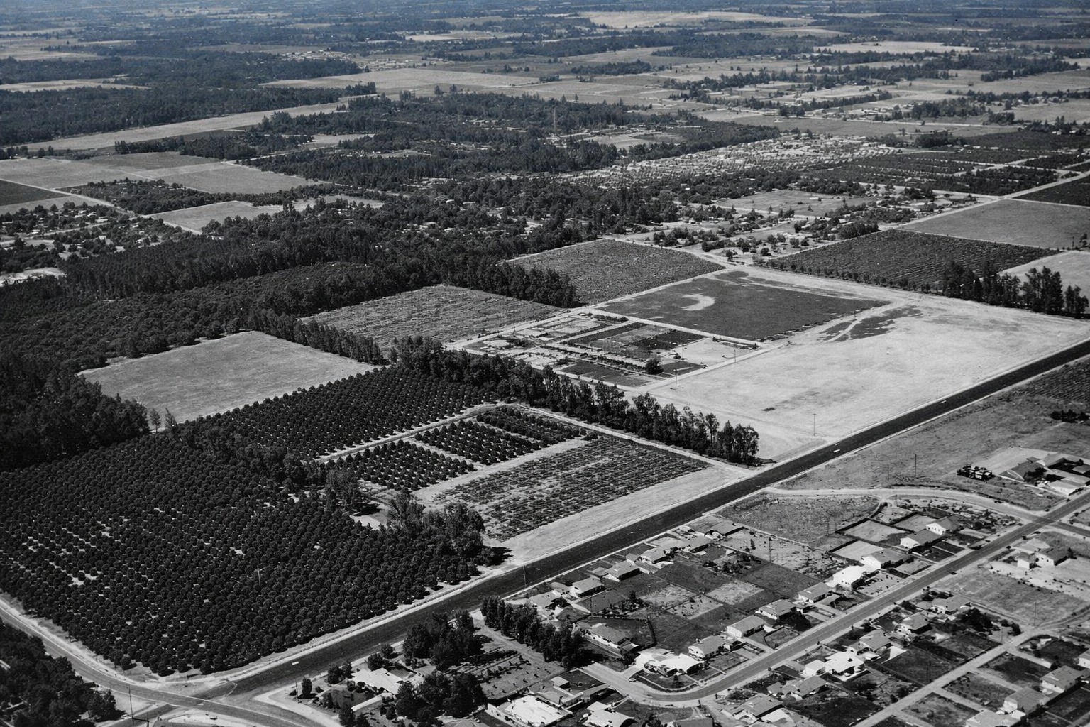
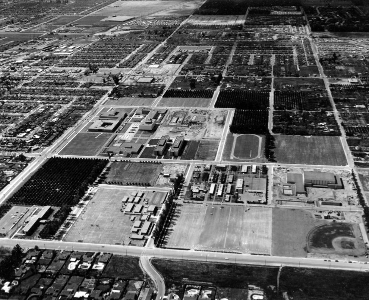
| (1956)* - Aerial view looking northwest over the newly established San Fernando Valley Branch of Los Angeles State College, later California State University, Northridge. The intersection of Zelzah Avenue and Nordhoff Street appears at lower left, surrounded by open land that would be developed into one of the largest campuses in the California State University system. |
Early Valley State and CSUN: The Beginning |
A four-year college in the San Fernando Valley was not inevitable. It came about through the organized determination of Valley residents and civic leaders who saw the need and made their case to state lawmakers at exactly the right moment.In the early 1950s, the Valley was growing at a pace that few parts of California could match. Returning veterans, young families, and new industries were filling the flatlands between the mountains. Yet the nearest four-year public college was across the hills in Los Angeles, a difficult commute for students who needed a campus close to home. Valley leaders recognized this gap and went to work.Their efforts led to the founding of San Fernando Valley State College in Northridge in 1956. What began as a cluster of temporary buildings on open land grew into one of the largest campuses in the California State College system within a decade. This section traces that story through aerial photographs, campus scenes, and the voices of the era, from the first temporary classrooms to the formal naming of California State University, Northridge in 1972. |
Fighting for a Valley Campus (1952–1955) |
The campaign to place a college in the San Fernando Valley was a textbook example of local advocacy changing a state decision. When officials in Sacramento pointed toward Baldwin Hills, Valley leaders organized fast, gathered their evidence, and took their case directly to the lawmakers who could change the outcome.
|
Historical Notes When state officials selected Baldwin Hills as the site for a new satellite campus in 1952, Valley leaders treated the decision as a challenge rather than a conclusion. They organized quickly, assembled demographic evidence showing the Valley's rapid growth, and lobbied directly for a reversal. The effort was deliberate and effective. The turning point came on December 21, 1954, when advocates hosted twenty-three state legislators for dinner at the Brown Derby on Wilshire Boulevard. They presented population projections and made a straightforward argument: the San Fernando Valley was growing faster than any other part of the region, and it needed a college close to home. The strategy worked. In 1955, Assemblyman Judge Julian Beck carried the legislation that authorized the purchase of land in the northern Valley for a new branch of Los Angeles State College. |
A Campus Begins (1956–1958) |
Speed mattered in the mid-1950s. Valley families were already arriving faster than planners had anticipated, and the new college had to open before permanent buildings were ready. Temporary structures went up on the Northridge land, and in the fall of 1956 the first students arrived.
|
 |
|
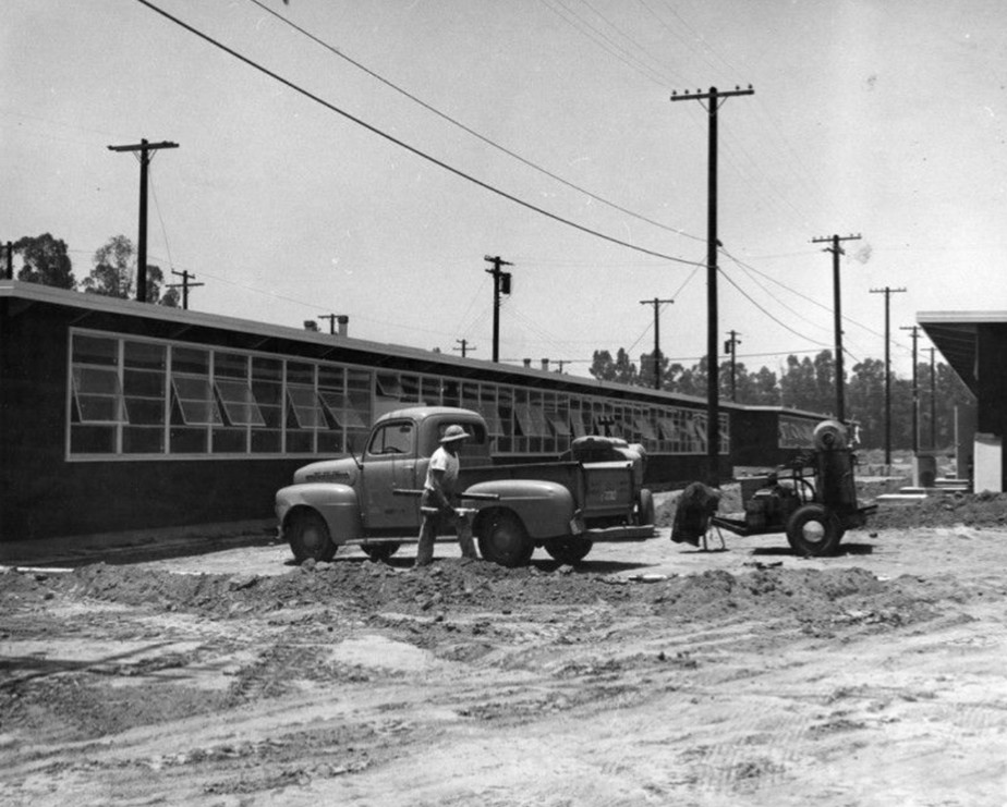
| (1956)* – Valley Times photograph showing temporary buildings at the new San Fernando Valley State College campus in Northridge, published July 26, 1956. These structures housed the first students when the college opened in September of that year. Initial instruction concentrated on business and teacher training, with plans already in place for expansion into a full four-year liberal arts program. |
Historical Notes The college opened its doors in September 1956 with a practical focus, offering business and teacher training to meet the immediate needs of Valley students. The temporary buildings were understood from the start to be just that: a beginning, not a destination. A twenty million dollar construction program was already being planned to build the full campus. Opening in temporary quarters was common for California's rapidly expanding college system during this period. The state was adding campuses across the region to keep pace with postwar population growth, and getting instruction started quickly took priority over waiting for permanent facilities to be completed. |
Independence and a New Identity (1958) |
Within two years of opening, the San Fernando Valley campus had outgrown its role as a branch operation. On July 1, 1958, it became San Fernando Valley State College, an independent institution with its own president and its own direction. Enrollment was already measured in the thousands, and the college was positioned to grow further. |
 |
|
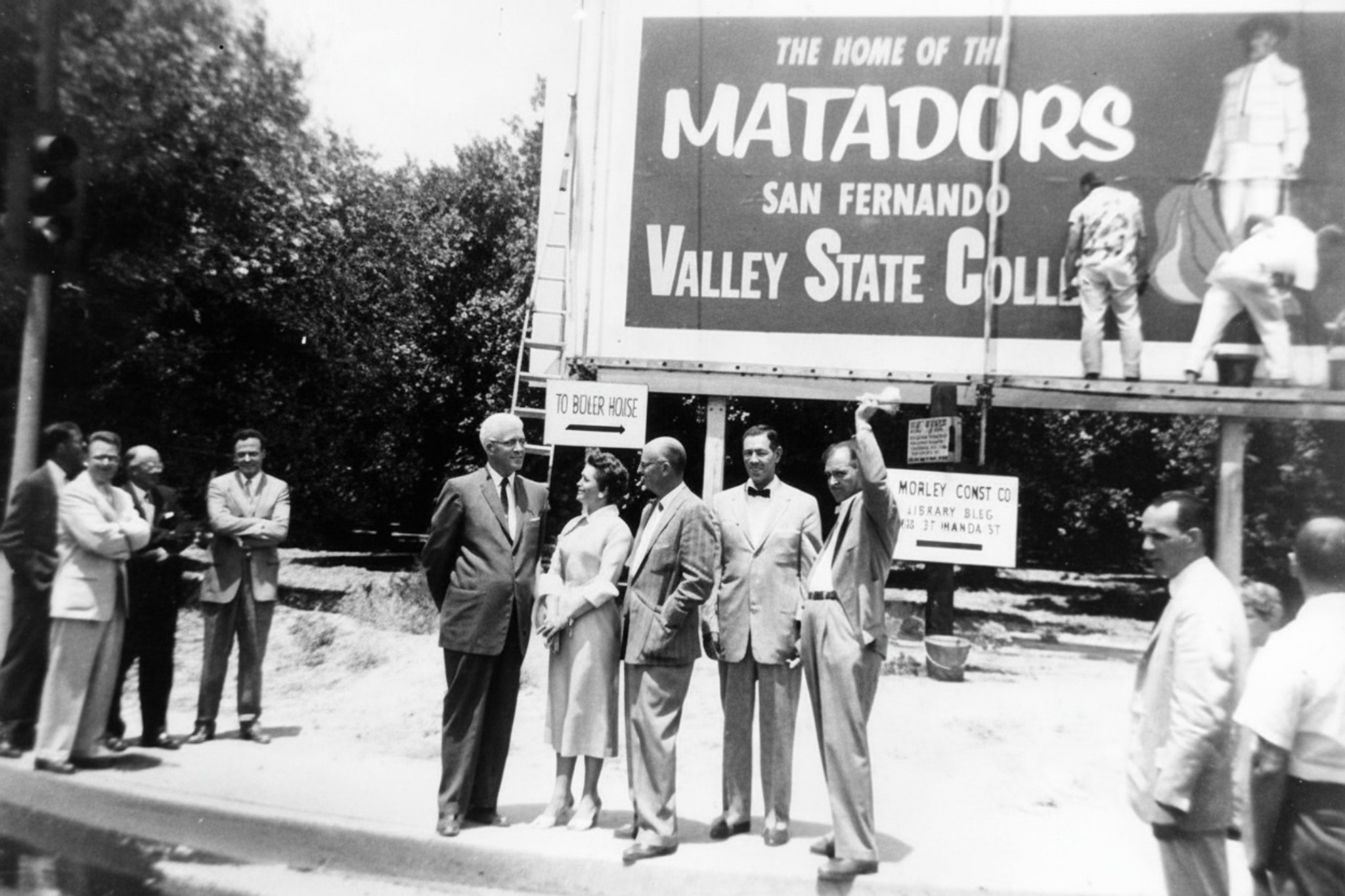
| (1958)^ - The new San Fernando Valley State College sign installed in 1958 following the institution's separation from Los Angeles State College. Pictured from left: Howard McDonald, President of Los Angeles State College; Ralph Prator, first President of San Fernando Valley State College; and Delmar T. Oviatt, Dean of Instruction. |
Historical Notes July 1, 1958, marks the official founding date of the institution now known as California State University, Northridge. On that date, the college became San Fernando Valley State College, an independent campus within the state system. It began its independent life with approximately 3,300 students and 104 faculty members. By that fall, enrollment settled at around 2,525 students, with full-time fees set at just twenty-nine dollars per semester. Ralph Prator served as the college's first president, leading an institution that would grow dramatically over the following decade. The name California State University, Northridge was adopted on June 1, 1972, reflecting both a statewide rebranding of the Cal State system and the campus's emergence as a major regional university. |
Student Life in the Early Years (Late 1950s) |
Even on a campus still defining itself, student life took hold quickly. The spaces between classes — the snack bar, the lawn, the informal gathering spots — gave the new college a sense of community that the temporary buildings alone could not have provided. By 1959, the first graduating class had walked across a stage set up on a football field still surrounded by open land. |
 |
|
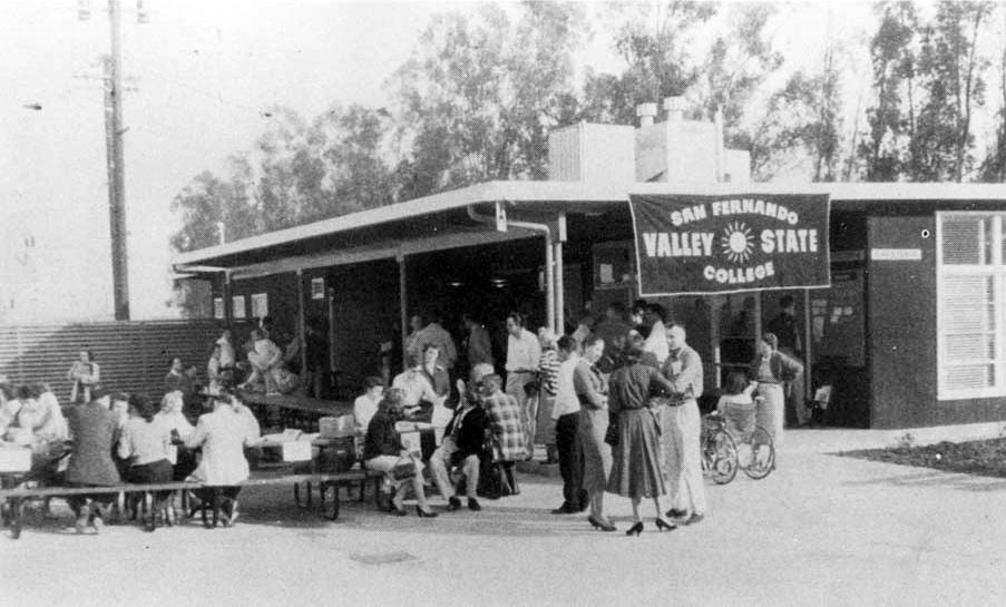
| (ca. 1958)* - The Bull Ring snack bar at San Fernando Valley State College, one of the earliest social gathering spots on the new Northridge campus. |
Historical Notes The Bull Ring became one of the first true social centers on the young campus, a place where students could meet between classes and get a sense of belonging to something still being built. Informal gathering spots like this played an important role in establishing campus identity during the years when permanent buildings were still under construction. Student life in these early years had a frontier quality to it. The campus was growing, the curriculum was expanding, and students arriving in the late 1950s were helping to shape traditions that had not yet been established. The Bull Ring was part of that process, a small but meaningful piece of what made the new college feel like a real community. |
 |
|
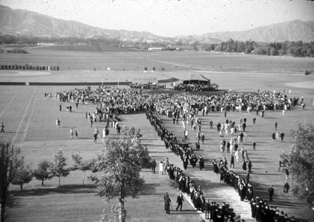
| (1959)* – The first graduation ceremony at San Fernando Valley State College, held on June 12, 1959. Ninety students received degrees on the campus football field, with the Santa Susana Mountains visible in the background across open land that would later be developed. |
Historical Notes On June 12, 1959, ninety students became the first graduates of San Fernando Valley State College. The ceremony was held on the campus football field, a practical choice for an institution that had not yet built the kind of facilities that most colleges take for granted. The Santa Susana Mountains rising in the background, beyond acres of undeveloped land, gave the scene a sense of both scale and possibility. This first graduating class had enrolled when the college itself was just getting started. They studied in temporary buildings, watched permanent structures go up around them, and left carrying degrees from an institution that would grow far beyond what any of them could have predicted on that June afternoon. |
Building a Permanent Campus (1959–1964) |
Through the early 1960s, the character of the campus changed steadily as one permanent building after another replaced or supplemented the original temporary structures. The South Library came first, followed by science buildings, a fine arts facility, and the Music Building. Enrollment climbed with each passing year, pressing the pace of construction. Some of the new buildings carried architectural distinction. The Fine Arts Building was designed by Richard Neutra, one of the most respected architects working in California at the time. His involvement reflected the ambition the state had invested in the new campus, which was not simply being built quickly but was being built with care. |
 |
|
| (ca. 1960)^ - Aerial view looking north over the campus of San Fernando Valley State College, later California State University, Northridge. Nordhoff Hall and the Music Building appear at left; Science Buildings 1 and 2 and the Bookstore Complex occupy the center. |
Historical Notes The dedication of the South Library in 1959 marked the beginning of the campus's permanent physical identity. It was the first structure built to last, and it signaled a shift from the improvised early years toward something more substantial. Enrollment was climbing steadily, and the pace of construction would need to keep up. By 1960, the Speech-Drama Building and the Fine Arts Building had been completed. The Fine Arts Building was designed by Richard Neutra, whose reputation for elegant, light-filled structures had made him one of the most admired architects in California. His involvement lent a degree of distinction to a campus that was still relatively young. |
 |
|
| (1961)^ - Aerial view looking west over the campus of San Fernando Valley State College. Science Buildings 1 and 2 appear in the center, with the Music Building at left and Zelzah Avenue in the foreground. |
Historical Notes The Music Building, completed in 1961, added a 400-seat theater to the campus, and the first production staged there was Shakespeare's Othello. The building represented the college's growing commitment to the arts alongside its original emphasis on business and teacher training. By February 1961, enrollment had passed 6,000 students, a number that would have seemed unlikely just a few years earlier when the campus was operating out of temporary buildings. The rapid growth reflected both the Valley's expanding population and a rising expectation among residents that higher education should be accessible close to home. |
 |
|
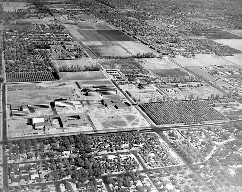
| (1962)* - Aerial view looking east over San Fernando Valley State College. Sierra Hall is visible under construction at center, flanked by the science buildings. Nordhoff Street, Nordhoff Hall, and the Music Building appear at right, with Etiwanda Avenue in the foreground. |
| Historical Notes
The early 1960s were years of almost continuous construction on the Northridge campus. Sierra Hall, visible here under construction, was part of a three-building complex that would become one of the central academic clusters on campus. The pace of building reflected enrollment growth that was outrunning earlier projections. By 1964, the Physical Education Building, the Sierra Hall complex, the Administration Building, and the Engineering Building had all been completed. Enrollment that year reached 12,690 students, more than double what it had been just three years earlier. The campus that had opened in temporary buildings was rapidly becoming a substantial institution. |
 |
|
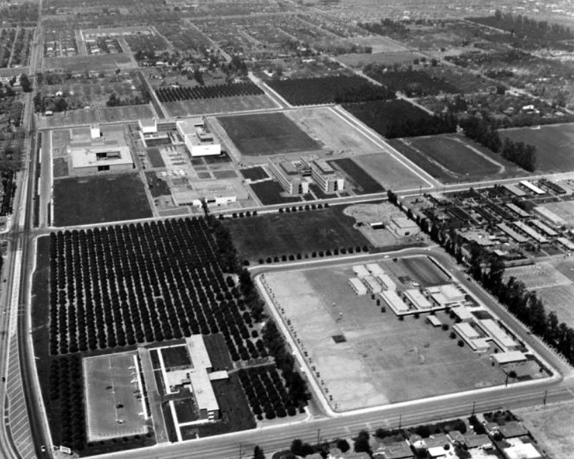
| (1962)* - Aerial view looking west over San Fernando Valley State College. Zelzah Avenue runs along the foreground and Lindley Avenue crosses the center. The baseball field appears at lower right and the track at right center. Campus buildings, reading clockwise from upper right, include the Sierra Hall construction site, Science Buildings 1 and 2, the Bookstore Complex, the Music Building, Nordhoff Hall, the Fine Arts Building, and the library. |
Historical Notes This westward view captures the campus at a moment of transition, when construction was active on multiple fronts and the overall plan for the grounds was beginning to take recognizable shape. The combination of completed buildings and active construction sites tells the story of an institution racing to keep pace with its own growth. The breadth of facilities visible here — science, music, arts, administration, sports — reflects how quickly the college had moved beyond its original narrow focus on business and teacher training. Within a decade of opening, San Fernando Valley State College had the physical presence and the academic range of a full university in everything but name. |
A Growing Campus in a Turbulent Era (1960s) |
By the mid-1960s, San Fernando Valley State College was one of the fastest-growing campuses in California. Enrollment was measured in the tens of thousands, major buildings were complete, and the college had established itself as the educational center of the Valley. But the campus was also a place where the larger conflicts of the decade were playing out.
|
 |
|
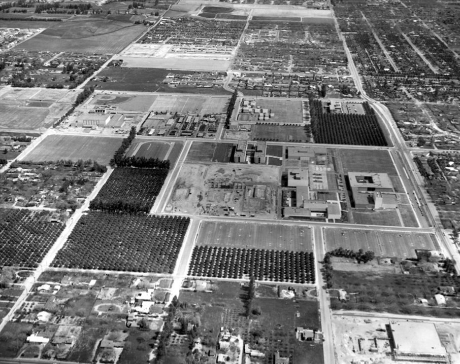
| (1960s)* - Aerial view looking northeast over San Fernando Valley State College and the surrounding community. By this period the campus had grown substantially from its origins as a temporary branch campus, and the surrounding Valley had developed in kind. |
Historical Notes Student activism arrived on the Northridge campus in 1966, when protests against the Vietnam War began to draw significant participation. The demonstrations reflected a national pattern, but the Valley campus gave them a local character shaped by the particular mix of students, faculty, and community members who had built the institution from the ground up. In the fall of 1966, gubernatorial candidate Ronald Reagan spoke on campus, and Vice President Hubert Humphrey was confronted by antiwar demonstrators during his visit. The presence of major national figures and the open expression of dissent were signs that the college had grown beyond its origins as a quiet regional branch campus and had become part of the broader national conversation. |
 |
|
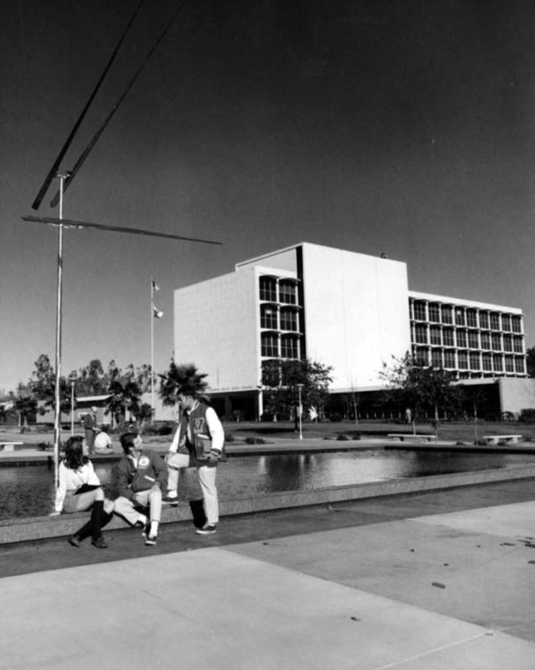
| (1968)* – Three students relax at the reflecting pool southwest of the Administration Building at San Fernando Valley State College. The building is now known as Bayramian Hall. The kinetic sculpture "Two Up Two Down" by artist George Rickey was installed nearby in August 1968 and remains in the same general area today. |
Historical Notes In March 1968, the campus drew national attention when presidential candidates Robert F. Kennedy and Eugene McCarthy both visited, drawing a combined audience of approximately 12,000 people. The event reflected how politically engaged the student body had become, and how seriously national candidates were taking the college-age vote. Students burned draft cards during the visit, and the atmosphere that day captured the intensity of a year that would prove turbulent across the country. That same year, rock singer Janis Joplin performed on campus, underscoring how the college had become a venue for both political and cultural events of the era. The reflecting pool visible in this photograph, long since removed, was one of the places where students gathered informally to talk, study, and watch the world around them change. |
A New Name for a Maturing University (1970s) |
By the early 1970s, the institution had outgrown the identity carried by its original name. San Fernando Valley State College had become something larger and more complex than the name suggested. A statewide reorganization of the California State College system provided the occasion for a change that the campus had arguably been ready for. |
 |
|
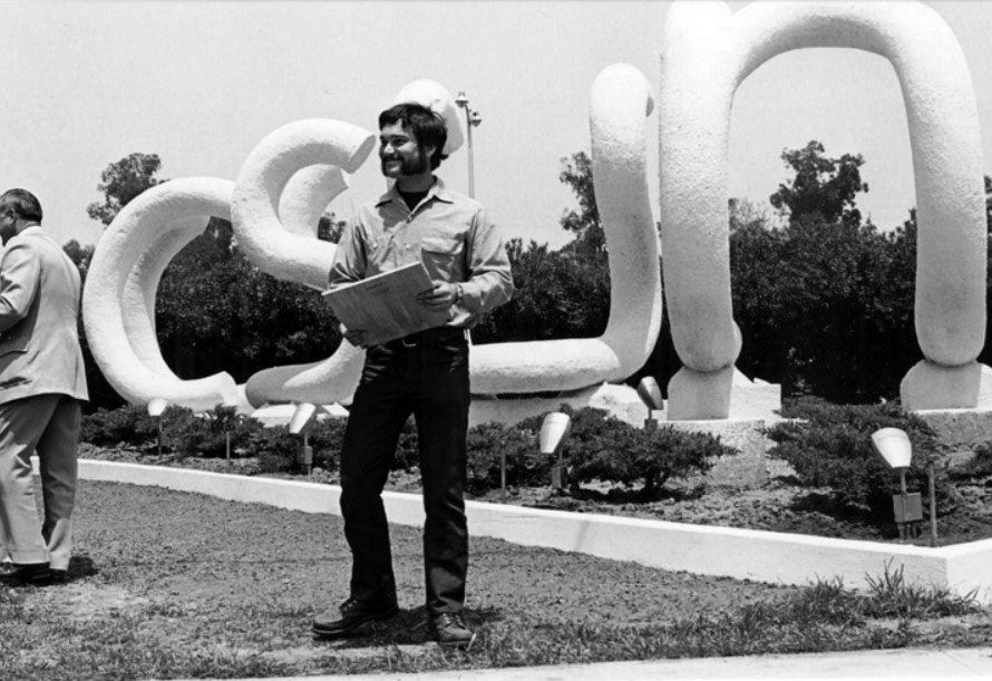
| (1970s)* – The CSUN sculpture at the corner of Nordhoff Street and Zelzah Avenue, designed by graduate art student John T. Banks and installed in 1975. The letters mark the campus entrance at one of its most recognized intersections. |
Historical Notes California State University, Northridge received its current name on June 1, 1972, when the state Legislature and the Board of Trustees of the California State University formally renamed the college as part of a broader reorganization of the state system. The change reflected more than a title; it acknowledged that the institution had grown into a full university in scope, enrollment, and academic mission. The CSUN sculpture installed at the corner of Nordhoff and Zelzah in 1975 gave the new name a visible presence at one of the campus's most recognized entry points. Designed by graduate art student John T. Banks, it became one of the more enduring landmarks from the era, a simple and direct statement of the university's identity at the corner where students, faculty, and visitors have entered the campus for generations. |
Then and Now
 |
|
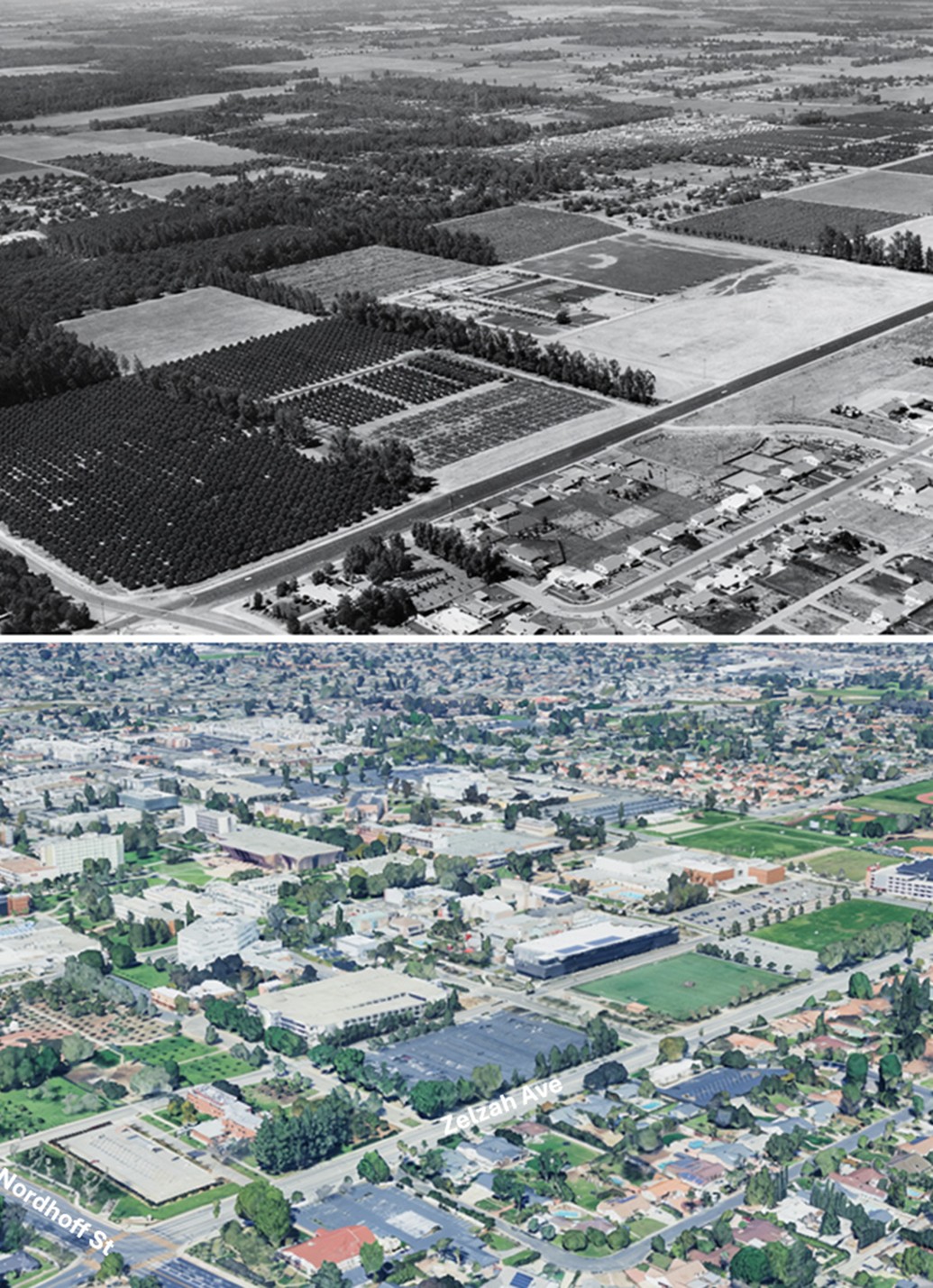
| (1956 vs. Today)* — Then and Now aerial view looking northwest over the future site of California State University, Northridge. The intersection of Zelzah Avenue and Nordhoff Street appears in the lower left of both images. What was once orchards and open farmland is today one of the largest university campuses in the California State University system. Photo comparison by Jack Feldman. |
From Valley Effort to Regional Institution When California State University, Northridge received its current name in 1972, the transformation from a small branch campus into a full university was already well underway. Enrollment had climbed past 25,000 students, and the grounds that once held a handful of temporary buildings were now defined by a growing collection of permanent structures. The Valley had built what it set out to build, and more. That growth was tested on January 17, 1994, when a magnitude 6.7 earthquake struck beneath the Valley at 4:31 in the morning. Every structure on campus sustained damage. A newly built parking structure collapsed, and the Oviatt Library was heavily damaged. Losses were estimated at more than 400 million dollars, the greatest ever recorded at an American university from a natural disaster up to that time. Because the earthquake struck during a holiday weekend before the spring semester began, the loss of life on campus was limited. Recovery came quickly. Within two weeks, classes resumed in tents and temporary structures while rebuilding efforts began across the campus. Federal and state funding supported a full reconstruction, and many of the buildings seen today date from that period. What had been built once was built again, stronger and more resilient. Today, California State University, Northridge enrolls approximately 37,000 students and offers more than 130 degree programs. It is recognized as a Hispanic-serving institution and contributes an estimated two billion dollars annually to the regional economy. The Valley leaders who gathered at the Brown Derby in December 1954 could not have fully imagined the scale of what their efforts would produce—but the outcome reflects exactly what they set in motion. What was once uncertain became inevitable, because the Valley decided it should be. |
* * * * * |
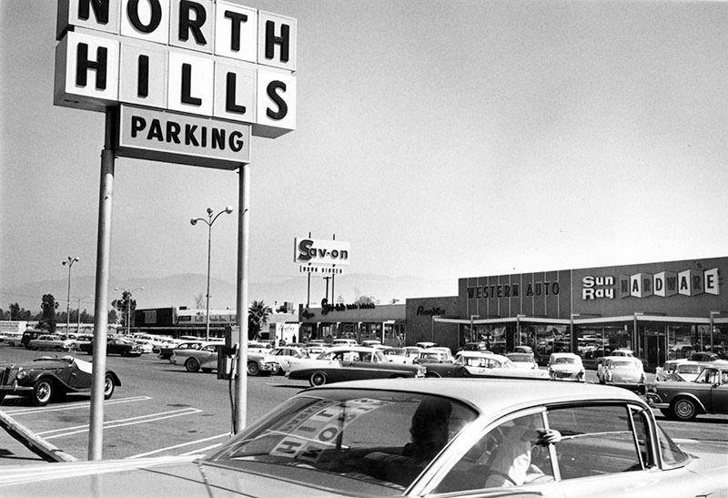
North Hills Shopping Center |
Devonshire and Balboa |
 |
|
| (1960)* – Photo caption reads, "Acres of parking space available at new North Hills Shopping Center, Devonshire Street and Balboa Boulevard." Photo Credit: Valley Times - Sept. 30, 1960. Note tht the child in the back seat of the car is not wearing a seat belt. California’s seat belt law wasn't passed until 1986. |
Historical Notes North Hills was originally an agricultural community known as Mission Acres. After World War II, the newly developed suburban community was renamed Sepulveda until the 1990s. In 1992, residents of the western half of Sepulveda, west of the San Diego Freeway, voted to secede from the eastern section in order to form a new community named North Hills. Thereafter the value of properties east of the San Diego Freeway in Sepulveda fell. The City of Los Angeles eventually changed the name of remaining Sepulveda to North Hills also. The city then formed a new sub-neighborhood of "North Hills West" which begins west of the 405 freeway and goes to Bull Creek/Balboa and from Roscoe to Devonshire. The eastern section became the sub-neighborhood of North Hills East. |
* * * * * |
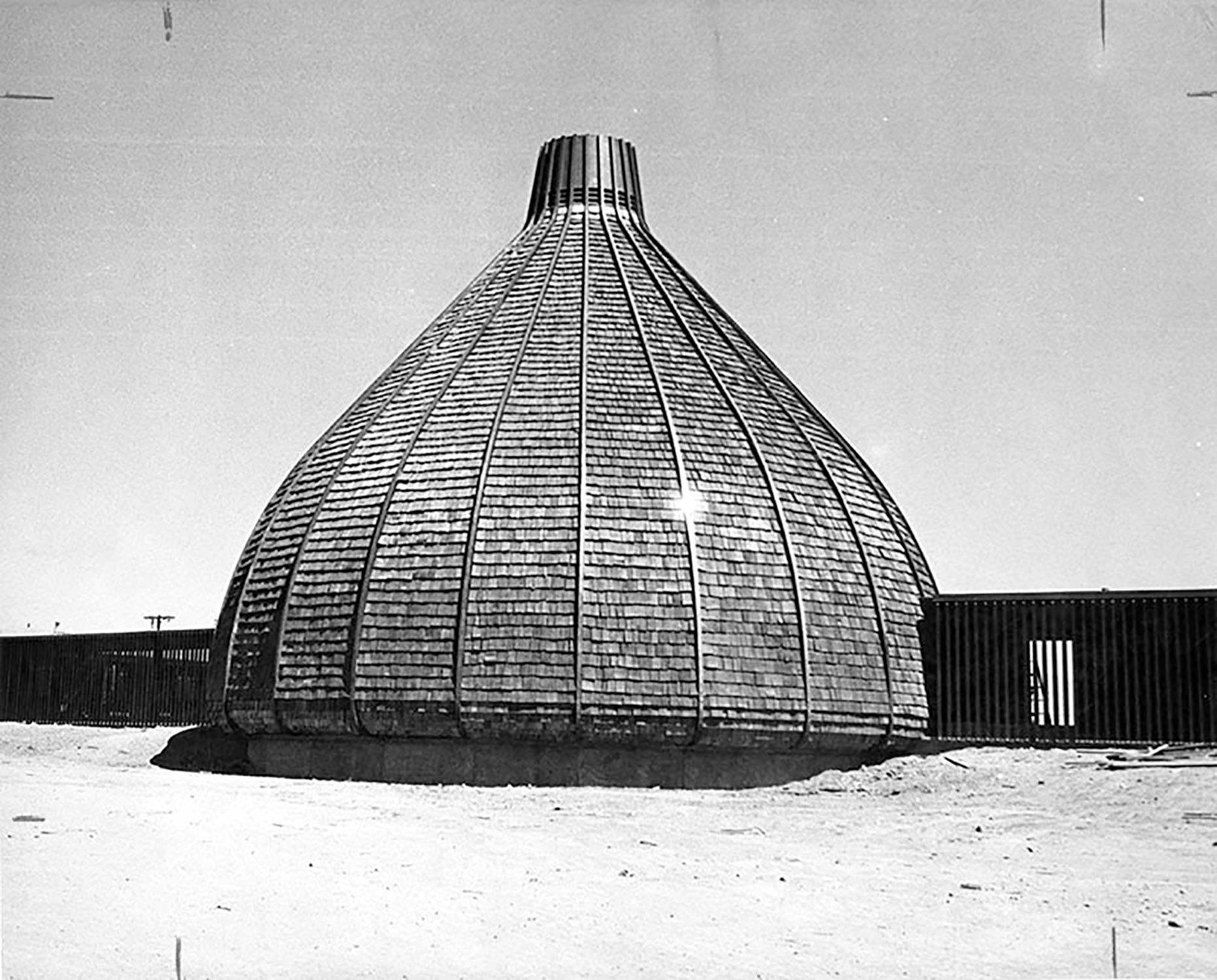
Valley Unitarian Universalist Church - The Onion |
9550 Haskell Avenue |
 |
|
| (1964)* – View showing The Valley Unitarian Universalist Church (as it was called in the 1960s) shortly before it was completed, located at 9550 Haskell Avenue in Sepulveda (later North Hills). |
Historical Notes Designed by acclaimed architect Frank Ehrenthal, the building was completed in 1964. Its bizarre shape led to the nickname "The Onion." In addition to its church service, the building also operated as a nursery school, and held small theatrical performances. |
 |
|
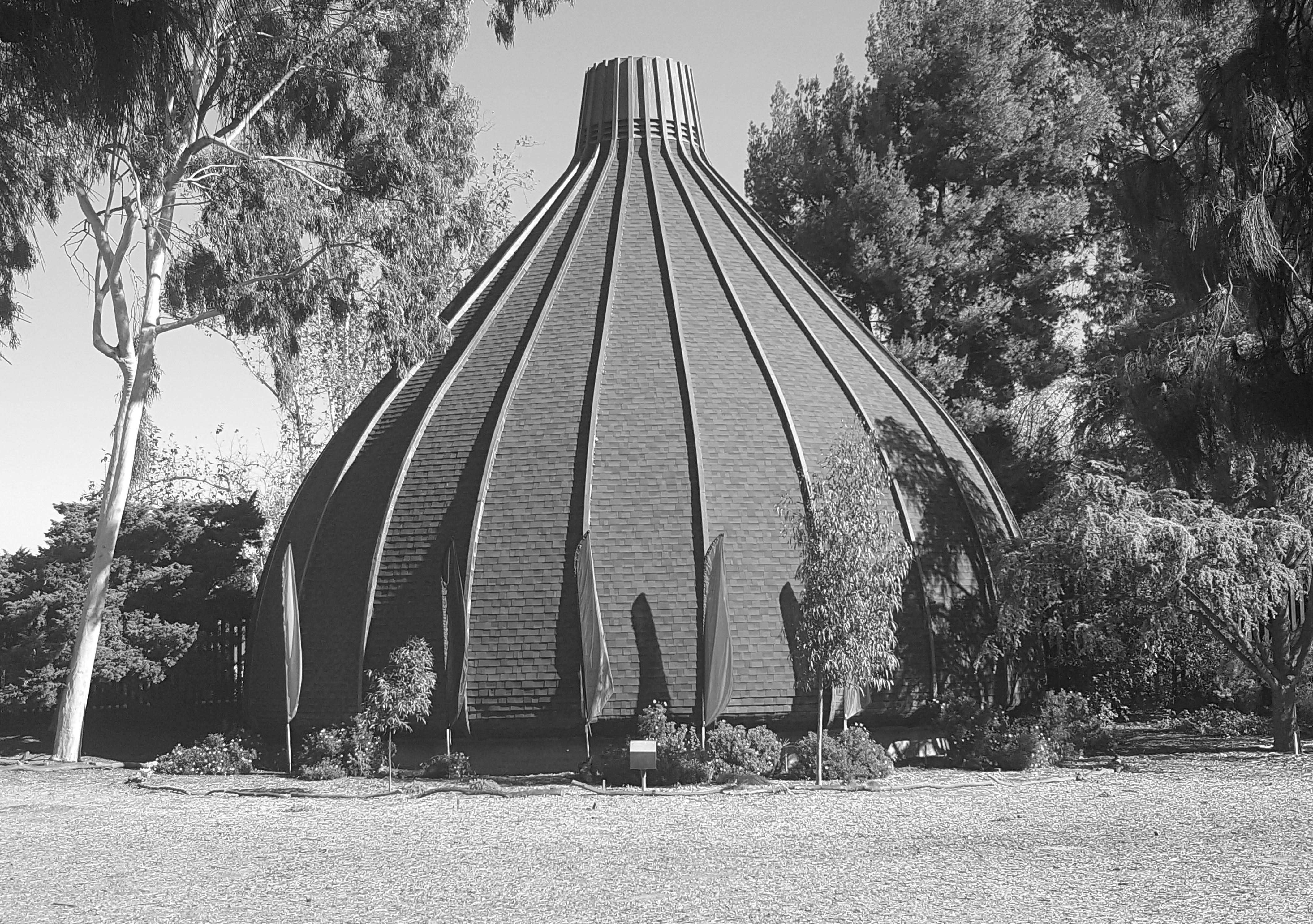
| (2015)* – View showing "The Onion” in North Hills as it appears today. The building is currently home to the Sepulveda Unitarian-Universalist Society – A Liberal Religious Congregation. |
Historical Notes In 2010, the Sepulveda Unitarian Universalist Society Sanctuary was dedicated Los Angeles Historic-Cultural Monument No. 975. Click HERE to see complete listing. |
 |
|
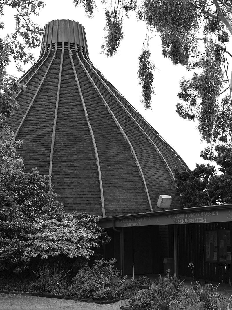
| (2016)* – View from the northeast showing the Sepulveda Unitarian Universalist Society Sanctuary ("The Onion"), located at 9550 N. Haskel Avenue in North Hills. Photo by Junkyandsparkel / Wikipedia |
* * * * * |
Miracle Market |
Nordhoff and Sepulveda |
 |
|
| (1950)* – View showing the Grand Opening of Miracle Market located on the northwest corner of Nordhoff Street and Sepulveda Boulevard (9101 Sepulveda Blvd). Today, this building is occupied by Sepulveda Laundry. Click HERE for contemporary view. |
* * * * * |
Panorama Market |
Devonshire and Sepulveda |
 |
|
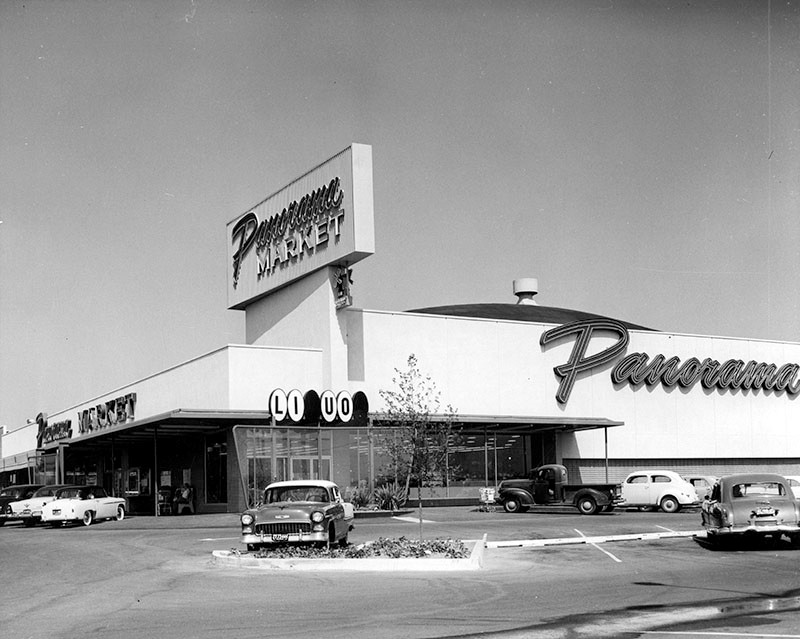
| (1954)* - View showing the construction of Panorama Market located on the northwest corner of Devonshire Street and Sepulveda Boulevard. |
Historical Notes Photo caption dated October 27, 1954 reads "Contractors are rushing to complete work on the new Panorama Market located at 10321 Sepulveda Blvd. at Devonshire Street. Company officials revealed today it will open during November. This new layout pictured above embraces 55,000 square feet of floor space and among its many features will be a free check cashing booth, free parking for hundreds of cars and unlimited one-stop shopping facilities at one of the most modern shopping centers with the latest innovations in the Southland. Ground for the project was broken last Spring. Arthur Froehlich is architect." |
 |
|
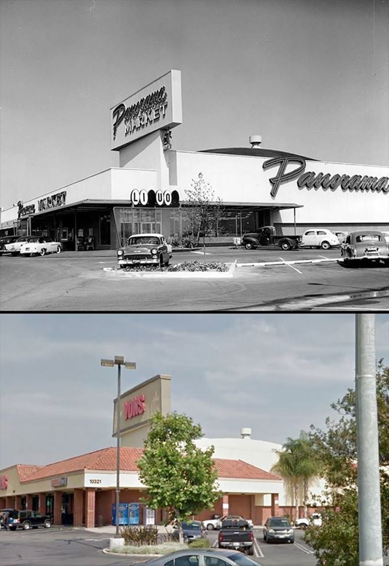
| (1957)* – View showing Panorama Market, 10321 Sepulveda Boulevard at Devonshire Street, Mission Hills. Today this is a Vons Market. Click HERE for contemporary view. |
Then and Now
 |
|
| (1957 vs 2010s)* - Panorama Market….Today a Von’s |
* * * * * |
|
Devonshire and Sepulveda |
 |
|
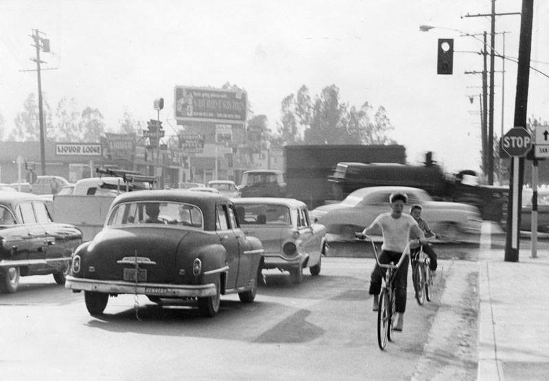
| (1961)* – View looking west on Devonshire Street at Sepulveda Boulevard showing two boys riding their bicycles against traffic near a very congested intersection. The intersection was named the "7th worst intersection in the Valley" according to accident numbers from 1959. Valley Times Collection - Click HERE for contemporary view. |
* * * * * |
TARZANA 1940s to 1960s |
Tarzana grew from a quiet ranching community into a suburban neighborhood centered on Ventura Boulevard and Reseda Boulevard. Named after Tarzana Ranch, once owned by author Edgar Rice Burroughs, the area began as open land with scattered homes and farms. By the 1930s a small community had formed, supported by local markets, a post office, and basic services.After World War Two Tarzana changed quickly. Returning veterans, new families, and regional growth fueled housing construction and commercial development. Ventura Boulevard and Reseda Boulevard became key corridors where businesses and services clustered to serve a growing suburban population.The following images help trace Tarzana’s transition from small town beginnings to a thriving mid century community. |
COMMUNITY FOUNDATIONS |
Tarzana in the 1930s and early 1940s was still semi rural. A few essential services helped define the community and gave residents a sense of identity and connection. These early institutions marked the shift from ranchland to organized neighborhood life. |
 |
|
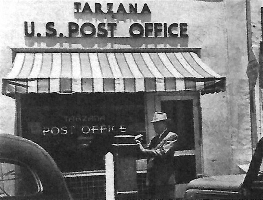
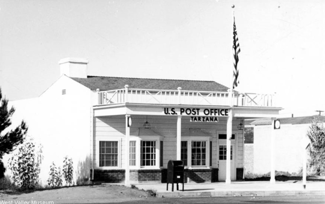
| (1930s)* - View showing a man dropping a letter in a mail post box in front of Tarzana’s first Post Office located near the northwest corner of Reseda and Ventura. |
Historical Notes Tarzana’s first Post Office opened in 1930 in a small room inside a local market near Ventura and Reseda. As the community grew, additional postal facilities and services were added. Rural Free Delivery began in 1937, bringing home mail service to hundreds of families and reflecting a more settled population. |
 |
|
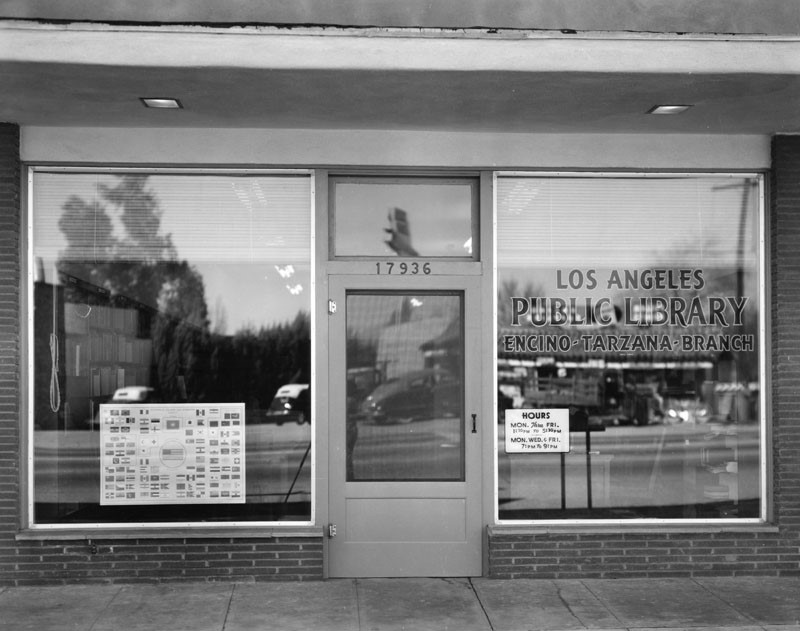
| (ca. 1940)* – View showing the original Encino Tarzana Branch of the Los Angeles Public Library located at 17936 Ventura Boulevard. Photo courtesy of West Valley Museum |
Historical Notes The Encino Tarzana Branch Library served as an important educational and cultural resource for the growing community. Libraries in the San Fernando Valley helped establish a sense of civic life and learning in newly developing neighborhoods. The building still stands today and houses a restaurant, showing how early community structures often found new uses as the area evolved. |
* * * * * |
POSTWAR GROWTH AND URBAN DEVELOPMENT |
After World War Two Tarzana changed quickly. Returning veterans, new families, and strong regional growth fueled housing construction and commercial development. Ventura Boulevard and Reseda Boulevard became key corridors where businesses and services clustered to serve the expanding population. |
 |
|
| (1946)* – Panoramic view looking northwest toward the intersection of Ventura and Reseda Boulevards in Tarzana. Photo from the Ernest Marquez Collection |
Historical Notes This view shows Tarzana during its transition from open land to suburban development. Commercial buildings were beginning to appear along Ventura Boulevard while surrounding areas still showed traces of farmland and open space. Intersections like Ventura and Reseda soon became focal points for Tarzana’s commercial and social life. |
 |
|
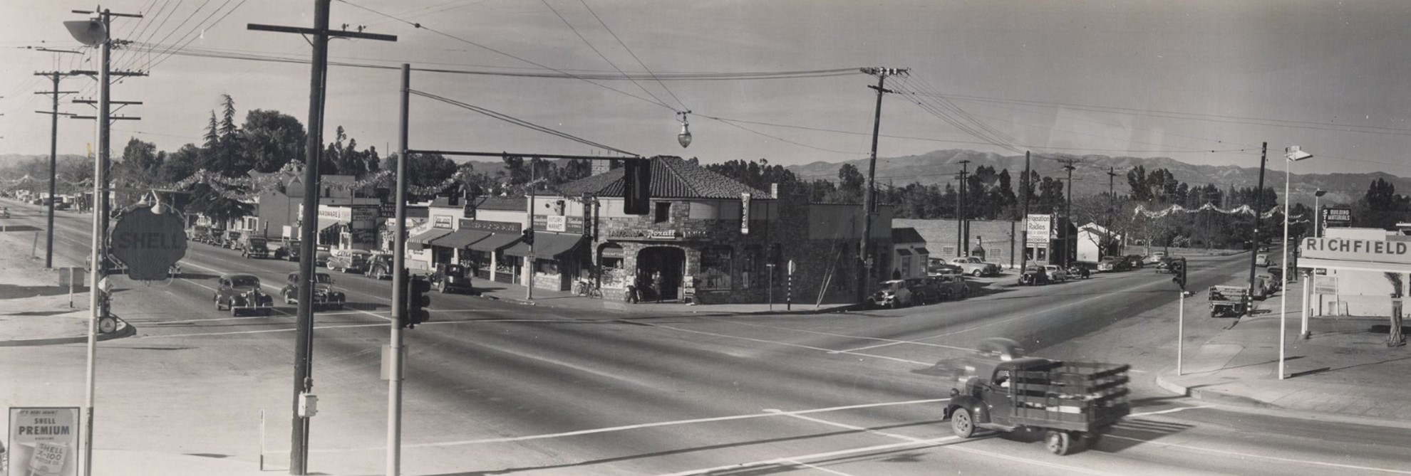
| (1946)* – Closer view of the northwest corner of Ventura and Reseda, site of a Rexall Drug Store. A hanging utilitarian streetlight is visible above the intersection. |
Historical Notes Rexall drugstores were important neighborhood anchors in mid century communities. They offered prescriptions, household goods, and often a soda fountain where residents gathered. The presence of a Rexall at this corner shows how Tarzana was developing a recognizable commercial center serving both local residents and passing motorists. |
 |
|
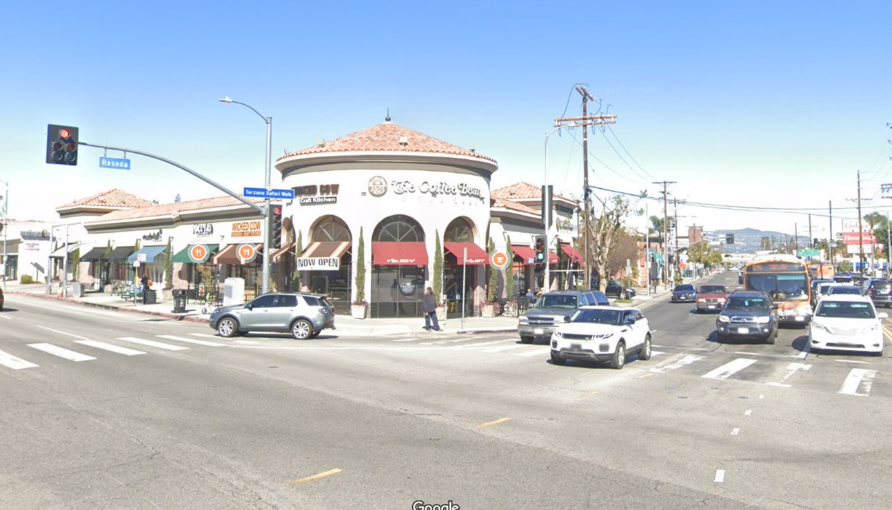
| (2023)* - Contemporary view of the northwest corner of Ventura and Reseda Boulevards showing a Coffee Bean and Tea Leaf and Wicked Cow Burgers. |
| Historical Notes
This corner remains one of Tarzana’s most active commercial locations. While the businesses have changed over time, the intersection continues to function as a neighborhood gathering place, much as it did in the 1940s and 1950s. |
Then and Now
 |
|
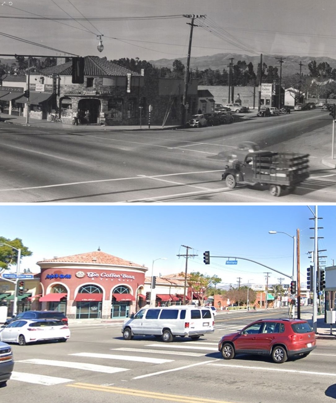
| (1946 vs. 2018)* - View looking at the northwest corner of Ventura and Reseda Boulevards showing a Coffee Bean and Tea Leaf, once the location of a Rexall Drug Store in 1946. Photo comparison by Jack Feldman. |
Historical Notes Between the days of the Rexall Drug Store and the present café, a gas station once occupied this site. The shift from drugstore to fuel station to café reflects changing travel patterns and retail trends in an automobile oriented community. |
 |
|
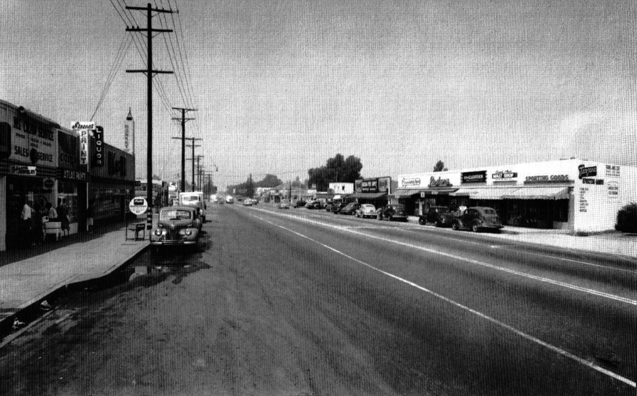
| (ca. 1948)* – View looking east on Ventura Boulevard toward Reseda Boulevard. On the south side were McCraw Appliance Service, a paint store, and K and M Market. On the north side were Tarzana Sporting Goods, Frank and Ann’s Café and Malt Shop, Village Cleaners, Roston’s Yardage, Tarzana Variety Store, and Tarzana Feed Supply. |
| Historical Notes
By the late 1940s Ventura Boulevard featured a mix of locally owned businesses serving everyday needs. These small shops defined early suburban retail before the arrival of large regional chains. They also reflect a close knit community where residents often knew local business owners. |
Mayfair Market
 |
|
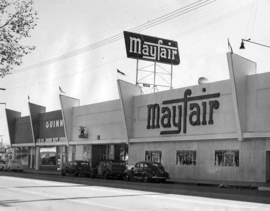
| (1950)* - View of Mayfair Market located at 18632 Ventura Boulevard in Tarzana with several automobiles parked along the street. |
Historical Notes Mayfair Markets was a popular Southern California grocery chain known for quality products and customer service. Part of the Arden Mayfair group, it benefited from access to fresh dairy from Arden Farms. Supermarkets like Mayfair represented the shift toward modern suburban shopping where families could purchase a wide range of goods in one place. They also signaled the decline of smaller independent grocers along Ventura Boulevard. |
 |
|
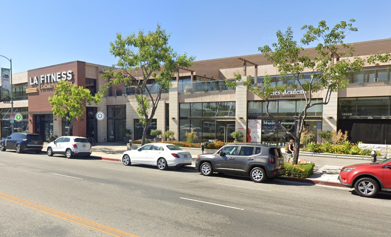
| (2024)* - Contemporary view of the 18600 block of Ventura Boulevard showing a commercial building on the former site of Mayfair Market, now home to businesses such as LA Fitness and Angeles Academy. |
| Historical Notes
The site has seen several transitions reflecting changing commercial needs. Larger buildings and multi tenant uses became more common as land values rose and suburban density increased along Ventura Boulevard. |
Then and Now
 |
|
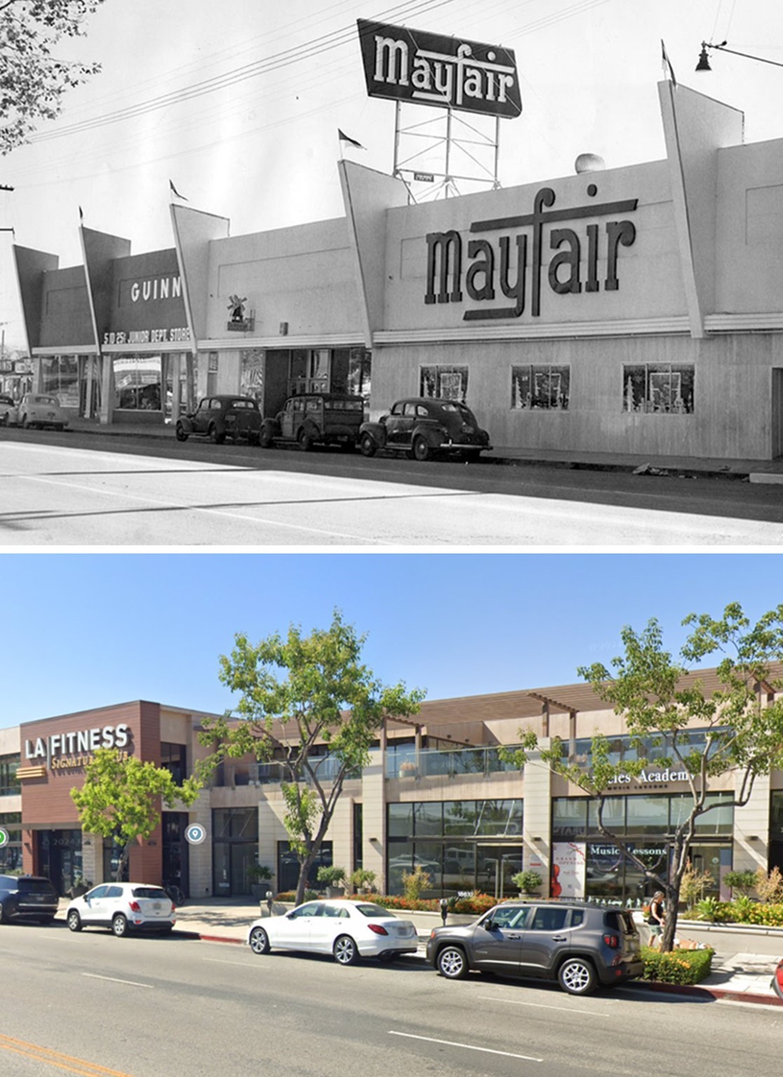
| (1950 vs. 2024)* – Then and Now view of Mayfair Market at 18632 Ventura Boulevard where today stands a modern commercial complex. |
Historical Notes From 1972 to 2005 the site was home to the Movies of Tarzana theater, a well known local entertainment venue. Its later redevelopment into a commercial complex mirrors broader trends along Ventura Boulevard as retail and service uses evolved. |
 |
|
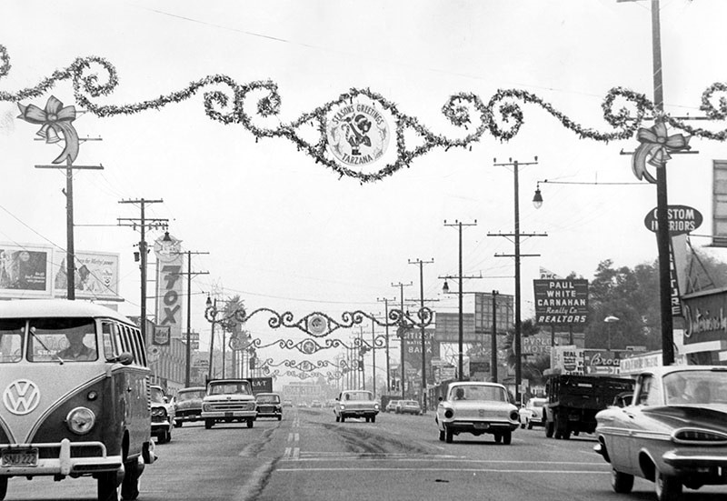
| (1962)* - Photograph caption dated December 18, 1962 reads Tarzana between Mecca and Wilbur Avenue on Ventura Boulevard. Visible signs include Custom Interiors Furniture, Paul White Carnaham Realty Company, Avalon Motel, a pet shop, Citizens National Bank, and Fox. |
Historical Notes By the early 1960s Ventura Boulevard had matured into a fully developed commercial corridor. The mix of real estate offices, motels, banks, and specialty shops reflects a stable suburban population and an economy serving both residents and the steady stream of travelers moving through the Valley on Ventura Boulevard. |
 |
|
| (1940s)* – View showing the original Encino Tarzana Branch of the Los Angeles Public Library located at 17936 Ventura Boulevard in Tarzana. |
Historical Notes The Encino Tarzana Branch Library served as an important educational and cultural resource for the community. Libraries helped establish civic life in developing Valley neighborhoods. The building still stands and is now occupied by a restaurant, demonstrating how early community structures often found new uses as the area evolved. Click HERE for contemporary view. |
* * * * * |
TARZANA COMES OF AGE |
By the mid twentieth century Tarzana had completed its transition from ranchland to a well established suburban community. What began as open agricultural land tied to Tarzana Ranch evolved into a neighborhood shaped by Ventura Boulevard commerce, automobile travel, and local institutions that served daily life.Although individual businesses and buildings changed over time, the main corridors and many of the locations shown here remain active today. Together these views capture Tarzana’s growth alongside the San Fernando Valley and its place in the broader suburban story of the San Fernando Valley and Los Angeles.Click HERE to see more Early Views of Tarzana |
* * * * * |
Ventura and Balboa Blvds (Encino)
 |
|
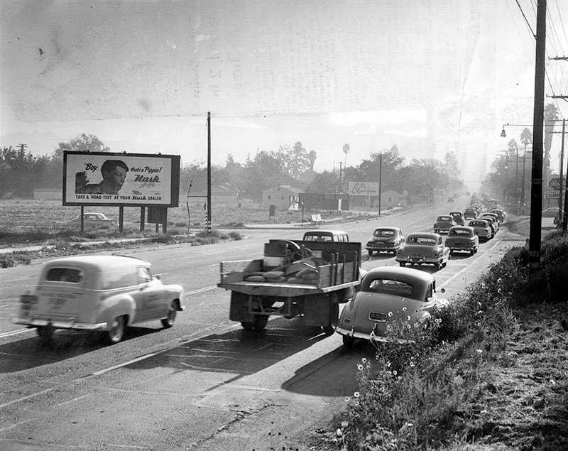
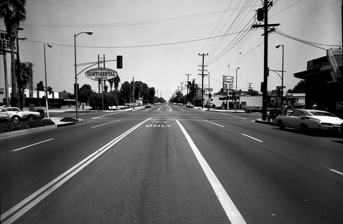
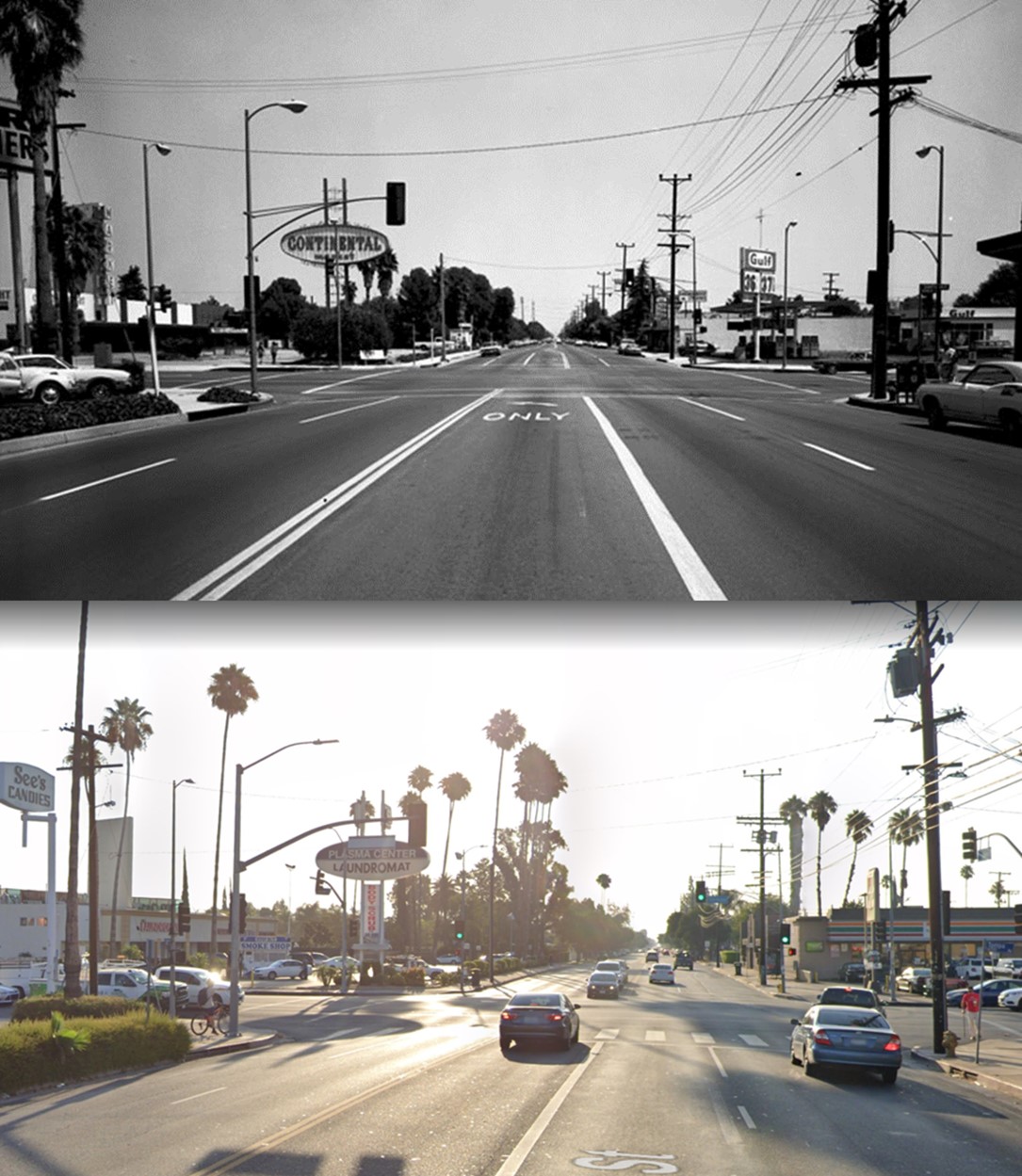
| (1953)* – View looking east on Ventura Boulevard from just east of Balboa Boulevard. |
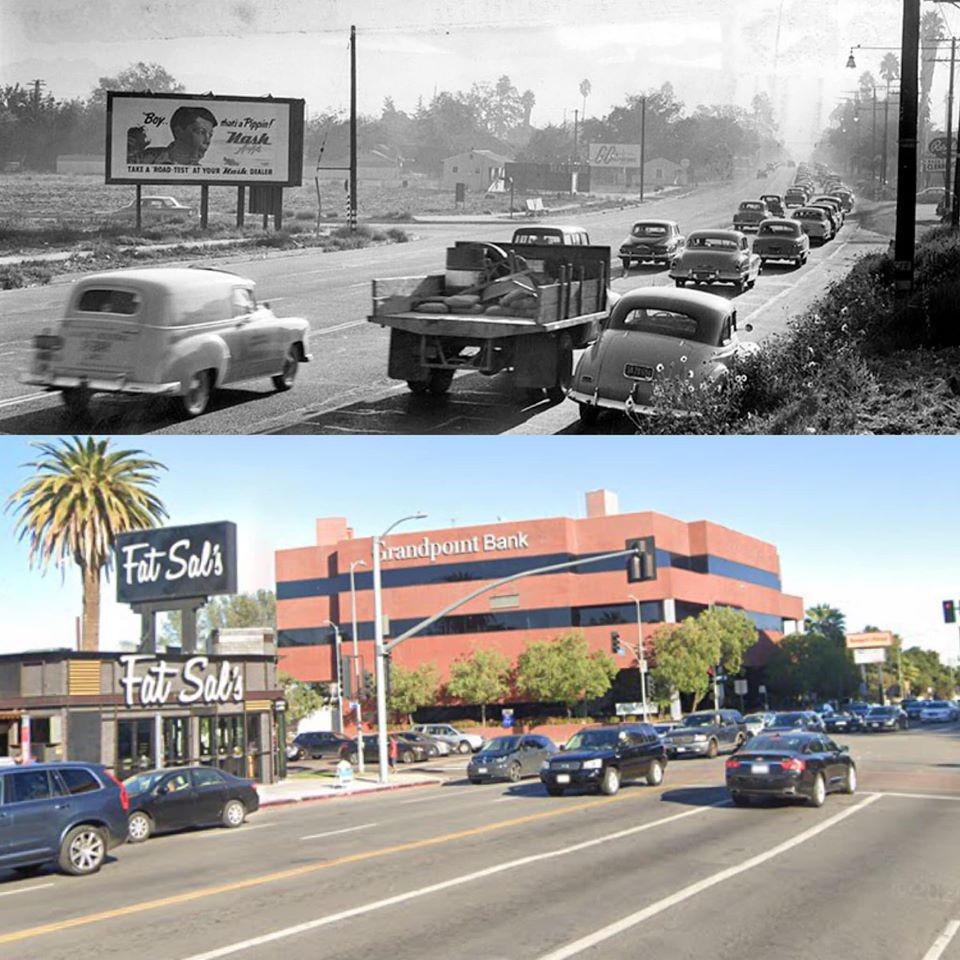
Historical Notes Valley Times photo caption dated October 24, 1953 reads, "Seven a.m. saturation - This is view looking east on Ventura boulevard just east of the Big Squeeze bottleneck at Balboa Boulevard. Work-bound suburban residents are forced into two lanes, while two west-bound lanes are free of traffic. Suggested solution: Three-lane traffic eastbound in the mornings; three-lane traffic westbound in the evening." |
 |
|
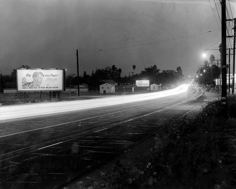
| (1953)* - Early morning view of Ventura Boulevard looking east from just east of Balboa Boulevard. Photo taken from the same spot as previous photo. Click HERE to see contemporary view. |
Historical Notes Photograph caption reads, "Five p.m. frustration - Picture taken from exactly the same spot as 7 a.m. Saturation illustrates reverse flow of home-bound residents, again forced into two lanes while two lanes at right carry little or no traffic. This photo is a time-exposure. Bright white streak is caused by endless line of headlights on cars moving westward." |
Then and Now
 |
|
| (1953 vs. 2019)^ - Ventura Blvd. looking East at Balboa Blvd. |
Los Encinos Historic State Park
 |
|
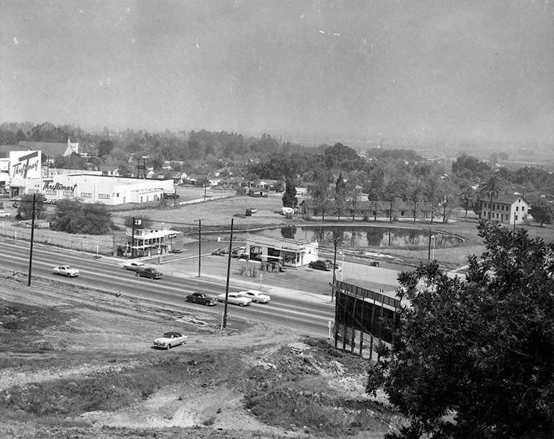
| (1957)* - Photograph caption dated June 1, 1957 reads "Overlooking monument. This photograph was taken from nearby hillside where an Indian village once was located. Ventura Boulevard is shown in foreground and beyond service station is Los Encinos Monument and Encino Pool, contrasting modern progress with early-day Valley life." Also pictured are a Thriftimart grocery store, a Shell service station, and a Mexican fast food restaurant. |
Historical Notes Vincent de la Osa Adobe, built in 1849 by Don Vicente De La Osa, was a favored stopping place for the numerous travelers on El Camino Real. It stands on land that is a part of the one-square-league Rancho El Encino granted in 1845 by Governor Pio Pico to three Indians, Ramon, Francisco, and Roque, whose interests were purchased by Don Vicente. Originally the land was under the jurisdiction of Mission San Fernando Rey founded in 1797 (Click HERE to see more). |
 |
|
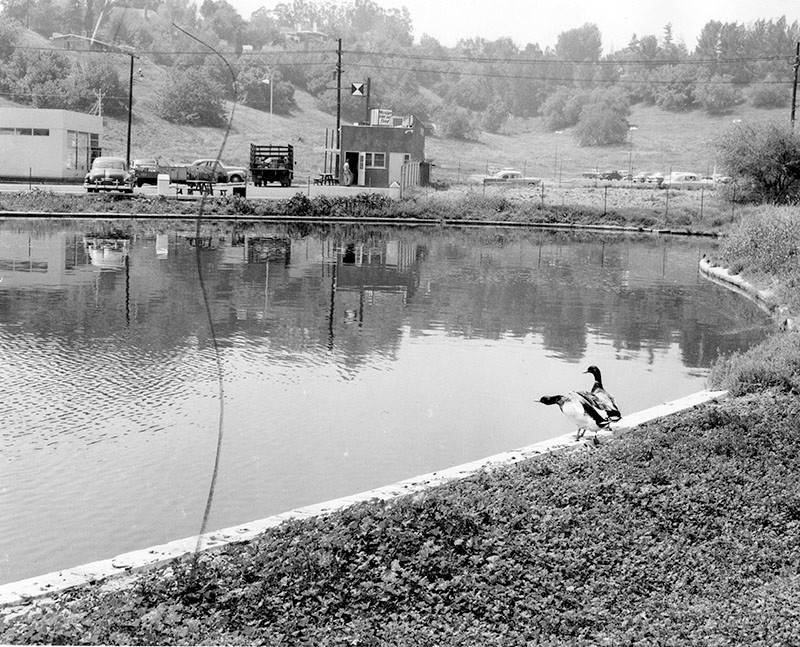
| (1957)* - View looking south across the Encino pool at Los Encinos State Park toward Ventura Boulevard. A sign on the building across the pond reads "Mexican fast food." |
Historical Notes Valley Times photo caption dated June 1, 1957 reads "Ducks enjoy Encino pool. Adorning monument grounds is this spring-fed pool, a Valley beauty spot. Stream carries 85-degree spring water to pond. Ducks flew there, liked it, stayed permanently." |
 |
|
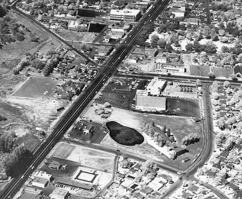
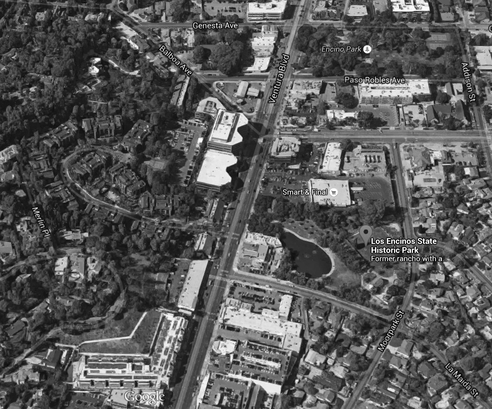
| (1960)* – Aerial view showing Los Encinos Historic State Park near the intersection of Ventura and Balboa boulevards (upper-center left). Thriftimart can be seen just west of the State Park (center of photo). |
Historical Notes Los Encinos State Historic Park, just northeast of the intersection of Balboa and Ventura Boulevards in Encino, was the hub of Rancho El Encino. This California rancho includes the original eight-room de la Ossa Adobe, the two-story limestone Garnier building, a blacksmith shop, a natural spring, and a pond. The natural spring provided a year-round source of water for the ancient, autonomous, village of Siutcanga. The village was home to Chumash, Tongva, and Tataviam people, who later were called "Fernandeños" by the Spanish due to the enslavement of these three groups to the San Fernando Mission. An excellent description of this village was recorded as part of the 1769 Portola Expedition. This Spanish expedition reached the San Fernando Valley and named it “El Valle de Santa Catalina de Bononia de Los Encinos” (The Valley of St. Catherine of Bononia of the Oaks).*^*^* The name Encino means "Oak"; Rancho Los Encinos - Ranch of Oak Trees" |
 |
|
| (2015)* – Google satellite view showing Los Encinos Historic State Park in Encino. |
Historical Notes Located along a significant travel route between Los Angeles and Santa Barbara, the property passed through many hands between the 1840s and the early 20th century. Today, the park contains exhibits related to the agricultural enterprises of Rancho El Encino’s various owners, including Mission Indian, Mexican Californio, French, and French Basque families.*^*^* Click HERE to see more Early Views of Rancho Los Encino. |
|
|
|
| (1960)* - Los Encinos Historic State Park and vicinity. | (2015)#*^# - Los Encinos Historic State Park and vicinity. |
Thriftimart (Encino)
 |
|
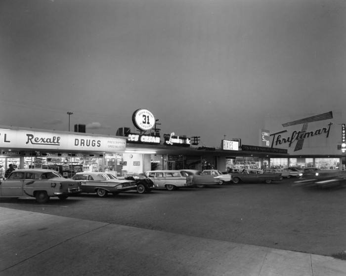
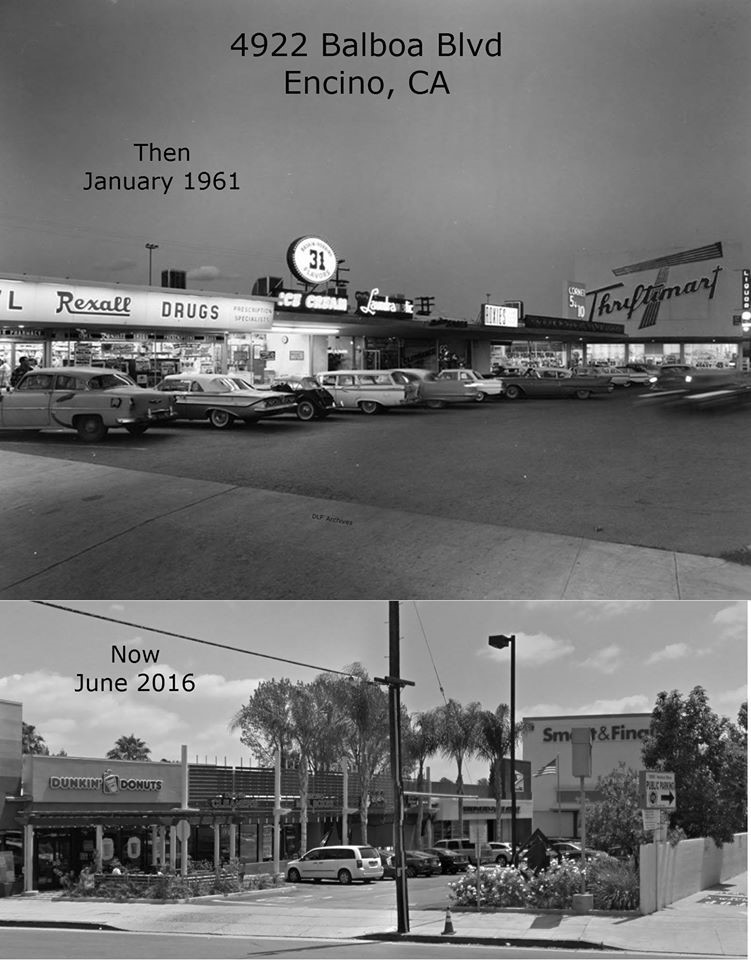
| (ca. 1961)^.^ – Rexall Drugs, Baskin Robins, and Thriftimart occupy a strip mall on the east side of Balboa north of Ventura Boulevard (4922 Balboa Blvd, Encino). Located just west of Los Encinos State Park, this shopping center still exists but has been given a face-lift. Today, a Dunkin Donuts occupies the space where Rexall use to be. Also, Thriftimart has been converted into a Smart and Final. Click HERE for contemporary view. |
Historical Notes Burning bright above the San Fernando Valley and L.A. Basin at dusk were the red, 40-foot tall "T's" - the iconic logo of the late, great Thriftimart supermarket chain. These gigantic signs emerged on the local landscape through the 50's and 60's. The company that would eventually be named Thriftimart, Inc. was created in 1930 when a group of former A&P managers headed by Roger Laverty, Sr. purchased a company called Fitzsimmons Stores, Ltd. (the name the company would bear until well into the 1950's). In its earlier years, the company grew through acquisitions, including the 9-store "Thriftimart" and the 17-store Roberts Markets chains in the 1940's. In 1955, the company purchased the Smart & Final Iris Company, which at the time was strictly a wholesale operation. By 1961, the company had over 60 stores and had renamed itself after its famous trademark.* |
Then and Now
 |
|
| (1961 vs. 2016)^ - 4922 Balboa Blvd in Encino. Aside from the store names and facades, not much has changed. Note that the Thriftimart is now a Smart and Final. Photo courtesy of Dean Fields. |
Historical Notes Thriftimart purchased Smart & Final in 1955 as its wholesale division. The Smart and Finals you see today were once Big T stores. By now most are remodeled and modern or a Safeway store such as the Canoga Park Big T, now West Hills Pavilions. The Rexall is Dunkin Donuts, Coronet 5 and 10 a Post Office. |
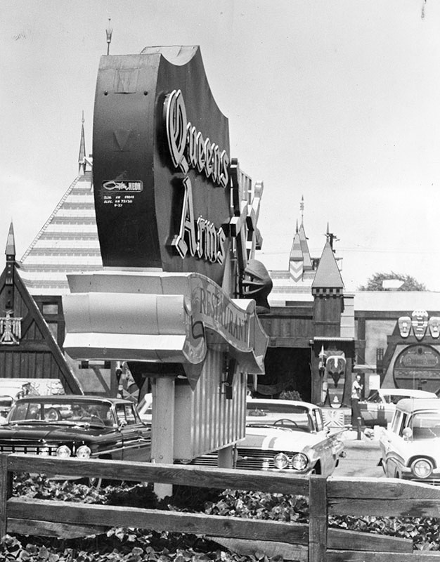
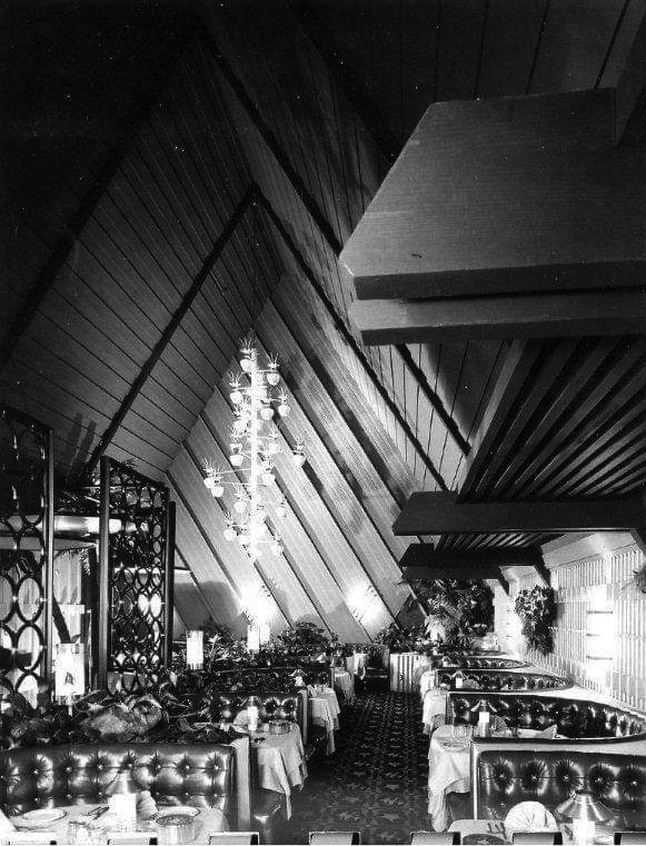
Queens Arms Restaurant (Encino)
 |
|
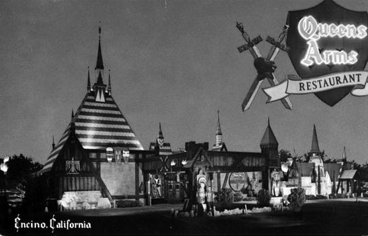
| (1960s)^.^ – Postcard view showing the Queens Arms Restaurant, located at 16325 Ventura Boulevard, Encino. |
Historical Notes The Queens Arms was a spectacular, Disneyland-like sight along Ventura Boulevard between Hayvenhurst and Libbit avenues. It was opened in 1956 by brothers Chris and John Skoby. The duo’s first restaurant was Skoby's Drive-in, located in Burbank. Skoby restaurants that followed included The King's Arms in Toluca Lake, The Queen's Arms in Encino and Blackbeard's, with locations in Newport Beach and on Maui. Skoby's only remaining restaurant, like the first, is simply named Skoby's, in Chatsworth. Chris Skoby, had planned the restaurant based on his visits to Europe during the 1940s, when he fell in love with the architecture. He found a designer who was active in the film industry. The main interior designer of the Queens Arms was Martin Obzina, who was a top art director for Alfred Hitchcock on many of his films. There was a full-size knight in armor in the foyer and elaborate Renaissance-themed murals on the walls.^ |
 |
|
| (1960)* - Photograph caption dated September 14, 1960 reads, "Castle-like restaurant is one of many plush eating places along busy Ventura Boulevard. 'Royal' atmosphere is appropriate; the Valley was named after Ferdinand III of Spain." The address for the Queens Arms Restaurant is 16325 Ventura Blvd. |
Historical Notes Many celebrities dined at the Queens Arms during its heyday, including Encino residents Dick Van Dyke and Steve Allen. Many top-notch entertainers performed there as well, including Gary Lewis of Gary Lewis and the Playboys in 1974. In 1975 the Queens Arms closed its drawbridge for the final time, but actually lived on, for a short time, as the Spaghetti Castle, a family-oriented restaurant with cheaper fare that never really took off. The property was then taken over for several years by Terry York Chevrolet, which was next door on the corner of Hayvenhurst for many years. Today, a Ralphs Market stands on the site where the Queens Arms used to be. Click HERE for contemporary view. |
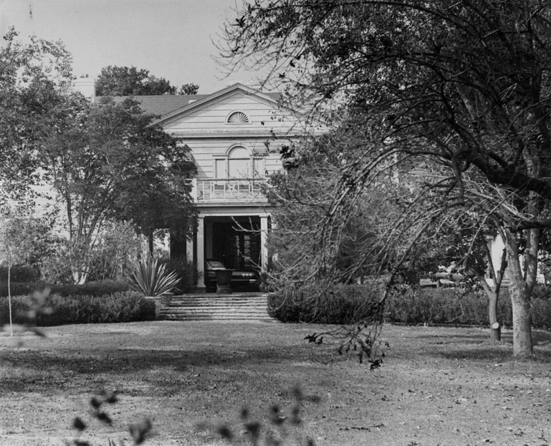
Horton Mansion
 |
|
| (1962)* – View showing the Encino home of actor Edward Everett Horton, located at 5521 Amestoy Avenue. It contained 17 rooms, 14 fireplaces, and a banquet hall. |
Historical Notes Edward Everett Horton had a long career in film, theater, radio, television, and voice work for animated cartoons. He began his stage career in 1906, singing and dancing and playing small parts in vaudeville and in Broadway productions. In 1919, he moved to Los Angeles where he began acting in Hollywood films. In 1925, Horton purchased several acres in the district of Encino and lived on the property at 5521 Amestoy Avenue until his death. He named the estate, which contained Horton's own house and houses for his brother, his sister and their respective families, Belleigh Acres. In the 1950s, the state of California forced Horton to sell a portion of his property for construction of the Ventura Freeway. The freeway construction left a short stump of Amestoy Avenue south of Burbank Boulevard and shortly after his death, the city of Los Angeles renamed that portion Edward Everett Horton Lane. Edward Everett Horton Lane ends at Burbank Boulevard, and begins in the shadow of the Ventura Freeway. On the other side of the boulevard is a bus stop also named for Edward Everett Horton, between bus stops at Aldea and Balboa. The borderline of Anthony C. Beilenson Park is directly across the street from the corner of Burbank Boulevard and EE Horton Lane. The opposite end of the lane leads to a foot bridge that overlooks the Ventura Freeway and ends up on the Amestoy Avenue side.*^ Scott Fitzgerald rented a two-story guest house on the property, 1938-39. Reflective of the devastation of the Great Depression, the author received his last royalty check while a Valleyite, $13.13. ^ |
Ventura and Sepulveda Blvds (Sherman Oaks)
 |
|
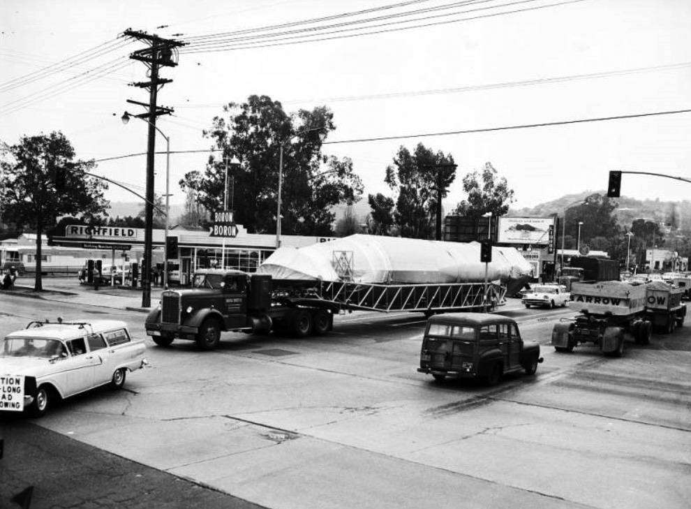
| (1958)^^ - View looking toward the southeast corner of Ventura and Sepulveda where a Richfield Service Station is located. A large truck carrying an Atlas missile is seen rounding the corner of Sepulveda onto Ventura Blvd. |
Historical Notes The Atlas, first tested in 1957, was the United States' first successful ICBM (Intercontinental Ballistic Missile). It launched the Mercury project space capsules and became the foundation for a family of successful space launch vehicles now built by United Launch Alliance. The Atlas rocket family is today used as a launch platform for commercial and military satellites, and other spacecraft.*^ |
 |
|
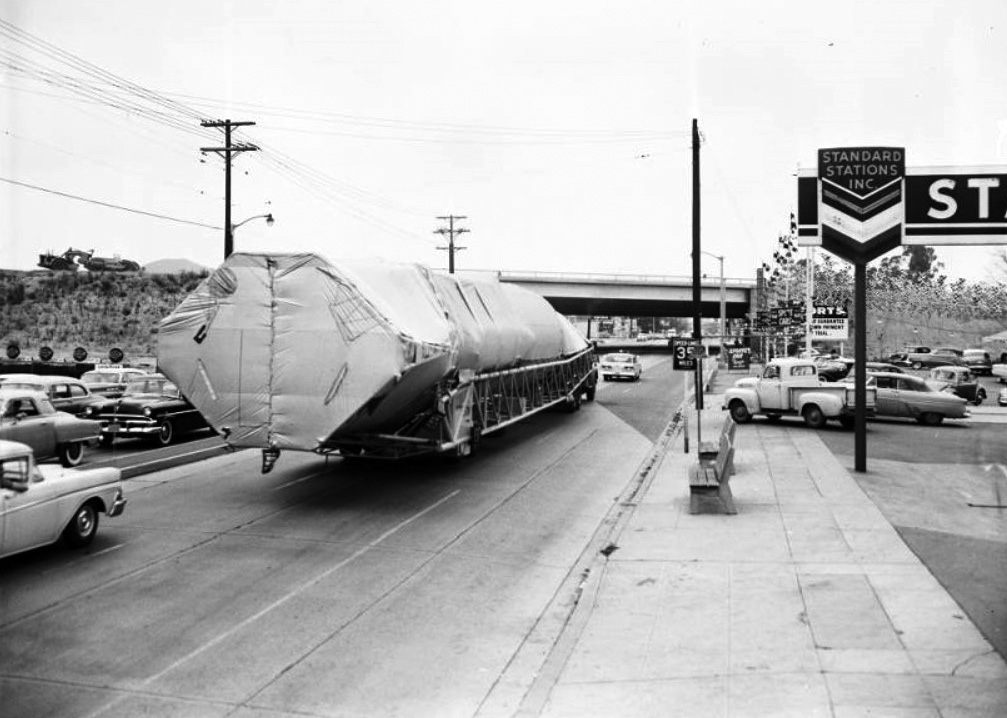
| (1958)^^ - View looking west on Ventura Boulevard showing the Atlas missile being transported toward the San Diego Freeway overpass (still under construction). A Standard Service Station is seen at right on the northwest corner of Ventura and Sepulveda boulevards. |
Historical Notes The San Diego Freeway, connecting the Westside with the San Fernando Valley, would not open until 1962.*^ |
Ventura Freeway
 |
|
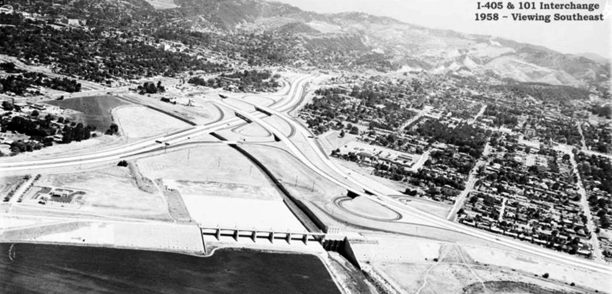
| (1958)^ – Panoramic aerial view looking southeast over the Sepulveda Basin showing the San Diego and Ventura Freeway Interchange still under construction. |
 |
|
| (1958)* - Facing south at newly constructed San Diego Fwy (initially CA-7, now I-405) at Ventura Fwy (US-101) interchange. New 1.5 mile long freeway segment extended from Valley Vista Blvd to Burbank Blvd (Valley Times photo date July 1, 1958). |
 |
|
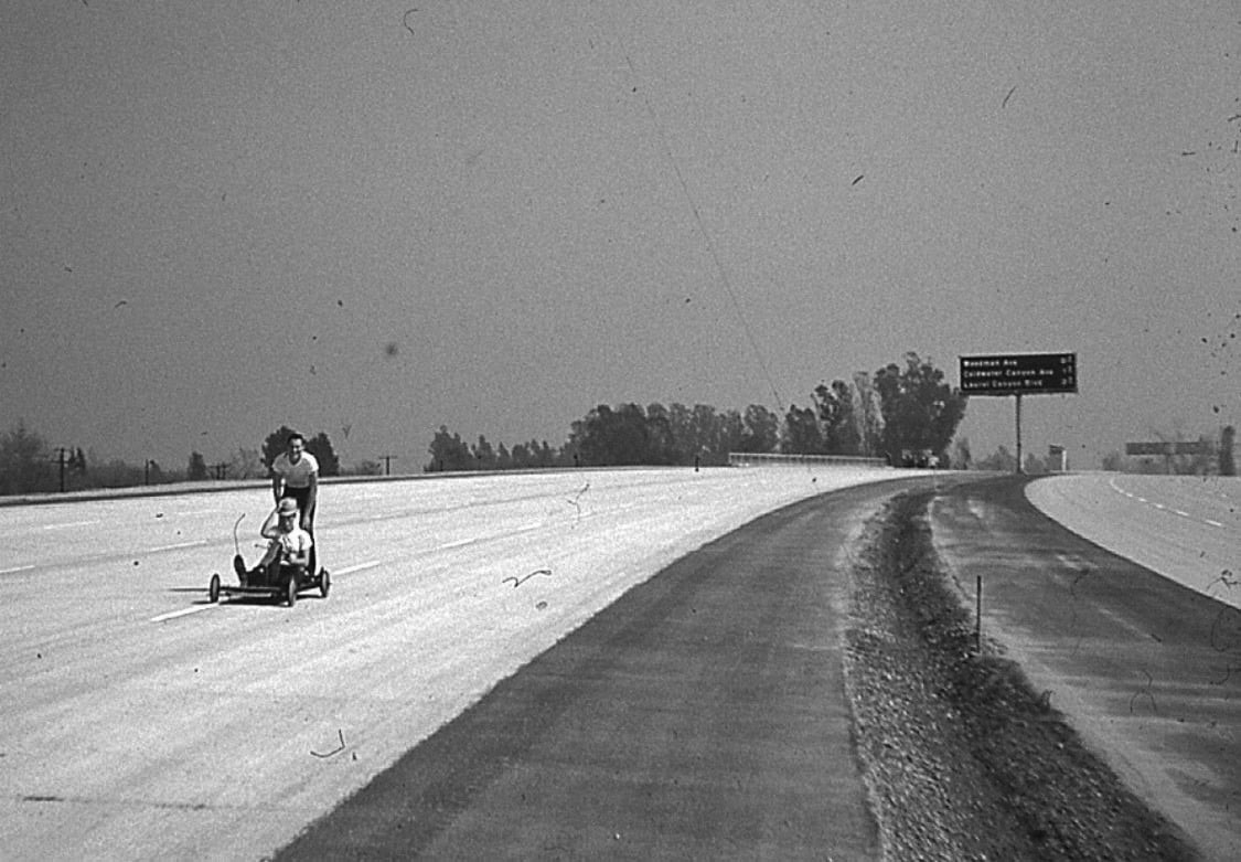
| (1960)* – Two boys are seen riding their go-kart on the unifnished Ventura Freeway. View is looking east with the sign in the background reading Woodman, Coldwater, and Laurel Canyon. |
 |
|
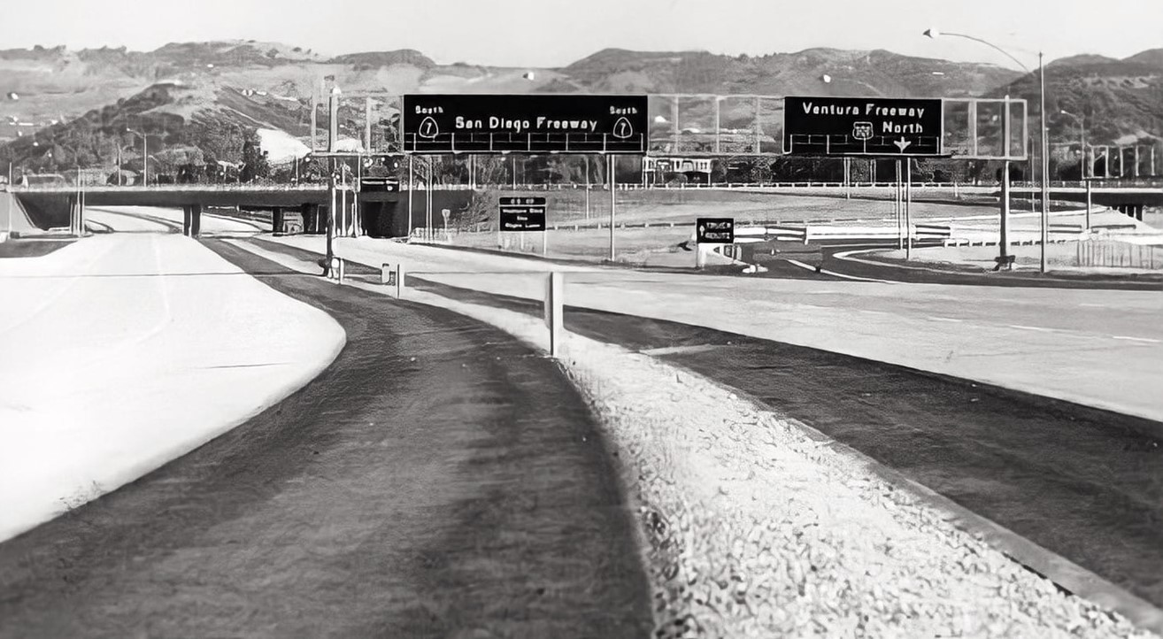
| (1960)*- Members of Valleywide Committee on Streets and Highways and officials from State Division of Highways check nearly completed NB section of Ventura Freeway (US-101) near Reseda Blvd bridge (Valley Times Collection). Photo date March 9, 1960 |
Historical Notes The portion of the Ventura Freeway signed as US 101 is signed as a north-south route by CalTrans despite the freeway's actual alignment being east-west. This is due to the fact that US 101 as a whole has a north-south alignment. The apparent inconsistency can be confusing to visitors, as the same freeway entrance can often be signed as "101 North" and "101 West." This is most common in the San Fernando Valley. |
Studio City
 |
|
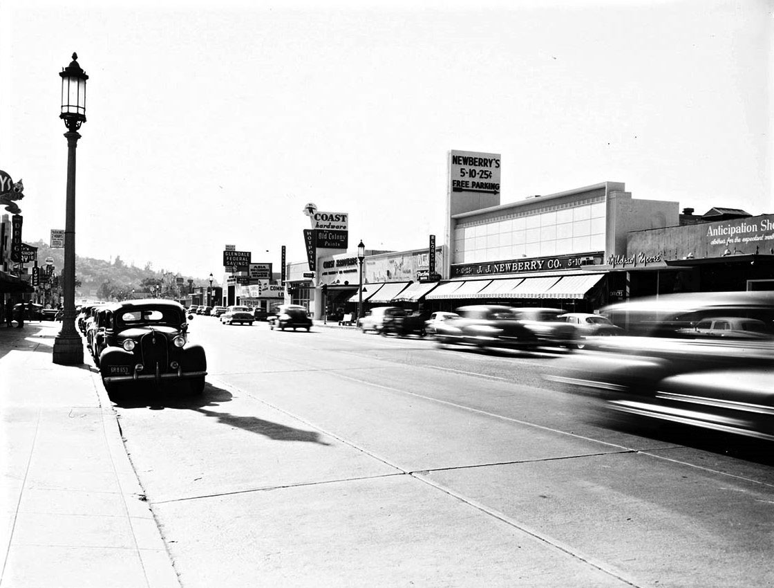
| (ca. 1950)* – View looking west on Ventura Boulevard in Studio City. Coast Hardware Store and J.J. Neweberry and Co. can be seen on the north side of the street. Photo by Julius Shulman. |
Historical Notes Ventura Boulevard is one of the primary east–west thoroughfares in the San Fernando Valley. It is one of the oldest routes in the San Fernando Valley as it was originally a part of the El Camino Real (the trail between Spanish missions). It was also U.S. Route 101 before the freeway (which it is parallel to for much of Ventura Boulevard's length) was built, and it was also previous signed as Business U.S. Route 101. |
 |
|
| (1954)* – View looking east on Ventura Blvd (US-101) toward Laurel Canyon Blvd in Studio City. Studio City Theatre can be seen in the distance on the right. Thrifty Drug Store is further back on the NW corner of Ventura and Laurel Canyon. |
Historical Notes Running 18 miles, Ventura Boulevard is the world's longest avenue of contiguous businesses. The Boulevard begins near Calabasas in Woodland Hills at an intersection with Valley Circle Boulevard, passes through Tarzana, Encino, Sherman Oaks, and finally in Studio City (where it intersects with Lankershim Boulevard) it becomes Cahuenga Boulevard, which then winds through Cahuenga Pass into Hollywood. It has always been the most concentrated location for mom and pop shops and small businesses in the Valley; nowadays it has pockets of housing, mini-malls, and shops, along with a wide assortment of businesses, schools, and other establishments. |
 |
|
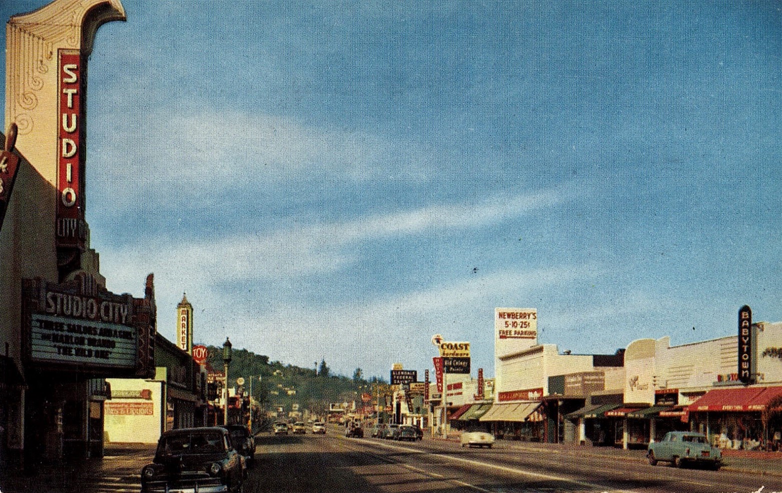
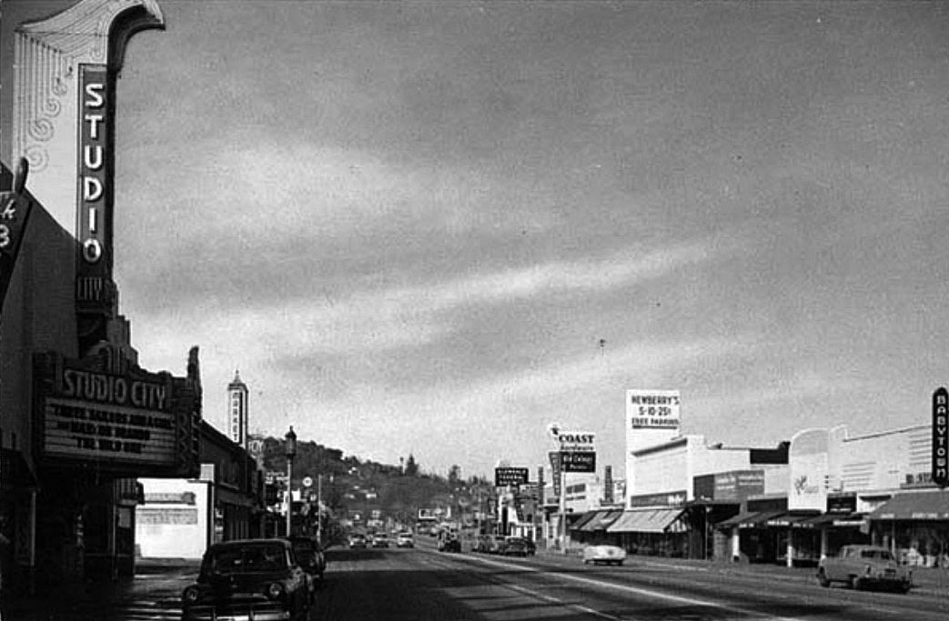
| (1950s)* – View looking west on Ventura Boulevard with the Studio City Theatre seen on the left. Some recognizable signs on the right (north side of Ventura) include: Coast Hardware Store, Newberry’s 5-10-25, and Babytown. Photo courtesy of Valley Relics Museum |
Historical Notes Opened in 1938, the Studio City Theater at 12136 Ventura Boulevarfd was operated by Fox West Coast Theatres and its successor companies. The last operator was Mann Theatres. It's been known as the Studio Theatre, the Studio City Theatre and the Fox Studio City. The theater closed in 1991. The interior is largely intact but has been converted into a Bookstar/Barnes & Noble bookstore. |
 |
|
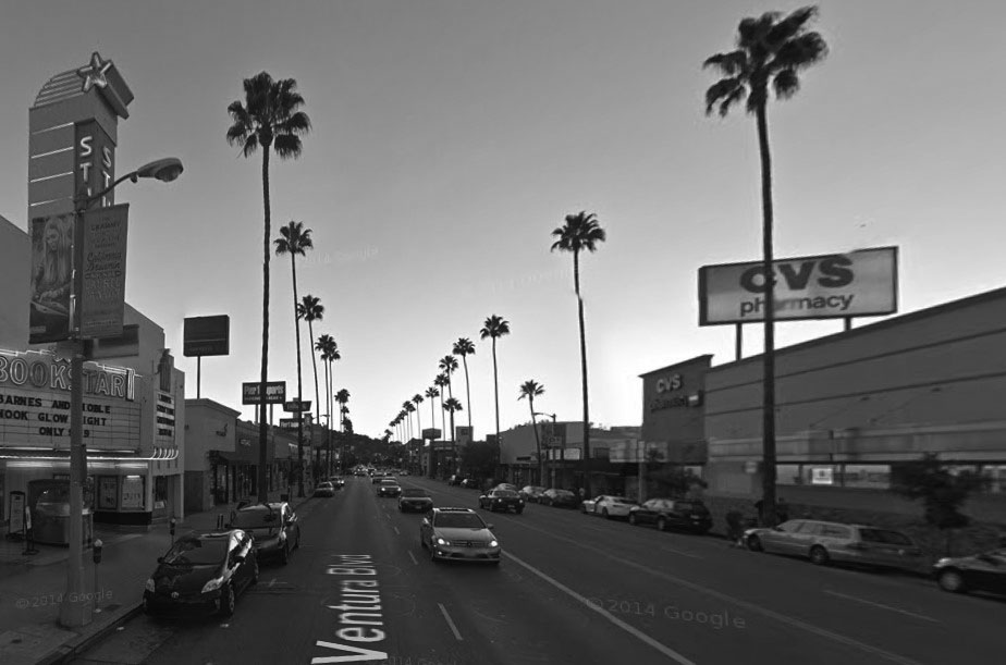
| (2014)* - Google street view looking west on Ventura Boulevard next to the Bookstar/Barnes & Noble bookstore at the old Studio City Theatre with CVS on the north side of the street. |
Then and Now
 |
|
|
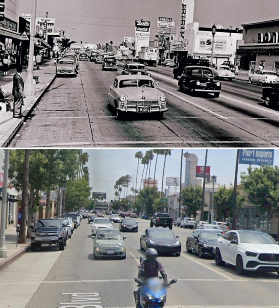
| (1950s vs 2014)* – Looking west on Ventura Boulevard, Studio City. |
Then and Now
 |
|
| (1954 vs 2022)* - Looking east on Ventura Boulevard at Vantage Avenue in Studio City. |
 |
|
| (ca. 1950)* – View looking west on Ventura Blvd. in Studio City from east of Laurel Canyon Blvd. Currie’s Ice Cream (large cone on top of building) can be seen in the distance, located on the N/W corner of Ventura Blvd and Laurel Canyon. |
Historical Notes People still fondly remember the Currie’s chain and its “mile-high cone” whose replica was often displayed billboard-style on roofs. The chain was started in 1927 by three brothers named Kuhns. After WWII they sold it to the Good Humor Company who later sold it to Lipton in the 1960s. In 1964 the chain opened its 87th store, in North Hollywood. Although Currie’s anticipated launching units in every community in Southern California, only three outlets were listed in the 1967 Los Angeles phone book and the chain had disappeared by the 1980s. |
 |
|
| (1954)* – Looking SE on Ventura Blvd towards Vineland Ave in Studio City. |
 |
|
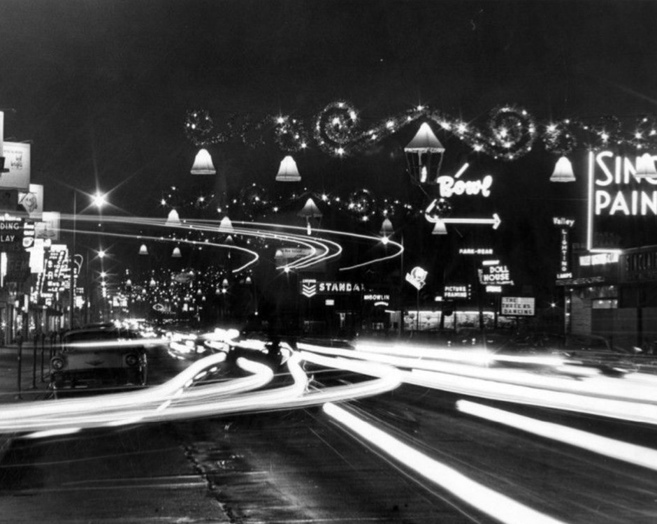
| (1962)* – Night view looking west on a holiday-decorated Ventura Boulevard at Vantage Avenue. Visible signs include Sinclair Paints, Valley Lighting and Lamps, Doll House, marquee reading The Three Ks Dancing, Picture Framing, a bowling alley, Chevron gas station, Riding and Play Clothes, Valley Gem Shop, a record store. Valley Times photo. |
Historical Notes During the 1960s, Ventura Boulevard in Studio City was adorned with festive holiday decorations that contributed to its vibrant atmosphere. Large decorative bells, often illuminated with lights, were prominently displayed along the boulevard, particularly at key intersections. Local businesses joined in the celebration by decorating their storefronts with lights, garlands, and other festive ornaments, fostering a sense of community and attracting customers during the holiday season. |
 |
|
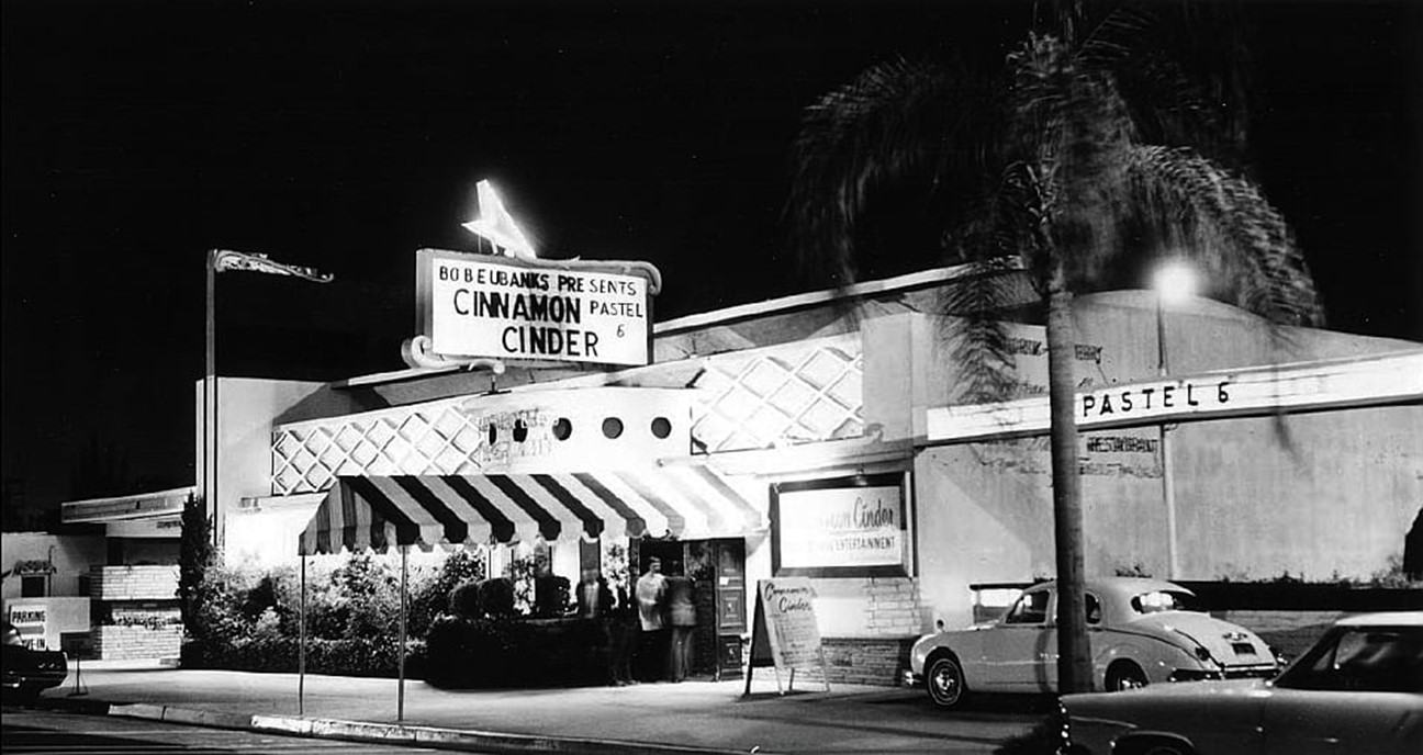
| (ca. 1962)* - "Cinnamon Cinder" Teenage Night Club located at 11345 Ventura Blvd., Studio City. Photo courtesy of Jan Fields |
Historical Notes In 1962, D.J. Bob Eubanks bought the first club on Ventura Blvd and ran it as the Cinnamon Cinder. The club served no alcohol and admission was $1.50. It was here on Aug. 23, 1964, that the Beatles gave a secret press conference before their Hollywood Bowl show. Like everywhere else the Beatles went, it was swarmed with hundreds of teenaged fans. The clubs success was attributed to stringent rules; No-one under 18 permitted. Single men past age 25 were discouraged from seeking entrance. Girls were not permitted if wearing capris or shorts (must wear skirts). Boys were barred if wearing t-shirts, sweatshirts, club or school jackets, levis or tennis shoes. |
 |
|
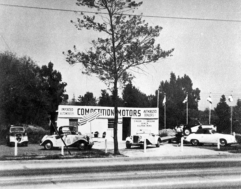
| (1963)* - Photo caption dated May 28, 1963 reads, "Competition Motors Distributors had its humble beginning in a two-car garage building at 11211 Ventura Boulevard in Studio City (top photo). Here John von Neumann, president of the Volkswagen distributorship, specializing in tuning racing cars. He also formed a Porsche Car Distributorship, Inc., a separate operation from the Volkswagen. Photo shows early Porsche at right..." |
Historical Notes A shopping center (Studio City Place) now exists where Competitive Motors once stood. Click HERE for contemporary view. |
 |
|
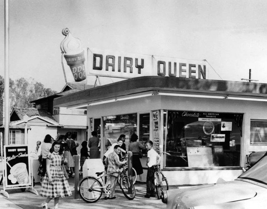
| (1957)* - Opening day in 1957 at the Dairy Queen located at 11334 Moorpark Street (at the southwest corner of Bakman Ave) in Studio City, now the site of the Girasol Restaurant. Click HERE to see contemporary view. |
Historical Notes The concept of soft serve was developed in 1938 by John Fremont McCullough and his son Bradley. They partnered with ice cream shop owner Sheb Noble to open the first Dairy Queen in Joliet, Illinois, in 1940. |
 |
|
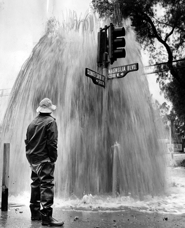
| (1956)* - Photo caption reads: "Water and Power Department employee Vic Pollard stands at the wettest spot in the Valley today, corner of Coldwater Canyon Ave. and Magnolia Ave., North Hollywood. A 150-ft. water spout poured from fire hydrant sheared by motorist whose car skidded on the rain-slick pavement. Driest spot in the Valley was the surrounding four-mile area where household water was shut off for several hours as workmen repaired the damage." Valley Times |
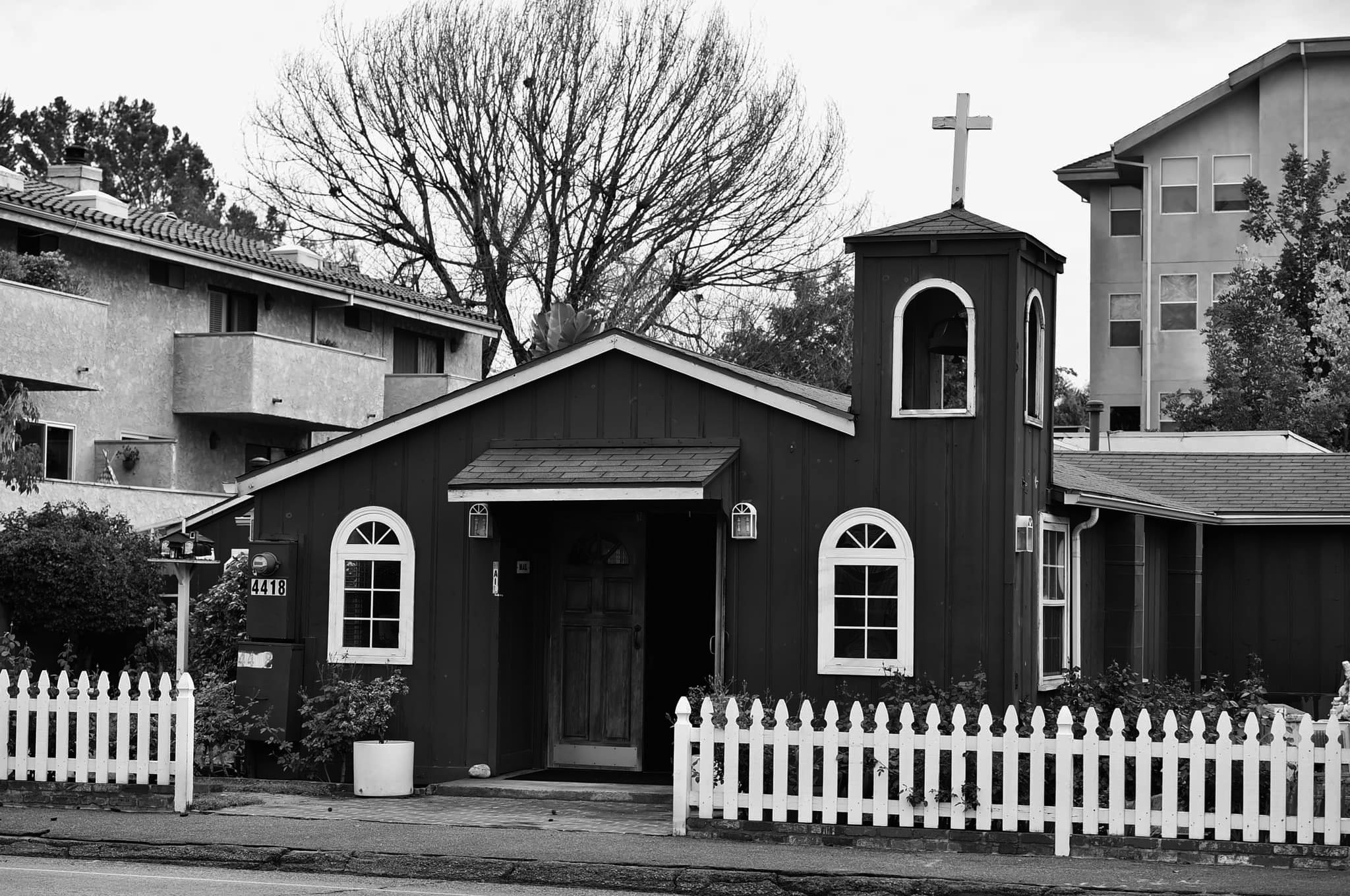
Little Brown Church in the Valley (Studio City)
 |
|
| (1957)* - Valley Times photo caption reads, "Little Brown Church in the Valley, 4418 Coldwater Canyon, Studio City, enjoys country atmosphere near busy thoroughfare. About 100 persons fit comfortably in the 20 x 40 foot sanctuary. Church is non-sectarian in 'attitude and spirit.'" |
Historical Notes The Little Brown Church in the Valley, a diminutive sanctuary in Studio City surrounded by multistory apartment buildings, has hosted more than 23,000 weddings. But it's probably best known as the site of the union between Ronald Reagan and Nancy Davis on March 4, 1952. * The Little Brown Church still stands today. Click HERE for contemporary view. |
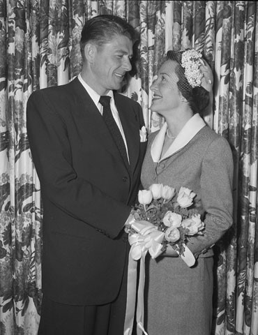 |
(1952)* - Ronald Reagan and Nancy Davis on their wedding day - March 4, 1952. It was the 1,761st marriage ceremony performed in the Little Brown Church in Studio City. | |
Historical Notes ◆ 40th President of the United States (1981 – 1989) |
 |
|
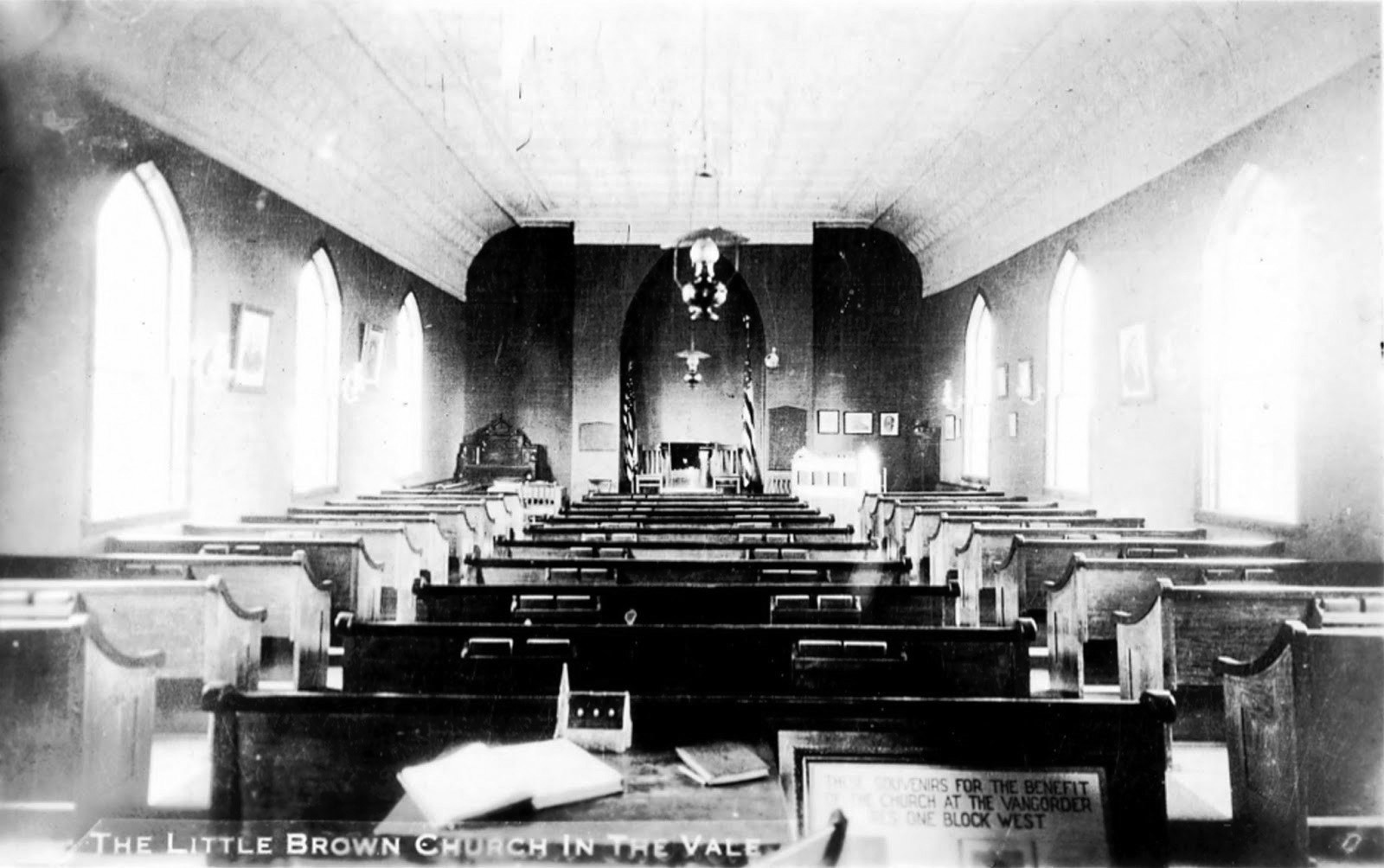
| (1939)* – Postcard view showing the interior of The Little Brown Church in Studio City. Photo Courtesy: Gary Fredburg |
Historical Notes The Little Brown Church in the Valley, a tiny Protestant chapel, was built alone by the Rev. John H. Wells in the late 1930s. |
 |
|
| (2021)* - The “Little Brown Church in the Valley”……Coldwater Canyon in Studio City |
Historical Notes Today, the historic structure located at 4418 Coldwater Canyon is primarily a wedding site but still houses a small and devoted congregation. The wedding place of President Ronald Regan and his wife Nancy, the modest chapel has been host to many celebrity marriages. |
Bullock's Fashion Square (now Westfield Fashion Square)
 |
|
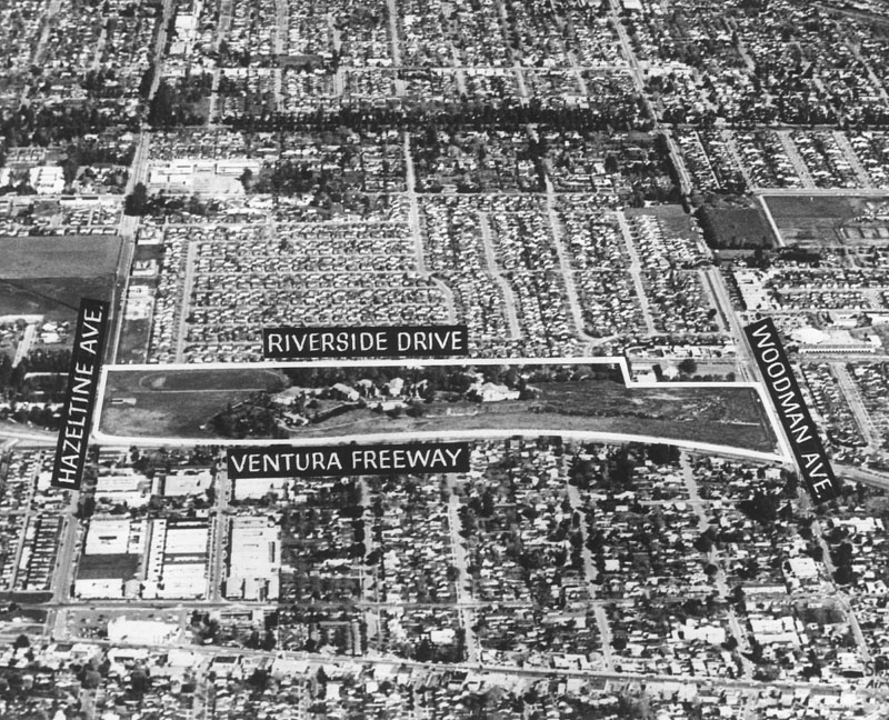
| (1959)* - Photograph caption dated October 6, 1959 reads, "Bullock's New Site -- Shown above is aerial view of the San Fernando Valley site of Bullock's, Inc., proposed facility. Purchased from McKinley Home for Boys, location is bordered on north by Riverside Drive, on south by Ventura Freeway, on west by Hazeltine Avenue and on east by Woodman Avenue. Coldwell Banker and Co. represented both parties in transaction." |
Historical Notes Original property of McKinley Home for Boys lists a Van Nuys address. This site on which the Bullock's Fashion Square was built is actually part of Sherman Oaks. Conditions of the transaction required that the property be rezoned for commercial use. The McKinley Home for Boys built a new facility in San Dimas, Calif.* |
 |
|
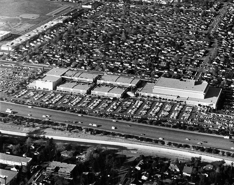
| (1964)* - View showing the Bullock's Fashion Square (today Westfield Fashion Square), located at 14006 Riverside Drive, with the Ventura Freeway in the foreground. |
Historical Notes Originally anchored by Bullock's from 1962, Sherman Oaks Fashion Square added The Broadway, and I. Magnin department stores in 1975. In 1988-1990, the outdoor mall was enclosed and double-decked with a Mediterranean theme. In 1994, the mall suffered serious damage from the Northridge earthquake. In 1996 Bullock's was converted into Macy's. The Broadway later became Bloomingdale's--the result of Federated Department Stores buying out Carter Hawley Hale Stores, parent company of The Broadway. The Westfield Group acquired a half-interest in the shopping center in 2002, and renamed it "Westfield Shoppingtown Fashion Square", dropping the "Shoppingtown" name in June 2005.*^ |
Sunkist Building
 |
|
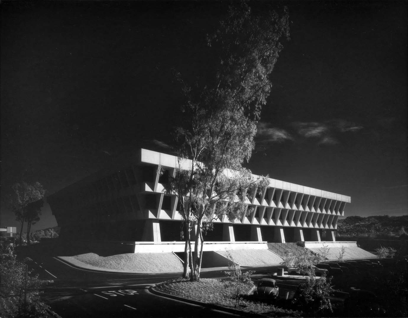
| (1970)* – View showing the newly constructed Sunkist Building located at 14130 Riverside Drive in Sherman Oaks.\. Photo by Julius Shulman |
Historical Notes When citrus marketing company Sunkist moved into its new Sherman Oaks building in 1970, it left an Art Deco office tower in downtown Los Angeles for a homecoming of sorts; the San Fernando Valley was once partially covered with citrus groves, which were removed to make way for housing tracts after World War II. No matter that the orange trees were no more at the time of its construction—the building looks a little bit like an orange crate, inverted and set upon angled concrete columns. ^++ Click HERE to see the Sunkist downtown headquarters between 1935 and 1970. |
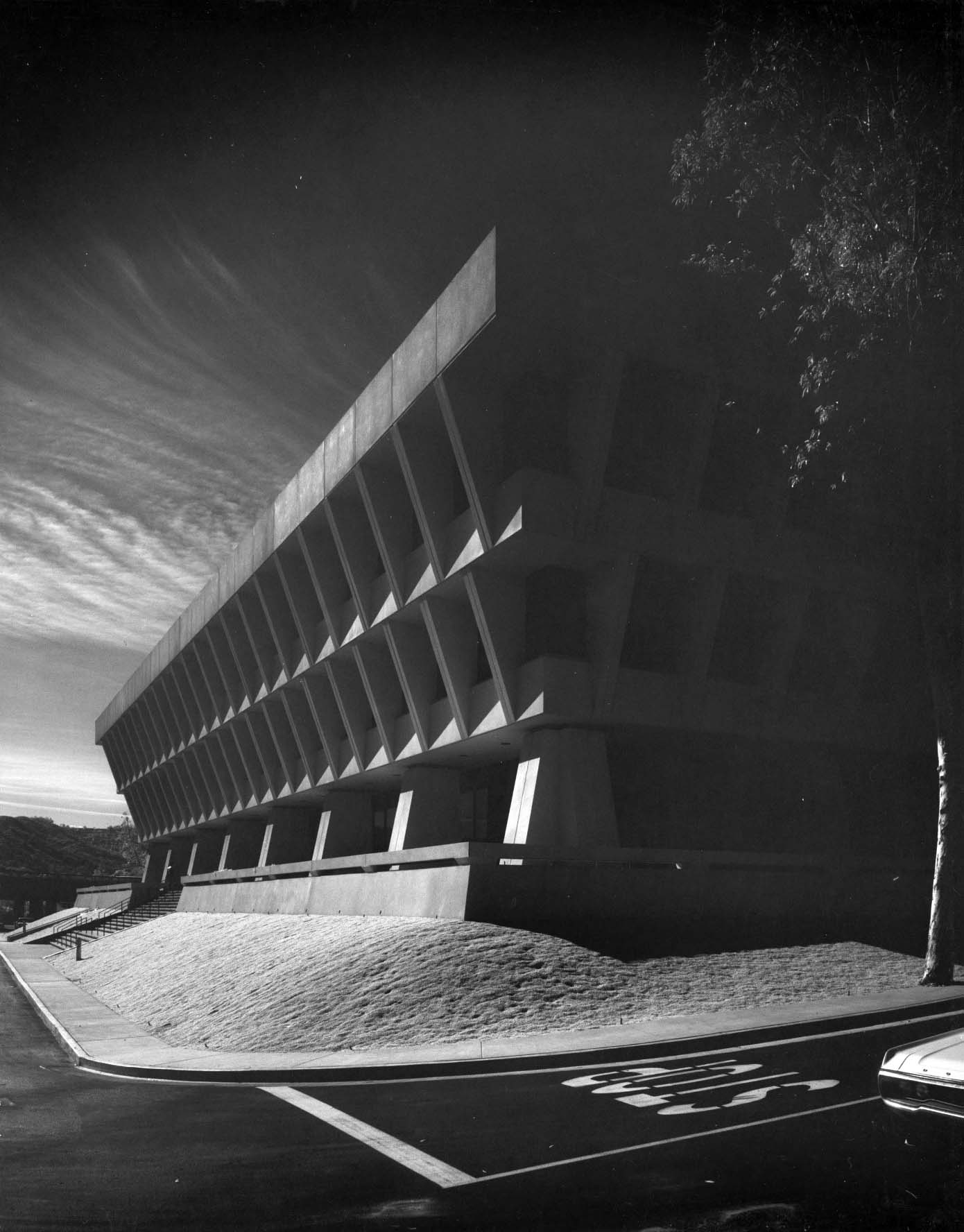 |
|
| (1970)* – Close-up profile view showing the Sunkist Building with its inverted pyramid design. Photo by Julius Shulman / Getty Research Institute |
Historical Notes The Sunkist Building was designed by A. C. Martin and Associates, a firm with a long and storied history in Los Angeles. In the late 1960s, the firm was busy changing the look of downtown with its Corporate International-style skyscrapers. For Sunkist, A. C. Martin created a low-rise but unquestionably monumental Late Modern-style building of reinforced concrete with recessed windows. It is shaped somewhat like an inverted pyramid, colossally wide at the top and tapering in at the base so it appears to balance on concrete legs. |
 |
|
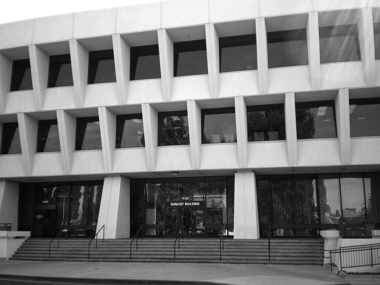
| (2008)* – View showing the front entrance to the Sunkist Building on Riverside Drive in Sherman Oaks. Photo by 'Cbl62' / Wikipedia |
#/media/File:Sunkist_Building.JPG)
Historical Notes For 35 years the building was headquarters for the giant Sunkist growers' cooperative that was organized 100 years ago. Pioneer William Wolfskill planted the seeds of what was to become Sunkist Growers in the 1840s. Many of the fortune-seekers who flocked to California during the Gold Rush developed scurvy because fresh fruit was not widely available. As word spread that citrus fruits could prevent the disease, demand skyrocketed. Soon lemons sold for $1 each. When the arrival of the railroad in Los Angeles in the 1890s made possible the fast shipment of perishable fruit to the East, the orange industry became firmly established. During the depression of 1893, a group of 60 local growers formed a cooperative to advertise and market their crops. That group reorganized in 1905 to become the California Fruit Growers' Exchange. In 1908, when growers began casting about for a trademark to set their fruit apart, admen came up with "Sunkissed." It was quickly shortened to "Sunkist." A few years later, the slogan, "California for Wealth, Oranges for Health," was coined. ^^^ In September 2014, Sunkist relocated its headquarters to the Valencia neighborhood of Santa Clarita. As of 2014 there has been a plan for a massive development to be built around the Sunkist Building which would add residential, commercial and retail space to the iconic structure. |
Coffee Dan's (Van Nuys)
 |
|
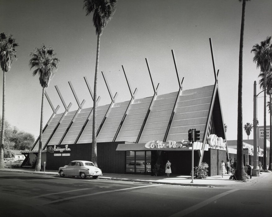
| (ca. 1957)* - View looking at the southeast corner of Van Nuys Boulevard and Kittridge Street showing Coffee Dan's. Photograph by Julius Shulman / Getty Research Institute |
Historical Notes Built in 1957, Coffee Dan's in Van Nuys was designed by Architect William Krisel of the firm Palmer and Krisel. The history of Coffee Dan's dates back to 1935 when it was founded by Dan Evans in Pasadena. The restaurant quickly gained popularity for its cozy atmosphere, friendly service, and delicious food. |
 |
|
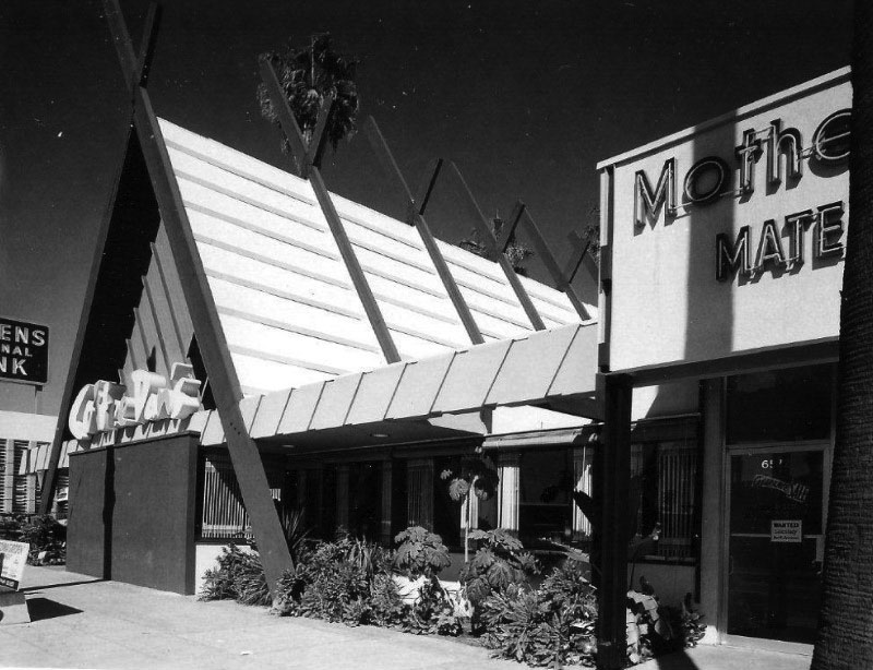
| (ca. 1957)* - View of Coffee Dan's located at 6576 Van Nuys Boulevard, SE corner of Van Nuys and Kittridge. Photograph by Julius Shulman |
Historical Notes Coffee Dan's Restaurants became known for its all-day breakfast menu, offering a wide variety of breakfast dishes, including pancakes, waffles, omelets, and freshly brewed coffee. The chain also served lunch and dinner options, featuring American comfort food classics such as burgers, sandwiches, salads, and hearty entrees. Today, the SE corner of Van Nuys and Kittridge is occupied by a mini mall with a 7-11 and an El Pollo Loco. Click HERE for contemporary view. |
 |
|
| (ca. 1957)^ - Interior view of Coffee Dan's in Van Nuys. I'll have the apple pie and a cup of coffee. Photograph by Julius Shulman |
Historical Notes Over the years, Coffee Dan's expanded its presence, opening several locations throughout California and other states. The restaurants were often designed with a distinctive mid-century modern aesthetic, featuring retro decor and cozy booths, creating a welcoming environment for families and friends to gather. |
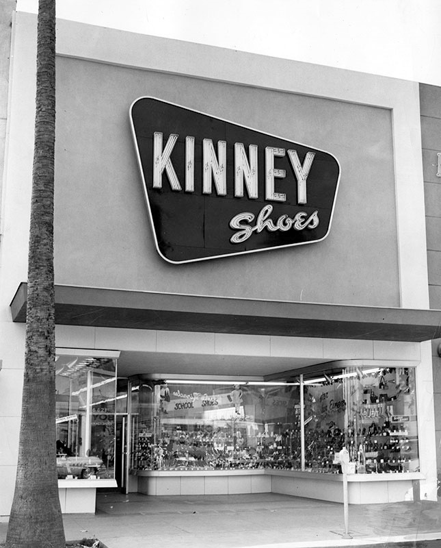
Kinney Shoes (Van Nuys)
 |
|
| (1954)* - View showing Kinney Shoes store located at 6621 Van Nuys Blvd. Today, two temporary signs (in Spanish) hang above the storefront. Click HERE for contemporary view. |
Historical Notes Kinney Shoes was the largest family chain shoe retailer in the United States at the beginning of 1936, with 335 stores operating nationwide. In 1963, the G.R. Kinney Company was sold to F.W. Woolworth. The firm was renamed the Kinney Shoe Corporation and continued as a fully owned subsidiary of Woolworth. The company continued operating throughout the 1960s and 1970s with divisions named Stylco (1967), Susie Casuals (1968), and Foot Locker (1974). In 1998, the Venator Group, Woolworth's successor, announced that Kinney's 467 shoe stores and 103 Footquarters stores would close. The Foot Locker division, started in 1974, continues to this day, with Venator changing its name in 2001 to Foot Locker. Foot Locker also maintains the trademarks of the Kinney and Woolworth brands.*^ |
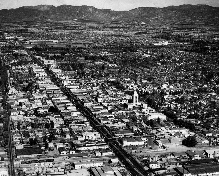
Van Nuys
 |
|
| (1960)* - Aerial view of Van Nuys, looking north from about Oxnard Street. Wide street running north-to-south is Van Nuys Boulevard. Van Nuys City Hall is clearly seen in the center of the photo. |
Historical Notes The 1960s saw further expansion of Van Nuys' residential areas, with more tract housing and apartment complexes being built to accommodate the increasing population. The architectural styles of the homes ranged from traditional to modern, reflecting the changing tastes and trends of the time. The community remained family-oriented, with a strong emphasis on education and a sense of community pride. Schools in Van Nuys continued to play a central role in the lives of residents, and families were actively involved in school-related activities and events. |
 |
|
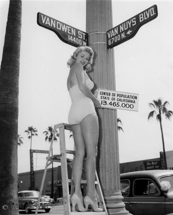
| (1960)* - Miss Van Nuys on a step ladder holds up sign, reading: Center of population, State of California, 13,465,000, at the intersection of 14,400 W. block of Vanowen Street and 6,700 N. block of Van Nuys Blvd., Sept. 1960. |
Historical Notes The advent of three new industries in the early 20th century – motion pictures, automobiles, and aircraft spurred urbanization and population growth. World War II production and the subsequent postwar boom accelerated this growth so that by 1960, the valley had a population of well over one million. Los Angeles continued to consolidate its territories in the San Fernando Valley by annexing the former Rancho El Escorpión for Canoga Park-West Hills in 1959, and the huge historic "Porter Ranch" at the foot of the Santa Susana Mountains for the new planned developments in Porter Ranch in 1965.*^ Van Nuys Boulevard was renamed from North Sherman Way as the main boulevard in the town of Van Nuys, which got its name from longtime Valley wheat farmer Isaac Newton Van Nuys. Vanowen Street - coined because it was the direct route across the Valley between the towns of Van Nuys and Owensmouth.^* |
 |
|
| (1960s)* - Looking north on Van Nuys Boulevard at Victory Boulevard with the Fox Van Nuys Theatre seen on the left (6417 Van Nuys Blvd). Photo courtesy of Valley Relics Museum |
Historical Notes During the 1960s, the commercial district along Van Nuys Boulevard continued to thrive. The boulevard was bustling with activity, with a wide range of shops, restaurants, and entertainment venues. Shopping centers, such as the Van Nuys Fashion Square, provided residents with convenient access to various retail options. |
 |
|
| (1965)^ – View looking north on Van Nuys Boulevard at Kittridge Street toward Vanowen with palm trees lining both sides of the street. “I and Joy” Bagels can be seen on the right. Note the 1965 Buick Riviera at left. |
Historical Notes The automobile culture remained strong in Van Nuys during the 1960s. The community's wide streets and ample parking continued to accommodate the growing number of cars owned by residents. Car ownership was seen as a symbol of status and freedom, and cruising along Van Nuys Boulevard remained a popular pastime. |
 |
|
| (1961)* - Photograph caption dated March 3, 1961 reads, "Cars whiz through the Valley's most dangerous intersection. Victory and Sepulveda boulevards listed 22 collisions." |
Historical Notes During the 1960s, Van Nuys, like many other areas in Los Angeles, experienced significant traffic congestion. The population was growing rapidly, leading to an increase in the number of vehicles on the road and subsequently contributing to traffic congestion. |
 |
|
| (1962)* - View of flood at the northeast corner of Vanowen Street and Louise Avenue, in Van Nuys (now Lake Balboa). The photo caption reads, "Automobile splashes through deep water in a West Valley intersection. Heavy rains meant stalled cars, no school, wet pedestrians and cleaning bills." Valley Times photo, dated 2/9/1962. |
Historical Notes Van Nuys experienced occasional flooding in the streets during the 1960s. It was susceptible to flooding due to heavy rainstorms and the region's limited drainage infrastructure. On November 2, 2007, the City Council of Los Angeles approved a motion renaming a larger portion of Van Nuys to Lake Balboa, including this intersection. Click HERE for contemporary view of the NE corner of Vanowen and Louise. |
Schlitz Brewery
 |
|
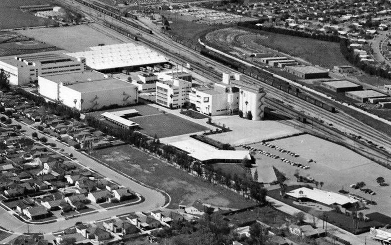
| (ca. 1960s)^^^^* – Aerial view showing the Schlitz Brewery adjacent to the railroad tracks, Van Nuys. |
Historical Notes Schlitz opened its state-of-the-art 35-acre brewery at 7321 Woodman Avenue in Van Nuys in 1954.^^^^* The Joseph Schlitz Brewing Company was based in Milwaukee, Wisconsin, and once the largest producer of beer in the United States. Its namesake beer, Schlitz, was known as "The beer that made Milwaukee famous" and was advertised with the slogan "When you're out of Schlitz, you're out of beer". Schlitz first became the largest beer producer in the US in 1902 and enjoyed that status at several points during the first half of the twentieth century, exchanging the title with Anheuser-Busch multiple times during the 1950s.*^ |
 |
|
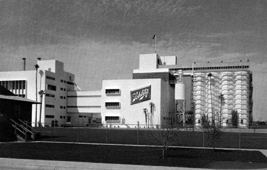
| (1975)^^# – Profile ground view showing the Schlitz Brewery, Van Nuys. |
Historical Notes The company was founded by August Krug in 1849 but acquired by Joseph Schlitz in 1858. Schlitz was bought by Stroh Brewery Company in 1982 and subsequently sold along with the rest of Stroh's assets to the Pabst Brewing Company in 1999. Pabst now produces Joseph Schlitz Brewing Company's former flagship brands including Old Milwaukee and Schlitz beer.^^^^* Intense competition within the beer industry and a declining share of the Western market helped force the closure of the Van Nuys brewery in 1990.^^^ |
* * * * * |
North Hollywood Federal Savings
 |
|
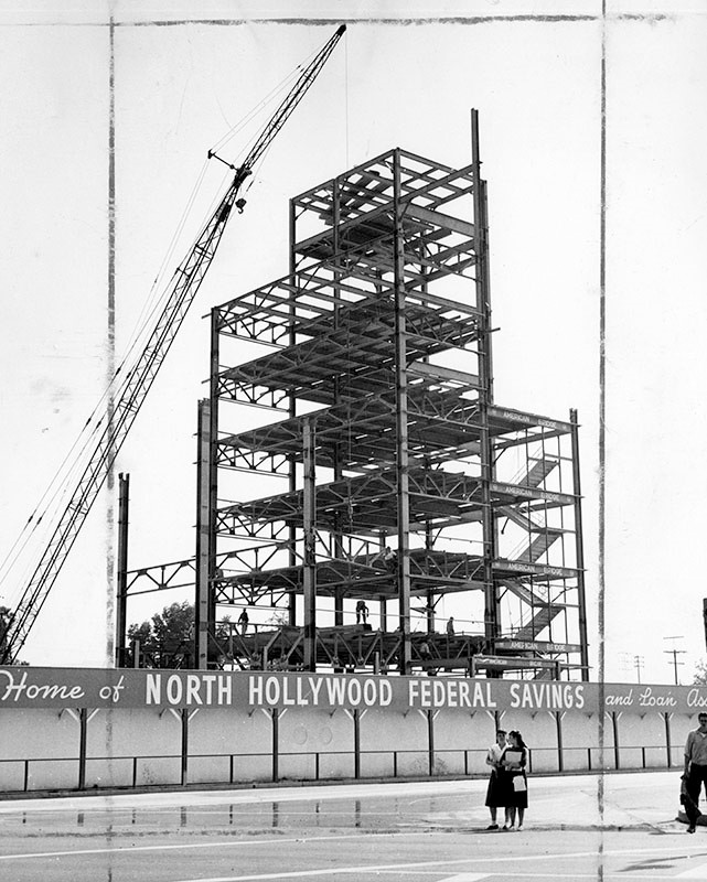
| (1960)* – Valley Times photograph caption dated May 25 1960 reads, "Steel framework of the largest office building ever erected in San Fernando Valley, reaches the eight story mark. Shown here is about half the steel skeleton for North Hollywood Federal Savings and Loan Association's new home office at Riverside Drive and Lankershim Boulevard. Giant crane at left hoists individual steel girders weighing as much as five tons." |
 |
|
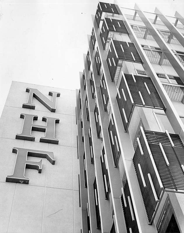
| (1961)* - Photograph article dated April 4, 1961 partially reads, "A new dimension is being added to the San Fernando Valley - height. This is highlighted today with the completion of the area's first skyscraper by North Hollywood Federal Savings and Loan Association. North Hollywood Federal's structure stands as a towering monument to this new era at the corner of Lankershim Boulevard and Riverside Drive. The modern facility rises eight stories and contains 73,810 square feet of floor space to add new prominence to the North Hollywood business district." North Hollywood Savings building is the tallest structure completed in the Valley to date. |
Historical Notes Today, the 36-story 10 Universal City Plaza Building in Universal City (built in 1980) is the Valley’s tallest building. |
 |
|
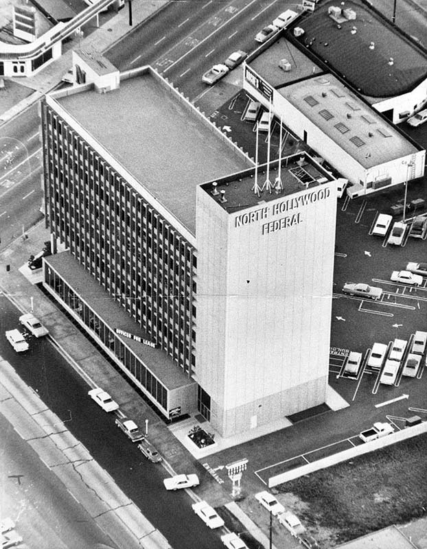
| (ca. 1962)* – Aerial view showing the North Hollywood Federal Savings and Loan, located at 4455 Lankershim Blvd. and the corner of Riverside Drive adjoining Ventura Freeway in North Hollywood. A large sign reading "Offices for lease" can be seen atop a portion of the building. Today the building is occupied by Chase Bank. Click HERE for contemporary view. |
 |
|
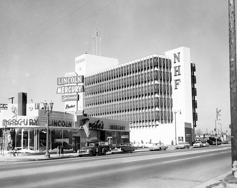
| (1961)* – Street view showing the North Hollywood Federal Savings and Loan Association building, looking at the block between Landale St. and Riverside Dr. A man can be seen painting the windows of the Comet, Lincoln, Mercury, Continental, Roche's automotive building on the corner. Today, that building is occupied by North Hollywood Toyota and the NHF building is occupied by Chase Bank. Click HERE for contemporary view. |
Hody's Coffee Shop and Drive-in
 |
|
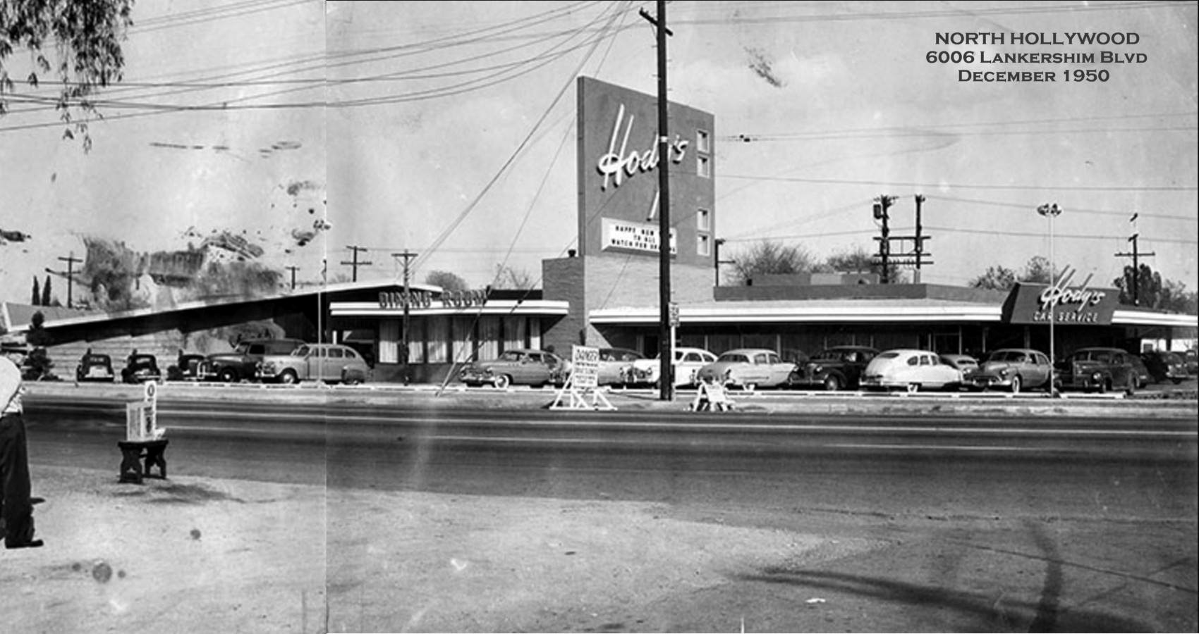
| (1950)^ - Photograph caption reads: "This is the new $400,000 Hody’s Restaurant at 6006 Lankershim Blvd - Unique interior finishing and decorations, including Sequoia Room, called outstanding in modern restaurant design." Photo courtesy of Rich Krugel |
Historical Notes In 1949, restaurateur Sidney Hoedemaker of the Pig 'n' Whistle - Melody Lane chain founded Hody's Restaurant Inc. Hoedemaker's restaurants were all about service, efficiency, cheerfully and courtesy. One was always greeted with a smile. Hody's was a family restaurant. Kid's would get a kid's clown menu that could be worn on their face. |
 |
|
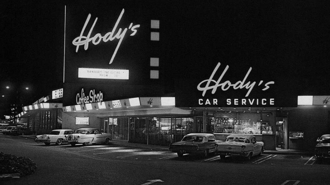
| (1961)^ – Night view showing Hody’s Coffee Shop and Drive-In located at 6006 Lankershim Boulevard in North Hollywood. |
Historical Notes By 1969 there were 8 Hody restaurants in Southern California. The most famous Hody's was located on the N/W corner of Hollywood and Vine. Click HERE to see more. |
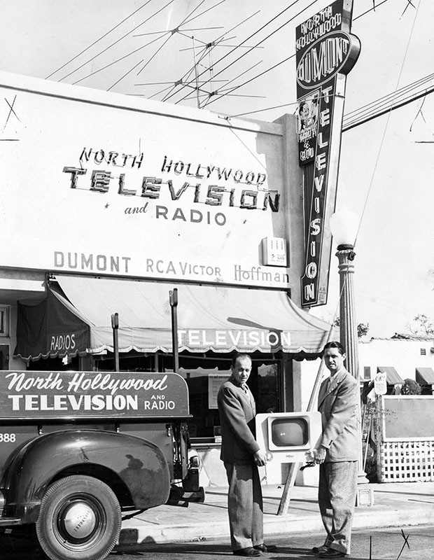
North Hollywood Television
 |
|
| (1950)* - Valley Times photo caption reads "Marty Faust and Rod Boutelle, co-owners of North Hollywood Television store, prepare to deliver another TV set to one of their customers. After three years of operation the store is one of the largest retail television stores in Valley." The store was located at 11413 Moorpark Street in North Hollywood. |
 |
|
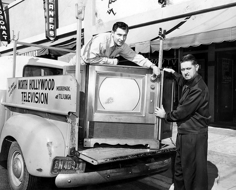
| (1955)* - Rod Boutelle, right, owner of North Hollywood Television, helps load a Packard-Bell color TV set on delivery truck as he prepares to observe his seventh anniversary at his North Hollywood location, Moorpark at Tujunga. Assisting him is Ralph Voit, service manager." |
Historical Notes Packard Bell was founded in 1933, in Los Angeles. It had a reputation for making excellent radios and supplied electrical equipment to the government during World War-II. It got into the television marketplace in 1948 and remained there until the company was sold in 1974.* The first national color broadcast (the 1954 Tournament of Roses Parade) occurred on January 1, 1954. |
Tommy's Restaurant (North Hollywood)
 |
|
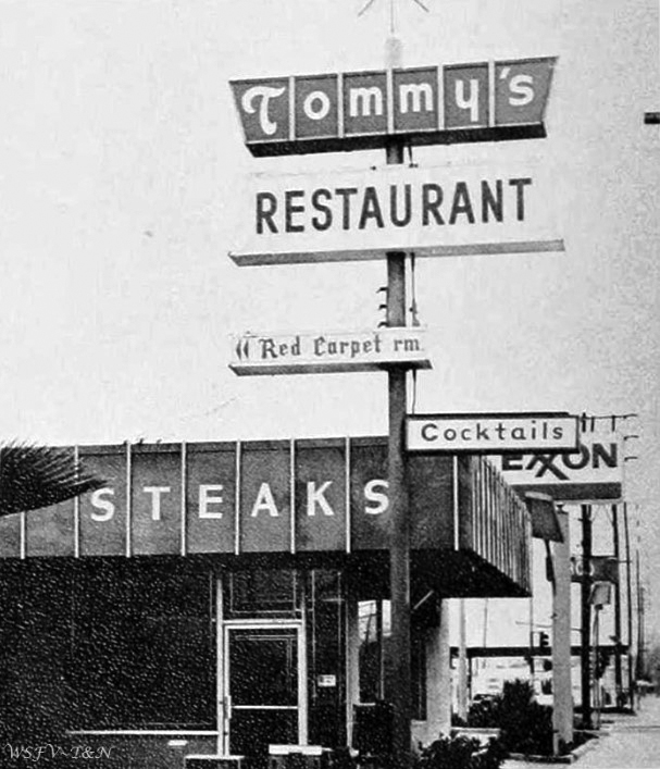
| (1975)^ – View showing Tommy's Restaurant (not the hamburger chain) located at 6343 Vineland Ave, North Hollywood. Photo courtesy of Keith Hart |
Historical Notes Established in 1947, this restaurant, owned by brothers Tommy and Bill Seletos stood the test of time, and stayed here for a few decades. It was a popular local spot, remembered for steak & potatoes, and its Red Carpet Cocktail Room, which was added in 1962. The building today is occupied by a car rental agency. Click HERE for contemporary view. |
Drive-in Church Service (North Hollywood)
 |
|
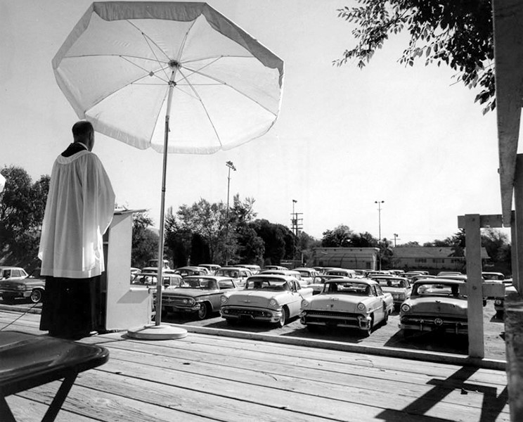
| (1965)* - View showing a Drive-In Church Service at 11919 Oxnard Street in North Hollywood. |
Historical Notes The Emmanuel Lutheran Church’s Summer Sunday Drive-In Service started around 1948 and was touted by the church as the first of its kind in the U.S. Over the span of a couple of decades, the service started at 8:15 a.m. The average number of attendees were around 200 with many children still clad in their pajamas and adults wearing casual clothes. Ushers would go from car-to-car with their offering baskets.^ |
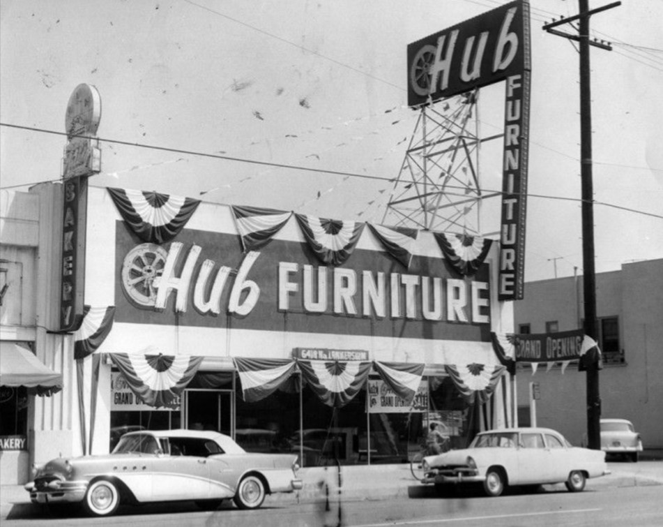
Lankershim and Victory
| (1961)* - View looking north on Lankershim at Victory in North Hollywood. Several furniture stores can be seen including Hub Furniture on the right and Halls' Furniture on the left (NW corner). Note the 1959 Chevrolet Impala coupe at right. |
 |
|
| (1956)* - Photograph caption dated May 20, 1956 reads, "Hub opens North Hollywood store - Newest addition to chain of Hub Furniture Stores is this one at Lankershim and Victory boulevards in North Hollywood. It features complete line of modern, maple and provincial furniture from leading factories throughout country." |
 |
|
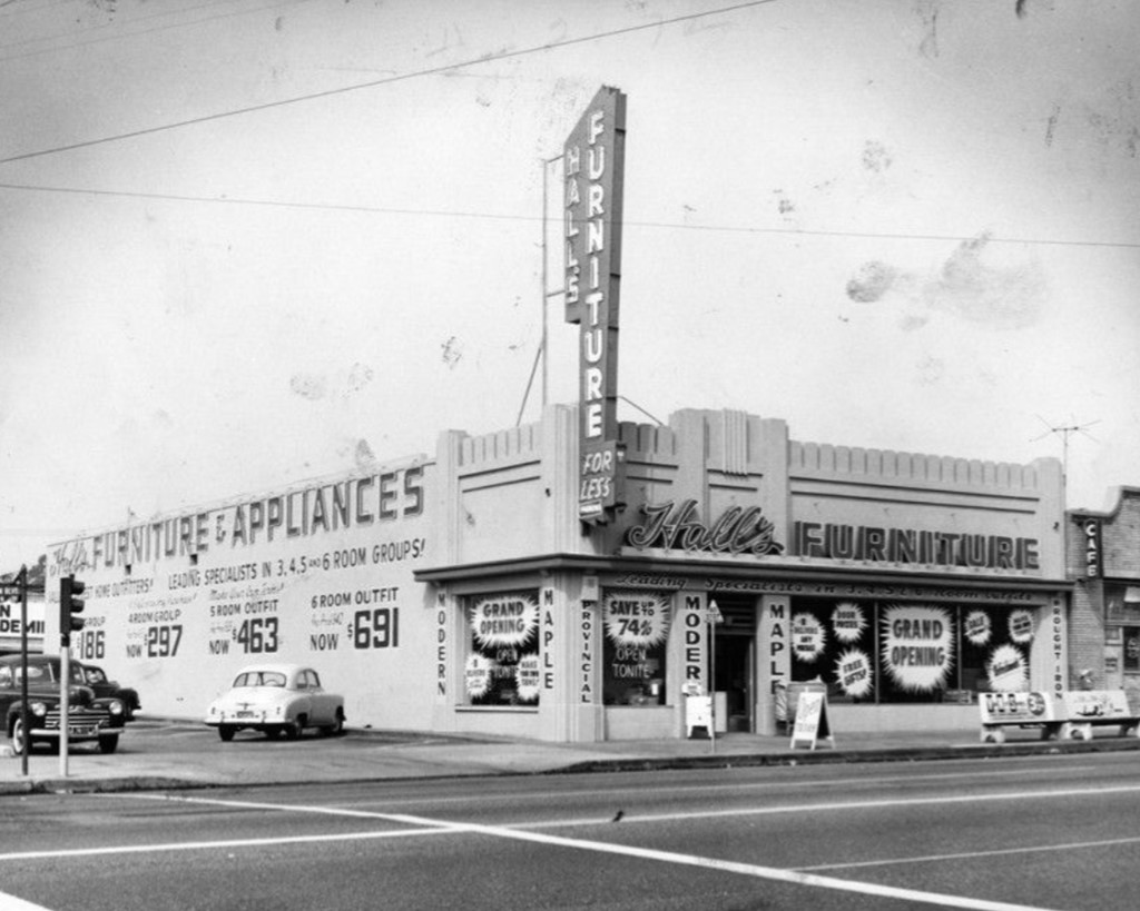
| (1955)* - Photograph caption dated October 1, 1955 reads, "A four-day grand opening celebration is going on this weekend at Hall's Furniture and Appliance Co. store at Lankershim and Victory boulevards, North Hollywood. Owners Harry Hall and David A. Fryer are giving away door prizes, free gifts and refreshments to all Valley visitors." |
 |
|
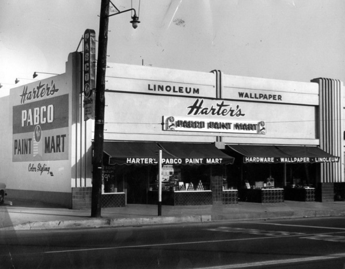
| (1950)* - Photograph caption dated January 31, 1950 reads, "The Paraffine Co., manufacturers of Pabco Paints, announces its award of a 'Pabco Paint Mart' franchise to Harter's of 6428 Lankershim Blvd. (between Victory and Hamlin), in Victory Center. Harter's Pabco Paint Mart is independently owned and operated by Morris F. Harter, Sherman Oaks builder and real estate man, and his son, Glenn Harter. Both father and son have a wide experience in the paint and hardware field, having formerly owned and operated the Sherman Oaks hardware store for five years. Glenn Harter will manage the new store which will stock a complete line of Pabco Paints and Craftsmen finishes as well as a complete stock of builders' hardware, wallpaper and linoleum. The store is one of the largest of its kind in the Valley." |
Then and Now
| Then and Now - Looking north on Lankershim at Victory in North Hollywood. Photo comparison by Trey Callaway* |
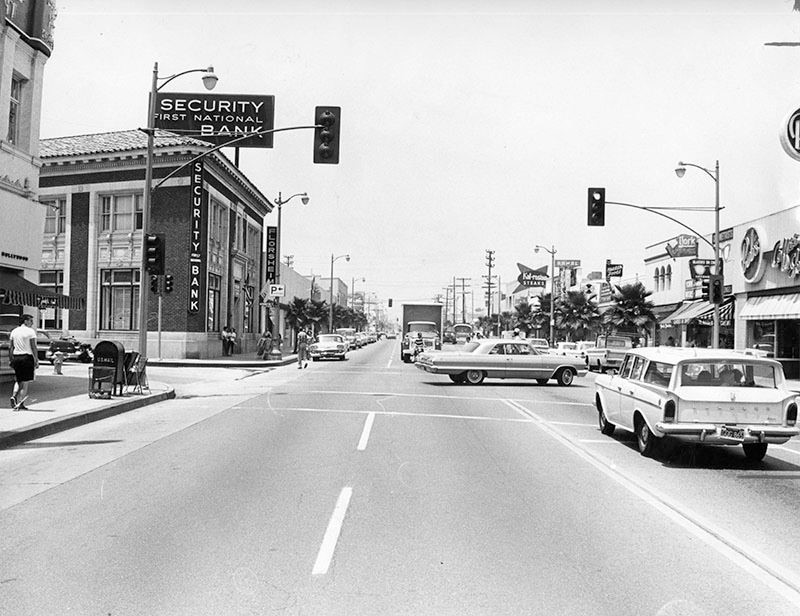
Lankershim near Weddington
| (1964)* - View looking north on a well-decorated Lankershim Boulevard during the holiday season. On the left ahead can be seen the El Portal Theatre. Also seen is the Security-First National Bank located on the NW corner of Lankershim and Weddington. |
 |
|
| (1965)* - View looking north on Lankershim Blvd at Weddington St in North Hollywood. A 1963 Chevrolet Impala Coupe is making a left turn onto Lankershim Blvd while a Rambler station wagon is stopped at the light. You can see Bob's Coffee Shop on the right and the Security-First National Bank on the left (now The Federal Bar). |
Historical Notes The bank building on the northwest corner is on property that was once the Fred Weddington homestead. The Weddington family established the Bank of Lankershim in 1910 which later became part of the Security Pacific chain. The same bank building is now occupied by the Federal Bar restaurant. |
Then and Now
| (1965 vs 2018)* - Looking north on Lankershim Blvd at Weddington St in North Hollywood with the El Portal Theatre out of view on the left. |
Victory Drive-in Theatre
 |
|
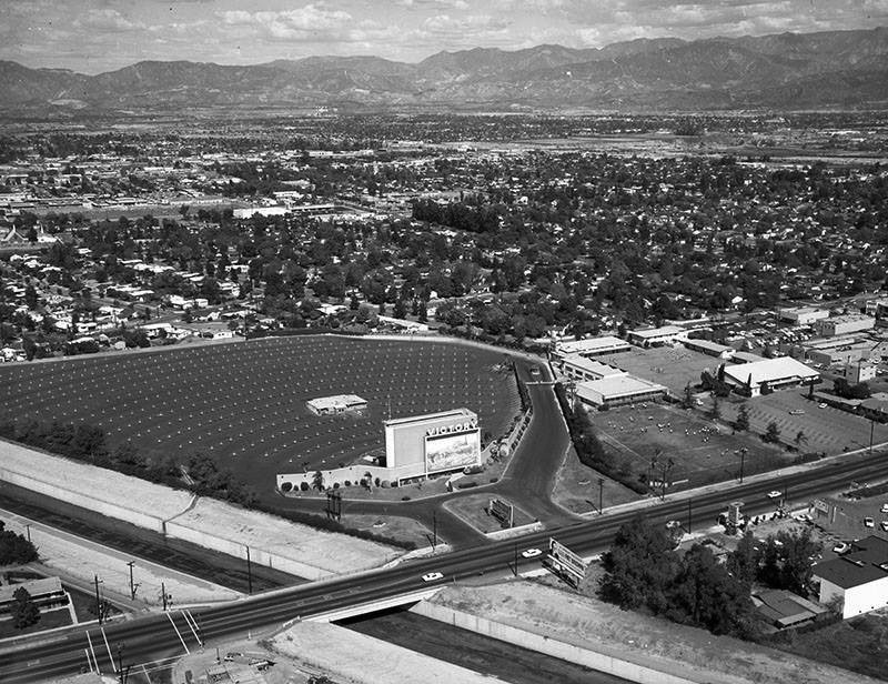
| (1964)* – View looking northeast of the Victory Drive-in located at 13037 Victory Boulevard in North Hollywood. Victory Boulevard can be seen crossing the Tujunga Wash. |
 |
|
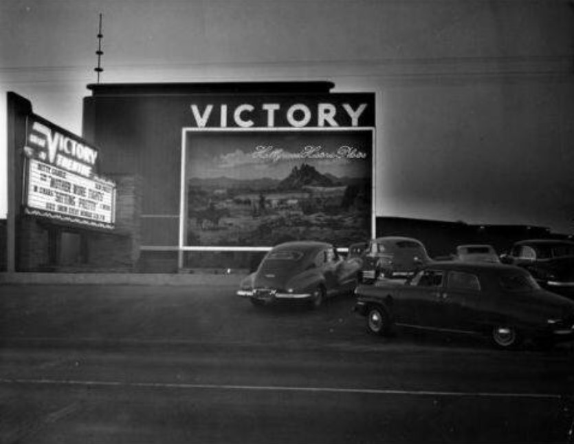
| (1950)*^*# – View showing a line of early model cars waiting to get into the Victory Drive-in Theatre in North Hollywood. |
Historical Notes Opened in 1949, the Victory Drive-in was designed by William Glenn Balch also known for several other drive-ins in the late 1940s including the one located in Van Nuys. The Victory had a capacity for 650 cars and was operated by Pacific Theatres. Many of the Drive-ins that Balch’s firm designed had large murals painted on the screen towers. Victory Drive-in was torn down and replaced with the Victory Plaza Shopping Center. Today the center includes LA Fitness, Vallarta Market, CVS Pharmacy, and Subway Restaurant. |
Reseda Drive-in Theatre
 |
|
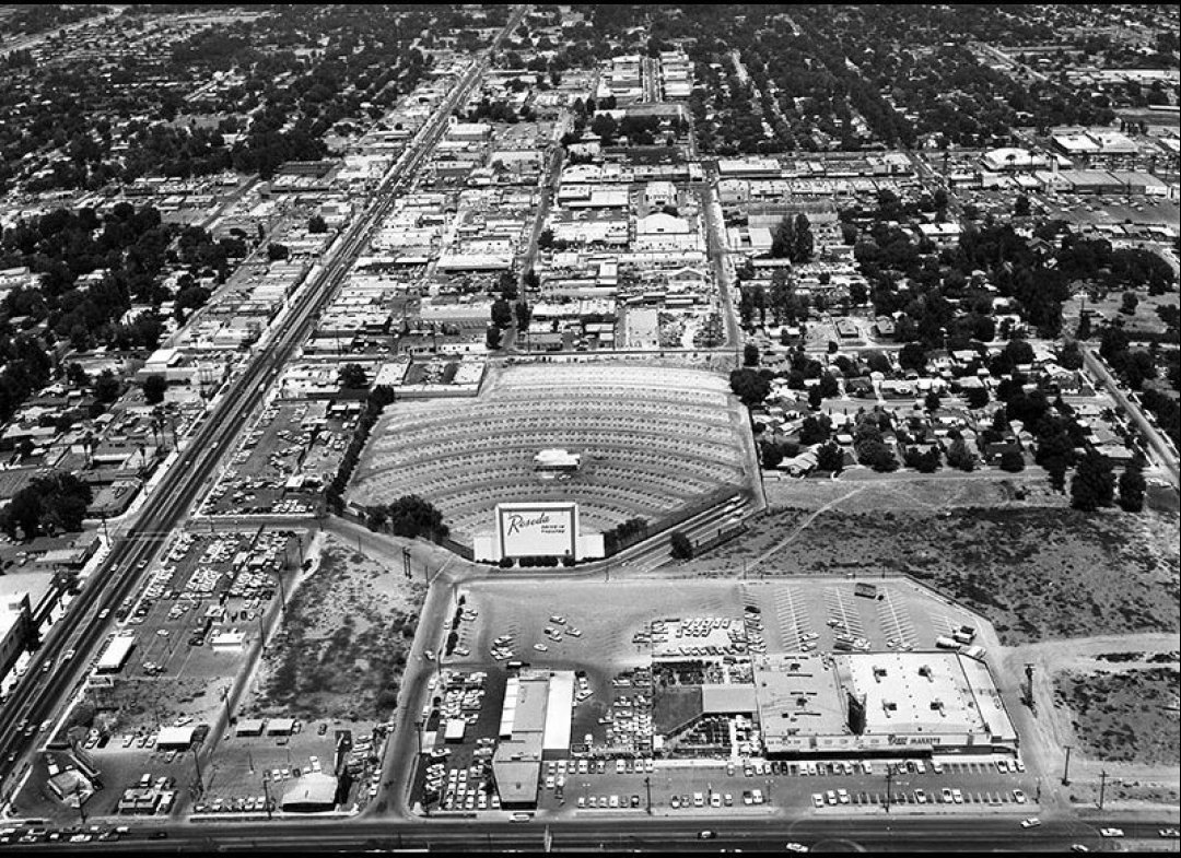
| (1962)* - View looking north of Reseda Boulevard from above Vanowen Street. The Reseda Drive-In Theater is seen on the right just east of Reseda Blvd. |
Historical Notes The Reseda Drive-In was opened on April 7, 1949 by Pacific Drive-In Theatres. It was located just north of Vanowen and east of Reseda Blvd. The theater lasted till the mid-1970’s when it was torn down. The site today is occupied by the Mid-Valley Athletic Club and an industrial park. In 1968, the Reseda Drive-In played host for the location of Peter Bogdanovich’s movie “Target”, staring Boris Karloff.^**^ |
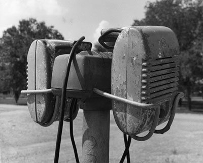 |
(n.d.)^##* - Window-mounted drive-in speakers...one for your car...one for the car on the other side of you. Later systems would transmit the signal through your AM radio.
|
Historical Notes The outdoor theaters reached the zenith of their popularity during the 1950s. Piling the kids in the car made for a cheap family night out, and drive-ins were a favorite hangout for teens who'd recently gotten driver's licenses. The activities of the teenagers prompted another nickname for drive-in theaters — "passion pits." *#^^ |
Vanowen and Tampa
 |
|
| (1973)* - Looking east on Vanowen Street at Tampa Avenue. |
Then and Now
 |
|
| (1973 vs 2022)* - Looking east on Vanowen Street at Tampa Avenue. |
Pump Room Restaurant
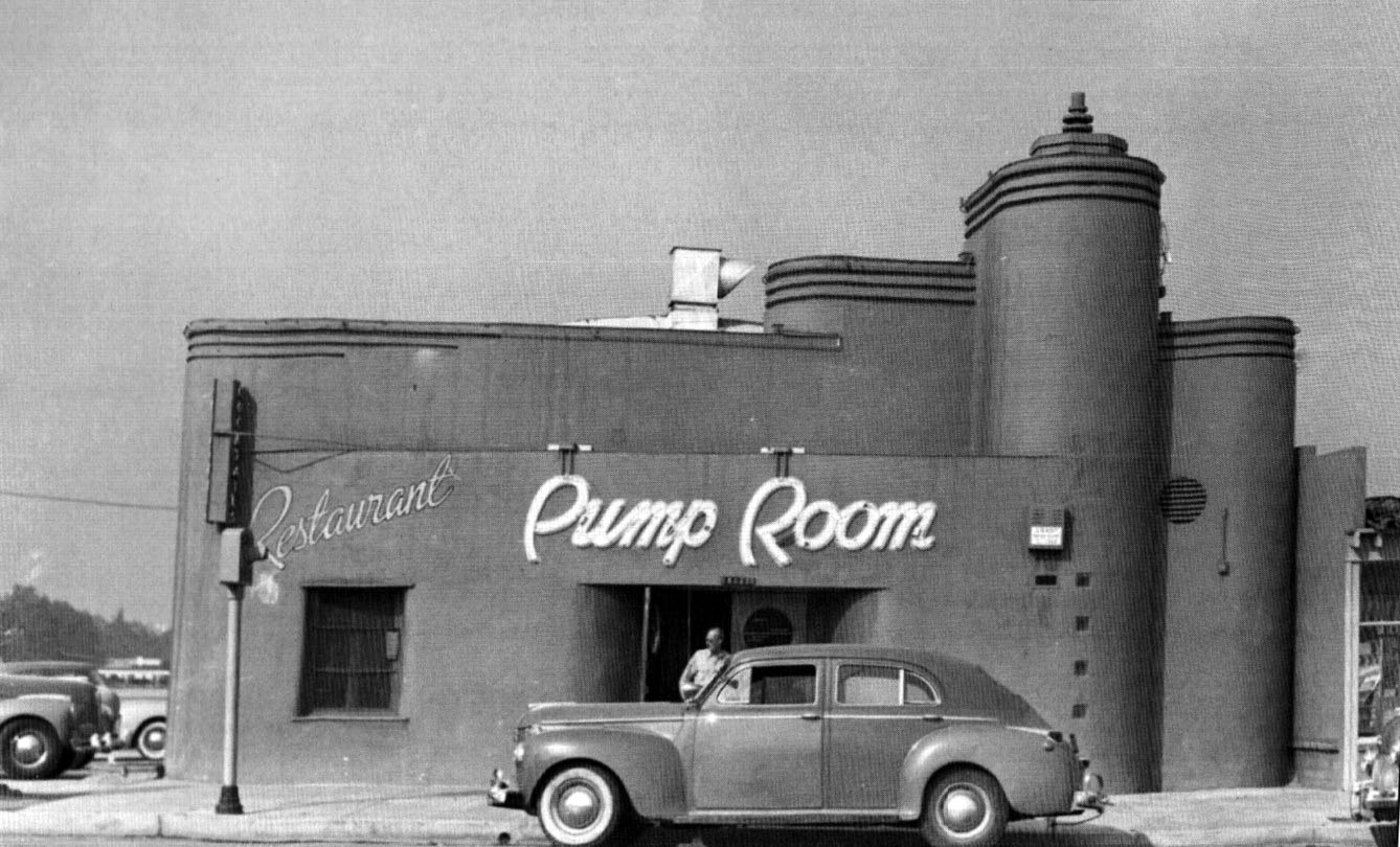 |
|
| (ca. 1945)^ – View showing an early model car parked in front of the Pump Room Restaurant, located at 14445 Ventura Boulevard in Sherman Oaks. A man is seen exitng the restaurant. Photo courtesy of Keith Hart |
Historical Notes In early 1945, Roy Harlow opened a restaurant at 14445 Ventura Blvd, near Van Nuys Blvd, which he named the Pump Room, inspired by the Pump Room in Bath, England. In 1948, Harlow moved the restaurant to 13003 Ventura Blvd, just west of Coldwater Cyn Blvd. For many years, the Pump Room was a popular Valley restaurant, patronized by local residents for parties and meetings. Celebrities and sports stars were often seen here. In a quote from a 1953 news article, “hardly a day goes by without seeing a flock of Rams football players, Hollywood Stars and Los Angeles Angels baseball players in the café." In 1954, Harlow sold the business, leased the premises to the purchaser for ten years, and granted to the purchaser the right to use the name "Pump Room" during the term of the lease. In 1956, this purchaser sold the business and another party operated the business until either late 1956 or early 1957 when the premises were abandoned and closed for a short period of time. Harlow, as landlord, repossessed the premises early in 1957. About this time Harlow found some partners named Bob Waterfield, Bob Kelley, and Don Paul (all sports stars) and re-opened the restaurant in April of 1957. The Pump Room appears to have closed around 1978. In June of 1979, Ali Rabbani opened the Marrakesh at this location. #^*^ |
* * * * * |
_1948.jpg) |
(1948)^ – View showing the intersection of Greenleaf Street and Van Nuys Boulevard in Sherman Oaks after a snow storm. The large snow-covered tree stands on the SW corner. Click HERE for contemporary view. |
|
Historical Notes Click HERE to see more views of Snow in the San Fernando Valley. |
* * * * * |
Ralphs Market |
Ventura and Hazeltine (Sherman Oaks) |
Ralphs Grocery Company has been part of Los Angeles since 1873, when founder George Albert Ralphs opened his first store at Fifth and Hill in downtown Los Angeles after a hunting accident ended his career as a bricklayer. What began as a single neighborhood market grew into one of the largest supermarket chains in Southern California, expanding steadily across the region as the city grew. By the time this Sherman Oaks store opened in 1941, Ralphs had been feeding Angelenos for nearly seven decades and was pushing into the rapidly developing San Fernando Valley. |
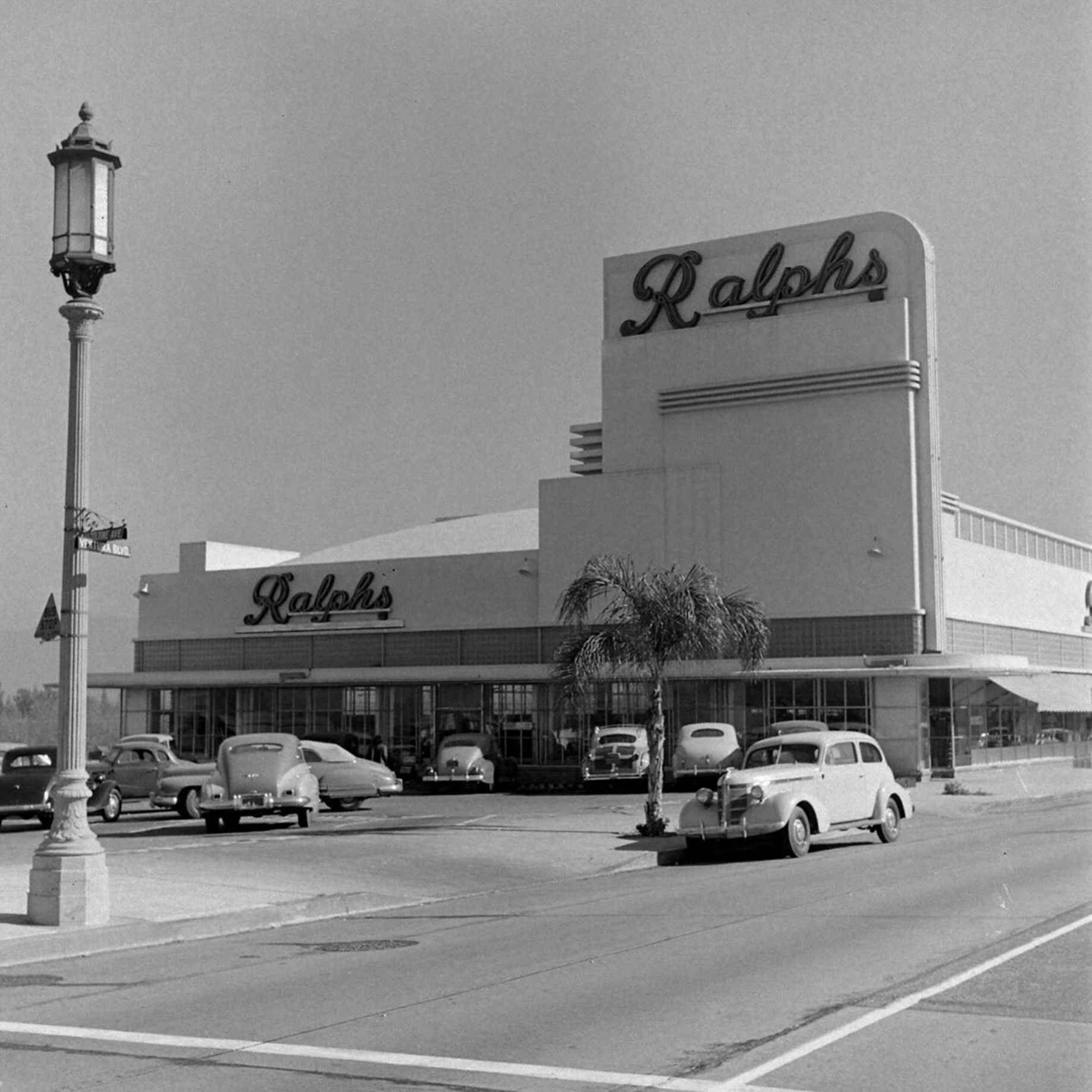 |
|
| (1948)* - The Sherman Oaks Ralphs at the northeast corner of Ventura Boulevard and Hazeltine Avenue. Photo by J.R. Eyerman for LIFE Magazine. |
Historical Notes When Ralphs opened this store in 1941, it was one of the company’s early expansions into the San Fernando Valley, part of a sustained push to follow Los Angeles’ population into the suburbs. The Streamline Moderne building photographed here was designed in the Art Deco style that Ralphs favored for its stores in the late 1930s and early 1940s, a period when the chain employed notable architects to give its locations a distinctive and modern appearance. Ralphs still operates at this corner today, but the building seen here no longer stands. The 1994 Northridge earthquake caused irreparable damage to the structure, and a replacement was built soon after. That version was itself demolished around 2012 and replaced by the larger Ralphs Fresh Fare store that occupies the site today, the third iteration of the market at this corner in just over eighty years. |
Then and Now
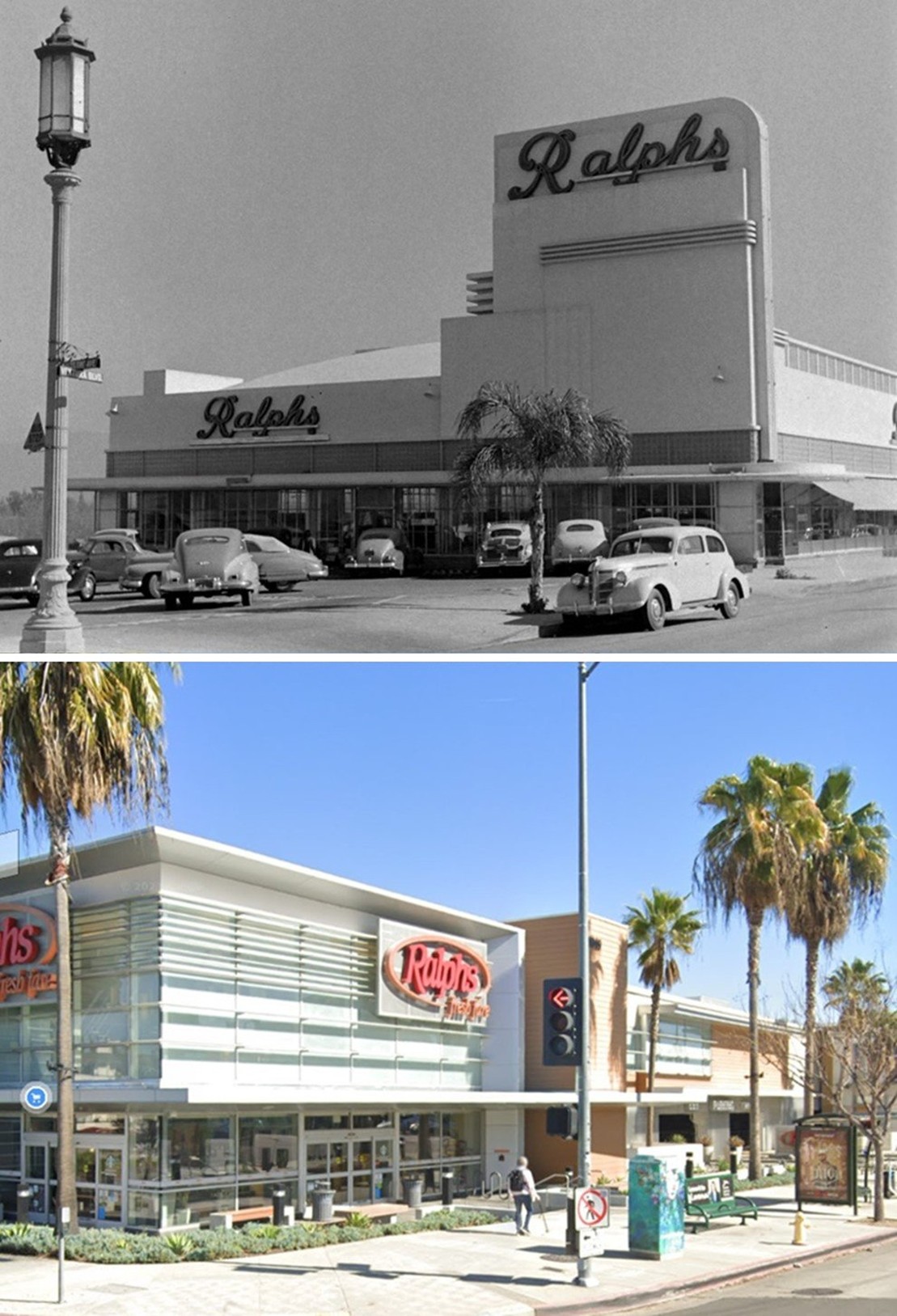 |
|
| (1948 vs 2023)* - The Sherman Oaks Ralphs at the northeast corner of Ventura Boulevard and Hazeltine Avenue. Upper image photo by J.R. Eyerman for LIFE Magazine. Photo comparison by Jack Feldman. |
| Historical Notes
These two views of the same corner, separated by 75 years, show how much the site has changed while the function has remained constant. The 1948 building, with its bold Streamline Moderne facade and prominent Ralphs lettering, reflects the confidence and optimism of postwar commercial architecture. The current store, rebuilt after two previous structures were lost to earthquake damage and redevelopment, is larger and more utilitarian. The palm tree visible in both images is one of the few continuous elements connecting the two eras. |
* * * * * |
Ventura and Van Nuys Boulevards (Sherman Oaks) |
The intersection of Ventura Boulevard and Van Nuys Boulevard has long been one of the commercial anchors of Sherman Oaks. Ventura Boulevard itself follows the route of El Camino Real, the old Spanish road that once connected the California missions, and it served as the primary east-west corridor through the San Fernando Valley long before the freeways were built. By the early 1940s, the corner at Van Nuys Boulevard had become a busy crossroads, and these images trace how it changed across two decades of rapid postwar growth. |
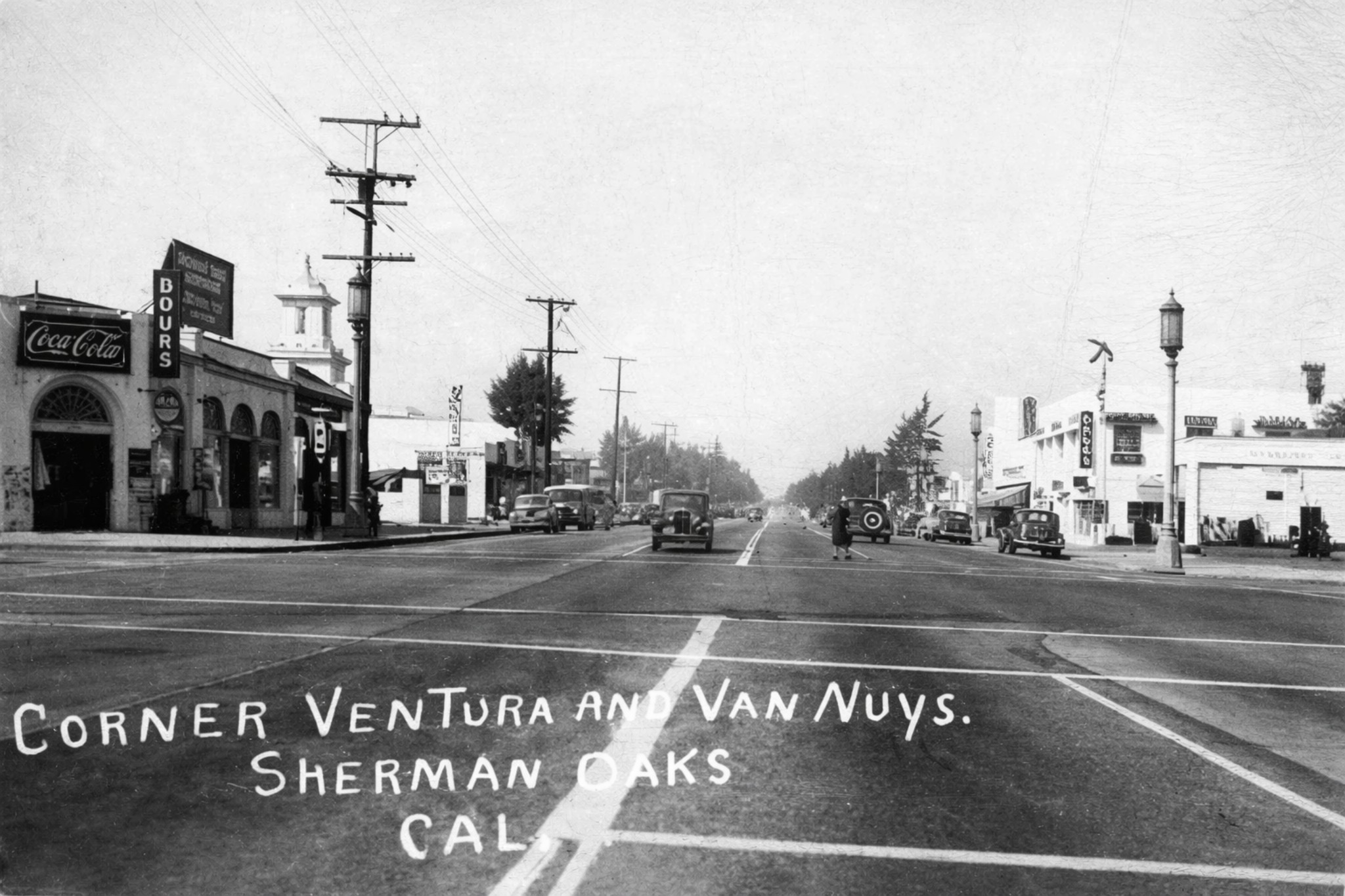 |
|
| (Early 1940s)* - View looking west on Ventura Boulevard at Van Nuys Boulevard in Sherman Oaks. A Standard Oil of California service station occupies the northwest corner. |
| Historical Notes
This early 1940s view shows Ventura Boulevard as Sherman Oaks was beginning its transformation from a semi-rural corridor into a suburban commercial strip. The Standard Oil of California station visible on the northwest corner was part of a network of service stations that spread rapidly across the San Fernando Valley as automobile ownership increased through the late 1930s and into the war years. Standard Oil of California later became Chevron, and a service station continues to operate on or near this corner today. |
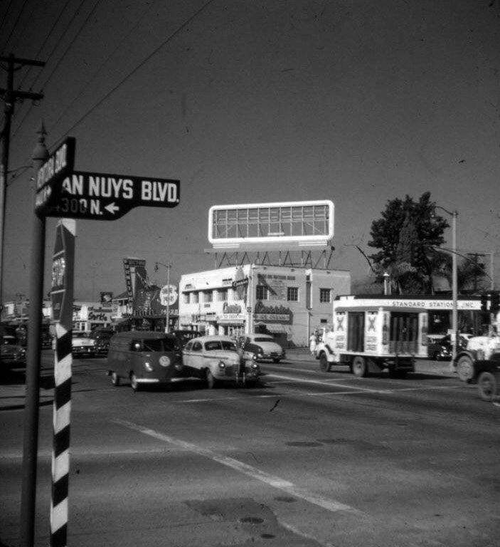 |
|
| (ca. 1955)* - View looking west from the southeast corner of Van Nuys and Ventura boulevards in Sherman Oaks. The Standard Oil station remains on the northwest corner. |
| Historical Notes
By the mid-1950s, Sherman Oaks had become one of the most desirable residential addresses in the San Fernando Valley, and Ventura Boulevard was filling in rapidly with shops, restaurants, and services catering to the postwar population boom. The storefronts visible here reflect the era’s straightforward commercial architecture, built quickly to serve a neighborhood growing faster than anyone had anticipated. The ten years between this photograph and the one taken in the early 1940s saw the Valley add hundreds of thousands of new residents. |
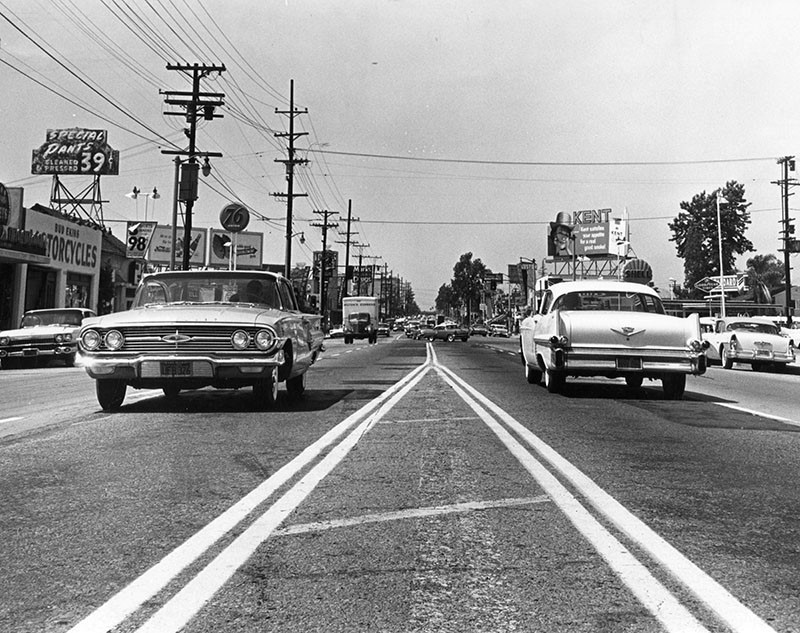 |
|
| (ca. 1959)* - Looking west on Ventura Boulevard toward Van Nuys Boulevard in Sherman Oaks. Heavy traffic, utility poles, and roadside billboards reflect the rapid commercial growth of the corridor. |
| Historical Notes
By the late 1950s, Ventura Boulevard had become one of the busiest commercial streets in the San Fernando Valley, and the intersection at Van Nuys Boulevard was at its center. The billboard clutter and heavy traffic visible in this late 1950s view were a direct consequence of the postwar housing boom that had transformed the surrounding neighborhoods into one of the densest suburban communities in the country. The San Diego Freeway would open nearby in 1960, adding further pressure to an already congested corridor. |
Then and Now
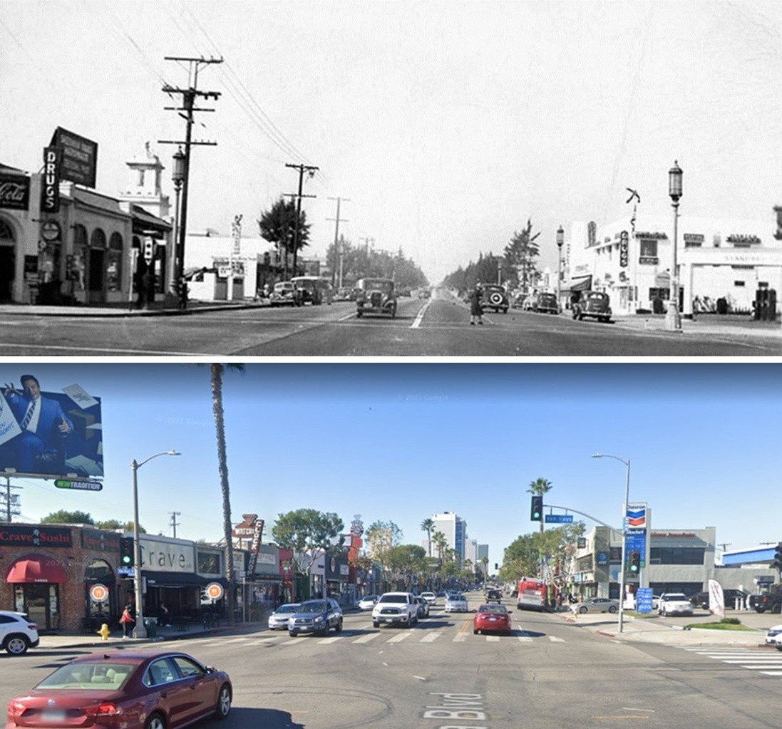 |
|
| (1940s vs 2021)* - Looking west on Ventura Boulevard at Van Nuys Boulevard in Sherman Oaks. Photo comparison by Jack Feldman. |
| Historical Notes
The comparison of these two views, taken roughly eighty years apart, shows the persistent character of this intersection. The road geometry and the northwest corner building footprint are recognizable across both eras, even as the street furniture, signage, and surrounding development have changed completely. Ventura Boulevard remains one of the most traveled surface streets in Los Angeles, carrying much of the same commercial energy it held when the Valley was first growing into the community it is today. |
* * * * * |
Ventura Freeway and Van Nuys Boulevard |
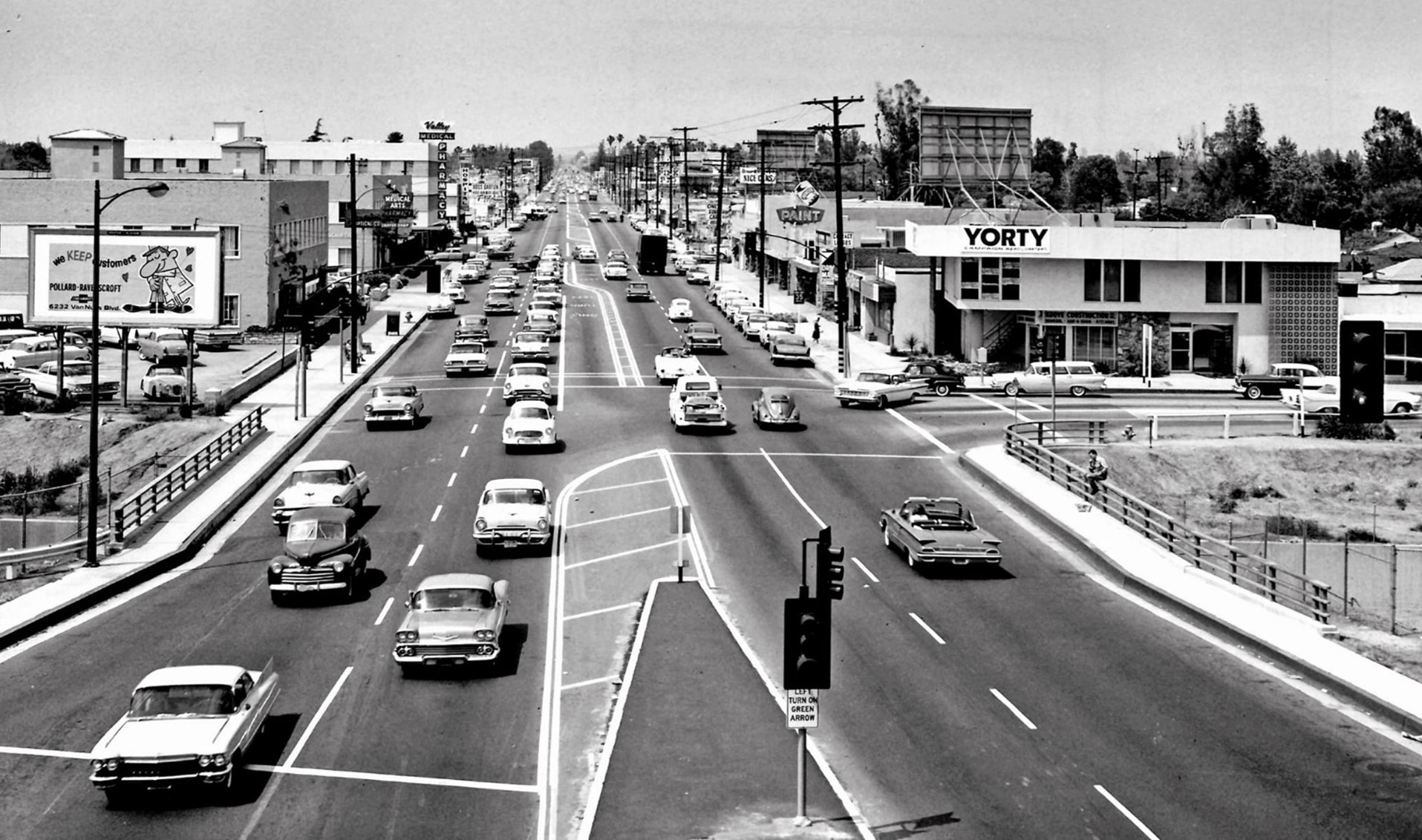 |
|
| (1961)* - Looking north from the Ventura Fwy (US-101) at Van Nuys Blvd in Sherman Oaks; LA River Bridge is at center. (DOH D7 Archives photo, courtesy of Arturo Salazar) |
Then and Now
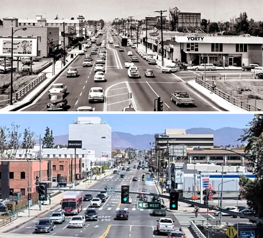 |
|
| (1961 vs. 2021) - Looking north on Van Nuys Blvd from the Ventura Fwy (US-101). Photo comparison by Jack Feldman. |
Wil Wright's Ice Cream (Sherman Oaks)
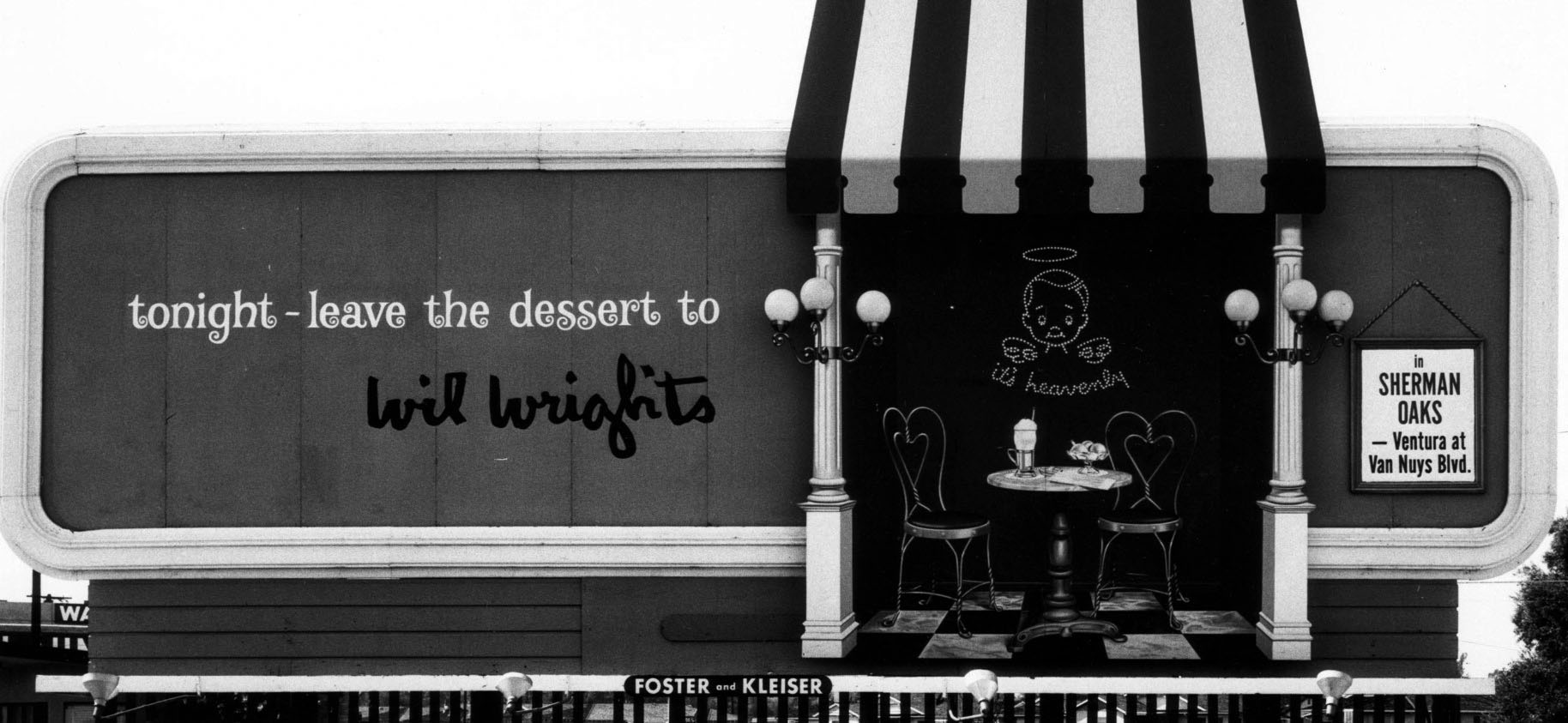 |
|
| (1961)* – Foster and Kleiser Billboard reads “tonight – leave the dessert to Wil Wright’s in Sherman Oaks – Ventura at Van Nuys Blvd.” Duke Library Image Archive |
Historical Notes The slogan 'It's Heavenly!' defined the chain of Wil Wright's fancy, old-style ice cream parlors. The Sherman Oaks location on Ventura Boulevard was a '60s legend. Wil Wright’s was a chain of ice cream parlors that dotted the Southern California landscape up until the mid-seventies. In addition to the Sherman Oaks location, they could be found in Beverly Hills (corner of Beverly Drive and Charleville), Westwood Village (corner of Glendon and Lindbrook), West Hollywood (Sunset Strip), Pacific Palisades (San Vicente), among other spots. They were the perfect place to take a date after the movie. The delicate pink and red decor and little marble tables and wire-frame chairs made you feel like you were seated inside a Valentine’s Day card. |
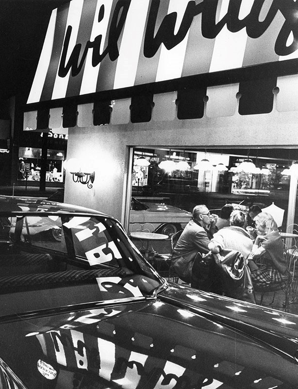 |
|
| (ca. 1960)* - Customers at Wil Wright’s Ice Cream Parlor, located on the NW corner of Ventura and Van Nuys boulevards in Sherman Oaks. |
Historical Notes Sometime in the early '70s, after Wil Wright's tried to add a full menu to compete with the success of Farrell's Ice Old Time Ice Cream Parlors—which were popular with kids and families and had a similar theme to Wil Wright's—the high-end parlor closed, leaving a legacy of rich, buttery tasting ice cream and marvelous macaroons in its wake.^ |
Casa de Cadillac
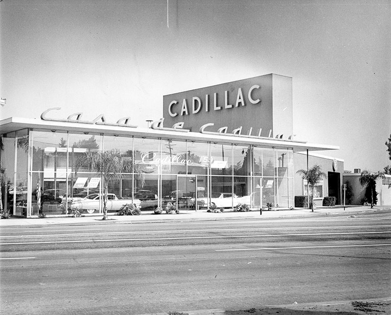 |
|
| (1958)* – View showing Casa de Cadillac, located at 14401 Ventura Boulevard in Sherman Oaks. |
Historical Notes Casa de Cadillac, a car dealership that has been in continuous operation on Ventura Boulevard since 1949, is a well-known landmark of San Fernando Valley Modernism. The building was designed by Randall Duell and Phillip A. Conklin to be Don Lee Cadillac's Valley dealer, and the name soon changed to Casa de Cadillac. Its corner once boasted four other "Casa" businesses, from gas station Casa de Petrol to roadside stand Casa Burger, but today only the dealership remains. Duell was a Hollywood set designer as well as an architect, and his Casa design is certainly cinematic: the showroom's double-height glass windows beckon passers-by to come check out a Cadillac, while the interior's polished terrazzo floor glistens in welcome and a massive vertical stucco slab rises above the roof to announce its brand in white neon block letters.^ Click HERE for contemporary view. |
Casa de Petrol Chevron Station
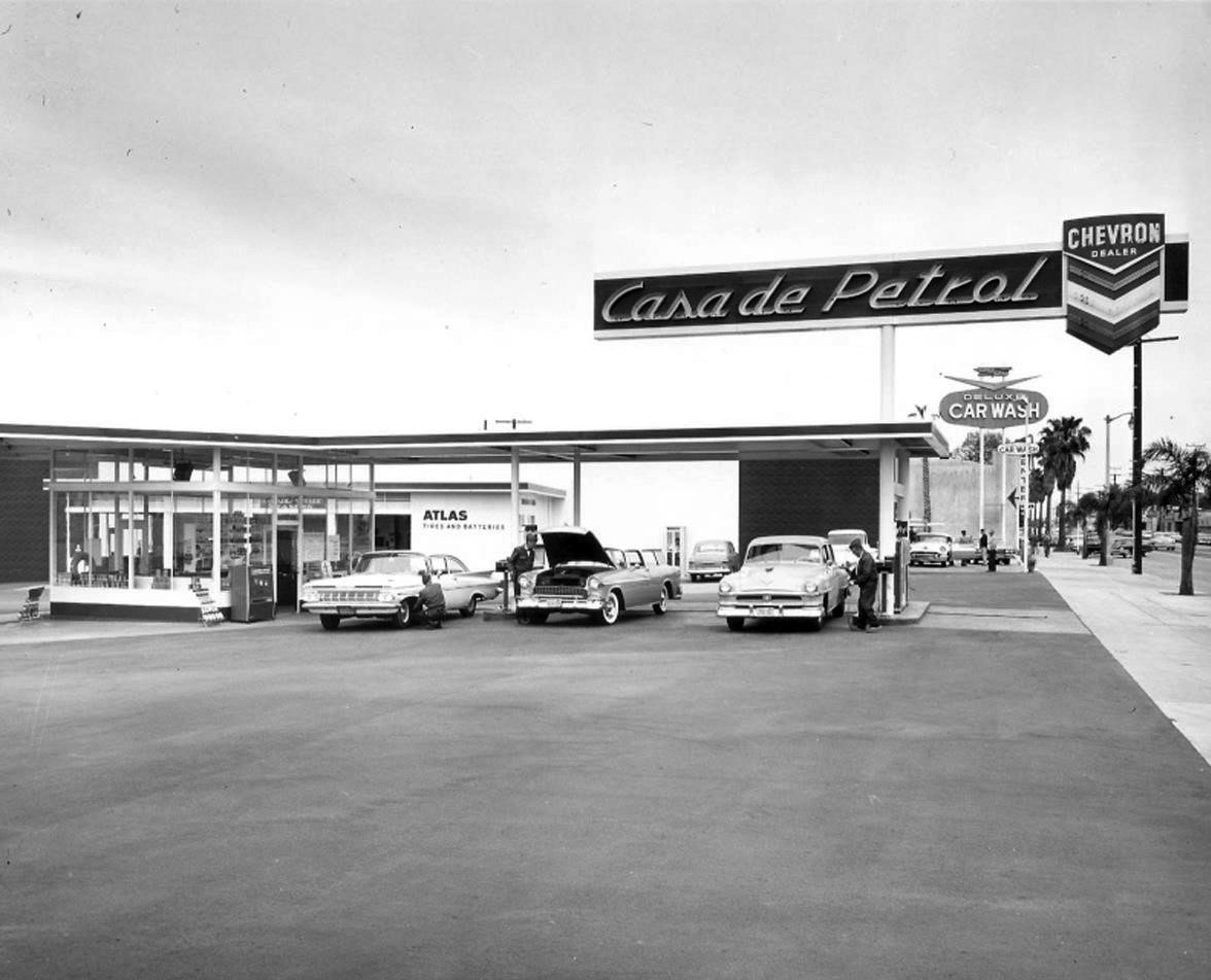 |
|
| (1961)^ - Casa de Petrol located at 14325 Ventura Blvd, Sherman Oaks (NE corner of Ventura Blvd and Tyrone Ave), across the street from Casa de Cadillac. Click HERE to see more Early LA Gas Stations. |
Historical Notes This was where James Dean filled up his Porsche before later meeting his maker in a fatal car accident in 1955. Click HERE to see contemporary view. |
Peppermint Stick Club
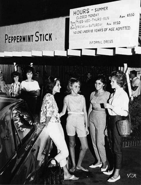 |
|
| (1962)* - The Peppermint Stick Club, located at 15463 Ventura Boulevard in Sherman Oaks, was a popular teenage non-alcoholic nightclub for teenagers. Photo by Julian Wasser. |
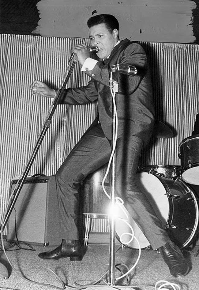 |
|
| (1962)* - Chubby Checker playing the Peppermint Stick Club. |
Historical Notes Photograph caption dated November 29, 1962 reads "Re-opens 'Stick.'" The article partially reads "The king of the Twist, handsome Chubby Checker, helped re-open the redecorated 'young adults' night club, The Peppermint Stick, in Sherman Oaks." |
Van Nuys Blvd
 |
|
| (1975)^x^ - View looking south along Van Nuys Boulevard from just north of Hortense Street in Sherman Oaks. Photo Courtesy of Richard Wojcik. |
Historical Notes A Hughes Market was on the east side of the street in the Sherman Oaks Center. It later became a Ralphs and is now Gelson's. |
 |
|
| (1972)^ - View showing a modern looking Mobil Gas Station located on the corner of Burbank and Van Nuys boulevards. Full service was still offered here. Hughes Market is seen in the background. Photo by Richard McCloskey. Click HERE to see more Early Views of LA Gas Stations. |
Historical Notes Hughes Markets was privately owned and family-operated for 45 years. In the mid-1990s the company was acquired by Quality Food Centers, Inc., a Seattle, Washington-based supermarket chain (but kept the Hughes name). By the late-1990s, many Hughes store locations were sold to Ralphs, which soon was sold to Fred Meyer, before going to Kroger.*^ |
 |
|
| (1970s)^ – View looking southwest on Van Nuys Boulevard. Visible at center is 6211 Van Nuys Boulevard, known at that time as the Van Nuys Hotel. It is believed to have had such boarders as silent film star William S. Hart. This building dates from the 1910s and is still standing today. Click HERE to see contemporary view. |
 |
(1970s)^x^ - These forked three-arm streetlights were chosen in the early 1970's by representatives of the Van Nuys business community to light Van Nuys Boulevard and Magnolia Boulevard. Originally, 1,000 watt mercury vapor lamps were used to provide on average five foot-candles. This turned out to be too bright and too costly from an energy level. Today, these three-pronged electroliers can still can be seen on and around Van Nuys Boulevard. However, the luminaires today are 250 watt high-pressure sodium. |
Four 'n 20 Restaurant & Pie Shop
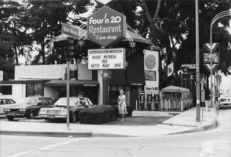 |
|
| (1978)** – View showing the Four ‘n 20 Restaurant & Pie Shop located on the northwest corner of Van Nuys Boulevard and Hatteras Street in Sherman Oaks. Today, this corner is occupied by a car dealership. Click HERE for contemporary view. Photo courtesy of David Burkin |
Historical Notes “Sing a song of sixpence, a pocket full of rye, four and twenty blackbirds, baked in a pie.” So goes the popular English nursery rhyme “Sing a Song of Sixpence.” From this rhyme came the name for a small chain of late 1960s restaurants called Four’n 20 Restaurant & Pie Shop. Like Marie Callendars, Four’n 20 featured pie, with a limited menu of soup, sandwiches, hamburgers, and salads. The chain was created by United Fruit Company in 1969, and was overseen by its Baskin-Robbins division. There were four restaurants in Los Angeles (Encino, Northridge, Sherman Oaks, and Valley Village), two in San Jose, and three in New York. |
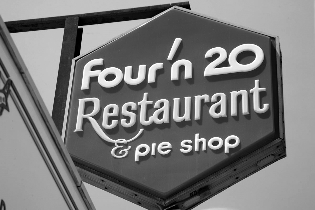 |
|
| (ca. 2017)** - Close-up view of the Four'n 20 sign at the 4723 Laurel Canyon location. |
Historical Notes None of the four original Los Angeles Four ‘n 20 buildings remain, though two of the restaurants relocated and each has incorporated original signage into their new locations: (1) 5530 Van Nuys Blvd., Sherman Oaks; (2) 4723 Laurel Canyon, Valley Village. |
Ventura Boulevard
 |
|
| (ca. 1960)* - Nighttime view looking east on Ventura Boulevard in Sherman Oaks/Van Nuys. Bigg of California’s at 13841 Ventura Boulevard is on the left. Click HERE to see contemporary view. |
 |
|
| (1962)* - Valley Times photo caption reads: It's Shopping Night on Ventura Boulevard! The Ventura Boulevard Merchants Association has declared May 2, 1962 "Shopping Night", with stores stretching the thoroughfare from Laurel Canyon to Fallbrook Avenue open until 9:00 p.m. |
Encino Velodrome
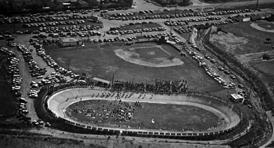 |
|
| (1960s)^ – Postcard aerial view showing the Encino Velodrome located near the intersection of Louise Avenue and Oxnard Street. |
Historical Notes The history of the Encino Velodrome began in 1953 when cycling enthusiasts George Garner, Bob Hansing, Jack Kemp and Charlie Morton started talking about building a new velodrome. Their original idea grew and through the help of friends, local businesses and the Corps of Engineers. Money and materials gradually came together allowing the track to be completed in time for the 1961 racing season. In 1963 the original asphalt surface was replaced with concrete and has remained as such to this day. |
 |
|
| (1961)* - Photograph caption dated May 18, 1961 reads "Bike racers bunch at start in sprint on banked, Olympic-sized Encino track. Pedal-pushers compete every Sunday on the $25,000 oval built by a bike club." The Encino Velodrome is located at 17301 Oxnard Street in Encino. |
Historical Notes The Encino Velodrome was selected to host the National Track Championships in 1965. The success of that single event paid for all prior construction costs. #+# |
 |
|
| (2014)^ – Panoramic view showing riders coming around the turn at Encino Velodrome. |
Historical Notes The oval track is 250 meters in length, has 28 degree banked turns and 15 degree straights. #+# |
Valley Ice Skating Center
 |
|
| (ca. 1960s)^ - View of the Valley Ice Skating Center located at 18361 Ventura Boulevard in Tarzana. |
Historical Notes The Valley Ice Skating Center was owned and operated by Ron and Sheila Priestly, both remarkable figure skaters and show performers of their time. Built in 1960, it was designed by Carl Maston mostly with the help of engineer Richard Bradshaw and had a dome shaped "clamshell" exterior. Maston had never done a project quite like a skating rink before but was knowledgeable of Bradshaw's previous work designing structures to span large spaces. The total construction cost for the completed building was $104,000. Bradshaw, not one to choose a box design when something more exciting could be done for the same price, came up with the creative design and construction process while Maston worked on the more straight-forward front and back elevations. The Tarzana Ice Rink went on to win a Los Angeles Chapter AIA Merit Award. ("Honor Awards Given by A.I.A." Los Angeles Times, October 16, 1960). ^ |
 |
|
| (ca. 1960s)^ – Interior view of the Valley Ice Skating Center in Tarzana. |
Historical Notes Owner and skating legend Ron Priestley served as president of the Tarzana Chamber of Commerce and he was an influential figure in the Ice Skating Institute of America (ISIA) which had been founded in 1959 to promote recreational skating. The Valley Ice Skating Center was demolished in the 1970s to make room for new development. Today, the land is occupied by the Tarzana Square Shopping Center. Click HERE for contemporary view. |
Reseda Municipal Center - Then
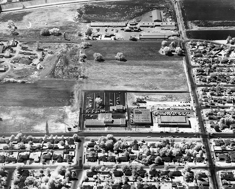 |
|
| (1960)* – Aerial view looing south showing the intersection of Vanowen Street (L to R) and Vanalden Avenue with the new Reseda Municipal Center located on the southeast corner. In front of the large parking area is the recently dedicated West Valley Police Building. Center is the West Valley Branch Library and at the right is the Municipal Center. |
Now
 |
|
| (2016)* – Google aerial view showing the West Valley Municipal Center and surrounding area as it appears today. Randal D Simmons Park is on the left with the LA City Municipal buildings on the right. The complex includes: the West Valley LAPD Station, West Valley Regional Branch Library, and the LA City Council Offices. |
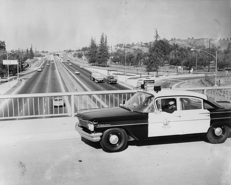 |
|
| (1960)* - View looking east from the Valley Circle overpass of the Ventura Freeway. Photo caption reads: "Under Watchful Eye. Motorists on new Ventura Freeway are now under constant surveillance by such special patrolmen as James Murphy, who sit in new high-speed West Valley police car. Specially equipped Pontiac is designed to bring "death" to speeding before speeders literally kill themselves." Freeway exit sign reads: Mulholland |
Historical Notes Known as the Freeway Flyers. They used suped-up Pontiacs and Oldsmobiles on the city freeways until the CHP took over patrol duties around 1968. The 101 Freeway from Ventura to its intersection with the Hollywood Freeway in the southeastern San Fernando Valley (the Hollywood Split) was built in the late 1950s and opened on April 5, 1960. East of the Hollywood Freeway intersection, it is signed as State Route 134 which was built by 1971. |
* * * * * |
Ventura Blvd at Topanga Canyon Blvd, Woodland Hills |
Ventura Boulevard has served as the commercial spine of Woodland Hills since developer Victor Girard subdivided the area in the 1920s and marked its western entrance with grand gates at Topanga Canyon Boulevard. The postwar boom of the late 1940s and 1950s brought thousands of new residents to the surrounding neighborhoods, and by 1962 the boulevard had matured into a busy commercial strip along its south side. The north side of Ventura near Topanga Canyon was still largely undeveloped open land at that time, and it would not fill in with commercial development until well into the 1960s and beyond. |
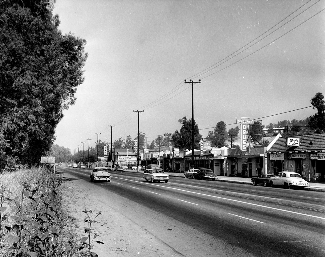 |
|
| (1962)* – View of Ventura Boulevard looking east from Topanga Canyon Boulevard. |
Historical Notes The above photo appeared in the Valley Times in 1962 with this caption: “The combination of country living and city convenience at Woodland Hills in the San Fernando Valley is demonstrated by this view of Ventura Boulevard on June 22, 1962. The view looks east from Topanga Canyon Boulevard.” The storefronts on the south side of Ventura represent the kind of neighborhood retail that followed the postwar residential boom into communities like Woodland Hills. Ventura Boulevard had served as the main commercial artery through the western San Fernando Valley since the early days of subdivision, and the intersection at Topanga Canyon Boulevard was one of its most recognized landmarks, going back to the elaborate entrance gates that Victor Girard built there in the 1920s. |
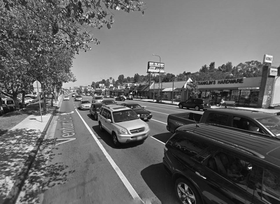 |
|
| (2015)* - Google street view looking east on Ventura Boulevard from near Topanga Canyon Boulevard. Franklin's Hardware Store can be seen across the street. |
Historical Notes Franklin's Ace Hardware anchors the right side of this 2015 Google Street View, one of the most enduring businesses on the south side of Ventura. The north side of the boulevard, once open land, had by this time filled in with the smaller commercial strip visible across the street. The overall character of the corridor had shifted considerably from the quiet neighborhood feel captured in the 1962 photograph. Franklin's Hardware opened in 1952 and has been family owned across multiple generations, currently led by the third generation of the Kurzeka family. Permit records show the building at 21936 Ventura was first recorded as a hardware store in 1968, suggesting Franklin's may have operated at a nearby address during its early years before relocating to its current home. For many Woodland Hills residents, the Franklin's sign has become as familiar a landmark as the mountains behind it. |
Then and Now
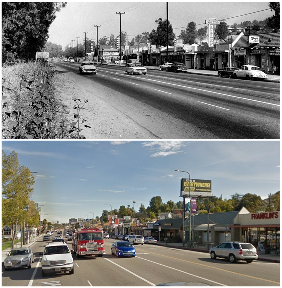 |
|
| (1962 vs 2017)*- Looking east on Ventura Boulevard from near Topanga Canyon Boulevard. Franklin's Hardware Store can be seen across on the right. Photo comparison by Jack Feldman. |
Historical Notes This comparison shows the same stretch of Ventura Boulevard looking east from near Topanga Canyon, 55 years apart. Franklin's Hardware anchors the right side of the modern view just as it has for decades, and the mountains in the background are unchanged. What has changed most visibly is the north side of the boulevard, where open land gave way to a built-out commercial strip over the following decades. Seen top and bottom, the street is busier and more fully developed in 2017, but the south side strip and its familiar anchor remain very much present. Before the building at 21936 Ventura became a hardware store, permit records show it housed a variety of tenants including a beauty shop, a bar, a TV repair shop, a health food store, and a real estate office. Franklin's, which opened in 1952, likely operated at a nearby address before moving here, which would explain why the name has long been associated with this corner even before the permit record begins. |
* * * * * |
|
Ventura Blvd and Kelvin Ave (Woodland Hills) |
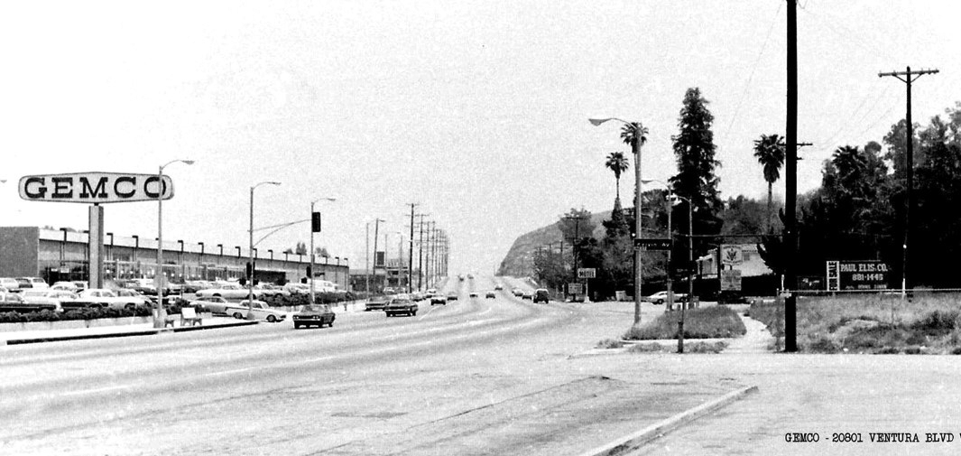 |
|
| (1960s)* – Looking east on Ventura Boulevard toward “Chalk Hill.” Gemco stood at 20801 Ventura Boulevard. Just up the hill were the restaurants Victoria Station and Charley Brown’s. Across the street on the southeast corner is Ridgewood Military Academy, located at Ventura Boulevard and Kelvin Avenue. |
Historical Notes Gemco was first established in Anaheim in October 1959. A year later, the company was purchased by Lucky Stores, which added the supermarket element and expanded Gemco into a chain. Business and profitability continued to be healthy for over 20 years until a series of unsuccessful leveraged takeover attempts were made on its parent company, Lucky Stores. To avoid such hostile takeover attempts, Lucky eventually decided it was best to liquidate Gemco entirely. This liquidation occurred from September to November 1986. Target reopened in most of the former Gemco locations by the fall of 1987, having remodeled many of Gemco’s prime business sites into Target’s red-and-white design. Chalk Hill is the light-colored rise visible in the distance. For decades it served as a familiar landmark for drivers along Ventura Boulevard. During the 1960s and 1970s, the hilltop featured popular restaurants such as Victoria Station and Charley Brown’s. As Woodland Hills grew, much of the area around Chalk Hill was reshaped for commercial development, and the roadway was widened to handle heavier traffic. Click HERE to see more early views of Chalk Hill. |
 |
|
| (2022)* - Looking east on Ventura Boulevard at Kelvin Avenue. The new office buildings on the southeast corner now occupy the former site of Ridgewood Military Academy, while the old Gemco building on the north side of Ventura Boulevard is now home to Target. |
Historical Notes Beginning in the late 1980s, this section of Ventura Boulevard saw major redevelopment as Woodland Hills transitioned from a suburban shopping strip to a mixed commercial district. The Ridgewood Military Academy property was cleared and replaced with mid-rise office buildings and professional suites. On the opposite side of the street, the former Gemco building was renovated for Target, continuing the corner’s role as a community retail hub. |
Then and Now
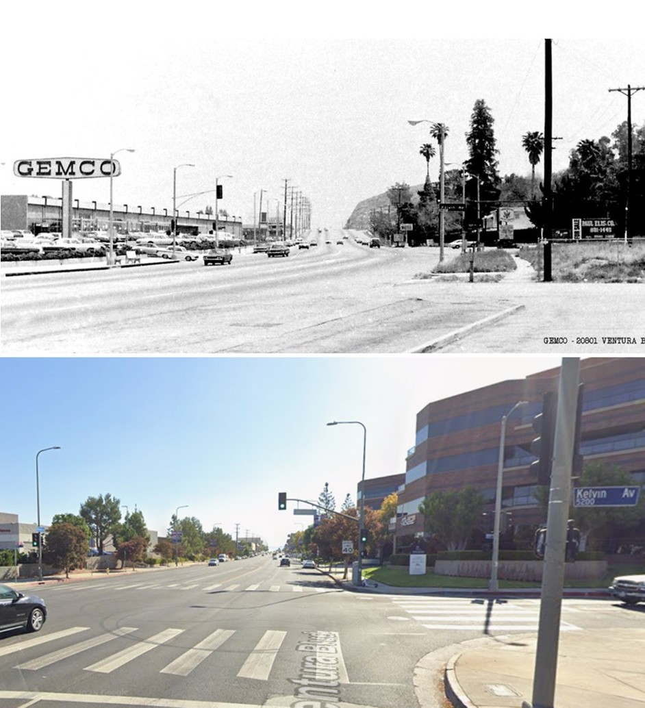 |
|
| (1960s vs 2022)* - Looking east on Ventura Boulevard at Kelvin Avenue. The site once occupied by Ridgewood Military Academy on the southeast corner now features modern office buildings, while the former Gemco building across the street has been converted into a Target store. Photo comparison by Jack Feldman. |
Historical Notes In the 1960s view, Gemco stands prominently on the left side of Ventura Boulevard with Chalk Hill in the distance. Ridgewood Military Academy’s grounds occupied the opposite corner to the right. In the present view, Target occupies the old Gemco site, and office buildings now stand where the academy once operated. The changes reflect Woodland Hills’ steady growth from a quiet suburban community into a major business and retail corridor. |
* * * * * |
Ridgewood Military Academy (Woodland Hills) |
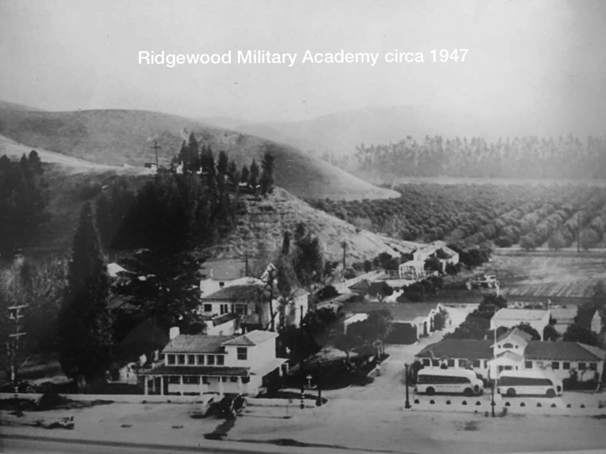 |
|
| (ca. 1947)^ – Ridgewood Military Academy at 20764 Ventura Boulevard. Kelvin Avenue is just out of frame to the right. Chalk Hill appears at left. Click HERE for contemporary view. |
Historical Notes Ridgewood Military Academy opened in 1942 and remained in operation until 1981. It was a private boys’ school emphasizing military discipline, physical training, and academic preparation. The academy’s buildings and parade grounds once covered the southeast corner of Ventura Boulevard and Kelvin Avenue. After its closure, the property was later redeveloped into modern office structures as part of the commercial growth of Ventura Boulevard. |
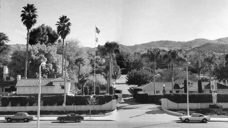 |
|
| (ca. 1980)^ – View looking south toward the front entrance of Ridgewood Military Academy, which once stood on the southeast corner of Ventura Boulevard and Kelvin Avenue. |
Historical Notes By the late 1970s, Ridgewood Military Academy was among the last of Southern California’s small military preparatory schools. Declining enrollment and changing educational preferences led to its closure in 1981. The site was soon cleared, and new commercial buildings took its place, reflecting the rapid transformation of Woodland Hills during the 1980s and beyond. |
* * * * * |
Valley Music Theatre (Woodland Hills) |
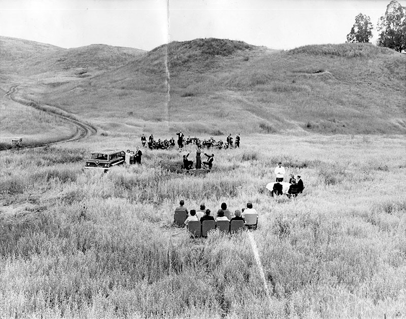 |
|
| (1963)* – View showing the Valley Symphony Orchestra on the site of the future Valley Theater Center at 20600 Ventura Boulevard in Woodland Hills. Musical star Janet Blair, flanked by two men, stands on a platform in the center. The photo was used to raise awareness (and money) for a new theater in the round, which was completed the following year. |
Historical Notes Photograph caption dated May 30, 1963 reads: “Here, on the south side of Ventura Blvd. between Winnetka and Canoga Aves., in Woodland Hills, is where the $1,000,000 theater-in-the-round will be built -- in time, it's hoped, for a 1964 start for the 20-week summer season of musical comedies with such already-committed stars as Miss Blair, Gordon and Sheila MacRae and John Raitt. |
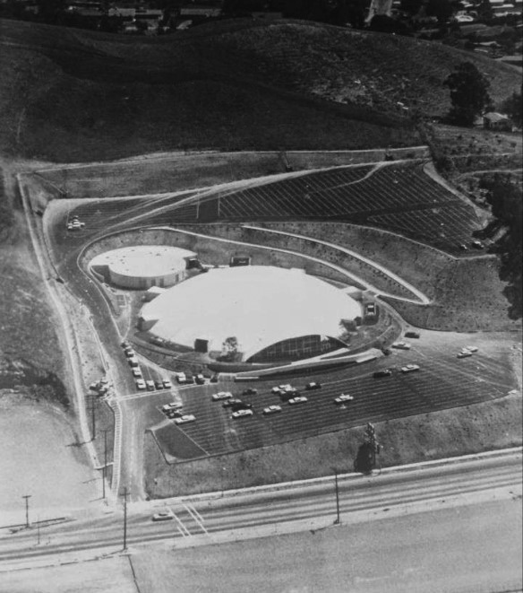 |
|
| (1960s)* - Aerial view showing the Valley Music Theatre on Ventura Boulevard between Winnetka and Canoga. |
Historical Notes The Valley Music Theater was built in 1963, as a concrete shell structure, by pouring a concrete 'dome' over a rounded hill of soil, then excavating the soil away. The theater project was backed by entertainers Bob Hope and Art Linkletter, along with Cy Warner. |
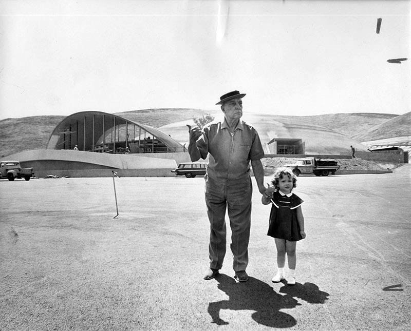 |
|
| (1964)* - Woodland Hills Honorary Mayor, Buster Keaton "hitching a ride" in front of the Valley Music Theater. Photo Credit: Steve Young-Valley Times - Los Angeles Public Library Collection |
Historical Notes The little girl is Melody Holland, the daughter of David Holland, who was the Director of Public Relations for the theater. This photo was taken in 1964 before the opening of "The Sound of Music." Mr. Keaton's last home was in Woodland Hills at 22612 Sylvan Street. |
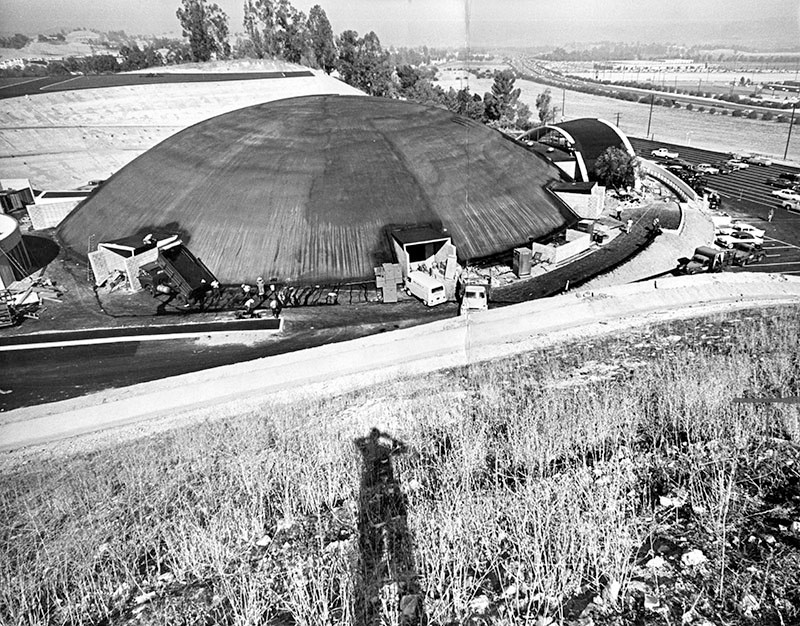 |
|
| (1964)* - Photograph caption dated July 6, 1964 reads, "Workmen are shown putting finishing touches on the Valley Music Theater, which presents its premiere performance Tuesday night when Janet Blair and John Myhers star in Rodgers and Hammerstein's 'The Sound of Music.' The $1.2 million concrete-domed structure occupies an 8.3-acre site at 20600 Ventura Blvd. in Woodland Hills. It seats up to 2,865 persons." |
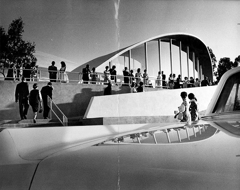 |
|
| (1964)* - Theater debut. Photograph caption dated July 8, 1964 partially reads, "Above, the setting sun catches members of the opening-night audience as they head for entrance of new Valley Music Theater." – Valley Times Collection |
Historical Notes The 2865-seat facility opened July 6, 1964 with The Sound of Music. The first year saw the theater mount 18 musicals, three comedies, a drama, as well as concerts with a combined audience of over 600,000. |
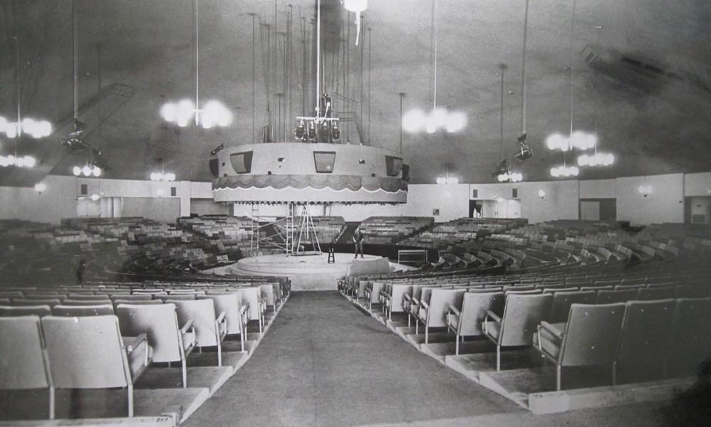 |
|
| (ca. 1965)* - Interior view of Valley Music Theater. This popular venue was located at 20600 Ventura Boulevard, on Chalk Hill, in Woodland Hills. |
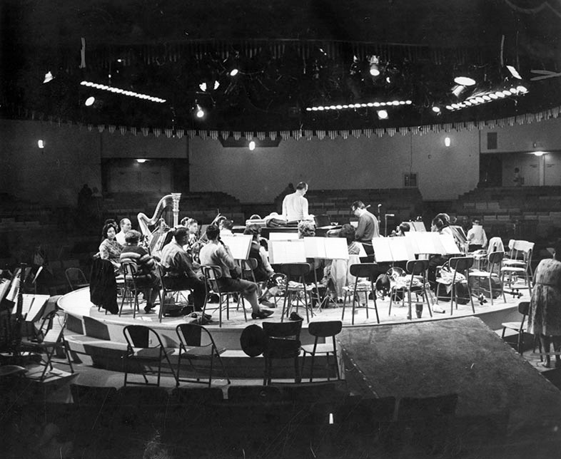 |
|
| (1965)* - Concert-in-round - Photograph caption dated February 25, 1965 reads, "The Valley Symphony's huge orchestra fills stage at Valley Music Theater as musical director James Swift, center, conducts and Steve Allen plays piano at rehearsal for nation's first theater-in-round concert tomorrow night." - Valley Times Collection |
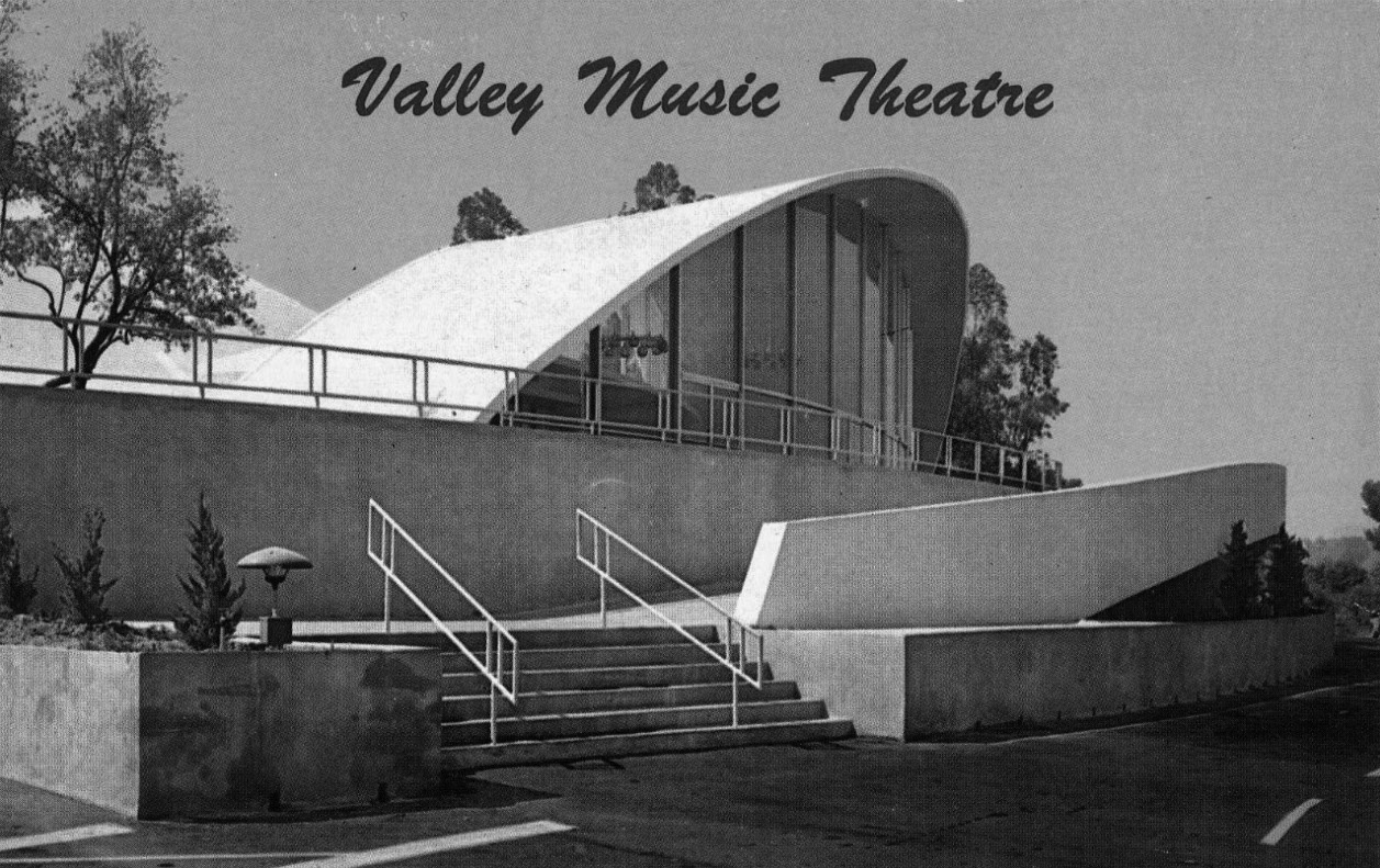 |
|
| (ca. 1960s)^ - View showing the Valley Music Theatre located at 20600 Ventura Boulevard in Woodland Hills. |
Historical Notes Among the performers who appeared at the Valley Music Theater were Sammy Davis Jr., Johnny Carson, Don Rickles, Woody Allen, Ray Charles, Art Linkletter, Robert Goulet, Mitzi Gaynor, Ike & Tina Turner, Peter, Paul & Mary, B.B. King, Lou Rawls, Three Dog Night, Jim Croce, and the Spiral Staircase. The Byrds, Buffalo Springfield, and The Doors appeared there together on February 22, 1967. |
 |
|
| (2004)* - The Valley Music Theater — formerly on Ventura Boulevard and Chalk Hill, in Woodland Hills. Photographed when it was an Assembly Hall of Jehovah's Witnesses. Photo by Scott Mayoral / Wikipedia |
Historical Notes By 1966 the theater began to fall on hard times. Over the years, the fare changed from legitimate theater, to rock concerts, to boxing matches, until in 1980 it became a Jehovah's Witness Regional Assembly Hall. By 2004, the church had outgrown the facility and sold the property, which it had bought for $1 million. |
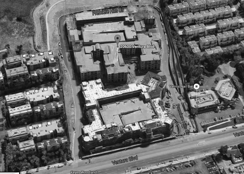 |
|
| (2015)* – Google Satellite View showing construction of the apartment complex (The Boulevard) where the Valley Music Center once stood, 20600 Ventura Boulevard. |
Historical Notes The Valley Music Center site at 20600 Ventura Blvd. now consists of an apartment complex and live + work lofts called "The Boulevard". |
* * * * * |
Ramo-Wooldridge (Woodland Hills) |
Later Thomas-Ramo-Wooldridge (TRW) |
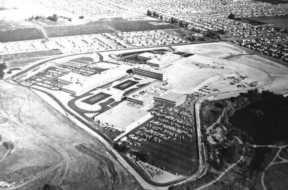 |
|
| (1959)* – Aerial view looking southeast showing the new Ramo-Wooldridge Corporation (later TRW) facility in Canoga Park with Hidden Lake seen on the far right. The intersection at upper-right is Fallbrook and Roscoe, and the hill in upper-left is now Chase Park. |
Historical Notes Two Hughes engineers, Simon Ramo and Dean Wooldridge, had new ideas on the packaging of electronics to make complete fire control systems. Ramo and Wooldridge, having failed to reach an agreement with Howard Hughes regarding management problems, resigned in September 1953. They founded the Ramo-Wooldridge Corporation, later to join Thompson Products to form the Thompson-Ramo-Wooldridge Corporation based in Canoga Park (present day West Hills) with Hughes leasing space for nuclear research programs. The company became TRW in 1965, another aerospace company and a major competitor to Hughes Aircraft. |
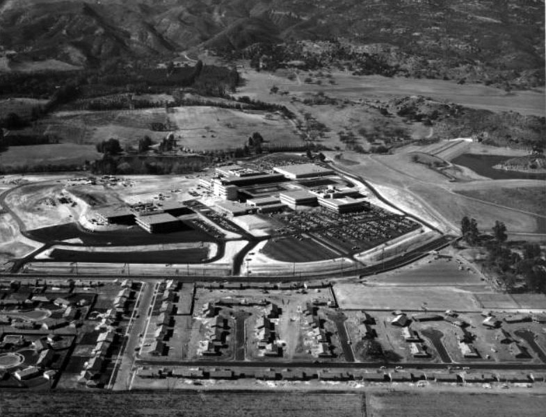 |
|
| (1959)* - Aerial view of the West San Fernando Valley (now West Hills). View is looking west toward the Ramo Woolridge facility with a portion of the Chatsworth Reservoir seen in the upper right. The main street running horizontally from left to right and then slightly curving up is Fallbrook Ave. The street at lower left running up from bottom is Eccles Street. |
Historical Notes Dean Wooldridge retired in January 1962 to become a professor at California Institute of Technology. Simon Ramo became president of the Bunker-Ramo Corporation in January 1964, jointly owned by TRW and Martin Marietta for the production of computers and monitors. Thompson Ramo Wooldridge officially became TRW Inc. in July 1965. |
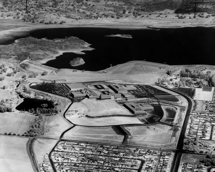 |
|
| (1960)* - Aerial view looking north toward Ramo-Wooldridge & Chatsworth residences. In the background is the Chatsworth Reservoir. The intersection at lower right is Fallbrook and Roscoe (now in West Hills). |
Historical Notes West Hills was originally part of Owensmouth (founded 1912) and renamed Canoga Park (1930). West Hills was formed in 1987 after homeowners on the western side of Canoga Park launched a petition drive a year earlier to form a new community. In an unusual move, the area's L.A. City Councilwoman, Joy Picus, polled Canoga Park residents, asking them if they would like to join the new community, to determine West Hills' boundaries. Today, West Hills is flanked on the north by the Chatsworth Reservoir, on the east by Canoga Park, on the south by Woodland Hills, on the southwest by Hidden Hills and on the west by Bell Canyon in Ventura County. Click HERE to see more Early views of the Chatsworth Reservoir. |
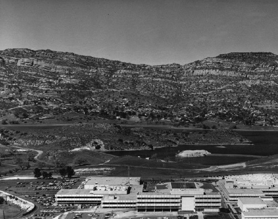 |
|
| (1960)* - Aerial view looking north over the TRW facility toward Chatsworth Reservoir and the Santa Susana Mountains. |
Historical Notes Today, Corporate Pointe business park is located on the property originally developed in 1959 as the Thompson-Ramo-Wooldridge aerospace corporation's new headquarters and later used by Atomics International, Hughes Aircraft, and Raytheon for aerospace development advancements and nuclear research. |
* * * * * |
Rocketdyne Field Laboratory |
(Simi Hills) |
 |
|
| (ca. 1960s)* - View of the Rocketdyne Field Laboratory located in the Simi Hills above the San Fernando and Simi Valleys. The laboratory is nestled in a canyon just northwest of the Chatsworth Reservoir. Two tall metal scaffolding structures with cranes on top can be seen, while several tanks sit on the rocky ground. |
Historical Notes Since 1947 the Santa Susana Field Laboratory location has been used by a number of companies and agencies. The first was Rocketdyne, originally a division of North American Aviation-NAA, which developed a variety of pioneering, successful and reliable liquid rocket engines. Some were those used in the Navaho cruise missile, the Redstone rocket, the Thor and Jupiter ballistic missiles, early versions of the Delta and Atlas rockets, the Saturn rocket family and the Space Shuttle Main Engine. The Atomics International division of North American Aviation utilized a separate and dedicated portion of the Santa Susana Field Laboratory to build and operate the first commercial nuclear power plant in the United States and for the testing and development of compact nuclear reactors including the first and only known nuclear reactor launched into Low Earth Orbit by the United States, the SNAP-10A. Atomics International also operated the Energy Technology Engineering Center for the U.S. Department of Energy at the site. The Santa Susana Field Laboratory includes sites identified as historic by the American Institute of Aeronautics and Astronautics and by the American Nuclear Society. |
.jpg) |
|
| (ca. 1960)* - View of a rocket engine test at the Rocketdyne Field Laboratory in the Simi Hills. A related press release reads: "The isolated laboratory, the most extensive rocket research center in the Free World, is located high in the Santa Susana Mountains 35 miles northwest of Los Angeles. Thousands of pounds of thrust are developed by rocket engines which will power guided missiles for the Air Force, Army and Navy. Engines are anchored in huge steel and concrete test stands where they are 'static tested' to record their thrust and performance." |
Historical Notes During its years of operation widespread use occurred of highly toxic chemical additives to power over 30,000 rocket engine tests and to clean the rocket test-stands afterwards, as well as considerable nuclear research and at least four nuclear accidents, which has resulted in the site becoming seriously contaminated. A long process has been and is still ongoing to determine the site contamination levels and locations, cleanup standards to meet, methods to use, timelines and costs, and completion requirements - all still being defined, debated, and litigated. |
 |
|
| (ca. 1955)* - Photoprint reads: "Battleship" tanks, which simulate the configuration of an Atlas ICBM, feed propellants to the engine being test fired at Rocketdyne's propulsion field laboratory in the Simi Hills. Stands like the one shown are capable of withstanding one million pounds' thrust, transmitting the enormous power of the Rocketdyne liquid propellant engines deep into bedrock. |
 |
|
| (1963)* - View showing a film crew documenting a static rocket engine test at the Santa Susana Rocketdyne faciity. |
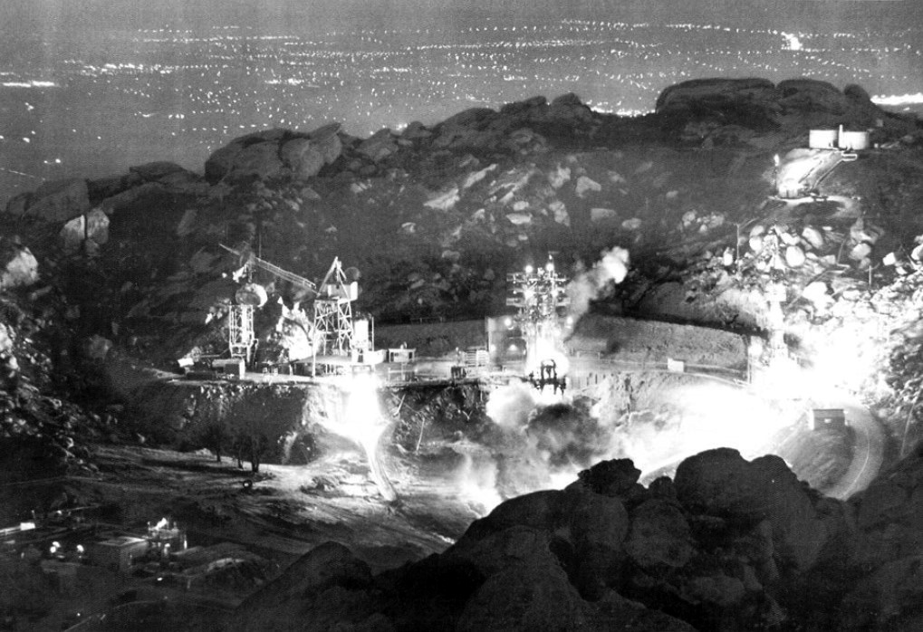 |
|
| (1961)* – Night time engine firing of Rocketdyne’s Santa Susana Field Lab, such as this test on May 21, 1961, regularly lit up the west end of the Valley and could be heard for miles. |
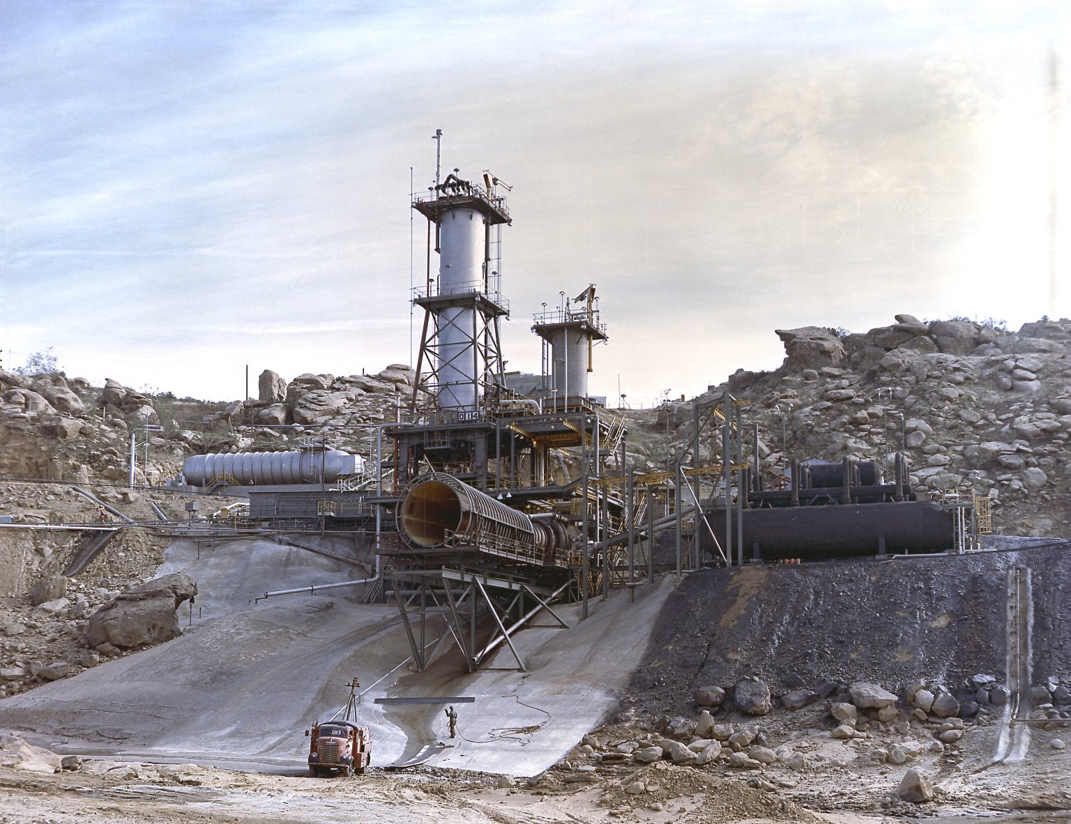 |
|
| (1962)* – View showing Rocketdyne's test stand for testing the J-2 engine in the Simi Hills above the San Fernando Valley. The J-2 engines were assembled and tested at Rocketdyne under the direction of the Marshall Space Flight Center. |
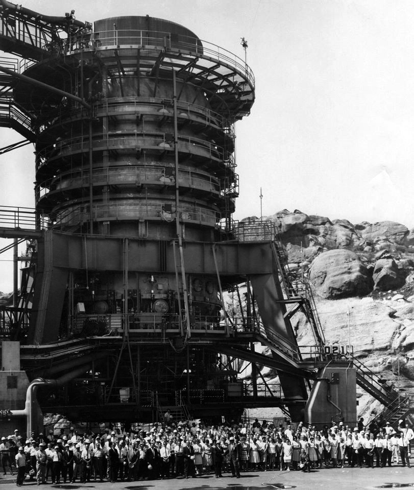 |
|
| (1960s)* - Rocketdyne employees standing in front of the static rocket test stand for a photo op. |
Historical Notes In 1996, The Boeing Company became the primary owner and operator of the Santa Susana Field Laboratory and later closed the site. In 2005, Pratt & Whitney purchased Boeing's Rocketdyne division, but declined to acquire Santa Susana Field Laboratory site as part of the sale.* There are still many unresolved issues regarding cleanup of the Santa Susana Field Laboratory site. Boeing, NASA and DOE are in the process of moving forward on their cleanup plan. |
* * * * * |
Canoga Park |
(1959+) |
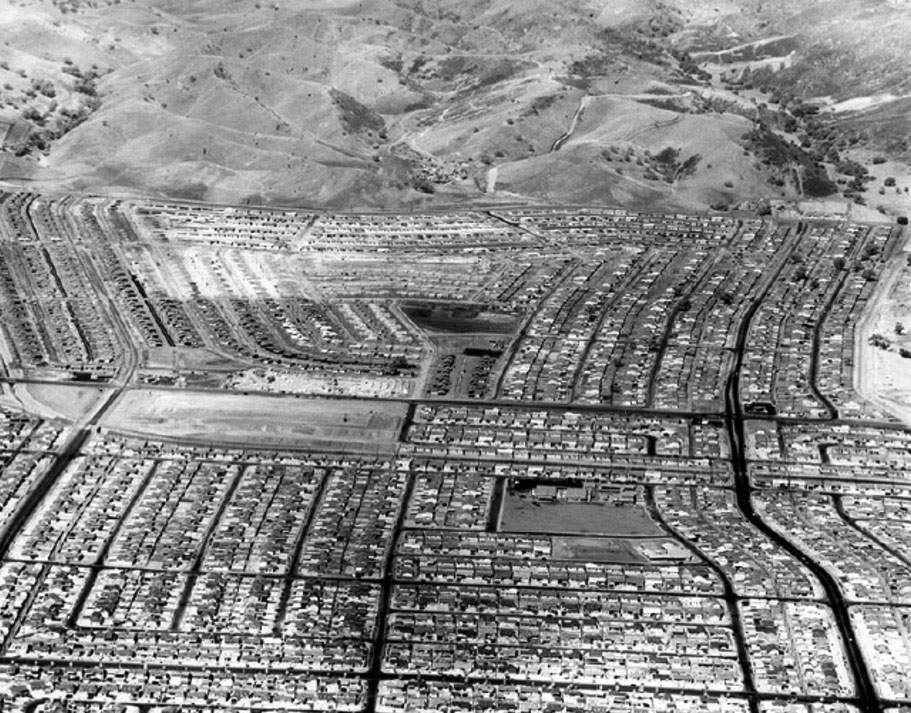 |
|
| (1960)* - Aerial view looking west above Canoga Park (now West Hills) showing hundreds of new homes pushing up against mountains in 1,133-acre Platt Ranch area. To right of picture, running away from the camera is Vanowen Street. Near lower- center right is Welby Way Elementary School. The large empty lot at center-left is now the Platt Village Shopping Center. Photo by Jon Woods/Valley Times Collection; Photo date: September 7, 1960 |
* * * * * |
Canoga Park / West Hills |
Then and Now |
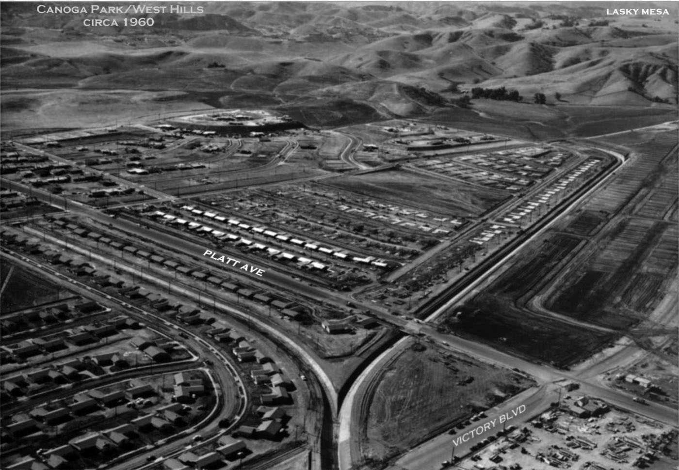 |
|
| (ca. 1960)* – Aerial view looking southwest from above the intersection of Platt Avenue and Victory Boulevard, in the lower-right. Lasky Mesa can be seen in the upper right. At lower right can be seen the Platt Village Shopping Center under construction. Photo courtesy of Rich Krugel |
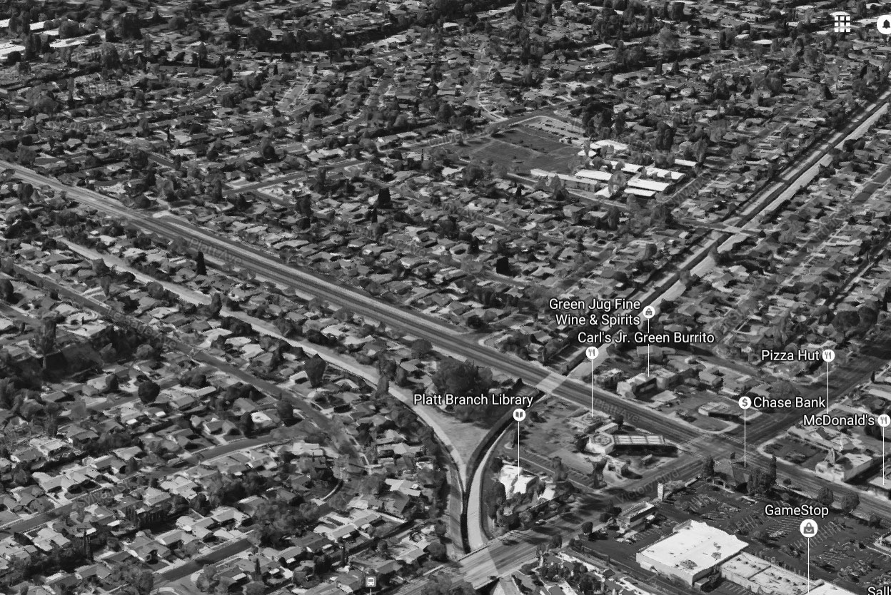 |
|
| (2016)* – Google Earth View looking southwest with the intersection of Platt Avenue and Victory Boulevard at lower-right. |
* * * * * |
Epiphany Lutheran Church (Canoga Park) |
(Today, Garden Chapel) |
 |
|
| (1959)*^ - View showing the Epiphany Lutheran Church the year it was built, located at 7769 Topanga Cyn Blvd, Canoga Park. Photo courtesy Keith Hart |
Historical Notes This excellent example of a Mid-Century Modern ecclesiastical structure, designed by architect Edward Davies, with a soaring A-frame chapel sits south of Elkwood St, and is surrounded by the Green Thumb growing grounds. Epiphany Lutheran Church held its first service Dec 5, 1959 in the Canoga Park Elementary School auditorium. Five months later, the congregation moved to the Canoga Park Women's Club auditorium at 7401 Jordan Avenue. Ground was broken in May 1958 for the church’s own building, and the first service was held April 12, 1959. Over the years, the congregation grew, until the 1990’s, when membership began to decline. In 2000, a decision was made to merge Epiphany Lutheran with Evangelical Church of the Resurrection, also in Canoga Park. After the merger, the combined church was renamed Faith Lutheran, with church services being held at the Evangelical Church site. The Epiphany Lutheran site was renamed The Garden Chapel, and is used for weddings and other special events. Click HERE to see contemporary view. |
* * * * * |
Pappy's Restaurant and Country Squire Motel |
Topanga and Saticoy |
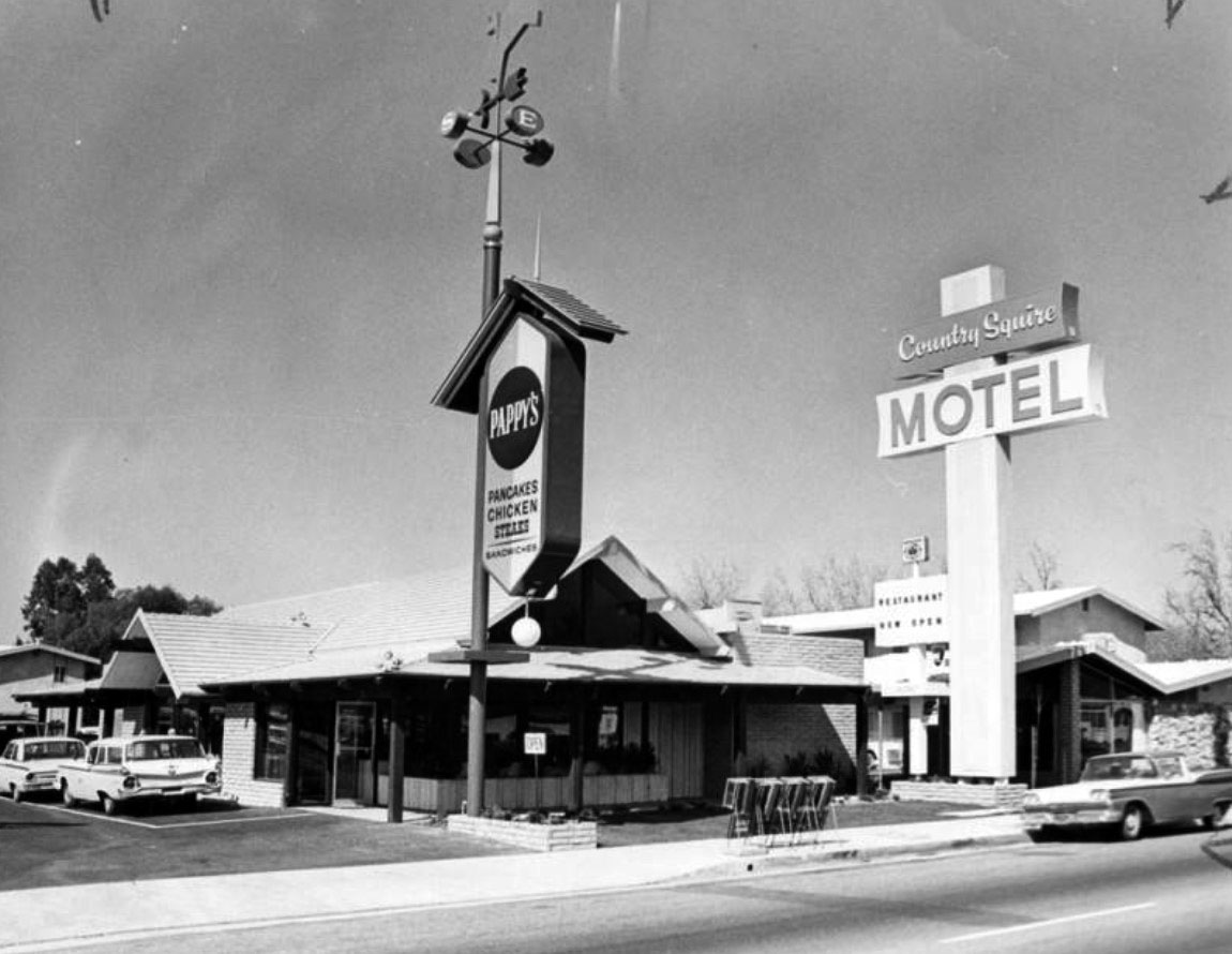 |
|
| (1965)* - The Grand Opening of Pappy's Restaurant and the 52-room Country Squire Motel on March 12, 1965 at 7625 Topanga Canyon Boulevard in Canoga Park. The motel featured a swimming pool and putting green. |
Historical Notes Pappy's started out as a pancake house and was a chain restaurant with 8 other locations stretching from Yuma, AZ to Portland, OR. The original Pappy's was opened in Santa Maria, CA in 1959. Jack Linkletter, son of TV personality Art Linkletter, helped set up the franchise. Eventually the owners felt the chain was stretched too far apart and they sold all but two of the restaurants, both of which are in Santa Maria. Today, it's a “2 Die For Sushi Restaurant" and “Super 8 Motel”. Click HERE for contemporary view. |
Holiday Theatre (Canoga Park)
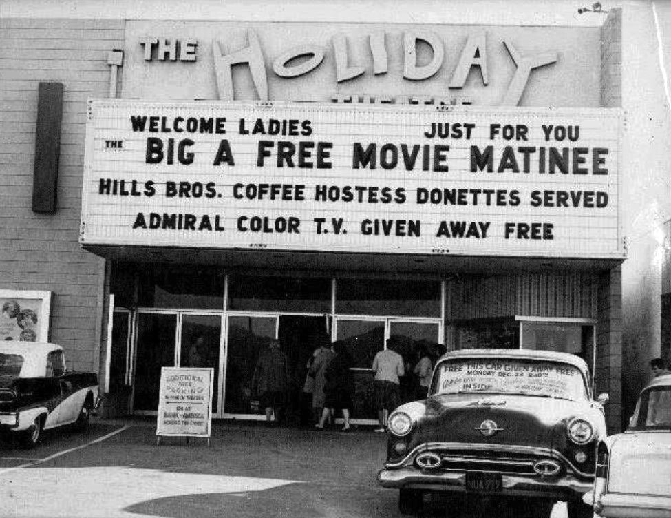 |
|
| (ca. 1961)^**^ – View showing the Holiday Theatre located at 8383 Topanga Canyon Boulevard, west side of Topanga n/o Roscoe Blvd. Billboard Reads: “Hills Bros. Coffee and Hostess Donettes Served – Admiral Color T.V. Given Away Free”. |
Historical Notes The Holiday Theater opened at Topanga & Roscoe in Canoga Park around 1961 and was a single screen theater. It became a Spanish theater and then a dollar theater before being closed in the 70's and turned into a hardware store. The architect was William N. Bonham and the contractor who built it was John P. Gilbert. #^*^ |
 |
|
| (1963)* – Photo caption reads: "The usherettes at Canoga Park's Holiday Theater are all dolled up in muu muus today for the opening of 'Diamond Head,' the drama of modern-day plantation life in Hawaii…” |
Historical Notes Today you will find a Lowe's Home Improvement store where the theatre once stood. |
* * * * * |
Zodys (Canoga Park)
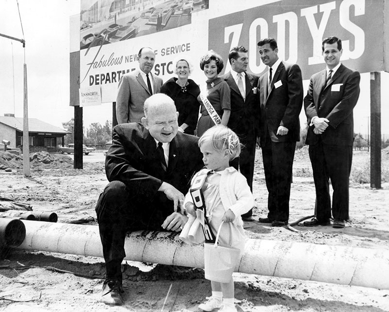 |
|
| (1962)* – View showing groundbreaking ceremonies for Zodys Discount Store located on the west side of Topanga Cyn Blvd. just south of Roscoe Blvd. The Wooden Shoe Cafe, 8240 Topanga Canyon Blvd., can be seen in the background. |
Historical Notes Valley Times photo caption dated May 17, 1962 reads "Break ground - Richard Wolfe, foreground, vice president and general manager of Zodys Quality Discount department Store, receives expert help from 2-year-old Janet Benson, Canoga Park, at groundbreaking ceremonies for new Zodys at Roscoe and Topanga Canyon Blvds., Canoga Park. Also participating are, from left, Howard Speer, Canoga Park Chamber of Commerce president; Mrs. Francis Lederer; Bonnie Gear, Miss Canoga Park; Francis Lederer, honorary Canoga Park mayor; James Liebman, Zodys developer, and Lee Freedman, Zodys vice president of store operations." Zodys was a chain of discount retail stores that operated from 1960 to 1986. The chain operated locations in California, Arizona, Nevada, New Mexico, and Michigan. By 1969 there were 19 stores. |
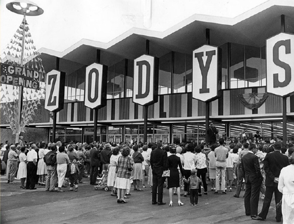 |
|
| (1962)* – Opening day at Zodys discount store on the 8200 block of Topanga Cyn Blvd. Today, a Ralphs Market (opened 1986) stands at this location. Photo date September 28, 1962 |
Historical Notes Photograph caption reads "Radio wave opens doors of Zodys in Canoga Park -Crowd surges at Zodys discount store at Topanga Canyon and Roscoe Blvds., in Canoga Park as doors swing open Thursday morning by means of a radio wave bounced off Mt. Wilson by a helicopter. Another Zodys in West Covina was opened simultaneously by the radio wave. The stores opened Thursday mark the fifth and sixth stores in the chain. A seventh Zodys will be opened in Burbank in December." Photo by Bob Martin/Valley Times Collection Bankrupt in the early 1980s, the parent company, then known as HRT Industries, began closing stores in 1984. The remaining Zodys stores in California were shuttered in March 1986 with many locations being sold to Federated Stores, the parent company of Ralphs supermarket chain, while other locations were purchased by HomeClub, a home improvement store chain. |
Chili Olé Restaurant
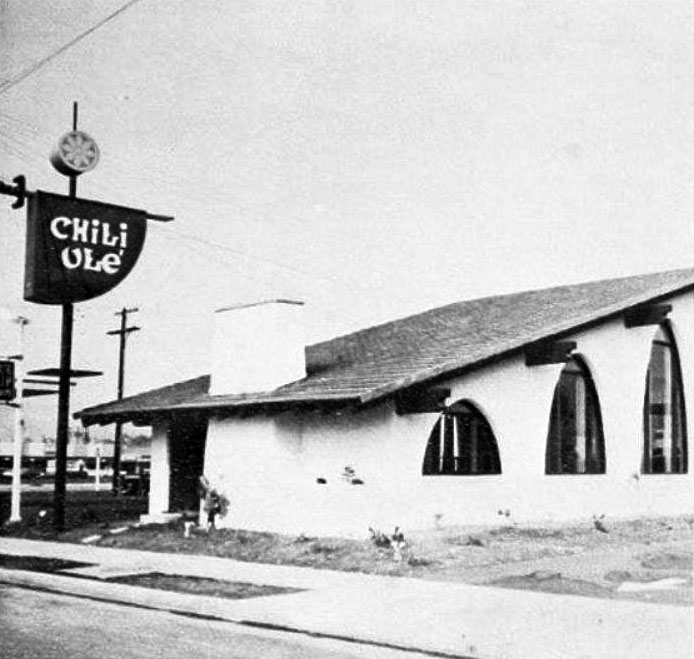 |
|
| (ca. 1966)* – View showing the short-lived Chili Olé Restaurant, located on the north side of Roscoe Blvd, two lots to the east of Topanga Cyn Blvd. |
Historical Notes In 1966, Chili Olé, a short-lived eatery near the corner of Roscoe and Topanga in Canoga Park, possibly one of L.A.'s first sports bars, opened specializing in chili. Its investors were from the sports world, including Pete Rozelle, then the Commissioner of Football. Despite its unique concept, Chili Olé didn't last the decade and was renamed The Jailhouse, then San Marcos, followed by a series of pizza joints, before the building eventually sat empty for many years. Giamela's was supposed to open in 2009 but the "opening" was "delayed" until about 2019. It never opened. |
 |
|
| (1968)* - Valley News cutout coupon dated August 2, 1968. |
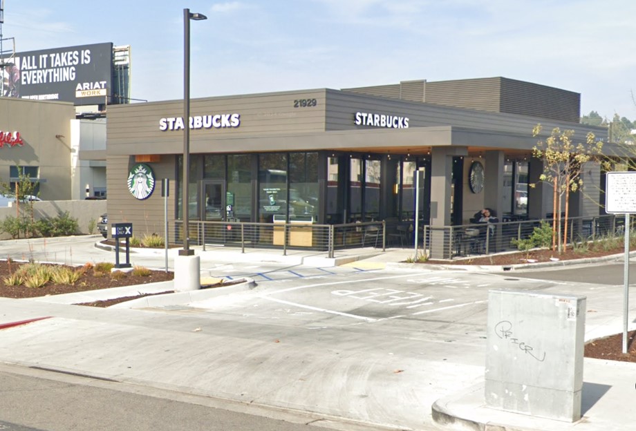 |
|
| (2024)* - A Starbucks now sits where the Chili Olé Restaurant was located in the late 1960s at 21929 Roscoe Boulevard, Canoga Park. |
Then and Now
 |
|
| (1966 vs 2024)* - The Chili Olé Restaurant, once located at 21929 Roscoe Boulevard, Canoga Park, is now the location of a Starbucks Coffee Shop. |
* * * * * |
Walker Dodge (Today, Dependable Dodge)
 |
|
| (1964)^ – Photo caption reads: Walker Dodge, the Valley’s newest Dodge dealership, is located at the corner of Canoga Avenue and Roscoe Boulevard…A modern facility covering 5-1/2 acres---with the latest service equipment available and manned by expert factory-trained mechanics. Before you buy from us…inspect our dealership, look us over and get acquainted, because we want you to like us now and twenty years from now. Sincerely, Jay Walker, President. Photo courtesy of Keith Hart |
Historical Notes Mr. Walker wasn't around for 20 years, but the Dodge dealership was. It became Dependable Dodge in 1970, and is still there today. Behind the Dodge dealership was “The Big A” grocery store and catty corner was White Front. |
Canoga-Chrysler Plymouth Dealership
 |
|
| (1964)* – Photograph caption dated October 27, 1964 reads "The architecture of the Canoga new Chrysler-Plymouth facility gives the agency building an imposing appearance." |
Historical Notes The Canoga-Chrysler Plymouth dealership, a Googie-style structure, was built in 1964. The building underwent renovation in 2013 and the curved concrete arches in the front of the building were removed. |
* * * * * |
Canoga Park Drive-in Theatre
 |
|
| (1961)* - Aerial view looking northwest, showing the Canoga Park Drive-In Theater at the bottom of the photo on the southwest corner of Canoga Avenue and Strathern Street. Lanark Park appears at the center left, with the Chatsworth Reservoir visible in the distance. When this picture was taken, Lanark Park was known as Orcutt Park. It was renamed Lanark Park in 1966, as noted below. |
Historical Notes The Canoga Park Drive-In, located at 21430 Strathern Street in Canoga Park, opened on April 13, 1960, with a capacity for 1,200 cars. Operated by Pacific Theatres, it featured its inaugural films "On the Beach" and "Noose for a Gunman." The drive-in thrived during the peak of outdoor movie theaters in the San Fernando Valley but ultimately closed its doors on September 18, 1977, with its final showings being "Final Chapter: Walking Tall" and "The Happy Hooker Goes to Washington." Following its closure, the drive-in was demolished and the site redeveloped into an industrial complex. Lanark Park: In 1930, Mary Logan Orcutt, wife of wealthy Union Oil executive William Warren Orcutt, advocated for changing the name of her West Valley neighborhood from Owensmouth to Canoga Park. Most government agencies agreed, but the Post Office initially held out. A letter to President Hoover helped resolve the issue, and the name officially changed on March 1, 1931. Mary Orcutt also played a key role in securing the land for Orcutt Park, named after her family. The Orcutt family's ranch, Rancho Sombra del Roble, built in 1926, was purchased by L.A.'s Department of Recreation and Parks in 1966. They renamed it Orcutt Ranch Park, which necessitated changing Orcutt Park's name to Lanark Park, after the street bordering the north. |
 |
|
| (1961)* - Aerial view looking west along Strathern Street from above Canoga Avenue and the SPRR tracks, which run left to right along the bottom of the photo. The Canoga Park Drive-In Theater is visible at the lower left on the southwest corner. |
Historical Notes Throughout the 1960s, the Canoga Park Drive-In thrived, becoming a social hub for moviegoers. Drive-ins offered a relaxed atmosphere that appealed to audiences looking for an alternative to traditional indoor theatres. They became popular date spots and family outings, reflecting the lifestyle of suburban America during this era. The drive-in experience was characterized by its blend of entertainment and social interaction, making it a cherished part of American pop culture. |
 |
|
| (1961)* - Aerial view of the Canoga Park Drive-In Theater on the southwest corner of Canoga Avenue and Strathern Street. Lanark Park, surrounded by trees, is visible at the center of the photo. Roscoe Boulevard runs diagonally from the right center to the top center. |
Historical Notes Like many drive-ins across the country, the Canoga Park Drive-In Theatre faced challenges that led to its closure on September 18, 1977. The rise of multiplex cinemas, increasing land values, and shifting entertainment preferences contributed to the decline of drive-in theatres. The closure of Canoga Park marked the end of an era for this iconic venue, encapsulating the broader story of drive-in theatres in mid-20th century America. The site is now an industrial complex housing a variety of businesses. |
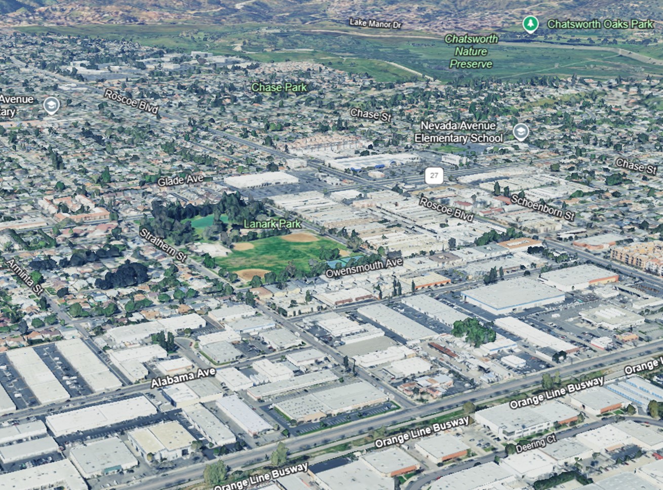 |
|
| (2023) – Google Earth view looking northwest over the former site of the Canoga Park Drive-in, now an industrial complex. The drive-in operated for a brief 17 years, from 1960 through 1977. At the upper right, the former Chatsworth Reservoir is now a nature preserve. |
Historical Notes The Chatsworth Reservoir, constructed in 1919 as part of Los Angeles' water management system, played a crucial role in supplying water to the western San Fernando Valley for several decades. Initially developed under the supervision of William Mulholland, it was expanded in the 1930s but was ultimately decommissioned in 1972 after being deemed seismically unsafe following the San Fernando earthquake. In the 1990s, the area was transformed into the Chatsworth Nature Preserve, which was established to protect its diverse natural habitats and historical significance, including evidence of Native American use and a historic lime kiln. Today, the preserve serves as an important ecological site, supporting migratory birds and preserving a vital piece of Los Angeles' cultural and natural heritage. Click HERE to see more early views of the construction of the Chatsworth Reservoir. |
* * * * * |
Roscoe and De Soto
 |
|
| (ca. 1957)* – View looking north on De Soto Ave at Roscoe Blvd. Cawlfield Reality is seen on the NW corner. |
Then and Now
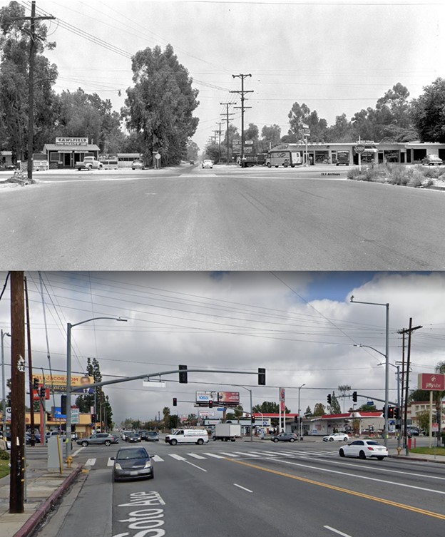 |
|
| (1957 vs. 2021)* – View looking north at the intersection of De Soto and Roscoe. |
* * * * * |
Sherman Way and De Soto
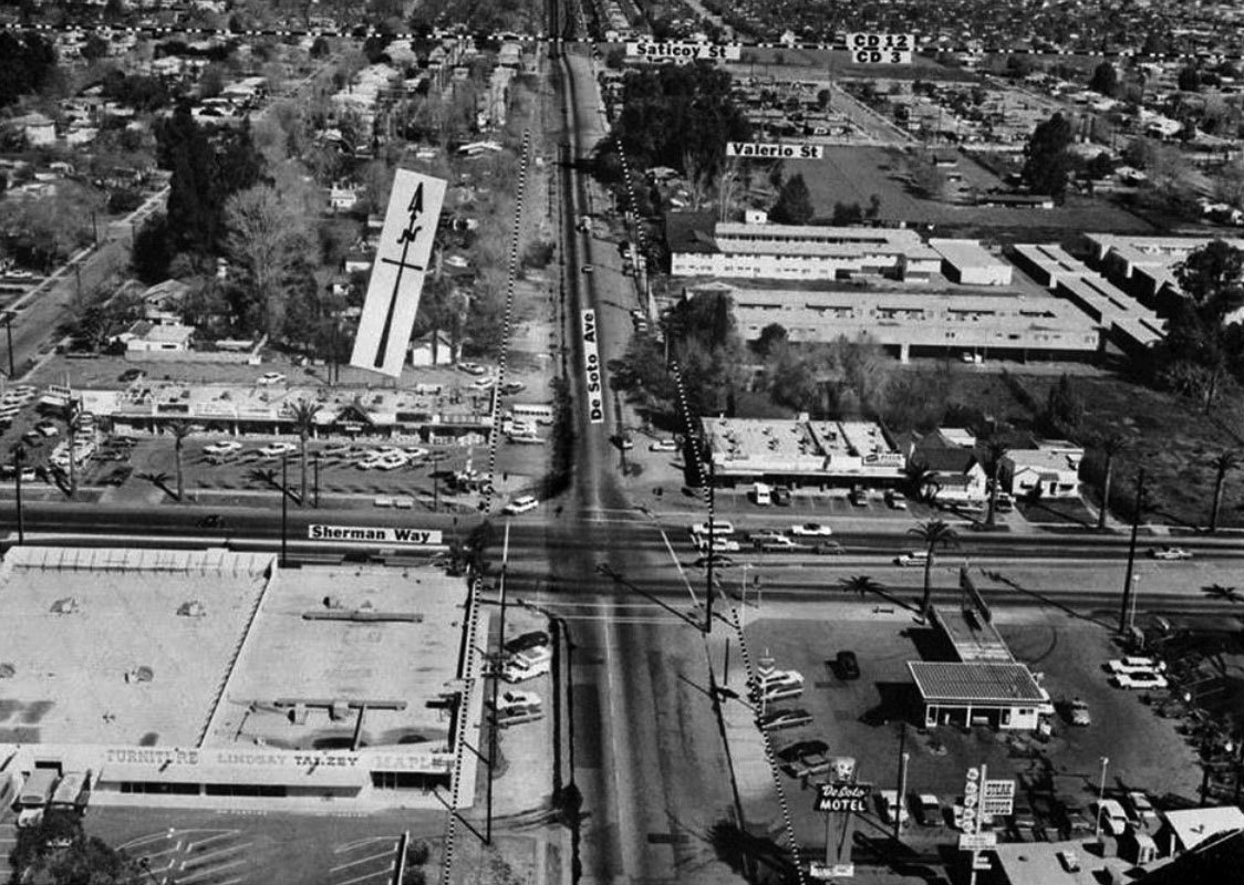 |
|
| (1961)* – View looking north at the intersection of De Soto and Sherman Way. |
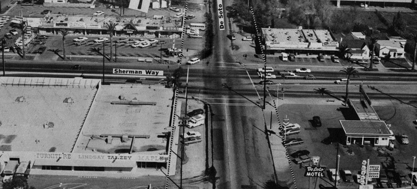 |
|
| (1961)* – Blow-up view of previous photo looking north on De Soto Avenue at Sherman Way. The dotted line along De Soto will be the new curb line once the street is widened to the 7-lane configurationhe that exists today. Legible signs include: Bruno’s, Darby’s, Guggie’s Nina’s Litle House of Italy, Lindsay-Tanzey Furniture and De Soto Motel. |
* * * * * |
Parkman Middle School (now Woodland Hills Academy)
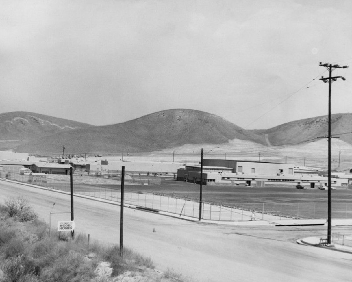 |
|
| (1959)* - View looking northeast at the intersection of De Soto Ave and Clark Street. Photograph caption dated September 24, 1959 reads, "New Junior High -- New Parkman Junior High School stands ready for its full load of students but awaits landscaper's touch to set it in background of cool, pleasant green shrubbery." |
Historical Notes Francis Parkman Middle School first opened its doors as a junior high school in 1959. Situated on a twenty-four acre site, the school was named for an American historian, Francis Parkman(1823-1893). In 2006, the school changed its name to Woodland Hills Academy. |
 |
|
| (2023)* – Looking towards the northeast corner of De Soto Ave and Clark Street, the current location of Woodland Hills Academy, originally known as Parkman Junior High School |
Historical Notes In 2006, Parkman Junior High School underwent a major transformation and was reborn as Woodland Hills Academy. This change was part of a school reform initiative aimed at addressing several challenges the school faced: Declining enrollment: By 2005-2006, the student population had dropped to around 800 students, down from nearly 1,500 in 2000. Low morale and academic performance: The school had a low API (Academic Performance Index) score. Loss of faculty and programs: The school was losing teachers and educational programs, including music. Competition: The school faced competition from nearby charter schools and high-performing LAUSD middle schools. |
Then and Now
 |
|
| (1959 vs 2023)* – Looking towards the northeast corner of De Soto Ave and Clark Street, now home to Woodland Hills Academy, originally known as Parkman Junior High School. |
Mason Ave Shopping Center (Mason and Lassen - Chatsworth)
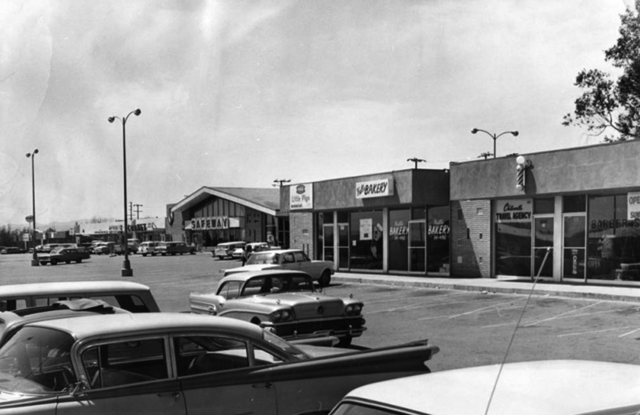 |
|
| (1964)* - Looking south from Lassen Street is the Mason Avenue Shopping Center. Storefronts seen in the photo are Cornet, Safeway, Little Pigs Barbecue, Hull's Bakery, Chatsworth travel agency and a barber shop. |
Historical Notes In 2019 most of the above buildings were razed to make room for a new shopping center ('Gateway'). MASON AVENUE was named for Azubeth H. Mason in 1917. LASSEN STREET was named for the Northern California county where Lassen National Park is located. Click HERE to see more in Street Name Origins – SFV. |
Cinema Theatre - Chatsworth (Mason and Devonshire - SE Corner)
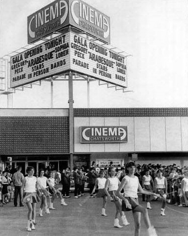 |
|
| (1966)^ - View showing Chatsworth High School Marching Band and Majorettes performing at the grand opening of the Cinerma Theatre located at 10124 Mason Avenue, Chatsworth. |
Historical Notes This long-defunct venue was once the key occupant of a shopping center on the southeast corner of Devonshire Street and Mason Avenue. It was opened as the Cinema Chatsworth on June 29, 1966 with Gregory Peck in “Arabesque”. It was operated by a variety of franchises throughout its lifetime—including the Century Theatres, Loews and General Cinema chains. By the early-1990’s, it was shut down and converted into retail space. |
* * * * * |
West San Fernando Valley
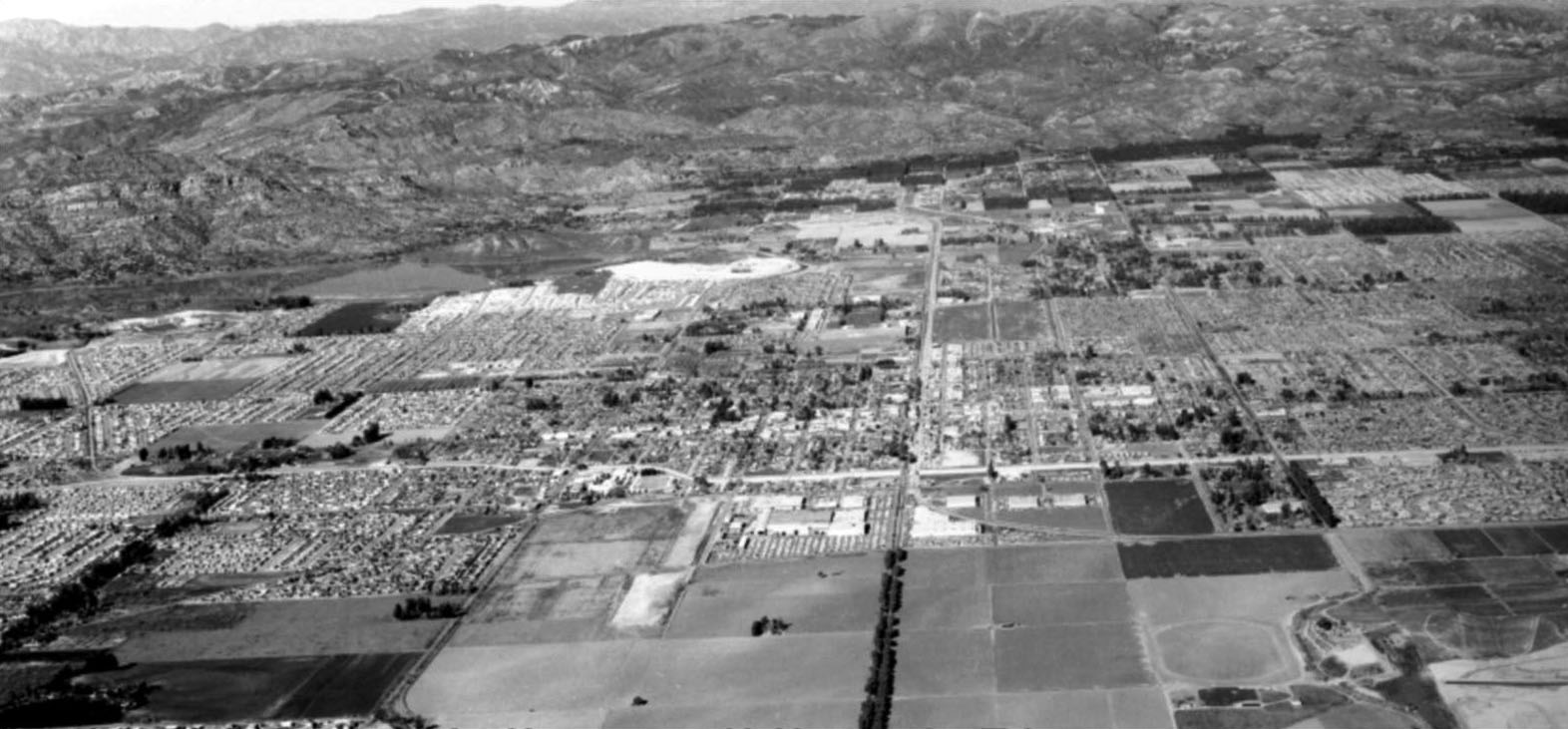 |
|
| (ca. 1962)* – Aerial view of the West San Fernando Valley looking north. Canoga Avenue runs down the middle of photo. Note all the undeveloped land in the foreground. Most of it was part of the Warner Ranch. Also note the tree-lined Canoga Avenue at lower center. Photo courtesy of Rich Krugel |
Historical Notes In the 1960s, the area that is now known as Warner Center in Woodland Hills was primarily the private horse ranch of Harry Warner, one of the Warner Brothers of Warner Bros. Pictures. The ranch encompassed around 1,100 acres of land. Some key events and developments in the 1960s: In 1967, the Harry Warner family donated 20 acres of land from the ranch that became Warner Center Park (also known as Warner Ranch Park). In 1968, 630 acres of the ranch land was sold to Aetna Life and Casualty for $30 million for long-term investment and development purposes. Aetna later brought in Kaiser as a joint venture partner. Initial development of the Warner Ranch land began in the Canoga Park portion between Victory Boulevard and Vanowen Avenue, with the opening of Topanga Plaza in 1964 as the first enclosed shopping mall in California. Aerospace companies like Rocketdyne and Litton Industries also built facilities on the land. |
 |
|
| (1964)* – View showing the pepper tree lined Canoga Avenue in Woodland Hills, between Victory and Ventura boulevards. |
Historical Notes A 1982 account in "The History of Woodland Hills and Girard" by Richard Cacioppo details how the original 1920s community of Girard came to be renamed Woodland Hills because of trees planted by developer Victor Girard. Girard marketed the arid 2,886-acre West Valley ranchland south of Ventura Boulevard as a weekend retreat for Los Angeles residents through his Boulevard Land Co. He realized it needed trees to have a real country look for potential buyers. Under Girard's plan, pepper trees were lined up along Canoga Avenue between Victory Boulevard on the north and Mulholland Drive on the south. When Warner Center was developed in the 1970s, the pepper trees between Victory and Ventura boulevards were chopped down to widen the two-lane street. |
* * * * * |
Litton Industries
 |
|
| (1961)* - Photograph caption reads: "Litton Industries will soon be joined by other firms in planned industrial complex". Photograph dated: Oct. 17, 1961 |
Historical Notes Named after inventor Charles Litton, Sr., Litton Industries was a large defense contractor. It started in 1953 as an electronics company building navigation, communications and electronic warfare equipment. They diversified and became a much bigger business, with major shipyards, etc., and even manufacturing microwave ovens. In 2001, Litton Industries was bought by Northrop Grumman Corporation. |
 |
|
| (ca. 1962)* - Aerial view looking northeast showing the Litton Guidance & Control Systems headquarters bounded by Canoga on the left (west), Burbank Blvd. (north), and Ventura Freeway (south). De Soto can be seen in the upper right of photo. |
Historical Notes Note the light traffic on the Ventura Freeway and the lack of any development between the freeway and Ventura Blvd., which itself was lightly developed back then along the south side and little more than a four-lane country highway. To the immediate left of the Litton property on the west side of Canoga Ave. stood the old Warner Ranch, often used in making movies. There were new housing developments on the east side of De Soto. Pierce College is to the north of the development and east of where De Soto eventually was put through, following the wash. Included on the Pierce property was the Warner House – on the knoll by the bend along the culvert east of where De Soto now runs. |
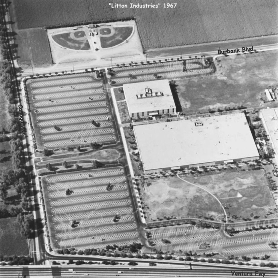 |
|
| (1967)* – Aerial view showing a closer look at Litton Industries with street names annotated. Note the baseball fields north of Burbank Blvd. They were used by Sunrise Little League for years. |
Historical Notes By 1990, Litton Industries was a primary builder of large surface multi-mission combat ships for the US Navy. They were also providing much of the Navys overhaul, repair, modernization, ship design, and engineering as well, all for surface ships. By the early 1990s, Litton Industries was too large to manage as one unit. It split into separate military and commercial companies. The military arm continued to be called Litton Industries. The commercial business, which included oilfield services, business and automated assembly line operations, was renamed Western Atlas Inc. In April 2001, Northrop Grumman Corporation acquired Litton Industries for about 3.6 billion dollars. |
Then and Now
 |
|
| (1961 vs. 2023)* – A 'Then and Now' comparison of Warner Center, formerly Warner Ranch, with the intersection of Canoga and Burbank highlighted in blue. Comparison by Jack Feldman. |
Historical Notes When the contemporary image (Google Earth view) was taken, construction was underway at the southeast corner of Burbank Boulevard and Canoga Avenue in Warner Center for Wisteria at Warner Center, a major senior housing development. Spanning approximately 17 acres, the project includes a six-story building with 647 senior residential units: 486 independent-living units, 65 assisted-living units, 20 memory-care units, and 76 skilled nursing beds. |
* * * * * |
Farrell's Ice Cream
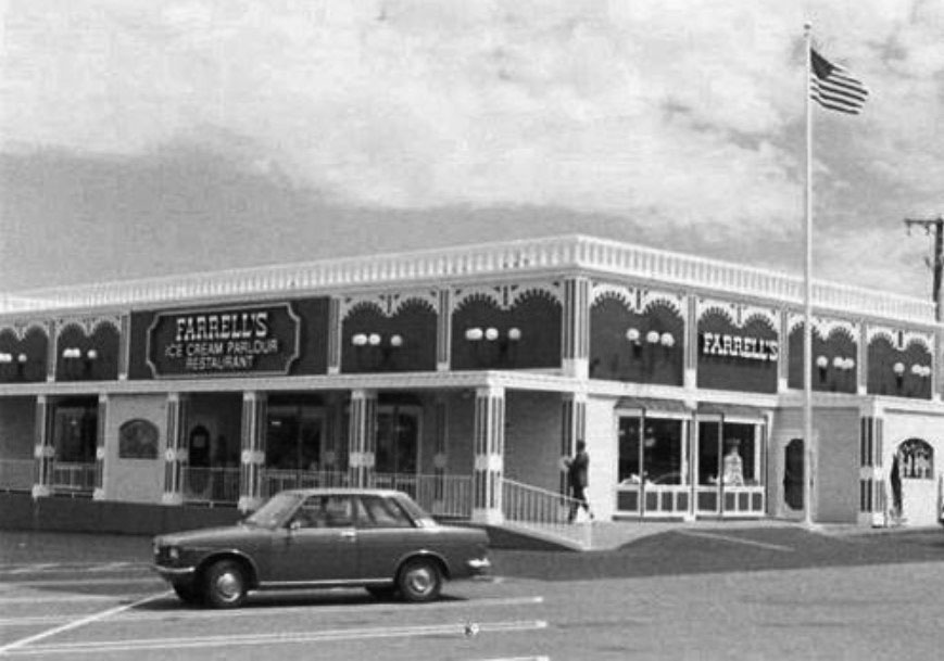 |
|
| (ca. 1970s)^ – View showing Farrell's Ice Cream Parlour Restaurant located at 10141 Reseda Blvd in Northrdige. Today, the Northridge Suit Outlet occupies this spot. Photo courtesy of the Museum of the San Fernando Valley. Click HERE to see contemporary view. |
Historical Notes Farrell's Ice Cream Parlour was started in Portland, Oregon, by Bob Farrell and Ken McCarthy in 1963. Farrell's became known for their offer of a free ice cream sundae to children on their birthday. The parlors had an early 1900s theme, with employees wearing period dress and straw boater hats, and each location featured a player piano.*^ |
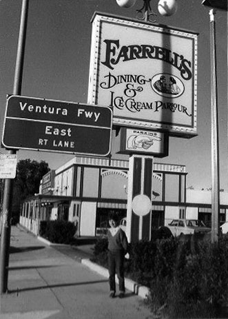 |
(ca. 1970s)^ - View looking north on Canoga Avenue showing a young man standing in front of the Farrell's Ice Cream Parlour's parking lot with the 101 Freeway on-ramp in the distance. Today, a Burger King stands near this location. Click HERE for contemporary view. |
|
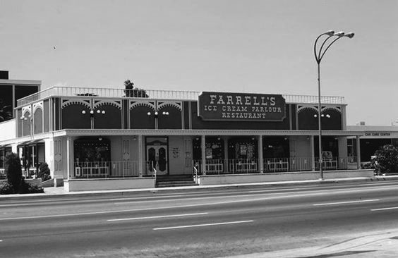 |
|
| (1978)* – Farrell’s Ice Cream Parlour on Van Nuys Boulevard in Van Nuys. Note the 3-headed streetlight in front of Farrell's. Van Nuys Boulevard was LA's brightest lit street in the 1970s (Click HERE to see more). |
Historical Notes In 1972, the Farrell's chain was purchased by the Marriott Corporation. By 1975, there were 120 Farrell's nationwide. Thereafter, sales dropped and most of the parlors were sold off in the 1980s. In 1982, Marriott sold the chain to a group of private investors. By 1990 almost all Farrell's locations had closed.*^ Seven Farrell's Restaurants still exist today, 6 in California and 1 in Hawaii. The closest one to the San Fernando Valley is located in Santa Clarita. |
Central San Fernando Valley
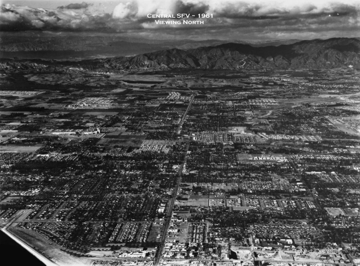 |
|
| (1961)^ – Aerial view looking north along Sepulveda Boulevard (Then Hwy 7) showing central San Fernando Valley with no freeways in sight! Photo courtesy of Rich Krugel |
Kaiser Panorama City
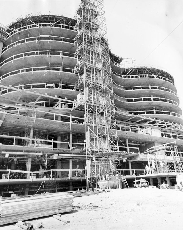 |
|
| (1961)* - Photograph article dated June 2, 1961 reads, "Binocular-shaped Kaiser Foundation Hospital is rapidly reshaping the skyline of Panorama City where it now towers 10 stories tall as vertical construction nears completion. The hospital will cost more than $6 million when completed. It is being built on a nine-acre site south of Roscoe boulevard on Woodman avenue at Cantara street." Photo from the Valley Times. |
Historical Notes In 1942, Henry Kaiser built a steel mill in Fontana to supply steel for the ships he was building to help America win the war. When he learned that his workers couldn’t get adequate health care, he built a hospital and medical offices right on the steel mill grounds. It was the first Kaiser Permanente facility in Southern California. The name Permanente came from Permanente Creek, which ran by Henry Kaiser's first cement plant on Black Mountain in Cupertino, California. |
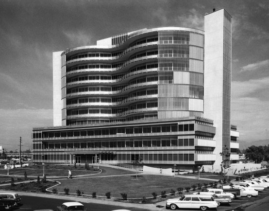 |
|
| (1962)## - Kaiser Panorama City opening day. View is looking northwest. Photo courtesy of Kaiser Pemanente |
Historical Notes The Panorama City Kaiser Hospital was completed in 1962 and featured two circular towers. Within the towers, the concept of "circles of service" was born. Later Kaiser Permanente hospitals retained the basic design but the "binocular" towers were enclosed in rectangles. |
.jpg) |
|
| (1963)*++ - View looking north showing Kaiser Permanente Hospital in Panorama City. Photo by Julius Shulman |
.jpg) |
|
| (1963)* - View looking northeast showing Kaiser Permanente Hospital in Panorama City. Photo Julius Shulman / Getty Research Institute |
.jpg) |
|
| (1963)* - View looking east showing Kaiser Permanente Hospital in Panorama City. Photo Julius Shulman / Getty Research Institute |
 |
|
| (1962)* – Close-up view of Kaiser Permanente, Panorama City. |
Historical Notes In 2008, the 1962-built Kaiser Permanent Hopsital was razed and a new Hospital and Medical Center built. Click HERE for contemporary view. |
Valley Presbyterian Hospital
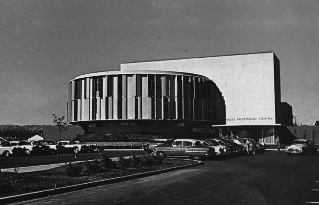 |
|
| (ca. 1958)* - Postcard view showing the Valley Presbyterian Hosipital in Van Nuys. Photo courtesy of Valley Relics Museum |
Historical Notes Built on a small plot of land in Van Nuys, Valley Presbyterian Hospital first opened to the community in 1958 with only 63 beds in a building designed by architect William Pereira.The facility specializes in maternal and child health, cardiac care, orthopedics, and critical care services.* |
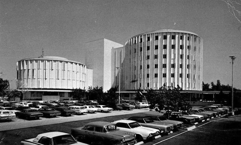 |
|
| (1974)*- View showing the Valley Prebyterian Hospital located at 15107 Vanowen Street, Van Nuys. |
Historical Notes In 1968, the hospital's seven-story Circle Tower was constructed, adding 180 beds. Today, the hospital has 350 beds and is one of the largest independent, nonprofit community hospitals in the San Fernando Valley.* |
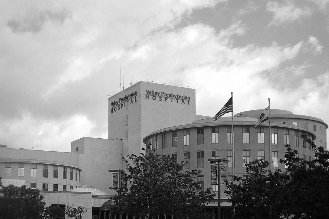 |
|
| (2008)^ - Close-up view of Valley Presbyterian Hospital located on Vanowen Street near Sepulveda Boulevard. Photo by 'Cbl62' / Wikipedia |
Historical Notes The Valley Presbyterian Hospital specializes in maternal and child health, cardiac care, orthopedics, and critical care services. Between 2006 – 2014, the Hospital was voted the "Best Medical Center" by the readers of the LA Daily News.* |
Busch Gardens
 |
|
| (1963)* - Artist's conception of the Skyrail Tour, a 3,500-foot long, elevated project designed by Arrow Development Company, to be constructed at the Anheuser-Busch Inc. brewery in Van Nuys as part of a $3 million Busch Gardens development. |
Historical Notes In 1954 Anheuser-Busch opened a brewery in Van Nuys, California, followed by an updated version of Busch Gardens in 1966. By this time, the Busch Entertainment Corporation had already opened their Tampa Bay gardens in 1959, which was an admission free hospitality facility with a beer garden and bird sanctuary. In a similar fashion, Busch transformed a cabbage patch adjacent to the Van Nuys brewery into a tropical beer garden and bird sanctuary. |
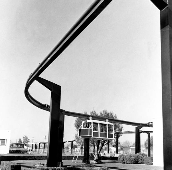 |
|
| (1960's)^** - View of what appears to be a Busch Gardens Sky Trolley being tested and fine-tuned prior to its official opening. |
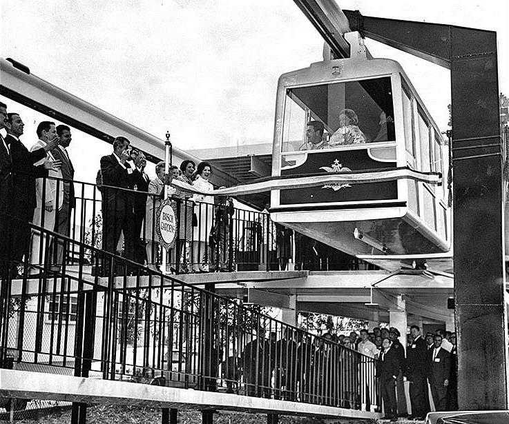 |
|
| (1966)*^# - View shows the Busch Monorail car moving forward at the ribbon cutting ceremony dedicating the new Busch Gardens in Van Nuys. |
Historical Notes On May 16, 1966, the first pair of cars, containing Busch and other dignitaries, snapped a ribbon as it began moving, and the dedication was official. In total, there were seven pairs of cars that would carry passengers on a 3,500-foot loop around the 17-acre Anheuser-Busch facility. |
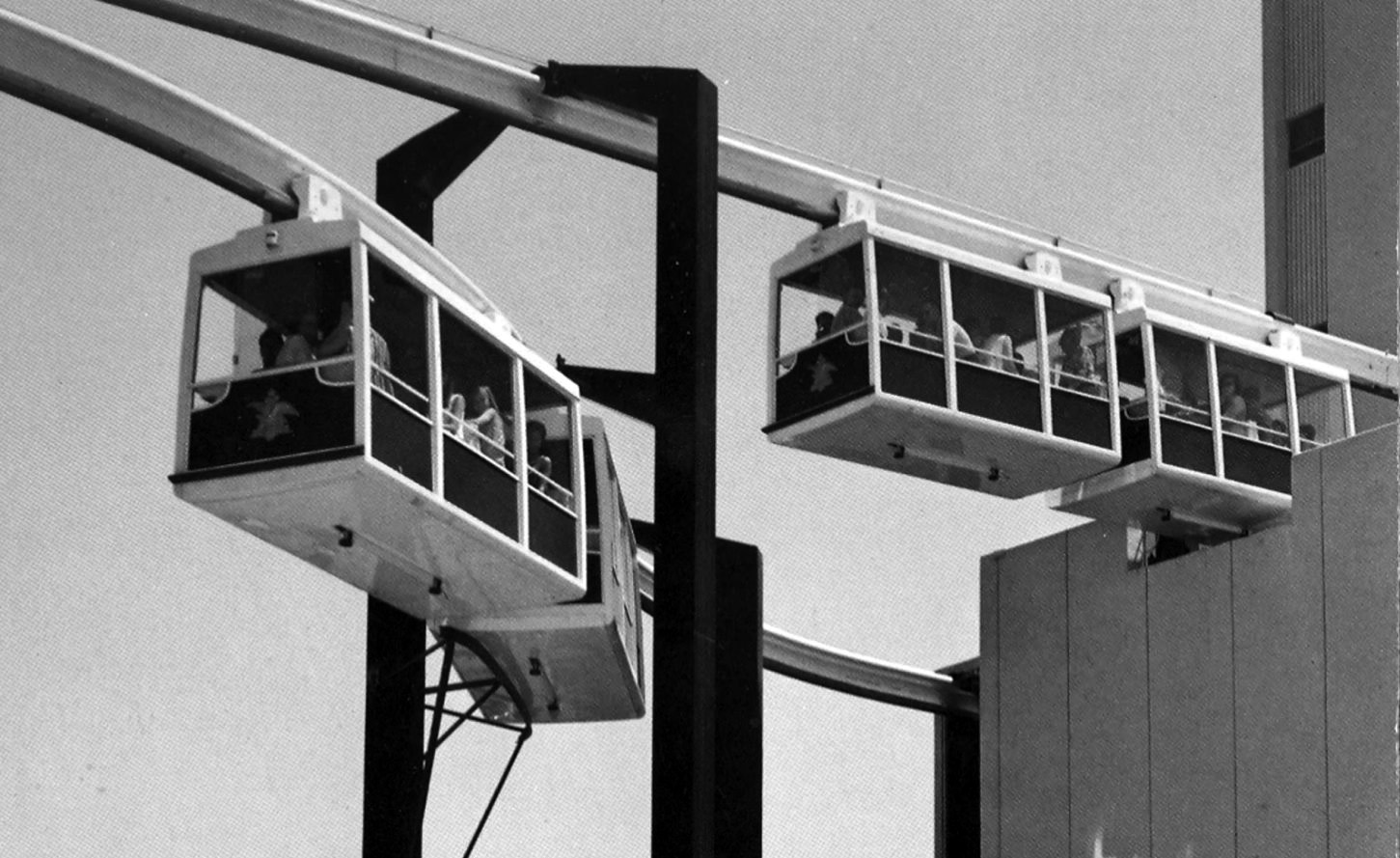 |
|
| (1960s)*#^ - Poscard view of the Monorails at Busch Gardens in Van Nuys. |
Historical Notes The Busch Gardens theme park featured a monorail that snaked around the facility and passed windows that gave passengers a look at the brewing process. |
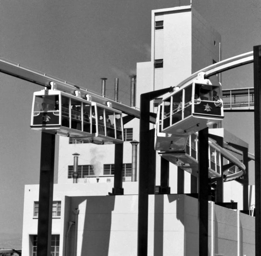 |
|
| (1960s)#^*^ – View looking up showing two fully-loaded monorails passing each other in front of the Busch brewery building. |
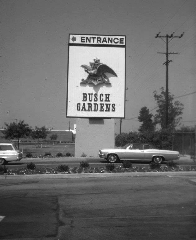 |
|
| (1960s)* – View is looking west (towards Woodley) from inside the parking lot. Roscoe is on the right. The brown building in the background is the Busch Gardens warehouse and wardrobe dept (where employees changed into costumes). The white building behind that is the Keebler cookie plant. A 1965 2-door Chevrolet Impala is seen in front of sign. |
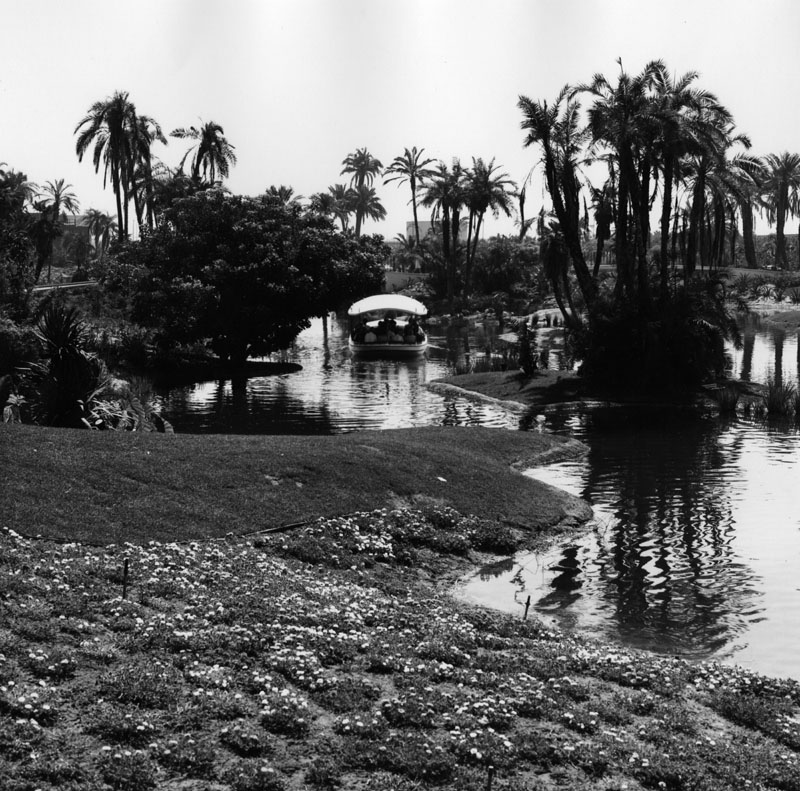 |
|
| (1960s)* - View of the amusement park boat ride inside of Busch Gardens. Busch Gardens was located next to the Anheiser-Busch brewery in Van Nuys, in the San Fernando Valley. |
Historical Notes Amongst the many activities provided for visitors were boat rides across a lagoon, a monorail, a log-flume ride, and a suspended trolley tour through the brewery; but perhaps the most popular attraction was the free beer. Once the park admission was paid, anyone of drinking age was allowed “two 10-ounce glasses of beer at each of the five pavilions.” |
.jpg) |
|
| (ca. 1970s)^^^* - Boat ride at Busch Gardens, Van Nuys. The Sky Trolley rail can be seen on the left. A beautiful waterfall is on the right. Photo courtesy of Valley Relics Museum |
Historical Notes In 1972 Busch Gardens would go through an expensive expansion that saw the addition of the log ride and other attractions of the like, and necessitated the construction of a pedestrian bridge and another monorail line to adjoin the original brewery property to the new section of the park. |
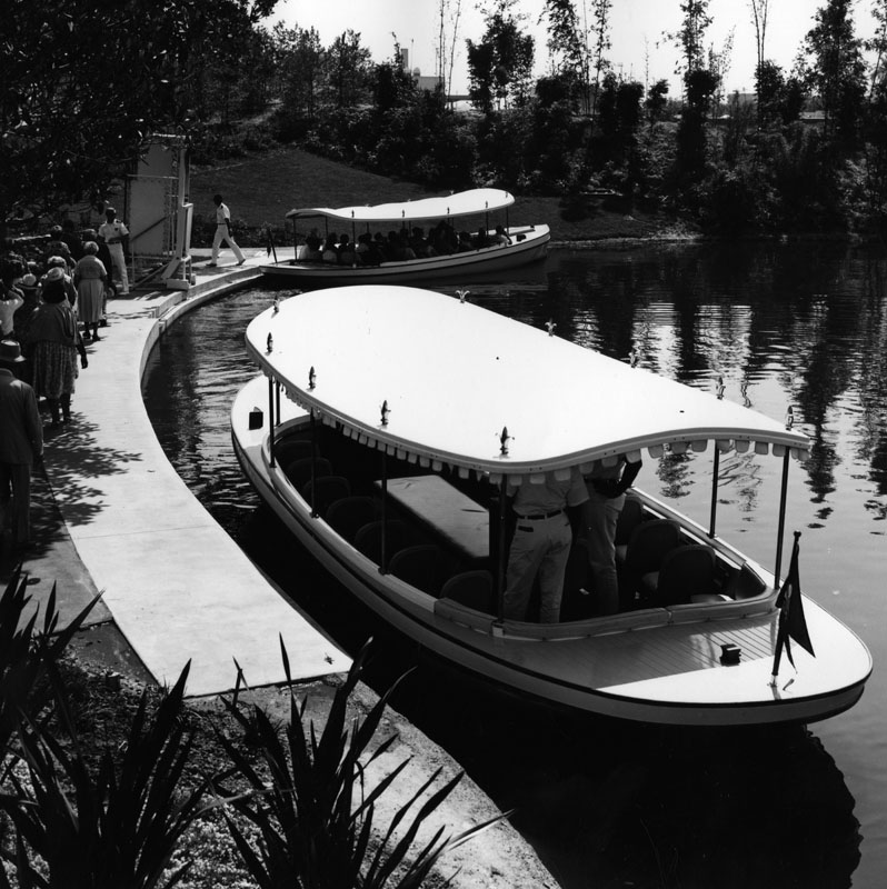 |
|
| (1970s)* - Passengers line up as they prepare to board the Busch Gardens boat ride. |
Historical Notes By the mid-seventies attendance began to slow down and August Busch III decided to close the park in December of 1976. Busch Gardens reopened on January 5, 1977 as a bird sanctuary and boasted "1500 birds of some 180 different species,". Many wandered freely and some were viewable from the boat ride. Guests began their trip with a 15-minute tour of the brewing facility, with audio narration provided by Ed McMahon. But, that didn't last long. |
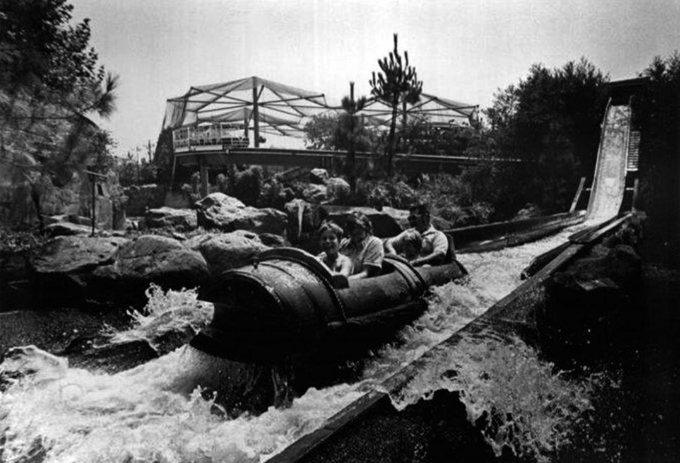 |
|
| (1970s)#*^* – View of the Log Ride at Busch Gardens, Van Nuys, with the Bird Sanctuary seen in the background. |
Historical Notes The Van Nuys park closed permanently in 1979. Two other Busch Gardens, in Tampa, Fla., and Williamsburg, Va., are currently open. The company was liberal with its "free beer" policy, which extended to the brewery's employees. This, curiously enough, wasn't a problem until 1982, when one employee who imbibed on his break wound up hitting and killing a 16-year-old pedestrian when he drove off the lot. It took several years of discussions between the workers' unions and the brewery, but the free beer finally came to an end on May 1, 1986, and employees had to settle for two free cases a month instead of "beer breaks" they initially had in their contracts. |
* * * * * |
Sepulveda Pass
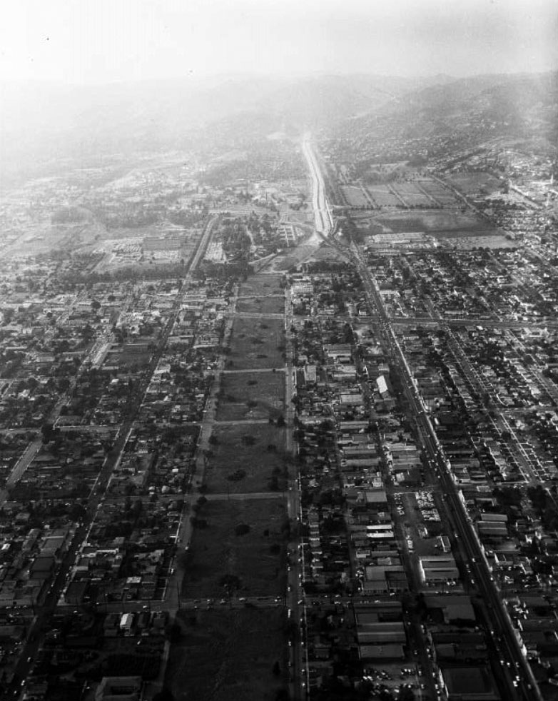 |
|
| (1957)^^ - Aerial view looking north toward Sepulveda Pass where construction of the San Diego (405) Freeway is underway. The section between Wilshire Blvd to Venice Blvd in Culver City is the next segment scheduled for construction. |
Historical Notes Construction of the 405 Freeway began in 1957 with the first section, mostly north of LAX Airport being completed in 1961. The section of the 405 that would connect western Los Angeles to the San Fernando Valley was part of a 12-mile, $20 million project, then the most expensive California highway project to date.*^ |
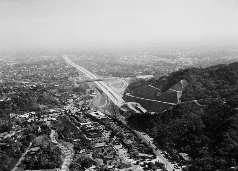 |
|
| (1957)^^ - The San Diego Freeway makes its entry through the Santa Monica Mountains in 1957. The hill on the right is now the site of the Getty Center. |
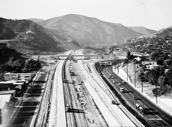 |
|
| (1957)^^ - View looking north showing construction of the 405 Freeway just south of Sepulveda Canyon. Sepulveda Blvd is on the right and the Sunset Blvd Bridge is in the distance. Courtesy of the Los Angeles Examiner Collection, USC Libraries |
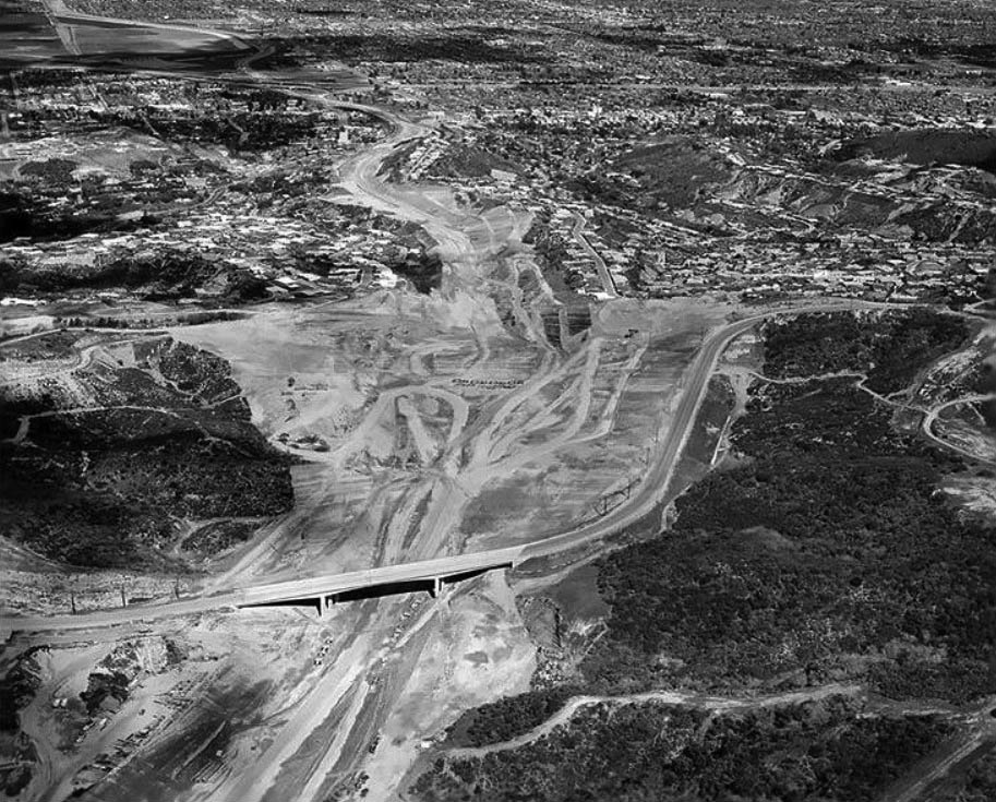 |
|
| (1960)* – Aerial view looking north toward the San Fernando Valley showing the newly completed Mulholland Drive Bridge. The Sepulveda Pass is chiseled out in preparation for the construction of the new 405 Freeway. Photograph Courtesy of California Department of Transportation |
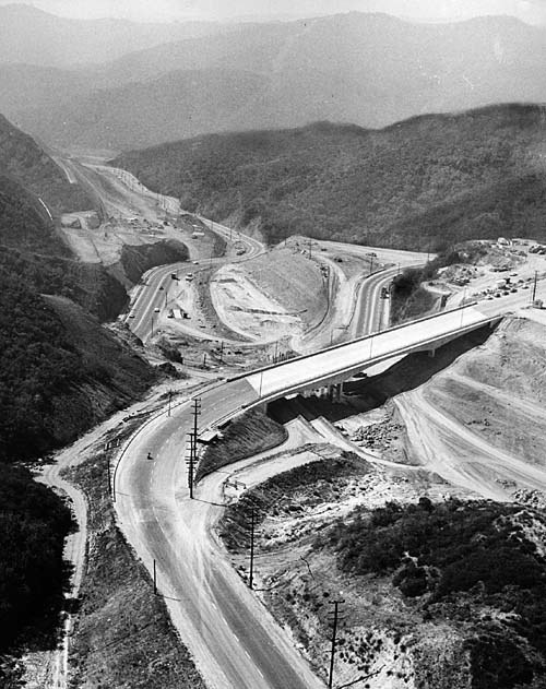 |
|
| (1961)^^^ - An aerial view looking south of the San Diego Freeway construction project shows the Mulholland Drive Bridge. Dirt is being dug from beneath the bridge and hauled to the San Fernando Valley for freeway fill. This bridge was constructed like no other, from the top down! Sepulveda Boulevard can be seen at center-left. |
Historical Notes This Mullholland Dr. Bridge was constructed like no other, from the top down. The bridge was completed over two years before the freeway that connected West L.A. to the San Fernando Valley would open.^*^* |
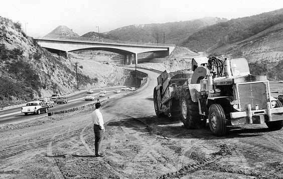 |
|
| (1960)^ - View showing the bridge across the Sepulveda Pass the official day of its completion, April 4, 1960. |
Historical Notes On Monday, April 4, 1960, the same day the 1959 Academy Awards were held at RKO's Pantages Theatre in Hollywood, Peter Kiewit Sons Co. completed the Mulholland Drive Bridge across the Sepulveda Pass.^*^* |
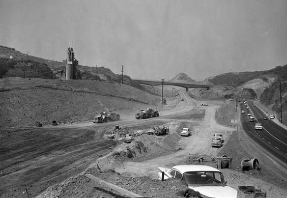 |
|
| (1960)* – View looking north showing the construction of the San Diego Freeway through Sepulveda Pass with a newly completed Mulholland Bridge in the distance and Sepulveda Boulevard on the right. Courtesy of the Los Angeles Times Photographic Archive. Department of Special Collections, Charles E. Young Research Library, UCLA. |
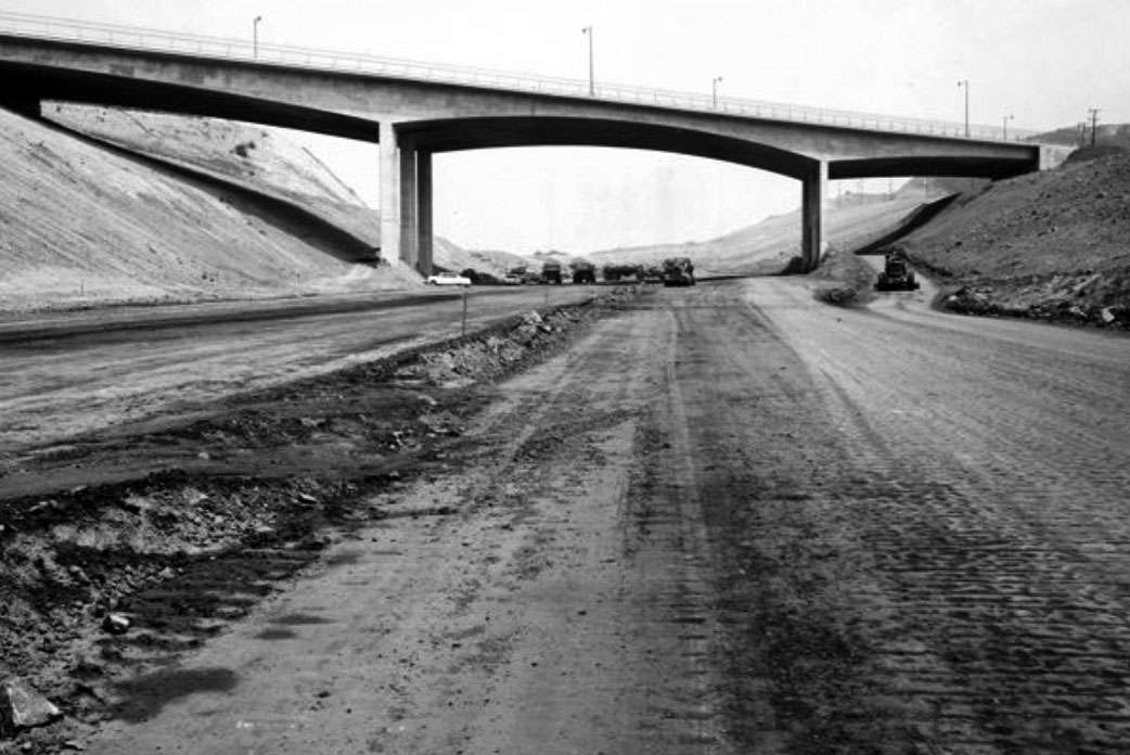 |
|
| (1961)* – View looking north toward the Mulholland Dr. Bridge over a yet-to-be completed San Diego Freeway. Photo Courtesy of California Department of Transportation. |
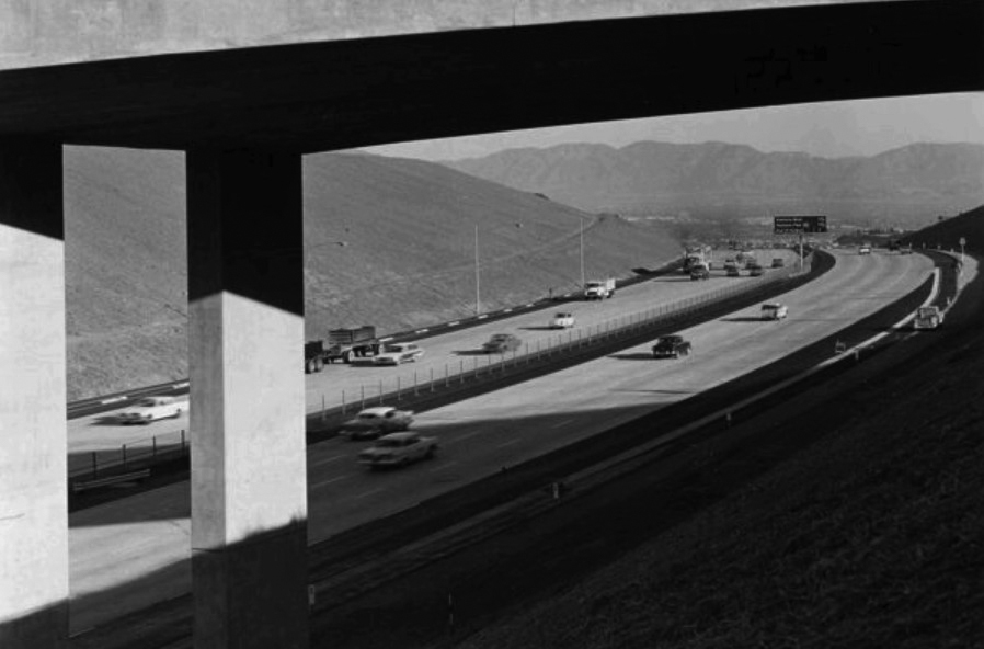 |
|
| (1962)* – View looking north through the Mulholland Dr. Bridge shortly after the completion of the Sepulveda Pass section of the San Diego Freeway (Dec, 1962). The San Fernando Valley is seen in the background. |
Then and Now
|
|
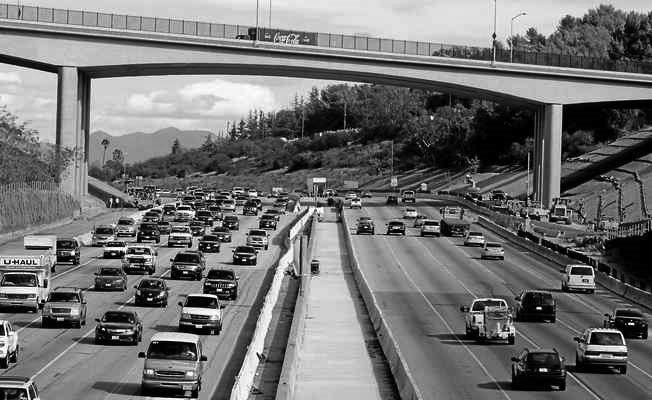 |
|
| (1961 vs 2014) - View looking north toward the Mulholland Dr. Bridge. 2014 Photo by Dean Musgrove |
Historical Notes In 2012, 52 years after it was originally built, the Mulholland Dr. Bridge was demolished and reconstructed to accommodate the widening of the I-405 freeway. The new bridge was widened by approximately 10 feet and designed to the latest seismic standards.^*^* |
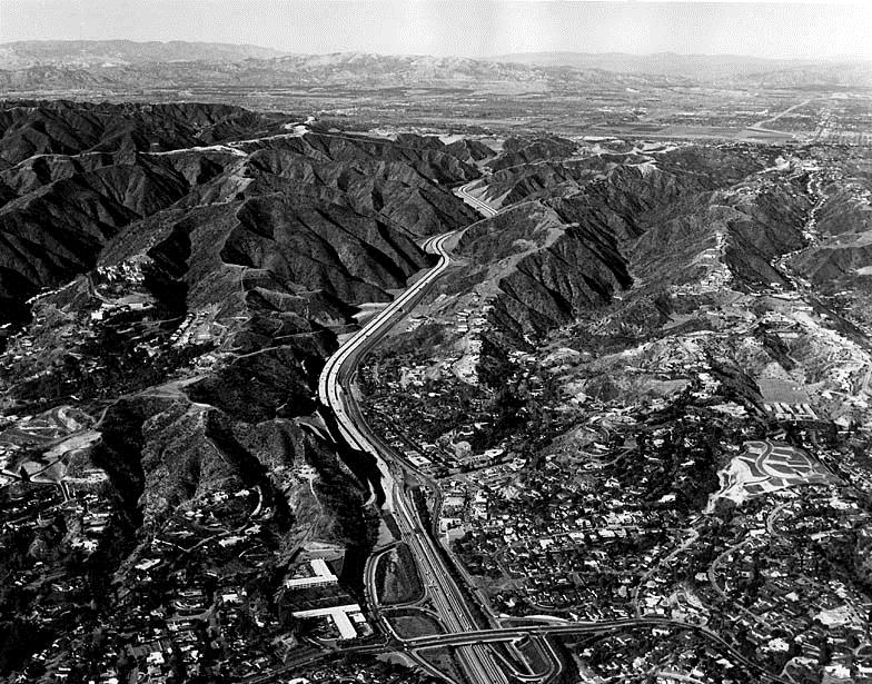 |
|
| (1962)^^^ - Six days after the Sepulveda Pass portion of the 405 Freeway opened, there's hardly a car in sight from the Sunset Boulevard bridge into the San Fernando Valley. Photo taken: Dec. 27, 1962 |
Historical Notes The freeway's congestion problems are legendary, leading to jokes that the road was numbered 405 because traffic moves at "four or five" miles per hour, or because drivers need "four or five" hours to get anywhere. Indeed, average speeds as low as 5 mph are routinely recorded during morning and afternoon commutes, and its interchanges with the Ventura Freeway (U.S. Route 101) and with the Santa Monica Freeway (Interstate 10) each consistently rank among the five most congested freeway interchanges in the United States.*^ |
.jpg) |
|
| (1962)* - View looking north toward the San Fernando Valley shortly after completion of the 405 Freeway (at the time just called San Diego Freeway).. |
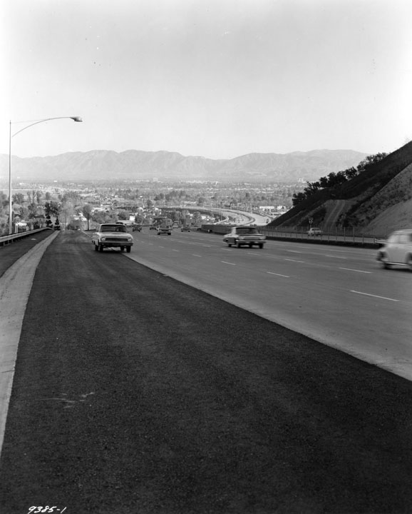 |
|
| (1962)* - View looking north toward the San Fernando Valley from the edge of the newly completed 405 Freeway. An early model Ford Rambler is seen on the left merging onto the freeway, having used the ramp at Sepulveda Boulevard and Fiume Walk in Sherman Oaks. Photo date: December 26, 1962. |
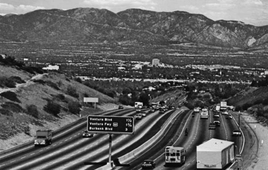 |
|
| (ca. 1970s)* - Postcard view showing the 405 Freeway entering the San Fernando Valley. |
San Diego and Ventura Freeway Interchange
|
|
| (1958)* - Looking south on the San Diego Freeway (at the time CA-7) toward the interchange with the Ventura Freeway (CA-101). This photo was taken just days before the opening of the interchange (Valley Times Photo dated July 1, 1958). |
Historical Notes Construction of the 101 Freeway (Ventura Freeway) progressed in segments, beginning with the section linking Sepulveda Boulevard and Encino Avenue that opened in 1958.* |
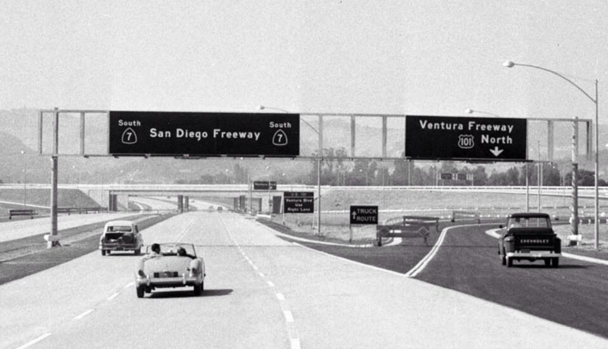 |
|
| (1961)^^ - Wide-angle view looking south on the San Diego Freeway at its junction with the Ventura Freeway shortly after it opened. What traffic congestion? Photo: Los Angeles Examiner Collection, USC Libraries |
Historical Notes Note the signage for SR-7 instead of I-405, which changed only a few years later. |
Cahuenga Pass
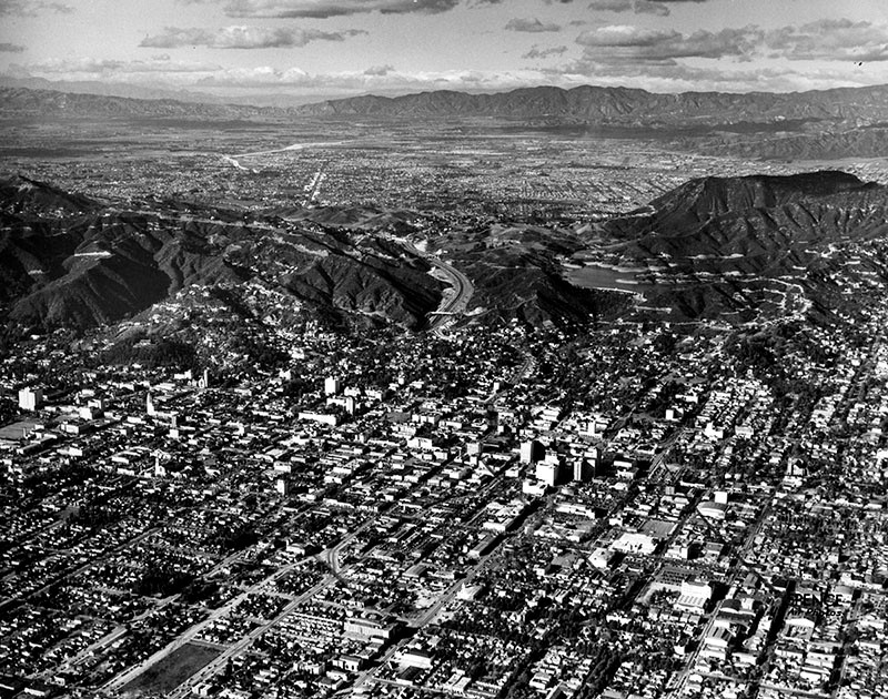 |
|
| (ca. 1950)* - Aerial view of Hollywood, north of Sunset between Highland and Gower before the second section of the Hollywood Freeway was built (1954). The Hollywood Reservoir (middle right) is in the hills above Hollywood. There is a clear view of San Fernando Valley in the background. |
Historical Notes The Cahuenga Pass has long been a convenient shortcut between the San Fernando Valley and Los Angeles Basin. The first Southern Californians likely blazed a foot-trail millennia ago, and by the late 18th century the villagers of Cabueg-na or Kaweenga (the origin of the name "Cahuenga") near Universal Studios regularly trekked through the pass. In 1852, a steep wagon road replaced the old trail, and in 1911 the Pacific Electric stretched its interurban railway tracks through the pass. Any remnants of the pass' rustic character vanished in 1940, when the Cahuenga Pass Freeway -- one of L.A.'s first – opened. |
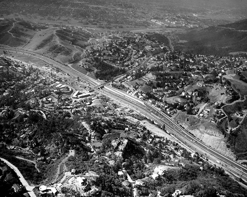 |
|
| (1957)* - Aerial view of the Cahuenga Pass and Barham Bypass, gateway to the San Fernando Valley. |
Historical Notes The first segment of the Hollywood Freeway built was a one and a half mile stretch through the Cahuenga Pass. That segment opened on June 15, 1940. It was then known as the "Cahuenga Pass Freeway." Pacific Electric Railway trolleys ran down the center of this freeway until 1952. |
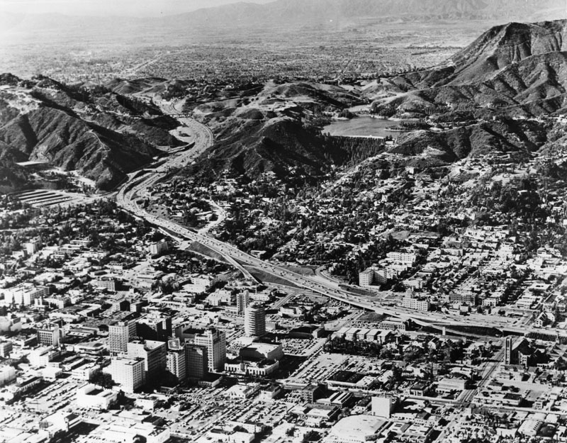 |
|
| (1960s)* - Aerial view of the Hollywood Freeway as it winds its way through Cahuenga Pass into the San Fernando Valley. The sprawling Valley can be seen in the background and Hollywood in the foreground. The large body of water in the upper right is the Hollywood Reservoir, now Lake Hollywood (Click HERE to see more in Early Views of the Hollywood Reservoir). |
Historical Notes The second section of the Hollywood Freeway that stretched from the San Fernando Valley to Downtown Los Angeles opened on April 16, 1954 at a cost of $55 million. |
Vineland Interchange
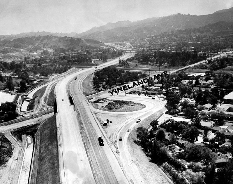 |
|
| (1957)* - View looking southeast of the Hollywood Freeway during construction at the point where it passes over Vineland Avenue. In the distance is Cahuenga Pass. |
Historical Notes The 101 Freeway from Ventura to its intersection with the Hollywood Freeway in the southeastern San Fernando Valley (the Hollywood Split) was built in the late 1950s and opened on April 5, 1960. East of the Hollywood Freeway intersection, it is signed as State Route 134 which was built by 1971. The Hollywood Freeway (Route 170) between the Ventura Freeway and the Golden State Freeway (Interstate 5) was completed in 1958. |
Then and Now
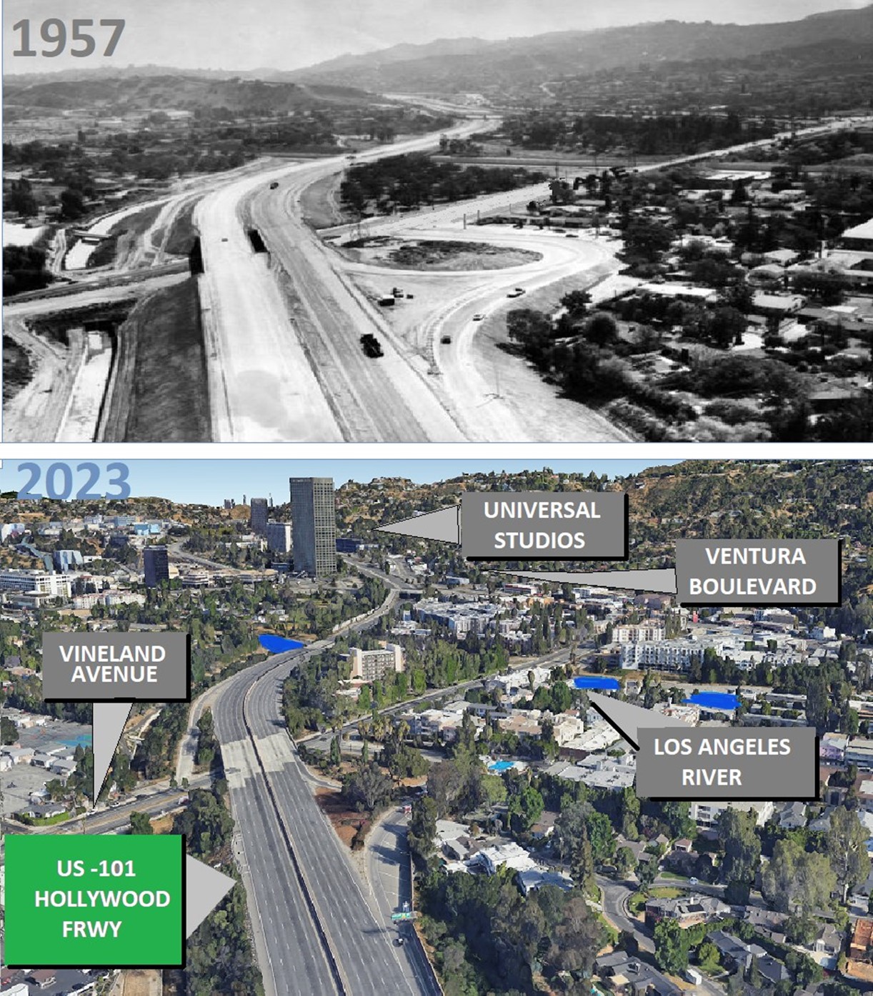 |
|
| (1957 vs. 2023)* - Looking ESE at North Hollywood/Universal City on the US -101 Hollywood Freeway with Vineland Avenue in the foreground and Cahuenga Pass up ahead. Photo comparison and annotations by Gordon Ross. |
Historical Notes Since 1957, Universal City has experienced significant growth, primarily centered around the expansion of Universal Studios Hollywood. The establishment of the modern Universal Studios tour in 1964 marked the beginning of its transformation into a theme park. Additionally, the success of the theme park spurred commercial growth in the surrounding area, resulting in the development of hotels, restaurants, and retail spaces. |
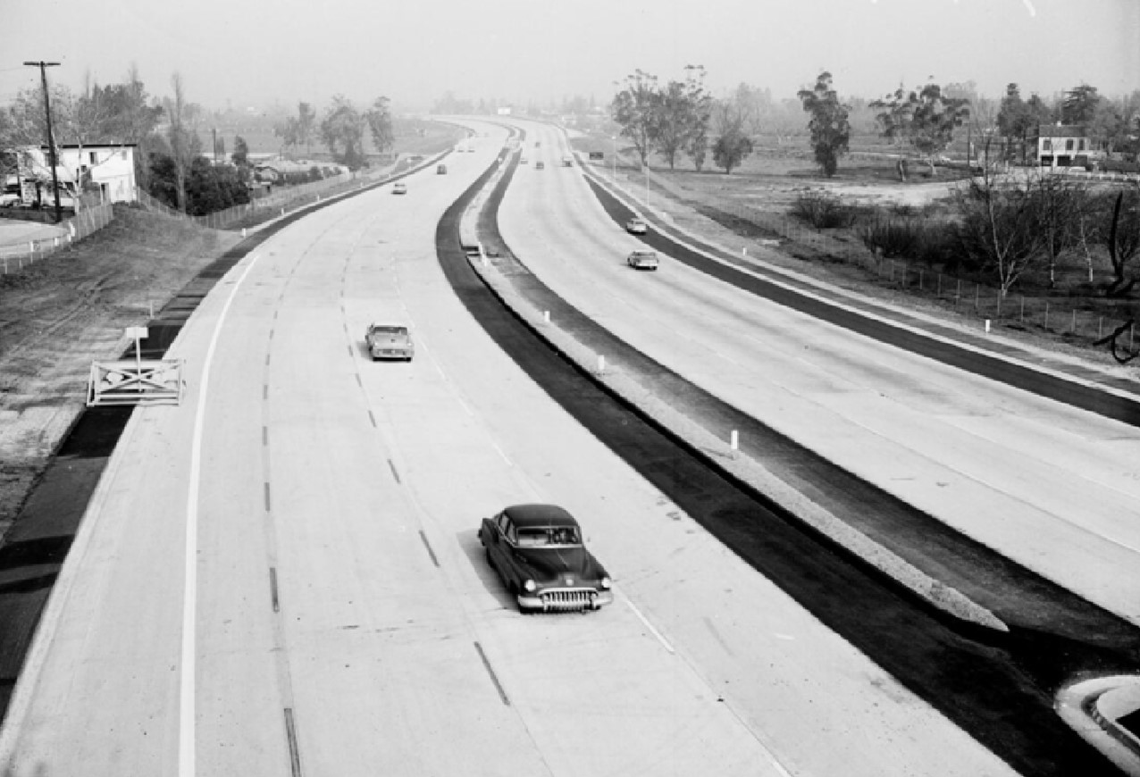 |
|
| (1958)* - Opening of new Hollywood Freeway link from Vineland to Moorpark. Photo date Feb 7, 1958 |
.jpg) |
|
| (1961)* – Photograph caption reads, "Ulcer bait: It's rush hour, and workmen are busy (right) - Photo taken at Vineland Interchange on Hollywood Freeway." Valley Times photo dated October 7, 1961. |
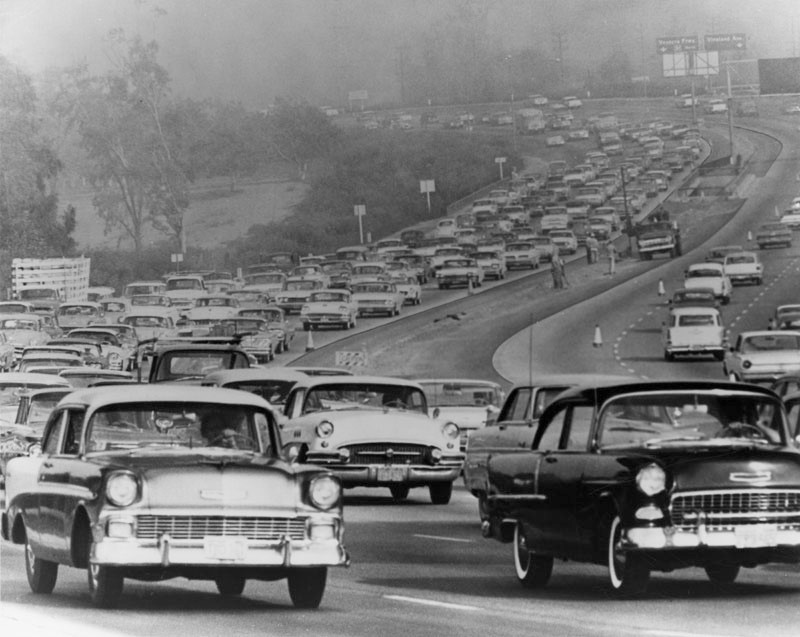 |
|
| (1961)* - Photograph caption reads: "At Vineland interchange on Hollywood Freeway, traffic creeps Downtown from Valley at 8 a.m. Workmen appear at 'island' at right despite highway department order to halt work during rush hours." |
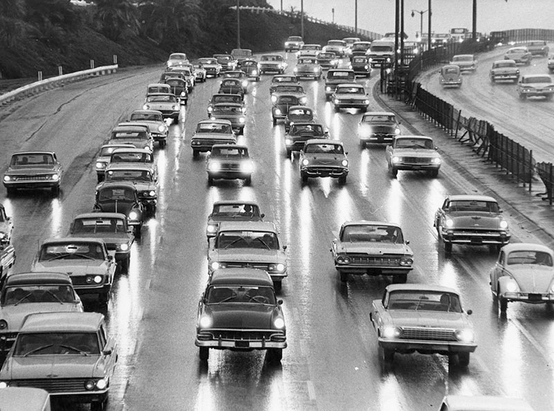 |
|
| (1964)* - Photo caption dated November 9, 1964 reads, "Cars were jammed on the freeway this morning because of the long-awaited rain, as cautious work-bound drivers moved toward Los Angeles. Photo shows cars in Cahuenga Pass on the Hollywood Freeway driving bumper-to-bumper. Police reported a few fender-bending accidents." |
Ventura Freeway (West San Fernando Valley)
|
|
| (1960)* - View looking east from the Valley Circle overpass of the Ventura Freeway. Photo caption reads: "Under Watchful Eye. Motorists on new Ventura Freeway are now under constant surveillance by such special patrolmen as James Murphy, who sit in new high-speed West Valley police car. Specially equipped Pontiac is designed to bring "death" to speeding before speeders literally kill themselves." Freeway exit sign reads: Mulholland |
Historical Notes Known as the Freeway Flyers. They used suped-up Pontiacs and Oldsmobiles on the city freeways until the CHP took over patrol duties around 1968. The 101 Freeway from Ventura to its intersection with the Hollywood Freeway in the southeastern San Fernando Valley (the Hollywood Split) was built in the late 1950s and opened on April 5, 1960. East of the Hollywood Freeway intersection, it is signed as State Route 134 which was built by 1971. |
Pacoima
 |
|
| (1950)* - View looking north from the intersection of Jouett Street and Norris Avenue in Pacoima. |
Historical Notes In 1887, Jouett Allen purchased under contract 1,000 acres of land between the Pacoima Wash and the Tujunga Wash. He chose the name that had long been applied to the beautiful canyon on the north and the “river” that flowed down from it. The land was purchased from the Maclay Rancho Water Co. which had taken over Senator Charles Maclay’s holdings in the Valley. Allen retained 500 acres for himself and subdivided the remainder in 1-acre tracts. From this the town of Pacoima was born. Pacoima was renamed 'Mulholland' in 1912 to take advantage of William Mulholland's popularity. It was hoped that the name change would give a boost to the area's development. But that only lasted for one year before the name reverted back to Pacoima. Click HERE to see more. By the 1950s, the rapid suburbanization of the San Fernando Valley arrived in Pacoima, and the area changed almost overnight from a dusty farming area to a bedroom community for the fast-growing industries in Los Angeles and nearby Burbank and Glendale, with transportation to and from Pacoima made easy by the Golden State Freeway. Pacoima is bordered by the Los Angeles districts of Mission Hills on the west, Arleta on the south, Sun Valley on the southeast, Lake View Terrace on the northeast, and by the city of San Fernando on the north.*^ |
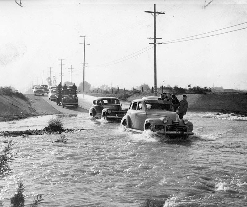 |
|
| (1954)* - Valley Times photograph caption dated March 6, 1954 reads, "Not too long ago this is the way motorists and pedestrians were forced to negotiate Pacoima Wash at Laurel Canyon Boulevard during storms. Then Valley progress stepped forward." Today, Pacoima Wash is cement lined and goes under Laurel Canyon near where the Golden State and 118 freeways meet. Click HERE to see a recent overhead view. |
Historical Notes Pacoima Wash is a major tributary of the Tujunga Wash, itself a tributary of the Los Angeles River, in the San Fernando Valley. The stream begins at Mount Gleason, 6,502 ft, in the western San Gabriel Mountains of the Angeles National Forest. The upper reaches, sometimes known as Pacoima Creek, flow through Pacoima Canyon as a rapid mountain stream. It then reaches the Pacoima Dam Reservoir in the western San Gabriel Mountains of the Angeles National Forest and proceeds south in a free-flowing stream alongside Pacoima Trail Road. Below the dam, it is generally known as the Pacoima Wash. From there, it joins several other unnamed streams that drain the nearby mountains, collecting at Lopez Dam. South of that dam, Pacoima Wash is encased in a concrete flood control channel, and travels south from Kagel Canyon in Sylmar though San Fernando, Pacoima, Mission Hills, Panorama City, and Van Nuys.*^ |
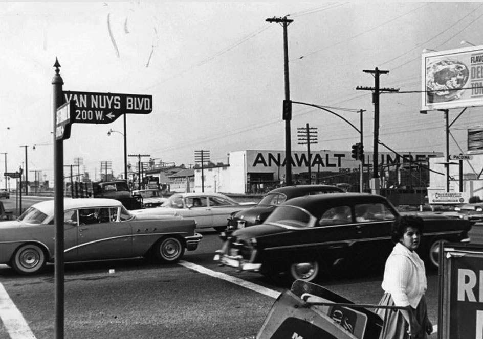 |
|
| (1950s)^ – View looking northeast showing the intersection of Van Nuys Boulevard and San Fernando Road. Click HERE for contemporary view. |
Whiteman Airport (aka Whiteman Air Park, Pacoima)
 |
|
| (1960)* - View showing an airplane coming in for a landing at Whiteman Air Park located at San Fernando Road and Pierce Street in Pacoima. |
Historical Notes Whiteman Airport was founded as "Whiteman Air Park" in 1946 on a farm by pilot Marvin Whiteman Sr. as a non-tower controlled, private airport. Later Whiteman Manufacturing Co. was built on the airport's west side. In 1970 the airport was purchased by the County of Los Angeles. During the 1980s the name was changed to "Whiteman Airport", but it is still commonly referred to as "Whiteman Airpark" by old-time local pilots to this day.*^ |
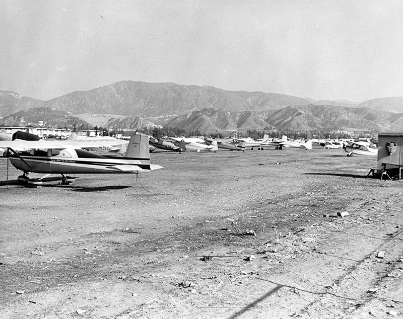 |
|
| (1963)* - Ground view showing Whiteman Air Park in Pacoima. The 'Air Park' did not have a control tower at the time. |
Historical Notes In 1988, an FAA-approved and funded control tower was installed in Whiteman Airport. |
Golden Valley Gun Club (Jessup Park, Pacoima)
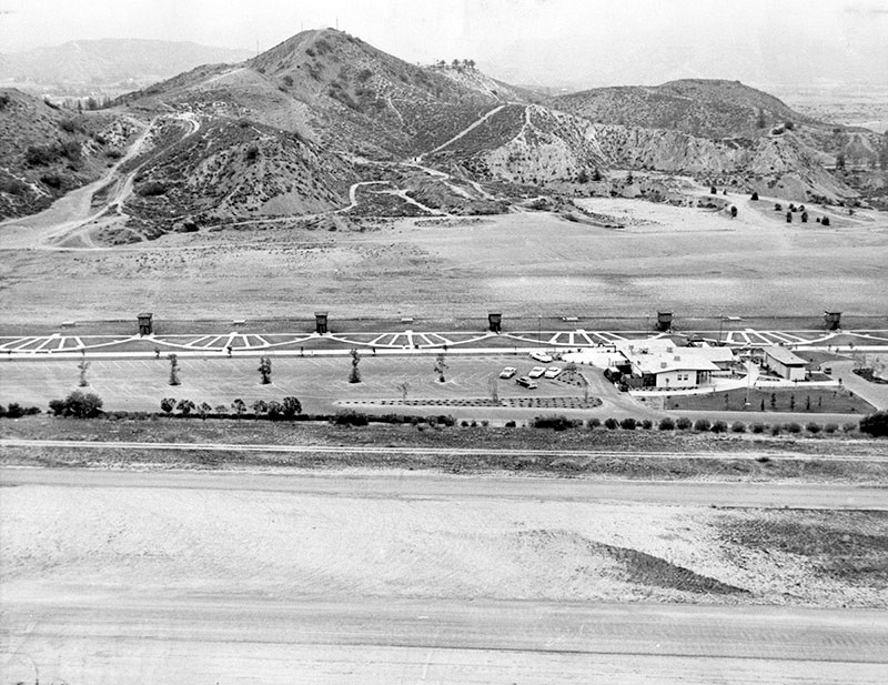 |
|
| (1962)* - View looking northeast showing the Golden Valley Gun Club located at 12651 Osborne Street in Jessup Park. The Whiteman Air Park is seen in the foreground. |
Historical Notes Golden Valley Gun Club, established in 1958, opened on May 7th 1960. It was located on the north corner of San Fernando Rd & Osborne St, adjacent to Whitman Airport. It had 14 trap and 9 skeet fields, with rifle and pistol range.* |
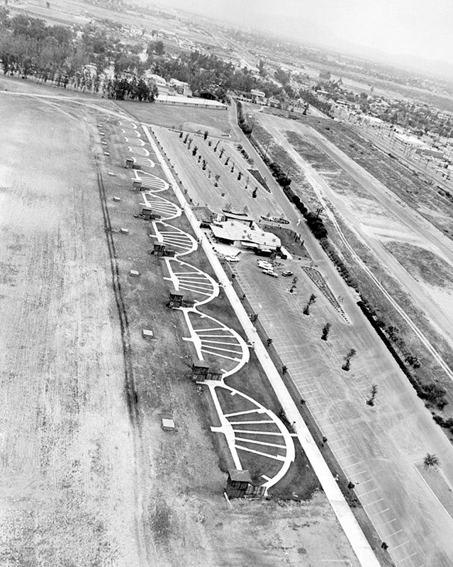 |
|
| (1962)* - Aerial view showing the Golden Valley Gun Club in Jessup Park* with the Whiteman Airport seen at far right. |
Historical Notes Jessup Park was named after Roger Wolcott Jessup. Roger and Marguerite Jessup founded Jessup Farms Dairy in 1919. It was located just north of Glendale. The dairy farm became the largest privately owned dairy in the United States at the time.* |
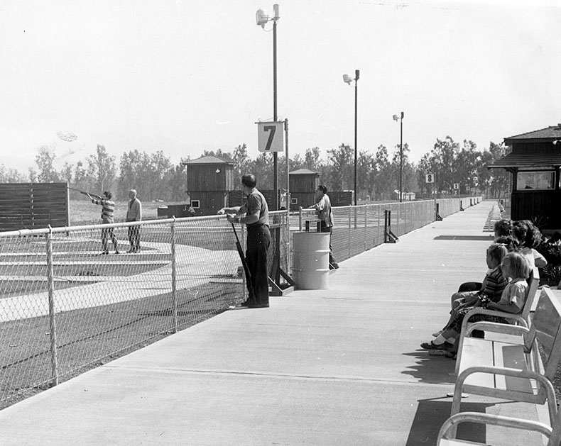 |
|
| (1960)* - Photo caption reads, "Shooters make use of range at Pacoima's new Golden Valley Gun Club located within Roger Jessup Park. Opened this year, the club provides trap and skeet facilities, a clubhouse and restaurant." |
Sylmar
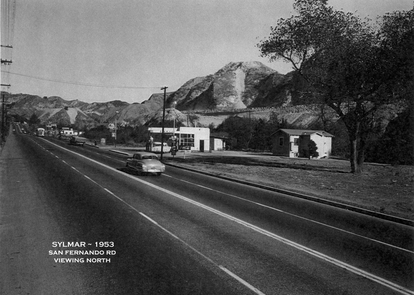 |
|
| (1953)^ – View looking north showing San Fernando Rd (US 99 & US 6 then). This was once the only way to head north out of the SFV. The I-5 Freeway is under construction in the background. A Shell Gas Station sits at approximately what is today, 14928 San Fernando Rd and the SPRR tracks are directly behind it. Another Gas Station is up the road a bit and was about where the Tunnel Station once was. On the road, as far as one can see, is where Sierra Hwy (US 6) begins by turning right over Weldon Canyon’s bridge. Photo courtesy of Southern California Regional Rocks and Roads |
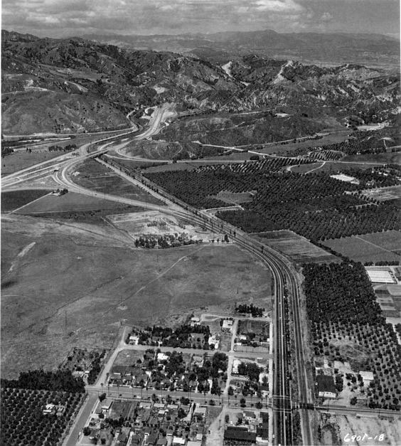 |
|
| (1954)^ – View looking north showing the transition from the Golden State Freeway to San Fernando Road. This is near the site of the I-5 / I-210 interchange today. Photo courtesy of Southern California Regional Rocks and Roads |
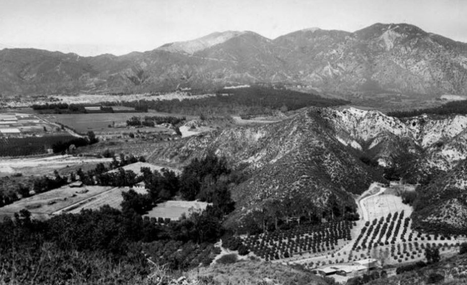 |
|
| (1957)* – Panoramic view from a spot near today's 210/118 Freeways. The photo was taken from the ridge flanking Lopez Canyon and shows the large ranch of Fritz Burns, Panorama City developer, with a new subdivision in the far background sweeping in from the San Gabriel Mountains. The charred area on the mountain top is above Olive View Sanitarium in Sylmar (Photo from the Valley Times). |
Historical Notes The Valley Times photo caption reads "People who prefer a rural way of life fled thickly-populated areas to develop canyons for home sites, only to discover their efforts to seek isolation were in vain. Agricultural acreage in the San Fernando Valley and nearby Santa Clara Valley dropped from 61,300 in 1945 to 35,000 in 1957." The Fritz Burns Ranch in the foreground has a colorful past that includes a reindeer herd, German POWs and silent films. Starting in the 1950s, the Burns Ranch was home to a reindeer herd that spent the Christmas season at Southern California shopping centers, including Panorama City. Dayle Hunter's family managed and lived at the ranch in the 1960's and '70s. The ranch is also known to have been a camp for a few of the 400,000 Axis prisoners of war held in the United States during World War II. Much of Sylmar was formerly known as San Fernando. The San Fernando prisoners are said to have been used as citrus workers. #^*^ D.W. Griffith owned the ranch before Burns and shot films there. The site of the Griffith Ranch is California Historical Landmark No. 716. |
Rancho Sombrero (Stetson Residence)
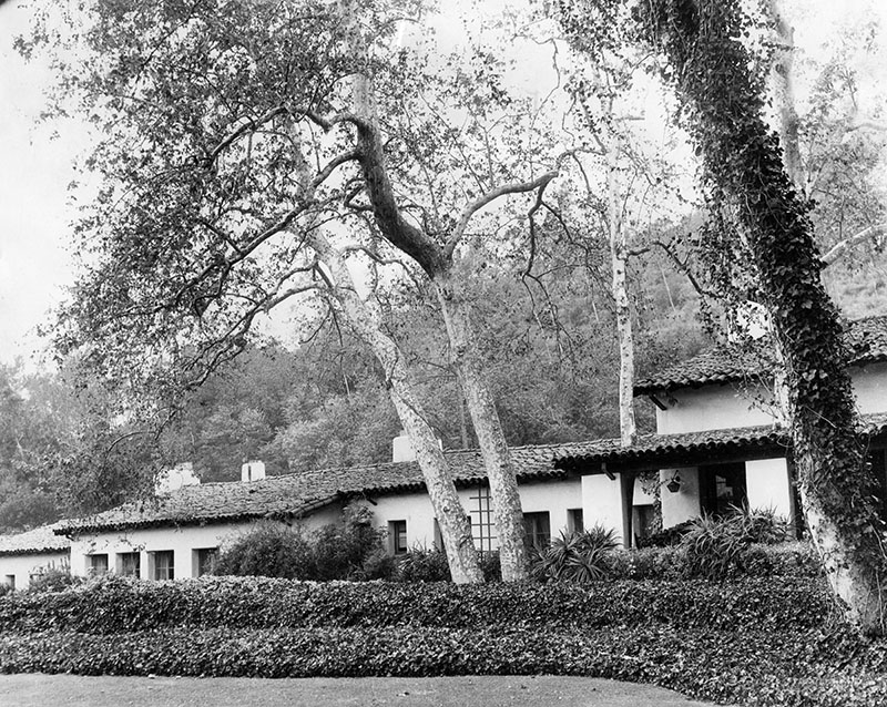 |
|
| (1958)* - The Spanish style ranch house of G. Henry Stetson, whose father invented the famous cowboy hat that bears the family name. The Sylmar property was purchased by Stetson in 1926. It consisted of 286 acres and was named Rancho Sombrero. |
Historical Notes Stetson sold the estate to the Mormon Church in 1958. Damaged by the 1971 earthquake, the house was razed and the church sold the property to a developer in 1978. A portion of the estates land was turned into Stetson Ranch Park. However, most of the land was developed into the Oakridge Mobile Home Park. The mobile home park was ravaged by the Sayre fire in November 2008 and 482 of the 600 homes burned to the ground.^ |
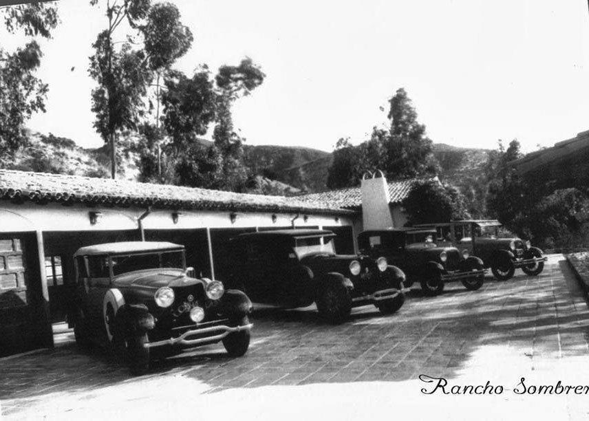 |
|
| (1930s.)^ - Four cars are parked in the driveway of Rancho Sombrero. |
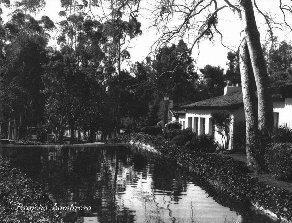 |
|
| (1930s)#^*^ - View showing the Rancho Sombrero with small lake adjacent to the house. Photo courtesy of San Fernando Valley Then and Now |
Laurel Drive-in (Pacoima)
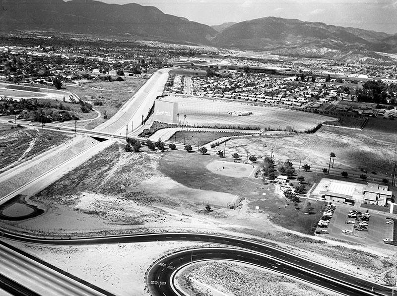 |
|
| (1964)* – Aerial view looking north showing the Laurel Drive-in in Pacoima. The Pacoima Wash can be seen vertically at left, as well as San Fernando High School's football field. The Golden State (5) Freeway is at the bottom left. |
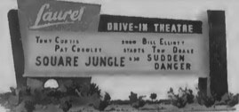 |
(1955)^ - Laurel Drive-In Theatre, located at 10770 Laurel Canyon Boulevard, Pacoima. Now showing a double feature: Square Jungle starring Tony Curtis and Pat Cowley and Sudden Danger starring Bill Elliott and Tom Drake. Photo: Cinema Treasures |
Historical Notes The Laurel Drive-in was operating by 1955. It was demolished in the early-1970’s to make way for the 118-Fwy. |
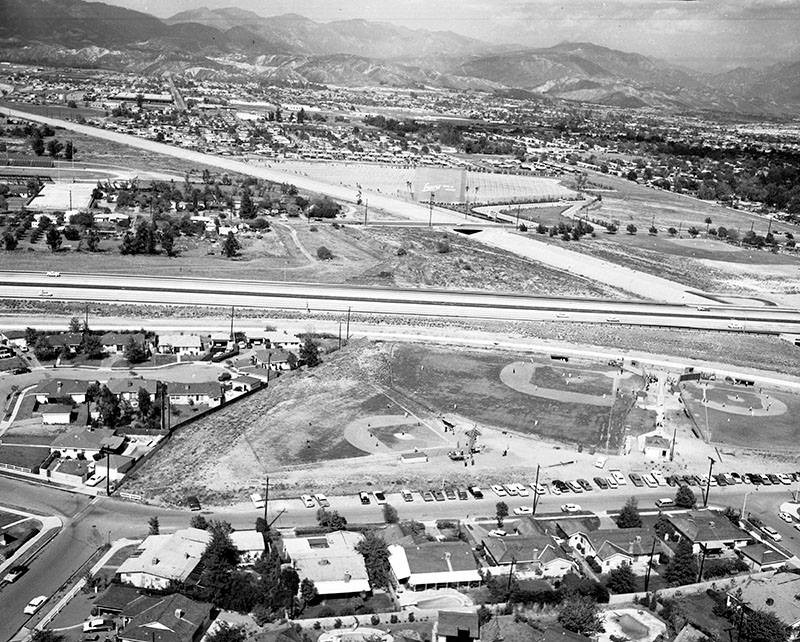 |
|
| (1964)* – View looking east showing I-5 as it passes over Pacoima Wash. Adjacent to the wash is the Laurel Drive-in, demolished in 1970's to make room for the 118 (Simi Valley Freeway). It was situated very near where the 5 and 118 intersect today. Several baseball diamonds are seen in what was then called Paxton Park, renamed Ritchie Valens Park in 1994. |
Historical Notes In the 1990s Richard Alarcon, a Los Angeles City Council member who represented Pacoima, proposed changing the name of Paxton Park to honor Ritchie Valens. Hugo Martin of the Los Angeles Times said in 1994 that Alarcon proposed the rename so Pacoima residents will "remember Valens's humble background and emulate his accomplishments." The annual Ritchie Valens Fest, a festival, was created in 1994 to honor the renaming of the park.*^ |
Travel Town (Griffith Park)
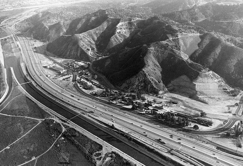 |
|
| (1964)* - Aerial view of Travel Town in Griffith Park, Ventura Freeway and the Los Angeles River. Photo by George Brich |
Historical Notes In the late 1940s, Charley Atkins, a Recreation and Parks employee, along with a handful of rail enthusiast friends, had the idea that a steam locomotive would make an attractive addition at the Griffith Park miniature railroad ride. The original intention of the Museum was to be a "railroad petting zoo," an opportunity for the children of Los Angeles to "imagineer" themselves as engineers. The City of Los Angeles Harbor Department had two little engines destined for scrap that seemed to fit the bill. The idea escalated as Atkins, with the enthusiastic support of former Recreation and Parks Department General Manager George Hjelte and Superintendent of Recreation William Frederickson, initiated contacts with major railroads in California to determine what equipment they might be willing to donate. At that time, the steam locomotive era was drawing to a close, and Atkins found a good response. Travel Town was formally dedicated on December 14, 1952. The concept of a combined transportation museum and recreation center blossomed, and wishes for donations were generously fulfilled. In 1965, Travel Town's exhibits were re-grouped, and the park re-dedicated.* |
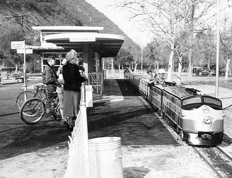 |
|
| (1948)* - Children riding the miniature train at Griffith Park's Travel Town while onlookers enjoy the view. |
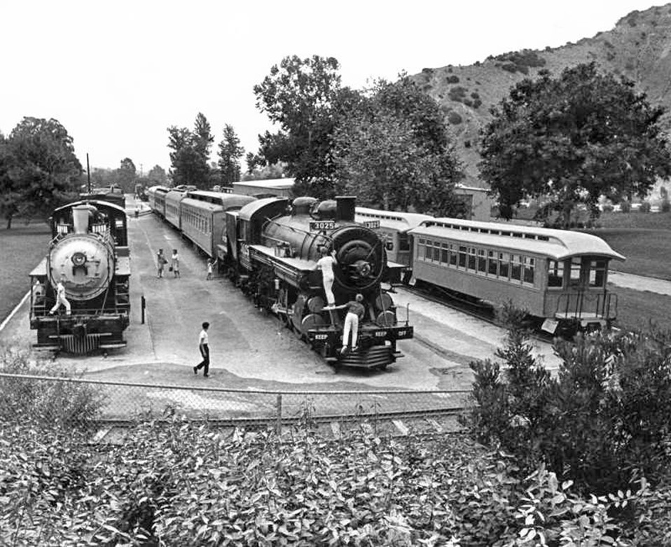 |
|
| (1967)* - Travel Town in Griffith Park (Herald Examiner Collection) |
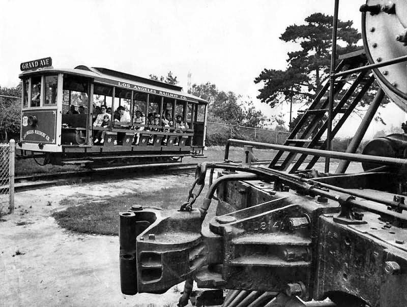 |
|
| (1970)* - Trolley cars from the 1880-1902 era at Griffith Park's Travel Town, a transportation museum, delight old and young. In foreground is part of an old steam locomotive. |
* * * * * |
Devonshire Street (Chatsworth)
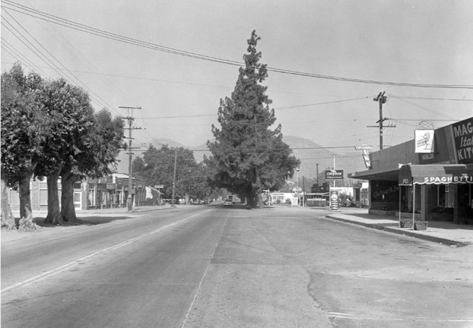 |
|
| (ca. 1950s)* - Looking west on Devonshire Street towards Owensmouth Avenue in Chatsworth. Note the tall trees that appear to be in the center of the street. Photo: Los Angeles City Archives Department of Engineering |
 |
|
| (2018)* - Looking west on Devonshire Street towards Owensmouth Avenue in Chatsworth. |
Then and Now
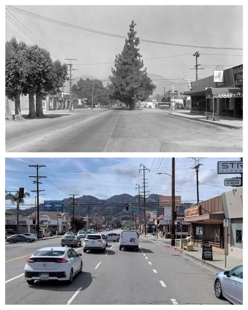 |
|
| Then and Now: Looking west on Devonshire Street towards Owensmouth Avenue in Chatsworth. Photo comparison by Trey Callaway* |
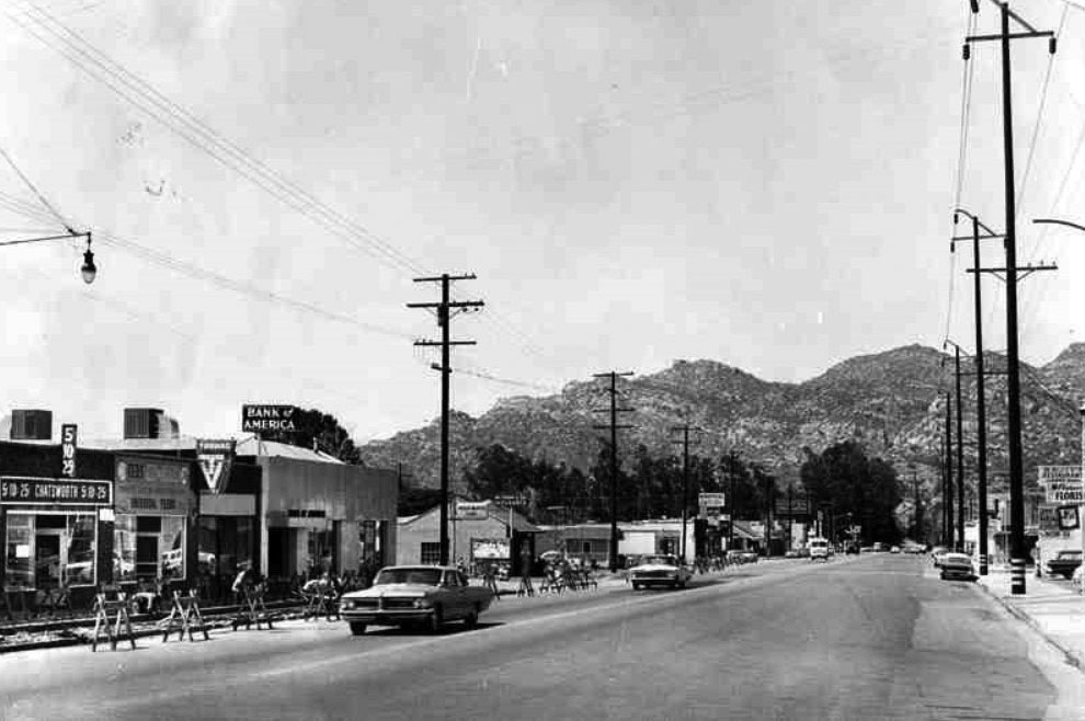 |
|
| (1964)* – View looking west on Devonshire Street from Owensmouth Avenue toward the Santa Susana Mountains. |
Historical Notes A new high voltage power line (34,500 Volts) was installed on the north side of Devonshire in the early 1960s to provide for the load growth in the NW San Fernando Valley. |
* * * * * |
The Munch Box
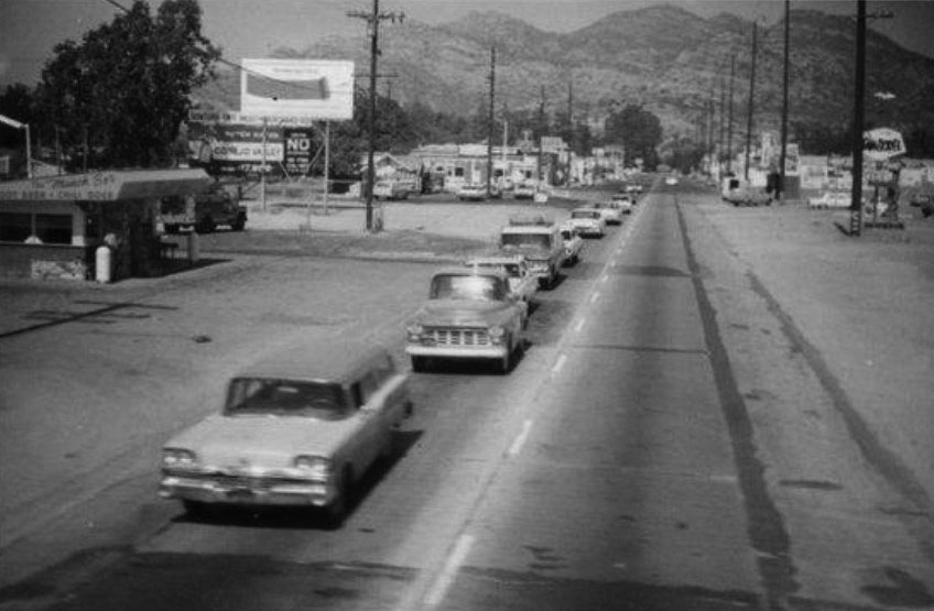 |
|
| (ca. 1960)* – View looking west on Devonshire toward Owensmouth from the railroad tracks. The Munch Box stands on the south side of the street at 21532 Devonshire Street. The first car in the left foreground is a 1959 Ford Ranch Wagon. |
Historical Notes Owned and operated by Buck Barker and family, The Munch Box is one of Chatsworth’s Historic-Cultural Landmarks. Buck’s Uncle John and Aunt Linda owned The Munch Box for the first 30 years, with Buck and his wife, Claire following in their footsteps. It has remained a family owned operation since its opening in 1956. |
 |
|
| (ca. 1960)* – View looking west on Devonshire toward Owensmouth from the railroad tracks. The Munch Box stands on the south side of the street at 21532 Devonshire Street. |
Historical Notes The Munch Box, a historic fast-food restaurant located in Chatsworth, has been serving up classic Americana since 1956. Designed by architect Marcel Dumar in the distinctive Googie style, this bright yellow and red roadside burger stand quickly became a local favorite. In its early days, it even featured a hitching post for horses and made its own root beer on-site, attracting famous patrons like western stars Roy Rogers and Dale Evans. With its jet-age overhang and compact 300-square-foot structure, The Munch Box stands as one of the Valley's best surviving examples of Googie architecture. |
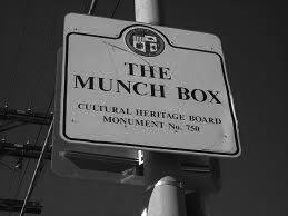 |
Historical Notes In 2003, The Munch Box became the first fast-food stand to be placed on the list of Historic-Cultural Monuments (No. 750). |
|
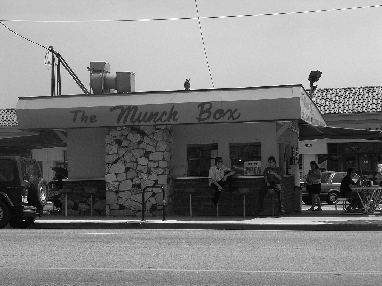 |
|
| (2009)* – View showing The Munch Box with extended covered patio dining and original stools for seating in front. A new shopping center can be seen in the background. Photo courtesy of Chatsworth Historical Society |
Historical Notes Opened in 1956, the menu has remained basically the same with hickory burgers, mushroom burgers and chili dogs to name a few. Some things have changed over the years--root beer is no longer made on the premises and sold for 10 cents, but the root beer float is still the popular drink. The hitching post to tie up your horse used to be directly behind the building and is now gone. |
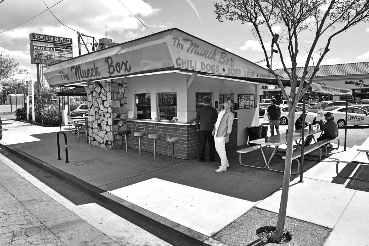 |
|
| (2020)*– The Munch Box located at 21532 Devonshire Street in Chatsworth. The first fast-food stand to be placed on the list of LA Historic-Cultural Monuments (No. 750). Photo courtesy of William Lowden |
Historical Notes Huell Howser was invited to The Munch Box to see what sites Chatsworth has to offer. His program included an interview with Buck and his wife Claire discussing the history of the family. Still a meeting place and favorite place to drop by, The Munch Box also has been known to have antique car collectors gather to show off their 50’s style rides. |
* * * * * |
Stoney Point
 |
|
| (ca. 1960s)* - Postcard view looking northeast showing a two lane Topanga Highway at lower-left with Stoney Point in the background |
 |
|
| (Early 1970s)^# - View looking north from the top of Stoney Point showing Topanga extension to the 118 freeway under construction. Note the freeway buildup to the upper right. Also note the water tank for the mobile home park at the upper left. |
 |
|
| (2014) – Google satellite view directly above Stoney Point (center-bottom), looking up toward where Topanga Canyon Boulevard (27) intersects with the 118 Freeway. Santa Susana Pass Road can be seen at lower left. |
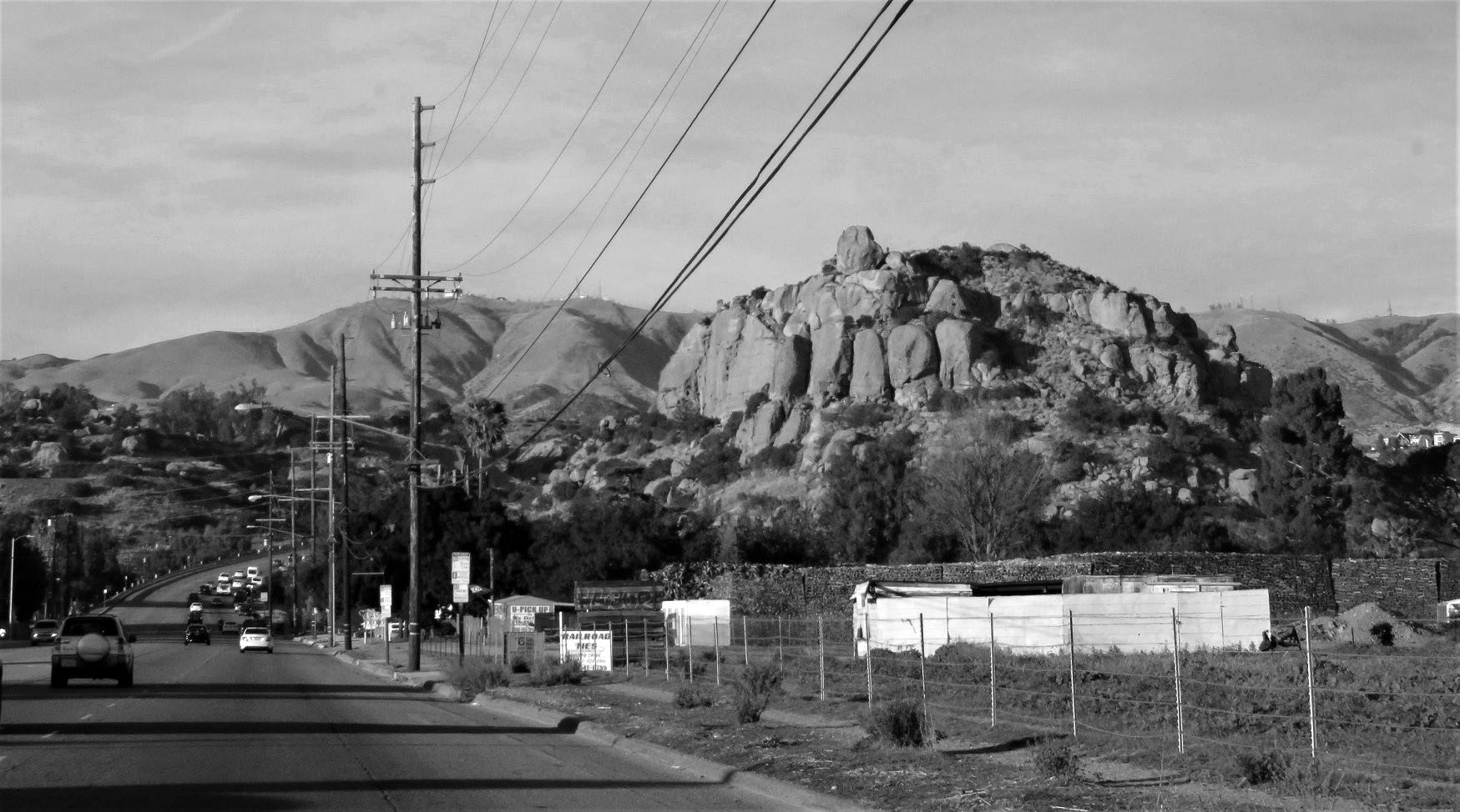 |
|
| (2017)* – View looking north on Topanga Boulevard toward the 118 Freeway from just north of Chatsworth Street with Stoney Point seen on the right. |
Historical Notes Click HERE for More Early Views of Stoney Point. |
* * * * * |
Simi Freeway (118)
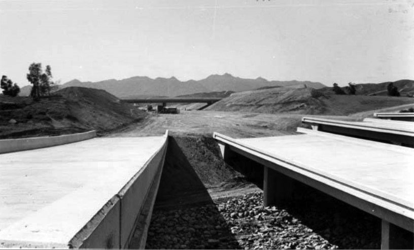 |
|
| (ca. 1979)* - The Simi Freeway (118) construction moves ahead with the mammoth task of removing millions of yards of dirt from the final segment. This area is between Louise and Encino Avenues. |
Historical Notes Construction of the Simi Valley Freeway (118) began in 1968 and the last section of freeway opened in 1979. The segment of freeway between Balboa Boulevard and Tampa Avenue was one of the last freeway segments to be built in the Los Angeles area. Before the freeway was built, the route went through Simi Valley on Los Angeles Avenue and Keuhner Drive, then crossed into the San Fernando Valley on Santa Susana Pass Road. The eastern segment used Devonshire Street through the San Fernando Valley. During the 1932 Summer Olympics, it hosted part of the road cycling event. In December 1994, the portion of Route 118 constructed to freeway standards was renamed the Ronald Reagan freeway.* |
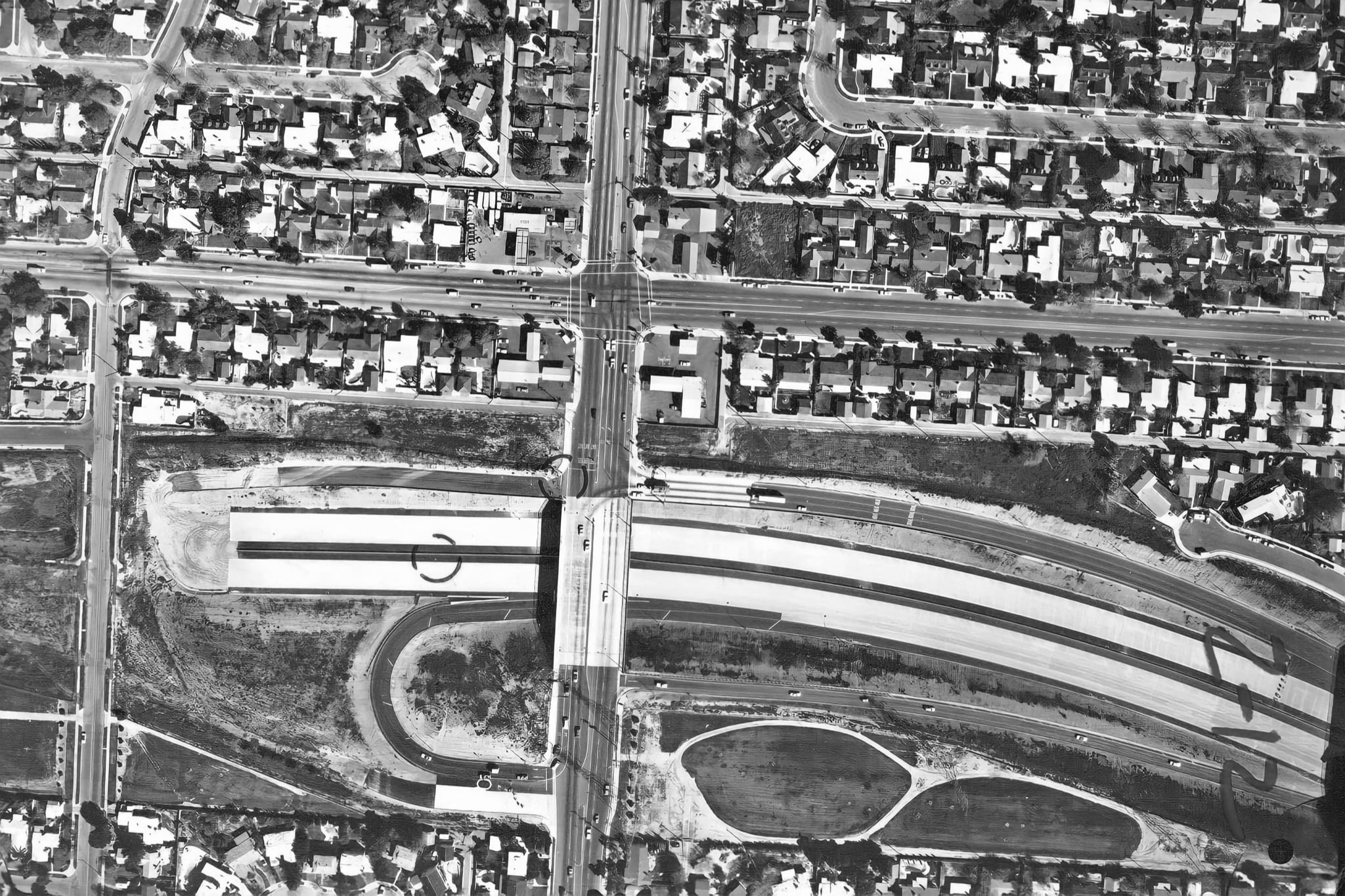 |
|
| (1979)* - Aerial view showing the Simi Valley Fwy, now Reagan Fwy (CA-118), under construction at Balboa Blvd in Granada Hills. |
Historical Notes Prior to the freeway completion, westbound traffic had to get off the 118 at Balboa, drive down Rinaldi to Corbin, to Devonshire, to Desoto, and then North to the 118. When they closed the gap from Balboa to De Soto, most, if not all, of those bridges were built on the ground and the dirt excavated from underneath. |
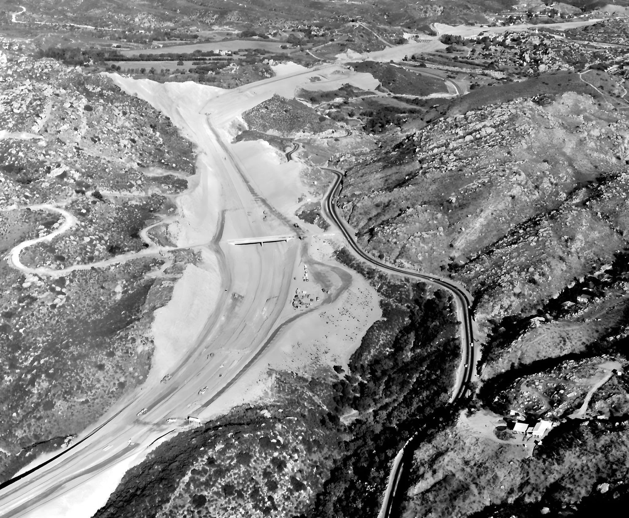 |
|
| (1968)* - Looking NE over Simi Valley Fwy (now Reagan Fwy CA-118) construction in Santa Susana Pass. Rocky Peak Rd OC in center; Santa Susana Rd at right. |
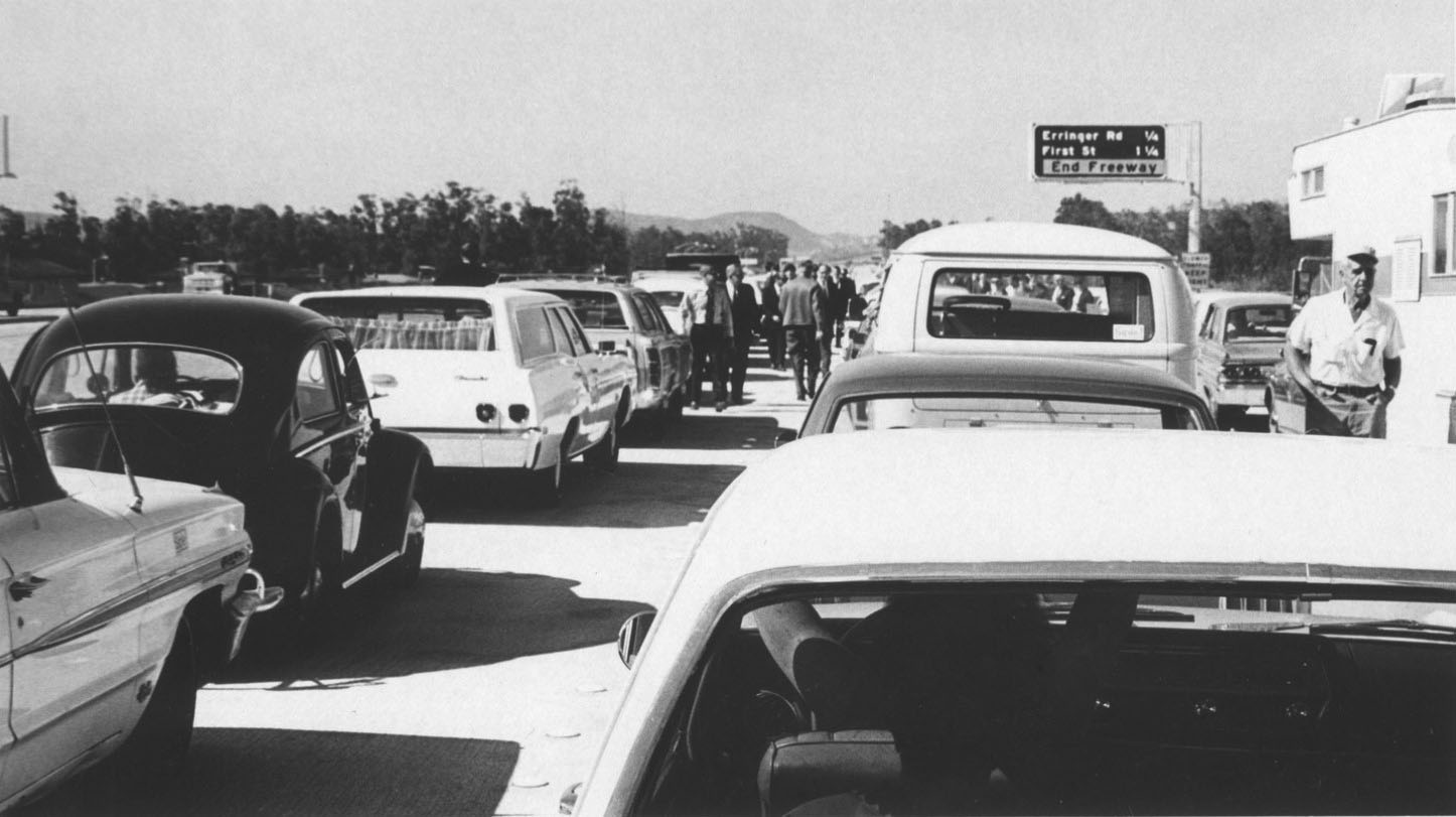 |
|
| (1970)* - First Backup - Cars line westbound lanes of new Simi Valley-San Fernando Valley Freeway before opening-day procession begins. Two-mile extension of freeway was officially dedicated yesterday. Freeway will eventually link Santa Paula Freeway near Saticoy with Foothill Freeway near Sunland for total stretch of 47 miles. Photo Date: October 23, 1970. |
 |
|
| (1980s)* - View of the I-5 and I-14 interchange just north of the San Fernando Valley, also known as the Newhall Pass Interchange (officially Clarence Wayne Dean Memorial Interchange). In 1971, the Sylmar earthquake caused major damage to several of these bridges and in 1994, the Northridge quake caused more damage. |
Historical Notes A total collapse of the southbound Interstate 5 to northbound State Route 14 overpass occurred as a result of the February 9, 1971 Sylmar earthquake. This collapse resulted in the additional collapse of the intersecting southbound State Route 14 to southbound I-5 overpass (as this connector bridge was directly beneath the 5/14 overpass). Both bridges fell directly onto the southbound I-5 truck bypass. The interchange was rebuilt in 1973, with additional steel rebar reinforcement. The January 17, 1994 Northridge earthquake caused the southbound State Route 14 to northbound I-5 connector to collapse. It also caused the south 14 to south I-5 overpass to collapse directly onto the main I-5 freeway and the southbound I-5 truck bypass, nearly exactly as had happened in the 1971 Sylmar earthquake. The latter collapse caused the death of Los Angeles Police Department motorcycle officer Clarence Wayne Dean, who, while reporting to work, fell from a partially collapsed bridge when he was unable to stop in time. The interchange was later dedicated the Clarence Wayne Dean Memorial Interchange in his honor. The collapse also closed the Metrolink's Antelope Valley Line, which began operation to Lancaster soon after. The interchange was partially reopened on July 8, and completed in 1995 with additional reinforcing on the overpass support columns. |
Fotomat Kiosks
 |
|
| (1970s)* – Postcard view of a Fotomat kiosk. This was a common sight in the parking lots of shopping centers throughout Southern California during the 1960s, 70s, and 80s. Photo courtesy of Web Urbanist |
Historical Notes Fotomat was a retail chain of photo development drive-through kiosks located in shopping center parking lots. Fotomat Corporation was founded by Preston Fleet in San Diego in the 1960s, with the first kiosk opening in Point Loma, California in 1965. At its peak around 1980 there were over 4,000 Fotomats throughout the United States, primarily in suburban areas. Fotomats were distinctive for their pyramid-shaped gold-colored roofs and signs with red lettering, usually positioned in a large parking area such as a supermarket or strip mall, as the Fotomat huts required a minimal amount of land and were able to accommodate cars driving up to drop off or pick up film. |
 |
|
| (1970s)* – View showing a 1969 Volvo 142 at a Fotomat kiosk drive-thru. Note the 1971 Gremlin parked in the background. Photo courtesy of Classic Hollywood/Los Angeles/SFV |
Historical Notes Photomat sold Kodak-brand film and other photography-related products, and offered one day photo finishing. They often hired female employees to work in the small buildings and called them "Fotomates." The Fotomate uniform was a royal blue and yellow smock top. Male employees were called "Fotomacs" and their uniform was a light blue polo shirt. The company's main product, overnight film development, was rendered noncompetitive by the late 1980s development of the minilab, which provided one-hour photo development and could be installed on-site without a large capital investment. |
Tampa and Parthenia
.jpg) |
|
| (1960)* - Looking north on Tampa Avenue at Parthenia Street in Northridge. |
Then and Now
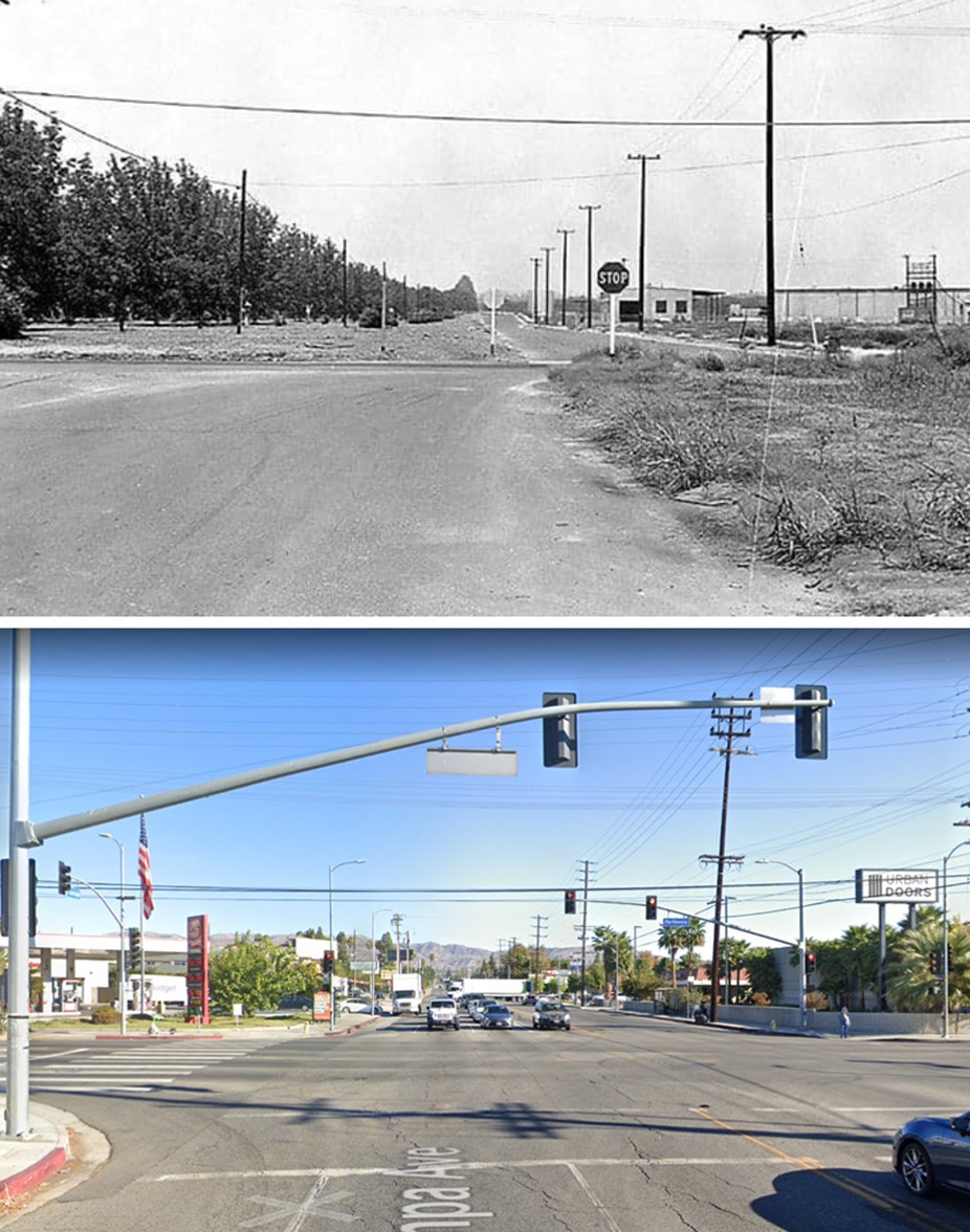 |
|
| (1960 vs. 2022)* - Looking north on Tampa Avenue at Parthenia Street in Northridge. |
* * * * * |
Northridge Fashion Center
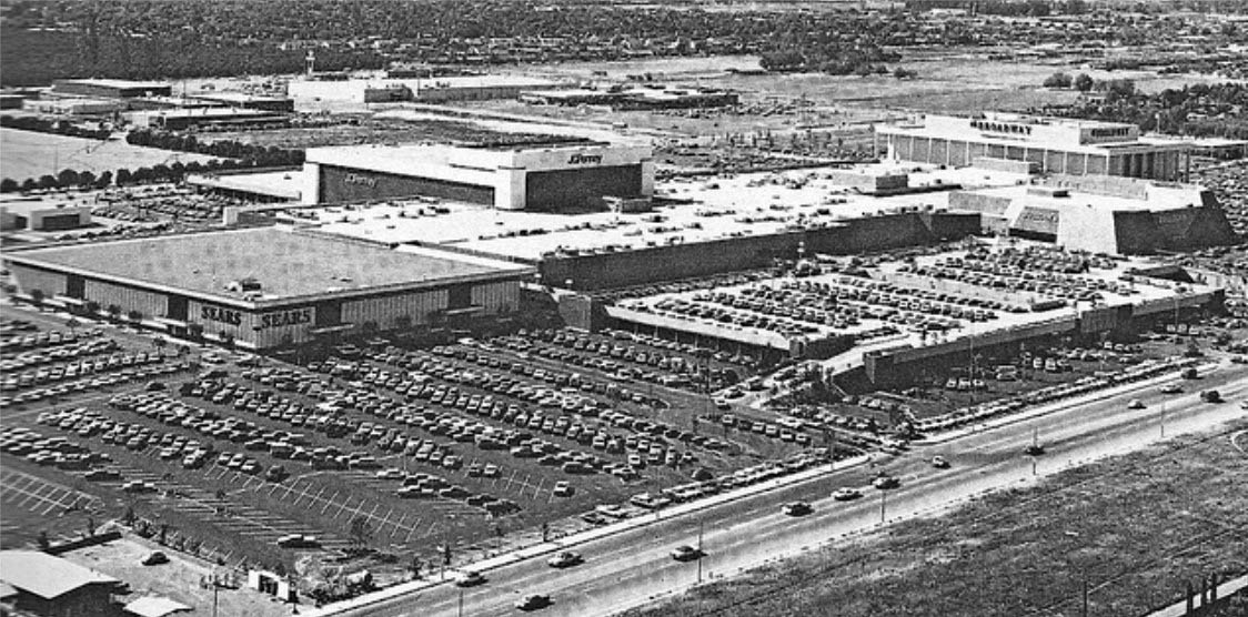 |
|
| (Early 1970s)* – View looking northwest of the Northridge Fashion Center. It opened in four phases, between September 1971 and April 1972. Upon its completion, it was the largest mall in Southern California. |
Historical Notes Northridge Fashion Center had been in the early stages of construction when the Sylmar quake hit on February 9, 1971. There was damage to structures being built, such as the Bullock's store. However, all compromised construction was soon rebuilt, with work proceeding as planned. Unfortunately, the Northridge temblor of January 17, 1994 caused severe damage to the mall. The Bullock's and Penney's stores collapsed, The Broadway and Sears suffered significant structural damage and two parking garages were leveled. However, the bulk of the mall proper was left fairly intact. The mall was closed for well over a year while repairs were made. Bullock's was rebuilt from the ground up and expanded to 200,000 square feet. The Broadway, Penney's and Sears were gutted and reconstructed. |
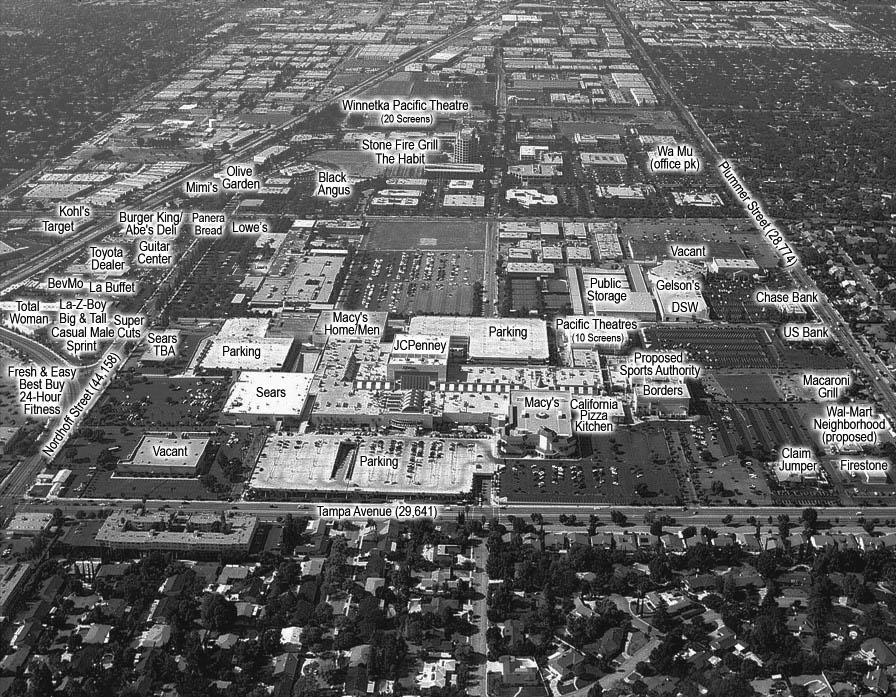 |
|
| (ca. 2012)* – View looking west showing the Northridge Fashion Center and surrounding area businesses. |
Historical Notes A second expansion of the Northridge Fashion Center was undertaken in 1997, with the north end of the structure completely reconfigured. The vacant Robinson's-Robinsons-May North was demolished and the empty Broadway building opened-up and made part of an outdoor concourse and plaza. New stores in the "Entertainment Expansion" included Borders, Cost Plus World Market, Bally's Health Club and On The Border Mexican Grill & Cantina. The focus of the expansion was the Pacific Theatres Northridge 10 multiplex, built on the site of the old Robinson's. The addition was formally dedicated in November 1998, increasing the GLA of the mall to 1,512,700 square feet. The retail roster now listed over one hundred and seventy stores and services. Dallas-based MEPC American Properties had the misfortune of acquiring Northridge Fashion Center just one month before it was nearly leveled by the 1994 earthquake. After investing over one hundred million dollars into its reconstruction and renovation, they sold the mall to Chicago-based General Growth Properties, in April 1998. |
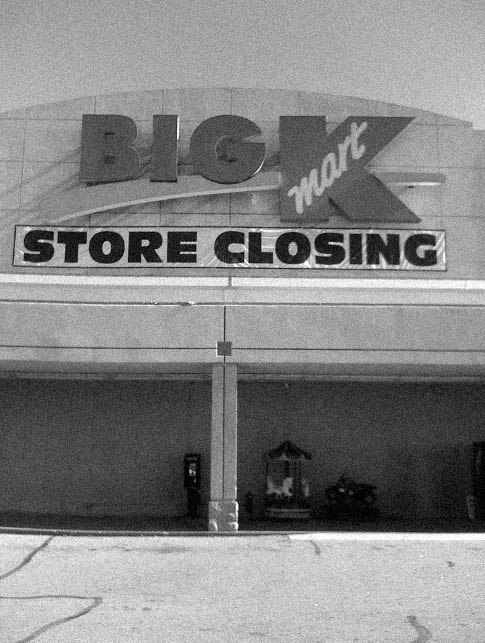 |
(2009)* – View of the front of the Kmart Store located on the southeast corner of Corbin and Plummer in Northridge. Sign reads: "Store Closing"
|
Historical Notes In 2011, the Kmart building was demolished to make room for a housing complex (Terrena Apartments) after standing on the corner of Corbin and Plummer for over 40 years. The Mulholland Orchard Co. occupied at least the area immediately west of the Northridge Mall to Corbin, between Nordhoff and Plummer. The Mulholland Home was the site of the late K-Mart, presently the Terrena Apartments. The grapefruit groves that were recently destroyed for Northridge Toyota's temporary lots and to the north, at the southwest corner of Shirley Ave and Prairie St, were planted by the Chief's son, Perry, circa 1916. The San Fernando Valley's last groves are at CSUN, O'Melviny Park and south to the Blvd, off Corbin. |
Winnetka Drive-in Theatre
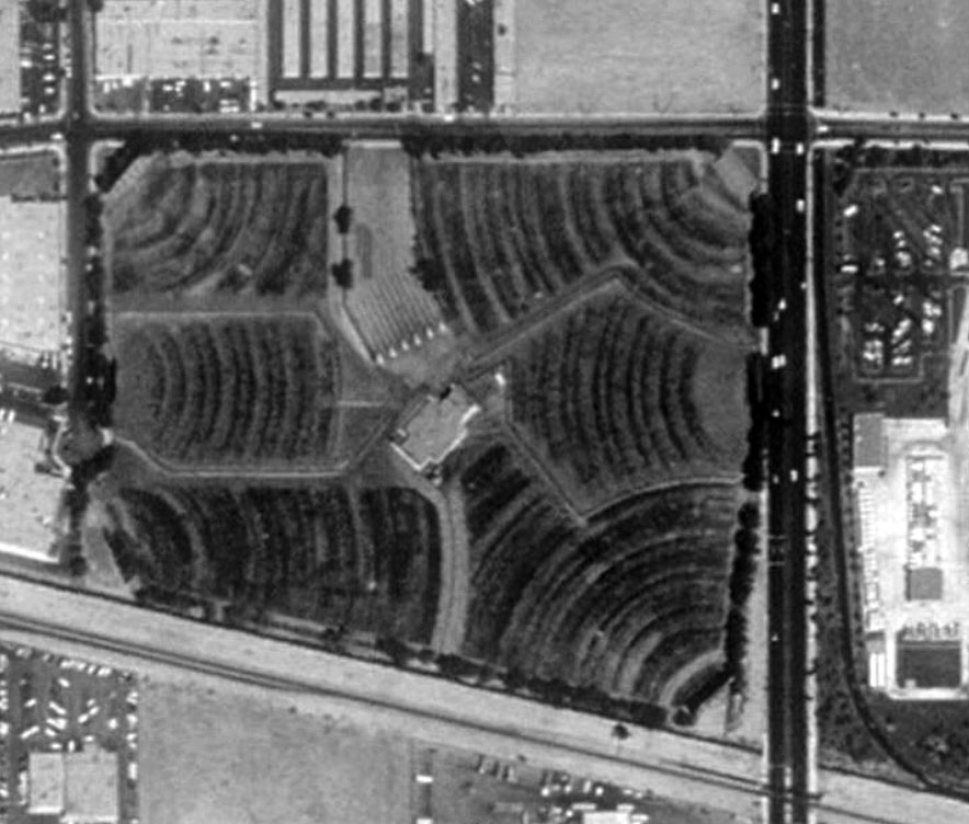 |
|
| (1980s)^**^ –Aerial view showing the Winnetka 6 Pacific Drive-In Theatre in Chatsworth, The drive-in was bounded by Winnetka Avenue (right), Oso Avenue (left), Prairie Street (top), and the Southern Pacific tracks (bottom). |
Historical Notes This was Pacific’s biggest drive-in for most of its life. It was built to cater for the expanding suburbs in the West San Fernando Valley. The Winnetka 4 (as it was in the 1970's) replaced the old Canoga Park drive-in on Canoga near Roscoe. By the 1980's Winnetka had expanded to 6 screens and was the drive-in powerhouse in the San Fernando Valley. If not for Pacific moving to more indoor multiplexes, the drive-in would still be open. The Pacific Stadium 21 now draws the same audience and more to hotdogs every night......indoors! #^*# |
Then and Now
|
.jpg) |
|
| (1980s)^**^ - Aerial view of the Winnetka 6 Pacific Drive-In, Chatsworth. | (2014)#*^# – Google satellite view of the Winnetka Pacific Theatres, Chatsworth. |
Historical Notes The Winnetka Drive-In was the last drive-in to be built (1976) and the last to close (1996) in the San Fernando Valley. |
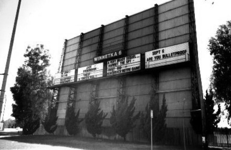 |
|
| (ca. 1996)#^*# – Outside view of the Winnetka 6 Drive-In, located at 20210 Prairie Street in Chatsworth. |
Historical Notes There was an elevated projection room at the center of the lot with a snack bar alongside. The staff used motorized golf carts to move around the site since it was so large. #^*# |
 |
|
| (ca. 1990s)#^*# - View showing the six ticket booths at the Winnetka 6 Drive-In Theatre. |
Historical Notes You guessed it, six screens so six ticket booths! Boom gates helped ensure "runners" did not get in without paying. When big films played here all six boxes were open.#^*# |
Porter Ranch
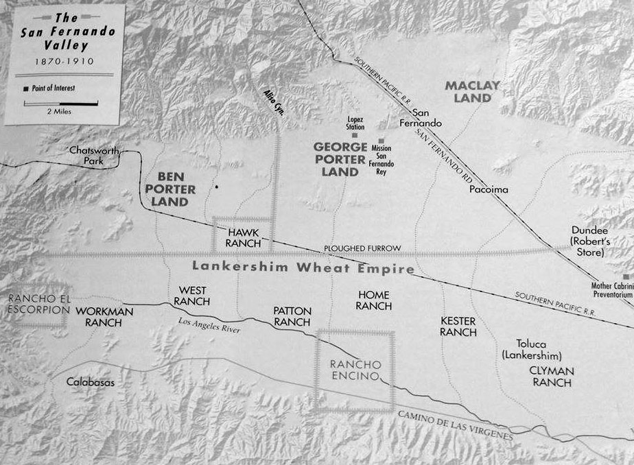 |
|
| (1900s)^ - A simplified map showing the division of land between 1870 and 1910 in the San Fernando Valley. At top can be seen the Ben Porter Land and George Porter Land, just west of Mission San Fernando Rey (San Fernando Mission). Map courtesy of William Flower |
Historical Notes George K. Porter owned a third of the northern valley west from the railroad line to Aliso Canyon (Zelzah Avenue from Granada Hills to Northridge). He was the first to initiate large-scale citrus growing in the valley, having planted a navel orange grove that reportedly stretched nearly three miles long. His cousin Benjamin owned 20,000 acres in the valley’s northwestern area. Because it was far removed from the railroad line, it was the least desirable section, and remained relatively undeveloped. |
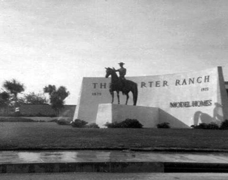 |
|
| (ca. 1975)^ – View showing the Porter Ranch welcome statue located on the corner of Tampa and Devonshire. Photo courtesy of Will Markland |
Historical Notes Benjamin Porter’s descendants decided to hold onto the ranch until the early 1960s. But this area was definitely still thought of as ranch land. During the late 1960’s and early 1970’s the unofficial entrance to Porter Ranch was even marked with two horse and rider statues. One was at the northwest corner of Tampa and Devonshire and the other was located at the northeast corner on Devonshire and Tunney. Rumor has it that many years later, one of the statues was found in a local trash dumpster. |
.jpg) |
(1970s)^ - Annual October Ritual, a pumpkin on head of the Porter Ranch welcome statue. Photo courtesy of Will Markland |
|
Historical Notes The Porter Ranch area eventually garnered the reputation of housing horse ranches for numerous celebrities and also served as a filming location for several major movie studios. In cinema history, Porter Ranch was most notable as the location of large portions of the famous film, E.T. the Extra-terrestrial, in 1982. There were a number of shots from the Steven Spielberg blockbuster where they featured views looking down on the Porter Ranch neighborhood that sits beneath the ridge in Palisades Park. Porter Ridge Park is also the sight of the park scene at the end of the movie. |
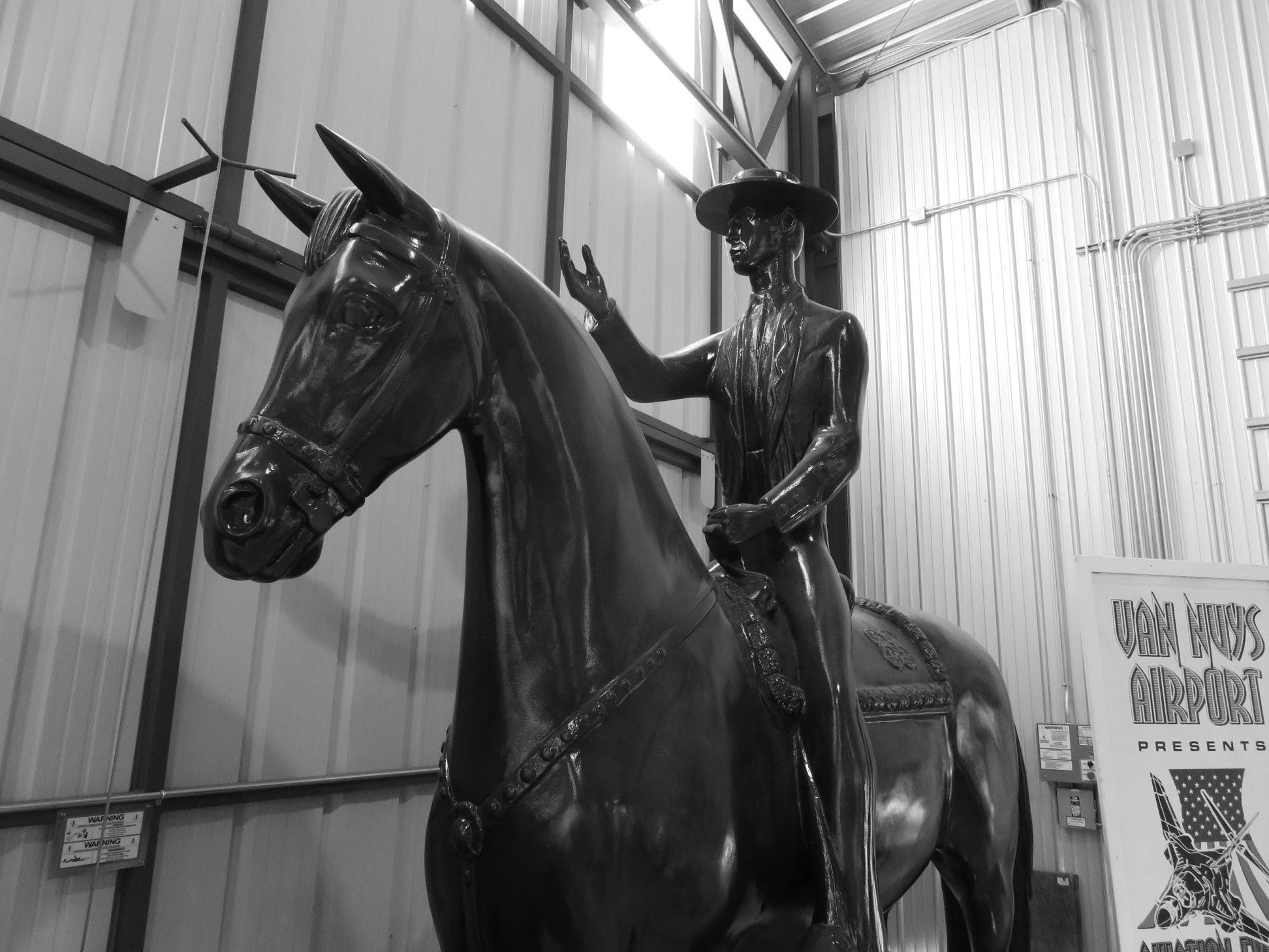 |
|
| (2018)^ - The Porter Ranch Welcome Statue now located at the San Fernando Valley Relics Museum, 7900 Balboa Blvd. Photo courtesy of Richard Flower |
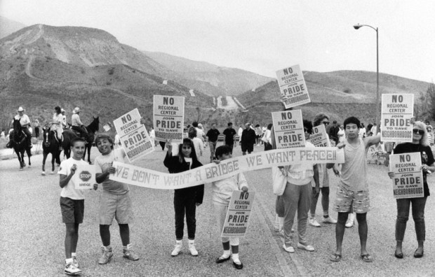 |
|
| (1989)* - Photo captions reads: ‘Members of PRIDE citizens' group staged a rally yesterday to protest overdevelopment in Porter Ranch area of the San Fernando Valley. They gathered at the site of a planned bridge across Aliso Canyon, which they fear will increase traffic in the rural area by providing a link between freeways and a proposed regional center, another project they oppose.’ Photograph dated August 19, 1989. |
Historical Notes In the late 80s, there was an attempt to connect Sesnon Boulevard, the road that flanks the north side of the neighborhood, to its counterpart across the Aliso Canyon, also named Sesnon, via a bridge to be named simply, the "Aliso Canyon Bridge". This plan never came to fruition due to demonstrations from the residents of Porter Ranch, the primary opponents of the bridge, who believed that connecting the road to the neighborhood across the canyon would bring "crime...drag racing, and drug dealing". Residents were also afraid of Sesnon becoming "a [highway] 118 alternate route", which would "send many cars through Porter Ranch". The bridge was never built. However, there is still evidence of the bridge seen from Sesnon heading east towards the canyon, the road (which is now closed off behind multiple guard rails) is visible heading towards the canyon just short of the bridge, and the counterpart is still visible on the west-bound side.^ |
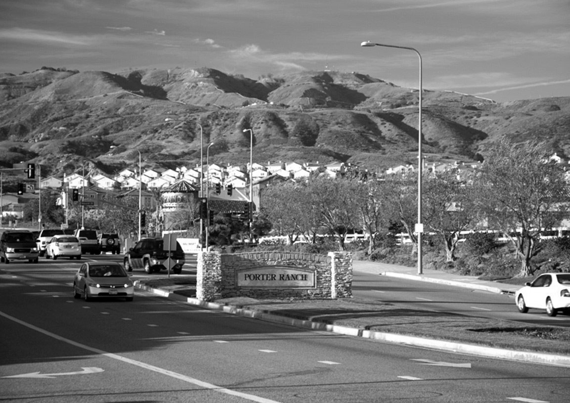 |
|
| (2010s)* - View looking north on Mason Avenue toward Rinaldi Street showing the Porter Ranch entrance sign at center medium. Photo courtesy of Toll Brothers |
Historical Notes New home building that eventually took place in the Porter Ranch area in the 1990s–2000s, including the Renaissance Summit development, was mired in controversy and Los Angeles politics in the late 1980s and early 1990s. Existing residents of the Porter Ranch area feared the increased traffic that would be brought by the planned building of an area commercial complex to service the new homes being built. Developments were also criticized for destroying the natural beauty of the brush and wild areas that inhabited the space before the houses were built. In 1990, the new 1,300-acre Porter Ranch development was approved by the City Council and became known as one of the biggest housing and commercial projects in Los Angeles’ history.*^ |
 |
|
| (2018)^ – Google map showing Porter Ranch and its boundaries. |
Historical Notes To the north of Porter Ranch, just outside the city limits, there existed an abandoned oil field with 115 wells called Aliso Canyon storage facility. This became the second largest storage facility in the nation when it was re-purposed in the 1970s, with a capacity to hold 86 billion cubic feet of natural gas. On October 23, 2015, Southern California Gas Company workers discovered a leak in one of the wells at the Aliso Canyon natural gas storage facility, about three miles north of homes in Porter Ranch. The gas blowout began spewing 110,000 pounds of methane per hour. The blowout involved gas stored under pressure in an underground reservoir. By order of the Los Angeles County Dept of Health, the company relocated thousands of families from the Porter Ranch area; the Federal Aviation Administration established a temporary flight restriction over the leak site until March 2016. On December 15, the county of Los Angeles declared a state of emergency, and two days later it approved a plan to close two schools in the area. Officials estimated that the leak would take months to repair. On February 18, 2016, state officials announced that the leak was permanently plugged. The gas leak has been cited by experts and independent researchers as the largest in U.S. History. It was thought that residents had filed as many as 1,000 lawsuits. Los Angeles County filed criminal charges against SoCalGas for its failure to report the leak immediately. In 2018 SoCalGas agreed to payments of $119.5 million to several government entities over the incident. |
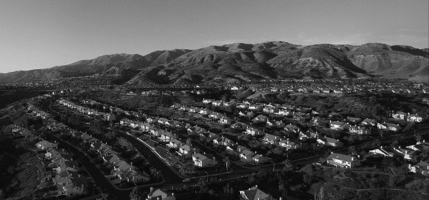 |
|
| (2016)* – View from above Porter Ranch neighborhood on a clear day. |
Historical Notes Fifty-one percent of Porter Ranch residents aged 25 and older had earned a four-year degree by 2000, a high percentage for the city. Also, Porter Ranch is rated the wealthiest neighborhood in the San Fernando Valley, with Encino ranked second. |
Chatsworth
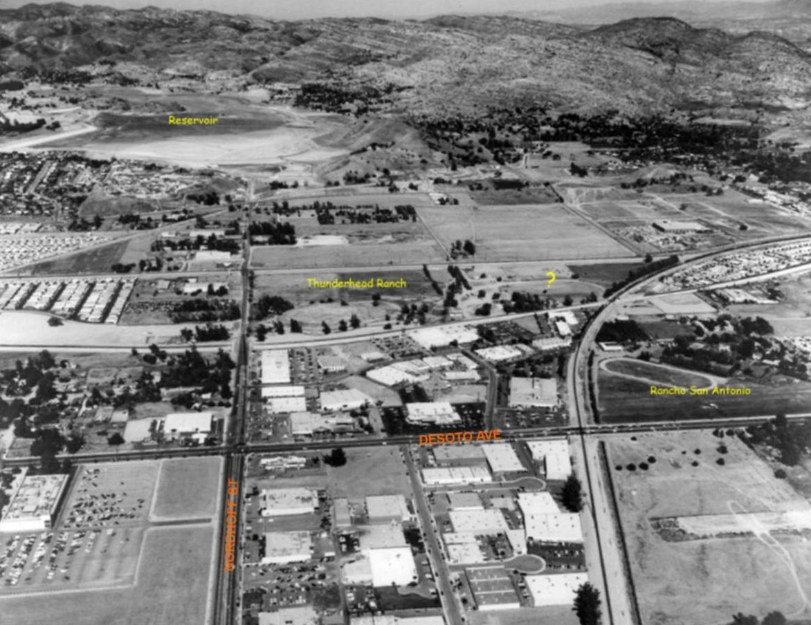 |
|
| (1971)* – Aerial view looking west over Nordhoff Street as it extends all the way to Chatsworth Reservoir, upper-left. The Thunderhead Ranch (center) and Rancho San Antonio (center-right) can also be seen. Photo courtesy of Rich Krugel |
 |
|
| (ca. 1969)* - View looking west at the intersection of Nordhoff Street at Topanga Canyon Boulevard. The empty lot on the southwest corner (upper-left) is now occupied by California Chicken Café. Chatsworh Reservoir is located on the other side of the hill in the distance. Photo courtesy of Valley Relics |
Then and Now
|
 |
|
| (ca. 1969)* - Intersection of Nordhofft St. and Topanga Canyon Boulevard, looking west. | (2014)* - Intersection of Nordhofft St. and Topanga Canyon Boulevard, looking west. |
Canoga Park
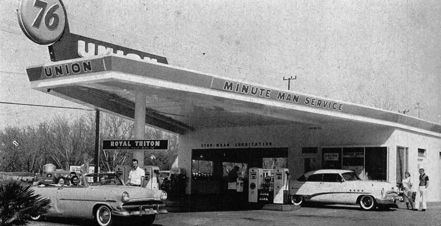 |
|
| (1959)^ – View showing the Burroughs Union 76 Station located at 7560 Topanga Cyn Blvd – SE corner of Topanga and Saticoy; Winchell’s donuts was behind. Photo caption reads: Al Mead zooms up with Nancy Ignacio, and in the back seat Donna Zaretzka and Joe Hackett, to get gas from service man Bill Burroughs. |
Historical Notes Click HERE to see more Early Views of LA Gas Stations. |
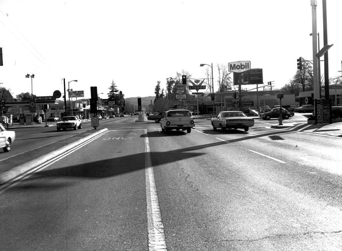 |
|
| (ca. 1969)* – View looking south on Topanga Cyn Boulevard at Saticoy Street with a Union 76 station seen on the SE corner and a Mobil station on the SW corner. Photo: Valley Relics Museum |
Historical Notes The Mobil station is now a mini-mart and the Union station is now a Walgreens, but that liquor sign near the SE corner still stands! |
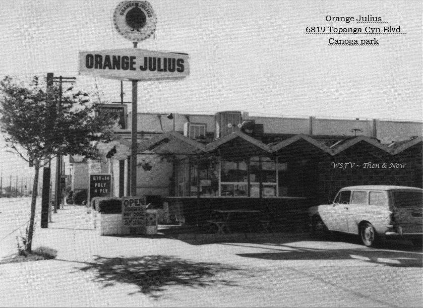 |
|
| (ca. 1974)^ - View looking north showing Orange Julius, located at 6819 Topanga Canyon Boulevard. Canoga Park High School is located across the street. |
Historical Notes The restaurant opened in early 1965, and was in business for almost 20 years. In 1984, a new sign was erected, with the owner being PCH burgers. The building was razed sometime between 1989 and 1994, and is now part of the car wash property. |
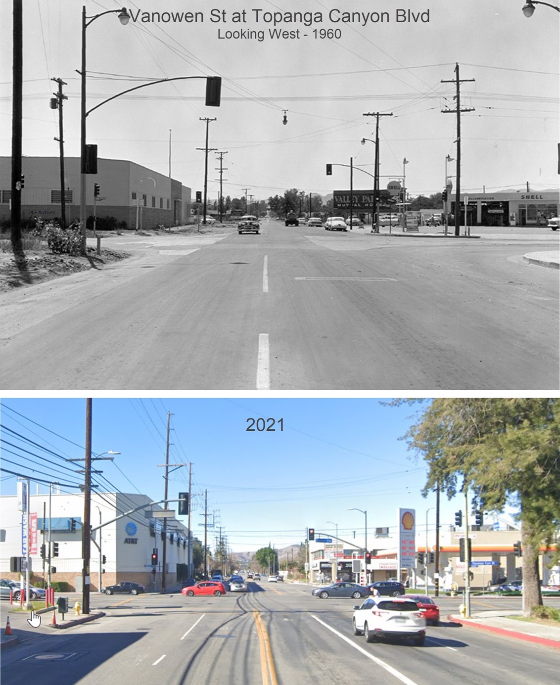 |
|
| (1960 vs. 2021)* - Looking West on Vanowen Street at Topanga Canyon Boulevard. Note the billboard advertising Valley Park Mutual Homes. |
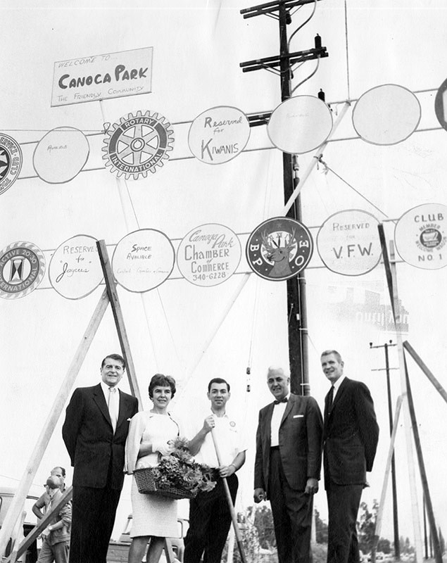 |
|
| (1965)* - Valley Times photo caption reads "Canoga Park residents recall happier 'pre-war' days before the boundary dispute between Woodland Hills and Canoga Park. Shown at dedication of the 'Welcome to Friendly Canoga Park' sign three weeks ago on friendly Topanga Canyon Boulevard and friendly Oxnard Street are, from left, Francis Lederer, Canoga Park's honorary mayor; Wilma Netz, Welcome Wagon hostess; Charles Bordonaro, president 20-30 Club; Russell Robertson, past exalted ruler of Elks Lodge 2190, and Harvey Parkinson, president of the Canoga Park Chamber of Commerce." Photo date: June 17, 1965 |
Lederer Residence
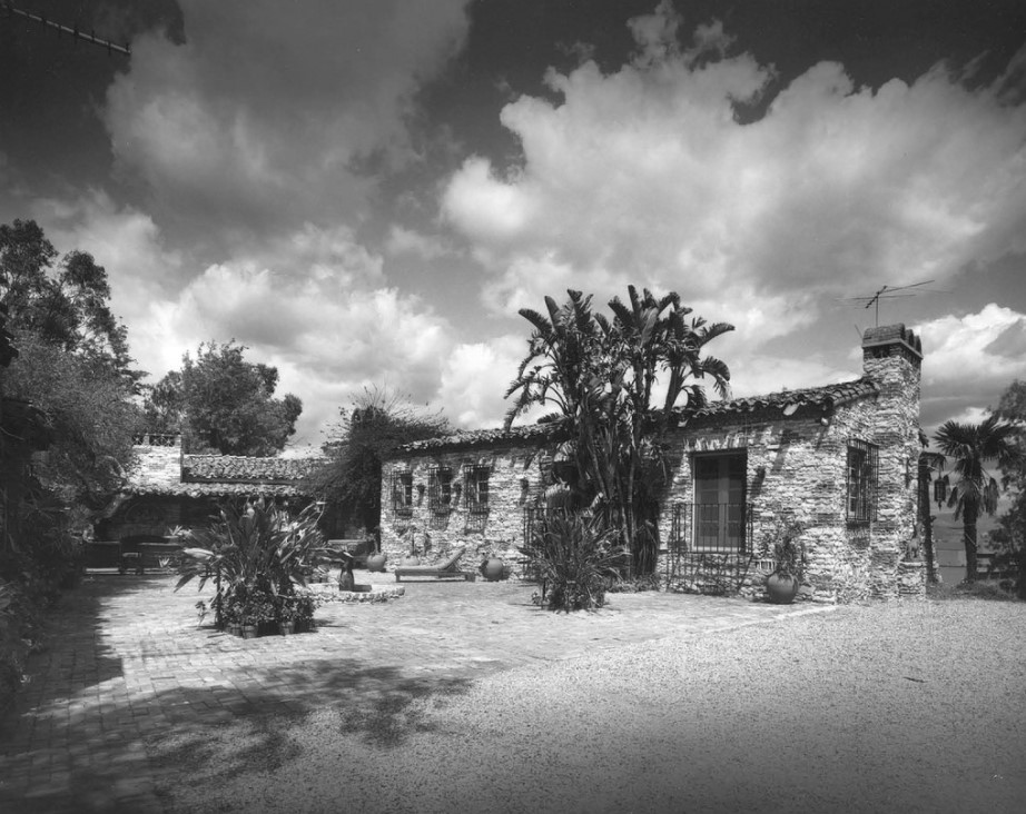 |
|
| (n.d.)^ – View showing the Lederer Residence located at 23134 Sherman Way, home of famous actor Francis Lederer. Photo by Julius Schulman / Big Orange Landmarks |
Historical Notes Francis Lederer was a Czech-born film and stage actor with a successful career, first in Europe, then in the United States. Lederer has more than seventy credits on the IMDb. During the 1950s, he served as honorary mayor of Canoga Park. In 1934, Francis Lederer began design and construction, with the help of artisan builder John R. Litke, of his landmark residence and stables on the hilltop of a large 300-acre rancho at the west end of Sherman Way. The house is a blending of Mediterranean Revival style with Mission Revival style architecture in which the interior and exterior integral design, artisan work, and construction details are in a refined landmark quality. The rich building materials were chosen to make the finished buildings appear centuries old. The interior has imported original 14th and 15th century Italian Renaissance and Spanish Renaissance museum-quality art pieces, decorative arts elements, and furnishings. |
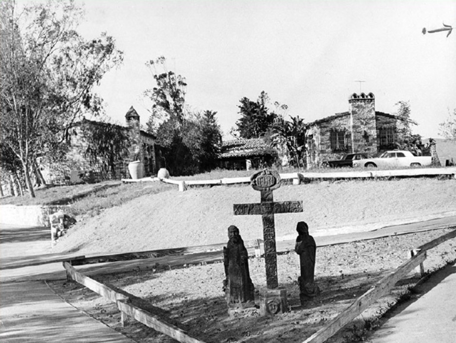 |
|
| (1965)* – Valley Times photo with caption that reads “Entrance to Lederer home announces Spanish theme. Paintings and other art objects date back to 15th and 16th Century." Photo by George Brich, March 16, 1965. |
Historical Notes In 1978, the Lederer Residence and immediate environment was declared LA Historic Cultural Monument No. 204. A big factor in the residence’s historic monument declaration was the decorative and antique furnishings throughout the home. The city called the Lederer Residence “a distinguished example of Mission Style architecture in which interior and exterior detailing is of museum quality. The Spanish and Italian furnishings are of particular interest, dating back from the 14th century.” |
 |
|
| (2008)* - View showing the 1930s Lederer Residence, a Los Angeles Historic-Cultural Monument located at 23134 Sherman Way. |
Historical Notes Lederer also owned the stables across the street (now the Canoga Mission Gallery) which was also declared a Los Angeles Historic Cultural Monument in 1974. Both sites comprised a 300 acre ranch owned by Lederer. He was also the Honorary Mayor of Canoga Park during a good portion of his life prior to his death in 2000 at the age of 100. Lederer was a promoter of the West Valley especially Canoga Park where he helped establish the sister city program between Taxco, Mexico and Canoga Park in 1963. |
Canoga Mission Gallery
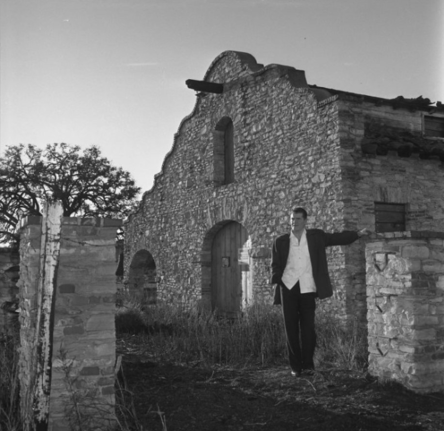 |
|
| (1963)^x^ - STABLE TO ART CENTER - Actor Francis Lederer poses outside building on his estate formerly used as a stable. Lederer is preparing to turn the structure into a community art center for California and Mexican artists' works exhibits. |
Historical Notes The stables are in pure Mission Revival style and was designed by Francis Lederer with John R. Litke in the 1930s. It was built beside Bell Creek. Marion Lederer, his wife, transformed them into the Canoga Mission Gallery in the 1970s, which continues to the present day. In his later life, Lederer, who had become very wealthy, invested in real estate, especially in the Canoga Park community (renamed West Hills in 1987). He was active in local and Los Angeles civic affairs, philanthropy and politics. He served as Recreation and Parks Commissioner for the city of Los Angeles, received awards for his efforts to beautify the city and was the honorary mayor of Canoga Park for quite a time. He became involved with peace movements, taught acting, and was one of the founders of the American National Academy of Performing Arts in Los Angeles, and the International Academy of Performing Arts in Washington, D.C. In 2000, he was honored by the Austrian government with the Cross of Honor for Science and Arts, First Class. Lederer Avenue was named in his honor. |
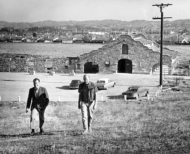 |
|
| (1964)* – Valley Times photo with caption that reads: "David Brockmann, left, and John Naftzger climb hill from new Canoga Mission Community Art Center in Canoga Park. Pair plans museum in building modeled after San Luis Rey Mission, donated by actor Francis Lederer." |
Historical Notes In 1967, the stables were transformed into a Mexican art gallery known as the Canoga Mission Gallery. In 1974, the Mission Revival-style building was declared LA Historic-Cultural Monument No. 135. |
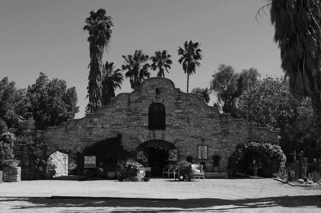 |
|
| (2008)^ - View showing the Canoga Mission Gallery located at 23130 Sherman Way, West Hills. Photo: Big Orange Landmarks |
Historical Notes Today the former stables, built in 1936 by actor Francis Lederer, houses an antique shop and hosts events. |
Shoup Ave
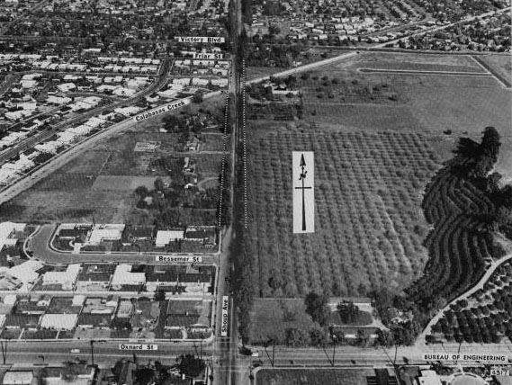 |
|
| (1965)^##^ - View looking north on Shoup Avenue between Oxnard Street and Victory Boulevard. The Calabasas Creek runs diagonally across Shoup. Today, the "Summit at Warner Center" occupies the land east of Shoup and north of Oxnard. |
Historical Notes Shoup Avenue was named after Paul Shoup, a vice president of the Southern Pacific Railroad and president of the Pacific Electric Railway Co. Oxnard Street was named for Henry T. Oxnard, sugar beet magnate in the Ventura County area. The name dates from 1916, when the Valley was developing into a major beet producer. Click HERE to see more SFV Street Name Origins. |
Sherman Way and Shoup Ave
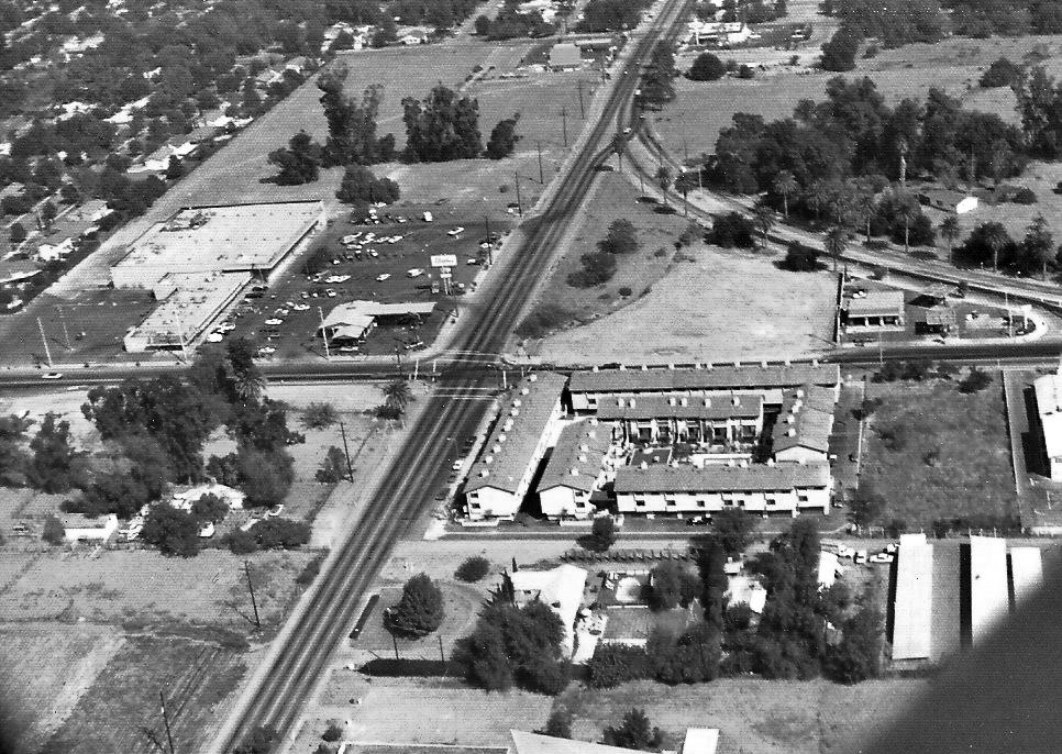 |
|
| (ca. 1972)#^*^ – Aerial view looking east on Sherman Way toward Shoup Avenue (center of photo) from above the Trafficanda Egg Ranch. Carlson Circle is at upper-right. Hughes Market is seen at center-left. Click HERE to see a contemporary view of the same area. |
Historical Notes On the right, where Carlson Circle merges with Shoup Avenue, you can see a gas station. This station lasted until the mid-70's when it became a 'Naugles' and about 1988 became a Del Taco. The reason Carlson Circle is curved is that Pacific Electric had plans for a streetcar line that would run from Topanga and Sherman Way all the way up to Shoup and Ventura Blvd. The line never went in. Just east of the Hughes Market (upper-left) is where the Roller Dome eventually was and later a health fitness center (Racquetball World then Spectrum and currently the Bay Club). |
 |
|
| (ca. 1972)#^*^ – Aerial view looking south showing Sherman Way, just west of Shoup Avenue. The property now is West Valley Christian Church. The church you see here (once the Nazarene church) is on the south side of Sherman Way. |
 |
|
| (2019)* – Aerial view looking south showing the intersection of Sherman Way and Shoup Avenue (lower-left). West Valley Christian School is on the right. A Del Taco is seen on the left at the intersection of Carlson Circle and Shoup Avenue, where a gas station once stood. |
* * * * * |
Warner Ranch
 |
|
| (ca. 1958)* – View looking northwest showing Harry Warner’s home overlooking Warner Ranch near De Soto Ave and Oxnard Street. Rocketdyne's first completed building can be seen near the SPRR Curve (upper center-right). Then, still some Pepper Trees blocking view to the west side of Canoga where other buildings were built. |
Historical Notes Harry Warner, the eldest of the Warner Brothers, owned this land since the 1940s which he used as a horse ranch. In 1968, 630 acres of the land was sold to Aetna Life and Casualty for $30 million. Aetna acquired the land for long-term investment and development purposes, and later brought in Kaiser as a joint venture partner. Initially, tracts of the Warner Ranch land had been developed in pieces, such as the Topanga Plaza which opened in 1964 as the first enclosed shopping mall in California, or sold to users such as aerospace companies Rocketdyne and Litton Industries which built their facilities there. The Harry Warner family donated 20 acres of land in 1967 that became the Warner Center Park (also known as the Warner Ranch Park), located east of Topanga Canyon Boulevard between Califa Street and Marylee Street. |
* * * * * |
Warner Center and Woodland Hills
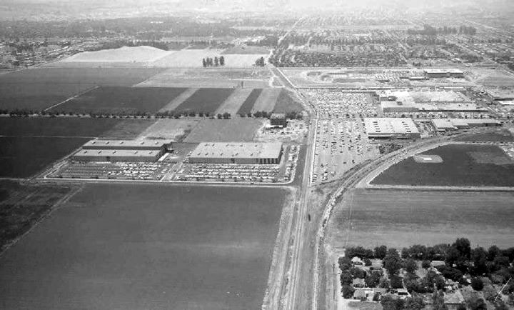 |
|
| (ca. 1963)* - View looking west on Victory Boulevard from above De Soto Avenue. In the distance, the Topanga Plaza Mall is under construction. The area that would become Warner Center, on the left, is still completely undeveloped. |
Historical Notes Before development began in the early 1960s, the area that became Warner Center and much of central Woodland Hills was part of the Warner Ranch—owned by Harry Warner of Warner Bros. Studios. The ranch, used for horses and cattle, stretched roughly from De Soto Avenue to Topanga Canyon Boulevard and from Ventura Boulevard north to Victory Boulevard. When Warner sold large parcels of his property after 1959, it opened the door to one of the San Fernando Valley’s largest planned business and residential developments. The curving line running off to the right follows the old Southern Pacific railroad tracks. These tracks once paralleled Victory Boulevard east and west, then curved north to run along Canoga Avenue—today replaced by the Metro Orange Line Busway. The tree-lined road crossing the image from left to right is Canoga Avenue. The grove of trees in the upper right marks the site of Shadow Ranch Park, originally part of an early 19th-century homestead that covered much of this area. Beyond Shadow Ranch, Fallbrook Square (later Fallbrook Center) would soon rise. The hill in the upper left is part of Woodland Hills Park near Shoup Avenue. At the top center-right of the image, construction is underway on the Topanga Plaza Mall—one of the first enclosed shopping centers in Southern California. Just beyond the mall runs Topanga Canyon Boulevard. At this time, nearly all the land west of De Soto Avenue—once part of the Warner Ranch—remained open and agricultural. The ranch had been owned by Harry Warner of Warner Bros., who sold large parcels in the late 1950s and early 1960s. These sales paved the way for the planned business and residential community that became Warner Center. |
 |
|
| (2023)* - Google Earth view looking west on Victory Boulevard from above De Soto Avenue. Pierce College is visible at the lower left. |
Historical Notes This modern aerial view shows the remarkable transformation of the area over six decades. What was once open ranchland is now a dense mix of commercial buildings, apartments, and tree-lined streets. The former Warner Ranch evolved into Warner Center, a master-planned development designed as a regional hub for business, housing, and shopping in the western San Fernando Valley. Victory Boulevard, Topanga Canyon Boulevard, and Canoga Avenue now form the area’s main traffic and transit grid. The Metro Orange Line Busway follows the route of the old Southern Pacific tracks seen in the 1963 photo. Pierce College remains a defining feature on the southeast corner, maintaining its agricultural character even as the surrounding landscape urbanized. Warner Center continues to grow under the Warner Center 2035 Plan, emphasizing walkability, mixed-use neighborhoods, and sustainable design. Today it stands as one of Los Angeles’ most complete suburban centers—home to major retail complexes like Westfield Topanga and The Village, along with new residential towers and corporate campuses. |
Then and Now
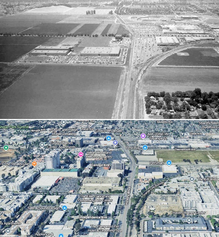 |
|
| (1963 vs 2023)* - A Then and Now comparison looking west on Victory Boulevard from above De Soto Avenue. In 1963, the view shows the open farmland of Harry Warner’s ranch and the early construction of Topanga Plaza Mall. By 2023, that same stretch has become the heart of Warner Center, surrounded by modern development, Pierce College, and the Orange Line Busway. Photo comparison by Jack Feldman. |
Historical Notes This comparison highlights the sweeping transformation from rural farmland to an urban center. The development of Warner Ranch into Warner Center mirrors the broader growth of the San Fernando Valley after World War II. Freeway access, economic expansion, and master planning turned the once-quiet west Valley into a thriving district of homes, offices, and shopping centers. The scene that once featured open fields and rail tracks now reveals landscaped boulevards, high-rises, and a busy transit corridor—showing how Los Angeles’ agricultural edge became an integral part of its metropolitan core. |
Then and Now
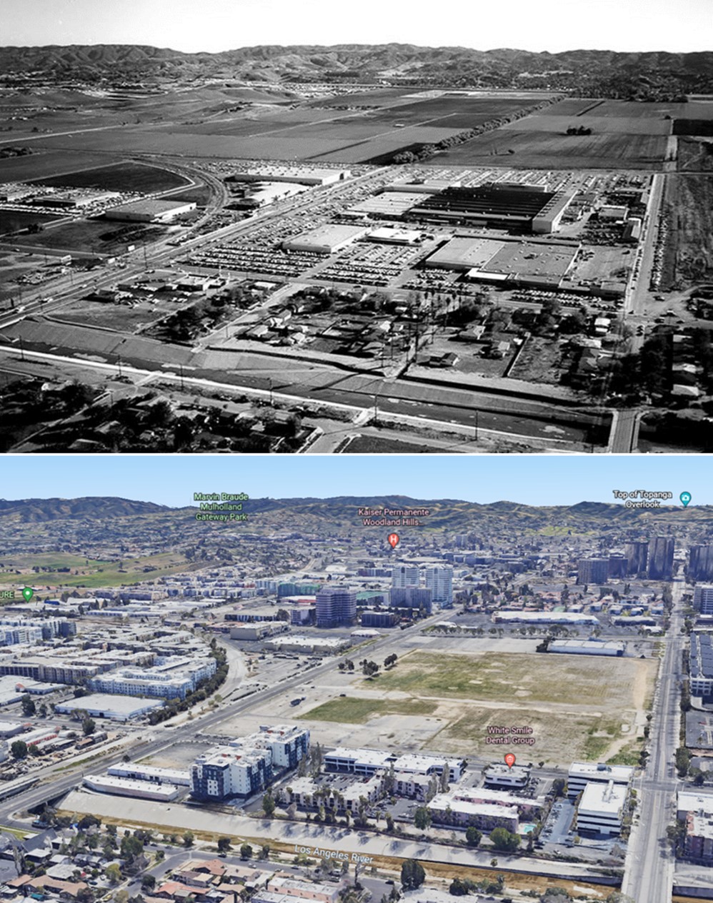 |
|
| (1960 vs 2022) - Aerial view looking southeast toward Warner Center. Canoga Avenue is on the left, running diagonally from lower left to upper right. Owensmouth Avenue is on the right, running away from the camera. The headwaters of the Los Angeles River can be seen at the bottom. In the earlier photo, the Rocketdyne facility appears at center, and Warner Center has yet to be developed. At center-right, the site where Topanga Plaza would later be built remains vacant—it wouldn’t open for another four years. Photo comparison by Jack Feldman. |
Historical Notes This view captures the west San Fernando Valley at the dawn of its transformation. In 1960, the area south of Victory Boulevard was still largely industrial and agricultural. The Rocketdyne complex—seen at the center—was one of the Valley’s major aerospace employers, producing rocket engines for the early space program. Surrounding the facility were open fields, orchards, and a scattering of warehouses and service buildings. By contrast, the 2022 view shows a completely urbanized landscape. Warner Center, which occupies much of the land seen here, grew from Harry Warner’s former ranch into a master-planned commercial and residential hub. The Los Angeles River channel at the bottom of the image, once a natural wash, is now a concrete-lined flood control channel. The area that had been empty land in the 1960 image includes the former Topanga Plaza site—later Westfield Topanga and The Village—along with office towers, apartments, and landscaped boulevards. This “Then and Now” pair illustrates the rapid urban growth that reshaped the western Valley during the 1960s and beyond, turning farmland and aerospace industry into one of Los Angeles’ most vibrant business and residential centers. |
* * * * * |
Rocketdyne (Canoga Park)
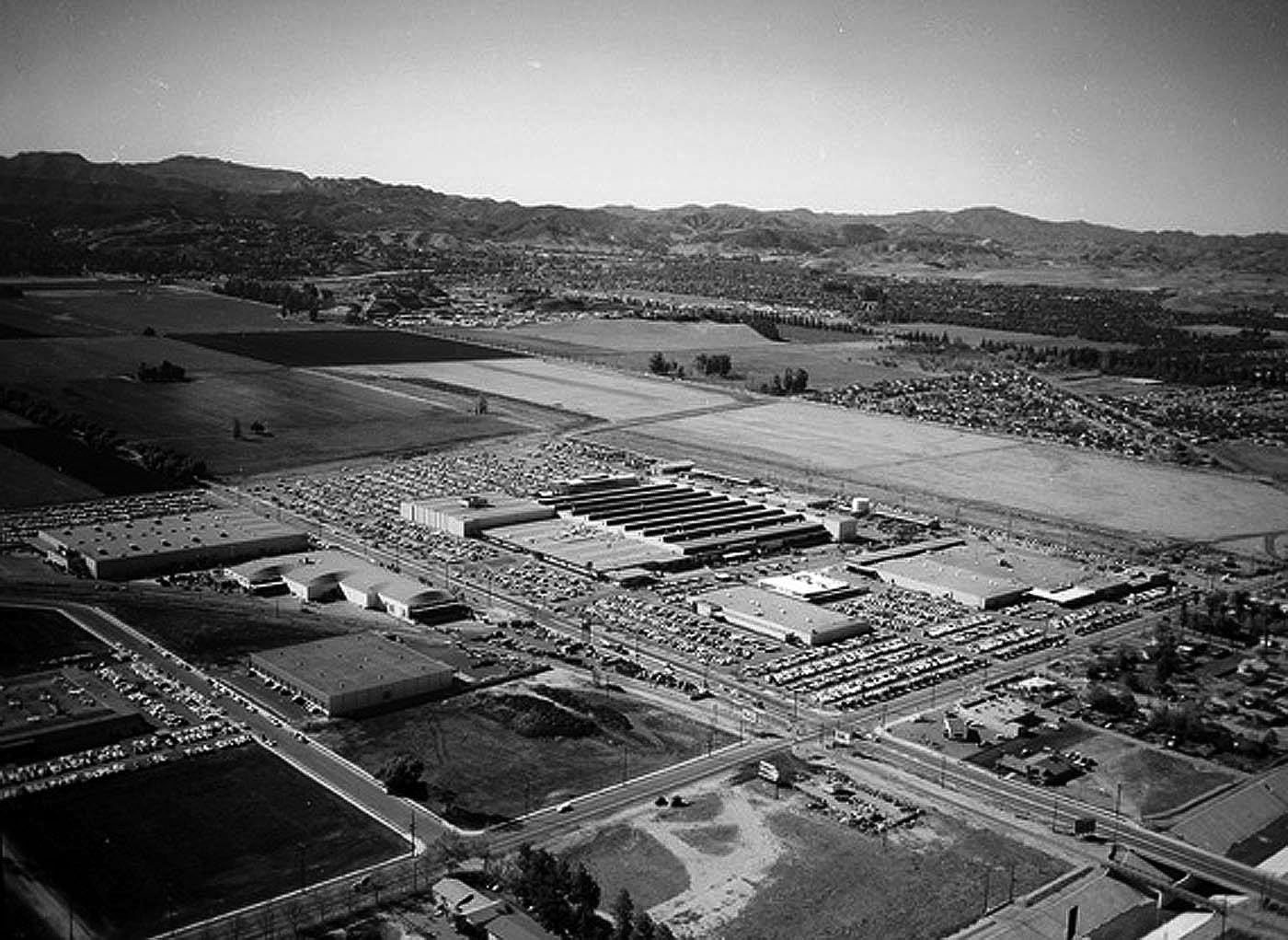 |
|
| (ca. 1958)* – Aerial view looking southwest toward Woodland Hills and Calabasas showing the Canoga Park Rocketdyne Plant. The intersection of Vanowen Street and Canoga Avenue is seen at lower center-right. The two large parcels of open land in the distance, between Owensmouth and Topanga Canyon Boulevard, are the future homes of the Topanga Plaza and Westfield Topanga and Village shopping centers. |
Historical Notes The 47-acre facility at 6633 Canoga Avenue, opened by North American Aviation in November 1955, helped propel America’s vaunted space program. The Aerojet Rocketdyne division is now located at 8900 De Soto Avenue in Chatsworth, which opened five years later. At its height in the mid-1960s, the Rocketdyne division employed more than 23,000 rocket scientists in Canoga Park, Chatsworth and its Santa Susana Field Laboratory above Simi Valley, site of booming rocket engine tests. |
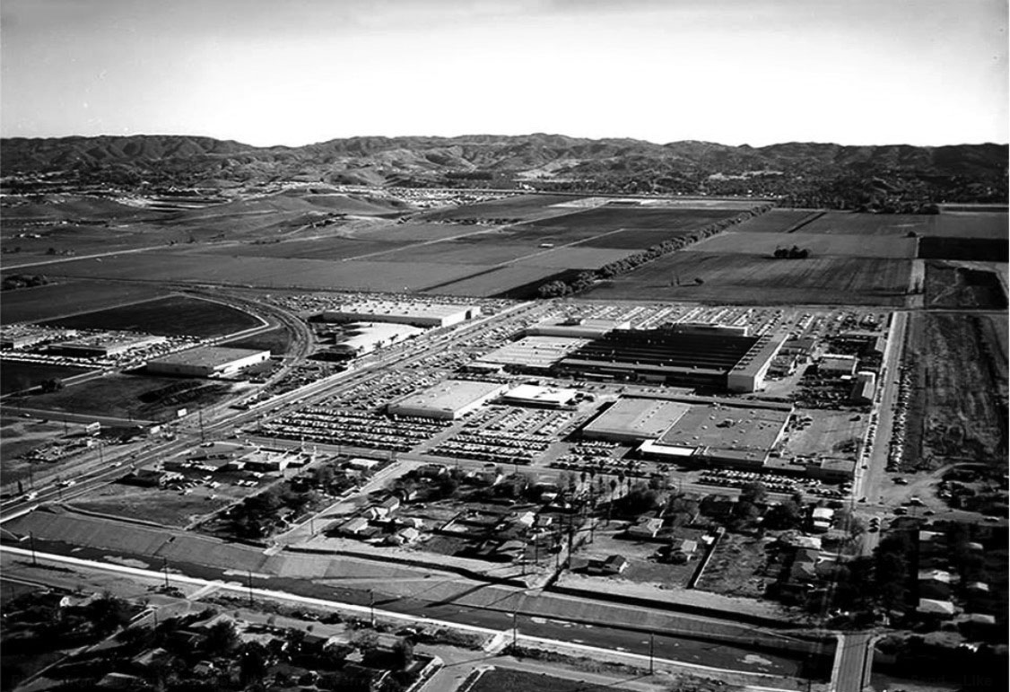 |
|
| (1960)#^*^ – Aerial view looking southeast toward the Santa Monica Mountains. The Rocketdyne facility is seen at center of photo. Canoga Ave is on the left running diagonally from lower left to upper right. Owensmouth is the street running away from the camera on the right. If you look to the right, you'll notice that Topanga Plaza had not been built yet. Wouldn't be open for another 4 more years. Photo by: Alan Scott Crawford |
Historical Notes For more than 50 years, the massive Canoga Park manufacturing facility has played a central role to the U.S. space program. Workers there designed and built the engines used on the Saturn V rocket in the Apollo program, and then the main engines used on the Space Shuttle. |
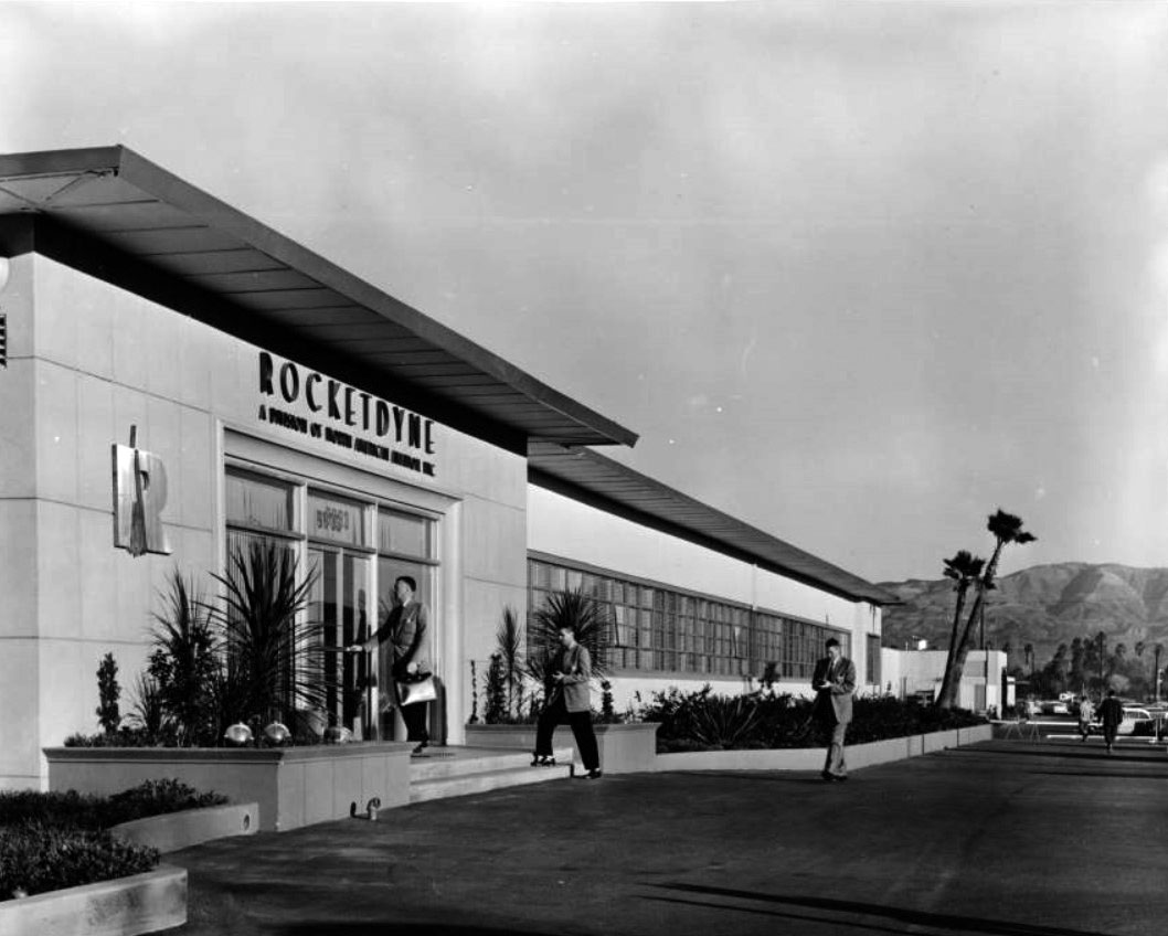 |
|
| (1960s)* - View showing three men dressed in suits entering the headquarters building of Rocketdyne Company, 6633 Canoga Avenue, Canoga Park. Photoprint reads: "HQ building - Canoga Park, "a small residential and farming community in the west San Fernando Valley", main offices, ranch, developments and manufacturing of liquid, propellant rocket engines. |
Historical Notes A press release attached to the photo reads: 'High-thrust rocket engines for the arrived forces are designed, developed, and manufactured in this ultra-modern main plant of Rocketdyne, a division of North American Aviator, above. Located at Canoga Park in California's San Fernando Valley, the plant contains in addition to 316,000 square feet, engineering and warehousing facilities nearby. In the Santa Susana Mountains near Canoga Park is Rocketdyne's propulsion field laboratory, where the large, liquid-propellant rocket engines are static-fired in huge steel test stands. It is the free world's most extensive and advanced rocket research center.' |
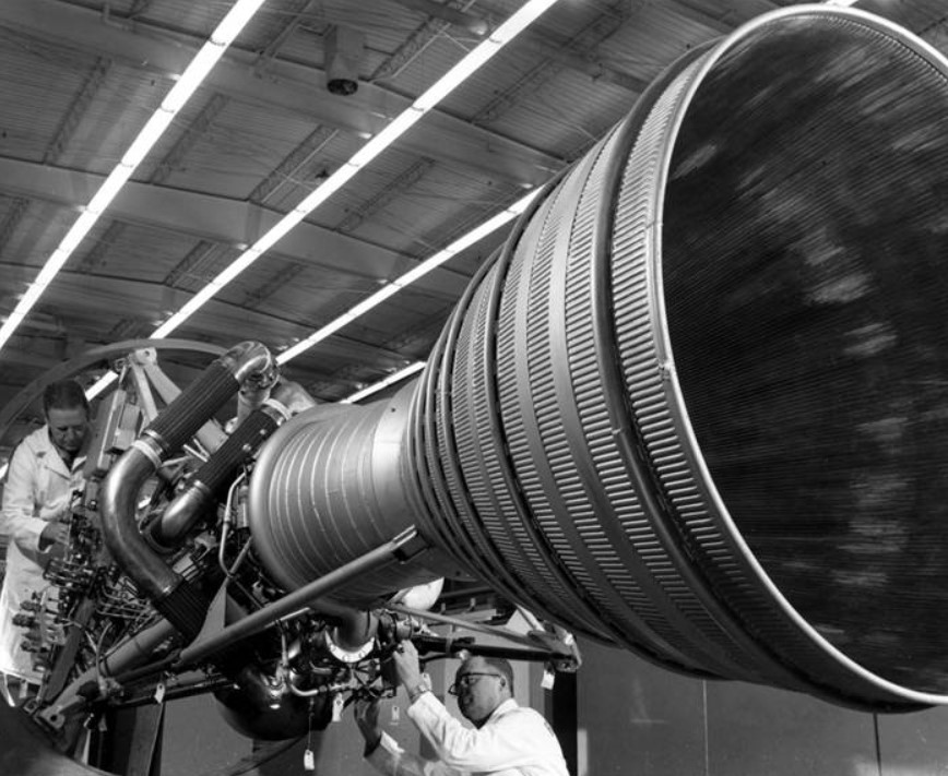 |
|
| (ca. 1960)* - Mechanics at work on a rocket engine at Rocketdyne in Canoga Park. Photo Rocketdyne Archives |
Historical Notes A related press release explains that the mechanics are making: "the final adjustments on an engine which will be used in the U.S. Army Jupiter intermediate range ballistic missile. The Jupiter IRBM will be deployed in operational use by units of the Strategic Air Command. It was an engine of the type shown which was called upon to furnish the powerful first-stage boost of the Army's space probe." |
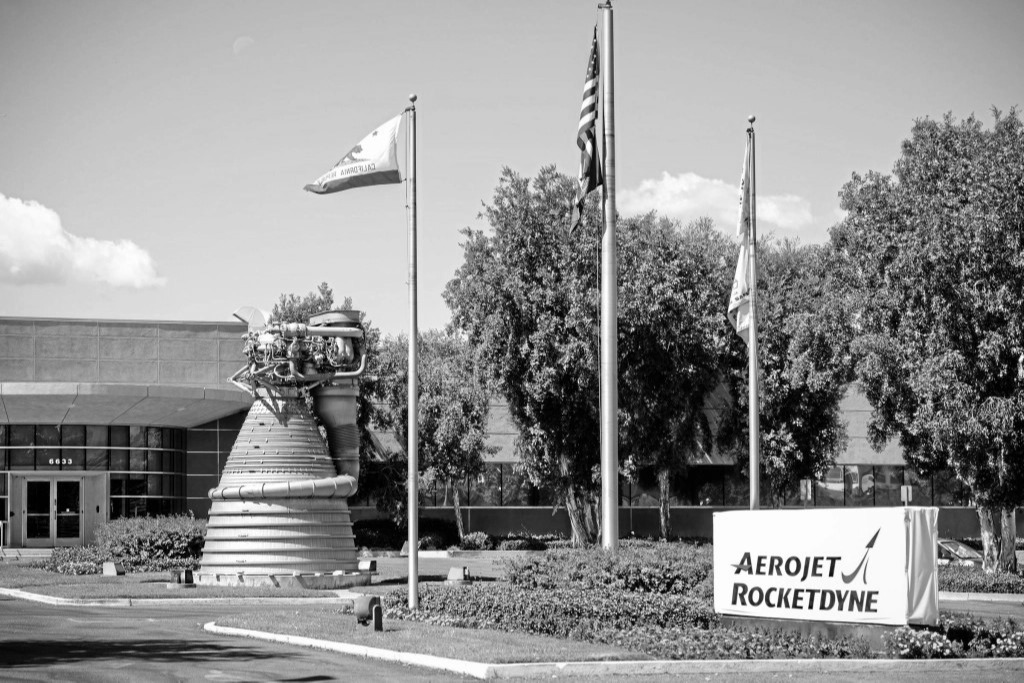 |
|
| (2013)* - View showing an F-1 rocket engine like those used to power Apollo missions to the Moon, in front of the Aerojet Rocketdyne facility in Canoga Park. The 18,400-pound engine, berthed since 1979 in front of the Canoga Avenue plant that produced it, is scheduled to be hauled to the company's De Soto Avenue site in 2015. Photo: David Crane / Daily News |
Historical Notes Rocket engines for aerospace and weapons were developed and manufactured by Rocketdyne (1955-2005), Pratt & Whitney Rocketdyne (2005-2013), and Aerojet Rocketdyne (2013-present) at the Canoga Park facility. At its loudest was its colossal F-1 liquid propellant rocket engine (seen above), the largest, most powerful single-nozzle, liquid fueled rocket ever made, according to NASA.*^ Of its 13 Apollo missions from 1967 to 1973, 24 astronauts escaped Earth’s orbit without a hitch, including a dozen who walked on the moon, using the Canoga Park built rocket engine. Some 98 F-1s were produced, including some 65 engines flown, according to NASA. One of them was the unused engine on Canoga Avenue resembling the Terminator in an antebellum hooped skirt, now owned by the Smithsonian Institution in Washington, D.C. |
 |
|
| (1960)* - Aerial view looking west onto Rocketdyne Missile Division, Canoga Avenue. At the top left corner is the intersection of Victory and Topanga Canyon boulevards and the very large empty space at top of photo is the future home of the Topanga Plaza Mall. |
 |
|
| (1960)* - Aerial view looking northwest showing the Rocketdyne’s Canoga Park facility with the intersection of Victory and Canoga at lower right. At upper left can be seen the future home of the Topanga Plaza Mall (completed in 1964). |
Historical Notes In 2014, the entire Canoga Park Rocketdyne facility was sold to developers. Shortly after the sale, it was announced that a $3 billion project would be constructed on the 47-acre Rocketdyne site that will include a mix of commercial, residential and high-rise buildings forming almost their own mini-city. |
Then and Now
 |
|
| (1958 vs. 2022)* - Rocketdyne - Canoga Park. Photo comparison by Jack Feldman |
Historical Notes Devolopment of the Rocketdyne Canoga Park plant site have been stalled. Community activism and legal actions have played a significant role in addressing the issues surrounding the site. Local residents and environmental organizations have been advocating for a thorough cleanup of the site and increased transparency in the process. Lawsuits have been filed against the responsible parties to ensure accountability and adequate remediation efforts. Efforts to address the environmental concerns and protect public health are ongoing, with continued monitoring, cleanup activities, and engagement from community stakeholders, government agencies, and environmental organizations. |
* * * * * |
Topanga Plaza Mall
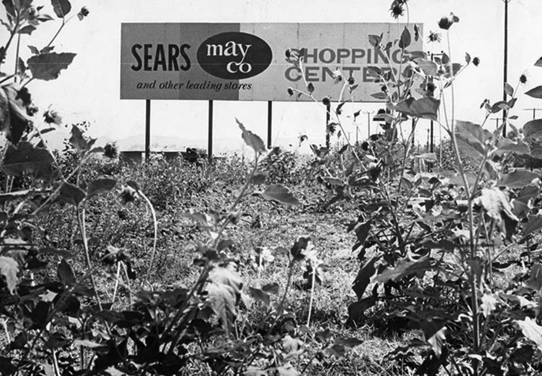 |
|
| (1960)* - Sign amidst sunflowers at Vanowen Street and Topanga Canyon Boulevard, announcing the coming of a new shopping center - Topanga Plaza. |
Historical Notes Ground was broken for the TOPANGA PLAZA project in February 1963. Topanga Plaza was conceived as one of California's first major enclosed shopping malls. This design approach was revolutionary at the time, as it provided a climate-controlled environment for shopping, protecting visitors from the elements and creating a more comfortable experience year-round. |
|
|
| (ca. 1963)* - View looking west on Victory Boulevard toward De Soto. In the distance can be seen the Topanga Plaza Mall still under construction. |
Historical Notes Looking west on Victory, Desoto is the first street at the bottom of the picture going left to right. The curving road going off to the right is the railroad tracks that paralleled Victory (E & W) then curved up and paralleled Canoga (N & S) - now the Orange Line Busway. The road in the middle with trees along it going left to right is Canoga Ave. The trees in the upper right is Shadow Ranch Park and beyond that is where Fallbrook Square is going to be built....if you look at the hill on the upper-left side of this picture it’s the back of Woodland Hills Park on Shoup. The construction near the top middle-right is the Topanga Plaza Mall being built and the street just beyond it is Topanga Canyon Blvd. |
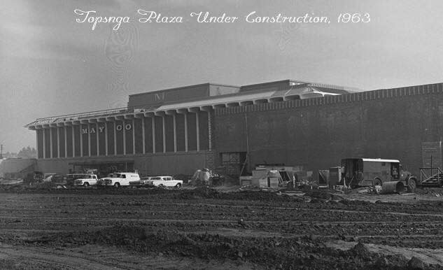 |
|
| (1963)* – View looking northeast as seen from Topanga Boulevard showing Topanga Plaza's new May Co. anchor store during construction. |
Historical Notes Topanga Plaza was conceived as one of California's first major enclosed shopping malls. This design approach was revolutionary at the time, as it provided a climate-controlled environment for shopping, protecting visitors from the elements and creating a more comfortable experience year-round. |
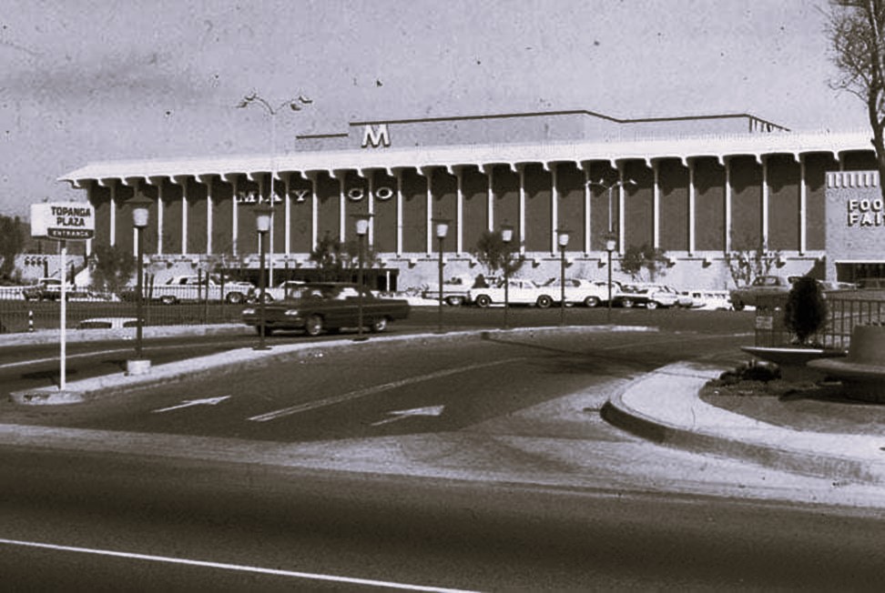 |
|
| (ca. 1964)* – Topanga Plaza's new May Co. anchor store shortly after its opening. Photo courtesy of Valley Relics Museum |
Historical Notes The original design incorporated three major anchor stores - May Company, Montgomery Ward, and The Broadway. These large department stores were strategically placed to draw customers and create foot traffic throughout the mall. |
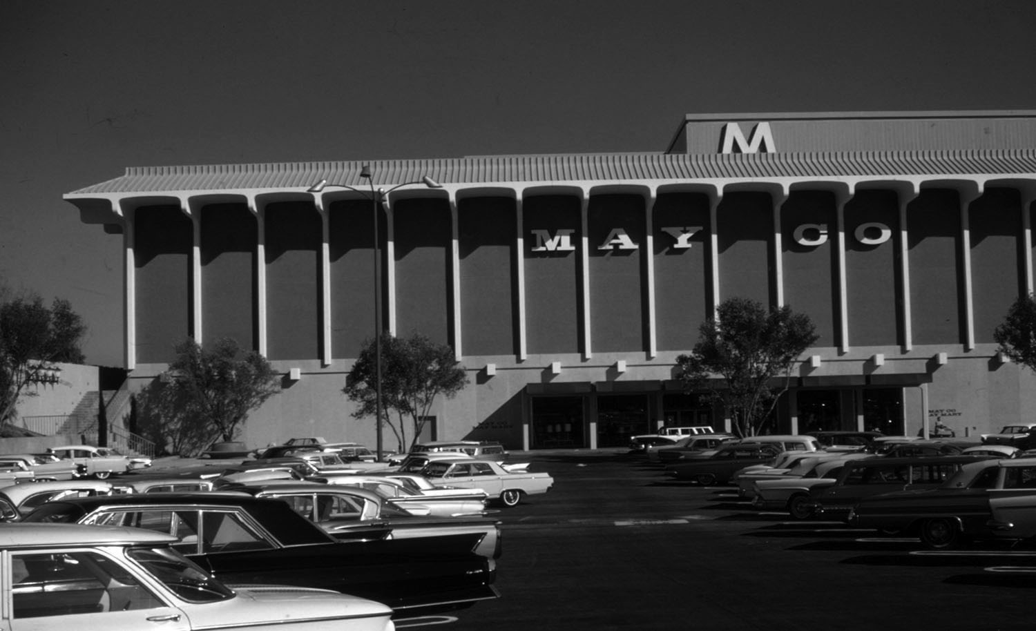 |
|
| (1964)^ – View showing a full parking lot in front of the newly completed May Company at Topanga Plaza Mall. Photo courtesy Gruen Associates |
Historical Notes The Topanga Plaza Mall would open on February 10, 1964 and become California's first enclosed shopping mall and also the first enclosed mall west of the Mississippi. It was originally anchored by The Broadway, May Company and Montgomery Ward. Nordstrom was added in 1983. |
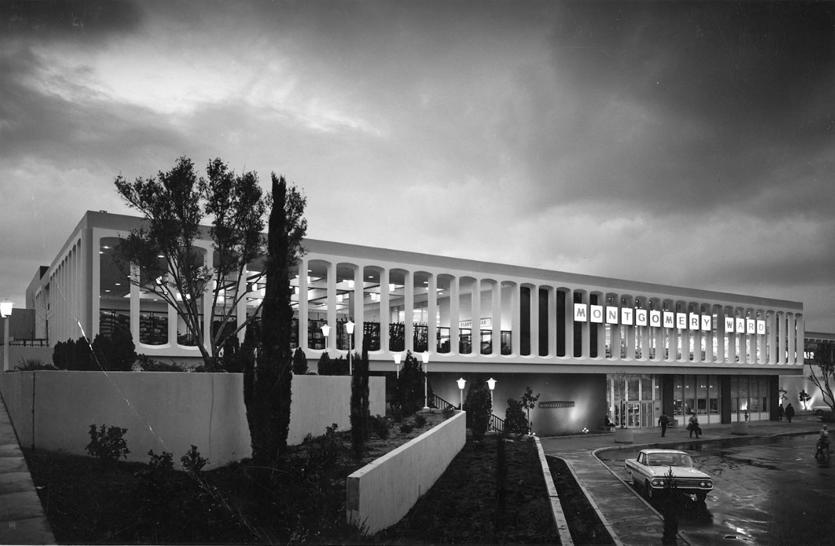 |
|
| (1964)^ – View showing the newly completed Montgomery Ward at the Topanga Plaza Mall. Montgomery Ward, The Broadway, and May Company were the three original anchor stores at the shopping mall. Photo courtesy of Gruen Associates |
Historical Notes Completed in 1964, Victor Gruen Associates provided planning, architecture, engineering and interior design services for Topanga Plaza. |
 |
|
| (1990s)* – View looking north showing Topanga Mall after conversion from the original Topanga Plaza opened in 1964. Victory Boulevard runs across the lower part of the photo with Owensmouth seen on the right running away from the camera. The building at lower-left is the Mandarin Wok Restaurant. That site was still a wheat and barley field when the Topanga Theater opened in 1964, then the Topanga Amusuement Center south of there in 1965. The original Broadway store with it's shimmering yellow/gold colored stone panels was renamed and reconfigured a Sears store. The Robinsons-May was originally the May Company further north in the left distance. Other retails business were constructed, extending further into the parking lot in the middle of the picture. |
Historical Notes As the first enclosed shopping mall to open in southern California, Topanga Plaza was developed by Saint Louis-based May Centers, Inc. and built in the San Fernando Valley on a 58-acre tract, 25 miles northwest of the city center. The land parcel had been part of the Harry Warner Ranch. |
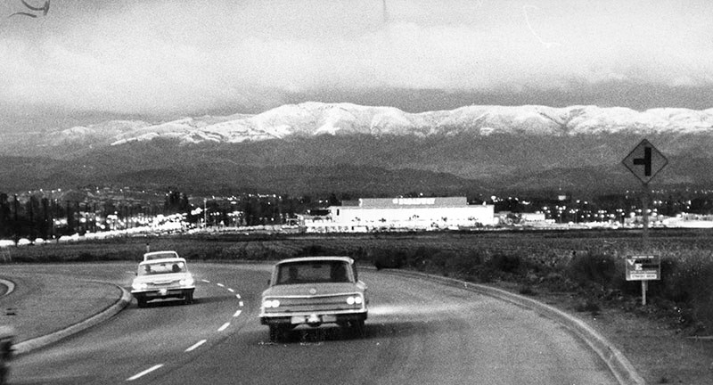 |
|
| (1964)* - Photo caption dated November 18, 1964 reads, "Oat Mountain and mountains above Chatsworth and Granada Hills were covered with a blanket of snow this morning following yesterday's storm which brought up to six inches of the white fluffy stuff down to the 1,000-foot level. This photo was taken from Woodland Hills aimed across the newly completed Topanga Plaza Shopping Center." |
Historical Notes The photo above was taken just north of Califa St headed toward Oxnard St with a clear view of The Broadway and Topanga Plaza. Today, the Marriott Hotel would be on the right and the Promenade after that. Note the sign for the T intersection -- that's for Oxnard St, the paved section ended at Topanga. |
 |
|
| (1960s)^ - Aritist rendition showing the Topanga Plaza Mall, Victor Gruen Associates Architects. |
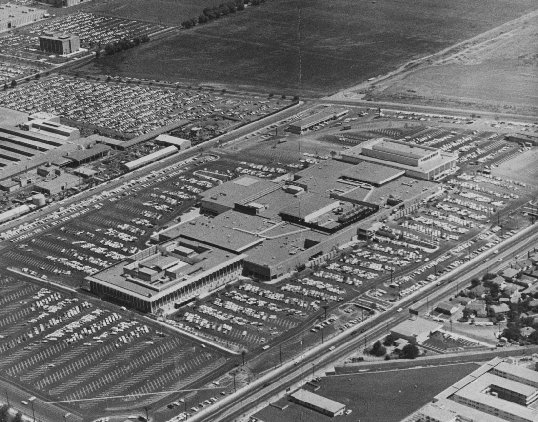 |
|
| (1964)* - Aerial view of the new Topanga Plaza Mall, looking southeast. Topanga Cyn. Boulevard runs diagonally from bottom-center to right-center of photo. The intersection of Victory and Owensmouth is at top-center. Large area of open undeveloped land can be seen south of Victory at top of photo. |
Historical Notes The original mall enveloped 727,100 leasable SF on two levels and housed 83 retailers. The first stores in business were the May Company, Montgomery Ward and The Broadway, serving as anchor stores for several decades. Charter tenants included Joseph Magnin apparel, Mullen & Bluett ladies’ apparel, Silverwood’s men’s and boys’ apparel, Lane Bryant, Kay Jewelers, Florsheim Shoes, Hardy Shoes, Frederick’s of Hollywood, Hudson’s Jewelers and Sutton Brothers Home Decorating. Topanga Plaza is now the modern-day Westfield’s Topanga shopping center.^ |
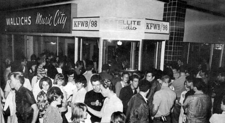 |
|
| (1964)* – Wallich’s Music City at the Topanga Plaza Mall. It originally had a radio broadcast booth (KFWB/98). |
Historical Notes In 1964, Wallich's famed Music City invited stars and the general public to the June 5 "star-packed party" celebrating the debut of the Music City at Topanga Plaza. Present were emcee Bill Ballance of KFWB, Bonanza's Lorne Greene, and Don Grady of "My Three Sons." Giveaways galore included a Magnavox *color* TV, Magnavox stereo, Audion home organ, a guitar, hundreds of record albums, and tickets to Jungleland. The original Wallichs Music City was located on the northwest corner of Sunset & Vine and operated from 1940 to 1978. Owner Glenn E. Wallichs had started Capitol Records, along with Tin Pan Alley songsmith Johnny Mercer and ex-Paramount movie producer Buddy De Sylva from a small office a little further south down Vine Street in 1942 and moved to larger offices above the store in 1946. After Capitol Records moved into The Capitol Tower in 1956 the offices become the home of Dot Records. Wallichs Music City was one of the first-known music stores to seal record albums in cellophane and put them in display racks for customers to browse. The racks were tabletop height trapezoid-shaped browser boxes (designed by Capitol Records' Frederick Rice) that allowed the covers they contained to be viewed like a card index without damaging the sleeves. The store was also the first to have demonstration booths for listening to records. |
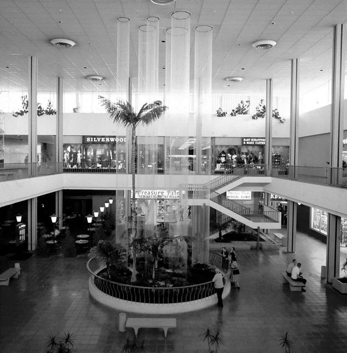 |
|
| (1964)*^^^ - Several people stand by rail observing the rain fountains at the new Topanga Plaza. |
Historical Notes From the 3-story ceiling, "raindrops" cascaded down columns of nylon monofilaments straight into a garden area and pond. It was located at the south end of, at the time, the world's largest two-level all-enclosed and air-conditioned mall shopping center.^ |
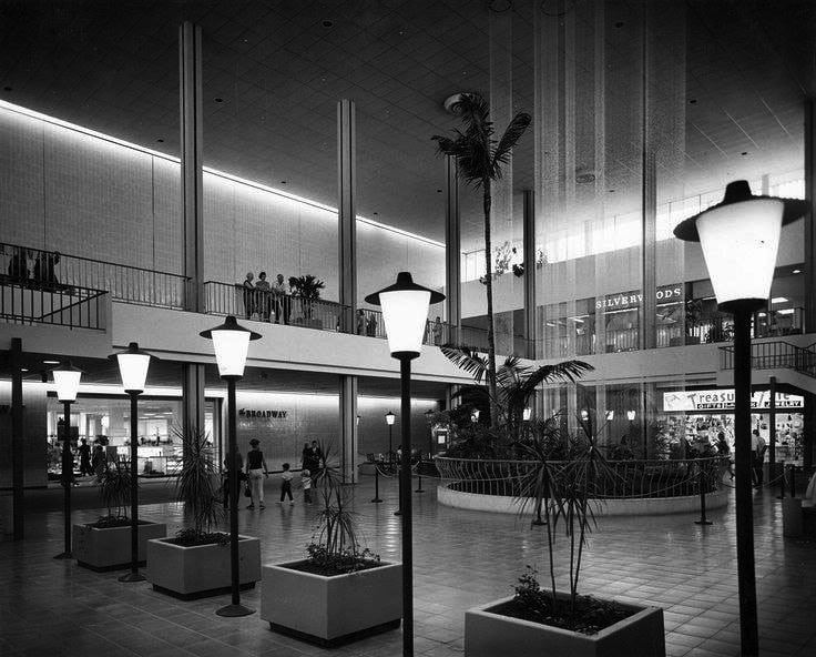 |
|
| (1960s)* - Lower level view of the “Rain Forest” Fountain with water droplets cascading down the string. The Broadway is seen at left. |
Historical Notes Deep sea diver, Merchant Marine officer, stuntman, and designer Vic Chatten of Torrance created the “Rain Forest” fountain. Unveiled in May 1964, the 55-foot spectacle featured 6 columns totaling half a million "raindrops" (65 gallons of glycerin) silently descending over 15 miles of monofilm. The “rain” would then go through receivers which, in turn, channeled to a pump where the fluid traveled up 3-stories to the top of the fountain. Each monofilm wire was fastened at the ceiling and kept taut with an 8-ounce weight below the base of the fountain. Chatten spent three decades perfecting his fountain system. A successful inventor, he created many other contraptions, including a reusable beer keg bung that was ultimately used by a major U.S. brewery. |
Topanga Plaza Ice Arena (later known as Ice Capades Chalet)
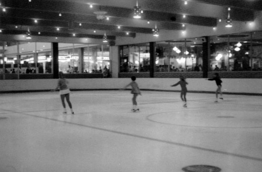 |
|
| (1970s)* – View showing potential future stars practicing at the Ice Skating Rink at Topanga Plaza. Little Known Fact: The Topanga Plaza Ice Arena, later known as Ice Capades Chalet, was a training ground for future stars. Notably, Tai Babilonia and Randy Gardner, a renowned pair skating duo, practiced there. They went on to become five-time U.S. national champions and won the World Figure Skating Championships in 1979. |
Historical Notes The Topanga Plaza Ice Arena opened in March 1965, about a year after the mall's inauguration. It was located on the mall's lower level, at the southeast corner of the structure, adjacent to the original food court. The ice skating rink quickly became a popular attraction, especially for younger people during hot summer days, drawing visitors from as far away as Hollywood. The rink was part of a larger entertainment complex within the mall, which also included features like the "Rain Fountain" ("Wonderfall") in the adjacent South Court, bird aviaries and a gazebo in the North Court, and the Terrace Restaurant overlooking the area from atop the May Company store. In 1966, Ice Capades, a traveling entertainment show on ice, purchased the skating rink at Topanga Plaza as part of their expansion into owning and operating permanent ice rinks, establishing their Chalet Division. The ice skating rink remained a fixture of the mall throughout the late 1960s and most of the 1970s. However, it closed in the late 1970s. |
 |
|
| (1974)* – Food court and skating rink at the Topanga Plaza Mall. Photo by Roy Hankey |
Historical Notes After its closure, the space was initially used for five inline stores in the early 1980s. Later, as part of a $16 million renovation in 1984, the space was transformed into the 15-bay Plaza Cafes Food Court. |
* * * * * |
Lytton Savings and Loan
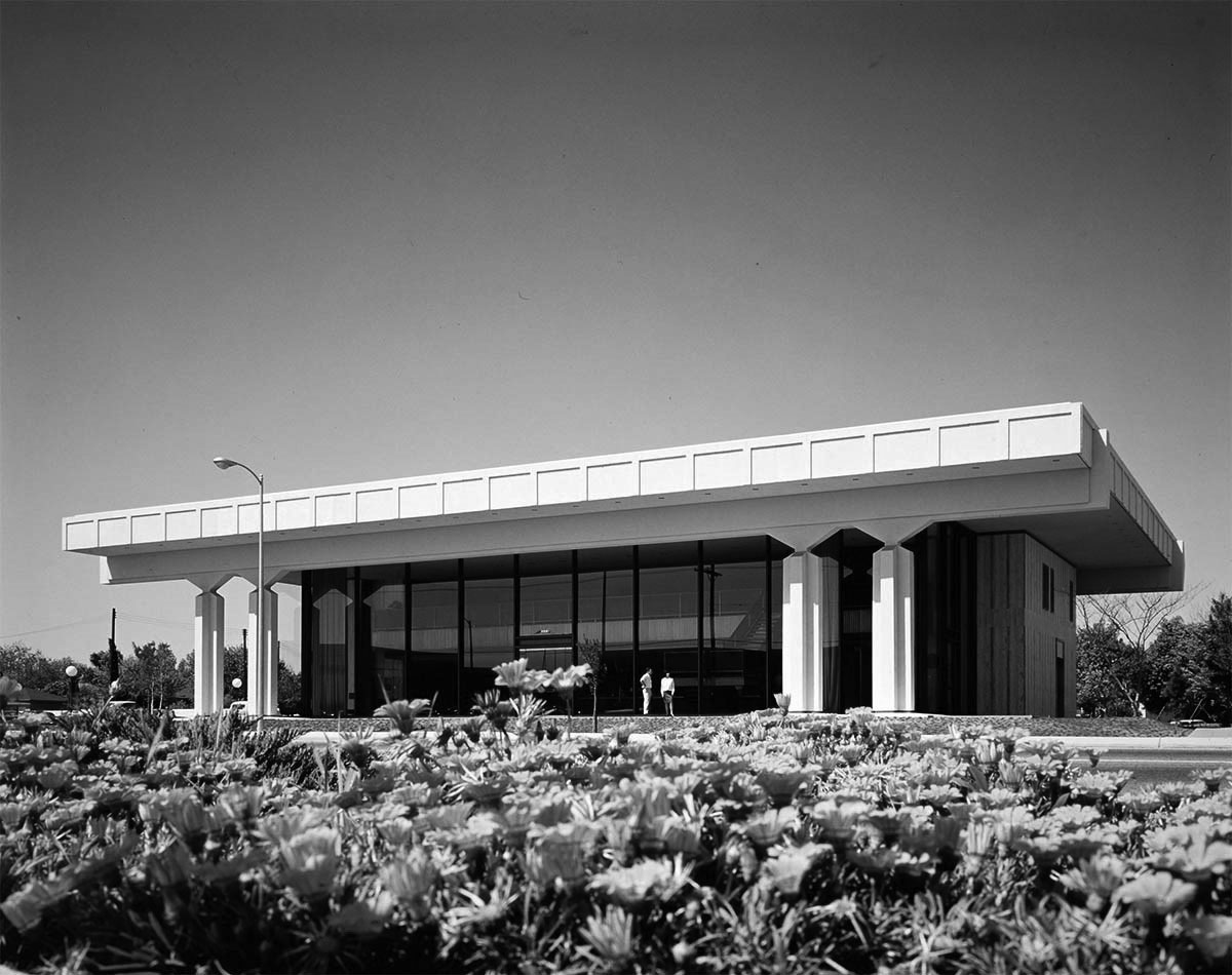 |
|
| (1966)* – View showing the Lytton Savings and Loan building located at 6633 Topanga Cyn Boulevard shortly after it was built, as seen from across the street in front of Topanga Shopping Center. Photo courtesy of Getty Research Institute |
Historical Notes Located at the corner of Topanga Canyon Boulevard and Kittridge Street, the 12,400 square foot contemporary design structure faced the recently-completed Topanga Plaza Shopping Center. The new building replaced the office located at Variel and Independence avenues which was opened in 1960. |
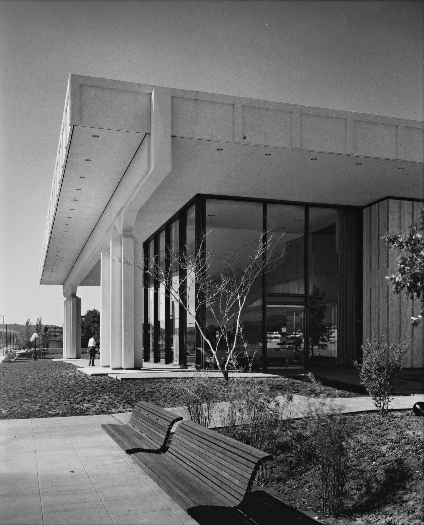 |
|
| (1966)* - View looking northwest showing the Lytton Savings and Loan building as seen from near the corner of Kittridge Street and Topanaga Canyon Blvd. Photo courtesy of Getty Research Institute |
Historical Notes The structure is a two-story concrete and glass pavilion with a roof supported by two massive concrete girders which, in turn, are supported by eight sculptured concrete columns of cruciform section. |
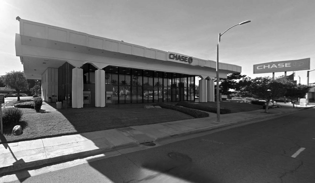 |
|
| (2015)#*^# - Google Street View showing the building as it appears today, a Chase Bank. Other than the ATM's on the left, the building looks the same as it did when first built in 1966. |
Sierra's and Mission Burrito Restaurants
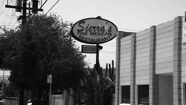 |
|
| (ca. 2010)*^ – View looking southwest showing Sierra’s Mexican Restaurant located at 6819 Canoga Avenue. Click HERE for contemporary view. |
Historical Notes Sierra's Restaurant started as "Ed Sierra's Spanish Cafe" in 1932 at 500 San Fernando Mission Blvd. During the 1930's Hollywood filmed many movies in the San Fernando Valley and for the most part the place to eat was Ed Sierra's Spanish Cafe. From the 1930's to the 60' many movie stars moved to the San Fernando Valley, so you never know who you might run into at Ed's Cafe. In the mid 60's Mr. Sierra sold the Cafe to his son-in-law, Gil Jaramillo. Mr. Jaramillo is the founder of Mission Brand Tortillas, which he later sold in the late 1970's, to pursue a new chapter in his life, serving the Valley with the finest quality Mexican cuisine at an affordable price. He changed the name to "Sierra's" and opened his second, larger restaurant in Canoga Park, which was previously the "Old Vic's" restaurant, just off the corner of Vanowen and Canoga Avenue.* |
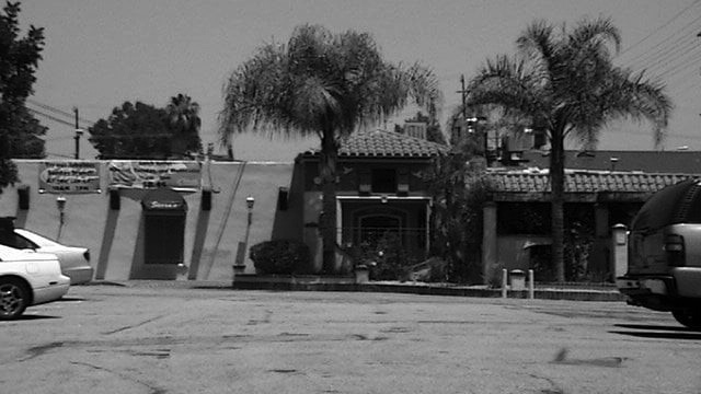 |
|
| (2010)* – View looking across a parking lot showing the front entrance to Sierra’s located on the NW corner of Canoga and Vanowen. |
Historical Notes Because Sierra’s was run by two generations including Mr. Sierra’s grandchildren, it claimed to be the oldest restaurant in the San Fernando Valley continuously operated by one family. Sierra's in Canoga Park was so successful it needed to be expanded three times since it's opening in 1969. |
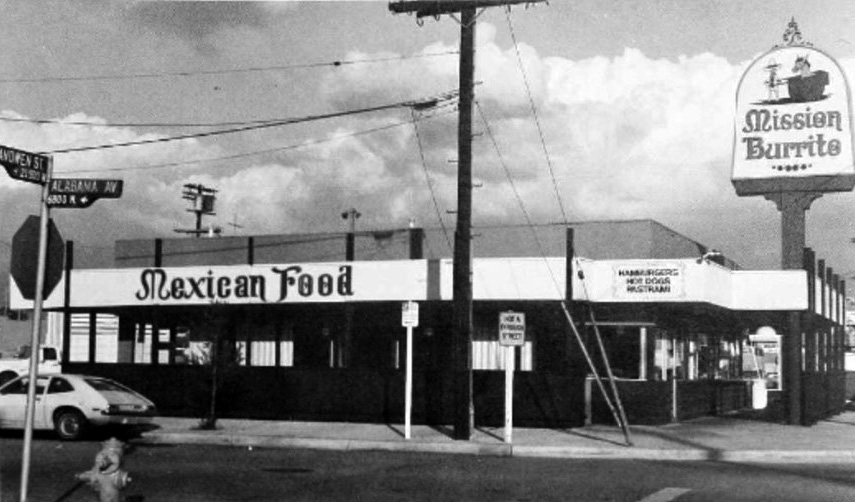 |
|
| (ca. 1975)^ - View looking at the NE corner of Vanowen Street and Alabama Avenue showing Mission Burrito located at 21425 Vanowen, Canoga Park. |
Historical Notes With the success of Sierra's, Gil and his wife Fay, realized the area was in need of a fast food restaurant, so in 1973, the Jaramillo's purchased "Gus's Chicken Shack" on the corner of Alabama and Vanowen Street. He ran this for about a year as a sandwich shop specializing in "dip" style sandwiches. The demand for Sierra's style Mexican food was so great and Sierra's had already reached its full capacity, that he then created "Mission Burrito", and the rest is history.* |
 |
|
| (2012)^.^ - Sierra’s Mexican Restaurant and Mission Burrito Canoga Park closing their doors on December 31, 2012. |
Historical Notes In 2013, Sierra's, the oldest family run restaurant in the San Fernando Valley, closed its doors as well as the doors of their adjacent Mission Burrito. Mission Burrito would soon be reincarniated in West Hills at 22744 Roscoe Blvd near Fallbrook Ave. There are currently several other Mission Burritos locations including: Woodland Hills, Simi Valley, and Moorpark. |
Topanga and Victory
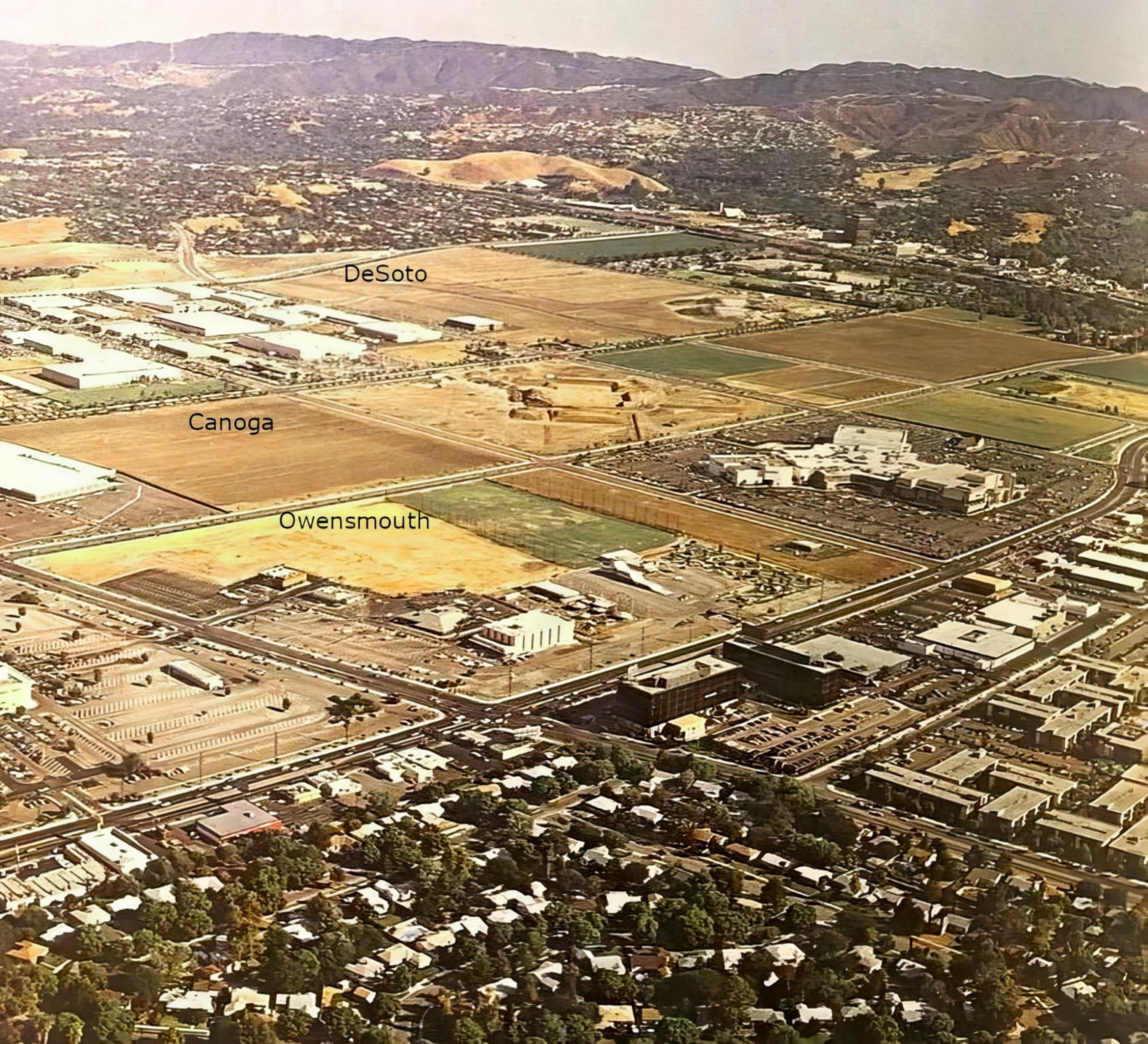 |
|
| (1975)* - Aerial view looking SE with the intersection of Topanga and Victory boulevards seen in the foreground (lower center-left). The large white building on the SE corner is the Topanga Theatre. South of the theater is the Topanga Amusement Center and south of there, on the other side of Erwin Street, is the Promenade Shopping Mall. |
Historical Notes The Promenade Shopping Mall originally opened in 1973 as a high-fashion shopping center, anchored by stores like J.W. Robinson's, Bullock's Wilshire, and Saks Fifth Avenue. Over the years, many of the anchor stores closed or left, including Robinson's, Bullock's, and Saks Fifth Avenue. By the 2010s, the Promenade had fewer than 10 stores remaining and was considered a "dead mall". In 2020, the Los Angeles City Council approved a plan by Unibail-Rodamco-Westfield to redevelop the Promenade site into a mixed-use development with hotels, offices, and over 1,400 new apartments. In 2022, the Promenade property was sold to an investor group led by Los Angeles Rams owner Stan Kroenke, who is expected to redevelop the site as part of a larger mixed-use project in the area. |
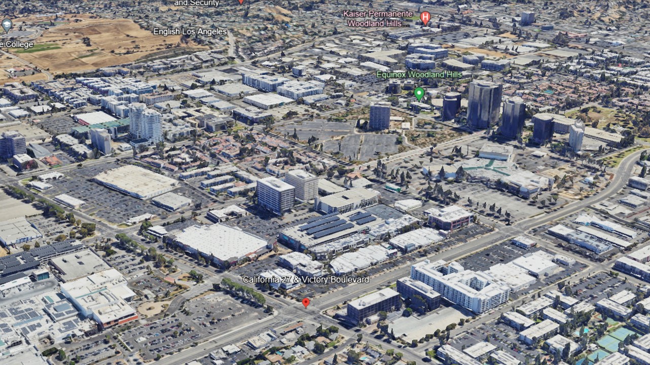 |
|
| (2022)* - Aerial view of Woodland Hills and Warner Center looking SE with the intersection of Topanga and Victory boulevards seen at lower center-left showing how the entire area has developed over the years. |
Then and Now
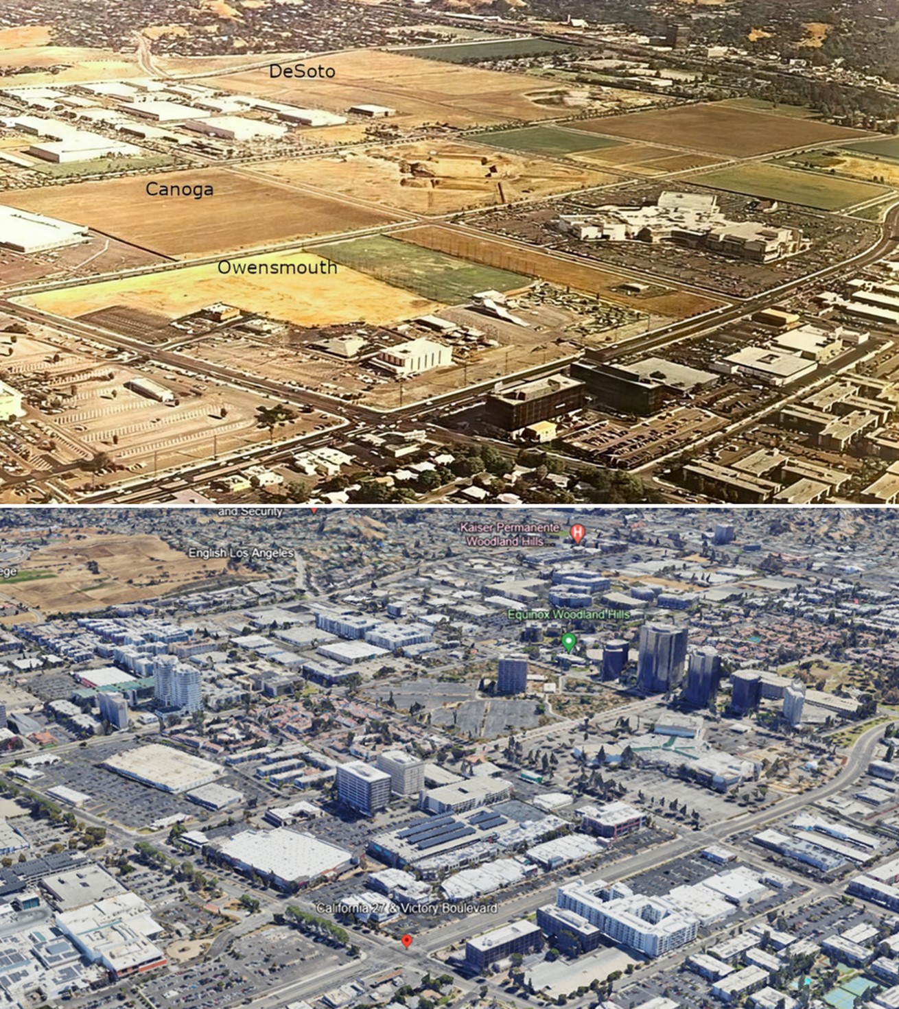 |
|
| (1975 vs 2022)* - Aerial view of Woodland Hills and Warner Center looking SE with the intersection of Topanga and Victory boulevards seen in the foreground (lower center-left). |
Historical Notes Warner Center in Woodland Hills, experienced significant development in the 1970s and 1980s: The area was originally the private horse ranch of Harry Warner, one of the Warner Brothers. In 1968, 630 acres of the land were sold to Aetna Life and Casualty for $30 million for long-term investment and development purposes. Aetna later brought in Kaiser as a joint venture partner. Initial development in the 1970s included the 34-acre Promenade Mall, which opened in 1973, as well as engineering facilities and headquarters for aerospace companies like Rocketdyne and Litton Industries. The 1.1 million square foot Warner Center Business Park and the 1.8 million square foot Warner Center Plaza, with its signature high-rise office buildings, were also built out during this period. In the 1980s, the Trillium office project consisting of twin 17-story towers was constructed. Real estate developer Robert Voit, in partnership with Robert Allison and New England Life Insurance Company, led much of the commercial development in Warner Center during this time. |
Topanga Amusement Center
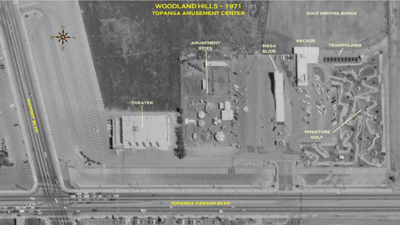 |
|
| (ca. 1971)* – Aerial View showing the Topanga Amusement Center in Woodland Hills. The intersection of Topanga Canyon Blvd and Victory Blvd is at lower-left. The amusement center (right) included a Driving Range, Arcade & Club House, Trampolines, Miniature Golf, Mega Slide and Amusement Rides. The building at center-left is the Topanga Theatre. Today, the entire block is occupied by the Westfield Village at Topanga. |
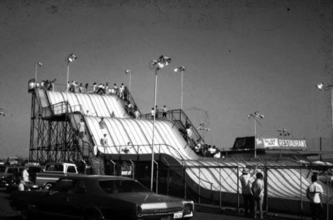 |
|
| (1970s)^.^ – Close-up view showing the Mega Slide (with those itchy gunny sacks) at Topanga Amusement Center. |
 |
|
| (2010s)#^*^ - Aerial view looking southeast showing the future home of The Village at Westfield Topanga. |
Then and Now
 |
|
| (2010s vs 2022) - The Village at Westfield Topanga, Then and Now |
Topanga Theatre
 |
|
| (1989)#^*^ – View of the Topanga Theatre at 6360 Topanga Boulevard, located across the street from Topanga Plaza near the S/E corner of Topanga and Victory. |
Historical Notes The Topanga Theatre was opened as a single screen movie house in the 1960s. It was twinned in the early 80’s, triplexed in the early 90s. Pacific Theatres was the last chain to operate the Topanga, which became a second-run theatre in 1998 and closed altogether in early 2000. What killed the Topanga theatre was a 16 screen AMC multiplex opened one block away. In the same area there was also the GCC Woodland Hills Triplex, the UA Warner Center 6, the single screen Baronet and, down the road, the GCC Fallbrook 10. The former Topanga Theatre last housed a furniture store and was demolished in September 2007.^**^ The site currently is part of the Westfield Village at Topanga open-air mall. |
The Original Pizza Cookery
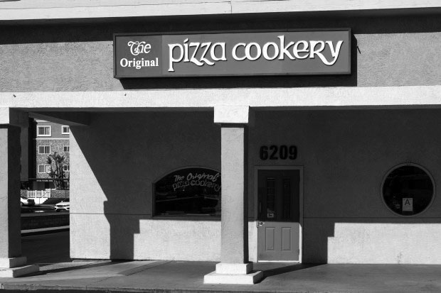 |
|
| (2019)^ – View showing the front entrance to The Original Pizza Cookery at 6209 Topanga Canyon Blvd. (Photo by David Crane, Los Angeles Daily News/SCNG). |
Historical Notes The restaurant, opened in 1975 at a small plaza that now anchors Office Depot and See’s Candies, has old rustic walls made of wood and boards, vintage lamps and the sawdust covered floor. A former cook, born in New York, Jordan Klempner opened the restaurant after returning from the military and selling his house in Laurel Canyon for $10,000. It took him a year, though, to find the right spot. When he walked into the Woodland Hills’ location, it “hit” him that there was the right place. The restaurant became the instant hit.^. |
 |
|
| (2019)^ – Large front window in front of the Pizza Cookery where one can get a close-up view of the kitchen and, of course, the pizza ovens. |
Historical Notes After nearly 45 years of business, Woodland Hills’ The Original Pizza Cookery is closing its doors. Owner Jordan Kempner is moving (May 2019). A new location in Thousand Oaks is set to open in June 2019 near the Best Western Plus Thousand Oaks Inn at 75 W. Thousand Oaks Blvd. It will be able to host about 200 people.^ |
Warner Center
 |
|
| (2002)* - An aerial view of office buildings at the Warner Center. On the left can be seen Topanga Canyon Boulevard as it winds its way up toward Chatsworth. Warner Center Park is at bottom of the photo. |
Historical Notes Warner Center is a master-planned business hub in the Valley that was named for Harry Warner of Warner Bros. Pictures, who had owned 1100-acre horse ranch in the 1940s. Robert Voit led the commercial development of the land after it was sold in the late-1970s. Warner Center was built to relieve traffic to and from downtown L.A., as well as generate jobs in the San Fernando Valley. At the band shell of Warner Park (visible in the foreground), sits the site of the Valley's "Concerts in the Park" series, which the Valley Cultural Center stages for free during the summer months. The concerts showcase everything from folk and rock to jazz and big band music.* |
Ventura Blvd
 |
|
| (2002)* - Photograph taken on Ventura Boulevard looking west toward Oakdale Avenue in Woodland Hills. Numerous businesses line the street. Banners reading, "Baseball as America. Natural History Museum" can be seen hanging on each street lamp. In the forefront, the rear view of a white convertible Jaguar XJS as it drives away. |
.jpg) |
|
| (2014)^^^ – Panoramic view of the West San Fernando Valley looking north with Warner Center in the foreground and the Santa Susana Mounains in the distance. |
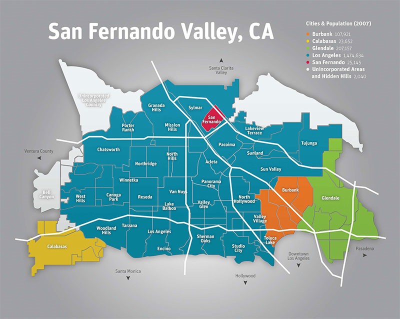 |
|
| (2016)^ - Map showing the 38 communities located in the San Fernando Valley. |
Historical Notes In 1900, there was still less than 3,000 people in the whole San Fernando Valley. The Valley's population today is nearly 1.8 million, larger than every other U.S. city except New York, Chicago, Houston, and of course, the rest of Los Angeles. Today, there are 38 Communities within the San Fernando Valley covering an area of 225 square miles. Click HERE to see SFV Communities - Name Origins and History |
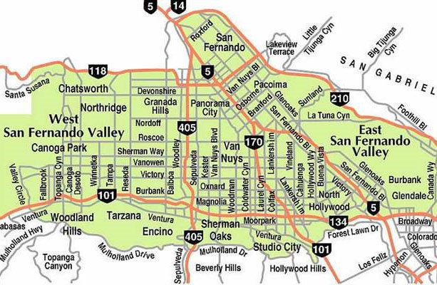 |
|
| (2010)^x^ - Map showing the major streets of the San Fernando Valley. Little known fact: Most of the major east-west streets in the Valley are in alphabetical order going north to south: Chatsworth - Devonshire - Lassen - Nordhoff - Plummer - Roscoe - Saticoy - Sherman Way - Vanowen - Victory |
Historical Notes "If you want to know the history of the San Fernando Valley, read the street signs." - Bill Robertson, Director of L.A.'s Bureau of Street Services (2009) Click HERE to see Street Name Origins - SFV |
* * * * * |
Please Support Our CauseWater and Power Associates, Inc. is a non-profit, public service organization dedicated to preserving historical records and photos. Your generosity allows us to continue to disseminate knowledge of the rich and diverse multicultural history of the greater Los Angeles area; to serve as a resource of historical information; and to assist in the preservation of the city's historic records.
|
More Historical Early Views
Newest Additions
Early LA Buildings and City Views
History of Water and Electricity in Los Angeles
* * * * * |
References and Credits
* LA Public Library Image Archive
^ CSUN Oviatt Library Digital Archives
#^San Fernando Valley History Digital Library - CSUN Oviatt
**DWP - LA Public Library Image Archive
^*The Valley Observied: Street Name Origins; Timeline of Valley History
^#Chatsworth Historical Society; Chatsworth Nike Site; Munch Box
*#Mojave Desert.net: Remi Nadeau
***Los Angeles Historic - Cultural Monuments Listing
*^*California Historical Landmarks Listing (Los Angeles)
*^^Nuestra Señora la Reina de los Ángeles - losangelespast.com
^^^LA Times: Adohr Spelled Succes for the Adamsons; Mulholland Bridge; Panorama City; Getting the Skinny on a Tall Valley Landmark; Valley Newspapers of the Past; Schlitz Closure; Sunkist Growers
^^*LA Times: Stanley Norris Petit
*##LA Times: Dig Into History You'll Find Snake Oil..Victor Girard Kleinberger
+#^Facebook.com: Encino Velodrome
+**Valley Presbyterian Hospital History and Milestones
+^^Panorama City - Commercial Area Concept Plan
^++Los Angeles Conservancy: Sunkist Headquarters
++#Facebook.com: Photos of Los Angeles
##*Pinterest - California; Farrell's Ice Cream Parlour
#^#San Fernando Valley Blog: LA Federal Savings Building, North Hollywood; Van Nuys Blvd. Postcard, Valley Music Theatre
*#*Project Restore: Van Nuys City Hall
^*^Topanga Canyon History - LA Magazine
*#^LA World Airports - History of Van Nuys Airport
^^#The Museum of the San Fernando Valley
**#Tumblr.com: LA History - Leonis Adobe
^#*Photo of the Northeast San Fernando Valley ca.1950 - Laurie Burns
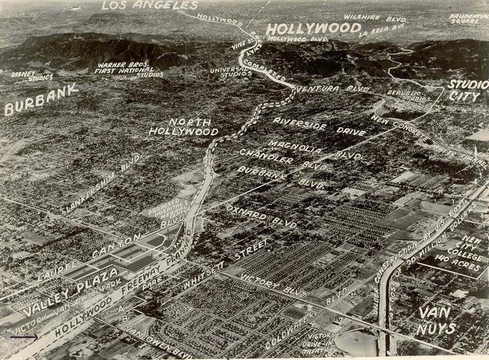
^*#North Hollywood-Toluca Lake Patch: History of the Laurel Canyon and Valley Plaza Mall; N. Hollywood Train Depot
*##*BellCanyon.com: Bell Canyon History
#^#^Granada Hills North Neighborhood Council: Granada Hills History
^*^*Metro.net: Mulholland Drive Bridge
*^*#Facebook.com: Classic Hollywood-Los Angeles-SFV
*^^^San Fernando Valley Historic Society/Facebook.com: JC Penney; California Bank; Devonshire Downs; Topanga Plaza Founain; Devonshire and Owensmouth; Sheep Crossing Roscoe; Log Ride / Busch Gardens
^**^Cinema Treasures: Rivoli-Capri Theatre; Reseda Drive-In Theatre; Van Nuys Driv-In Theater; Winnetka Drive-In; Topanga Theatre; Victory Drive-in; Holiday Theatre
***^Los Angeles Movie Palaces: Studio City Theater
**^^KCET: LA Flood of 1938: Cement the River's Future; Canoga Park at 100: A Brief History of the Birth of Owensmouth; When Cahuenga Pass Was Rustic; Before the 'Carmageddon': A Photographic Look at the Construction of 5 SoCal Freeways; Thematic Cartography and Mapping Los Angeles
**^#LA Times Framework: Busch Gardens Monorail; Woodland Hills Sheep
*^^#Flickr.com: Kaiser Panorama City; Coffee Dan's (Van Nuys)
++^^The Valley Economic Alliance
+++# Facebook: San Fernando Valley Historical Society
+++^Facebook: Here in Van Nuys
**#*EntertainmentDesigner.com: Busch Gardens
**#^San Fernando Valley Historical Society: Van Nuys Drive-in Theater
*^#^Northridge Fashion Mall Jobs
^^##Encino-Tarzana Patch: Valley Ice Skating Center
^##*Pinterest: Drive-in Speakers
^##^Pinterest: San Fernando Valley
*#^#Forum.skyscraperpage.com: Coffee Dan's
*##^City-Data.com: Ventura Boulevard
*#^*Los Angeles County Library: Agoura Hills
*#^^Big Orange Landmarks: Drive-ins Roared into LA Country
*#**Facebook.com: Museum of the San Fernando Valley; Busch Monorail
^***LosAngelesPast.com: Cahuenga Pass
^**#The Friends of Oakridge; theoakridgeestate.com
#**^Flickr.com: Bibiop – Northridge Fashion Center
#^**The Go Go's: Local Coffee Shops and Diners
#^*^Facebook.com: West San Fernando Valley Then And Now
#*^*The First 100 Years: umccp.org
#*^#Google Maps
#^*#Worldwide Drive-Ins: Winnetka 6
#*#^Pierce College - piercecollege.edu
#*##Daily News: Rocketdyne Canoga Park; Proposed $3B Project at Rocketdyne Site; Mulholland Bridge
+*##Restaurant-ing Through History: Ice Cream Parlors
##^^California State University Northridge History: csun.edu
##++Litton Industries Company History
+#+#CardCow.com: Hody's Coffee Shop
^###Northridge Fashion Mall History
^^***Water and Power Associates
^^^^*Mbcinfo.com: Joseph Schlitz Brewing Company
**^^^LA Movie Palaces: San Fernando Valley
*^^^^Pinterest: San Fernando Valley - My Home Sweet Home
*^^^#DWP - Water and Power Associates Historical Archives - Courtesy of Rex Atwell
^***^Pacific Electric San Fernando Valley Line - ERHA.org
^^^*San Fernando Valley Relics: Facebook.com; Leonis Ranch; Ventura and Woodman; Busch Gardens; Reseda Blvd; Victory Blvd in Woodland Hills; Van De Kamp's; Valley Plaza; Nordhoff St. and Topanga Cyn; Ventura and Van Nuys Blvd; Van Nuys and Oxnard; Van Nuys Aerial; Van Nuys Blvd, ca. 1940; I-5 and I-14 Interchange; Van Nuys Drive-in; Mobil Gas Station; Canoga Drive-In; Victory and Whitsett; Van Nuys Aerial; Budweiser/Anheiseur-Busch Sign; Ventura Blvd 1950s
*^ Wikipedia: Sherman Oaks; Isaac Van Nuys; Encino; Tarzana; Campo_de_Cahuenga; Cahuenga Pass; Chatsworth; Panorama City; Santa Susana Field Laboratory; North Hollywood; Canoga Park; Woodland Hills; Reseda; Orcutt Ranch; Granada Hills; Andrés Pico; Moses Sherman; Van Nuys; Henry Kaiser; Charles Maclay; San Fernando Valley; Mission Point; Hughes Aircraft; Domonique Amestoy; Winnetka, Los Angeles; City of San Fernando; Canoga Park High School; Ventura Freeway; Hollywood Freeway; Los Angeles Valley College; Kaiser Permanente; Van Nuys Assembly; Rancho El Escorpión; Topanga Plaza; Simi Valley Freeway (118); Newhall Pass Interchange; Litton Industries; West HIls; Devonshire Downs; CSUN; Television Set History; Shadow Ranch; Atlas Missile; Thrifty Drugs; Coast Daylight; Longs Drugs; Du-Par's Restaurant; Joseph Schlitz Brewing Company; Annheiseur Busch; Fotomat; Baskin-Robbins; Valley Presbyterian Hospital; Warner Center; Gemco; Valley Music Theatre; Westfield Fashion Square; Paxton Park (Ritchie Valens Park); Big Donut Drive-in; Randy's Donuts; Builders Emporium; AlliedSignal; North Hills; Pacoima; 1960 Presidential Election; Farrell's Ice Cream Parlour
< Back