Early Views of Cahuenga Pass
From Tongva Trail to Hollywood Freeway
Introduction |
Cahuenga Pass has served as a natural gateway between the Los Angeles Basin and the San Fernando Valley for thousands of years. The Tongva people were the first to cross this gap in the Santa Monica Mountains, and by the late 1700s villagers from the community of Kawengna used it regularly. What began as a footpath became a wagon road in 1852, and that narrow, unpaved route remained an important crossing through the nineteenth century, used by ranchers, farmers and travelers who stopped at waystations such as the Eight Mile House near the summit. The twentieth century brought rapid change. The Pacific Electric Railway reached the pass in 1911, providing reliable rail service between Los Angeles and the growing San Fernando Valley. Automobiles soon shared the corridor with electric streetcars, while the growth of Hollywood, the Hollywood Bowl and nearby neighborhoods brought steadily increasing traffic. By the late 1930s the old road could no longer meet the demand, leading to construction of the Cahuenga Pass Parkway, which opened in 1940 as an eight lane highway with Pacific Electric tracks running down its center. This page traces that transformation through historic photographs, postcards, aerial views and then and now comparisons. Along the way, readers will see the early wagon road and roadside taverns, farms in the hills, the arrival of the Pacific Electric Railway, the growth of automobile traffic, construction of the parkway and its evolution into the Hollywood Freeway. Familiar landmarks including the Hollywood Bowl, Mulholland Drive, the Ford Theatre and Universal Studios appear throughout, while many of the surrounding ridgelines remain recognizable even as the transportation corridor below has been repeatedly rebuilt. |
The Wagon Road Years |
Long before automobiles or streetcars, Cahuenga Pass provided a natural route through the Santa Monica Mountains between the Los Angeles Basin and the San Fernando Valley. Indigenous people used the pass for generations, and the name Cahuenga is derived from Kawengna, the name of a Tongva village associated with the area. By 1852, a wagon road had been built through the pass, creating a more practical route for horses, wagons and stagecoaches.For much of the nineteenth century, the road remained narrow, steep and unpaved. Travelers followed its winding course through largely undeveloped hills, stopping along the way at roadside establishments that provided food, drink and shelter. By 1858, Butterfield Overland Mail stages were crossing the pass on their route through the San Fernando Valley.The images below capture this early period, when Cahuenga Pass was still a rural mountain crossing. They show the winding wagon road, the open hills surrounding it and the tavern near the summit that became a familiar stopping place for travelers. |
 |
|
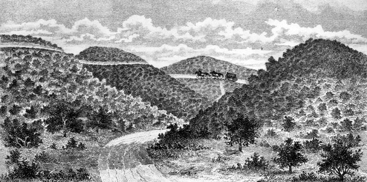
| (n.d.)* - Drawing showing an early view of Cahuenga Pass, with a horse drawn wagon traveling through the hills. The original caption reads, “The drive to Cahuenga Vista.” |
Historical Notes Long before a wagon road crossed these hills, Indigenous people used Cahuenga Pass as a natural route through the Santa Monica Mountains. The name Cahuenga is derived from Kawengna, the name of a Tongva village associated with the area. By the middle of the nineteenth century, increasing travel between Los Angeles and the San Fernando Valley led to improvements through the pass, including construction of a wagon road by 1852. Cahuenga Pass also played a role in California's Mexican period. In 1831, forces opposed to Governor Manuel Victoria confronted his troops near the pass. Two men were killed and Victoria was seriously wounded; he resigned shortly afterward. Another conflict, the Battle of Providencia, took place on the Valley side in 1845, when Californios rebelled against Governor Manuel Micheltorena. His defeat led to the return of Pío Pico as governor. |
 |
|
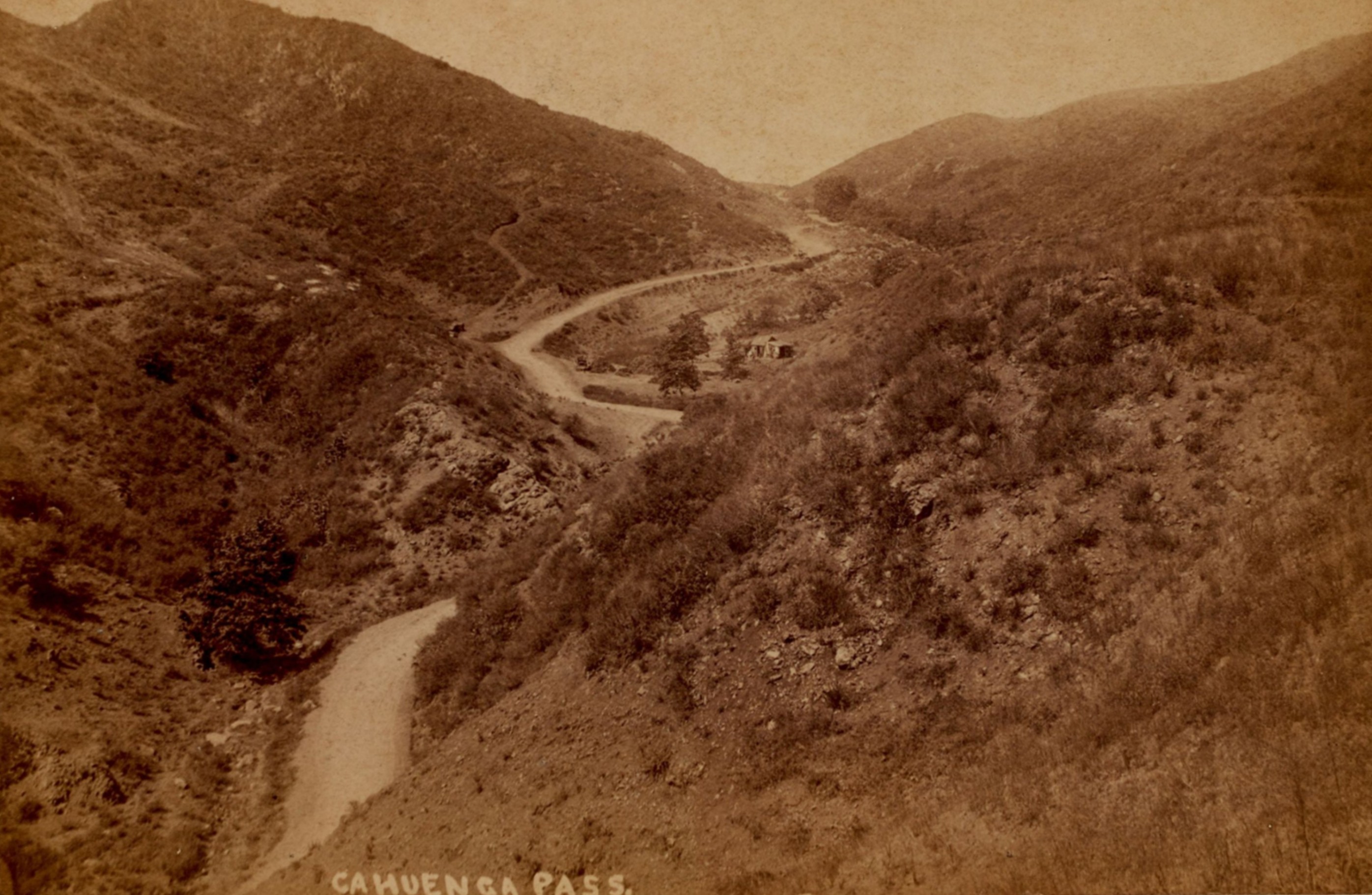
| (ca. 1888)* - View of the winding dirt road through Cahuenga Pass from the San Fernando Valley side, near present day Universal City. A horse drawn vehicle is visible descending the road at upper center, with a coach stop near the bend below. Photo by Pacific Photography Gallery from the Ernest Marquez Collection. |
Historical Notes By the late nineteenth century, Cahuenga Pass remained a rough and winding route through largely undeveloped hills. Wagons and stagecoaches followed the narrow road along steep slopes covered in chaparral, making the crossing slow and sometimes difficult. The pass had already become an important transportation route. Butterfield Overland Mail stages began crossing Cahuenga Pass in 1858 on their route through the San Fernando Valley. Roadside stopping places also appeared along the route, providing food, drink, supplies and shelter for travelers and their animals. |
 |
|
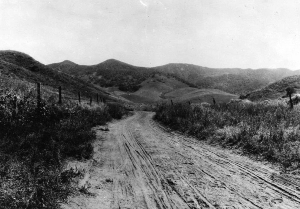
| (ca. 1890)* - View of the winding dirt road through Cahuenga Pass during the late nineteenth century. |
Historical Notes By the 1890s, travel through Cahuenga Pass was becoming more common as farms and communities developed in the San Fernando Valley. Wagons, stagecoaches and riders continued to use a road that remained largely unpaved and closely followed the natural contours of the hills. These early photographs also provide a useful record of the original landscape. Later road widening, grading, railway construction and eventually the Hollywood Freeway would substantially reshape the corridor, while many of the surrounding ridgelines remained recognizable. |
Then and Now
 |
|
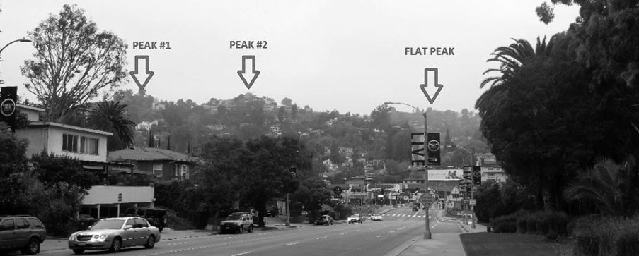 |
|
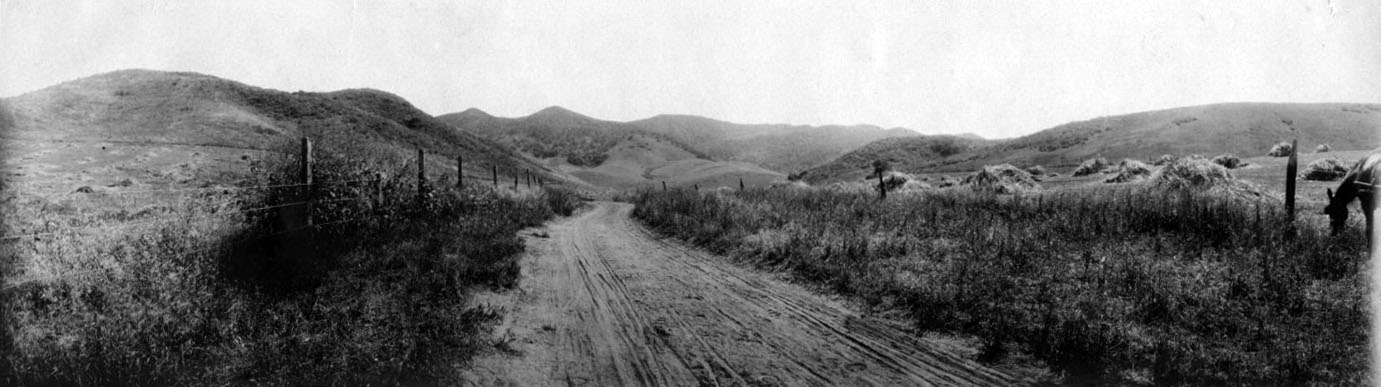
| (1890 vs. 2021) - View looking southwest from the Barham Boulevard area toward Cahuenga Pass, comparing the rural wagon road with the modern transportation corridor. |
Historical Notes This comparison shows how extensively Cahuenga Pass has been reshaped. In the 1890 view, a dirt road winds through open, largely undeveloped hills. By 2021, graded boulevards and freeway construction had transformed the same area into a major transportation corridor between Hollywood and the San Fernando Valley. Despite more than a century of development, the surrounding hills provide a connection between the two views. Their familiar ridgelines help identify the landscape even though the roads below have been widened, lowered and rebuilt. |
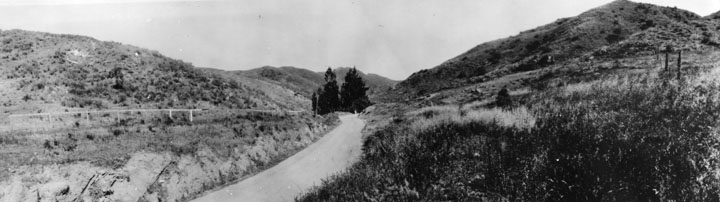 |
|
| (1882)* - View at the summit of Cahuenga Pass showing a horse drawn wagon on the road and a saloon partly concealed among the trees. |
Historical Notes Roadside establishments near the summit provided welcome stopping places when crossing Cahuenga Pass was still a slow journey by wagon or horseback. Travelers could rest themselves and their animals, obtain food and supplies, and prepare for the descent on the opposite side of the hills. The building visible among the trees appears to be the establishment later identified in photographs as Cahuenga Tavern, also known as the Pass Hotel or Eight Mile House. It became one of the best known landmarks along the early route through the pass. |
 |
|
| (1882)* - View of the summit of Cahuenga Pass with a saloon, Cahuenga Tavern, situated between the tall eucalyptus trees. |
Historical Notes Cahuenga Tavern was also known as the Pass Hotel and Eight Mile House, a name associated with its distance by road from Los Angeles. The establishment served travelers, stagecoach drivers and local ranchers crossing between Los Angeles and the San Fernando Valley. In addition to food and drink, the Eight Mile House provided lodging, supplies and other services to travelers. For decades it was a familiar landmark along the old wagon road, although its importance declined as transportation through Cahuenga Pass became faster and more reliable. |
* * * * * |
Eight Mile House (Cahuenga Tavern or Pass Hotel) |
For travelers making the long crossing between Los Angeles and the San Fernando Valley in the nineteenth century, the summit of Cahuenga Pass offered a natural place to stop. There, a two story wooden building served travelers for decades as a tavern, hotel, store and toll station. It was known by several names, including the Eight Mile House, for its approximate distance by road from Los Angeles, the Cahuenga Tavern and the Pass Hotel.The Eight Mile House became a familiar landmark along the route through the pass, providing food, drink, lodging and supplies to travelers and their animals. As transportation changed during the early twentieth century, automobiles increasingly replaced horses and stagecoaches, reducing the need for roadside establishments of this kind.These views trace the Eight Mile House through its later years, from an active stop along the old wagon road to a building whose original purpose gradually disappeared as travel through Cahuenga Pass became faster and easier. |
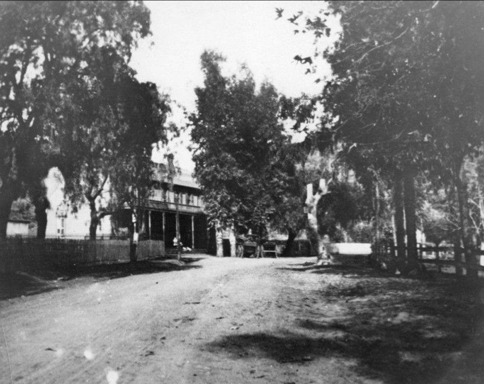 |
|
| (n.d.)* - View of the Eight Mile House, also known as Cahuenga Tavern or the Pass Hotel, near the summit of Cahuenga Pass. |
Historical Notes Sources differ on when the Eight Mile House was established. Most local histories place its construction in the early 1870s, while a Los Angeles city planning history, citing historian Gregory Paul Williams, places the Cahuenga Pass Hotel at the summit by the end of the 1850s. No contemporary source has been found that conclusively resolves the difference. Whatever its exact date of origin, the two story wooden building became one of the best known stopping places along the route through Cahuenga Pass. It served as a tavern, hotel, store and toll station, providing travelers with a place to rest before continuing down the opposite side of the hills. |
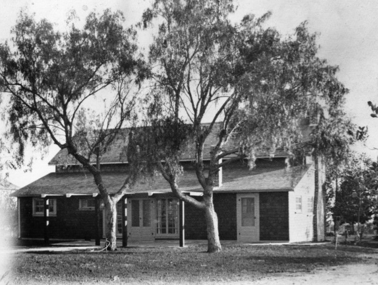 |
|
| (1905)* - Close view of the Eight Mile House, also known as Cahuenga Tavern or the Pass Hotel, set among trees near the summit of Cahuenga Pass. |
Historical Notes By the beginning of the twentieth century, the Eight Mile House had served travelers through Cahuenga Pass for decades. Its location near the summit made it a convenient stopping place along a road that was still largely rural. Its role, however, was beginning to change. Automobiles were appearing on the road, reducing travel times and lessening the need for the overnight lodging and services that had made roadside establishments like the Eight Mile House important during the wagon and stagecoach era. |
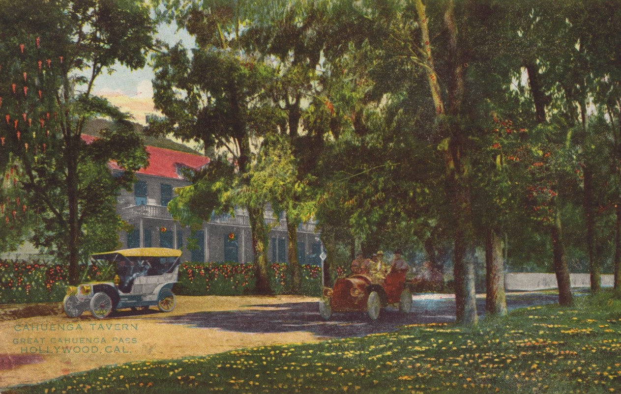 |
|
| (1908)* - Postcard view of the Eight Mile House near the summit of Cahuenga Pass, with early automobiles in the foreground. |
Historical Notes This view captures a transition in transportation through Cahuenga Pass. The roadside establishment that had served travelers during the horse drawn era now stood alongside automobiles, which were beginning to change how quickly and easily people could travel between Los Angeles and the San Fernando Valley. The transformation continued during the following decade. The Pacific Electric Railway opened through Cahuenga Pass in 1911, while the roadway was gradually improved for increasing automobile traffic. As travel became faster, the Eight Mile House lost much of its original purpose. The old establishment eventually fell into decline and was removed around 1920. |
* * * * * |
Hazards of Early Travel through Cahuenga Pass |
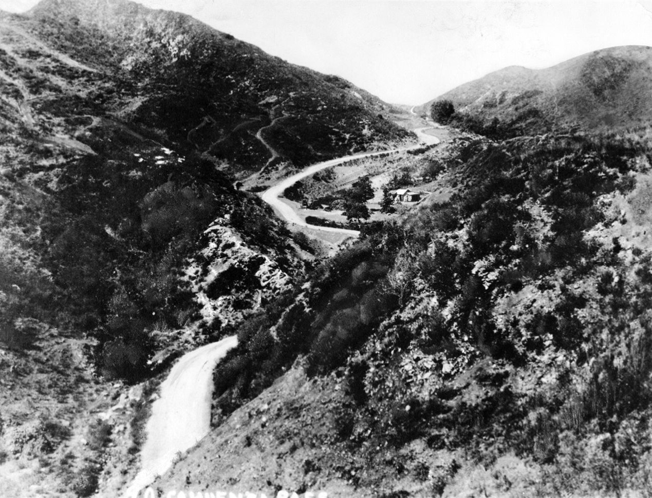
Travel through Cahuenga Pass in the nineteenth century required care and experience. The road was narrow, unpaved, and shaped by the terrain. Steep grades, limited visibility, and changing weather conditions made each trip uncertain.These views show the pass at a time when the landscape itself defined the limits of travel. |
 |
|
| (ca. 1888)* - High angle view of Cahuenga Pass with road winding through the hills. |
Historical Notes The dirt road through the pass was narrow and difficult to navigate. On steep grades, two wagons could not pass each other, requiring one to back down to allow the other through. Storms could frighten horses, and lightning strikes were reported in the area. The dangers were real. In 1889, Miguel Leonis, a prominent landowner in the San Fernando Valley, was fatally injured after falling from his wagon while crossing the pass. A nearby coach stop operated by Geronimo Lopez provided shelter for travelers who chose not to attempt the crossing after dark. |
 |
|
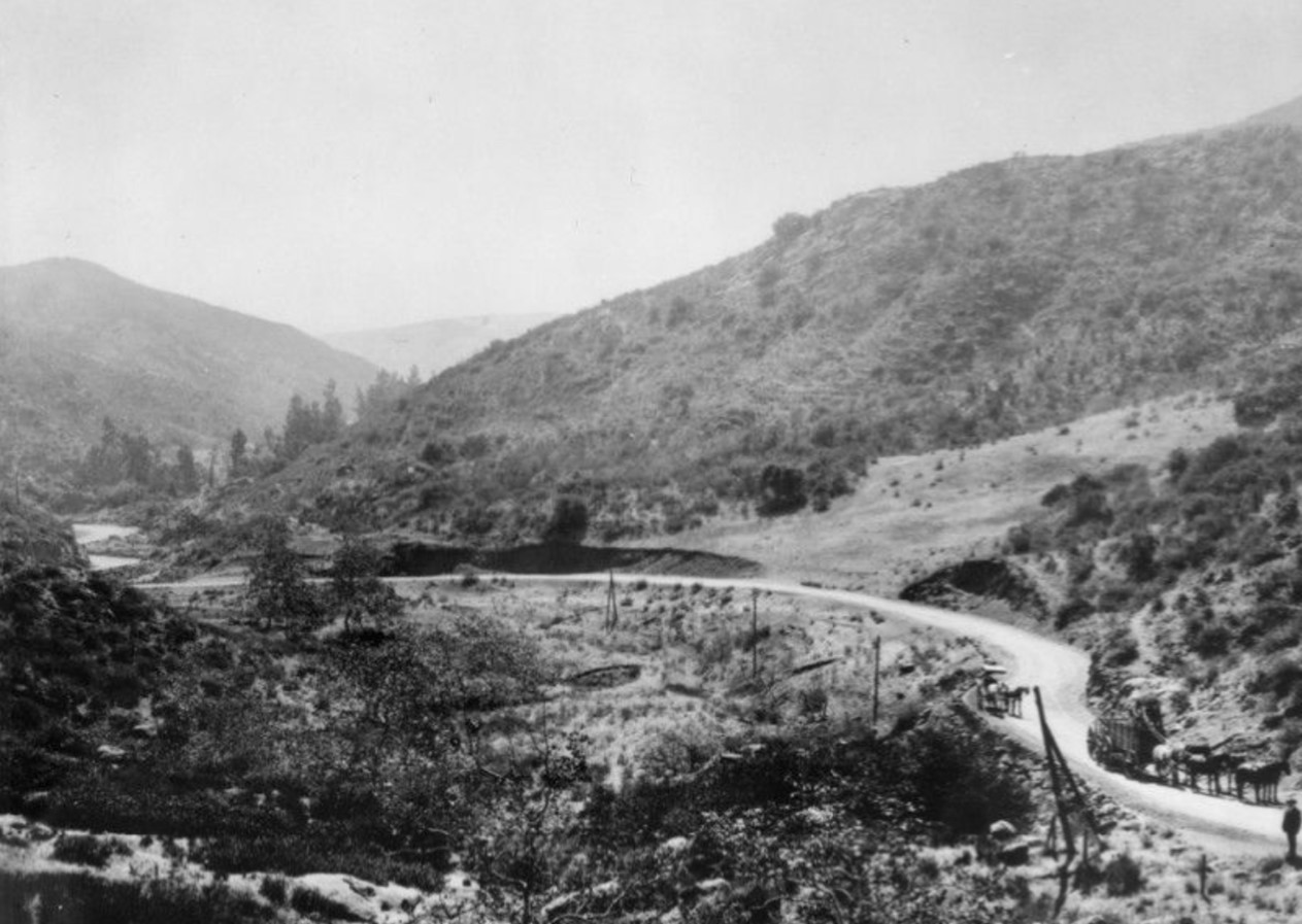
| (ca. 1894)* - Early view of the pass with wagons and teams of horses along the road. |
Historical Notes By the 1890s, travel through the pass had become more common, though conditions remained difficult. The road was still unpaved and uneven, and required careful handling by drivers familiar with its grades and turns. Traffic through the pass continued to increase as farmers and traders moved between the valley and Los Angeles. The limitations of the road were becoming clear, and the need for a wider and more reliable route would soon lead to improvements. |
* * * * * |
Early Travel through Cahuenga Pass |
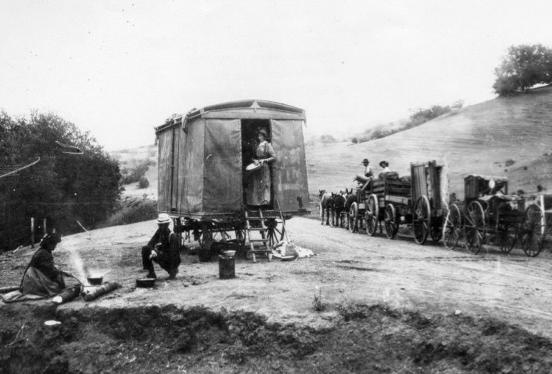
By the late nineteenth and early twentieth centuries, Cahuenga Pass was carrying a growing mix of travelers. Wagons, cyclists, and early automobiles shared the same narrow road, which had changed little since the 1850s.These images show the pass during a period of transition, as increasing use began to push the limits of the original route and set the stage for future improvements. |
 |
|
| (1892)* - Travelers stop to camp and cook along the route through Cahuenga Pass. |
Historical Notes By 1892, the pass had been used as a wagon route for several decades. The Butterfield Overland Mail crossed here beginning in 1858, and by the 1870s the Eight Mile House provided a place to rest and resupply. Travel through the pass was still a slow process. Trips required planning, supplies, and time, and travelers often stopped along the way to camp and prepare meals. |
 |
|
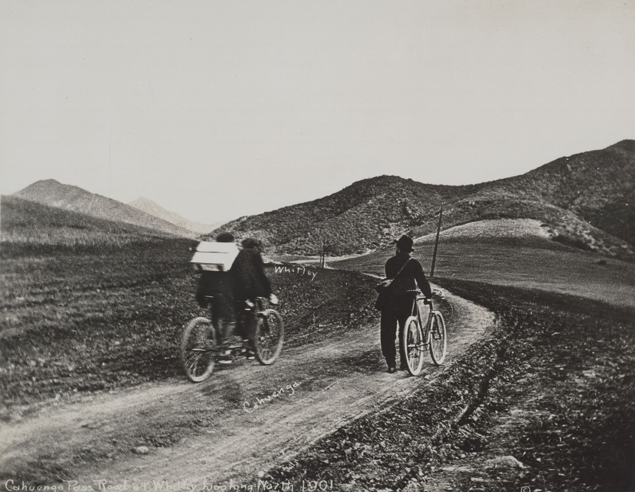
| (1901)* - Cahuenga Pass Road at Whitley looking northwest. Photo by C. C. Pierce. |
Historical Notes This 1901 photograph shows the unpaved road that served as the primary connection between Los Angeles and the San Fernando Valley. The surface remained rough and uneven, reflecting its origins as a wagon route. By the early twentieth century, the road carried a wider range of users, including cyclists and early motorists. Increasing traffic placed pressure on the route, leading to efforts to widen and improve the roadway. |
 |
|
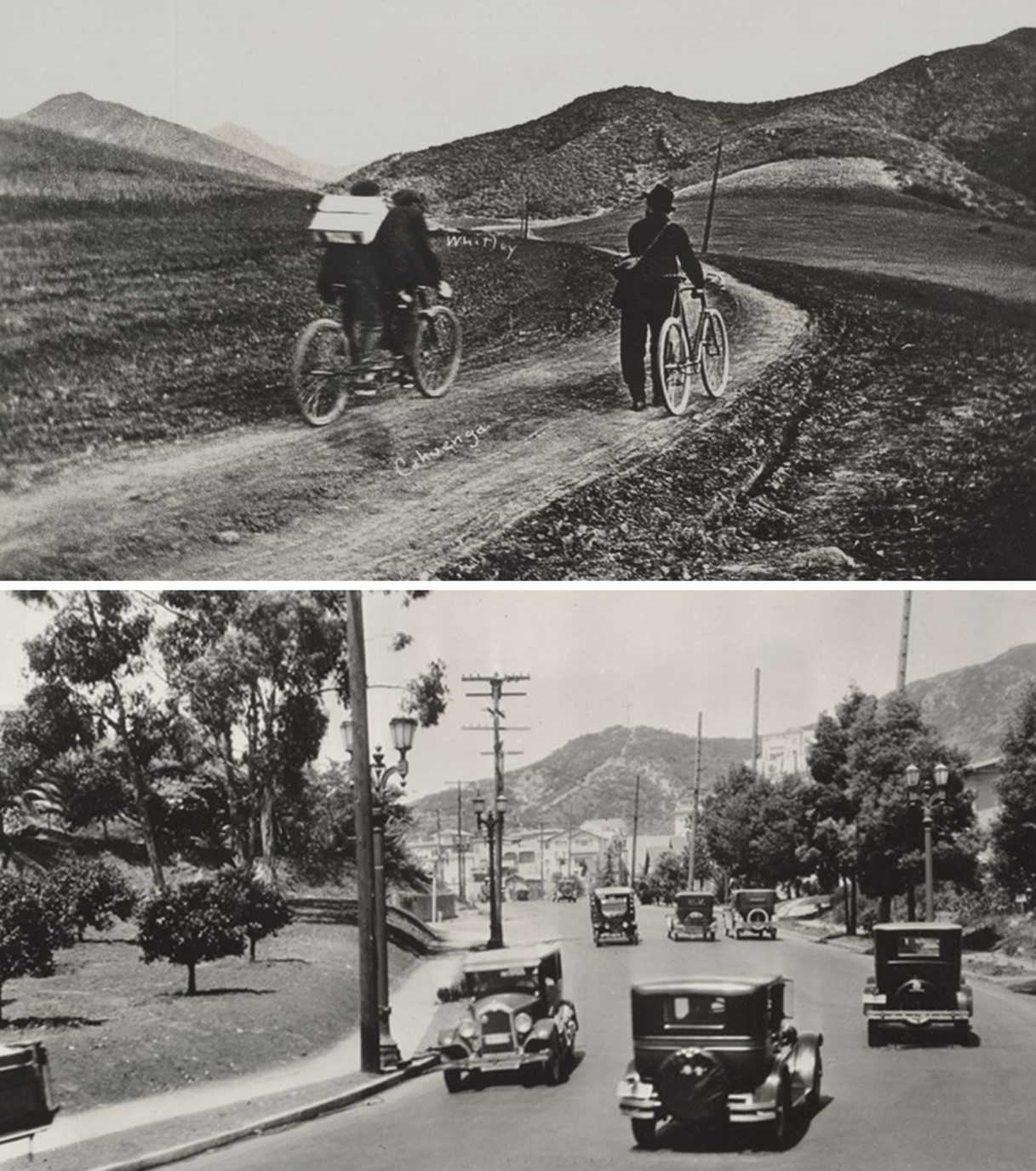
| (1927)* - Cahuenga Pass Road at Whitley looking northwest. Photo by C. C. Pierce. |
Historical Notes This view of the same location shows how the road had been improved by the 1920s. The surface had been graded, and the route was better defined than in earlier years. In 1925, Cahuenga Avenue was officially renamed Cahuenga Boulevard, recognizing its role as a major route through the pass and an important connection between Hollywood and the San Fernando Valley. |
 |
|
| (2022)* - View looking northwest on Cahuenga Boulevard at Whitley Avenue. |
Historical Notes Today, Cahuenga Boulevard remains an important surface street through the Hollywood Hills. While nearby freeways carry most regional traffic, the boulevard continues to connect neighborhoods on both sides of the pass. The surrounding ridgelines remain largely unchanged, while the roadway has been repeatedly widened, graded, and improved over time. The pass continues to serve the same basic function it did more than a century ago. |
Before and After
 |
|
| (1901 vs. 1927)* – Looking northwest along Cahuenga Pass Road (now Cahuenga Boulevard) at Whitley in the Hollywood Hills. Over time, the road has been graded and lowered, but the ridgeline remains relatively unchanged. Photo comparison by Jack Feldman. |
Historical Notes These two views show the same location at the beginning and end of a period of rapid change. In 1901, the road was still largely unpaved and followed the natural contours of the pass. By 1927, it had been graded and improved, reflecting increased use and the growing importance of the route. The changes visible between the two images are the result of ongoing efforts to make travel through the pass more reliable. As traffic increased in the early twentieth century, the need for a safer and more efficient roadway led to repeated improvements that reshaped the corridor. |
Then and Now
 |
|
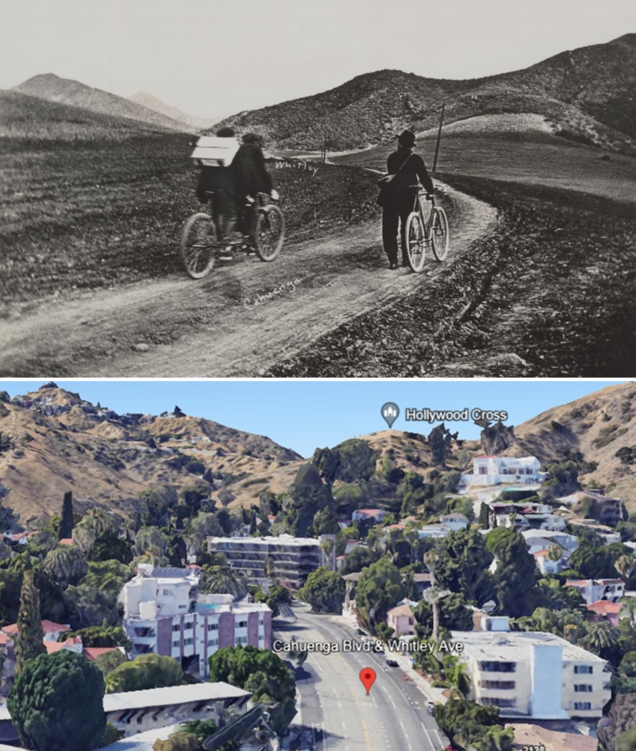
| (1901 vs. 2022)* - Looking northwest on Cahuenga Pass Road (now Cahuenga Boulevard) at Whitley in the Hollywood Hills. While the angles of the images differ and the road has been graded and lowered over time, the outline of the ridges has remained relatively unchanged. Photo comparison by Jack Feldman. |
Historical Notes These views, taken more than a century apart, show both continuity and change. The ridgeline remains largely the same, providing a consistent reference point across time. The road itself, however, has been widened, lowered, and paved to meet the needs of modern traffic. What began as a narrow wagon route is now a major roadway carrying daily traffic through the Hollywood Hills. The comparison highlights how the natural landscape has endured, even as the route through it has been steadily transformed. |
* * * * * |
Cultivation and Settlement in the Pass |
Before modern roads and development reshaped Cahuenga Pass, its hillsides were home to something quieter and more modest: small farms carved from rugged terrain by settlers arriving during Los Angeles’s first great wave of growth. In the early twentieth century, the pass was more than a route between regions. It was a working landscape, where fields and homesteads took hold along the canyon slopes. These images capture that brief agricultural chapter, when the pass was defined more by soil and labor than by asphalt and speed. |
 |
|
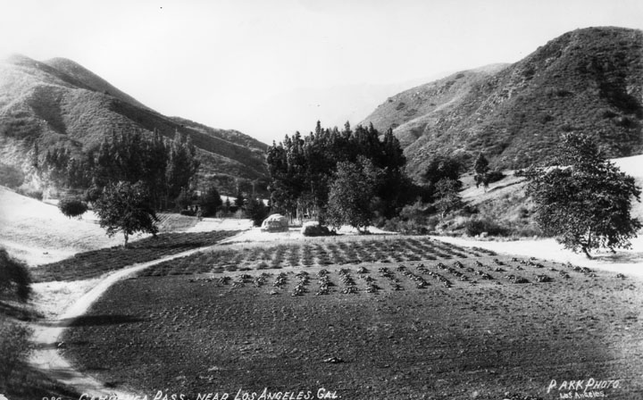
| (ca. 1903)* - View of early Cahuenga Pass as seen from the Hollywood side. The road runs around and through a cultivated area. |
Historical Notes By the early 1900s, Los Angeles County was entering a period of rapid agricultural expansion. Small farm homes, often set on one to three acres, were actively promoted by the Los Angeles Chamber of Commerce and the Los Angeles Times as a way to attract settlers and stimulate land sales. The Cahuenga Pass reflected this broader trend, as newcomers pushed into the hillsides and cleared slopes that had previously supported only native brush. Farming in the pass was neither easy nor predictable. The terrain was uneven, water required careful management, and access to markets depended on a rough, unpaved road winding through the canyon. Even so, these early efforts reflected a larger belief taking hold across Southern California: that the land could be shaped to support both livelihood and growth. This 1903 view from the Hollywood side shows that transformation already underway, with cultivated fields visible along the road’s path. |
 |
|
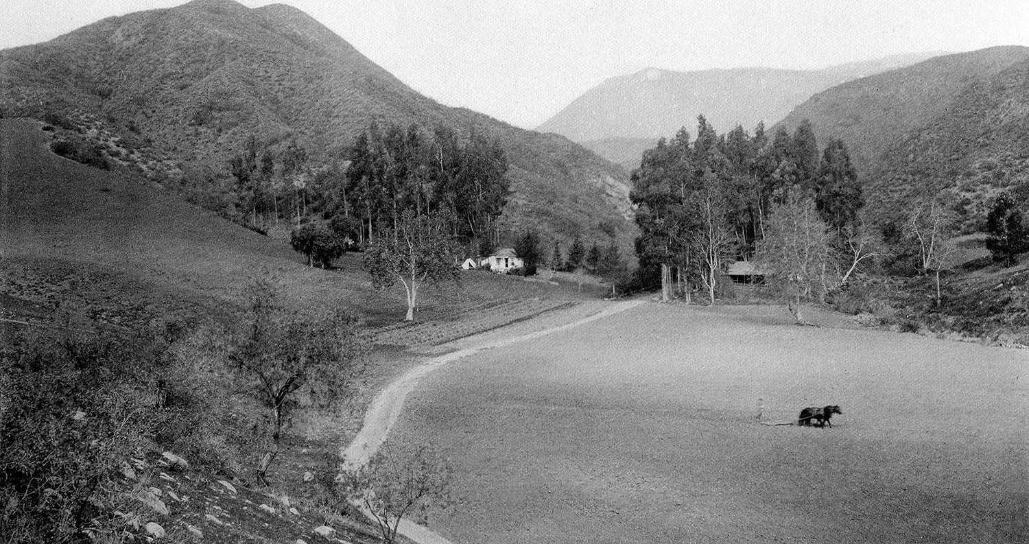
| (ca. 1905)* – Early view of Cahuenga Pass showing a farmer in his field behind a horse-drawn plow. Two structures are seen in the background. |
Historical Notes This 1905 scene captures a familiar pattern across the Los Angeles Basin at the time: a farmer working the land with a horse-drawn plow, relying on patience and steady effort to bring crops from difficult terrain. The two structures in the background suggest a modest, self-contained farm operation, typical of the homesteads that spread through the hills surrounding Hollywood during this period. Even as the motion picture industry began to emerge nearby, farming still defined daily life within the pass. As late as 1914, Cecil B. DeMille lived in a small wooden cabin in the area, traveling on horseback each day to his studio in Hollywood. His routine reflects the unusual overlap of rural life and early film production, two worlds briefly coexisting within the same landscape. |
 |
|
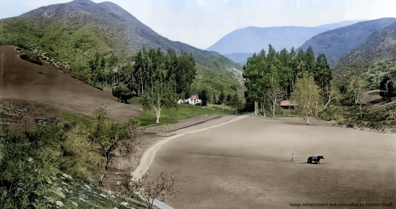
| (ca. 1905)* – Early view of Cahuenga Pass showing a farmer in his field behind a horse-drawn plow. Two structures are seen in the background. Image enhancement and colorization by Richard Holoff |
Historical Notes This colorized rendering brings added clarity to the agricultural character of the pass during this period. The tones of the soil and the simplicity of the structures highlight a landscape shaped by manual labor and practical necessity, one that would have been familiar across much of the rural American West. Cahuenga Pass had long served as a natural gateway between Los Angeles and the San Fernando Valley, first used by the Tongva people and later by Spanish missionaries and ranchers. By the early twentieth century, farming had become part of that continuing story. These cultivated fields, visible here through the added dimension of color, would not last. Improved roads, the arrival of Pacific Electric service in 1911, and the rapid expansion of the city would soon replace agriculture with transportation and development, bringing this quieter chapter to a close. |
* * * * * |
Roads and Faith in the Cahuenga Pass |
Before modern highways carved a direct path between Los Angeles and the San Fernando Valley, the journey through Cahuenga Pass was slow, uncertain, and often difficult. Early roads were little more than dirt tracks winding through rugged terrain, shared by farmers, travelers, and those whose journeys were driven by something deeper than commerce.These images capture a transitional moment when the pass served not only as a physical gateway between regions, but also as a corridor for human movement, community, and purpose. Within just a few years, the arrival of improved roads and rail lines would transform this landscape forever. |
 |
|
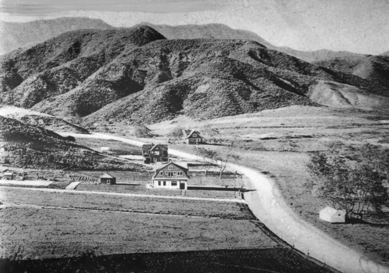
| (1906)* - Early view of Highland Avenue north of Hollywood Boulevard as it winds its way toward Cahuenga Pass. Some buildings are visible with hills in the background. |
Historical Notes This early view shows Highland Avenue as it approaches the southern entrance to Cahuenga Pass. By 1906, the road had become an established route linking Hollywood with the San Fernando Valley, though it remained unpaved and subject to the limitations of terrain and weather. At the time, travel through the pass required patience and caution. Grades were uneven, surfaces were rough, and the route could quickly become difficult during rain or heavy use. Even so, this road represented one of the most practical connections between Los Angeles and the Valley, foreshadowing the major transportation corridors that would soon follow. |
 |
|
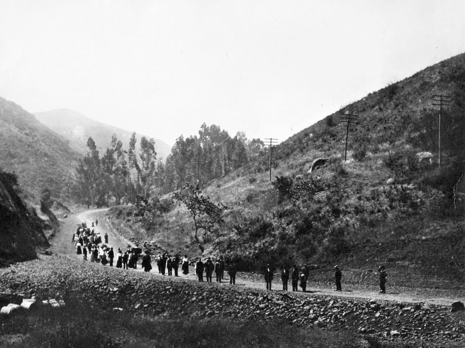
| (1910)* - Residents of the Pisgah Home in Los Angeles making their way to Pisgah Gardens in Lankershim. |
Historical Notes The Pisgah Home movement, founded by faith healer and reformer Finis E. Yoakum, grew from a small Highland Park sanatorium into a wide-reaching religious and social mission. By 1910, its members regularly traveled by foot and wagon to Pisgah Gardens in Lankershim, where the organization operated a facility serving the sick, the poor, and orphaned children. Although the exact route of this journey is not definitively documented, travel between Los Angeles and the San Fernando Valley at the time required crossing rugged mountain terrain on unpaved wagon roads, well before rail lines or modern highways existed. This image reflects the physical and spiritual effort involved in such trips, highlighting how early pathways between regions carried not only goods and travelers, but also shared purpose and community. |
* * * * * |
The Last Years of the Old Road |
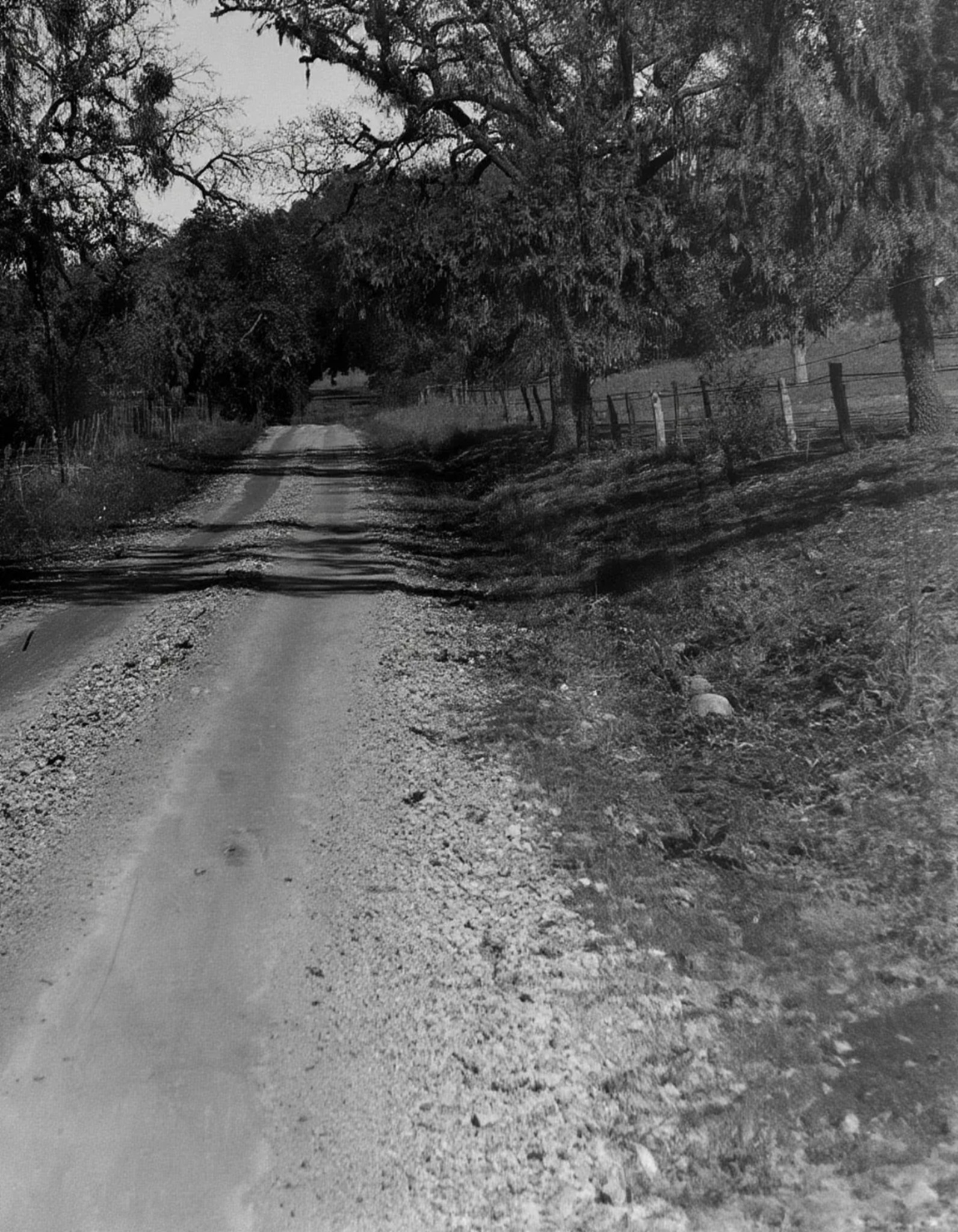
By the early 1910s, the traditional route through Cahuenga Pass had changed little in form, even as the region around it was beginning to modernize. The road remained narrow, unpaved, and increasingly inadequate for the growing demands placed upon it. |
 |
|
| (1913)* - Old Cahuenga Pass Road in what is now Studio City. At the time, this narrow dirt route was the primary connection between Los Angeles and the San Fernando Valley, where passing often required one team to back up and yield. |
Historical Notes By 1913, the road through Cahuenga Pass remained primitive, little more than a narrow dirt track winding through the mountains. In places, it was so constricted that when two horse-drawn teams met, the lighter one was forced to back up to allow passage. Travelers faced a range of hazards, from unstable footing and steep grades to sudden storms that could spook horses or turn the road into mud. These conditions underscored the growing need for safer, more reliable transportation routes. Within just a few years, automobiles, improved grading, and the expansion of rail service would begin to transform the pass. What had long been a difficult and uncertain journey would soon become one of the region’s most important transportation corridors. |
* * * * * |
Rails and Roads Transform Cahuenga Pass |
By the early 1910s, the long-isolated route through Cahuenga Pass was on the verge of rapid change. The extension of the Pacific Electric Railway, coupled with improved road building, began to reshape the pass from a difficult mountain crossing into a vital transportation corridor linking Los Angeles with the San Fernando Valley. |
The Arrival of the Trolley (1911) |
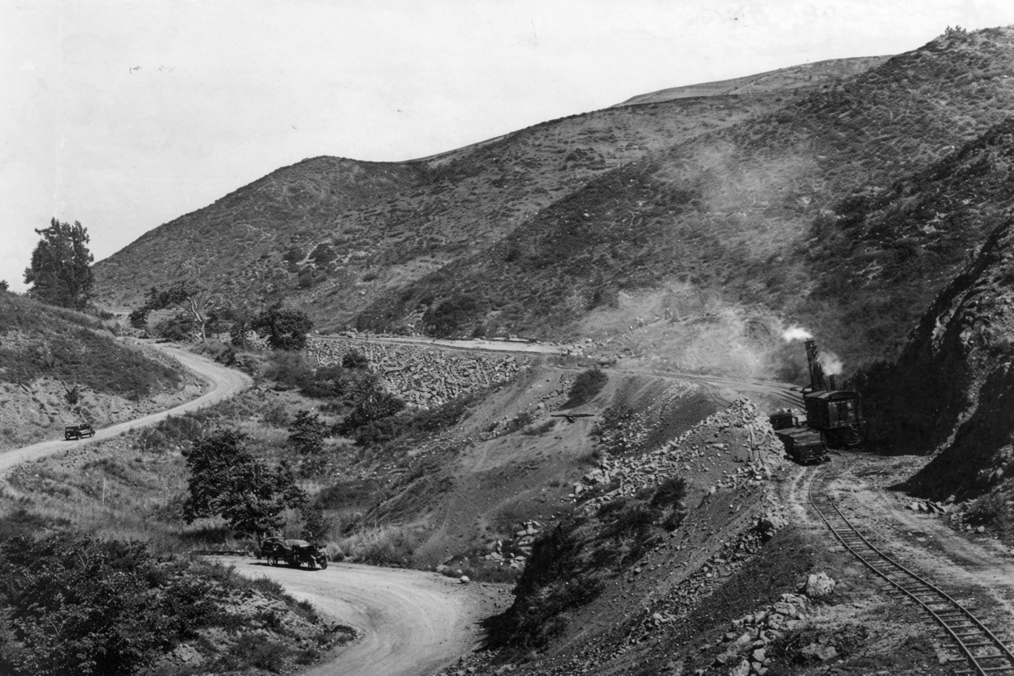
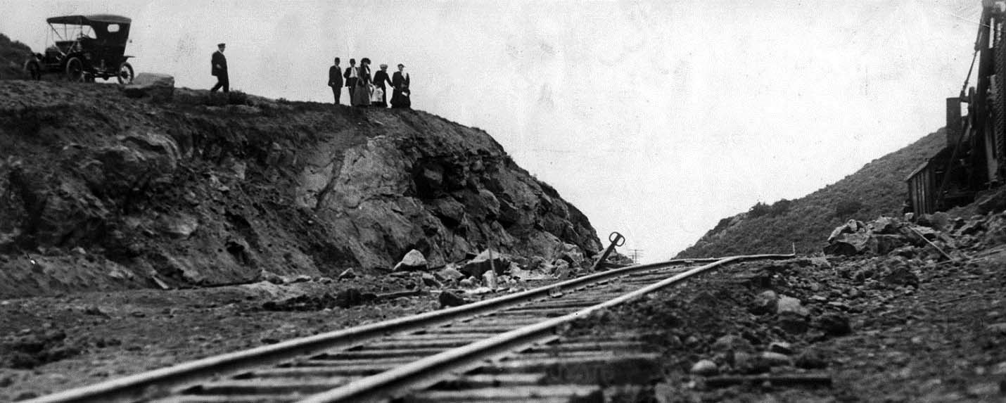
In 1911, construction of the Pacific Electric line through the pass marked a turning point. For the first time, reliable electric rail service would connect Hollywood with the Valley's emerging communities, dramatically reducing travel time and opening new opportunities for development. |
 |
|
| (1911)* - Tracks are being built through the hills of the Cahuenga Pass as shown on the right side of this picture. On the lower road can be seen supplies coming and going by teams of horses and wagons. |
Historical Notes The construction visible in this photograph marked a turning point in the history of Cahuenga Pass. General Moses Sherman, working through the Los Angeles Pacific Railroad and in partnership with a syndicate of investors that included Harry Chandler and others, directed the building of a new Pacific Electric line through the pass beginning in 1910. The project required grading through rugged mountain terrain while the existing road below remained in use, with horse-drawn teams continuing to haul construction materials alongside the very work that would soon make their route obsolete. The line reached Van Nuys on December 16, 1911, completing a connection that for the first time gave the San Fernando Valley reliable electric rail service to downtown Los Angeles. Paired with the construction of Sherman Way, a $500,000 paved boulevard built alongside the tracks across the Valley, the new line became the primary engine of development, opening farmland and grain fields to residential subdivision within just a few years. |
 |
|
| (1911)* - Sightseers checking out the new Pacific Electric trolley line being built in the Cahuenga Pass between Hollywood and the San Fernando Valley. |
Historical Notes Public interest in the new line was immediate. The April 9, 1911 Los Angeles Times caption recorded the moment directly: "This picture shows the railroad as now laid to the highest point in the gap which unites Hollywood with the rich San Fernando Valley. The road will be in operation early in the summer. Express trains connecting the town of Van Nuys with Los Angeles will make only one stop, Hollywood." Within months of opening, the line was carrying passengers on a 45-minute run between Van Nuys and downtown Los Angeles, a journey that had previously required hours by wagon over unpaved roads. The pass that had long been a barrier was rapidly becoming a corridor. |
* * * * * |
Roads and Rails Together (1910s–Early 1920s) |
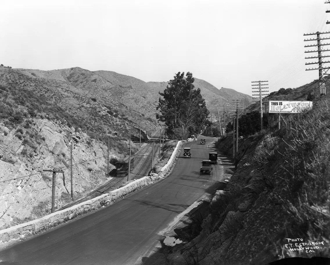
Following the completion of the trolley line, Cahuenga Pass entered a period when old and new modes of travel shared the same narrow corridor. Dirt roads were gradually improved for automobiles while electric rail service continued to carry passengers through the pass, the two systems running side by side through the same mountain gap. |
 |
|
| (ca. 1920)* - Cars travel on the road past a sign reading "This is Hollywood." Below and to the left is the rail line, which also goes through the Cahuenga Pass. A trolley car is traveling on the tracks. |
| Historical Notes
By around 1920, Cahuenga Pass carried two distinct transportation systems side by side. Automobiles moved along the improved road above while Pacific Electric Red Cars ran on their private right of way below, the two modes sharing the same narrow mountain corridor in an arrangement that would define the pass for the next three decades. The roadside sign proclaiming "This is Hollywood" reflects the growing recognition of the area as a destination in its own right, as the film industry's rapid expansion drew visitors, workers, and new residents through the pass in steadily increasing numbers. |
 |
|
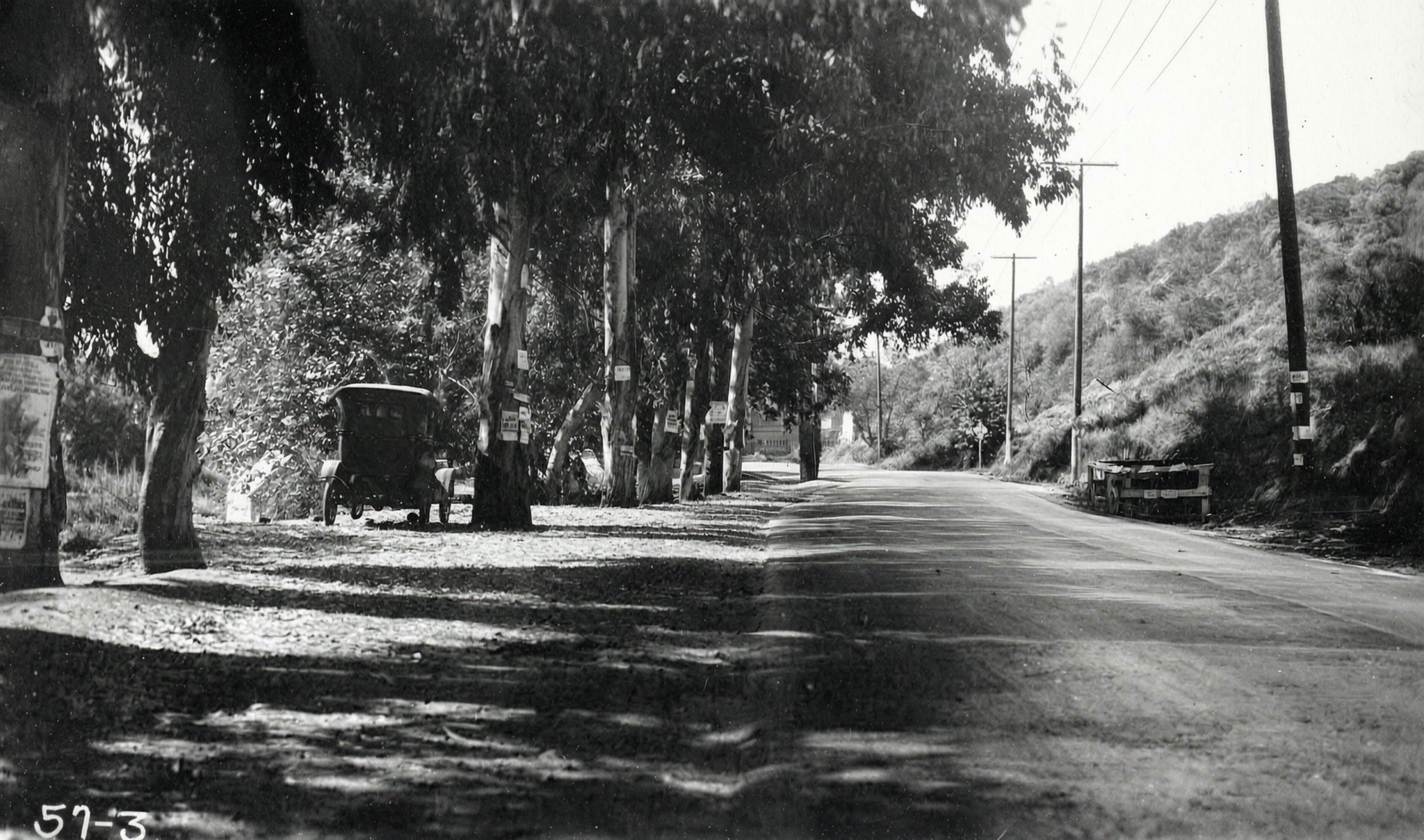
| (1921)* - View of the highway through the Cahuenga Pass showing a car parked on the side of the road next to what appears to be a Eucalyptus tree. |
| Historical Notes
By the early 1920s, automobile travel through the pass had become common enough to take for granted, though the road itself remained narrow and far from modern in character. Scenes like this one, with a motorist paused along the roadside, speak to the casual familiarity that had replaced the uncertainty of just a decade earlier. The eucalyptus trees lining portions of the route were a familiar feature of early California roads, planted during the same era that saw the pass transformed from a rough mountain track into a traveled highway connecting two of the region's fastest-growing areas. |
 |
|
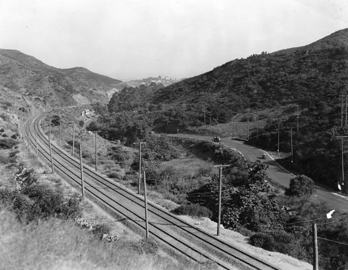
| (1922)* - View of Cahuenga Pass looking east towards Hollywood. On the left are the railroad tracks, and paralleling them on the right is the road for cars. |
| Historical Notes
This view looking back toward Hollywood clearly shows the dual transportation system that defined the pass in the early 1920s. The Pacific Electric tracks on the left occupied their own private right of way while the road for automobiles ran parallel on the right, the two systems pressed together within the confined space of the mountain corridor. That arrangement would last for decades. When the Hollywood Freeway was eventually built through the pass, the PE tracks remained in the center median, and the former right of way was not paved over until 1957, when two additional freeway lanes replaced the last physical trace of the trolley era. |
* * * * * |
Expanding Views of the Pass (1920s) |
As access improved, new vantage points revealed the broader landscape of Cahuenga Pass. What had once been experienced only as a narrow and difficult crossing could now be seen in relation to the surrounding hills, the growing Valley beyond, and the infrastructure that was rapidly reshaping the region. |
 |
|
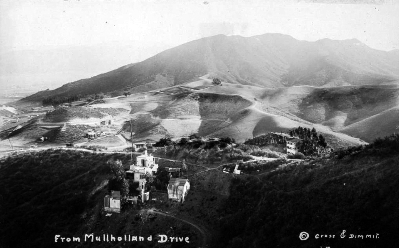
| (1920s)* - Postcard view looking north showing the Hollywood Hills from Mulholland Drive, with a few houses in the foreground and a faint view of the "Hollywoodland" sign in the upper right. Cahuenga Pass runs between the rolling hills at center and the mountains in the background. |
| Historical Notes
This elevated postcard view captures Cahuenga Pass as it appeared from the Hollywood Hills in the early 1920s, with the natural corridor between Los Angeles and the San Fernando Valley visible between the ridgelines. The faint appearance of the Hollywoodland sign in the upper right helps date the image, as the sign was officially dedicated on July 13, 1923, erected as a promotional billboard for an upscale hillside real estate development that would give Hollywood one of its most enduring landmarks. From this vantage point the pass reads as geography rather than infrastructure, a reminder that what became one of the region's most traveled corridors began as a gap in the mountains followed by those with no other way through. |
 |
|
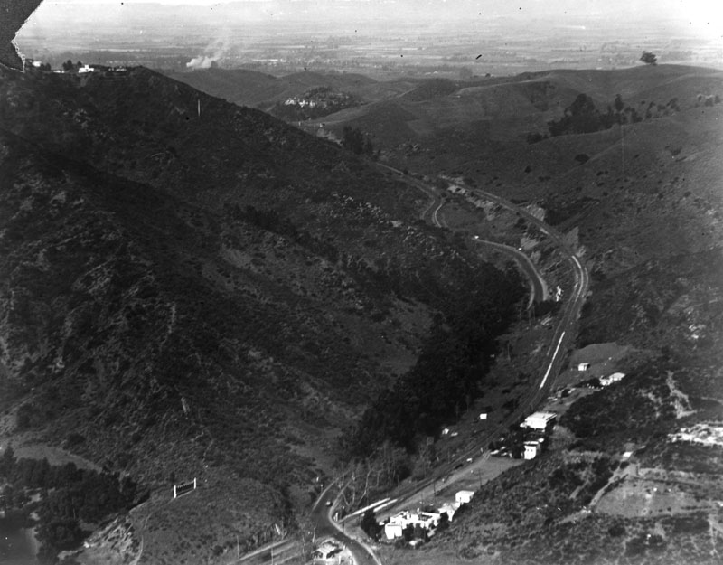
| (1922)* - Aerial view of Cahuenga Pass with the San Fernando Valley in the background. |
| Historical Notes
Seen from above, the strategic importance of Cahuenga Pass becomes immediately apparent. The narrow gap in the Santa Monica Mountains funnels movement between the Los Angeles basin and the broad floor of the San Fernando Valley, a geographic fact that shaped transportation planning from the earliest wagon roads through the Pacific Electric era and into the age of the Hollywood Freeway. By 1922, the Valley visible in the background was already well into the rapid transformation set off by the arrival of the PE line eleven years earlier, with agricultural land giving way to residential tracts along the corridors that Sherman Way and the trolley had opened. |
 |
|
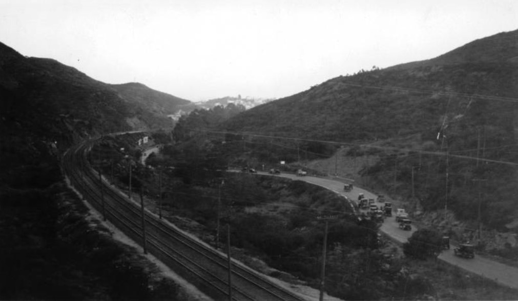
| (1923)* - View of Cahuenga Pass looking toward Hollywood from a new road leading from Holly Crest Station to a dam in Weid Canyon (Mulholland Dam). |
| Historical Notes
By 1923, new roads built to serve infrastructure projects in the hills surrounding the pass were providing additional vantage points across the landscape. The Mulholland Dam, then under construction in Weid Canyon, was part of the expanding water system supporting the region's rapid population growth, and the access roads built to reach it offered views of the pass and the Hollywood Hills that few had seen before. The same year this photograph was taken, the Hollywoodland sign was erected on the ridge above, marking the hills surrounding the pass with what would become one of the most recognized landmarks in the world. |
 |
|
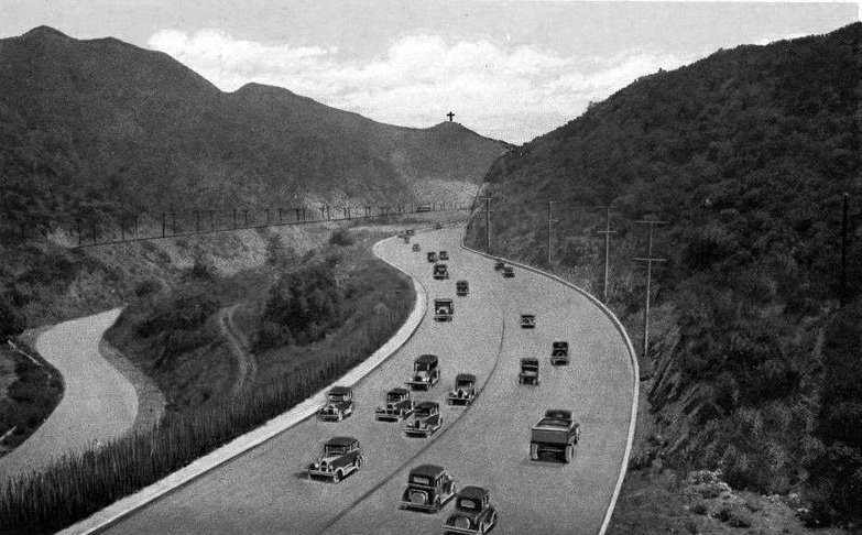
| (ca. 1923)^ – Postcard view of Cahuenga Pass looking toward Hollywood. A cross can be seen on top of the hills in the background. |
Historical Notes The 32-foot-high steel cross at 2580 Cahuenga Boulevard in the Hollywood Hills was erected in 1923 to the memory of Christine Wetherill Stevenson. The Pilgrimage Play Theatre was built in 1920 by the author Christine Wetherill Stevenson. She believed the rugged beauty of the Cahuenga Pass would provide a dramatic outdoor setting for The Pilgrimage Play. Together with Mrs. Chauncey D. Clark, she purchased this land along with that on which the Hollywood Bowl now sits. A wooden, outdoor amphitheater was built on this site and the play was performed by noted actors every summer from 1920 to 1929, until the original structure was destroyed by a brush fire in October 1929. In 1976, the Pilgrimage Theatre was renamed the John Anson Ford Theatre in honor of the late L.A. County Supervisor's significant support of the arts. |
 |
|
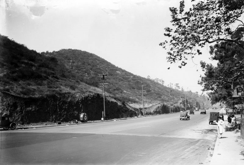
| (1920s)* - View of the broad highway on Cahuenga Pass - the lowest through the Santa Monica Mountains - that connects the Los Angeles Basin to the San Fernando Valley. The hills are truncated where they were excavated for the road bed. A street vendor is setup on the curb and although the utility poles are standing, the electric cables have not been strung. A roll of cable sits next to a pole, left. |
 |
|
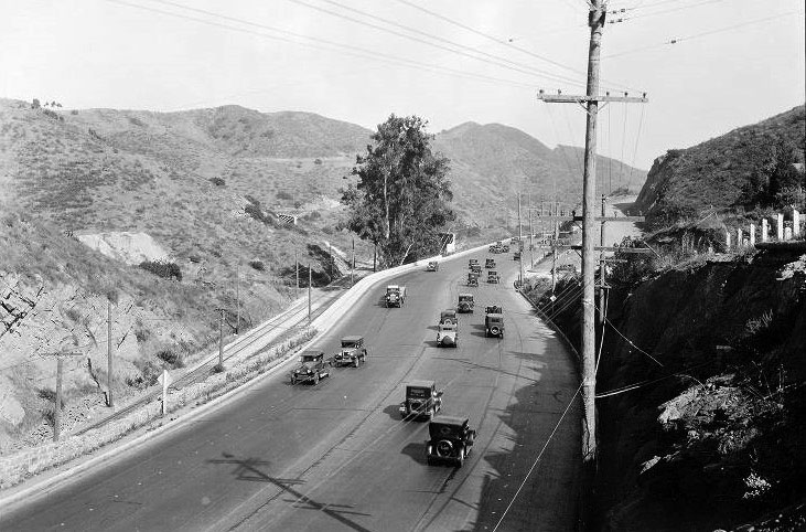
| (1928)* - View of Cahuenga Pass Road, south from the Summit. Railway tracks are on the left. |
 |
|
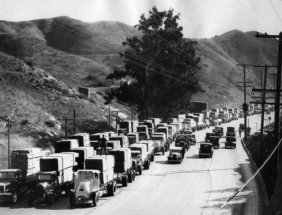
| (1930)* – View showing a Universal Studios Lumber Convoy on Cahuenga Pass Road. Photo Date: 12/31/30 |
Historical Notes Greatest single truck shipment of lumber ever moved over American highways at one time parades through Los Angeles streets as 100 motor trucks and trailers, carrying almost a million board feet representing a year's supply for Universal Studios, is escorted across town from Los Angeles Harbor by a convoy of police. |
* * * * * |
Cahuenga Pass at the Hollywood Bowl and Pilgrimage Play Theatre |
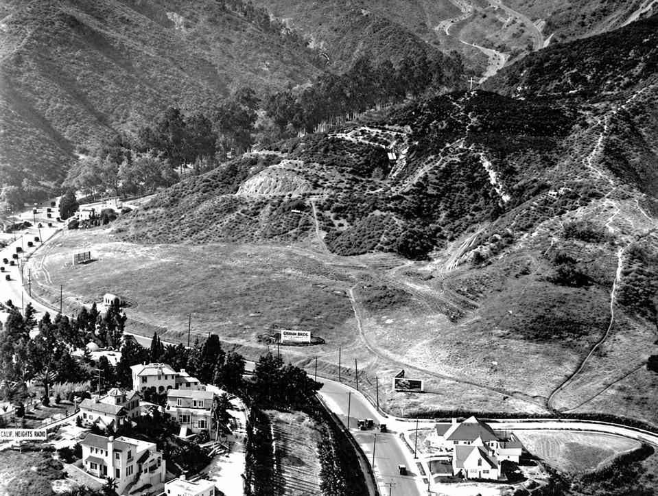
During the 1930s, the southern entrance to Cahuenga Pass was centered around two growing cultural landmarks: the Hollywood Bowl on one side of the roadway and the Pilgrimage Play Theatre on the other. Highland Avenue and Cahuenga Boulevard converged near the Bowl, while Pacific Electric Red Cars traveled through the Pass alongside a steadily increasing number of automobiles heading between Hollywood and the San Fernando Valley.Restaurants, parking lots, roadside stands and large advertising signs lined portions of the route, serving motorists and crowds attending the Hollywood Bowl and Pilgrimage Theatre. By the end of the decade, increasing traffic had led to plans for a new type of roadway through the Pass. The Cahuenga Pass Freeway opened in June 1940, beginning a transformation that would eventually make this corridor part of the Hollywood Freeway. |
 |
|
| (ca. 1930)* - Aerial view looking northwest toward Cahuenga Pass. Highland Avenue and Cahuenga Boulevard curve through the foreground toward the Pass and the San Fernando Valley. Homes of Whitley Heights are seen at lower left, while the Hollywood Bowl is just out of view to the left. The largely undeveloped hillsides show the area before construction of the Cahuenga Pass Freeway. |
Historical Notes By the early 20th century, the southern entrance to Cahuenga Pass was changing rapidly as Hollywood expanded and automobile traffic increased. The Hollywood Bowl and Pilgrimage Play Theatre soon became prominent landmarks on opposite sides of this busy corridor. Whitley Heights, seen at lower left, was developed beginning in 1918 by Hobart J. Whitley. Its hillside homes attracted many people associated with the growing motion picture industry. Part of the neighborhood was later removed during construction of the Hollywood Freeway. |
 |
|
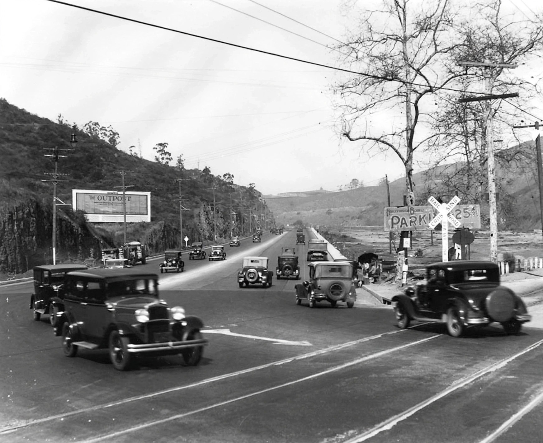
| (1930)* - Cars travel in both directions through Cahuenga Pass near the Hollywood Bowl. A large hillside billboard at left advertises the Outpost development in the Hollywood Hills, while a roadside stand and Hollywood Bowl parking sign are seen at right. |
Historical Notes The Outpost development grew from property once owned by Los Angeles Times publisher Harrison Gray Otis. Developer Charles E. Toberman acquired the property in the 1920s and developed Outpost Estates as an upscale residential neighborhood in the Hollywood Hills. A large Outpost sign was erected on the hillside to advertise the development to passing motorists, much like the better known Hollywoodland sign nearby. The roadside stand and Hollywood Bowl parking sign also show how businesses were beginning to cater to the increasing number of people traveling through the Pass by automobile. |
 |
|
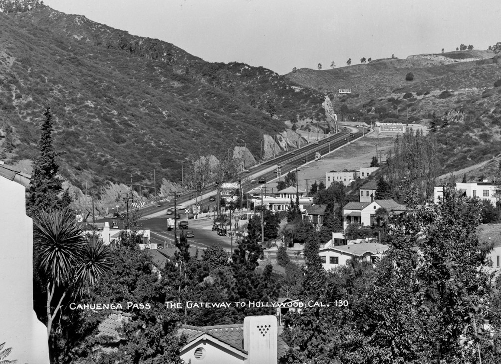
| (1930s)* – Postcard view of Cahuenga Pass looking north from Hollywood. Highland Avenue and Cahuenga Boulevard meet near center left, marked by a railroad crossing sign. Several signs advertise 25-cent parking for the Hollywood Bowl, while The Berries restaurant stands prominently at center. The Bowl entrance is just out of view to the left. Photo by Bob Plunkett from the Ernest Marquez Collection. |
Historical Notes The Berries was one of several roadside businesses serving motorists traveling through Cahuenga Pass. Period photographs show the restaurant advertising food and drinks with large signs positioned to attract drivers heading toward the Hollywood Bowl or continuing into the San Fernando Valley. The railroad crossing sign is another reminder that automobiles did not have the Pass to themselves. Pacific Electric Red Cars also traveled through this corridor, linking Hollywood with communities in the Valley. |
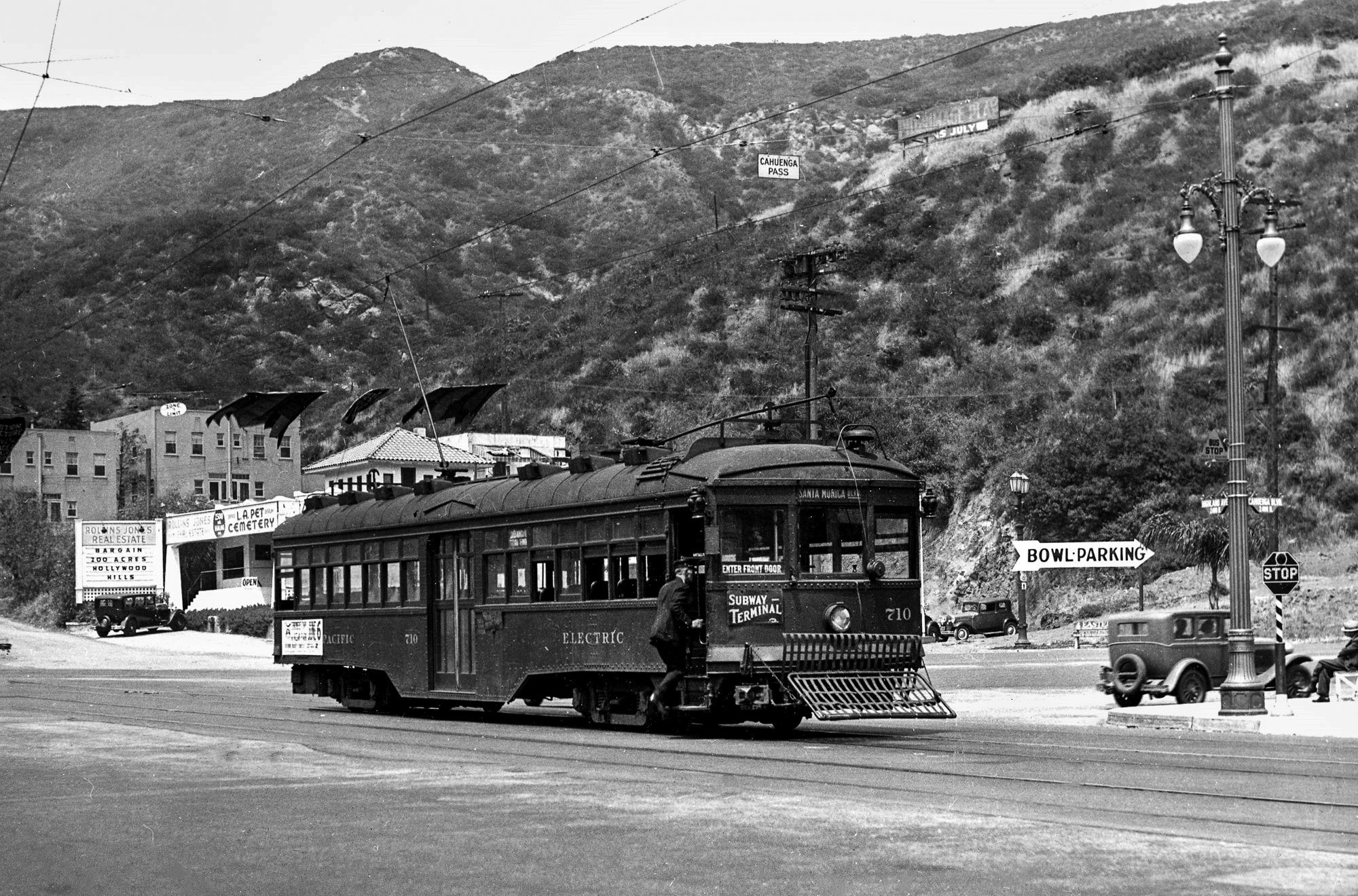 |
|
| (ca. 1930)* – Pacific Electric car No. 710 travels inbound from the San Fernando Valley through Cahuenga Pass. The Red Car is near the Hollywood Bowl entrance where Cahuenga Boulevard meets Highland Avenue, continuing south on Highland toward Santa Monica Boulevard. |
Historical Notes Pacific Electric rail service through Cahuenga Pass into the San Fernando Valley began in December 1911, providing an important connection between Hollywood and the growing communities north of the mountains. Automobiles and Red Cars shared the Cahuenga Pass corridor for decades. When the Cahuenga Pass Freeway opened in 1940, the Pacific Electric tracks were retained in the center of the new roadway. Red Cars continued traveling through the Pass until December 1952. |
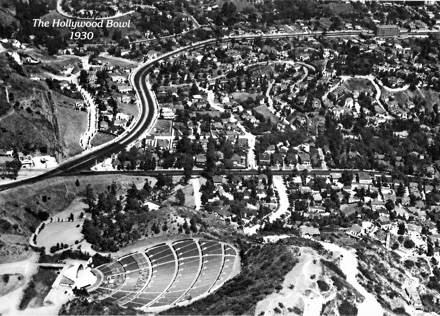 |
|
| (1930)* - Aerial view of the Hollywood Bowl looking east. Whitley Heights is seen beyond the Bowl, while the winding route of Cahuenga Boulevard emerges from Cahuenga Pass at middle left and continues toward Hollywood. |
Historical Notes The Hollywood Bowl developed alongside the growing importance of Cahuenga Pass. The site was selected as an outdoor performance venue in the early 1920s, and its summer concerts soon attracted large crowds from throughout Los Angeles. The winding roadway visible in this photograph shows how closely Cahuenga Boulevard followed the natural contours of the Pass. As automobile traffic increased during the 1920s and 1930s, this older road system became increasingly inadequate for the number of vehicles traveling between Hollywood and the San Fernando Valley. |
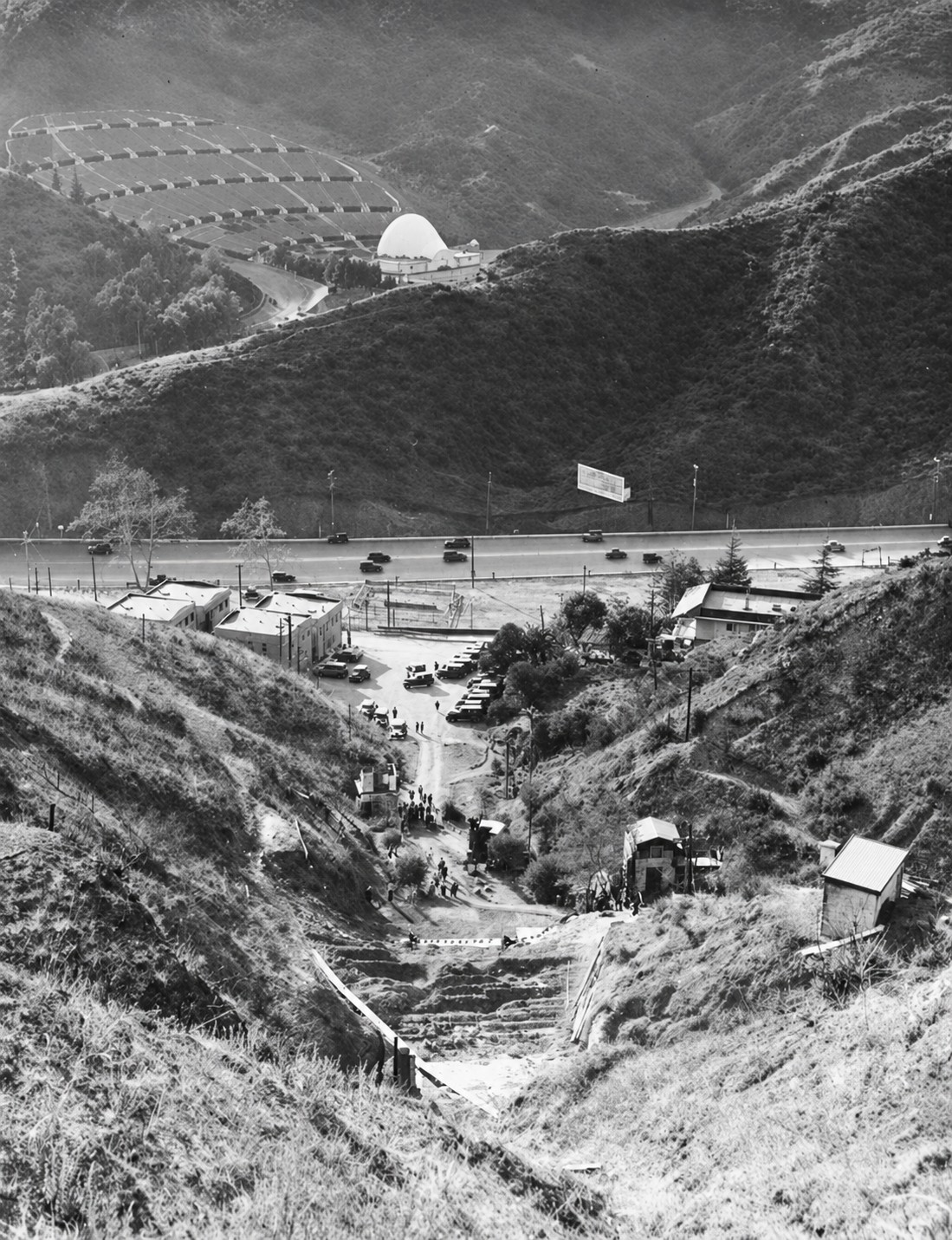 |
|
| (1931)* - Looking down into the construction site of the new Pilgrimage Play Theatre, with Cahuenga Pass and the Hollywood Bowl visible in the background. The new concrete amphitheatre replaced the original wooden theatre, which was destroyed by a brush fire in October 1929. |
Historical Notes The original Pilgrimage Theatre opened in 1920 as the home of The Pilgrimage Play, a religious drama written by Christine Wetherill Stevenson. The canyon setting across from the Hollywood Bowl provided a natural outdoor setting for the annual production. After the wooden theatre burned in 1929, a new concrete amphitheatre designed by architect William Lee Woollett opened in 1931. Its architecture was intended to suggest the setting of ancient Jerusalem. Los Angeles County later acquired the theatre, and in 1976 it was renamed the John Anson Ford Theatre in honor of the longtime County Supervisor and supporter of the arts. Today it is known simply as The Ford. |
* * * * * |
The Berries — A Cahuenga Pass Landmark |
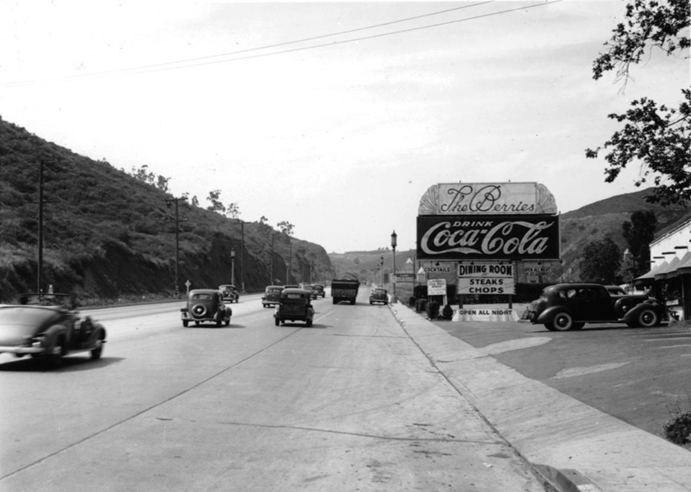
The Berries was a roadside restaurant on the east side of Cahuenga Boulevard, across from the Hollywood Bowl. Its prominent signs, including a large Coca-Cola sign, made it an easily recognized landmark for motorists traveling through Cahuenga Pass. |
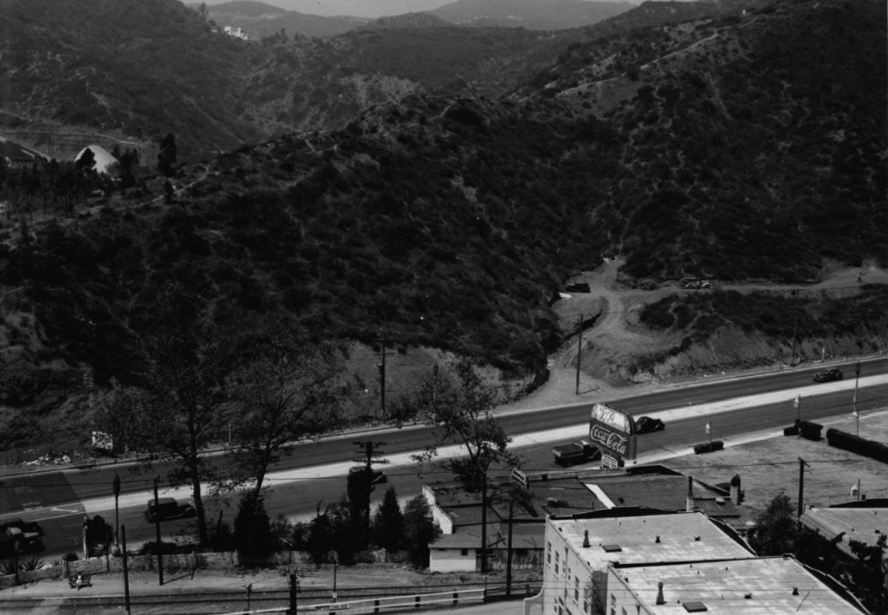 |
|
| (1938)* - Bird's-eye view looking west over Cahuenga Boulevard. The Hollywood Bowl is visible at upper left, while a large sign at lower center right advertises The Berries restaurant and Coca-Cola. |
| Historical Notes
By 1938, Cahuenga Boulevard had become a heavily traveled route between Hollywood and the San Fernando Valley. Restaurants and other roadside businesses took advantage of the steady flow of motorists, using large signs that could be easily seen from passing cars. This view captures the area shortly before major changes began. Plans were moving forward for a limited-access roadway through Cahuenga Pass that would separate much of the through traffic from local streets while still accommodating Pacific Electric rail service. |
 |
|
| (1938)* – Motorists head north on Cahuenga Boulevard toward the San Fernando Valley, passing the entrance to the Hollywood Bowl. At right, a roadside restaurant advertises steaks and chops beneath a large Coca-Cola sign. |
| Historical Notes
By the late 1930s, businesses along Cahuenga Boulevard had become closely tied to automobile travel. Restaurants, parking lots and roadside stands competed for the attention of motorists traveling between Hollywood and the Valley or attending events at the Hollywood Bowl. Large signs and familiar brand names such as Coca-Cola were designed to be noticed quickly from a moving car. Within a few years, freeway construction would begin changing this roadside commercial landscape. |
 |
|
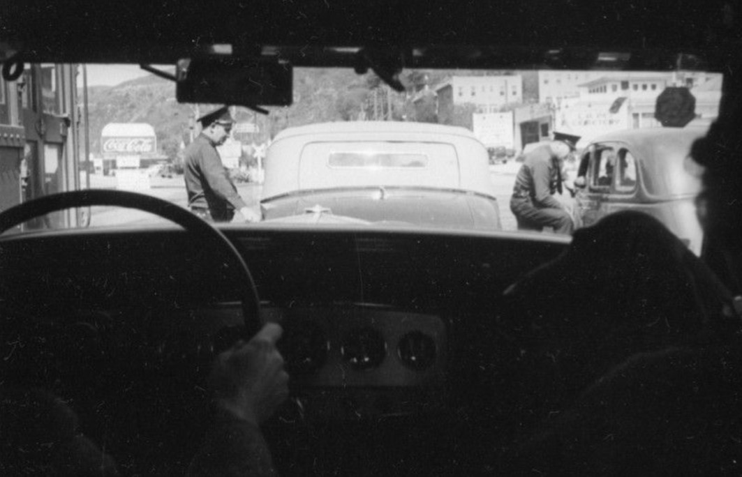
| (1938)* - Windshield view looking north on Highland Avenue at Cahuenga Boulevard. A woman holding a dog sits in the passenger seat while two police officers speak with motorists ahead. Nearby businesses include the Los Angeles Pet Cemetery office at 2500 North Highland Avenue. A Coca-Cola billboard is also visible. Photo from the Herman J. Schultheis Collection. |
| Historical Notes
The Los Angeles Pet Cemetery sign referred to a business operated by veterinarian Dr. Eugene Jones. The Highland Avenue location served as a mortuary and office associated with the pet cemetery he established in the western San Fernando Valley near Calabasas. Beyond that unusual bit of roadside history, the photograph provides an informal look at everyday travel near the entrance to Cahuenga Pass. Cars, police officers, businesses and advertising all occupy a relatively compact streetscape that would soon be substantially altered by freeway construction. |
Then and Now
 |
|
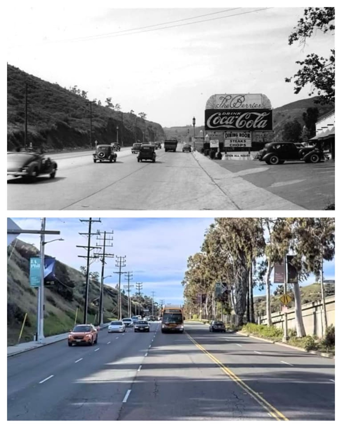
| (1938 vs 2024)* – Looking north on Cahuenga Boulevard just past the entrance to the Hollywood Bowl. Photo comparison by Trey Callaway. |
| Historical Notes
This section of Cahuenga Boulevard is located between the Hollywood Bowl entrance and the bridge leading to the Pilgrimage Theatre, now the John Anson Ford Theatre. The Hollywood Freeway can be seen running alongside the older roadway at right. The comparison shows how freeway construction changed both the landscape and the experience of traveling through Cahuenga Pass. The earlier road served local businesses as well as through traffic. The freeway created a separate high-capacity route designed primarily to move vehicles between Hollywood, Downtown Los Angeles and the San Fernando Valley. |
 |
|
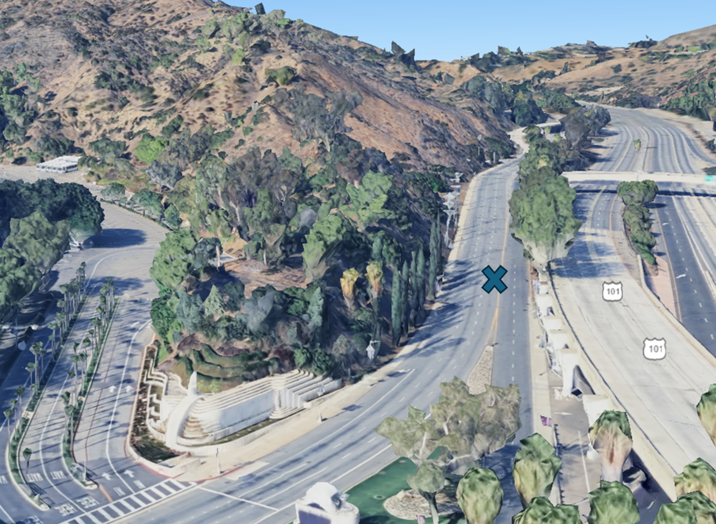
| (2023)* - Google Earth view showing the approximate location of the previous photograph, between the Hollywood Bowl entrance and the bridge leading to the John Anson Ford Theatre. |
Historical Notes Cahuenga Boulevard still follows portions of its earlier route, but the Hollywood Freeway now dominates the transportation corridor. Ramps, bridges and altered hillsides have replaced much of the more open landscape visible in photographs from the 1930s. The Hollywood Bowl and Ford Theatre remain useful landmarks for comparing the old and new routes through the Pass. |
* * * * * |
Cahuenga Pass and Mulholland Highway — Before the Freeway |
By the late 1930s, Cahuenga Pass had become a busy route between Hollywood and the San Fernando Valley, while Mulholland Highway provided a scenic connection along the crest of the Santa Monica Mountains. Yet much of the surrounding landscape remained open, with winding roads, undeveloped hillsides and relatively little construction beyond the main transportation corridor.These photographs provide some of the last broad views of the Pass before major changes began. Starting in 1940, construction of the Cahuenga Pass Freeway would reshape the roadway and surrounding hillsides, while later expansion of the Hollywood Freeway would transform the corridor even further. |
 |
|
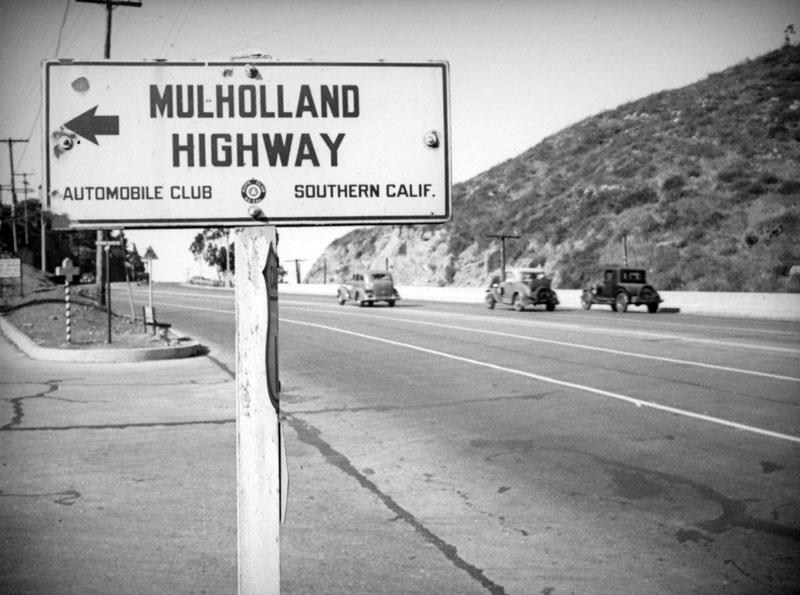
| (ca. 1938)* - Automobile Club directional sign for Mulholland Highway near its eastern end at Cahuenga Pass. The natural hillside beyond the sign shows the area before construction of the Cahuenga Pass Freeway. The eastern portion of Mulholland Highway would soon become known as Mulholland Drive. |
Historical Notes Mulholland Highway opened in 1924 as a scenic road along the crest of the Santa Monica Mountains. Named for William Mulholland, the roadway offered motorists views of both the Los Angeles Basin and the San Fernando Valley while providing access to the still largely undeveloped mountain ridge. Its eastern end connected with Cahuenga Boulevard at Cahuenga Pass. The eastern portion of the road became known as Mulholland Drive around 1939–1940. Construction of the Cahuenga Pass Freeway soon changed this intersection, eventually carrying Mulholland Drive across the freeway on a bridge rather than through the earlier surface-road arrangement. |
 |
|
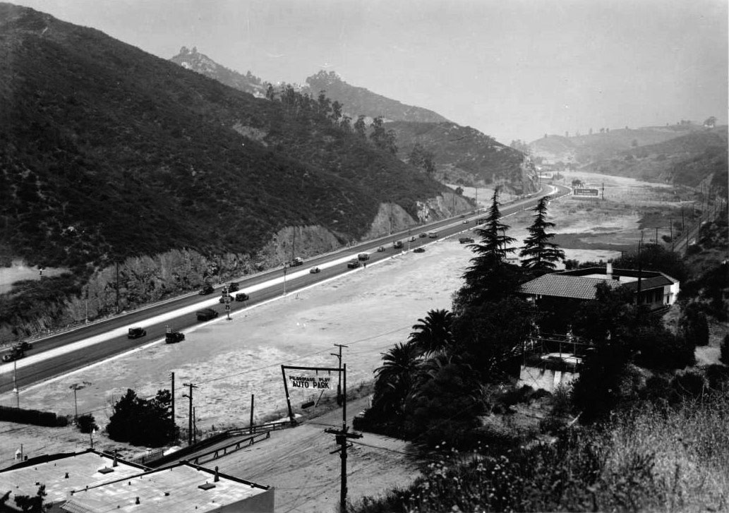
| (1930s)* - View looking northwest through Cahuenga Pass, with the Pilgrimage Play Theatre parking lot in the foreground. Cahuenga Boulevard runs from the lower left toward the San Fernando Valley at upper center right. The Hollywood Bowl is just out of view to the left. |
Historical Notes This photograph provides a wider look north through Cahuenga Pass. Beyond the Hollywood Bowl and Pilgrimage Play Theatre area, Cahuenga Boulevard continued toward the San Fernando Valley, while Mulholland Highway met Cahuenga near the upper portion of the Pass. Opened in 1924, Mulholland Highway added another important route to this growing network of mountain roads. From Cahuenga Pass, motorists could turn onto Mulholland and follow the crest of the Santa Monica Mountains, with views toward both the Los Angeles Basin and the San Fernando Valley. |
 |
|
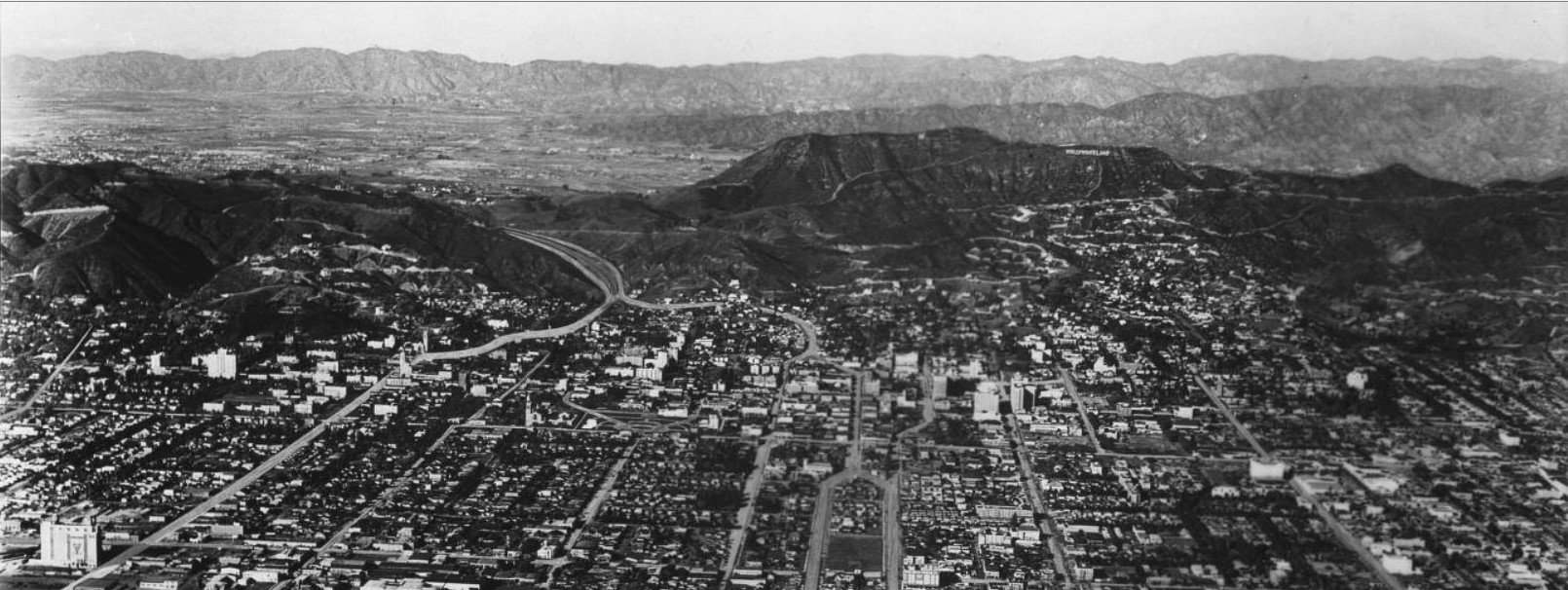
| (ca. 1930s)* - Panoramic aerial view looking northwest across Hollywood toward Cahuenga Pass and the San Fernando Valley. Highland Avenue runs diagonally from the lower left toward the entrance to the Pass. |
Historical Notes This panoramic view shows how the major roads came together at Cahuenga Pass. Highland Avenue provided the approach from Hollywood, Cahuenga Boulevard continued north through the Pass toward the San Fernando Valley, and Mulholland Highway crossed the mountains along the ridge above. Together, these roads made Cahuenga Pass an important meeting point between Hollywood, the Valley and the Santa Monica Mountains. The open landscape seen here would soon begin to change with construction of the Cahuenga Pass Freeway, which opened in June 1940. |
* * * * * |
Cahuenga and Highland: Gateway to Hollywood |
For much of the twentieth century, the convergence of Highland Avenue and Cahuenga Boulevard at the southern entrance to Cahuenga Pass served as the main northern gateway to Hollywood. By the 1930s, automobiles, Pacific Electric streetcars and local traffic all converged here, creating a major traffic bottleneck near the Hollywood Bowl.The images below trace the transformation of this junction over less than two decades. What began as a congested surface intersection was rebuilt with tunnels and grade separations in the late 1930s, followed by the Cahuenga Pass Freeway in 1940, with Pacific Electric tracks running through its center. In the early 1950s, the area was rebuilt once again as the freeway was extended south through Hollywood toward Downtown Los Angeles. |
.jpg) |
|
| (1937)* - Postcard view looking north toward Cahuenga Pass, where Highland Avenue and Cahuenga Boulevard converge at what was promoted as the "Gateway to Hollywood." |
Historical Notes For decades, this junction served as the main northern entrance to Hollywood for travelers arriving from the San Fernando Valley. Highland Avenue and Cahuenga Boulevard came together near the Hollywood Bowl, funneling increasing numbers of automobiles and Pacific Electric streetcars into the relatively narrow entrance to the pass. By the late 1930s, the junction had become a major traffic bottleneck. Beginning in the late 1930s, a series of ambitious road projects would completely reshape the area. The French Village, visible near the center of the image, stood on the triangular property where Highland Avenue and Cahuenga Boulevard converged, across from the Hollywood Bowl. Today, much of the former French Village site is occupied by Hollywood Bowl Parking Lot D, also home to the Hollywood Heritage Museum in the historic Lasky-DeMille Barn. |
 |
|
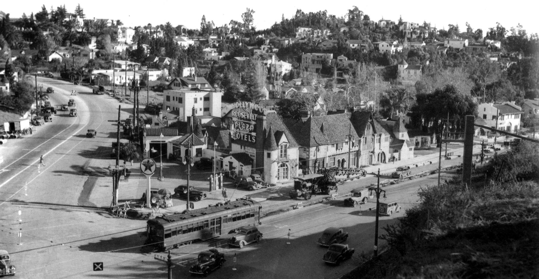
| (1937)* - Panoramic view looking southeast toward the junction of Cahuenga Boulevard (left) and Highland Avenue (right). Streetcars and automobiles share the roadway, while a Texaco service station stands at the corner. Behind it, a large sign directs motorists toward the Hollywood Roosevelt and Hollywood Plaza hotels farther south in Hollywood. |
Historical Notes The French Village occupied a triangular parcel where Highland Avenue and Cahuenga Boulevard came together. Developed beginning around 1919–1920, its Normandy-style cottages became home to shops, studios and businesses associated with Hollywood's growing entertainment community. The large hotel sign was well placed for motorists entering Hollywood through Cahuenga Pass. It pointed travelers toward two prominent Hollywood hotels: the Hollywood Roosevelt near Hollywood and Highland and the Hollywood Plaza at Hollywood and Vine. The mix of streetcars and automobiles seen here also illustrates the growing traffic problems at this busy junction. |
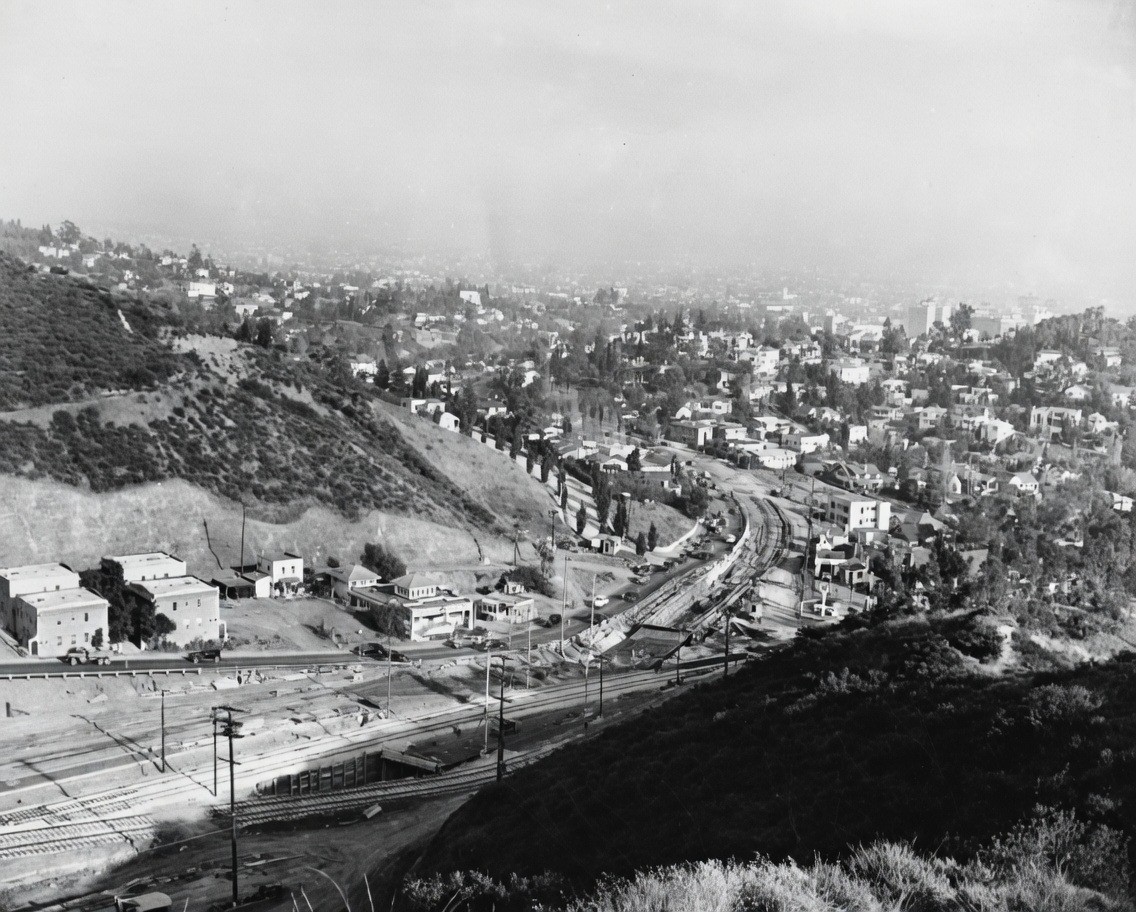 |
|
| (1937)* - View looking southeast toward Whitley Heights during construction of the grade separation at Highland Avenue and Cahuenga Boulevard. Cahuenga Boulevard veers to the left, while a large boring machine can be seen at center. |
Historical Notes The project was an early attempt to untangle one of Hollywood's most difficult traffic junctions. Tunnels and separated roadways allowed through traffic and vehicles using Highland Avenue to follow different paths rather than meeting at a conventional intersection. Although the new arrangement improved traffic flow, it would soon become part of an even larger transformation. Plans were moving ahead for a modern divided highway through Cahuenga Pass. |
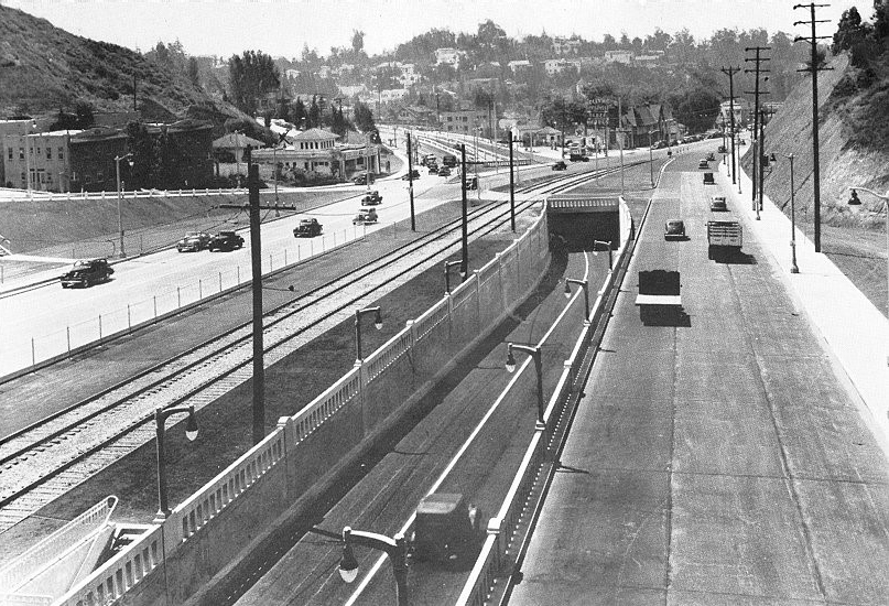 |
|
| (ca. 1938)* - View looking southeast at the Cahuenga and Highland junction shortly after completion of the new grade separation. Through traffic followed Cahuenga Boulevard through the tunnel, while Highland Avenue traffic continued to the right. |
Historical Notes The new arrangement separated much of the through traffic from vehicles using Highland Avenue, helping relieve one of the area's major bottlenecks. But Los Angeles traffic was growing rapidly, and an even larger project through Cahuenga Pass was already taking shape. Within only a few years, the corridor would be transformed again with construction of the Cahuenga Pass Freeway. |
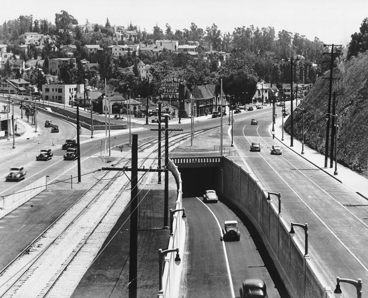 |
|
| (1938)* - Looking southeast toward Whitley Heights across the newly rebuilt Cahuenga-Highland junction. Cahuenga Boulevard crosses the foreground, while the entrance to the Hollywood Bowl is just beyond the shoulder of the hill at right. |
Historical Notes This view shows how complicated the southern entrance to Cahuenga Pass had become even before freeway construction. Separate roadways directed traffic toward Highland Avenue and Cahuenga Boulevard while Pacific Electric trains continued to operate through the corridor. Within two years, much of this landscape would change again with the opening of the Cahuenga Pass Freeway. The Hollywood Bowl, just out of view, remained the major landmark at the entrance to the pass. |
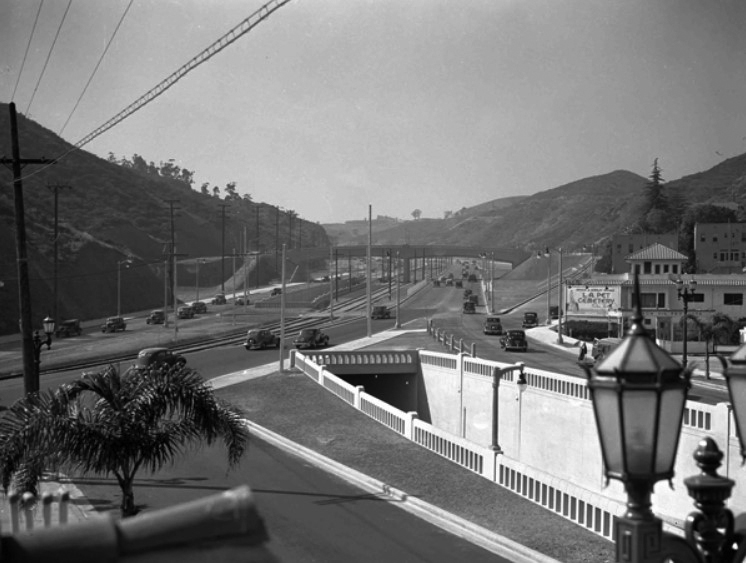 |
|
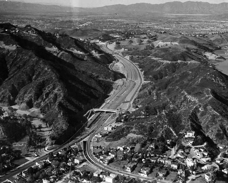
| (1940s)* - View looking northwest through Cahuenga Pass toward the San Fernando Valley. The grade-separated roadway at center-right carried traffic beneath the newly built freeway. The Hollywood Bowl is out of view to the left. |
Historical Notes On June 15, 1940, the first section of the Cahuenga Pass Freeway opened through the pass. The new divided highway carried automobile traffic on either side of Pacific Electric tracks running through the center. The arrangement allowed Red Cars serving the San Fernando Valley to travel between opposing streams of freeway traffic. Pacific Electric rail service through Cahuenga Pass continued until December 28, 1952. |
 |
|
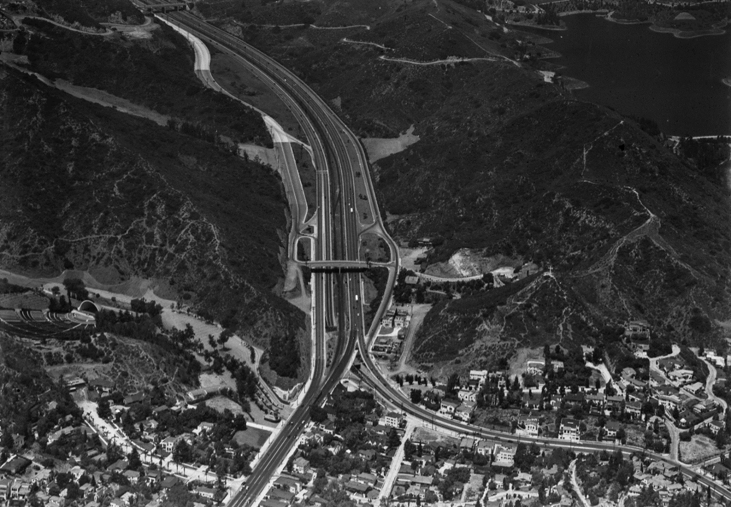
| (1940s)* - Aerial view looking northwest over the southern entrance to Cahuenga Pass, where Highland Avenue merges with Cahuenga Boulevard and the new freeway. The Hollywood Bowl is visible at lower left and the Pilgrimage Theatre, today's John Anson Ford Amphitheatre, at center-right, with the Hollywood Reservoir in the hills beyond. Photo from the Ernest Marquez Collection. |
Historical Notes This aerial view shows the scale of the transformation that took place in only a few years. What had been a complicated surface-road junction had become a broad, grade-separated highway, with Pacific Electric tracks running through its center. The Cahuenga Pass Freeway was an important early link, but a continuous freeway connection between the San Fernando Valley, Hollywood and Downtown Los Angeles was still years away. Construction after World War II would eventually connect this section with the developing Hollywood Freeway to the south. |
 |
|
| (ca. 1951)* - Bird's-eye view looking northwest along the freeway through Cahuenga Pass. The Highland-Cahuenga grade separation is visible at lower center-left. The Muse of Music, Dance, Drama at the entrance to the Hollywood Bowl can be seen just to its left, with part of the Bowl shell farther beyond. |
Historical Notes The Muse of Music, Dance, Drama was completed in 1940 by sculptor George Stanley, who is also associated with the design of the Academy Award statuette. Created as a WPA project, the monumental sculpture marks the Highland Avenue entrance to the Hollywood Bowl. When this photograph was taken, Pacific Electric Red Cars were still operating through the center of the freeway. Rail service through the pass ended on December 28, 1952, as work proceeded on extending and rebuilding the freeway corridor. |
Before and After: Building the Hollywood Freeway
|
|
.jpg) |
|
| (1938 vs. 1953)* - Two views looking south at the Highland-Cahuenga junction before and during construction of the Hollywood Freeway extension. In the lower 1953 image, the old tunnel (3) is being eliminated as a new bridge and freeway alignment are built. Temporary roadways (1 and 2) carry traffic around the construction area. |
Historical Notes The 1953 reconstruction brought another major change to a junction that had already been rebuilt several times in less than two decades. The old tunnel and portions of the earlier grade separation were removed or rebuilt as engineers connected the Cahuenga Pass section with the Hollywood Freeway extending south through Hollywood. The new freeway connection opened in 1954, completing a continuous route between the San Fernando Valley and Downtown Los Angeles. In little more than 15 years, this location had progressed from a congested surface intersection, to tunnels and grade separations, to an early freeway carrying both automobiles and Red Cars, and finally to the freeway corridor familiar today. |
Then and Now: Locating the Site
 |
|
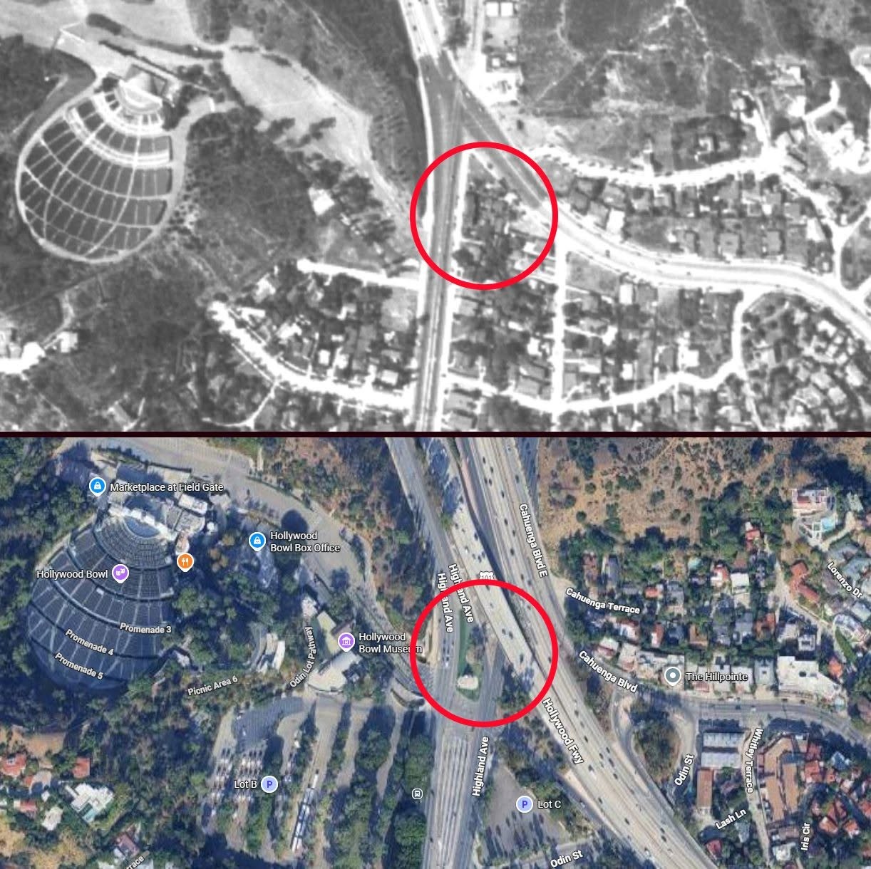
| (1938 vs. 2026)* – Then-and-now aerial comparison showing the location of the former Pass Hotel/The Berries near the Highland Avenue-Cahuenga Boulevard junction. The red circles mark the same approximate location in both views. The Hollywood Bowl is visible at left. Comparison by Jon Orr. |
Historical Notes This comparison helps show how extensively the area was changed by later freeway construction. The site occupied by the hotel and restaurant in 1938 is now within the greatly expanded roadway system surrounding Highland Avenue, Cahuenga Boulevard and the Hollywood Freeway. The red circles identify the approximate location in both views, providing a useful reference for understanding where the building once stood in relation to the Hollywood Bowl and today's freeway. |
* * * * * |
From Parkway to Freeway: Cahuenga Pass at Highland Avenue |
The opening of the Cahuenga Pass Parkway in 1940 had already transformed travel between Hollywood and the San Fernando Valley. The divided highway carried automobile traffic on either side of Pacific Electric tracks, with bridges and grade separations designed to move traffic through the pass without the congestion of the old surface-road junction.By the early 1950s, another major change was underway. Pacific Electric rail service through the pass ended in 1952, and construction of the Hollywood Freeway was advancing north through Hollywood. At Highland Avenue, portions of the earlier Cahuenga Pass Parkway were rebuilt, the old tunnel was eliminated, and new ramps and roadways connected the pass with the freeway extending south toward Downtown Los Angeles.The photographs below, taken from the Pilgrimage Bridge, trace this transformation and show how the roadway and surrounding landscape changed between the late 1930s, the completion of the Hollywood Freeway in 1954, and today. |
 |
|
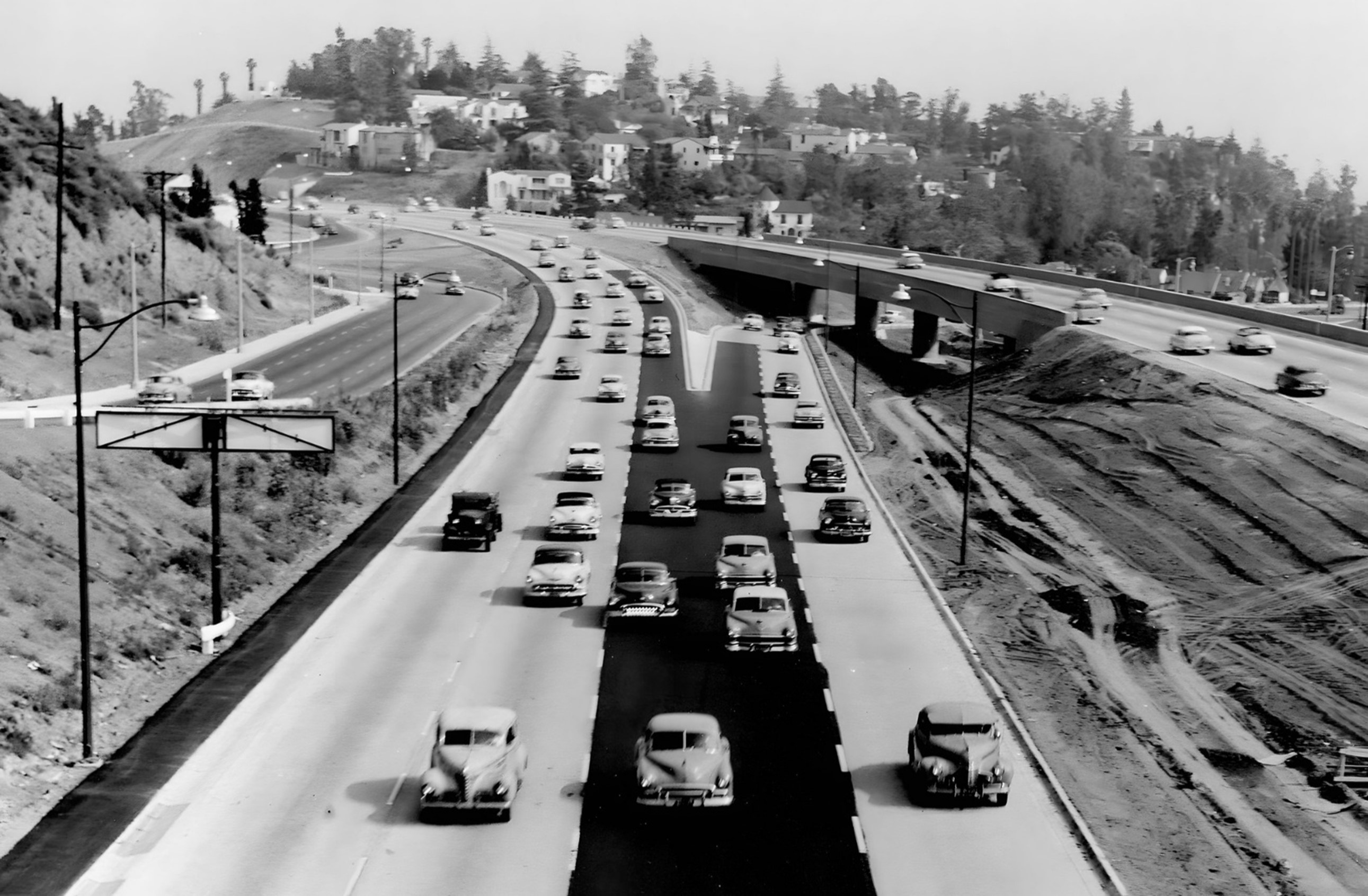
| (1954)* - View looking southeast from the Pilgrimage Bridge shortly after reconstruction of the northbound Hollywood Freeway (US 101) at Highland Avenue. The Highland Avenue entrance to the freeway is visible at right, with Whitley Heights rising beyond. |
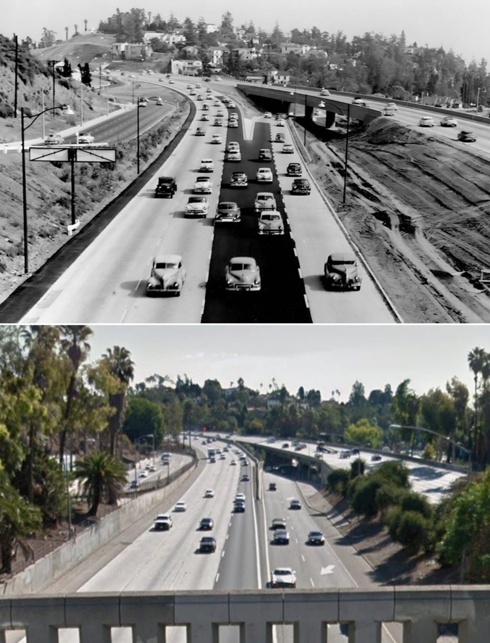
Historical Notes The 1954 reconstruction connected the southern end of the original Cahuenga Pass Parkway with the Hollywood Freeway extending south through Hollywood. The earlier highway through the pass had opened in 1940 with automobile traffic running on either side of Pacific Electric tracks. After Red Car service through Cahuenga Pass ended in December 1952, the tracks and other railway facilities were removed and the roadway near Highland Avenue was rebuilt as part of the new freeway alignment. The old tunnel near Highland Avenue was eliminated, and the junction was reconfigured with new ramps and connections. The final link of the Hollywood Freeway opened in April 1954, creating a continuous freeway route between the San Fernando Valley, Hollywood and Downtown Los Angeles. |
Before and After: 1938 vs. 1954
 |
|
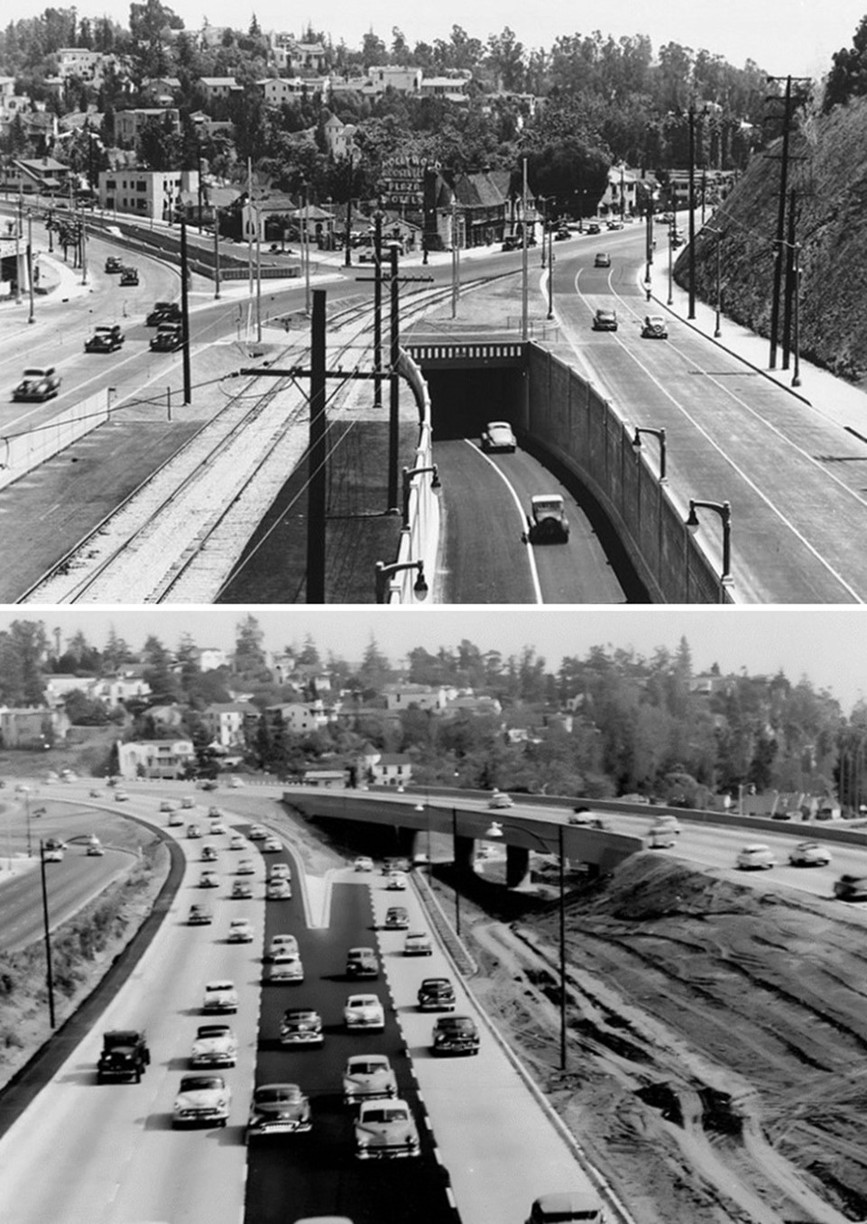
| (1938 vs. 1954)* – Before-and-after views looking southeast toward Highland Avenue and Whitley Heights. The comparison shows the roadway before construction of the Cahuenga Pass Freeway and after reconstruction for the Hollywood Freeway. Several surviving buildings in Whitley Heights help identify the same area in both views. Photo comparison by Jack Feldman. |
Historical Notes The 1938 view shows the southern entrance to Cahuenga Pass before completion of the Cahuenga Pass Freeway. Within two years, the corridor would be transformed by a divided highway carrying automobile traffic on either side of Pacific Electric tracks. By 1954, the area had been rebuilt again. The earlier tunnel and portions of the 1940 roadway arrangement were removed or altered as the Cahuenga Pass section was joined directly to the Hollywood Freeway. Although the photographs were taken from different elevations, Whitley Heights and several surviving buildings provide useful reference points for seeing how extensively the corridor changed in less than two decades. |
 |
|
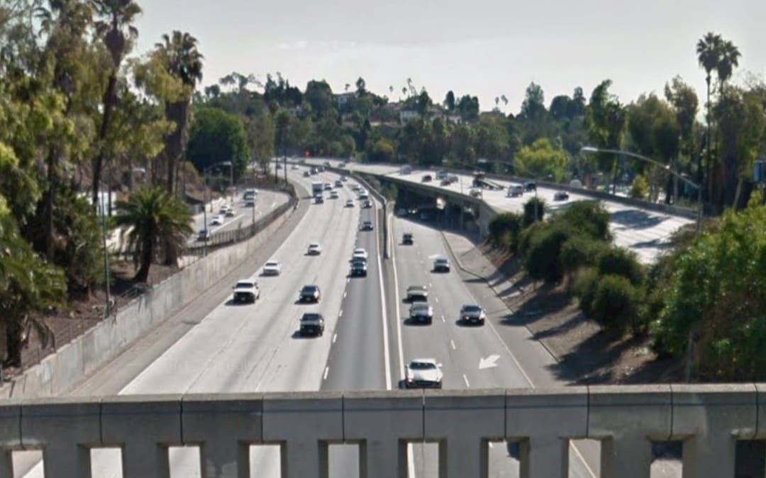
| (2020s)* - Contemporary view looking southeast from the Pilgrimage Bridge toward Highland Avenue and Whitley Heights. The Hollywood Freeway follows essentially the same corridor established during the 1950s reconstruction. Photo courtesy of Mark Newton-John. |
Historical Notes More than seven decades after the Hollywood Freeway was completed through this location, the basic freeway alignment and Highland Avenue connection remain readily recognizable. Whitley Heights also provides a useful landmark for comparing the modern scene with photographs taken from the same location decades earlier. The view is again from the Pilgrimage Bridge, built as part of the original Cahuenga Pass Parkway project. Its elevated location provides an especially useful vantage point for comparing the freeway and surrounding landscape over time. |
Then and Now: 1954 vs. 2020s
 |
|
| (1954 vs. 2020s)* – Then-and-now views looking southeast from the Pilgrimage Bridge toward Whitley Heights and the Highland Avenue entrance to the northbound Hollywood Freeway (US 101). Photo comparison by Jack Feldman. |
Before and After: Finding the Same Landmarks
 |
|
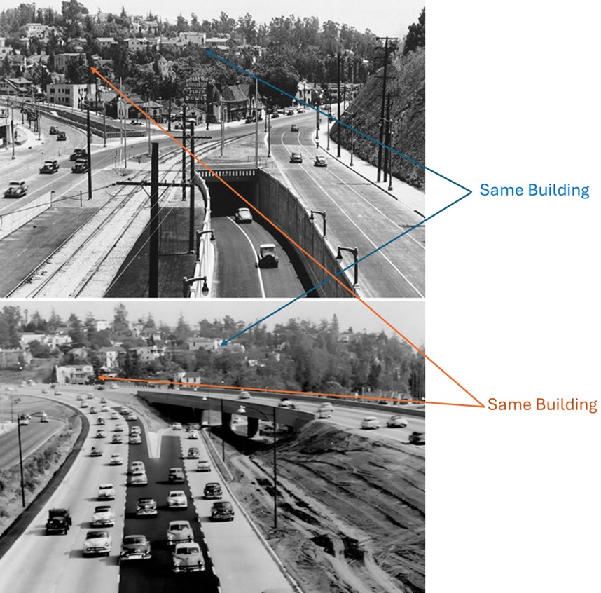
| (1938 vs. 1954)* – Annotated comparison looking southeast toward Highland Avenue and Whitley Heights. The arrows identify several buildings visible in both views, helping locate the same area before and after freeway reconstruction. Photo comparison and annotations by Jack Feldman. |
Historical Notes The annotations identify several buildings in Whitley Heights that appear in both photographs. Because the two views were taken from different elevations, these surviving buildings provide useful reference points for locating the earlier roadway within the greatly altered 1954 landscape. Between the two photographs, the old tunnel was eliminated, roadways were realigned, and the hillside was cut back as the southern entrance to Cahuenga Pass was rebuilt. The surviving buildings above the roadway help show just how extensively the transportation corridor below them was changed. |
* * * * * |
Cahuenga Pass Parkway Construction
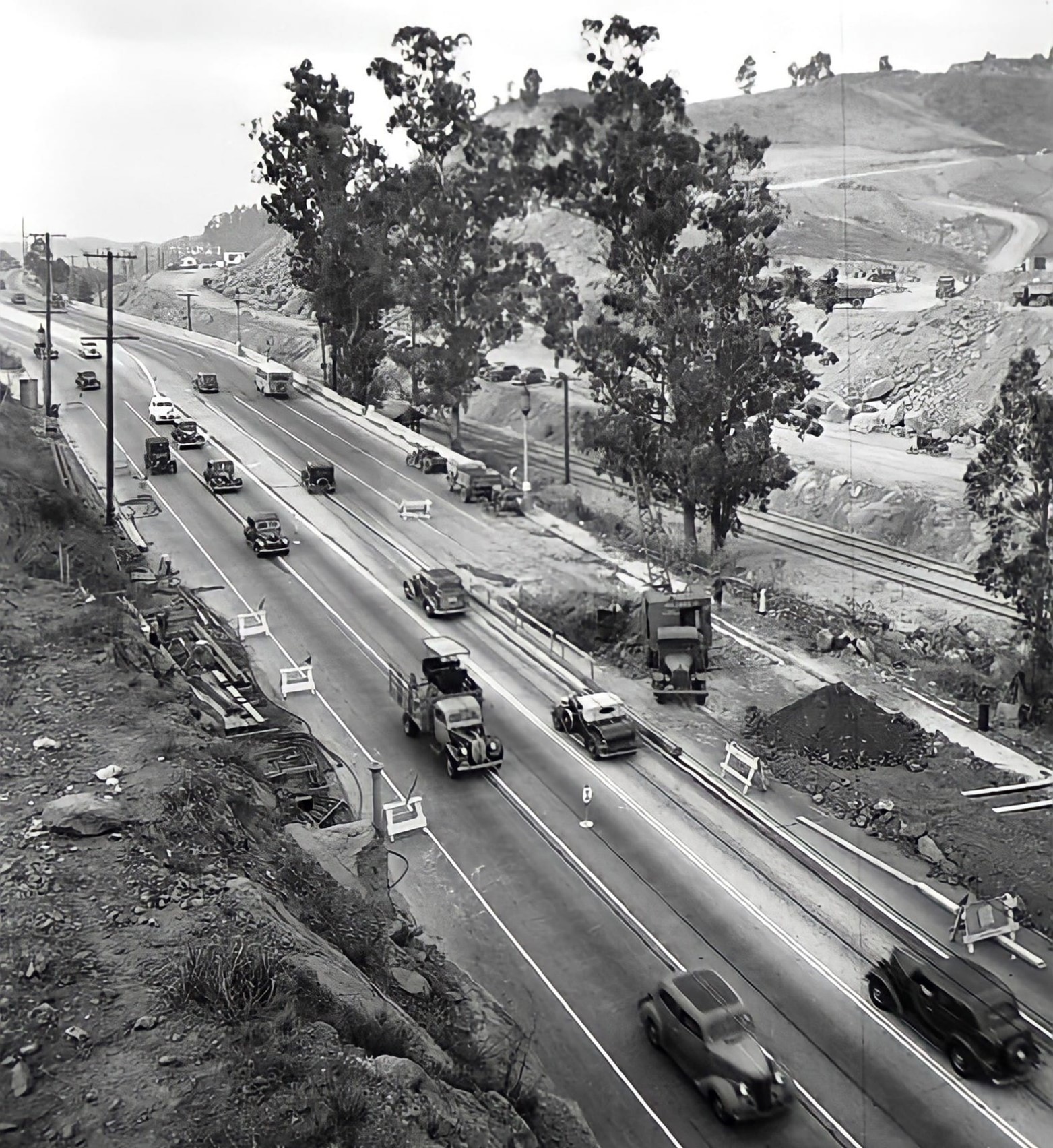 |
|
| (1939)* - Looking NW over Cahuenga Pkwy (US-101, later Hollywood Fwy) construction near present-day Mulholland Dr overcrossing with Cahuenga Blvd in foreground. |
Historical Notes The construction of the Cahuenga Pass Parkway in the late 1930s faced several significant challenges. One of the foremost difficulties was the need to keep the existing road through the pass open to traffic throughout the entire construction period. At the time, the pass was already a critical artery, carrying between 45,000 and 50,000 vehicles per day, making any closure or major disruption untenable for the region’s commuters and commerce. This required careful phasing of construction and innovative traffic management to ensure continuous flow while major infrastructure was built. The construction of the Mulholland Bridge was a complex undertaking, requiring the maintenance of heavy daily traffic-between 45,000 and 50,000 vehicles-through the Cahuenga Pass during the build. The bridge’s tall, vertical design distinguished it from the other parkway bridges, and the project included additional infrastructure such as service roads, wooden guard rails, pedestrian tunnels for safe access to trains, and a vehicular tunnel beneath the roadway. These features reflected a thoughtful integration of automobile and rail transit within a challenging natural landscape, emphasizing both functionality and aesthetics. |
 |
|
| (1939)* - View of construction and traffic jam on Cahuenga Pass. |
Historical Notes The construction of the Cahuenga Pass Parkway in the late 1930s faced several significant challenges. One of the foremost difficulties was the need to keep the existing road through the pass open to traffic throughout the entire construction period. At the time, the pass was already a critical artery, carrying between 45,000 and 50,000 vehicles per day, making any closure or major disruption untenable for the region’s commuters and commerce. This required careful phasing of construction and innovative traffic management to ensure continuous flow while major infrastructure was built. Additionally, the project was under intense time pressure due to funding constraints, as the Public Works Administration’s financial support was set to expire by July 1, 1940. To meet this deadline, the work was divided into two main phases, with the first segment completed and dedicated just two weeks before the funding cutoff. The construction also had to contend with the aftermath of the devastating floods of March 1938, which damaged many bridges and roadways in the region, prompting urgent planning and design for replacements and improvements. These factors, combined with the engineering complexities of building new bridges, grade separations, and tunnels in a narrow, heavily traveled natural corridor, made the Cahuenga Pass Parkway project a landmark achievement in Los Angeles infrastructure history. |
* * * * * |
Mulholland Drive Viaduct (aka Mulholland Drive Bridge) |
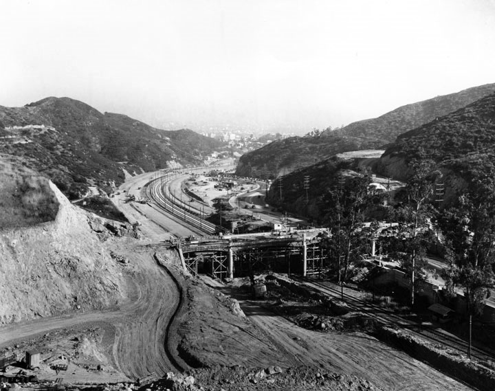 |
|
| (ca. 1939)* - View of Cahuenga Pass looking towards Hollywood showing the construction of the Mulholland Drive Bridge. Mulholland Drive (originally Mulholland Highway) can be seen winding its way up the hill at right. |
Historical Notes The Mulholland Bridge in Cahuenga Pass was constructed in the late 1930s as a key part of the Cahuenga Pass Parkway project, an innovative effort to improve transportation between Hollywood and the San Fernando Valley. Spearheaded by Los Angeles City Engineer Lloyd Aldrich, the project envisioned an eight-lane highway with a central barrier to separate northbound and southbound traffic, while also accommodating Pacific Electric Railway tracks. The Mulholland Bridge, completed and dedicated on June 15, 1940, was one of three major bridges built along the parkway, showcasing the era’s advanced engineering and Streamline Moderne architectural style. The structure on Mulholland Drive that crosses the Cahuenga Pass is historically known as the Mulholland Drive Viaduct, built around 1939 to span the pass and the Hollywood Freeway below. This elevated structure consists of multiple connected spans, fitting the definition of a viaduct as a long series of bridges or arches over terrain and roadways. However, it is sometimes also referred to simply as the Mulholland Drive Bridge in various contexts, reflecting a more general usage of the term "bridge" for this crossing. Despite this interchangeable naming, the term "viaduct" is more precise for describing the structure at Cahuenga Pass due to its length and multi-span design. When it officially opened on December 27, 1924, Mulholland Highway was 24 miles long, running from Cahuenga Pass to Calabasas. The name was changed to Mulholland Drive in 1939. |
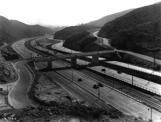 |
|
| (1940)* – View showing the newly completed Cahuenga Pass Freeway looking southwest toward Hollywood with the Mulholland Drive overcrossing at center. The Pacific Electric Railway tracks are visible in the median. |
Historical Notes The Cahuenga Pass Parkway, including the Mulholland Bridge, was completed in two phases by the end of 1940 at a total cost of about $1.7 million. The bridge remains an important transportation link in Los Angeles and stands as a monument to the city’s ambitious public works programs of the era. Mulholland Drive is associated with two major elevated structures named after it in Los Angeles. The first is the Mulholland Drive Bridge over the 405 Freeway in the Sepulveda Pass, originally built in 1959 and replaced in 2013, serving as an important connection between West Los Angeles and the San Fernando Valley. The second is the Mulholland Drive Viaduct, constructed around 1939, which spans the Cahuenga Pass and the Hollywood Freeway (U.S. 101). While this structure is technically a viaduct due to its multiple spans, it is sometimes also referred to as a bridge. Together, these two crossings highlight Mulholland Drive’s role in bridging key transportation corridors in Los Angeles. |
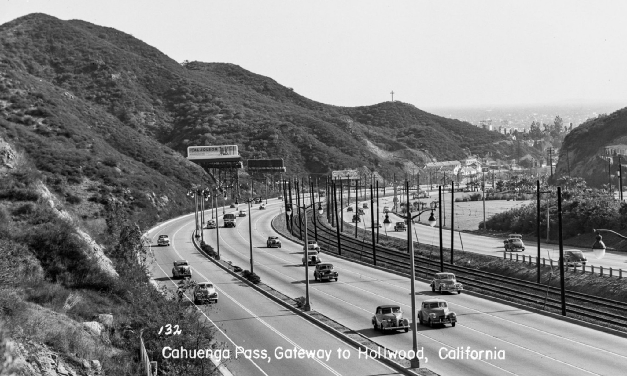 |
|
| (1940s)* – Cahuenga Pass, Gateway to Hollywood, as seen from near the Mulholland Drive Bridge. Photo by Bob Plunkett from the Ernest Marquez Collection. |
Historical Notes Cars glide through the Cahuenga Parkway, part of U.S. Route 101, as it winds through the pass toward Hollywood. The 40-foot Hollywood Pilgrimage Memorial Cross, installed in 1923, rises on the hilltop above the Pilgrimage Theatre. A rooftop sign promotes Al Jolson on KFI radio. |
* * * * * |
Cahuenga Pass Parkway
.jpg) |
|
| (ca. 1940)* - Panoramic view of Hollywood looking northwest toward the Cahuenga Pass. The newly constructed Hollywood Freeway through Cahuenga Pass (known as Cahuenga Pass Parkway) is visible at the top of the photo, with the San Fernando Valley far off in the distance (compare to previous photo). |
Historical Notes Built at a cost of $1.5 million and partly financed by the federal Public Works Administration (PWA), the two-mile Cahuenga Pass Parkway eliminated a notorious bottleneck at the place where one of the state's first highways -- El Camino Real -- crossed the Santa Monica Mountains. |
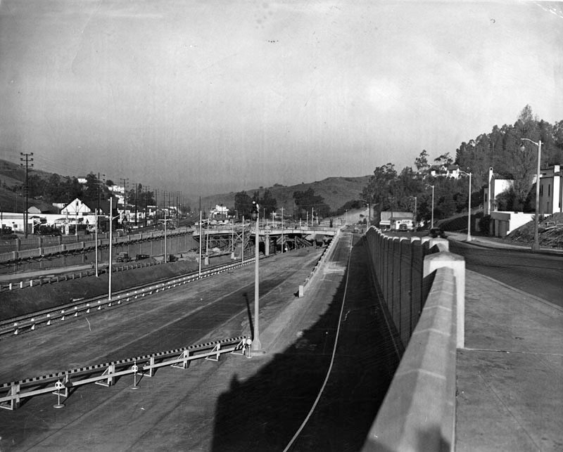 |
|
| (1940)* – View showing the new Cahuenga Pass Parkway at the Barham exit before its official opening. |
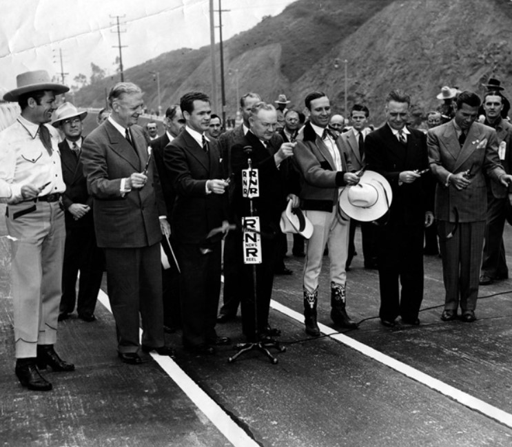 |
|
| (1940)* - View showing the dedication ceremony for the Cahuenga Pass Parkway on Jun 15, 1940. |
Historical Notes From left to right: Tom Keene, honorary mayor of Sherman Oaks, Governor Culbert Olson, John B. Kingsley, president of Hollywood Chanber of Commerce, Mayor Fletcher Bowron of Los Angeles, actor and singer Gene Autry, honorary mayor of North Hollywood, Mayor Frank C. Gillson of Burbank, and actor Richard Arlen. |
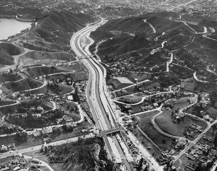 |
|
| (1940)* - Aerial view looking southeast showing the new Cahuenga Pass Parkway with the Hollywood Reservoir seen at upper left. |
Historical Notes The Cahuenga Pass Parkway replaced a narrow, winding road between Hollywood and the San Fernando Valley with an eight-lane superhighway. A pair of Pacific Electric rails ran down the freeway's center divider. |
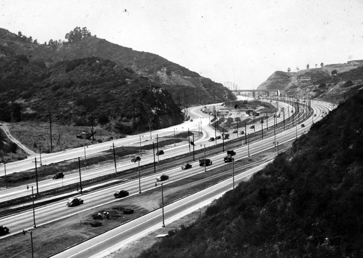 |
|
| (ca. 1940)* – View looking north toward the Mulholland Drive Bridge showing traffic in both directions of the Cahuenga Pass Parkway. |
 |
|
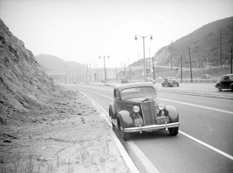
| (ca. 1940)* - View shows the Cahuenga Pass Parkway, later the Hollywood Freeway, near the Hollywood Bowl. Mulholland Drive Bridge (built in 1940) can be seen in the background. A car appears stopped on the side of the freeway. |
 |
|
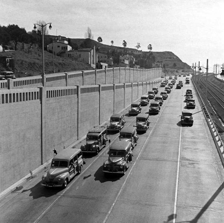
| (ca. 1942)* - View showing a caravan of woody wagons (aka "Station Wagon Brigade") heading north through Cahuenga Pass near the Barham exit. |
Historical Notes Also known as the 1st Evacuation Corps, the "Station Wagon Brigade" was formed in response to the fears that the anticipated Japanese invasion would require a massive evacuation of Southern California. Sort of like the “taxicab army” of the First World War, it was planned to organize and use civilian station wagons to evacuate families and individuals without personal transportation. |
 |
|
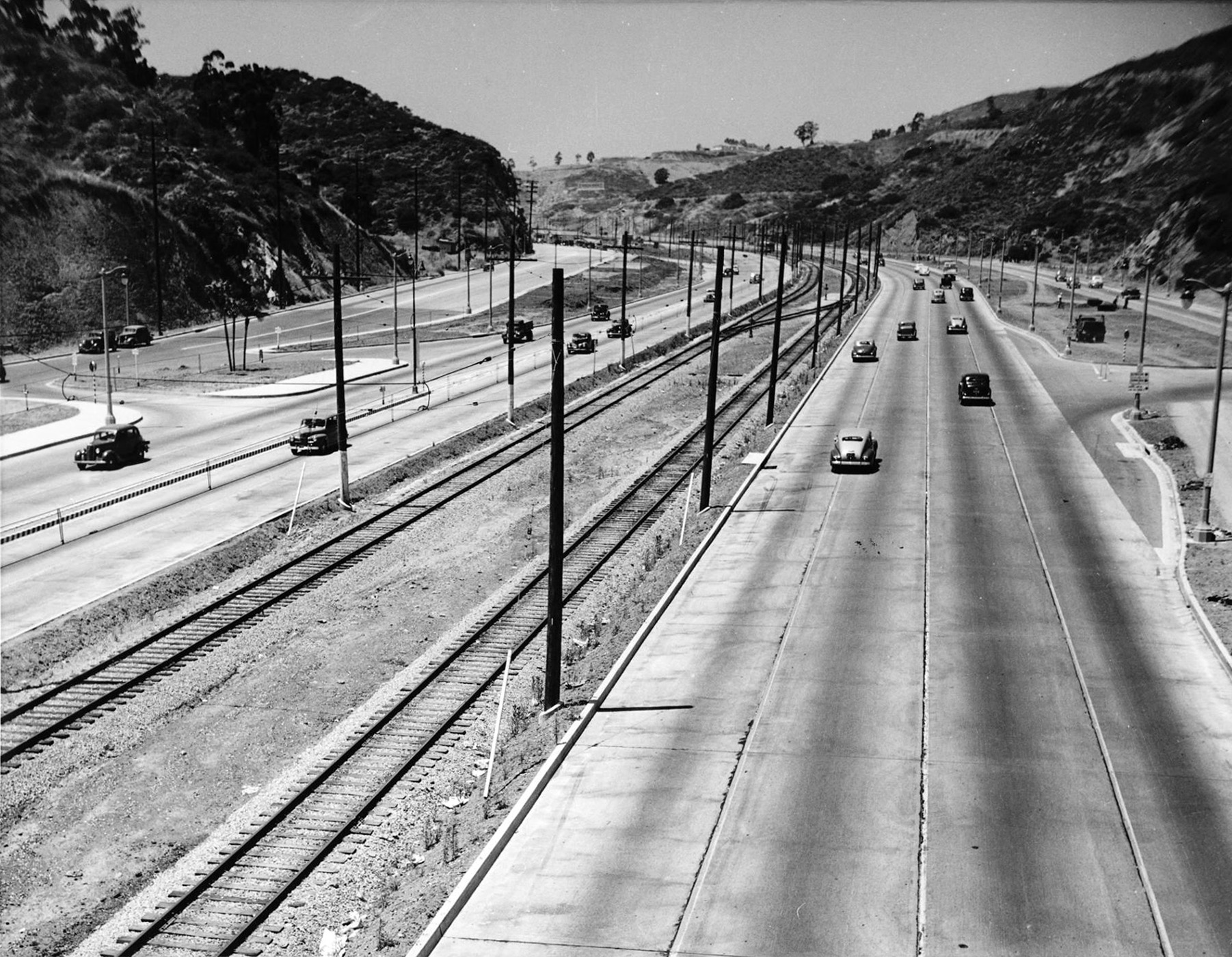
| (1943)* - View looking northwest of Cahuenga Pass Parkway with fairly light traffic. Note the Pacific Electric tracks in the center median. |
 |
|
| (1940s)* – Close-up view showing the tracks in the center median of Cahuenga Pass. |
 |
|
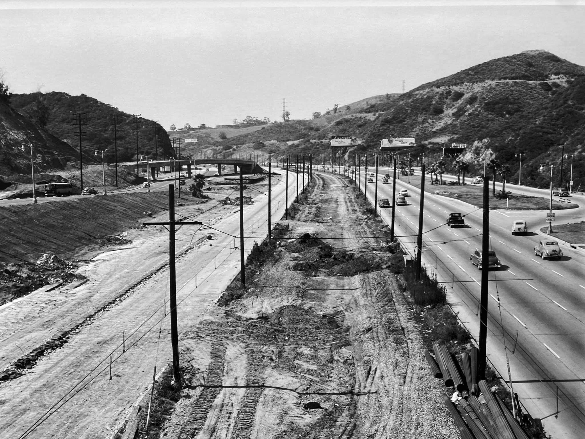
| (1953)* - Cahuenga Pass after the center median tracks have been removed (compare to previous photo). In the distance can be seen the Highland off-ramp under construction. 1952 was the last year Pacific Electric Railway trolleys ran down the center of the "Cahuenga Pass Freeway", (Hollywood Freeway). Photo by Richard C. Miller |
* * * * * |
Mulholland Bridge
 |
|
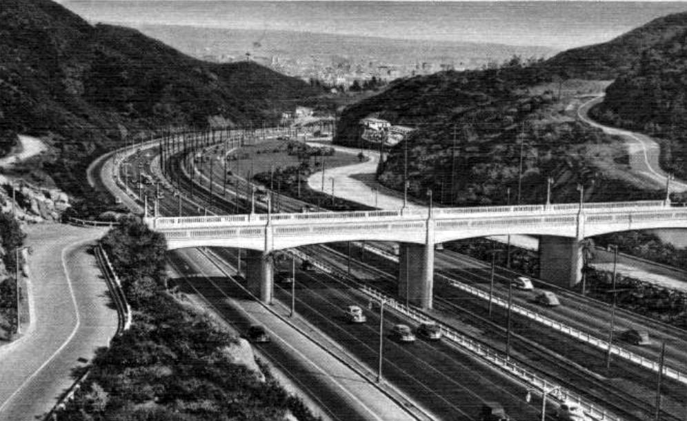
| (1947)*^#* – Postcard view looking southeast showing the Mullholland Drive Bridge (built in 1940) crossing the Cahuenga Pass Freeway (later Hollywood Freeway), the “Gateway to Hollywood", with Mulholland Drive winding up into the Hollywood Hills in the upper-right. |
 |
|
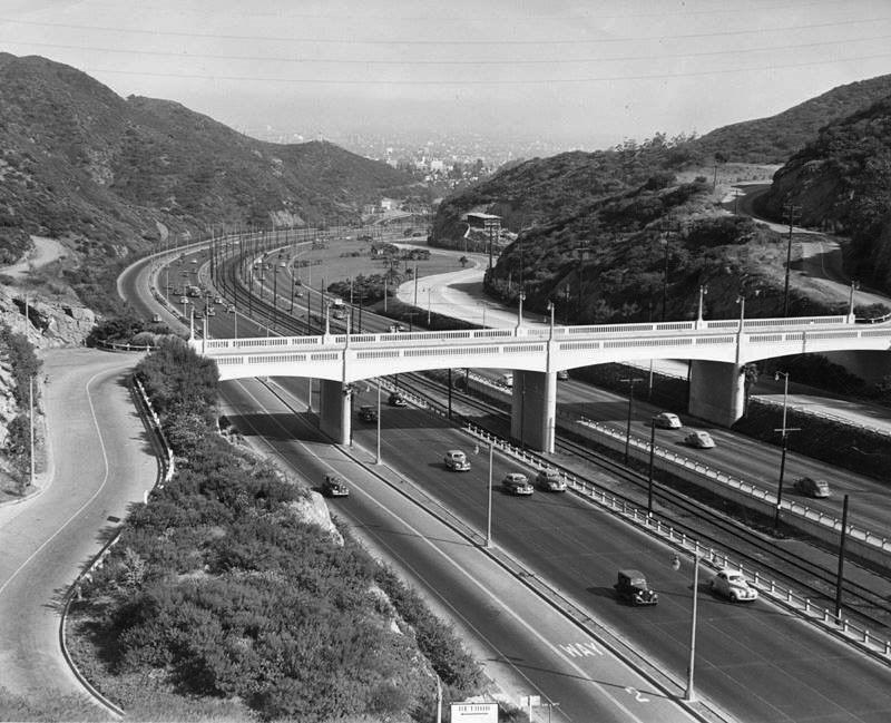
| (1947)* - View of Cahuenga Pass looking towards Hollywood at the Mulholland Bridge. |
 |
|
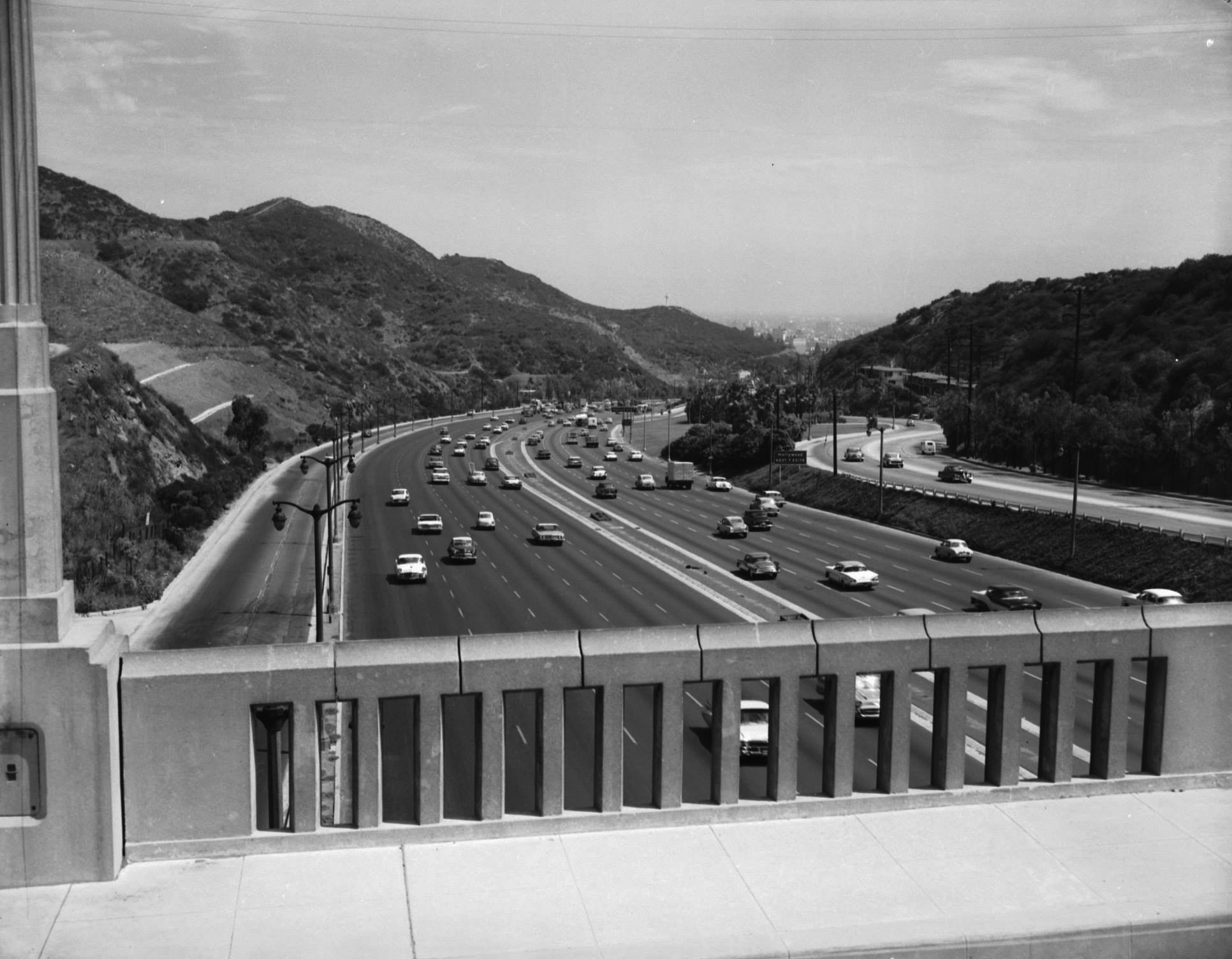
| (1950s)* – Cahuenga Pass as seen from the Mulholland Overpass looking towards Hollywood. |
* * * * * |
Franciscan Motel
 |
|
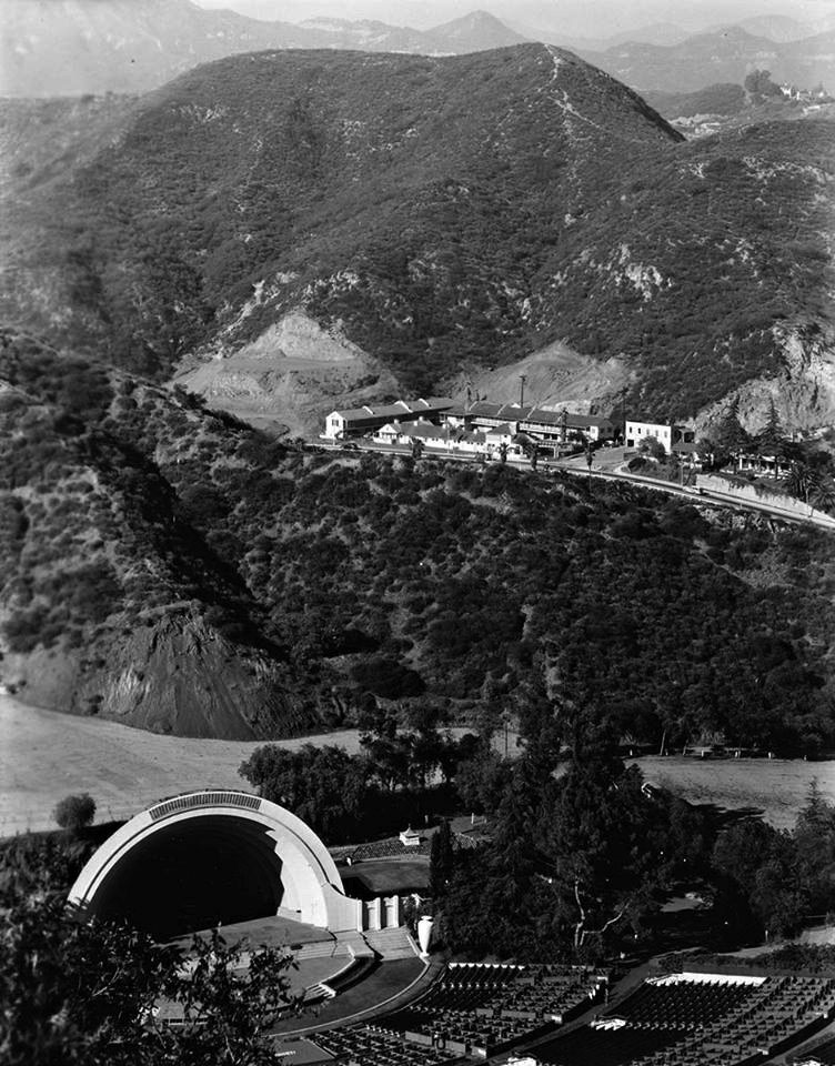
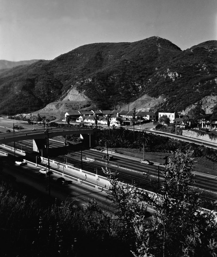
| (1949)* - View showing the Franciscan Motel, overlooking the Hollywood Bowl. Photo by Julius Shulman. |
Historical Notes The buildings nearest the freeway were demolished sometime between 1972 and 1980. The ones at the back of the lot, however, survive today. They are now in what seems to be the north parking lot of the Ford Theatre. Click HERE for contemporary view. |
 |
|
| (1949)* – View looking northwest across Cahuenga Pass. The complex on the north side of the pass is the Franciscan Motel (no longer standing) whose entrance was directly opposite the Pilgrimage Bridge. Click HERE for contemporary view. |
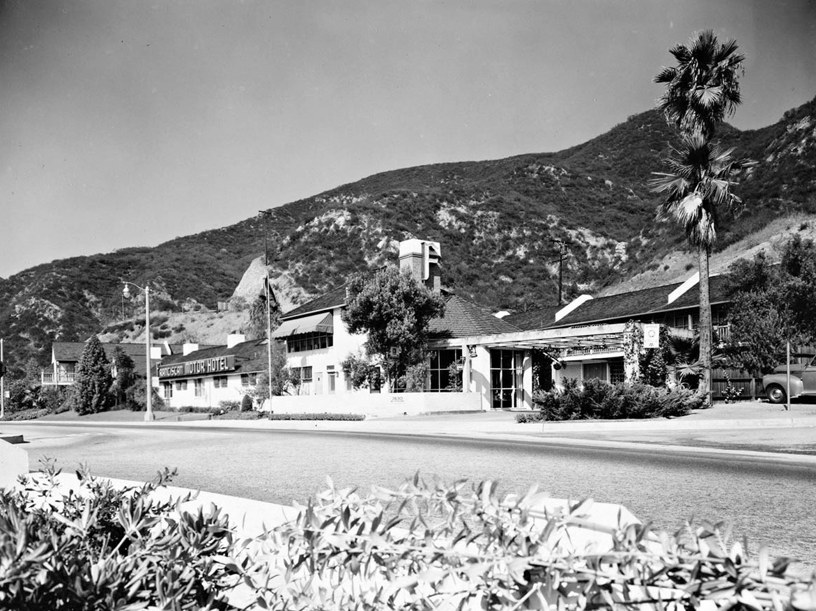 |
|
| (1951)* – Close-up view showing the front of the Franciscan Motel in Cahuenga Pass. Photo by Julius Shulman |
* * * * * |
Cahuenga Pass Extension to Vineland
 |
|
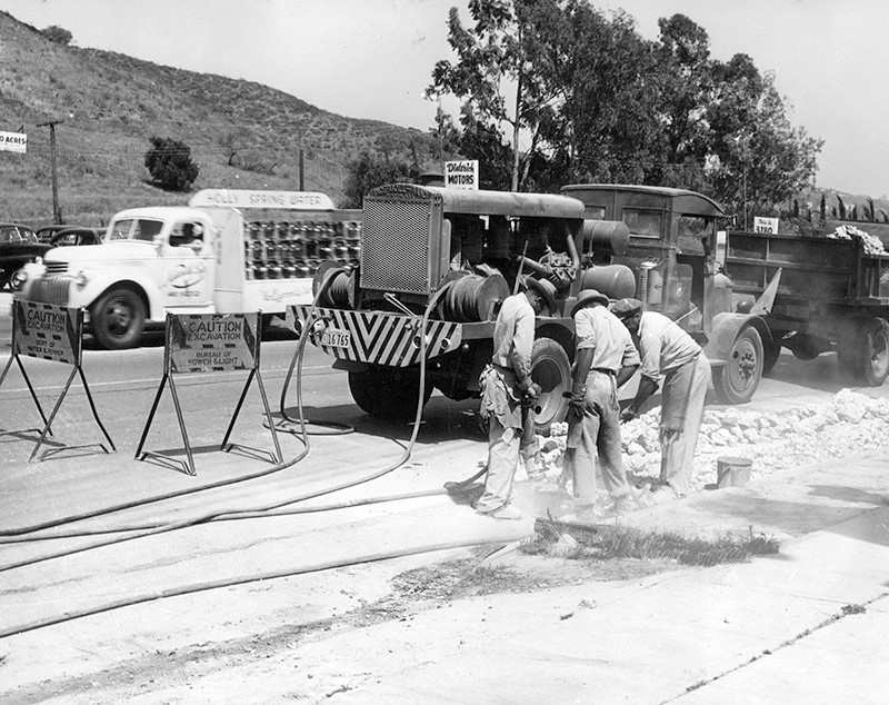
| (1947)* - Photo caption dated June 14, 1947 reads, "Extension of the Hollywood freeway along Ventura boulevard to Vineland avenue started with the thunder of air-hammers at Universal City, as the last cars to use the intersection of Lankershim and Ventura boulevard whizzed by in back of the workmen. A detour soon will go around the intersection." |
 |
|
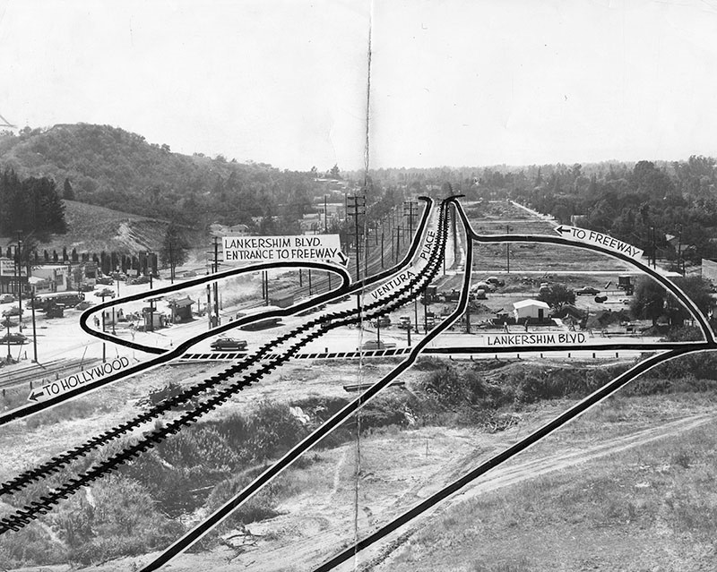
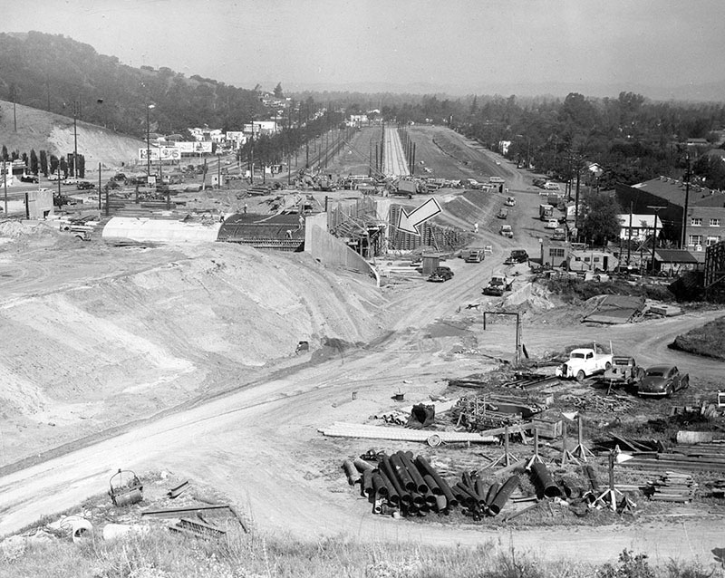
| (1947)* - Photograph caption dated July 12, 1947 reads, "Most complex part of the new freeway link connecting Vineland avenue and Cahuenga Pass will be at Universal City, above, where a grade separation will be constructed over Lankershim boulevard. |
Historical Notes This Valley Times photo-diagram shows where rail lines will be relocated down the center of the new freeway link. Traffic leading into the Valley will follow the lane on the right of the tracks; that leading to Hollywood will stream down a parkway at the left of the rail lines. Lankershim boulevard traffic onto the freeway's Hollywood-bound lane will go under the freeway and rise on a looped ramp as shown at left. Lankershim traffic into the Valley-bound freeway lane will follow the road at upper right. To get onto Lankershim from the right hand freeway lane, cars will use the road shown in right lower foreground. |
 |
|
| (1948)* - Photograph dated May 8, 1948 shows the construction of a freeway underpass at Lankershim and Cahuenga boulevards. The project is part of the extension of the Hollywood Freeway connecting Vineland Avenue and the Cahuenga Pass. |
Historical Notes The bridge/tunnel was built as part of the Cahuenga Freeway; it is now known as the Lankershim/101 Freeway Bridge and Tunnel. |
 |
|
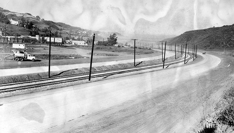
| (1948)* - View showing paving of Hollywood Freeway lanes that extend from the Cahuenga Pass to Vineland Avenue. In between the freeway lanes are electric lines used by Pacific Electric trains. Photo date: November 10, 1948 |
 |
|
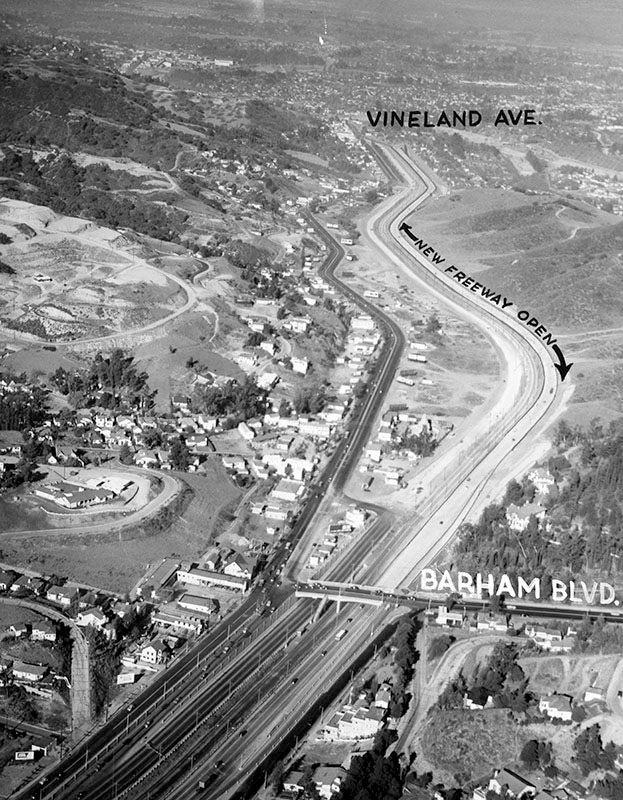
| (1948)* - Aerial view of the Hollywood Freeway extension from Barham Boulevard to Vineland Avenue. Universal City is seen to the right of the freeway, and Studio City to the left. Phote date: November 14, 1948 |
 |
|
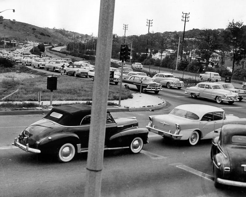
| (1956)* - Intersection of Vineland and the end of the Hollywood Freeway extension through Cahuenga Pass. |
Historical Notes Photograph caption dated April 30, 1956 reads, "May be city's busiest intersection - Pouring from all directions, cars meet at intersection of Vineland avenue and Ventura boulevard, labeled as 'possibly Los Angeles' busiest intersection' by Traffic Manager Lloyd Braff. Last count indicates 86,000 cars pass through here over 24-hour period." - Valley Times |
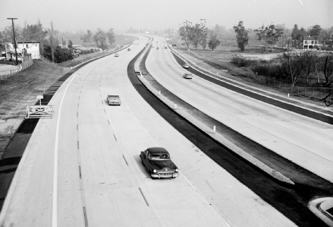 |
|
| (1958)* - Opening of new Hollywood Freeway link from Vineland to Moorpark. Photo date: Feb 7, 1958 |
* * * * * |
 |
|
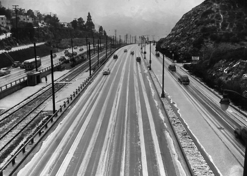
| (1948)^^ - View looking toward the San Fernando Valley showing a rare sight - freshly fallen snow in Cahuenga Pass. |
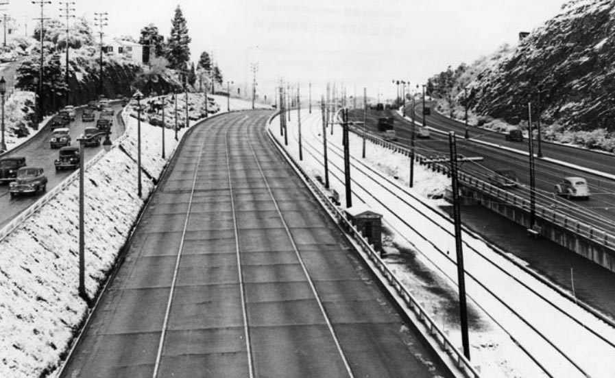
Historical Notes Snow is a rare occurrence in the Los Angeles Basin. While it's common in the region's mountains, the moderating effect of the Pacific means that at lower elevations temperatures rarely fall below the point necessary to create snow. Since records were first kept in 1921, snow has fallen on downtown Los Angeles only ten times—and not once since 1962. |
 |
|
| (1948)* - View of Cahuenga Pass Freeway with snow already melted on the pavement. Northbound freeway lanes are completely empty. |
* * * * * |
Pacific Electric Red Cars Through Cahuenga Pass |
For more than forty years, Pacific Electric Red Cars traveled through Cahuenga Pass, providing an important rail connection between Los Angeles and the growing San Fernando Valley. The line opened to Van Nuys in 1911 and later extended farther into the Valley, carrying passengers through the narrow passage between the Santa Monica Mountains.The trains originally traveled on their own right-of-way alongside the highway. Beginning in 1926, Valley cars used the Hollywood Subway to reach the Subway Terminal at Fourth and Hill Streets in downtown Los Angeles. When the Cahuenga Pass Freeway opened in 1940, the Pacific Electric tracks were placed in its broad center median, creating an unusual scene in which Red Cars and automobiles traveled side by side through the pass.Service beyond Van Nuys Boulevard and Sherman Way had already been discontinued in 1938, but Red Cars continued between Van Nuys and Los Angeles for another fourteen years. The final regular service through Cahuenga Pass ended on December 28, 1952, when buses replaced the trains. The photographs below capture the Red Cars during their final years, followed by the removal of the tracks and the transformation of their former right-of-way into part of the expanding Hollywood Freeway. |
 |
|
| (1948)* - Rush-hour traffic fills Cahuenga Pass as motorists head from the San Fernando Valley toward Hollywood and Los Angeles, with Pacific Electric tracks visible at left. |
Historical Notes By 1948, Cahuenga Pass carried an unusual combination of rail and highway transportation. Automobiles crowded the roadway during the morning commute while Pacific Electric Red Cars continued to carry passengers between the San Fernando Valley, Hollywood and downtown Los Angeles. Rail service had crossed Cahuenga Pass since 1911. When the Cahuenga Pass Freeway opened in 1940, the tracks were incorporated into the center of the new roadway, allowing trains and automobiles to share the same transportation corridor for another twelve years. |
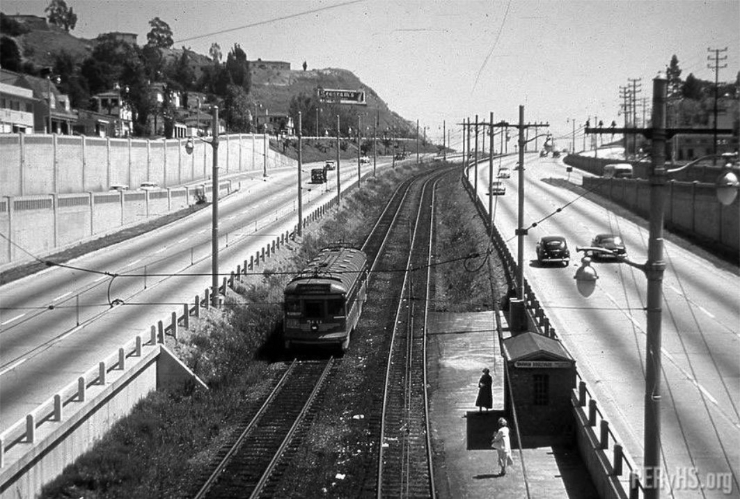 |
|
| (1948)* - Looking southeast from Barham Boulevard Bridge, a Pacific Electric Red Car travels through Cahuenga Pass, with the Barham passenger stop visible near the center. |
Historical Notes The Barham stop served passengers traveling between the San Fernando Valley and Los Angeles. A stairway from Barham Boulevard Bridge provided direct access to the stop and tracks below. The location provides one of the clearest examples of how closely rail and highway transportation were integrated through Cahuenga Pass. Red Cars occupied their own right-of-way while automobile traffic moved alongside them. |
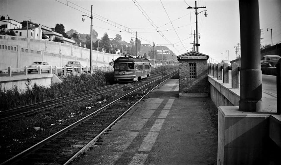 |
|
| (1948)* - View from beneath Barham Boulevard Bridge showing a Pacific Electric Red Car approaching the Barham stop. |
Historical Notes From beneath the bridge, the relationship between the Red Car line and the surrounding highway can be seen at ground level. The tracks, overhead electrical system and passenger facilities occupied a relatively narrow strip through the center of the pass. Barham Boulevard Bridge crossed above both the freeway and Pacific Electric right-of-way. Its stairway gave passengers access to the trains without requiring them to walk along the busy highway. |
.jpeg) |
|
| (ca. 1948)* - Looking southeast toward Barham Boulevard Bridge, a Pacific Electric Red Car stops at the Barham passenger station. |
Historical Notes Pacific Electric used several types of cars on its San Fernando Valley service over the years. During the final years of operation, rebuilt Hollywood Cars became a familiar sight along the Van Nuys Line and through Cahuenga Pass. Cars photographed along this portion of the route included Nos. 5011, 5130 and 5138. Car 5138 would later become associated with the final night of regular passenger service in December 1952. |
\ |
|
| (ca. 1950)* - View of the Barham Boulevard passenger stop along the Pacific Electric tracks in the center of Cahuenga Pass. |
Historical Notes The Barham stop was relatively modest, reflecting its role as one of several local passenger stops along the Valley route rather than a major terminal. Passengers could board here for trips south toward Hollywood and downtown Los Angeles or north toward the San Fernando Valley. Southbound trains eventually entered the Hollywood Subway and continued to the Subway Terminal at Fourth and Hill Streets, giving riders from stops such as Barham a direct trip into downtown Los Angeles. |
 |
|
| (1949)* – Barham Boulevard Bridge over Cahuenga Pass, looking southeast, with a stairway leading down to the Pacific Electric tracks and passenger stop below. |
Historical Notes The stairway visible in this photograph connected Barham Boulevard Bridge directly with the Pacific Electric passenger stop below. It was a practical solution to the unusual arrangement of placing a rail line within a busy highway corridor. The bridge itself carried Barham Boulevard across Cahuenga Pass while trains and freeway traffic passed underneath. After Red Car service ended, the passenger stairway lost its original purpose as the tracks and station facilities disappeared. |
Then and Now
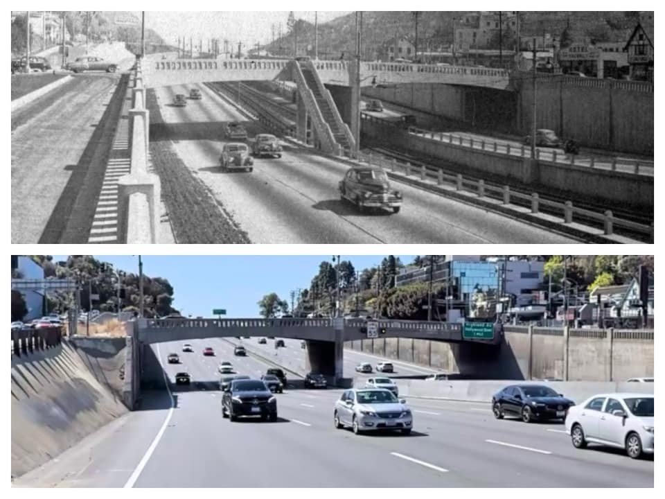 |
|
| (1949 vs 2022)* – Looking southeast toward Barham Boulevard Bridge in Cahuenga Pass. Comparison photo by Trey Callaway. |
Historical Notes The 1949 view shows Pacific Electric tracks and passenger facilities occupying the center of the pass, with automobile traffic traveling alongside them. More than seventy years later, the same corridor is dominated by the much wider Hollywood Freeway. Barham Boulevard Bridge remains an important reference point in both photographs, making it easier to see how extensively the roadway below has changed since the Red Car era. |
.jpg) |
|
| (1949)* - Morning commuters head through Cahuenga Pass from the San Fernando Valley toward Hollywood and central Los Angeles. |
Historical Notes The San Fernando Valley experienced rapid population growth during the years following World War II, increasing the number of commuters traveling through Cahuenga Pass each day. The pass remained one of the principal routes connecting Valley communities with Hollywood and central Los Angeles. This photograph captures a transportation system in transition. Large numbers of commuters were already traveling by automobile, while Pacific Electric trains continued to offer an alternative in the same corridor. |
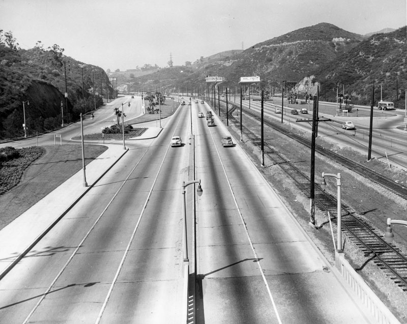 |
|
| (1949)* - Automobiles and Pacific Electric Red Cars share Cahuenga Pass. The Cahuenga Pass Freeway had opened in 1940 as the first completed section of what would become the Hollywood Freeway. |
Historical Notes The Cahuenga Pass Freeway opened on June 15, 1940, with eight traffic lanes separated by a center reservation for Pacific Electric trains. The arrangement allowed the existing rail service to remain while providing a modern highway connection through the pass. The freeway initially covered only the Cahuenga Pass portion of the route. Construction later extended the freeway south through Hollywood and toward downtown Los Angeles, creating the continuous Hollywood Freeway connection completed in 1954. |
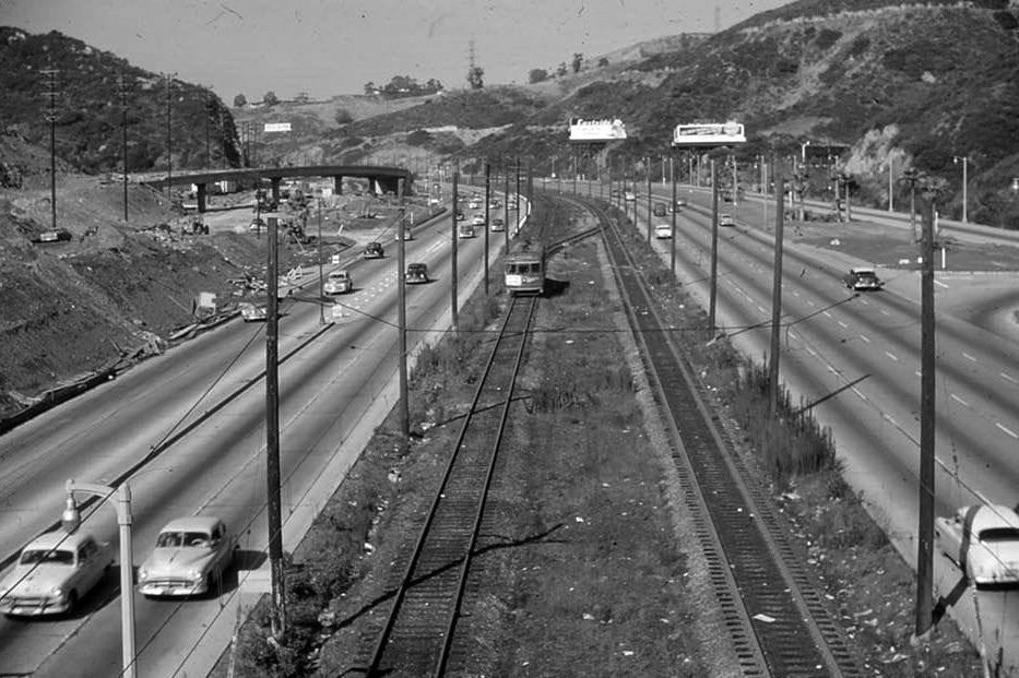 |
|
| (ca. 1950)* - A Los Angeles-bound Pacific Electric Red Car travels south through Cahuenga Pass during the final years of rail service to the San Fernando Valley. |
Historical Notes Beginning in 1926, Valley trains used the Hollywood Subway to reach the Subway Terminal at Fourth and Hill Streets in downtown Los Angeles. The subway allowed Pacific Electric trains to bypass congested surface streets through part of Hollywood and central Los Angeles. Near the south end of Cahuenga Pass, the line also served the Hollywood Bowl. For concertgoers, the Red Cars provided an alternative to driving and parking near one of Los Angeles' busiest entertainment destinations. |
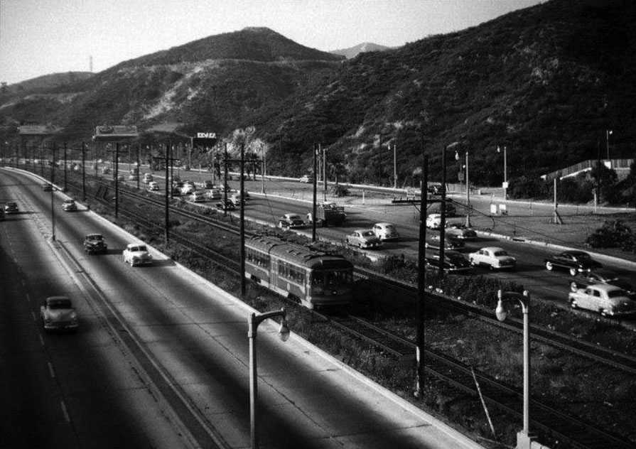 |
|
| (ca. 1950)* - A Pacific Electric Red Car heads south toward Hollywood as it travels through Cahuenga Pass. |
Historical Notes By the early 1950s, scenes such as this had been part of daily life in Cahuenga Pass for decades. Pacific Electric trains had first reached the San Fernando Valley in 1911, long before the modern freeway was built around their route. The Red Cars survived the construction of the Cahuenga Pass Freeway and continued operating in its center for twelve years. Their presence made this portion of the highway visually different from almost any other freeway corridor in Los Angeles. |
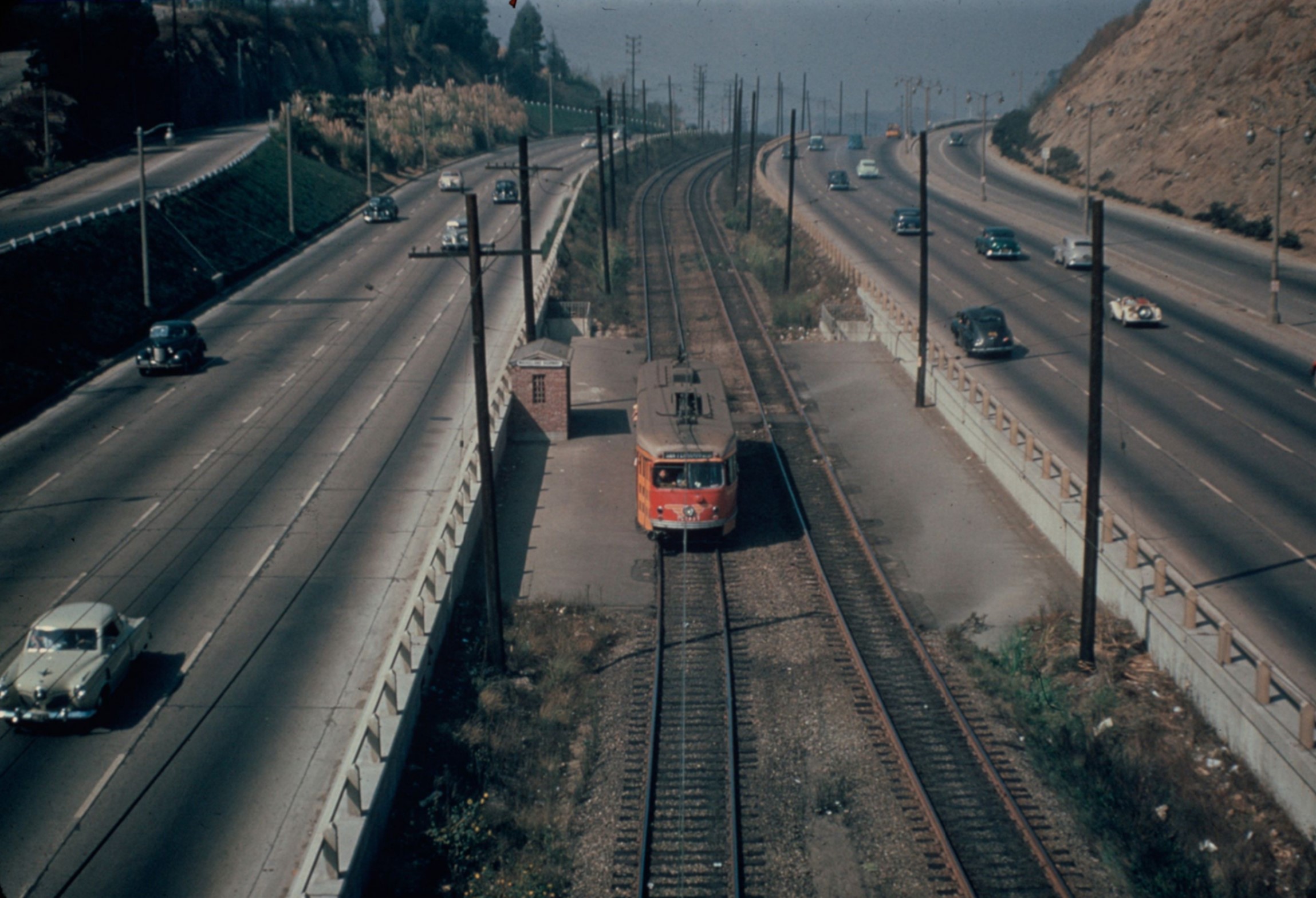 |
|
| (1952)* - A Pacific Electric Red Car from the San Fernando Valley travels through the center of Cahuenga Pass during the final year of rail service. Photo from the Ernest Marquez Collection. |
Historical Notes Pacific Electric service through Cahuenga Pass originally continued beyond Van Nuys to Owensmouth, now Canoga Park, and the city of San Fernando. Those outer portions of the system were discontinued in 1938, leaving Van Nuys Boulevard and Sherman Way as the end of the remaining Valley service. Red Cars continued from Van Nuys through North Hollywood, Universal City, Cahuenga Pass and Hollywood to downtown Los Angeles until December 1952. |
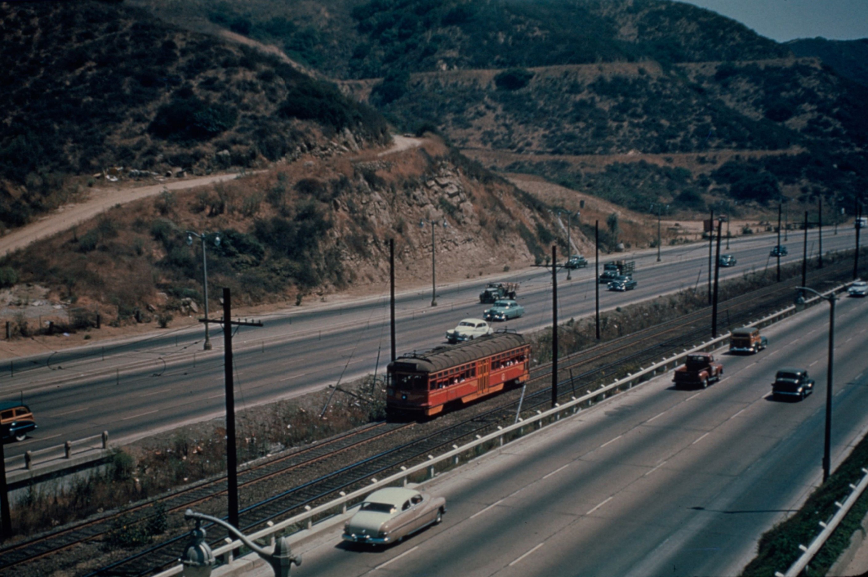 |
|
| (1952)* – Pacific Electric Railway car No. 5138 travels through the median of the Hollywood Freeway in Cahuenga Pass on the Van Nuys Line. Photo from the Ernest Marquez Collection. |
Historical Notes Car No. 5138 holds a special place in the history of the line. It operated the last regularly scheduled passenger trip from the Subway Terminal in downtown Los Angeles, departing at 1:20 a.m. on Sunday, December 28, 1952. A special train operated the following day, but No. 5138's trip marked the end of regular passenger service through Cahuenga Pass after more than forty years of Pacific Electric operations. |
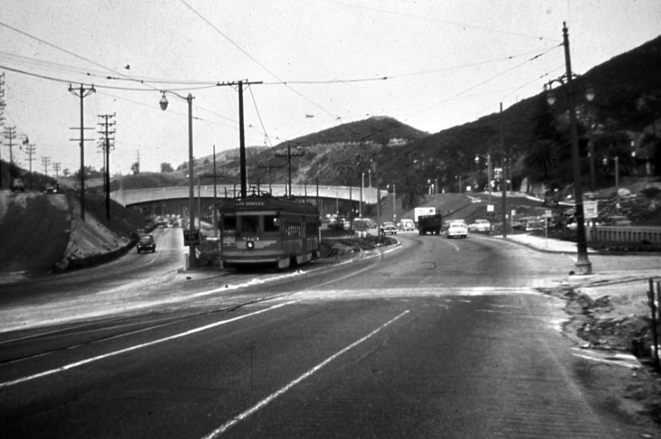 |
|
| (1952)* – Looking north near Cahuenga and Highland avenues, a Pacific Electric Red Car heads south toward Hollywood and downtown Los Angeles. |
Historical Notes Near Highland Avenue, Pacific Electric trains approached the southern end of Cahuenga Pass and continued through Hollywood toward the Hollywood Subway. This was also the area where passengers could reach the Hollywood Bowl. The photograph shows how the Red Car line connected the relatively open transportation corridor through the pass with the more developed streets of Hollywood to the south. |
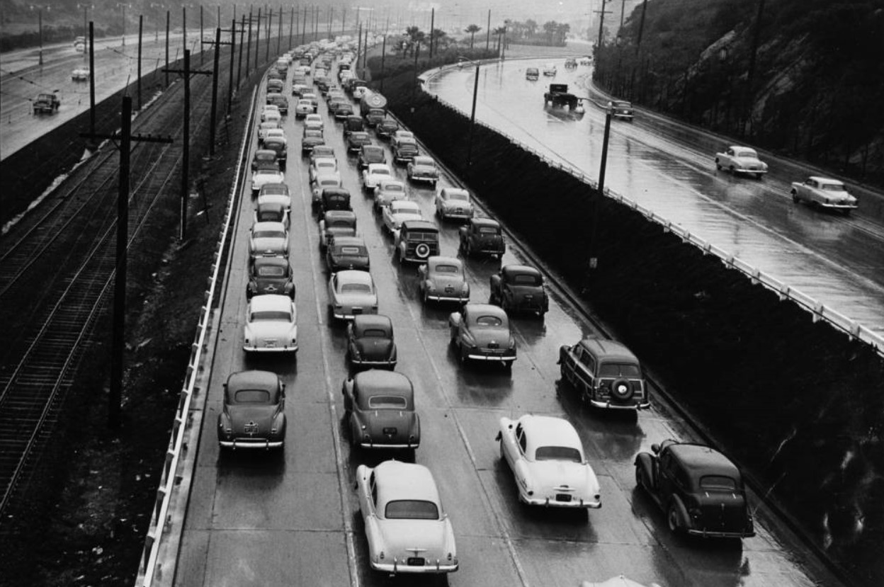 |
|
| (1952)^^ - Rush-hour traffic moves through Cahuenga Pass on a rainy morning, with the Pacific Electric tracks still occupying the center of the roadway. |
Historical Notes Rain added another challenge to an already busy commute through Cahuenga Pass. Automobile traffic could slow considerably on wet pavement, while the Pacific Electric trains continued along their fixed rails through the center of the roadway. Taken during the final year of Red Car service, the photograph also records how heavily the highway was already being used before the Hollywood Freeway connection to downtown was completed. |
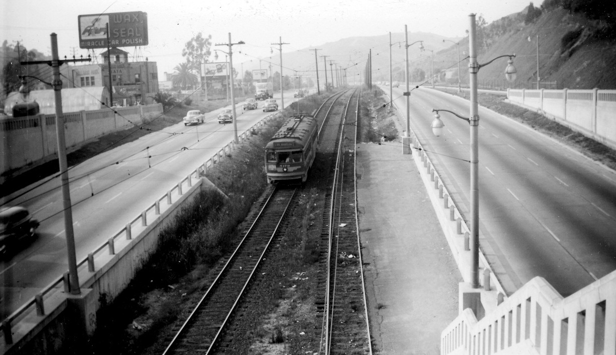 |
|
| (1952)* - A southbound Pacific Electric Red Car travels through the center of the Hollywood Freeway near Barham Boulevard during the final year of Valley rail service. |
Historical Notes December 1952 marked the end of more than forty years of Pacific Electric rail service through Cahuenga Pass. On December 28, buses replaced the remaining regular Red Car service between Van Nuys and Los Angeles. The change brought an end to one of the most distinctive features of the pass: electric trains and automobiles traveling side by side through the same narrow corridor. |
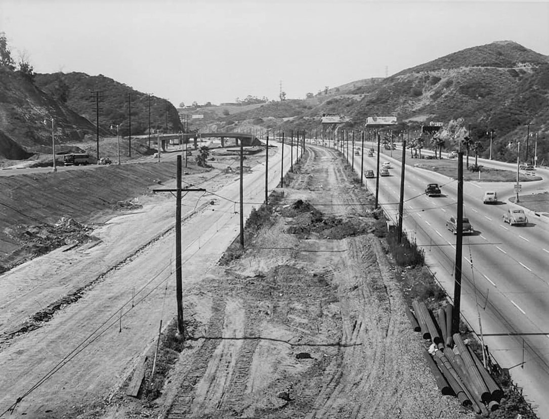 |
|
| (1953)* - Looking north from the Pilgrimage Bridge near the Hollywood Bowl as workers remove the former Pacific Electric tracks from the center of the Cahuenga Pass Freeway. |
Historical Notes After Pacific Electric service ended in December 1952, crews began removing the rails, overhead electrical equipment and other railway facilities through Cahuenga Pass. This photograph records the former right-of-way during that transition. Although the freeway-median tracks dated from 1940, Pacific Electric trains had traveled through Cahuenga Pass since 1911. Their removal erased a transportation route that had served the Valley for more than four decades. |
Before and After
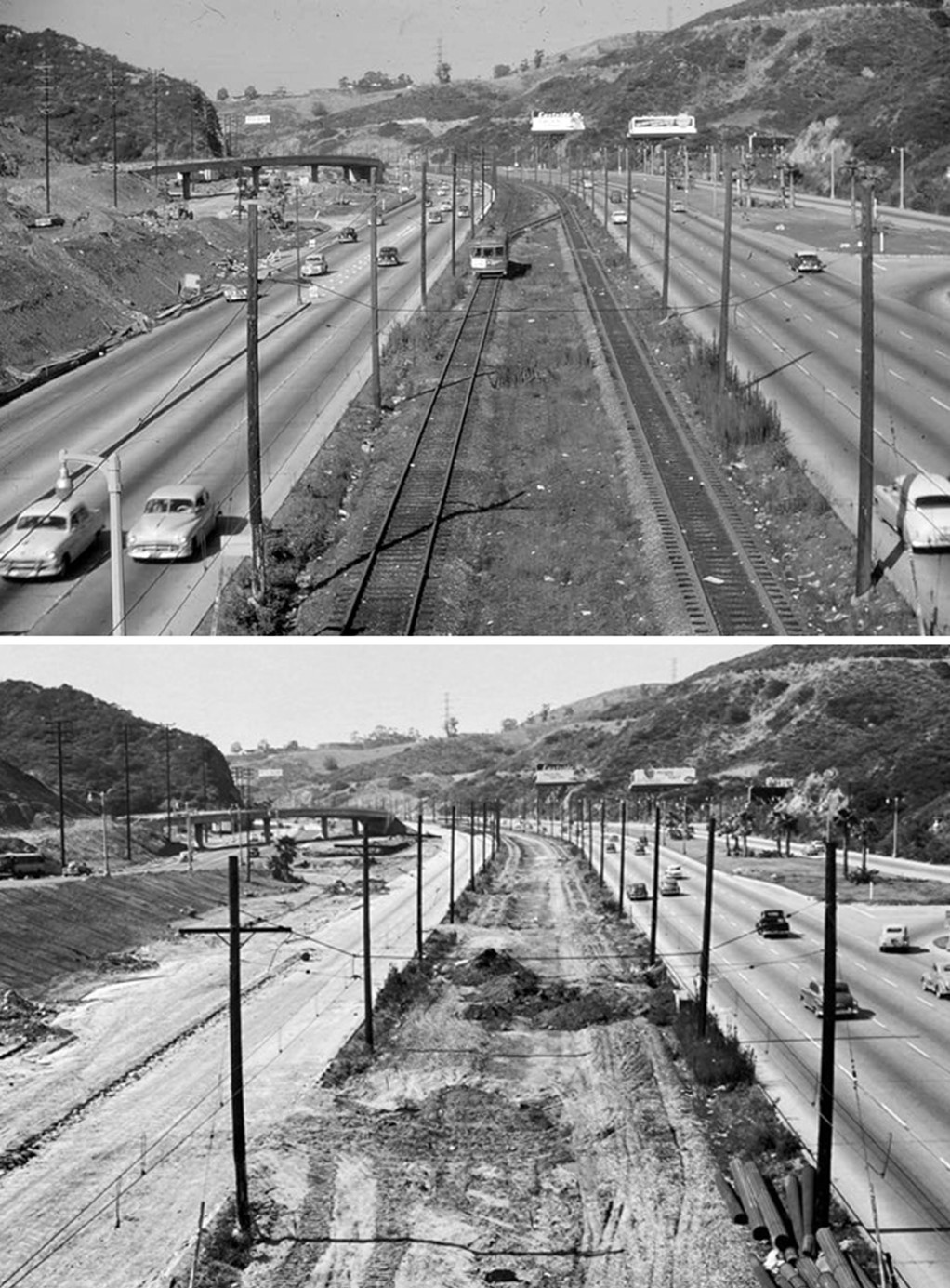 |
|
| (1950 vs. 1953)* - Before-and-after views looking north from the Pilgrimage Bridge near the Hollywood Bowl show the Pacific Electric tracks in the center of the Cahuenga Pass Freeway and their removal after rail service ended. Photo comparison by Jack Feldman. |
Historical Notes Taken only three years apart, these photographs show how quickly Cahuenga Pass changed. In 1950, Pacific Electric tracks occupied their own right-of-way between the traffic lanes. By 1953, the Red Cars were gone and the rails were being removed. The comparison marks the transition from a corridor shared by rail and automobiles to one increasingly devoted to highway traffic. The former Pacific Electric right-of-way would eventually become part of the expanded freeway. |
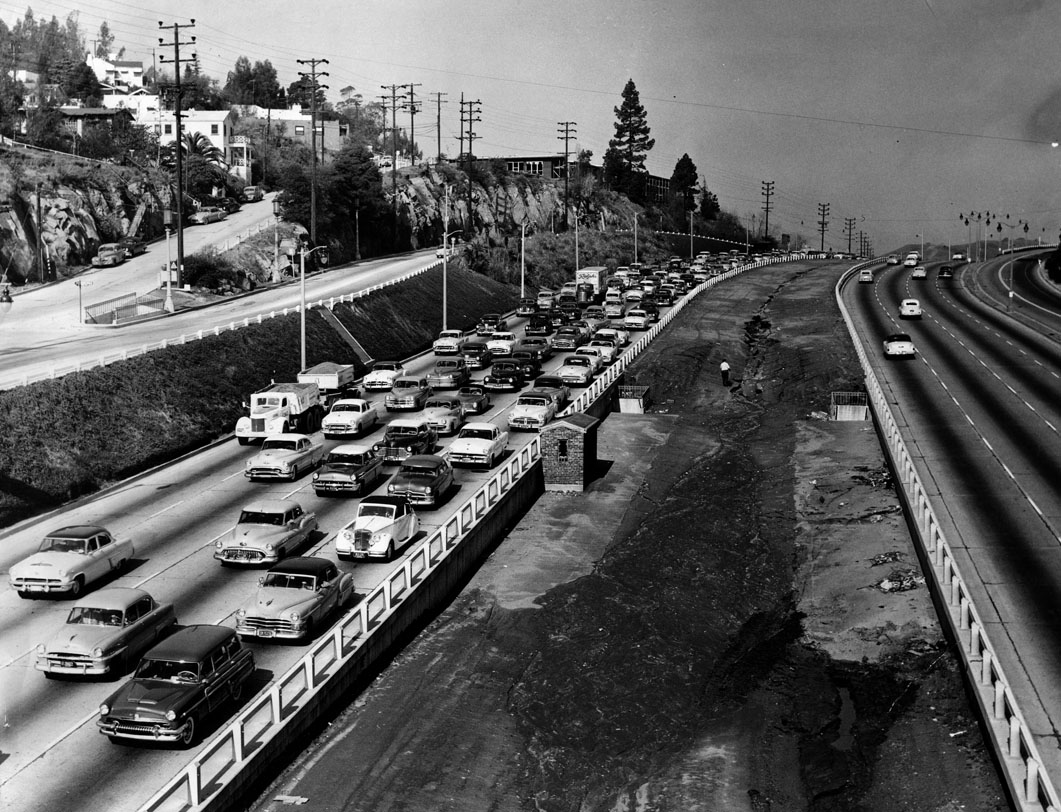 |
|
| (1955)* - Looking north from the Mulholland Drive bridge toward the Hollywood Freeway. The Pacific Electric tracks that once ran through the center of Cahuenga Pass have been removed. |
Historical Notes Although Pacific Electric trains had traveled through Cahuenga Pass since 1911, the familiar arrangement of Red Cars running between freeway lanes dated from the opening of the Cahuenga Pass Freeway in 1940. By the time of this photograph, the tracks and overhead electrical system were gone. The former Pacific Electric right-of-way was gradually incorporated into the highway as the Hollywood Freeway was expanded to accommodate increasing automobile traffic. |
 |
|
| (1950s)*^^ - View looking north through the Cahuenga Pass showing a line of buses which replaced the Pacific Electric Red Car. |
Historical Notes Pacific Electric rail service reached Van Nuys through Cahuenga Pass in 1911 and later extended to Owensmouth and San Fernando. Service to those outer destinations ended in 1938, but Red Cars continued to Van Nuys for another fourteen years. On December 28, 1952, buses replaced the remaining regular rail service through Cahuenga Pass. The buses could use the expanding highway system without requiring tracks, overhead wires or a separate rail right-of-way. |
Then and Now
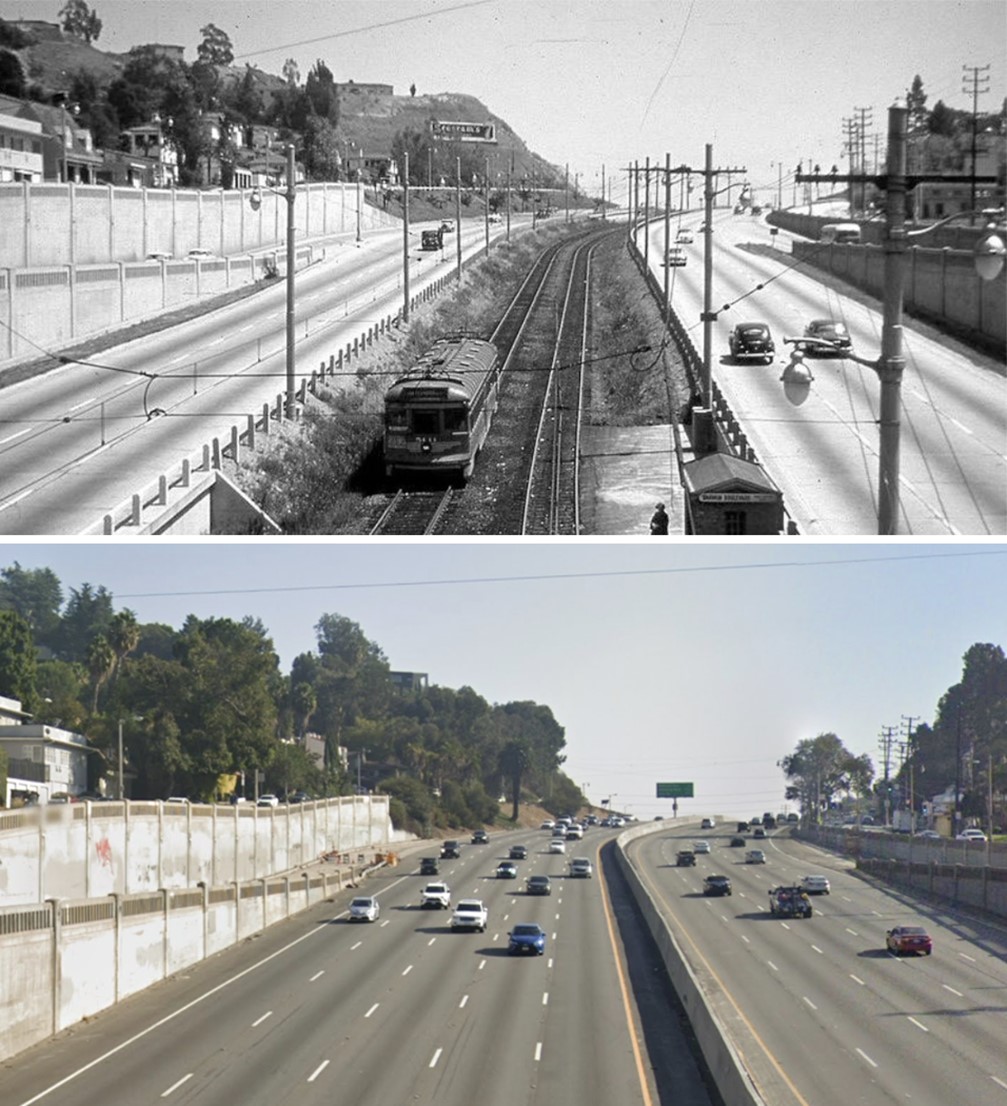 |
|
| (1948 vs. 2021)* - Looking southeast from Barham Boulevard Bridge in Cahuenga Pass. In 1948, Pacific Electric Red Cars traveled through the center of the freeway; by 2021, their former right-of-way had long since become part of the Hollywood Freeway. Photo comparison by Jack Feldman. |
Historical Notes The two views provide a fitting summary of the transformation of Cahuenga Pass. In 1948, the corridor accommodated both Pacific Electric trains and automobiles, continuing a rail connection to the San Fernando Valley that had begun in 1911. By 2021, virtually all visible evidence of the Red Car line had disappeared beneath the modern Hollywood Freeway. Barham Boulevard Bridge remains one of the few recognizable landmarks connecting the two scenes. |
* * * * * |
Cahuenga and Lankershim
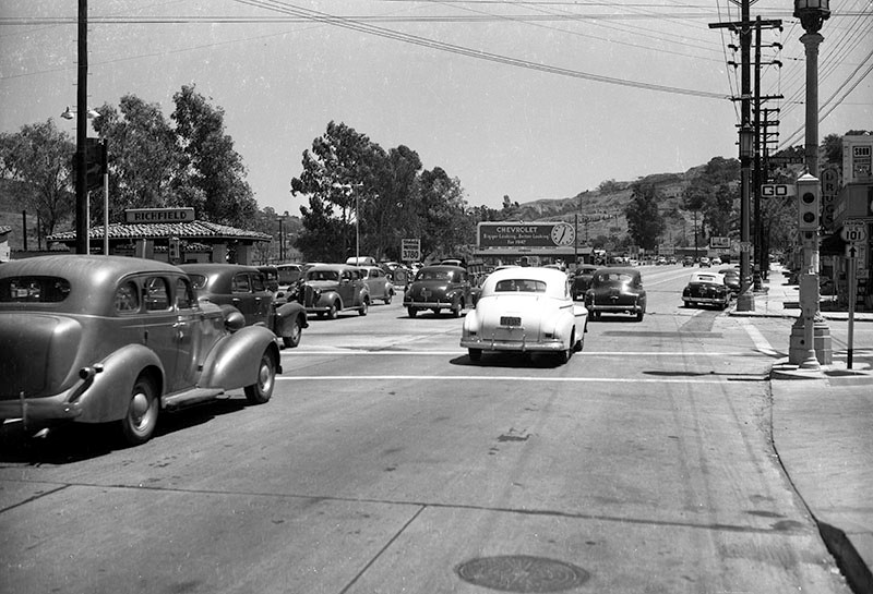 |
|
| (1947)* - Looking southeast down Cahuenga Boulevard, from just west of where it crosses Lankershim Boulevard (center). Seen, from left to right, are a Richfield service station, Dieterich Motors used car lot, a Foster and Kleiser billboard advertising 1947 Chevrolet automobiles, homes up in the hills, the Tasty Nook Cafe, and various other businesses. Photograph dated August 1, 1947. |
Historical Notes Ventura Boulevard turns into Cahuenga Boulevard east of Lankershim. |
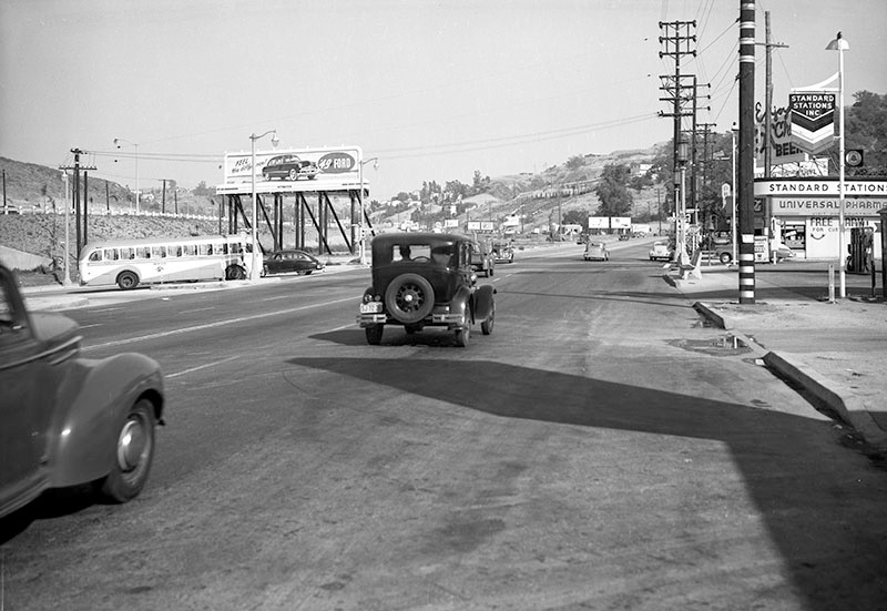 |
|
| (1949)* – View looking southeast down Cahuenga Boulevard, from just west of where it crosses Lankershim Boulevard (center). Seen, from left to right are the Lankershim Bridge and Tunnel (only partially visible), a Foster and Kleiser billboard advertising the 1949 Ford automobile (left), homes up in the hills, a Rexall drugstore and a Standard oil service station. Photograph dated June 23, 1949. |
Historical Notes The bridge/tunnel was built in 1948 as part of the Cahuenga Freeway; it is now known as the Lankershim/101 Freeway Bridge and Tunnel. The corner where the billboard is seen (left of center) was named Yitzhak Rabin Square in 1995 in honor of the slain Israeli Prime Minister. |
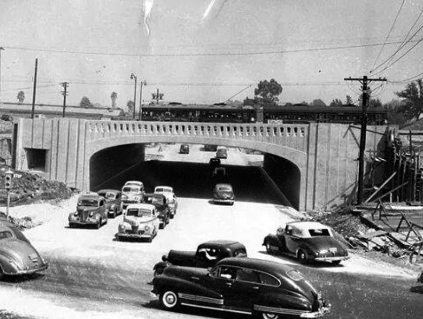 |
|
| (1952)*^*# – View looking north on Lankershim Boulevard at Cahuenga Boulevard showing the freeway underpass built in 1948. Two Pacific Electric Red Cars are passing each other above. |
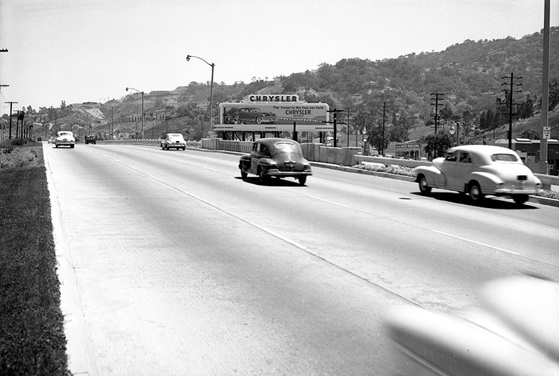 |
|
| (1950)* - Cars travel south down the Cahuenga Pass Freeway over the Lankershim Bridge and Tunnel, just north of where Cahuenga and Ventura boulevards meet in Studio City. |
* * * * * |
Movie Scenes in Cahuenga Pass
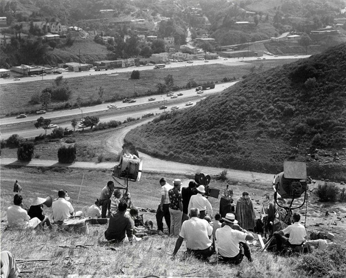 |
|
| (1959)* – View of the filming of 'Spartacus' in Cahuenga Pass, with the Hollywood Freeway (US-101) in the background. The location is on the hills above what is now Hotel Drive, on the site of what is today a Universal Studios parking lot. Photo by J.R. Eyerman for LIFE. |
Historical Notes Photo caption from the Los Angeles Evening News reads: ‘While the busy Hollywood Freeway remains out of the camera’s view, it serves as a contrasting backdrop to the scene from Bryna Productions’ Spartacus—a 74 B.C. setting outside the Gates of Rome. The southern edge of Universal-International Studios borders the freeway, where many travelers can glimpse the movie being filmed. Peter Ustinov, wearing a full-length sheepskin coat, is shown alongside Sir Laurence Olivier, positioned to his right.’ In 1959, Stanley Kubrick filmed scenes for the epic historical drama "Spartacus" in the Cahuenga Pass area of Los Angeles, with the Hollywood Freeway (US-101) serving as a nearby backdrop. The location was strategically selected for its suitable hillside terrain and its proximity to Universal Studios, being just a short drive away. The filming site was likely situated near what is now Hotel Drive, north of Universal Studios Boulevard. During the production, the area offered a unique setting where movie production intersected with everyday urban life, with travelers on the freeway potentially catching glimpses of the historical film being created. |
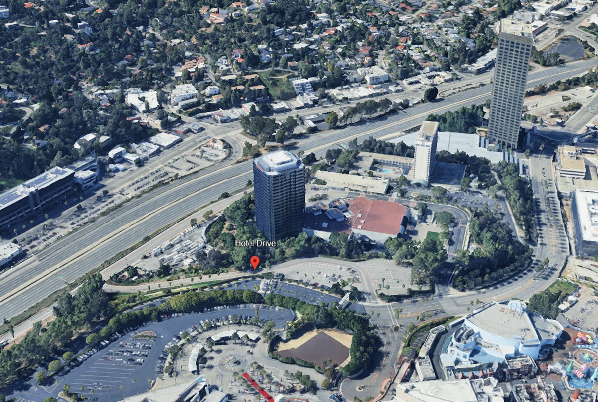 |
|
| (2023)* – Google Earth view looking southwest from above Hotel Drive and Universal Studios, showing the location of the former 'Spartacus' scene, now a parking lot. |
Historical Notes The rugged terrain of Cahuenga Pass, which connects the Hollywood area with the San Fernando Valley, was used for several outdoor sequences in films like 'Spartacus', particularly those involving large-scale battle scenes. The area’s natural features, including its rocky hills and open spaces, were well-suited for the grand scale of the film’s epic gladiatorial and military sequences. Today, Cahuenga Pass is heavily developed, especially with the expansion of Universal Studios, but its historical use as a filming location remains a notable part of Hollywood’s film legacy, contributing to Spartacus and many other films shot in the area over the decades. |
 |
|
| (1959)* – Filming the Spartacus Roman fortress scene from above the Hollywood Freeway in Cahuenga Pass, toward a hill that today is a parking lot at Universal Studios. Photo by J.R. Eyerman for LIFE. |
Historical Notes 'Spartacus' is renowned for its exceptional cinematography and spectacular battle scenes, some of which were filmed in the local mountains near Hollywood, including the Cahuenga Pass. The film's cinematographer, Russell Metty, employed innovative techniques to capture the epic scale of the production. Using the 35 mm Super 70 Technirama format, which was later blown up to 70 mm film, Kubrick and Metty achieved ultra-high definition and captured vast panoramic scenes. This process allowed for breathtaking visuals, particularly evident in the battle sequences. While the major battle scenes were filmed on a vast plain outside Madrid with about 8,000 trained soldiers from the Spanish infantry, some local filming took place in the hills above Los Angeles' Cahuenga Pass. The film's visual impact was particularly striking for audiences who experienced it in rare Super Technirama 70 prints, which showcased the impressive cinematography in 70mm with six-track sound. Metty's work on "Spartacus" was so impressive that he won the Academy Award for Best Color Cinematography, despite reported conflicts with Kubrick during filming. 'Spartacus' went on to win four Academy Awards, including Best Supporting Actor for Peter Ustinov, Best Art Direction, and Best Costume Design. |
* * * * * |
Building the Hollywood Freeway — Cahuenga Pass to Downtown Los Angeles |
The Cahuenga Pass Freeway had already provided a modern roadway between Hollywood and the San Fernando Valley when it opened in 1940. But the freeway ended near the Hollywood Bowl and Highland Avenue, leaving motorists to continue through Hollywood on city streets.These early 1950s aerial views show the area just before construction pushed the freeway south through Hollywood. Beginning in 1952, major construction brought new roadways, bridges, ramps and grade separations through the densely developed corridor. The completed connection opened in April 1954, creating a continuous freeway route between the San Fernando Valley and downtown Los Angeles. |
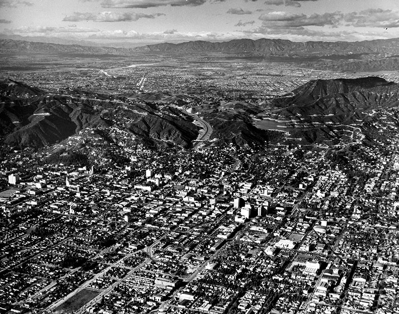 |
|
| (ca. 1951)* - Aerial view looking north across Hollywood before construction of the Hollywood Freeway extension. The Hollywood Reservoir is visible in the hills at upper right, with the San Fernando Valley beyond Cahuenga Pass. |
|
|
| (ca. 1951)* - Aerial view looking north through Cahuenga Pass toward the San Fernando Valley. The Cahuenga Tunnel beneath Highland Avenue is visible at lower center-left. Nearby are the Muse of Music sculpture at the entrance to the Hollywood Bowl and a portion of the Bowl itself. |
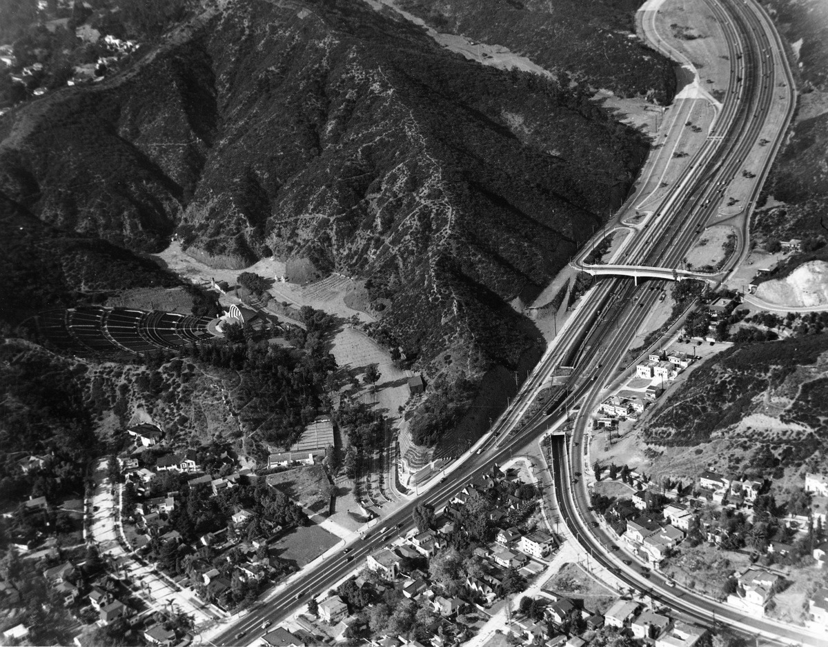 |
|
| (ca. 1952)* – Aerial view showing the southern end of the Cahuenga Pass Freeway near the Hollywood Bowl. From here, the freeway would soon be extended south through Hollywood and connected with downtown Los Angeles. |
Historical Notes The freeway through Cahuenga Pass was already more than a decade old when these photographs were taken. The first section opened on June 15, 1940, running from near the Hollywood Bowl north through the pass. Known initially as the Cahuenga Pass Freeway, it was an early part of what would eventually become the Hollywood Freeway. Pacific Electric Red Cars continued to operate along tracks in the freeway median, sharing the corridor with automobiles. At the southern end, however, the freeway ended near Highland Avenue and the Hollywood Bowl. Motorists heading toward central Hollywood and downtown still had to continue on existing city streets. The Cahuenga Tunnel carried Highland Avenue beneath the freeway near the Bowl, part of a roadway arrangement that would soon be substantially rebuilt. These early 1950s aerial views capture the area just before that transformation. Beginning in 1952, construction extended the Hollywood Freeway south through Hollywood, eliminating the old tunnel and connecting the existing Cahuenga Pass roadway with the new freeway being built toward downtown. Pacific Electric service through the pass ended in December 1952, and the Valley-to-downtown freeway connection was completed in April 1954. |
* * * * * |
Construction of the Hollywood Freeway — 1952–1954 |
Construction of the Hollywood Freeway extension transformed a broad corridor through Hollywood and Cahuenga Pass. Hillsides were cut away, buildings removed, bridges and ramps constructed, and traffic shifted onto temporary roads while the new freeway was built through one of the city's most heavily traveled areas.The photographs below follow the work from 1952 through early 1954, as the existing Cahuenga Pass Freeway was rebuilt and extended south through Hollywood toward downtown Los Angeles. |
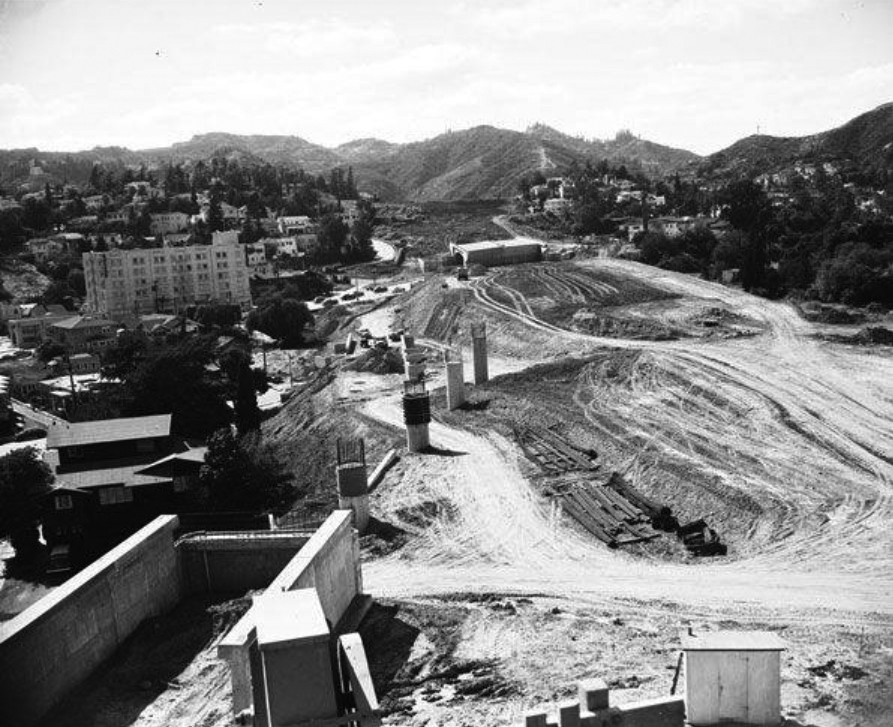 |
|
| (1952)* - Construction of the Hollywood Freeway near Whitley Heights, about two blocks north of Hollywood and Vine. Concrete columns rise from the newly graded hillside as work progresses on the freeway connection between Cahuenga Pass and downtown Los Angeles. |
Historical Notes Construction of the Hollywood Freeway cut directly through Whitley Heights, one of Hollywood's earliest residential neighborhoods. The freeway required extensive excavation through the hillside and the removal of homes and other structures along its route. The project permanently divided portions of the neighborhood as the new roadway descended from Cahuenga Pass toward central Hollywood. |
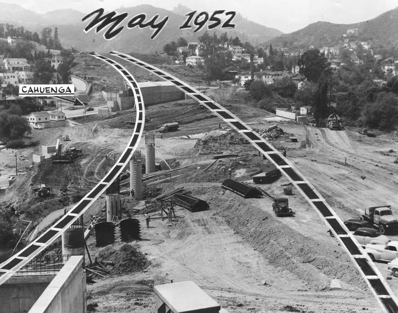 |
|
| (1952)* - View showing the route being cleared for the Hollywood Freeway extension between Cahuenga Pass and downtown Los Angeles. The arrow points to Cahuenga Boulevard. |
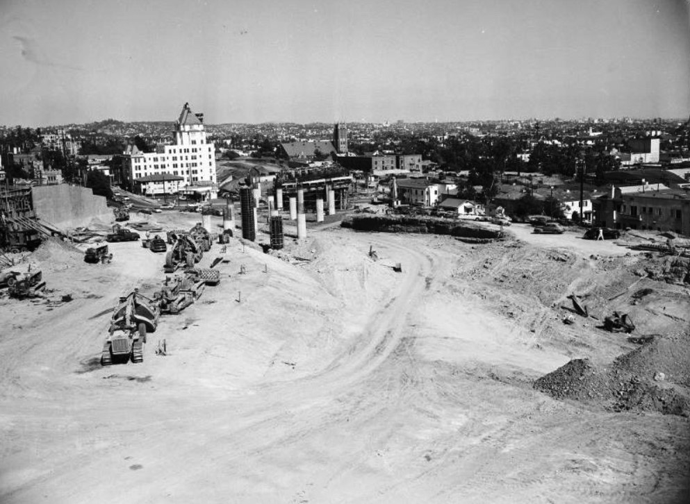 |
|
| (1952)* - Looking southeast toward a new bridge over Cahuenga Boulevard during construction of the Hollywood Freeway. The Hollywood Tower is visible in the background. |
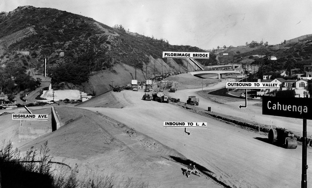 |
|
| (1953)* - View looking north toward Cahuenga Pass during construction of the Hollywood Freeway. The Pilgrimage Bridge is visible in the background, with Highland Avenue at left and the Muse of Music sculpture marking the entrance to the Hollywood Bowl. |
Historical Notes The Pilgrimage Bridge crossed Cahuenga Pass near the entrance to the Hollywood Bowl. Its name came from the nearby Pilgrimage Play and Pilgrimage Theatre, later renamed the John Anson Ford Theatre. Its elevated location also provided a useful vantage point for photographs documenting construction and traffic through the pass. The Muse of Music sculpture at the entrance to the Hollywood Bowl was dedicated in 1940. Created by sculptor George Stanley, it depicts the Muse of Music with figures representing Dance and Drama and remains a familiar landmark along Highland Avenue. |
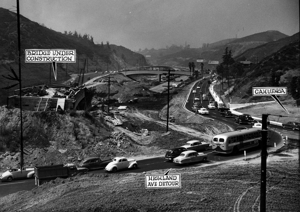 |
|
| (1953)* - Traffic moves through Cahuenga Pass while construction continues on the Hollywood Freeway. Highland Avenue traffic is temporarily routed onto Cahuenga Boulevard as new freeway connections are built. |
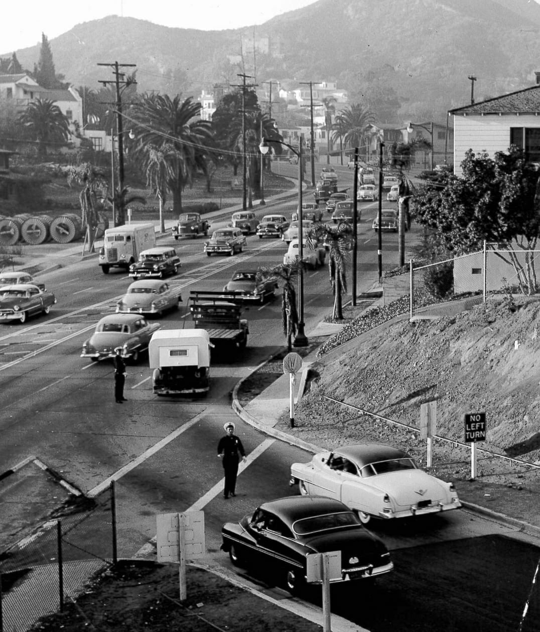 |
|
| (1953)* - Looking north toward the northbound Hollywood Freeway off-ramp at Cahuenga Boulevard on October 7, 1953. Traffic officers direct motorists through the newly constructed roadway while a stop sign remains covered. |
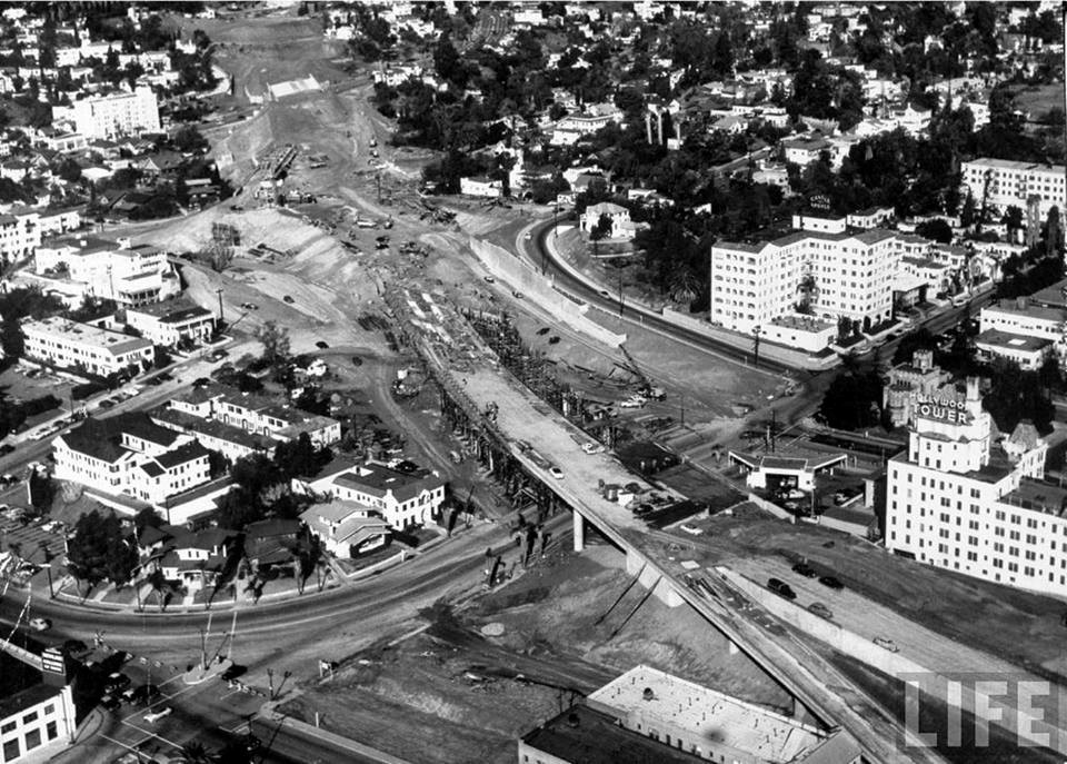 |
|
| (1953)* – Construction of the Hollywood Freeway near Argyle Avenue, looking through Hollywood toward Cahuenga Pass. Castle Argyle and the Hollywood Tower are visible among the surrounding buildings. Source: LIFE Magazine. |
Historical Notes Unlike the earlier freeway through Cahuenga Pass, the southward extension had to cut through an already developed section of Hollywood. Property was acquired and buildings removed to create the freeway right-of-way, leaving a broad new transportation corridor through neighborhoods that had developed decades earlier. The Castle Argyle and Hollywood Tower visible in this photograph survived the freeway construction and remain useful landmarks for comparing the changing Hollywood landscape. |
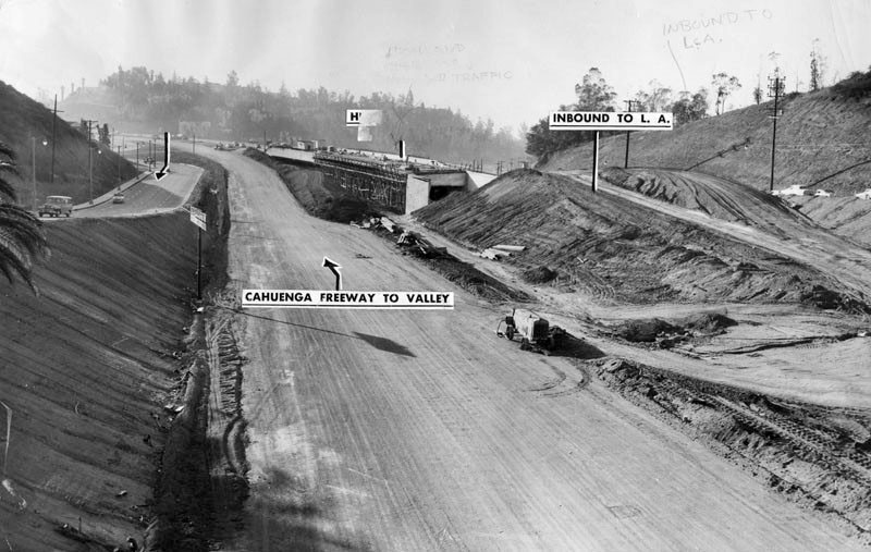 |
|
| (1953)* - Looking south from the Pilgrimage Bridge during construction of the Hollywood Freeway through Cahuenga Pass. Temporary hillside roads carry northbound and southbound traffic around the work zone. The photograph was published by the Herald Examiner on December 26, 1953. |
Historical Notes Temporary hillside roads allowed traffic to continue moving between Hollywood and the San Fernando Valley while the permanent freeway lanes were under construction. The arrangement illustrates the difficulty of rebuilding Cahuenga Pass while keeping one of the city's major routes open. As portions of the new freeway were completed, traffic was shifted from one temporary alignment to another until the permanent roadway could be placed in service. |
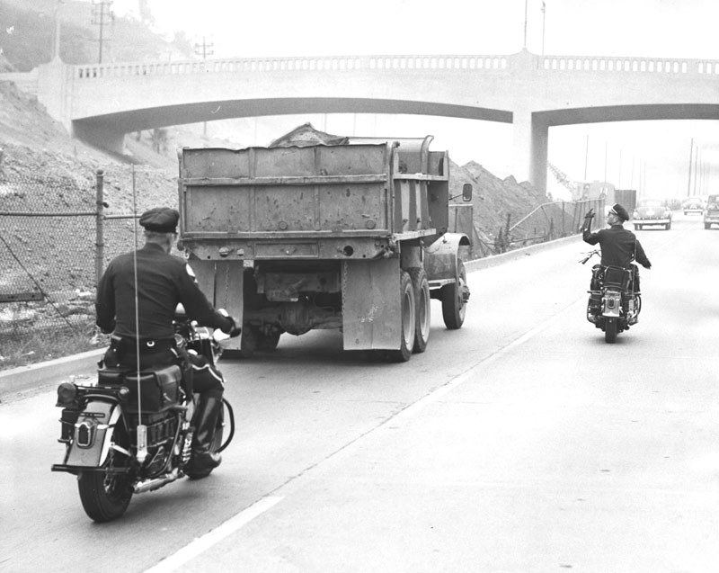 |
|
| (1953)* – Motorcycle officers Lloyd Asdale, left, and Harry Smalley stop a slow-moving truck traveling in the fast lane during a freeway safety campaign in Cahuenga Pass. According to the Herald Examiner, 95 motorists were cited during the first eight hours of the enforcement effort. |
Historical Notes The rapid expansion of Los Angeles freeways introduced new driving patterns and new enforcement concerns. Police increasingly emphasized lane discipline, speed and safe merging as motorists adjusted to sustained higher-speed travel. This 1953 campaign targeted slow-moving vehicles traveling in the fast lane through Cahuenga Pass. |
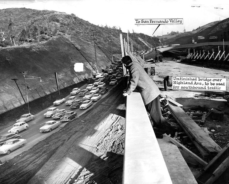 |
|
| (1954)* - View of the Hollywood Freeway near Highland Avenue in January 1954. Portions of the roadway were already carrying traffic while construction continued on the Highland Avenue crossing. |
Historical Notes Reconstruction around Highland Avenue eliminated the earlier Cahuenga Tunnel, which had carried Highland Avenue beneath the freeway near the Hollywood Bowl. The older roadway arrangement was replaced by new bridges and approaches designed for the expanded Hollywood Freeway. The work substantially changed the southern entrance to Cahuenga Pass and created much of the freeway configuration familiar to later generations of Los Angeles motorists. |
|
|
| (1954)* - Looking southeast from the Pilgrimage Bridge toward the reconstructed northbound roadway through Cahuenga Pass at Highland Avenue. The former Cahuenga Pass Freeway was being incorporated into the expanding Hollywood Freeway. |
Historical Notes Pacific Electric Red Cars once traveled through the center of the Cahuenga Pass roadway, providing rail service between Hollywood and the San Fernando Valley. Passenger service through the pass ended on December 28, 1952, while construction of the Hollywood Freeway was underway. The end of passenger service did not mean the tracks disappeared immediately. Portions of the former rail right-of-way remained for several years before the median area was converted to additional freeway lanes. |
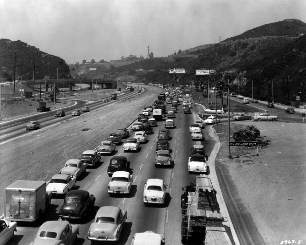 |
|
| (1954)* - View looking north from the Pilgrimage Bridge along the newly completed Hollywood Freeway through Cahuenga Pass. The Mulholland Drive exit is at right. |
Historical Notes — Completion of the Hollywood Freeway The final connection of the Hollywood Freeway between the San Fernando Valley and downtown Los Angeles was dedicated on April 15, 1954, during ceremonies near the Pilgrimage Bridge. Entertainer Bob Hope participated in the celebration, which marked the completion of the freeway connection through Hollywood. The new section opened to traffic the following day, April 16, providing a continuous freeway route from the Valley through Cahuenga Pass and Hollywood to downtown Los Angeles. The completed route fundamentally changed travel between the San Fernando Valley and central Los Angeles and established the Hollywood Freeway as one of the region's major transportation corridors. |
* * * * * |
Hollywood Freeway — After the 1954 Opening |
The opening of the completed Hollywood Freeway in 1954 gave motorists a continuous freeway route between the San Fernando Valley, Hollywood and downtown Los Angeles. But the new roadway did not eliminate one of the region's most familiar problems: traffic.Within a few years, the freeway had become a major part of everyday travel through Cahuenga Pass and Hollywood. The photographs below show the completed freeway in use and how its broad path permanently changed the landscape of Hollywood. |
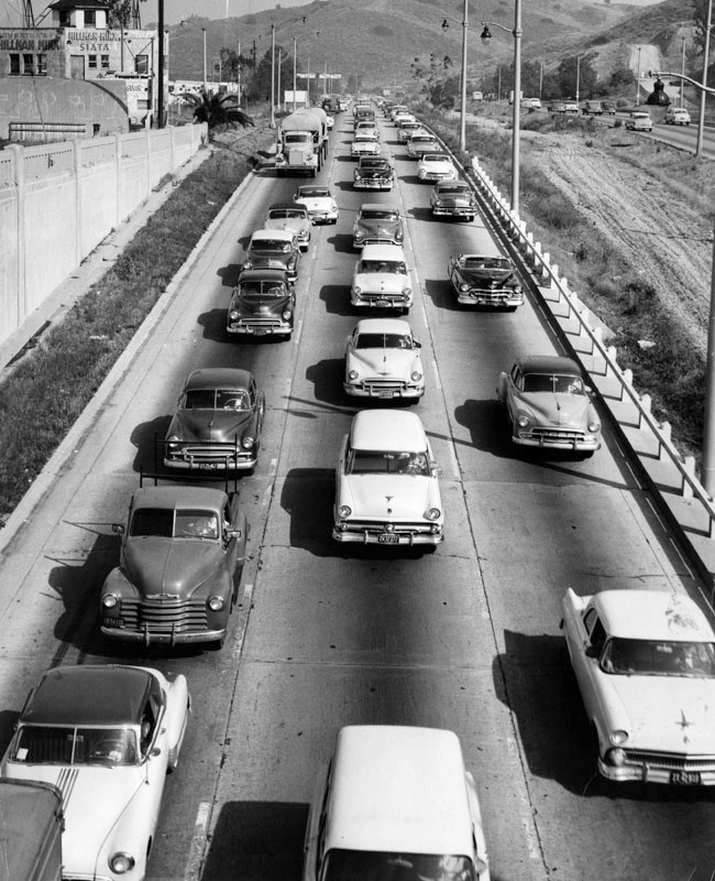 |
|
| (1955)* - Traffic backs up on the inbound Hollywood Freeway on May 17, 1955, after a disabled truck caused a two-hour morning traffic jam. The backup extended onto major streets carrying commuters from the San Fernando Valley. |
Historical Notes Traffic congestion quickly became a familiar part of travel on the Hollywood Freeway. The Herald Examiner reported that this 1955 backup began when a truck broke down during the morning commute, creating a two-hour traffic jam and backing vehicles onto major streets leading from the San Fernando Valley. The incident came only about a year after completion of the freeway connection to downtown and illustrates how heavily the new route was already being used. |
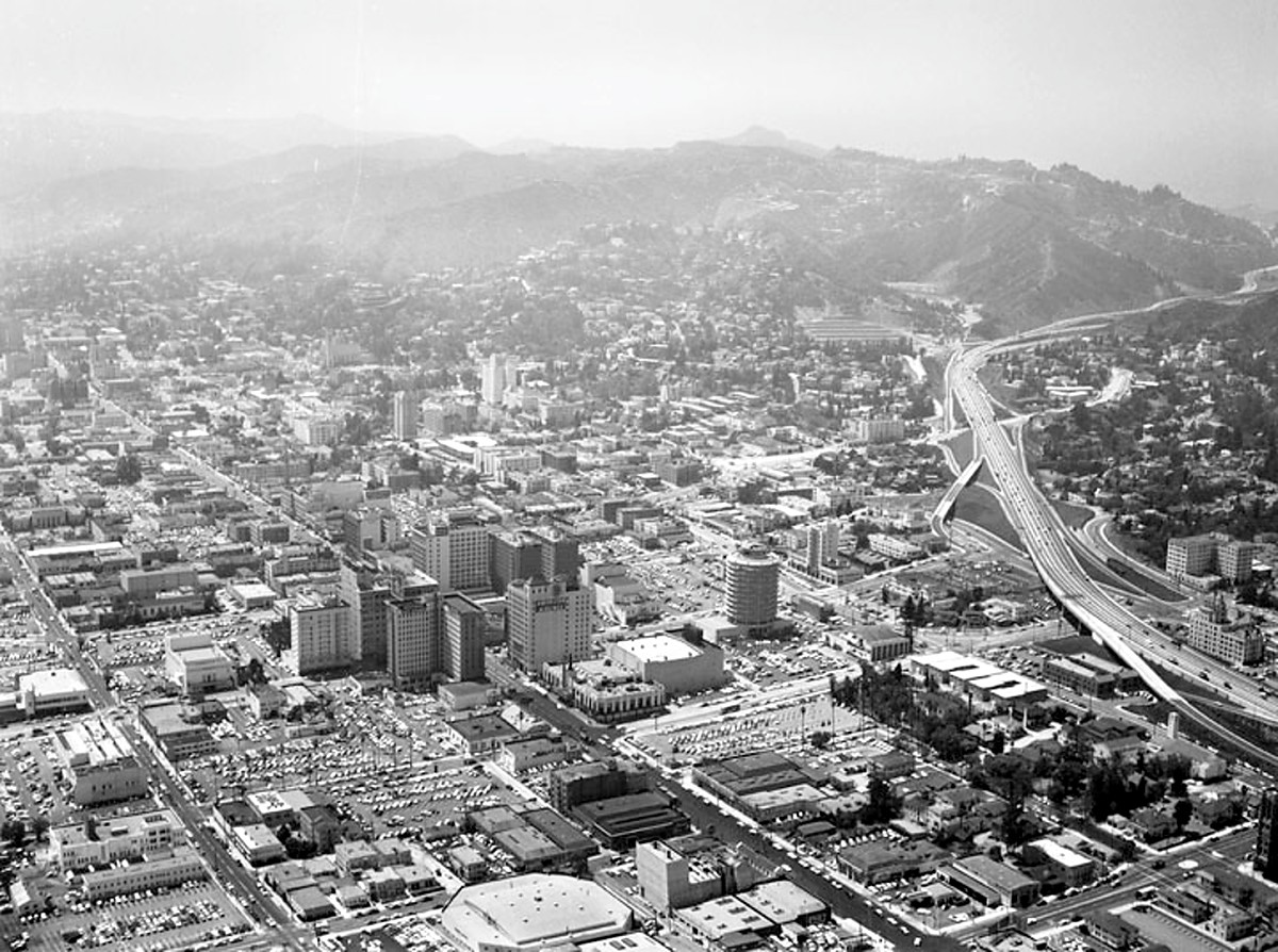 |
|
| (1956)* - Aerial view looking across Hollywood toward Cahuenga Pass, showing the completed Hollywood Freeway connecting the San Fernando Valley with Hollywood and downtown Los Angeles. Cahuenga Pass is at upper right, with the Hollywood business district at center. |
Historical Notes By the mid-1950s, the Hollywood Freeway had created a continuous high-speed route through one of Los Angeles' most heavily developed corridors. From Cahuenga Pass, the freeway cut south through Hollywood before continuing toward downtown Los Angeles. Its broad right-of-way permanently altered the Hollywood landscape, replacing portions of established neighborhoods and creating a transportation corridor that remains one of the area's defining features. |
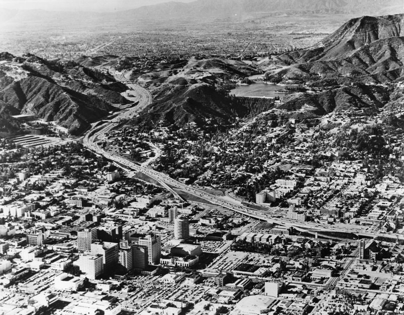 |
|
| (ca. 1960s)* - Aerial view of Hollywood and the surrounding area after completion of the Hollywood Freeway. The freeway cuts through the center of Hollywood toward Cahuenga Pass. The Hollywood Reservoir and Mulholland Dam are visible in the hills at upper right, with the Capitol Records Building in the foreground |
Historical Notes The Capitol Records Building provides an important clue to the date of this photograph. Completed in 1956 at Hollywood and Vine, the cylindrical building became one of Hollywood's most recognizable landmarks. By the 1960s, the Hollywood Freeway had become firmly established in the city's landscape. From the air, its impact is especially clear as the roadway passes through the dense street grid of Hollywood before entering the narrower corridor of Cahuenga Pass. |
Before and After
|
|
|
|
| (1951 vs. ca. 1960s)* - Aerial views showing Hollywood and Cahuenga Pass before and after construction of the Hollywood Freeway extension. The 1951 view shows the area before the freeway was pushed south through Hollywood, while the later view shows the completed roadway cutting through the developed city. |
Historical Notes The comparison shows the scale of the change produced by freeway construction during the 1950s. Before the extension, the Cahuenga Pass Freeway ended near Highland Avenue and the Hollywood Bowl. Motorists continuing toward central Hollywood and downtown relied on existing city streets. After 1954, the freeway formed a continuous corridor through Hollywood. Hillsides were excavated, buildings removed and portions of existing neighborhoods divided to make room for the roadway, ramps and interchanges. |
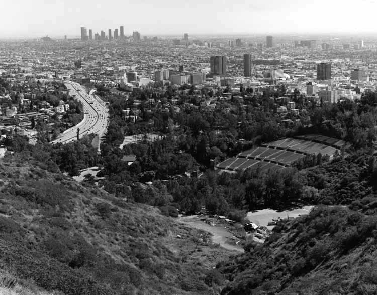 |
|
| (1989)* - View looking across the Hollywood Bowl from Mulholland Drive toward Hollywood and downtown Los Angeles. The Hollywood Freeway is visible at left as it passes through Cahuenga Pass and continues south through Hollywood. |
Historical Notes More than three decades after its completion, the Hollywood Freeway had become an established part of the Cahuenga Pass landscape. From this elevated viewpoint, the relationship between the Hollywood Bowl, surrounding hills and freeway corridor can be clearly seen. The view also illustrates why Cahuenga Pass has remained such an important transportation corridor. The natural opening through the Santa Monica Mountains has long provided one of the principal routes between Hollywood and the San Fernando Valley. |
Cahuenga Pass Then and Now
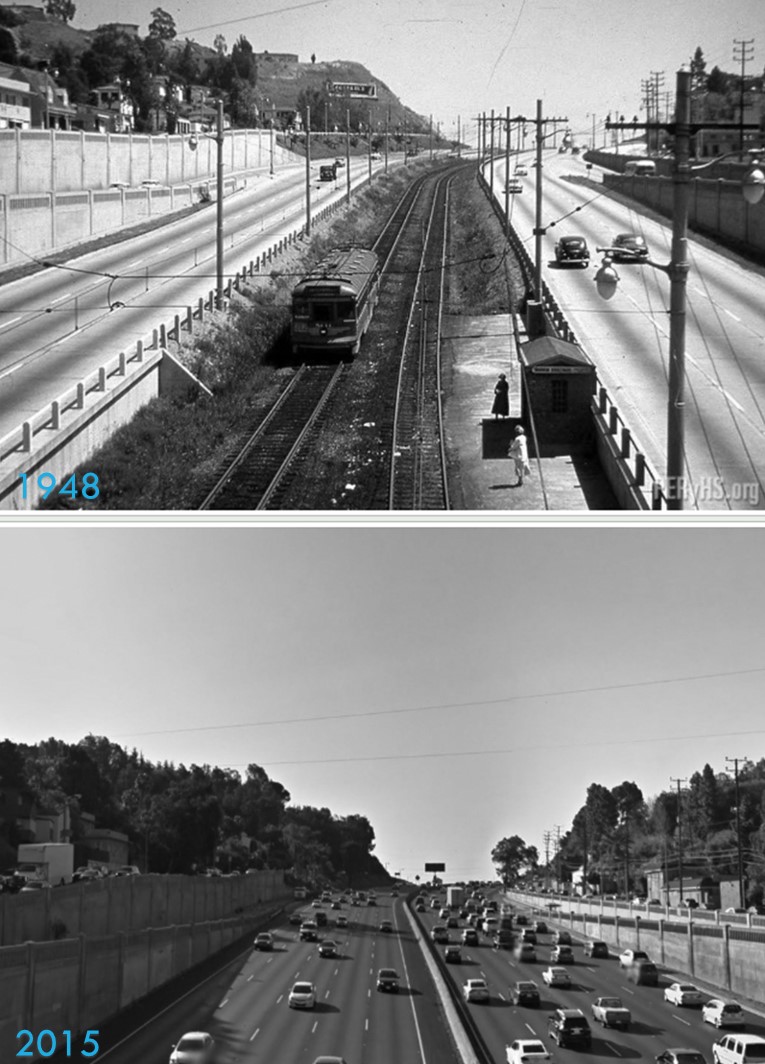 |
|
| (1948* vs. 2015)* - Then-and-now views looking southeast from the Barham Bridge in Cahuenga Pass. The comparison shows the corridor before the Hollywood Freeway extension and more than six decades later. |
Historical Notes Although the surrounding hills provide recognizable reference points, the transportation landscape through Cahuenga Pass changed substantially between these two views. The earlier photograph shows the corridor before the major freeway reconstruction and extension of the early 1950s. By 2015, the Hollywood Freeway had long been one of the principal routes between the San Fernando Valley and central Los Angeles, carrying traffic through a corridor that had served travelers long before the freeway era. |
* * * * * |
Cahuenga Pass on a Rainy Day |
Rain has always added another challenge to driving through Cahuenga Pass. The winding roadway, surrounding hills and heavy commuter traffic could make wet conditions especially noticeable along this busy route between the San Fernando Valley and Los Angeles.Southern California's long dry periods could create an additional hazard. Oil, dirt and other residue accumulated on pavement between storms, and when rain finally arrived, the mixture could make roads unusually slick. The first rain after an extended dry spell therefore required motorists to slow down and allow more room between vehicles.These two photographs, taken twelve years apart, capture morning commuters making their way through Cahuenga Pass in the rain. Together they offer a glimpse of how wet weather affected traffic during two different stages in the development of the Hollywood Freeway. |
|
|
| (1952)* - Morning rush hour traffic moves through Cahuenga Pass toward Hollywood and central Los Angeles on a rainy morning. |
Historical Notes When this photograph was taken in 1952, the freeway through Cahuenga Pass had been carrying traffic for more than a decade. The original Cahuenga Pass Parkway opened in 1940, while construction was still underway on portions of the Hollywood Freeway that would eventually provide a continuous freeway connection toward downtown Los Angeles. Rain added another challenge to the morning commute. Wet pavement reduced traction and visibility, while motorists traveling through the pass had to adjust their speed to the conditions. The photograph captures a familiar Los Angeles combination that remains recognizable today: rain, rush hour and a crowded Cahuenga Pass. |
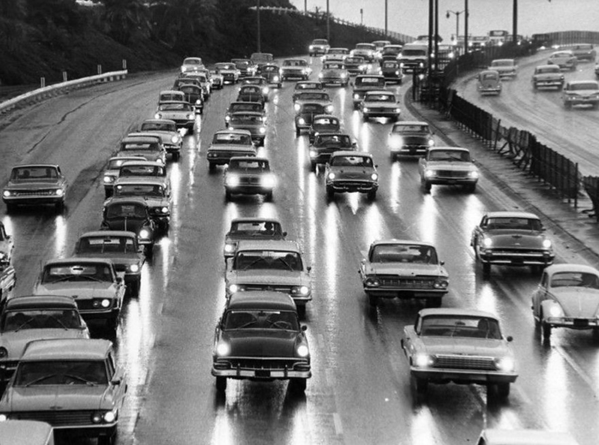 |
|
| (1964)* - Morning commuters travel bumper to bumper through Cahuenga Pass on the Hollywood Freeway during rain on November 9, 1964. The original photo caption noted that cautious work bound drivers were moving toward Los Angeles and that police reported several minor accidents. |
Historical Notes The original caption described the storm as a “long awaited rain,” an important detail in Southern California. After an extended dry period, oil, dirt and other roadway residue can accumulate on pavement. When the first rain arrives, that material mixes with the water and can make the road particularly slick. By 1964, the Hollywood Freeway had become a major commuter route between the San Fernando Valley, Hollywood and downtown Los Angeles. On this November morning, traffic through Cahuenga Pass was bumper to bumper as motorists slowed on the wet pavement, and police reported several minor accidents. Twelve years after the 1952 photograph above, rain and rush hour were again combining to slow the morning commute through the pass. |
* * * * * |
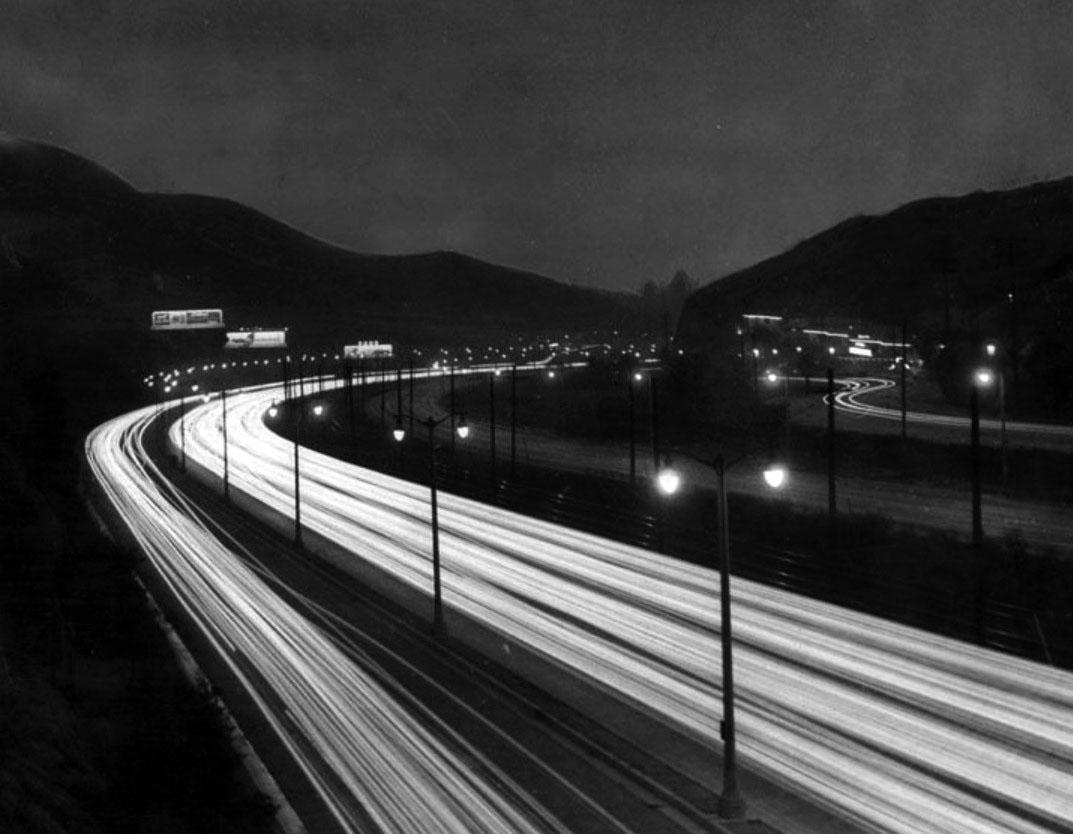 |
|
| (1950)* – A timed picture taken at night when the lights of the cars all run together into strings. Lighted billboards can be seen near the curve in throads. |
.jpg) |
|
| (ca. 1964)* - Daylight view of Cahuenga Pass showing dual-arm lamposts. A 1964 Valiant is seen at left. |
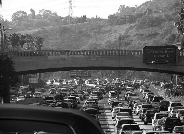 |
|
| (ca. 2005)* - Cahuenga Pass as it appears today. |
* * * * * |
Research, writing, and image curation by Jack Feldman, Water and Power Associates, with editorial assistance.
* * * * * |
More Historical Early Views
Newest Additions
Early LA Buildings and City Views
History of Water and Electricity in Los Angeles
* * * * * |
References and Credits
* LA Public Library Image Archive
^ CSUN Oviatt Library Digital Archives
*^ Wikipedia: Cahuenga Pass; Moses Sherman; John Anson Ford Theatre
#^WhitleyHeights.org: Aerial of Cahuenga; Whitley Heights Aerial
#+Facebook.com: Los Angeles Railroad Heritage Foundation
^**Huntington Digital Library Archive
^x^Facebook.com: Photos of Los Angeles
**^Noirish Los Angeles - forum.skyscraperpage.com
**#The California History Room, California State Library: William Reagh
*^^Metro Jacksonville: Cahuenga Pass
^*^KCET: L.A.'s First Freeways; When Cahuenga Pass Was Rustic
^^*Pacific Electric San Fernando Valley Line - ERHA.org
^^^California State Library Image Archive
*^#LosAngelesPast.com: Cahuenga Pass
*#^Forum Skyscraperpage.com: Cahunega and Highland Intersection
#^^KCET: When the Cahuenga Pass Was Rustic; L.A.'s First Freeways
**^#LA Times Framework: Cahuenga Pass
*^#*Calisphere: University of California Image Archive
*^*#Facebook.com: Classic Hollywood-Los Angeles-SFV
#**#Facebook.com: Garden of Allah Novels, Martin Turnbull
#^^#The Pacific Electric Railway Historical Society (PERyHS)
^#^^Facebook.com: Vintage Los Angeles
^*^#Facebook.com - Bizarre Los Angeles
< Back