Early Views of the San Fernando Valley
| Historical Photos of the San Fernando Valley |
 |
|
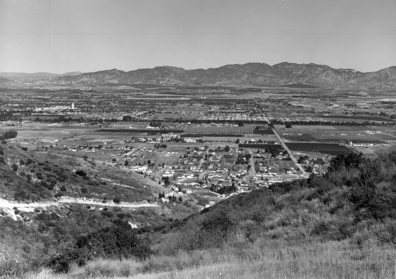
| (1939)* - Hillside view looking north showing Van Nuys and North Hollywood. Note how much land is still undeveloped. Van Nuys City Hall can be seen in the upper left of photo. Photo: USC Image Archive. |
Historical Notes In 1939, the San Fernando Valley was in a transitional phase, with areas like Van Nuys and North Hollywood leading the way in urban development. Van Nuys boasted the Valley's tallest building, its City Hall, and was developing a grid-like urban structure. |
 |
|
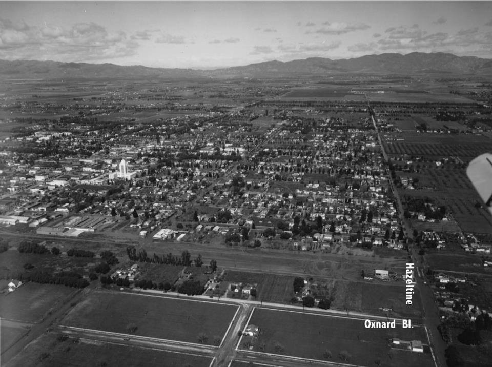
| (ca. 1940)* - Aerial view of Van Nuys looking north. The intersection of Hazeltine and Oxnard Boulevard is seen at lower right. Van Nuys City Hall, center-left, is the tallest building in the Valley. |
Historical Notes The area was becoming increasingly residential to accommodate its growing population. While much of the Valley remained agricultural, the seeds of suburban expansion were being sown, with infrastructure expanding and major boulevards being established or widened. The impending World War II would soon accelerate this development, as returning veterans would settle in the Valley in large numbers in the following years. Despite the growing urbanization, the Valley still maintained a distinct character from Los Angeles proper, with vast areas of open land and farmland coexisting with the emerging urban centers. |
 |
|
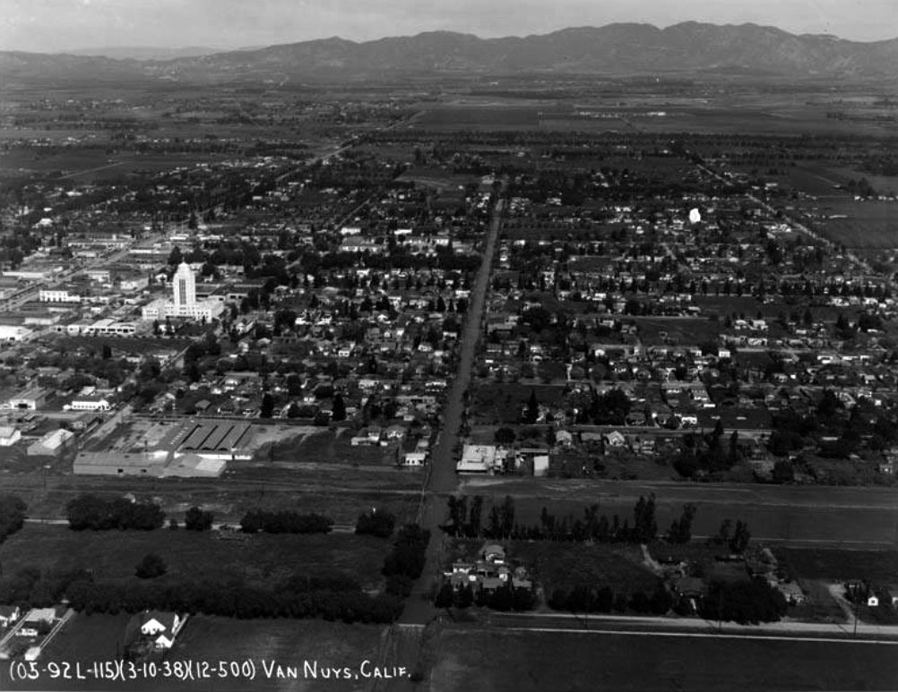
| (1938)* – Aerial view looking north on Tyrone Avenue. Van Nuys City Hall on Sylvan Street stands out at center-left of photo. |
Van Nuys City Hall
 |
|
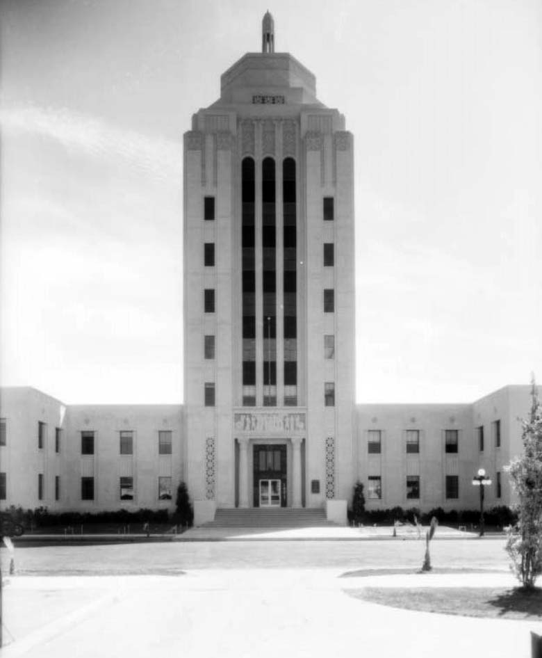
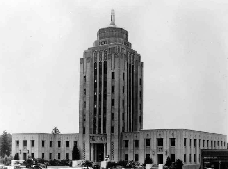
| (1933)* - Front view of Van Nuys City Hall, also known as the Valley Municipal Building, as seen from across Sylvan Street. |
Historical Notes Built in 1932 as the Valley Municipal Building and designed as a miniature of Los Angeles City Hall by architect Peter K. Schaborum, Van Nuys City Hall gained recognition as a Historic-Cultural Monument in 1978. |
.jpg) |
|
| (1933)* - View looking up toward the top of the Van Nuys City Hall. Note the bas relief details of the panel above the front entryway that appears to be supported by two Greek-style columns. |
 |
|
| (1939)* - Van Nuys City Hall (aka Valley Municipal Building), located at 14410 Sylvan Street, Van Nuys. |
Historical Notes Originally, the Valley Municipal Bulding housed a Hospital in one wing of the base and the Police Department and Municipal Court, complete with jail, in the other. With the population growth in the fifties and sixties, the hospital and police station were eventually relocated to roomier sites, and the building was remodeled to house other City offices. |
 |
|
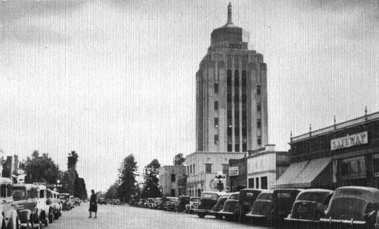
| (ca. 1940s)* - Postcard view of the Valley Municipal Building looking east on Sylvan Street. A Safeway Market can be seen in the lower right. |
 |
|
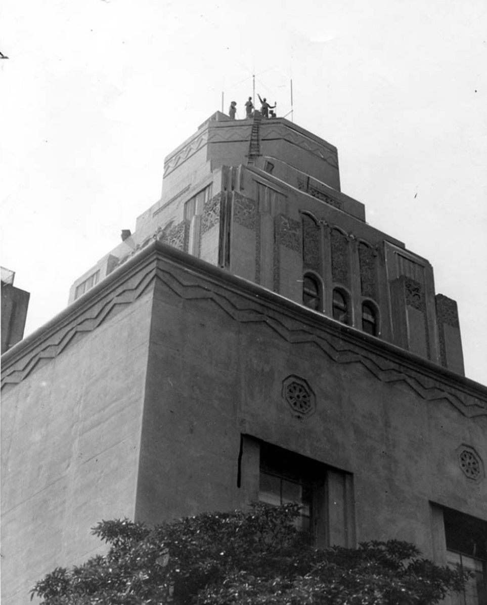
| (1947)* - Workers repairing the roof aerials on the Van Nuys City Hall, also known as the Valley Municipal Building, located at 14410 Sylvan Street, Van Nuys. |
Historical Notes On October 18, 1978, the Valley Municipal Building (Van Nuys City Hall) was declared Los Angeles Historic-Cultural Monument No. 202 (Click HERE to see complete listing). |
Victory and Whitsett
 |
|
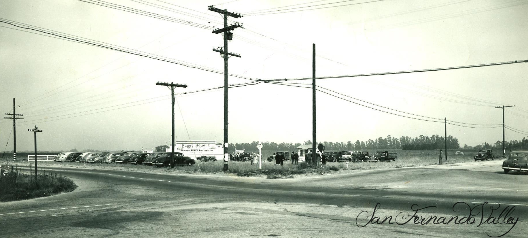
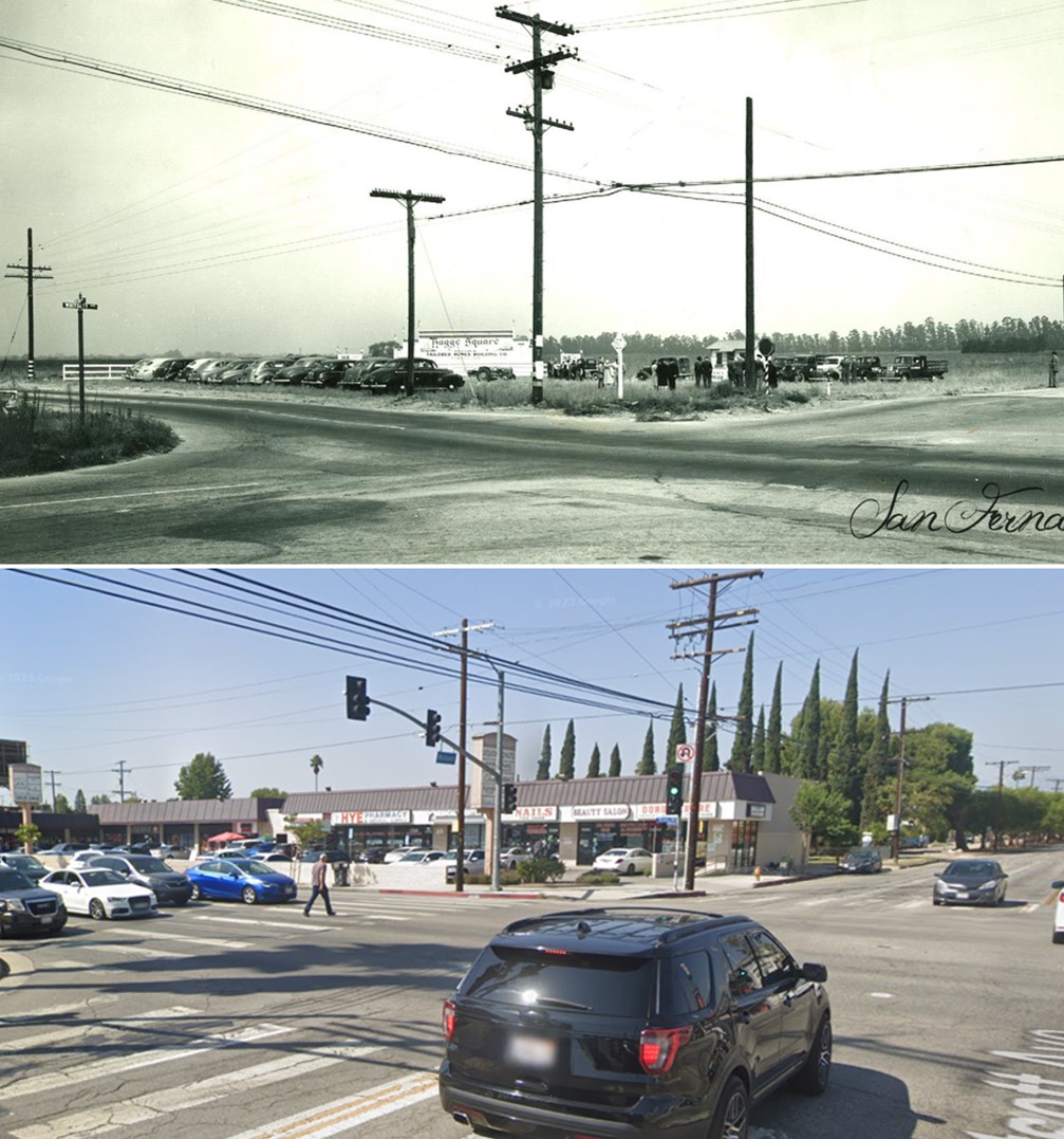
| (ca. 1944)* – View looking at the NW corner of Victory Boulevard and Whitsett Avenue. |
Historical Notes Whitsett Avenue was named after William P. Whitsett who is remembered by some as the "Father of Van Nuys." He was also a major land developer and water official in Los Angeles. The street was first known as Encino Avenue. Victory Boulevard was named in honor of the Valley's World War I veterans in 1924. The segment west of Balboa Boulevard did not open until 1955. Click HERE to see more SFV Street Name Origins. |
 |
|
| (2022)* - Looking at the NW corner of Victory Boulevard and Whitsett Avenue. |
Then and Now
 |
|
| (1944 vs 2022)* - Looking at the NW corner of Victory Boulevard and Whitsett Avenue. |
* * * * * |
 |
|
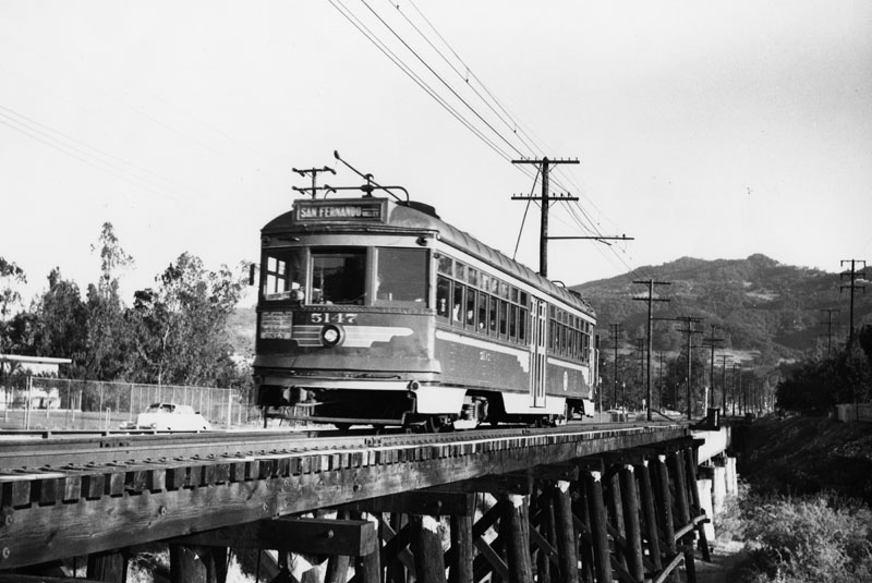
| (ca. 1940s)* - A Pacific Electric Railway car on its San Fernando Valley route circa the 1940s. |
Sepulveda and San Fernando Mission
 |
|
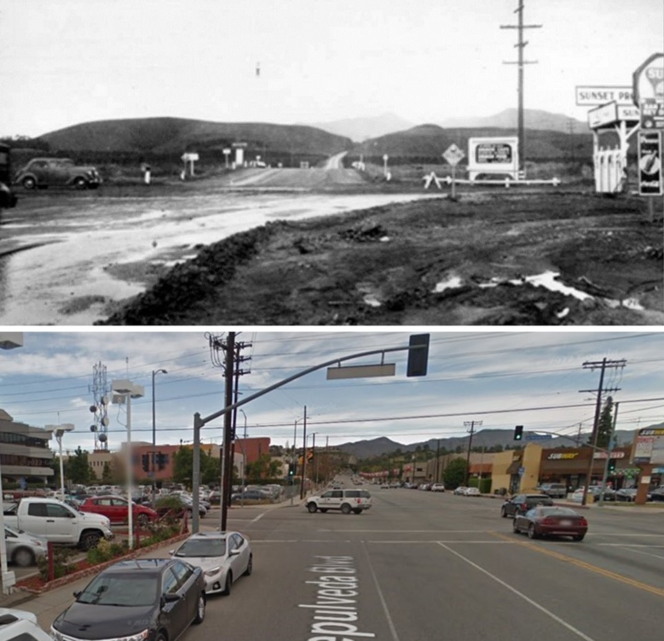
| (1941)#^*^ – View looking north on Sepulveda Boulevard at San Fernando Mission Boulevard (today Mission Hills). On the N/E corner there is a sign for the Spanish Café. It was located at 500 Mission Boulevard, San Fernando. On the S/E corner stands a gas station. Click HERE for contemporary view. |
Then and Now
 |
|
| (1941 vs 2015)* – Looking north on Sepulveda Blvd at San Fernando Mission Blvd. |
 |
|
| (1940s)^^*** – Photo of a mural currently at the North Hollywood-Universal City Chamber of Commerce, 6369 Bellingham Ave. Photo by Shel Weisbach |
Historical Notes In 1944, Bing Crosby’s recording of “San Fernando Valley” reaches No. 1 on the charts, no doubt prompting plenty of GIs to move here after the war. |
 |
|
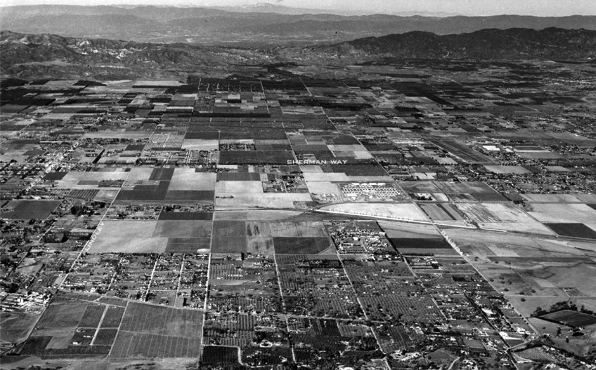
| (1946)^.^ - Aerial view, looking north, of the central part of the San Fernando Valley, including Reseda and Van Nuys. The photo has been annotated to show the major streets. Sherman Way runs horizontally across the center of the photo. |
Historical Notes When soldiers returned to California from World War II, many of them settled in the San Fernando Valley, at that time mostly farmland, where lots were affordable and pre-fab homes available. Some people literally built their own houses. |
 |
|
| (1946)* - Aerial view of the San Fernando Valley north on Sepulveda Boulevard from Sherman Way. Photo by Spence Air Photos. |
Birmingham Army Hospital (Site of today's Birmingham High School)
 |
|
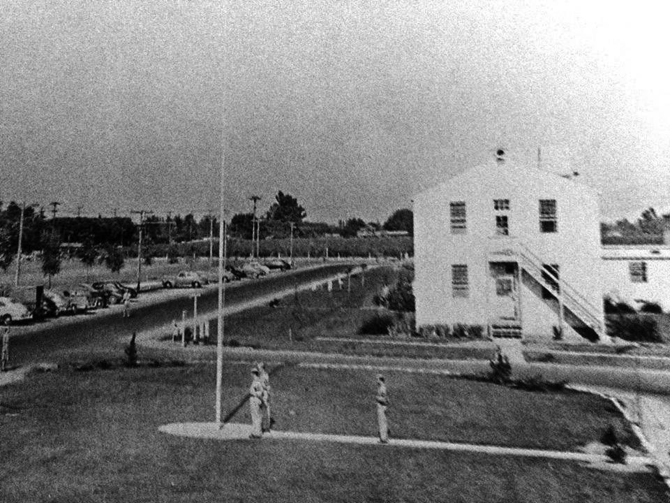
| (1945)#^*^ - Aerial view looking southwest showing the Birmingham Army Hospital. The intersection of Balboa Boulevard and Vanowen Street is in the foreground. Balboa runs diagonally from center-bottom to center-left.anowen is in the foreground. |
Historical Notes Birmingham General Hospital (later Birmingham Army Hospital) was built in Van Nuys in late 1943 and early 1944 to serve as both a general hospital and a debarkation hospital. Originally named Van Nuys General Hospital, it was soon renamed in honor of Named for Brigadier General Henry Patrick Birmingham, Medical Corps, U.S. Army. Its stucco buildings had 1777 beds, of which 800 were devoted to debarkation activities.^ |
 |
|
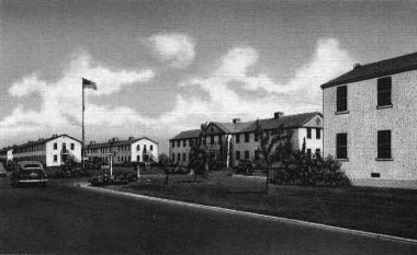
| (ca. 1945)^ – Postcard view showing the Administration Building and Nurses Quarters at the Birmingham Veterans Administration Hospital. |
Historical Notes The hospital had a small prisoner of war compound. Due to its location so close to Hollywood, many radio and movie stars visited patients at the hospital. Jack Benny even broadcasted his annual Christmas Part from the hospital in 1944. |
 |
|
| (1945)#^*^ – View showing a Birmingham Army Hospital wartime medal ceremony. |
Historical Notes In 1946 Birmingham became a VA hospital, which closed in June, 1950, just as the Korean War was about to begin. The combination Birmingham Jr High/High School opened in 1955. |
Then and Now
|
|
 |
|
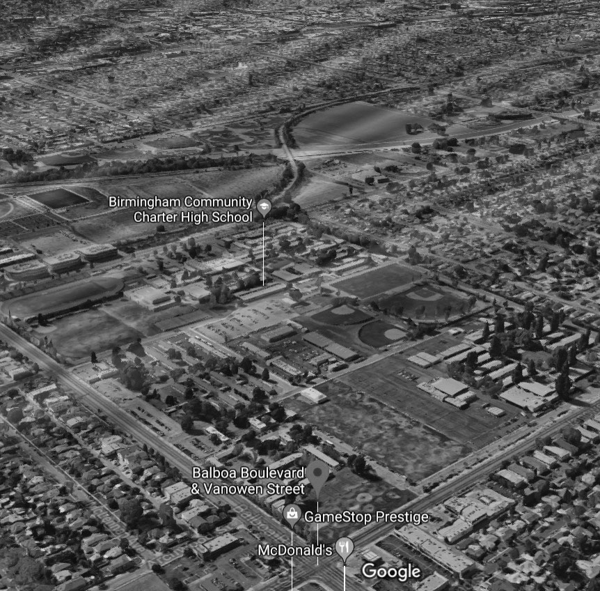
| (1945) vs. (2017)#*^# - Today, three schools sit on the former Birmingham Army Hospital site: Mulholland Middle School, Daniel Pearl Magnet High School, and Birmingham Community Charter High School. |
Historical Notes The VA closed the hospital in 1950. After 1950 the facility was converted into local use for public schools, while the army retained a piece for use in the air defense of Los Angeles. Part of the former Birmingham Army Hospital facility was used as an air defense missile battalion headquarters from 1956 to 1968.^ |
 |
|
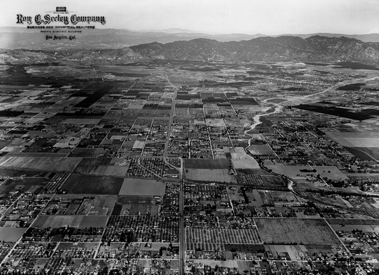
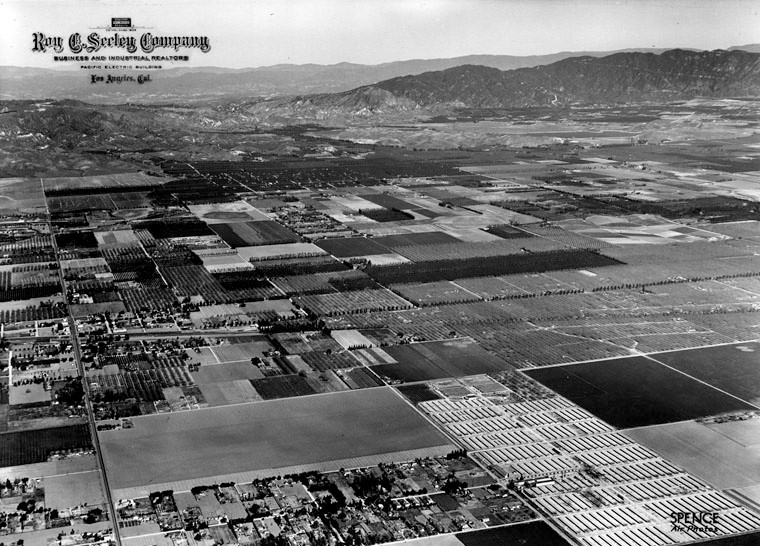
| (1946)* - Aerial view of the San Fernando Valley, north of Northridge. Photo by Spence Air Photos. |
Historical Notes Spence Air Photos was a one-man company ~ photographer, "Robert Earl Spence". He began shooting aerials in 1918. In the 1920s he had numerous clients hiring him to shoot homes and businesses. Spence would shoot images at an angle, not straight down, showing many additional building details. Spence was not a pilot, he hired an airplane pilot to fly him overhead while he leaned out from the cockpit with a bulky camera to get angled shots of the landscape. His method captured the details of the homes and their surroundings all the way to the horizon. He continued to photograph homes for 50 years. In 1971, Spence retired and donated his collection of 110,000 negatives to the University of California Geography Department. He passed away in 1974.****^ At UCLA, the Spence Collection is part of The Benjamin and Gladys Thomas Air Photo Archives. |
 |
|
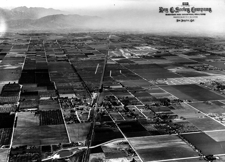
| (1946)* - Aerial view of the San Fernando Valley, east of Northridge on the S. P. coastline. Farmland predominates the horizon. |
Northridge (Originally Zelzah)
 |
|
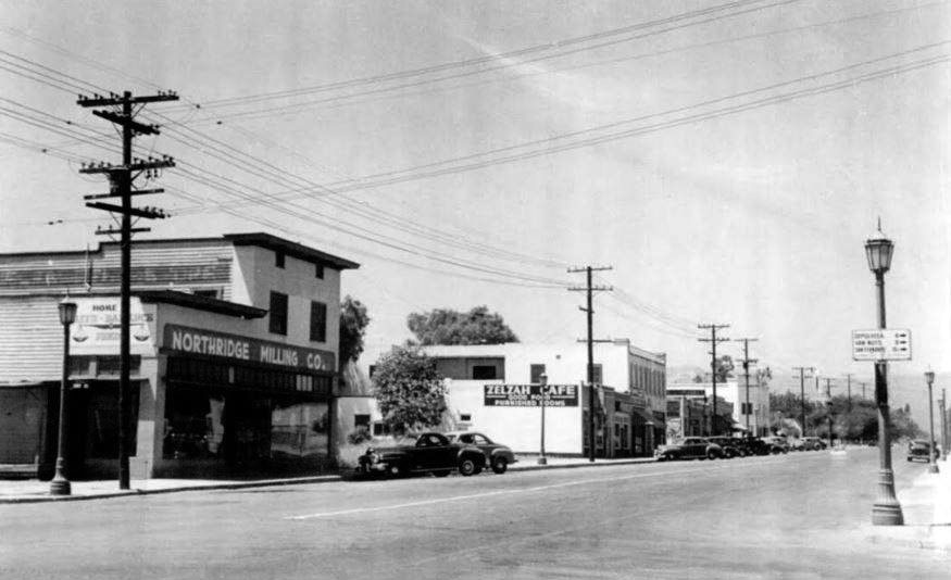
| (ca. 1940)^ – View looking north on Reseda Boulevard showing the Northridge Milling Co located at 8729 Reseda Blvd, NW Corner at Eddy St. Also seen is the Zelzah Café, which was the local hangout for many years. |
Historical Notes In the 1930’s, Northridge Milling Co was known as North Los Angeles Feed Store and located 1 block further north. It changed names alongside the name change of the town to Northridge. In early 1952, the business changed hands and was then called Brown’s. Originally called Zelzah, the town that we call Northridge today was renamed North Los Angeles on July 1, 1929. In 1938, this area of the San Fernando Valley was renamed Northridge Village. Few evidences of the "village" remain. |
.jpg) |
|
| (1940s)^ - View looking south on Reseda Boulevard from Rayen Street at Christmas time. Click HERE to see contemporary view. |
 |
|
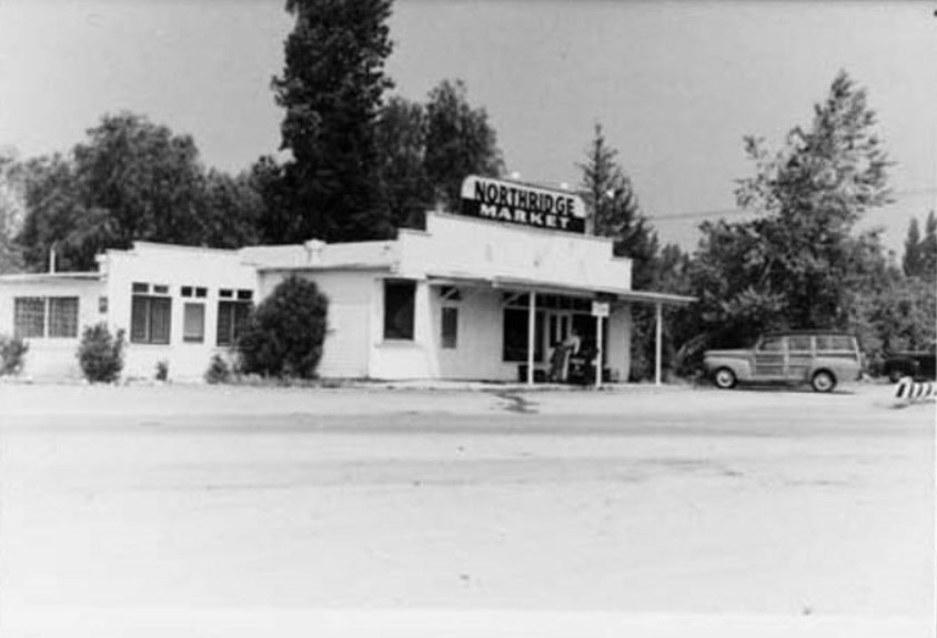
| (ca. 1940s)^ – View of Northridge Market, also known as the "Downs" market, located at Zelzah Avenue and Devonshire Street. The building was constructed in 1933. Note the "woodie" station wagon parked in front of the building. |
Historical Notes Mr. A.G. Rowlands built a market on the corner of Devonshire and Zelzah early in 1933. This grocery store has changed hands several times, but has been in continuous operation since its opening. #^#^ |
Nordhoff and Lindley
 |
|
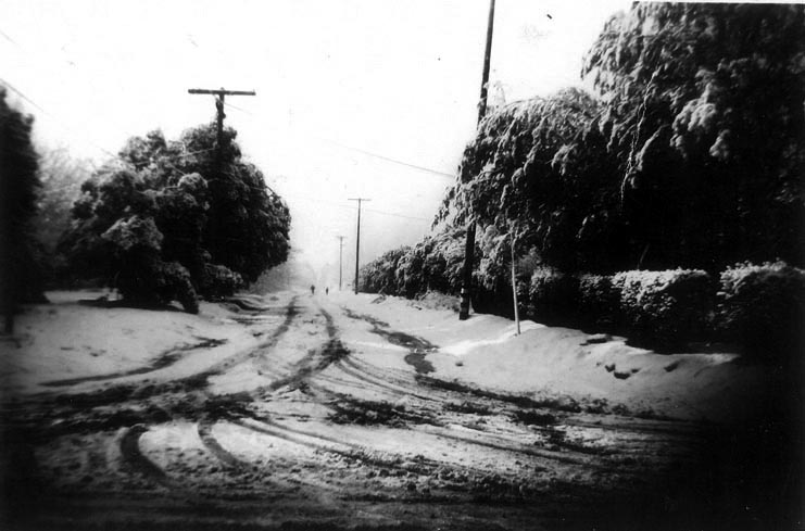
| (1949)^ - Snow blankets the San Fernando Valley in 1948. Looking south on Lindley Avenue from Nordhoff Street. |
Then and Now
 |
|
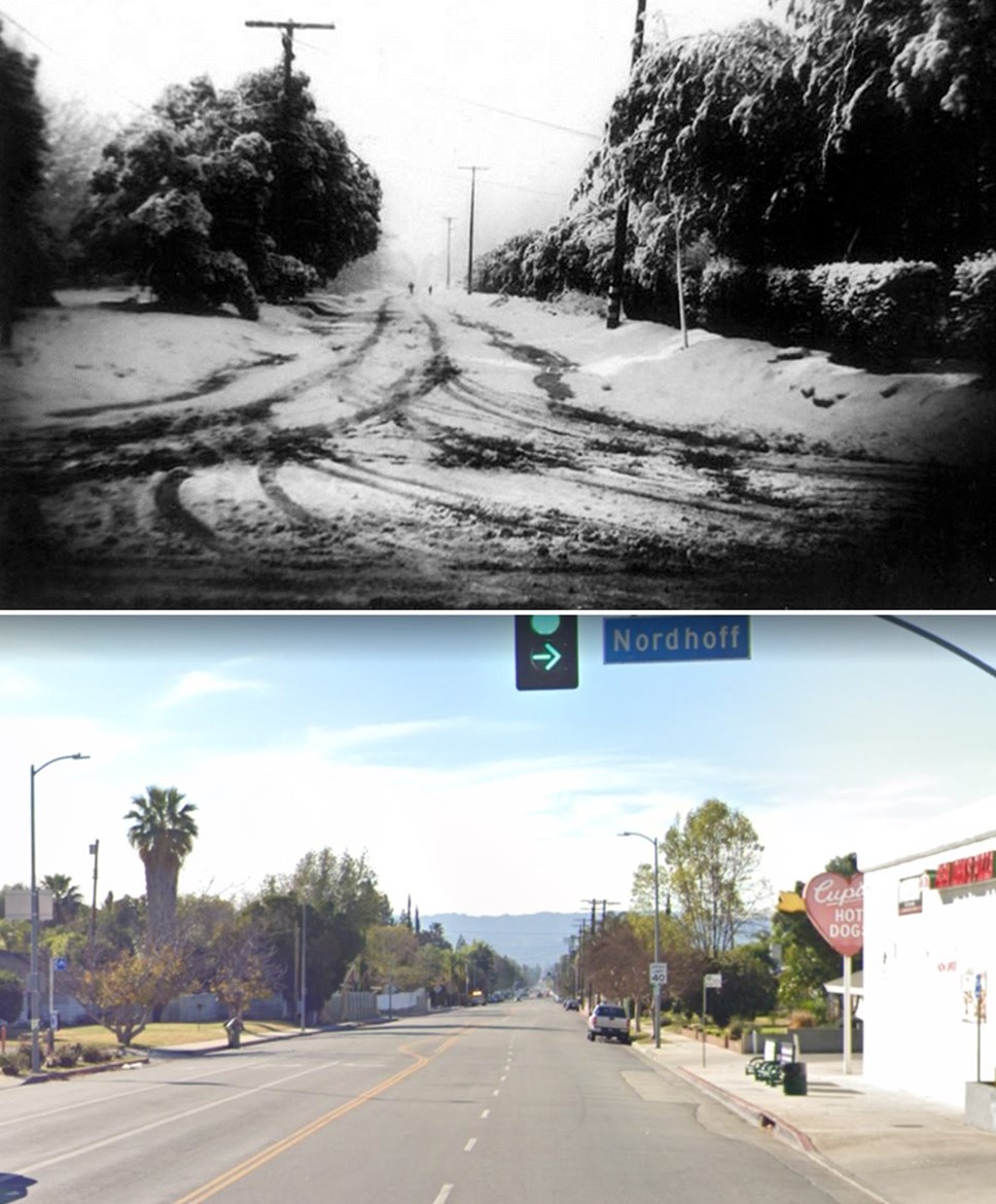
| (1949 vs. 2021)*- Looking south on Lindley Avenue at Nordhoff Street. |
Devonshire Downs
 |
|
| (1950s)^ – View looking west down Devonshire Boulevard from above Balboa Boulevard. The racetrack is Devonshire Downs. |
Historical Notes Chatsworth is a more developed street than Devonshire at this time because it was the main street of Granada Hills. Lassen is the street on the extreme left. It was a dirt road between Zelzah and Lindley. Lindley didn't go through to Devonshire until the the Police station was built in 70s or 80s. The historic cedar trees on White Oak between San Jose and Chatsworth are visible. |
 |
|
| (ca. 1946)* - View looking north showing Devonshire Downs in Northridge. The race track was located at the corner of Zelzah & Devonshire Street (now the north campus of CSUN). |
Historical Notes In 1943, Helen Dillman and Pete Spears purchased 40 acres for $80,000 with plans to construct a harness racing track, but a wartime construction moratorium temporarily put the project on hold. Weekly Sunday afternoon harness races, called matinees, began in 1946.*^ |
 |
|
| (1951)^^ – Trotting Races at the Valley Fairgrounds, on August 30, 1951. |
Historical Notes The State of California bought the property for $140,000 in 1948, at which time it also became the home of the 51st District Agricultural Association's annual San Fernando Valley Fair. *^ |
 |
|
| (1950)* - Close-up view of the Devonshire Downs grandstand with racetrack on the right. |
Historical Notes Devonshire Downs later became a venue for concerts and other events, including rodeos. |
 |
|
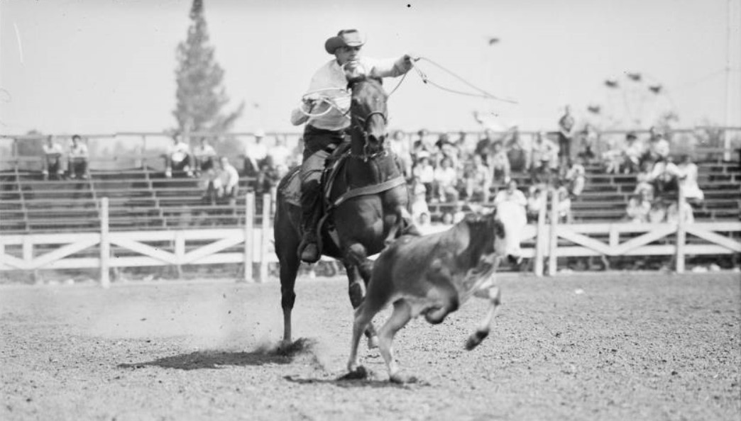
| (1951)^^ - A rodeo cowboy shows off his roping and riding talents at Devonshire Downs during the San Fernando Valley Fair. |
Historical Notes The Downs hosted annual fireworks shows and the Scoutcraft Fair, but entertained its largest crowd the weekend of June 20-22, 1969. Newport '69, which drew at least 200,000 people, was the nation's biggest outdoor rock festival until Woodstock, headlined by Jimi Hendrix, Eric Burdon, Marvin Gaye and others. In 1959 the expanding San Fernando Valley State College (now CSUN) claimed the land for expansion, but in 2001 virtually the entire site was razed for a private industrial park under lease to the school. |
Newport '69 (Devonshire Downs)
 |
||
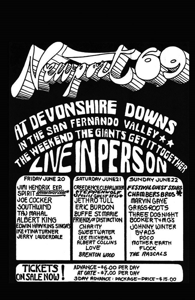
| (1969)^ - Attended by an estimated 200,000 fans on June 20–22, 1969, this festival was the largest pop concert up to that time and is considered one of the most famous Pop Festivals in Southern California, possibly because of the appearance of the top-billed Jimi Hendrix Experience. |
Historical Notes In the summer of 1969, an estimated 200,000 people—a record number at the time—dropped in to the sun-drenched Devonshire Downs racetrack in Northridge (now part of the CSUN campus) to hear a stellar list performers including Jimi Hendrix, Joe Cocker, Creedence Clearwater, The Rascals, The Byrds, Booker T. & the M.G.’s, Ike & Tina Turner, Eric Burdon, Jethro Tull, Marvin Gaye, The Grass Roots, Three Dog Night and Johnny Winter. List of Performers: Friday, June 20, 1969: Ike & Tina Turner, Albert King, Edwin Hawkins Singers, The Jimi Hendrix Experience, Joe Cocker, Southwind, Spirit and Taj Mahal. Saturday, June 21, 1969: Albert Collins, Brenton Wood, Buffy Sainte-Marie, Charity, Creedence Clearwater Revival, Eric Burdon and War, Friends of Distinction, Jethro Tull, Lee Michaels, Love, Steppenwolf and Sweetwater. Sunday, June 22, 1969: Booker T. & the M.G.'s, The Chambers Brothers, The Flock, The Grass Roots, Johnny Winter, Marvin Gaye, Mother Earth, Jimi Hendrix jam with Buddy Miles, Eric Burdon and Mother Earth, Poco, The Byrds, The Rascals and Three Dog Night.*^ |
* * * * * |
 |
|
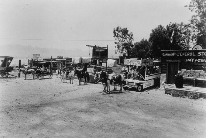
| (ca. 1940s)#^ - View of John Carpenter's Heaven on Earth Ranch. |
Historical Notes The Heaven on Earth Ranch, first located in Glendale, California (later moved to Lake View Terrace), was available for visitors to come and spend a day with the horses and enjoy the mock western town that served as the ranch's backdrop. |
* * * * * |
Van Nuys Boulevard (1940s & 1950s) |
In the 1940s and 1950s, Van Nuys Boulevard was the commercial heart of the San Fernando Valley. What had once been a quiet agricultural community centered on ranches and walnut groves evolved into a thriving postwar business district fueled by returning veterans, new housing tracts, and the explosive growth of automobile culture.Running north and south through Van Nuys, the boulevard served as both a Main Street and a transportation corridor. Pacific Electric Red Cars glided down the center tracks, linking the Valley to Hollywood and downtown Los Angeles, while widening roadways and growing traffic signaled the region’s shift toward the automobile. Neon signs, ornamental streetlights, movie theaters, drugstores, dress shops, restaurants, and professional offices lined the sidewalks, creating a lively pedestrian environment that blended small town familiarity with big city ambition.These images capture Van Nuys Boulevard at its mid century peak, when the San Fernando Valley was transforming from rural outpost to suburban powerhouse. |
 |
|
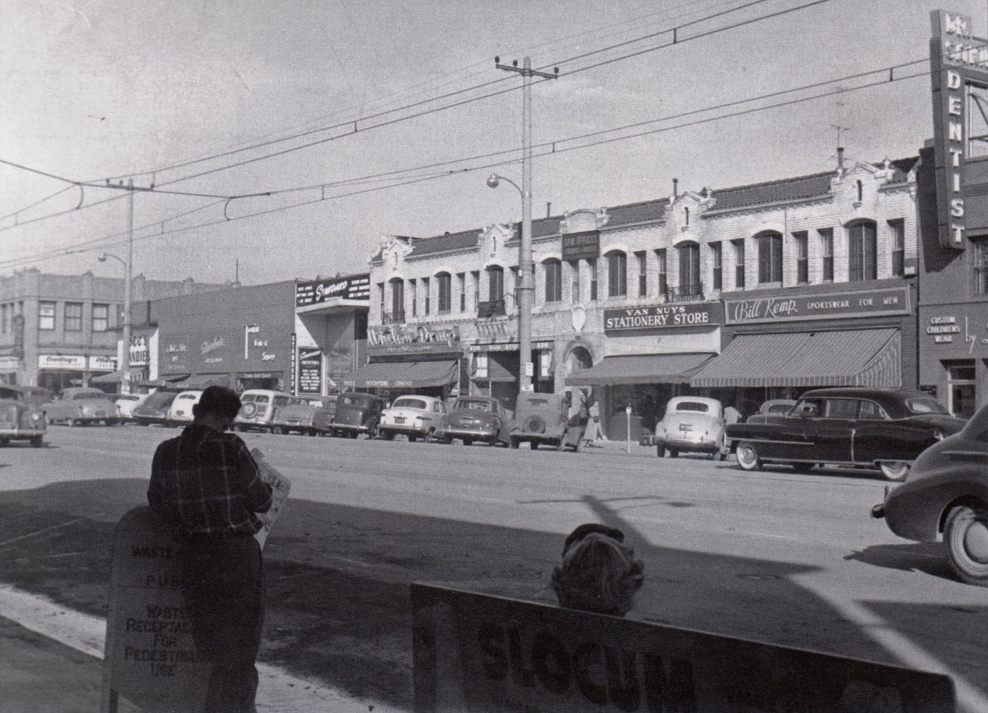
| (1952)* – View looking toward the west side of the 6400 block of Van Nuys Boulevard at Friar Street. Prominent corner businesses include Courdrey’s Drugs and See’s Candies. Along the block are Shirlee Dress Shop, Town Gift Shop, Standard Outfitters, Whelan Drugs, Dr. R. E. Elliott, Sun Store, the law offices of Corman and Hansen upstairs, Van Nuys Stationery Store (Bush’s), Bill Kemp Sportswear, and dentist Dr. Sitkin. Photo courtesy of Keith Hart. |
Historical Notes By the early 1950s, this stretch of Van Nuys Boulevard reflected the prosperity of post World War II suburban life. National brands such as See’s Candies stood beside locally owned shops, creating a commercial mix that defined the Valley’s identity. Drugstores like Courdrey’s and Whelan Drugs were more than retail outlets. They functioned as neighborhood gathering places with soda fountains and lunch counters. Small professional offices located above storefronts illustrate a traditional Main Street pattern where commerce and services shared the same block. The storefronts are straightforward in design, with wide display windows meant to attract both pedestrians and passing motorists. This was a district built for both foot traffic and the growing dominance of the automobile. |
 |
|
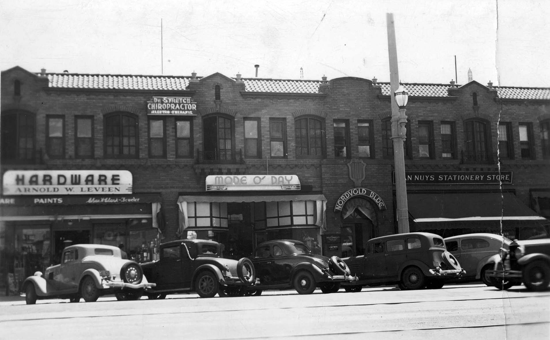
| (ca. 1940)* - Cars line the curb in front of the Nordvord Building at 6420 Van Nuys Boulevard, just north of Victory Boulevard. Businesses include Arnold W. Leveen Hardware, Dr. Stretch Chiropractor, Mode O’ Day, and the Van Nuys Stationery Store. An ornamental streetlight stands at the curb. Click HERE to see more in Early L.A. Streetlights. |
Historical Notes Constructed during the commercial expansion of the late 1930s, the Nordvord Building represents the architectural character of prewar Van Nuys. Two story brick and stucco blocks such as this housed hardware stores, clothing shops, and professional offices that supported a growing residential population. The ornamental streetlight visible in the foreground reflects the City of Los Angeles’ effort to modernize and beautify its commercial corridors. These standards, many installed during the 1920s and 1930s, gave districts like Van Nuys a civic presence and nighttime visibility. The parked cars underscore the Valley’s early embrace of automobile access, even before the freeway era reshaped regional travel. |
 |
|
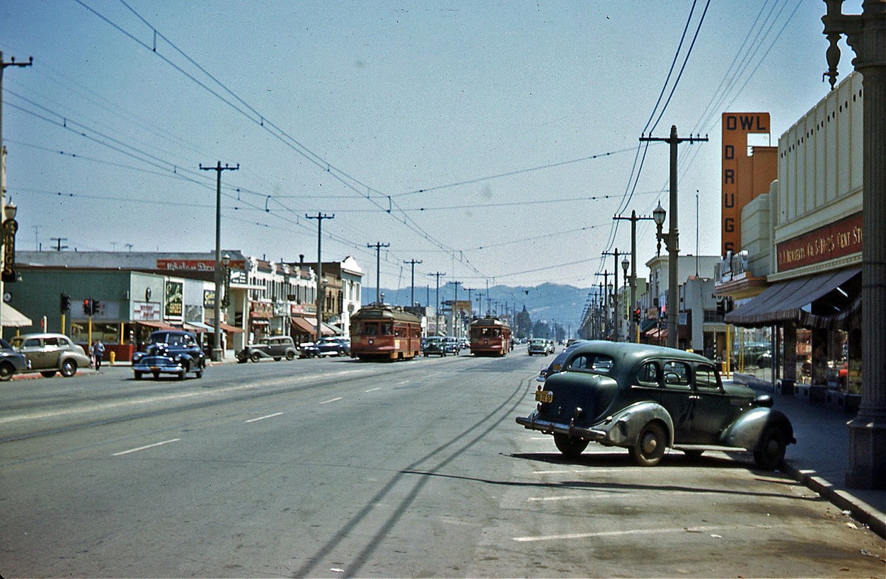
| (ca. 1945)* – Looking south on Van Nuys Boulevard toward Friar Street with Pacific Electric Red Cars operating along center tracks. Photo courtesy of Sean Ault. |
Historical Notes For decades, the backbone of Valley transportation was the Pacific Electric Railway, whose Red Cars connected Van Nuys with Hollywood and downtown Los Angeles. The line running down Van Nuys Boulevard allowed residents to commute without relying solely on automobiles. During the 1940s, the Red Cars carried wartime workers and shoppers alike. Tracks embedded in the center of the boulevard symbolized a period when rail transit and auto traffic shared the same roadway. By the mid 1950s, ridership declined rapidly as freeway construction expanded and private car ownership became the norm. The eventual removal of the tracks marked the end of an era and the beginning of the Valley’s full transition to auto dominance. |
 |
|
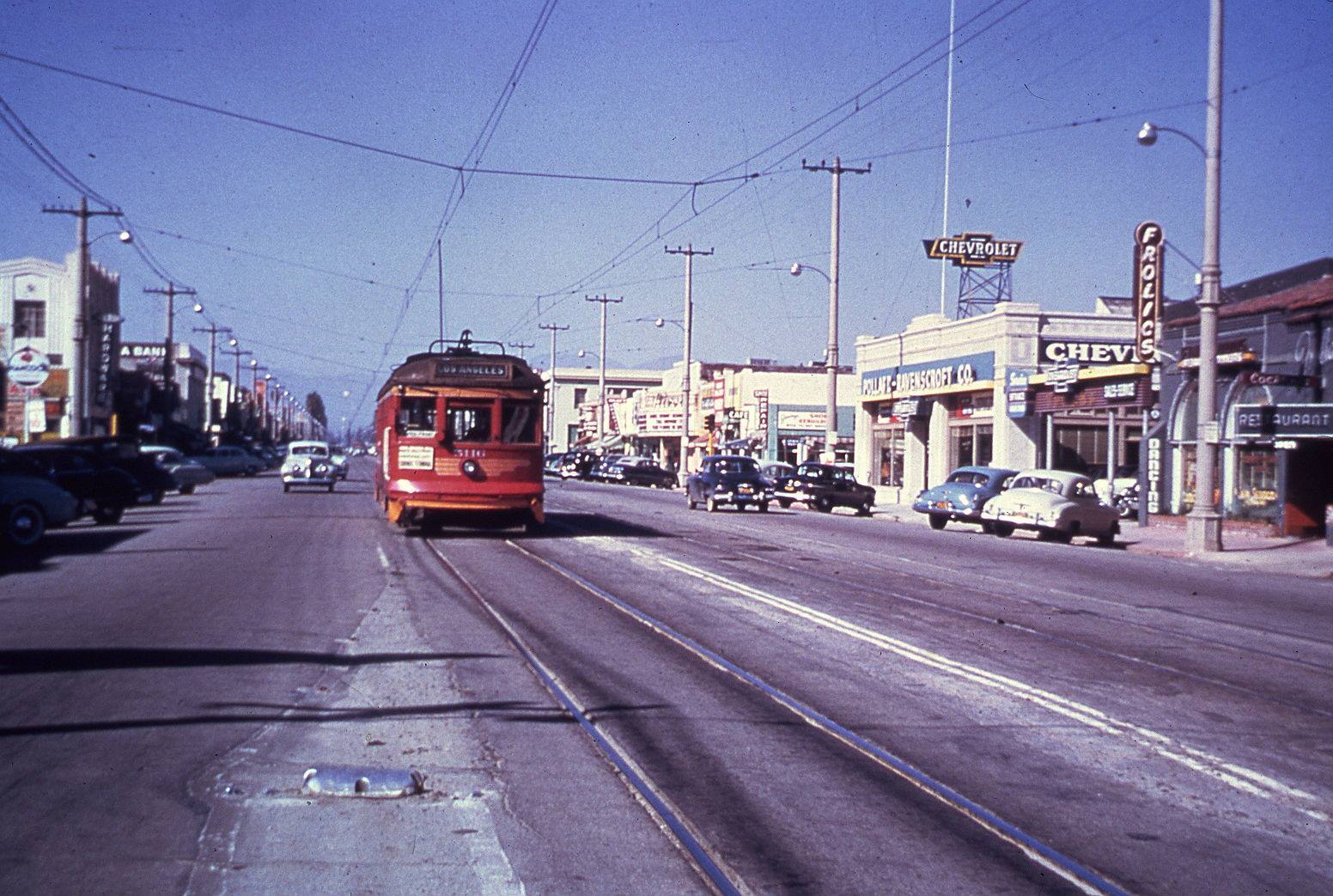
| (1950)* – Pacific Electric car no. 5110 heads south on Van Nuys Boulevard near Erwin Street. At right is Frolics Restaurant at 6216 Van Nuys Boulevard. A Chevrolet dealership stands nearby, and the Rivoli Theatre is visible in the distance. |
Historical Notes This 1950 view captures Van Nuys Boulevard at the intersection of rail and automobile culture. The Red Car shares the street with increasing traffic, while neon signage and dealership showrooms reflect the optimism of the early postwar years. Restaurants like Frolics catered to families and shoppers drawn to the boulevard’s growing retail scene. Auto dealerships, including Chevrolet, highlighted the Valley’s expanding car ownership and the rise of weekend cruising that would later define Van Nuys Boulevard in the 1960s and 1970s. The Rivoli Theatre, visible in the distance, served as a social anchor for the community. Movie palaces and neighborhood cinemas were essential components of mid century commercial districts, bringing residents downtown for evening entertainment and reinforcing the boulevard’s role as the Valley’s civic center. |
* * * * * |
Rivoli Theatre |
 |
|
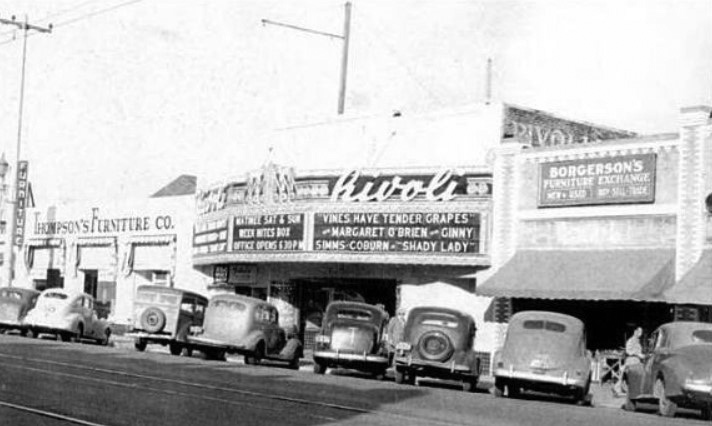
| (1945)^ – Cars parked diagonally in front of the Rivoli Theatre located at 6248 Van Nuys Bouelvard. The theater is bookended by two furniture stores. |
Historical Notes The Rivoli Theatre opened in 1921 at Sherman Way near Erwin Street. That chunk of Sherman later got renamed Van Nuys Blvd. The address is listed as 6262 Van Nuys Blvd. in the 1926 city directory, 6260 in 1928, 6258 in the 1939/40 directory with it being called the Fox Rivoli. By 1959 or 1960 the building got remodelled and emerged as the Capri Theatre. The theater closed in the early 70s and was demolished for a Federal Building parking lot. The theatre's former location is now part of the site of the Van Nuys / City of LA Braude "Constituent Service Center." The theatre was just north of Erwin which now dead ends at Van Nuys Blvd. What had been Erwin east of Van Nuys Blvd. is a pedestrian walkway between the City of LA building and the Federal Building to the south.^ |
 |
|
| (ca. 1946)* - View looking north on Van Nuys Boulevard at Erwin Street in the "Central Business District" of Van Nuys. The Rivoli Theatre can be seen on the east side of the Boulevard. |
Then and Now
 |
|
| (1946 vs 2021)* – Looking north on Van Nuys Boulevard at Erwin Street showing streetcar tracks running down the center of the street. The Rivoli Theatre can be seen in upper right, today site of the Marvin Braude San Fernando Valley Constituent Service Center. |
 |
|
| (1952)^.^ – View looking north on Van Nuys Boulevard showing flooded street and sidewalk. |
 |
|
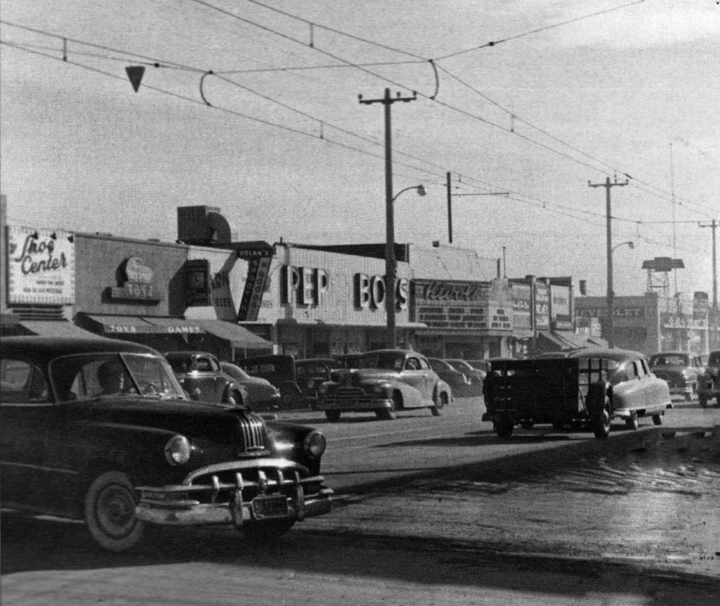
| (1952)##^ - High water, looking south on the 6200 block of Van Nuys Boulevard. Pep Boys and The Rivoli Theatre can be seen in the background. |
 |
|
| (1952)^ – View showing the 6200 block of Van Nuys Blvd, east side. From left to right are: Shoe Center, Toy Store, Stark Jewelers, Dolan’s Sporting Goods, Pep Boys, and the Rivoli Movie Theatre. |
 |
|
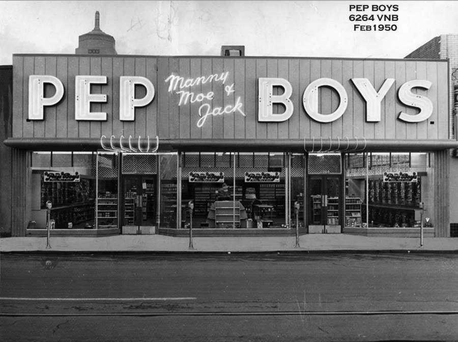
| (1950)#^*^ – View showing Pep Boys (Manny, Moe, & Jack) located at 6264 Van Nuys Boulevard. The top of Van Nuys City Hall can be seen in upper left. Photo courtesy of Rich Krugel |
 |
|
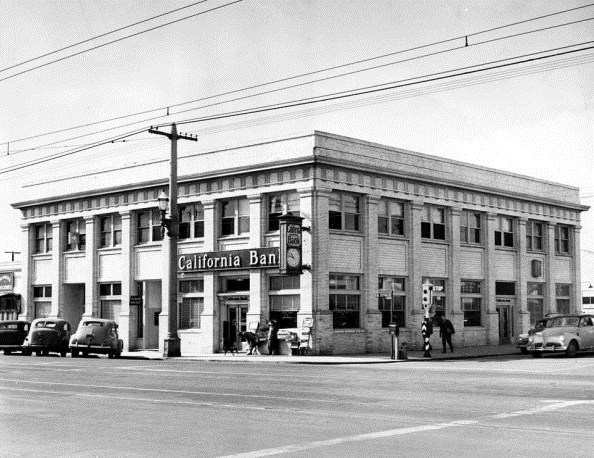
| (1949)^ - Exterior view of the California Bank on the corner of Van Nuys Boulevard and Sylvan Street, Van Nuys. |
Historical Notes The California Bank building was built in 1911 by H.J. Whitley and was originally known as the Bank of Van Nuys. The building is now the Country General Store and has been family owned since 1956.*^^^ |
 |
|
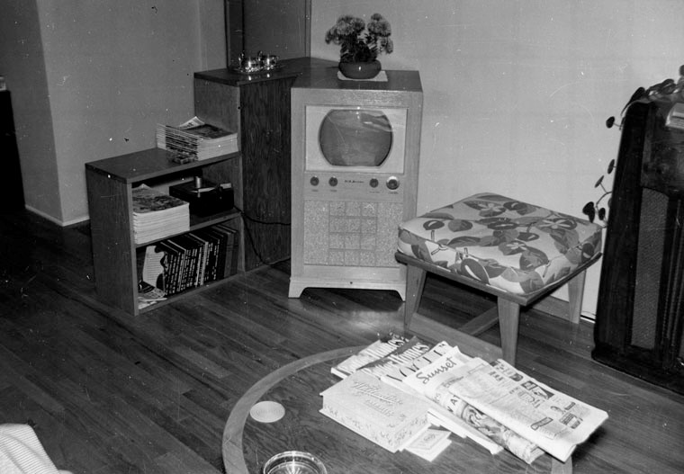
| (ca. 1947)* - Interior view of a San Fernando Valley home, showing a television set in the living room corner. Better Homes, Vogue, and Sunset magazines, along with two newspapers, are neatly stacked on the coffee table next to a box of Whitman’s Chocolates. A phonograph player is seen at left sitting on the shelf of a bookcase. |
Historical Notes Television usage in the United States skyrocketed after World War II with the lifting of the manufacturing freeze, war-related technological advances, the gradual expansion of the television networks westward, the drop in television prices caused by mass production, increased leisure time, and additional disposable income. While only 0.5% of U.S. households had a television in 1946, 55.7% had one in 1954, and 90% by 1962. By the late 1960s and early 1970s, color television had come into wide use.*^ |
 |
|
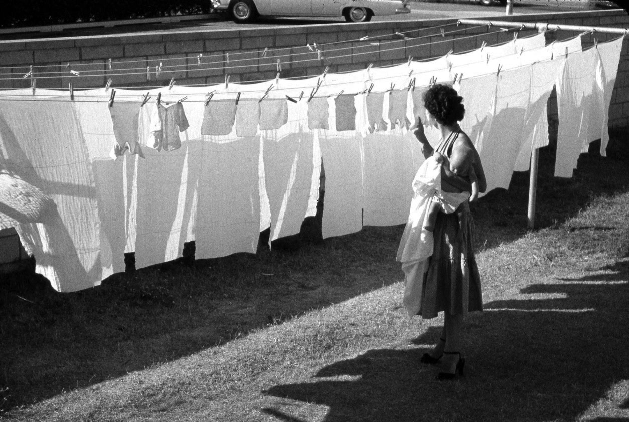
| (1956)^.^ - A woman hangs clothes on a clothesline while carrying a baby. Not often seen today. |
Historical Notes In 1955, only 10 percent of U.S. households had a clothes dryer, probably because they were expensive. Back then, the average price for a dryer was $230. Adjusted to today’s dollars, that lowly laundry appliance would have cost between $2,000 to $3,000.^ |
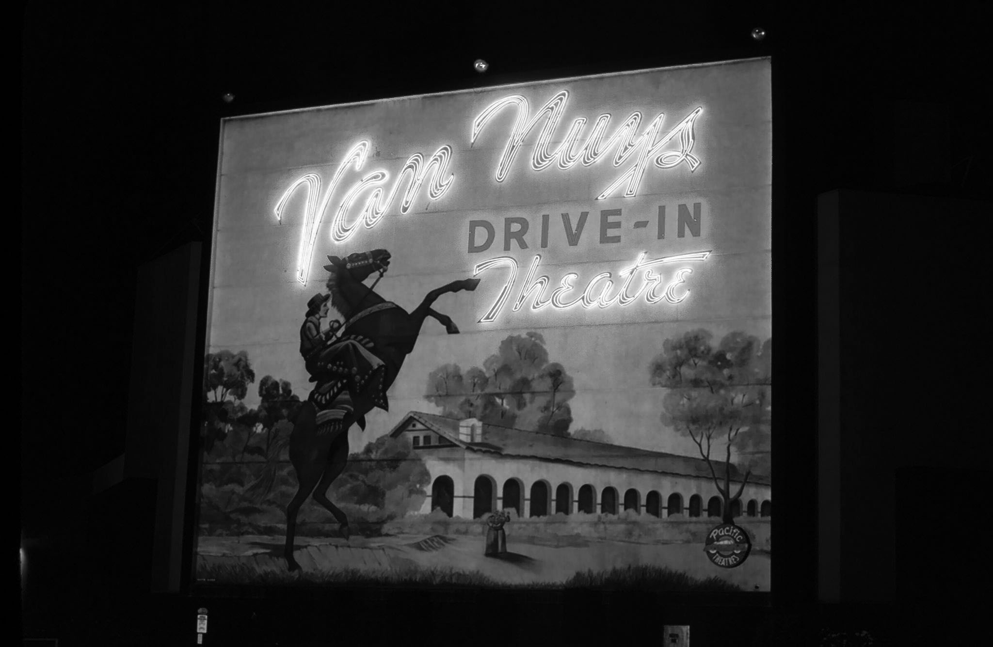
Van Nuys Drive-in Theatre
 |
|
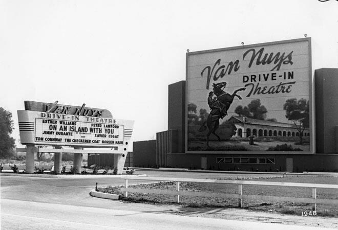
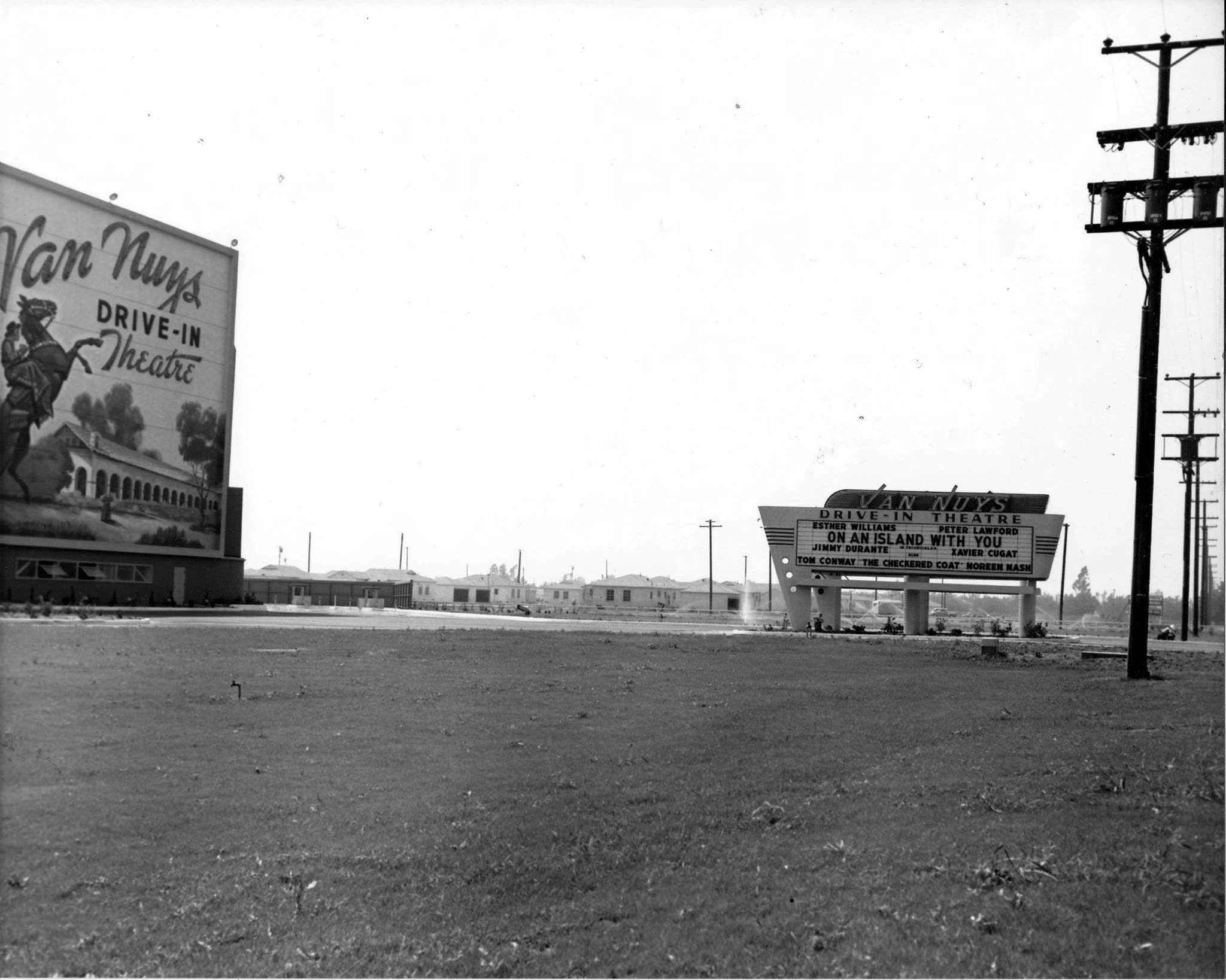
| (1948)**#^ - Outside view of the Van Nuys Drive-in Theater located at 15040 Roscoe Boulevard. The featured movie is On An Island With You, starring Esther Williams and Peter Lawford. The drive-in had swings under the screen for the children to play. |
Historical Notes The Van Nuys Drive-In was one of many Pacific drive-ins that had murals on their screen towers. The outdoor theater opened in 1948 and parked 891 cars. It lost its mural and original screen tower when it became a tri-plex drive-in.^**^ |
 |
|
| (1948)**#^ – Ground view looking southwest showing the Van Nuys Drive-in shortly after it opened. |
 |
|
| (1964)* - View looking southwest showing the Van Nuys Drive-in Theater located at 15040 Roscoe Boulevard, Van Nuys (Roscoe & Noble, where Vista Middle School is today). |
 |
|
| (1979)* - Night view of the Van Nuys Drive-in mural with it's neon lights illuminating the back of the screen. |
Historical Notes During its last year, it was the last drive-in located in the San Fernando Valley. As Pacific Theatres closed the theater, its marquee said “closed for the season”. That season never came. The Van Nuys Drive-In sat empty for a few years and was being used to store cars from a nearby dealership. It was demolished in the late-1990’s. |
* * * * * |
General Motors Plant (Panorama Dairy and Sheep Ranch)
 |
|
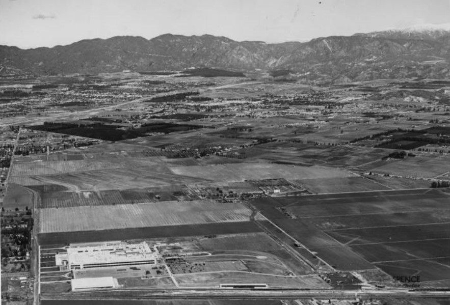
| (1949)* - Aerial view of the San Fernando Valley as it appeared in 1949. The Panorama Ranch and Chevrolet plant (foreground) can be seen before unprecedented boom which made it one of the fastest growing areas of its kind in the world at the time. |
Historical Notes Steel magnate Henry J. Kaiser had a motto: "Find a need and fill it." After World War II, Kaiser and land developer Fritz B. Burns realized returning GIs would need homes and plenty of them. Kaiser Homes bought about 400 acres of the Panorama Ranch dairy farm with plans to build 3,000 two- and three-bedroom homes. With $500 down, a veteran could purchase a two-bedroom home for $10,000. For Kaiser, whose father went blind and daughter died due to improper medical care, healthcare was a priority. Central to the plan for Panorama City was the Permanente Hospital. It was renamed Kaiser Permanente in 1953. |
 |
|
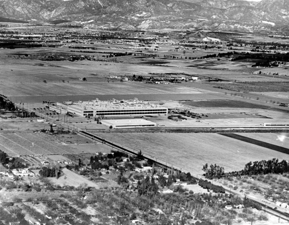
| (1948)* - Closer view of the General Motors plant in early suburban Van Nuys. Note the vast open space surrounding the assembly plant. |
Historical Notes The General Motors Assembly plant started production in 1947. It was one of the first major industrial companies to come to the San Fernando Valley and aided in its transformation from an agricultural to a suburban/industrial area. |
 |
|
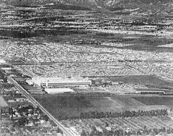
| (1953)* - Aerial view of the GM Plant and surrounding area showing the explosion of growth in only 5 years (see previous photo). |
Historical Notes The importance of industry to the Valley’s development is vividly illustrated in the last two views of the GM Assembly Division plant at Van Nuys. The top picture was taken in early 1948, less than a year after the plant began operations. Five years later, about the same time of year in 1953, as shown in the lower photo, thousands of homes had been built on acreage that was undeveloped real estate when the plant was built. |
 |
|
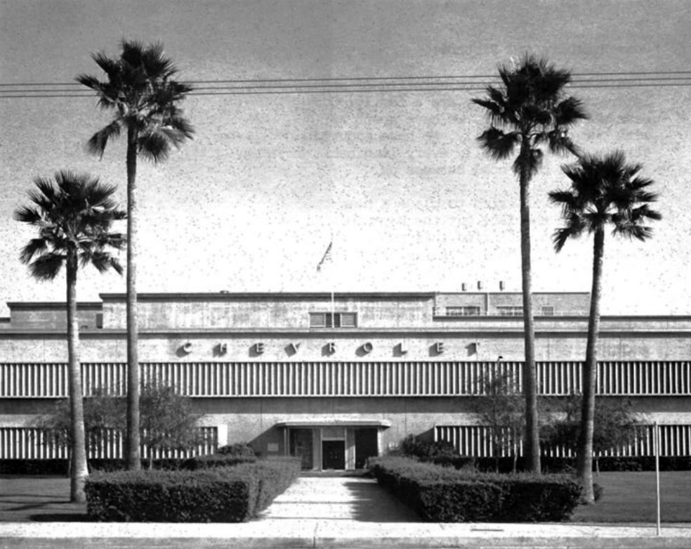
| (1947)* - Front entrance to the GM/Chevrolet Manufacturing Plant located on Van Nuys Blvd. |
Historical Notes The GM/Chevrolet Manufacturing Plant on Van Nuys Boulevard opened its doors in 1947, marking the beginning of a significant era for automotive manufacturing in the San Fernando Valley area of Los Angeles. This facility was established during the post-World War II industrial boom, reflecting the growing demand for vehicles in the rapidly expanding Southern California region. Initially, the plant's primary focus was on producing Chevrolet Advance Design trucks, which were popular in the post-war period. The opening of this facility was a major economic development for the area, creating numerous job opportunities and contributing to the local economy. The plant's establishment was part of General Motors' strategy to expand its manufacturing capabilities and meet the increasing demand for automobiles in the western United States. Its location on Van Nuys Boulevard was strategic, providing good access to transportation networks and a growing workforce in the San Fernando Valley. |
 |
|
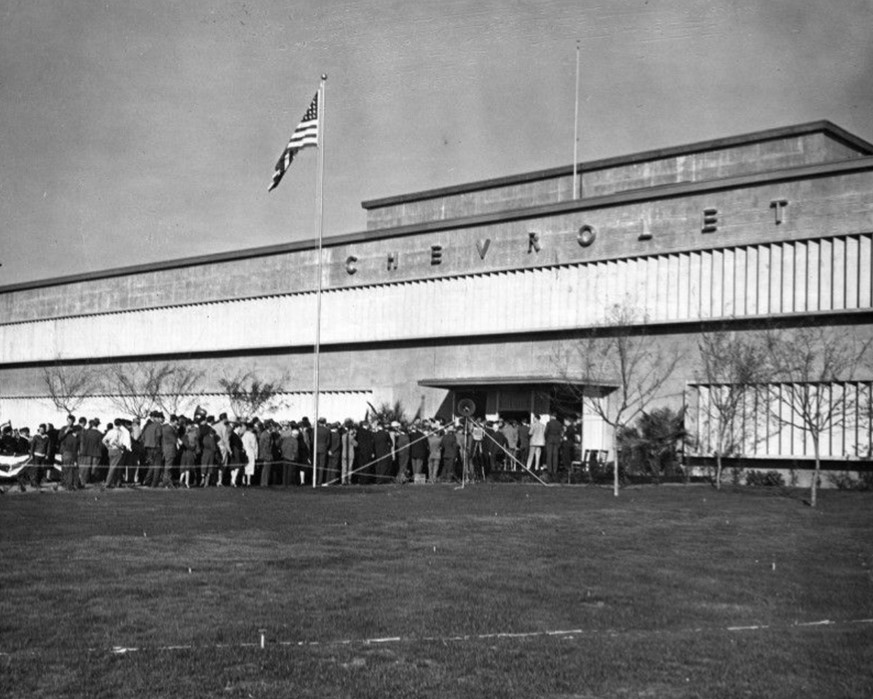
| (1948)* - Crowd in line for the public opening of General Motors' Chevrolet Motor Division assembly plant at 8000 Van Nuys Blvd. Photograph dated February 23, 1948. |
Historical Notes Over time, the plant would evolve to produce a wide range of GM vehicles, including popular models like the Chevrolet Impala, Corvair, and later the Camaro and Pontiac Firebird. The opening of this plant in 1947 set the stage for decades of automotive production that would significantly impact the local community and economy until its eventual closure in 1992. |
 |
|
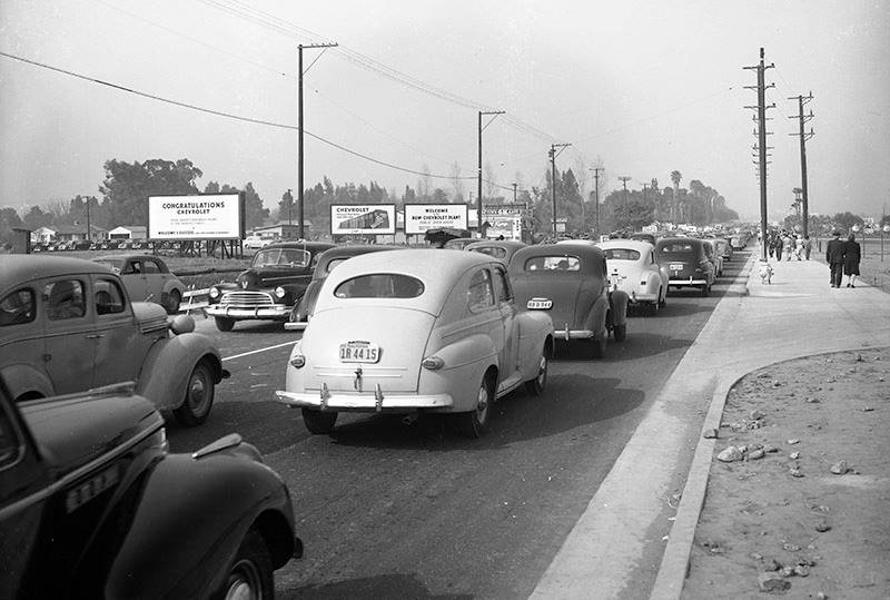
| (1948)* - View looking north on Van Nuys Boulevard near Arminta Street showing traffic at a standstill during an open house for the newly constructed GM/Chevrolet assembly plant. |
Historical Notes "The Plant" officially opened in 1947 and produced GM models such as the Chevrolet Corvair, Nova, Camaro and the Pontiac Firebird. When in full production, the plant employed 3,500 workers and helped to expand industrial, commerce and residential development. |
 |
|
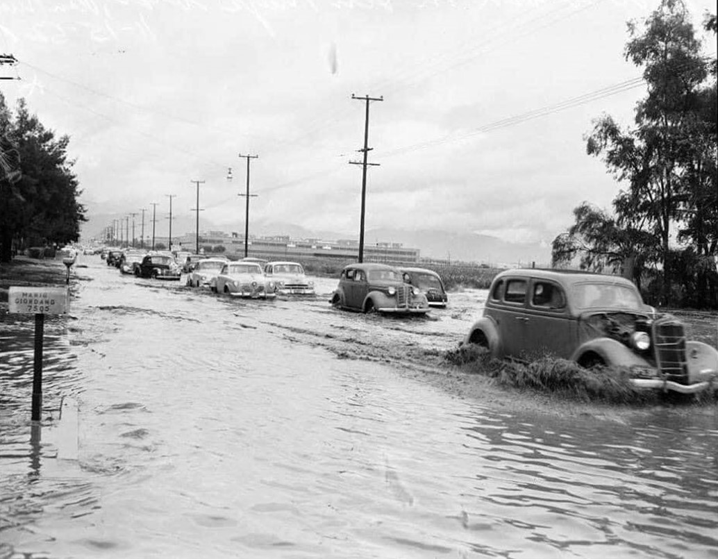
| (ca. 1949)* - Cars on a flooded Van Nuys Boulevard with the General Motors Plant seen in the background. The address on the mailbox on the left is 7505 Van Nuys Blvd. |
Historical Notes Flooding on Van Nuys Boulevard was a significant issue in the San Fernando Valley during the late 1940s and 1950s, primarily due to rapid urban development and inadequate flood control infrastructure. Click HERE to see more on Flooding in the San Fernando Valley. |
 |
|
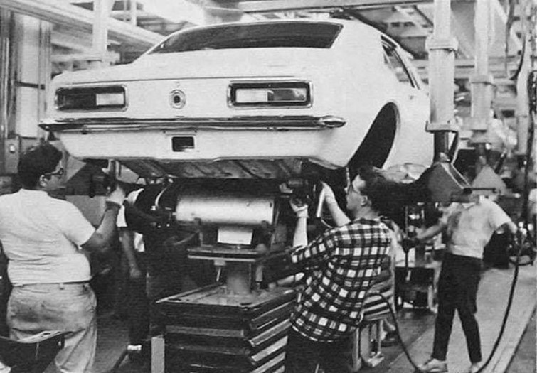
| (1960s)* – Workers at the GM plant in Van Nuys assembling what appears to be a Camaro. |
Historical Notes The GM Plant assembled Camaros and Firebirds on the same line. |
 |
|
| (ca. 1966)* - View showing the assembly line at the General Motors Plant in Van Nuys. |
Historical Notes The GM assembly plant in Van Nuys, California, which opened in 1947 and operated until 1992, was a significant automobile manufacturing facility during the 1960s. It produced several popular Chevrolet models, including the Impala, Biscayne, Corvair, Chevelle, and Nova. Known for its versatility, the plant often built multiple models on the same assembly line and was recognized for producing unique and high-performance vehicles, such as special order cars with powerful engines and limited production performance models. At its peak, the Van Nuys plant employed nearly 3,000 workers and played a vital role in the post-World War II industrial boom in Southern California. With its 68-acre facility and flexible manufacturing capabilities, the plant contributed significantly to General Motors' production network and the American automotive landscape during this iconic decade. |
 |
|
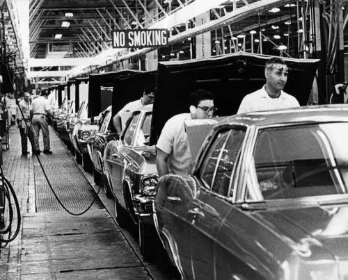
| (ca. 1960s)^ - View showing an assembly worker putting the final touches on a Chevrolet Impala at the General Motors Assembly Plant in Van Nuys. |
Historical Notes The GM Assembly Plant was closed in 1992 when Camaro/Firebird production was moved to Sainte-Thérèse Assembly in Quebec. The site was razed in 1998. A retail and industrial complex, known as The Plant, was built on the 68-acre site, as well as Station 81 of the Los Angeles Fire Department. The retail portion totals 365,000 square feet and is home to 35 retail stores and restaurants. A 16-screen movie theater honors the site history with an automotive theme décor. GM continues to operate a car-testing facility on 27 acres next to The Plant. |
* * * * * |
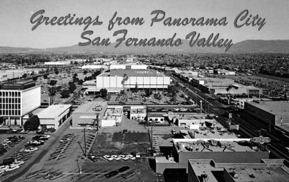
Panorama City
 |
|
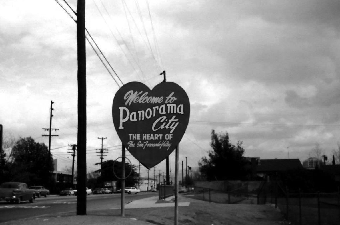
| (1960s)^.^ – Welcome to Panorama City – The Heart of the San Fernando Valley. Photo courtesy of George McGraw |
Historical Notes Panorama City is known as the San Fernando Valley's first planned community. In 1948, it was developed as such by residential developer Fritz B. Burns and industrialist Henry J. Kaiser. The master plan was created by architectural firm Wurdeman & Becket. Burns, seeing the tremendous potential fortune that could be made as large numbers of World War II veterans came home and started families, teamed up with Kaiser in 1945 to form Kaiser Community Homes. The vast majority of the houses were bought with loans issued by the FHA or the Servicemen's Readjustment Act of 1944, better known as the G.I. Bill. Homes in the area were sold with racially discriminatory covenants. A "Conditions, Covenants, Restrictions" document filed with the county recorder declared that no Panorama City lot could be "used or occupied by any person whose blood is not entirely that of the white or Caucasian race." Such restrictive covenants, which sometimes also limited ownership to people "of the Christian faith", were common in many communities at the time, and although rendered legally unenforceable by the Civil Rights Act of 1968 they may still be found on some older property deeds. De facto integration was accelerated by the Community Reinvestment Act of 1977. The CRA-insured credit was provided to the entire community without regard to race or income, causing white flight as with many other areas of the San Fernando Valley. During the period of desegregation busing, Panorama City was exempted due to its diversity. In its history, Panorama City was once adjacent to General Motors' largest assembly plant to date. Today, the Van Nuys Assembly plant has been replaced with a large shopping center named The Plant, which includes stores and restaurants such as Regency Theatres, Ross, Babies "R" Us, The Home Depot, Hometown Buffet, Blaze Pizza, In-N-Out Burger, Starbucks Coffee and others. Panorama City touches Mission Hills on the north, Arleta on the northeast, Sun Valley on the east, Valley Glen on the southeast, Van Nuys on the south and North Hills on the west. For the most part, the community is a mixture of small single-family homes and low-rise apartment buildings.*^ |
Panorama City Shopping Mall
 |
|
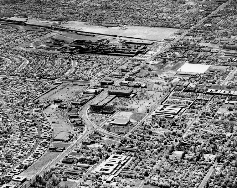
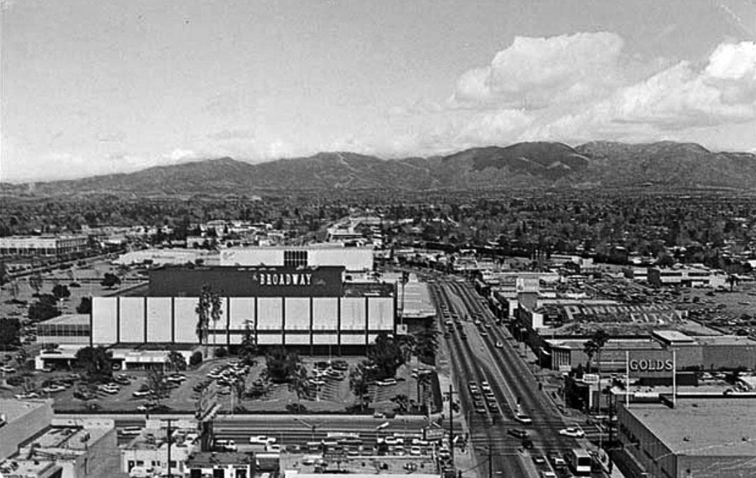
| (1960)* - Aerial view looking southeast showing the new Panorama City shopping district located near the intersection of Van Nuys and Roscoe Boulevards (center of photo). Broadway department store, framework on new Robinson's and site of new Montgomery Ward store and additional parking are indicated. The large plant in the background is the General Motors plant. |
Historical Notes During 1955-1964, the Panorama Mall featured over 100 stores including the department stores Broadway, Robinson’s, Montgomery Ward, and Orbach’s. The center was enclosed in 1980 under ownership of The Macerich Company. Broadway closed its doors in 1996 and the first Walmart Super Center opened in May 1998. This was the first Walmart in the City of Los Angeles and first multi-level Walmart in the United States. La Curacao opened in 1995 focusing on hard goods and changed their name to Curacao in 2012. The mall was purchased by Primestor Development in November 2015.^ |
 |
|
| (1960s)+## - Postcard view looking north showing the new Panorama City Shopping Mall. The intersection of Roscoe and Van Nuys bouelvards is at center-right. |
.jpg) |
|
| (1960s)* – Street view looking south on Van Nuys Boulevard toward the Broadway Department Store. Other stores seen here are: F. W. Woolworth, Kinney Shoes, and Thrifty Drug Store. |
Historical Notes The Broadway–Valley shopping center, as it was then known, opened on October 10, 1955, as a single strip of stores along Van Nuys Blvd. north of Roscoe Blvd, with 89,000 square feet of retail space adjacent to and sharing a parking lot with a 226,000-square-foot Broadway department store designed by architect Welton Becket. Silverwoods, Mandel's, Kinney Shoes, Lerner's and Woolworth were the other stores in the complex.^ |
 |
|
| (1970s)+## – Closer view of the Panorama Mall showing The Broadway Department Store at the northwest corner of Roscoe and Van Nuys. Gold's Furniture is on the southeast corner. |
Historical Notes The shopping center’s anchor department stores opened as follows: The Broadway, opened October 10, 1955, 226,000 square feet, 3 stories, currently Walmart Montgomery Ward, opened September 13, 1961, 154,537 square feet, 2 stories, closed in 2001, building currently empty J. W. Robinson's, opened on June 27, 1961 Ohrbach's, opened October 7, 1964, 115,000 square feet, 7.5-acre site, cost $5 million to build, currently the Valley Indoor Swap Meet. ^ |
 |
|
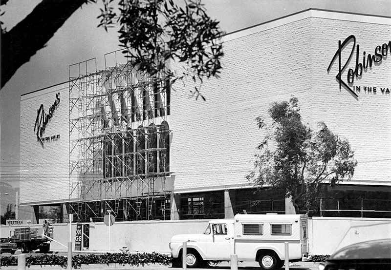
| (1961)* - View showing the nearly completed Robinson's department store in Panorama City. |
Historical Notes The new Valley Robinson’s was the fifth outlet for the company, which was founded in Los Angeles in 1883 by Joseph Winchester Robinson.* |
.jpg) |
|
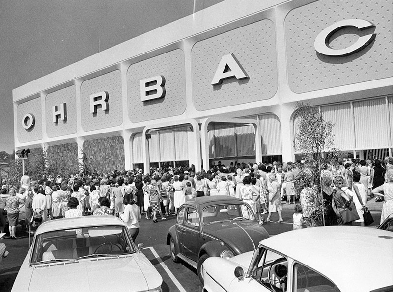
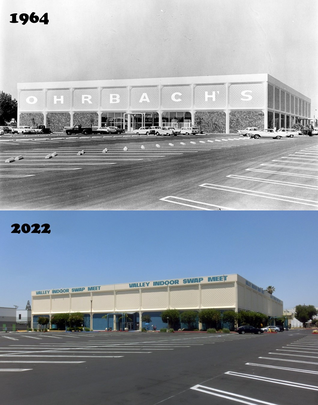
| (1964)* - Photograph caption dated October 6, 1964 reads, "New store - Sculptured three-dimensional panels of concrete emphasize the structural frame of the new Ohrbach's department store, Panorama City, which will open tomorrow." The structure is located at 14650 Parthenia Street. Photo from the Valley Times. |
Historical Notes With the opening of Orbach's department store in 1964. . . Panorama Mall was the ONLY shopping center in the Valley that had 4 major department stores: Broadway, Robinson’s, Montgomery Ward, and Orbach’s. |
 |
|
| (1964)* - Photograph caption dated October 12, 1964 reads, "Part of the large crowd that attended the opening of Ohrbach's new $5-million store in Panorama City last week. The new building on Parthenia Street between Cedros and Tobias Avenues contains 115,000 square feet and is the third Ohrbach's store in California." Photo from the Valley Times. |
Then and Now
 |
|
| (1964 vs. 2022)* - The Ohrbach’s Panorama City store closed in 1986, and the building has since served as the Valley Indoor Swap Meet. |
 |
|
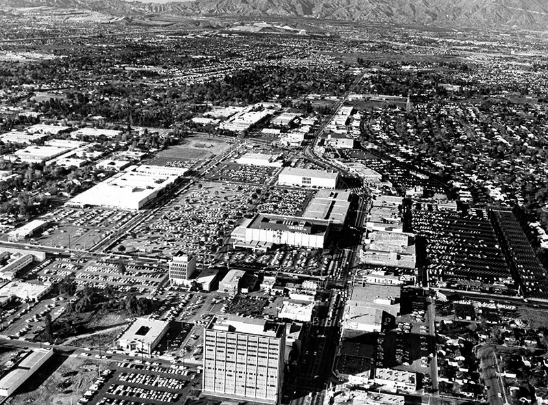
| (1965)* - Aerial view looking north down Van Nuys Boulevard showing the Panorama City shopping district. Note the number of parking lots, all mostly filled. |
Historical Notes People would come from across the Valley to do their shopping here. The Panorama shopping district had a hundred-plus shops including several major department stores such as Broadway, Robinson’s, Montgomery Ward, and Orbach’s. Perhaps not the most attractive feature of Panorama City, a testimony to the lively retail economy of the time, was 18 acres of parking lots. |
Panorama Market
 |
|
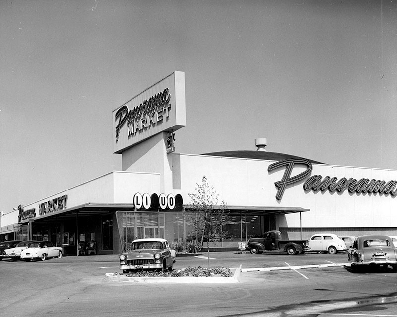
| (1954)* - View showing the construction of Panorama Market on the northwest corner of Sepulveda Boulevard and Devonshire Street. Architect: Arthur Froehlich |
Historical Notes Photo caption dated October 27, 1954 reads "Contractors are rushing to complete work on the new Panorama Market located at 10321 Sepulveda Blvd. at Devonshire Street. Company officials revealed today it will open during November. This new layout pictured above embraces 55,000 square feet of floor space and among its many features will be a free check cashing booth, free parking for hundreds of cars and unlimited one-stop shopping facilities at one of the most modern shopping centers with the latest innovations in the Southland. Ground for the project was broken last Spring. Arthur Froehlich is architect." |
 |
|
| (1957)* – View showing Panorama Market, 10321 Sepulveda Boulevard at Devonshire Street, Mission Hills. Today this is a Vons Market. Click HERE for contemporary view. |
Orcutt Ranch
 |
|
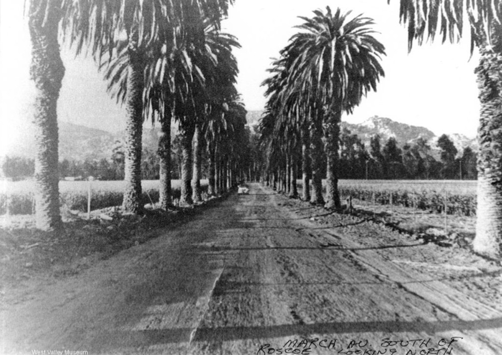
| (ca. 1948)* - March Avenue, wide dirt road lined with palm trees, looking north, with car in distance and Orcutt Ranch in background. |
Historical Notes The Orcutt Ranch, formally called Rancho Sombra del Roble, was the vacation and retirement estate of William Warren Orcutt and his wife Mary Logan Orcutt. The adobe residence, as well as the estate’s garden, ranch structures, oak trees, and citrus orchard have historic significance because of the distinction of its owner W.W. Orcutt, pioneer of the oil production industry in California and discoverer of the prehistoric fossils at the La Brea Tar Pits. In January 22, 1965, the City of Los Angeles designated a 24-acre portion of the estate as Los Angeles Historic-Cultural Monument No. 31 (Click HERE to see complete listing), which included the residence, ranch structures, garden, oaks, and citrus orchard. At that time, Mrs. Orcutt was still residing within the adobe residence. One year later, the City of Los Angeles, Department of Recreation and Parks, acquired the property, preserving the site. Click HERE to see more on Orcutt Ranch. |
Castle Peak
 |
|
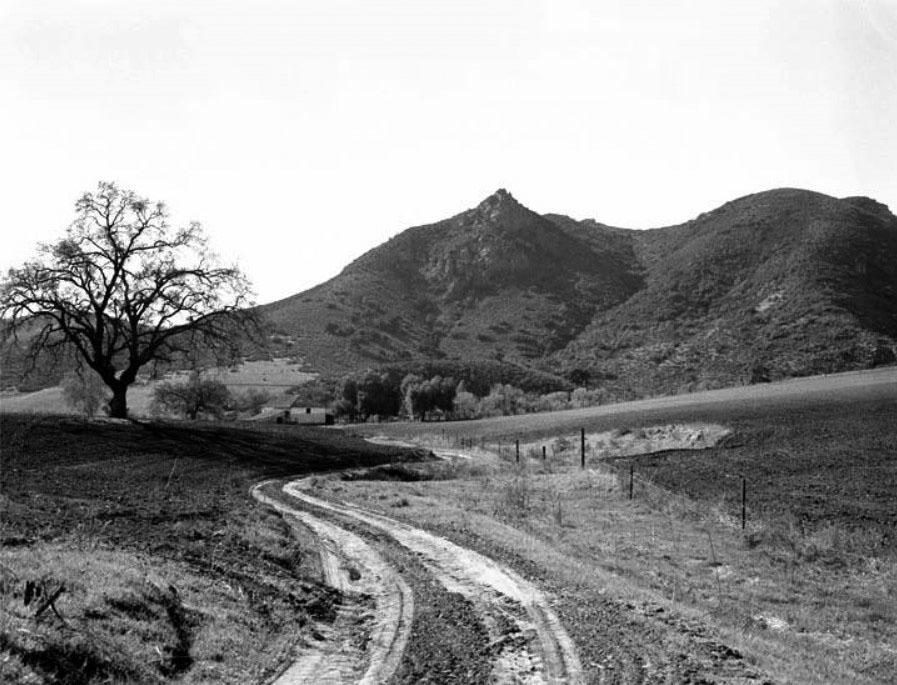
| (ca. 1940s)#^*^ - View of a dirt road winding its way toward a house or barn at the base of Castle Peak near Valley Circle. |
 |
|
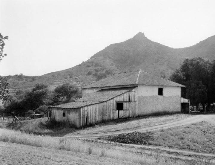
| (ca. 1947)* - View of the Leonis barn in Rancho El Escorpión as seen from Valley Circle Boulevard. Castle Peak is seen in the background. |
Historical Notes Rancho El Escorpión was a 1,110-acre Mexican land grant given in 1845 by Governor Pío Pico to three Chumash Native Americans - Odón Eusebia, Urbano, and Mañuel. In 1871, Miguel Leonis, of the historic Leonis Adobe in Calabasas, acquired Rancho El Escorpión. He used the land for cattle and sheep herds. Leonis took control of the rancho and added land by bullying, litigating, or buying up homesteaders. Though illiterate and only speaking Basque, he was often in court, with over thirty property disputes recorded. He hired Mexican and Malibu Chumash gunmen to expand his lands by threatening homesteaders and squatters. In 1850 Miguel Leonis, took Espiritu, the daughter of a Chumash chief Odón Eusebia , as his wife and moved to the base of Castle Peak. When Leonis died, he left only a small portion of his estate to Espiritu, who retained lawyer Horace Bell to acquire the whole of the estate. As payment for legal services rendered, Espiritu gave Bell some of the land. Bell's son Charles, also a lawyer and Calabasas Justice of the Peace in 1906, later built his home there. The community of Bell Canyon derives its name from Charles. |
Then and Now
 |
|
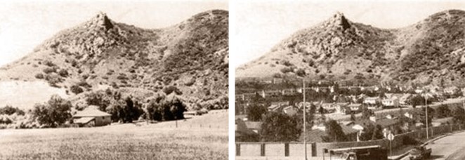
| (1947 vs 1992)* |
Historical Notes The Leonis barn was demolished by developers in the 1960's and the entire little valley filled in. In the late 1960s, the land, then a 1,700-acre cattle ranch, was purchased by Spruce Land and Boise Cascade, subdivided and named Woodland Hills Country Estates. One year later, the new subdivision of Bell Canyon went on the market and almost all of the 700 lots sold during the first weekend.*##* The remaining land, encompassing parts of present day West Hills and Woodland HIlls, was also quickly developed. |
Woodland Hills
 |
|
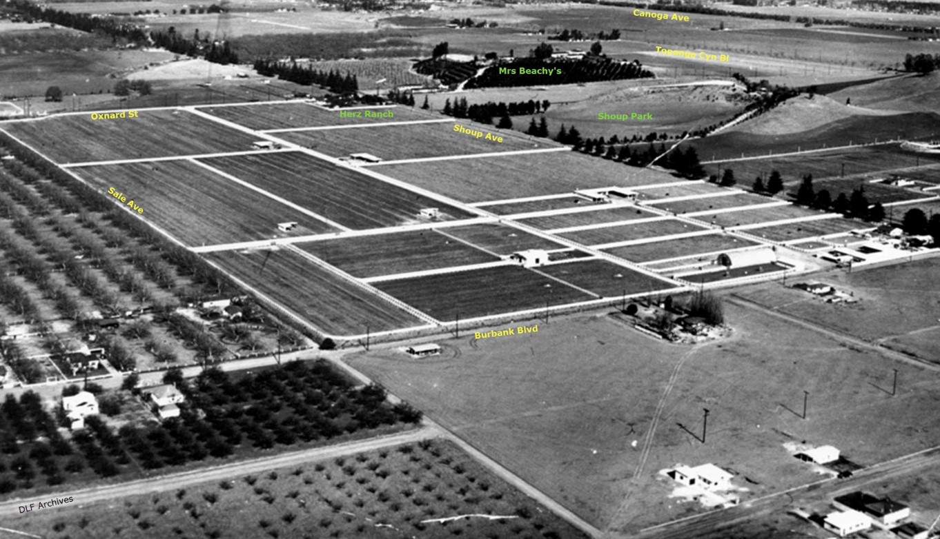
| (1949)#^ - Aerial view of Woodland Hills in 1949. The main street running perpendicular across the center is Shoup Avenue. In the center of the hills, covered with orange groves, is Mrs. Beachy's house. The bare trees to the right of her house is Topanga Canyon Boulevard. Beyond that are pepper trees along Canoga Avenue. |
 |
|
| (1949)#^*^ - Aerial view of Woodland Hills. Same as previous photo but annotated to show street names and landmarks. The upper center of the picture is the intersection of Oxnard and Shoup. Note the pepper trees along Canoga and the pine trees along Shoup. Mrs Beachy's (of Calabasas fame) house on the hill covered witih citrus, now The Summit; and the barren hill now Shoup Park. Annotated by Dean Fields |
Los Angeles River
 |
|
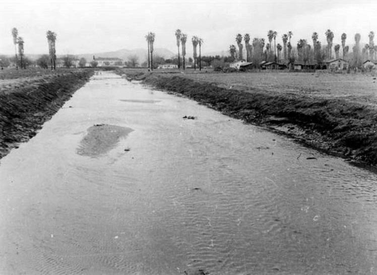
| (1943)#^ - L.A. River looking west from Canoga Ave. Bridge, January 24, 1943. There is a car barely visible upstream that had fallen in the river. |
 |
|
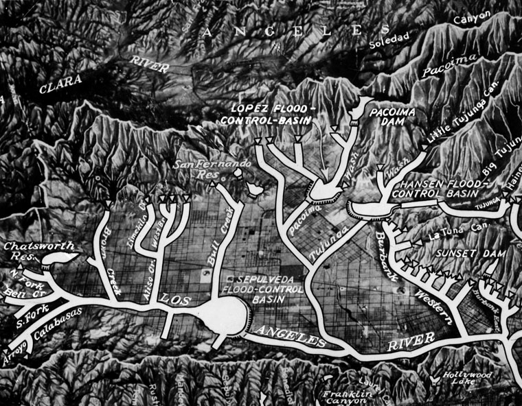
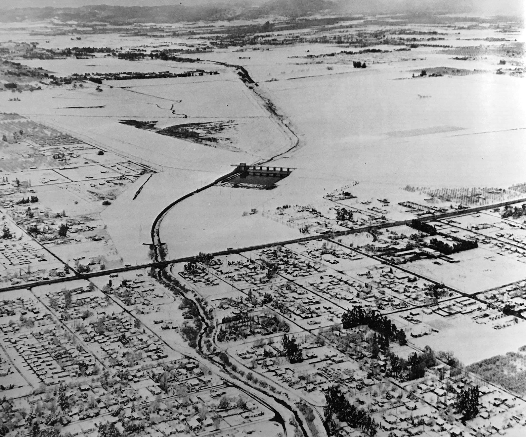
| (1949)* - Caption Reads: Compiled by the Corps of Engineers, U.S. Army, this map shows the network of channels and flood basins which will eventually control the rampages of Valley waterways. Many of the projects have already been completed or are now underway. |
Historical Notes Between February 27th and March 3rd, 1938 Los Angeles was inundated with two storm systems delivering record breaking rainfalls. By March 3rd, the San Gabriel Mountains received 32 inches of rain, more than their average yearly total, and Los Angeles received over 10 inches of rainfall over the 5-day storm. 115 people lost their lives, thousands more were evacuated, over 6000 homes were damaged or destroyed, and 108,000 acres - one third of Los Angeles - was flooded. The San Fernando Valley, Venice, Compton, and Long Beach were the worst hit. The Los Angeles River was completely warped - new inlets were carved by the rushing water and the channels in areas shifted, nearly as much as a mile. Total channelization of the river began a few months later. With funding from the Works Progress Administration and the federal government as a result of the Flood Control Act, contractors and construction crews worked around the clock under the supervision of the U.S. Army Corps of Engineers, lowering and widening the channel and cementing the banks and river bottom. By the end, 20 years later, contractors had moved "twenty million cubic yards of earth (roughly 800,000 dump truck loads worth).* |
Sepulveda Dam
 |
|
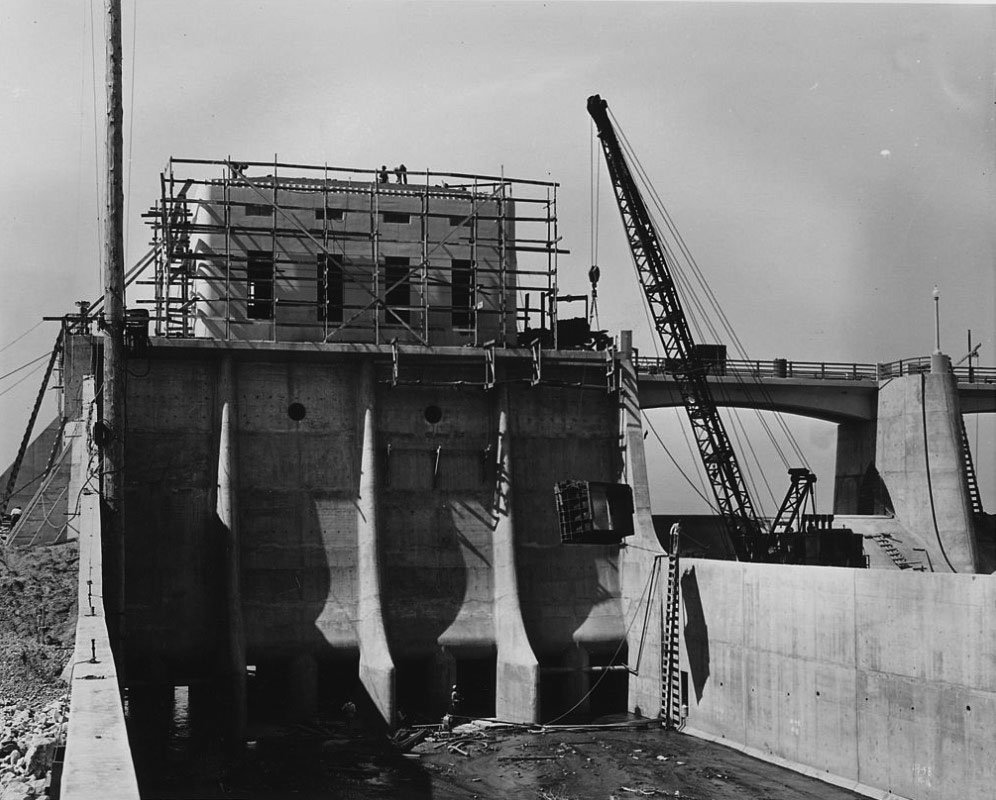
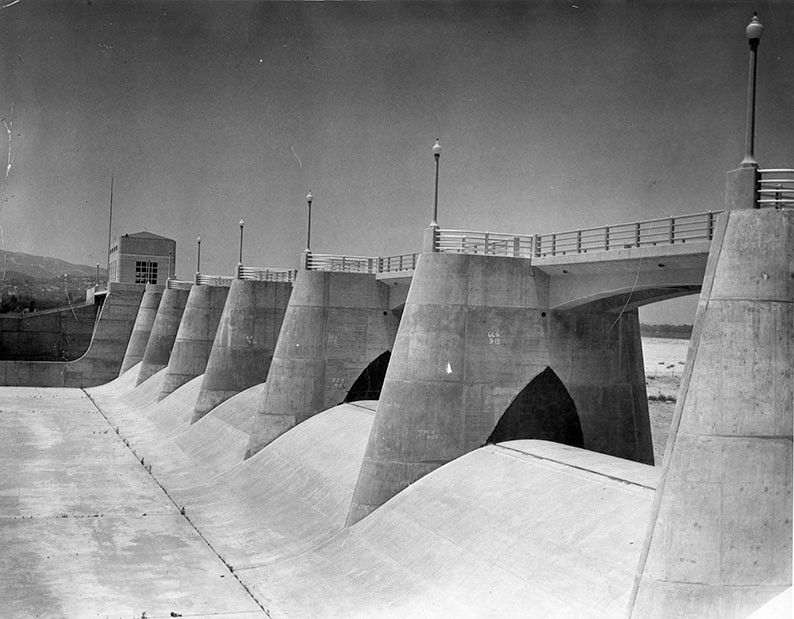
| (1941)*^ – Sepulveda Dam in the latter stages of construction, showing the outlet channel, control tower, and service bridge. |
Historical Notes After the great flood of 1938, the Army Corps of Engineers took the lead role in channelizing the river and constructing several dams which would create flood control basins behind them. Channelization began in 1938, and by 1960, the project was completed to form the present fifty-one mile engineered waterway. Included in this work were Hansen Dam, completed in 1940 and followed by Sepulveda Dam in 1941.*^ |
 |
|
| (1948)* – View of the Sepulveda Dam located in the south-central part of the San Fernando Valley. The control tower can be seen in the background. |
Historical Notes For 28 years the Sepulveda Dam did its job without incident until 1969 when the Los Angeles River overflowed its banks causing millions of dollars in damage. In 1988 the Los Angeles River's banks were raised to avoid another incident. In 1994 a hundred-year flood occurred in the Los Angeles River. The dam was restored and went without incident for another 11 years until the Los Angeles River again overflowed its banks in 2005.*^ |
 |
|
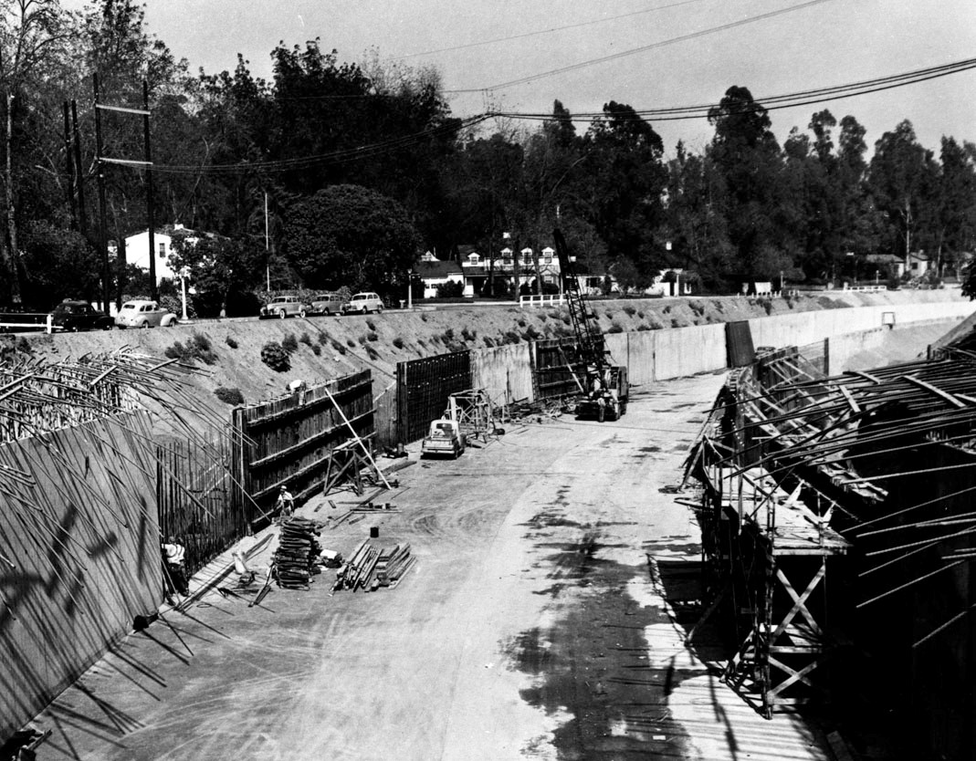
| (1949)* - View showing the construction of the channel walls in the Los Angeles River at Laurel Canyon. |
Historical Notes Since 1938, 278 miles of river and tributaries were retrofitted and more than 300 bridges were built. With the river encased in cement, the natural sharp turns were now straightened. Any evidence of vegetation was completely removed, allowing runoff from the San Gabriel Mountains to escape through the river and out of Long Beach at up to 45 miles-per-hour. Streets and sewers were connected to drains along the river, designed to quickly capture and move rainfall away from the surrounding streets.**^^ |
Ventura Boulevard (Sherman Oaks)
 |
|
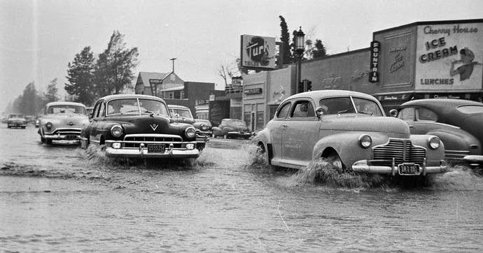
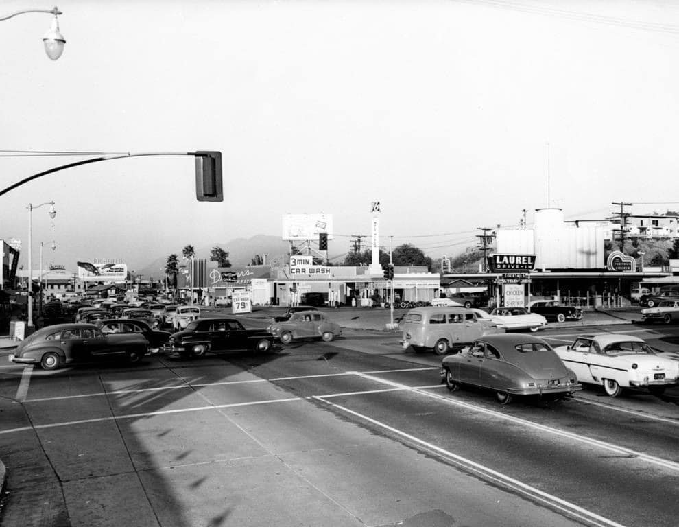
| (ca. 1952)^^^* - View of a flooded Ventura Boulevard at Woodman Avenue. The Cherry House Restaurant is seen on the southeast corner. |
Historical Notes To this day, despite the flood control channels, flooding still occurs in certain intersections of the San Fernando Valley especially after heavy rains. |
 |
|
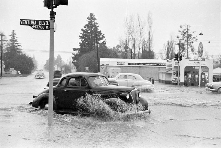
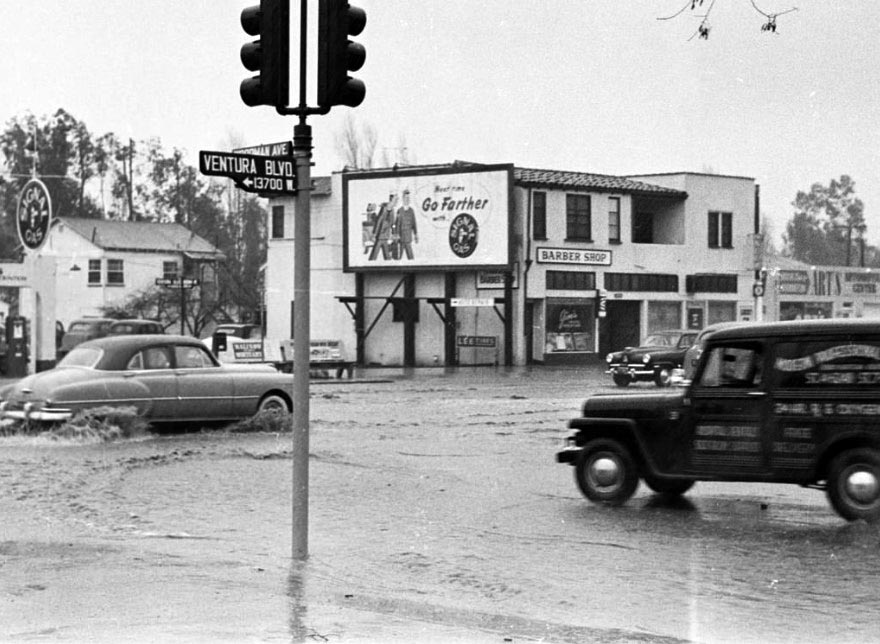
| (1952)*^^^^ - Heavy rain caused flooding at the intersection of Ventura Boulevard and Woodman Avenue. A Signal Gas Station is on the northeast corner. |
 |
|
| (1952)^– View looking northeast showing a flooded intersection at Ventura Boulevard and Woodman Avenue in Sherman Oaks. A Signal Gas Station is on the left (N/E corner) and a barber shop is seen on the right. |
Viking Ski Shop
 |
|
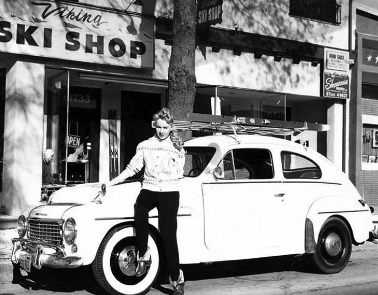
| (ca. 1950s)^ - Harold Larson's Viking Ski Shop at 13733 Ventura Boulevard in Sherman Oaks complete with a vintage Volvo (B 544). The shop had a large wooden ski ramp on the corner of Ventura Boulevard and Mammoth Avenue. Photo courtesy of Priscilla Shipstad |
Historical Notes In the 1950s, Valley residents who wanted to learn to ski might have considered Harold Larson's Viking Ski Center at 13733 Ventura Boulevard in Sherman Oaks. |
 |
|
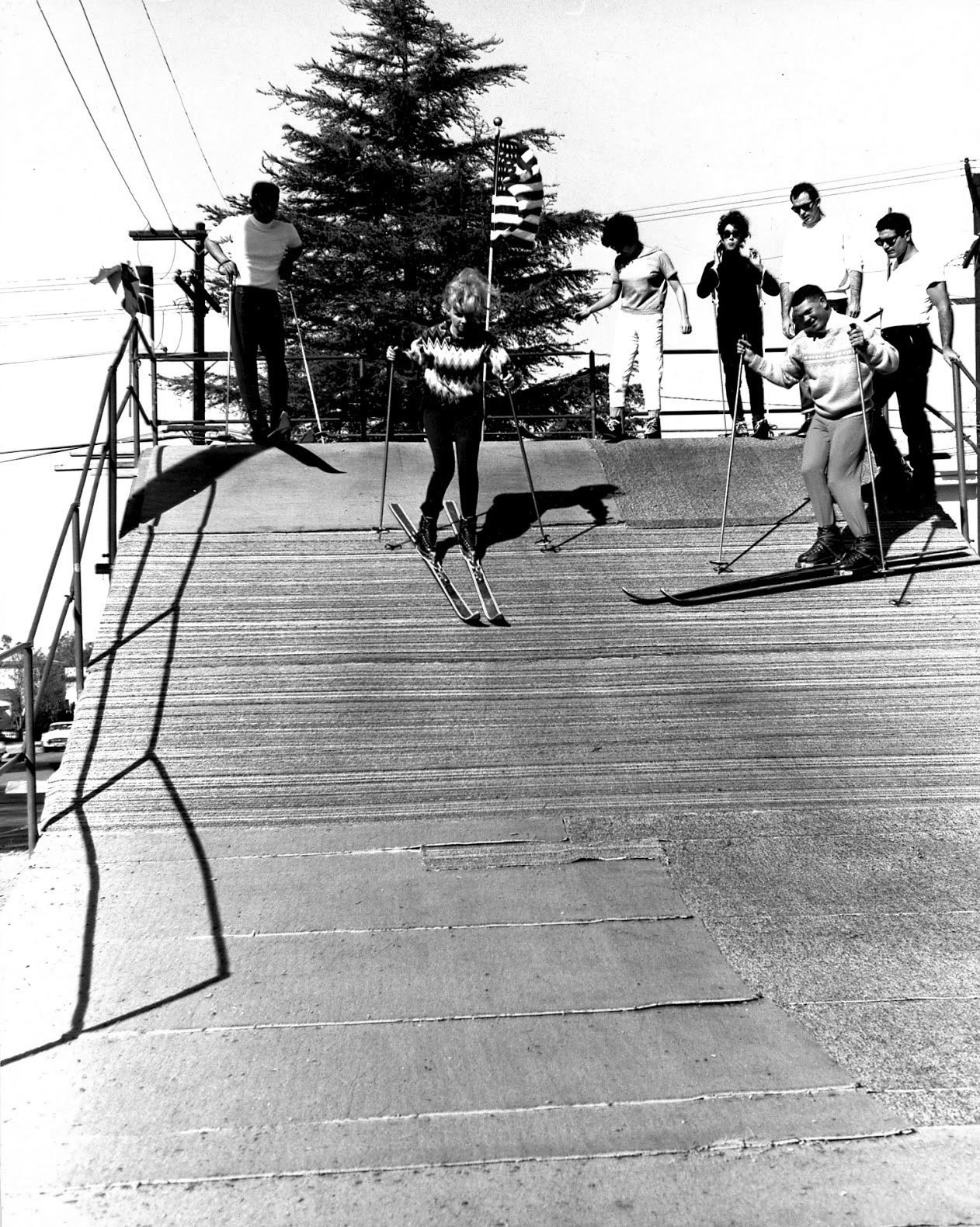
| (ca. 1950s)^ – View showing the large wooden ski ramp at the Viking Ski Shop on the NE corner of Ventura Boulevard and Mammoth Avenue in Sherman Oaks. Photo courtesy of Priscilla Shipstad |
* * * * * |
Ventura Boulevard (Studio City)
 |
|
| (ca. 1948)* – View looking east on Ventura Boulevard from near Laurelgrove Avenue toward Vantage Avenue (12200 blk of Ventura). The Hollywood Hills behind Universal City can be seen in the background. At lower-left is the Panorama Bowl (out of view). |
Historical Notes The above photo was taken from atop the next-door ferris wheel at Kiddyland. |
 |
|
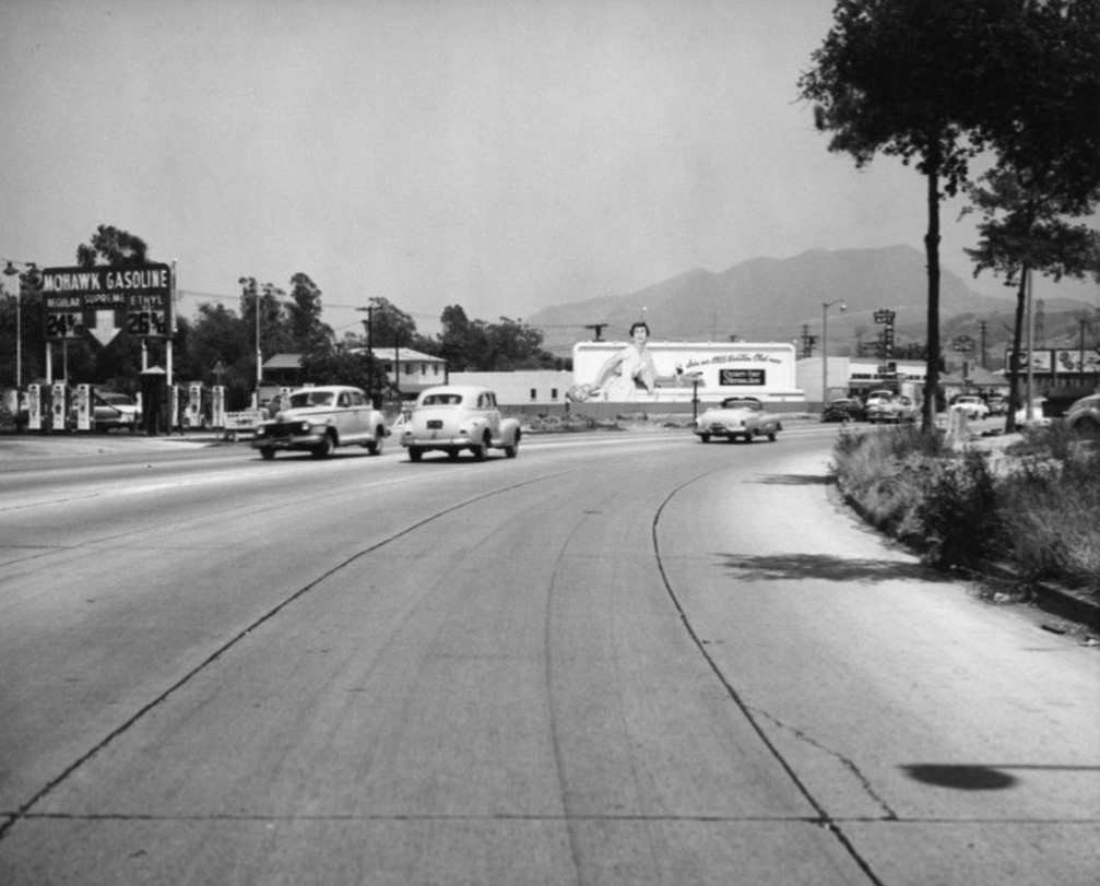
| (1954)* - Looking NE on Ventura Boulevard at Arch Drive in Studio City with the Hollywood Hills behind Universal Studios in the distance. A Mohawk Gasoline station is seen at left. Note the gas prices: 24¢ and 26¢ per gallon! |
 |
|
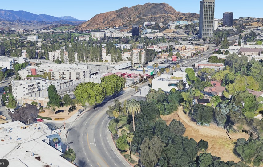
| (2022)* - Aerial view above Ventura Boulevard and Arch Drive with Universal Studios and the Hollywood Hills in the background. |
Then and Now
.jpg) |
|
| (1954 vs 2022)* - Aerial view above Ventura Boulevard and Arch Drive with Universal Studios and the Hollywood Hills in the background. |
Then and Now
.jpg) |
|
| Then and Now * - Looking NE on Ventura Boulevard at Arch Drive in Studio City with the Hollywood Hills behind Universal Studios in the distance. Photo comparison by Trey Callaway |
 |
|
| (1950s)^ – Postcard view showing Ventura Boulevard as it runs through Studio City in the San Fernando Valley. |
Historical Notes Thanks to its geographic location and its proximity to entertainment industry businesses, Studio City has served as the home for eclectic restaurants and nightclubs providing a variety of amusement and atmosphere. Several film industry professionals operated their own niteries, such as screen villain Jack La Rue and Academy Award winning cinematographer James Wong Howe. Others featured eclectic decoration or strong celebrity clientele. Some venues hosted variety performers entertaining guests, such as clubs at 11502 Ventura Blvd. and 12449 Ventura Blvd.* |
Ventura and Laurel Canyon
 |
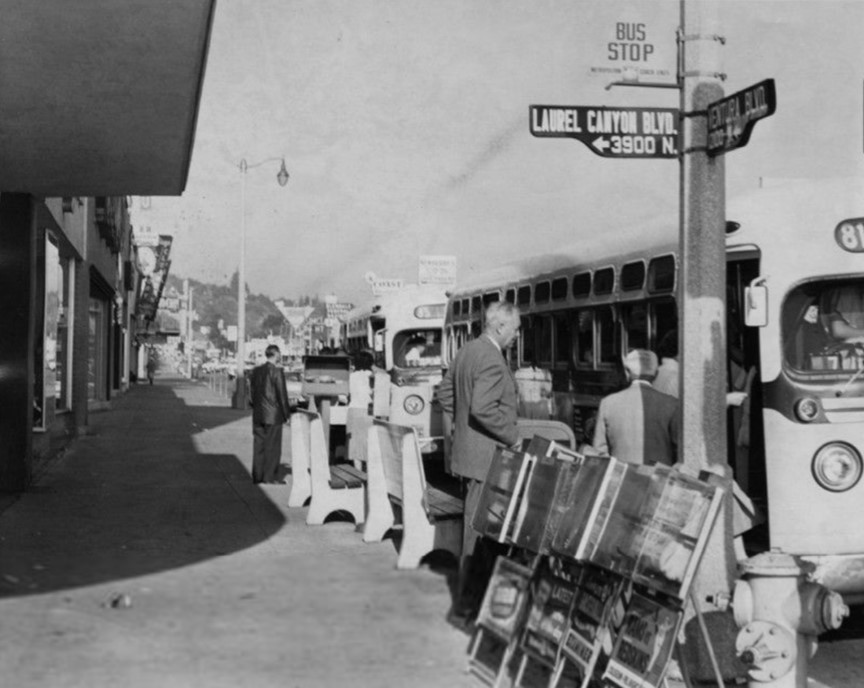
|
| (1948)* - Looking at the southwest corner of Ventura and Laurel Canyon boulevards in Studio City showing a semaphore traffic signal next to a bus stop. Today a CVS Pharmacy stands at the corner. In the distance on the right can be seen the roofline of the Studio City Theatre. |
Historical Notes The semaphore traffic signals used in Los Angeles in the 1920s - 1940s were manufactured by the Acme Traffic Signal Company. These signals had "Stop" and "Go" semaphore arms that would pop up, along with small red and green lights and bells that would ring to indicate the change in signal. The semaphore signals had a third, smaller yellow light at the bottom that would flash to indicate caution. Acme semaphores were used in Valley until the mid-1950s, when they were replaced by the standard three-light traffic signals we see today. Click HERE to see more Early Los Angeles Semaphores. |
 |
|
| (1959)* - Photograph caption dated August 26, 1959 reads, "Anniversary of Freeway Flyer. West Valley Freeway Flyer, which whisks commuters from Reseda to Los Angeles in 45 minutes in morning, depending on traffic, and back again in afternoon, celebrates first anniversary of service tomorrow. At left, Flyer picks up passengers at Ventura Boulevard and Laurel Canyon in Studio City before speeding non-stop to Los Angeles where it drops riders at Temple and Hope streets. In year, MTA has tripled services on route." |
Historical Notes The West Valley Freeway Flyer service began in 1959 as part of efforts by the Los Angeles Metropolitan Transit Authority (MTA) to provide faster and more efficient commuter bus service. The Freeway Flyer service promised to "melt miles and minutes off the map" by using the newly constructed freeways to bypass traffic congestion on surface streets. In the early years, the Freeway Flyer service started with just 4 buses per day from the San Fernando Valley, but quickly grew to 15 buses per day as ridership increased. The MTA found that wherever they established Freeway Flyer express and limited-stop service, ridership increased significantly, with one line seeing a 39% increase and another 32%. This early success with the Freeway Flyer concept encouraged the MTA that a modern, fast mass transit system could attract many drivers to leave their cars at home and ride the buses instead.* |
 |
|
| (1954)* – Looking east on Ventura Boulevard and Laurel Canyon Boulevard. Du-par's Restaurant is visible in the distance. |
 |
|
| (2021)* - Looking east on Ventura Boulevard and Laurel Canyon Boulevard. |
Then and Now
.jpg) |
|
| Then and Now - Looking east on Ventura Boulevard and Laurel Canyon Boulevard. Photo comparison by Trey Callaway |
Tower Motor Hotel
 |
|
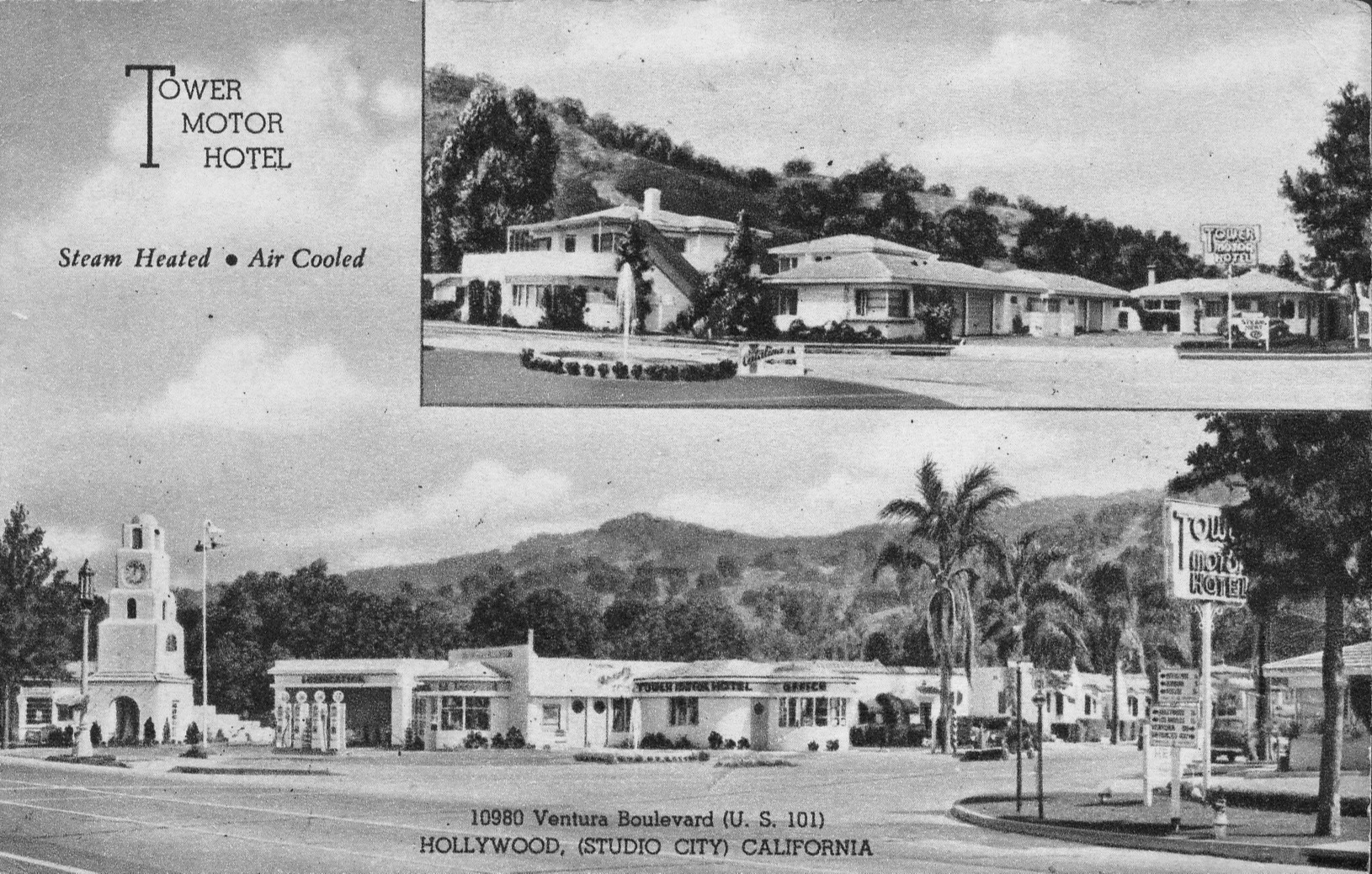
| (ca. 1948)* - Postcard view showing the Tower Motor Hotel at 10980 Ventura Boulevard in Studio City - Steam Heater & Air Colled. |
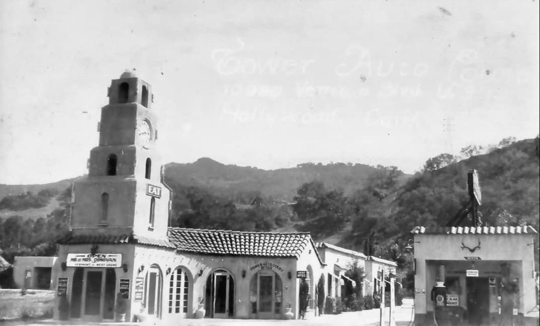 |
|
| (]1940s)* - Close-up view of the Tower Motor Hotel and adjacent gas station near the SE corner of Ventura and Vinaland, Studio City |
Topper Motel
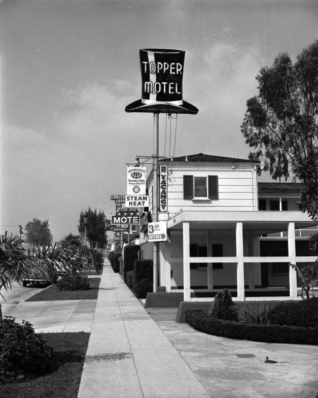 |
|
| (1950)^^- View showing the Topper Motel on the north side of Ventura Boulevard, west of Colfax Avenue. Part of the Carlton Motor Lodge, 11811 Ventura Blvd, can be seen behind the Topper. Click HERE for contemporary view. |
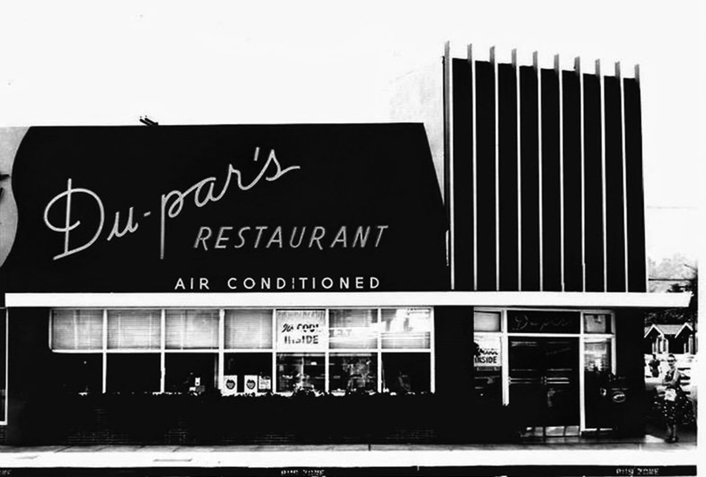
Du-par's Restaurant (Studio City)
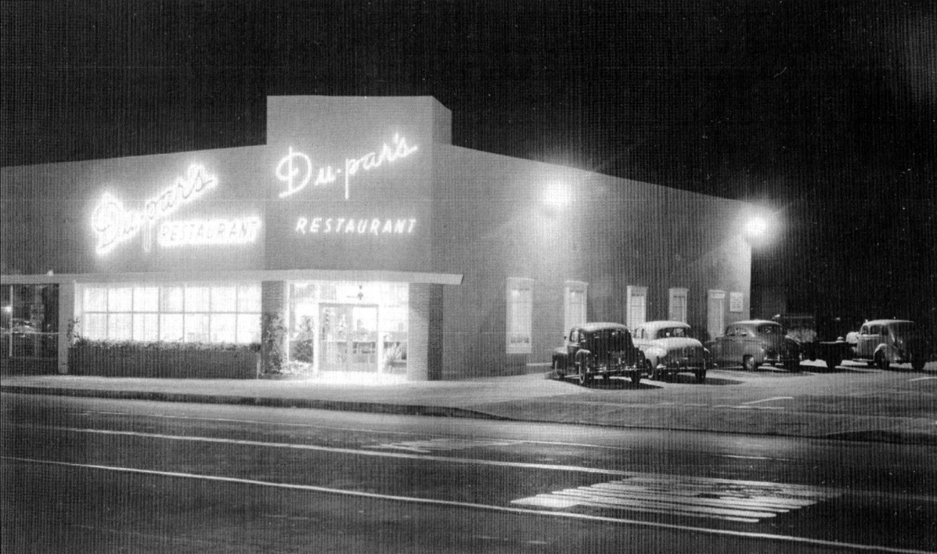 |
|
| (ca. 1948)* – View showing Du-par’s Restaurant located at 12036 Ventura Boulevard, Studio City. |
Historical Notes The longtime diner opened the Studio City location in 1948. This expansion was the first after Du-par's debuted at the Original Farmer's market in 1938. |
 |
|
| (1950s)* – A woman stands by the entrance to to Du-Pars Restaurant in Studio City. Photo courtesy of Richard Levenson |
Historical Notes The first Du-par's was founded in 1938 at the Los Angeles Farmers Market by James Dunn and Edward Parsons, who combined their surnames to create the restaurant's name. The chain was purchased in 2004 by an investor group led by W.W. "Biff" Naylor, the son of noted California restaurateur Tiny Naylor. Du-par's expanded in 2009 to include several locations from the bankrupt Bakers Square chain.^ |
 |
|
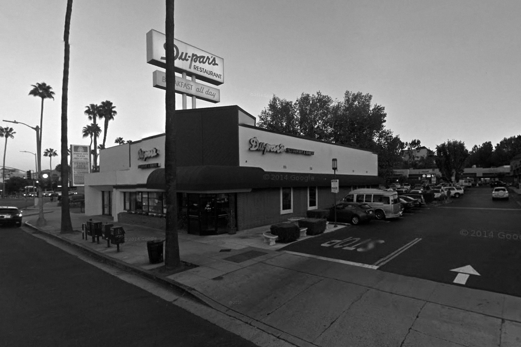
| (2014) - Google street view showing Du-par's Restaurant in Studio City, "Breakfast all day". |
Historical Notes The Studio City location closed its doors for good on December 31, 2017. The building is currently (2019) occupied by Sephora. Click HERE for contemporary view. |
 |
|
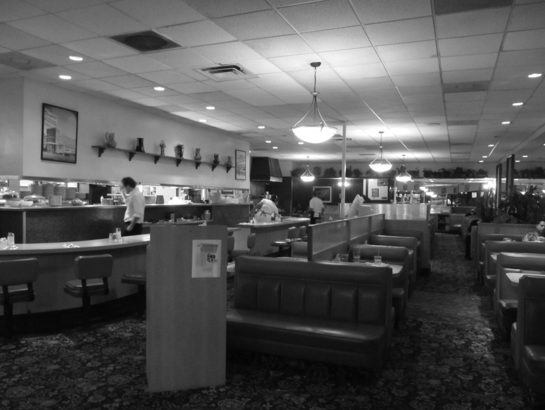
| (2011)^ - Interior view of Du-par’s Restaurant in Studio City. |
Then and Now (Closed 12-31-17)
|
.jpg) |
|
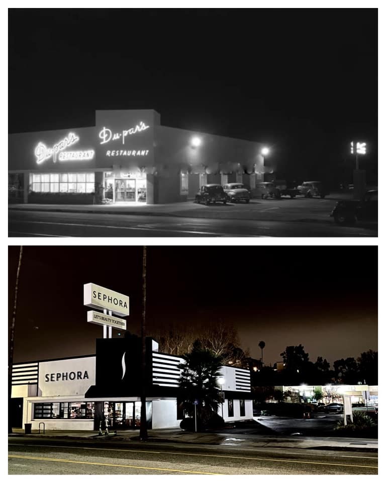
| (ca. 1948) - Du-par's Restaurant at 12036 Ventura Boulevard, Studio City. | (2014) - Du-par's Restaurant at 12036 Ventura Boulevard, Studio City. |
 |
|
| Then and Now: Du-par's / Sephora. Photo comparison by Trey Callaway |
Zomba Café (later Oil Can Harry's)
 |
|
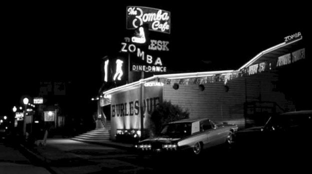
| (1940s)* – View looking west on the 11400 block of Ventura Boulevard in Studio City. On the left can be seen an Auto Court, Uptown Motor Court and the Zomba Café (11502 Ventura Blvd) on the SW corner of Ventura Blvd and Berry Drive. A beautiful 1940 Chevrolet is staring right into the camera. |
Historical Notes 11502 Ventura Blvd. has hosted a revolving clientele of clubs since at least 1936, when Rex’s White Cabin operated at the location. The Everglades premiered at the location in December 1939, featuring singing star Beth Williams, accompanied by Harry Powell and his Gladesmen, per the December 7, 1939 Van Nuys Valley News. The club offered dinner and dancing, and such special cuisine as Chicken a la Maryland. The Zomba Café proffered colorful entertainment to men looking for a little excitement, opening in 1941. A blurb in the September 5, 1942 issue of Variety stated, “Unusual atmosphere at the Zomba Cafe, 11502 Ventura Blvd. Radio’s Jimmy Jackson greets you with song. Also orchestra leader Eugene Jackson (formerly of Our Gang Comedies) gives you “a bit of Africa.” (Jackson played Farina’s older brother, “Pineapple,” in Our Gang Comedies).* |
 |
|
| (1950s)* – Zomba Café located at 11502 Ventura Boulevard in Studio City. This would become Oil Can Harry’s in the 1960s. |
Historical Notes Zomba operated mostly as an upscale burlesque club for men looking for an “afternoon delight,” with B-girls performing on raised and separate platforms as well as in choreographed numbers, per the American Guild of Variety Artists yearbook. Comedians acted as emcees, trying to inject some humor and energy into proceedings, especially between acts. Atmosphere and decorations carried an African and safari theme, suggesting exotic pleasures.* |
Oil Can Harry's (Originall Zomba Café - Studio City)
 |
|
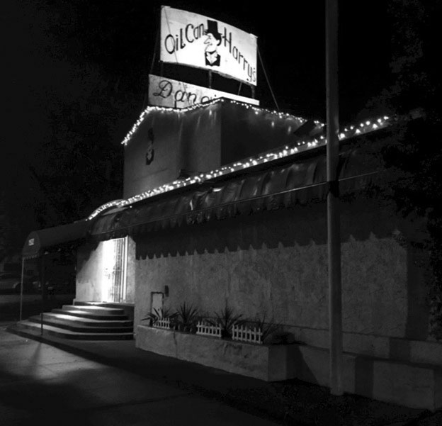
| (n.d.)* - Oil Can Harry's on the SW corner of Ventura and Berry Drive, 11502 Ventura Boulevard in Studio City. The building was occupied by the Zomba Café between 1941 and 1968. |
Historical Notes Sometime in 1968 the Zomba Café closed, replaced by current tenant, the gay cowboy bar, Oil Can Harry’s (closed in 2021). |
* * * * * |
Bob's Good Earth Real Estate (Encino)
 |
|
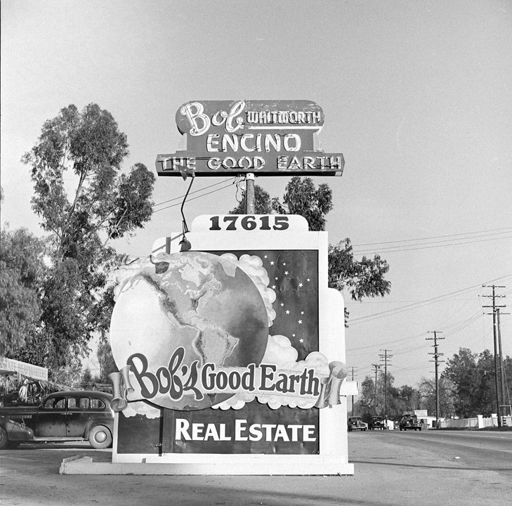
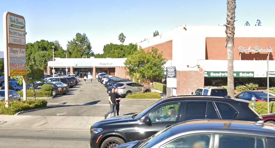
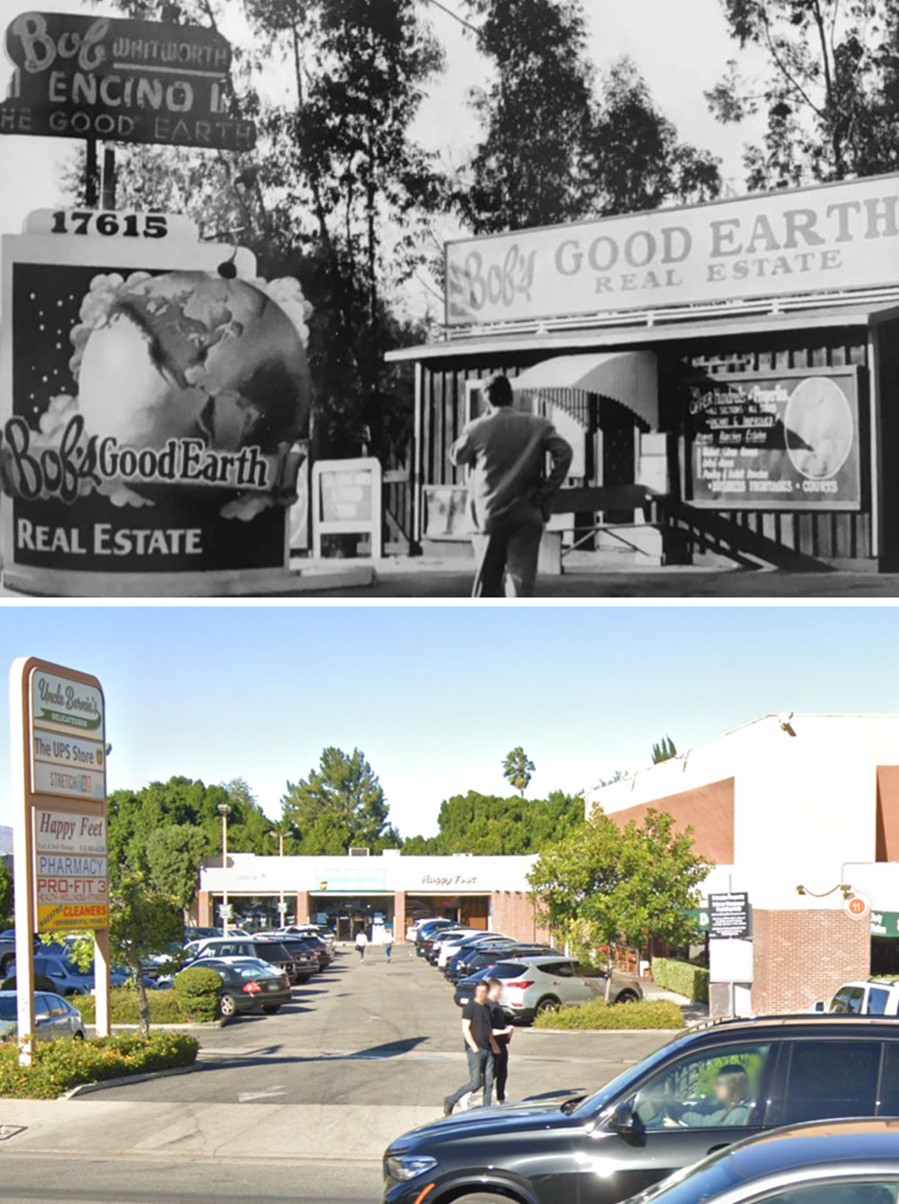
| (1940s)* – Bob’s Good Earth Real Estate located at 17615 Ventura Boulevard in Encino. |
 |
|
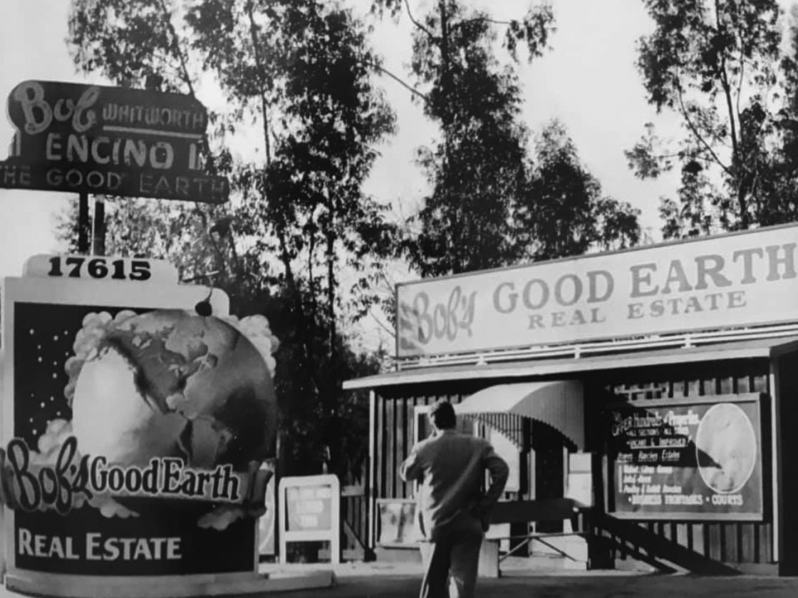
| (1946)^ – A man is seen standing in front of Bob’s Good Earth Real Estate Office located at 17615 Ventura Boulevard in Encino. Today, a strip mall is located at this site. Click HERE for contemporary view. |
 |
|
| (2023)* - Looking north into a strip mall where Bob's Good Earth Real Estate office once stood. |
Then and Now
 |
|
| (1946 vs 2023)* - Looking at the office of Bob's Good Earth Real Estate, current location of a strip mall. |
* * * * * |
 |
|
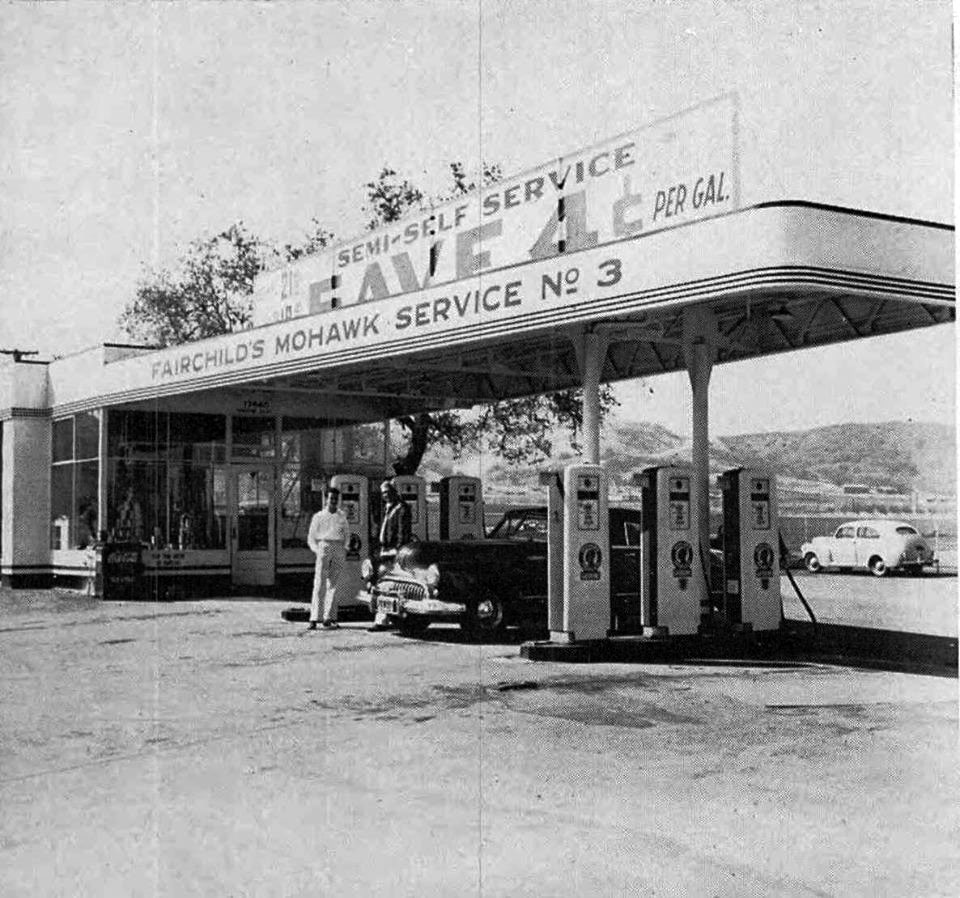
| (1948)* - View showing Fairchild’s Mohawk service station located at 17660 Ventura Blvd (at White Oak) in Encino. Actually, it is a "semi-self service" station, where you save 4 cents per gallon by pumping your own gas. Here we see customer Stanley Kalmonivitz with Mr. Fairchild. Click HERE to see more Early Views of LA Gas Stations. |
 |
|
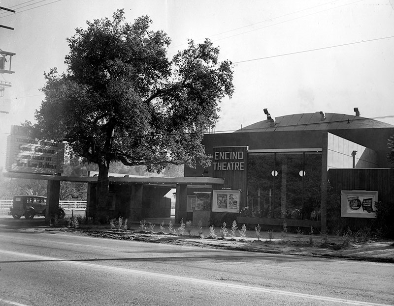
| (1949)* – View showing the newly built Encino Theatre with large oak tree by the front entrance, located on the south side of Ventura Boulevard east of Leoline Avenue. |
Historical Notes The Encino film Theatre opened in August 10, 1949 and was located at 16342 Ventura Blvd. The theater featured two hours of entertainment nightly; a feature, a short and a newsreel at one admission price. The theater held 1,000 seats which were staggered to provide clear views from every chair. The bottom half of the marquee is advertising the 1948 film noir, "They Live by Night." *^^^ |
 |
|
| (2015)#*^# - Google street view showing the mixed-use housing complex located at the site of the old Encino Theatre, 16340 Ventura Boulevard. |
Love's Wood Pit Barbecue
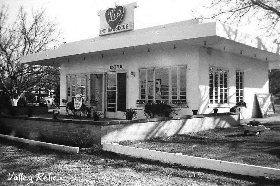 |
|
| (ca. 1950)^.^ – View showing the original Love’s Wood Pit Barbecue located at 15758 Ventura Boulevard, Encino. Their jingle was “When You’re in Loves...The Whole World's Delicious. |
Historical Notes Love's Wood Pit BBQs were a chain of barbeque restaurants, known for their delicious BBQ sauce, tender meat and smokey wood pit flavour that were located primarily on the West Coast of the US in the late '60s and early '70s. |
Ventura Boulevard (Woodland Hills)
 |
|
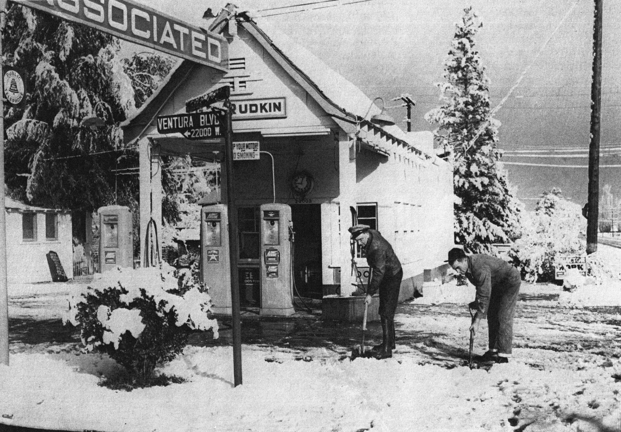
| (1949)^ – View looking west on Ventura Boulevard toward Topanga Canyon Boulevard in Woodland Hills. Sign on the northeast corner (at right) reads 2 miles to Canoga Park (if you turn right on Topanga Cyn). On the southwest corner can be seen a Standard Gas Station and on northwest corner an Associated Gas Station. Click HERE to see contemporary view. |
Historical Notes This photo was originally identified as being in Canoga Park because of the large sign seen on the corner. But if you look underneath the "Canoga Park" sign there is an arrow pointing right (north) on Topanga Cyn. Blvd. |
Then and Now
 |
|
| (1949 vs. 2021)* – View looking west on Ventura Boulevard toward Topanga Canyon Boulevard in Woodland Hills. |
 |
|
| (1949)#^*^ – View showing two men shoveling snow in front of an Associated Gas Station located on the NW corner of Topanga & Ventura boulevards. Photo date: Jan 12, 1949. Today, a Chase Bank stands at this corner. Click HERE to see more Early LA Gas Stations. |
Snow in the San Fernando Valley (Storm of 1949)
 |
|
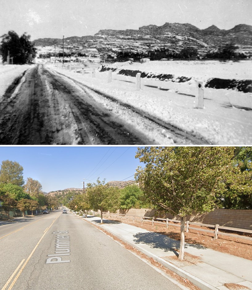
| (1949)^ – View looking west on Plummer Street in Chatsworth after snowfall, January 11, 1949. The hills in the background are part of the Santa Susana Mountains that surround Box Canyon. |
Historical Notes Snow fell in the San Fernando Valley and in most of Southern California during a 3-day storm from Jan 9 through Jan 12, 1949. |
 |
|
| (1949)* - The snow storm transformed the San Fernando Valley community of Canoga Park into a winter wonderland. Los Angeles Examiner Collection. |
 |
|
| (1949)#^*^ - Aerial view looking northwest showing the effect of a three day snow storm (Janurary 9th through January 11th). Sepulveda Boulevard is seen crossing at center left to right with the Sepulveda Dam and Basin just behind it. |
Historical Notes In a Jan. 10, 1999, Los Angeles Times article, columnist Cecilia Rasmussen wrote: On Jan. 10, 1949, in the middle of the worst housing shortage in Los Angeles history, more than half an inch of snow covered the Civic Center. The San Fernando Valley was pelted with the unfamiliar white stuff for three days, accumulating almost a foot. The rare snowfall produced wondrous vistas and unexpected difficulties, as some motorists besieged with frozen radiators were trapped in their cars in Laurel Canyon for several hours. |
 |
|
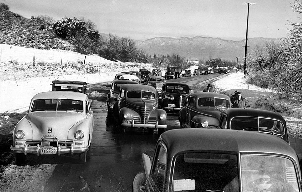
| (1949)^^^ – View showing cars lined up on Sepulveda Boulevard in Sherman Oaks waiting for ice to melt before driving over the hill to West Los Angeles. Cars with chains were allowed through. At noon the road was opened. Photo published in the Los Angeles Times, Jan. 13, 1949. |
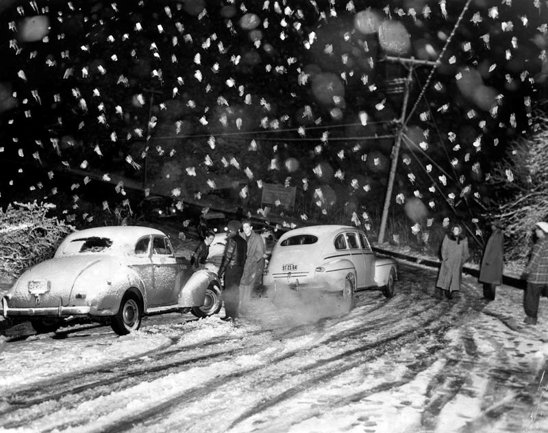 |
|
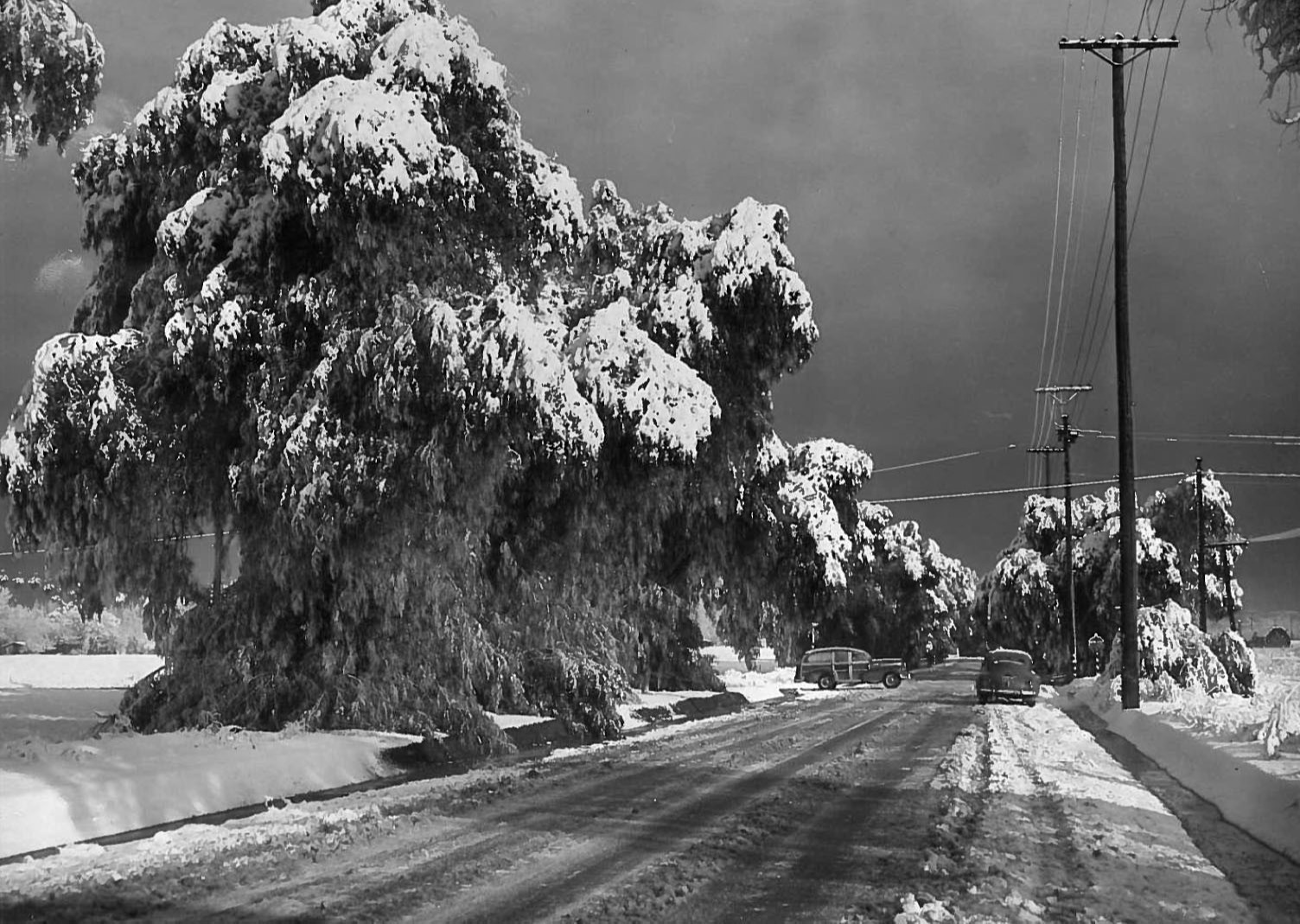
| (1949)* - Heavy flakes of snow fell in the darkness of the early dawn on January 11, 1949, and stalled traffic on this road in Coldwater Canyon, as a record-breaking snowfall hit Southern California. Many motorists were turned back on this road. Herald-Examiner Collection |
 |
|
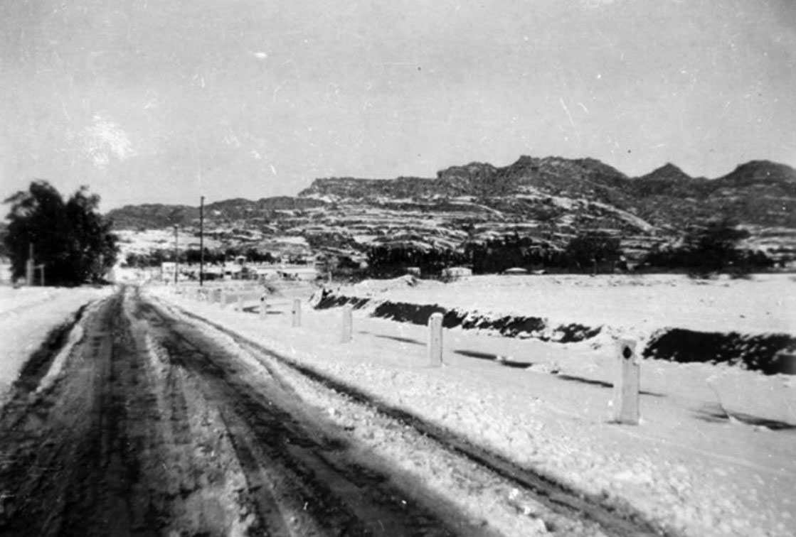
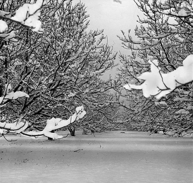
| (1949)++## – View showing a walnut orchard on Hazeltine Avenue in Van Nuys after three days of snow (Jan 9th thru Jan 12th). |
Then and Now
 |
|
| (1949 vs 2022)* - Looking west on Plummer Street in Chatsworth toward the Santa Susana Mountains. Top photo was taken after snowfall on January 11, 1949. |
* * * * * |
Chatsworth - Southern Pacific R.R.
 |
|
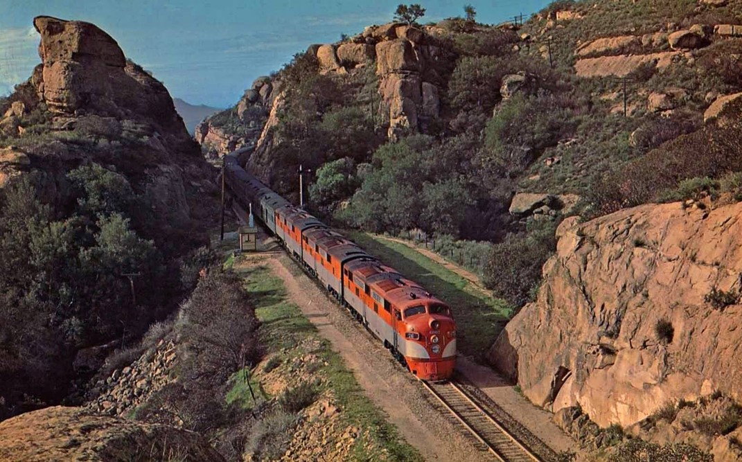
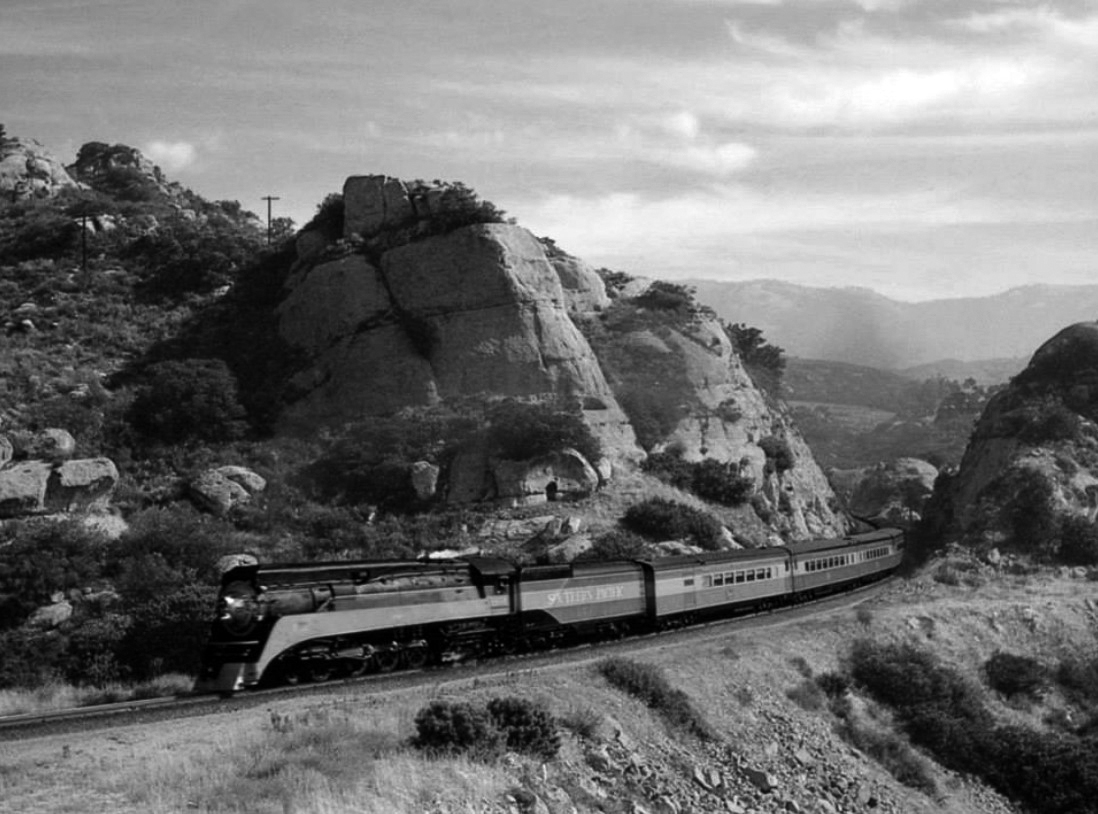
| (1950s)^ – Postcard view showing the Southern Pacific overnight “Lark” as it makes its way through the Chatsworth Mountains toward downtown L.A. |
Historical Notes The Lark was an overnight passenger train of the Southern Pacific Company on the 470-mile run between San Francisco and Los Angeles. It became a streamliner in 1941 and was discontinued on April 8, 1968. The Lark ran along the same route as the Coast Daylight and was often pulled by a locomotive wearing the famous Daylight paint scheme of orange, red, and black. |
 |
|
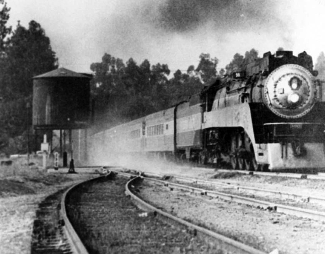
| (n.d.)*- View showing the Southern Pacific Coast Daylight heading northbound towards the second tunnel in Chatsworth. Photo courtesy of California State Railroad Museum |
Historical Notes The Coast Daylight, originally known as the Daylight Limited, was a passenger train on the Southern Pacific Railroad (SP) between Los Angeles and San Francisco, California, via SP's Coast Line. In the eyes of many the "most beautiful passenger train in the world," it carried a stunning red, orange, and black color scheme. |
 |
|
| (ca. 1946)^ - Southern Pacific's "Daylight Limited" train 98 crossing Devonshire Street in Chatsworth on its way from San Francisco to Los Angeles. |
Historical Notes The Coast Daylight operated from 1937 until 1974, one of the few passenger trains retained by Amtrak in 1971. Amtrak merged it with the Coast Starlight in 1974. |
 |
|
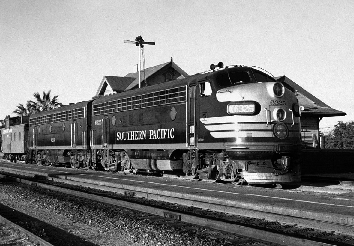
| (1952)^.^ - Classic Southern Pacific: SP F7A 6325 and F7B 8219 (both November 1950 graduates of the EMD La Grange, IL, factory) sit with a caboose at the station in Chatsworth, California, on the SP's Coast Line. The 6325 was retired in March 1969, and the 8219 was retired in December 1965. Photo credit: John J. Munson |
 |
|
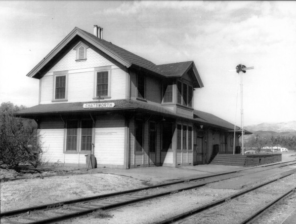
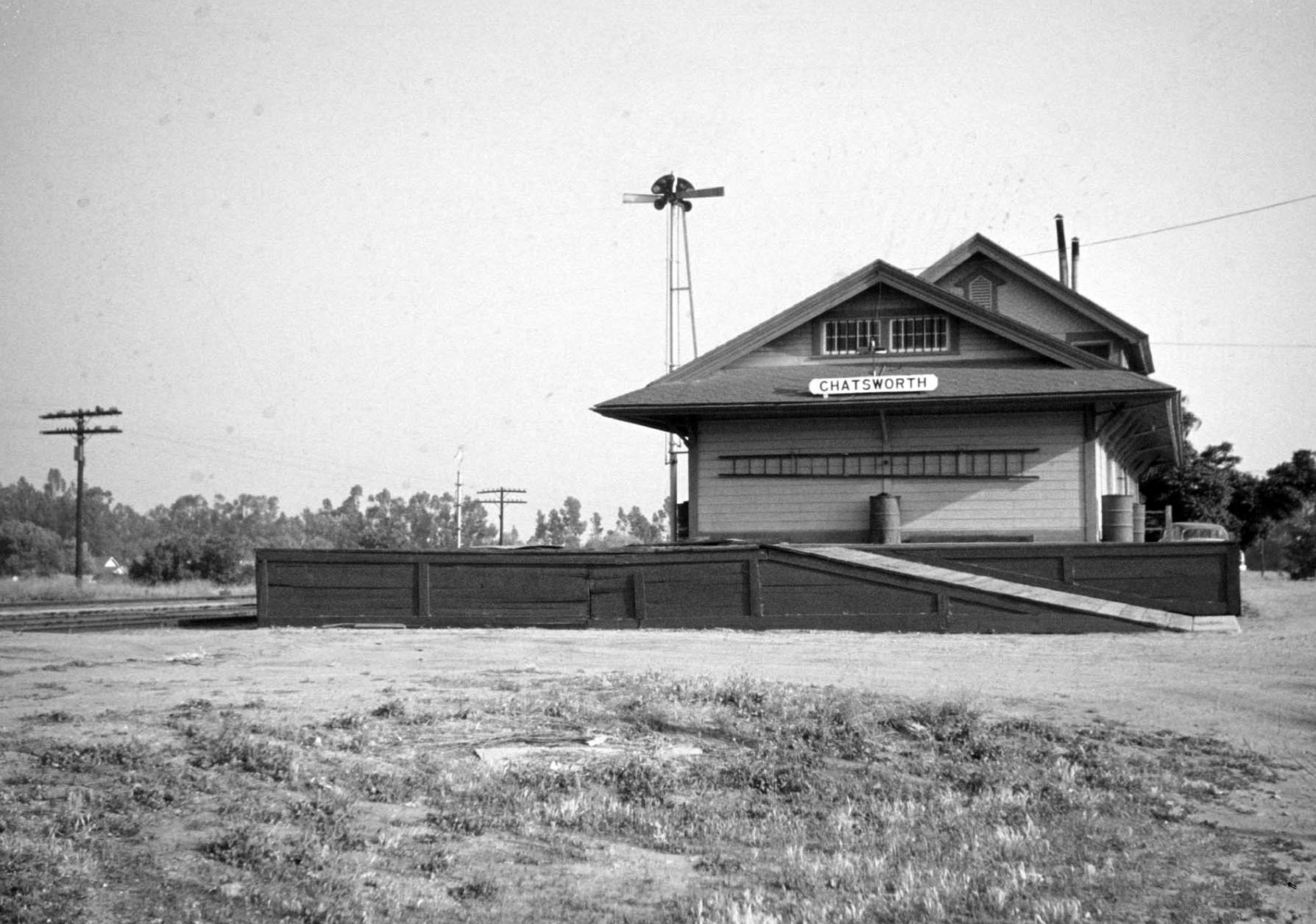
| (1950s)^ - View of Chatsworth's railroad station (its 2nd) located at Devonshire Street. The view is looking northwest toward Devonshire. This station coexisted with the first station until the latter was destroyed by fire in 1917. |
Historical Notes The Original Chatsworth Depot was built in 1893 near the intersection of Marilla and Topanga. Chatsworth's second depot (seen above) was built around 1910, located south of Devonshire Street on the west side of the tracks. |
 |
|
| (1956)* – View is looking south from Devonshire showing the Southern Pacific Chatsworth Depot on the west side of the tracks. |
Historical Notes By the early 1960s the above Chatsworth Depot fell into disuse and was razed by Southern Pacific (December, 1962). In 1997 a new depot and town center was erected between Devonshire and Lassen streets. |
Los Angeles River (near Reseda Park)
 |
|
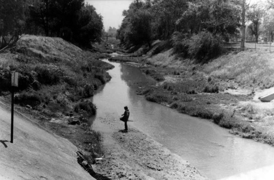
| (1955)^ – View showing two boys playing at the edge of the Los Angeles River between Lindley Avenue and Reseda Boulevard with what appears to be Reseda Park at upper-right. |
Reseda Park (Then and Now)
 |
|
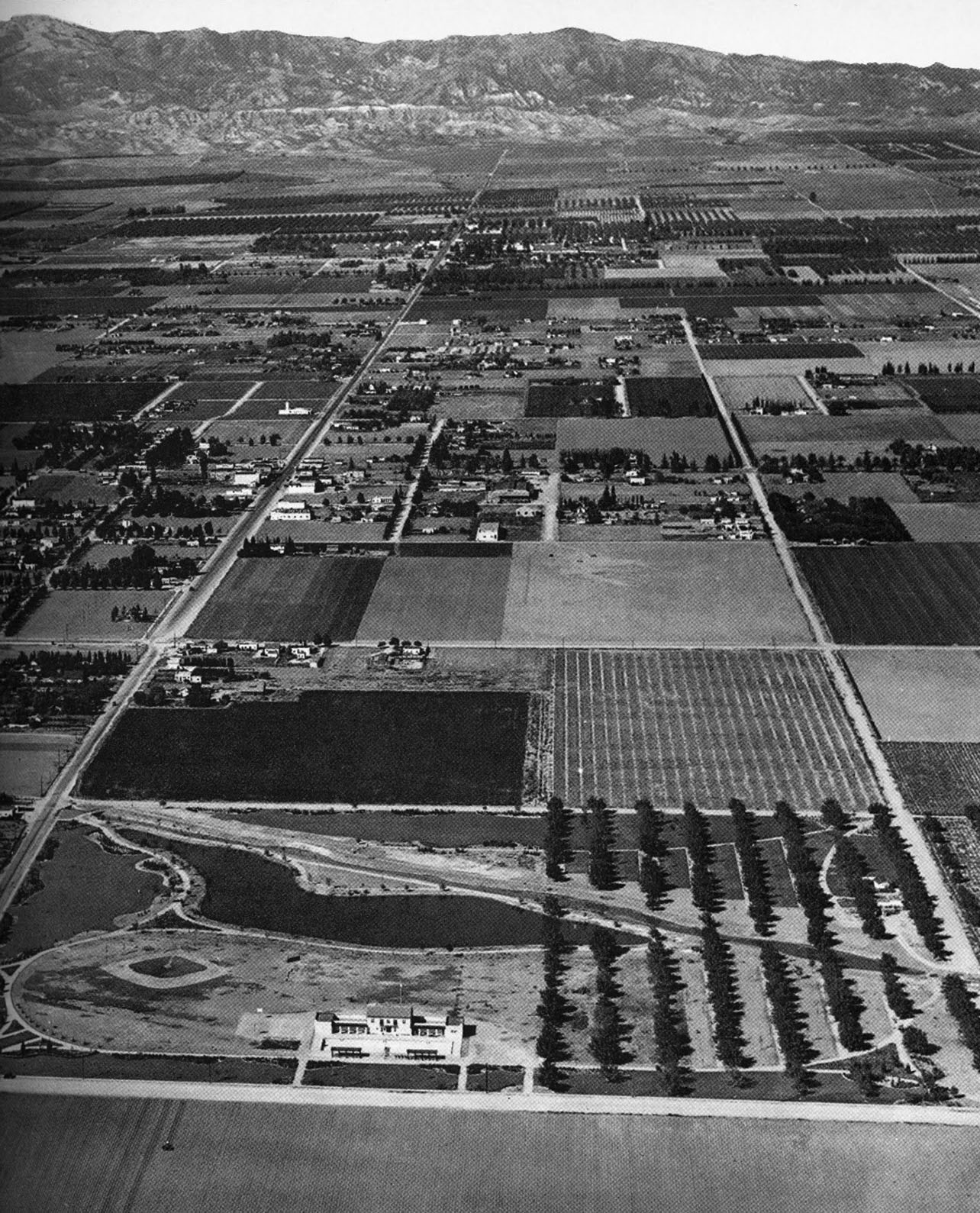
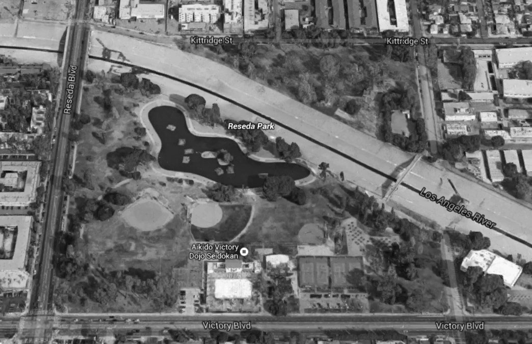
| (1932)* - Aerial view looking north over Reseda Park showing the LA River running diagonally across the park. Below the park, in the foreground, is Victory Boulevard running left to right (west to east). The two major streets runing north-south are Reseda Boulevard (left) and Etiwanda Avenue (right). |
Historical Notes Completed in 1933, Reseda Park was made possible through federal funding by the New Deal Agency: Reconstruction Finance Corporation (RFC). The Annual Report from 1932-33 of the Los Angeles Board of Park Commissioners reads: “Reseda Park is one of the city parks located in San Fernando Valley at Reseda and Etiwanda Avenues, Kittridge Street, and Victory Boulevard. Being forty acres in area it provides a delightful recreational spot for the residents of San Fernando Valley. A great deal of improvement was accomplished during 1932-1933 with the help of the RFC and County Welfare workmen. Fifteen hundred lineal feet of walks were built, involving the grading of 600 cubic yards of dirt, and lining the walks with 2,100 lineal feet of 1×4 redwood curbing. The flood channel for 1,450 feet was improved necessitating the removal of 2,250 cubic yards of dirt. Three acres of park land were cleared and eight acres graded, removing 2,400 cubic yards of dirt. New picnic grounds were also built, totaling two acres. A new sprinkling system was installed necessitating the laying of 10,880 lineal feet of pipe. Improving the park from a landscape standpoint, 520 trees were trimmed, 350 trees moved, 1,280 new trees planted, 7,520 new shrubs planted, and 24,700 flowering plants were placed in the shrub beds and around the banks of the lagoon. About five acres of ground were planted in new grass. One pergola was also built and a new comfort station constructed in the picnic grove. This park is becoming very popular with residents of the San Fernando Valley for picnic suppers during the extreme warm weather.” * |
Now
 |
|
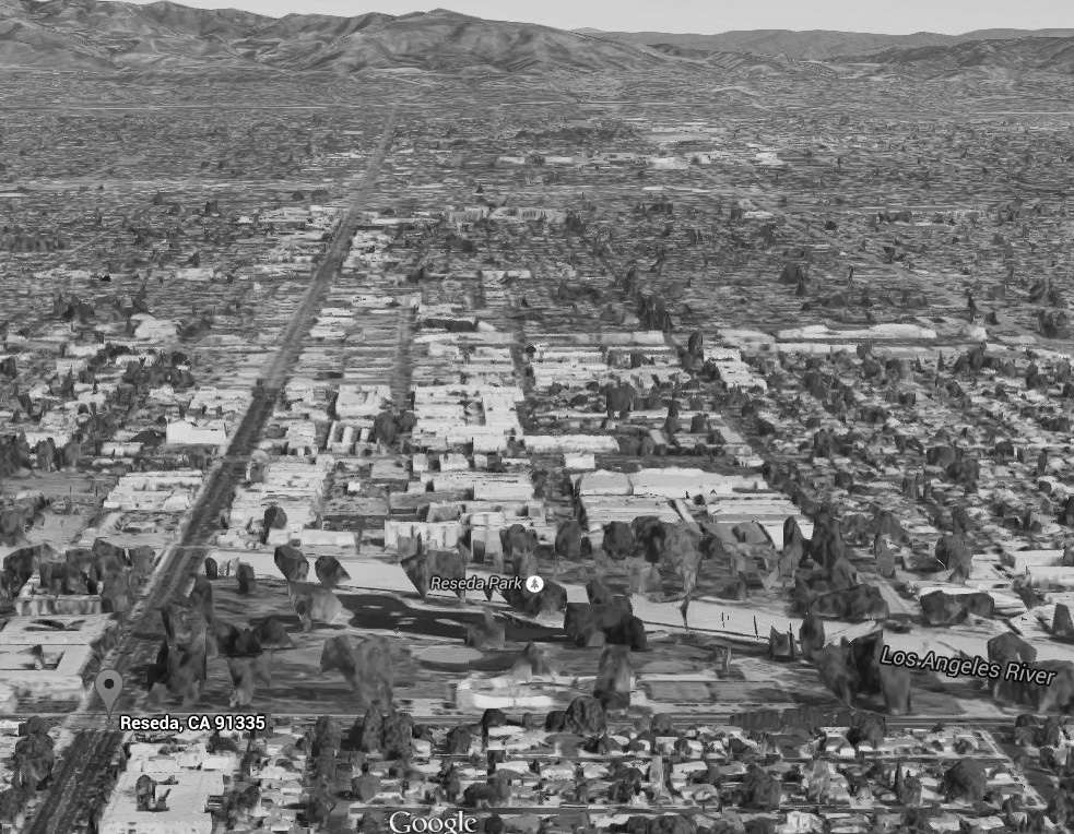
| (2015)* - Google aerial view looking north over Reseda Park. The intersection of Victory and Reseda boulevards is at lower-left. |
 |
|
| (2015)#*^# – Aerial view of Reseda Park showing a cement-lined Los Angeles River. |
* * * * * |
 |
|
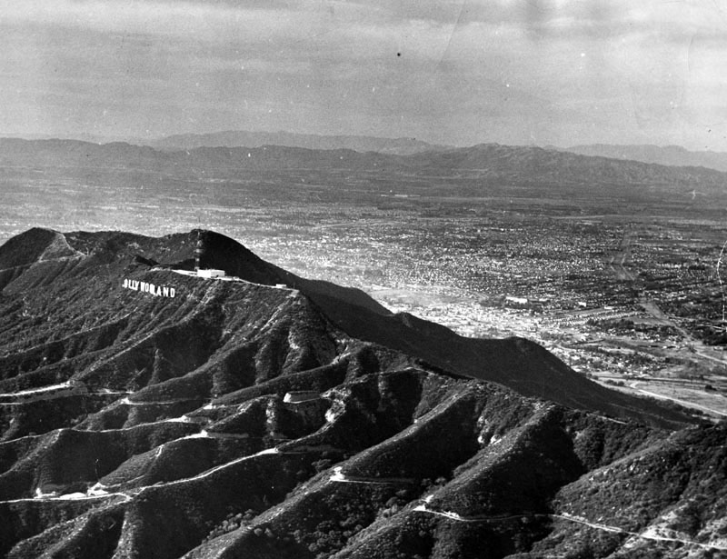
| (1948)* - Aerial view of the San Fernando Valley. View shows the "HOLLYWOODLAND" sign on the mountain. The letter "H" is missing. Within months of the time this photo was taken the sign would be shortened to read "HOLLYWOOD". Photo dated: December 13, 1948. |
Historical Notes The HOLLYWOODLAND sign was erected in 1923 to advertise a new housing development in the hills above the Hollywood district of Los Angeles. In 1949 the Hollywood Chamber of Commerce contracted to repair and rebuild the sign. The contract stipulated that “LAND” be removed to reflect the district, not the housing development.* (Click HERE to see more in Early Views of Hollywood). |
 |
|
| (1950)* – View looking northwest showing the community of Van Nuys in the foreground with a wide open San Fernando Valley in the distance. |
jpg.jpg) |
|
| (1950s)^ - View of the San Fernando Valley looking northwest from above Sherman Oaks. The Santa Monica Mountains are on the left with Ventura Boulevard running from lower right-center to upper-left of photo. The concrete-lined LA River serpentines its way down from the Sepulveda Basin (top-center) to Sherman Oak (lower-right). |
Historical Notes The Ventura Freeway wasn’t built until the late 1950s and opened on April 5, 1960.*^ |
Oxnard and Fulton
 |
|
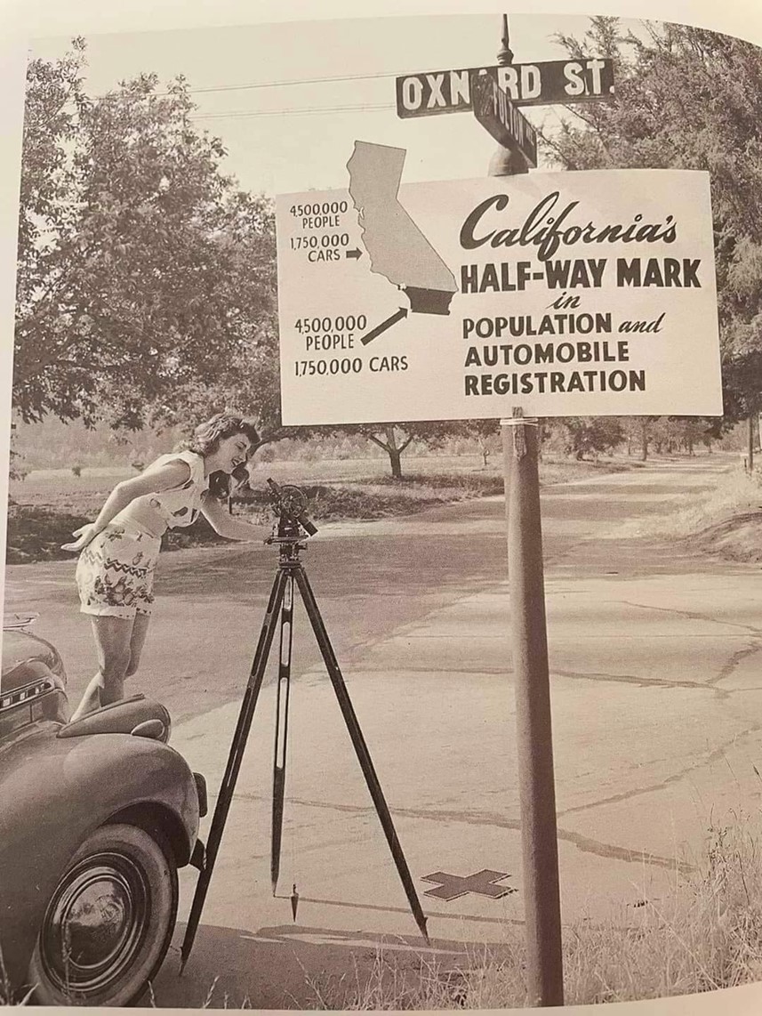
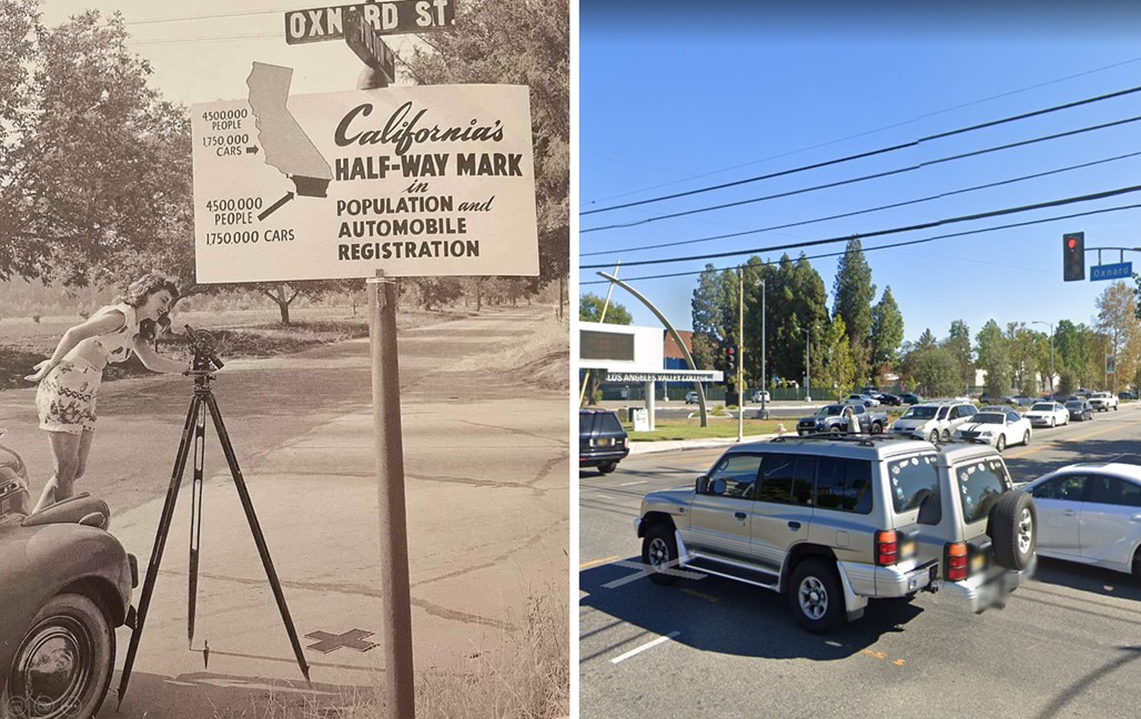
| (1948)* – Intersection of Oxnard Street and Fulton Avenue. Sign reads: 'California's Half-Way Mark in Population and Automobile Registration. |
Then and Now
 |
|
| (1948 vs 2022)* – Intersection of Oxnard and Fulton where today Valley College can be seen on the SE corner. |
Valley Plaza Mall
 |
|
| (ca. 1950)^#* - This photo was a 'give-away' from the new Valley Plaza Shopping Center. View is looking southeast toward Cahuenga Pass. Neither the Ventura Freeway nor the Hollywood Freeway were completed at the time of this photo. The future home of Valley City College is indicated in the lower right. |
Historical Notes The Valley Plaza Mall was built in 1951 and, at the time, was the largest mall west of the Mississippi River. It was the first mall in the U.S. geared toward the automobile and was built in anticipation of the yet to be completed Ventura and Hollywood Freeways.^*# The 101 Freeway from Ventura to its intersection with the Hollywood Freeway in the southeastern San Fernando Valley in Los Angeles (the Hollywood Split) was built in the late 1950s and opened on April 5, 1960. East of the Hollywood Freeway intersection, it is signed as State Route 134 which was built by 1971.*^ The Hollywood Freeway (Route 170) between the Ventura Freeway and the Golden State Freeway (Interstate 5) was completed in 1958.*^ Los Angeles Valley College was founded on September 12, 1949 to meet the tremendous growth of the San Fernando Valley during the 1940s and early 1950s. The college was officially chartered by the Los Angeles Board of Education in June 1949, and was located on the campus of Van Nuys High School. In 1951 Valley College moved to its permanent 105-acre site on Fulton Avenue in Valley Glen.*^ |
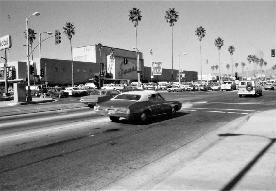
Sears (Valley Plaza Mall - North Hollywood)
 |
|
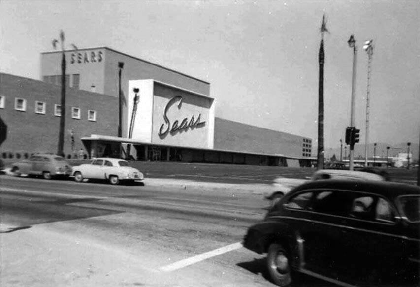
| (1950)*^*# - View showing the yet to be completed Sears Roebuck & Co. located at 12121 Victory Boulevard at the new Valley Plaza Mall. |
 |
|
| (1962)* - Photograph caption dated February 19, 1962 reads, "Motorists splash through flooded North Hollywood intersection - Corner of Victory and Laurel Canyon boulevards was awash." - Valley Times |
 |
|
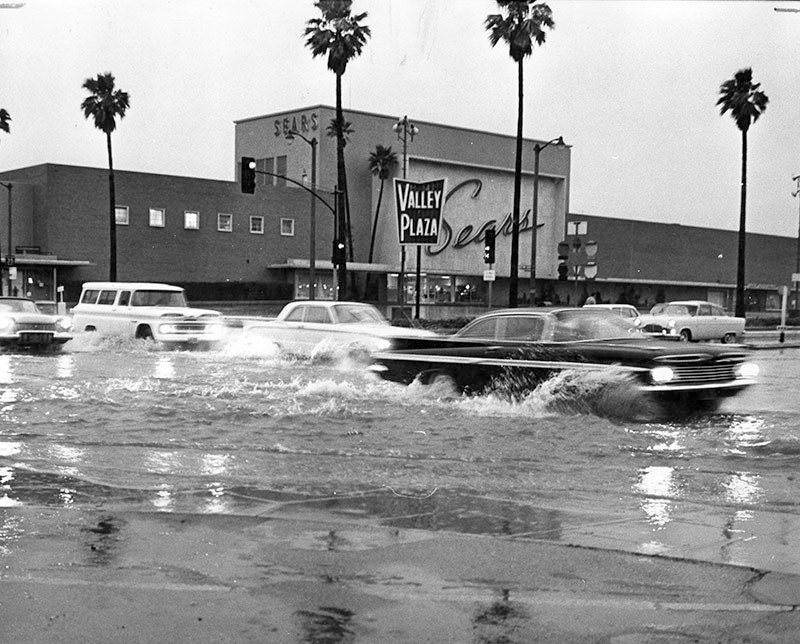
| (1970s)^.^ – Looking north on Laurel Canyon at Victory, showing the Sears at the the Valley Plaza Shopping Center with a Mobil Station at left, on the SW corner. Click HERE for contemporary view. |
McDaniel’s Market (Valley Plaza Mall - North Hollywood)
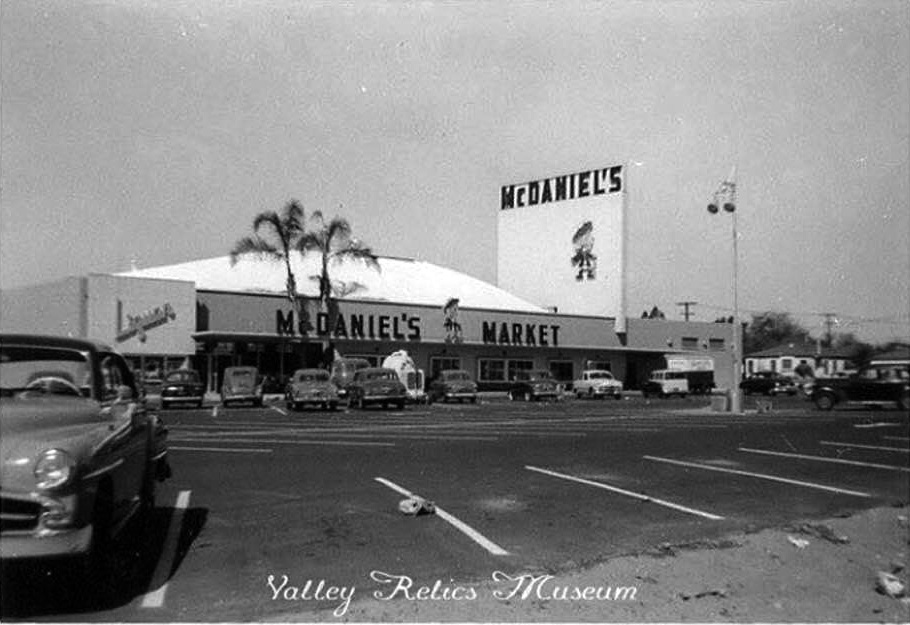 |
|
| (ca. 1950)^.^ - View showing McDaniel’s Market located at the north end of Valley Plaza near Vanowen. |
Historical Notes McDaniel’s Markets was an independent supermarket chain which featured a jaunty Scotsman as their mascot and a tartan pattern as a key design element in their ads and on stores. By mid-1957, McDaniel’s had six stores, located in North Hollywood, Beverly Hills, East L.A., Maywood and Baldwin Park, according to the Los Angeles Times. That year, McDaniel’s bought out the six-store Walker’s Market chain, and between those stores and additional units built over the years, the company eventually grew to almost 25 stores. In the early 60’s McDaniel’s went bankrupt, selling their choicest locations to Food Giant Markets.* |
Longs Drugs
 |
|
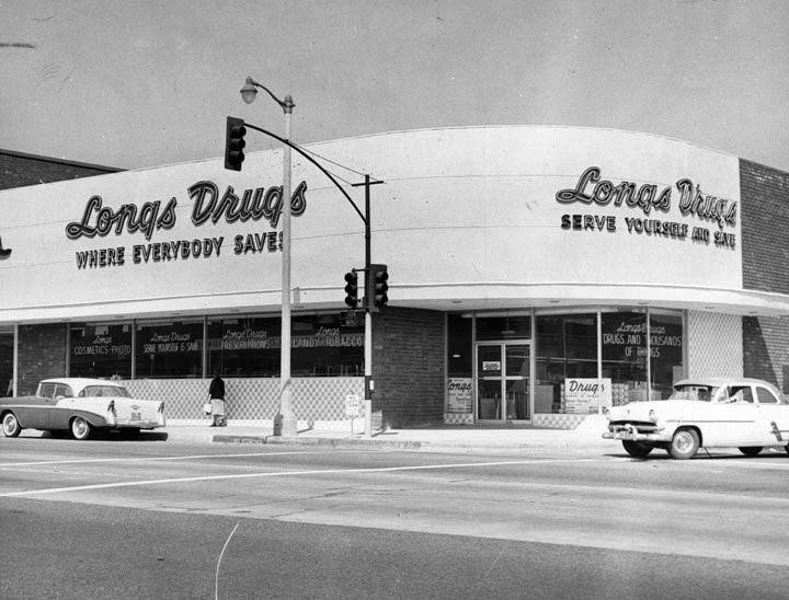
| (1959)* - View showing a Longs Drugs at 12201 Victory Blvd, which opened in 1959. The Longs chain is but a recent memory and this building now houses an Anna's Linens (Fallas). Click HERE for contemporary view. |
Historical Notes Before being acquired by CVS Health in 2008, Longs Drugs was a chain of over 500 stores, located primarily on the West Coast of the United States. They had stores located in California, Hawaii, Nevada, Arizona, Alaska, Colorado, Oregon, and Washington, and was headquartered in Walnut Creek, California.*^ |
LA Federal Savings and Loan
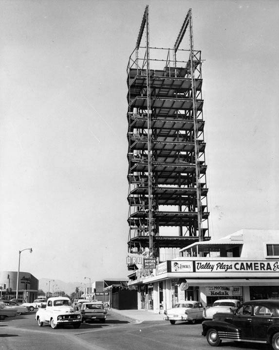 |
|
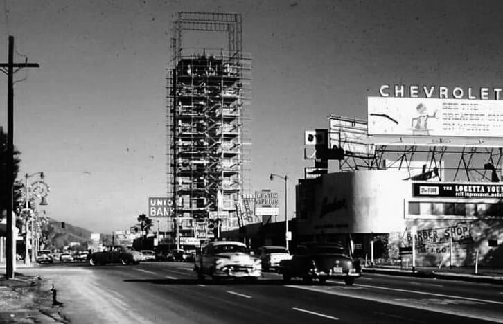
| (1960)* - View of the LA Federal Savings and Loan Building under construction located near the Hollywood Freeway at Victory Boulevard adjacent to the Valley Plaza. Longs Drug Store can be seen in the lower left. |
Historical Notes At 165-feet tall and 35-feet wide, it was the tallest building in the San Fernando Valley when its steel frame and precast wall sections rose out of the Valley Plaza Shopping Center in 1960. In those days its 100 thriving stores and shops made up what was believed to be the largest retail complex west of Chicago.^^^ |
 |
|
| (1960)^.^ - LA Federal Savings and Loan still under construction with the Union Bank seen behind it, 12160 Victory Boulevard. View is looking east on Victory Boulevard from near the Hollywood Freeway. Click HERE to see contemporary view. |
 |
|
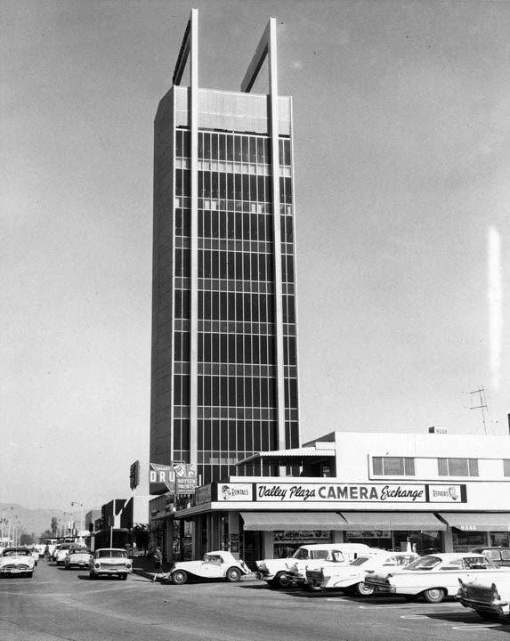
| (1961)* - View showing the completed Federal Savings Building with Valley Plaza Camera Exchange in the foreground. |
Historical Notes The Los Angeles Federal Savings and Loan Assn. spent $1 million on the building, including land and construction costs. Modernist architects Douglas Honnold and John Rex were hired to give the project the maximum bang for its buck.^^^ |
 |
(1976)#^# – Postcard view of the Los Angeles Federal Savings Building, located at 12160 Victory Boulevard, North Hollywood. The Valley Plaza sign is seen across the street.
|
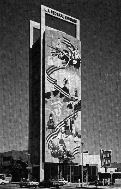
Historical Notes In 1976, a Bicentennial mural was commissioned by LA Federal Savings. Several financial institutions have operated the Victory Boulevard building over the years. Its current owner is Wells Fargo Bank.^^^ |
 |
|
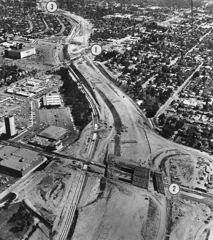
| (1965)* - Aerial view, looking south, of the Hollywood Freeway extension under construction. Near the top of the photo is Laurel Canyon Boulevard (1). In the foreground is Victory Boulevard (2). At the top of the photo is the freeway going to Los Angeles (3). At left-center can be seen the Los Angeles Federal Savings Building and the Valley Plaza. |
 |
|
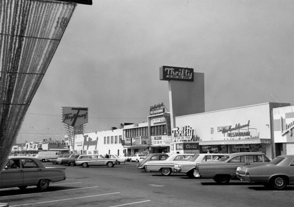
| (1960s)* - View of the shopping center across the street from Valley Plaza at Victory and Laurel Canyon Blvd. Thriftmart is seen on the left and Thrifty Drugs at center. This is when an ice cream cone at Thrifty was only 5 cents. |
Historical Notes Until the early 1980s, every Thrifty store featured a tube tester, usually located near the cosmetics display case. Vacuum tubes were still used in a wide variety of consumer electronics such as TVs and radios, and the local Thrifty store was a convenient place to test them and purchase replacements. Thrifty published a brochure helping customers diagnose which tubes might be responsible for various TV malfunctions. The brochure also provided numbered stickers to aid consumers in reinstalling working tubes in their correct sockets. Thrifty PayLess Holdings, Inc. was a pharmacy holding company that owned the Thrifty Drugs and PayLess Drug Stores chains in the western United States. In 1996, Rite Aid acquired 1,000 West Coast stores from Thrifty PayLess Holdings, creating a chain with over 3,500 drug stores. Rite Aid preserved the Thrifty Ice Cream brand because it won numerous awards in its history, and remained well-known for its affordable prices, quirky flavors, and iconic cylinder-shaped scoops.*^ |
 |
|
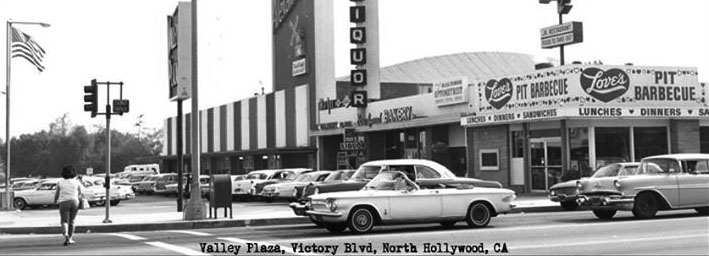
| (ca. 1961)^^^* - Panoramic view of the Valley Plaza on Victory Blvd. in North Hollwyood. Love's Pit Barbecue Restaurant is seen on the right. A Van De Kamp's bakery sign appears on the facing of a market. |
 |
|
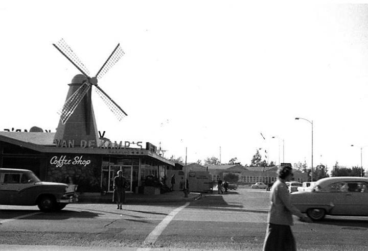
| (ca. 1950s)^^^* - View of Van De Kamp’s located on Laurel Canyon Blvd between Victory & Oxnard in North Hollywood. |
Historical Notes There were at least two other Van De Kamp’s coffee shops in the San Fernando Valley. One was at San Fernando Road and Fletcher Drive. The other, was on the southeast corner of Roscoe Blvd and Reseda Blvd, where the Facey Medical Building is located today. |
 |
|
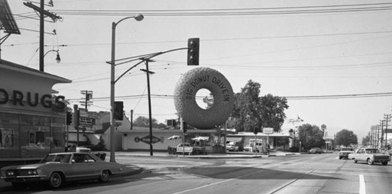
| (1960s)^^^* - View looking north on Laurel Canyon toward Magnolia Boulevard where the Big Donut Drive-in stands on the northwest corner. |
Historical Notes Russell C. Wendell, a doughnut machine salesman, created the Big Donut Drive-in. There were 10 locations, built over the course of the 1950s. At least five Big Donuts survive: they are Kindle's Donuts in unincorporated Westmont (this is the original location, built in 1950), (2) Randy's Donuts in Inglewood near LAX, the Donut King II in Gardena (3), Dale's Donuts in Compton (5), and Bellflower Bagels in Bellflower (8). Each features the distinctive giant doughnut constructed of rolled steel bars covered with gunite, a material used in swimming pools. Five Big Donuts have been demolished. They were located in Culver City (4), North Hollywood (6), Inglewood (on Imperial Hwy, 7), Van Nuys (9) and Reseda (10). The building style dates to a period in the early 20th century that saw a proliferation of Programmatic Architecture throughout Southern California. This style had its heyday from the mid-1920s to the mid-1930s. By the 1950s however, the trend of designing structures in the shape of the product sold there had changed to focus on signs rather than architecture itself.*^ Click HERE to see more examples of Programmatic Architecture. |
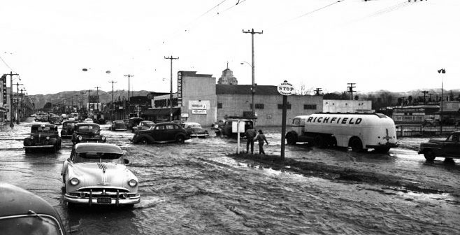 |
|
| (ca. 1951)^^^* - View looking north of a flooded intersection at Van Nuys Blvd and Oxnard Street where the tracks are. A stop sign sits in the center median of Van Nuys. Serbers Market is at the northeast corner in the center of the photo. The spire of Van Nuys City Hall can be seen in the background just behind the market. |
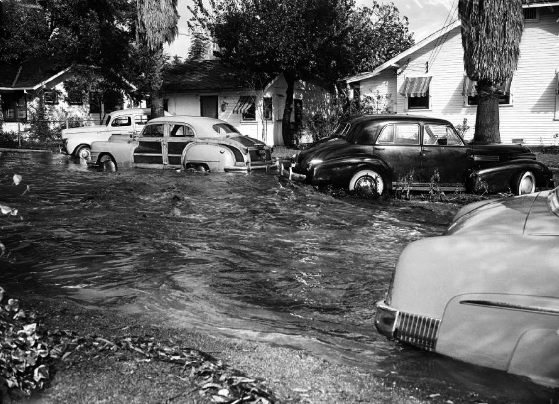 |
|
| (1952)^^ – View showing stuck cars as water rages down Tyrone Avenue near Sylvan Street. |
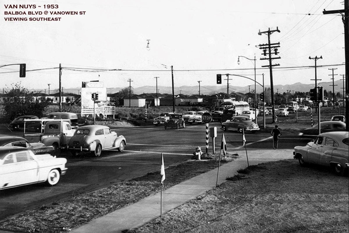 |
|
| (1953)#^*^ – View looking southeast showing the intersection of Balboa Blvd and Vanowen St in Van Nuys (Today - Lake Balboa). Caption reads: "Not too long ago - It seems like only months ago when corner of Vanowen street and Balboa boulevard was 'way out in the country.' This scene is another example of Five o'Clock Frustration that faces commuters daily Just try to make a left turn here!" |
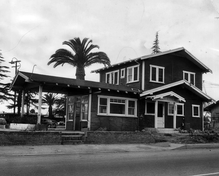 |
|
| (1954)* - Camera gets a last look at the old Van Nuys home built by Valley pioneer, George Beals, in 1909 at Sherman Circle and Van Nuys Boulevard. Site will soon be that of a new drive-in sandwich shop. Photo dated: December 2, 1954. – Valley Times |
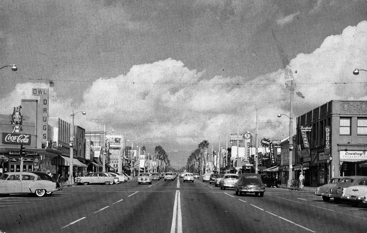 |
|
| (1950s)#^# – Postcard view looking north on Van Nuys Boulevard toward Friar Street with Owl Drug Store at the N/W corner. Across the street, on the N/E corner, stands Cowdrey's Pharmacy and the Beneficial Finance Company office. Behind that can be seen the signs for Hart’s Jewelers and the Oasis Club (see next photo). |
Van Nuys and Victory
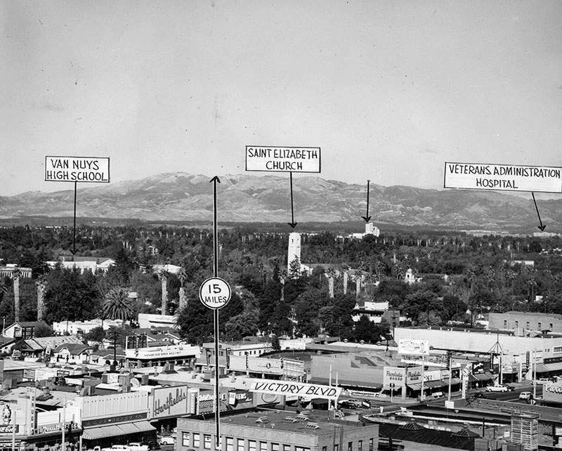 |
|
| (1954)* – View looking northwest over the intersection of Van Nuys and Victory on a very clear day. |
Historical Notes Valley Times photo captions reads: “Clear skies in Van Nuys - November, 1954. A 15-mile visibility could be seen with no smog in sight. The City had recently changed the home incinerator burning hours from morning to evening. Landmarks noted include Van Nuys High School, Saint Elisabeth Catholic Church, and the former VA hospital in Sepulveda.” |
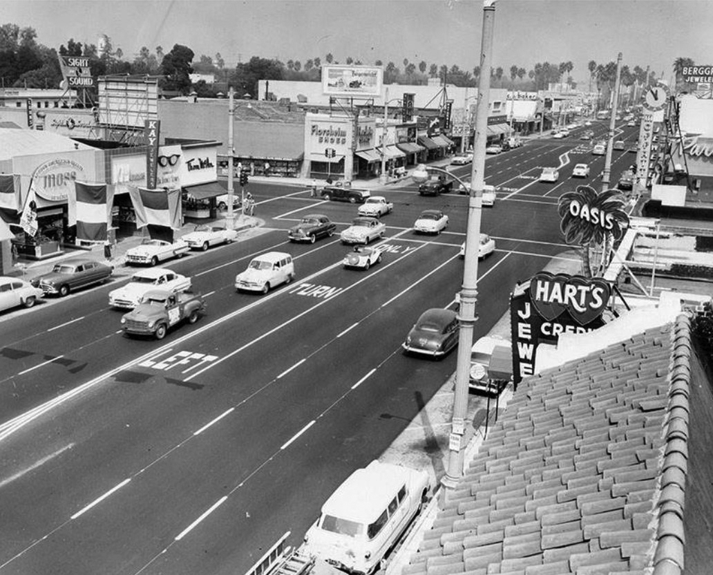 |
|
| (1955)++# – View looking north on Van Nuys at Victory Boulevard. Legible store signs include (R to L): Moss, Kay Jewelers, Tom McAn Shoes, Sight and Sound, Florsheim Shoes, Oasis, and Hart’s Jewelers. |
Historical Notes Photograph caption dated September 23, 1955 reads, "Special left turn only lanes, known as shadow lanes, are being used in Van Nuys on Van Nuys boulevard from Oxnard to Vanowen streets. This view is looking north on Van Nuys at Victory boulevard. Left turn lane is immediately to the left of normal center line. This is first time in Los Angeles such lanes have been painted on rather than constructed of raised concrete or bars." ++# |
 |
|
| (1962)* - Looking south on Van Nuys Boulevard at Victory Boulevard. |
Historical Notes Herald Examiner photo caption reads: ‘Said to be the busiest intersection in Los Angeles, it is a far cry from former years when traffic in Van Nuys was light’. |
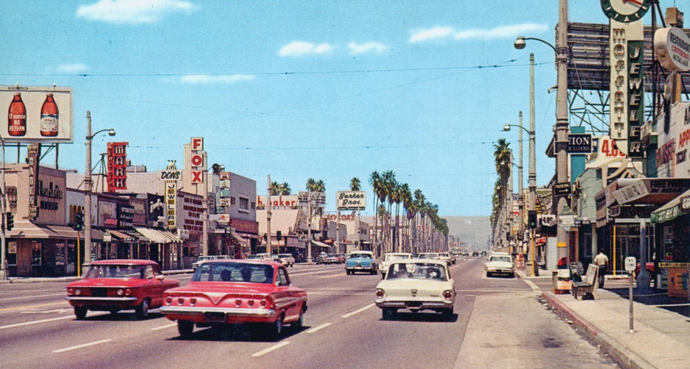 |
|
| (1960s)* - Looking north on Van Nuys Boulevard at Victory Boulevard with the Fox Van Nuys Theatre seen on the left (6417 Van Nuys Blvd). Photo courtesy of Valley Relics Museum |
Historical Notes During the 1960s, the commercial district along Van Nuys Boulevard continued to thrive. The boulevard was bustling with activity, with a wide range of shops, restaurants, and entertainment venues. Shopping centers, such as the Van Nuys Fashion Square, provided residents with convenient access to various retail options. |
Cupid's Hot Dogs (Van Nuys)
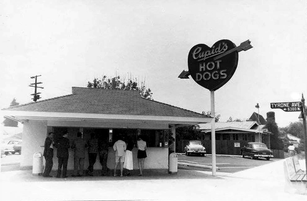 |
|
| (1950s)++^^ – View showing Cupid’s Hot Dogs on the southwest corner of Victory Boulevard and Tyrone Avenue in Van Nuys. |
Historical Notes Cupid's was originally established in 1946 as Walsh's Hot Dogs by Richard and Bernice Walsh. Shortly thereafter Richard changed the name to Cupid's; which was Bernice's nickname. For nearly 40 years Richard and Bernice ran the North Hollywood, Van Nuys and Canoga Park locations. In the early 80's their long haired surfer son Rick took over. 2009 brought on the 3rd generation of Walsh's to continue the Cupid's tradition. Sisters, Kelly and Morgan Walsh, have now taken the reigns.++^^ |
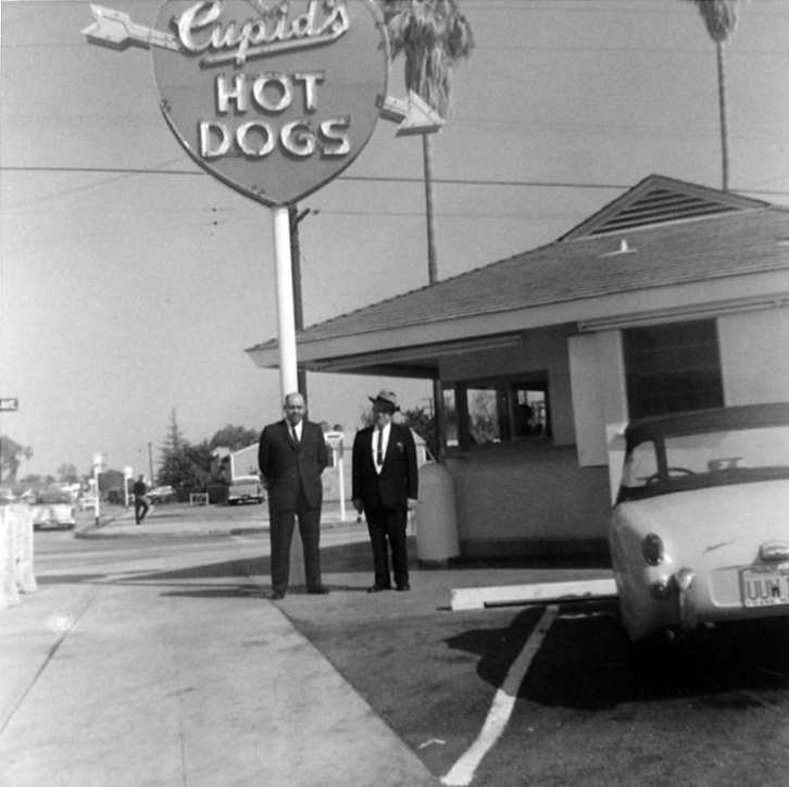 |
|
| (1950s)+++ – View looking east showing two men in suits posing for the camera in front of Cupid’s located on the southwest corner of Victory Blvd and Tyrone Ave in Van Nuys. |
Historical Notes Today, there are the 3 locations still owned and operated by the original founding family: Canoga Park, Simi Valley, and Northridge. The Victory and Tyrone Cupid's seen above no longer exists. It’s now just a parking lot. |
Cupid's Hot Dogs (North Hollywood)
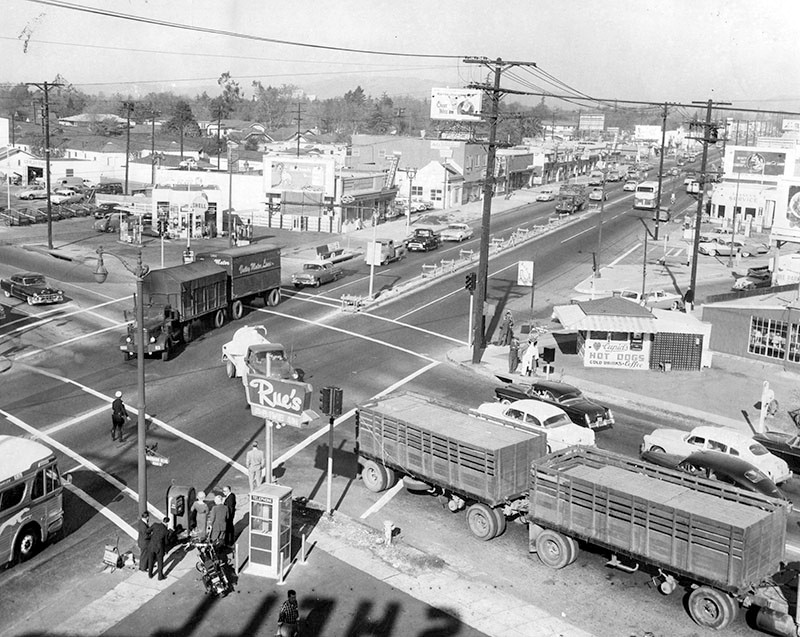 |
|
| (1956)* – View looking northwest showing the intersection of Lankershim and Burbank boulevards in North Hollywood. Cupid’s Hot Dogs stand is seen on the NE corner (center-right). Lankershim Blvd runs from lower-left to upper-right. |
Historical Notes Today, a Denny's Restaurant is located on the site where the Lankershim and Burbank Cupid's once stood. Click HERE for contemporary view. |
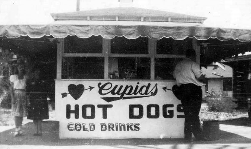 |
|
| (ca. 1950s)#^*^ - Close-up front view of the North Hollywood Cupid's Hot Dog stand located on the NE corner of Lankershim and Burbank blvds. Today, a Denny's stands at this location. |
* * * * * |
Lankershim Boulevard
| (ca. 1945)^.^ – View looking northwest toward the intersection of Lankershim and Magnolia with Fitzsimmons Market on the NW corner. The 'Drugs' sign on the SW corner is for Merchants Pharmacy. There is also a Thrifty Drug Store north of the corner. Note the two-lamp streetlights have been darkened on top (WWII) |
Historical Notes During the War many streetlights throughout the City were blacked-out on top as a preventative measure. Click HERE to see more in Early Views of Los Angeles Streetlights. |
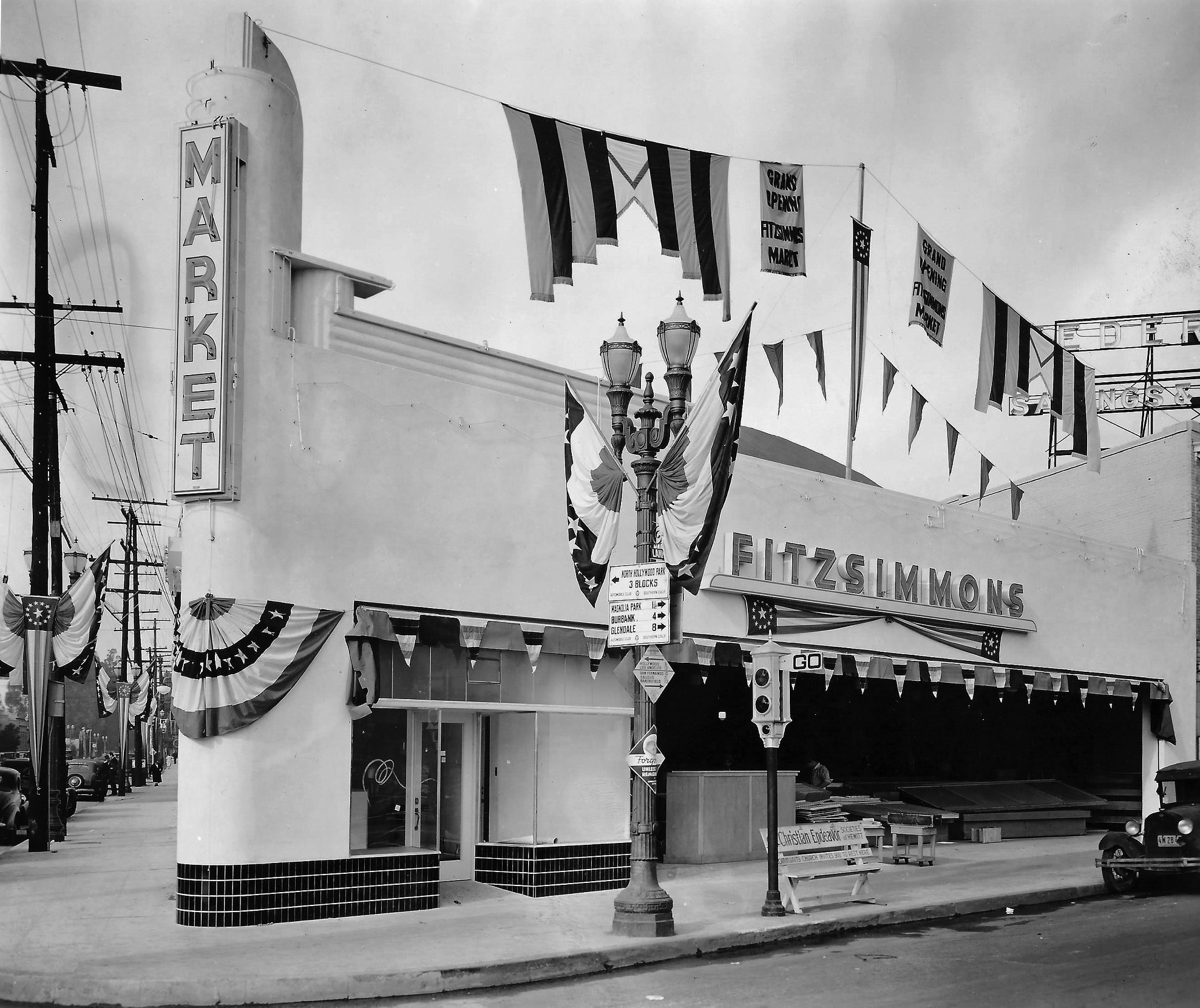 |
|
| (ca. 1940)^.^ - View looking at the NW corner of Lankershim and Magnolia showing Fitzsimmons Market being prepared for its Grand Opening. Note the semaphore traffic signal* standing by the beautiful dual-lamp streetlight (without black-out tops; pre-WWII)). Sign on streetlight reads: North Hollywood Park – 3 blocks with arrow pointing to the West. Lower part of sign points to the East and reads: Magnolia Park – 1½ Miles; Burbank – 4 Miles; Glendale – 8 Miles |
Historical Notes *These early signals, manufactured by the Acme Traffic Signal Co., paired “Stop” and “Go” semaphore arms with small red and green lights. Bells played the role of today’s amber or yellow lights, ringing when the flags changed—a process that took five seconds. |
| (ca. 1946)* - View looking south on Lankershim Boulevard at Chandler Boulevard. Ornate two-lamp electroliers (without the black-out tops) line both sides of Lankershim. Pictured is the Klump Building on the southeast corner. Occupying the retail space is Savemor Drug which contains a window display for Coty cosmetics. Visible signage along Lankershim includes the El Portal Theatre and Thrifty Drugs. |
Historical Notes The Klump Building was demolished after sustaining damage in the 1994 Northridge Earthquake. See the intersection of Lankershim and Chandler in: 1891 / 1924 / 2018 |
| (1942)* – Front view of the El Portal Theatre. Now playing: Take a Letter, Darling with Rosalind Russell and They All Kissed the Bride with Joan Crawford. To the right is the El Portal Pahrmacy with the Dr. Beauchamp Dentist Office on the second floor. |
Historical Notes The El Portal has a great history. It was the final theatre to be designed by prolific theatre architect Lewis Arthur Smith. Seating was provided for 1,346 on a single floor and the decorative style was Spanish Renaissance Revival. Movies, supported by a vaudeville show ran here for several years, until the arrival of talkies. Vaudeville played an important part in the first decades of El Portal, as live acts were used as added incentive to bring people in to see the newfangled silent pictures, starring the first stars of Hollywood, such as Charlie Chaplin, Buster Keaton and Laurel and Hardy. In fact, to measure an audience's response to their films, both Laurel and Hardy were known to frequent El Portal, slipping in after the audience was seated for showings of their own films. Oliver Hardy lived for many years nearby in Van Nuys, golfed at the in Toluca Lake, died in North Hollywood and is buried there. Harold Lloyd also used to listen to the laughter of audiences watching his films at El Portal. He and his brother were silent partners in the Shreves Filling Station, which was then on Lankershim across from the theater.* Click HERE to see more Early Views of the Portal Theatre. |
| (1950s)^.^ – View looking north on Lankershim Blvd from near Magnolia Blvd. Things got busy, where there were formerly orchards and a simpler life. Harris & Frank and Woolworth's can be seen at the intersection. |
Valley Times
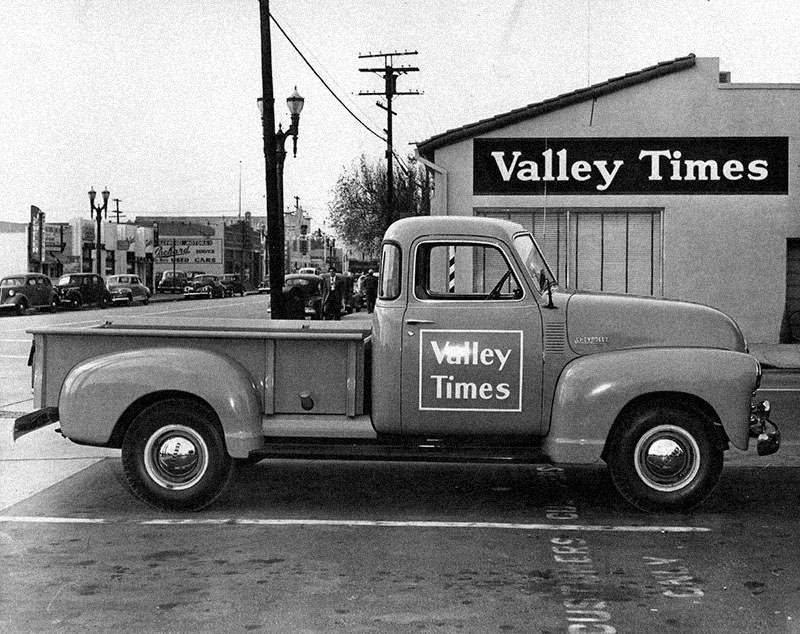 |
|
| (1947)* - Seen here is the main office for the Valley Times, which was located at 11109 Magnolia Blvd. in North Hollywood. Photograph caption reads, "Representing advancement in speeding up distribution of the Valley Times to the doorsteps of Valley readers, here is one of a new fleet of four 1948 Chevrolet pickup trucks to be used in faster delivery of America's fastest growing daily to all points in the Valley." |
Historical Notes Even before large daily newspapers were widely circulated in the San Fernando Valley, residents had many places to turn for news. In the 1880s, it was The San Fernando Comet and the Burbank News. In the 20th Century, they could catch up on local happenings with such community newspapers as San Fernando Valley Press, San Fernando Valley Reporter, San Fernando Valley Journal, Sylmar Breeze, Sherman Oaks Sun, Studio City Graphic, Encinian and Woodland Hills Reporter.^^^ While the newspaper building seen above was later demolished and replaced with a large apartment complex, many of the commercial buildings seen across Magnolia Blvd. (left of center) remain standing.* |
Mosher Tire Service
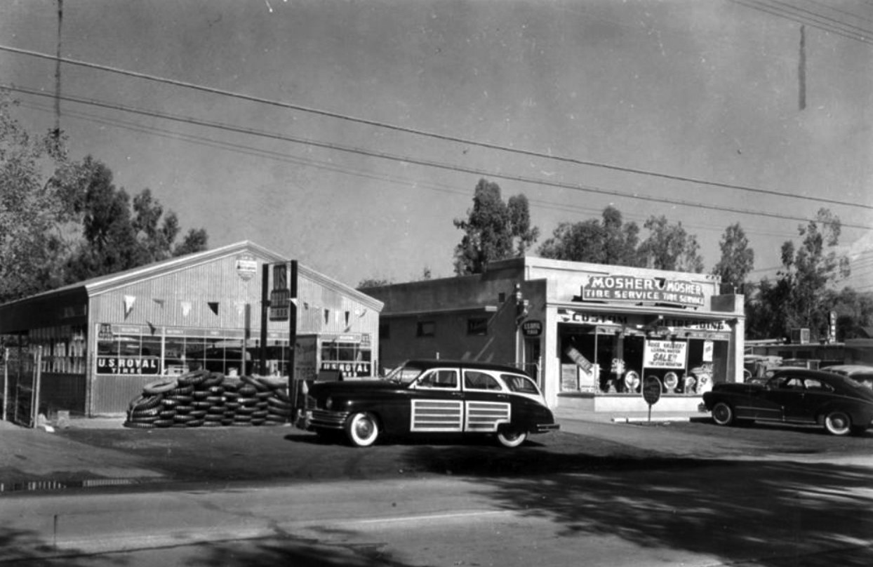 |
|
| (1950)* – Mosher Tire Service located 12117 Burbank Boulevard in North Hollywood. Photograph caption dated February 2, 1950 reads "U. S. Royal North Hollywood distributor announces the 'Mid-Century' featuring greater traction and 'scuff-proof' white sidewalls." |
Historical Notes Originally located at 1534 N. Cahuenga Boulevard in Hollywood, Lewis Dean Mosher moved his business to this location in 1942. After retiring his son, Merill, operated the business until he also retired. The original structure on Burbank Blvd is no longer there, but the house next door, where Lewis Dean and his wife lived starting in 1927, is still there. Click HERE for Contemporary View. Click HERE to see original Hollywood location. |
Foodtime Market
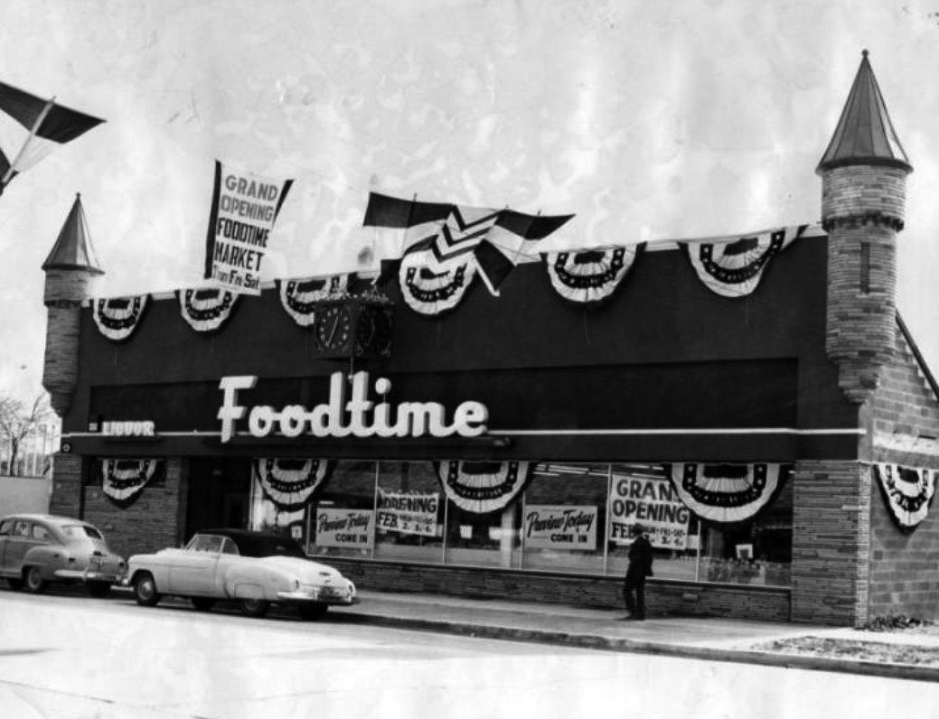 |
|
| (1950)* - Grand Opening of Foodtime Market located at 12450 Magnolia Boulevard in North Hollywood. |
Historical Notes The Foodtime Market grocery store, located in the turreted building now occupied by the Valley Village post office, was the largest business in the historic district and operated from 1950 until sometime in the late 1960s.^ |
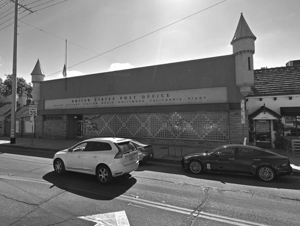 |
|
| (2018)** - Formerly the location of Foodtime Market, 12450 Magnolia Blvd, Valley Village, is now home to the Valley Village* Post Office. |
Historical Notes VALLEY VILLAGE – The history of Valley Village went back to the 1930s, when workers at nearby motion picture studios built houses there. The local post office on Magnolia Boulevard canceled all mail with a "Valley Village" postmark. It was, however, officially a section of North Hollywood. The idea of separating Valley Village from North Hollywood was brought into public light with a meeting of about 300 homeowners at Colfax Avenue Elementary School in December 1985, yet it wasn't until 1991 that Valley Village got seven new blue reflective markers from the city of Los Angeles to mark its borders. |
Bay's Market
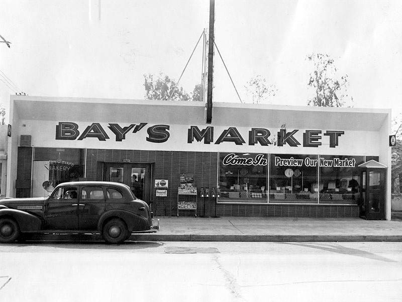 |
|
| (1950)* - Photograph caption dated February 24, 1950 reads "Three day celebration of opening of Bay's new supermarket, 10708 Magnolia Blvd., North Hollywood, will be climaxed at 2 p.m. tomorrow by trick riding of Janice Hays on the pinto pony Dixie." |
 |
|
| (2016)#*^# – Google street view showing the Magnolia Market (formerly Bay's Market) at 10708 Magnolia Boulevard featuring Antojitos Parral, a small Mexican food eatery. |
Rathbuns Department Store
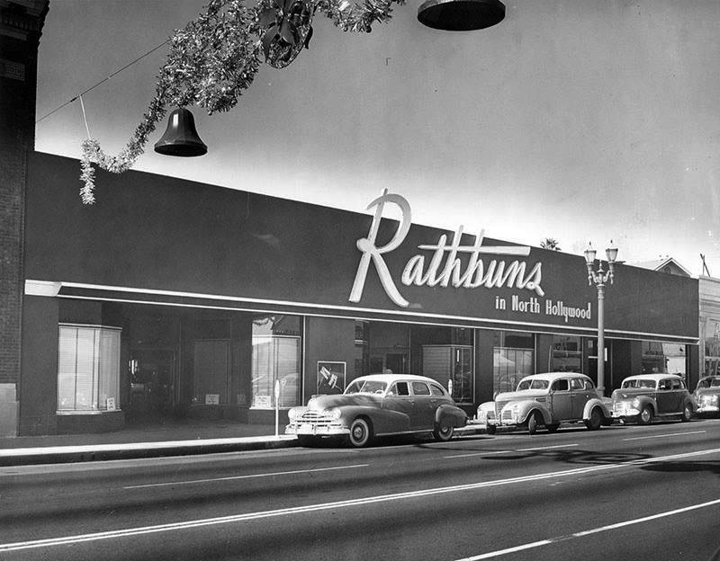 |
|
| (1940s)^.^ - View showing the Rathbuns Department Store, 5311 Lankershim Boulevard, North Hollywood. |
Historical Notes For more than 50 years Rathbun's Department Store was key shopping location in the San Fernando Valley. Established before malls, Rathbun's was one of the few high style stores in the Valley. Shopping downtown Los Angeles was an occasion for holidays. Hall Rathbun started the store on Pico Boulevard (near where the Staples Center is today) in the early 20th century and moved it to North Hollywood around 1914. In 1972, Rathbuns was sold to Nahas Department Stores, which didn’t last too many years after that.^ |
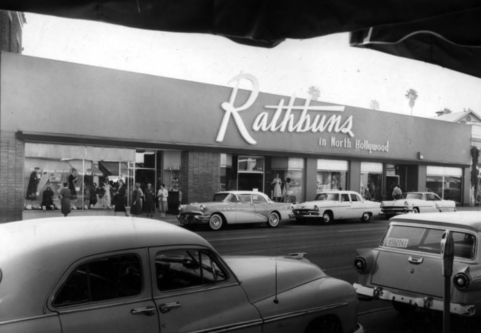 |
|
| (1957)* - View showing the newly remodeled Rathbuns Department Store located at 5311 Lankershim Boulevard. |
Historical Notes Interesting facts: Amelia Earhart bought her clothes and shoes there. Raquel Welch worked with her mom on the switchboard for a while.^ |
* * * * * |
Please Support Our CauseWater and Power Associates, Inc. is a non-profit, public service organization dedicated to preserving historical records and photos. Your generosity allows us to continue to disseminate knowledge of the rich and diverse multicultural history of the greater Los Angeles area; to serve as a resource of historical information; and to assist in the preservation of the city's historic records.
|
More Historical Early Views
Newest Additions
Early LA Buildings and City Views
History of Water and Electricity in Los Angeles
* * * * * |
References and Credits
* LA Public Library Image Archive
^ CSUN Oviatt Library Digital Archives
#^San Fernando Valley History Digital Library - CSUN Oviatt
**DWP - LA Public Library Image Archive
^*The Valley Observied: Street Name Origins; Timeline of Valley History
^#Chatsworth Historical Society; Chatsworth Nike Site; Munch Box
*#Mojave Desert.net: Remi Nadeau
***Los Angeles Historic - Cultural Monuments Listing
*^*California Historical Landmarks Listing (Los Angeles)
*^^Nuestra Señora la Reina de los Ángeles - losangelespast.com
^^^LA Times: Adohr Spelled Succes for the Adamsons; Mulholland Bridge; Panorama City; Getting the Skinny on a Tall Valley Landmark; Valley Newspapers of the Past; Schlitz Closure
^^*LA Times: Stanley Norris Petit
*##LA Times: Dig Into History You'll Find Snake Oil..Victor Girard Kleinberger
+#^Facebook.com: Encino Velodrome; American Rails
+**Valley Presbyterian Hospital History and Milestones
+^^Panorama City - Commercial Area Concept Plan
++#Facebook.com: Photos of Los Angeles
##*Pinterest - California; Roscoe Sheep Crossing
#^#San Fernando Valley Blog: LA Federal Savings Building, North Hollywood; Van Nuys Blvd. Postcard, Valley Music Theatre
*#*Project Restore: Van Nuys City Hall
^*^Topanga Canyon History - LA Magazine
*#^LA World Airports - History of Van Nuys Airport
^^#The Museum of the San Fernando Valley
**#Tumblr.com: LA History - Leonis Adobe
^#*Photo of the Northeast San Fernando Valley ca.1950 - Laurie Burns
^*#North Hollywood-Toluca Lake Patch: History of the Laurel Canyon and Valley Plaza Mall; N. Hollywood Train Depot
*##*BellCanyon.com: Bell Canyon History
#^#^Granada Hills North Neighborhood Council: Granada Hills History
^*^*Metro.net: Mulholland Drive Bridge
*^*#Facebook.com: Classic Hollywood-Los Angeles-SFV
*^^^San Fernando Valley Historic Society/Facebook.com: JC Penney; California Bank; Devonshire Downs; Topanga Plaza Founain; Devonshire and Owensmouth; Sheep Crossing Roscoe; Log Ride / Busch Gardens
^**^Cinema Treasures: Rivoli-Capri Theatre; Reseda Drive-In Theatre; Van Nuys Driv-In Theater; Winnetka Drive-In; Topanga Theatre; Victory Drive-in; Holiday Theatre
***^Los Angeles Movie Palaces: Studio City Theater
**^^KCET: LA Flood of 1938: Cement the River's Future; Canoga Park at 100: A Brief History of the Birth of Owensmouth; When Cahuenga Pass Was Rustic; Before the 'Carmageddon': A Photographic Look at the Construction of 5 SoCal Freeways; Thematic Cartography and Mapping Los Angeles
**^#LA Times Framework: Busch Gardens Monorail; Woodland Hills Sheep
*^^#Flickr.com: Kaiser Panorama City
**#*EntertainmentDesigner.com: Busch Gardens
**#^San Fernando Valley Historical Society: Van Nuys Drive-in Theater
*^#^Northridge Fashion Mall Jobs
^^##Encino-Tarzana Patch: Valley Ice Skating Center
^##*Pinterest: Drive-in Speakers
^##^Pinterest: San Fernando Valley
*#^#Forum.skyscraperpage.com: Coffee Dan's
*##^City-Data.com: Ventura Boulevard
*#^*Los Angeles County Library: Agoura Hills
*#^^Big Orange Landmarks: Drive-ins Roared into LA Country
*#**Facebook.com: Museum of the San Fernando Valley; Busch Monorail
^***LosAngelesPast.com: Cahuenga Pass
^**#The Friends of Oakridge; theoakridgeestate.com
#**^Flickr.com: Bibiop – Northridge Fashion Center
#^*^Facebook.com: West San Fernando Valley Then And Now
#*^*The First 100 Years: umccp.org
#*^#Google Maps
#^*#Worldwide Drive-Ins: Winnetka 6
#*#^Pierce College - piercecollege.edu
#*##Daily News: Rocketdyne Canoga Park; Proposed $3B Project at Rocketdyne Site
##^^California State University Northridge History: csun.edu
^###Northridge Fashion Mall History
^^***Water and Power Associates
^^^^*Mbcinfo.com: Joseph Schlitz Brewing Company
**^^^LA Movie Palaces: San Fernando Valley
*^^^^Pinterest: San Fernando Valley - My Home Sweet Home
*^^^#DWP - Water and Power Associates Historical Archives - Courtesy of Rex Atwell
^***^Pacific Electric San Fernando Valley Line - ERHA.org
^^^*San Fernando Valley Relics: Facebook.com; Leonis Ranch; Ventura and Woodman; Busch Gardens; Reseda Blvd; Victory Blvd in Woodland Hills; Van De Kamp's; Valley Plaza; Nordhoff St. and Topanga Cyn; Ventura and Van Nuys Blvd; Van Nuys and Oxnard; Van Nuys Aerial; Van Nuys Blvd, ca. 1940; I-5 and I-14 Interchange; Van Nuys Drive-in; Mobil Gas Station; Canoga Drive-In; Victory and Whitsett; Van Nuys Aerial; Budweiser/Anheiseur-Busch Sign; Ventura Blvd 1950s
*^ Wikipedia: Sherman Oaks; Isaac Van Nuys; Encino; Tarzana; Campo_de_Cahuenga; Cahuenga Pass; Chatsworth; Panorama City; Santa Susana Field Laboratory; North Hollywood; Canoga Park; Woodland Hills; Reseda; Orcutt Ranch; Granada Hills; Andrés Pico; Moses Sherman; Van Nuys; Henry Kaiser; Charles Maclay; San Fernando Valley; Mission Point; Hughes Aircraft; Domonique Amestoy; Winnetka, Los Angeles; City of San Fernando; Canoga Park High School; Ventura Freeway; Hollywood Freeway; Los Angeles Valley College; Kaiser Permanente; Van Nuys Assembly; Rancho El Escorpión; Topanga Plaza; Simi Valley Freeway (118); Newhall Pass Interchange; Litton Industries; West HIls; Devonshire Downs; CSUN; Television Set History; Shadow Ranch; Atlas Missile; Thrifty Drugs; Coast Daylight; Longs Drugs; Du-Par's Restaurant; Joseph Schlitz Brewing Company; Annheiseur Busch; Fotomat; Baskin-Robbins; Valley Presbyterian Hospital; Warner Center; Gemco; Valley Music Theatre; Westfield Fashion Square; Paxton Park (Ritchie Valens Park); Big Donut Drive-in; Randy's Donuts; Builders Emporium; AlliedSignal; North Hills; Pacoima; 1960 Presidential Election
< Back