Mulholland Dam and Hollywood Reservoir
 |
|
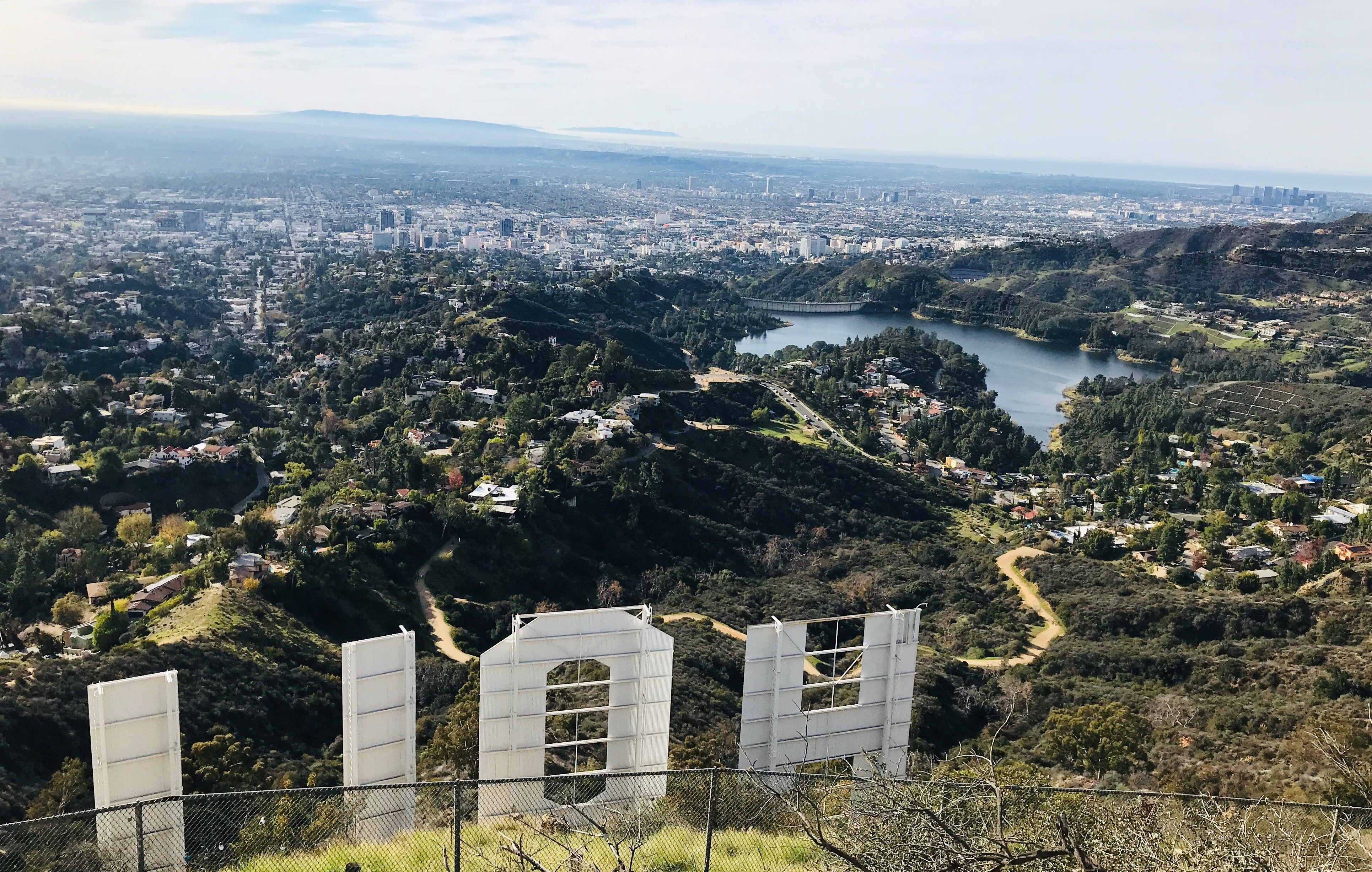
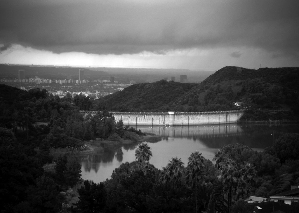
| (2019)* - Panoramic view looking down at Mulholland Dam and Hollywood Reservoir from behind the Hollywood Sign, showing the close relationship between Los Angeles’ water infrastructure and the city it helped shape. Photo by Jack Feldman. |
Introduction |
Mulholland Dam and the Hollywood Reservoir together form one of the most visible reminders of how water shaped the growth of Los Angeles. In some period captions and sources, Mulholland Dam is also referred to as Hollywood Dam. Built in the early 1920s, the project combined engineering ambition, civic pride, and the urgent need to supply water to rapidly expanding hillside communities. Set high in Weid Canyon above Hollywood, the dam was unusual for its time: a major concrete structure located within sight of a growing metropolitan district.The reservoir it created became an important link in Los Angeles’ evolving water system, helping deliver reliable pressure and storage to neighborhoods climbing into the Hollywood Hills. At the same time, real estate development surged around it, with new subdivisions and iconic hillside signs marketing the promise of hillside living supported by modern infrastructure.Over the decades, Mulholland Dam has also reflected changing attitudes toward dam safety, seismic risk, and urban design. From its celebrated dedication in 1925 to the post-1928 era of heightened dam-safety review and operating caution, and into its present role as a carefully managed facility, the dam tells a broader story about how Los Angeles learned, adapted, and grew. |
* * * * * |
Planning and Building the Dam (1923–1925) |
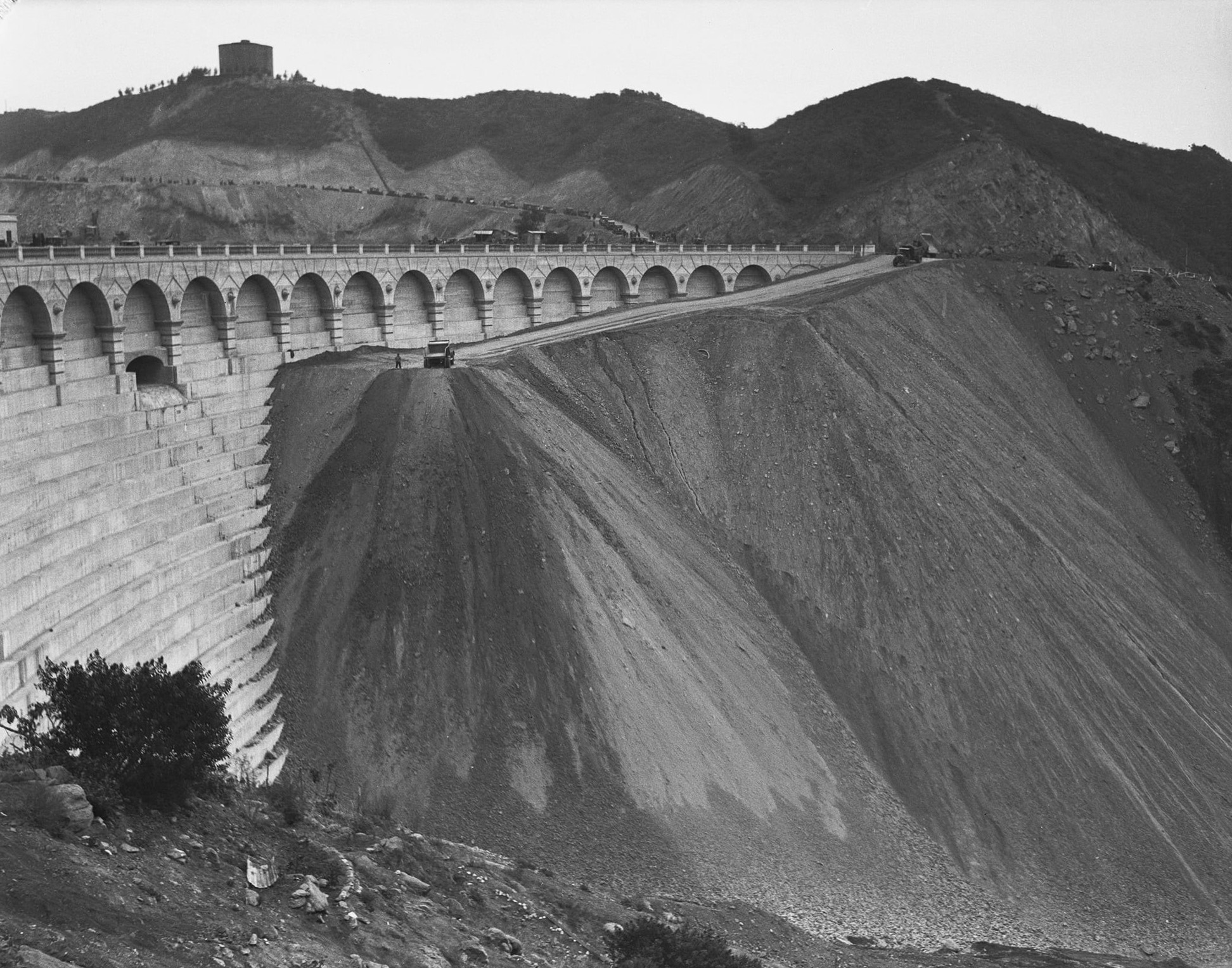
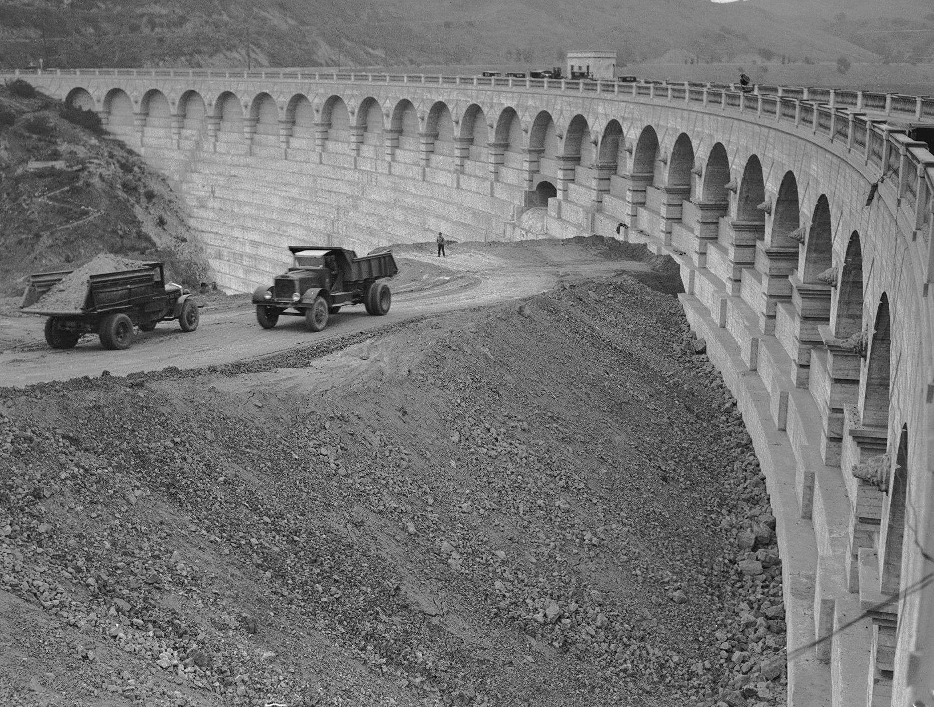
Mulholland Dam was planned during a period when Los Angeles was expanding quickly and needed more local water storage. Engineers selected Weid Canyon because its narrow shape and strong canyon walls made it suitable for a large reservoir close to the city. Construction began in 1923 under Chief Engineer William Mulholland and moved at a rapid pace. By the end of 1924 the concrete structure was complete, turning a quiet canyon into a major part of the city’s water system. |
 |
|
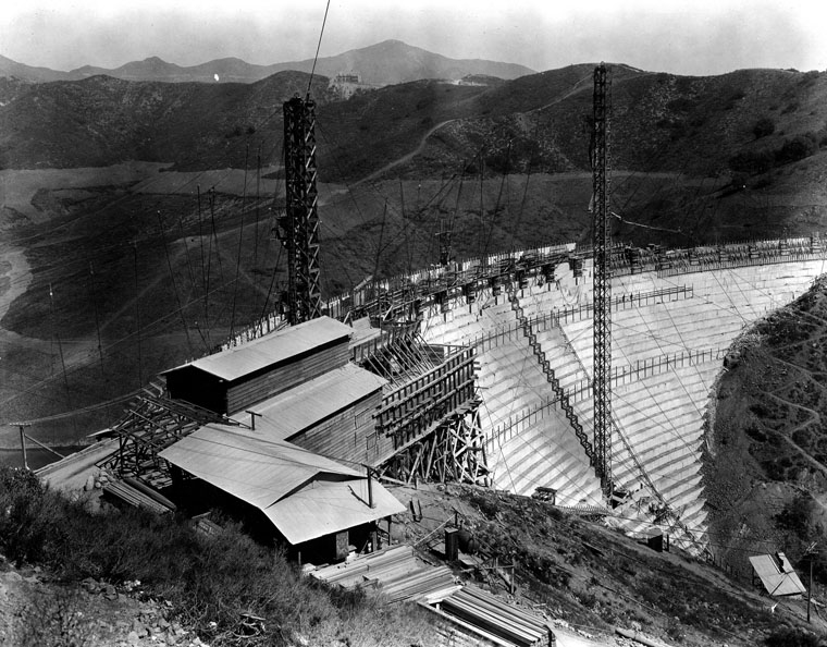
| (1924)* - View showing the Mulholland Dam under construction. Photo date: February 2, 1924 |
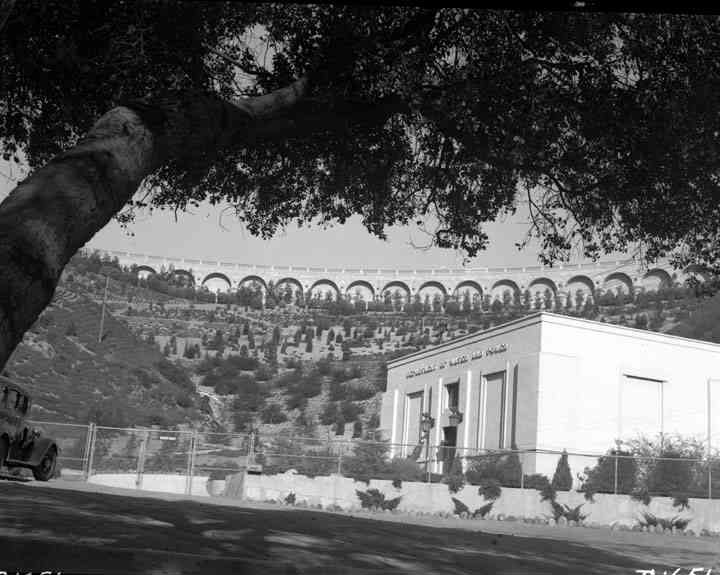
Historical Notes Mulholland Dam is a curved concrete gravity dam built by the City’s Bureau of Water Works and Supply under Chief Engineer William Mulholland. Construction began in August 1923 and the structure was completed in December 1924 to create a new municipal reservoir above Hollywood. The arch is thrust upstream so the hydrostatic load is carried into the canyon walls, a common practice for early concrete gravity-arch dams. The formal dedication took place on March 17, 1925. |
 |
|
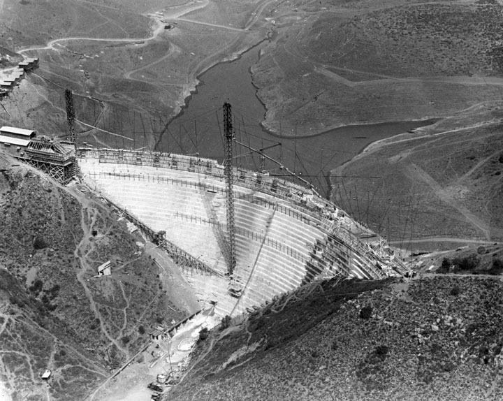
| (1924)* - Aerial view shows the construction of the Mulholland Dam and the Hollywood Reservoir beginning to take form. |
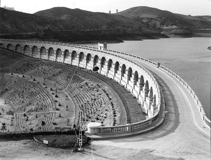
Historical Notes The reservoir impounded behind the dam was named Hollywood Reservoir, later popularly called Lake Hollywood. At design pool it stored about 7,900 acre-feet, approximately 2.5 billion gallons, supplied primarily by the Los Angeles Aqueduct and integrated into the city’s wider distribution system. The reservoir became one link in a citywide chain of storage and distribution facilities serving rapidly growing neighborhoods. |
* * * * * |
Water and Growth in the Hollywood Hills |
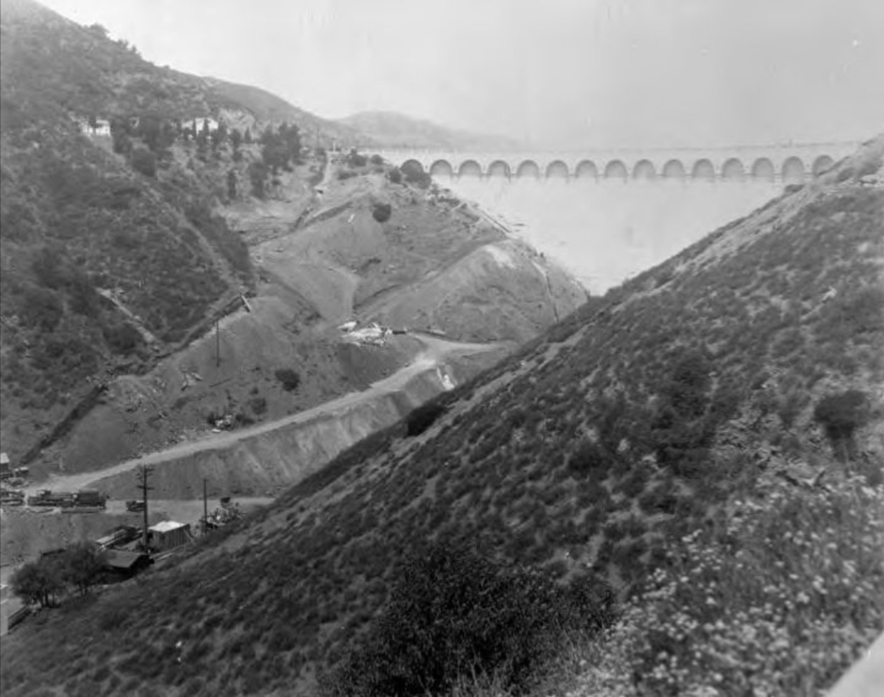
As the dam and reservoir rose in Weid Canyon, development spread across the surrounding hills. Subdivisions were marketed with oversized hillside signs that could be read for miles. The images in this section show how water infrastructure and real estate promotion advanced side by side during the 1920s. |
 |
|
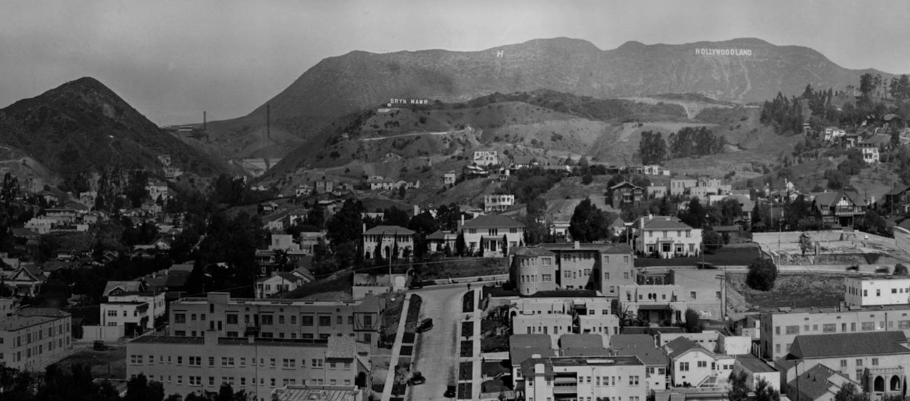
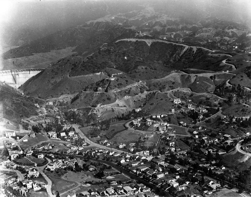
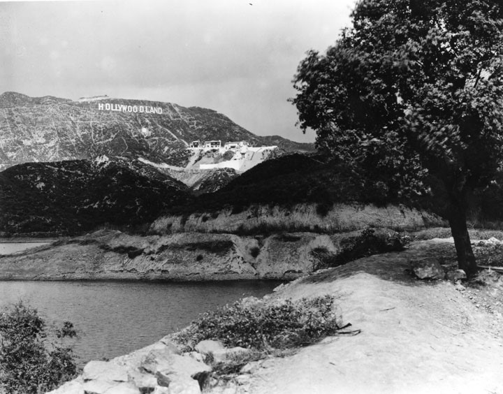
| (1924)* – Panoramic view looking north over the Hollywood Hills. The HOLLYWOODLAND sign is at upper right, a large letter H is near top center, and the Bryn Mawr sign appears below. The new Mulholland Dam is at center left and still under construction. |
Historical Notes During the early 1920s hillside real-estate promotions placed oversized signs on the slopes to market new tracts such as Bryn Mawr, Outpost Estates, and HOLLYWOODLAND. The marketing of these subdivisions paralleled construction of the dam and reservoir that would provide gravity pressure to the expanding Hollywood area. Click HERE to see more in Early Views of Hollywood. |
 |
|
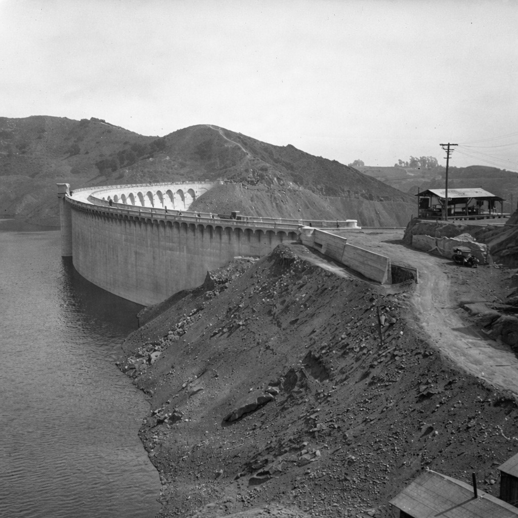
| (1924)* - Aerial view showing a nearly completed Mulholland Dam at the upper-left with the Bryn Mawr residential subdivision below it. The Bryn Mawr Sign can be seen to the right of the dam on the hillside. |
Historical Notes By late 1924 the dam structure was essentially finished and the reservoir basin grading was complete. Streets of the Bryn Mawr tract below were being cut and improved, a visual reminder of how water infrastructure and hillside development advanced together in the 1920s. |
Before and After
 |
|
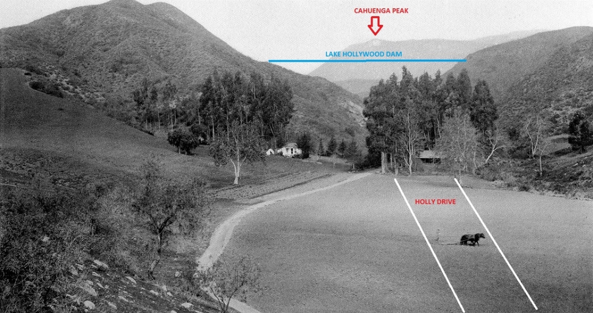
| (ca. 1905)* - View from Cahuenga Boulevard looking down at a farm where a man stands behind a horse-drawn plow. Today Holly Drive runs north here within the later Bryn Mawr tract. Cahuenga Peak is in the distance near the future site of Mulholland Dam.* |
Historical Notes Long before the dam and the 1920s hillside tracts, this area was a mix of small farms and open country. Within two decades the same slopes would host street grids, tract homes, and the city’s new Hollywood Reservoir. |
 |
|
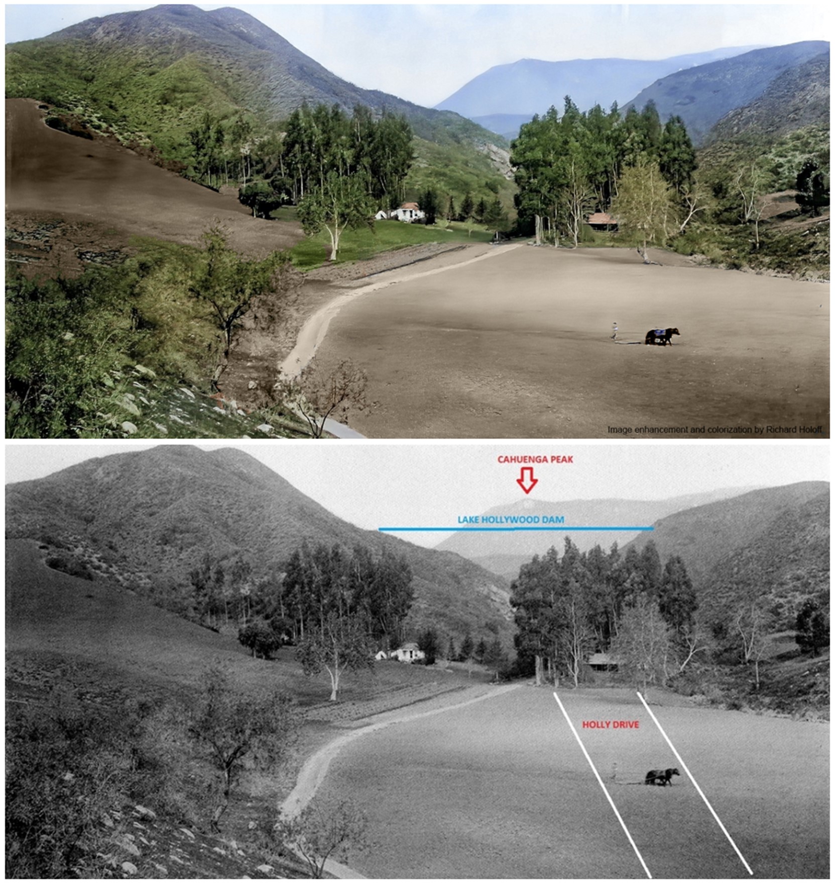
| (ca. 1905)* - Same view from Cahuenga Boulevard looking toward the future Bryn Mawr tract and the site of Mulholland Dam. Image enhancement and colorization by Richard Holoff. |
Historical Notes This colorized view emphasizes the rural character that preceded urban subdivision and the reservoir project. By the mid 1920s the canyon beyond would hold an arching concrete dam anchoring Los Angeles’ growing water system. |
 |
|
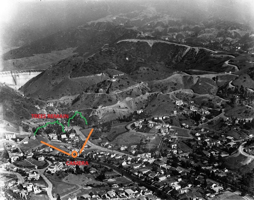
| (1924)* - Aerial view identifying the location of the earlier farm scene. The highlighted trees serve as reference points for comparison. |
Historical Notes With the dam nearly complete in 1924, the landscape had transformed from scattered agriculture to engineered infrastructure and hillside street grids. The reservoir would add both storage and reliable gravity-fed pressure for Hollywood’s growing neighborhoods. |
* * * * * |
Creating Hollywood Reservoir |
The dam created Hollywood Reservoir, later widely known as Lake Hollywood. At full design level it could store about 7,900 acre-feet of water, equal to roughly 2.5 billion gallons. Water delivered by the Los Angeles Aqueduct could be held here and then distributed to nearby neighborhoods by gravity. This made the reservoir an important link in the growing chain of storage facilities that supported Los Angeles in the 1920s. |
 |
|
| (1925)* - Close-up view showing the water beginning to rise behind the dam. |
Historical Notes Initial filling was staged after construction, with operating crews monitoring the structure and abutments as water climbed the face. The reservoir was still well below its design pool at the March 17, 1925 dedication. |
 |
|
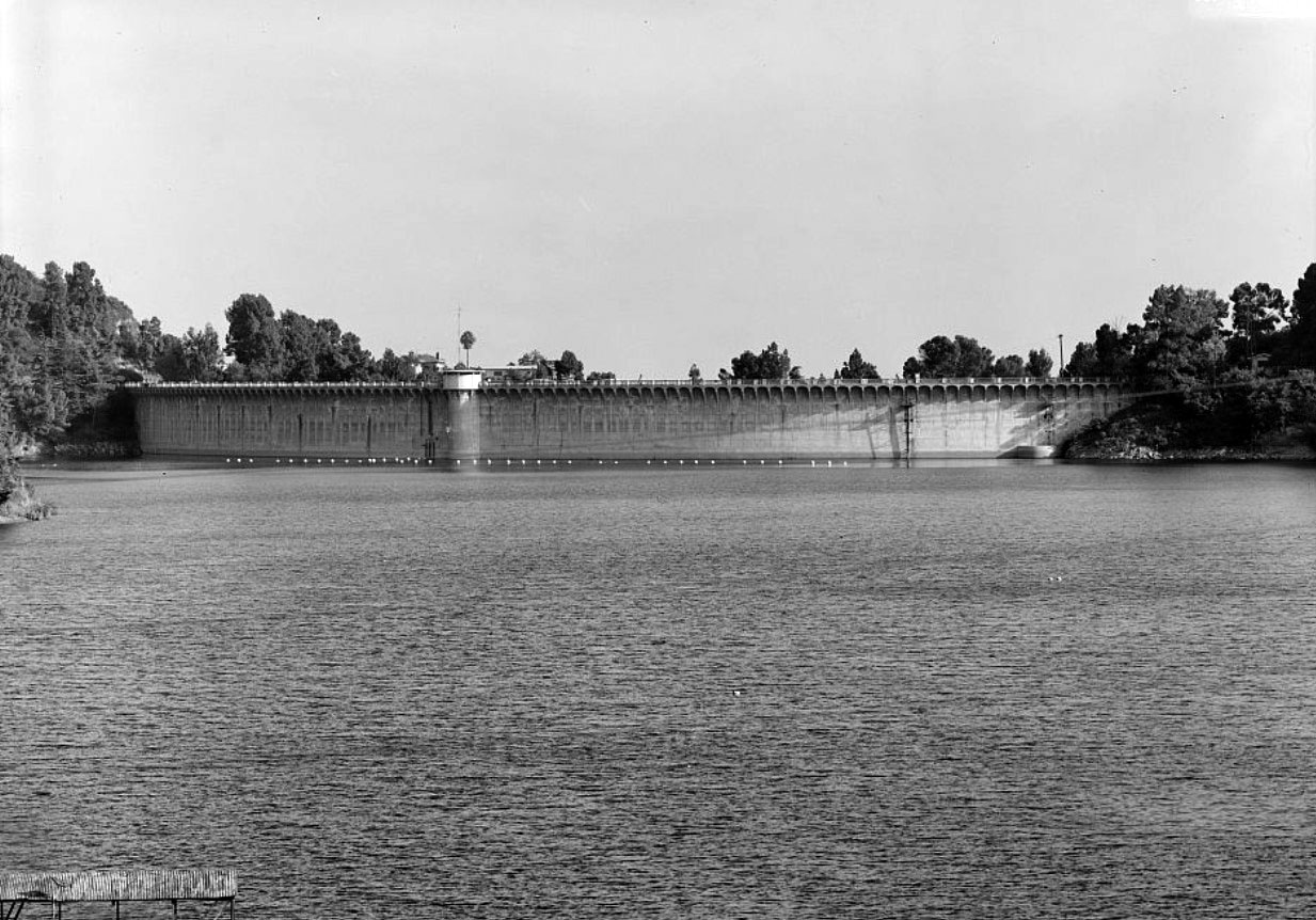
| (1925)* - View of Mulholland Dam shortly after completion. The dam was named for its designer William Mulholland, who also led design and construction of the Los Angeles Aqueduct and many city reservoirs. |
Historical Notes As built, the dam contained about 172,800 cubic yards of concrete. Typical section dimensions included a crest width of about 16 feet, a base thickness near 160 feet, and a crest length commonly cited between 975 and 995 feet. Original storage was approximately 7,900 acre-feet with a maximum water depth near 183 feet. |
* * * * * |
Opening Day |
The dedication of Mulholland Dam on March 17, 1925 was treated as a major civic event. Large crowds gathered on the crest and city leaders presented the project as a sign of progress and confidence in the future. William Mulholland himself attended the ceremonies. These images show how important water projects were to the public identity of Los Angeles during this era. |
 |
|
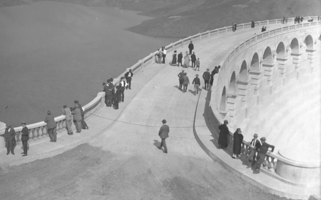
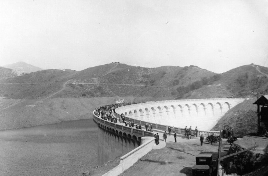
| (1925)* – People arriving on the Mulholland Dam for the opening-day dedication ceremony, March 17, 1925. |
Historical Notes St. Patrick’s Day 1925 marked the formal dedication of both the dam and Hollywood Reservoir. The city celebrated the project’s engineering ambition and its strategic location inside a growing metropolitan district. |
 |
|
| (1925)* - Hollywood Reservoir and Mulholland Dam during dedication ceremonies, showing the assembled crowd with the dam face prominent. March 17, 1925. |
Historical Notes The Bureau emphasized two priorities for an urban dam in public view: safety and beauty. The crest roadway featured balustraded sidewalks, ornamental detailing, and views over Hollywood and downtown Los Angeles. |
 |
|
| (1925)* - Visitors walking across the crest during the dedication ceremony. An American flag is draped over one of the towers. |
Historical Notes The dam’s crest functioned as a 24-foot roadway with pedestrian walks on both sides. The arch thrust upstream was intended to transmit water loads to the canyon abutments while the mass of the section resisted overturning and sliding. |
 |
|
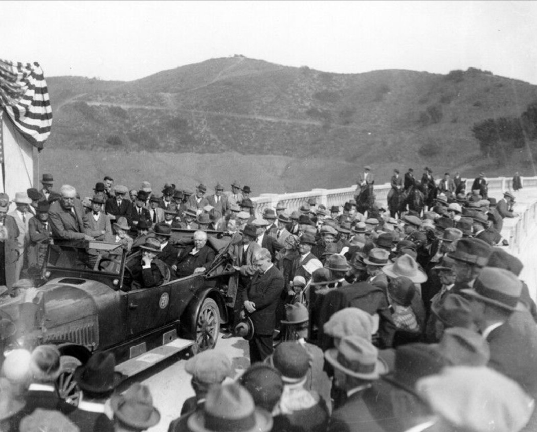
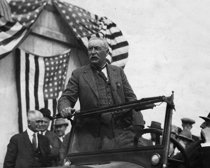
| (1925)* - Dedication day at Mulholland Dam. William Mulholland is standing in the car at center. Riders on horseback appear to the rear. |
Historical Notes William Mulholland, born in Belfast in 1855, rose from ditch tender to chief engineer and became the most prominent figure in Los Angeles water development. After the St. Francis Dam failure in 1928 he retired from public service. Mulholland Dam remained in operation and later entered a period of more cautious management (see ‘After the St. Francis Dam Disaster’ below). |
 |
|
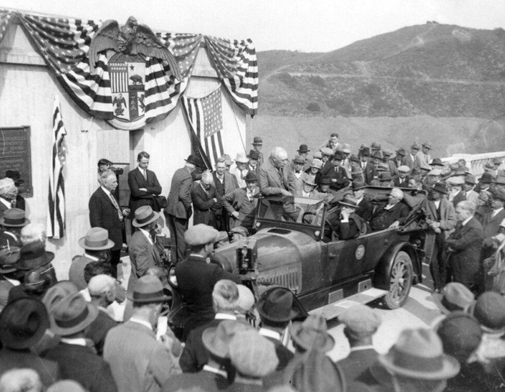
| (1925)* - Dedication ceremonies showing dignitaries in a car with the Los Angeles City seal on the door. Flags frame the dedicatory plaque. |
Historical Notes At dedication the reservoir stood at about 120 feet of depth, well under design capacity as controlled filling continued. The project cost about $1.25 million, roughly a little over six dollars per cubic yard of concrete at the time, notably lower than many comparable projects elsewhere. |
 |
|
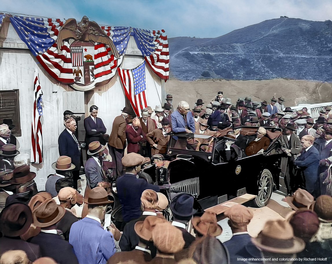
| (1925)* - Dedication ceremonies, same scene as above. Image enhancement and colorization by Richard Holoff. |
Historical Notes Colorization highlights the ceremonial displays on the crest and the scale of the concrete structure above the newly impounded lake. |
 |
|
| (1925)* - William Mulholland standing in an open automobile in front of American flags at the dedication of the Mulholland Dam and Hollywood Reservoir. Click HERE to see the William Mulholland Biography. |
Historical Notes Dedication on March 17 aligned with Mulholland’s Irish heritage. Within a few years the tragic collapse of the St. Francis Dam in March 1928 would prompt public scrutiny of Hollywood Reservoir and major local operating and reinforcement changes described in the ‘After the St. Francis Dam Disaster’ section below. |
* * * * * |
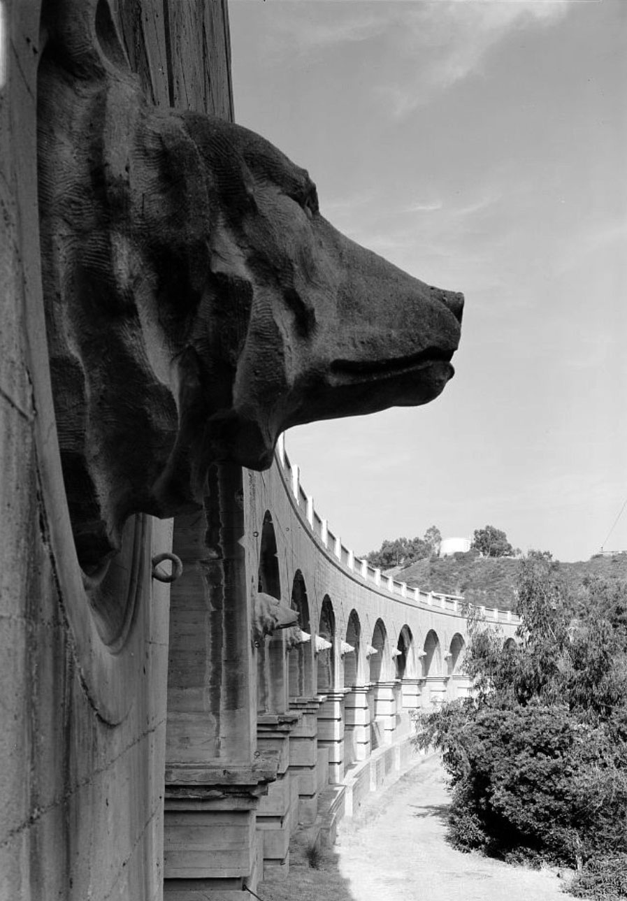
Design and Decorative Details |
Mulholland Dam was designed for strength but also for appearance. The crest included a roadway, railings, towers, and decorative features. The bear head ornaments reflected California’s state symbol and added a civic touch to the structure. These details show that the city viewed major water works as public landmarks, not just hidden utilities. |
 |
|
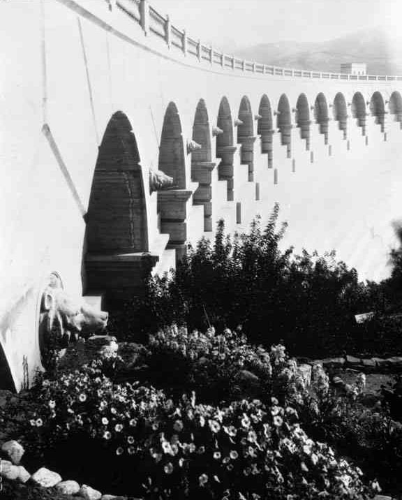
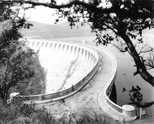
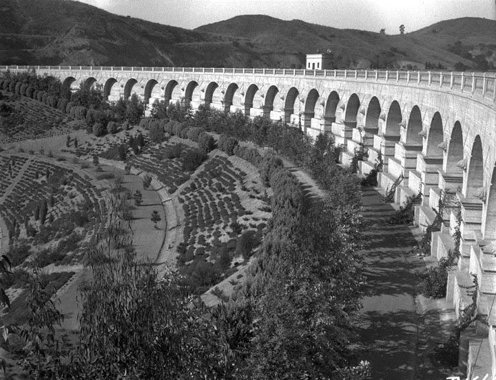
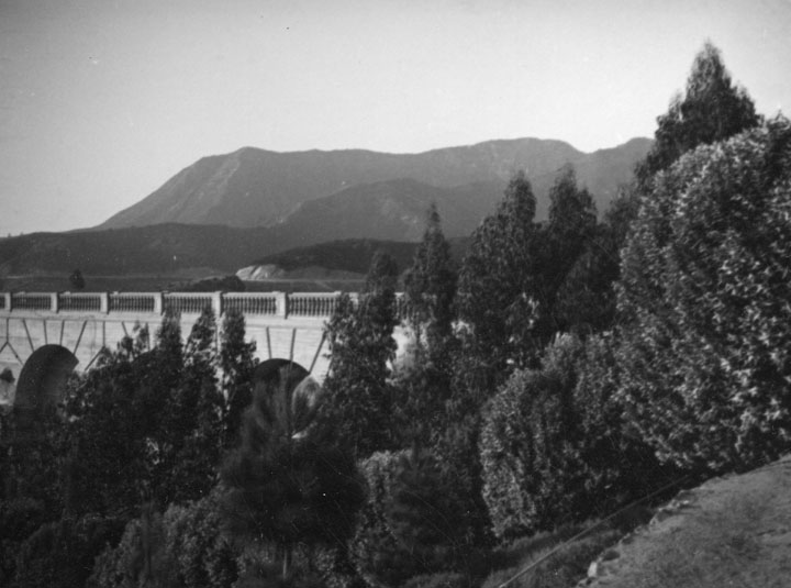
| (1925)* - Graceful arches and landscaping make Mulholland Dam an object of beauty as well as of service in providing a valuable reserve water supply for Hollywood and other districts of Los Angeles. |
Historical Notes Mulholland Dam was conceived not only as a working structure but also as a civic showpiece. The curved concrete gravity form thrusts upstream to carry water pressure into the canyon walls, while the crest roadway and balustraded sidewalks provided a formal public face. Early landscaping softened the flanks and framed views over the new Hollywood Reservoir, later widely known as Lake Hollywood. |
 |
|
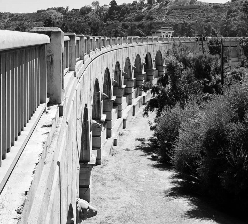
| (2020)* – View showing The Bears of Mulholland Dam as they appear today. Photo courtesy of Brian Burchfield. |
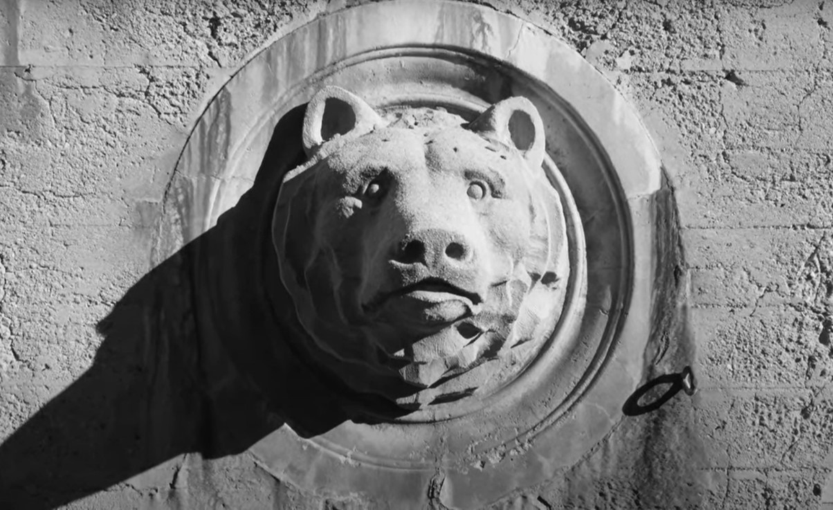
Historical Notes Ornamental bear-head medallions decorate the spandrel walls along the downstream side. The motif reflects California’s state symbol and the region’s native wildlife, a deliberate blending of civic art and engineering that dates to the dam’s 1920s design. |
 |
|
| (2022)* – Contemporary view of the Mulholland Dam bears. Courtesy of Tinsel and Stars. |
Historical Notes The cast bear heads remain one of the dam’s most distinctive features. They occupy the spandrel panels between the crest and the face of the dam and were retained through later safety modifications, preserving the 1920s aesthetic. |
 |
|
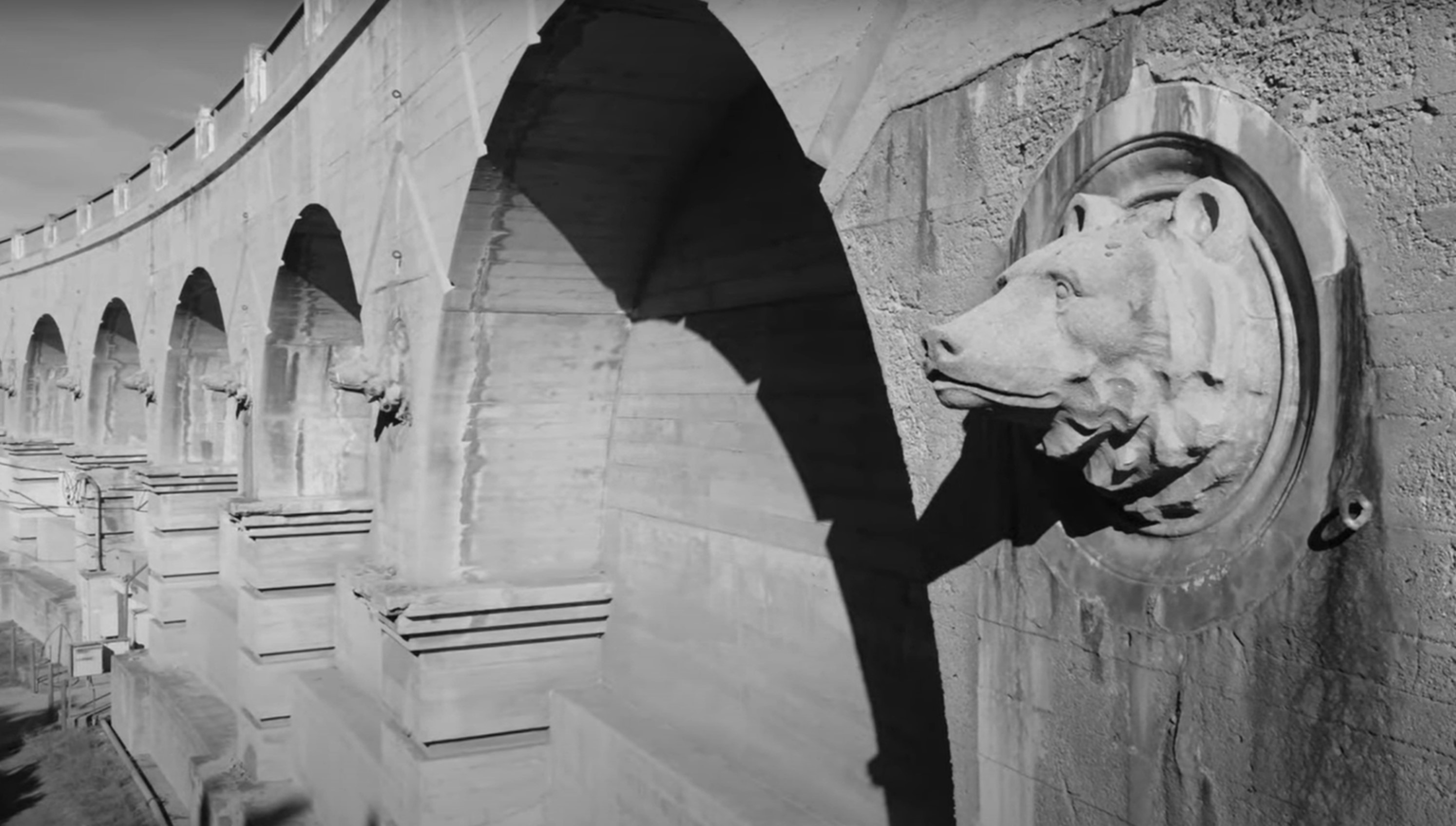
| (1968)* - Close-up profile view showing the ornamental bears on the downstream side of Mulholland Dam. Library of Congress. |
Historical Notes The stylized bear heads set into the spandrel wall reference California’s state animal and were part of the dam’s original decorative program on the crest and parapet. Mid-century photography confirms the ornament remained in place after the 1933–1934 addition of an earth buttress to the downstream face. While the lower concrete was buried for stability and to calm public concern, the crest elements—including the balustrades and bears—remained visible and were later framed by landscaping. |
 |
|
| (2022)* – Close-up view of the Mulholland Dam bear. Courtesy of Tinsel and Stars. |
Historical Notes The bears are cast ornament attached to the spandrel wall along the crest roadway. They reflect the City’s 1920s emphasis on making this urban waterworks both functional and civic in appearance. Today they read as historic markers of the dam’s original architectural treatment. |
* * * * * |
Views of Mulholland Dam and Hollywood Reservoir |
From the streets of Hollywood to aerial viewpoints above the basin, these images show how unusual Mulholland Dam was for its time: a major concrete dam visible from everyday city locations. They also capture how the reservoir and dam became part of Hollywood’s visual identity, appearing alongside hillside tract signs, growing street grids, and the skyline of a rapidly changing Los Angeles. |
 |
|
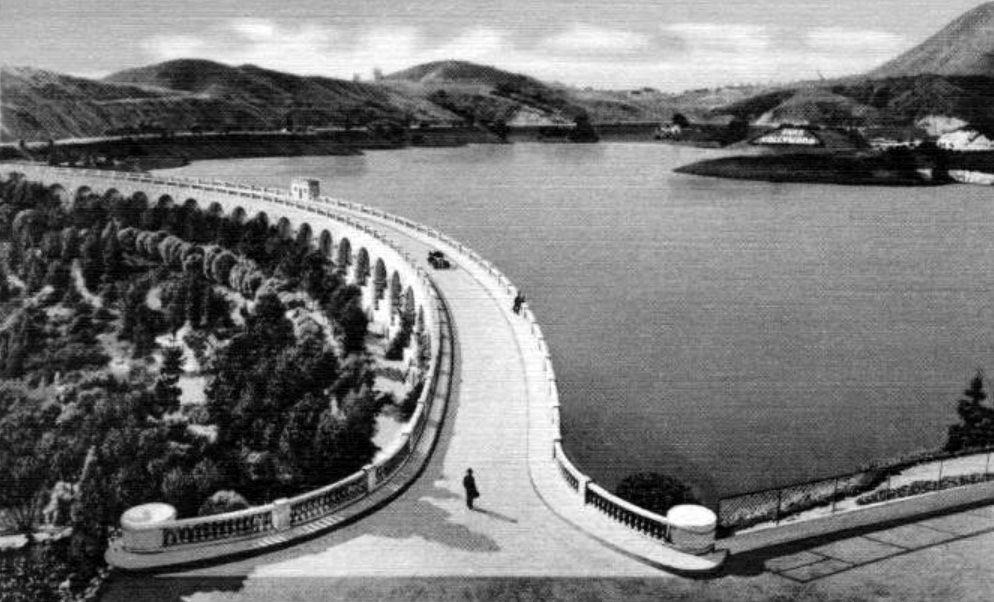
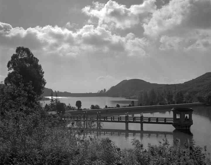
| (1925)* - Mulholland Dam and Hollywood Reservoir seen here with the clouds reflecting off the water. |
Historical Notes This early view shows Hollywood Reservoir, later widely known as Lake Hollywood, soon after dedication on March 17, 1925. As built, the curved concrete gravity dam impounded roughly 7,900 acre-feet at design pool, providing gravity head for water service to Hollywood and adjacent pressure zones. Initial filling proceeded in stages while engineers observed the structure and abutments. |
 |
|
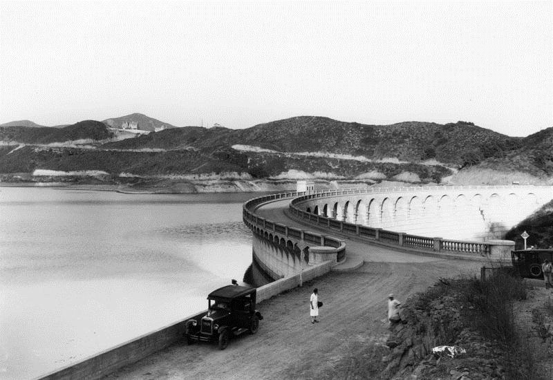
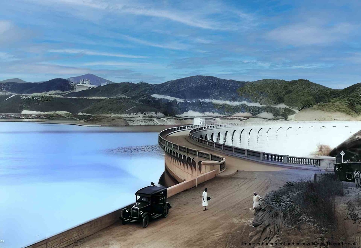
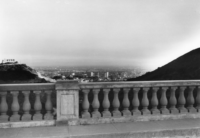
| (1925)* - View looking out over the Hollywood Reservoir toward the Mulholland Dam. A large sign behind the dam reads “BRYN MAWR”. |
Historical Notes Like the HOLLYWOODLAND sign, the Bryn Mawr hillside sign promoted a new 1920s subdivision below and around the reservoir. The simultaneity of dam construction and tract development illustrates how water infrastructure underpinned the rapid growth of the Hollywood Hills. (Click HERE to see more). |
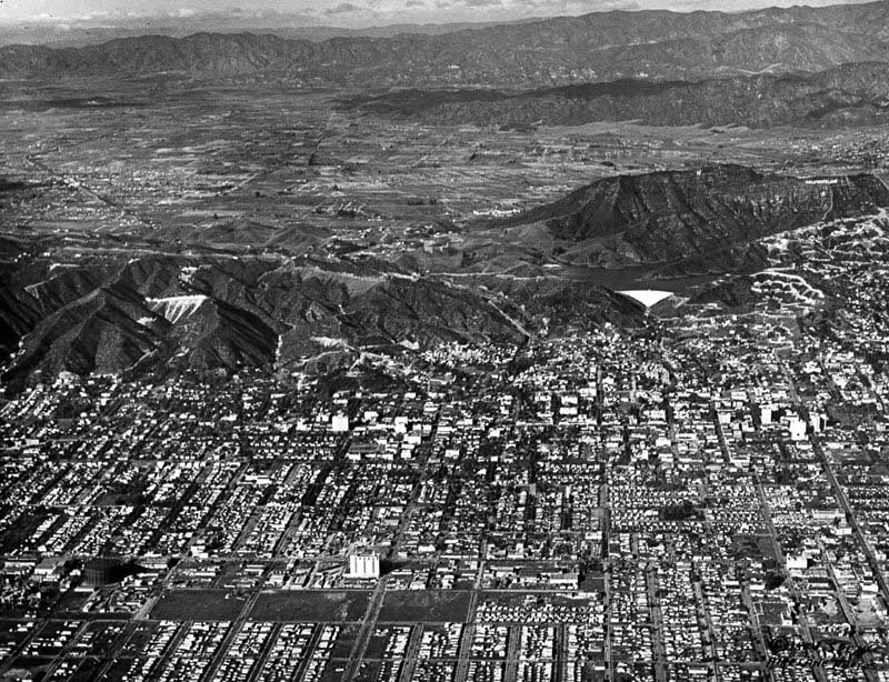 |
| (1926)*- Aerial view of Hollywood looking north. The Mulholland Dam and Hollywood Reservoir can be seen at upper center-right. |
Historical Notes By 1926 the reservoir sat above an increasingly gridded Hollywood. Streetcar lines, studio lots, and hillside subdivisions spread beneath the new storage facility, which tied the Los Angeles Aqueduct supply to local distribution. |
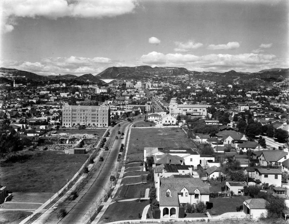 |
| (1925)* - View of Hollywood looking north from Rossmore Avenue and Rosewood Avenue showing Vine Street from its north turn near Melrose Avenue. At top center-left is a clear view of the Mulholland Dam high in the Hollywood Hills. |
Historical Notes From this mid-city vantage the white face of the dam is visible on the ridge above Hollywood. The view underscores the unusual siting of a major concrete dam within a metropolitan district, a point often remarked upon at the 1925 dedication. |
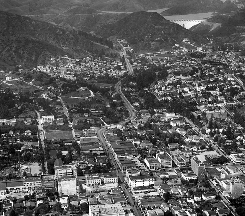 |
| (1926) – Aerial view looking north along Highland Avenue toward Cahuenga Pass with the Mulholland Dam and Hollywood Reservoir in the distance. |
Historical Notes Highland Avenue leads directly toward the Cahuenga Pass transportation corridor. Beyond, the reservoir occupies Weid Canyon, with the dam’s upstream arch transferring water loads into the canyon walls. The skyline still shows the big hillside tract signs of the era. |
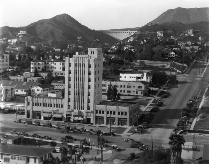 |
| (1928)^ - View looking north from over the intersection of Yucca and Vine streets, showing the Mulholland Dam straddling the Hollywood Hills canyon. The Art Deco Mountain States Building (now Yucca Vine Tower) is in the foreground. |
Historical Notes Taken the same year as the St. Francis Dam failure, this image captures Mulholland Dam at near-full presentation before the later earth buttress obscured its lower face. After 1928 the City reduced Hollywood Reservoir’s operating level and later (1933–1934) added a large downstream earth embankment for stability and public reassurance. |
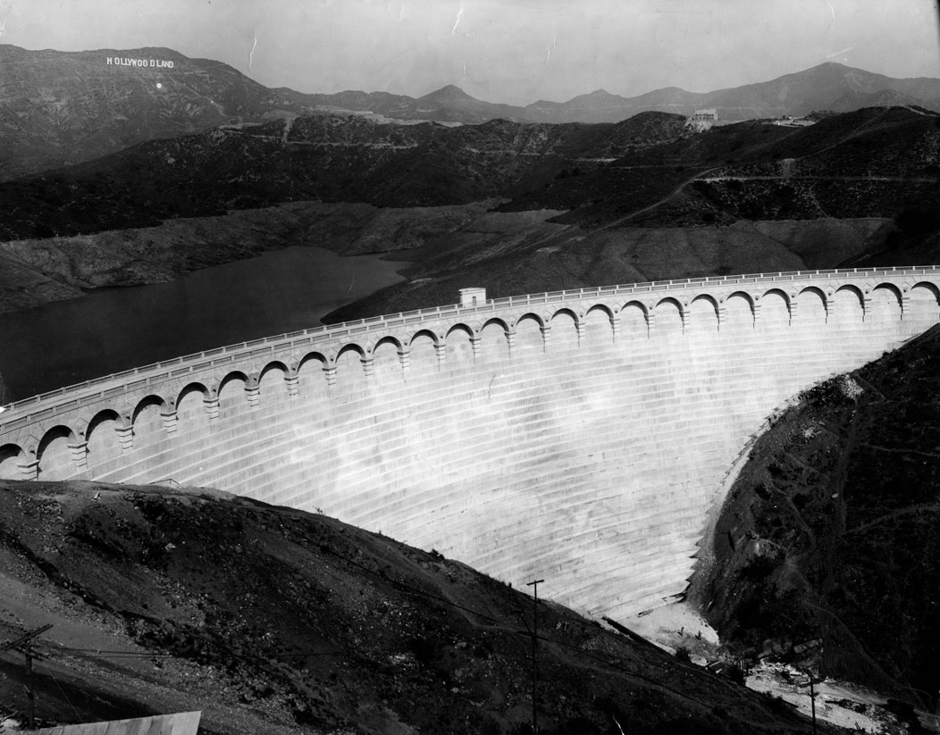 |
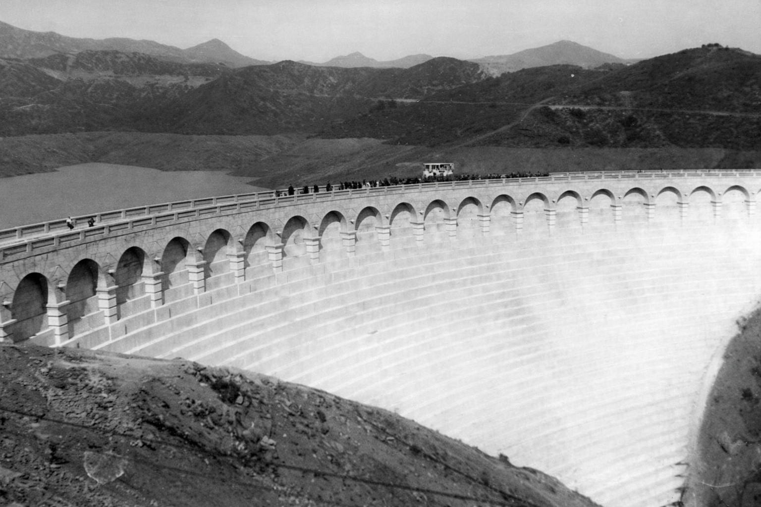
| (1929)* - Front view of Mulholland Dam in the Hollywood Hills, described at the time as among the most beautiful works in Los Angeles’ water system. The HOLLYWOODLAND sign appears in the background. |
Historical Notes This frontal portrait shows the dam before the downstream buttress was placed. The balustraded crest roadway and ornament emphasized the Department’s stated priorities of safety and beauty for an urban landmark. Note the low water level: after the 1928 St. Francis Dam disaster, Hollywood Reservoir was drawn down as a precaution and later operated under permanent limits (see ‘After the St. Francis Dam Disaster’ below). |
* * * * * |
Mulholland Dam in Its Early Years |
By the late 1920s Mulholland Dam and Hollywood Reservoir were fully integrated into the city’s water system and landscape. The dam’s white concrete face remained fully visible and the reservoir often operated near its original design levels. These images capture the facility as it appeared during its first years of service, just before changes in dam safety philosophy reshaped its operation. |
 |
|
| (1928)* - View of Mulholland Dam and Hollywood Reservoir, later widely known as Lake Hollywood, designed and built under William Mulholland. |
Historical Notes In 1928 Hollywood Reservoir still operated near its original design pool. After the 1928 St. Francis Dam disaster, the City adopted more cautious operating limits for Hollywood Reservoir and later added a large downstream earth buttress (1933–1934). Details and figures are provided in the ‘After the St. Francis Dam Disaster’ section below. |
 |
|
| (1928)* - Mulholland Dam and Hollywood Reservoir, same view as above. AI enhancement and colorization by Richard Holoff. |
Historical Notes The colorized version conveys the broad water surface and the white concrete face that characterized the dam before the downstream embankment and full landscaping program obscured much of the structure from view. |
 |
|
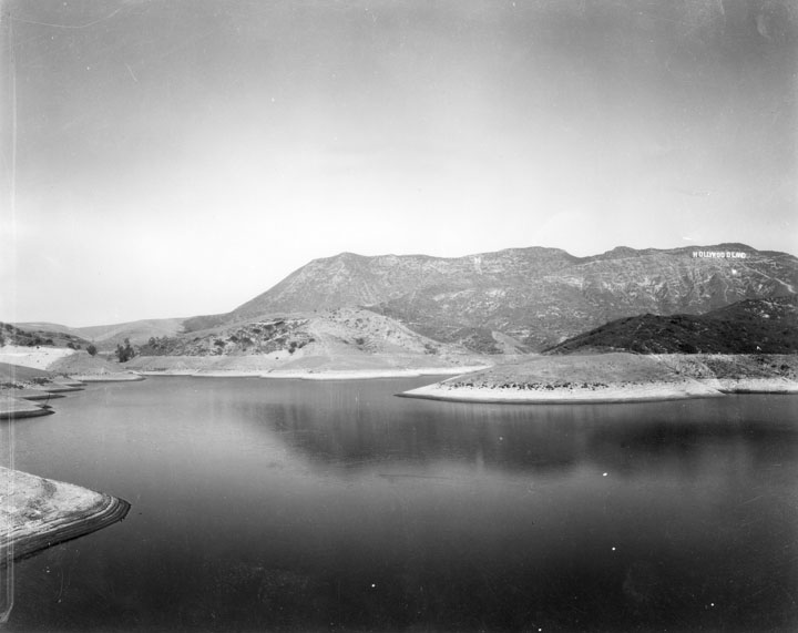
| (ca. 1920s)* - View of Hollywood Reservoir with the Hollywoodland Sign visible on the right side. |
Historical Notes The hillside Hollywoodland sign promoted the 1923 subdivision in the hills above the reservoir. Real estate advertising and the new water storage project advanced in parallel during the 1920s as Hollywood’s population expanded and hillside tracts were opened. |
 |
|
| (ca. 1930)* – View showing the Hollywoodland Sign in the distance as seen from the edge of the Hollywood Reservoir. |
Historical Notes From the shore of the reservoir the sign’s large letters illustrate how marketing of the Hollywoodland tract was integrated into the landscape. The reservoir provided gravity head for the surrounding pressure zones as new streets and homes climbed the slopes. |
 |
|
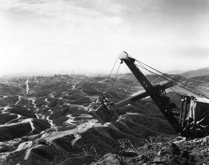
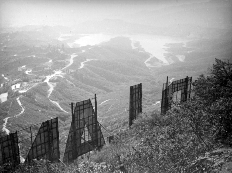
| (ca. 1929)* - An overview of the hills with the Mulholland Dam and Hollywood Reservoir at right, partly hidden by a steam shovel on the near ridge. Brackets in the foreground are supports for the Hollywoodland Sign. |
Historical Notes Heavy grading equipment and sign supports reveal the scale of concurrent hillside construction. The dam’s siting in Weid Canyon placed major municipal infrastructure within sight of active real estate development, an uncommon urban juxtaposition at the time. |
 |
|
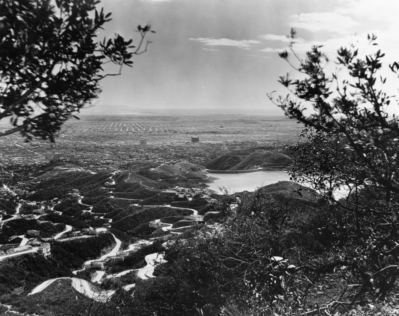
| (ca. 1929)* - Panoramic view of Hollywood and West Los Angeles from Mt. Lee. Hollywood Reservoir and the Hollywoodland sign are in the foreground. |
Historical Notes This panorama situates the reservoir within the greater basin. By the late 1920s studio districts, street grids, and arterial roads stretched south and west while the municipal storage basin supplied pressure to Hollywood and nearby neighborhoods. |
 |
|
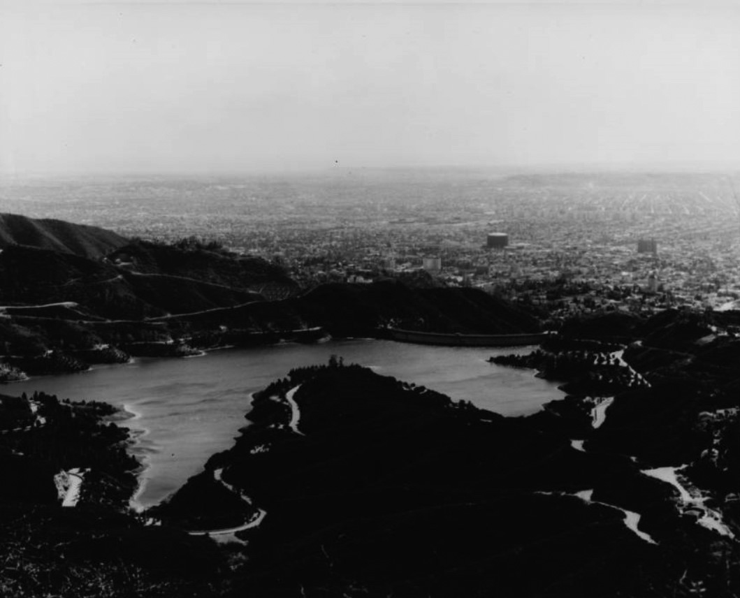
| (n.d.)* – View looking south across Hollywood Reservoir and Mulholland Dam with footpaths on the surrounding hillsides. The city lies in the distance beyond the water. |
Historical Notes A network of service and recreational paths has long traced the hills around the reservoir. Today a public loop of approximately 3.3 miles follows roads above the shoreline, offering views toward Hollywood and the Los Angeles Basin while the reservoir operates well below its original capacity. |
 |
|
| (ca. 1929)* - Profile view of the Mulholland Dam with a man looking over the rail. |
Historical Notes This profile emphasizes the elegant curve of the concrete gravity section and the balustraded crest roadway. Within a few years the City would add a large downstream earth embankment that buried the lower face for stability and to reduce public concern, leaving the crest and ornament as the most visible elements. |
* * * * * |
Artistic Interpretations |
Unlike the documentary photographs shown elsewhere on this page, the images in this section present Mulholland Dam as an artistic subject. Photographers and artists were drawn to the dam’s sweeping curves and dramatic setting, using it as a backdrop for mood, symbolism, and modernist composition. These works show how infrastructure could also inspire creative expression. |
 |
|
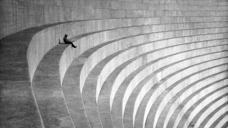
| (ca. 1930)* – Photo by Hiromu Kira titled “The Thinker,” showing a man seated on the elegantly curved wall of the Mulholland Dam. |
Historical Notes Hiromu Kira, a leading Japanese American pictorialist, used the dam’s sweeping geometry as a modernist stage for contemplation. Photographed a few years before the earth buttress altered the public face of the structure, the image highlights the crest’s scale and refined detailing. |
 |
|
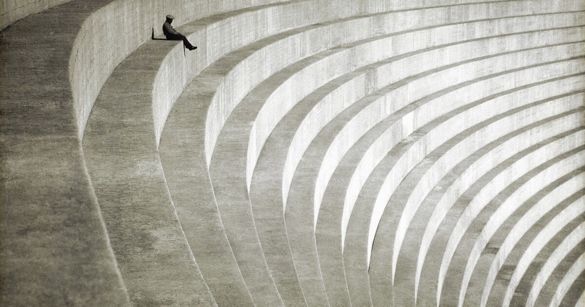
| (ca. 1930)* – Photo by Hiromu Kira titled “The Thinker,” showing a man seated on the curved wall of the Mulholland Dam. Photo source: Los Angeles Times. |
Historical Notes This publication print of Kira’s “The Thinker” circulated widely in Southern California photography circles. It preserves the dam’s original concrete profile and urban setting just prior to the 1933–1934 modifications. |
* * * * * |
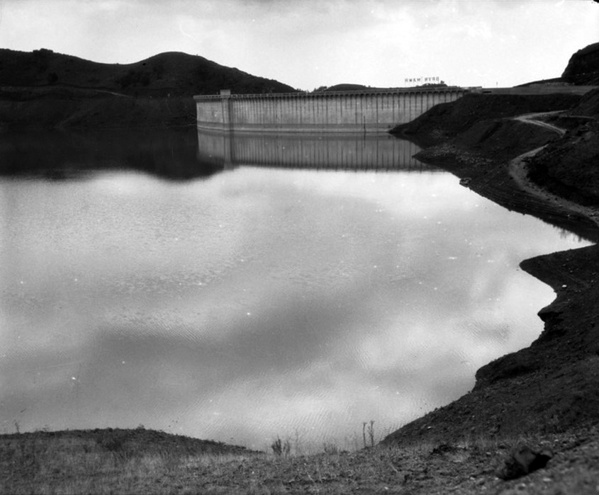
After the St. Francis Dam Disaster |
The failure of the St. Francis Dam in 1928 deeply affected public confidence in large dams. Although Mulholland Dam remained sound, attention quickly turned to its safety. Engineers reviewed the structure and operating practices. This period marked a shift from celebration to caution in how water projects were viewed.In the photos that follow, watch the dam’s exposed white face gradually disappear as the earth buttress and landscaping take over. |
Mulholland Dam Reinforcement
 |
|
| (ca.1929)* - Mulholland Dam receiving a downstream earth embankment as part of post–St. Francis modifications. |
Historical Notes Following the 1928 St. Francis Dam disaster, Los Angeles immediately drew down Hollywood Reservoir as a precaution while the dam was reviewed. In 1931 the City adopted a permanently reduced operating level for the reservoir. In 1933–1934 approximately 300,000 to 330,000 cubic yards of earth were placed against the downstream face to improve resistance to uplift and seismic forces and to visually screen the structure. Since that time the reservoir has been limited to a maximum of about 4,000 acre-feet and is typically kept near 2,800 acre-feet, well below its original design capacity.Click HERE to see more in St. Francis Dam Disaster. |
 |
|
| (ca.1929)* - Reinforcement of Mulholland Dam in the aftermath of the St. Francis Dam disaster. |
Historical Notes Despite multiple investigative panels declaring the Mulholland Dam safe, city officials opted for additional safety measures in response to public anxiety and opposition from local residents. The Los Angeles Department of Water and Power (DWP) undertook a massive reinforcement project aimed at improving the dam's stability and restoring confidence in the city's water infrastructure. The reinforcement project involved adding approximately 300,000 cubic yards of earth to the downstream face of the dam. This earth was carefully landscaped and planted with fast-growing trees, creating a natural hillside appearance that concealed the dam's original concrete structure. By 1934, the once-visible white concrete face of the Mulholland Dam had essentially vanished from view, appearing instead as a landscaped hillside when seen from below. |
 |
|
| (1930s)* - View of the Mulholland Dam shortly after its front was filled with dirt for additional reinforcement. Trees and shrubs have been planted. Note the water ring around the reservoir, a visible result of the post-1928 precautionary drawdown and the lower operating levels adopted soon afterward. |
Historical Notes After the St. Francis Dam collapse in 1928, the City drew down Hollywood Reservoir as a precaution while Mulholland Dam was reviewed. The lowered shoreline seen in photos from this period reflects that early response and the lower operating levels adopted soon afterward. |
 |
|
| (1930s)* – A view looking down at the Mulholland Dam and Hollywood Reservoir (Lake Hollywood). The trees and shrubs have grown, obscuring most of the dam’s profile. Note the water ring around the reservoir, a visible result of the post-1928 drawdown and the lower operating levels adopted soon afterward. Photo by Bob Plunkett from the Ernest Marques Collection. |
Historical Notes Alongside these physical modifications, the decision was made to permanently maintain a lower water level in the reservoir. The capacity was reduced from about 7,900 acre-feet to a maximum of about 4,000 acre-feet, with the reservoir typically kept near 2,800 acre-feet. This significant reduction in water volume, combined with the other safety measures, transformed Mulholland Dam into one of California’s most conservatively managed and closely monitored dams, helping address structural concerns and restore public confidence. |
 |
|
| (ca. 1935)* - View of the Hollywood Reservoir and Mulholland Dam. Note how the trees and shrubs have grown in just a few years since planted. |
Historical Notes The transformation of the dam and reservoir was not only a practical engineering solution but also an effort to address aesthetic considerations and public concerns. The changes ensured that the dam appeared less imposing while maintaining its functionality as part of the city's water system. |
 |
|
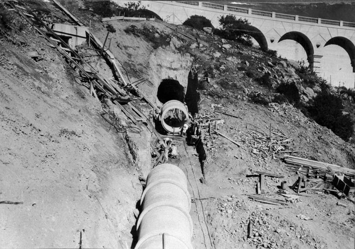
| (1933)* - Construction of the Lower Mulholland Dam spillway pipe. |
Historical Notes The lowered water level, combined with other modifications such as the addition of a massive earth buttress and the installation of a spillway, transformed the Mulholland Dam into one of the most conservative and closely monitored dams in California. These measures were designed to address concerns about hydraulic uplift, earthquake forces, and overall structural integrity, while also helping to restore public confidence in the dam's safety. |
 |
|
| (ca. 1933)++ – View looking down from the Hollywood Hills showing: the upper and lower sections of the Hollywood Reservoir, Mulholland Dam, and the city below. |
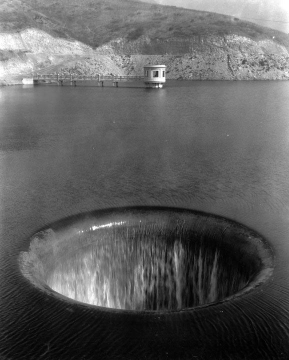 |
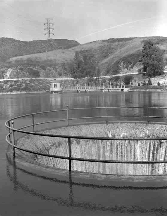
|
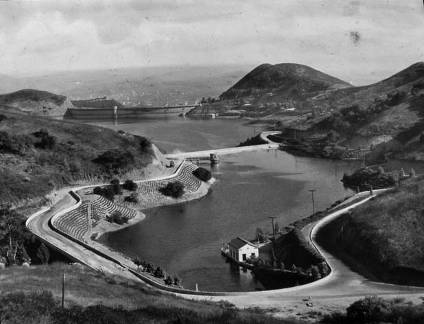
| (1933)* - View of the spillway in the upper Hollywood Reservoir. |
Historical Notes At the upper end of the reservoir is Hollywood Knolls Pumping Plant which serves the higher areas with water. It was intended to pump water to Hollywoodland and nearby sections. Water was pumped from this plant to tanks above 1,100 feet elevation. This plant is in addition to the Hollywood Reservoir Pumping Plant located at the base of the dam.* |
 |
|
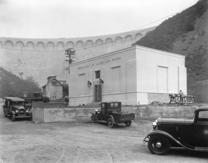
| (ca. 1929)* - Hollywood Reservoir Pumping Plant - Dwarfed by a comparison with Mulholland Dam, which towers immediately above it, a new pumping and chlorinating plant is nearing completion in the hills of Hollywood. The new concrete structure, modern in design, will replace the existing corrugated iron Vinecrest pumping and chlorinating plant. Regular service to the Hollywoodland district and emergency service to the Las Palmas system, will be provided by the new plant.^ |
 |
|
| (ca. 1930s)* - Interior of the Hollywood Pumping Plant. |
.jpg) |
|
| (1930s)** – Postcard view showing the Mulholland Dam in the Hollywood Hills. |
 |
|
| (1935)* - View Mulholland Dam seen rising above the pumping plant after it was reinforced with tons of dirt. The landscaping is beginning to take hold. |
 |
|
| (1941)* - Landscaping completed at the Mulholland Dam and Hollywood Reservoir. |
 |
|
| (1941)**– Postcard view showing two men walking over the Mulholland Dam and one car heading in the direction of the camera. The Hollywood Reservoir is in the background behind the dam and one large home is seen on the hillside on the other side of the reservoir. |
 |
|
| (ca. 1940s)* - Partial view of Mulholland Dam with the Hollywood Hills in the background. Photo by Herman Schultheis. |
* * * * * |
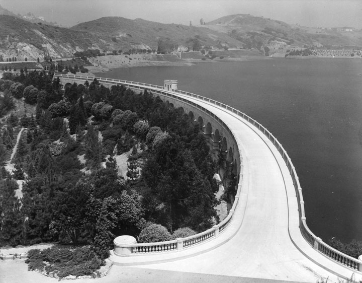
Post-Reinforcement and the Freeway Era (1935–1960s) |
After the reinforcement work of 1933 and 1934 and the decision to keep lower water levels, Mulholland Dam entered a quieter but steady period of service. Earth fill, landscaping, and growing trees softened the dam’s appearance. Meanwhile, Hollywood kept expanding and new roads and freeways began to reshape Cahuenga Pass and the basin below. The images in this section show how the dam and reservoir remained important, even as they became less visible in a faster, larger city. |
 |
|
| (ca. 1930s)* - Partial view of the Mulholland Dam on the Hollywood Reservoir, overlooking the Bryn Mawr residential subdivision immediately adjacent to the Dam. A backward Bryn Mawr Sign can be seen on the left portion of the hillside, and behind that facing south, the sprawling city is visible as far as the eye can see. |
 |
|
| (ca. 1938)* - This panoramic view taken from behind the Hollywoodland Sign captures the structure of the letters as well as Lake Hollywood on the right. |
 |
|
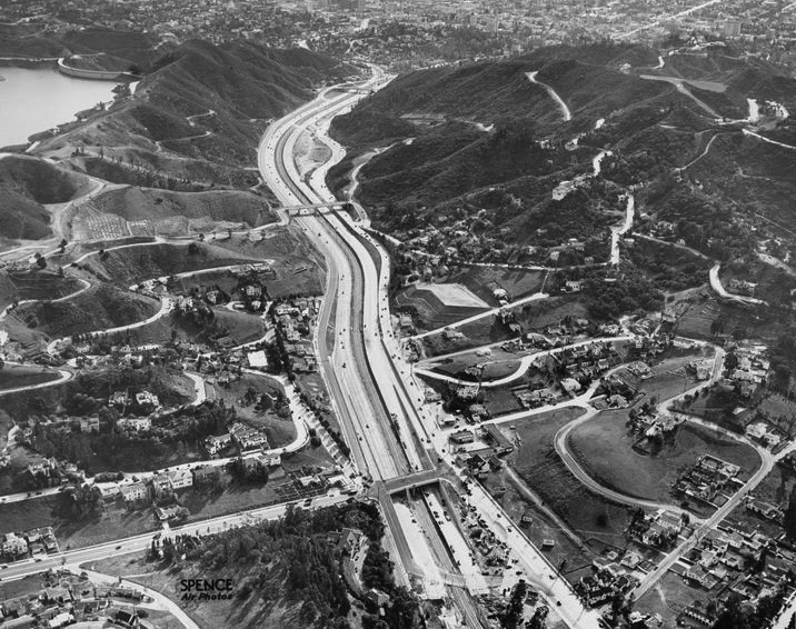
| (1940)* - Aerial view looking southeast showing the new Cahuenga Pass Freeway with the Mulholland Dam and Hollywood Reservoir seen at upper left. |
 |
|
| (1967)* - View of Upper Hollywood Reservoir. |
 |
|
| (1967)* - Upper Hollywood Reservoir showing water flowing into intake. |
 |
|
| (ca. 1950)** - Aerial view of Hollywood, north of Sunset between Highland and Gower before the second section of the Hollywood Freeway was built (1954). The Hollywood Reservoir (middle right) is in the hills above Hollywood. |
 |
|
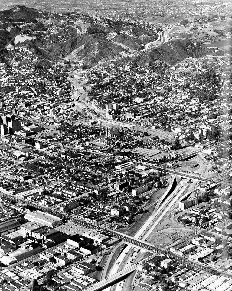
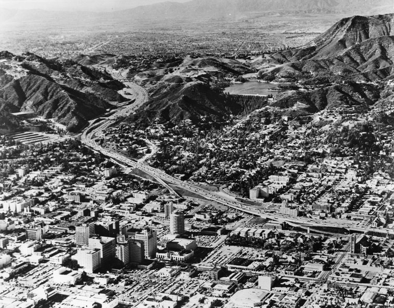
| (1952)* - Looking NW over Hollywood Fwy (US-101) construction as it made its way to Cahuenga Pass. Sunset Blvd and Wilton Place intersect in foreground with Hollywood Blvd parallel to Sunset Blvd across center of photo. The Mulholland Dam and Hollywood Reservoir are seen in the upper-right corner. |
 |
|
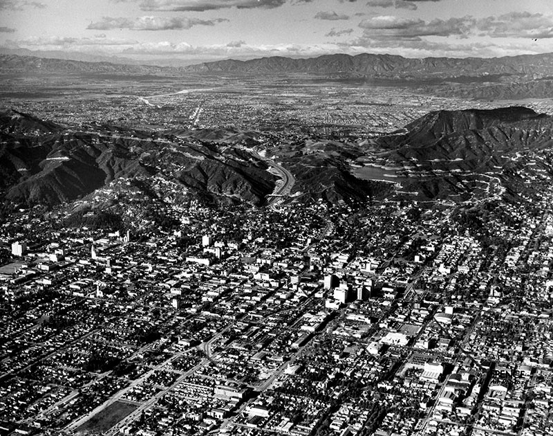
| (ca. 1960s)* - Aerial view of Hollywood and its surrounding areas after the second segment of the Hollywood Freeway was completed (1954). The Mulholland Dam and Hollywood Reservoir are seen in the hills above Hollywood (upper center-right). |
Historical Notes Due to more stringent safety and water quality regulations, the dam and reservoir are no longer used as they were when originally built. Newer underground storage tanks now store treated water, with pipelines linking the tanks to the distribution system. |
 |
|
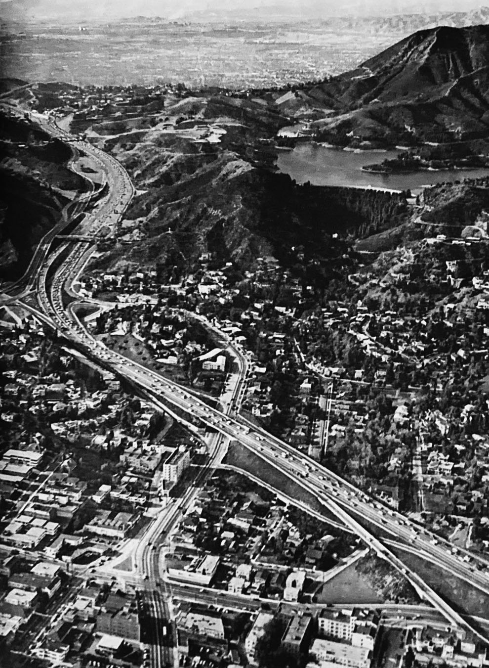
| (1957)^ – Aerial view giving a closer look at the Hollywood Freeway, Mulholland Dam and Hollywood Reservoir. |
* * * * * |
Then and Now |
This pair of images shows how the same viewpoint changed from 1928 to today. In the early scene, the dam is easy to see. In the modern view, growth, trees, and the Hollywood Freeway reshape what the eye can find. |
 |
|
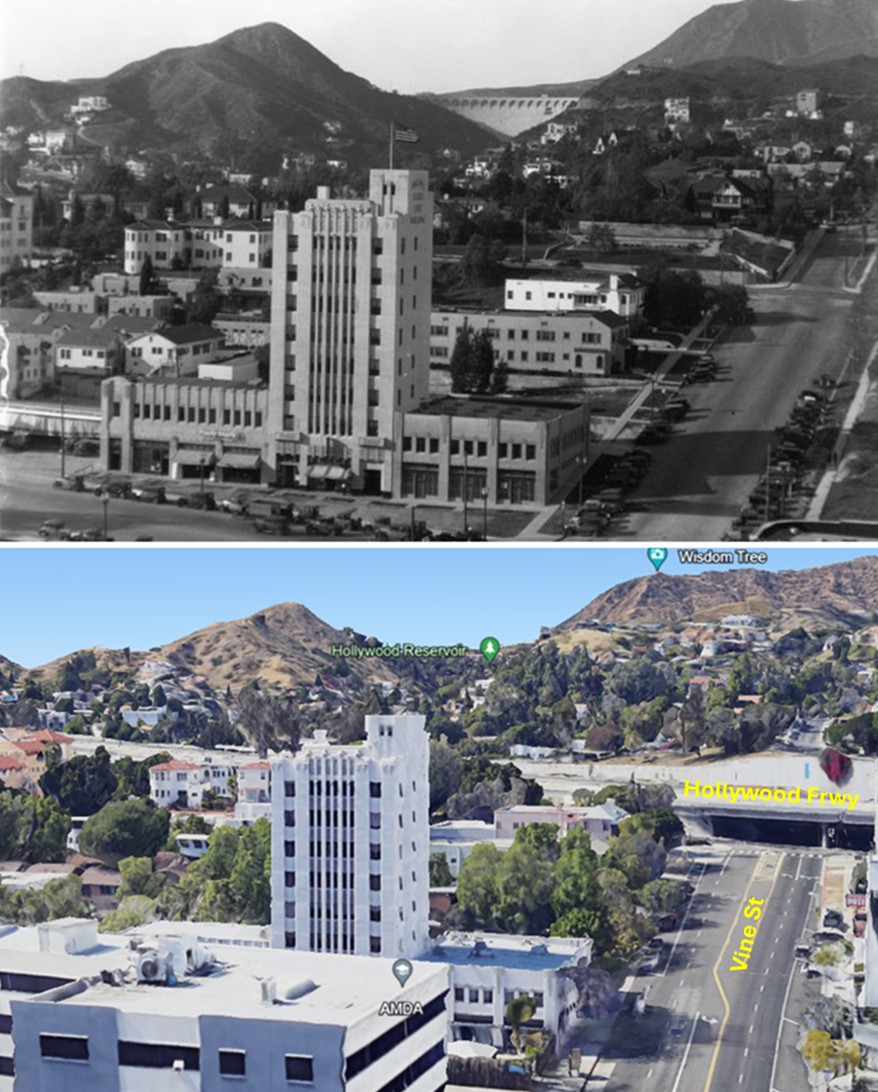
| (1928 vs 2022)* - Looking north from above Vine Street at Yucca toward the Hollywood Hills. In 1928 the white face of Mulholland Dam is clearly visible in Weid Canyon with Hollywood Reservoir behind it. In 2022 the dam is no longer visible from this vantage, and the Hollywood Freeway (US 101) now crosses the view at the north end of Vine Street. Photo comparison by Jack Feldman. |
Historical Notes The 1928 scene centers on the newly completed Mountain States Building at Yucca and Vine, an Art Deco landmark that still anchors the modern view (today known as the Yucca Vine Tower). Beyond it, Mulholland Dam’s concrete face was fully exposed during the reservoir’s first years of operation. Following the 1928 St. Francis Dam disaster, Los Angeles permanently lowered Hollywood Reservoir and in 1933–1934 placed approximately 300,000 to 330,000 cubic yards of earth against the downstream face of Mulholland Dam. The embankment, along with subsequent landscaping and mature tree growth, obscured the lower concrete and largely hid the dam from neighborhood sightlines. Postwar freeway construction reshaped the district. The Hollywood Freeway (US 101), built through Hollywood in the late 1940s and early 1950s, cut a wide transportation corridor across the north end of Vine Street. The new roadway and overcrossings removed blocks of housing, altered street connections, and introduced a permanent visual barrier between the Yucca/Vine area and the hills. |
* * * * * |
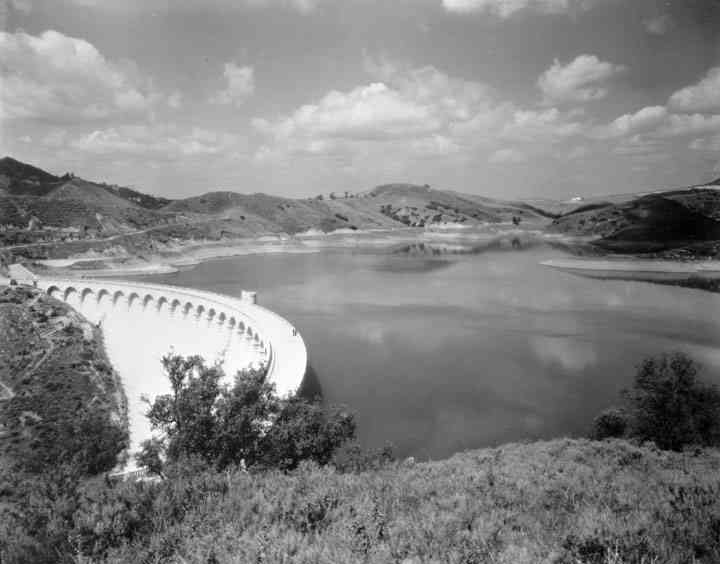
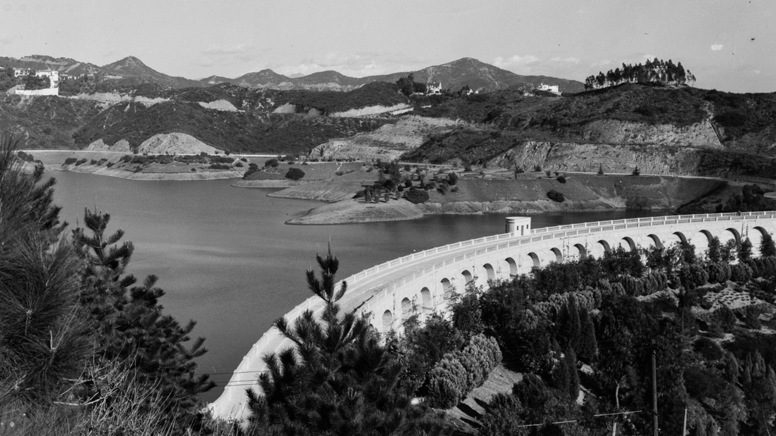
Mulholland Dam in the Modern Era |
By the late 1960s Mulholland Dam had settled into a mature phase of its history. The emergency concerns and major modifications that followed the St. Francis Dam disaster were now decades in the past, and the reservoir was operated under careful limits. The dam no longer stood out as a civic showpiece as it had in the 1920s, but it remained a quiet and reliable part of Los Angeles’ water system. The images that follow show the dam and Lake Hollywood as they appeared in the later twentieth century and into recent years, set within a city that had grown far beyond what early planners imagined. |
 |
|
| (ca. 1968)* - Water-level view of Lake Hollywood and the Mulholland Dam. Library of Congress |
 |
|
| (2012)^* - View looking down at Lake Hollywood and the Mulholland Dam with the Westside city skyline in the background. |
 |
|
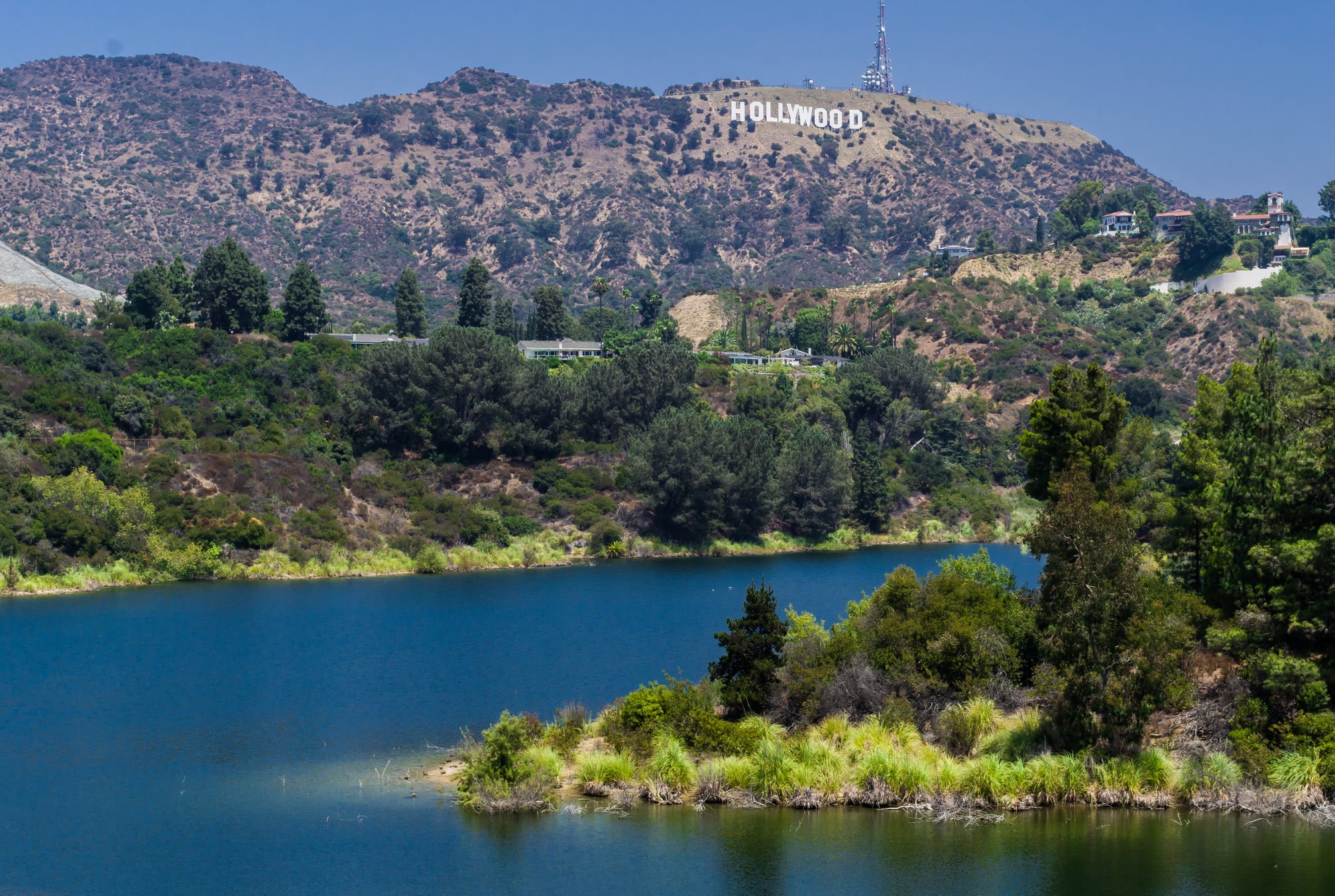
| (2021)* - Lake Hollywood with the Hollywood Sign and Mt. Lee in the background. Photo courtesy of Ron Reiring |
 |
|
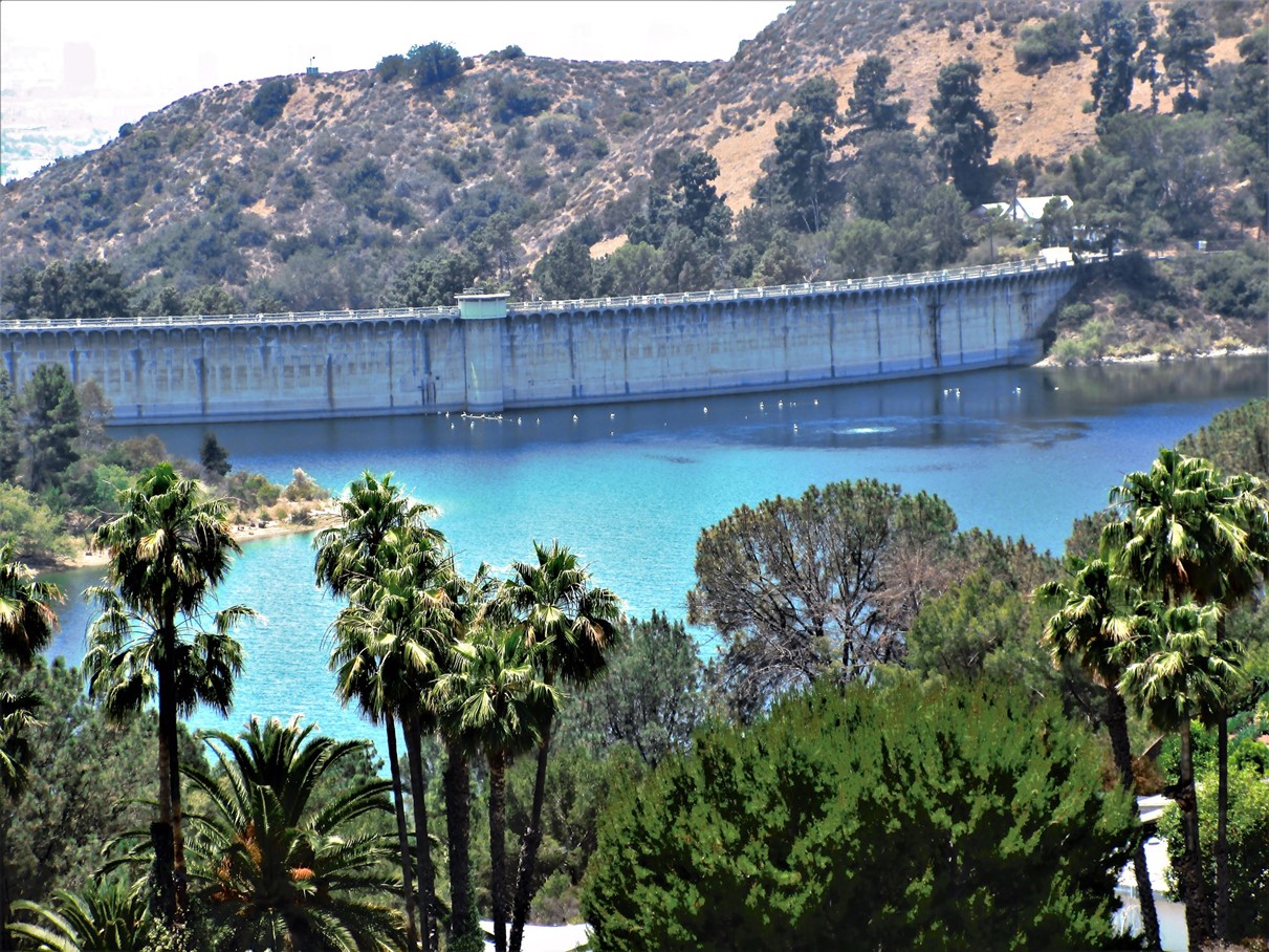
| (2022)* – Looking toward the Hollywood Hills from in front of the Mulholland Dam and Lake Hollywood. Courtesy of Tinsel and Stars |
 |
|
| (2021)* – Looking down at Lake Hollywood and Mulholland Dam. Photo by Howard Gray |
* * * * * |
Conclusion |
From the opening day crowds in 1925 to the cautious operating limits that followed 1928, the story of Mulholland Dam is a story of Los Angeles adapting in real time. The reservoir still mirrors the sky, the hills, and the city’s evolving skyline, even as the dam itself is now partly hidden by the very measures meant to make it safer. Seen from the Hollywood Sign or from the streets of Hollywood below, it remains a reminder that behind the city’s image and growth is an engineering system that had to be built, tested, and continually improved.Click HERE to see more in Early Los Angeles Water Reservoirs. |
* * * * * |
Please Support Our CauseWater and Power Associates, Inc. is a non-profit, public service organization dedicated to preserving historical records and photos. Your generosity allows us to continue to disseminate knowledge of the rich and diverse multicultural history of the greater Los Angeles area; to serve as a resource of historical information; and to assist in the preservation of the city's historic records.
|
History of Water and Electricity in Los Angeles
More Historical Early Views
Newest Additions
Early LA Buildings and City Views
* * * * * |
References and Credits
* DWP - LA Public Library Image Archive
*^LA Public Library Image Archive
**Calisphere: University of California Image Archive
++KCET: Hand-Colored Lantern Slides of Old Los Angeles
***LA Times: Making Waves - Japanese American Photography, 1920-1940
*^*The Daily MIrror: Hollywood Hills Signs
**^Noirish Los Angeles - forum.skyscraperpage.com
^**Huntington Digital Library Archive
^^^UCLA Library Digital Collection
< Back