Early Los Angeles Water Reservoirs
LA's First Above Ground Plaza Reservoir (1858)
 |
|
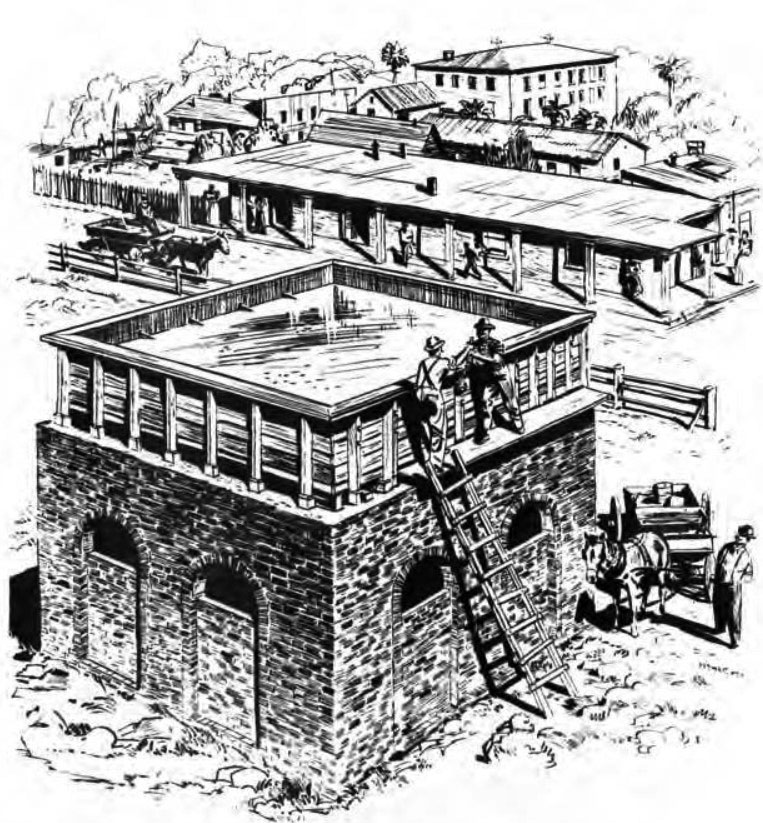
| (ca. 1860)* - Sketch of Los Angeles’ first central Plaza reservoir—a brick (often described as stone) and wood tank fed by the Zanja Madre, the city’s original aqueduct. Located in the middle of the Plaza, it served as the young pueblo’s principal water storage and distribution point. |
Historical Notes In 1858, the Los Angeles Water Works Co., headed by William G. Dryden, built a large brick-lined and wood-sheathed storage tank in the center of the city Plaza. Fed by the Zanja Madre, it provided an elevated delivery point for hauling and, later, for limited piped distribution. The tank stood for roughly a decade before being removed and replaced by a fountain; smaller tanks around the Plaza perimeter and other local reservoirs continued to store water for domestic and irrigation use. In 1876, the privately owned Los Angeles Water Co. (John S. Griffen, Solomon Lazard, Prudent Beaudry) completed the Buena Vista Reservoir in Elysian Park. The firm held a 30-year franchise lease (1868–1898) to operate the city’s water system under contract with the City. Click HERE to read more history in Water in Early Los Angeles. |
.jpg) |
|
| (ca. 1860)* - Los Angeles Reservoir - One of Los Angeles’ first water reservoirs was the brick structure shown in the center of the Plaza. The street extending to the left is Wine Street (renamed Olvera Street). The three-story building in the background was the Sisters of Charity Orphanage, established in 1856. The reservoir was built in 1858 by William G. Dryden and his Los Angeles Water Works Company. |
Historical Notes This reservoir marked the end point of the city’s historic lifeline—the Zanja Madre—at least in terms of supplying water to pueblo residents. While other branches of the zanja system continued to serve agricultural fields, the water collected here was distributed to homes through wooden pipes, representing Los Angeles’ first attempt to deliver water directly into residences rather than relying solely on water carriers. |
 |
|
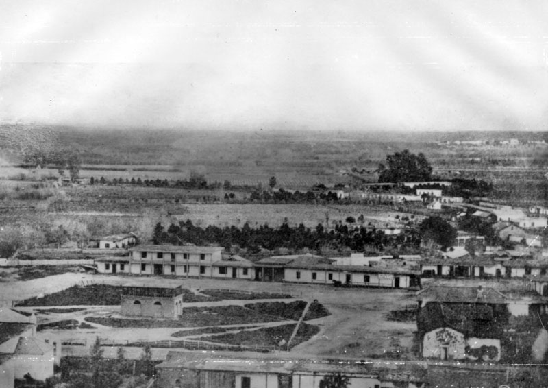
| (ca. 1858)* - Earliest known photograph of the Los Angeles Plaza. At the center is a square brick reservoir, the terminus of the Zanja Madre, or “Mother Ditch,” which brought water from the Los Angeles River. |
Historical Notes Photographic evidence of pre-Civil War Los Angeles is rare; this image documents the newly built Plaza reservoir soon after its 1858 completion. From this elevated tank, water—raised from the Los Angeles River by Dryden’s wheel-and-pump system—entered town for storage, hauling, and limited distribution. The structure’s prominence in the Plaza reflects how central water access was to civic life in early Los Angeles. |
 |
|
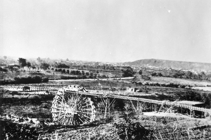
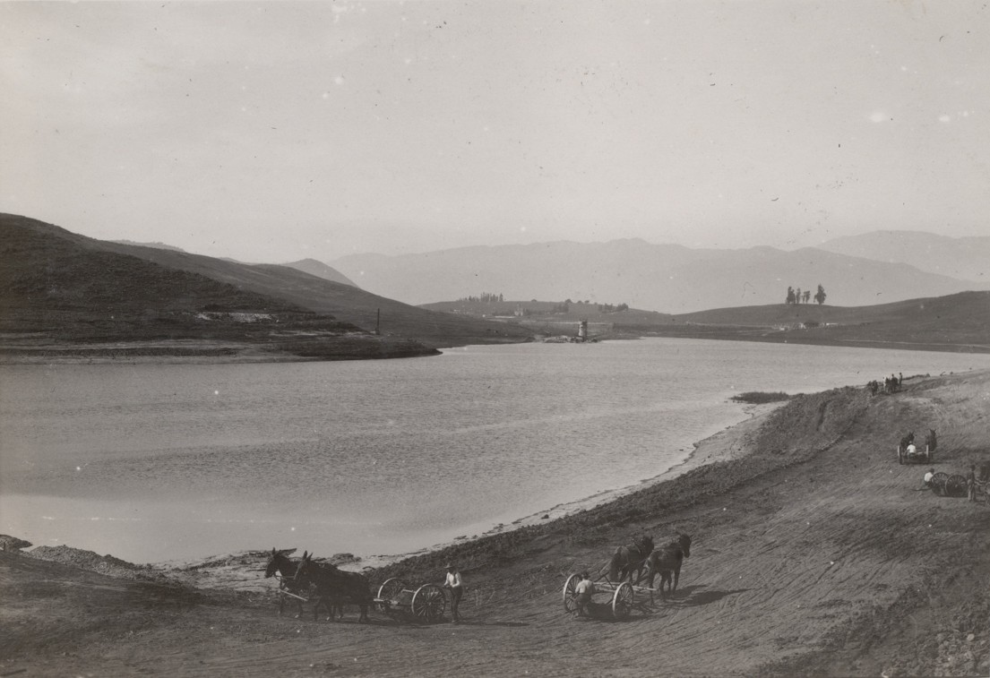
| (1863)* - A 40-foot water wheel on the Los Angeles River at the start of the Zanja Madre, Los Angeles’ original aqueduct. Often mistaken for a bucket-lift wheel, it actually powered a pump that drew cleaner water from below the river’s surface, then delivered it to the Plaza reservoir and the growing pueblo. |
Historical Notes The 40-ft. wheel harnessed river flow to power pumps that raised a portion of the Los Angeles River supply high enough for gravity delivery into the Zanja Madre. Drawing intake water from below the surface reduced sediment compared with direct surface diversion. In 1857 the City Council granted William G. Dryden a franchise to build an organized water system. His plan combined: A wheel-driven pump installation at the river; The Zanja Madre conveyance ditch; An above-ground brick reservoir in the Plaza; and Early distribution through hollowed log (wooden) pipes to homes, fields, and businesses along principal streets. Click HERE to read more about William Dryden. |
 |
|
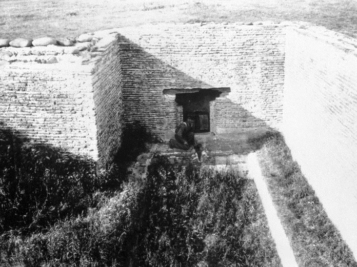
| (n.d.)* - Ruins associated with an early Los Angeles water facility—commonly linked to Dryden Springs (formerly Abila Springs)—part of the system that fed the Plaza reservoir in the late 1850s–1860s. |
Historical Notes Dryden Springs (Abila Springs) lay below the mesa where today’s College Street meets Alameda Street. Although an early proposal to rely solely on spring water was initially rejected (the Council argued residents could still draw from the zanjas), Dryden persisted. On Feb. 24, 1857, Judge William G. Dryden and partner McFadden secured a franchise to distribute water from their lands and to install a water wheel in the Zanja Madre. By 1860, Dryden had erected a small brick reservoir in the Plaza—about 20 by 30 feet, 18 feet high, with the tank bottom 10 feet above grade—pump-filled and piped to consumers through hollowed logs. This marked Los Angeles’ first attempt at piped water delivery beyond hand-carried supply. The Plaza tank stood roughly ten years before removal. Dryden died in Los Angeles on September 10, 1869, after a notably colorful public career. Click HERE to read more about LA's early water works system. |
Buena Vista Reservoir (1869)
.jpg) |
|
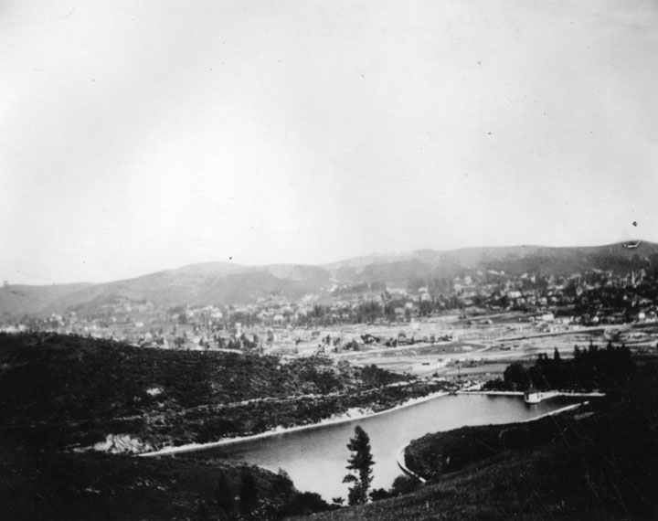
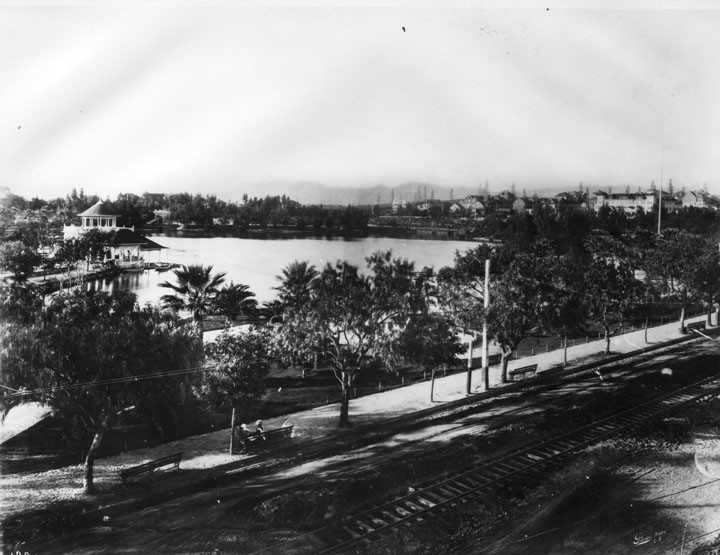
| (1876)* - Buena Vista Reservoir in Elysian Park. Built in 1869 by the privately-owned LA City Water Co. this was the company's first water storage facility. Photo shows reservoir seen from the hills, looking east from present-day location of the Pasadena Freeway. |
Historical Notes Buena Vista Reservoir was built by the LA City Water Company in 1869 and enlarged in the 1880s. It was the City's 1st large scale water reservoir. In 1868, Prudent Beuadry, John S. Griffen, and Solomon Lazard, three of the city's more successful businessmen, submitted a proposal to the city council to develop and operate the city's water system. In turn they asked for all of the city's water rights and control over the water rates. They also promised to construct a reservoir for the city, lay twelve miles of iron pipe, install fire hydrants at major street crossings, provide free water to public buildings, and to erect an ornamental fountain in the city plaza. The city approved the franchise agreement on a 30 year lease basis. Beaudry, Griffen, and Lazard incorporated as the Los Angeles City Water Company which would operate the City's water system until 1902 when the newly created LA City Water Department was established.. |
 |
|
| (Early 1900s)^* - View of Buena Vista Reservoir looking northeast with trees and buildings in the background. |
 |
|
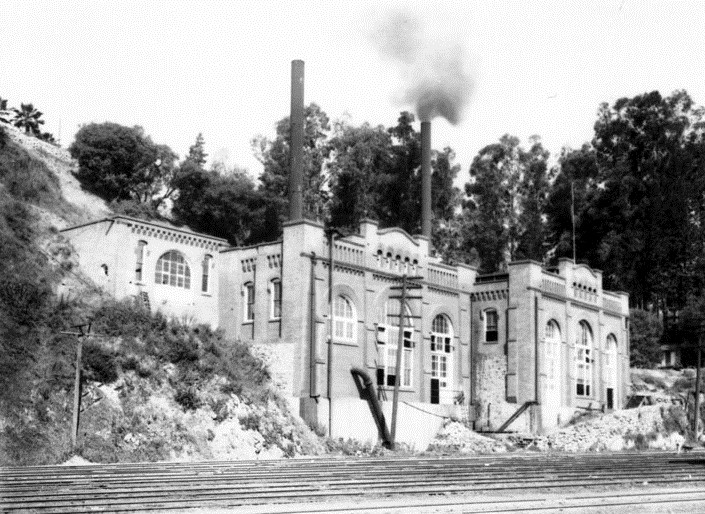
| Buena Vista Pumping Station was located at the edge of Elysian Park, east of the North Figueroa Street Bridge, and faced the Los Angeles River. It was placed in operation by the Water Bureau in 1904. The original plant replaced a water wheel, located in the near vicinity. It pumped water from Buena Vista to Solano and Highland Reservoirs.* |
Historical Notes One of the first installations, the Buena Vista Pumping Station consisted of a vertical shaft, 14-ft in diameter, which connected with a tunnel which ran to about the present site of the Lincoln Heights City jail (1939). The tunnel tapped water from infiltration galleries, carrying it by gravity flow to the shaft. Water was lifted by a big pump, submerged at the bottom of the shaft and operated by rods driven by a steam engine.* |
 |
|
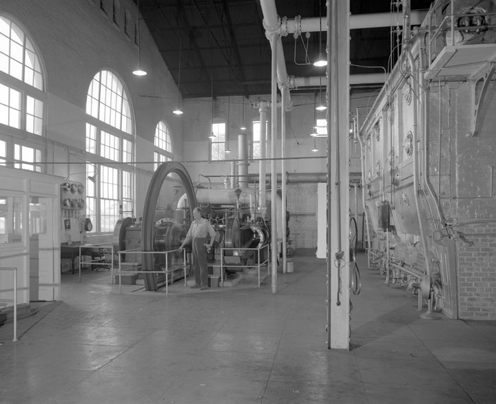
| (1930s)* - Interior view of the Buena Vista Pumping Plant. |
 |
|
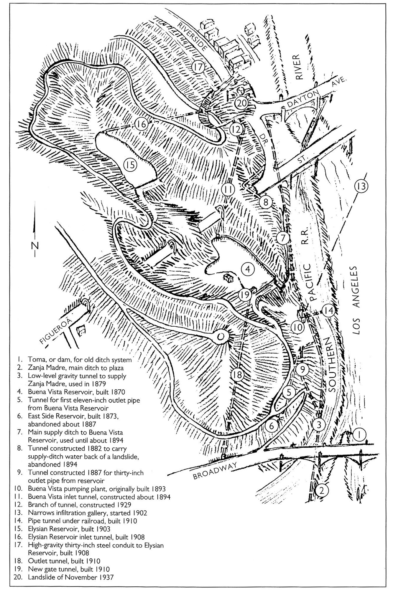
| (1938)^^* - Map of the Elysian Park area showing waterworks structures dating from Zanja Madre days to 1937. |
 |
|
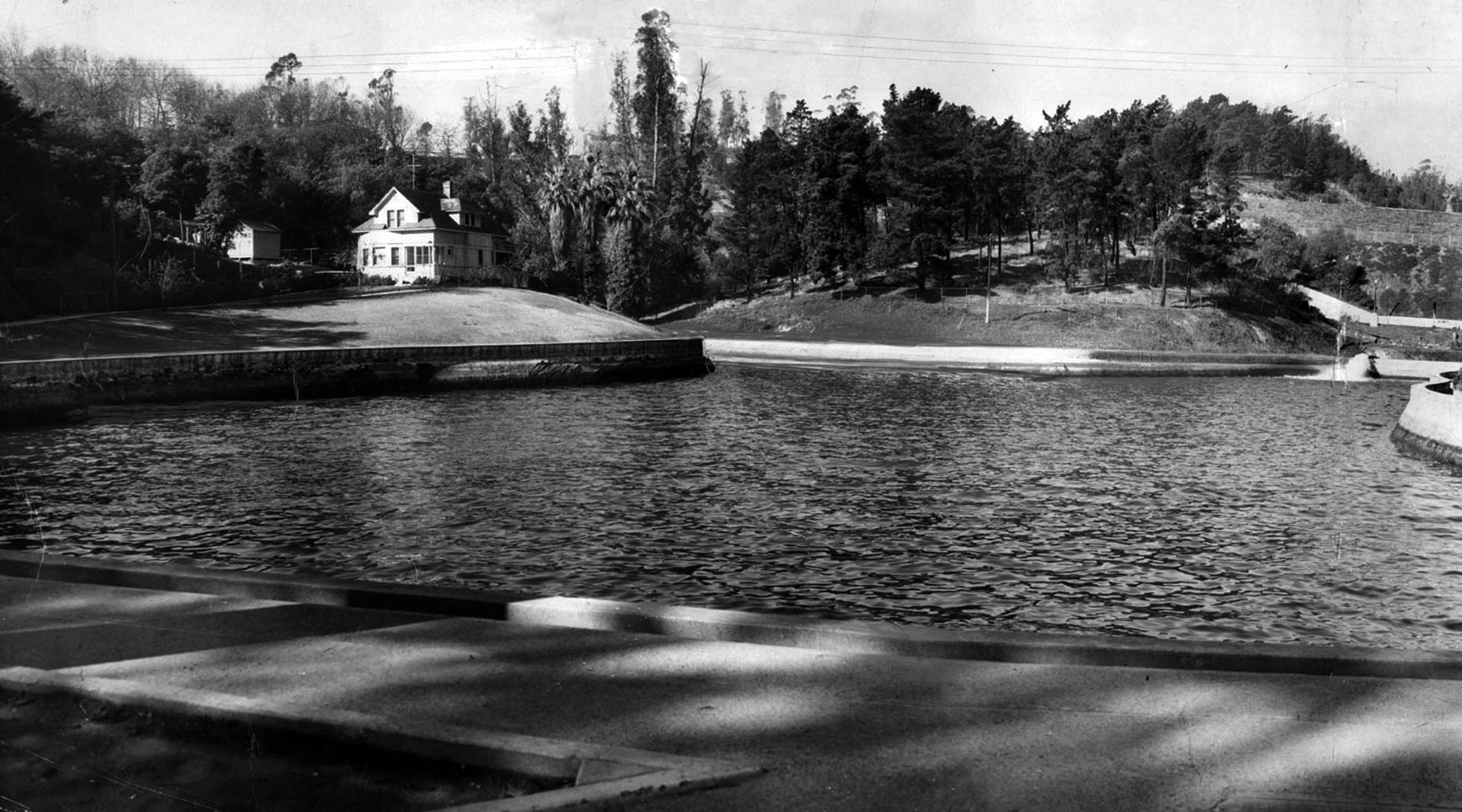
| (1949)* - View of caretaker's home at Buena Vista Reservoir in Elysian Park, alongside the Arroyo Seco Parkway. This panorama was made from two prints. Paul Calvert / Los Angeles Times |
Historical Notes Buena Vista Reservoir, was the granddaddy of all downtown reservoirs. It long was hidden in the hills of Elysian Park – until they put through the Pasadena Freeway, which zoomed right past this old water hole built in 1869. |
 |
|
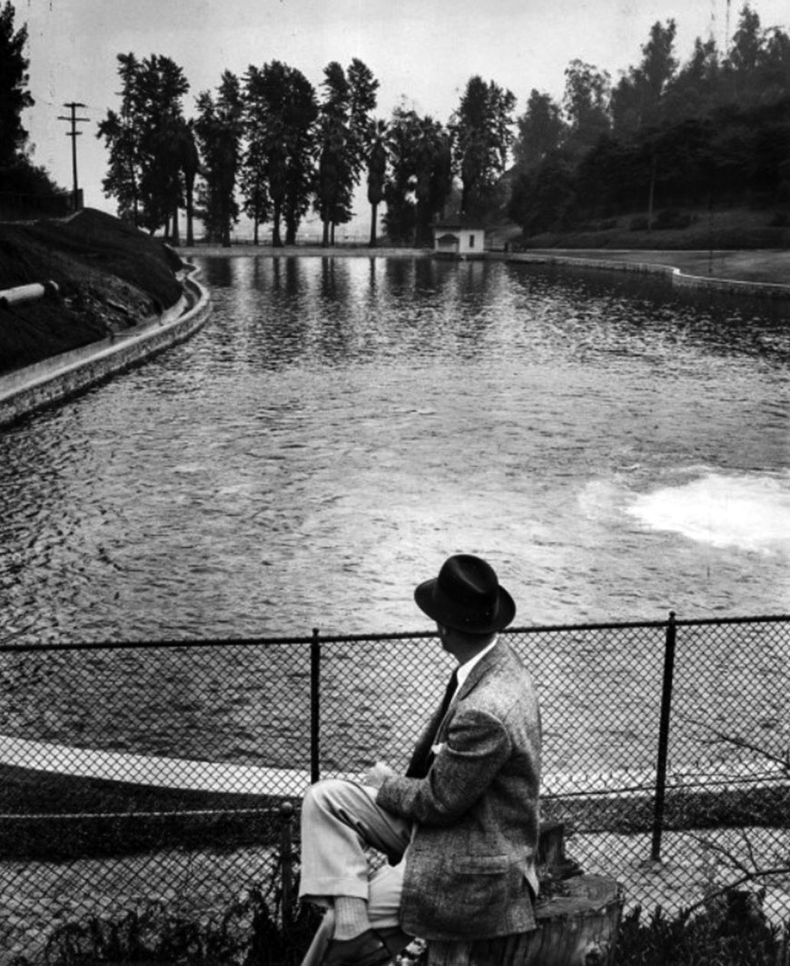
| (1955)* - A man looks out toward Buena Vista Reservoir in Elysian Park. Built in 1869, this was Los Angeles’ first major scale water reservoir. |
Historical Notes A year after the above photo was taken, the reservoir was drained and abandoned. The location is now the Buena Vista Meadow picnic area. |
* * * * * |
Reservoir No. 4 (Echo Park Lake - 1868)
 |
|
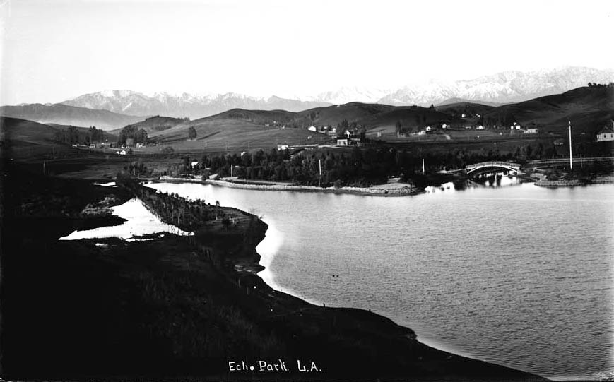
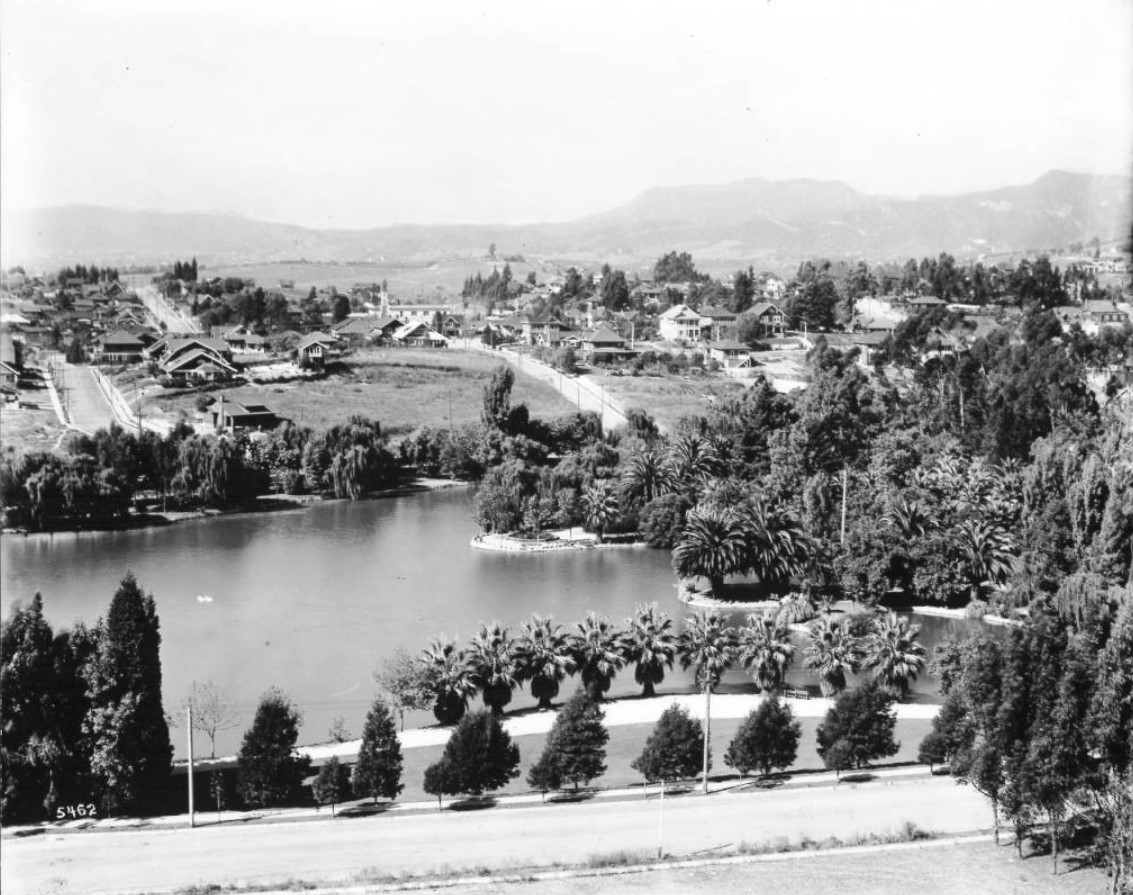
| (ca. 1894)^ - Early view of Echo Park Lake, looking northwest towards the Santa Monica Mountains. The dirt road running along the lower half of the image is Montana Street, which would later become Echo Park Avenue. Trees and farmhouses pepper the landscape, and a man is visible at the bottom. |
Historical Notes Echo Park Lake didn’t start out as a man-made lake. Instead, its earliest use by the city was as a reservoir, storing water in a section sometimes known as the city’s “West End.” In those years this area was thought of as the city’s west side. The Los Angeles Canal and Reservoir Co. formed Reservoir No. 4 in 1868. The company obtained the water by digging a ditch that sent water flowing from the Los Angeles River – in the area now known as Los Feliz – along a zigzag path that merged with the Arroyo de los Reyes and then emptied into the reservoir.* The Arroyo de los Reyes originates near the Catholic school on Glendale Boulevard – right by the 2 off-ramp. It flowed southward, along Glendale Boulevard, occupied the area now taken by Echo Park Lake, and continued down to 2nd Street, then crossing through downtown LA, about a block or two south of Pershing Square, where it spread and created a big muddy mess. These flows eventually connected with the Los Angeles River, when they didn’t seep into the ground first.^ |
 |
|
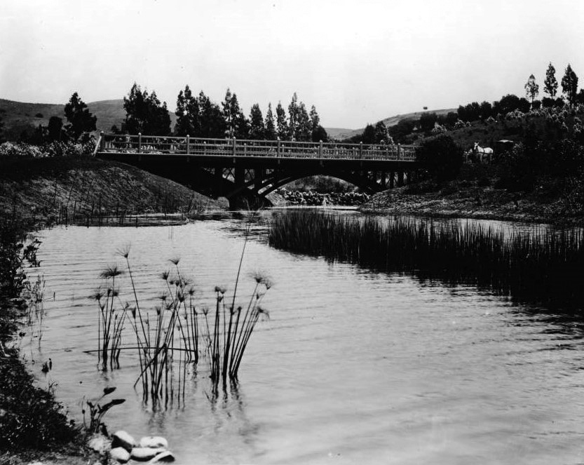
| (ca. 1895)^## - View looking northeast showing Echo Park with the snow-capped peaks of the San Gabriel Mountains in the distance and rolling countryside all around. Note the arched wooden bridge at center-right. |
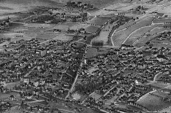
Historical Notes In the late 1880s, a carriage maker turned real estate developer, by the name of Thomas Kelley, teamed up with other investors to purchase about 70 acres that included Reservoir No. 4—what is now Echo Park Lake. Kelley and his business partners sold off pieces of what they called the Montana Tract to individuals who built the business district along Sunset Boulevard and the densely packed homes and apartments that surround Echo Park Lake.* |
.jpg) |
|
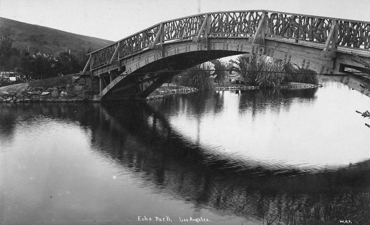
| (ca. 1895)^## - View looking east showing Echo Park Lake and surrounding area with bridge seen at center-left. |
Historical Notes In those years, Reservoir No. 4 was held in check by a dam in the vicinity of Bellevue Avenue. From there, water traveled down the Woolen Mill Ditch to a mill near present-day Fifth and Figueroa Streets, not far from where Kelley lived. Kelley petitioned the city to provide a quitclaim, essentially a land swap, converting the reservoir lands into a park and private residences. That request, and quite possibly a legal challenge, led to three years of debate by the parks commission, the city council and the mayor.* |
.jpg) |
|
| (ca. 1895)^## - View looking south toward Bellevue Avenue and the dam holding up the lake, showing houses on bluff at left, a bank with trees on right, and two small wooden boats at center. |
Historical Notes In 1891, the city’s health officer inspected the lake's dam and determined that, if it were to hold a greater volume of water, it would pose a danger to residents who lived south of Bellevue Avenue. Two months later, city leaders struck a deal with the men who owned the land around the reservoir. Kelley and his associates – including William LeMoyne Wills, who like Kelley, would later serve on the school board – gave up 33 acres of land around the reservoir so that it could be used as a park. In exchange, the city agreed not to overflow the reservoir land, making the remaining land held by Kelley and his associates – including the street that would soon become Sunset Boulevard – far more valuable. When Mayor Henry Hazard signed the paperwork in 1891 allowing the park to be created, he envisioned a grand boulevard on Alvarado Street that would transport residents from Westlake – now MacArthur Park – to Echo Park Lake and then northeast to Elysian Park.* |
 |
|
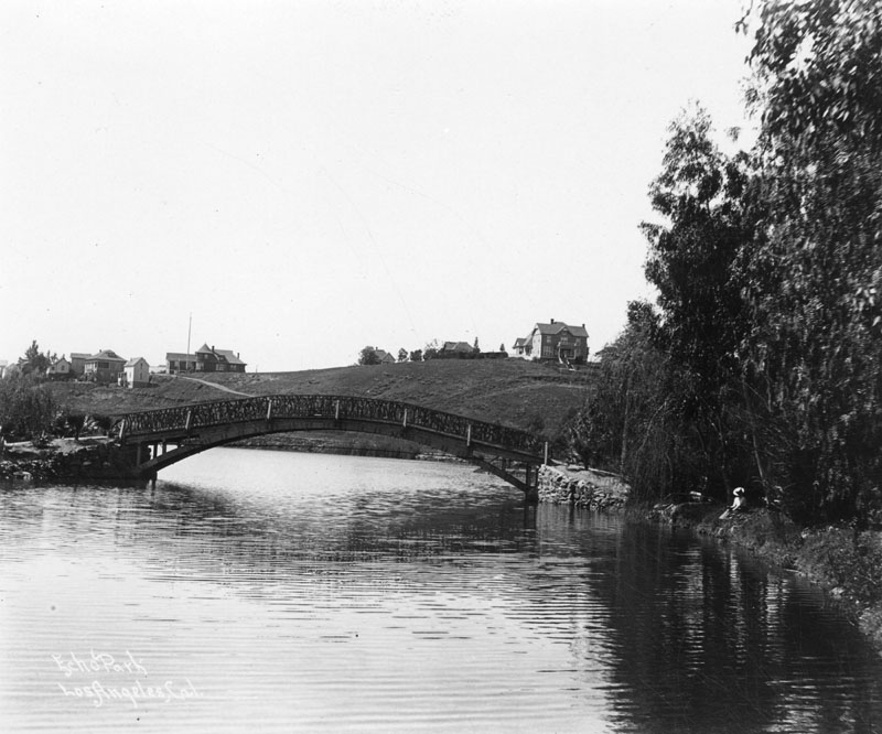
| (1900)* - Wooden bridge over Echo Park Lake as it looked at the turn of the century. Note the homes on the hillside behind the bridge and the woman with the hat relaxing alongside the lake. |
Historical Notes Designed in the rustic style, one of the lake's two bridges helped pedestrians reach the island seen on the left, while a second bridge passed over the lake’s northwest corner, where the ditch delivered water from the Los Angeles River (and lotus now grow). The city began work landscaping the park in October 1892. By 1895, the park and accompanying boathouse were completed. |
 |
|
| (ca. 1895)^## – Close-up view looking south showing one of the two wooden bridges at Echo Park Lake. The bridge rail is made from fitted gnarled branches. In distance is a park bench and boathouse. |
Historical Notes The city began work landscaping the park in October 1892. By 1895, the park and accompanying boathouse were completed. |
 |
|
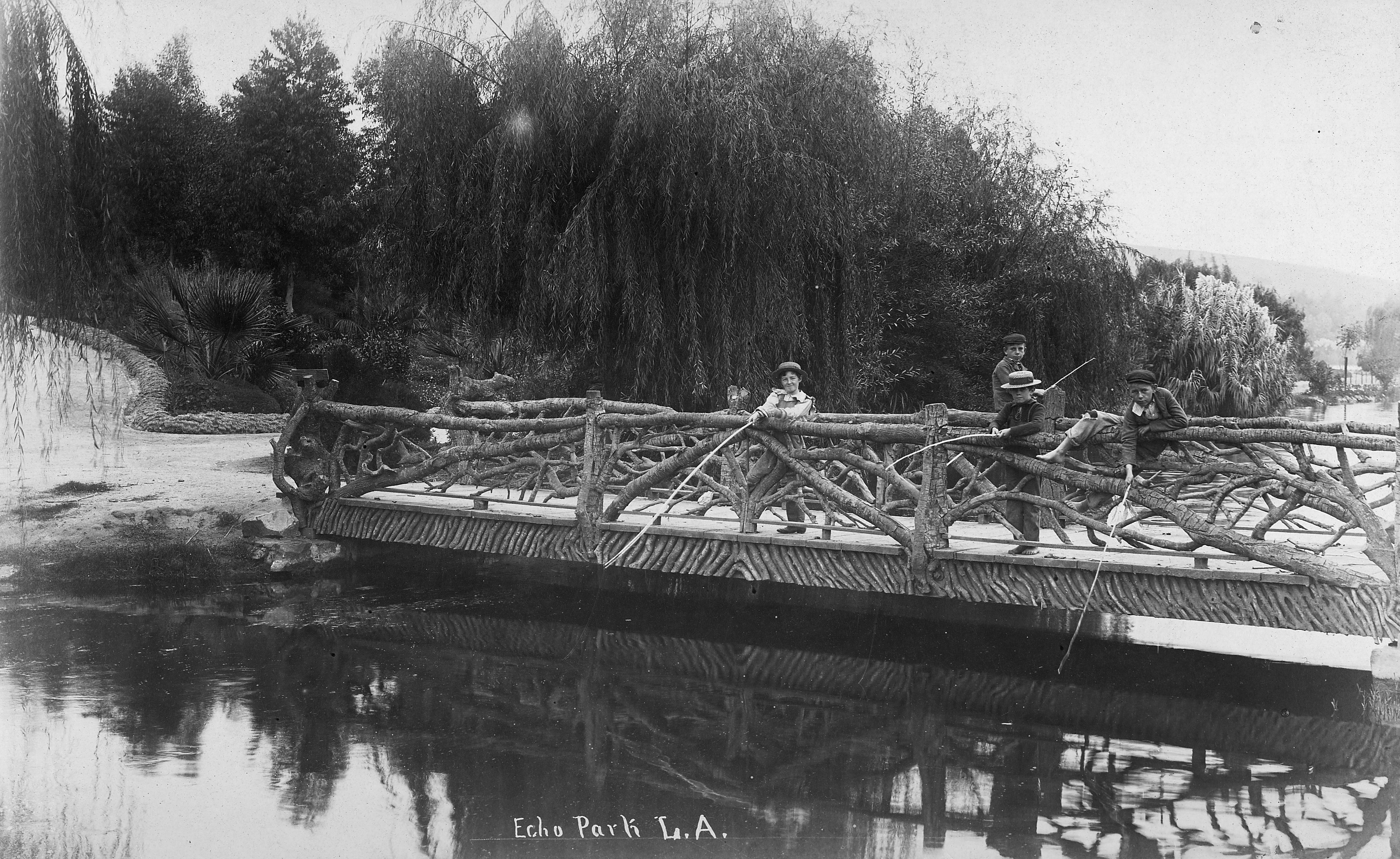
| (1890)* - View showing four boys fishing off one of the two bridges at Echo Park Lake with willow trees in the background. Note the “tree-limb” railing. |
Historical Notes The above bridge passed over the lake’s northwest corner, where the ditch delivered water to the lake from the Los Angeles River (where the lotus now grow). The city began work landscaping the park in October 1892. By 1895, the park and accompanying boathouse were completed. |
 |
|
| (1894)*#*– Map showing Echo Park Lake (center-top) located at the intersection of Lake Shore Avenue (later Glendale Boulevard) and Bellevue Avenue. Note that there is a second smaller lake seen at lower-center. It was part of the Second Street Park, located at the intersection of Lake Shore Avenue and 1st and 2nd streets. Map courtesy of the Library of Congress. |
Before and After
|
|
 |
|
| (ca. 1894)^ vs. (1911)^^ - Echo Park Lake before and after landscaping. |
Historical Notes Echo Park development began in 1891 with landscaping a year later. The first Superintendent of Parks for the city was an English immigrant named Joseph Tomlinson who was assigned the task of creating the park. Mr. Tomlinson, being somewhat homesick for his favorite park in Derbyshire, England, decided to model the park after his favorite childhood place to play. At the same time, the reservoir was closed and the stream was capped. The park superintendent created a 16-acre lake where the reservoir had been. It cost $5,637.00 to create the lake that is now filled with city water. Once that was accomplished, the planting began on the other 15 acres of park. One day, while overseeing the work, Mr. Tomlinson thought he heard his workers talking during a break, but he knew they were across the park from him. The park had an echo! He knew what the name of the park would be! Unfortunately, the plantings he installed destroyed the echo, but the name remained. The park was dedicated and opened to the public in 1895. The famous bed of lotuses that grow in the lake at the northwest end of the park, the largest stand of lotuses outside Asia, is a mystery yet to be solved. One legend says that evangelical Chinese missionaries planted them for use as food, but no one knows the real story. They appeared some time in 1923 or 1924. Nonetheless, they remain a beautiful addition to the park and have inspired the city to sponsor the annual Lotus Festival that celebrates Asian and South Pacific Island cultures.^^ By 1899, city leaders were intent on adding even more green space, by extending the parkland south to Temple Street. Bounded by Temple on the south and Bellevue on the north, the area was completed by 1907, with an extensive network of playing fields and courts for tennis and croquet. Called Echo Park Playground, it was only the second public playground to be built in the city of Los Angeles and still remains today. Click HERE to see more on the Echo Park Playground. Click HERE to see more contemporary views of Echo Park Lake (1975+). |
* * * * * |
Eastlake Park (Lincoln Park)
 |
|
| (ca. 1880)#* – View showing a stream and foot bridge in Eastlake Park (later Lincoln Park). A line of marsh grass is pictured to the right, emerging from the center of the stream. In the background, the foot bridge can be seen extending over the water, with a horse-drawn carriage visible on the right bank. |
Historical Notes Originaly Eastlake Park and Westlake Park were built as a drinking water reservoirs connected to the city's systems of zanjas (small conveyance channels/trenches). When the city abandoned the non-pressurized zanja system for a pressurized pipe system, these smaller, shallow reservoirs located at low points no longer provided much benefit. They were then converted into parks.*^* |
 |
|
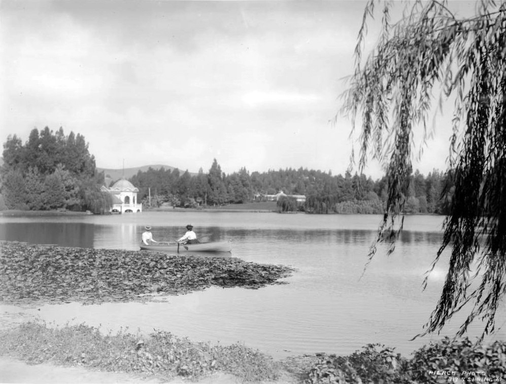
| (ca. 1900)#* – Photo showing two women wearing long-sleeved blouses and hats in a small canoe on a large lake at Linocoln Park. In the background at left, a large cylindrical structure with a domed roof is visible. A smaller building can be seen at right. |
Historical Notes Lincoln Park was originally created by the City of Los Angeles in 1881, from land donated by John Strother Griffin. It was one of Los Angeles' first parks. It was originally called East Los Angeles Park. By 1901 it had become a major amusement center for the people of Los Angeles, and it was at this time that the name was changed to Eastlake Park. On May 19, 1917, the park was renamed Lincoln Park after Lincoln High School.^* |
 |
|
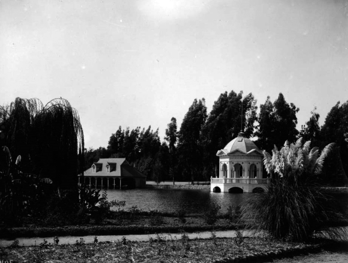
| (ca. 1900)#* - View showing Eastlake Park (later Lincoln Park). A boat house stands on the lake in background while a lightly-colored, extravagant gazebo stands on the water's edge at right. Flowers line a pathway in the foreground while tall trees stand across the far side of the lake. |
 |
|
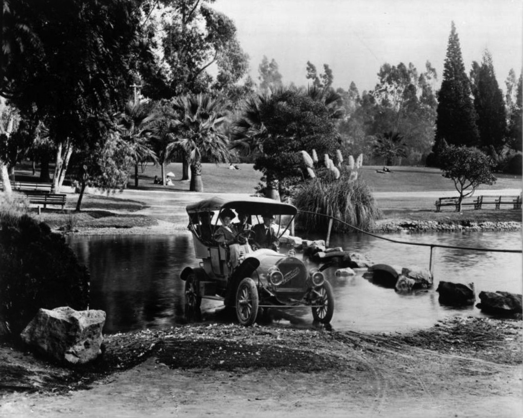
| (ca. 1908)#* – View showing a 1908 "Tourist" automobile driving through a stream in Eastlake Park (later Lincoln Park). The lightly-colored automobile is being driven by a woman with a man seated next two her and two women in the back. Across the stream, more park patrons can be seen enjoying an open expanse of lawn. |
* * * * * |
Westlake Park (later MacArthur Park)
 |
|
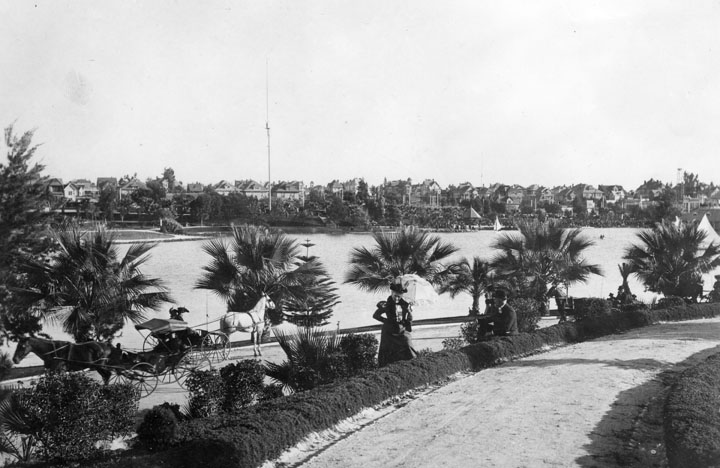
| (ca. 1880s)^* - Panoramic view looking northwest showing Westlake Park (now MacArthur Park) at the intersection of 7th and Alvarado streets. Alvarado runs diagonally from lower-left to center-right. The surrounding hills are devoid of homes and trees. The building on the far left is the boathouse. |
Historical Notes The park, originally named Westlake Park, was built in the 1880s, along with a similar Eastlake Park, whose lake is artificial. Westlake Park was renamed MacArthur Park on May 7, 1942; Eastlake Park was renamed Lincoln Park. Originally Westlake Park and Eastlake Park (as well as Echo Park) were built as drinking water reservoirs connected to the city's systems of zanjas (small conveyance channels/trenches). When the city abandoned the non-pressurized zanja system for a pressurized pipe system, these smaller, shallow reservoirs located at low points no longer provided much benefit. They were then converted into parks.*^* |
 |
|
| (1880s)^* - View looking northwest of Westlake Park and its boathouse. The Hollywood Hills stand in the background (top-right). |
 |
|
| (ca. 1895)^* - View of Westlake Park (now MacArthur Park) circa 1895. Transportation was still mostly by horse and carriage (lower left of picture) and ladies carried parasols to shade themselves from the sun. Multi-story homes fill the hill on the other side of the lake. A 150-foot tall streetlight stands in front of the row of homes. |
Historical Notes Wilshire Boulevard formerly ended at the lake on its west side, but in 1934 a berm was built for it to cross and link up with the existing Orange Street (which ran from Alvarado to Figueroa) into downtown Los Angeles. Orange Street was renamed Wilshire and extended east of Figueroa to Grand Ave. This divided the lake into two halves; the northern one was subsequently drained.*^* |
 |
|
| (1907)^* - View looking northeast of Westlake Park (later McArthur Park) from 7th Street. A tree-lined walkway with benches is seen on the edge of the park. Trolley tracks run down an unpaved 7th Street. Oil derricks are seen in the hills across the lake. |
Historical Notes In 1890, Edward Doheny struck oil south of Angelino Heights and Echo Park, triggering the city’s first oil boom. Soon, hundreds of wells were pumping away in a wide belt stretching roughly south of Temple Street. For decades the wells would change the landscape of the City.*** Westlake Park was renamed MacArthur Park on May 7, 1942.*^* Click HERE to see more Views of Westlake Park (MacArthur Park) in the 1920s + |
* * * * * |
Garvanza Reservoir (1902)
 |
|
| (ca. 1930s)* - View of Garvanza Reservoir. The concreted lined and covered reservoir was located south of Meridian St. between N. Ave 63 and N. Figueroa St. , Highland Park. It was acquired in February 1902 and enlarged 1907. |
Historical Notes In 1989, the Garvanza Pumping Station and site of Highland (Garvanza) Reservoir was dedicated as L.A. Historic-Cultural Monument No. 412 (Click HERE to see complete listing). |
 |
|
| (n.d.)* - Early view of the Garvanza Pumping Plant |
* * * * * |
Solano Reservoir (1904)
 |
|
| (1920s) - The Solano Reservoir was located southwesterly of Spruce Street at Jarvis Street and Alley, Elysian Park. It held 5.8 million gallons of water and was put in service in 1904. |
* * * * * |
Ivanhoe Reservoir (1906)
 |
|
| (1930s)* - Ivanhoe Reservoir - The reservoir was put in service May 1906. It was enlarged in 1952, and taken out of service November 1993, and it was put back in service July 1994. |
 |
|
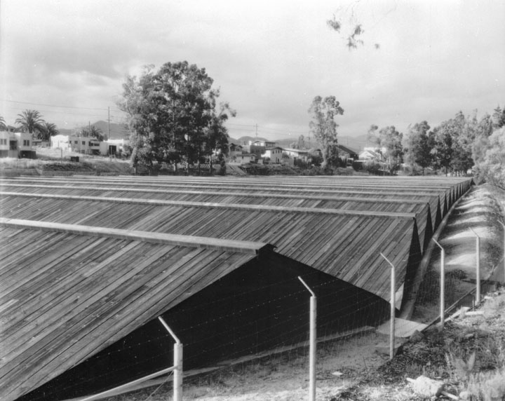
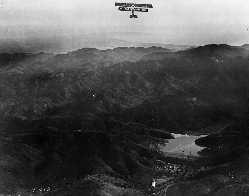
| (1930)* - View looking east towards the Ivanhoe Reservoir, near the intersection of Tesla and W. Silver Lake Drive. The black structure shown over the reservoir is a cover made of wood and black roofing material. Various houses, most of which are in the California Spanish style, are visible throughout the image. Silver Lake Reservoir, which adjoins Ivanhoe, is not covered because of its larger area, greater depth and more active water circulation. |
* * * * * |
Silver Lake Reservoir (1907) |
By the early twentieth century, Los Angeles was growing at an unprecedented rate, and the city's demand for water was increasing just as rapidly. The open farmland of Ivanhoe offered an ideal location for new storage reservoirs that would become essential components of the city's expanding water system.Construction began on the smaller Ivanhoe Reservoir in 1906. Immediately to its south, crews then built the much larger Silver Lake Reservoir, completed in 1907. Although adjacent and operated as part of the same water system, the two were always separate reservoirs, divided by the Ivanhoe Dam and, beginning in 1944, connected by a reinforced concrete spillway. Originally, Ivanhoe served as a domestic water reservoir, while Silver Lake was used primarily for irrigation.Together, the two projects permanently transformed the valley. Fields, orchards, and dirt roads gave way to dams, reservoirs, and eventually new residential neighborhoods. |
* * * * * |
Relationship of the Ivanhoe and Silver Lake Reservoirs
 |
|
| Locator diagram showing the relative positions of the adjacent Ivanhoe and Silver Lake reservoirs. Ivanhoe Reservoir, completed in 1906, lies immediately north of the larger Silver Lake Reservoir, completed in 1907. The two reservoirs are separated by the Ivanhoe Dam and have been connected by a reinforced concrete spillway since 1944. Not to scale. |
* * * * * |
Construction Begins
 |
|
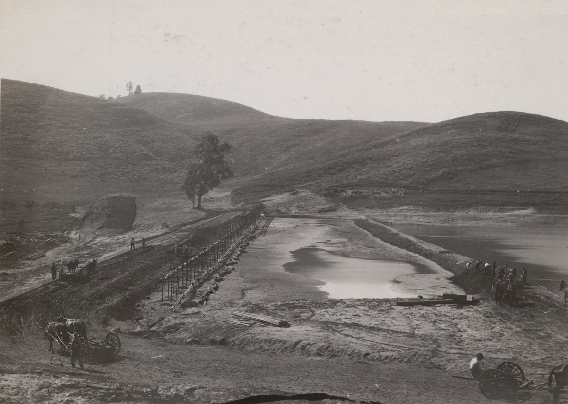
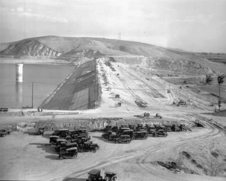
| (1906)* - View showing the construction site of the adjacent Ivanhoe and Silver Lake reservoirs. Construction began on the smaller Ivanhoe Reservoir in 1906, followed by the larger Silver Lake Reservoir in 1907. Image slightly enhanced. |
Historical Notes The City of Los Angeles began acquiring land for what would become the Ivanhoe and Silver Lake reservoir complex during the 1880s, obtaining the remaining property through condemnation in 1904. Designed by Chief Engineer William Mulholland, the project introduced an innovative construction technique known as hydraulic sluicing, in which powerful water jets excavated and relocated enormous quantities of earth. Construction began with the smaller Ivanhoe Reservoir in 1906, followed by the much larger Silver Lake Reservoir, completed the following year immediately to the south. Although adjacent and operated as part of the same water system, the two reservoirs served different purposes: Ivanhoe supplied domestic drinking water, while Silver Lake was used primarily for irrigation. |
 |
|
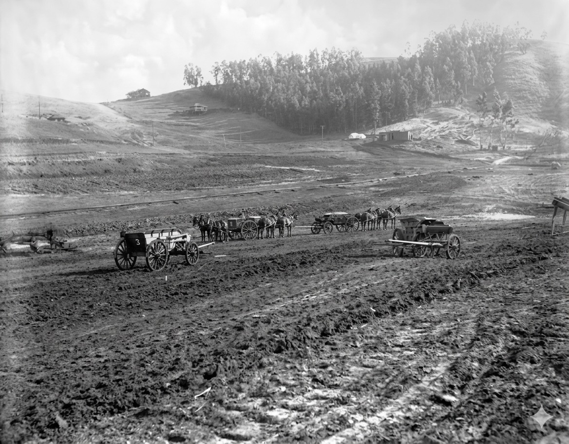
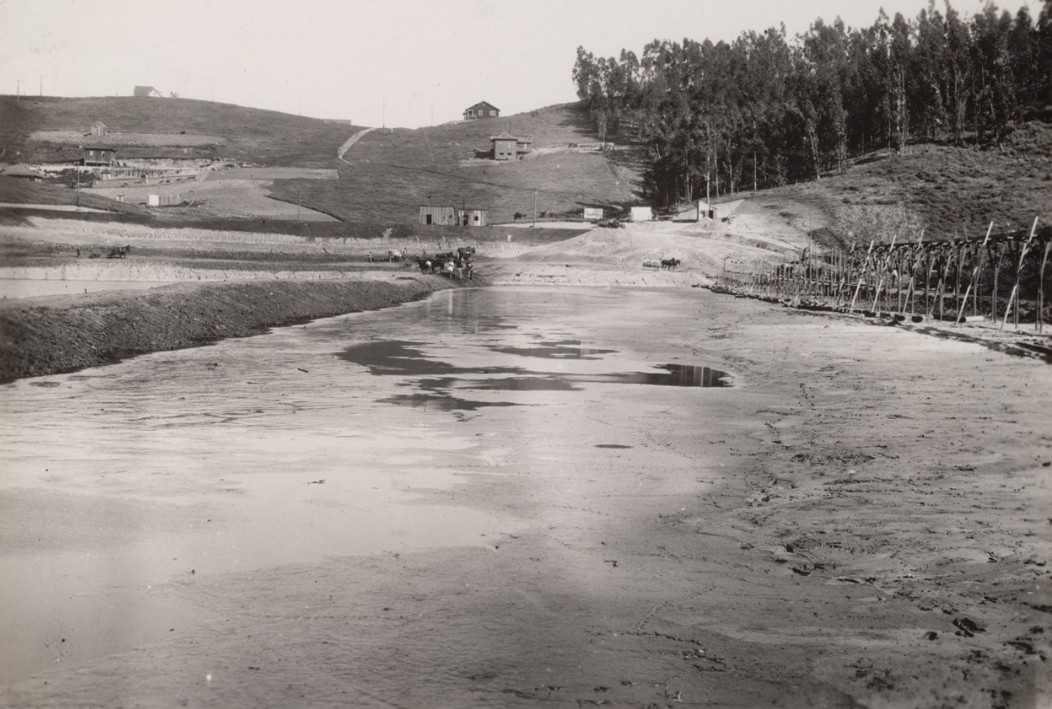
| (1907)* - View showing men operating horse-drawn ploughs grading the land adjacent to the newly constructed Silver Lake Reservoir located in the Ivanhoe Canyon. |
Historical Notes While crews continued grading the land surrounding the newly completed Silver Lake Reservoir, the project had already become associated with Herman Silver, the influential attorney, City Council President, and first Chairman of the Los Angeles Water Commission. Although Silver was not reappointed to the Water Board after a change in city administration, the City Council honored his contributions by naming the new reservoir after him. Over time, the surrounding community gradually adopted the name Silver Lake, replacing the earlier name Ivanhoe, while the smaller reservoir to the north retained its historic name. |
 |
|
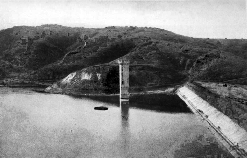
| (1907)* - Silver Lake Dam, looking north, during construction. |
Historical Notes To construct the Silver Lake Dam, William Mulholland first embedded a wall of riveted steel plates within three feet of concrete to create a watertight core. Powerful hydraulic jets washed earth from the canyon floor and deposited it against the concrete core, forming the massive earthen embankment. This innovative hydraulic sluicing technique reduced the need for conventional excavation while allowing engineers to build one of Los Angeles' earliest reservoirs quickly and efficiently. |
 |
|
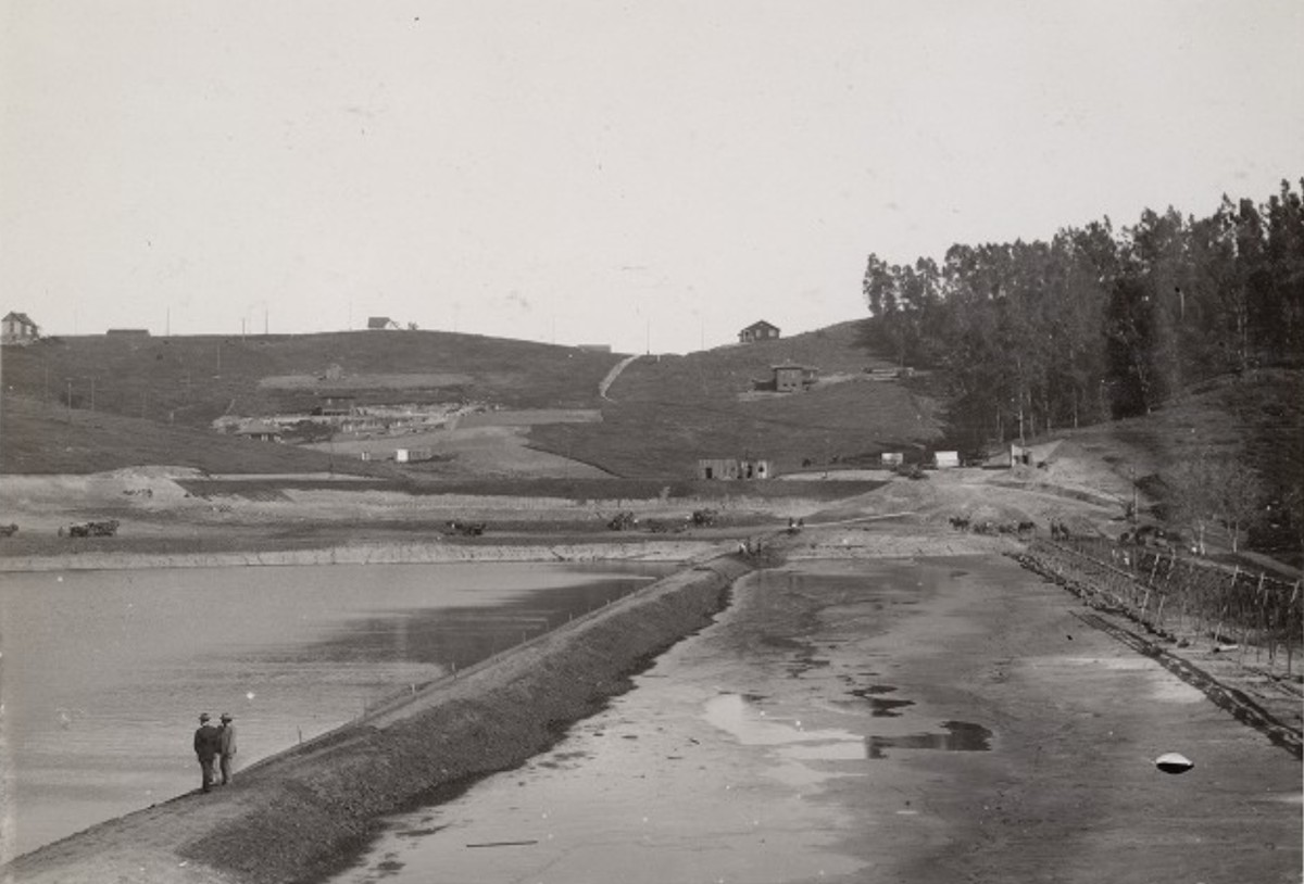
| (1907)* - Silver Lake Dam, looking south. |
Historical Notes Standing atop the newly completed Silver Lake Dam, this view looks south across the reservoir toward the surrounding hillsides. Holding approximately 767 million gallons of water pumped from wells near Griffith Park along the Los Angeles River, the reservoir could supply Los Angeles for nearly three weeks if all other sources were interrupted. Together with the smaller Ivanhoe Reservoir immediately to the north, Silver Lake became a key part of the city's rapidly expanding water system. Beyond its engineering importance, the reservoir permanently transformed the surrounding landscape. The quiet farming valley of Ivanhoe soon gave way to a growing residential community that ultimately took its name from the larger reservoir. |
 |
|
| (1907)* - Newly completed Silver Lake Reservoir looking across the water toward the developing hillsides of Ivanhoe. |
Historical Notes Standing atop the newly completed dam, two men look across Silver Lake Reservoir toward the developing hillsides of Ivanhoe. Although the valley remained largely rural, the creation of the adjacent reservoirs soon encouraged residential development throughout the surrounding hills, forever changing the character of the area. |
 |
|
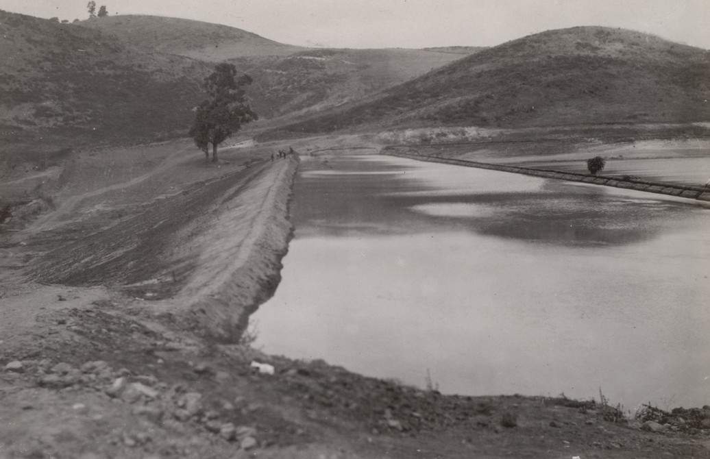
| (1907)* - View along the earthen embankment of the newly completed Silver Lake Reservoir in Ivanhoe Canyon. |
Historical Notes Seen from atop the completed embankment, the reservoir follows the natural contours of Ivanhoe Canyon. Rather than forcing the reservoir into a rigid geometric shape, Mulholland's engineers adapted the reservoir to the existing topography, creating a broad earthen dam that blended with the surrounding hills. Within only a few years, farms and open fields surrounding the reservoirs gave way to streets, homes, and businesses as one of Los Angeles' earliest planned residential communities took shape around the new water system. |
* * * * * |
Silver Lake Reservoir: From Water Supply to Community Landmark |
When Silver Lake Reservoir was completed in 1907, it was built as a practical piece of municipal infrastructure to meet Los Angeles' rapidly growing demand for water. Unlike the smaller Ivanhoe Reservoir immediately to its north, which was originally covered with a wooden roof to protect water quality, Silver Lake remained open to the sky. Almost immediately, Angelenos discovered that it offered something unexpected: a beautiful new landscape.That open water soon shaped the neighborhood growing around it. Beginning in the 1920s, developers transformed the surrounding hillsides into carefully planned residential subdivisions, their curving streets designed to take advantage of sweeping views of the reservoir. What had begun as an engineering project quickly became the defining feature of one of Los Angeles' most distinctive communities.Today the reservoir is no longer part of Los Angeles' active drinking water system, but it remains one of the city's most recognizable landmarks. The photographs below trace its remarkable evolution from municipal water supply to community centerpiece over nearly seventy years. |
 |
|
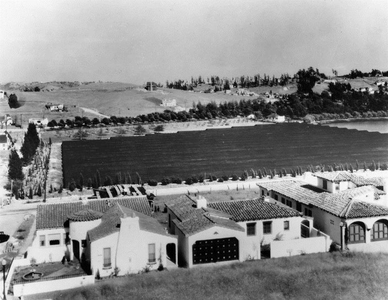
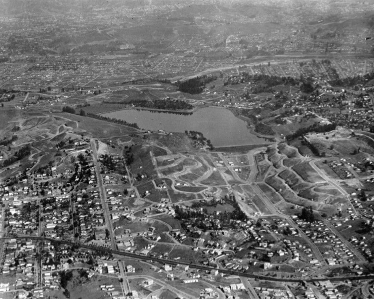
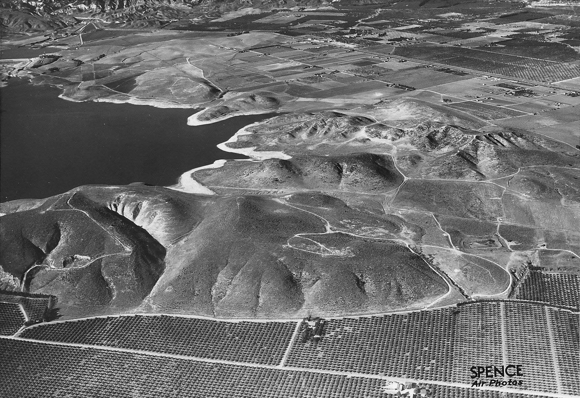
| (1924)* - Seen from the air is the Silver Lake Reservoir and the surrounding Moreno Highlands-Silver Lake community. |
Historical Notes Although constructed as a municipal water supply, Silver Lake Reservoir quickly became one of Los Angeles' most scenic public spaces. Unlike nearby Ivanhoe Reservoir, which was originally covered with wooden planks to protect water quality, Silver Lake remained open, allowing residents to enjoy sweeping views across the water. Angelenos strolled along its shoreline, fishermen cast for black bass, and the reservoir soon became one of the city's most picturesque gathering places. Recognizing its growing recreational appeal, the City's Park Department planted more than 2,000 eucalyptus trees on the surrounding hillsides in 1912. What had begun as a utilitarian engineering project had already become the defining landscape feature of the emerging Silver Lake neighborhood. |
 |
|
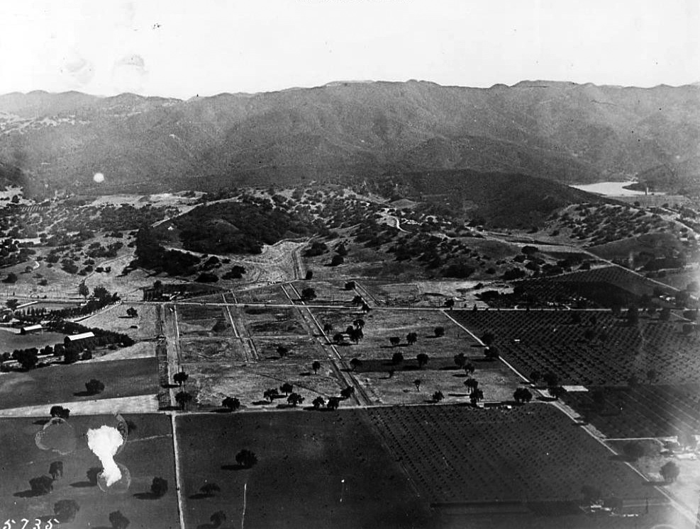
| (1924)* - Aerial view of Silver Lake Reservoir and surrounding area, with streets readied for houses. View is looking north. |
Historical Notes By 1924, developers were laying out the streets that would become the Moreno Highlands, the hillside neighborhood immediately west of the reservoir. Silent film star Antonio Moreno and his wife, oil heiress Daisy Canfield, had established their own hilltop estate nearby and soon subdivided the surrounding land into home sites designed to capitalize on dramatic views of the water. Rather than following a rigid street grid, the curving roads visible here were carefully aligned with the natural contours of the hillsides. Within only a few years these graded streets would be lined with Spanish Colonial Revival and Mediterranean style homes, many of which still define the character of the neighborhood today. |
* * * * * |
A Growing Neighborhood Around the Reservoir
 |
|
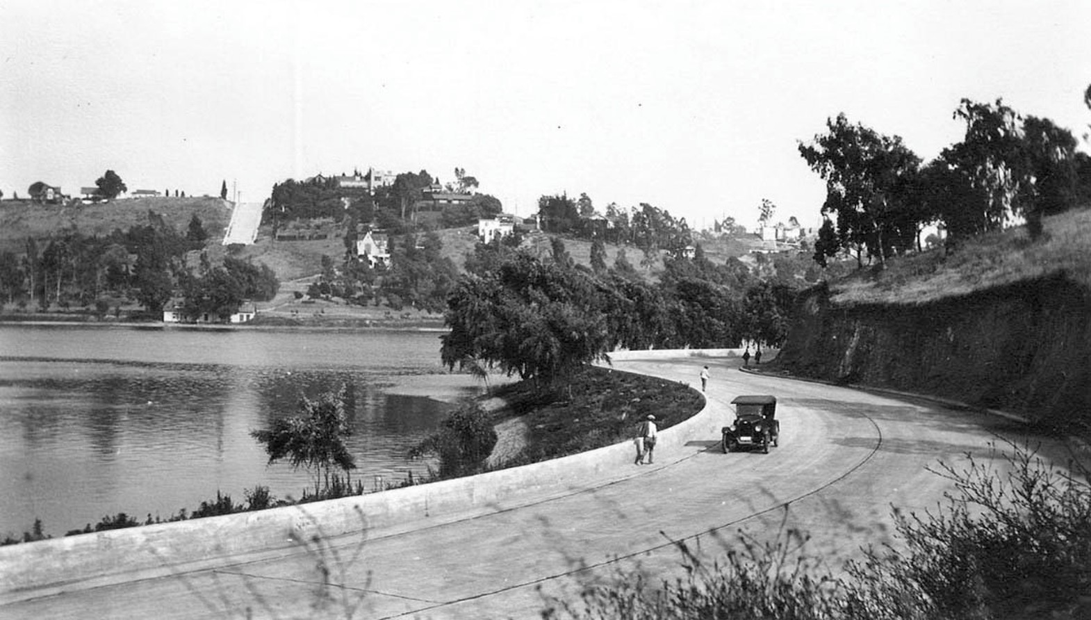
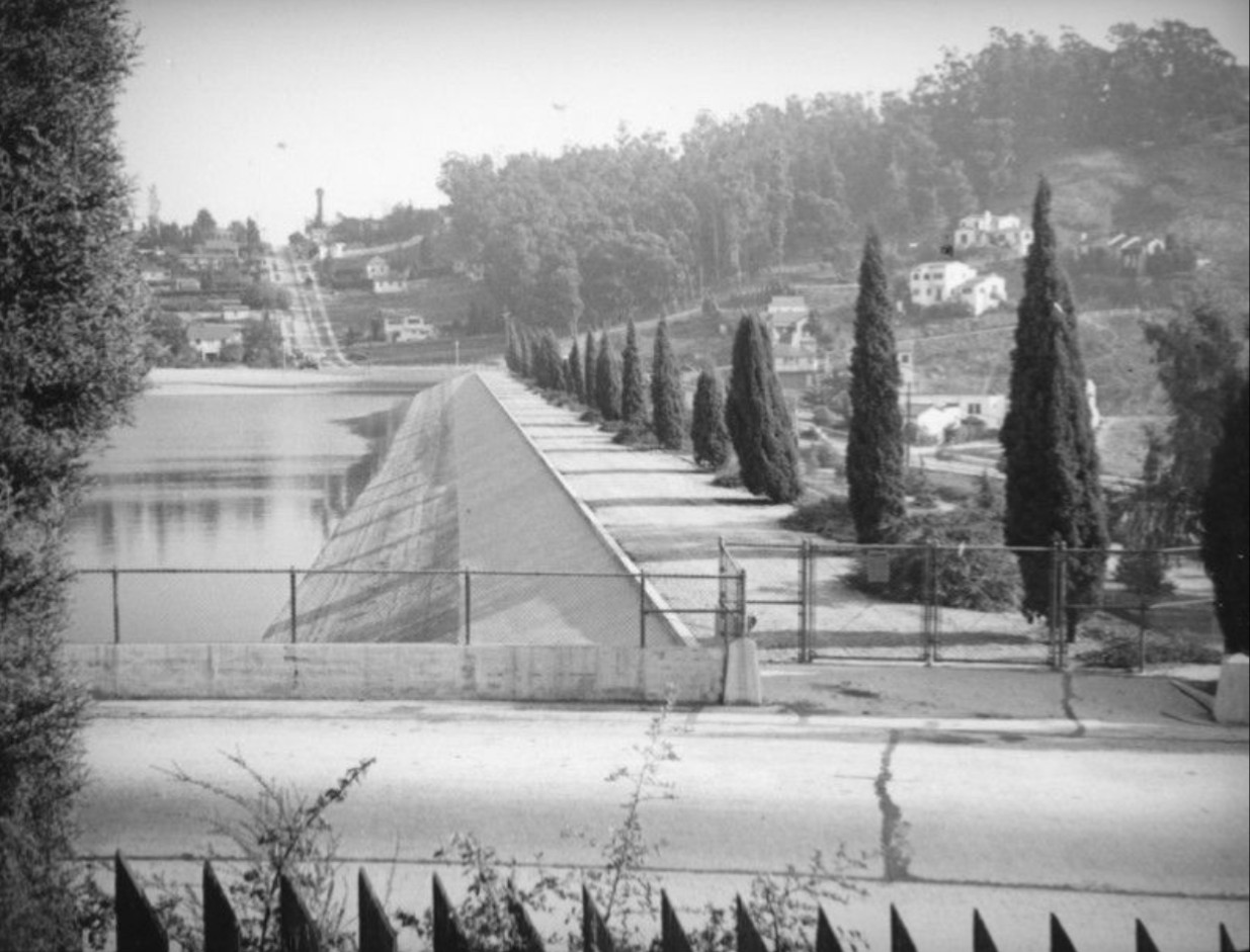
| (1927)*– Panoramic ground level view showing Silver Lake Reservoir. Two people are seen strolling along the road adjacent to the reservoir as an early model car rounds the curve. |
Historical Notes By the late 1920s, Silver Lake Reservoir had become much more than a source of water. Tree-lined roads, scenic vistas, and the expanding residential neighborhoods surrounding the reservoir made it a favorite destination for leisurely walks and Sunday drives. The two pedestrians and early automobile captured here reflect a community beginning to embrace the reservoir as part of everyday life. Although development around the reservoir was still in its early stages, the road circling the water had already become a popular public promenade. The reservoir was no longer simply part of the city's infrastructure—it had become the social and visual heart of the neighborhood. |
 |
|
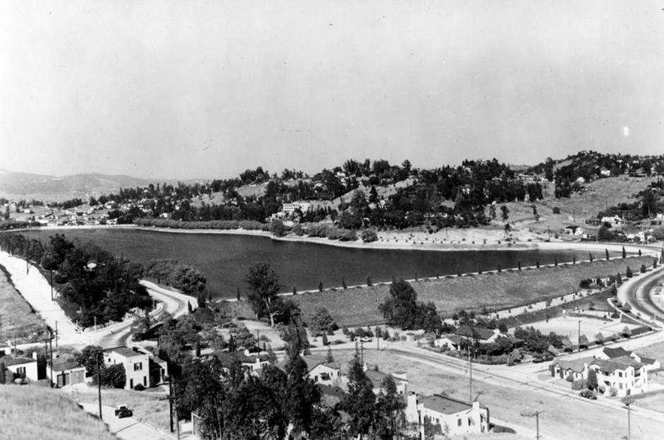
| (1930)* - Silver Lake Reservoir. Silver Lake Reservoir was named for Herman Silver, first president of the Board of Commissioners, Domestic Water Works System. He served from 1902 to 1903. The reservoir was put into service in May 1908. |
Historical Notes Silver Lake Reservoir was named in honor of Herman Silver, an attorney who served as the first president of the Board of Commissioners of the Domestic Water Works System from 1902 to 1903. Although Silver left the board after a change in city administration, the reservoir permanently preserved his name, and the surrounding community gradually adopted it as well, replacing the earlier name Ivanhoe. Completed as an earth fill dam with asphalt concrete lining and paved slopes, the reservoir officially entered service in May 1908. More than two decades later it remained an essential part of Los Angeles' municipal water system while simultaneously serving as the defining landmark of the growing Silver Lake neighborhood. |
 |
|
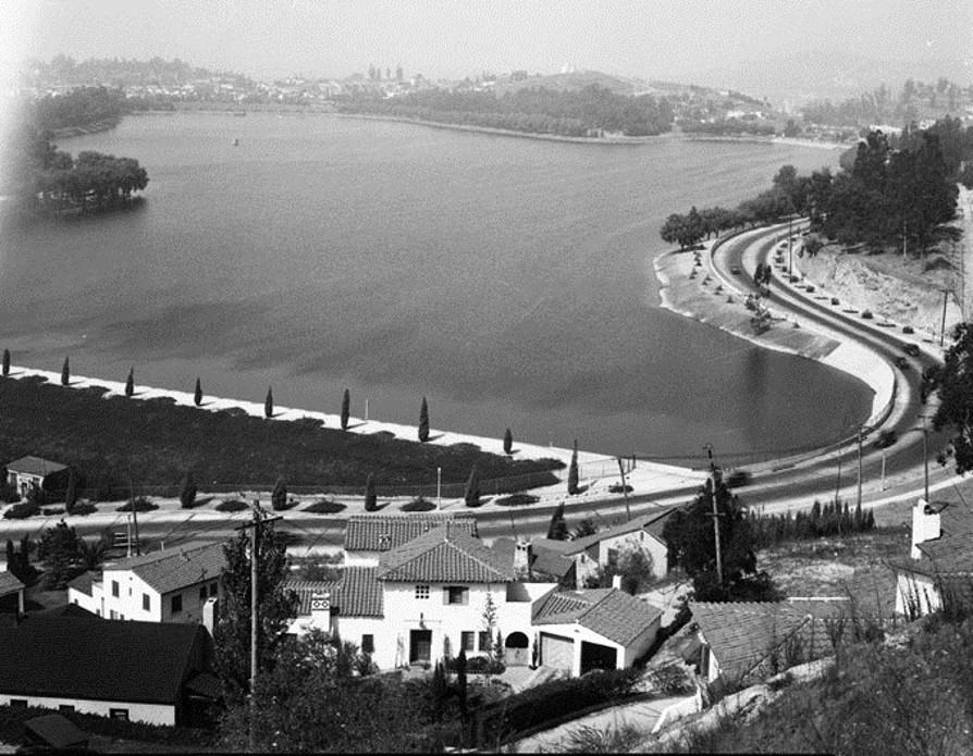
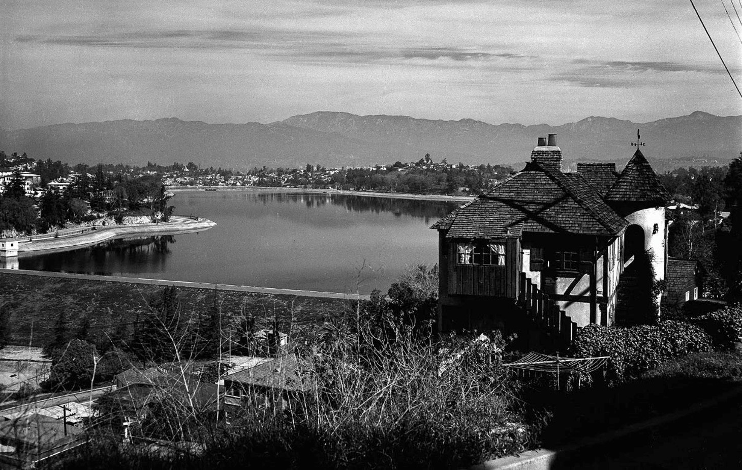
| (ca. 1935)* - View of Silver Lake Reservoir, looking northwest from the southeast. |
Historical Notes By the mid-1930s, the hills surrounding Silver Lake Reservoir were filling with homes built in the California Spanish and Spanish Colonial Revival styles that had become synonymous with Southern California architecture. The reservoir's sweeping views and gently curving streets attracted homeowners seeking both natural beauty and convenient access to downtown Los Angeles. The generous spacing between homes reflected both the challenging hillside terrain and the desire to preserve views of the reservoir below. Unlike the dense street grids of many Los Angeles neighborhoods, development here adapted to the landscape, creating the distinctive character that still defines Silver Lake today. |
 |
|
| (ca. 1936)* -View of the reservoir, looking northeast from the southwest. The original Silver Lake Recreation Center can be seen at the intersection of Van Pelt and W. Silver Lake Boulevard. |
Historical Notes Dedicated in November 1931, the Silver Lake Recreation Center became an important gathering place for the growing neighborhood. Its original facilities included tennis courts, croquet courts, playgrounds, and open recreational space, providing residents with opportunities for organized sports and community activities. Together, the recreation center and the reservoir created a natural focal point for neighborhood life. What had begun as a municipal water project had evolved into one of Los Angeles' most attractive public landscapes, where recreation, scenic beauty, and community life existed side by side. |
 |
|
| (ca. 1937)* – Southwest corner of Silver Lake Reservoir. Photo by Herman Schultheis. |
Historical Notes This photograph was taken by Herman Schultheis, whose remarkable images of Los Angeles during the late 1930s have become an invaluable record of everyday life throughout the city. Rediscovered decades after his disappearance while photographing Mayan ruins in Guatemala, his work now forms one of the Los Angeles Public Library's most important photographic collections. Here, Schultheis captured the quiet beauty of Silver Lake Reservoir as it appeared during the Great Depression, by then firmly established as both a working reservoir and one of Los Angeles' most recognizable neighborhood landmarks. |
 |
|
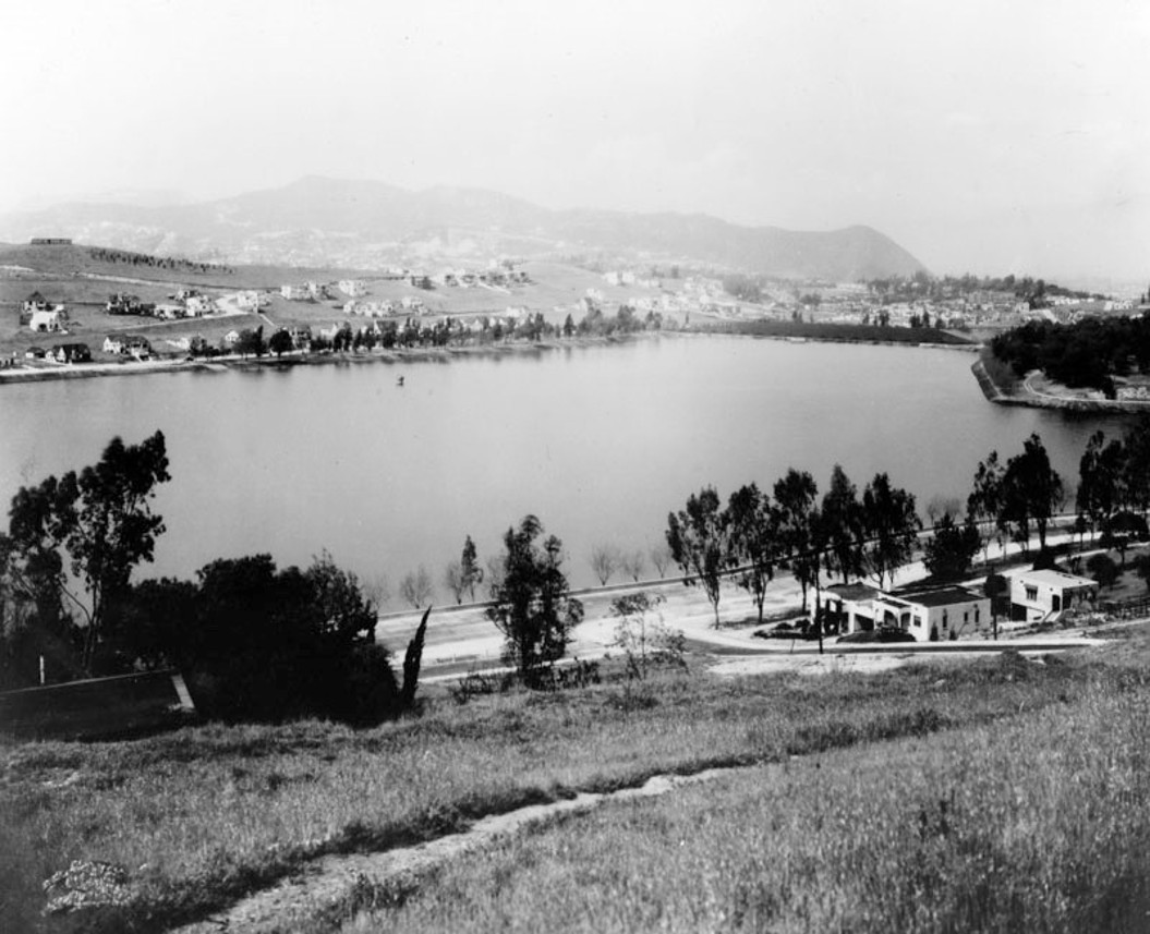
| (1938)* - Panoramic view of Silver Lake Reservoir. Photo by William Reagh. |
Historical Notes William Reagh devoted much of his career to documenting the changing landscapes of Los Angeles, producing tens of thousands of photographs that today provide an invaluable visual record of the city's twentieth-century history. His careful, documentary approach makes this panoramic view one of the finest surviving images of Silver Lake before postwar development reshaped much of the surrounding city. Taken only fourteen years after the first Moreno Highlands streets were graded, this photograph reveals how quickly the reservoir had become integrated into the fabric of the neighborhood, surrounded by mature trees, winding roads, and an expanding residential community. |
 |
|
| (1956)* – View of Silver Lake Reservoir, looking north toward the mountains. |
Historical Notes By the mid-1950s, Silver Lake had matured into a well established residential neighborhood while the reservoir continued serving as an active part of Los Angeles' drinking water system. Homes now lined nearly every surrounding hillside, yet the broad expanse of open water remained the community's defining feature. This mid-century view captures Silver Lake at a moment of remarkable balance, long after its pioneering years but decades before changing federal water quality regulations would end its role as an open drinking water reservoir. |
 |
|
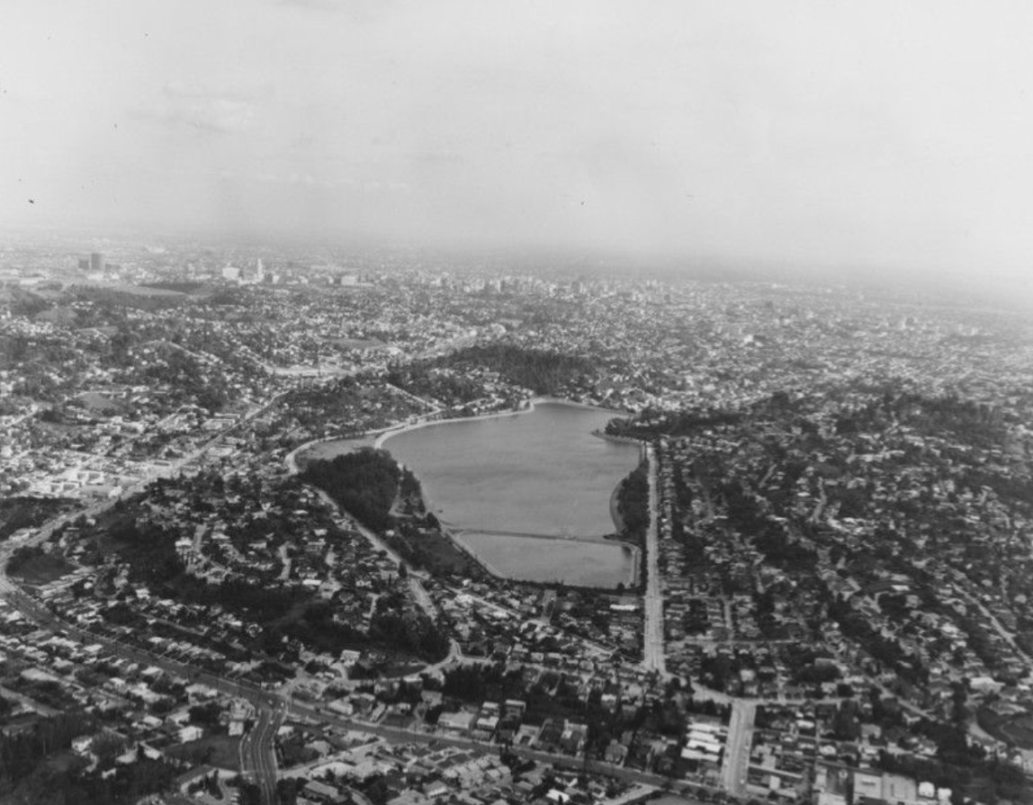
| (1973)* - Aerial view of Silver Lake, looking southeast. |
Historical Notes Nearly fifty years after the first streets of the Moreno Highlands were laid out, the hills surrounding Silver Lake Reservoir had become a mature residential community representing several generations of architectural styles. Despite this growth, the reservoir itself remained the visual centerpiece around which the neighborhood continued to evolve. The reservoir would continue serving Los Angeles' water system for several more decades before new federal drinking water regulations eventually brought that chapter of its history to a close. Even after its municipal role changed, Silver Lake remained the landmark that gave both the neighborhood and its identity enduring meaning. |
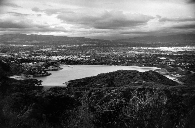
Silver Lake Today Although no longer used for drinking water storage, both Ivanhoe and Silver Lake reservoirs remain defining features of the neighborhood they helped create more than a century ago. The two reservoirs continue to hold water while serving as valued community amenities, wildlife habitat, and an integral part of the Silver Lake Reservoir Complex. Their original role in Los Angeles' municipal water system has been assumed by the underground Tom LaBonge Headworks Water Complex, allowing these historic reservoirs to be preserved as treasured landmarks for future generations. |
* * * * * |
Lower Van Norman Reservoir (aka Lower San Fernando Reservoir) |
 |
|
| (1930)* – View showing construction work at the Lower San Fernando Reservoir, originally built in 1913. |
Historical Notes The Los Angeles Aqueduct enters the San Fernando Valley, discharging into the Upper San Fernando Reservoir and then into the Lower San Fernando Reservoir. In 1930, the Los Angeles Bureau of Water Works and Supply (later LADWP) began work to increase the storage capacity of the Lower San Fernando Reservoir. |
 |
|
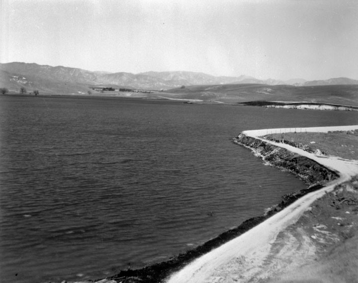
| (1930)* - View showing the Lower San Fernando Reservoir (later named Lower Van Norman Reservoir) after expansion. |
Historical Notes The capacity of the Lower San Fernando increased from 14,000 to 18,000-acre feet by raising the height of the earth fill dam there 12 feet. The dam is 2,400 feet long. |
 |
|
| (1935)^^ - Aerial view of the Lower Van Norman Reservoir looking northeast. Rinaldi Street runs east to west in the foreground. |
Historical Notes The reservoir was later named after Harvey Arthur Van Norman who was a long time employee and engineer for the City of Los Angeles under his chief and close friend William Mulholland. When Mulholland retired Van Norman took his place as head of the Chief Engineer and General Manager of the Bureau of Water Works and Supply. When the separate water and power bureaus were merged into a single organization he became head of the new Department of Water and Power. Click HERE for a chronology and explanation of all the DWP name changes. After the 1971 Sylmar Earthquake, the Los Angeles Dam was constructed and a new reservoir would replace the Lower Van Norman Reservoir. |
* * * * * |
Chatsworth Reservoir (1919) |
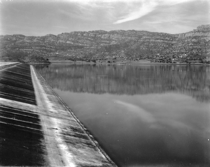
Long before the San Fernando Valley was covered by homes and shopping centers, it was an agricultural landscape sustained by imported water. When William Mulholland completed the Los Angeles Aqueduct in 1913, he brought Owens Valley water to the edge of the Valley, but that water required storage and careful regulation. The Chatsworth Reservoir was part of that solution, planned from the earliest days of the aqueduct to capture surplus winter flows and release them gradually for irrigation.The Chatsworth site was identified as early as 1911, though acquiring the land proved slow. Negotiations with the daughter of original owner B.F. Porter stretched over four years before construction began in the summer of 1917. Using a combination of horse-drawn equipment and early machinery, workers built two large earthfill dams across natural gaps in the hills at the northwest edge of the Valley. On April 9, 1918, Mulholland personally turned the valve to allow water to flow into the reservoir. By 1919, construction was complete, and Chatsworth entered service with a capacity of 7,400 acre-feet.For more than fifty years, Chatsworth Reservoir played a central role in the western San Fernando Valley. It supported agriculture in its early decades and later supplied drinking water as development spread westward. The dams were raised and strengthened in the early 1930s to meet growing demand. Then, following the 1971 Sylmar earthquake, concerns over the stability of earthfill dams led to its permanent closure. Today, the site has been transformed into the Chatsworth Nature Preserve, a 1,300-acre open space that remains one of the largest remaining undeveloped areas in Los Angeles County. |
 |
|
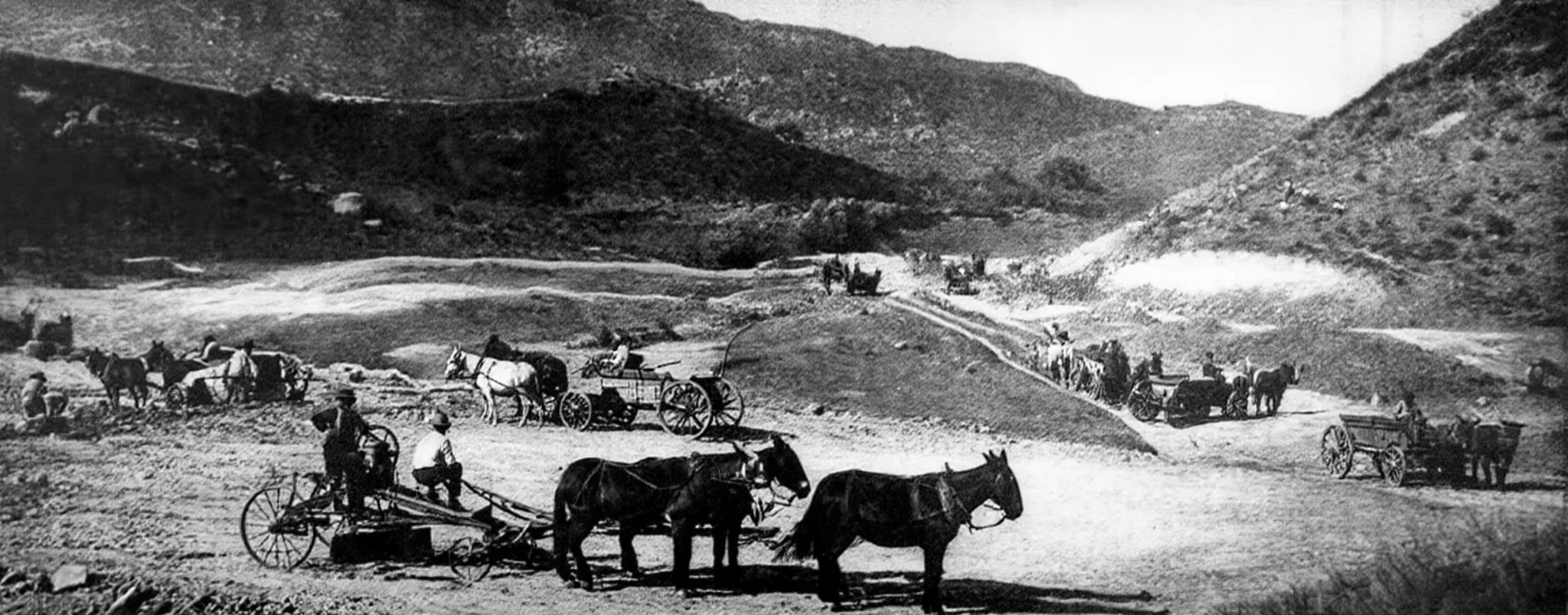
| (ca. 1918)* - Early construction at the Chatsworth Reservoir dam site. Mule teams moved earth during the first phase of building, which began in the summer of 1917. |
Historical Notes Planning for the Chatsworth Reservoir began soon after the Los Angeles Aqueduct opened in 1913. The site had been identified in 1911, but land acquisition delayed construction until 1917. Work began with teams of horses and laborers moving large volumes of earth to shape the basin and form the initial dam embankments. Horse-drawn equipment remained standard for large-scale earthmoving at the time, even on projects of this size. In the rugged terrain at the northwest edge of the Valley, horses worked alongside early machinery to clear land and build up the dams. This phase marked the transformation of dry foothills into one of the city's major water storage facilities. |
 |
|
| (1918)* – Construction workers pose in front of a steam shovel at the Chatsworth Reservoir dam site. Steam shovels and horse-drawn equipment worked side by side during the 1917 to 1919 construction period. |
Historical Notes Steam shovels introduced a new level of efficiency to large construction projects, allowing workers to cut into hard ground and load material far faster than manual labor alone. At Chatsworth, mechanical and animal power worked side by side to complete the dams between 1917 and 1919. Images like this were often staged to document both the workforce and the scale of the undertaking. The Chatsworth Reservoir was a major infrastructure project for its time, and those involved recognized its importance to the city's future growth. |
 |
|
| (ca. 1919)* - View looking down toward the recently filled Chatsworth Reservoir. Water first officially flowed into the reservoir on April 9, 1918, when William Mulholland turned the valve. |
Historical Notes On April 9, 1918, Mulholland formally opened the reservoir by allowing aqueduct water to flow in. Although some water had been introduced earlier for testing, this marked the official beginning of operations. Construction, however, was still ongoing. The larger dam required additional work before the reservoir could reach full capacity. That milestone was achieved in 1919, when the reservoir was completed and placed into full service as part of the aqueduct distribution system. |
 |
|
| (ca. 1919)* – Closer view of the Chatsworth Reservoir, looking northeast across the newly completed basin. The reservoir reached full capacity in 1919 after construction of the larger of its two earthfill dams was finished. |
Historical Notes After the initial filling, engineers continued raising the larger of the two earthfill dams to its designed height. Full capacity was reached in 1919, when it entered service as the principal storage facility for the western San Fernando Valley. The Chatsworth High Line conduit, completed in 1916, was extended three miles to supply the reservoir while continuing to serve irrigation needs throughout the north Valley. This dual role made Chatsworth a central distribution point within the aqueduct system. |
 |
|
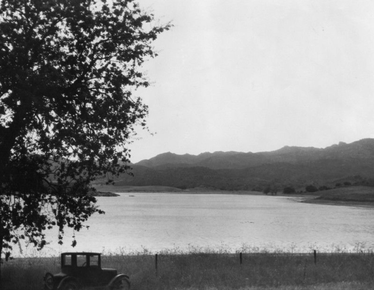
| (ca. 1925)* - The Chatsworth Reservoir in the northwest San Fernando Valley, approximately six years after it was placed in service. The surrounding area remained largely agricultural at the time. |
Historical Notes When Chatsworth Reservoir entered service in 1919, the San Fernando Valley was still overwhelmingly agricultural. The aqueduct water stored here supplied ranches, orange groves, grain fields, and vegetable farms spread across the valley floor and surrounding foothills. The reservoir's original capacity of 7,400 acre-feet matched those irrigation needs, and its high water elevation of 884.3 feet allowed gravity to move water through the distribution system without mechanical pumping. The two earthfill dams and two smaller dikes that formed the reservoir used compacted earth to create watertight barriers across natural gaps in the terrain. Because the structure relied on fill rather than concrete, regular maintenance and monitoring were essential. From its earliest years, LADWP engineers kept close watch on the embankments, knowing that the water supply of the western San Fernando Valley depended on their integrity. |
 |
|
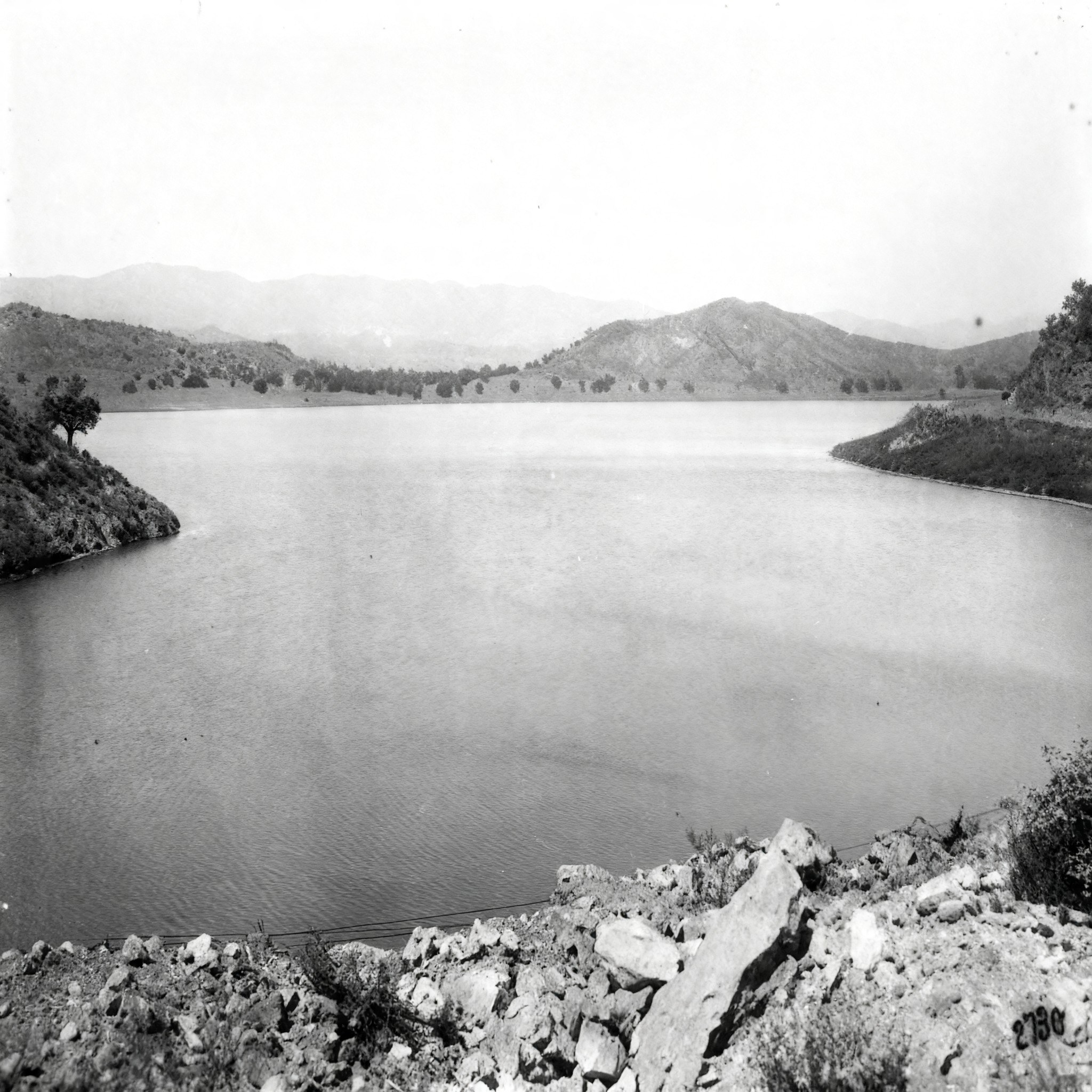
| (ca. 1930s)* - Aerial view looking northwest across the Chatsworth Reservoir toward Simi Valley. The intersection of Roscoe and Topanga Canyon Boulevards is visible at the center left. By this date the reservoir had been expanded to a capacity of 9,840 acre-feet. |
Historical Notes By the early 1930s, the reservoir had already been expanded to meet increasing demand. Work in 1930 and 1931 raised the water level by five feet and increased capacity to 9,840 acre-feet, requiring partial reconstruction of both dams. From this vantage point, the reservoir appears isolated within a largely undeveloped landscape. The intersection of Roscoe and Topanga Canyon Boulevards marks the edge of growth at the time, while Simi Valley lies beyond the Santa Susana Mountains in the distance. For many years, it remained the principal storage facility serving the western Valley. |
 |
|
| (ca. 1930)* - Chatsworth Reservoir before the 1930 to 1931 enlargement project. The expansion raised the high water level five feet and increased capacity by more than 2,400 acre-feet. |
Historical Notes As population growth accelerated through the 1920s, the reservoir's original capacity became insufficient. Engineers developed plans to raise the dams, a process that required draining the reservoir before reconstruction could begin in 1930. This view shows the reservoir at its original level, prior to enlargement. The expansion increased capacity by roughly one-third, allowing the system to meet the demands of a rapidly growing Valley. |
 |
|
| (1930s)* - The Chatsworth Reservoir and one of its two concrete-faced earthfill dams, with the Santa Susana Mountains in the background. The dams were reconstructed and raised during 1930 and 1931. |
Historical Notes The 1930 to 1931 reconstruction was the most significant upgrade in the reservoir's history. Large volumes of compacted earth and rock were added to raise and strengthen the dams, followed by a concrete facing to protect against erosion. The finished structure increased both capacity and durability, extending the reservoir's usefulness for decades as demand continued to grow. In total, approximately 16,000 cubic yards of concrete were applied to the dam facings and associated structures. |
 |
|
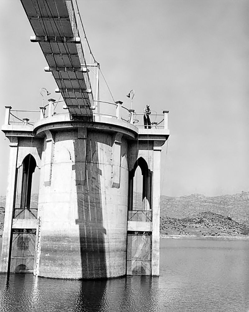
| (1956)* - Caretaker Arthur Hirschy atop the 50-foot outlet tower at the Chatsworth Reservoir, which controlled the flow of water to the western San Fernando Valley. The tower was built in 1920 as part of the reservoir's original distribution infrastructure. |
| Historical Notes
The outlet tower at Chatsworth Reservoir was the control point for releasing stored water into the distribution system that served farms and, later, homes across the western San Fernando Valley. Built in 1920, the year after the reservoir entered full service, the tower allowed operators to regulate the flow precisely, opening or closing valves to match the daily and seasonal demands of the communities below. At 50 feet tall, the structure rose well above the dam embankment, giving the caretaker a clear view of the reservoir surface and access to the control mechanisms at varying water depths. By 1956, when this photograph was taken, the reservoir had been in continuous operation for 37 years. The presence of a resident caretaker like Arthur Hirschy reflected how seriously LADWP treated the facility's day-to-day management. The western Valley was growing rapidly at this time, and dependable water delivery required constant attention. Within fifteen years, the 1971 Sylmar earthquake would end the reservoir's operational life, and structures like this tower would fall silent along with the rest of the facility. |
 |
|
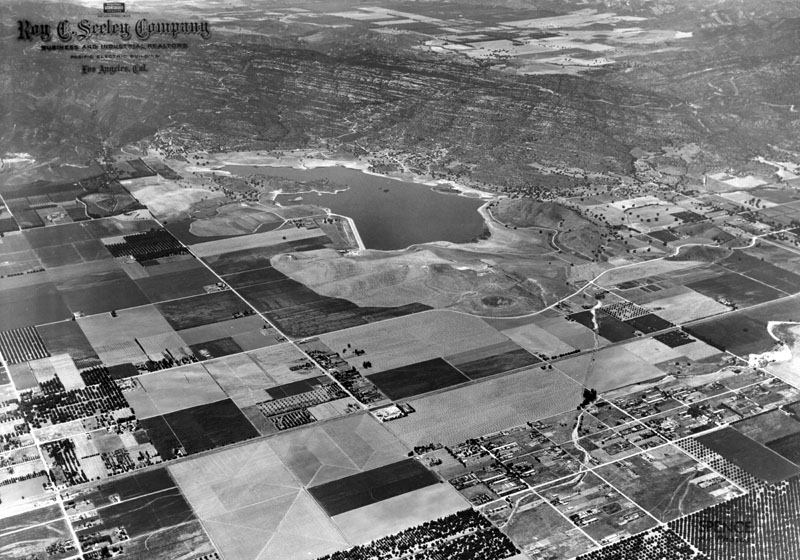
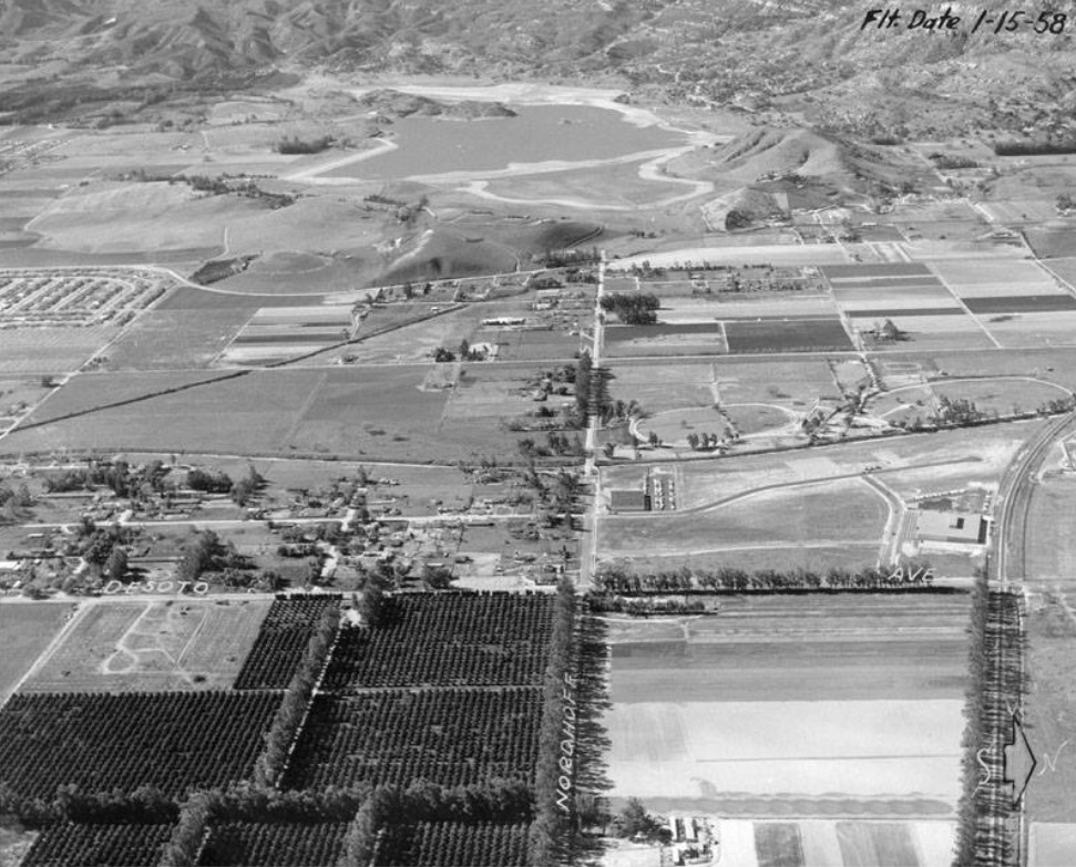
| (1958)* - Aerial view looking west along Nordhoff Street toward its intersection with Topanga Canyon Boulevard. Southern Pacific railroad tracks run along the right edge of the frame. The Chatsworth Reservoir is visible in the background, still in full operation. |
Historical Notes By 1958, the surrounding landscape had shifted from agriculture to suburban development. Residential neighborhoods were expanding westward, replacing the farms that had once depended on reservoir irrigation. As land use changed, so did the reservoir's role. It increasingly supplied domestic water rather than agricultural irrigation, introducing new challenges in water quality and system management. |
 |
|
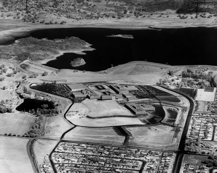
| (1960)* - Aerial view looking north toward the Ramo-Woolridge and Chatsworth residential neighborhoods, with the Chatsworth Reservoir in the background. The reservoir remained in service until the 1971 Sylmar earthquake prompted its permanent closure. |
Historical Notes This aerial view captures the reservoir near the end of its operational life. Residential development had reached the surrounding hills, and the system was under increasing pressure to meet urban water demands. By the time of the 1971 Sylmar earthquake, the reservoir had already been drawn down as part of system improvements. The earthquake heightened concerns about the stability of its earthfill dams, leading to the decision not to return it to service. The site was later repurposed as the Chatsworth Nature Preserve, preserving the land as open space while marking the end of its role in Los Angeles's active water system. Click HERE to see more Early Views of the Chatsworth Reservoir. |
Historical Summary Chatsworth Reservoir served the western San Fernando Valley for more than half a century, evolving from an irrigation facility for a largely agricultural landscape into a domestic water supply for a growing suburban population. Built through a combination of engineering determination and hard physical labor, it represented the far reach of Mulholland's aqueduct vision. Its closure after the 1971 Sylmar earthquake marked not just the end of one facility, but the close of an era in which the open land of the northwest San Fernando Valley had been shaped, stored, and sustained by water carried more than 230 miles from the Owens Valley. |
* * * * * |
Encino Reservoir (1921)
 |
|
| (ca. 1921)^* - Aerial view looking southwest showing the Santa Monica Mountains, Santa Monica Bay, and in the foreground on the Valley side of the mountains, Encino Reservoir. |
Historical Notes Encino Reservoir was constructed in 1921 to provide and store water for the fast growing San Fernando Valley. |
 |
|
| (1921)^* – Encino Reservoir looking west showing completed tower. |
 |
|
| (ca. 1922)^* – Aerial view looking south toward Ventura Boulevard which runs horizontally near the center of the photo. In the upper right Encino Reservoir can be seen and about center-left is the Rancho Los Encinos. |
Historical Notes Encino (Spanish for evergreen or holm oak) is a hilly district of the San Fernando Valley. Specifically, it is located in the central portion of the southern San Fernando Valley and on the north slope of the Santa Monica Mountains. It derives its name from the Rancho Los Encinos (Ranch of the Evergreens), a parcel of land given to three Mission Indians by the Mexican government following its secularization of the California missions beginning in 1834. Rancho Encino was established in 1845. |
.jpg) |
|
| (1921)* – Aerial view looking north over the Santa Monica Mountains Showing the wide-open San Fernando Valley with Encino Reservoir in the foreground. |
 |
|
| (2002)^* - View of Encino Reservoir, looking north from Mulholland Drive. Nestled at the foot of the Santa Monica Mountains, the open reservoir is located opposite from an abandoned Nike Missile Base. Times Photo dated March 23, 2002. |
Historical Notes Encino Reservoir, which was originally constructed in 1921, is currently no longer in service but continues to hold water for fire and emergency purposes. |
* * * * * |
Stone Canyon Reservir (1924)
 |
|
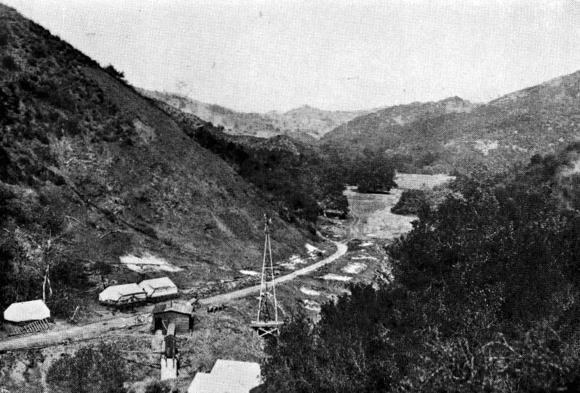
| (1919)^.^ – View showing the Stone Canyon Reservoir and Dam Site at start of construction. |
Historical Notes Construction work on the Stone Canyon tunnel started on October 1, 1919. The tunnel would bring the water into the new Stone Canyon Reservoir. |
 |
|
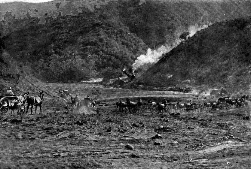
| (1920)^.^ – Horse-drawn wagons haul away dirt as a steam shovel (seen in background) digs in preparation for the Stone Canyon Dam. |
 |
|
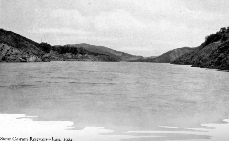
| (1924)^.^ - View of the Stone Canyon Reservoir shortly after it was filled for the first time. |
Historical Notes The Stone Canyon Reservoir was built in 1924 by the Los Angeles Department of Water and Power, then named the Bureau of Water Works and Supply (BWWS). As with most other BWWS reservoirs of the time, it is of earth fill construction which was placed utilizing the hydraulic sluicing method. This method was pioneered and refined by William Mulholland. This reservoir had an original capacity of 8,000 acre⋅ft.^ |
 |
|
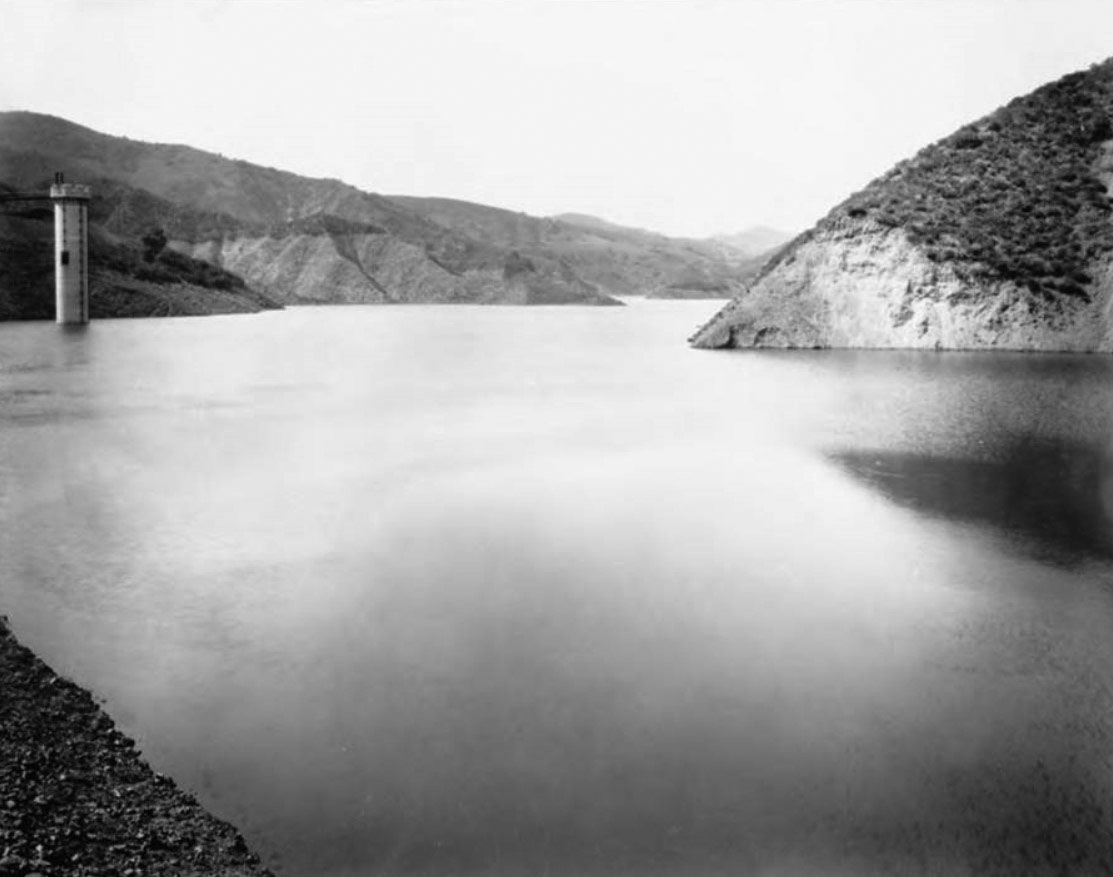
| (ca. 1930s)* – View showing the Stone Canyon Reservoir (lower reservoir) - Bledsoe Collection 1908-1933 |
 |
|
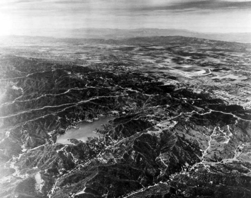
| (1941)^** – Aerial view looking Northwest across the Santa Monica Mountains to the San Fernando Valley showing the Stone Canyon Reservoir at center-left. |
 |
|
| (1950s)* - View showing construction work on the Upper Stone Canyon Reservoir. |
Historical Notes In the mid-1950s, the upstream part of the dam was rebuilt as a roller compacted backfill founded on rock, while the downstream part remained unchanged. The rehabilitation work was completed in 1956. |
 |
|
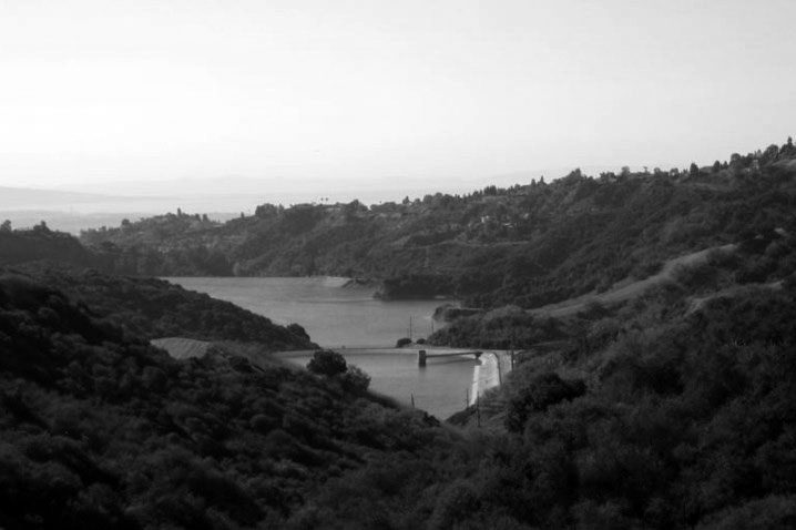
| (2010s)^.^ - View looking down towards the Upper and Lower Stone Canyon Reservoirs. |
Historical Notes The lower reservoir has already been decommissioned for regular use but with provision to address emergency situations with a small water treatment plant built to handle such a situation. In case of fire emergency it is planned that the lower reservoir which has enough storage could provide firefighting requirements.^ |
 |
|
| (2017)* – Panoramic view showing both the Upper and Lower Stone Canyon Reservoirs. |
Historical Notes A proposal to replace the existing Upper Stone Canyon Reservoir is under active consideration. The proposal is to replace the surface reservoir with three underground reservoirs beneath it to store 81 million US gallons of water. The underground structures are proposed to be covered initially with soil and then covered over with local vegetation. Hiking trails are also proposed to pass through the filled up area as a recreational activity to trek the canyon. The objective of this project is basically to follow the regulations set under the Federal Laws for uncovered reservoirs.^ |
* * * * * |
Sawtelle Reservoir (1924)
 |
|
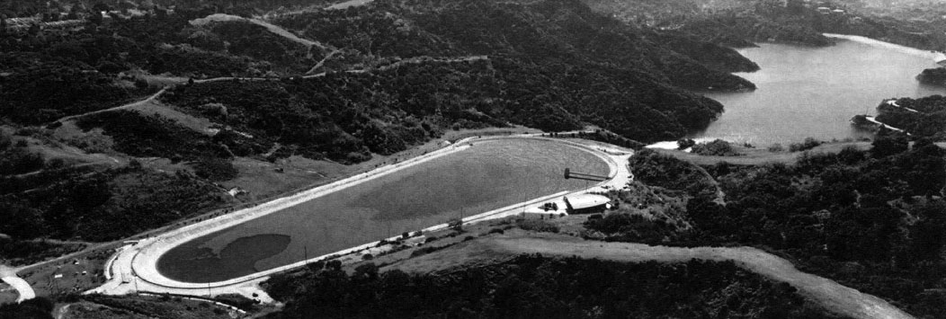
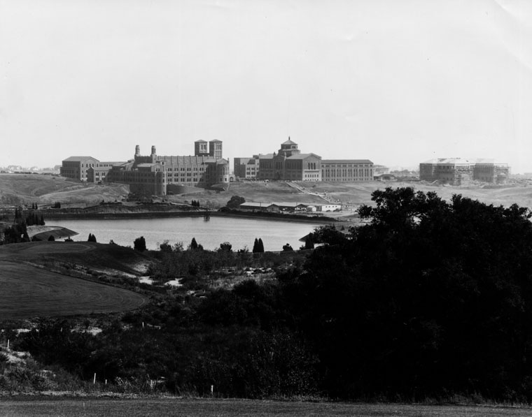
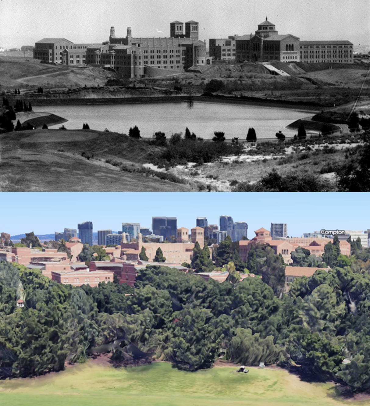
| (1929)* - View of the UCLA Westwood campus, at the time of its opening in 1929. View is looking southeast from the golf course of the Bel-Air Country Club. The body of water shown is the Sawtelle Pressure Break Reservoir. |
Historical Notes Installed in 1924, Sawtelle Reservoir was used to reduce the pressure of water coming from Stone Canyon Reservoir to West LA. |
 |
|
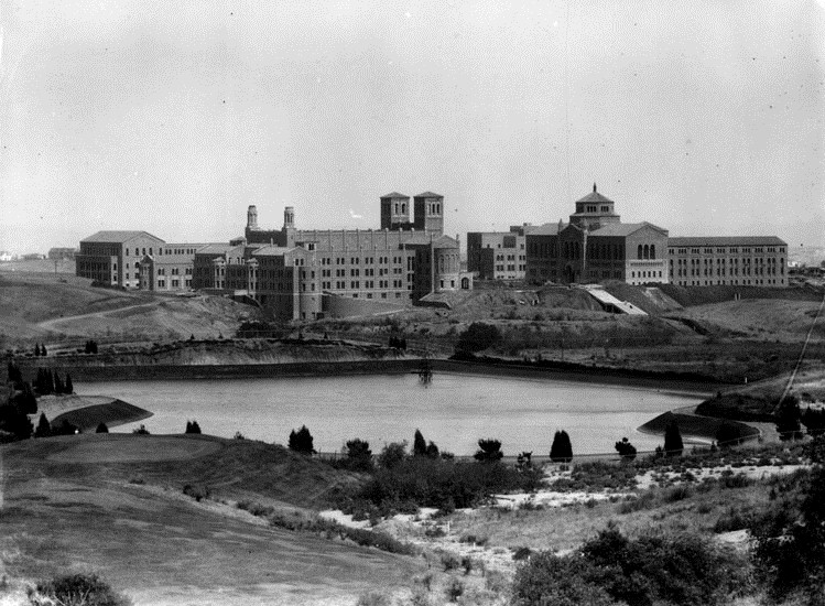
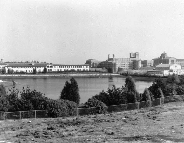
| (1930)* - A panoramic view of the UCLA Westwood campus, shortly after it opened in 1929. View is looking from the golf course of the Bel-Air Country Club. The body of water shown is the Sawtelle Pressure Break Resevoir. The twin towers of Royce Hall are seen in the middle of this photo. |
.jpg) |
|
| (1931)#^ – Panoramic view of Bel-Air showing the UCLA campus and Westwood in center-right. The Sawtelle Pressure Break Resevoir is seen at center. The long two-story building behind it is Marymount High School. |
 |
| (ca. 1931)* - The Sawtelle Pressure Break Reservoir with Marymount High School on left and UCLA on the right. |
 |
|
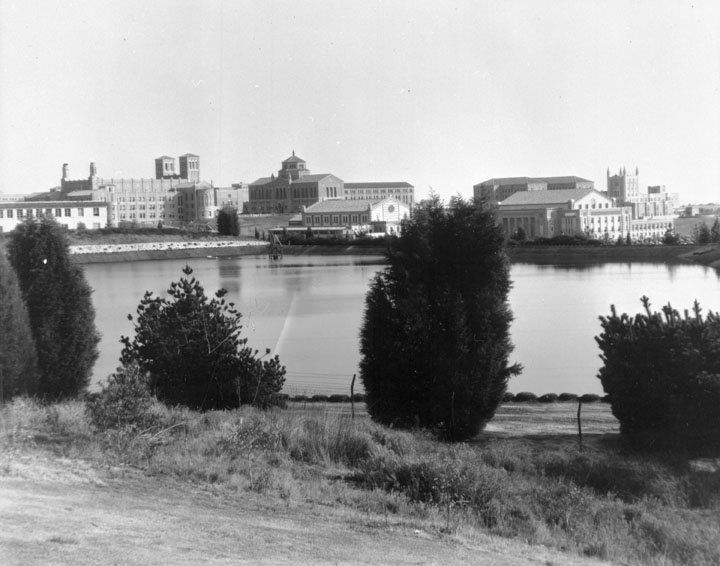
| (ca. 1931)* - The Sawtelle Pressure Break Reservoir was completed and put into service during the month of October (1924). The UCLA campus can be seen in the background. |
.jpg) |
|
| (ca. 1953)#* – Aerial view looking west showing the University of California Los Angeles campus with the Sawtelle Reservoir seen at center-right. |
Then and Now
 |
|
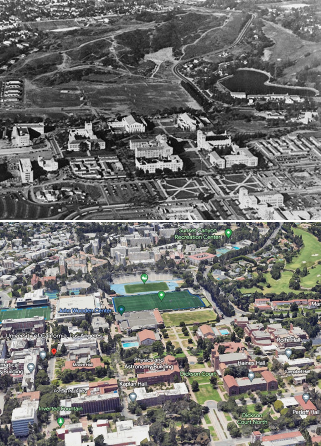
| (1953 vs 2022)*- Sawtelle Reservoir and UCLA Campus - Showing the Bel Air Golf Course where the Sawtelle Reservoir used to be. |
Historical Notes Sawtelle Reservoir was used to reduce the pressure of water coming from Stone Canyon Reservoir to West LA and was replaced by a pressure regulating station in the mid 1980's |
Then and Now
 |
|
| (1929 vs 2022)* - Sawtelle Reservoir - Then and Now |
Click HERE to see more in Early Views of UCLA |
* * * * * |
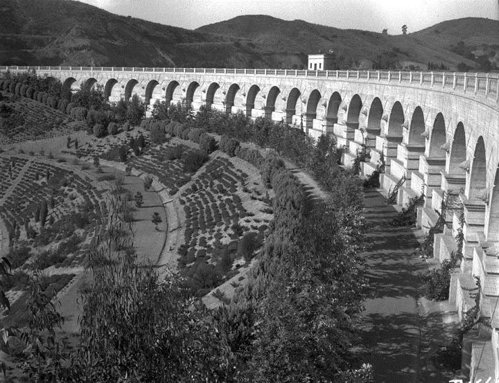
Mulholland Dam and Hollywood Reservoir (1925)
 |
|
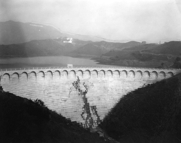
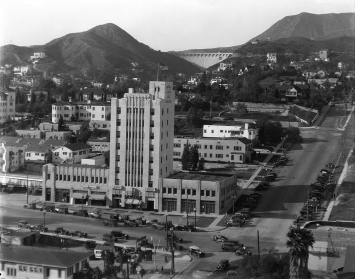
| (1925)* - Hollywood Reservoir and Mulholland Dam. Photo shows front of dam wall. The Hollywoodland sign is dimly seen high in the hills. |
 |
|
| (1928)* - View of Mulholland Dam and Hollywood Reservoir (also known as Lake Hollywood) both designed and built by engineer William Mulholland, for which the Dam is named after. |
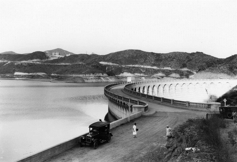
Historical Notes Construction of the Mulholland Dam and Hollywood Reservoir began on August 1923, and they were completed just one year later, in December 1924. The man-made reservoir, which held more than 2.5 billion gallons of water, was filled in 1925; it was part of the Owens River Aqueduct system (LA Aqueduct) and provided Los Angeles with most of its drinking water.* Note: The reservoir is no longer in use as shown above. |
 |
|
| (ca. 1928)* - The Mulholland Dam is visible in the upper center of the photo behind the Yucca Vine Tower in Hollywood. |
Click HERE to see more of the Mulholland Dam and Hollywood Reservoir |
 |
|
| (1941)* - Landscaping completed at the Mulholland Dam and Hollywood Reservoir. After the 1928 St. Francis disaster, the Mulholland Dam was reinforced with tons of earth on the downstream side as a precaution. |
Historical Notes In 1989, the Mulholland Dam and Lake Hollywood Reservoir were designated LA Historic-Cultural Monument No. 421 (Click HERE to see complete listing). |
* * * * * |
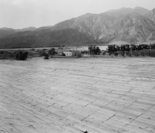
Maclay Reservoir (1929)
 |
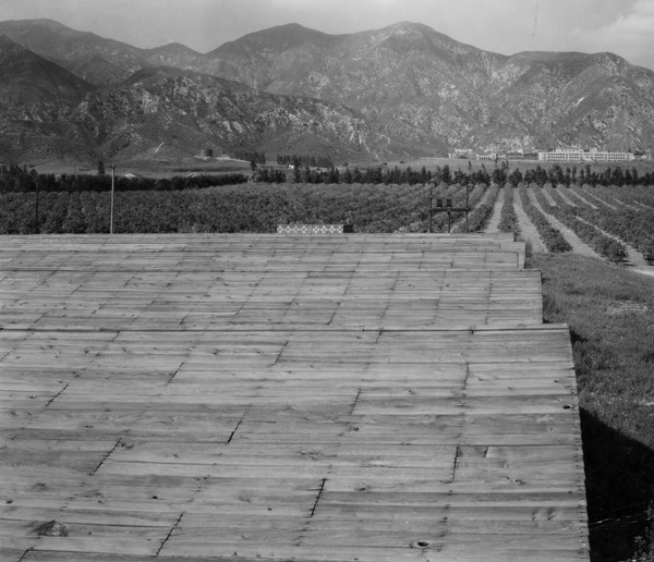 |
| View 1 (1929)** - Maclay Reservoir covered with wood planks. | View 2 (1929)** - The reservoir was built as part of the San Fernando/Owens Aqueduct. |
 |
|
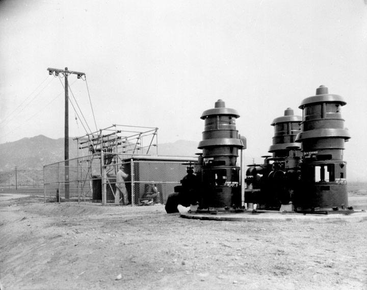
| (1933)* - Maclay Pumping Plant |
LADWP Historic Archive
Dependability of water service to the area in the western section of San Fernando Valley served by the Maclay reservoir is strengthened further by the recent installation of a battery of pumps at Upper San Fernando reservoir.
Largest of their kind in the local water system, the pumps are described by S. M. Dunn, assistant to Fred J. Fisher, engineer in charge of pumping plants and reservoirs, as being 12-inch, 250 horsepower, and deep well turbine type. They are set in a common pit approximately 40 feet deep, and have a capacity of 15 second feet against a head of 325 feet.
The pumping plant is located just below the San Fernando power plant along the penstock by-pass line. In the event of a protracted shutdown of the main aqueduct, water from the reservoir would be pumped back through the penstock to its connecting point with the branch line supplying Maclay reservoir.
Paul J. Stoakin, in charge of all electric pumping plants under Fischer, said that the pumps are kept primed when the reservoir level is down by a vacuum pump located in the switch house.
Although the plant is at the edge of Upper San Fernando reservoir, it will be known as Maclay pumping plant because its function is to supply Maclay reservoir when necessary. Fred Martin, operator of nearby Mission Wells pumping plant, will be in charge of the new plant also.*^
* * * * * |
Baldwin Hills Reservoir (1951)
 |
|
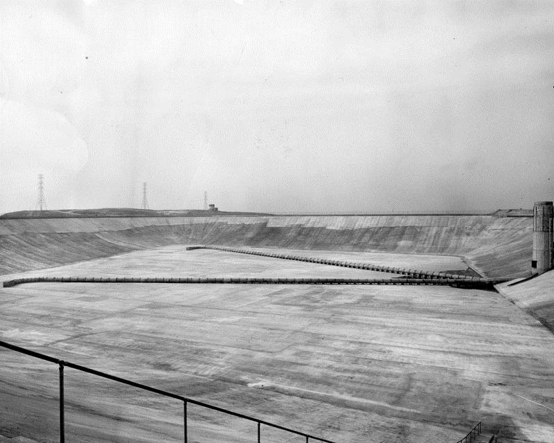
| (1951)* - A view of the floor of the Baldwin Hills Reservoir in the final stages of construction in 1951. |
Historical Notes On December 14, 1963, the Baldwin Hills Reservoir dam breached, releasing 250 million gallons of water onto the surrounding neighborhood. 277 homes were destroyed and 5 lives were lost. Vigorous rescue efforts averted a greater loss of life. The reservoir is now part of Kenneth Hahn State Recreation Area.^ |
* * * * * |
Water Tank Reservoirs
 |
|
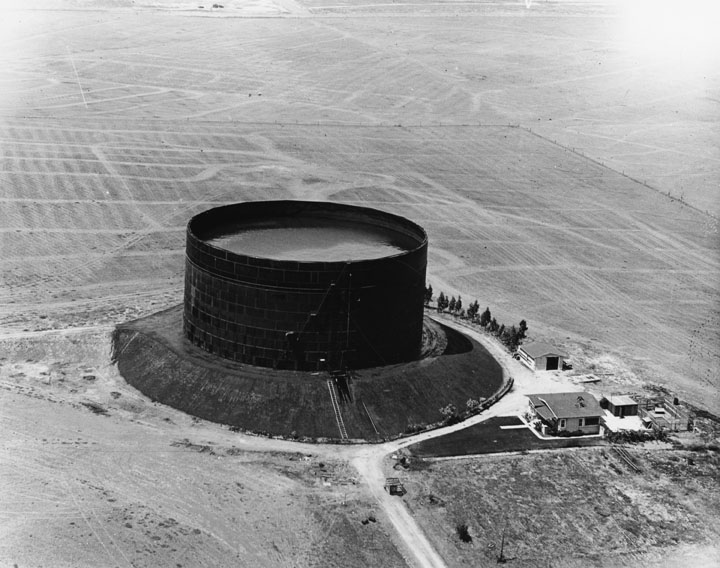
| (1924)^* - View of a water tank reservoir at Western Ave. & 199th Street. It is located on slightly raised ground with open fields behind it. On the lower right are 3 or 4 buildings. |
.jpg) |
|
| (1924)^* - Aerial view of the large water tank reservoir at Western Ave. & 199th Street. There are still construction materials on the ground below and a portion of a building to the left. |
 |
|
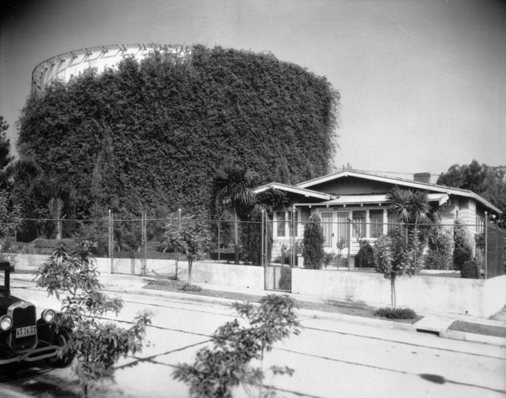
| (1932)* - Water tank covered with vine growth in Department's beautification plan. |
LADWP Historic Archive
November 1932 – “That such an unprepossessing and unwieldy a thing as a steel reservoir is not esthetically impossible or beyond the reach of beautification programs is definitely proved in the case of one of those of the Los Angeles city water system on Finley Avenue a block or so east of Hillhurst in East Hollywood,” says a writer in a recent issue of The Sunday Times Farm and Garden section.
The writer observes that although the grounds around the structure have been ably landscaped with an eye to beautification, it is the reservoir itself which attracts attention because of the clever way in which it had been handled. The great steel tank has been virtually hidden beneath a covering of Tecoma australis, the wonga-wonga vine of Australia.
The growth is supported for the entire height of the reservoir by wire netting. Even in severe wind storms the mass of green has clung tenaciously to the foundation. Much progress has been shown in the vine growth since planting about four years ago. L. A. Ghiotto is caretaker of the grounds. Harry L. Murietta is in charge of all landscaping around reservoirs.
Nationwide attention has been given to the scheme of beautification undertaken by both the Bureau of Water Works and Supply and the Bureau of Power and Light. Power Bureau distribution stations are objects of architectural beauty. They are creditable additions to any section of the City. The grounds surrounding these structures are planted to shrubs and plants that blend harmoniously with the building. C. W. Fox is in charge of this work.
In many cases the method of landscaping around pumping plants and reservoirs of the Water Bureau and Distribution and Receiving Stations of the Power Bureau have inspired great effort toward improvements in surroundings of privately-owned lots and homes sites.*^
* * * * * |
History of Water and Electricity in Los Angeles
More Historical Early Views
Newest Additions
Early LA Buildings and City Views
* * * * * |
References and Credits
* DWP - LA Public Library Image Archive
^*LA Public Library Image Archive
**CSUN Oviatt Library Digital Collection
^ Baldwin Hills Reservoir - Wikipedia
#^Huntington Digital Library Archive
*#Jewish Museum of the American West: Herman Silver
^^San Fernando Valley Relics - Facebook.com: Van Norman Reservoir
+#LA Times Framework: Know Your City
++Silver Lake Reservoirs Conservatory
*** Theeastsiderla.com: Angelino Heights Oil Boom
^.^Claremont Colleges Digital Library
^^^KCET: How Mulholland Made Ivanhoe Canyon Into Silver Lake
**^ LA Magazine: How Ivanhoe Canyon Became Silver Lake
^**California State University, Dominguez Hills Photograph Collection
**# Historicechopark.org: Echo Park Lake
*## Facebook.com: Classic Hollywood/LA/SFV
^## California State Library Image Archive
^*^ Facebook.com: West San Fernando Valley Then And Now
*^* Wikipedia: Lower Van Norman Dam; Lincoln Park (Eastlake Park); MacArthur Park (Westlake Park)
< Back