Early Views of Beverly Hills
Historical Photos of Beverly Hills |
 |
|
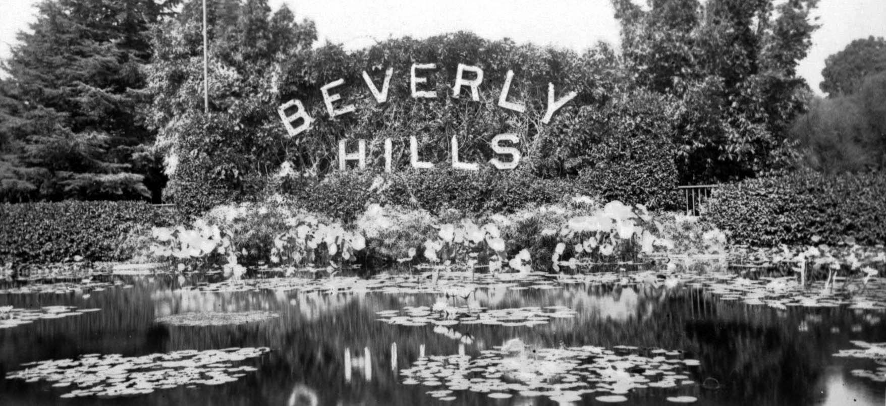
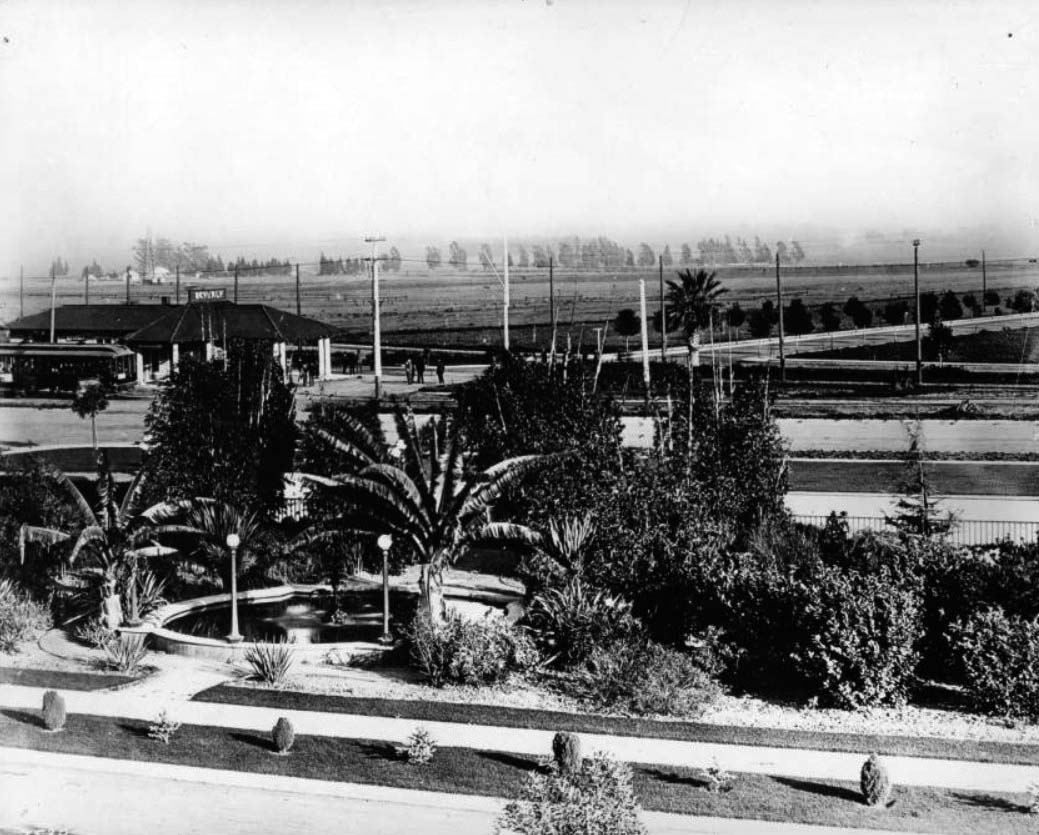
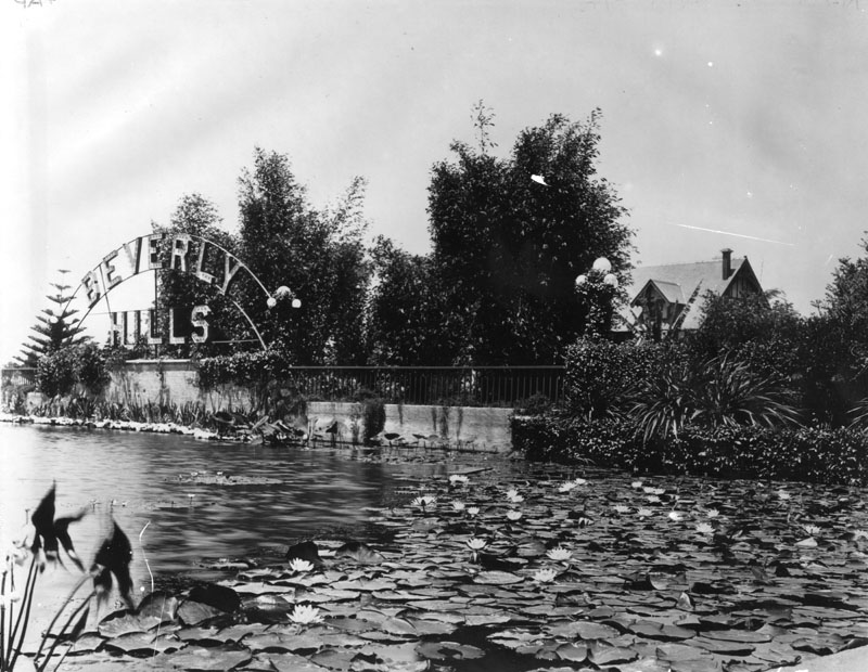
| (ca. 1925)* – View showing the world famous lily pond and Beverly Hills sign pictured in its original form. It is now part of the landmark Beverly Gardens Park. |
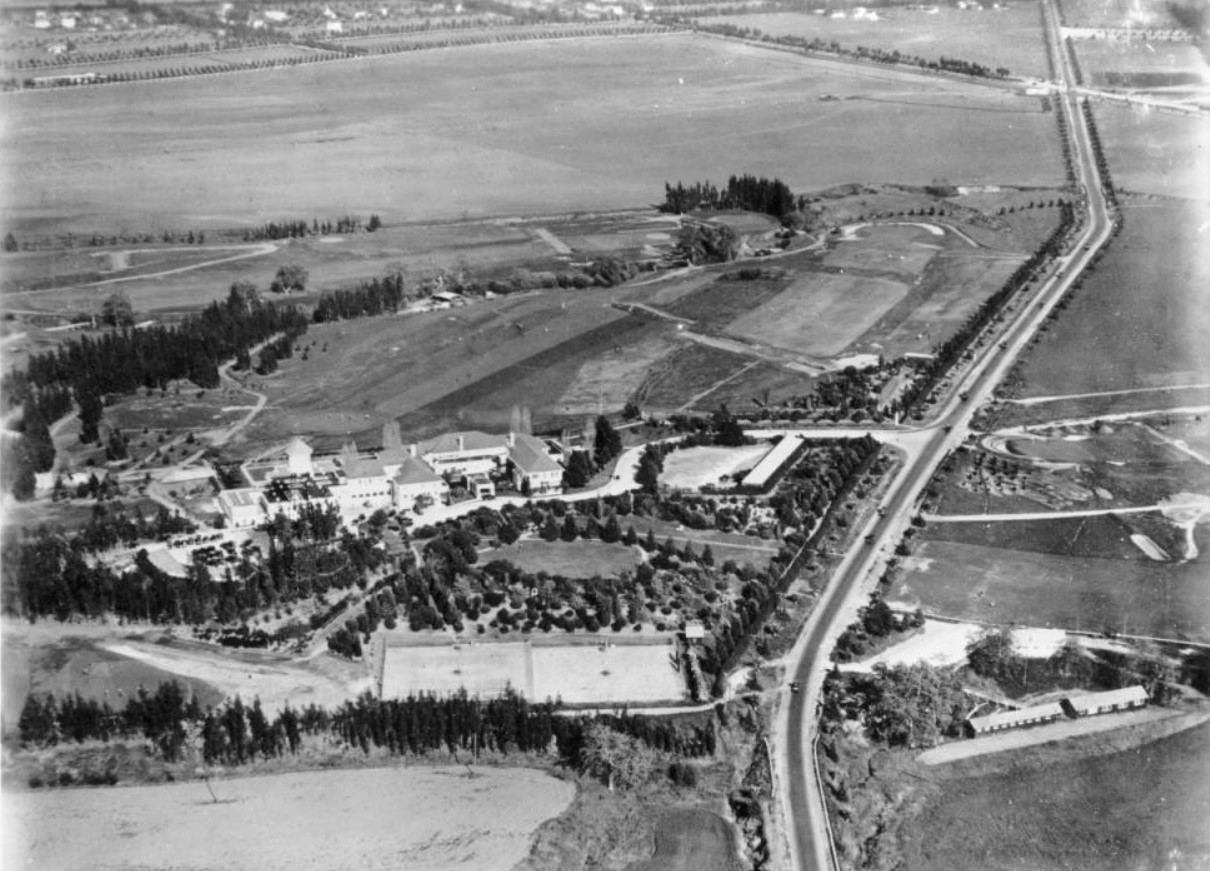
Historical Background In 1838, the Mexican governor of California deeded the land grant El Rodeo de las Aguas to Maria Rita Valdez Villa, the Afro Latina widow of a Spanish soldier. Maria Rita, an early California feminist icon, built an adobe ranch house near the intersection of present day Sunset Boulevard and Alpine Drive. She employed a vast posse of cowboys and proceeded to raise cattle and horses. As was the custom of a time, Maria Rita permitted her livestock to wander freely, but once a year a festive roundup, another kind of rodeo, was held beneath a huge eucalyptus tree at the corner of Pico and Robertson boulevards. In 1852, three Native Americans ambushed Maria Rita's rancho. A shoot-out and siege followed in a grove of walnut trees at Benedict Canyon and Chevy Chase Drive. Maria Rita survived, but the battle may have influenced her decision just two years later to sell the ranch to Benjamin D. Wilson and Henry Hancock for $4000. However, the legendary waters deserted the new owners; a drought decimated their crops and their cattle died in parched stream beds. However, their names live on today in nearby Mt. Wilson and Hancock Park. After the Civil War wildcatters and roughnecks drilled oil wells. Cattle gave way to herds of sheep. Edward Preuss bought the ranch in 1868 with the intention of establishing a colony for German immigrant farmers. Preuss dubbed his civic speculation the "City of Santa Maria." He subdivided the soil into five-acre lots and put them up for sale for $10 a parcel. Another drought ruined these plans and the land reverted to sheep and cattle ranching. |
.jpg) |
|
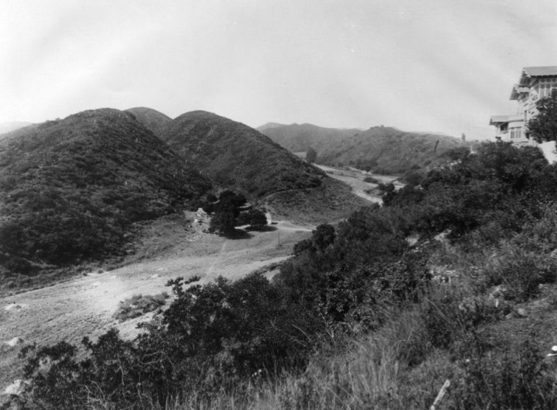
| (ca. 1900)* – View looking south showing a bean field on the Hammel and Denker ranch in an area that would become the city of Beverly Hills. |
Historical Notes Shortly after the drought, the rancho passed into the hands of two Los Angeles hoteliers who proceeded to grow lima beans on the property. Their first land purchase was made in 1881, and was later added to parcel by parcel. Henry Hammel and Charles Denker, managers of the U.S. Hotel in Los Angeles, proposed their own townsite, to be called Morocco, for the area. Morocco was subdivided in 1888 during the big land boom of 1887-88, the era which saw the start of so many Southern California communities, both successful and unsuccessful. Hammel and Denker’s settlement was centered around the train station at the then junction of Burton Way and Santa Monica Boulevard (in the vicinity of Canon and Beverly Drives today) on the Santa Monica-Los Angeles line, which ran along Santa Monica Boulevard, which had also been named Morocco. Plans for Morocco were never realized, and the next activities on the ranch centered around a syndicate of investors, known as the Amalgamated Oil Company. |
 |
|
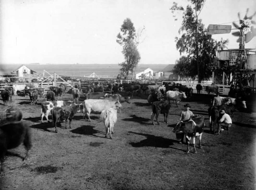
| (ca. 1905)* – View showing a herd of dairy cows on the Hammel and Denker ranch, Beverly Hills. Three men are in the corral with one milking a cow. Additional corrals and ranch buildings are visible in the background as well as stretches of wide open land. |
Historical Notes In 1900, Burton E. Green, Charles A. Canfield, Max Whittier, Frank H. Buck, Henry E. Huntington, William G. Kerckhoff, William F. Herrin, W.S. Porter, and Frank H. Balch, formed the Amalgamated Oil Company, bought the Hammel and Denker ranch, and began looking for oil. However, they did not find enough to exploit commercially by the standards of the time. |
 |
|
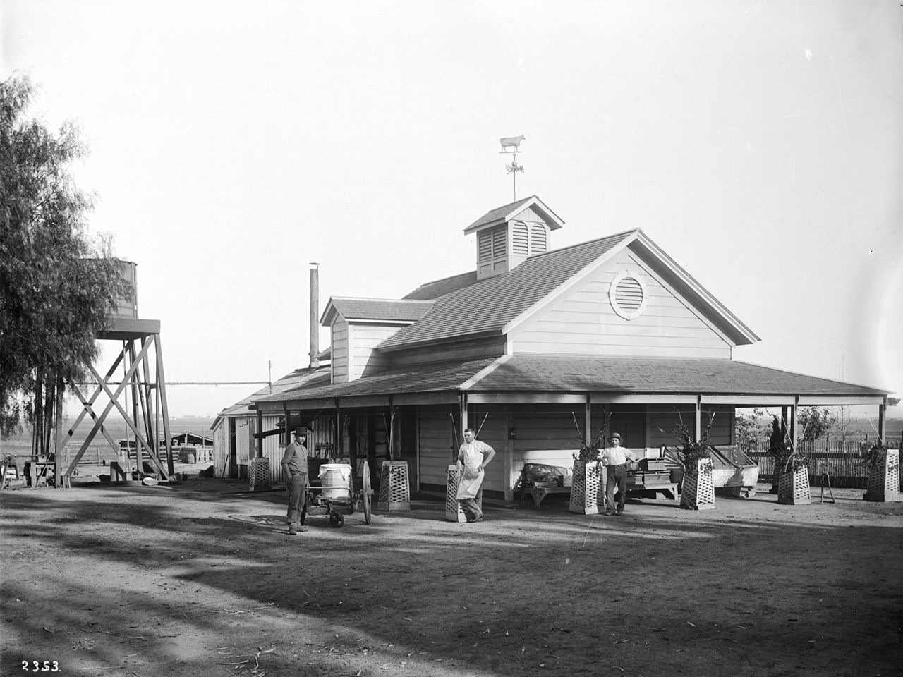
| (ca. 1905)* - View showing three men standing in front of the creamery on the Hammel and Denker ranch. Trellis planting boxes surround each of the wooden posts of the covered porch of the wooden creamery. A directional wind vane in the shape of a cow is on the top of the roof. A water tower is visible behind the building. Another ranch building is visible in the background. |
Historical Notes In 1906, Burton Green and the Amalgamated Oil Company reorganized as the Rodeo Land and Water Company, renamed the property "Beverly Hills," subdivided it, and began selling lots. The development was named "Beverly Hills" after Beverly Farms in Beverly, Massachusetts and because of the hills in the area. The first house in the subdivision was built in 1907, although sales remained slow. |
 |
|
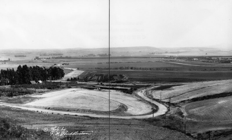
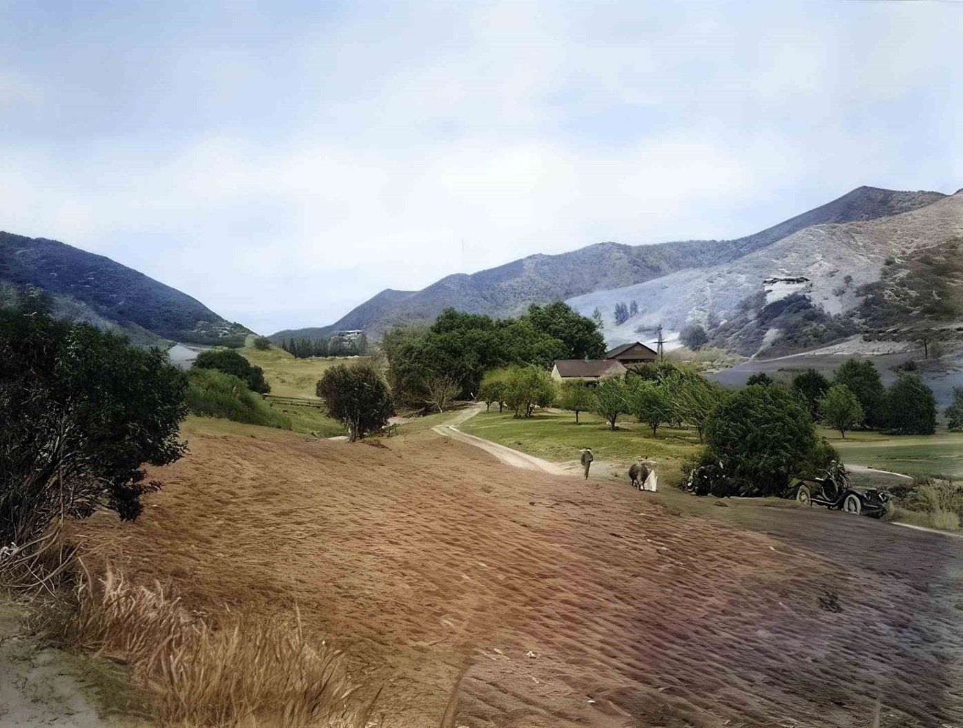
| (1913)^ - Panoramic view showing the Beverly Hills countryside with just a few homes and dirt roads. |
* * * * * |
Beverly Hills' 1st Train Station
.jpg) |
|
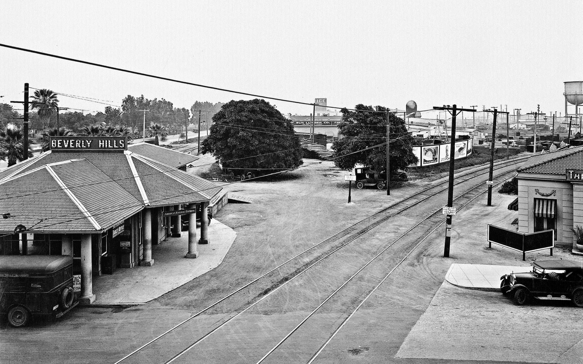
| (ca. 1910)* - Before being incorporated, before the Beverly Hills Hotel, before there was even "Hills," it was called just "Beverly." The above view shows Beverly Hill’s first train station located where the historic post office still stands on the southeast corner of Santa Monica Boulevard and Cañon Drive. |
Historical Notes The elite northern portion of the new city was divided from the southern portion by the railroad tracks and a commercial triangle between Santa Monica and Wilshire Boulevards. This triangle was originally known as “Beverly” while the rest of the City, located north of Santa Monica Boulevard, was known as “Beverly Hills.” |
 |
|
| (ca. 1918)* - View of Beverly Hills looking south showing a Pacific Electric Station. An oasis-style fountain stands in the foreground surrounded by trees, a sidewalk lining it in front. Behind this, the Pacific Electric station can be seen with a departing streetcar at left, on the corner of Beverly Drive and Santa Monica Boulevard. |
 |
|
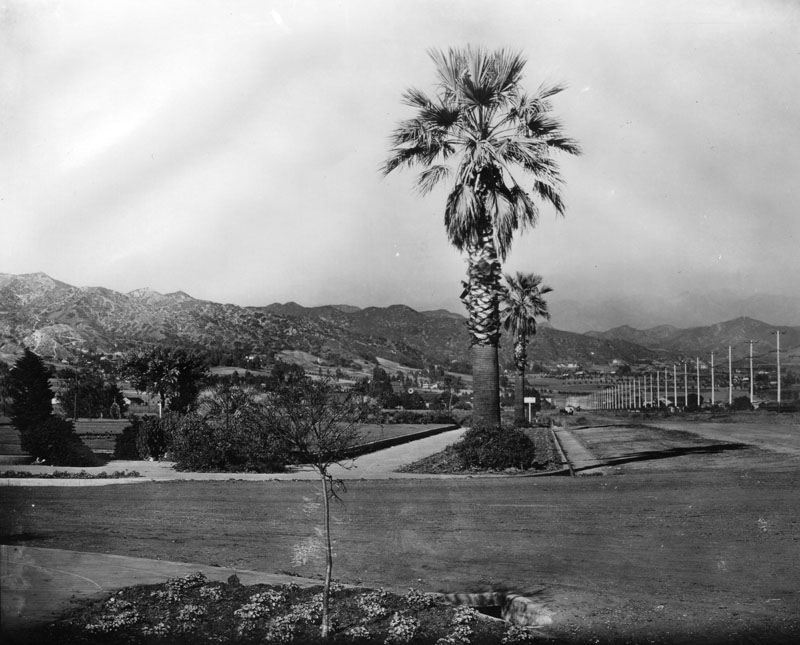
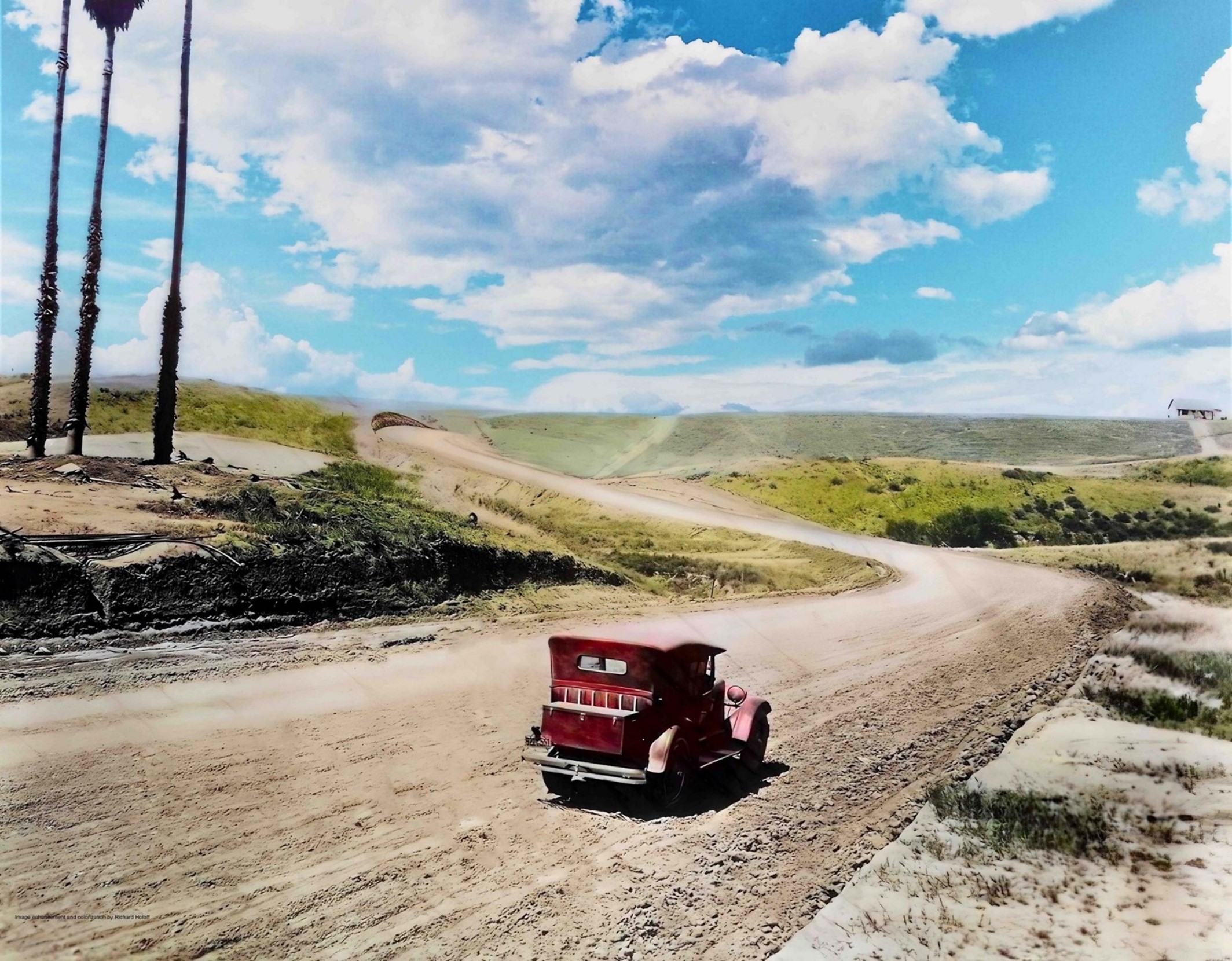
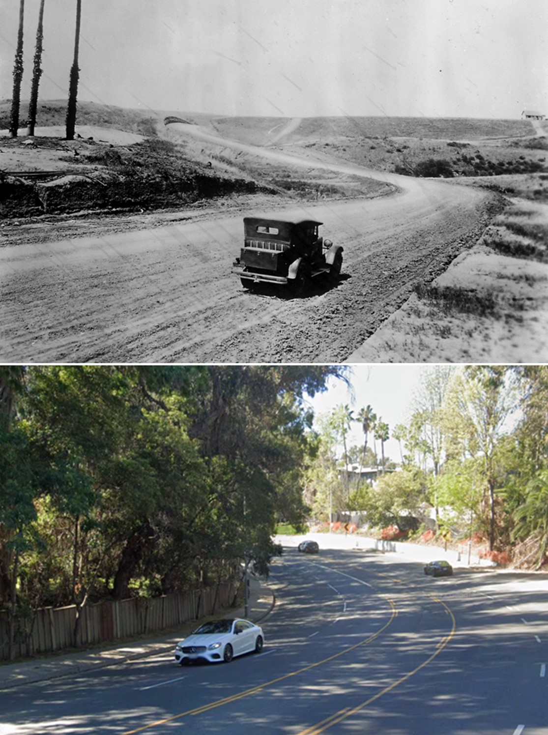
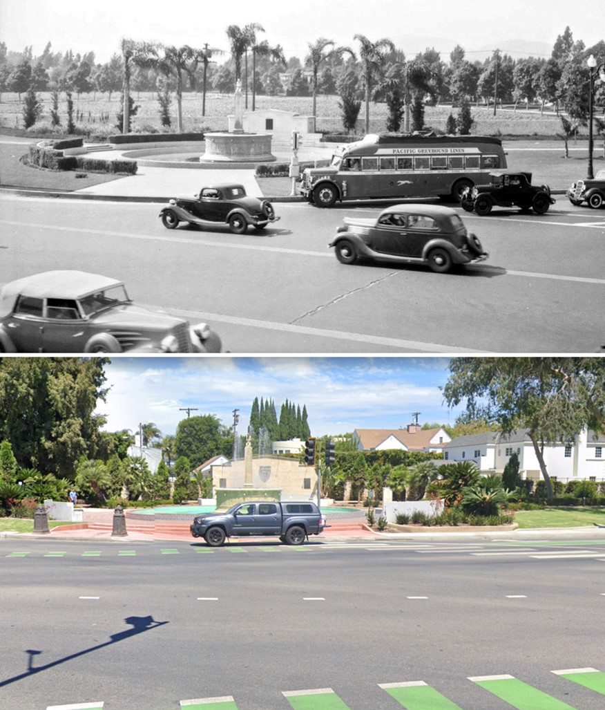
| (1915)* - View looking east on an unpaved Santa Monica Boulevard at Canon Drive with the Hollywood Hills in the background. |
Then and Now
 |
|
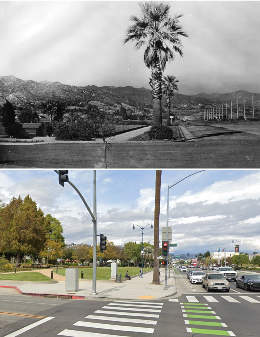
| (1915 vs 2019)* - View looking east on an unpaved Santa Monica Boulevard at Canon Drive. Photo comparison by Jack Feldman. |
 |
|
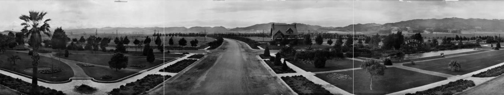
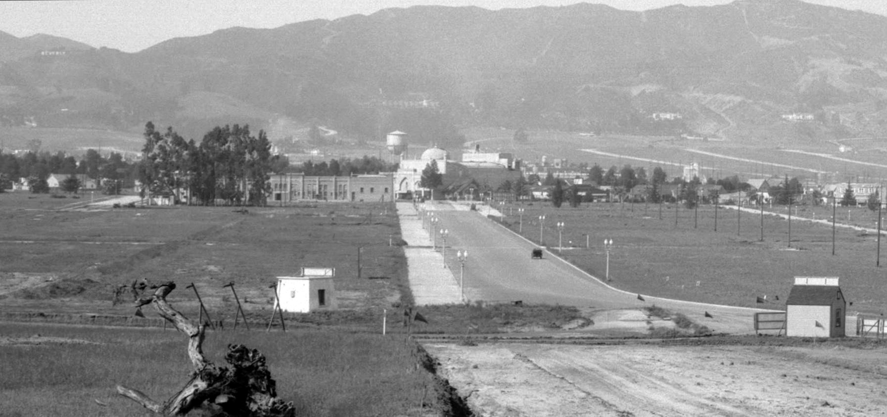
| (1920)* - A panoramic view of Beverly Gardens Park at the corner of Beverly and Santa Monica. The park has wide, flat lawns with a few flower beds, paths, and young trees. On the right a large sign reading "Beverly Hills" stands behind a wide, shallow pool. Both the sign and the house on Beverly on the right are still there. Most of the land beyond the park is undeveloped. |
Historical Notes The area was created as a real estate attraction, hoping to entice people traveling from Los Angeles to buy parcels of land for development, and could be seen from passer byers on the train that came through town on Santa Monica Boulevard, or as it was once known, as Railway Avenue. |
 |
|
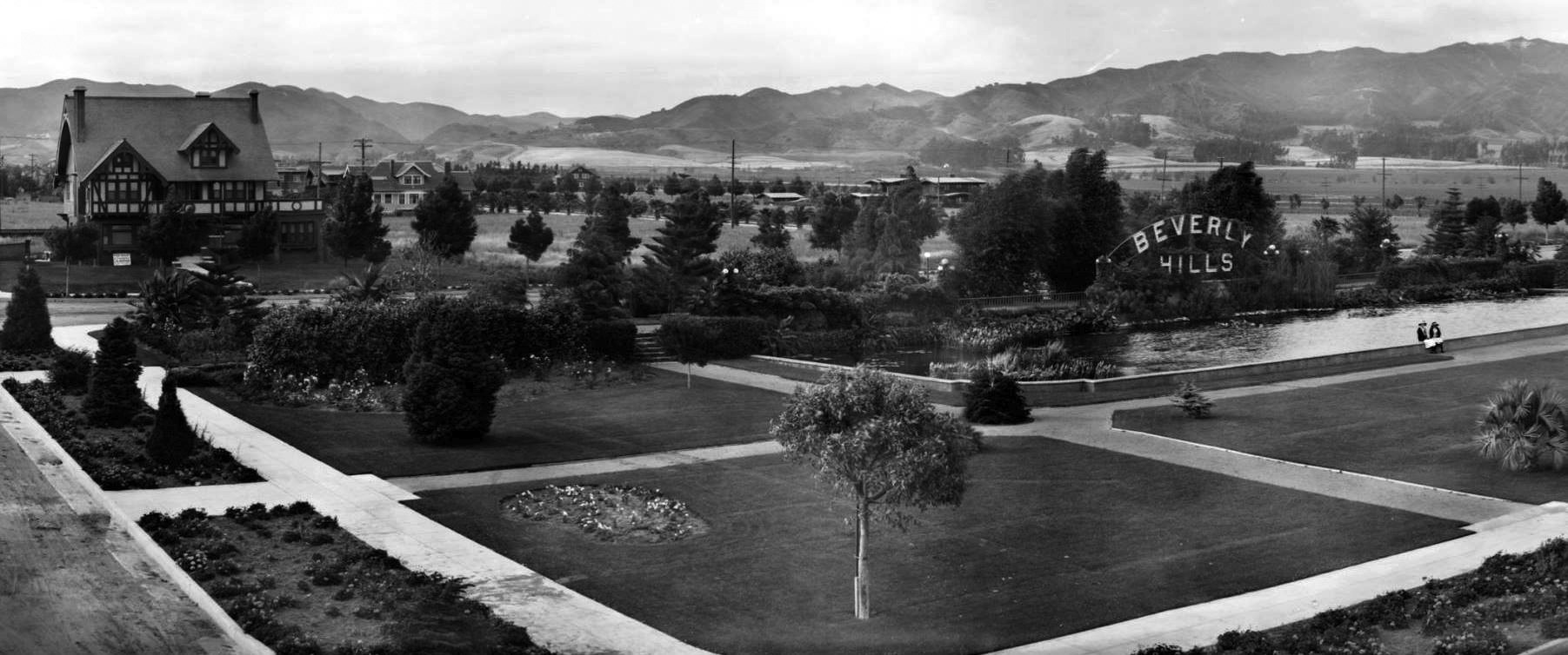
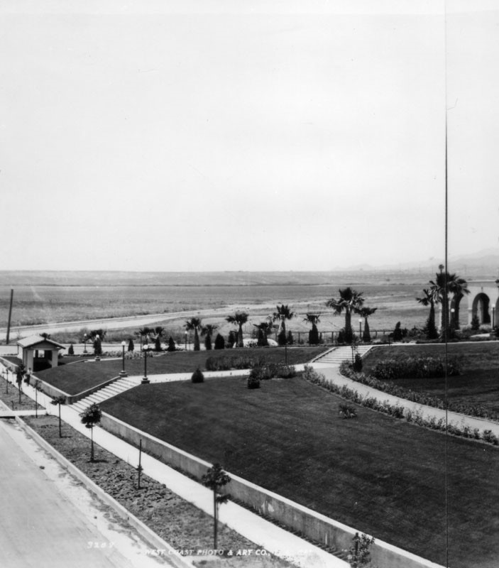
| (ca. 1920)* – View looking northeast near the intersection of Santa Monica Boulevard and N. Beverly Drive showing Beverly Hill’s iconic Tudor Revival Park Way house (upper-leftr) and famous lily pond in Beverly Gardens Park with its original electrified Beverly Hills sign. |
 |
|
| (1920s)* – Closer view showing the lily pond in Beverly Gardens Park, located at Santa Monica Boulevard and N. Beverly Drive. The large home in the background (right) is located at 1309 Park Way. |
.jpg) |
|
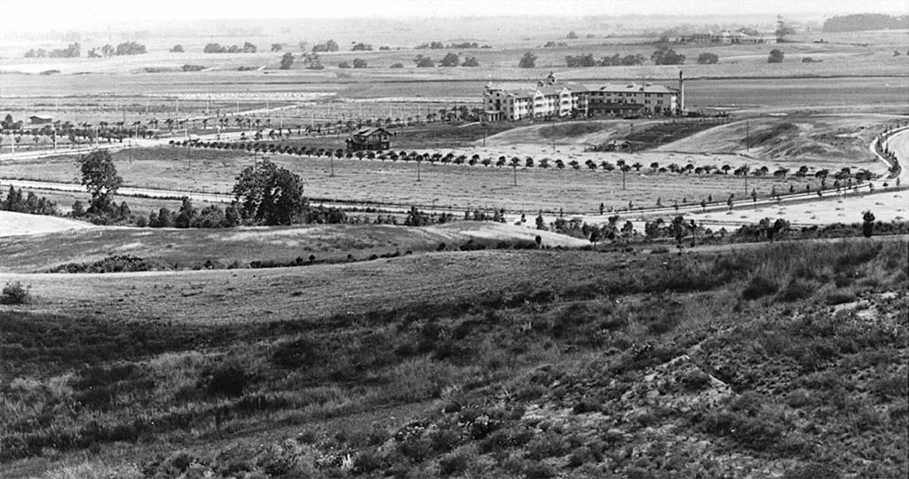
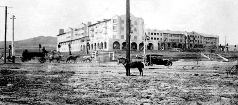
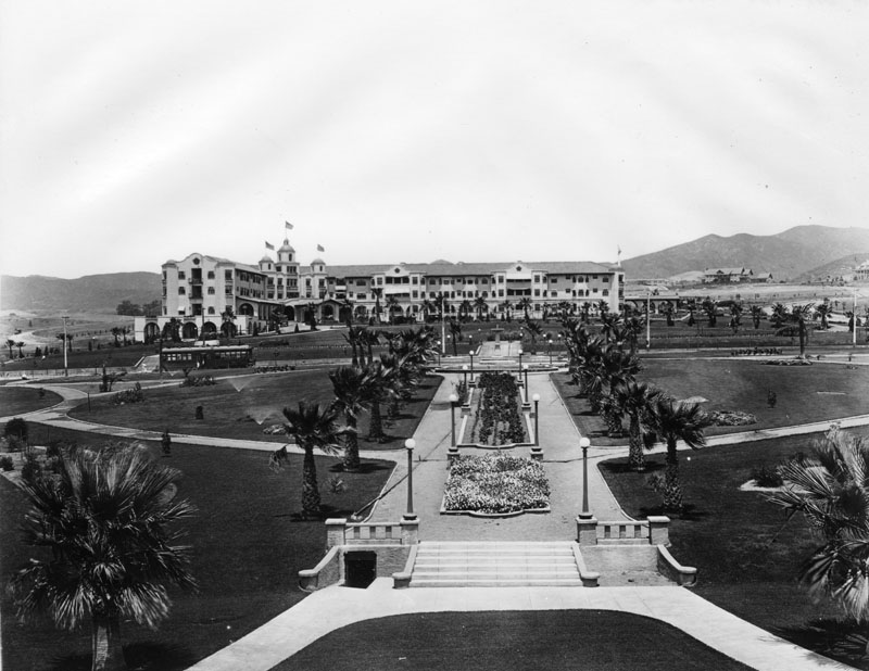
| (1913)* - Panoramic view looking southwest showing a mostly empty Beverly Hills. The 1912-constructed Beverly Hills Hotel appears at center-right. |
Historical Notes As in so many of the boom towns of the 1880s, Beverly Hills needed a large resort hotel to give it prominence and establish its reputation. It got that hotel in 1911, when the Rodeo Land and Water Company, in conjunction with Margaret J. Anderson, commissioned Elmer Grey to build his Craftsman/Mission Revival design. |
* * * * * |
Beverly Hills Hotel
 |
|
| (1912)* - View of looking southwest across Lexington and Crescent Drives. The Beverly Hills Hotel and the still undeveloped surrounding area can be seen in the background. Sunset Boulevard is beyond the hotel. |
Historical Notes Construction on The Beverly Hills Hotel began in September 1911, led by developer Burton Green, president of the Rodeo Land and Water Company. The hotel officially opened on May 12, 1912, and was managed by Margaret J. Anderson and her son Stanley, both of whom had previously operated the Hollywood Hotel. At the time, the surrounding area was mostly open land, but the hotel was intended to draw wealthy visitors and prospective buyers to what would soon become the city of Beverly Hills. Just two years later, in 1914, the population was large enough to incorporate the community as an independent city. |
 |
|
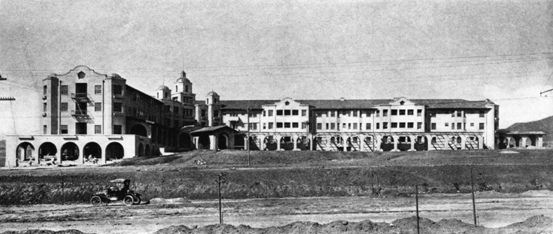
| (ca. 1912)* - The Beverly Hills Hotel as seen from across an unpaved Sunset Boulevard. Workers appear to be putting the finishing touches on the western wing, and the front lawn has yet to be landscaped. This Mission style complex was designed by architect Elmer Grey. |
Historical Notes Architect Elmer Grey designed the original hotel building in the Mediterranean Revival style, which was popular in Southern California at the time. The unpaved roads and lack of landscaping show how new and undeveloped the area was. Around this time, the Rodeo Land and Water Company began separating its real estate and utility services. In 1914, the Beverly Hills Utility Commission was created to manage local water, gas, and electricity—essential infrastructure for a growing community. |
 |
|
| (ca. 1912)* – View looking northeast showing the Beverly Hills Hotel. A horse-drawn water wagon his heading east on Sunset Boulevard with an early model car parked by the side of the road. In the foreground, a horse appears to be tied to a power pole. |
Historical Notes This view captures the mix of old and new transportation in early 20th-century Los Angeles—horses were still common, but automobiles were beginning to appear. The Beverly Hills Hotel had only just opened and quickly became a centerpiece of the new development. Despite the area's rural appearance, the hotel helped pave the way for Beverly Hills to evolve into a modern, desirable suburb of Los Angeles. |
 |
|
| (ca. 1918)* - Close-up view of the Beverly Hills Hotel with Pacific Electric station on Sunset Boulevard in the foreground. |
Historical Notes A short Pacific Electric shuttle line, often called the “Dinky,” connected the main Pacific Electric station at Santa Monica Boulevard and North Cañon Drive to the hotel. The 1.38-mile line ran up Rodeo Drive, making the hotel easily accessible to guests arriving from downtown Los Angeles. This unique transportation link operated from 1907 to 1923 and helped promote the area as a convenient and fashionable destination. |
 |
|
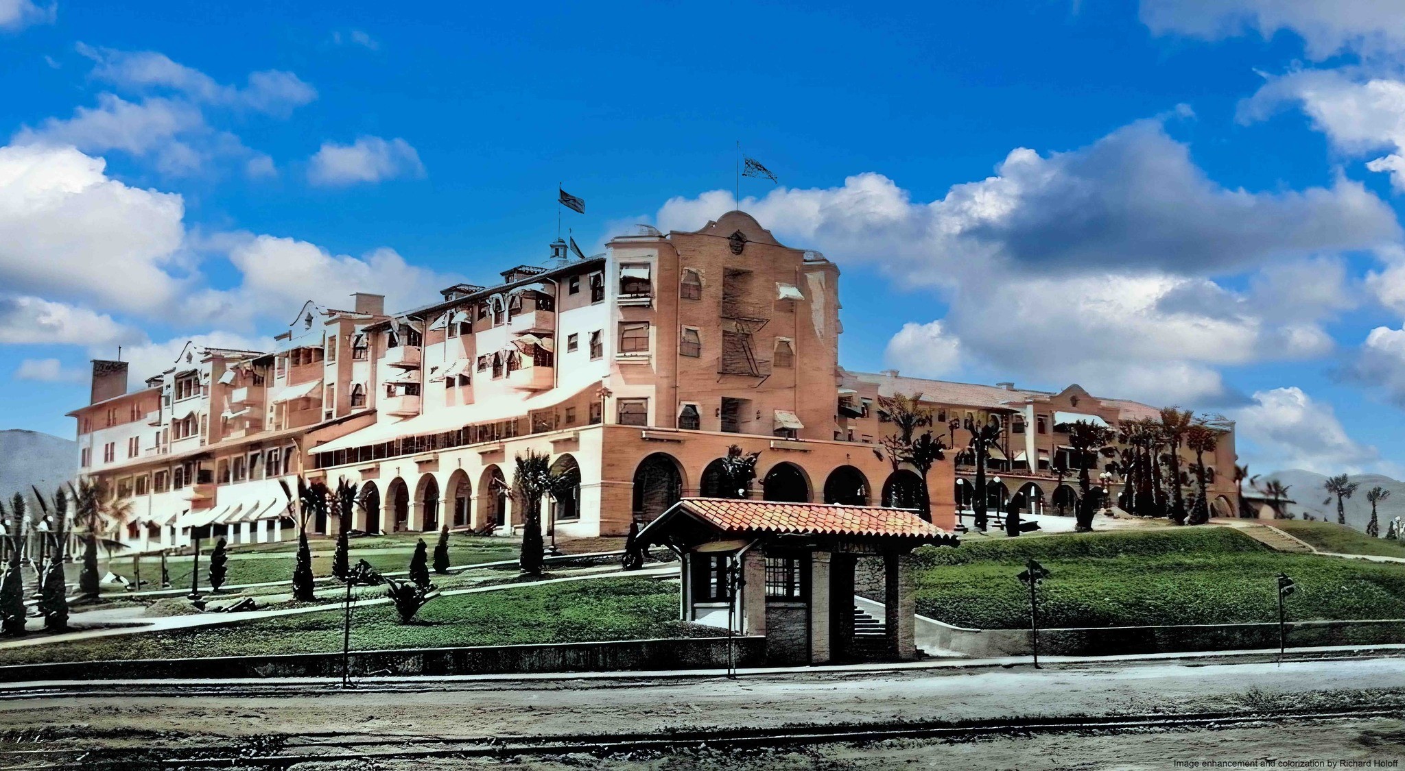
| (ca. 1918)* - Close-up view of the Beverly Hills Hotel with Pacific Electric station on Sunset Boulevard in the foreground. Image enhancement and colorization by Richard Holoff. |
Historical Notes The enhanced photo helps bring to life the early years of the hotel, when it was already attracting attention from celebrities and investors. As the Hollywood film industry took off, stars like Mary Pickford, Douglas Fairbanks, Charlie Chaplin, and Gloria Swanson became regular visitors—some even moved nearby, transforming Beverly Hills into an exclusive enclave. |
Then and Now
 |
|
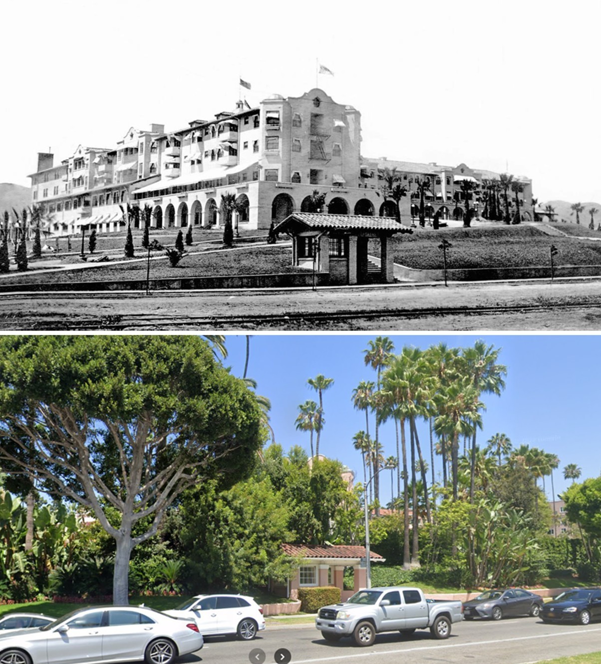
| (1918 vs 2022)* - Looking toward the Beverly Hills Hotel across Sunset Boulevard. The hotel was once fully visible across an unpaved Sunset Boulevard. Today, it’s largely hidden behind landscaping, but a small bus shelter still marks the spot where a Pacific Electric stop once stood. Photo comparison by Jack Feldman. |
Historical Notes The Beverly Hills Hotel opened in 1912, two years before the city was incorporated. To help guests reach the hotel, the Pacific Electric Railway operated a short 1.38-mile shuttle—nicknamed the “Dinky”—from its main station at Santa Monica Boulevard and North Cañon Drive. This local line ran up Rodeo Drive and ended at a modest shelter in front of the hotel. Passengers transferred here after arriving from either Santa Monica or downtown Los Angeles. The shelter visible in the 1918 photo was the final stop on that line and served guests during the hotel’s early years of attracting Hollywood’s elite. Though the trolley line was discontinued in 1923, a modern bus stop now occupies nearly the same location, echoing the site's past as a transportation gateway. The contrast between the open, unpaved landscape of 1918 and today’s tree-lined boulevard reflects more than a century of transformation in Beverly Hills. |
.jpg) |
|
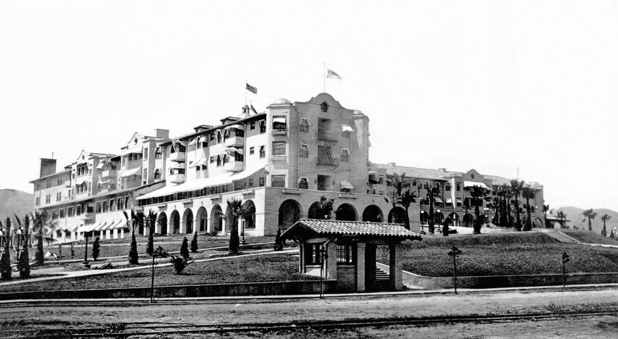
| (ca. 1914)* – View showing the Beverly Hills Hotel from the end of its main driveway which is lined by small palm trees. |
Historical Notes When it opened in 1912, the Beverly Hills Hotel included the main building and 23 separate bungalows, also designed by Elmer Grey. The landscaped entrance—still in its early stages here—reflected the vision of a high-end, resort-like environment. The hotel's popularity spurred homebuilding in the surrounding hills, supporting the Rodeo Land and Water Company's goals of selling residential lots to the wealthy. |
 |
|
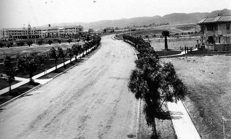
| (ca. 1915)* - View looking west across the front lawn of the Beverly Hills Hotel to the open space beyond. At left can be seen the new Pacific Electric station on Sunset Boulevard. |
Historical Notes The surrounding area remained largely undeveloped during the hotel's early years. However, wide, curving streets—designed by landscape architect Wilbur D. Cook—were already in place. Cook, influenced by Frederick Law Olmsted (designer of New York’s Central Park), also created parks and green spaces throughout Beverly Hills, including what is now Beverly Gardens Park. These thoughtful designs helped shape the city’s image as a luxurious, garden-like suburb. |
 |
|
| (1915)* - View looking northwest on N. Crescent Drive from Lomitas Avenue. A large mansion can be seen on the right and the recently completed Beverly Hills Hotel is in the upper left. |
Historical Notes This image captures the transition of Beverly Hills from open ranchland into a residential community. Large homes were beginning to appear, and the hotel's reputation drew wealthy residents, many connected to the entertainment industry. The curving street layout and tree-lined drives reflect the city's early planning ideals. |
 |
|
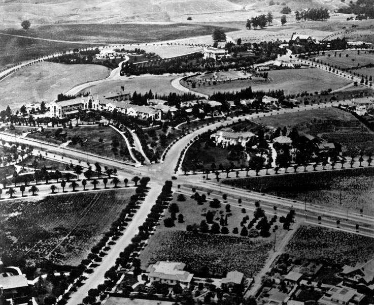
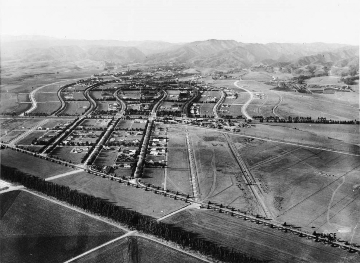
| (ca. 1918)* - Aerial view of Beverly Hills early on in real estate development. Seven roads meet just before the Beverly Hills Hotel. |
Historical Notes By 1918, the Beverly Hills Hotel was not just a landmark—it was a symbol of the city’s identity. Movie stars were buying homes nearby, and the area’s elegant layout made it one of Los Angeles’ most desirable neighborhoods. In 1919, Mary Pickford and Douglas Fairbanks built their estate “Pickfair” just blocks away, helping seal the city’s reputation as a haven for Hollywood’s elite. |
 |
|
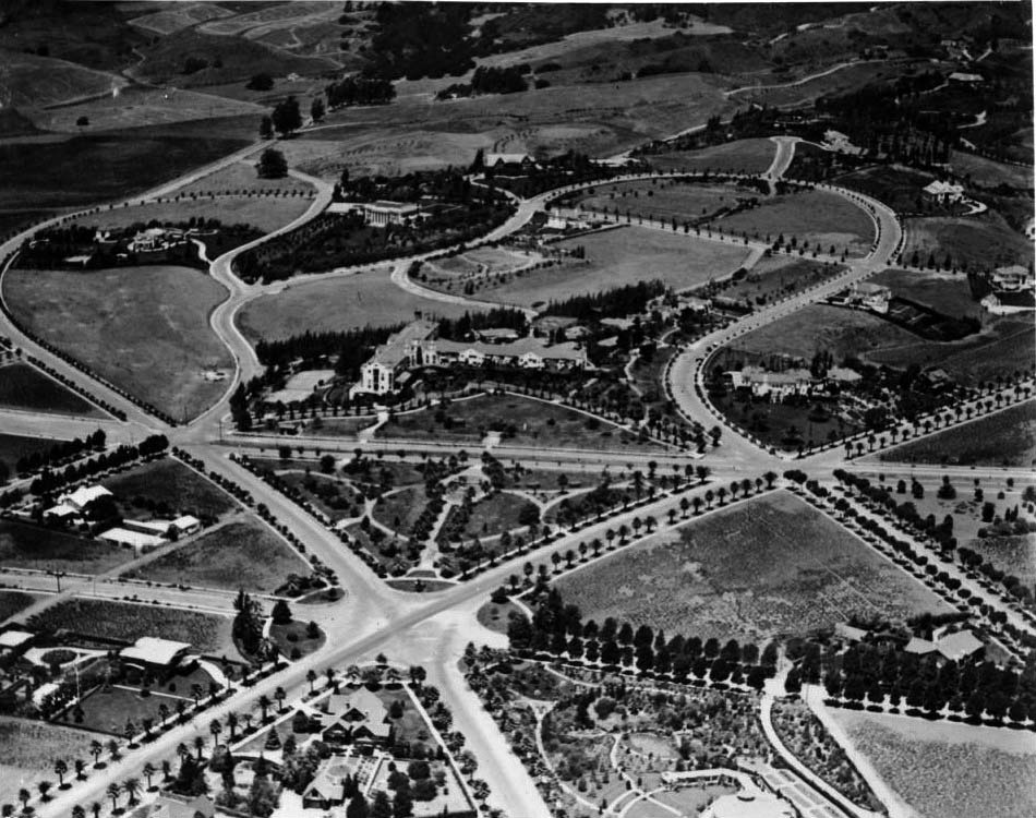
| (ca. 1918)* - Aerial view of Beverly Hills showing the new Beverly Hills Hotel. The hotel is visible at center, its t-shaped main building surrounded by trees. There are two tennis courts and several smaller buildings on the hotel grounds as well. In front of the hotel is a triangular park that would later become Will Rogers Memorial Park, after the first mayor of Beverly Hills. The streets in this neighborhood curve irregularly and there are three six-way intersections visible, one at each of the corners of the park. |
Historical Notes This image shows the hotel and its grounds, including tennis courts and bungalows added in 1915 to accommodate celebrity guests seeking privacy. The triangular park in front, later named after Will Rogers (the city’s first honorary mayor), became a cherished public space. At this time, Beverly Hills was still a racially and religiously restricted community; deed covenants prevented non-white residents and Jews from buying property unless they were household staff. Despite this, the area flourished, shaped by real estate, celebrity culture, and early city planning. |
* * * * * |
Sunset Park (Will Rogers Memorial Park)
 |
|
| (ca. 1918)* - View looking north showing Sunset Park (later Will Rogers Memorial Park) in front of the Beverly Hills Hotel, designed by Elmer Grey. Neither has mature landscaping at this time. Note the streetcar on Sunset Boulevard (center-left). |
Historical Notes Originally belonging to the Beverly Hills Hotel, this five acre park adjoining the property across Sunset Boulevard was donated to the City of Beverly Hills by owners Margaret and Stanley Anderson. |
 |
|
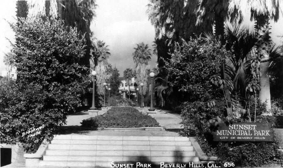
| (n.d.)* - Postcard view showing Sunset Municipal Park (later Will Rogers Memorial Park) with the Beverly Hills Hotel in the background. |
Historical Notes Sunset Municipal Park opened in 1915 as the first municipal park in the Beverly Hills. In 1926, entertainer Will Rogers was appointed first "Honorary Mayor" of Beverly Hills and, in 1952, the City renamed the Park, Will Rogers Memorial Park. |
 |
|
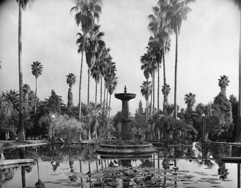
| (n.d.)* - View of a fountain in a lily pond in Will Rogers Memorial Park, located at 9650 W. Sunset Blvd. in Beverly Hills. |
* * * * * |
Golden Triangle
 |
|
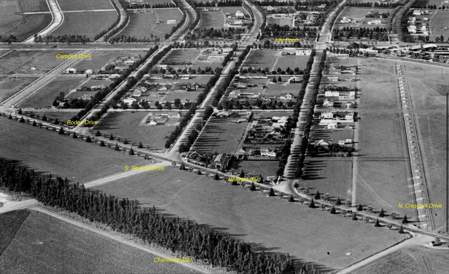
| (ca. 1919)* - View of Beverly Hills looking north over Wilshire Boulevard. Street names have been marked on the photo including Wilshire, Santa Monica, Sunset, and Crescent Drive. |
Historical Notes The Golden Triangle itself is defined by three major thoroughfares: Santa Monica Boulevard (west), Wilshire Boulevard (south), and Canon Drive (east), with Rodeo Drive running through its center. The area was intentionally designed as a triangular commercial district by landscape architect Wilbur D. Cook in 1907, as part of the broader city plan for Beverly Hills. |
 |
|
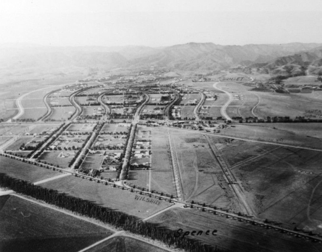
| (1922)* – Aerial view of Beverly Hills north of Wilshire Boulevard. A thin line of trees is pictured in the left foreground, cutting diagonally down across an expanse of what appear to be cultivated fields. In the center ground at left, a collection of three straight roads separates four sections of residential property. These roads continue farther into the background where they become part of a group of snaking, s-shaped roads. |
Historical Notes The Beverly Hills Hotel, opened in 1912, became a focal point for attracting the elite and establishing Beverly Hills as a desirable destination. The city was incorporated in 1914, but it wasn't until the post-World War II era that the Golden Triangle began to take shape as a commercial hub. |
 |
|
| (ca. 1920)* – Aerial view looking down at the City of Beverly Hills' world famous "Golden Triangle". Photo annotated by Kimberly Vinokur / Beverly Hills Heritage. |
Historical Notes At one point the Golden Triangle was nothing more than a modest residential neighborhood containing dozens of bungalow style homes accommodating city occupants of limited monetary means. A handful of these humble structures remained until the post war era when the city's shopping and financial center enjoyed robust growth, paving the way to the development of a successful commercial district. Today, the Golden Triangle remains an iconic symbol of luxury, attracting visitors from around the world with its exclusive boutiques, restaurants, and hotels, centered around the famed Rodeo Drive. |
* * * * * |
Beverly Hills Speedway (aka Los Angeles Speedway)
 |
|
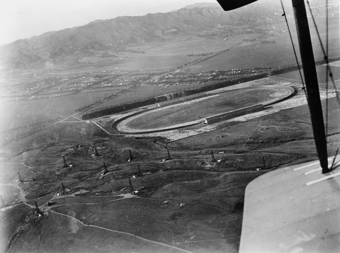
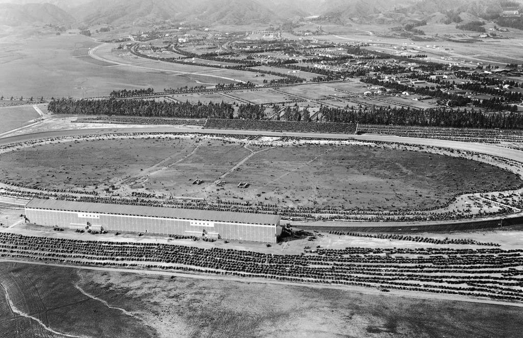
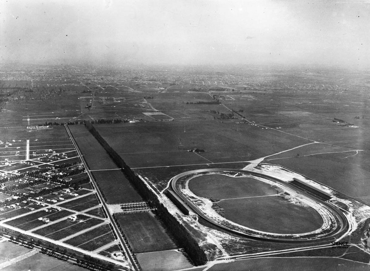
| (ca. 1919)* - Aerial view of the Beverly Hills Speedway, located just south of Wilshire Boulevard near its intersection with Santa Monica Boulevard. The tree-lined street above the speedway is Charleville Boulevard, one block south of Wilshire. Note the oil fields in the foreground. |
Historical Notes The Beverly Hills Speedway (also called the Los Angeles Speedway) was a 1.25-mile wooden board track for automobile and motorcycle racing in Beverly Hills. It was built in 1919 on 275 acres of land that includes the site of today's Beverly Wilshire Hotel, just outside of the "Golden Triangle". The site was bounded by Wilshire Boulevard, South Beverly Drive, Olympic Boulevard and Lasky Drive. |
 |
|
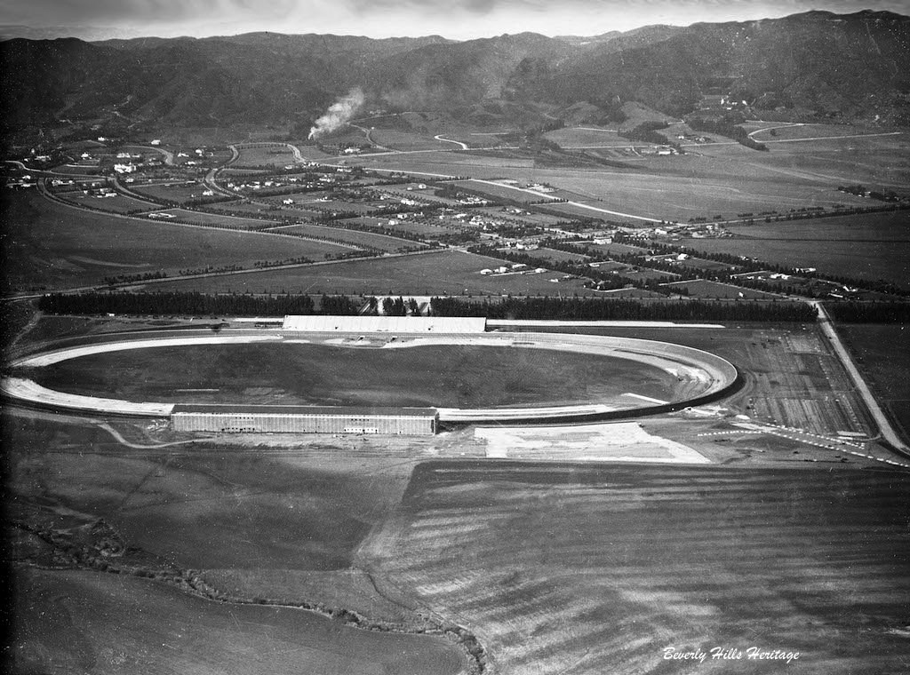
| (1919)^ - Aerial photograph of the Beverly Hills Speedway, located at Wilshire and Santa Monica boulevards. West Hollywood can be seen in the distance at upper-right. Note the oil wells in the left foreground. |
Historical Notes The new Speedway was built by Jack Prince and Art Pillsbury and was financed by a group of racers and businessmen that called itself the Beverly Hills Speedway Association. The track was the first in the United States to be designed with banked turns incorporating an engineering solution known as a spiral easement. |
.jpg) |
|
| (1919)^ - Aerial photo of the Beverly Hills Speedway located at Wilshire and Santa Monica Boulevards. |
 |
|
| (ca. 1919)* - Closer view of the Beverly HIlls Speedway located just south of Wilshire Boulevard near where it intersects with Santa Monica Boulevard (aka "Golden Triangle"). Photo courtesy of Beverly Hills Heritage. |
.jpg) |
|
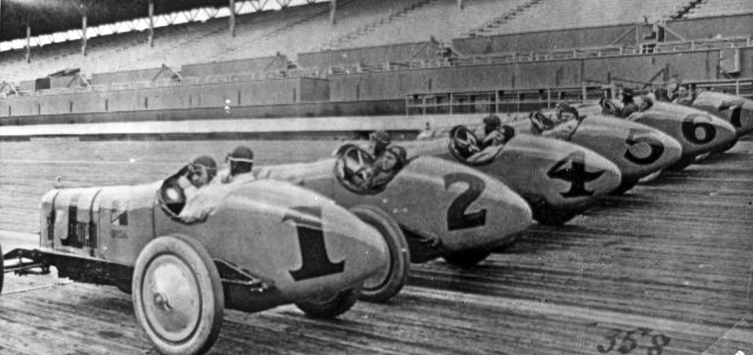
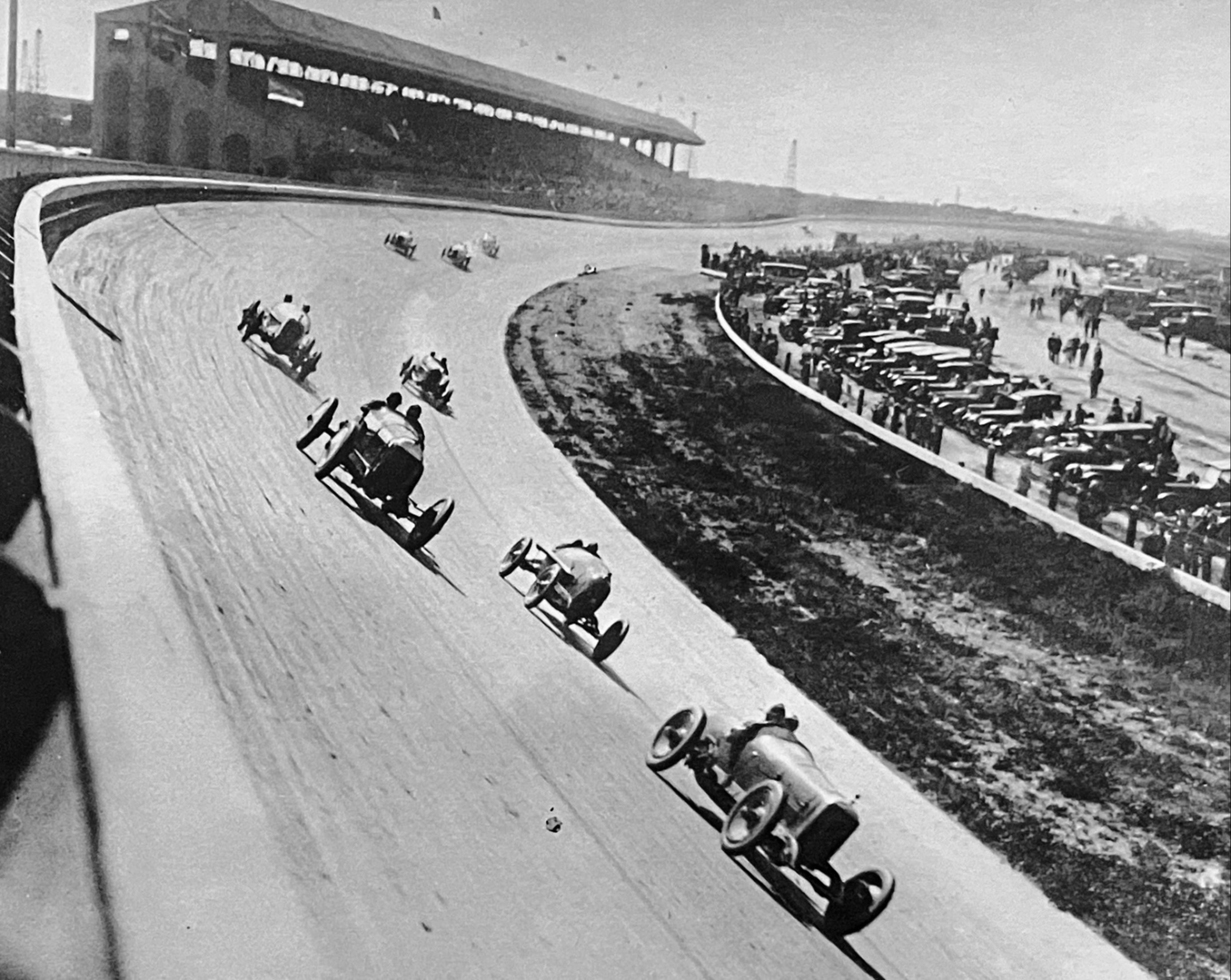
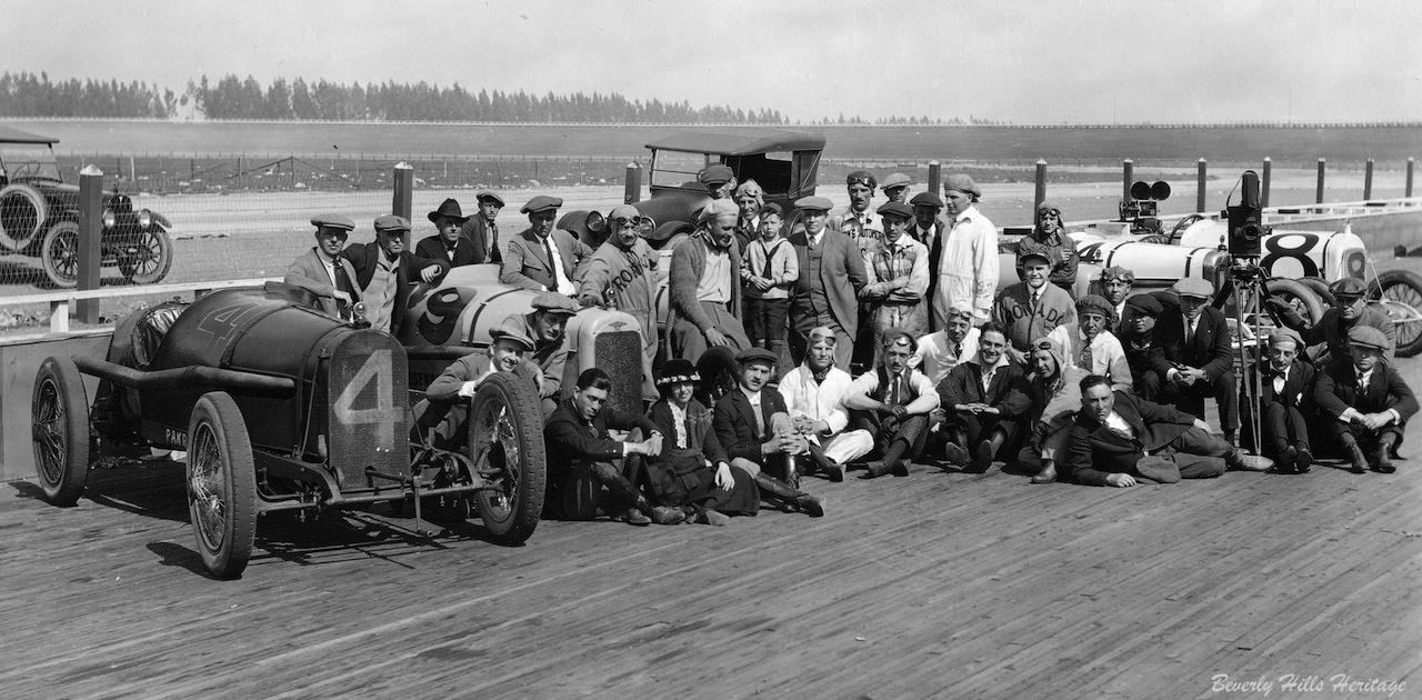
| (1919)^ - Early race cars are lined up at the Beverly Hills Racetrack. |
 |
|
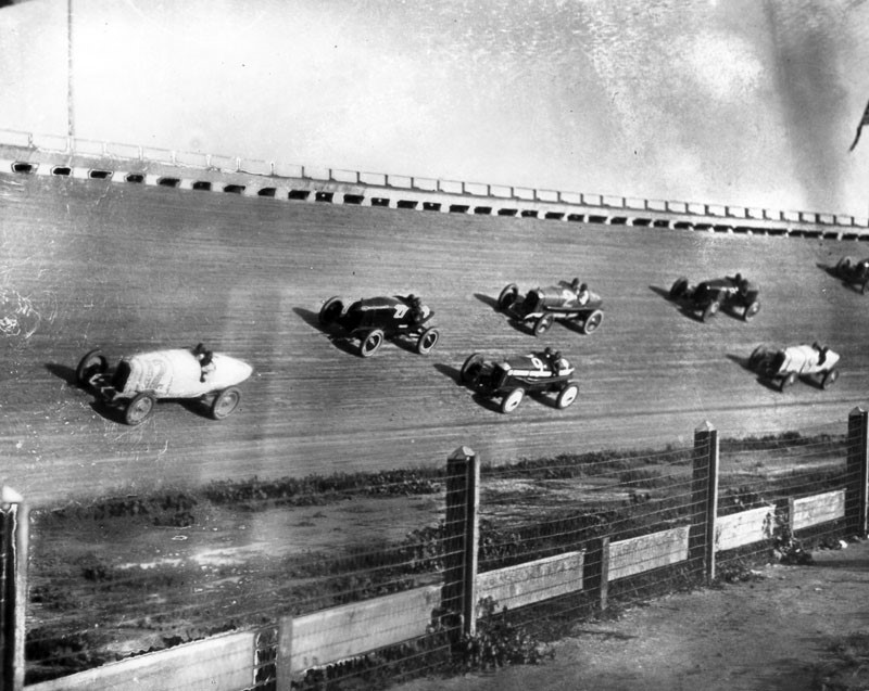
| (1919)^ - View showing race cars racing on the steep bank of the track at the Beverly Hills Racetrack. |
 |
|
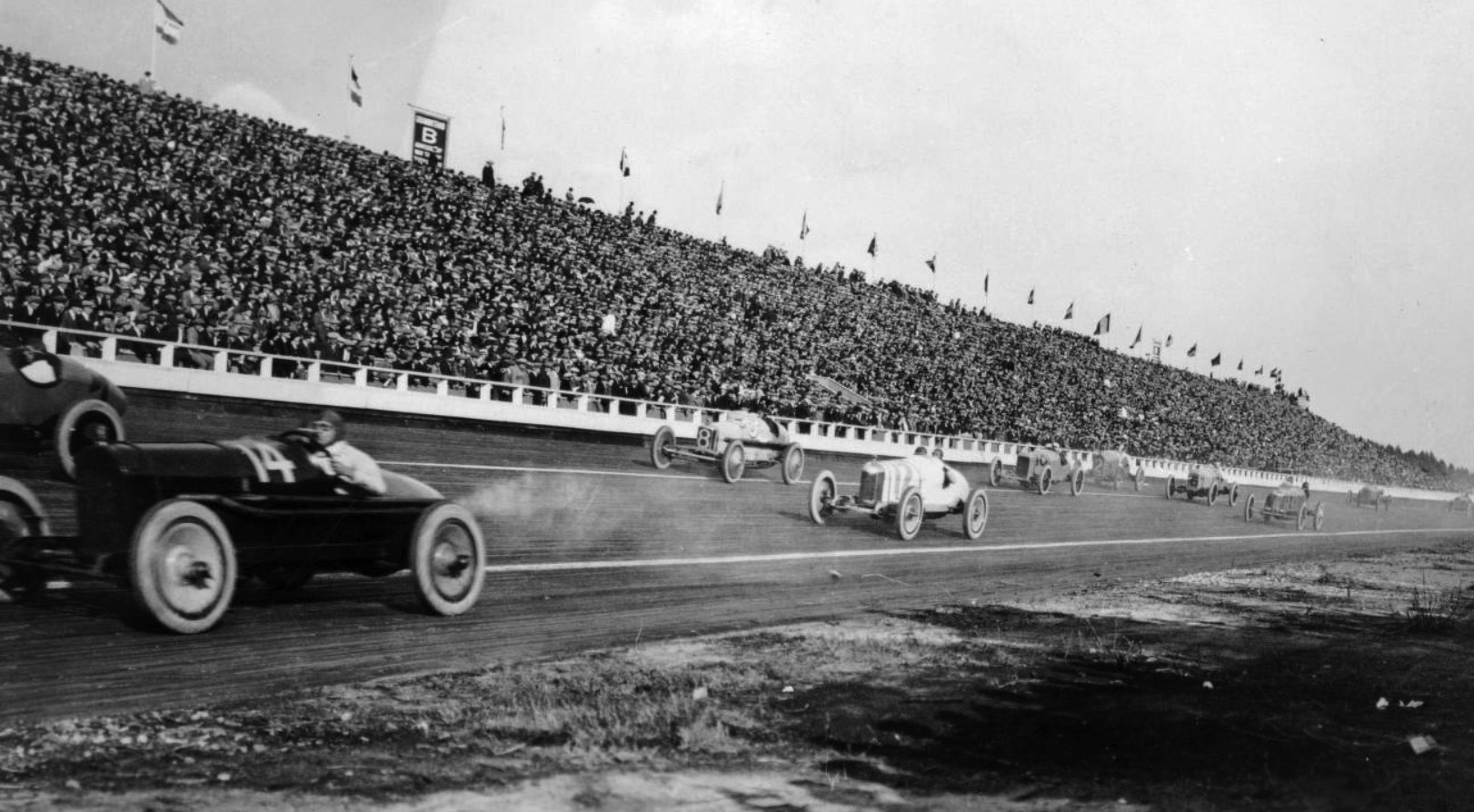
| (ca. 1919* - Panoramic view showing an automobile race at the Beverly Hills Racetrack. The early racecars are all open topped and the drivers are wearing leather helmets and goggles. The grandstand is packed with spectators. |
 |
|
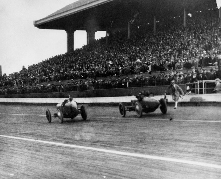
| (1919)^ - View of two race cars racing past the finish line at the Beverly Hills Racetrack. |
Historical Notes At the time, the wooden racetrack was ranked second in race quality only to the Indianapolis Motor Speedway. |
 |
|
| (1922)* - Durant Racing team, Beverly Hills Raceway . . . Harry Miller Designed and built. Cliff Durant was William Durant's son (General Motors President). He had the most highly funded team of the day with the best drivers. |
Historical Notes Many race cars had paint jobs that read Durant Racing on the sides. Durant was an American race car driver, the son of William C. Durant, a founder of General Motors who was also the co-owner and president of the Beverly Hills Speedway. Durant Drive in the City of Beverly HIlls was named after these Durants. |
 |
|
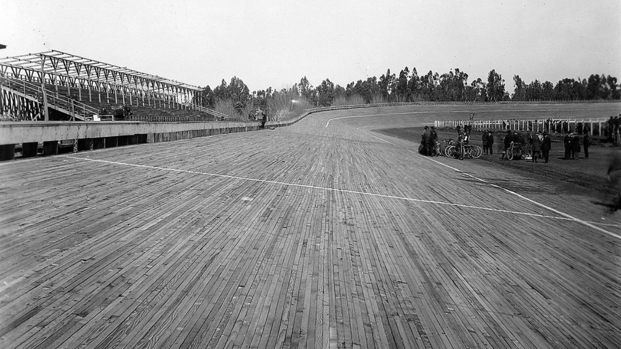
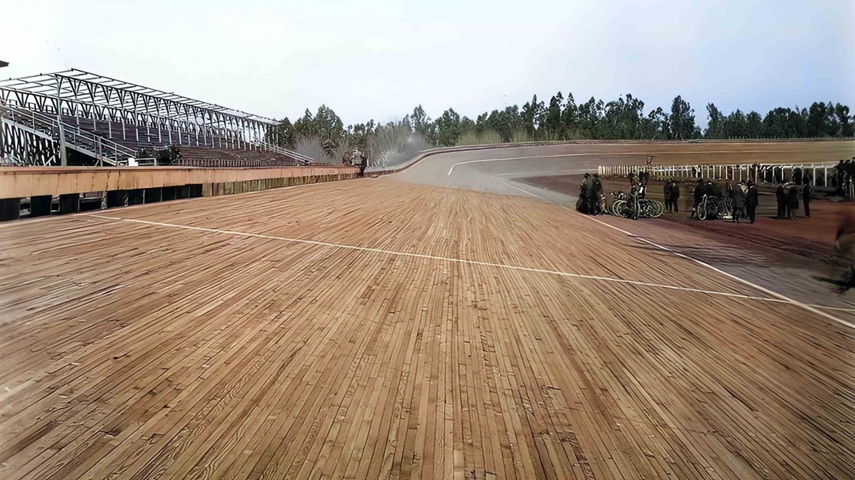
| (1920s)* - Race cars rounding the embanked curve a the speedway.. |
 |
|
| (1922)* – Aerial view looking down at the Beverly Hills Speedway showing a full house at a racing event. Note the number of cars in the parking lot. Photo: Marc Wanamaker/Bison Archives |
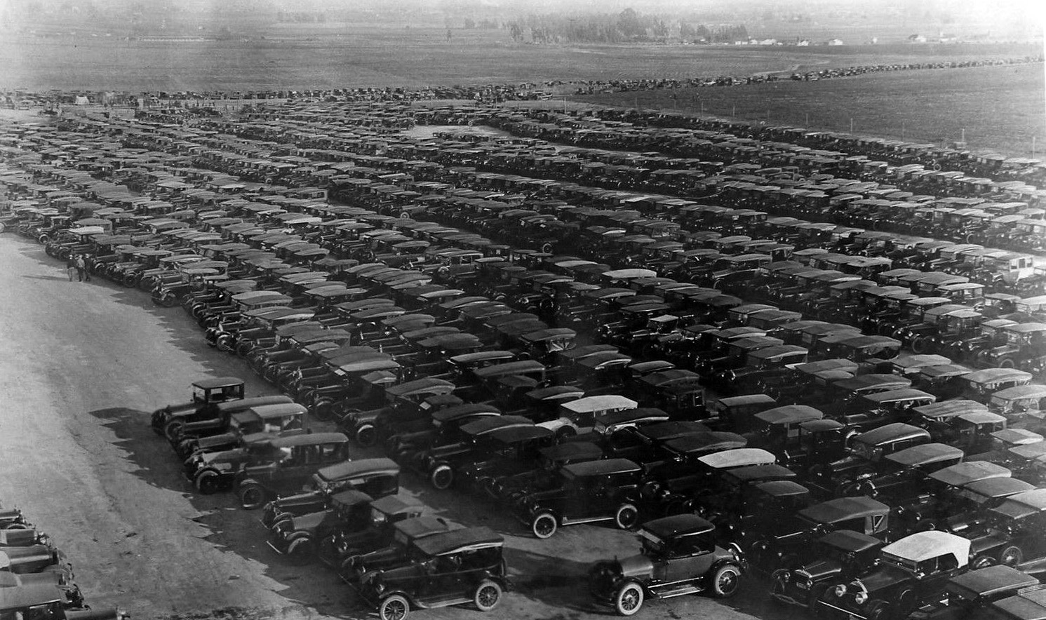
Historical Notes The Speedway was a great success, not only for racing but also for events. In fact, sometimes the space was so well attended, the parking lots overflowed with cars. |
 |
|
| (1919)^ - View of cars parked next to the spectator stands of the Beverly Hills Racetrack. |
Historical Notes The Speedway operated for four years and attracted many historically significant competitors including Ralph DePalma, Jimmy Murphy, and Tommy Milton. It was also the site of a racing accident that killed National Champion and Indianapolis 500 winner Gaston Chevrolet in 1920. Gaston Chevrolet was the younger brother of Louis Chevrolet, who in 1911 co-founded the Chevrolet Motor Company. |
 |
|
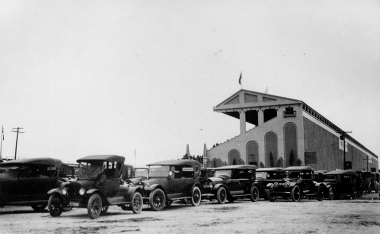
| (ca. 1919)* - View showing a filled to capacity parking lot at the Beverly Hills Speedway. |
 |
|
| (1919)* – View looking northeast showing cast and crew of the 1919 silent film “The Roaring Road” posing for the camera on the Beverly Hills Speedway track. |
Historical Notes The gigantic eucalyptus trees in the distance ran the length of what today would be Charleville Blvd., a street named for developer Walter G. McCarty's Irish roots. The trees created a natural wind and sound barrier for residential neighborhood north of Wilshire Boulevard, which within five years, would start to become the city's commercial triangle. |
 |
|
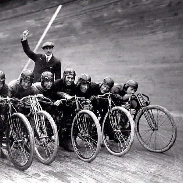
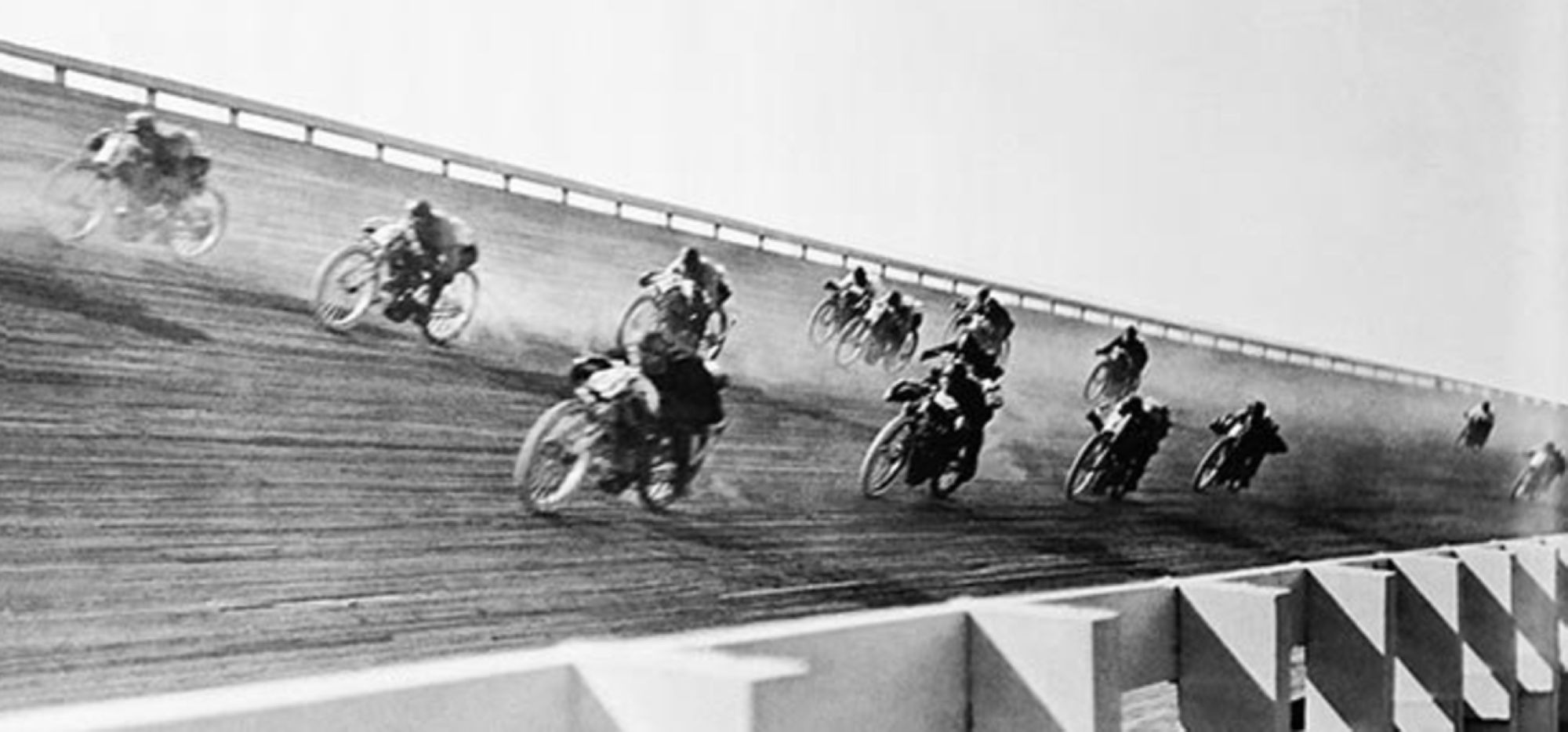
| (ca. 1921)* - Motorcycles line up and wait for the starting gun to go off. |
Historical Notes Motorcycle board track racing took place at the short lived Beverly Hills Speedway between 1920 and 1924. |
 |
|
(1921)* - A group of men stand next to several motorcycles on the inside of the banked track at the Fresno Speedway. |
Historical Notes There is no doubt that board track racing was an incredibly exciting event to witness. The motorcycles were capable of speeds over 100 mph and represented all the marques of the day. Manufacturers such as Harley-Davidson, Indian and Excelsior all had factory racing teams with custom built factory race bikes. |
 |
|
| (1921)* - A group of men stand next to several motorcycles on the inside of the banked track at the Fresno Speedway. AI image enhancement and colorization by Richard Holoff. Correction Note: This image was initially misidentified as depicting the Beverly Hills Speedway. While similar in appearance and constructed in the same year, this photograph actually shows the Fresno Speedway, which was located at the Fresno County Fairgrounds. |
 |
|
| (1920s)* - View showing motorcycle racers rounding the embanked curve a the speedway. |
Historical Notes Because the turns were severely banked, it allowed riders to reach speeds of more than 100 miles an hour. Crashes were frequent and horrific—riders who went down faced being impaled by splinters—and often fatal. |
 |
|
| (1921)* - Aerial view looking east on Wilshire Boulevard from where Santa Monica Boulevard intersects it. Vast open fields can be seen between the Beverly Hills Speedway and the City of Los Angeles. |
Historical Notes By the mid-‘20s, the sport began to lose its appeal. Perhaps the novelty wore off; certainly the carnage was appalling. Newspapers began referring to motordromes as “murderdromes,” and local governments closed some tracks. Race officials and the motorcycle manufacturers that sponsored racing teams tried to implement measures to slow down the bikes, but that went nowhere. By the early 1930s, board-track motorcycle racing had become a footnote in motorsport history. |
 |
|
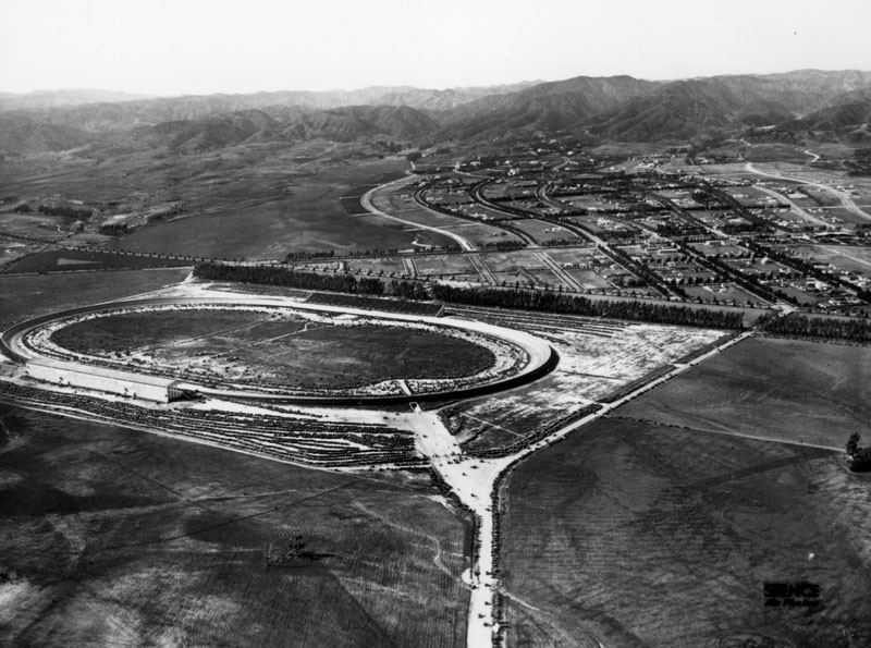
| (ca. 1921)^ - Aerial view looking northwest showing the Beverly Hills Speedway during an event. Note all the open, undeveloped land surrounding the speedway. |
Historical Notes It would soon become apparent that the racetrack wasn't as valuable as the land it was on. By the mid-twenties the track was dismantled to make way for new developments. |
* * * * * |
Coldwater Canyon
 |
|
| (ca. 1910)^- Looking north up Coldwater Canyon at the Haines lemon farm and the Sheffler residence. The Rodeo Land and Water Company later developed the canyon as one of the prime residential areas in Beverly Hills north of Sunset Boulevard. |
Historical Notes Coldwater Canyon is a canyon running perpendicular to the Santa Monica Mountains. The canyon is traversed by Coldwater Canyon Drive and Coldwater Canyon Avenue (linked by a short section of Mulholland Drive), which connect the city of Beverly Hills with the community of Studio City in the San Fernando Valley.* |
 |
|
| (ca. 1910)^- Looking north up Coldwater Canyon at the Haines lemon farm and the Sheffler residence. The Rodeo Land and Water Company later developed the canyon as one of the prime residential areas in Beverly Hills north of Sunset Boulevard. (AI enhancement and colorization by Richard Holoff) |
Historical Notes The Rodeo Land and Water Company later developed the canyon as one of the prime residential areas in Beverly Hills north of Sunset Boulevard. The legacy of the Rodeo Land and Water Company is intertwined with the history of Beverly Hills. The successful development and promotion of the area helped establish Beverly Hills as a premier residential destination, known for its affluence and celebrity residents. |
 |
|
| (1911)* - View of a large home situated on the top of the hill, overlooking Coldwater Canyon. The home is identified as once belonging to a Kirk Johnson. |
Historical Notes In the early 20th century, the area underwent significant development, and Coldwater Canyon became a prominent route. The expansion of Los Angeles and the development of Beverly Hills as an upscale residential area contributed to the importance of Coldwater Canyon as a transportation artery. |
* * * * * |
Beverly Hills Bridle Paths
 |
|
| (1921)^ - A view of Beverly Hills looking north from Santa Monica Boulevard, between Rodeo Drive and Beverly Boulevard. Note the bridle path down the center of Rodeo Drive on the left. Prior to 1920, it was used as a one-trolley car system (aka "Dinky") that conveyed guests from the Pacific Electric Station (SE corner of Canon Drive and Santa Monica Boulevard) up Rodeo Drive to the Beverly Hills Hotel. |
Historical Notes From the early 1920s through the 1960s, pathways dedicated to horse travel ran down the center of several Beverly Hills streets. One stretched from the city's eastern to western boundary, meandering through town down the center of Sunset Boulevard. Another occupied the median of Rodeo Drive, where it replaced an abandoned Pacific Electric trolley line that once connected Santa Monica Boulevard with the Beverly Hills Hotel. Two more snaked their way up Coldwater and Benedict canyons. The bridle paths served several purposes. They satisfied the recreational urges of the city's many equine enthusiasts. They reinforced the image of Beverly Hills as a place of wealth and privilege. They preserved the rustic feel of a city that was fervently carving itself out of the open countryside of Rancho Rodeo de las Aguas. And lastly, though saddle horses were never as common on city streets as draft horses, they nostalgically recalled that dying breed -- the urban horse. ^*^ |
 |
|
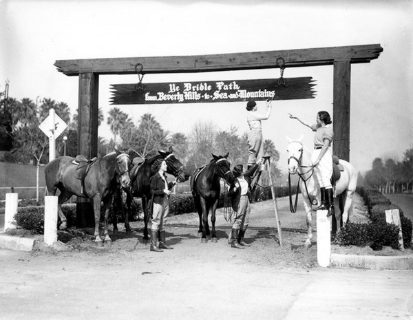
| (1920s)^# – Close-up view showing three horseback riders making their way down one of the bridle paths in Beverly Hills. |
Historical Notes For a time, Beverly Hills' bridle paths teemed with horseback riders and the occasional tally-ho. A grand pageant marked the completion of the city's bridle path network on January 10, 1925. The Bridle Path Association placed signs at the paths' entrances proclaiming that they led from "Beverly Hills to the Sea and the Mountains" -- a reference to the organization's ambitious plans to lace the Santa Monica Mountains with equestrian trails. ^*^ |
 |
|
| (1920s)^ - A sign over the entrances to the bridle paths read: 'Ye Bridle Path - from Beverly Hills to Sea and Mountains'. |
Historical Notes The city's enthusiasm for horses soon waned and eventually its bridle paths fell into disuse. Another recreational craze briefly gave the paths new life in 1938, when, in the midst of a nationwide bicycle fever, the city opened them up to bicycles -- transforming the old bridle paths into some of the region's finest cycling infrastructure. But after World War II brought an abrupt end to the nation's obsession with biking, the city slowly dismantled the aging paths. By 1965, grassy medians occupied the space where horses once trod. ^*^ |
* * * * * |
New Development
.jpg.png) |
|
| (ca. 1921)#+ – Aerial photo showing the Beverly Hills Speedway annotated to show the major streets. |
Historical Notes The last race on the track was held in 1924; it wasn't as valuable as the land it was on, and was shuttered and dismantled to make way for new developments, like the 1928 Beverly Wilshire Hotel, which was erected on part of the former racetrack property. The Speedway was relocated just a few miles away to Culver City (1924), near the intersection of Culver and Overland boulevards (across the street from MGM Studios). Click HERE see more on the Culver City Speedway. |
 |
|
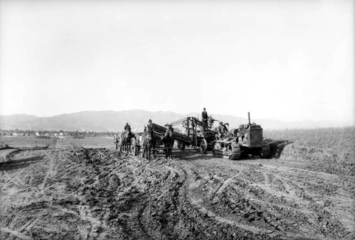
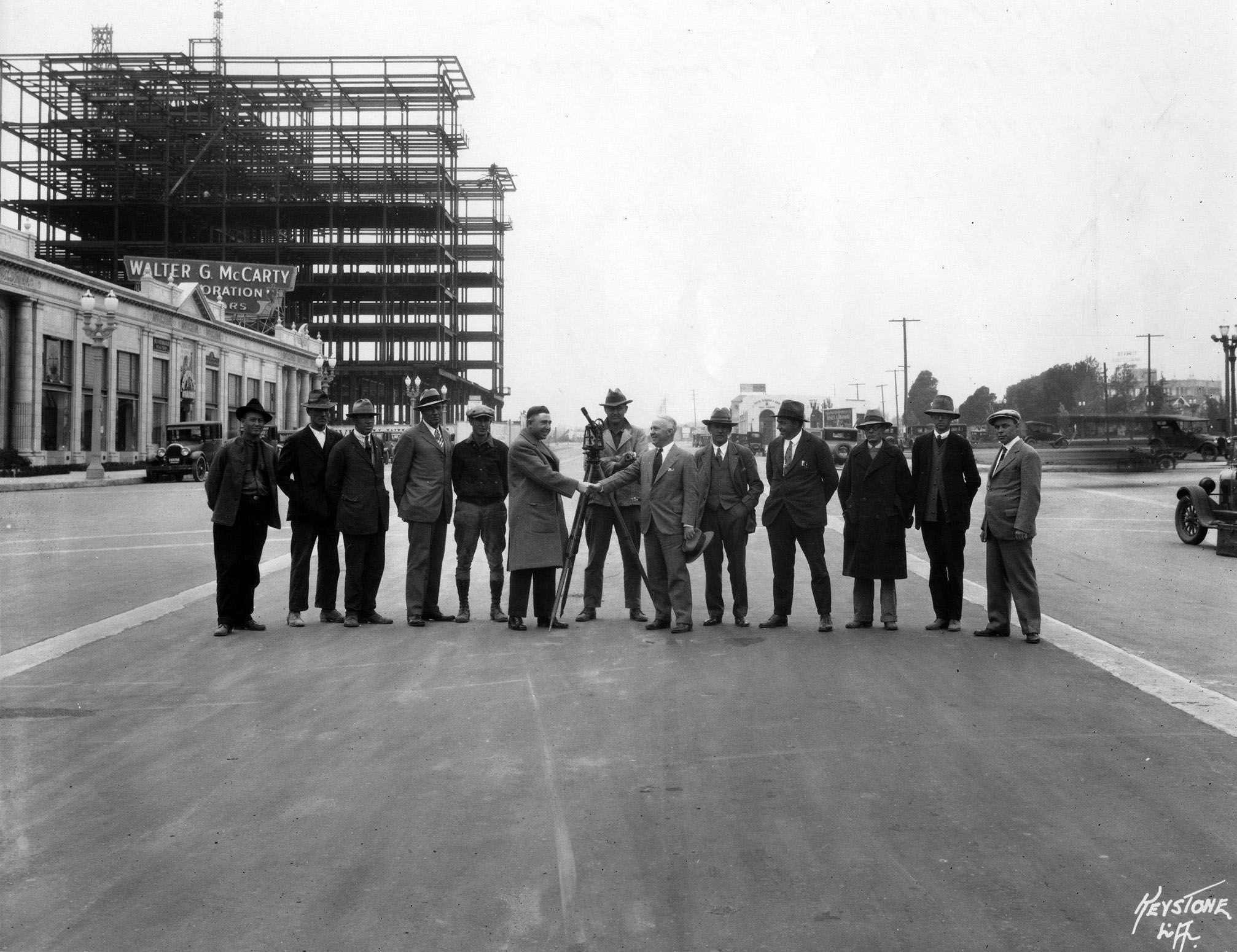
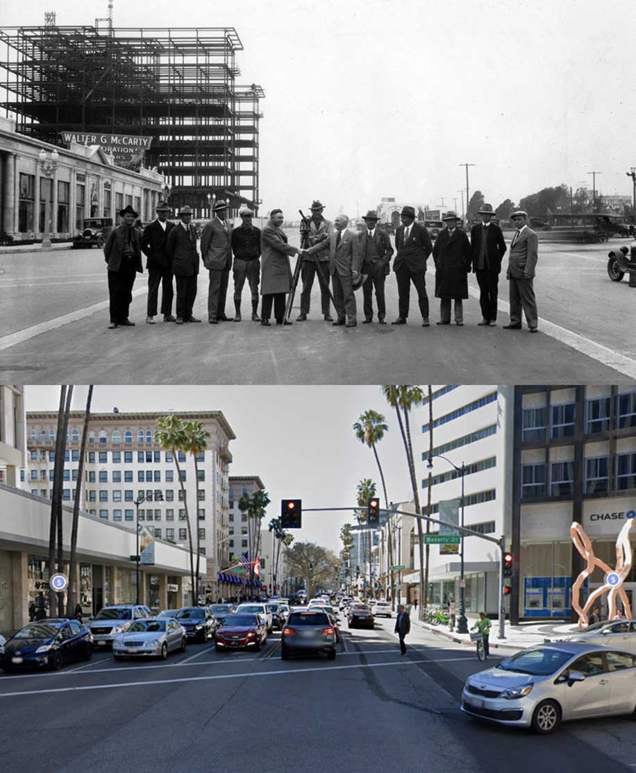
| (1925)^^ – View looking north showing the excavation of land south of where the Beverly Hills Speedway once stood. The new development, Beverly Hills Heights, is centered on South Beverly Drive and runs from where Olympic Boulevard is today up to Wilshire Boulevard. |
Historical Notes In 1923, the 193 acres known as the Beverly Hills Speedway tract owned by Silsby Spalding, Cliff Durant, and Jake Dansinger was sold to Walter G. McCarty at about $10,000 per acre. By 1924, the entire Speedway property bounded by Wilshire Boulevard, South Beverly Drive, Olympic Boulevard, and Lasky Drive was developed into a proposed residential and business district. #* |
 |
|
| (ca. 1925)^ - Aerial view of Beverly Hills showing new development where the Speedway used to be (center-left). |
Before and After
|
|
|
|
| (1919 vs. 1925)^ - Aerial view of Beverly Hills showing how much growth and development took place in a relatively short span of time. |
Beverly Hills Heights
.jpg) |
|
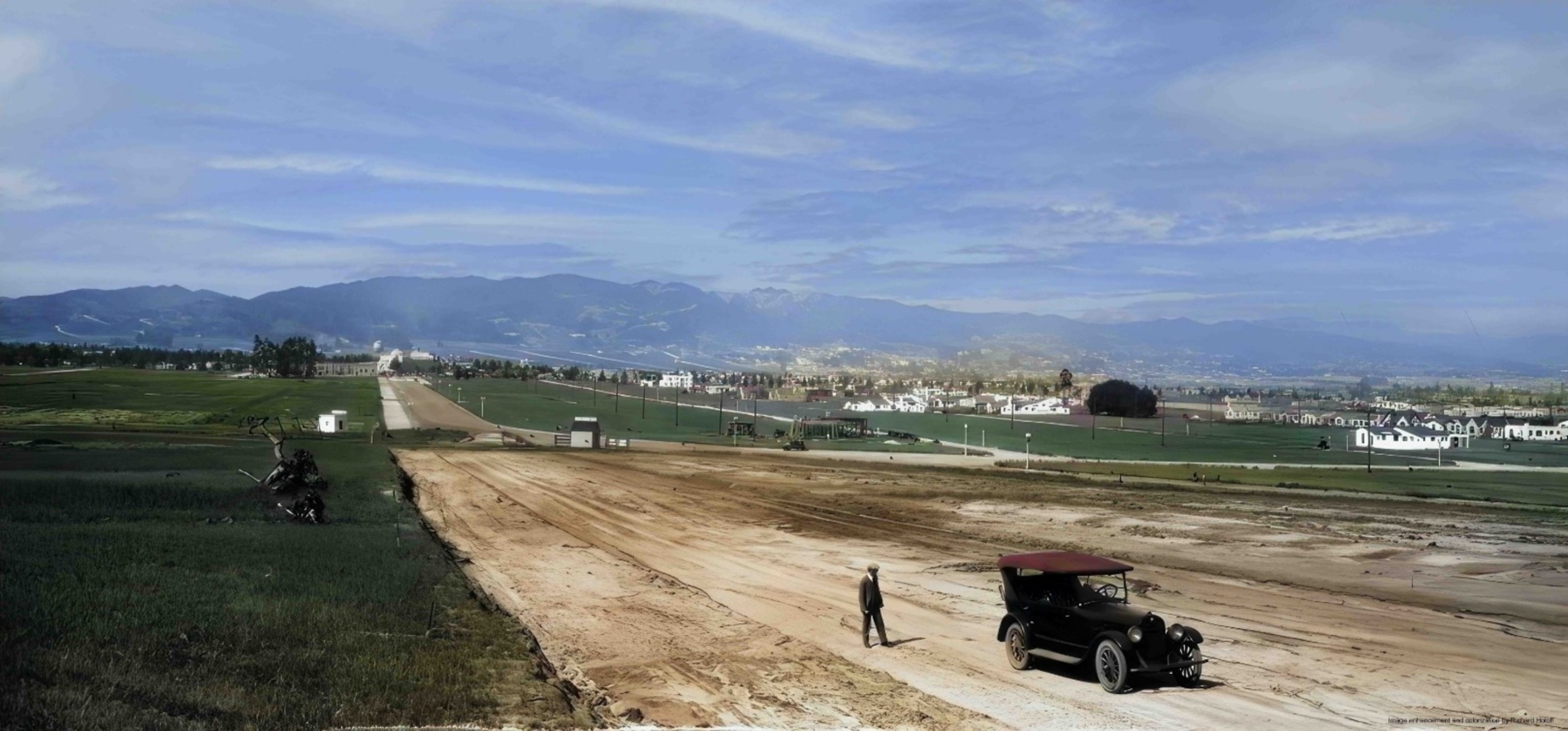
| (1925)* - A view of Beverly Hills Heights, a development by Frank Meline, shown at the start of the subdivision. A man stands near a parked automobile on a wide, unpaved S. Beverly Drive near what is today Olympic Boulevard. |
Historical Notes He’s a forgotten name today, but, in the 1920s, there was no more successful real estate developer in a booming greater Los Angeles than Frank L. Meline. Simultaneously, Meline’s powerhouse firm developed such prominent places as Bel-Air, Brentwood, Beverly Hills, and a host of others in the region. He expanded his enterprise to form The Meline Bond and Mortgage Company, an unusual move for a residential developer in that he could issue his own mortgages for projects developed by his realty company.* At the time of this photo 10th Street (now Olympic Boulevard) had not yet been cut through to the west. It was originally named 10th Street, but was renamed Olympic Boulevard for the 1932 Summer Olympics, as that was the occasion of the tenth modern event. |
 |
|
| (1925)* - A view of Beverly Hills Heights, a development by Frank Meline, shown at the start of the subdivision. A man stands near a parked automobile on a wide, unpaved S. Beverly Drive near what is today Olympic Boulevard. Image enhancement and colorization by Richard Holoff. |
Historical Notes At the time of this photo 10th Street (now Olympic Boulevard) had not yet been cut through to the west. It was originally named 10th Street, but was renamed Olympic Boulevard for the 1932 Summer Olympics, as that was the occasion of the tenth modern event. |
 |
|
| (1925)*– Panoramic view of a completely undeveloped South Beverly Drive looking north to the Beverly Theater at Wilshire Boulevard. |
Historical Notes There are still giant eucalyptus trees that once lined the boundaries of the Beverly Hills Speedway to the north behind the Walter McCarty retail development. Those trees would soon be cut down to make way for Charleville Blvd. To the left you can see El Camino Drive is beginning to make its way south and in the upper left hand corner of the photo you will find the "Beverly Crest" real estate sign on the mountain, very much like its sister sign, "Hollywoodland" only a handful of miles away. The area from where the photo was taken was known as Beverly Heights. ##++ |
 |
|
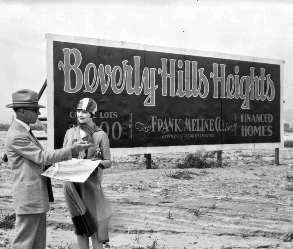
| (ca. 1925)^ - View showing a Real Estate agent making a pitch to a prospective buyer at the new Beverly Hills Heights Tract development. Sign reads: Beverly Hills Heights – The Frank Meline Co. Inc. – Financed Homes. |
Historical Notes Frank Meline was an architect and the first sales agent in Bel-Air for developer Alphonzo Bell (1875-1947). Meline subdivided Pacific Palisades’ California Riviera neighborhood, where some streets also bear the Claude Fisher Company seen in Monte-Mar Vista. Meline was a prominent developer "who in 1912 formed his hown Los Angeles construction company, which he expanded in 1919 to a full-service real-estate development and sales opertion with (by 1924) eighteen branch offices throughout the Los Angeles basin. As a broker, Meline sold half the homes purchased in Beverly Hills before 1930.^ |
 |
|
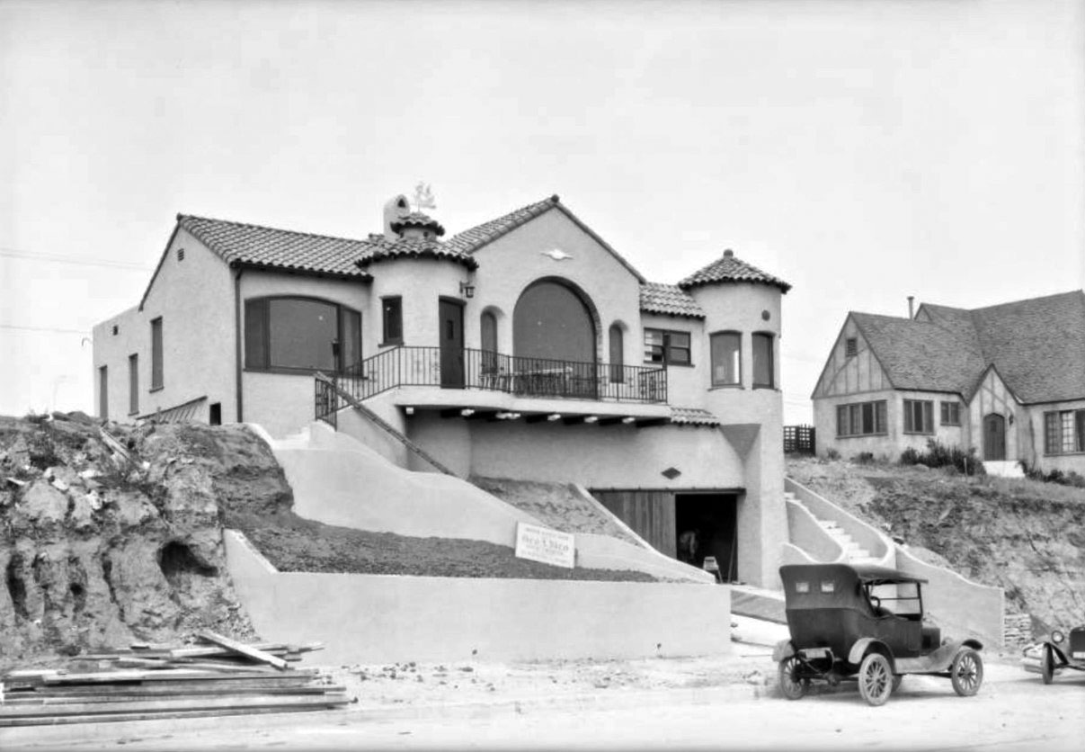
| (ca. 1925)^ – Early model car parked in front of newly constructed home in the Beverly Hills Heights Tract. |
 |
|
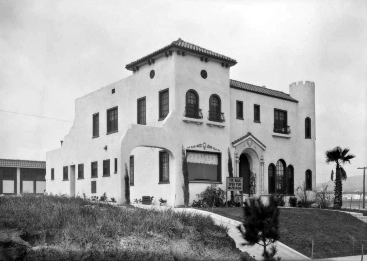
| (ca. 1925)^ - Close-up view showing a newly-built house for sale in the Beverly Hills Heights Tract. Sign in front reads: ‘For Sale – Open for Inspection’. Note the empty land in the background on the right. |
 |
|
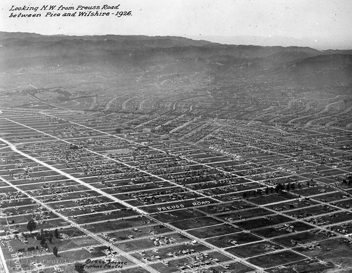
| (1926)^ - Aerial view of Beverly Hills looking NW from Preuss Road between Pico and Wilshire. |
Historical Notes The street called Preuss Road in the picture is now called Robertson Blvd. The Preuss Road name survives on a street south of Pico. |
 |
|
| (1929)^ - Aerial view of Beverly Hills looking north. The large white building at center of photo is the Beverly Wilshire Hotel, completed in 1928. |
Before and After
|
|
|
|
| (1925 vs. 1929)^ - Aerial view of Beverly Hills showing how much growth and development took place in a relatively short span of time. |
 |
|
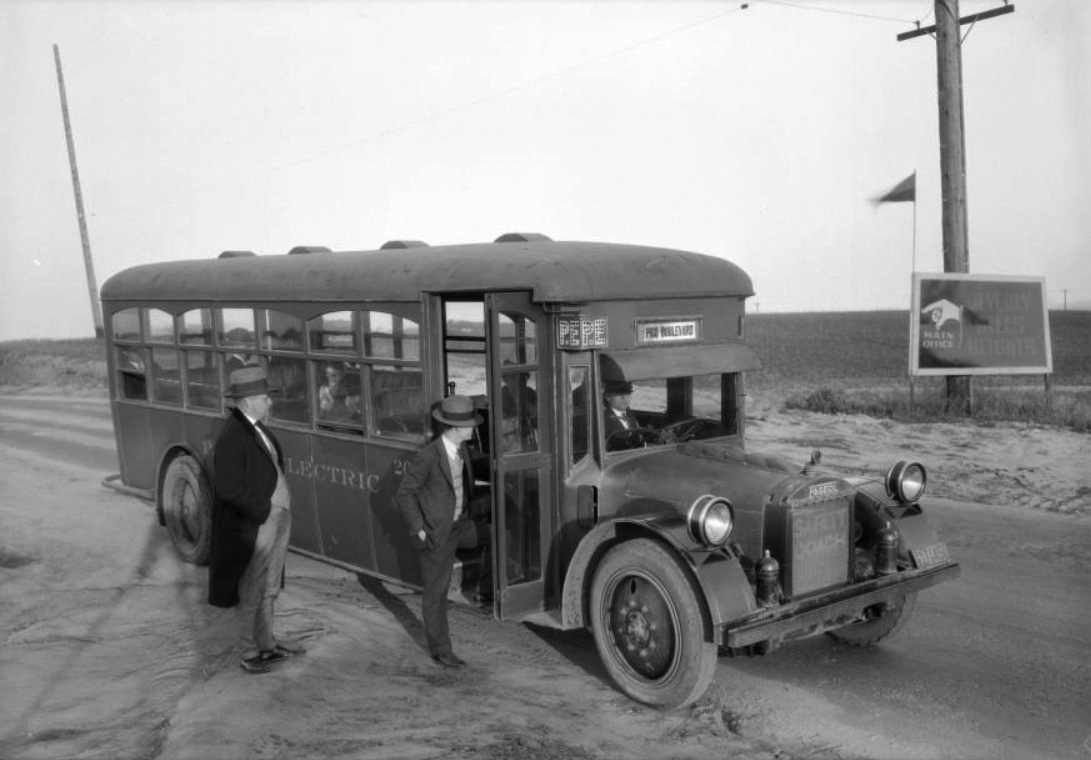
| (1925)*^#^ - A Pacific Electric bus parked along the side of the road near a sign for the Beverly Hills Heights development. Two men are standing outside the bus, one about to board, and a few people are already seated on the bus. The land that is visible is covered in fields. |
 |
|
| (ca. 1925)*- View showing a car on an unpaved Sunset Boulevard heading west between Carolwood and Delfern Drives, with three palm trees in the background. Click HERE to see contemporary view. |
Historical Notes Sunset Boulevard stretches from Figueroa Street in Downtown Los Angeles to the Pacific Coast Highway at the Pacific Ocean in the Pacific Palisades. Approximately 22 miles in length, the famous boulevard roughly mimics the arc of the mountains that form the northern boundary of the Los Angeles Basin, following the path of a 1780s cattle trail from the Pueblo de Los Angeles to the ocean. The portion of Sunset Boulevard that passes through Beverly Hills was once named Beverly Boulevard.^* |
 |
|
| (ca. 1925)* - View showing a car on an unpaved Sunset Boulevard heading west between Carolwood and Delfern Drives, with three palm trees in the background. Image enhancement and colorization by Richard Holoff. |
Then and Now
 |
|
| (1925 vs 2021)* - Sunset Boulevard between Carolwood and Delfern Drives in Beverly Hills. |
 |
|
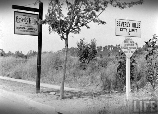
| (n.d.)+# – Life Magazine photo showing rural-looking Beverly Hills at city limits with signs reminding motorists that “Bridal path crossing – Saddle horses have right of way.” |
* * * * * |
Camden Drive and Santa Monica Boulevard
 |
|
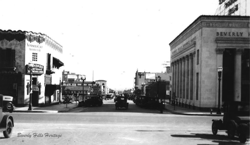
| (1927)^ - View looking north on Camden Drive across Santa Monica Boulevard and the P.E. tracks. |
 |
|
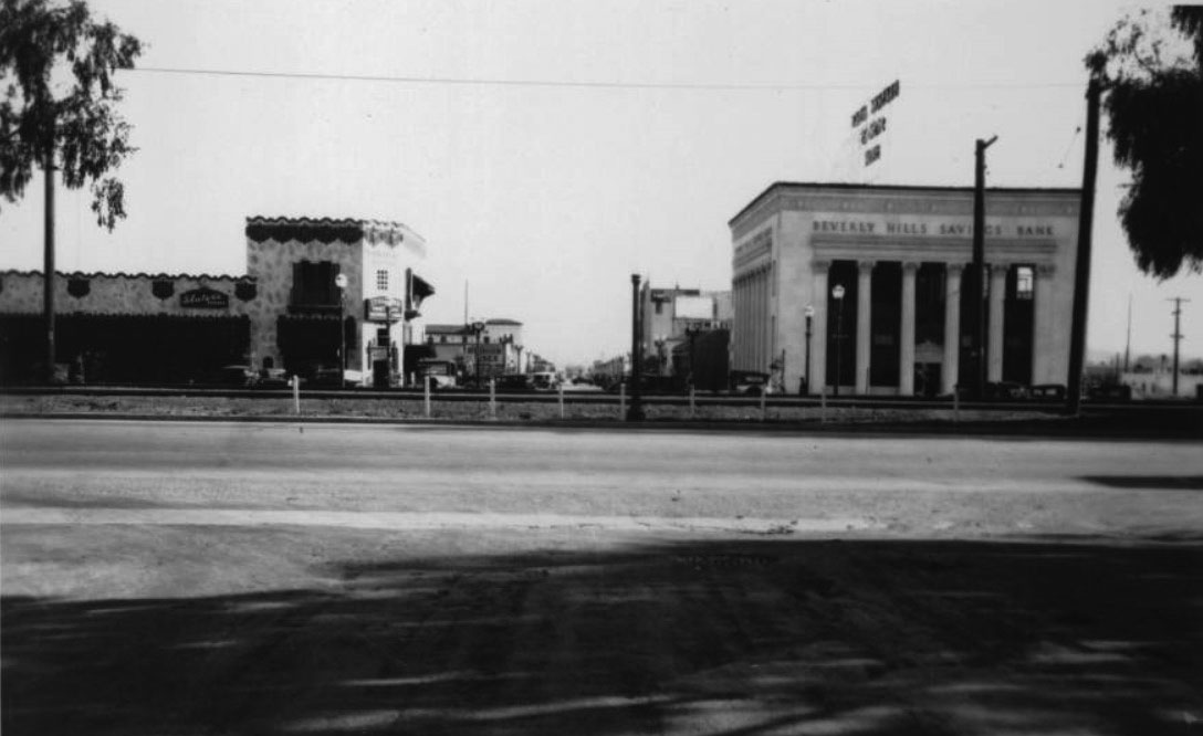
| (1927)^ – View looking south on Camden Drive across Santa Monica Boulevard and the Pacific Electric Railway tracks toward the commercial district of Beverly Hills. To the right can be seen the Beverly Hills Savings Bank. Sign on the building to the left reads “Slater’s Kodaks”. |
 |
|
| (ca. 1927)* – View looking south on N. Camden Drive from just south of the PE tracks. On the left is the old Hans Ort Bicycle shop. On the right (SW corner) can be seen the Beverly Hills Savings Bank. Photo courtesy of Beverly Hills Heritage. |
 |
|
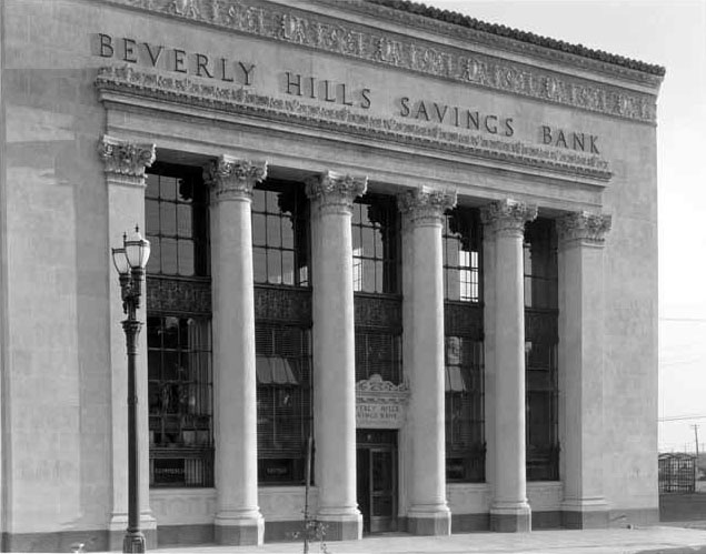
| (ca. 1920s)^*# – Close-up view of the Beverly Hills Savings Bank with Greek-style columns, located on the SW corner of Camden Drive and Santa Monica Boulevard. Note the ornate dual-lamp streetlight. |
Then and Now
 |
|
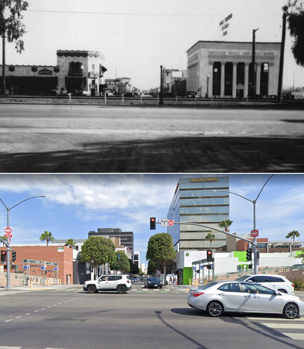
| (1927 vs 2022)* - Looking south on Camden Drive at Santa Monica Boulevard. |
* * * * * |
 |
|
| (ca. 1924)* - Aerial view over Beverly Hills looking towards Hollywood. Below, at lower-center, can be seen Beverly Hill’s 1st Train Station. Photo: Fred Basten Collection |
Then and Now
 |
|
| (1924 vs. 2017) – Aerial view over Santa Monica Blvd and Canon Drive looking towards Hollywood showing the relative locations of the Beverly Hills’ 1st Train Station (left) and today’s City Hall (right). |
 |
|
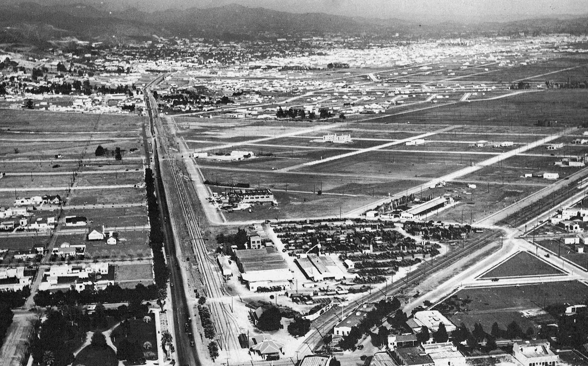
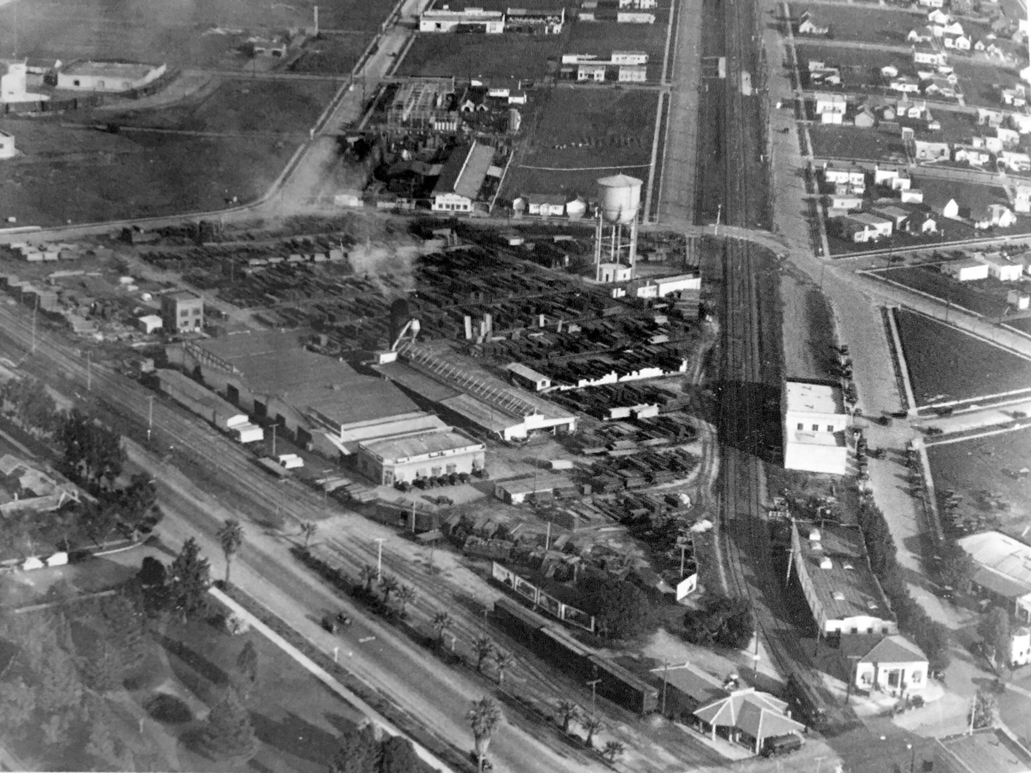
| (ca. 1926)* - Aerial view of Sun Lumber and the future location of City Hall. The intersection of Canon Drive and Santa Monica Blvd is in the foreground where the new Beverly Hills Depot is seen. |
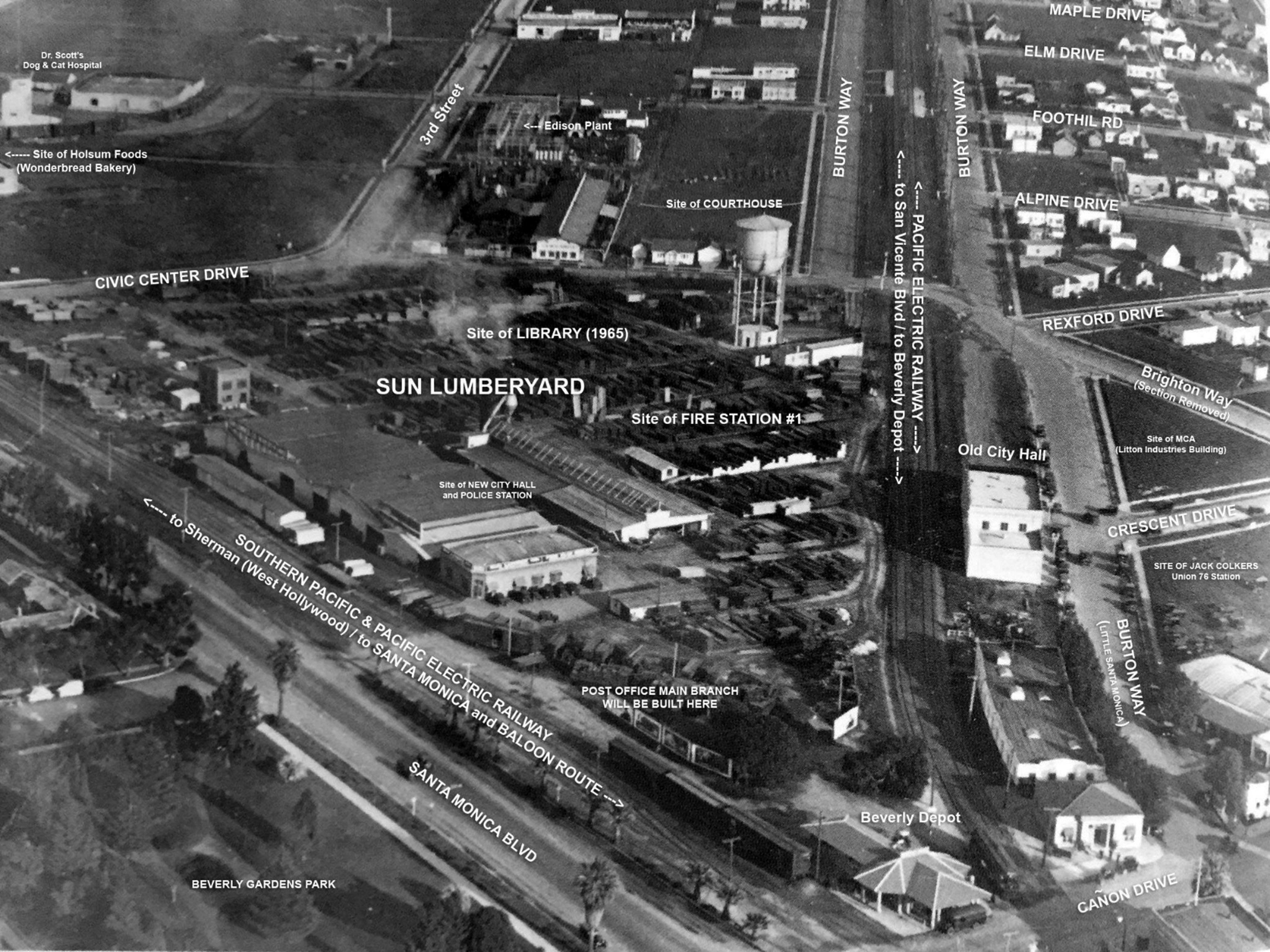 |
|
| (ca. 1926)* - Aerial view of Sun Lumber annotated to with street names and future significant buildings. Beverly Hills Historical Society |
 |
|
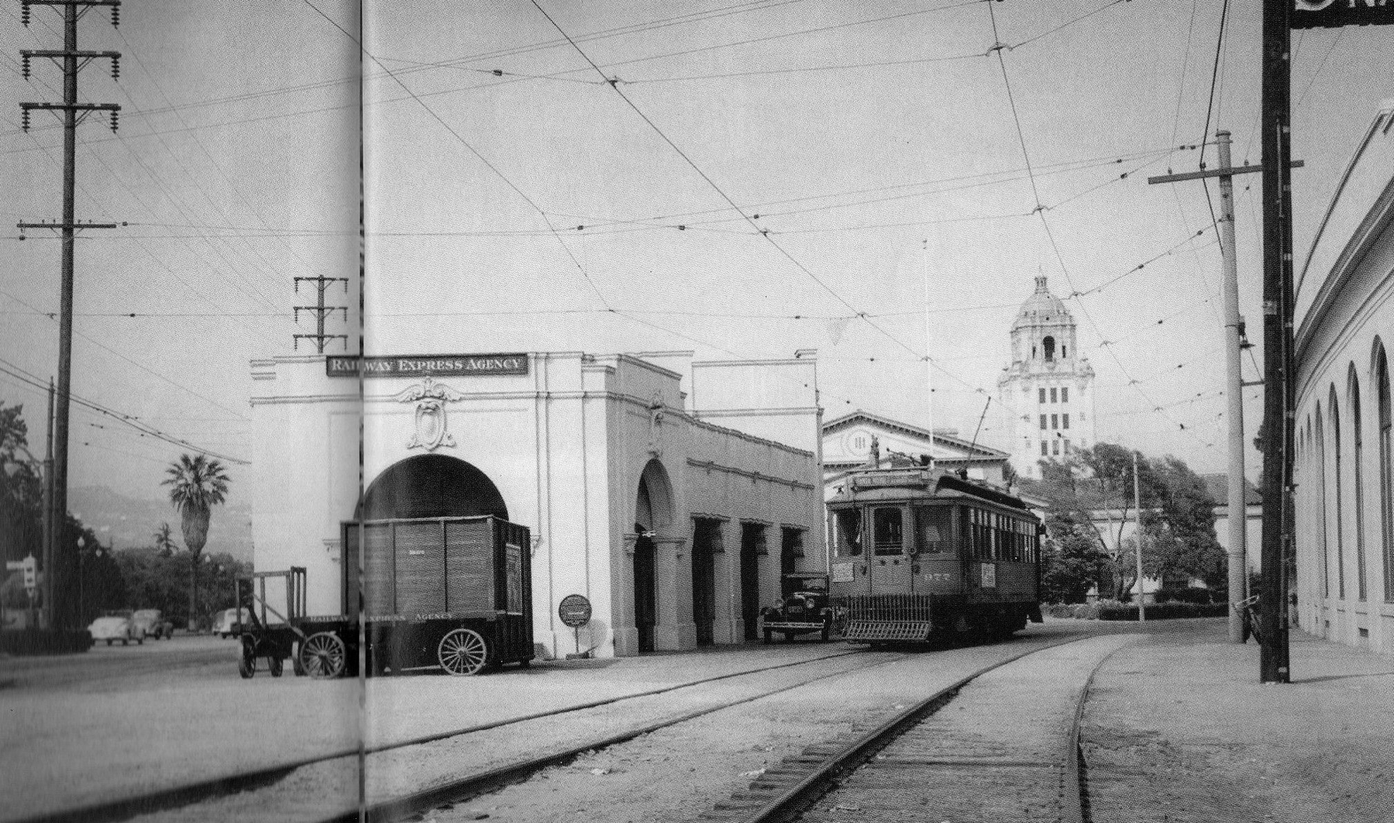
| (1926)^.^ – View looking northeast as seen from Canon Drive showing the newly named Beverly Hills Station featuring the American Railway Express. In the background can be seen Sun Lumber, soon to be the site for the new Beverly Hills City Hall. |
 |
|
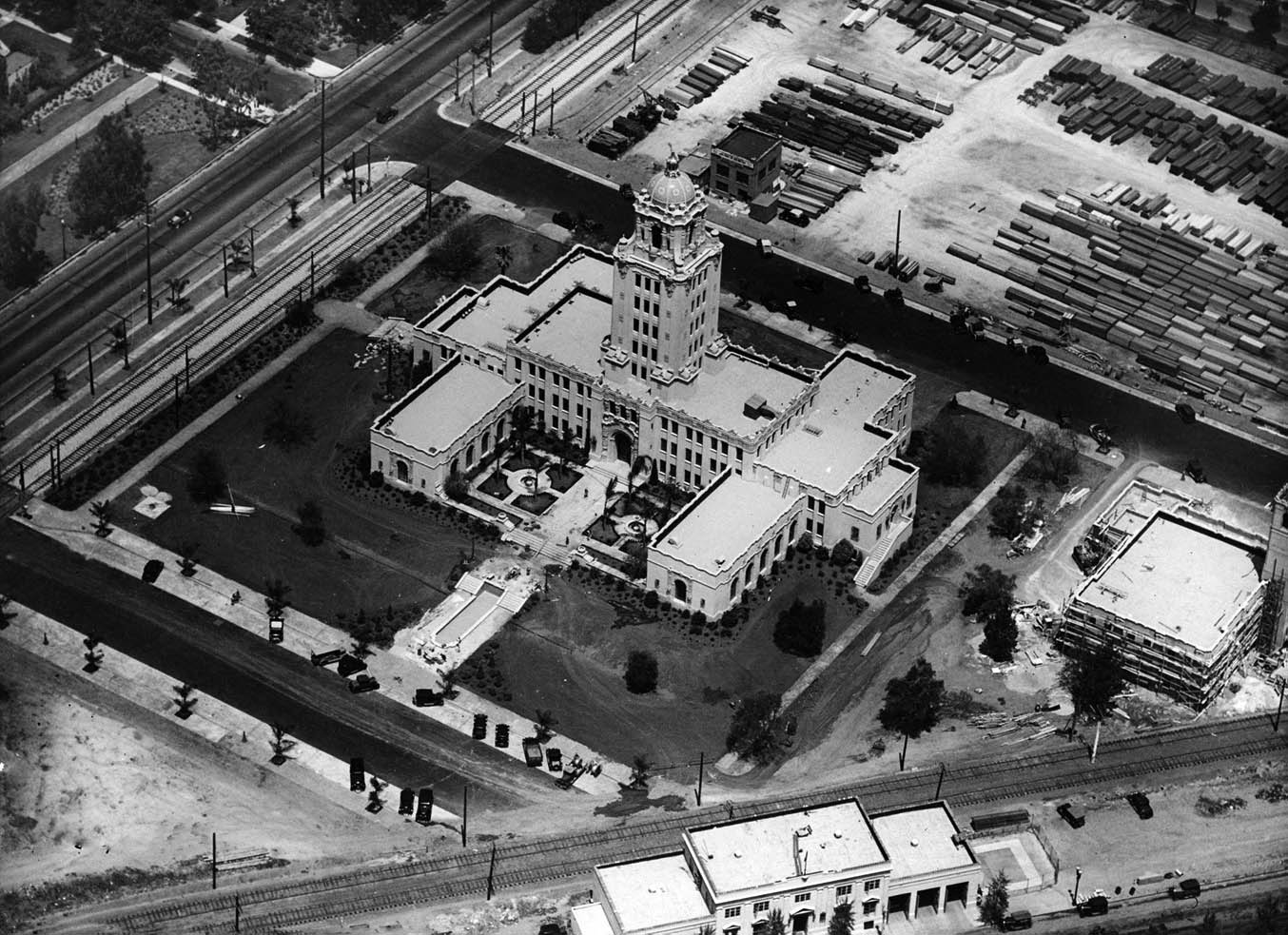
| (1932)* - Beverly Hills City Hall shortly after it was completed situated between tracks and the Sun lumberyard. |
Historical Notes In 1930, land was purchased from the Pacific Electric to build the city hall. Construction lasted from 1931 to 1932. The building was designed by architects William J. Gage and Harry G. Koerner in the California Churrigueresque style, a type of Spanish Revival Architecture. The building was constructed by the Herbert M. Baruch Corporation. When the city hall opened in 1932, it was called by the Los Angeles Times the "largest and most expensive City Hall of any municipality its size in the country."* Click HERE to see more Early Views of Beverly Hills City Hall. |
 |
|
| (1933)^ - Panoramic view of Beverly Hills City Hall and surrounding area, looking east. City Hall was built in 1932 on Crescent Drive at Santa Monica Blvd. |
* * * * * |
Beverly Hills 1st City Hall
 |
|
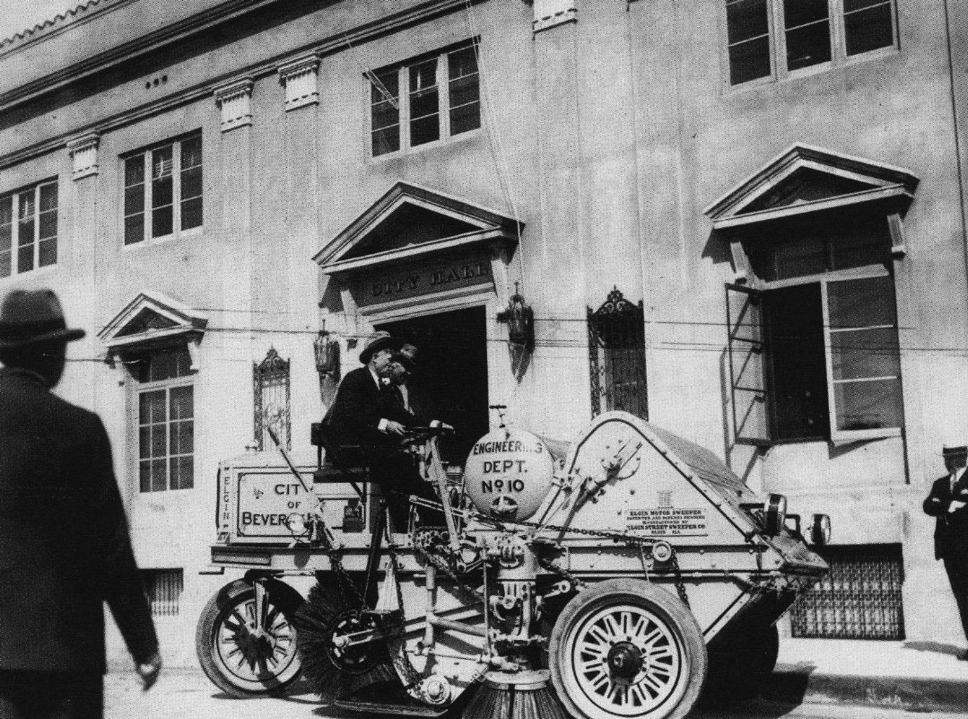
| (1926)* - Honorary Mayor Will Rogers demonstrates the city's brand new Elgin Street Sweeper in front of Beverly Hills’ original City Hall at the terminus of N Crescent Drive and Burton Way. |
Historical Notes William Penn Adair "Will" Rogers, in addition to being a cowboy, vaudeville performer, humorist, newspaper columnist, social commentator, and stage and motion picture actor, was the honorary Mayor of Beverly Hills (1926 – 1928). After the city was incorporated it was run by an appointed city manager. The "mayor's office" was merely a ceremonial one that enabled Will to make more jokes about do-nothing politicians such as himself. |
 |
|
| (ca. 1928)* – View showing Honorary Mayor Will Rogers and the Beverly Hills Fire Department standing outside the city's first City Hall and fire station. |
Historical Notes The first City Hall building faced south at the end of Crescent Drive, right before Santa Monica Boulevard. It was demolished when the new City Hall was erected in 1932 and its demise made way for South Santa Monica Boulevard to the east and west and Crescent Drive to go all the way through to the South. |
Beverly Hills 2nd City Hall
 |
|
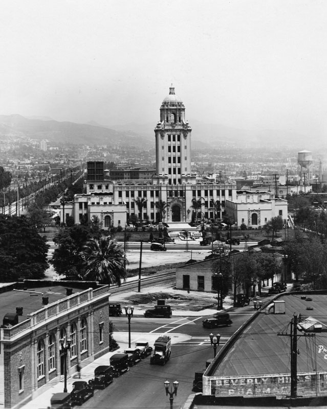
| (ca. 1935)^ - Looking northeast from the Beverly Hills business district showing Beverly Hills City Hall (built in 1932) and the Beverly Hills Civic Center. The Pacific Electric streetcar tracks of the Beverly Hills line that run down Santa Monica Boulevard are seen in the center. Between the tracks and City Hall is the Beverly Hills Post Office. In the far distance (upper-right) you can make out the snow-capped San Gabriel Mountains. |
Historical Notes In 1930, land was purchased from the Pacific Electric to build the new city hall. Construction lasted from 1931 to 1932. The building was designed by architects William J. Gage and Harry G. Koerner in the Spanish Revival architectural style (though sometimes also characterized Churrigueresque). When the city hall opened in 1932, it was called by The Los Angeles Times the "largest and most expensive City Hall of any municipality its size in the country." |
 |
|
| (ca. 1935)^ - Looking northeast from the Beverly Hills business district showing Beverly Hills City Hall (built in 1932) and the Beverly Hills Civic Center. The Pacific Electric streetcar tracks of the Beverly Hills line that run down Santa Monica Boulevard are seen in the center. Between the tracks and City Hall is the Beverly Hills Post Office. In the far distance (upper-right) you can make out the snow-capped San Gabriel Mountains. Photo enhancement and colorization by Richard Holoff. |
 |
|
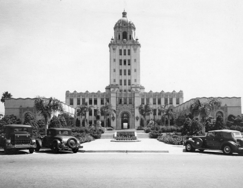
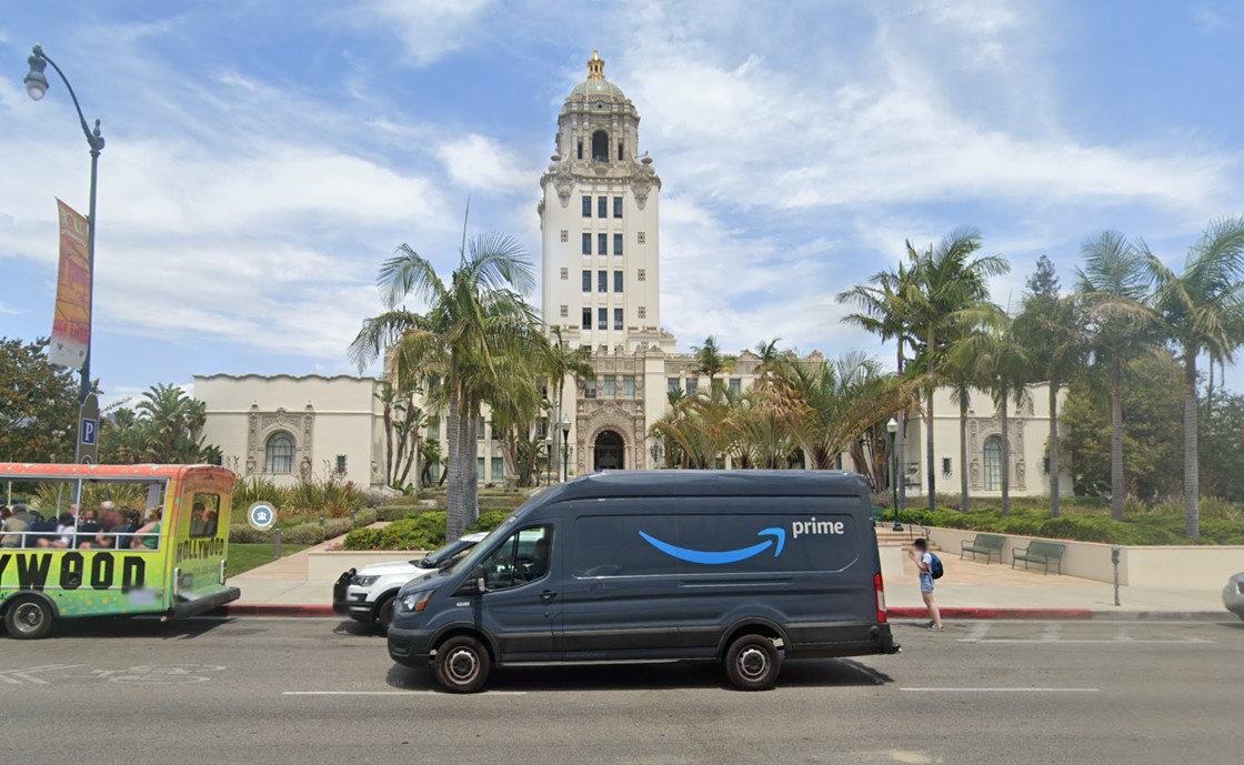
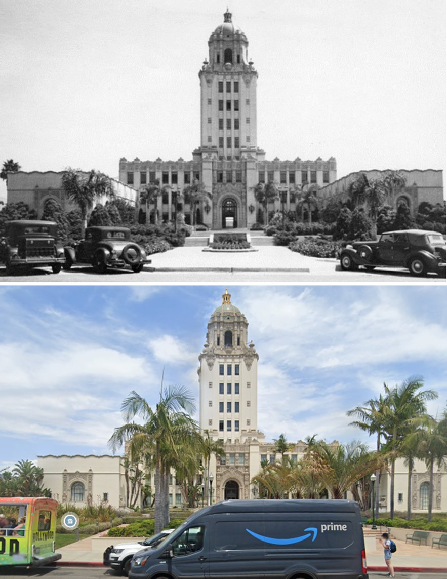
| (1937)^ - Close-up view looking east showing the Spanish Colonial Revival-style Beverly Hills City Hall. |
Historical Notes Beverly Hills City Hall is surrounded by North Santa Monica Boulevard, North Rexford Drive, South Santa Monica Boulevard, and North Crescent Drive. Its main entrance is at 455 North Rexford Drive. |
 |
|
| (2022)* - Contemporary view of Beverly Hills City Hall as seen from N. Crescent Drive. |
Then and Now
 |
|
| (1938 vs 2022)* - Beverly Hills City Hall as seen from N. Crescent Drive. |
Historical Notes Beverly Hills City Hall is surrounded by North Santa Monica Boulevard, North Rexford Drive, South Santa Monica Boulevard, and North Crescent Drive. Its main entrance is at 455 North Rexford Drive. Click HERE to see more Early Views of Beverly Hills City Hall. |
* * * * * |
Beverly Hills Post Office
 |
|
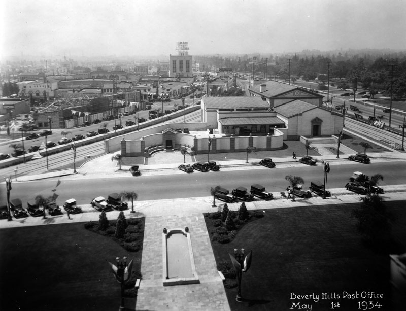
| (1934)^ - View looking west showing the Beverly Hills Post Office located at 325 N. Maple Drive as seen from City Hall. This was the location of Beverly Hills' 1st Train Station. |
Historical Notes Architects Ralph C. Flewellin and Allison and Allison built the Beverly Hills Post Office in 1932-1933 in the Italian Renaissance Revival style, with building in terra cotta and brick. |
 |
|
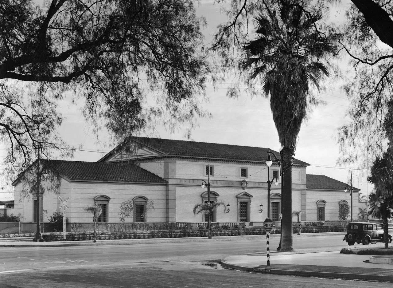
| (ca. 1934)* – Close-up view of the Italianate-style Beverly Hills Post Office located on Maple Drive between Canon Drive and Santa Monica Boulevard. |
Historical Notes The Beverly Hills Post Office (also known as the Crescent Drive Post Office) was part of the original civic center built for the growing young city. Legendary humorist and honorary mayor Will Rogers was credited with securing funding for the building from the federal government, after sending a typically folksy-yet-biting letter to Secretary of the Treasury Andrew Mellon. Ralph C. Flewelling designed the building with consulting architects Allison and Allison. The building’s stately Italian Renaissance Revival exterior leads into a double-height, marble-clad grand lobby. Artist Charles Kassler adorned the upper walls of the lobby with eight WPA fresco murals depicting the creation of the mail service and views of modern life during the Depression. |
 |
|
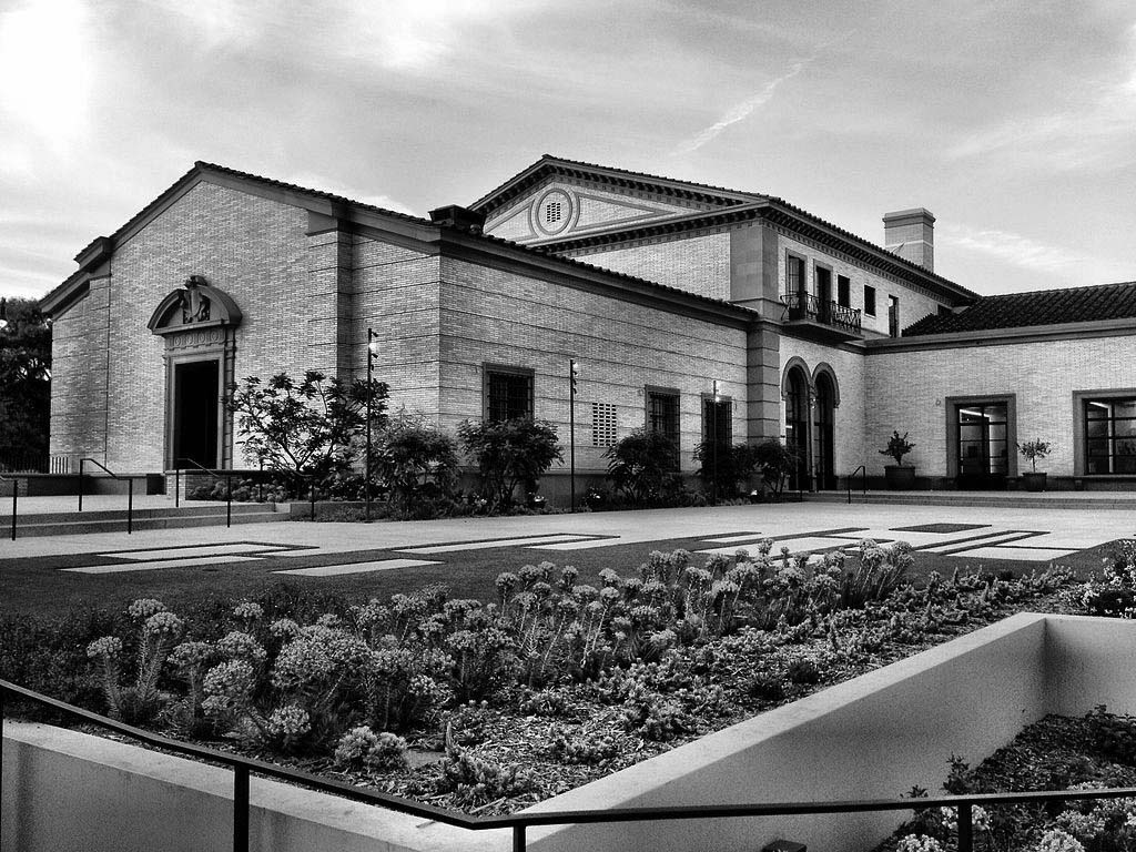
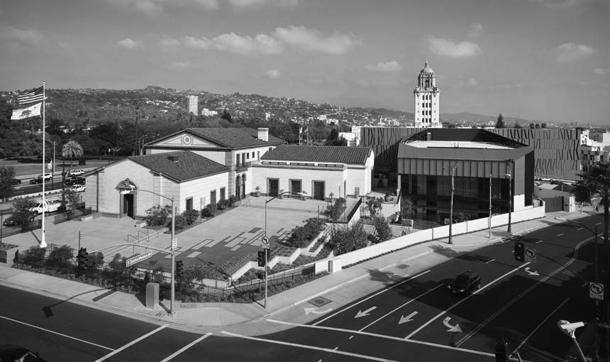
| (2014)* - View showing the restored Post Office portion of the Wallis Annenberg Center for the Performing Arts, as seen from the corner of South Santa Monica Boulevard and Canon Drive. Photo by Waliy Sherpa |
Historical Notes When the U.S. Postal Service’s needs outgrew the building, USPS declared it as “surplus property” and offered it for sale to federal, state, and local governments. The nonprofit Beverly Hills Cultural Center Foundation was formed to find a new use for the building as a cultural venue, and the City of Beverly Hills bought the building in 1999. To transform the site for use as a performing arts center, the project team restored historic elements of the post office building and added a modern annex, connected via tunnel, to house the main 500-seat theatre. The original building received a meticulous repair and restoration, from re-roofing, to restoring the WPA murals, to refurbishing all historic features inside and out. |
 |
|
| (2015)^^– View showing the 1933-built Beverly Hills Post Office, now part of the Wallis Annenberg Center for the Performing Arts. Photo by John Edward Linden |
Historical Notes The Wallis Annenberg Center for the Performing Arts includes a new 500-seat state-of-the-art theater adjacent to the landmark Italian Renaissance Revival building, and three classrooms, a 150-seat flexible studio space, a donor lounge, production support services and administrative offices within the historic post office building itself. |
* * * * * |
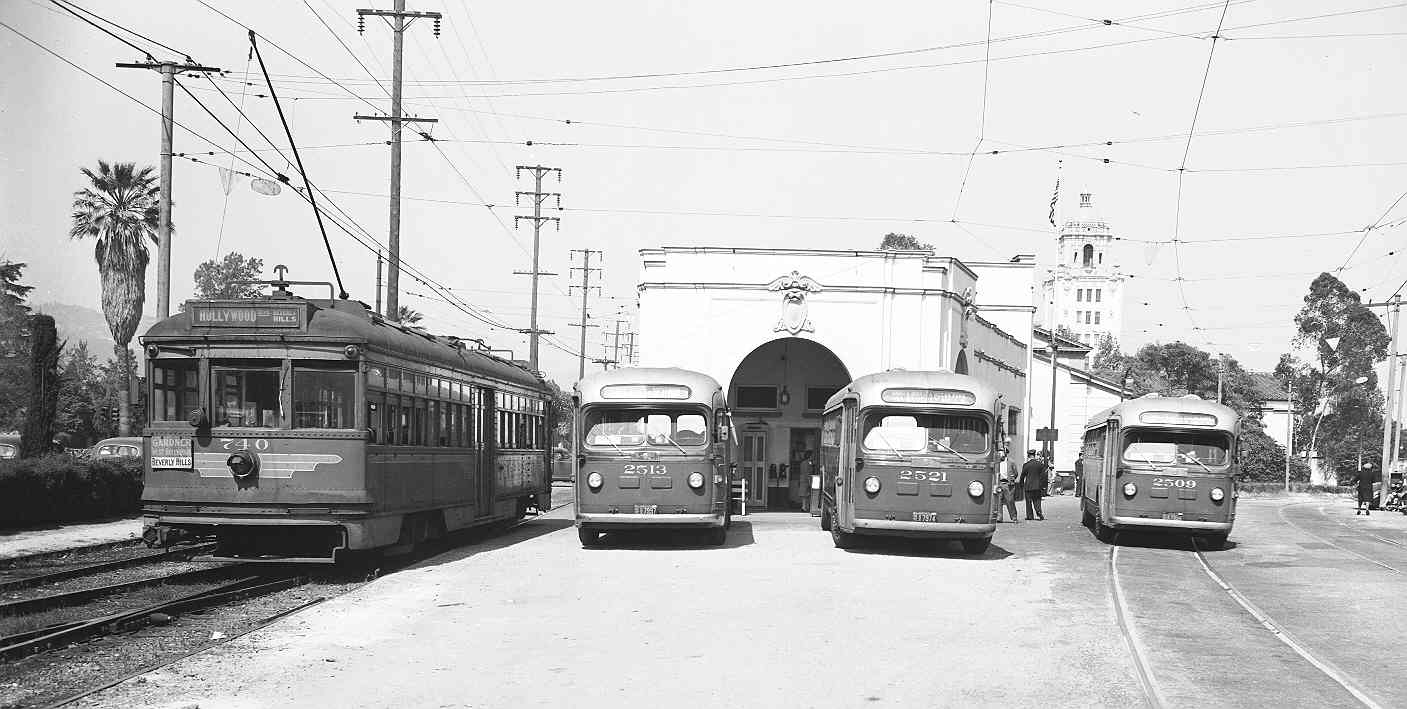
Beverly Hills Pacific Electric Station
 |
|
| (1940)* – Scan of a picture that was in the Spring 2008 issue of "Classic Trains" magazine. The picture was taken by Harold Stewart, a Pacific Electric motorman, in July 1940, just before passenger service on the Los Angeles-Beverly Hills-Santa Monica line was discontinued*. |
Historical Notes *The discontinuance was west of the station - service continued on the east side until the mid-1950s. PE/MTA provided service further to the west via buses. |
 |
|
| (ca. 1943)* - View of the Beverly Hills Pacific Electric Station looking east showing a PE Red Car adjacent to three buses all lined up. City Hall can be seen in the background. |
* * * * * |
Beverly Hills Fire Department
 |
|
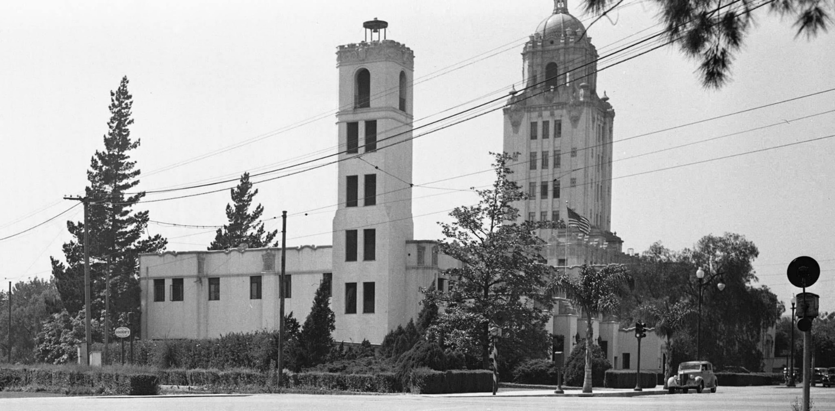
| (ca. 1938)* - Lookikng north on Rexford Drive from S. Santa Monica Boulevard showing the Beverly Hills Fire Department builiding with City Hall in the background. |
Historical Notes The Beverly Hills Fire Department's origins can be traced back to the city's incorporation in 1914, initially operating as a combined service with the police department. In the early years, the first deputy, Jack Munson, uniquely used his home as headquarters for both fire and police services. A significant change occurred in 1919 when a City Marshal was appointed to lead both departments. This combined leadership structure continued until 1925, marking a pivotal moment when the decision was made to separate the Fire and Police Departments. This separation allowed each department to develop independently, setting the foundation for the modern, specialized emergency services that Beverly Hills residents rely on today. |
 |
|
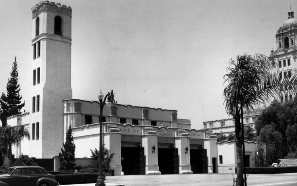
| (1938)* – View showing the Beverly Hills Fire Department at Rexford Drive at Santa Monica Boulevard with City Hall in the background. |
Historical Notes In 1925, the Beverly Hills Fire Department (originally a unit of the Beverly HIlls Police) came into its own entity as a separate organization. When the new city hall was built in 1932, a new and separate fire station building was added adjacent to the civic center. |
 |
|
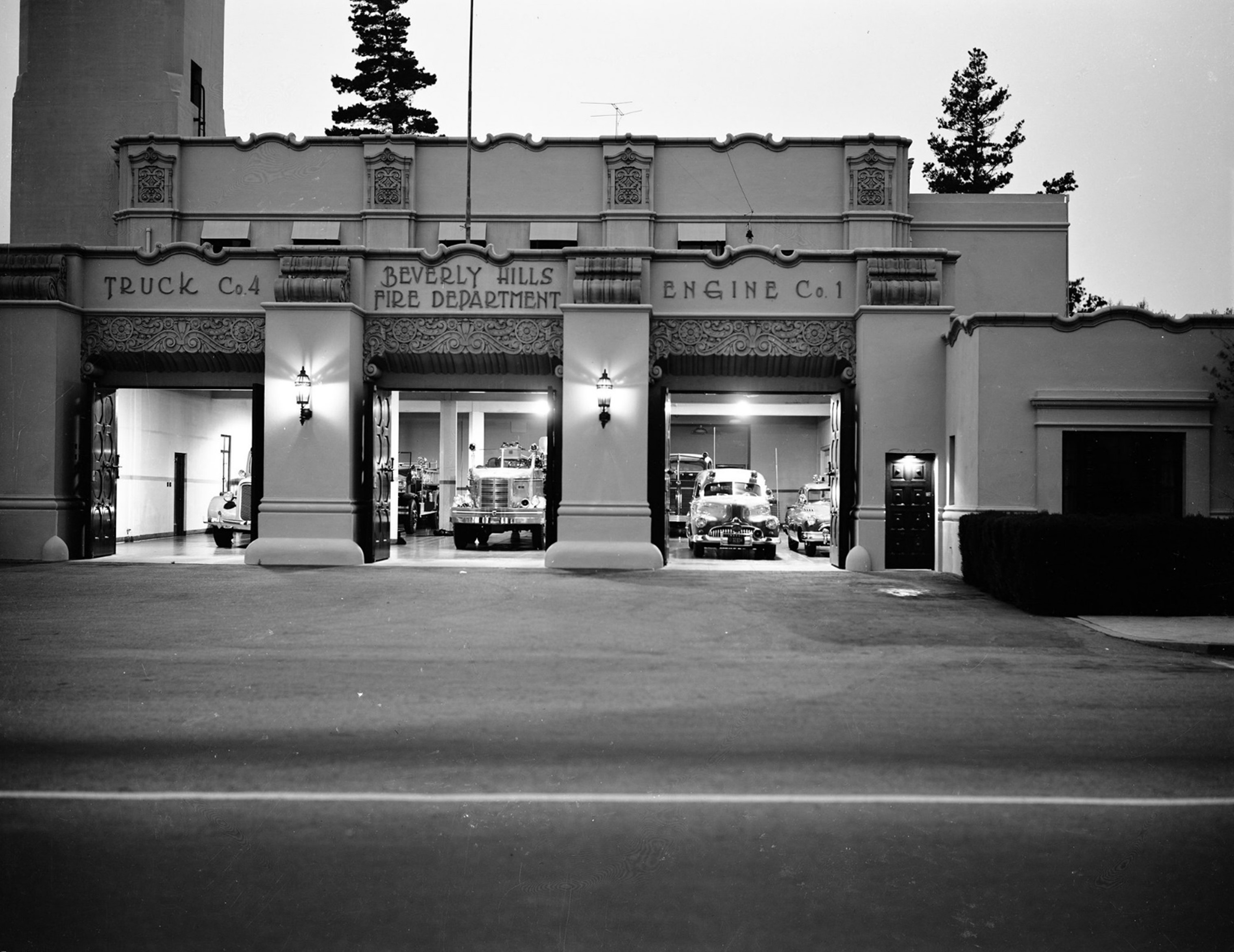
| (1950)* – Front view of the Beverly Hills Fire Deparmtent building at 445 Rexford Drive with fire engines and trucks all set to go if necessary. |
Historical Notes The Beverly Hills Fire Department Headquarters, built in 1932, was designed by the noted architect William J. Gage, in partnership with Harry G. Koerner. Known for designing several prominent buildings in Beverly Hills, Gage and Koerner created the Fire Department Headquarters in the distinctive Mediterranean Revival style, incorporating elements like stucco walls, tiled roofing, and arched windows. This style complemented the nearby Beverly Hills City Hall, also designed by Gage and Koerner, enhancing the architectural cohesion of the civic center. |
 |
|
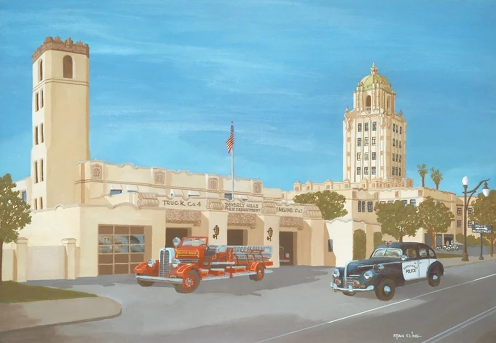
| (1939)* – Beverly Hills City Hall Police Fire Station. Image from Stan Cline Nostalgia Gallery. |
* * * * * |
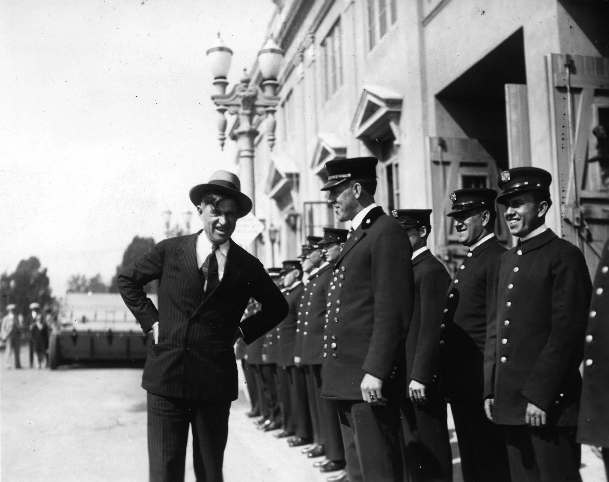
Beverly Hills Police
 |
|
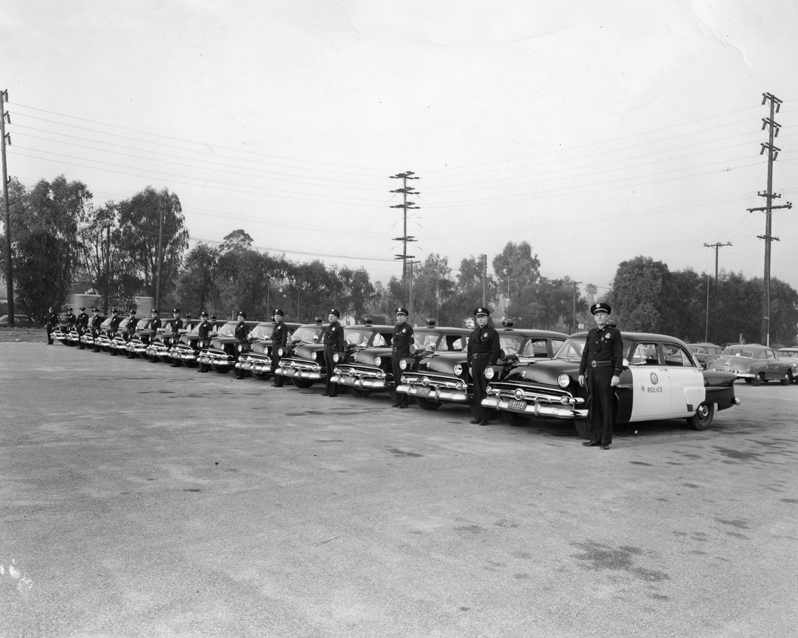
| (1952)* - Beverly Hills Police line up next to their patrol cars. |
* * * * * |
Associated Gas Station
 |
|
| (1941)* – View showing the Flying "A" gas station located at 400 Rexford Drive, across from the Beverly Hills City Hall. |
Historical Notes The station was built on a portion of the original Sun Lumber Company that once dominated the area. Today, the site is the south wing of the Beverly Hills Public Library. Click HERE for contemporary view. |
 |
|
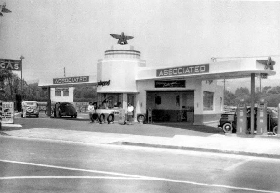
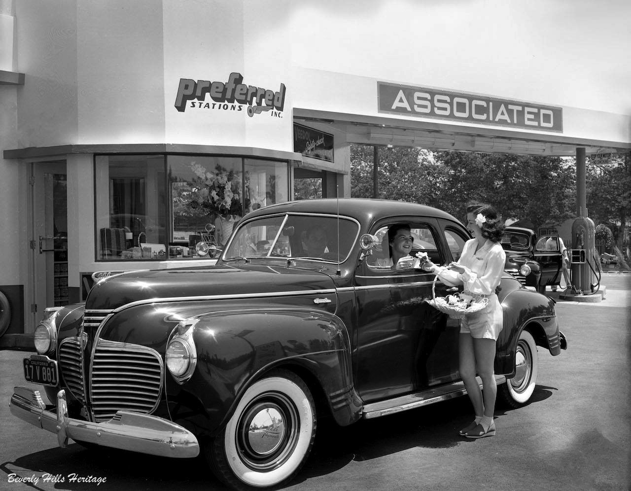
| (1941)* - Service with a smile and a gardenia flower is how it was done at this Associated Gas Station in Beverly Hills. This classic filling station stood at on the northeast corner of Rexford Drive and Burton Way. Click HERE to see more Early Views of Gas Stations. Photo courtesy of Beverly Hills Heritage. |
* * * * * |
Beverly Wilshire Hotel
 |
|
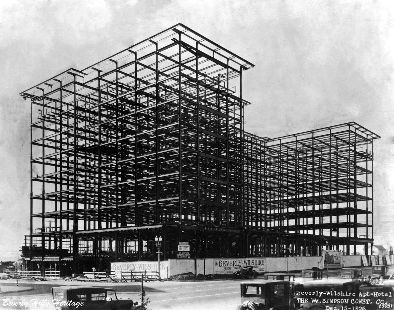
| (1926)* – View showing steel framing for the Beverly Wilshire Hotel. Photo: Marc Wanamaker, courtesy of Beverly Hills Heritage. |
Historical Notes One of the most significant buildings on Wilshire Boulevard in the 1920s was that of Walter G. McCarty's Beverly Wilshire Hotel and Apartment Homes. Designed by the prestigious Los Angeles architectural firm of Walker and Eisen in the Renaissance Revival style, it became the city's second large-scale hotel in 1928. McCarty and his investment syndicate were equally as committed to the promotion and growth of the city as the Rodeo Land and Water Company had been, and the hotel was a fitting anchor to their residential developments south of Wilshire Boulevard. |
 |
|
| (ca. 1927)* – View looking west on Wilshire Boulevard showing a group of men, including Walter G. McCarty, surveying the street and posing for the camera. The Beverly Wilshire Hotel is under construction as part of McCarty's developing landscape that once included the Beverly Hills Speedway tract of land. In the distance, the white building with the arched front doorway would soon become the Brown Derby Restaurant. |
Historical Notes The Beverly Wilshire Hotel was constructed by real estate developer Walter G. McCarty on the site of the former Beverly Hills Speedway. It was completed in 1928 (when the city had fewer than 18,000 residents), and was then known as the "Beverly Wilshire Apartment Hotel". |
Then and Now
 |
|
| (1927 vs 2022)*– View looking west on Wilshire Boulevard from N. Beverly Drive. |
 |
|
| (ca. 1930)* – Postcard view looking southwest showing the Beverly Wilshire Hotel as seen from the east side of N. Beverly Drive. The Brown Derby Restaurant sign can be seen at far right. |
 |
|
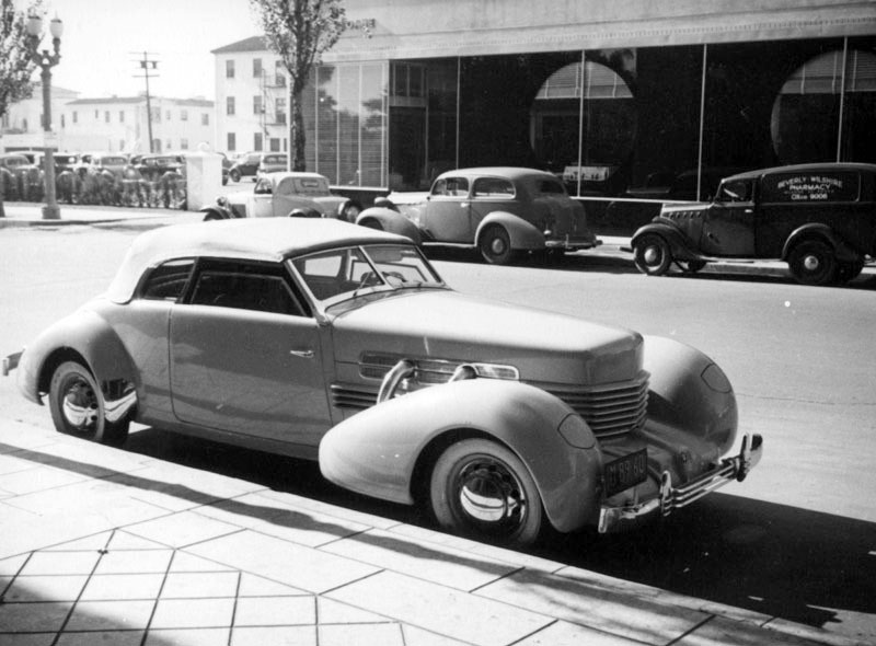
| (ca. 1937)* – View showing a 1937 Oldsmobile parked on Beverly Drive with the Beverly Wilshire Hotel in the background. Parking doesn't seem to be an issue. |
 |
|
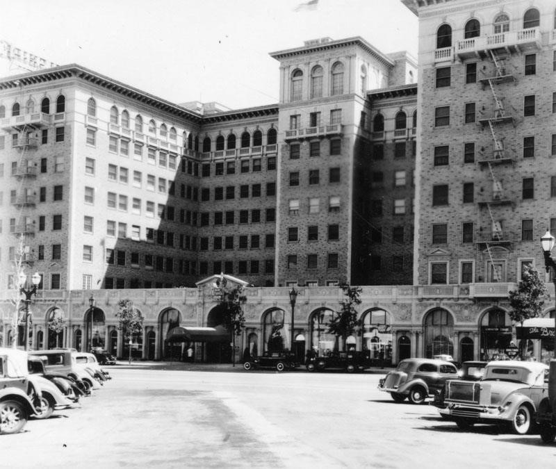
| (1937)^ - Closer view of the Beverly Wilshire Hotel located on the southwest corner of Wilshire Boulevard and S. El Camino Dr. |
Historical Notes Originally named the "Beverly Wilshire Apartment Hotel” when opened (1928), it was renamed the Beverly Wilshire Hotel by its new owners in the 1940s when it was renovated with a ballroom to accommodate the popular big bands of the day. An Olympic-sized swimming pool was built and championship tennis courts were added, with tennis champion Pancho Gonzalez as tennis director. |
 |
|
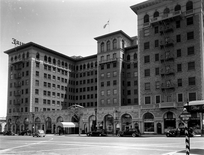
| (1939)^ - View showing the Beverly Wilshire Hotel at 9500 Wilshire Boulevard as seen from the northwest corner of Wilshire and Rodeo Drive. Sign at lower right reads: “Boulevard Stop”. |
Historical Notes The E-shaped structure is built of a Tuscan stone and Carrara marble in the Italian Renaissance architecture style. |
 |
|
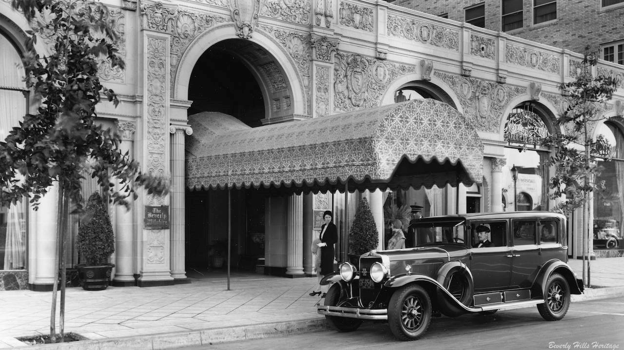
| (ca. 1929)* – View showing the front entrance to the Beverly Wilshire Hotel with a beautiful awning under which to arrive in style and bronze plaque bearing the name of the proud establishment. Photo: Marc Wanamaker/Bison Archives, courtesy of Beverly Hills Heritage. |
Historical Notes Today, you will still find the diamond shaped sidewalk when you arrive and individual awning on the tops of each window at the front and the sides of the hotel. |
 |
|
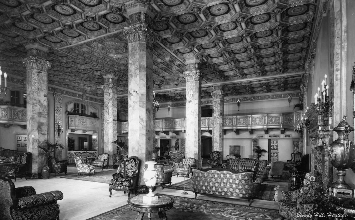
| (1929)* – View showing the elegant lobby of the Beverly Wilshire Hotel. Photo: Marc Wanamaker/Bison Archives, courtesy of Beverly Hills Heritage. |
Historical Notes Four of the six columns are still there today but are just covered up. The ceiling was dropped. Unfortunately that beautiful ornate balcony cover is gone. |
 |
|
| (ca. 1937)^ – View of the Beverly Wilshire Hotel as seen from the center of Rodeo Drive. |
Historical Notes Commissioned by Walker G. McCarty, it was designed by Walker and Eisen and built in the Italian Renaissance revival style. The photo shows the arcade work on the street level. |
 |
|
| (ca. 1937)^ - View of S. Rodeo Drive looking south from Wilshire showing a luxury car (1937 Cord Convertible) parked next to the diamond patterned sidewalk of the Beverly Wilshire Hotel. Across the street are the Art Deco windows of the W. & J. Sloane furniture store. |
Historical Notes Cord was the brand name of an American automobile company from Connersville, Indiana, manufactured by the Auburn Automobile Company from 1929 through 1932 and again in 1936 and 1937. |
 |
|
| (ca. 1937)^ - Numerous cars are parked outside businesses on Rodeo Drive in Beverly Hills. In the distance is the Beverly Wilshire Hotel, located at 9500 Wilshire Boulevard. Photo by Herman J. Schultheis |
 |
|
| (1932)* – View looking south down Rodeo Drive from Santa Monica Boulevard toward the Beverly Wilshire Hotel. Click HERE to see contemporary view. |
 |
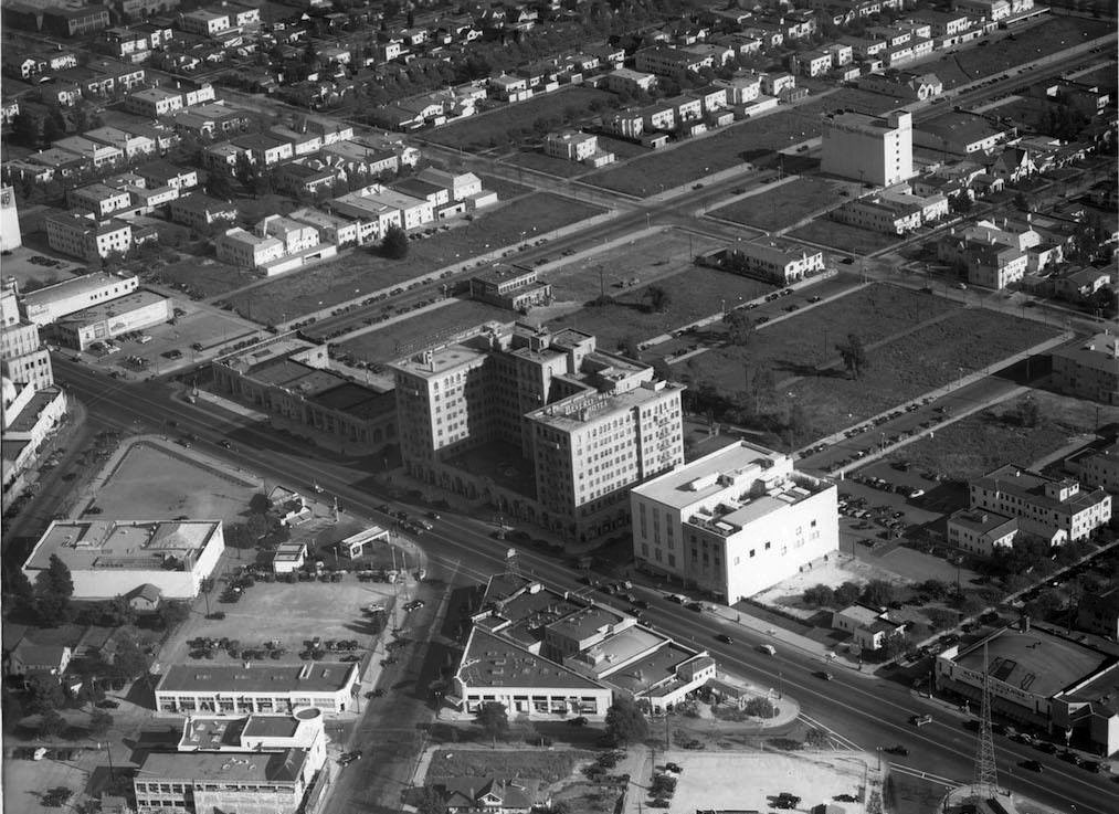
|
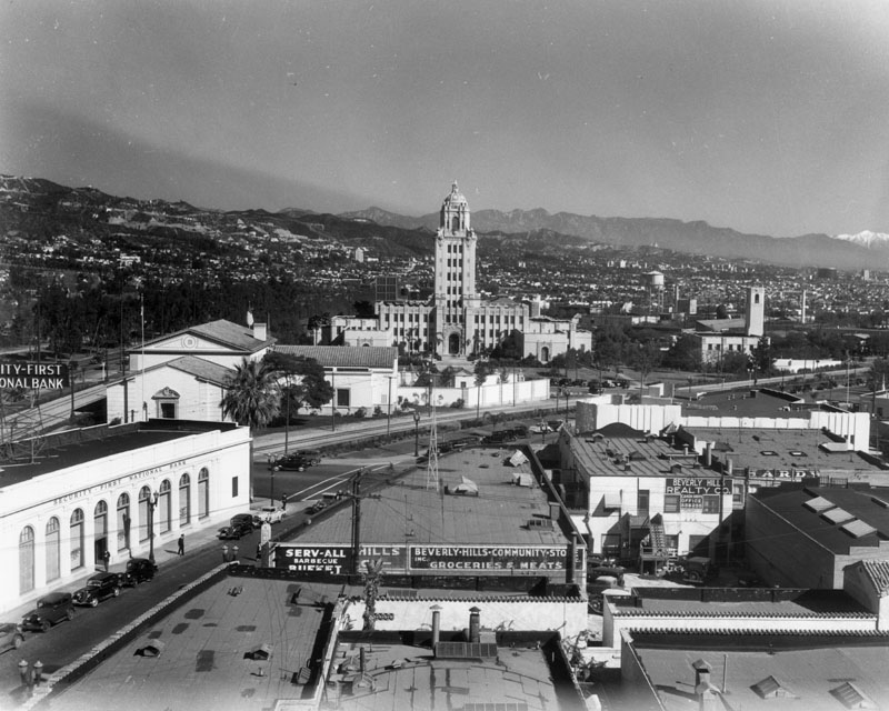
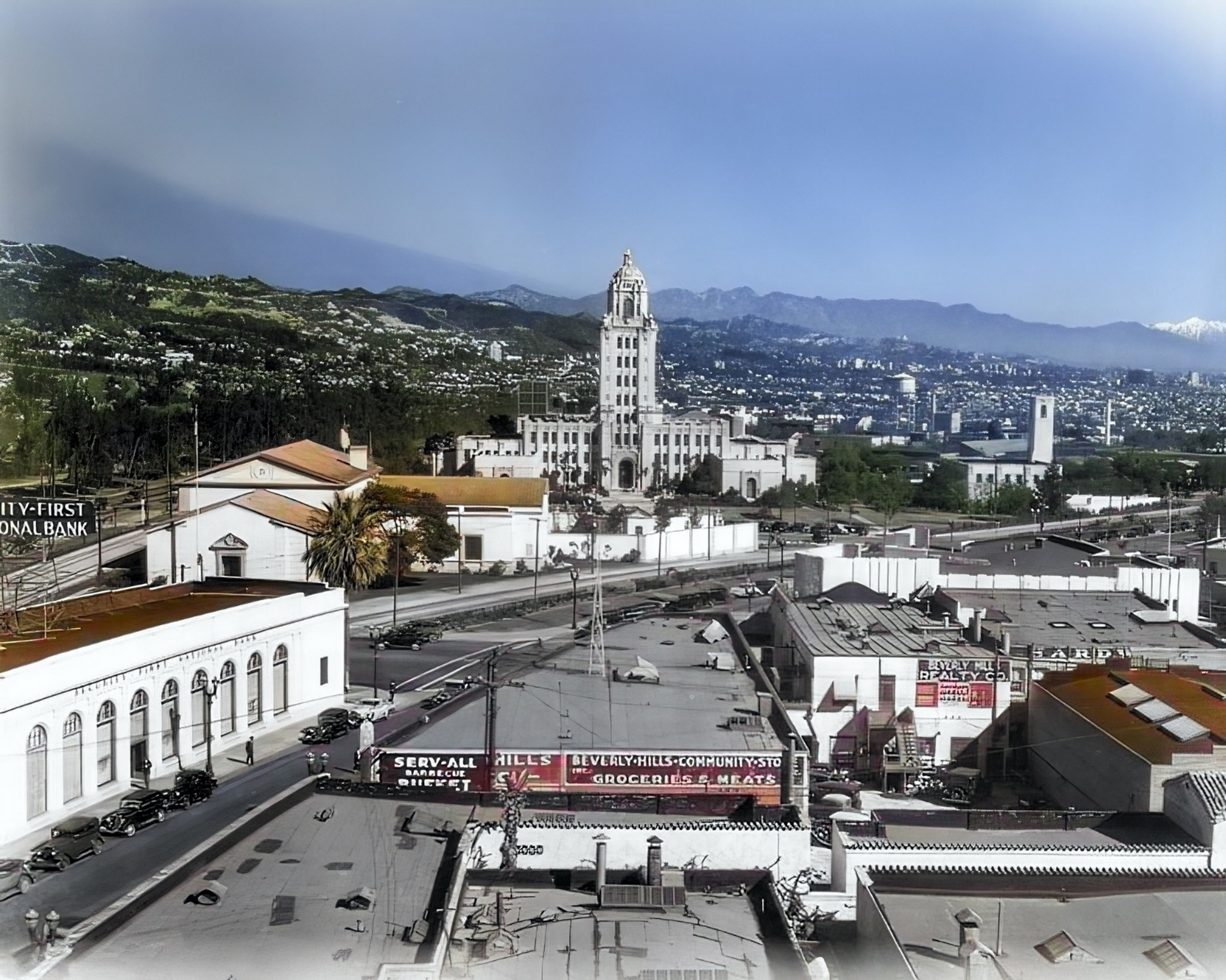
| (ca. 1938)*– Aerial view of Beverly Hills showing many of the landmarks that still exist today. The Beverly Wilshire Hotel and Rodeo Drive aree at center-left. City Hall is seen at upper-center right. |
 |
|
| (1938)* - Aerial view looking southeast over the intersection of Wilshire Boulevard and Rodeo Drive showing the historic Beverly Wilshire Hotel. Note all the empty land south of the hotel. Photo: Marc Wanamaker/Bison Archives |
Historical Notes The Beverly Wilshire Hotel changed hands in 1958 and again in 1961, when it was purchased by a group of investors headed by Hernando Courtright. The singer Elvis Presley and later the actor Warren Beatty lived several years in the hotel. It was also the home of John Lennon, when he was separated for several months from his wife Yoko Ono. The American socialite and Woolworth department store heiress Barbara Hutton spent her last years in near poverty and poor health in the hotel and died there in May 1979. Acquired by Regent International Hotels in 1985, the 395-room luxury hotel has been managed by the Four Seasons Hotel since 1992. |
 |
|
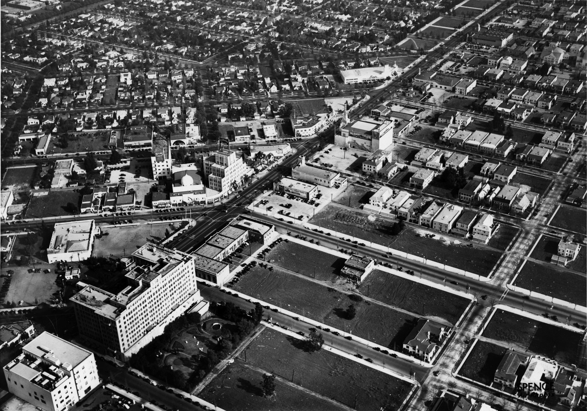
| (1937)* – Aerial view of Beverly Hills looking northeast. The intersection of Wilshire Boulevard and Beverly Drive is at center-left where the Moorish-style Beverly Theater stands at the corner. The Beverly Wilshire Hotel is seen at lower-left. |
 |
|
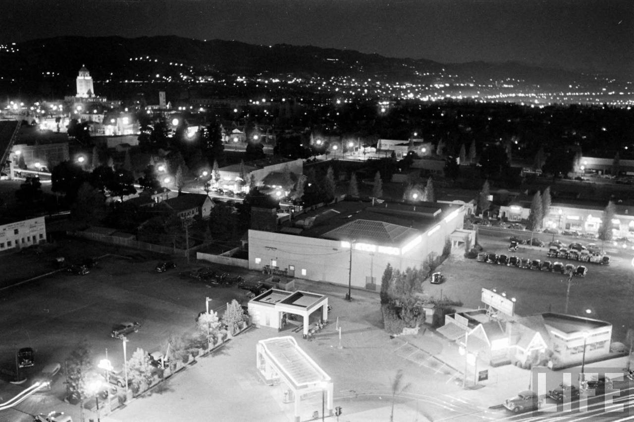
| (ca. 1938)*– – Panoramic night view looking northeast from the Beverly Wilshire Hotel showing the city lit up. Beverly Hills City Hall stands tall in upper-left, with a portion of West Hollywood seen in the distance at upper-right. Source: Life Magazine |
Wilshire and Beverly Drive
 |
|
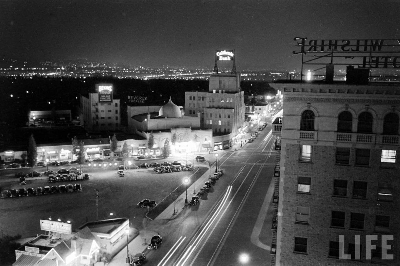
| (ca. 1938)* – Night view looking east on Wilshire Boulevard as seen from the Beverly Wilshire Hotel. The intersection of Wilshire and Beverly is at center of photo. Also seen from left to right are the: Bekins Storage Building, Beverly Theater, and California Bank Building. Source: Life Magazine |
 |
|
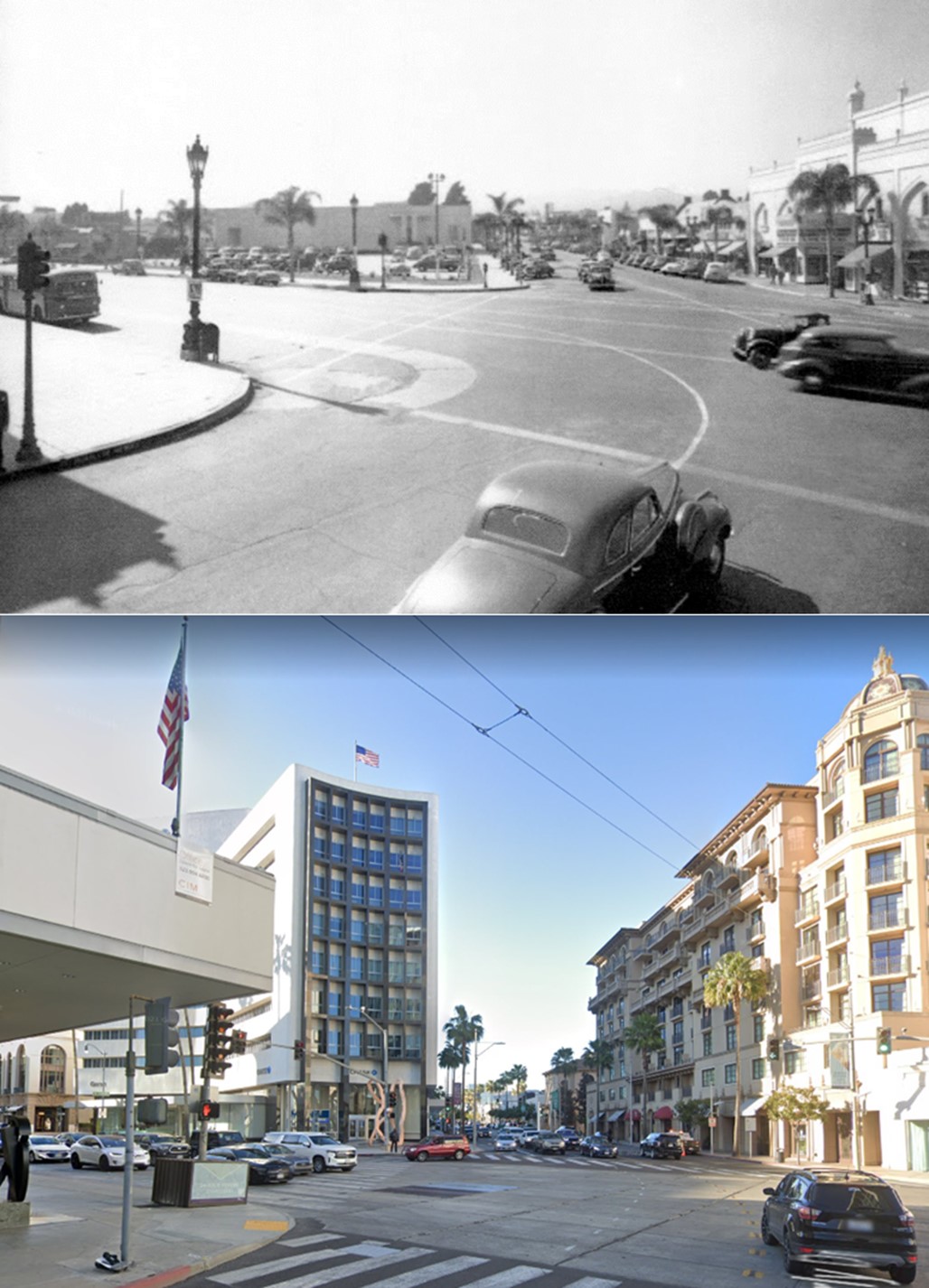
| (1939)^ - View looking north on Beverly Drive at the intersection with Wilshire Boulevard. |
Historical Notes The intersection of Wilshire and Beverly Drive has always been the heart of the commercial triangle of Beverly Hills. On the northeast corner was the Beverly Theater, built in 1925. It was the cities first theater. On the northwest corner was the parking lot of Adrian's Costume building which was originally the Victor Hugo Restaurant in the 1930s. |
Then and Now
 |
|
| (1939 vs. 2021)*- Looking north on Beverly Drive at Wilshire Boulevard. |
 |
|
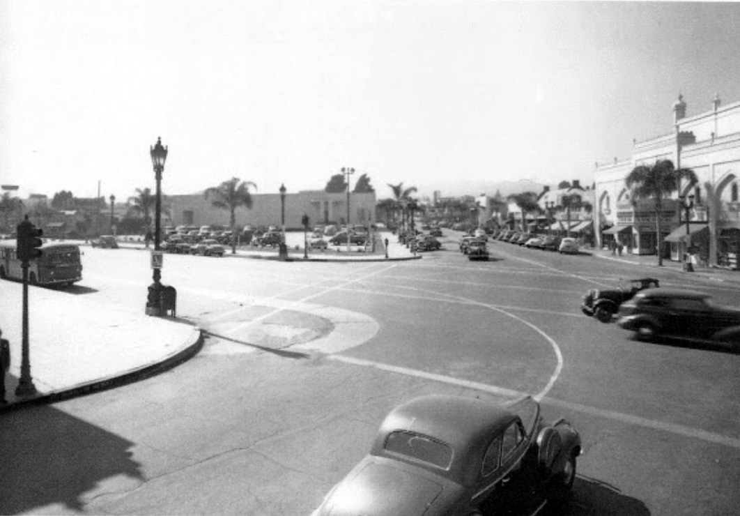
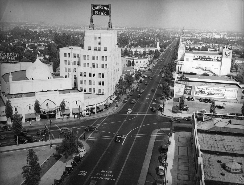
| (ca. 1940)* – View looking east on Wilshire Boulevard at Beverly Drive in Beverly Hills from the top of the Beverly Wilshire Hotel. Seen are, left to right, the Beverly Theater, the California Bank Building, and the Warner Theatre. |
 |
|
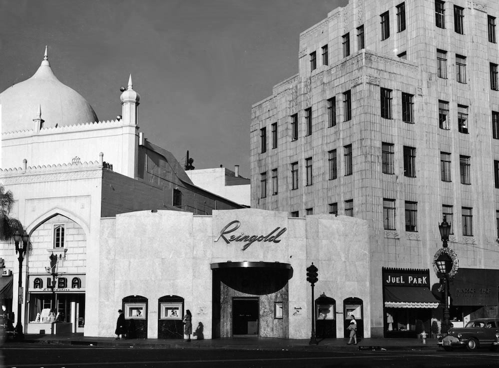
| (1951)* – Close-up view showing the northeast corner of Wilshire Boulevard and N. Beverly Drive showing three buildings with uniquely distinctive architectural styles: the Mughal Revival Beverly Theatre, the Mesoamerican Revival California Bank Building, and the Hollywood Regency style structure connecting them that became Reingold Jewelers. Photo: Marc Wanamaker |
 |
|
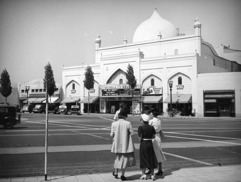
| (ca. 1940)^ - Three women stand on a street corner opposite the Beverly Theater in Beverly Hills. The marquee includes "Fred MacMurray Exclusive." |
Historical Notes Designed by L.A. Smith, this was the first vaudeville and movie theater to be built in Beverly Hills. |
 |
|
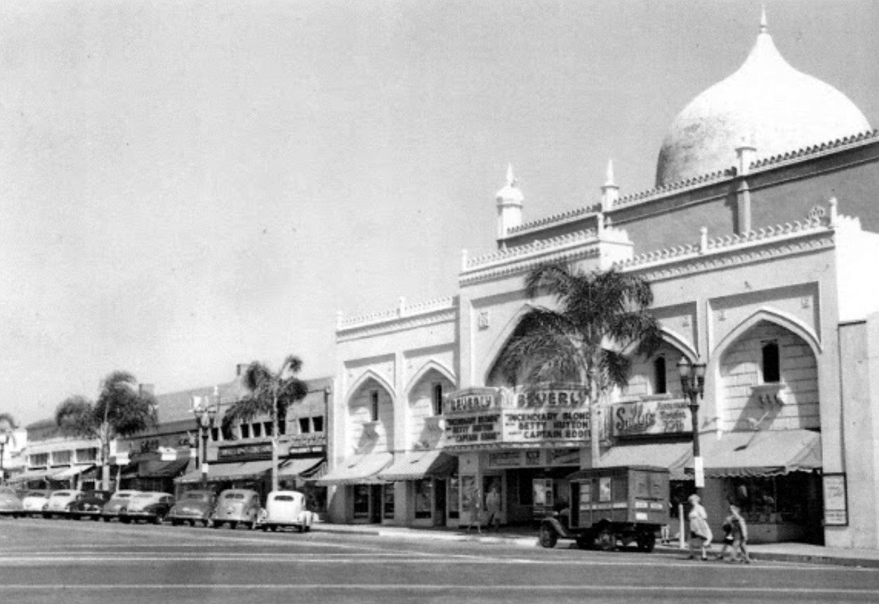
| (1945)* - Located at 206 North Beverly Drive, at Wilshire Boulevard, the current film playing at the Beverly Theater was Paramount's Incendiary Blonde, starring Betty Hutton. |
Historical Notes In 1925, real estate pioneer, Dan M. Quinlan constructed the theater, the first to be built with East Indian decor. The businesses in the theater building included Sally's Homemade Candies. |
 |
|
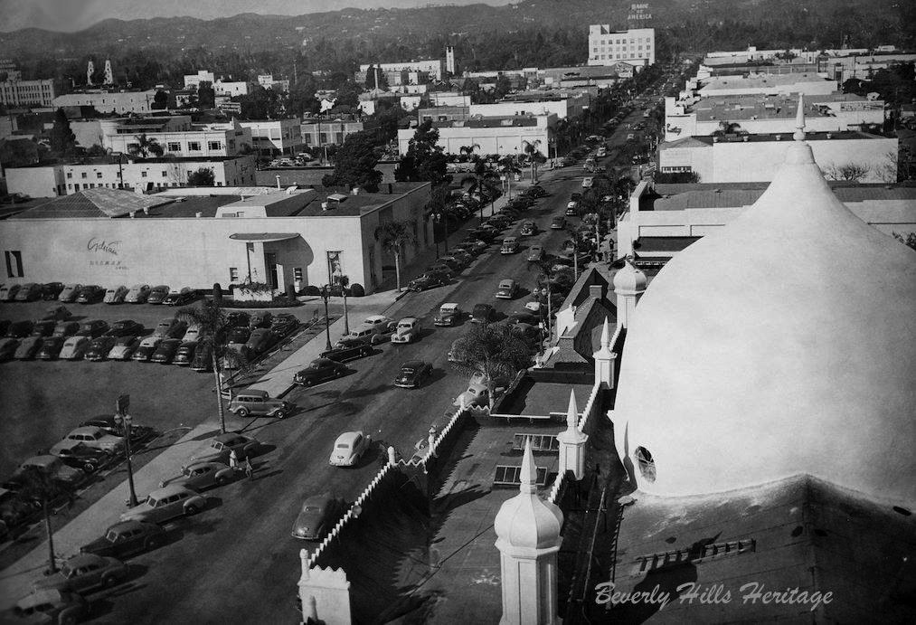
| (1945)* - A bird's-eye view from the California Bank Building (Sterling Plaza) of north Beverly Drive with the Beverly Theater directly below shortly after its dome received a fresh coat of paint. Photo courtesy of Beverly Hills Heritage. |
Historical Notes The first building on the west side of the road (left) began as the Victor Hugo Restaurant. It was next occupied by the salon of Adrian (as pictured), the movie costumer and designer of couture gowns for the discerning (and very wealthy) woman. It later became a Lane Bryant store. The building was eventually razed. The parking lot is where the Chase Bank building (originally Bank of America) now stands. The Adrian lot is the site of an office building where MGM is headquartered. |
 |
|
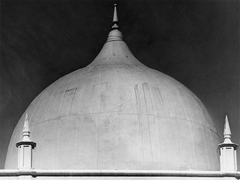
| (1978)* - Close-up view showing the dome of the old Beverly Theatre, at time of photo a bank. |
Historical Notes After many years of housing a bank, the Beverly Theater was sadly demolished in August of 2005 to make way for new development. The onion dome ... brings to mind Beverly Hills' temporary original name, "Morocco". Click HERE to see more in Early Views of the Beverly Theatre. |
* * * * * |
California Bank Building (aka Sterling Plaza)
 |
|
| (1930)* - Night view of the California Bank Building located at 9441 Wilshire Boulevard in Beverly Hills. Click HERE to see contemporary view. |
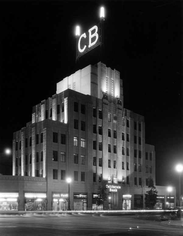
Historical Notes Completed in 1929, just before the stock market crash, the California Bank Building stands seven stories tall and was designed by the Los Angeles Father/Son architect team of John and Donald Parkinson. Its classic Art Deco era stair-step design is quintessentially Mesoamerican Revival in style and retains most of its architectural integrity from its period of significance. Louis B. Mayer, the head of MGM, owned the building for some time. In the 1990s, the building was acquired by Donald Sterling. As a result, it was renamed the Sterling Plaza. |
 |
|
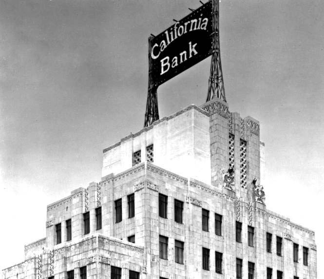
| (ca. 1930s)* – Detailed top view of the California Bank Building located at the northeast corner of Wilshire and Beverly Drive. Today, the building is known as Sterling Plaza. Photo: Beverly Hill Heritage. |
Historical Notes The bottom portion of the building's façade was changed around 1951 to create a modernized, uniform appearance with the small corner building to the west. Around the same time, head of MGM Louis B. Mayer acquired the property and it's rumored there's a theatre on the top floor building. In the 90s, real estate investor/developer Donald Sterling purchased the property and renamed it Sterling Plaza. |
 |
|
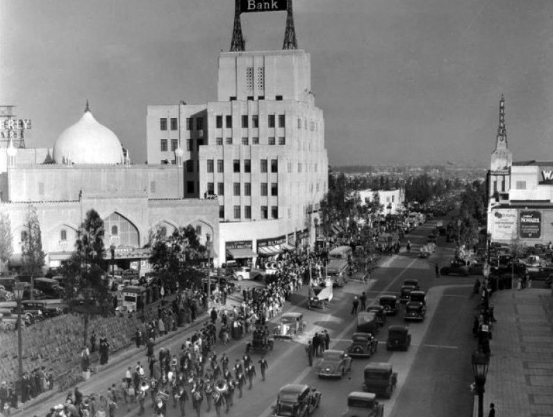
| (ca. 1936)* – View showing a marching band in a parade heading west on Wilshire Boulevard with spectators lining the street. In the background can be seen (l to r): Beverly Theatre, California Bank Building, and the Warner Beverly Theatre. |
 |
|
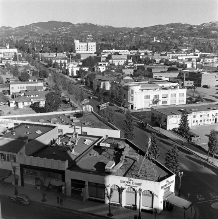
| (ca. 1936)* – View looking east on Wilshire Boulevard and Dayton Drive. From right to left can be seen: J.J. Haggarty, Beverly Wilshire Hotel, California Bank, the dome of the Beverly Theater and the top hat sign of the famous Brown Derby Restaurant. |
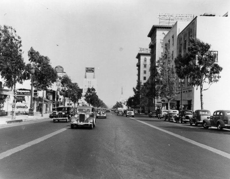 |
|
| (1937)* - View looking east on Wilshire Boulevard in Beverly Hills on September 22, 1937. Some of the prominent signs are: The Brown Derby, California Bank, Warner Bros. Theatre, and the Beverly-Wilshire Hotel. |
 |
|
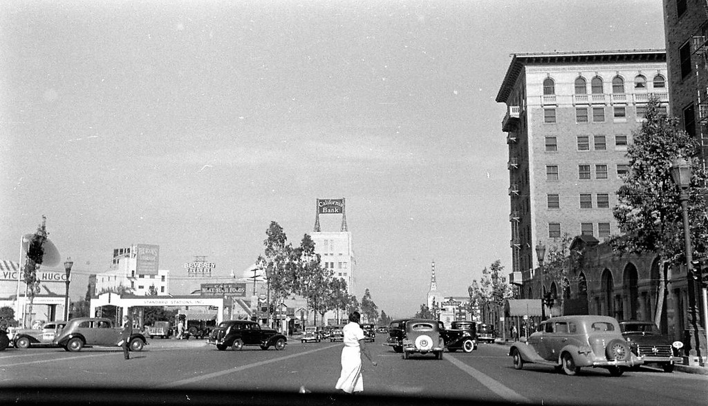
| (ca. 1940)* – Dashboard view looking east on Wilshire Boulevard near Rodeo Drive showing a woman crossing the street. The Beverly-Wilshire Hotel is on the right. |
 |
|
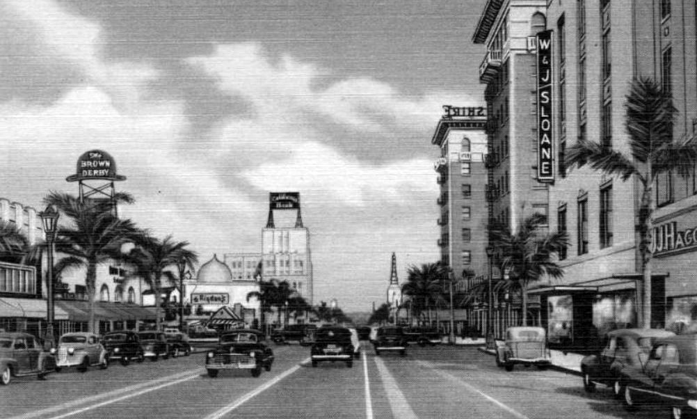
| (ca. 1940)* – Postcard view looking east on Wilshire Boulevard in Beverly Hills. The Brown Derby Restaurant is on the left (sign above the palm trees) with the Beverly Theater and California Bank Building in the distance. On the right can be seen the Beverly-Wilshire Hotel, W & J Sloane and J. J. Haggarty's Department Store. |
* * * * * |
Brown Derby (Beverly Hills)
 |
|
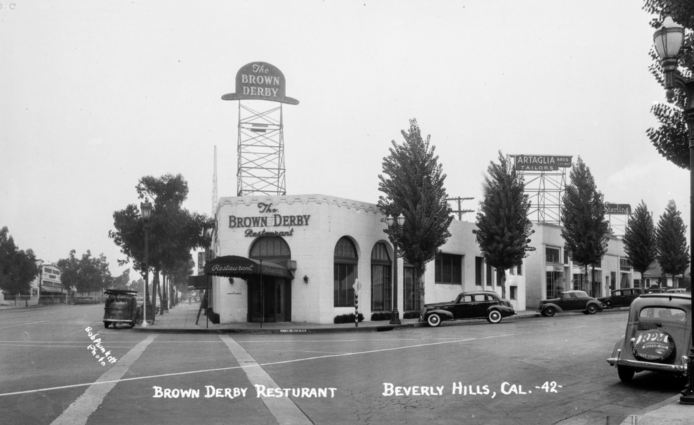
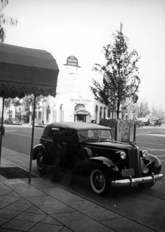
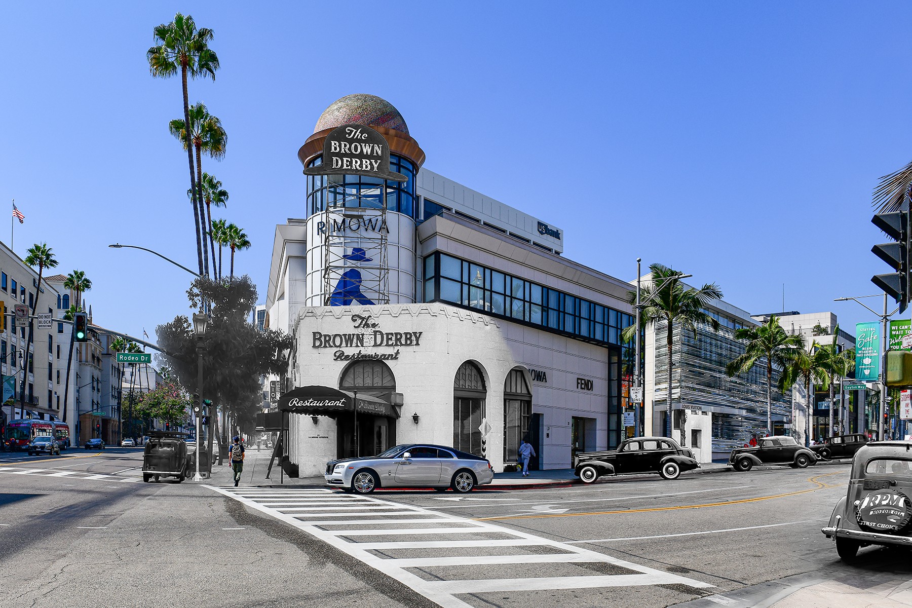
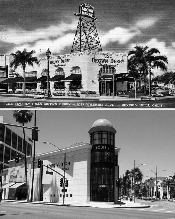
| (1942)* – Postcard view showing Brown Derby Restaurant with its distinctive hat-shaped rooftop sign, located on the northwest corner of Wilshire Boulevard and Rodeo Drive. Several 1940s-era automobiles are parked along the street. Photograph by Bob Plunkett, from the Ernest Marquez Collection. |
Historical Notes The Beverly Hills Brown Derby, opened in 1931 at the northwest corner of Wilshire Boulevard and Rodeo Drive, was the third and perhaps most glamorous outpost of the iconic Brown Derby restaurant chain. Situated directly across from the Beverly Wilshire Hotel, it quickly became a magnet for celebrities, industry executives, and tourists, reflecting the growing allure of Beverly Hills as a social and cultural hub. The building, remodeled from a group of small shops including a women’s clothing store called “The Petite Shop,” featured the city’s first revolving entry door and a large, illuminated derby-shaped sign that made it a local landmark. |
 |
|
| (1940s)* – View showing the Brown Derby Restaurant on the corner of Wilshire and Rodeo Drive as seen from the Beverly-Wilshire Hotel. Today, Louis Vuitton sits on this corner. |
Historical Notes Inside, the restaurant was known for its elegant atmosphere and themed spaces. In 1938, it expanded to include “The Derby House,” a private dining room decorated in Old English style, and “The American Room,” which displayed charcoal portraits by artist Nicholas Volpe of Academy Award-winning actors and actresses. The Beverly Hills Brown Derby was renowned for attentive service and plush American fare, continuing the chain’s tradition of combining fine dining with Hollywood glamour. |
 |
|
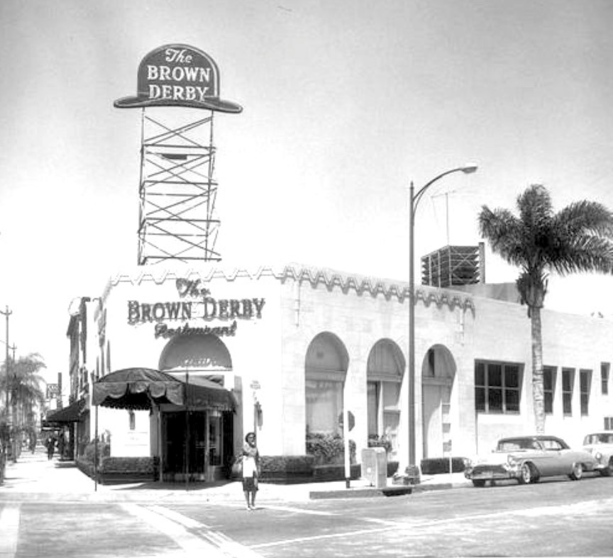
| (ca. 1937)^ - A car is parked in front of a walkway leading to the Beverly Wilshire Hotel (9500 Wilshire Boulevard) in this image looking west towards the Brown Derby, located at 9537 Wilshire Boulevard, on the northwest corner of Wilshire and Rodeo Drive. |
 |
|
| (1950s)* – View showing a woman crossing the street on Rodeo Drive with the The Brown Derby Restaurant behind her. Wilshire Boulevard is out of view on the left. After the building was occupied by the third Brown Derby from 1931 to 1982, it was demolished and replaced with a new commercial structure designed for high-end retail. |
Historical Notes The Brown Derby restaurants, including the Beverly Hills location, became synonymous with the Golden Age of Hollywood, serving as backdrops for deals, celebrations, and star sightings. However, by the early 1980s, shifting tastes and escalating land values led to their decline. The Beverly Hills Brown Derby closed its doors in 1982 and was demolished shortly thereafter. In 1986, the site was redeveloped into the “One Rodeo” shopping center, which features a derby-shaped dome as a tribute to the legendary restaurant. |
Then and Now
 |
|
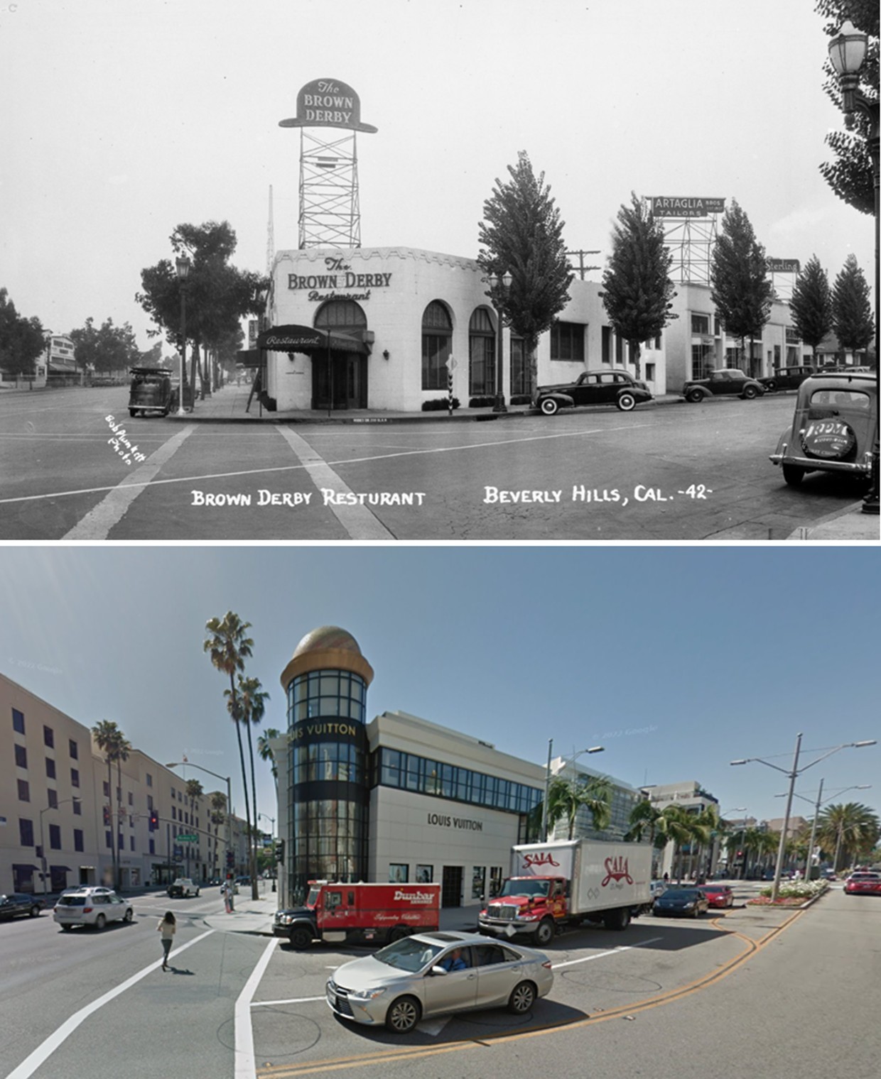
| (1940 vs. 2015)* – A 'Then and Now' view of the northwest corner of Rodeo Drive and Wilshire Boulevard in Beverly Hills. Photo comparison by Jack Feldman. |
Historical Notes The iconic Brown Derby restaurant once stood here, a favorite haunt of Hollywood’s elite until its closure and demolition in the early 1980s. The site was later redeveloped as part of the Wilshire Rodeo Plaza, now known as the One Rodeo office and retail complex. Today, the location is anchored by tenants such as Merrill Lynch/Bank of America, UBS, William Morris Endeavor, and Encore Recordings. The property was acquired by a new ownership group in 2024, which is actively working to attract additional luxury retail and office tenants. |
Blended View
 |
|
| (Then and Now - Blended)* - Brown Derby Then and Now by Mark Hersh / Mark Hersh Photography. |
Then and Now
 |
|
| (2014)* - The Brown Derby is gone, but the Louis Vuitton building gives a subtle nod to the past with its brown, hat-like dome. Location: 9537 Wilshire Bouelvard, Beverly Hills |
* * * * * |
 |
|
| (1918)* – Aerial view looking east showing a 2-lane Wilshire Boulevard with the Los Angeles Country Club in the foreground. The intersection of Wilshire and Santa Monica boulevards is seen at upper-right. Beyond that ‘Point’ (upper right corner) is an empty field where the Beverly Hills Speedway will be built within a year of this photo. |
Historical Notes The 36-hole Los Angeles Country Club moved to its current Beverly Hills location (seen above) in 1911. It had previously been located at Hobart and 16th streets in Pico Heights. |
* * * * * |
The Point (Wilshire and Santa Monica)
 |
|
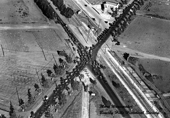
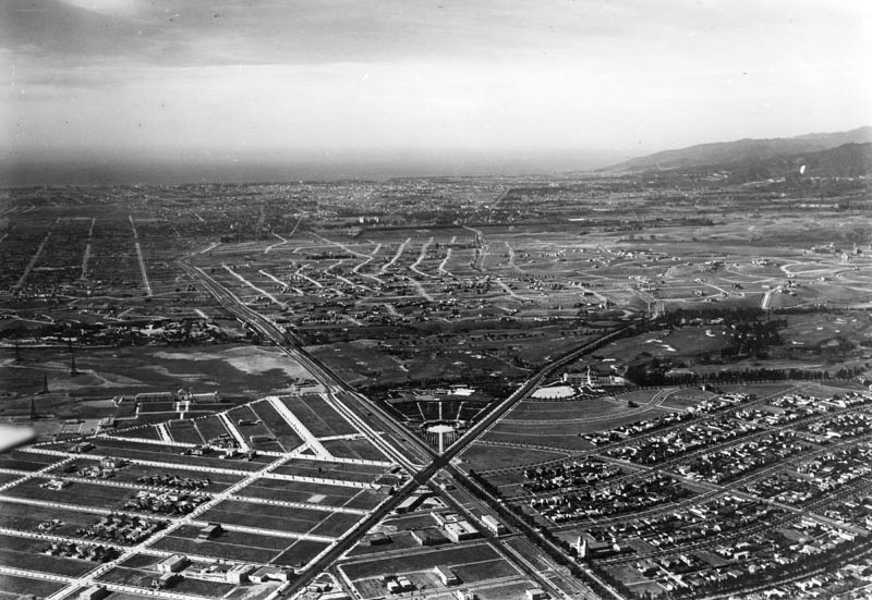
| (1924)^.^ – Aerial view looking down at the intersection of Wilshire and Santa Monica boulevards (aka 'The Point'. It’s choked with vehicles because local drivers were staging a demonstration intended to goad the city to installing traffic lights. Photo courtesy of Marc Wanamaker and the Beverly Hills Historical Society. |
 |
|
| (1928)^ - Aerial view, looking west, showing where Santa Monica and Wilshire boulevards intersect (aka 'The Point'). Beverly Hills High School can be seen at center-left. The Good Shepherd Catholic Church is at lower center-right. The Beverly Hills Electric Color Fountain (N/E corner) will not go in for another three years while the Beverly Hilton Hotel would not be built until 1954. At center and center-right can be seen the Los Angeles Country Club. |
 |
|
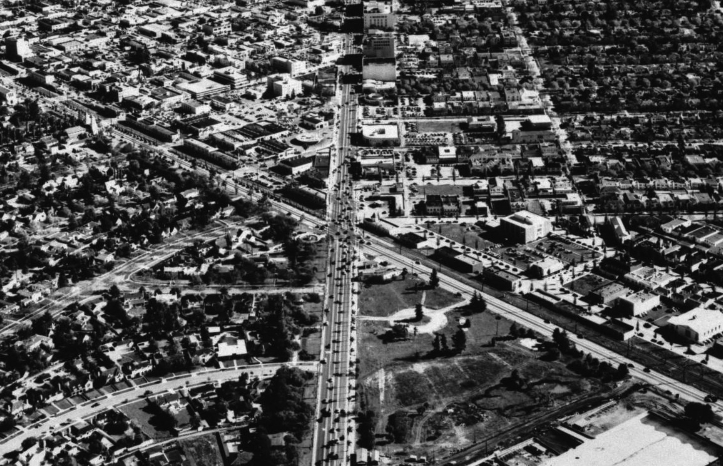
| (ca. 1950)* – Aerial view looking east showing “The Point” (intersection of Wilshire and Santa Monica boulevards). A small park can be seen at lower center-right near the intersection. This would be the future site of the Beverly Hilton Hotel (completed 1954). At center-left can be seen the Beverly Hills Electric Color Fountain (1931). |
 |
|
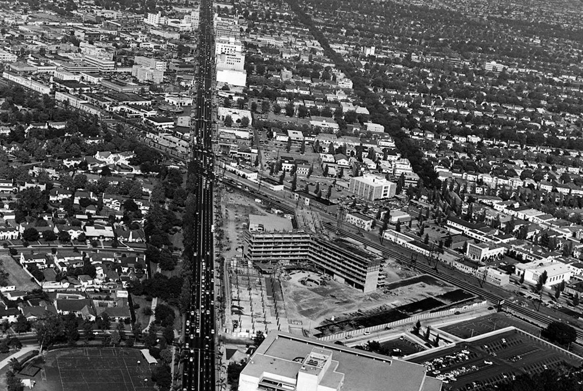
| (1954)* – Aerial view looking east on Wilshire Boulevard toward "The Point" showing the Beverly Hilton Hotel under construction with the Robinson's Department Store (completed in 1952) seen at bottom. |
 |
|
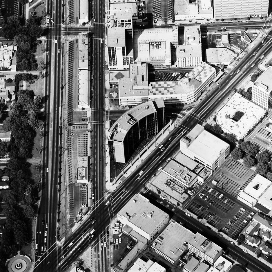
| (1967)* – Aerial view looking down at the intersection of Wilshire and Santa Monica boulevards (running from bottom to top). The 1931-built Beverly Hills Electric Color Fountatin can be seen at lower-left. Photo by Edward Ruscha |
 |
|
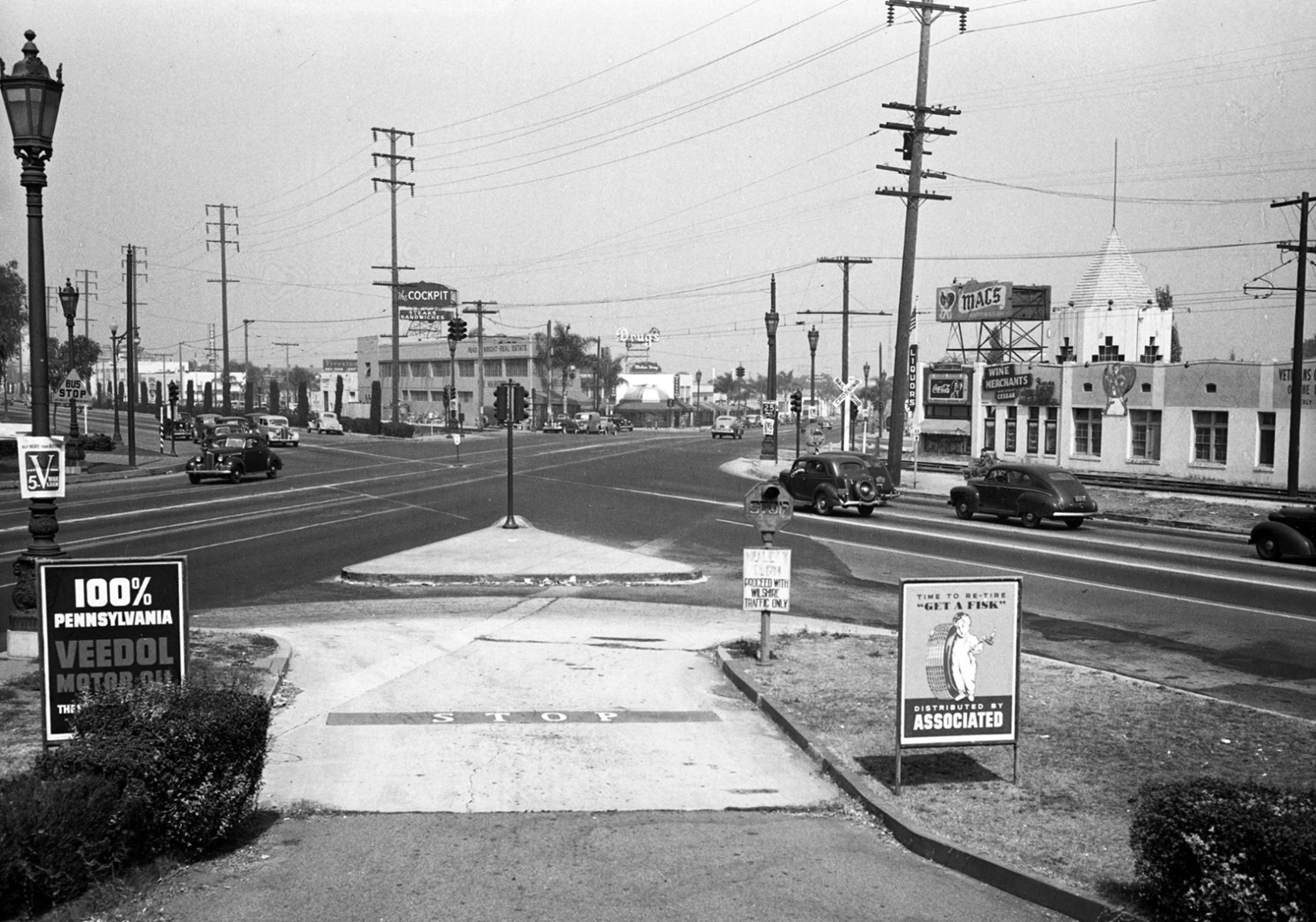
| (1944)* - View looking East along the intersection of Wilshire and Santa Monica Blvd's from an Associated “Flying A” Service Station. Note the “War Loan” poster on the lamppost on the left. The edge of the Electric Fountain can be seen also on the left behind the lamppost. |
Then and Now
 |
|
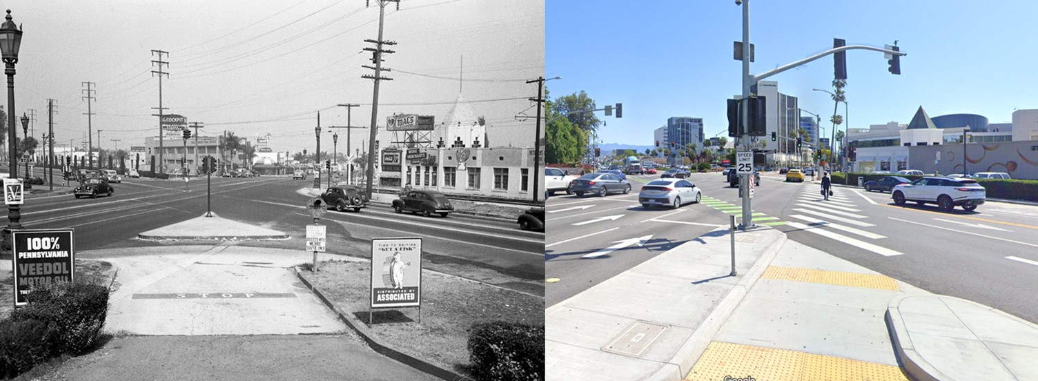
| (1944 vs. 2021)* - View looking East along the intersection of Wilshire and Santa Monica Blvd's (aka 'The Point'). |
Historical Notes In the 1940s an Associated “Flying A” Service Station stood at this corner. Later it was the site of Trader Vic’s (outside the Hilton Hotel), and today home of the new Waldorf. |
 |
|
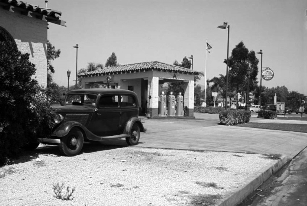
| (1940)* – View looking northeast showing an Associated “Flying A” Service Station located on the S/W corner of Wilshire and Santa Monica boulevards. Across the street in the distance (right-center) can be seen the iconic Beverly Hills Electric Color Fountain. Photo by Dick Whittington |
Historical Notes Associated Oil Company was an American oil and gas company once headquartered in San Francisco and served much of the Pacific West Coast, including Hawaii, as well as the Orient and merged with the Tidewater Oil Company in 1938. |
 |
|
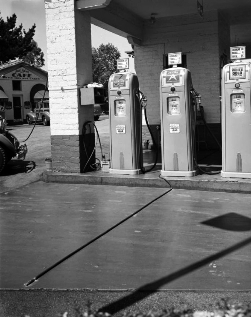
| (1940)* – Closer view showing the pumps at the "Flying A" Associated service station with Cafe in background, corner of Wilshire and Santa Monica. Gas prices: 15¢ - 17¢ - 20¢ per-gallon. Note the signal bell hose in the foreground. Click HERE to see more Early Gas Stations. |
* * * * * |
Beverly Hills Electric Color Fountain
 |
|
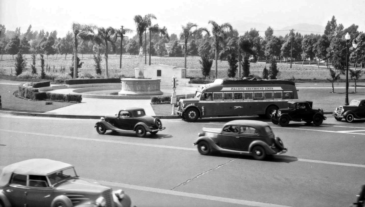
| (1935)* – View looking north at the intersection of Santa Monica and Wilshire boulevards showing the Beverly Hills legendary Electric Color Fountain. Note the Greyhound Bus making a right turn from Santa Monica unto Wilshire. Also, note all the empty land in the background. Photo by Dick Whittington |
Historical Notes Conceived in the late 20’s and inaugurated in 1931, built on land donated by the Rodeo Land and Water Company and funded by the Beverly Hills Woman’s Club, the Electric Fountain was designed by the architect Ralph Carlin Flewelling with the frieze and sculpture at the top being designed by sculptor/artist Robert Merrell Gage. |
 |
|
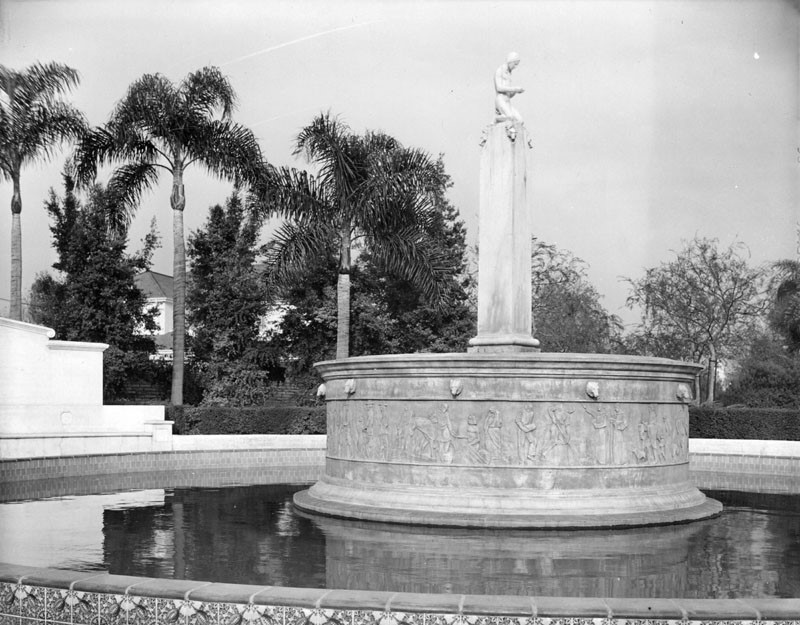
| (1930s)^ – Close-up view of the "Electric Fountain" installed near the intersection of Wilshire and Santa Monica boulevards in Beverly Gardens Park, Beverly Hills. |
Historical Notes The “Electric Fountain” includes water-jets and multi-hued lights, which allow for 60 different combined effects every 8 minutes at night. Atop the fountain is a figure of a Native American male, modeled after Gradin Newsom, kneeling in prayer. |
 |
|
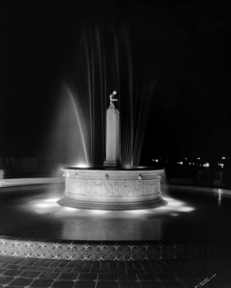
| (ca. 1930s)* - Night view showing the “Electric Fountain” with lit beams of water extended into the air from its relief sculptured pedestal, while other lights project from the bottom of the pedestal into the pool. |
Historical Notes The fountain's intricate hydraulic system stopped working in the mid 1970's prompting a partially successful restoration attempt in the 1980's. Then the lighting stopped working around 1990. In 2000 there was a complete authentic restoration of the elaborate 69-year-old landmark utilizing new water jets and light fixtures. On December 13, 2000, the switch was thrown once again on the nation's first electric water fountain, restarting the spectacular water and light show. |
 |
|
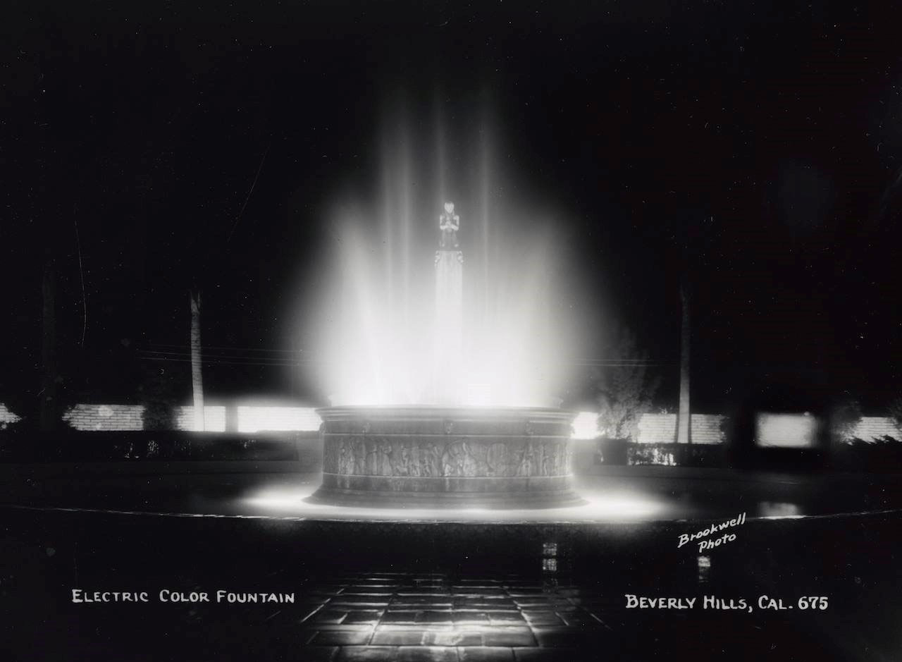
| (1930s)* - Located at Wilshire at Santa Monica Boulevards in Beverly Hills, the Electric Fountain is said to have stopped traffic for hours when unveiled and dedicated in 1931. |
Historical Notes The iconic Beverly Hills Electric Color Fountain was once again restored and the dedication ceremony held on April 5, 2016. The restoration cost $1.5 million, with the city matching private contributions raised by the Friends of Beverly Gardens Park, which also is working to restore the rest of the 1.9-mile linear series of gardens and paths that runs along the northern side of Santa Monica Boulevard and separates the business of the famous city from its homes. In keeping with the city’s conservation efforts, the lights that change color are now LED and the water recirculates. |
|
|
| (1930s)^ – Close-up view of the "Electric Fountain" installed near the intersection of Wilshire and Santa Monica boulevards in Beverly Gardens Park, Beverly Hills. |
Historical Notes The “Electric Fountain” includes water-jets and multi-hued lights, which allow for 60 different combined effects every 8 minutes at night. Atop the fountain is a figure of a Native American male, modeled after Gradin Newsom, kneeling in prayer. |
Then and Now
 |
|
| (1935 vs 2022)* – View looking north at the intersection of Santa Monica and Wilshire boulevards showing the Beverly Hills legendary Electric Color Fountain. |
* * * * * |
Beverly Hills High School
 |
|
| (1927)* – Early view of Beverly Hills High School when it was still under construction. |
Historical Notes Beverly Hills High School, founded in 1927, features original buildings designed by Robert D. Farquhar in the French Normandy style. Initially part of the Los Angeles City High School District, the school became part of the newly formed Beverly Hills High School District on March 23, 1936, when the Beverly Hills Elementary School District separated from the Los Angeles City High School District. By operation of law, this transition created the Beverly Hills Unified School District. |
 |
|
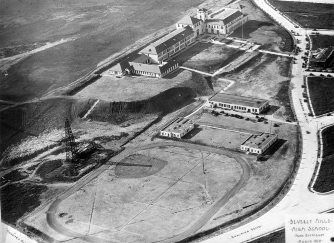
| (1928)* - Aerial view showing Beverly Hills High School located at 241 Moreno Drive. Note the oil derrick adjacent to the track field. |
Historical Notes Beverly Hills High School occupies land that was once part of the Beverly Hills Speedway. Known also as the Los Angeles Speedway, this 1.25-mile wooden board track was constructed in 1919 on a 275-acre property in Beverly Hills. The area now includes the site of Beverly Hills High School. The speedway operated briefly, from 1920 to 1924, before being dismantled due to soaring real estate values. After its closure, the land was developed for various purposes, including the establishment of Beverly Hills High School in 1927. The speedway's original site was approximately bordered by Wilshire Boulevard to the north, Olympic Boulevard to the south, Lasky Drive to the west, and Beverly Drive to the east. The Beverly Hills Oil Field, discovered in the early 20th century, extends beneath Beverly Hills High School, where an oil drilling facility operated discreetly on campus. This fThe Beverly Hills Oil Field, discovered in the early 20th century, extends beneath Beverly Hills High School, where an oil drilling facility operated discreetly on campus. This facility generated substantial revenue for the Beverly Hills Unified School District, supporting school programs and maintenance. |
 |
|
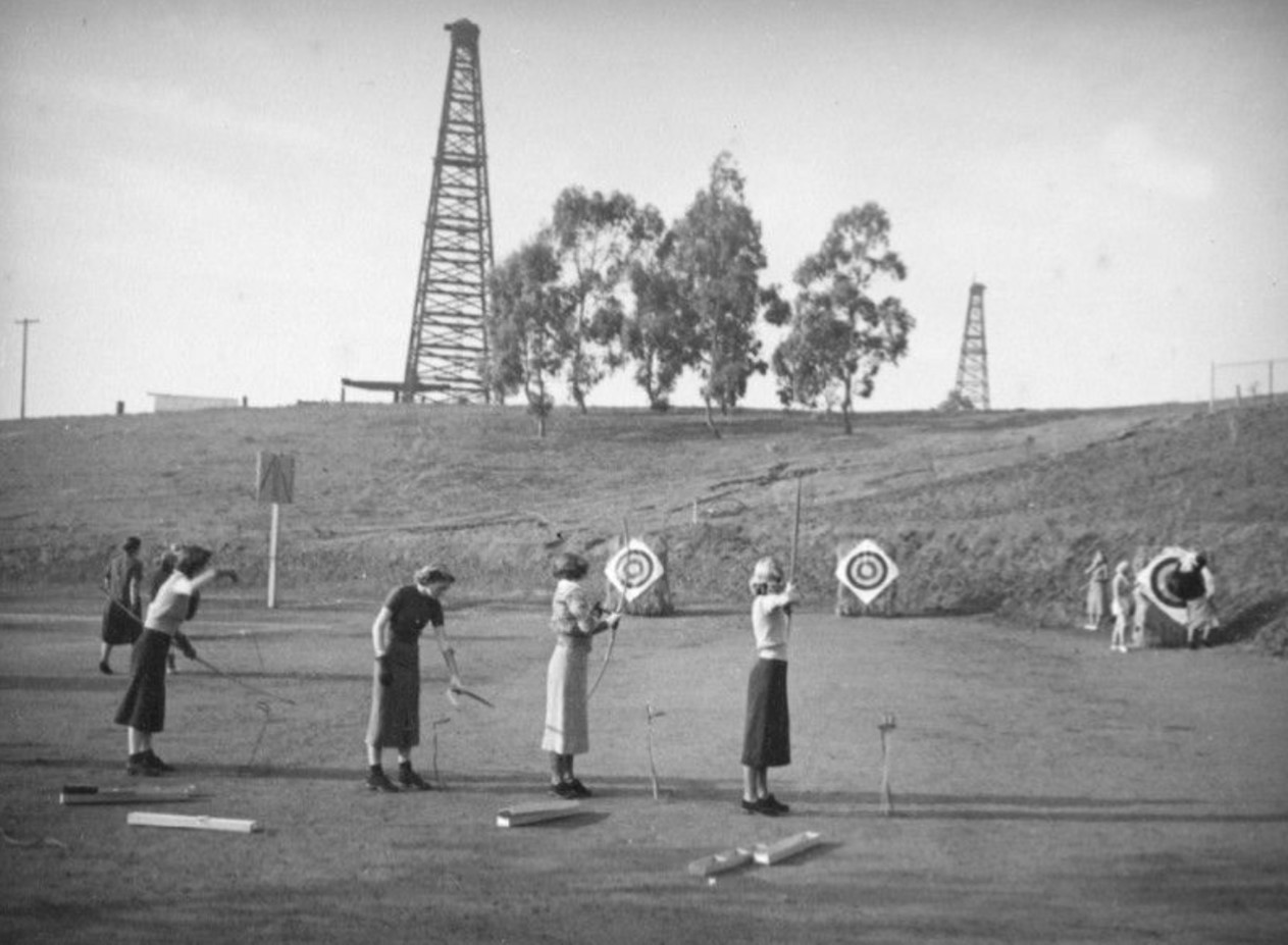
| (ca. 1937)* - A group of four girls practice their archery skills while other students move a target at Beverly Hills High School. Oil wells can be seen on a hill in the background. Photo by Herman Schultheis. |
Historical Notes Beverly Hills High School's connection to oil extraction is a distinctive and multifaceted chapter of its history. Situated atop the Beverly Hills Oil Field, the school was home to a 150-foot oil derrick, known as the "Tower of Hope," which was creatively camouflaged with vibrant artwork. For decades, this oil well generated substantial royalty income, contributing $300,000 to $700,000 annually—funding up to 85% of teacher salaries. In the early 2000s, the site became a focal point of controversy when environmental activist Erin Brockovich raised concerns about potential health risks, including cancer cases among alumni. Legal challenges followed but were dismissed in 2006 due to insufficient evidence. The oil well’s story concluded in 2017 when Venoco LLC, the operator, declared bankruptcy. By March 2021, the Beverly Hills Unified School District completed a thorough well-plugging project, marking the end of nearly a century of on-campus oil extraction and reshaping the school’s landscape. |
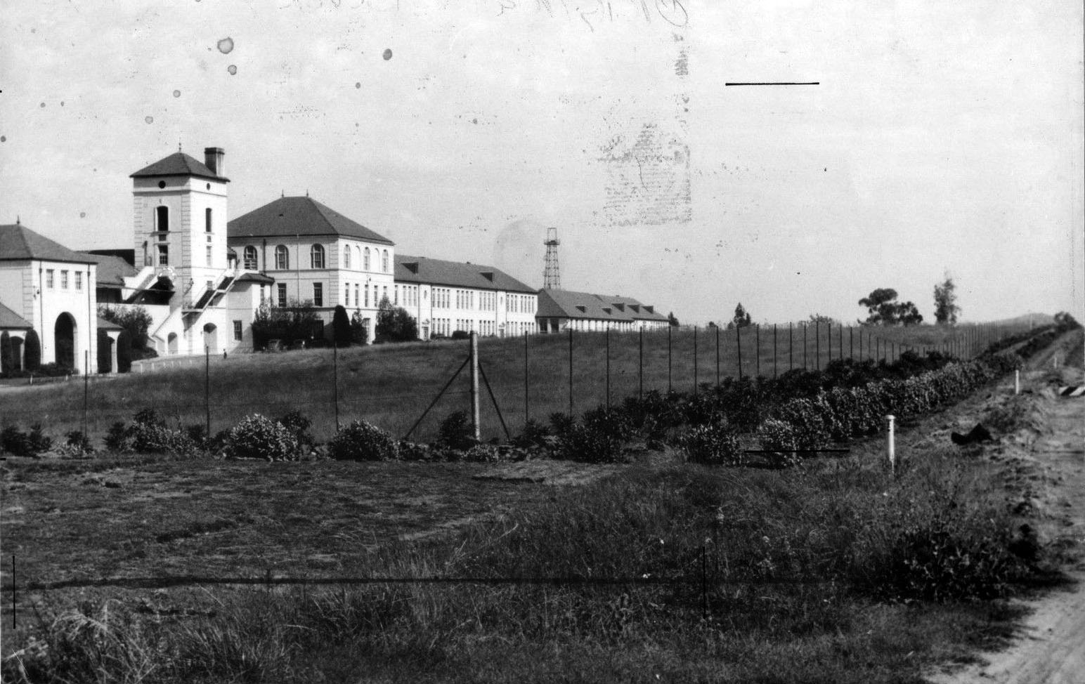 |
|
| (1944)* – Panoramic view showing Beverly Hills High School and surrounding area. Note the oil well on the other side of the school. |
 |
|
| (2020)* - Former (left) and current school crest. The current school crest was adopted in 2020. |
Historical Notes The school motto, “Today well lived”, is part of a Sanskrit Proverb: "Yesterday is a dream, tomorrow but a vision. But today well lived makes every yesterday a dream of happiness, and every tomorrow a vision of hope. Look well, therefore to this day." Team name: Normans |
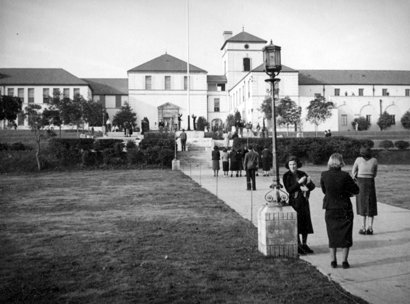 |
|
| (ca. 1937)^ - Students gather next to a lamppost on the walkway that leads to the main building of Beverly Hills High School, while others walk to class. Two people are raising the flag. Photo by Herman Schultheis |
Historical Notes Architect Robert D. Farquhar designed the 1927 Beverly Hills High School, located at 241 Moreno Drive. In 1936-1937, the main building was renovated due to damage done by the 1933 Long Beach earthquake. The Swim-Gym, designed by Stiles O. Clement, was built in 1939-1940. Major additions designed by Rowland H. Crawford occurred from 1967-1970 (North Wing to the Main Building, 5 story building with classrooms and two level parking garage). The Science and Technology Center, designed by LPA, architects, was built in 2005-2007. |
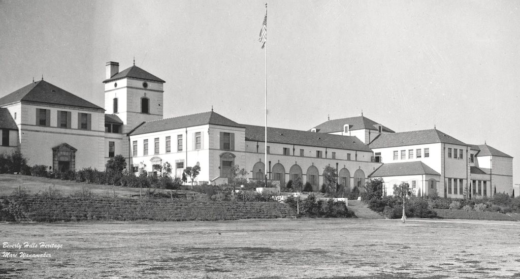 |
|
| (ca. 1930s)* - Close-up view showing Beverly Hills High School, a treasured architectural icon. Photo courtesy of Beverly Hills Heritage/Mark Wanamaker. |
Historical Notes Beverly Hills High School has been featured in many films and TV shows, either as part of the plot or a filming location. Many movies, including Clueless, Real Women Have Curves, Whatever It Takes, The Bachelor and the Bobby-Soxer, and It's a Wonderful Life, featured a scene in Beverly's unique "Swim Gym," perhaps the only gymnasium that has a basketball court that can split open to reveal a recreational-sized, 25-yard swimming pool. |
 |
|
| (2019)* - Beverly Hills High School "Swim Gym," perhaps the only gymnasium that has a basketball court that can split open to reveal a recreational-sized, 25-yard swimming pool. |
Historical Notes Built in 1939, there’s a 25-yard pool under the gym floor. You put in a key, turn it and the gym floor parts in the middle, unveiling the pool. It served as a location for a scene from the 1946 movie “It’s a Wonderful Life.” |
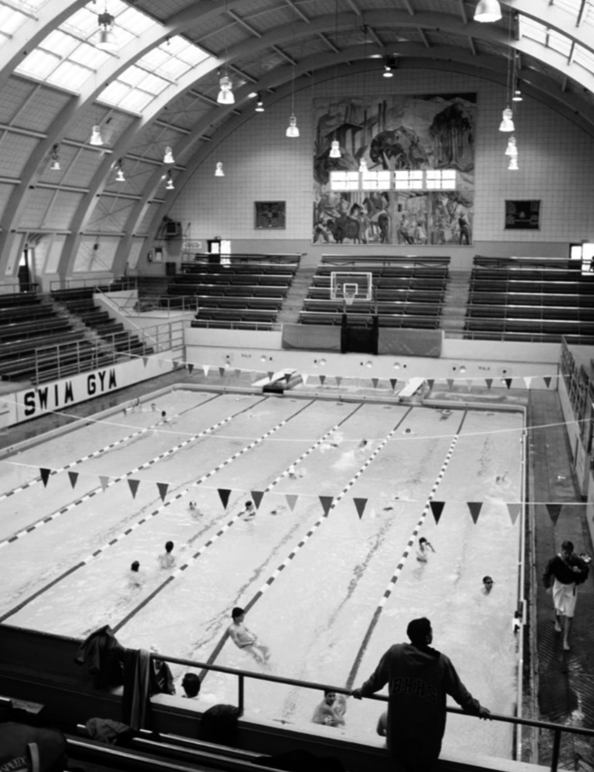 |
|
| (1938)* – Swim Gym at Beverly Hills High School with farm/ranch mural on the end wall. |
Historical Notes Beverly Hills High School’s famous Swim Gym (a gym that converts into a pool) appeared in It’s a Wonderful Life. Alicia Silverstone’s Cher in Clueless was a student there. And famed alumni include Betty White, Max Mutchnick, Angelina Jolie, Nicolas Cage and Barry Diller. |
 |
|
| (ca. 2018)* – View of Beverly Hills High School with the twin high-rise Century Plaza Towers in the background. |
* * * * * |
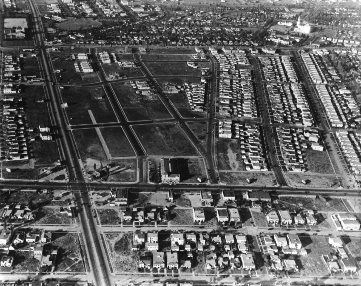 |
|
| (ca. 1926)* – Aerial view looking north showing La Cienega Boulevard (left) running away from the camera. Pico Boulevard runs horizontally near center of photo with Olympic Boulevard further north. At upper-left is La Cienega Park (circular plot of land) and across the street is the Beverly Hills Water Treatment Plant. The large white building at upper-right is the Carthay Circle Theatre (built in 1926). |
La Cienega Park
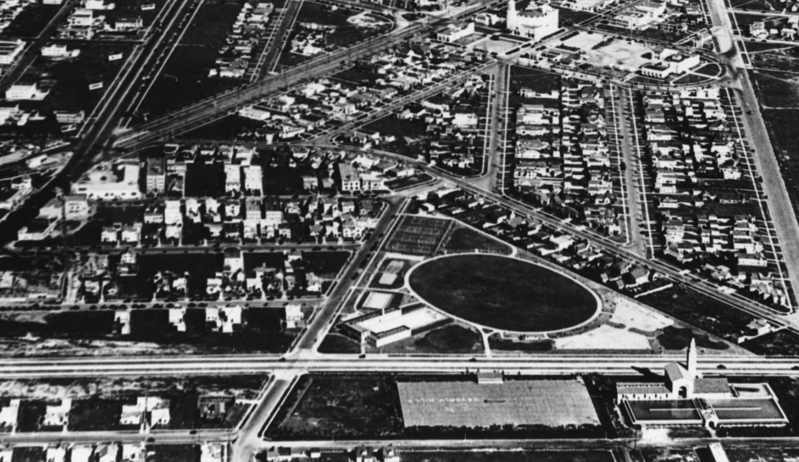 |
|
| (1930)* – Aerial view looking east above La Cienega Boulevard (runs horizontal at bottom of photo). The intersection of Wilshire and San Vicente is at upper left and Olympic Boulevard runs away from the camera at right. The triangular piece of land with oval-shaped field in center is La Cienega Park. The La Cienega Municipal Pool sits at the SE corner of La Cienega and Gregory Way, adjacent to the oval-shaped field. Across the street, at lower right, is the Beverly Hills Water Treatment Plant and reservoir. The large white building at top of photo is the Carthay Circle Theatre. |
Historical Notes The 10-acre La Cienega Park was established in 1928. It included a baseball diamond, tennis courts, lawn bowling, croquet, horseshoe pitch, gymnasium bars, golf-putting green, children’s swings, and a swimming pavilion that was added in 1929. |
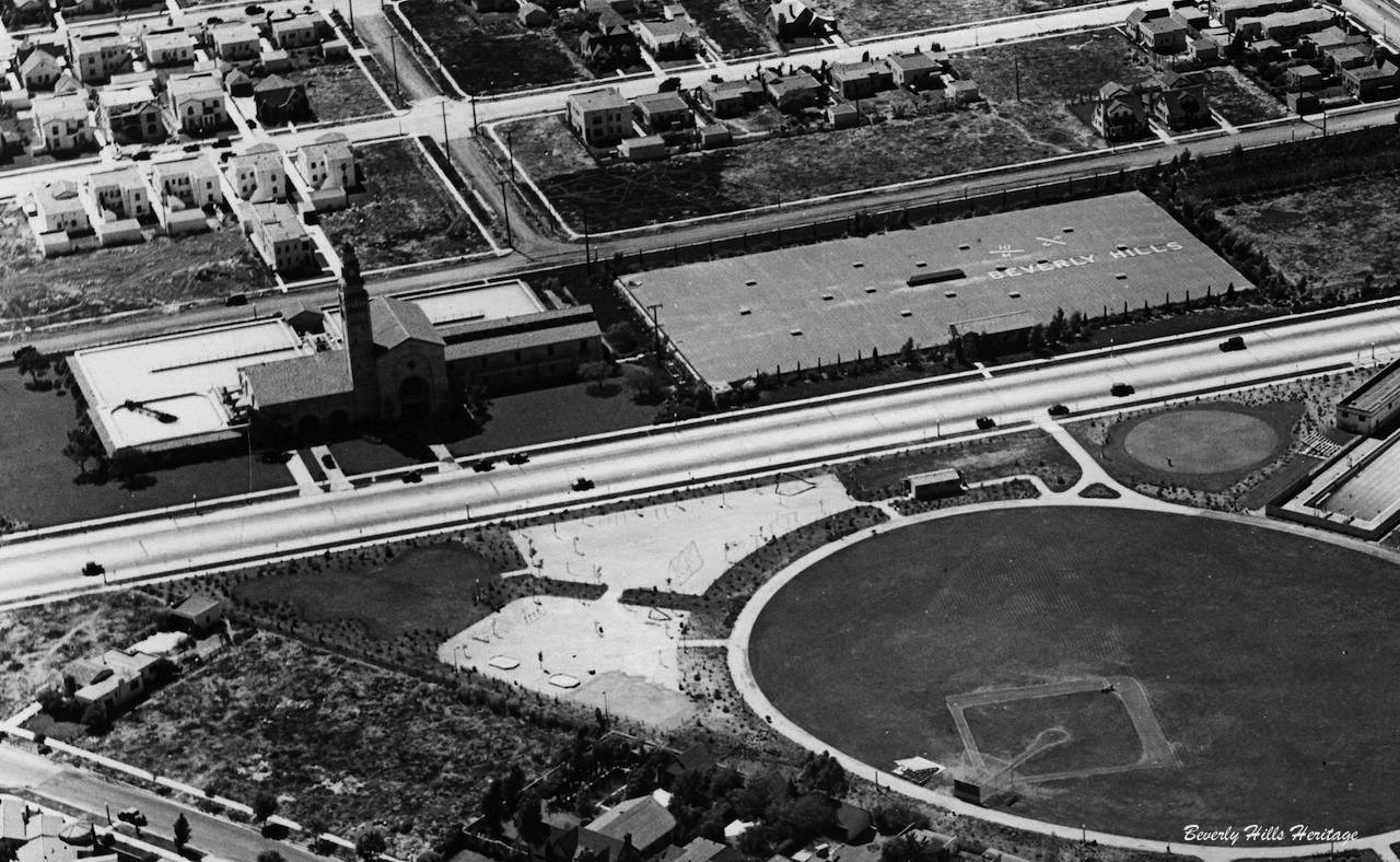 |
|
| (ca. 1930)* – Aerial view looking northwest showing a baseball diamond within the oval-shaped field of La Cienega Park. Part of the La Cienega Municipal Pool is visible on the right. Across the street can be seen the Beverly Hills Water Treatment Plant No. 1 and reservoir. “Beverly Hills” is written on top of the covered reservoir in large letters. |
* * * * * |
Beverly Hills Water Treatment Plant No. 1
.jpg) |
|
| (ca. 1927)^ - View looking northwest showing the City of Beverly Hills' Water Treatment Plant No. 1, located at 333 South La Cienega Boulevard. |
Historical Notes Designed by Los Angeles architects: Salisbury, Bradshaw and Arthur Taylor and built in 1927, the building was affectionately called the "Public Water Cathedral" because of its monumental Spanish Romanesque style. |
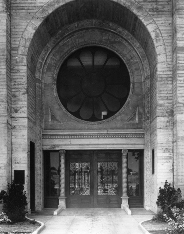 |
|
| (ca. 1928)^ – Close-up view showing the entrance to the City of Beverly Hills Water Treatment Plant No. 1. Seen are an arch, with a rose window above, and double bronze doors with wrought iron screens, flanked by spiral Romanesque columns below. |
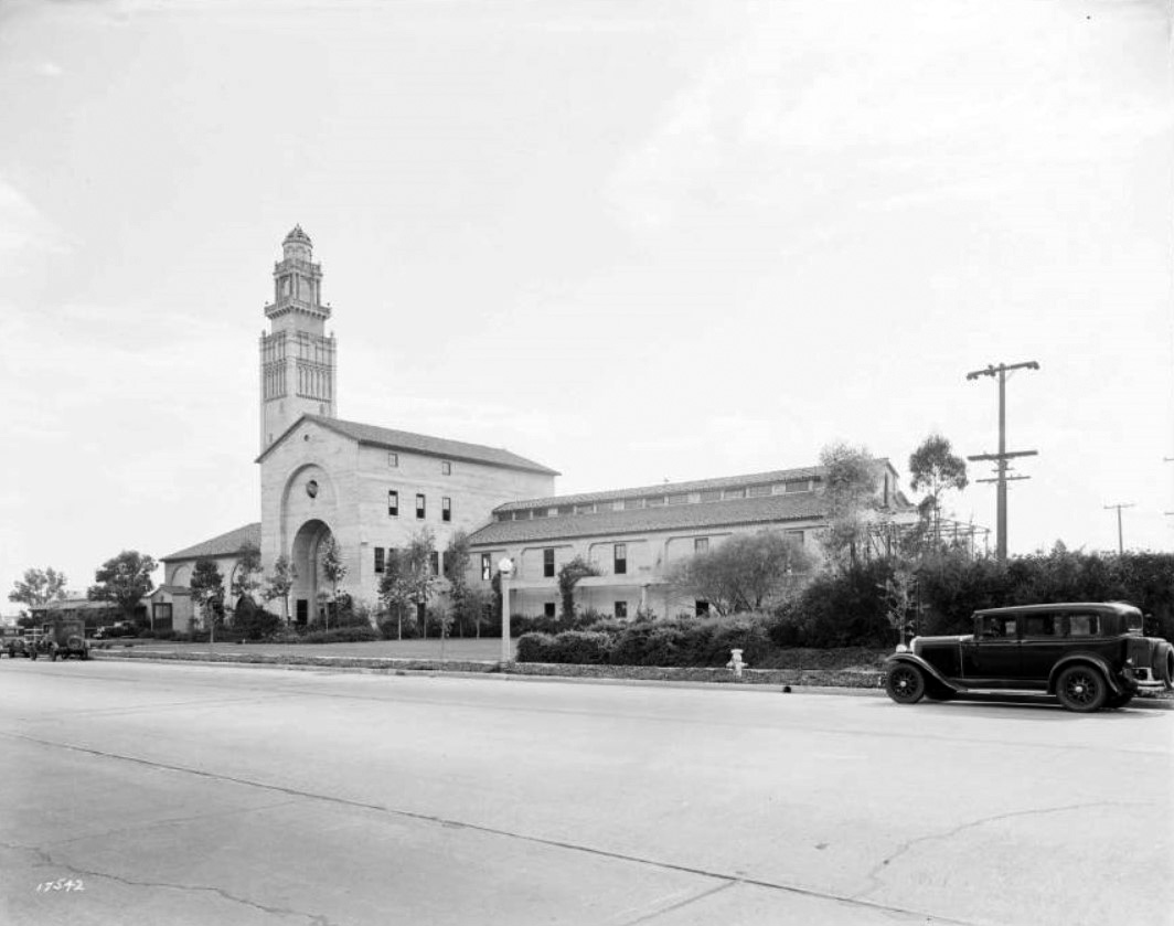 |
|
| (1931)* - View looking across La Cienega Boulevard showing early model cars parked in front of the water treatment plant building. |
.jpg) |
|
| (late 1930s)^ - Closer view of Water Treatment Plant No. 1 on La Cienega Boulevard. |
Historical Notes The Spanish-Romanesque building fell into disuse in 1976 when Beverly Hills began to purchase water from the Los Angeles Metropolitan Water District. In 1988, the Academy of Motion Picture Arts and Sciences proposed restoring the building to house a library and film archive and the center opened in 1991. In 2002, the film archive moved to Hollywood. The building was designed along a traditional hacienda layout. Its distinctive high tower is actually a disguised chimney which was originally used to burn off the sulfur in the water at a level high enough to keep it from the noses of nearby residents. |
 |
|
| (1934)* – View looking north showing an attendant pumping gas at a Union 76 service station located on the southeast corner of La Cienega and Olympic Blvds. The Beverly Hills Water Treatment Plant No. 1 is seen in the background. Click HERE to see more in Early Views of LA Gas Stations. |
* * * * * |
Municipal Tennis Courts
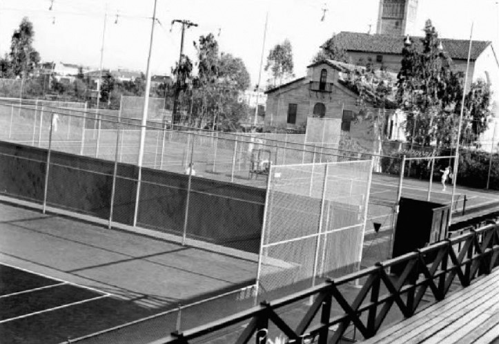 |
|
| (1938)* - View showing the Municipal Tennis Courts located on the SW corner of La Cienega and Gregory Way, adjacent to the Beverly Hills Water Treatment Plant No. 1. |
Historical Notes The tennis courts were known as the “Reservoir Courts” because they were built over one of the City’s water reservoirs adjacent to the Beverly Hills Water Treatment Plant. After the reservoir and tennis courts were removed, a parking structure was built and the tennis courts were returned to their original site. |
* * * * * |
La Cienega Municipal Pool
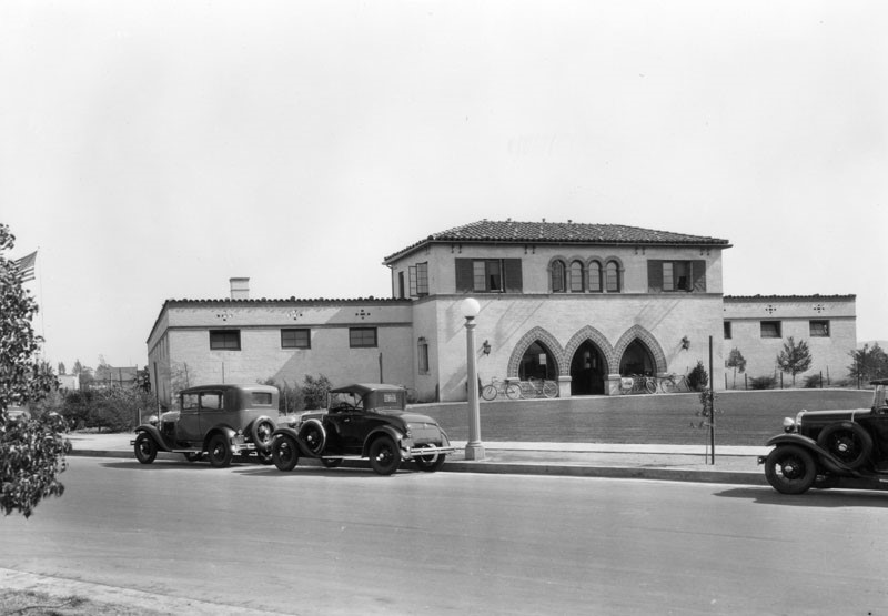 |
|
| (1930)* - View looking at the La Cienega Municipal Swimming Pool, located at 300 S. La Cienega Boulevard at Gregory Way, across the street from the Beverly Hills Water Treatment Plant. |
Historical Notes Opened in 1929, the pool was one of the best swimming facilities in the Los Angeles area. |
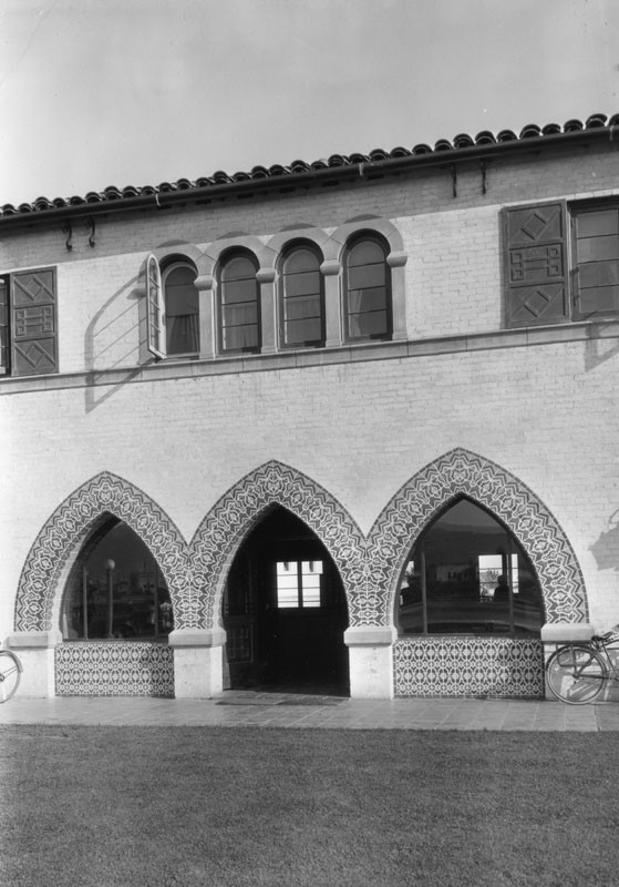 |
|
| (1930)* - Close-up view showing the entrance to La Cienega Municipal Swimming Pool with its Italian Renaissance design.. |
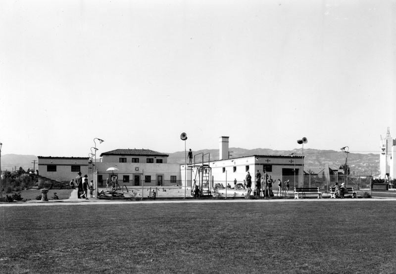 |
|
| (1930)* – View looking northwest showing swimmers at the La Cienega Municipal Swimming Pool with the Santa Monica Mountains in the distance. |
Historical Notes With it's Italian Renaissance design, the swim pavilion was 150 by 45 feet and was a landmark in the city until it was demolished in the 1970s. |
* * * * * |
Myer Siegel Department Store
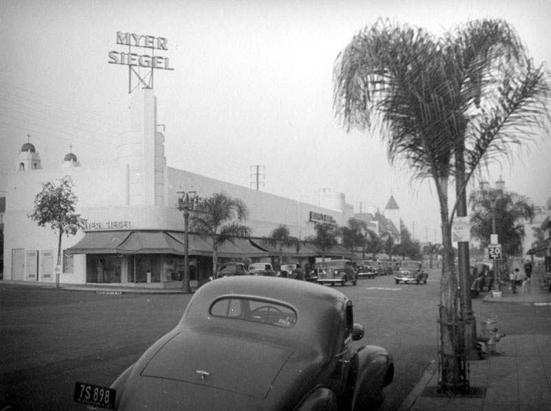 |
|
| (ca. 1937)^ - View looking at the northeast corner of N. Roxbury Drive and S. Santa Monica Boulevard showing the Streamline Moderne Myer Siegel department store (9697 S. Santa Monica Boulevard, Beverly Hills). The crosses and golden domes of the Church of the Good Shepard (501 North Bedford Drive) are visible behind the building on the far left. |
Then and Now
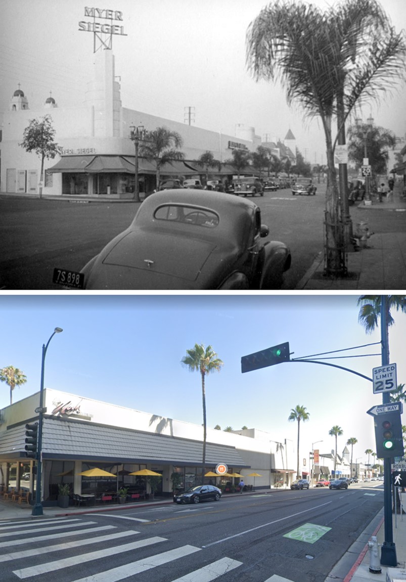 |
|
| (1937 vs 2022)* – Looking toward the NE corner of 'Little' Santa Monica Boulevard and N. Roxbury Drive. |
* * * * * |
Church of the Good Shepherd
.jpg) |
|
| (1930s)* - A path winds through the cactus gardens at Beverly Gardens Park, and the Church of the Good Shepherd can be seen in the background. |
Historical Notes The Church of the Good Shepherd, established in 1923, is the oldest Catholic parish in Beverly Hills and remains one of its most recognizable landmarks. Designed by architect James J. Donnellan, the church was completed and dedicated in 1925 in the Spanish Colonial Revival style, featuring white stucco walls, terracotta tile roofing, and twin bell towers topped with gilded domes. The interior includes beautiful stained glass windows and Carrara marble altars, many of which were enhanced during a major renovation in 1959. The church stands at 504 N. Roxbury Drive, just north of Santa Monica Boulevard, and has served as a spiritual anchor for the surrounding community for over a century. |
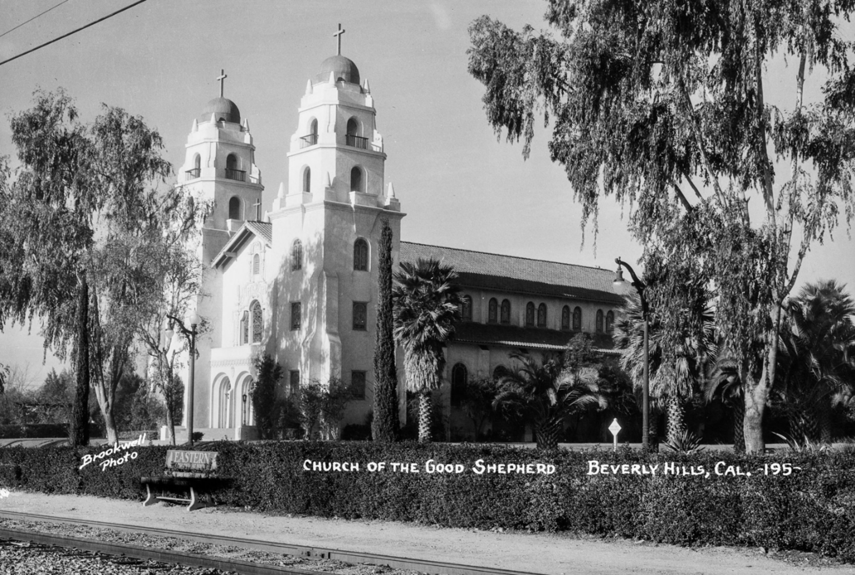 |
|
| (1930s)* – Postcard view of the Church of the Good Shepherd seen here with its iconic twin bell towers and white stucco façade—hallmarks of James J. Donnellan’s Spanish Colonial Revival design. This photo was taken from across Santa Monica Boulevard, beside the Pacific Electric tracks used at the time by Red Car streetcars running between downtown Los Angeles and Santa Monica. Established in 1923, it remains the oldest Catholic parish in Beverly Hills. Brookwell Photo from the Ernest Marquez Collection. |
Historical Notes Over the years, this house of worship has been the local parish church for most of the Catholic movie stars who live in Beverly Hills, from Rudolph Valentino to Bing Crosby (who both attended Sunday Mass here). It has seen numerous celebrity weddings and funerals. Celebrity weddings have included Elizabeth Taylor and Conrad "Nicky" Hilton, Loretta Young and Tom Lewis, Rod Stewart and Rachel Hunter, and Mark Wahlberg and Rhea Durham, Carmen Miranda and David Sebastian. Celebrity funerals have included Rudolph Valentino (1926), Carmen Miranda (1955), Gary Cooper (1961), William Frawley (1966), Pier Angeli (1971), Jack Haley (1979), Alfred Hitchcock (1980), Vincente Minnelli (1986), Rita Hayworth (1987), Danny Thomas (1991), Eva Gabor (1995), Mary Frann (1998), Frank Sinatra (1998), Don Adams (2005), and Merv Griffin (2007). |
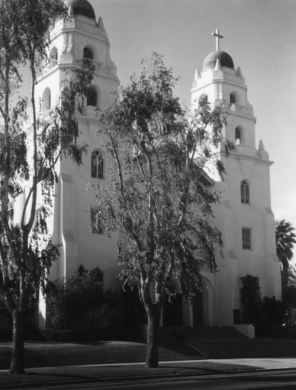 |
|
| (1930s)* - Exterior of the Good Shepherd Catholic Church, located at 501 North Bedford Drive in Beverly Hills. |
Historical Notes The parish extended its mission by establishing the Good Shepherd Parish School in 1930, initially staffed by the Sisters of the Holy Cross. The school continues to offer faith-based education from preschool through eighth grade and is an integral part of the parish’s community outreach. Today, as it celebrates more than 100 years of service, the Church of the Good Shepherd remains a vibrant center of worship, education, and tradition, blending historic charm with enduring relevance in the heart of Beverly Hills. |
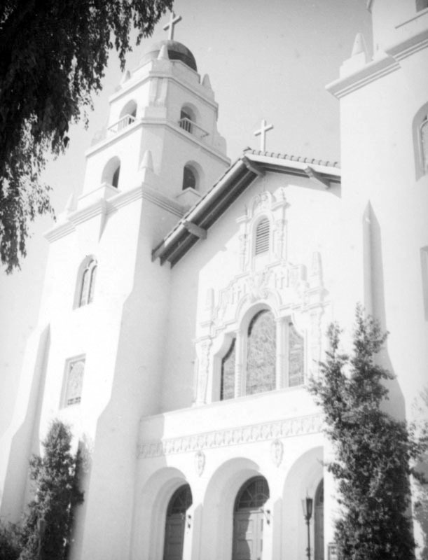 |
|
| (ca. 1937)* - This view of the entrance to the Church of the Good Shepherd features the arched doors and windows, bell towers, stained glass windows, churrigueresque and Spanish tile roof. |
Then and Now
 |
|
| (Then and Now)* - Church of the Good Shepherd on the northwest corner of Santa Monica Boulevard and Bedford Drive. Photo comparison by Trey Callaway. |
* * * * * |
N. Beverly Drive
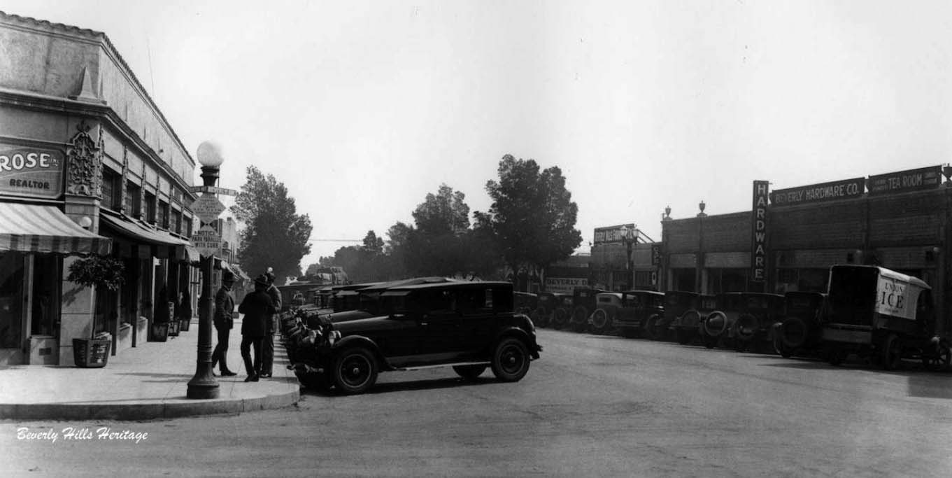 |
|
| (1925)* – View looking south on N. Beverly Drive from Little Santa Monica Boulevard or what was then Burton Way. The Spanish Revival building on the left hand corner would soon become Hazel's Grill and eventually cycle through many drug store incarnations. Today that location is a brown glass box "building," which contains a Bank of America. Click HERE for contemporary view. Photo courtesy of Beverly Hills Heritage. |
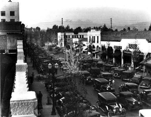 |
|
| (1928)* – View looking north on N. Beverly Drive toward Santa Monica Boulevard showing traffic congestion. |
Historical Notes Traffic jams in Beverly Hills were common through the boom of the 1920s, resulting in new traffic laws and intersection lights to ease traffic and auto accidents. Some of the stores shown on the eastside of the street include Piggly Wiggly Market and the Beverly Mode Shop. |
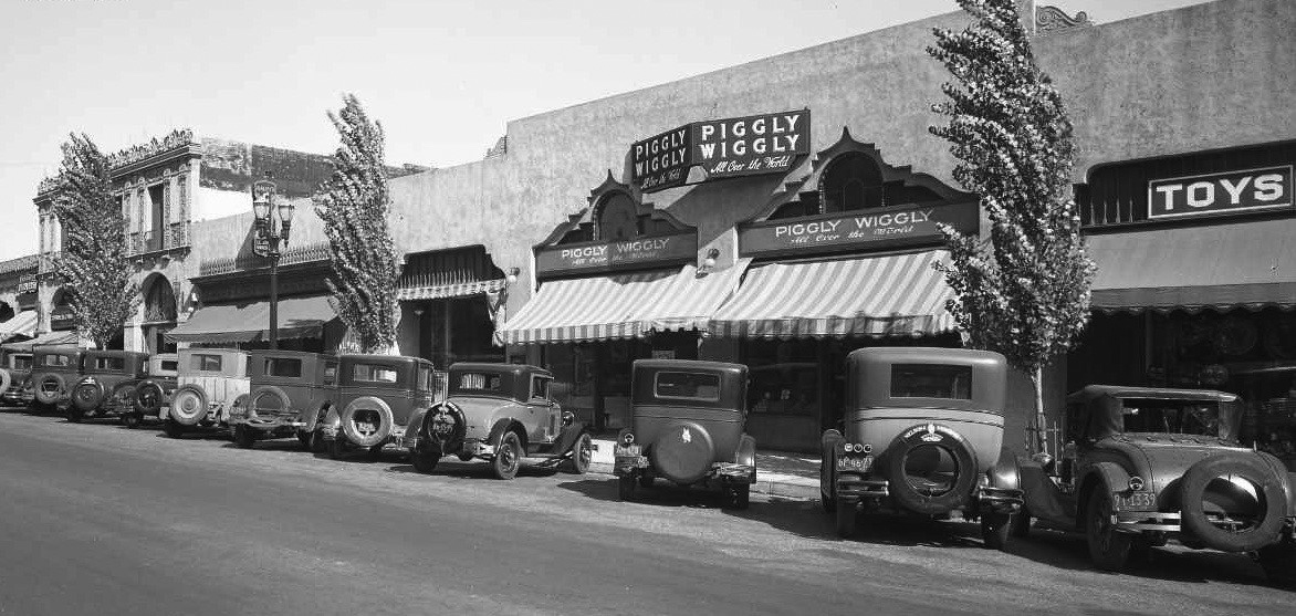 |
|
| (1929)* - Panoramic veiw of the east side of Beverly Drive showing Piggly Wiggley Market with what appears to be a Toy Store to its right. |
Historical Notes Piggly Wiggly was the first self-service grocery store. It was founded in 1916 in Memphis, Tennessee, by Clarence Saunders. At the time of its founding, grocery stores did not allow their customers to gather their own goods. Instead, a customer would give a list of items to a clerk, who would then go through the store, gathering them. This created a greater cost, and therefore higher prices. Piggly Wiggly introduced the innovation of allowing customers to go through the store, gathering their own goods, thus cutting costs and lowering prices. Losses due to easier shoplifting were more than offset by profits from increased impulse purchasing. Others were initially experimenting with this format as well, which initially came to be known as a "groceteria", reminding people of cafeterias, another relatively new, self-service idea. The success of Piggly Wiggly was phenomenal, so much so that other independent and chain grocery stores changed to self-service in the 1920s and 1930s. At its peak in 1932, the company operated 2,660 stores and posted annual sales in excess of $180 million. There are presently more than 600 independently owned and operated stores in 17 states. The company headquarters are located in Keene, New Hampshire. Some of the stores have formed a retailers' cooperative to manage distribution, while using the Piggly Wiggly name (e.g., Piggly Wiggly Midwest and Piggly Wiggly Alabama Distributing Company). Piggly Wiggly stores are found predominantly in medium to smaller size cities, and remain a fixture in many rural communities. |
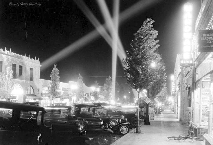 |
|
| (1929)*– Night view of north Beverly Drive looking south showing four spot lights for what appears to be a new store opening which was so typical of the 20s and 30. At lower right there is a bike casually dropped in the doorway of a hardware store (Beverly Hardware Co.). Photo courtesy of Beverly Hill Heritage. |
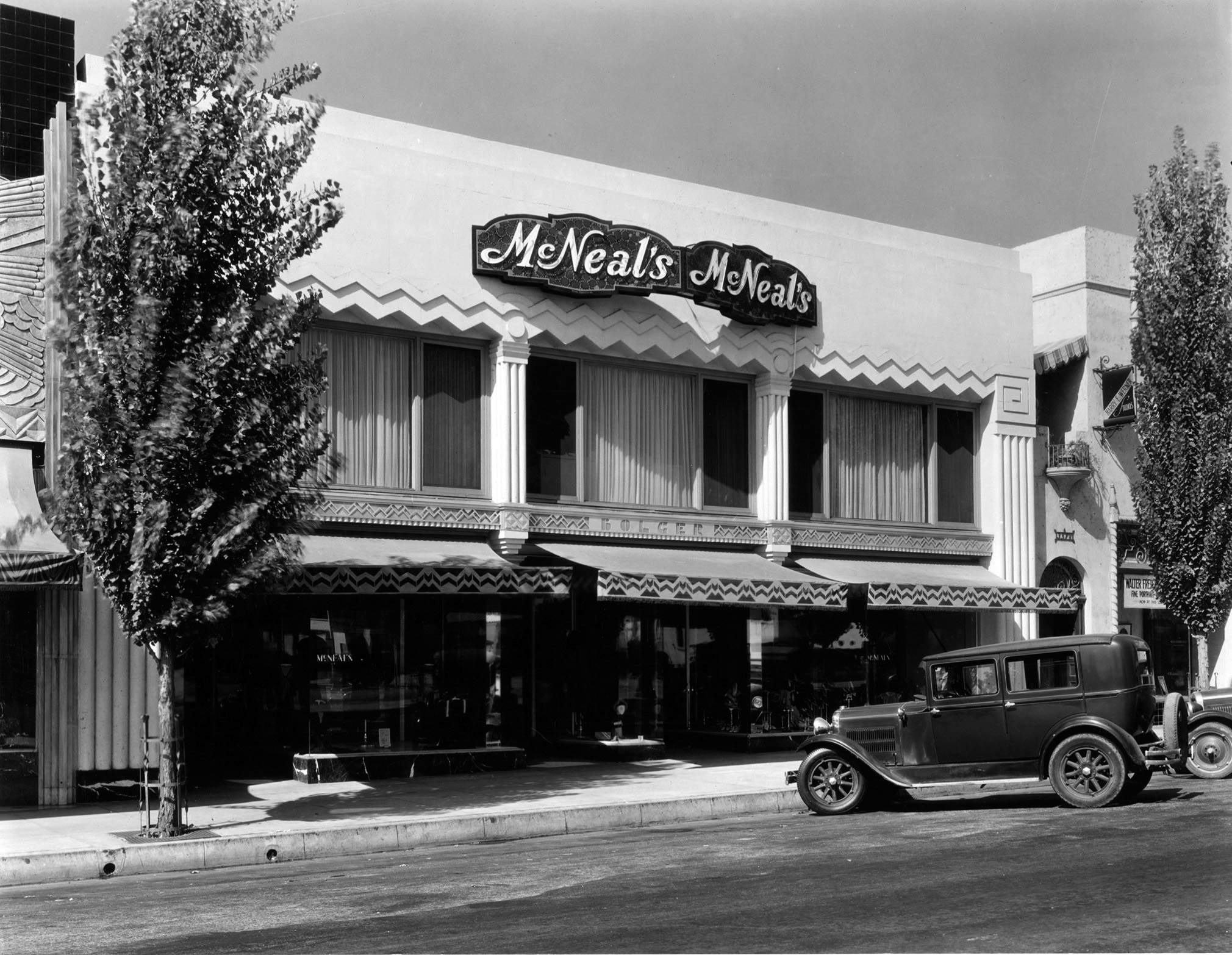 |
|
| (1930)* – View showing McNeals Department Store located at 351 N. Beverly Drive. The store specialized in women's apparel. |
* * * * * |
N. Canon Drive
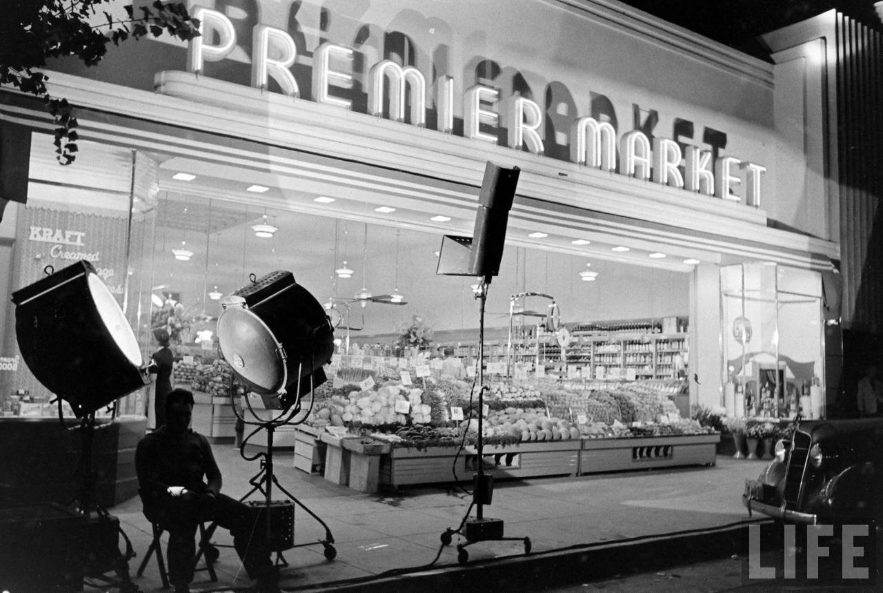 |
|
| (ca. 1936)* – Life Magazine photo showing the opening of Premier Market located at 425 N. Canon Drive. Note the Streamline Modern Art Deco Design of the building. Photo source: Life Magazine. |
Historical Notes Spot lights were commonly used for grand openings of stores in the 1930s. |
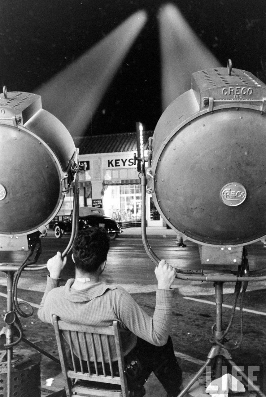 |
|
| (ca. 1936))* – ‘Premier of Premier Market’ - A man holds on to two spot lights as he sits in chair in front of Premier Market during its Grand Opening. Photo source: Life Magazine. |
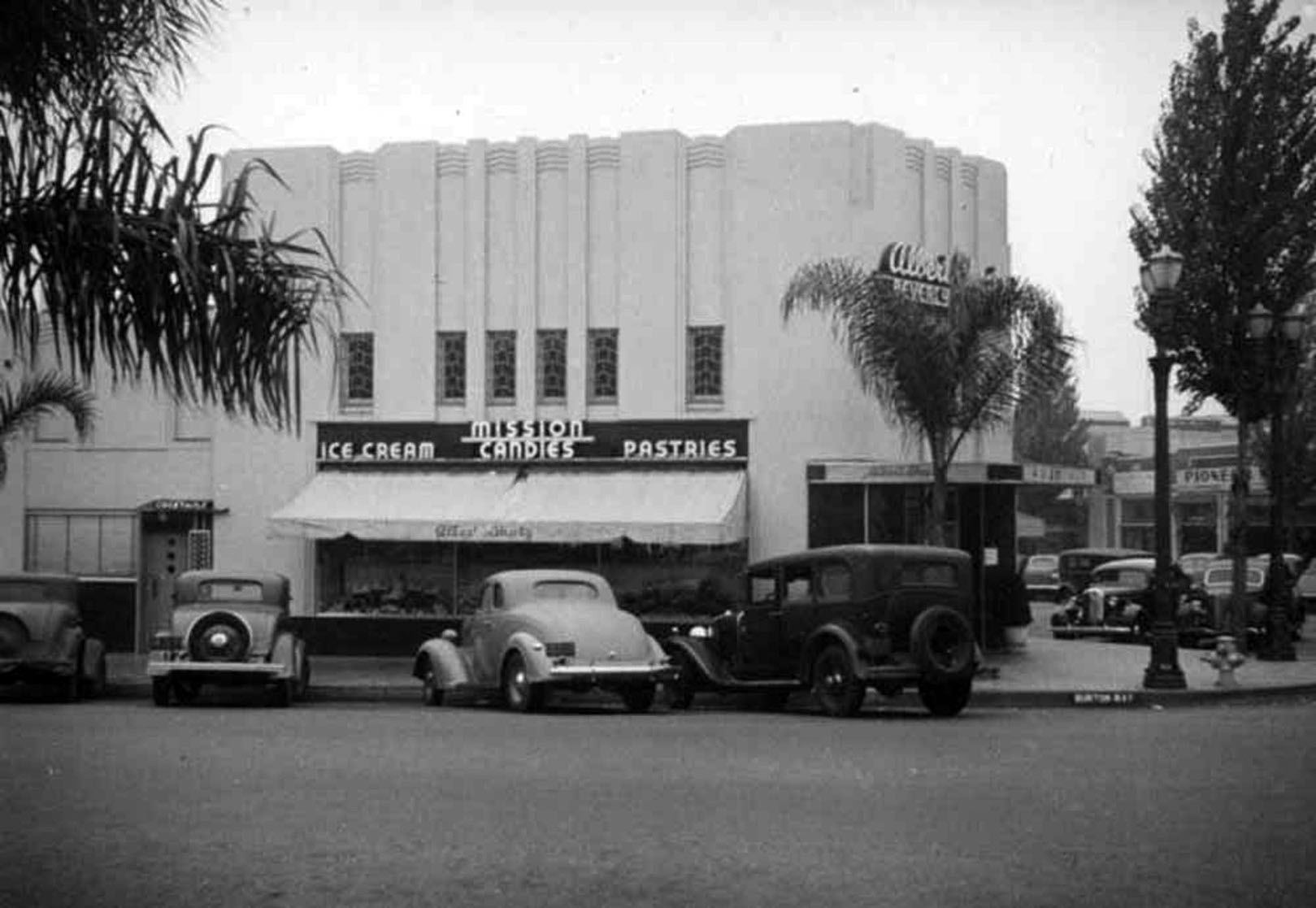 |
|
| (ca. 1937)* - Albert Sheetz Mission Candy Company located at 450 North Canon Drive. It was also a bakery and fountain serving ice cream according to the signage on the front and sides of the Art Deco building. Cars line the curb in this image taken from the corner, which includes a cocktail lounge on Burton Way and Pioneer on Canon Drive. |
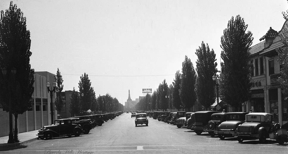 |
|
| (1931)* – View looking south on N. Canon Drive as seen from South Santa Monica Boulevard (then Burton Way). Warner Beverly Theatre can be seen in the far distance on Wilshire Boulevard. The Bekins Building sign can also be seen. Photo courtesy of Beverly Hills Heritage. |
Historical Notes At the beginning of the 1930s in Beverly Hills, Canon Drive was becoming a commercial street between Santa Monica and Wilshire Boulevards. The Bekins Storage building, one of the first major commercial spaces on the block, was followed by the Cadillac and Auburn-Cord dealerships and several furniture showrooms. At the end of the block at Wilshire Boulevard, stood the new Warner Beverly Hills Theater that opened in May 1931, beginning a new business boom for the city. However, due to the Depression, most business and real estate development was stalled until the end of the 1930s. |
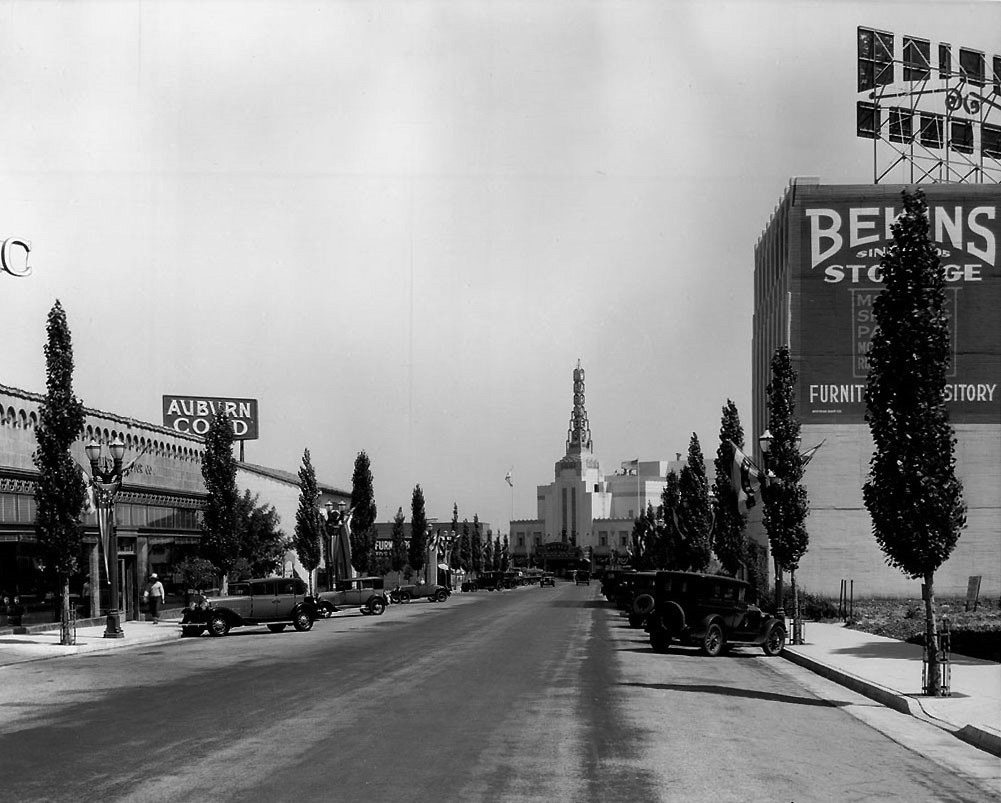 |
|
| (ca. 1930)* – View looking south on N. Canon Drive showing an Auburn Cord Dealership (left), the Bekins Storage Building (right), and the Warner Bros. Beverly Hills Theater at the end on Wilshire Boulevard |
Historical Notes Cord was the brand name of an American automobile company from Connersville, Indiana, manufactured by the Auburn Automobile Company from 1929 through 1932 and again in 1936 and 1937. |
* * * * * |
Warner Beverly Theatre
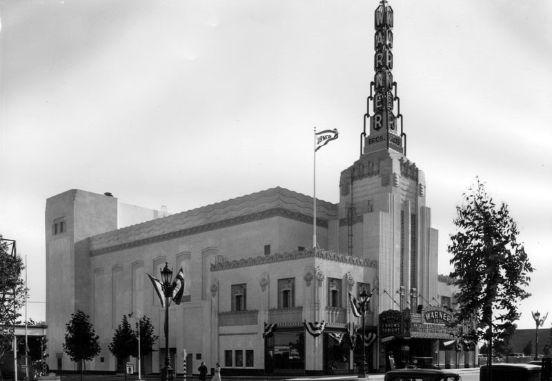 |
|
| (1931)* – View looking southwest showing the newly built Warner Beverly Theatre located at 9404 Wilshire Boulevard. |
Historical Notes Designed by architect B. Marcus Priteca in 1930, the Warner Beverly was a medium sized theater, designed after its sisters in Huntington Park and San Pedro. The building was an outstanding example of Art Deco style and was considered "The Pride of Beverly Hills" on the southwest corner of Wilshire Boulevard and Cañon Drive in 1931. |
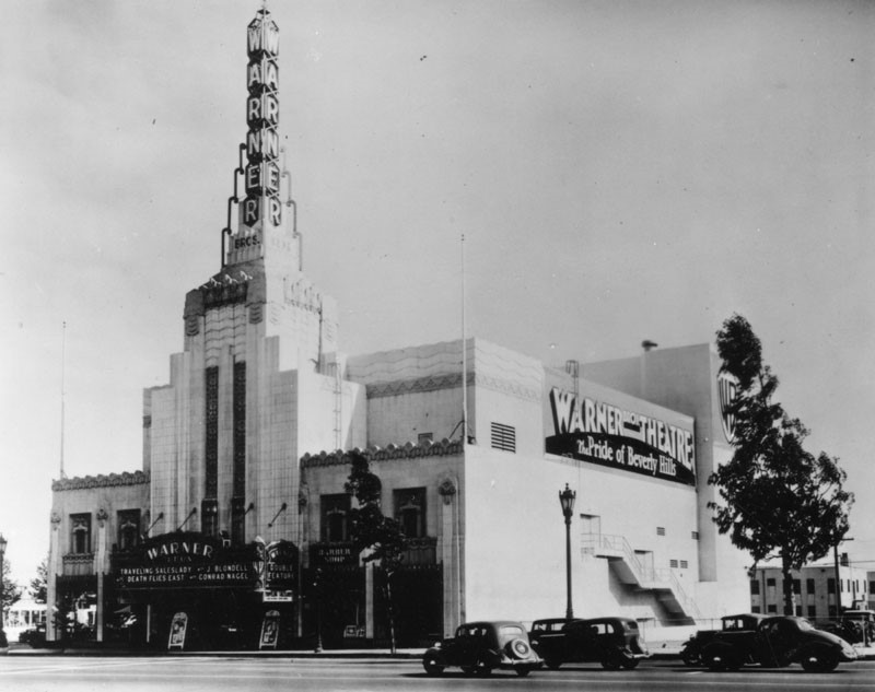 |
|
| (1935)* - View looking southeast showing the Warner Bros. Beverly Hills Theatre. The marquee features "Traveling Saleslady" with Joan Blondell, and "Death Flies Easy" with Conrad Nagel. |
Historical Notes The theater's large scale and elaborate Art Deco design made it a prominent feature in the landscape of Beverly Hills, distinguished especially by its tall neon-lit tower sign. |
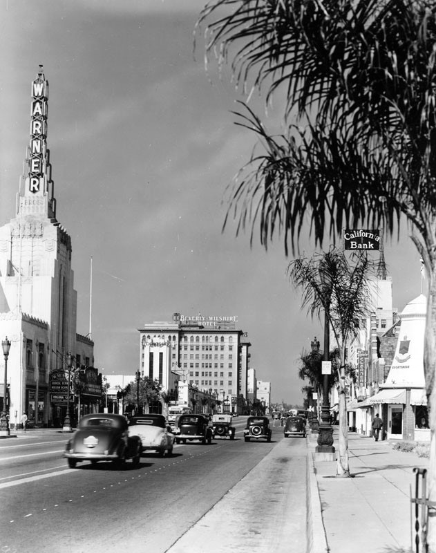 |
|
| (1937)* - View looking west on Wilshire Boulevard in the Beverly Hills business district. On the left is the Warner Bros. Beverly Hills Theatre, located at 9404 Wilshire Blvd; the marquee promotes "Virginia City" with Errol Flynn, Miriam Hopkins, Randolph Scott, and Humphrey Bogart. Also seen are the Beverly Wilshire Hotel, further west on the boulevard, and the offices of California Bank on the right. |
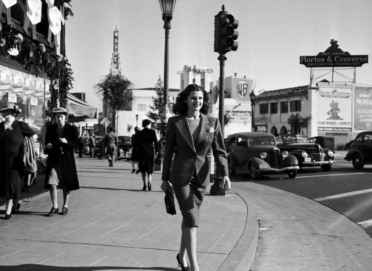 |
|
| (1939)* – The beautiful and stylish Rita Hayworth stepping off the curb on the NE corner of Wilshire and N. Beverly Drive. Warner Beverly Theatre can be seen in the background. |
Historical Notes Rita Hayworth achieved fame during the 1940s as one of the era's top stars, appearing in a total of 61 films over 37 years. The press coined the term "The Love Goddess" to describe Hayworth after she had become the most glamorous screen idol of the 1940s. She was the top pin-up girl for GIs during World War II. |
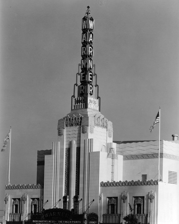 |
|
| (1930s)* – Close up front view of the Warner Theatre showing the intricate Art Deco designs on the face of the building and its tower. |
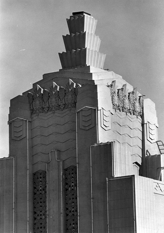 |
|
| (1987)* - Photograph caption reads: "Shattered crystal of the Beverly Theater's tower ... resembles a chunk of Superman's kryptonite". Photograph dated August 17, 1987. ~ Herald-Examiner Collection |
Historical Notes The final owner of the Warner Beverly Theatre, Columbia Savings and Loan Association, had the facility torn down in 1989 because they didn't want to spend the money, reportedly $12 million, to seismically upgrade the Art Deco movie palace, even though it was in fine cosmetic condition. |
* * * * * |
Signal Service Station
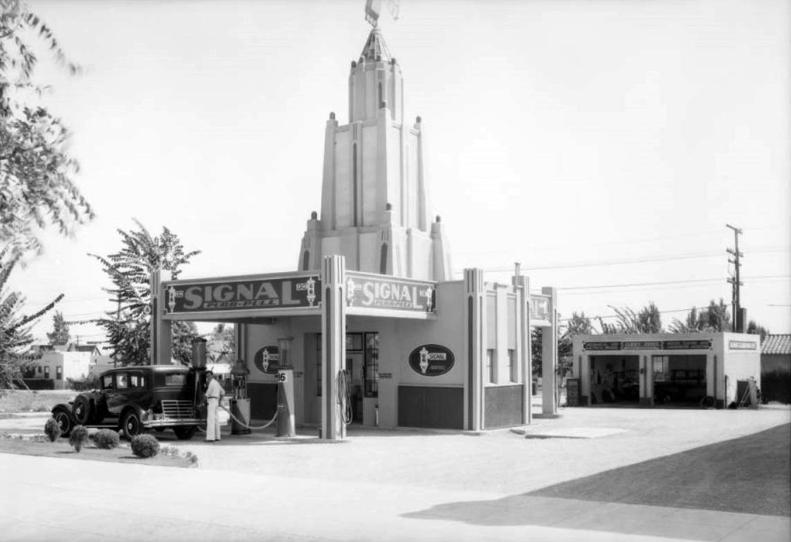 |
|
| (1931)* – Attendant pumping gas at a Signal Purr-Pull service station with Art Deco tower, located in Beverly Hills. Click HERE to see more in Early LA Gas Stations. |
* * * * * |
Fox Wilshire Theatre (today Saban Theatre)
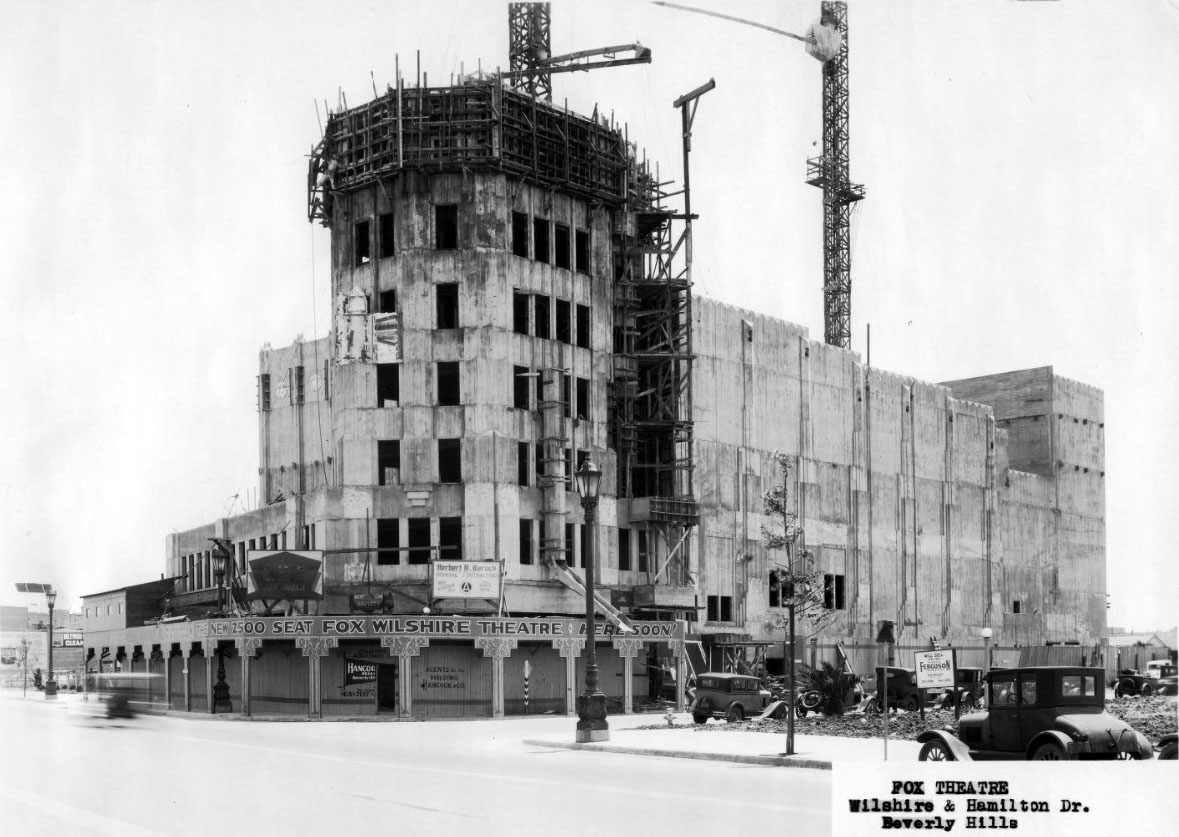 |
|
| (1930)* – View showing the Fox Wilshire Theatre under construction on the southeast corner of Wilshire Boulevard and Hamilton Drive in Beverly Hills. |
Historical Notes At the eastern edge of Beverly Hills sits the elaborate Spanish Art Deco style Fox Wilshire Theatre. Designed by noted theatre architect Simeon Charles Lee, this was his 3rd theatre design, after the Tower Theatre and the Los Angeles Theatre, both in downtown Los Angeles. The Fox Wilshire Theatre was also the first of many he designed in an Art Deco style. It was built for and operated by the Fox West Coast Theatres circuit, and opened on September 19, 1930, with seating for 2,296 in orchestra and balcony levels. ^ |
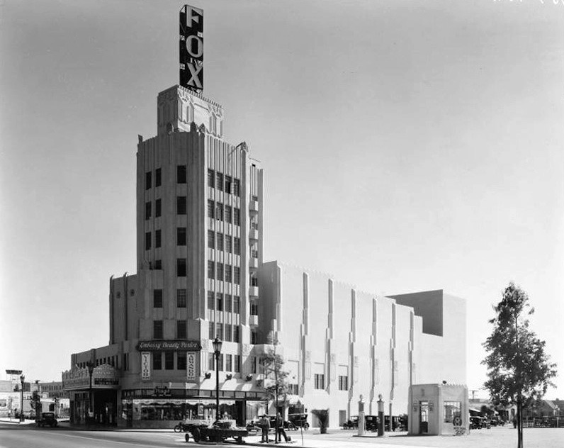 |
|
| (ca. 1930)** – Closer view showing the Fox Wilshire Theatre located on the southeast corner of Wilshire Boulevard and Hamilton Drive. A gas station is seen across the street at lower-right. Click HERE to see contemporary view. |
Historical Notes Dominating the exterior of the Fox Wilshire building was a 6-story corner tower, containing luxurious apartments on the top two floors. It was originally topped by a huge rotating sky sign spelling out the name ‘FOX’ in large vertically placed letters. The exterior of the building was originally painted in a buff color and had black vertical stripes running up the tower and Deco style decorations painted in silver. ^ |
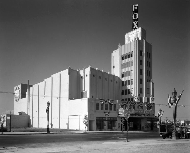 |
|
| (1930)^*# – View looking southwest showing the Fox Wilshire Theatre as seen from the north side of Wilshire Boulevard. Banners hang from the side of the theatre building and from the streetlight posts in preparation for the grand opening. |
Historical Notes The Fox Wilshire was designed in what is now known as the Art Deco style but was then often described simply as “modern.” This style features strong geometric designs, stylized plant and animal motifs, and an accent on vertical forms. Very contemporary in 1930, the design was complemented by a bold color scheme of silver, black, and coral along with plush pink carpets, which created a luxurious environment.* |
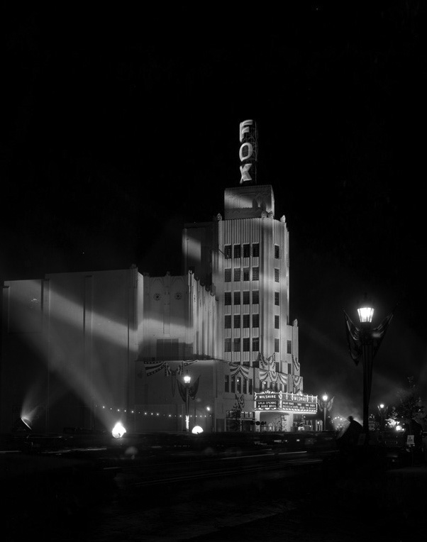 |
|
| (1930)^*# - Spotlights sweep across the front of Fox Wilshire Theatre during its Grand Opening night. |
Historical Notes Built for the Fox West Coast Theatres circuit, the Fox Wilshire hosted premieres of many important Fox films in the 1930s and ’40s, beginning opening night, which featured the Marx Brothers in Animal Crackers. The theatre’s wide proscenium allowed for an extra large screen, which later made it a natural for long runs of widescreen films such as The Sound of Music (1965).* |
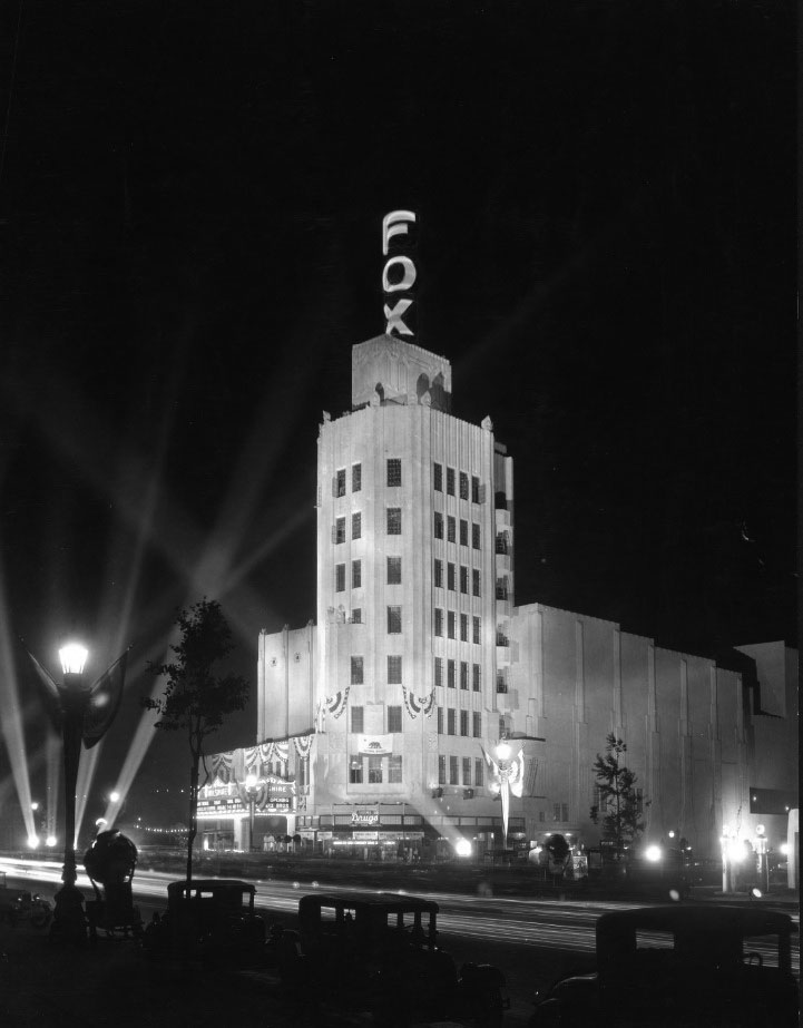 |
|
| (ca. 1930)* - The Fox Wilshire on opening night illuminated by spotlights and draped with bunting. The exterior design was a much simplified version of Lee's many concepts. The Fox sign became the most prominent attribute of the tower at night. |
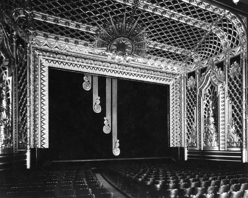 |
|
| (1930)^ - View of the proscenium and organ screen of the Fox Wilshire Theater in Beverly Hills. Built 1928-30. Architect: S. Charles Lee. |
Historical Notes The Fox Wilshire was designed in what is now known as the Art Deco style but was then often described simply as “modern.” This style features strong geometric designs, stylized plant and animal motifs, and an accent on vertical forms. Very contemporary in 1930, the design was complemented by a bold color scheme of silver, black, and coral along with plush pink carpets, which created a luxurious environment.* |
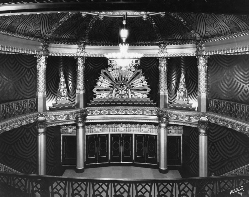 |
|
| (1930)^ - View of the lobby from the balcony; looking towards the main entrance of the Fox Wilshire Theatre. |
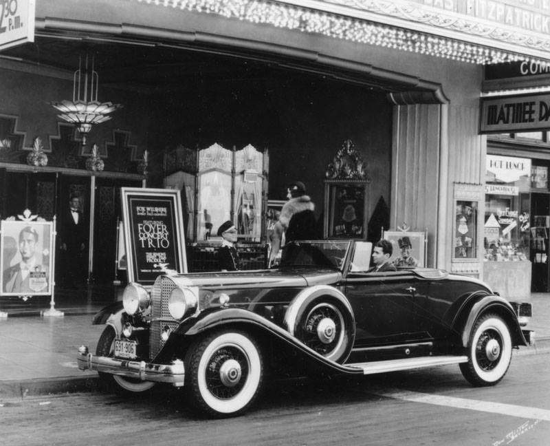 |
|
| (1932)^ – View of box office and foyer with a 1932 Packard 'Eight Deluxe' parked under the marquee of the Fox Wilshire Theater (today the Saban Theatre). |
Historical Notes During the early years in the 1930’s, the Fox Wilshire was a popular meeting place for lunchtime foyer concerts and occasional midnight matinees which would be attended by film stars who lived in the locality of Beverley Hills. The open lobby on the street front was modernized over the years, losing its street ticket booth and gaining a new marquee, while the exterior of the building was painted plain white, which diminishes the original Spanish Art Deco style of the building. ^ |
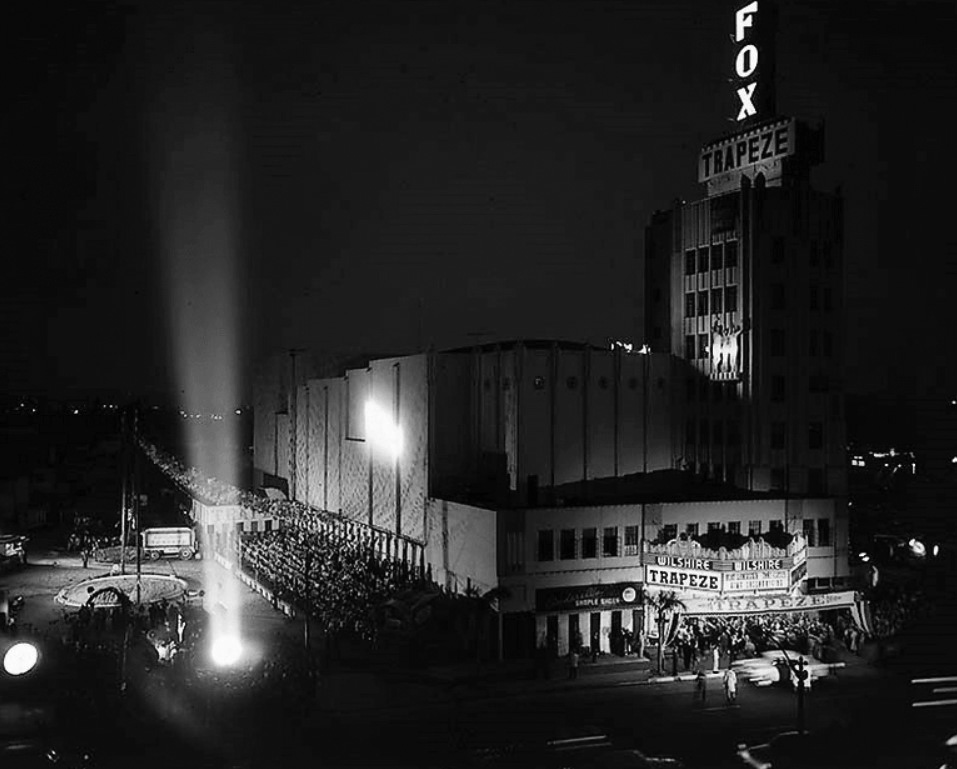 |
|
| (1956)+# – View showing the world premiere of "Trapeze" at the Fox Wilshire Theatre, 8440 Wilshire Blvd. The super bright searchlight trained directly on the entrance must have been blinding, and that shaft of light reaching straight up into the night sky would have been visible for miles around. |
Historical Notes The theatre was always a premier first run venue for Fox West Coast Theatres and its successor National General. Later it was operated by Mann Theatres after they took over the remnants of the Fox Circuit on the west coast. For the second film released in Cinemascope, "How to Marry a Millionaire," 20th Century Fox took it to the Fox Wilshire. |
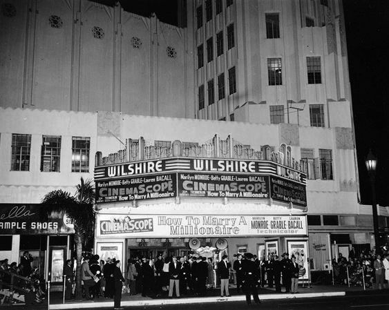 |
|
| (1953)^^+ - “How to Marry a Millionaire” starring Marilyn Monroe, Betty Grable, and Lauren Bacall, plays the Fox Wilshire Theatre, 8440 Wilshire Blvd. Beverly Hills, November 4, 1953 |
Historical Notes The theatre was converted to a stage venue in 1980. To better accommodate audiences during intermissions, the lobby was enlarged to include space that had formerly been rear orchestra seating. By that time, original silver-and-black stenciled designs that had completely covered the walls and ceiling had been replaced with a muted palette of contemporary colors..^ |
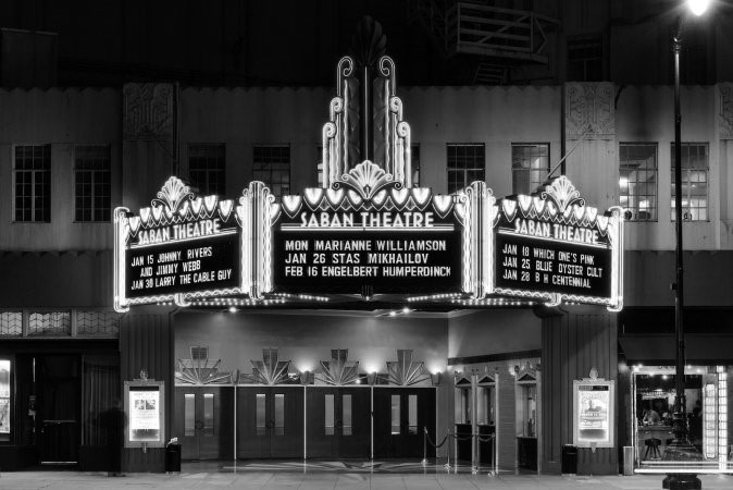 |
|
| (2014)* – View showing front entrance to the Saban Theatre (previously Fox Wilshire). Upcoming shows include: Marianne Williamson, Stas Mikhailov, and Engelbert Humperdinck. Photo by Hunter Kerhart / Los Angeles Conservancy |
Historical Notes In 2005, Temple Shalom for the Arts purchased the building and subsequently began work on restoring the theatre back to its original grandeur. Renamed the Saban Theatre in 2009, it is now used as a rental space for theatre, concerts, film shoots, and special events, as well as for religious services. In 2012, the theatre was listed in the National Register for Historic Places. On May 8, 2013, the theatre was declared landmark #12 on the Beverly Hills Register of Historic Properties. |
* * * * * |
Wilshire Links Miniature Golf
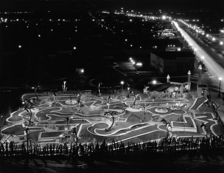 |
|
| (1930s)^*# – Night view looking west showing the Wilshire Links miniature golf course located on the southeast corner of Wilshire and La Cienega in Beverly Hills. View is from the top of Fox Wilshire Theatre (built in 1930). |
Historical Notes Mary Pickford's Wilshire Links, a miniature golf course, was located on the corner of Wilshire Blvd and La Cienega. Pickford owned the property and with the miniature golf craze in full swing, she hired artisans from the United Artist Studio to build a course in a "French modernistic style." It featured imitation palms, a lake and wandering streams as well as lighting effects.*^# |
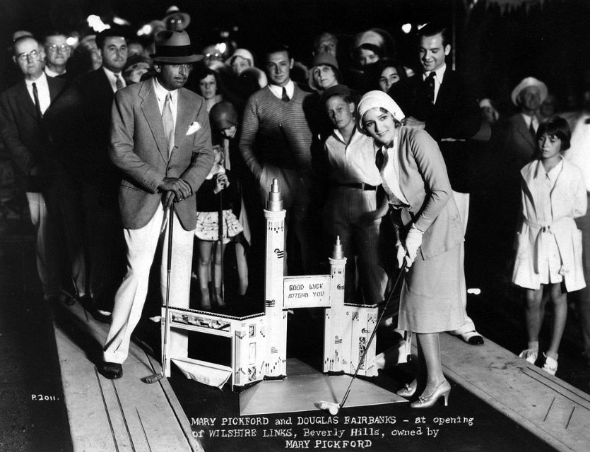 |
|
| (1930s)^^# - Mary Pickford and Douglas Fairbanks inaugurate the Wilshire Links mini-golf course on Wilshire and La Cienega. It was an Art Deco paradise. |
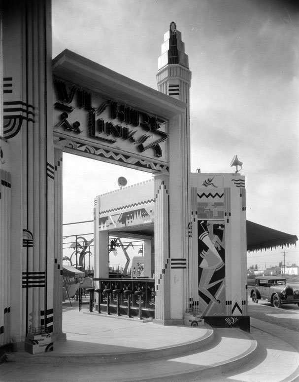 |
|
| (1930s)^*# – View looking at the S/E corner of Wilshire and La Cienega showing the Wilshire Links Miniature Golf entrance, through which can be seen a soda fountain with bar stools. An early model car is parked along the curb on the west side of La Cienega. |
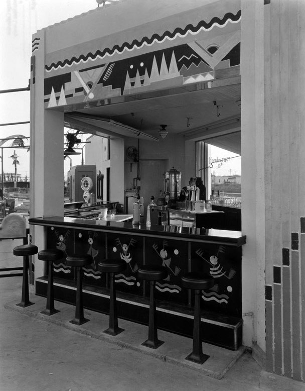 |
|
| (1930s)^*# - Closer view showing the Wilshire Links soda fountain with its Art Deco designs. |
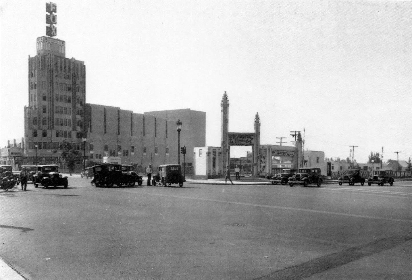 |
|
| (1934)##++ – View looking toward the southeast corner of Wilshire and La Cienega with the Wilshire Links entrance gate on the corner. The Fox Wilshire Theatre can be seen in the background. Note that there’s an auto accident near the middle of the intersection. Click HERE to see contemporary view. |
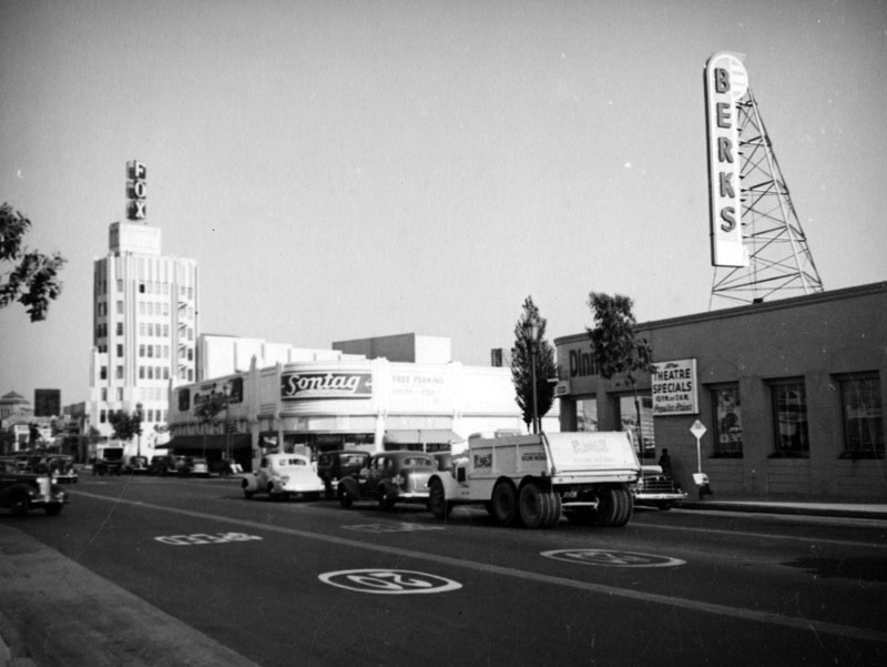 |
|
| (1930s)^ - View looking east on Wilshire Boulevard at La Cienega showing the Fox Wilshire Theatre in the distance. Closer in is a Sontag Drug Store where Wilshire Links Miniature Golf once stood. Berk's Restaurant is seen across the street on the right. Note the 20 mile speed limit painted on Wilshire Boulevard. |
Historical Notes The Sontag Drug Store contained a soda fountain, grill and coffee shop and was built in the Streamline Moderne style. It was one of the largest drug stores in America when constructed. Berk's is advertising theater specials from 10 p.m. to 2 a.m. at popular prices! |
* * * * * |
Wilshire Coffee Pot Café
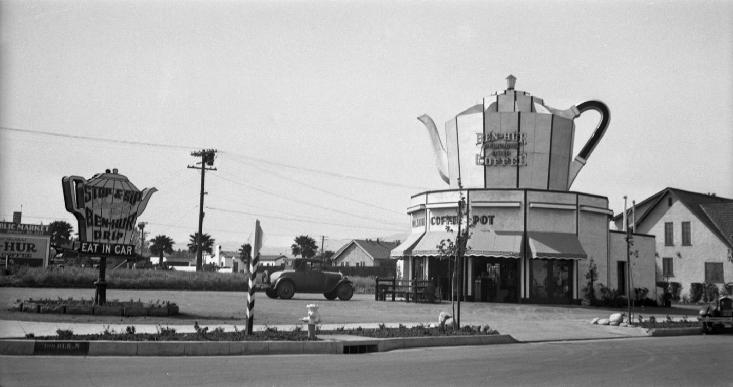 |
|
| (ca. 1928)* - View showing an automobile parked in front of the Wilshire Coffee Pot Restaurant, located at 8601 Wilshire Boulevard on the northwest corner of Stanley Drive and Wilshire Blvd., two blocks west of La Cienega Boulevard. A large coffee pot crowns the roof, advertising Ben-Hur Coffee to passing motorists. |
Historical Notes The Wilshire Coffee Pot was a classic example of Programmatic Architecture, a whimsical style popular in Los Angeles during the 1920s and 1930s in which buildings were designed to look like the products they sold. Its enormous rooftop coffee pot served as both structure and sign, catching the eye of motorists cruising along Wilshire Boulevard—then the city’s premier “Auto Row.” The restaurant catered to the growing car culture of early Los Angeles, where roadside novelty buildings like this became local landmarks. Ben-Hur Delicious Drip Coffee—a brand inspired by the 1925 silent film Ben-Hur: A Tale of the Christ—was the featured brew. |
 |
|
| (1930s)* - Wilshire Coffee Pot Restaurant and Café, located at 8601 Wilshire Boulevard in Beverly Hills. A sign advertises “Fresh Strawberry Ice Cream Soda – 15¢.” |
Historical Notes By the 1930s, the Wilshire Coffee Pot had evolved into a full café and soda fountain—reflecting the era’s fascination with roadside refreshments. The café’s playful design drew tourists, shoppers, and Beverly Hills locals alike, becoming a familiar stop for a quick bite or a cold drink. During this time, Wilshire Boulevard was rapidly developing into a major commercial thoroughfare linking downtown Los Angeles with the emerging “Westside.” Small businesses such as this thrived by appealing directly to the automobile traveler. |
 |
|
| (1930s)* - Close-up view of the Wilshire Coffee Pot Restaurant, 8601 Wilshire Boulevard, Beverly Hills. The giant coffee pot atop the roof advertises “Ben-Hur Delicious Drip Coffee.” |
Historical Notes This close-up highlights the bold visual branding of the Coffee Pot—one of Los Angeles’ most memorable examples of Programmatic or Novelty Architecture. In an age before neon dominance and billboards, such structures served as three-dimensional advertisements. The concept flourished in Southern California’s automobile culture, where attention-grabbing façades could be seen from blocks away. Though the Wilshire Coffee Pot no longer stands, its image endures as part of the city’s early roadside heritage—an era when architecture itself was designed to make motorists smile and stop for a cup of coffee. Click HERE to see more examples of Programmatic Architecture. |
* * * * * |
Al Monroe Service Station
 |
|
| (1930)* - Four men and a woman pose for the camera by a tire and the main office of Al Monroe Service Station located at Le Doux Road and Wilshire Boulevard in Beverly Hills. This was a promotion shot for Diamond Tires which at the time was made by the B.F. Goodrich Co. |
Historical Notes In March of 1912, the Diamond Rubber Company was bought out by and merged with the B.F. Goodrich Company. The Diamond brand name and product line were retained and a subsidiary Diamond Rubber Company created for the marketing and manufacturing of them. Click HERE to see more Early Gas Stations. |
* * * * * |
Carpenter's Sandwiches Drive-in
 |
|
| (1932)* - View looking east on Wilshire Boulevard at Le Doux Rd. showing Carpenter's Drive-in Restaurant on the SE corner. In the distance, on the right, is the Fox Wilshire Theatre. |
Historical Notes Harry B. Carpenter founded the Carpenter's chain with his brother Charles and operated many locations in the Los Angeles area including: Sunset and Vine, Wilshire and Western, Wilshire and Le Doux, Wilshire and Vine, Pico and Vermont, Silver Lake and Glendale and Sunset and Virgil.^ |
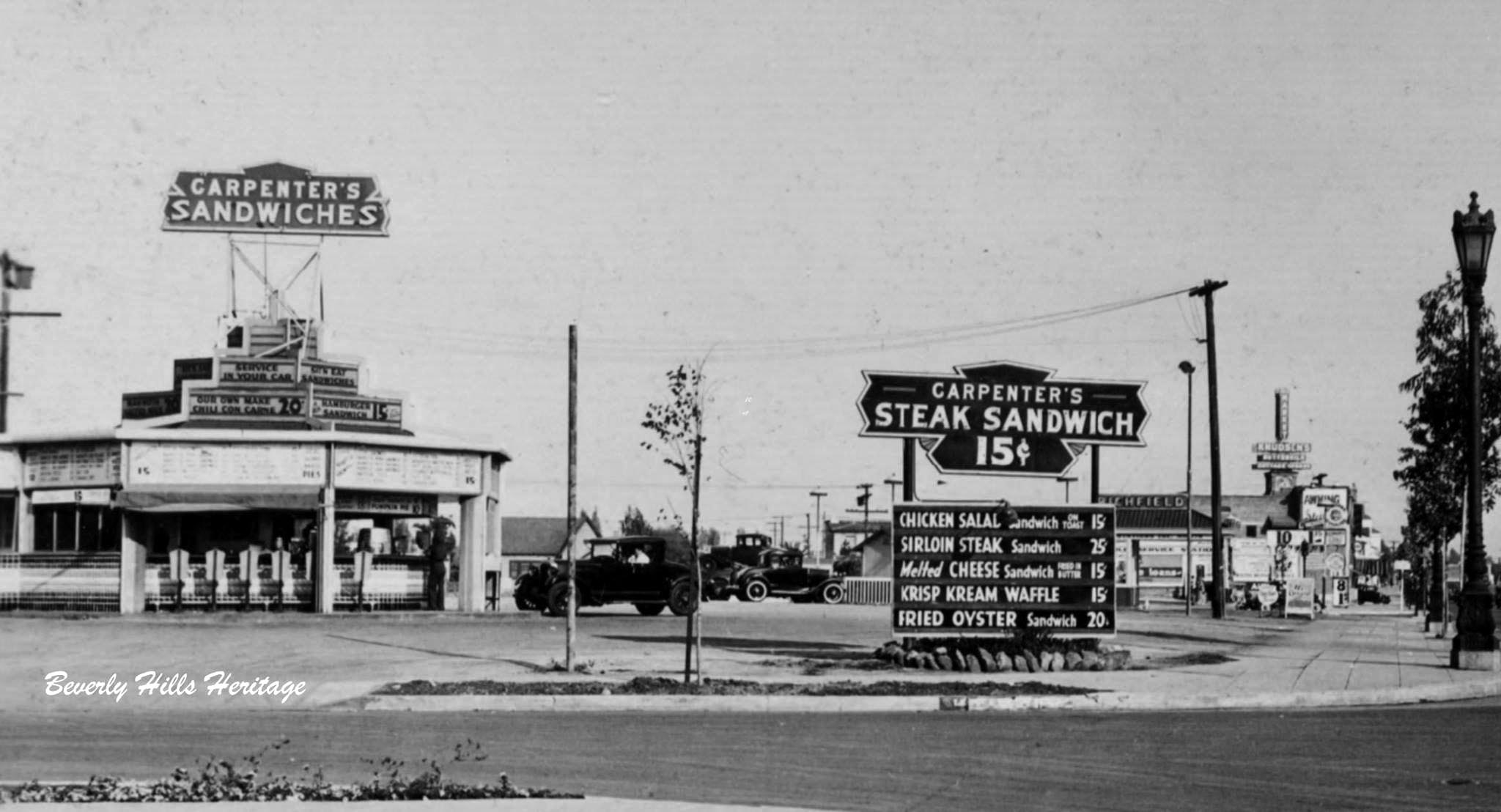 |
|
| (1932)* - Before it was "Dolores" Drive-In, it was Carpenter's Sandwiches on the NE corner of Wilshire Blvd at Le Doux Rd. For 30 cents you could enjoy a hamburger and wash it down with a cup of beer while sitting behind the wheel of your car (5 cents more for the premium beer). The tower of Sunset Clock Market can be seen in the distance on the right (N/E corner of Wilshire and Hamilton). Photo courtesy of Beverly Hills Heritage. |
Historical Notes In 1936, after separating from his brother, Charles E. Carpenter opened three Carpenter's Cafes. A transitional project Carpenter's Village (606 E. Colorado) combined a Rite Spot Cafe and Carpenter's drive-in. Next he opened the Rite Spot Cafe in Pasadena, located at 1500 West Colorado Street (now considered Eagle Rock) and the Santa Anitan Cafe at Huntington and Colorado. Click HERE to see more Early Views of LA Drive-in Restaurants. |
Dolores Drive-in (previously Carpenter's)
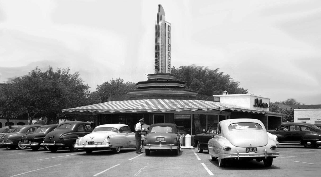 |
|
| (ca. 1949)^ - Dolores Drive-in located on the NE corner of Wilshire Boulevard and Le Doux Rd, previously Carpenter's Drive-in Restaurant. |
Historical Notes Dolores was founded by Amanda and Ralph Stevens, who after owning various restaurants in different states moved to Los Angeles in 1944 and opened the Dolores Drive-in Restaurant in West Hollywood.. There were many drive-in restaurants in Los Angeles during the mid 1940's and Dolores fit right in. Then, in 1956 the Stevens' son Robert and his wife Lucille moved to Los Angeles to help manage the newly leased Dolores Restaurant on Wilshire Blvd. and Le Doux Rd near La Cienega. The restaurant was a hit with the local teenagers in the 40's and 50's with its carhops, Suzie Q's and JJ Burgers became a staple in the community for the next thirty years.^ |
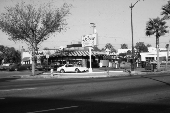 |
|
| (1978)* - Looking northeast across Wilshire Boulevard towards Dolores Drive-in Restaurant. Le Doux Road is on the left and La Cienega Boulevard is out of view to the right. Compare to previous photo to see how the once prominent tower above the structure has now been cut. |
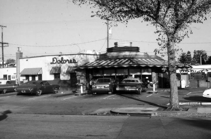 |
|
| (1978)* - Looking east across Le Doux Road towards Dolores Restaurant, a dining spot with car-hop service at 8531 Wilshire Boulevard. |
Historical Notes In 1981 Dolores Drive-in was forced to close down to make room for a high rise office building. The last of the remaining Dolores Restaurants was located at 11407 Santa Monica Blvd in West Los Angeles, which recently closed down. |
 |
|
| (1980)* - Dolores Drive-in on Wilshire Boulevard near La Cienega, Beverly Hills. LA Times Collection |
Historical Notes Built in 1946, Dolores would become the last restaurant of its kind to be seen in Beverly Hills thanks to a city ordinance prohibiting drive-ins. In 1981, KNBC TV interviewed loyal customers who flocked to Dolores's, the popular drive-in restaurant at Wilshire and La Cienega Blvd. for one last meal before it was torn down. Click HERE to see short video. Today, an office building stands where Dolores Drive-in once served hamburgers and fries. Click HERE for contemporary view. |
El Dorado Market
.jpg) |
|
| (1931)^ - Corner view showing one of the early “mini malls” in Los Angeles/Beverly Hills located on the northeast corner of Wilshire Boulevard and Almont Drive. |
Historical Notes The Spanish-style shopping center of the El Dorado Market was arranged around the parking lot and service station and featured easy access from Wilshire Blvd. It included a grocery store, bakery, delicatessen, Dutch ice cream shop, and real estate office.* Southern California was the principal center for the development of drive-in markets between the mid-1910s to the early 1940s. Other notable early drive-in markets included: Mandarin Market (Hollywood), Plaza Market (LA), Sunset Clock Market (Beverly Hills), and the Aurora Market (Glendale) |
 |
|
| (1931)^ - View showing the El Dorado Market “mini mall”, located at 8963 Wilshire Boulevard, 2 blocks east of S. Doheny Drive. Note the large Ice Cream Cone sign at right. It was *Currie's Ice Cream Parlor". |
Historical Notes Currie’s was a popular ice cream chain known for its “mile-high cone” whose replica was often displayed billboard-style on roofs. There was at least one more Currie's Ice Cream Store in Beverly Hills, located on the NW corner of Gale Drive and Wilshire Boulevard. Today, a multi-story office building stands where El Dorako Market used to be located. Click HERE for contemporary view. |
* * * * * |
Wilshire and Doheny
 |
|
| (ca. 1935)* – Postcard view showing the Streamline-Moderne Wilshirmart located on the southwest corner of Wilshire Boulevard and Doheny Drive. Caption reads: "Wilshirmart - Corner Wilshire Blvd. and Doheny Drive, Los Angeles...is Noted for its Excellent Produce Markets," |
 |
|
| (1935)* – Time-lapse photograph showing a well-lit Wilshirmart, without the ‘e’, located at Wilshire Boulevard and Doheny Drive. Today an office building occupies that space, just north of the Writers Guild Theater. |
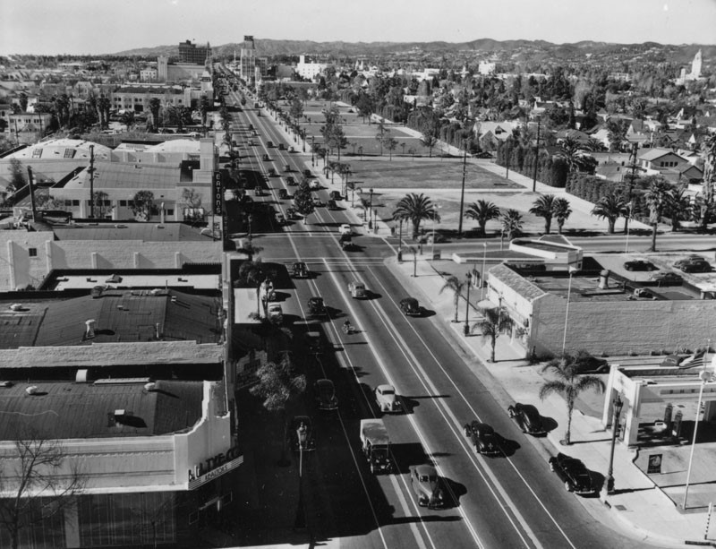 |
|
| (ca. 1939)^ – View looking west on Wilshire Boulevard toward Doheny Drive as seen from above Wetherly Drive. Note the empty lots along the north side of Wislhire in the distance. Wilshirmart is seen on the southwest corner of Wilshire and Doheny. A gas station is seen in lower-right (NW corner of Wilshire and Wetherly Drive). |
Historical Notes Wilshire Boulevard got its name from millionaire socialist Henry Gaylord Wilshire, who in 1895 began developing 35 acres stretching westward from Westlake Park for an elite residential subdivision. Wilshire donated to the city (LA) a strip of land 120 feet wide by 1,200 feet long for a boulevard, on the conditions that it would be named for him and that railroad lines and commercial or industrial trucking would be banned. As the city developed westward, so did Wilshire. Doheny Drive is a major north–south thoroughfare mostly through Beverly Hills and West Hollywood. It is named for Edward L. Doheny, an early 20th century oil tycoon based in Los Angeles/Beverly Hills. |
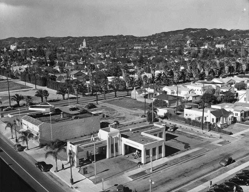 |
|
| (ca. 1939)^ – Birds-eye view of Beverly Hills looking northwest from the intersection of Wilshire Boulevard and Wetherly Drive. A Shell Gas Station is seen in the foreground on the northwest corner. Beverly Hills City Hall can be seen in the distance (upper center-left). |
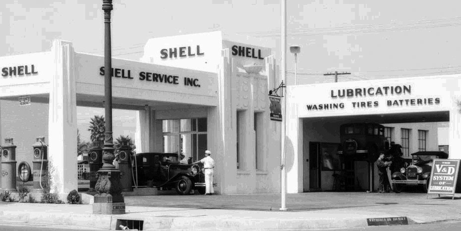 |
|
| (1931)* – Full service at the Shell Service Station located on the northwest corner of Wilshire Boulevard and Wetherly Drive, in Beverly Hills. Click HERE for more Early Views of LA Gas Stations. |
* * * * * |
Beacon Laundry
| (ca. 1940)^ - Street view showing Beacon Laundry, a laundry and dry cleaning business located one block west of Doheny Drive at 9134 Wilshire Boulevard in Beverly Hills. This structure, attached to a small strip mall (left), includes an Art Deco-style tower. |
* * * * * |
Harrold's Steakhouse
 |
|
| (ca. 1936)* – View showing Harrold’s Steakhouse located at the northeast corner of Wilshire Boulevard and Bedford Drive. The Art Deco steakhouse was an eccentric blend of Streamline Moderne and Moorish Revival styles. Saks Fifth Avenue would open across the street in 1938. Photo: Mark Wanamaker/Bison Archives, Courtesy of Beverly Hills Heritage & Kimberly Vinokur |
Historical Notes Harrold’s Steakhouse was named for its owner Harold Feldman, a transplant from Illinois. Harold and his wife Gwendoline lived only blocks away in a multi-family dwelling at the corner of Reeves Drive and Gregory Way. The building was partially designed (the Streamline westernmost portion) by the architectural firm of Schwartz and Fiel and survived until the early 60s at which time it was demolished to make way for an unobtrusive mid-century, Security First National Bank building. In 1971, that building was demolished for a more lucrative, high-rise, glass-box. * Click HERE to see contemporary view of the above intersection. |
* * * * * |
Wilshire Boulevard
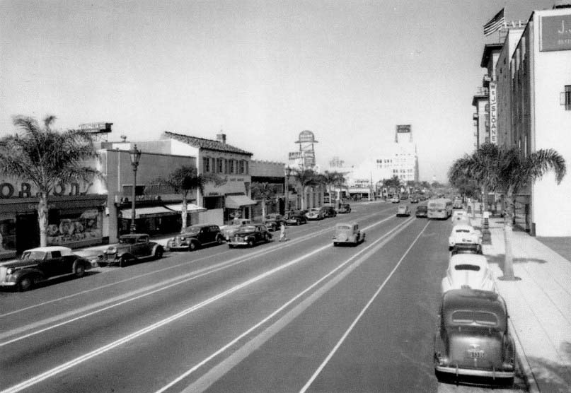 |
|
| (1944)* – View looking east on Wilshire Boulevard from S. Camden Drive. From right to left can be seen J.J. Haggarty's, W & J Sloane, Beverly Wilshire Hotel, Californian Bank, and the Brown Derby Restaurant. |
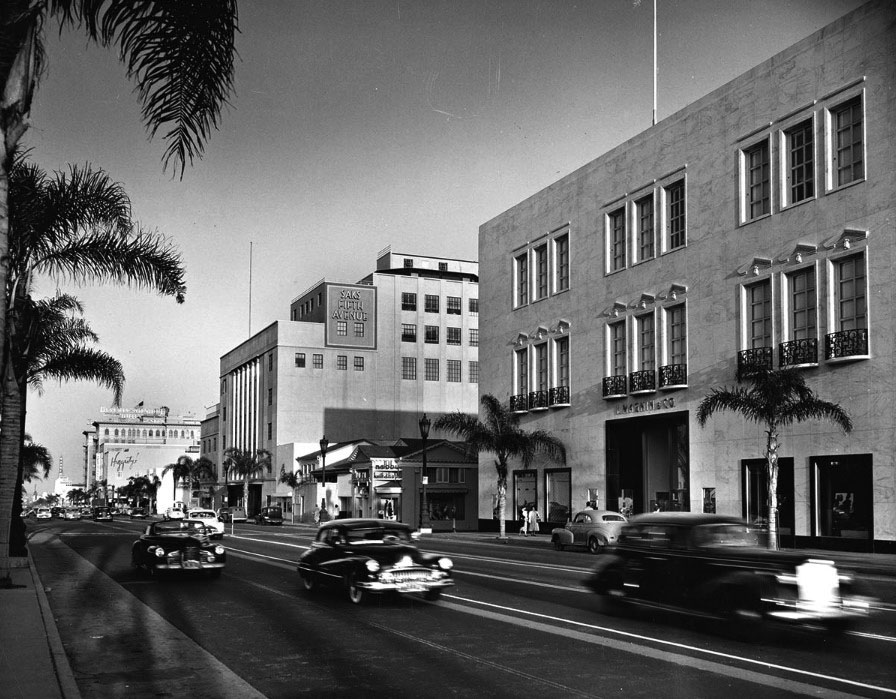 |
|
| (1940s)* - View looking east on Wilshire Boulevard in Beverly Hills showing I. Magnin at right and Saks Fifth Avenue at center-left. In front of Saks Fifth Avenue is an attractive little building housing Nobby Knit Shops. In the background is Haggarty's, the Beverly Wilshire Hotel, a Bank of America and the Warner Beverly Hills Theater. |
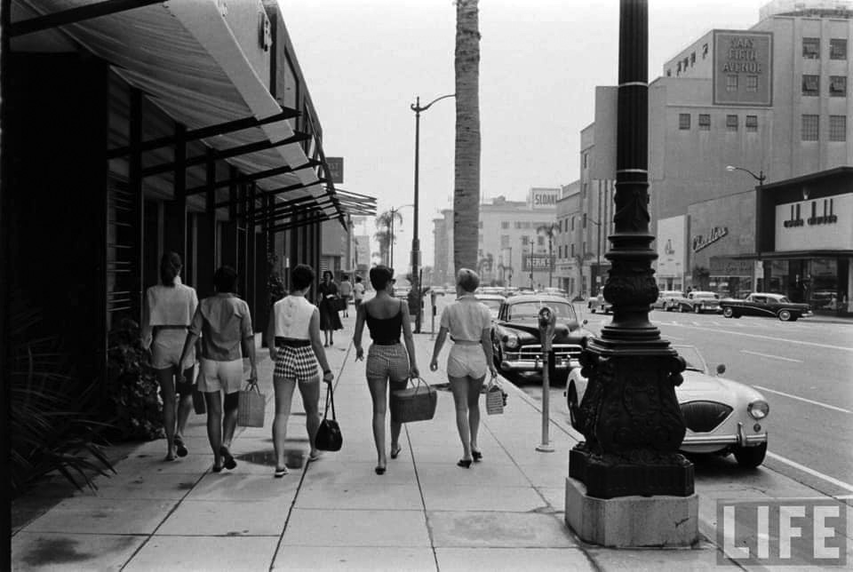 |
|
| (1950s)* – Life Magazine photo showing young ladies walking east on Wilshire Boulevard wearing short shorts. Saks Fifth Avenue and Sloans Department Store can be seen in the distance. |
Then and Now
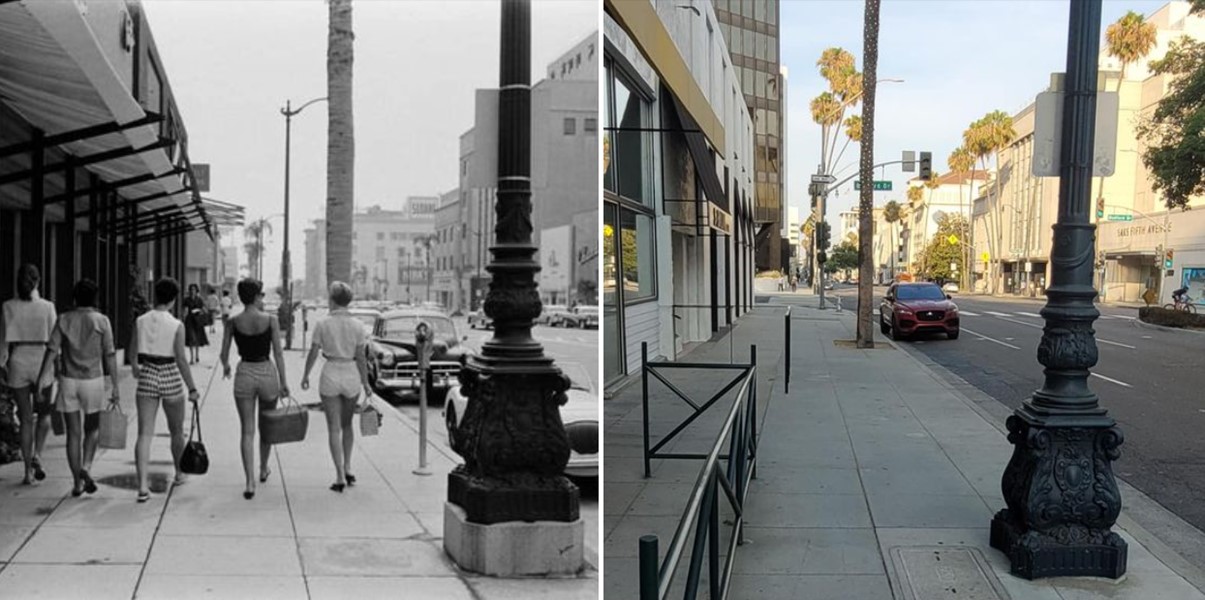 |
|
| (1950 vs. 2020)* |
* * * * * |
Haggarty's Department Store
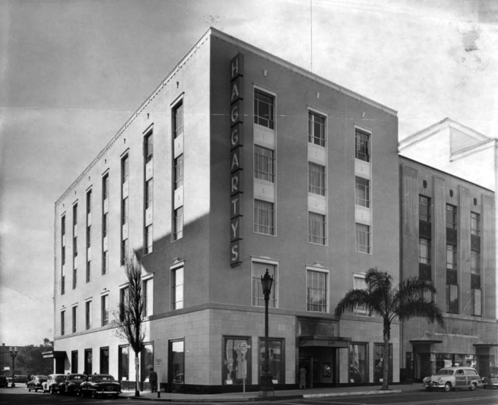 |
|
| (1951)* - View showing Haggarty's Department Store, located at 9536 Wilshire Boulevard, SW corner of Wilshire and Rodeo Drive. Click HERE for contemporary view. |
Historical Notes Haggarty's was a department store chain founded in Los Angeles in 1906 and which closed in May 1970 due to not keeping up with fashion trends and a resulting $4.4 million in debts. It had more than a dozen branches at its peak. The chain was founded by J. J. Haggarty (1860–1935) who opened his first store the "New York Cloak and Suit House" in 1906. After opening three more stores on Broadway between 3rd and 6th streets, he finally opened his "vision", a large "uptown" Los Angeles store, at the southeast corner of W. Seventh St. and Grand Avenue, this time under the name J.J. Haggarty Inc. After Mr. Haggarty's death the chain was bought by Clyde H. DeAcres, who had been president of Sherman, Clay and Co. in San Francisco, retailers of musical instruments. In 1938, DeAcres opened a four-story branch store in Beverly Hills on Wilshire Boulevard at Rodeo Drive. |
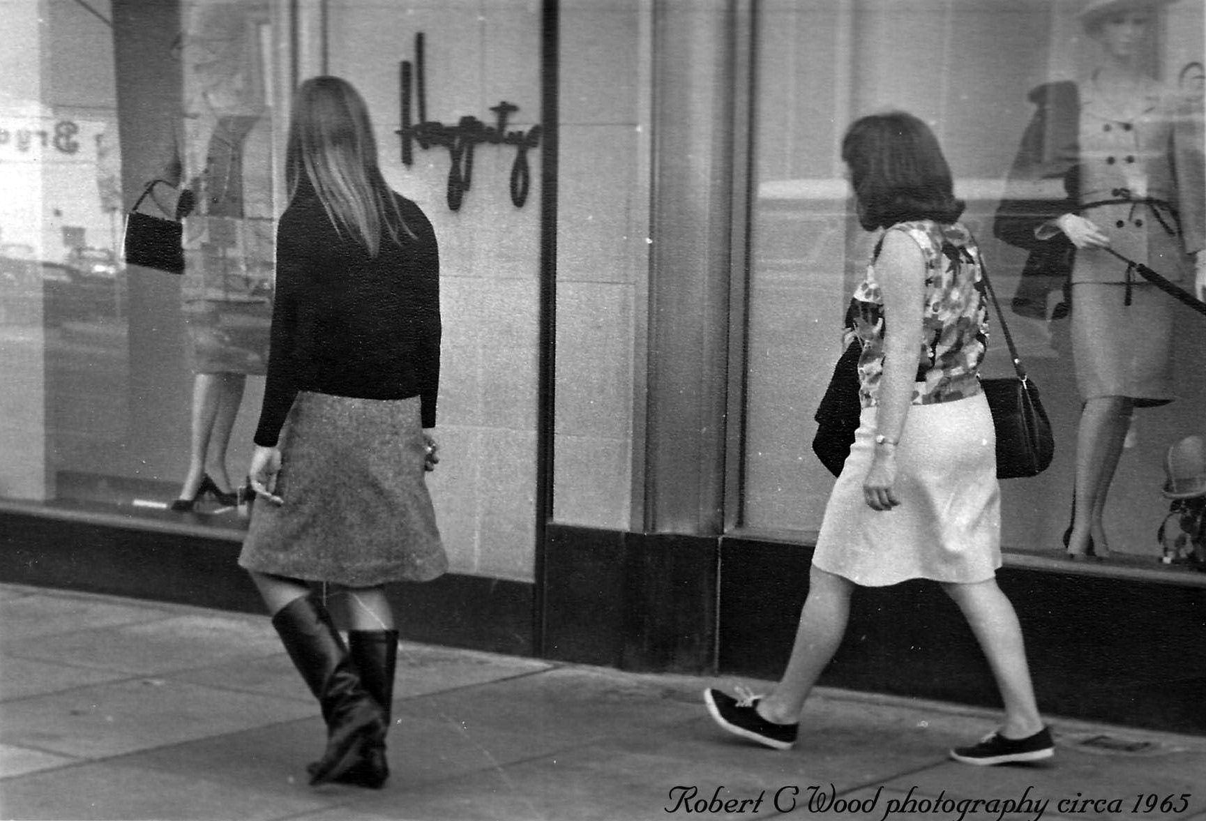 |
|
| (ca. 1965)* - Girls walking past Haggerty’s on Wilshire Boulevard. Photo by Robert C. Wood |
Historical Notes At the time of the Haggerty chain's demise the principal owner was Mrs. Lila M. Ash, the wife of Roy Ash, the president of Litton Industries, a large defense contractor. She had invested about $9.5 million in Haggarty's. Shortly before bankruptcy in 1970, the chain operated locations in Beverly Hills (the lease on which was acquired by Roos-Atkins), Palm Springs, Downey, Canoga Park, and four Hafter's-Haggarty's shops in the San Diego area. |
* * * * * |
Wilshire and Robertson
 |
|
| (ca. 1940)* - View looking north on Roberston at Wilshire Boulevard showing an ornate Spanish-style building on the NE corner. A Creswell Drug Store, Hall of Fame Book Shop, and other business occupy the building. Two men are seen atop a large Coca-Cola sign, which is mounted to the roof. Click HERE to see contemporary view. |
 |
|
| (ca. 1937)* - Creswell Drug Store located at 8801 Wilshire Blvd in Beverly Hills. The Spanish Colonial Revival style building has a gorgeous cupola atop its turret. |
 |
|
| (ca. 1940)* - View looking at the SW corner of Wilshire and Willaman Drive (3 blocks east of Robertson) showing an Art Deco style automobile service and maintenance center, 8672 - 8680 Wilshire Boulevard. Roy Frankson's Motor Glide Mart, an authorized scooter dealer in Beverly Hills is located in the middle of the center, at the base of the large twin towers sign. The center offers tires, general repair, car washes, and a variety of other automotive services. Click HERE to see contemporary view. Photo by Ansel Adams |
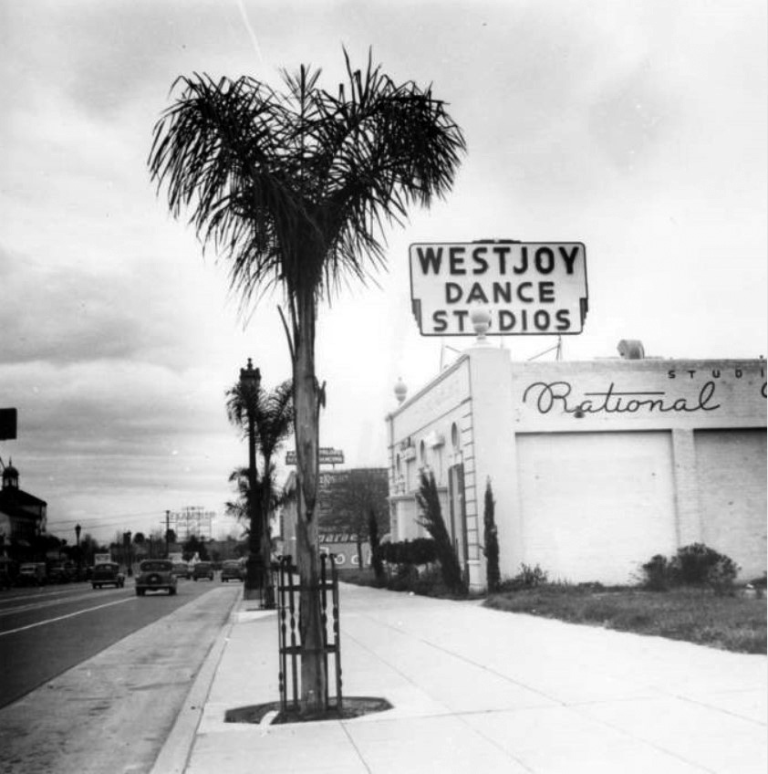 |
|
| (ca. 1940)* - View looking east on Wilshire Blvd toward Robertson Blvd. Westjoy Dance Studios, consisting of Westjoy Dance Studio (8844 Wilshire Blvd.) and Nancy White Studio (8846 Wilshire Blvd.), are located in the building seen on the right, on the south side of the street. Young palms line the sidewalk and various businesses are visible in the background on the left. Photo by Ansel Adams |
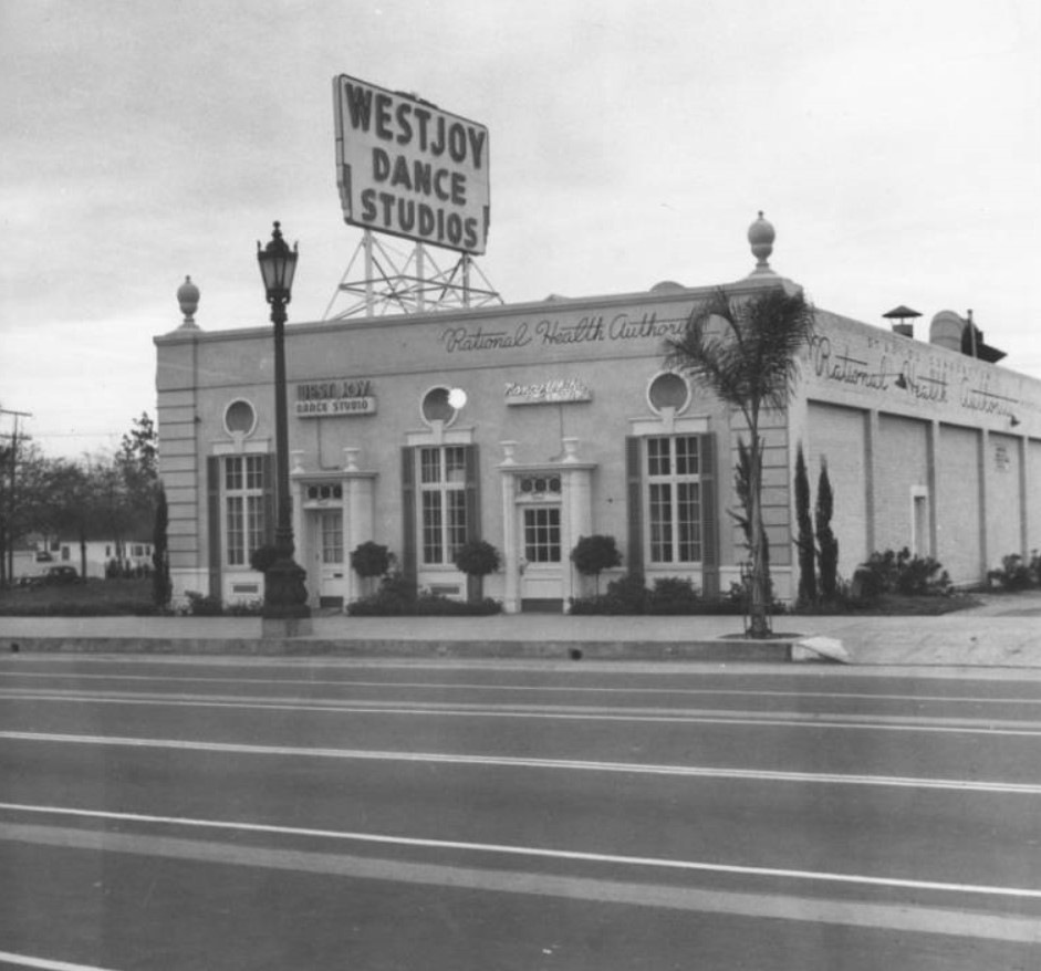 |
|
| (ca. 1940)* - Exterior view of Westjoy Dance Studios, consisting of Westjoy Dance Studio (8844 Wilshire Blvd.) and Nancy White Studio (8846 Wilshire Blvd.), located in Beverly Hills. A classic "Wilshire Lantern" street light is seen directly outside the building. Today, an Audi Dealership occupies this site (Click HERE to see contemporary view). Photo by Ansel Adams |
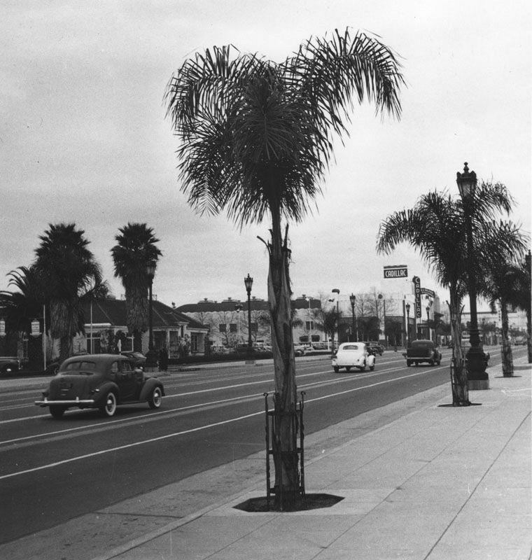 |
|
| (1940s)* – View looking west on Wilshire Boulevard toward Palm Drive. In the distance can be a large sign on an Art Deco building reading “Cadillac”. Photo by Ansel Adams |
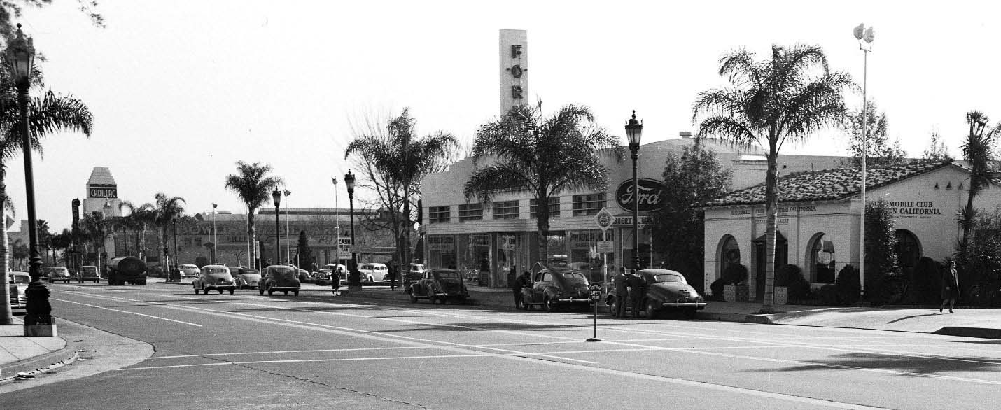 |
|
| (1944)* – Panoramic view looking southeast on Wilshire Boulevard as seen from Crescent Drive. Today Wells Fargo and FedEx/Kinkos stand where the Streamline Moderne designed Ford dealer once stood. In the distance can be seen a Cadillac dealtership. Photo: Marc Wanamaker/Bison Archives. Click HERE to see contemporary view. |
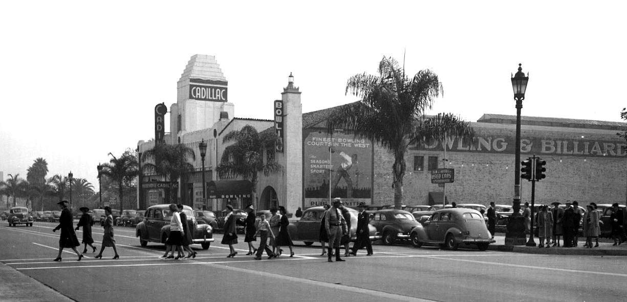 |
|
| (ca. 1944)* - A shot of Wilshire Boulevard looking southeast at Rexford Drive. A group of walkers in their Sunday best head north, presumably coming from the First Church of Christ Scientist, right, down the street (out of view). The second home of Hillcrest Cadillac is seen here, adjacent to a bowling alley and billiard hall, in a building which originally housed Maddux Lincoln Automobiles. Today, both of these buildings are home to Jim Falk Lexus Beverly Hills (and don't look a THING like this anymore). Click HERE to see contemporary view. |
* * * * * |
Hillcrest Motor Co. Building
 |
|
| (ca. 1950s)* – View showing the Hillcrest Motor Company Building and Cadillac Dealership located on the SW corner of Wilshire and S. Maple Drive. |
Historical Notes Built in 1930s, the Art-Deco Hillcrest Motor Company Building was the sole Cadillac showroom, dealership, and service venue in Beverly Hills for decades. |
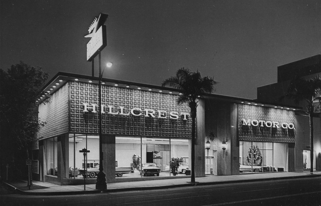 |
|
| (ca. 1964)*- View showing the redesigned Hillcrest Motor Co. Building located at 9217 Wilshire Boulevard (SW corner of Wilshire and Maple). |
Historical Notes William M. Bray, Architect, AIA, NCARB created the new look contemporary building design which included two-story marble and glass entry; large expanses of glass between contemporary pilasters; “Starburst” lightweight concrete block decoration and screens; marble flooring; and high ceilings. This made Hillcrest Motors a cultural icon in the city of Beverly Hills for decades. Business leaders, celebrities, and others viewed, bought, and had their cars serviced there. Today, this building is a Lexus Dealership. Click HERE for contemporary view. |
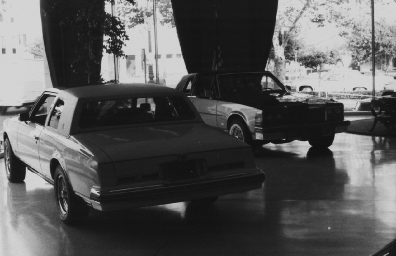 |
|
| (1977)* – Interior view of the Hillcrest Motor Co. showroom with two 1977 Seville San Remo Coupes on display. |
* * * * * |
Ralphs Market (Wilshire and Crescent Drive)
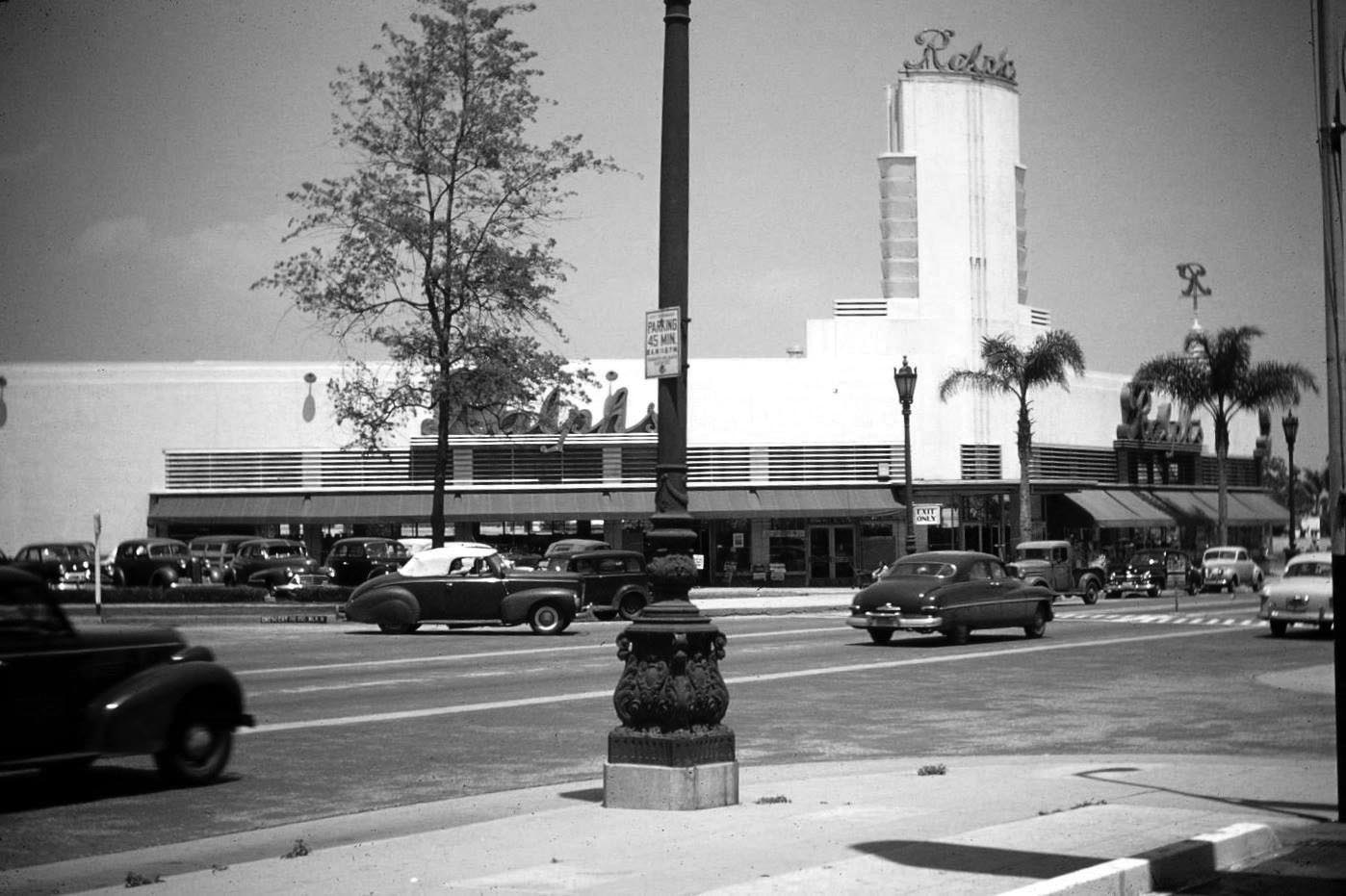 |
|
| (1949)* - View looking northeast across the intersection of Wilshire Blvd and Crescent Drive showing Ralphs Market with its Art Deco tower standing tall on the northeast corner. |
Historical Notes The Ralphs grocery store chain made their way through the Southern California architectural landscape in the early 20th century building stunning structures uniquely suited for individual neighborhoods. Beverly Hills was no exception with its stately Art Deco Streamline Moderne Ralphs on the northeast corner of Wilshire Boulevard and Crescent Drive. The corner where Raplhs once stood is now occupied by a 3-story office building. Click HERE to see contemporary view. Ralphs Grocery Company was founded in 1873 by George Albert Ralphs. The original store was located at Sixth and Spring Streets. Click HERE to see the original store. |
.jpg) |
|
| (1949)* – View of the Art Deco-style Ralphs Market at the northeast corner of Wilshire Boulevard and Crescent Drive. Photo courtesy of ssilberman, whose grandparents took it during a visit to Los Angeles |
Historical Notes The Ralphs Market built in 1939 on the northeast corner of Wilshire Boulevard and Crescent Drive in Beverly Hills was a significant example of Streamline Moderne architecture, designed by the renowned architect Stiles O. Clements. Known for its distinctive facade featuring large glass blocks and clean, curved lines, the building exemplified the evolution of supermarkets into architecturally notable urban landmarks during the mid-20th century. Clements, who also designed iconic structures such as the El Capitan Theater in Hollywood, the Wiltern Theater, and the now-demolished Richfield Building in downtown Los Angeles, contributed significantly to the architectural landscape of Los Angeles. Although the Ralphs store is no longer standing, it remains an important part of Beverly Hills' architectural history, reflecting the post-war optimism and the increasing influence of automobile culture on urban development. |
* * * * * |
N. Beverly Drive (1940s +)
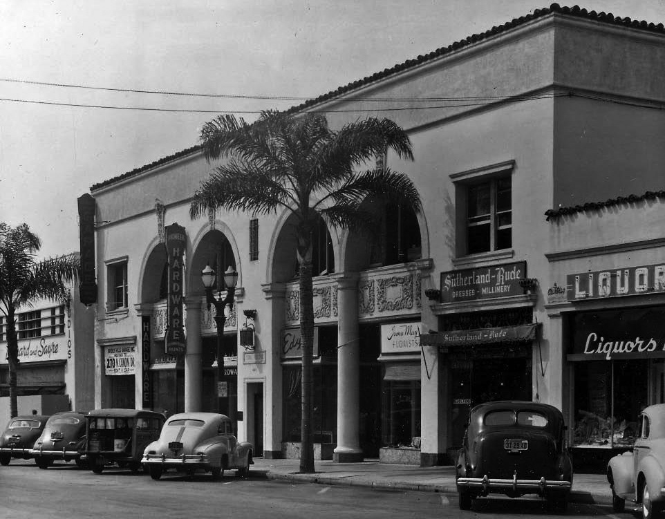 |
|
| (1940s)* – View of Beverly Drive showing a variety of commercial business from hardware stores to liquor stores. Note the young palm trees that line the street. |
Historical Notes The development of Beverly Hills in the 1920s, 30s and 40s gave witness to an eclectic mix of architectural styles that defined the unique and glamorous look the city still enjoys today. |
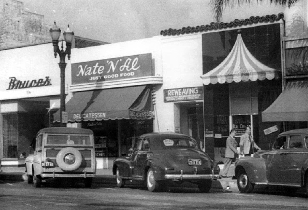 |
|
| (1947)* – View showing Nate ‘n Al Delicatessen located at 414 N. Beverly Drive, in Beverly Hills. |
Historical Notes Nate 'n Al opened its doors in 1945. The deli was started by two long term friends and partners, Al Mendelson and Nate Rimer. It began to grow big in name especially when silver screen starlets, directors, producers and writers made Nate 'n Al a Hollywood hangout. Nate would eventually leave the business, however, the deli would continue to be run by Al and family, including his wife Terry, sons Barry and Sandy, and grandsons Mark and David who still operate Nate ‘n Al today. |
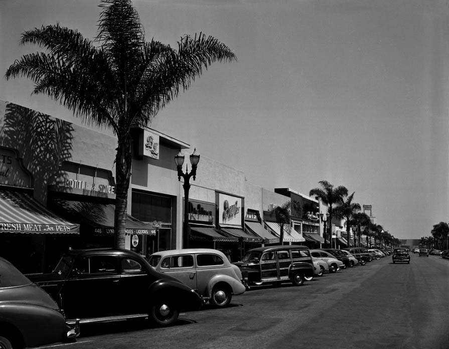 |
|
| (ca. 1949)* – View looking south showing the east side of Beverly Drive with the California Bank sign seen in the distance, located on Wilshire Boulevard. |
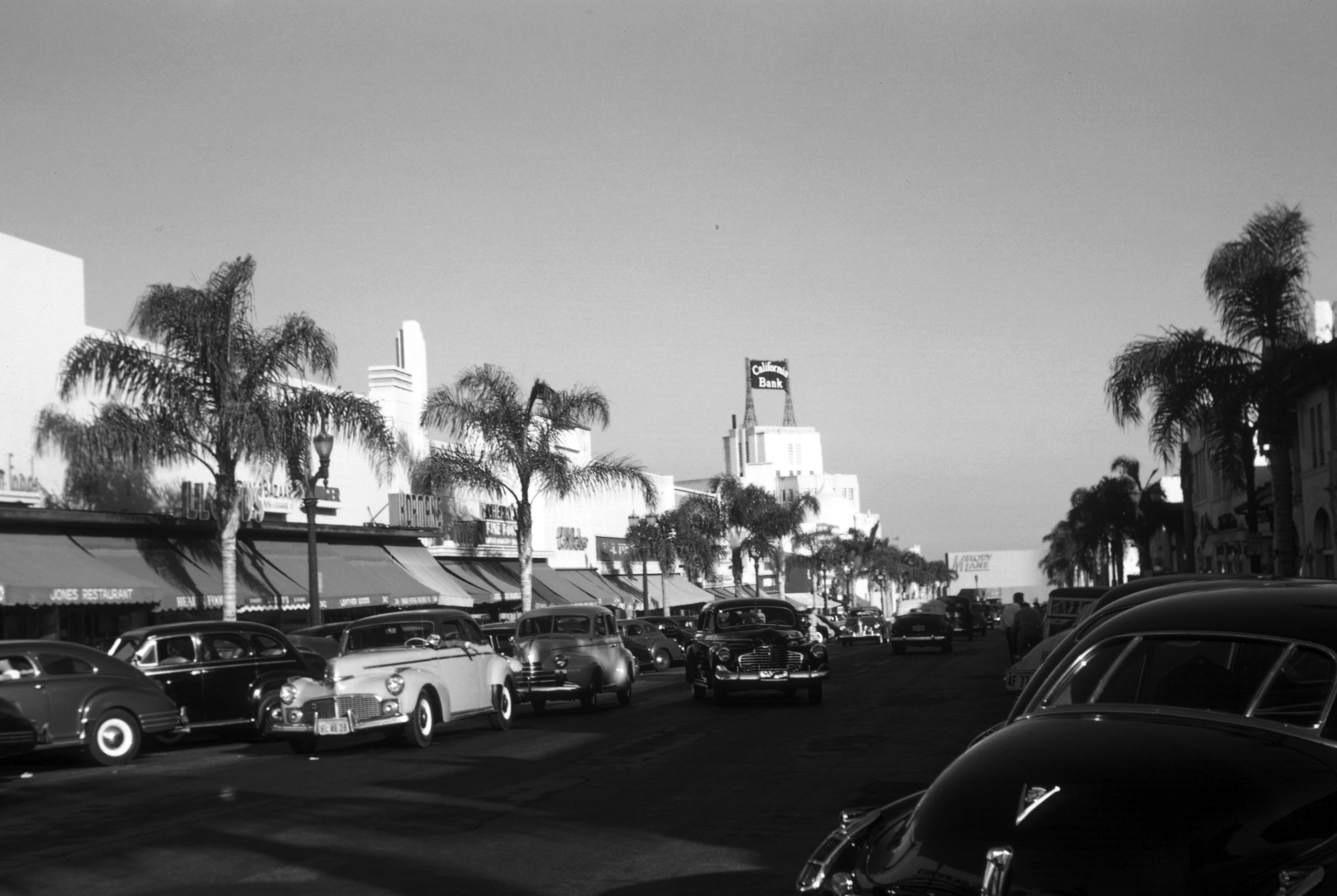 |
|
| (1947)* – View looking south on N. Beverly Drive toward Wilshire Boulevard with the California Bank seen in the distance. |
S. Beverly Drive (1950s +)
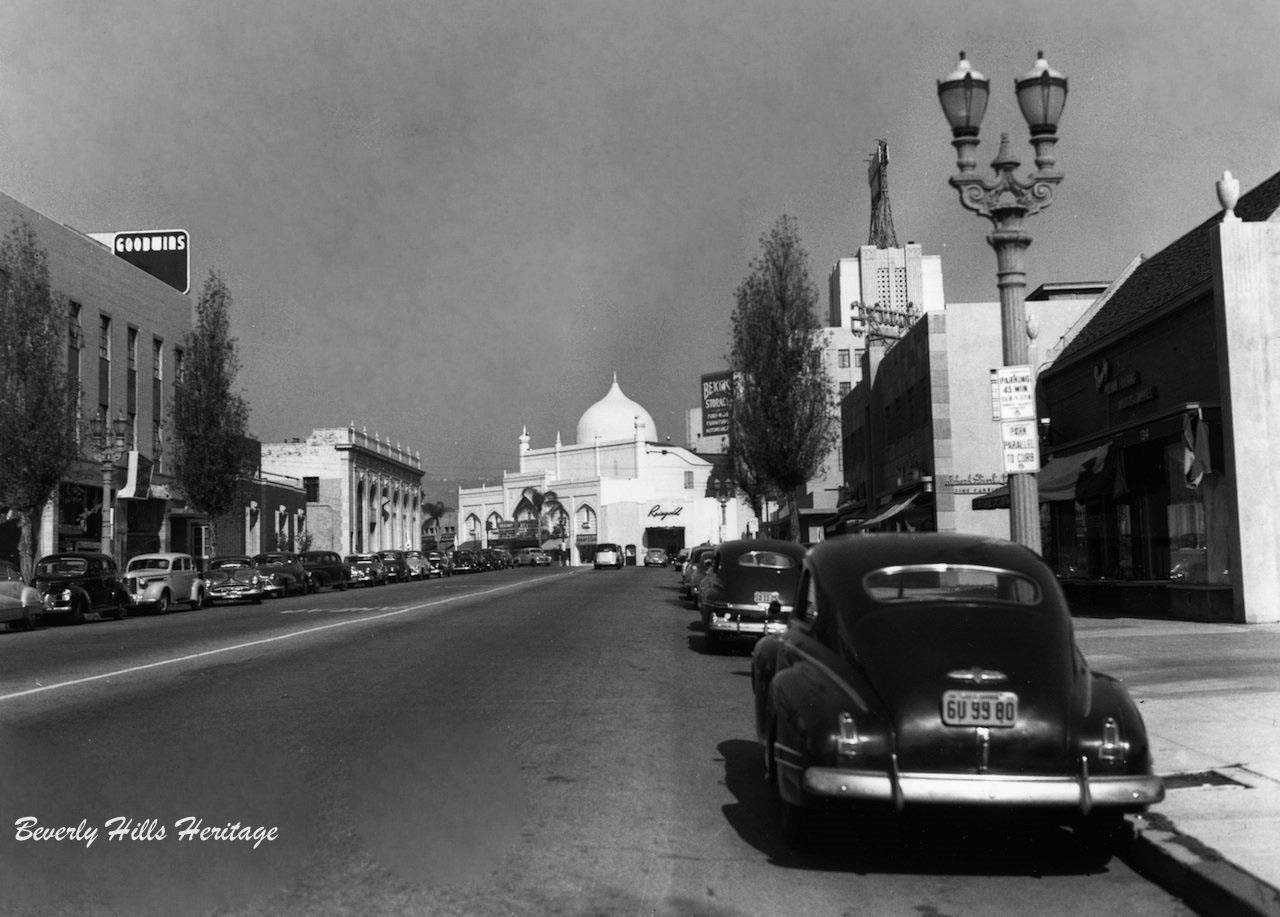 |
|
| (ca. 1950)* – View looking north on S. Beverly Drive toward Wilshire Boulevard with the Beverly Theater and California Bank Building seen in the background. Photo courtesy of Beverly Hills Heritage. |
Historical Notes In the above photo, the mingling of exceptional architectural styles is clearly evident, from the Beaux Arts Walter G. McCarty development on the southwest corner of Wilshire Boulevard and Beverly Drive to the Mughal Revival Beverly Theatre on N. Beverly Drive and the stair-step design Art Deco Era California Bank building now known as Sterling Plaza. The heart of the commercial district was distinct and recognizable as definitively Beverly Hills. |
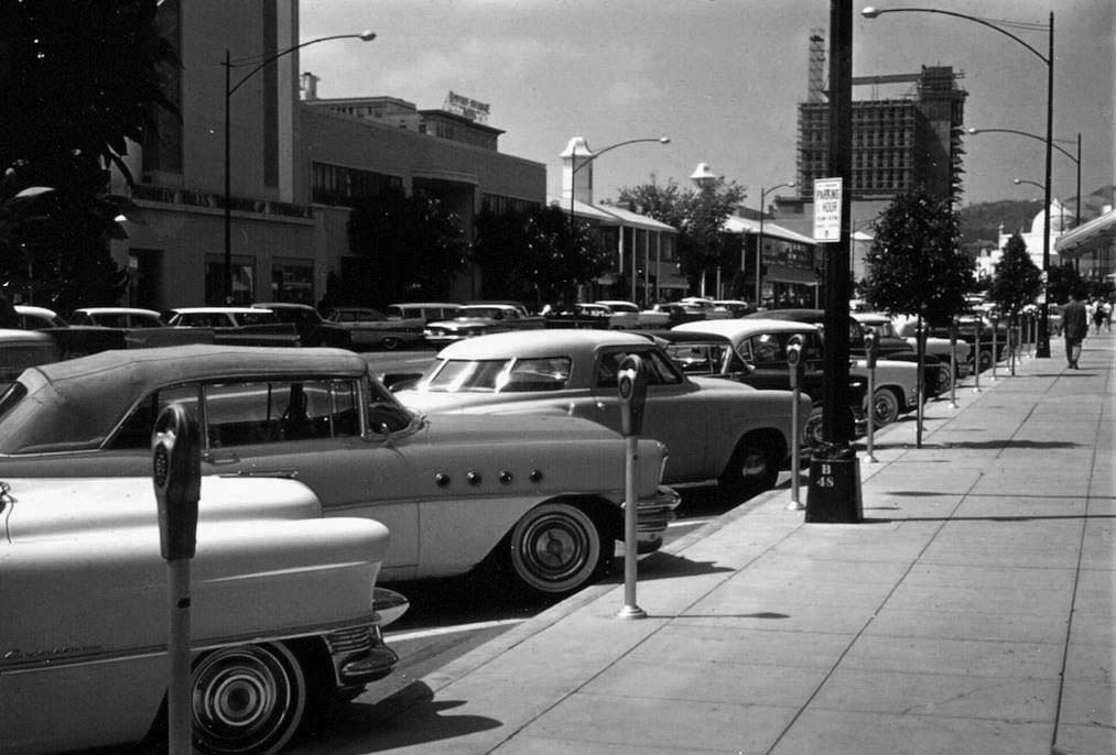 |
|
| (1959)* – View looking north on South Beverly Drive toward Wilshire Boulevard. A Studebaker is parked next to a ragtop Buick (foreground). In the distance can be seen the Union Bank building still under construction, S/W corner of Wilshire and Beverly. On the N/E corner stands the Beverly Theatre. Click HERE for contemporary view. |
* * * * * |
Wil Wright's Ice Cream
 |
|
| (1954)* - Wil Wright’s Ice Cream parlor located on the southeast corner of Beverly Drive and Charleville Boulevard in Beverly Hills. Today, Tarte Tatin Bakery and Starbucks occupy the space where Wil Wright's used to be. |
Historical Notes Wil Wright’s was a chain of ice cream parlors that dotted the Southern California landscape up until the mid-seventies. In addition to the Beverly Hills location, they could be found in Westwood Village (corner of Glendon and Lindbrook), West Hollywood (Sunset Strip), Pacific Palisades (San Vicente), and Sherman Oaks (corner of Ventura and Van Nuys Blvd). They were the perfect place to take a date after the movie. The delicate pink and red decor and little marble tables and wire-frame chairs made you feel like you were seated inside a Valentine’s Day card. |
Then and Now
|
|
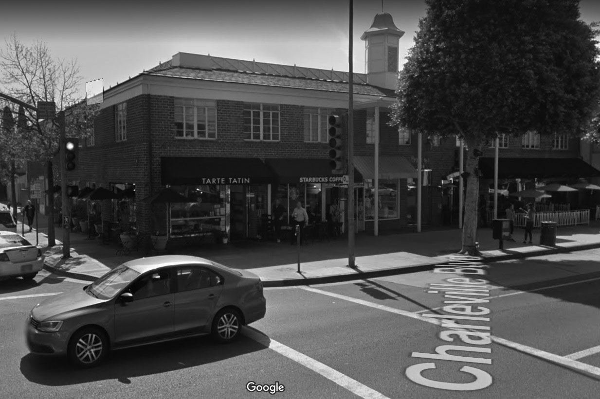 |
|
| (1954 vs. 2018) - SE corner of Beverly Drive and Charleville Blvd. |
* * * * * |
Rodeo Drive
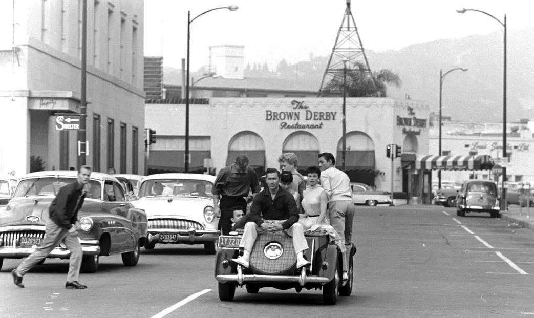 |
|
| (ca. 1955)* – View showing at least 8 young adults/kids packed into a mid-50s MG “TF” model as it heads north on South Rodeo Drive toward Wilshire Boulevard. The Brown Derby Restaurant is seen in the background on the NW corner and Haggarty's Department Store is on the left, SW corner. |
Then and Now
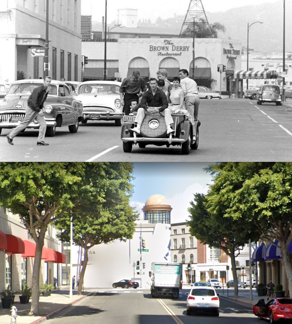 |
|
| (1950s vs. 2020s) – Looking north on Rodeo Drive toward Wilshire Boulevard. Top photo shows Haggerty’s on the left, Beverly-Wilshire Hotel on the right, and the Brown Derby Restaurant straight ahead. |
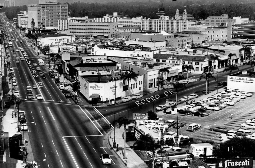 |
|
| (ca. 1958)^ – View looking west on Wilshire Boulevard at Rodeo Drive. The Brown Derby Restaurant can be seen on the northwest corner. |
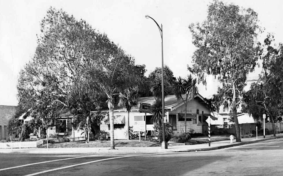 |
|
| (1954)* – View looking at a house located on SW corner of Rodeo Drive and Brighton Way (371 N. Rodeo). |
Historical Notes This was the last house left standing on Rodeo Drive between Wilshire and Santa Monica boulevards before the street completely gave over to commercial interests. Actually, it was a home turned into a restaurant. Rodeo Drive didn’t become a luxury strip until the arrival of Gucci in 1969. |
Then and Now
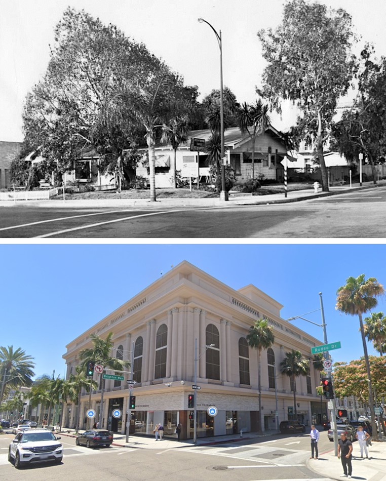 |
|
| (1954 vs 2022)* - SW corner of Rodeo Drive and Brighton Way. |
* * * * * |
Robinson's Department Store
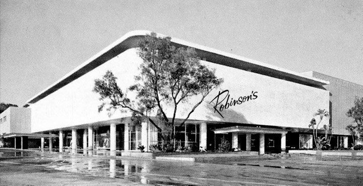 |
|
| (1952)^.^ - Artist rendition of Robinson’s Department Store on Wilshire Boulevard in Beverly Hills. |
Historical Notes In 1952, Robinson’s unveiled its first major branch store in Beverly Hills, designed by Charles Luckman and William Pereira, with interiors by Raymond Loewy. The mid-century modern store, with floor-to-ceiling windows looking out on a “California Patio” had adjacent parking and a rooftop restaurant, and was noted by the Los Angeles Times for its "striking architecture and sophisticated smartness." |
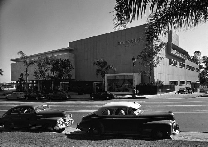 |
|
| (1952)^^* – View looking across Wilshire Boulevard showing Robinson's Beverly Hills. Designed by William Pereira & Charles Luckman with Charles Matcham. |
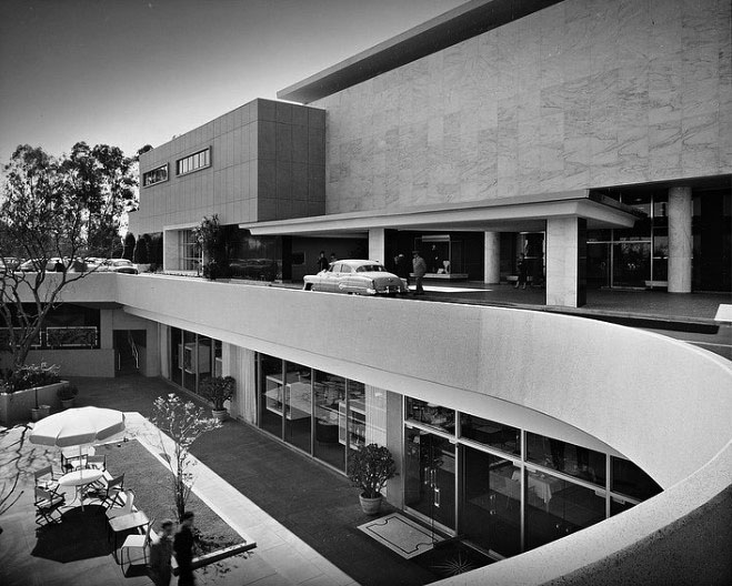 |
|
| (1952)^^* - Robinson's Beverly Hills, pedestrian entrance and valet ramp. |
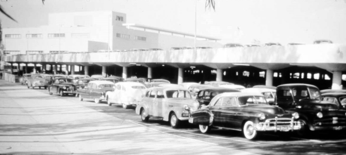 |
|
| (1952)^^ - View showing the lower and upper parking levels from service drive of J.W. Robinson's Department Store, 9900 Wilshire Boulevard, Beverly Hills. |
Historical Notes The store opened in 1952 and closed in 2006. It was 200,000 square feet large with 1,100 parking spaces when it opened; cost was $6 million. Architect-engineers were Charles O. Matcham, Charles Luckman and William Pereira (of San Francisco Transamerica Pyramid and Irvine city planning fame). Raymond Loewy and Associates designed the interior.^ |
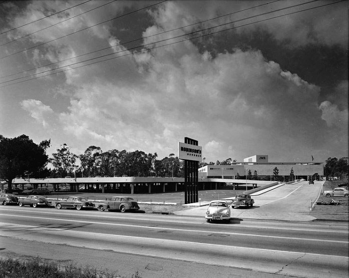 |
|
| (1952)^^* - Robinson's Beverly Hills, Wilshire-West entrance. Left to right, '48 Pontiac torpedo, '50 Buick fastback, '50 Pontiac two-door coupe, and a '39 Oldsmobile. |
Historical Notes As decades passed, revenues of the Beverly Hills Robinson's store declined in part due to the prevalence of newly-constructed regional shopping malls throughout the country. Whereas department stores originally succeeded as standalone buildings, new department stores were being positioned as anchors within regional shopping malls where they benefited from the synergy and traffic provided by a complementary mix of dozens of retail clothing stores. More specifically, the Robinson's Department Store's business was directly challenged by the 1964 opening of the nearby 900,000 SF Century Square Shopping Center, now known as Westfield Century City. The 900,000 SF Century Square Shopping Center would eventually include two department stores, which have now been rebranded as Bloomingdales and Macy's. As a result of this major shift in the department store industry, Robinson's would find its sales and traffic steadily decreasing until the early 2000s. ^ In 2016, the Robinson's slong with its parking structure was demolished to make room for two high rise, mixed used housing buildings. |
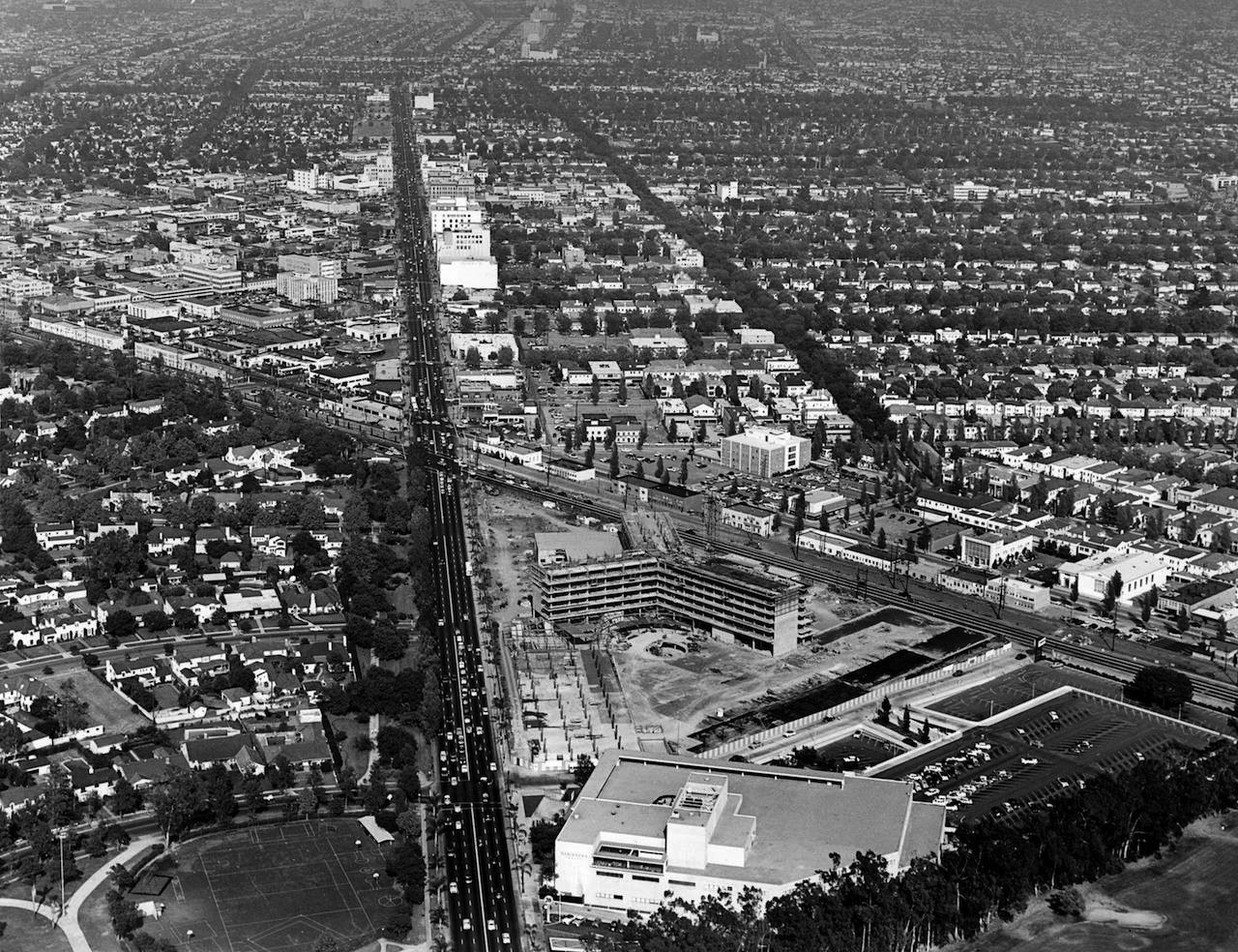 |
|
| (1954)* – Aerial view looking east on Wilshire Boulevard where it intersects Santa Monica Boulevard (aka 'The Point') showing the construction of the Beverly Hilton Hotel, with the Robinson's Department Store (completed in 1952) seen at bottom. Photo courtesy of Beverly Hills Heritage |
Historical Notes In 1950, Conrad Hilton filed an application to build a $17 million hotel on the site of the Beverly Hills Nursery. The hotel opened in August 1955, making it the third major hotel in Beverly Hills. |
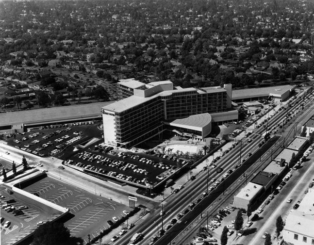 |
|
| (1955)^.^ - Aerial view looking NE showing the Beverly Hilton Hotel shortly after it opened at 9876 Wilshire Boulevard. |
Historical Notes Conrad Hilton opened the Beverly Hilton in 1955. Architect Welton Becket designed the hotel as a showpiece with 582 rooms. Since 1961, the hotel's International Ballroom has hosted the Golden Globe Awards ceremony, presented annually by the Hollywood Foreign Press Association.* |
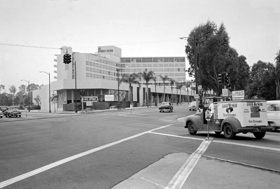 |
|
| (1955)^.^ - Street view looking SW at the intersection of Wilshire and Santa Monica boulevards. The newly constructed Beverly Hilton can be seen with palm trees fronting it on Wilshire Blvd. Note the Good Humor Ice Cream truck stopped at the crosswalk on the right. On the corner is Trader Vic's under construction, with four tiki gods on the wall. |
`
Beverly Hilton Hotel
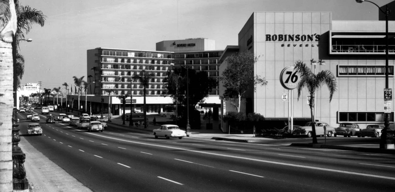 |
|
| (ca. 1955)* - View looking east on Wilshire Boulevard from Whittier Drive showing the Beverly Hilton and Robinson's with the Santa Monica Boulevard crossing in the distance. |
Historical Notes The Beverly Hilton opened in 1955 by distinguished hotelier Conrad Hilton. Owned by Merv Griffin from 1987 to 2003, Beny Alagem and Oasis West Realty LLC purchased the 569- room hotel in 2003 and immediately embarked on a spectacular $80 million renovation, which was completed in 2008. Since then, an additional $19 million in refresh updates have been made. |
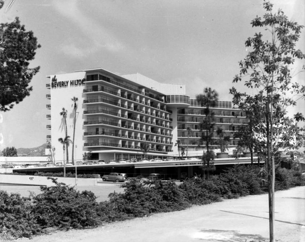 |
|
| (1955)* - View of the Beverly Hilton Hotel located at 9876 Wilshire Boulevard. Sign on the edge of the parking lot reads: "Minute Man Service" |
Historical Notes Esther Williams, film star and swimmer extraordinaire officially inaugurated The Beverly Hilton’s Aqua Star Pool (the largest in Beverly Hills) by swimming through white gardenias with three of her swim students. The hotel’s ground-floor nightclub, the Bali Room (now the International Ballroom), was so versatile that its beautiful jeweled stage and dance floor could be converted to an ice skating rink when the occasion called for it. |
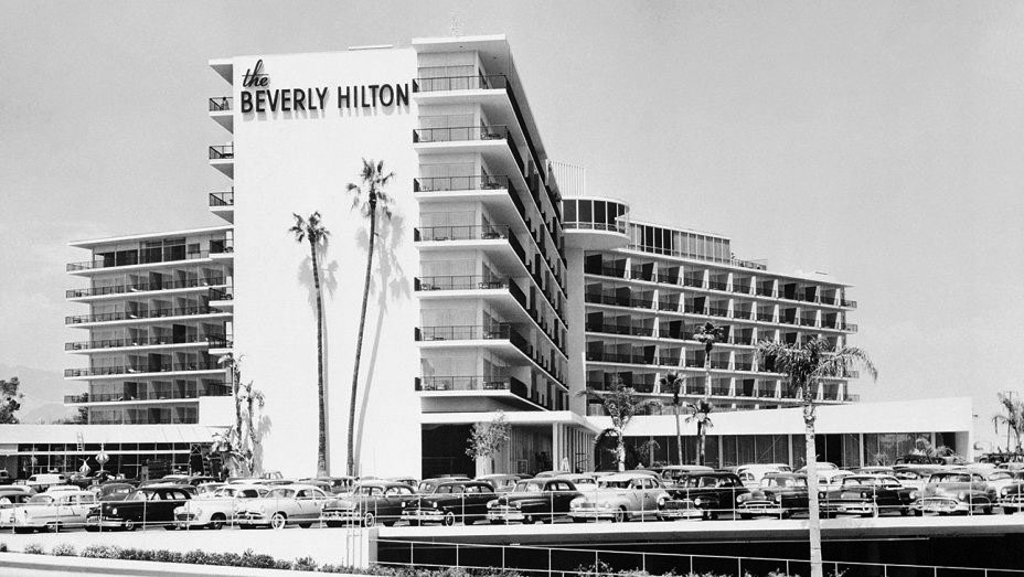 |
|
| (ca. 1955)* - Another view of the Beverly Hilton fronted by tall palm trees. |
Historical Notes Painted a familiar shade of Welton Becket's favored color, marshmallow white, the building was called the "western White House" by President John F. Kennedy. July 10, 1960 marked the Democratic National Convention Closing Ceremonies; Presidential nominee John F. Kennedy held a gala fundraiser at The Beverly Hilton where his pal Frank Sinatra rounded up a host of celebrities including Milton Berle, Janet Leigh, Tony Curtis, Judy Garland, Mort Sahl and the entire ‘Jack Pack’ to mingle with the crowd of 2,800 supporters. By the time Judy Garland began her second number, the crowd had filled two separate ballrooms to capacity. |
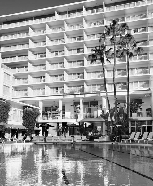 |
|
| (2010s)^ – Beverl Hilton Hotel's pool with palm trees in background. |
Historical Notes Since 1961, the hotel's International Ballroom has hosted the Golden Globe Award ceremony, presented annually by the Hollywood Foreign Press Association. The hotel’s vast size and upscale event space allows over 1,300 guests to gather in the International Ballroom for the live telecast, five entertainment companies also throw large viewing and after parties simultaneously in areas throughout The Beverly Hilton’s nearly 9-acre property. |
* * * * * |
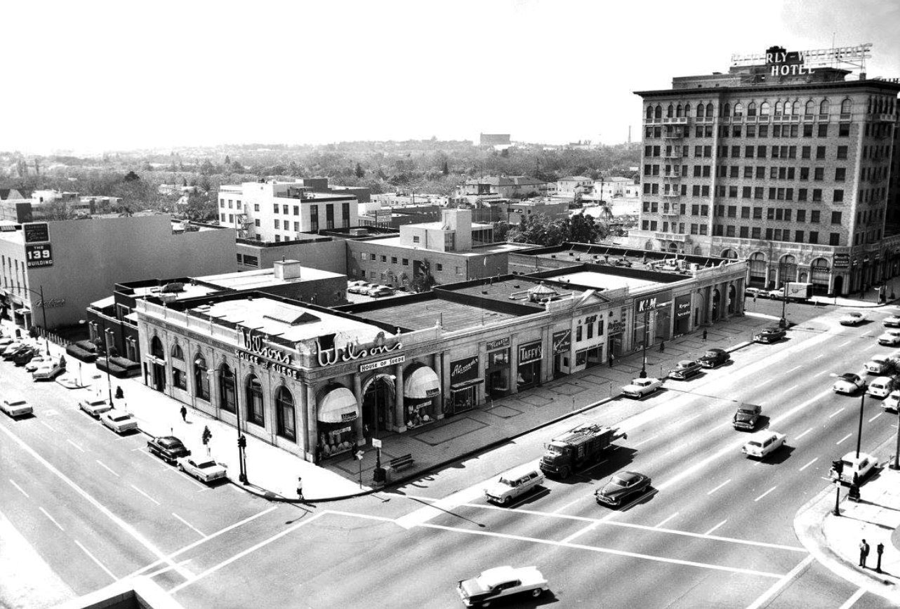 |
|
| (1957)* – View of Wilshire Boulevard showing the side of the Beverly Wilshire Hotel and Wilson's House of Suede anchoring the line of stores to the east of the hotel on the corner of El Camino. |
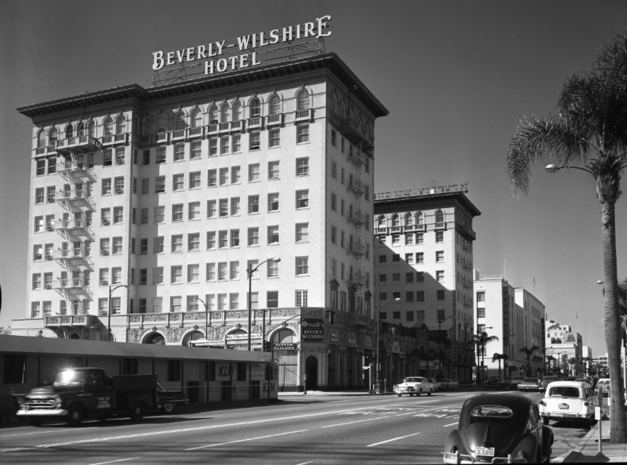 |
|
| (1959)^ – View looking west on Wilshire Boulevard showing the Beverly Wilshire Hotel. |
* * * * * |
Pacific Electric Station
|
|
| (1940)* – Scan of a picture that was in the Spring 2008 issue of "Classic Trains" magazine. The picture was taken by Harold Stewart, a Pacific Electric motorman, in July 1940, just before passenger service on the Los Angeles-Beverly Hills-Santa Monica line was discontinued. |
Historical Notes The discontinuance was west of the station - service continued on the east side until the mid-1950s. PE/MTA provided service further to the west via buses. |
|
|
| (ca. 1943)* - View of the Beverly Hills Pacific Electric Station looking east showing a PE Red Car adjacent to three buses all lined up. City Hall can be seen in the background. |
Pacific Electric Streetcars and Trains
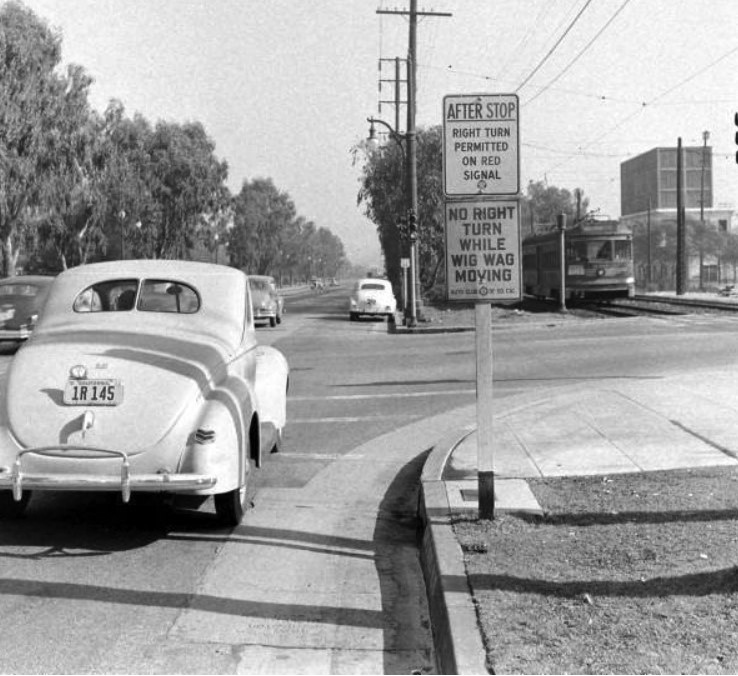 |
|
| (ca. 1939) – View looking east on Santa Monica Boulevard with a Pacific-Electric streetcar seen on right. Sign reads: ‘NO RIGHT TURN WHILE WIG WAG MOVING’ |
Historical Notes Wigwag is the nickname given to a type of railroad grade crossing signal once common in North America, named for the pendulum-like motion it used to signal the approach of a train. It is generally credited to Albert Hunt, a mechanical engineer at Southern California's Pacific Electric (PE) interurban streetcar railroad, who invented it in 1909 for safer railroad grade crossings. The term should not be confused with its usage in Britain, where wigwag is generally used to refer to alternate flashing lights, such as those found at modern level crossings.* |
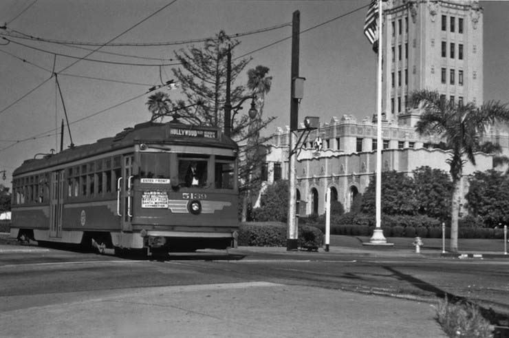 |
|
| (1950)* – View showing a Red Car on the Hollywood Line rolling past Beverly Hills City Hall. |
Historical Notes The Pacific Electric ran freight service along here until 1965 while electric passenger operations through Beverly Hills ended in the 1950s. Until the mid-1960s it was commonplace to see a train travel down Santa Monica Boulevard along the business triangle through the city. Today those tracks have been replaced by parking structures but you can still see the Pacific Electric right-of-way fenced off on parts of what used to be known as Railroad Avenue. |
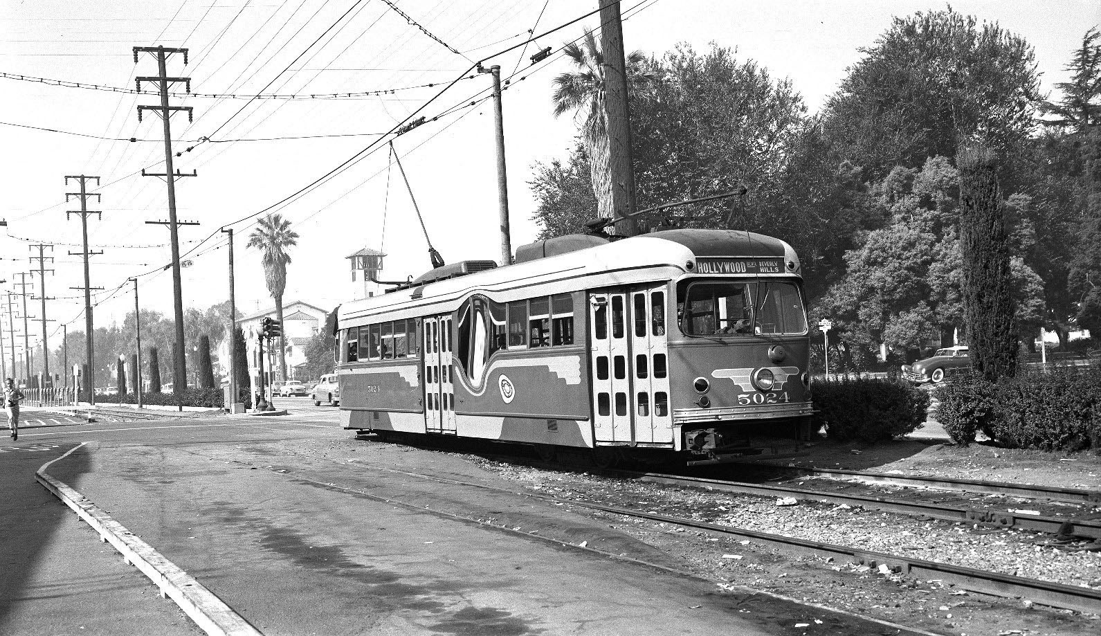 |
|
| (1950s)* - View looking west near the intersection of Beverly Drive and Santa Monica Boulevard showing a streetcar heading east toward Hollywood. Sign on streetcar reads: HOLLYWOOD - BEVERLY HILLS |
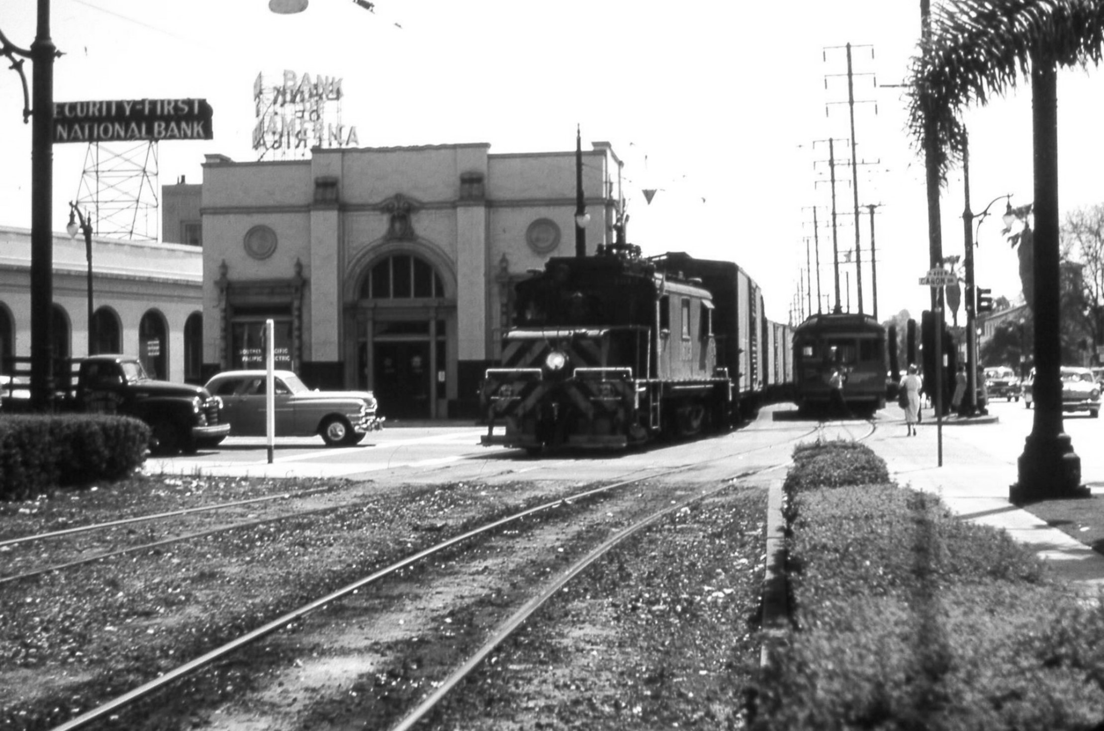 |
|
| (1954)* – A train and a streetcar are seen side by side in front of the Pacific Electric station on the SE corner of Santa Monica Blvd and Cannon Drive. |
Historical Notes Pacific Electric ran freight service along here until 1965 while electric passenger operations through Beverly Hills ended in the 1950s. |
Santa Monica Blvd and Bedford Drive
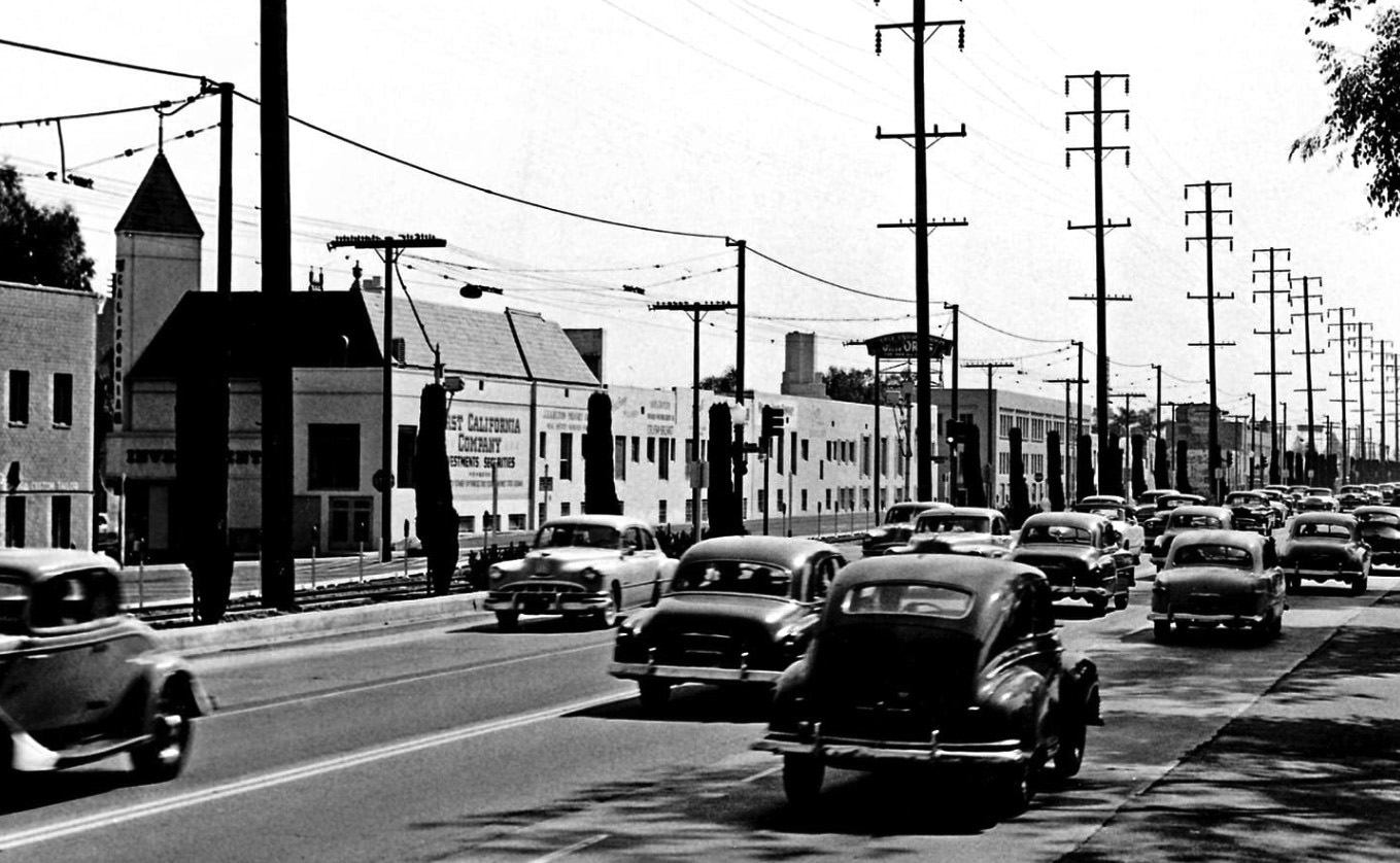 |
|
| (1953)* - View looking southwest showing Santa Monica Blvd (US-66) near Bedford Drive. The railroad tracks seen on the left were used by the Red Cars and for freight delivery. |
Historical Notes Route 66, also known as U.S. Highway 66 or the Will Rogers Highway, was established in 1926. This roadway was once the primary highway from America’s interior to the West Coast. It is 2,450 miles long and is one of the earliest automobile transport routes in the United States. During the mid-1930s, Route 66 stretched into the Los Angeles area from Pasadena’s Colorado Boulevard and connected to a number of existing roadways. Route 66 made its way to downtown Los Angeles, followed Sunset Boulevard, connected with North Santa Monica Boulevard and headed through Beverly Hills, as it continued west to the Santa Monica Pier. In recent years, the City of Beverly Hills has developed distinctive signage to place along historic Route 66, within Beverly Hills city limits. The unique Route 66 mark mirrors the City’s iconic shield logo. |
Then and Now
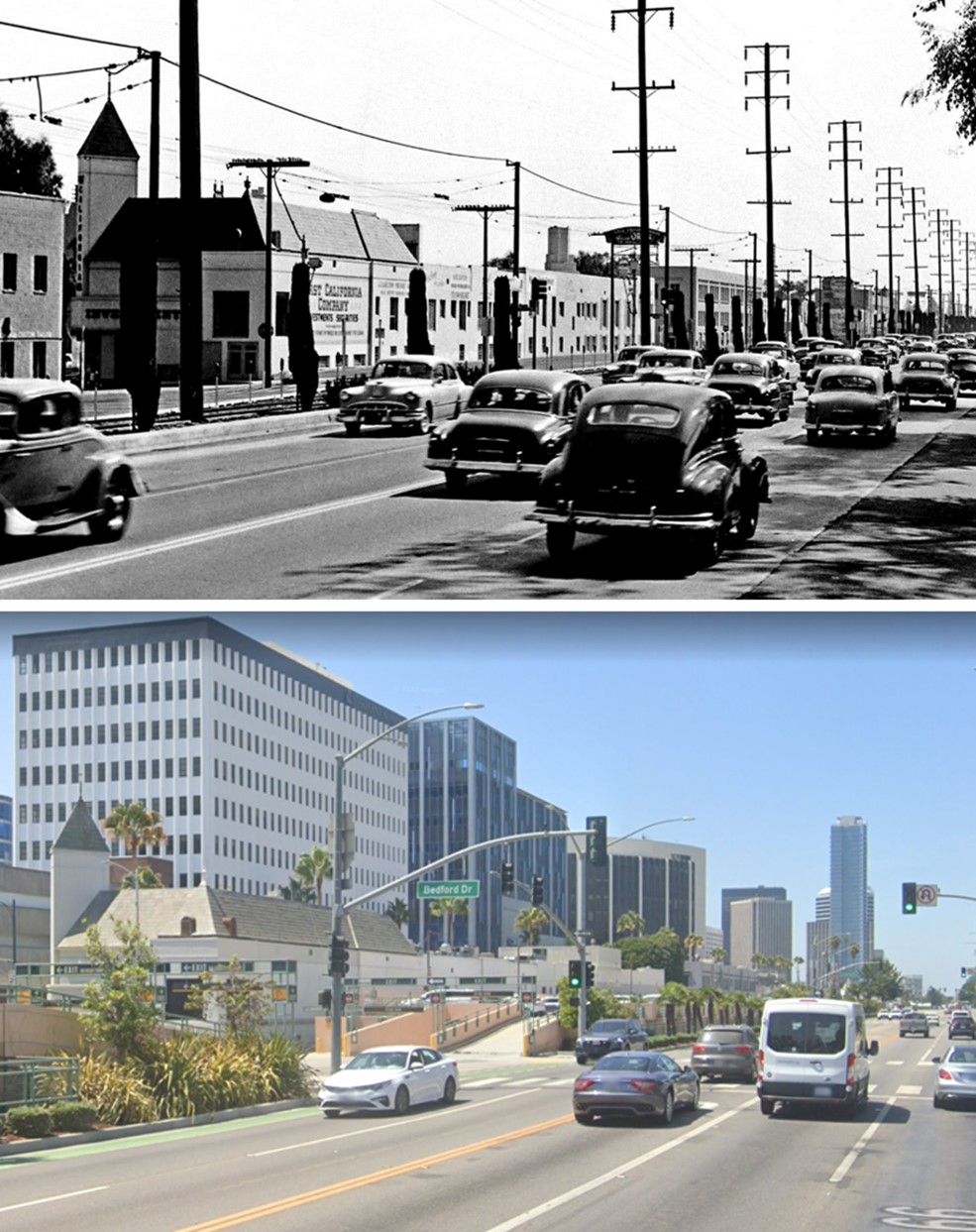 |
|
| (1953 vs. 2022)* - View looking southwest showing Santa Monica Blvd (US-66) near Bedford Drive. |
Wilshire and Robertson
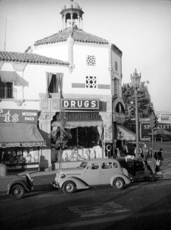 |
|
| (ca. 1937)^ - Cars park in front of the Spanish Colonial Revival style Creswell Drug Store, located at 8801 Wilshire Boulevard at Robertson, which has since been demolished. A Sparkletts billboard can be seen in the background. |
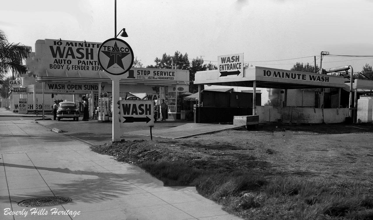 |
|
| (1947)* – Texaco Service Station at Wilshire Boulevard and Willaman Drive providing ‘1 Stop Service’: Gas, Body & Fender Repair, and a 10 Minute Carwash. Photo courtesy of Beverly Hills Heritage. |
Wilshire and San Vicente
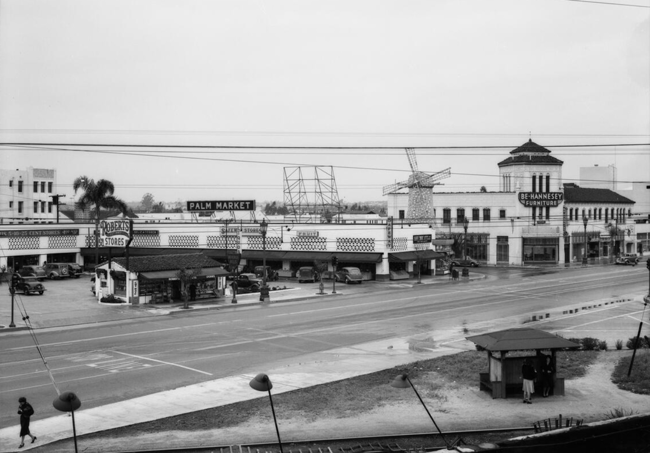 |
|
| (1940)^ - View looking toward the South side of Wilshire Boulevard West of San Vicente. Note the tracks and covered depot in the foreground. In the distance at the corner of Wilshire and Tower Drive stand Van de Kamps and the Art Deco Be-Hannesey Furniture Store. |
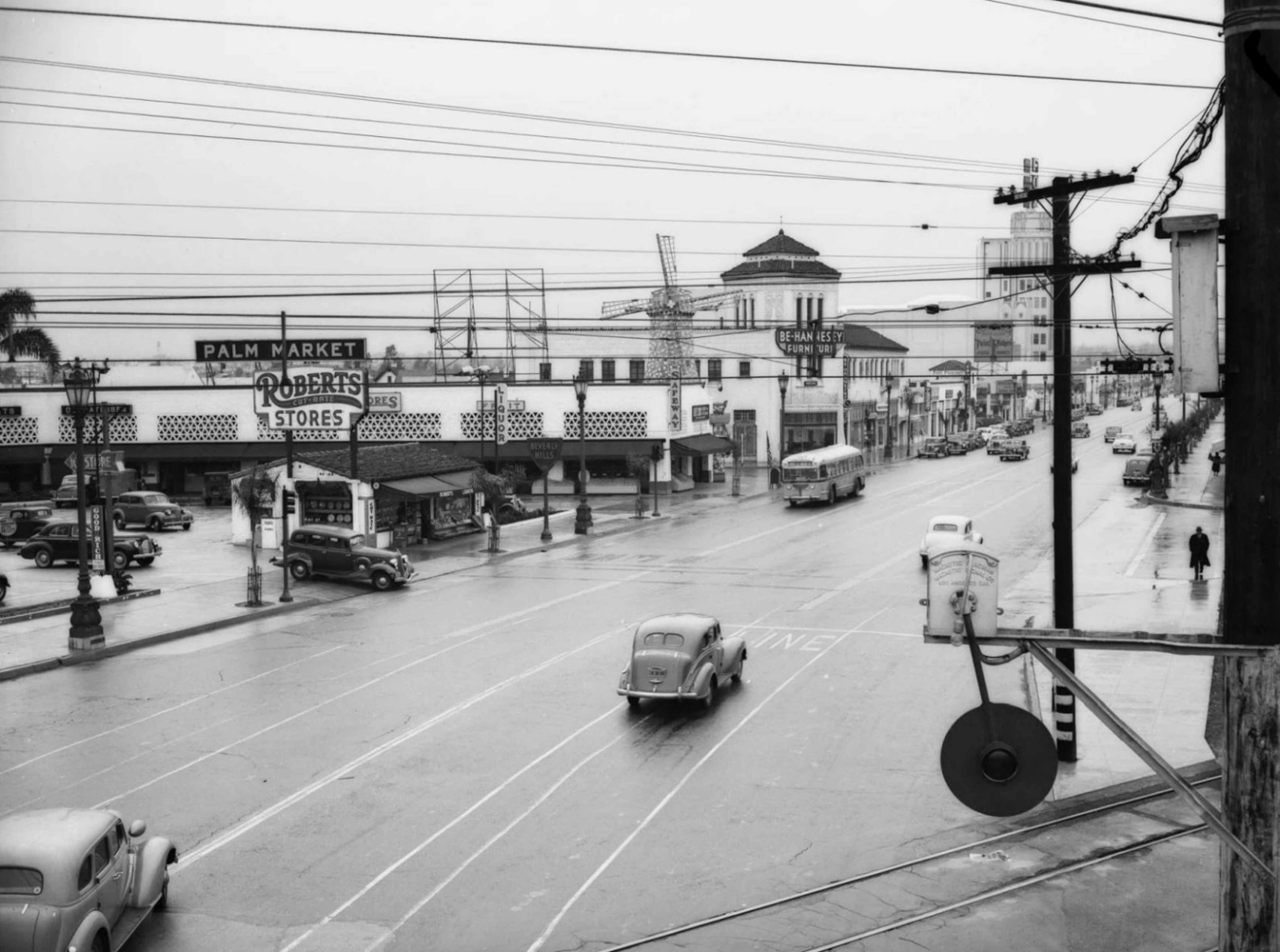 |
|
| (1940)^ – View looking West showing Palm market at San Vicente Blvd and Wilshire Blvd. Here we see the market, rainy pavement, the Fox Wilshire (Saban) Theater, the Wig-Wag from the Pacific Electric line that ran down San Vicente Blvd, Van de Kamps Holland Dutch Bakery. |
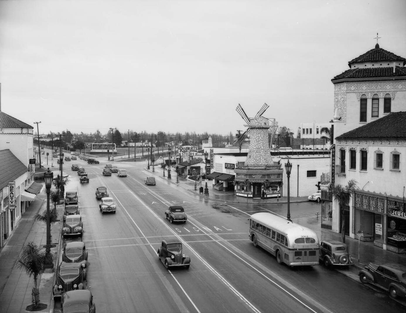 |
|
| (1940)^ - View looking East on Wilshire Blvd toward San Vicente Blvd. Van de Kamps stands on the SE corner of Wilshire and Tower Drive. Click HERE to see more early views of the intersection of Wilshire and San Vicente in the 1920s. |
Then and Now
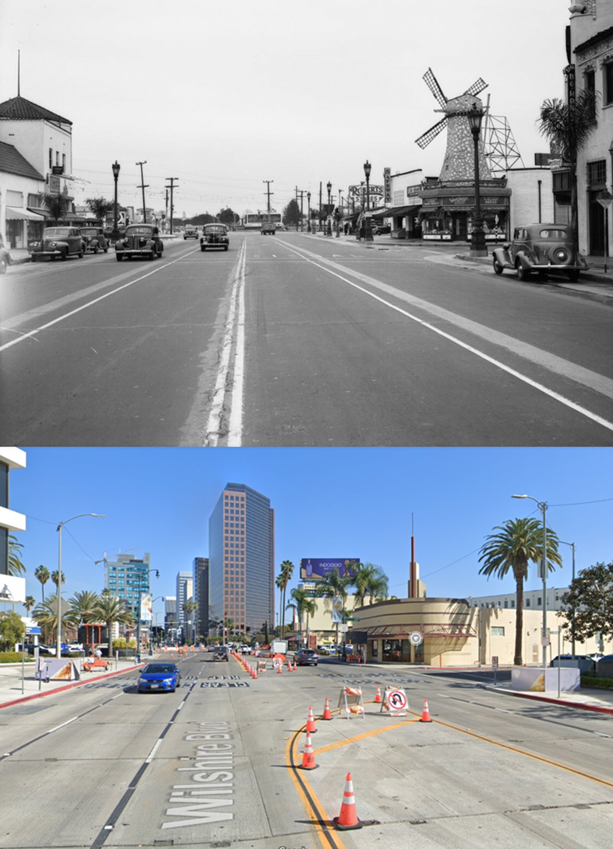 |
|
| (1940)^ – View looking East on Wilshire Boulevard at Tower Drive, one block West of San Vicente Boulevard. |
Van de Kamp's Bakery
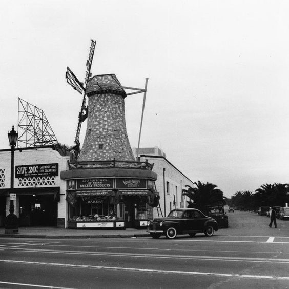 |
|
| (1940)^ - The Van de Kamp's Bakery in Beverly Hills, located on the Southeast corner of Wilshire Blvd and Tower Drive, as seen through the lens of Ansel Adams. Two workmen are seen making repairs to the bakery's Dutch-style windmill, which is being held up by scaffolding. A portion of this building still stands and is currently occupied by Coffee Bean. |
Historical Notes Theodore J. Van de Kamp and brother-in-law Lawrence L. Frank were the owners and originators of the Van de Kamp Bakeries. Fondly known as the "Taj Mahal of all bakeries". Van de Kamp and Frank also founded both the Tam O'Shanter's (1922) and Lawry's Prime Rib (1938) restaurants. The bakery was sold by the Van de Kamp family and acquired by General Baking Co. in 1956. The company was sold to private investors in 1979, and closed in bankruptcy in 1990. Former Los Angeles County District Attorney John Van de Kamp is a grandson of the baker's founder. *^ Click HERE to see Van de Kamp's 1st Windmill Bakery Shop. |
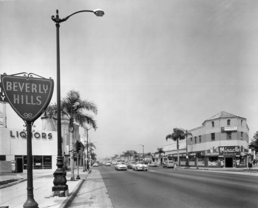 |
|
| (ca. 1951)^^ – View looking west on Wilshire Boulevard from near San Vicente, showing the Beverly Hills City boundary sign. The windmill of the Van de Kamp's Bakery can be seen in the distance (Wilshire Blvd. and Tower Dr.) behind the Beverly Hills sign. |
Then and Now
|
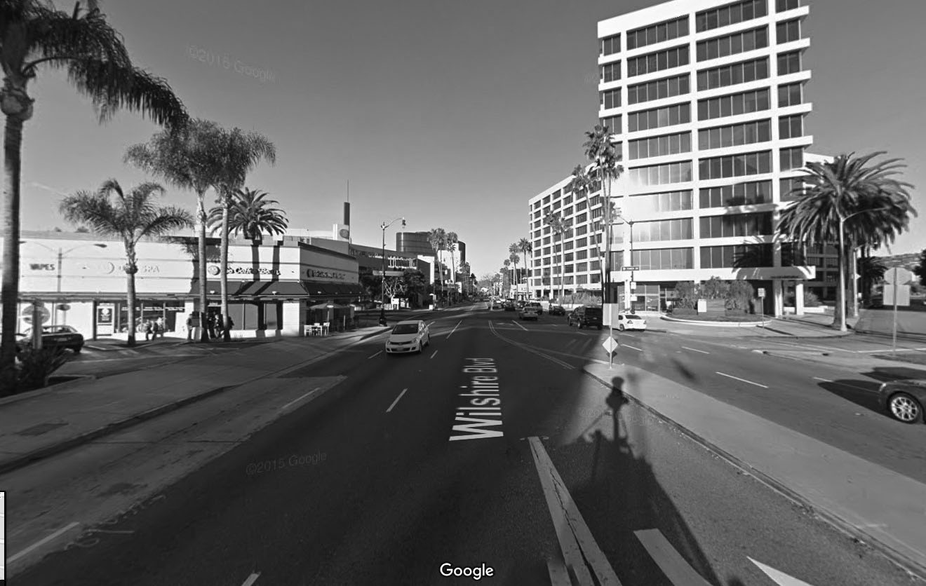 |
|
| (2015)^** - View looking west on Wilshire Boulevard from San Vicente. Almost the same view as previous photo but 64 years later. |
* * * * * |
Currie's Ice Cream
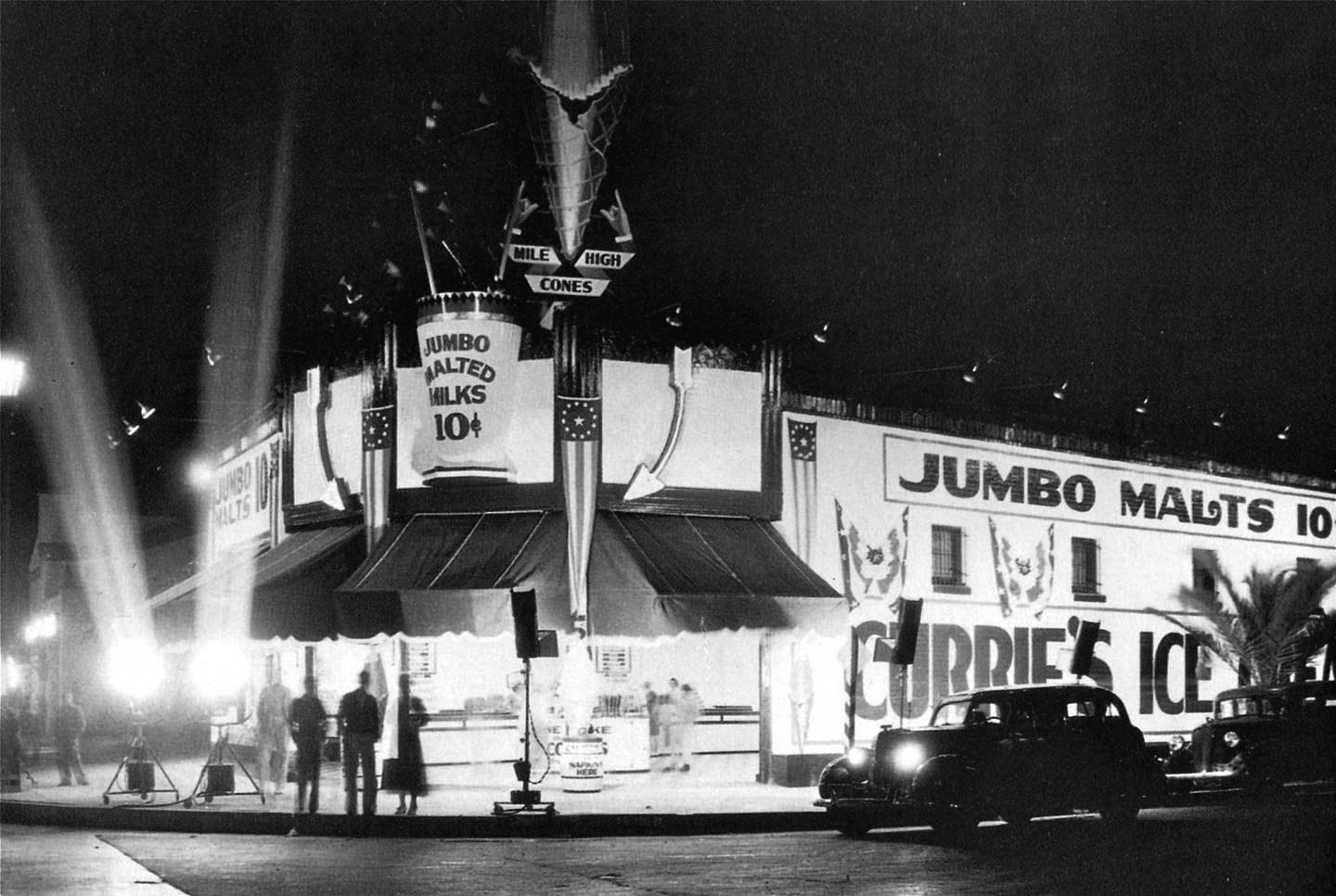 |
|
| (1930s)^* – View showing what appears to be the Grand Opening of Currie’s Ice Cream Parlor on the NW corner of Wilshire Blvd and Gale Drive in Beverly Hills. |
Historical Notes People still fondly remember the Currie’s chain and its “mile-high cone” whose replica was often displayed billboard-style on roofs. The chain was started in 1927 by three brothers named Kuhns. After WWII they sold it to the Good Humor Company who later sold it to Lipton in the 1960s. In 1964 the chain opened its 87th store, in North Hollywood. Although Currie’s anticipated launching units in every community in Southern California, only three outlets were listed in the 1967 Los Angeles phone book and the chain had disappeared by the 1980s. *## |
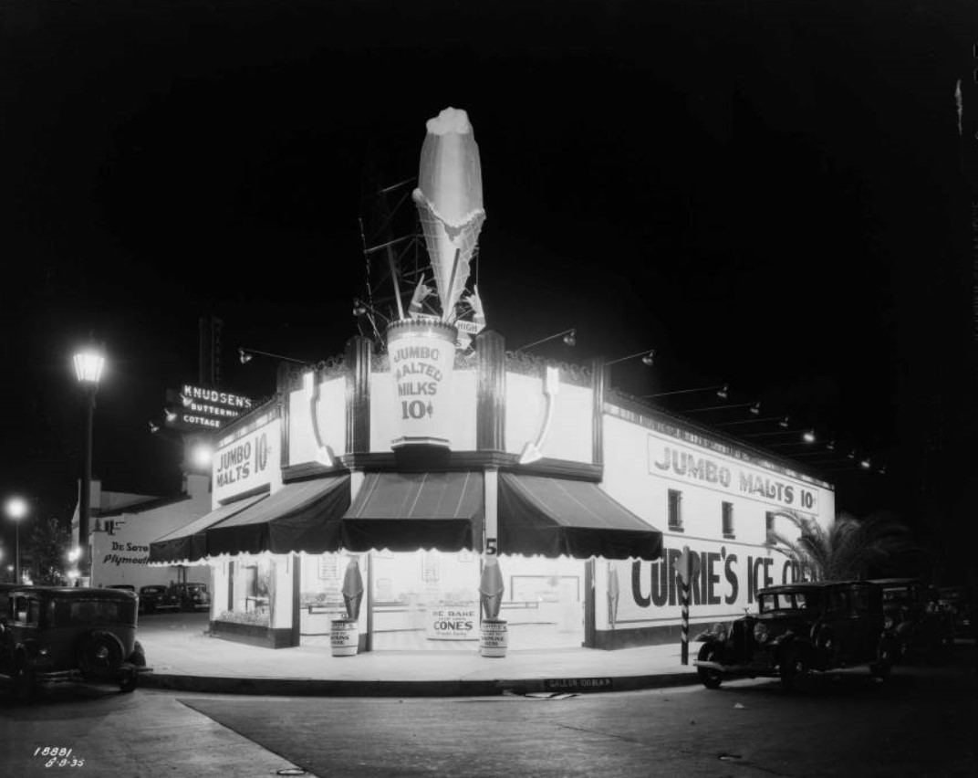 |
|
| (1930s)*^#* – View looking at a well-lit Currie's Ice Cream located at the northwest corner of Gale Drive and Wilshire Boulevard. Apparently, their 10 cent jumbo malts were the big thing—they mention it on all three sides of the building! Currie's was also known for its "Mile-High Cones". Click HERE to see contemporary view showing the same building. The Sunset Clock Market can be seen on the left. |
Historical Notes Most of the buildings that housed Currie's Ice Cream had the larger than life cone on top of the building. These “hey-you-can’t miss-me!” buildings (referred to as Novelty or Programmatic Architecture) were made to pull automobile drivers right off the road. Click HERE to see more examples of Programmatic Architecture. |
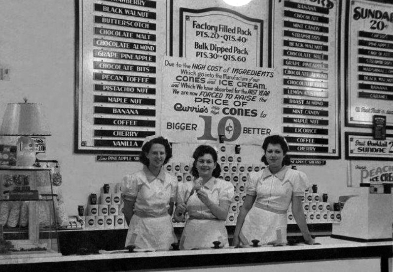 |
|
| (n.d.)^ - Interior view of Currie’s. 40 cents for a quart of ice cream and they're apologizing for having to raise the prices. Yikes! |
* * * * * |
Sunset Clock Market
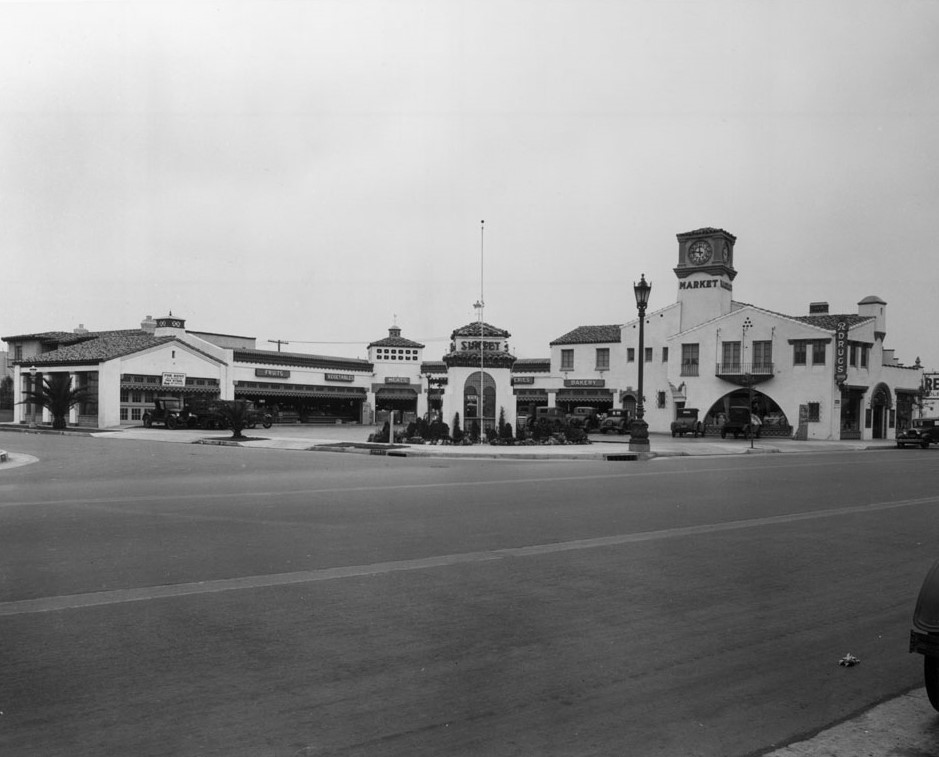 |
|
| (ca. 1930)* - View of the Sunset Clock Market at the northeast corner of Wilshire Boulevard and Hamilton Drive, one block east of La Cienega Boulevard. |
Historical Notes Built in 1929, this C. W. Wilson and Sons designed L-shaped structure once housed a mom-and-pop market and one apartment. This last remaining example of a Wilshire drive-up market currently (2015) serves as a Porsche-Audi dealership. |
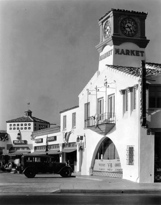 |
|
| (ca. 1930)^*# - Close-up view showing the clock tower above Sunset Clock Drive-up Market. |
Historical Notes Southern California was the principal center for the development of drive-in markets between the mid-1910s to the early 1940s. Other notable early drive-in markets included: Mandarin Market (Hollywood), Plaza Market (LA), El Dorado Market (Beverly Hills), and the Aurora Market (Glendale). |
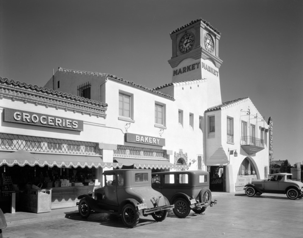 |
|
| (ca. 1930)^ - Close-up view showing cars parked in front of the Groceries and Bakery sections of the Sunset Clock Tower Market (8423 Wilshire Bouelvard). |
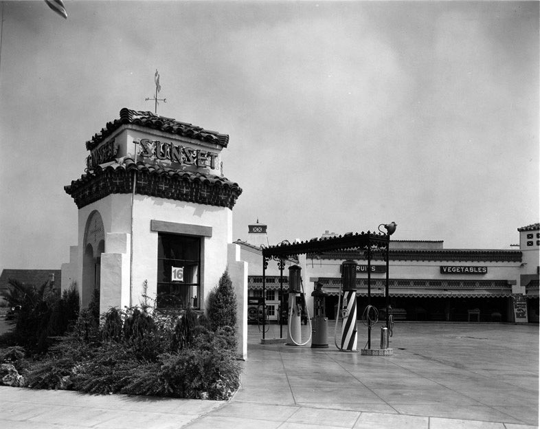 |
|
| (ca. 1930)* - Street view showing the gas station at the Sunset Clock Drive-up Market. |
Historical Notes Click HERE to see more Views of Early Gas Stations. |
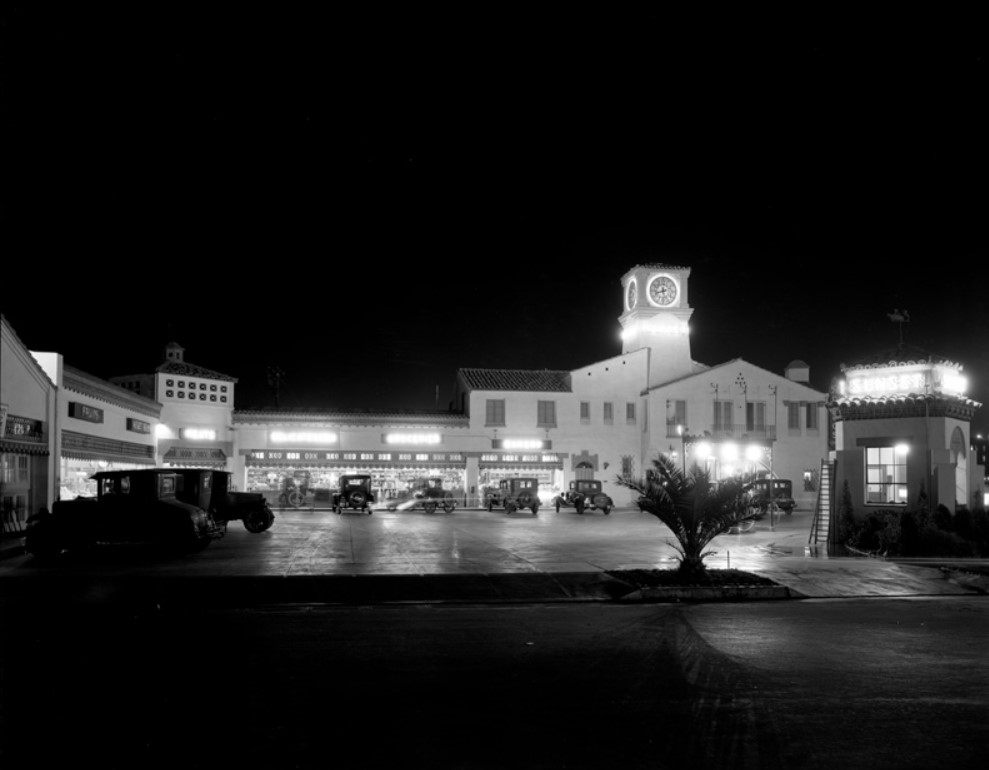 |
|
| (ca. 1930)^ - Night view of the Sunset Clock Tower Market with gas station seen at right. |
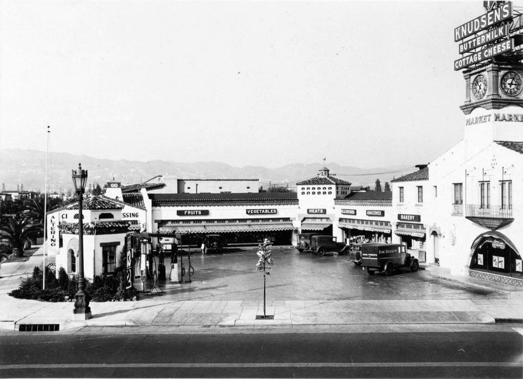 |
|
| (1932)^ – View looking north showing the Sunset Clock Market on the northeast corner of Wilshire Boulevard and Hamilton Drive. Note the new signboard on top of the clock tower. |
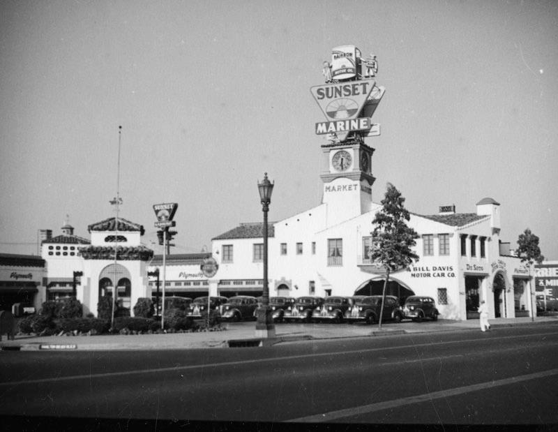 |
|
| (ca. 1937)* - The Sunset Clock Market at 8423 Wilshire Boulevard at Hamilton Drive, in it's first incarnation as a Plymouth car dealership. Click HERE to see contemporary (2016) view. |
* * * * * |
Lawry's Prime Rib Restaurant
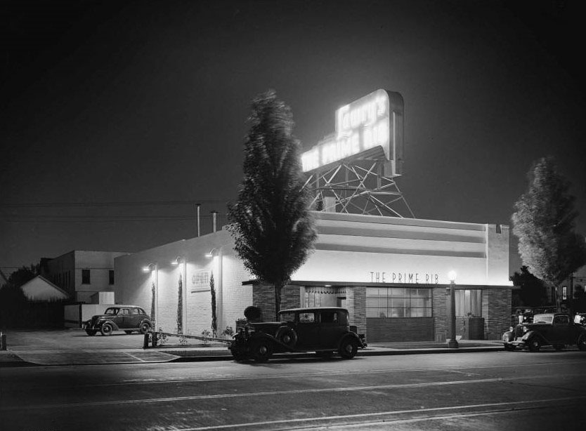 |
|
| (1938)* – Night view showing Lawry’s - The Prime Rib Restaurant shortly after it opened, located on La Cienega Boulevard in Beverly Hills. |
Historical Notes In 1922 Lawrence L. "Lawry" Frank and Walter Van de Kamp founded the Lawry's company and created the Tam O'Shanter Inn restaurant in the Los Feliz district of Los Angeles, which claims to be the oldest restaurant in Los Angeles still operated by the same family in the same location. Frank created a special seasoned salt for use at Tam O'Shanter, which was available only to customers. In 1938 the two opened Lawry's The Prime Rib on La Cienega Boulevard in Beverly Hills. The same year, Lawry's began marketing its signature seasoned salt in retail stores. This was the beginning of a food products empire under the Lawry's name that today sells a wide range of seasonings and flavorings. The line was sold to Lipton/Unilever in 1979, which in turn sold it to McCormick & Company in 2008.* |
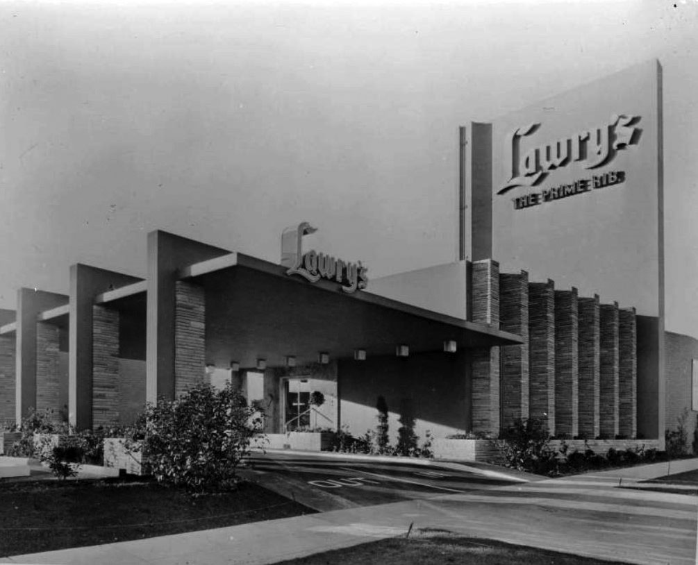 |
|
| (ca. 1947)* – View of Lawry’s Restaurant at its second location at 55 N. La Cienega Boulevard (Today's location of the Stinking Rose Restaurant). |
Historical Notes In 1947 Lawry's restaurant moved from its original location on La Cienega across the street and a few blocks further south to a larger, mostly windowless, strikingly modernistic building designed by Wayne McAllister. In 1956, just prior to the 1957 Rose Bowl Game between the Oregon State Beavers and the Iowa Hawkeyes, Lawry's entertained the two competing teams. The Beavers were fed a prime rib dinner at the Beverly Hills restaurant and the Hawkeyes the same on the Pasadena City College football field following their practice. This started an annual tradition of hosting both Rose Bowl-bound teams, although following the inaugural event with Iowa the Big Ten teams were served outside Rose Bowl Stadium from 1957-1962. By 1963, when Illinois and Washington both dined at the restaurant on separate nights prior to the 1964 Rose Bowl Game, the two team events had become known as "Lawry's Beef Bowl." The Beef Bowl has expanded to the Dallas, Texas, location for the two Cotton Bowl participants.* |
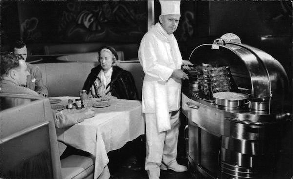 |
|
| (ca. 1960s)^ – I’ll have the Diamond Jim Brady Cut! |
Historical Notes Born in 1856 to Irish immigrants in New York City, James B. Brady was a self-made millionaire, railroad tycoon, and philanthropist. His love of flashy jewelry, which he affectionately called “my pets” and wore on everything – even down to his underwear – earned him his nickname. Prominent man-about-town, Broadway theatergoer, tireless dancer and owner of the city’s first automobile, Diamond Jim was a true celebrity in his day. His superhuman appetite established him as the “greatest eater” of the late 19th century America’s Gilded Age. It was said that in one sitting he could put away enough food to feed ten people. A midday snack alone might include three dozen oysters, six lobsters, turtle soup, a steak and two pounds of bonbons for dessert. His reputation, built on press coverage during his life, grew into the next century. In the depths of the Depression, people’s fascination with this outsized character was heightened by the publication of a biography in 1934 and the release of Preston Sturges’ 1935 movie “Diamond Jim.” By the time the first Prime Rib opened in 1938, Diamond Jim Brady, who had passed away twenty-one years before, was legendary. Any restaurant guest would have immediately recognized his name as a symbol of the biggest and the best.^ |
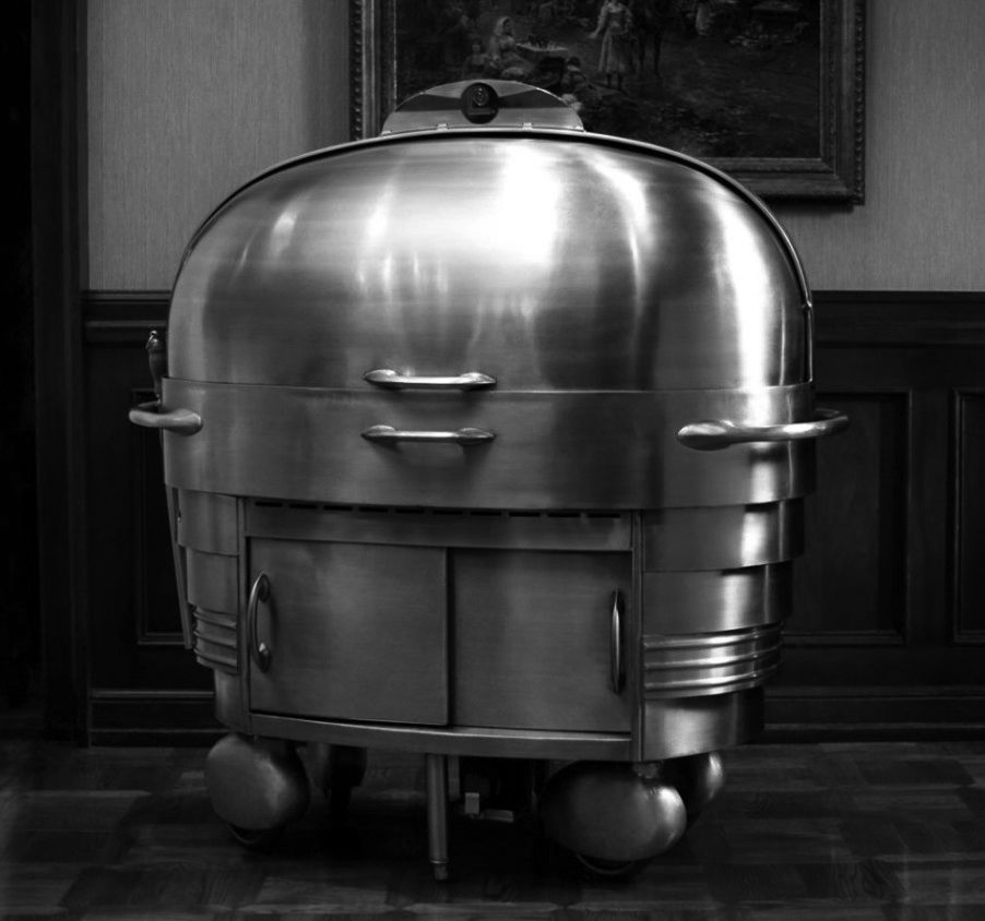 |
|
| (2019)^ - Lawry’s Prime Rib serving cart as it appears today. Photo courtesy of Lawrey's Restaurant |
Historical Notes The streamlined look cart has been in service since the restaurant opened in 1938 - it is in use to this day. |
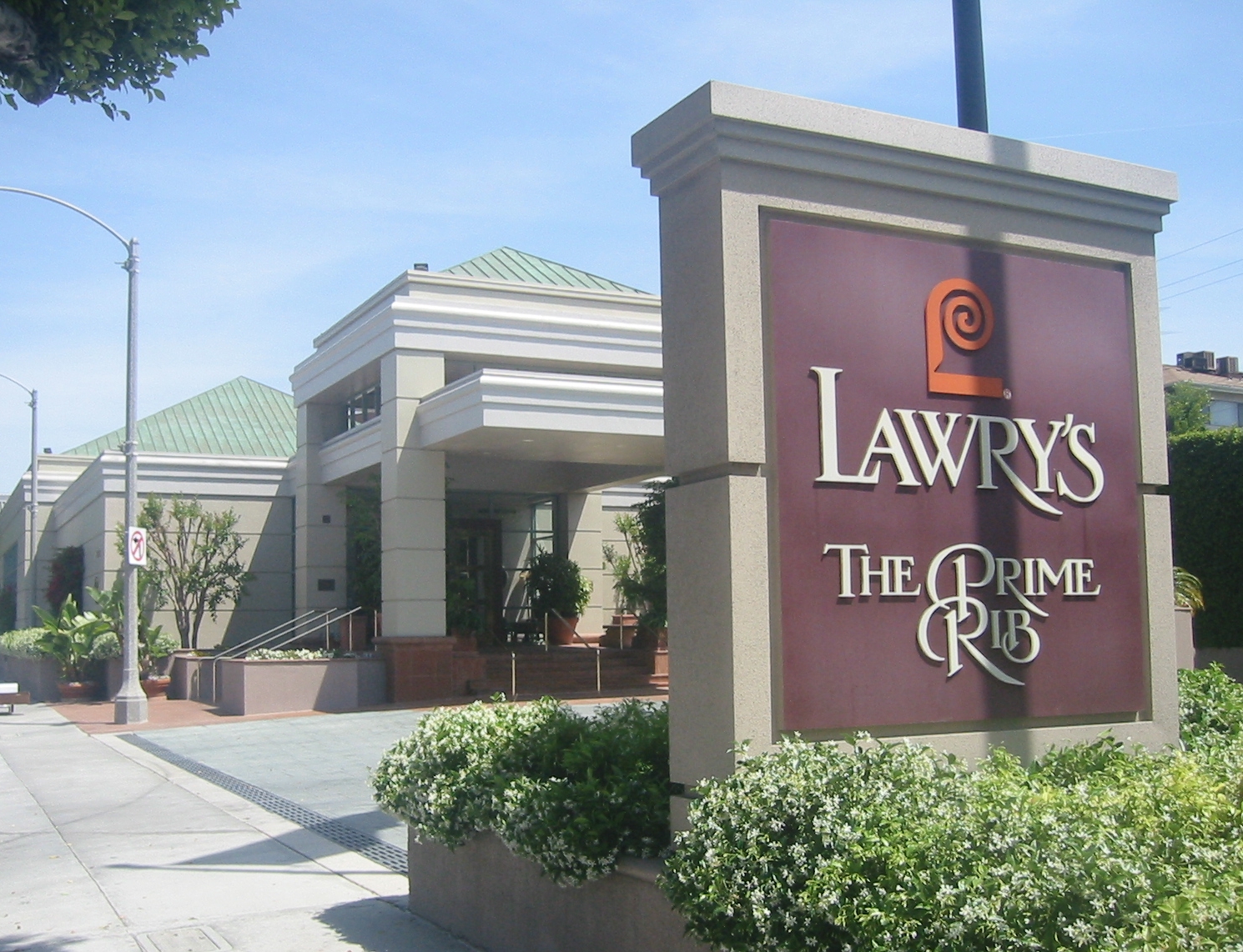 |
|
| (2007)* – View of Lawry’s Prime Rib Restaurant located at 100 N. La Cienega Boulevard. Photo by Minnaert / Wikipedia |
Historical Notes In 1993 Lawry’s moved again to a new building located on the original site. McAllister's building is now occupied by The Stinking Rose, a well-known garlic-themed Italian restaurant. In 1974, Lawry's opened a satellite in Chicago's River North district, followed by restaurants in Dallas in 1983 and Las Vegas in 1997. Internationally, Lawry's opened in Jakarta in 1996, Singapore 1999, Tokyo 2001, Taipei 2002, Hong Kong 2006, Shanghai & Osaka in 2008, and Seoul in 2013.* |
* * * * * |
Santa Monica Boulevard
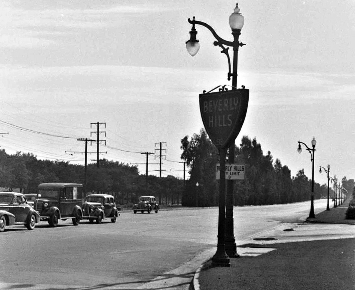 |
|
| (1940s)^x^ – View looking west on Santa Monica Boulevard at Doheny Drive, at the Beverly Hills City Limit. Note the ornate streetlights running along Santa Monica Blvd. Click HERE to see contemporary view. |
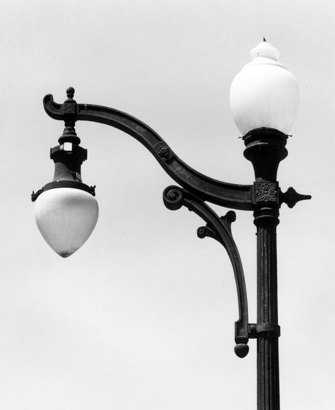 |
(1981)* - Close-up view of an acorn style street light located on Santa Monica Boulevard in Beverly Hills. Some of these are still standing including one at the NW corner of Santa Monica and Oakhurst.
Click HERE to see more in Early LA Streetlights. |
|
Little Santa Monica Boulevard (aka South Santa Monica Boulevard also Burton Way)
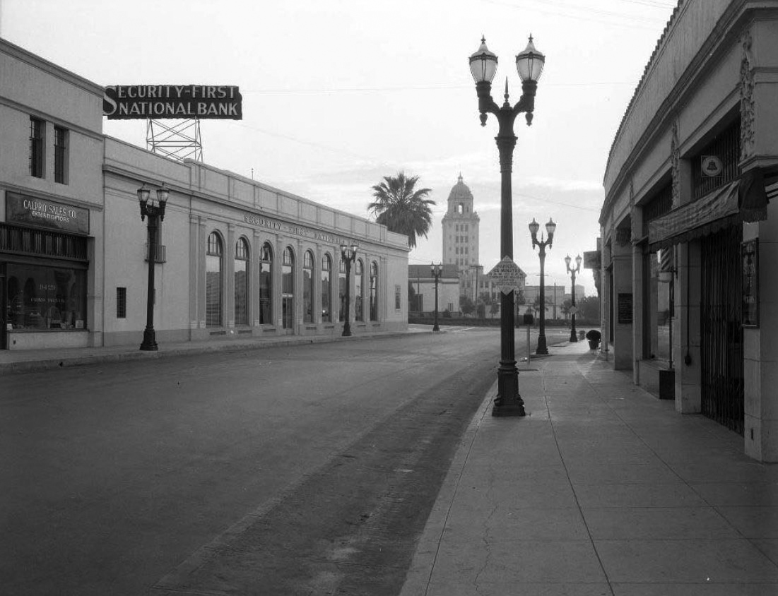 |
|
| (ca. 1930's)^.^ - View looking east on ‘Little Santa Monica’ toward Canon Drive with the Beverly Hills City Hall (built 1932) seen in the background. Look at all the parking! Note the ornate two-lamp streetlights. |
Historical Notes The south roadway of Santa Monica Boulevard, often called Little Santa Monica Boulevard in Beverly Hills, runs parallel to the state highway (north) roadway of Santa Monica Boulevard from the city's west limit to Rexford Drive. After Rexford Drive, Little Santa Monica turns east, becoming Burton Way. Burton Way merges into San Vicente Boulevard at its intersection with La Cienega Boulevard.*^ |
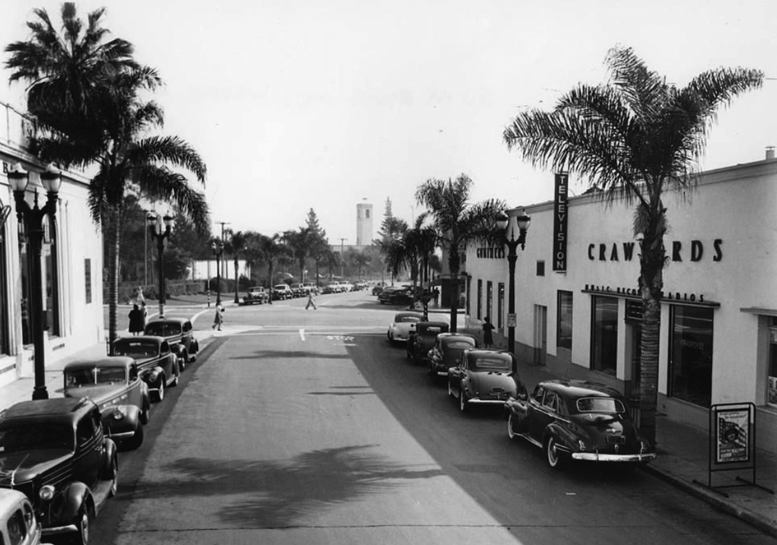 |
|
| (1944)^.^ - Little Santa Monica Blvd looking east toward Cañon Dr., with the City's decade old firehouse in view. City Hall is to the left behind the building and palm tree. Photo courtesy of Beverly Hills Heritage |
Historical Notes The whole stretch of Little Santa Monica was known in the city’s early years as Burton Way, named after Beverly Hills cofounder Burton E. Green. |
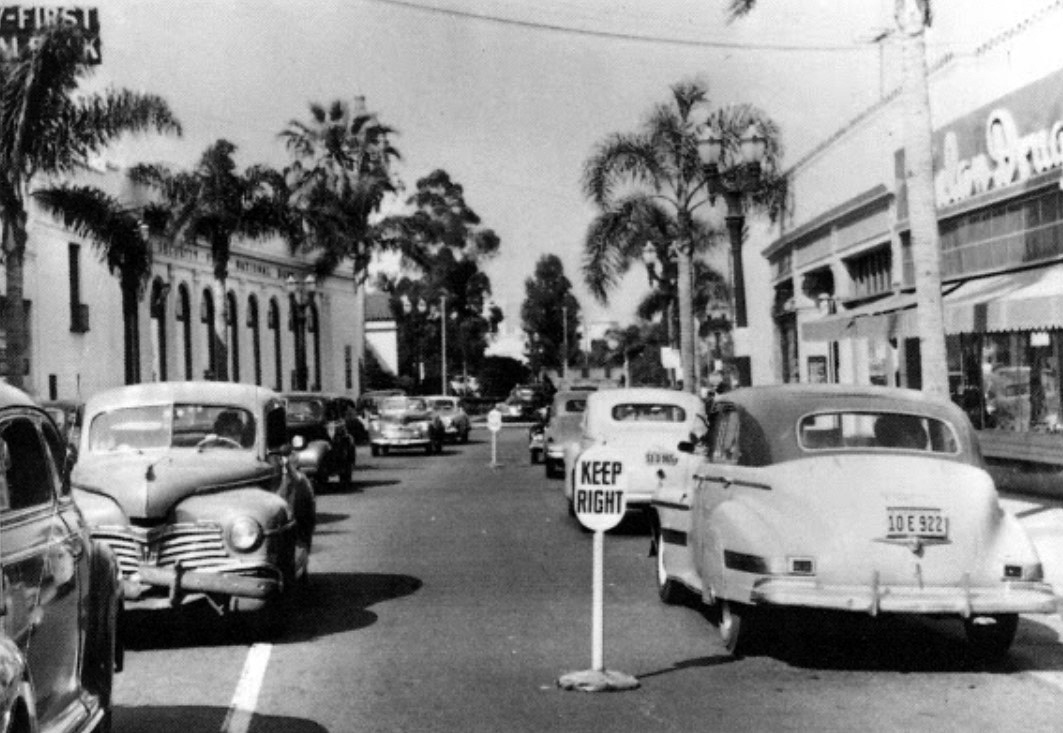 |
|
| (1947)^x^ - View looking east on South Santa Monica Boulevard towards Canon Drive (South Santa Monica Boulevard was an extension of Burton Way). On the right where the drugstore is located was the original shopping building of Beverly Hills, established in the early 1920s. Click HERE to see contemporary view. |
Pokey's Restaurant
_1955.jpg) |
|
| (1955)*^#^ – Pokey’s Restaurant located on the northwest corner of Santa Monica Boulevard and Beverly Drive in Beverly Hills. |
 |
|
| (1955)*^#^ – Interior view of Pokey’s Coffee Shop showing a fine selection of pies. |
_1955.jpg) |
|
| (1955)*^#^ - Pokey’s Restaurant looking at the N/W corner of Santa Monica Blvd and Beverly Dr. as seen from across the street. |
_1955.jpg) |
|
| (1955)*^#^ – Night view showing Pokey’s Restaurant located at Santa Monica Boulevard and Beverly Drive. Photo by Joseph Fadler (SCE) |
Perpetual Savings and Loan Building
 |
|
| (1961)^* – View showing the Perpetual Savings Bank Loan Association building located on the SW corner of Wilshire Blvd and S. McCarty Drive in Beverly Hills. Click HERE to see contemporary view. |
Historical Notes The Perpetual Savings and Loan building is a striking tower of stacked white arches with trailing greenery, sited prominently along Wilshire Boulevard in Beverly Hills. It was designed by seminal architect Edward Durell Stone in the New Formalist style he popularized in the early 1960s, and represents an important step in his re-visioning of historical Classical, Moorish, and Indo-Islamic styles through a Modern lens.^ |
 |
|
| (1962)^.^ – View showing the fountain and metal sculpture (titled "Sunburst") in front of the Perpetual Savings and Loan building at 9720 Wilshire Boulevard. Click HERE for contemporary view. |
Historical Notes Completed in 1962, the eight-story Perpetual Savings building is a simple glass-skinned high-rise completely sheathed in a pierced concrete screen of repeating parabolic arches. It has been described as Venetian Modern, and indeed it stands like a simplified palazzo, complete with front plaza containing four flagpoles and a dramatic circular fountain. Some people see another Italian influence: the Mussolini-commissioned Palazzo della Civilta Italiana in Rome, known as the "Square Colosseum" for its Fascist replication of the ancient arena's arches on a square tower.^ |
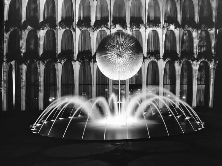 |
|
| (1962)^.^ – Close-up view of the sculptured fountain, “Sunburst”, in front of the Perpetual Savings and Loan Building, Beverly Hills. Photo courtesy of Linda Hammonds |
Historical Notes Designed by Harry Bertoia, the 18 by 11 feet gold plated “Sunburst” is now located at 215 S 15th St. Milton Abrahams Branch Omaha Library. |
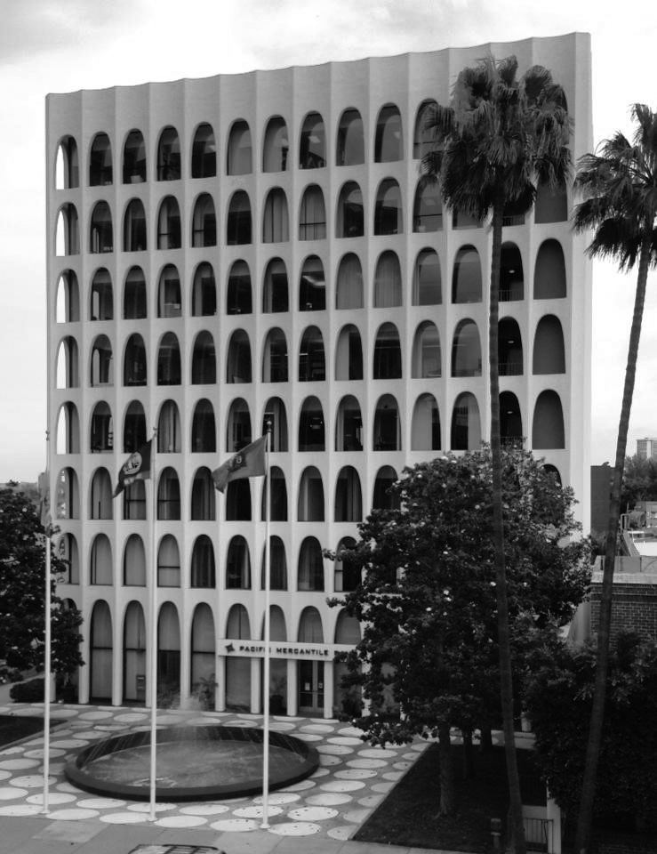 |
|
| (ca. 1969)* – The Perpetual Savings Building now occupied by Pacific Mercantile Bank. Photo courtesy of Steve Milner |
Historical Notes The Perpetual Savings Building (later Home Federal Savings then Pacific Merantil Bank) is a striking tower completely sheathed in a pierced concrete screen of stacked white repeating parabolic arches. Some see the influence of Marcello Piacentini’s Palazzo della Civilta Italiana in Rome, commissioned by Mussolini and known as the “Square Colosseum” for its fascist replication of the ancient arena’s arches on a square tower. Architect Edward Durell Stone was enamored of both classical and Modern Italian architecture, visiting the country often with his Italian-born wife. |
Beverly Hills Federal Savings
 |
|
| (1961)* – Night view showing Beverly Hills Federal Savings on the southeast corner of Wilshire Boulevard and Reeves Drive. Photo: Julius Shulman |
Historical Notes Designed by the architectural firm of Stiles and Robert Clements, this building still stands today but has been substantially modified along the way. Stiles O. Clements was a key architect during the Art Deco Era and designed such notable structures as the El Capitan, Mayan, and Wiltern Theatres, Chapman Market, the Adamson House in Malibu, the beloved Richfield Tower in downtown Los Angeles and SO many other iconic structures including our the Swim Gym at Beverly High. His son Robert joined the firm in 1955 and by 1965 Stiles retired and died in 1966. Collectively, their designs had a tremendous impact on the development of Wilshire Boulevard in the 20th century. Today, this building is occupied by the ROLEX Corporation. Click HERE for contemporary view. |
 |
|
| (ca. 1962)* - Looking west on Wilshire Boulevard showing from left to right: Beverly Hills Federal Savings, Bank of America, Union Bank, Beverly Wilshire Hotel, California Bank, and Thrifty Drug Store. |
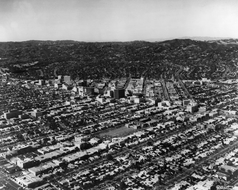 |
|
| (1970)^ - Aerial view of Beverly Hills in 1970. The row of taller (high-rise) buildings seen across the middle of the picture are along Wilshire Blvd. |
Beverly Hills (Before and After)
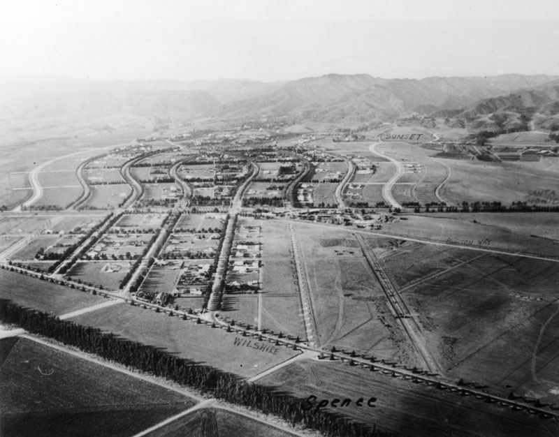 |
|
|
| (1919 vs 1970) - Aerial view of Beverly Hills. |
Then and Now
|
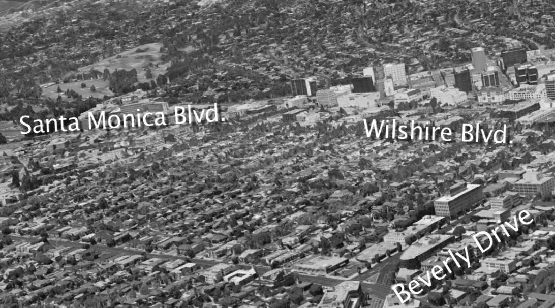 |
|
| (1921 vs 2015 )* - Then and Now |
|
|
| (ca. 1958)^ - View showing the intersection of Wilshire Boulevard and Rodeo Drive, with the Brown Derby Restaurant standing on the N/W corner. |
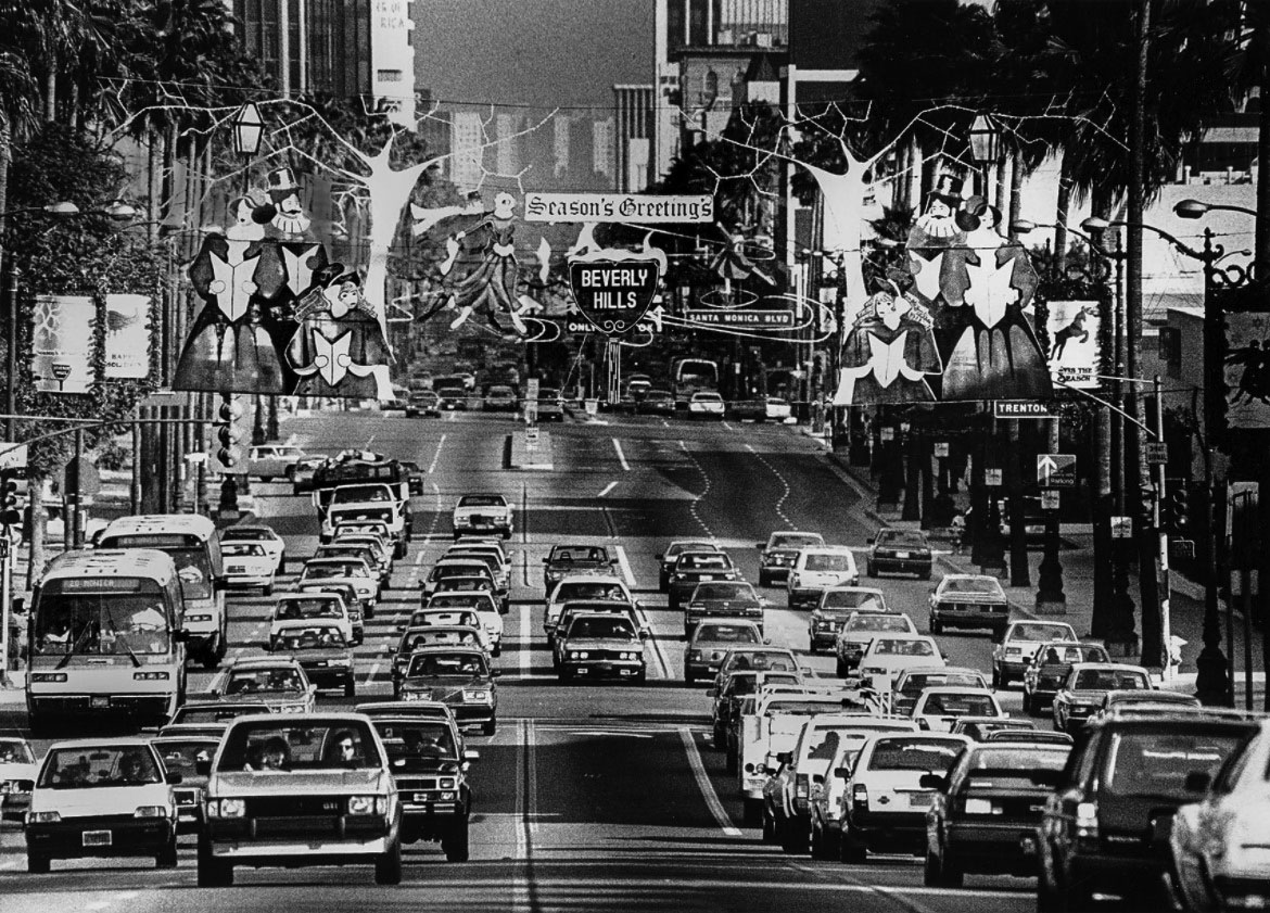 |
|
| (1986)* - Christmas shoppers shuttling between Beverly Hills and Westwood clog Wilshire Blvd. at Santa Monica Blvd. Overhead hang new City of Beverly Hills Christmas decorations. |
Rodeo Drive
.jpg) |
|
| (1993)* - View showing street sign post at the corner of N. Rodeo Dr. and Via Rodeo Dr. Photo by Torsten Bolten |
Historical Notes Rodeo Drive is a two-mile long street, primarily in Beverly Hills. Its northern terminus is its intersection with Sunset Boulevard and its southern is its intersection with Beverwil Drive in the city of Los Angeles. The name is most commonly used to refer to a three block stretch of the street north of Wilshire Boulevard and south of Little Santa Monica Boulevard, which is known for its luxury-goods stores. The larger business district surrounding Rodeo, known as the "Golden Triangle," which extends from Wilshire Boulevard to Santa Monica Boulevard, is both a shopping district and a major tourist attraction. |
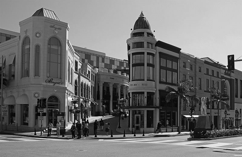 |
|
| (2012)* - Beverly Hills at the corner of Rodeo Drive, Dayton Way, and Via Rodeo. Photo by John O'Neill |
Historical Notes Two Rodeo Drive is an outdoor shopping center that was built in 1990. It initially housed, amongst other stores, Christian Dior and Valentino. The original developer, Douglas Stitzel, sold the property for about $200 million immediately after its completion. The shopping center was hard-hit by the early 1990s recession, with occupancy rates dropping to as low as 60%, and the buyers sold it at an almost $70 million loss in 2000. By 2007 the property was financially stable again and was sold to a group of Irish investors for $275 million. It resembles a “faux-European shopping alley” and features a cobblestone street. Some architects have claimed that Two Rodeo Drive is similar to a "theme park in the manner of Disneyland." |
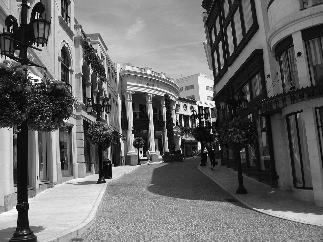 |
|
| (2007)* - Closer view showing the European-style buildings on Two Rodeo Drive. Photo by Kjetil Ree |
* * * * * |
 |
|
| (2010s)* - There’s love in the air. Looks like she gave him the green light! Photo courtesy of Megan Artus |
 |
|
| (2019)* – Santa Monica and Wilshire boulevards with palm trees in the background. |
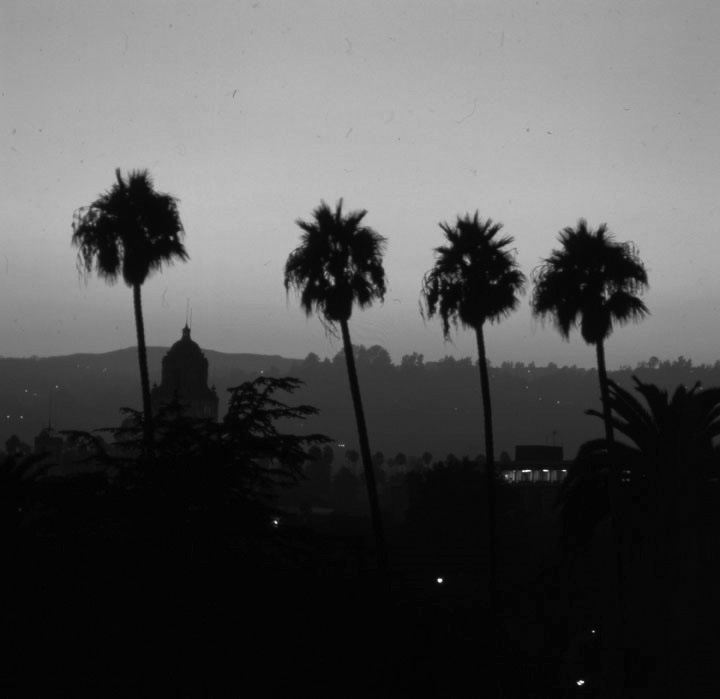 |
|
| (1980)* - Panoramic view of Beverly Hills at dusk. The dome of the Beverly Hills City Hall is jutting up amid tall palm trees and lights shine from buildings on the hills afar. Photo by Carol Westwood |
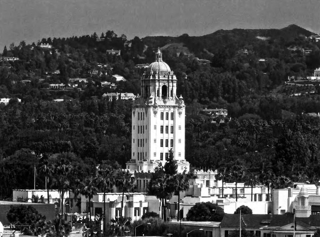 |
|
| (2016)* – View showing Beverly Hills City Hall with the Santa Monica Mountains in the background. |
Historical Notes Beverly Hills City Hall has long been a beloved civic landmark, its 1932 Spanish Renaissance tower denoting the political heart of an iconic city. |
 |
|
| (2012)* - View showing the Beverly Hills Civic Center from the corner of Crescent Drive and Burton Way. The tower of the Beverly Hills City Hall, part of the Civic Center complex, can be seen in the background. Photo by John O'Neill |
Historical Notes In 1981, Beverly Hills announced a design competition to add a large civic center component adjacent to the historic City Hall building, and chose the winner from submissions by five highly prominent architectural firms. Charles Moore and his firm Urban Innovations Group came out on top with a design that playfully expands on City Hall’s architecture. Completed in 1990, the Civic Center complex uses a sort of Postmodern, Spanish-Art Deco hybrid in its plan of courtyards, colonnades, promenades, and buildings. The complex mixes open and semi-enclosed spaces, using stairways and balconies to create multiple levels of perspective. A diagonal promenade dotted with elliptical courtyards runs through the complex, connecting City Hall with the street and unifying the complex as a whole. Colorful tile and geometrically arched colonnades bring a distinct 1980s sensibility that somehow complements the tiled dome of the 1932 tower. In this design, as in all of his designs, Moore aimed to create “a place that is distinguishable in mind and memory from other places.” The Beverly Hills Civic Center definitely met that goal, as there is no place else quite like it. |
 |
|
| (2016)* - The Beverly Hills city limit sign, featuring the official seal of Beverly Hills. |
Historical Notes As Beverly Hills approached the 100th anniversary of its incorporation, concern began to grow over the lack of an historic preservation ordinance to protect significant structures located within the city limits. In response, the City Council enacted one with the honor of Historic Landmark No. 1 being bestowed upon the Beverly Hills Hotel. Upon achieving its centennial in 2014, Beverly Hills continues to mature with renewed appreciation for its past, remaining true to Burton Green’s vision of an oasis of refinement, while meeting the challenges of the future. |
 |
|
| (2013)* - Beverly Hill's signs sprinkled through, well, Beverly Hills, California. |
* * * * * |
Please Support Our CauseWater and Power Associates, Inc. is a non-profit, public service organization dedicated to preserving historical records and photos. Your generosity allows us to continue to disseminate knowledge of the rich and diverse multicultural history of the greater Los Angeles area; to serve as a resource of historical information; and to assist in the preservation of the city's historic records. |
More Historical Early Views
Newest Additions
Early LA Buildings and City Views
History of Water and Electricity in Los Angeles
* * * * * |
References and Credits
^ LA Public Library Image Archive
#^California Historical Society Digital Archive
+# Facebook.com: Garden of Allah Novels
^* Facebook: SoCal Historic Architecture
#* Early Beverly Hills - Marc Wanamaker
** Beverly HIlls HIstorical Society
^* The Valley Observed: Street Name Origins
^# Beverly Hills Library Historical Collection
** Pinterest.com: Beverly Hills Centennial (1914-2014)
++ Travelingaround.tumblr.com: Beverly Hills
^+Beverly Hills Renovated Electric Fountain
^^MattConstruction.com: Wallis Annenberg Center for the Performing Arts
## Beverly Hills High School Home Page
***Fountains in LA: Beverly Hills Electric Fountain
*^*City of Beverly Hills: Historic Resource Report
*#*Riding Vintage: The Motordrome
^*^KCET: The Lost Bridle Paths of Beverly Hills
^*#California State Library Image Archive
+++BeverlyHills.org: History of Beverly Hills; Sign and Logo
*^#^Huntington Digital Library Archive
^^*Flickr.com: Michael Ryerson
^^^Rodeo Realty
^#^Noirish Los Angeles - forum.skyscraperpage.com
^x^My Love of Old Hollywood - A Quick Tour of Beverly Hills
+##MartinTurnbull.com: Fairfax and Wilshire
*##Restaurant-ing Through History: Ice Cream Parlors
*^#Facebook.com - Bizarre Los Angeles
#**Hemmings Classic Cars: Ralphs Market
++^Mentalfloss.com: 12 Postcard Locations Then and Now
^++Cinema Treasures: Fox Wilshire Theatre (Saban Theatre)
+++Los Angeles Conservancy: Birth of the Boulevard; Wallis Annenberg Center for the Performing Arts
**^#Vintage Los Angeles: Facebook.com
*^^#Curating the City: Sunset Clock Market
#^*^Pinterest.com: Old Hollywood
#+++Yahoo.com: Beverly Hills Hotel
##^*Calisphere: University of California Image Archive
##++Facebook.com - Beverly Hills Heritage
#*#^Flickr.com: Wilshire Boulevard History
^^^^Beverly Hills Board Track Racing
^*^*Beverly HIlls Patch: The Beverly Hills Speedway
^**^Pinterest: Splinters n Speed; Cars - Bertrand Lacheze; Beverly Boards Motorcycle Racing
***^^Will Rogers Memorial Park
< Back