Early Views of the San Fernando Valley
 |
|
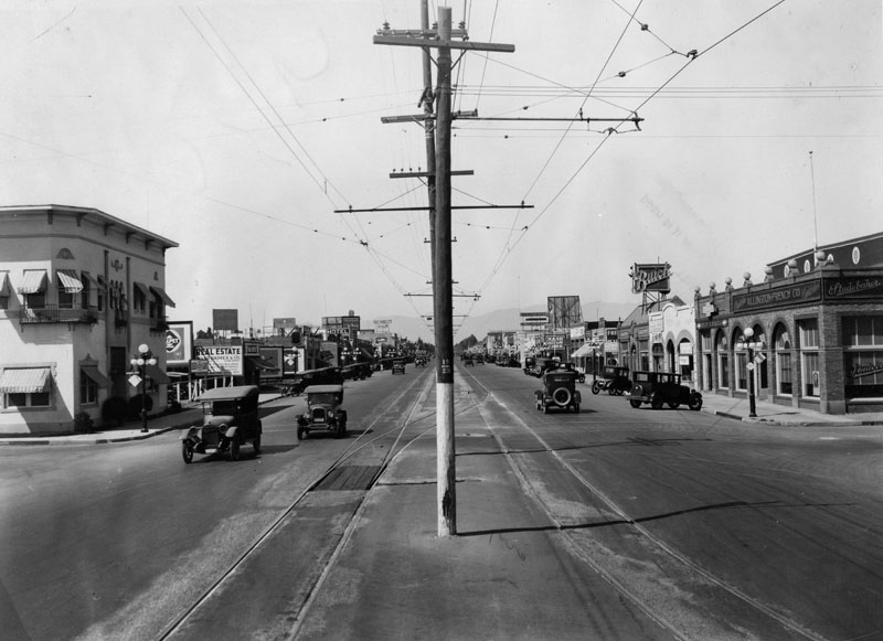
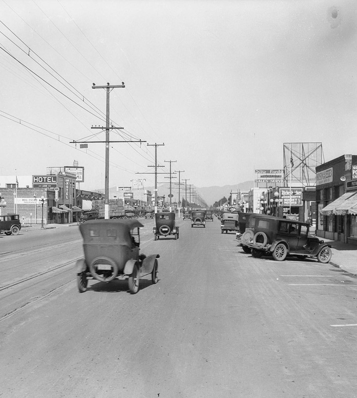
| (1927)* - Looking north on Van Nuys Boulevard from near Calvert Street. Utility poles rise in the center median, flanked by automobile lanes and embedded streetcar rails. Small commercial buildings line both sides of the boulevard, with diagonal street parking. Visible signage includes automobile dealerships (Studebaker, Buick, Nash, Ford), a cigar and soda shop, a real-estate office, and a hotel. |
Historical Notes In 1927, Van Nuys Boulevard still carried streetcar rails in its median, a reminder of the early electric transit era in the San Fernando Valley. As the boulevard developed, automobile traffic and angled parking became more common, and many of the small commercial storefronts reflect the rapid growth of the Valley’s suburbs at the time. The poles running down the center carried overhead trolley wires that supplied electricity to the streetcars operating along Van Nuys Boulevard. |
 |
|
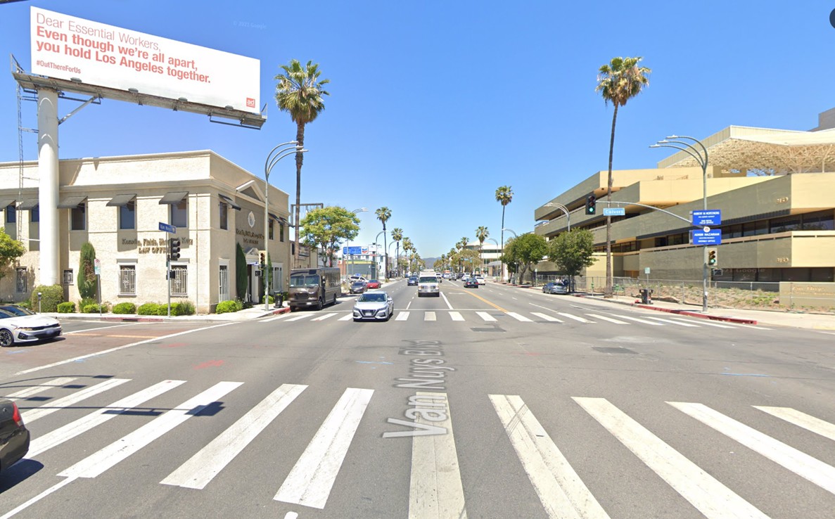
| (2021)* – Looking north on Van Nuys Boulevard at Calvert Street. A surviving commercial building on the northwest corner remains in use, although it has been modified since the original photo. |
Historical Notes Nearly a century after the 1927 view, the street has evolved dramatically. The streetcar rails are long gone, and the median is now dedicated to vehicular lanes and modern traffic flow. The remaining corner building serves as a physical link to the boulevard’s early commercial era amid more contemporary architecture and heavier traffic volumes. |
Then and Now
 |
|
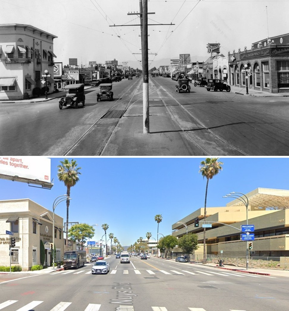
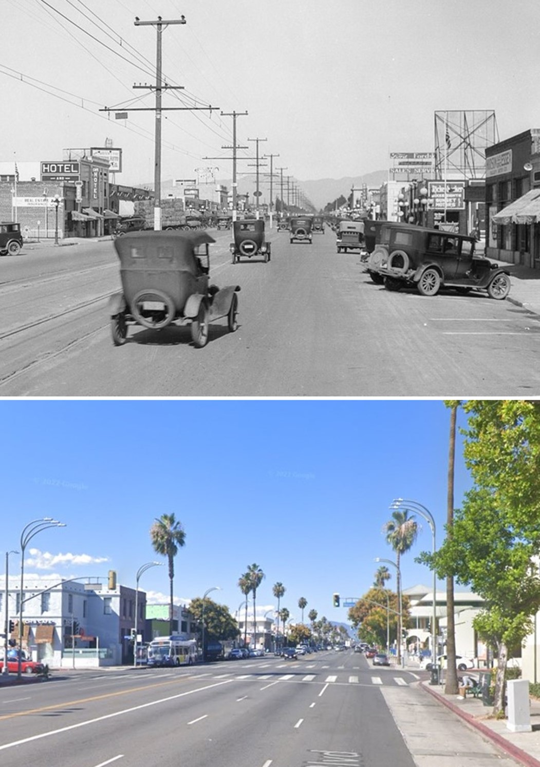
| (1927 vs 2021)* – Then-and-now comparison of Van Nuys Boulevard looking north at Calvert Street. Note the central utility poles and streetcar tracks in the earlier view, and the surviving northwest-corner building. Photo comparison by Jack Feldman. |
Historical Notes These two views show how one street can reflect nearly a century of change. The 1927 photograph captures the tail end of streetcar service in the Valley, while the 2021 photo highlights how automobile-dominated boulevards replaced dedicated transit rails. The tall poles that once lined the center carried overhead wires powering Pacific Electric streetcars. The fact that a corner building still stands offers a tangible connection across time. |
 |
|
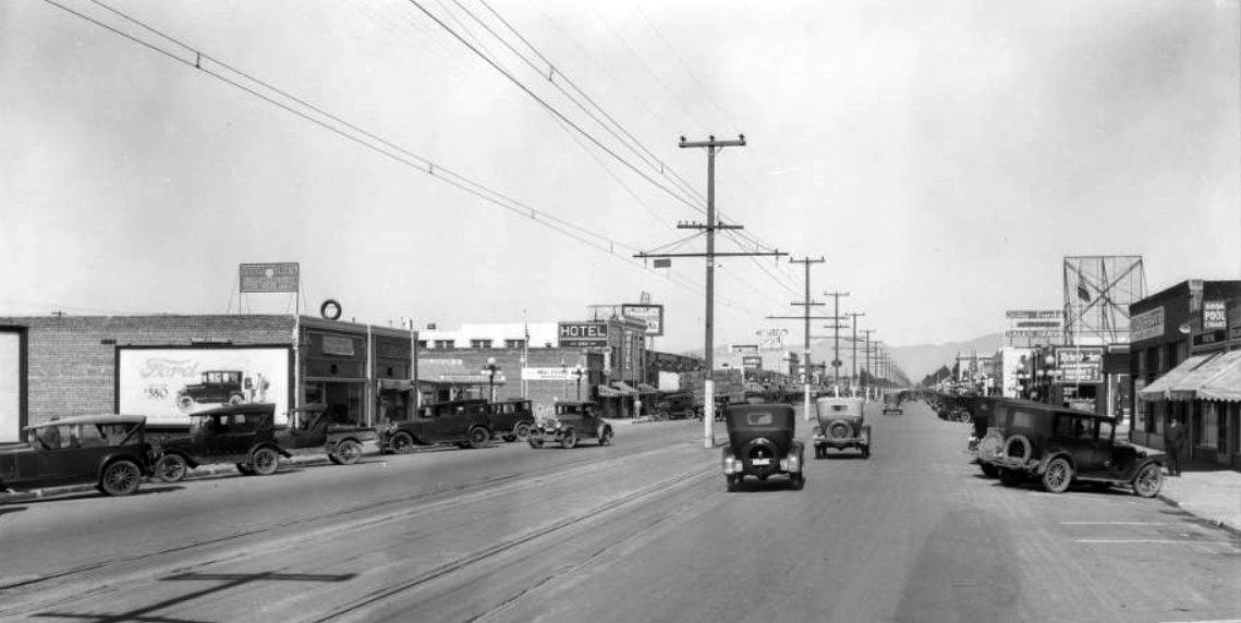
| (1926)* - Looking north on Van Nuys Boulevard showing the Van Nuys Hotel (left-center) on the west side of the street, near the northwest corner of Van Nuys Boulevard and Delano Street. Streetcar tracks and overhead wires run down the center of this wide thoroughfare. |
Historical Notes The Van Nuys Hotel, visible here, served as a landmark in its era, located at a key intersection in the growing town of Van Nuys. At the time this photo was taken, the street’s width and its transit infrastructure underscore how the boulevard was conceived as a major civic and commercial axis, not just a residential street. The tall poles in the center supported the streetcar’s electric lines, which powered the Pacific Electric cars serving the Valley during this period. |
 |
|
| (1926)* - Looking north on Van Nuys Boulevard at the Van Nuys Hotel (west side of street, left-center). The hotel stands amid early commercial development, with power lines and streetcar tracks visible down the boulevard’s median. |
Historical Notes While many of the buildings that lined Van Nuys Boulevard in the mid-1920s have since been demolished or heavily altered, the Van Nuys Hotel building (6211 Van Nuys Blvd) remains — a rare surviving piece of that early era of development. This image helps illustrate the transition from small-town fields to a boulevard defined by transit, commerce, and lodging. |
Then and Now
 |
|
| (1926 vs. 2022)*- Then-and-now view of Van Nuys Boulevard looking north at the Van Nuys Hotel (west side, left-center) near Delano Street. The older photo shows the hotel amid early development; the modern view shows the greatly altered streetscape. Click HERE to see more of the Van Nuys Hotel. Photo comparison by Jack Feldman. |
Historical Notes This comparison emphasizes the change from a transit-oriented boulevard—complete with streetcar tracks, overhead wires, and center-line poles—to a roadway shaped by the automobile. Those poles once supplied electric power to the Pacific Electric cars serving Van Nuys. The survival of the hotel building offers one of the few anchors to the 1920s streetscape, reminding viewers of the layered history beneath the modern façade. |
 |
|
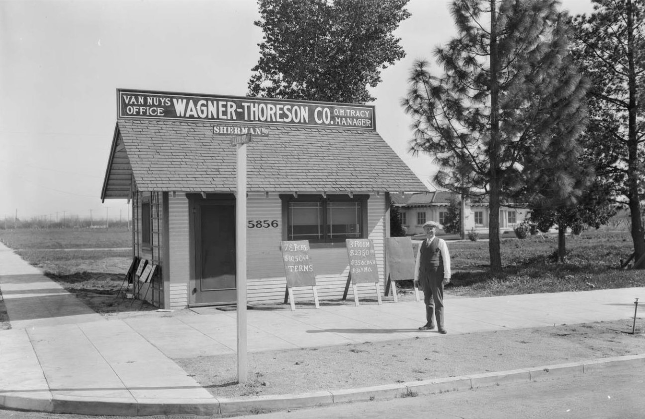
| (ca. 1920s* – View of the southeast corner of Sherman Way and Lane Street (now Van Nuys Boulevard and Califa Street) showing a man standing in front of a real-estate office. A sign advertises a three-room house for $350 down and $30 per month. |
Historical Notes In the early years of Van Nuys’ development, land was being rapidly subdivided and sold. The original street names reflect the planning era—Sherman Way for the boulevard and Lane Street for the offshoot. The sign’s payment terms offer a glimpse into how homes were marketed in the 1920s Valley. |
 |
|
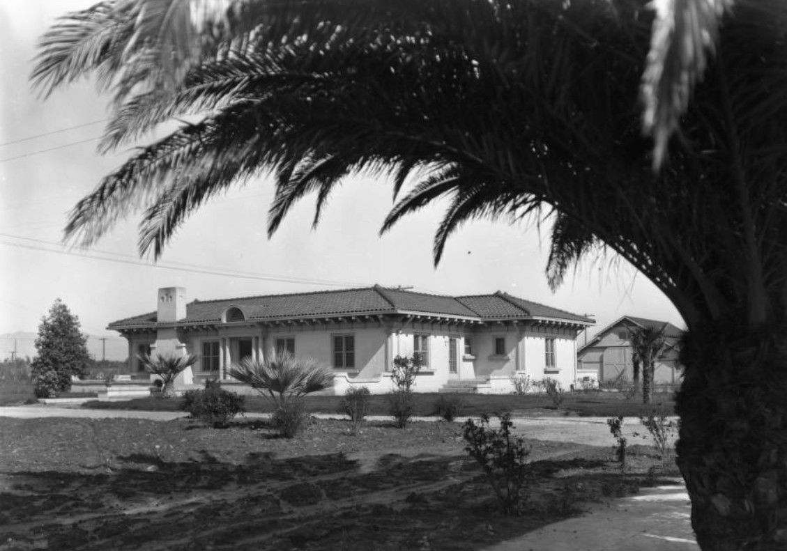
| (1926)* - View looking northwest on Califa Street (formerly Lane Street), just east of Van Nuys Boulevard (formerly Sherman Way), showing a house built in the 1920s. The home sits behind the real-estate office from the earlier photo. |
Historical Notes This residence is an example of early suburban housing in the Valley, located within walking distance of the main commercial drag. Over time, many of these houses and their neighboring businesses gave way to more intensive commercial or mixed-use development; today the footprint is used differently, reflecting changing land-use patterns. Today, a used car dealership (Keys Lexus) is located where the above house and real estate office once stood. |
.jpg) |
|
| (ca. 1926)** - View of the northeast corner of Van Nuys Boulevard and Oxnard Street. The buildings shown are part of the distribution headquarters of the Bureau of Power and Light (later the Los Angeles Department of Water & Power). |
Historical Notes Utility infrastructure and streetcar systems were closely connected to urban growth during the 1920s. The presence of a Bureau of Power and Light facility at this intersection shows how the City’s utilities expanded alongside new streets and neighborhoods. Over time, these facilities were relocated or replaced, but the image captures an era when utilities were visibly integrated into the street-front landscape. The Los Angeles Department of Water and Power (DWP) has seen six different name changes since it was first created in 1902. Click HERE to see DWP Name Change Chronology. |
* * * * * |
Robert Morton Organ Co.
 |
|
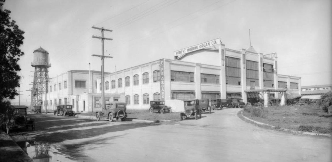
| (1926)* - Panoramic view of the Robert Morton Organ Co., Van Nuys. |
Historical Notes The Robert Morton Organ Company was a producer of theater pipe organs and church organs, located in Van Nuys. Robert Morton was the number two volume producer of theatre organs, building approximately half as many organs as the industry leader Wurlitzer. The name Robert Morton was derived not from any person in the company, but rather from the name of company president Harold J. Werner's son, Robert Morton Werner. The company's heyday was in the late 1920s, the era of the lavish movie palace theaters exhibiting silent films. The rise of the Great Depression and the advent of sound films eliminated the demand for theater organs and the company closed in 1931. In addition to their uses in theaters and music halls, Robert Morton organs have been featured in the music for the Haunted Mansion attractions at various Disney theme parks. |
* * * * * |
Ventura Boulevard (Sherman Oaks)
 |
|
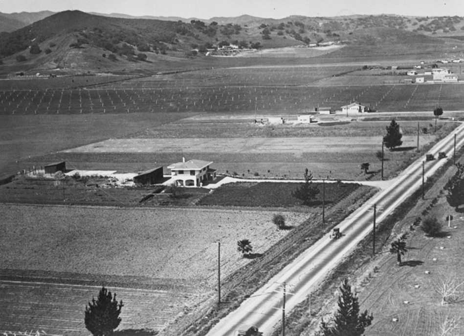
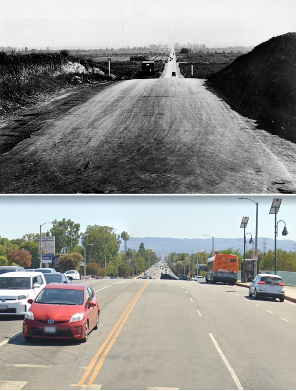
| (ca. 1920)* - Aerial view looking west along Ventura Boulevard in the Sherman Oaks–Van Nuys Boulevard area. The rural landscape shows newly surveyed tracts, scattered farmhouses, and orchards at the base of the Santa Monica Mountains. Within a few years, this section would become the heart of Sherman Oaks’ early commercial district. |
Historical Notes Sherman Oaks was one of the first communities in the San Fernando Valley to see major real estate development. In 1910, the Los Angeles Suburban Homes Company bought 47,500 acres in the southeast Valley, anticipating that completion of the Los Angeles Aqueduct would bring a new era of growth. A year later, the company filed a subdivision map known as Tract 1000. One of its partners, General Moses Hazeltine Sherman, kept 1,000 acres for himself. In 1927, he subdivided and sold the land for about $780 an acre. Sherman also served on the Los Angeles Board of Water Commissioners, which gave him unique insight into how water from the aqueduct would transform the Valley from farmland into residential neighborhoods. |
 |
|
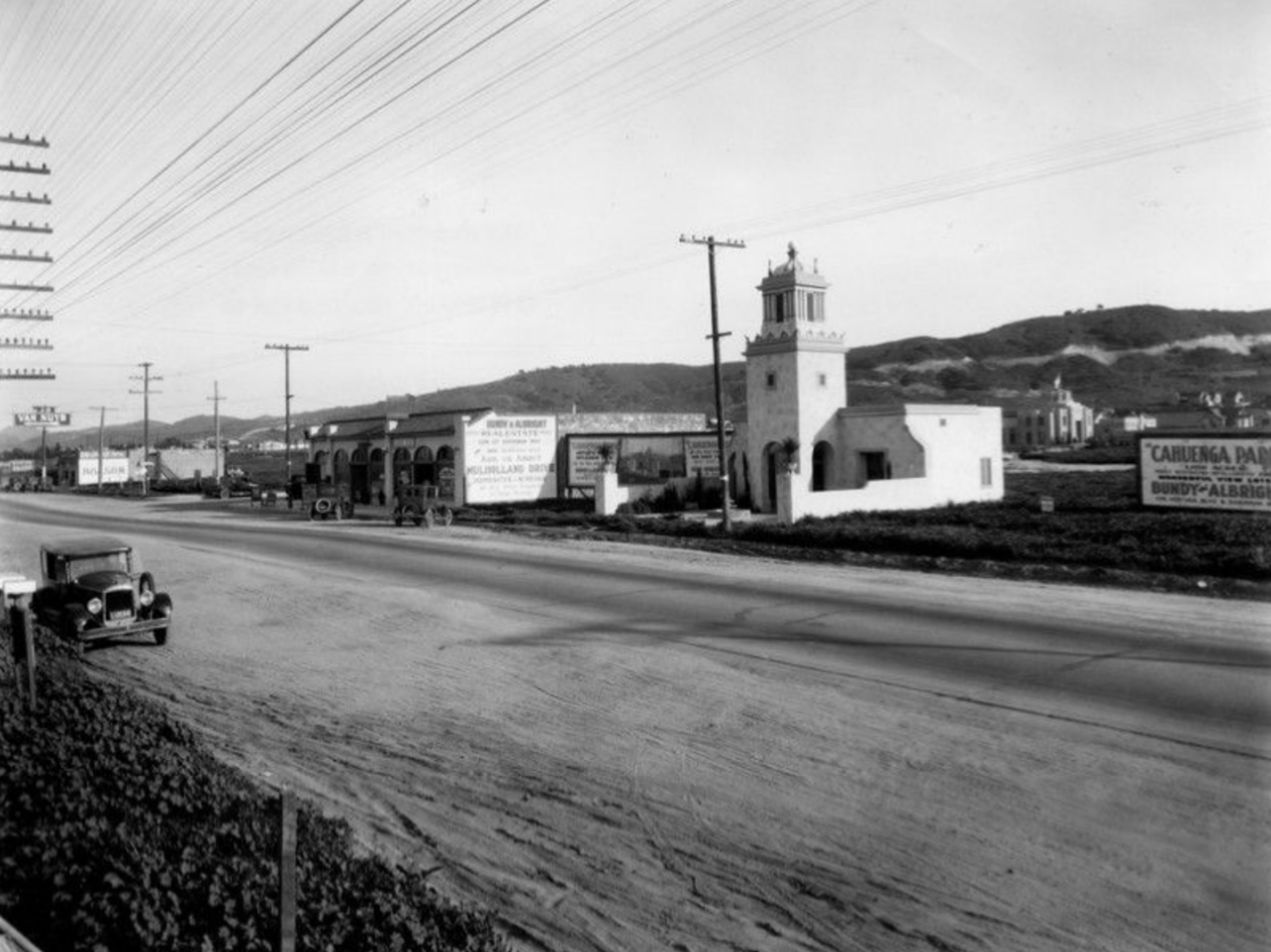
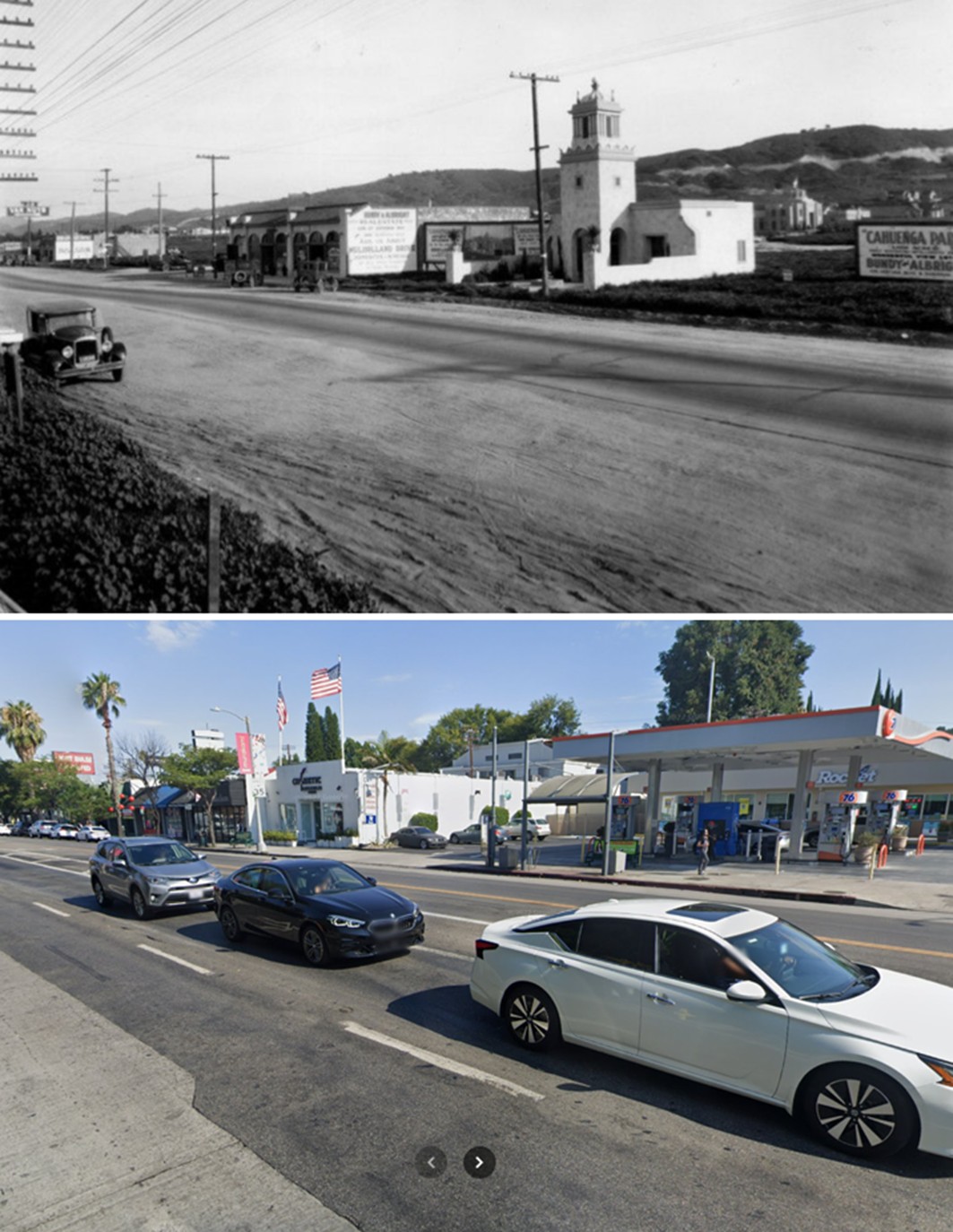
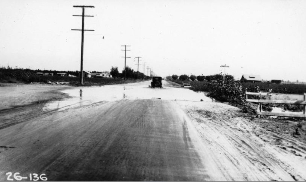
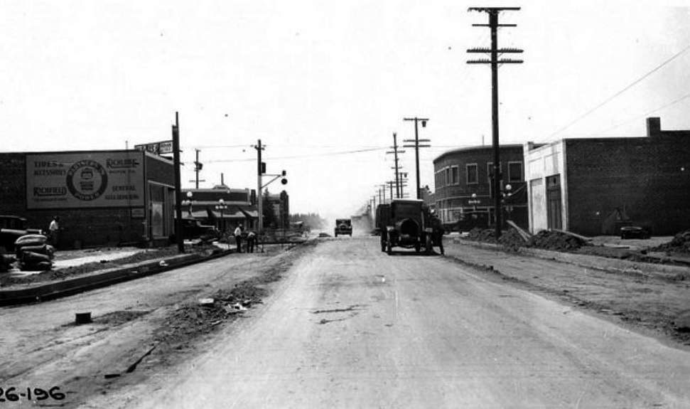
| (1927)* - View looking southeast across Ventura Boulevard near Van Nuys Boulevard in Sherman Oaks. Commercial buildings line the south side of Ventura, while only a narrow two-lane strip of pavement runs through the center. A roadside sign on the right reads, “Cahuenga Park – Wonderful View Lots.” |
Historical Notes By 1927, Ventura Boulevard had become the main thoroughfare through Sherman Oaks and an early link in the state’s highway system, soon forming part of U.S. Route 101 before the freeway era. The small businesses seen here served new homeowners moving into the surrounding tracts. The open landscape still reflected the Valley’s rural past, but that would change quickly as roads were widened and the automobile transformed the community. Sherman’s name lives on in Sherman Oaks and Sherman Way, while Hazeltine Avenue was named for his daughter. Together, they mark the personal and civic legacy of a man whose influence helped shape the development of the San Fernando Valley. |
 |
|
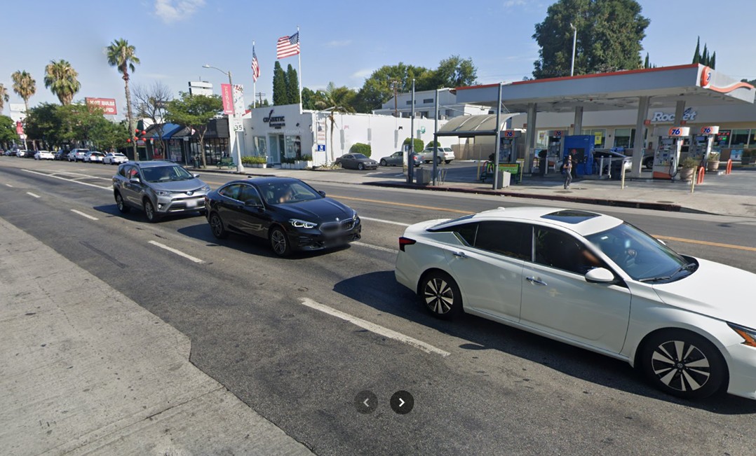
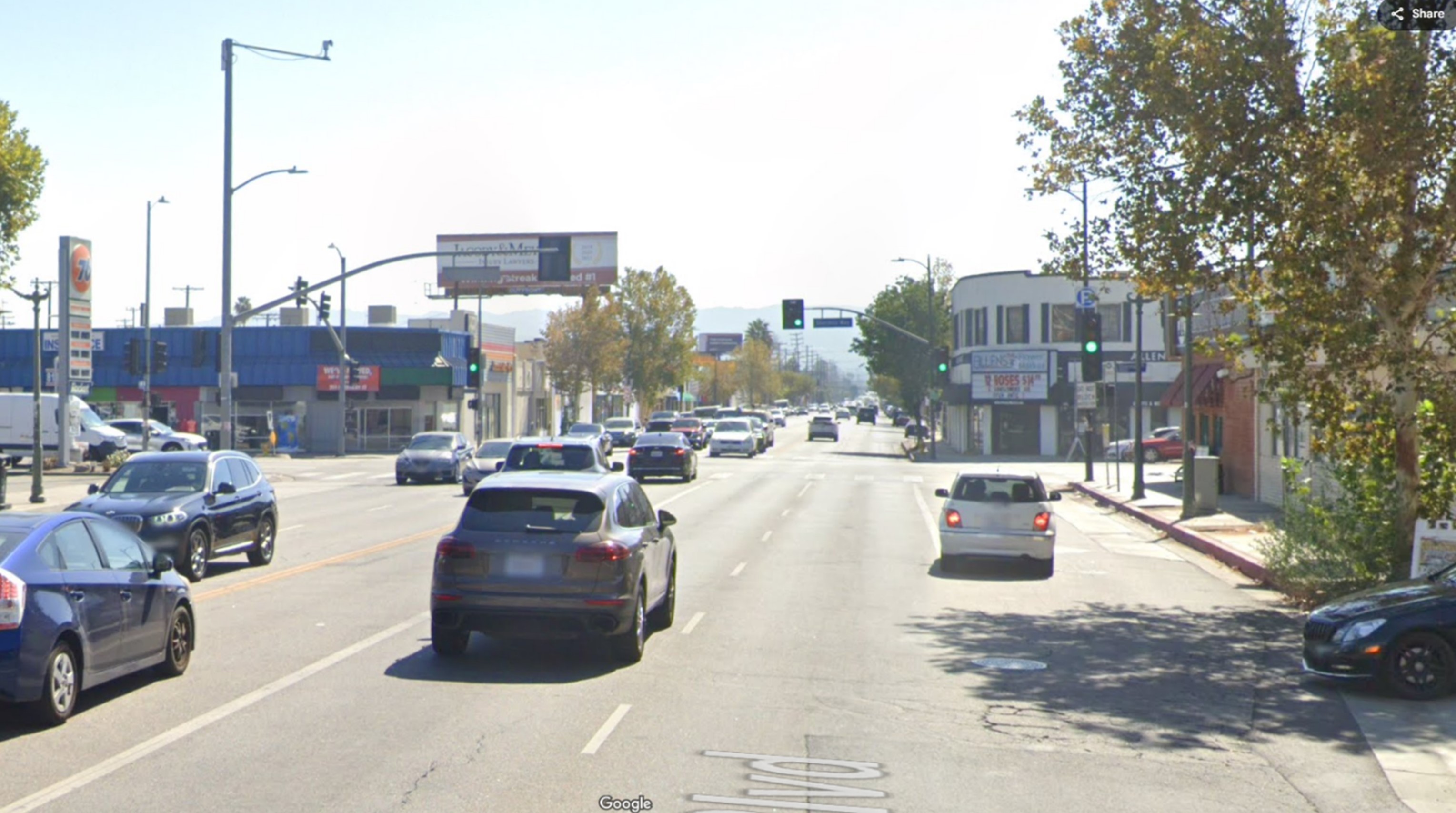
| (2022)* - Contemporary view looking southeast across Ventura Boulevard from just east of Van Nuys Boulevard. |
Historical Notes Today, this section of Ventura Boulevard remains one of the busiest stretches in the San Fernando Valley. What began as a dirt and gravel road lined with scattered shops and citrus groves has become a vibrant corridor of restaurants, offices, and storefronts. The area still reflects Sherman Oaks’ original street grid, and many of the commercial buildings follow the same lot lines laid out over a century ago. |
Then and Now
 |
|
| (1927 vs 2022)*- Then and Now view looking southeast along Ventura Blvd at Van Nuys Blvd in Sherman Oaks, showing its transformation from a rural crossroads in 1927 to a major urban corridor today. Photo comparison by Jack Feldman. |
Historical Notes The 1927 view shows a quiet, undeveloped landscape with a few businesses catering to new settlers in the Valley. The modern view reveals a dense, urban corridor filled with traffic and commercial activity. In less than a century, the once-rural Ventura Boulevard evolved from a narrow two-lane highway into one of Los Angeles’ most recognizable and heavily traveled streets, a vivid illustration of the rapid suburban expansion that followed the arrival of reliable water and the growth of the postwar freeway system. |
* * * * * |
Lankershim and Weddington (North Hollywood)
| (ca. 1919)* - Panoramic view looking west along Lankershim Boulevard at Weddington Street in what is now North Hollywood. Two large homes sit on either side of a private driveway. In the distance you can see a wooden stable and a church tower. Trees surround the properties. |
Historical Notes The home on the left was once owned by member of the Weddington family, and was located at 5269 Lankershim Blvd. It was later moved to 5245 Bakman Avenue to make space for the construction of the El Portal Theatre, and ultimately demolished in 1965. The house on the right was moved to 5259 (later 5263) Bakman Avenue and became part of St. Charles Parish, and then was relocated a second time in 1953 to 5461 Louise Avenue on a school campus; it appears it no longer stands. The private drive that once separated the two homes was widened later so Weddington Street could extend straight through. The building visible in the distance was a combined Methodist Episcopal Church and Church of the Immaculate Conception. It was briefly used as a legitimate theater in the late 1940s, but was demolished in 1952. |
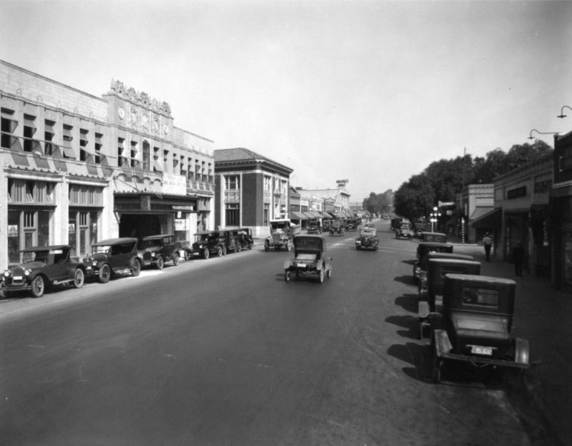
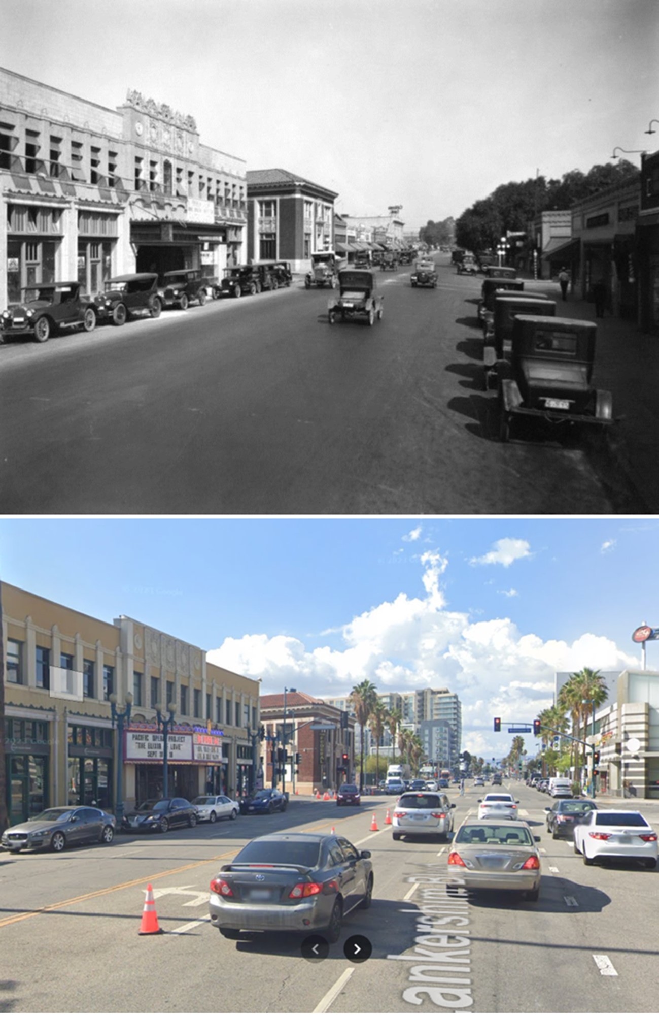
| (ca. 1923)* - View looking northward on Lankershim Boulevard from Weddington Street. On the left is a brick bank building under construction at 5303 Lankershim. A woman pushes a baby carriage, a child walks beside her. Storefront signs advertise a drug store, real estate office, and a soda/lunch/cigar business. On the west side is the private drive that once separated the two residences seen in the earlier image, later widened to become part of Weddington Street. Except for the bank, all the shown structures have been demolished. Click HERE for contemporary view. |
Historical Notes Following the opening of the Los Angeles Aqueduct and the influx of reliable water from Owens Valley, West Lankershim (now Valley Village) was annexed to the City of Los Angeles in 1919; Lankershim proper followed annexation in 1923. The area’s growth from farmland into urban neighborhood was underway. |
| (ca. 1923)* - Two-story brick commercial buildings line both sides of Lankershim Boulevard in North Hollywood. Signs advertise soda, cigars, lunch, drugs, and more. Early automobiles and a delivery truck labeled “Express” are parked or driving along the street. Telephone poles rise above tree-lined sidewalks. |
Historical Notes In 1927 the town of Lankershim renamed itself “North Hollywood” in an effort to link to the glamour of Hollywood and attract housing and development. This era kick-started a large house-building boom that transformed the area from agricultural fields to suburban neighborhood. |
Then and Now
| (1923 vs. 2022)* – Looking north on Lankershim Boulevard at Weddington Street. Nearly a century apart, yet the Federal Building remains the landmark anchor of this evolving intersection, where old Lankershim grew into modern North Hollywood. Photo comparison by Jack Feldman. |
Historical Notes The brick building at 5303 Lankershim Boulevard was completed in 1923 as the Lankershim Bank, one of the first major commercial structures in the area. Over the years it served a variety of tenants, including financial offices, professional suites, and neighborhood businesses. In the early 2010s the building was renovated and reopened as The Federal Bar, a popular restaurant, bar, and live music venue that became a gathering place for the North Hollywood Arts District. It closed at the end of 2023 after more than a decade of operation. As of 2025, a new concept called The Witch’s Cottage, described as a cafe, bar, and performance space, is planned to open in the building. The structure remains one of the most recognizable survivors of early Lankershim’s transformation from a small farming town to a lively urban community. |
* * * * * |
El Portal Theatre
 |
|
| (1926)* - View looking north on Lankershim Boulevard toward Weddington Street. On the left is the El Portal Theatre (then under construction) showing its newly installed windows and unfinished marquee. A rooftop sign for “California Bank” appears in the distance. Of the buildings in view, only the theatre and the brick bank at the corner of Weddington survive today. |
Historical Notes The El Portal Theatre was designed by architect Lewis A. Smith and opened in October 1926 as a vaudeville house and movie palace. It is now a historic landmark in the heart of North Hollywood. Over time it hosted silent and talking films as well as live shows. The building was badly damaged in the 1994 Northridge earthquake and later rebuilt and reopened in January 2000 as a three-theatre performing arts complex |
Then and Now
 |
|
| (1926 vs 2021)* - Looking north on Lankershim Boulevard toward Weddington Street with the El Portal Theatre seen on the left. The El Portal was built in 1926 on the site of the Weddington Residence, home of one of the original families of North Hollywood. Photo comparison by Jack Feldman. |
Historical Notes The original El Portal was built on the site of an earlier Weddington family residence, one of the original pioneer homes of the area. Over time the intersection has transformed from a quiet suburban boulevard to a bustling arts-district hub. |
 |
|
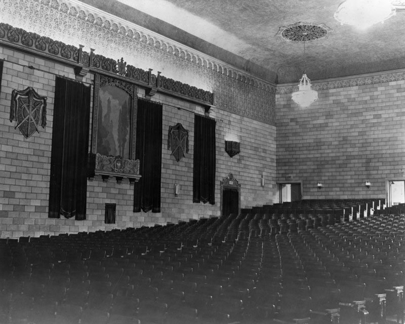
| (ca. 1926)* - Interior view of the El Portal Theatre showing the seating and auditorium as it appeared shortly after opening. |
Historical Notes When it opened, the El Portal seated around 1,300–1,400 people on a single level. Its style was Spanish Renaissance Revival, and it was among the most grand theatres in the Valley at the time. Over the decades the interior underwent changes, suffered earthquake damage, and was renovated for modern use. |
 |
|
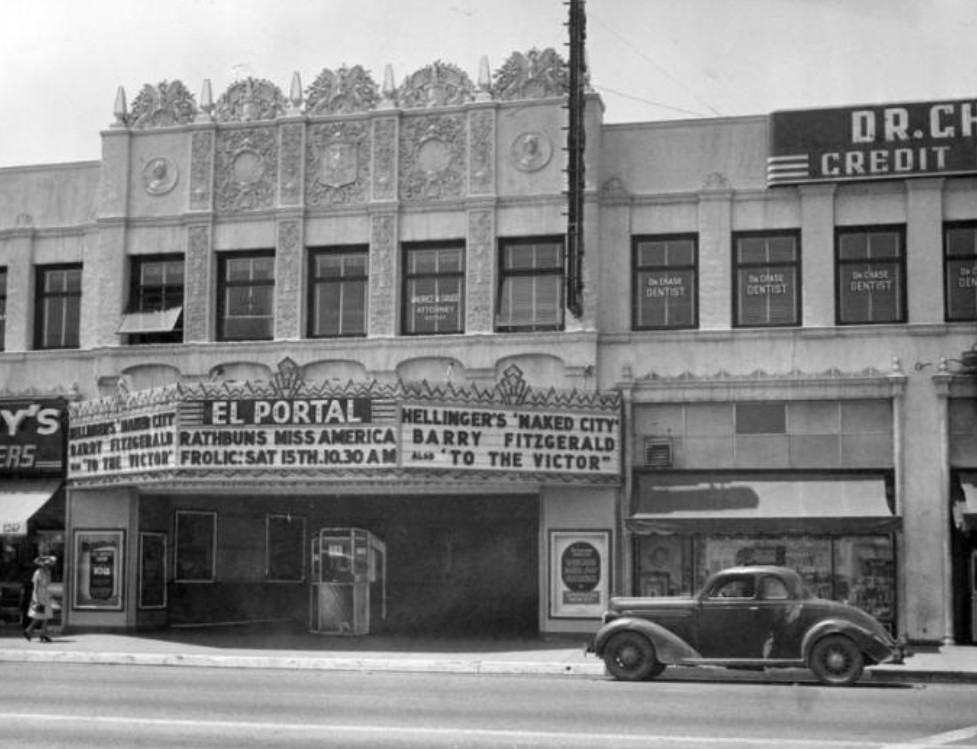
| (1948)* - The El Portal Theatre at 5269 Lankershim Blvd. with its marquee announcing hits such as “Hellinger’s Naked City – Barry Fitzgerald – also To the Victor” and “Rathbun’s Miss America – Frolic: Sat 15th. 10:30 AM”. The upper floor appears occupied by various offices: a dentist (Dr. Chase) and an attorney/Notary (Maurice M. Grudd). |
Historical Notes By 1948 the El Portal was a well-established movie theatre in North Hollywood, showing first-run films and serving as a local entertainment hub. The neighborhood had shifted from farming to urban commerce. The building later went through many incarnations before its modern restoration in 2000. |
 |
|
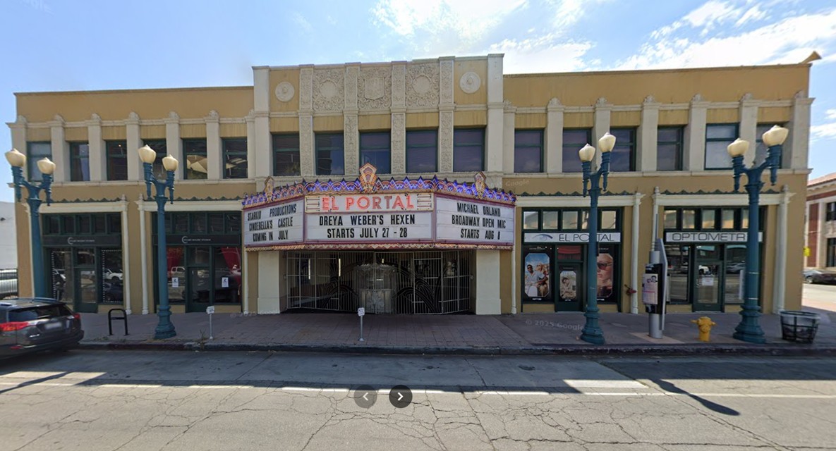
| (2024)* – Contemporary view of the El Portal Theatre located at 5273 Lankershim Boulevard in North Hollywood. |
Historical Notes Today the El Portal Theatre continues to stand as a centerpiece of the NoHo Arts District. After reopening in 2000, it has seen ongoing improvements including lighting, accessibility, and performance upgrades. Decorative street lamps were added along the boulevard to enhance the theatre’s historic character and nighttime appeal. The building remains a gathering place for theatre, music, and community events, blending its Art Deco charm with modern creativity. |
Then and Now
 |
|
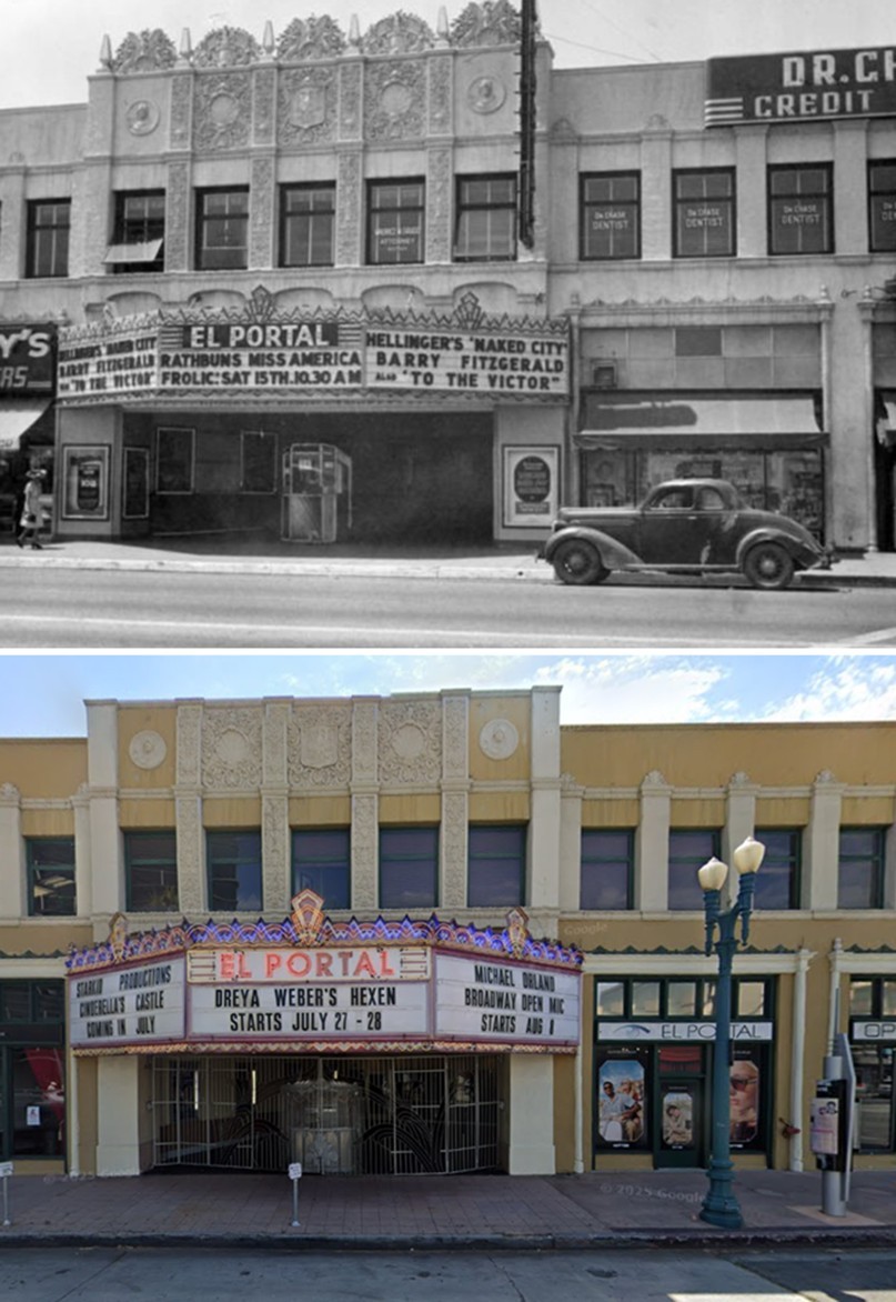
| (1948 vs 2024)* - From classic films like “Naked City” to today’s live-streamed performances, North Hollywood’s El Portal Theatre has been entertaining audiences since 1926. Rebuilt after the 1994 earthquake, renovated in 2000, and updated in recent years, its Art Deco glow still lights up Lankershim Boulevard. Photo comparison by Jack Feldman. |
Historical Notes The El Portal’s restoration returned it to its 1920s splendor while adapting it for modern productions. The renovation included new stages, seating, and restored decorative details on its façade. In the years since, additional improvements and the installation of vintage-style streetlights have helped preserve its historic atmosphere. Nearly a century after its debut, the theatre remains a landmark symbolizing North Hollywood’s transformation into a thriving arts community. |
* * * * * |
Lankershim and Chandler (North Hollywood)
| (ca. 1924)* - View of Lankershim Boulevard, looking south from Chandler Boulevard. California Bank occupies the building at the southwest corner. Of the buildings pictures on the right between Chandler Boulevard and Weddington Street, only the building on the south end (5303 Lankershim) remains. |
Historical Notes The building on the southwest corner that is occupied by California Bank is the Weddington Building. It was demolished in 1988 Chandler Boulevard was formerly called Wilcox Avenue, and later Margate Street.^ |
| (1927)* - View of Lankershim Blvd. in North Hollywood, looking south from Chandler Blvd. Various small retail shops are seen, with cars parked out front. At left is a sign advising that the Lankershim Branch of Los Angeles Public Library is to the left. |
Historical Notes See what the intersection of Lankershim and Chandler looked like in: 1891 / 1946 / 2018 |
* * * * * |
Columbia Hall (North Hollywood)
 |
|
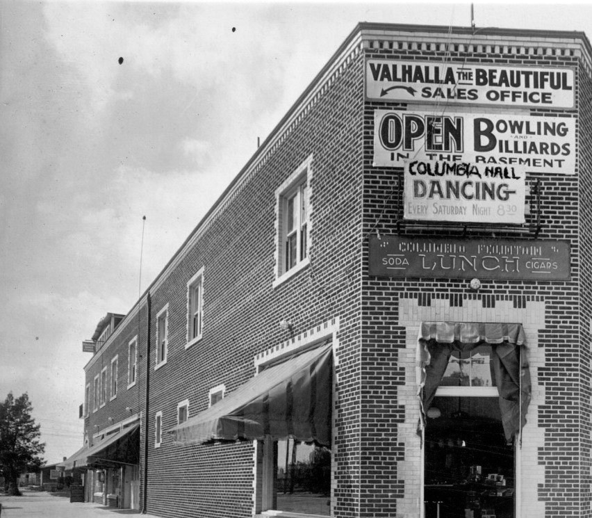
| (ca. 1920s)* - View showing Columbia Hall, one of the first two story buildings in the Valley. Located on the corner of Lankershim Blvd. and Compston Street, the brick building had a Dance Hall with Bowling and Billiards in the basement. |
* * * * * |
Lankershim High School (North Hollywood High School)
| (1927)*- Aerial view looking northwest showing Lankershim High School (later North Hollywood High School) on the northwest corner of 4th Street (later Magnolia) and Colfax Ave. Colfax runs diagonally from lower-left to middle-right. 4th Street runs from lower-bottom to middle-left. |
Historical Notes Built in 1927, Lankershim High School was named for the town of Lankershim (first called Toluca, now North Hollywood) and its founding family. Isaac B. Lankershim grew wheat on a wide swath of the Valley floor on his Lankershim Ranch. North Hollywood was established by the Lankershim Ranch Land and Water Company in 1887. It was first named Toluca before being renamed Lankershim in 1896 and finally North Hollywood in 1927.^* Lankershim High School would be renamed North Hollywood High School in 1929. ##*# |
| (ca. 1927)* – View showing the main building at Lankershim High School, 5231 Colfax Avenue. Note the bicycles lined up against the building. |
Historical Notes The original building that houses North Hollywood High School was built in 1927 and was then called Lankershim High School. An addition was added three years later to form what is now Kennedy Hall. In 1937, a mural of a Tataviam village was created by the WPA artist Fletcher Martin. The mural was 20 feet high and was located on a wall in the auditorium.^ |
 |
|
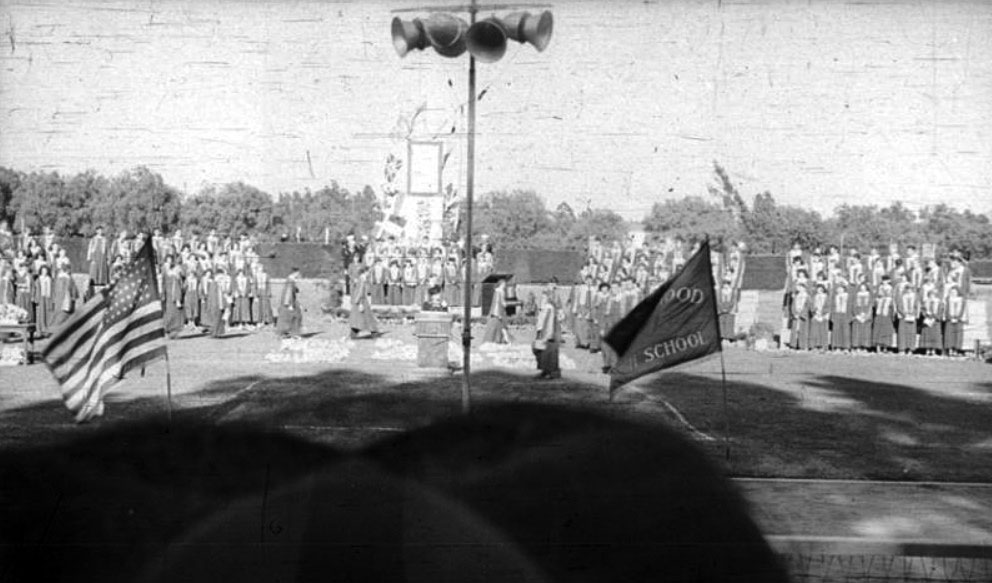
| (1942)^ - Graduation ceremony at North Hollywood High School, 1942. |
Historical Notes |
School Mascot: Huskies
School Colors: Blue, White, Grey
Click HERE to see Notable Alumni
|
Alma Mater: Near the valley’s purple mountains
|

 |
|
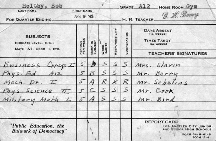
| (1943)^ - Front side of a World War II era report card for Robert Holtby, a graduate of North Hollywood High School. |
Historical Notes Classes included: Business Correspondence, Mechanical Drafting, and Military Math. All future needs for a young man in 1943.^ |
 |
|
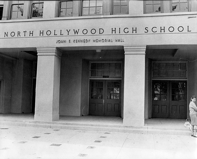
| (1965)* - View of the entrance to the John F. Kennedy Memorial Hall (main building) at North Hollywood High School. |
Historical Notes Known for years simply as the "main building" at North Hollywood High School, it was renamed the John F. Kennedy Hall in 1965 by the Senior class of 1963 who petitioned to Board of Education to name the building in memory of the slain President.* |
Lankershim Elementary School (2nd Location)
| (ca. 1920)* - View of a nearly completed new building at the Lankershim Elementary School, located at 5250 Bakman Avenue in North Hollywood. The original school building can be seen in the background on the right. |
Historical Notes Lankershim's first elementary school was located on Vineland Avenue, just south of Third Street (now Riverside Drive). It was relocated to the above site, 5250 Bakman Avenue, circa 1920s. Click HERE to see the school at its original location. |
| (ca. 1920s)* - Aerial view from the southwest of Lankershim Elementary School, located at 5250 Bakman Avenue in North Hollywood. The intersection of Lankershim and Weddington is in the upper left. |
Historical Notes In 1938, Student Norma Jean Baker won awards for track and field, and the high jump. At Lankershim she was known as Norma Jean the jumping bean. She later found fame as an actress. Today we remember her as Marilyn Monroe.^#^^ |
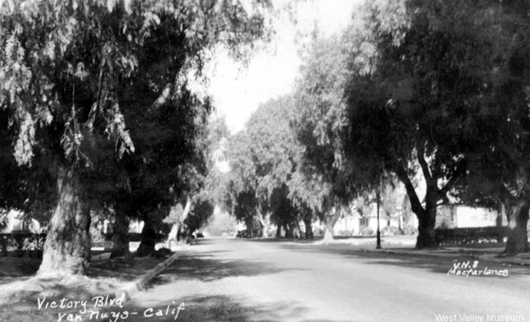
Victory Elementary School
 |
|
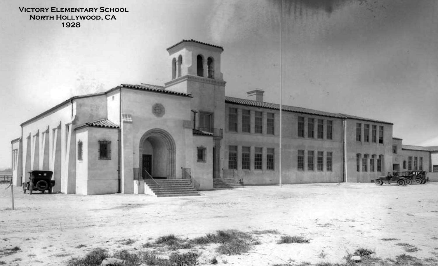
| (1928)#^*^ – View looking slightly northwest showing Victory Elementary School with snow on ground. Location: SW corner of Radford Avenue and Victory Boulevard, North Hollywood. |
Historical Notes The beautiful school building was completed in 1928. It was demolished by 1972 (seen in aerials) and replaced by the current building there today. |
* * * * * |
 |
|
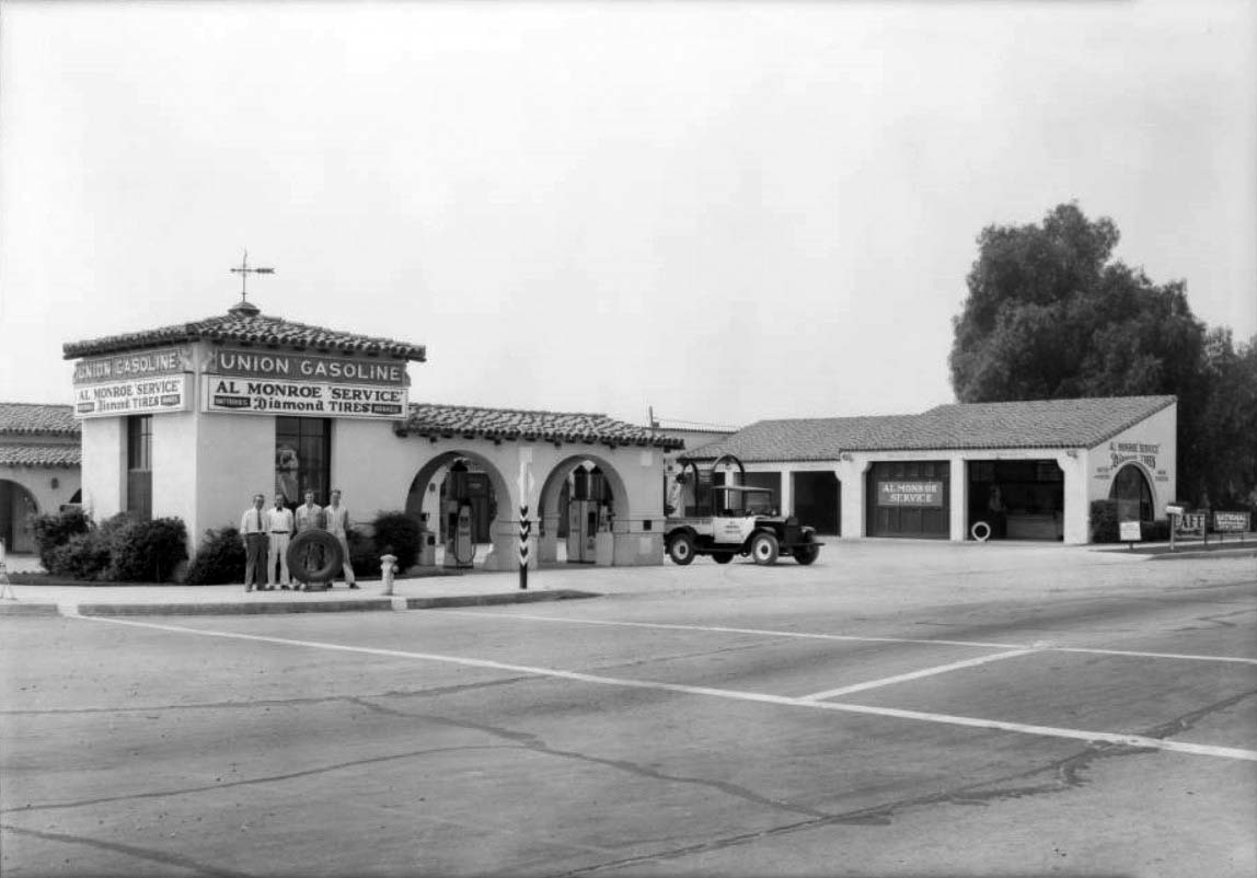
| (1930)^^ - View showing 4 men standing behind a tire in front of a Union Gasoline service station on the corner of Lankershim and Victory boulevards. Sign reads: Al Monroe Service – Diamond Tires. Click HERE to see more Early Views of LA Gas Stations. |
 |
|
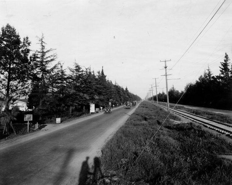
| (1927)* - Sherman Way between Van Nuys and Lankershim Boulevards in North Hollywood. The photographer's shadow can be seen in the foreground. |
 |
|
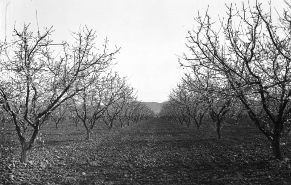
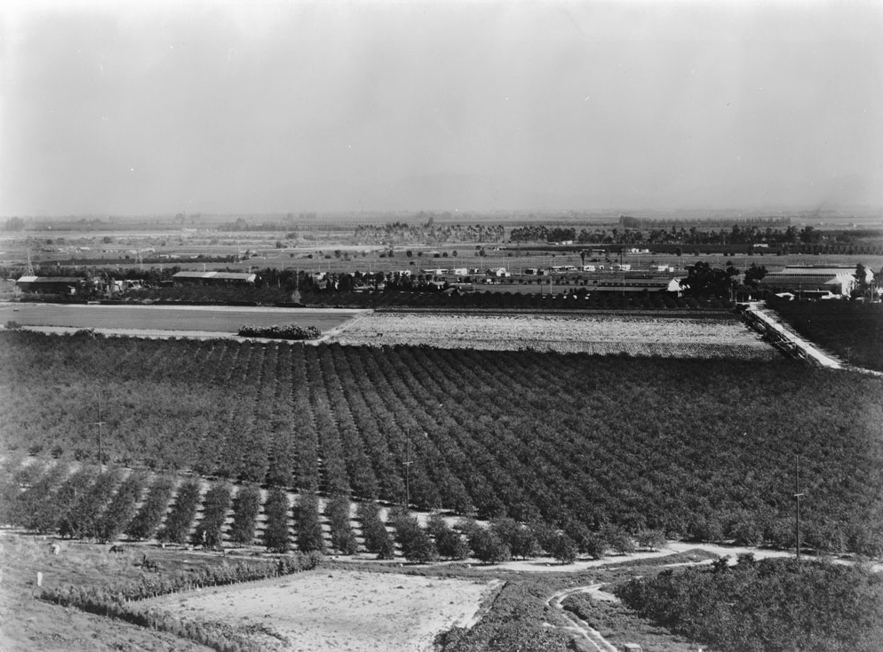
| (1920s)^^ – View of an apricot orchard in the San Fernando Valley. Two rows of apricot trees extend into the distance, each with small bulbs or leaves adorning its boughs. A row of bare soil stands between the row, and more lines of trees appear on both sides. In the distance, the line of distant hills can be seen. |
Historical Notes By the 1920s, with assistance from the waters of the Los Angeles Aqueduct, fruit and especially citrus cultivation was San Fernando's biggest industry. The price of land for orange and lemon groves went as high as $5,000 an acre – as much as eight times more than the cost of other land – and the city had at least four packing houses with annual shipments of nearly 500 rail cars of oranges and lemons. Olives also flourished in the Mediterranean-like climate, and the 2,000-acre Sylmar olive grove – then the world's largest – produced 50,000 gallons of olive oil and 200,000 gallons of ripe olives. Other crops grown in and around San Fernando included alfalfa, apricots, asparagus, barley hay, beans, beets, cabbage, citrus, corn, lettuce, melons, peaches, potatoes, pumpkins, squash, tomatoes, and walnuts.*#^* |
Van Nuys Grammar School
 |
|
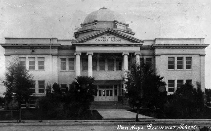
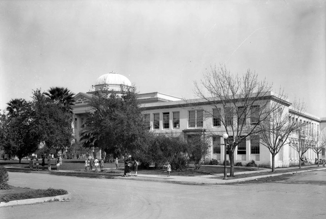
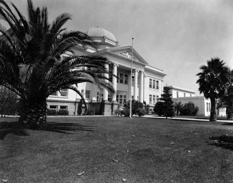
| (ca. 1910s)^.^ - View showing the original building of Van Nuys Grammar School with its four Ionian columns and large dome. Built in 1912, the school was (and still is) located at the corner of Sylmar Avenue and Gilmore Street. |
Historical Notes The original domed building was three stories high; the tallest building at the time, and a landmark to the center of the Valley that could be seen from all sides around it. |
 |
|
| (1926)^^ - View of the original building of Van Nuys Grammar School located at 6464 Sylmar Avenue. The street sign on the light post reads Sylmar Avenue and Gilmore Street. A new school building now stands at this corner. Click HERE for contemporary view. |
Historical Notes Built in 1912, the school would be demolished after the 1933 Long Beach earthquake. |
 |
|
| (ca. 1920s)* - View of the front entrance to Van Nuys Grammar School. |
Historical Notes TOne of Van Nuys Elementary's early principals was Oletha Stearns. She was principal for 29 years from 1924 through 1953. In 1964, when the school was 54 years old, she wrote a history of the school. It's fascinating! Click HERE to read the school’s history. |
Universal City
 |
|
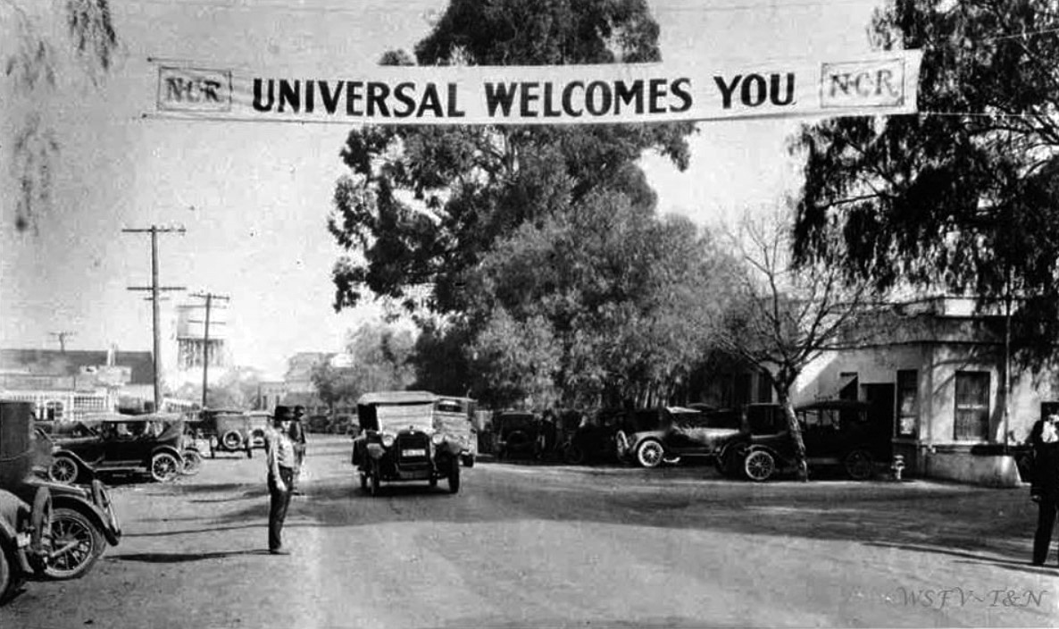
| (1915)* – View showing Lankershim Boulevard with banner overhead that reads: “Universal Welcomes You”. The water tower in the background is part of Universal Studios. It would later be converted into a castle tower. |
Historical Notes In 1913, the Universal Company purchased 12,000 acres of land in the San Fernando Valley near the railroad station of Lankershim and about eight miles from Los Angeles. A year earlier, on April 30, 1912, Carl Laemmle merged the Independent Motion Picture Company with five smaller companies to form the Universal Film Manufacturing Company. After visiting his newly acquired west coast operations of Nestor Studios and Nestor Ranch, he renamed the studio "Universal Studios" and the leased Oak Crest Ranch became the first "Universal City" in the San Fernando Valley. The first Universal/Nestor Ranch (Providencia Land and Water Development Company property Oak Crest Ranch) is presently the site of Forest Lawn Memorial Park (Hollywood Hills). In 1915, Universal moved its operations at the Hollywood/Nestor studio and Universal/Nestor Ranch to its new Lankershim Blvd. location before the official opening of Universal City (Lankershim Blvd).^ |
 |
|
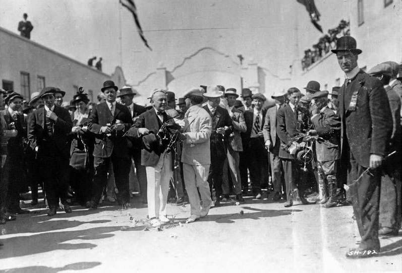
| (1915)* – View showing the beginning of Opening Day festivities just inside the front gate at Universal City. |
Historical Notes On March 15, 1915, a glorious grand opening celebration was held for what was touted as the “Wonder City of the World”. It was a celebration sparked by a national advertising campaign, that began on March 7th, with a special Santa Fe train ride from Chicago carrying scores of celebrities, including Buffalo Bill Cody, and headed by mastermind, “Uncle” Carl Laemmle. Laemmle’s team had acquired the 300-acre property along Lankershim Blvd, which included the former Taylor, Boag, Davis and Hershey Ranches. Ground was broken in June 1914, and while construction was going on, picture making began. In late 1914, Universal City’s first feature, ‘Damon and Pythias’, opened across the country. On opening morning, 10,000 visitors watch as Laura Oakley, of Universal’s biggest stars presented a golden key to Laemmle, who unlocked the gate and inaugurated the festivities. The band played The Star-Spangled Banner, the American flag was hoisted, and Laemmle led the sing-a-long of “I Love You, California.” The crowds were treated to a gala that included numerous moviemaking exhibitions. The event was planned to hold week-long festivities, but on the afternoon of the second day, Frank Stites, a stunt pilot, whose daredevil flying had thrilled the crowd all morning, crashed into Mount Cahuenga; the festivities ended, and everybody went home. |
 |
|
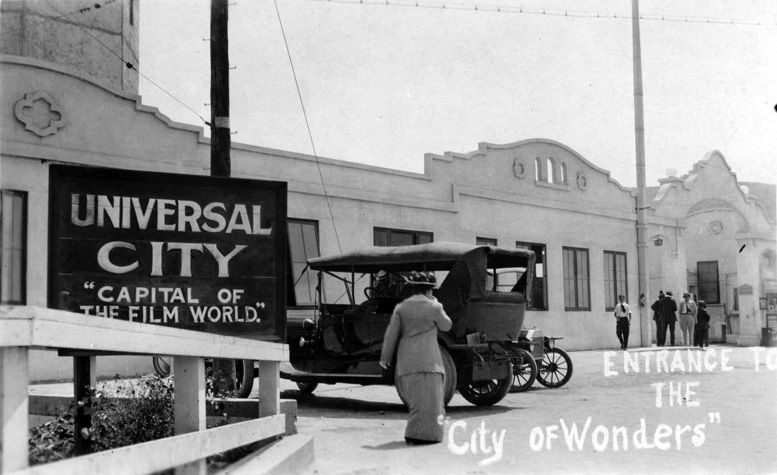
| (ca. 1915)^*# - Postcard view of the entrance to Universal City: "Capital of the Film World" and the "City of Wonders". |
Historical Notes After the gala opening, Carl Laemmle continued to let the general public visit his Movie City - "The City of Wonders." |
 |
|
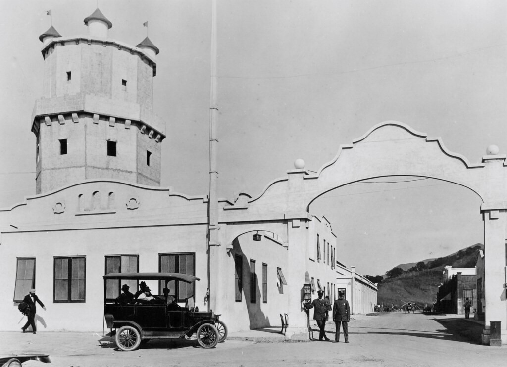
| (ca. 1916)* - View showing the Lankershim Blvd. entrance to Universal Studios. Two security gaurds in uniform stand at watch under the large archway. The tower building on the left is actually a water tower modified to resemble a castle tower. Passengers sit in the back of an early model vehicle, possiblly the precursor to today's tram ride. |
 |
|
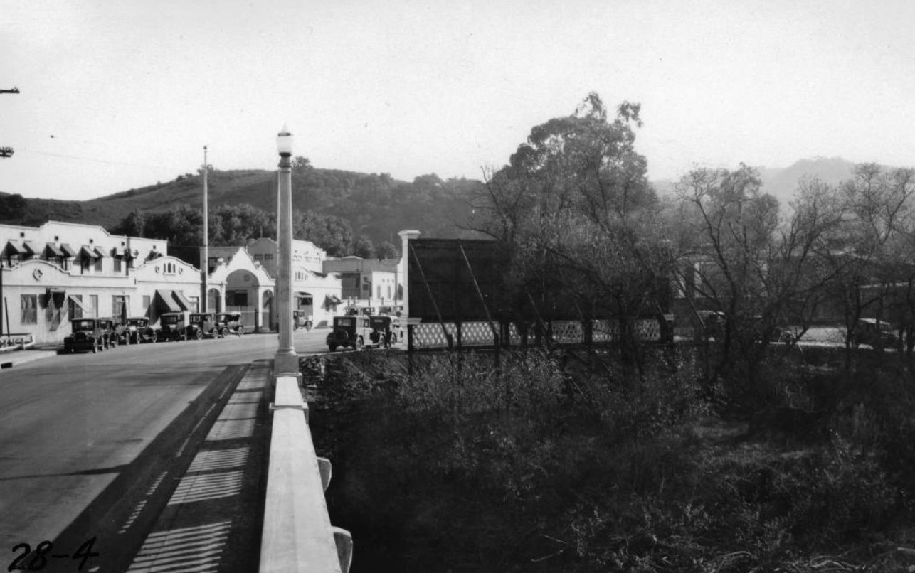
| (1928)^^ - View looking southeasterly at the Universal City entrance as seen from the Los Angeles River bridge, home to Universal Studios. |
| (1928)^ - View of Lankershim Boulevard opposite Bluffside Drive looking northwesterly across Los Angeles River bridge as seen from the entrance to Universal City. |
Historical Notes Clear HERE to see more in Early Views of Universal Studios. |
Campo de Cahuenga
.jpg) |
|
| (1928)* - Campo de Cahuenga, site of the signing of the Treaty of Cahuenga in 1847. Location: 3919 Lankershim Blvd, North Hollywood, adjacent to the Universal Studios Metro Station. |
Historical Notes The Campo de Cahuenga, near the historic Cahuenga Pass in present day Studio City, was an adobe ranch-house on the Rancho Cahuenga where the Treaty of Cahuenga was signed between Lieutenant Colonel John C. Frémont and General Andrés Pico in 1847, ending hostilities in California between Mexico and the United States. The subsequent Treaty of Guadalupe Hidalgo of 1848, ceding California, New Mexico, and Arizona (but not Texas, since it had seceded from Mexico in 1836, declared itself a republic, and joined the union in 1845) to the United States, formally ended the Mexican-American War. From 1858 to 1861 the Campo de Cahuenga became a Butterfield Stage Station.*^ Campo de Cahuenga has been designated as California Historical Landmark No. 151 (Click HERE to see complete listing). |
 |
|
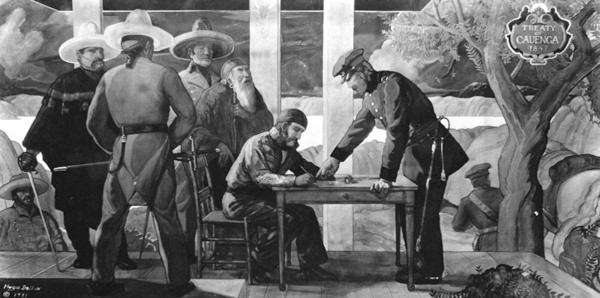
| (1931)* - Hugo Ballin's mural depicting the singing of the Treaty of Cahuenga is mounted in the lobby of the Guarantee Trust Building at 5th and Hill Streets. |
 |
|
| (1928)* - View looking east of the Campo de Cahuenga, site of the signing of the Treaty of Cahuenga. Today, Universal Studios sits on top of the hill across Lankershim Blvd as seen in the above photo. |
Historical Notes The original adobe structure was demolished in 1900. The city of Los Angeles provided funds for the purchase of the property in 1923, and a Mission Revival and Spanish Colonial Revival style replica 'adobe' ranch house was built by the city following an effort led by Irene T. Lindsay, then President of the San Fernando Valley Historical Society, was dedicated on November 2, 1950. It is now a park and interpretive center managed by the City of Los Angeles- Department of Recreation and Parks in partnership with the Campo de Cahuenga Historical Memorial Association. |
* * * * * |
Sepulveda Boulevard and Chatsworth Road (Mission Hills)
 |
|
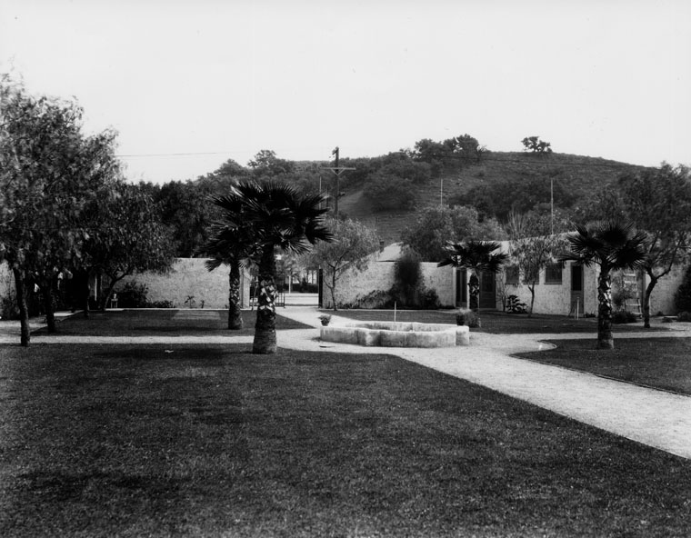
| (1928)* - View looking north on Sepulveda Boulevard at Chatsworth Road, showing outlet to open concrete drain and culvert on east side of Sepulveda Boulevard. Note billboard at left presumably directing motorists east on Chatsworth to “Granada”, PE tracks at center and original San Fernando Heights Orange Assoc. packing house at right; the letters “San Fer” can be discerned on the ridge of the building. |
Historical Notes Sepulveda Boulevard was once known as Saugus Avenue. It was dedicated in 1925. Named for the family of Don Francisco and Ramona Sepulveda, who had 11 children, all of whom inherited parts of their parents' property and acquired more land through their marriages. The road was used by the Sepulvedas to transport their cattle, which were often attacked by grizzly bears. |
 |
|
| (1928)* – View looking south on Sepulveda Boulevard at Chatsworth Road showing inlets to culverts on east and west sides of the street. The sign on the bell reads: "El Camino Real, Mission San Fernando, Los Angeles Plaza 24, ..….” |
* * * * * |
Van Nuys
 |
|
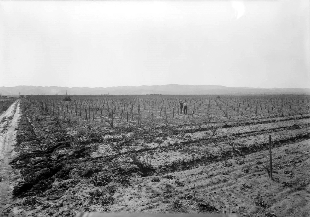
| (ca. 1926)^^ – View looking north showing two men standing in the middle of a Van Nuys crop field. |
 |
|
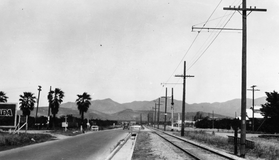
| (ca. 1928)#^ - Postcard view looking down Victory Boulevard in Van Nuys. |
 |
|
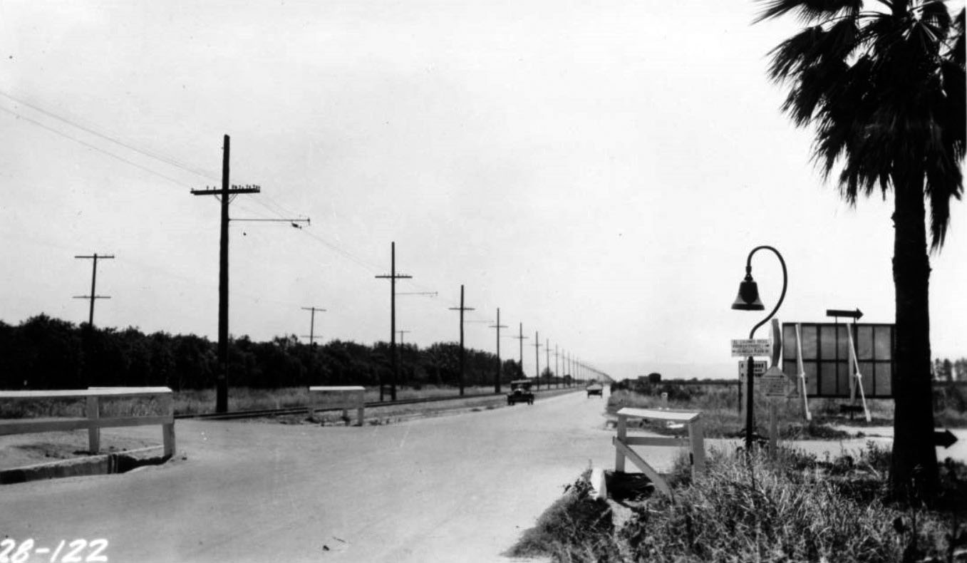
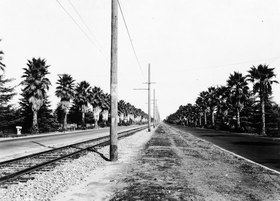
| (1928)* - Photograph of a view of Sherman Way at Haskell Avenue in the San Fernando Valley, looking north. A set of railroad track runs from the foreground at left into the distance at center. Running parallel to the tracks are two wide paved roads, one on each side, and a line of utility poles. Bordering the outside edges of the roads are rows of palm tree. Several mailboxes can be seen along the side of the roads. |
* * * * * |
Reseda Boulevard (Northridge)
 |
|
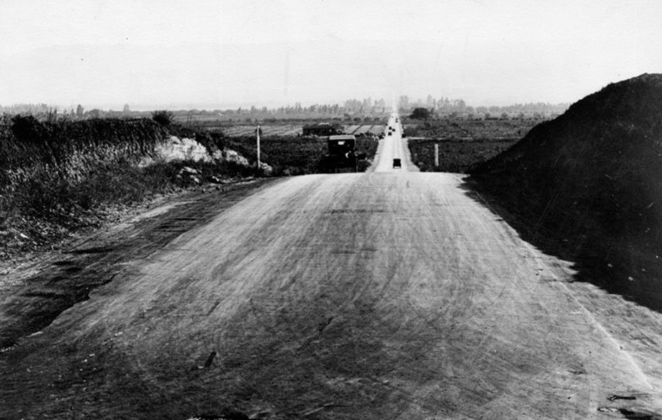
| (1929)* - Reseda Boulevard looking south from near Devonshire Street. |
Historical Notes The community grew on land that was once part of the Hawk Ranch. It's first name became Zelzah. The name then changed to North Los Angeles for a short period of time and then changed again to Northridge. Click HERE to see more. A key moment in Reseda’s history occurred in May 1929, when a Los Angeles City ordinance officially renamed Reseda Avenue to Reseda Boulevard. This change reflected the thoroughfare’s growing importance to the community. |
 |
|
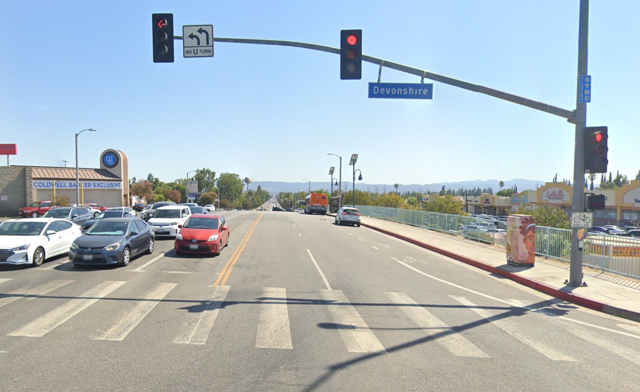
| (2022)* - Reseda Boulevard looking south from Devonshire Street. |
Then and Now
 |
|
| (1929 vs. 2022)* - Reseda Boulevard looking south from near Devonshire Street. Photo comparison by Jack Feldman. |
Historical Notes Northridge has undergone a dramatic transformation since 1929. In the late 1920s, the area, then known as North Los Angeles, was primarily a rural agricultural community with vast open spaces, farmlands, and orchards. The landscape was dotted with modest homes, and basic infrastructure was just beginning to develop. Reseda Boulevard, which would become the main thoroughfare, was only paved in 1930. The area served as a shipping center for agricultural products, reflecting its rural character. Fast forward to today, and Northridge presents a starkly different picture. The once-rural landscape has been replaced by a bustling suburban neighborhood with extensive housing developments, ranging from middle-class homes to affluent estates. The agricultural fields have given way to significant commercial developments, including the Northridge Fashion Center and numerous shopping districts. The establishment of California State University, Northridge, in 1956 has become a defining feature of the community. |
* * * * * |
Reseda Boulevard (Reseda)
 |
|
| (1926)* - Wide angle view looking north on Reseda Avenue (soon to be Blvd.) from the south side of Kittridge Street. Water over intersection is 3 to 4 feet deep. |
Historical Notes This is now the approximate site of the main east/west flood control channel. Reseda Park will be situated just out of frame to the right and on this side of Kittridge and the flood control channel. |
 |
|
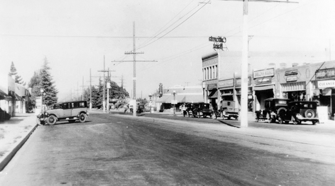
| (1926)* – View looking south on Reseda Boulevard toward the intersection with Sherman Way. The road appears to be in the process of being widened and paved. The Reseda State Bank building can be seen on the southwest corner of Sherman Way and Reseda. |
Historical Notes Reseda originated as a farm town named "Marian" (or "Rancho Marian") that appeared in 1912. Its namesake, Marian Otis Chandler, was the daughter of Los Angeles Times publisher Harrison Gray Otis, a director of the Los Angeles Suburban Homes Company. H J Whitley was the manager of the Los Angeles Suburban Home Company. The Western Division of the Pacific Electric Railway 'Red Cars Line' expedited development after the Los Angeles Aqueduct brought water to the City of Los Angeles in 1913. Soon, thereafter, Marian would be annexed by the City. |
 |
|
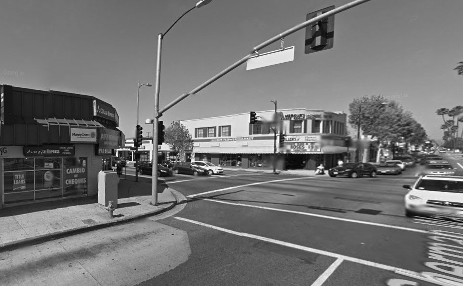
| (2022)* - Contemporary view of Reseda Boulevard looking south toward Sherman Way. |
Historical Notes The intersection of Reseda Boulevard and Sherman Way has a rich history dating back to the early 20th century. Sherman Way, named after developer Moses Sherman, became the first boulevard across the valley, while Reseda Boulevard (originally Reseda Avenue until 1929) developed into a major north-south artery. The area saw the establishment of its central business district around 1915 and has since evolved from a hub of automotive dealerships and cultural venues to a focus of urban renewal efforts. |
Then and Now
 |
|
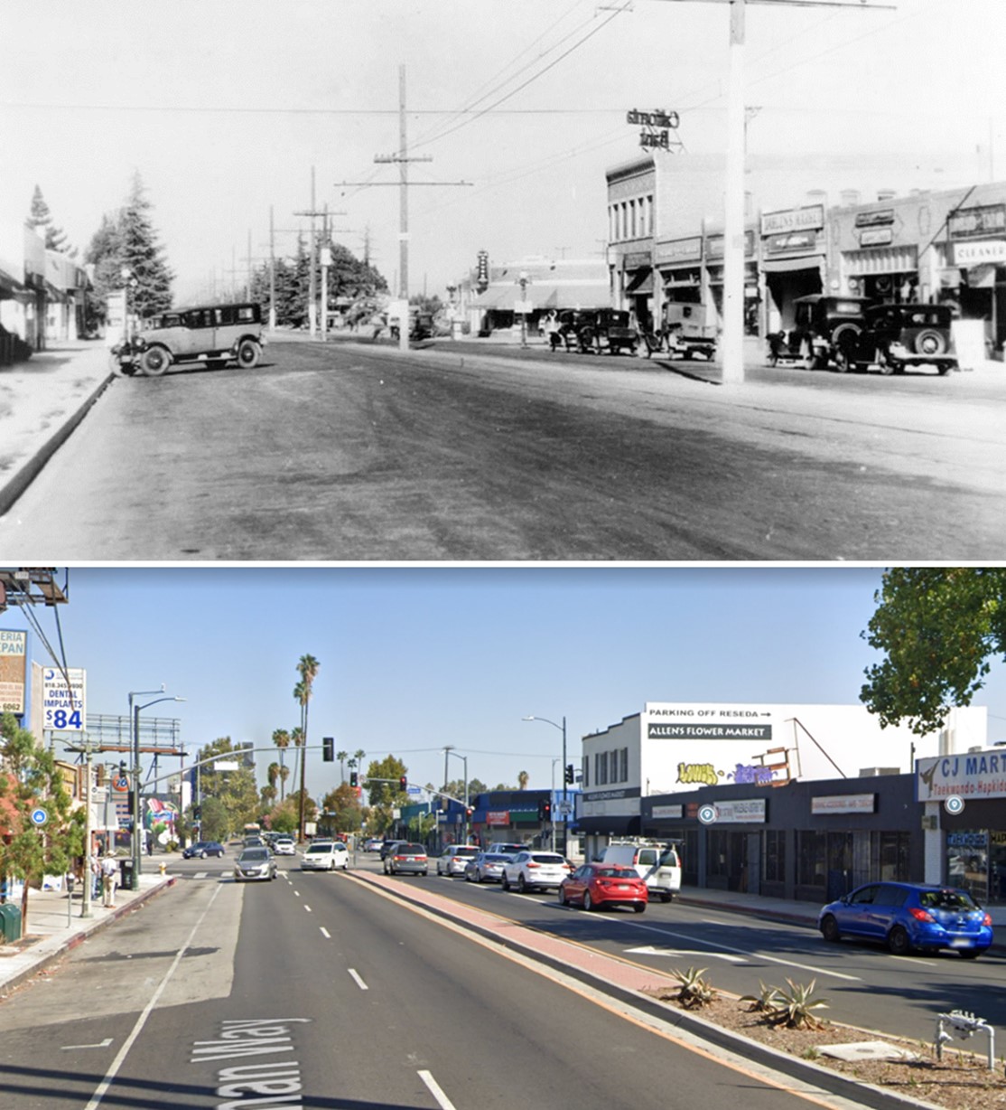
| (1926 vs. 2022)* - Looking south on Reseda Boulevard toward Sherman Way. Photo comparison by Jack Feldman. |
.jpg) |
|
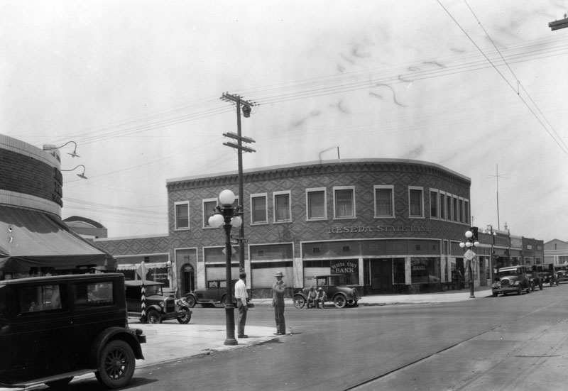
| (1928)* - Reseda State Bank building at the southwest corner of Reseda Ave. and Sherman Way. Note the ornate streetlights on the corners. |
Historical Notes In 1920, Reseda was named after a fragrant North African yellow-dye plant, Reseda odorata, whose English name is mignonette and which grows in hot, dry climates—replaced Marian as a designation for a stop on the Pacific Electric interurban railway running along Sherman Way. The name "Reseda" was given first to a siding on a branch of the Southern Pacific Railroad in the south San Fernando Valley. |
 |
|
| (2014)* - Google street view looking at the southwest corner of Reseda Blvd and Sherman Way. |
Then and Now
 |
.jpg) |
|
| (1928 vs 2014)* - Southwest corner of Sherman Way and Reseda. Photo comparison by J. Feldman. |
 |
|
| (1938)* - Looking east on Sherman Way towards Reseda Boulevard. California State Bank is on the SW corner (previously Reseda State Bank). |
Then and Now
 |
|
| (1938 vs 2022)* - Looking east on Sherman Way towards Reseda Boulevard. Photo comparison by Jack Feldman. |
* * * * * |
 |
|
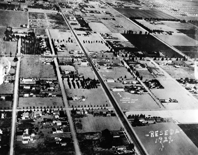
| (1929)* - Aerial view showing Reseda Boulevard runining from lower-right to upper left-center. The arrow marks the American Legion Post, No. 308. The intersection of Sherman Way and Reseda Boulevard is at upper-center of photo. |
 |
|
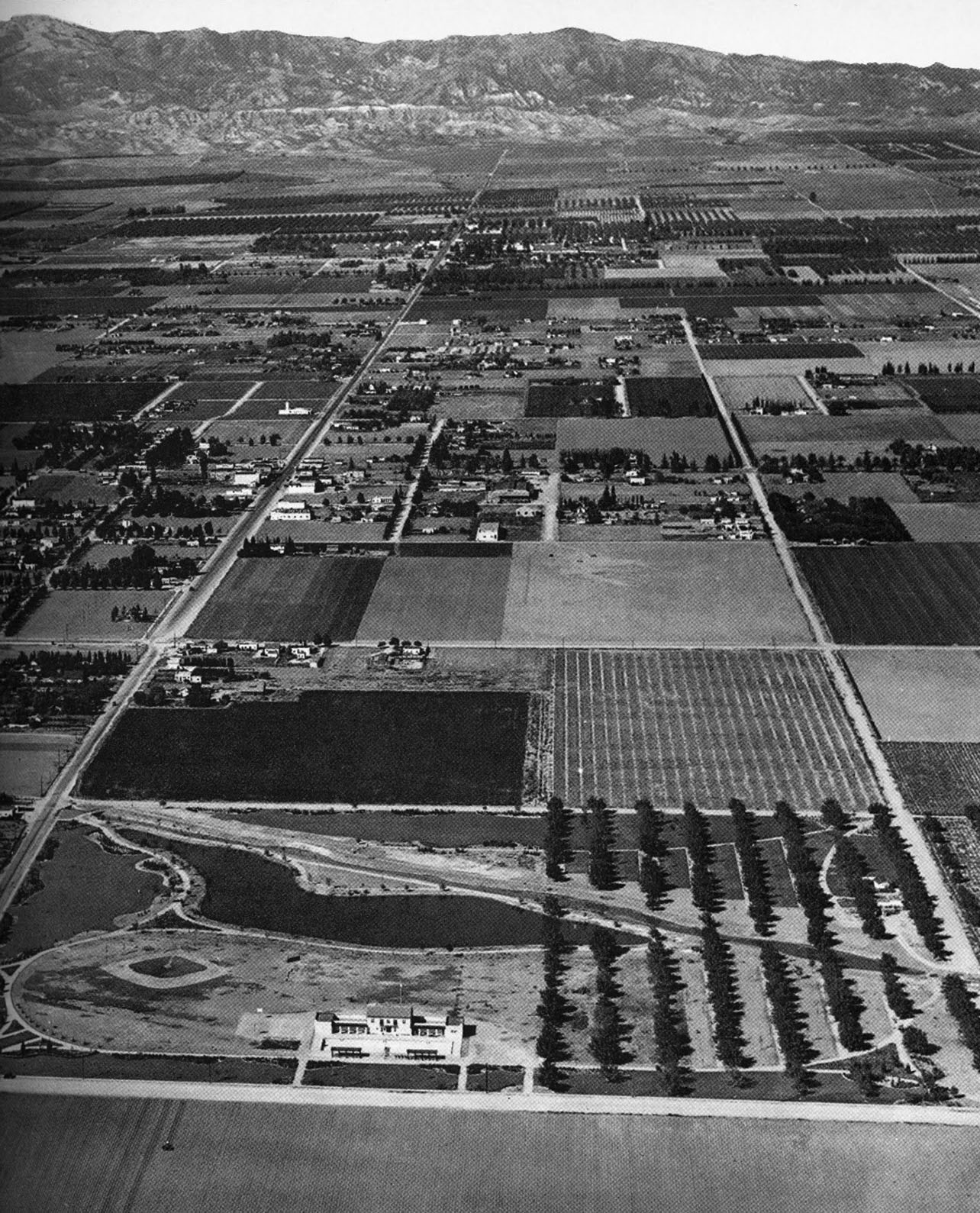
| (1932)^^# - Aerial view looking north over Reseda Park (completed in 1932-33) showing the LA River running diagonally across the park. Below the park, in the foreground, is Victory Boulevard running left to right (west to east). The two major streets runing north-south are Reseda Boulevard (left) and Etiwanda Avenue (right). The intersection of Sherman Way and Reseda Boulevard is at upper center-left. |
Canoga Park
.jpg) |
|
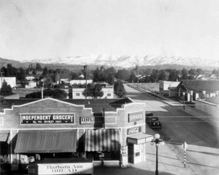
| (ca. 1929)#^ - Sherman Way looking east at the corner of Remmet Avenue. R.W. Bird's Independent Grocery store is on the left. |
 |
|
| (ca. 1929)#^ - Independent Grocery in Canoga Park owned by R. William Bird, on Sherman Way, looking north on Remmet. Henri's Restaurant stands at this corner today and in 1955 it was the Red Apple Restaurant. Click HERE for contemporary view. |
Historical Notes The town fire station (with Spanish tiled roof) can be seen on the right. The building next to the fire station, which advertises "PRINTING" was the headquarters for the town newspaper, the Owensmouth Gazette.#^ |
 |
||
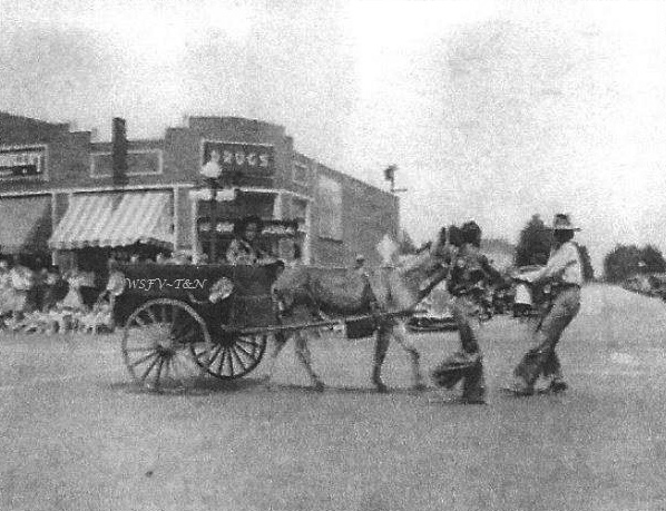
| (1934)#^*^ - View showing a parade in front of the Independent Grocery and Drug Store located on the northwest corner of Sherman Way and Remmet Avenue. Photo courtesy of Canoga/Owensmouth Historical Society. |
Engine Company No. 72
 |
|
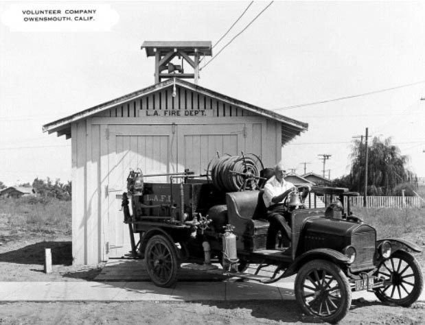
| (ca. 1927)^#** - Volunteer Company Owensmouth located at 7224 Remmet Ave, in service until 1931. At that time the LAFD established Engine Co. No. 72 who moved into a new nearby facility on Owensmouth Ave. |
Historical Notes In 1927 there were still rural areas throughout the city, such as parts of the San Fernando Valley, Bel Air, Harbor City, Pacific Palisades, and Encino Acres that utilized volunteer firefighters. Some were still using two-wheeled hand drawn hose and/or chemical carts. However, most were using Ford Auto Combination hose wagons (seen above), loaded with 2 1/2" (from 500' up to 1200'), chemical hose, and sometimes some 1 1/2" hose was added. The chemical tank was a 60 gal. soda/acid.^#** |
 |
|
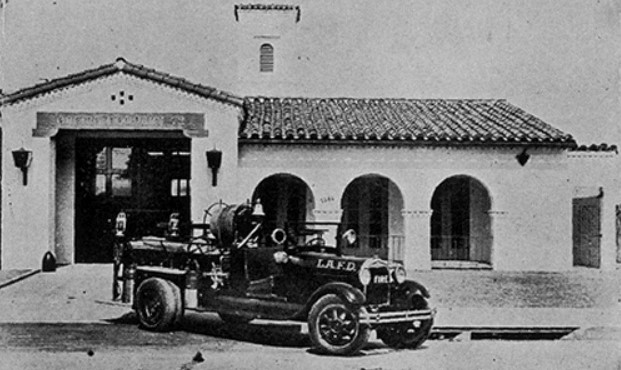
| (ca. 1935)#^ - View of the newly constructed firehouse for Engine Co. No. 72 located at 7248 Owensmouth Ave. |
Historical Notes The new Owensmouth Station was built in 1931 but did not open until 1933 due to manpower shortage.^#** |
 |
|
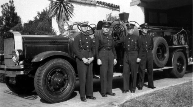
| (1939)^#** - Engine Company No. 72. From left to right are: Captain E. S. Shiveley, R. J. McLaughlin, J. L. Stringer, and E. H. Newmyer. |
* * * * * |
Calabasas School House
 |
|
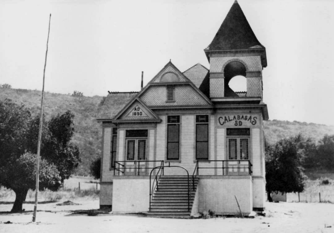
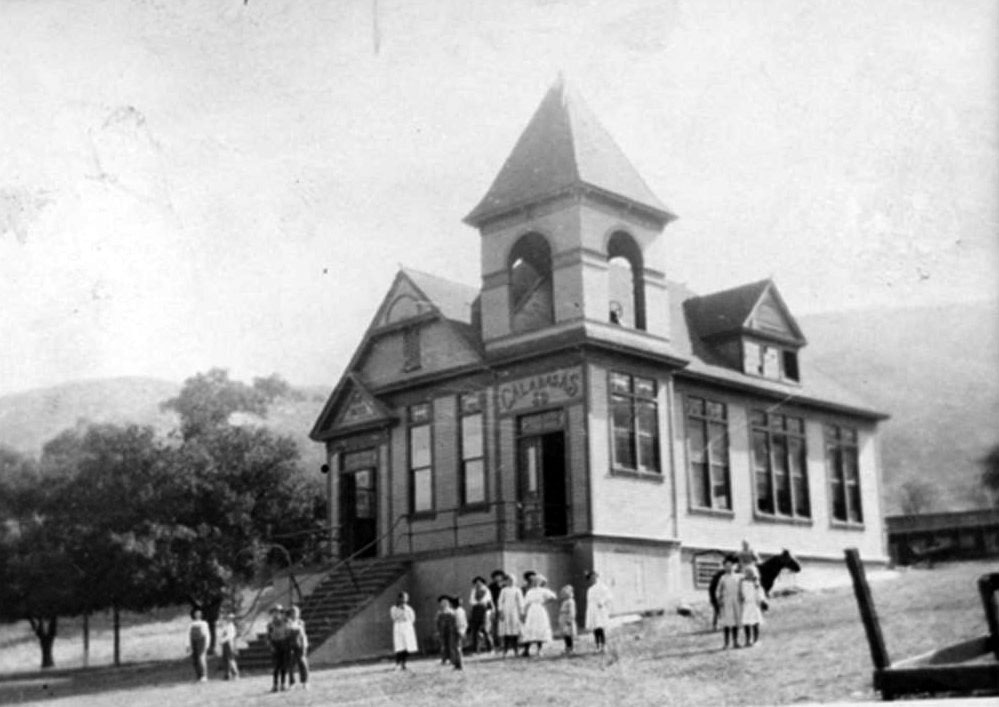
| (ca. 1890)#^*^ - View of the 1890-built Calabasas School house in the 24400 block of Calabasas Road. Photo courtesy of the Calabasas Historical Society. |
Historical Notes Isaac C. Ijams came to the area in the early 1880’s and immediately sought out a place for his children to attend school. In 1884, he started the school in an empty granary, about ½ mile from present day Mulholland Drive and Valmar. In 1890 LA County took over, and built the Calabasas School, a one-room Victorian schoolhouse with a bell tower (pictured here). It was located on the property that today bears the address of 24454 Calabasas Road. Teachers were hard to come by in those days due to the low pay of 2 dollars per month, and Calabasas was still the old west – a rough area to live in. The teachers that Isaac was able to find lived at his home with his family. At times when he couldn’t find a teacher, Ijams himself became the educator. If a student appeared to know more than Isaac, he simply sent that student back one grade. (Ya didn't mess with Isaac Ijams - he also carried the nickname of the 'Hanging Judge'). #^*^ |
 |
|
| (ca. 1910)^ - View of children gathered around the 1890 Calabasas School house. Replaced on the same property with the 1924-1925 schoolhouse. |
Historical Notes This was the second school formed in the Calabasas area - #1 (Las Virgenes), #3 (Liberty) and #4 (Cornell). |
 |
|
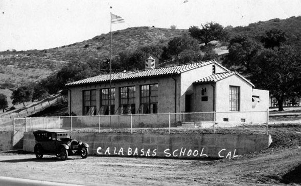
| (Late 1920s)^ - Second Calabasas School on property in 24400 block of Calabasas Road, circa late 1920s. Built in the 1924-1925 school year, it was a one-teacher school until June 1948. |
Historical Notes In 1924/25, a new Spanish Colonial Revival building was built on the same site as the original Calabasas School (previous photo). By 1934, 50 students were enrolled at this school. In 1947, the Calabasas School District joined Liberty, Cornell and Las Virgenes to form a unified school district. In 1950, the school building and three acres were sold to Charles Mureau. Subsequent modifications for tenants, including their current (1984) Pelican's Retreat restaurant, have left only the front wall of the original building, the retaining wall and the steps up from the road.^ |
* * * * * |
Calabasas
 |
|
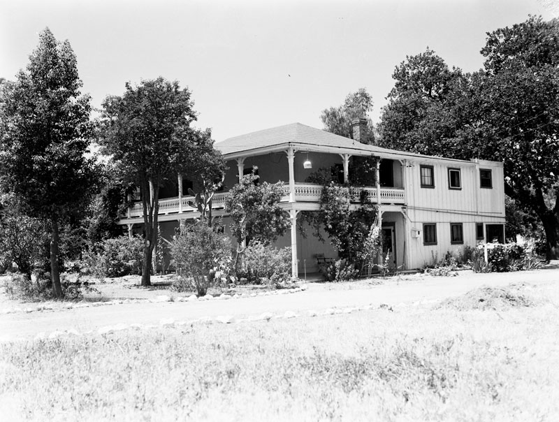
| (1929)* - Exterior of the Leonis Adobe at 23530 Ventura Blvd. in Calabasas. Miguel Leonis occupied the adobe intermittently as a ranch house. Wooden additions at the rear were added in 1919. For a number of years it was part of Warner Bros. ranch properties and resided in by actor John Carradine and family. In 1965 it was one of the few remnants of the San Fernando Valley's heritage standing in original form. Built in 1844. |
Historical Notes Leonis Adobe is one of only four surviving adobe residences remaining in the San Fernando Valley. When the Los Angeles Cultural Historical Board was formed in 1962, Leonis Adobe was the first designated as a Historic-Cultural Monument (Click HERE to see the LA Historic-Cultural Monuments List). By 2007, there were nearly 900 separately numbered sites that had received the designation, but Leonis Adobe has the prestige of having been designated as Historic-Cultural Monument #1. In 1975, the adobe was listed on the National Register of Historical Places.^ Click HERE to see more Early Views of the Leonis Adobe. |
.jpg) |
|
| (ca. 1930s)^ - View showing Kramer's grocery store on Calabasas Road. To the right (out of view) is the famous Calabasas "Hanging Tree". |
Historical Notes This store was originally owned by Charles Cooper and was known as Cooper's. After he died, his widow, Alice, married Laurence Kramer and they renamed it Kramer's. Kramer owned and operated the store until he retired in 1968.^ |
 |
|
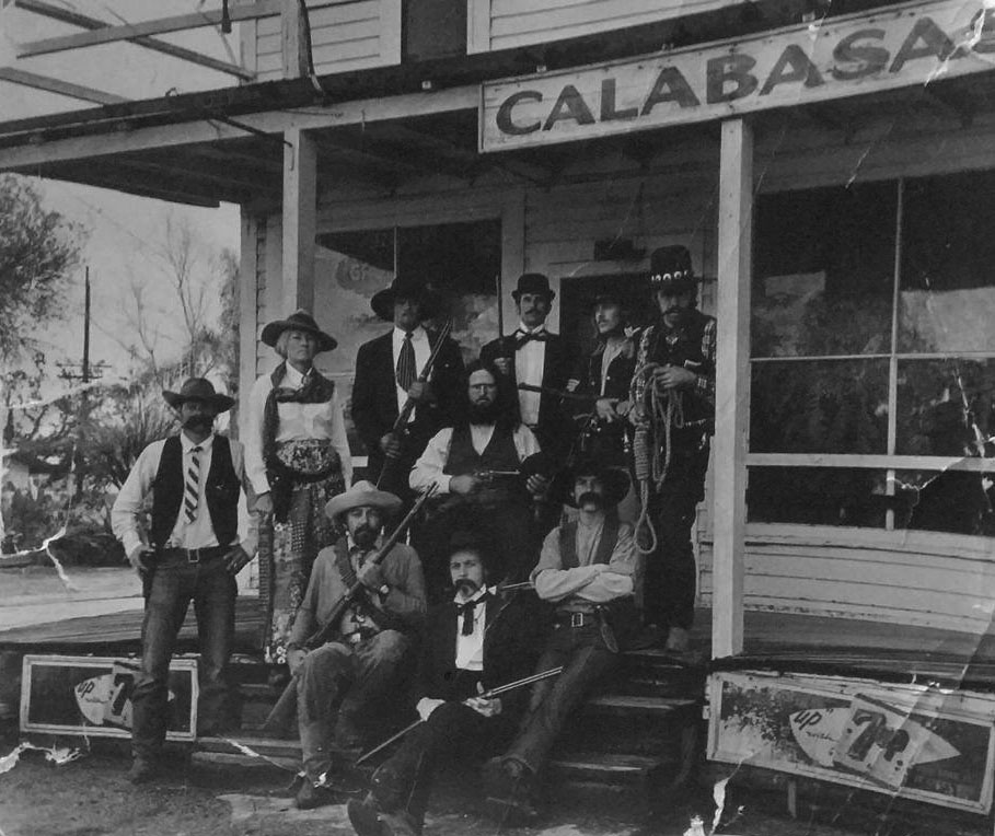
| (ca. 1968)^ – View showing members of the Calabasas Cattleman's Association posing in front of the old Calabasas Store. The group of men are well armed and the man on the right is holding a hanging noose. The Calabasas "Hanging Tree" is to the right and out of view. Photo by Debbie and Tom Cleaveland |
Costas Family of Girard / Woodland Hills
 |
|
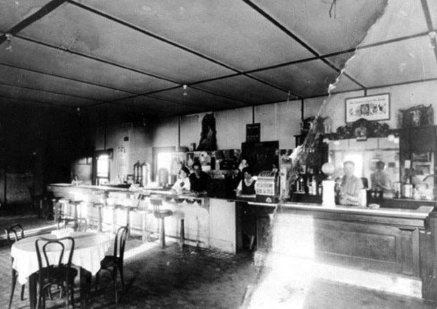
| (1922)^ - Interior view of the counter at El Camino Cafe, Calabasas. This restaurant was operated by the Costa family. |
Historical Notes Mariano Costa and his family, moved to the West Valley in 1922, where they had a house on Shoup. While living here, the Costas had another child, John, who was the first child born in Girard (Aug 7, 1923). Mariano operated a restaurant in Calabasas called the El Camino Cafe, at the corner of what is now El Canon Avenue and Calabasas Road. ^ In 1926, Mariano built a home at 22513 Ventura, then added a gas station and restaurant, which were the first businesses west of Topanga (seen next photo). |
 |
|
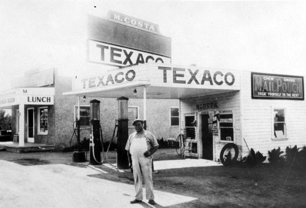
| (ca. 1930)^ - M. Costa Texaco gas station at 23513 Ventura Boulevard, Woodland Hills. The Eastside Lunchroom is visible at left in background. |
Historical Notes Mariano Costa and his family, moved to the West Valley in 1922, where they had a house on Shoup. While living here, the Costas had another child, John, who was the first child born in Girard (Aug 7, 1923). Mariano also operated a restaurant in Calabasas called the Camino Cafe, at the corner of what is now El Canon and Calabasas roads (see previous photo) In 1926, Mariano built a home at 22513 Ventura, then added a gas station and restaurant, which were the first businesses west of Topanga (seen in the photo). Mrs Costa had a large, open air oven with no chimney, so that when she baked her bread, the aroma spread to the surrounding area, announcing the restaurant’s presence. She also made such a delicious soup, that nearby people would bring their own kettle to fill and take home, establishing an early “take-out” business. By 1930, their oldest son, Nick, had developed quite an interest in ranching, ultimately becoming one of the largest sheep raisers in the Valley, and a frequent advisor at Pierce College. By the early 1960’s, grazing land was dwindling, forcing Nick and his herd over the hill into the Conejo Valley.^ |
* * * * * |
Pacoima
 |
|
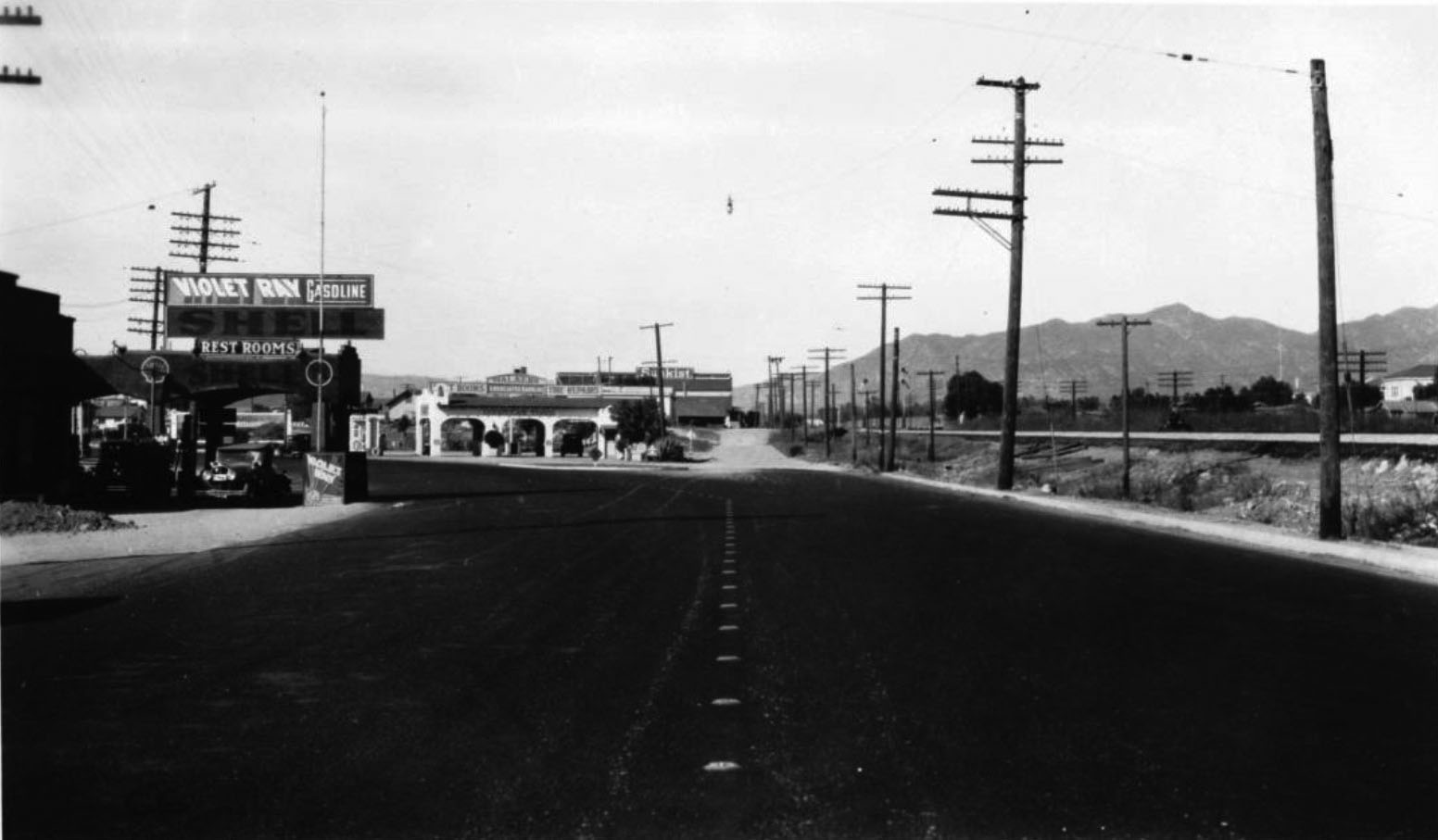
| (1929)^^ – View looking north toward the intersection of San Fernando Road and Hathaway Street north of Pacoima Wash. |
 |
|
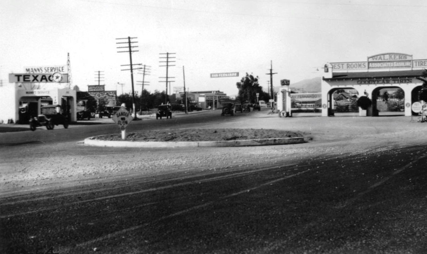
| (1929)^^ – View looking towards the City of San Fernando at the intersection of San Fernando Road and Hathaway Street at Walker's Service Station, north of the Pacoima Wash near San Fernando Road. |
 |
|
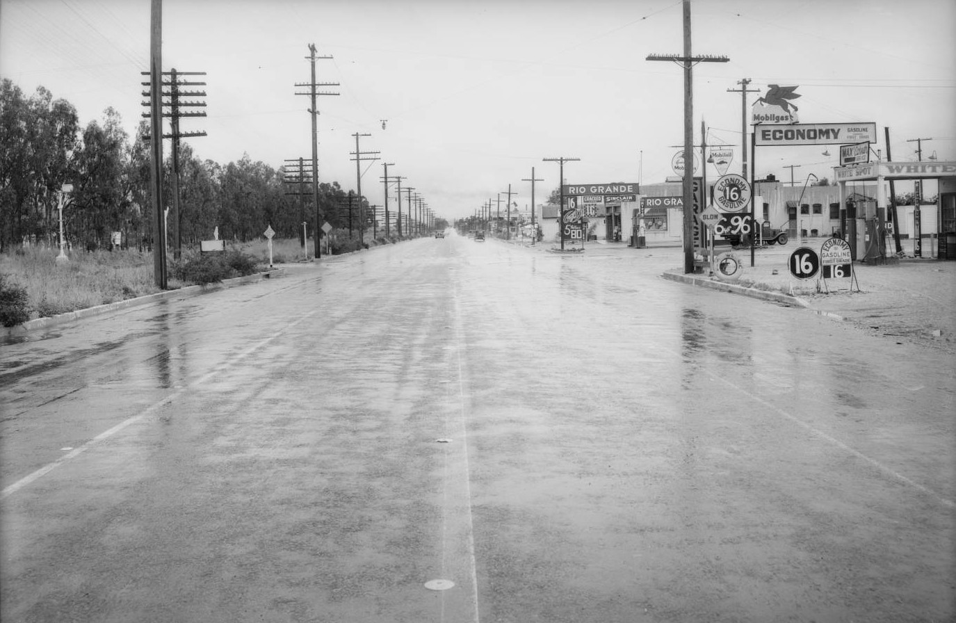
| (1935)^^ – View looking south on a rain-slick San Fernando Road toward Osborne Street. Two gas stations are seen at the intersection: Mobil and Rio Grande. |
Then and Now
 |
|
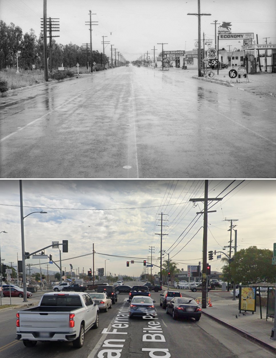
| (1935 vs. 2021)* - Looking south on San Fernando Road at Osborne Street. |
 |
|
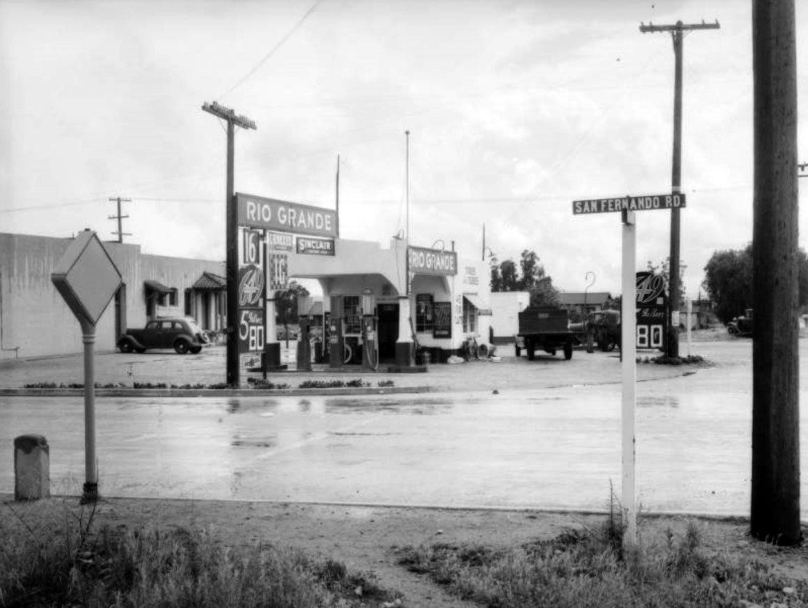
| (1935)^^ - Intersection of Osborne Street and San Fernando Road with the Rio Grande Service Station seen on the SW corner. |
Historical Notes Rio Grande Oil Company began in the petroleum business in 1915. At the time, its main business was supplying U.S. military forces with gasoline in support of operations against Pancho Villa. By 1936, Rio Grande had reorganized and merged with other companies to become Richfield Oil Corporation.^ |
.jpg) |
|
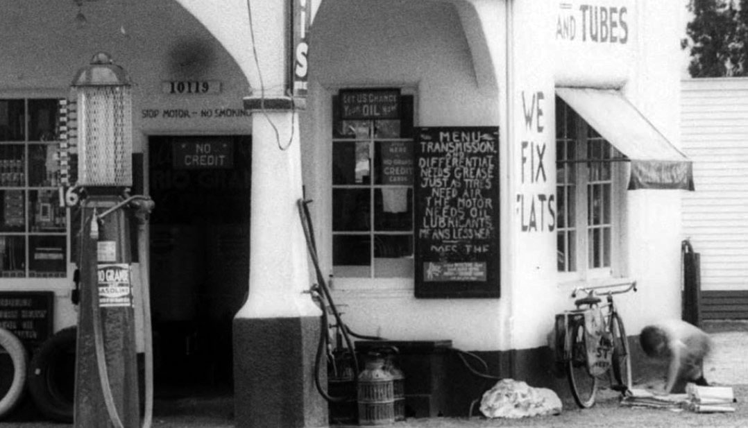
| (1935)##^ – Close-up view of the Rio Grande Service Station. Note the gas prices: 5 Gallons for 80¢ (16¢ per Gallon!) |
 |
|
| (1935)##^ - Blow-up of previous photo showing a newspaper delivery boy folding newspapers (right) at the Rio Grande Service Station, 10119 San Fernando Road. |
Click HERE to see more Early Views of LA Gas Stations |
* * * * * |
Mission Hills
 |
|
| (ca. 1930)^^ - Birdseye view over an orchard on the Mission San Fernando, looking east from the Santa Susana Mountains towards the Cahuenga Pass. A wide swath of treetops can be seen spanning the width of the image, while other planted rows stand behind them. Still farther out, residential buildings are spaced out disparately over a large plot of flat ground. In the foreground, a cleared and unplanted patch of soil can be seen. |
Historical Notes The above view is from the top of a hill near where The Odyssey Restaurant is today, in Mission Hills. Center-left is the 'Mission San Fernando Rey de España' (San Fernando Mission). At center is about a dozen houses on Memory Park Ave, built in the mid-1920s. Center-right is the 'San Fernando Heights Lemon Association' (Sunkist) buildings and just below the SFHLA is Stranwood Ave. At bottom, running diagonally, is Rinaldi St. |
Laurel Canyon and Vanowen (Then and Now)
 |
|
 |
|
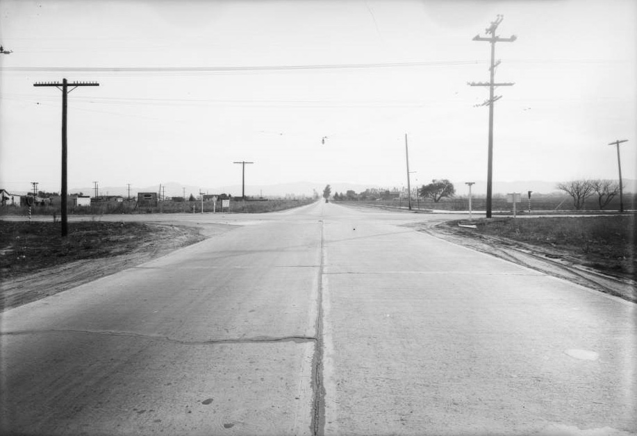
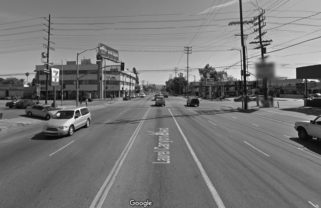
| (1931)*#^# vs. (2015)#*^# - View looking south on Laurel Canyon Blvd. at Vanowen Street. |
* * * * * |
 |
|
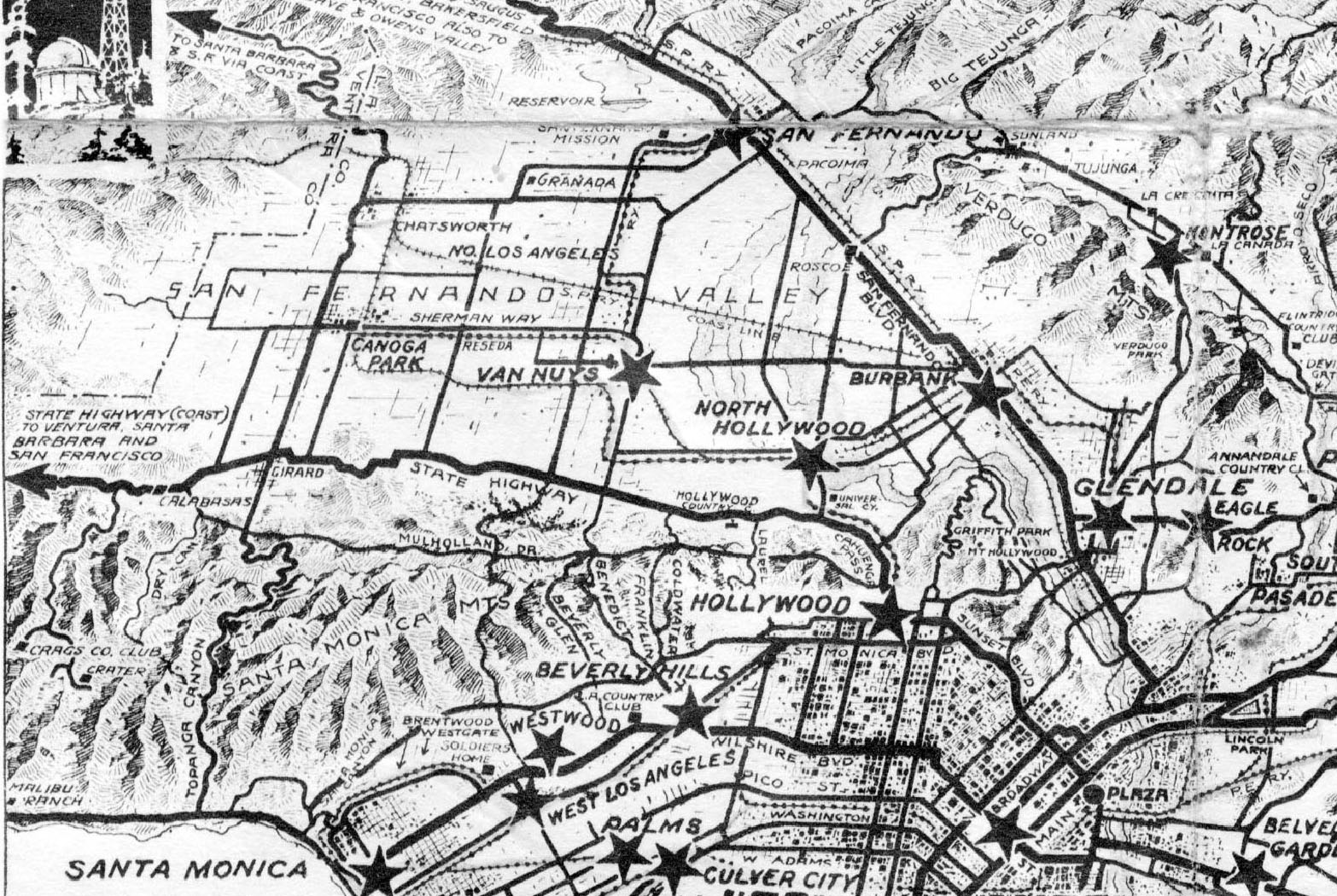
| (1930s)^*## - Map of the San Fernando Valley in the early 1930's. Several of the communities have changed names since this map was printed including Girard, North Los Angeles, and Granada. This was a time before freeways, and the pass through the Santa Monica Mountains, Sepulveda Pass, was still a dirt road. |
Historical Notes The community of Girard is identified in the center-left of photo near the intersection of the State Highway and Topanga Canyon. In 1945 it became known as Woodland Hills.*^ Originally called Zelzah, the town that we call Northridge today was renamed North Los Angeles on July 1, 1929. In 1938, this area of the San Fernando Valley was renamed Northridge Village. Few evidences of the "village" remain.^^# The community of Granada was founded in 1926. The “Hills” was added 15 years later in 1941.*^ The Ventura Freeway would not be completed across the San Fernando Valley until 1960.* |
Sepulveda Tunnel
 |
|
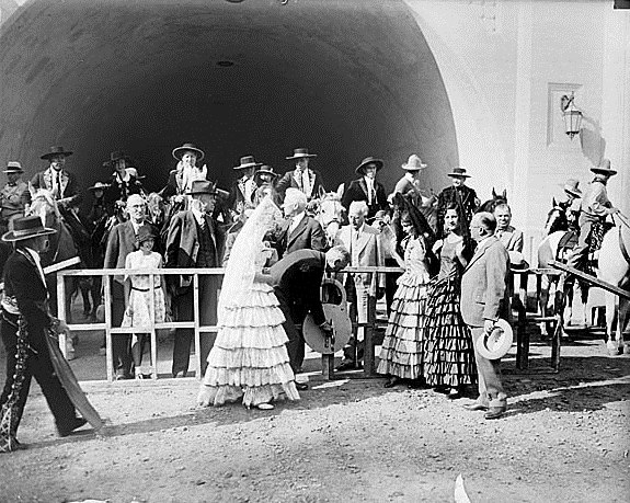
| (1930)**^# - Los Angeles Mayor John Porter turns the key in a giant symbolic lock during opening ceremonies of the Sepulveda Boulevard tunnel in the Santa Monica Mountains. September 27, 1930 |
Historical Notes Descendants of the Sepulveda rancho family attended the ceremony and the San Fernando High School band played. The program contained ads for Valley chicken farms and the brand new Los Angeles Metropolitan Airport, "at the Heart of the San Fernando Valley, Woodley Street and Saticoy Boulevard." That's now Van Nuys Airport.^^^# |
 |
|
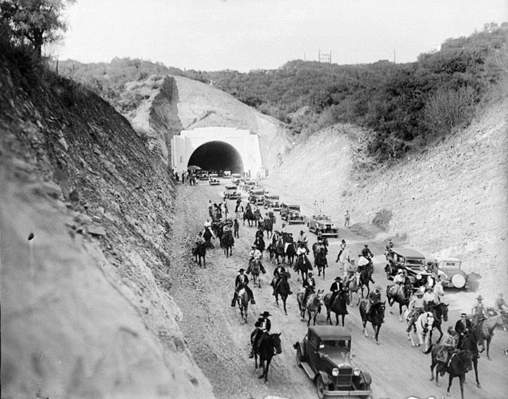
| (1930)* - View of a procession of cars, horses and wagons moving south through the new Sepulveda Boulevard tunnel following opening ceremonies. After eight years of road construction, the new tunnel connected the San Fernando Valley with West Los Angeles. |
Historical Notes The Sepulveda Tunnel opened on September 27, 1930. Until then, the Sepulveda Pass consisted of just a dirt road and some trails. Most of the traffic between the Valley and the city moved over Cahuenga Pass and narrow passages like Laurel Canyon and Beverly Glen. |
 |
|
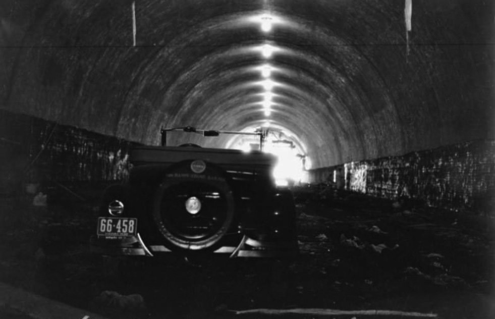
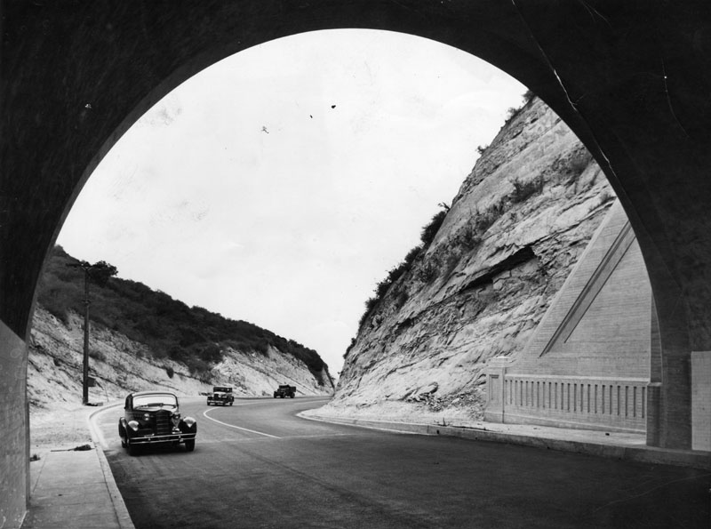
| (1930)^.^ - Inside view of the new Sepulveda Boulevard tunnel. |
 |
|
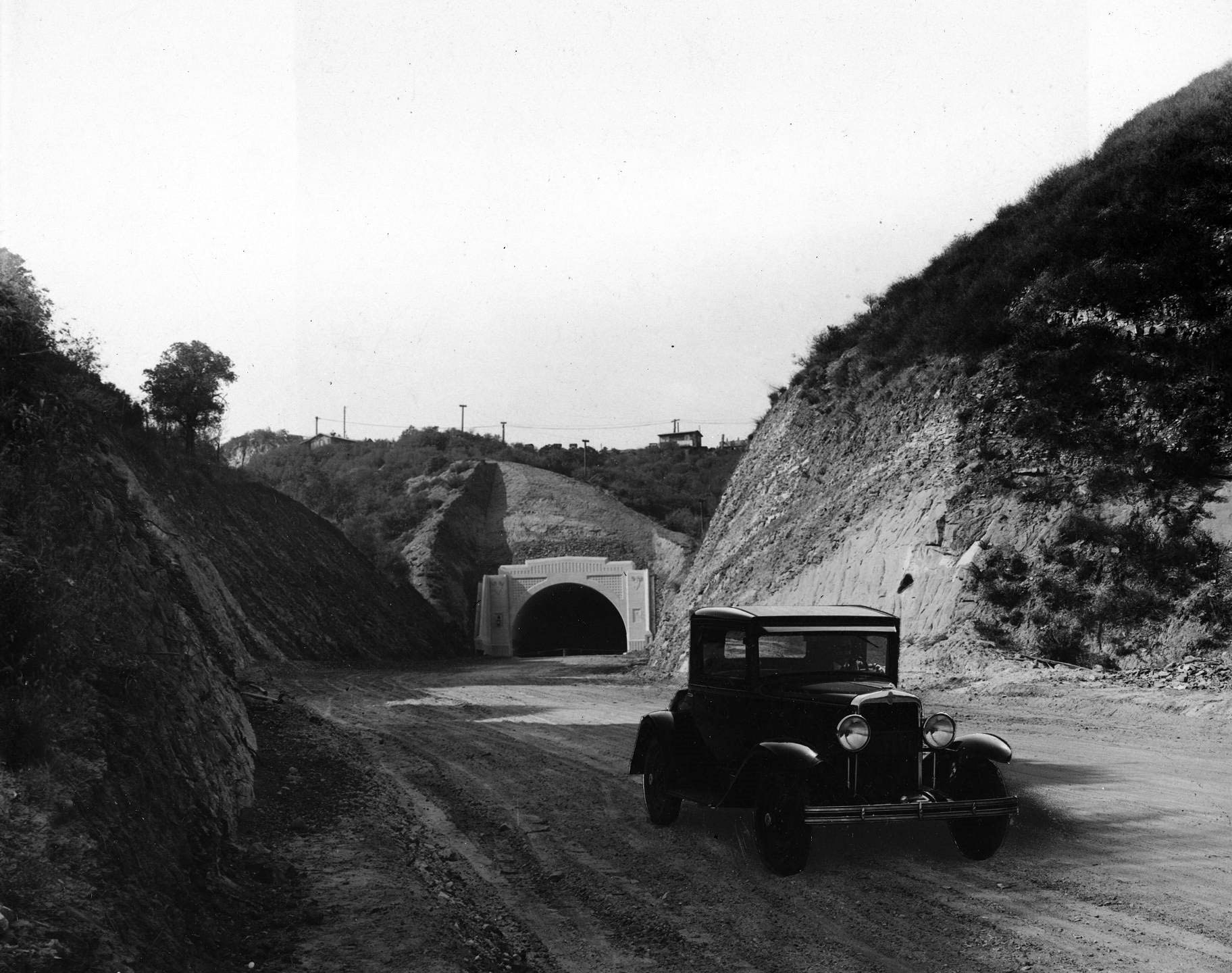
| (1930)^^ – View showing a car coming out of the Sepulveda Tunnel with Sepulveda Boulevard still an unpaved road. Photo courtesy of the Los Angeles Examiner Collection, USC Libraries. |
Historical Notes Construction lasted several years and culminated with the opening of a 650-foot tunnel beneath the summit at Mulholland Drive. Despite the opening festivities, by the time traffic started flowing in September 1930, the new Sepulveda Canyon Road was already inadequate. Five years later the state spent $275,000 to pave it. |
 |
|
| (1935)* - View of cars about to enter the Sepulveda Tunnel through the Santa Monica Mountains shortly after the dirt road was paved for the first time. This is part of the Sepulveda Highway connecting Ventura Blvd. to Sunset. |
Historical Notes Sepulveda Pass was paved and became a state highway route in 1935. |
Sepulveda and Magnolia
 |
|
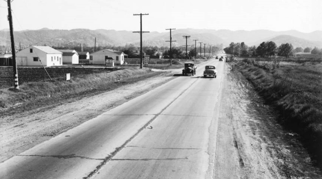
| (1939)* – View of Sepulveda Boulevard looking south from Magnolia Boulevard before improvement. Sepulveda is at center and is a paved, two lane road with dirt shoulders. Wide ditches can be seen on both sides of the road, and several automobiles are driving on its surface. A collection of small wooden buildings can be seen at left, while at right is an open field. A line of utility poles runs parallel to the road at left. |
Historical Notes Sepulveda Boulevard is the longest street in the county of Los Angeles (2nd longest in the city). It is around 43 miles in length, running from Long Beach north through the South Bay and Westside regions, and over the Santa Monica Mountains at Sepulveda Pass to northern San Fernando Valley. |
 |
|
| (1939)* –Looking south on Sepulveda Boulevard from Magnolia Boulevard. Image enhancement and colorization by Richard Holoff |
 |
|
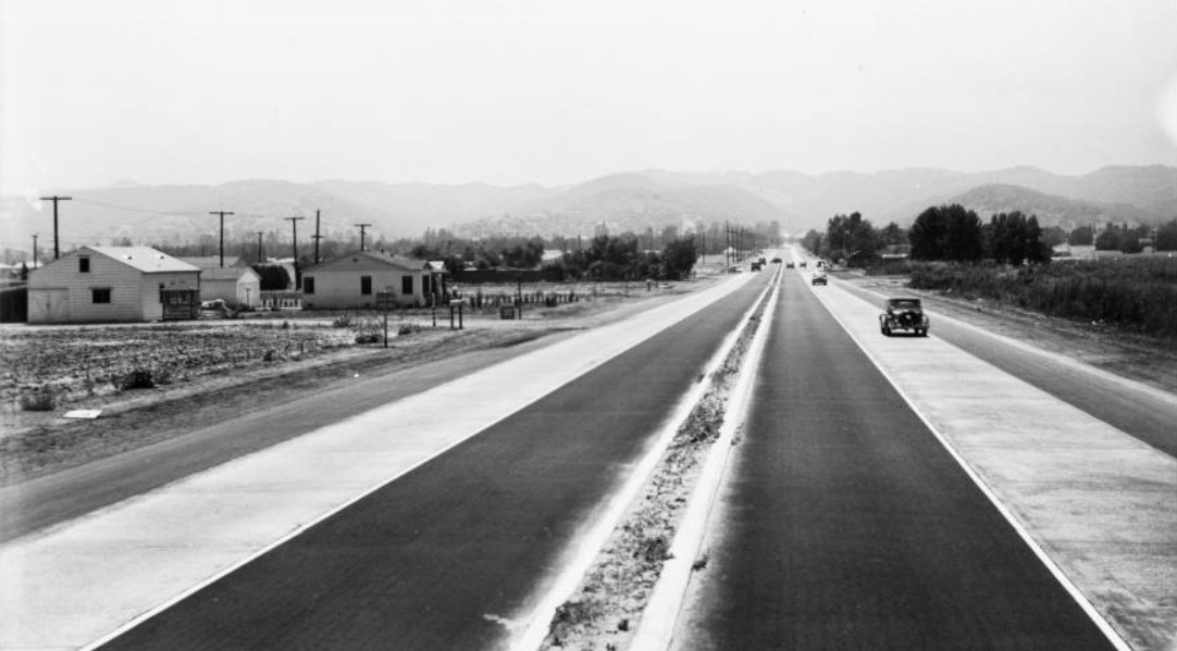
| (1940)* - View of Sepulveda Boulevard looking south from Magnolia Boulevard after improvement, June 18, 1940. Sepulveda is at center and is now a six-lane road with a dirt divider in the middle. Note: The pole line has been removed. |
Then and Now
 |
|
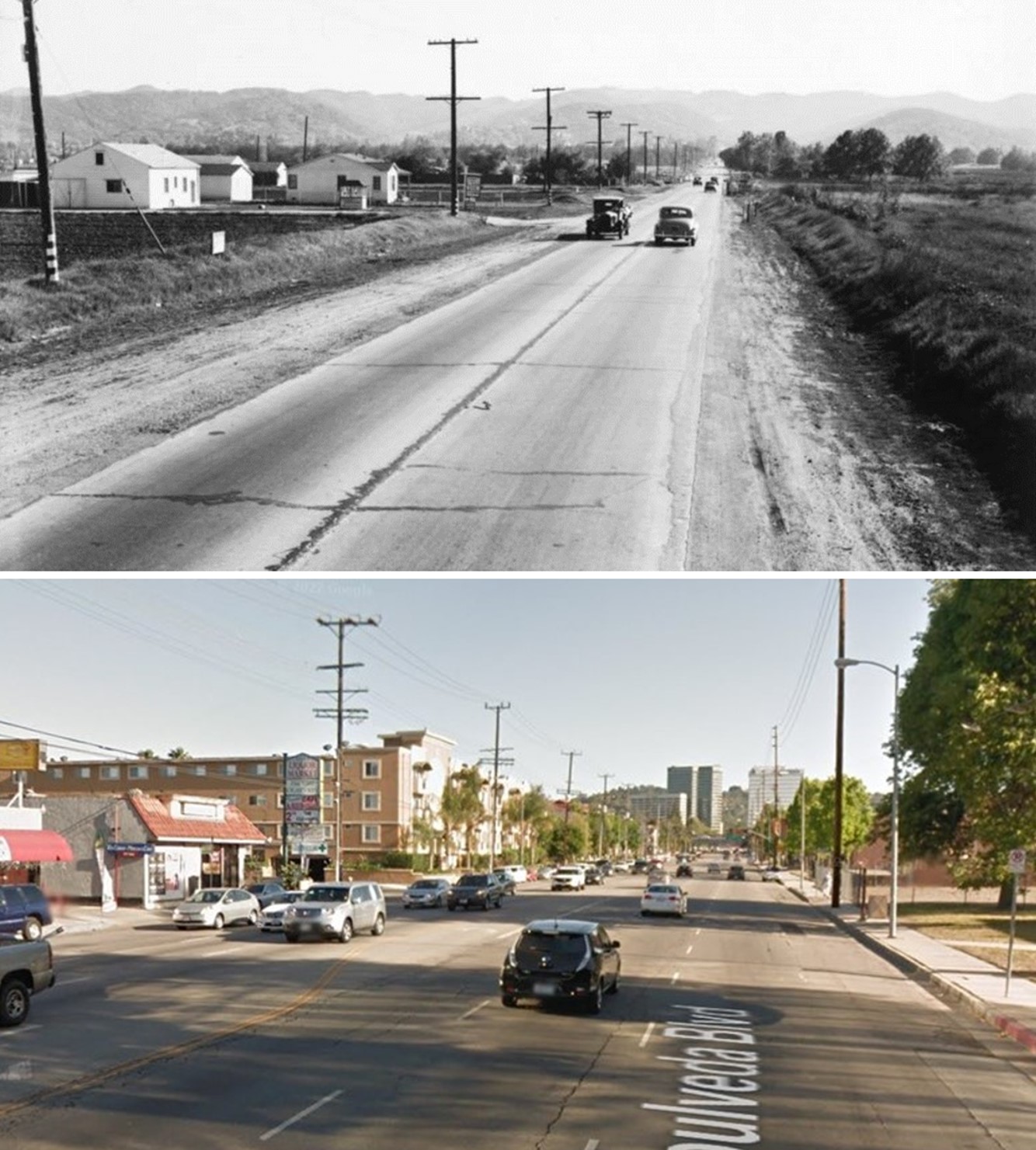
| (1939 vs. 2014)* - Looking south on Sepulveda Boulevard from Magnolia Boulevard. |
Metropolitan Airport (Van Nuys Airport)
 |
|
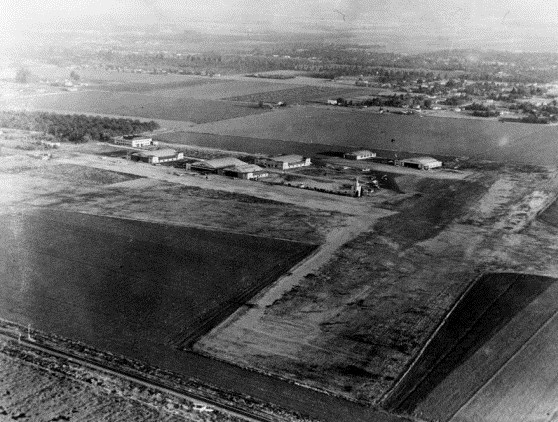
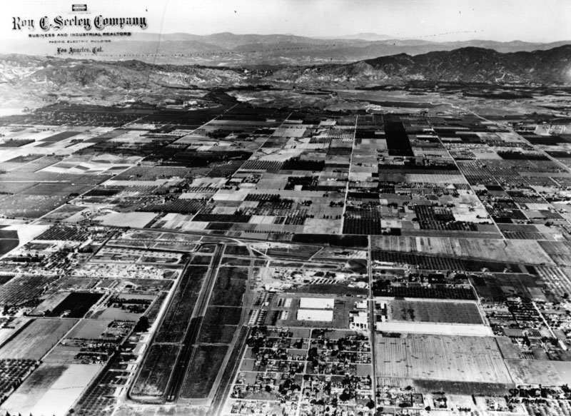
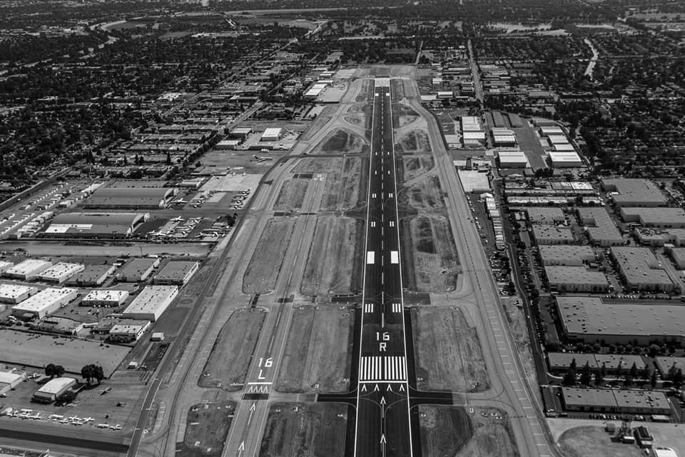
| (1930)^ - Aerial view of Van Nuys Airport when it was known as Metropolitan Airport. |
Historical Notes Los Angeles Metropolitan Airport opened in 1928 and was spread over 80 acres amid the trees and farmland. In 1929, Hollywood discovered the airport. Howard Hughes, Hoot Gibson, Cecil B. DeMille, Gene Autry and Wallace Beery were among the growing number of stars flying at the new airport. The airport continued to expand and grow with three factories, six hangers, and a control tower on airport grounds. The airport also began hosting air races. During one such race in 1929, Amelia Earhart set a new speed record.*^# |
 |
|
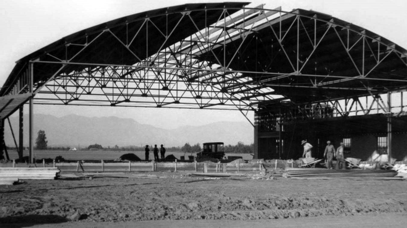
| (1929)^.^ – View showing the westernmost hangar (the one closest to the control tower) while it was under construction in the fall of 1929. At that time, it was the only hangar at the airport. When it was completed, "Los Angeles Metropolitan Airport" was painted in large letters on the roof. |
 |
|
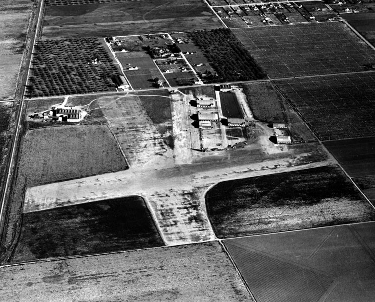
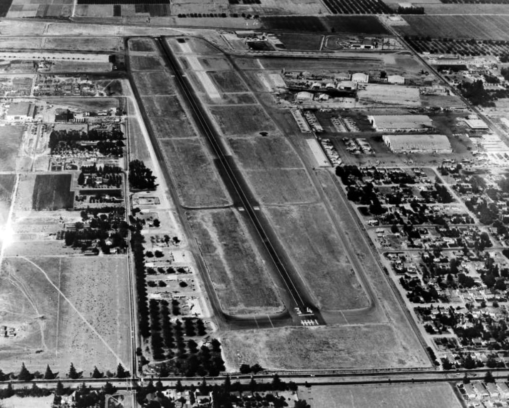
| (1940)* - Aerial view showing the Metropolitan Airport, later Van Nuys Airport, on April 15, 1940. |
 |
|
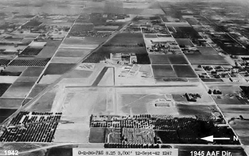
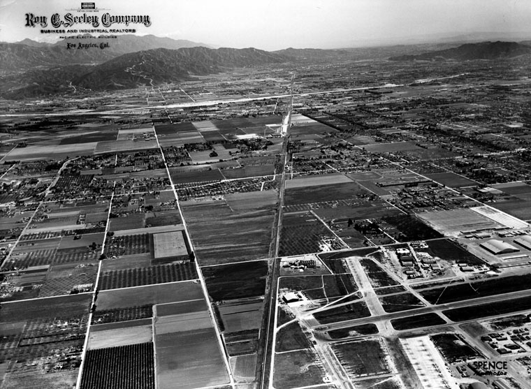
| (1942)*^ – Aerial view looking east showing the Van Nuys Army Airfield. Note the vast open land around the airport. |
Historical Notes In 1942, with the outbreak of World War II, the U.S. government purchased Metropolitan Airport and converted it into a military base to help protect the West Coast. The military also purchased an additional 163 acres of land for the construction of the Van Nuys Army Airfield, using new runways to train hundreds of P-38 Lightning pilots.*#^ |
 |
|
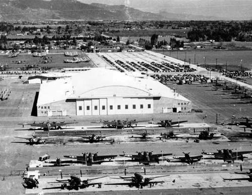
| (1944)^.^ – View showing several military planes including Hudson Bombers at Van Nuys Army Airfield during WWII. |
Historical Notes The twin engine Hudson Bombers were built at the Lockheed Plant B-1 on Empire and Buena Vista in Burbank. |
 |
|
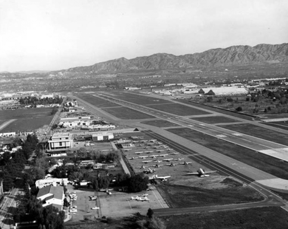
| (ca. 1944)* - Aerial view, looking east, of the San Fernando Valley. The Metropolitan Airport is seen at lower right after its expansion. |
Historical Notes The airport became a vital defense-manufacturing center during the war. In 1944, a joint venture between the U.S. Navy and Lockheed Corporation created an aircraft modification facility known as the Navy Lockheed Plant. In the meantime, Hollywood continued to use the airport for filming, most notably when scenes from the classic Casablanca were filmed at the airport.*#^ |
 |
|
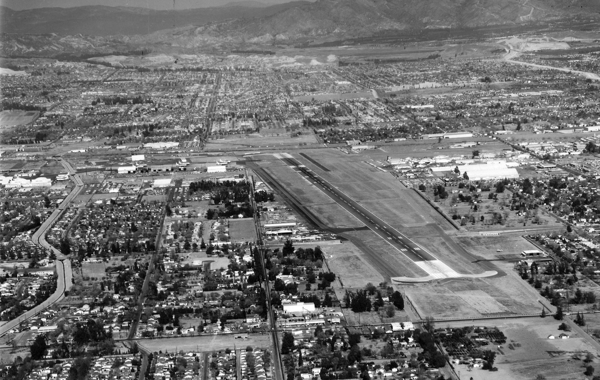
| (1946)* - Aerial view of San Fernando Valley, north of the Metropolitan Airport, now known as Van Nuys Airport. |
 |
|
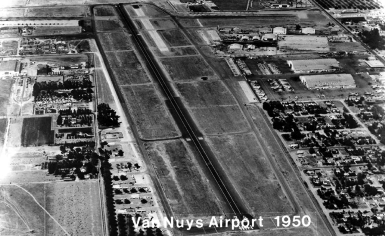
| (1950)#* - Aerial view looking down on the runway and buildings of the Metropolitan Airport in Van Nuys, bordered at the southern end by Sherman Way and by railroad tracks to the north. |
 |
|
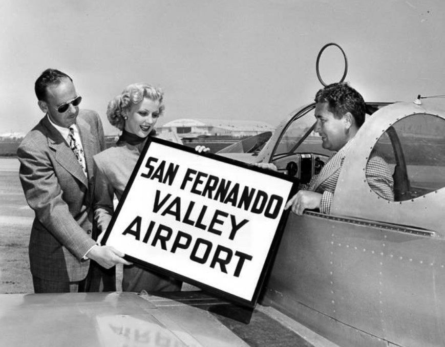
| (1950)#^ - Metropolitan Airport is renamed San Fernando Valley Airport. |
Historical Notes In 1949, the city of Los Angeles purchased the airport from the War Assets Administration for a token payment of one dollar, with the condition that it remain the home of the California Air National Guard until 1985. One year later, the airport was renamed San Fernando Valley Airport.*# |
 |
|
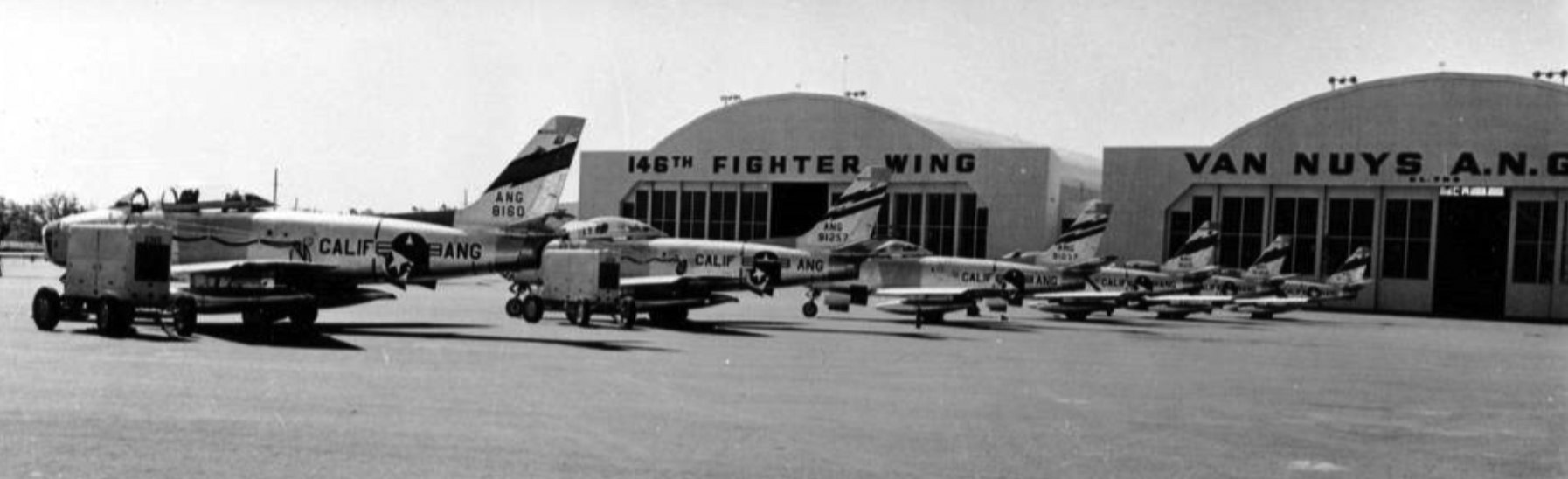
| (1955)^ - Several F-86s from the Air National Guard's 146th Tactical Fighter Wing resting on the ramp at San Fernando Valley Airport in Van Nuys. |
Historical Notes Following World War II, previously splintered Army National Guard and Army Guard Air Corps units were reformed and restructured under the newly created Department of Defense. On September 16, 1946, the 62nd Fighter Wing, 146th Fighter Group and 115th Bombardment Squadron (the former 115th Observation Squadron) were given Federal recognition, and flew their first missions out of Van Nuys Air National Guard Base, later to become Van Nuys Municpal Airport in the San Fernando Valley north of Los Angeles. In 1948, several units of the new wing moved to Burbank Airport, only to return to Van Nuys a short time later, after too little ramp space at Burbank proved a hindrance to accomplishing the wing's missions.* |
 |
|
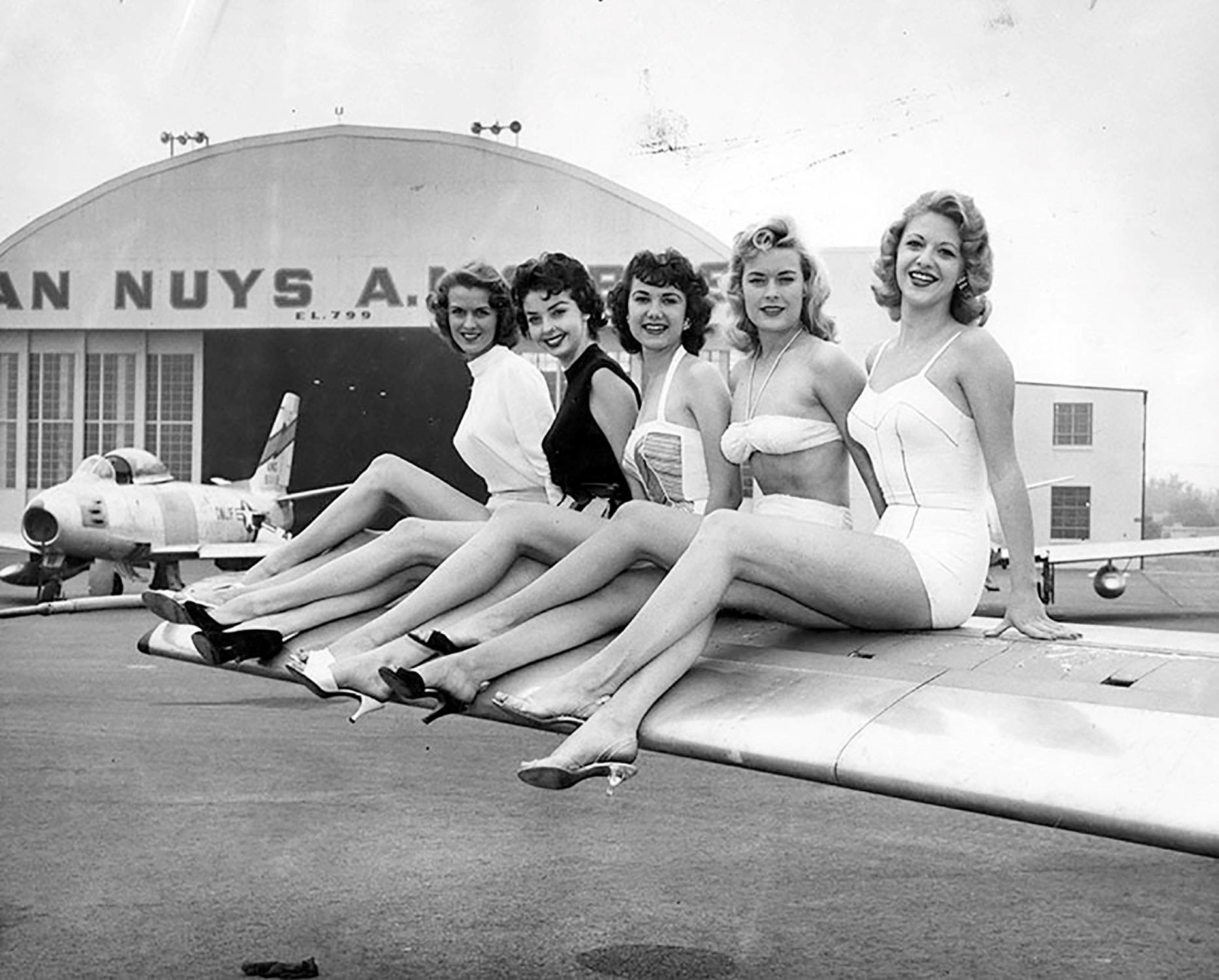
| (1956)* – View showing models posing for the camera while sitting on the wings of airplane. In the background stands an F-86 Sabre with leading edge slats and deployed air brake in front of a Van Nuys Air Force hangar. |
Historical Notes Valley Times Photograph caption dated April 26, 1956 reads "Beauties above will assist during open house program May 19-20 at San Fernando Valley Airport by posing for amateur photographers and serving as models for a fashion show. From left they are Gloria Robertson, Camille Williams, Babs Manausa, Barbara Thompson and Ree Regul. Open house will tie in with Armed Forces Day." The Metropolitan Airport opened on December 17, 1928. In 1950 it was renamed San Fernando Valley Airport and in 1957 the name changed to Van Nuys Airport. The airport is located at 16461 Sherman Way, Van Nuys.* |
 |
|
| (1950)^ – Postcard aerial view of the runway at Van Nuys Airport. |
Historical Notes The above photo is mislabeled. In 1950 the airport was still known as the San Fernando Valley Airport. It would be renamed Van Nuys Airport in 1957.*^# |
 |
|
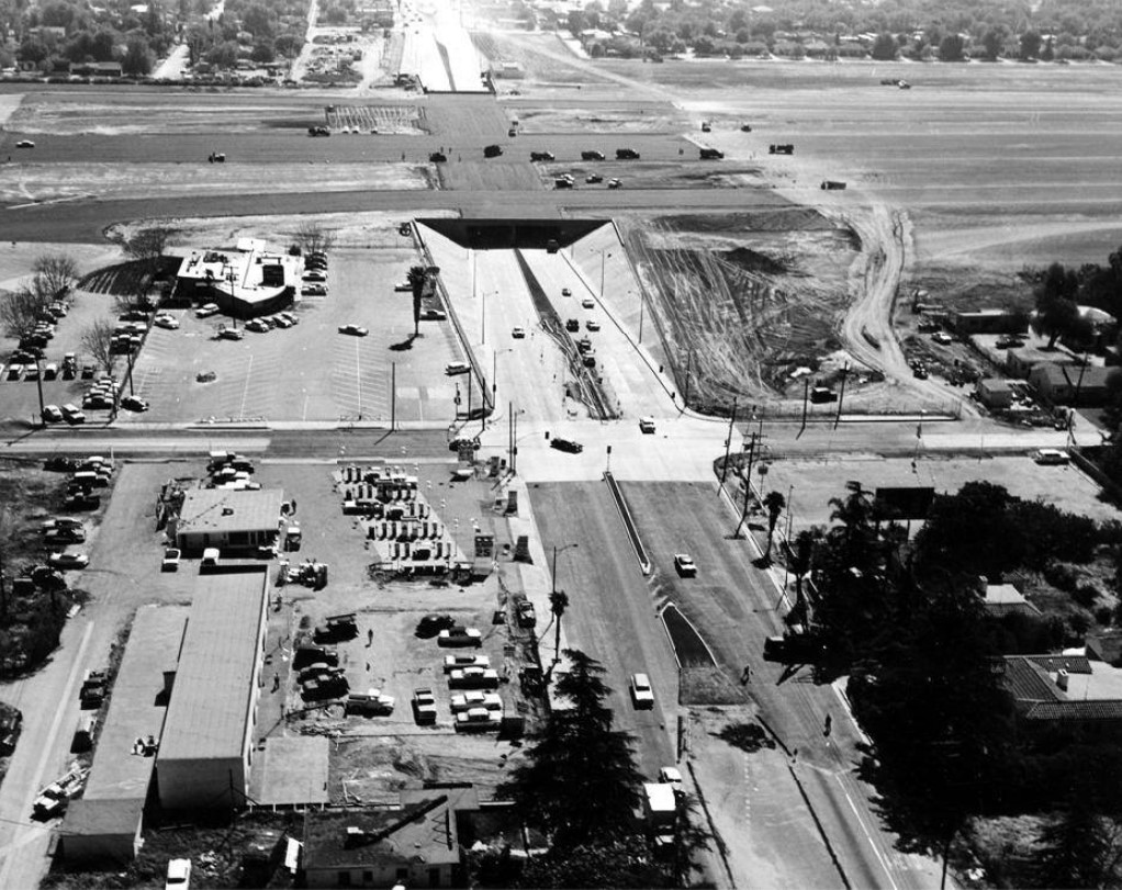
| (1958)#^^* – Aerial view showing the construction of the Van Nuys Airport runway extension and Sherman Way Tunnel. |
Historical Notes At one point the Van Nuys Airport was envisioned as a base for Air Force fighter/interceptor planes to defend against a feared attack by Soviet-piloted bombers from Siberia. To provide the space needed for early jet fighters, a runway was extended an additional 2,000 feet south from Saticoy Street to Vanowen Street. To avoid blocking busy Sherman Way, the street was routed into a tunnel under the runway, which is still in use today. But, by the time hundreds of homes had been razed and the expansion completed, the defense role was taken over by Nike anti-aircraft missiles, leaving the airport with an extraordinarily long (8,000 feet!) runway for a general aviation field, an unintended legacy of the Cold War.*^# |
 |
|
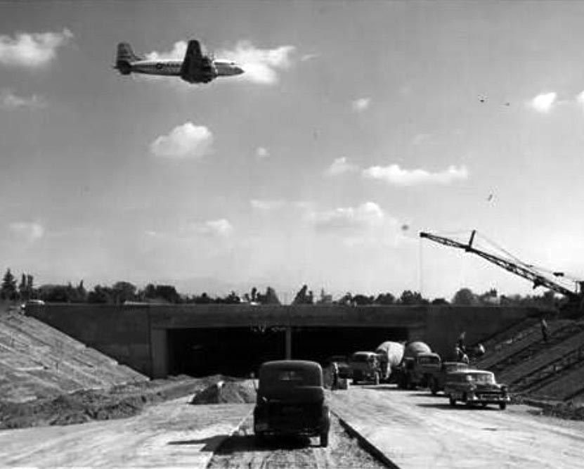
| (1958)*^## - View of the Van Nuys Airport runway extension and building of the Sherman Way tunnel with a DC-4 flying overhead. |
 |
|
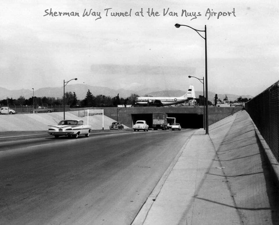
| (1959)^.^ - A C-97 taxis over the Sherman Way tunnel at the Van Nuys Airport. At left, a 1959 Chevrolet Coupe with its large tailfins is seen heading toward the tunnel. |
 |
|
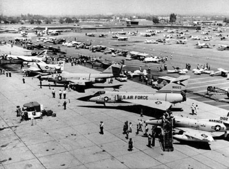
| (1965)#^*^ – View showing the Van Nuys Airport Air Show displaying the latest military aircraft including the: A-4, F-102, and F-1-1. Note the lack of high priced "millionaire" hangers that are in dominance today! |
Historical Notes The annual Van Nuys Airport Air Shows lasted nearly four decades until the Air Force stopped them mainly due to low turnouts and security problems. #^*^ |
 |
|
| (1966)^ – Aerial view looking north showing the Van Nuys Airport and the north end of the San Fernando Valley on a clear day. |
 |
|
| (1968)**^# – Aerial view looking north showing Van Nuys Airport and surrounding area. |
 |
|
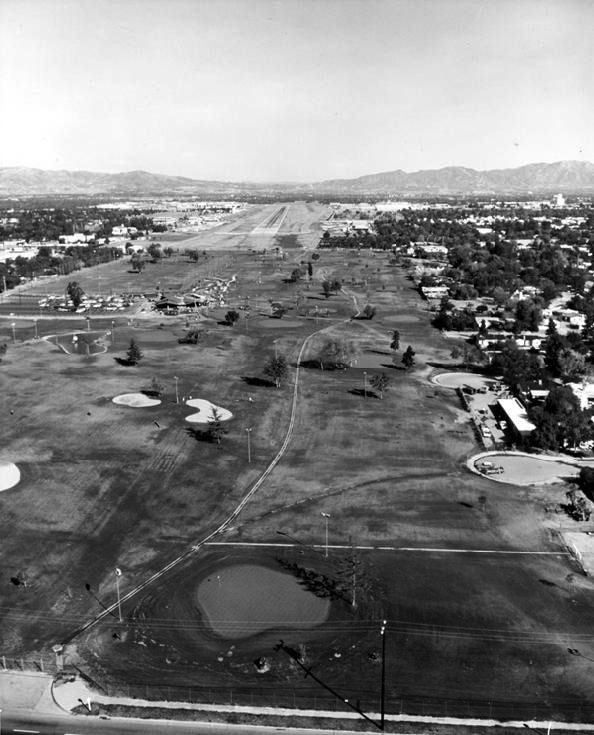
| (1968)* - Aerial view looking north showing the Van Nuys Golf Course with Victory Boulevard in the foreground. The end of the Van Nuys Airport runway can be seen in the distance. |
 |
|
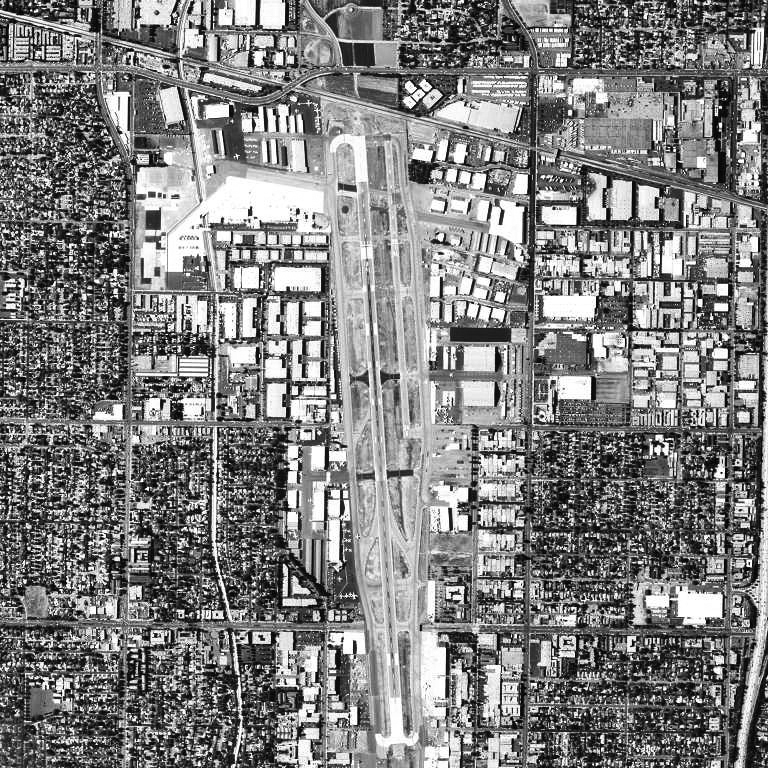
| (2006)*^ - Aerial view of Van Nuys Airport as it appeared in 2006. |
Historical Notes Van Nuys Airport is owned and operated by Los Angeles World Airports. Through 2005, it was the busiest general aviation airport in the world (the second busiest being Phoenix Deer Valley Airport). In terms of takeoffs and landings, it was also the 25th busiest airport in the world. With two parallel runways, Van Nuys Airport handled 448,681 aircraft movements in 2005, averaging over 1,200 operations/day; in 2006 it handled 394,915 movements, nearly 1,100 per day. That’s amazing considering no major airlines fly into this airport. Los Angeles International Airport (with 4 runways and many airline flights) has roughly 1,700 operations a day.*^ |
 |
|
| (2017)* - Aerial view of Van Nuys Airport. Photo Van Nuys Airport |
 |
|
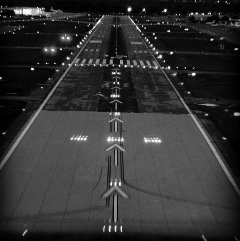
| (2014)* – The Pilot View - Night landing at Van Nuys Airport. |
Click HERE to see more in Aviation in Early L.A. |
Van de Kamp's Bakery
 |
|
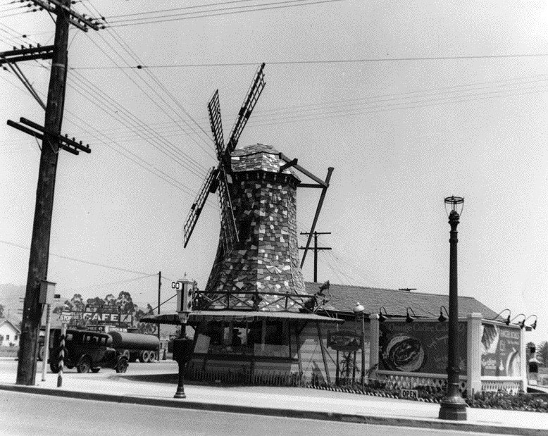
| (1931)* - This Van de Kamp's Bakery's building, designed to resemble a 16th -century Dutch farmhouse, located on San Fernando Road and Fletcher Drive served as headquarters for the chain of bakeries and coffee shops whose trademark "windmill" buildings and neon signs prevailed throughout mid-20th century Los Angeles. |
Hisorical Notes J. Edward Hopkins designed Van de Kamp’s headquarters in Glassel Park. Harold Griffith “Harry” Oliver, a set designer by profession, designed the windmill stores. Oliver also designed the Spadena Home/“Witch’s House” (1921) in Beverly Hills and the altered Montgomery’s Country Inn/Tam O’Shanter Inn of Los Feliz (1922). The stores were portables!, designed to be moved from location to location if business just wasn't there. San Fernando Road was graded across the barren eastern edge of the Valley in the 1870s for use by wagons hauling ore between San Fernando and Los Angeles. |
* * * * * |
Orcutt Ranch and March Avenue |
From Oil Pioneer Estate to Valley Cultural Landmark |
At the western edge of the San Fernando Valley near the base of the Simi Hills stands one of the Valley’s most elegant early estates. Orcutt Ranch was the country retreat of William Warren Orcutt, a petroleum geologist, oil executive, and early contributor to California scientific research.Built during the 1920s on land once used for cattle and citrus, the ranch reflected the prosperity generated by California’s early petroleum industry and the romantic architectural style that defined early Southern California estates. Today it remains one of the Valley’s best preserved historic properties and a rare reminder of when Roscoe Boulevard was rural and March Avenue was a quiet country road. |
 |
|
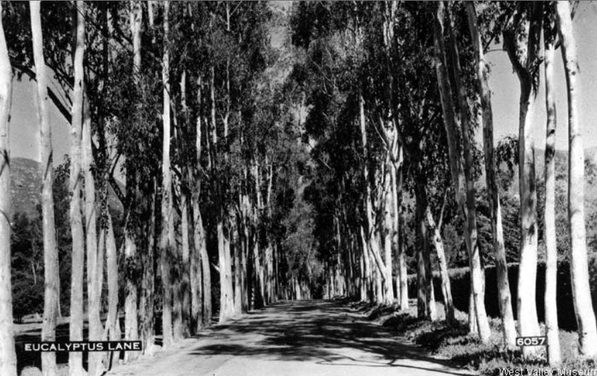
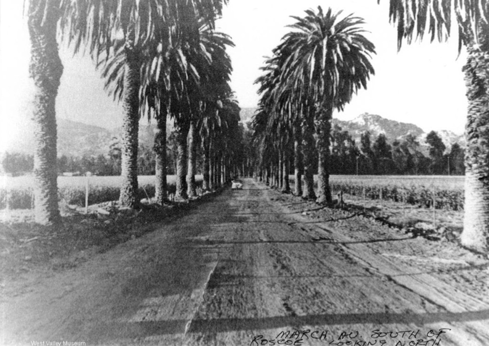
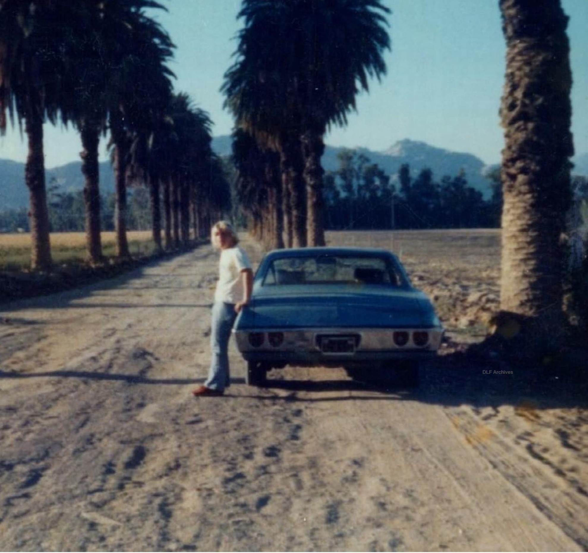
| (ca. 1931)* - View looking north along Eucalyptus Lane on March Avenue just south of Roscoe Boulevard. Orcutt Ranch is at right. |
Historical Notes This early view shows March Avenue when it was still largely rural. The road, lined with eucalyptus and palm trees, ran north toward Roscoe Boulevard and passed directly alongside the Orcutt estate. At the time, the surrounding land was open farmland and citrus groves. William Warren Orcutt purchased the property in 1917 and gradually transformed it into Rancho Sombra del Roble, which means Ranch of the Shaded Oak. The estate grew to cover about 210 acres at the foot of the Simi Hills and became one of the most refined private residences in the western Valley. |
 |
|
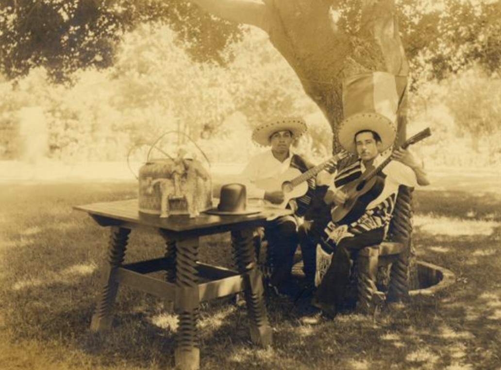
| (ca. 1932)* - Musicians seated beneath a tree at Orcutt Ranch. |
Historical Notes The ranch was more than a private residence. It became a social gathering place where guests enjoyed music, outdoor events, and garden settings shaded by mature trees. The Spanish name Rancho Sombra del Roble reflected both the landscape and the romantic architectural character of the estate. William Orcutt was a major figure in California oil development. He worked for Union Oil Company and helped expand petroleum production throughout the state. He is also remembered for helping uncover one of the first scientifically documented prehistoric skeletons at the La Brea Tar Pits, bringing scientific attention to the Ice Age fossils found there. |
 |
|
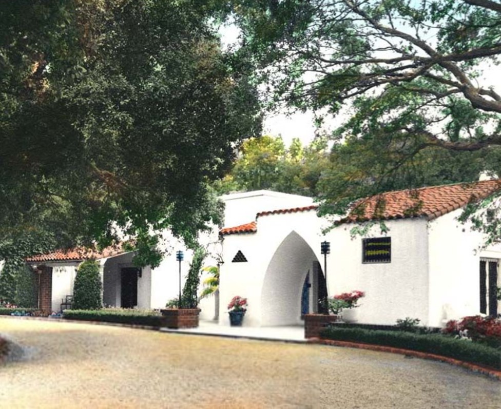
| (1945)* - Front entrance and yard of the Orcutt home, Rancho Sombra del Roble. |
| Historical Notes
The residence was completed in the mid 1920s and designed by architect L. G. Knipe. The home blends elements of Spanish Colonial Revival and Mission Revival architecture, with stucco walls, tile roofing, arched openings, and decorative ironwork. By the 1940s the ranch stood as a mature estate surrounded by orchards, gardens, and open Valley land. Roscoe Boulevard was still lightly developed, and March Avenue remained a quiet approach road framed by trees. |
 |
|
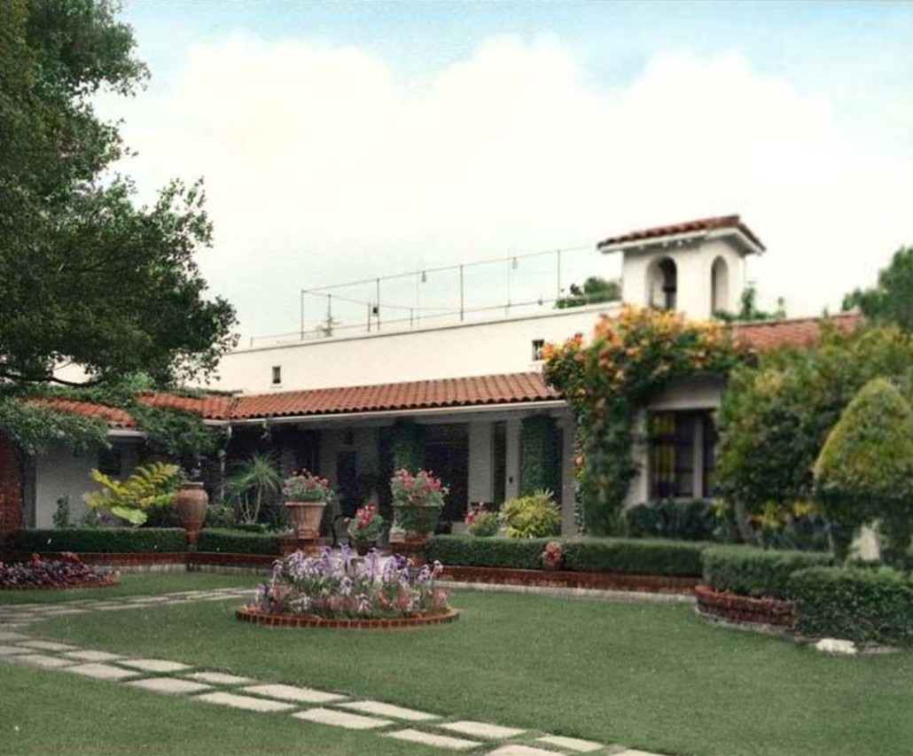
| (1945)* - Spanish-style ranch house with fenced sundeck on roof, backyard lawn and garden in foreground, at the Orcutt Ranch/Rancho Sombre del Roble. The ranch was the home of William and Mary Logan Orcutt, on property purchased in 1917, and designated as a Los Angeles Cultural Heritage Monument in 1965. |
| Historical Notes
This view highlights the Mediterranean influence that defined many prominent Southern California country estates of the 1920s. The rooftop sundeck and shaded arcades were designed to take advantage of the Valley’s warm climate and wide open views. The estate reflected the prosperity generated by California’s early petroleum industry. Orcutt’s success in petroleum exploration allowed him to create a refined country retreat that combined agriculture, leisure, and architectural style. |
 |
|
| (ca. 1948)* - March Avenue looking north with car in distance and Orcutt Ranch in background. |
| Historical Notes
By the late 1940s the San Fernando Valley was beginning its transition from farmland to suburban neighborhoods. March Avenue, still largely unpaved, was gradually improved as residential development expanded outward from central Los Angeles. The ranch remained a landmark along Roscoe Boulevard even as surrounding acreage was subdivided. Its orchards and open grounds contrasted sharply with the growing grid of postwar homes that would soon define much of the western Valley. |
 |
|
| (1977)* - March Avenue looking north toward Roscoe Boulevard with Orcutt Ranch in the background. Photo courtesy of Dean Fields. |
| Historical Notes
Even as late as 1977, March Avenue retained a rural character. The roadway appears lightly graded rather than fully paved, showing how this stretch remained somewhat removed from the rapid suburban development surrounding it. By this time the City of Los Angeles had already acquired the estate through the Department of Recreation and Parks. Orcutt Ranch had been designated Los Angeles Historic Cultural Monument Number 31, preserving the house and gardens while much of the western San Fernando Valley transitioned into dense residential neighborhoods. |
 |
|
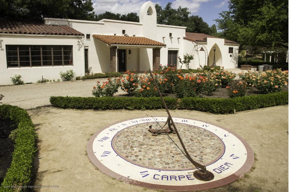
| (ca. 2025)* - Sundial in the garden at Orcutt Ranch with the ranch house in the background. |
| Historical Notes
Today the estate operates as the Orcutt Ranch Horticulture Center at 23600 Roscoe Boulevard in West Hills. It is owned and maintained by the City of Los Angeles Department of Recreation and Parks, which maintains offices and horticultural facilities on the property. The gardens feature roses, citrus trees, and landscaped grounds that reflect the agricultural past of the estate. Although Roscoe Boulevard is now a major Valley thoroughfare, the ranch still offers a sense of quiet retreat and remains one of the best preserved historic estates in the western San Fernando Valley. |
 |
|
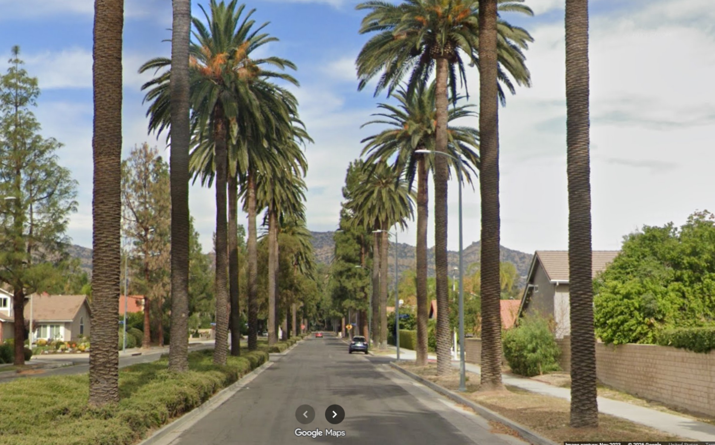
| (2023)* - Google Street view looking north on March Avenue toward Orcutt Ranch. |
| Historical Notes
This contemporary view shows March Avenue fully paved and lined with modern residential development. The rural character seen in earlier photographs has been replaced by established suburban neighborhoods, sidewalks, and improved roadway infrastructure. Although the surrounding landscape has changed dramatically, Orcutt Ranch remains just beyond the trees near Roscoe Boulevard. The estate serves as a preserved reminder of the Valley’s agricultural past and of the prosperity generated by California’s early petroleum industry, which made estates such as this possible. |
Then and Now
 |
|
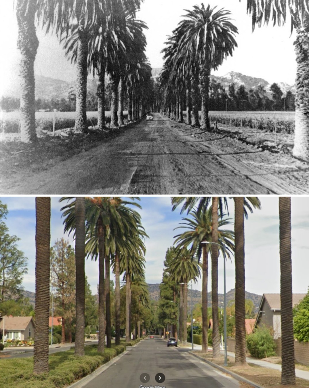
| (1948 vs. 2023)* - Then and Now view looking north on March Avenue toward Orcutt Ranch and Roscoe Boulevard. Photo comparison by Jack Feldman. |
| Historical Notes
This Then and Now comparison illustrates the transformation of March Avenue over seventy five years. In 1948 the road was still largely unpaved and bordered by open land associated with the Orcutt estate. By 2023 the roadway is fully improved and surrounded by residential development. Despite the growth of the western San Fernando Valley, Orcutt Ranch remains a visible landmark near Roscoe Boulevard, linking the modern community to its early twentieth century origins. |
* * * * * |
Sherman Way and Mason Ave |
 |
|
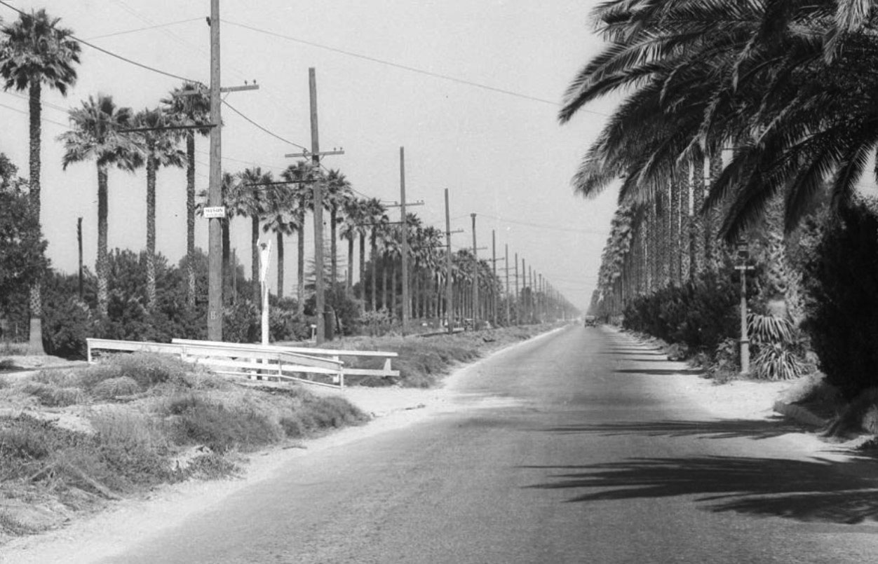
| (1932)*- View looking east on Sherman Way at Mason Avenue in Owensmouth (later Canoga Park, now Winnetka). |
Hisorical Notes Mason Avenue was named for Azubeth H. Mason in 1917. Click HERE to see more in SFV Street Name Origins. Owensmouth became Canoga Park in 1931. |
 |
|
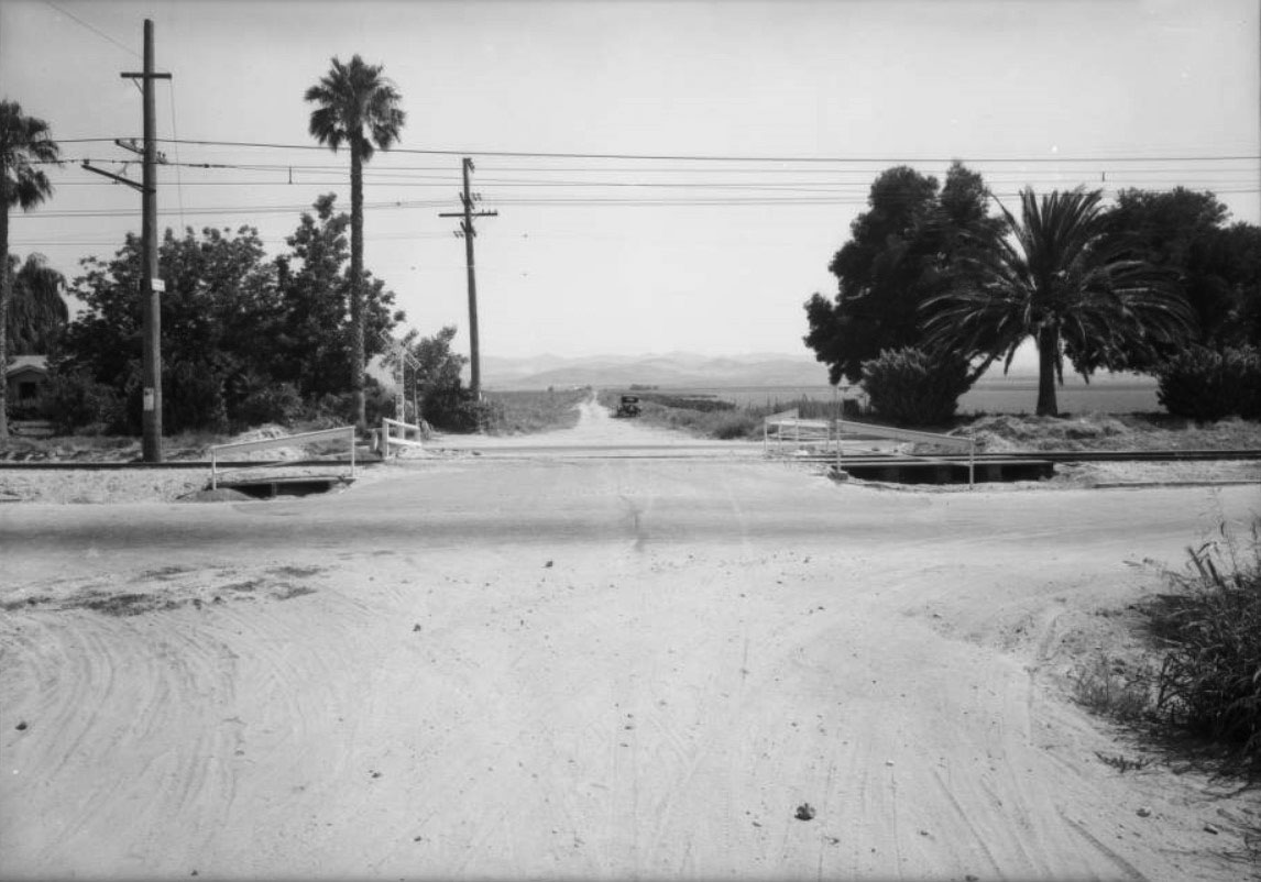
| (1932)*– View looking south on Mason Ave across Sherman Way. Note the tracks down the center median of Sherman Way. |
 |
|
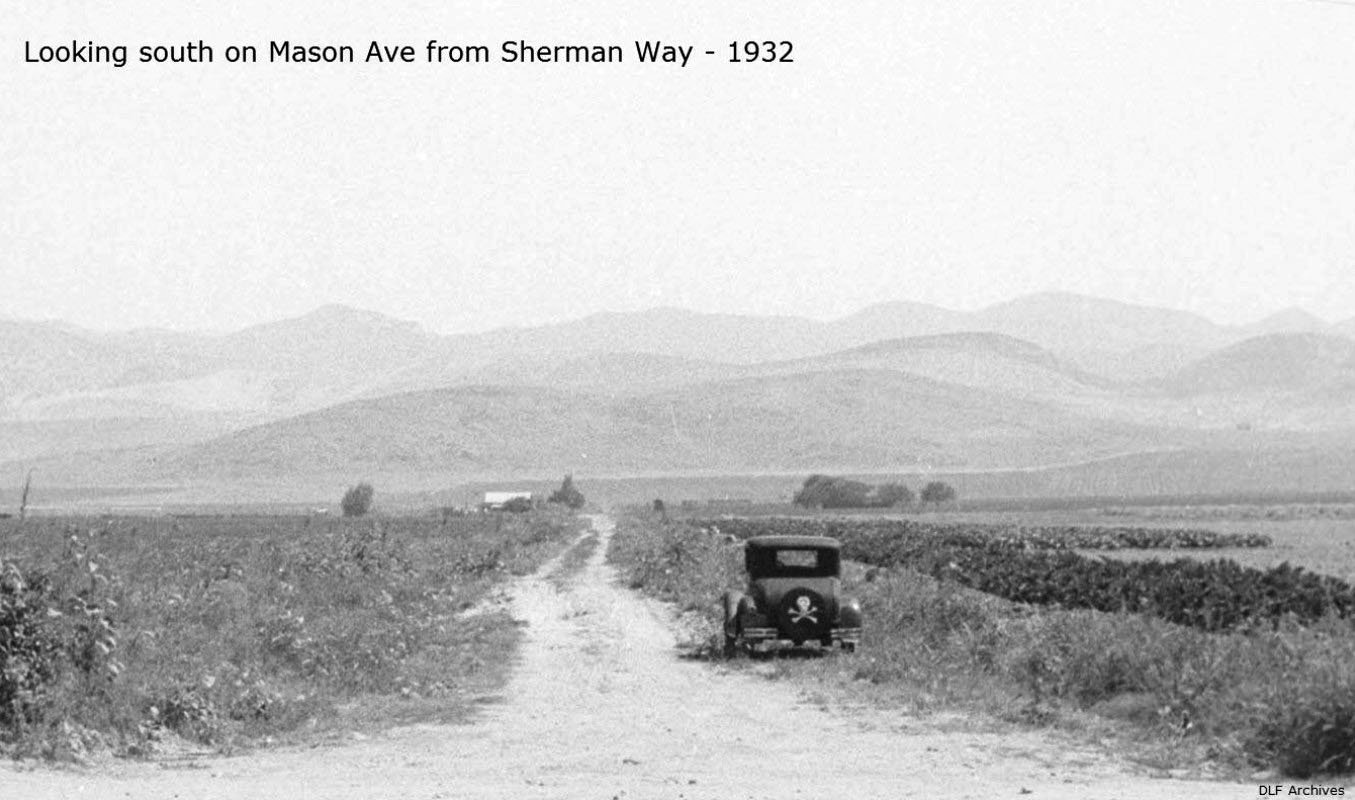
| (1932)^ – View looking south on Mason Ave from Sherman Way. At the base of the hills is where Pierce College stands today. |
Then and Now
 |
|
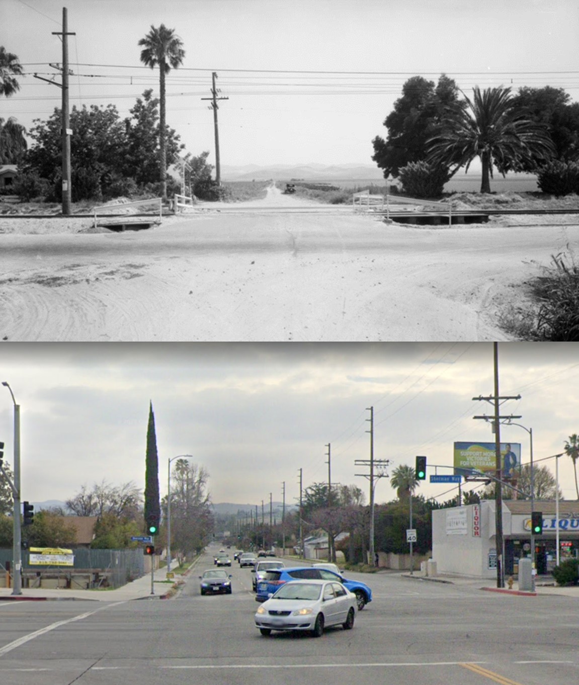
| (1932 vs. 2021)*– View looking south on Mason Ave across Sherman Way. Photo comparison by Jack Feldman. |
Lower Van Norman Reservoir
 |
|
| (1935)^^^* - Aerial view of the Lower Van Norman Reservoir looking northeast. Rinaldi Street runs east to west in the foreground. |
Hisorical Notes Also called the Lower San Fernando Dam, the Lower Van Own Reservoir was built as the southern terminus of the Los Angeles Aqueduct, storing drinking water for the city. After the 1971 Sylmar Earthquake, the Los Angeles Dam was constructed and a new reservoir would replace the Lower Van Norman Reservoir. The reservoir was named after Harvey Arthur Van Norman who was a long time employee and engineer for the City of Los Angeles under his chief and close friend William Mulholland. When Mulholland retired Van Norman took his place as head of the Chief Engineer and General Manager of the Bureau of Water Works and Supply. When the separate water and power bureaus were merged into a single organization he became head of the new Department of Water and Power.*^ Click HERE to see more Early L.A. Water Reservoirs. |
Republic Studios (today CBS Studio Center) - Studio City
 |
|
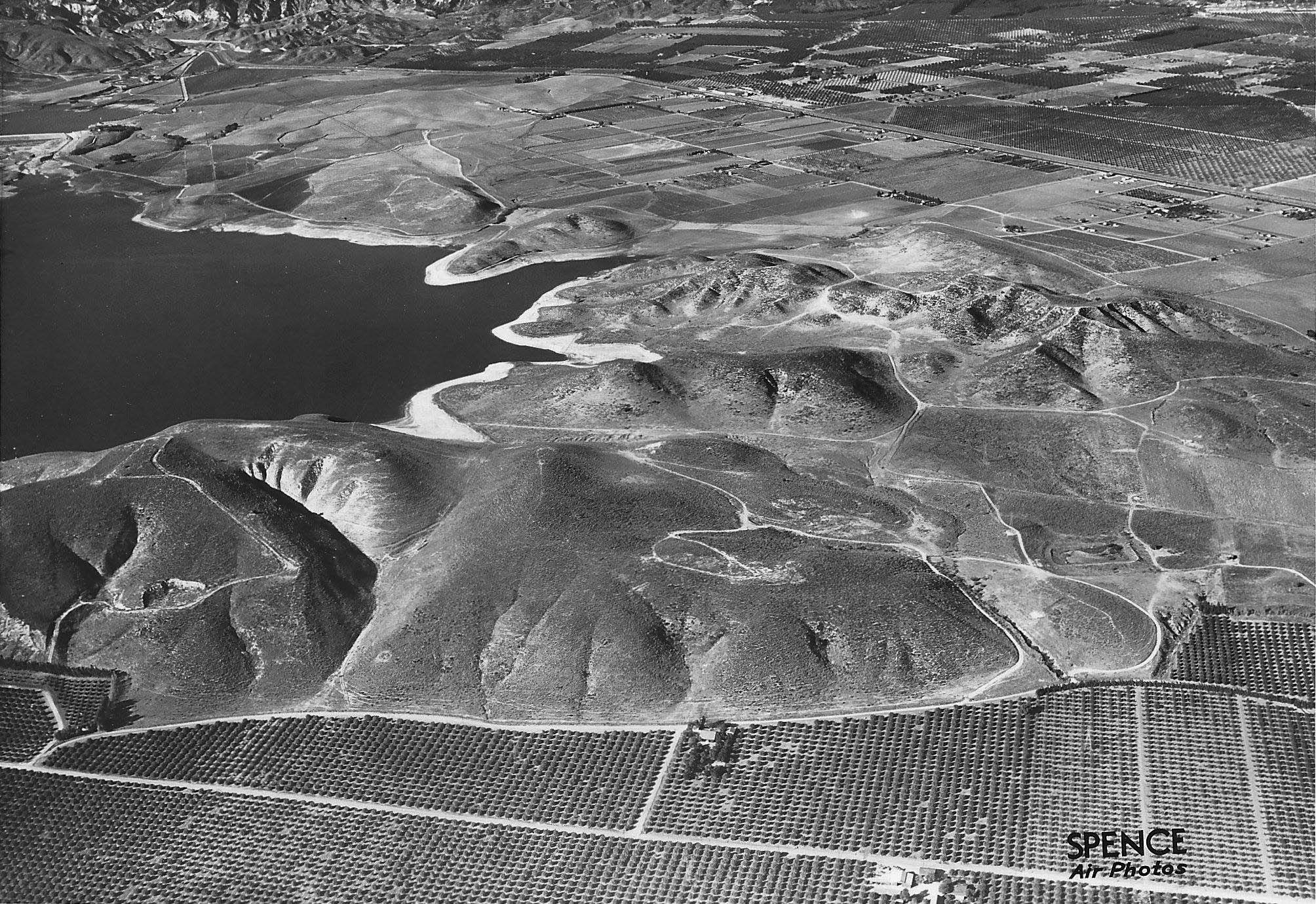
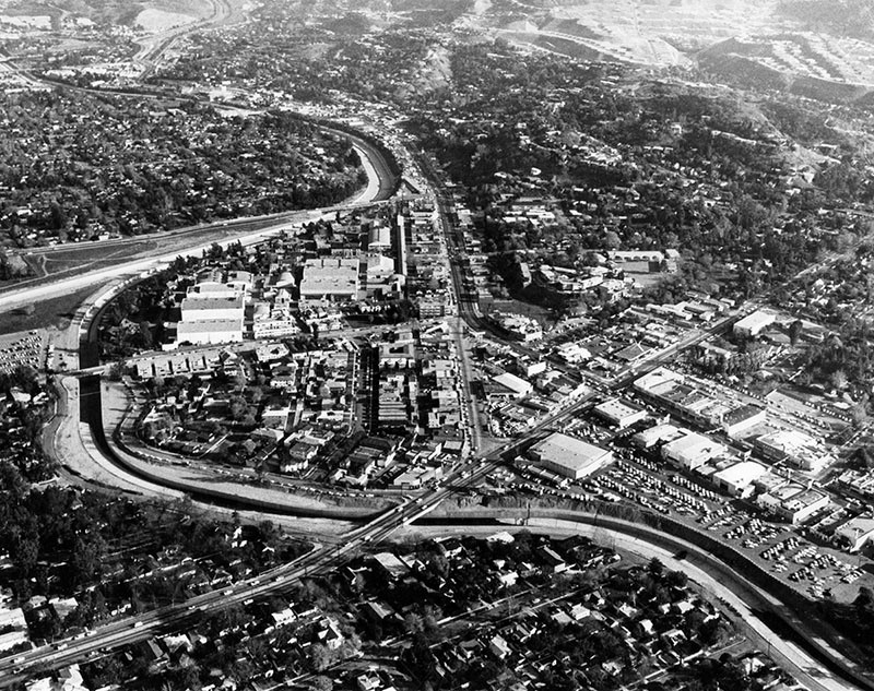
| (ca. 1920s)* - Aerial view of the field which became the site for Republic Studios, near Ventura Blvd. and Colfax Ave. in what is now Studio City. |
Hisorical Notes Mack Sennett, a silent film producer and director, came to the San Fernando Valley and opened his new movie studio at this location (at what's now Ventura Boulevard and Radford Avenue) in May 1928. He previously operated a smaller studio on Glendale Boulevard in Echo Park (then called Edendale) where he produced films featuring the Keystone Kops, Charlie Chaplin, Mabel Normand, Buster Keaton, W.C. Fields, and Fatty Arbuckle. After Sennett began building the new studio on 20 acres donated by a land developer, the surrounding area was named Studio City.*^ |
 |
|
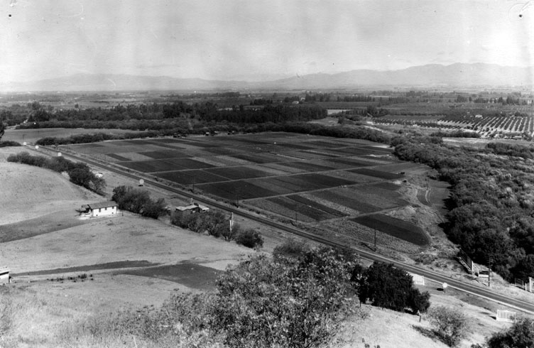
| (ca. 1935)* - View of Republic Studios in North Hollywood, now Studio City, in the San Fernando Valley. Trucks are parked in a line in the foreground and a building is under construction on the far left. By this time, Noah Beery Sr.'s ranch in the background is part of the 70-acre studio complex. |
Hisorical Notes The studios didn't fare well and in 1933 Mack Sennett and his enterprise became bankrupt. Herbert J. Yates took over the site and in 1935 formed a production company entitled Republic Pictures Corporation. The studios became known as Republic Studios.* |
 |
|
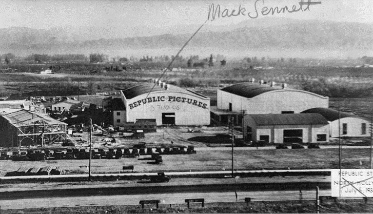
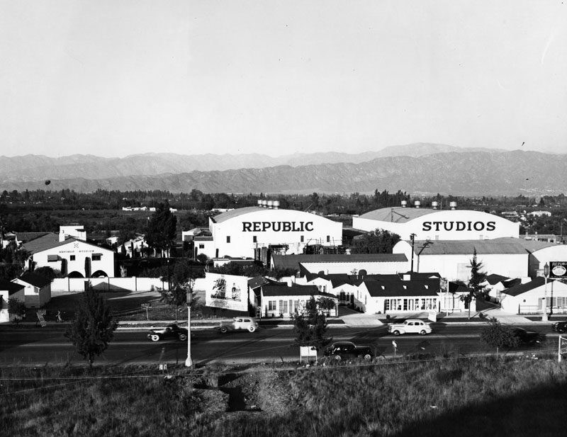
| (ca. 1939)* - View showing Republic Studios and its sound stages. A billboard for Schlitz is visible, as cars zoom up and down the boulevard. The words "Republic" and "Studios" are written separately on two sound stages. Another smaller building at left also has the film studio's name printed on the wall. |
Hisorical Notes Republic Pictures’ studio facilities is best known for specializing in westerns, movie serials, and B films emphasizing mystery and action. It financed and distributed one Shakespeare film, Orson Welles' Macbeth (1948), and several of the films of John Ford during the 1940s and early 1950s. It is also notable for developing the careers of John Wayne, Gene Autry, and Roy Rogers.*^ |
 |
|
| (1964)* - View looking southeast showing the CBS Studios (previously Republic Studios) located at upper center-left. The intersection of Ventura and Laurel Canyon boulevards is at center-right. The cement-lined LA River loops around the studios. |
Hisorical Notes Republic Pictures ceased production in 1958 and began leasing its lot to CBS studios. CBS began to place their network-produced filmed shows there, including Gunsmoke, Rawhide, My Three Sons, and Gilligan's Island. (The Wild Wild West followed in 1965). While under lease, the facility was renamed the CBS Studio Center. The network purchased the 70-acre lot outright from Republic in February 1967, for $9.5 million. CBS built new sound stages, office buildings, and technical facilities. To make up for these investments, CBS began to rent out its studio lot for independent producers, and the newly created MTM Enterprises (headed by actress Mary Tyler Moore and her then-husband, Grant Tinker) became the Studio Center's primary tenant, beginning in 1970. Since 2007, the Studio Center serves as the home to CBS's Los Angeles flagship TV station, KCBS-TV, along with sister station KCAL-TV, as they vacated Columbia Square to move into a newly built, digitally-enhanced office and studio facility located where the house for the hit CBS reality series, Big Brother, once stood. The CBS Studio City Broadcast Center also houses the Los Angeles bureau of CBS News, which is shared with the KCBS/KCAL local newsroom.*^ |
Then and Now
|
|
 |
|
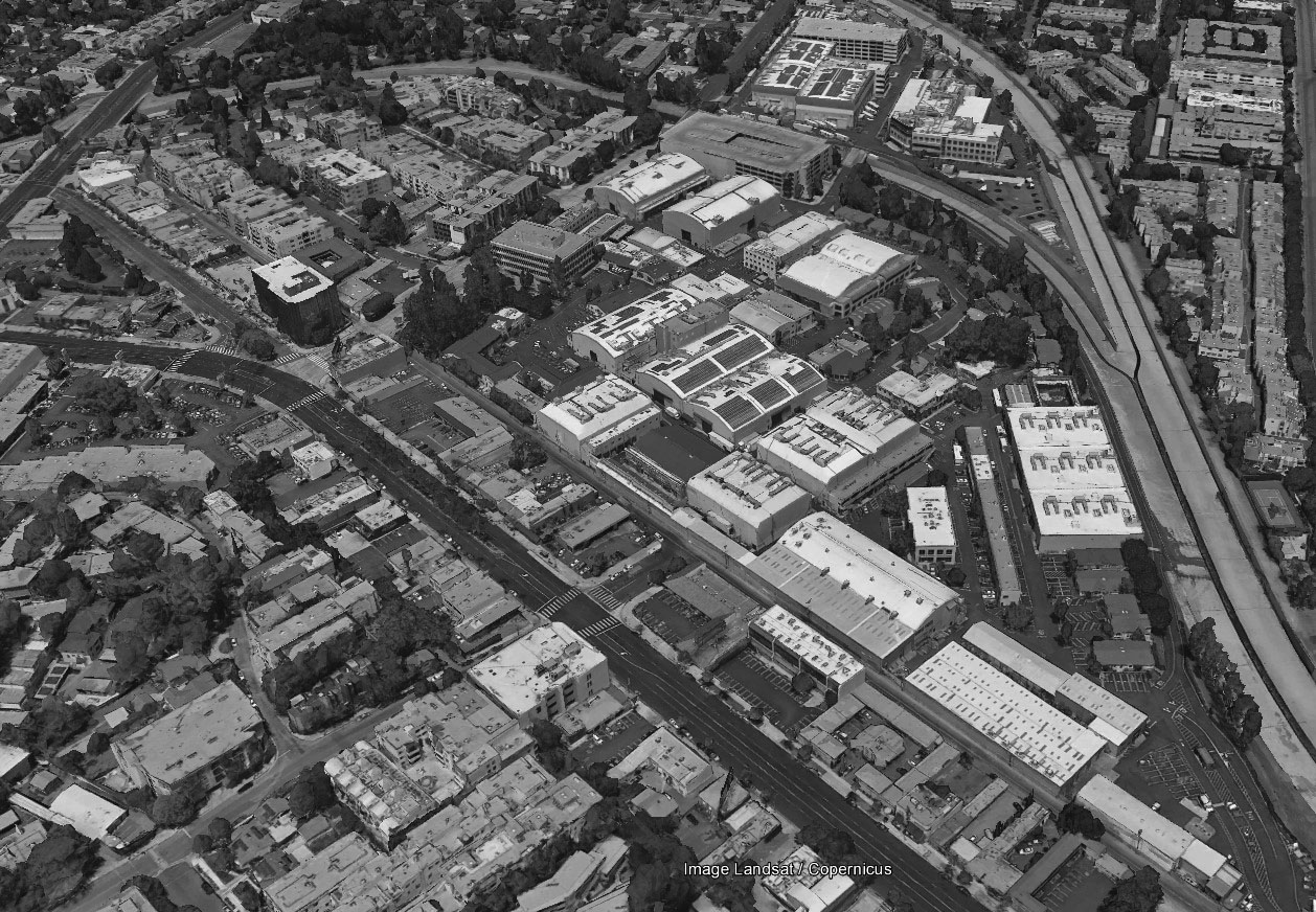
| (1920)* vs. (2016)#*^# - Aerial/Satellite view showing the area that became Republic Studios and today is CBS Studio Center. The major street runnning diagonally (lower-right to upper-left) is Ventura Boulevard. The LA River loops around the facility. Laurel Canyon Boulevard can be seen in the upper-left corner of the bottom image. Photo comparison by Jack Feldman. |
Chatsworth Community Church (today, occupied by St. Mary the Virgin Anglican-Rite Catholic Church)
 |
|
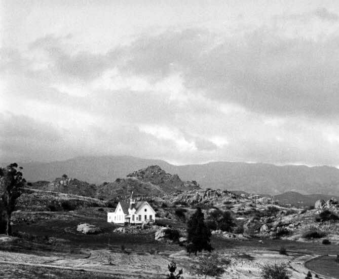
| (n.d.)* – View showing the Chatsworth Community Church located at 10051 Topanga Canyon Blvd. The Santa Susana Mountains are seen in the background. |
Historical Notes The Chatsworth Community Church was built in 1903 using volunteer labor. This was the first Protestant Church in the San Fernando Valley, incorporated as the First Methodist Episcopal Church of Chatsworth in November 1903. |
.jpg) |
|
| (n.d.)* – View as seen from the driveway of the Orrin Sage Chatsworth Ranch showing the Chatsworth Community Church in the distance with the Santa Susana Mountains in the background. |
Historical Notes The Community Church was built on land donated by Nelson A. Gray located at 10051 Topanga, half way between Devonshire and Lassen on the west side of the street. It was also used as the community's high school from 1906–1908. It was a center of community life in the early days of Chatsworth, serving as a haven from floods and fires. |
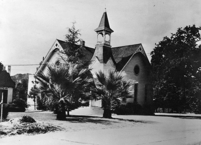 |
|
| (ca. 1930s)* - View of the Chatsworth Community Church, the 2nd oldest church in the San Fernando Valley, located at 10051 Topanga Canyon Boulevard. |
Historical Notes In 1958, Chatsworth Community Church's name was changed to Chatsworth First Methodist Church. In 1963, the Methodist Church moved to a new building further north on Topanga just south of Stoney Point leaving the old church vacant. It was "the last remaining community building" of old Chatsworth, and became threatened by development. The Chatsworth Historical Society would help save the building in 1965. In 1963, the Chatsworth Community Church was designated as Los Angeles Historic-Cultural Monument No. 14 (Click HERE to see complete listing). This would be a key factor in helping preserve the old church. |
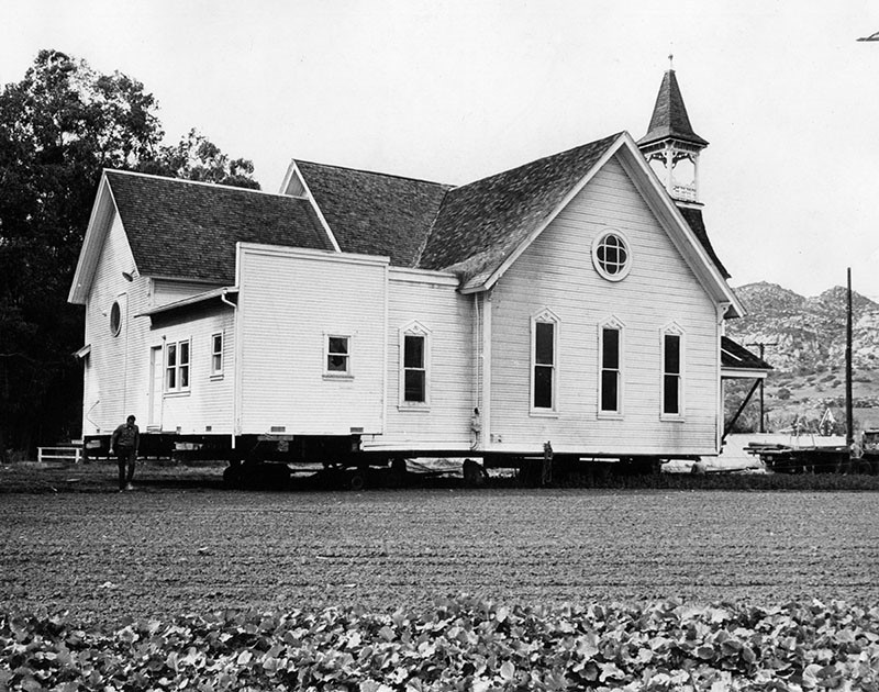 |
|
| (1965)* – Photo caption reads: "On its way to a new home, Chatsworth Community Church is being moved from 10051 Topanga Canyon Blvd. to Oakwood Memorial Park at 22601 Lassen St. Built in 1903, the frame structure served also as high school and center of civic life." Valley Times photo dated January 23, 1965 |
Historical Notes In order to save the church building from demolition, the Chatsworth Historical Society raised $19,725 to move the church in 1965 from its original location at 10051 Topanga Canyon Boulevard to its present site at 22601 Lassen Street, on the grounds of Oakwood Memorial Park. |
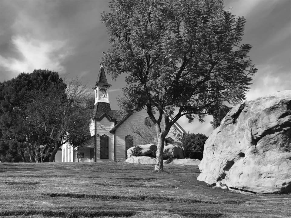 |
|
| (2017)* – View showing the St. Mary the Virgin Anglican-Rite Catholic Church (originally the Chatsworth First Community Church) located at 22601 Lassen Street on the grounds of the Oakwood Memorial Park. |
Historical Notes Since November 15, 1981, the building has been occupied by the congregation of St. Mary the Virgin Anglican-Rite Catholic Church. |
Stoney Point
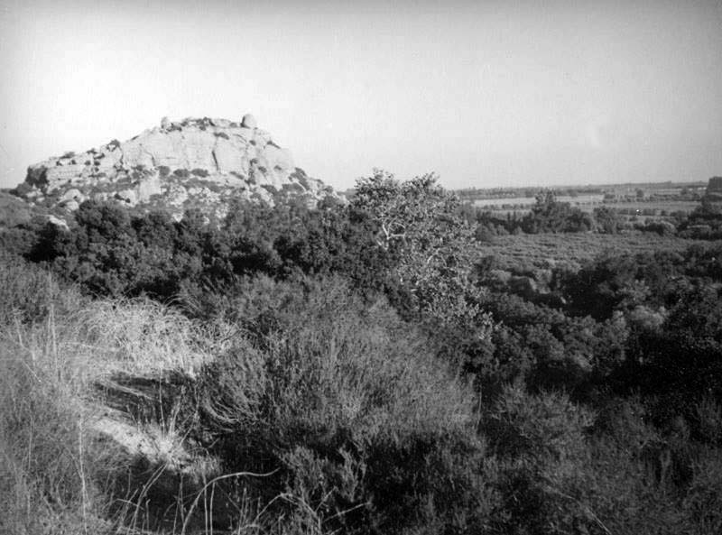 |
|
| (1931)* - View looking southwest toward Stoney Point in Chatsworth. It is also known as the Stoney Point Outcroppings or Chatsworth Formation. |
Historical Notes Stoney Point is the site of a Tongva Indian rancheria until the 1790s, with Spanish invasion. It is believed that the Village of Momonga was located at Stoney Point. It is culturally significant because Momonga was multilingual and multiracial, allowing intermarriage of Chumash, Fernandeno and Gabrieleno peoples. A sulphur spring, believed to possess spiritual properties runs adjacent to Stoney Point Park on the Eastern side. It is said that shamans would visit Stoney Point in preparation for the Winter Solstice celebration that drew native people from as far away as Temecula. It was used as a marker by the Southern Pacific Railroad during construction of the railroad through the Santa Susana Mountains. In 1974, Stoney Point was designated as Los Angeles Historic-Cultural Monument No. 132 because of its historic value (Click HERE to see complete listing). |
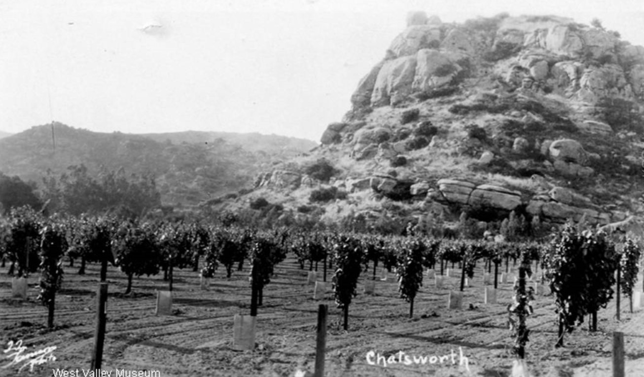 |
|
| (ca. 1935)^ - View of Stoney Point showing vineyards running all the way up to the outcropping. |
Historical Notes The Chatsworth formation is part of the Pacific Plate, which grinds against the North American Plate, and therefore is continuously pushed northwest at a rate of 2.5 inches per year. The Chatsworth Formation was pushed out of the ocean, and, as part of Simi Hills, created part of the Transverse Ranges. Because any fossils left in the ocean were ground up on the journey up, there are very few fossils to be found in the area. |
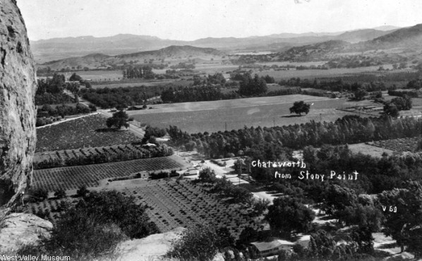 |
|
| (ca. 1935)^ - View from Stoney Pt. looking southwest. Topanga Cyn Boulevard runs from lower right to upper left of photo. The street crossing Topanga at a 45 degree angle is Andora Avenue. At upper right-center can be seen the Chatsworth Reservoir. |
Historical Notes The Chatsworth Reservoir in the Northwest San Fernando Valley was placed in service in 1919. Click HERE to see more in Early LA Water Reservoirs. |
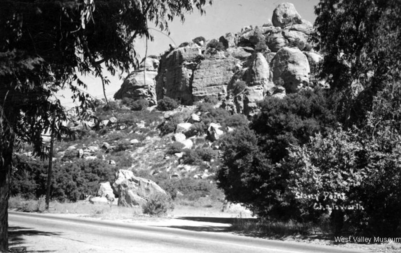 |
|
| (ca. 1935)* – View looking northeast toward Stoney Point as seen from Topanga Canyon Boulevard. Photo courtesy of West Valley Museum. |
Then and Now
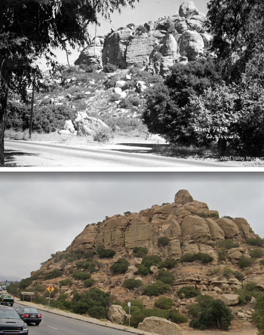 |
|
| (1935 vs 2022) - Stoney Point, Chatsworth. Some things never change. |
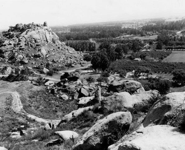 |
|
| (Early 1900s)* - View showing Stoney Point and the Old Santa Susana Pass Road. |
Historical Notes The Old Santa Susana Stage Road or Santa Susana Wagon Road is a route taken by early travelers between the San Fernando Valley and Simi Valley through Chatsworth and over the Santa Susana Pass. The main route climbs through what is now Santa Susana Pass State Historic Park, with a branch in Chatsworth Park South. It was an important artery linking the Los Angeles Basin and inland Ventura County, and was part of the main route for travel by stagecoach between Los Angeles and San Francisco from 1861 until the opening of rail traffic between the cities in 1876. |
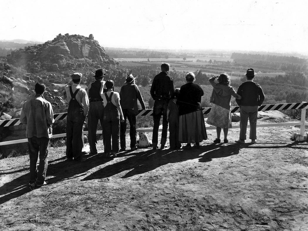 |
|
| (1940)* - Scene from the movie The Grapes of Wrath showing when the Joads finally arrive in California…what they are looking at is Chatsworth. Stoney Point can be seen to the left. |
Historical Notes The Grapes of Wrath (1940) was one of the first 25 films to be chosen (in 1989) by the Library of Congress for preservation in the United States National Film Registry because it is "culturally, historically, or aesthetically significant." While the film was lensed at more than a dozen and a half locations it does include some rich scenes filmed on the Iverson Ranch in Chatsworth. |
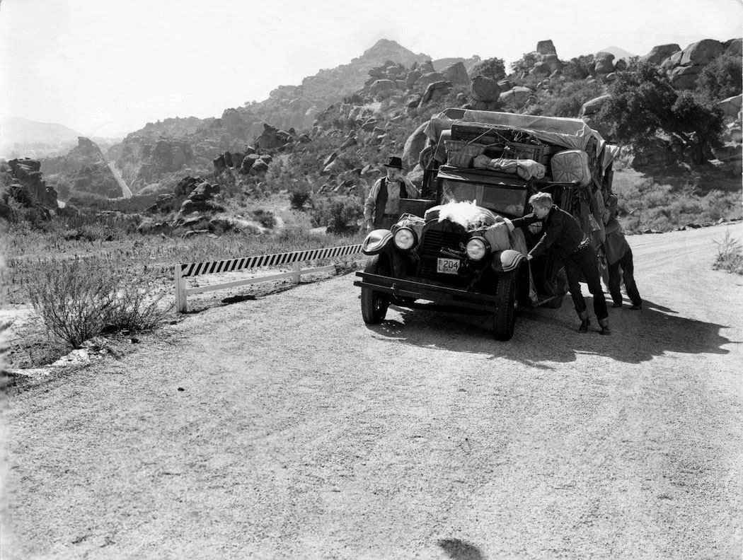 |
|
| (1940)* - This still from Grapes of Wrath is the approximate location of today's Redmesa Road. |
Historical Notes Redmesa Road in the northwest corner of Chatsworth leads to one of the most recognizable areas of the former historic Iverson Movie Location Ranch -- The Garden of the Gods -- a twenty three-acre park site acquired by the Santa Monica Mountains Conservancy in 1987. It's the only part of the Iverson Ranch that still has public access. The Garden of the Gods Park is perched just south of the 118 freeway along both sides of Redmesa Road a little north of Santa Susana Pass Road, and just a little west of Topanga Canyon Boulevard. Click HERE for contemporary Google Earth View. |
Iverson Ranch
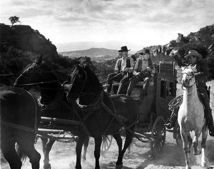 |
|
| (ca. 1940s)* - Santa Susana...Iverson Ranch. A lot of western movies and other films were made here. The location of the ranch was in the northwest corner of Chatsworth, along the western side of Topanga Canyon Boulevard where it currently intersects with the 118 Freeway. |
Historical Notes Karl and Augusta Iverson, who owned a 500-acre family ranch in the Simi Hills on Santa Susana Pass above Chatsworth, first allowed a movie to be shot on the property as early as 1912, with the silent movies Man's Genesis (1912), "My Official Wife" (1914) and The Squaw Man (1914) among the features most often cited as the earliest films shot on the site. A long and fruitful association soon evolved between Hollywood and the Iverson Movie Ranch, which became the go-to outdoor location for Westerns in particular and also appeared in many adventures, war movies, comedies, science-fiction films and other productions, standing in for Africa, the Middle East, the South Pacific and any number of exotic locations. |
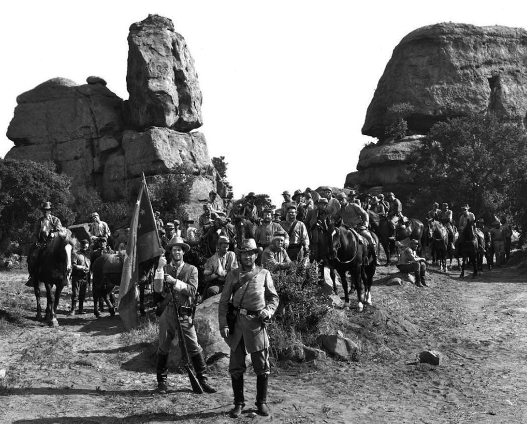 |
|
| (1948)* - Still from feature "The Man from Colorado", starring Glen Ford and William Holden taken at Garden of the Gods, Chatsworth; note rock formations "Tower" at left and "Sphinx" at right. |
Historical Notes The demise of the Iverson Movie Ranch was largely caused by the decline of cowboy movies and that new invention called TV. Also, the construction of the 118 Freeway doomed the Ranch as it split the lands and added a layer of unacceptable noise. |
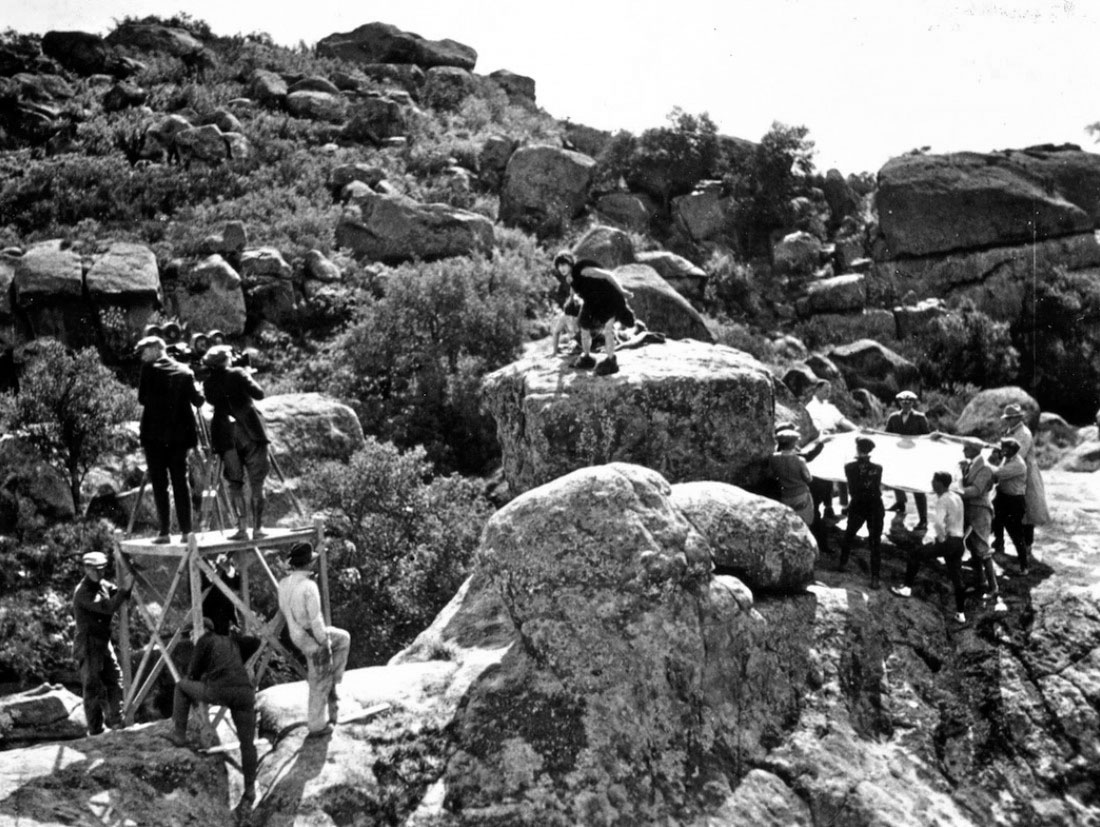 |
|
| (1923)* - Filming at Iverson Ranch was popular in the 1920s. In the still above from the silent film Three Ages, Buster Keaton and his film crew are rehearsing the stunt where he will appear to be actually falling off backwards (to be caught in the safety net). |
Historical Notes Another frequently filmed landscape feature on the Iverson Movie Ranch is a rock dubbed Three Ages Rock, honoring the successful 1923 Buster Kenton comedy with the same name. Three Ages Rock (above left) is part of a formation that is nestled against the south end of the Cal-West Townhomes development. The exact location is about a half mile north of Santa Susana Pass Road on the east side of Redmesa Road in Chatsworth, CA. Click HERE for contemporary Google Earth View. |
* * * * * |
Santa Susana Pass Road
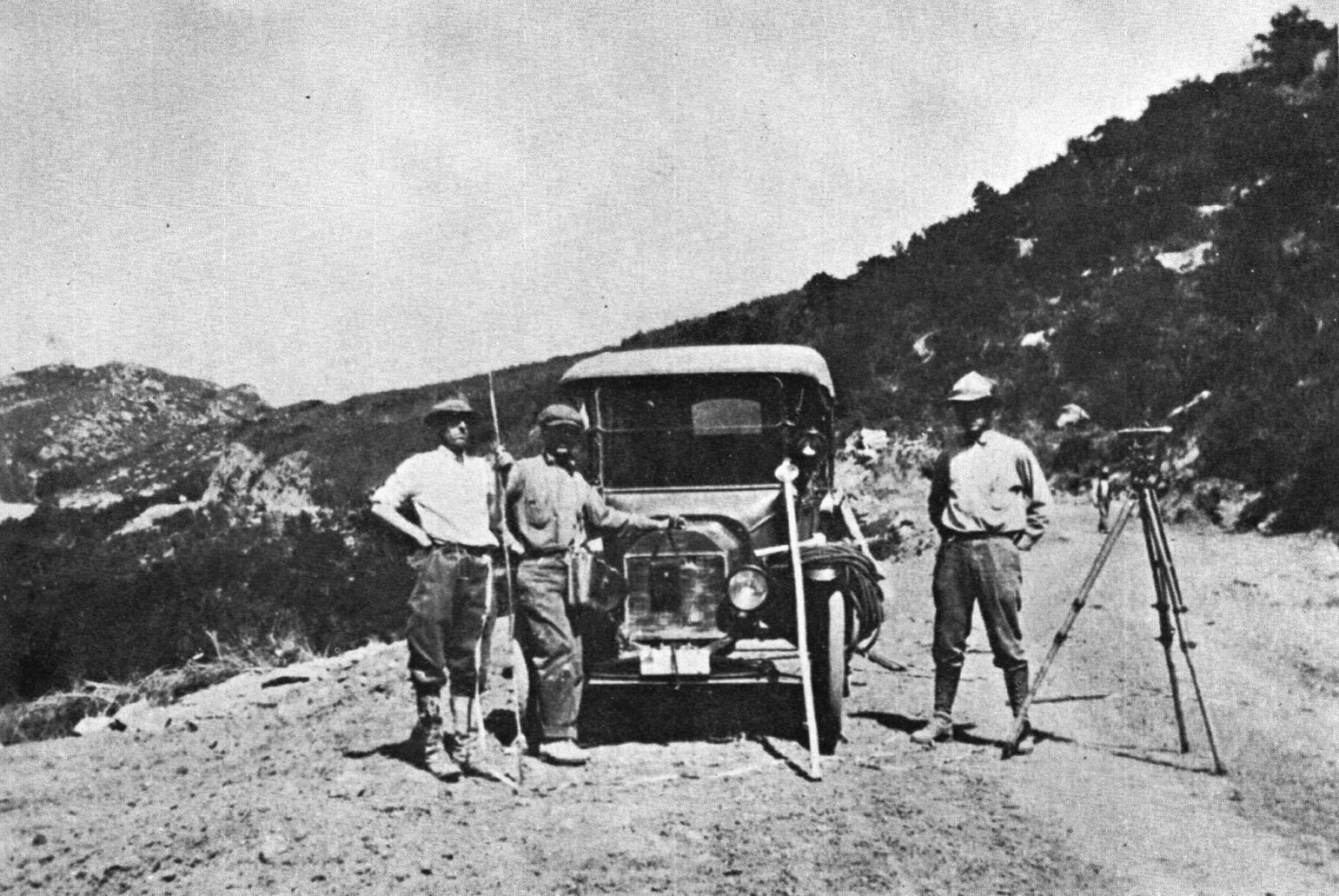 |
|
| (1917)* – View shows three surveyors on what was the beginning of what we know as the Santa Susana Pass Road, which we still drive today. |
Historical Notes Santa Susana Pass has a rich history as a key passage through the Simi Hills, connecting the San Fernando Valley with Simi Valley. Historically, it was a travel route for the Chumash and Tongva tribes, who used it for trade between inland and coastal villages. During the Spanish and Mexican periods, it was a primary route for travelers between Los Angeles and northern settlements, later becoming part of the El Camino Real. In the late 19th and early 20th centuries, the Pass Road developed as a wagon trail for settlers, with steep grades and narrow paths making it challenging. The route also hosted several stagecoach lines before modern highways were built, and remnants of these routes still exist in the Santa Susana Pass State Historic Park.The original stage road, used from 1860 to 1895, containing Devil’s Slide, as well as the El Camino Nuevo (aka Chatsworth Grade Road) had many hairpins turns, and by 1913 horse-drawn wagons had to share their right-of-way with an ever-increasing number of gasoline-powered automobiles and trucks. After torrential winter rains in 1914-15, instead of repairing the road, Los Angeles and Ventura Counties decided to construct an entirely new asphalt-paved road across the drainage dedicated solely to automobile traffic, and it was opened in 1917. |
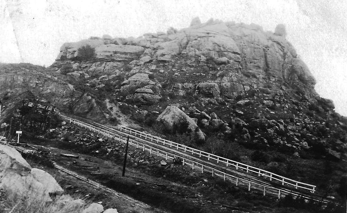 |
|
| (late 1920s)* – Close-up view of Stoney Point with the first Santa Susana Pass Road in the foreground. Photo courtesy of Paul Ayers. |
Historical Notes The road with the white two rail guardrail still exists and can be driven today, it is Old Santa Susana Pass Road, and takes you to the hairpin turn that is over the railroad tracks. |
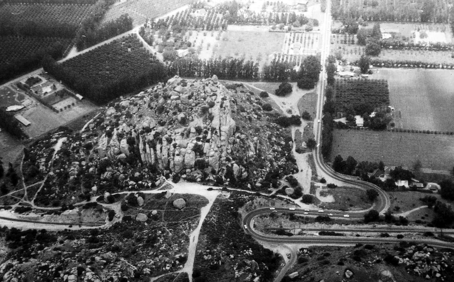 |
|
| (Early 1900s)* – Aerial view of Stoney Point looking south, before Topanga went through to the 118 Freeway. The old Santa Susana Pass Road begins its ascent up the hills at this point. |
Historical Notes The Simi Valley Freeway (State Route 118) through Chatsworth near Topanga Canyon was built in stages throughout the late 1960s and 1970s, with planning starting in 1962 when the California Highway Commission designated a route from Los Angeles Avenue at Madera Road in Ventura County to De Soto Avenue in Los Angeles. Construction began in 1968 and required extensive earthwork—over 8.5 million cubic yards of excavation—to navigate the challenging terrain. The freeway opened in sections, with the last segment completed in 1979. Before this, Route 118 took a different path through Simi and the San Fernando Valleys. Initially named the "Simi Valley-San Fernando Valley Freeway," it was renamed the "Ronald Reagan Freeway" in December 1994. The new freeway significantly enhanced transportation efficiency, transforming connectivity between the two valleys. |
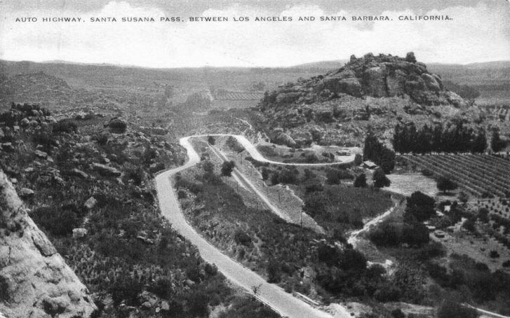 |
|
| (Early 1900s)* - Postcard view showing the Santa Susana Pass Road as it begins its ascent from the San Fernando Valley and continues out to Simi Valley, with Stoney Point in the background. |
Historical Notes The Santa Susana Pass Road continued in use as an alternative to the route along El Camino Viejo from 1861 to 1875, replacing the older road as the main route between Los Angeles and San Francisco. In 1876, the Southern Pacific Railroad opened a tunnel through the Newhall Pass, enabling rail connections from Los Angeles north to San Francisco, and rail travel soon replaced travel by stagecoach between Los Angeles and San Francisco. From this time, the stagecoach traffic to Santa Barbara once again used the coast route, and the Santa Susana Pass road was relegated to local traffic. |
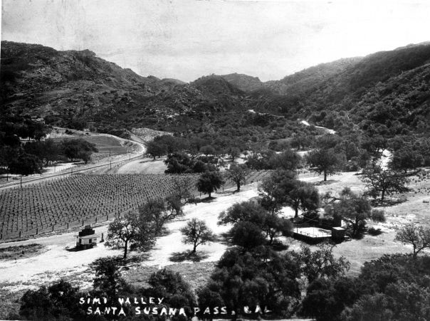 |
|
| (1917)* - The Santa Susana Pass Road as it appeared from the Susana Knolls in Simi Valley just after the grading was completed. This was actually the third road over the Santa Susana Mountains and is still in use today. |
Historical Notes In 1895, a new wagon route bypassing the deteriorating Devil's Slide was opened. Initially called El Camino Nuevo (the New Road), it was later named the Chatsworth Grade Road, which continued in use until Santa Susana Pass Road (now Old Santa Susana Pass Road) was built in 1917. |
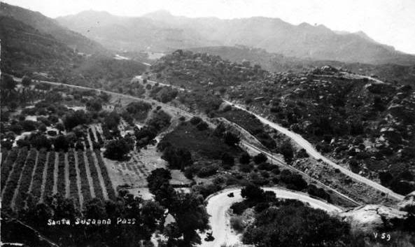 |
|
| (1941)* - View of Santa Susana Pass Road as it appeared in 1941. |
Historical Notes The Old Santa Susana Stage Road is listed on the National Register of Historic Places. Part of the stage road is also a Historic-Cultural Monument of Ventura County and of the city of Los Angeles under the name 'Old Stagecoach Trail', No. 92 (Click HERE to see the LA Historic-Cultural Monuments List). |
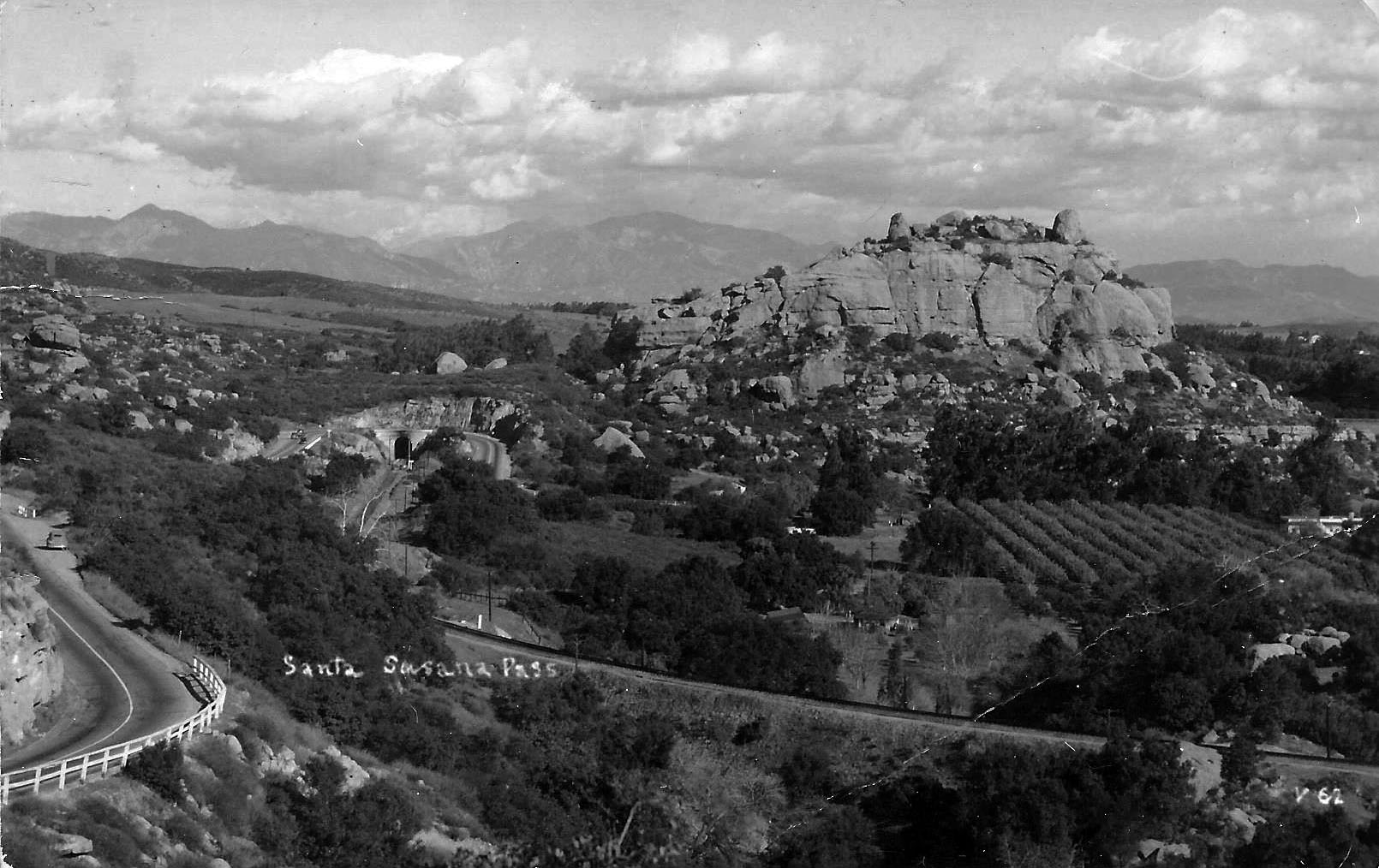 |
|
| (1940s)* – Looking east, the Santa Susana Pass Road appears on the left, winding through the rocky terrain of Chatsworth. The view also captures the Southern Pacific Railroad tracks, one of the three SP Chatsworth tunnels, and the prominent Stoney Point in the distance. Photo from the Aileen Collection. |
Historical Notes After the completion of the Simi Valley Freeway (State Route 118) in 1979, Santa Susana Pass Road saw a decline in use as a major transportation route between the San Fernando Valley and Simi Valley. The new freeway offered a faster, safer, and more direct route, diverting most of the heavy traffic, especially commercial vehicles, away from the Pass Road’s narrow and winding path. Santa Susana Pass Road transitioned to a scenic, local route mainly used by residents and visitors interested in its historical and natural significance. This shift helped preserve its original character, and much of the surrounding area was later incorporated into the Santa Susana Pass State Historic Park, protecting the historic road and adjacent lands. The road remains a reminder of early travel routes, attracting hikers, history enthusiasts, and those looking to experience its rugged beauty and historical ambiance. |
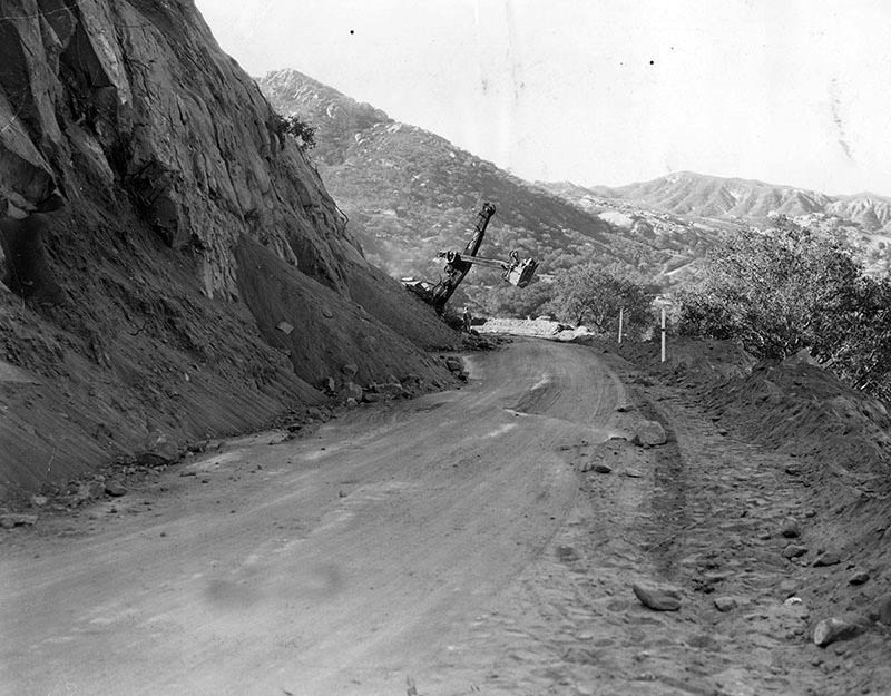 |
|
| (1950)* - Workmen with heavy equipment move tons of earth from cut in Santa Susana Mountains. |
Historical Notes Original photo caption reads: "Historic Santa Susana Pass between Chatsworth and Santa Susana, one of the Valley's gateways, today is being made to conform to present-day travel. Engineers of the state division of highways are blasting out four sharp turns in the one-time stage coach route over the Santa Susana Mountains. At present, work crews are moving toward the Valley from the westerly slope of the pass in Ventura County. The old pass was one of three approaches to the Valley from the gold fields just above assaying offices in San Fernando and other stations." |
.jpg) |
|
| (ca. 1937)* - A car is pulled over on this two-lane highway in front of a rock outcropping in the Santa Susana Pass. |
Historical Notes In the 1930s, Santa Susana Pass Road was a narrow, twisting route through steep hills and rocky terrain. The road’s path followed the rugged landscape of the Simi Hills, with sharp curves and steep climbs that made driving difficult. It was mostly unpaved, and its lack of guardrails and loose gravel posed constant risks for slipping and skidding. For drivers, traveling the Pass could be an intimidating experience. Cars at the time didn’t have the power or safety features of modern vehicles, and many struggled to climb the steep hills, especially in hot weather when engines often overheated. During rainy seasons, parts of the road turned muddy or became blocked by landslides, leaving sections impassable until repairs could be made. Dust was a problem on dry days, and poor visibility around sharp turns increased the chances of accidents. Despite these challenges, Santa Susana Pass Road remained an important route between Los Angeles and Ventura counties, and its scenic views attracted those willing to brave the rugged drive. |
.jpg) |
|
| (ca. 1937)* - Cars and trucks drive East on a paved road through the Santa Susana Pass, with Simi Valley visible in the background. |
* * * * * |
Railway through Santa Susana Pass
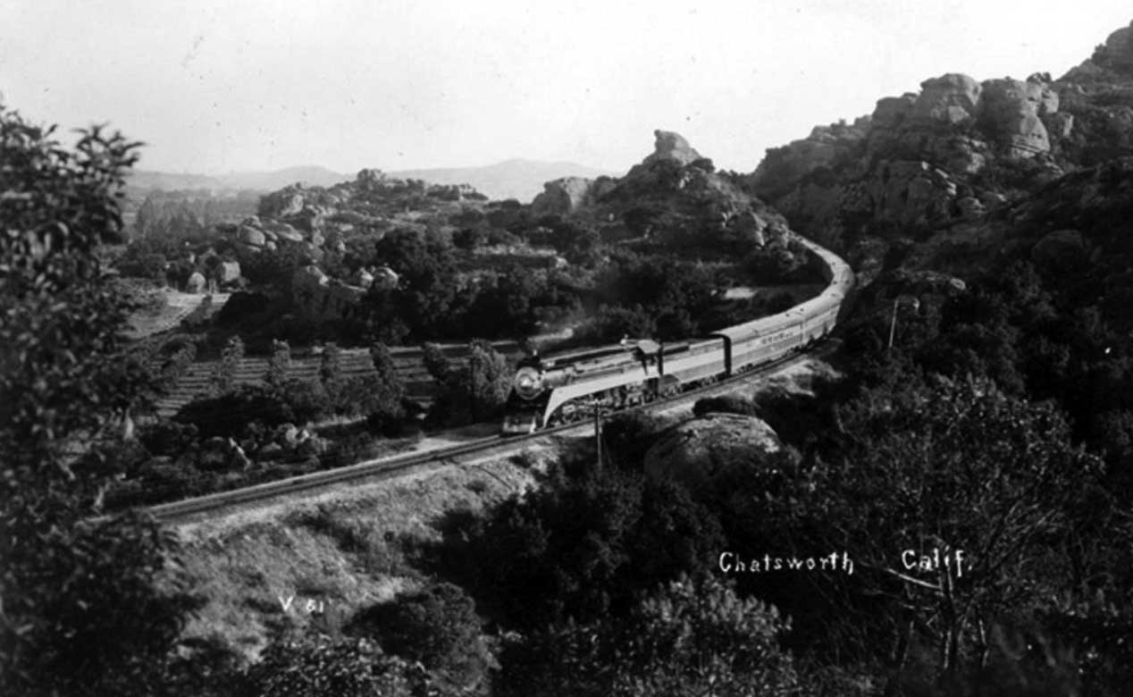 |
|
| (ca. 1940)* - Southern Pacific Railroad's Coast Daylight passing through Chatsworth. The Coast Daylight operated between Los Angeles and San Francisco from dawn to dusk. |
Historical Notes Southern Pacific trains known as 'Daylights' ran during the daytime between San Francisco and Los Angeles beginning in 1937. The first 'Daylight' train left at 8:15 a.m. In January 1940 the 'Noon Daylight' train was added to accommodate additional passengers; it departed daily at noon. |
.jpg) |
|
| (ca. 1937)* - Another view of a Southern Pacific 'Daylight' train as it passes the Garden of Gods area in Chatsworth. |
Historical Notes The passenger cars and locomotive were painted red, orange, and black. The colors were so striking against the California coastline and mountains that the train was often called the "Most Beautiful Train in the World". Click HERE to see more early views of the Southern Pacific Coast 'Daylight'. |
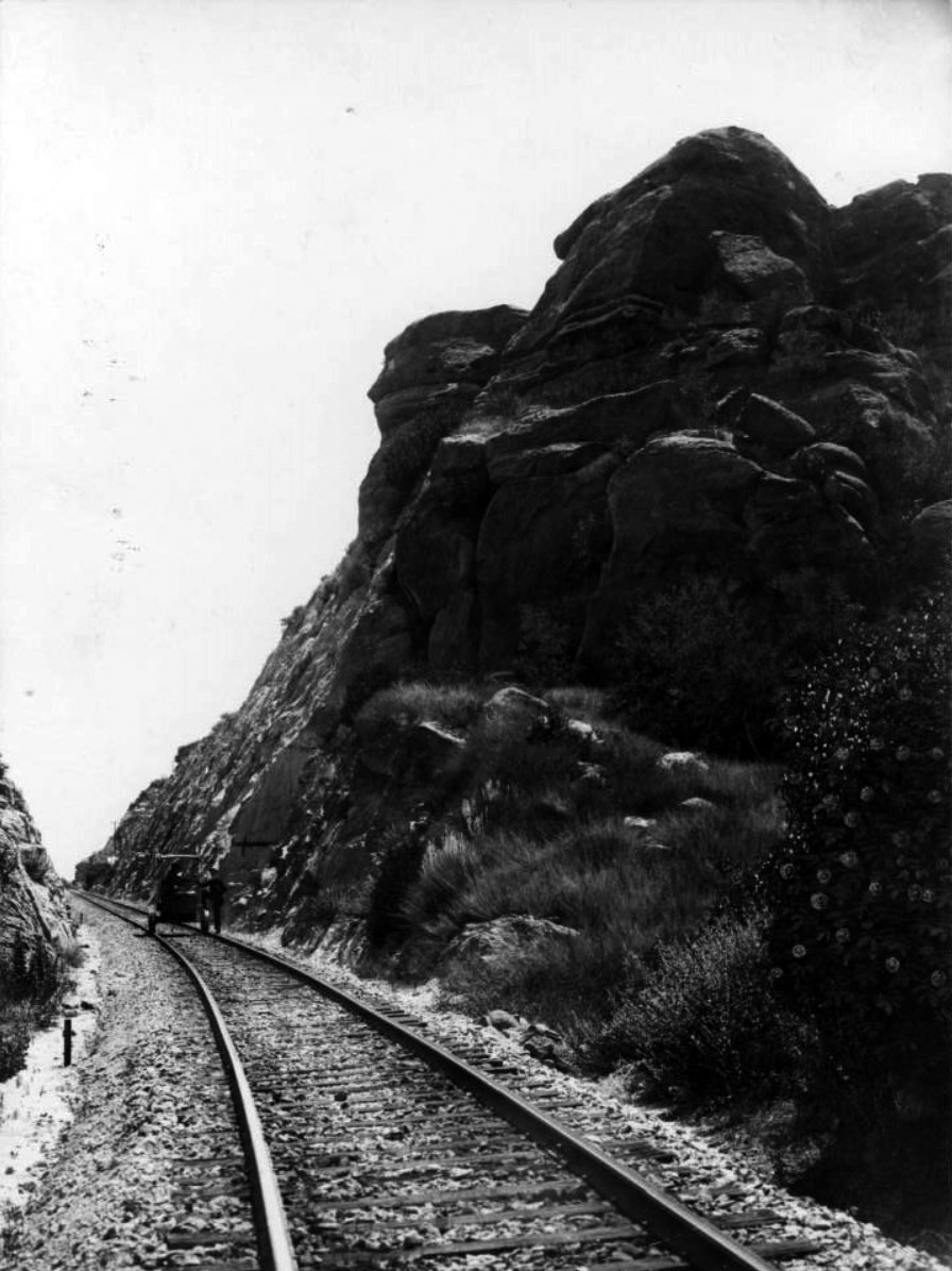 |
|
| (ca. 1930s)* - View showing a railroad handcar passing by one of the many rock formations near the Iverson Ranch in Chatsworth. |
Historical Notes Because of its unique rock formations and also its remoteness, Iverson Ranch was used to film over 3,500 movies and televison episodes..........more than any other movie ranch. The long-running TV western The Virginian filmed on location at Iverson in the ranch's later period, as did Bonanza and Gunsmoke. In the mid-1960s the state of California began construction on the Simi Valley Freeway, which ran east and west, roughly following the dividing line between the Upper Iverson and Lower Iverson, cutting the movie ranch in half. The waning popularity of the Western genre and the decline of the B-movie as an important business model for the studios coincided with the arrival of the freeway, which opened in 1967, and greater development pressure, signaling the end for Iverson as a working movie ranch. |
* * * * * |
Chatsworth Park Elementary School (Originally Santa Susana School)
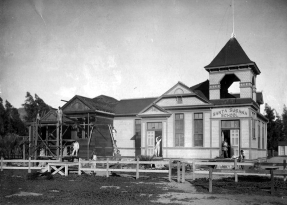 |
|
| (1900)* – View showing the construction of a new addition to the original Santa Susana School (later Chatsworth Park Elementary School) at the Northwest corner of Topanga and Devonshire. Note the hitching rail out front in the lower right corner. |
Historical Notes By 1900, Chatsworth’s population had grown significantly due to tunnel construction and quarry operations. The town's first elementary school, built in 1880, would require expansion to accomodate this new growth. In 1902, the school name was changed to Chatsworth Park Elementary School to avoid confusion with the new 1902 Santa Susana School built in Simi Valley. In 1913, the Los Angeles Aqueduct brought water to Los Angeles from the Owens Valley. Chatsworth voted to become a part of the city and share in the water supply in 1915. As soon as the school became a part of the LA City School system, plans were made for a new school building to be erected on the same location. |
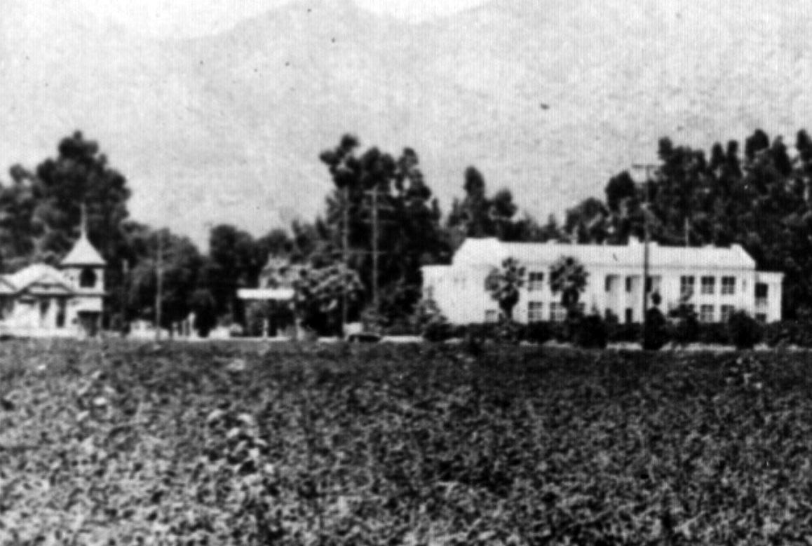 |
|
| (ca. 1915)* - View looking northwest showing the new two-story Chatsworth Park Elementary School (right) and the original school building seen on the left. |
Historical Notes The original school building was sold and moved to the southwest corner of Devonshire and Topanga (seen above). It was later moved again to another location on Devonshire where it would eventurally be torn down. |
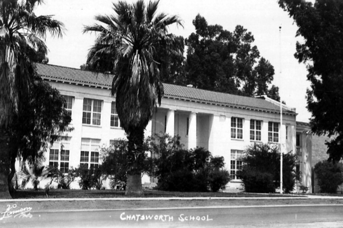 |
|
| (ca. 1930)* - Postcard view showing the new Chatsworth School building (2nd building) at the N/W corner of Devonshire and Topanga. |
Historical Notes The new school was a two-story building with Classic Greek columns, that faced east. There was an auditorium in the middle of the first floor that was used for public meetings and box socials. Classrooms were located on either side of the auditorium. In 1933, the school was damaged by the Long Beach Earthquake and would have to be torn down. Children went to school in tents while a new building was built. |
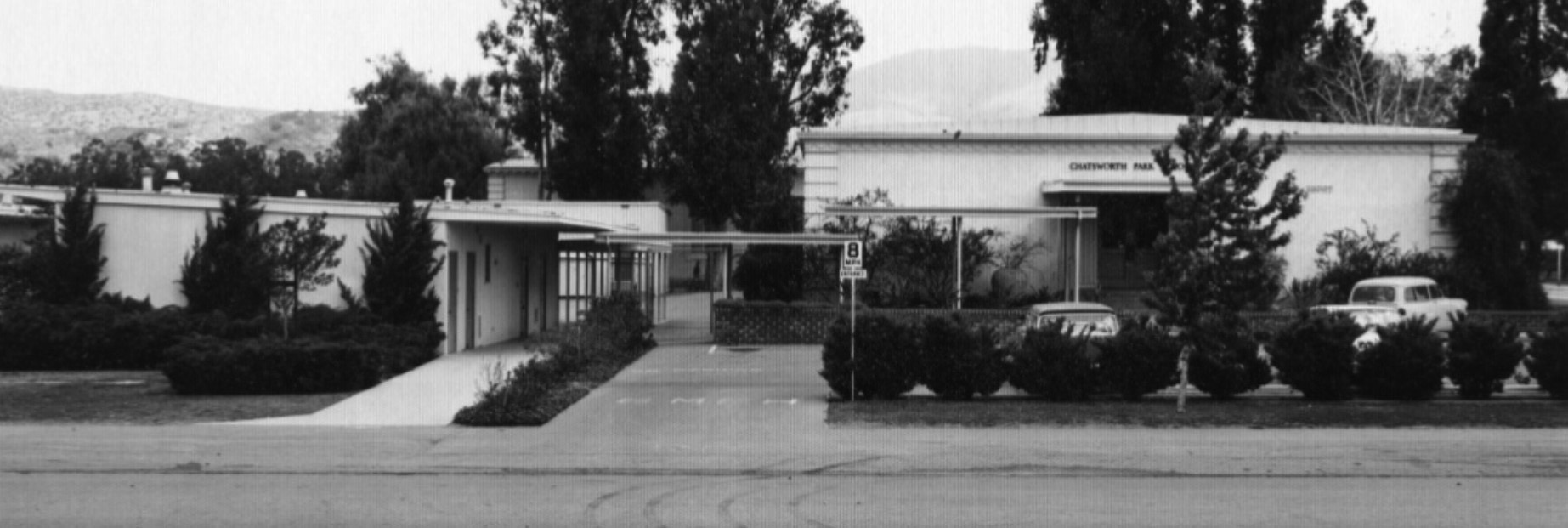 |
|
| (ca. 1950)* - View showing Chatsworth Park Elementary School which replaced the 2nd building (seen in previous photo) in 1935. Click HERE to see contemporary view. |
Historical Notes On October 25, 1935, the new school was dedicated. Bungalows were added in 1956 and in the 1957-58 school year the building was remodeled with the offices added and the front changed to its present facade. As late as 1954 Chatsworth Park Elementary was the only school west of Reseda Blvd. and north of Roscoe. |
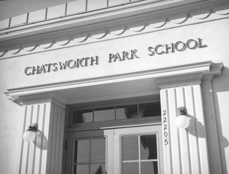 |
|
| (ca. 1937)* - Chatsworth Park School is written on the Grecian facade above the entryway, as is the address 22205 on the corner of Devonshire and Topanga Canyon. The current address is 22005 Devonshire, but the building is still there. Click HERE for contemporary view. |
Historical Notes Click HERE to see more Early Views of the Original Chatsworh Park Elementary School. |
* * * * * |
Please Support Our CauseWater and Power Associates, Inc. is a non-profit, public service organization dedicated to preserving historical records and photos. We are of the belief that this information should be made available to everyone, without restriction, without limitation and without advertisements. Your generosity allows us to continue to disseminate knowledge of the rich and diverse multicultural history of the greater Los Angeles area; to serve as a resource of historical information; and to assist in the preservation of the city's historic records.
|
More Historical Early Views
Newest Additions
Early LA Buildings and City Views
History of Water and Electricity in Los Angeles
* * * * * |
References and Credits
* LA Public Library Image Archive
^ CSUN Oviatt Library Digital Archives
#^San Fernando Valley History Digital Library - CSUN Oviatt
**DWP - LA Public Library Image Archive
^* The Valley Observied: Street Name Origins; Timeline of Valley History
^# Chatsworth Historical Society; Chatsworth History Timeline
*# Mojave Desert.net: Remi Nadeau
***Los Angeles Historic - Cultural Monuments Listing
*^*California Historical Landmarks Listing (Los Angeles)
+*+Undereverystone.blogspot.com: LA Pet Cemetery
^^^LA Times: Adohr Spelled Succes for the Adamsons; Lake View Terrace
^^*LA Times: Stanley Norris Petit
*^^Nuestra Señora la Reina de los Ángeles - losangelespast.com
*##LA Times: Dig Into History You'll Find Snake Oil..Victor Girard Kleinberger
*#*Project Restore: Van Nuys City Hall
*+*Los Angeles Planning Department: Idle Hour Cafe
^*^Topanga Canyon History - LA Magazine
*#^LA World Airports - History of Van Nuys Airport
^^#The Museum of the San Fernando Valley
**#Tumblr.com: LA History - Leonis Adobe
^#*Photo of the Northeast San Fernando Valley ca.1950 - Laurie Burns
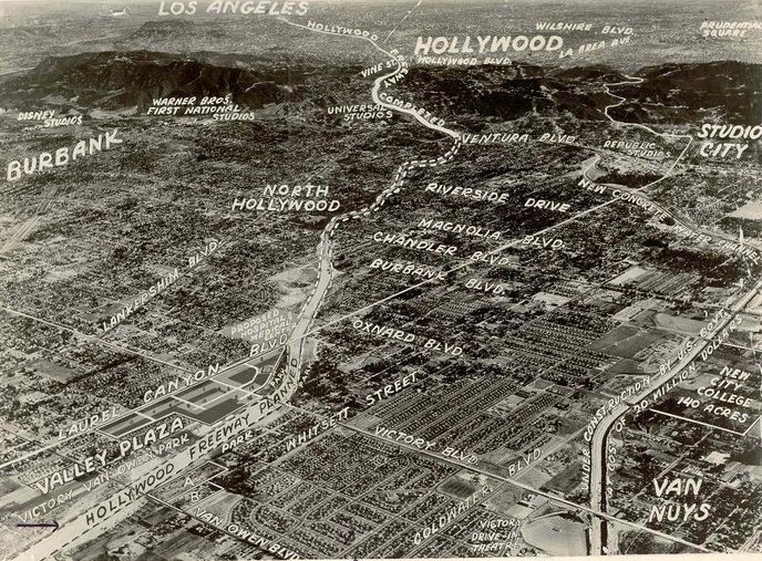
^*#North Hollywood-Toluca Lake Patch: History of the Laurel Canyon and Valley Plaza Mall; N. Hollywood Train Depot
#**California State Library Image Archive
#++Vintage Everyday: The 1938 Los Angeles Flood
#*#San-Fernando-Valley-Real-Estate.com: Granada Hills
#^#San Fernando Valley Blog: James Cagney Ranch
#^^*Facebook.com: Van Nuys Airport
#^#^Granada Hills North Neighborhood Council: Granada Hills History
**^^KCET: LA Flood of 1938: Cement the River's Future; When Cahuenga Pass Was Rustic; Los Angeles Pet Memorial Park
*^^^San Fernando Valley Historic Society/Facebook.com: La Reina Theater
*^*#Facebook.com: Classic Hollywood-Los Angeles-SFV
*^^#Flickr.com - Floyd B. Bariscale Photostream: Minnie Hill Palmer House
**^#LA Times Framework: Sepulveda Tunnel
^^**Pinterest.com: Stoney Pt. and Santa Susana Pass; Santa Susana Pass from Simi Valley
^^^*San Fernando Valley Relics - Facebook.com: Stoney Point; 1938 Flood; Van Norman Reservoir; Cypress Motor Motel
^^^#LA Observed: Dedication of theSepulveda Tunnel
^#**Los Angeles Fire Department Historical Archive
^#^*A Drifting Cowboy: The Grapes of Wrath
^#^^LAUSD.K12 - Lankershim Elementary School; Van Nuys Elementary School
^**#The Friends of Oakridge; theoakridgeestate.com
^*##Godickson.com: San Fernando Valley Map, 1930s
^*#*Pinterest - Memories I Remember Growing Up in the SFV
^##*Pinterest: Bygone Los Angeles
*##^City-Data.com: Santa Susana Pass
^##^Pinterest: San Fernando Valley
#*^#Google Maps and Street Views
#^*^Facebook.com: West San Fernando Valley Then And Now
##*^Calisphere: University of California Image Archive
*#^*Los Angeles County Library: History of Agriculture in the San Fernando Valley
*#^#Forum.skyscraperpage.com: Troquet Motel
***^Los Angeles Movie Palaces: Studio City Theater
***#Daily News: Universal City Turns 100 Years Old
*^ Wikipedia: Sherman Oaks; Isaac Van Nuys; Encino; Tarzana; Campo_de_Cahuenga; Cahuenga Pass; Chatsworth; Panorama City; Santa Susana Field Laboratory; North Hollywood; Canoga Park; Woodland Hills; Reseda; Orcutt Ranch; Granada Hills; Andrés Pico; Moses Sherman; Van Nuys; Henry Kaiser; Charles Maclay; San Fernando Valley; Mission Point; Hughes Aircraft; Domonique Amestoy; Winnetka, Los Angeles; City of San Fernando; Canoga Park High School; Ventura Freeway; Hollywood Freeway; Los Angeles Valley College; Chatsworth Community Church; Stoney Point; Minnie Hill Palmer House; Northridge; Iverson Movie Ranch; Van de Kamp's Holland Dutch Bakeries; Lower Van Norman Dam; Robert Morton Organ Co.; Van Nuys Airport; Simi Valley Freeway ;(118); Republic Pictures; Van Nuys Boulevard
< Back