Early Views of the San Fernando Valley |
North Hollywood and the Lankershim Depot |
Before the San Fernando Valley became defined by freeways and suburban streets, it was connected by the Pacific Electric Railway—the "Red Cars." These lines linked the Valley to downtown Los Angeles and played a central role in its early development.
|
* * * * * |
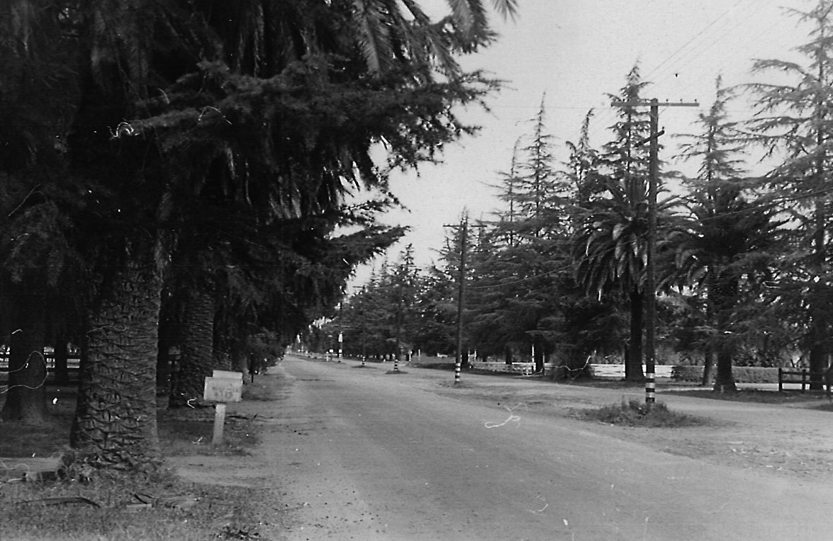
At Lankershim Boulevard and Chandler Boulevard stood a modest but essential structure that anchored North Hollywood’s early development. Opened in 1895, the depot served the community through its evolution from Toluca to Lankershim and ultimately to North Hollywood, remaining in continuous use for more than half a century. |
 |
|
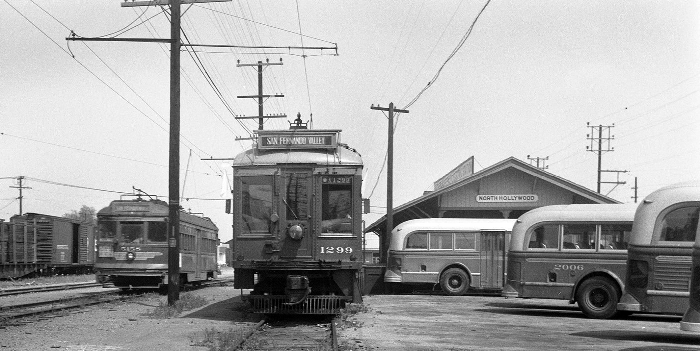
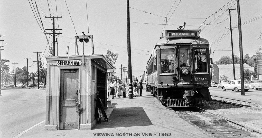
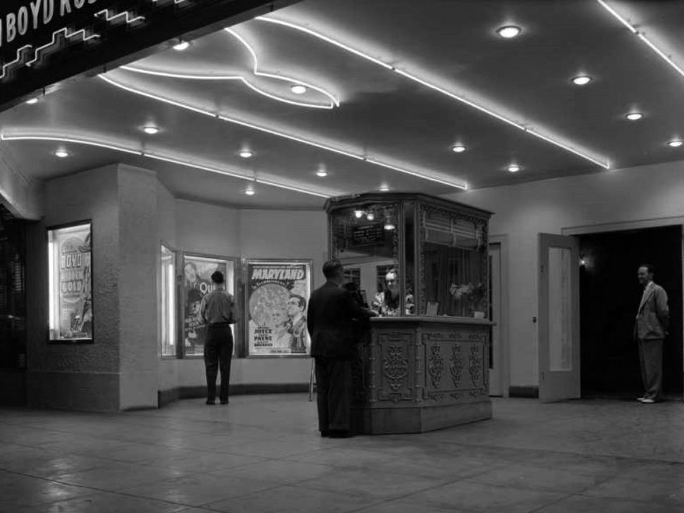
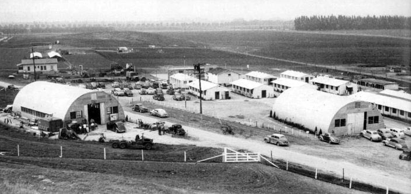
| (ca. 1950)* - The North Hollywood Pacific Electric Station. A Van Nuys-bound Red Car stands at left, Southern Pacific Executive Car 1299 at center, and a row of white buses at right. |
Historical Notes This image captures the station at a clear moment of change. The depot had long served as the primary passenger hub connecting the Valley to downtown Los Angeles via the Subway Terminal Building at Fourth and Hill Streets. By about 1950, buses were already appearing alongside the Red Cars, signaling a system-wide shift toward highway-based transit. Executive Car 1299, rebuilt in 1929 for official inspection use, appears at center. Its presence alongside both rail and bus equipment makes this an unusually complete record of the transition. |
 |
|
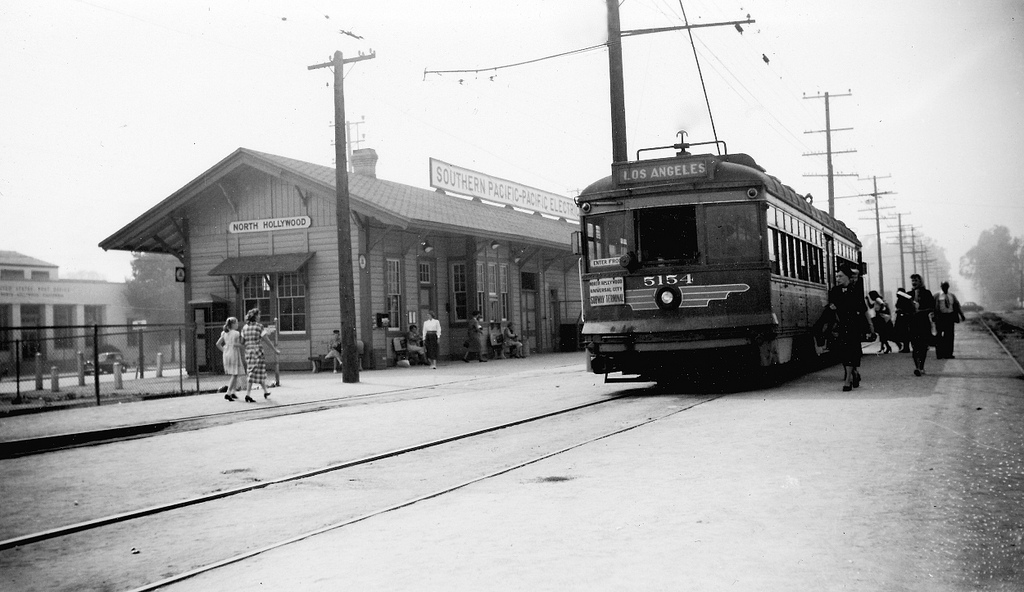
| (1952)* - Passengers queue at the North Hollywood Pacific Electric station for a Van Nuys-bound Red Car. |
Historical Notes By 1952, the depot remained heavily used despite the imminent end of rail service. Having served the community for more than fifty years through successive waves of Valley growth, it stood as one of the oldest structures in the San Fernando Valley—a distinction it retains today. The station has since been designated a Los Angeles City Historic and Cultural Monument and continues to operate as a coffee house at the same corner. Click HERE to see earlier views of the station when it was known as Lankershim Station. |
| (2023)* - The former North Hollywood Pacific Electric Station on Chandler Boulevard west of Lankershim, now operating as a coffee house. |
| Historical Notes
Unlike virtually all other Pacific Electric infrastructure, the depot was not demolished after the system's closure. Its survival reflects both its architectural character and sustained community support for its preservation. Metro funded a $3.6 million restoration, and in 2017 the building reopened as home to Groundwork Coffee, a local roaster with longstanding ties to the neighborhood — a fitting tenant for a structure that once served as the Valley's primary transit hub. The adjacent rail corridor along Chandler Boulevard has since been repurposed for bus rapid transit, continuing its transportation function in a different form. The depot’s long-term setting may change. A large mixed-use development proposed for the surrounding Metro-owned property, known as the District NoHo Project, includes plans to relocate the building to accommodate new subway access entrances. The LA Conservancy has opposed the move, arguing that relocation would undermine its value as a historic landmark. As of this writing, the matter remains unresolved. |
Then and Now
| (1952 vs 2023)* - Then and Now: The North Hollywood Pacific Electric Depot across more than seventy years. Photo comparison by Jack Feldman. |
| Historical Notes
This comparison presents the depot from two different vantage points. The 1952 image looks toward the rail-facing side along the former Pacific Electric right-of-way, while the 2023 view shows the street-facing elevation at Lankershim and Chandler. Despite the change in perspective, the structure itself remains largely unchanged. Its roofline, proportions, and defining architectural features are consistent across both views, highlighting the building’s continuity even as its surroundings and function have evolved. The difference in vantage point also reflects the depot’s dual role—once as an active rail facility and today as a neighborhood landmark. |
* * * * * |
The Van Nuys Line: Final Years of Operation |
The Van Nuys Line connected the San Fernando Valley to downtown Los Angeles via Universal City and the Subway Terminal Building at Fourth and Hill Streets. At its greatest extent the route had reached Owensmouth—now Canoga Park—and the city of San Fernando, opening the Valley to settlement after 1911. Service beyond Van Nuys Boulevard and Sherman Way ended in 1938, and by the early 1950s the remaining segment was one of the last active Pacific Electric routes in the Valley. |
 |
|
| (ca. 1952)* - A Los Angeles-bound Pacific Electric Railway car travels along Sherman Way toward the Subway Terminal Building in downtown. |
Historical Notes The line ran in the street median—a common Pacific Electric arrangement that reduced construction costs but placed rail operations in increasing conflict with postwar automobile traffic. The route connected Valley communities directly to the Subway Terminal Building at Fourth and Hill Streets, a journey that passed through Universal City and the Hollywood Hills tunnel. Its replacement by freeway buses in December 1952 reflected a broader shift toward automobile-based transportation rather than a failure of the service itself. |
 |
|
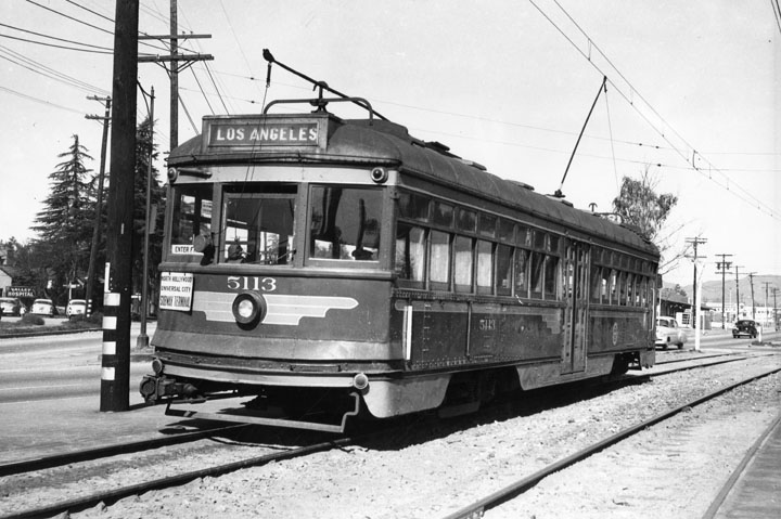
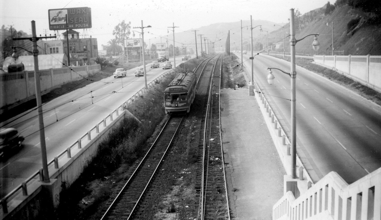
| (1951)* - Pacific Electric Red Car No. 5171 stopped on Van Nuys Boulevard near Sherman Way, the destination sign reading: NORTH HOLLYWOOD — UNIVERSAL CITY — SUBWAY TERMINAL. |
Historical Notes Van Nuys Boulevard and Sherman Way marked the northern limit of active Pacific Electric service in the Valley. Service beyond this point to Owensmouth and San Fernando had ended in 1938 after declining ridership made the outer segments unsustainable. The remaining corridor, connecting the Van Nuys commercial district and North Hollywood to the downtown terminal, continued for another fourteen years before buses on the Hollywood Freeway replaced it on December 28, 1952. |
 |
|
| (1952)* - Looking north on Van Nuys Boulevard from Vose Street. Pacific Electric No. 1299 pauses on the track, the Sherman Way curve visible at left. The destination sign is set—humorously—to "San Bernardino." |
| Historical Notes
The Sherman Way curve marked a key transition in the track alignment, where the line shifted from median running to the Van Nuys Boulevard trackage. The destination roller set to San Bernardino—well outside any route the car ever operated—was almost certainly the work of a crew member in a lighthearted mood. The photograph was taken by Fred V. DuBritz, one of the most systematic documentarians of the Pacific Electric's final years, whose work is preserved in the Michael Patris Collection through Pacificelectric.org. |
.jpg) |
|
| (1952)* – A southbound Pacific Electric Red Car on Van Nuys Boulevard. The Rivoli Theatre is visible at right; later renamed the Capri, it was demolished for a parking lot in the early 1970s. |
| Historical Notes
The Rivoli was a neighborhood movie house typical of the commercial strips that lined Van Nuys Boulevard in the 1940s and early 1950s—first-run films within walking distance of the surrounding residential neighborhoods served by the same Red Car line. Renamed the Capri in later years and demolished in the early 1970s for surface parking, it and the Red Car together represent a mid-century streetscape that has since disappeared. |
* * * * * |
Rail and Freeway: A Brief Overlap |
In the late 1940s and early 1950s, Pacific Electric rail operations and Hollywood Freeway construction briefly coexisted through Cahuenga Pass. The new freeway incorporated sections of the existing PE right-of-way as a transitional measure, placing Red Cars in the freeway median while the surrounding highway was completed. The arrangement ended with the closure of Valley rail service on December 28, 1952. |
 |
|
| (1952)* - Pacific Electric Red Car in the Hollywood Freeway median near Barham Boulevard. |
| Historical Notes
The Hollywood Freeway was built through the Cahuenga Pass to incorporate the existing Pacific Electric right-of-way rather than relocate it, creating a corridor where rail and highway traffic briefly shared space. The arrangement was always understood as transitional. When rail service ended that December, the median trackway was removed and the freeway corridor expanded to fill the space it had occupied. No visible trace of the rail alignment in the freeway median survives. |
| (1949)* – View looking south on Lankershim Boulevard toward the Lankershim/101 Freeway Bridge and Tunnel as freeway construction reshaped the corridor. |
| Historical Notes
This view documents Lankershim Boulevard during active freeway construction, with the bridge and tunnel structure that would carry both the Hollywood Freeway and the Pacific Electric right-of-way through the narrowest section of the pass. Lankershim had long been the principal surface route between North Hollywood and the communities south of the hills. Within a few years, the corridor would be transformed into a full freeway interchange, with the rail infrastructure removed and the surface street reconfigured around it. |
| (ca. 1949)* – The Lankershim Boulevard underpass at the Hollywood Freeway. Two Pacific Electric Red Cars pass each other on the elevated trackway above. |
| Historical Notes
The dual-track configuration visible here reflects the level of service the Pacific Electric still maintained through the Cahuenga Pass in the late 1940s, with two tracks allowing simultaneous operation in both directions to meet the volume of commuter traffic the line carried. The overhead trackway was purpose-built to maintain rail operations above the surface road. Within a few years of this photograph, both the trackway and its supporting infrastructure would be dismantled as the freeway expanded to fill the corridor. |
Then and Now
| (1949 vs. 2014)* – Then and Now: The Lankershim Boulevard underpass at the Hollywood Freeway, looking north. Photo comparison by Jack Feldman. |
| Historical Notes
The underpass itself provides the fixed reference point that makes the comparison legible—its form unchanged while every element of the rail system visible in 1949 has been removed. The surrounding landscape is fully built out in the 2014 frame, the hills still recognizable but the corridor otherwise unrecognizable as a former rail route. The comparison illustrates not only the scale of infrastructure change but the completeness with which the Pacific Electric's physical presence was erased from this part of the Valley. |
 |
|
| (1948)* - The Cahuenga Pass in 1948, automobiles queued on the road and Pacific Electric tracks visible at left. |
Historical Notes The pass through the Santa Monica Mountains was the only practical land route between Hollywood and the Valley, and by 1948 its capacity was already strained by postwar traffic volumes. The Pacific Electric had operated through this corridor since the early twentieth century. Within four years, the freeway had absorbed the corridor, the tracks had been removed, and the Cahuenga Pass had been converted from a shared road with a trolley line into the multi-lane Hollywood Freeway. |
* * * * * |
End of Service |
Pacific Electric rail service in the San Fernando Valley ended on December 28, 1952, concluding more than fifty years of interurban rail operations. Bus service via the Hollywood Freeway replaced all remaining Valley routes that day, and the physical infrastructure of the rail system was removed in the months and years that followed. |
 |
|
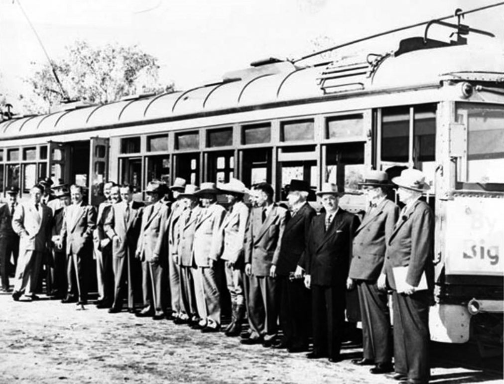
| (1952)* - A line of officials, rail employees, and local figures gather for the last run of Pacific Electric service in the Valley. |
| Historical Notes
Among those identified: Fred Weddington (right), who rode both the first and the last Red Car; cowboy actor Monty Montana; and Ferd Mendenhall (far left), publisher of the Green Sheet Journal (later the Daily News). Fred Weddington's presence as both first and last rider gave the ceremony a quiet human continuity. On December 28, 1952, the last Red Car completed its run, and more than fifty years of rail service in the San Fernando Valley came to an end. |
* * * * * |
Cahuenga Pass Extension to Vineland
 |
|
| (1947)* - Photo caption dated June 14, 1947 reads, "Extension of the Hollywood freeway along Ventura boulevard to Vineland avenue started with the thunder of air-hammers at Universal City, as the last cars to use the intersection of Lankershim and Ventura boulevard whizzed by in back of the workmen. A detour soon will go around the intersection." |
 |
|
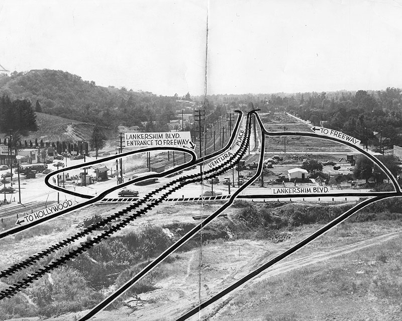
| (1947)* - Photograph caption dated July 12, 1947 reads, "Most complex part of the new freeway link connecting Vineland avenue and Cahuenga Pass will be at Universal City, above, where a grade separation will be constructed over Lankershim boulevard. |
Historical Notes This Valley Times photo-diagram shows where rail lines will be relocated down the center of the new freeway link. Traffic leading into the Valley will follow the lane on the right of the tracks; that leading to Hollywood will stream down a parkway at the left of the rail lines. Lankershim boulevard traffic onto the freeway's Hollywood-bound lane will go under the freeway and rise on a looped ramp as shown at left. Lankershim traffic into the Valley-bound freeway lane will follow the road at upper right. To get onto Lankershim from the right hand freeway lane, cars will use the road shown in right lower foreground. |
 |
|
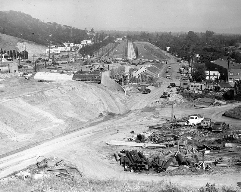
| (1948)* - Photograph dated May 8, 1948 shows the construction of a freeway underpass at Lankershim and Cahuenga boulevards. The project is part of the extension of the Hollywood Freeway connecting Vineland Avenue and the Cahuenga Pass. |
Historical Notes The bridge/tunnel was built as part of the Cahuenga Freeway; it is now known as the Lankershim/101 Freeway Bridge and Tunnel. |
| (1948)* - View showing paving of Hollywood Freeway lanes that extend from the Cahuenga Pass to Vineland Avenue. In between the freeway lanes are electric lines used by Pacific Electric trains. Photo date: November 10, 1948 |
 |
|
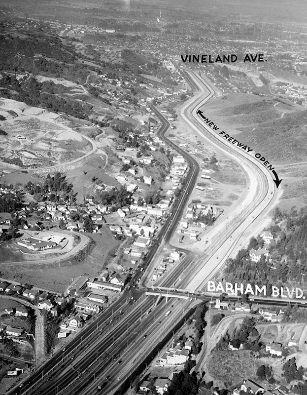
| (1948)* - Aerial view of the Hollywood Freeway extension from Barham Boulevard to Vineland Avenue. Universal City is seen to the right of the freeway, and Studio City to the left. Phote date: November 14, 1948 |
* * * * * |
Cahuenga and Lankershim
| (1947)* - Looking southeast down Cahuenga Boulevard, from just west of where it crosses Lankershim Boulevard (center). Seen, from left to right, are a Richfield service station, Dieterich Motors used car lot, a Foster and Kleiser billboard advertising 1947 Chevrolet automobiles, homes up in the hills, the Tasty Nook Cafe, and various other businesses. Photograph dated August 1, 1947. |
| (1949)* – View looking southeast down Cahuenga Boulevard, from just west of where it crosses Lankershim Boulevard (center). Seen, from left to right are the Lankershim Bridge and Tunnel (only partially visible), a Foster and Kleiser billboard advertising the 1949 Ford automobile (left), homes up in the hills, a Rexall drugstore and a Standard oil service station. Photograph dated June 23, 1949. |
Historical Notes The bridge/tunnel was built in 1948 as part of the Cahuenga Freeway; it is now known as the Lankershim/101 Freeway Bridge and Tunnel. The corner where the billboard is seen (left of center) was named Yitzhak Rabin Square in 1995 in honor of the slain Israeli Prime Minister.* |
 |
|
| (1950)* - Cars travel south down the Cahuenga Pass Freeway over the Lankershim Bridge and Tunnel, just north of where Cahuenga and Ventura boulevards meet in Studio City. |
* * * * * |
Van Nuys
 |
|
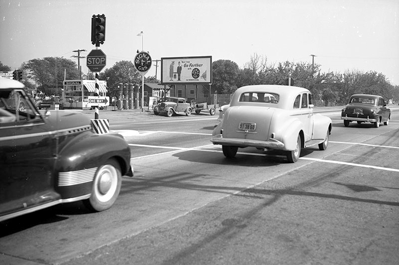
| (ca. 1946)* - Automobiles travel in both directions on Sepulveda Boulevard where it crosses Saticoy Street in Van Nuys. A billboard advertises Signal Gas, pumped next door at the service station (left). |
Historical Notes Signal Gasoline company was founded by Samuel B. Mosher in 1922. It renamed itself to Signal Gas & Oil in 1928 to reflect its expanding businesses; by the 1950s, Signal was the largest independent oil company on the West Coast of the United States and Mosher held large stakes in American President Lines and Flying Tiger Line. In 1964, Signal merged with the Garrett Corporation, an aerospace company, and the combined company adopted "The Signal Companies" as its corporate name in 1968. The merger of Allied and Signal made aerospace the new company's largest business sector. The combined company adopted the name Allied-Signal in 1985. It dropped the hyphen to become AlliedSignal in 1993 to reinforce a one-company image and signify the full integration of all of its businesses. In 1999, AlliedSignal acquired Honeywell for $15 billion and took its more-recognizable name.*^ |
Builders Emporium (Van Nuys)
 |
|
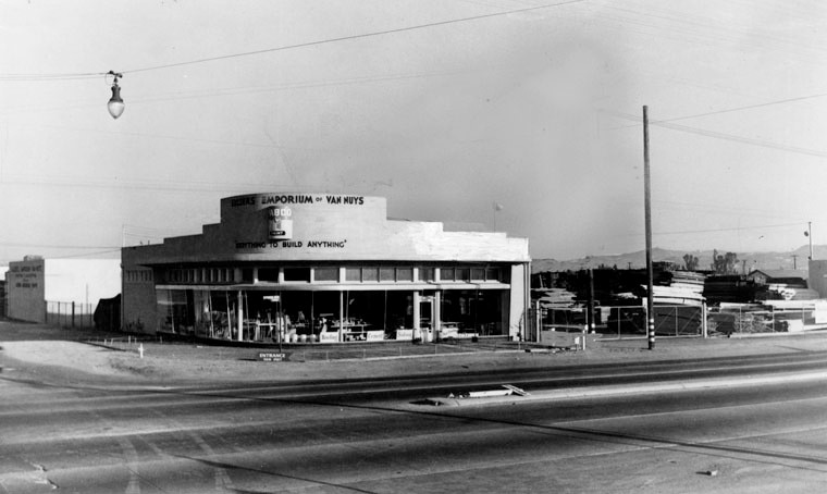
| (1948)* – View showing Builders Emporium located at 17643 Sherman Way in Van Nuys, before expansion. Store then had only 600 square feet of space. |
Historical Notes Builders Emporium was started in the San Fernando Valley in 1946. Victor M. Carter bought the ailing Van Nuys hardware store in 1949. He introduced the concept of a self-service hardware store with a "do it yourself" training component that became the model for The Home Depot. Carter built Builder’s Emporium into a leading self-serve retail operation and the largest hardware store in the United States, selling it in 1956, to acquire controlling interest in Republic Pictures just a few years later. The chain was later acquired by Wickes which dismantled its operation in 1989. Builders Emporium was forced to close in 1993 after its former parent had a number of financial problems during the previous decade.*^ |
 |
|
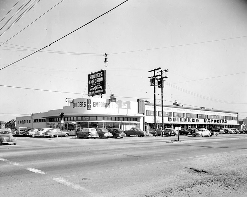
| (1957)* – View showing Builders Emporium home improvement store after its expansion. |
Anheuser-Busch Brewery
 |
|
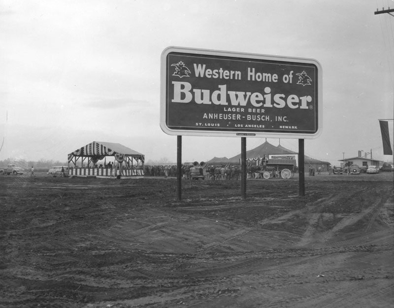
| (1953)* - Photo of the future home of Anheuser-Busch, Inc. in Van Nuys, taken during the ground-breaking ceremony. A billboard reads: "Western Home of Budweiser - Lager Beer - Anheuser-Busch, Inc. - St. Louis. Los Angeles. Newark". A crowd of people can be seen standing next to a 'grand stand' in the background. |
Historical Notes During the 1870s, Adolphus Busch toured Europe and studied the changes in brewing methods which were taking place at the time, particularly the success of pilsner beer, which included a locally popular example brewed in Budweis (largest city in the South Bohemian Region of what is now Czech Republic). In 1876, Busch introduced Budweiser, with the ambition of transcending regional tastes. The ability to transport bottles made Budweiser America's first national beer brand, and it was marketed as a "premium" beer.*^ |
 |
|
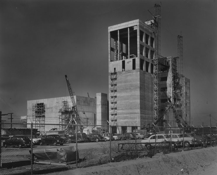
| (1953)* - Nearing completion is the huge brew house of Anheuser-Busch's $50,000,000 brewery at Roscoe Boulevard and Woodley Avenue in San Fernando Valley, where Budweiser beer will be produced. The brewery will have a capacity of 920,000 barrels. Photo dated: December 17, 1953. |
Historical Notes Woodley Avenue was named for Frank A. Woodley, a county supervisor and state legislator. Laid out as Alvarado Avenue north of Roscoe Boulevard in 1916. Roscoe Boulevard derives from the town of Roscoe, now Sun Valley. The thoroughfare originated as a plowed furrow that extended the length of the Valley and marked the boundary between the Lankershim Ranch on the south and the Maclay-Porter ranches on the north.^* Click HERE to see more SFV Street Name Origins. |
 |
|
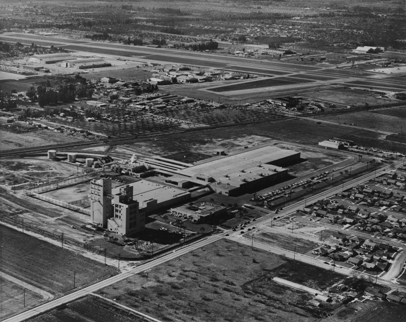
| (ca. 1955)* - Aerial view looking southwest at the Anheuser-Busch Brewery in Sepulveda shortly after it was completed. The Van Nuys Airport (then known as the San Fernando Valley Airport) can be seen in the background. |
Historical Notes Founded in 1852, and incorporated in 1875, Anheuser-Busch Companies, Inc. is the largest brewing company in the United States, and the world's largest brewing company based on revenue. The then-small St. Louis, Missouri brewery was owned and operated by Eberhard Anheuser, who brought in his son-in-law Adolphus Busch as a partner in 1869. In 1876, Busch introduced America's first national beer brand: Budweiser, followed (years later) by several other brands, such as Busch, Michelob, and Bud Light to name a few. With the death of Anheuser in 1880, Busch became president of the company, subsequently becoming the first U.S. brewer to use pasteurization to keep beer fresh, the first to use artificial refrigeration and refrigerated railroad cars, and the first to bottle beer extensively.* In 1955 the airport was still known as the San Fernando Valley Airport. It would be renamed Van Nuys Airport in 1957.*^# |
 |
|
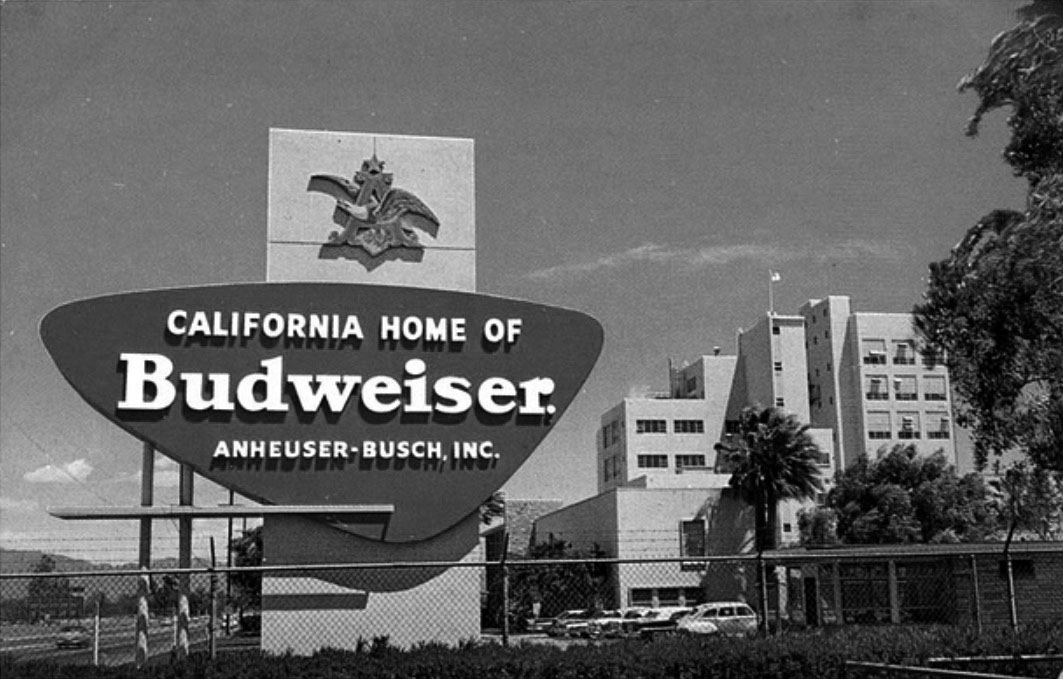
| (ca. 1950s)^^^* – View looking east showing the large Anheuser-Busch Sign in front of the brewery on Roscoe Blvd. Sign reads: California Home of Budweiser |
Historical Notes By 1957, Anheuser-Busch had become the largest brewer in the United States.* In 1966, Anheuser-Busch transformed a cabbage patch adjacent to the Van Nuys brewery into a tropical beer garden and bird sanctuary. Click HERE to see more on Busch Gardens. |
City of San Fernando
 |
|
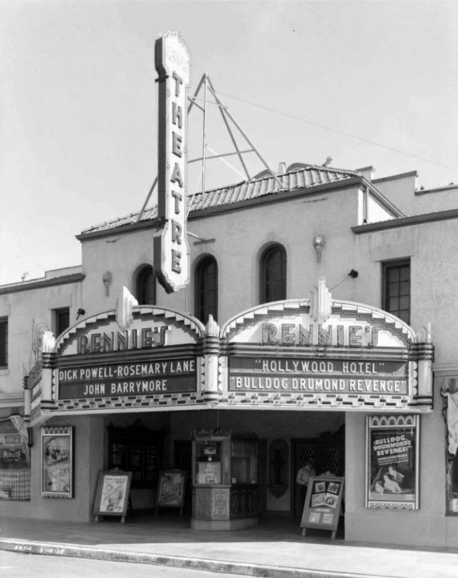
| (1938)#* – View showing Rennie's Theater, located at 214 N. Maclay Avenue in San Fernando. Now showing: "Hotel Hollywood" starring Dick Powell and Rosemary Lane; and "Bulldog Drummond's Revenge" starring John Barrymore. |
Historical Notes Rennie’s Theatre was opened in 1925. In the early-1960’s it was operating as the Crest Theatre. It was still open as a movie theatre in the San Fernando Valley as of January 20, 1980, showing Spanish language films and re-named Azteca Theatre. It is now operating as the Living Hope Community Church. Click HERE to see current (2016) view. |
 |
|
| (1940)#* – Night view showing a man purchasing tickets at Rennie’s Theatre in San Fernando. Mr. Rennie is seen standing at the front entry door on the right. |
 |
|
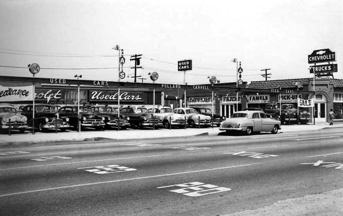
| (ca. 1950)#^*^ – View showing Pollard-Carrell Chevrolet dealership located at 753 San Fernando Rd. |
Historical Notes One of the valley’s first Chevrolet dealerships was opened Dec 1, 1937 by partners Martin Pollard and Thomas C Carrell. Pollard, with various partners, went on to own seven car dealerships in the valley. Both Pollard and Carrell got heavily involved in politics; Carrell served as an assemblyman and state senator in the 60’s and 70’s. In the 1960’s, Carrell bought out Pollard, renaming the San Fernando dealership Tom Carrell Chevrolet. The dealership changed hands a few more times, including: Dan Hedrick Chevrolet (1983), Bill Murphy Chevrolet (1991) and Rydell Chevrolet. |
 |
|
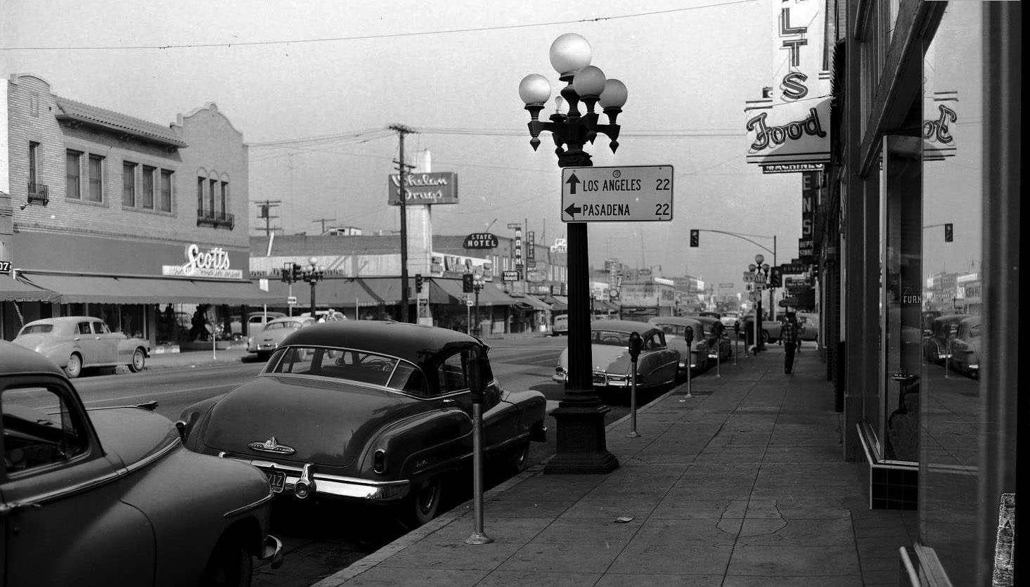
| (ca. 1950)#* - View looking southeast from the south side of San Fernando Road just west of Maclay Avenue. |
Historical Notes The junction of State Route 118 with State Routes 99 and 6 was at Maclay and San Fernando. The 118 proceeded north on Maclay to Foothill and then to the La Crescenta Valley and Pasadena. The City of San Fernando was founded in 1874. Click HERE to see San Fernando in the 1800s. |
 |
|
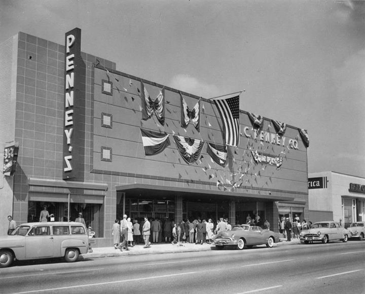
| (1953)*^^^ - San Fernando J.C. Penney Grand Opening, located at 1140 San Fernando Road. People are seen waiting in line to see the new store. A 1953 Buick Skylark convertible is parked in front. |
Historical Notes The store closed its doors in July 2012 despite having historical significance to the San Fernando community. J.C. Penney has had a store open in San Fernando since 1920.*^^^ |
Reseda
 |
|
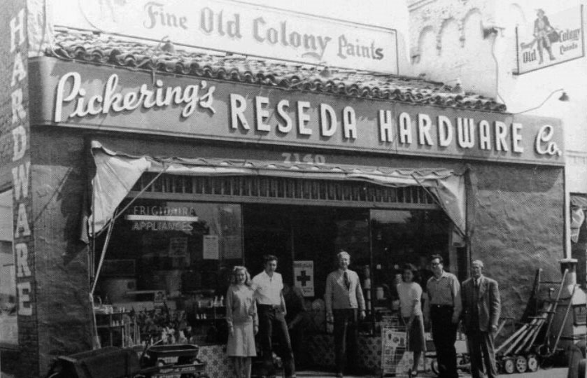
| (1948)#^*^ – View showing a group of people posing for the camera in front of Pickering's Reseda Hardware Co. located on the east side of Reseda Boulevard south of Sherman Way (7140 Reseda Blvd). |
Historical Notes By 1950, Reseda had over 16,000 residents and in the early 1950s, a population explosion took place, making Reseda one of the most popular and populated of all Valley communities. Because of this, Reseda's merchants provided bus service to transport shoppers throughout the busy downtown Reseda areas.*^ |
 |
|
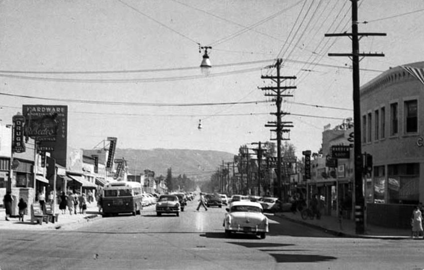
| (ca. 1953)+## - View looking south on Reseda Boulevard from Sherman Way. Pickering's Reseda Hardware is seen on the left. |
 |
|
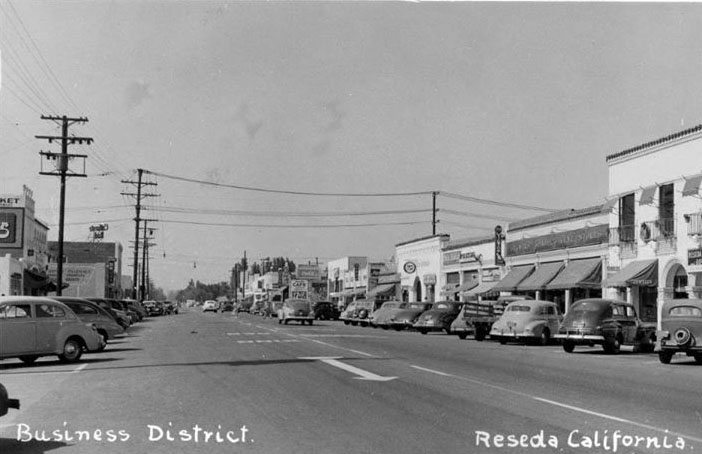
| (ca. 1950)^^^* - View looking north on Reseda Boulevard toward Sherman Way. |
 |
|
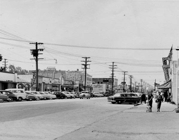
| (ca. 1954)^ - Reseda Boulevard looking north, one block south of Sherman Way, circa 1954. California Bank building is on southwest corner of Reseda Boulevard and Sherman Way and is still standing today. American flag on right is above Reseda Post Office. Gas pumps in lower right belong to Atlantic Richfield gas station. |
.jpg) |
|
| (ca. 1957)* – View showing Reseda Boulevard - the main business center of the San Fernando Valley. The two-tone car at center is a 1957 Ford Fairlane. Photo courtesy of Valley Relics Museum |
 |
|
| (ca. 1960)^.^ – View showing Big Do-Nut Drive-in located at 7208 Reseda Boulevard on the NE corner of Reseda and Sherman Way. |
Historical Notes Russell C. Wendell, a doughnut machine salesman, created the Big Donut Drive-in. There were 10 locations, built over the course of the 1950s. At least five Big Donuts survive: they are Kindle's Donuts in unincorporated Westmont (this is the original location, built in 1950), (2) Randy's Donuts in Inglewood near LAX, the Donut King II in Gardena (3), Dale's Donuts in Compton (5), and Bellflower Bagels in Bellflower (8). Each features the distinctive giant doughnut constructed of rolled steel bars covered with gunite, a material used in swimming pools. Five Big Donuts have been demolished. They were located in Culver City (4), North Hollywood (6), Inglewood (on Imperial Hwy, 7), Van Nuys (9) and Reseda (10). The building style dates to a period in the early 20th century that saw a proliferation of Programmatic Architecture throughout Southern California. This style had its heyday from the mid-1920s to the mid-1930s. By the 1950s however, the trend of designing structures in the shape of the product sold there had changed to focus on signs rather than architecture itself.*^ Click HERE to see more examples of Programmatic Architecture. |
Sherman Way (Reseda)
 |
|
| (1954)* - Photograph caption dated August 12, 1954 reads, "Reseda, 'Hub of the West Valley,' surprises even the old timers who settled in the area when it boasted of bumper wheat crops. Today, the community is a beehive of merchandising activity with thousands of new residents and many new merchants. This view looking west on Sherman Way from Etiwanda avenue reveals some of the stores that will participate in the big Dollar Day week end sale tomorrow and Saturday. Thousands of items at reduced prices go on sale." - Valley Times |
 |
|
| (1954)* - Valley Times photo caption dated October 7, 1954 reads, "Attractive new shopping district along Sherman Way in Reseda will offer special merchandise and low prices during Reseda Harvest Days tomorrow and Saturday. Modern shops are designed with ample shopping areas. Special buses will bring West Valley shoppers to business center." View is looking west on Sherman Way towards Reseda Boulevard. |
 |
|
| (ca. 1955)^^^* - View from right to left is a 1953 Oldsmobile, 1954 Ford, and a 1952 Chevy on Sherman Way across from the Reseda Theater. The building with the striped awning is Traders Pawnshop, on the northwest corner of Reseda and Sherman Way. |
Reseda Theater
 |
|
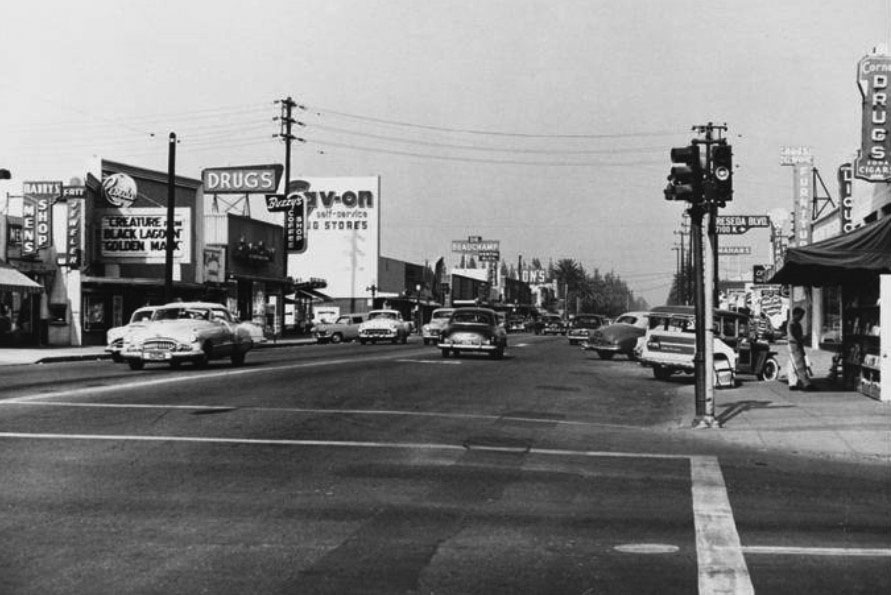
| (1955)##^ – View looking east on Sherman Way from Reseda Boulevard with Sav-On Drug Store seen at center-left and the Reseda Theater at left. |
Historical Notes The Reseda Theatre carries the original design of famed architect S. Charles Lee, 1948. The upper facade was a picture frame, a design element found in a couple of Lee’s post-WW II designs. In lieu of a marquee, the Reseda carried a sign board, placed for reading by passing cars. Lee’s works included the Los Angeles & Tower Theatres in downtown LA, the Inglewood Academy Theatre, the Beverly Hills Fox Wilshire Theatre (today, Saban Theatre) and the stunningly beautiful San Luis Obispo Fremont. Lee’s born name was Simeon Charles Levi. Levi/Lee’s parents bought a furniture store from a Mr. Lee. Rather than change the store’s name, the family changed their name. - Shel Weisbach, author of Pathways of the San Fernando Valley |
 |
|
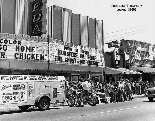
| (1966)^**^ – View showing a crowd of people in front of the Reseda Theater located at 18443 Sherman Way. Now playing: "Munsters Go Home" and "The Ghost and Mr. Chicken". |
Historical Notes The Reseda Theatre was opened in 1948 and closed in 1988. The marquee of the Reseda Theatre was seen in the 1997 film “Boogie Nights”. In June 2016 plans were announced to convert the theatre into a multiscreen cinema which will be operated by Laemmle.^**^ |
Reseda High School
 |
|
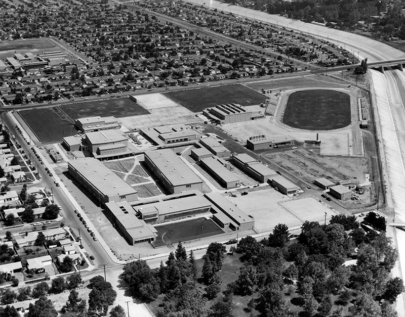
| (1955)* – View of Reseda High School located at 18230 Kittridge Street, just after it was constructed. |
Historical Notes Photo title reads, "Aerial view shows new $5,000,000 Reseda High School, the first complete high school plant constructed in Los Angeles since before World War II. It will open to 1,500 sophomores and juniors Monday at 18230 Kittridge St. Dr. Lowell McGinnis, former principal of John H. Francis Polytechnic High School, will head school. Plant eventually will house 2,500 students. Athletic field with seating for 3,000 spectators and night lighting system is included in facilities." On the right is the Los Angeles River. Photo Date: September 10, 1955 – Valley Times* |
 |
|
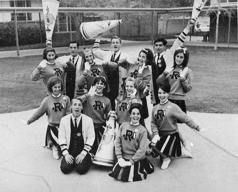
| (1968)+## – Reseda High School Cheerleaders - 1968 |
* * * * * |
 |
|
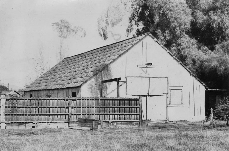
| (1950)* - A wooden fence encloses the barnyard next to the shingle-roofed Zelzah barn at 8369 Reseda Boulevard. Photo caption reads: "Still standing. Believed to be a hundred years old is the original Zelzah barn in Northridge. Thousands of fertile acres surrounding it were once sown to beans and wheat". Photo dated: Dec. 4, 1950. |
* * * * * |
 |
|
| (ca. 1955)^ - Aerial photograph taken circa 1955 of the home and farm of brothers Louie and Albert Beltramo, who were among the earliest farmers in the San Fernando Valley. The Beltramos began farming in 1919. Their operation grew until eventually it fed and housed over 100 Mexican nationals, who worked on the farm. The farm was located on Owensmouth and Roscoe Blvd. and remained in the area even after being completely surrounded by urban development. |
Sodium Reactor Experiement
 |
|
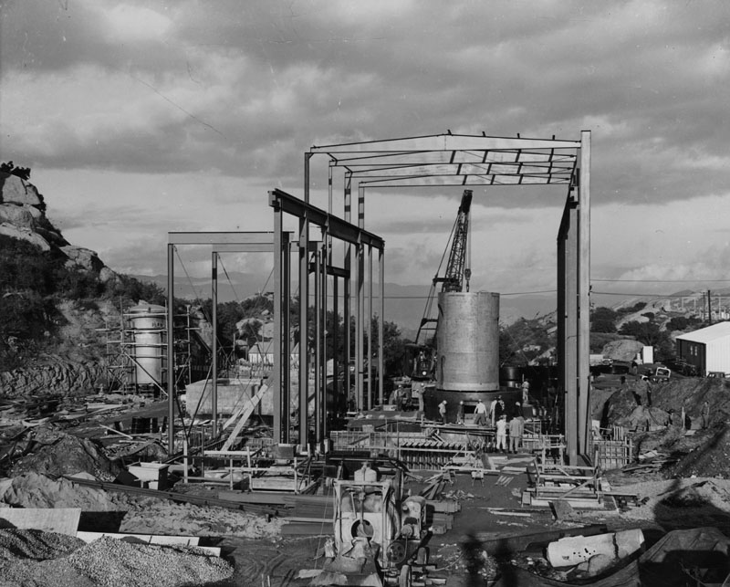
| (1956)* - Photograph caption dated May 10, 1956 reads, "Fission housing lowered into place. Container to house core, or component in which nuclear fission takes place to produce 20,000 kilowatts of heat, is lowered into position at Sodium Reactor Experiment site in Santa Susana Mountains near Canoga Park. Reactor is part of program to develop commercial power from atomic energy." |
Historical Notes This reactor was part of the Sodium Reactor Experiment, a nuclear power plant built by Atomics International of North American Aviation at the Santa Susana Field Laboratory, in the Santa Susana Mountains. The reactor was active from 1957 to 1964. * |
 |
|
| (1956)* - Photograph caption reads: "Atomic reactor to generate power. San Fernando Valley's atomic reactor, above, first non-military reactor in the nation to be operated by private firm to produce electricity is nearing completion stage in Santa Susana Mountains. It is being built by Atomics International of North American Aviation. It will be capable of producing 7,5000 kilowatts. Negotiations are under way between the group and Southern California Edison Co. for sale of surplus heat." |
Historical Notes The Sodium Reactor Experiment-SRE was an experimental nuclear reactor which operated from 1957 to 1964 and was the first commercial power plant in the world to experience a core meltdown.*^ |
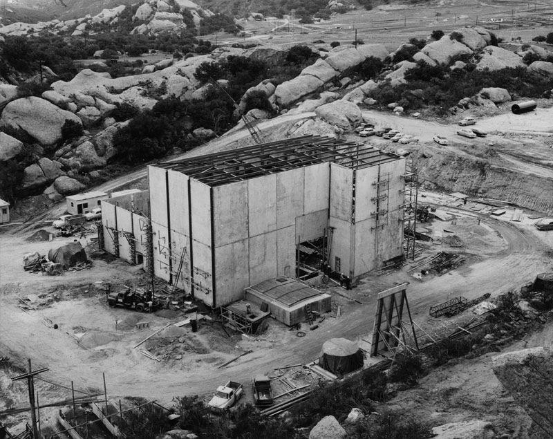
| (1957)* - View showing the newly completed atomic reactor building and power station. Photograph caption dated July 16, 1957 reads, "New plant opened by Atomics International, division of North American Aviation, Inc., for Atomic Energy Commission, rests in Santa Susana Mountains. Plant is combination of atomic reactor building at right, and Southern California Edison Co. power station, left. Project is attempting to develop economical power from nuclear energy." |
Historical Notes This was the first commercial power plant in the world to experience a core meltdown. There was a decades-long cover-up by the US Department of Energy. The operation predated environmental regulation, so early disposal techniques are not recorded in detail. Thousands of pounds of sodium coolant from the time of the meltdown are not yet accounted for. The reactor and support systems were removed in 1981 and the building torn down in 1999.*^ |
* * * * * |
Ventura Boulevard
 |
|
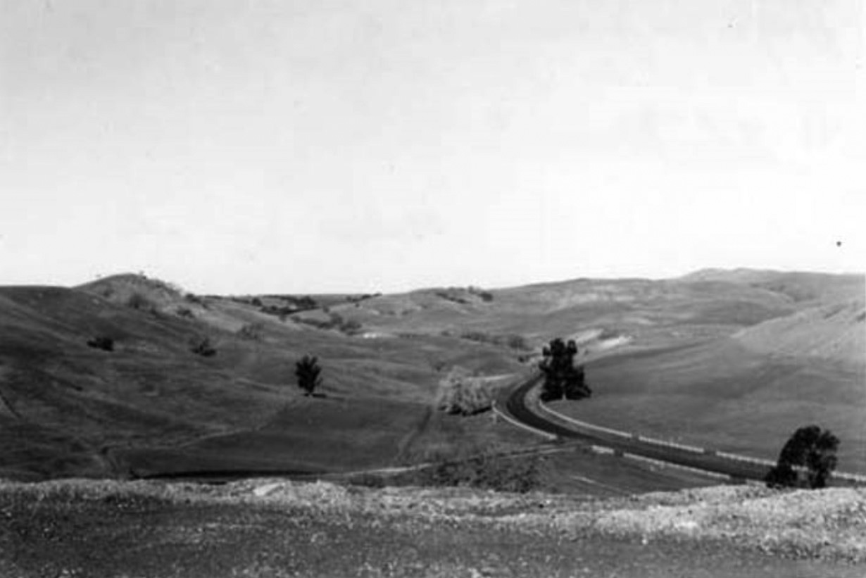
| (ca. 1950s)^ - View of Ventura Boulevard facing west from Hidden Hills. The flat hill in the center is called "the Mesa." To the west of the Mesa was the Agoure Ranch. The area was later named Agoura Hills. |
Historical Notes In its earliest days, Agoura Hills was nothing more than a stagecoach stop and was referred to as "Vejar Junction." In the early 1920s, after Paramount Studios purchased a ranch in the neighborhood, the community became known briefly as "Picture City." But neither name stuck. In 1928, a group of residents formed a Chamber of Commerce which, as one of its first actions, asked to have a permanent post office established in the community. The Postal Department informed the chamber that it would need to submit a list of ten potential names for the town. One of the area's more colorful early landowners had been a man by the name of Pierre Agoure. Though French by birth and a shepherd in his youth, he favored Spanish costumes and adopted the moniker Don Pedro Agoure. In compiling a list of possible names, the townspeople inserted "Agoure" in the tenth spot. Bob Boyd, the town's first postmaster, later recalled that the tenth name was selected because it was the shortest. How the "e" became an "a" remains an unsettled issue. Some say it was done intentionally for ease of spelling, others lay blame at the door of the post office, arguing that the modification was simply an error. |
 |
|
| (ca. 1950s)* - View looking east on Ventura Bouelvard from Calabasas. |
Historical Notes Ventura Boulevard was originally part of El Camino Real. It now continues as Calabasas Road (running parallel to the 101 Freeway). A stage line, run by Flint, Bixby and Butterfield, operated during the 19th century along it. |
* * * * * |
Hidden Hills
 |
|
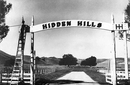
| (1950)* - Looking from the main gateway along Long Valley Road in Hidden Hills. The oak at the left is between 23704 and 23726 Long Valley Road. The oak on the right is at the northeast corner of Twin Oaks Road and Long Valley Road. |
 |
|
| (1950)* - Corner of the intersection of Long Valley Road and 101 before it was a freeway. The Old Miguel Leonis Adobe home is at the photographer's back. |
 |
|
| (1950)* - Putting the finishing touches on the main entrance gate. The first sections of the three rail, white fences have just been erected. |
 |
|
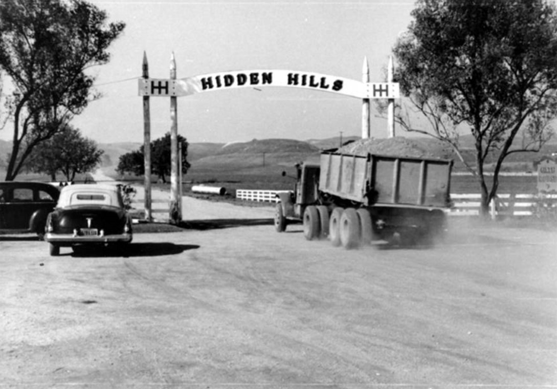
| (ca. 1950)^ – View showing the front gate in the new development of Hidden Hills. A truck with fill dirt is seen entering the subdivision at Long Valley Road. |
 |
|
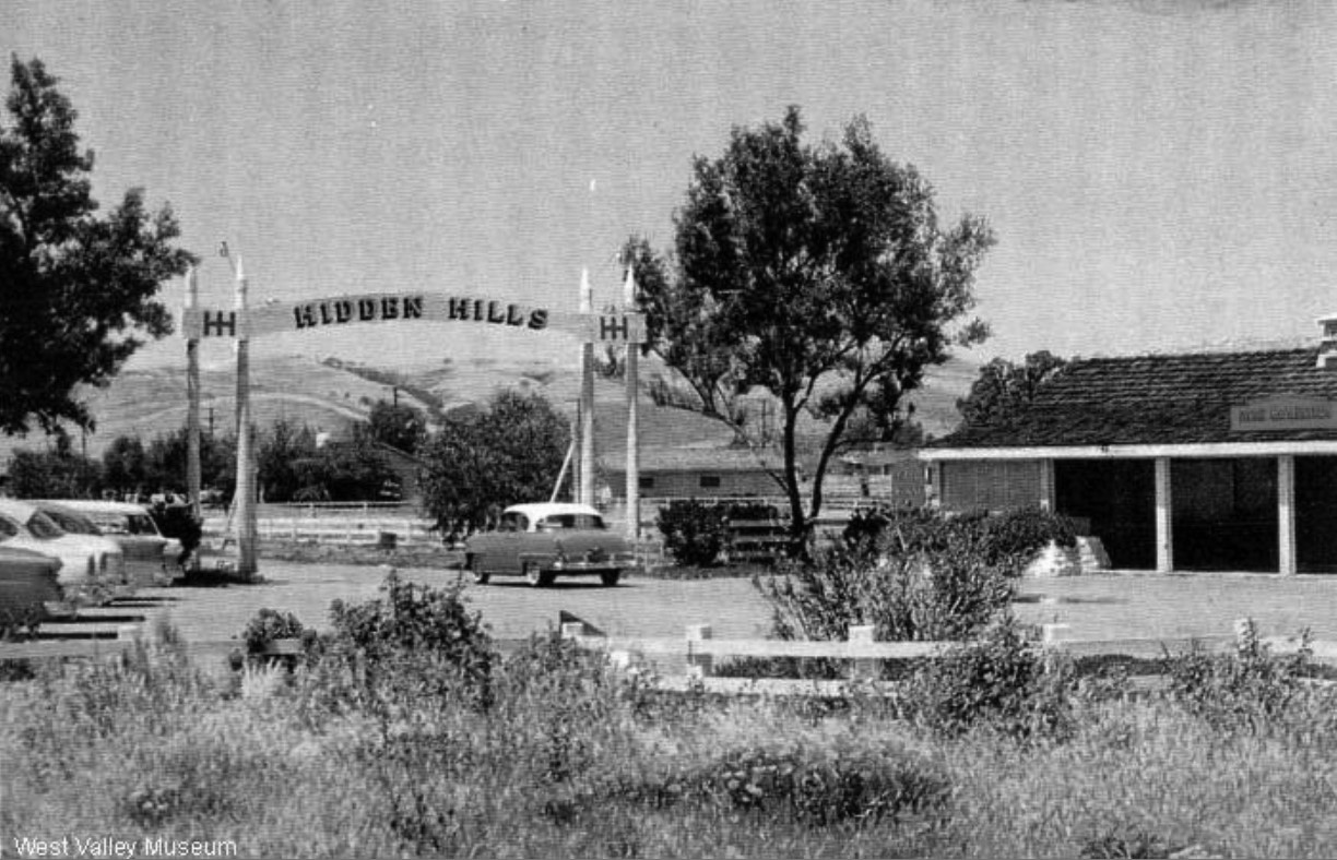
| (1950)* – View showing a large sign on Ventura Boulevard at the intersection of Long Valley Road. |
Historical Notes Sing reads: 1000 Acres of Elbow Room - Live in HIDDEN HILLS where Living is Fun! Full Acre Lots $4750. The "1000 acres" were composed of the following purchases: 1) in 1949, 700 acres acquired from E.E. Hurlbutt; 2) in 1950, 160 acres purchased from Nace, et al; 20 acres from Mrs. Lasher; 119 acres from the Straubinger family; and 5.6 acres from Spinks — a total of 1004.6 acres. |
 |
|
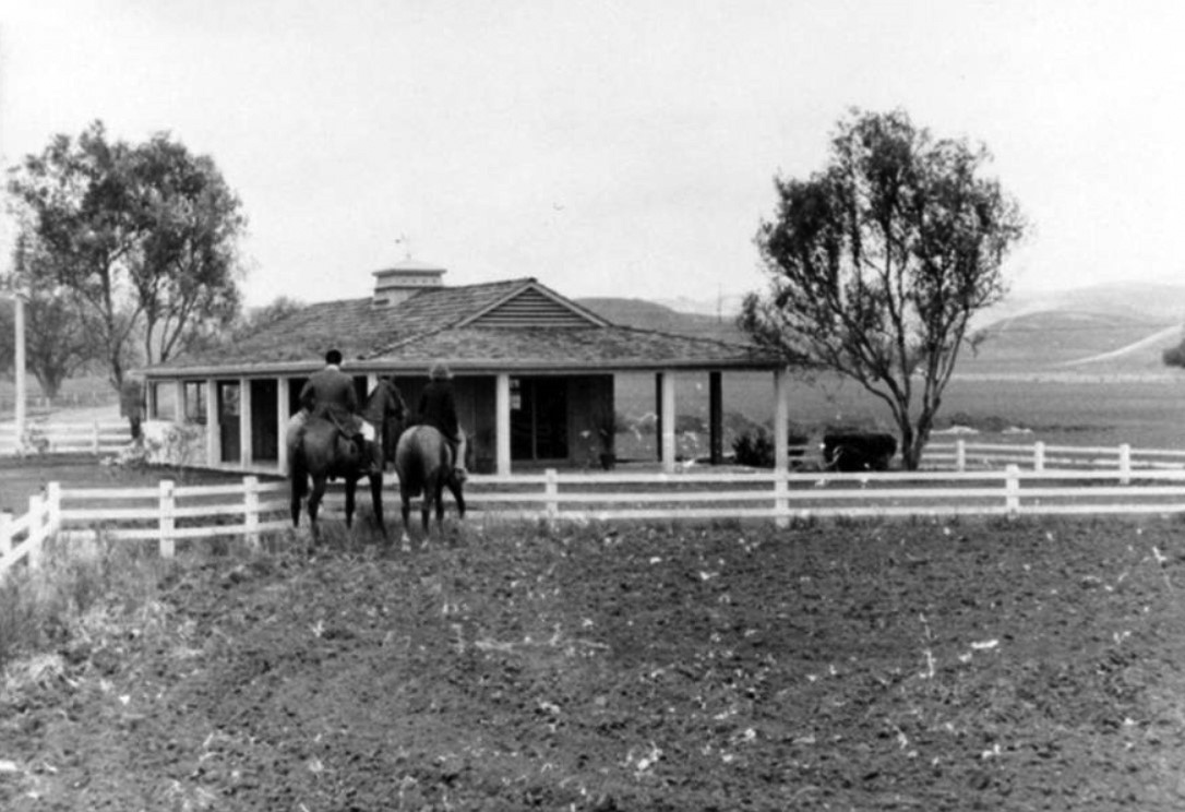
| (1950s)^ – A man and woman ride horseback near the real estate office at the front gate of the new Hidden Hills development. |
Historical Notes By 1957, the cost of a three- or four-bedroom home on a one-acre site was $27,500 – $47,500. One- to five-acre home sites were selling for $7,950 – $12,500. |
 |
|
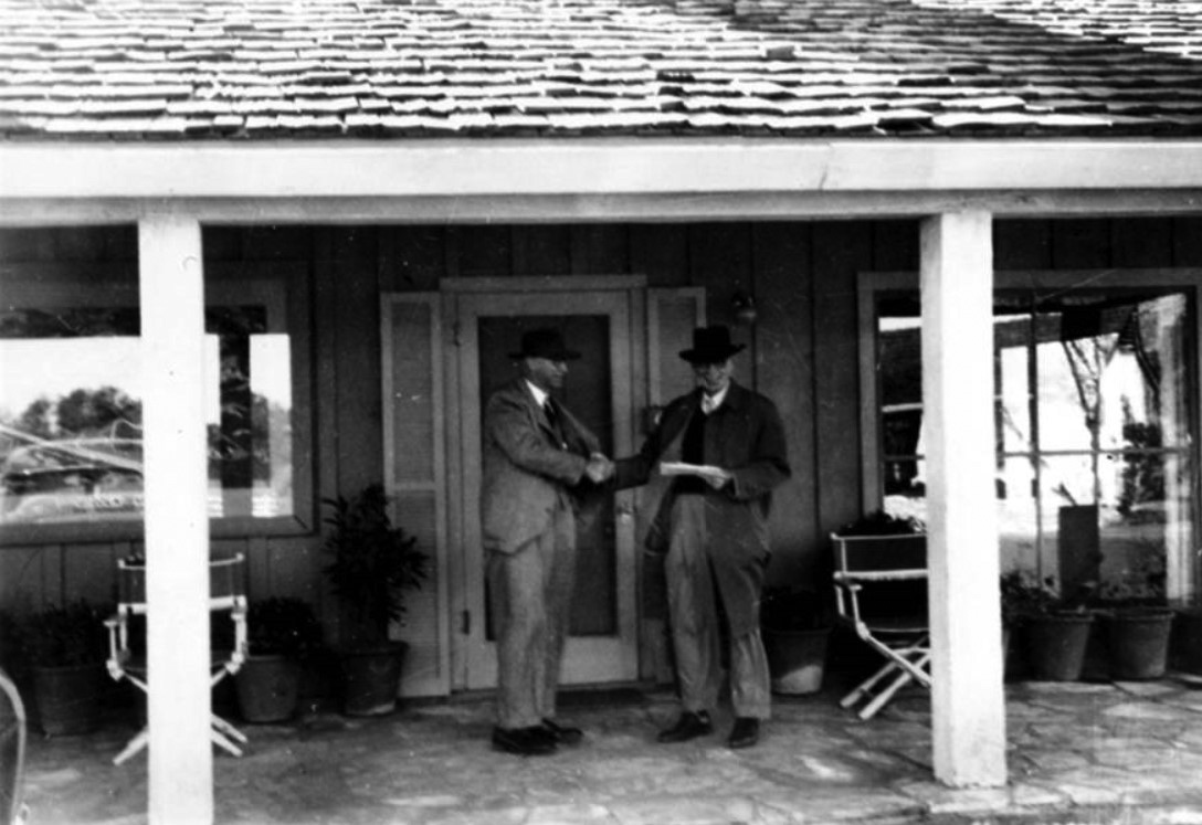
| (1950s)^ - Developer A. E. Hanson and salesman Pat Murphy shaking hands on the porch of the Hidden Hills real estate office. |
Historical Notes The Hidden Hills Community was designed and developed in the 1950s by A.E. Hanson, a renowned Southern California landscape architect and planned community developer. His earlier projects included Rolling Hills and Palos Verdes Estates, and the 1920s Beverly Hills Harold Lloyd Estate 'Greenacres'. |
 |
|
| (ca. 1953)^ - Postcard view showing the entrance to Hidden Hills. |
Historical Notes Hidden Hills is bordered on the north by the nature reserve and greenbelt of the Upper Las Virgenes Canyon Open Space Preserve, a park with miles of equestrian, hiking, and mountain biking trails. Nearby to the south is the pioneer Leonis Adobe National Historic Landmark, with gardens and a historical Museum. It's across the historic El Camino Real of the Spanish Las Californias and Mexican Alta California eras, now U.S. Route 101. |
 |
|
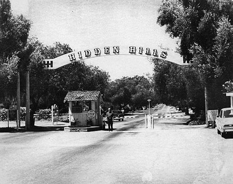
| (ca. 1960)* - View of entrance to Hidden Hills with Gatehouse. |
Historical Notes In the spring of 1961, civic leaders in the tiny community of Hidden Hills launched a drive to form a city. They were faced with the prospect of being annexed to the City of Los Angeles and having Burbank Boulevard extended through the community. The petition for cityhood was signed by 79% of the voters, and in spite of the fact that the Los Angeles City Council's Planning Committee opposed the incorporation, it was approved by the Board of Supervisors. September 19, 1961 was designated as election day, when a total of 358 votes were cast for incorporation (83% of registered voters), with 71 votes against. The area of the new city was approximately 1.3 square miles, with a population of a little over 1,000 and an assessed valuation of $2,681,910. On October 19, 1961, Hidden Hills became the 73rd city in the County. |
* * * * * |
Calabasas
 |
|
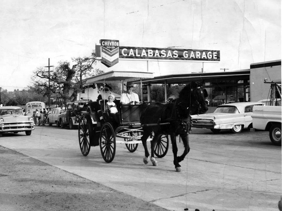
| (1958)* – Aerial view of Calabasas Road showing the Leonis Adobe (center-right). The old Hanging Tree as well as the Calabasas Garage can also be seen (lower center-left). Photo courtesy of Leonis Adobe Museum |
Historical Notes In the 1950s, Old Town Calabasas was a small, rural community with a rich history rooted in its days as a stagecoach town in the Wild West. Known for its rustic charm, the area featured several historic structures, most notably the Leonis Adobe, built in the 1840s as part of Rancho El Escorpion and associated with Basque settler Miguel Leonis. This adobe, now a living history museum, was central to preservation efforts during the 1950s, narrowly avoiding demolition for new developments. Calabasas had been a significant stop on the Flint, Bixby, and Butterfield stage line in the mid-19th century, connecting Los Angeles and Monterey and serving as a hub for travelers. Despite the broader growth in California, Calabasas retained its rugged, frontier spirit, with its small population and limited interaction with outsiders. The town's cultural fabric was further enriched by the establishment of Park Moderne, an artists' colony from the 1920s. Community life also featured landmarks like the "Hangman's Tree," a white oak tied to local folklore, which was eventually removed to accommodate infrastructure development. Overall, Old Town Calabasas in the 1950s was a place where history and rural charm coexisted amidst the pressures of modernization. |
 |
|
| (ca. 1958)* - View showing a 1957 Chevrolet making a right turn unto El Canon Avenue from Calabasas Road. On the left is a horse tied to a power pole. Behind the horse can be seen the Calabasas "Hanging Tree". Photo courtesy of Leonis Adobe Museum |
Historical Notes This ca. 1958 photo shows a 1957 Chevrolet turning right onto El Canon Avenue from Calabasas Road. On the left, a horse is tied to a power pole, recalling the area’s rural charm. Just behind the horse stands what many believed to be the Calabasas Hanging Tree, a large oak once thought to be the site of frontier justice. While no documented hangings are known, the tree became a local icon, especially after being featured in city logos and local events. After it died in the 1960s and fell in 1995, its remains were preserved and displayed nearby. However, some residents believe the real hanging tree was a different oak in front of a nearby store, sparking ongoing local debate. |
 |
|
| (1960)* - Photo showing Archie E. Hanson, Jr. and his daughter in a horse-drawn buggy in the Calabasas Christmas Parade with the Calabasas "Hanging Tree" in the distance. |
Historical Notes Archie Hanson, Jr. developed Hidden Hills as well as Rolling Hills, CA. Mr. Hanson renovated the Leonis Adobe and lived there with his family for a few years. He also designed the gardens at the Getty House in Los Angeles and the gardens of the Harold Lloyd Estate among other projects. The photo is part of the Leonis Adobe Museum and Plummer House Collection. Courtesy of CSUN Oviatt Digital Library. |
Then and Now
 |
|
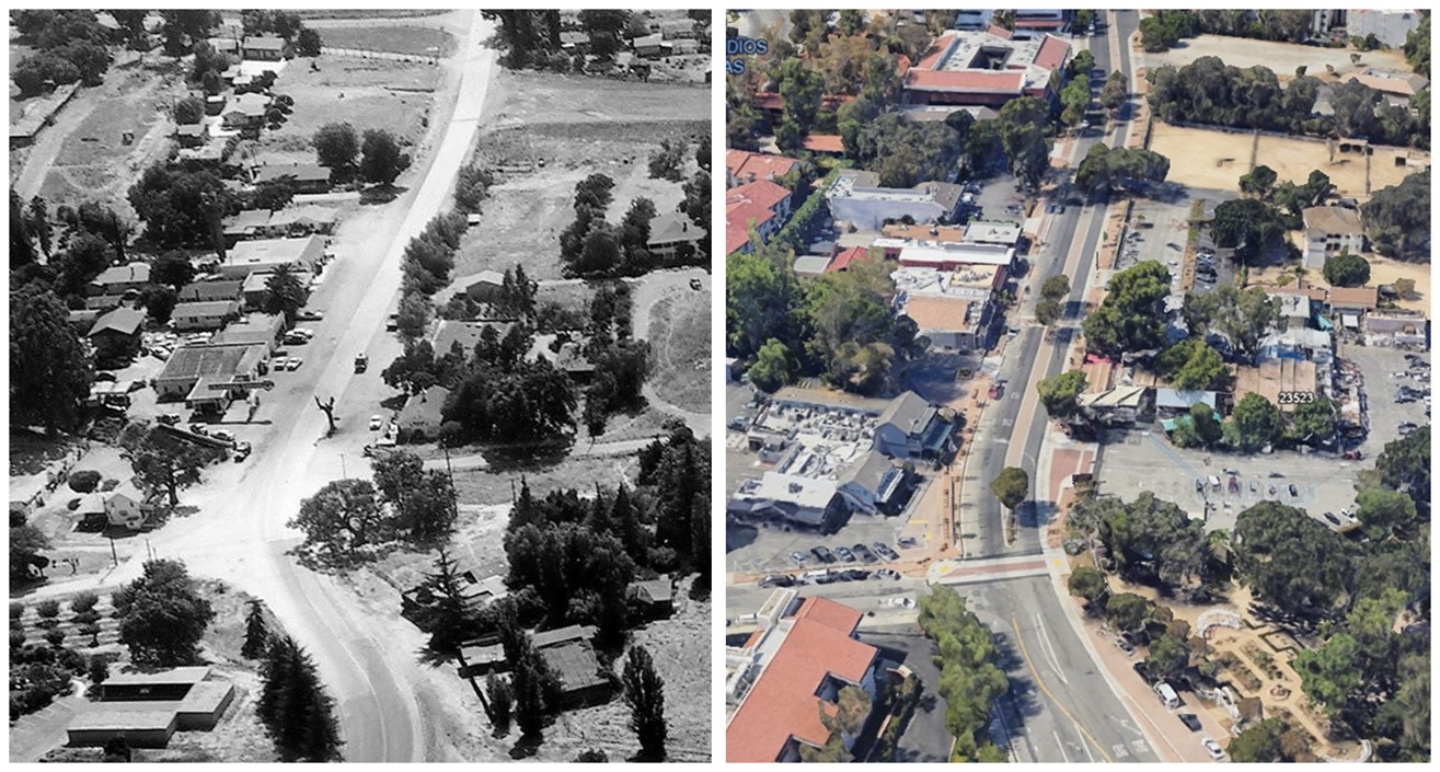
| (1958 vs. 2024)* - Aerial view of Old Town Calabasas with the intersection of Calaabsas Road and El Canon Ave seen at lower-left. Photo comparison by Jack Feldman. |
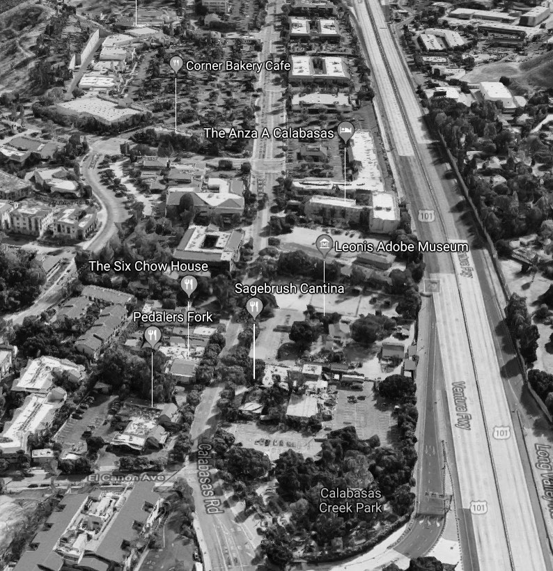
Historical Notes Today, Old Town Calabasas is a charming area that blends historical sites with modern attractions. A key feature is the Leonis Adobe Museum, a historic site dating back to 1844, offering a glimpse into 19th-century ranch life. Nearby, Calabasas Creek Park provides a picturesque setting with antique ironwork, gardens, and a creek, perfect for leisurely strolls and picnics. The area is also known for its dining and shopping options, including popular spots like Sagebrush Cantina, Pedalers Fork, and The Six Restaurant. Additionally, the Old Town Calabasas Farmers Market, held every Saturday, is a vibrant local hub for fresh produce and baked goods, making it a popular social and shopping destination. |
Then and Now
|
|
 |
|
| (1958 vs. 2019)* - Calabasas Road |
Historical Notes This side-by-side look at Calabasas Road shows how the area changed over 60 years. Once a dusty two-lane road through a ranching town, it’s now a central part of a vibrant shopping and dining area. Still, reminders of the past remain. The Leonis Adobe continues to anchor the area, and stories of the Hanging Tree live on. Though the original tree—on the north side of Calabasas Road—fell in the 1990s, the legend persists, with some claiming the real tree was across |
* * * * * |
Jim's Fallbrook Market (originally Fallbrook Market)
 |
|
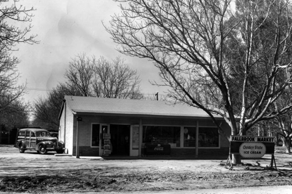
| (1940s)* – View showing Fallbrook Market located at 5947 Fallbrook Avenue in Woodland Hills. Note: Fallbrook Avenue is still a dirt road. |
Historical Notes Fallbrook Market was initially built and opened by the Lookabaugh Family in 1946, when Fallbrook Avenue was nothing but a rough-hewn dirt road, and the area was home to more nuts than people. It is one of the oldest businesses and certainly the longest continuously running market in the West San Fernando Valley. |
 |
|
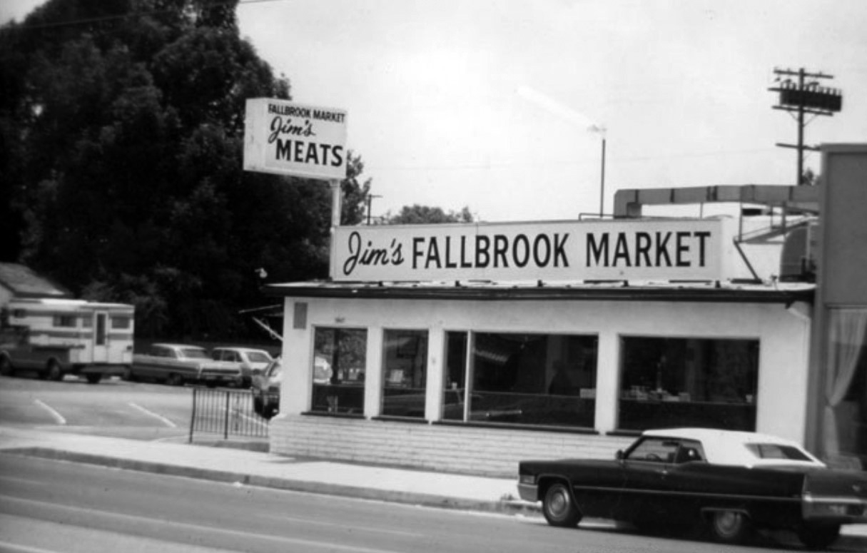
| (ca. 1965)* - View showing front of Jim’s Fallbrook Market with new sign. |
Historical Notes It operated as small grocery until 1951, when Jim McQuaid rented space in what was then a 40’x40’ building. He immediately installed a meat counter and became the store’s first butcher until 1958, when he purchased the market outright. Over the next 20 years, Jim renamed, remodeled and reconfigured the store to what it is today. |
 |
|
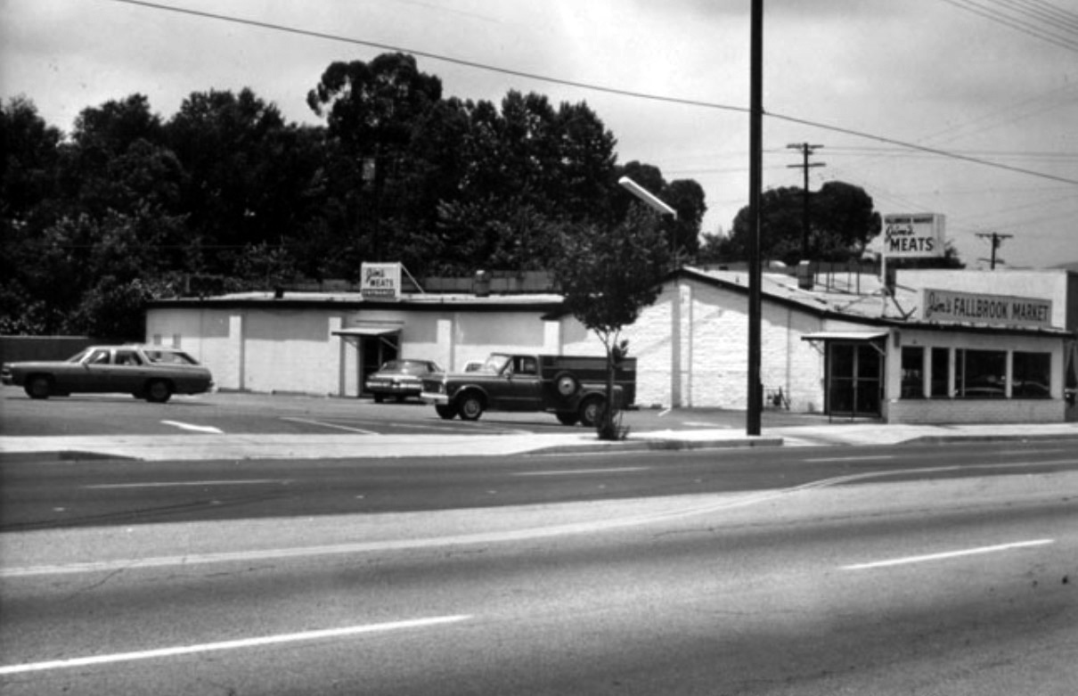
| (1960s)^ – View showing the parking lot and front of Jim’s Fallbrook Market in the early 60's. Click HERE to see contemporary view. |
Historical Notes After Jim McQuaid retired in 1978, sons Mike and Pat took over the store, splitting the meat-cutting/grocery duties. Pat retired in 2010 and Mike’s son, Cory, would soon join the operation. Jim’s Fallbrook Market, with over 50 years of a McQuaid at the helm, is the longest continuously running market in the West San Fernando Valley. |
* * * * * |
Fallbrook Square (today Fallbrook Center)
 |
|
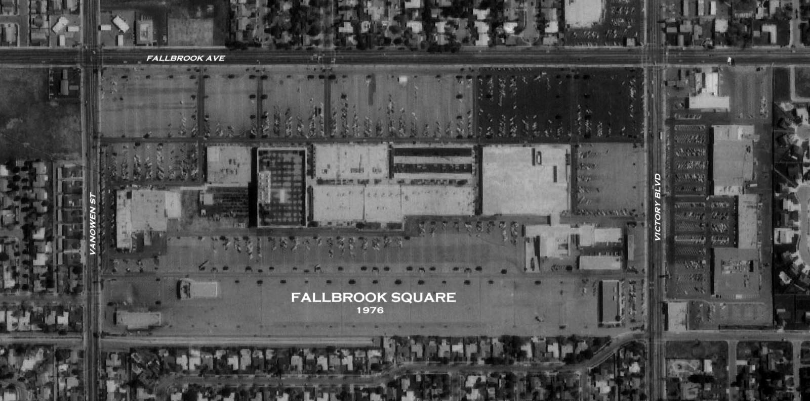
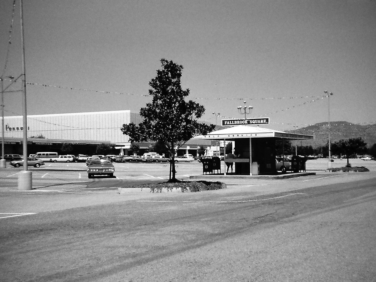
| (1976)* – Aerial view showing Fallbrook Square located at 6633 Fallbrook Avenue (Top is East, Left is North). Photo courtesy of Rich Krugel |
Historical Notes The complex, originally known as Fallbrook Square, opened between November 1963 and November 1966. Housing eighty stores and services in an open-air format, it was anchored by large Sears and J.C. Penney locations and included F.W. Woolworth, Ontra Cafeteria, House of Sight and Sound, Karl's Toys, Nibblers Restaurant, and a Market Basket supermarket. An enclosing renovation was done between April 1984 and July 1986. Target and Mervyn's anchors were added and the complex was renamed Fallbrook Mall. Damaged by the 1994 Northridge earthquake, and in decline by the late 1990s, the shopping venue was redeveloped between August 2001 and November 2003, emerging as the 1,200,000-square-foot Fallbrook Center of today. |
 |
|
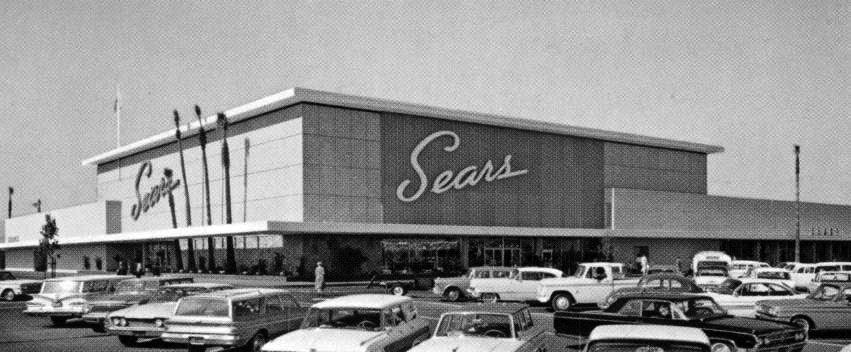
| (1960s)* - View showing Sears, one of the two anchor stores at the Fallbrook Mall. It was located at the southeast corner of the mall, near Victory and Fallbrook. |
Historical Notes The Fallbrook Square Sears, at 330,000 square feet, was said to be the largest store in the Chicago-based chain when it was built. The Sears, which had re-opened at the nearby Westfield Topanga in 1996, was divided between Big Kmart (upper level) and Burlington Coat Factory (lower level). These opened in 1997. The Big Kmart closed and re-opened, as a Wal-Mart (currently branded as Walmart), in January 2004. |
 |
|
| (1978)* - View looking northwest showing the Fallbrook Square shopping center with former drive-up self-service post office in parking lot. J.C. Penney can be seen in the background. Photo by 'Antartic96' / Wikipedia |
Historical Notes The existing Penney's structure, vacated in April 2001, was retenanted by Kohl's. Today, the 75-acre Fallbrook Center is an open-air, 880,000-square-foot shopping center with retailers including Wal-Mart, Trader Joe's, Home Depot, Target, Ross Dress for Less, 24 Hour Fitness, Michael's, and Petco. |
 |
|
| (1978)* - View looking northwest showing the Fallbrook Square shopping center with former drive-up self-service post office in parking lot. J.C. Penney can be seen in the background. Photo by 'Antartic96' / Wikipedia |
Then and Now
 |
|
| (1978 vs 2018)* - Looking northwest showing the Fallbrook Square (today Falbrook Center) shopping center with former drive-up self-service post office in parking lot with J.C. Penney (today a furniture store) seen in the background. Photo comparison by Jack Feldman. |
* * * * * |
Fox Fallbrook Theatre
 |
|
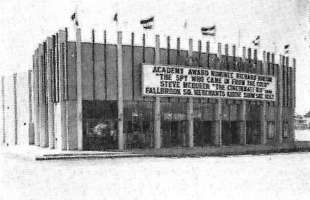
| (1966)* – View showing the Fox Fallbrook Theatre located at 22940 Vanowen Street on the Fallbrook Square property. |
Historical Notes The Fox Fallbrook Theatre was opened March 16, 1966 by National General Theatres with Richard Burton in “The Spy Who Came in from the Cold”. The Fallbrook was like the smaller single story neighborhood version of the National Theatre in Westwood. The theater was designed by J. Arthur Driellma, built by Ernest W Hahn Inc, and seated 874 persons. It would later get twinned, with Mann Theaters operating there in its final years. The last film shown here was November 1987, and the theater sat vacant for a couple of years, before being razed for a Chuck E Cheese. |
* * * * * |
Giacopuzzi Drive-thru Dairy (Saticoy and Fallbrook)
 |
|
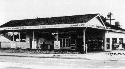
| (ca. 1960)* - View showing the Giacopuzzi Drive-thru Dairy on the SE corner of Saticoy Street and Fallbrook Avenue. Sign reads: Easy Stop And Shop. Photo courtesy of Keith Hart |
Historical Notes This building still exists today and is now called Altadena Express Market. Click HERE for contemporary view. |
 |
|
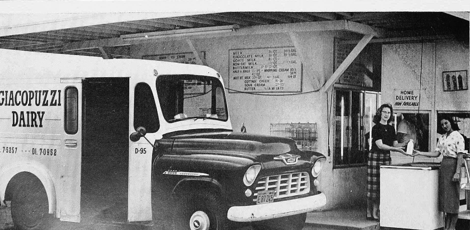
| (ca. 1958)* - Terry Marable and Sandy Blank hold a bottle of milk as they pose for the camera at Giacopuzzi Drive-thru Dairy. Photo courtesy of Keith Hart |
Historical Notes The Giacopuzzi family was one of the founding families of Owensmouth, which would later become Canoga Park. Brothers Mario and Guido Giacopuzzi ran the dairy farm from the 1950s with over 500 cows. Over the years the dairy farm received numerous awards from both the Los Angeles and Ventura County Fairs Boards for its quality production and award winning milk. The dairy herd was sold in 1983. |
 |
|
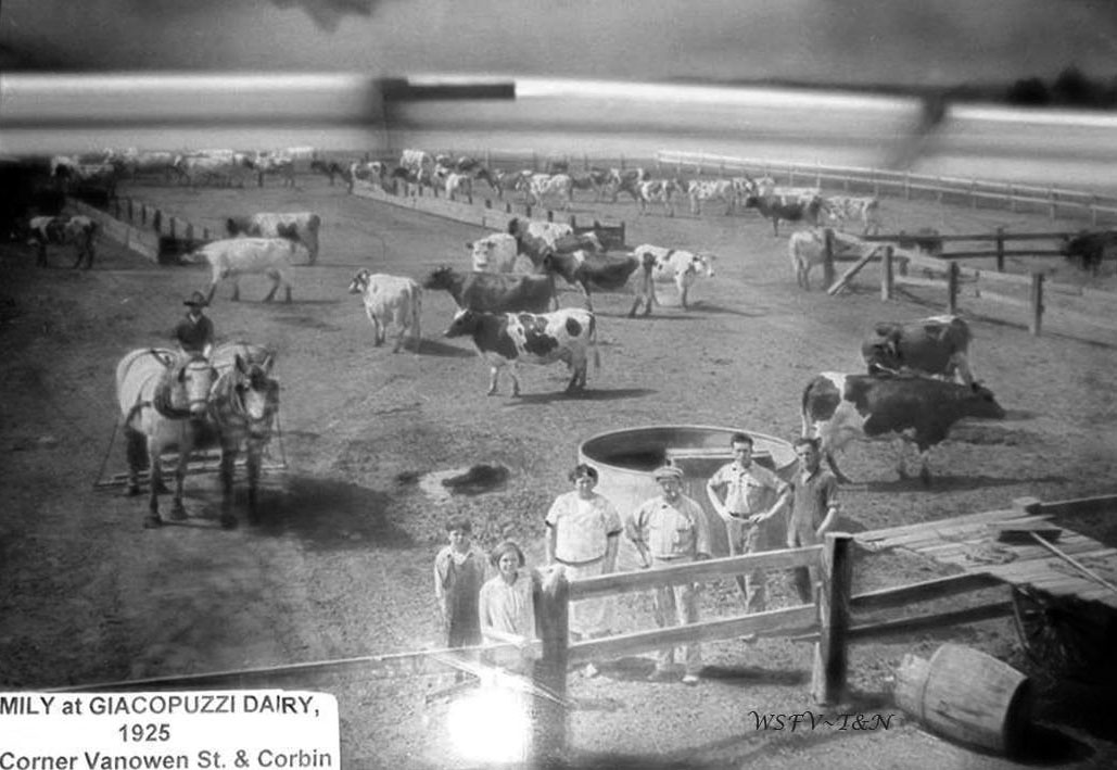
| (1925)* - This photo was taken at the NW corner of Corbin and Vanowen, and includes John & Rosie, two of their children, Irma and Lindo, and a few farm hands. The photo hangs in the Canoga-Owensmouth Museum, courtesy of Keith Hart. |
Historical Notes John Giacopuzzi, along wife Rosie and daughter Marie, immigrated from Italy in the very early 1900’s, and set up dairy farming in Los Angeles City, where more children were born. During this time, Antonio Giacopuzzi (aka Tony, and unrelated – Giacopuzzi was a common name in that part of Italy) also immigrated from the same area of Italy, and married Marie. Both families moved to the SFV, settling on two 10-acre plots of land at Vanowen and Corbin in Canoga Park in the early 1920’s, with a dairy farm, and some of the acreage devoted to other crops. Houses were built at 6841 Corbin Ave (John & Rosie) and at 19801 Vanowen (Tony & Marie). Tony’s sons Guido and Mario continued the family business for decades. In 1927, John purchased another ten acres along Sherman Way, farming this acreage as well. Eventually another 10 acres was acquired at the SE corner of Fallbrook and Strathern for dairy farming. Over time, the families opened up a couple more drive-thru dairies in the West Valley, as well as Thousand Oaks and Simi to sell their products. In the early 1950’s, the 10 acres at the corner of Corbin and Vanowen was leased to Canoga Dairy Farms, which eventually became Lindo Giacopuzzi's Corbin Dairy until 1967, when zoning on the property changed, and a shopping center was built. Circa 1967, the cows from both the Vanowen and Fallbrook Giacopuzzi locations were moved to a 48 acre dairy in El Rio, where the operation continued. |
Then and Now
 |
|
| (1960 vs 2021)* - Giacopuzzi Drive-thru Dairy (today Altadena Express Market) located on the SE corner of Saticoy Street and Fallbrook Avenue in West Hills. Photo comparison by Jack Feldman. |
* * * * * |
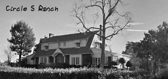
Circle S Ranch
 |
|
| (n.d.)* - View looking northeast showing the 1927-built home at Circle S Ranch, located on the southeast corner of Woodlake Avenue and Saticoy Steet. |
Historical Notes Around the time the Syndicate was selling lots in the town of Owensmouth, they also sold larger lots in the adjoining area. The property at Tenth Street (Saticoy) and Santa Ana Avenue (Woodlake), was purchased by a John T Hadley in 1911. He built a barn on the property, but no house. After his passing, his wife sold the property to a Virgil W Deaver; he also did not build a house. Frank S Howard, founder of the Howard Automobile Company, purchased the property in 1926. The house above was built for him in 1927. |
 |
|
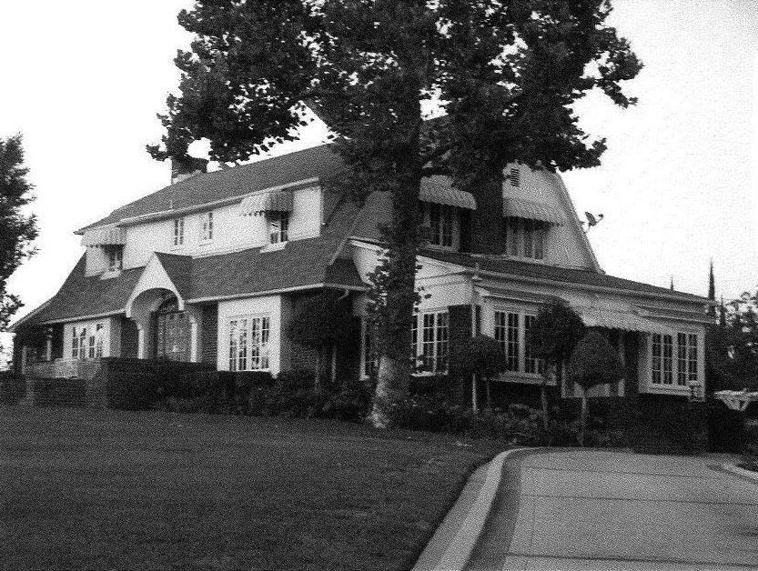
| (2014)* – View looking at the main residence on the Circle S Ranch located at 7566 Woodlake Avenue. |
Historical Notes The two-story Dutch Colonial Revival Home was built for Frank Stewart Howard, a Buick distributer, in 1927 at the cost of $8,500.00. Frank founded The Howard Motor Company and had dealerships in Pasadena and Hollywood. He hired J.H. Hillard to build the house, a garage and 14 chicken coops of varying sizes to house exotic birds, and other animals including thoroughbred horses. The largest coop was 108 feet long. Unfortunately, Frank was a drinker and during a family argument in which he was choking his wife, his 12 year old son shot him and Frank died before he reached the hospital. The Howard Estate deeded the property to George Chambers on October 18, 1930. George and his wife, Mary retired to the ranch until George passed away in 1940. Mary sold the ranch to May Carreaud, who leased it to Grenville Stratton, a Douglas Aircraft executive who was well known for breeding horses, in 1944. Grenville built a guest house and turned the largest chicken coop into a barn. Grenville W. Stratton purchased the property (38.5 acres) from May in 1947. As the new owner, he changed the name of the property to Circle S Stables to suit the needs of his thriving horse racing and breeding business. * |
 |
|
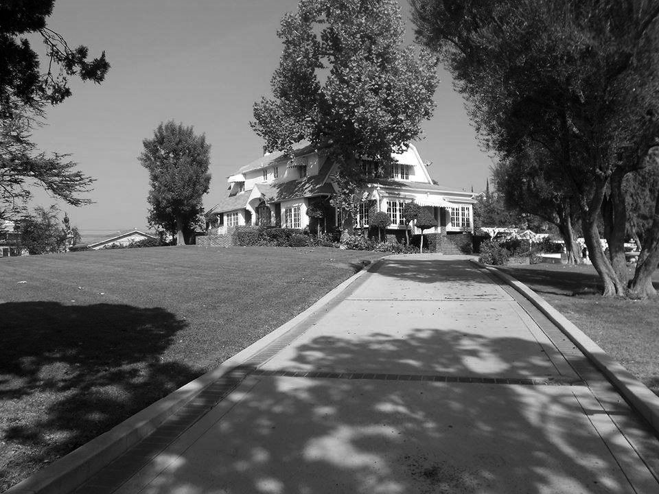
| (ca. 2017)* – View looking up the driveway toward the large ranch estate located on the SE corner of Woodlake Ave and Saticoy Street. Click HERE for a more contemporary view. |
Historical Notes The Circle S Ranch became widely recognized as a landmark on the southeast corner of Tenth Street and Santa Ana Avenue, later changed to Saticoy Street and Woodlake Avenue. Under Grenville's ownership, the Circle S Ranch made a name for itself in the horse racing industry. When Grenville's wife passed away, his stepdaughter sued him for half of the estate. In 1954, the cost of the long, drawn out lawsuit and Greenville’s bad health forced him to close the ranch. In 1956 the ranch was subdivided into 207 home site lots and one 3.46 acre lot for the remaining ranch buildings. The 100 foot horse barn was removed from the property and later razed when its new location was subdivided. The original barn was moved to a location on Zelzah but was also demolished to make way for an apartment building. Greenville’s second wife, Janice, sold the remaining property to William & Joy Ross in 1972. In 1990 it was put in a family trust in which it still remains today. |
* * * * * |
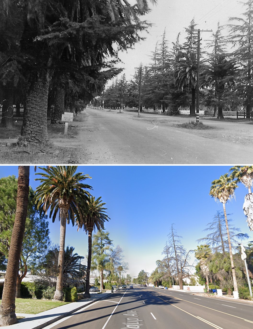
Shoup and Vanowen
 |
|
| (1940s)* - View looking north on Shoup Ave towards Vanowen Street. Trees line both sides of Shoup Ave with an overhead power pole line seemingly running down the center of the street. Photo courtesy of Martin Martindale |
 |
|
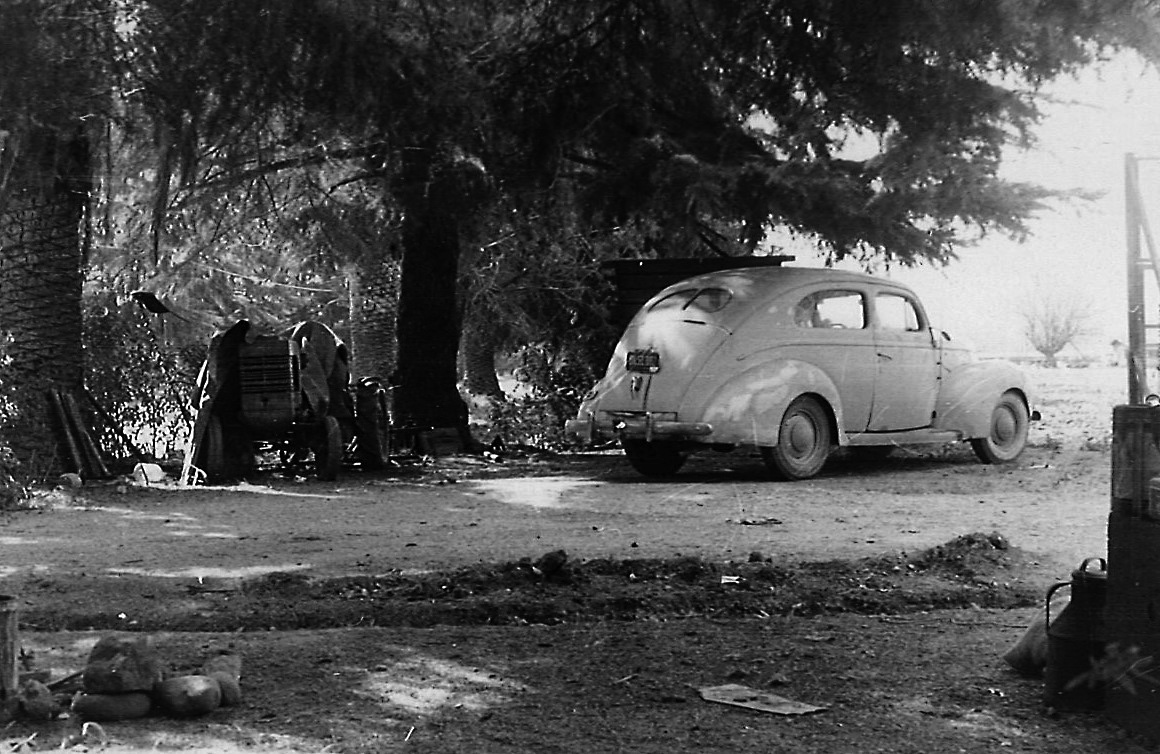
| (1940s)* – View showing a 1939 Ford Deluxe 2-Door Sedan next to a covered tractor in the driveway of a lot located on the 6700 block of Shoup Avenue. |
.jpg) |
|
| (1956)*- Aerial view over Shoup Ave and Vanowen Street showing several open fields. The pole line in the center median can clearly be seen. Photo courtesy Dean Fields. Click HERE to see contemporary view. |
Historical Notes Shoup Avenue was named after Paul Shoup, a vice president of the Southern Pacific Railroad and president of the Pacific Electric Railway Co. Vanowen Street was coined because it was the direct route across the Valley between the towns of Van Nuys and Owensmouth. Click HERE to see more SFV Street Name Origins. |
Then and Now
 |
|
| (1940s vs 2021)* - View looking north on Shoup Ave towards Vanowen Street in West Hills. |
* * * * * |
Woodland Hills
 |
|
| (ca. 1952)* – Aerial view of Woodland Hills looking east. The large road running away at bottom-center is Ventura Boulevard. It makes a slight turn just past Shoup Avenue (center-left). The freeway was built on top of the second block over to the right with Avenue San Luis paralleling it, next street over. |
 |
|
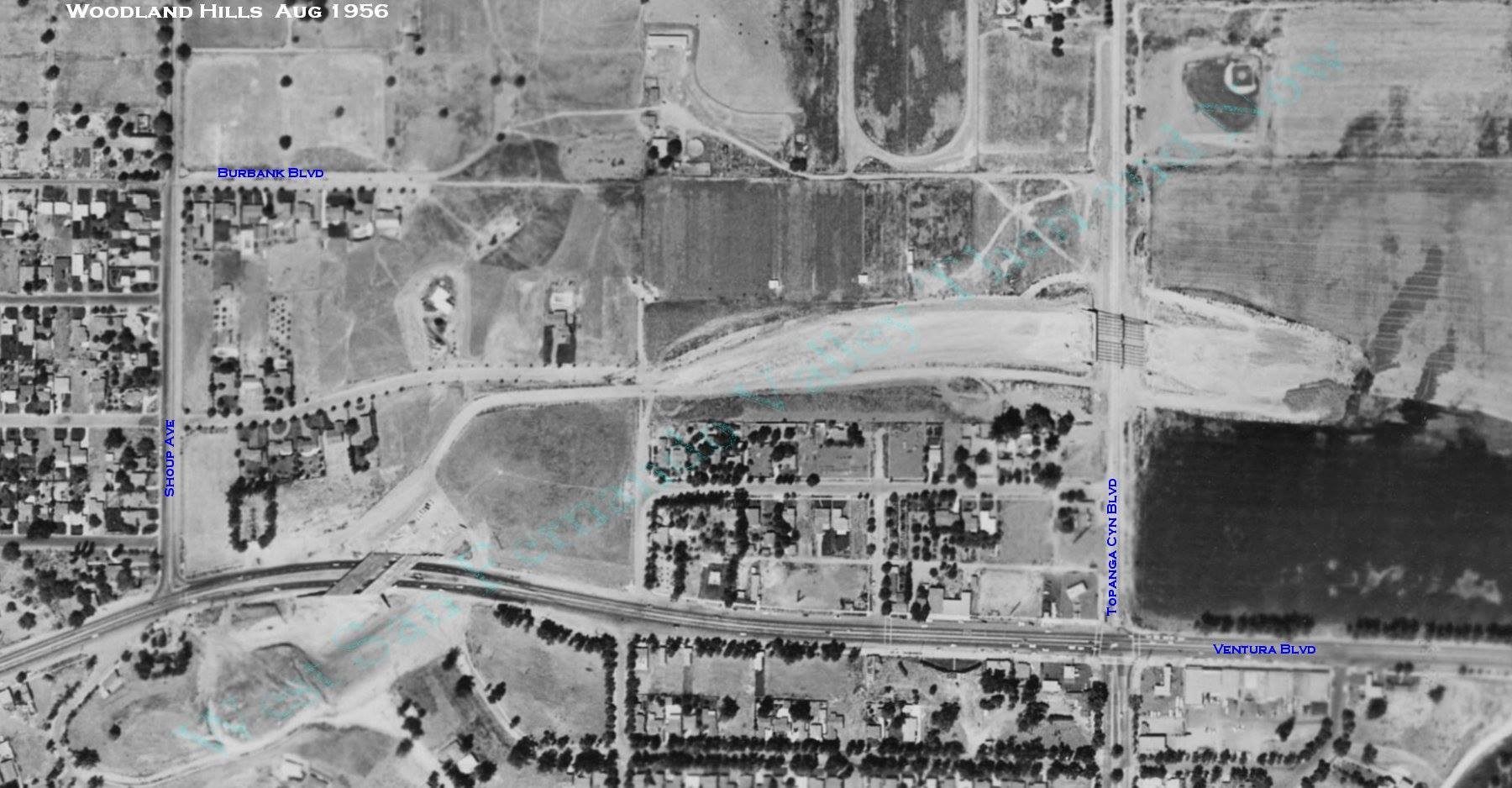
| (1956)#^*^ - Aerial view showing overpass construction on the 101 Freeway (Ventura Freeway) at Topanga Cyn Blvd (center-right) and further west at Ventura Blvd, east of Shoup Ave (lower center-left). Annotated by Rich Krugel |
Historical Notes Shoup Avenue was named after Paul Shoup, a vice president of the Southern Pacific Railroad and president of the Pacific Electric Railway Co. Topanga Canyon Boulevard - The name 'Topanga' evidently means 'above' with reference to the village site being above the high water of Topanga Creek. The 'nga' with which the name ends means 'place' and the entire name apparently means 'above place' or, as we would say in current English, merely 'above'. The name is an old Shoshonean word and can also be used in reference to the sky or heaven. Click HERE to see more SFV Street Name Origins. |
 |
|
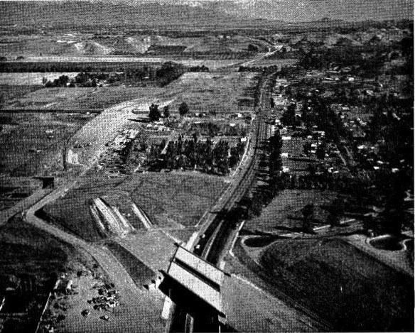
| (1956)* – Aerial view looking east showing the construction of the Ventura Freeway Bridge over Ventura Boulevard, east of Shoup Avenue. |
 |
|
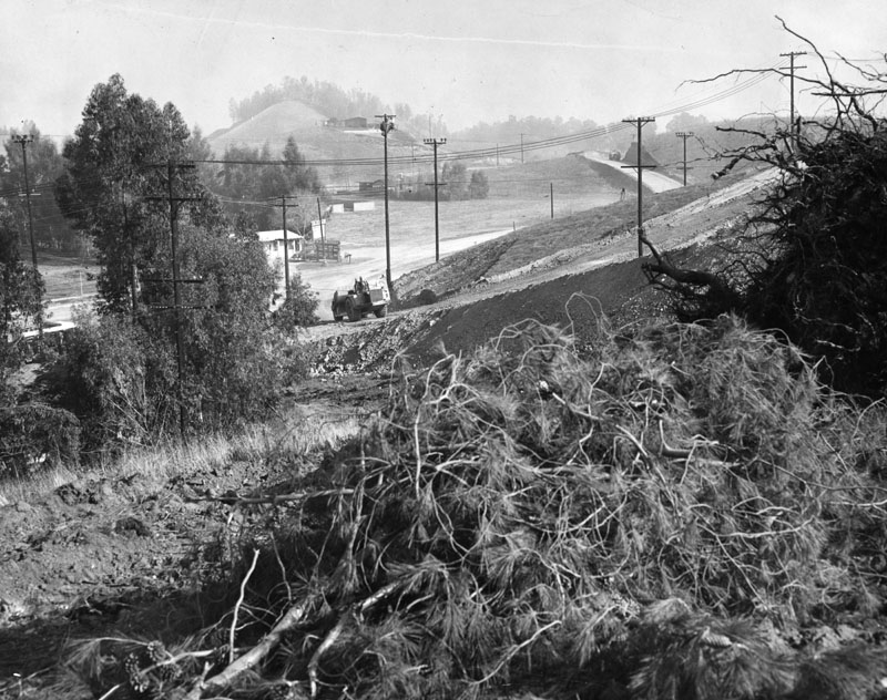
| (1956)* - Construction across Ventura Bouelvard in Woodland Hills, before freeway construction, near Shoup Avenue, about a mile west of Topanga Canyon. Photo dated: Jan. 11, 1956. |
 |
|
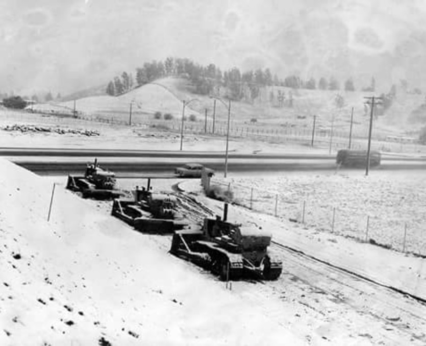
| (1957)*- January SNOW FALL has tractors stalled on the Ventura Freeway exit at Topanga Canyon Boulevard during freeway construction. Photo Date: January 29, 1957 |
Historical Notes The bulldozers are parked on the Topanga North off-ramp of the westbound 101. Across the street the cut for the Topanga South off-ramp can be seen. The hill in background is still there and is topped by the private homes on Como Circle. The bus is driving north on Topanga approaching Burbank Boulevard. |
 |
|
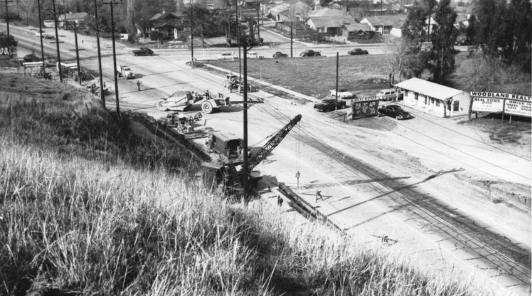
| (1950s)* - View looking west of street construction on Ventura Boulevard in Woodland Hills (near where the Ventura Freeway crosses Ventura Boulevard today). Cranes and other construction equipment sit along the left side of the street, while to its right sits the single-story Woodland Realty office. A sign to the right of the building advertises "Woodland Realty - Real Estate Service - 22233 Ventura Blvd - Drive in - Homes - Lots – Acreage." Another street (possibly Shoup), lined by parked automobiles, intersects the main street in the upper portion of the image. |
* * * * * |
Ventura and Canoga
 |
|
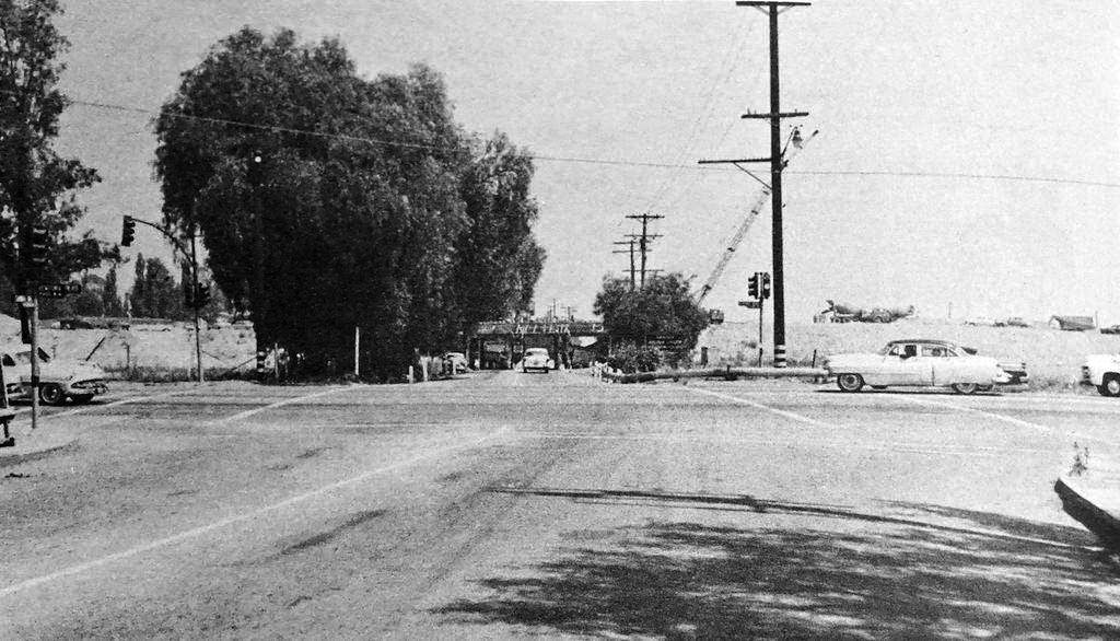
| (1957)^ – View looking north on Canoga Ave at Ventura Boulevard. In the background can be seen the construction of the Ventura Freeway. Today, Whole Foods is on the NE corner and Vista Ford is across the street on the NW corner. Click HERE for contemporary view. |
Then and Now
 |
|
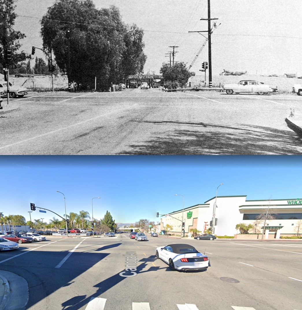
| (1957 vs 2021)* - Looking north on Canoga Avenue at Ventura Boulevard. |
 |
|
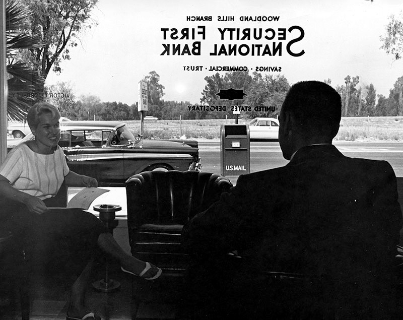
| (1961)* - Pictured is the Woodland Hills branch of the Security First National Bank, located at 21620 Ventura Blvd., Woodland Hills. A woman and man can be seen sitting in the lobby of the bank, and beyond the large glass 'wall', several automobiles are parked along the street, with a U.S. mailbox front and center. In the distance can be seen a car on the Ventura Freeway. Vista Lexus now occupies the empty lot across the street. |
* * * * * |
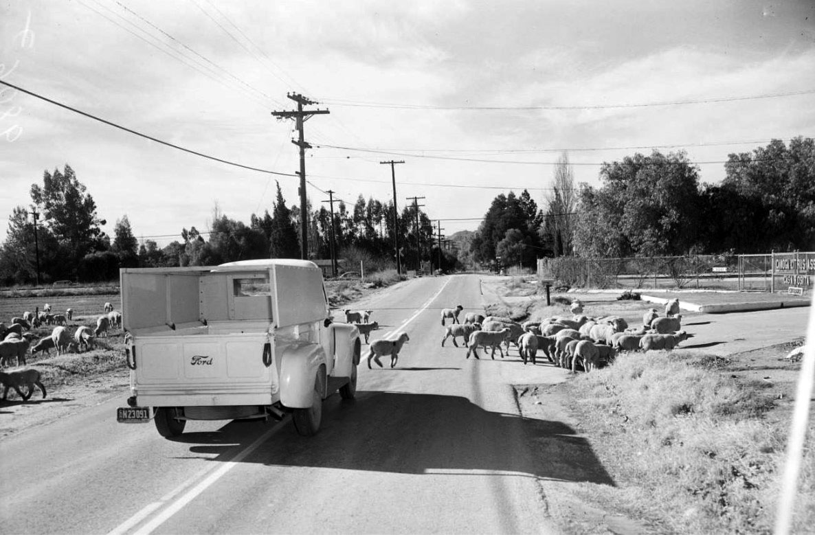
Sheep Along Ventura: Woodland Hills in the 1950s
 |
|
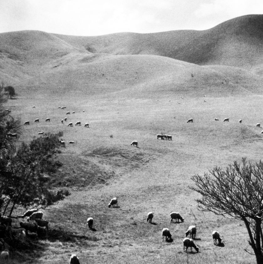
| (1950s) - Sheep grazing on the hills along Ventura Boulevard in Woodland Hills. |
Historical Notes In the 1950s, flocks of sheep were a familiar sight across the San Fernando Valley. Ranchers routinely moved their herds from one hillside to another, allowing them to feed on open grasslands before the land was developed. At that time, Woodland Hills was still largely rural, with wide stretches of farmland and ranch property. Over the next few decades, as Los Angeles’ population grew and housing demand soared, these open spaces were transformed into neighborhoods and commercial centers. The agricultural era faded—and with it, the pastoral scenes that once defined life along Ventura Boulevard. |
 |
|
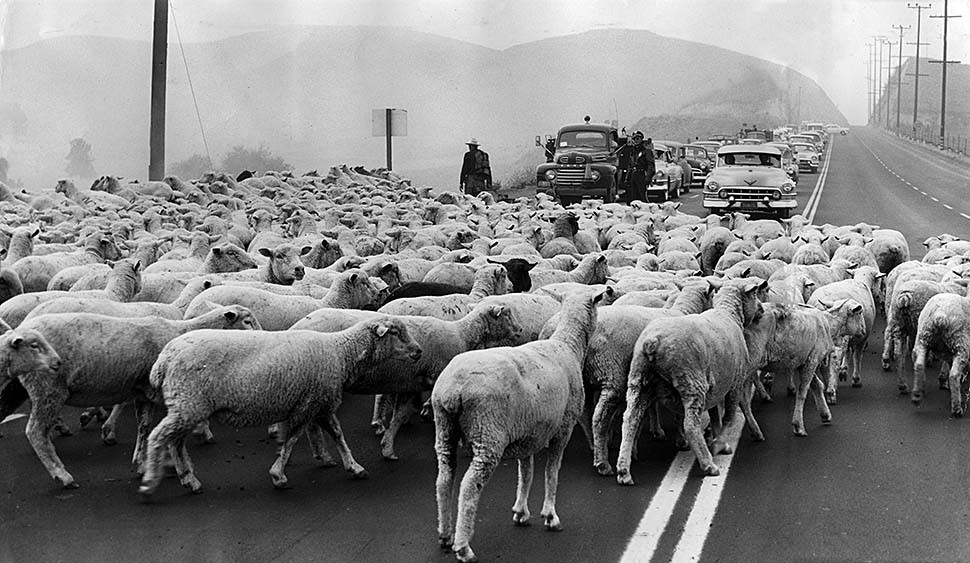
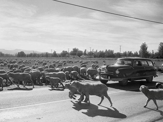
| (1955)* - With the help of policemen, sheep are moved across Ventura Blvd in Woodland Hills. View is looking west on Ventura Blvd toward Chalk Hill from near Winnetka Ave. Taft High School, would open on the left in 1960. |
Historical Notes A Los Angeles Times article dated October 18, 1955, described the unusual scene:
During this period, much of the San Fernando Valley still reflected its ranching roots. But within a few short decades, urbanization would overtake agriculture, and Ventura Boulevard—once lined with grazing hills—would become a major commercial corridor. These glimpses remind us that before shopping centers, gas stations, and traffic lights, Woodland Hills was part of a quieter, rural landscape where livestock still roamed freely. |
Then and Now
 |
|
| (1955 vs. 2020s)* - Looking west on Ventura Blvd toward Chalk Hill from near Winnetka Ave. Taft High School seen on the left, would open in 1960. Comparison photo by Trey Callaway. |
Historical Notes This “Then and Now” comparison shows just how dramatically Woodland Hills has changed. In the 1955 view, the hills were still mostly undeveloped, with open slopes and a few scattered structures. In the modern 2020s photo, the same stretch of Ventura Boulevard is now lined with trees, cars, and commercial buildings. The transformation mirrors the story of the entire San Fernando Valley — a region that evolved from rural farmland into a suburban cityscape. By the 1960s, sheep grazing had disappeared entirely, replaced by schools, homes, and busy streets. Scenes like these capture a fleeting moment in time — when Woodland Hills was still a bridge between Los Angeles’ agricultural past and its suburban future. |
* * * * * |
Lindley Bothwell Ranch (Woodland Hills)
 |
|
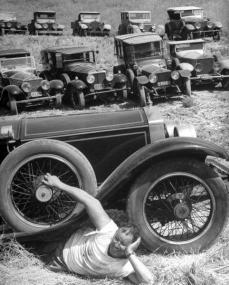
| (1963)* - Valley Times photo caption reads "Small part of Lindley Bothwell's huge car collection stares out of barn." - August 1, 1963 |
Historical Notes Lindley Bothwell was born in L.A. in 1901. He was a USC graduate, prosperous Southern California orange grower, a citrus agriculturalist from his Lindley Bothwell Ranch located at 5300 Oakdale Avenue in Woodland Hills, and an antique automobile collector and racer.^ |
 |
|
| (ca. 1960s)^.^ - View showing Lindley Bothwell posing for the camera as he relaxes under a 1948 Rolls Royce with the rest of his Rollers “collection” seen in the background. |
Historical Notes Bothwell collected antique cars and created vintage racing in the US in the 40s & 50s. By 1954, he was the owner of the largest private antique automobiles collection in the country. His impressive collection included the 1911 Rolls-Royce of the last tzar of Russia. At its peak the Bothwell collection numbered 88 cars. He served as the Los Angeles regional executive of the Sports Car Club of America.^ |
 |
|
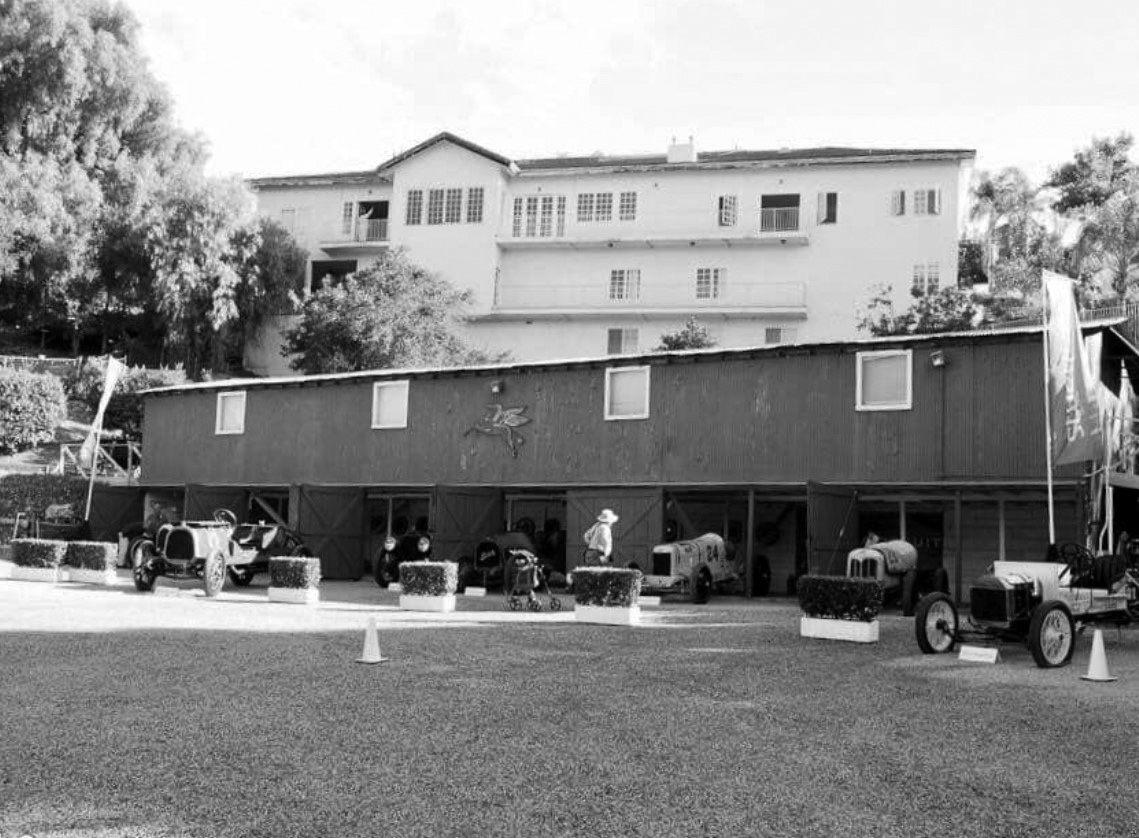
| (2017)^* - View showing the Bothwell Barn with vintage model cars on display as it appears today. |
Historical Notes On November 11, 2017 An auction of the Bothwell collection brought in over $13 million in sales, including the significant 1914 Peugeot grand prix race car that topped the charts at $7.26 million.^ |
 |
|
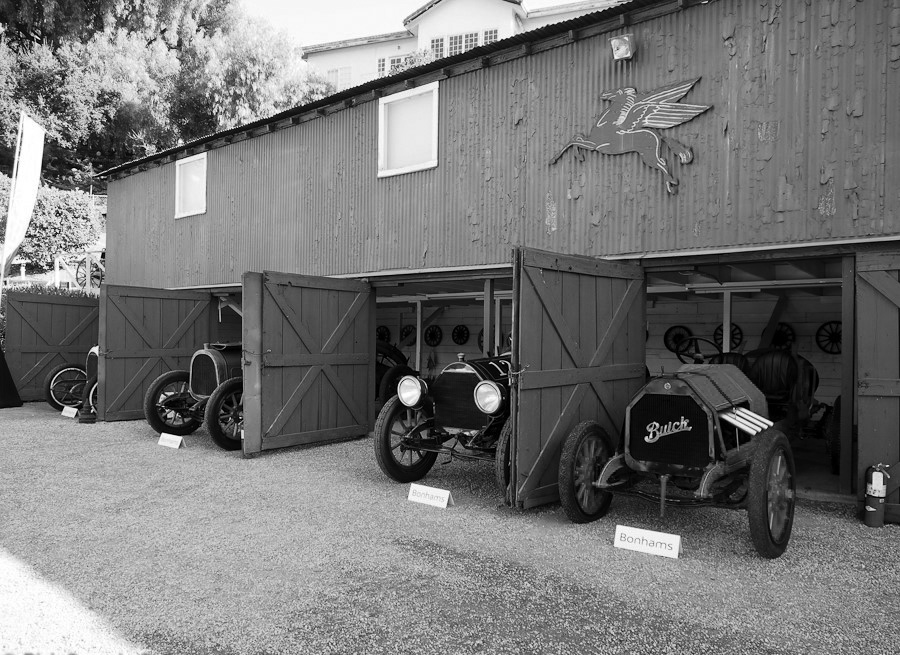
| (2017)^* - Close-up view of Bothwell’s Barn with more antique cars on display during an auction. |
Historical Notes In addition to the antique cars, Brothwell also collected, trains, horse-drawn streetcars and had the only private collection in the world at the time. Bothwell built a rail line and a tram barn on his ranch, to keep them in working order and entertain guests. |
 |
|
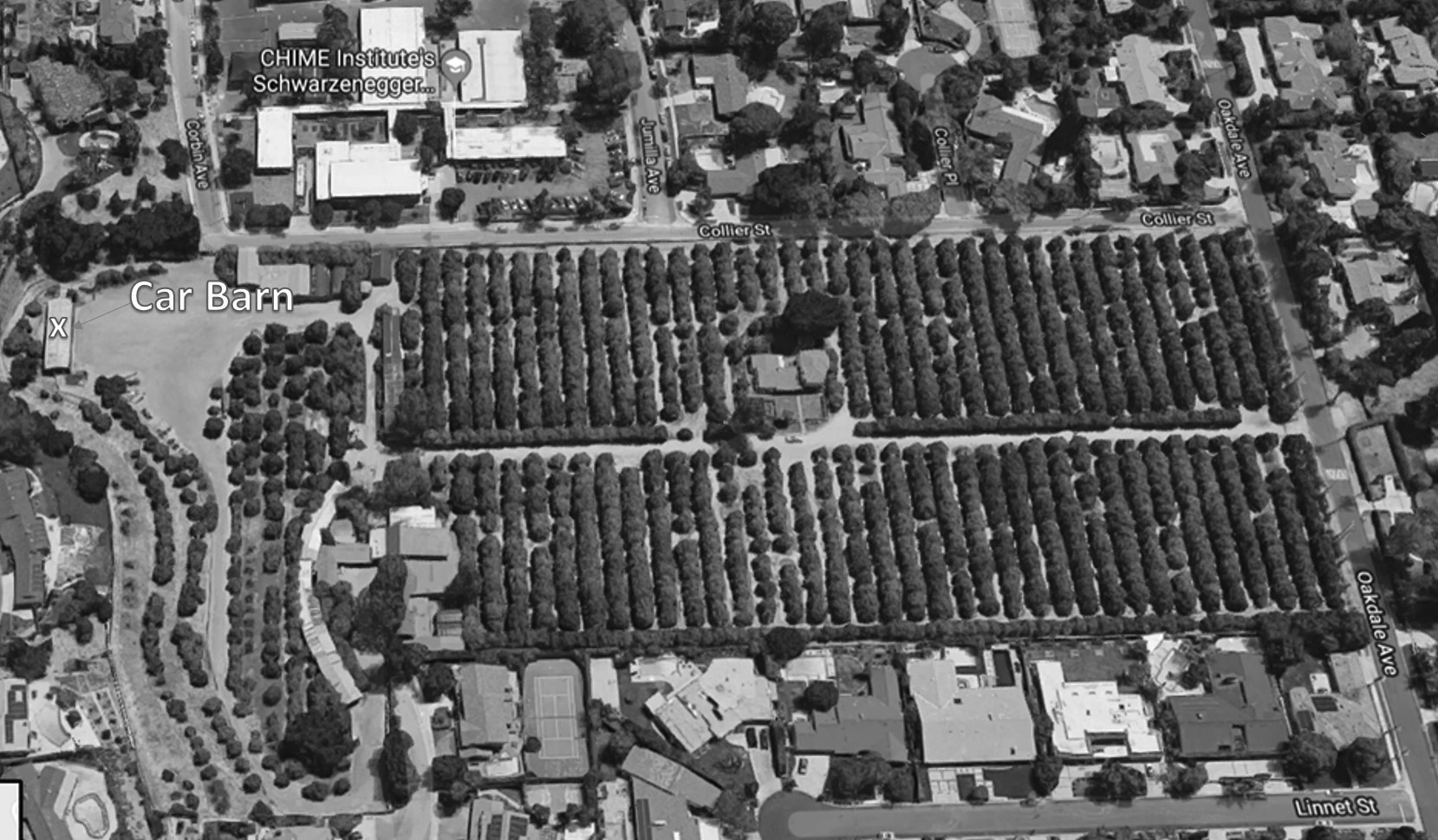
| (2019)*^ - Aerial view looking down at the 14-acre Lindley Bothwell Ranch located at 5300 Oakdale Avenue in Woodland Hills showing the last commercial orange grove in the Valley. Bothwell’s Car Barn is seen on the left. |
Historical Notes The 14-acre orange ranch is the last commercial orange grove in the Valley. Brothwell died in 1986 and his widow, Ann, looked after the ranch and his collections until her death in 2016. The ranch has been passed down to their grandchildren as she outlived her children.^ |
Chalk Hill
 |
|
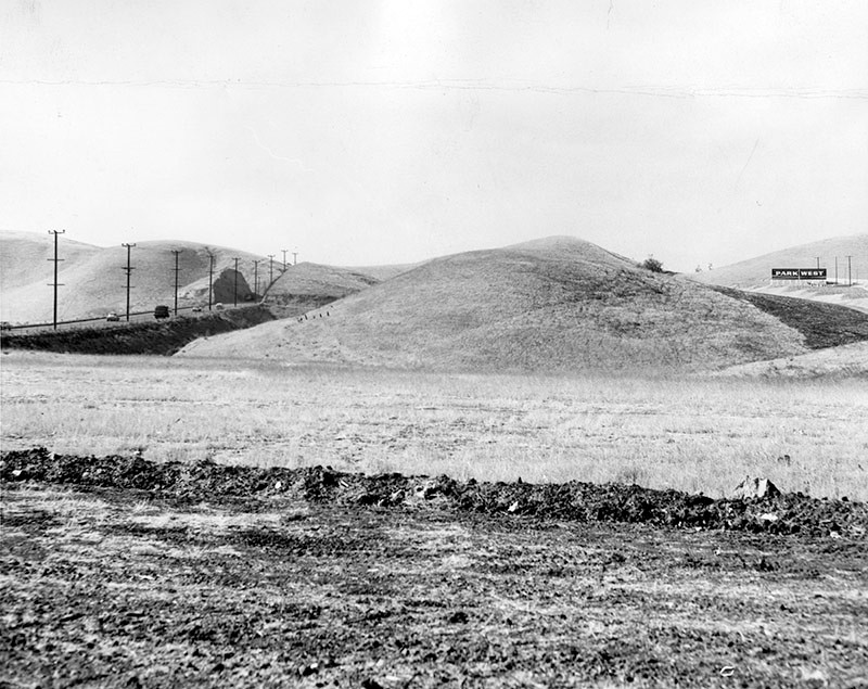
| (1956)* – View showing Ventura Boulevard as it cuts through ‘Chalk Hill’ in Woodland Hills. |
Historical Notes Photograph caption dated December 26, 1956 reads "Ventura boulevard cuts through famous hills that divide East Woodland Hills from Woodland Hills. Area to south of cut is earmarked for $6 million high school in future. Plans call for a facility similar to Reseda High School with room for some 2,500 students, modern buildings and athletic fields. Southeast of this location is remainder of large estates which once made up much of residential area. Beautiful home and spacious grounds of Lindley Bothwell on Oakdale avenue are example of 'what used to be.' Other sections of area fell under 'urban yoke' and modern structures are addin every day to medern look of community." |
 |
|
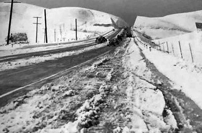
| (1949)^.^ – View showing the aftermath of a snowstorm at Chalk Hill along Ventura Blvd. Courtesy of Drew Watson from a Canoga Park High School yearbook. |
Historical Notes The CPHS website mentions snows in 1915, 1923, 1932, 1941, 1949, 1957 and 1989. |
 |
|
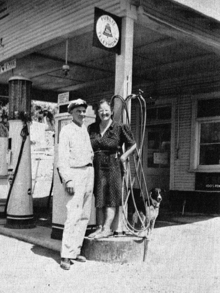
| (1944)#^*^ – View showing Rudolph and Marie Langraf posing with dog in front of their gas station on Chalk Hill. Photo Credit: ‘The History of Woodland Hills and Girard’, Richard K Cacioppo |
Historical Notes In 1922, Austrian Rudolph Francis Langraf purchased twelve acres on Chalk Hill, and soon after earned his nickname ‘The Kaiser of Chalk Hill’. He and his wife, operated a Chalk Hill rest stop and gas station for three decades. Known as the “Drinking Post,” it became the eastern gate for what would eventually be called Woodland Hills.#^*^ |
 |
|
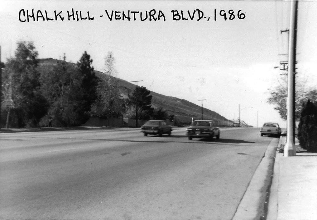
| (1986)#^*^ – View looking west on Ventura Boulevard from the front of Charley Brown’s Restaurant (later Victoria Station) with 'Chalk Hill' seen on the left. |
Historical Notes Click HERE to see more early views of Chalk Hill. |
Pierce College
 |
|
| (1947)#*^* – Panoramic view of Pierce School of Agriculture (now Pierce College) the year it was formed. |
Historical Notes Pierce College was founded in 1947 through the efforts of Clarence W. Pierce, M.D. The land for the college was purchased by the L.A. City School District (now the L.A. Unified School District). The original name of the college was the Clarence W. Pierce School of Agriculture. Two hundred and twelve WWII veterans entered the first classes. |
 |
|
| (1954)* - Pierce Junior College open house, 9 May 1954. Los Angeles Examiner Collection |
Historical Notes By the early 1970's the college had 2,000 students taking classes in agriculture. Four hundred and fifty head of cattle (114 dairy cattle), 250 head of sheep, 250 of swine and 6,000 poultry made up the livestock portion of the college farm. A fifteen acre orchard, green houses and fields of alfalfa, oats, pumpkins, melons and various other field crops were used to educate our students. In 1947, Los Angeles County was the leading agriculture county in the United States.* |
 |
|
| (1956)* – Valley Times photograph caption dated December 26, 1956 reads "A close-up of Pierce Junior College administration and education buildings show architectural style well suited to valley tradition. School which started as primarily an agricultural college now has major enrollment in liberal arts and technical education. Newly finished Calvert street grammar school located due east of college already is operating to capacity in growing, progress-minded East Woodland Hills." |
Historical Notes As the San Fernando Valley grew, the need for a comprehensive community college to serve the region was apparent. The college changed its name and its mission when it became Pierce College. The college’s core buildings were constructed and enrollment grew from a hundred or so in 1947 to more than 25,000 at its peak in the early 1980s.* |
Candy Cane Lane (Woodland Hills)
 |
|
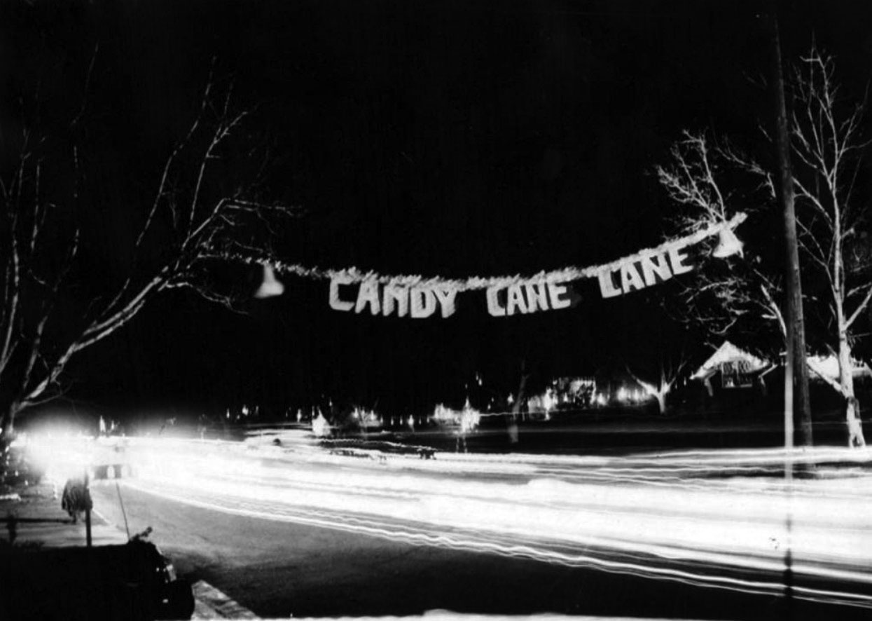
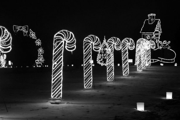
| (1953)* - Photograph caption dated December 23, 1953 reads, "At night Lubao avenue, East Woodland Hills, is a fairyland of Christmas lights. Neighbors along three blocks each use crossed candy canes, decorated mailboxes and tinkle bells, then add what their imagination dictates." |
Historical Notes The Christmas spirit on Candy Cane Lane dates back to 1951, according to Daily News archives, when the newly built neighborhood was surrounded by walnut groves and the 101 Freeway didn’t stretch farther west than Sepulveda Boulevard. More contemporary accounts date the tradition to 1952. The Valley News & Green Sheet, predecessor to the Daily News, credits the themed decorations up and down Lubao Avenue to a Helen Couzens in December 1953. A neighbor asked everyone to meet and to bring their own coffee cups. During the kaffeeklatsch, residents decided they would decorate their homes for Christmas, planting stovepipe candy canes along the curb. Themes developed for local streets. Lubao Avenue came to be dubbed Candy Cane Lane. Jumilla Avenue came to be called Avenue of the Bells. Oakdale Avenue became Candlelight Lane. And nearby Penfield Avenue turned into Caroler’s Way. Homes further afield followed suit. Neighborhood celebrities from actor Mickey Rooney to Chuck Connors supported it, residents say. Actor Sean Penn grew up on Lubao Avenue.^ |
 |
|
| (n.d.)^.^ - Christmas decorations at Candy Cane Lane. |
Bob Burns Ranch (aka 'Bazooka Berk' Ranch)
 |
|
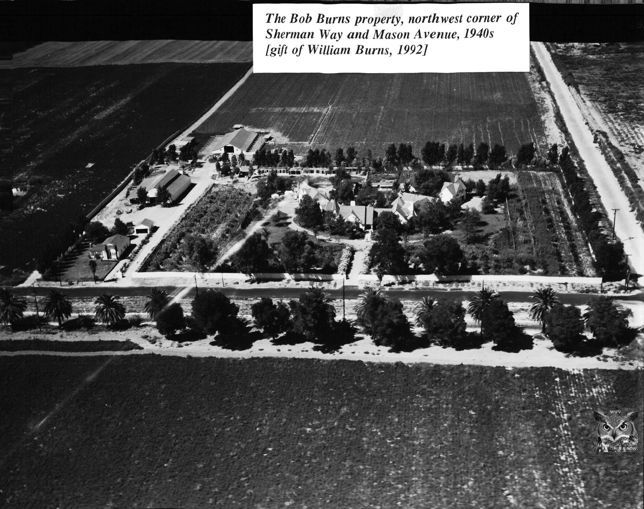
| (1940s)#^*^ – View showing the Bob Burns property at the northwest corner of Sherman Way and Mason Avenue. Photo courtesy of the Canoga-Owensmouth Historical Society. |
Historical Notes “Bazooka" Bob Burns was a radio personality from the 1930’s – early 1950’s who made Canoga Park his home. He owned quite the acreage of property at the NW corner of Sherman Way and Mason. He named this ranch “Bazooka Berk” and raised prize-winning Berkshire swine here, as well as many agricultural crops. The ranch he called home included anywhere from 60-200 acres, according to various sources, which dwindled to 10 acres at the time of his death in 1956. He owned additional acreage in the valley; as much as 500-600 acres according to some sources. He was well-liked in the town, serving as its honorary mayor for a number of years in the late 1940’s – early 1950’s. After his death in February 1956, the estate traded a piece of the property to First Baptist Church for another parcel just west of Cozycroft, for which to build their church. Another note about the property. In an interview, Bob Burns said that he designed the whole site all by himself, without the aid of an archictect or contractor. |
 |
|
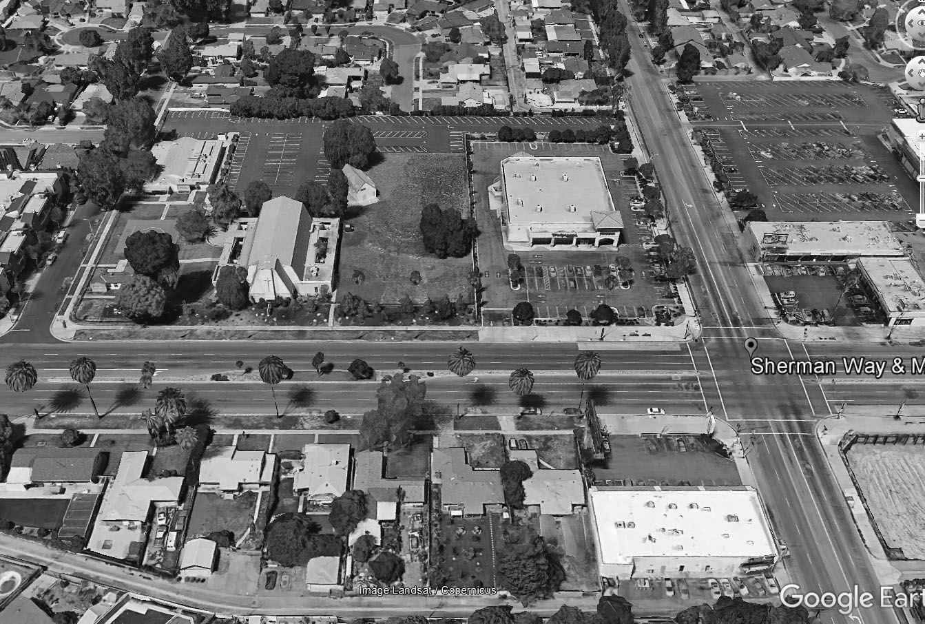
| (2017)#*^# – Google Earth View showing where the Bob Burns Ranch once stood as it appears today. First Baptist Church is seen at center-left (NE corner of Sherman Way and Cozycroft Ave) and a Walgreens stands at center-right (NW corner of Sherman Way and Mason Ave). |
Hancock Service Station (Canoga Park)
 |
|
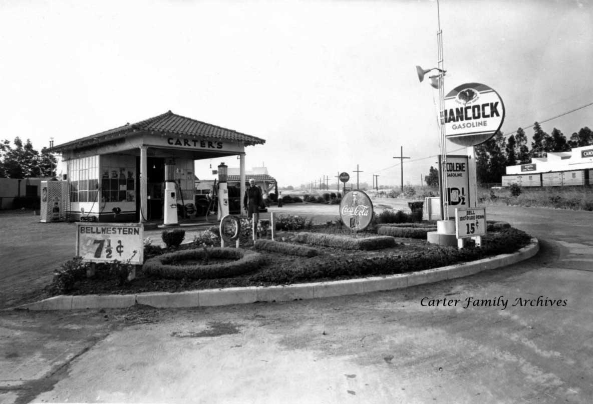
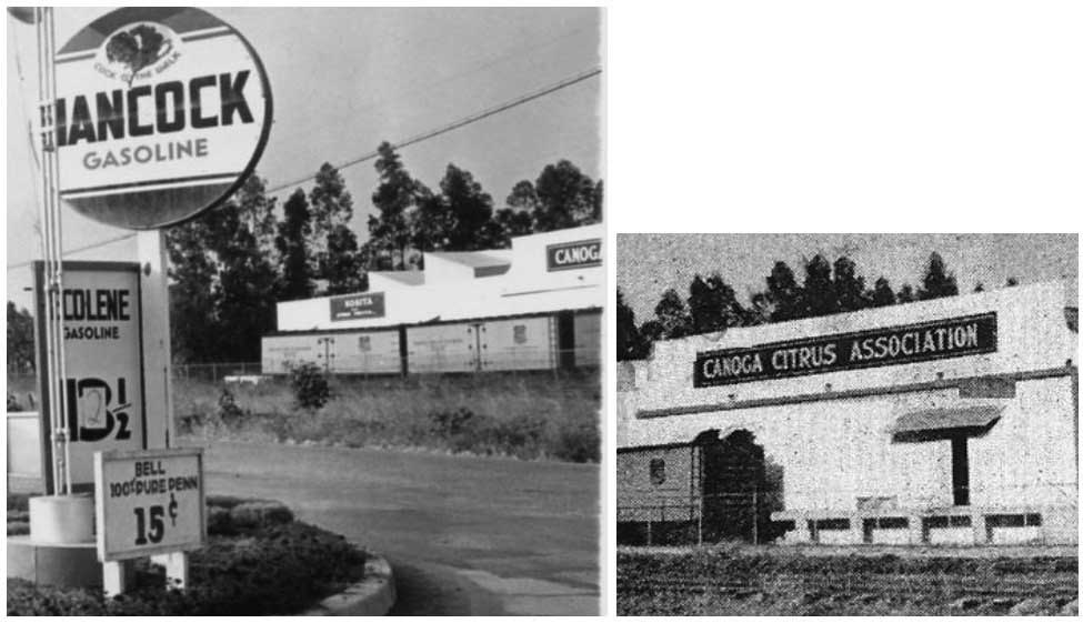
| (ca. 1930s)* – View looking at the NW corner of Roscoe and Canoga Ave showing Carter’s Hancock Gas Station. Across the street, East side of Canoga, can be seen the Canoga Citrus Association Building (today occupied by the Salvation Army. Photo Courtesy of the Carter Family |
Historical Notes Mr & Mrs Carter lived on Chase St in Canoga Park, as seen in city directories in 1937 & 1939, as well as the US Census in 1940. Today, a Chevron station is located on the NW corner of Roscoe and Canoga. Click HERE to see Contemporary View. |
 |
|
| (ca. 1930s)* – Close-up view showing the Canoga Citrus Plant across the street from Hancock Gas Station. Note the gas price has been modified from 13 ½ to 12 ½ Cents. Photo Courtesy of Keith Hart |
Historical Notes HANCOCK Oil Company was headquartered in Los Angeles. In the 1850’s, lawyer Henry Hancock helped the Rocha family establish their legal claim to Rancho La Brea, but they ended up owing him so much in fees that they gave him part of the rancho in payment. In 1860 Hancock and his brother bought the rest of the rancho. Hancock began to sell asphalt produced from the famous tar pits that gave the rancho its name. This was the beginning of the Hancock Oil Company. In 1885 Hancock’s widow leased part of the rancho to eastern oil men who went bust by 1888. But in 1902, Mrs. Hancock leased part of the rancho to the Salt Lake Oil Company, which proved a great success. Henry Hancock’s son, George A. Hancock, who had learned the oil business working for Salt Lake, established his own company in 1906. By February 1907, he had over 70 wells producing nearly 300 barrels a day, making the Hancock's one of California’s wealthiest families. The Hancock family built Hancock Park, a large upscale apartment community. The Hancock Oil Company was sold to Signal Oil in 1958. In 1965 Signal was sold to Humble, and both the Hancock and Signal brands vanished.* Click HERE to see more Early LA Gas Stations. |
* * * * * |
Owensmouth and the Canoga Citrus Association
 |
|
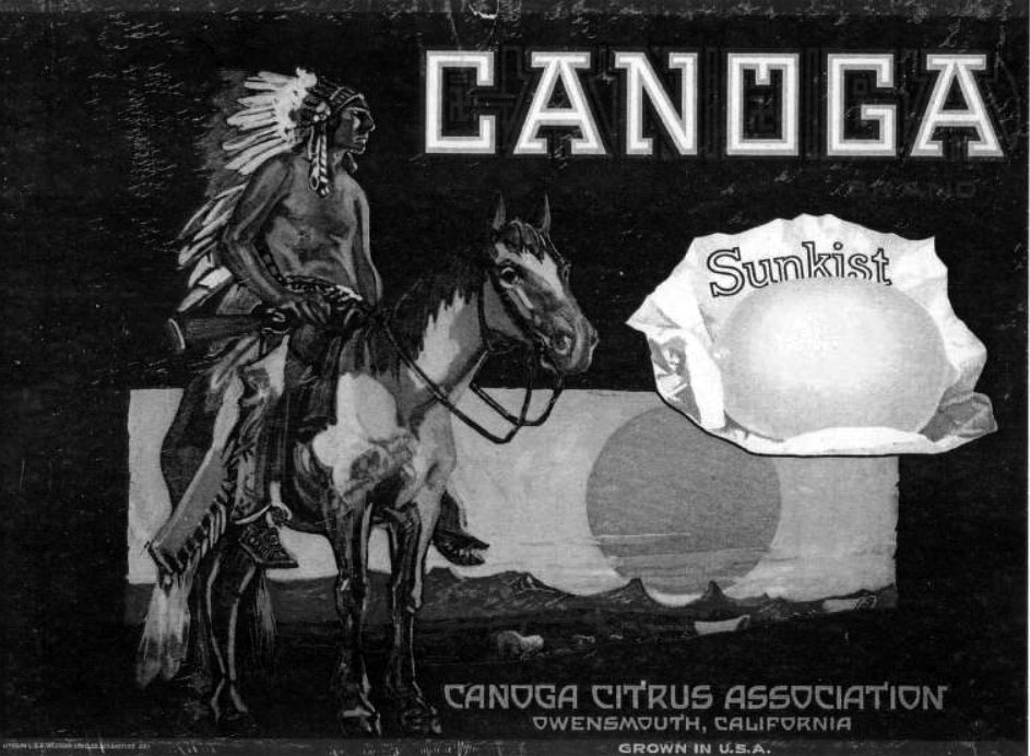
| (ca. 1928)^^ – Facsimile of Sunkist & Canoga Citrus Association crate label, Owensmouth (later known as Canoga Park). |
Historical Notes Only after Los Angeles annexed Owensmouth in 1917 did aqueduct water flow into town. The arrival of Owens Valley water made citrus groves and other forms of intensive agriculture possible. Sunkist used the Canoga name, which previously referred to a watering hole at the site of the town. The town was located on the site of an old well used by stagecoaches and local settlers. When the Southern Pacific built a branch line through the area, it designated the spot Canoga, after the town of Canoga, New York, which in turn took its name from the Indian village of Ganogeh ("place of floating oil").**^^ |
 |
|
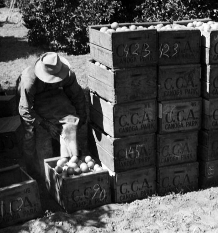
| (ca. 1940s)#^*^ – View showing a laborer loading oranges into crates to be brought to the Canoga Citrus Association packing house for processing. The crates are stamped "CCA" which is the abbreviation for the Canoga Citrus Association. |
 |
|
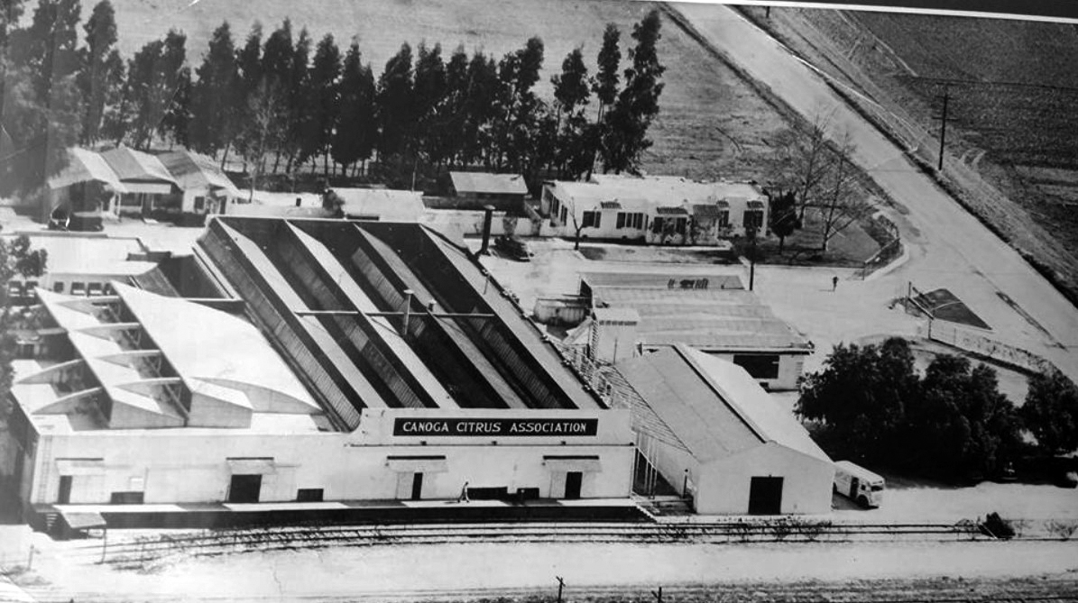
| (ca. 1950)#^*^ – Aerial view looking east showing the Canoga Citrus Association processing plant located on Roscoe and Canoga. Today it’s the Salvation Army building. |
Historical Notes The Canoga Citrus Association plant was located near the northeast corner of Roscoe & Canoga. It began packing oranges in 1927, with at least 25 brands packaged at this site.*^^^ |
 |
|
| (1953)*^^^ – View looking west showing sheep crossing Roscoe Boulevard near Canoga Avenue in Canoga Park. The entrance to the Canoga Citrus Association processing plant can be seen on the right. |
 |
|
| (ca. 1950s)##* - View looking northeast showing sheep crossing Roscoe Boulevard in Canoga Park* while a 1951 Nash Rambler Station Wagon waits. |
Historical Notes *In the late 1920s, residents and business leaders suggested that their town's name revert back to Canoga, complaining that Owensmouth suggested a location hundreds of miles away in the Owens Valley. Concerns about the community's image may have inspired the campaign, too; the older suburbs of East Los Angeles and Sherman had recently changed their names to Lincoln Heights and West Hollywood, respectively. In 1931, Owensmouth became Canoga Park. (The Post Office insisted on adding "Park" to avoid confusion with Canoga, New York.)**^^ |
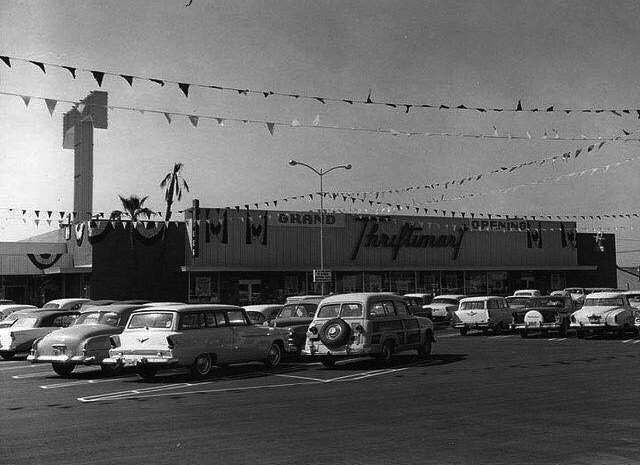
Thriftimart
 |
|
| (1950s)^.^ - View showing the Grand Opening of Thriftimart located at 20934 Roscoe Boulevard, SW corner of Roscoe and DeSoto. Although the big “T” is gone, the building still exists with a Sam Ash Music Store and a Dollar Tree Store taking up the space. Click HERE for contemporary view. |
Historical Notes Burning bright above the San Fernando Valley and L.A. Basin at dusk were the red, 40-foot tall "T's" - the iconic logo of the late, great Thriftimart supermarket chain. These gigantic signs emerged on the local landscape through the 50's and 60's. The company that would eventually be named Thriftimart, Inc. was created in 1930 when a group of former A&P managers headed by Roger Laverty, Sr. purchased a company called Fitzsimmons Stores, Ltd. (the name the company would bear until well into the 1950's). In its earlier years, the company grew through acquisitions, including the 9-store "Thriftimart" and the 17-store Roberts Markets chains in the 1940's. In 1955, the company purchased the Smart & Final Iris Company, which at the time was strictly a wholesale operation. By 1961, the company had over 60 stores and had renamed itself after its famous trademark.* |
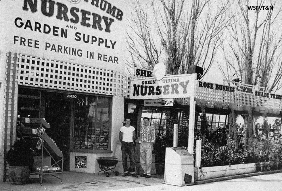
Green Thumb Nursery
 |
|
| (1951)#^*^ - View showing two young men posing in front of the entrance to Green Thumb Nursery, located at 21420 Sherman Way in Canoga Park. |
Historical Notes This iconic Canoga Park business was opened in October 1946 at 21420 Sherman Way by partners Dale Bergquist and Errol Newton, when Canoga Park was little more than 100 homes. The town grew, and in 1953, Green Thumb moved a few blocks west to the SW corner of Sherman Way and Jordan., where it continues to this day. In interviews, Bergquist credited his company's success to the growth of Canoga Park and the west San Fernando Valley and the demand for landscaping materials. Green Thumb eventually added stores in other communities, including Santa Clarita and Ventura, while Dale’s brothers Bob and Max later started and operated the Green Arrow Nursery, also in the Valley. This 1951 photo of the original location came by way of Canoga Park High School yearbook. #^*^ |
Arcade Block (originally Syndicate Block)
 |
|
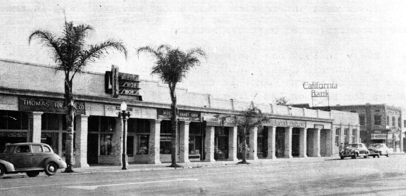
| (1940s)#^*^ – Panoramic view showing the Arcade Block on the 21500 block of Sherman Way with California Bank at the end of the long building. |
Historical Notes The Arcade Block (originally called Syndicate Block) was built circa 1912. It was the first commercial building constructed in the town of Owensmouth after the Owensmouth Station. The California Bank was originally occupied by Owensmouth Bank. Click HERE to see more early views of the Syndicate Block. |
 |
|
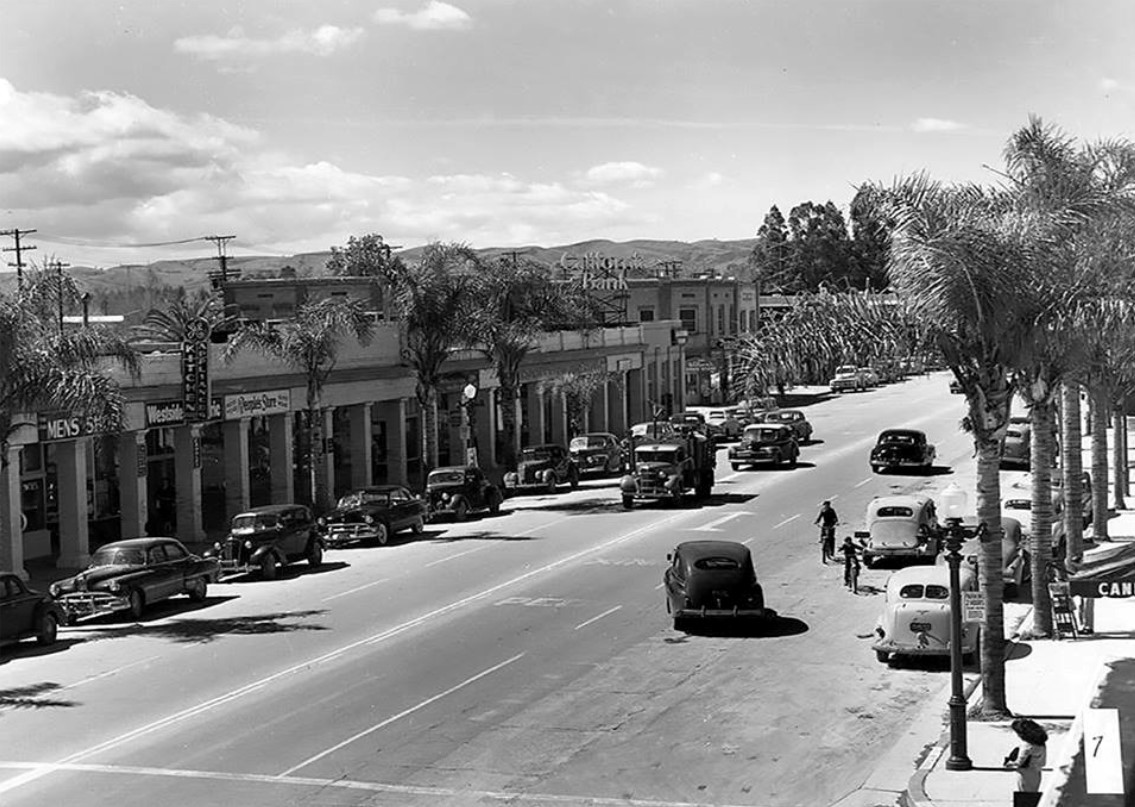
| (Early 1950s)#^*^ - View looking west on Sherman Way in Canoga Park. The California Bank, at center of photo, is on the southeast corner of Sherman Way and Remmet Avenue. |
 |
|
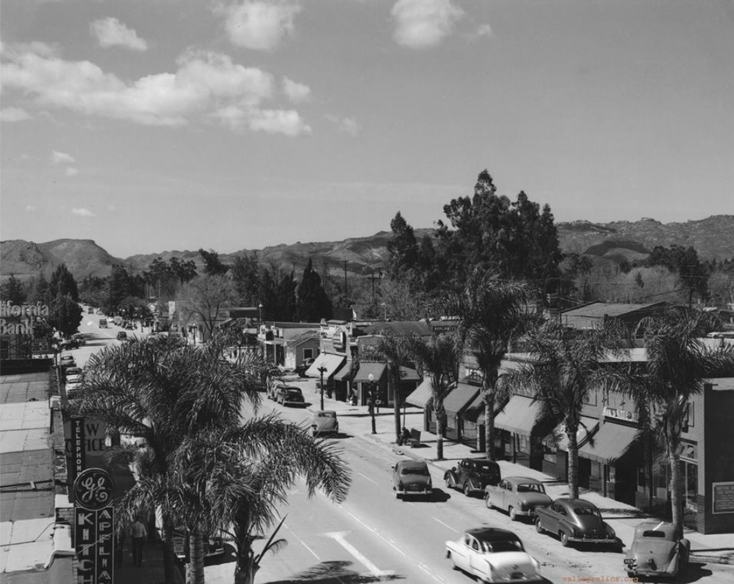
| (1950s)^^^* - View showing Sherman Way heading towards Topanga Canyon Boulevard as seen from near Alabama Avenue. California Bank is seen on the left. |
Canoga Park Post Office (Then and Now)
 |
|
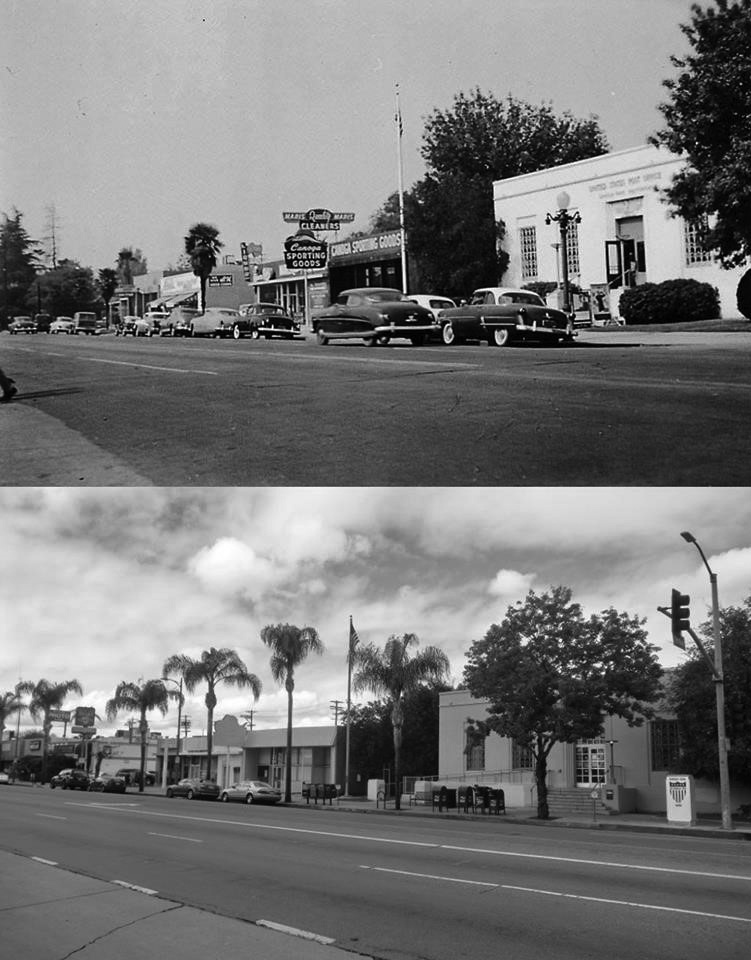
| (1955 vs. 2018)#^*^ – View looking northwest on Sherman Way from Jordan Avenue in front of Green Thumb Nursery showing the Post Office across the street at 21801 Sherman Way. |
Historical Notes In top photo, Canoga Sporting Goods is just west of the Post Office. Further west can be seen the Mar-Wick Food Mart. In bottom photo, Follow Your Heart is at the far left where Mar-Wick Food Mart was once located. |
Mar-Wick Food Mart (Today, Follow Your Heart)
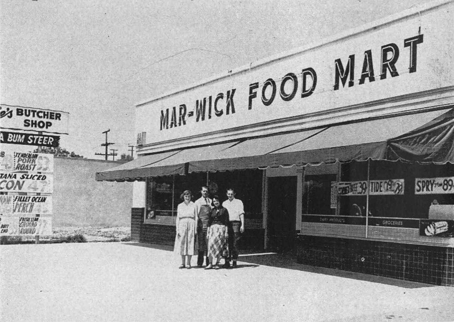 |
|
| (1951)#^*^ – View showing four people (employees/owners?) posing in front of Mar-Wick Food Market located at 21825 Sherman Way. Partial view of the sign on the left indicates that Larrie's Butcher Shop is inside. |
Historical Notes Before Follow Your Heart, there was Larrie's Butcher Shop. Chef's Pastry Shop opened in May 1949. Mar-wick Food Mart was in business by fall of 1950, and Larrie's opened up inside of Mar-Wick in January 1951. Larrie's soon expanded to include the entire building, and in 1958, enlarged the building by adding 50 feet to its depth. Follow Your Heart moved in in the mid 1970's. #^*^ Click HERE to see contemporary view. |
Valley Refrigeration Co. (Today, Work Boot Warehouse)
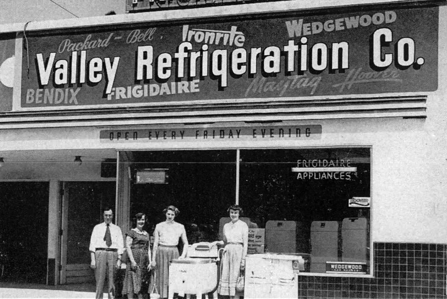 |
|
| (1951)#^*^ – Hayward Garlow, Katherine Gathers, Sally Curruthers, and Betty Babcock are standing next to a Maytag washer in front of the Valley Refrigeration Co. Store located at 21715 Sherman Way. |
Historical Notes The Valley Refrigeration Co. Store opened in the mid 1940’s. Today, the building is occupied by Work Boot Warehouse. Click HERE for contemporary view. |
Canoga Park (Red Line)
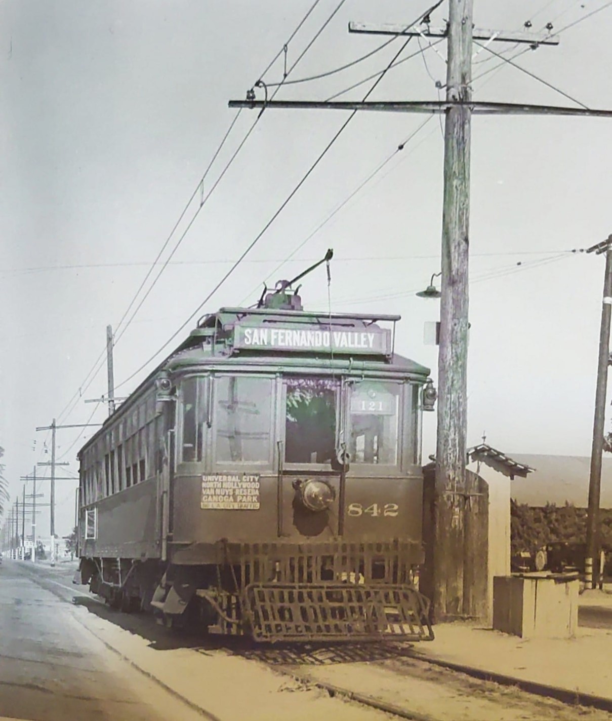 |
|
| (1937)* – Topanga Canyon Road (now Boulevard) at the end of the Canoga Park Line (Ernie M. Le Rasmussen Collection). |
Historical Notes "PE 842 has arrived at Topanga Canyon Road, now Boulevard, at the end of the Canoga Park line. Both trolley poles are down, so they will test out of service for a while. The number 121 in the right corner of the streetcar is its train number. Per PE employee timetable 13 effective 3:30 am of July 21, 1937, train 121 departed Daily except Sunday from Los Angeles (Subway Terminal) at 2-20 pm and arrived at Topanga Canyon Road at 3.48 pm. The trip was 29.10 miles in length. The image is dated July 1937." |
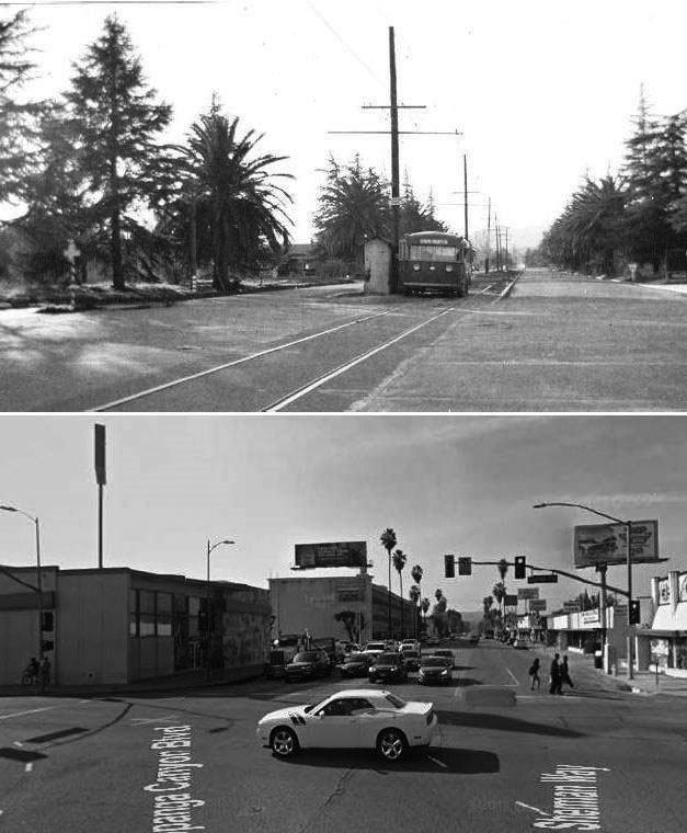 |
|
| (1941 vs. 2017)#^*^ – View looking west on Sherman Way at Topanga Cyn Blvd. |
Historical Notes In the 1941 photo (top), the Pacific Electric Cars had already been discontinued; replaced by motorized buses, which evidently utilized the center of the street, with the tracks still in the ground. |
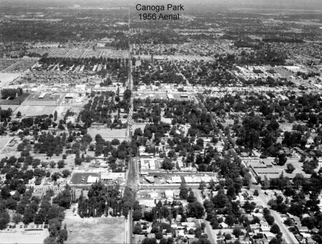 |
|
| (1956)#^*^ – Aerial view looking east over Canoga Park from just west of Topanga Canyon Blvd. Baskin-Robbins can be seen on Topanga just north of Saticoy (lower center-left). |
Historical Notes Baskin-Robbins was founded in 1945 by brothers-in-law Burt Baskin and Irv Robbins from the merging of their respective ice cream parlors, in Glendale, California. Burt Baskin owned Burton's Ice Cream Shop (opened in 1945) and Irv Robbins owned Snowbird Ice Cream (opened in 1946). Snowbird Ice Cream offered 21 flavors, a novel concept at that time. When the separate companies merged in 1953, the number of flavors was expanded to 31 flavors. By 1948, Burt and Irv had opened six stores. Today, Baskin-Robbins has more than 7,300 shop locations in nearly 50 countries.*^ |
De Young Service Station
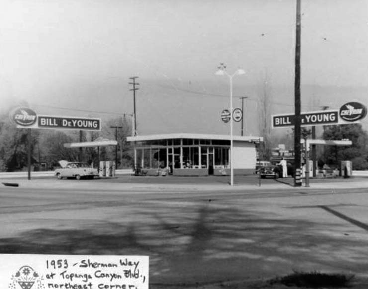 |
|
| (1953)#^*^ – View showing Bill De Young Service Station on the northeast corner Sherman Way and Topanga Canyon Boulevard. |
Then and Now
|
.jpg) |
|
| (1953)#^*^ - N/E Corner of Sherman Way and Topanga Canyon Boulevard | (2014)#*^# - N/E Corner of Sherman Way and Topanga Canyon Boulevard |
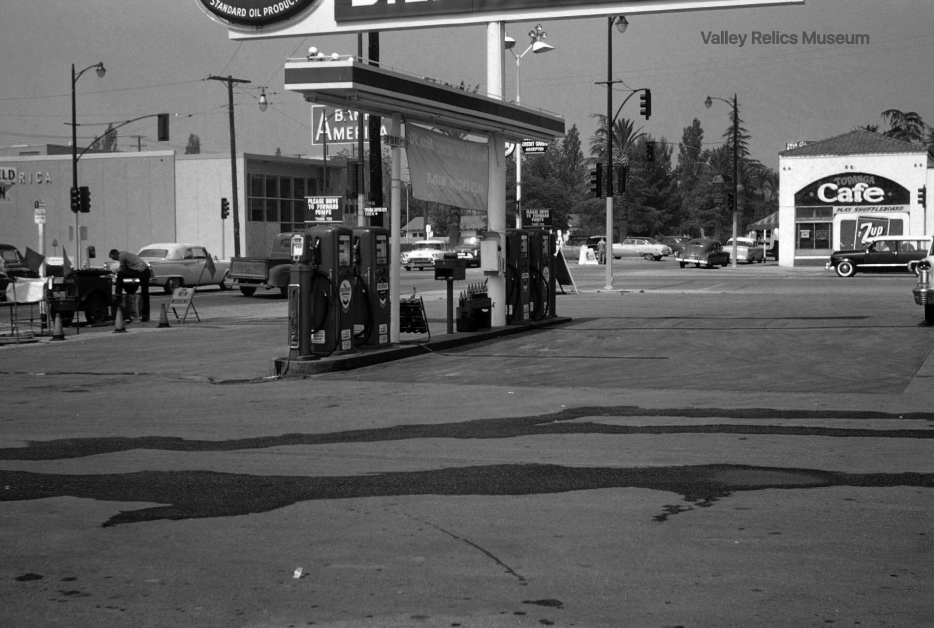 |
|
| (1957)^^^* – View looking northeast toward the intersection of Topanga Canyon Boulevard and Sherman Way from DeYoung gas station. Topanga Café is seen on the northwest corner. |
Historical Notes Today, Bank of America is still located on the southwest corner of Topanga and Sherman Way, while Conroy’s Flowers occupies the building where Topanga Café used to be. Click HERE for contemporary view. |
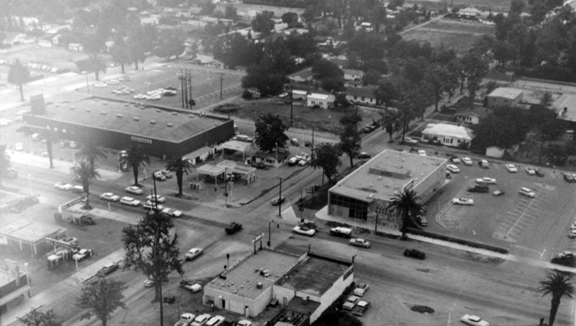 |
|
| (1960s)#^*^ – Panoramic aerial view of the intersection of Sherman Way and Topanga Boulevard, looking southeast. De Young Service Station can be seen at lower left (N/E corner). This is before Our Lady of the Valley Church was built (1968) on the corner of Gault Street and Topanga Blvd (upper-right). |
Shadow Ranch
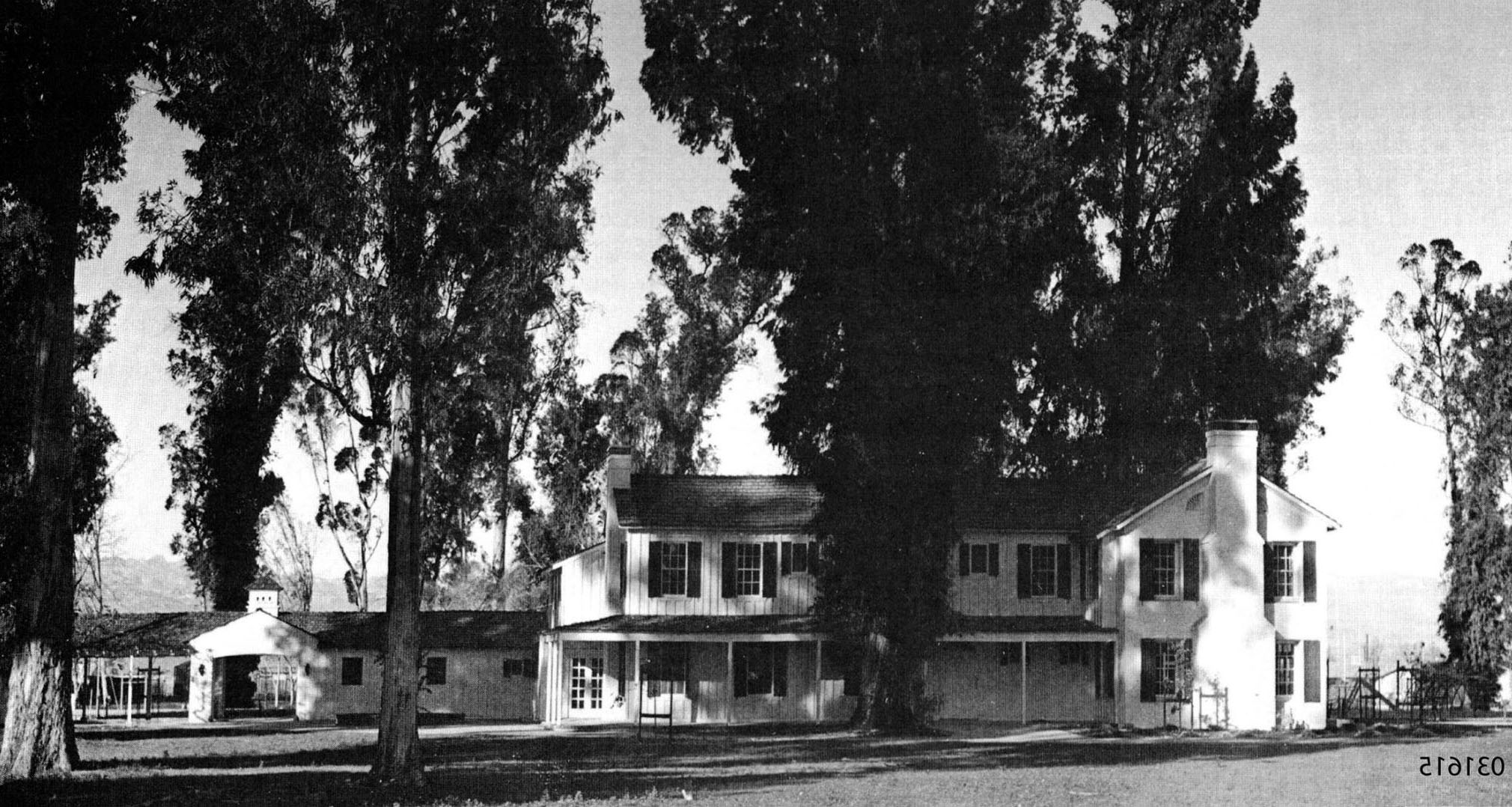 |
|
| (n.d.)#^*^ – View showing Shadow Ranch located at located at 22633 Vanowen Street in Canoga Park. (Note: Original image was inadvertantly flipped.) |
Historical Notes The ranch began as a dry-land wheat farm owned by the San Fernando Homestead Association led by Isaac Lankershim and Isaac Van Nuys. Albert Workman, an Australian immigrant, began as the superintendent of Van Nuys' Los Angeles Farm and Milling Company. After 1869 Workman purchased the 9,000-acre ranch, and cultivated it with another 4,000 acres nearby. The ranch also had a thousand head of cattle at one time. Workman imported Australian Blue Gum eucalyptus tree seeds from his homeland and planted them on the ranch. Some claim the numerous eucalyptus trees in California of that species, Eucalyptus globulus, originate from the Workman Ranch groves.*^ |
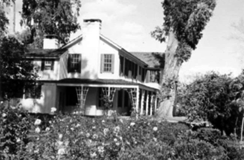 |
|
| (1958)#^ - Close-up side view of Shadow Ranch showing large eucalyptus trees surrounding the main house. |
Historical Notes The site has multiple Hollywood connections. In the 1930s the Workman Ranch was acquired by Colin Clements and Florence Ryerson, a couple who were screenwriters for the film studio. Ryerson co-wrote the screenplay for the 1939 film 'The Wizard of Oz' while living there. She renamed the estate Shadow Ranch for the amount of shade provided by the numerous large eucalyptus trees, originally planted during the Workman era. It was acquired in 1948 by another screenwriter, Ranald MacDougall, whose credits include "Mildred Pierce" and "Cleopatra." In 1961 movie director William Wyler used the ranch house as a filming location for 'The Children’s Hour', based on the play by Lillian Hellman.*^ |
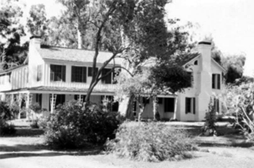 |
|
| (1958)#^ - Another view of the Shadow Ranch House on Vanowen Street in Canoga Park. |
Historical Notes In the 1950's, Shadow Ranch served as a private girls school called Robinnaire. Today, it is part of the Los Angeles City Recreation and Parks Department. #^ |
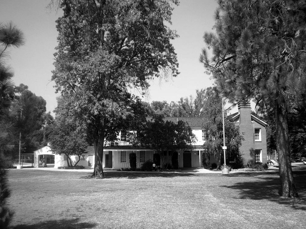 |
|
| (2008)*^ - View of Shadow Ranch House as it appears today. Location 22633 Vanowen Street |
Historical Notes Today, the historic Shadow Ranch residence stands on a 13 acres parcel, the remaining undeveloped land of the original ranch that is an L.A. city park. The structure is used as a recreational facility and events venue. When the Los Angeles Cultural Heritage Commission was formed in 1962, Shadow Ranch was one of the first ten properties to be designated as a city Historic-Cultural Monument No. 9 (Click HERE to see complete listing).*^ |
Chatsworth Reservoir
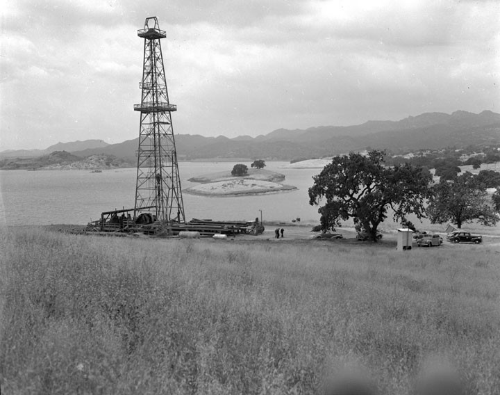 |
|
| (1943)** - View showing an oil derrick at the edge of the Chatsworth Reservoir. Photo title reads: Well #1 on Chatsworth Reservoir. Source - DWP Photo Collection |
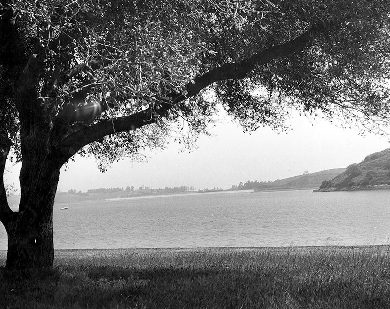 |
|
| (1956)* - Photograph caption dated May 25, 1956 reads, "Southwest of Chatsworth, quiet, silver waters of Chatsworth Lake dissect green hills and reflect centuries-old Oak trees dotting beautiful countryside. Site once had adobe settlement of early Spaniards but years have gradually crumbled it out of existence. Old sulphur springs still flow in area. Chamber of Commerce, women's club, American Legion and school buildings are now located near hub of present-day community at intersection of Devonshire Boulevard and Topanga Canyon." |
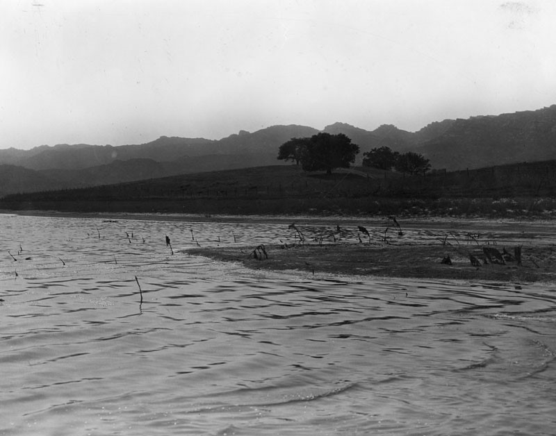 |
|
| (n.d.)*– Close-up view of the Chatsworth Reservoir looking northwest. |
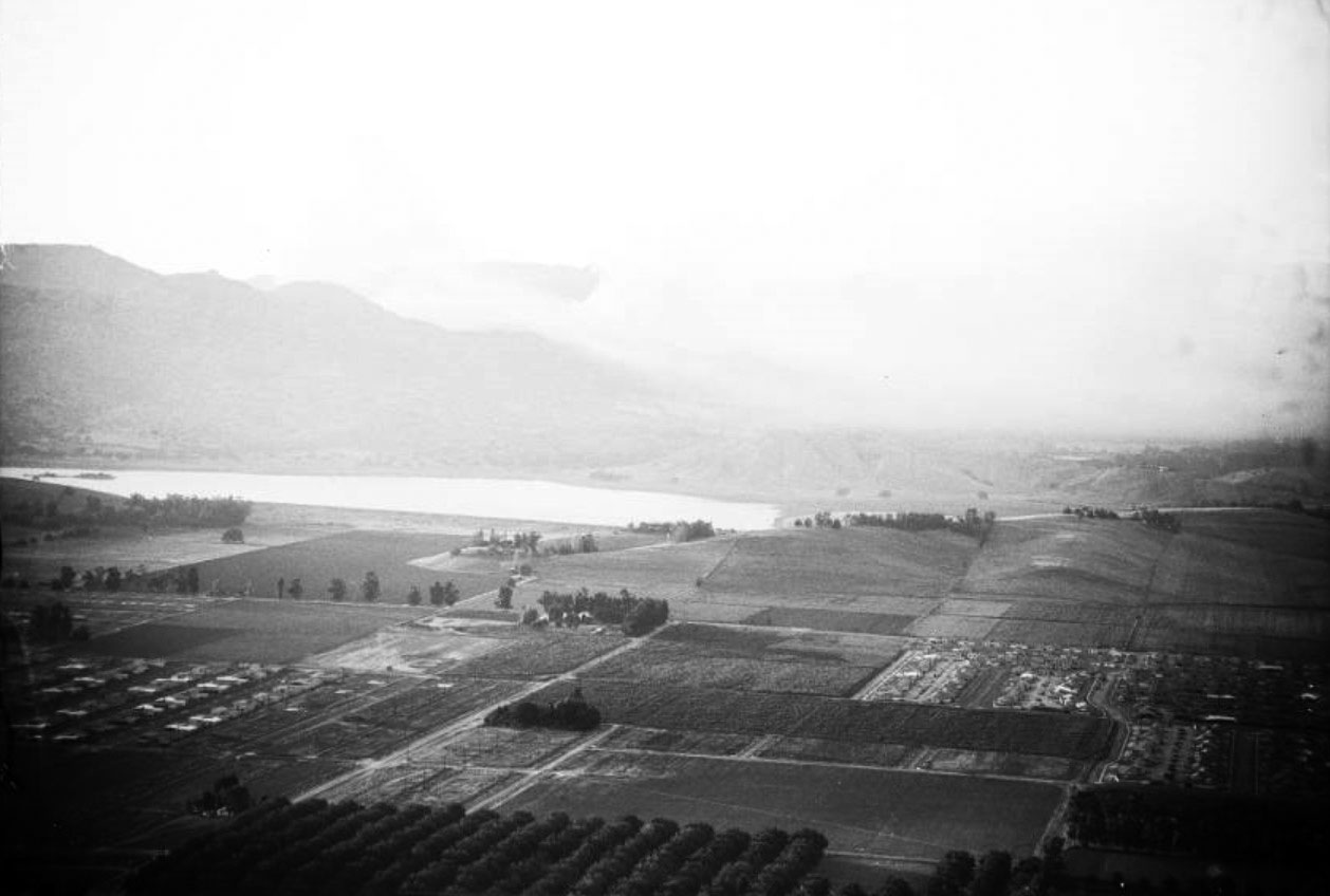 |
|
| (1957)^^ – Aerial view looking northwest over Canoga Park with the Chatsworth Reservoir at center-left. At center of photo is the T-intersection of Roscoe Boulevard and Shoup Avenue. A brush fire can be seen in Chatsworth (upper-right). Photo date July 3, 1957. |
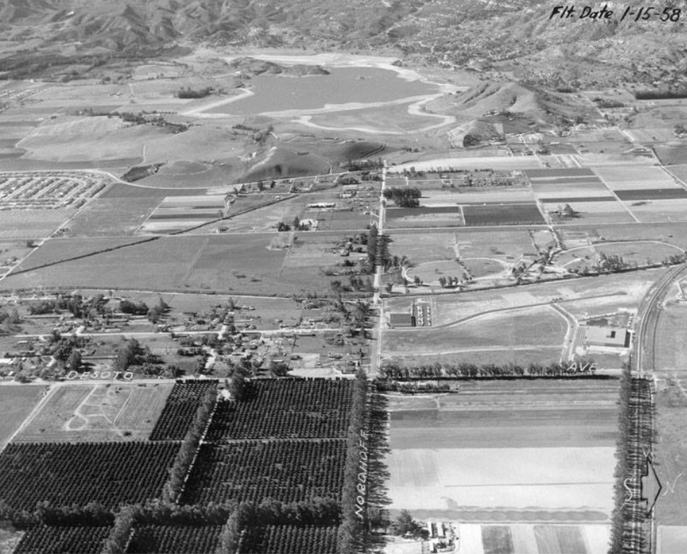 |
|
| (1958)* - Aerial view looking west on Nordhoff Street toward its intersection with Topanga Canyon Boulevard. The Southern Pacific tracks are on the right. The Chatsworth Reservoir, filled with water, is seen in the background. |
Historical Notes The Chatsworth Reservoir was completed in 1919 and used to store water for the West San Fernando Valley for over 52 years. After the 1971 Sylmar Earthquake it was placed out-of-service and pemanently retired.* Click HERE to see more in Early Los Angeles Water Reservoirs. |
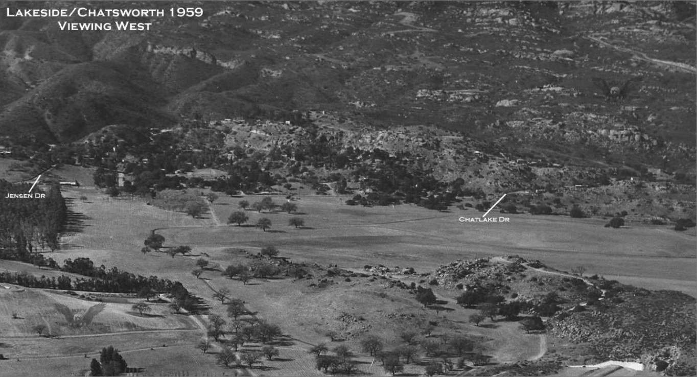 |
|
| (1959)#^*^ - View looking west across the southwestern portion of Chatsworth Reservoir showing the Lakeside Community, now a part of West Hills. No water appears in this section of the reservoir at the time. |
Historical Notes Lakeside came into existence in 1928/1929 and was comprised of 2 major subdivisions ~ Tract #'s 9889 & 9683. At its eastern base, along Valley Circle was a Park, seen in the center of the image. #^*^ |
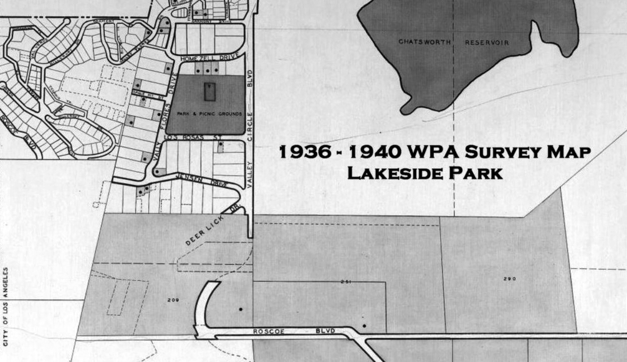 |
|
| (1930s)#^*^ – WPA Cultural Survey Map showing the community of Lakeside Park. Note the Park & Picnic Grounds in upper center-left. |
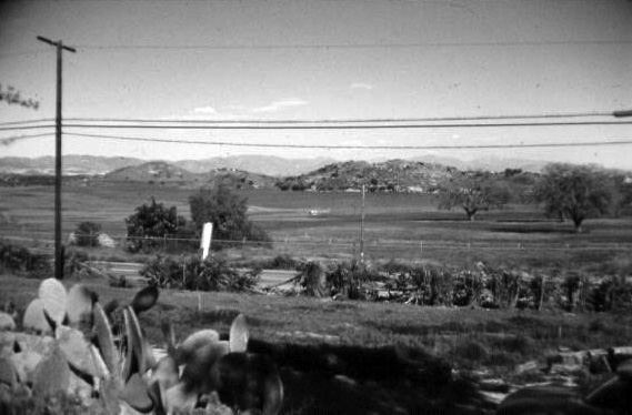 |
|
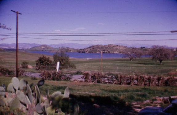 |
|
| (1960s)*^^^# - View looking northeast from near the intersection of Homezell Drive and Valley Circle Boulevard showing the Chatsworth Reservoir filled with water. Photo courtesy of Bert Emert |
Notes Color photos were included for better contrast. |
 |
|
| (2012)#*^# - Google Street View showing an empty Chatsworth Reservoir from about the same location as previous photo, intersection of Homezell Drive and Valley Circle Boulevard. |
 |
|
 |
|
| (1960s)*^^^# – Closer view of the Chatsworth Reservoir from near Homezell Drive and Valley Circle Boulevard. If you look closely you can see several deer under the large oak tree at center-left. Photo courtesy of Bert Emert |
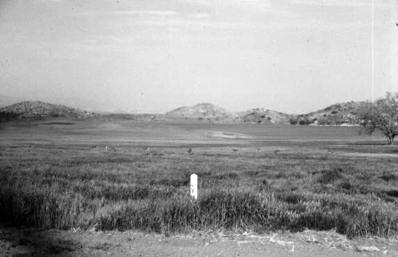 |
|
.jpg) |
|
| (1960s)*^^^# – View showing deer making their way to open space with the Chatsworth Reservoir in the background. Photo courtesy of Bert Emert |
Notes Click HERE to see more Early Views of the Chatsworth Reservoir. |
* * * * * |
Chatsworth Aerial Views (1950s)
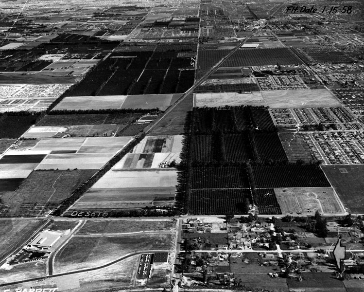 |
|
| (1958)* - Aerial view of Chatsworth looking east down Nordhoff Street. DeSoto Avenue is seen at the bottom running from north to south (left to right). The Southern Pacific tracks run diagonally across the photo (lower-left to upper-right). |
Historical Notes Nordhoff Street was named for famed 19th-century health seeker and writer Charles Nordhoff. Hired by Southern Pacific rail baron Henry Huntington in 1873, journalist Charles Nordhoff wrote the book California for Health, Pleasure and Residence. Click HERE to see more SFV Street Name Origins. |
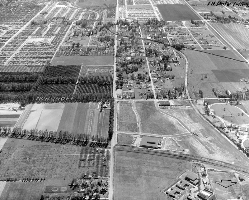 |
|
| (1958)* - Aerial view of DeSoto Avenue looking south. Nordhoff Street runs east-west at the center of the photo. The open area with a few buildings on it in the upper left area is Limerick Elementary. Aerojet Rocketdyne is currently where the walnut groves are in the center. |
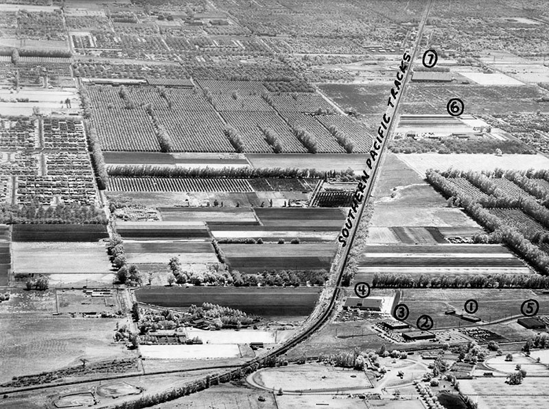 |
|
| (1960)* - Photograph caption dated September 27, 1960 reads, "Pilot's view of Chatsworth, looking east from Canoga Avenue, shows area which is expected to one day be a major Valley industrial section. Artist's keyed locations are: (1) Canoga Park Processing, Inc., (2) Amphenol-Western Division, (3) Metal Bellows Corp., (4) Deluxe Check Printers, Inc. (5) Azar Manufacturing Co., Inc., Chatsworth, and (6) Riker Laboratories, Inc., and (7) Orange Empire Co-Op, both in Northridge. Take a good look at the spacious fields--they won't be there long." |
Nike Missile Site (Oat Mountain, Chatsworth)
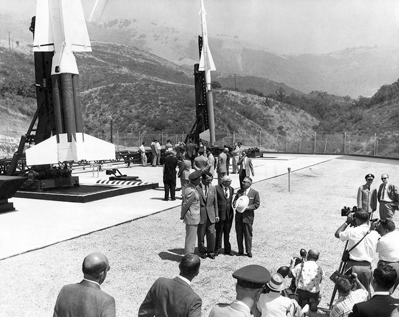 |
|
| (1958)* - Valley Times photograph caption dated August 30, 1958 reads, "Dignitaries attending ceremony which marked first Nike-Hercules base to go operational in nation are dwarfed by huge weapon which can destroy entire enemy squadron of bombers with atomic warhead. In foreground at Oat Mountain Base in Chatsworth are, left to right, Maj. Gen W. A. Perry, Donald Douglas Jr., Don Belding and Sheriff Eugene Biscailuz." |
Historical Notes In 1958, at top of Browns Canyon at the end of De Soto Avenue there existed an Army base with Nike Hercules missiles armed with nuclear warheads. The Nike Missile Base LA-88 located in Chatsworth on Oat Mountain was part of the “Ring of Steel” that protected Los Angeles from 1958 to 1974. The Cold War, between the Communist World (the Soviet Union and its allies) and the Western World (the United States and its allies), lasted from 1946 to 1991. During this time of political, military and economic conflict, various strategies were undertaken by the United States to defend against a nuclear attack. Nike Missile bases provided that defense. They were initially equipped with anti-aircraft missiles (Nike-Ajax in 1953), followed by the Nike-Hercules in 1958, which was armed with nuclear warheads and could intercept ballistic missiles.^# |
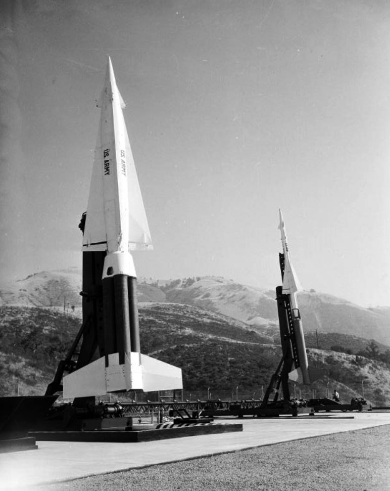 |
|
| (1958)^^ – Close-up view at the Oat Mountain Base in Chatsworth showing a launch pad with two missiles on it (a Nike-Hercules and a Nike-Ajax). |
Historical Notes By 1958, the Army had established over 200 Nike missile bases within the United States (including Alaska and Hawaii). Los Angeles was defended by a ring of 16 Nike sites, referred to as a “Ring of Steel”. To protect its aerospace industries, Los Angeles received extensive air defenses. Oat Mountain towers over the San Fernando Valley and provides visibility in all four directions and far out into the Pacific Ocean. LA-88 was the last of the scheduled 16 Los Angeles Nike sites to be completed due to the rugged terrain and only one usable road through Browns Canyon. Construction difficulties leveling a mountain peak and also digging deep into the ground for the three underground launchers caused delays. The site was completed and operational as of August 26, 1956.^# |
Chatsworth Park (renamed Chatsworth Park North in 1978)
 |
|
| (1960)* - Photograph caption dated January 21, 1960 reads, "Park site shown - This recently acquired 24.4-acre site in Chatsworth is to be developed as park under provisions of 1957 park and recreation bond fund." Valley Times Collection |
Historical Notes Originally called Chatsworth Park, the facility was one of several parks and recreation centers that were financed under a bond measure approved by Los Angeles voters in 1957. Plans to develop a new park in Chatsworth, which was experiencing rapid residential growth at the time and was poorly served by park facilities, were approved by the Recreation and Parks Commission in 1960. The Commission also approved the annexation of 7.4 acres of county-owned land located adjacent to the proposed park, which were subsequently acquired and incorporated into the facility.^ |
 |
|
| (1963)* - Photo of Chatsworth Park playground, taken June 30, 1963, shortly after it opened. |
Historical Notes Conceptual plans for the park were developed by the Los Angeles-based landscape architectural firm of Cornell, Bridgers and Troller. Partner Ralph Cornell had a well-established reputation and was known for designing landscapes that thoughtfully incorporated indigenous plantings. Accordingly, the area’s abundant sandstone outcroppings and existing oak trees were integrated into the park’s design, which was approved by the city in 1961. Contractor P.J. Robert and Co. was retained to develop the park in 1962, and the site was formally dedicated and incorporated into the city’s park system in 1963.^ |
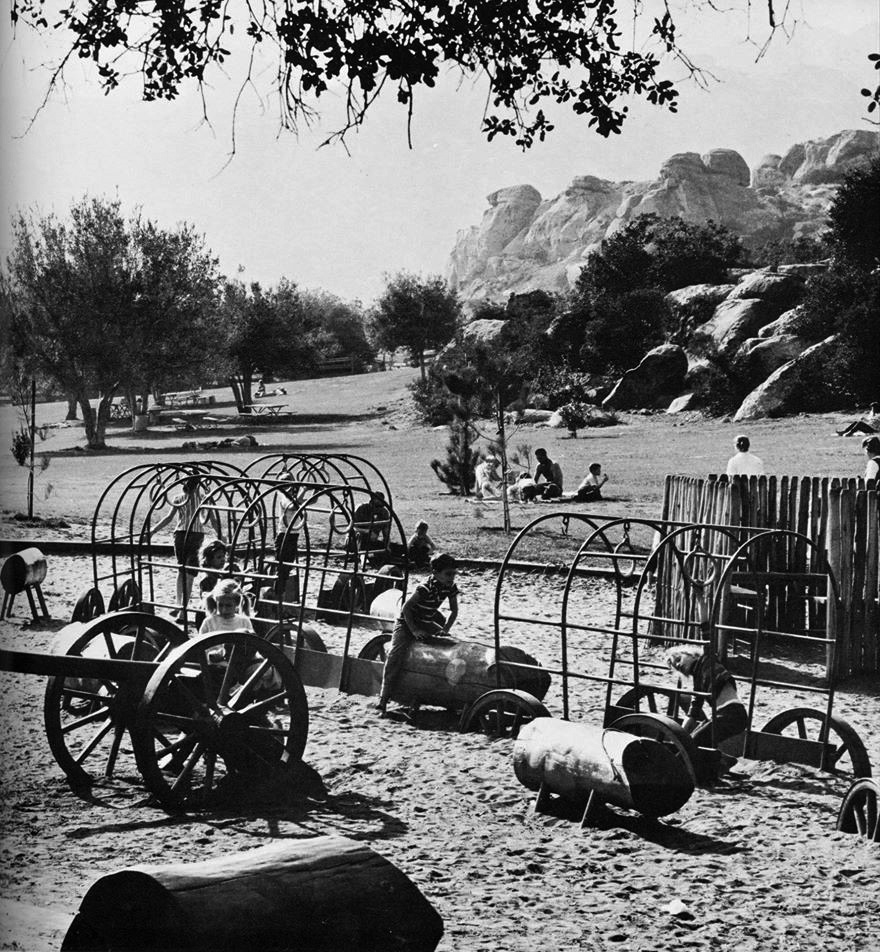 |
|
| (1960s)^.^ – View showing Chatsworth Park (North), with playground and picnic area. |
Historical Notes Chatsworth Park was expanded in 1978, when an additional 72 acres to the south of the original site were acquired by the city and subsequently developed as parkland. The expansion, which had been used as a skeet shooting range prior to its development, is the site of Homestead Acre (HCM #92) and the Old Stagecoach Trail (HCM #133). However, since the two sections of the park were separated by private property that was never successfully acquired, they remained noncontiguous and were treated as two separate entities: Chatsworth Park North and Chatsworth Park South.^ |
* * * * * |
Sun Valley
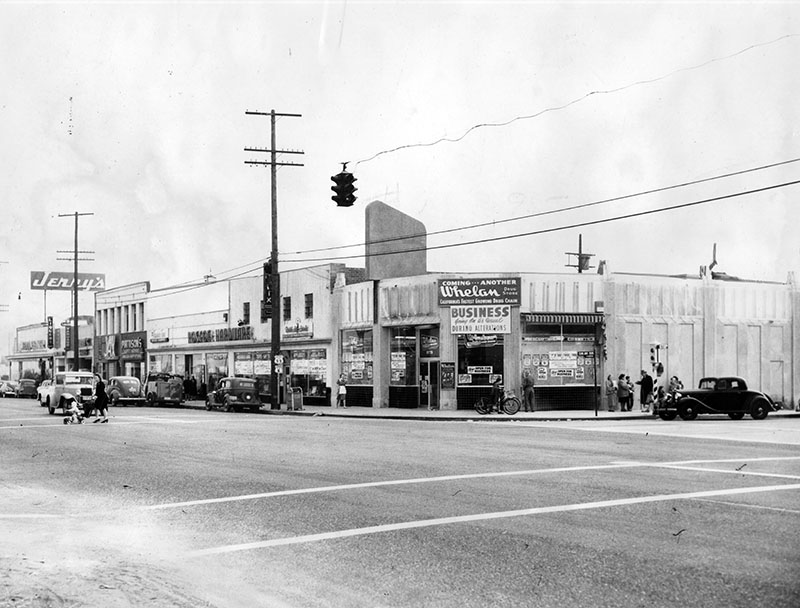 |
|
| (1948)* - View showing the intersection of Sunland Blvd. and San Fernando Rd. on eve of change in name of the community from Roscoe to Sun Valley. A modern drug store has replaced gas station, another story has been added to building that housed Roscoe Public Market. Roscoe Hardware, which will retain name, is in same location as 31 years ago. Source: Valley Times - December 31, 1948 |
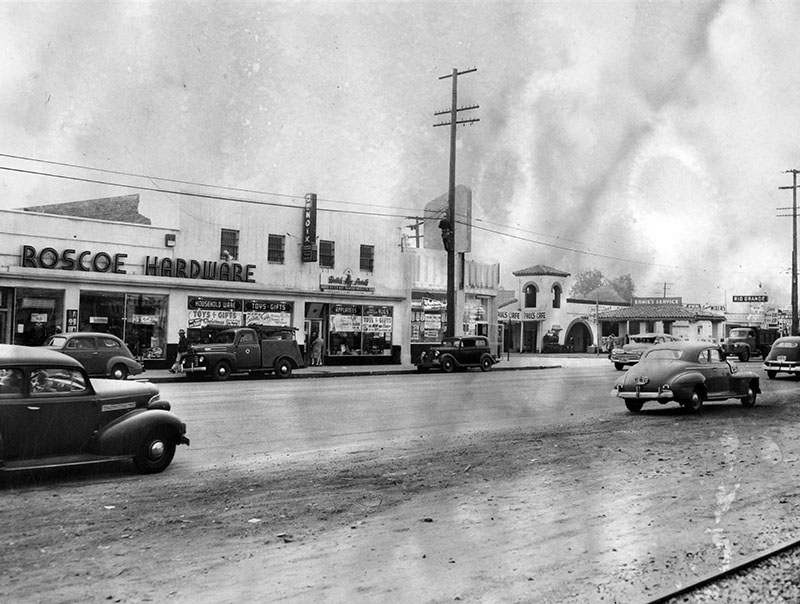 |
|
| (1949)* - Pictured is a view of Roscoe Hardware and other shops on San Fernando Road near Sunland Boulevard in Sun Valley. Picture was taken on eve of change in name of community from Roscoe to Sun Valley. Valley Times: Photograph dated January 22, 1949. |
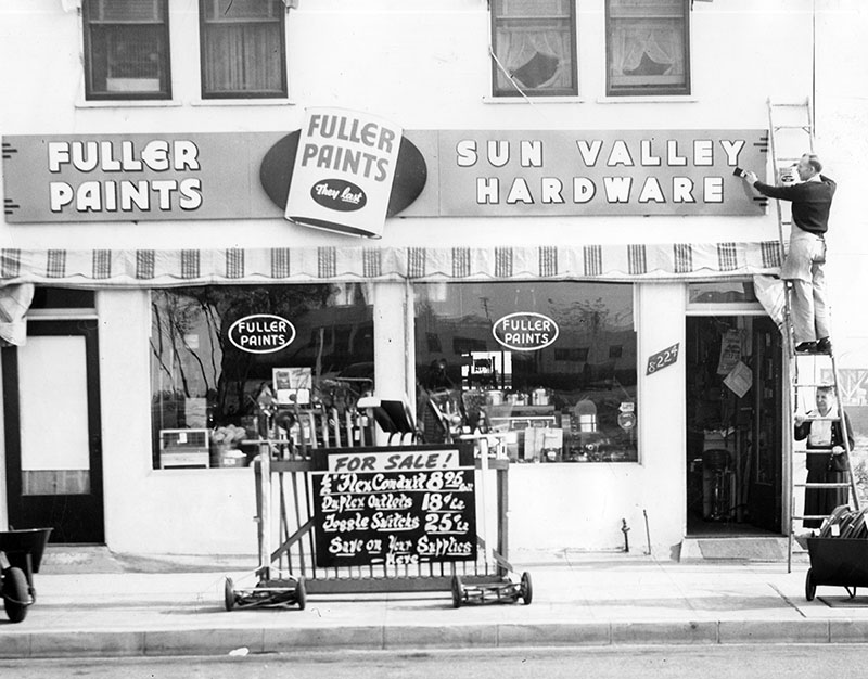 |
|
| (1949)* - Pictured on ladder, painting sign, is William Willmott, of Sun Valley Hardware, 8224 Sunland Boulevard. Photograph dated January 22, 1949. |
 |
|
| (1959)* - Photograph caption dated September 2, 1959 reads, "Policeman diverts cars from Tuxford street entrance to Sunland boulevard at Glenoaks boulevard as second traffic jam in two days snarls traffic with closing of Sunland boulevard route from Sun Valley to Sunland to permit widening of thoroughfare. Cars are being rerouted over Sheldon-Wentworth street route just opened last Friday. Sunland boulevard will be closed for next nine months." |
Valley Steam Plant
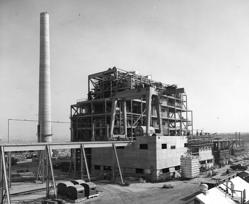 |
|
| (1953)** - View showing the Valley Steam Electric Generating Plant under construction in Sun Valley. |
Historical Notes The 1950s saw such a rapid growth in the San Fernando Valley that it forced the Department of Water and Power to construct one of the largest steam plants in the country in Sun Valley. |
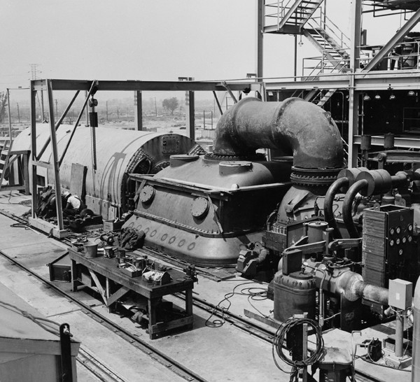 |
|
| (1954)^ - View showing a General Electric F2 type turbine with a hydrogen cooled generator (Unit No. 1) at Valley Steam Plant. |
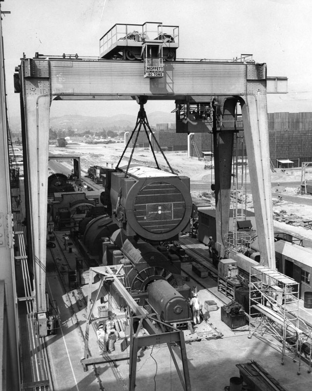 |
|
| (1955)** - Workmen haul the last of four electric generators into position at the $80,000,000 Valley Steam Plant. |
| (1957)** - This huge 25-foot three-phase transformer at the Valley Steam Plant steps up voltage from 18,000 to 138,000 volts for transmission to the distribution system. The plant has about 1700 control switches, instruments and relays. |
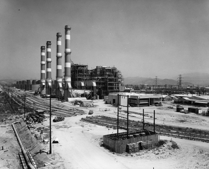 |
|
| (1956)** - View showing the newly completed Department of Water and Power's Valley Steam Plant located in Sun Valley (N/E San Fernando Valley). |
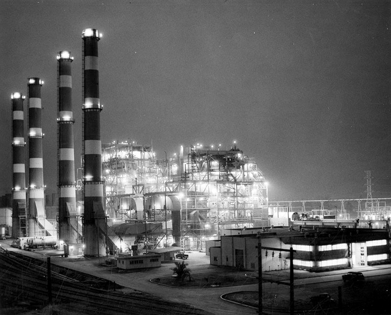 |
|
| (1956)* - Photograph caption dated July 13, 1956 reads "Power for million lights up sky. Fabulous growth of the San Fernando Valley forced the Department of Water and Power to construct one of the largest steam plants in the country in Sun Valley. The four unit project costing $89,000,000 is virtually completed and will provide power for million Valley residents." - Valley Times |
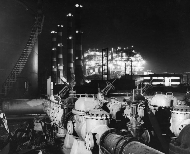 |
|
| (1956)* - Close-up nighttime view showing a well lit Valley Steam Plant. |
Historical Notes Photo caption reads, "Valley Steam Plant glows with thousands of lights during nighttime operation. Pipes and valves in foreground are part of fuel lines leading to plant. Built on 150-acre site in Sun Valley at cost of $80,000,000, Valley Steam Plant has total generating capacity of 512,000 kilowatts of electricity. Because of mild climate, plant is virtually open to the air with complete housing only for operating personnel and most delicate equipment. Electricity is generated by means of turbines which are powered by super-heated steam, heated in boilers using either gas or oil as fuel." Valley Times - August 1, 1956* |
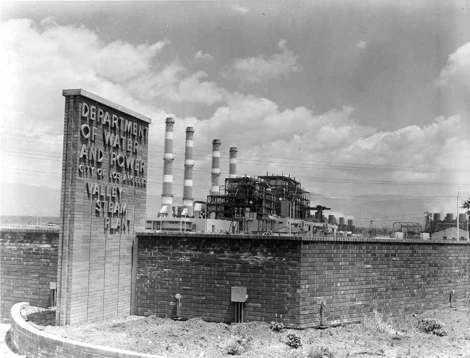 |
|
| (ca. 1957)*^^^# - View showing the front entrance to Valley Steam Plant located at 11805 Sheldon Street in Sun Valley. |
Historical Notes Click HERE to see more Early Power Generation. |
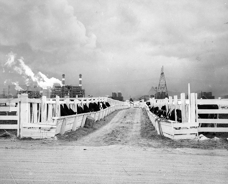 |
|
| (1956)* – View showing a herd of Holstein cattle feeding at Silver Shield Dairy on Wicks Street in Sun Valley. In the left background are the familiar towers of the Valley Steam Plant. |
Reseda Boulevard
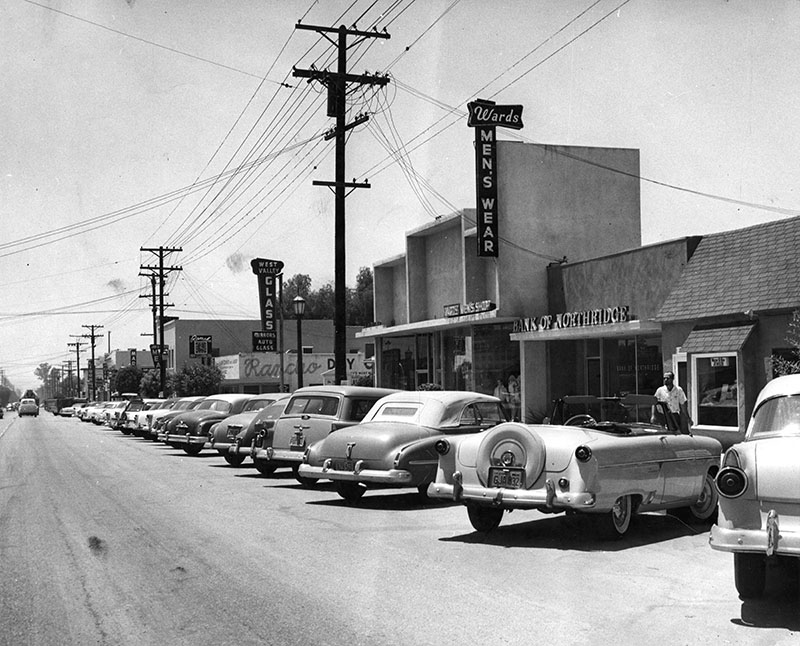 |
|
| (1956)* - Photo caption dated July 26, 1956 reads, "Thriving shopping center - Autos line busy Reseda Boulevard shopping center of Northridge. Despite motorized majority, some Northridgers still ride to town on horseback. Town expects to encounter parking problem when diagonal parking is prohibited this fall and parallel parking required by city. Business area still retains friendly, small town flavor." |
 |
|
| (ca. 1950)##^ – View looking south on Reseda Boulevard from Sherman Way showing commercial business on the west side of the street including: Reseda Bakery, Donut Hut, and a shoe repair shop. The large 2-story building in the background is the West Valley LAPD Headquarters. Note the stop sign at left (S/E corner). |
 |
|
| (ca. 1958)^^ – View showing a man walking by the front entrance to the West Valley Division of the LAPD located at 7137 Reseda Boulevard (West side of Reseda just s/o Sherman Way). |
_ca1958.jpg) |
|
| (ca. 1958)#^*^ – Wider view of the West Valley Police Station showing a police car parked in the alley on the right. Reseda Drug Store is seen next door to the right across the alley. |
Historical Notes Today, BMW Clinic is at the LAPD site and the Reseda Drug Store has been replaced by Alan’s Flowers and a side parking lot. #^*^ |
* * * * * |
Please Support Our CauseWater and Power Associates, Inc. is a non-profit, public service organization dedicated to preserving historical records and photos. Your generosity allows us to continue to disseminate knowledge of the rich and diverse multicultural history of the greater Los Angeles area; to serve as a resource of historical information; and to assist in the preservation of the city's historic records.
|
More Historical Early Views
Newest Additions
Early LA Buildings and City Views
History of Water and Electricity in Los Angeles
* * * * * |
References and Credits
* LA Public Library Image Archive
^ CSUN Oviatt Library Digital Archives
#^San Fernando Valley History Digital Library - CSUN Oviatt
**DWP - LA Public Library Image Archive
^*The Valley Observied: Street Name Origins; Timeline of Valley History
^#Chatsworth Historical Society; Chatsworth Nike Site; Munch Box
*#Mojave Desert.net: Remi Nadeau
***Los Angeles Historic - Cultural Monuments Listing
*^*California Historical Landmarks Listing (Los Angeles)
*^^Nuestra Señora la Reina de los Ángeles - losangelespast.com
^^^LA Times: Adohr Spelled Succes for the Adamsons; Mulholland Bridge; Panorama City; Getting the Skinny on a Tall Valley Landmark; Valley Newspapers of the Past; Schlitz Closure
^^*LA Times: Stanley Norris Petit
*##LA Times: Dig Into History You'll Find Snake Oil..Victor Girard Kleinberger
+#^Facebook.com: Encino Velodrome; American Rails
+**Valley Presbyterian Hospital History and Milestones
+^^Panorama City - Commercial Area Concept Plan
++#Facebook.com: Photos of Los Angeles
##*Pinterest - California; Roscoe Sheep Crossing
#^#San Fernando Valley Blog: LA Federal Savings Building, North Hollywood; Van Nuys Blvd. Postcard, Valley Music Theatre
*#*Project Restore: Van Nuys City Hall
^*^Topanga Canyon History - LA Magazine
*#^LA World Airports - History of Van Nuys Airport
^^#The Museum of the San Fernando Valley
**#Tumblr.com: LA History - Leonis Adobe
^#*Photo of the Northeast San Fernando Valley ca.1950 - Laurie Burns
^*#North Hollywood-Toluca Lake Patch: History of the Laurel Canyon and Valley Plaza Mall; N. Hollywood Train Depot
*##*BellCanyon.com: Bell Canyon History
#^#^Granada Hills North Neighborhood Council: Granada Hills History
^*^*Metro.net: Mulholland Drive Bridge
*^*#Facebook.com: Classic Hollywood-Los Angeles-SFV
*^^^San Fernando Valley Historic Society/Facebook.com: JC Penney; California Bank; Devonshire Downs; Topanga Plaza Founain; Devonshire and Owensmouth; Sheep Crossing Roscoe; Log Ride / Busch Gardens
^**^Cinema Treasures: Rivoli-Capri Theatre; Reseda Drive-In Theatre; Van Nuys Driv-In Theater; Winnetka Drive-In; Topanga Theatre; Victory Drive-in; Holiday Theatre
***^Los Angeles Movie Palaces: Studio City Theater
**^^KCET: LA Flood of 1938: Cement the River's Future; Canoga Park at 100: A Brief History of the Birth of Owensmouth; When Cahuenga Pass Was Rustic; Before the 'Carmageddon': A Photographic Look at the Construction of 5 SoCal Freeways; Thematic Cartography and Mapping Los Angeles
**^#LA Times Framework: Busch Gardens Monorail; Woodland Hills Sheep
*^^#Flickr.com: Kaiser Panorama City
**#*EntertainmentDesigner.com: Busch Gardens
**#^San Fernando Valley Historical Society: Van Nuys Drive-in Theater
*^#^Northridge Fashion Mall Jobs
^^##Encino-Tarzana Patch: Valley Ice Skating Center
^##*Pinterest: Drive-in Speakers
^##^Pinterest: San Fernando Valley
*#^#Forum.skyscraperpage.com: Coffee Dan's
*##^City-Data.com: Ventura Boulevard
*#^*Los Angeles County Library: Agoura Hills
*#^^Big Orange Landmarks: Drive-ins Roared into LA Country
*#**Facebook.com: Museum of the San Fernando Valley; Busch Monorail
^***LosAngelesPast.com: Cahuenga Pass
^**#The Friends of Oakridge; theoakridgeestate.com
#**^Flickr.com: Bibiop – Northridge Fashion Center
#^*^Facebook.com: West San Fernando Valley Then And Now
#*^*The First 100 Years: umccp.org
#*^#Google Maps
#^*#Worldwide Drive-Ins: Winnetka 6
#*#^Pierce College - piercecollege.edu
#*##Daily News: Rocketdyne Canoga Park; Proposed $3B Project at Rocketdyne Site
##^^California State University Northridge History: csun.edu
^###Northridge Fashion Mall History
^^***Water and Power Associates
^^^^*Mbcinfo.com: Joseph Schlitz Brewing Company
**^^^LA Movie Palaces: San Fernando Valley
*^^^^Pinterest: San Fernando Valley - My Home Sweet Home
*^^^#DWP - Water and Power Associates Historical Archives - Courtesy of Rex Atwell
^***^Pacific Electric San Fernando Valley Line - ERHA.org
^^^*San Fernando Valley Relics: Facebook.com; Leonis Ranch; Ventura and Woodman; Busch Gardens; Reseda Blvd; Victory Blvd in Woodland Hills; Van De Kamp's; Valley Plaza; Nordhoff St. and Topanga Cyn; Ventura and Van Nuys Blvd; Van Nuys and Oxnard; Van Nuys Aerial; Van Nuys Blvd, ca. 1940; I-5 and I-14 Interchange; Van Nuys Drive-in; Mobil Gas Station; Canoga Drive-In; Victory and Whitsett; Van Nuys Aerial; Budweiser/Anheiseur-Busch Sign; Ventura Blvd 1950s
*^ Wikipedia: Sherman Oaks; Isaac Van Nuys; Encino; Tarzana; Campo_de_Cahuenga; Cahuenga Pass; Chatsworth; Panorama City; Santa Susana Field Laboratory; North Hollywood; Canoga Park; Woodland Hills; Reseda; Orcutt Ranch; Granada Hills; Andrés Pico; Moses Sherman; Van Nuys; Henry Kaiser; Charles Maclay; San Fernando Valley; Mission Point; Hughes Aircraft; Domonique Amestoy; Winnetka, Los Angeles; City of San Fernando; Canoga Park High School; Ventura Freeway; Hollywood Freeway; Los Angeles Valley College; Kaiser Permanente; Van Nuys Assembly; Rancho El Escorpión; Topanga Plaza; Simi Valley Freeway (118); Newhall Pass Interchange; Litton Industries; West HIls; Devonshire Downs; CSUN; Television Set History; Shadow Ranch; Atlas Missile; Thrifty Drugs; Coast Daylight; Longs Drugs; Du-Par's Restaurant; Joseph Schlitz Brewing Company; Annheiseur Busch; Fotomat; Baskin-Robbins; Valley Presbyterian Hospital; Warner Center; Gemco; Valley Music Theatre; Westfield Fashion Square; Paxton Park (Ritchie Valens Park); Big Donut Drive-in; Randy's Donuts; Builders Emporium; AlliedSignal; North Hills; Pacoima; 1960 Presidential Election
< Back