Early Views of Santa Monica
Historical Photos of Early Santa Monica |
 |
|
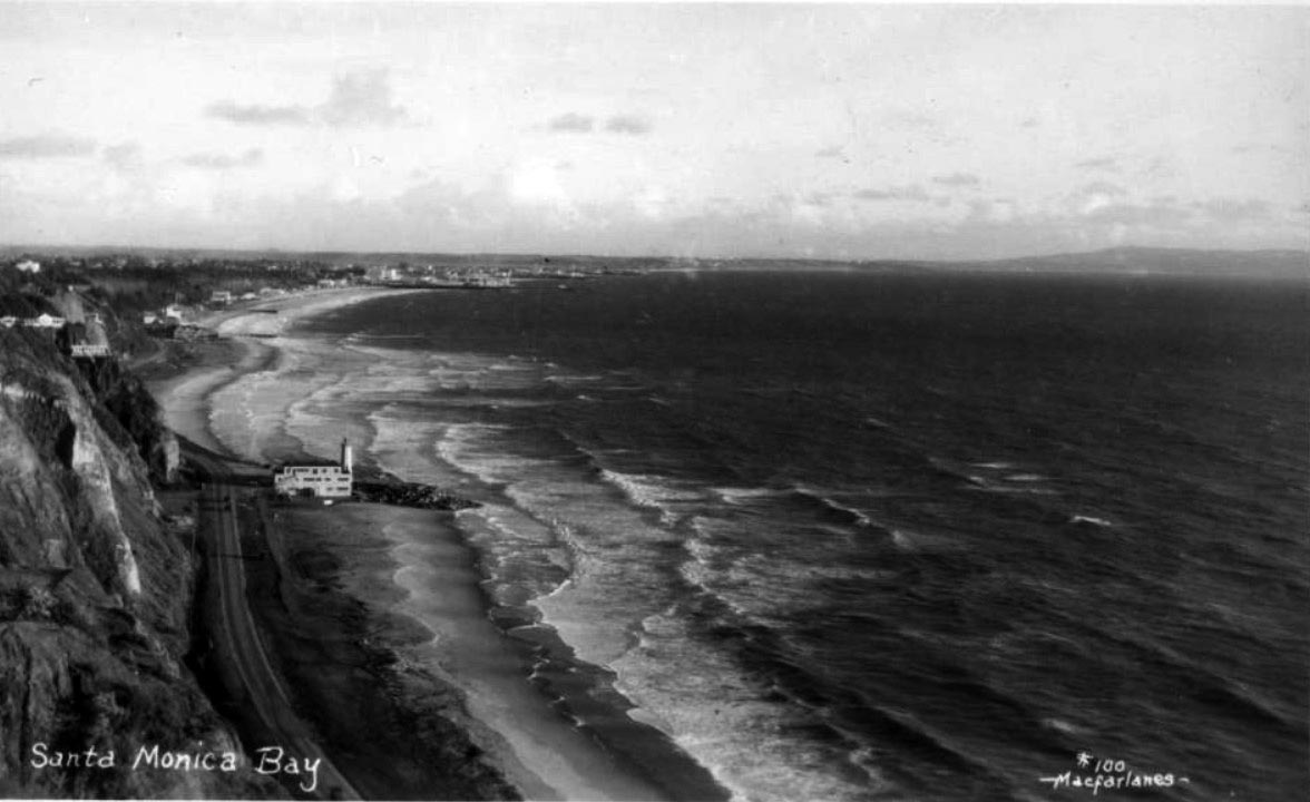
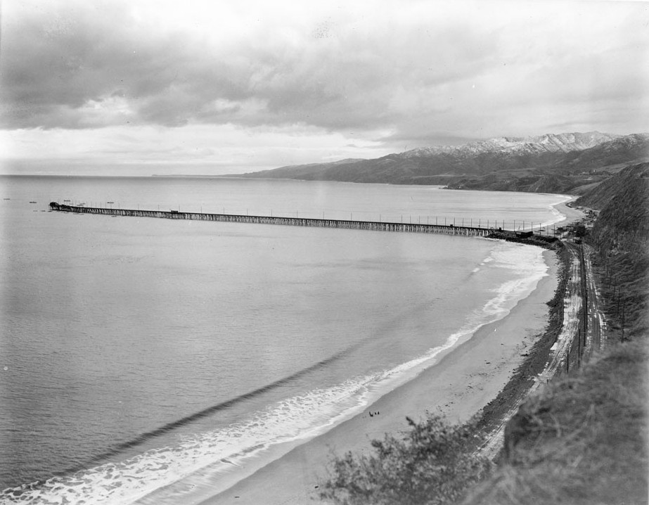
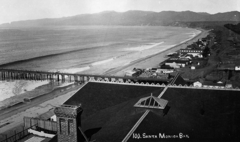
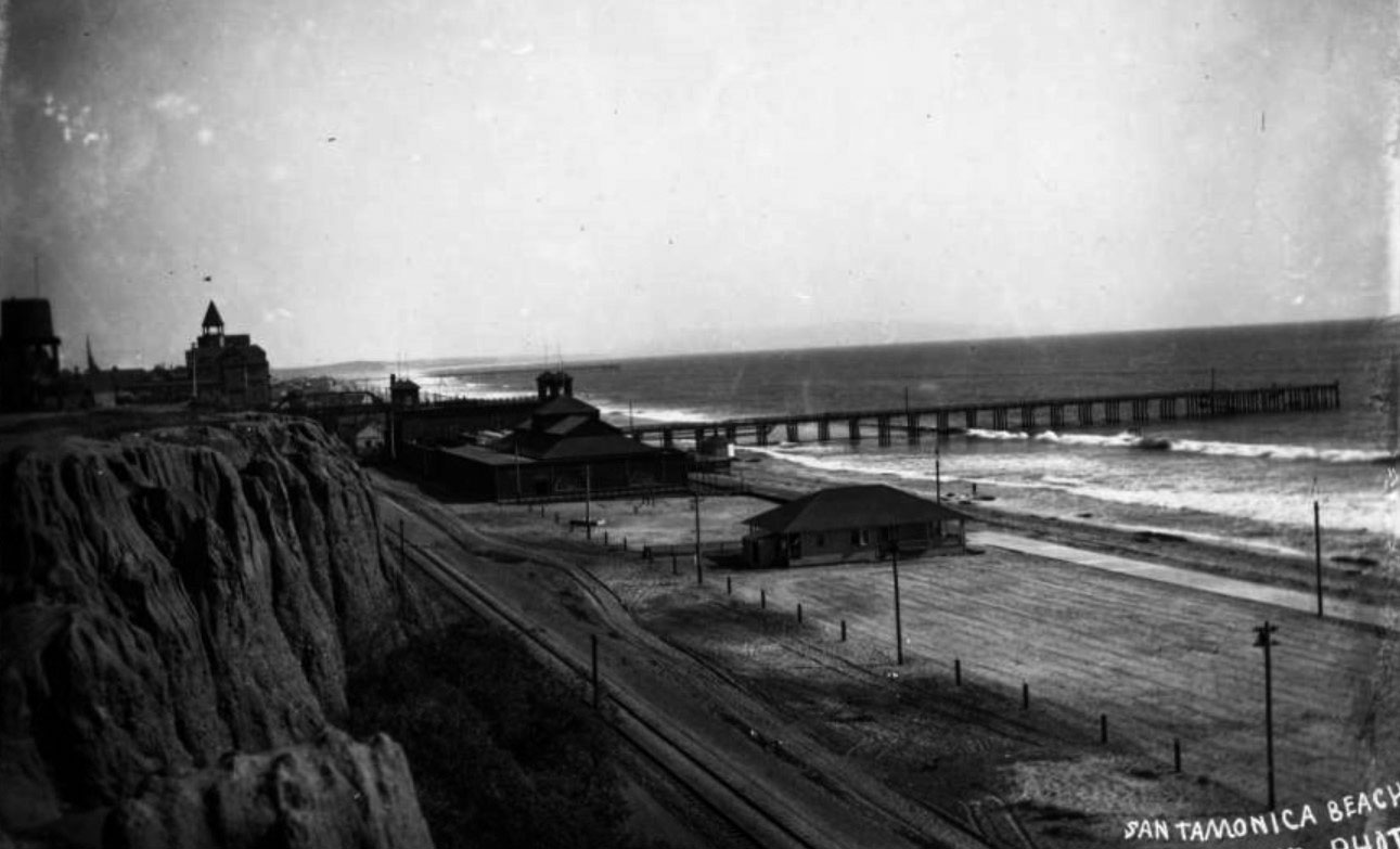
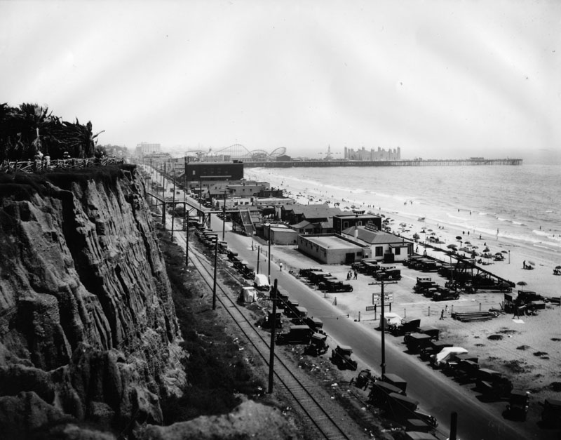
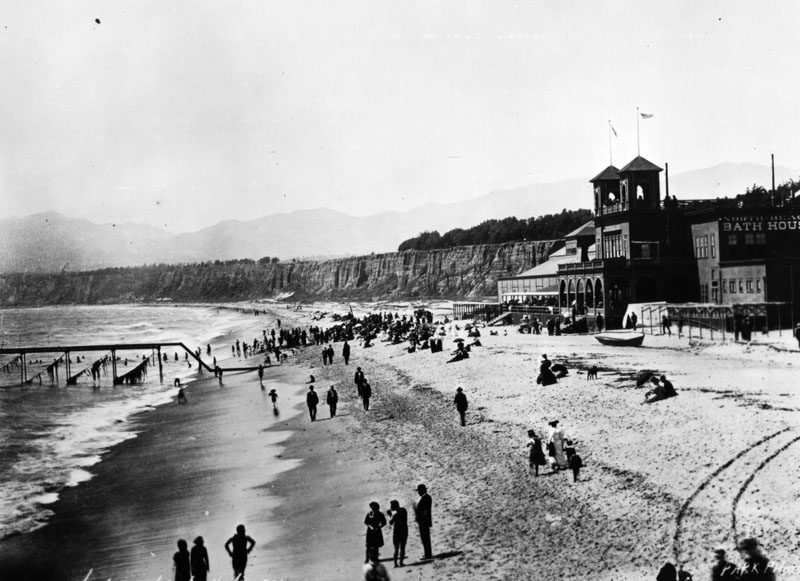
| (ca. 1927)* - Panoramic view of Santa Monica Bay showing the Roosevelt Highway (later Pacific Coast Highway), Santa Monica Bay, and coastline with the Lighthouse Bathhouse on the beach next to the remains of the Long Wharf stone jetty in Pacific Palisades. The Santa Monica Pier can be seen in the distance at upper left center. A sign for "Huntington Palisades" is seen at left edge of image. |
Historical Notes The Pacific Palisades lighthouse was built as a bathhouse with a working light in 1927. In the early 1930s the structure along with the beach was sold to Will Rogers and later the beach was given to the state of California and renamed the Will Rogers State Beach. |
 |
|
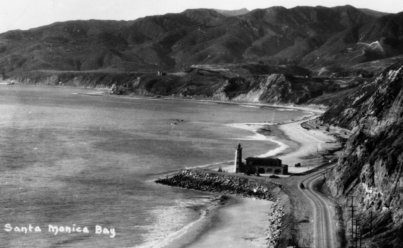
| (ca. 1927)* - View of the Santa Monica Bay coastline, showing a lighthouse and bathhouse near the Pacific Palisades. The lighthouse stands at the spot where the Long Wharf used to extend out into the ocean. |
Historical Notes “The Lighthouse” restaurant and bathhouse opened for business on Memorial Day, 1927. Built by the Pacific Palisades Association and designed by architect Thomas P. Barber, the bathhouse featured a second floor dining room, a wrap-around Venetian colonnade, and was large enough to accommodate 500 patrons. |
 |
|
| (ca. 1930)* - Postcard view showing the Roosevelt Highway (later Pacific Coast Highway) stretching westward from Santa Monica to Pacific Palisades, with Malibu in the background. The Lighthouse was a restaurant and cafe, and later the lifeguard headquarters. It marks the spot where the Long Wharf once projected into the Bay. |
Historical Notes Although it was not a true lighthouse, the picturesque building was commonly featured in promotional photographs and materials advertising Southern California. It was also an important visual point of reference for boats navigating into Santa Monica Bay. |
 |
|
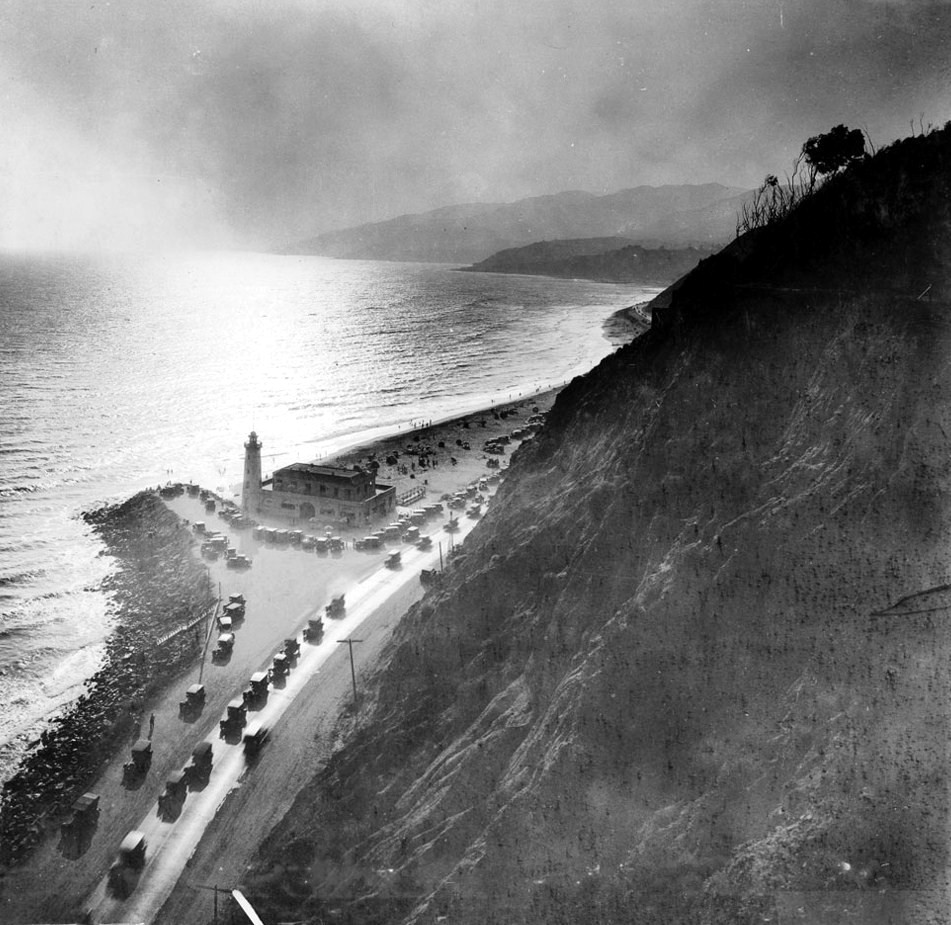
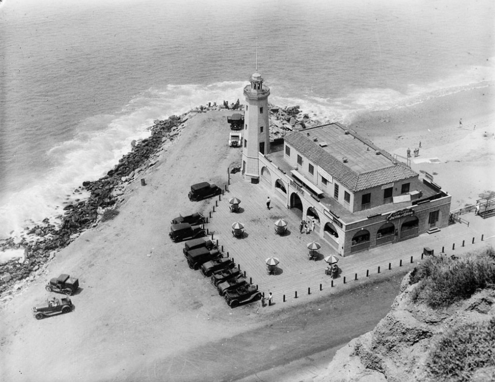
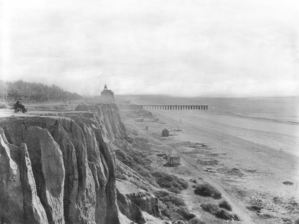
| (ca. 1920s)* - View looking down from the canyon of where the Long Wharf used to extend into the ocean. The Pacific Palisades Lighthouse and Bathhouse are seen with an adjacent parking lot full of cars. |
 |
|
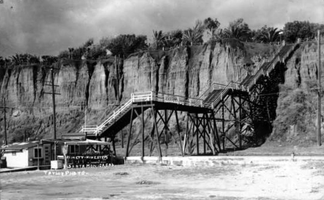
| (ca. 1930)* - View of the lighthouse, restaurant and bathhouse on the Long Wharf outcropping, Roosevelt Highway. Six tables with striped umbrellas can be seen to the left of the restaurant, while several automobiles are parked in front of the building at left. |
Historical Notes The most distinctive feature was the 50-foot tall lighthouse tower with a functioning beacon powered by eight 500-watt lamps. The Lighthouse was a popular destination and become an iconic landmark as the Roosevelt Highway (later the PCH) opened up through Malibu in 1929, connecting all of California along a single coast highway. |
 |
|
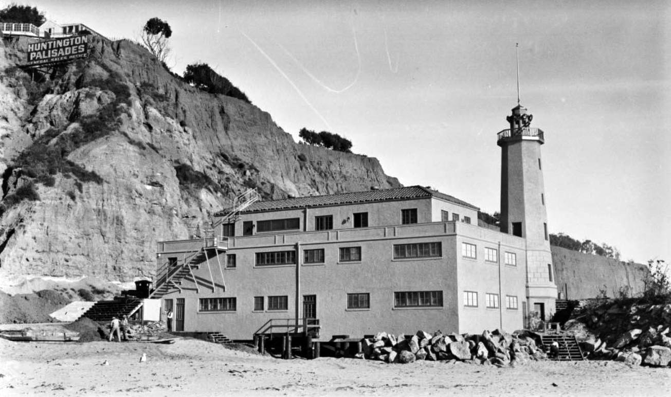
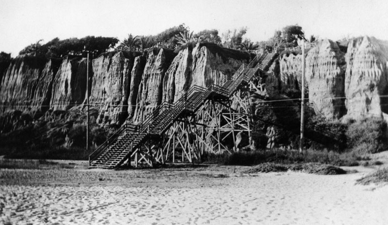
| (ca. 1927)* - View showing construction workers working on a walkway and staircases of the Lighthouse Bathhouse on the beach in Pacific Palisades, with a small part of the remains of the Long Wharf at far right. A sign for the Huntington Palisades general sales office can be seen on a cliff above. |
Historical Notes In 1926, the Pacific Palisades Association purchased the land that was owned by the Huntington family of New York. Both a commemorative gesture and a way to benefit from the prestige associated with the Huntington name, the area was deemed “Huntington Palisades.” |
 |
|
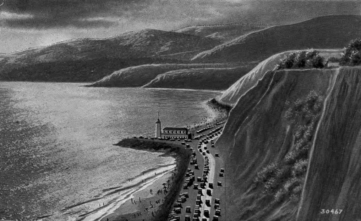
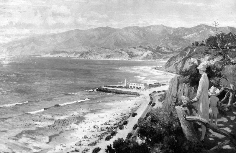
| (ca. 1930)* - Looking down from Palisades Park in Santa Monica north towards the Lighthouse bathhouse and restaurant that stood on Pacific Coast Highway at the point where the Santa Monica Mountains come down to the shore. This is a photograph of a painting by Chris Siemer. The painting was created for display by the L.A. Chamber of Commerce. |
 |
|
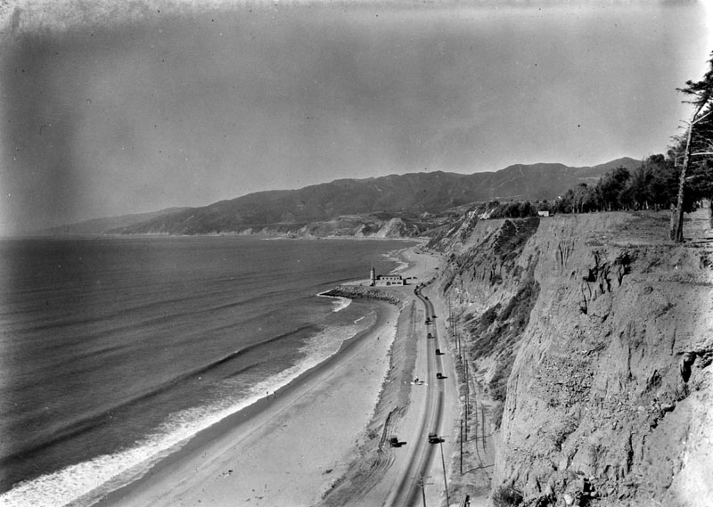
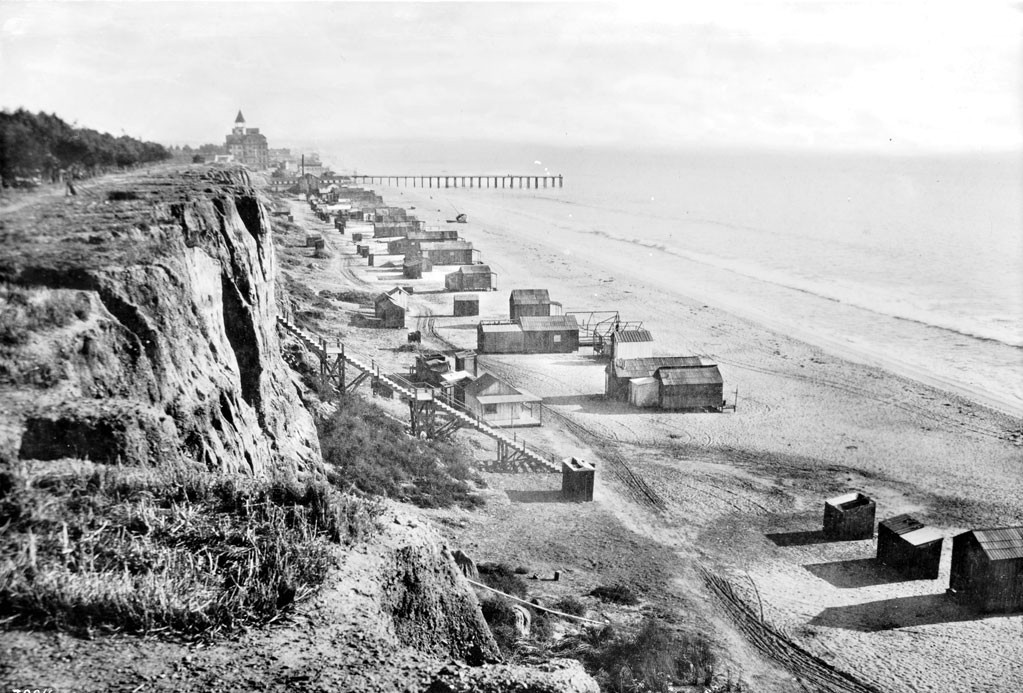
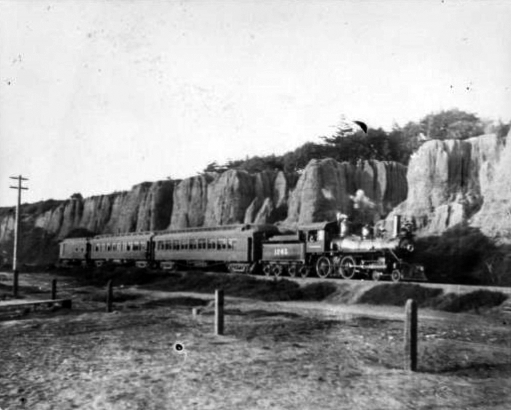
| (1927)* - A view of the palisades of Santa Monica, looking north along Roosevelt Highway next to an unbuilt beach (today's Will Rogers Beach). |
Before and After
 |
|
|
|
| (1916)* vs. (1927)* - View showing the Long Wharf (1893 - 1920) and the Pacific Palisades Lighthouse and Bathhouse (1927 - 1972) at the same location. The beach seen in the foreground is today's Will Rogers Beach. |
Historical Notes The Long Wharf was the longest ocean wharf in the world at 4700 feet. It was built in 1893 by the Southern Pacific Railroad, and it was destroyed in 1920 by the Pacific Electric Railroad Co. The Long Wharf was designated California HIstorical Landmark No. 881. Click HERE to see more California Historical Landmarks in L.A. |
 |
|
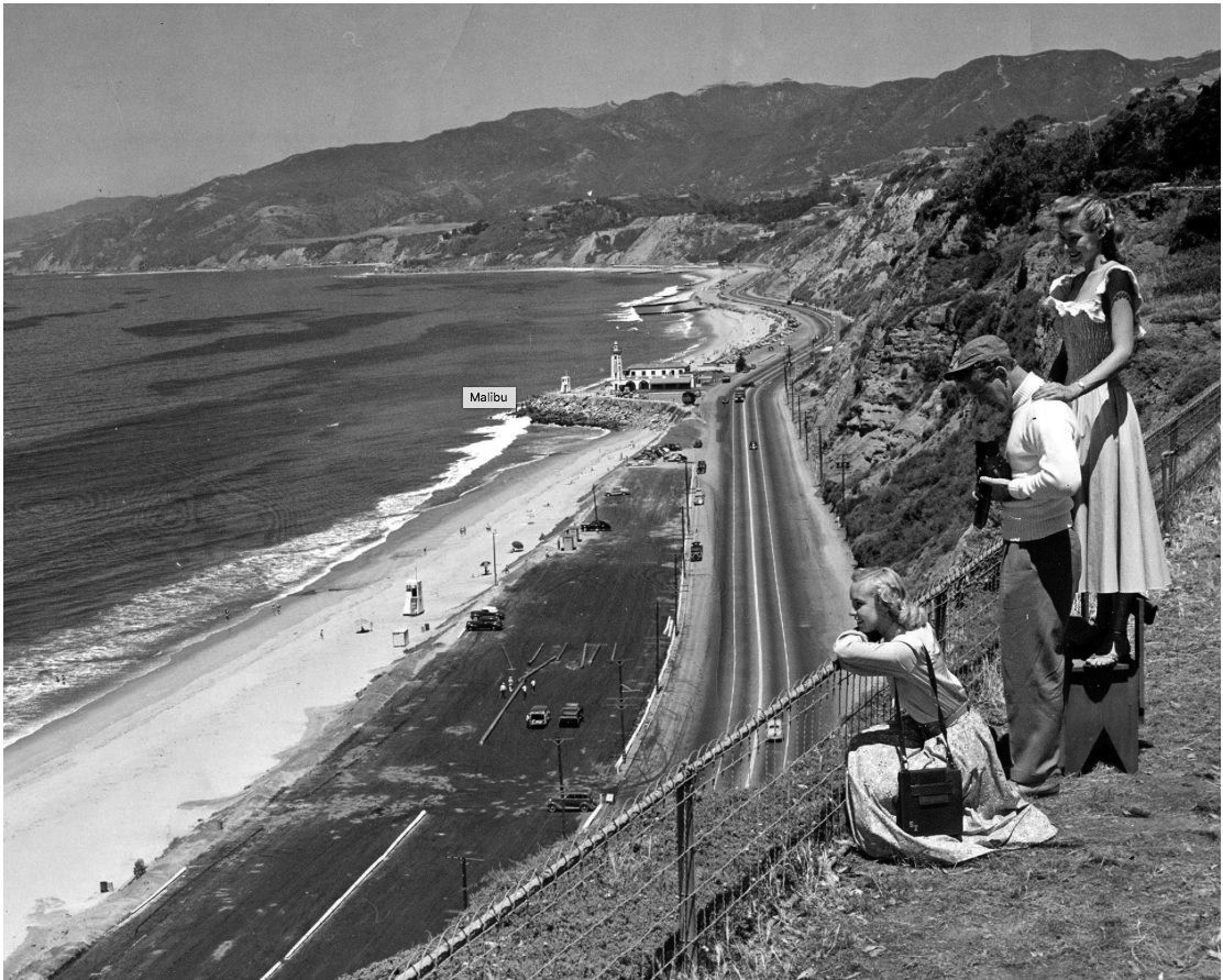
| (1940s)* – View showing tourists admiring the scenery from the bluffs above Santa Monica Canyon (Huntington Palisades), with the Pacific Palisades Lighthouse seen in the distance. Photo courtesy of Eric Wienberg |
 |
|
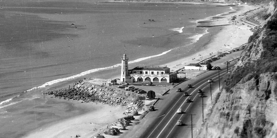
| (ca. 1940)* – Panoramic view showing the Pacific Palisades Lighthouse, restaurant and bathhouse and Pacific Coast Highway. |
Historical Notes Over the decades, as the popularity of bathhouses faded, the patronage of the Lighthouse diminished. Eventually, the building was taken over by the Will Rogers State Beach lifeguard, serving as a part of the lifeguard headquarters. By 1972, the Lighthouse structure was determined to be unsuitable for habitation and was razed. |
 |
|
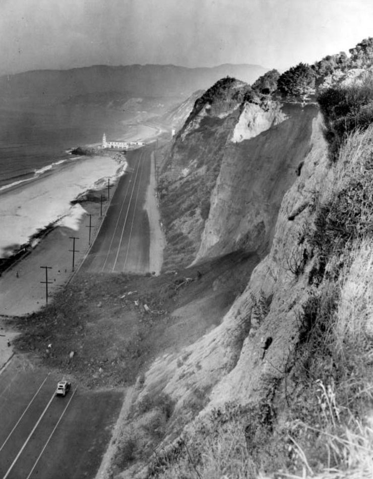
| (1944)* - A landslide blocks the Roosevelt Highway--soon to be the Pacific Coast Highway. The Lighthouse bathhouse and cafe is in the background. |
Historical Notes Notes from reverse of photo: Roosevelt Highway Blocked Again. Santa Monica, Calif.,--Southern California's Roosevelt Highway along the Pacific Ocean near here was the scene of another traffic-stopping earth slide from the towering beach front Palisades. The 200-foot, 30-foot deep chunk of earth slid from the backyard of actor Charles Laughton. Photo date: 8/29/44 |
* * * * * |
Pacific Palisades
 |
|
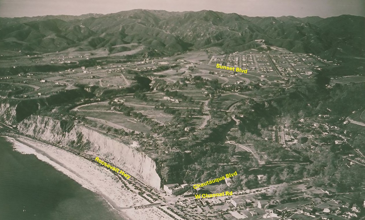
| (1932)* - Aerial view of Pacific Palisades looking north from above Santa Monica Canyon, with Chautauqua Boulevard, West Channel Road, and Rustic Creek visible near the bottom center. Note the cars parked between Roosevelt Highway and the beach, in the area that would later become Will Rogers Beach. |
Historical Notes Roosevelt Highway was widened and renamed Pacific Coast Highway (PCH) along this stretch in the 1940s. Rustic Creek, flowing through Rustic Canyon in Pacific Palisades, has a history intertwined with the area's development since the Spanish land grant era. Originally part of Rancho Boca de Santa Monica, the canyon gained prominence in 1887 when Abbot Kinney established a forestry station and planted eucalyptus trees. The early 20th century saw increased development, including the founding of Pacific Palisades in 1922 and the establishment of the Uplifters Club. Will Rogers' purchase of his ranch in Upper Rustic Canyon in 1926 further elevated the area's profile. |
 |
|
| (1932)* - Annotated aerial view of Pacific Palisades looking north from above Santa Monica Canyon, with Chautauqua Boulevard, West Channel Road, and Rustic Creek visible near the bottom center. The wide beach at the bottom would become Will Rogers State Beach in 1942. Annotated by Jack Feldman. |
Historical Notes Will Rogers Beach, located near Chautauqua in the Pacific Palisades area, was officially named and dedicated on July 26, 1942. This occurred about seven years after the death of Will Rogers, who had owned the beachfront property in the 1920s and early 1930s. Following his death in a 1935 plane crash, his widow Betty developed a plan to gift their oceanfront land to the state of California. The beach was initially owned and operated by the State of California from its dedication in 1942 until 1975, when the County of Los Angeles took over its management. The naming of the beach was part of a larger effort to transform the Rogers' private property into a public recreational area, preserving Will Rogers' legacy and providing public access to this stretch of coastline. |
 |
|
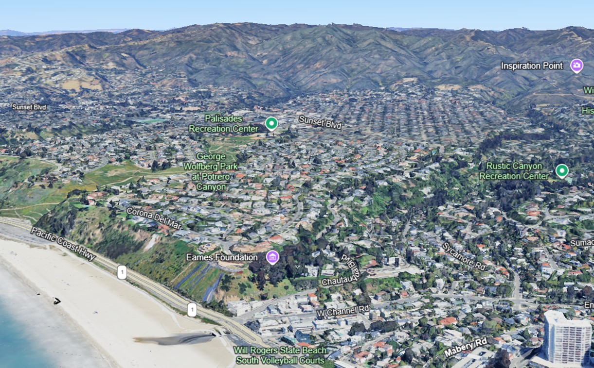
| (2023)* - Google Earth view of Pacific Palisades looking north from from above Santa Monica Canyon. You can see where Rustic Creek empties into Santa Monica Bay. |
Historical Notes Today, Rustic Creek remains one of the few natural streams in developed Los Angeles, running past Will Rogers State Historic Park and into Topanga State Park. It continues to be a vital part of the local ecosystem, surrounded by a prestigious residential neighborhood known for its natural beauty and seclusion. Highlighted in purple on the Google Earth view is the Eames Foundation, located at 203 Chautauqua Boulevard in Pacific Palisades, California. Established in 2004, the foundation preserves the Eames House—an iconic mid-20th century modernist structure designed by Charles and Ray Eames in 1949. Part of the Case Study House program, this landmark served as both their home and studio and is now recognized as a National Historic Landmark. |
Then and Now
 |
|
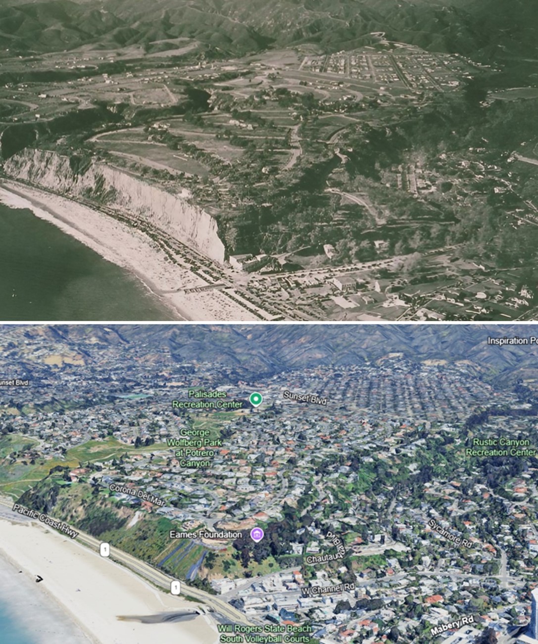
| (1932 vs. 2023)* - Looking north from above Santa Monica Canyon, illustrating how much development has occurred over 90 years. Note that the Pacific Palisades bluffs are no longer vertical; through natural erosion or engineering, they have been slanted to prevent future slides. Photo comparison by Jack Feldman. |
Historical Notes The bluffs at Pacific Palisades above Will Rogers Beach have transformed from vertical to slanted due to a mix of natural and human influences. Eroding at an average rate of about 4 inches per year, the bluffs—composed of easily erodible materials like sand, silt, gravel, and clay—are particularly vulnerable to erosion and slumping. Significant weather events, such as heavy rains during El Niño periods, have triggered landslides, notably in 1998. Seismic activity, like the Northridge Earthquake, has also contributed to bluff collapses. Human activities may have further impacted their stability. Over time, these combined forces have reshaped the bluffs into a more stable, sloped formation, reflecting the natural evolution of coastal landscapes. |
* * * * * |
Inceville
.jpg) |
|
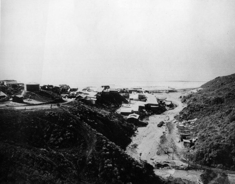
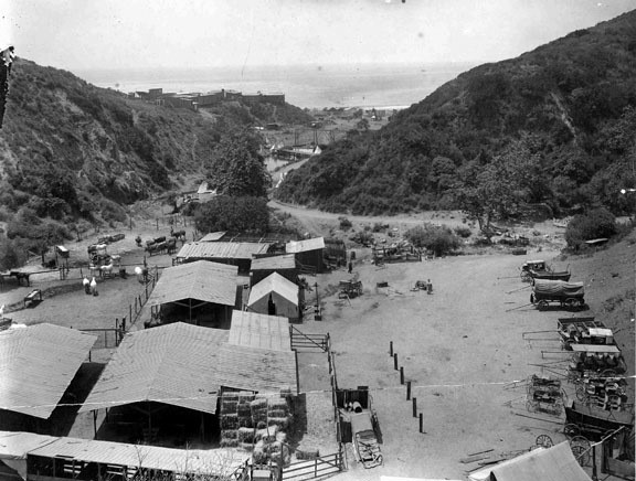
| (ca. 1915)* - View from the Palisades looking toward Malibu showing Inceville, the famed motion picture studio founded by Thomas Ince. |
Historical Notes In 1911, film director Thomas Ince created his Western film factory, "Inceville," which at its peak employed nearly 600 people. |
 |
|
| (1915)* - View of Inceville, on Sunset Boulevard (Santa Ynez Canyon) at the Pacific Ocean, where Ince Studios filmed location scenes. |
Historical Notes Ince leased 18,000 acres of land extending from the seashore up Santa Ynez Canyon and into the mountains for 7-1/2 miles. While he was building the frame-structured studio buildings, situated where Gladstone’s Restaurant is today, he also hired Miller’s 101 Ranch Wildwest Show, including many cowboys, animals and a Sioux Indian tribe, who set up their teepees on the property. |
 |
|
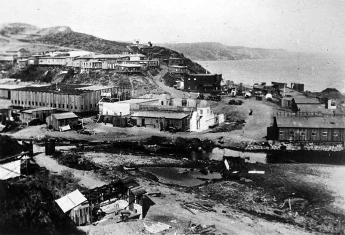
| (ca. 1916)* - The mouth of Santa Ynez Canyon at the Pacific Ocean was once home of Inceville, an early 1900s film studio built by film director Thomas Ince. |
Historical Notes Most of the cowboys, Indians and assorted workmen lived at Inceville, while the actors came from Los Angeles and other communities as needed, taking the red trolley cars to the Long Wharf at Potrero Canyon, where buckboards conveyed them to the set. Ince lived in a house that overlooked Inceville, the location of Marquez Knolls today. |
 |
|
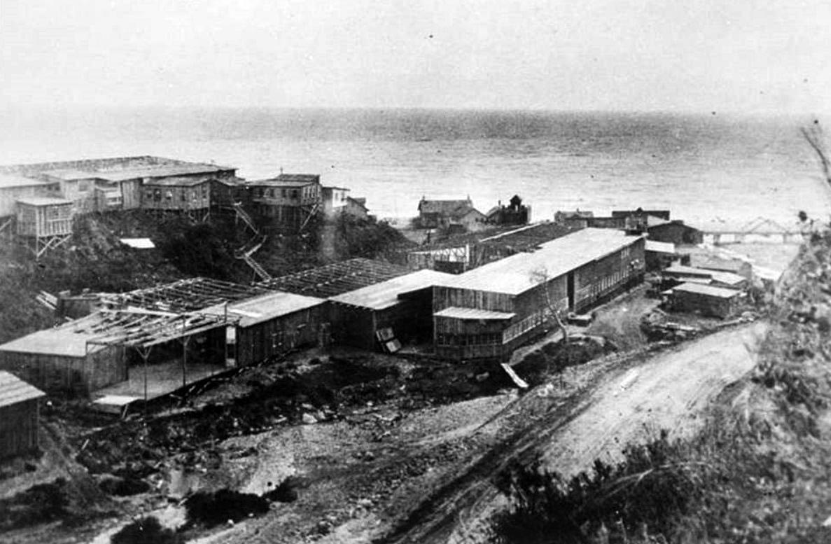
| (1916)* – View showing the Inceville Studios built by silent film producer Thomas H. Ince at the mouth of Santa Ynez Canyon. |
 |
|
| (1916* - Looking down Sunset Boulevard with a view of silent film producer Thomas Ince's Inceville Studios in Santa Ynez Canyon. |
 |
|
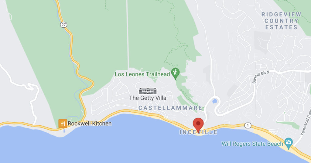
| Google map showing the location of Incville relative to where Sunset and PCH are situated today. |
Historical Notes By 1916, Ince was supervising eight directors and releasing one five-reel picture (about 50-minute films) each week at an average cost of $40,000. His film ‘Civilization,’ which employed over 25,000 extras, was by far his most ambitious endeavor. The set for the mythical city stood alone on the barren hills, where Marquez Elementary School is today. It was built by 60 carpenters over a period of three months at a cost of $80,000 and was used for only 100 feet of film. |
 |
|
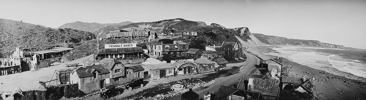
| (ca. 1916)*^ - View of houses and stage sets at Incville. Large sign on one of the buildings reads: Triangle Ranch. |
Historical Notes Incville's cost continued to rise as moviegoers enjoyed the more expensive feature films, which used five reels or more. Ince, through his alliance with Triangle, a production company founded by D. W. Griffith and Mark Sennett, built a new studio in Culver City to use for indoor movies, while retaining Inceville for outdoor locations and Westerns. Ironically, on January 16, 1916, a few days after opening of his Culver City studio, a fire broke out at Inceville, the first of many which would eventually destroy all of the dry frame buildings. That same year, Ince gave up on Inceville and sold it to Hart, who renamed it Hartville. Three years later, Hart sold the lot to Robertson-Cole, which continued filming until 1922. |
 |
|
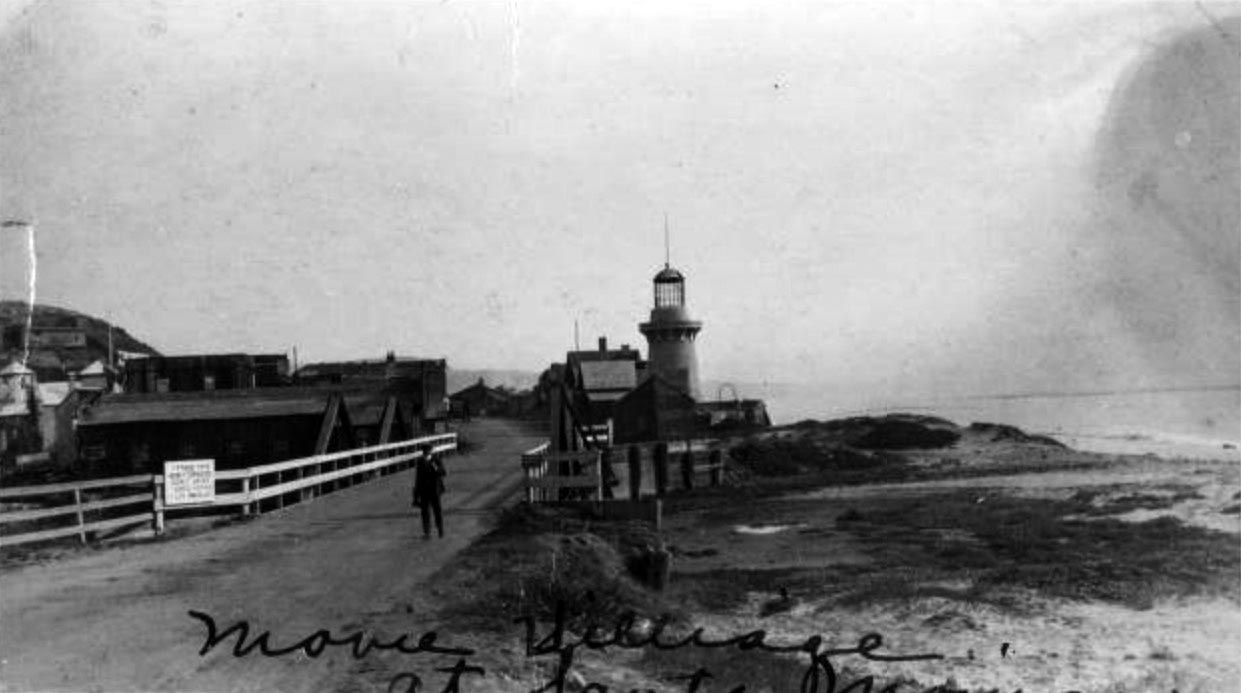
| (ca. 1915)* - View showing a man standing on a bridge leading to Inceville Movie Studio village on the beach at Pacific Palisades in Santa Monica. A sign on the bridge reads "Take this newly completed scenic drive Santa Monica Los Angeles." |
* * * * * |
Santa Monica North Beach
 |
|
| (ca. 1891)* - View of Santa Monica beach looking north from the observation tower of the Arcadia Hotel. Palisades Park can clearly be seen to the right. |
 |
|
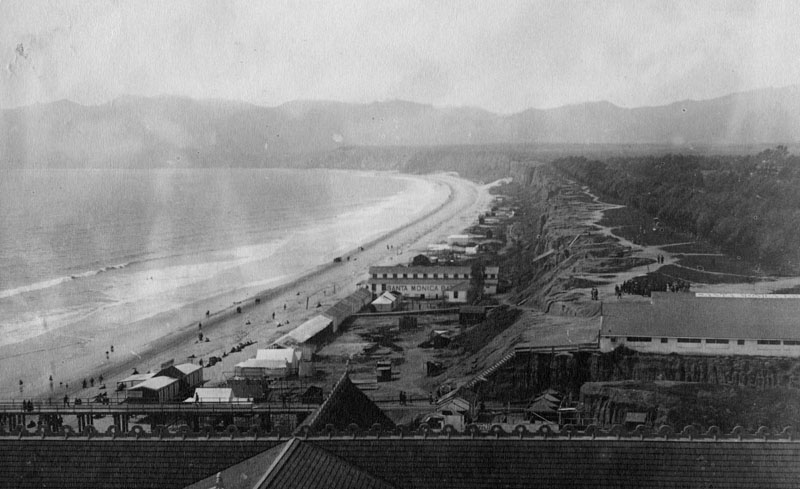
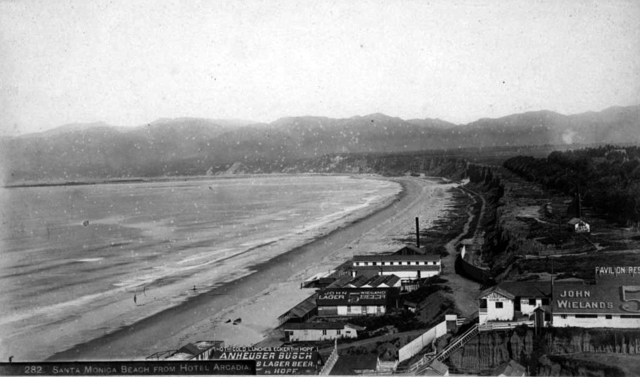
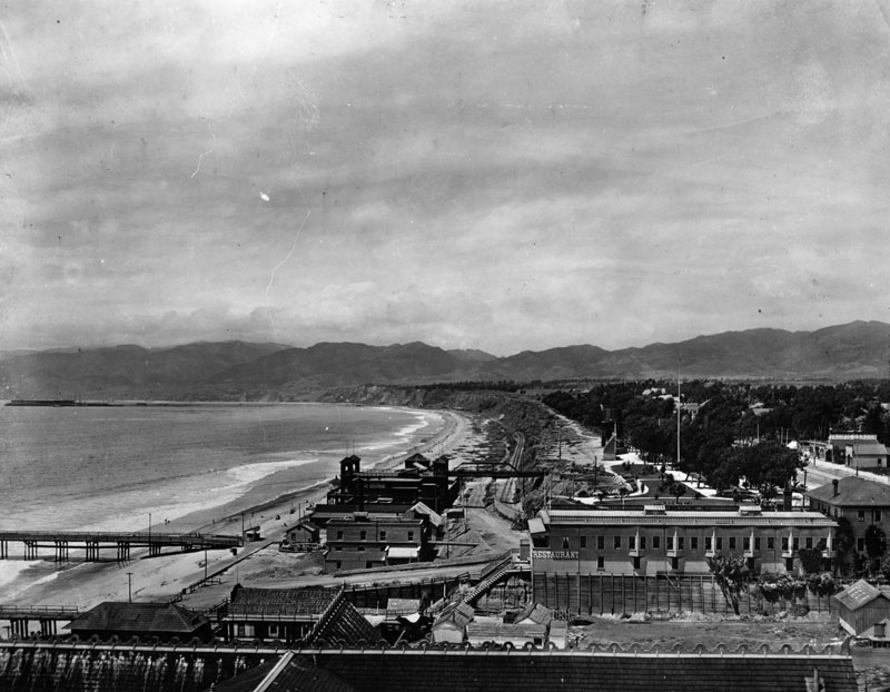
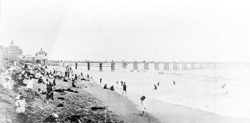
| (1893)#^^ - View showing restaurants on the North Beach, as seen from the Arcadia Hotel. Signs on the restaurants read "Hot and cold lunches, Eckert and Hopf, Anheuser Busch Lager Beer" "Pavilion Restaurant" and "John Wieland lager beer." The Santa Monica Bath House is seen beyond the "John Wieland" sign, with a bandstand shell on the bluffs above (in present-day Palisades Park) and the Long Wharf visible in the distance. |
 |
|
| (ca. 1893)* - View of Santa Monica beach looking north from the Arcadia Hotel observation tower. Palisades Park is on the right and the Santa Monica mountains can be seen in the distance. |
 |
|
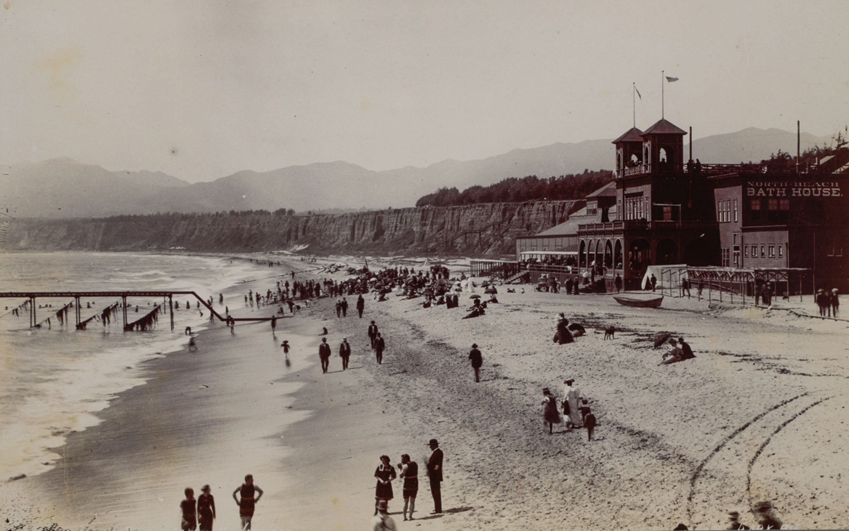
| (1898)* - This view of Santa Monica beach is looking north from the foot of Colorado Street. Ocean Avenue and Palisades Park can be seen on the right. The North Beach Bath House (dark building, center-left) is now in view. It was constructed in 1898. |
Historical Notes The Santa Monica Bath House was replaced by the North Beach Bath House in 1898. Two piers are seen in the above view. The lower pier is the remains of the Los Angeles & Independence Railroad Wharf. The pier further north is the North Beach Pier, built in 1898 (same year as the North Beach Bath House). |
North Beach Pier
 |
|
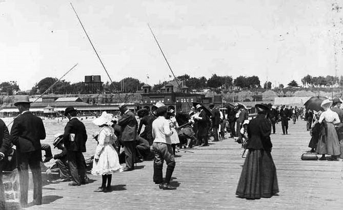
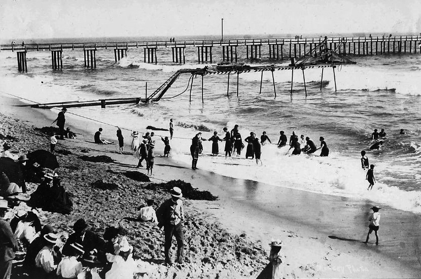
| (1898)^x^ – Crowds of people are seen enjoying the day on the newly constructed North Beach Pier. The North Beach Bath House, also constructed in 1898, can be seen in the background. |
Historical Notes The North Beach Pier was built adjacent to the North Beach Bath House in 1898. At 200 feet long, it was a place where guests of the North Beach Bath House could stroll. |
 |
|
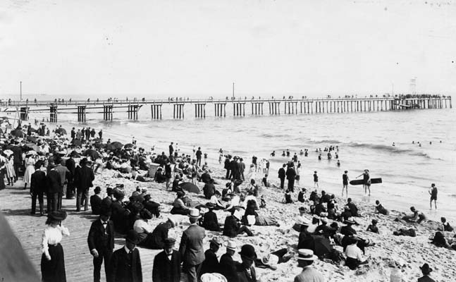
| (ca. 1898)* - View showing people walking on the boardwalk, sitting on the beach, and enjoying the surf with the North Beach Pier seen in the background. This was considered casual attire in the 1890s. |
 |
|
| (1898)* - Panoramic view of Santa Monica looking south from about the line of present Santa Monica Blvd. View is of the original bathing beach, or North Beach. The Camera Obscura building can be seen in the distance near the North Beach Pier. |
Historical Notes The remains of the 1875-built Los Angeles & Independence Railroad Wharf is further south closer to the Arcadia Hotel. |
|
Historical Notes The pipeline seen above is some form of discharge pipe that came out of the North Beach Bathhouse. |
 |
|
| (ca. 1898)^x^ – View as seen from the North Beach Pier looking toward the shoreline showing a pipe running from the North Beach Bathhouse out over the ocean. |
 |
|
| (ca. 1898)* - View from Santa Monica palisades south toward the North Beach Pier and Bath House. A train runs along the beach at the foot of the cliffs. The Arcadia Hotel can also be seen in the distance. |
 |
|
| (1901)^ - Image of the first house on the beach in Santa Monica, California, with the North Beach Bath House and North Beach Bath House Pier visible just south of the house, and the Arcadia Hotel, with one tower, in the distance. The Beach Road (which later became Pacific Coast Highway) and Southern Pacific Railroad tracks are seen behind the house next to the cliffs of Palisades Park, with a water tower at far center left. |
 |
|
| (1900)^ - View looking north toward Santa Monica Canyon with North Beach Bath House and houses along Beach Road on the left. Also, railroad tracks and signal and Palisades Park cliffs at right. |
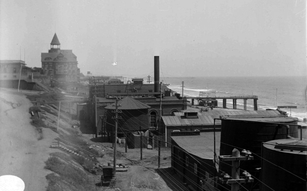
Santa Monica Electric and Power Co.
 |
|
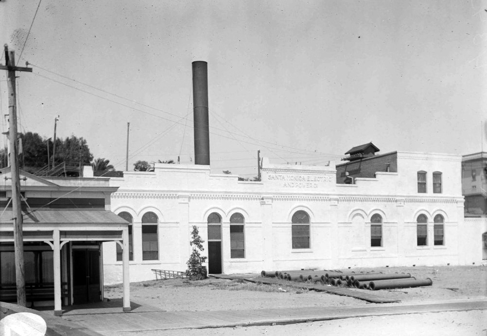
| (ca. 1898)^ – View looking south toward the Arcadia Hotel showing a large building with tall smoke stack at center of photo. This was Santa Monica’s first large steam power plant operated by the Santa Monica Electric and Power Co. Note the oil storage tanks at lower-right. |
Historical Notes Santa Monica Electric and Power Company built a power house on the beach in the late 1890s. |
 |
|
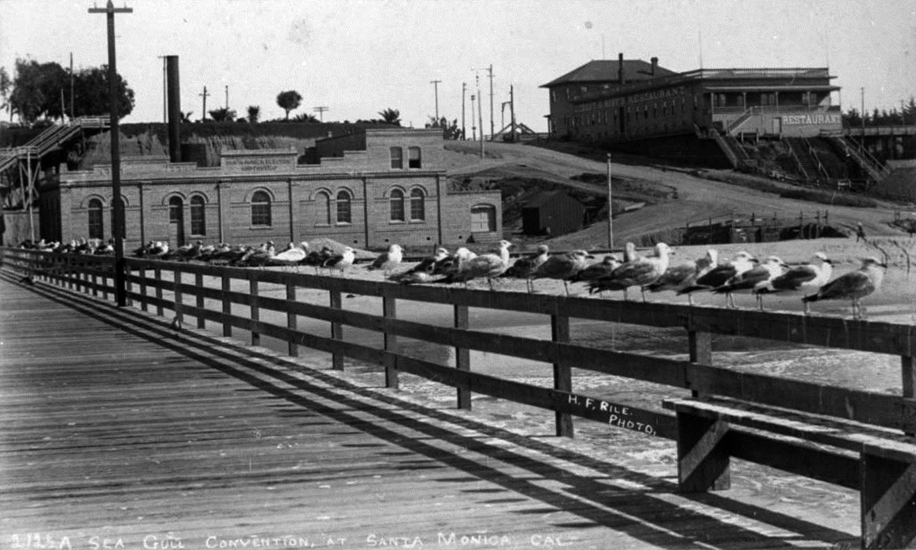
| (ca. 1900)^ - Postcard view showing a line of seagulls perched on a railing of the North Beach Bath House Pier. In the background is the brick Santa Monica Electric and Power Co. and Eckert & Hopf's Restaurant. Steps can be seen leading down from the Palisades bluffs. |
 |
|
| (ca. 1900)^ - Close-up front view of the Santa Monica Steam Plant. The sign on the building reads: "Santa Monica Electric and Power Co." |
 |
|
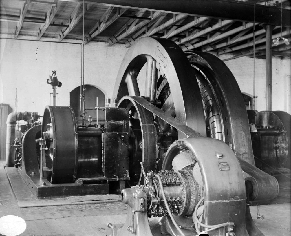
| (ca. 1900)^ – Interior view of Santa Monica Steam Plant showing steam turbine and generator of Unit 1. |
* * * * * |
North Beach Bath House |
Santa Monica's Grand Victorian Resort on the Sand (1894 to 1911) |
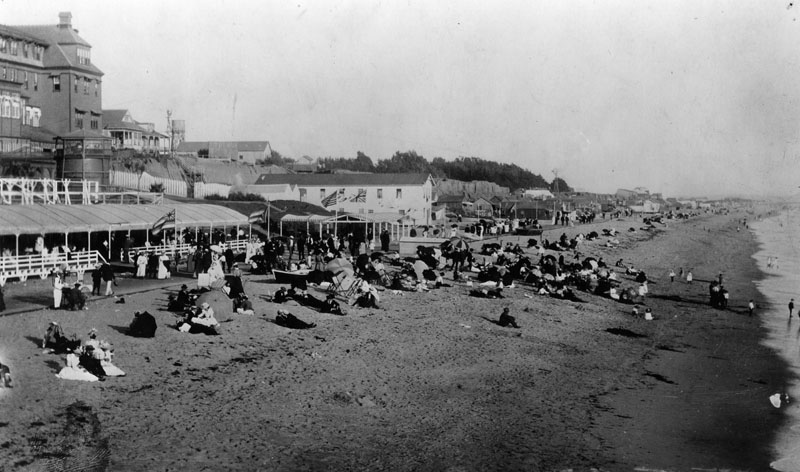
When the North Beach Bath House opened on June 9, 1894, it instantly became the social center of Santa Monica's beach life. Senator John P. Jones, one of the city's co-founders, had invested $50,000 to build it, hiring architect Sumner P. Hunt, who would later design the Southwest Museum in Los Angeles, to create what the Los Angeles Times described as the largest and finest structure of its kind on the Pacific Coast.Stretching 440 feet along the sand, the complex was far more than a place to change clothes. It offered two large heated saltwater plunges, 300 dressing rooms, an ornate parlor, a ballroom, a rooftop garden and observation deck, a bowling pavilion, a vaudeville auditorium added in 1901, and the Pavilion Restaurant with three separate dining rooms. A twenty foot wide boardwalk connected the bath house to the nearby Arcadia Hotel and ran for several miles along the surf, rivaling the famous boardwalk at Atlantic City. Admission was just twenty five cents.The bath house was the fifth facility to open along Santa Monica's North Beach, the first having been built by Michael Duffy back in 1876. It served the community for sixteen years before being torn down in 1911. The photographs below document the bath house and its surrounding beach from its earliest years through the height of its popularity. |
 |
|
| (ca. 1900)* - People in front of the North Beach Bath House, dressed in clothes and bathing suits, on the beach and in the water in Santa Monica. A pipe transporting sea water to the indoor plunge can be seen on the beach at left and a sign reading "North Beach Bath House" is painted on the building at right. The 99 Steps bridge can be seen descending from the Palisades cliffs in the distance. The warm saltwater plunge is the long building at far left and the bath house is the building with the two towers. Photo from the Ernest Marquez Collection. |
Historical Notes This view from around 1900 shows the full extent of the North Beach Bath House complex from the beach side. The long building at far left housed the heated saltwater plunge, while the taller structure with two towers to the right was the main bath house containing the dressing rooms, parlor, ballroom, and restaurant. The pipe running along the sand at left is particularly interesting. In 1896, a contract was awarded to lay pipe from the bath house to two large 30,000 gallon tanks constructed on the bluffs above, supplying saltwater not only to the indoor plunge but also to water the streets and keep the dust down in the growing town above. The 99 Steps bridge descending from the Palisades in the distance connects this scene directly to the Linda Vista Park section of your site, reminding visitors that the bluffs and the beach were linked from the earliest days of the resort. The mix of fully clothed visitors and bathers in the water captures the dual nature of North Beach as both a social promenade and a working resort, where the simple act of entering the ocean required a trip through the bath house and a change of clothes. |
 |
|
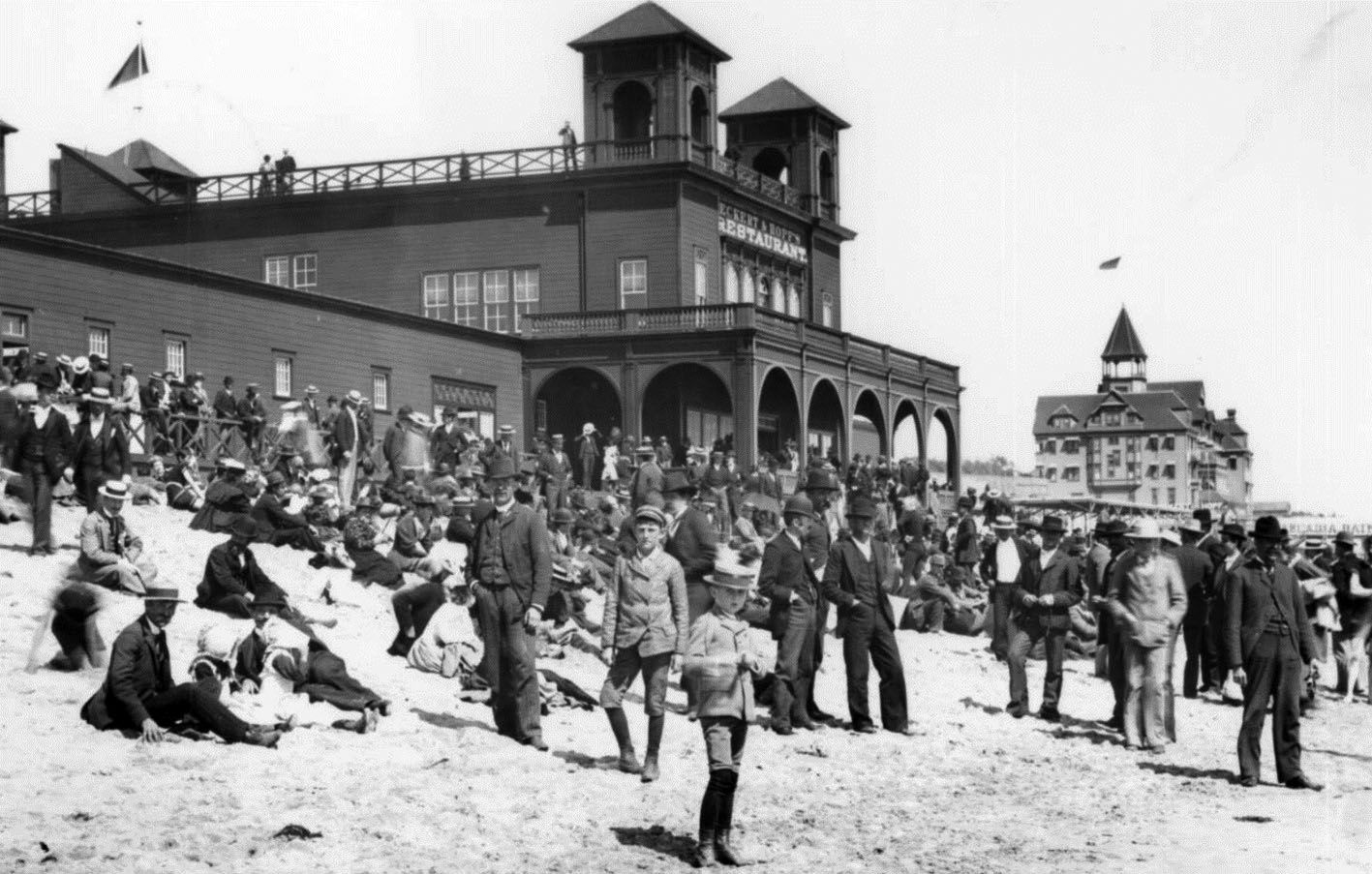
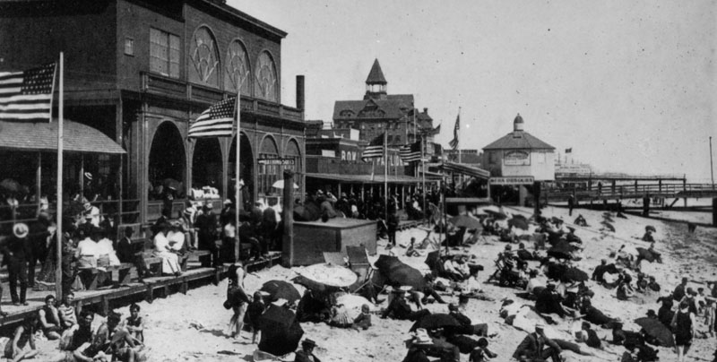
| (ca. 1898)* - The North Beach Bath House and Eckert and Hopf's Restaurant on a crowded beach day in Santa Monica. The elegant Arcadia Hotel is visible in the background. Flags fly from all towers of both buildings. |
Historical Notes Eckert and Hopf's Restaurant operated as a popular dining establishment adjacent to the North Beach Bath House, catering to the steady flow of visitors who arrived by Pacific Electric trolley and early automobile from Los Angeles. The flags flying from every tower of both buildings suggest a holiday or special event, likely one of the many summer festivals and beach days that regularly drew thousands of visitors to North Beach in the 1890s. The remains of the Los Angeles and Independence Railroad Wharf visible in the distance marked what had been Santa Monica's first bid for major port status, before San Pedro was selected as the region's official harbor. The grand structure visible in the background is the Arcadia Hotel, built in 1887 by Santa Monica co-founder Arcadia Bandini de Baker. One of the finest resort hotels in Southern California, it hosted presidents and dignitaries along its ocean facing verandas and was considered the social crown jewel of early Santa Monica. Like the bath house beside it, the Arcadia Hotel had a relatively short life. It was demolished in 1909, just two years before the bath house itself came down, closing the chapter on North Beach as the city's premier resort district. |
 |
|
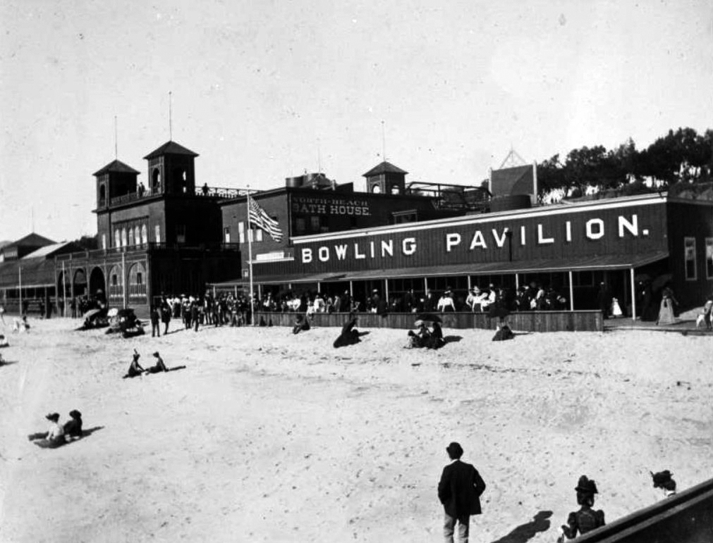
| (1898)* – People on the beach and boardwalk in front of the North Beach Bath House and Bowling Pavilion, many carrying umbrellas. An edge of the North Beach Bath House Pier can be seen at bottom right. |
Historical Notes The umbrellas carried by nearly every visitor in this 1898 view are a telling detail. In the late Victorian era, a suntan was considered undesirable, associated with outdoor labor rather than leisure, and fashionable visitors to the beach took great care to protect their skin from the sun. The broad twenty foot boardwalk running in front of the bath house was the social heart of North Beach, a place to promenade, be seen, and enjoy the sea air without necessarily setting foot on the sand or in the water. The Bowling Pavilion was one of the bath house's most popular secondary attractions, offering an indoor recreation option for visitors who preferred not to swim. The North Beach Bath House Pier, partially visible at lower right, extended into the ocean and gave bathers direct access to the surf, while the boardwalk above served as Santa Monica's answer to the famous promenades of Atlantic City and Long Beach. |
 |
|
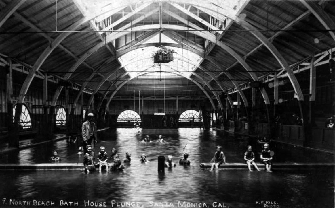
| (1901)* - People, including children, swimming in the North Beach Bath House saltwater plunge. A sign reading "Deep Water" hangs above the indoor pool at center. |
Historical Notes This 1901 interior view captures the plunge in full use on a busy day. The pool measured 50 by 150 feet and ranged from three to nine feet in depth, making the "Deep Water" sign overhead a genuine safety warning rather than a decorative touch. The heated saltwater was piped directly from the ocean and warmed to a comfortable temperature, making the plunge usable year round regardless of the weather outside. Children playing in the shallower sections and adults swimming in the deeper end reflect how deliberately the bath house was designed to serve the entire family. The year 1901 also marked the addition of the new vaudeville auditorium to the complex, built at a cost of $7,000 and opened first by the newly organized YMCA before being taken over by a traveling vaudeville company. With the plunge, the restaurant, the bowling pavilion, and now a performance venue all under one roof, the North Beach Bath House had grown into one of the most complete resort facilities anywhere on the California coast. |
 |
|
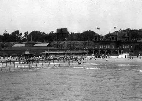
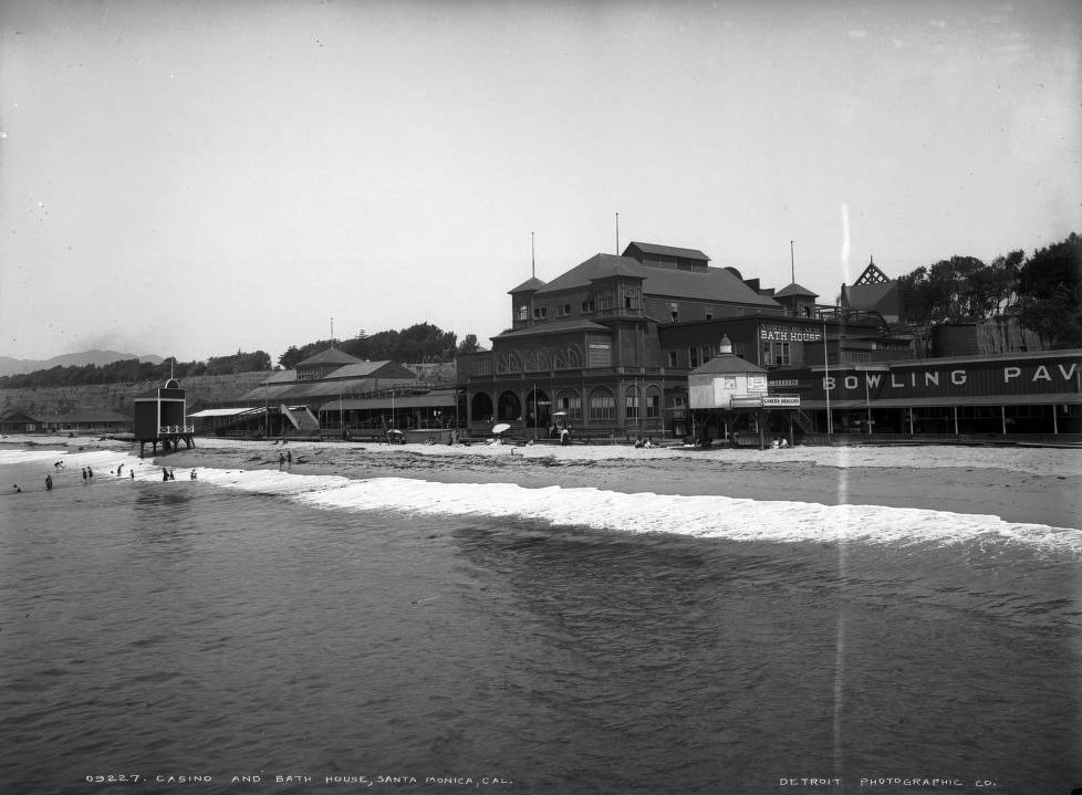
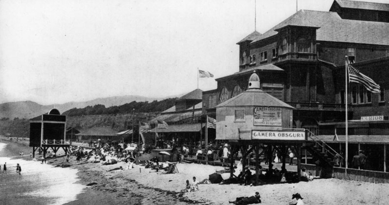
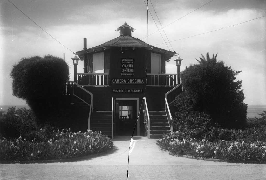
| (ca. 1900)* - View of Santa Monica's North Beach from the end of the pier. The North Beach Bath House is at center. The Camera Obscura and Bowling Pavilion are visible to the right. |
Historical Notes This elevated view from the end of the pier puts the bath house complex in its full coastal context. The main bath house building sits at center with the Camera Obscura and Bowling Pavilion clearly visible to the right, illustrating how tightly packed the resort's attractions were along this short stretch of sand. From this vantage point the scale of the operation is clear. The complex occupied nearly the entire width of the beach between the bluffs and the ocean, leaving just enough room for the boardwalk and open sand that visitors needed to reach the surf. The Camera Obscura, installed around 1899 by Robert F. Jones, nephew of Senator John P. Jones, quickly became one of the bath house's most talked about features. For ten cents, visitors entered the darkened chamber where a rotating lens and mirror projected a live 360 degree view of the surrounding beach, ocean, and passing ships onto a circular table below, giving them a moving panorama of the entire Santa Monica shoreline without stepping outside. |
 |
|
| (ca. 1900)* - View of the North Beach Bath House and casino at North Beach in Santa Monica. People mingle in front of Bath House while others swim or sit on the beach. Shows a bowling alley. Signs read: "North Beach Bath House" "Camera Obscura" "Bathing Suits" and "Bowling Pavilion." |
Historical Notes The signs visible on the bath house facade in this photograph serve as a directory of everything the complex had to offer. "Bathing Suits" indicates that rental costumes were available for visitors who arrived without their own, a common service at bath houses of this era when wool bathing costumes were expensive and most visitors did not own one. The sign for the Camera Obscura and the Bowling Pavilion confirm that by 1900 the bath house had grown well beyond its original purpose as a changing facility into a full resort attraction in its own right. The term "casino" in the caption refers not to a gambling establishment but to the broader Victorian usage of the word, meaning a public gathering place for entertainment and socializing. By this definition, the North Beach Bath House was very much a casino in the truest sense, a place where the community came together for music, dining, sport, and the simple pleasure of a day by the sea. |
 |
|
| (ca. 1898)* - Crowds enjoying a day on the beach in front of the North Beach Bath House. The Camera Obscura building is visible in the background. |
Historical Notes This view from around 1898 captures North Beach at what may have been the height of its popularity. The crowds filling the sand in front of the bath house reflect the enormous appetite for seaside recreation that had developed in Los Angeles during the 1880s and 1890s, driven largely by the arrival of transcontinental railroad service and the dramatic drop in fares that followed the rate wars of 1886. Visitors who had once faced a long overland journey to reach the California coast could now travel from downtown Los Angeles to Santa Monica for a few cents on the Pacific Electric. The Camera Obscura, visible in the background, had been installed just the year before and was already drawing curious visitors to its darkened chamber. Within a decade, however, the opening of Venice of America just to the south in 1905 would begin drawing crowds away from North Beach, and the bath house itself would close by 1910 and be demolished the following year, ending a sixteen year run as the finest resort facility on the Southern California coast. |
* * * * * |
Camera Obscura |
Santa Monica's Most Beloved Optical Novelty (1898 to Present) |
In 1898, Santa Monica mayor Robert F. Jones, nephew of city co founder Senator John P. Jones, built a Camera Obscura on the beach near the North Beach Bath House. Jones had experimented with the devices since boyhood, and as mayor he saw it as both a personal fascination and a clever attraction that could draw visitors to the young seaside city. Admission was ten cents, and the Los Angeles Herald advertised it for months under the headline “There Is Fun at Santa Monica.” The principle behind the Camera Obscura is ancient. Aristotle first described how a small opening in a darkened space could project an inverted image of the outside world onto an interior surface. In 1600 the German astronomer Johannes Kepler gave the phenomenon its Latin name, meaning “dark chamber.” What Robert Jones constructed in Santa Monica was a revolving version of this device, housed in a small wooden turret that projected a full 360 degree live view of the surrounding beach, ocean, and passing ships onto a circular table inside a darkened room. Jones proudly described it as one of the most perfect instruments of its kind. The Camera Obscura has had a remarkable life spanning more than 125 years. From its original location on the beach, it moved briefly to Westlake Park in Los Angeles in 1898, returned to Santa Monica in 1899, was purchased by the city in 1910 and relocated to Linda Vista Park, and in 1955 was installed in a purpose built mid century modern structure at 1450 Ocean Avenue designed by architect Weldon J. Fulton. It still operates today as part of the Camera Obscura Art Lab and remains one of only a handful of revolving Camera Obscuras still functioning anywhere in the world. |
 |
|
| (ca. 1898)* - The original Camera Obscura, built by Santa Monica mayor Robert F. Jones in 1898, standing on the beach in a small wooden turret structure. The North Beach Bath House is visible in the background. |
Historical Notes This early photograph shows the Camera Obscura in its original form, a small wooden turret standing on the sand near the North Beach Bath House. Robert F. Jones constructed the device in 1898 during his tenure as mayor, combining his lifelong fascination with optical instruments with the city’s growing effort to attract visitors to Santa Monica’s expanding seaside resort. Visitors climbed a wooden stairway, paid ten cents, and entered a completely dark chamber where a rotating mirror and lens projected a live panoramic image of the surrounding beach and ocean onto a circular viewing disc below. The effect was surprisingly vivid. Waves rolled, people moved along the shore, and ships passed slowly across the horizon, all appearing silently on the white table inside the dark room. Because the operator spent hours scanning the shoreline through the lens, the Camera Obscura occasionally served an unexpected secondary purpose. From this elevated vantage point attendants could observe swimmers and activity along the beach, functioning at times as informal lookouts for lifeguards and police. |
 |
|
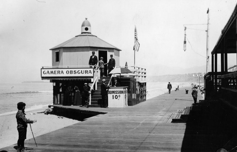
| (ca. 1900)* - An attendant collects a ten cent admission fee from a visitor at the entrance to the Camera Obscura on the Santa Monica boardwalk. The North Beach Bath House is visible in the background. |
Historical Notes By around 1900 the Camera Obscura had been given a new wooden structure after its brief relocation to Westlake Park in Los Angeles and its return to Santa Monica in 1899. The attendant collecting the admission fee in this photograph was an employee of the North Beach Bath House, which had incorporated the Camera Obscura as one of its featured attractions. According to the Los Angeles Times, it was a rule of the establishment that every employee be a good swimmer, and the Camera Obscura operator, perched above the beach with a commanding view of the water, was among the best positioned to spot trouble in the surf below. Ten cents was a modest sum even by the standards of 1900, and the Camera Obscura drew several hundred visitors on busy days, making it one of the most consistently popular attractions at North Beach. The image it projected onto the viewing disc inside was not a still photograph but a live, moving, silent picture of everything happening outside, an experience that must have felt genuinely astonishing to visitors who had never seen anything like it. |
 |
|
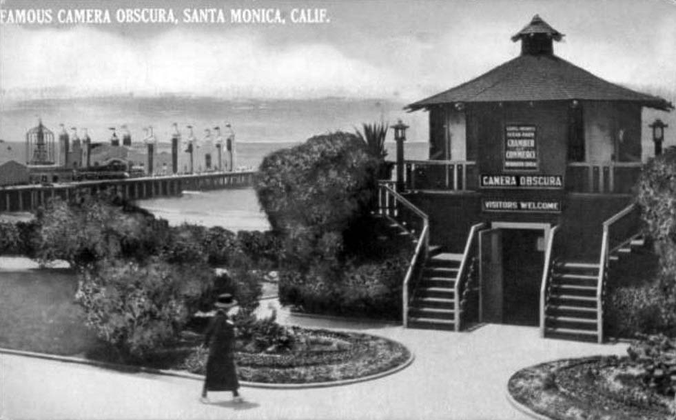
| (ca. 1907)* - The Camera Obscura in its new location at the top of the Palisades Bluffs at Linda Vista Park, after being donated to the city of Santa Monica by Robert F. Jones in 1907. |
Historical Notes In 1907, Robert F. Jones donated the Camera Obscura to the city of Santa Monica, and it was moved from the beach up to Linda Vista Park on the bluffs above, near the foot of Broadway. The city hoped the device would attract visitors to the park the same way it had drawn crowds to North Beach, and the elevated location proved to be an even better vantage point. From the top of the Palisades, the Camera Obscura's rotating lens could capture sweeping views stretching from the mountains to the north all the way south to the developing beach communities of Ocean Park and Venice. The move to the bluffs also coincided with the gradual decline of the North Beach Bath House, which would close in 1910 and be demolished the following year. As the old resort district faded, the Camera Obscura carried on above it, outlasting the boardwalk, the bath house, and the Long Wharf, all of which had defined the Santa Monica shoreline at the turn of the century. |
 |
|
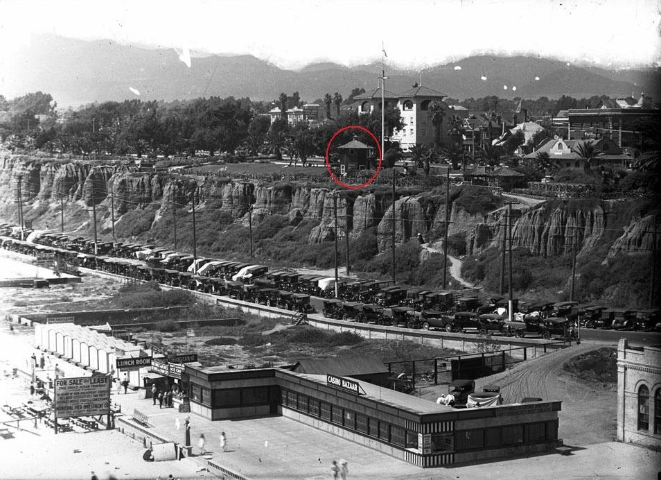
| (ca. 1924)* - Postcard view of the Camera Obscura at Palisades Park in Santa Monica. The newly opened La Monica Ballroom, completed in 1924, is visible to the left. |
Historical Notes By the mid-1920s the Camera Obscura had become a fixed landmark of Palisades Park, appearing regularly on postcards that promoted Santa Monica as a scenic destination. The La Monica Ballroom, visible to the left in this view, had just opened in 1924 as one of the largest dance halls built over the ocean anywhere in the country, bringing a new generation of visitors to the bluff top park. The Camera Obscura's small wooden structure, modest by comparison, sat quietly nearby, offering a very different kind of spectacle, one that required patience, darkness, and a willingness to simply watch the world go by in silence. The postcard format of this image reflects how thoroughly the Camera Obscura had entered the public imagination as a symbol of Santa Monica. It appeared in promotional materials alongside the pier, the ballroom, and Palisades Park itself, recognized as one of the distinctive experiences the city offered that visitors could not find anywhere else. |
 |
|
| (ca. 1920)* - The Camera Obscura in its bluff top setting at Palisades Park, formerly known as Linda Vista Park, which was officially renamed around 1915. |
Historical Notes By around 1920 the park had been known as Palisades Park for five years, having shed its earlier name of Linda Vista Park in 1915 to reflect the dramatic coastal cliffs that define the bluff top landscape. The Camera Obscura's modest wooden structure fits naturally into the informal, rustic character of the park during these years, when twisted branch fencing, winding paths, and simple wooden shelters gave the bluff top promenade its distinctive character. The device continued drawing visitors steadily through the 1920s and into the mid-century, when a growing need for a permanent home led the city to commission architect Weldon J. Fulton to design a purpose built structure. In November 1955, the Camera Obscura was installed in Fulton's new building at 1450 Ocean Avenue, where it has remained ever since, one of only a handful of revolving Camera Obscuras still operating anywhere in the world, and one of the oldest continuously operating public attraction in Santa Monica's history. |
* * * * * |
 |
|
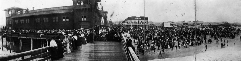
| (ca. 1895)* - A panoramic view of one of the ocean piers and parks along the ocean before 1900. Huge cowds are on the pier and on the beach next to it. |
Historical Notes In 1895, Abbot Kinney acquired the deed to the coastal strip previously purchased by W.D. Vawter and named the area Ocean Park. It became his first amusement park and residential project. A race track and golf course were built on the Ocean Park Casino. After a falling out with his partners he focused on the south end of the property, which he made into Venice of America. Click HERE to see more in Early Southern California Amusement Parks. |
 |
|
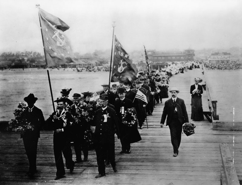
| (ca. 1900)* - A long parade line, led by U.S. Navy flag bearers, walks across a pier carrying flowers to be thrown from the pier into the water at the foot of Colorado Ave. |
Historical Notes Formerly known as Decoration Day, Memorial Day originated after the American Civil War to commemorate the Union and Confederate soldiers who died in the Civil War. By the 20th century, Memorial Day had been extended to honor all Americans who have died while in the military service.*^ |
 |
|
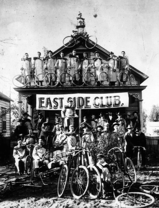
| (ca. 1898)* - Group photo of the East Side Cycle Club, showing a banner for the club, taken on the beach at Santa Monica near the old North Beach Bath House. The riders are wearing overcoats and over-sized bows. |
Los Angeles Pacific Electric Railway
 |
|
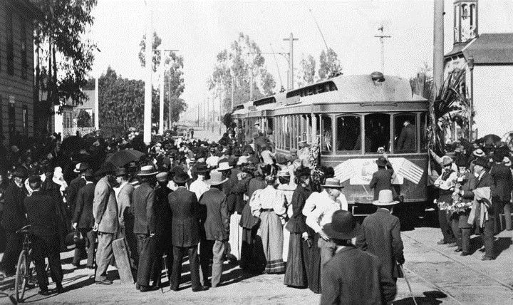
| (1896)* - Opening of the Los Angeles Pacific Electric Railway from Los Angeles to Santa Monica, April 1, 1896. The extensive Pacific Electric Railroad easily transported to the beaches people from across the Greater Los Angeles Area. |
Historical Notes The Los Angeles Pacific Railway was built by Eli Clark and Moses H. Sherman, for whom Clark Drive, Shermanton (now West Hollywood), and Sherman Avenue (now Santa Monica Boulevard) were first named. They were early pioneers of interurban electric railways that laid track from downtown to the sea. Their Los Angeles to Santa Monica line opened on April 1, 1896 to an excited beach crowd in Santa Monica.*# |
 |
|
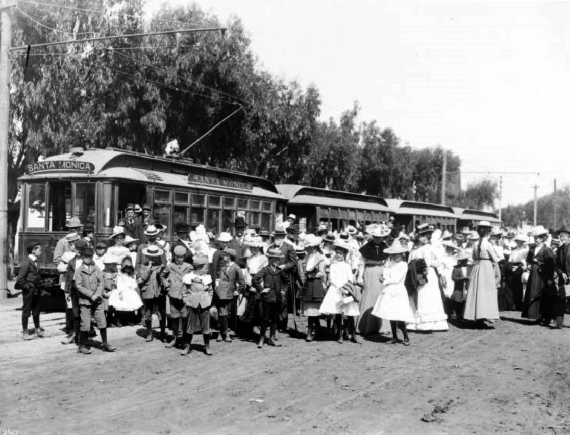
| (1896)** – View showing a crowd of people gathered for opening day of the electric car line in Santa Monica, April 1, 1896. The men, women and children are piling off of four cars at center. The finely-dressed crowd stands in front of the cars in the foreground while trees hang over the cars from the left side. |
 |
|
| (1896)* - View is looking north across the bridge on Ocean Avenue, from the Arcadia Hotel. A trolley can be seen on the right. In the middle of the photograph, a sign reads "Arcadia Baths, hot salt baths, new tubs." |
Whitaker Ranch
 |
|
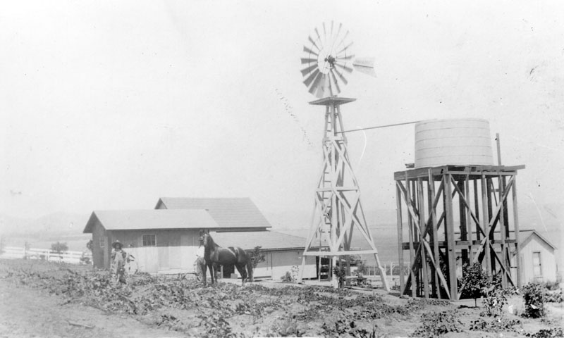
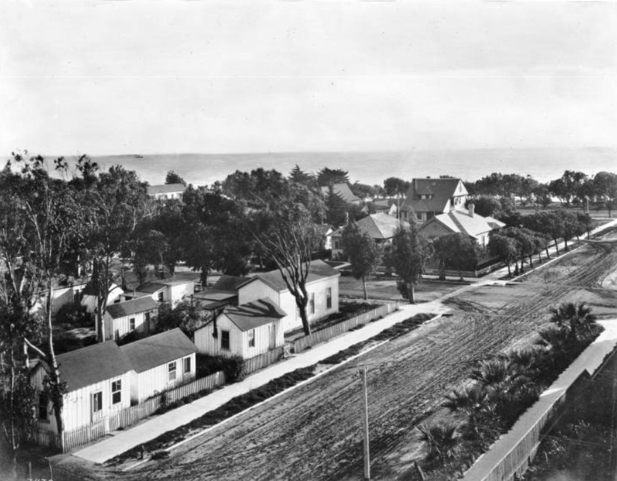
| (1897)* - Original wooden house and barn on the Whitaker Ranch located on Centinela Avenue in Santa Monica. Two men and a horse can be seen standing in the small field closest to the house, and a windmill and water tank are visible on the right. The Santa Monica Airport is now located in this same location. |
Historical Notes Santa Monica Airport was originally called "Clover Field" after World War I aviator Lieutenant Greayer "Grubby" Clover, and was home of the Douglas Aircraft company. The first circumnavigation of the world by air took off from Clover Field on St. Patrick's Day, March 17, 1942. At one point, it was the site of the Army's 40th Division Aviation, and became a Distribution Center after World War II.* |
Vawter Carnation Fields
 |
|
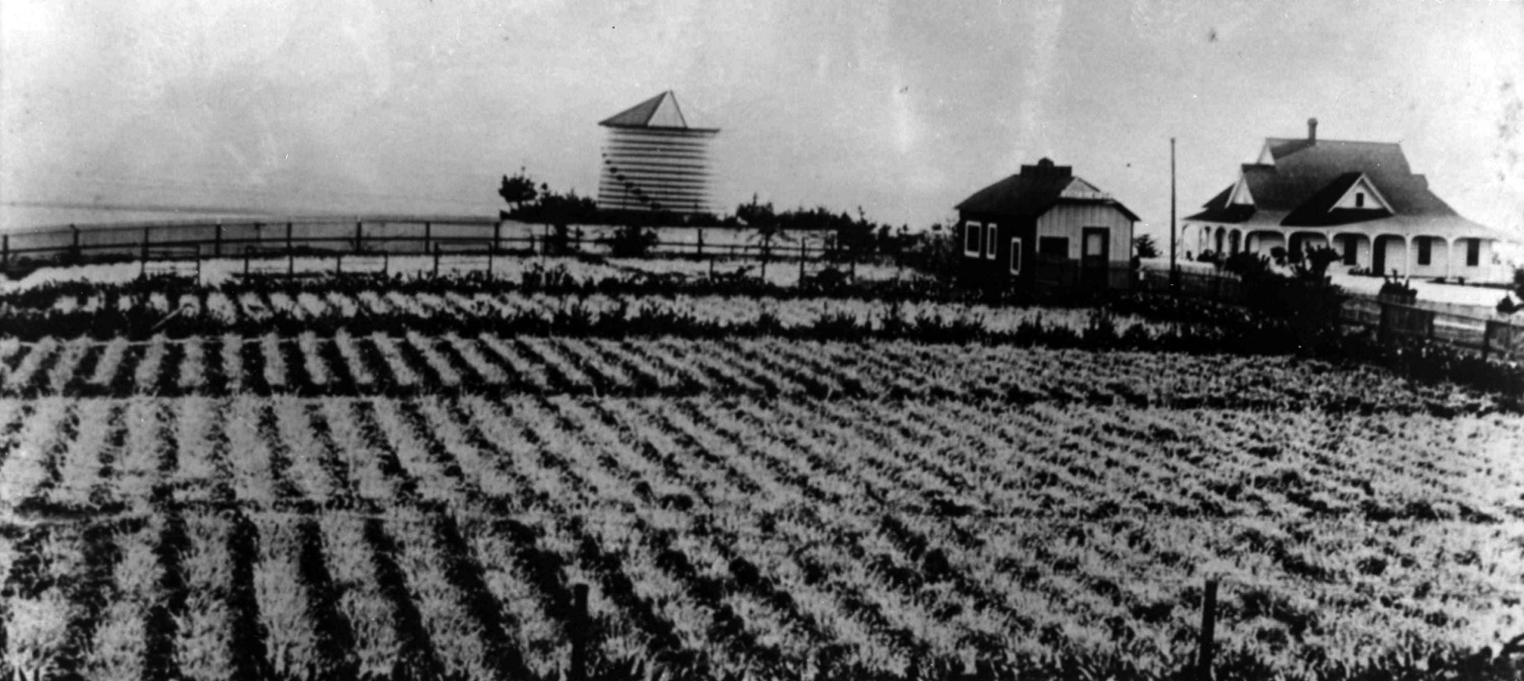
| (ca. 1900)* - Carnation field, silo, and a home, located at 4th Street and Marine Street in the Ocean Park neighborhood of Santa Monica. The property belonged to Edwin J. Vawter, a pioneering Santa Monica businessman. |
Historical Notes Edwin J. Vawter, was from a pioneering Santa Monica family. His father established Santa Monica's first general store and First National Bank. A 1901 guidebook (Wilson's Illustrated and Descriptive Souvenir and Guide to Los Angeles and Near-by Towns) described the carnation fields thus: "One of the most beautiful attractions [in Ocean Park] is the carnation field of Mr. E.J. Vawter. It is situated on a ridge overlooking the grand old Pacific. Here carnations are in full bloom summer and winter." It was probably helpful that Mr. Vawter was also in charge of the city water company. |
Ocean Park Pier
 |
|
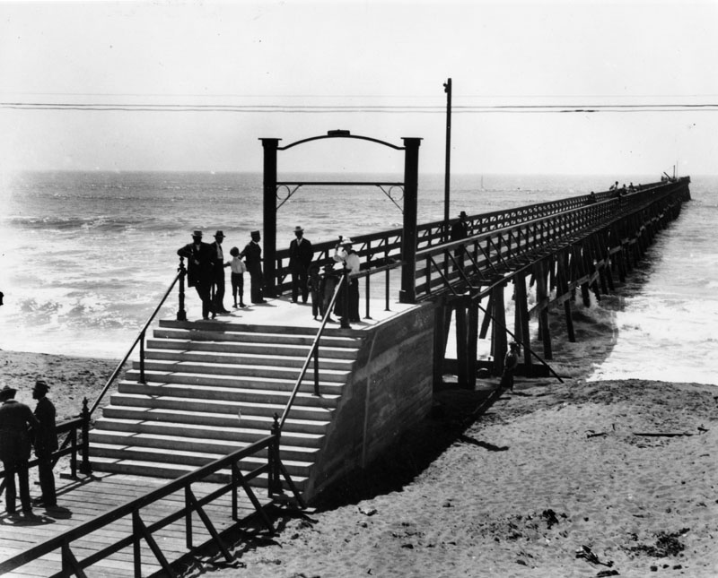
| (ca. 1897)* - A view of the 500 ft. long Ocean Park Pier, built by the Santa Fe Railroad in 1895. This view shows several people standing on the pier as we look towards the ocean. |
Historical Notes In 1891, Abott Kinney and (silent partner) Francis G. Ryan purchased a 1-1/2 mile long, narrow strip of sand dunes along the shore line south of Santa Monica extending from Strand Street to Brooks Avenue from a Captain Hutchinson. To encourage building, water was brought in, the tract was sewered, board walks laid, and lots leased to persons desiring to put up small cottages. That same year, Kinney & Ryan (Ocean Park Development Company) built a pier, golf course, horse-racing track, boardwalk and other resort amenities on the northernmost edge of their holdings. They would also give 12 acres to the Santa Fe Railroad so they would extend their Inglewood line north to Kinney and Ryan’s resort. In 1893, Kinney and Ryan began selling small 25 x 100 foot beach lots priced at $100 and featured piped water. Tents were erected on the unsold lots and were available to campers for summer rental. Frederick Rindge, who was president of the Los Angeles YMCA, founds a YMCA summer camp on 5 acres of land located on 250ft beach front near Hill St., donated by Kinney who hopes that the YMCA camp will attract people to his beach resort.* |
 |
|
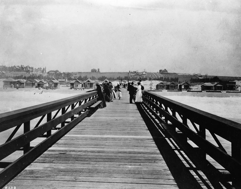
| (ca. 1897)* - A view of the 500 ft. long Ocean Park Pier, built by the Santa Fe Railroad in 1895, and located about 300 feet south of Hill St. Here we are standing on the pier looking toward Ocean Park itself. |
Historical Notes Kinney and Ryan’s original resort consisted of 150 beach cottages, and a small commercial district along Pier Avenue. A building boom added 40 new beach cottages, several stores, and Kinney’s new 40 acre Ocean Park race course and golf links. The resort would be subdivided and sold to more developers and by 1902, there were over 700 cottages in Ocean Park.* |
 |
|
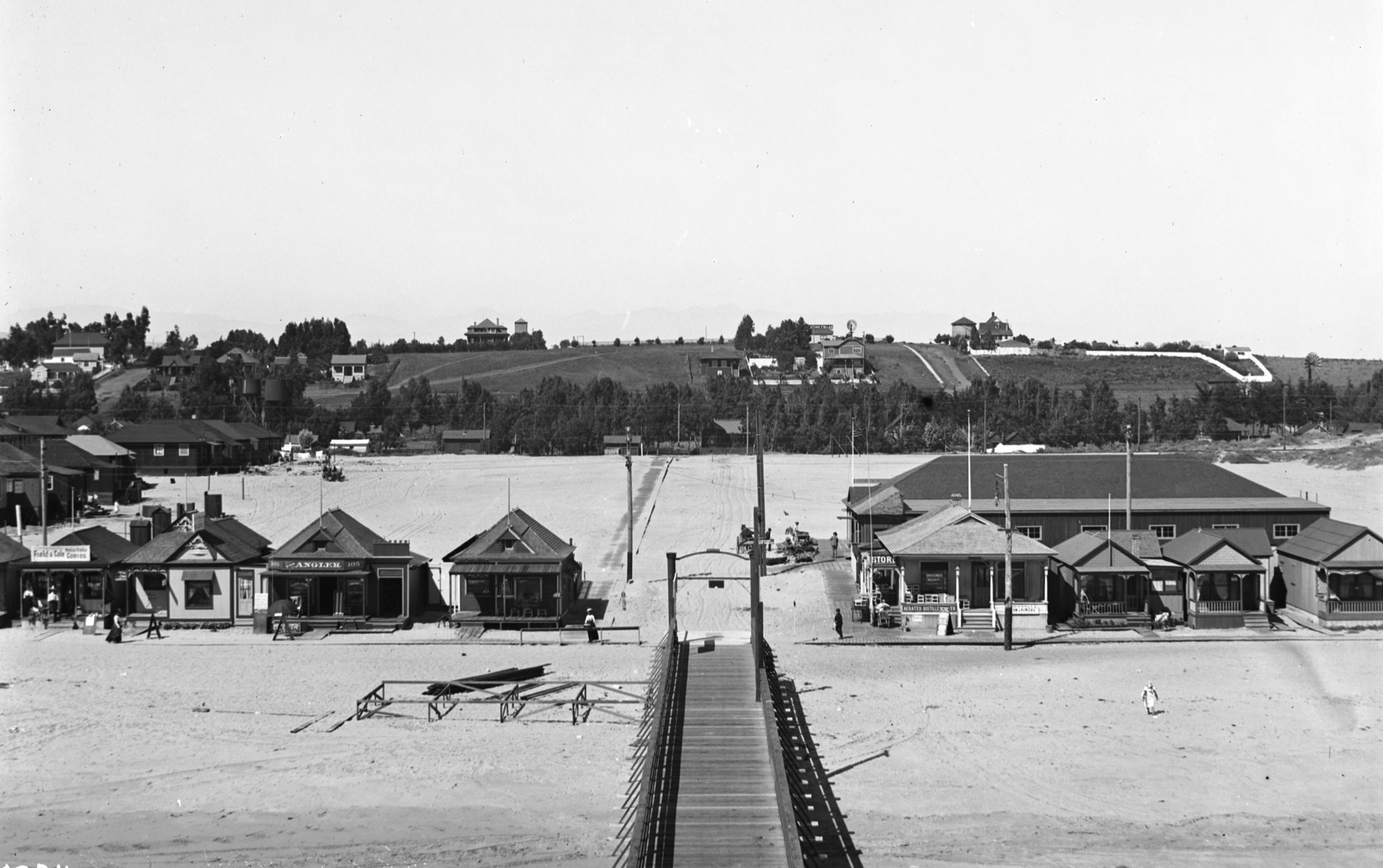
| (1898)* - Closer view of Kinney and Ryan's beach cottage resort located near Ocean Park Pier. |
Historical Notes In 1898, Ryan died and his widow married Thomas Dudley of Santa Monica who becomes Kinney's new partner. After 1904, Kinney moved his attention to his Venice of America development (also called Ocean Park at the time) , south of the Santa Monica city boundary. The history of Venice and Ocean Park are intertwinned. From 1905 to 1925, Ocean Park was developed by people such as Fraser, Merritt Jones, Hart, Hollister and Wadsworth. |
* * * * * |
Santa Monica Palisades
 |
|
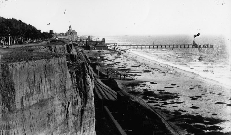
| (ca. 1889)* - Looking south from the '99 steps' toward the Arcadia Hotel. In the upper left can be seen a man sitting on a bench very close to the edge of the palisades (This area would become Palisades Park). The stub of the Los Angeles and Independence Railroad Wharf can also be seen. |
Historical Notes Originally known as “Linda Vista Park,” Palisades Park was the first officially-designated public open space in Santa Monica. The land was donated to the City by Santa Monica's founder, Senator John P. Jones, in 1892. The Los Angeles and Independence Railroad Wharf was in use between 1875 and 1879, at which time it was purchased by the Southern Pacific Railroad company and partially dismantled. It stood just south of the present location of the Santa Monica Pier at the foot of Colorado Avenue. |
 |
|
| (ca. 1890)^- View looking south from the rim of the Palisades, overlooking the original "99 Steps," which provided access to the northern portion of Santa Monica beach. Seen in the distance is the Hotel Arcadia and the stub of the Los Angeles and Independence Railroad Co. Wharf. The vantage point of this photograph is near the foot of Wilshire Boulevard. |
Historical Notes Most of the beach shacks would be removed with the laying of railroad tracks along the beach by Southern Pacific in 1892. |
 |
|
| (ca. 1890)* - View looking south from the rim of the Palisades, overlooking the original "99 Steps," which provided access to the northern portion of Santa Monica beach. Seen in the distance is the Hotel Arcadia and the stub of the Los Angeles and Independence Railroad Co. Wharf. The vantage point of this photograph is near the foot of Wilshire Boulevard. AI image enhancement and colorization by Richard Holoff |
 |
|
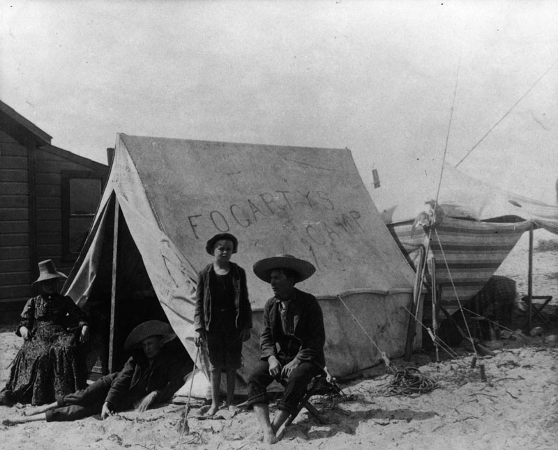
| (ca. 1900)* - A family is camping on the beach circa 1900. On their tent are written the words, "Fogarty's Camp." A man and woman are sitting on chairs near the tent, while two barefoot boys pose with them. All are wearing street clothes. The tent has an annex behind and is located next to a wooden house. |
* * * * * |
The “99 Steps” |
Early Beach Access Beneath the Santa Monica PalisadesThe Staircase That Watched a City Grow |
In 1875, the same year Santa Monica was founded, a wooden staircase was built at the foot of Arizona Avenue. Its purpose was simple: to solve the problem of the coastal bluffs. Those cliffs rose sixty-five feet above the beach and made reaching the shoreline a real challenge for residents and visitors alike. The staircase, soon called the 99 Steps, became the town's first direct pedestrian route from the mesa above down to the sand below. For more than fifty years it served as the main connection between the growing city and the ocean it was built around. The 99 Steps are worth studying because of how much changed around them while they kept standing. In the early 1890s, railroad tracks were laid directly beneath the staircase. Freight trains carrying cargo to a massive ocean wharf then passed under the same wooden landings where bathers had been pausing to enjoy the view. A celebrated resort hotel rose a short walk to the south. The dirt road at the base of the bluffs slowly became one of the most recognized coastal highways in the country. Through all of it, the steps stayed open and kept carrying visitors to the beach, until the highway finally grew too wide and too busy for a wooden staircase to safely cross. The photographs in this section follow the 99 Steps through each of those changes. They begin with the original wooden staircase in the 1880s and end with the pedestrian bridge that stands at the same location today. Each image shows the steps at a different point in time. The world around them shifts in nearly every photograph, but the route from the bluff to the beach never moves. |
|
1886 | The Original 99 Steps |
 |
|
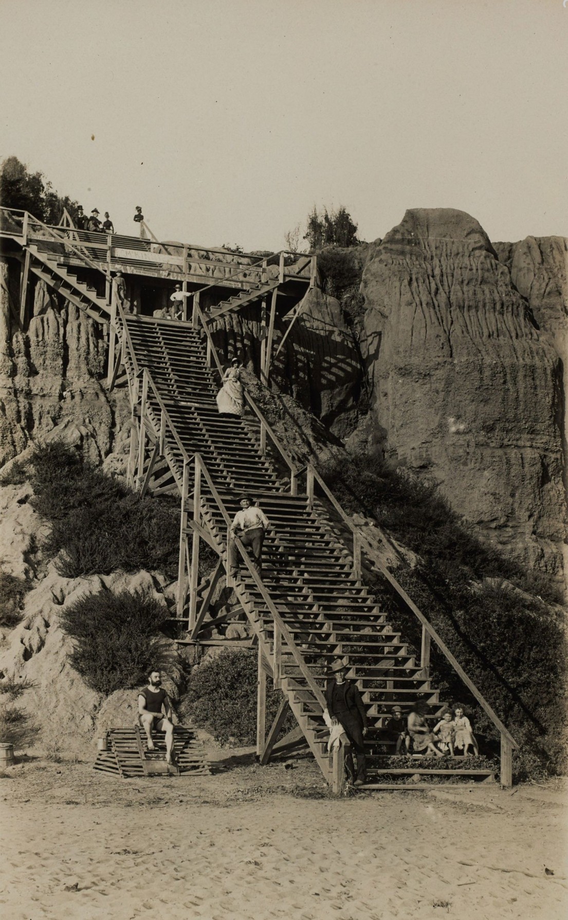
| (1886)* – Visitors pause on the wooden landings at the foot of Arizona Avenue. A sign near the top advertises Fred C. McKinnie's drugstore. Image from the Ernest Marquez Collection. |
Historical Notes This is one of the earliest surviving photographs of the steps, taken eleven years after they opened. Look at what it actually shows: a man in a bathing suit at the base, women and children ranged along the upper railings, nobody in a particular hurry. The 99 Steps were not just a way to get to the beach. They were a place to be. People paused on the landings to watch the surf, talk, and take in the view that spread out below them across the full sweep of Santa Monica Bay. The McKinnie sign is worth a second look. Fred McKinnie was a local pharmacist who understood something simple: this staircase was the most-traveled ground in town. Every person heading to the beach passed this spot. In an era before roadside billboards, the top of the 99 Steps was the best advertising location in Santa Monica. Santa Monica itself was only eleven years old when this photograph was taken, founded by Senator John P. Jones and Colonel Robert S. Baker with a land auction in July 1875. The bluffs that required the staircase were the same bluffs that gave their new city its dramatic silhouette against the Pacific sky. Whether the staircase ever had exactly 99 steps is a question the historical record does not fully answer. The name stuck as a popular nickname through every modification and rebuilding. The current Arizona Avenue crossing has approximately 115 steps — suggesting the count grew over time as the structure was expanded to bridge an ever-wider corridor of road and rail below. The name, however, never changed. |
ca. 1891 | The 99 Steps, Looking Up from the Beach
 |
|
| (ca. 1891)* - The 99 Steps descend toward the beach. Two small wooden buildings have appeared near the base. |
Historical Notes The quiet in this image is about to end. Those two small wooden buildings near the base of the steps are the first hint of the commercial shoreline beginning to form below the bluffs. But the bigger change is invisible here: the Southern Pacific Railroad was already surveying the narrow strip of land at the bottom of these steps, preparing to lay tracks straight through it. Within a year or two, freight trains would be passing directly beneath the wooden landings visible in this photograph. The 99 Steps, built for a sleepy beach town, were about to become a pedestrian bridge over one of the busiest rail corridors on the Southern California coast. |
The Railroad Era, 1891–1913 |
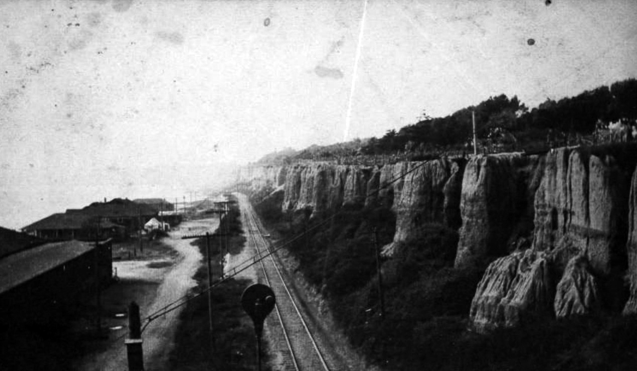
ca. 1898 | Railroad Tracks Below the Steps |
 |
|
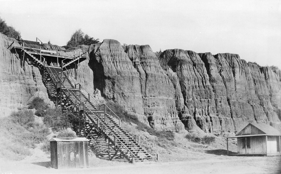
| (ca. 1898)* - View looking northwest showing railroad tracks running underneath the '99 Steps' in Santa Monica. The Long Wharf, which was the end point of this Southern Pacific Railroad line, can be seen in the distance. Note how the steps have been modified to accomodate the tracks (compare to previous image). |
Historical Notes Few photographs in this collection are as striking as this one. The 99 Steps now span an active freight railroad. The staircase was modified in the early 1890s to let trains pass beneath while pedestrians continued above, and the two systems coexisted for several decades without incident. The Long Wharf in the distance opened in 1894 as the longest wooden pier in the world at approximately 4,700 feet. Ships from Pacific ports unloaded onto waiting Southern Pacific cars, which then rolled south beneath these steps to Los Angeles. A visitor stepping off the last riser in 1898 would have landed directly beside moving freight cars before crossing to the beach. |
ca. 1898 | Colorized View, Beach Road and Railroad
 |
|
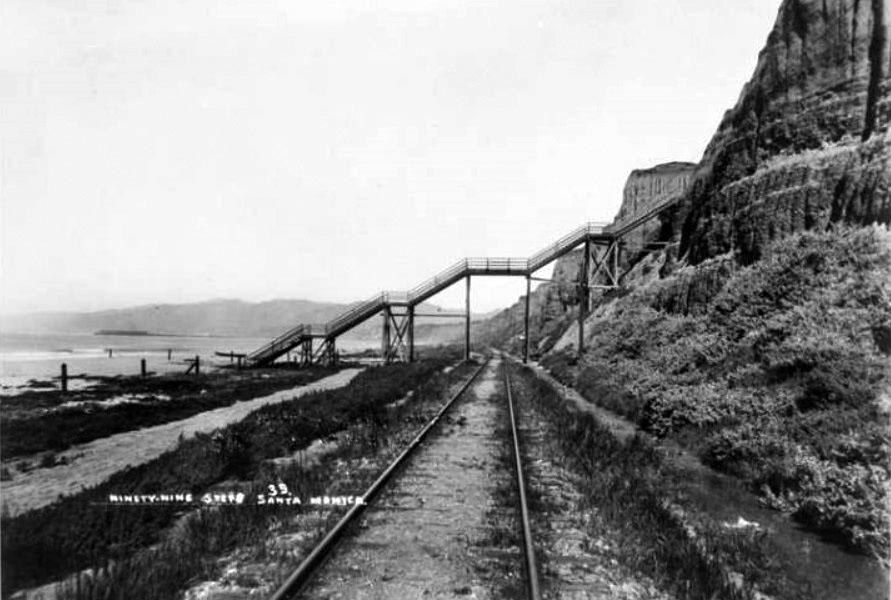
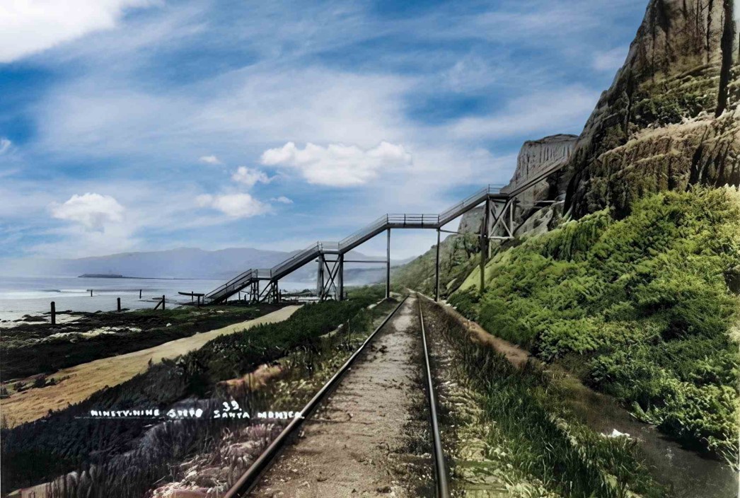
| (ca. 1898)* - A view looking northwest shows railroad tracks running beneath the '99 Steps' in Santa Monica. To the left, the dirt road known as Beach Road would later become Roosevelt Highway. In the distance, the Long Wharf marks the terminus of this Southern Pacific Railroad line. AI image enhancement and colorization by Richard Holoff. |
Historical Notes In this single frame you can see almost every form of transportation available in Southern California in 1898: a wooden staircase, a working railroad, a dirt road, and in the distance a pier long enough to dock oceangoing ships. The railroad was here because of the Free Harbor Fight, a national political battle over whether Santa Monica Bay or San Pedro Bay would become the official port of Los Angeles. Senator Jones backed Santa Monica. When Congress chose San Pedro in 1897, it was essentially over. Shipping traffic at the Long Wharf began to fall. The wharf closed in 1913. But Beach Road, visible running beside the tracks, outlasted the railroad entirely, eventually widening into Pacific Coast Highway. The 99 Steps crossed all of it without pause. |
1893 | Looking South Along the Beach
 |
|
| (1893)* - View looking south showing North Beach and the Arcadia Hotel with the Southern Pacific Railroad tracks running next to the Beach Road in Santa Monica. The Santa Monica Bath House and the remains of the Los Angeles and Independence Wharf are visible at right and the Palisades Bluffs are visible at left. Photo from the Ernest Marquez Collection. |
Historical Notes This photograph was taken from a point near the 99 Steps, looking south down the coastline, which means the staircase itself is behind the camera and out of frame. What the image gives us instead is the world the steps connected to. The railroad tracks pressed against the palisade base carried the trains that passed directly beneath the 99 Steps before continuing south along this very stretch of shoreline. The Arcadia Hotel visible in the middle distance opened on January 24, 1887. Named for city co-founder Arcadia Bandini de Baker, who donated the blufftop land above the steps to the city as a public park in 1892, the hotel sat just far enough south that guests who wanted to climb the palisades would have walked north along this beach to reach the staircase. What remains of the original Los Angeles and Independence Railroad Wharf is visible at right, reduced by 1893 to little more than pilings in the water. Senator Jones had built it in 1875, the same founding year as the 99 Steps, to bring commerce to his new city by sea. It did not last. By the time this photograph was taken, the Southern Pacific Long Wharf — approximately 4,700 feet of new timber stretching into the bay just north of here — had already replaced it as the working pier of Santa Monica. What this image captures, then, is a city mid-transformation: the old wharf fading, the new one risen, and the 99 Steps still standing above it all. |
ca. 1892 | Train Below Linda Vista Park
 |
|
| (ca. 1892)* - A Southern Pacific train travels along the beach and the unpaved Beach Road, beneath the Linda Vista Park (now Palisades Park) bluffs in Santa Monica. |
Historical Notes The steps are just out of frame to the right. Anyone on this train looking up would have seen visitors descending toward the beach, exactly as they had been doing since 1875. The park above is Linda Vista Park, established this same year when Senator Jones and Arcadia Bandini de Baker donated the blufftop land to the city. Jones was known to walk his dogs here each evening to watch the sunset. The view from the top of the steps, looking out over the full arc of Santa Monica Bay, was among the finest on the California coast. The park was renamed Palisades Park in 1915 and remains one of the great public promenades in Southern California. A bronze bust of Arcadia Bandini de Baker stands in its rose garden today, placed there in 1987. |
ca. 1898 | Looking South from the Palisades
|
|
| (ca. 1898)* - View from Santa Monica palisades south toward the pier. A train runs along the beach at the foot of the cliffs. The Arcadia Hotel can be seen in the background. |
| Historical Notes
From here, everything lines up. The steps. The railroad. The dirt road. The hotel. The ocean. This one view contains the entire argument for why the 99 Steps matter: they connected the top of this bluff to the bottom of it, and at the bottom was the whole world of early Santa Monica. The political battle over the harbor was still unsettled when this photograph was taken. Had Congress chosen Santa Monica Bay, the narrow strip of land visible below these bluffs would have become one of the most industrial stretches of coastline in the American West. The 1897 decision to build the port at San Pedro instead preserved Santa Monica as a beach town. Everything in the modern photographs of this same location follows from that choice, and the 99 Steps carried visitors to that shoreline through every chapter of what came next. |
The Automobile Age, 1915–1935
 |
|
| (1915)* - View of the '99 Steps' leading from the beach to the area above the palisades at Santa Monica. |
| Historical Notes
Forty years old, and still the original structure. The railroad beneath the steps stopped carrying freight two years before this photograph was taken. Electric streetcars still ran the beach road below, and would until 1933. Santa Monica's population was growing fast, and the crowds on these steps were far larger than anything Jones and Baker had imagined when they built this simple wooden staircase in their brand-new city. Nothing about the structure itself had changed. Everything around it had. |
 |
|
| (1920s)* - Postcard view showing the '99 steps' leading down from the Palisades bluff, over the coast road to the beach in Santa Monica, with a building with an awning that reads "Public Welcome." Trees and fence of Palisades Park are seen at the top of the bluff. |
| Historical Notes
The beach economy visible at the base of the steps reflects how thoroughly the shoreline had been commercialized by the 1920s. Refreshment stands, changing rooms, and shops lined the strip between road and water. But look at the road itself, running beneath the staircase. Automobile traffic was growing fast along the coast, and a wooden staircase crossing an active roadway at ground level was becoming a genuine danger. The end was coming. The 99 Steps that had stood since Santa Monica's founding year would soon be replaced by concrete and steel. |
ca. 1929 | Looking Down at Roosevelt Highway
 |
|
| (ca. 1929)* - Looking down at Roosevelt Highway (later Pacific Coast Highway) shortly after its completion. A new concrete staircase is seen that connects the top of the palisades to the beach. |
Historical Notes The wooden staircase is gone, but the route has not moved. The new concrete bridge sits at the same point on the bluff where the original 99 Steps were built in 1875, and it still carries pedestrians from Palisades Park down to the beach along the same path. Roosevelt Highway, dedicated on June 26, 1929, was part of an ambitious plan for a continuous paved road down the entire western coast of the Americas. The increasing width and traffic of the road had made the old wooden structure unsafe, and the concrete bridge crossing visible here was the answer. The highway eventually became Pacific Coast Highway. The crossing built on the bones of the 99 Steps continues to serve that role today. |
1935 | Construction of the New Pedestrian Bridge
 |
|
| (1935)* - View showing the construction of a new concrete bridge across Roosevelt Highway to replace an earlier, less robust concrete bridge, which had itself replaced the original wooden steps connecting Palisades Park to the beach. |
Historical Notes The earlier concrete bridge was already overwhelmed. Santa Monica's population had passed thirty thousand, and summer weekends brought tens of thousands more from across the Los Angeles region. The 1935 structure was built to handle that scale, and it established the design that functions at this location today. Worth saying plainly: every version of this crossing, from the wooden staircase of 1875 to the bridge under construction in this photograph, has stood at the same point on the bluff at the foot of Arizona Avenue. The route to the beach has outlasted the railroad, the resort hotel, the wharf, and two separate staircase structures. It is, in that sense, the most durable thing Santa Monica ever built. |
2022 | Aerial View, Arizona Avenue Bridge
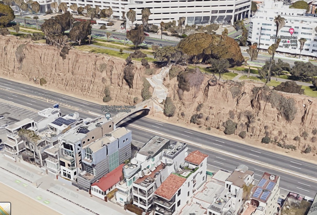 |
|
| (2022) - Google Earth view showing the Pedestrian Bridge that connects the Palisades, at the end of Arizona Ave, to the beach right where the original 1875-built 99 Steps were located. |
| Historical Notes
From directly above, the logic of the site becomes undeniable. The bluffs that made a staircase necessary in 1875 are still there, unchanged. The bridge crosses Pacific Coast Highway at the exact point where the wooden steps once descended to railroad tracks and a dirt road. The beach itself is a different story: sand replenishment projects over the past century have added roughly thirty million cubic yards of material to the shores of Santa Monica and Venice, transforming the narrow historic shoreline into the broad recreational beach visible here. The steps, in every form they have taken, have always pointed to this edge of the continent. |
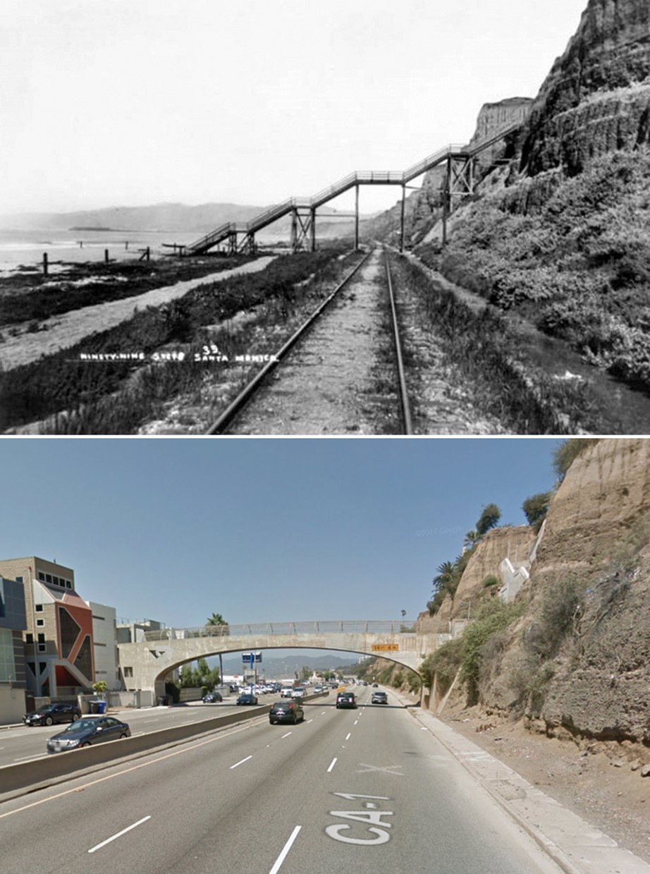
1898 vs. 2022 | Then and Now
 |
|
| (1898 vs 2022)* – Looking NW showing at the Pedestrian Bridge (over PCH, CA-1) that connects the Palisades, at the end of Arizona Ave, to the beach right where the original 1875-built 99 Steps were located. Photo comparison by Jack Feldman. |
| Historical Notes
The railroad is gone. The highway is four lanes. The beach is twice as wide. And yet anyone standing at the top of the Arizona Avenue crossing today is standing exactly where every visitor to the 99 Steps has stood since 1875: at the edge of the bluff, looking down toward the same Pacific Ocean, about to take the same route to the water. |
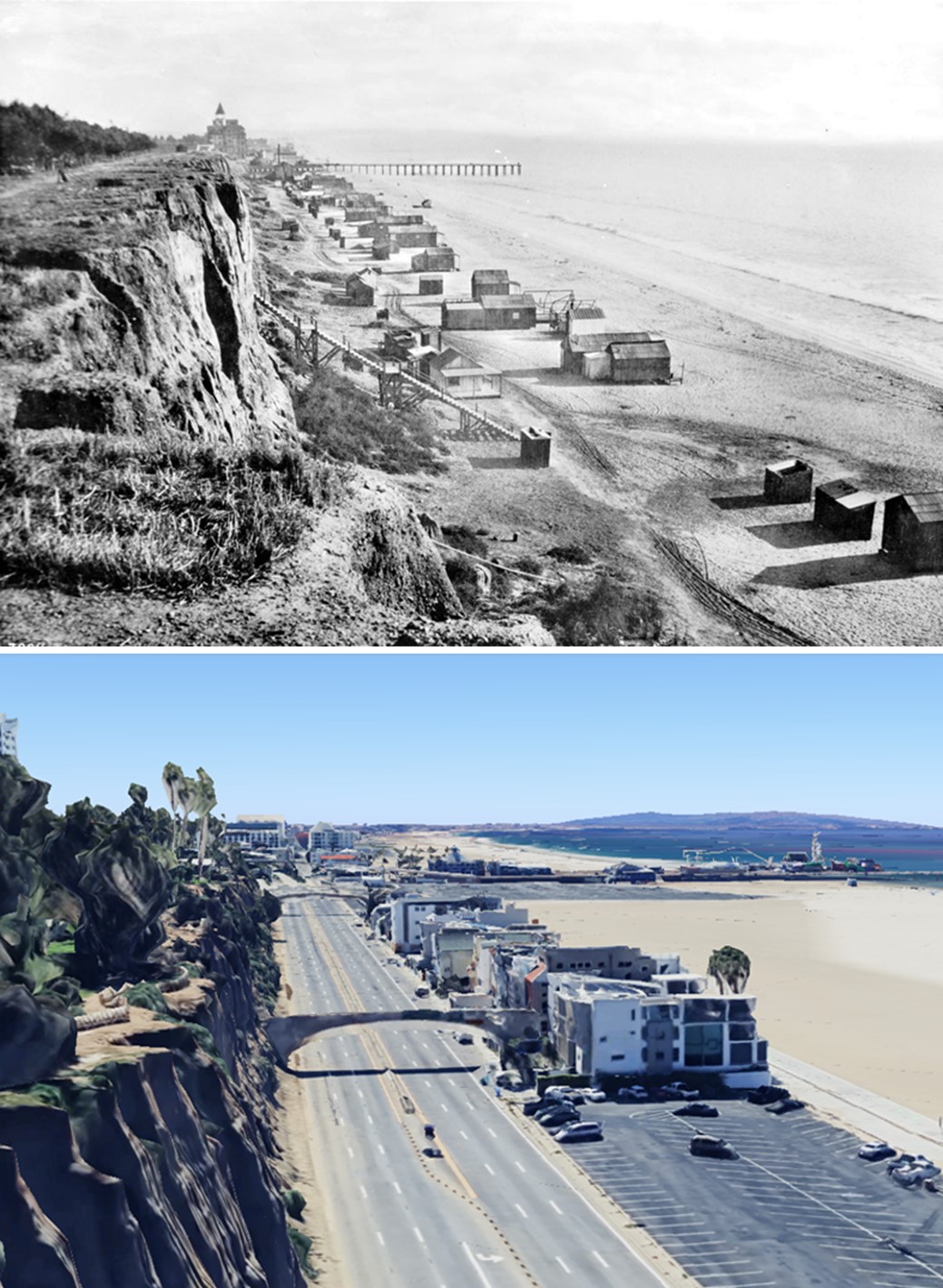
1890 vs. 2023 | The Wider Beach
 |
|
| (1890 vs. 2023)* – View looking south from the rim of what is now Palisades Park near the foot of Wilshire Boulevard. The 1890 photo shows the original "99 Steps," which provided access to the northern portion of Santa Monica Beach. In the distance, the Hotel Arcadia and the remains of the Los Angeles and Independence Railroad Co. Wharf are visible. The 2023 image shows the Pedestrian Bridge, connecting the Palisades at the end of Arizona Avenue to the beach below, located at the site of the original "99 Steps" built in 1875. Photo comparison by Jack Feldman. |
Historical Notes The Los Angeles and Independence Railroad Wharf in the distance of the 1890 image was built by Senator Jones in 1875, the same year as the 99 Steps. They were founding-year projects built side by side: a staircase to bring people down to the beach, a wharf to bring commerce in from the sea. The wharf is buried under a hundred years of sand and history. The staircase, in everything but its original wood, is still there. Every day, people who have never heard of the 99 Steps cross the Arizona Avenue bridge and walk down to the beach without a second thought. They are following a path that has been in continuous use for one hundred and fifty years. |
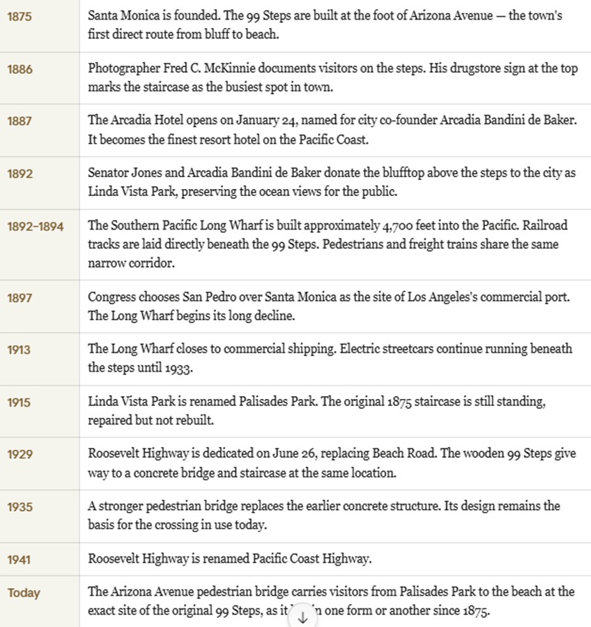
Timeline
 |
| Historical Notes
The 99 Steps were never a landmark in the way the Arcadia Hotel or the Long Wharf were. Nobody came to Santa Monica to see a staircase. They came to see the ocean, and the steps were simply the way down. That plainness is exactly what makes them worth remembering. While hotels were built and torn down, while railroads arrived and fell silent, while highways were cut through ranchland and renamed, this single route from the bluff to the beach kept going. It still does. |
* * * * * |
Arriving in Santa Monica |
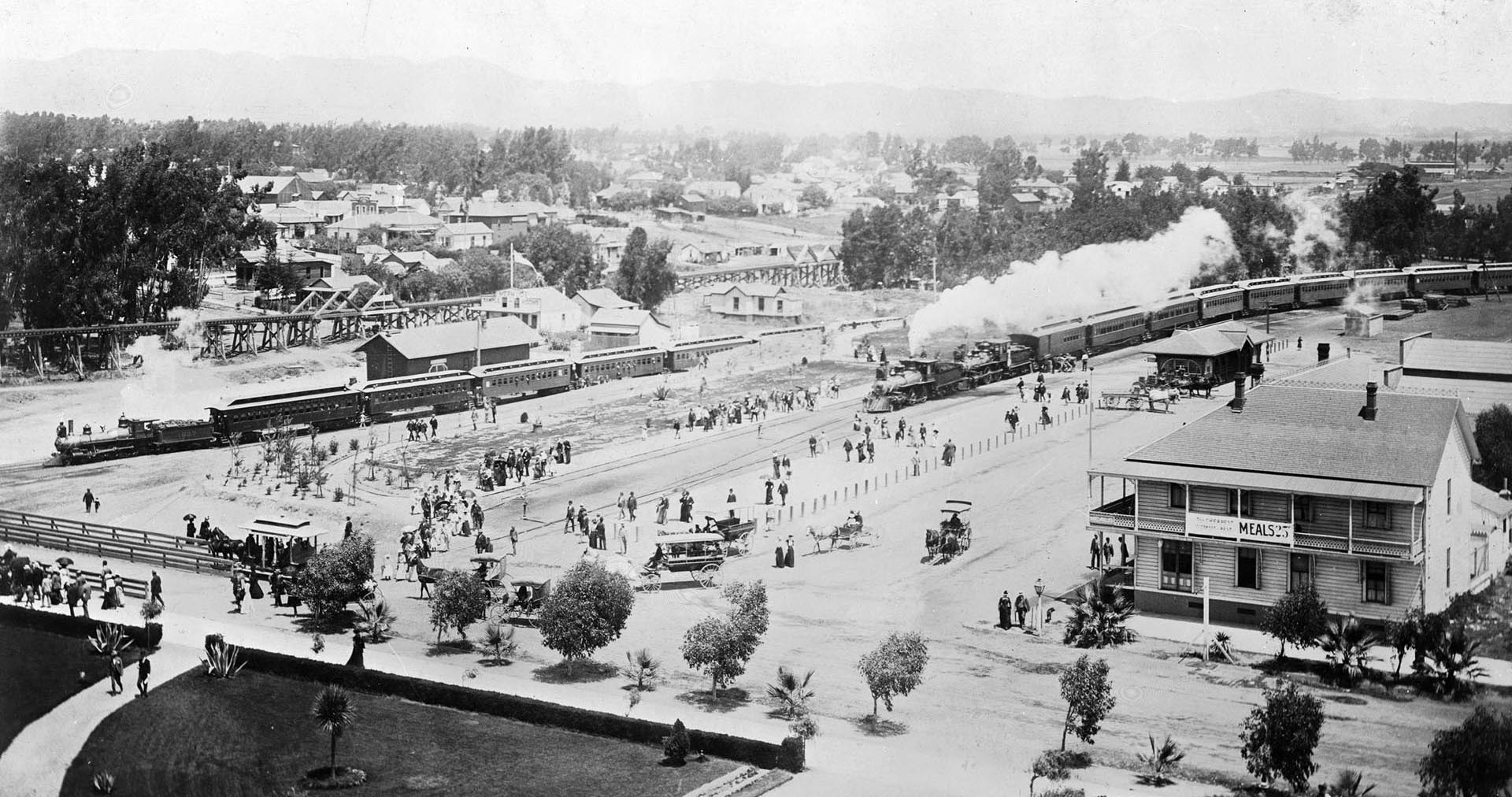
By the end of the nineteenth century, Santa Monica had become one of Southern California's most popular seaside destinations. Much of that success depended on the railroad. Excursion trains from Los Angeles regularly brought visitors to the coast, turning what had once been a quiet shoreline into a busy resort town. A trip that once required hours by wagon could now be made in less than an hour by rail. Most visitors arrived by train at the depot near the beach, then continued their journey on foot, by carriage, or by local streetcar. From the observation tower of the Arcadia Hotel, visitors could watch trains pull into the station while crowds moved toward the beach below the bluffs. The hotel itself, opened in 1887 and named in honor of Arcadia Bandini de Stearns Baker, a prominent California landowner, quickly became the social center of the young resort city. Rising 136 feet above beach level, its tower offered guests one of the finest panoramic views on the Southern California coast. The photographs shown here were taken from the Arcadia Hotel observation tower and capture a lively moment around the turn of the twentieth century. Southern Pacific excursion trains stand beside the depot while horse-drawn carriages and a trolley wait to carry passengers through town. Within a few years Santa Monica would grow rapidly, but the railroad remained the primary route through which most visitors first experienced the city and its beaches. |
 |
|
| (ca. 1900)* - View from the Arcadia Hotel observation tower showing two Southern Pacific excursion trains. These trains regularly brought beachgoers to Santa Monica. Horse-drawn carriages and a trolley can also be seen. |
Historical Notes From the tower of the Arcadia Hotel, guests could look out over the Santa Monica depot and watch excursion trains arrive throughout the day from Los Angeles. The railroad below was the former Los Angeles and Independence line, which had opened in 1875 to connect Santa Monica with downtown Los Angeles. After the Southern Pacific acquired the line a few years later, it became the primary route used by excursion trains carrying visitors to the beach. Scenes like this were common on weekends and holidays when large numbers of passengers arrived from the city. Once the trains stopped at the depot, travelers continued toward the beach on foot, by carriage, or by local trolley. The mixture of steam locomotives, horse drawn vehicles, and early electric transit seen here reflects a moment when several forms of transportation shared the same streets in the growing seaside resort. |
 |
|
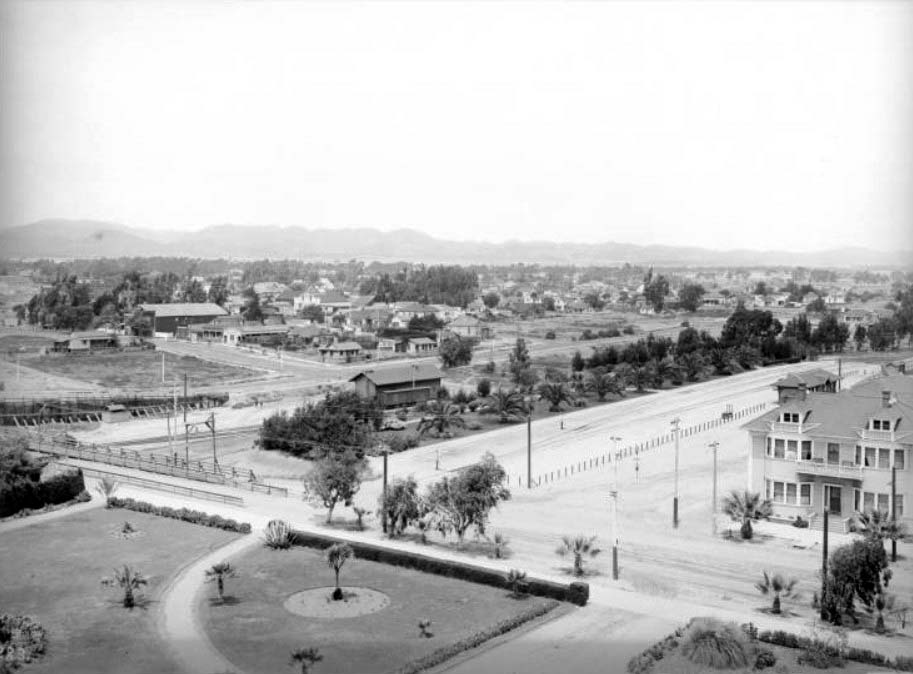
| (ca. 1904)* - Birdseye view looking northeast from the Arcadia Hotel (same view as previous photo but about 4 years later). Note how the building in the lower right has been enlarged, also, the addition of trees around the train station at center of photo. |
Historical Notes This later view from the Arcadia Hotel tower shows how quickly the area around the Santa Monica depot was changing at the start of the twentieth century. Buildings near the station had expanded and trees had been planted around the depot grounds, giving the district a more developed appearance than in the earlier photograph. At the time Southern Pacific was also considering Santa Monica as a potential commercial harbor. In 1893 the railroad built a large wharf at the north end of the city that briefly served as the Port of Los Angeles. When Congress selected San Pedro Bay in 1897 as the region's principal harbor, Santa Monica remained primarily a seaside resort. Excursion trains like those seen here continued bringing visitors to the coast, helping sustain the town's growing tourism economy. |
* * * * * |
Beach Views |
 |
|
| (1900)* - Beachgoers enjoying the day at Santa Monica Beach. The large building to the right is the North Beach Bath House. Photo is looking north from the pier, at the foot of Colorado Avenue. |
 |
|
| (ca. 1900)* - Children are seen playing on the beach at Santa Monica. The Arcadia Hotel and wharf can be seen in the background. |
 |
|
| (ca. 1900)* - Crowds of people can be seen sitting on the beach and strolling the boardwalk on South Beach in Santa Monica. The Arcadia Hotel is in the upper-left. |
* * * * * |
Santa Monica City Views
.jpg) |
|
| (1900)** - Panoramic view of Santa Monica looking northeast from Third Street and Arizona Avenue. Trees stand on the side of the street in the foreground. Large houses stand in a row with wide, manicured lawns. More houses can be seen amongst the tree tops that extend to the mountains in the distance. |
 |
|
| (ca. 1900)** - View looking southwest from the tower of the Academy of Holy Names, located on Third Street and Arizona Avenue with the ocean visible in the distance. Arizona Avenue runs diagonally from lower-left to upper-right where it meets Ocean Avenue. Today, the Hotel Shangri-La stands on that corner. |
 |
|
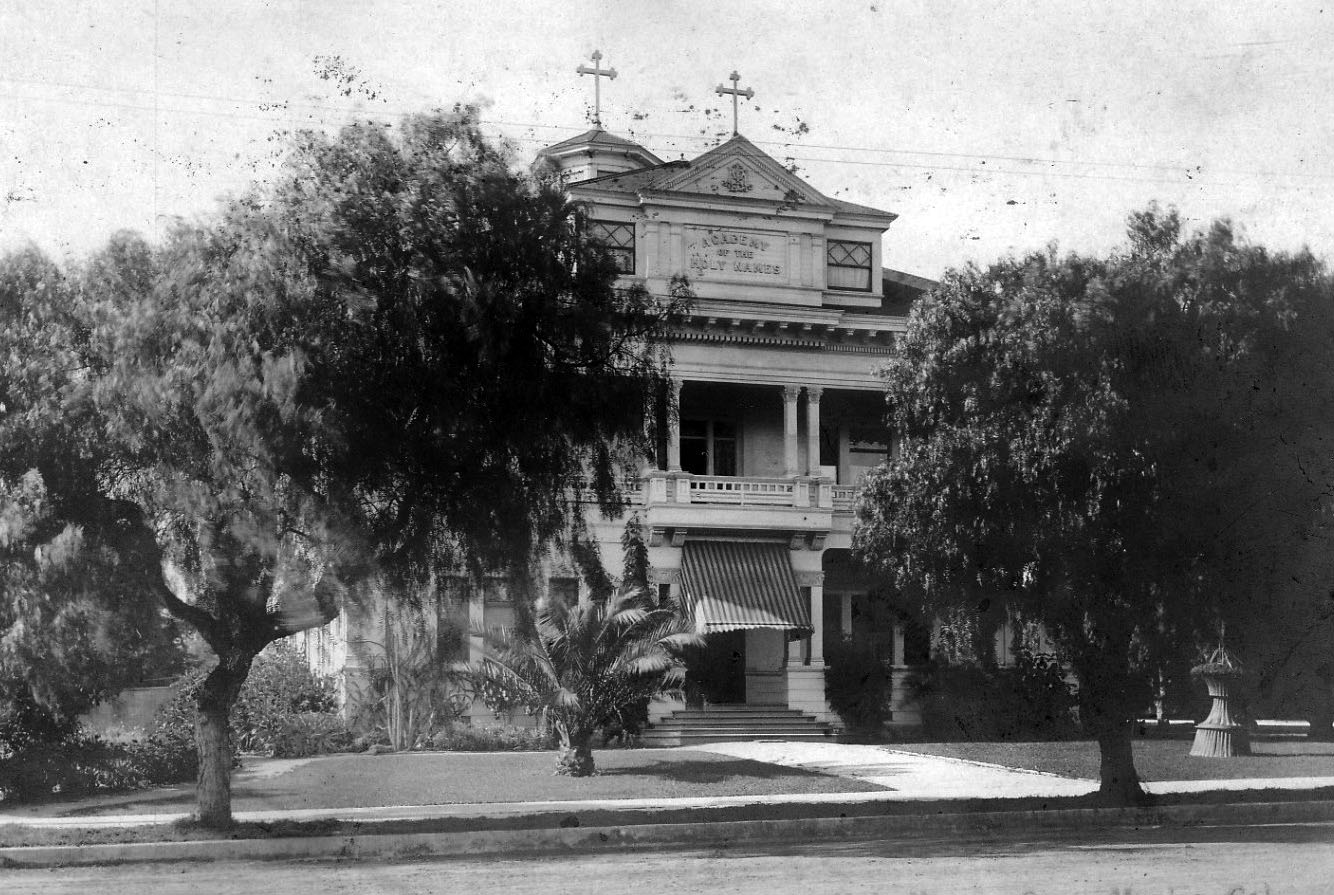
| (ca. 1900)**^ – Front view of the Academy of the Holy Names, a flourishing school for girls established by a band of holy sisters, located at 3rd Street and Arizona Avenue in Santa Monica. |
Historical Notes The Sisters of the Holy Names of Jesus and Mary had arrived in Santa Monica in July 1899. They opened the Academy of the Holy Names on September 4 of that year in a small frame building on Fourth Street and Arizona. An intense fund-raising drive was launched immediately and a more substantial Academy building was erected in 1900 at Third and Arizona. |
* * * * * |
Bank of Santa Monica
 |
|
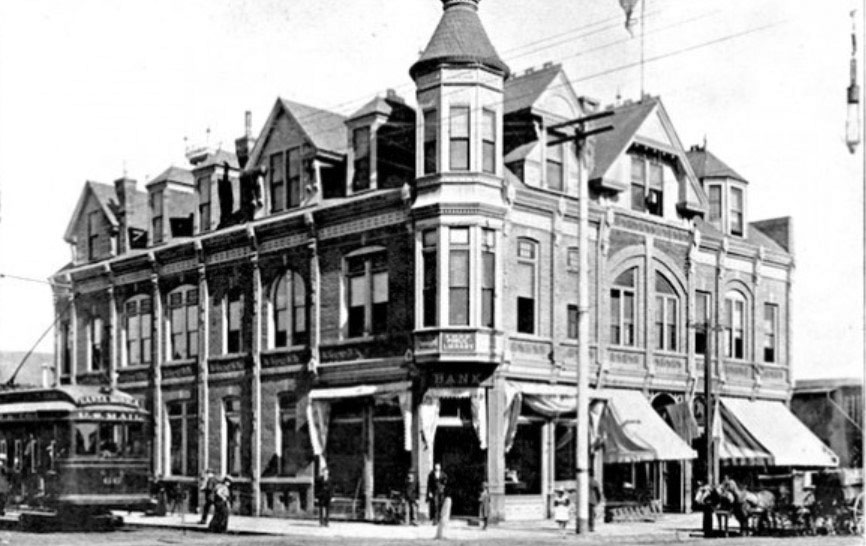
| (ca. 1899)* – View of the Bank of Santa Monica located at Third Street and Oregon Avenue (now Santa Monica). |
Historical Notes By 1899 there were two banks in the City of Santa Monica: Bank of Santa Monica located at Third Street and Oregon Avenue (now Santa Monica Blvd.) and Commercial Co's Bank at 219 Third Street. By the late 1920s there were thirteen financial institutions, including multiple branches. |
 |
|
| (ca. 1900)* - View of the corner of Third Street and Santa Monica Boulevard (then named Oregon Avenue). Today the intersection is part of the popular Third Street Promenade retail district. |
Historical Notes The 1st Santa Monica Public Library was located at Third Street and Santa Monica Blvd. on the second floor of the Bank of Santa Monica. |
 |
|
| (ca. 1900)* - View of the corner of Third Street and Santa Monica Boulevard (then named Oregon Avenue). Today the intersection is part of the popular Third Street Promenade retail district. Image enhancement and colorization by Richard Holoff. |
* * * * * |
Pacific Electric Railway
 |
|
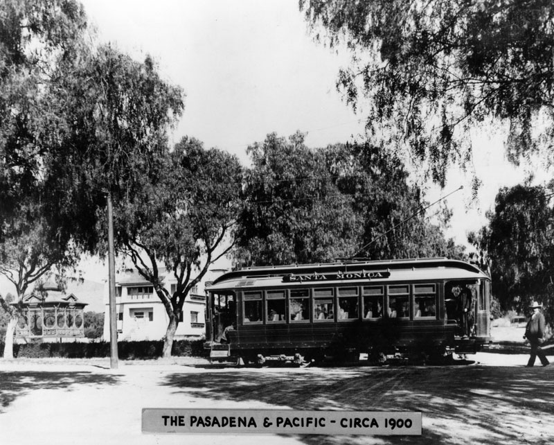
| (ca. 1900)* - Pacific Electric Railway Pasadena and Pacific car labelled "Santa Monica,” seen crossing a street. |
Historical Notes The Los Angeles Pacific Railroad, founded by Moses Sherman and his brother-in-law Eli Clark, operated a peak network of 180 miles of track in the western parts of Los Angeles County. Its routes connected Pasadena to Santa Monica and extended along the coast to Redondo Beach. The Pacific Electric Railway served Santa Monica from 1911 to 1953. It acquired the Santa Monica Air Line during the 1911 "Great Merger," when Southern Pacific took over Henry Huntington's railway holdings. Pacific Electric also continued the popular Balloon Route excursion, originally launched in 1901 by the Los Angeles Pacific Railroad. After taking over LAP's operations in 1911, Pacific Electric maintained the Balloon Route as one of its signature attractions. |
 |
|
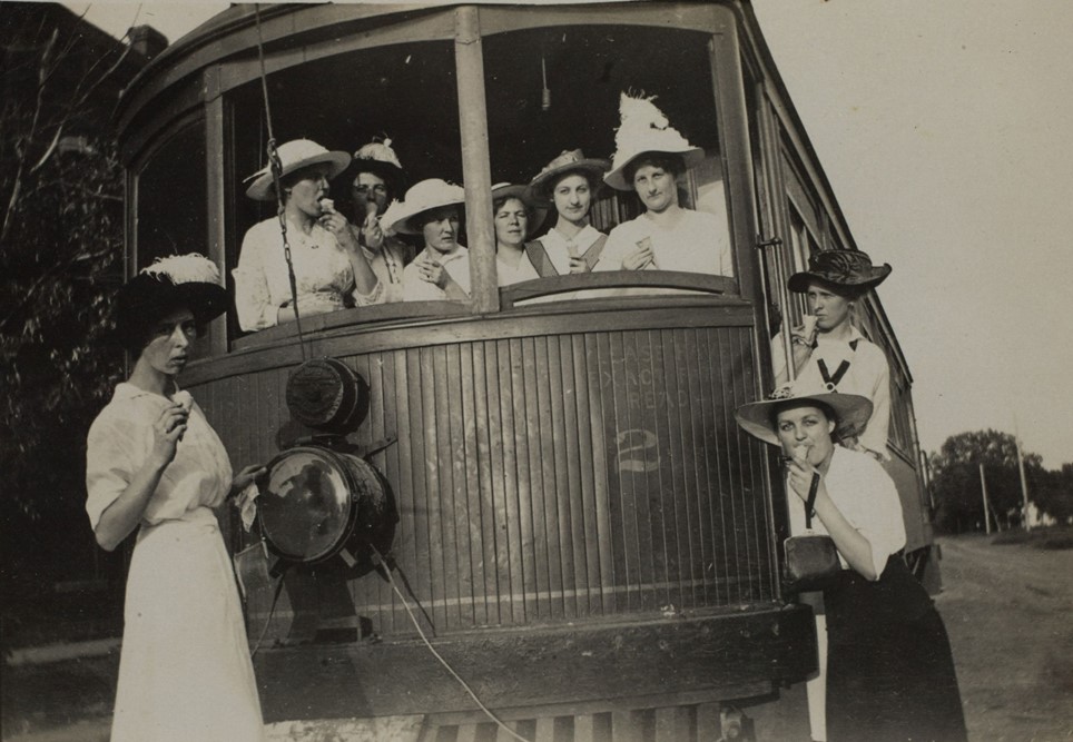
| (1913)* – A group of young women, each holding an ice cream cone, pose for the camera in and around a Pacific Electric trolley car in Santa Monica. Photo from the Ernest Marquez Collection |
Historical Notes Pacific Electric trolleys played a crucial role in Santa Monica's history, connecting the coastal city to downtown Los Angeles and other parts of Southern California. The Santa Monica Air Line, established in 1908, was a key component of this transportation network, providing electric passenger service along a 16.88-mile route with 15 stations. As part of the world's largest trolley system by the 1920s, the line contributed significantly to Southern California tourism, urban development, and economic growth. It allowed residents to live in coastal areas while working in the city center and influenced the gridded street layout of many communities. Despite its initial popularity, the Santa Monica Air Line faced challenges, with service reduced to rush hours by 1924 and passenger service ending in 1953. |
* * * * * |
Balloon Route Trolley Trip
 |
|
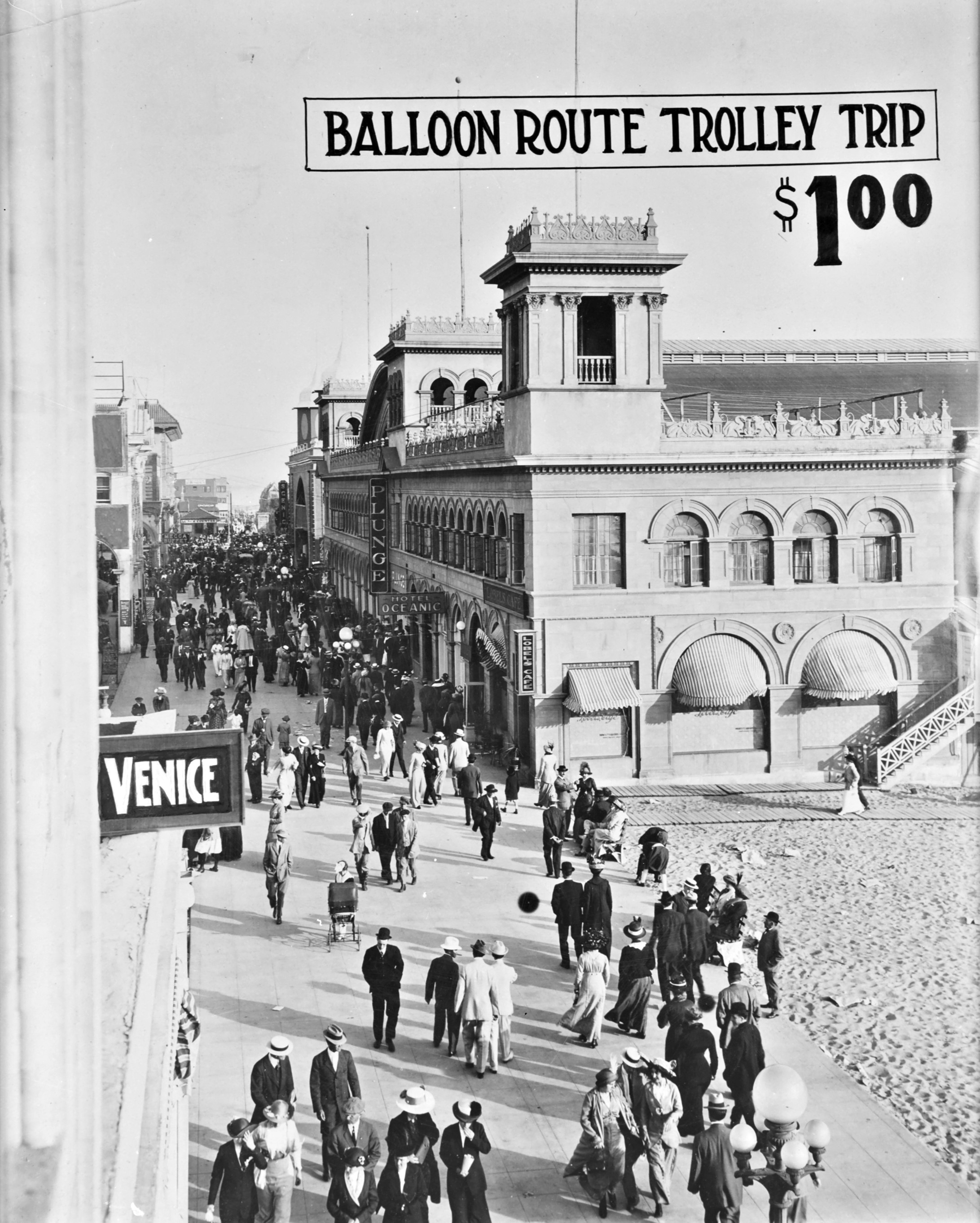
| (1902)* - Postcard view showing passengers enjoying the most famous trolley car trip in the West during the early 1900s – a daylong excursion called the “Balloon Route” from downtown Los Angeles to the beach cities and back again. The trip, billed as “the only ocean voyage on wheels,” covered 101 miles for 100 cents. |
Historical Notes Moses Sherman and Eli Clark introduced several innovations to trolley operations in the Los Angeles area. Among the most popular was the scenic Balloon Route Trolley Trip, celebrated as the most famous streetcar excursion in the West. Few tourists visiting Los Angeles skipped a ride on the Balloon Route, named for the loop-shaped course the trolleys followed. The excursion featured up to 18 cars daily, departing from downtown Los Angeles and traveling through Hollywood, Sawtelle, Santa Monica, and beach cities like Venice, Playa del Rey, and Redondo Beach. The route then returned downtown via the Palms area. |
 |
|
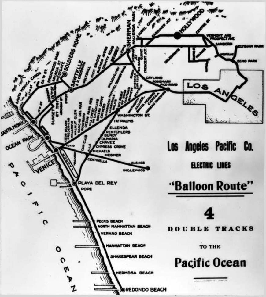
| (1910)* - Map of the Los Angeles Pacific Company Electric lines around Los Angeles, including the "Balloon Route" which would bring flocks of tourists to Santa Monica, among other places. |
Historical Notes The Balloon Route Trolley trip was the featured route of the Los Angeles Pacific, opened in September 1901. The line ran from downtown LA through Hollywood, Santa Monica, Venice Beach, Redondo Beach and back to L.A. via Culver City. The lines stopped at beach resorts and included free entrance to some en-route stops attractions along the way, including: Sunset Boulevard, studio of painter Paul de Longpré, bean fields of Morocco in Beverly Hills, Sawtelle Veterans Home and Old oldiers’ Home in Sawtelle, Long Wharf, Camera Obscura at Santa Monica, Playa del Rey Pavilion for a fish dinner, Redondo's Moonstone Beach, Venice, and Palms - Culver City. |
 |
|
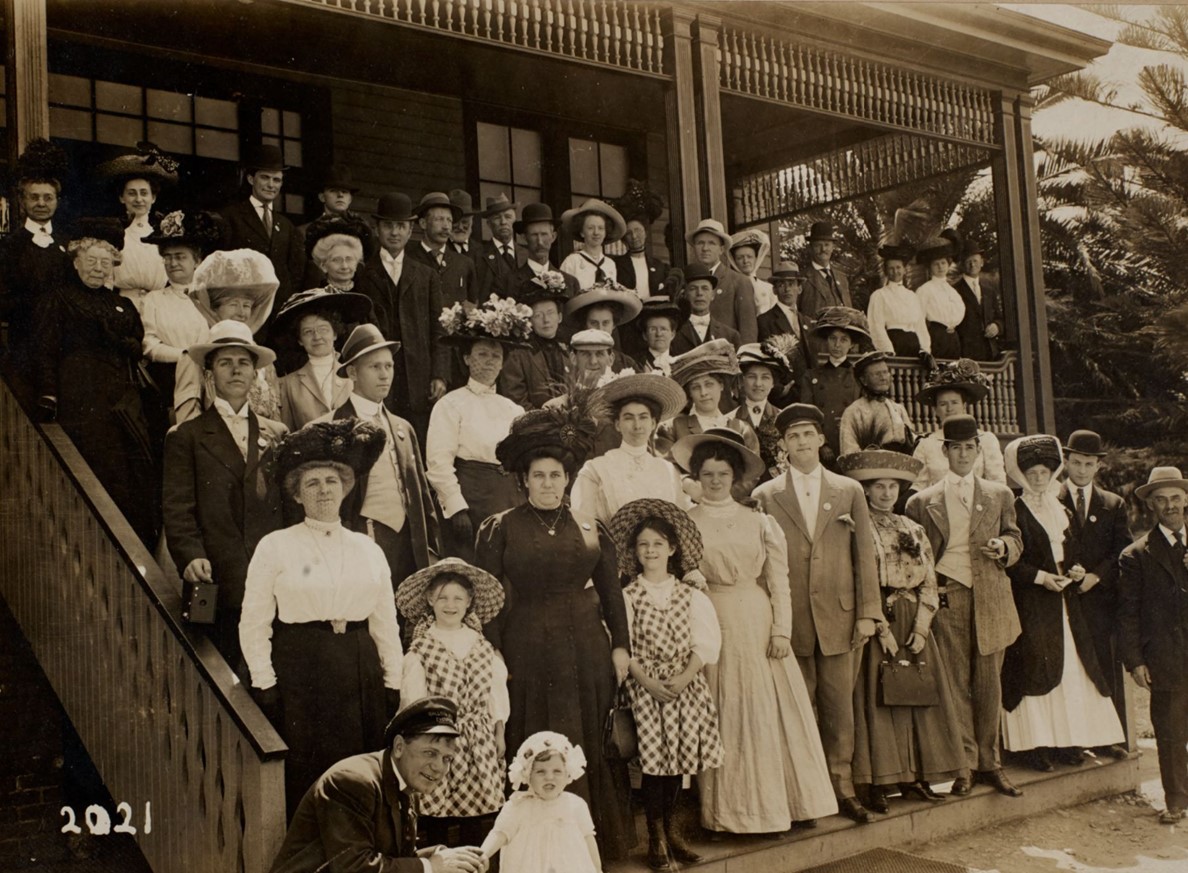
| (ca. 1905)* - Group portrait of passengers on the Balloon Route Excursion at one of their many stops, the Soldiers’ Home in Sawtelle. Photo from the Ernest Marquez Collection. |
Historical Notes Passengers enjoyed picturesque views of the city and coastline from the comfort of parlor cars. The trip featured stops at notable attractions such as Paul de Longpre's house, the Soldiers’ Home in Sawtelle, and Santa Monica's Long Wharf, offering a delightful experience for both locals and visitors. |
 |
|
| (ca. 1905)* - Advertisement for the Balloon Route Trolley Trip: 101 miles for 100 cents—or "one whole day for a dollar. |
Historical Notes Initially developed by land promoters Moses Sherman and Eli Clark in 1901, the Balloon Route flourished under the management of Charles M. Pierce, who effectively marketed it as "the only ocean voyage on wheels." At its peak, the route attracted an average of 10,000 riders per month during the tourist season. However, its popularity waned after 1911 when a major railway merger transferred ownership to Southern Pacific, leading to neglect and ultimately the decline of this once-thriving trolley service. |
* * * * * |
Ocean Park Grammar School
 |
|
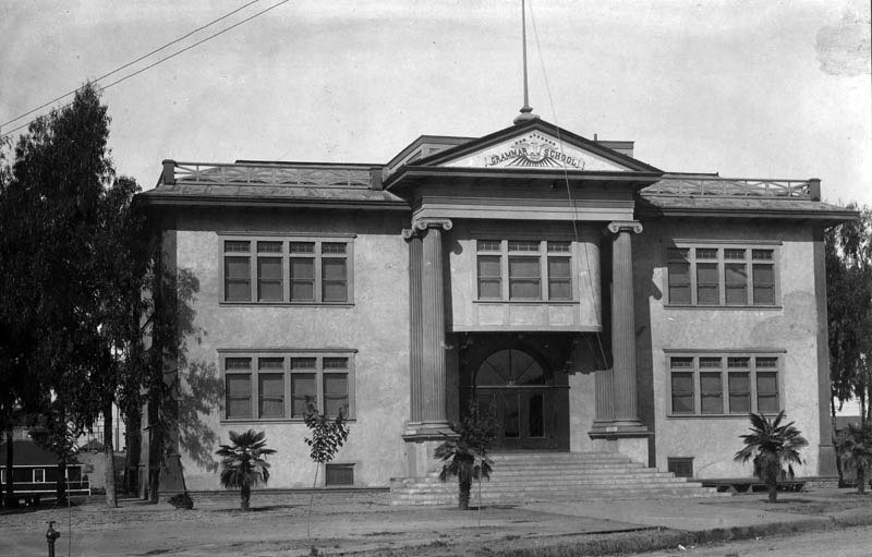
| (1900)* - Exterior view of Ocean Park Grammar School. |
* * * * * |
Pacific Café
 |
|
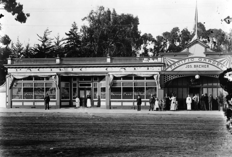
| (ca. 1900)* - View of the 1500 block on Ocean Avenue, opposite the Pacific Electric Depot. Groups of people can be seen standing outside of the Pacific Cafe and Pacific Garden restaurants. |
 |
|
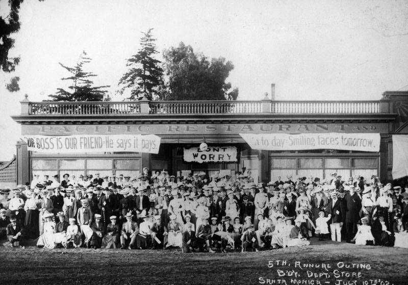
| (1902)* - Group portrait of department store employees and their families, taken in front of the Pacific Restaurant in Santa Monica. This was their 5th Annual Outing. |
Sue's Ice Cream and Confectionery
.jpg) |
|
| (1902)#^ – View showing Sue's Ice Cream and Confectionery on the northeast corner of Second Street and Utah (now Broadway) in Santa Monica. Nordstroms is located on this corner today. |
* * * * * |
 |
|
| (1902)* - Several people watch the heavy surf at the Santa Monica Pier. |
 |
|
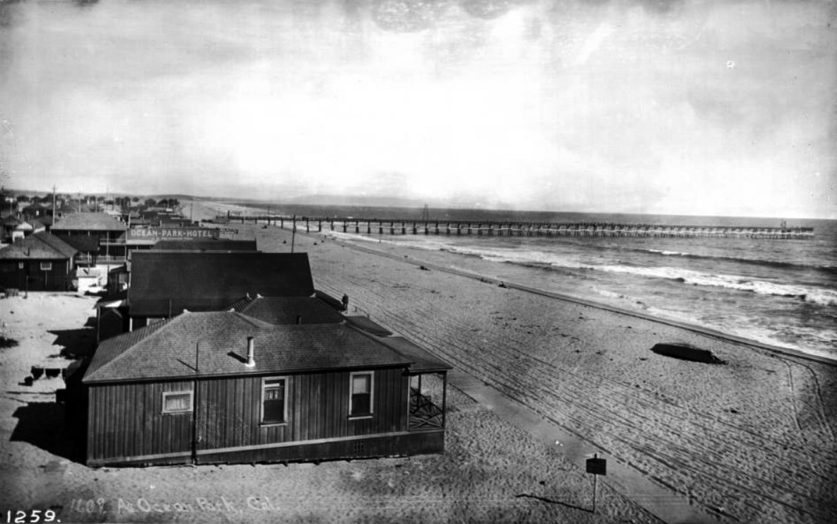
| (ca. 1903)** - View showing Ocean Park beach homes looking south toward the pier. Very few people are on the beach. Legible signs include: "Ocean-Park-Hotel, J.G. Holboro, propr.", and "Holboro's Restaurant". |
 |
|
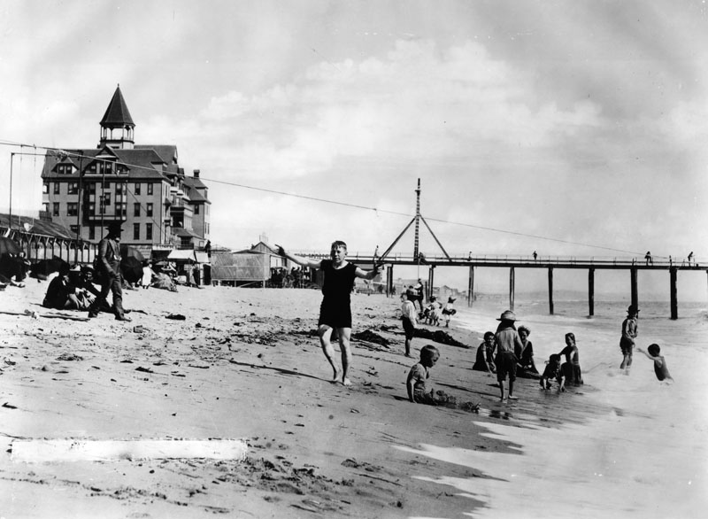
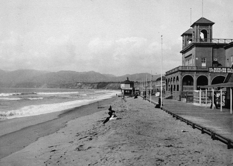
| (1904)* - A mother and child are seen sitting on the beach in front of the Santa Monica Bath House. The bath house is owned by Sen J.B. Jones. A sign shows there is also a pool room, bowling alley and a shooting gallery. The Camera Obscura booth stands at the end of the boardwalk and a long wharf can be seen in the far distance. |
 |
|
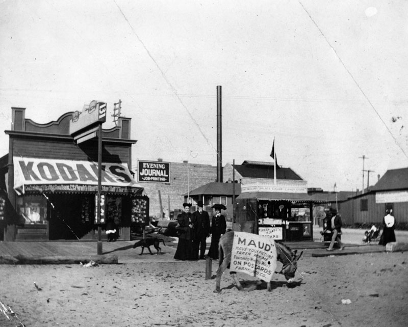
| (1905)* - A donkey with a blanklet advertising "Maud" to have your picture taken stands in the middle of an unpaved street. Buildings and people are seen behind the wooden board walk. |
* * * * * |
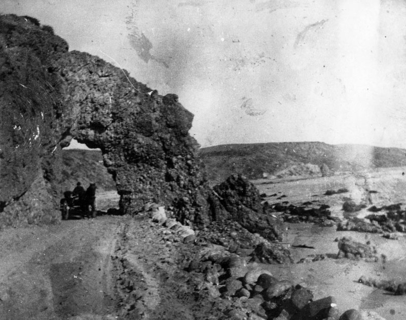
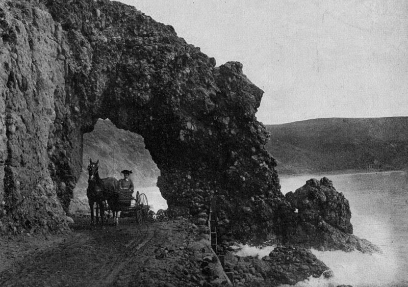
Arch Rock
 |
|
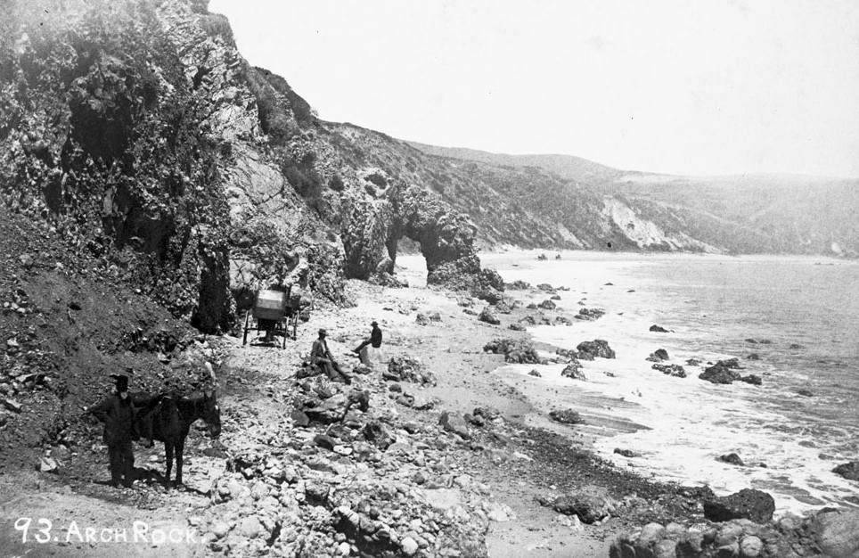
| (ca. 1880)** - View of Arch Rock (a stone formation) in Santa Monica, showing a group of men posing along the rocks nearby. The men can be seen in the center and left foreground area while either standing or sitting on rocks. In the center background, the natural rock formation can be observed while the shore is visible in the right. In the background, a ridge extends out across the horizon. |
Historical Notes One of Santa Monica’s natural wonders was the Arch Rock. It was so wide that during low tide, horse-drawn wagons could pass through its opening. It was located on what is now Pacific Coast Highway just south of Topanga Cyn Blvd. In the early 1890s, a primitive wagon road between Santa Monica and Malibu passed directly through the stony structure.*#* |
 |
|
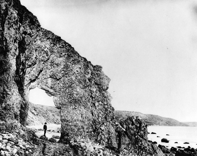
| (1890s)* - A man is seen standing on what appears to be a large rock directly below the natural arch. |
Historical Notes With improved access, the Arch Rock became a popular destination among excursion parties and day-trippers.*#* |
 |
|
| 1890s)* - A horse and buggy are seen passing under the natural arch. |
Historical Notes The old stage road to San Francisco (later Pacific Coast Highway) passed under the Arch Rock on Santa Monica Beach.* |
 |
|
| (1890s)* - View of the Arch Rock, a natural formation on the old stage road (now Pacific Coast Highway) near Santa Monica. A horse and buggy pass under the natural arch during high tide. |
 |
|
| (1890s)* - View showing three women and a child standing under the arch. |
Historical Notes For many nineteenth-century tourists, the Santa Monica Arch Rock was the place to see. It became the defining image of the Southern California coast.*# |
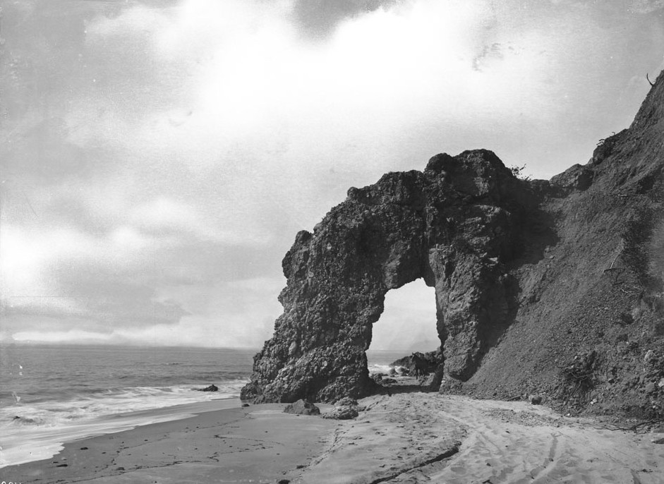 |
|
| (ca. 1895)** - View of Arch Rock on the Santa Monica Bay beach, looking north. A horse-drawn carriage is about to drive under it toward the foreground. |
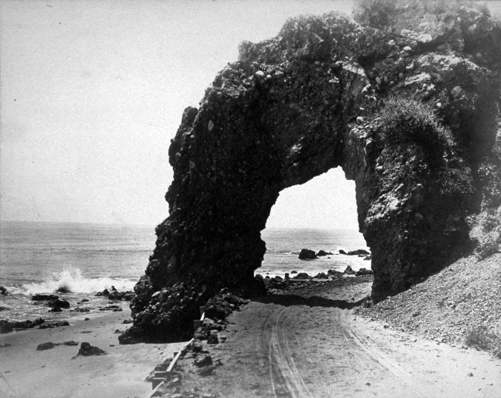 |
|
| (ca. 1906)#^# – Close-up view, looking north, of the Arch Rock. In the foreground can be seen the wood shoring supporting the dirt road going through the arch. |
Historical Notes On the morning of March 24, 1906, the bridge that once spanned the arch's two columns was found crumbled on the ground. Initial reports blamed a rainstorm, but rumors later circulated that work crews constructing a railroad to Ventura had blasted the rock, performing their nefarious deed under the cover of darkness because of public affection for the landmark. In turns out that the railroad was never completed, but some of the grading work was later incorporated into the coast highway.*#* |
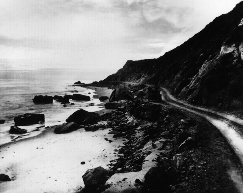 |
|
| (ca. 1920)* - View of old Roosevelt Highway (later Pacific Coast Highway) running parallel to the beach in Santa Monica. |
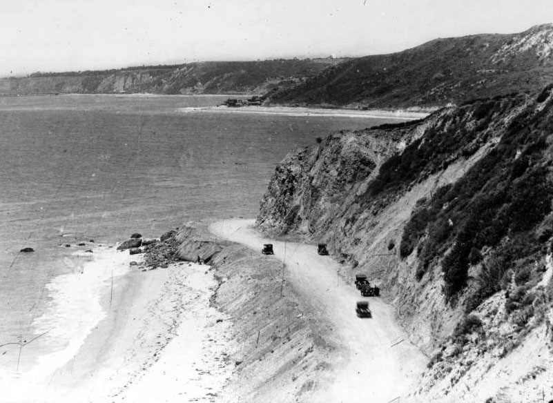 |
|
| (ca. 1920s)* - Site of Arch Rock after its demolition and subsequent highway grading. The arch was demolished in 1906. |
Historical Notes Today, Mastro's Ocean Club Restaurant (18412 E. Pacific Coast Hwy) is located where the picturesque Arch Rock once stood.* |
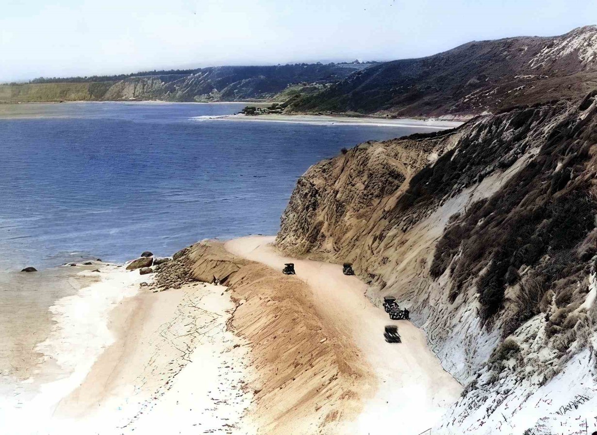 |
|
| (ca. 1920s)* - Site of Arch Rock after its demolition and subsequent highway grading. The arch was demolished in 1906. (AI image enhancement and colorization by Richard Holoff). |
* * * * * |
Castle Rock and Haystack Rock: Landmarks of the Santa Monica Coast
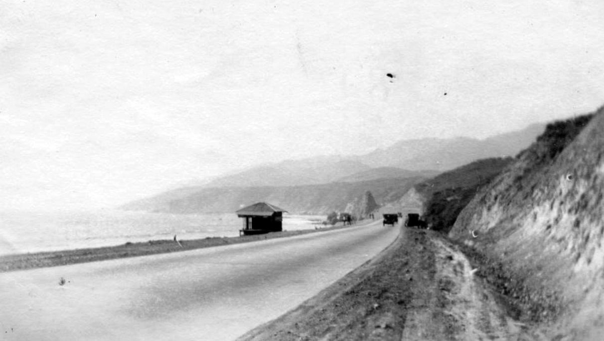 |
|
| (ca. 1915)* - Cars approach Castle Rock on the coast road between Santa Monica and Malibu. Castle Rock was eventually demolished to expand the highway after World War II. |
Historical Notes This early view shows the narrow coast road before it was formally improved and named Roosevelt Highway in the late 1920s. At this time Castle Rock stood less than a mile northwest of the former Arch Rock site, rising roughly fifty feet from the sand and serving as a natural gateway between Santa Monica and the sparsely settled Malibu coast. Motorists, picnickers, and day-trippers used the looming sandstone outcrop as a wayfinding landmark long before traffic demanded a modern four-lane highway. |
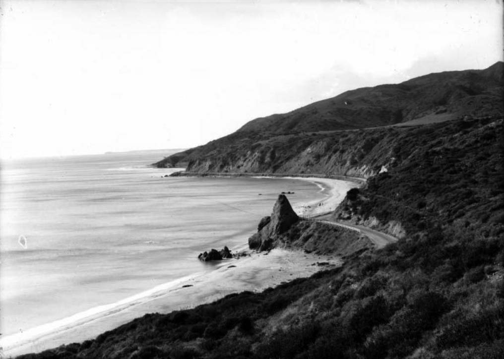 |
|
| (1910s)* - Photograph of Santa Monica's Palisades Park and Castle Rock. The conical rock is at center, jutting out from the shoreline above a sandy beach. Behind the rock at left, the Coast Highway can be seen winding its way along the shore. A wooden fence acts a guardrail near the rock. |
Historical Notes Seen from Palisades Park on the bluffs, Castle Rock anchors the shoreline just north of town. The dirt and early paved road hugging the base of the cliffs would soon evolve into Roosevelt Highway and later Pacific Coast Highway, but here it still reads as a narrow scenic drive with only a simple wooden rail between motorists and the drop to the beach. The image underlines how abruptly the coastal cliffs, the beach, and the new automobile road met at this point on the bay. |
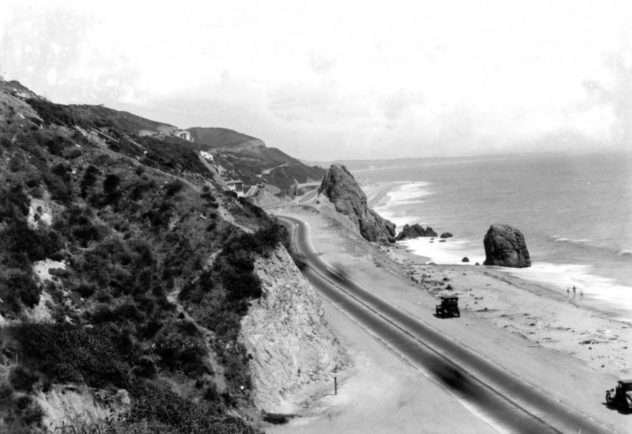 |
|
| (1910s)* – Birdseye view of Castle Rock in Santa Monica from the north side hill. The large conical rock is at center, jutting out over a sandy beach at right. There is another large rock in the water near Castle Rock. Three people are seen walking near the breaking waves. |
Historical Notes This hilltop view makes clear why Castle Rock fascinated early photographers. The main promontory projects from the base of the bluff, with a second boulder off-shore that is probably the rock later known as Haystack. Tiny figures on the wet sand emphasize the scale of the formation and show how close the sea, the cliffs, and the future highway all crowded together at this tight bend in the coastline. |
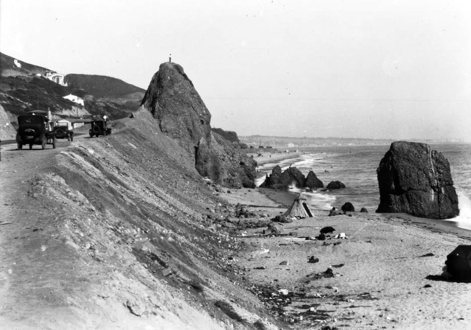 |
|
| (ca. 1920)* - Castle Rock, located between Sunset Boulevard and Coastline Drive north of Santa Monica. A man is seen standing on top of Castle Rock. |
Historical Notes The man standing on the summit gives a sense of Castle Rock’s height and its sheer drop to the beach below. The formation stood between the mouth of Sunset Boulevard and what is now Coastline Drive, near the present-day Getty Villa and below the future site of Villa de Leon. Locals often scrambled up the rock for the view up and down Santa Monica Bay, long before strict safety railings and modern traffic made such climbs impossible. |
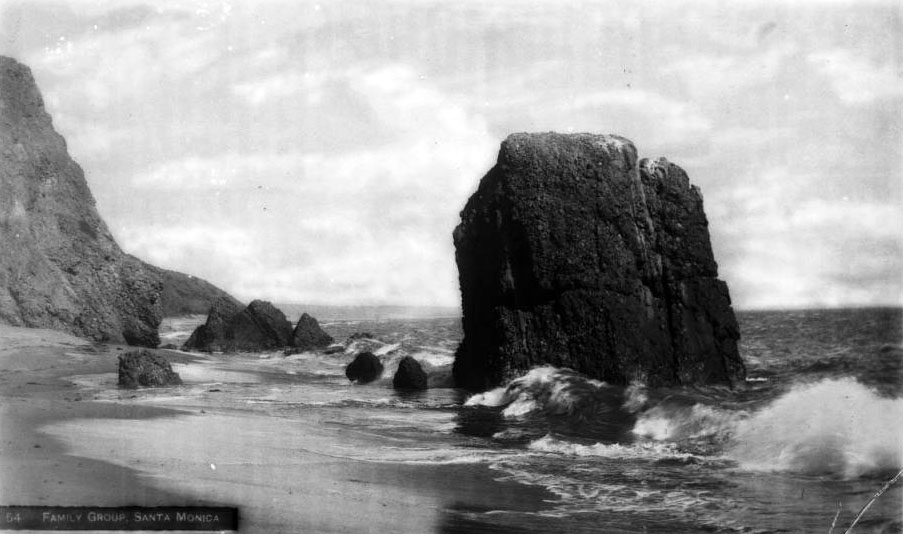 |
|
| (ca. 1925)* - Haystack Rock and the Family Group, located on the beach beneath Castle Rock. |
Historical Notes Here the focus shifts from Castle Rock itself to the cluster of boulders at its base. The stout, flat-topped rock in the surf was known as Haystack Rock, and the smaller stones beside it were nicknamed the Family Group. Postcards of the era celebrated this spot as the place “where the mountains meet the sea,” capturing the dramatic way the Santa Monica Mountains plunge directly into the Pacific at this narrow strip of sand. Today the same boulder is still there and is known to climbers as the J. Paul Pebble, even though Castle Rock above it is gone. |
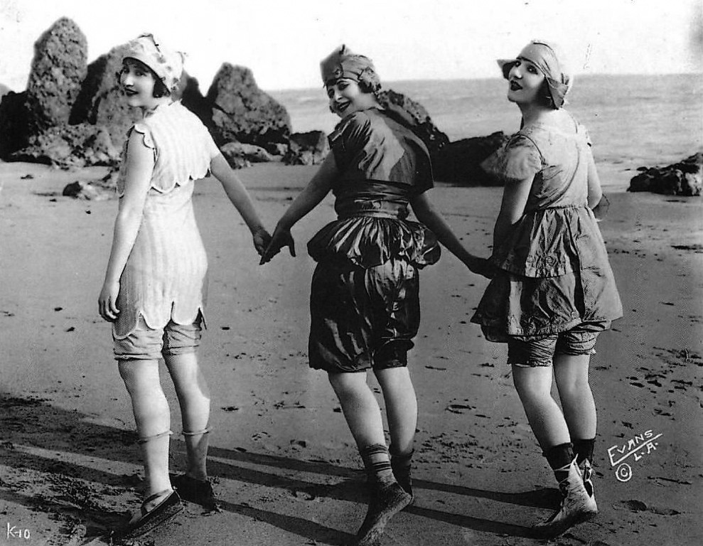 |
|
| (1918)* - Swimsuit in 1918 Fashion in Los Angeles Modern Postcard in front of Haystack Rock. It's difficult to imagine the beach attire in this photograph was once considered risque. |
Historical Notes This postcard uses Haystack Rock as a scenic backdrop to show off what were then “modern” bathing suits. In the late 1910s, shorter hemlines, sleeveless tops, and form-fitting knitwear pushed the boundaries of acceptable public dress, especially for women. The rugged rocks and open Pacific behind the model helped sell Southern California as both a fashionable resort and a place of natural drama, tying the emerging beach culture to this very specific stretch of shoreline. |
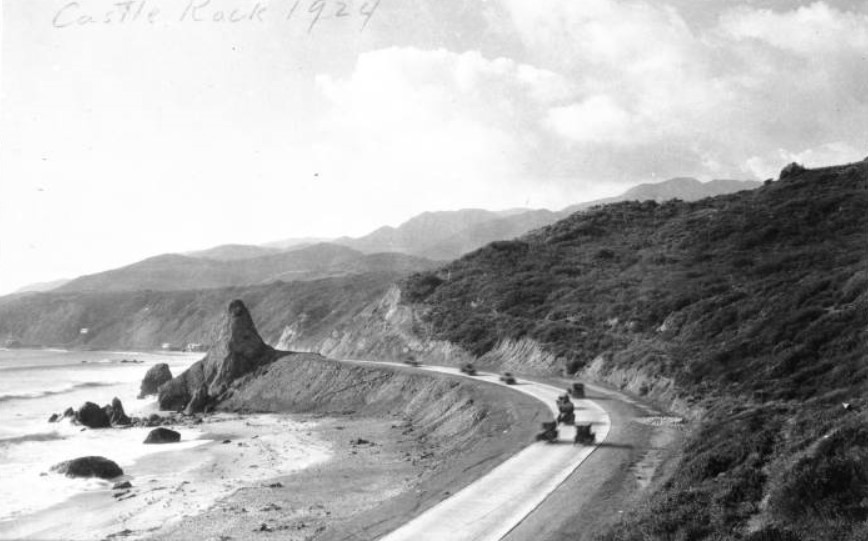 |
|
| (1924)*^ - View looking northwest showing early model cars passing Castle Rock on the two-lane Roosevelt Highway (now PCH). |
Historical Notes By 1924 the coast road had been widened and formally incorporated into Roosevelt Highway, which carried motorists from Santa Monica toward Malibu and points north. Here the highway bends so close to Castle Rock that the stone nearly overhangs the pavement, dwarfing the small touring cars that squeeze past. Countless postcard views like this made the rock a symbol of motoring along the bayside cliffs, even as increasing traffic would soon mark it as an obstacle to be blasted away. |
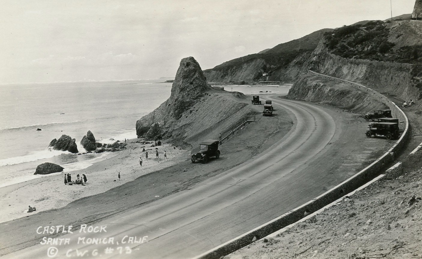 |
|
| (1920s)* - The rock formation known as Castle Rock in Pacific Palisades appears here looking westward as the coast road passes by it. Castle Rock was later demolished to expand the highway just after World War II. |
Historical Notes This westward view emphasizes how the highway threads between the cliffs and the sea, with Castle Rock pinched between asphalt and surf. As automobile use soared in the 1920s and 1930s, this scenic pinch point also became a bottleneck. Engineers eventually concluded that the only way to create a modern four-lane route was to remove most of the rock, a decision they would carry out in 1945 when wartime concerns diverted public attention from the loss of the landmark. |
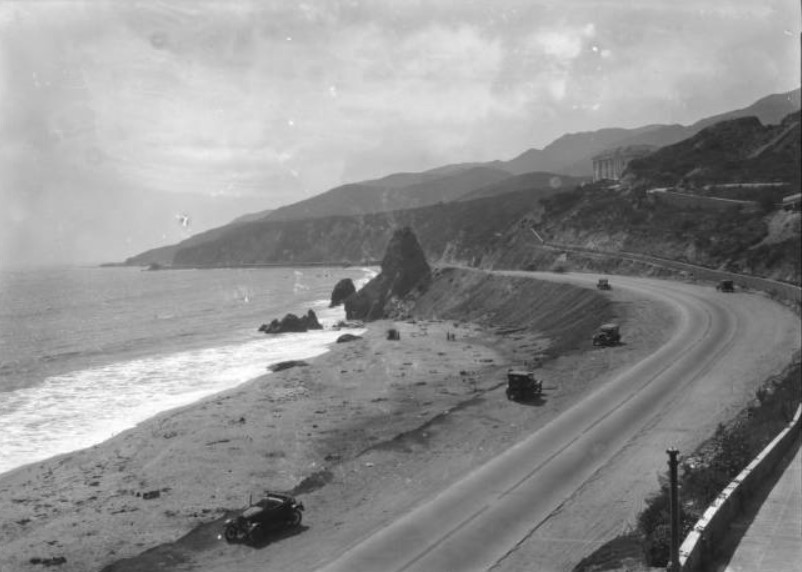 |
|
| (ca. 1928)* - View of Castle Rock in Santa Monica, looking northwest toward Topanga Canyon. The large conical rock is at center. At its base is a long sandy beach on which small waves are breaking and several people are playing. The Coast Highway is at right and winds its way along the shoreline, coming close to the back of Castle Rock. Several early-model automobiles are parked along the shoulders of the road. The right side of the road is bordered by steep hills. |
Historical Notes In this late-1920s scene, Castle Rock still dominates the curve of the bay, but the surrounding landscape is beginning to change. Families relax on the sand while motorists park along the shoulder for a closer look, treating the rock as a built-in roadside turnout. Beyond, the highway points toward Topanga Canyon and the sparsely developed Malibu coast. Within a decade, large hillside estates like Villa de Leon would rise above this same stretch of road, and traffic would be far heavier than the few cars seen here. |
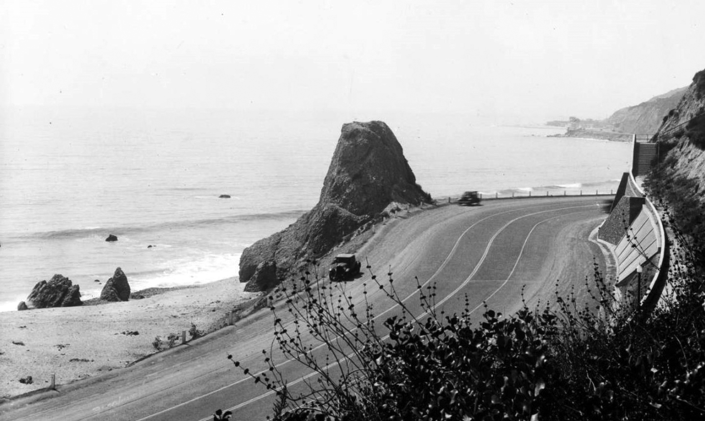 |
|
| (ca. 1930)* - Closer view showing automobiles driving down Roosevelt Highway (later PCH) past Castle Rock in Santa Monica. |
Historical Notes By around 1930 Roosevelt Highway had been upgraded and soon after was officially renamed Coast Highway; the familiar Highway 1 designation would follow in 1939. This closer view shows a steady stream of cars hugging the base of Castle Rock, illustrating why highway engineers worried about limited sightlines and room for expansion. What had once been a picturesque roadside monument was increasingly treated as a traffic hazard on one of California’s most important coastal routes. |
.jpg) |
|
| (1936)* - Closer view of Castle Rock as seen from the hillside across Roosevelt Highway at Castellamare. |
Historical Notes From the developing hillside tract of Castellammare, we see Castle Rock framed against the ocean with the highway squeezed between rock and surf. By the mid-1930s this area was attracting affluent homebuilders, including Leon Kauffman, whose Villa de Leon rose directly above the formations. Castle Rock and nearby Haystack Rock became familiar backdrops in Hollywood films and promotional photography, and in August 1945 the young Norma Jeane (later Marilyn Monroe) posed here for one of her earliest paid modeling assignments, a color shoot promoting the Mercury II camera and ANSCO color film. |
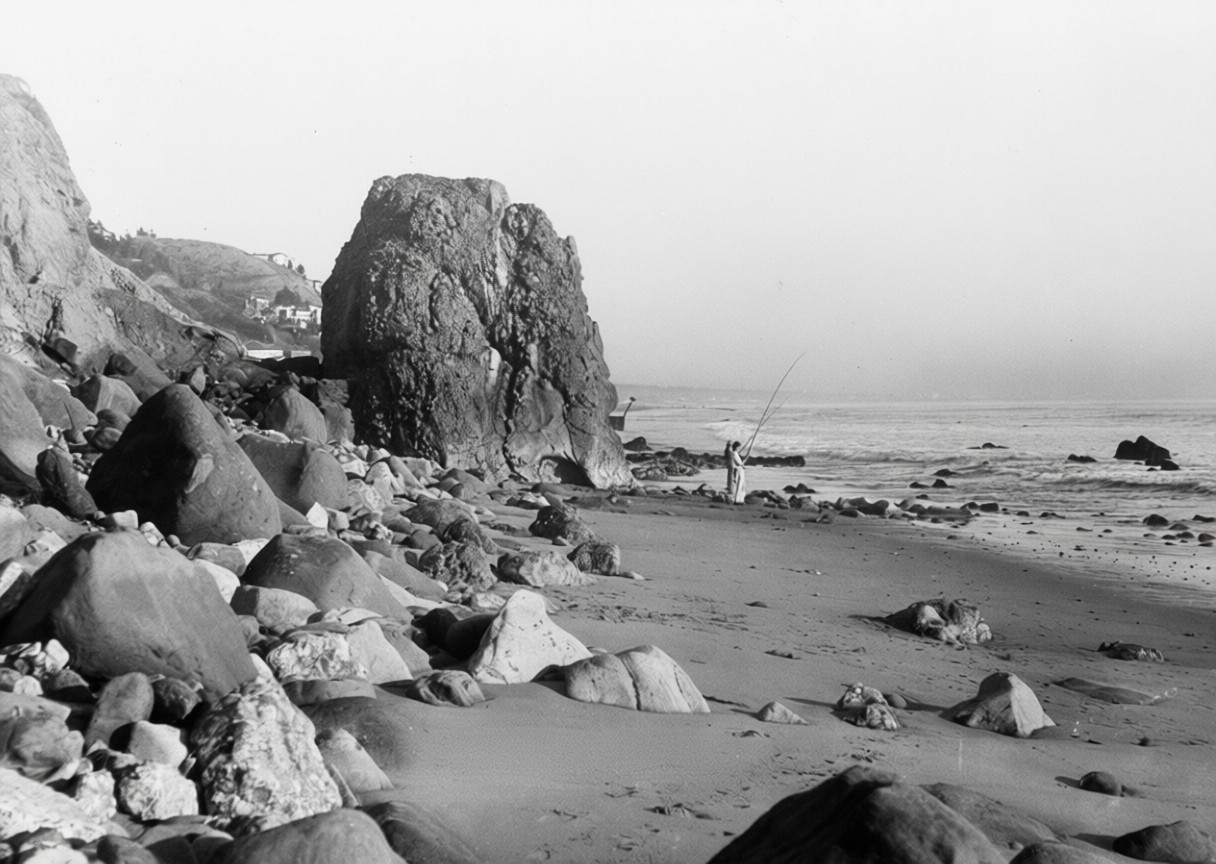 |
|
| (1930s)* - Image of Castle Rock at center left, looking south, along the coast highway and Haystack Rock near the water with people fishing on the beach in present-day Pacific Palisades. These rock formations are also known as the Family Group. |
Historical Notes This view looks back toward Santa Monica with Castle Rock on the left, the highway curving around its base, and Haystack Rock in the surf. People fish and wander among the boulders that locals called the Family Group, treating the spot as both a roadside stop and a neighborhood beach. The scene captures the mix of everyday uses that made the rocks so beloved: a place to fish, stroll, picnic, and watch cars roll by within sight of the growing city. Today only Haystack Rock survives, but the outline of the old turnout and the line of the highway still mark where Castle Rock once stood. |
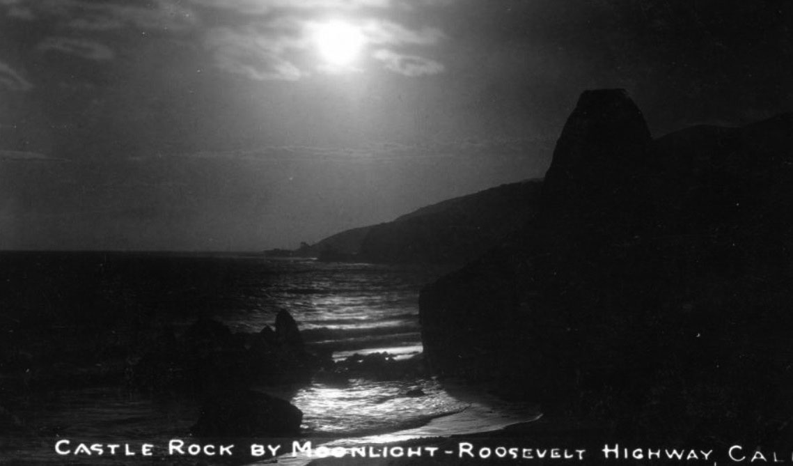 |
|
| (ca. 1920s)* - Postcard view showing Castle Rock silhouetted against a moonlit ocean with the Malibu coastline in the background. |
Historical Notes Publishers often turned Castle Rock into a romantic symbol, showing it against a moonlit sea or sunset sky in postcards aimed at tourists. The rock stood beside the old coast road near the present-day Getty Villa and below what would later become Villa de Leon. In June 1945, highway crews used explosives and heavy equipment to remove most of the formation so the road could be widened. Castle Rock once stood on the ocean side of what is now Pacific Coast Highway at the curve near Coastline Drive, directly below Villa de Leon and across from the Getty Villa entrance. Only a low remnant of the original rock remains at road level, while Haystack Rock still stands offshore in its original position. |
* * * * * |
Roosevelt Highway
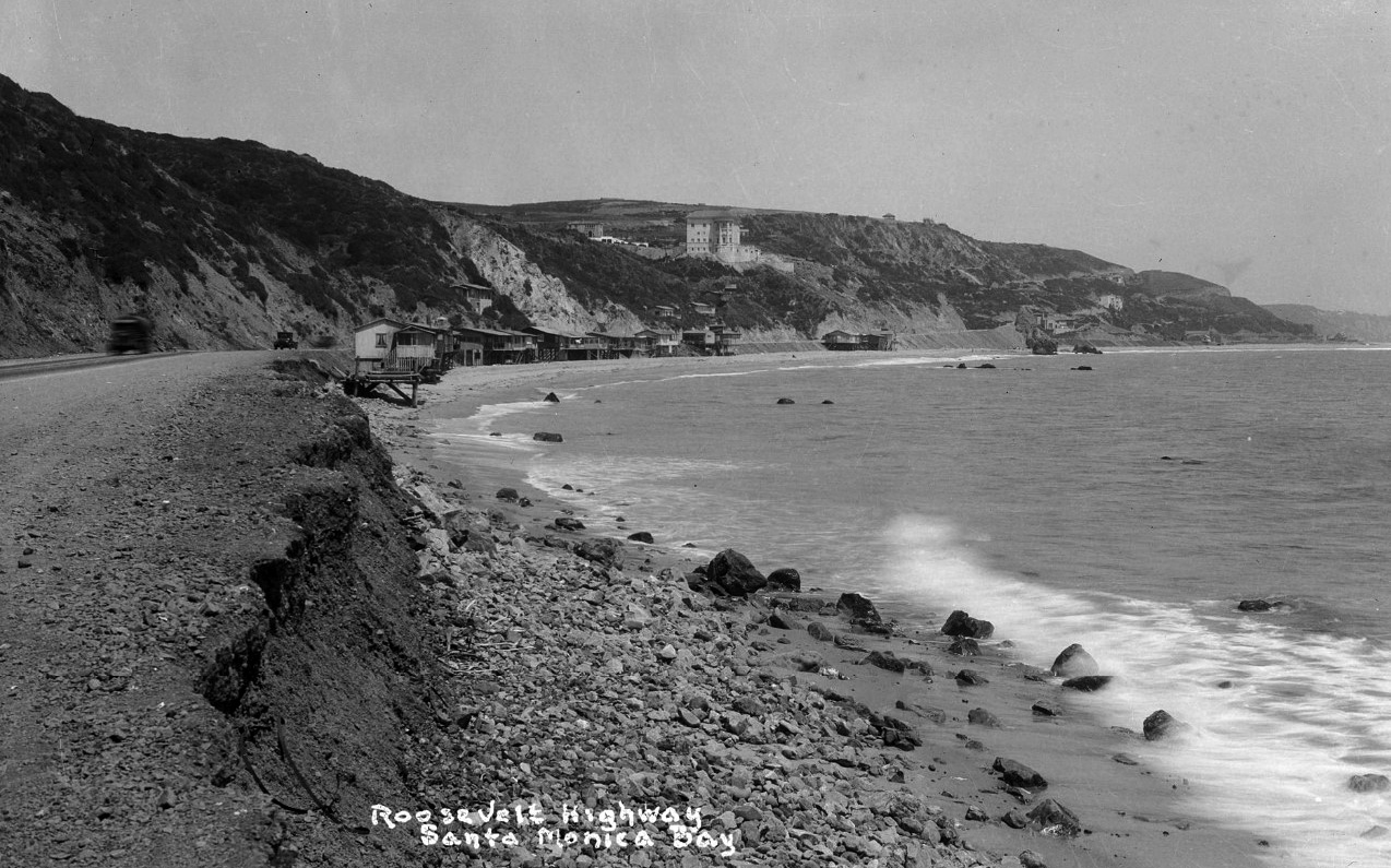 |
|
| (ca. 1927)** - Coastal view looking south towards the Villa de Leon, visible at the top of the slope in the distance, and Castle Rock. Writing on postcard reads Roosevelt Highway, Santa Monica Bay. |
Then and Now
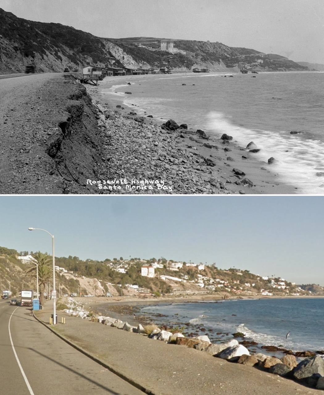 |
|
| (1927 vs 2016)* - Roosevelt Highway (today PCH, CA-1). View looking south towards Villa de Leon, visible at the top of the slope in the distance. Photo comparison by Jack Feldman. |
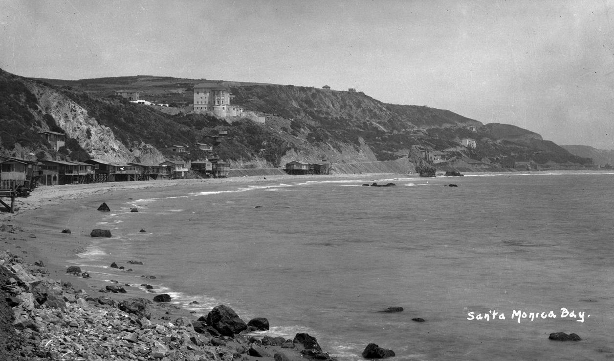 |
|
| (ca. 1927)** - View of the Topanga and Pacific Palisades coast in Santa Monica Bay facing east-southeast towards castle rock in the far distance. Beach houses line the shore with the Roosevelt Highway (later Pacific Coast Highway) and coastal slopes behind them. Villa de Leon (Leon Kauffmann residence, 17948 Porto Marina Way, is visible at the top of a slope. |
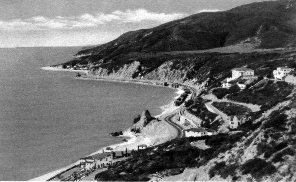 |
|
| (1930s)^v^ - The rock formation known as Castle Rock appears here (center of image) in a view looking west toward Malibu. The Roosevelt Highway (later Pacific Coast Highway) winds through coastal homes. Note the mansions that now appear on the hillside. Castle Rock was demolished to expand the highway just after World War II. |
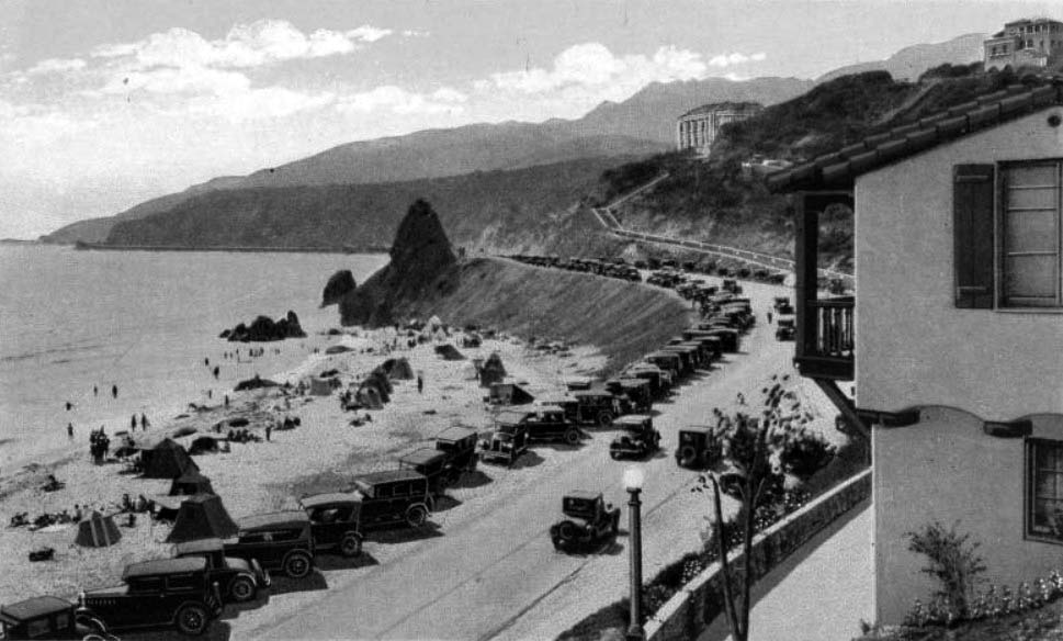 |
|
| (ca. 1930)** - Postcard view of the Coast Highway at Castle Rock, near Santa Monica. Along the edge of the roadway, numerous cars are parked in one row and tents dot the sandy beach. In the background are large estates atop the mountain, one of which is the Villa de Leone, completed in 1928. |
Historical Notes Castle Rock used to stand beside the Roosevelt Highway at the water's edge near the present-day location of the Getty Center Villa and Villa de Leone. Castle Rock was demolished in 1945 in order to expand the highway, renamed the Pacific Coast Highway (see next photo). |
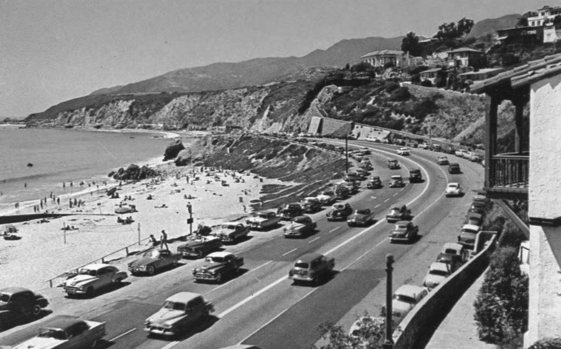 |
|
| (1950s)^ - View looking west (technically speaking) of Pacific Coast Highway, which was also known in the 1950s as a Highway 101 alternative. Center-left in the image is the former location of Castle Rock, which had been demolished several years earlier to expand the highway to four lanes. |
Villa de Leon
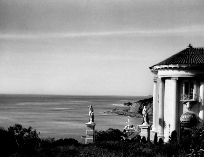 |
|
| (1930s)* - View showing the coastline and Pacific Coast Highway as seen from the grounds of the Villa de Leon. |
Historical Notes Named after its original builder, Austrian native Leon Kauffman, the Villa Leon was the result of a longstanding promise Kauffman had made to his wife Clemence that, if he ever had the money, he would build for her a dream castle by the sea. A fortune made in the wool processing business in California during the First World War allowed Kauffman to make good on his promise and, after purchasing an impressive six-lot parcel above the famous Castle and Haystack Rock formations, Kauffman began construction of his $1,000,000 dream house in 1926.^ |
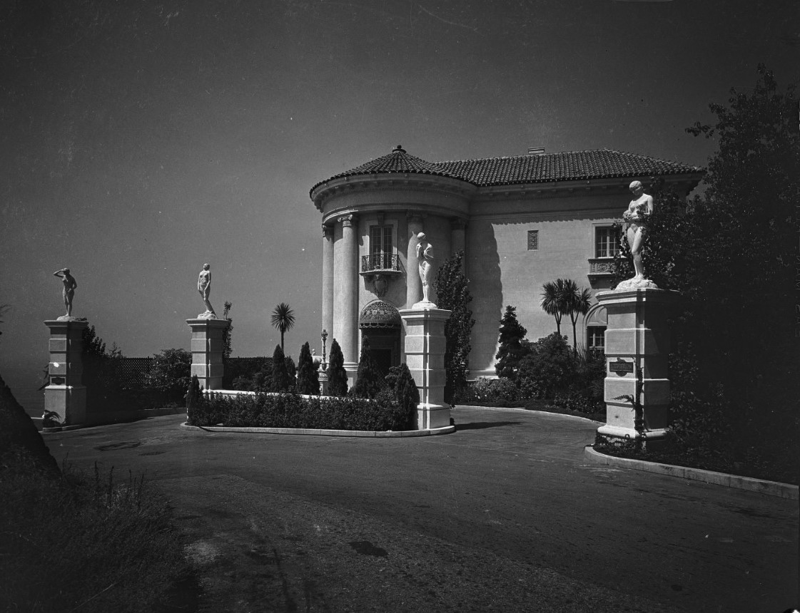 |
|
| (1929)^ – Close-up view of the front entrance to the Villa de Leon located at 17948 Porto Marina Way. At the time it was built (1927), it was one of the largest villas in Southern California. |
Historical Notes Leon Kauffman selected architect Kenneth MacDonald in 1926 to design this 12,000-square-foot palazzo in the Beaux- Arts European tradition. This imposing structure features 35 rooms, including nine bedrooms, 11 bathrooms, a huge grand salon (32’ x 64’), a library, a circular dining room, a butler’s pantry, an elevator and a seven-car garage. The construction price of $1 million (that was a lot of money in the late ‘20s!) included a first-ever central vacuum, several hand-made crystal chandeliers, Italian tiles, imported marbles, hand-carved wooden beams, mahogany paneling from Thailand, magnificent wrought-iron gates, even gold grouting for the Italian tiles. The Villa de Leon took five years to complete.* |
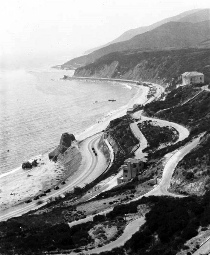 |
|
| (ca. 1930)** – Birdseye view of the Santa Monica shoreline north from Castellammare Drive. Villa de Leon sits in the upper right on the edge of the cliffs overlooking Castle Rock below. |
Historical Notes Leon Kauffman purchased six elevated lots in the 1920s in the new Castellammare (Castle by the sea) area on the Malibu coast, North of Sunset Boulevard and high above what would soon become Roosevelt Highway, predecessor of the Pacific Coast Highway.* |
.jpg) |
|
| (1929)^ - Villa de Leon (Leon Kauffmann residence) and the coast beyond with early model car parked in the driveway. |
Historical Notes When first built, the Villa de Leon boasted topiary gardens, a pipe organ and beach access via a private funicular railway, very expensive amenities that have not survived the passage of time. |
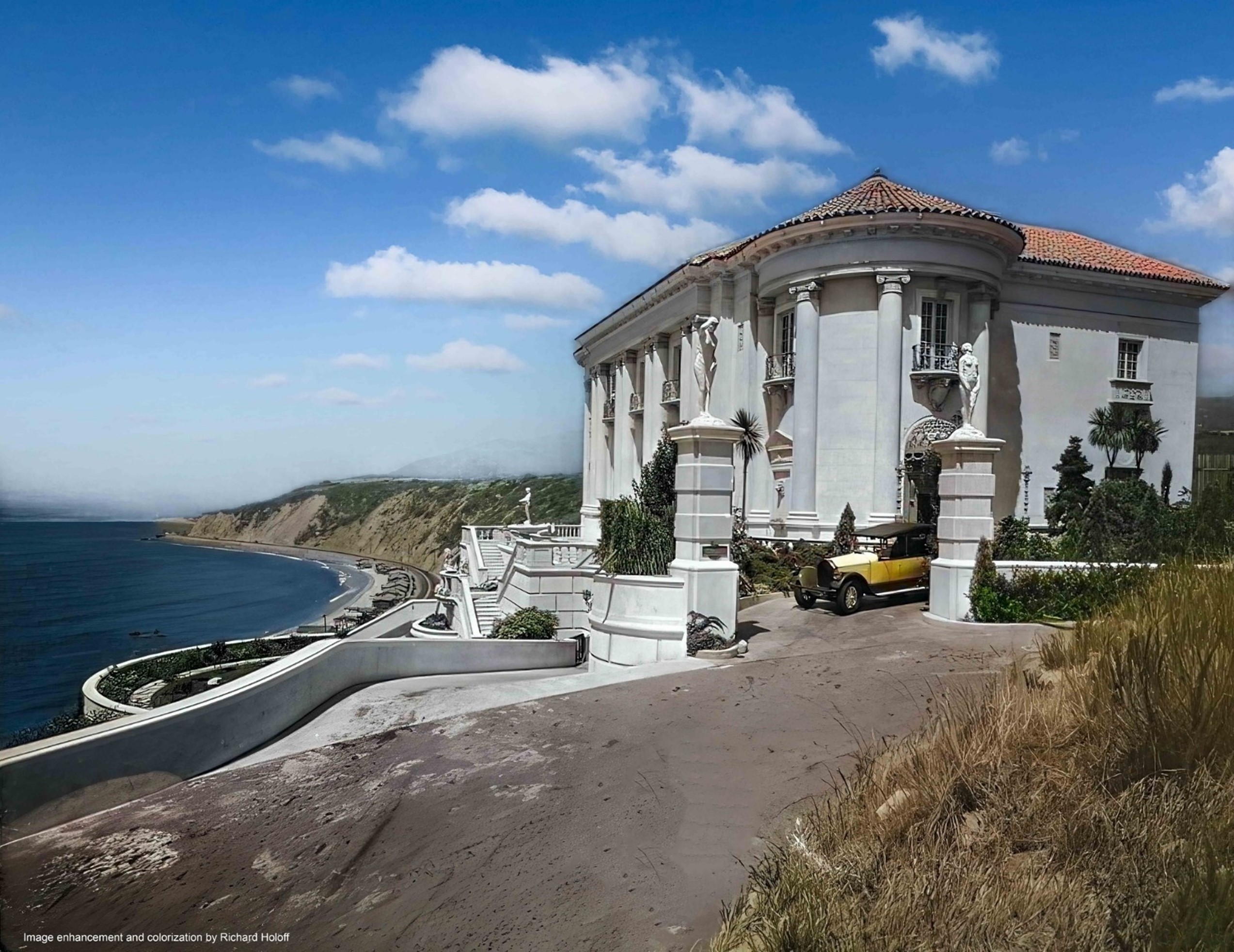 |
|
| (1929)^ - Villa de Leon (Leon Kauffmann residence) and the coast beyond with early model car parked in the driveway. Image enhanced and colorized by Richard Holoff. |
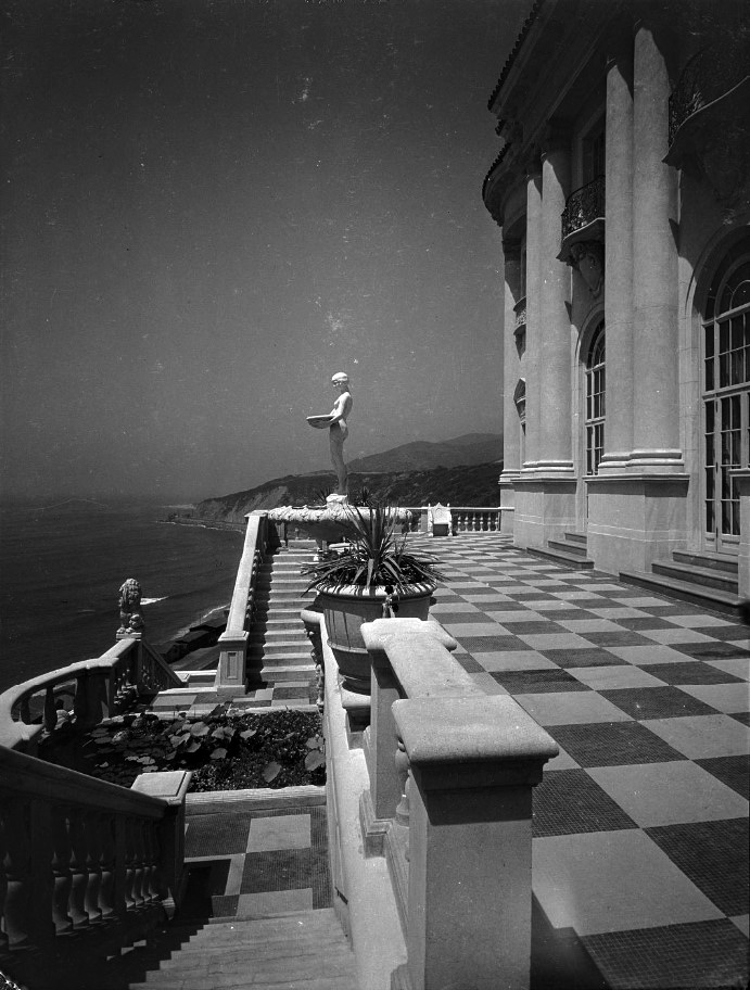 |
|
| (1929)^ - Exterior view of the ocean front terrace and terrace facade of the Villa de Leon, and the stairs leading from the paved terrace to the garden terrace below. The terrace is paced in a checkerboard pattern of dark and light stone. There is a nude statue on a pedestal and the coast is visible beyond the terrace. |
Historical Notes The Kauffmans lived in the house for five years before Leon’s wife (Clemence) died, and Leon lived only another two years. Their grown son chose not to live in the house, which was overseen by caretakers until 1952, when the estate was settled.* |
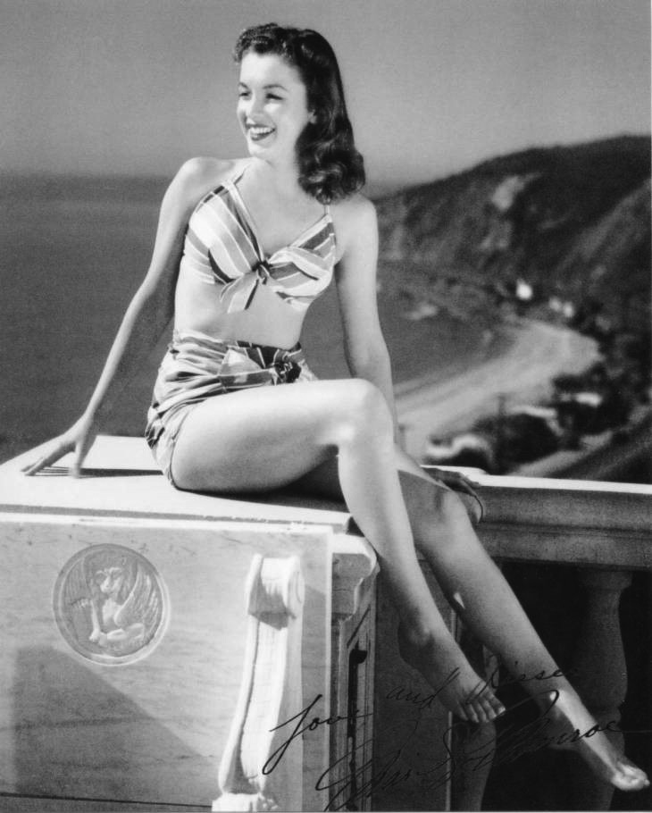 |
|
| (1946)** - Marilyn Monroe, then known as Norma Jean Baker, poses for a bikini pin-up on the terrace of Villa de Leon with the Topanga coastline in the background. Photo by Joseph Jasgur |
Historical Notes Villa de Leon has been featured in countless productions over the years, most notably photo shoots. |
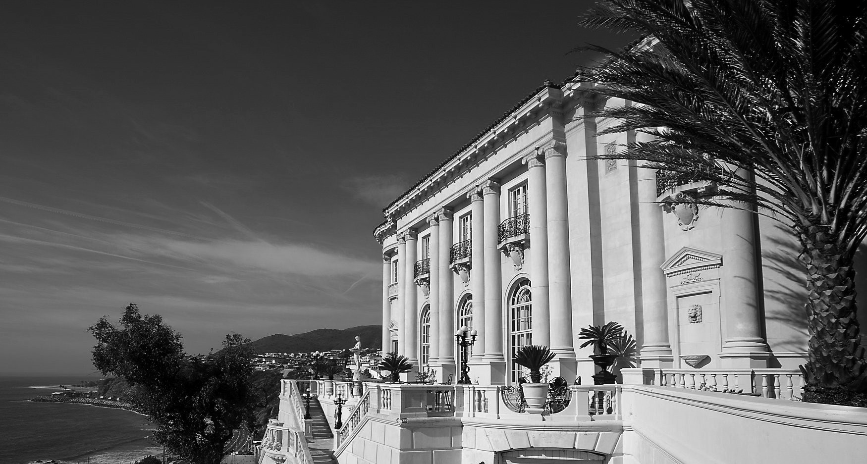 |
|
| (2020)^ - Panoramic view showing the Villa de Leon as it appears today. Photo courtesy of California Heritage |
Historical Notes The mansion overlooks Pacific Coast Highway and the Pacific Ocean and is situated in close proximity to the Getty Villa. It was designed by prominent Los Angeles architect Kenneth A. MacDonald, Jr. in 1926 for Austrian builder and investor in wool Leon Kauffman. |
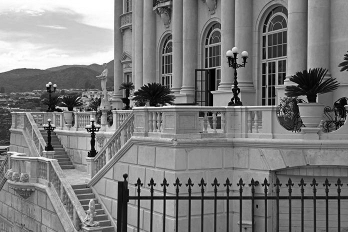 |
|
| (2017)^^ - Close-up view showing stairs leading to the terrace of Villa de Leon. Palisadian-Post |
Historical Notes The Villa de Leon has been used in many high-profile music videos, commercials, and printed ads such as Beyonce's "Haunted," Lady Gaga's "Paparazzi," Britney Spears's My Prerogative body fragrance commercial, Camila Cabello "Liar", Ariana Grande, Miley Cyrus and Lana Del Rey "Don't Call Me Angel", Rod Stewart's Christmas special Rod Stewart: Merry Christmas, Baby, and shoots featuring Heidi Klum, Victoria Beckham, Robert Pattinson, and Reese Witherspoon. Its highly recognizable grand staircase has been a major focal point in several of these videos and photographs, as has its balconies and their balustrades, including their appearance on the cover of English rock band Procol Harum's 1973 album, Grand Hotel.*^ |
|
Historical Notes Today, many first-time visitors to the adjacent J. Paul Getty Villa mistake the Italianate Revival palazzo, the Villa de Leon, for the Getty Villa museum, not visible from the Pacific Coast Highway. Even the New York Times and The Wall Street Journal have mis-identified Villa de Leon thinking it was the Getty Villa. |
* * * * * |
Roosevelt Highway
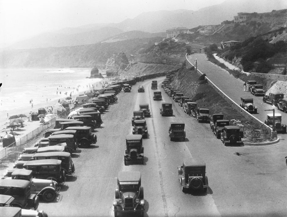 |
|
| (ca. 1930)** - Automobiles driving on the Roosevelt Highway (PCH) at Porto Marina Way. Almost every parking space is taken along the side of the road. Tents, umbrellas, and sunbathers are visible on the beach at left, while Castle Rock can be seen further back on the ocean side of the highway. Large homes are visible on the hills at right in the Castellammare neighborhood , while mountains can be seen in the distance. The site of Thelma Todd's Sidewalk Cafe restaurant is out of frame on the right although still a couple of years in the future (1932). |
Historical Notes The new Castellammare neighborhood became popular with the Hollywood crowd. John Barrymore, Thelma Todd and Joseph Cotton had homes in the area. |
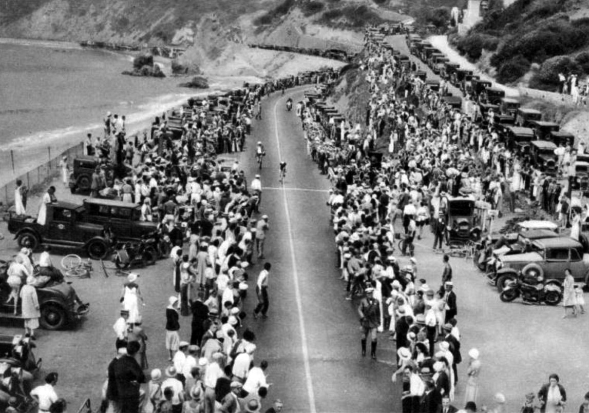 |
|
| (1932)^ - Onlookers and their cars crowd the edge of the Roosevelt Highway as cyclists approach the finish line during the 1932 Olympics. Castle Rock is in the background. Photo taken from the newly constructed footbridge over the highway. |
Historical Notes For the 1932 Summer Olympics, the segment of the PCH between Oxnard and Santa Monica (then known as the Theodore Roosevelt Highway) hosted part of the road cycling events. |
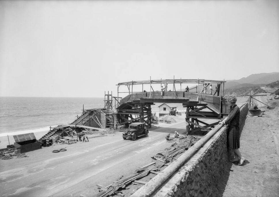 |
|
| (1926)* – A woman looks down toward Roosevelt Highway (later PCH) at Castellammare where a pedestrian bridge is under construction. Photo by Dick Whittington |
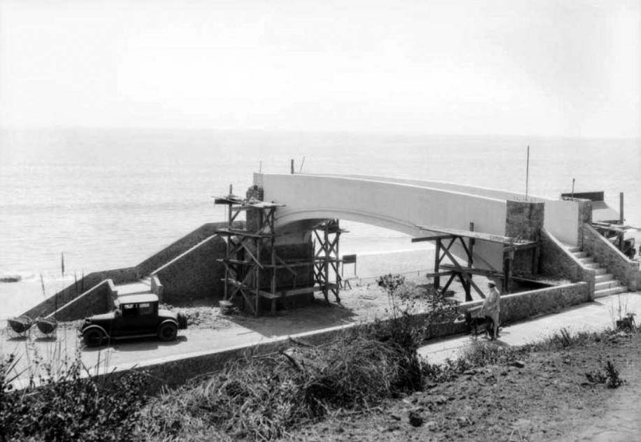 |
|
| (1926)* – View showing a pedestrian bridge being built over Roosevelt Highway (PCH) at Castellammare. The bridge provided beach access for residents of the new Castellammare development. Photo by Dick Whittington |
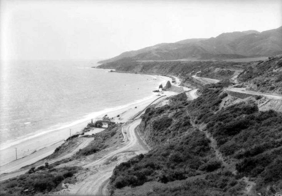 |
|
| (1926)* - View of the Castellammare development following the subdivision but before any houses were built. Pedestrian bridge can be seen down on Roosevelt Highway (PCH) which appears to be a dirt road. Castle Rock can be seen in the distance. Photo by Dick Whittington |
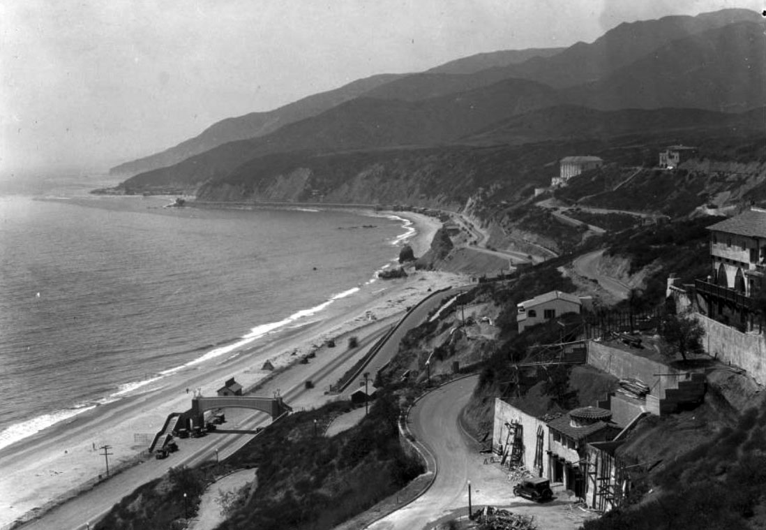 |
|
| (ca. 1928)** - Birdseye view of the Santa Monica shoreline north from Castellammare Drive. In the foreground, next to the footbridge over the highway, is the Thelma Todd Sidewalk Café, still under construction. Castle Rock is seen in the distance with the Villa de Leon standing watch in the hills above it. |
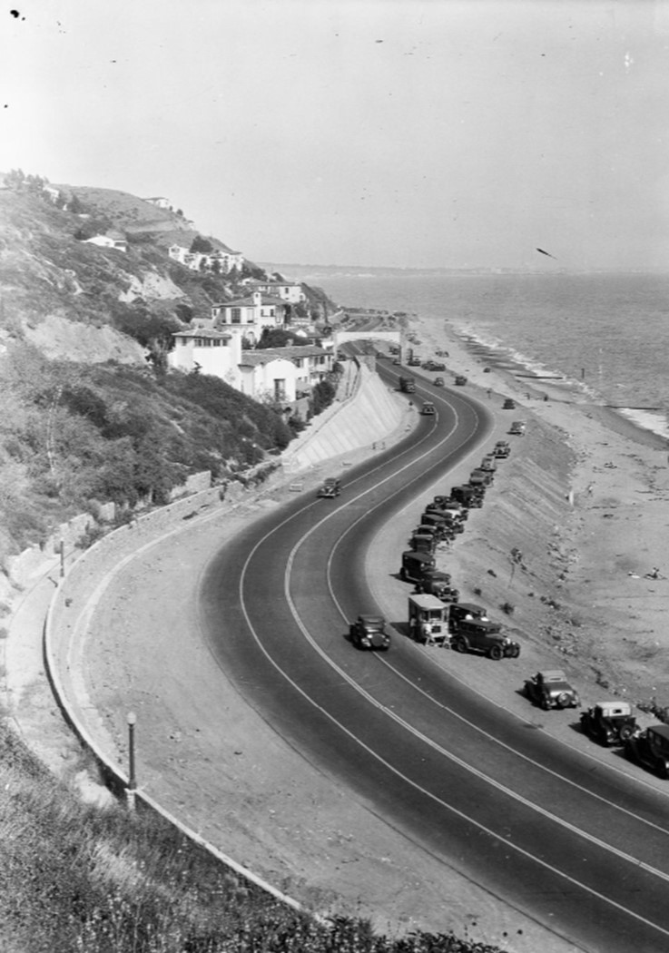 |
|
| (1930s)* - Image of the Castellammare neighborhood on the Roosevelt Highway (later Pacific Coast Highway) in Pacific Palisades, with automobiles parked along the beach, including a small trolley or bus marked "6" in the foreground and an elevated pedestrian crossing in the distance. Photo by Bob Plunkett |
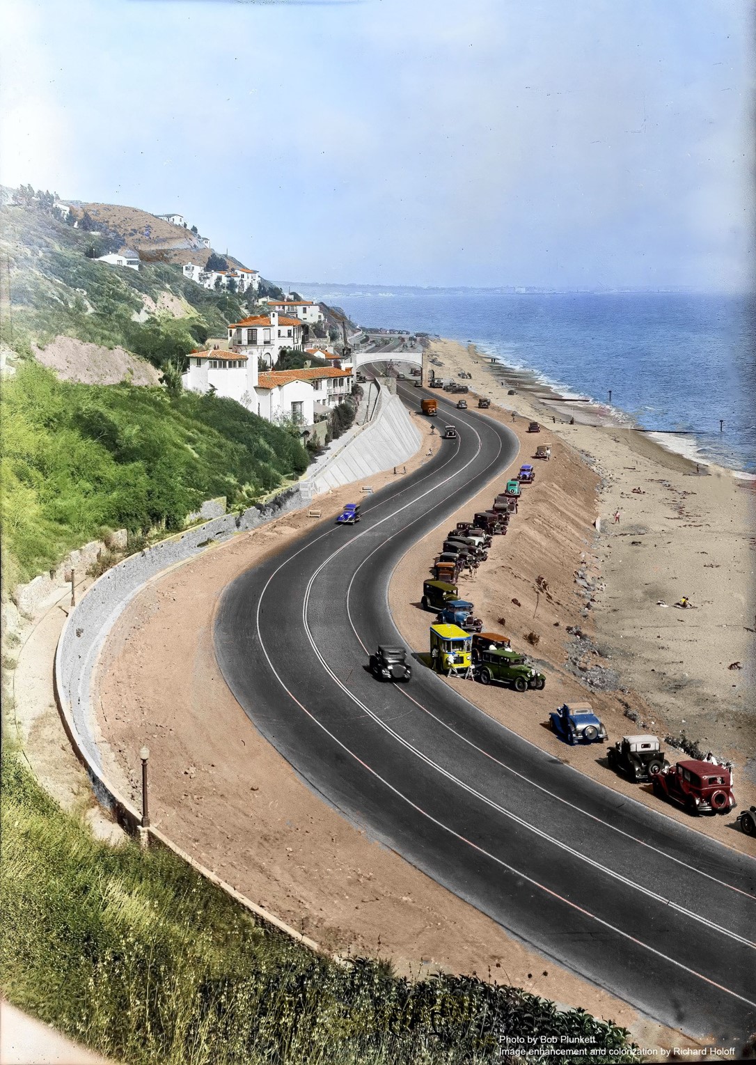 |
|
| (1930s)* - Image of the Castellammare neighborhood on the Roosevelt Highway (later Pacific Coast Highway) in Pacific Palisades, with automobiles parked along the beach, including a small trolley or bus marked "6" in the foreground and an elevated pedestrian crossing in the distance. Photo by Bob Plunkett; Image enhancement and colorization by Richard Holoff |
* * * * * |
Thelma Todd's Sidewalk Café
.jpg) |
|
| (1935)* - Close-up view of Thelma Todd's Sidewalk Café located at 17575 Pacific Coast Highway in Pacific Palisades. The structure was built in 1928. |
Historical Notes Thelma Todd's Sidewalk Café was a notable Hollywood hotspot in the 1930s, located at 17575 Pacific Coast Highway in the Castellammare neighborhood of Pacific Palisades, California. The building and café have a rich history intertwined with Hollywood's Golden Age and a tragic mystery. |
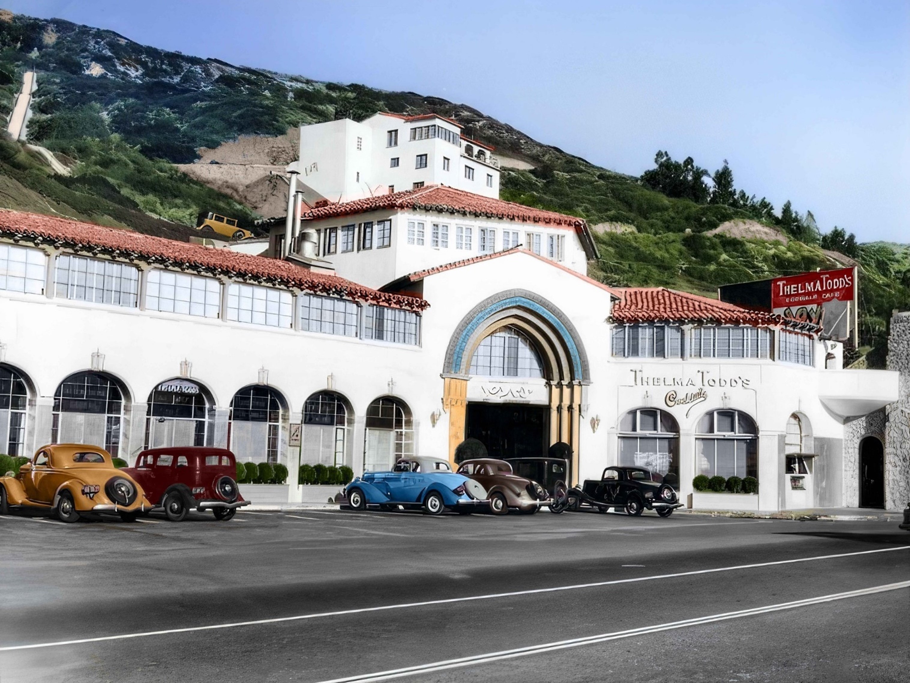 |
|
| (1935)* - Close-up view of Thelma Todd's Sidewalk Café located at 17575 Pacific Coast Highway in Pacific Palisades. Image enhancement and colorization by Richard Holoff |
Historical Notes The Spanish-style building that housed Thelma Todd's Sidewalk Café was originally constructed in 1928. It was designed by architect Mark Daniels in the California Mediterranean and Spanish Colonial Revival styles with Moorish influences. Initially, the structure served as a shopping center for the nearby Castellammare housing development. |
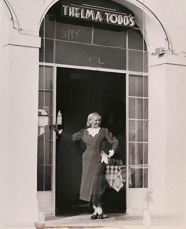 |
|
| (1934)* - Thelma Todd stands in the entryway of her new café. |
Historical Notes In the summer of 1934, Hollywood actress Thelma Todd and her lover/business partner, director Roland West, opened Thelma Todd's Sidewalk Café on the ground floor of the building. The café quickly became a popular destination for Hollywood's elite, known for its high-end seafood menu and glamorous atmosphere. |
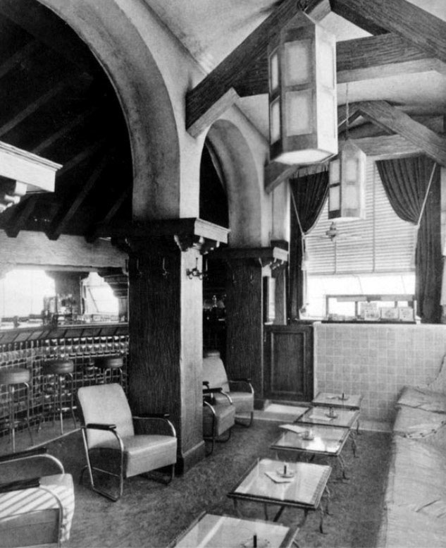 |
|
| (ca. 1934)* - Interior view of Thelma Todd's Sidewalk Café's cocktail room. |
Historical Notes Thelma Todd's Sidewalk Café was a stylish establishment featuring a ground-floor bar, a private upstairs dining area called Joya's Room, and a menu with specialty seafood dishes, including New England-style offerings. Known for its unique cocktails named after celebrities, like the Todd Gin Sour and Thelma Todd Rickey, the café attracted patrons in part due to Todd's frequent presence behind the counter, where she engaged with customers and promoted the business through interviews and photo opportunities. The building itself had a multi-level layout: the café occupied the ground floor, while the second floor housed Joya's Room, Todd’s apartment, and an adjoining apartment for her business partner, connected by a sliding door. A ballroom with a hexagonal shape and a bandstand occupied the third floor, providing an elegant space for events. |
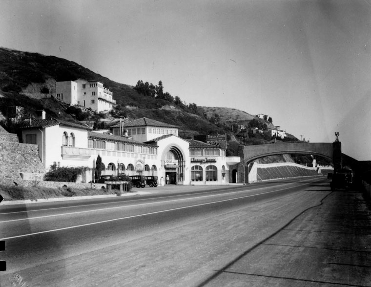 |
|
| (1937)* - View looking south of the three-story, 15,000-square-foot Spanish style Thelma Todd's Sidewalk Café, located at 17575 Pacific Coast Highway in Pacific Palisades. |
Historical Notes On the morning of December 16, 1935, Thelma Todd was found dead in her car inside the garage of Jewel Carmen, a former actress and former wife of Todd's lover and business partner, Roland West. Carmen's house was approximately a block from the topmost side of Todd's restaurant. Her death was determined to have been caused by carbon monoxide poisoning. Todd had a wide circle of friends and associates as well as a busy social life; police investigations revealed that she had spent the previous Saturday night (December 14) at the Trocadero, a popular Hollywood restaurant, at a party hosted by entertainer Stanley Lupino and his actress daughter, Ida. At the restaurant, she had had a brief but unpleasant exchange with her ex-husband, Pat DiCicco. However, her friends stated that she was in good spirits, and were aware of nothing unusual in her life that could suggest a reason for committing suicide. She was driven home from the party in the early hours of December 15 by her chauffeur. |
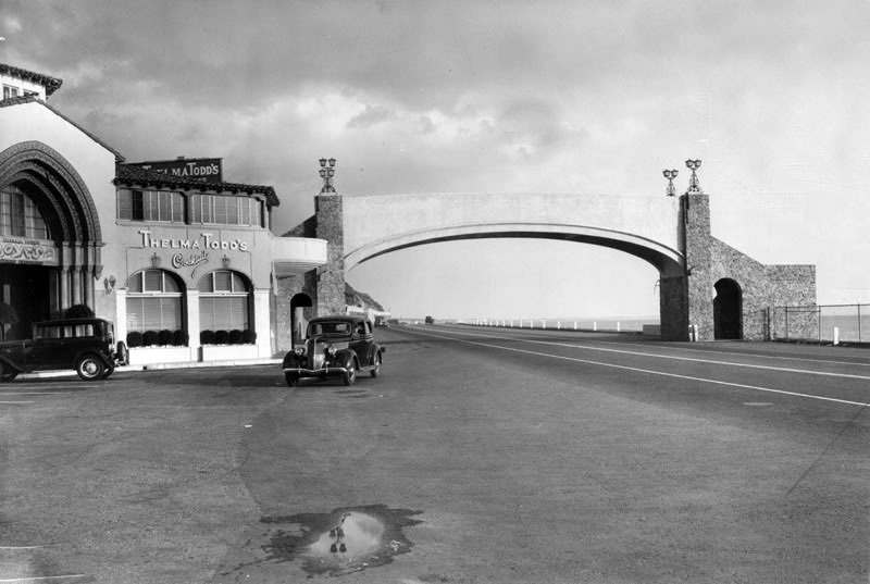 |
|
| (1935)* – View of Thelma Todd’s Sidewalk Café and the pedestrian bridge crossing over Pacific Coast Highway. |
Historical Notes The detectives of the LAPD concluded that Todd's death was accidental, the result of her either warming up the car to drive it or using the heater to keep herself warm; however, other evidence, such as a bloodied lip, seemed to point to foul play. |
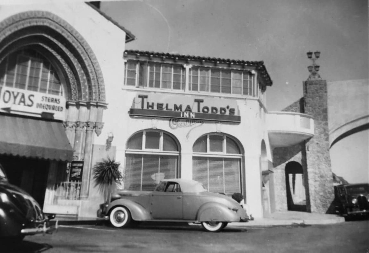 |
|
| (1930s)* - A beautiful convertible is parked in front of Thelma Todd’s Inn. |
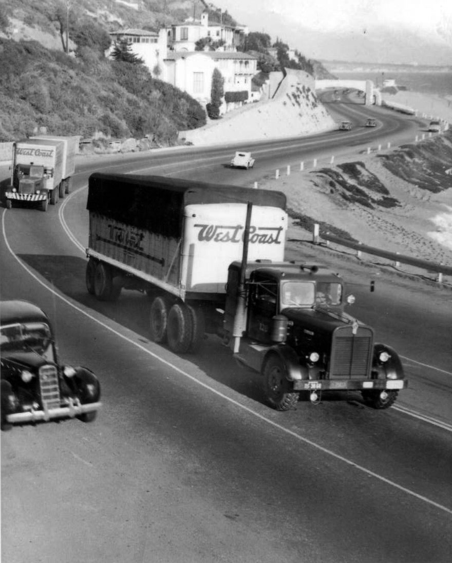 |
|
| (1930s)* – View showing two tractor trailer trucks heading west on the Roosevelt Highway (later Pacific Coast Highway) through the residential area known as Castellammare in Pacific Palisades. The pedestrian bridge adjacent to Thelma Todd’s Sidewalk Café is seen in the background. |
Historical Notes Tractor trailer trucks first became widely used on American highways in the 1930s. This period marked a crucial turning point for the trucking industry, as these vehicles revolutionized long-distance haulage and transportation of goods. |
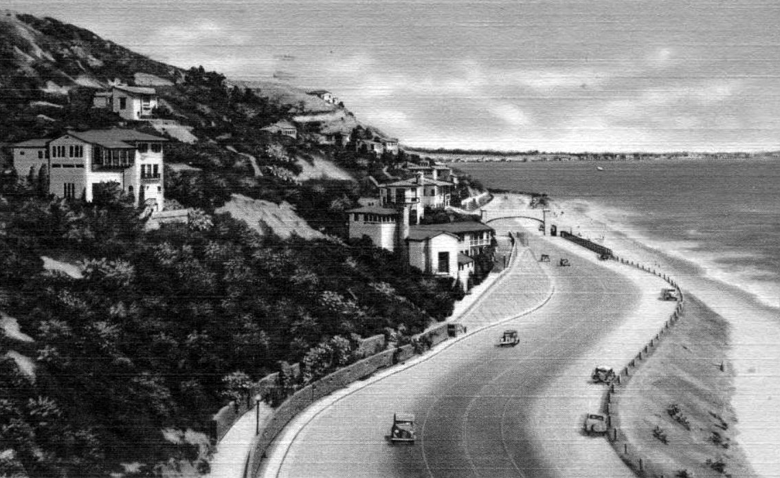 |
|
| (1930s)* – Postcard view looking east on Roosevelt Highway (later Pacific Coast Highway) and the beach near the Castellammare area of Pacific Palisades just northwest of Santa Monica. |
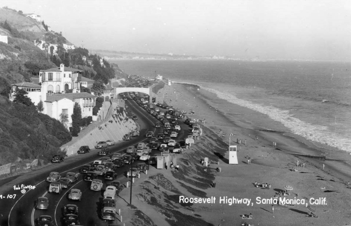 |
|
| (1940s)* – Postcard view looking east on the Roosevelt Highway (later Pacific Coast Highway) crowded with traffic near the Castellammare area of Pacific Palisades just northwest of Santa Monica. |
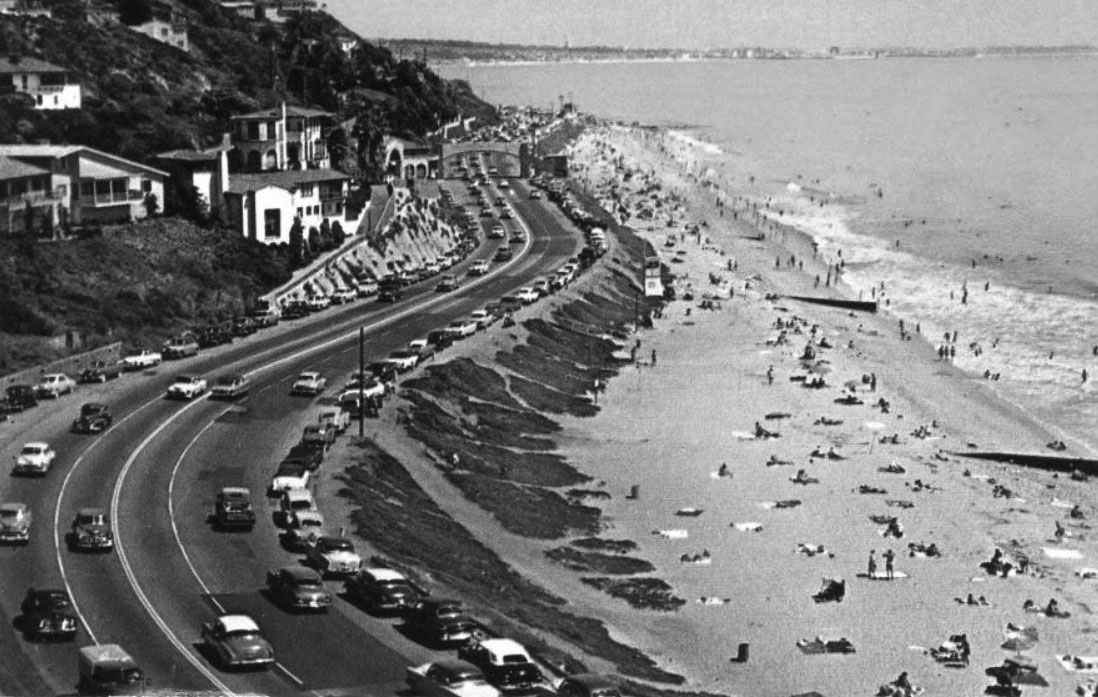 |
|
| (1950s)* - View looking east towards Santa Monica, from Pacific Palisades on the Pacific Coast Highway. |
Then and Now
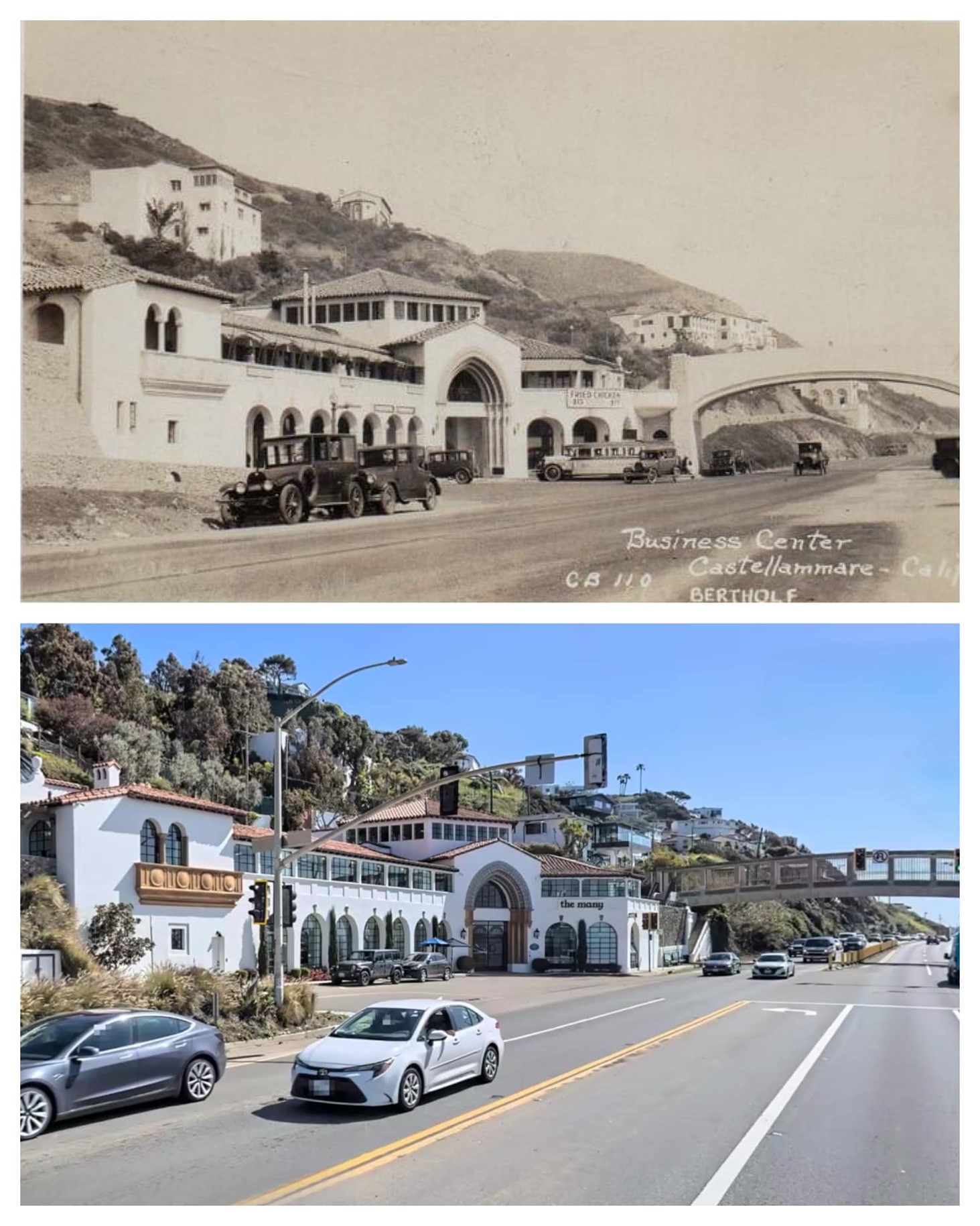 |
|
| Then and Now - Thelma Todd’s Café Shop, today a commercial office building, 17575 Pacific Coast Highway in Pacific Palisades. Photo comparison by Trey Callaway* |
Historical Notes Over the decades, the building experienced periods of vacancy and various uses, including serving as a private residence and housing different businesses. Today, the Spanish Colonial Revival building has been renovated and is marketed as a creative office space called "Surfside" by Vibe Office Properties. Photo comparison by Trey Callaway. |
* * * * * |
Please Support Our CauseWater and Power Associates, Inc. is a non-profit, public service organization dedicated to preserving historical records and photos. Your generosity allows us to continue to disseminate knowledge of the rich and diverse multicultural history of the greater Los Angeles area; to serve as a resource of historical information; and to assist in the preservation of the city's historic records.
|
More Historical Early Views
Newest Additions
Early LA Buildings and City Views
History of Water and Electricity in Los Angeles
* * * * * |
References and Credits
* LA Public Library Image Archive
^^California State Library Image Archive
^* LMU Digital Collection: Arcadia Hotel
*# The Los Angeles County Metro Division 7
#^ Santa Monica Public Library Image Archive
#+ Wehoville.com: Balloon Route
#^*Ocean Park History: oceanpark.wordpress.com
^x^Facebook.com: Venice, Ca, Ocean Park, & Santa Monica in the 20th Century
*^*Paradise Leased: Arcadia Hotel
**^Noirish Los Angeles - forum.skyscraperpage.com; The Long Wharf; Camera Obscura; Acadamy of the Holy Names; Inceville - Inceville - palipost.com
*#*KCET: Arch Rock and Castle Rocks; Rail Returns to the Westside: The Expo Line's Historical Precursors
^#*Santa Monica History Museum
^*#Huntington Palisades - A Brief History
*^#Nuestra Señora la Reina de los Ángeles: losangelespast.com
#**MTA Transportation and Research Library Archives
#^^Huntington Digital Library Archive; Arcadia Roller Coaster; Arcadia Roller Coaster 2; Visitors to SM Beach; Southern Pacific RR
^##The Malibu Times: On the Villa de Leon
###Ingersoll's Century History, Santa Monica Bay Cities
***^History of the Fairmont Miramar Hotel and Bungalows
**^^TheLosAngelesBeat.com: Camera Obscura
^^**Atlas Obscura: Santa Monica Camera Obscura
^*##Facebook.com - Bizarre Los Angeles
*^^#LAistory: The Santa Monica Pier
^##^San Fernando Valley Historical Society/Facebook.com 1st Mail Wagon
^##*Inthecanyon.com: History of Santa Monica Canyon
^#^#CSUN Oviatt Library Digital Archives
+#+#The Famous Lighthouse that Almost Came to Pepperdine
#**#Santa Monica Local History: blogspot.com
#^^^Survey LA: Brentwod-Pacific Palisades Community Plan Area
#^^*Pinterest.com: Old Hollywood
#^#*Denver Public Library Image Archive
*^Wikipedia: California State Route 1; History of Santa Monica; Los Angeles and Independence Railroad; Griffith J. Griffith; Memorial Day; Pacific Electric Railway; Thelma Todd
< Back