Early Views of Santa Monica
Historical Photos of Early Santa Monica |
 |
|
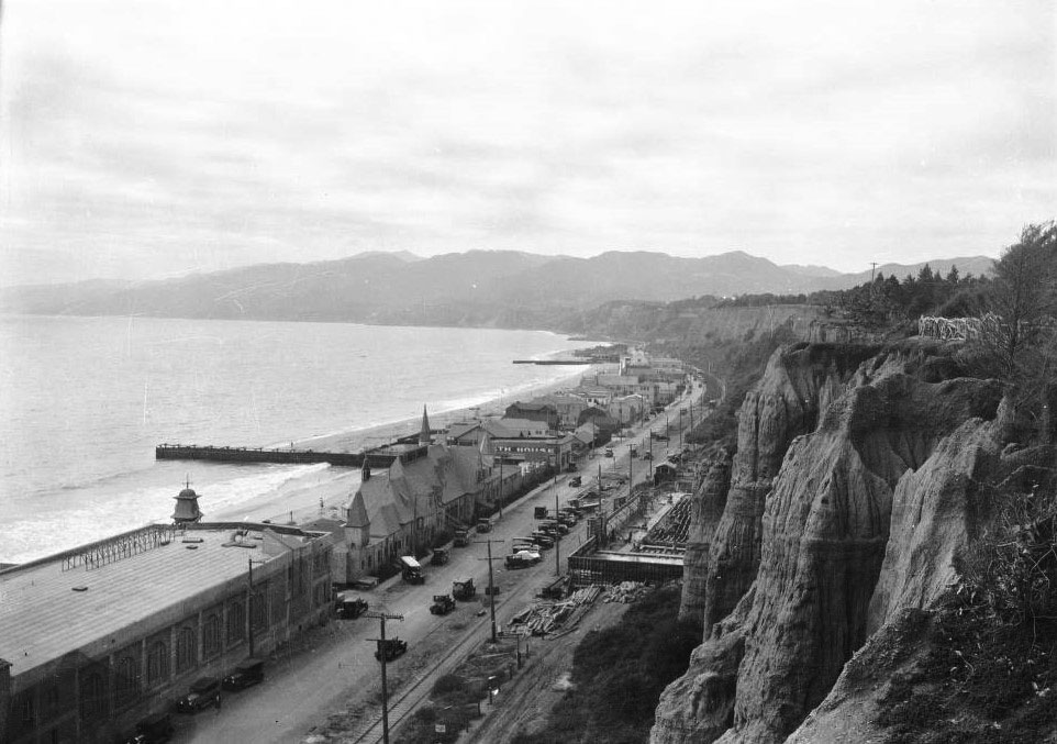
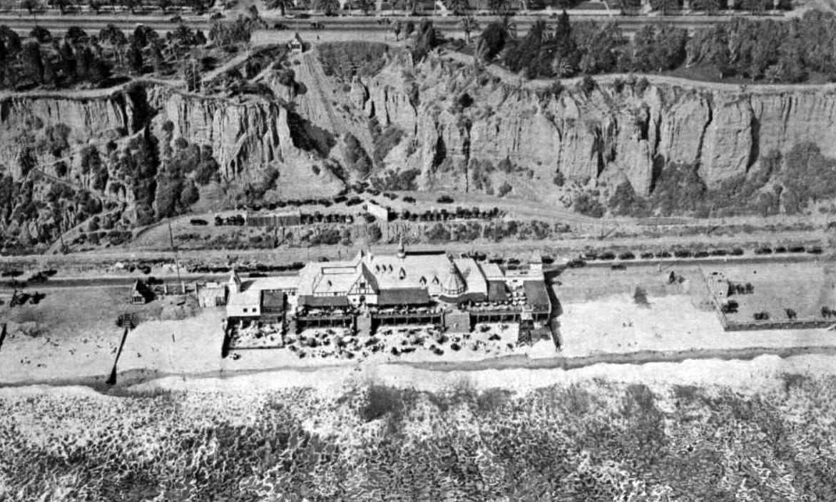
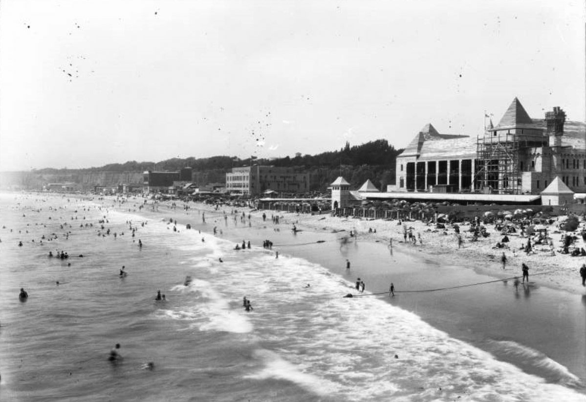
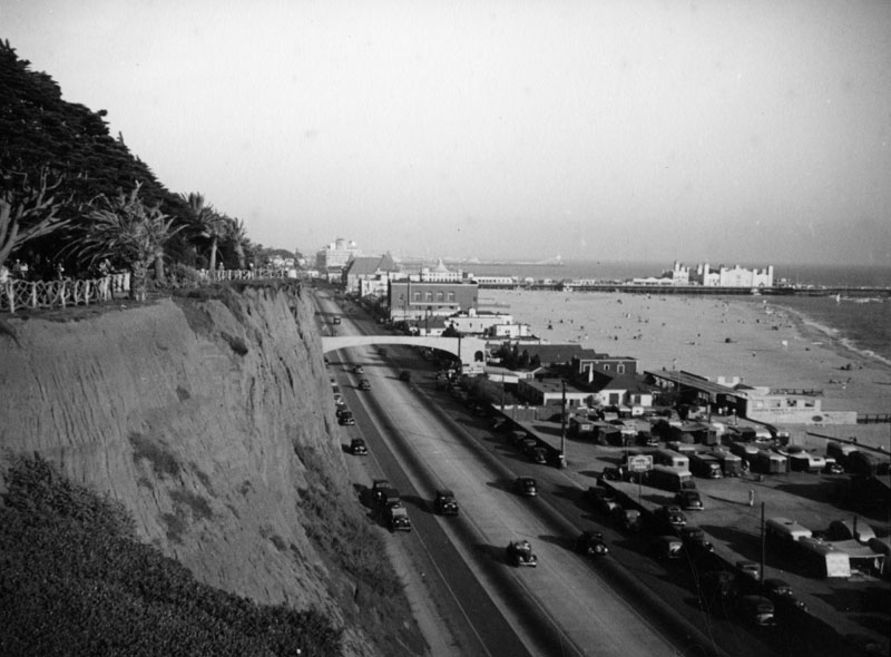
| (ca. 1926)* - Birdseye view of Roosevelt Highway (later Pacific Coast Highway) in Santa Monica from Palisades Park. The steep cliffs of Palisades Park are visible at right, and a wooden fence can be seen running along the top edge. Below, a long line of buildings, including a bath house and the Gables Beach Club can be seen on the left side of Pacific Coast Highway. At the base of the Palisades (center-right) can be seen the foundations for the new Gables Hotel. |
Historical Notes IIn the 1920s and 30s, a number of fancy beach clubs were built along Santa Monica beach including the aptly named Santa Monica Athletic Club, the Beach Club, the Santa Monica Swimming Club, the Deauville, the Wavecrest, the Edgewater, and the Breakers. There was also the Gables Beach Club, a grand Tudor-style building (seen above) constructed in 1926. |
 |
|
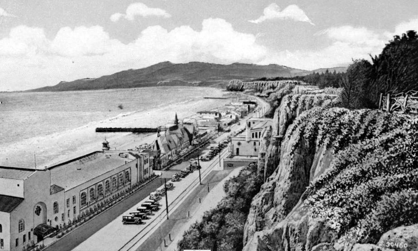
| (ca. 1927)* – Panoramic postcard view looking north toward Malibu showing several beach clubs as seen from Palisades Park. The Jonathan Club, opened in 1927, is on the lower left. Next to it is the Gables Beach Club, which burned in a fire in 1930, only to reopen with a new building. Across the Roosevelt Highway is the unfinished Gables Hotel, later known as the Sorrento Ruins. |
 |
|
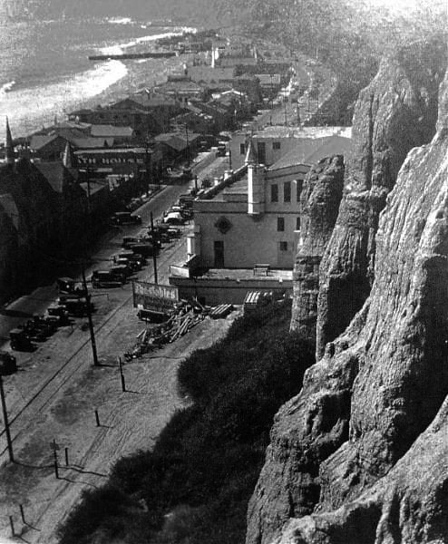
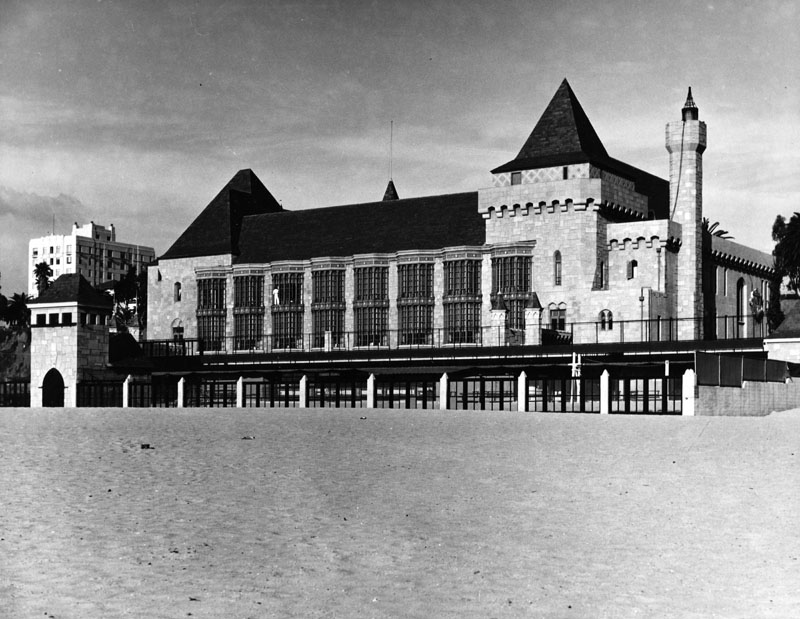
| (ca. 1927)^.^ – View showing the Gables Hotel on the Palisades in Santa Monica. The hotel was never finished due to the Great Depression and eventually became known as the Sorrento Ruins. |
Gables Beach Club and Hotel
 |
|
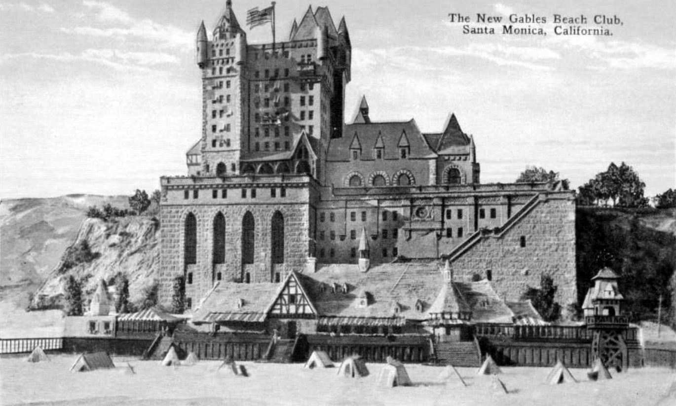
| (ca. 1926)* – Postcard view showing an illustration of the proposed Gables Beach Club and Hotel. The hotel was never completely built. |
Historical Notes The Gables Beach Club, seen on the beach in the foreground, was completed in 1926 and flourished until it burned in a fire in 1930. It reopened a few years later as the Sorrento Beach Club. The 21-story Gables Hotel began construction in 1926 also but only reached the third story before the project was halted by the Great Depression. The hotel was never completed, and the three-story structure was later used as a parking facility for the Sorrento Beach Club located across the street until 1962. The building was demolished in the 1970s, except for the foundation, which is still visible today and now serves as a retaining wall. It is now known as the Sorrento Ruins. |
 |
|
| (ca. 1926)* – Aerial view showing the buildings and site of the Gables Beach Club and beach in Santa Monica, with the Palisades bluffs in the background. Cars are parked across the highway where the 21-story hotel was planned to be constructed. |
.jpg) |
|
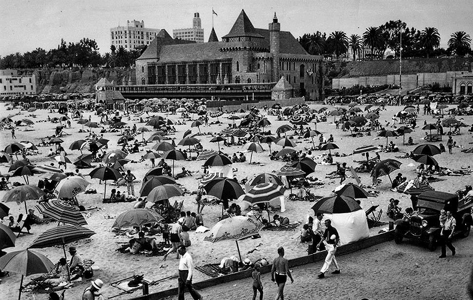
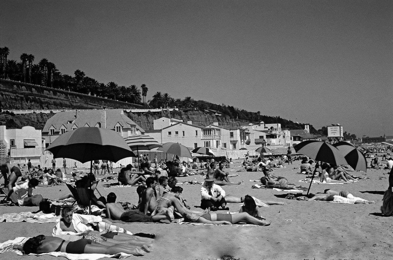
| (ca. 1926)* - View of the Santa Monica beach from the palisades, showing the Gables Beach Club. A short pier or breakwater extends into the sea at center, and another can be seen in the distance at right. |
Historical Notes The grand Tudor-style Gables Beach Club was constructed in 1926. It was a popular filming location. After a fire partially destroyed it in 1930, the club was rebuilt and reopened as the Sorrento Beach Club in 1932. |
 |
|
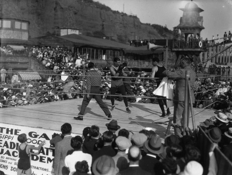
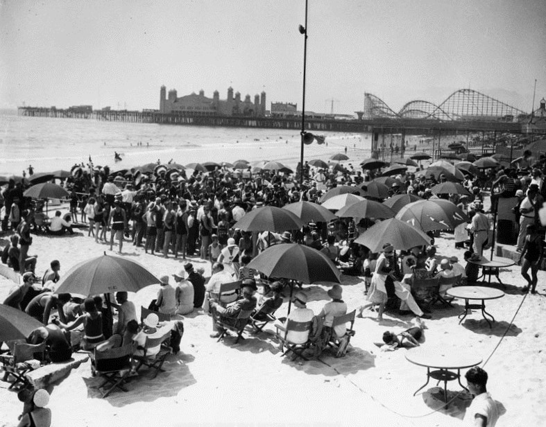
| (1920s)* - View showing Jack Dempsey boxing for a fund raiser in a ring outside the Gables Beach Club. |
Historical Notes William Harrison "Jack" Dempsey became a cultural icon of the 1920s. He held the World Heavyweight Championship from 1919 to 1926, and his aggressive style and exceptional punching power made him one of the most popular boxers in history. Many of his fights set financial and attendance records, including the first million-dollar gate.*^ |
 |
|
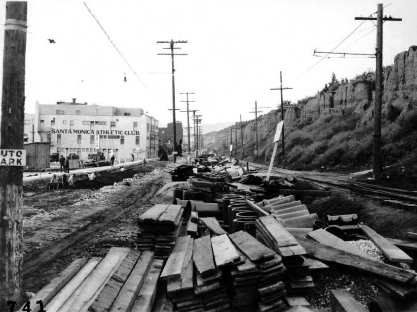
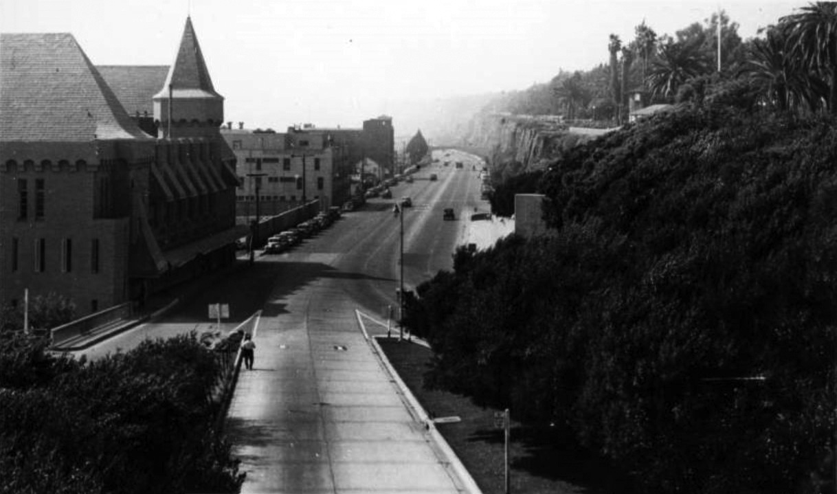
| (1927)* - View looking north along Coast Highway from point just north of Colorado Street, Santa Monica. Also visible are: lumber and other construction supplies, workmen, pedestrians, railroad tracks, embankment at the top of which are palm trees, utility poles and lines, buildings (businesses mostly), a few parked automobiles. Legible signs include: "Auto Park", "Santa Monica Athletic Club", "Parking 25¢". |
 |
|
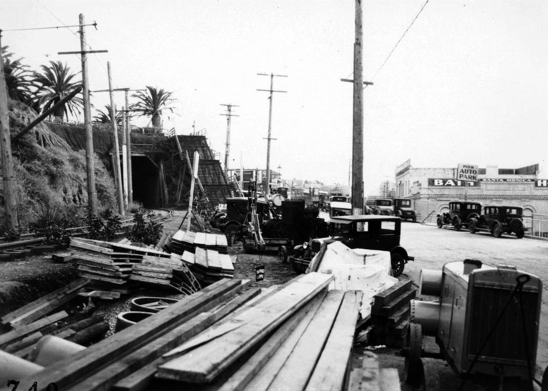
| (1927)* - View looking south along Coast Highway from point just north of Colorado Street, Santa Monica, showing entrance to the Pacific Electric Railway tunnel under Ocean Avenue. Also visible are: lumber and other construction supplies, generator, parked automobiles, embankment, utility poles and lines, stairs up to Ocean Avenue, businesses, a few palm trees along Ocean Avenue. Legible signs include: "Lunch..., "Pier auto park", "Santa Monica Bath House". To the right (out of view) is the Deauville Club, which is still under construction. |
* * * * * |
Deauville Club
 |
|
| (1927)* – View of beachgoers and the under-construction Deauville Club on the beach in Santa Monica. The large building is at right and is mostly complete except for the wall facing the beach. There is scaffolding around one of the two large towers on the corners of the buildings. The beach in front of the club is crowded with bathers playing in the sand and the surf. Further down the beach at center are other beach clubs, including the Santa Monica Athletic Club. |
Historical Notes The Deauville Club was located north of the Santa Monica Pier. It opened to the public in 1927 and was built on the site of the old North Beach House. It was modeled after a casino in Deauville, France, and considered to be one of the most beautiful beach clubs. |
.jpg) |
|
| (ca. 1927)* – View of the beach in Santa Monica in front of the Deauville Beach Club. The wide sandy beach is at center and is crowded with bathers and their umbrellas. A pair of bicycles is leaning against a post at center. The beach is bordered at right by several large buildings, including the Deauville club in the foreground and the Santa Monica Athletic Club further in the distance. |
 |
|
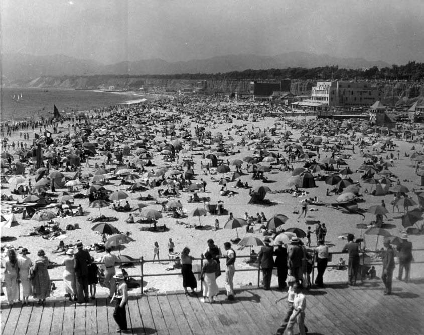
| (ca. 1930)* - View of Santa Monica Beach and Pier showing people standing at the rail of the wood-planked pier in the foreground as they look at the beach at center. People in bathing suits with umbrellas over them flood the sandy beach into the distance. The Santa Monica Athletic Club and part of the Deauville Club are in view at upper right. |
 |
|
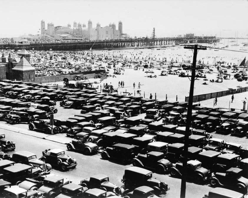
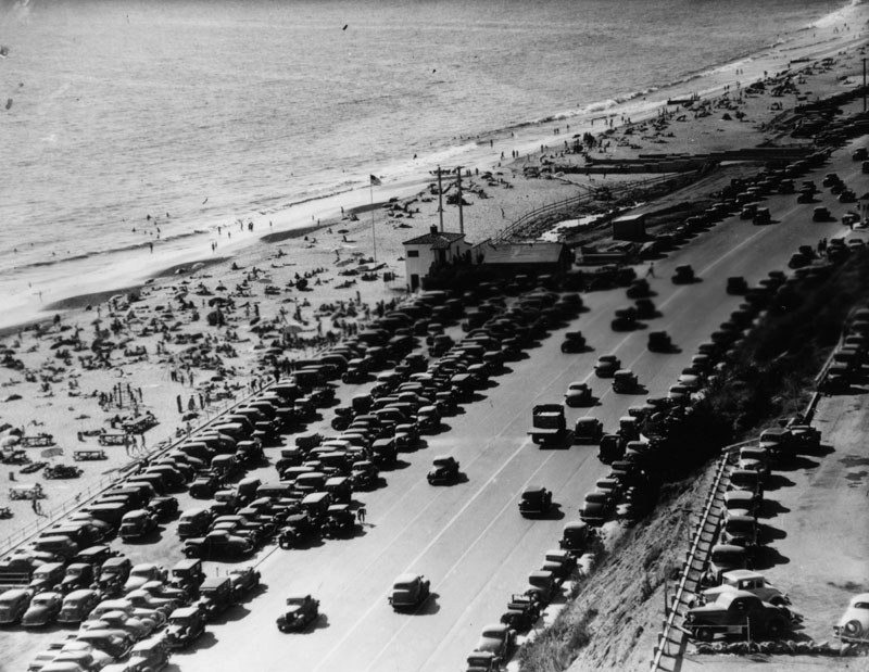
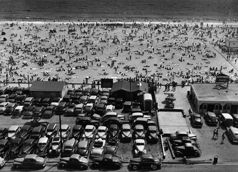
| (1934)* - View of the Santa Monica Pier showing a jammed-packed parking lot in the foreground. Hundreds of beachgoers can be seen under umbrellas and in the water. In the background the pier can be seen, with several structures on it. The most notable building on the pier is the La Monica Ballroom with minarets topping each of its many towers. At upper left can be seen part of the castle-style Deauville Club. |
 |
|
| (1936)* - A summer day at Santa Monica beach in front of the Deauville Beach Club. In the background, behind Palisades Park, can be seen the Georgian Hotel and thet Bay Cities Guaranty Building with its clock tower. |
Historical Notes The Deauville Beach Club was a significant landmark in Santa Monica, established in 1927. Designed by Morgan, Walls and Clements in a style reminiscent of a European castle. The club offered an impressive array of amenities including guest rooms, a gymnasium, a saltwater plunge, and various recreational facilities. It quickly became a popular destination for Hollywood stars and high society events. |
 |
|
| (1934)* - View showing a crowd watching a beauty contest at the Deauville Club, with contestants lined up to walk on stage and a contestant modeling a bathing suit next to a musical band. The Georgian Hotel (built in 1933) is seen behind Palisades Park at upper right edge of image. Photo from the Ernest Marquez Collection. |
 |
|
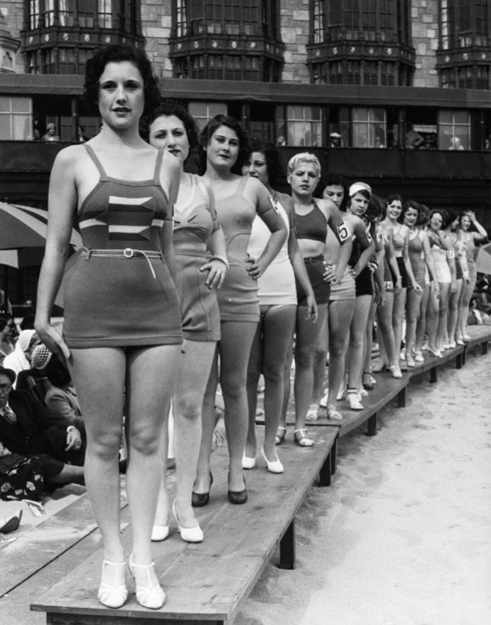
| (1932)^ - Image of contestants walking on elevated planks in bathing suits for a beauty contest at the Deauville Club in Santa Monica. |
 |
|
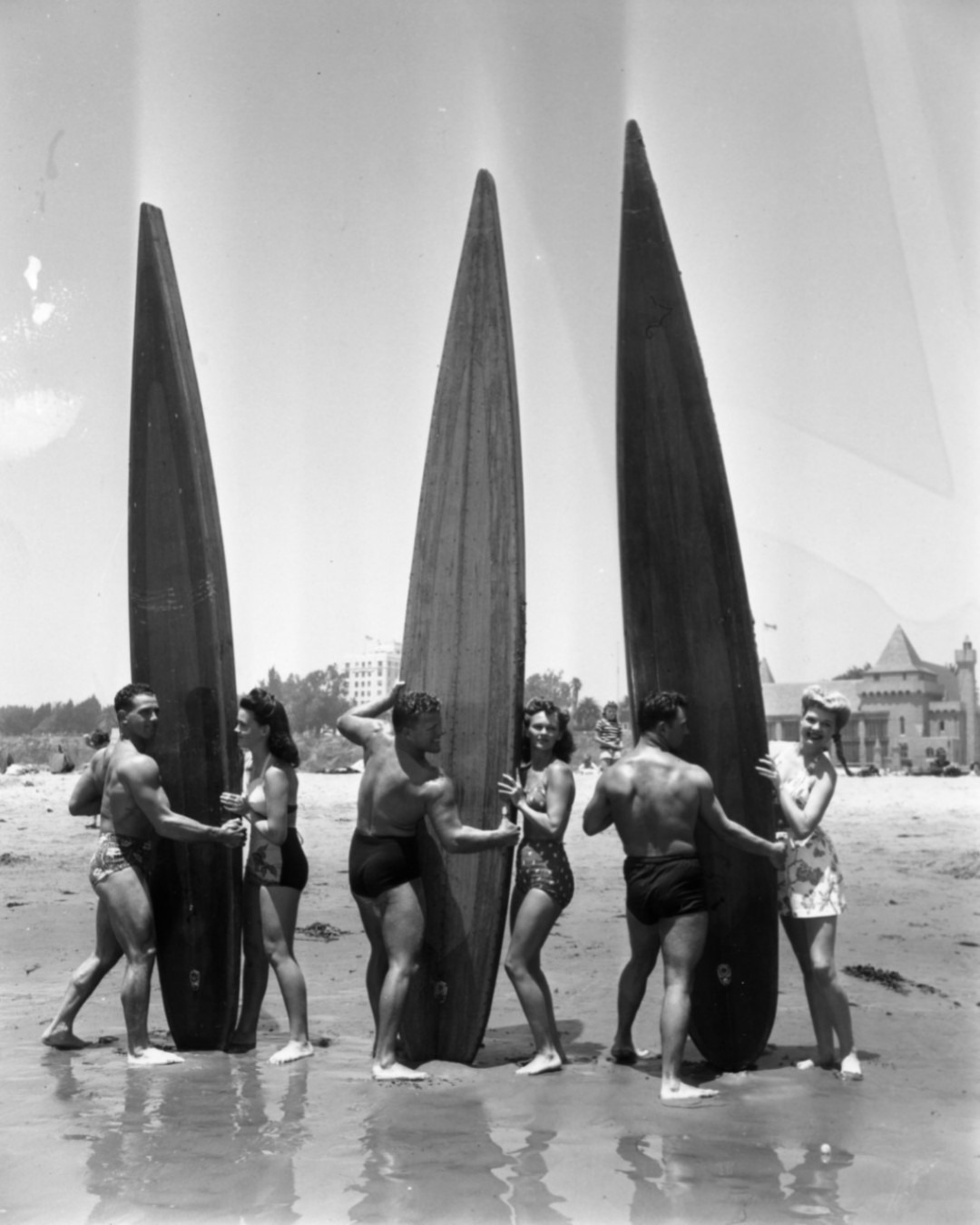
| (1930s)* – Three couples posing for the camera by their longboards at Santa Monica Beach with the Deauville Club in the background. |
 |
|
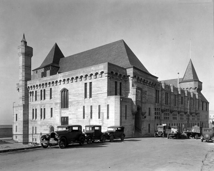
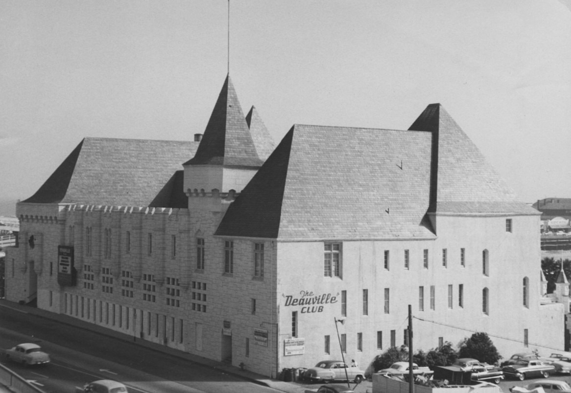
| (ca. 1930s)* - Street side view of the castle-style Deauville Club located at the junction of the Roosevelt Highway and Olympic Blvd. |
Historical Notes In 1930, the Los Angeles Athletic Club bought the Deauville Club and, in 1933, a breakwater built in the bay expanded the sandy beaches, creating more oceanfront space for the multitude of visitors to the area. |
 |
|
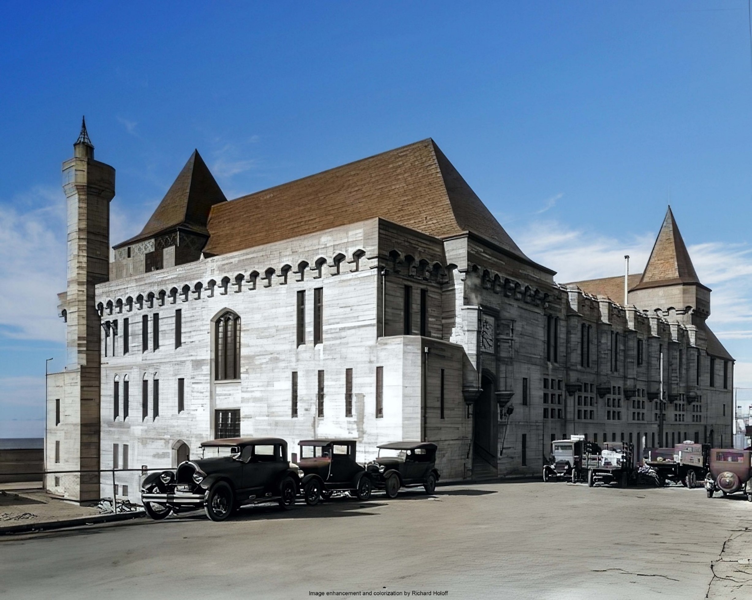
| (ca. 1930s)* - Street side view of the castle-style Deauville Club located at the junction of the Roosevelt Highway and Olympic Blvd. Image enhancement and colorization by Richard Holoff. |
 |
|
| (ca. 1930s)^^ - Interior view of the Deauville Club's lounge area with views of the surf. |
Historical Notes The Deauville offered guest rooms, a gymnasium, a saltwater plunge, lockers and showers, lounge rooms, game rooms, private dining rooms, and a restaurant. |
 |
|
| (1930s)^^ - Interior view of the large, ornate dining hall at the Deauville Club. Chandeliers are seen hanging down from the high ceiling exposed beams. |
 |
|
| (1937)* - Close-up view of the Deauville Club as seen from the beach. |
 |
|
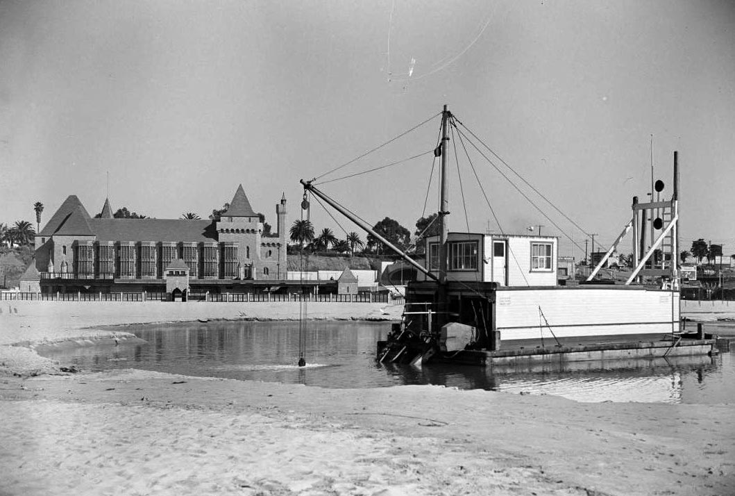
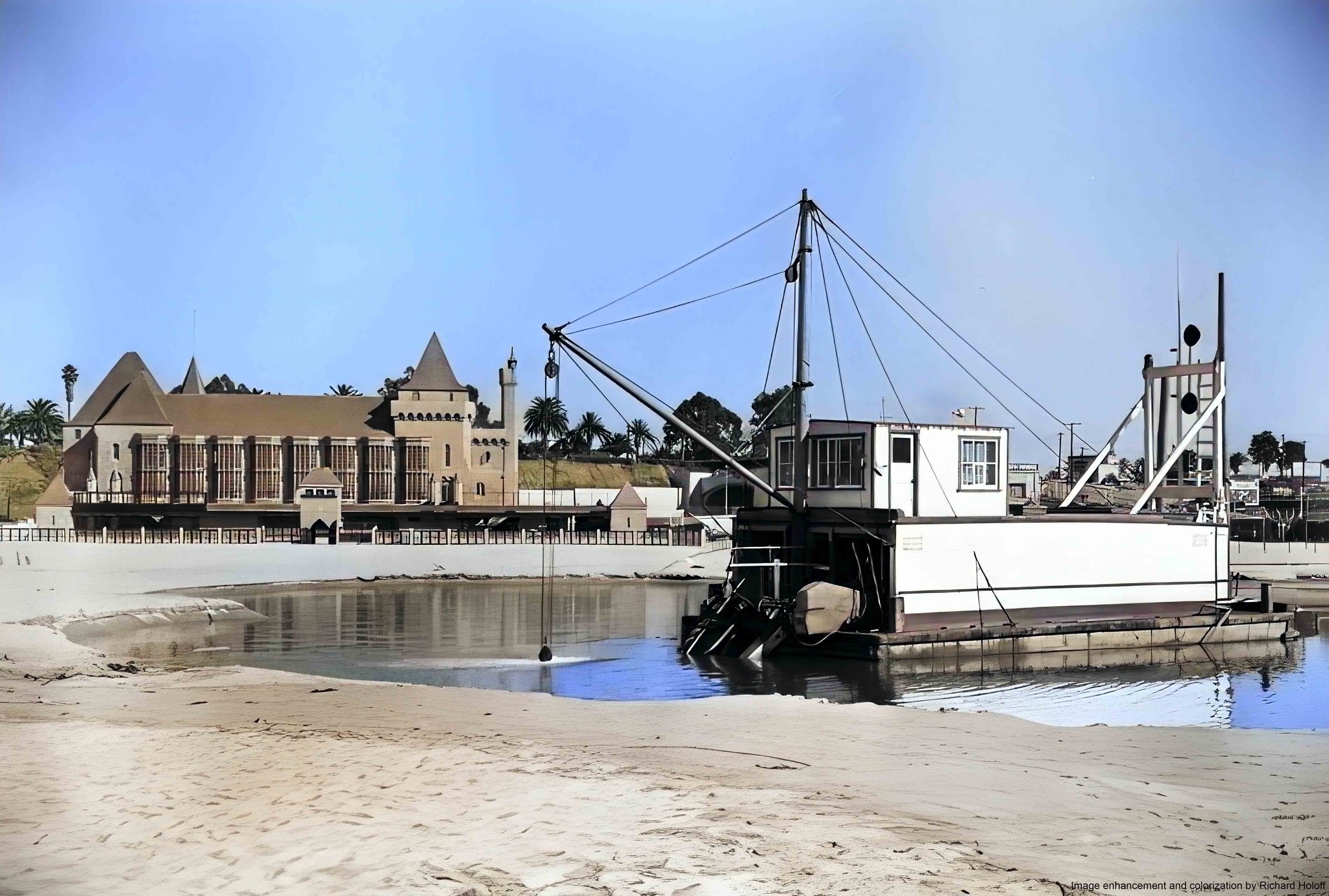
| (1938)* – View showing an electric dredge in a pool of water in front of the Deauville Club. To the right of the Deauville Club and behind the dredge can be seen the west end of the McClure Tunnel. |
 |
|
| (1938)* – View showing an electric dredge in a pool of water in front of the Deauville Club. To the right of the Deauville Club and behind the dredge can be seen the west end of the McClure Tunnel. Image enhancement and colorization by Richard Holoff |
 |
|
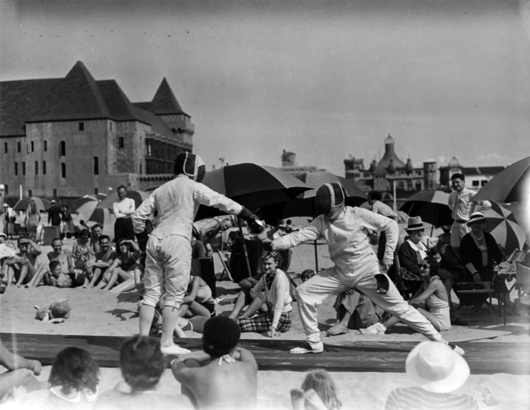
| (1930s)^ - Image of spectators on the beach watching a fencing match in front of the Deauville Club in Santa Monica, with the Looff Hippodrome seen at right on the Santa Monica Pier. |
 |
|
| (1940s)^ - View looking north showing Palisades Beach Road (part of the Roosevelt Highway and later Pacific Coast Highway), with the Deauville Club (with tower), Santa Monica Athletic Club, and Wavecrest Club, at left, and Palisades Park and bluffs at right. |
 |
|
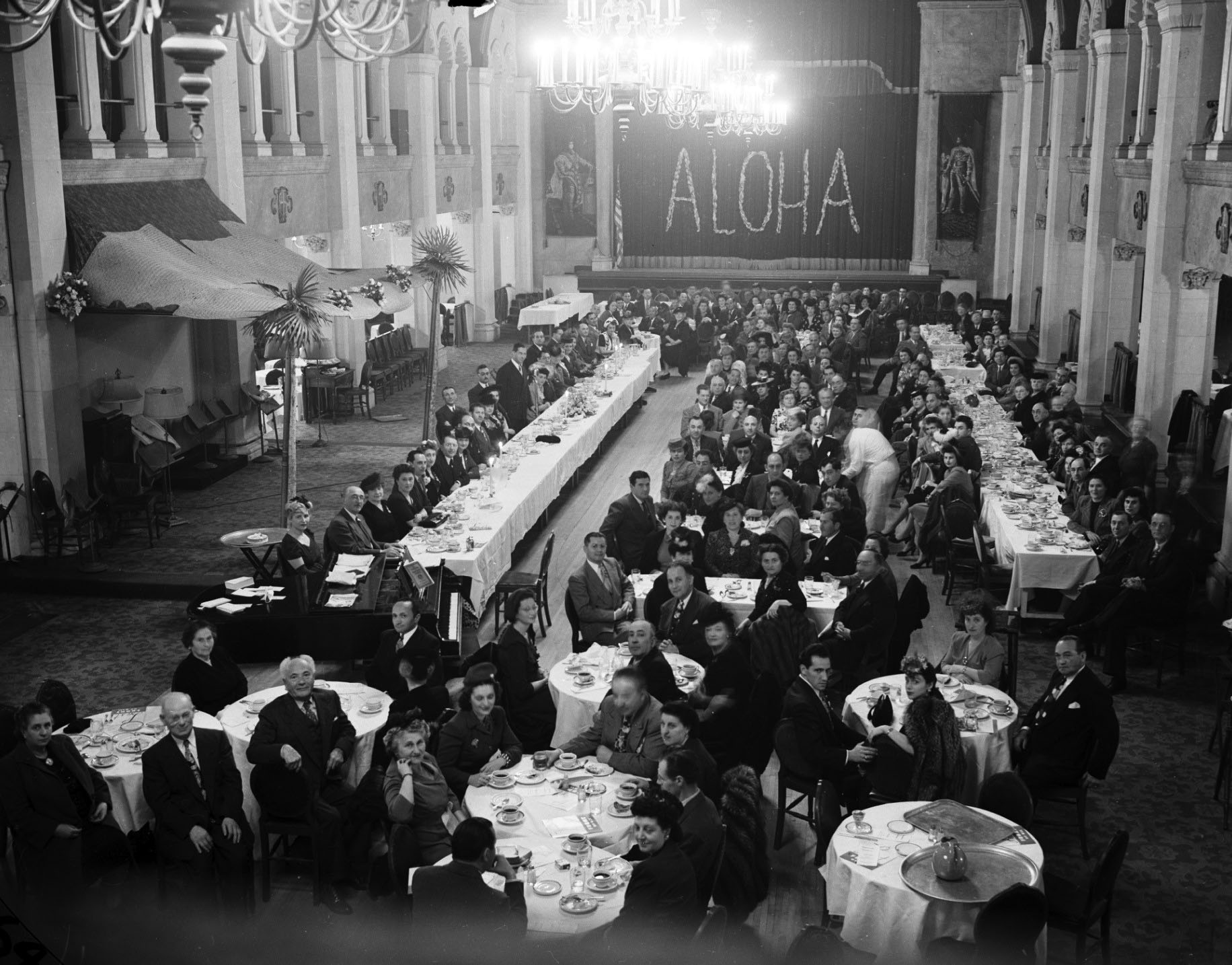
| (1945)* - Jewish Community Center founders and guests gather for a dinner at the Deauville Club. The attached newspaper article states: "Halfway at the outset was the quota status of the subscription pledges announced for the proposed new Santa Monica Jewish Community Center Building when the Jewish leaders...and 245 others gathered for a dinner program at the Deauville Club." The word "aloha" is visible in the back of the room. |
 |
|
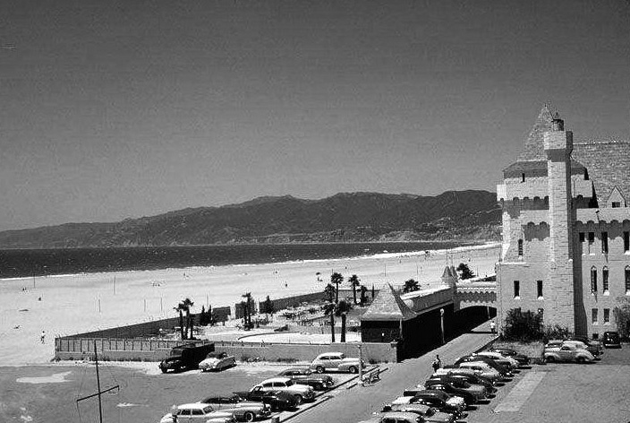
| (ca. 1948)* – Looking down from above PCH toward the Deauville Club with cars turning into the McClure Tunnel. Photo courtesy of Eric Wienberg Collection via Pepperdine University Special Collections. |
 |
|
| (ca. 1955)* – View looking at the Deauville Beach Club near the end of its life. |
 |
|
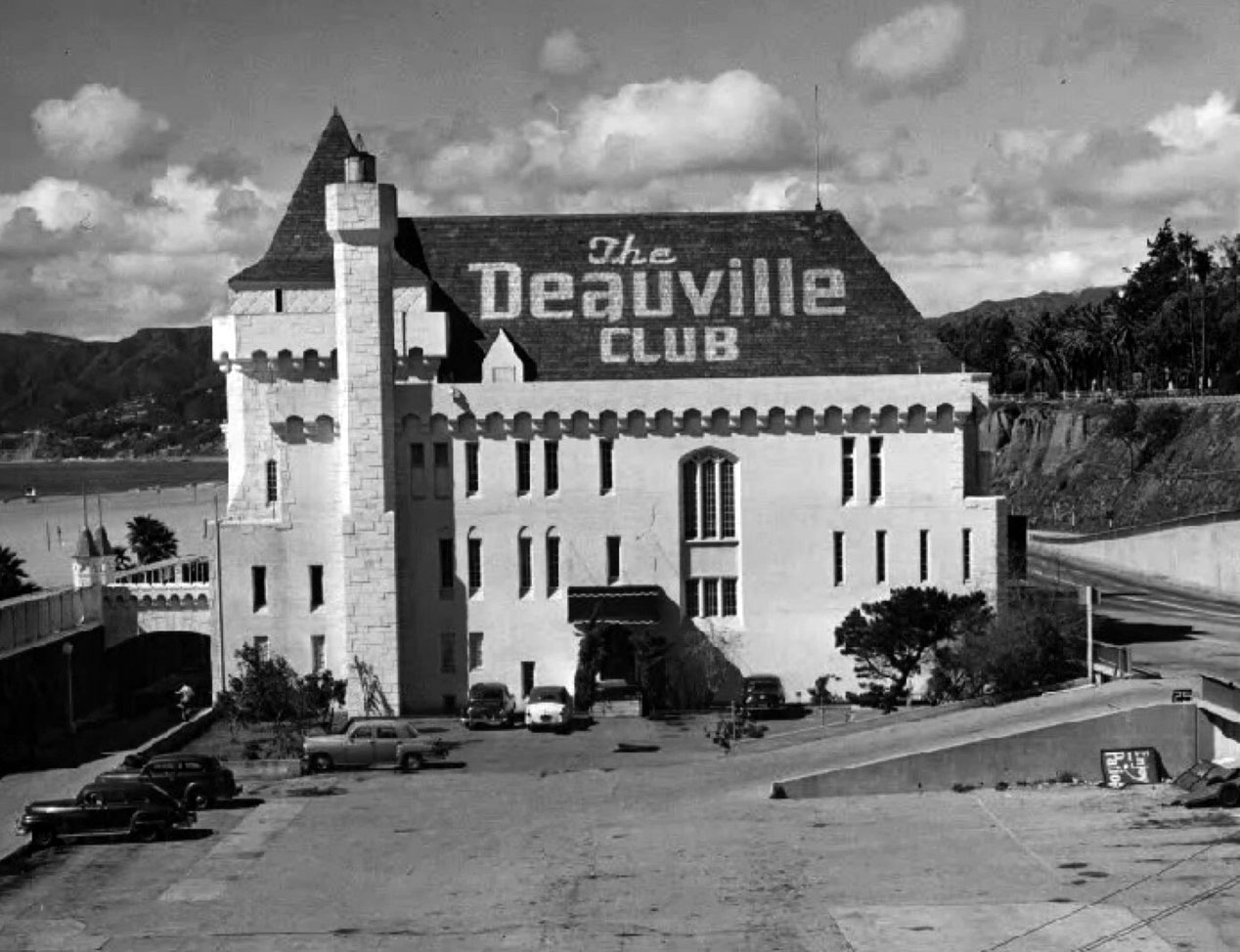
| (ca. 1950)* - The Deauville Club located just north of the Santa Monica Pier, opened in 1927 on the former site of the North Beach Bath House. Its design was inspired by a castle styled casino in Deauville, France. |
Historical Notes The club hosted bands, beauty contestants, dances, high school proms and banquets. It had several owners over the course of its nearly 40 year life. It was ultimately demolished in the mid-1960s following a devastating fire on April 5th, 1964. |
* * * * * |
Santa Monica Yacht Harbor and Pier
 |
|
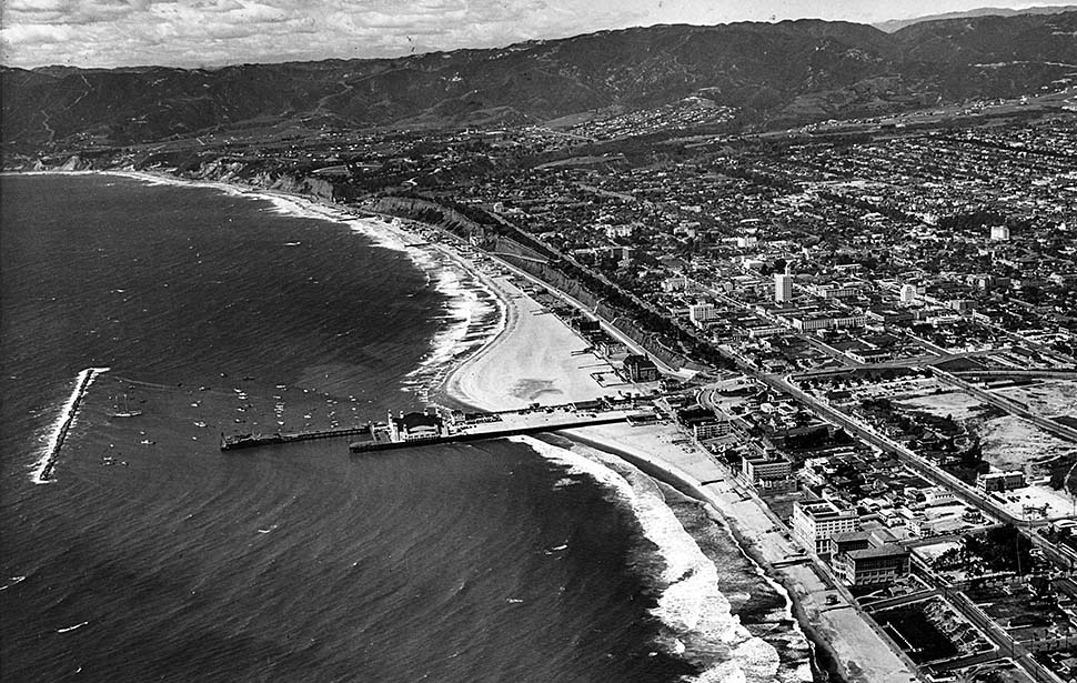
| (1937)* - Aerial photo of the Santa Monica Pier shoreline looking northwest. The Deauville Club sits to the north of the pier. The Casa del Mar Club is the first building located in the lower right corner. Photo by Spencer Air Service |
Historical Notes The Santa Monica Yacht Harbor was officially established in 1933 with the completion of the breakwater, a WPA project that transformed the pier into a working harbor. At 37 feet high and over 100 feet wide at its base, the breakwater provided a calm basin for yachts, fishing boats, and cruise services. This harbor not only altered the coastline—expanding the beach north of the pier—but also attracted tourists, boaters, and even floating casinos. |
 |
|
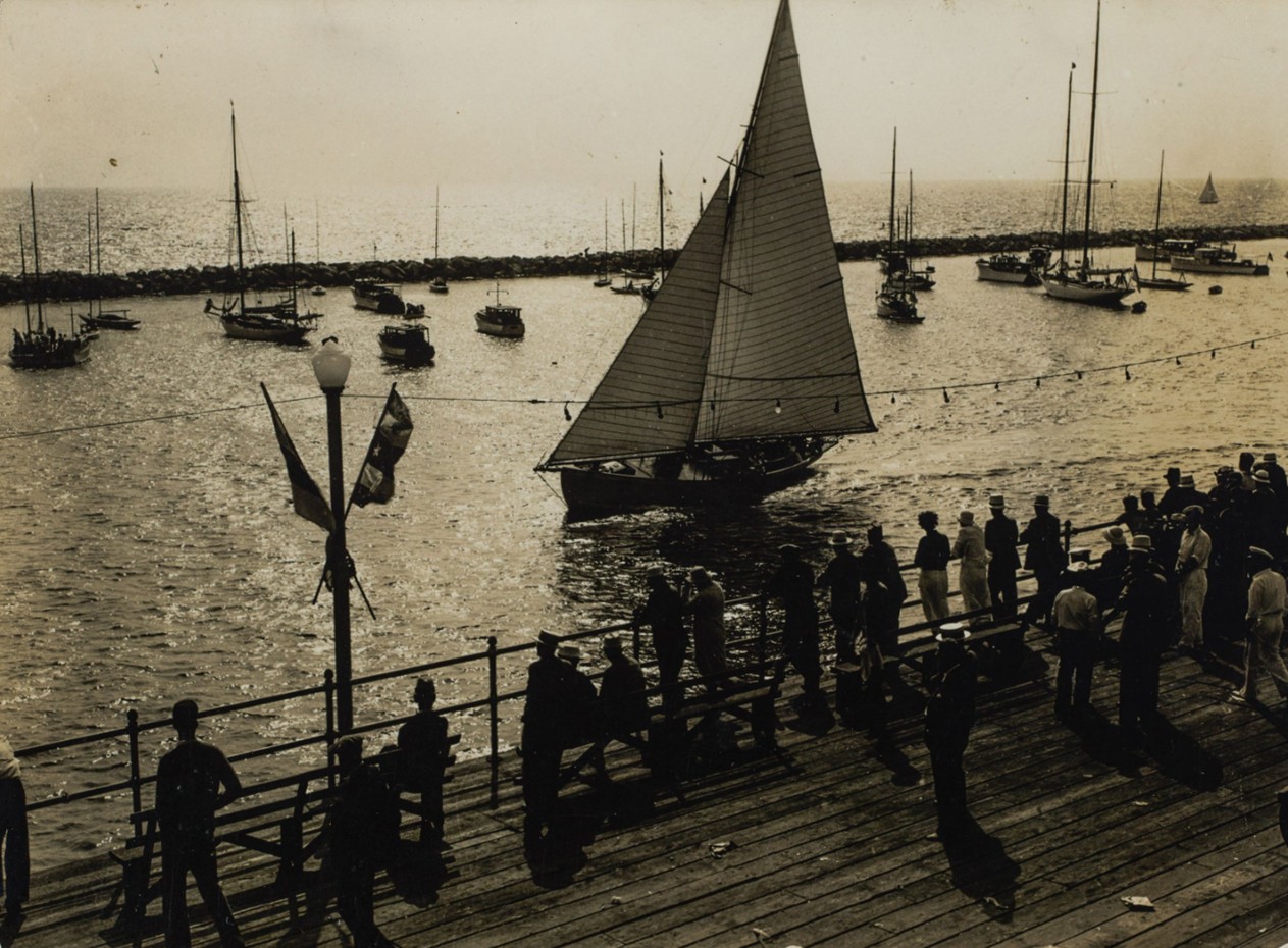
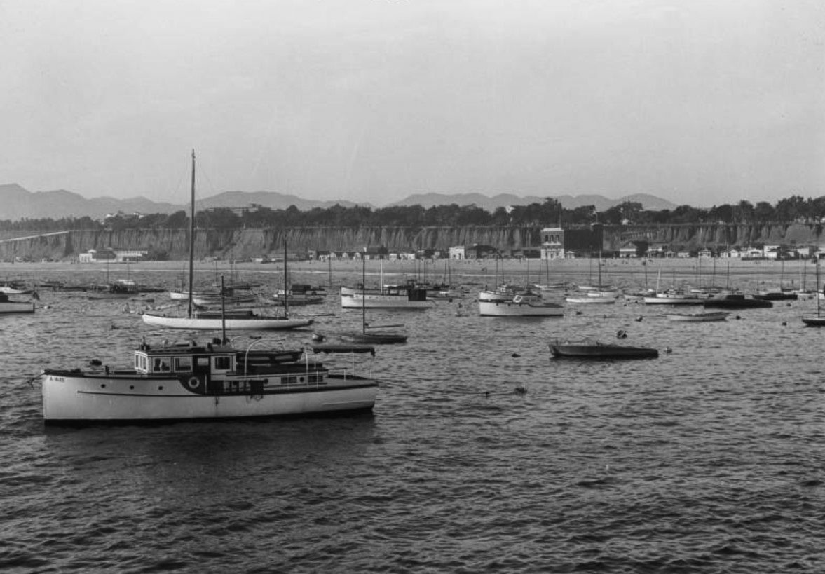
| (ca. 1935)* - Santa Monicans line the end of the pier to watch boats sail through the newly protected Santa Monica Yacht Harbor. The breakwater curves across the horizon, forming a calm and sheltered anchorage. Photo by Adelbert Bartlett. |
Historical Notes This ca. 1935 image captures the public engagement with the brand-new harbor. The protective breakwater—completed in 1934 as part of a WPA coastal improvement project—transformed the Santa Monica Pier into a functional marina. Small craft and sailboats could now moor safely just offshore, drawing both locals and tourists. The pier became not only a launch point for boats but also a popular place to watch them come and go. |
* * * * * |
The Battle of Santa Monica Bay
 |
|
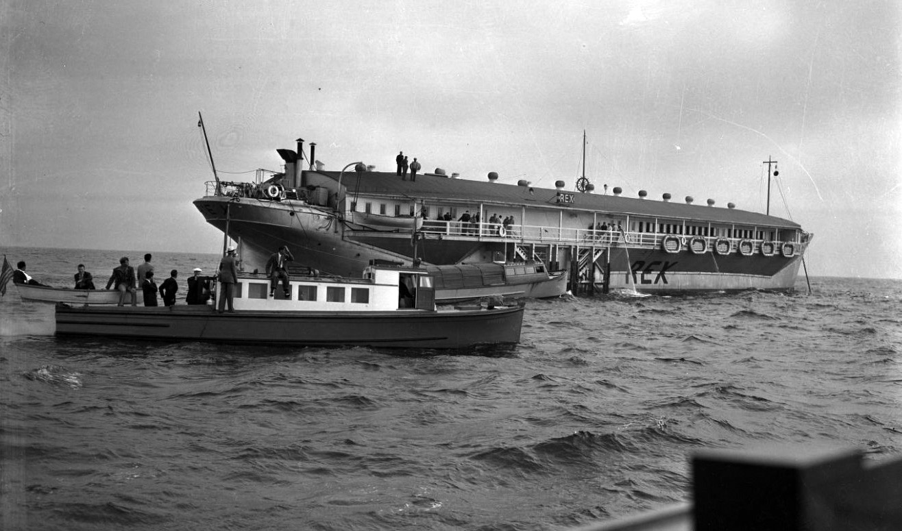
| (1939)* - The "Rex," one of Tony Cornero’s floating casinos, fends off law enforcement boats off the Santa Monica coast during “The Battle of Santa Monica Bay.” |
Historical Notes In the 1930s, gambling mogul Tony Cornero exploited legal loopholes by operating floating casinos just beyond California’s three-mile limit. His flagship vessel, The Rex, was a fully outfitted luxury gambling ship anchored off Santa Monica. The Santa Monica Yacht Harbor served as the primary launch site for water taxis shuttling gamblers to the offshore vessel. Boats based in the harbor made frequent trips, loading guests directly from the pier. The newly built breakwater provided calm waters for these shuttles, making the harbor a critical base of operations. This came to an end in 1939, when then–Attorney General Earl Warren initiated a raid dubbed “The Battle of Santa Monica Bay.” After a tense three-day standoff, Cornero surrendered—reportedly saying he “needed a haircut.” Agents boarded the Rex, dumped slot machines overboard, and set fire to the gambling tables. The episode marked the end of the harbor’s brief but colorful association with offshore gambling. |
 |
|
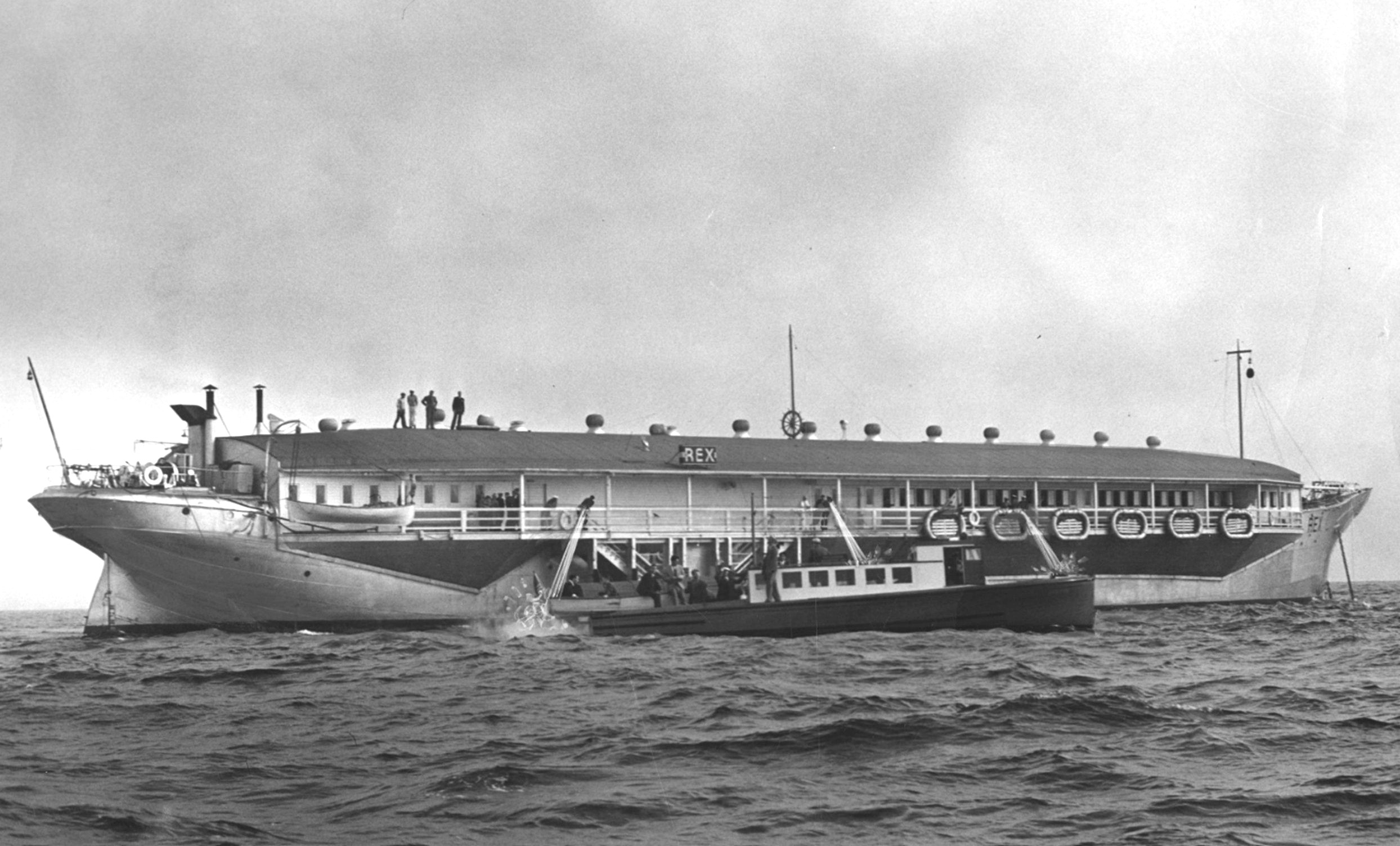
| (1939)* - The crew of the Rex turned fire hoses on law enforcement boats in a last-ditch attempt to keep them from boarding. |
Historical Notes In a dramatic show of defiance, the crew of The Rex used high-pressure fire hoses to repel law enforcement officers attempting to board the ship during the 1939 raid known as The Battle of Santa Monica Bay. For three days, Tony Cornero held off state agents as they circled his floating casino just beyond California’s legal reach. The confrontation drew national attention, symbolizing the clash between vice, legality, and spectacle off the coast of Santa Monica. Eventually, Cornero surrendered peacefully, but not before giving one last splash of resistance. Tony Cornero went on to become a pioneer in early Las Vegas, founding the Stardust Resort and Casino, but died in 1955 at the craps table of the Desert Inn—some say under suspicious circumstances. Earl Warren’s career soared. He became Governor of California and later served as Chief Justice of the U.S. Supreme Court, where he presided over landmark rulings like Brown v. Board of Education and Miranda v. Arizona, transforming the legal and civil rights landscape of the United States. |
* * * * * |
Santa Monica Pier (1930s)
 |
|
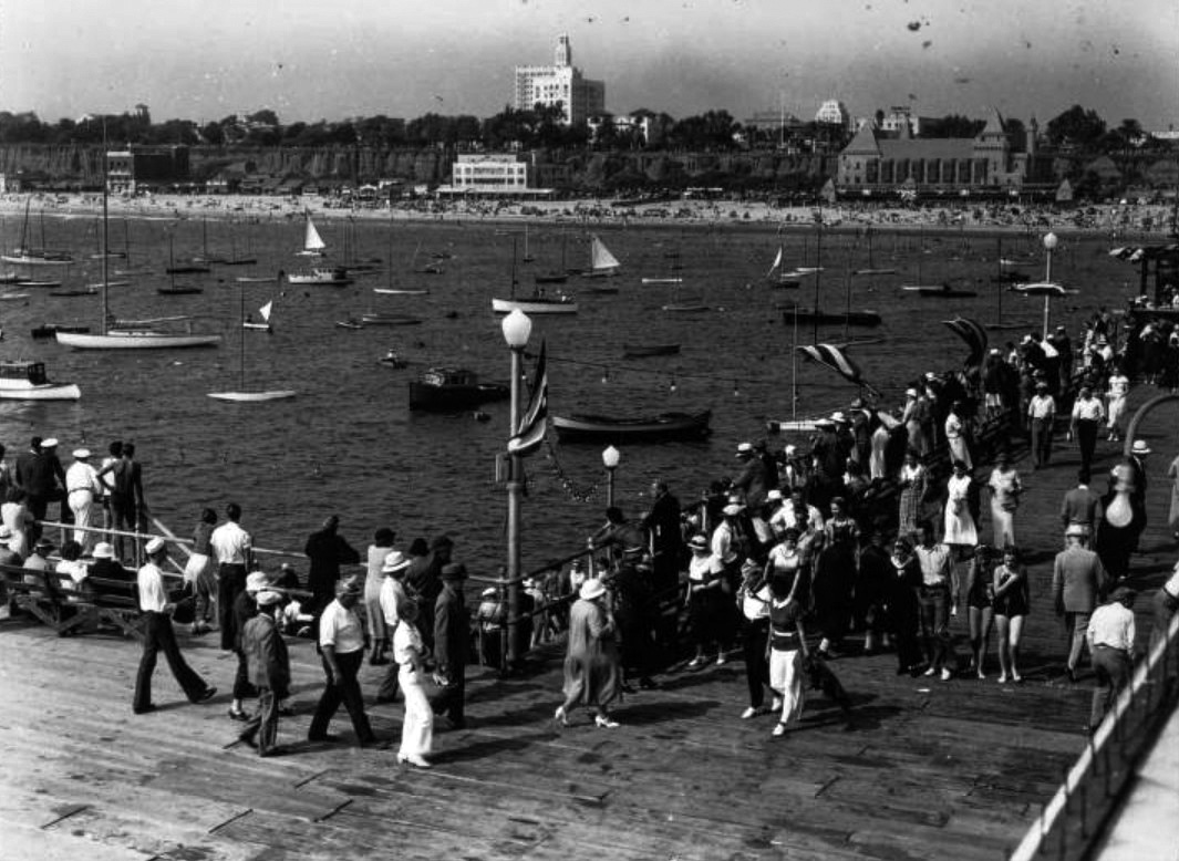
| (ca. 1935)* - View showing the Santa Monica Yacht harbor with boats in the water and people standing at the end of the Santa Monica Pier looking toward the beach. The Deauville Club (at right with towers), Santa Monica Athletic Club (center) and Wavecrest Club (at far left) are visible on the beach and the Bay Cities Guaranty Building (also known as the Clock Tower Building or Crocker Bank Building) is visible beyond the Palisades bluffs and Palisades Park. Photo by Adelbert Bartlett. |
Historical Notes This image captures the public’s excitement around the harbor. The new breakwater not only protected boats but also boosted the pier’s status as a social, recreational, and commercial hub. |
 |
|
| (1940s)* - Postcard view showing the Santa Monica Pier and Harbor. The Spanish and French Renaissance style La Monica Ballroom stands out. Also, an aircraft carrier can be seen off in the distance. Frasher's Fotos. |
Historical Notes The La Monica Ballroom (opened in 1924) was the pier’s signature landmark for decades. During the war years, the nearby harbor also served patriotic functions, as local residents observed both pleasure boats and military vessels in Santa Monica Bay. |
 |
|
| (ca. 1935)* - View of the Santa Monica Yacht Harbor looking back to Santa Monica beach, with the California Incline seen at left, the two-story Wavecrest Club at center and the edge of the Santa Monica Athletic Club at right. |
 |
|
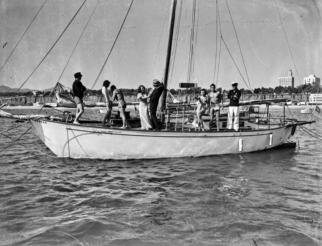
| (1930s)* - Image of a lifeguard, man in a tuxedo, woman in an evening dress, man in a sailor suit, and others in swimsuits standing on the deck of a sailboat in the ocean, with the Santa Monica Athletic Club, the Georgian Hotel, the Crocker Bank Building, and the bluffs below Palisades Park in the distance. |
 |
|
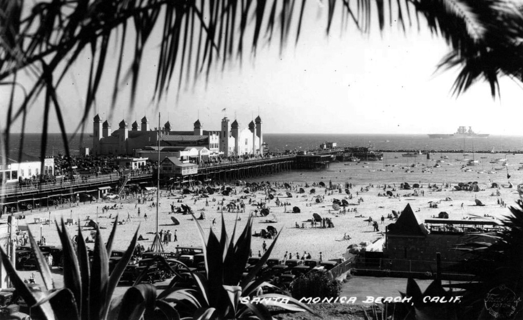
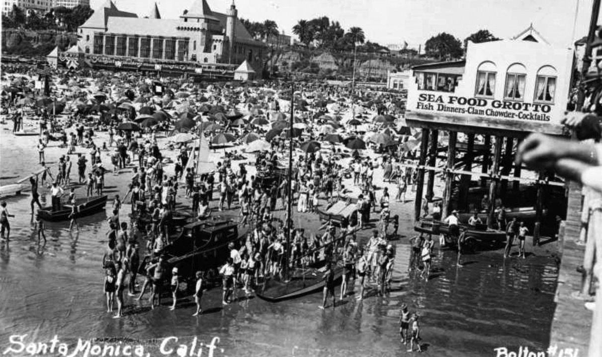
| (ca. 1934)* - Image of a beach crowded with people, small boats, and beach umbrellas just north of the Santa Monica Pier. The Deauville Club (on the beach with towers) is in front of the bluffs of Palisades Park with a sign for "Yachtsmen" and a sign advertising "Sea Food Grotto, fish dinners, clam chowder and cocktails" is seen on a restaurant situated at the edge of the pier at right. |
 |
|
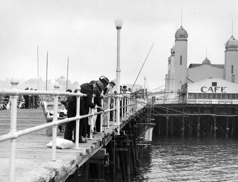
| (1937)* - Fishermen are angling from the pier with the La Monica Ballroom seen on the right. |
Historical Notes The Spanish and French Renaissance style La Monica Ballroom was designed by T.H. Eslick; it opened on July 23, 1924 and was demolished in 1963. |
 |
|
| (1942)* – Low tide in Santa Monica just north of the pier with the Palisades and California Incline seen in the distance. What appears to be a dredge sits in pool of water surrounded by sand. |
Historical Notes A post-construction scene reflecting how sand and water dynamics shifted after breakwater installation. |
* * * * * |
Santa Monica Pier (1939–1958)
Historical Overview
From 1939 to 1958, the Santa Monica Pier transitioned from its golden era of seaside amusement to a period of decline and reinvention. Wartime restrictions, changing public tastes, and the aging of key attractions such as the Looff Hippodrome and La Monica Ballroom all contributed to the shifting character of the pier. What began as a bustling entertainment hub—filled with dance halls, cafes, and carnival rides—slowly evolved into a more modest, community-oriented destination. Yet even in its later years, the pier remained a cherished landmark, reflecting both the endurance of Santa Monica’s coastal identity and the city’s broader struggle to balance preservation with progress. The developments of this period set the stage for the pier’s near-demolition in the 1970s and its eventual restoration as one of California’s most beloved historic icons.
 |
|
| (ca. 1939)* – View showing a crowded Santa Monica Pier with the Looff Hippodrome seen in the upper-left and the La Monica Ballroom in the distance. |
Historical Notes From 1939 to 1958, the Santa Monica Pier underwent several significant changes, including the sale and replacement of its iconic carousel, the conversion of the La Monica Ballroom into a roller skating rink, and shifts in ownership and management. These changes were indicative of broader social and economic trends and set the stage for future redevelopment efforts that would eventually restore the pier to its former glory. |
 |
|
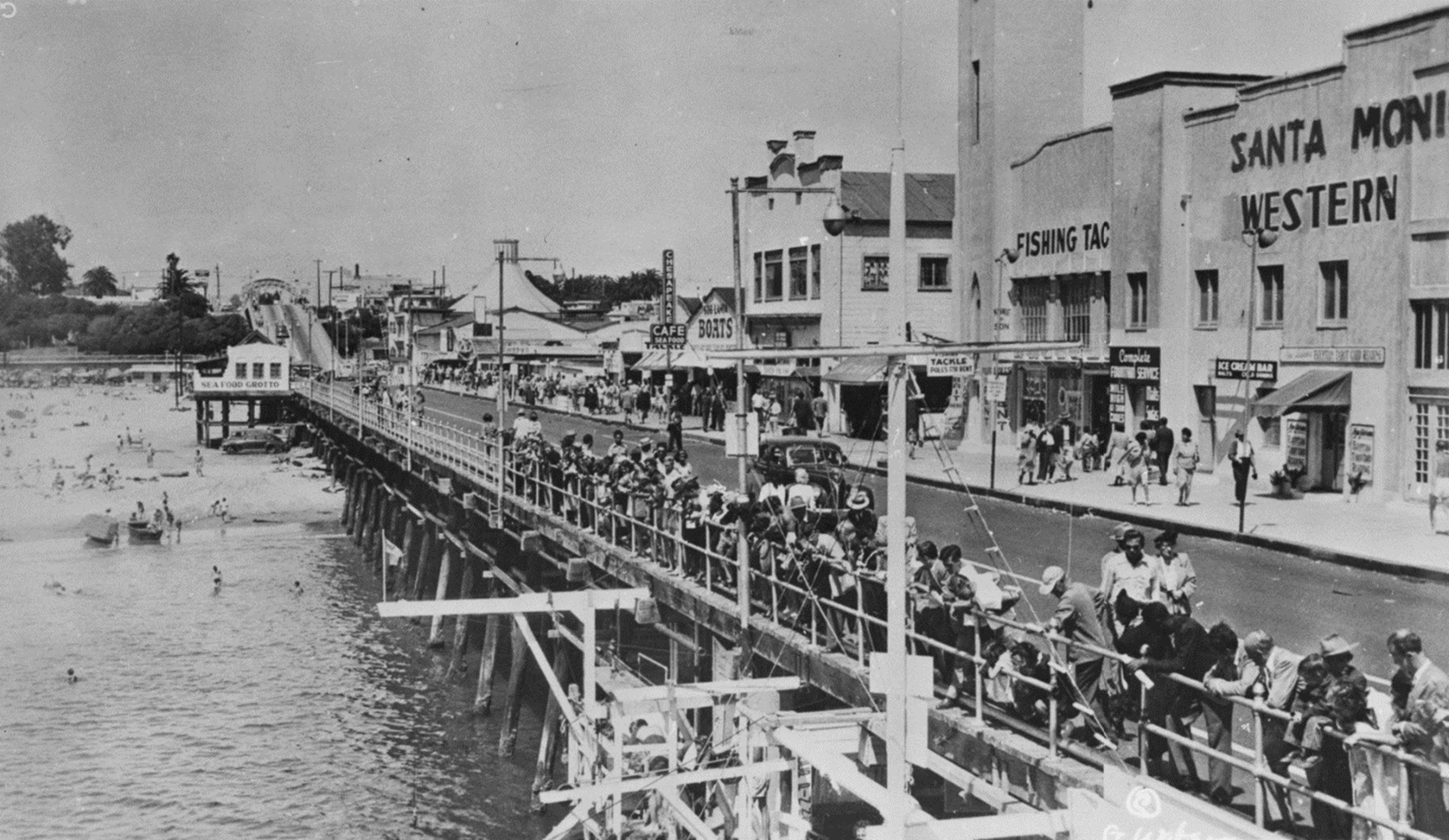
| (1940s)* – View of Santa Monica Pier, with people peering over the railing in the foreground and others walking in front of shops across the pier. Signs for stores on the pier include "Sea Food Grotto," "Chesapeake Cafe," "Fishing Tackle," and "Ice Cream Bar." |
Historical Notes Despite wartime restrictions, visitors continued to flock to the pier whenever possible, and its festive atmosphere endured even during difficult times. The 1940s were a transformative decade for the Santa Monica Pier, marked by significant events and changes. During World War II, the La Monica Ballroom was repurposed for military use, serving as a shelter and hosting dances for troops. Maintenance of the pier was minimal due to material and manpower shortages. Post-war, the pier experienced a revival in entertainment, notably with Spade Cooley's televised weekly show from the La Monica Ballroom in 1948, drawing renewed attention and visitors. Despite wartime challenges, the pier remained a popular leisure destination. Structural improvements included the Works Progress Administration (WPA) building a bridge over Pacific Coast Highway in 1940 and the erection of the iconic arched sign at the foot of Colorado Avenue. |
 |
|
| (1940s)* - View looking toward the shoreline from the Santa Monica Pier showing cars parked and people walking. The Deauville Club can be seen in the distance. |
Historical Notes Parking at the end of the Santa Monica Pier ceased in 1975. This decision was part of broader efforts to preserve the pier and improve safety and accessibility for visitors. The cessation of parking on the pier itself marked a shift towards prioritizing pedestrian access and the overall visitor experience, which has continued to evolve over the years. |
 |
|
| (1950s)* - Postcard view showing Santa Monica Pier. |
Historical Notes The 1950s were a transitional period for the Santa Monica Pier, marked by significant changes and challenges. In 1953, the City of Santa Monica took over ownership of the Looff Pier, leasing it to a private operator. The La Monica Ballroom, showing signs of wear, was converted into a roller skating rink in 1958, reflecting shifting entertainment preferences. The pier arcade was revitalized by a new family, becoming a long-running attraction. Despite efforts to maintain the pier, it faced dilapidation and economic struggles, with declining popularity due to competition from other venues. However, the pier remained a beloved community hub and a site of historical significance, setting the stage for future preservation and redevelopment efforts. |
 |
|
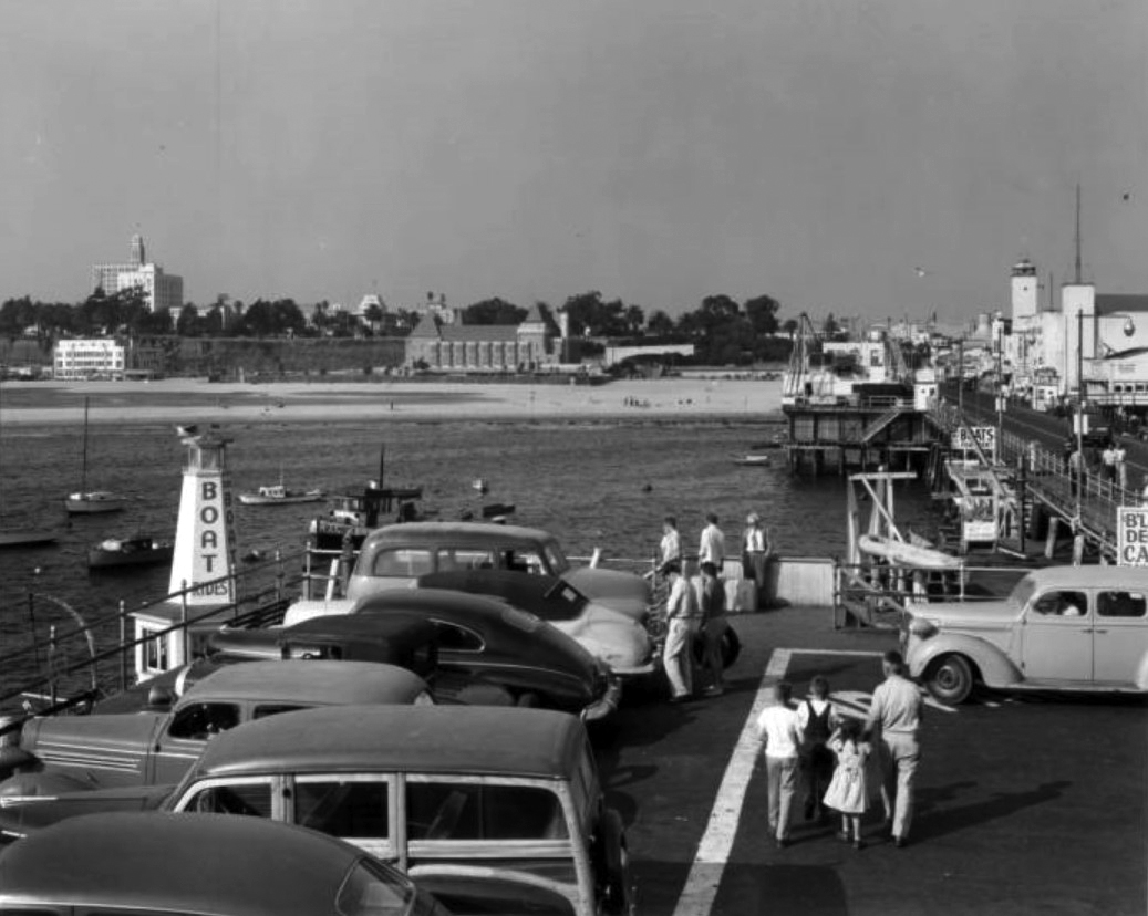
| (1958)* - Looking down toward the Santa Monica Pier with the La Monica Ballroom during its final years of operation. The Deauville Club appears at lower right, while the beach parking lot below is filled with classic 1950s automobiles lined up beneath the late afternoon sun. |
Historical Notes By 1958, the Santa Monica Pier was showing the effects of age and neglect, as shifting leisure patterns and competition from newer attractions drew visitors elsewhere. The once-grand La Monica Ballroom, opened in 1924 as one of the largest dance halls on the West Coast, was nearing the end of its life as a public venue and would soon be converted into a roller skating rink. It was ultimately demolished in 1963. The Deauville Club, seen at lower right, remained a glamorous but fading reminder of the pier’s early resort era until it was destroyed by fire in 1964. The sunlit beach parking lot and fading pastel tones of the structures capture the last years of postwar optimism before the pier entered a period of decline. Within a decade, portions of the pier would be threatened with demolition—sparking the preservation movement that ultimately saved it. |
 |
|
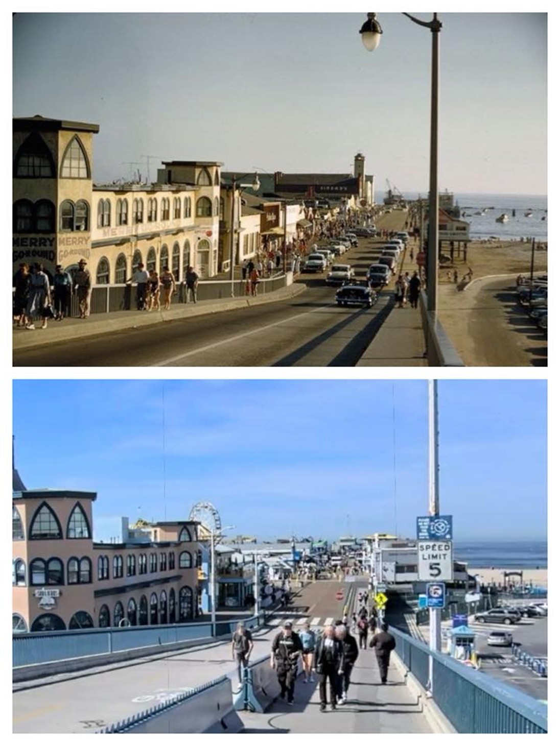
| (1958)* - Looking down the access ramp to the Santa Monica Pier with the Merry-Go-Round in the left foreground. |
Historical Notes The access ramp to the Santa Monica Pier, constructed as part of the 1939 Colorado Grade Separation Project, was completed on June 12, 1940. This project aimed to improve traffic flow between the Pacific Coast Highway and Santa Monica streets by providing direct access from Colorado Avenue to the pier, replacing the old access route. To highlight the new route, the Santa Monica Pier Business Men’s Association unveiled a neon sign reading "Santa Monica Yacht Harbor – Sport Fishing – Boating – Cafes" on June 17, 1941. |
 |
|
| (1940s)^ - Postcard view looking northwest showing the Colorado Avenue access ramp to the Santa Monica Municipal Pier. The overpass was opened in 1940. |
Historical Notes The bridge and entry gate to Santa Monica Pier were built in 1939 by the federal Works Project Administration, and replaced the former grade connection. |
Then and Now
 |
|
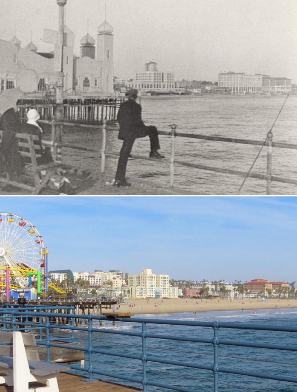
| (1958 vs. 2018)* – Then & Now: Santa Monica Pier. Photo comparison by Trey Callaway. |
Historical Notes The 1958 view shows the Santa Monica Pier near the end of its postwar years, when landmarks like the La Monica Ballroom and Deauville Club still stood but were beginning to fade. By that time, the pier was showing signs of age and facing competition from newer attractions along the coast. The 2018 image shows how the pier was brought back to life through decades of community effort and preservation. The restored Hippodrome, new amusement rides, and bustling walkways reflect how the pier has remained a symbol of Santa Monica’s spirit—linking the city’s colorful past with its vibrant present. |
* * * * * |
Santa Monica Pier Sign
.jpg) |
|
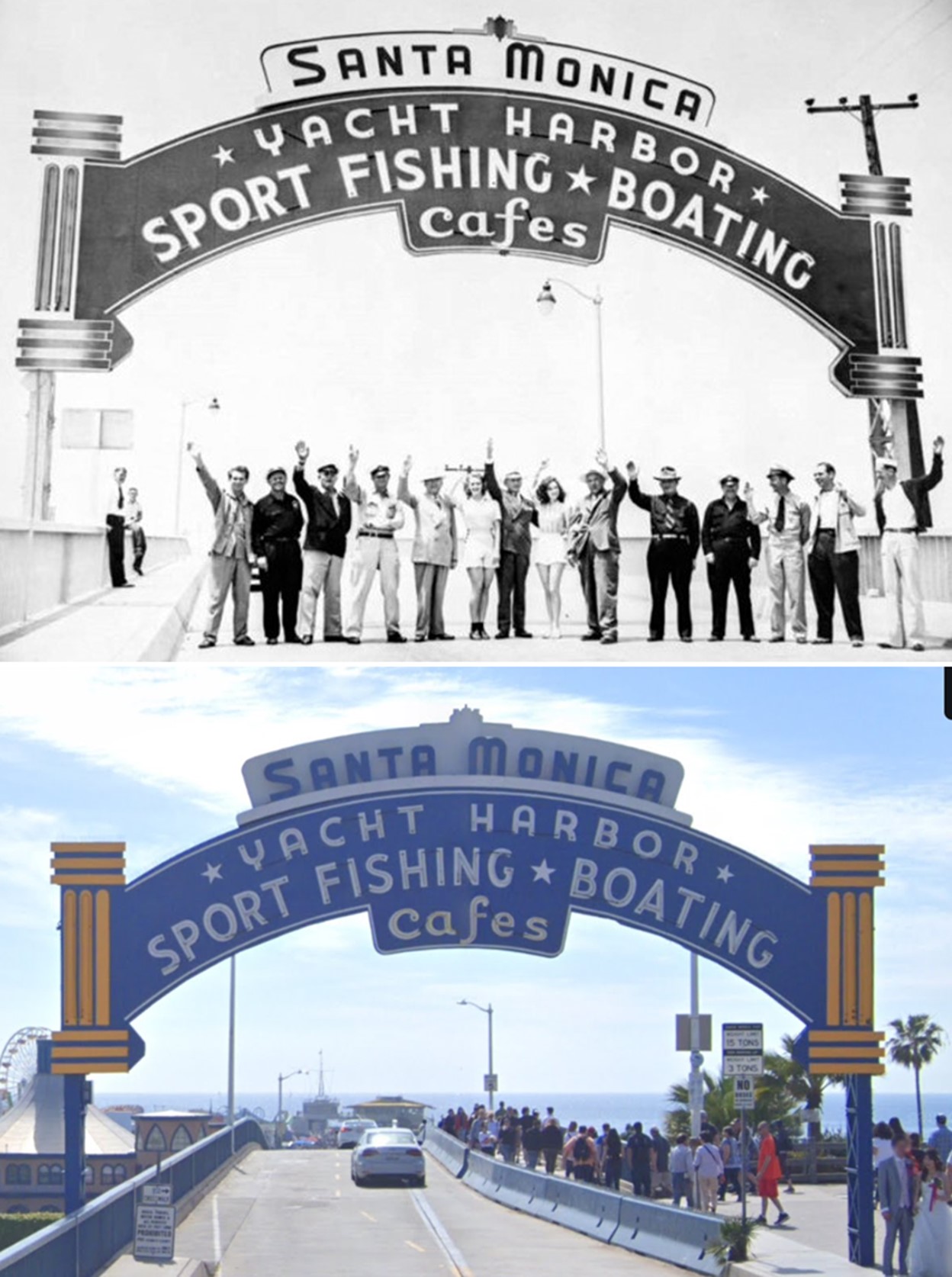
| (1941)^ - Image of a line of people waving while standing under a neon sign for the Santa Monica Pier. The sign reads "Santa Monica Yacht Harbor Sport Fishing and Boating Cafes." |
Historical Notes In 1941 the famous neon sign at the top of the Pier ramp was installed by the Santa Monica Pier Businessmen’s Association to celebrate the opening of the newly-built ramp. It is an internationally-recognized tourist destination and a symbol of the Southern California lifestyle. |
 |
|
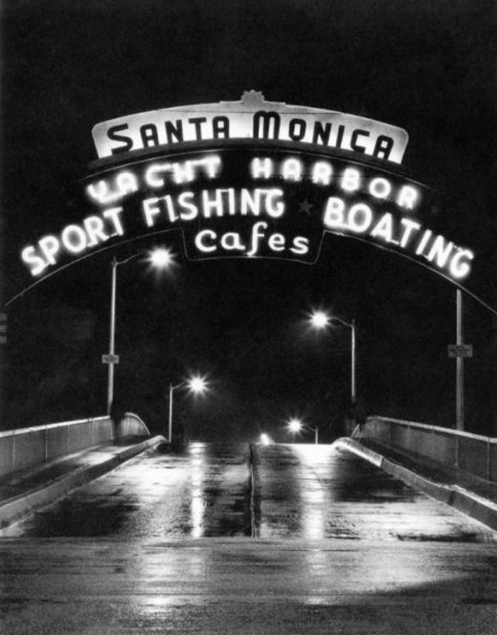
| (n.d.)#^ - Nigth view of the Santa Monica Pier neon sign (installed in 1941). |
Historical Notes The iconic Santa Monica Pier sign, commissioned by the Santa Monica Businessmen's Association in 1940, was designed by Fred Lehman in the Streamline Moderne style and unveiled in 1941. Originally intended to promote the Pier as a tourist destination, its neon lights were extinguished during World War II. Despite changes and repairs, including a relocation in the 1950s, the sign retains much of its original structure. In 2012, it was designated a historic landmark by the City of Santa Monica, ensuring its preservation. |
Then and Now
 |
|
| (1941 vs 2019)* - Santa Monica Pier Sign, installed in 1941. Photo comparison by Jack Feldman. |
* * * * * |
Beach Scenes
 |
|
| (1930s)* - Members of one of the private clubs at a beach party; in the background is the Santa Monica Pier. |
 |
|
| (1938)* - Sunbathers, beach volleyball players, and umbrellas crowd the beach before a line of private beach clubs interrupts their spread. A sign on the first wall, center, reads "Waverly Club, private beach, members only". The eight story building formerly was Breakers Beach Club, 1725 Promenade in Santa Monica. The next six story building is the Jonathan Club, formerly the Edgewater Beach Club, 1855 Promenade. |
Historical Notes The Breakers Beach Club opened in 1926. The 8-story building had over 300 sleeping apartments and a full complement of amenities for guests. As ownership changed, it was also known as Club Lido. Eventually the club transitioned into a hotel, used to house military personnel during World War II. Later it was also known as the Chase Hotel. The structure became an apartment building known as the Sea Castle Apartments in the 1960s. The building was completely destroyed by fire in 1996. |
 |
|
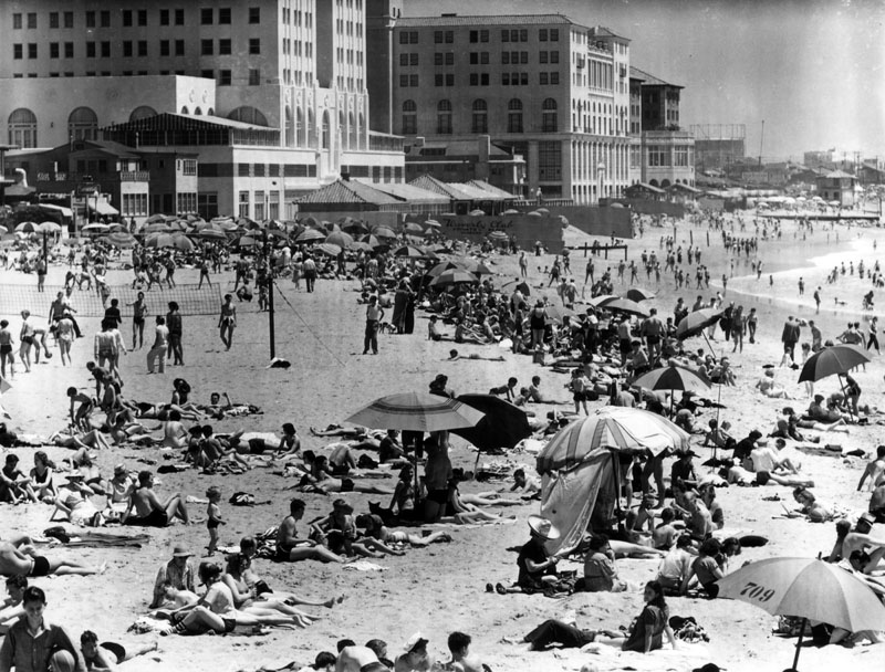
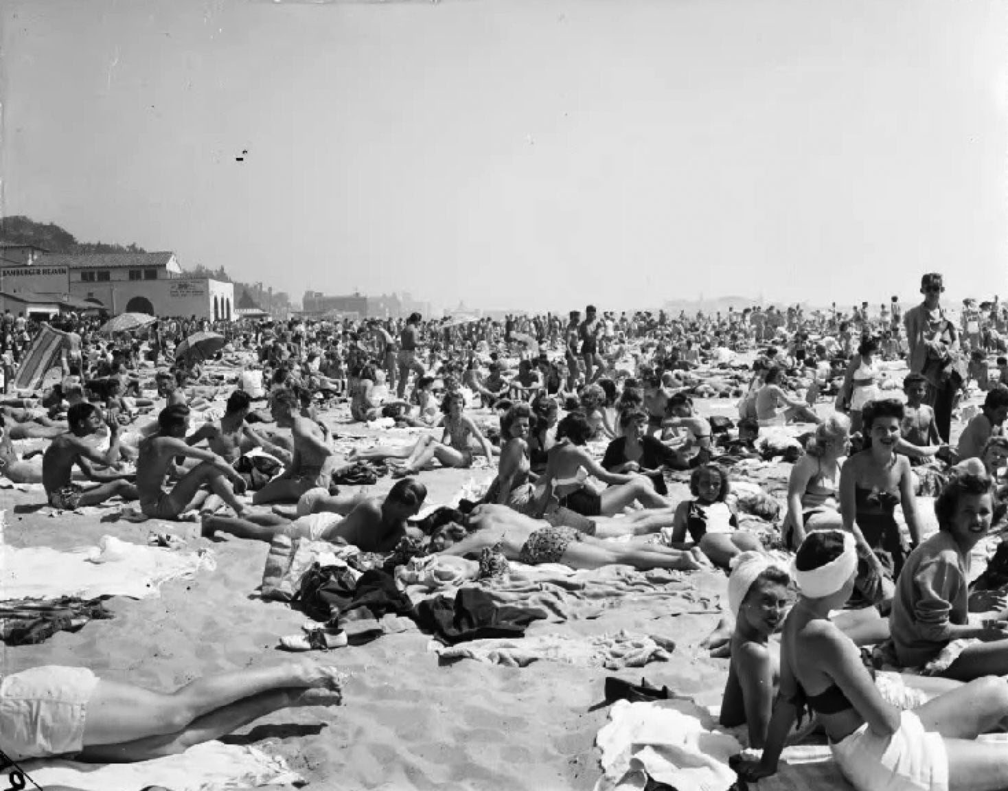
| (1939)* - Miles of public beach serve millions of recreation-seekers along the Pacific shores of Los Angeles County. This scene is between Ocean Park and Venice on June 26, 1939. |
 |
|
| (1930s)* - Crowded day at Ocean Park beach in Santa Monica. |
 |
|
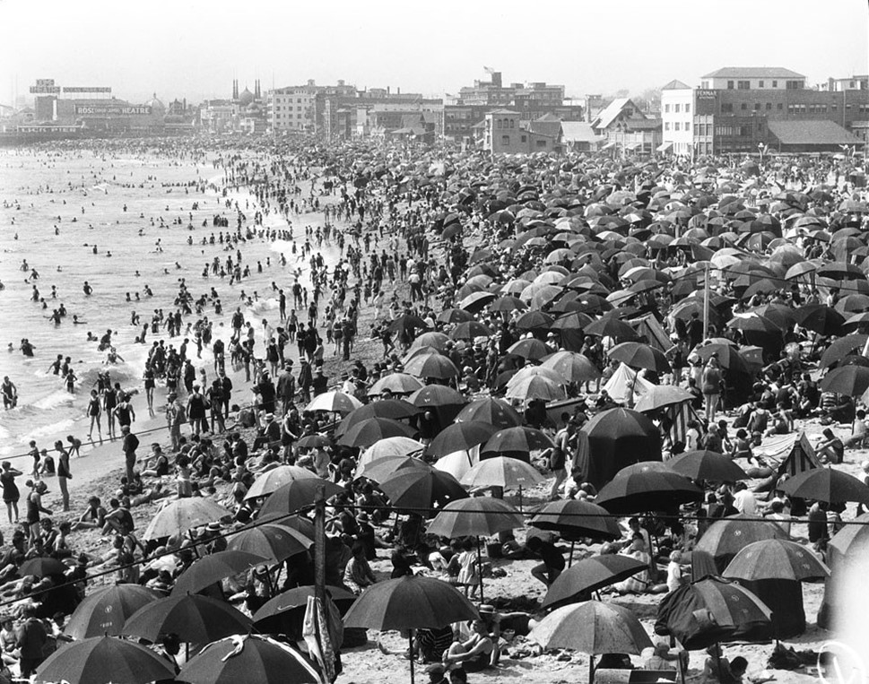
| (1939)* - Not a parking space to be had. Another busy day at the beach in Santa Monica. |
 |
|
| (1945)* – Santa Monica Beach…’This is how we Winter’. |
* * * * * |
Beach Volleyball
 |
|
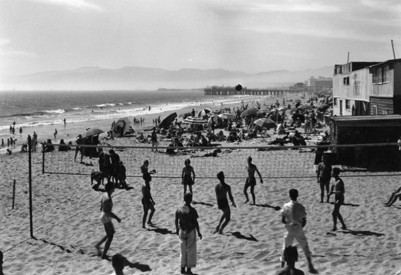
| (ca. 1930)* - A group of people play volleyball on Santa Monica beach. In the background, crowds of people relax on the beach and under umbrellas, while the pier is visible in the distance. |
Historical Notes Beach volleyball has deep roots in Santa Monica, often regarded as the birthplace of the sport. The origins of beach volleyball can be traced back to the 1920s when the city added new jetties, creating more space for public recreation. This led to the installation of public and private volleyball nets along the coast, setting the stage for the sport's evolution. In the 1930s, beach volleyball was primarily played by men. |
 |
|
| (1930s)* – A beach volleyball game in Santa Monica draws a crowd, with a parking lot full of automobiles visible in the background. Photo: Ernest Marquez Collection |
Historical Notes Volleyball became an official Olympic event at the 1964 Summer Olympics in Tokyo. This marked the debut of both men's and women's volleyball competitions at the Games. The sport had previously been featured as a demonstration event at the 1924 Summer Olympics in Paris, but it took another 40 years before it was officially included in the Olympic program. |
* * * * * |
Santa Monica Lifeguard Service
 |
|
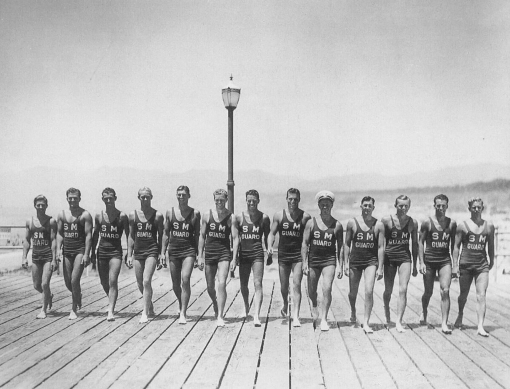
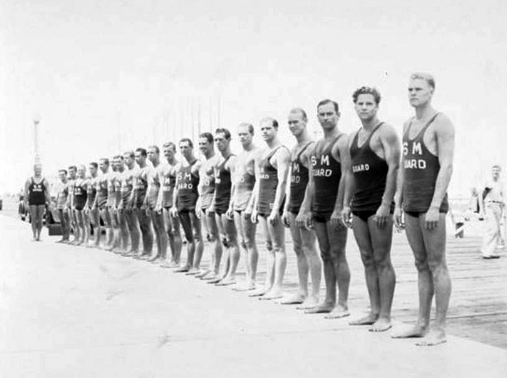
| (1934)* – Lifeguards march in line in front of Santa Monica Pier. |
Historical Notes The Santa Monica Lifeguard Service was founded in the 1920’s under Captain George Watkins. In 1934, it established a home on the Santa Monica Pier in the former Bowling and Billiards Building. A year later they moved to the La Monica Ballroom and, while there, operated an aquarium. |
 |
|
| (1935)* - Santa Monica Lifeguards line up at the edge of Santa Monica Pier. |
Historical Notes In the early years of the lifeguard service, it attracted a following of Hollywood heavyweights and swimming champions. Duke Kahanamoku of Hawaii brought surfing to Santa Monica. Johnny Weismuller was made an honorary lifeguard, since so many of the team would stunt double for him in the Tarzan films. Gary Cooper was a fan, along with Marion Davies, Darryl Zanuck and Cary Grant, who kept houses by the beach. The lifeguard service expanded along with the explosion of coastal real estate development in the early part of the 20th century. Abbot Kinney hired lifeguards to patrol the beach to help sell his beachfront properties. Kinney’s wife was responsible for raising funds to purchase the first lifeguard boat in Venice and organized lifeguards into a crew. Back then, lifeguards would carry long metal cans – or rescue tubes (invented by a Santa Monica lifeguard) on rescues. Today, the tubes are made of plastic polymers, but the essentials of the job remain unchanged – vigilant eyes on the surf, anticipating problems and steering crowds away from dangerous behaviors, like drinking.^ In the mid-1930s the Santa Monica Lifeguard Headquarters was located in the La Monica Ballroom Building located on the pier. In the late 1950s a New Headquarters Building would be built at 1642 Ocean Front Walk, which is still in use today. |
* * * * * |
Muscle Beach
 |
|
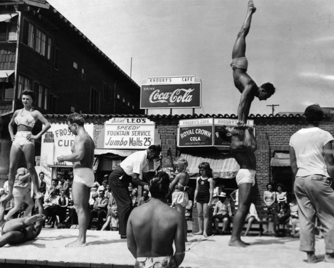
| (1948)* - View of the original Muscle Beach, located south of the Santa Monica pier, at a long, wooden platform constructed by the Works Progress Administration. |
Historical Notes Muscle Beach is where the body was celebrated in its sunbaked glory as young men (and more than a few women) showed off their physical prowess by performing acrobatic and gymnastic routines. The original Muscle Beach disappeared in the late 1950s; the modern-day version is now located in Venice Beach. |
 |
|
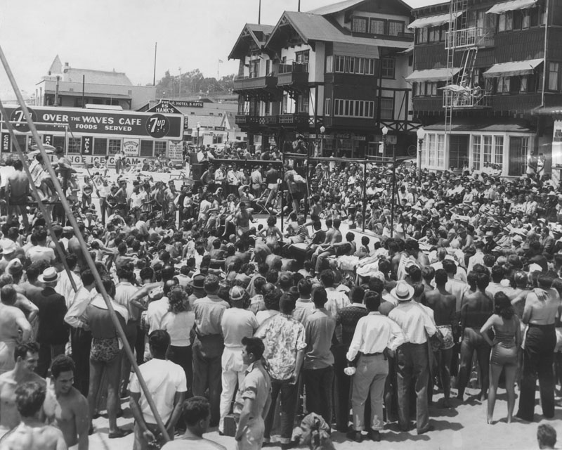
| (1948)* - Mr. Muscles contestant performing acrobatic move as crowd watches at Muscle Beach in Santa Monica. |
Historical Notes Beginning in 1934, the fantastic gymnastics shows held here made the site a major attraction and center of the international fitness movement led by Jack LaLanne, Steve Reeves and Joe Gold. |
 |
|
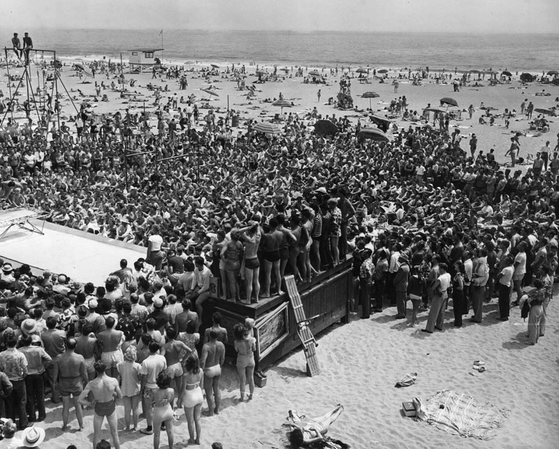
| (1951)* - Two thousand people watch acrobatics during a program at which Downey dairyman Ken Cameron, 23, was chosen "Mr. Muscle Beach of 1951." He won over 15 others in the contest sponsored by the Santa Monica Recreation Department on July 4, 1951. |
Historical Notes Acrobats, gymnasts and bodybuilders performed before large crowds, which often included Jayne Mansfield and Mae West. Santa Monica's Muscle Beach reached the height of its popularity in the 1940s before moving to its current location in Venice Beach in 1959. |
 |
|
| (1948)* - Entertainment aplenty, Muscle Beach. |
Historical Notes The 1940 opening of the first of an eventual nationwide chain of weightlifting gyms by famed pioneer gym chain operator, Vic Tanny, only two city blocks from Muscle Beach in Santa Monica is commonly considered a key contributor to the increasing attraction of bodybuilders and strength lifters to Muscle Beach from across the nation. By the 1950s Muscle Beach established worldwide fame and helped to popularize and bring legitimacy to physical culture with acrobatics and bodybuilding and contribute to a nationwide health and fitness movement continuing into the 21st century. |
 |
|
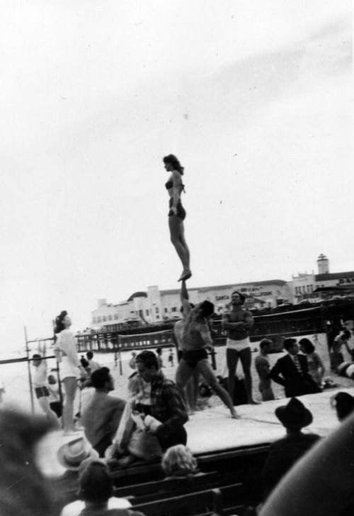
| (ca. 1949)* - Acrobats on Muscle Beach. |
Historical Notes Male and female gymnasts regularly put on public shows, dazzling beachgoers with their displays of strength and balance. |
 |
|
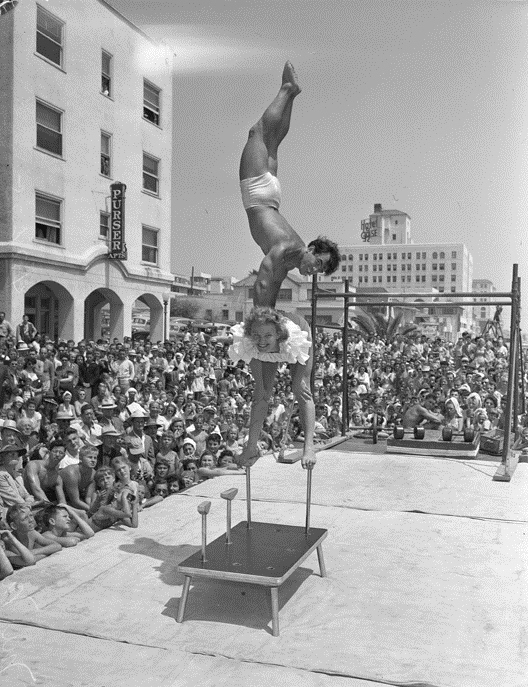
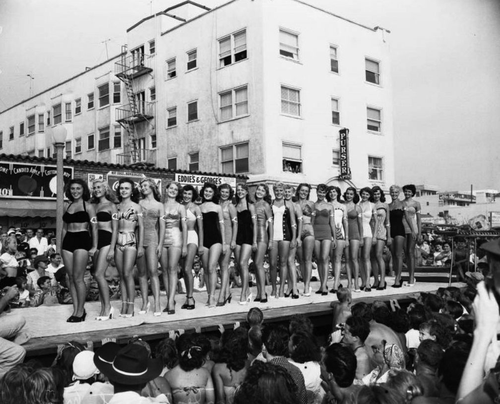
| (1951)* - Miss Muscle Beach contest with the Purser Apartments in the background. |
 |
|
| (1954)* - View showing a not so crowded Muscle Beach. The original Muscle Beach disappeared in the late 1950s; the modern-day version is now located in Venice Beach. |
* * * * * |
View From the Top
 |
|
| (1943)* – Actress Susan Peters Looking down at Santa Monica beach from the palisades. |
 |
|
| (1949)**^ - View of the beach in Santa Monica on a summer day. |
 |
|
| (1940s)^ - Closer view showing sunbathers enjoying a day at Santa Monica Beach, with the California Incline and Palisades Park in the background. |
 |
|
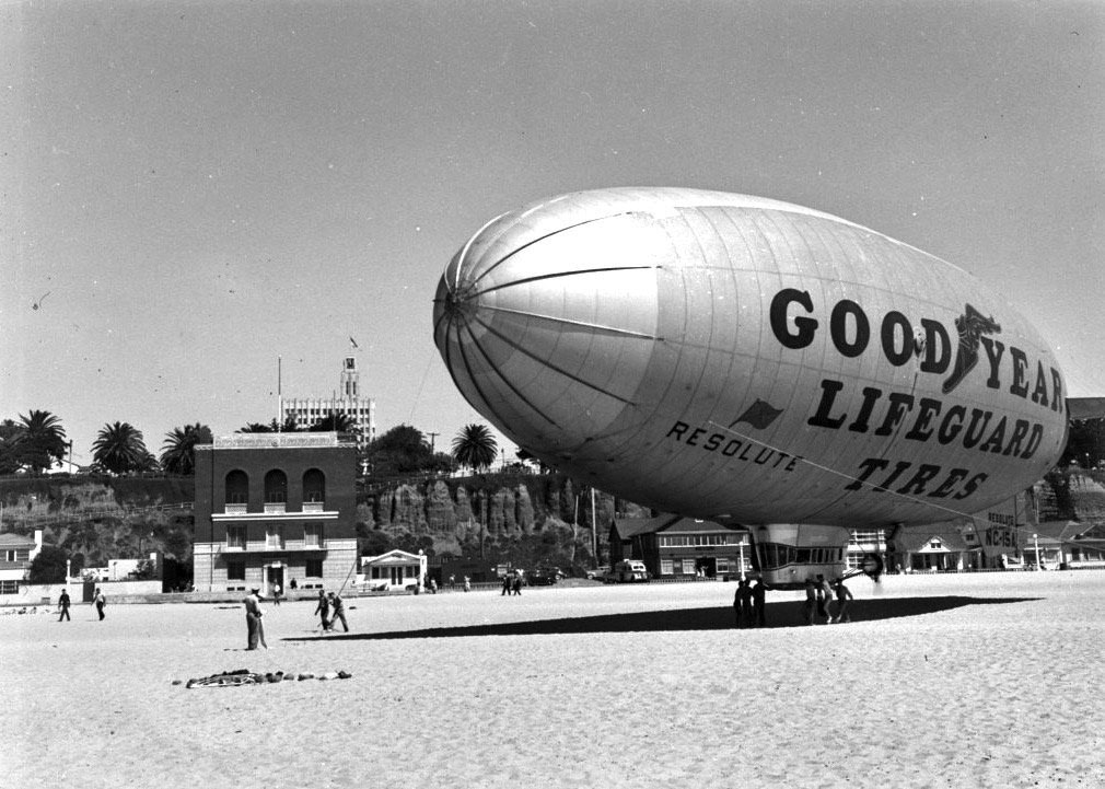
| (1940)* – Goodyear blimp, ‘Resolute’, lands on the sand at Santa Monica Beach. The Cities Guaranty Clock Tower Building (Crocker Bank Building) can be seen in the background. |
Historical Notes That building with the arched windows to the left of the blimp, was the old armory building that became an officers club during WWII and for a time after. By the late 50s, Synanon took it over. That was 'the Synanon house on the beach,' throughout the 60s, prior to their moving into Casa del Mar. |
* * * * * |
Along the Santa Monica Bluffs: PCH Through Time
 |
|
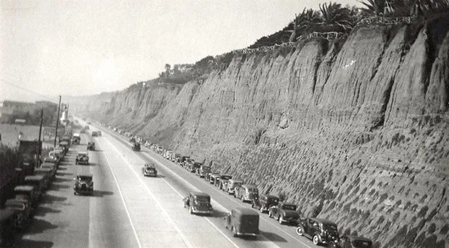
| (ca. 1940)* - Looking north along Pacific Coast Highway (U.S. 101A) from the base of the Palisades cliffs in Santa Monica, with roadway, bluffs, and early coastal development visible. |
Historical Notes By 1940, the highway running beneath the Santa Monica bluffs was officially designated U.S. 101 Alternate, or 101A. The “A” signified its role as the scenic option to inland U.S. 101, which crossed the San Fernando Valley and Ventura via the Cahuenga Pass. This coastal road had earlier roots as the Theodore Roosevelt Highway, dedicated in 1929. In 1964, a statewide renumbering converted U.S. 101A into California State Route 1, more commonly known today as the Pacific Coast Highway (PCH). |
 |
|
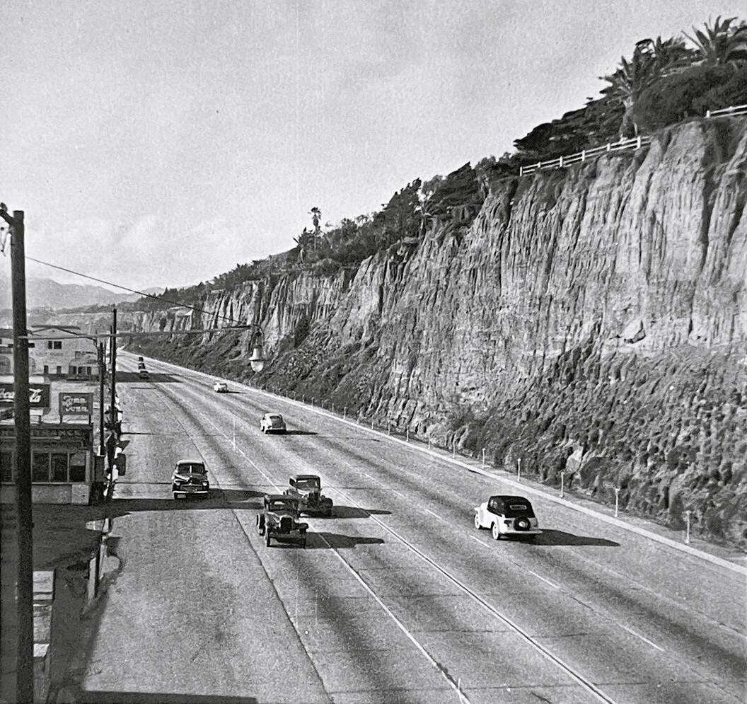
| (1949)* - The sandstone cliffs of Palisades Park rise at right while small roadside businesses line the highway at left. |
Historical Notes In 1949, this section of roadway was still marked U.S. 101A. The designation drew tourists and motorists who preferred a drive beside the ocean. Businesses such as motor courts, restaurants, and filling stations clustered along the shoulder to serve them. When California renumbered its highways in 1964, U.S. 101A was retired and this stretch was redesignated State Route 1. From that point forward, the familiar name Pacific Coast Highway took hold permanently. |
 |
|
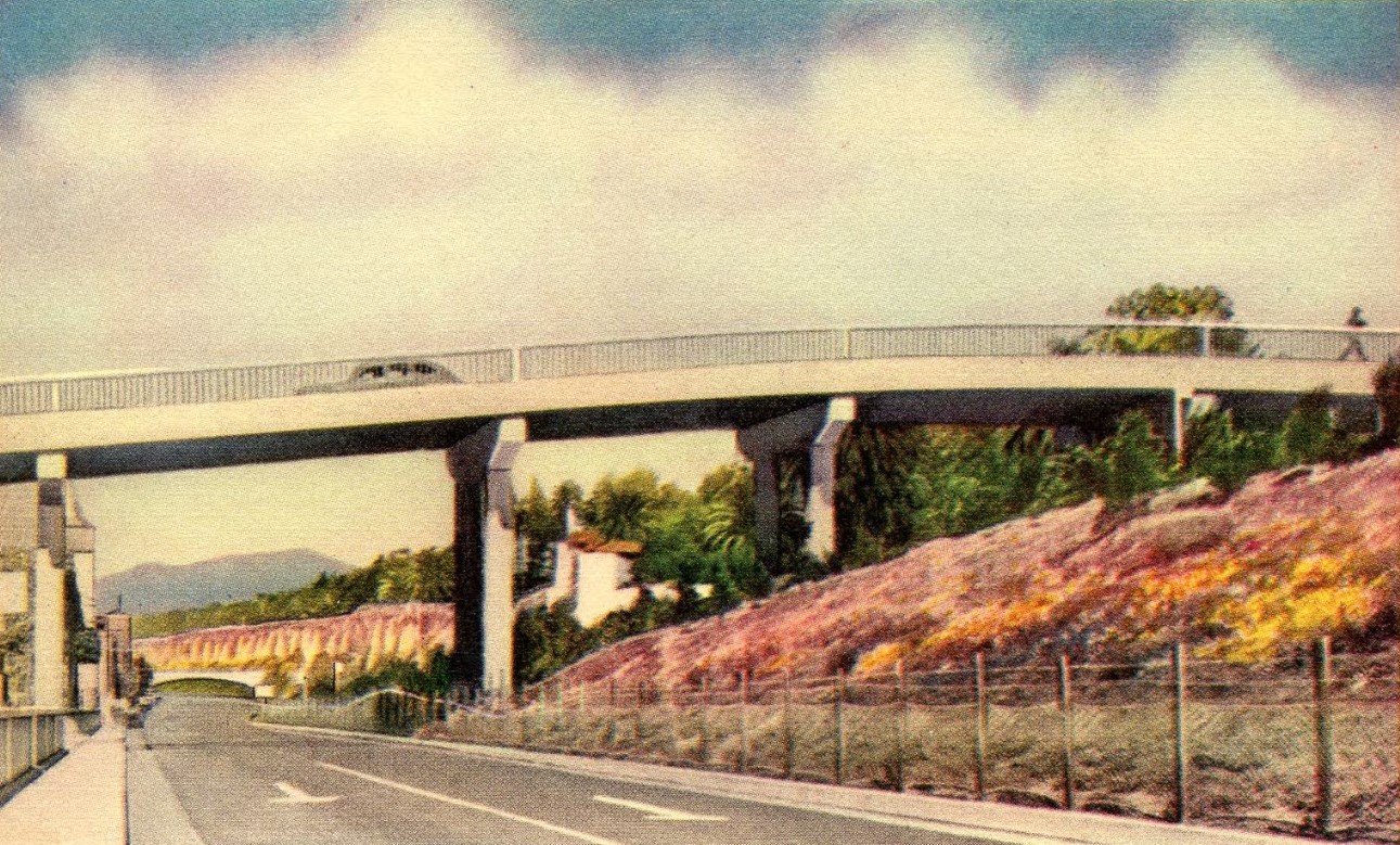
| (1940s)* - View overlooking Pacific Coast Highway. Palisades Park is above the cliffs on the left, the Santa Monica beach is on the right, La Monica Ballroom is on the pier in the distance, and a pedestrian bridge spans the highway in the center. |
Historical Notes Beach access was a constant challenge once the coastal highway opened in 1927. Wooden stairs and crossings gave way to concrete steps and an early overpass. By 1935, the city built the more substantial pedestrian bridge seen here, which allowed residents and visitors to reach the sand safely despite heavier automobile traffic. The La Monica Ballroom on the pier, opened in 1924, was a landmark of this era, hosting dances, exhibitions, and community events until it closed in 1962 and was demolished the following year. |
 |
|
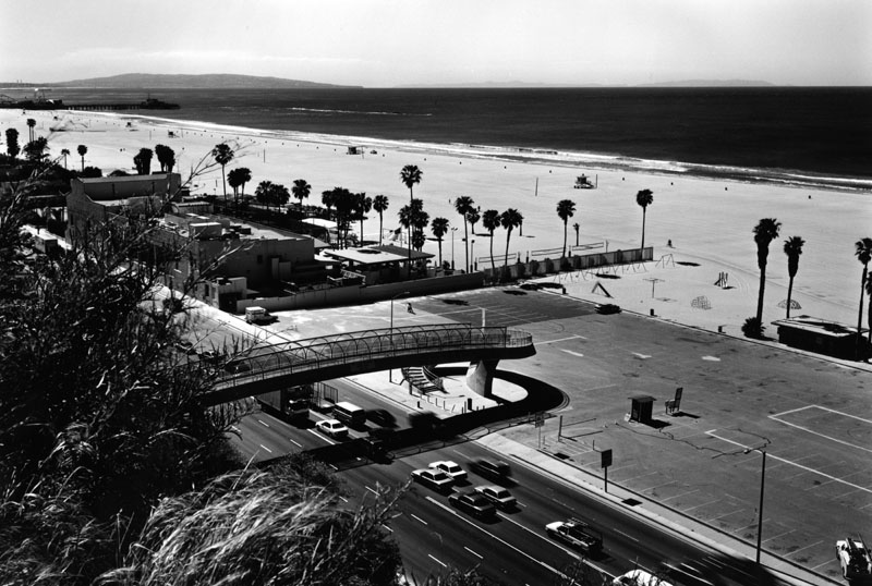
| (1997)* - Looking over the Pacific Coast Highway from the Santa Monica bluffs, with the Jonathan Club, the pier, and the Palos Verdes Peninsula visible in the upper left. A steady stream of cars moves along PCH beneath the pedestrian bridge while the beach parking lot on the right sits empty. |
Historical Notes By the late 20th century, the Pacific Coast Highway was firmly established as both a scenic drive and a vital traffic artery. Santa Monica maintained multiple pedestrian bridges, including the long-standing Arizona Avenue span, to preserve access from Palisades Park down to the sand. The California Incline continued to serve as a main route from Ocean Avenue to PCH, modernized over the decades to handle greater volumes. In this photograph, the balance between heavy automobile traffic and quieter stretches of beach illustrates the enduring tension between mobility and recreation that has shaped the history of the Santa Monica coast. |
* * * * * |
Santa Monica Lifeguard Headquarters
 |
|
| (1959)^ - Santa Monica Lifeguard Headquarters off Pacific Coast Hwy. The building was designed by Welton Becket and Associates. |
Historical Notes The lifeguard facility was originally constructed in the late 1950’s and has been staffed by Los Angeles County since the 1970’s. The County Fire Department provides year-round lifeguard coverage for the beach seven days a week, as well as round the clock emergency response and paramedic support.* |
 |
|
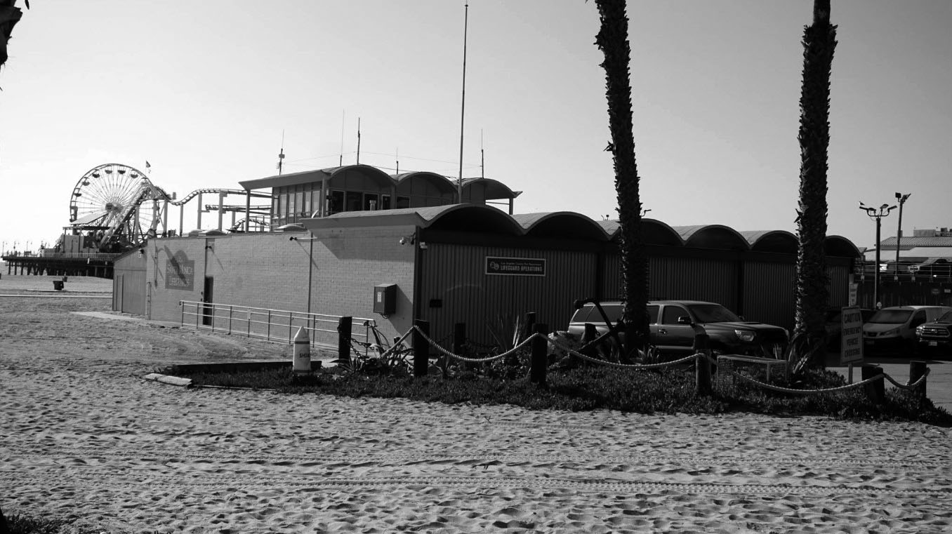
| (2018)^ - Santa Monica Lifeguard Headquarters at 1642 Ocean Front Walk with Santa Monica Pier seen in the background. |
Historical Notes The Los Angeles County Fire Department Lifeguard Division is the largest professional lifeguard service in the world. In 2018, the Los Angeles County Lifeguard Service employed 177 year-round lifeguards (chiefs, captains and ocean lifeguard specialists) and over 650 seasonal lifeguards (recurrents). Operating out of four Sectional Headquarters, located in Hermosa, Santa Monica, Marina Del Rey and Zuma beach. Each of these headquarters staffs a 24-hour response unit, and are part of the 911 system. In addition to providing marine firefighting, LA County Lifeguards have specialized training for fire boat operations. Prior to July 1, 1994, Los Angeles County Lifeguards were part of the Department of Beaches and Harbors.*^ |
 |
|
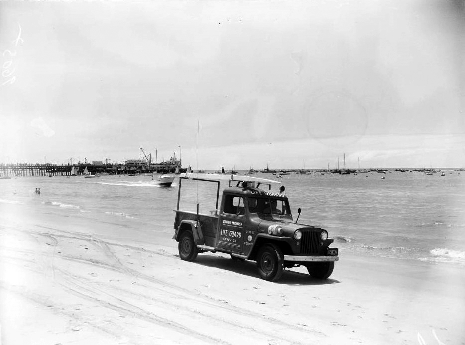
| (1952)* - View showing a life guard jeep and rescue boat at Santa Monica Beach. Caption reads: “Rescue jeep's newest radio equipment to talk to (1) radio equipped lifeguard power rescue boat on emergency call and (2) lifeguard headquarters station (extreme right end of pier). Santa Monica is the only guard station on the coast with its own frequency, assigned by the Federal Communication Commission". |
* * * * * |
Surfing
 |
|
| (1950)* - Surfing California. Surfing is more than a sport....it's a way of life! |
Historical Notes “Out of water, I am nothing.” — Duke Kahanamoku “Surfing’s one of the few sports where you look ahead to see what’s behind.” — Laird Hamilton “One of the greatest things about the sport of surfing is that you need only three things: your body, a surfboard, and a wave.” — Naima Green |
 |
|
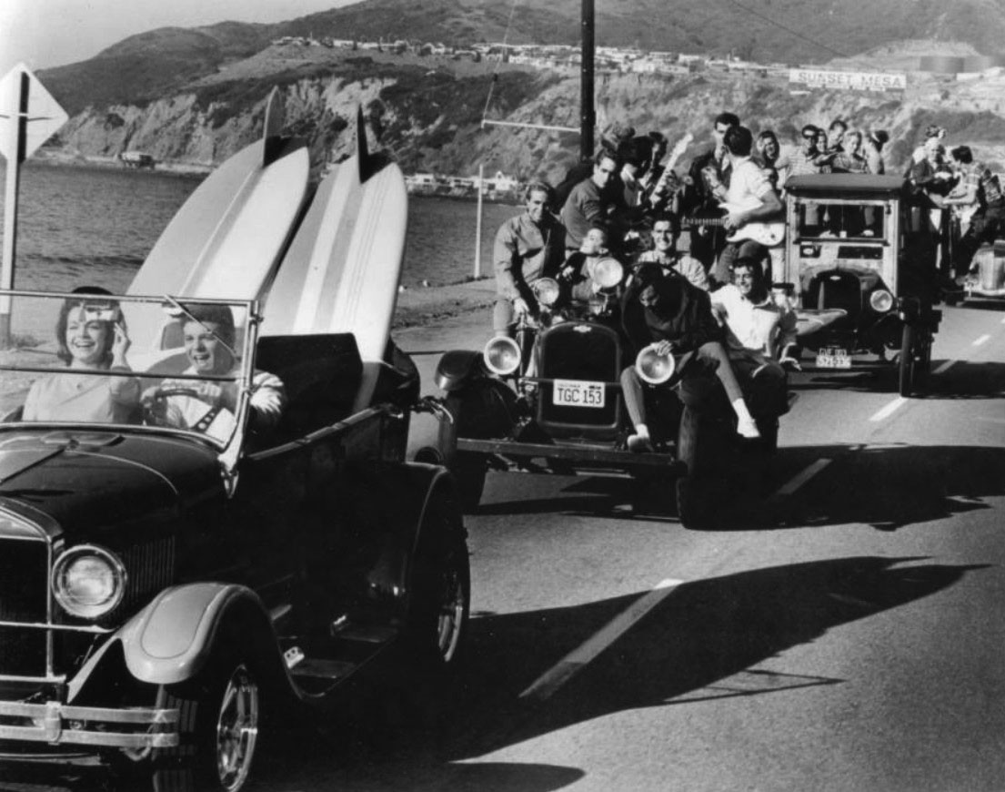
| (1964)^ - Still image from the Frankie and Annette beach movie "Muscle Beach Party" from 1964. The Jalopy caravan moves down the Pacific Coast Highway in Pacific Palisades with the Sunset Mesa development in the background. |
Historical Notes Muscle Beach Party (1964) is the second of seven beach party films produced by American International Pictures. It stars Frankie Avalon and Annette Funicello and was directed by William Asher, who also directed four other films in this series.*^ |
 |
|
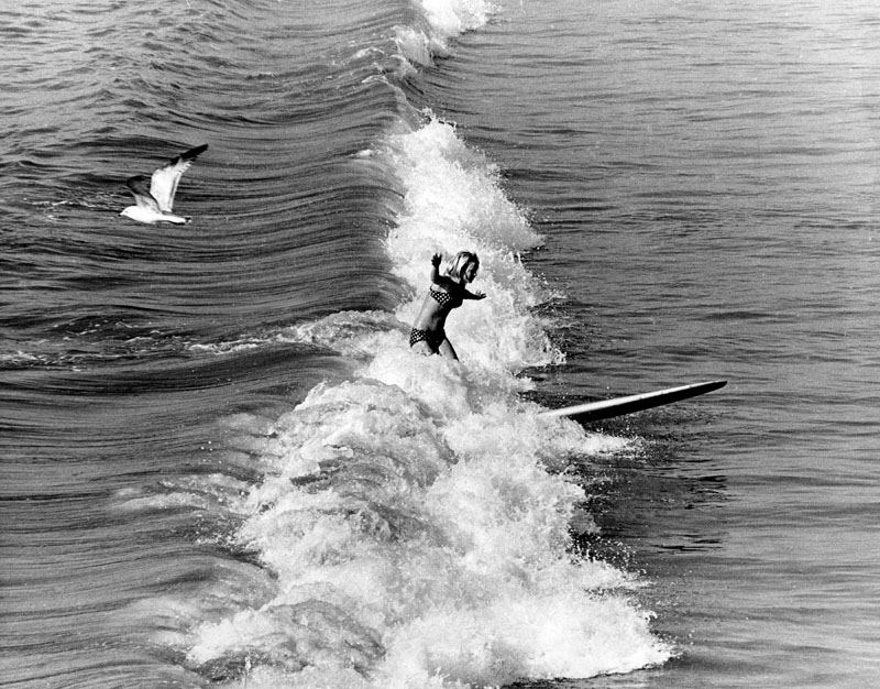
| (1968)* - View of a young surfer riding a wave in Santa Monica. |
 |
|
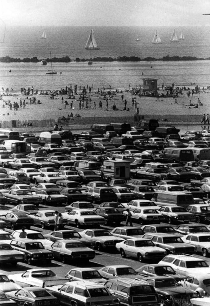
| (1977)* - The parking lot at the beach in Santa Monica has only a few empty spots. People are strolling or sunbathing or playing beach volleyball as sailboats pass by. |
 |
|
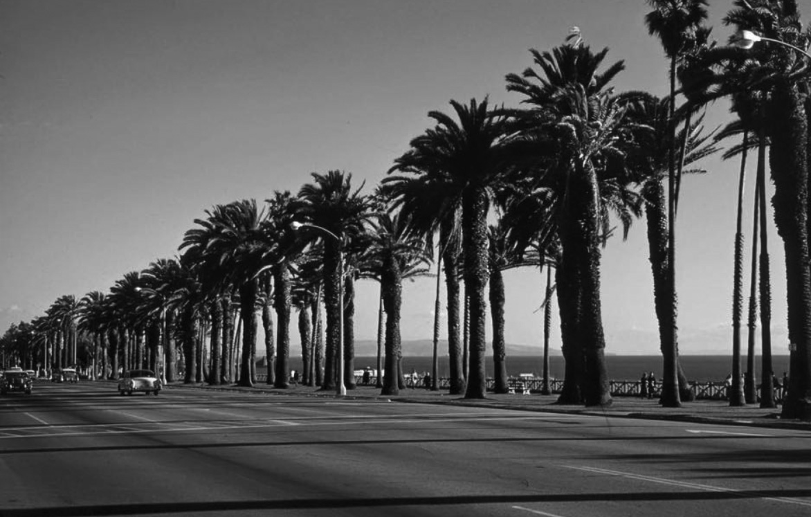
| (1950s)* - View showing a palm tree-lined Ocean Avenue with the Palos Verdes Peninsula in the distance. |
Historical Notes Ocean Avenue is a road in Santa Monica that starts at the residential Adelaide Drive on the north end of Santa Monica and ends at Pico Boulevard. Ocean Avenue is the westernmost street in Santa Monica, and for most of its course it runs parallel to Palisades Park, whose bluffs overlook Pacific Coast Highway and Santa Monica State Beach.*^ |
 |
|
| (1960s)^ – Postcard view from Palisades Park near Inspiration Point of the Pacific Coast Highway stretching northward along the beach. The building seen through the palm trees is the 101 Ocean Avenue condo complex. |
Historical Notes Built in 1963, the 101 Ocean Ave condo complex is made up of 59 units in a 10-story building. |
Third Street (now Third Street Promenade)
 |
|
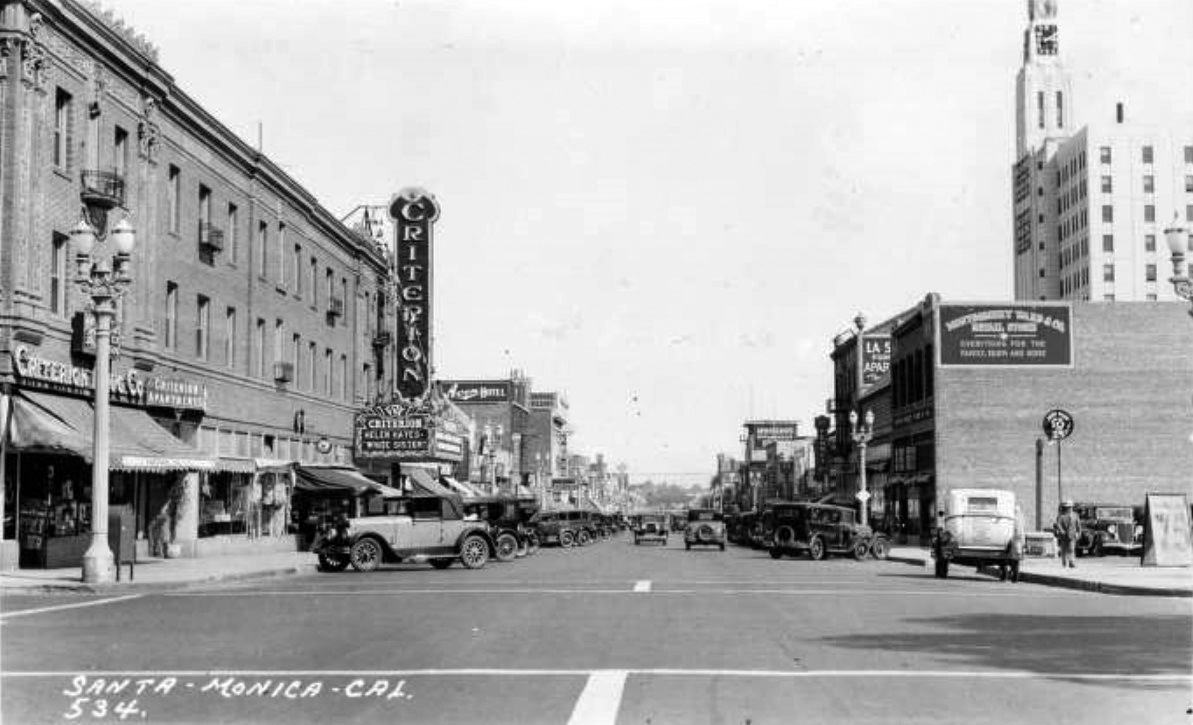
| (1933)^ – Postcard view looking south on Third Street from Arizona Avenue showing streetlights, automobiles, pedestrians and storefronts. The Bay Cities Guaranty Clock Tower Building (Crocker Bank Building) is seen at right and the Criterion Theatre is seen at left advertising "The White Sister" with Helen Hayes. Signs on the street read "Criterion Drug Co." "Criterion Apartments" "Avon Hotel" "Sponberg's Department Store" "Montgomery Ward & Co" and "J.C. Penny Co." |
Historical Notes The Criterion Theatre was built in 1924 and was part of the Fox West Coast Thetres ciruit. In 1983, the theatre was rebuilt to make way for a new 6-plex.*** |
 |
|
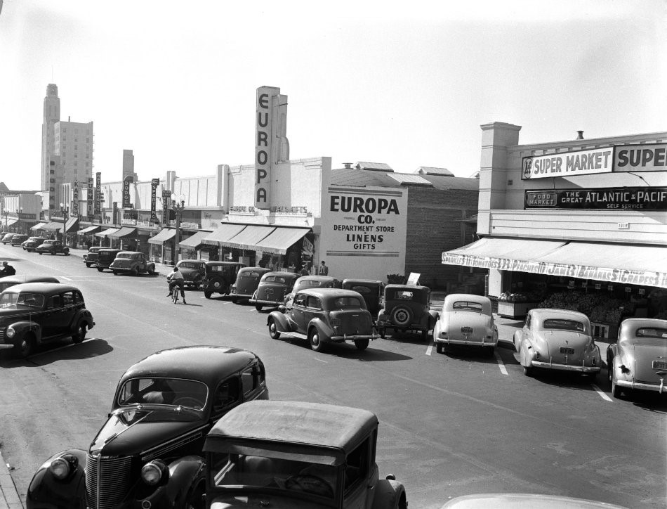
| (1940)* – Looking down Third Street, showing A&P Supermarket, Bay Cities Guaranty Building and Europa Company Department Store. |
.jpg) |
|
| (ca. 1950)##^* – View looking south down Third Street showing the Fox Criterion Theatre on the left, located at 1315 Third Street. |
 |
|
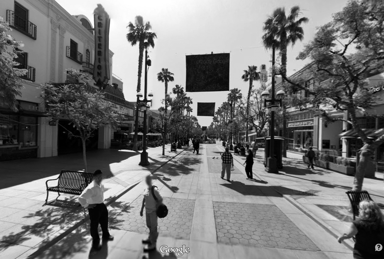
| (2008)#*^# - Google street view of the Third Street Promenade showing the Criterion Theatre on the left. |
Historical Notes Mann Theatres took over the Criterion in 1991 and in 2001, remodeled the interior and exterior of the theater. The architectural firm Behr Browers Architects of Westlake CA were responsible for the remodel. It was one of the most successful theaters in the circuit. The Criterion Theatre was closed on March 30, 2013 to make room for more retail stores.*** |
Before and After
|
|
|
| (ca. 1950)##^* – View looking south down Third Street with the Fox Criterion Theatre on the left. | (2008)#*^# - View of the Third Street Promenade with the Criterion Theatre on the left. |
 |
|
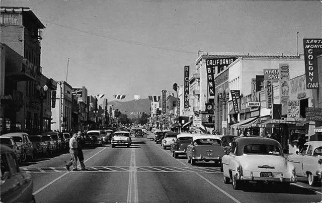
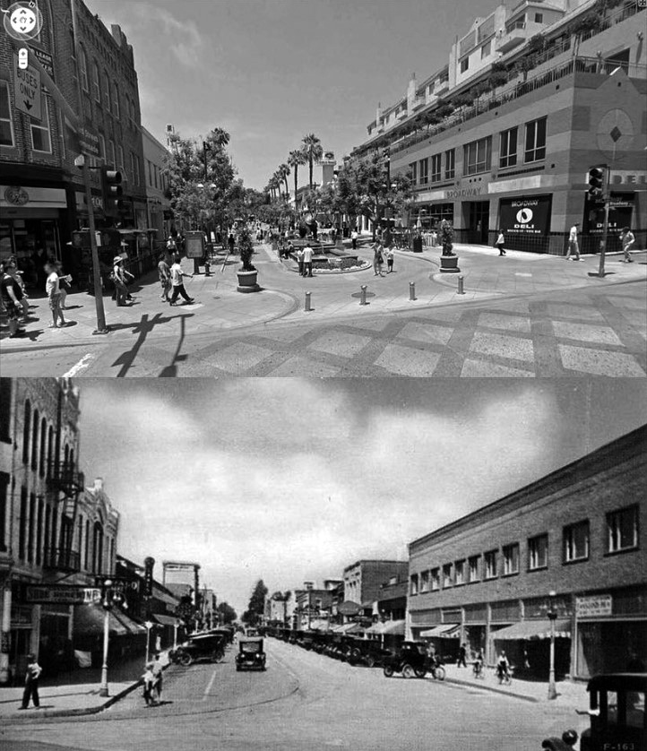
| (ca. 1955)*** – View looking north on Third Street in Santa Monica (now the Third Street Promenade). On the right legible signs include: Santa Monica Colony Club, California Bank, Richmond’s, and in the distance, the Criterion Theatre. |
Historical Notes Third Street Promenade has been a center of business in Santa Monica since the town's inception in the late 19th century. The Promenade's roots date back to the 1960s when three blocks of Third Street were converted into a pedestrian mall.*^ |
 |
|
| (1965)* - View showing the Third Street Promenade under construction. |
Historical Notes “A 'pedestrians' paradise' is in the making in this Santa Monica Street. A three-block-long mall, free of vehicular traffic, is under construction in this area”. - Herald Examiner - July 27, 1965.* |
 |
|
| (1965)^ - The 3rd Street Promenade in Santa Monica, when it first opened as a pedestrian-only street. The El Miro Theatre is seen on the right. UCLA image archive |
Historical Notes It wasn’t called the 3rd Street Promenade until they revamped it in the late 80s. Before that it was called The Santa Monica Mall. |
Then and Now
 |
 |
|
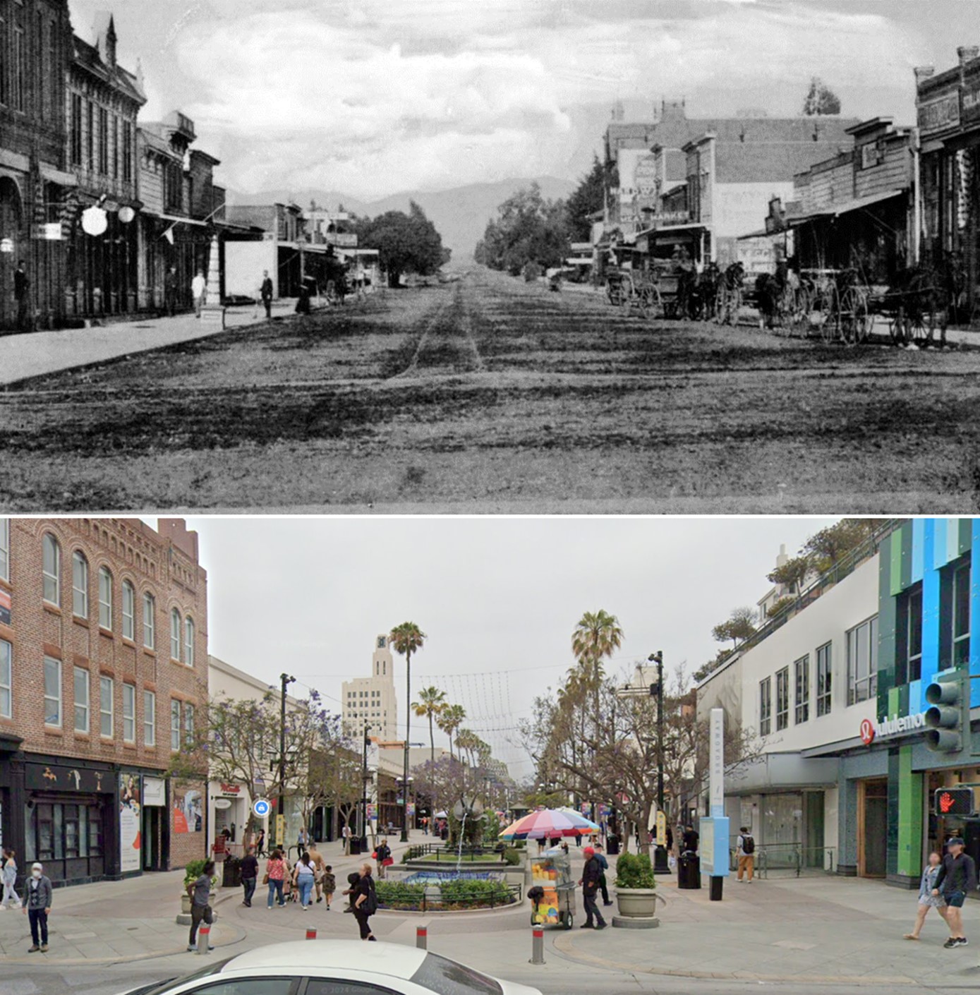
| (1880)* - View of Third Street, between Utah and Oregon (now Santa Monica Boulevard). | (ca. 2010s)* - View of the Third Street Promenade. |
Then and Now
 |
|
| (1891 vs 2024)* - Third Street Promenade in Santa Monica, looking northwest on Third Street at Utah (now Broadway). |
 |
|
| (2010s vs. 1920s)^.^ - Then and Now - Third and Broadway, Santa Monica . |
|
|
| (ca. 2010s)* - Third Street Promenade in Santa Monica. A Bar and Grill can be seen on the left side. Two fountains with art sculptures are in the middle of the mall. A Cineplex theater and a Broadway's Deli is on the right side. Three vendors with push carts can be seen towards the middle of the mall, with many people walking throughout the area. The Santa Monica beach is 3-4 blocks away. |
Historical Notes Third Street Promenade's roots date back to the 1960s when three blocks of Third Street were converted into a pedestrian mall. Although successful, by the late 1970s, the Santa Monica Mall (as it was then called), was in need of modernization and a redesign. A new enclosed shopping center, Santa Monica Place (1980–2007), designed by Frank Gehry was added at the Promenade's southern end. A citywide bond measure was issued and architectural firm ROMA Design Group was hired to redesign Santa Monica Mall. The renamed Third Street Promenade opened on September 16, 1989. The project was part of a larger redevelopment effort, encompassing several blocks of Downtown Santa Monica. Santa Monica Place has since been renovated into a new open-air shopping and dining experience that re-opened on August 6, 2010.*^ |
Route 66 - End of the Trail
 |
|
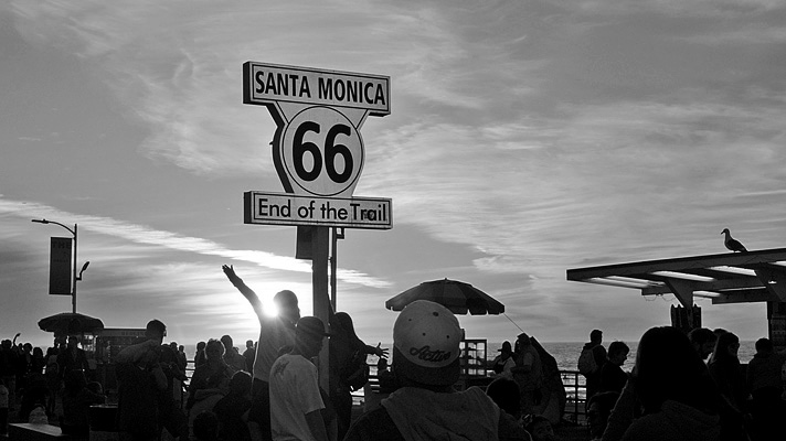
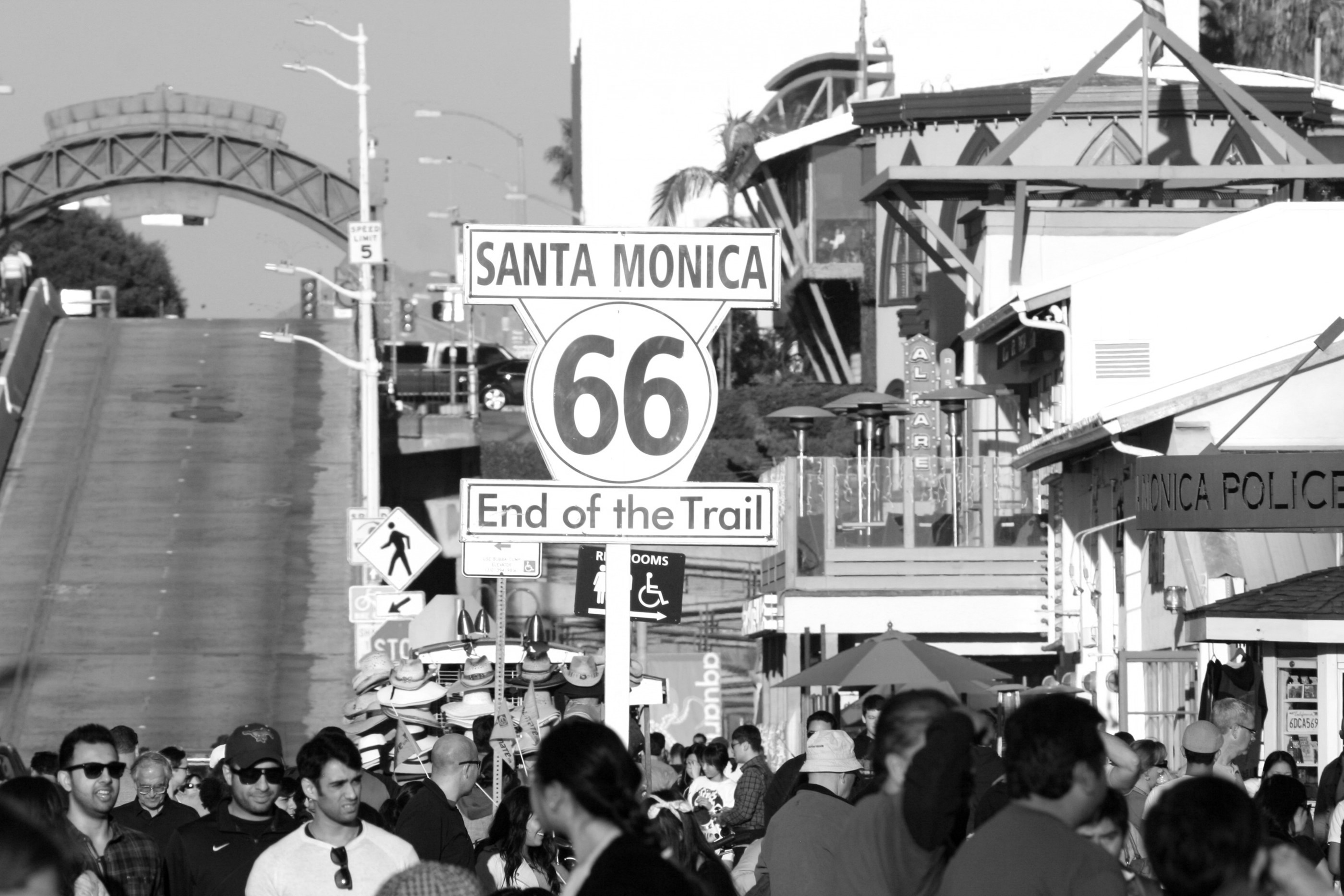
| (2013)* - The Route 66 End of the Trail sign is one of Santa Monica’s hidden gems, located on one end of the Santa Monica Pier. Photo courtesy of C H Ogawa |
Historical Notes Known as the Will Rogers Highway, the Mother Road and the Main Street of America, the 2,450-mile-long Route 66 was originally built to connect Chicago to Los Angeles. Though the actual end of the legendary highway has been debated for decades, this replica of the long-lost End of the Trail Sign officially marks the Western terminus of the great highway. |
 |
|
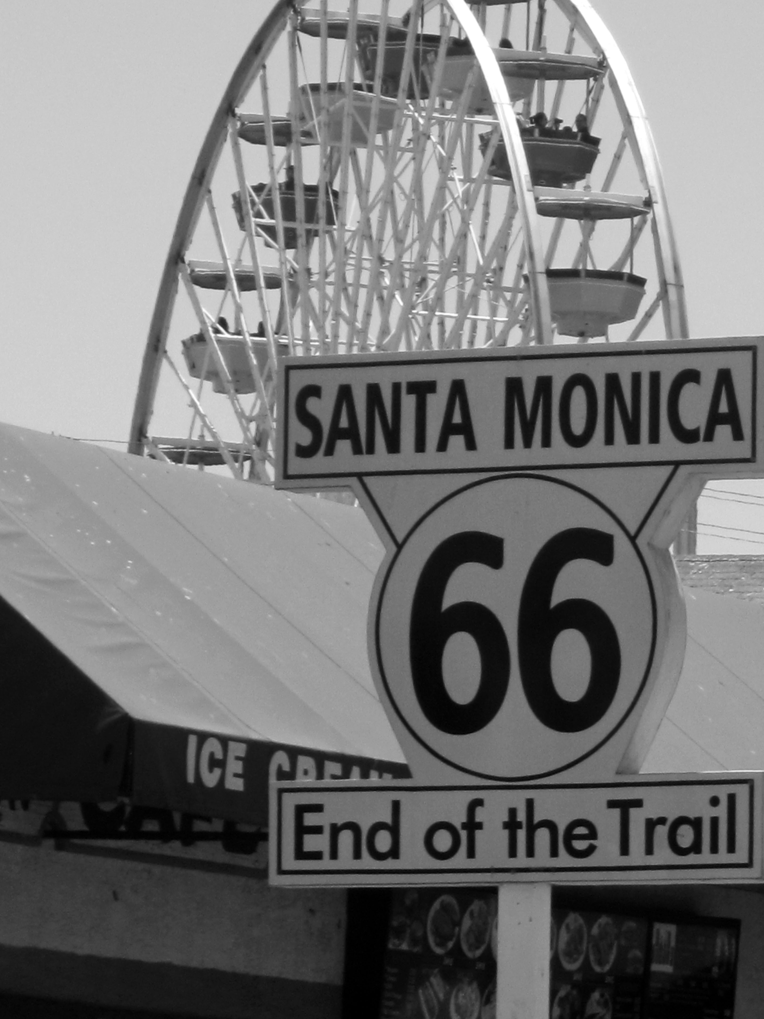
| (2014)* - Route 66 - End of the Trail sign at the Santa Monica Pier with Ferris wheel in the background. Photo courtesy of Marie Christin |
 |
|
| (2013)* - The sign of US 66's western terminus at the Santa Monica Pier. Photo by Christian Beiwinkel / Wikipedia |
Santa Monica Pier
 |
|
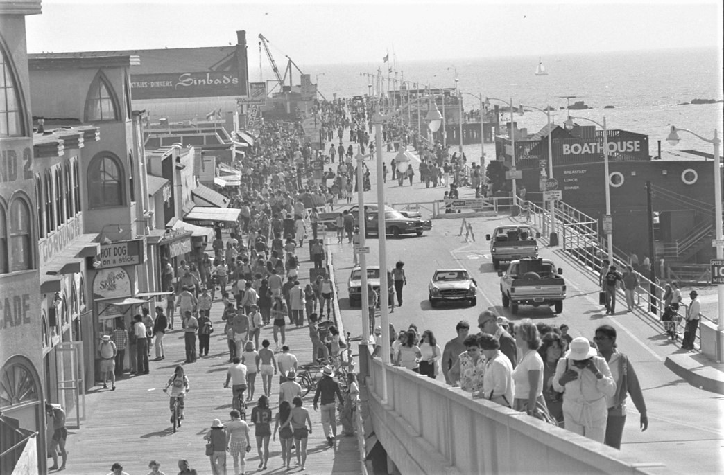
| (1979)* - PIER PRESSURE--A summery weekend brought throngs of people to the shops, restaurants and beach along the Santa Monica Pier. |
Historical Notes The Santa Monica Pier faced significant challenges and transformations during the 1970s and 1980s. In the early 1970s, the pier narrowly escaped demolition when plans for a resort development threatened its existence. However, community activism, particularly the formation of the "Save Santa Monica Bay" group, led to the city council revoking the demolition order in 1973, marking a crucial turning point in the pier's preservation. |
 |
|
| (1988)* - Santa Monica Pier looking north on the first day of Spring. Photograph dated: March 21, 1988. |
Historical Notes The 1980s brought both destruction and renewal to the iconic landmark. In 1982, storms destroyed the protective breakwater, leaving the pier vulnerable. The following year, in early 1983, violent winter storms caused severe damage, destroying over one-third of the pier. This devastation prompted a comprehensive revitalization effort by the city. The restoration included adding concrete structures for improved stability and planning new attractions such as restaurants, retail stores, and the beginnings of an amusement park. As part of its rebirth, the Santa Monica Pier evolved into a popular event venue. The city began hosting concerts and events to attract visitors, including Cirque du Soleil's first touring show, which enhanced the pier's reputation as an entertainment destination. These efforts paid off, and by the late 1980s, the pier was drawing around 2 million visitors annually, mostly summer tourists. |
 |
|
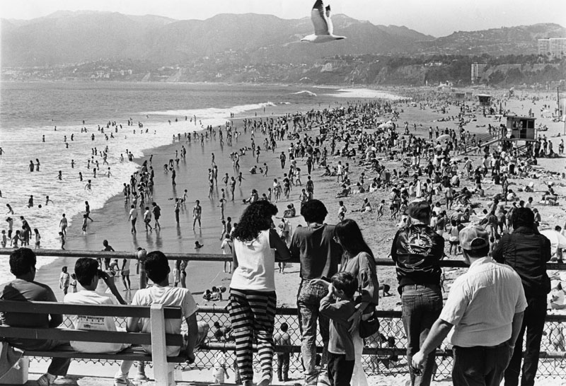
| (1988)* - Photograph caption reads: "A place in the sun became scarce as the human tide rolled in at Santa Monica Beach". The view is looking north from the Santa Monica Pier. Los Angeles Herald Examiner Photograph dated: March 28, 1988. |
Historical Notes During the 1980s, Santa Monica beaches adjacent to the pier were renowned for drawing massive holiday crowds, reflecting Southern California's vibrant beach culture. While precise crowd numbers are challenging to pinpoint, historical records suggest that holiday weekends like Memorial Day, Fourth of July, and Labor Day would transform the shoreline into a densely packed recreational landscape. The pier and surrounding beaches became magnets for locals and tourists alike, with families, young people, and beach enthusiasts converging in large numbers to enjoy the sun, surf, and festive atmosphere. The area's popularity was driven by its picturesque setting, accessible location, and the pier's numerous attractions. Lifeguard reports and local media from that era consistently described these holiday periods as times when beaches were "wall-to-wall" with people, creating a vibrant, energetic environment that epitomized Southern California's beach lifestyle. The crowds were so significant that they became a defining characteristic of Santa Monica's summer and holiday scenes, drawing people from across the greater Los Angeles metropolitan area seeking recreation, relaxation, and community celebration. |
 |
|
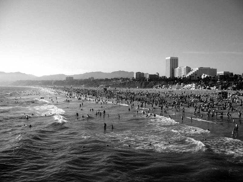
| (2008)*^ - View of Santa Monica Beach from the pier on a crowded day. In the distance can be seen the California Incline and some of the City's skyline. |
 |
|
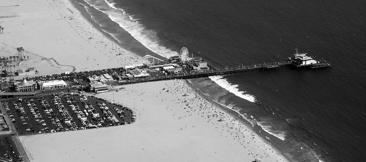
| (2009)*^ - Panoramic view of the Santa Monica Pier as seen from an altitude of 2,000', looking south. Several rides of the pier’s amusement park, Pacific Park, can be seen including the large Ferris wheel. Photo by 'Jelson25' / Wikipedia |
 |
|
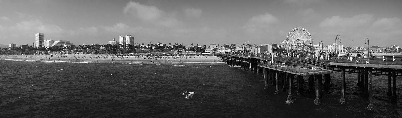
| (2009)* - Panoramic view of the beach and pier in Santa Monica. The City's skyline can be seen in the background. Photo by Matthew Field / Wikipedia |
 |
|
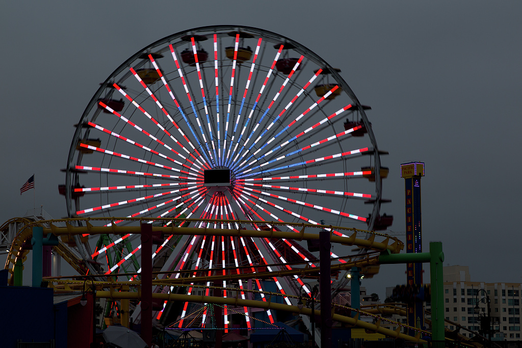
| (2012)* – Close-up view of the Ferris wheel at Santa Monica Pier. Photo by Carol M. Highsmith / Library of Congress |
Then and Now
 |
|
| (1927 vs Now)* - Santa Monica Pier showing the LA Monica Ballroom where the Ferris wheel is today. Contemporary photo by Lorie Vignolle-Moritz. |
California Incline
 |
|
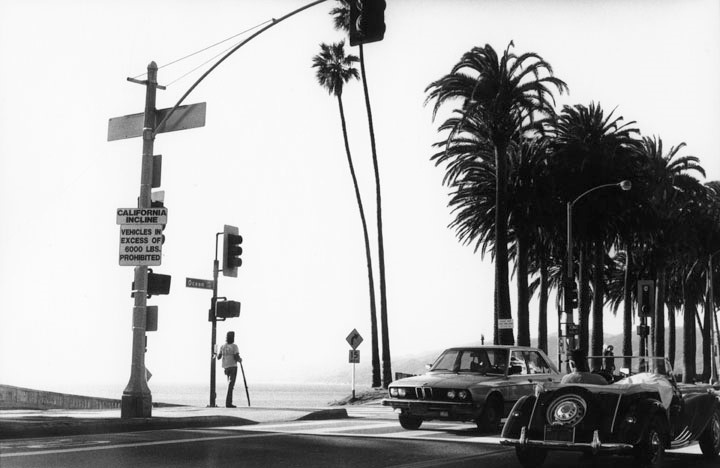
| (ca. 1987)* - Cars travel in both directions along Ocean Avenue where it crosses California Avenue in Santa Monica. California Avenue leads to the California Incline, also known as the California Avenue Incline Bridge (foreground, left), connecting Ocean Avenue to the Pacific Coast Highway. Sign at left reads: California Incline, Vehicles in Excess of 6,000 lbs. Prohibited. |
Historical Notes The California Incline was identified as structurally deficient in the early 1990s. In 2007, the City of Santa Monica secured federal highway funds to replace the structure with one meeting current seismic standards. |
 |
|
| (2011)* - View of the California Incline as seen from the Santa Monica Pier. Photo by Ricardo DeAratanha / Los Angeles Times |
Historical Notes The California Incline was rebuilt between 2015 and 2016. The new bridge consists of a pile-supported reinforced concrete slab structure with a width of 51 feet 8 inches, an increase of 5 feet 8 inches over the previous structure. The project cost $17 million, with 88.5% coming from federal funds and the balance from local funds. Construction began in April 2015 and took 17 months to complete. The roadway reopened to the public on September 1, 2016. The rebuilt structure includes wider sidewalks and bicycle lanes. Click HERE to see early views of the California Incline (1905 +). |
Palisades Park
 |
|
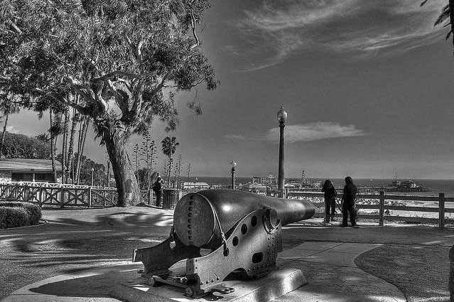
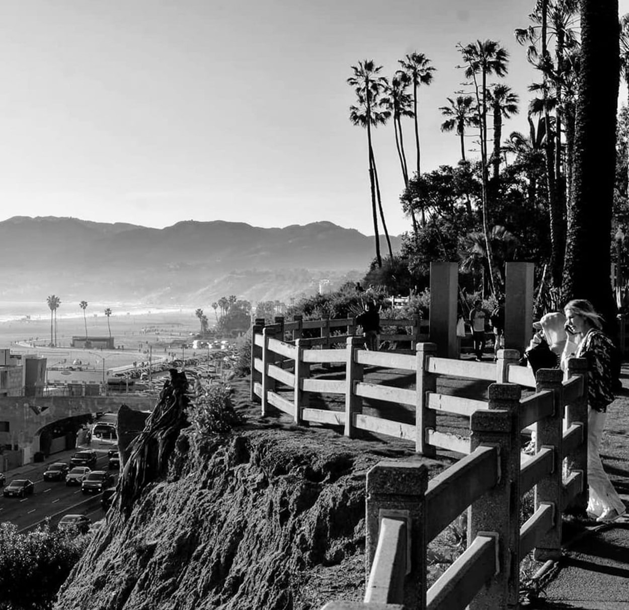
| (2012)* - View of one of two very large cannons located at Palisades Park. Three people are seen by the rail at the bluff's edge looking out toward Santa Monica Pier and Beach. Photo courtesy of Thomas Hart |
Historical Notes A pair of Civil War seacoast cannons dating from 1861 were given to the City of Santa Monica on July 4, 1908, by the U.S Veteran’s Administration. Originally, each of the mounted guns had a pyramidal stack of iron cannonballs beside it, which are now gone. One cannon is located north of Colorado Boulevard near the entrance to the Santa Monica Pier. The other cannon, is located north of the Recreation center. They are ten-inch Rodman smoothbore seacoast guns. Each of the cannons is twelve-feet long and weighs about sixteen tons. They came to Palisades Park from Angel Island. Santa Monica was never defended with cannons during times of war, although it is said that during the Spanish-American War, the city engineer mounted lengths of large pipes along the bluff to give the impression that the city was heavily fortified. |
.jpg) |
|
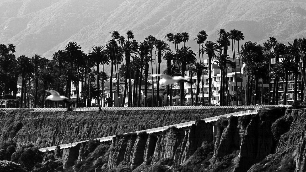
| (n.d.)* - Tall palm trees line the walking path in Palisades Park. The Santa Monica beach can be seen in the background. |
Historical Notes In recognition of its value as a historic resource and cultural landscape, Palisades Park was designated as a Santa Monica landmark in 2007. |
 |
|
| (2023)* - Looking down from the top of Palisades Park. Photo courtesy of Paul Wright |
 |
|
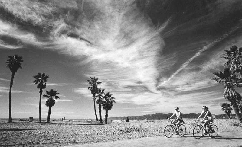
| (1988)* - Two bike riders take advantage of springtime in January while they take in the sights along the sunny, wind-swept beach path between Santa Monica and Venice Beach. Photograph dated: Jan. 26, 1988. |
 |
|
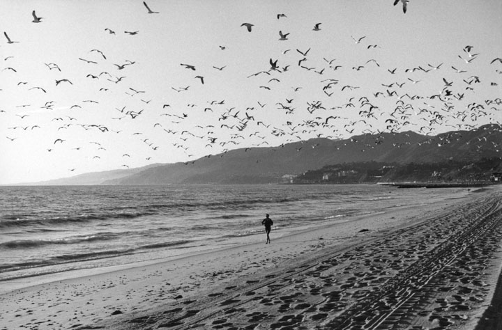
| (1986)* - A large colony of seagulls fills the sky over on a beach in Santa Monica, where a woman is seen jogging near the water. |
 |
|
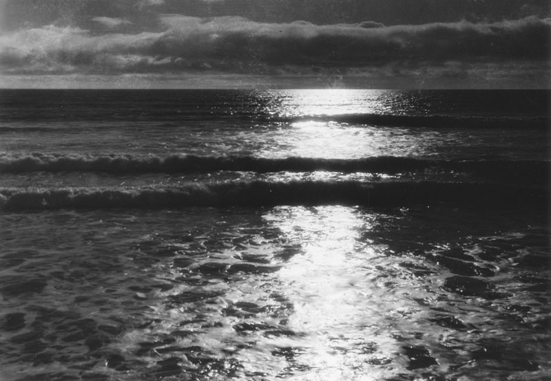
| (n.d.)* - Sunset over the Pacific Ocean as seen at Santa Monica Beach. |
* * * * * |
Please Support Our CauseWater and Power Associates, Inc. is a non-profit, public service organization dedicated to preserving historical records and photos. Your generosity allows us to continue to disseminate knowledge of the rich and diverse multicultural history of the greater Los Angeles area; to serve as a resource of historical information; and to assist in the preservation of the city's historic records.
|
More Historical Early Views
Newest Additions
Early LA Buildings and City Views
History of Water and Electricity in Los Angeles
* * * * * |
References and Credits
* LA Public Library Image Archive
^^The California History Room, California State Library
^*LMU Digital Collection: Arcadia Hotel
#^ Santa Monica Public Library Image Archive
+# Santa Monica Mirror: Statue of Santa Monica
+^ Santa Monica Landmarks: Looff Hippodrome
## Library of Congress: Santa Monica Bay ca. 1908; Ferris Wheel
***Cinema Treasures: El Miro Theatre; Criterion Theatre and Thrid Street; Criterion Theatre
^x^Facebook.com: Venice, Ca, Ocean Park, & Santa Monica in the 20th Century
**^Noirish Los Angeles - forum.skyscraperpage.com; Deauville Club; Palisades Park Cannon; Muscle Beach
^^*Deviantart-Studio5: Santa Monica Beach
^^#University of California Digital Library: The Deauville Club
^^+Stanford University Revs Digital Library
*^#Nuestra Señora la Reina de los Ángeles: losangelespast.com
*#*KCET: A Historical Look at SoCal's Beaches
*#^Santa Monica Public Library
^#*Santa Monica History Museum
^#^Framework.latimes.com: Santa Monica Beach, 1936; Santa Monica Aerial, 1937; McClure Tunnel
^##The Malibu Times: Historic Las Flores Canyon
+##Facebook.com: Vintage Los Angeles
*#*KCET: A Historical Look at SoCal's Beaches; Arch Rock and Castle Rocks; When L.A.'s Most Famous Streets Were Dirt Roads
**#The Central Tower Building - City Landmark Assessment and Evaluation Report
#**MTA Transportation and Research Library Archives
#^^Huntington Digital Library Archive
#*^Electric Railway History: Venice Trams
#+#Facebook.com: Photos of Los Angeles
^^^California State Library Image Archive
****Life.time.com: Stoked-Life Goes Surfing
^^^^Pinterest/Santa Monica Past: Santa Monica Canyon Flood; Santa Monica Airport/Clover Field; Douglas Aircraft
*^*^Santa Monica Beach Stories
^**^California Legends: Santa Monica at the End of Route 66
*^^*Discoverlosangeles.com: Santa Monica
*^^^NonPhotography.com-Nika: Santa Monica Pier
***^History of the Fairmont Miramar Hotel and Bungalows
^***Southern California Beaches: Santa Monica Beach
**#*Santa Monica via Beverly Hills Line - uncanny.net
*#**Los Angeles Westerners Corral: Venice Miniature Railway
*##*AkamaIdivers.com: Pacific Ocean Pier
*##^Santa Monica Conservancy; Henshey’s Tegner Building
*#*#Los Angeles Then and Now: Douglas' Dream Took Wing in Santa Monica
*#^#Flickr.com: Walking Over Santa Monica
^#*#Venice History: Roller Coasters and Carousels
^^*#Oceanpark.wordpress.com: Ocean Park Time Line
*^*#Santa Monica Municipal Airport
*^^#LAistory: The Santa Monica Pier
#*^*Cardcow.com: Marion Davies' Mansion
#***California 2012 - Travel w/ Terry: Annenberg Beach House
#*#*Flickr.com: Michael Ryerson
#^#*Denver Public Library Image Archive
#^^^Survey LA: Brentwod-Pacific Palisades Community Plan Area
#^*^Santa Monica Landmark Properties
#^^*Pinterest.com: Old Hollywood
#^#^Paslisades Park: smgov.net
##*^Facebook.com: Hollywood's Garden of Allah Novels, Martin Turnbull
##^^MartinTurnbull.com: Gables Beach Club
****^Facebook.com: West San Fernando Valley Then And Now
^*^*^Wehadfacesthen.tumblr.com
*^*^*SantaMonicaPier.com
*#*#*Venice Miniature Railroad - Jeffrey Stanton
*^ Wikipedia: California State Route 1; History of Santa Monica; Alphonzo Bell; Venice; California Incline; Route 66; Third Street Pomenade; Santa Monica Pier; Casa del Mar Hotel; Pacific Palisades - Castellammare; Parkhurst Building; Venice Canal HIstoric District; Annenberg Community Beach House; Santa Monica High School; Jack Dempsey; Muscle Beach; Wilshire Boulevard
< Back