Early Views of Hollywood (1920 +)
| Historical Photos of Early Hollywood |
 |
|
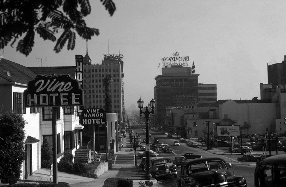
| (ca. 1952)* – View looking south on Vine Street from just north of Yucca Street. The intersection of Hollywood and Vine can be seen in the distance. Within 5 years of this photo, the iconic Capitol Records Building would be going up on the west side of Vine just south of Yucca Street. Photo Courtesy of Vintage Los Angeles and Alison Martino. |
Historical Notes During the 1950s and 1960s, Vine Street in Hollywood was part of a declining entertainment hub. The intersection of Hollywood Boulevard and Vine Street, once bustling with radio and movie-related businesses, began to lose its prominence as studios relocated elsewhere in Los Angeles. Despite this downturn and an increasingly seedy reputation, Vine Street retained cultural significance with landmarks like the Capitol Records Building, constructed in 1956, and the Hollywood Walk of Fame. The area saw further decline in the 1960s as businesses moved away, but it remained home to iconic sites such as the Pantages Theatre, continuing to attract visitors despite its challenges. |
 |
|
| (ca. 1952)* – Colorized version of the previous photo, looking south on Vine Street from just north of Yucca Street. The intersection of Hollywood and Vine appears in the distance. Within five years of this view, the iconic Capitol Records Building would rise on the west side of Vine, just south of Yucca Street where the palm tree is located. Photo Courtesy of Vintage Los Angeles and Alison Martino. |
Historical Notes Within five years of the above view, the iconic Capitol Records Building would rise on the west side of Vine, just south of Yucca Street, right where the palm tree is seen in the photo. |
 |
|
| (2024)* - Looking south on Vine Street toward Yucca Street showing the 1955-built Capitol Records Building. |
Then and Now
 |
|
| (1952 vs 2022)* – Looking south on Vine Street from just north of Yucca Street. The iconic Capitol Records building, constructed in 1955, rises prominently in the more recent view. Photo comparison my Jack Feldman. |
* * * * * |
Capitol Records Building
 |
|
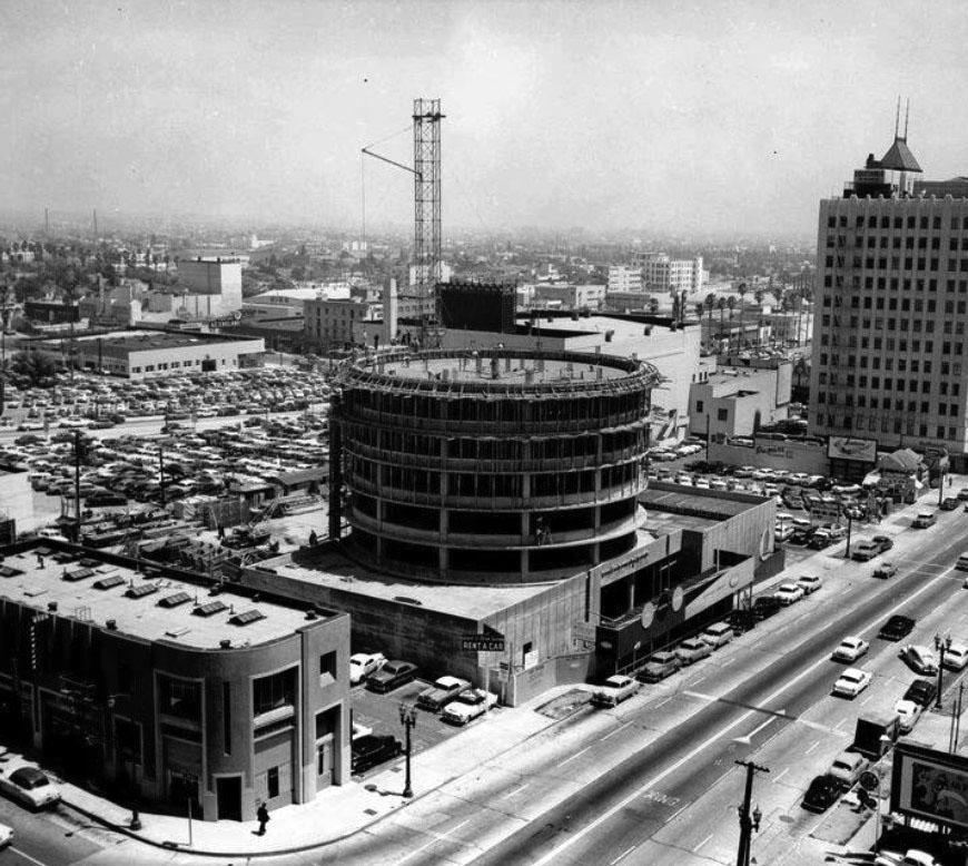
| (1955)* - View looking southeast showing the Capitol Records Building in the early stages of construction, located near the corner of Yucca and Vine streets. |
Historical Notes The Capitol Records Building, also known as the Capitol Records Tower, is a landmark in Hollywood, Los Angeles, notable for its unique circular design. Construction began in 1955 after British music company EMI acquired Capitol Records and was completed in April 1956. Designed by architect Louis Naidorf of Welton Becket Associates, the building stands 13 stories tall and is recognized as the world's first circular office building. |
 |
|
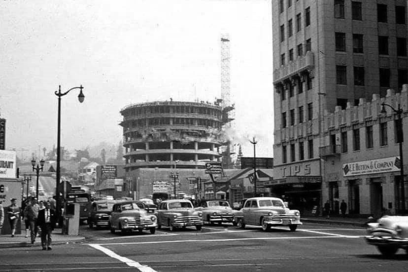
| (1955)* - View looking north showing the Capitol Records Building under construction as seen from Hollywood and Vine. |
Historical Notes The design process faced initial resistance from Capitol Records' president, Glen Wallichs, who preferred a rectangular structure. However, after lenders favored the circular design for its cost-effectiveness and potential to attract attention, Wallichs ultimately approved it. The building's distinctive shape resembles a stack of vinyl records on a turntable and features a spire that includes a light signaling "Hollywood" in Morse code. |
 |
|
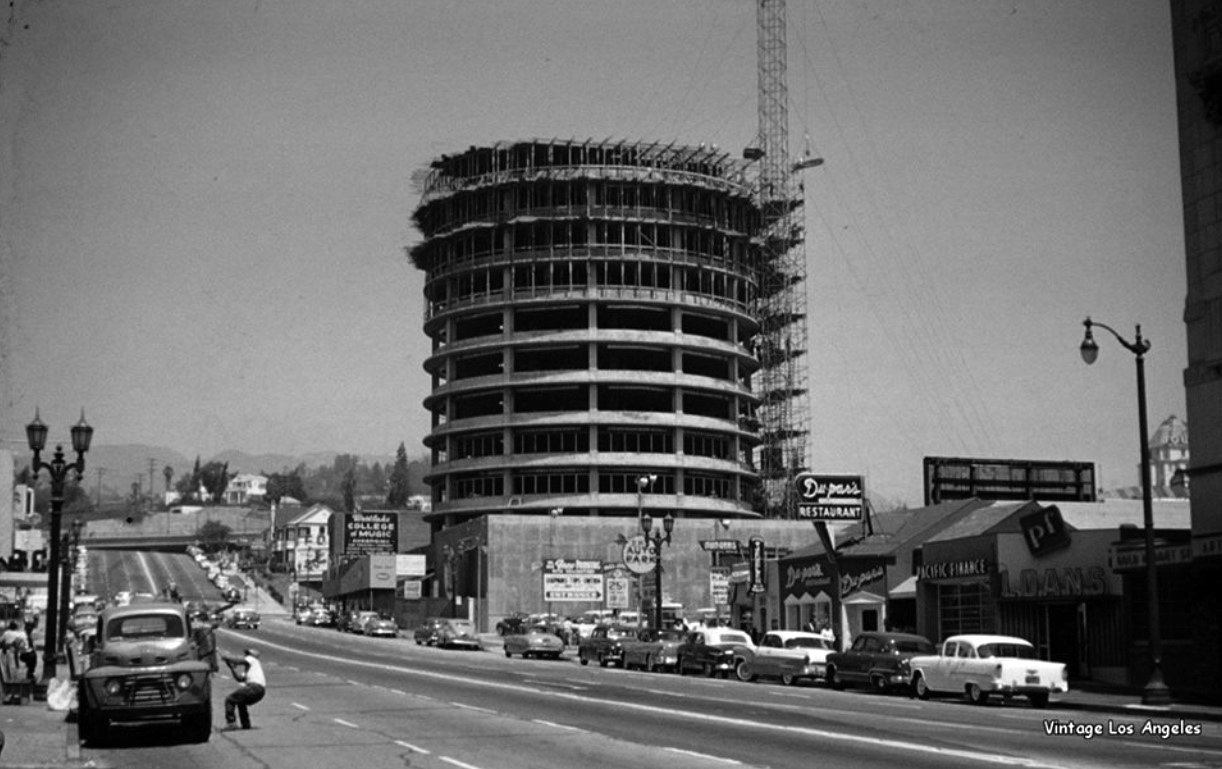
| (1955)* – View looking north on Vine Street showing the Capitol Records Building under construction. At lower right-center can be seen Du-par's Restaurant. |
Historical Notes Designed by Louis Naidorf of Welton Becket and Associates, the tower was the world’s first circular office building, constructed of reinforced concrete and punctuated by a series of porcelain enamel sun shades stepping down each floor of the building. |
 |
|
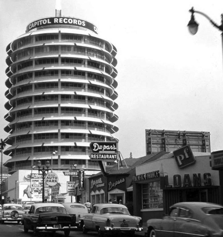
| (1956)* - View showing the newly completed Capitol Records Building located at 1750 N. Vine Street. Du-par's Restaurant is seen in the foreground. |
Historical Notes The 13-story Capitol Records Building, also known as the Capitol Records Tower, is one of the city's landmarks. Construction was contracted by British company EMI soon after its 1955 acquisition of Capitol Records, with completion in April 1956. Located just north of the intersection of Hollywood and Vine and consolidating the West Coast operations of Capitol Records, the structure is home to the recording studios and echo chambers of Capitol Studios. |
 |
|
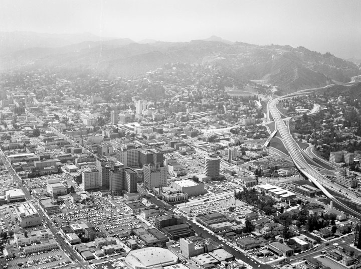
| (1956)* - Aerial view looking northwest showing the Hollywood business district, with the Capitol Records Building visible middle right. Other visible buildings include: Pantages Theatre, E.F. Hutton Building, Broadway-Hollywood, Hotel Knickerbocker, Guaranty Building, and the Taft Building. The streets are (diagonally, l to r): Selma Avenue, Hollywood Boulevard, and Yucca Street; and (bottom to top) Gower Street, Argyle Avenue, Vine Street, Ivar Avenue, and Cahuenga Boulevard, to name a few. The Hollywood (101) Freeway is visible along the right. |
.jpg) |
|
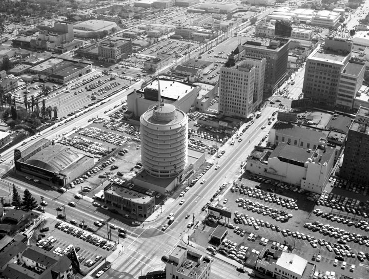
| (1956)* - Aerial view of the Hollywood business district, with the Capitol Records Building in the foreground; view is looking south. The cluster of tall buildings around the intersection of Hollywood and Vine can be seen at center of photo. Visible buildings include: Pantages Theatre, E.F. Hutton Building, Broadway-Hollywood, Hotel Knickerbocker, Guaranty Building, and the Taft Building. The streets are (vertically, l to r): Argyle Avenue, Vine Street, Ivar Avenue, Cahuenga Boulevard; and (horizontally, bottom to top) Yucca Street (extreme bottom), Hollywood Boulevard, Selma Avenue, and Sunset Boulevard, to name a few. |
 |
|
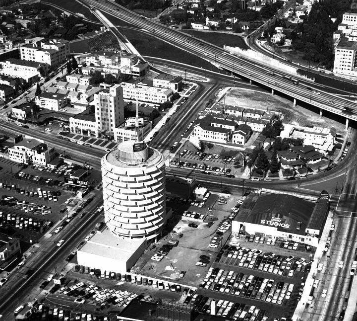
| (1956)* - Aerial view of Hollywood showing the Capitol Records Building in the center surrounded by other buildings near Hollywood Boulevard and Vine Street; view is looking southeast. The visible streets are (diagonally, r to l): Vine Street, Argyle Avenue, Gower Street, and Bronson Avenue and (l to r): Yucca Street, Hollywood Boulevard, and Sunset Boulevard. Other visible buildings are Yucca Vine Building (corner of Yucca and Vine), Equitable Building (corner of Vine and Hollywood), Pantages Theatre (corner of Hollywood and Argyle), and Charles E. Skinner Studios (corner of Argyle and Yucca). |
 |
|
| (ca. 1955)* – Aerial view looking northwest showing the newly completed Capitol Records Building near the S/E corner of Vine and Yucca streets. On the N/W corner stands the Mountain States Building (built in 1928). The Charles E. Skinner Studios are seen on the S/W corner of Argyle and Yucca streets on the right and a portion of the Hollywood Tower is at the upper-right corner. |
 |
|
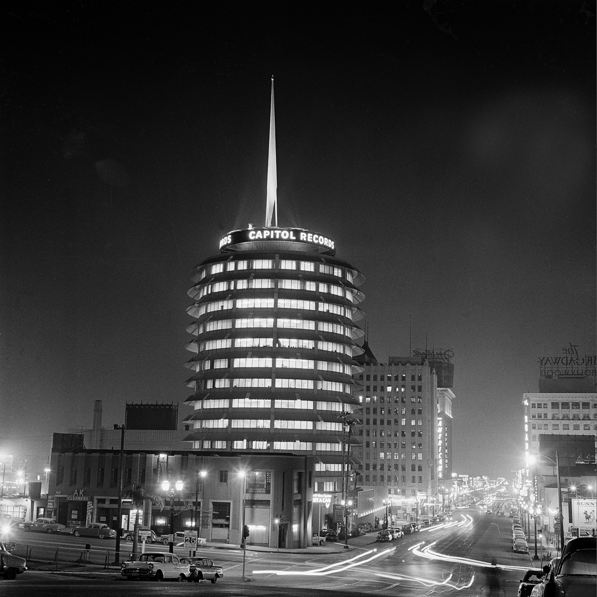
| (1958)* - Nighttime view, looking south, of the intersection of Vine and Yucca streets. The Capitol Records Building stands tall near the southeast corner. |
Historical Notes The wide curved awnings over the windows of each floor and the tall spike emerging from the top of the building combine to give it the appearance of a stack of vinyl 45s on a turntable, although it was not originally designed with that idea in mind. |
 |
|
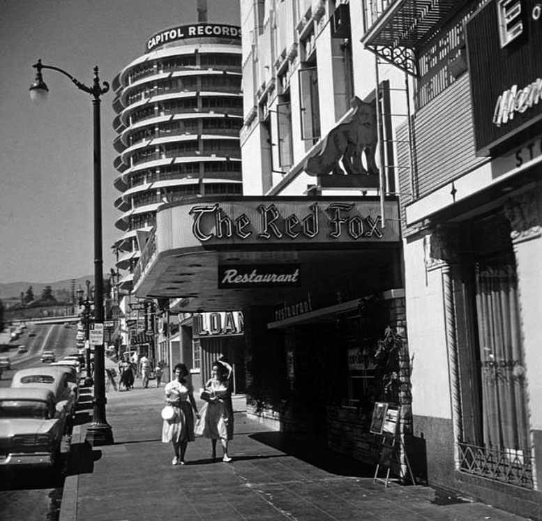
| (1960)* – View looking north on Vine Street showing the Capitol Records Building in the background with The Red Fox Restaurant in the foreground. Du-par's Restaurant is located behind the Red Fox Restaurant out of view. |
 |
|
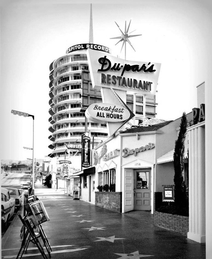
| (1960s)* - View looking north on Vine St. just north of Hollywood Blvd. Du-par's Restaurant is open for business: Breakfast ALL HOURS. In the background stands the Capitol Records Building. Note that the streetlights have been changed-out to a new 3-bulb design, called Hollywood Specials. |
Historical Notes The first Du-par's was founded in 1938 at the Los Angeles Farmers Market by James Dunn and Edward Parsons, who combined their surnames to create the restaurant's name. The chain was purchased in 2004 by an investor group led by W.W. "Biff" Naylor, the son of noted California restaurateur Tiny Naylor. Du-par's expanded in 2009 to include several locations from the bankrupt Bakers Square chain. |
 |
|
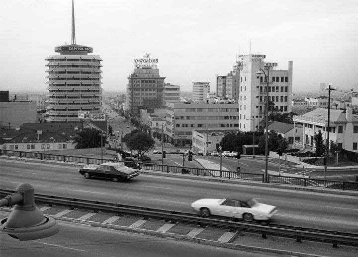
| (1967)* - View looking south on Vine Street from across the Hollywood Freeway showing the Capitol Records Building and Broadway-Hollywood Building. |
 |
|
| (1960s)* - Daytime holiday view of Hollywood and Vine with the Capitol Records Building in background. |
 |
|
| (ca. 1956)* - Long exposure of Hollywood and Vine at night. Capitol Records Building is in the background. |
Historical Notes The blinking light atop the tower spells out the word "Hollywood" in Morse code, and has done so since the building's opening in 1956. This was an idea of Capitol's then president, Alan Livingston, who wanted to subtly advertise Capitol's status as the first record label with a base on the west coast. The switch was initially activated by Leila Morse, the granddaughter of Samuel Morse. In 1992 it was changed to read "Capitol 50" in honor of the label's fiftieth anniversary. It has since returned to spelling "Hollywood". A black and white graphic image of the building appeared on the albums of many Capitol recording artists, with the phrase, "From the Sound Capitol of the World". |
 |
|
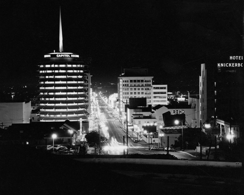
| (ca. 1960)* - View shows the Capitol Records Building (left) and Hotel Knickerbocker (right). Capitol Records, located on Vine Street, is a unique 13-story, 150 ft. high-rise cylindrical building that was built in 1956 by architect Welton David Becket and contractor C. L. Peck Co. |
Historical Notes The Hotel Knickerbocker, a Renaissance Revival/Beaux Arts building located on Ivar Avenue, began life as a luxury apartment building that was at the heart of Hollywood back in the 1920s, before becoming a hotel later in its history. It's been linked with tragic deaths and because of this, it is considered haunted by some. Some unfortunate occurrences: D.W. Griffith died of a stroke on July 21, 1948 under the crystal chandelier of the lobby; a costume designer named Irene jumped to her death from a hotel window; William Frawley, who lived at the hotel for decades, died of a heart attack on the sidewalk in front of the Knickerbocker. Other stars that frequented the hotel with better luck were: Rudolph Valentino, Elvis Presley, Marilyn Monroe and Joe DiMaggio, Frank Sinatra, Lana Turner, Mae West, and Cecil B. DeMille among many, many others.*^ |
 |
|
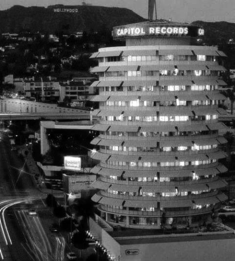
| (ca. 1960s)* – Night view looking north showing the Capitol Records Building with the Hollywood Sign in the background. |
 |
|
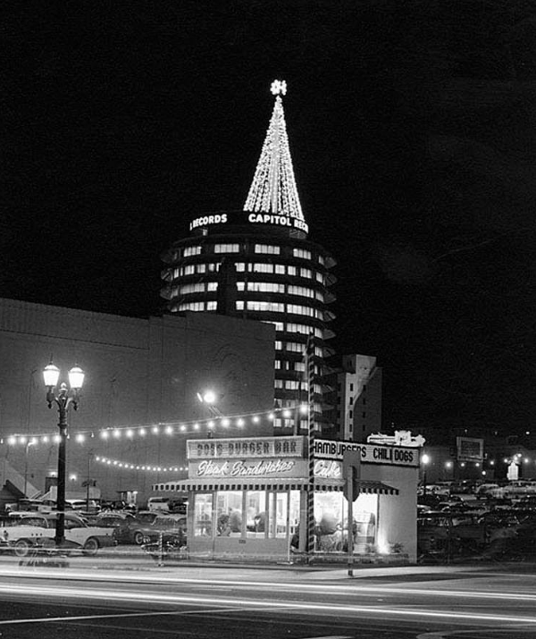
| (1962)* – View looking northwest from the intersection of Hollywood and Argyle showing the Capitol Records Building in the backgrond, with Christmas tree on top. The Pantages Theatre is on the left and a small hamburger stand is in the foreground. |
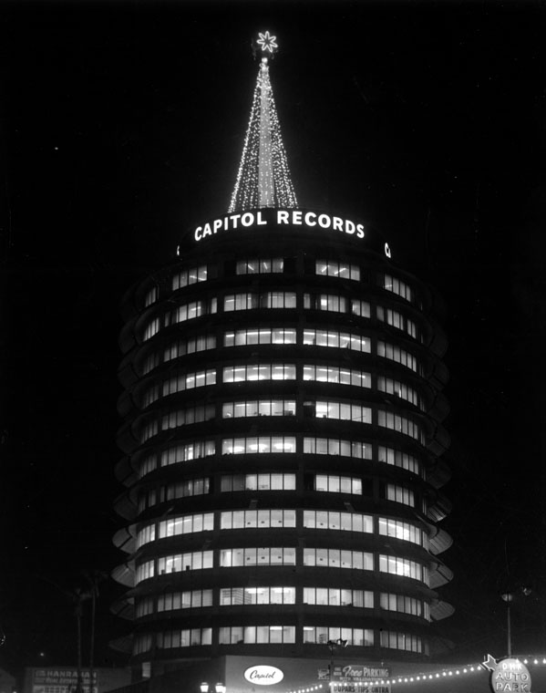
Historical Notes Designed by Stewart Romans of Ollsen Lighting and featuring 4,373 bulbs (at 25 watts each), the Christmas tree on top of the Capitol Records Building was the first of its kind, and it has been a part of the Hollywood skyline each December since 1958, save for 1973, when L.A. experienced an energy crisis. |
 |
|
| (1962)* - The iconic Capitol Records building needle lit as a Christmas tree, 1750 Vine Street. |
Historical Notes In 2006, the Capitol Records Building and Rooftop Sign were dedicated as LA Historic-Cultural Monument No. 857 (Click HERE to see complete listing). |
 |
|
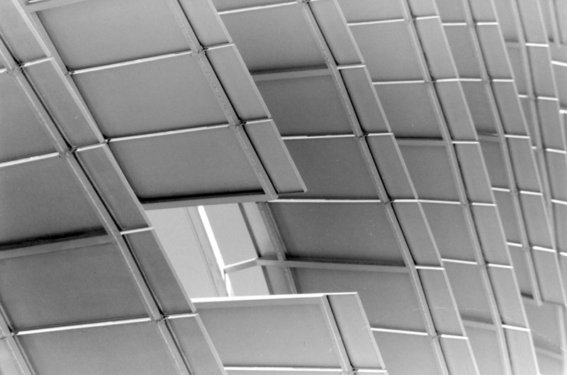
| (1999)* - Detail of the awnings of the Capitol Records Building in Hollywood. |
Historical Notes The wide curved awnings over windows on each story and the tall spike emerging from the top of the building coincidentally resembling a stack of records on a turntable. The rectangular ground floor is a separate structure, joined to the tower after completion. The tower incorporates 13 stories, to conform to the 150-foot zoning height limit that was in place at the time of its construction. Earthquake height restrictions were later lifted in 1964. |
* * * * * |
Sunset Boulevard
 |
|
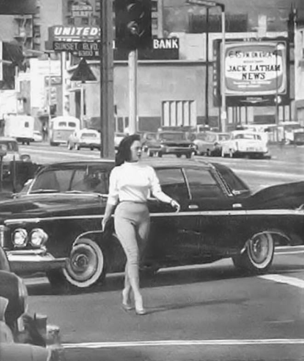
| (ca. 1960)* – “Look at the lines on that model, that is the car, a 1960 Plymouth” - Sunset Blvd in Hollywood. |
* * * * * |
Sunset and Vine
 |
|
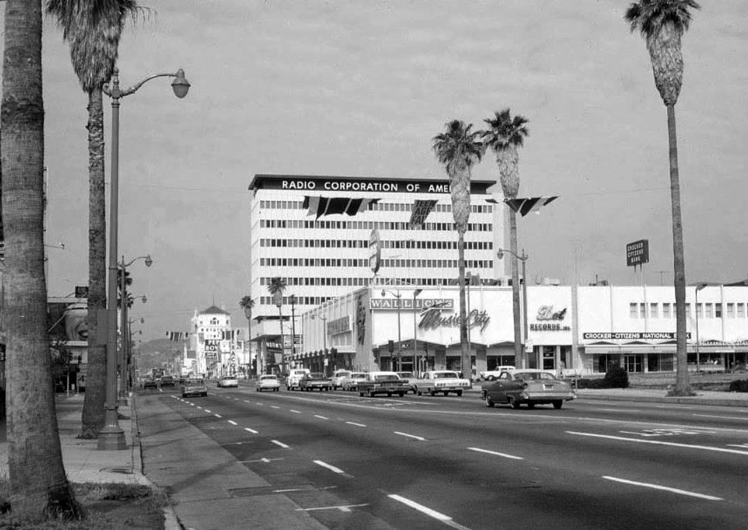
| (1965)* – View looking west on Sunset Boulevard at Vine Street. Wallich’s Music City can be seen on the northwest corner. Behind it is the Radio Corporation of America Building built in 1963. |
Historical Notes The empty parking lot across the street on the northeast corner of Sunset and Vine was the gorgeous stream line NBC Building that had just been recently torn down. It was replaced with Home Savings of America, now Washington Mutual. And the banners above the street are advertising the Teenage Fair, which was at the Hollywood Palladium. |
 |
|
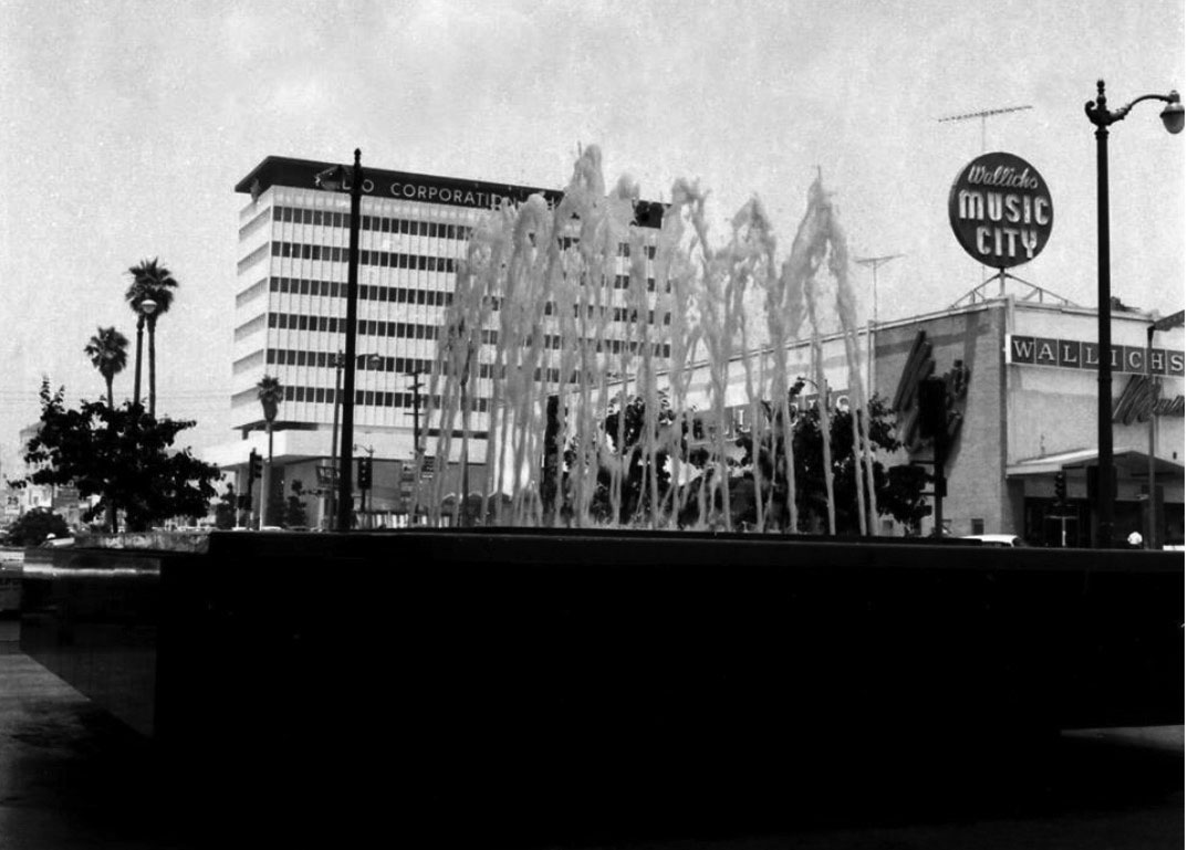
| (1965)* – Looking through fountain waters towards the NW corner of Sunset & Vine. Between the RCA building and Wallichs Music City is a red-white striped Norm's restaurant. The RCA building, built in 1963, is all that remains today. |
 |
|
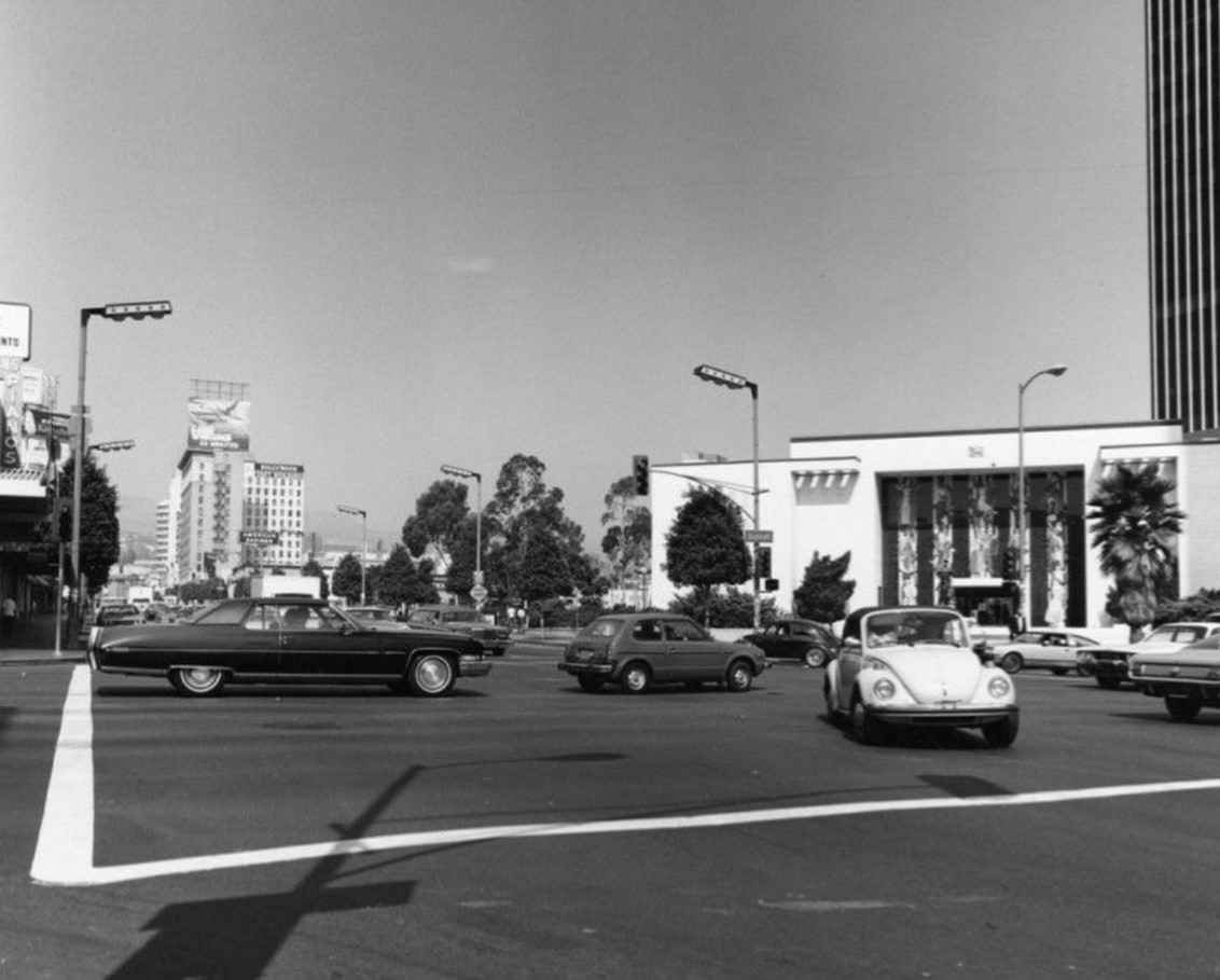
| (1975)* – View looking north on Vine at Sunset, showing the Home Savings and Loan building on the northeast corner. Note the distinctive streetlights along Vine, known as 'Hollywood Specials,' which were a notable feature of the Hollywood streetscape from the 1960s through the 1990s. Photo by Roy Hankey. |
Historical Notes In the 1970s, the intersection of Sunset and Vine in Hollywood was still a vibrant cultural hub with deep ties to the entertainment industry. The area, once home to NBC Radio City, was transformed with the construction of the Home Savings and Loan building, designed by Millard Sheets and completed in 1968. This building became an artistic landmark, featuring mosaics and sculptures that celebrated Hollywood's history. The surrounding streets, including "Guitar Row," were lively with nightlife and music-related businesses. |
 |
|
| (1987)* - View of a statue by Paul Manship at the Home Savings Bank building (now Chase Bank) at the northeast corner of Sunset and Vine in Hollywood. Before the Home Savings and Loan building was constructed in 1968, the site was occupied by NBC Radio City. Photo by William Reagh. |
Historical Notes The Flight of Europa, an Art Deco statue by Paul Manship, is situated in the forecourt of this building. Created in 1925, it depicts the Greek myth of Europa being abducted by Zeus in the form of a bull, with Cupid whispering in her ear and dolphins symbolizing their destination. |
 |
|
| (2024)* - Contemporary view of the northeast corner of Sunset and Vine showing the Flight of the Europa statue in fornt of Chase Bank. |
* * * * * |
Sunset Vine Tower
 |
|
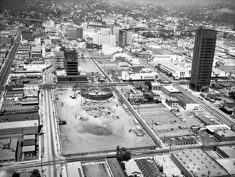
| (1963)* - Aerial view showing the recently completed 20-story Sunset Vine Tower located on the southeast corner of Sunset and Vine (seen at right). At center-left, in the early construction phase, is the future home of Pacific Cinerama Theatre (Cinerama Dome Theatre), located at 6360 Sunset Boulevard. The RCA Building is also under construction across the street. The NBC Building on the northeast corner of Sunset and Vine would be torn down in 1964. |
Historical Notes The 1963-built Sunset Vine Tower was designed by architect Douglas Honnold of the firm Honnold & Rex. It was the first skyscraper built in Los Angeles after the city repealed its 14-story building height limit. |
 |
|
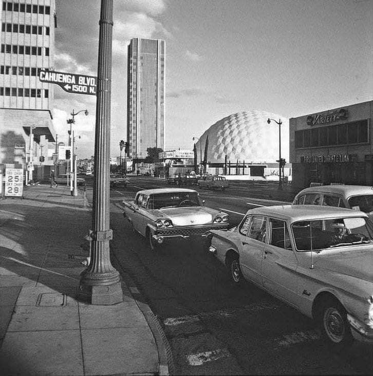
| (1963)* - Street view looking west on Sunset Boulevard at Cahuenga Boulevard with the Sunset Tower and Cinerama Dome in the distance. |
 |
|
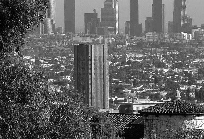
| (n.d.)* – View through a telephoto lens looking southeast from the Hollywood Hills showing the Sunset Vine Tower standing tall in the foreground with the downtown skyline in the distance. |
Historical Notes In 2001, the skyscraper sustained damage due to an electrical transformer explosion. The owner fell into bankruptcy and the building was shut down indefinitely. In 2003, the CIM Group, a commercial developer, acquired the padlocked skyscraper and began mapping plans to rehabilitate it. The company eventually decided to gut the building and convert it into residential units. After long delays and a costly $70 million retrofitting job, the skyscraper would once again open but not until 2010. |
 |
|
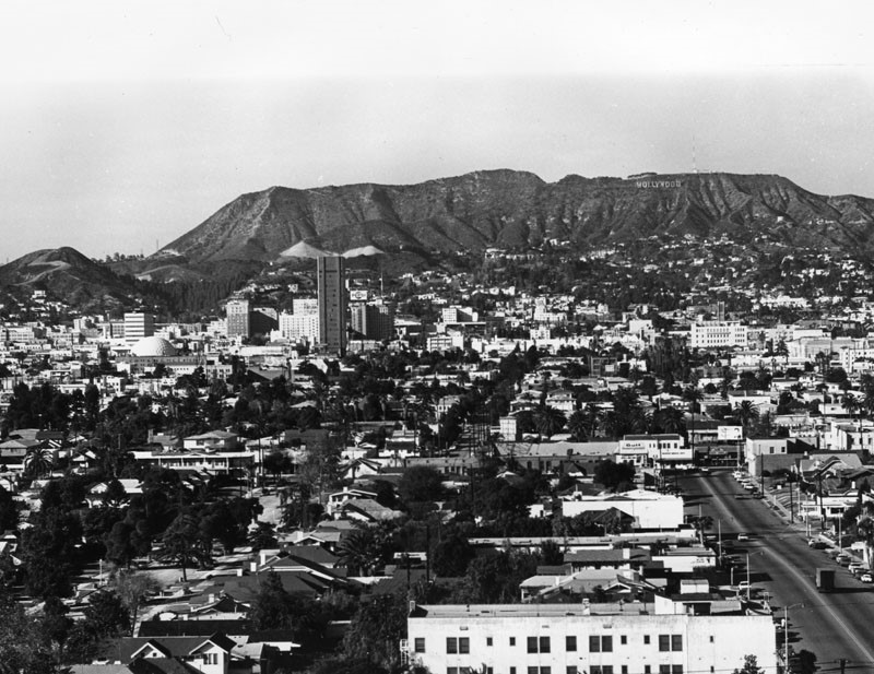
| (1965)* - View of Hollywood, from Larchmont and Beverly boulevards. The Hollywood Sign can be seen in the background. The Sunset Vine Tower is at left-center. To its left stands a very large geodesic dome, The Cinerama Dome, located at 6360 Sunset Boulevard, just west of Vine. |
Historical Notes Incidentally, disaster is nothing new when it comes to the Sunset Vine Tower. The skyscraper was featured in the film "Earthquake" back in 1974. |
 |
|
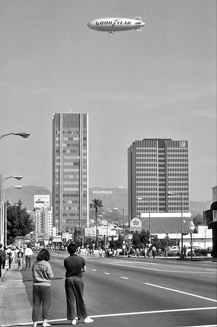
| (1987)* - L.A. Marathon spectators along Vine street with a Goodyear blimp hovering high above the Sunset Vine Tower. |
* * * * * |
Cinerama Dome Theatre
 |
|
| (1963)*- Cinerama Dome Theatre under construction. |
Historical Notes In February 1963, Cinerama Inc. unveiled a radically new design for theaters which would show its movies. They would be based on the geodesic dome developed by R. Buckminster Fuller, would cost half as much as conventional theaters of comparable size, and could be built in half the time. Cinerama's goal was to see at least 600 built worldwide within two years. The following April, Pacific Theatres Inc. announced plans to build the first theater based upon the design, and had begun razing existing buildings at the construction site. |
 |
|
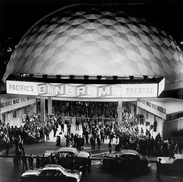
| (1963)* - View shows the exterior of this domed-shaped theater and the crowds of people at the entranceway awaiting for celebrities to arrive for the premiere of "Mad, Mad, Mad, Mad World." |
Historical Notes Located on Sunset near Vine Street, Cinerama Dome would be the first new major motion picture theater in Hollywood in 33 years, and would be completed in time for the scheduled November 2 press premiere of It's a Mad, Mad, Mad, Mad World. The design was adapted by the noted architectural firm of Welton Becket and Associates. |
 |
|
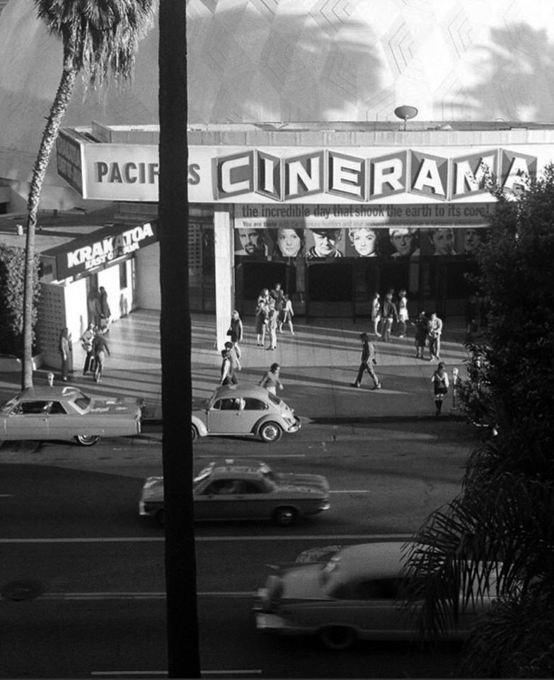
| (1968)^.^ – Cinerama Dome as seen from across the street. Now playing: ‘Krakatoa: East of Java’ |
 |
|
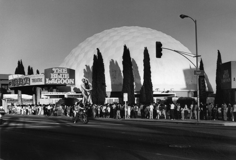
| (1980)* - In the early 1900's a mansion stood here with a large garden of string beans. Today, a long line of movie-goers await to see "The Blue Lagoon" at the Cinerama Dome Theater on Sunset Boulevard, July 8, 1980. |
 |
|
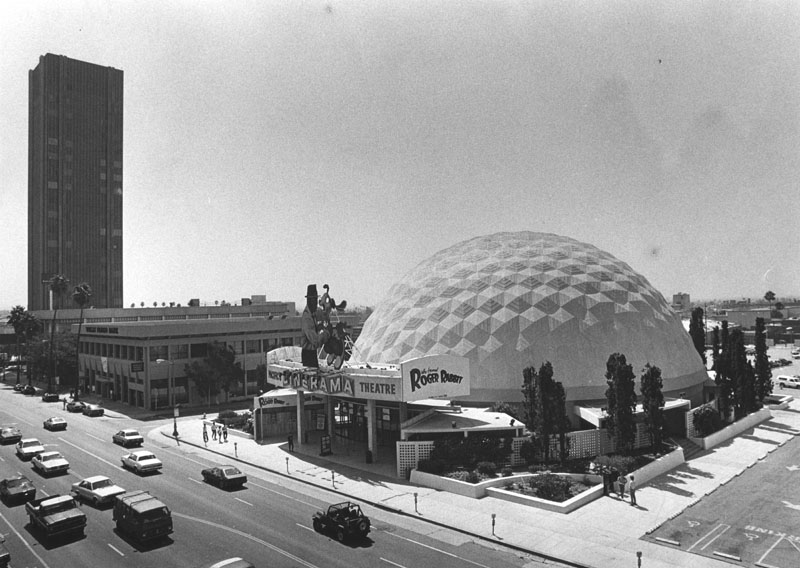
| (1988)* - Exterior view of the Cinerama Dome Theatre on Sunset Boulevard. This year (1988) is the 25th Anniversary of the Cinerama Dome. |
Historical Notes In 1998, the Pacific Cinerama Dome Theater was designated Historic-Cultural Monument No. 659 (Click HERE to see complete listing). |
 |
|
| (1988)* - Inside the Cinerama Dome (6360 Sunset Blvd.) in 1988. Photographer: Chris Gulker |
Historical Notes With its 86 feet (26 m) wide screen, advanced acoustics and 70mm film capability, the Cinerama Dome remained a favorite for film premieres and "event" showings. |
 |
|
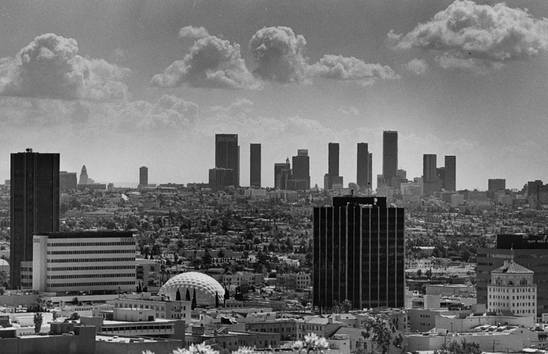
| (1987)* - Looking east from the Hollywood Hills, L.A.'s skyline appears clear and bright as does Hollywood and its distinctive Cinerama Dome. |
* * * * * |
Hollywood United Methodist Church (aka First United Methodist Church of Hollywood)
 |
|
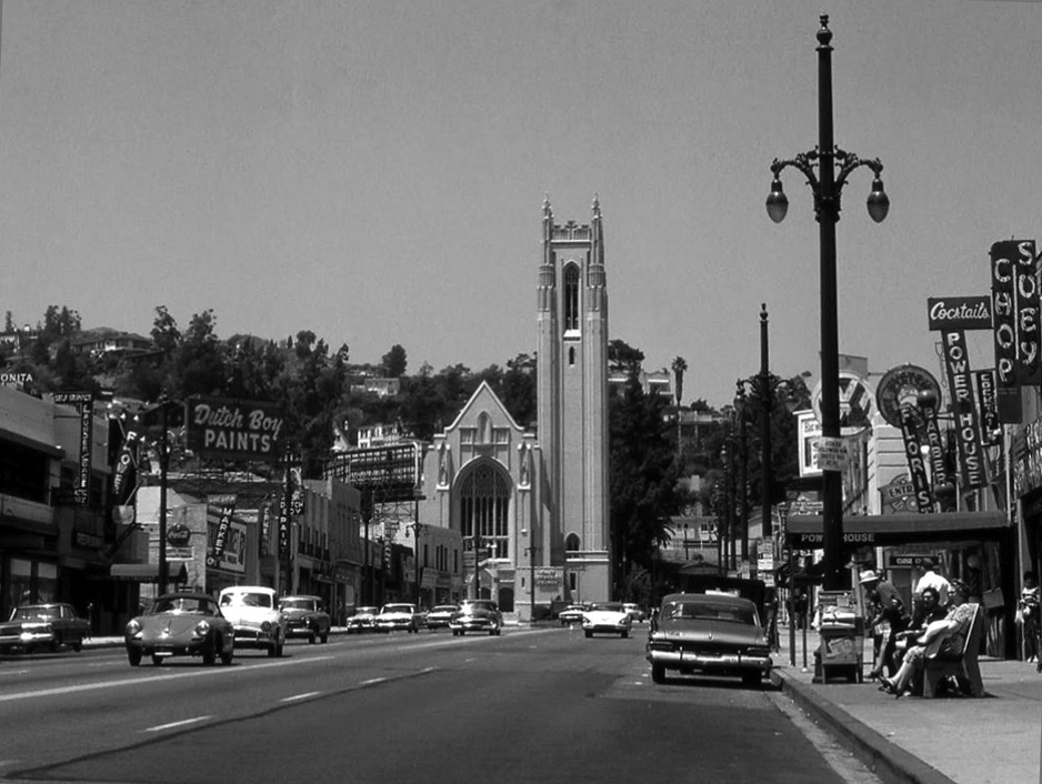
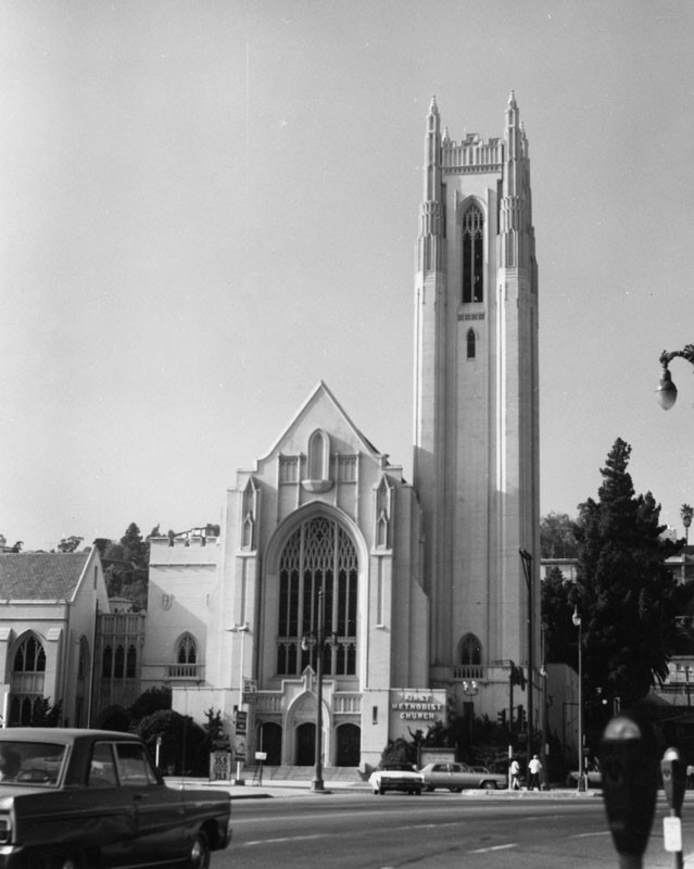
| (1960s)* – View of Highland Ave just north of Hollywood Blvd. The “Power House” is seen on the right. On the left today would be the Loews Hollywood Hotel and the Highland & Hollywood Mall. The Hollywood United Methodist Church is seen straight ahead at Highland and Franklin. |
Historical Notes The Hollywood United Methodist Church building (aka First Methodist Church of Hollywood) was designed by Thomas P. Barber, and based in part on the English Gothic style of Westminster Hall in London. The structure is steel-framed concrete, with the sanctuary roof having an open hammer beam construction. Construction on the first building, the Recreational Hall, was started in 1927 by a group of congregants who began organizing the new church in 1909. The rest of the structure was completed on March 16, 1930. The church's facilities, in addition to housing an active congregation, are used by the private non-religious Oaks School and have been the settings for many movies including Sister Act and Back to the Future. |
 |
|
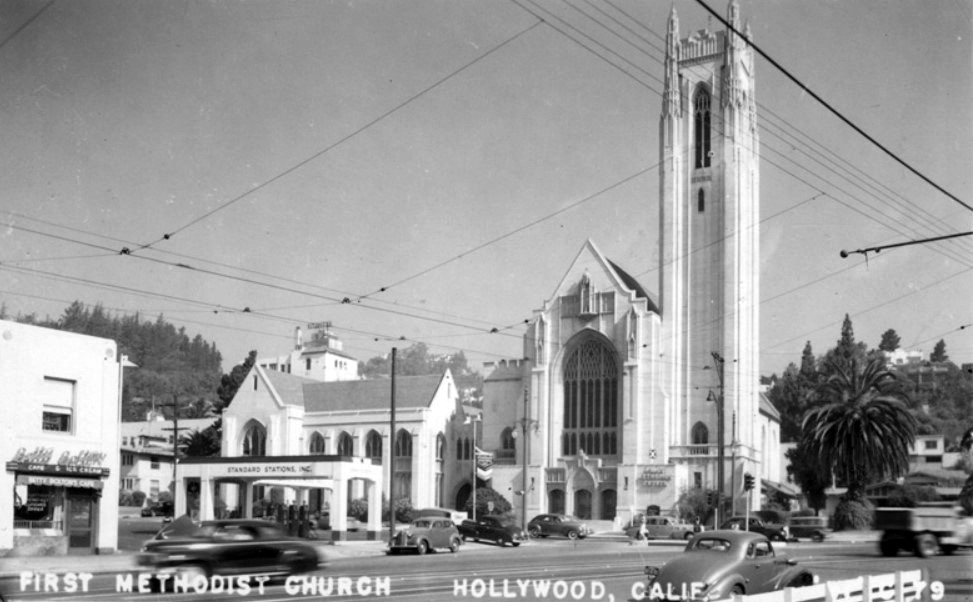
| (1969)* – View showing the English Gothic revival style Hollywood First Methodist Church, located at 6817 Franklin Avenue, declared Historic-Cultural Monument #248 by the City of Los Angeles in December 1981. |
Historical Notes Due to its convenient location in the heart of Hollywood and its mixture of Gothic and modern architecture, the church has been used frequently as a filming location for Hollywood movies. The "Enchantment Under the Sea" dance scenes in Back to the Future and Back to the Future Part II were filmed in the church's gymnasium, as was the talent show scene in That Thing You Do! Interior scenes for the movie Sister Act were filmed in the hallways, classrooms, and offices of the church, although the film crew repainted the interior to make it appear much older. Scenes from Anger Management, Big Momma's House, Jarhead, People Like Us, One Foot in Heaven, and several other movies were filmed on the premises. |
Then and Now
 |
|
 |
|
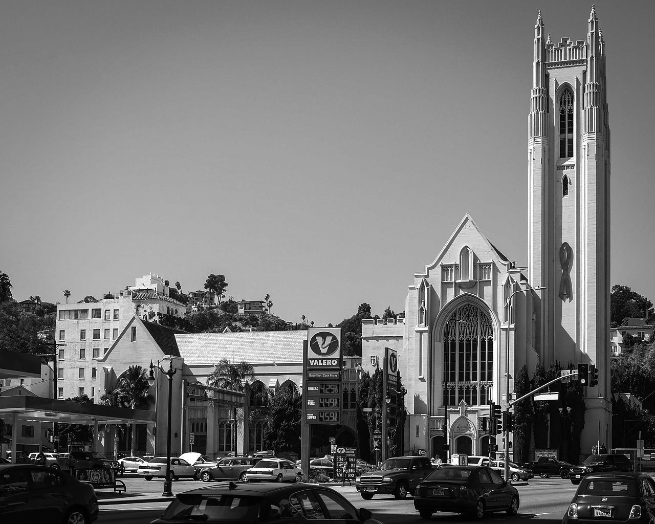
| (1940s)* vs. (2014)^ - First Methodist Church of Hollywood, NW corner of Highland and Franklin. |
* * * * * |
Highland and Hollywood
 |
|
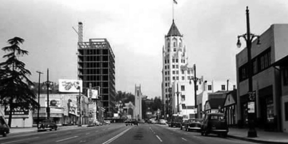
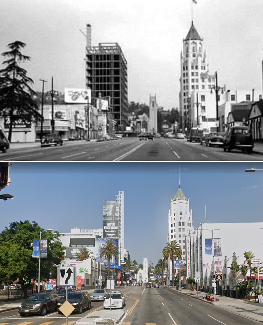
| (1959)* - View looking north on Highland Avenue toward Hollywood Boulevard. The First Federal Savings and Loan Building (N/W corner of Hollywood and Highland) is under construction across the street from the First National Bank Building. In the distance stands the Hollywood United Methodist Church. |
Historical Notes The 12-story First Federal Savings & Loan Building was built in 1959 on the northwest corner of Hollywood and Highland Avenue on the site once occupied by the Hollywood Hotel. In 2001, the Hollywood and Highland entertainment complex, which includes the Hollywood and Highland Center, the current home of the Academy Awards, was constructed on the site. |
Then and Now
 |
|
| (1959 vs 2022)* - View looking north on Highland Avenue toward Hollywood Boulevard. |
* * * * * |
Highland and Franklin
.jpg) |
|
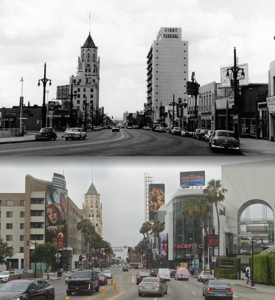
| (1960s)* – View looking south on Highland Avenue from Franklin toward Hollywood Boulevard. Both the First National Bank Building and the First Federal Savings and Loan Building can be seen. |
Then and Now
 |
|
| (1960s vs 2022)* – View looking south on Highland Avenue from Franklin toward Hollywood Boulevard. |
 |
|
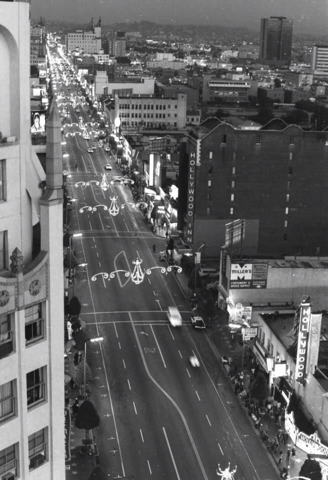
| (1975)* – View looking east on Hollywood Boulevard at Highland Avenue as seen from the top of the First Federal Savings and Loan Building (NW corner). The First National Bank Building is on the left (NE corner) with the Hollywood Inn (originally Hotel Christie) and Hollywood Theatre on the right (south side of Hollywood Blvd). |
Historical Notes In 1945, the Hotel Christie was renamed the Drake Hotel and later became the Hollywood Inn. These days, the structure is owned by the Church of Scientology. In 1998, the 12-story First Federal Savings and Loan Building was torn down to make way for a new entertainment center. The Hollywood and Highland Center, the current home of the Academy Awards, was constructed on the site in 2001. In the early 1990s, the Hollywood Theatre became a venue for the Guinness Book of World Records. |
* * * * * |
Hollywood Bowl
 |
|
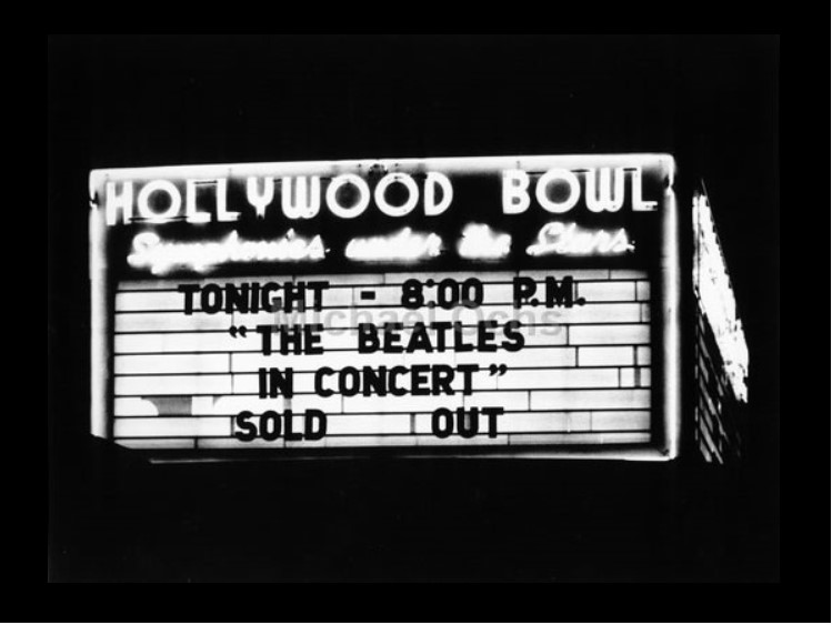
| (1964)^**# - The Hollywood Bowl Marquis when the Beatles were in town performing their first of two performances. They would appear again in 1965. |
Historical Notes Tickets went on sale four months before the concert and sold out in 3 1/2 hours. Hundreds of teenage girls camped out overnight on Highland Avenue and the next day the line went from the Bowl entrance nearly to Hollywood Boulevard. At the concert, the screaming of the crowd was so loud, no one could hear the music. After the concert, kids mobbed the backstage area. The producers used a limo as a decoy while putting the Beatles in a Dodge Dart and getting them out before the kids realized they were gone.^**# Bob Eubanks booked The Beatles' for the August 23, 1964 performance at the Hollywood Bowl. Capitol Records recorded their performance with the intent of releasing a live album, however, the sound quality of the tapes proved to be inadequate for commercial release.*^ |
 |
|
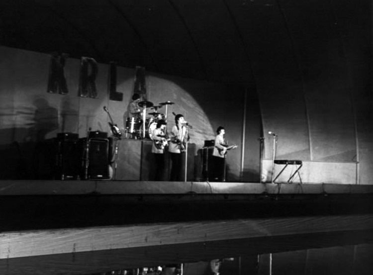
| (1965)^**# - The Beatles performing on stage at the Hollywood Bowl on August 29, 1964. |
Historical Notes The Beatles returned the following year for two more shows: August 29th and 30th, 1965. After the previous year's pandemonium, the Bowl's management tried to avoid a panic situation by hiring a Brinks armored truck to bring the Beatles to and from their hotel. Since then, virtually every rock star (with the possible exception of Elvis) has played the Bowl.^**# Capitol Records again recorded the two performances by the group as they did the previous year. The sound quality of the 1965 recordings was again disappointing. Capitol did, however, utilize a 48-second excerpt of "Twist and Shout" from the 1964 Hollywood Bowl concert on the 1964 documentary album, The Beatles' Story.*^ |
 |
|
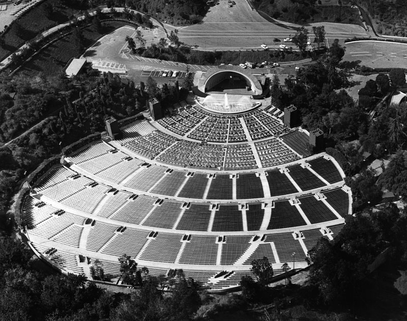
| (n.d.)* - View of the Hollywood Bowl as seen from the hillside looking towards the shell. Note the fountains and reflecting pool in front of the stage. |
Historical Notes The Hollywood Bowl reflecting pool was installed in 1953 and removed only 19 years later in 1972.*^ |
 |
|
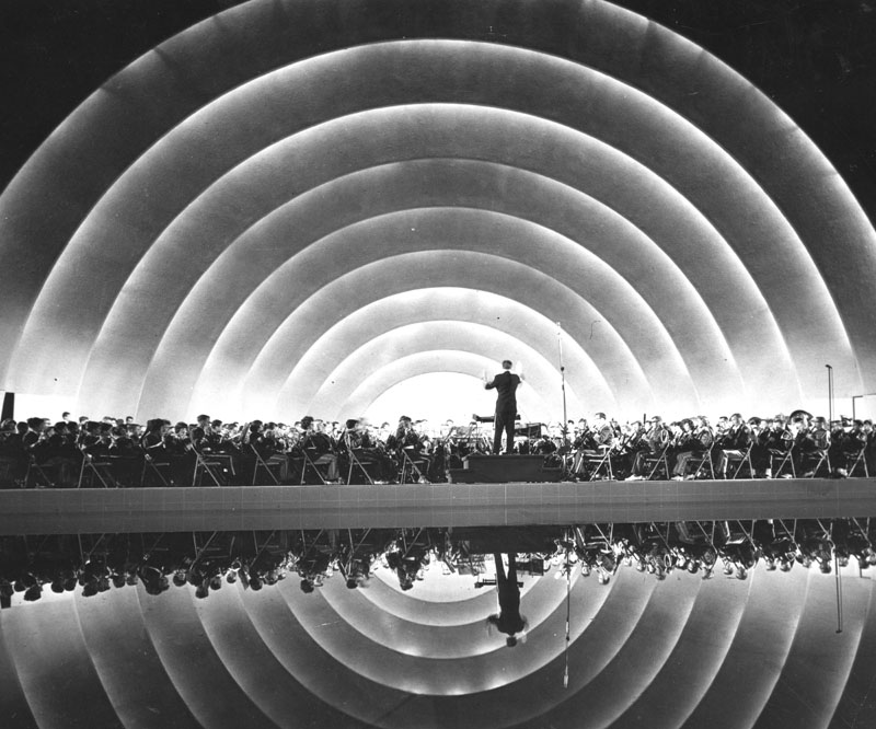
| (1968)* - View of the Los Angeles Philharmonic Orchestra performing at the Hollywood Bowl. |
Hollywood Boulevard
 |
|
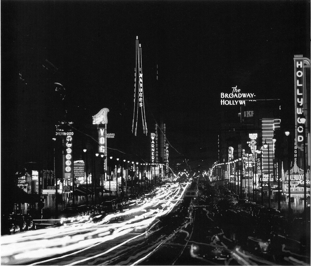
| (1959)^ – Time-lapse photo showing Hollywood Boulevard looking East towards Vine Street. Neon signs light up both sides of the Boulevard (from l to r): Vogue Theatre, Warner Brothers Theatre, Pantages Theatre, Taft Building, The Broadway-Hollywood, and Hollywood Theatre. |
 |
|
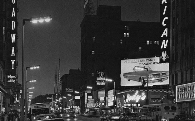
| (ca. 1964)* – View looking west on Hollywood Boulevard at Vine Street. The new 3-bulb ‘Hollywood Specials’ streetlights line both sides of the boulevard. The billboard above Hody’s Coffee Shop (NW corner of Hollywood and Vine) is advertising the new 1964 Pontiac convertibles. |
Historical Notes The most colorful of the postwar lights is the Hollywood Boulevard Special. Beginning around 1960 the existing electroliers on Hollywood Boulevard were reconstructed. The original pole bases and shafts were retained, but the lamps were replaced by luminaires on short arms. The Hollywood Special is a rectangular housing, over seven feet in length, in which three lamps are housed. The face of each side of the housing is adorned by red stars. Click HERE to see more early views of Hollywood Special Streetlights. |
 |
|
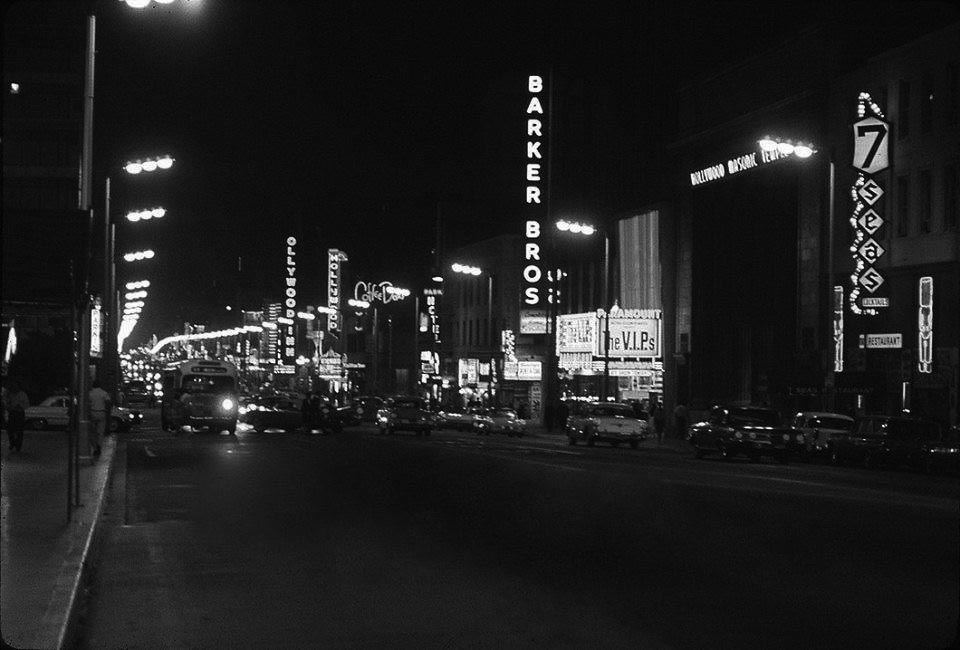
| (1963)* – View looking east on Hollywood Boulevard towards Highland Avenue. From right to left can be seen: 7 Seas Restaurant, Hollywood Masonic Temple, Paramount Theatre, Barker Bros., Coffee Dan's, Hollywood Theatre, Hollywood Inn, and the Egyptian Theatre. |
 |
|
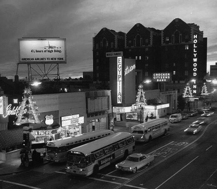
| (1966)#* – View looking southwest on Hollywood Boulevard from Las Palmas Avenue during the holiday season. The Egyptian Theatre is seen on the south side of the Boulevard with the Hollywood Inn (previously Hotel Christie and Drake Hotel) in the distance. |
 |
|
| (1966)* – Close-up view of the Egyptian Theatre at the premier of How to Steal a Million with Audrey Hepburn and Peter O’Toole |
 |
|
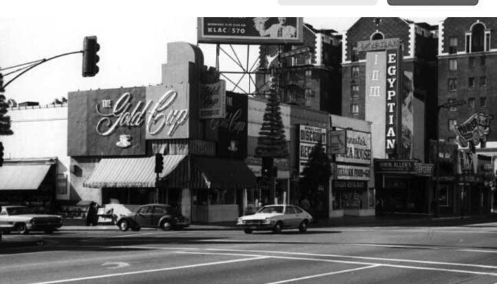
| (1960s)* - Looking toward the Egyptian Theatre from the intersection of Hollywood and Las Palmas Ave. |
 |
|
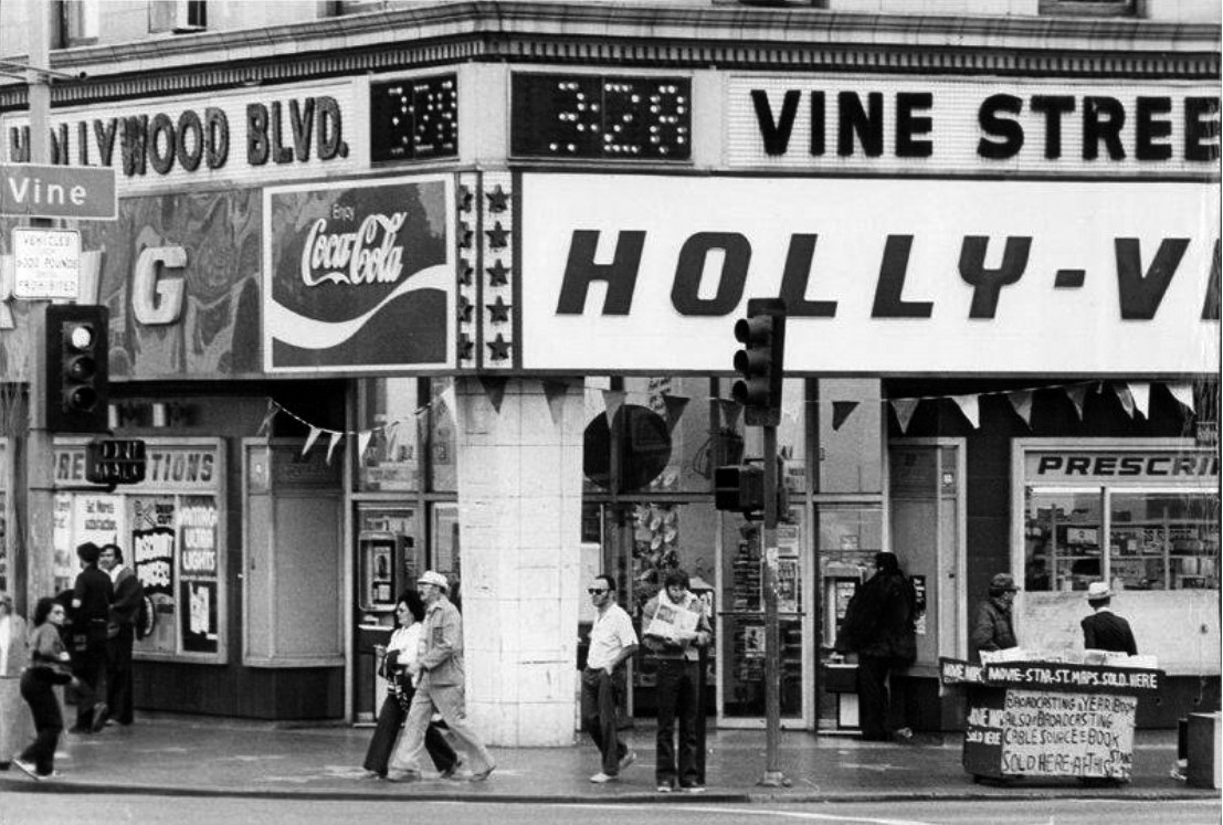
| (1971)##^* – View looking at the southeast corner of Hollywood and Vine in front of the Taft Building, 3:28 p.m. |
 |
|
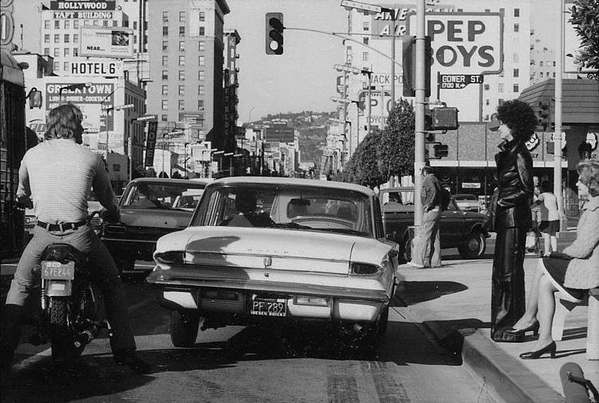
| (1974)^#^^ – View looking west on Hollywood Boulevard at Gower Street during the filming of "Earthquake". Actress Victoria Principal is in the leather jacket standing by the curb. The Taft Building can be seen in the upper left. |
 |
|
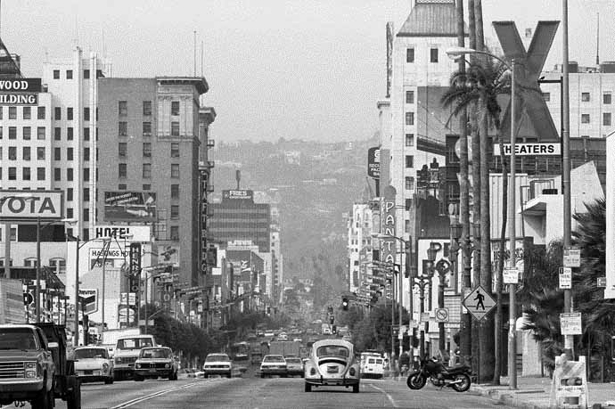
| (1986)^#^ - View of Hollywood Boulevard looking west near Bronson Street. The Hollywood Hills can be seen in the distance. |
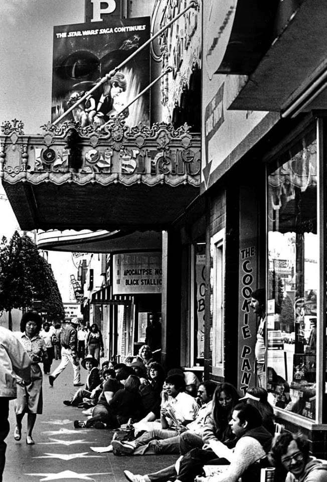 |
(1979)* – View showing a group of people staking their place along the stars of the Hollywood Walk of Fame as they wait in line to see Star Wars: The Empire Strikes. Also seen on the billboard is Apocalypse Now and Black Stallion. |
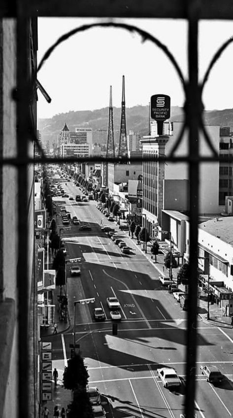 |
(1979)* – Looking down from the fire escape of the Broadway-Hollywood Building with the intersection of Hollywood Boulevard and Ivar Avenue below. The Security Pacific Bank (Security Trust and Savings Bank Building) stands on the northeast corner of Hollywood and Cahuenga.
|
M'Goo's Pizza
 |
|
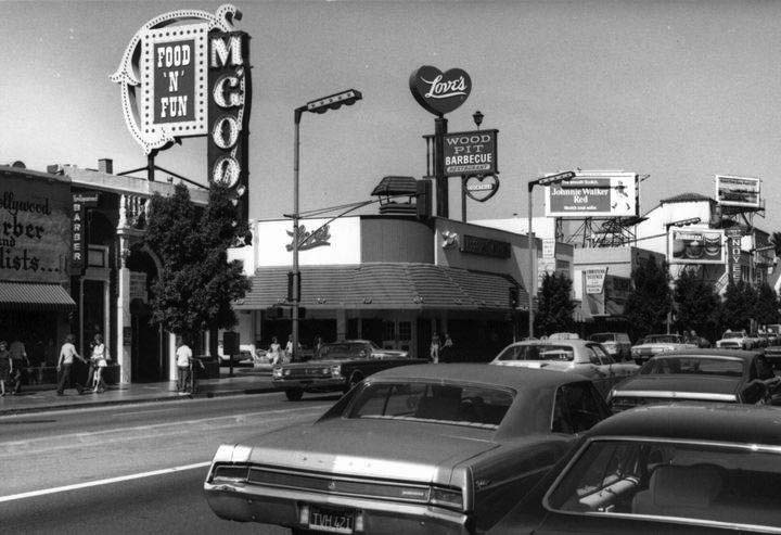
| (1976)* – View looking east on Hollywood Boulevard toward Cherokee Avenue. On the northeast corner stands Love’s BBQ Restaurant where Studio Cafe is today. Across the street, on the northwest corner is M’Goo’s Pizza which today is a souvenir store. Click HERE to see contemporary view. |
Historical Notes M'Goo's opened in 1959 at the northwest corner of Hollywood and Cherokee. M'Goo's Food 'n Fun - was a fun old time Irish themed restaurant. Owner Marty Bryman sold beer by the pound (6 lbs for $2.50) and champaign by the bubbles - in a glass slipper. |
 |
|
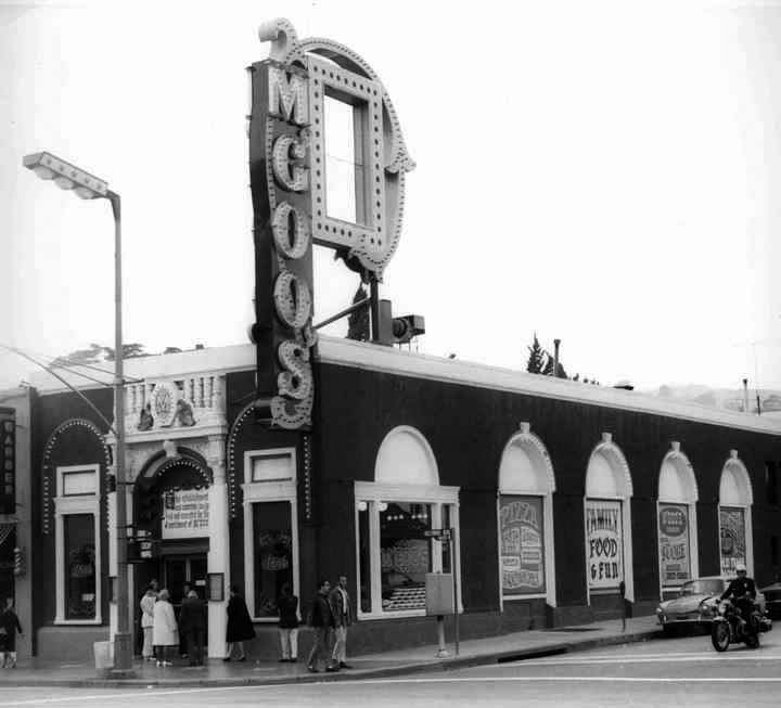
| (1972)* – View looking at the northwest corner of Hollywood Blvd and Cherokee Ave showing M’Goo’s Pizza. |
Historical Notes M'Goo's was very popular with teenagers and tourists. It was decorated like an old fashion pizza parlor. There was sawdust on the floor, little round tables and a high stage with a rinky-tink player piano. M'Goo's offered up a variety of fare including pizza, spaghetti ravioli and the World Famous M'Goo Stew. Needless to say, it was a lively place with sing a-longs to old time music. (There was also a M'Goo's in Pasadena and Van Nuys). M'Goo's stood here until a fire damaged the building in 1975. |
Shelley's Manne-Hole
 |
|
| (ca. 1970)* - Entrance of Shelly's Manne-Hole, a jazz club at 1608. N. Cahuenga Blvd. in Hollywood. Seen are ads for Bill Evans, Miss Abbey Lincoln, Shelly Manne and his men. Photo by William Reagh |
Historical Notes Shelley's Manne-Hole was a renowned jazz club located at 1608 North Cahuenga Boulevard in Hollywood. It was open from 1960 to 1972 and was a popular venue for jazz performances, particularly post-bop and modern jazz. The club was owned and operated by drummer Shelly Manne, who performed there regularly with his band "Shelly Manne and His Men". Other notable jazz artists who performed at Shelley's Manne-Hole include pianist Bill Evans, who recorded the live album "At Shelly's Manne-Hole" there in 1963. The club's entrance featured advertisements for the performers, including Bill Evans, Abbey Lincoln, and Shelly Manne and his band. It was located along the historic El Camino Real route heading north from Hollywood towards the San Fernando Valley. |
 |
|
| (2018)* - The manhole cover in front of Shelly's Manne-Hole jazz club in Hollywood commemorates the site of the famous jazz club, which was named after West Coast jazz drummer Shelly Manne. |
Historical Notes Shelley's Manne-Hole was an important hub for the West Coast jazz scene in the 1960s, hosting many influential artists and serving as a venue for live recordings. It closed in 1972 after operating for over a decade as one of the premier jazz clubs in Los Angeles. The manhole cover served as a memorial to the legacy of Shelly's Manne-Hole, which played an important role in the West Coast jazz scene. |
Cruising Sunset Boulevard
 |
|
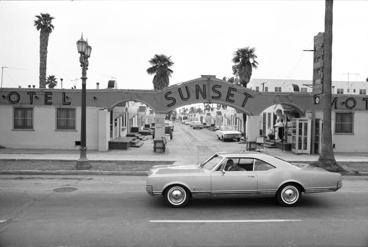
| (1966)* - "Livin' in a Hollywood bungalow!" 5154 Sunset Boulevard – Nice 1966 Oldsmobile Cutlas. Photo by Ed Ruscha |
 |
|
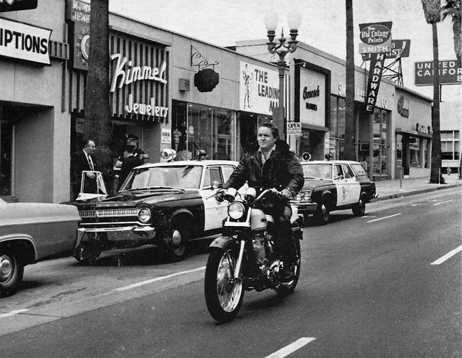
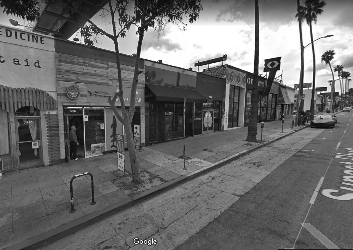
| (ca. 1967)^.^ – View showing pop singer Rouvaun riding a Harley Davidson on Sunset Boulevard with two LAPD cars parked by the curb. View is looking west on Sunset between Gardner and Sierra Bonita avenues (7500 block of Sunset). |
Historical Notes This is a photograph that appeared on the back cover of an LP by the big-voiced traditional pop singer Rouvaun. I believe it's from 1967. Caption: "Rouvaun riding his Harley-Davidson XLCH. Picture taken on Sunset Strip, Hollywood." Actually, this stretch of Sunset is located a couple of miles east of the Strip. Rouvaun (1932–1975) was born Jim Haun in Bingham, Utah. A child singer with the Mormon Tabernacle Choir in Salt Lake City, he went on to study voice at the Los Angeles Conservatory of Music and perform with the Beverly Hills Opera Company. Nonetheless, he remained a struggling woodworker studying voice. Rouvaun was a virtual unknown until February 5, 1967, when he appeared in Las Vegas as the headline singer leading the 100-person Frederick Apcar French stage review Casino De Paris at the Dunes Hotel. His first record label, KALAMO, described him on his debut album cover as "The World's Greatest Singer". Nicknamed "The Vocal Vesuvius", Rouvaun continued performing on stage to sellout crowds and recorded a number of albums. His career seemed to be blossoming until tragedy struck in 1975, when Rouvaun collapsed and died at age 43 due to massive internal hemorrhaging. Apparently the strain on his vocal cords had caused his esophagus to rupture.*^ |
 |
|
| (2019)** - Google street view showing the south side of Sunset between Gardner and Sierra Bonita as it appears today (7500 block of Sunset). |
Famous Amos
 |
|
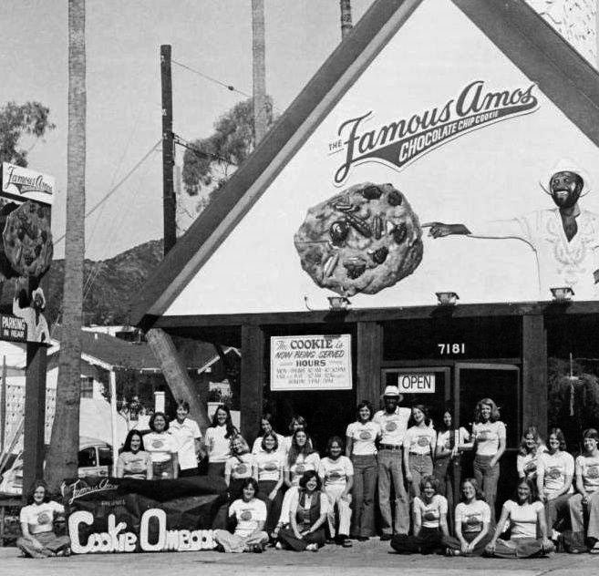
| (ca. 1975)* – Wally Amos poses with a group of teenagers in front of his first store located at 7181 Sunset Boulevard. |
Historical Notes On March 10, 1975, Wally Amos took the advice of some friends, and with $25,000 from singers Marvin Gaye and Helen Reddy, he opened a cookie store at 7181 Sunset Blvd., Hollywood, naming it "Famous Amos". In the first year he sold $300,000 worth of cookies, followed by more than $1,000,000 in sales in the store's second year of operation. By 1982 the company's revenues reached $12 million. |
 |
|
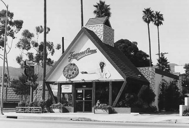
| (ca.1976)* – View showing the Famous Amos Cookie Store located on the N/E corner of Sunset and Formosa. |
Historical Notes The store proved so popular that the "Famous Amos" brand eventually branched out to sell cookies in supermarkets, a move that would later be emulated by other specialty stores such as Baskin-Robbins, T.G.I. Fridays, and Starbucks. In 1985 the meteoric rise began to slow down. That year the company lost $300,000 and had revenues of $10 million. By 1988 the company lost $2.5 million. That year the Shansby Group purchased Famous Amos for $3 million. After one year as a paid spokesman for his sold company, Amos quit in frustration. The Famous Amos brand has gone through a number of owners since inception. Between 1985 and 1989, the Famous Amos company went through four different owners. In 1992 the President Baking Company purchased the brand from The Shansby Group. Then, in 1998, Keebler purchased the President Baking Company. It was then owned by Keebler until the Kellogg Company purchased Keebler in 2001. The brand is now a part of Kellogg's. |
 |
|
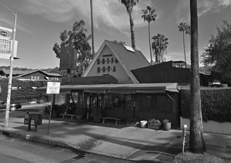
| (2015)* - Google Street View showing the northwest corner of Sunset Boulevard and Formosa Avenue, now a Brazilian Restaurant called the Bossa Nova. Note the 'Famous Amos Square' sign in front of the restaurant. |
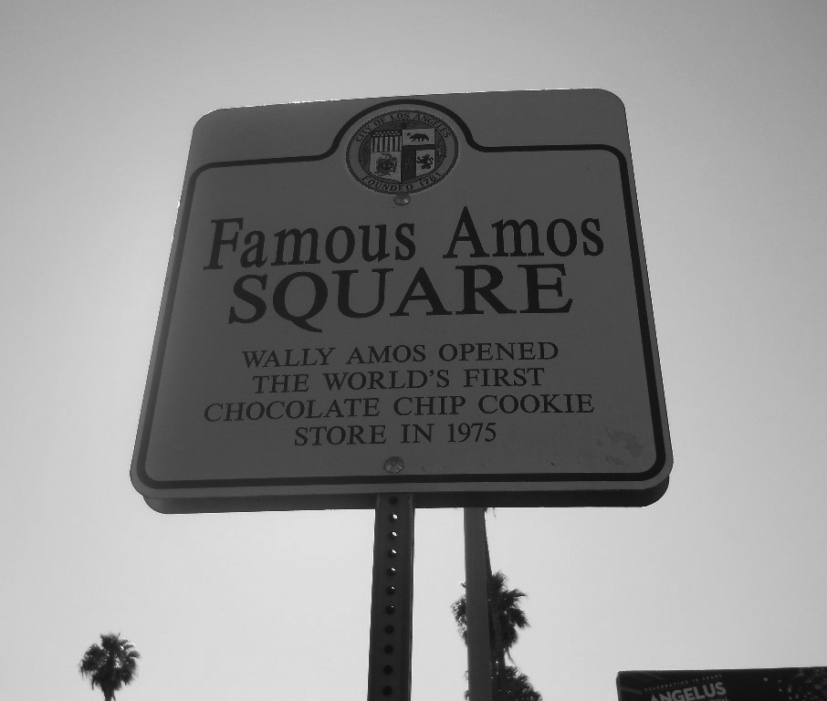
Historical Notes Today, there is a sign commemorating the first Famous Amos store in Los Angeles, located at West Sunset Boulevard and North Formosa Avenue in Hollywood. |
 |
|
| (2011)++ - Sign at the corner of Sunset and Formosa reads: Famous Amos Square - Wally Amos Opened the Worlds First Chocolate Chip Cookie Store in 1975 |
Historical Notes Wally Amos has created another brand of cookie called "Chip and Cookie", named after two characters he created in the 1980s. The Chip and Cookie brand is owned by Wally himself, and has a slightly different recipe than that of the Kellogg's variation. |
Sunset Grill
 |
|
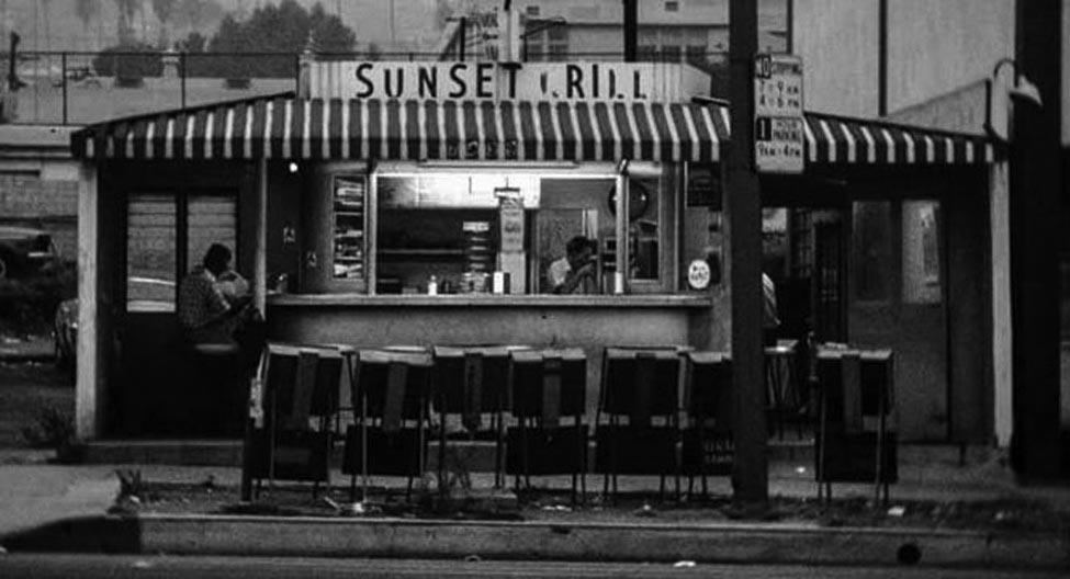
| (ca. 1970s)* – Night view showing the “Original” Sunset Grill located at 7439 Sunset Boulevard in Hollywood. |
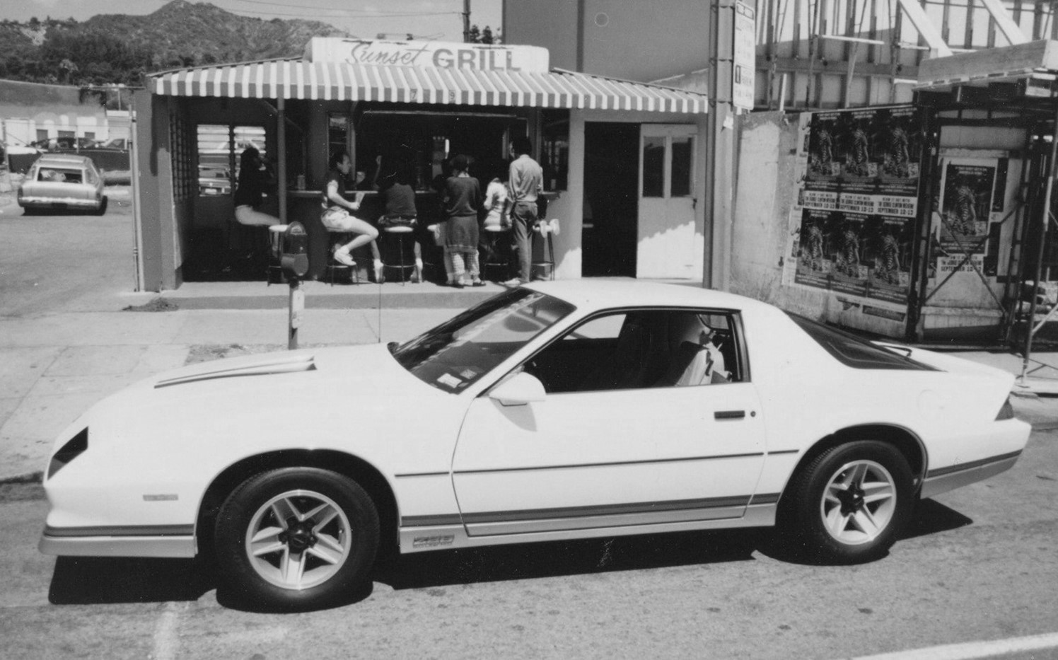
Historical Notes The original Sunset Grill was run by owner Joe Froehlich from 1957 to 1997 when he sold the business. The building was torn down, rebuilt and reopened. The burger joint neighbors the Rock Walk at the Guitar Center and gained fame from the Don Henley song "Sunset Grill". |
 |
|
| (1985)* – A new Camaro Z-28 parked in front of Sunset Grill on Sunset Boulevard. |
 |
|
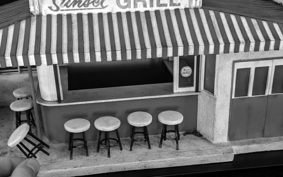
| (2020)^ - Miniature model of the iconic Sunset Grill assembled by Kieran Wright. |
Historical Notes After losing his job in airline marketing back in March, Kieran Wright, a 28-year-old New Zealand native, was searching for new ways to fill his time. But instead of turning to things like baking, binge-watching, or, you know, general existential despair, Wright focused his energy on something a bit more unexpected: Immortalizing iconic LA architecture through detailed miniature models.^ |
 |
|
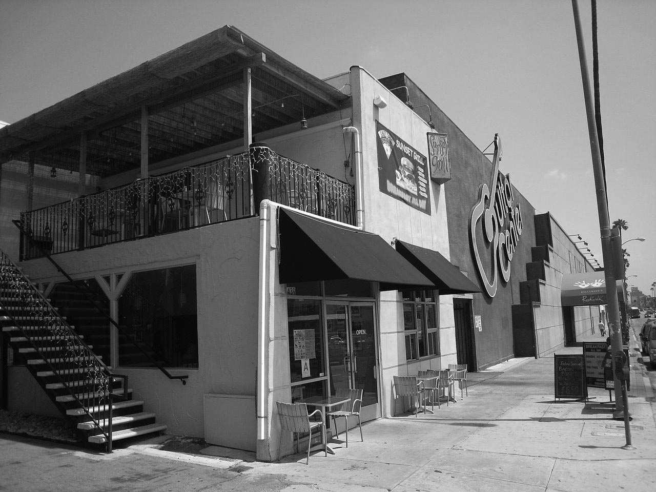
| (2007)*^ – View showing the new Sunset Grill Restaurant with Guitar Center next door to the east. |
Historical Notes Kittykat Musik and Friends wrote several songs at The Sunset Grill, while on breaks from recording next door at the now close SUSHI KINGz basement. The now famous VEGGIE WRAP song by Kittykat, Jesus acobain, AJ King and Friends, was written there. *^ The restaurant remains popular and is known for celebrity musician spottings. |
* * * * * |
 |
|
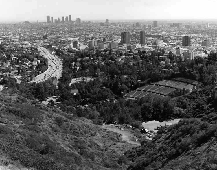
| (1989)^^^ - View of Hollywood from Mulholland Drive. The Hollywood Bowl can be seen in the foreground and the Hollywood Freeway is to the left. At top-center is the heart of Hollywood, around Hollywood and Vine. In the far distance can be seen Downtown L.A. and the Wilshire corridor. |
 |
|
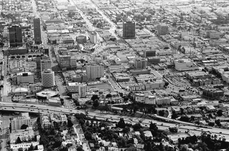
| (1992)* - Aerial view of Hollywood, looking south from near where the 101 Freeway (foreground) crosses Vine Street. Various landmarks, streets, office buildings, businesses, and homes are visible throughout the image. |
* * * * * |
Mount Lee and the Hollywood(land) Sign
 |
|
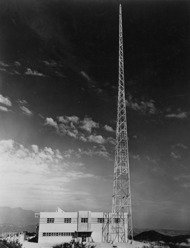
| (ca. 1938)* - View of the newly installed transmitter antenna and station building for Don Lee Broadcasting System's electronic television station W6XAO, located atop of Griffith Park's 1,700 ft. high Mt. Lee. |
Historical Notes Mount Lee is named after early Los Angeles car dealer and radio station owner Don Lee. Lee, a one-time bicycle shop owner who became a protégé of Los Angeles pioneer businessman Earle C. Anthony, purchased the Los Angeles radio station KHJ from Times publisher Harry Chandler in 1927. Part of Mount Lee was then sold to Howard Hughes, who intended to erect an estate for his then current love interest, Ginger Rogers. Ultimately, the Hughes-Rogers relationship soured, and the mansion was never built. After utilization during the war by the U. S. Army, the property remained an idle asset for decades, and eventually became part of the Hughes estate. In 2002, the Hughes estate sold 138 acres of their Mount Lee holdings to a group of Chicago investors. This opened up the possibility of development of four residential buildings adjacent to the sign. Many Angelinos, especially those in the movie industry, felt this would be sacrilege. A successful effort was mounted in 2010 to raise funds to purchase the land and add it to the adjacent Griffith Park. Today, the large radio tower atop Mount Lee today is owned and operated by the City of Los Angeles. Smaller tenants on the site have included some federal government and amateur radio users. |
 |
|
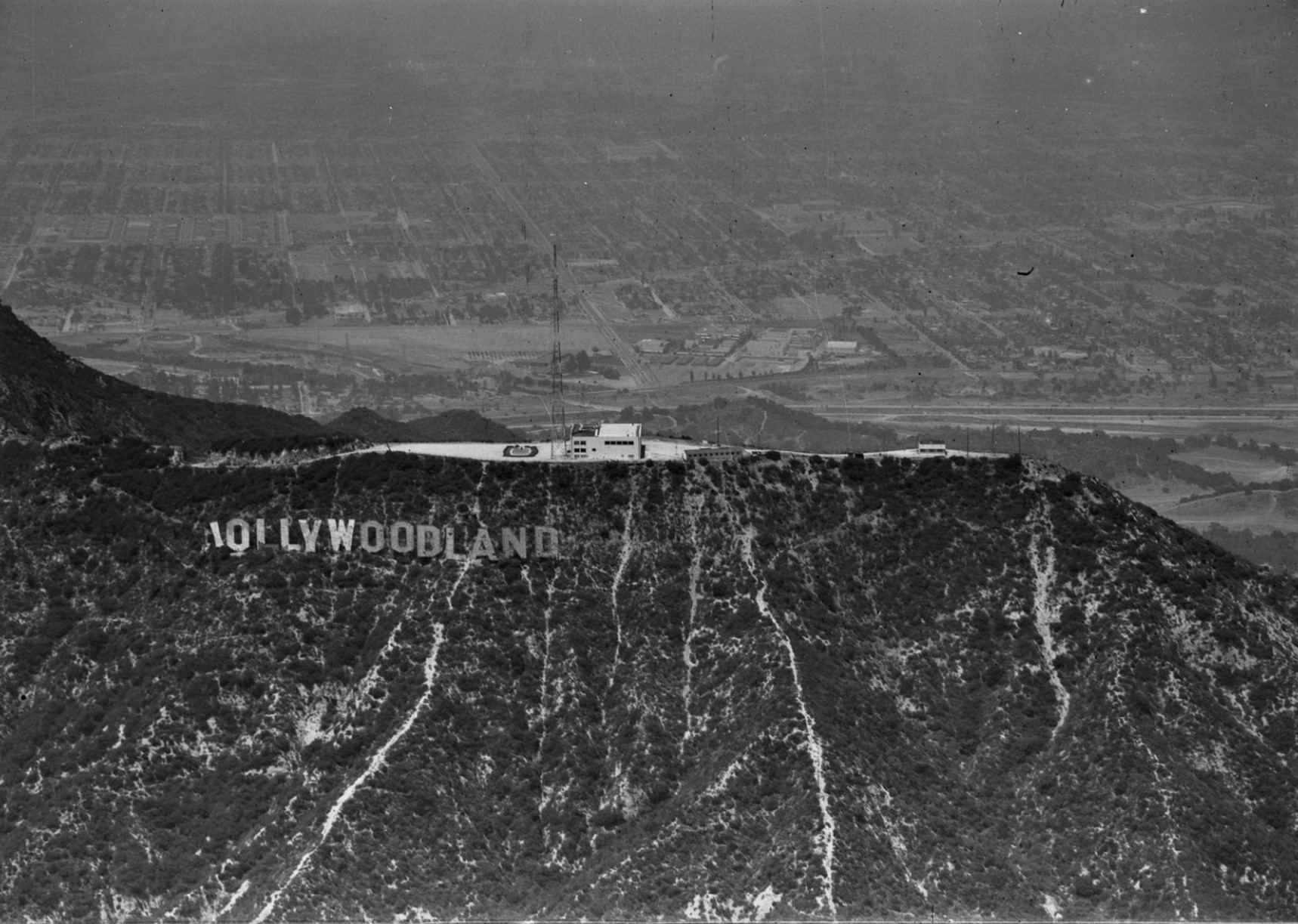
| (1944)* - An aerial view looking north at the Hollywoodland sign on Mount Lee in the Hollywood Hills, featuring the Don Lee Television Broadcasting Station and its transmission tower atop the hill. The San Fernando Valley is visible in the distance. Note that the letter "H" on the sign has fallen down. Photo from the Ernest Marquez Collection. |
Historical Notes The "Hollywoodland" sign, originally erected in 1923, suffered significant damage during the 1940s. Contrary to popular belief, the letter "H" did not fall in 1947 but was actually knocked down by a windstorm in March 1944, leaving the sign to read "OLLYWOODLAND" for a time. This damage contributed to the overall deterioration of the sign during that era, leading to the removal of the last four letters, "LAND," in 1949, thereby simplifying the iconic landmark to "HOLLYWOOD." |
 |
|
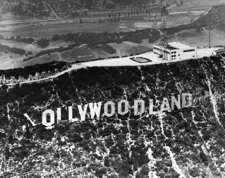
| (1944)* – Closer view showing the damaged “Hollywoodland” sign after a windstorm in March, 1944. Note the swimming pool on top of Mt. Lee adjacent to the transmitter tower and station building. |
Historical Notes In March 1944 the H blew down in a windstorm, and nearby residents complained that the sign was a hazard and an eyesore. On January 6, the Recreation and Parks Commission announced that the sign would be torn down. They denied a request of the Hollywood Chamber of Commerce to alter and repair the sign to read Hollywood. Several days later, Councilman Lloyd G. Davies (who represented Hollywood) introduced a resolution before the City Council that the Chamber of Commerce would repair the sign, at an estimated cost of $5,000, furnish bond to guarantee its maintenance and provide the city with proper liability coverage, if the parks commission would consent. Davies said his district was sensitive about becoming known as “ollywood.” The parks commission later reversed its decision and allowed the first nine letters to be repaired and cut down the last four, to read HOLLYWOOD, therefore transforming it from a commercial display into a community one. |
 |
|
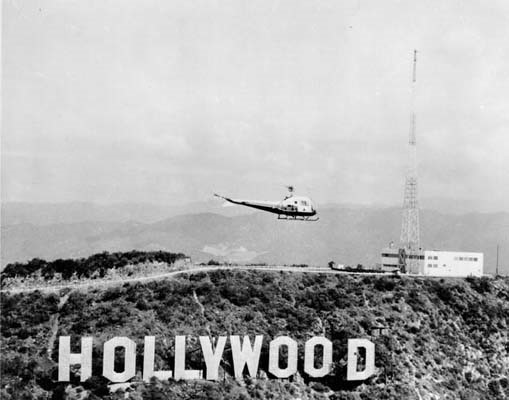
| (1960)* - A Northrop helicopter flies past the Hollywood Sign in 1960. The Don Lee Television station broadcasting antenna appears behind, on the top of Mount Lee. |
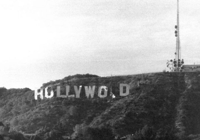 |
|
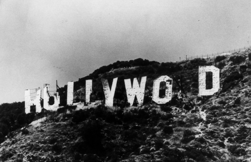
| (ca. 1970s)*^ - View of the Hollywood Sign in disrepair during the 1970s. |
Historical Notes Over the course of more than half a century, the sign, designed to stand for only 18 months, continued to sustain extensive damage and deterioration. |
 |
|
| (1970s)* - The Hollywood Sign went from a deteriorated wooden structure to today’s metal structure in the late 1970s. |
Historical Notes By the 1970s, the first O had splintered and broken, resembling a lowercase u, and the third O had fallen down completely, leaving the severely dilapidated sign reading "HuLLYWO D". |
 |
|
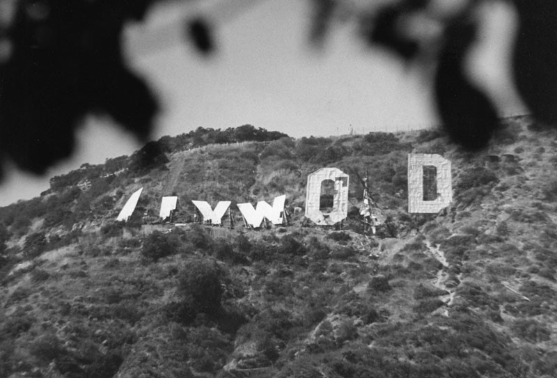
| (1978)* - Dismantling of the old Hollywood Sign to make way for the new sign. |
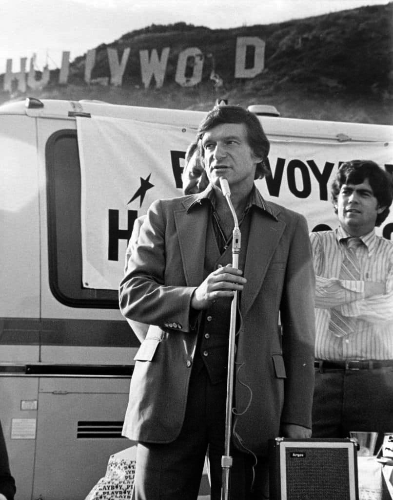
Historical Notes Improvements and maintenance occurred in fits and starts. By the early 1970s, committees were being formed to “save” the sign in order to restore it beyond shoddy paint jobs and patchwork repairs. Finally, in 1978 a committee headed by Hugh Hefner and Alice Cooper collected the funds – about US$27,000 per letter – to not simply repair, but rebuild the sign. |
 |
|
| (1978)* - Hufner leading the charge to raise money for restoring the Hollywood Sign. |
Historical Notes Following the 1978 public campaign to restore the sign, the following nine donors gave $27,777 each (which totaled $250,000):* H – Terrence Donnelly – publisher of the Hollywood Independent Newspaper |
 |
|
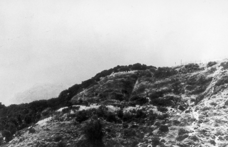
| (1978)* - For a short time during the reconstruction period the sign was completely gone from the mountain. |
 |
|
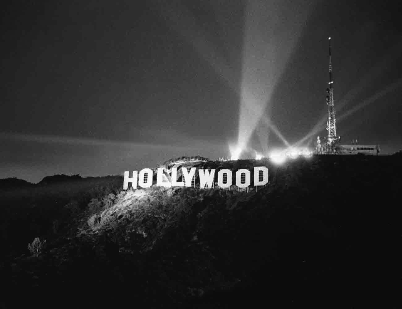
| (1978)* - The unveiling of the new Hollywood Sign in 1978. Photo courtesy Bruce Torrence |
Historical Notes The new letters were 45 feet tall and ranged from 31 to 39 feet wide. The new version of the sign was unveiled on November 11, 1978, as the culmination of a live CBS television special commemorating the 75th anniversary of Hollywood's incorporation as a city. |
 |
|
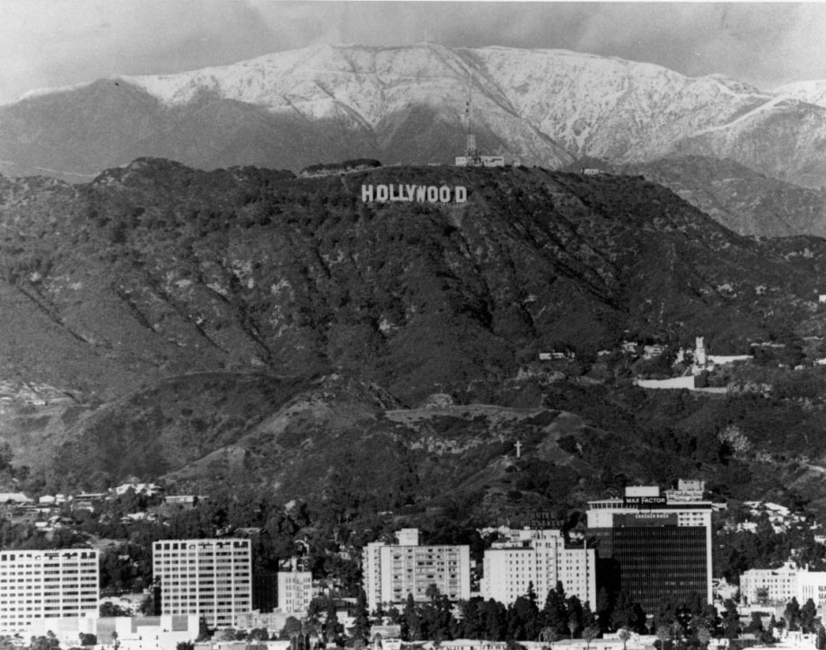
| (1978)* – The Hollywood Sign is up again! View of the restored Hollywood Sign on a clear winter day with the snow-capped San Gabriel Mountains in the distance. |
 |
|
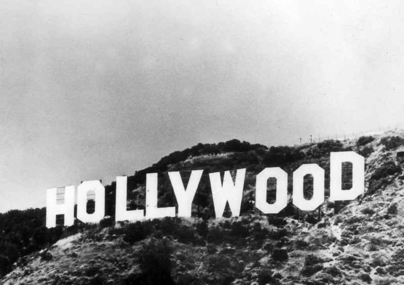
| (ca. 1978)* - Close-up view of the newly reburbished Hollywood Sign. |
 |
|
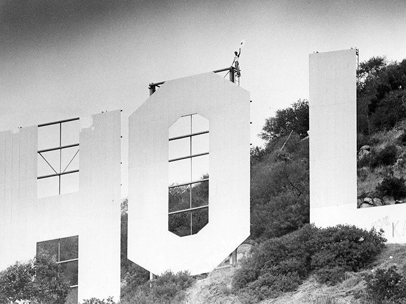
| (1980)* - Photograph caption dated August 19, 1980 reads, "Actor Frank Verocca atop 'Hollywood' Sign with picket sign." |
Historical Notes The strike and Emmy Awards boycott, which ran from July to October 25, 1980, led to a 32.25% increase in minimum salaries and a 4.5% share of movies made for pay TV. |
 |
|
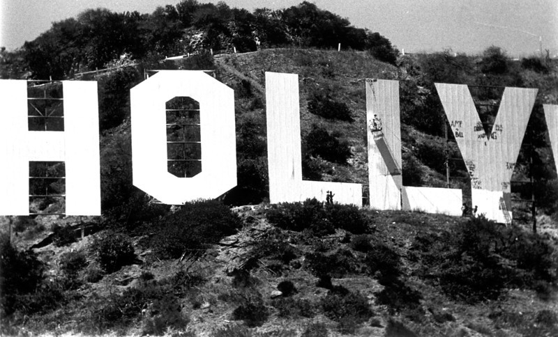
| (1984)* - Painters working on the Hollywood Sign to spruce it up for Olympics visitors. This view gives a true perspective of the size of the letters. A painter suspended on the side of the letter 'L' can be seen |
Historical Notes The sign has been painted several times since it was installed, however a recent project completed on December 4, 2012, removed all of the old paint and the sign is now painted on both sides. |
 |
|
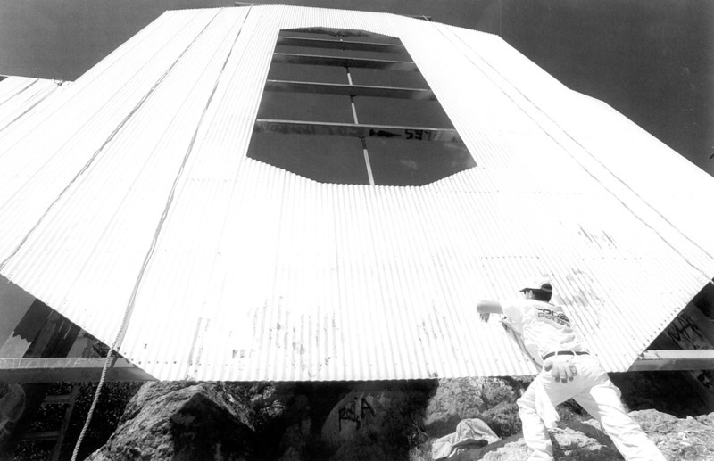
| (1995)* - Painters often have to climb the 45-foot letters from eight to 10 times a day while working on the job. |
 |
|
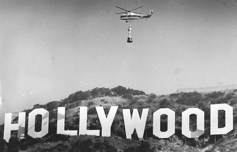
| (1988)* - A helicopter is seen flying an oversized Oscar statue over the Hollywood Sign in preparation for the 60th Academy Awards presentation on April 11, 1988 at the Shrine Auditorium in Los Angeles. |
 |
|
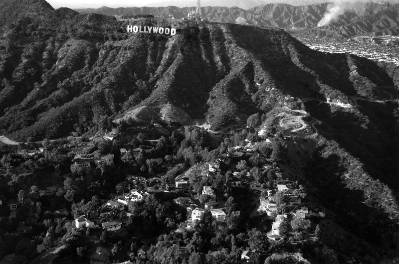
| (n.d.)* - Aerial view of the Hollywood Sign on a crystal clear day. Over the crest of the Hollywood Hills can be spotted a plume of smoke in the distant San Gabriel Mountains. |
 |
|
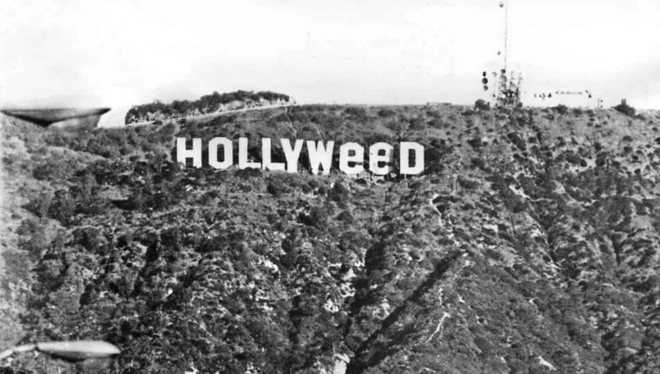
| (1976)*- The Hollywood Sign was altered to read HOLLYWeeD in January 1976, following the passage of a state law decriminalizing marijuana. |
Historical Notes Although the city has occasionally allowed it in the past for commercial purposes, current policy does not permit changes to the Hollywood Sign. This is largely due to neighborhood opposition and to past accidents. However, the sign has been unofficially altered a number of times, often eliciting a great deal of attention. Click HERE to see a list of alterations. |
 |
|
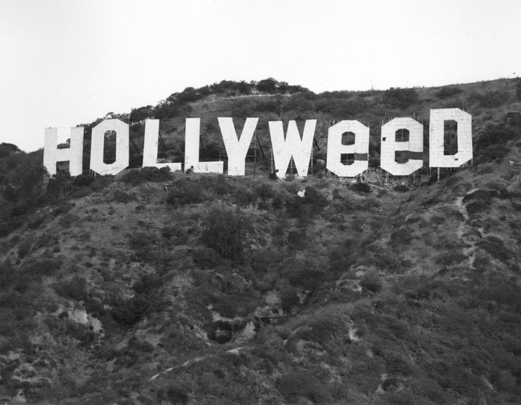
| (1976)* - On New Year’s Day, 1976 prankster Danny Finegood changed it to...HOLLYweeD |
 |
|
| (1976)* - View looking up toward the Hollywood Hills showing the "HOLLYWEED" sign. |
Historical Notes The HOLLYWOOD sign was altered to read ‘HOLLYWeeD’ in January 1976, following the passage of a state law decriminalizing marijuana. |
 |
|
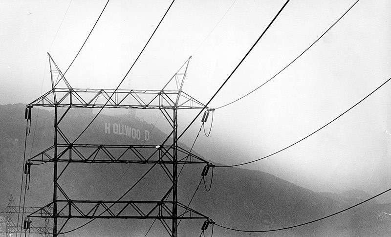
| (1979)* - Photograph caption dated September 14, 1979 reads, "The Hollywood sign is barely visible through the smog in this photo taken from above Lake Hollywood in Cahuenga Pass." |
Historical Notes Smog has been a big issue in Southern California for over half a century. Click HERE to see how things have improved in the last several decades. |
 |
|
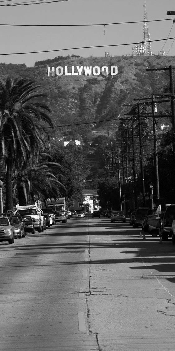
| (2010s)* – Street view looking north showing the HOLLYWOOD sign and the antennas on top of Mt. Lee in the background. |
 |
|
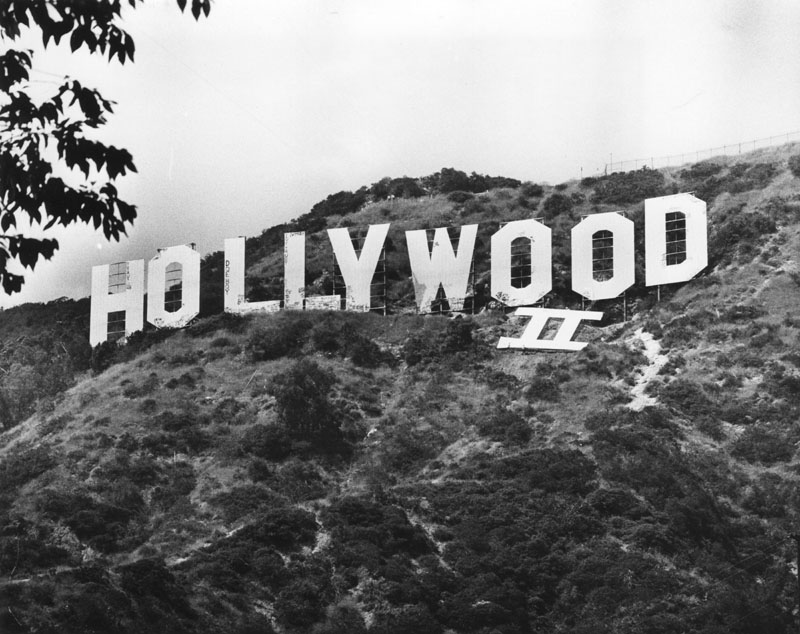
| (1986)* - The placement by helicopter of the 45-foot-by-45-foot Roman numeral II was one of several projects sponsored by Hollywood II, a coalition of citizens and businesses promoting the revitalization of Hollywood as a major area for growth. |
 |
|
| (1987)* - Movie characters and look-alikes, such as Laurel and Hardy, Woody Woodpecker, pose under the Hollywood Sign on the occasion of its sale to Universal Studios for advertising purposes. |
 |
|
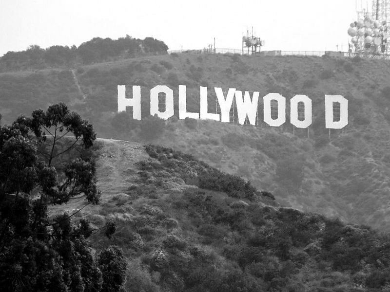
| (2005)*^ - Close-up view of the Hollywood Sign as seen from Hollywood Blvd with a telephoto lens. |
 |
|
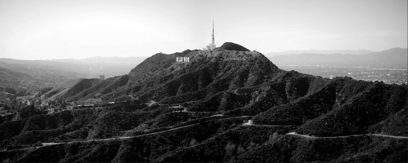
| (2013)* - Panoramic view of the Hollywood Hills showing the Hollywood Sign and Mt. Lee, with the San Fernando Valley in the background. Click HERE to see more in Early Views of the San Fernando Valley. Photo by Daniel Pouliot |
Then and Now
.jpg) |
.jpg) |
|
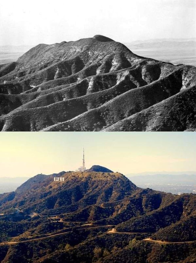
| (ca. 1905)^ - View of Mt. Lee circa 1905. | (2013)* - View of Mt. Lee as it appears today. |
 |
|
| (1905 vs. 2013)^ - Then and Now |
 |
|
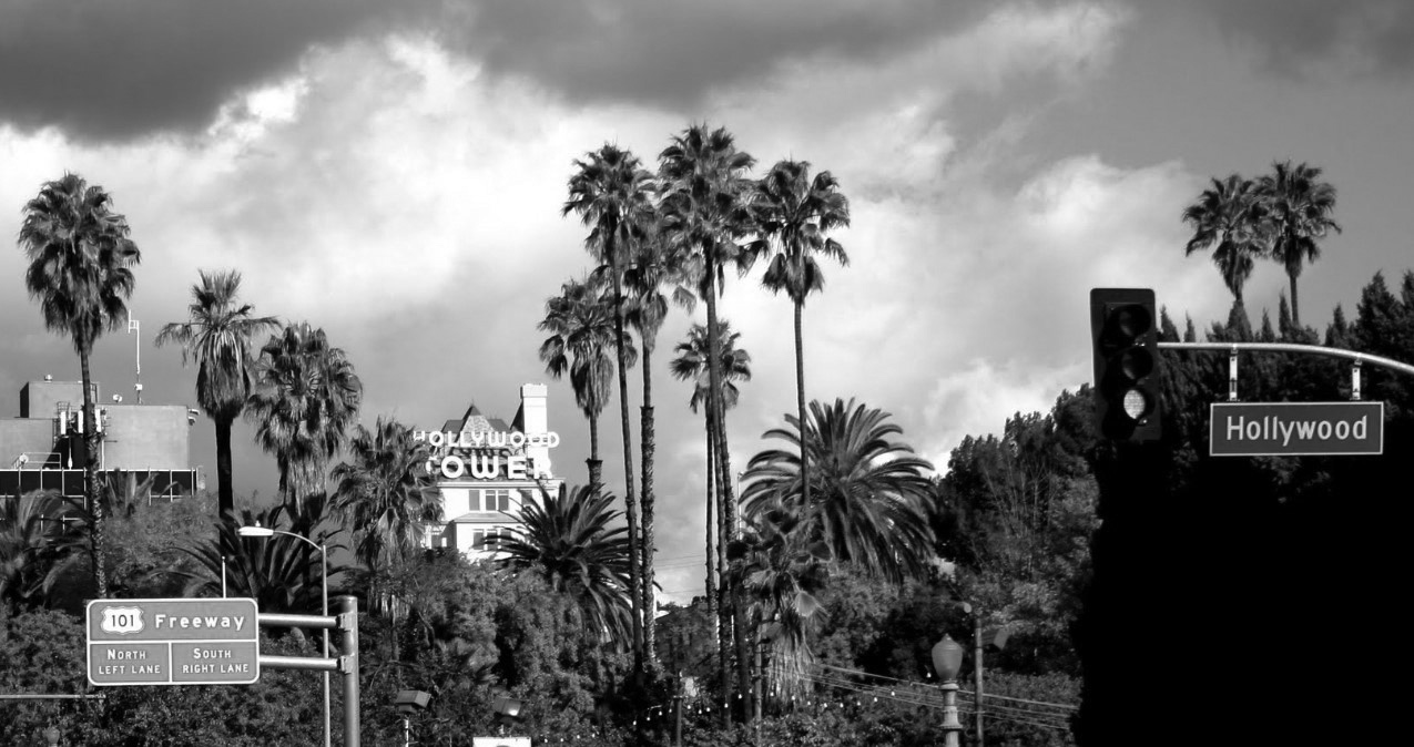
| (2010)* – Panoramic view looking northwest showing the iconic Hollywood Tower, appearing to be surrounded by palm trees with sign for the Hollywood Freeway on-ramp in lower-left. |
 |
|
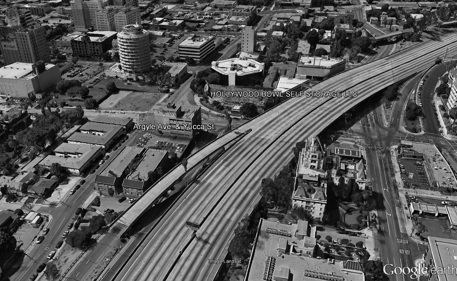
| (2015)* - Google Earth view looking west showing the Hollywood Tower (lower-right) and the Capitol Records Building standing tall on opposite sides of what appears to be an empty Hollywood Freeway. |
 |
|
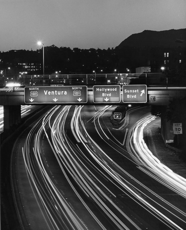
| (1980)* – Night scene showing the Hollywood Freeway heading north toward the San Fernando Valley. In view is the Sunset Boulevard overpass and exits for both Hollywood and Sunset boulevards. |
 |
|
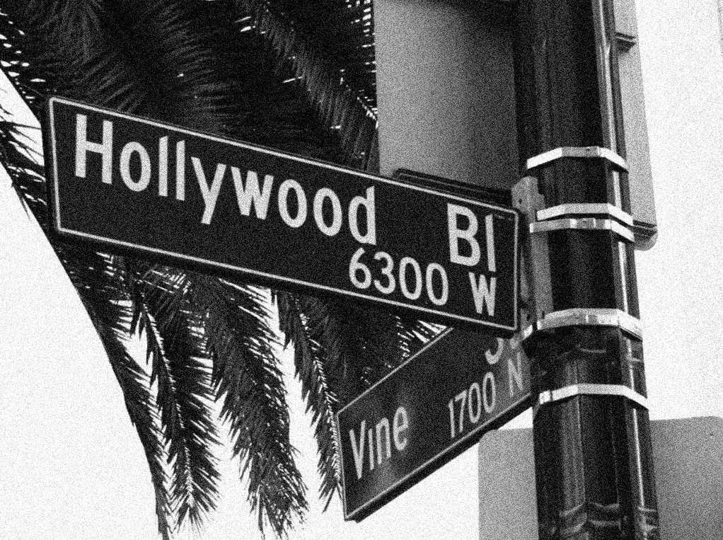
| (2011)* - Hollywood and Vine - One of the most famous intersections in the world. |
 |
|
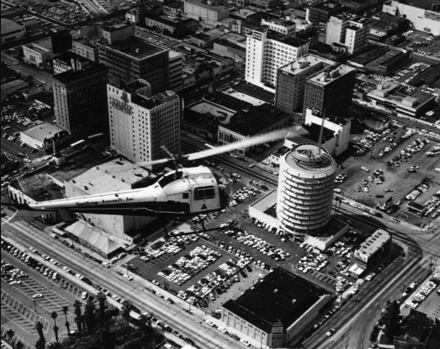
| (1970)* - Aerial view looking southwest showing a helicopter hovering over Hollywood. The intersection of Hollywood and Vine is at upper center-left and the Capitol Records Building stands tall at center-right. |
 |
|
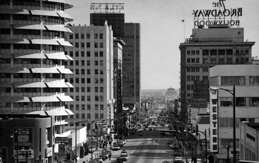
| (ca. 1961)* – View looking south on Vine Street from Yucca Street toward Hollywood Boulevard. |
Historical Notes With the rise of Hollywood’s importance came a dramatic rise in its skyline. Before 1922, the tallest building in Hollywood was the four story Hillview Apartmentt Building. By the end of the decade, the multi-story Broadway-Hollywood Building, Christie Hotel, Equitable Building, First National Bank Building, Hollywood Guaranty Building, Hollywood Plaza Hotel, Hollywood Roosevelt Hotel, Hollywood Storage Building, Knickerbocker Hotel, Yucca Vine Tower, and Taft Building had arisen in a flurry of development and Hollywood thus acquired its own proper downtown, distinct from Downtown Los Angeles and separated by 5.5 miles. |
 |
|
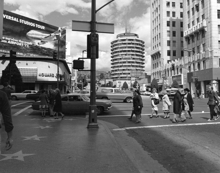
| (1978)*- View looking north from the southwest corner of Hollywood and Vine showing Howard Johnson's across the street and the Capitol Records Building in the distance. The northwest corner of Hollywood and Vine has a long and rich history of being occuppied by well known restaurants and nightclubs over the years.+ |
Historical Notes + In 1915, at the northwest corner of Hollywood and Vine Street sat the home of early Hollywood pioneer and land speculator George Hoover. Hoover was part of the L.A. Pacific Boulevard and Development Company. He was also president of Hollywood's first bank - the Bank of Hollywood and was one of the builders of the fashionable Hollywood Hotel (located at Hollywood and Highland). In 1925 German immigrant and movie maker Carl Laemmle purchased the property from George Hoover for $350,000. Laemmle was president of Universal Pictures Corporation and had a very successful movie studio in the San Fernando Valley. In 1932, Carl Laemmle opened the one story CoCo Tree Café on this corner. In 1940, restaurateur Sidney Hoedemaker of the Pig 'N Whistle - Melody Lane chain, leased the northwest corner Hollywood and Vine transformed it into a Melody Lane Restaurant. This would be followed by Hody's Restaurant in 1954, Howard Johnson's in 1971, and the Brown Derby in the 1980s. The site became a slew of struggling retail and nightclubs such as; Premiere, Jack's Sugar Shack, the Deep, and finally the Basque nightclub. In April 2008 the building went up in flames and the lot has been empty since. #^** |
 |
|
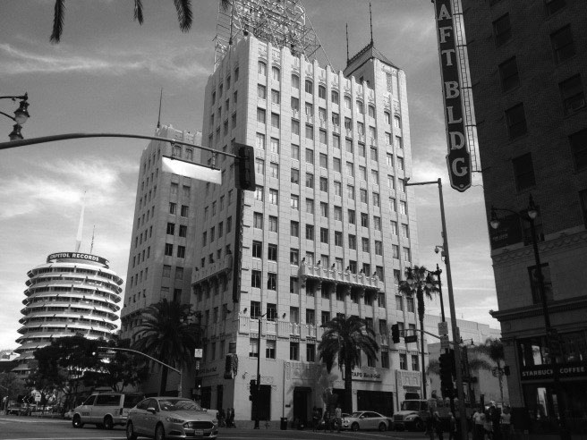
| (2016)*.* – View looking northeast at the intersection of Hollywood and Vine showing three of Hollywood’s most iconic buildings (l to r): the Capitol Records Building, the Equitable Building, and the Taft Building. |
 |
|
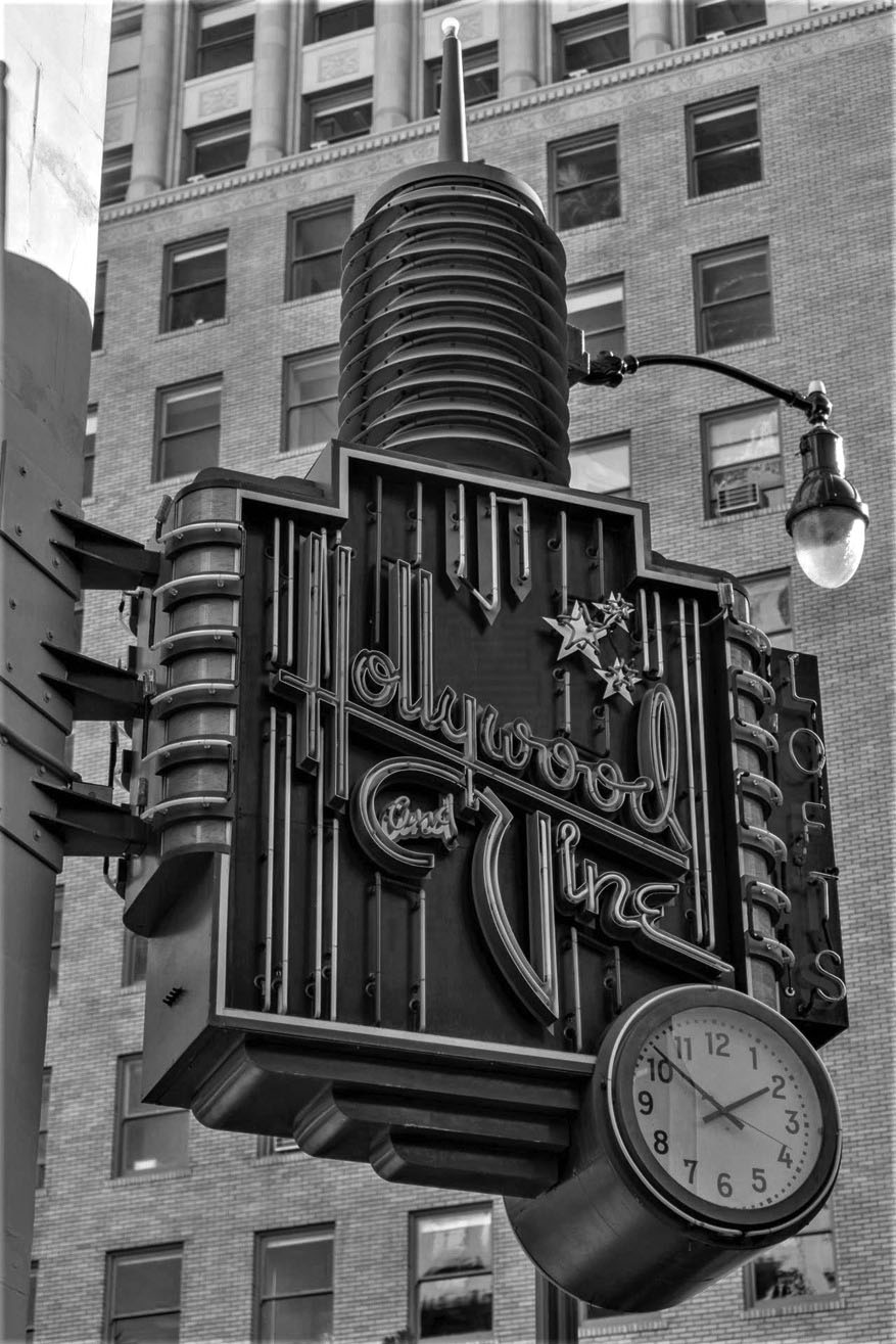
| (2022)^ - Clock and Lofts at Hollywood and Vine sign extends from the corner of the Equitable Building (NE corner of Hollywood and Vine). A “Vine Double” streetlight stands behind the sign. Photo courtesy of Carl Massa |
Historical Notes Hollywood’s historic Equitable Building has been transformed into condominium units with views of the Capitol Records tower and the iconic Hollywood sign. The original building was completed in 1930 and was home to the powerful Hollywood agent Myron Selznick. |
 |
|
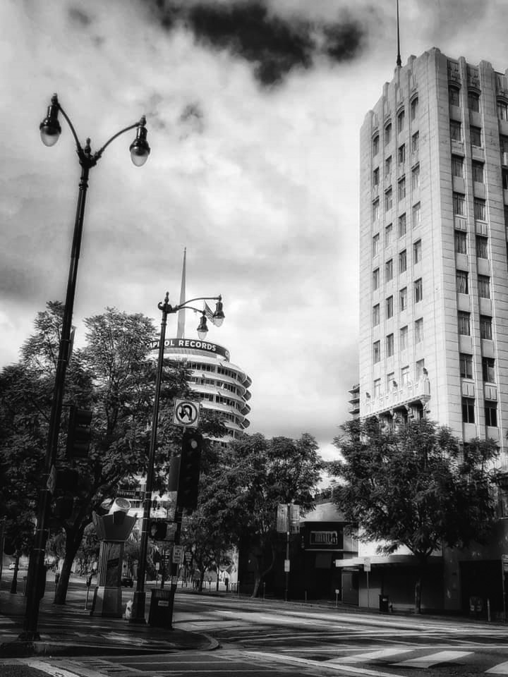
| (2020)^ - View showing a couple of “Vine Double” streetlights on the NW corner of Hollywood and Vine with the Capitol Records Building and the Equitable Building in the background. Photo by Carlos G. Lucero |
Historical Notes The curved two-arm streetlight pendants are connected to assemblies resembling a 'genie lamp'. Click HERE to see more. |
 |
|
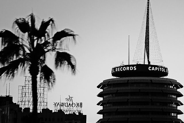
| (n.d.)***^ - View of the Capitol Records Building during the holidays. Each year, they add the Xmas tree to help make the city a little more festive. |
 |
|
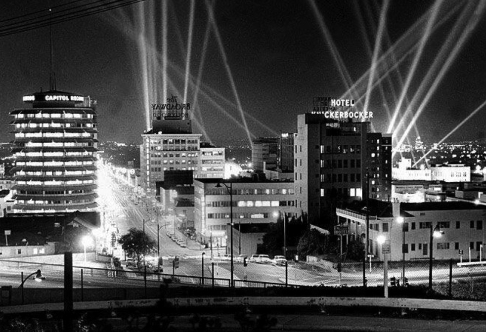
| (ca. 1950s)##^* - View looking south on Vine Street as seen from the Hollywood Freeway. Spotlights illuminate the sky wih beams of light. From left to right are the: Capitol Records Building, The Broadway-Hollywood Building, and the Hotel Knickerbocker. |
 |
|
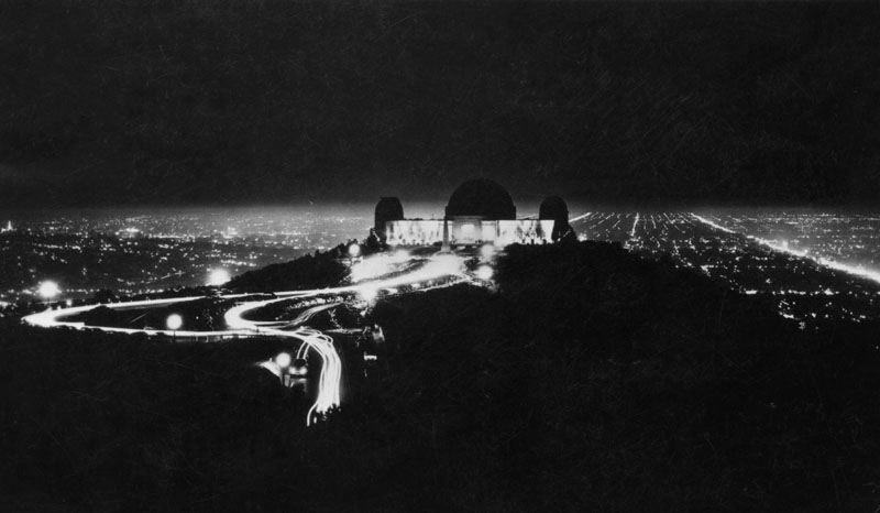
| (n.d.)* - Outline of Griffith Observatory is silhouetted against the brilliance of Hollywood lights. Night view taken from Mt. Hollywood. |
 |
|
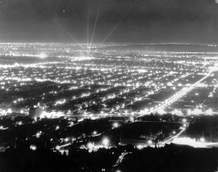
| (n.d.)* - Los Angeles lights from the Hollywood Hills. |
 |
|
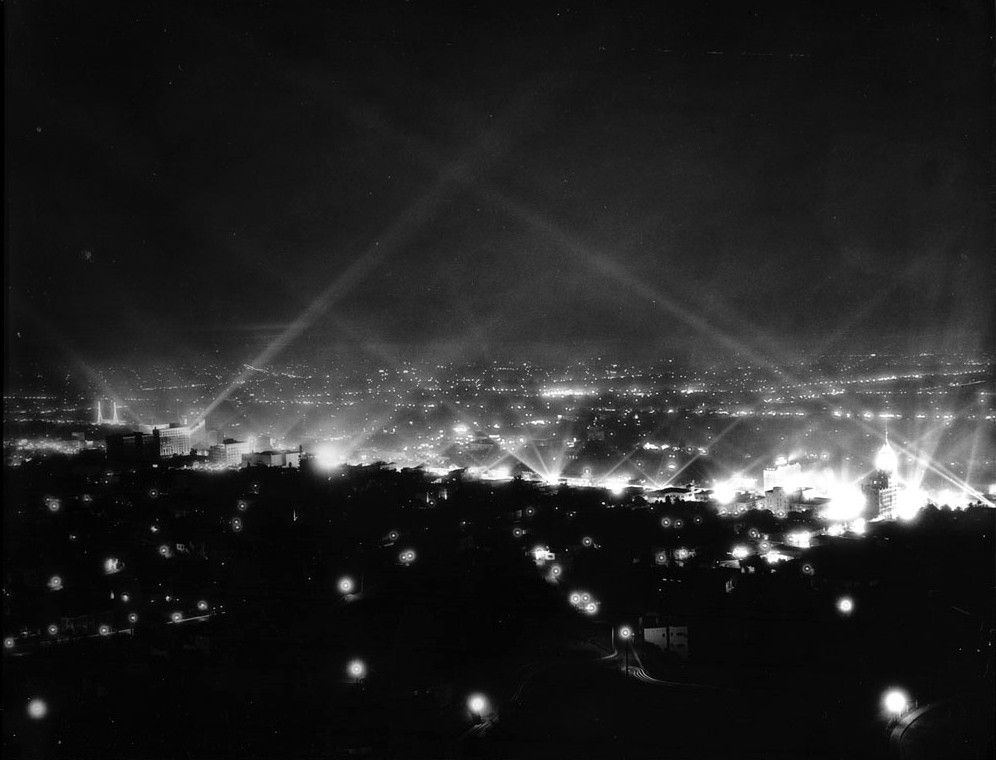
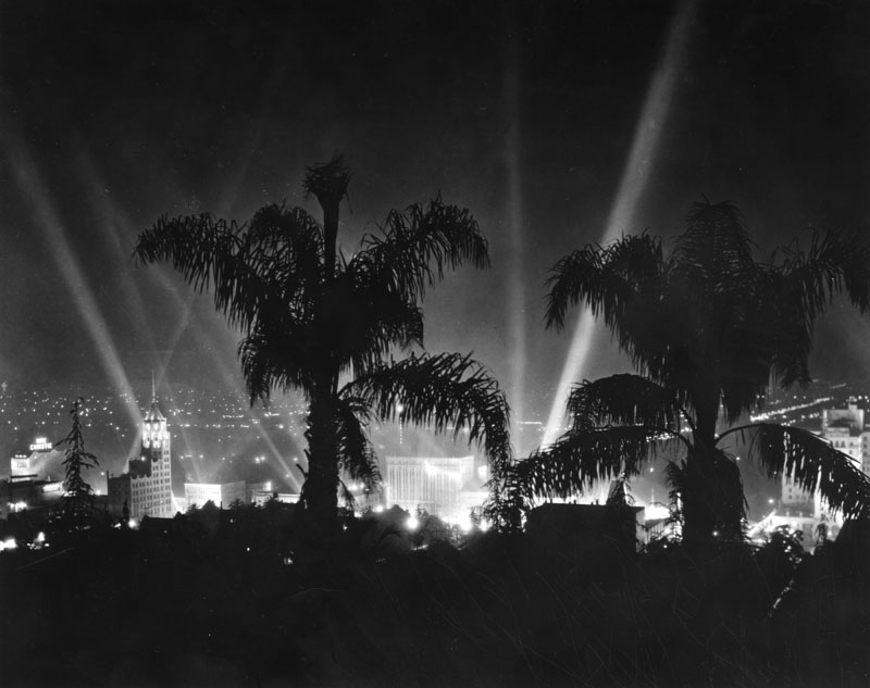
| (n.d.)* - View of Hollywood from the hills during what appears to be a movie premier. The First National Bank with tower can be seen on the right. |
 |
|
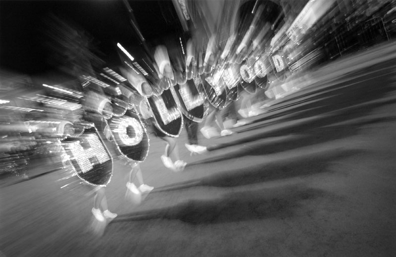
| (n.d.)* - Night view of tropical palms silhouetted against the brilliance of a Hollywood movie premiere. On left: First National Bank Building with tower. Center: Paramount Theatre. Right: Roosevelt Hotel. Photo taken from the Hollywood Hills Hotel. |
 |
|
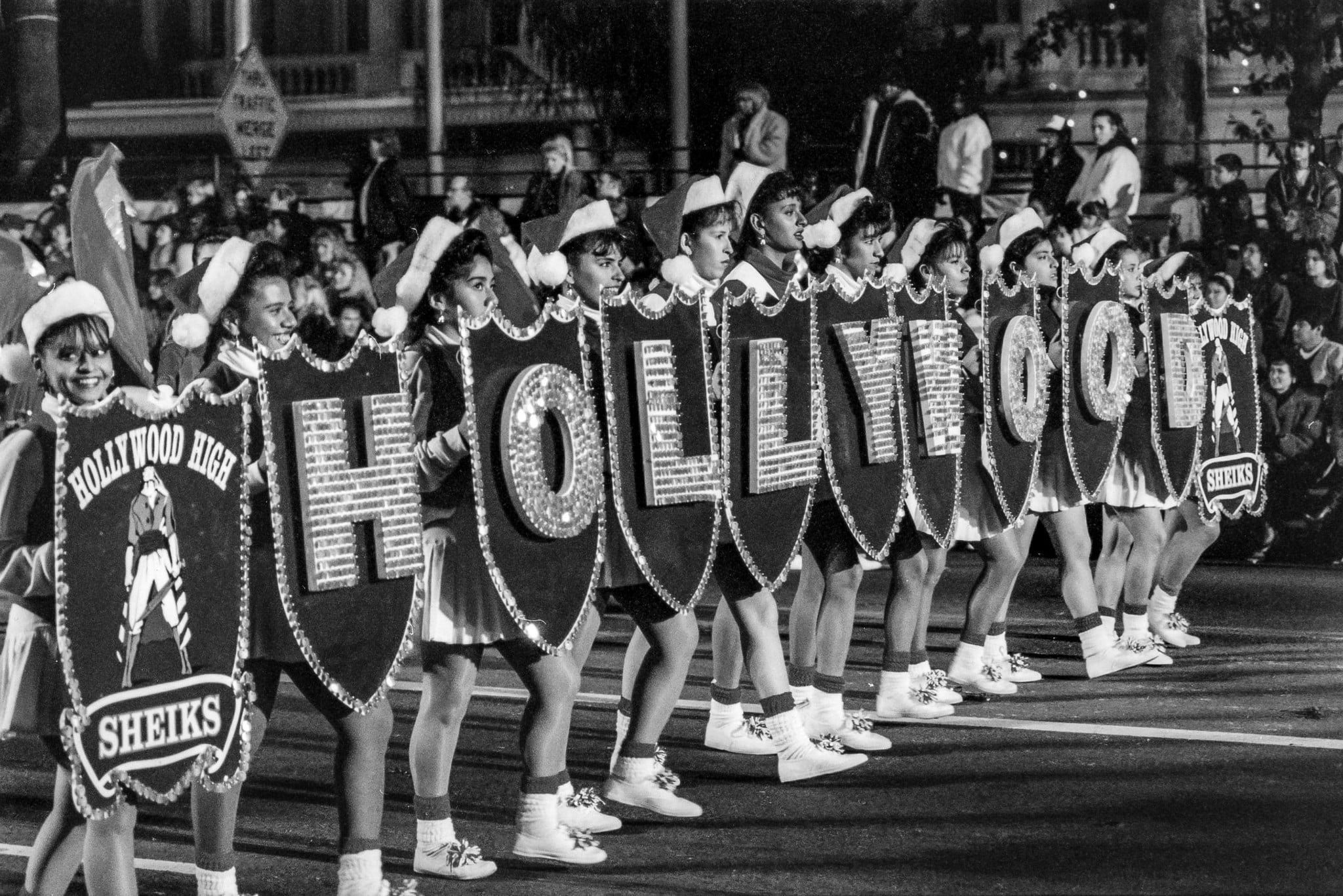
| (2008)* - The 77th Annual Hollywood Christmas Parade on Hollywood Boulevard. |
 |
|
| (n.d)* - Hollywood High School drill team marches down Hollywood Boulevard at the Christmas Parade. Photo courtesy of Erin Korta |
TCL Chinese Theatre
 |
|
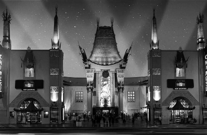
| (2014)#**^ - Front view of the TCL Chinese Theatre on Hollywood Boulevard as it appears today. |
Historical Notes In 1968, Grauman's Chinese Theatre was dedicated LA Historic-Cultural Monument No. 55 (Click HERE to see complete listing). In 2013, the world famous Chinese Theatre teamed up with one of China’s biggest electronics manufacturers, TCL, aka “The Creative Life” in a 10-year naming rights partnership. |
Hollywood and Highland Center
 |
|
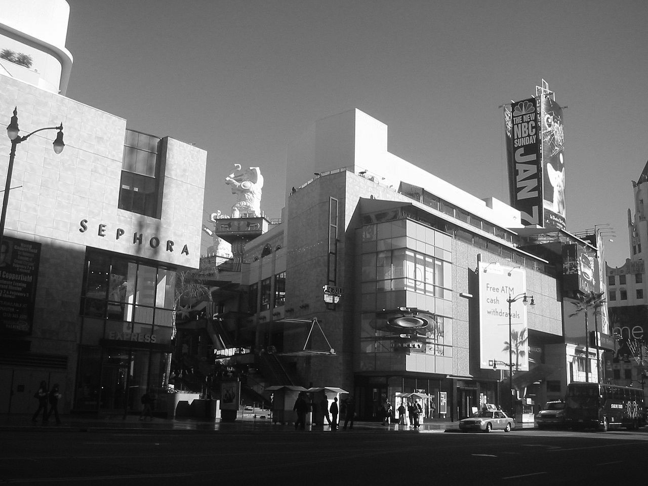
| (2006)*^ – View showing the entrance to the Hollywood and Highland Center in Hollywood, once the location of the famed Hollywood Hotel. Part of the iconic First National Bank Building can be seen on the right (N/E corner of Hollywood and Highland). Note the large elephant statue at center-left. Photo by Gary Minnaert - Wikipedia |
Historical Notes The Hollywood & Highland Center is a shopping mall and entertainment complex at Hollywood Boulevard and Highland Avenue. The 387,000-square-foot center also includes TCL Chinese Theatre (formerly Grauman's Chinese Theatre, and Mann's Chinese Theatre) and the Dolby Theatre (formerly known as the Kodak Theatre), home to the Academy Awards. The historic site was once the home of the famed Hollywood Hotel. Located in the heart of Hollywood, along the Hollywood Walk of Fame, it is among the most visited tourist destinations in Los Angeles.*^ |
 |
|
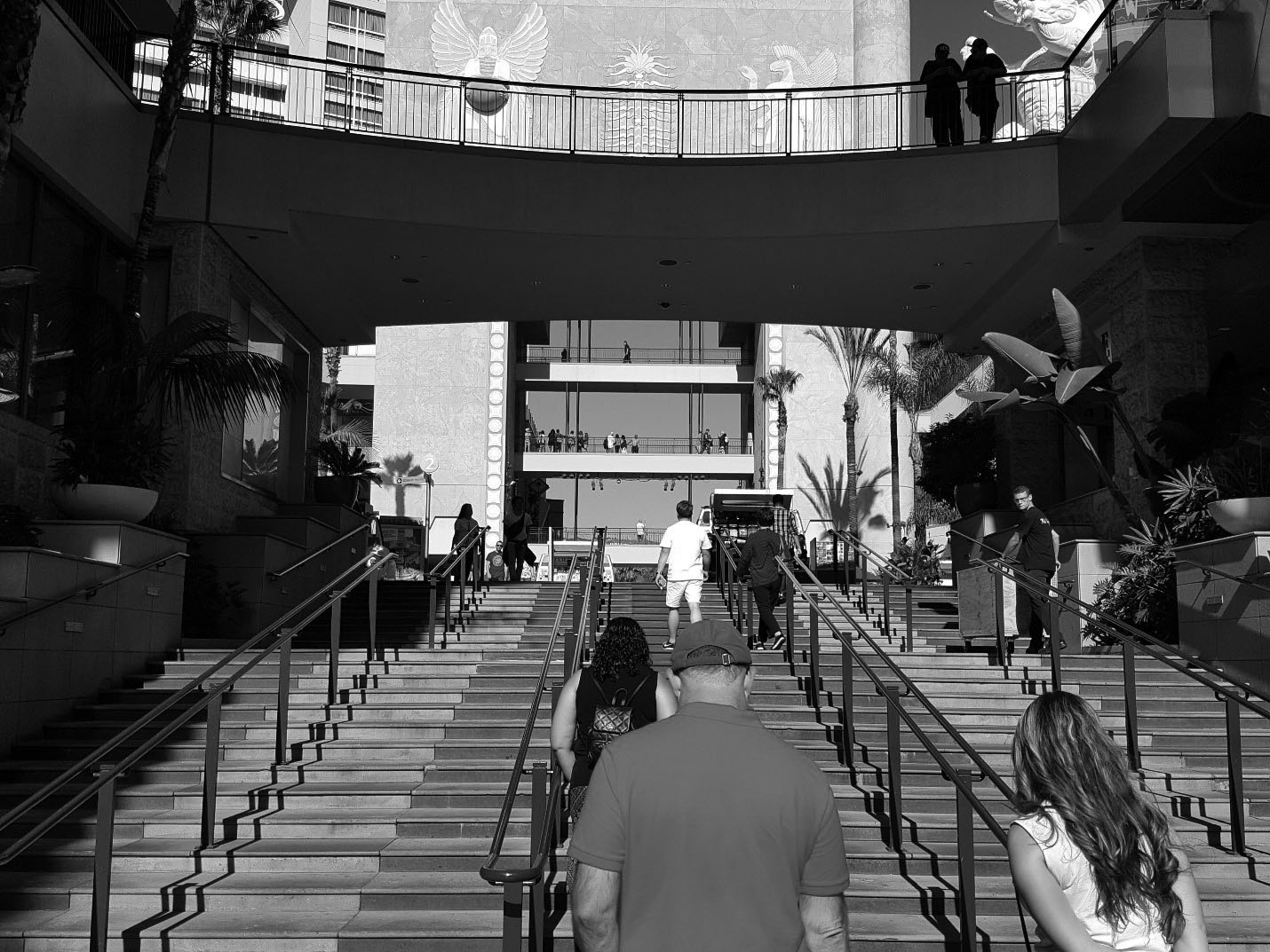
| (2016)^^^^ – View showing people walking up the stairs leading to the Hollywood and Highland Center courtyard. Photo by Jack Feldman |
Historical Notes The complex sits just across Hollywood Blvd. from the El Capitan Theatre and offers views of the Hollywood Hills and Hollywood Sign to the north, Santa Monica Mountains to the west and downtown Los Angeles to the east. |
 |
|
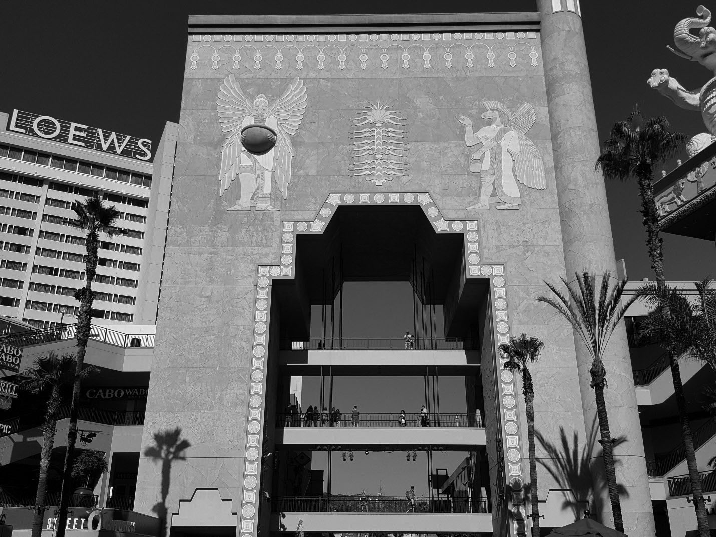
| (2016)^^^^ – View showing the courtyard’s massive archway and one of two pillars with elephant sculptures on top, inspired by the Babylon scene in the epic silent movie Intolerance. The Loews Hotel is seen on the left. Three pedestrian bridges across the archway allow visitors to get a good view of the Hollywood Sign (barely visible) in the distance. Photo by Jack Feldman |
Historical Notes The centerpiece of the complex is a massive three-story courtyard inspired by the Babylon scene from the 1916 D.W. Griffith film Intolerance. The developer of the shopping center built part of the archway and two pillars with elephant sculptures on the capitals, just as seen in the film, to the same full scale. It gives visitors an idea of how large the original set must have been. |
 |
|
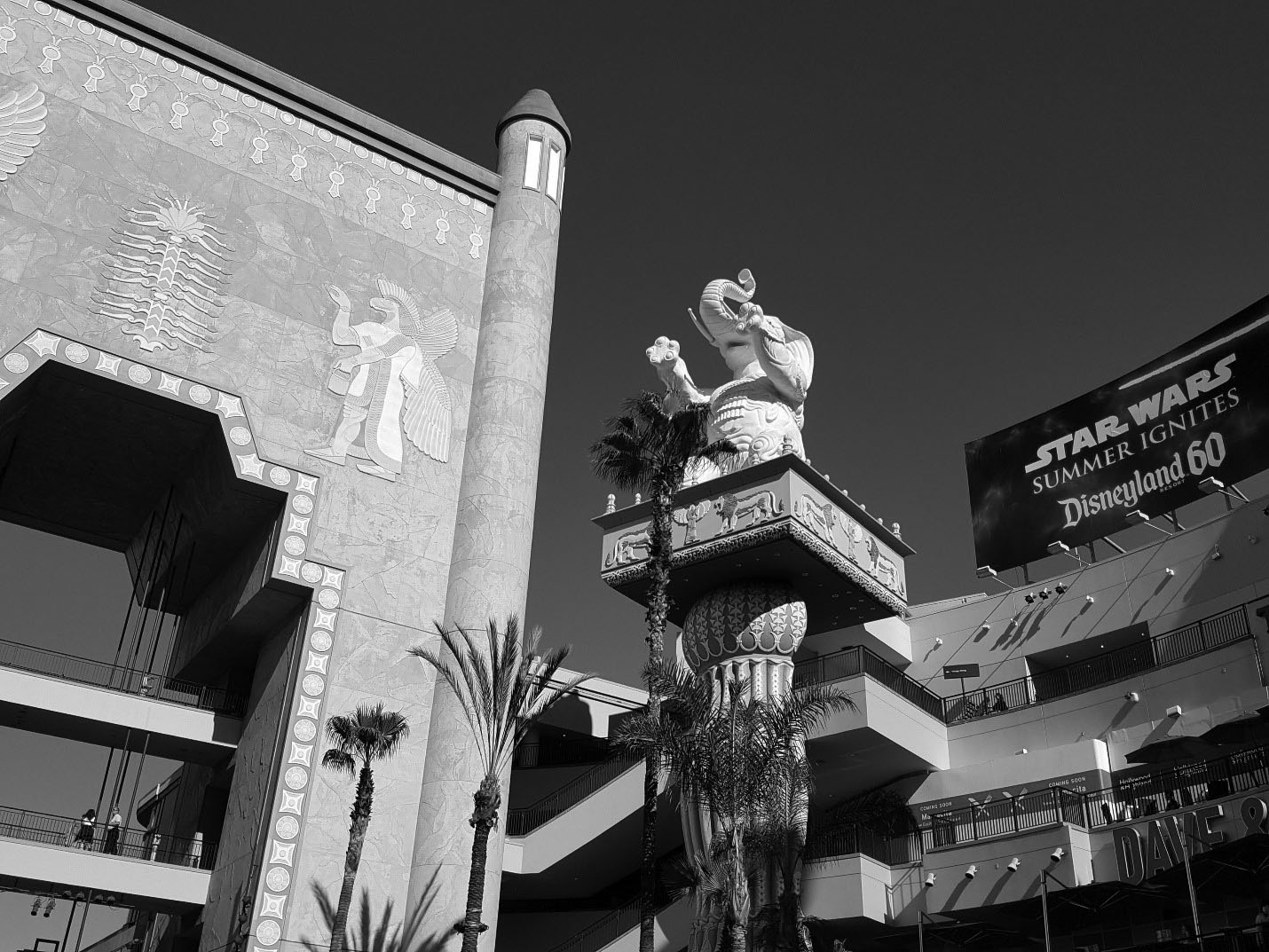
| (2016)^^^^ – Closer view showing one of the two huge pillars that bookend the archway, with sitting elephant on its top. Photo by Jack Feldman |
Historical Notes Click HERE to see the Babylon scene, from the D.W. Griffith film Intolerance, that inspired the Hollywood and Highland Center courtyard. In August 2020 it was announced that Hollywood & Highland is getting a massive makeover and a new name. The mall will become Ovation Hollywood, with a renewed focus on creative space and food and drink.* |
* * * * * |
Hollywood Sign
 |
|
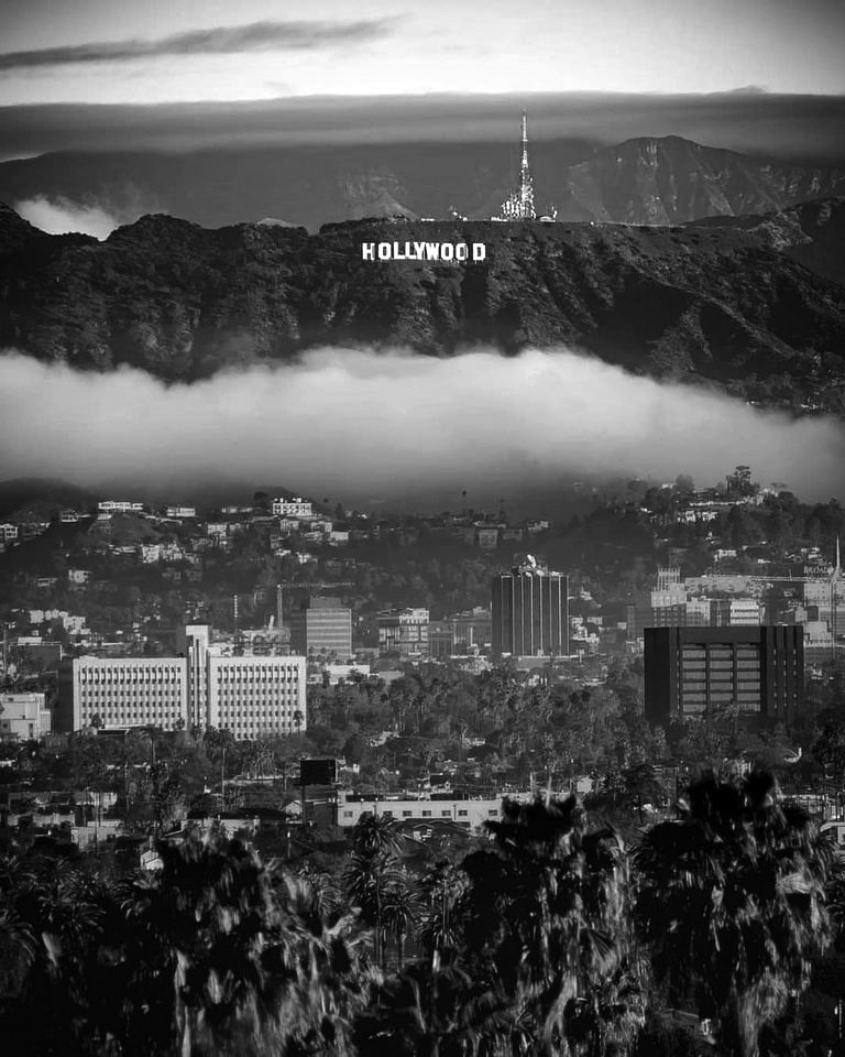
| (2020)^.^ - Early morning view looking north showing the iconic Hollywood Sign as the fog (or clouds) begins to clear with palm trees in the foreground. |
Historical Notes The Hollywood Sign: It's more than just nine white letters spelling out a city's name; it's one of the world's most evocative symbols – a universal metaphor for ambition, success, glamour...for this dazzling place, industry and dream we call H-O-L-L-Y-W-O-O-D |
 |
|
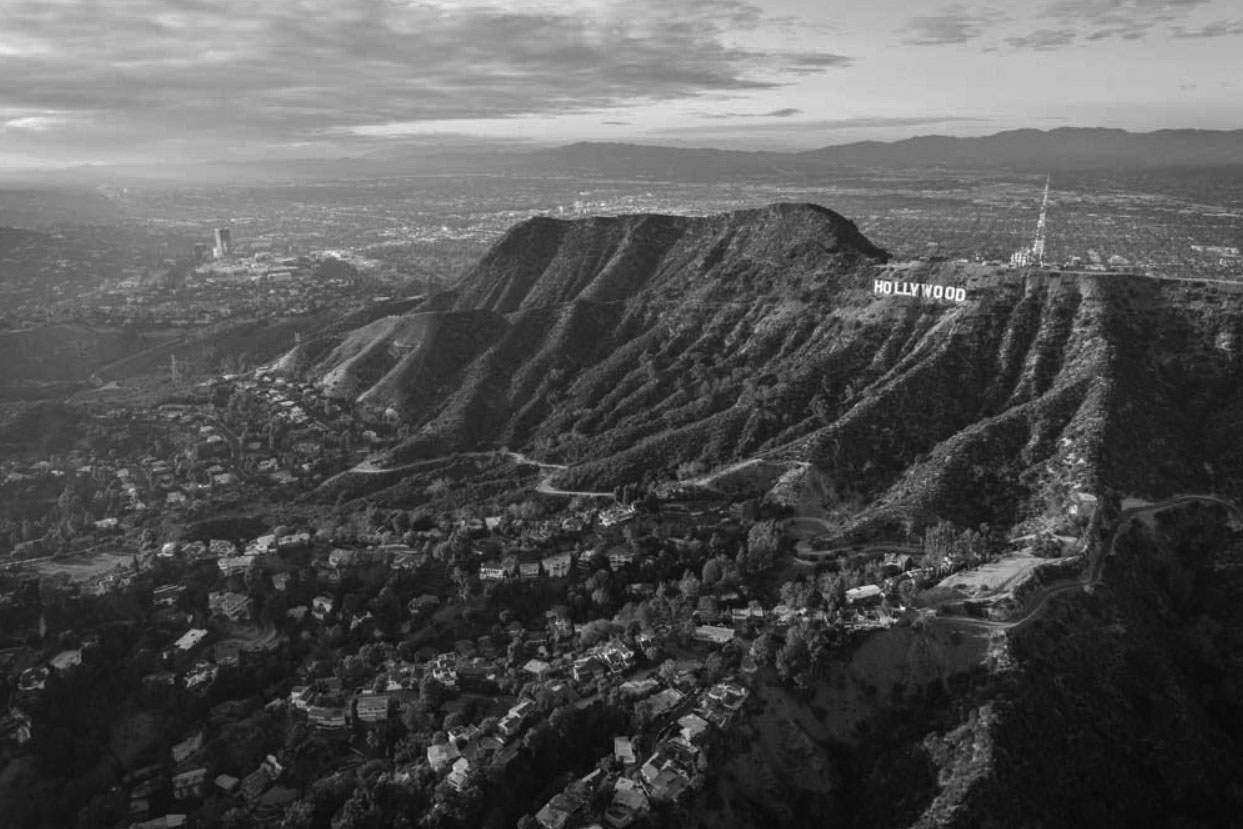
| (2015)^ – Aerial view on a crystal clear day showing the Hollywood Hills, Hollywood Sign, and the San Fernando Valley in the distance. Photo by Michael Kelley |
 |
|
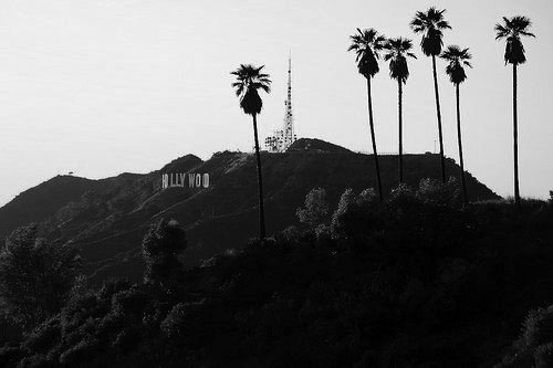
| (n.d.)#* - View looking toward the Hollywood HIlls showing the Hollywood Sign, Mt. Lee tower, and palm trees. |
 |
|
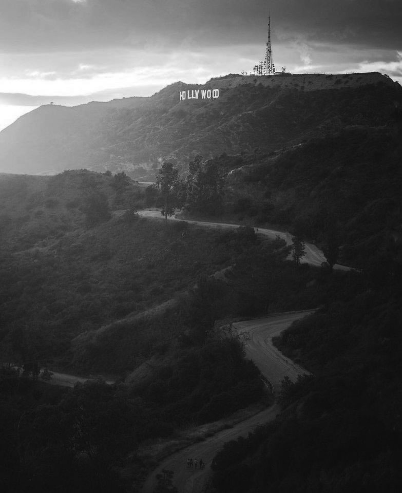
| (2020)^.^ - Hiking trail up to the Hollywood Sign and Mt. Lee. Photo courtesy of @bzero911 |
 |
|
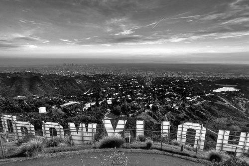
| (2018)^ – View looking southwest from behind the Hollywood Sign at sunset. Mulholland Dam and Hollywood Reservoir can be seen at right. |
 |
|
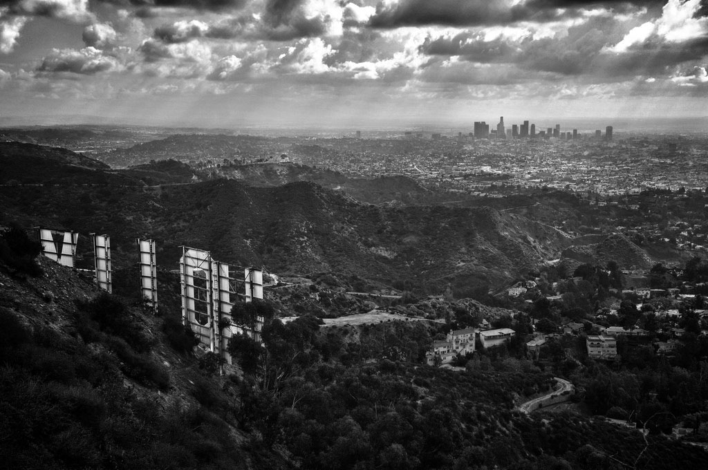
| (2011)** - View of Downtown Los Angeles from behind the Hollywood Sign. Photo by Paul Bajerczak |
 |
|
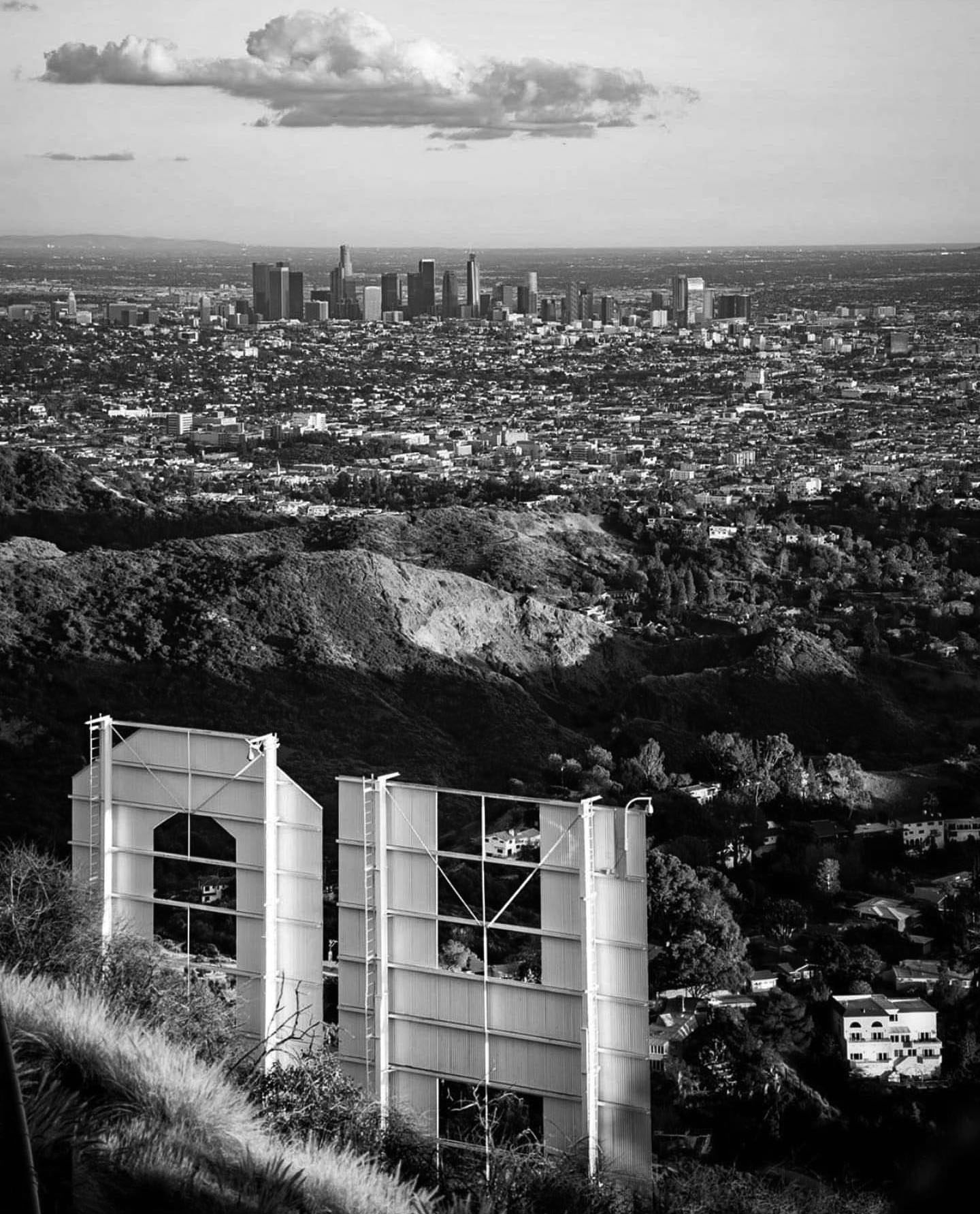
| (2021)* - Looking at Downtown LA from behind the Hollywood Sign on a crystal clear day. Photo by Mickey Nikolich |
 |
|
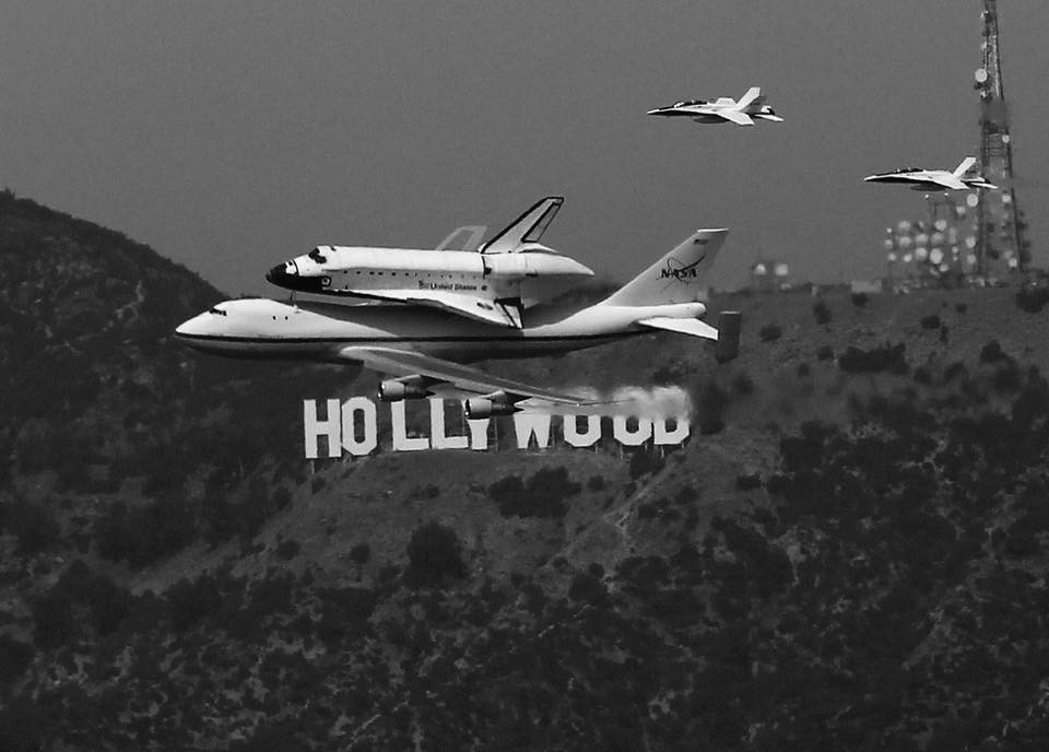
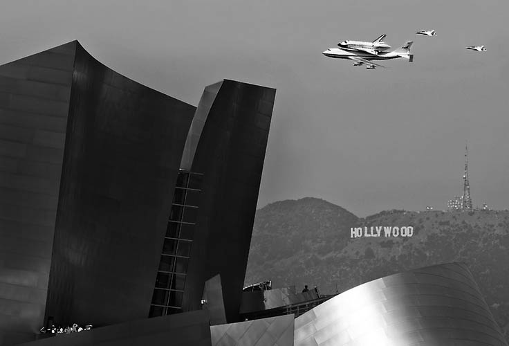
| (2012)^ – View showing Space Shuttle Endeavour atop of its 747 carrier aircraft being transported to LAX as it flies over the Hollywood Sign and Mt. Lee. |
Historical Notes After low level flyovers above NASA and civic landmarks across the country and in California, Endeavor was delivered to Los Angeles International Airport (LAX) on September 21, 2012. The orbiter was slowly and carefully transported through the streets of Los Angeles and Inglewood three weeks later, from October 11–14 along La Tijera, Manchester, Crenshaw, and Martin Luther King, Jr. Boulevards to its final destination at the California Science Center in Exposition Park.* Space Shuttle Endeavor |
 |
|
| (2012)#* - Space Shuttle Endeavour makes its final flight to LAX on September 21, 2012 as it passes over Disney Hall and the Hollywood Sign. |
 |
|
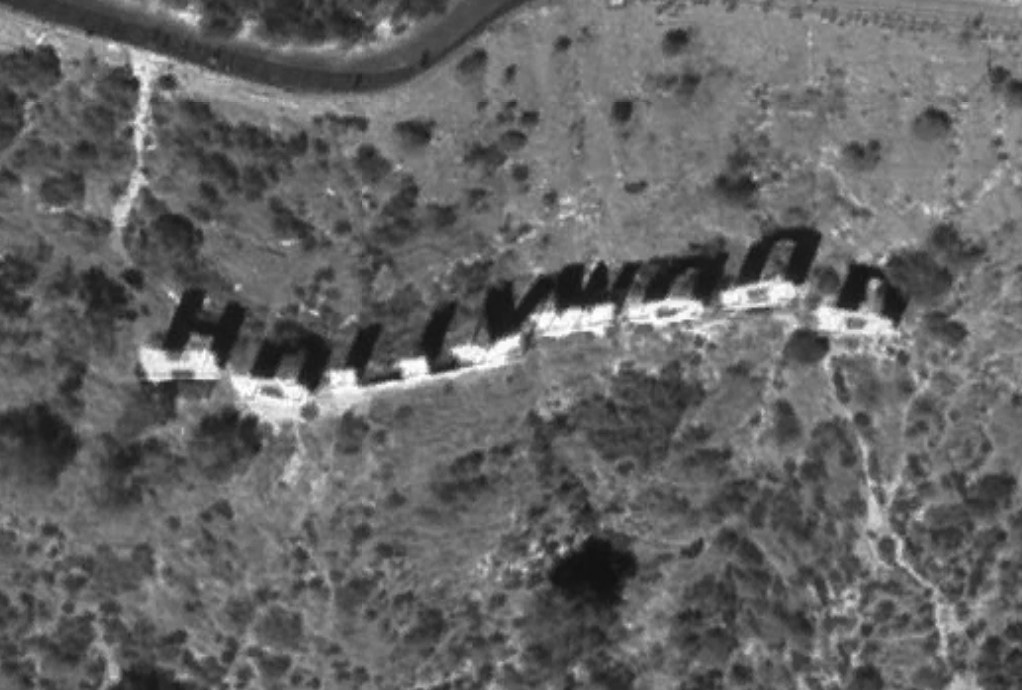
| (2007)*^ – NASA satellite view of the Hollywood Sign. Courtesy of NASA - Wikipedia |
 |
|
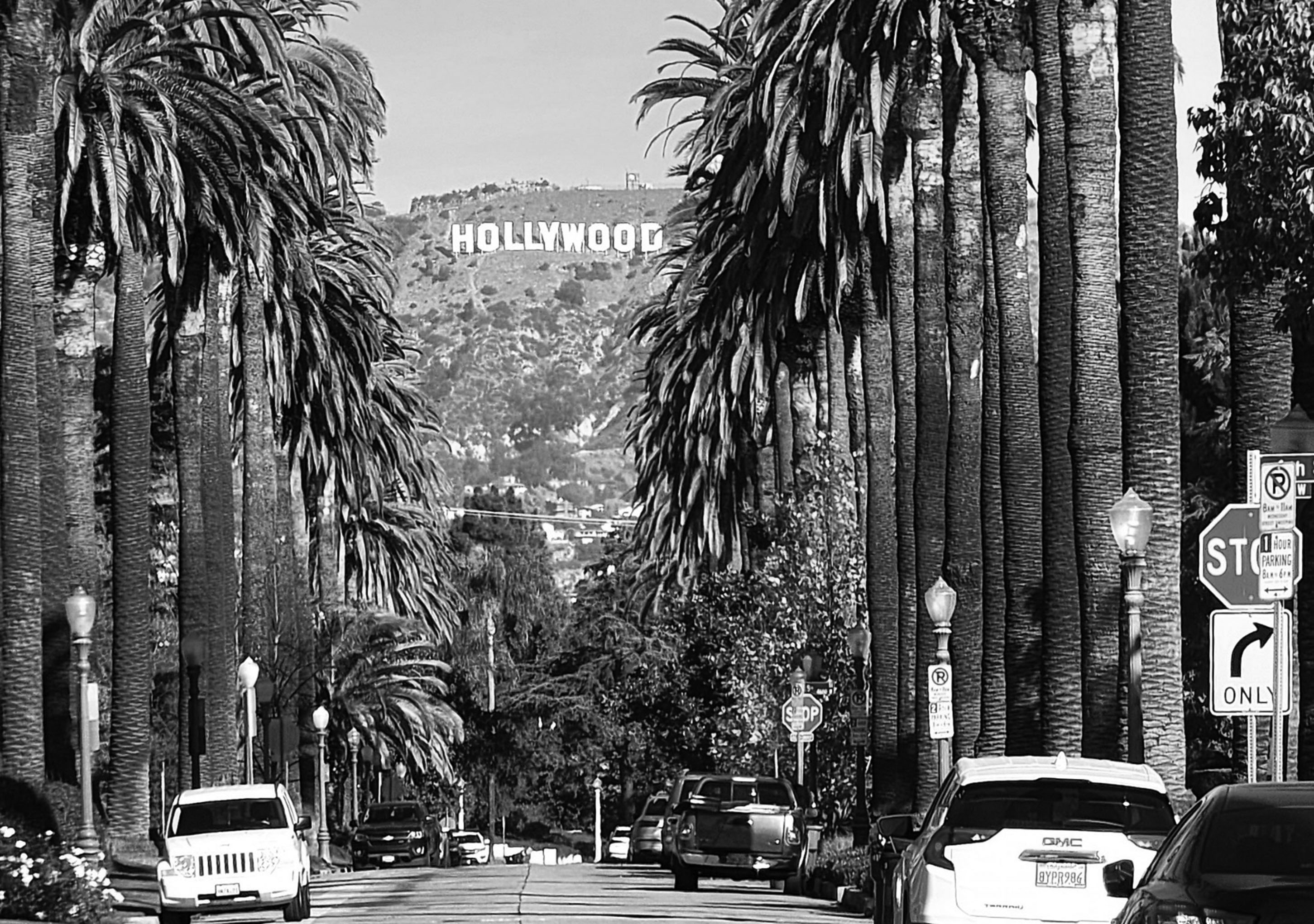
| (2021)* - Hollywood Sign as seen from the corner of Windsor Boulevard and 6th Street in Hancock Park. Photo by Nelson Monsod |
 |
|
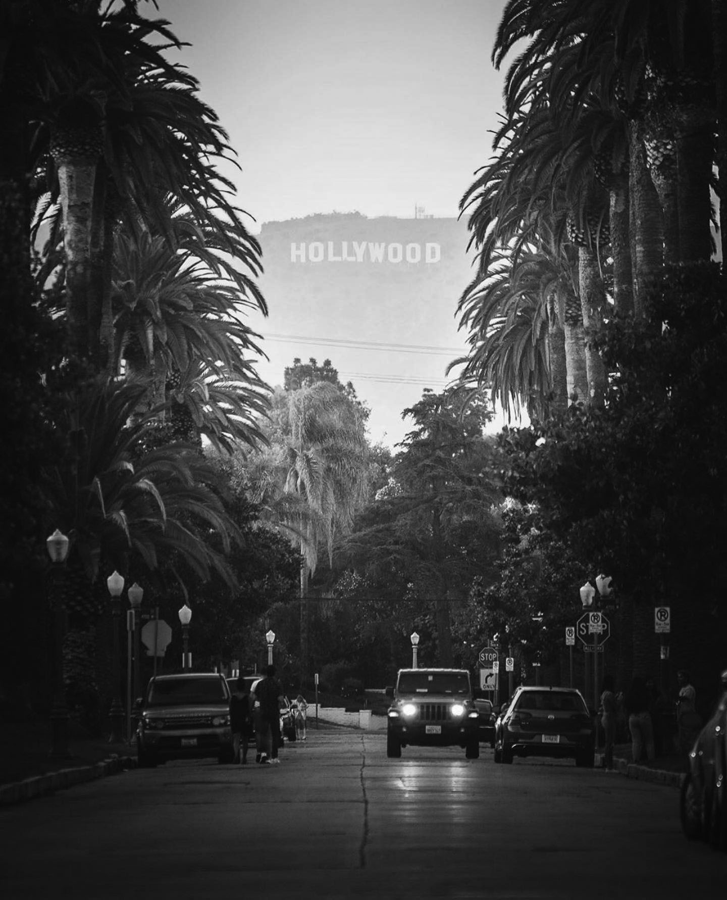
| (ca. 2019)^.^ - Driving up to get a closer look at the Hollywood Sign. Photo courtesy of @bzero911. |
 |
|
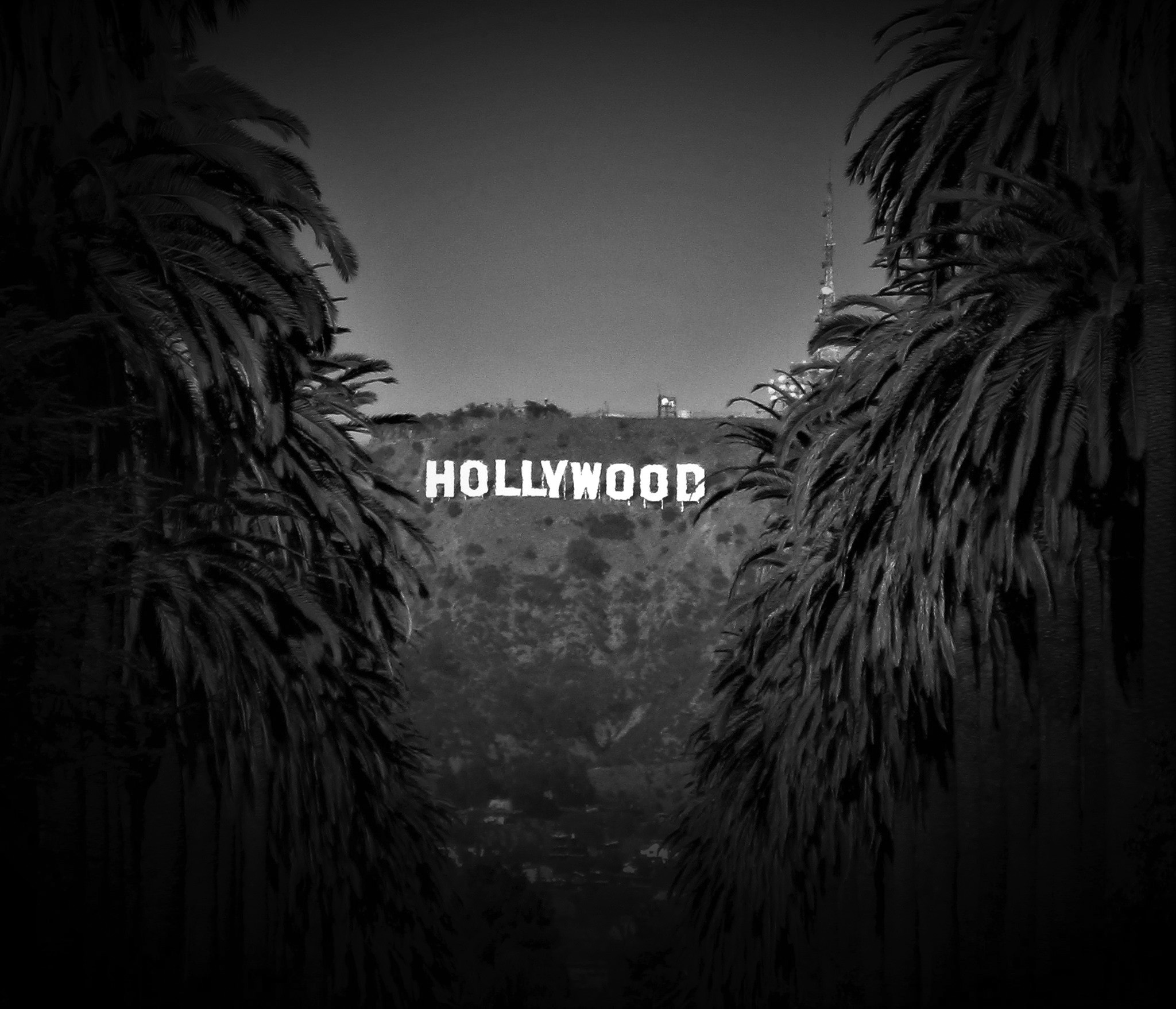
| (2020)^.^ - The HOLLYWOOD Sign framed by palm trees. Photo by Howard Gray |
Historical Notes In 1977, the Hollywood Sign and the land underneath (Griffith Park perimeter) was designated LA Historic-Cultural Monument No. 111 (Click HERE to see complete listing). |
* * * * * |
Please Support Our CauseWater and Power Associates, Inc. is a non-profit, public service organization dedicated to preserving historical records and photos. Your generosity allows us to continue to disseminate knowledge of the rich and diverse multicultural history of the greater Los Angeles area; to serve as a resource of historical information; and to assist in the preservation of the city's historic records.
|
More Historical Early Views
Newest Additions
Early LA Buildings and City Views
History of Water and Electricity in Los Angeles
* * * * * |
References and Credits
* LA Public Library Image Archive
^*California Historic Landmark Listing (Los Angeles)
^ California Historical Society Digital Archive
** Retronaut - Hollywoodland Sign
#* Pinterest - California and DailyBreeze.com; Mid Century Hollywood; Been There: Hollywod Sign; "HOLLYWEED" Sign
*^#LosAngelesPast.com: Cahuenga Pass
^^#LA Times: 'Swing in, pig out, drive off'; Hollywood Bond Cavalcade; Sunset Vine Tower; Taft Building; Pickwick Bookshop
***The Story of Hollywood by Gregory Paul Williams
*.* Greater Streets: Exploring the Walk of Fame — Heart of Hollywood
**^Table Magazine: LA Observatory
**+Hollywood Renegades Archive: "The Lot"
**#Beguiling Hollywood: The Hollywood Hotel
^**Huntington Digital Library Archive
*^*MTA Transportation and Research Library Archives
^^*Cinema Treasures:Ricardo Montabaln Theater
^^^California State Library Image Archive
^+^Cool Culinaria: Restaurateur Mike Lyman
+^*Jewish Museum of the American West: Restaurateur Al Levy
+^^Don Lee Mutual Broadcasting Building
+^+GoGoNotes.blogspot.com: Hollywood and Cherokee
++#Facebook.com: Photos of Los Angeles
*^^*Photos of Vintage Los Angeles: Facebook.com; Palladium; Capitol Records; Cruising Hollywood Blvd; Masonic Temple; Hody's Coffee Shop
^^^^Water and Power Associates
*^#*Calisphere: University of California Image Archive
*^*#Pinterest.com: Favorite Places and Spaces
**^*LA Daily News: Hollywood Sign Celebrates its 90th Birthday
***#Art Deco Architecture: LA Radio City
**##MartinTurnbull: Cross Roads of the World; Biff's Coffee Shop
^^##Alison Martino's Vintage Los Angeles: Wallichs Music City
++##Grauman's Chinese.org: Academy Awards
*#^^Flickr.com - Daniel Pouliot
*##*Squidoo.com: Lawrence Welk
*##^The Daily Meal: Formosa Cafe
^##*Flickr.com: Michael Ryerson; Baytram366; Melody Lane
^###Uncanny.net: Hollywood Pacific Electric Line
^#*#Bellaonline.com: Mickey Rooney and Judy Garland
+#+#Flickr,com
^#^*Flickr.com: Los Angeles - Back in the Day
^#^^Facebook.com - Vintage LA: Hollywood Palladium; Hollywood and Gower; Hollywood and Vine; Sunset & Vine; Capitol Records Building; United Methodist Church; Hollywood Ranch Market; Wallichs Music City; Tiny Naylors
^^#^History of the Samuel Goldwyn Studio
^^^#KCET's First Hollywood Home: The Historic Mutual-Don Lee Studios
#^**The Go Go's: Local Coffee Shops and Diners
^*#*Pinterest - Memories in the SFV 50's, 60's, & 70's
^*##Vintage Inspired California - marinachetner.com
^*^^Pomona Public Library Poscard Collection
^*^#Facebook.com - Bizarre Los Angeles
#**^Starlinetours.com: TLC Chinese Theatre
#**#Facebook.com: Garden of Allah Novels, Martin Turnbull
#*^#Historic Hollywood Theatres: Warner Bros. Hollywood Theatre
#^*#TheHollywoodMuseum.com: Max Factor Building
#^**The Go Go's: N/W Corner of Hollywood and Vine
#^^^Once Upon a Screen: Hollywood Canteen
#^#^Groceteria.com: A&P History
##**The Story of the Hollywood Sign: allanellenberger.com
##*^The Hollywood Sign: hollywoodsign.org
##*#Flickr.com: Paul Bajerczak
#*##Electric Railway Historic Association: Hollywood PE Line
##^*Facebook.com: Classic Hollywood-Los Angeles-SFV
##^^halfcoastal.com: The Hollywood Sign
***^Pinterest: Travel The World: 'HOLLYWEED'; Los Angeles and Hollywood
*^^ Nuestra Señora la Reina de los Ángeles: Vogue Theater; Hollywood Blvd Night 1930s; Hollywood and Vine ca.56
*^*^#Facebook.com: West San Fernando Valley Then And Now
^^***Pinterest: Diners
^^*^*Los Angeles Magazine: Capitol Records Building Christmas
^^*^^sittininthehills64.blogspot.com: Hollywood Views
*^^**Blogspot.com: Hollywood HoJo
*^#^*Vintage Everyday
^#^#^LA Curbed: Al Levy's Tavern
^###^Flickr.com: timetravelnow
*# Skyscraperage.com. - Griffith Observatory; CBS West Coast Headquarters; LA Fun Map; NBC Hollywood Radio City; Cross Roads of the World; Hollywood and Vine; Orchid Ave and Hollywood Blvd; Max Factor Building; Cahuenga and Yucca St.; Vine and Sunset; PE on Fairfax and Santa Monica; Sunset and Vine 1960
*^ Wikipedia: Hollywood; Hollywood Athletic Club; Hollywood Bowl; Grauman's Chinese Theatre; Grauman's Egyptian Theatre; Pantages Theatre (Hollywood); John Hanson Ford Theatre; 20th Century Fox; Samuel Goldwyn.Studio; Barnsdall Art Park; Greek Theatre; Griffith Observatory; Cinerama Dome; Ralphs; Hollywood Palladium; Hollywood and Vine; Hollywood Masonic Temple; Hollywood Pacific Theatre; Max Factor; West Hollywood; Brown Derby; Hollywood Christmas Parade; Tom Breneman; Schwab's Pharmacy; Capitol Records Building; CBS Columbia Square; West Coast Radio City - Los Angeles; Crossroads of the World; Hollywood Sign; Lawrence Welk; Du-Par's Restaurant; Formosa Cafe; Hollywood Walk of Fame; Marilyn Monroe; John C. Austin; KFWB; The Beatles at the Hollywood Bowl; 2005 Hollywood Sign; Rexall - Owl Drug Store; Hollywood Canteen; KABC; Wallichs Music City; Thrifty Drug Stores; Lasky-DeMille Barn; Mt. Lee; The Wizard of Oz ; Hollywood Roosevelt Hotel; Eddie Cochran; Guarantee Building; Hollywood United Methodist Church; Carolina Pines, Jr.; Vista Theatre
< Back
Menu
- Home
- Mission
- Museum
- Major Efforts
- Recent Newsletters
- Historical Op Ed Pieces
- Board Officers and Directors
- Mulholland/McCarthy Service Awards
- Positions on Owens Valley and the City of Los Angeles Issues
- Legislative Positions on
Water Issues
- Legislative Positions on
Energy Issues
- Membership
- Contact Us
- Search Index