THE ST. FRANCIS DAM DISASTER: CONSTRUCTION, COLLAPSE, AND LEGACY |
Introduction |
The St. Francis Dam was built in San Francisquito Canyon between 1924 and 1926 as part of Los Angeles' expanding water system. Designed and constructed by the city's Bureau of Water Works and Supply under Chief Engineer William Mulholland, the concrete gravity dam created a reservoir capable of storing about 38,000 acre feet of Los Angeles Aqueduct water.At 11:57 p.m. on March 12, 1928, the dam suddenly failed, releasing more than 12 billion gallons of water into San Francisquito Canyon and the Santa Clara River Valley. The flood traveled more than 50 miles to the Pacific Ocean, destroying homes, roads, bridges and farms and killing more than 400 people. The disaster ended Mulholland's career and led to major changes in dam engineering and safety oversight in California. |
 |
|
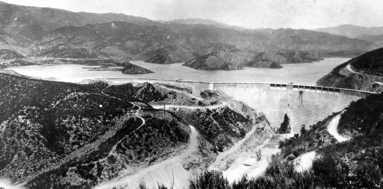
| (1928)* - Panoramic view of the St. Francis Dam with its reservoir nearly full. The dam stood in San Francisquito Canyon in northern Los Angeles County, about 10 miles north of present day Santa Clarita. |
Historical Notes Completed in May 1926, the St. Francis Dam was a curved concrete gravity dam built by the City of Los Angeles Bureau of Water Works and Supply under Chief Engineer William Mulholland. The main dam stood about 185 feet above the streambed and approximately 205 feet from its deepest foundation. The reservoir held about 38,000 acre feet of Los Angeles Aqueduct water. Less than two years after its completion, the dam failed at 11:57 p.m. on March 12, 1928. The resulting flood traveled through San Francisquito Canyon and the Santa Clara River Valley to the Pacific Ocean, killing more than 400 people. It remains one of the deadliest civil engineering disasters in American history. |
 |
|
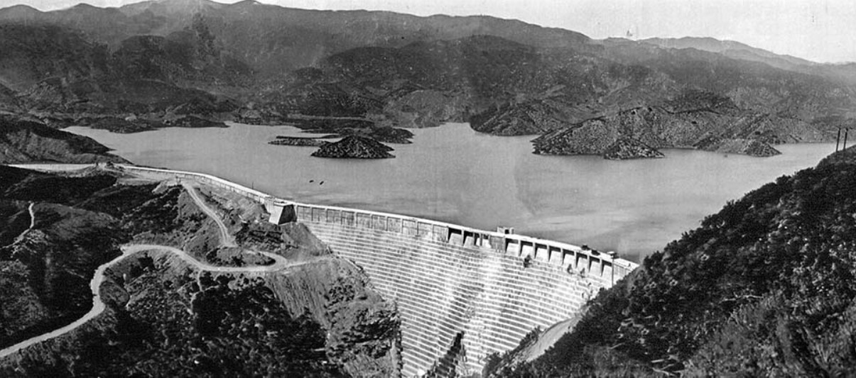
| (1928)* – View of the St. Francis Dam and its reservoir shortly before the collapse. |
Historical Notes Water began entering the St. Francis Reservoir in 1926. Over the next two years the reservoir gradually filled with water from the Los Angeles Aqueduct, reaching its highest level in early March 1928. When full, the reservoir held about 38,000 acre feet, or more than 12 billion gallons of water. |
 |
|
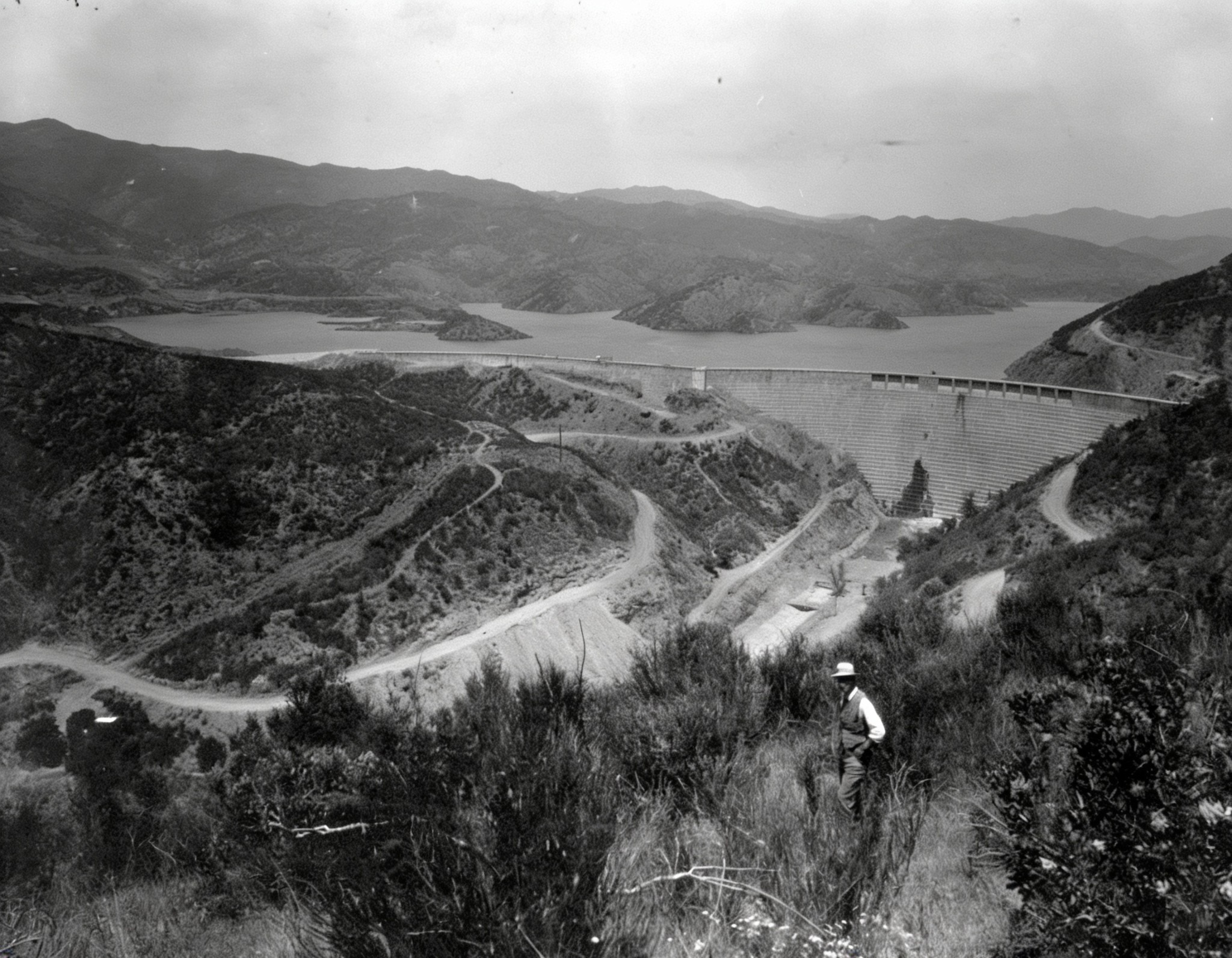
| (1928)* - The St. Francis Dam seen from the canyon hillside. A man in a hat stands in the foreground, giving a sense of the dam's scale. |
Historical Notes The St. Francis was a curved concrete gravity dam, designed so that its enormous weight resisted the pressure of the water behind it. It was built by the City of Los Angeles Bureau of Water Works and Supply, predecessor of today's Department of Water and Power, under the direction of William Mulholland. |
 |
|
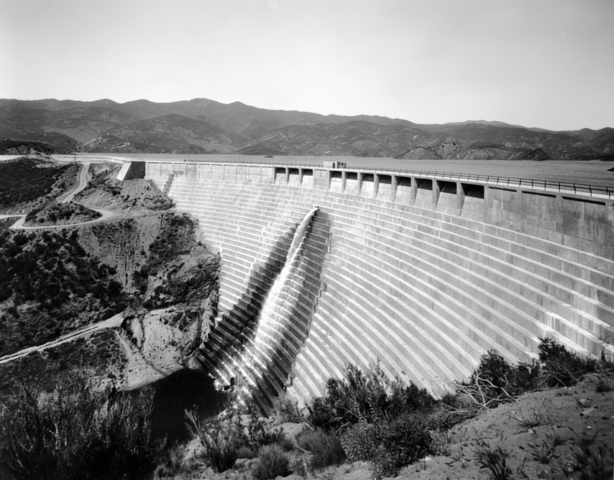
| (1928)* - Close view of the St. Francis Dam shortly before the reservoir reached capacity. |
Historical Notes The dam took its name from San Francisquito Canyon, where it was built. "St. Francis" is the English form of the Spanish name San Francisco, from which San Francisquito, meaning "Little San Francisco," is derived. |
* * * * * |
Construction of the St. Francis Dam
 |
|
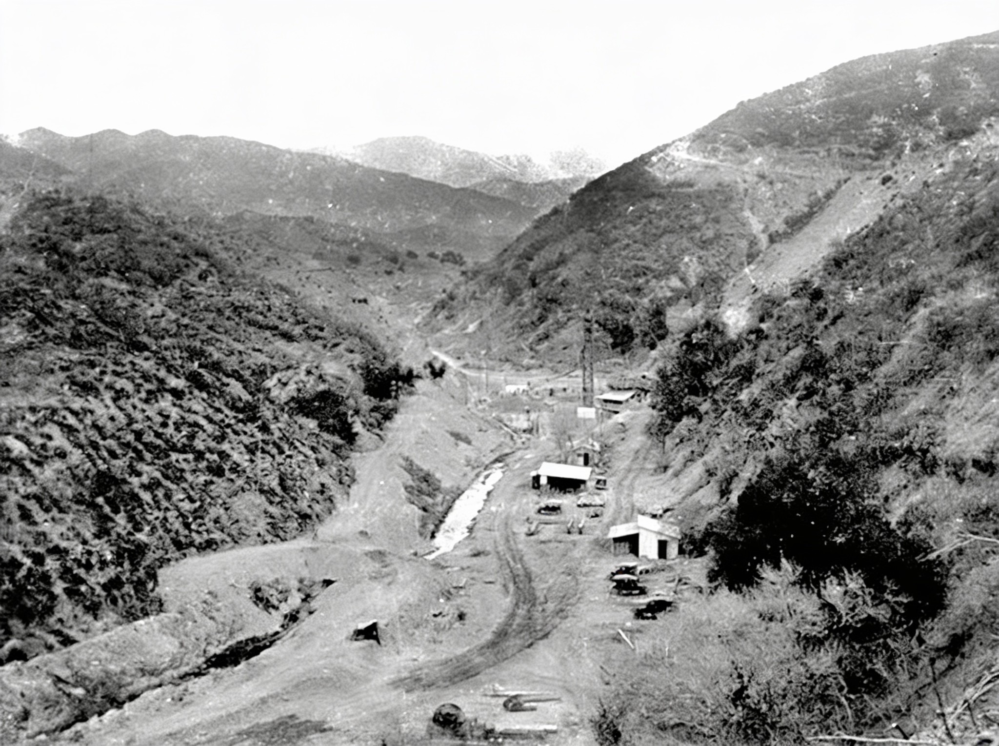
| (1925)* - Preliminary work begins at the base of San Francisquito Canyon. |
Historical Notes Planning for the reservoir began in the early 1920s, and construction was underway by 1924. The original design called for a dam about 175 feet above the streambed. The project was designed and constructed largely within the Bureau of Water Works and Supply without the independent engineering and geological review that would later become standard practice for major dams. |
 |
|
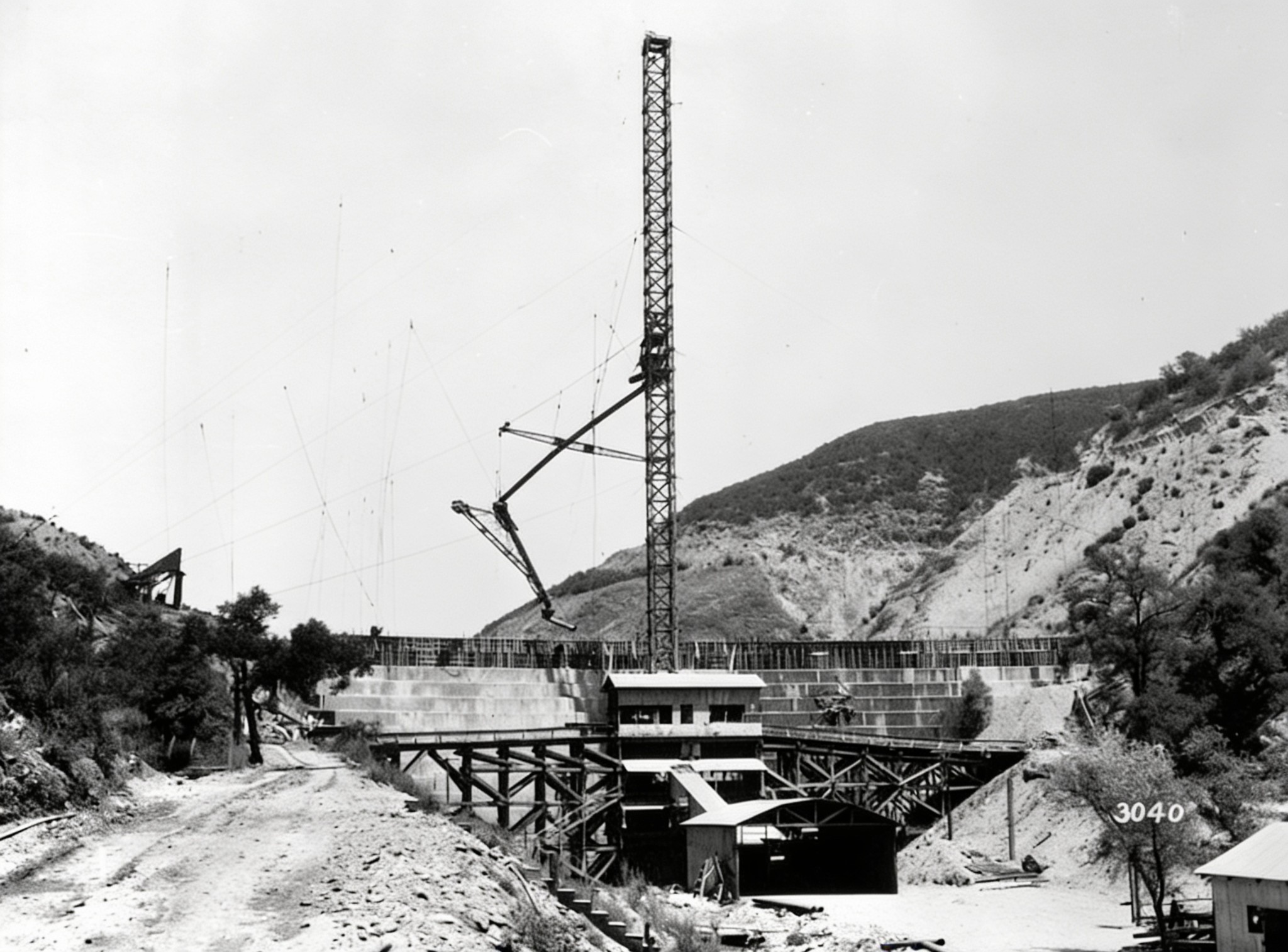
| (1925)* - Construction of the St. Francis Dam showing the concrete mixing plant, construction tower and runway. |
Historical Notes During construction, the planned height of the dam was increased to provide additional reservoir capacity. According to later engineering studies, the original design was ultimately raised by about 20 feet without a corresponding increase in the width of the dam's base. That decision would become important in later investigations of the failure. |
 |
|
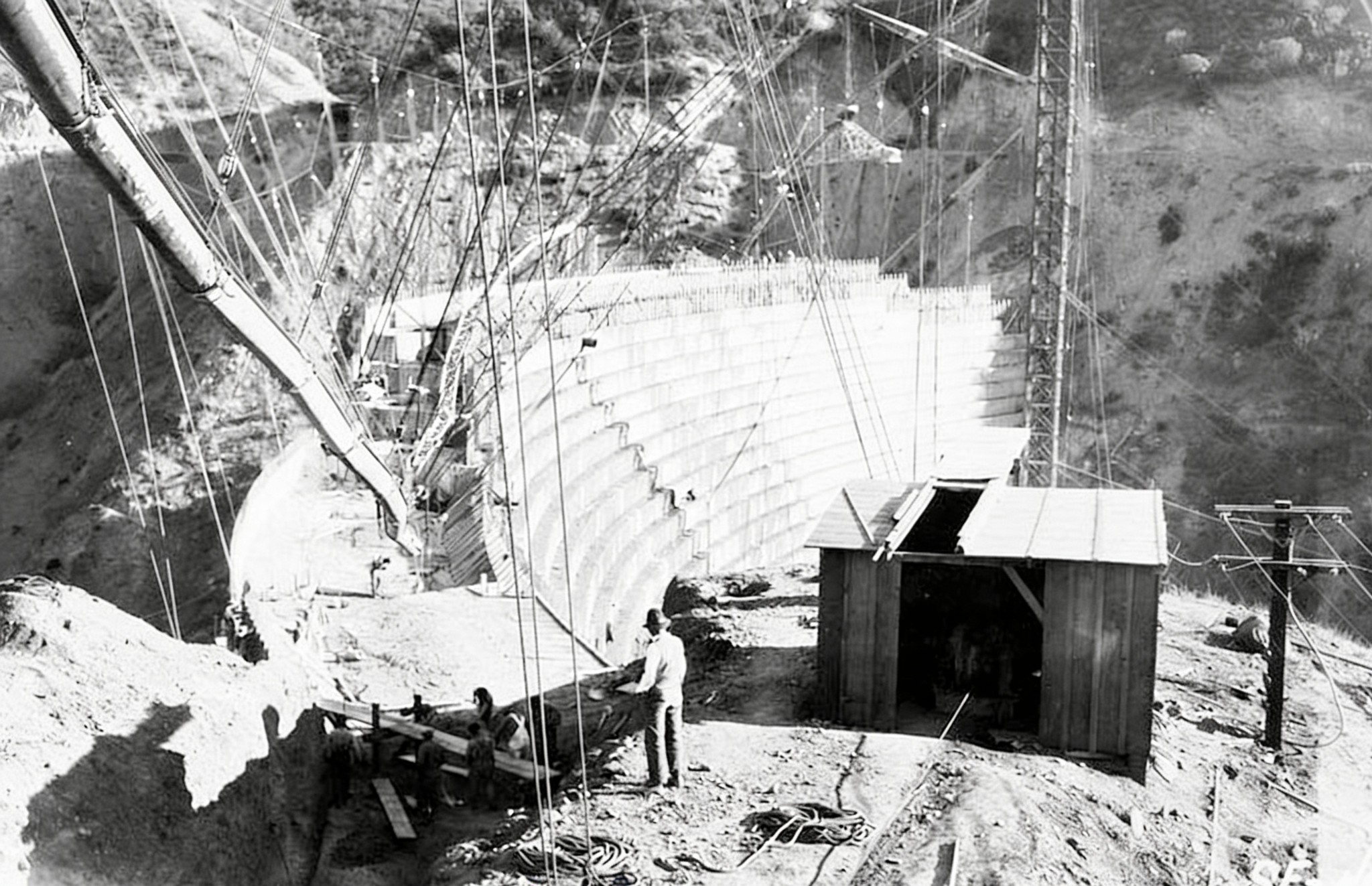
| (1925)* - Construction of the wing dike along the western side of the St. Francis Dam site. |
Historical Notes As the planned reservoir elevation was increased, a low ridge west of the main dam would have been overtopped. A concrete wing dike nearly 600 feet long was constructed along the ridge to contain the enlarged reservoir. |
 |
|
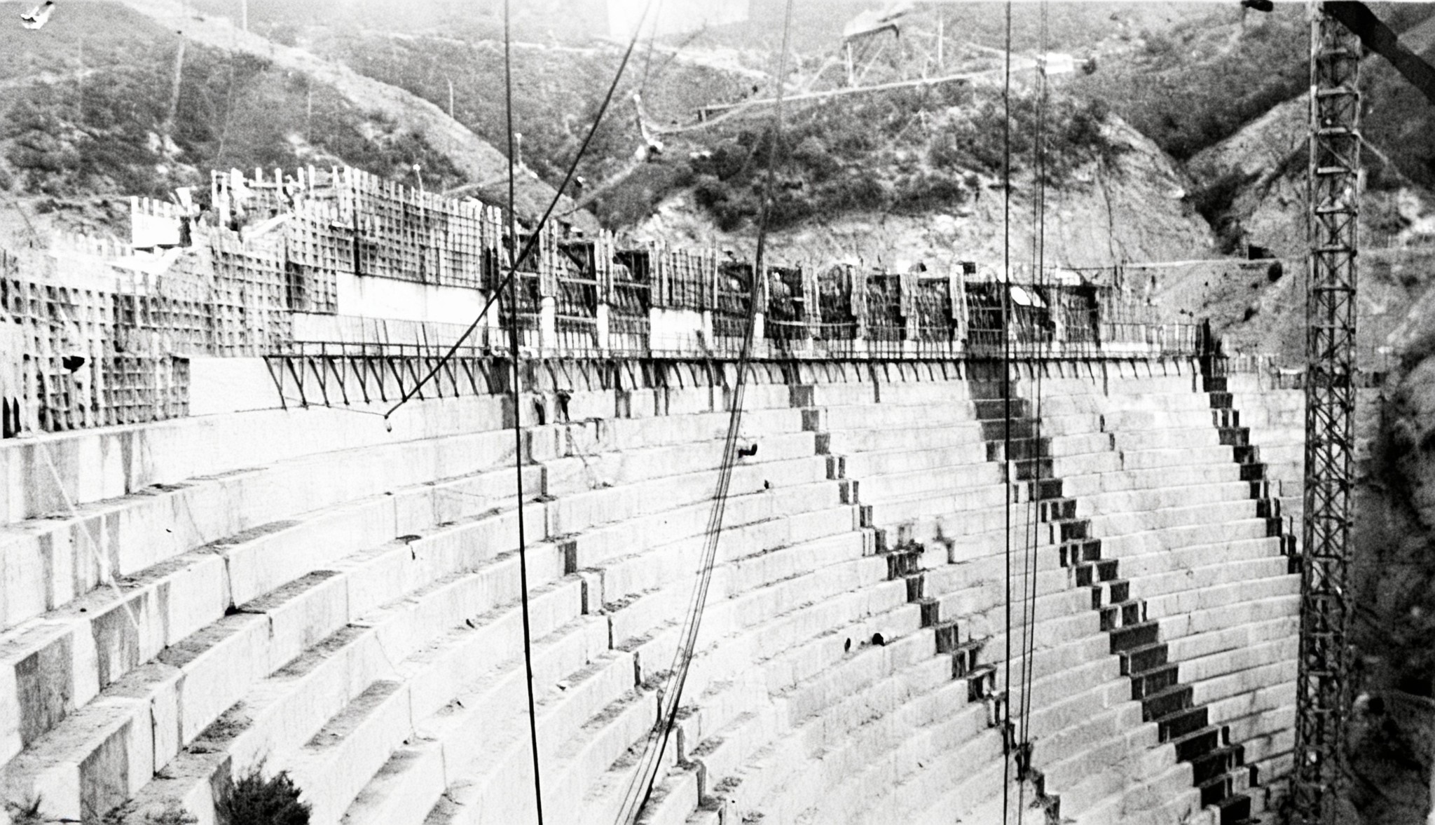
| (1925)* - The St. Francis Dam nearing completion. Changes made during construction left the dam about 20 feet taller than originally designed. |
Historical Notes A gravity dam depends largely on its weight to resist the pressure of the water behind it. Later engineering studies found that increasing the height of the St. Francis Dam without substantially widening its base reduced its margin of safety. The dam also lacked foundation drainage and other provisions for relieving water pressure beneath the structure. These factors, combined with difficult geology at the site, contributed to the disaster. |
* * * * * |
The Reservoir Reaches Capacity
 |
|
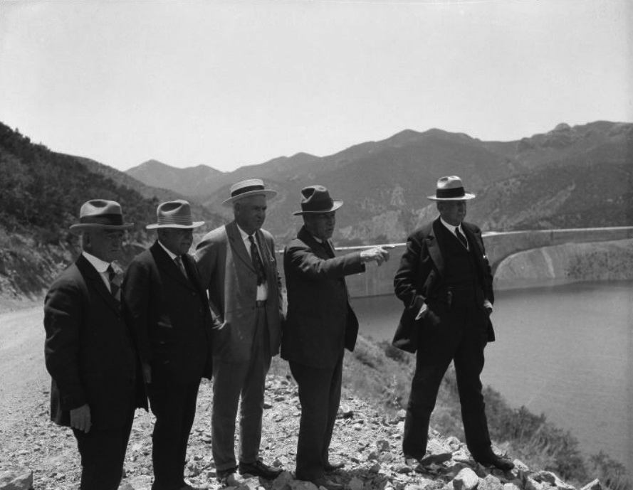
| (1928)* - William Mulholland points across the St. Francis Reservoir while standing with four other men on its east bank. The top of the dam is visible behind them. |
Historical Notes From left to right can be seen Fred Fischer, R. del Valle, ???, William Mulholland and John R. Haynes. The photograph was taken sometime between the dam's completion in 1926 and its failure in March 1928. |
 |
|
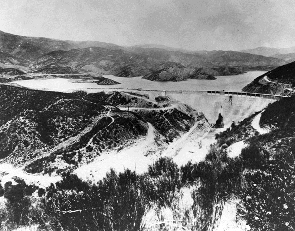
| (1928)* - Aerial view of the St. Francis Dam as the reservoir approached full capacity. |
Historical Notes Cracks, leaks and seepage had been observed at the dam during its brief operating life. Bureau engineers did not consider them unusual for a concrete dam of this type. Later investigations showed that water pressure beneath the structure and within the surrounding geology played an important role in the failure. |
 |
|
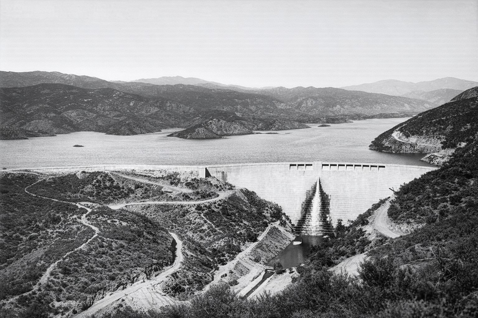
(1928)* - The St. Francis Dam with its reservoir near full capacity. The small island at center left, visible in the previous photograph, is now almost completely submerged. |
Historical Notes On March 7, 1928, the reservoir reached its highest level, within inches of the spillway. Five days later, the dam failed. |
 |
|
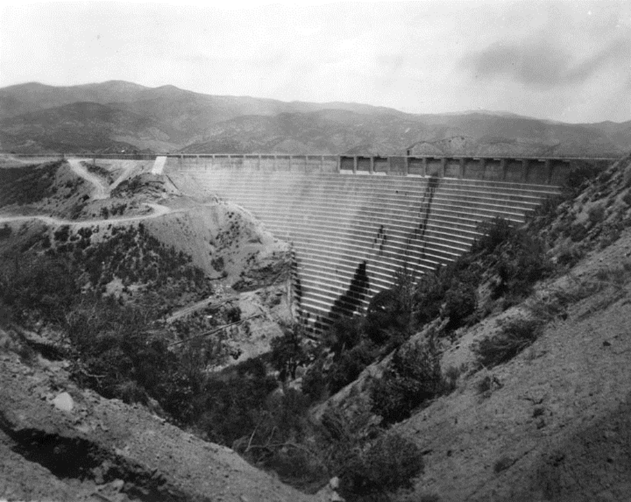
| (1928)* - Downstream view of the St. Francis Dam and surrounding canyon shortly before the failure. |
Historical Notes On the morning of March 12, damkeeper Tony Harnischfeger reported muddy water near the western abutment. Because muddy seepage could indicate that foundation material was being carried away, Mulholland and his assistant, Harvey Van Norman, came to inspect the dam. They found no evidence they believed indicated imminent failure and left the site. Harnischfeger and his family were among the first victims when the dam collapsed that night. |
* * * * * |
Catastrophic Failure
 |
|
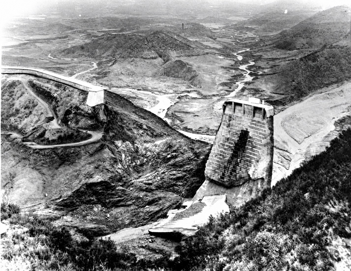
| (1928)* - The St. Francis Dam shortly after its catastrophic failure at 11:57 p.m. on March 12, 1928. The reservoir, containing more than 12 billion gallons of water, emptied in little more than an hour. |
Historical Notes No one at the dam survived to describe the moment of failure. Later engineering studies concluded that instability in the eastern abutment, where the dam rested against ancient landslide material, played a major role in initiating the collapse. Once failure began, enormous sections of concrete broke away and were carried downstream. Only the center section remained standing. |
 |
|
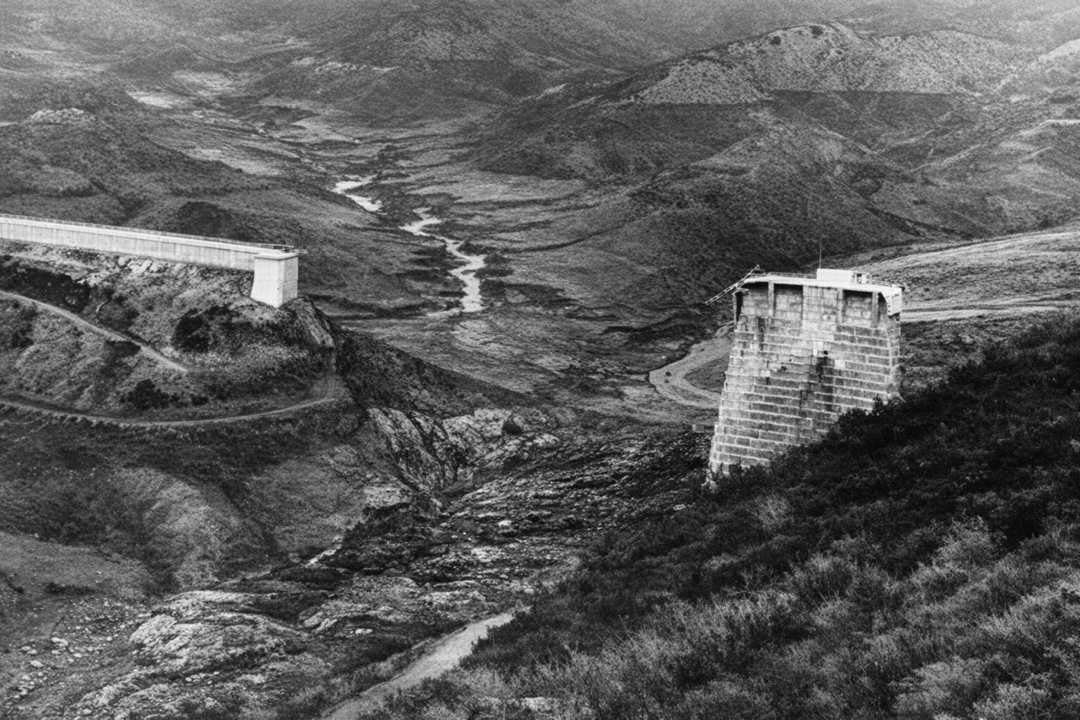
| (1928)* - Aftermath of the St. Francis Dam collapse. The former reservoir water line can be seen on the hills at upper right. |
Historical Notes The failure released the reservoir with tremendous force, stripping vegetation and soil from portions of the canyon and leaving debris scattered below the dam. The high water line visible on the surrounding hills shows the former level of the reservoir. |
 |
|
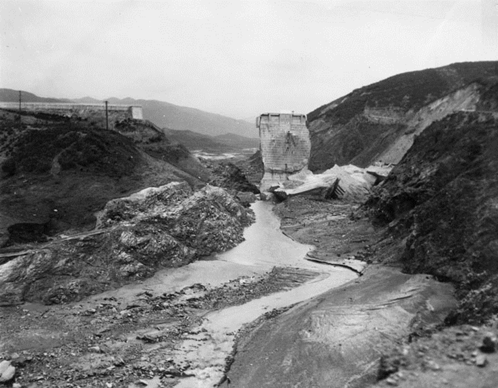
| (1928)* - Remaining water flows through the ruins of the St. Francis Dam. Only the center section remains standing. |
Historical Notes Most of the dam was destroyed during the failure. The center section remained standing while large portions on either side collapsed and were swept downstream. This surviving section soon became known as the "Tombstone" and remained standing for more than a year after the disaster. |
 |
|
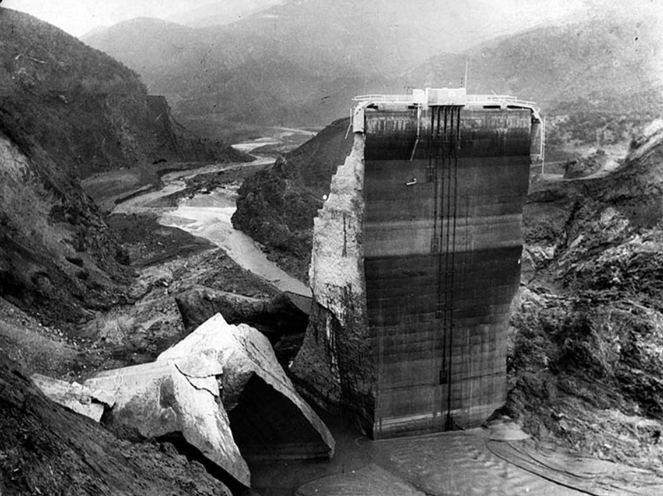
| (1928)* – The last standing section of the St. Francis Dam, with broken concrete at its base and water still flowing downstream. |
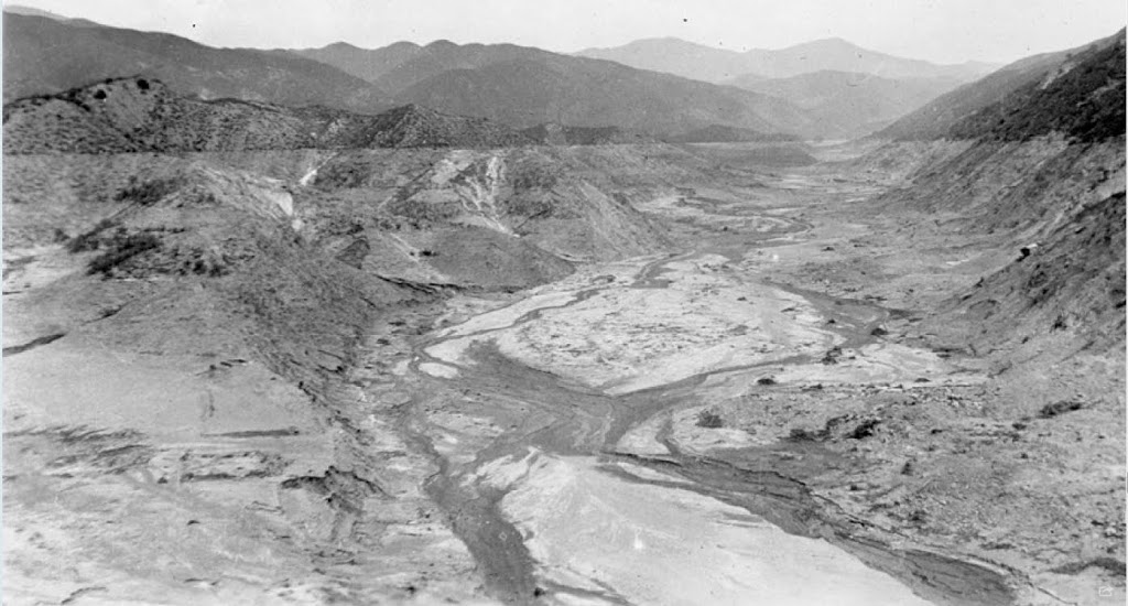
Historical Notes After leaving San Francisquito Canyon, the flood turned west and followed the Santa Clara River Valley toward the Pacific. Communities along its path included Piru, Fillmore, Santa Paula and Saticoy. Homes, farms, bridges, rail lines and roads were destroyed. The flood reached the Pacific several hours after the dam failed. More than 400 people died along its path. |
 |
|
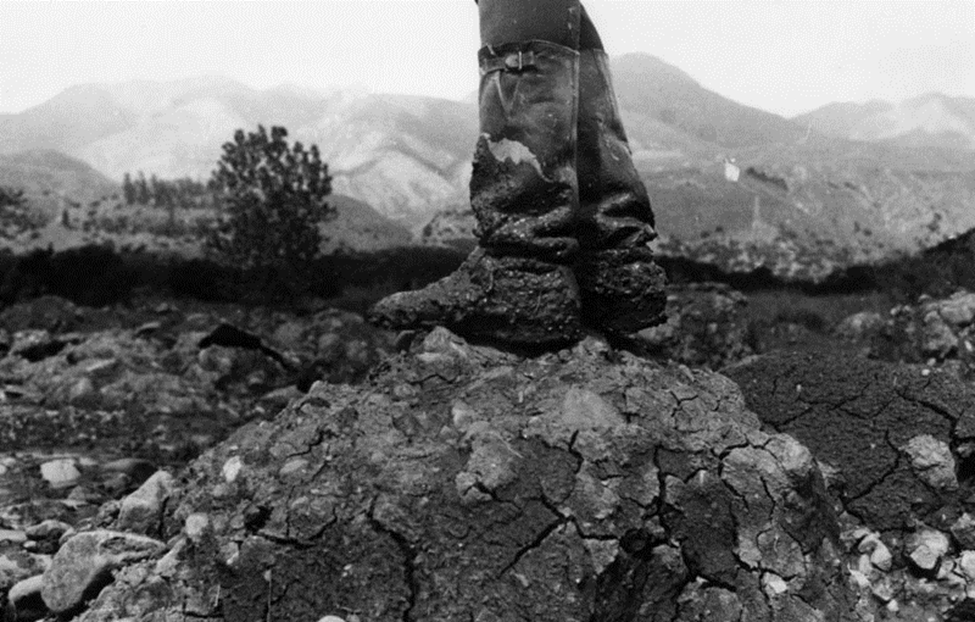
| (1928)* - A man in rubber boots stands atop a mound of rock and mud left by the St. Francis Dam flood. |
Historical Notes The flood carried enormous quantities of mud, rock, trees and wreckage downstream. When the water receded, thick deposits of debris covered portions of San Francisquito Canyon and the Santa Clara River Valley. |
 |
|
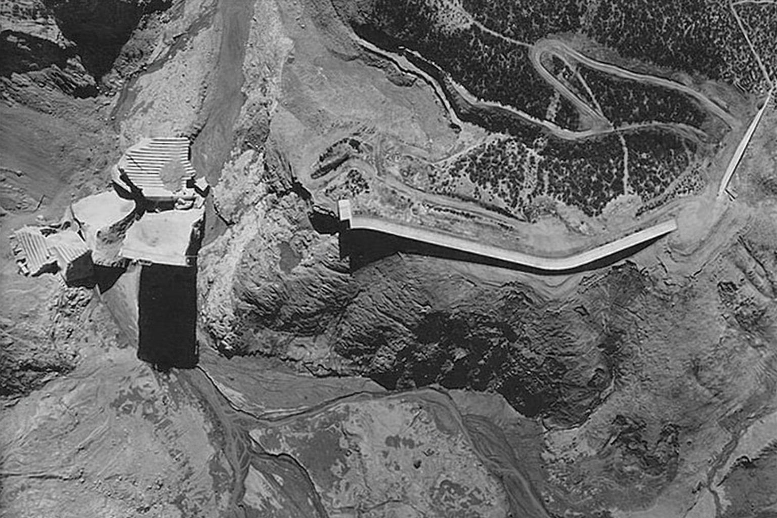
| (1928)* - Aerial view looking down on the collapsed St. Francis Dam. |
Historical Notes From the air, the extent of the failure could be clearly seen. Most of the dam had disappeared, leaving the center section standing amid broken concrete and the emptied reservoir behind it. |
 |
|
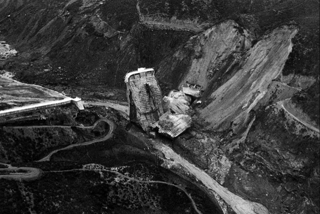
| (1928)* - Aerial view of the dam ruins. Only the center section remains upright, while the hillside shows evidence of the massive slide associated with the failure. |
Historical Notes The geology of the site became a central focus of investigations. The dam's eastern abutment had been constructed against ancient landslide material that had not been recognized as such before construction. Later engineering studies concluded that movement of this material, combined with water pressure beneath the dam and weaknesses in the design, played a major role in the failure. |
 |
|
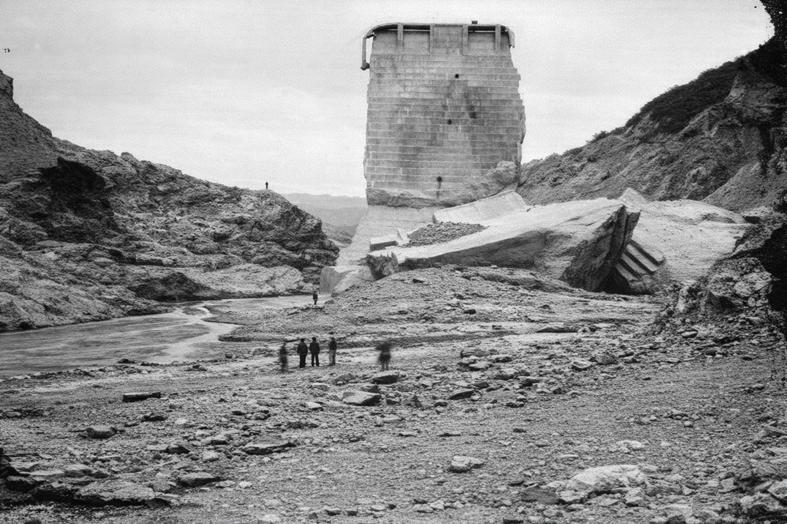
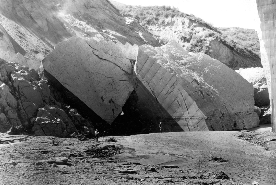
| (1928)* - Several men, dwarfed by the ruins, stand below the failed dam. One massive section remains standing while another lies broken below it. |
Historical Notes The dam broke into numerous sections, some weighing thousands of tons. Several large blocks were carried substantial distances downstream, demonstrating the enormous force of the escaping water. The men standing among the ruins provide a sense of the size of the concrete sections left behind after the collapse. |
 |
|
| (1928)* - Several men stand at the base of the collapsed dam's remains. |
Historical Notes
|
 |
|
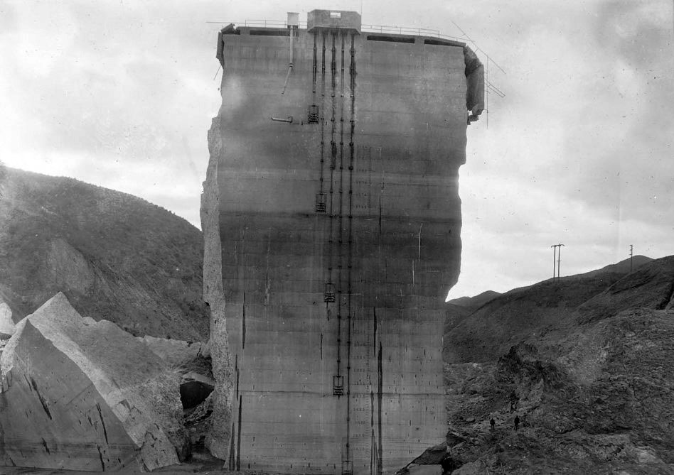
| (1928)* – Close-up view of the last remaining standing section of the St. Francis Dam, also referred to as “Tombstone”. Three men are seen climbing the debris at its base. |
Historical Notes
|
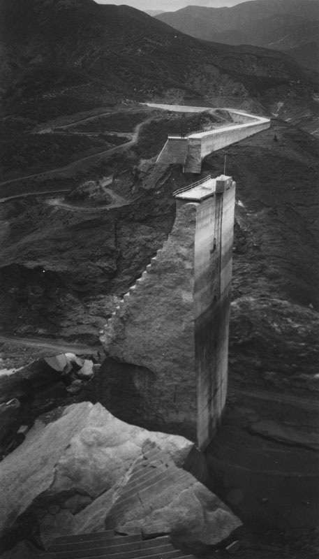 |
Side view of a massive concrete slab nicknamed "The Tombstone". This is the center section, and the only remaining portion, of the St. Francis Dam after its disastrous collapse in March 1928. Several large concrete blocks can be seen scattered throughout the area, and a few people can be seen along the road at the base of the mountain as well as atop a remaining portion of the bridge in the far distance.
|
 |
|
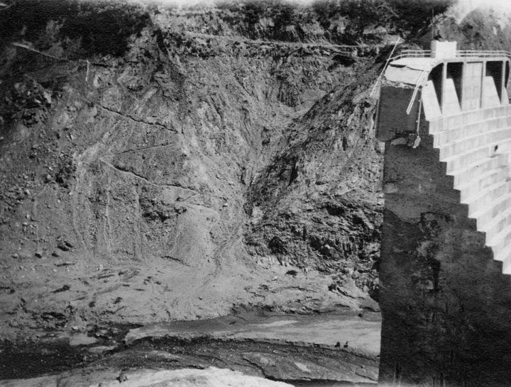
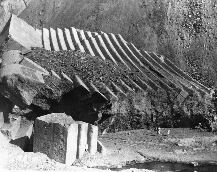
| (1928)* - Photo shows edge of the major piece still standing, and to the left of it a little of the water still left in the area. At the top left is a road closed by land slippage. |
Historical Notes
|
 |
|
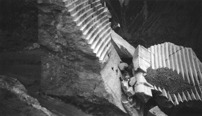
| (1928)* - A woman can be seen standing on the ground below some of the huge pieces of the failed dam which were washed down by the 100 foot high wall of water which raced towards Ventura. |
Historical Notes
|
 |
|
| (1928)* - Sightseers climb large chunks of concrete, St. Francis Dam. |
Historical Notes A few months after the dam's collapse, 18-year-old Lercy Parker fell to his death from the standing section after his friend, in playing a joke, had thrown a dead rattlesnake at him.* |
 |
|
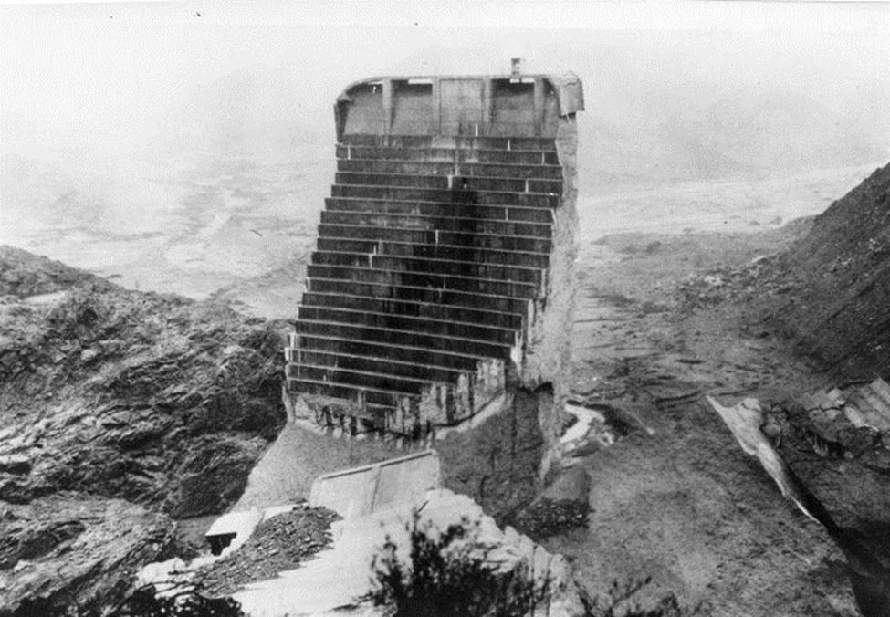
| (1928)* - Aerial view of the remaining, standing piece of the failed dam. Water soaked land and a small stream can be seen below and behind it. |
Historical Notes In May 1929, the upright section was toppled with dynamite and the remaining blocks were demolished with bulldozers and jackhammers to discourage sightseers and souvenir hunters from exploring the ruins.* |
 |
|
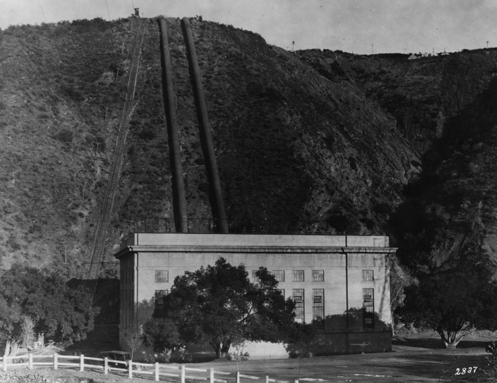
| (1920)* - This pre-failure photograph shows the exterior of the San Francisquito Power Plant No. 2 at the base of a hill with pipes (penstocks) running up the hill. The plant was directly in the path of the flooding water. |
Historical Notes
|
 |
|
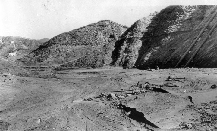
| (1928)* - The ruins of the San Francisquito Power Plant No. 2 are clearly visible from the canyon road above. The plant's penstocks can also be seen in the upper right. |
Historical Notes
|
 |
|
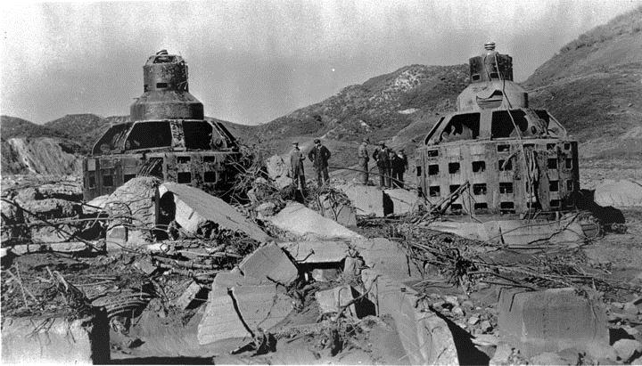
| (1928)* - Generators stand in the rubble of Power Plant No. 2 which stood just 5 miles north of Newhall. |
 |
|
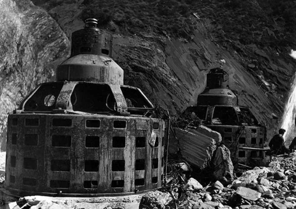
| (1928)* – Close-up view showing the turbine-generator housings - all that is left of Power House No. 2. LA Times Photo: March 15, 1928 |
 |
|
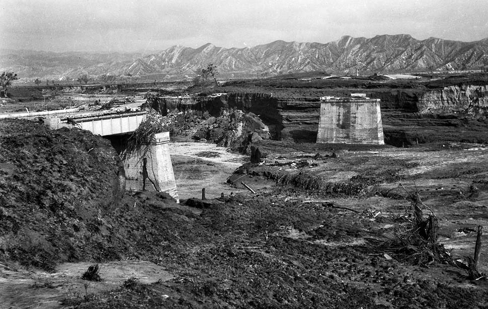
| (1928)* – View of Main Highway Bridge one and one-half miles from Castaic. Only the supports survived the flood waters following the St. Francis Dam collapse. |
 |
|
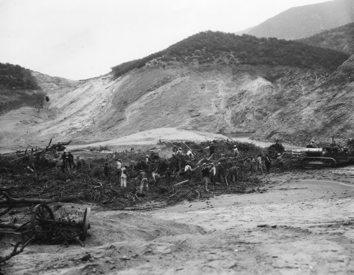
| (1928)* - This post-failure photograph shows men working in a field of broken trees, wagons and other debris attempting to clear it away. A caterpillar tractor is visible on the right side. |
 |
|
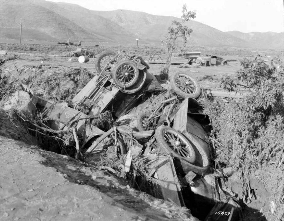
| (1928)* - Twisted company auto wreckage marks the site of the Southern California Edison Kemp Camp which was destroyed in the flood. |
Historical Notes Just past the Ventura County line along the Santa Clara River was a railroad siding called Kemp. There, a group of 150 workers for the Edison company were fast asleep in a tent camp used while they were building a transmission line. Night watchman Ed Locke watched in horror as the huge flood of water approached the camp. He ran through the camp, waking up as many people as possible. Locke, a true hero of the disaster, perished that night, along with 84 of the workers as the flood hit a geologic outcropping called Blue Cut, which created a whirlpool effect that uprooted the tents. Most of the survivors had their tents zipped up, which allowed them to float on the whirlpool.*^* |
 |
|
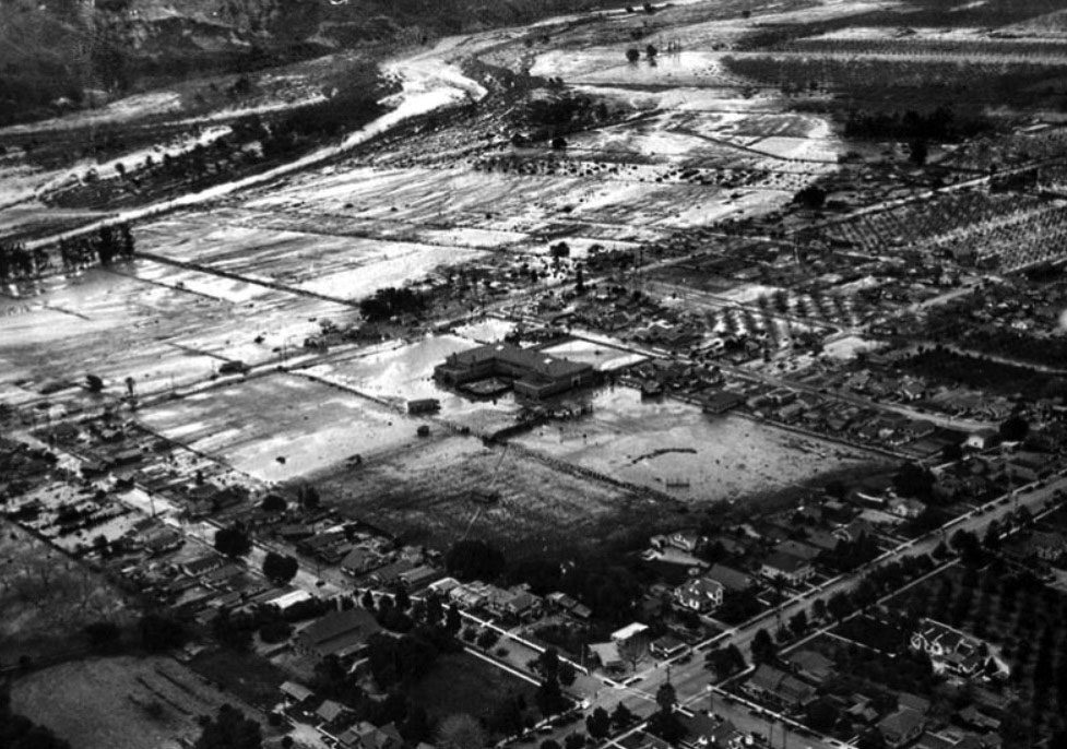
| (1928)* - Aerial photo of the City of Santa Paula following the collapse of the St. Francis Dam. This photo was published on page one of the March 14, 1928 LA Times. |
Historical Notes There were other heroes to recognize at Santa Paula. Louise Gipe, a night telephone operator at Santa Paula, received a call from the Pacific Long Distance telephone operator at 1:30 a.m., warning of the flood headed her way. Ignoring the peril to her own life, she stayed at her post, notifying California Highway Patrolman Thornton Edwards and calling residents in the low-lying areas of Santa Paula to warn them about the impending flood. Edwards would become known as the "Paul Revere of the St. Francis Flood" as he raced wildly from door to door warning residents of Santa Paula. While Edwards spread the alarm through Santa Paula, deputy sheriff Eddie Hearne raced up the Santa Clara River Valley toward the flood with his siren blaring to warn residents. He made it as far as Fillmore, where he met the flood waters and had to stop his wild ride.*^* There's a monument to their deeds in downtown Santa Paula, a sculpture called "The Watchers" that depicts the two motorcycle policemen who rode through town spreading the word. |
.jpg) |
|
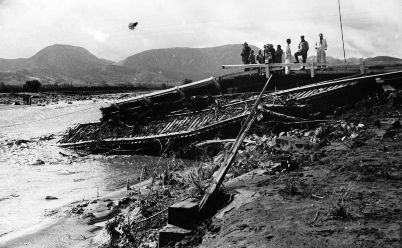
| (1928)* - Remains of homes in Santa Paula following the collapse of St. Francis Dam. LA Times Photo: March 14, 1928 |
 |
|
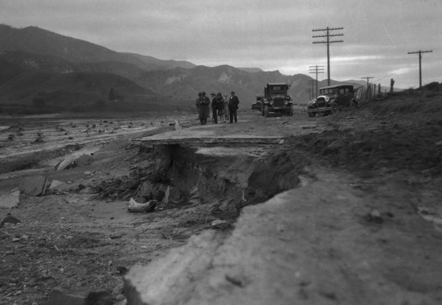
| (1928)* - People examine the damaged road and washed away railroad track, caused by excess water flowing down the Santa Clara River after the failure of the St. Francis Dam. |
 |
|
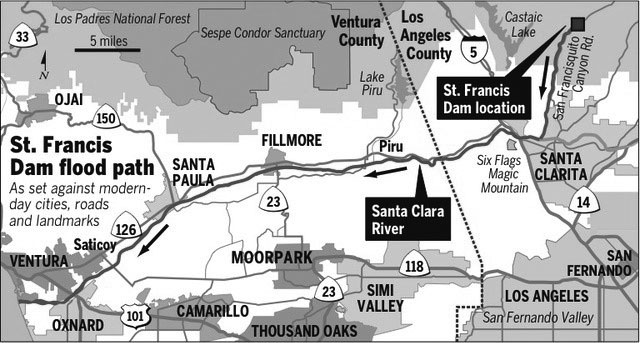
| (1928)* - Officials on the edge of the wide path of the flood that followed the failure of the St. Francis Dam. |
 |
|
| Map showing the St. Francis Dam flood path. Ventura County Star/Steve Greenberg* |
 |
|
| (1928)* - St. Francis reservoir a day or two later after all 12.4 billion gallons had drained out of it less than 70 minutes. The water line can be seen on the face of the mountains. |
Historical Notes The disaster was primarily caused by the ancient landslide material on which the eastern abutment of the dam was built, which would have been impossible for the geologists of the 1920s to detect. Two of the world's leading geologists at the time, John C. Branner of Stanford University and Carl E. Grunsky, had found no fault with the San Francisquito rock. Therefore, an inquest jury determined responsibility for the disaster lay with the governmental organizations which oversaw the dam's construction and the dam's designer and engineer, Mulholland, but cleared Mulholland of any charges, since neither he nor anyone else at the time could have known of the instability of the rock formations on which the dam was built. The hearings also recommended that "the construction and operation of a great dam should never be left to the sole judgment of one man, no matter how eminent."* |
Follow-Up Analysis J. David Rogers, a professor of geological engineering at Missouri University of Science and Technology, published a comprehensive account of the dam's failure. The dam's failure can be attributed to three major factors: the instability of the ancient landslide material on which the dam was built, the failure to compensate for the additional height added to the dam's design, and the design and construction being overseen by only one person.* |
Click HERE to see a slide presentation of Roger's report.^ |
 |
|
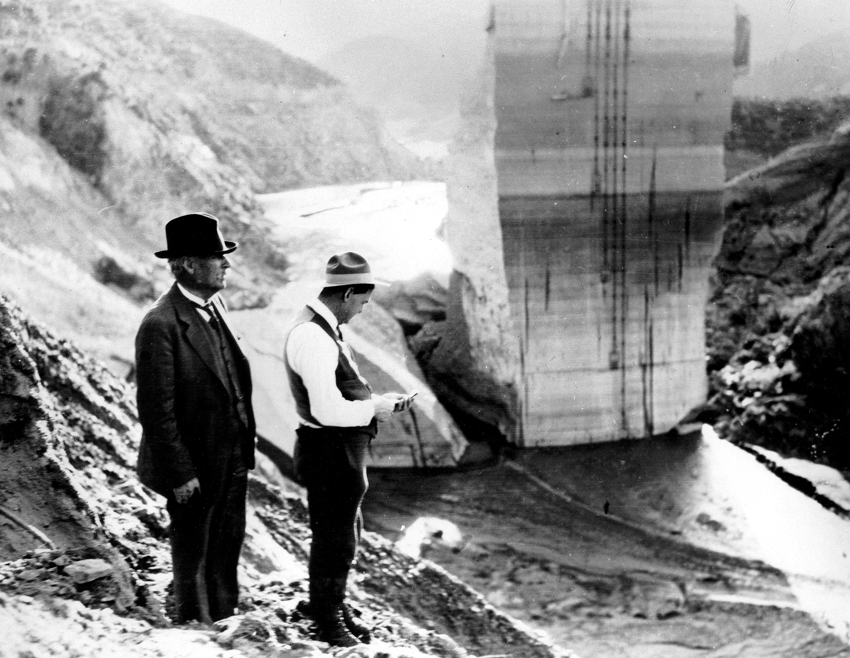
| (1928)* – William Mulholland and H. Van Norman stand on the hillside overlooking St. Francis Dam ruins shortly after it failed. |
Aftermath Despite some reports absolving Mulholland of culpability, the collapse ushered in a public distrust of all prior Mulholland projects. The aqueduct was re-evaluated, reservoirs double-checked, and his prior dams were re-enforced with more earth. The famed Mulholland Dam in Hollywood, which was similar in design to the St. Francis Dam, was also evaluated and re-enforced.* Click HERE to see more in Early Views of the Mulholland Dam and Hollywood Reservoir. |
 |
|
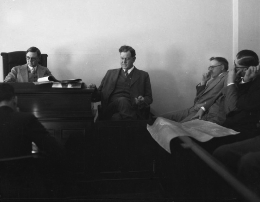
| (1928)* - Coroner Frank Nance and engineer H. A. Van Norman at the Coroner's Inquest following the failure of the Saint Francis Dam, Los Angeles. |
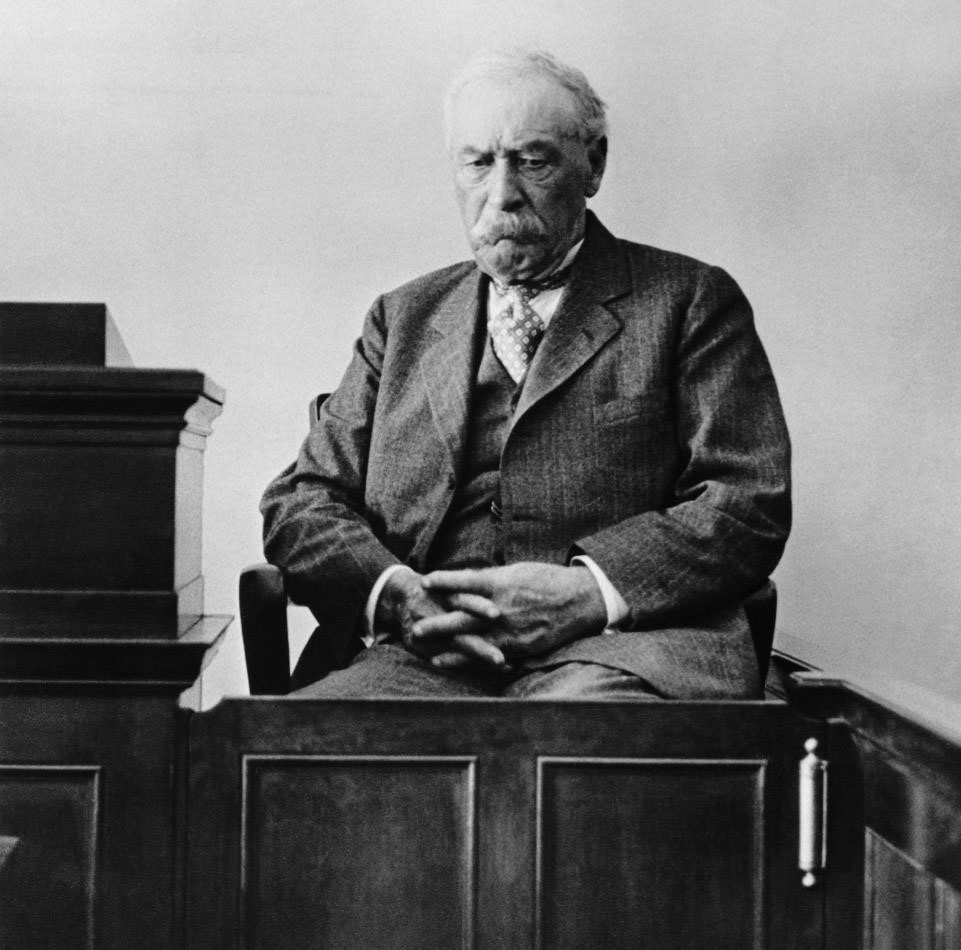 |
(1928)* - View showing William Mulholland testifying on the witness stand on March 26, 1928 in Los Angeles, at the coroner's inquest.
|
Aftermath Mulholland took responsibility in a way that no public figure would today. During the official inquest, he claimed the mistake as entirely his own. “The only ones I envy about this thing are the ones who are dead,” the crestfallen chief announced. He retired from the Bureau of Water Works and Supply in March 1929. His assistant, Harvey Van Norman, succeeded him as Chief Engineer and General Manager. Mulholland was retained as Chief Consulting Engineer for a while, however, in later years, he retreated into a life of semi-isolation. He died in 1935, at the age of 79.* |
* * * * * |
History of Water and Electricity in Los Angeles
More Historical Early Views
Newest Additions
Early LA Buildings and City Views
* * * * * |
References and Credits
* DWP - LA Public Library Image Archive
*#Folegattiadvocacia.com: St. Francis Dam
#*Newsweek: St. Francis Dam Disaster
**Ventura County Star: St. Francis Dam Flood Path
^^Noirish Los Angeles - forum.skyscraperpage.com
^^*LA Times Framework: St. Francis Dam Collapse
**^Sometimes-Interesting.com: St. Francis Dam
^**Huntington Digital Library Archive
*^*SCVHistory.com -St. Francis Dam Disaster
^*^Calisphere: University of California Image Archive
^^^UCLA Library Digital Collection
.....Failure of the St. Francis Dam Website - J. David Rogers
^ 1928 Catastrophic St. Francis Dam Failure -Suburban Engineering Management Project Publication
< Back