Early Views of Pasadena
Historical Photos of Early Pasadena |
 |
|
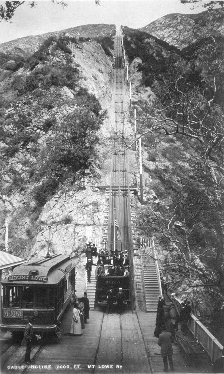
| (1893)^ - The great Cable Incline (seen above) went from Rubio Pavilion (the bottom) to Echo Mountain (at the top). In this picture one of the black cable cars, named "Rubio" sits at the bottom with some passengers aboard and others waiting nearby. Also on the left is the electric car which brought customers to the station from Mountain Junction. |
Historical Notes At the turn of the century (1893 - 1938) one of the most famous excursion in Southern California was the Mt. Lowe trip. Sightseers from all around the Los Angeles area took a Pasadena car to Altadena and Rubio Canyon. They then transferred to a cable car on the Incline Railway that went up a 62% grade to Echo Mountain. From there they would take a narrow-gauge trolley car winding its way up the rugged San Gabriel Mtns. and finally would arrive at Alpine Tavern on Mt. Lowe, a nearly 7 mile railway ride from the base of the mountain. The views of the valley floor and beyond were spectacular.* |
 |
|
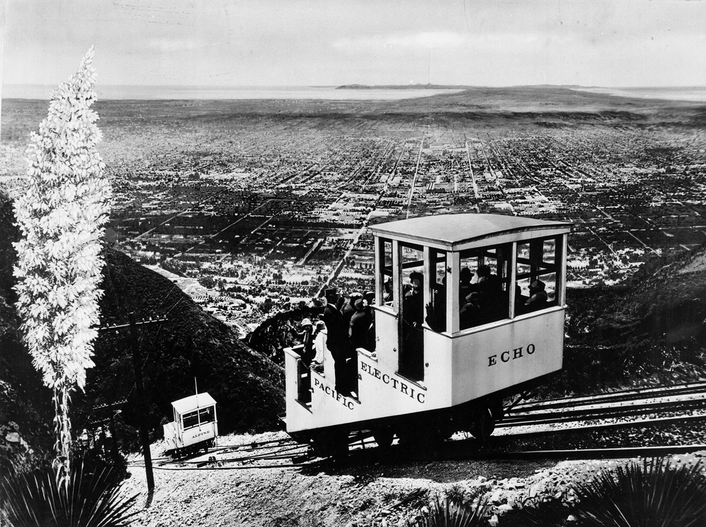
| (ca. 1915)**# - The Echo Mountain incline railway after Pacific Electric purchased it. Catalina Island can be seen in the distance. Click HERE to see more in Early Views of Catalina. |
Historical Notes After Pacific Electric (owned by Henry E. Huntington) purchased Mount Lowe Railway around 1902, the cars used on the Great Cable Incline were rebuilt to include a roof on the top deck. These cars, stripped to their floors, were last used to carry salvage in 1938, when the Mt. Lowe line was scrapped.**# |
 |
|
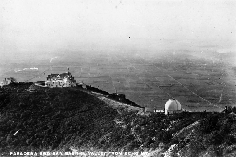
| (ca. 1890s)* - View of Pasadena and San Gabriel Valley from Echo Mountain. |
Historical Notes Buildings at Echo Mountain, reached by the Mount Lowe Railway, included the Echo Mountain House, a 70-room hotel at an elevation of approximately 3500 ft., the 40-room Echo Chalet, the observatory, car barns, dormitories, repair facilities, and a casino/dance hall.* Click HERE to see more in Early Views of Mt. Lowe Railway. |
 |
|
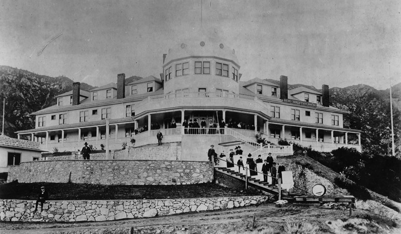
| (ca. 1890s)* - View of some of the hotel guest standing on the veranda and stairways at the front of Echo Mountain House. |
Historical Notes Completed in the fall of 1894, the Echo Mountain House was a marvel. The four-story Victorian building was marked by a tall, cylindrical tower and capped by a metal dome and a huge American flag. The bright white exterior was marked by a long row of windows on each floor. At the building’s entrance, two sweeping verandas looked off across the canyons and the valley. The interior of the hotel was extravagant, with detailed wood inlay, the finest floral-patterned carpet and handmade furniture throughout. There were seventy guest rooms, large areas for office space, a massive social hall and dining room, a souvenir shop, a Western Union office, a bowling alley, a billiard room, a barbershop and a shoeshine stand.^^ |
 |
|
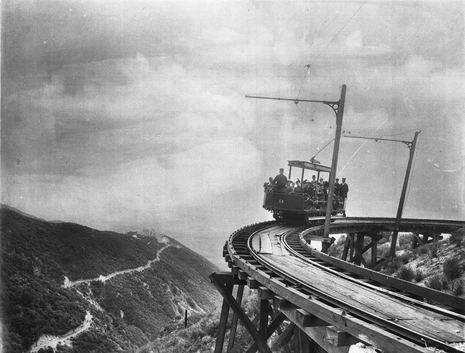
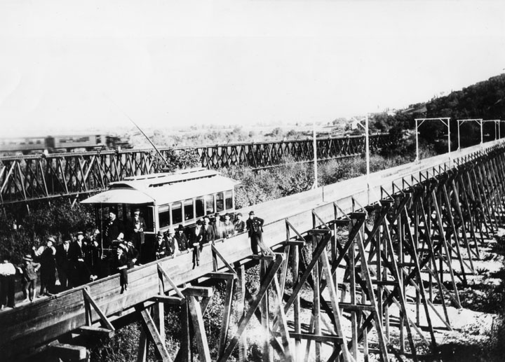
| (1893)^ - Photograph of the first passengers of Professor S.C. Lowe's dramatic Mount Lowe Railway, July 4, 1893. There are a couple of dozen people in the rail car (number "9") which is headed toward the camera on the circular bridge. The trestle structure is visible below the rails. The hotel on the mountaintop is visible at left as is the rail approach to the hotel. |
Historical Notes From the top of Echo Mtn, passengers could transfer to another trolley line, the Alpine Division, which would take them to the upper terminus at Crystal Springs and Ye Alpine Tavern, a 22-room Swiss Chalet hospice with a complement of amenities from tennis courts, to wading pools, to mule rides. This phase of tracks cut through the broad Las Flores Canyon which gave a tremendous panorama of the valley floor below. At one point a tall trestle was required to bridge a broad and deep chasm with a bridge so named High Bridge.*^ |
 |
|
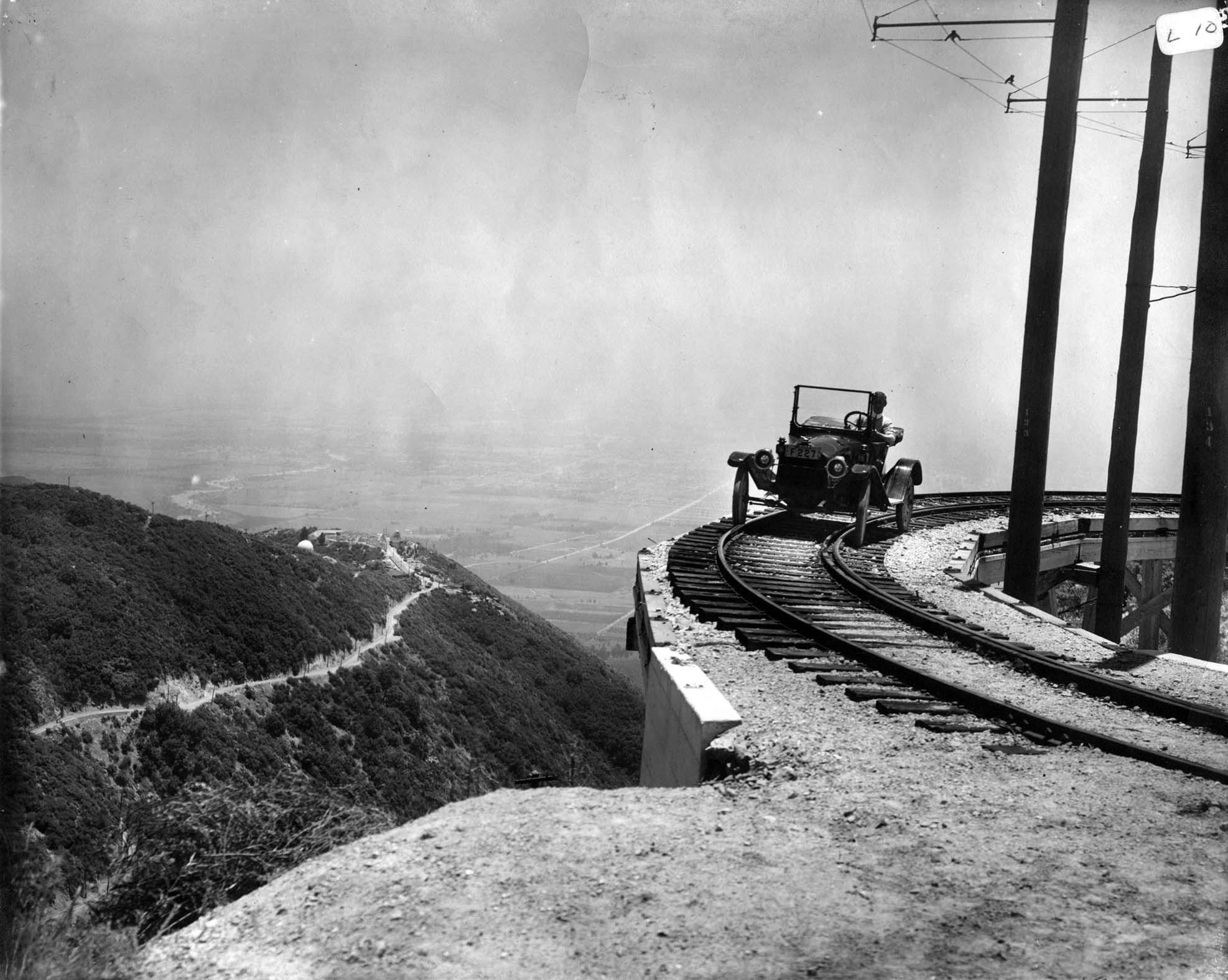
| (1914)*^* - A 1914 Metz Roadster poses for a publicity picture on Circular Bridge. Echo Mountain is at far left. The above photo was featured in the Pasadena Star (Sept. 10, 1914) where the headline read: “Five thousand is the number of autos: That many machines are owned in Pasadena and vicinity.” |
Historical Notes The automobile must have been taken up on the back of an incline car, as there were no auto roads in the vicinity at the time. A fire road reaches this spot today. |
 |
|
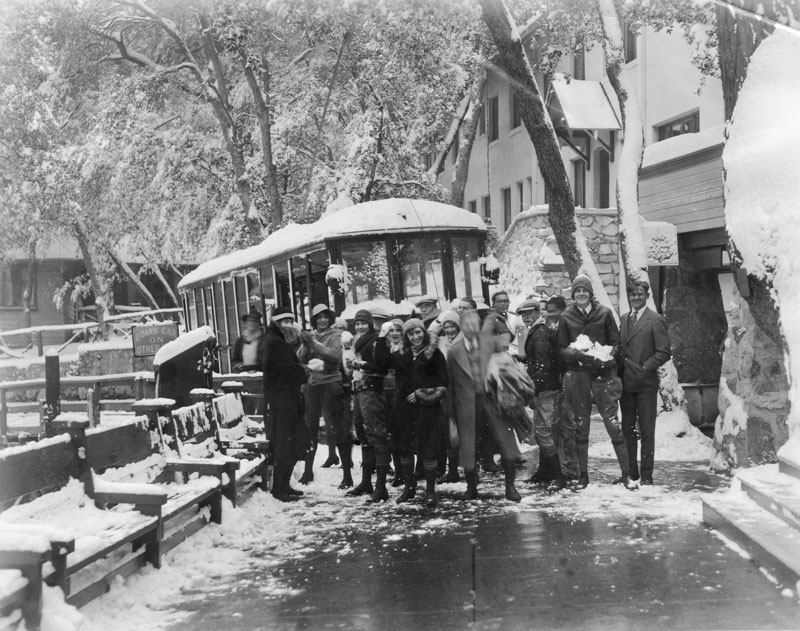
| (1930)* - Caption on the verso of the image reads, "Redondo High School students arrive at Mt. Lowe Tavern for a snow battle royal." |
Historical Notes Ye Alpine Tavern was the end-of-the-line for the Mount Lowe Railway at the foot of Mount Lowe. It was renamed The Mount Lowe Tavern in 1925, and was burned down in September 1936.*^ |
Click HERE to see more in Early Views of Mt. Lowe Railway |
 |
|
| (1897)++# - Winter view looking northeast from Monk's Hill showing the San Gabriel Mountains covered with a blanket of snow. You can just make out Mount Lowe Rwy. entering Rubio Cyn. and Alpine Division ascending from Echo Mountain. The dirt intersection in foreground is of Howard and Marengo. |
Historical Notes On closer look you can make out Christmas Tree Lane with deodar saplings in the middle of photo. The McNally and Greene mansions are those buildings on either side. |
 |
|
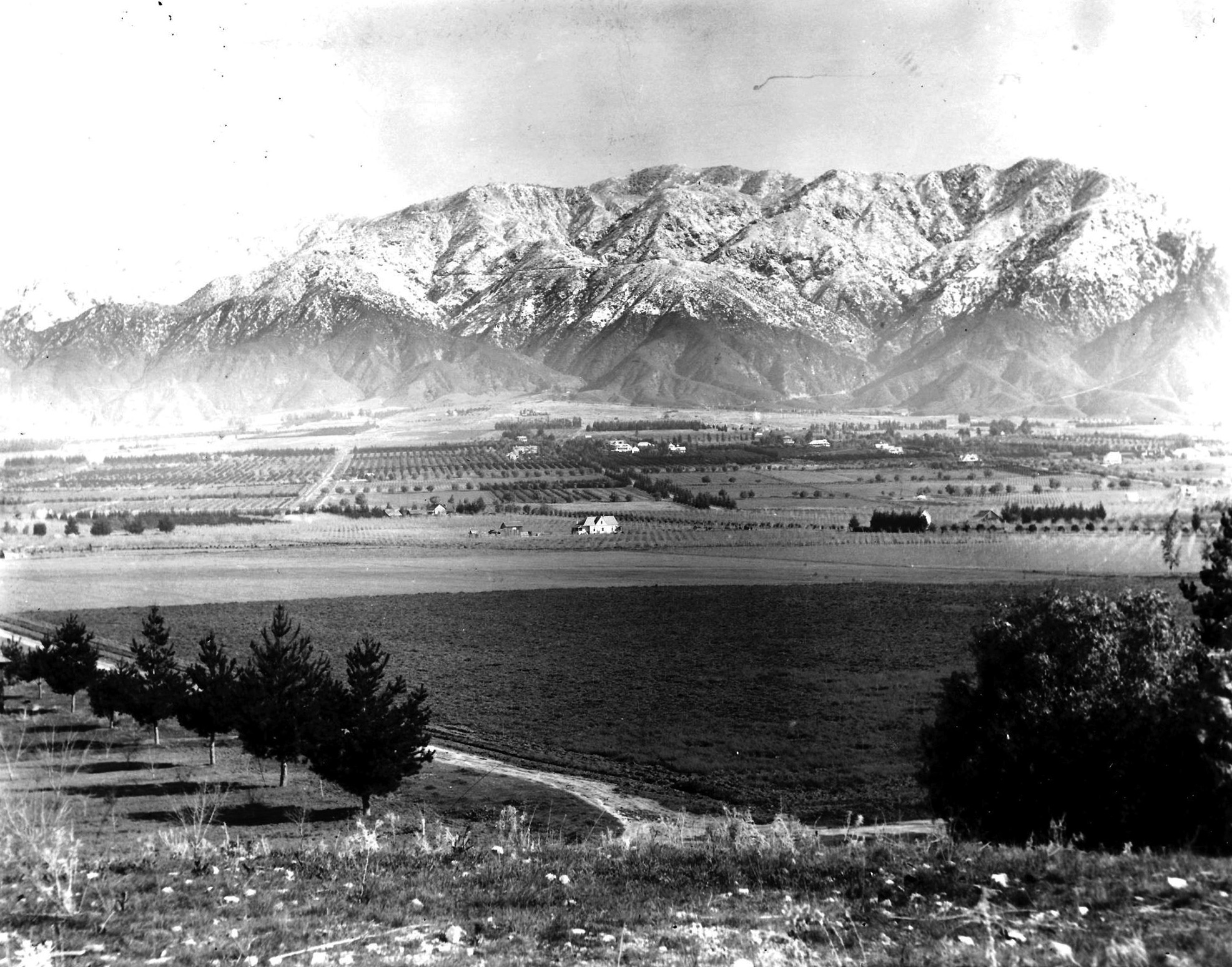
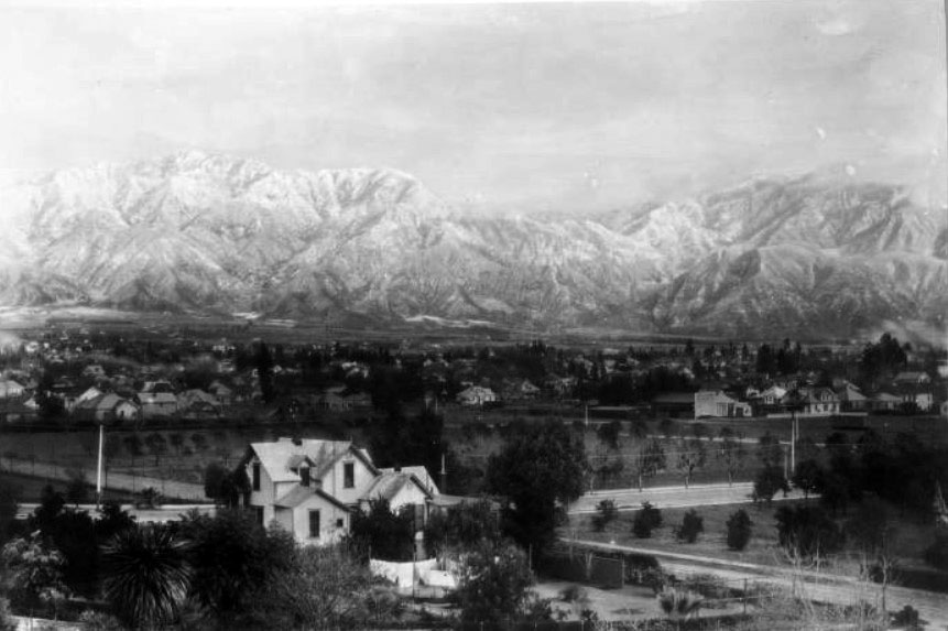
| (ca. 1900)#* - Panoramic view showing the snow-capped San Gabriel Mountains including Echo Mt., Mt. Lowe, and Mt. Wilson. Houses and orange groves are visible in the foreground. |
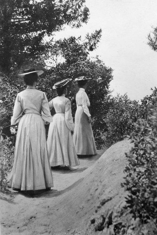 |
(1902)* - Caption reads, "'Ah, there!' Behold, three young ladies of fashion determinedly, though circumspectly, hiking up the Mt. Lowe trail in the year 1902. Mountaineering was quite the thing in those halcyon times, but if anyone had so much as mentioned hiking outfits with 'shorts' to these gals, they probably would have hidden their blushes in the shrubbery."
|
 |
|
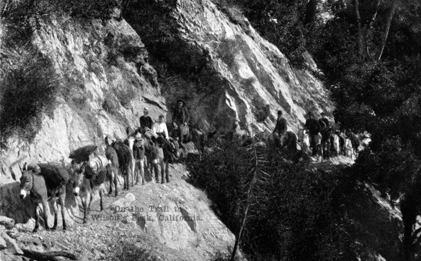
| (1912)^*^# - Postcard view showing a mule train traveling along a trail that led to the top of Mt. Wilson. |
Historical Notes Benjamin D. Wilson, born in 1811 in Tennessee, was a fur trapper by trade. He arrived in California in 1841, intending to continue to China. During the Mexican War he joined up with the Gringos, was captured, and spent the remainder of the war as a prisoner. After the war he went into business in Los Angeles and was eventually elected mayor in 1851. In 1854 he bought a 128 acre ranch where San Marino now stands and lived there until his death in 1878. Don Benito, as he was known to his many Spanish speaking friends, needed lumber for his fences and wine barrels. The mountain peak that loomed above Wilson's ranch held plentiful forests of sugar pine and cedar, so he had been told. The year was 1864. To get that timber, Wilson was to build the first modern trail up the peak that now bears his name. In the spring of 1864, Don Benito put his Mexican and Indian help to work improving an old Indian path up Little Santa Anita Canyon. Upon arriving at the top, Wilson found two cabin ruins already there, possibly built by horse thieves of an earlier time. The timber on Wilson's peak, as the mountain became known after Don Benito built his trail, apparently didn't suit Benjamin Wilson. A few weeks later he abandoned the venture. But his trail remained, and for many years was the only pathway to the mountain top. #*#* |
 |
|
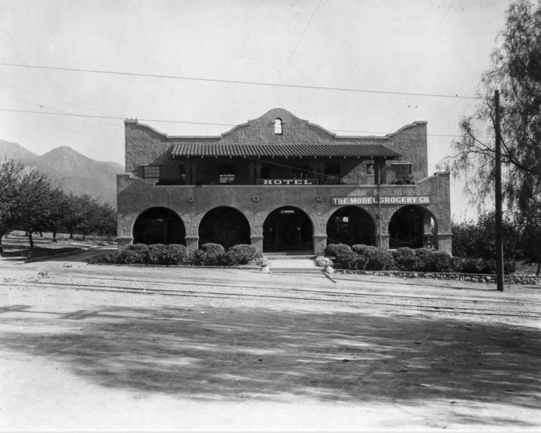
| (ca. 1910)** - View showing the Model Grocery store and the La Mariposa Hotel located at Lake and Marcheta (later Webster) avenues in Altadena. Railcar tracks can be seen embedded in the road's pavement. |
Historical Notes La Mariposa is the first motel located between Lake and Marcheta (Webster) avenues in Altadena. It was built in the early 1900s and had six rooms. The Model Grocery, a branch of Pasadena's Model Grocery stores, opened its business for a few years catering to the cattle trade customers. |
* * * * * |
 |
|
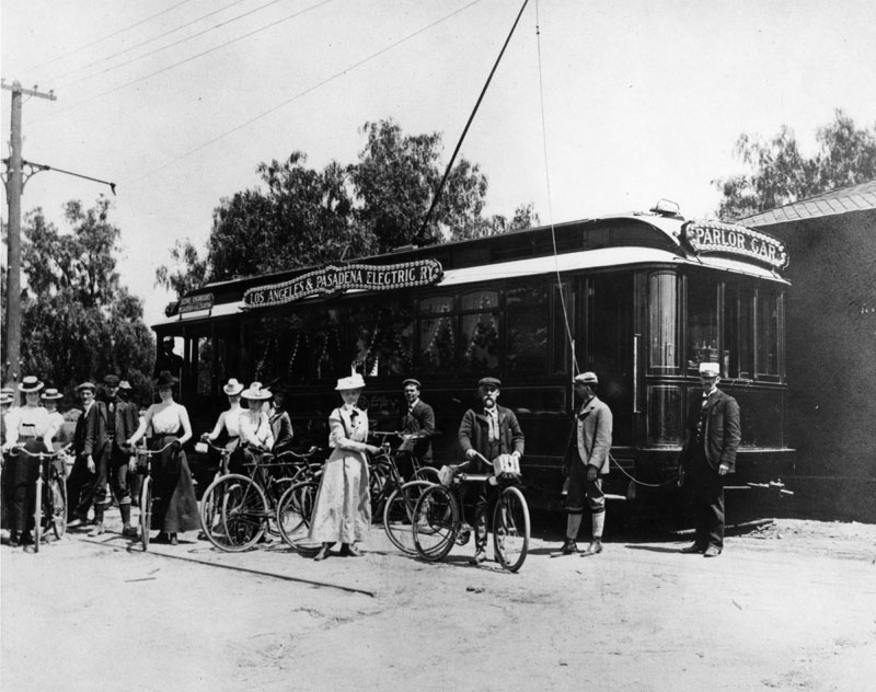
| (ca. 1894)* - A group of people, many of whom have bicycles, stands beside a Los Angeles & Pasadena Railway Company parlor car at the Altadena station. The parlor car was designed exclusively for scenic excursions to Pasadena and Altadena. |
 |
|
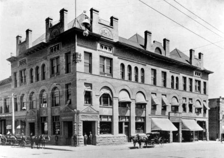
| (ca. 1886)** - View of Pasadena National Bank, located in the Masonic Temple building on the southeast corner of Raymond Avenue and Colorado Street. |
Historical Notes When the Pasadena National Bank first opened its doors in 1886, local residents made $25,000 worth of deposits on the first day alone. The bank's original lacation was a room on Raymond Avenue, but it soon moved to the Masonic Temple, shown here on the southeast corner of Raymond Avenue and Colorado Street. The bank's new offices had the most burglarproof vaults available, featuring 5-foot-thick walls laced with steel horseshoes.** |
 |
|
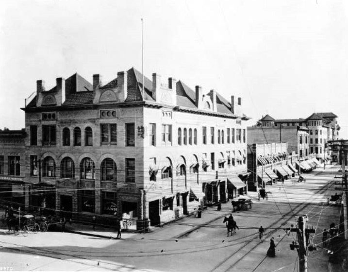
| (1908)#* - Street view of the corner of Raymond and Colorado looking south toward the Green Hotel. The Pasadena National Bank stands on the southeast corner. A rider on a horse shares the street with horse-drawn carriages, a cyclist, and pedestrians. |
Historical Notes Harry Ridgway designed the imposing Masonic Temple block at the southeast corner of Raymond and Colorado in Romanesque Revival style in 1894. He was also the architect/designer for the First National Bank building, built in 1886 on the n/w corner of Colorado and Fair Oaks. *#*# |
 |
|
| (ca. 1897)** - View looking toward the northwest corner of Raymond and Colorado. A streetcar shares the road with horse-drawn wagons. |
Wetherby & Kayser Shoes
 |
|
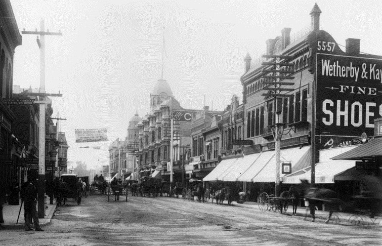
| (ca. 1894)* - View of Colorado Street, Pasadena, looking west from Raymond Avenue. Horse-drawn carriages fill the unpaved street. Sign on the right reads: "Wetherby & Kayser - FINE- SHOES" |
 |
|
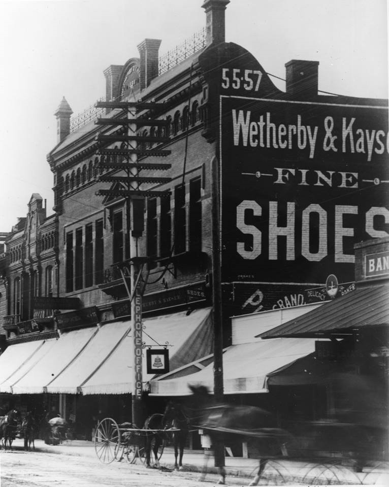
| (ca. 1894)* - Close-up view of Wetherby & Kayser Fine Shoes located at 55-57 East Colorado Street, just west of Raymond Ave. The sign on a congested telephone pole reads: "Telephone Office". |
Vroman's Bookstore
 |
|
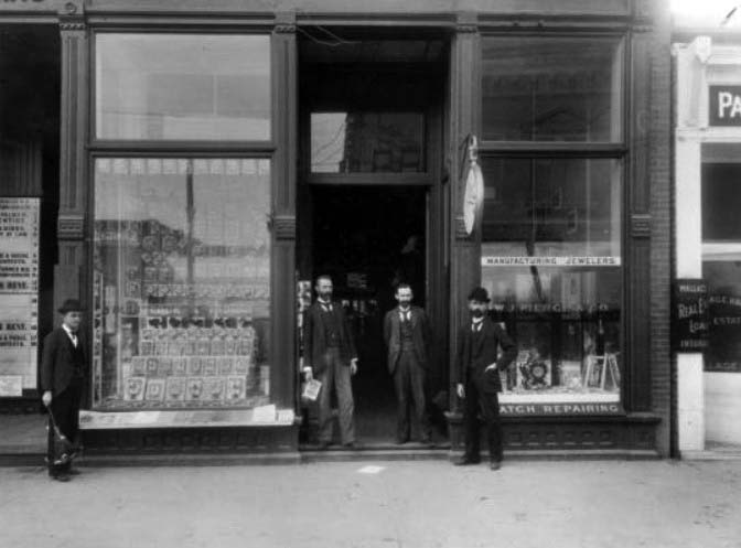
| (1895)**- Front of Glasscock and Vroman's bookstore at 60 E. Colorado and W. J. Pierce and Co. jewelers. A. C. Vroman is at the far right. |
 |
|
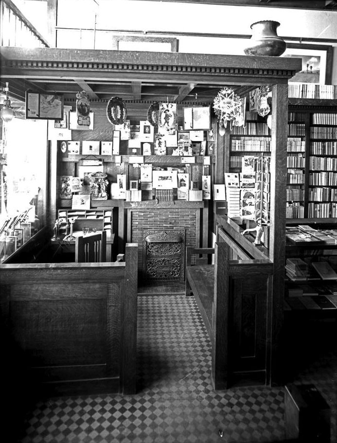
| (1905)++# – Interior view of Vroman’s bookstore showing a Christmas card display. At left can be seen the books set up in display behind the windows fronting Colorado. |
Nash Bros. Grocery Store
 |
|
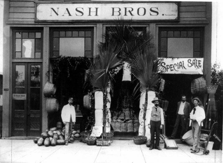
| (1895)** - Exterior view of the Nash Brother's Grocery Store located at 126 East Colorado. An ice cream parlor was located upstairs. |
Historical Notes Nash Bros. Grocery store moved to 141 Colorado in 1900. |
 |
|
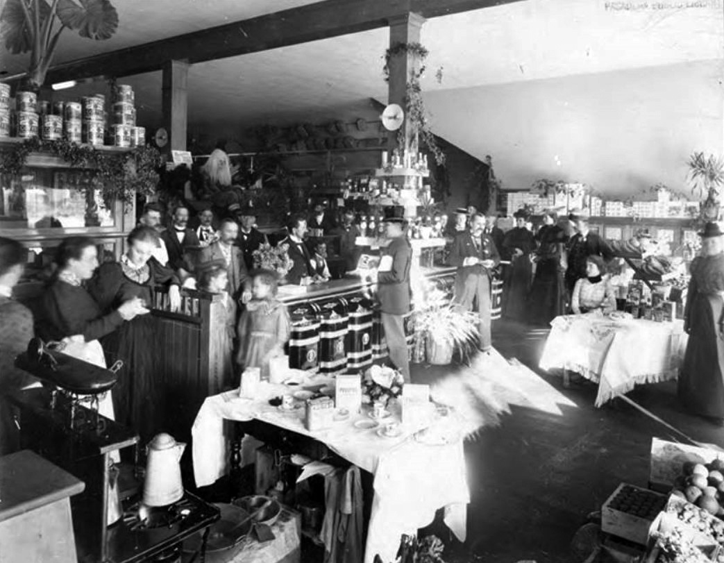
| (1890s)** – Interior view of Nash’s Grocery Store crowded with people during the holidays. Note the Santa Claus decoration on top of case in center of photo. |
* * * * * |
 |
|
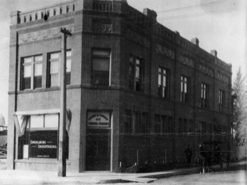
| (1895)** - View showing a two-story brick building located at 95 N. Raymond with horse-drawn wagon parked near the curb. Sign on window reads: EMBALMING – UNERTAKING. |
Historical Notes Back of photo reads: “Great Grandpa Adams founder of the Adams & Turner later Turner & Stevens. Grandma Wall lived on 2nd floor with my father.” |
* * * * * |
Universalist Church and Public Library
 |
|
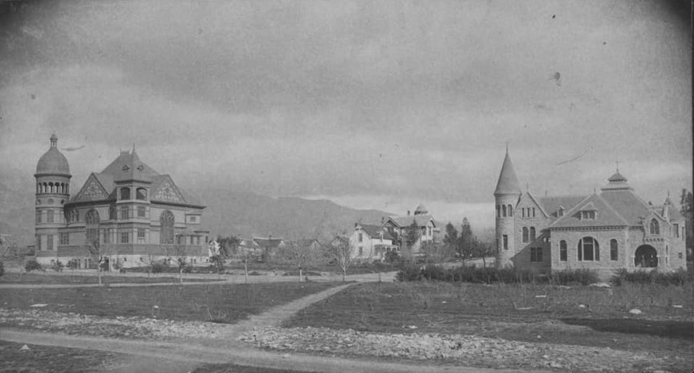
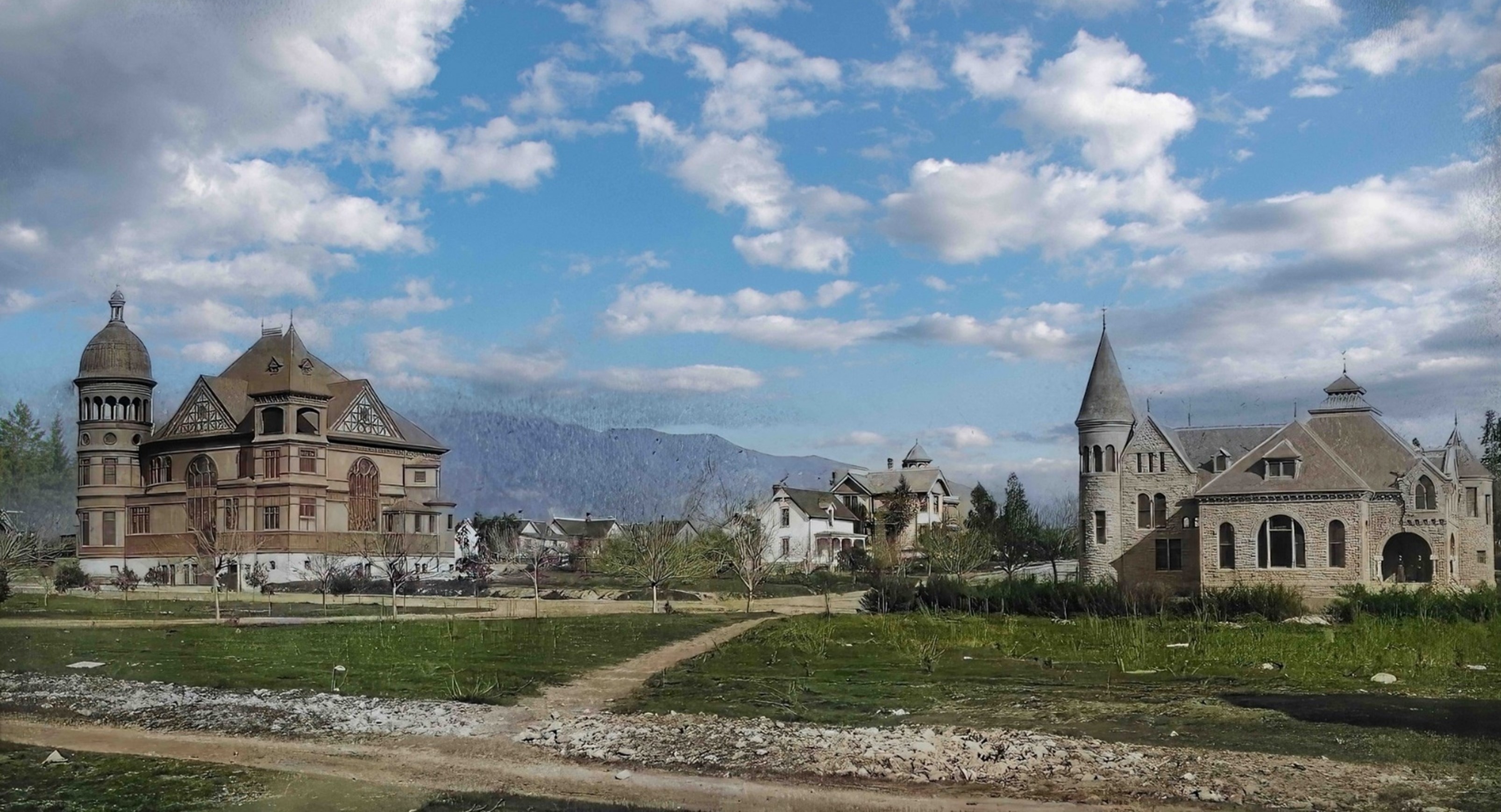
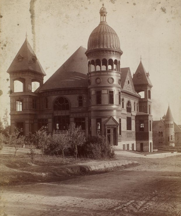
| (ca. 1890)^– Universalist Church (left) & Public Library (right) located at Walnut & Raymond Ave. Only the arch of the library still exists. |
Historical Notes The large home seen between the Churce & Library belonged to John Allin and was located at 109 East Walnut. Allin owned the "Livery and Feed Stable". Throop University later became Cal Tech. |
 |
|
| (ca. 1890)^– Universalist Church & Pasadena Public Library located at Walnut & Raymond Ave. Only the arch of the library still exists. Image enhancement and colorization by Richard Holoff. |
Public Library
 |
|
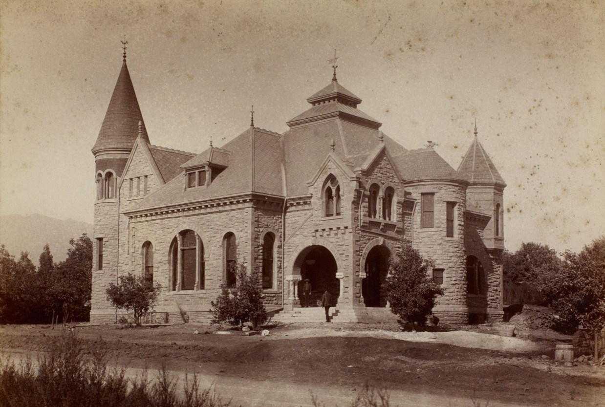
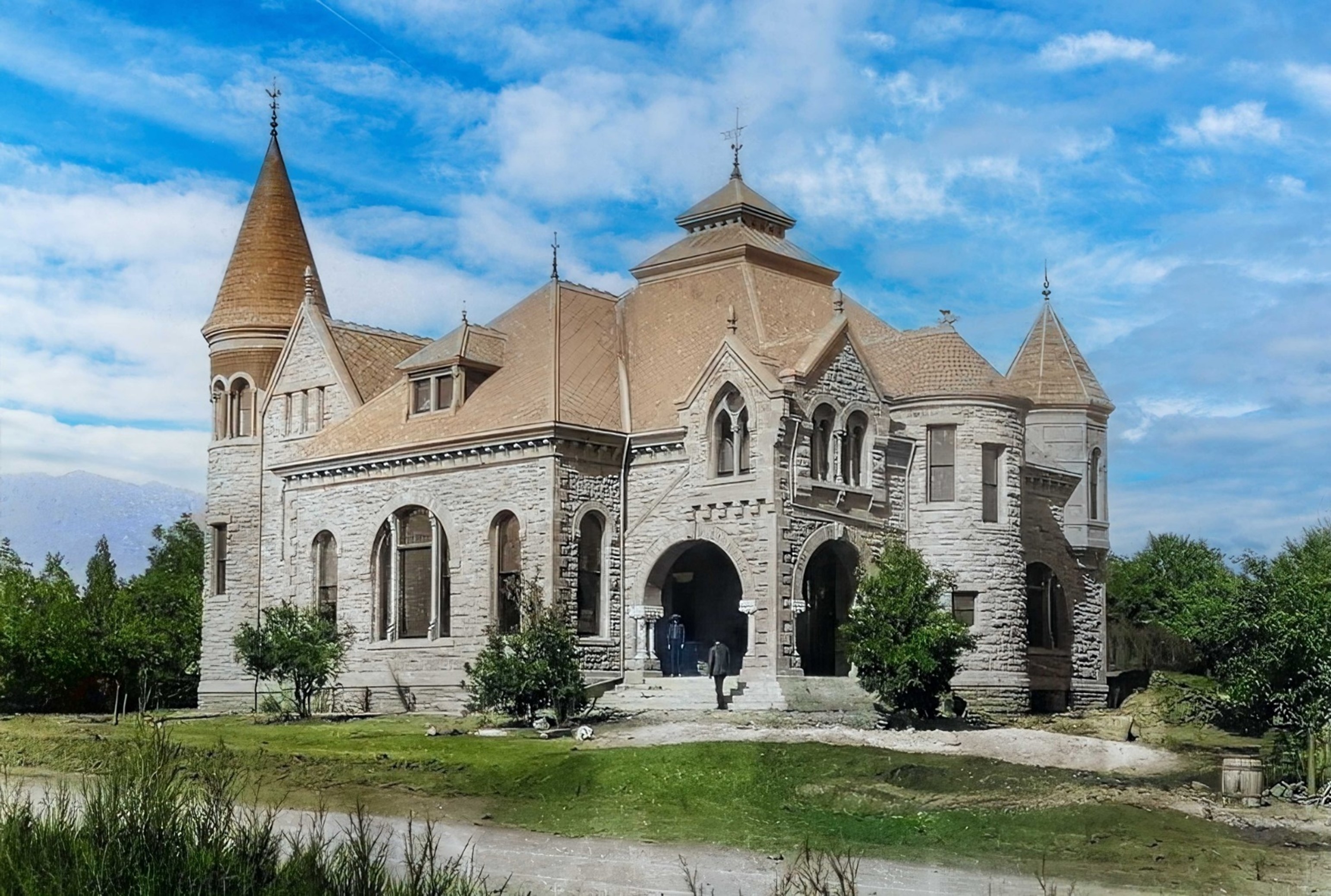
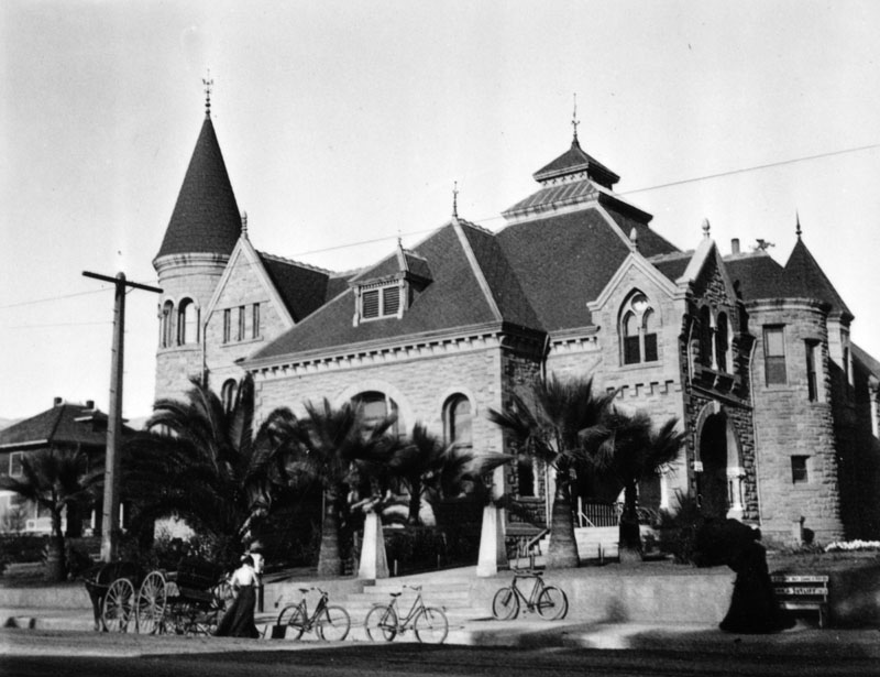
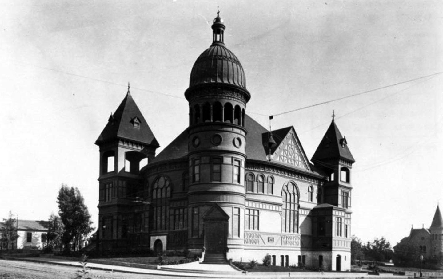
| (ca. 1890)* - Public Library Building at Walnut and Raymond (SE corner), built in the Richardson Romanesque style, with large arches and two pointed towers. |
Historical Notes This was Pasadena’s 2nd Central Public Library building. Opened on Sept. 9, 1890, the library was an impressive stone structure located on the southeast corner of Walnut Street at Raymond Avenue in what is now known as memorial Park. Although this building was expanded in 1901 and Children’s services had moved to a bungalow in Library Park, the existing space was insufficient to meet the needs of a growing City. The Library’s founding predates the City’s incorporation by four years. The first building was on Central School grounds, south side of Colorado St. between Raymond St. and Santa Fe tracks, and opened Feb. 26, 1884. This building was moved to 42 West Dayton St. in 1886.* Click HERE to see Pasadena's 3rd Public Library Building, built in 1925 at 285 E. Walnut. |
 |
|
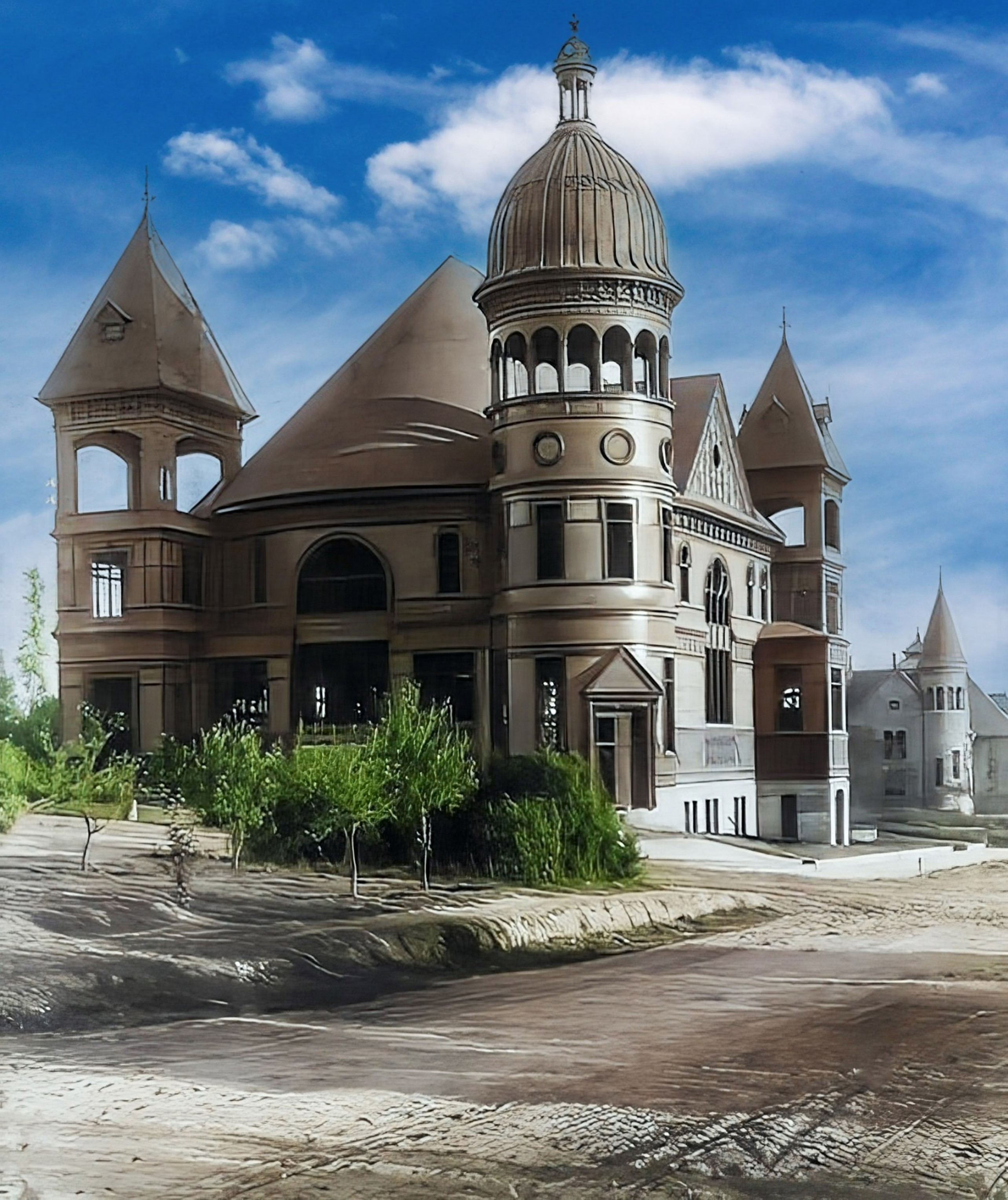
| (ca. 1890)* - Public Library Building at Walnut and Raymond (SE corner), built in the Richardson Romanesque style, with large arches and two pointed towers. Image enhancement and colorization by Richard Holoff. |
Historical Notes Opened on Sept. 9, 1890, the Richardsonian Romanesque style stone building was designed by architect Hamilton Ridgway. |
 |
|
| (ca. 1893)* - View of Pasadena’s second public library building, located on the southeast corner of Walnut Street at Raymond Avenue at what is now known as Memorial Park. A bicycle is seen parked by the curb in front of the library. |
 |
|
| (1900)* - The 1890-built Pasadena Public Library showing a horse-drawn buggy and several bicycles parked along the curb. |
Historical Notes This was Pasadena's second library building. The first was located on the Central School grounds, south side of Colorado St. between Raymond St. and Santa Fe tracks, and opened Feb. 26, 1884. |
 |
|
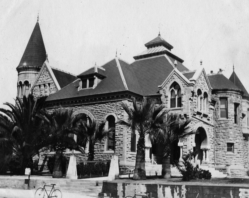
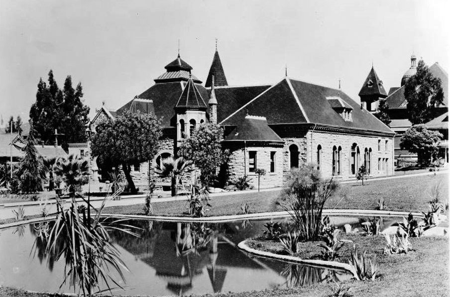
| (1908)#* - Rear view of the Pasadena Public Library showing landscape and a large pond in the foreground. It was situated in what is now known as Memorial Park, southeast corner of E. Walnut Street at N. Raymond Avenue. The building in the background on the right is the Universalist Church. |
Historical Notes Today, a green sandstone wall and a bench can be found at the corner of Orange Grove and Colorado. They are made of stone from the 1890 building of the Pasadena Public Library. A plaque bears the names of the 27 original colonists of Pasadena.*^ Click HERE to see Pasadena's 3rd Public Library Building, built in 1925 at 285 E. Walnut. |
Universalist Church
 |
|
| (1890)* – Looking at the Universalist Church located on the SE corner of the unpaved Chestnut and Raymond streets in Pasadena. The ornate church building has three towers, one with a domed top. The Public Library Building can be seen in the background. |
Historical Notes Rapidly growing in size, the Universal congregation decided to build a huge church building to accommodate future growth. By 1890 they reached almost 140 members and completed construction of a large church on the corner of Raymond and Chestnut. (The current church at Del Mar and Los Robles was built in 1923.) ^ |
 |
|
| (1890)* – Looking at the Universalist Church located on the SE corner of the unpaved Chestnut and Raymond streets in Pasadena. The ornate church building has three towers, one with a domed top. The Public Library Building can be seen in the background. Image enhancement and colorization by Richard Holoff. |
 |
|
| (ca. 1890)* – View showing the Universalist Church located on the southeast corner of Raymond and Chestnut Streets. |
Historical Notes Financing this new (1890) building was quite complicated, involving numerous other real estate transactions and loans. In the end, Amos Throop wound up paying over 2/3 of the cost. The Governor of California contributed $1000 which was a large sum in those days.^ |
 |
|
| (1895)* - Exterior view of Universalist Church at Raymond and Chestnut Streets, in Pasadena. The Romanesque-style church building had a hemispherical bronze dome supported by Roman columns. Note the palm trees surrounding the church. |
Historical Notes While a newspaper claimed in 1890 that the church could accommodate 1000 people, a more accurate story is obtained from the Nazarene Church which eventually bought the building in 1922. They claim that as many as 1300 people could be crammed into the sanctuary with 700 seated and 600 standing. The 700 seats were not pews but were luxurious theater-style seats with arm-rests. The book "Inventing the Dream, California Through the Progressive Era" mentions on p. 99: "Pasadena grew into a charming town of ten thousand by century's turn with a church for every thousand residents (including a massive Romanesque Universalist Church ...)". A local newspaper wrote: "Pasadena boasts many handsome buildings, but none of them surpass in architectural beauty the Universalist Church." The church building was demolished by the new owners in the early 1960s to create a parking lot. ^ |
Allin Residence
 |
|
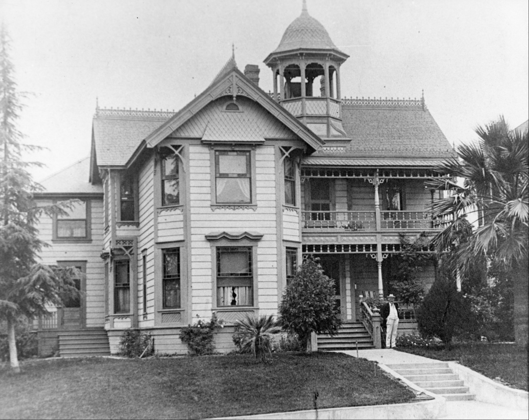
| (ca. 1890)*– Home of John Allin located at 109 East Walnut. Allin owned the "Livery and Feed Stable". This was the large home seen between the Church and Library in previous panoramic view. |
* * * * * |
 |
|
| (1895)* - View of North Orange Grove Blvd. in Pasadena in 1895. It is a dirt road lined with many trees. Walnut Street is at the bottom of the hill. |
 |
|
| (ca. 1895)++# - View looking south on Marengo Avenue showing two horse-drawn carriages parked opposite each other. |
* * * * * |
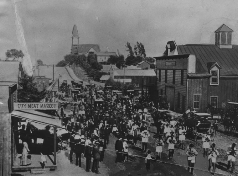
City Meat Market
 |
|
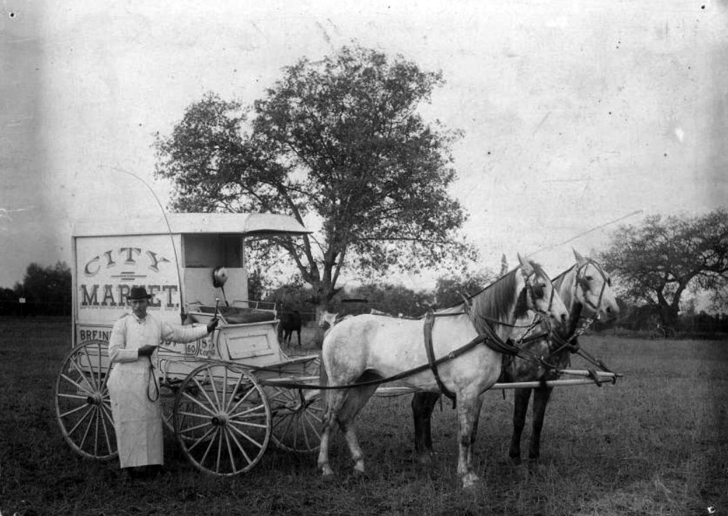
| (1895)*^* - Photo shows a man standing in front of a carriage drawn by two horses. On the side of the carriage is printed: CITY MARKET, with other words blocked by the man's body (although part of "Breiner" can be made out, probably "Breiner & Crosby"). |
 |
|
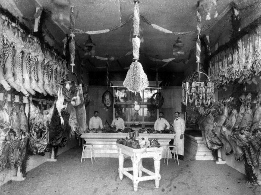
| (1891)*^* - Interior view of the City Meat Market, located at 83 East Colorado. The man on the far right is John Breiner, the proprietor. The City Meat Market is sometimes referred to as "Breiner Market." |
* * * * * |
First Electric Streetcar over Arroy Seco
 |
|
| (1895)* - View of the first electric car over Arroyo Seco near the Cawston Ostrich Farm on March 7, 1895. Pasadena and Los Angeles Railway Co. |
Historical Notes By 1895 a railroad line had been established from Downtown Los Angeles with a grand wooden trestle that cut a straight line crossing from the west side to the east. Eventually this line would hook up with rail lines built from the east to create the cross-country course of the Santa Fe Railroad. For local commutes, an electric traction trolley was put in and operated by the Pacific Electric Railway, a Henry E. Huntington enterprise, which ran the "Red Cars" from the upper Arroyo and Pasadena through the San Gabriel Valley into Los Angeles and many points beyond. The lower Arroyo Seco was served by the Los Angeles Railway "Yellow Car" lines. |
 |
|
| (ca. 1895)* – View showing an electric streetcar on the bridge over Arroyo Seco at Garvanza. |
Historical Notes Originally this line had four bridges. The most spectacular spanned the Arroyo Seco at Garvanza and was the highest bridge on the PE system. It was a single track structure, of combination steel and frame bent construction. Built in 1895, it was rebuilt in 1903 and strengthened in 1916. It was about 900 feet long. Two double track wooden trestles spanned the SP main line at Daly Street & Alhambra Avenue and the UP Pasadena Branch at Fair View near Columbia Street The lower Arroyo Seco was crossed by means of a concrete structure on Pasadena Ave. near Ave. 36; this was a paved viaduct for both vehicular and rail traffic. Believe it or not, the chief tourist attraction on this line was the Cawston Ostrich Farm, on the east bank of the Arroyo Seco at Garvanza. In was American's first ostrich farm, having opened in 1886. The incubators, the dye houses and factories were widely publicized and the South Pasadena cars hauled thousands for 25 cents round trip (which included admission to the Farm). Just as long as ostrich feathers enjoyed a vogue as an essential part of milady's costume, so did this lucrative business help keep the South Pasadena Line in the black. |
* * * * * |
Tournament of Roses Parade
The Early Years in Pasadena, 1890 to 1910
 |
|
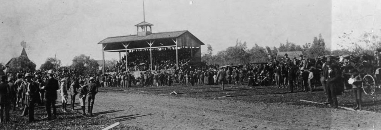
| (1890)* - View of the pavilion and grandstand where contests were held following the first Tournament of Roses Parade. Pasadena. January 1, 1890. |
Historical Notes The Tournament of Roses began as a winter festival created by members of Pasadena’s Valley Hunt Club. Many had moved from the East and Midwest and wanted to promote Pasadena’s mild winter climate. Professor Charles F. Holder is often credited with suggesting the idea, noting that while much of the country was buried in snow, Southern California still had flowers in bloom and oranges on the trees. The first event on January 1, 1890 featured a parade of horse-drawn carriages decorated with flowers, followed by outdoor contests including foot races, polo matches, and tug of war. The pavilion and grandstand seen here were used for these afternoon events, which helped turn the parade into a full day celebration. |
 |
|
| (1893)* - Spectators line the route at Tournament Park during the Tournament of Roses Parade. California Avenue area, across from the future site of Caltech. |
Historical Notes By 1893, the Tournament of Roses had already become a popular annual event. This view shows the parade passing through what later became known as Tournament Park, near today’s California Institute of Technology. This year established a lasting tradition. When January 1 fell on a Sunday, the parade was moved to January 2 to avoid interfering with church services and to prevent frightening horses tied outside churches. From that point forward, the parade was never held on a Sunday. The casual crowd scenes reflect the early character of the event. Spectators watched from the street, nearby wagons, and open ground, giving the parade a relaxed, community feel. |
 |
|
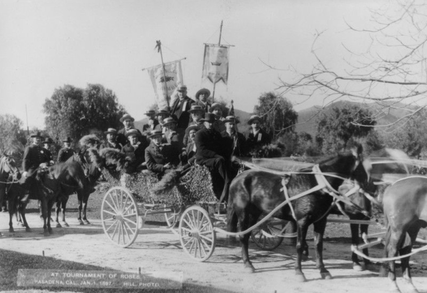
| (1893)* – Tournament of Roses Parade given under the auspices of the Valley Hunt Club. January 2, 1893. |
Historical Notes This image comes from the same year the parade date was moved from January 1 to January 2 due to the Sunday rule. At this time, the Valley Hunt Club was still responsible for organizing the parade. Within a few years, the event would grow beyond the ability of a single club to manage, leading to the formation of a dedicated Tournament of Roses Association. |
 |
|
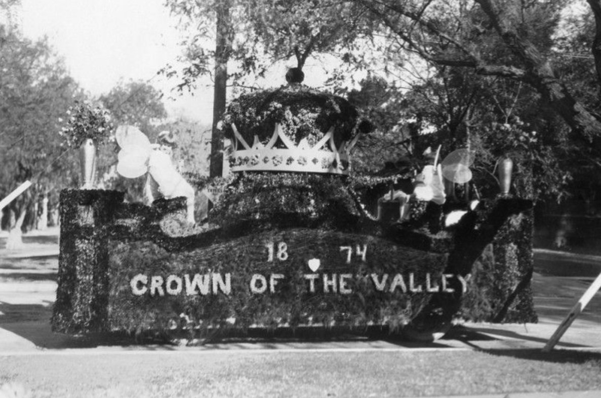
| (ca. 1894)* - Early Rose Parade float bearing the words “1874 Crown of the Valley,” Pasadena’s nickname and founding year. |
Historical Notes Early floats often promoted Pasadena itself. Themes focused on the city’s origins, climate, and identity. The phrase “Crown of the Valley” reflected how residents and boosters viewed Pasadena as a special place at the base of the San Gabriel Mountains. These early floats were simple by later standards, but they established the core tradition of using natural plant materials and flowers as the primary decorative element. |
 |
|
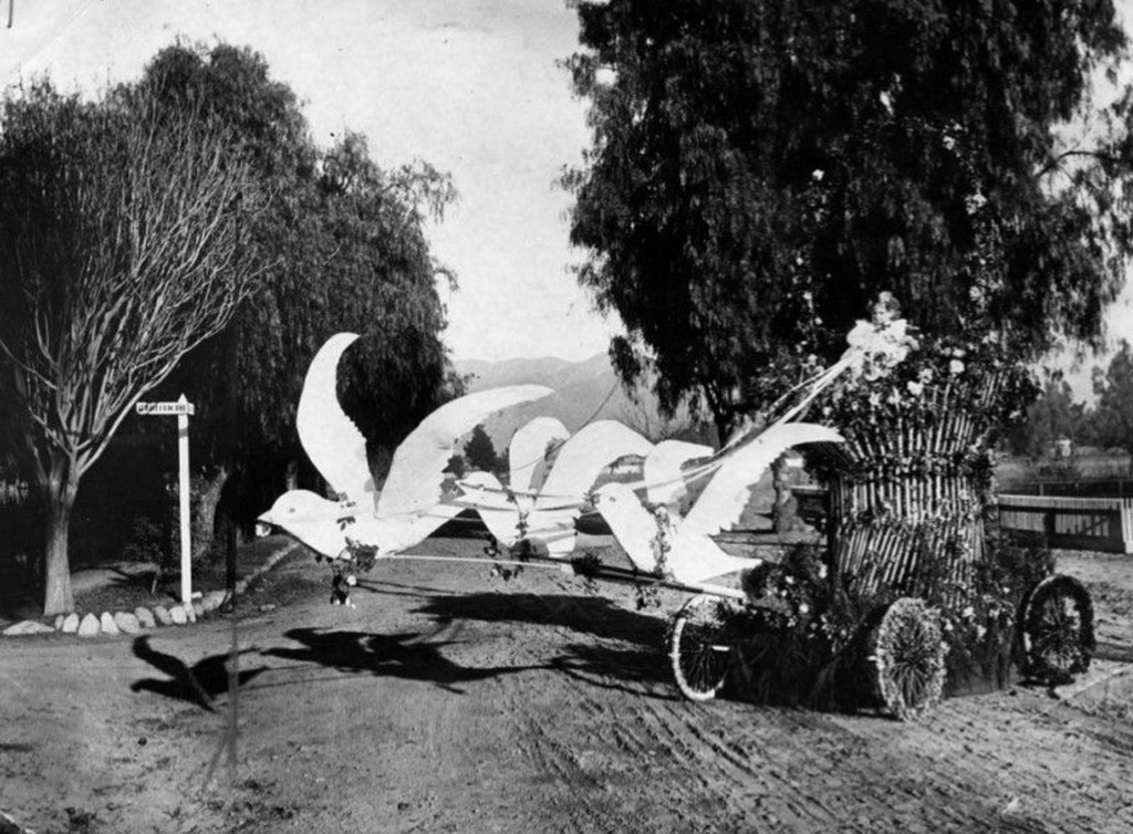
| (1897)* - Prize-winning entry of 1897; a basket which appears to be drawn by a team of flying doves is actually propelled by a man hidden inside the basket. |
Historical Notes This clever float relied on illusion rather than size or complexity. The basket was actually moved by a person hidden inside, creating the appearance of flight. Such novelty entries were crowd favorites and show that early parade organizers valued creativity and humor as much as floral beauty. |
 |
|
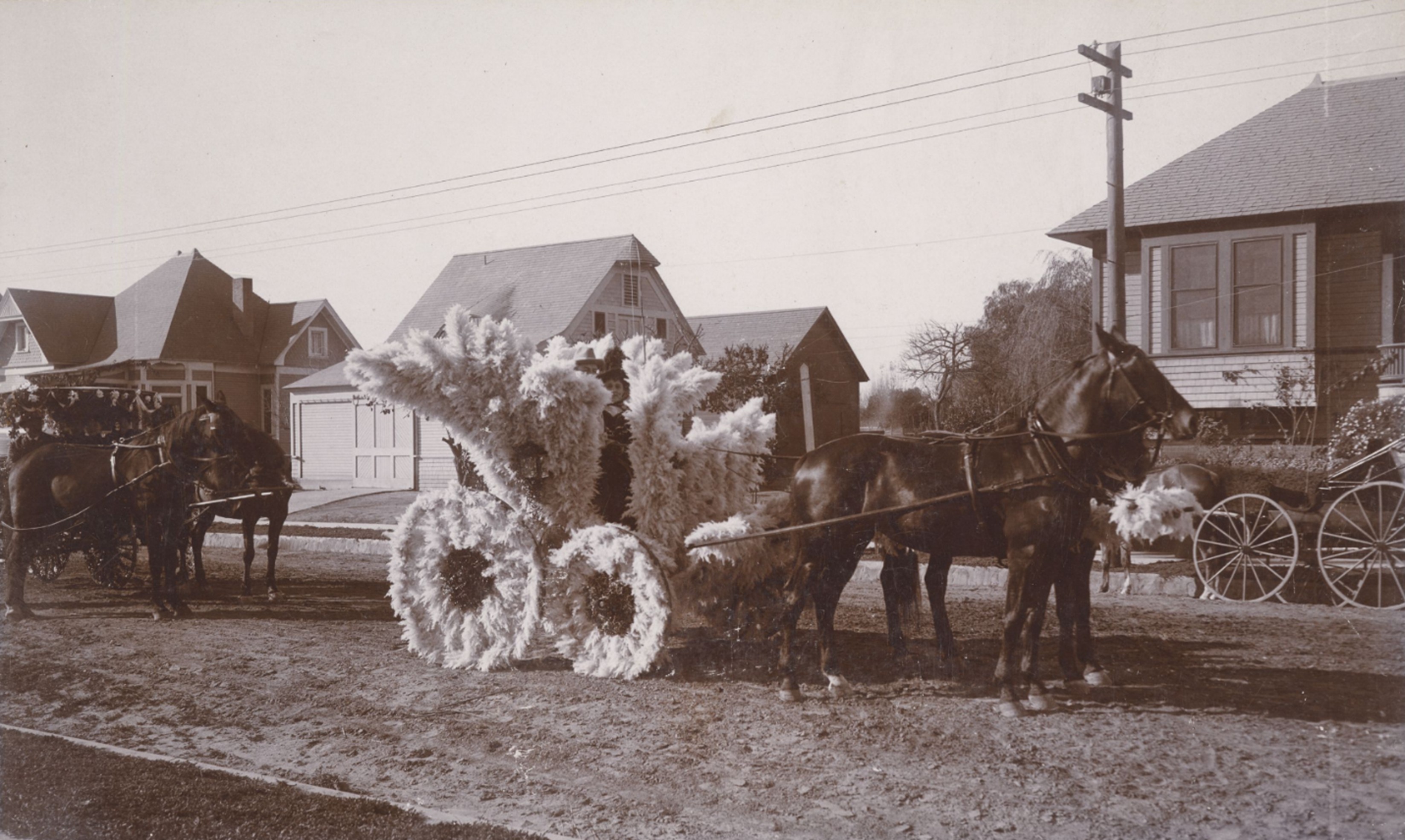
| (ca. 1895)* - Tournament of Roses parade with a small horse-drawn carriage completely decorated with pampas grass, with a young girl seated inside. |
Historical Notes Pampas grass was a popular decorative material in early Rose Parades because it was abundant, dramatic, and easy to shape. Long before strict flower rules were established, designers freely used grasses, leaves, and natural textures to create visual impact. Child participants were common in early parades, reinforcing the family and community spirit of the event. Entries like this emphasized charm and creativity rather than size or engineering. |
 |
|
| (1896)* - Horse-drawn carriage packed with riders during the Rose Parade. Women hold parasols as the procession moves along the route. |
Historical Notes In the 1890s, horse-drawn carriages formed the backbone of the parade. Many entries reflected Victorian social customs, with formal dress and decorative vehicles used to make a public impression. Parasols, hats, and packed carriages show how the parade functioned as both a civic celebration and a social event for participants and spectators alike. |
 |
|
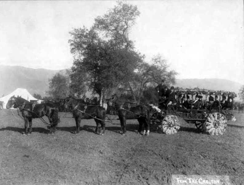
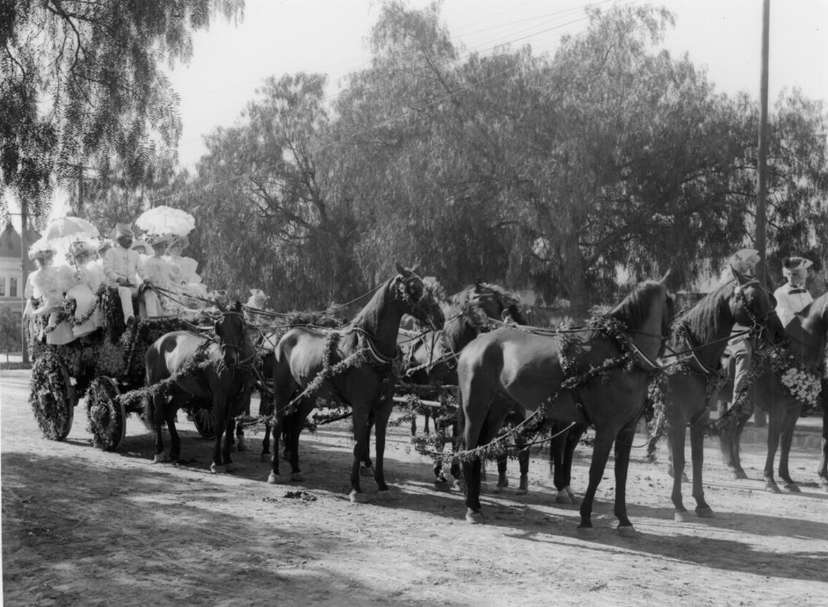
| (1890s)* - Decorated carriage, “Tallyho,” drawn by six black horses during the Tournament of Roses Parade, ca.1895-1899. |
Historical Notes The tally ho carriage was a formal horse-drawn coach traditionally associated with hunting parties and social outings. Its appearance in the Rose Parade reflects the influence of the Valley Hunt Club and Pasadena’s equestrian culture. Large teams of matched horses were a sign of prestige and spectacle. For early audiences, these impressive carriages were as exciting as later mechanical floats. |
 |
|
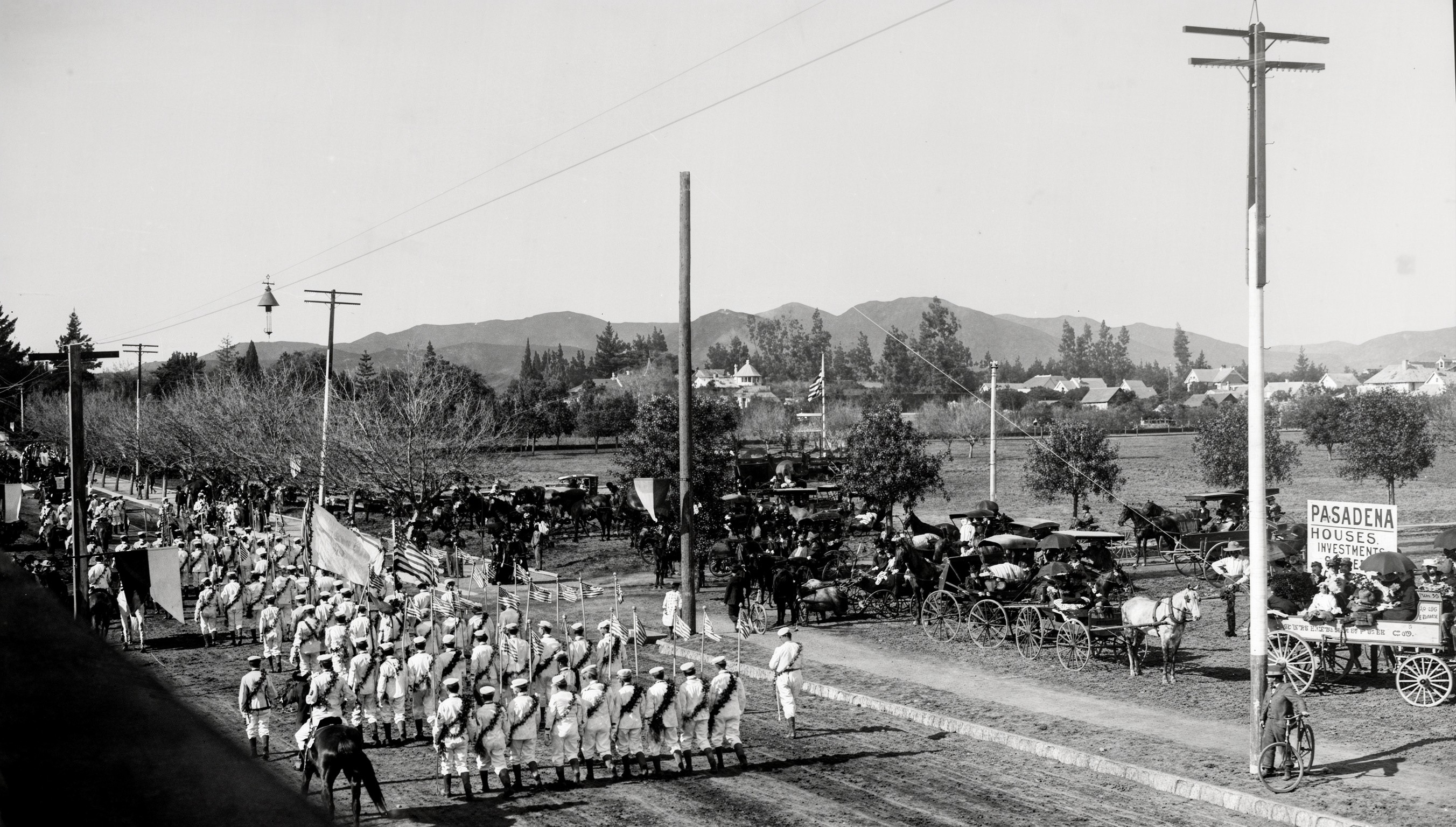
| (1897)* - Flower covered carriage float sponsored by the Los Angeles Chamber of Commerce, followed by riders on horseback. |
Historical Notes By the mid 1890s, the Rose Parade had become a major promotional platform. Organizations such as chambers of commerce used parade entries to advertise Southern California to visitors and potential investors. In 1895, the Pasadena Tournament of Roses Association was formed to manage the growing event. Activities associated with the parade soon expanded to include contests and novelty races held at Tournament Park. |
 |
|
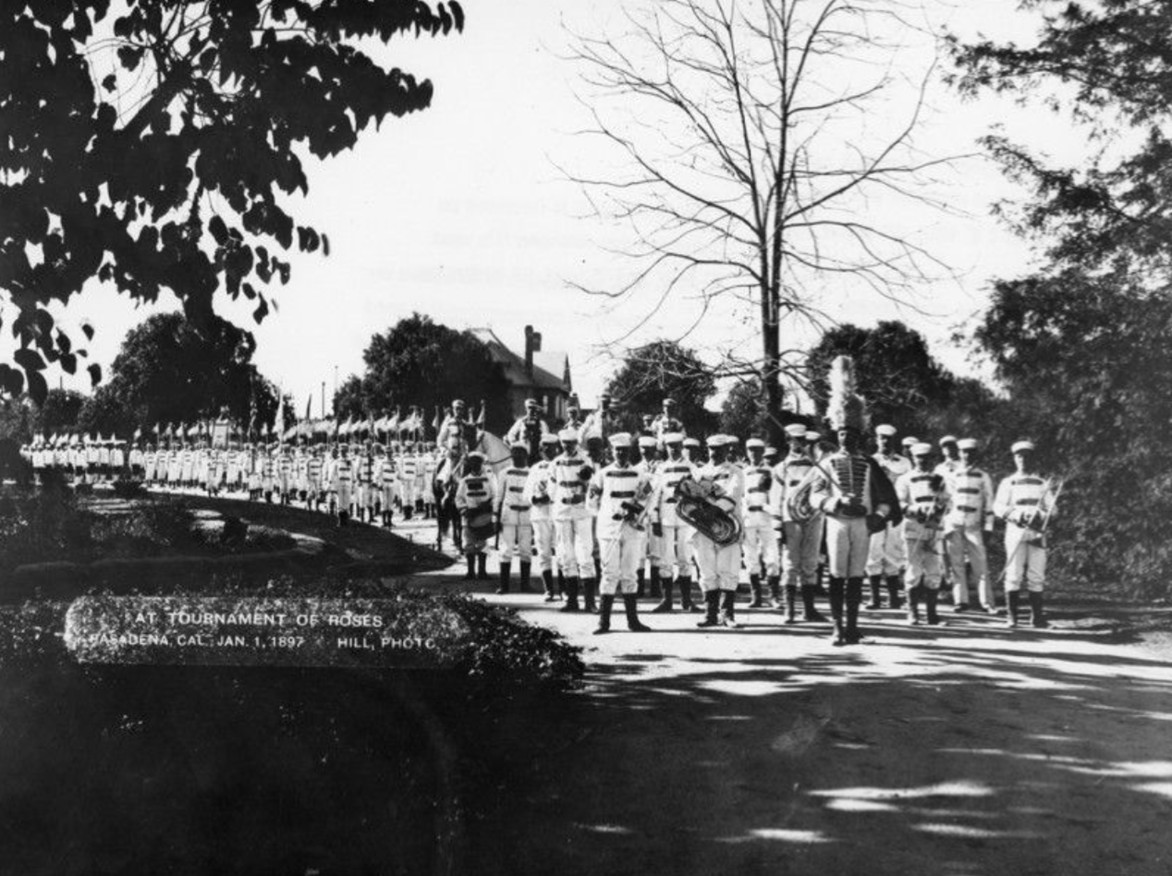
| (1897)* - Large marching band in white uniforms appears in the Rose Parade. |
Historical Notes Marching bands became part of the Rose Parade early in its history. The first band appeared in 1891 with fewer than 20 members. By the late 1890s, bands had grown in size and importance. Bands added sound, rhythm, and spectacle to the procession, helping transform the parade from a quiet carriage display into a lively public performance. |
 |
|
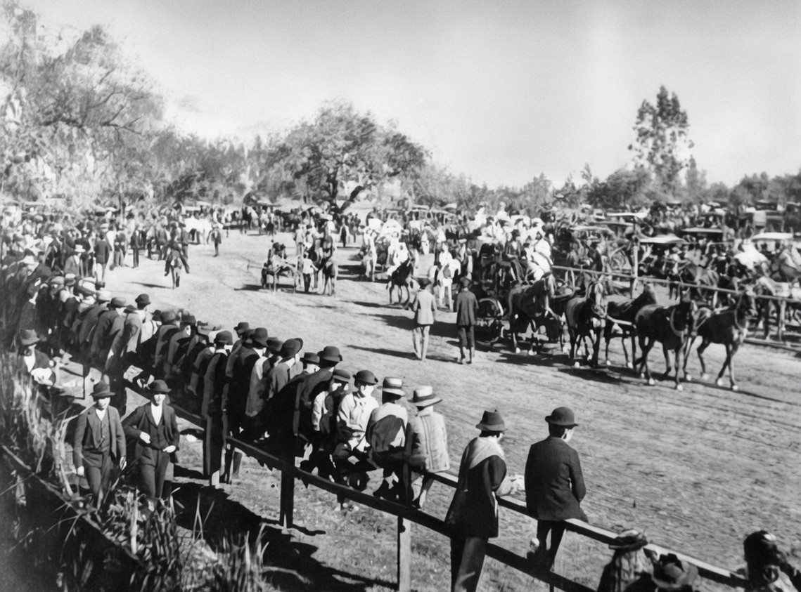
| (1898)* - Spectators gather along the parade route under clear skies, many watching from horse-drawn wagons. |
Historical Notes This view captures Pasadena at a time when large areas along the parade route were still open land. Spectators arrived early and often turned the parade into a full day outing. The relaxed arrangement of the crowd reflects an era before formal grandstands and heavy crowd control became common. |
 |
|
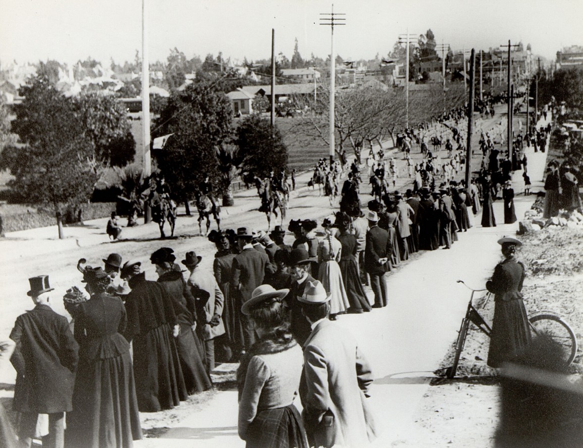
| (1901)* - Spectators line Colorado Boulevard to watch the Rose Parade. View is looking northeast from Conger Hill on Colorado Street, just east of Orange Grove Avenue. |
Historical Notes Equestrian entries remained a central feature of the Rose Parade well into the early 20th century. Riders often wore formal or themed attire, adding elegance and movement to the procession. This image also highlights the growing popularity of the parade. By this time, spectators lined the route in larger numbers, and viewing the parade had become an annual social tradition for Pasadena families. |
 |
|
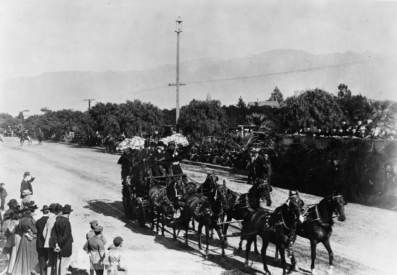
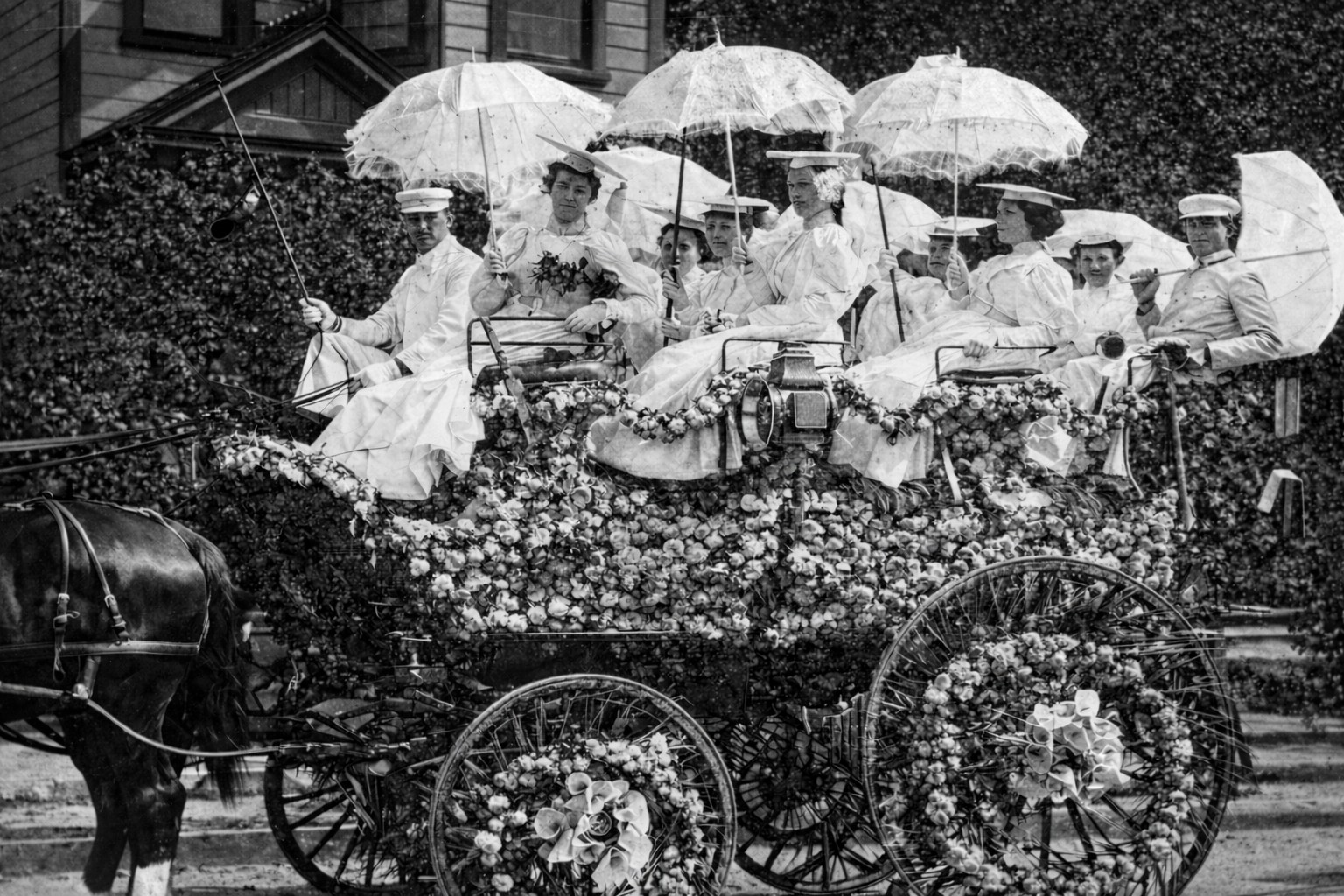
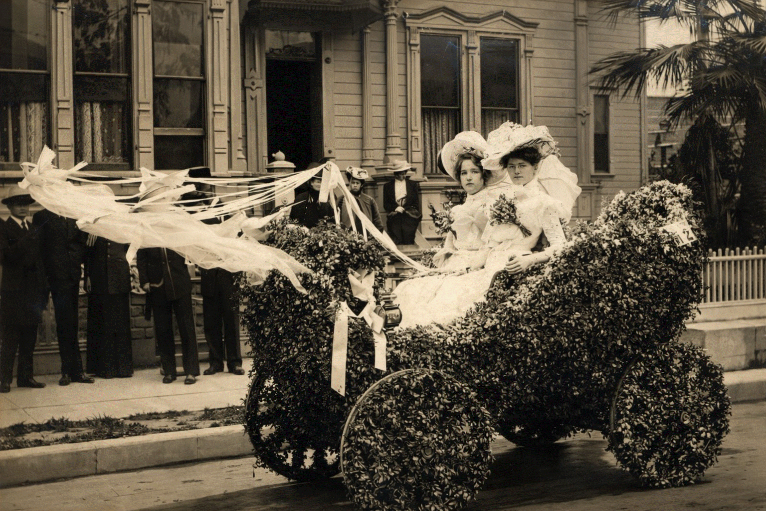
| (1902)* – Tournament of Roses Parade carriage decorated with flowers, showing women dressed in white and holding white parasols. They appear to be wearing flat caps resembling graduation hats, with tassels falling to the left. The carriage is paused, likely awaiting its turn to enter the parade route. |
Historical Notes By the early 1900s, flower-covered carriages were a common sight in the Tournament of Roses Parade, emphasizing natural beauty, craftsmanship, and Pasadena’s mild winter climate. Horse-drawn carriages were decorated with fresh flowers and greenery and often featured live participants rather than elaborate float structures. The women seated in this carriage are dressed in white and hold white parasols, reflecting the formal style of the period. Flat caps with tassels, fashionable at the turn of the century, are visible in many early parade photographs. Carriages such as this one often paused along residential streets near the parade route while awaiting their turn to proceed. |
 |
|
| (ca. 1902)* - Two women pose in an automobile decorated with garlands of greenery and ribboned doves. Both wear white dresses and wide-brimmed hats, with floral arrangements pinned to the front of their dresses. |
Historical Notes By the early 1900s, Pasadena was beginning to mix new technology with old traditions, and the Tournament of Roses became one of the places where people could literally see that transition roll by. For its first decade the parade was dominated by flower covered horse drawn vehicles and carriages, but automobiles soon began to appear as novelty entries. Motor vehicles were introduced to the Tournament of Roses Parade as early as 1901. Because the parade still relied heavily on horses, early automobiles were often kept toward the back of the procession so they would not spook the teams ahead of them. In later decades, the balance tipped the other way, and by 1920 the parade had fully shifted from horse drawn floats to motor driven floats. This photograph fits that early transitional era. The vehicle is treated almost like a rolling garden, with dense greenery used to hide the mechanics, and the decorations pushing upward and outward to create a festive silhouette. The ribboned “doves” are part of that same visual language, more symbolic than literal, suggesting peace, celebration, and the airy, floating look that parade decorators liked to create. The women’s white dresses, hats, and bouquets reinforce the formal, ceremonial feel that early Tournament entries often aimed for, half parade, half posed society scene. |
 |
|
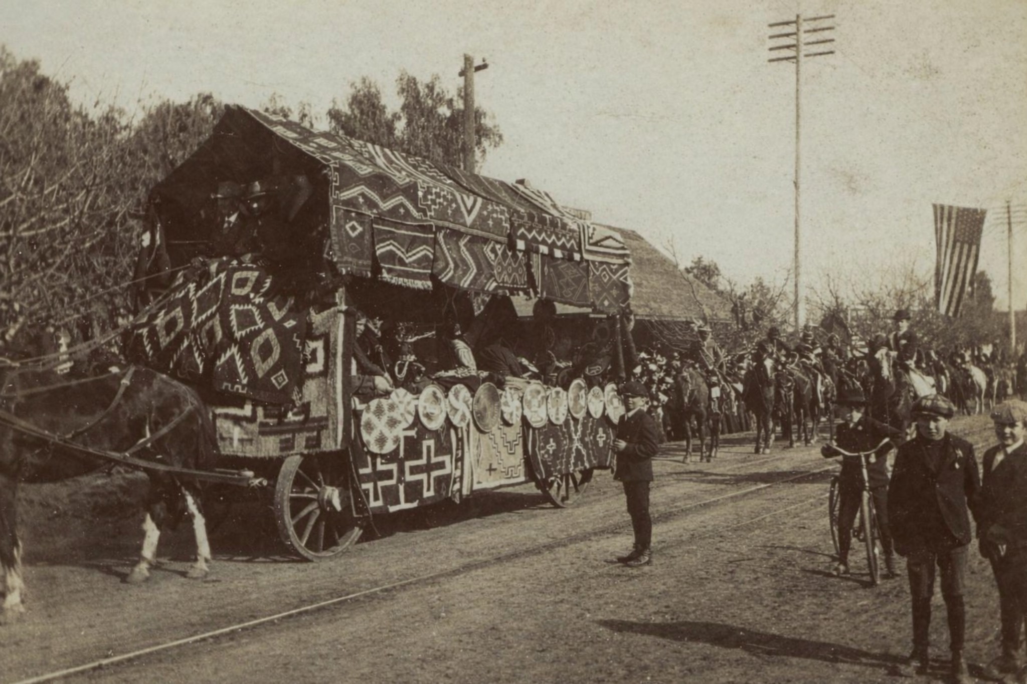
| (1903)* - Horse-drawn wagon parade float covered with Native American blankets during the Tournament of Roses Parade. Children, a bicycle, and mounted riders are visible along the route. |
Historical Notes Parade themes in the early 1900s often reflected romanticized views of the American West. Decorative elements such as Native American blankets were used to evoke frontier imagery and regional identity. The presence of children, bicycles, and riders alongside the float shows how informal parade viewing still was. The parade moved through active streets where everyday life continued alongside the celebration. |
 |
|
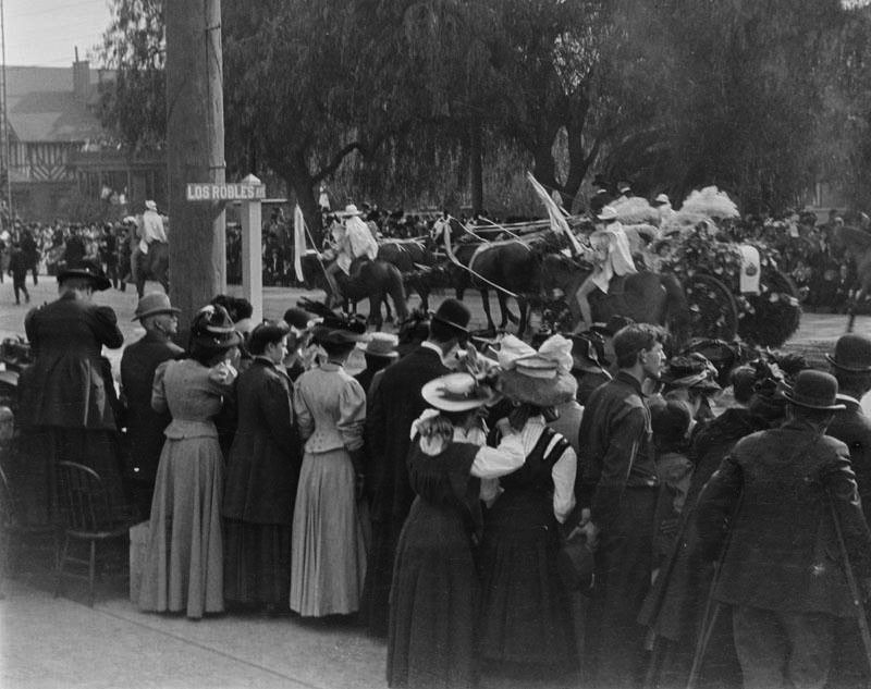
| (ca. 1900)* - Looking north along Colorado Street near Los Robles Avenue during the Rose Parade. Photo by George Leahy. |
Historical Notes By around 1900, Colorado Street had become one of Pasadena’s main parade routes, passing through increasingly developed parts of the city. At intersections such as Colorado Street and Los Robles Avenue, crowds gathered tightly along the sidewalks to watch the procession pass. This image reflects the parade’s growing popularity and its transition from an informal local celebration into a major civic event. Mature street trees, nearby buildings, and dense spectators show how the parade had become woven into the everyday urban fabric of Pasadena. Scenes like this mark a shift in the Rose Parade’s character, from open landscapes and casual viewing to crowded streets where the parade moved through the heart of the city. |
 |
|
| (1904)* – Autos in the Rose Parade. Pasadena City Hall can be seen in the background, located on the northeast corner of Fair Oaks and Union. |
Historical Notes The inclusion of automobiles marked a turning point in the parade’s history. Cars were still a novelty and symbolized modern progress. The City Hall seen here was Pasadena’s earlier civic building, used before the construction of the current City Hall in the 1920s. The image captures the transition from a horse powered past to a motorized future. |
 |
|
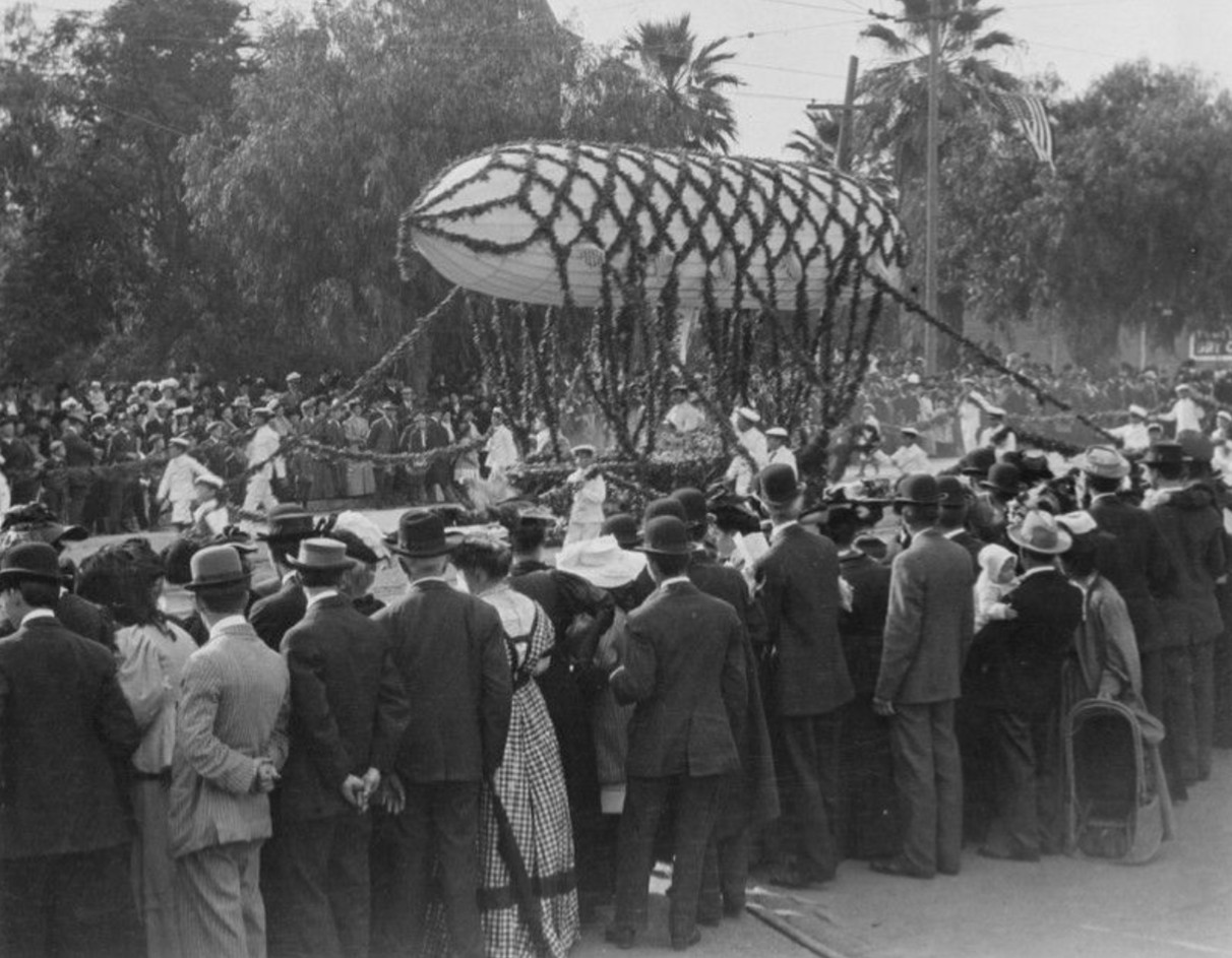
| (ca. 1908)* - A Rose Parade float that literally floats above the street, controlled by ropes held by handlers. |
Historical Notes This unusual entry demonstrates the parade’s early experimentation with spectacle. Rather than relying on size or mechanics, the float used lighter than air effects to surprise spectators. It shows that even in its early years, the Rose Parade aimed to entertain as much as impress. |
 |
|
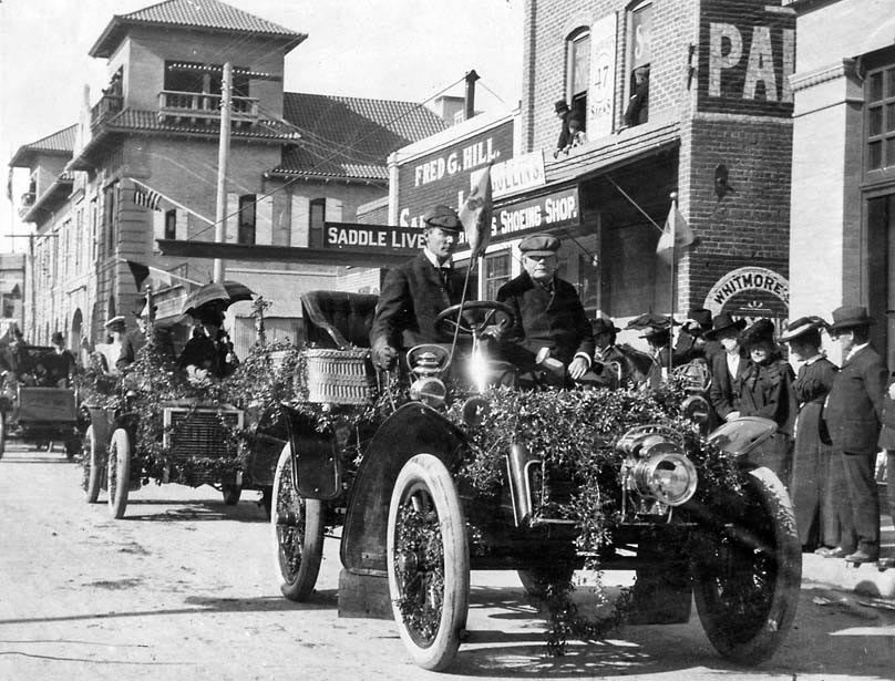
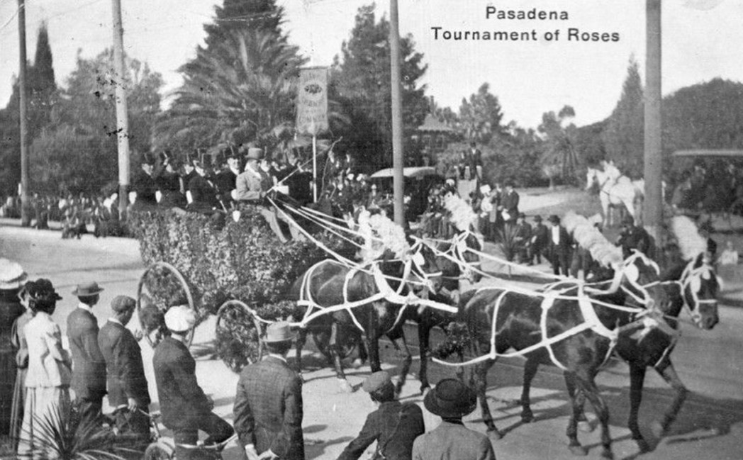
| (1910)* - Postcard view of a prize winning Rose Parade float carrying members of the Los Angeles Chamber of Commerce. |
Historical Notes This particular float was the winner of a First Prize. The verso of the card reads, "This is one of the wagons in New Year parade - the tournament was postponed till this Saturday on account of rain." There are two maxims about the Rose Parade that everyone in Pasadena knows: There’s never a parade on a Sunday, and it doesn’t rain on the parade. The first has always been true since the first time Jan. 1 fell on a Sunday in 1893 and the parade was moved to Jan. 2. The second—well, 10 rainy days in 125 years isn’t a bad batting average. |
* * * * * |
Pasadena Panoramic
 |
|
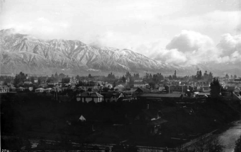
| (ca. 1898)^ - Panoramic view of Pasadena looking northeast toward the Sierra Madre mountain range in winter. Mount Wilson is behind clouds across the background. Trees are dispersed among the buildings of the city at center. |
Historical Notes The San Gabriel Mountains borrow their name from the nearby Spanish mission, but for decades they also bore a more poetic name: the Sierra Madre (Mother Mountains). Both names were handed down by the early Spanish missionaries and existed side-by-side until 1927, when the U.S. Board on Geographic Names acted on a petition from a Pomona College geographer and decided in favor of "San Gabriel Mountains." "Sierra Madre" has since passed out of common usage, although it still survives in numerous place names, from the City of Sierra Madre to the Gold Line's Sierra Madre Villa station, named after a tuberculosis sanitarium at the base of the mountains. |
California Cycleway (aka Pasadena Cycleway)
 |
|
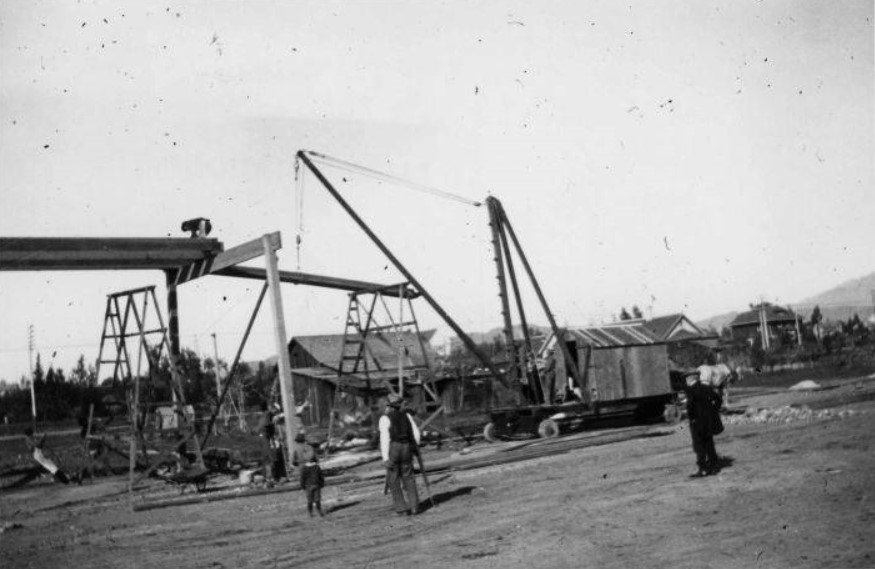
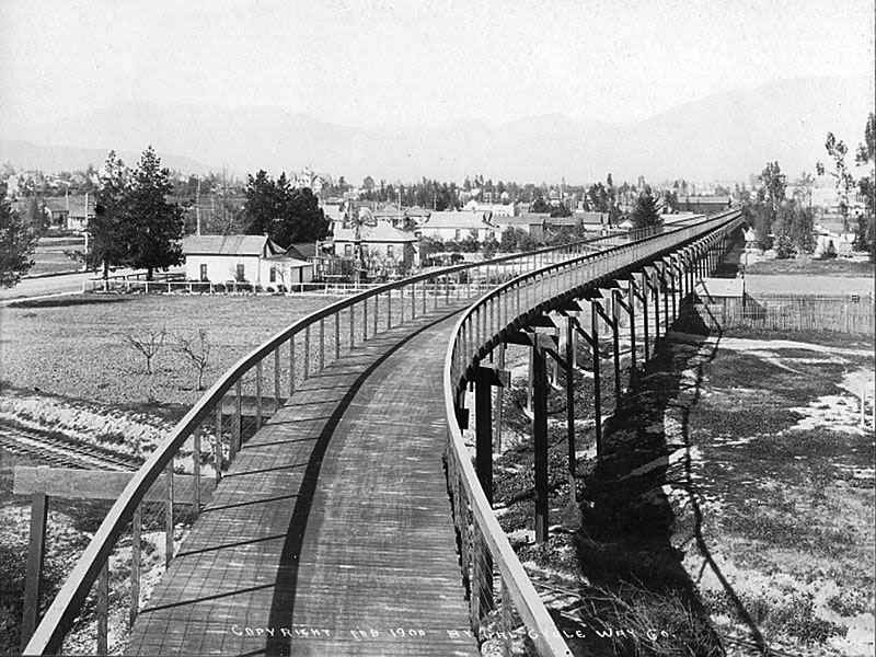
| (1899)** - View showing the construction of the California Cycleway (aka Pasadena Cycleway) a visionary project to link Los Angeles with Pasadena, built by Horace M. Dobbins (seen in lower-right). |
Historical Notes The inventor and promotor of the cycleway was Pasadena resident Horace Dobbins, who attracted ex-California governor Henry Harrison Markham to join him in the venture. Together, the two sought approval from the California state legislature, which was ultimately granted (after a first attempt was vetoed) in 1897. The California Cycleway Company bought a six-mile right-of-way from downtown Pasadena to Avenue 54 in Highland Park, Los Angeles. Construction began in 1899, and about 1.3 miles of the elevated wooden bikeway were opened on January 1, 1900, starting near Pasadena's Hotel Green and ending near the Raymond Hotel. |
 |
|
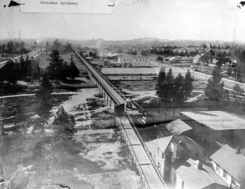
| (1900)* - View of the California Cycleway in Pasadena. A tolled elevated cycleway connecting Pasadena and South Pasadena along present day Edmondson Alley. View looking north from Raymond Hotel. Tracks in foreground are Santa Fe. Fair Oaks Ave. is on left side. |
Historical Notes The California Cycleway, opened in 1900, was a nine-mile elevated tollway built specially for bicycle traffic through the Arroyo Seco, intended to connect the cities of Pasadena and Los Angeles. The majority of the California Cycleway route is now Edmondson Alley. A toll booth was located near the north end, in the present Central Park. |
.jpg) |
|
| (ca. 1900)* - View of Bellevue Drive looking west at Raymond Avenue. The bridge in the foreground is a section of the Dobbins' Cycleway. The building at right is the rear of the Pasadena Grand Opera House. |
Historical Notes Built in 1889, the Pasadena Grand Opera House was bought by Thaddeus Lowe in 1891. Lowe is also known for his Mt. Lowe Railway and Echo Mountain Incline. |
 |
|
| (ca. 1902)* - On back of photograph: "Horace M Dobbins in his Olsdmobile on Pasadena Cycleway - about 1902-04". |
Historical Notes Oldsmobile model could not be verified, however, vehicle in photo closely resembles steam Locomobile from 1900-1904. |
 |
|
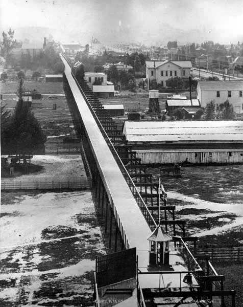
| (ca. 1902)* - View looking south from the Hotel Green showing the California Cycleway, with toll booth in center of photo. |
Historical Notes Had the full route been completed, it would have continued past Highland Park, on through Montecito Heights, crossed the Los Angeles River, passed Elysian Park, and continued to the Plaza in Los Angeles. |
 |
|
| (ca. 1902.)* - Closer view of the California Cycleway and its toll booth. Note the elaborate design of the trusses supporting the above-ground cycleway. |
Historical Notes The elevation of the roadway was 50 feet. The portion built was constructed almost entirely of Oregon pine and was wide enough for four cyclists to ride abreast, with provision for eventual doubling of the width. It was painted dark green and, at night, brightly lit with incandescent lights. |
 |
|
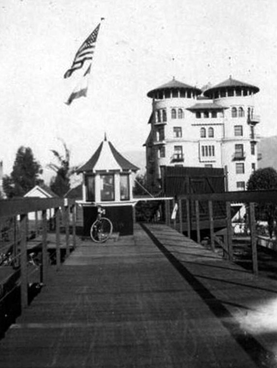
| (ca. 1904)** - View looking north from top of the cycleway platform. Flags fly high above the ticket booth and a bicycle is seen parked in front. The Hotel Green is in the background. |
Historical Notes The toll was 10 cents one-way, or 15 cents round trip. Due to the end of the bicycle craze of the 1890s and the existing Pacific Electric Railway lines connecting Pasadena to Los Angeles, the cycleway never made a profit, and never extended beyond the Raymond Hotel into the Arroyo Seco. In the first decade of the 20th century, the structure was dismantled, and the wood sold for lumber, and the Pasadena Rapid Transit Company, a failed venture headed by Dobbins to construct a streetcar line, acquired the right-of-way. Later, the California Cycleway's right-of-way became part of the Arroyo Seco Parkway (Pasadena Freeway). The California Cycleway, along with the similar Santa Monica Cycle Path, were two projects that reflected the cycling boom of the 1890s when Los Angeles had over 35,000 cyclists. They represented early attempts to create dedicated infrastructure for non-motorized transportation, predating the car-centric development that would come to define Los Angeles County in the 20th century. While neither project achieved long-term success, they remain important chapters in the history of transportation and urban planning in Southern California. |
Hotel Green
 |
|
| (ca. 1896)* - View looking north on Raymond Avenue showing the new Hotel Green in the distance with the original Santa Fe depot just to the right of the hotel. |
Historical Notes Hotel Green was initially known as the Webster Hotel. Mr. Webster became nearly bankrupt while trying to finish his lavish hotel in time for its opening. It opened its doors to the public in the 1880s and was only open a few months before he sold it to George Green. George Gill Green acquired the unfinished building, doubled the size and completed the hotel in 1893. The newly expanded hotel, named the Hotel Green, opened for business in 1894. |
 |
|
| (ca. 1900)* - View looking north on Raymond Avenue at the Hotel Green complex, which comprised of both buildings on either side of Raymond Avenue and walkway over the street. Horse-drawn wagons are seen parked in front of the hotel. |
Historical Notes In 1898, Col. Green built an even more impressive Mediterranean style hotel on the opposite side of Raymond. The two buildings were connected by a bridge across Raymond. |
 |
|
| (ca. 1900)* - Postcard view of the Hotel Green showing a streetcar passing underneath the bridge over Raymond Avenue that connects the two hotel buildings. |
Historical Notes The Green was one of the leading Pasadena hotels, along with the Raymond and the Huntington, during Pasadena's heyday as a winter resort for wealthy Easterners in the 1890s and 1900s. |
 |
|
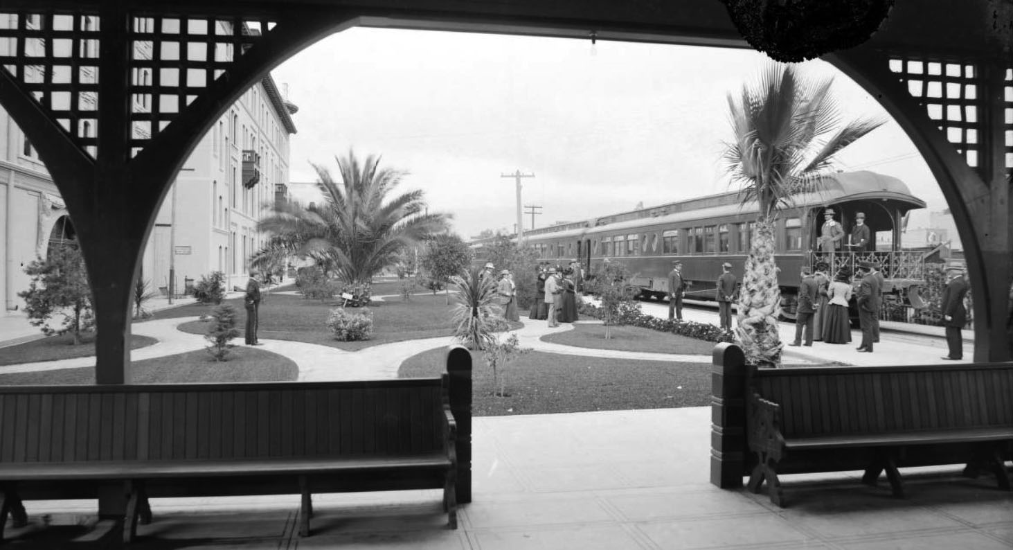
| (1890)^ - A view of the Atchison, Topeka, and Santa Fe railroad California Limited at the Hotel Green in Pasadena. |
Historical Notes In 1887, Edward Webster built a new Santa Fe Railroad station next to his hotel site, for easy food and lodging business with trains' arrival/departure passengers. Webster went bankrupt before finishing his hotel. |
 |
|
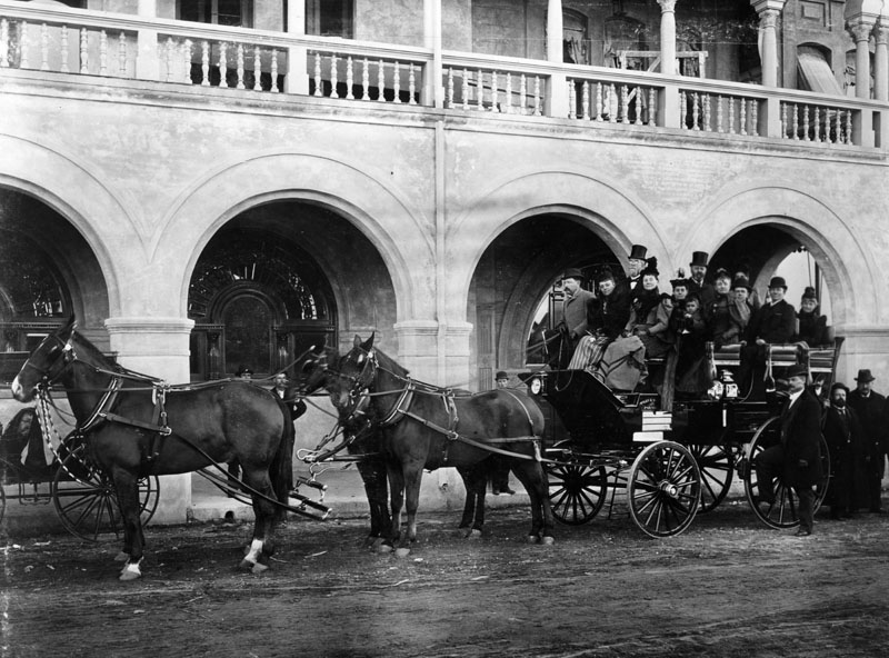
| (1890)* - Tally-Ho leaving the Hotel Green. The photograph identifies it as "Wiley & Greely's Tall-Ho." |
Historical Notes The hotel was home to both the Tournament of Roses and the Valley Hunt Club. It was supplemented by two later buildings, creating a complex of three structures. |
 |
|
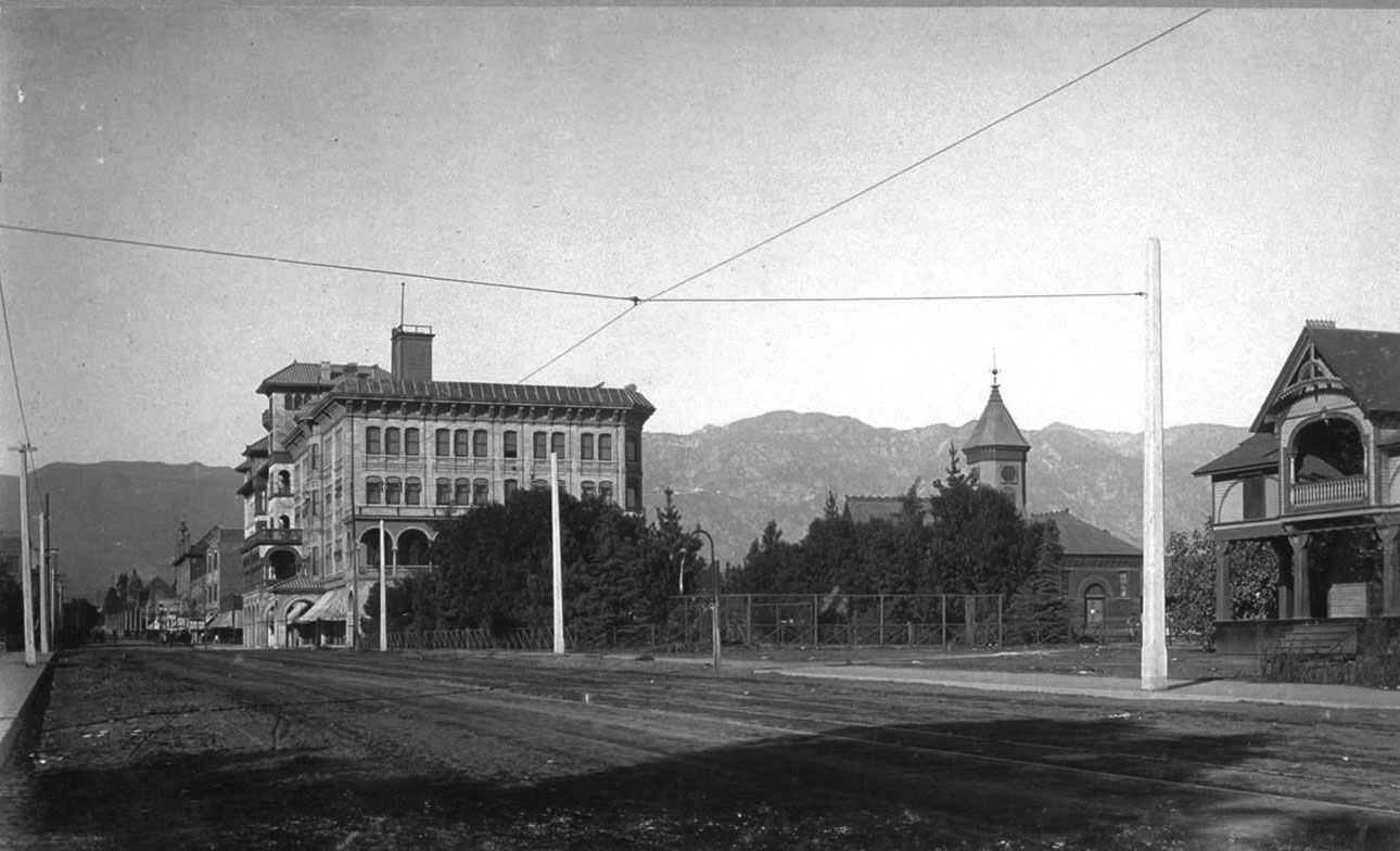
| (1901)^ – Panoramic view looking south showing the Hotel Green and its annex, “Central Annex”, from the corner of Green Street and Raymond Avenue. |
Historical Notes Due to the hotel's success, Green began building an addition in 1897, and the "Central Annex" opened on January 16, 1899 to coincide with Green's birthday, and 1,000 guests came to celebrate the occasion. The hotel continued to grow in popularity with the new Central Annex. Its pedestrian bridge to the main hotel over Raymond Avenue became a popular viewing site for the Rose Parade, which ran along Raymond at the time. |
 |
|
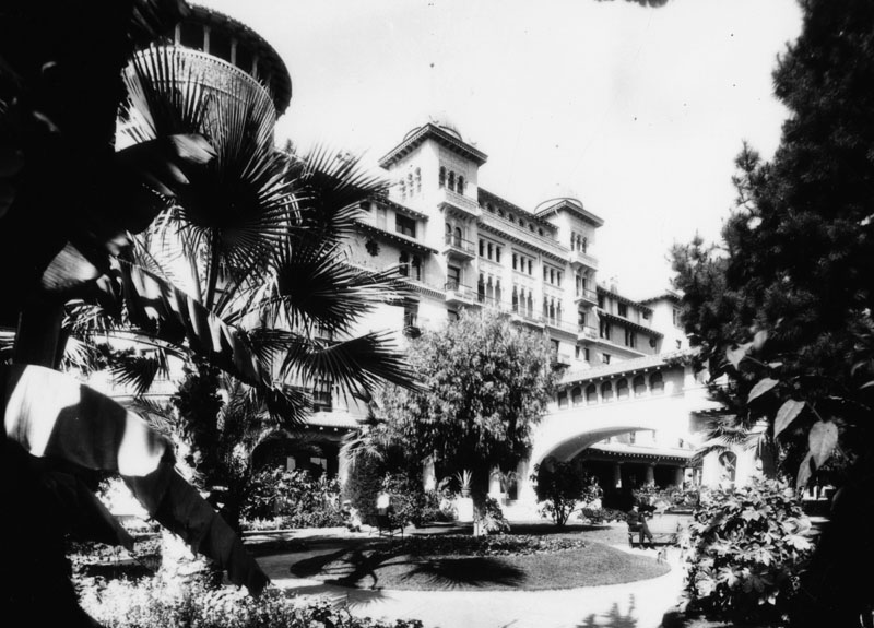
| (1905)^ - View of Hotel Green and its new Central Annex (Castle Green) on the left. |
Historical Notes The new building, to become known as "Castle Green," was on a full city block but was set back from the streets, which provided open space for large new gardens. They became Pasadena's only 'public' park at the time. |
 |
|
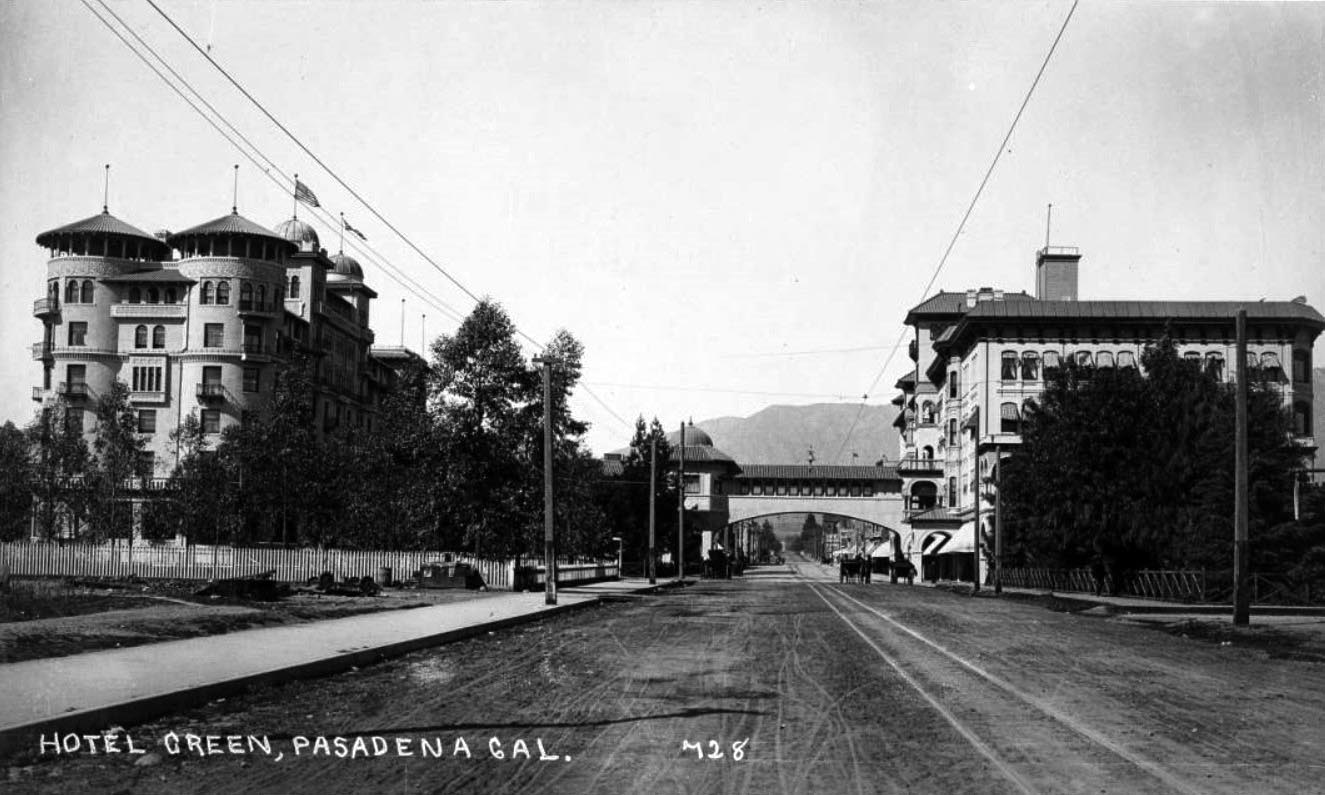
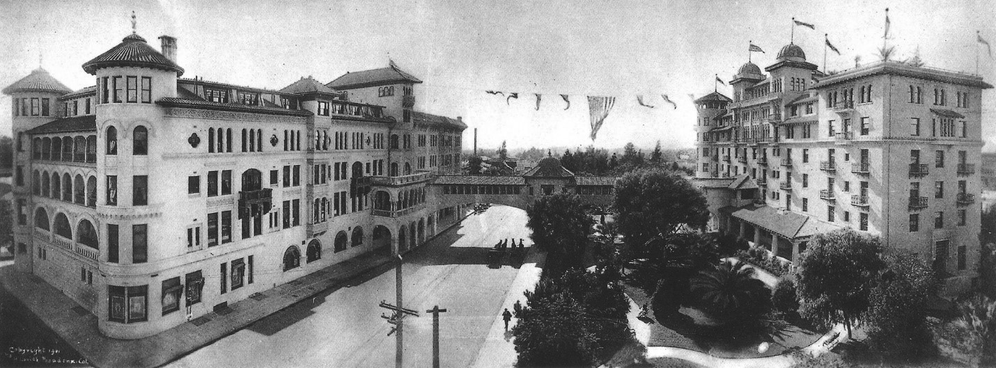
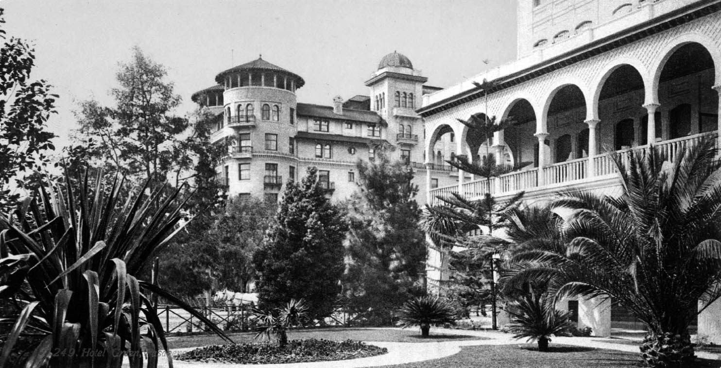
| (1908)^- Panoramic view showing the Hotel Greeen and its surrounding area. |
Historical Notes In 1903 Green added a third annex, known as the Wooster Block. It incorporated an earlier building constructed in 1887, which had been part of the original site of the California Institute of Technology. Green planned to add a fourth annex, before running short on money for construction. |
 |
|
| (ca. 1910)* - Exterior view of the Green Hotel looking from Central Park. View shows the towers of the building on the west side of Raymond Avenue, in Pasadena. |
Historical Notes Hotel Green, designed by Los Angeles-based architect Frederick Roehrig, was published in the periodical The Western Architect in December 1905. |
 |
|
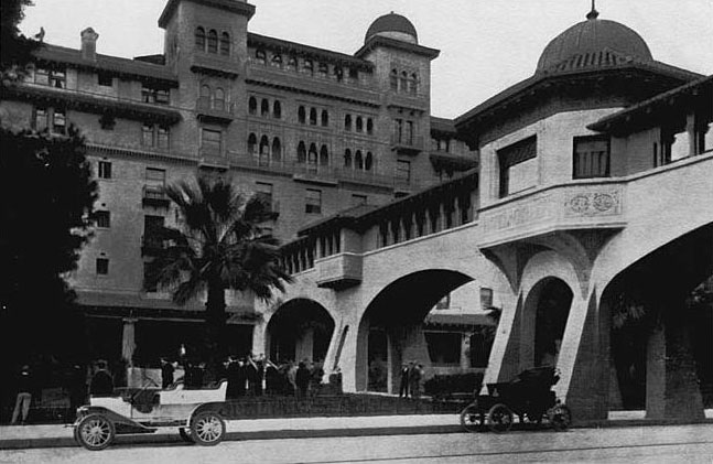
| (ca. 1910)* - View of the Castle Green, part of the Green Hotel Complex. Two early model cars are parked by the curb as a band is seen playing on the front lawn. |
Historical Notes Hotel Green acquired a reputation as a luxury hotel. The hotel hosted society events such as receptions for significant visitors and the Valley Hunt Club's annual ball. In addition, the hotel contributed to Pasadena's economy and population. Lodgers at the hotel were credited with spending large amounts of money at Pasadena businesses, and many tourists ultimately decided to live in Pasadena. |
 |
|
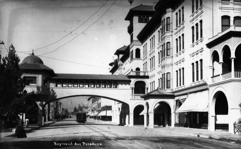
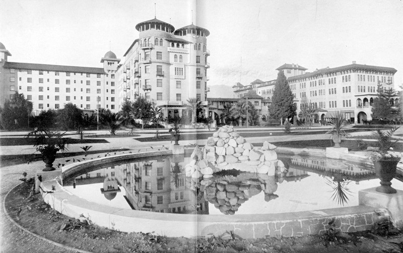
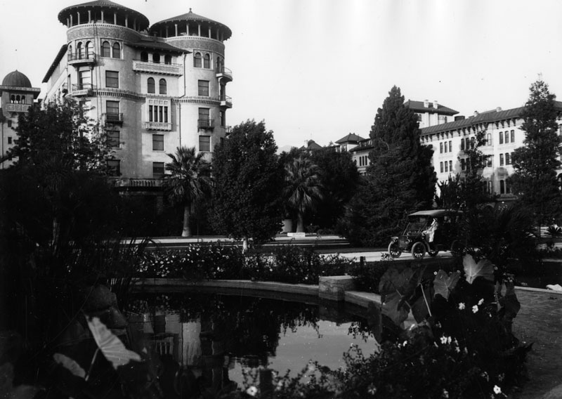
| (ca. 1910)* - View of the Hotel Green in Pasadena, in a lush garden setting. The portion of the building which extends to the right crossed over Raymond Avenue. |
 |
|
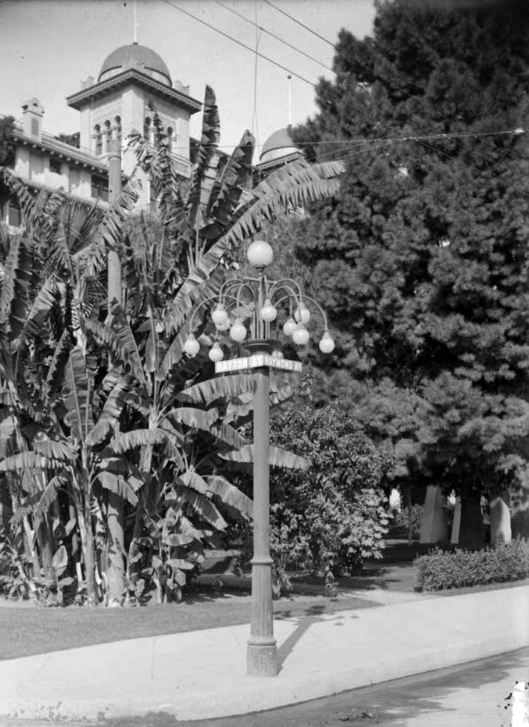
| (1910)^ – View showing a street lighting post on the corner of Raymond Avenue and Dayton Street, showing the Green Hotel in the background. |
 |
|
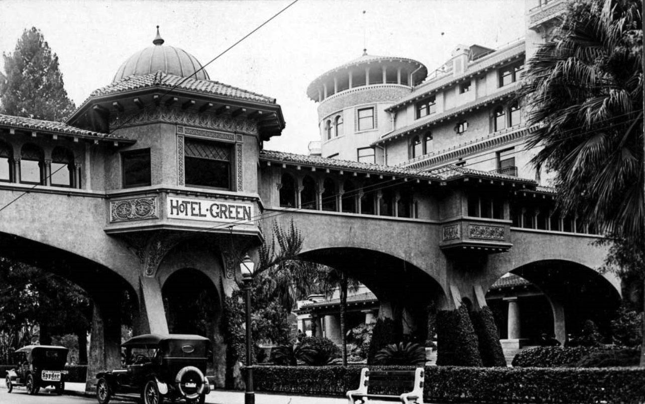
| (ca. 1919)^ - View of the Hotel Green and walkway that crossed over Raymond Avenue, connecting two buildings of the hotel. Two automobiles are parked on the street, and one has a sign saying "Snyder for Mayor." |
Historical Notes Meredith P. Snyder was elected mayor of Los Angeles in 1919. |
 |
|
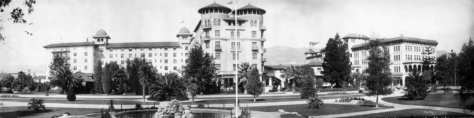
| (1923)^ - Postcard view of Hotel Green and grounds. |
.jpg)
Historical Notes Daniel M. Linnard bought the hotel from George Gill Green in 1914. The hotel's business declined after this point, as the rise of automobile travel took away its market of Santa Fe Railroad passengers at the adjacent train station. The original 1894 Hotel Green building on the east side of Raymond Avenue was sold in 1920. By 1924 the hotel was owned by a group of investors who divided the hotel complex into three parts. The Central Annex was subdivided into fifty residential apartments and renamed the Castle Green.* The Castle Green is now a luxurious condominium complex, with 52 units privately owned. They are predominantly one bedroom units, carved out of what were once hotel rooms and suites for the very wealthy. They are filled with rare architectural detail and beautiful reminders of their Victorian past. The Castle Green is listed on the National Register of Historic Places, the State Historic Register, and the City of Pasadena’s list of Historic Places.* |
* * * * * |
 |
|
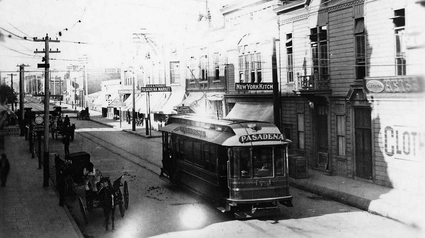
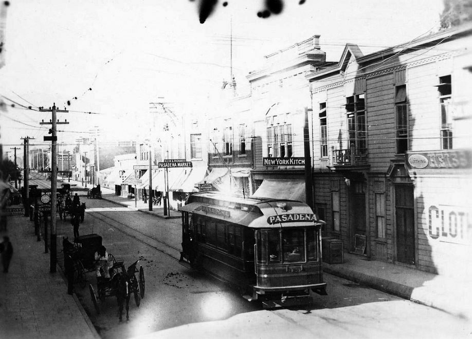
| (ca 1900)* - PE no. 93, Pasadena. Some of the business seen include: Pasadena Market, New York Kitchen, and Heiss Clothing. Mount Lowe Preservation Society Collection |
 |
|
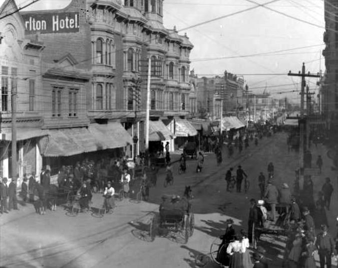
| (ca. 1900)* – View of a what appears to be a bicycle parade on Colorado Street in front of the Carlton Hotel. |
Historical Notes Colorado Street had become a more bustling locale by the time this photograph was taken, sometime around 1900. Many of the timber shacks lining the street in the 1880s photographs have been replaced by taller, more ornate buildings. Power lines and trolley tracks show Pasadena's progress as well. A bicycle parade attracted the curiosity of onlookers. Pasadena had nine bicycle shops by 1902, and the long line of parade participants on this day suggests that business was good. |
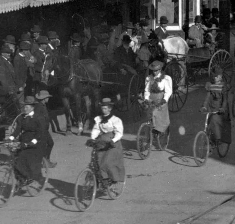 |
|
| (ca. 1900)* – Close-up view showing four women in their riding attire participating in the bicycle parade as spectators look on. |
.jpg) |
|
| (ca. 1900)* – Close-up view showing a woman seated in an early three-wheel bicycle along the parade route. |
 |
|
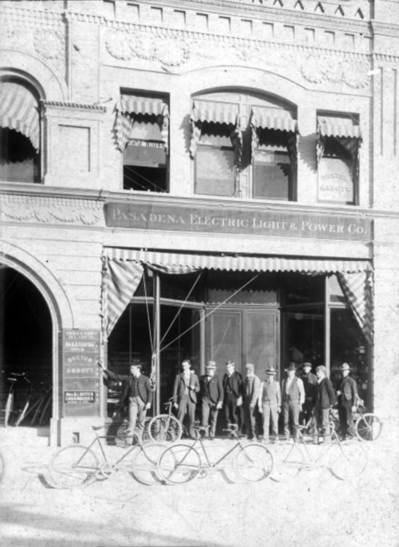
| (1900)* – View showing a group of men standing by their bicycles in front of the Pasadena Electric Light & Power Building at 34 S. Raymond Avenue. |
Carlton Hotel
 |
|
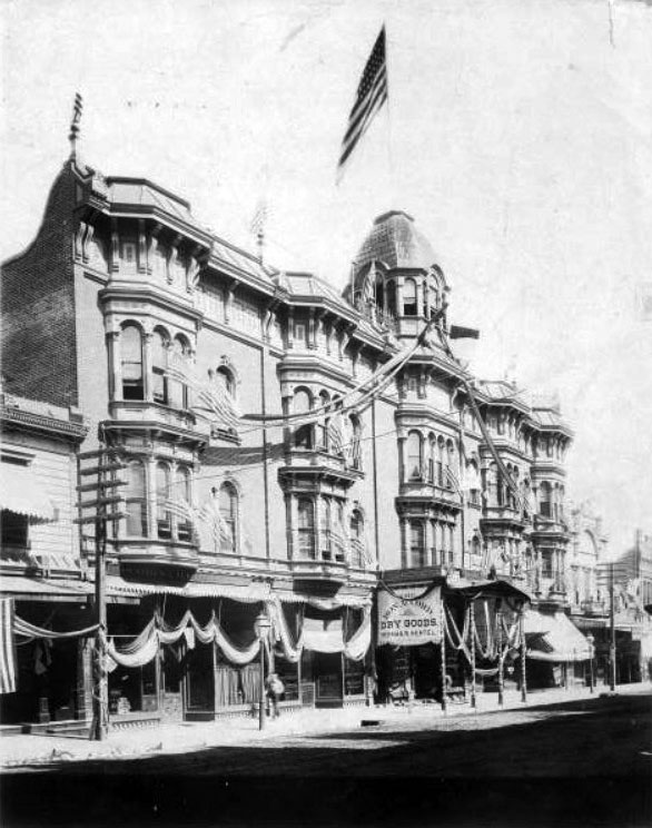
| (ca. 1902)*^* - Close-up view of the Carlton Hotel on Colorado St. The hotel is decorated with flags and banners. |
Historical Notes The Carlton Hotel was a first-class establishment in the center of Pasadena’s growing downtown. Known as the Exchange Block, and designed by Harry Ridgway, it opened in the summer of 1886 (the same year as the Raymond Hotel). The Carlton boasted the first passenger elevator in town, and at its front entrance was the first benchmark from which all official city grades or levels were measured.*#*# |
 |
|
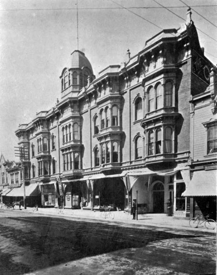
| (1902)*^* – Close-up view of the Carlton Hotel located at 29 E Colorado Street. |
* * * * * |
 |
|
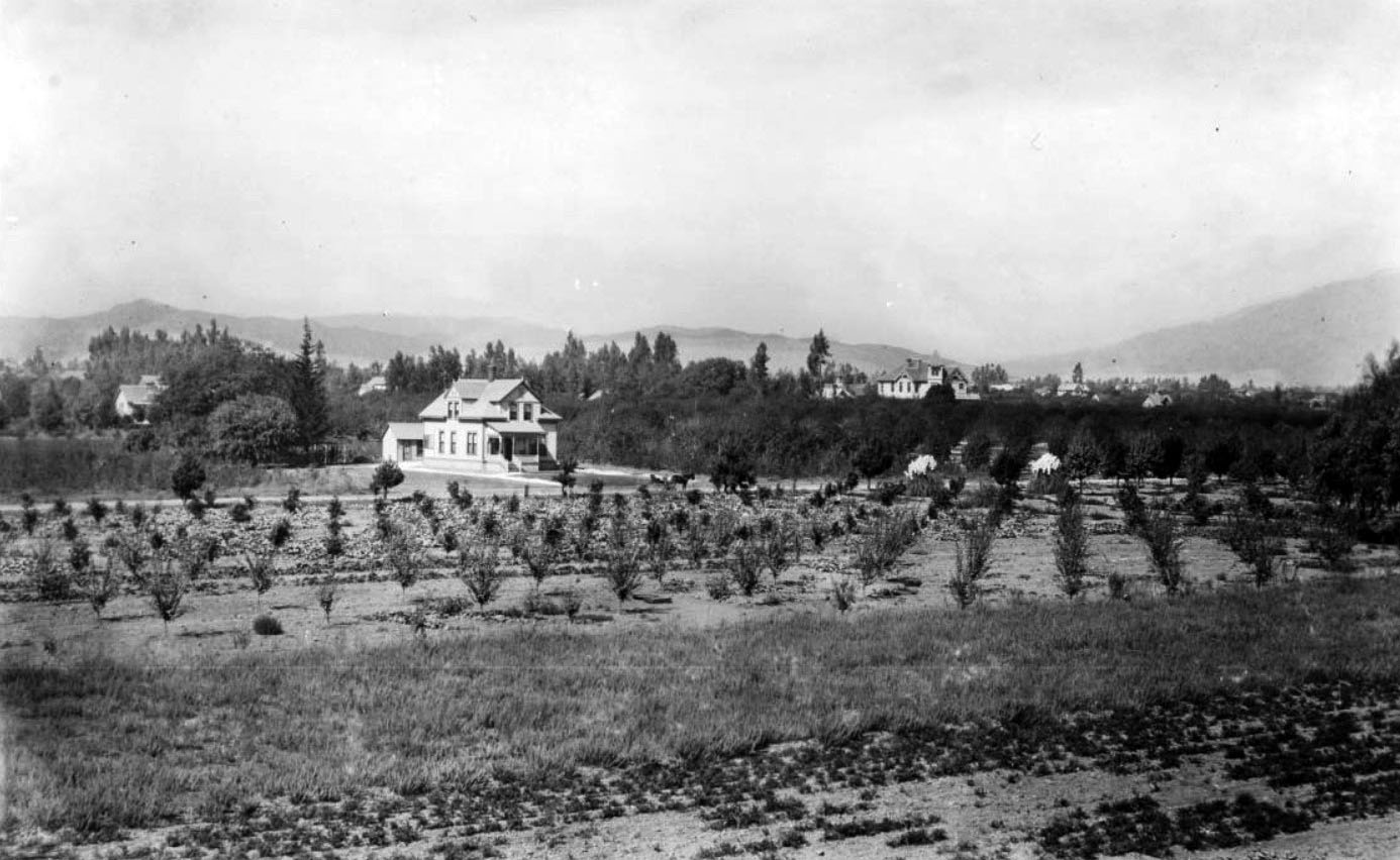
| (ca. 1890)^ - Panoramic view of Pasadena looking northwest from the cupola of the Longfellow Octagon House on San Pascual Street, about where Cal Tech stands today. In the foreground is an orchard of trees and further away stands a two-story house. |
Longfellow Octagon House
 |
|
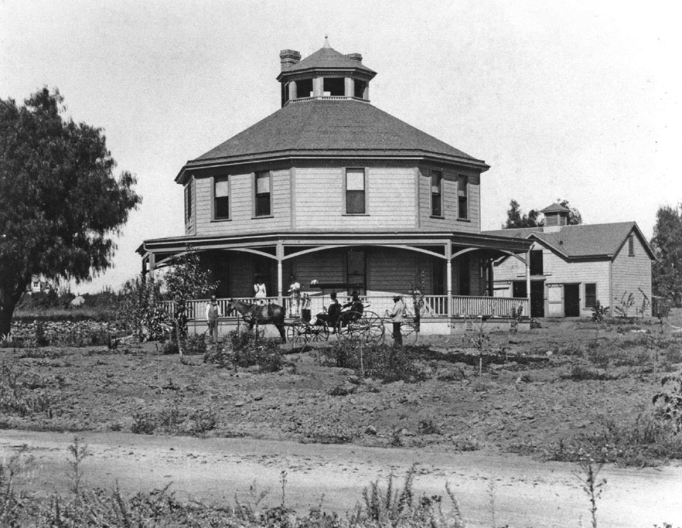
| (ca. 1900)^.^– View showing a horse-drawn carriage surrounded by several people in front of the Longfellow Octagon House in its original location on San Pasqual Street in Pasadena. (Photo courtesy of Cultural Heritage Foundation of Southern California) |
Historical Notes Gilbert Longfellow built his first octagonal house along the coast of Maine. Then in 1893, after moving to Pasadena, Longfellow built his second octagonal home on San Pasqual Street. After Longfellow died in 1912, his son Charles continued the family's farming business, purchasing additional land nearby (now part of the California Institute of Technology campus) where he established a small, but successful, citrus grove. In 1917, to make way for subdivision of the original farm, the house was moved to a city lot about a mile north of the farm on Allen Avenue. While remaining in the same family, over the years the house fell into great disrepair. In 1973, facing demolition of the house where he had spent much of his life, Walter Hastings (Longfellow's grandson) sought assistance from the Cultural Heritage Foundation of Southern California's Heritage Square Museum to save his family's home. In exchange, he donated the house to the museum. The home was moved to its present location (Heritage Square Museum) in 1986. ^ |
 |
|
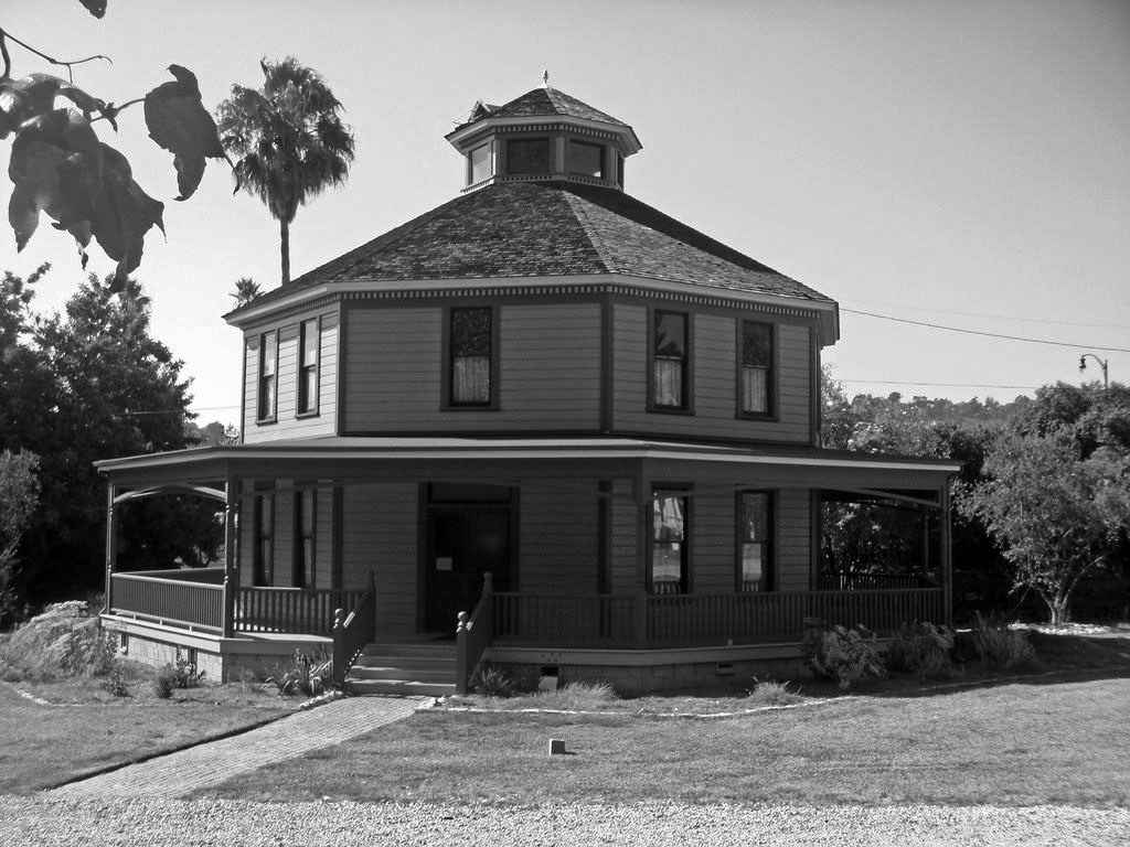
| (2009)^.^ – View showing the Longfellow-Hastings Octagon House after it was relocated to its current location at the Heritage Square Museum at 3800 Homer Street along the Arroyo Seco. |
Historical Notes In 1917, when L.A./Pasadena sprawl reached San Pasqual Street, the Longfellow family moved its octagon house a mile north to Allen Avenue. In 1973, the Cultural Heritage Foundation of Southern California, which runs the Heritage Square Museum, struck a deal with Walter Hastings, Longfellow's grandson who lived in the house. The foundation would save his home from threatened demolition if he donated the octagon. When Hastings moved out in 1986, the organization relocated the Longfellow place to the Arroyo Seco.) ^ |
* * * * * |
 |
|
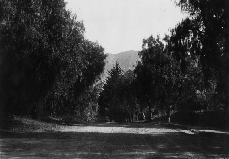
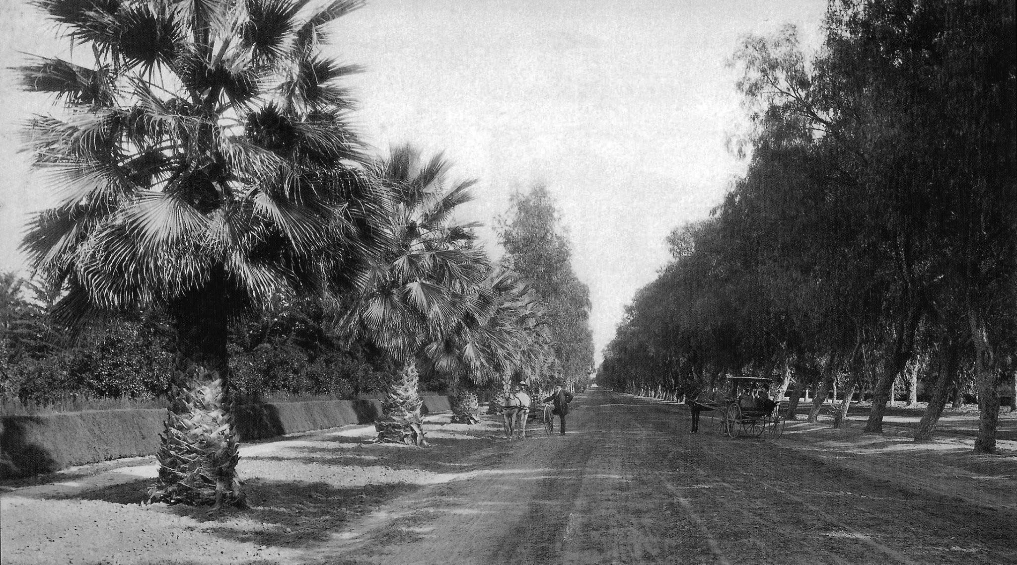
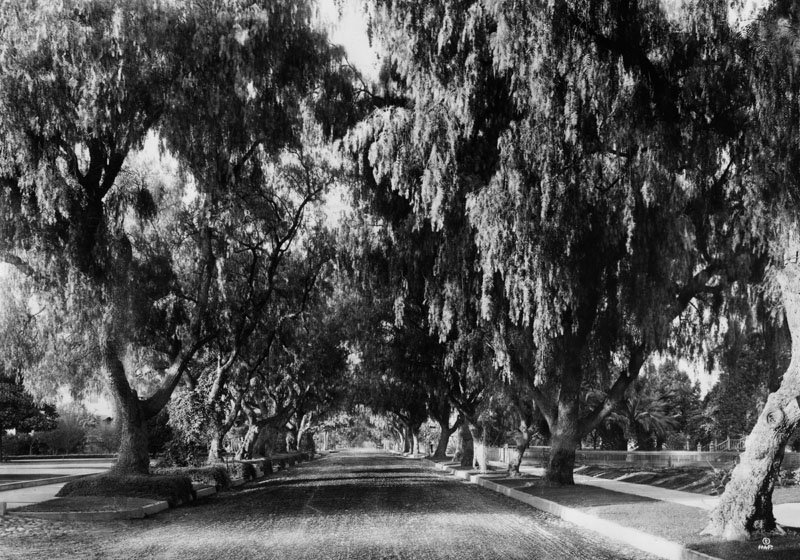
| (1900)* - View of a tree-lined unpaved Marengo Avenue, Pasadena. |
 |
|
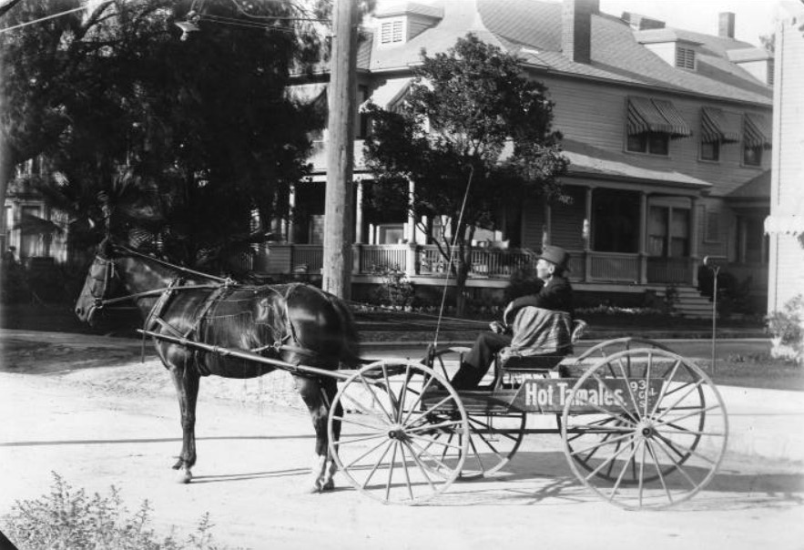
| (Early 1900s)*^* - View of a tamale wagon driven by Abalenio Hernandez of 615 South Broadway, Pasadena. Broadway is now called Arroyo Parkway. |
 |
|
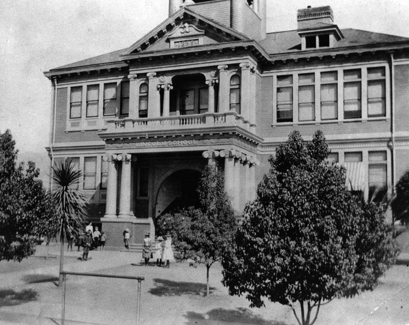
| (1900)* - View of Abraham Lincoln Elementary School, built at its present location (Lincoln Avenue and West Peoria Street) in 1895. |
Historical Notes The original building was a large two-story structure facing Lincoln Avenue; a small building for the kindergarten was in the rear. The Board purchased a house and lot adjoining the school site in November 1901, and started the kindergarten class there in January of 1902.* |
 |
|
| (ca. 1900)* - Pacific Electric Railway Pasadena and Pacific car labelled "Santa Monica,” seen crossing a street. |
Historical Notes In 1895 The Pasadena and Pacific Railway was created from a merger of the Pasadena and Los Angeles Railway and the Los Angeles Pacific Railway (to Santa Monica.) The Pasadena and Pacific Railway boosted Southern California tourism, living up to its motto "from the mountains to the sea." *^ |
 |
|
| (ca. 1900)##^^ - A PE Pasadena and Pacific streetcar marked “Pasadena” shares the road with horse-drawn wagons. Pasadena Market and New York Kitchen can be seen in the background. |
 |
|
| (1902)* - This was the 1902 Tournament of Roses parade, with a butchers band marching down the Pasadena street. There was nothing spectacular about the parade then, and the spectators were few. This was also the first year of the Rose Bowl game. |
 |
|
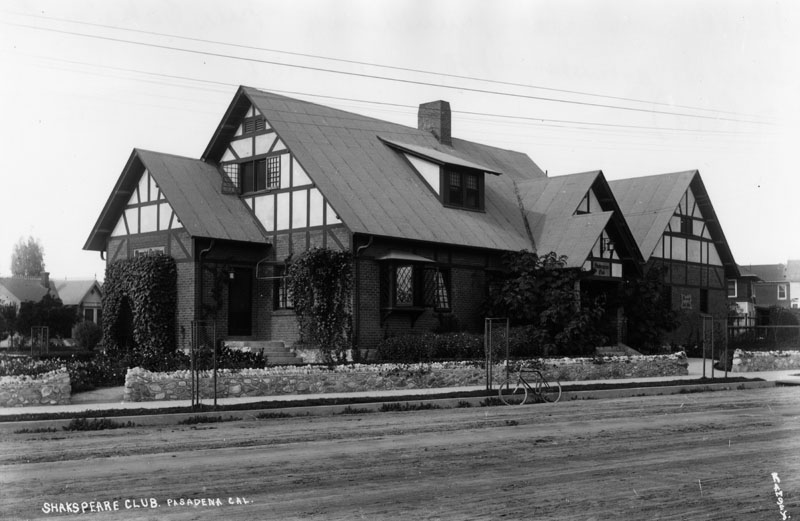
| (ca. 1902)* - Exterior view of the Shakespeare Club, junction of Fair Oaks and Lincoln Avenues, in Pasadena. |
Historical Notes The Shakespeare Club of Pasadena was organized in 1888 and has the distinction of being the oldest women's club in Southern California. The Club's purpose has always centered around the cultural, educational and philanthropic interests of its members.*# |
 |
|
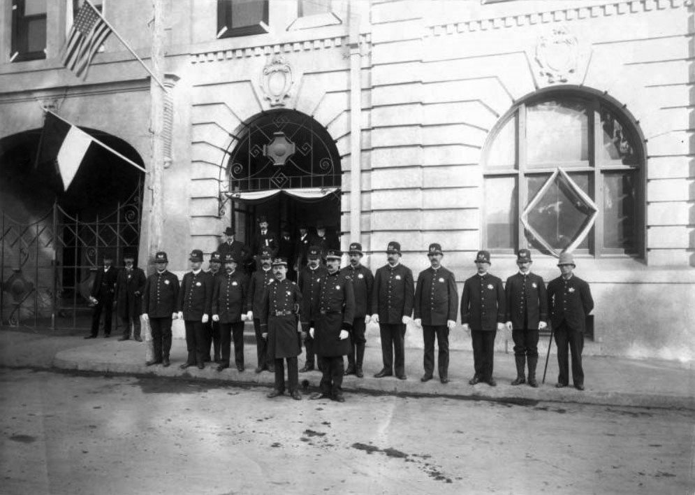
| (1903)** – View showing policemen posing in front of City Hall at Union and Fair Oaks. |
Historical Notes The Pasadena Police Department was founded in 1886.*^ |
 |
|
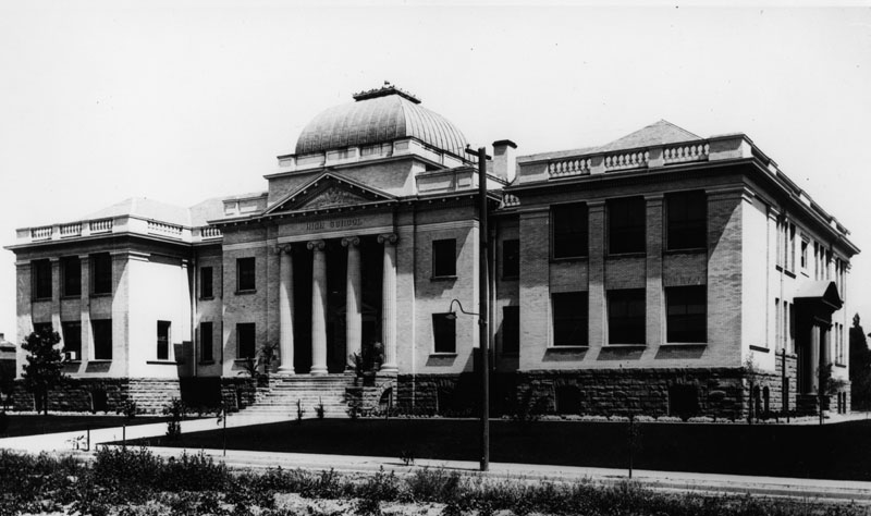
| (1903)* - View of John Muir High School, built in 1903 on the north side of east Walnut Street, between north Los Robles and Euclid Avenue. |
Historical Notes John Muir High School was Pasadena's second High School. Later it served as a Junior High School for many years, and then a school for special classes. The name had been changed to Benjamin Franklin. Later it was condemned for school purposes and the Recreation Department used it for years.* |
 |
|
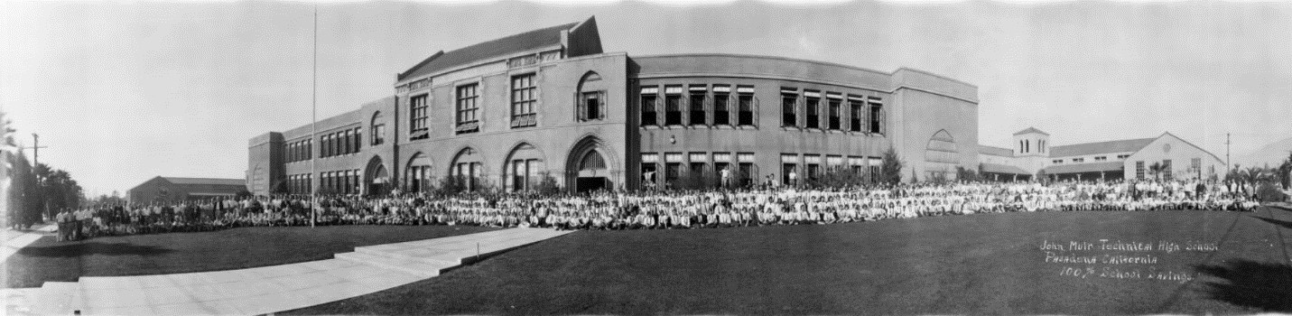
| (ca. 1930)#* – Panoramic view of John Muir Technical High School, 1835 Lincoln, Pasadena, with the student body sitting and standing in front of the building. |
Historical Notes John Muir Technical High School first appears in a 1928 Pasadena directory at its Lincoln location. Prior to that it was John Muir Junior High School, and was located on Walnut. #* |
 |
|
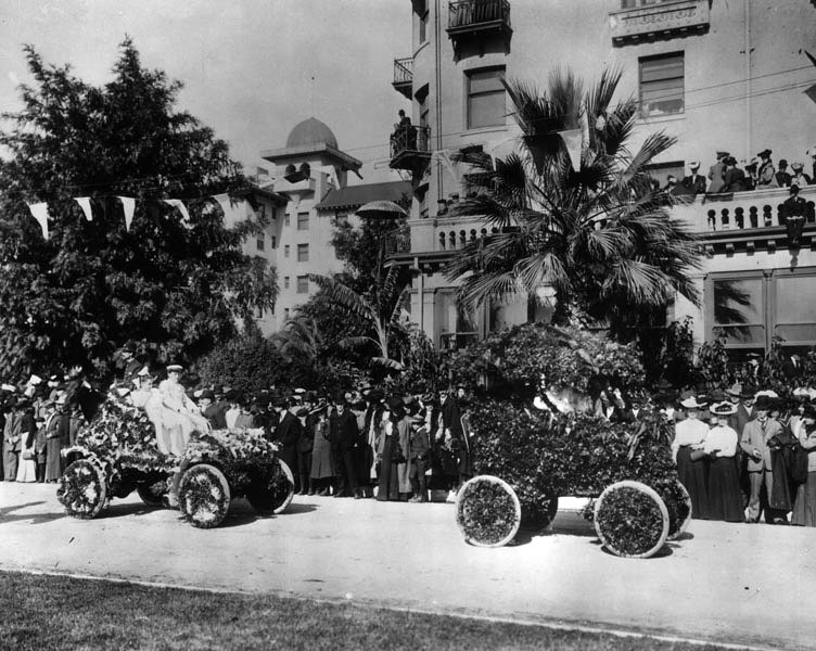
| (1905)* - Two flower-covered automobiles in the 1905 Rose Parade. This appears to be in front of the Raymond Hotel. |
 |
|
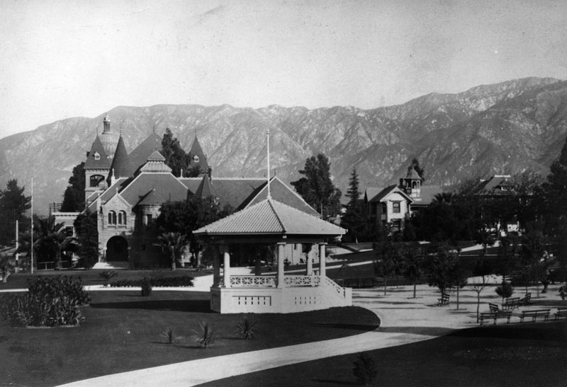
| (ca. 1905)* - View of Pasadena Park and City Hall in the back left of photo. |
* * * * * |
Please Support Our CauseWater and Power Associates, Inc. is a non-profit, public service organization dedicated to preserving historical records and photos. Your generosity allows us to continue to disseminate knowledge of the rich and diverse multicultural history of the greater Los Angeles area; to serve as a resource of historical information; and to assist in the preservation of the city's historic records.
|
More Historical Early Views
Newest Additions
Early LA Buildings and City Views
History of Water and Electricity in Los Angeles
* * * * * |
References and Credits
* LA Public Library Image Archive
^*California Historic Landmark Listing (Los Angeles)
^^UC Irvine - The White City by Miles Clement
*# The Shakespeare Club of Pasadena
+# Examiner.com - Rose Parade no-nos: Sundays, rain, Supreme Court Justices
#* Huntington Digital Library Archive
## Google Maps
*^#CSUN Oviatt Library Digital Archives
**^Colorado Street Bridge nps.com
*^^Nuestra Señora la Reina de los Ángeles: losangelespast.com
^^*LA Times Framework: 1918 Rose Parade; In 1949, the Snowman Socked LA
^*#Noirish Los Angeles - forum.skyscraperpage.com; Devil's Gate; Colorado St. Bridge; Maryland Hotel
^##California State Library Image Archive
+##Weird California: Los Angeles' Programmatic Architecture
###Library of Congress: Hotel Green Panoramic, ca. 1908
**#Metro Transportation Library and Archive
#**Palomar Observatory - Caltech.edu
*#*KCET: Scoville Bridge; Rise of the Sierra Madre
^#^LAghostpatrol.com: Devil's Gate
^.^Facebook: SoCal Historic Architecture
^#*ArroyoSeco.org: Devil's Gate
^^^Atlasobscura.com: Devil's Gate
*^*^Earlyaviators.com: Roy Knabenshue
^*^*Mtwilson.edu: Mount Wilson Observatory
^*^#Facebook.com - Bizarre Los Angeles
*^^*Pasadena: A Busines History
*^^^San Fernando Valley Historic Society/Facebook.com: Wagon Trip
^^*#Facebook.com - Pasadena Digital History
*#*^Denver Public Library Image Archive
*#*#Downtown Pasadena's Early Architecture
^#^^Calisphere: University of California Image Archive
#*#*OldRadio.com; The Story of Mt. Wilson
#^#^Los Angeles Magazine: The Dammed Past of Devil's Gate
##^^Flickr.com: Michael Ryerson
##^*Los Angeles Daily News: Castle Green
##**Electric Railway Historical Association; Pacific Electric
^^^^*Bureau of Street Lighting Image Archive
*^ Wikipedia: History of Pasadena; Tournament of Roses Parade; The Langham Huntington; Hotel Green; Rose Bowl Game; Pasadena City Hall; Old Town Pasadena; Los Angeles Terminal Railway; Richard H. Chambers United States Court of Appeals and the Vista del Arroyo Hotel and Bungalows; California Institute of Technology; Mt. Lowe Railway; Cawston Ostrich Farm; Pacific Electric Railway; Arroyo Seco - Devil's Gate; Mt. Wilson Toll Road; Mt. Wilson; Merritt Mansion; Raymond Hotel; California Cycleway
< Back