Early Views of Glendale
| Historical Photos of Early Glendale |
 |
|
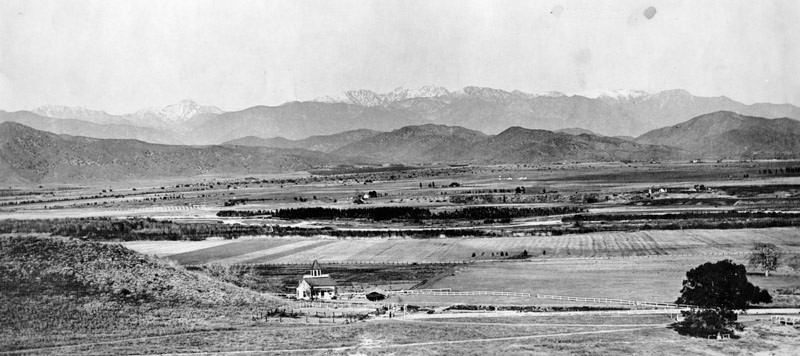
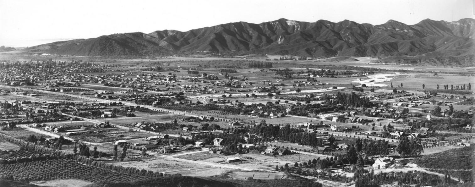
| (ca. 1880s)^ - Panoramic view from Griffith Park of the site of the later city of Glendale as it appeared sometime between the partition of the great San Rafael Rancho in 1870 and the founding of the town in the middle eighties. The Verdugo Hills and San Gabriel Mountains are seen in background. |
Historical Notes The area was long inhabited by the Tongva people (or "People of the Earth"), who were later renamed the Gabrieleños by the Spanish missionaries, after the nearby Mission San Gabriel Arcángel. In 1798, José María Verdugo, a corporal in the Spanish army from Baja California, received the Rancho San Rafael from Governor Diego de Borica, formalizing his possession and use of land on which he had been grazing livestock and farming since 1784. Rancho San Rafael was a Spanish concession, of which 25 were made in California. Unlike the later Mexican land grants, the concessions were similar to grazing permits, with the title remaining with the Spanish crown. |
 |
|
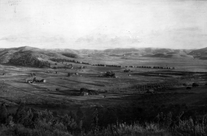
| (ca. 1900)^ - Panoramic view of Glendale looking northeast toward the Verdugo Hills. Only a few houses are seen. |
Historical Notes In 1860, José María Verdugo's grandson, Teodoro Verdugo, built the Verdugo Adobe, which is the oldest building in Glendale. The property is the location of the Oak of Peace, where early Californio leaders including Pio Pico met in 1847 and decided to surrender to Lieutenant Colonel John C. Frémont. Verdugo's descendants sold the ranch in various parcels, some of which are included in present-day Atwater Village, Eagle Rock, and Highland Park neighborhoods of Los Angeles. |
 |
|
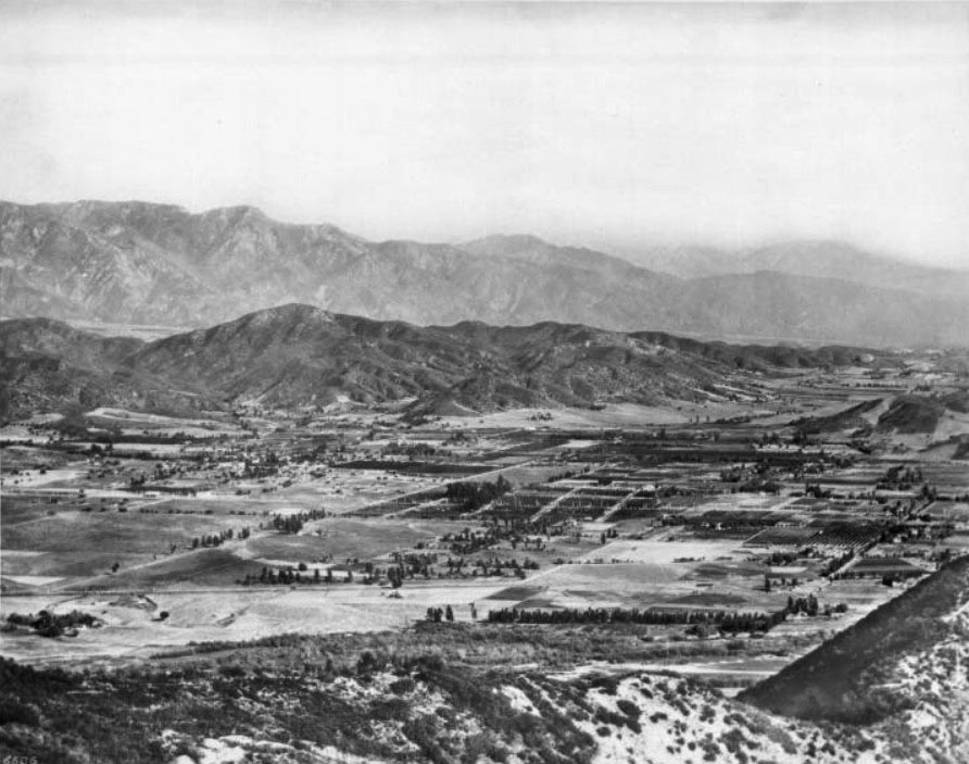
| (ca. 1904)^ – Panoramic view of Glendale and Eagle Rock from the hills to the west, looking northeast. Two rows of mountains stripe the background (San Gabriel Mtns. and Verdugo Hills), enclosing the town below in a valley between them and the hills. Residences are spaced far apart. |
Historical Notes In 1884, residents gathered to form a townsite and chose the name "Glendale" (it was bounded by First Street (now Lexington Drive) on the north, Fifth Street (now Harvard Street) on the south, Central Avenue on the west, and the Childs Tract on the east). Residents to the southwest formed "Tropico" in 1887. Residence to the north lived in the Casa Verdugo community. Glendale incorporated in 1906 and annexed Tropico 12 years later, in 1918. In March of 1926, a vote for annexation passed and Casa Verdugo also became a part of the city of Glendale. |
 |
|
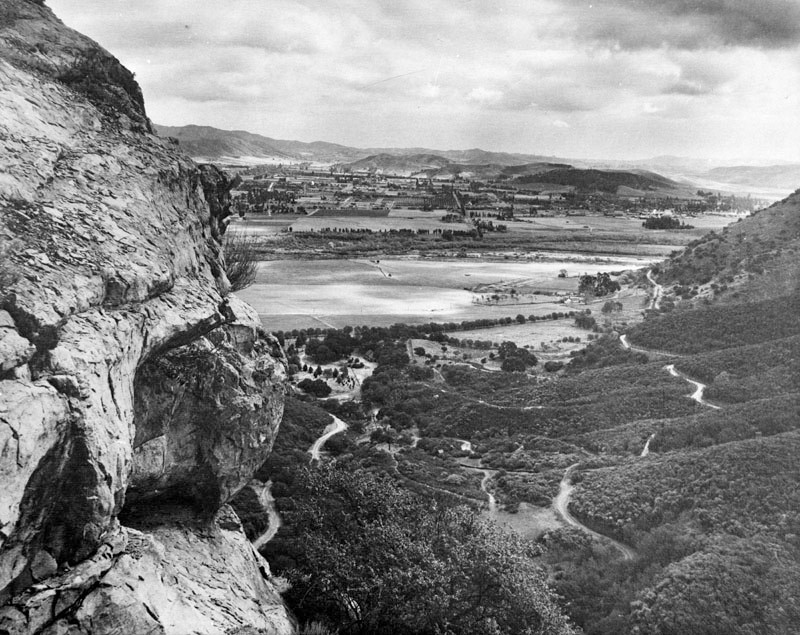
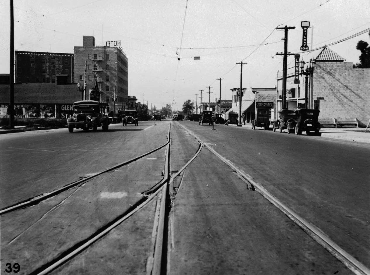
| (1924)* - Panoramic view of South Glendale as seen from Bee Rock in Griffith Park. |
 |
|
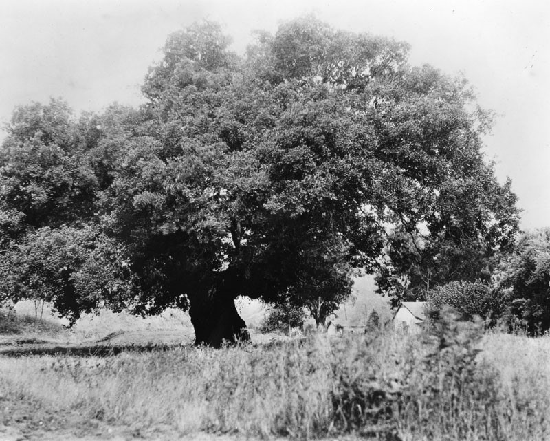
| (ca. 1900)^ - View showing an oak tree (‘The Oak of Peace’) at the Catalina Verdugo adobe in Glendale which was General Andres Pico's camp site before he surrendered to General John C. Fremont. |
Historical Notes Here was drafted the Treaty of Cahuenga on January 12, 1847, signed the following day in Cahuenga Pass. When the home was owned by Dr. and Mrs. Ernest G. Bashor, they named it "El Roble de la Paz" ('The Oak of Peace'). Although the tree died from natural causes in 1987, remnants can still be seen at its original site. |
Casa Verdugo Restaurant
 |
|
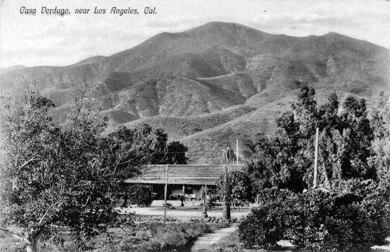
| (ca. 1905)* – Postcard view showing the Casa Verdugo (orignally Sepulveda adobe) shortly after it was converted into a restaurant. The Verdugo Mountain are seen in the background. |
Historical Notes The adobe had previously been the home of Fernando Sepulveda and his wife, Rafaela Verdugo de Sepulveda, whose father had owned the vast Rancho San Rafael. The restaurant was originally to have been called La Ramada (“The Arbor") but soon became known as Casa Verdugo after a Los Angeles reporter incorrectly identified the Adobe as the home of Teodoro Verdugo, Rafaela's nephew. The name stuck, Casa Verdugo opened on January 21, 1905, and the restaurant was an immediate success.^ |
 |
|
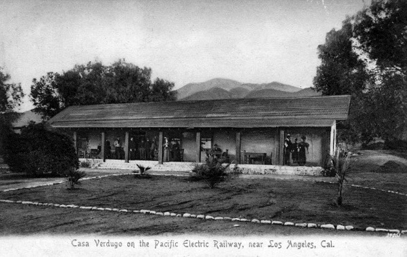
| (1905)^ – Postcard view showing the original Casa Verdugo Restaurant the year it opened. |
Historical Notes Leslie C. Brand and Henry E. Huntington purchased hundreds of acres of what had been the famous and vast Rancho San Rafael which included the Casa Verdugo adobe. They decided to remake the old house into a tourist destination in the form of a restaurant specializing in Spanish dishes intended to delight the tourists and give them a real “taste” of old California in the most literal sense of the word.^ |
 |
|
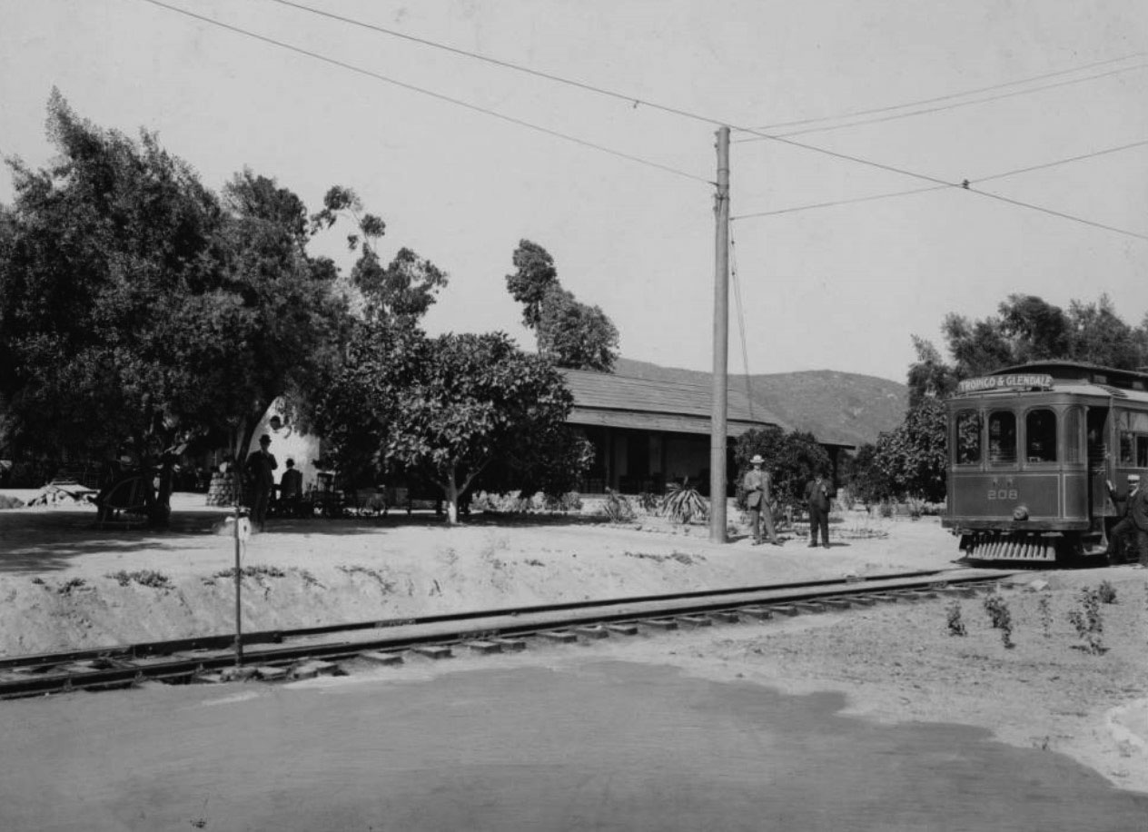
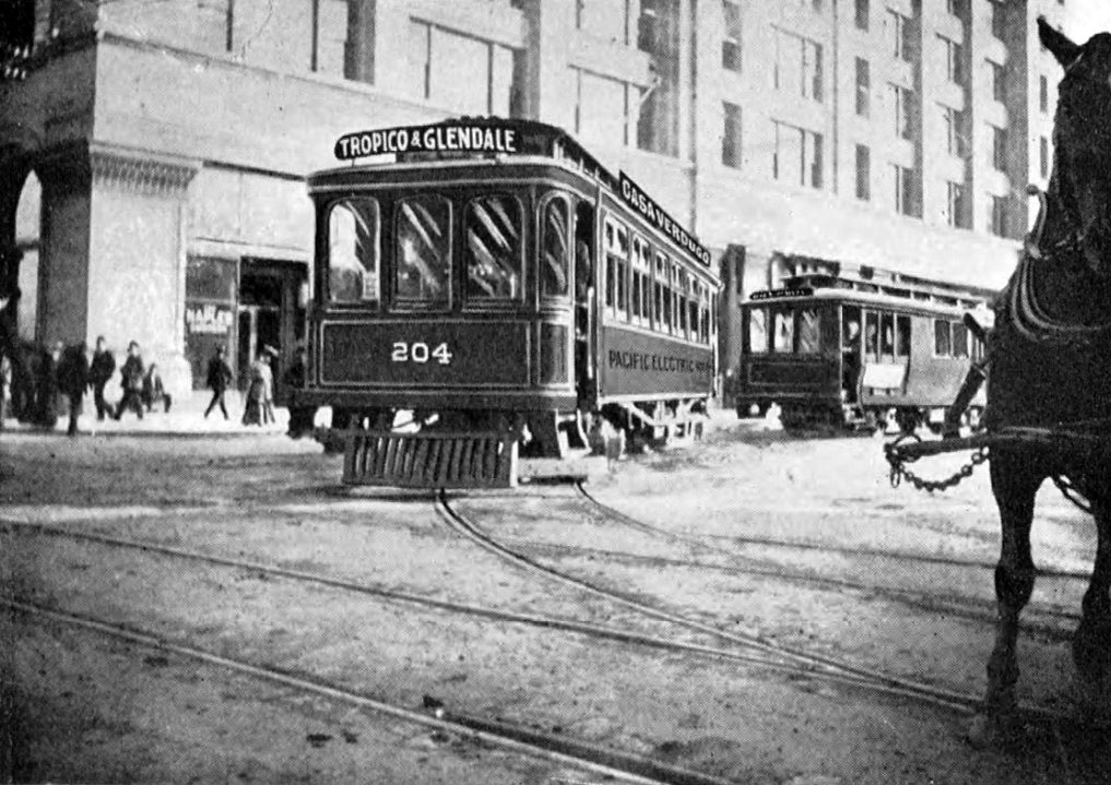
| (ca. 1905)^ – View showing a "Tropico & Glendale" electric streetcar outside Casa Verdugo adobe in Glendale. The conductor stands outside of his electric car on the right with the tracks in front of him leading to the left foreground. Two more men stand next to an electrical pole at center while others sit under the shade of trees at left. The adobe can be seen through the trees. |
Historical Notes In 1905, the Casa Verdugo restaurant opened in the Sepulveda Adobe, operated by Piedad Yorba Sowl. Brand and Huntington recruited Mrs. Sowl due to her experience in the restaurant industry. Her first restaurant, El Famoso, also served authentic dishes of Mexican origin. The restaurant capitalized on the romanticized image of Old California that became widely popular during the late 19th century. Casa Verdugo quickly became an early tourist attraction in Glendale as evidenced by local ads and postcards of the restaurant. The area around it became a popular destination as evidenced by the growth of the population of Casa Verdugo area in 1910 from 1,200 to 1,500 persons.* To make the old adobe accessible to the tourists, Huntington arranged for his Pacific Electric Railway to extend up Brand Boulevard, adding a terminus station at the entrance to the restaurant and its surrounding park, which was named “Casa Verdugo” in honor of Maria Sepulveda’s great-grandfather, Jose Maria Verdugo, the original “Don” of Rancho San Rafael. |
 |
|
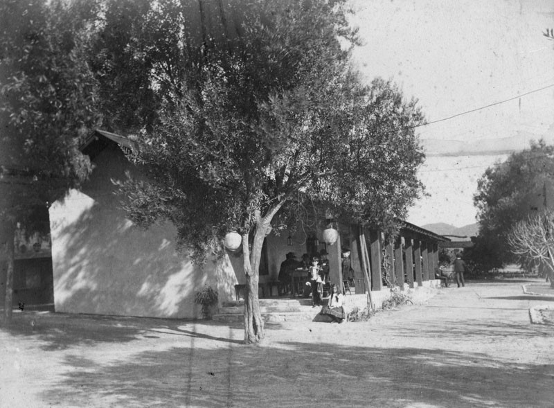
| (ca. 1905)^ – View showing the Casa Verdugo Restaurant behind a couple of pepper trees. Several people can be seen sitting at a table. |
Historical Notes Surrounded by pepper trees and other mature vegetation, the picturesque old adobe had a commanding vista towards downtown Los Angeles from its wide sheltering corridor that ran the entire length of the long narrow facade. |
 |
|
| (ca. 1905)* - Postcard view of entrance to the Casa Verdugo restaurant in Glendale. Olive trees are seen in background. Railroad tracks are seen in foreground. |
Historical Notes Huntington and his development syndicate expended thousands not only on the adobe itself, but in transforming the surrounding acres into a lush park with meandering pathways winding their way around exotic plantings including varieties of cacti and a fragrant grove of oranges that was intended to represent the type of gardens found in the old California days.^ |
 |
|
| (ca. 1905)* - Postcard view of entrance to the Casa Verdugo restaurant in Glendale. Olive trees are seen in background. Railroad tracks are seen in foreground. Image enhanced and colorized by Richard Holoff |
 |
|
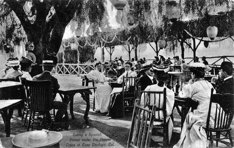
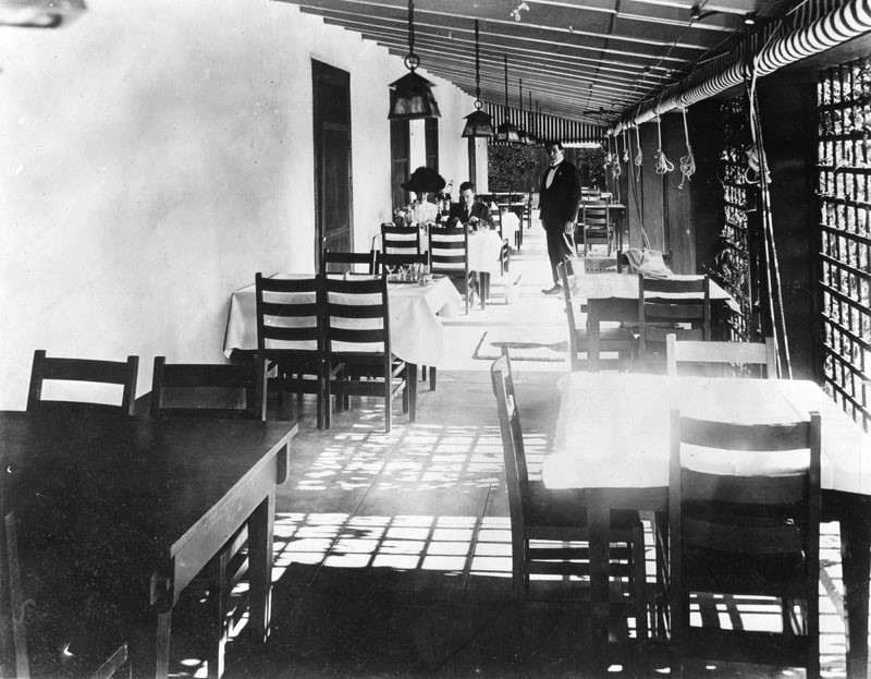
| (ca. 1905)* - Eating a Spanish dinner under the pepper trees at Casa Verdugo. View of men and women dining outside at the Casa Verdugo restaurant in Glendale. Lanterns are seen hanging above diners. |
Historical Notes From the time of its opening in early 1905, the Casa Verdugo was a big hit. Heavily advertised by the Pacific Electric, the Casa Verdugo rode the crest of the wave of public fascination with the romantic days of California’s Spanish and Mexican past and visitors made their way in droves “Out Glendale way” to partake in a Spanish dinner and stroll about the lush grounds. During its heyday, Casa Verdugo regularly entertained hundreds and sometimes even thousands of visitors at a time including a memorable 1907 Shriners outing that brought 5,000 visiting potentates to the old adobe.^ Within a few years of the restaurant opening a small community had developed and called itself Casa Verdugo after the restaurant. A commercial district grew along Brand Boulevard and Central Avenue, including a department store, groceries, a meat market, hardware store, drug store, the Mission Theatre and a post office where tourists could have their picture postcards of the restaurant postmarked “Casa Verdugo, California.” The droves of tourists, and the postcards they mailed home, helped make Casa Verdugo a well-known destination throughout the country; visitors had to see the missions, the Mt. Lowe Railway, Santa Catalina Island and the famous Casa Verdugo. |
 |
|
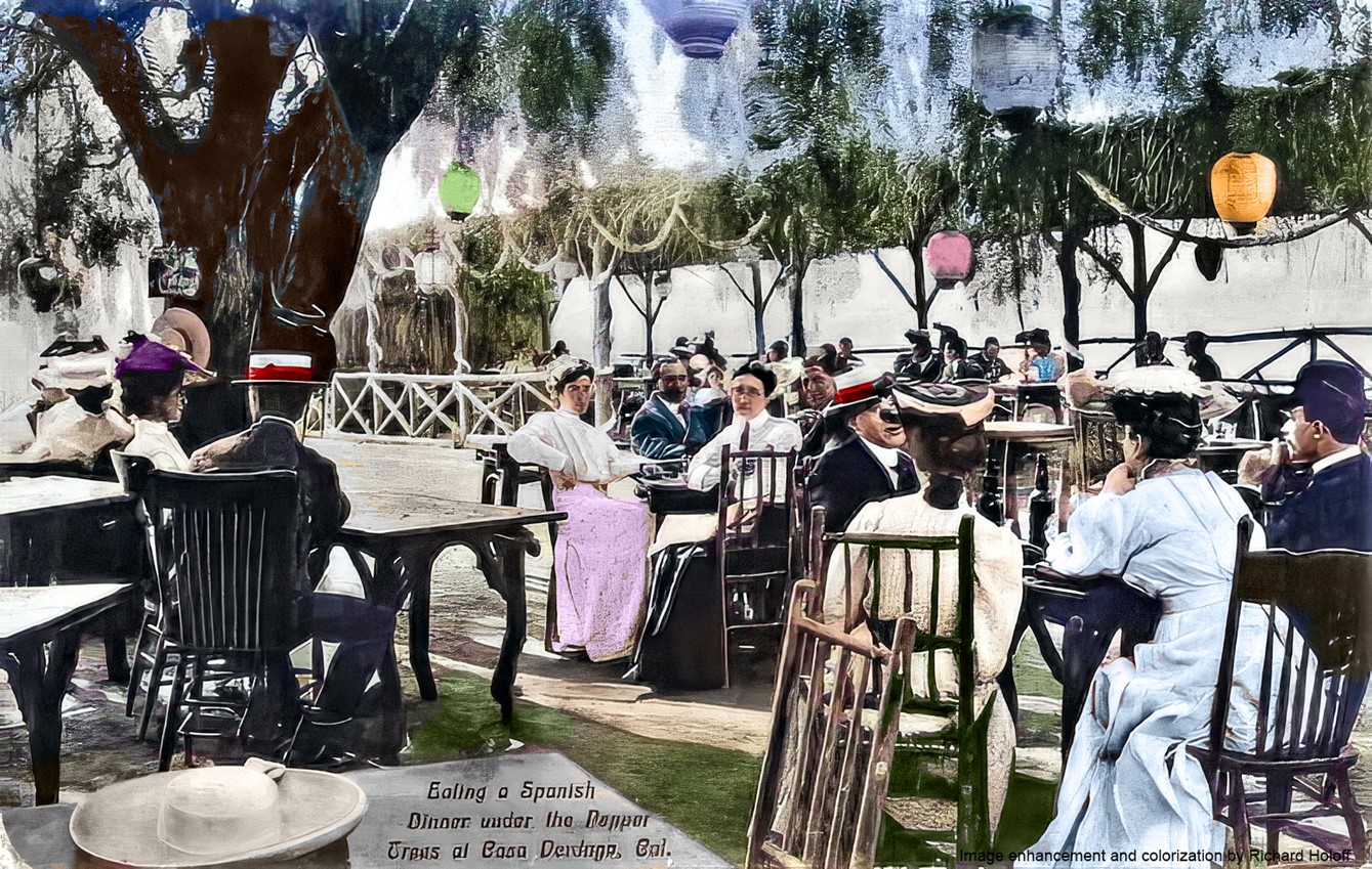
| (ca. 1905)* - Eating a Spanish dinner under the pepper trees at Casa Verdugo. View of men and women dining outside at the Casa Verdugo restaurant in Glendale. Lanterns are seen hanging above diners. Image enhancement and colorization by Richard Holoff |
 |
|
| (n.d.)* - Diners at the Casa Verdugo Restaurant with a waiter standing nearby. |
Historical Notes Both the food and the setting were real treats. Diners could enjoy their peppery selections in a variety of inviting locations, from the fireplace-warmed main sala with its thick adobe walls and old beamed ceiling festooned with strings of red peppers to al fresco settings under venerable pepper trees or vine-covered bowers. A most popular spot was, no doubt, the wide veranda where the pleasure of a sunset dinner was enhanced by the heady scent of orange blossoms wafting through the dusky air. Although its setting was charming in the extreme, Casa Verdugo’s true success was the result of its exceptional proprietress, Piedad Yorba de Sowl, whom Huntington and Brand had wisely granted a five-year lease to run the property upon its opening in 1905. Under de Sowl, Casa Verdugo rapidly became a “must do” for anyone visiting Southern California. In 1910, because of a disagreement with de Sowl, the Pacific Electric would not renew her lease and hired another proprietor. de Sowl, however, had both trademarked and copyrighted the name “Casa Verdugo” and now claimed infringement. A nasty court battle followed, which de Sowl decisively won in 1911 and the Pacific Electric was forced to suck lemons and come up with a new name. They ultimately settled on “La Ramada”. de Sowl opened a "New" Casa Verdugo Restaurant in her nearby residence and over the next decade the two restaurants operated side by side in an uneasy truce, but one clearly favored by de Sowl. In evicting de Sowl, the Pacific Electric had naively thought people had come to Casa Verdugo to see a building. They hadn’t. They came for an experience, and de Sowl was the one who provided it.^ On May 1, 1923 the original Casa Verdugo Restaurant (formerly the Sepulveda adobe), located in what is now the 1200 block of North Maryland Avenue, was demolished. |
Casa Verdugo Segunda
 |
|
| (ca. 1907)^^ - View showing the Mission Revival-style home of Piedad Yorba de Sowl before it was transformed into the new Casa Verdugo Restaurant. |
Historical Notes Because of her success at the original Casa Verdugo Restaurant, Senora Piedad Yorba de Sowl and her husband Charles had been granted by a then grateful Pacific Electric the northeast corner of the Casa Verdugo property where, in 1907, they built a beautiful Mission-styled home, which the couple dubbed “Soledad.” In 1910, when de Sowl could not get an extension of her lease at the original Casa Verdugo Restaurant because of a disagreement with Pacific Elelctric, she simply reopened “Casa Verdugo” in her former dwelling, taking the staff and most all of the patrons with her, and which she pointedly advertised as “not the railroad place.” |
 |
|
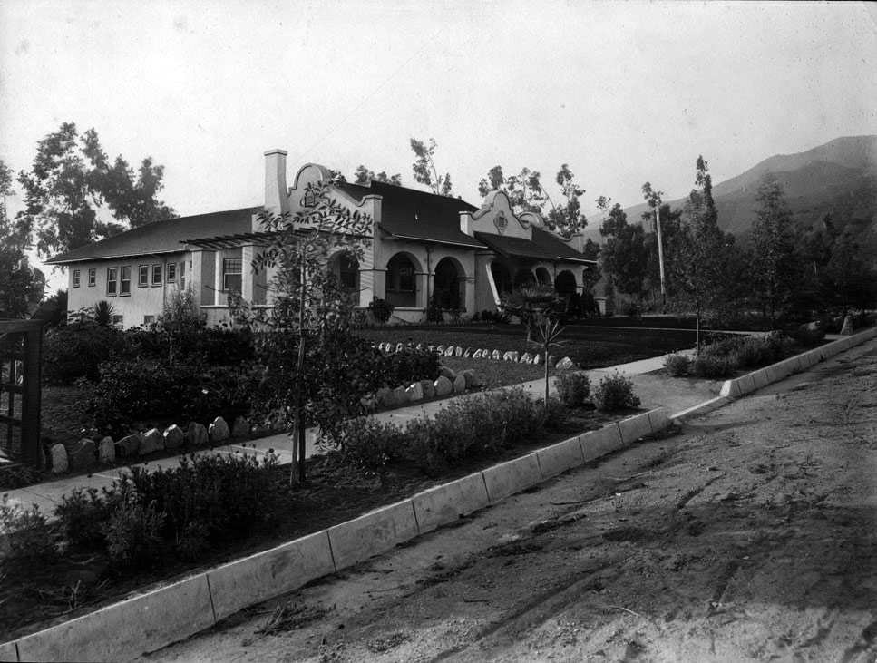
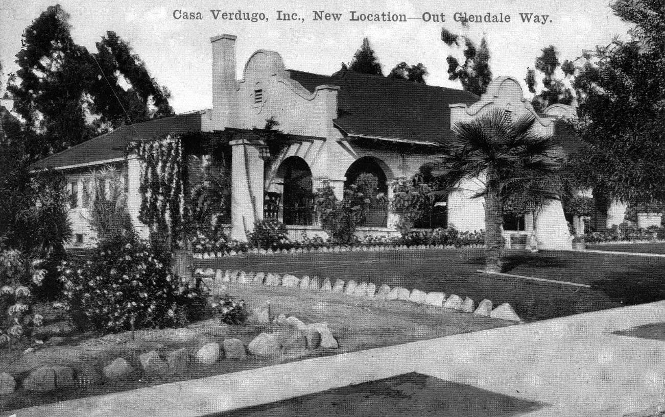
| (1910)^v^ – "New Location--Out Glendale Way". Postcard view showing the ‘New’ Casa Verdugo Restaurant. |
Historical Notes When Piedad Yorba Sowl moved her restaurant around the corner (literally) after the Pacific Electric Railway declined to renew her lease in 1910, she had a set of postcards printed featuring the new location. This is the first one. |
 |
|
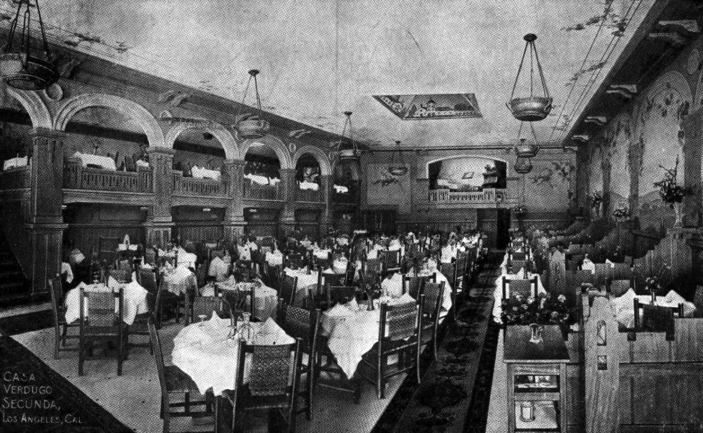
| (ca. 1914)** – Postcard view showing the interior dining area of the Casa Verdugo Segunda. |
Historical Notes Piedad Yoba de Sowl’s new Casa Verdugo brought the same charms that were so successful to Casa Verdugo vieja. As before, diners could choose indoor or al fresco dining. Those choosing indoor seating had their choice of a series of charming spaces, each with its own unique name and personality such as the Indian, the Red or the Green Room. And to make sure diners didn’t have to rely on the hated Pacific Electric to visit the Casa, de Sowl had a beautiful garage constructed, that housed any number of visiting machines in Mission-styled splendor. Piedad Yoba de Sowl was such a success she opened a “Casa Verdugo Segunda” at 736 South Spring Street in 1913 so diners in downtown Los Angeles could enjoy the same style food and service found “Out Glendale Way.” Operating in this location until April of 1921, de Sowl and the Pacific Electric both sold out to a consortium of three school teacher sisters, Ida , Jeannette and Myrtle Baldwin from Dayton, Ohio. The combined transaction for the two properties being described as the largest real estate deal to date in Glendale area for the considerable sum of $100,000. The Casa Verdugo name remained a potent one in L.A. restaurant up into the 1960’s. By that time, however, Piedad Yorba de Sowl had long passed, dying at the age of 84 in 1948. Her former home and restaurant, however, has survived, an accomplishment as remarkable as the woman herself, and remains today a treasured landmark in northern Glendale (1235 North Louise Street at the corner of Randolph).^* Click HERE for contemporary view. |
Casa Adobe de San Rafael
 |
|
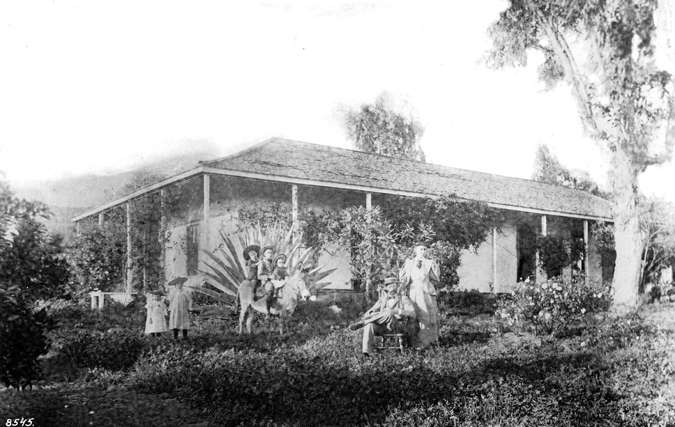
| (1895)^^ - Photographic portrait of Charels and Nellie Bogue in front of the former home of Tomas Sanchez in Glendale. The one-story adobe, located on the back of the Verdugo Ranch one half-mile west of Brand Boulevard, is shown at center, featuring a wrap-around patio and overhang. In the yard in front, Charles is shown seated to the left with Nellie standing at his side. At center, three boys in bolero dress identified as the children of "Charles and John" sit astride a burro while two girls identified as "Ruth and Helen" are pictured in lightly colored dressed farther left. Sanchez lived at the residence between 1872 and 1875. |
Historical Notes In October 1784, José María Verdugo petitioned Pedro Fages, Governor of Alta California, for a grant of land. This grant was the first and one of the largest made. When parts of Rancho San Rafael were sold, Tomás Sánchez, Sheriff of Los Angeles County, purchased a tract of 100 acres and in 1865 built this artistic adobe of the hacienda type, restored in 1932. |
 |
|
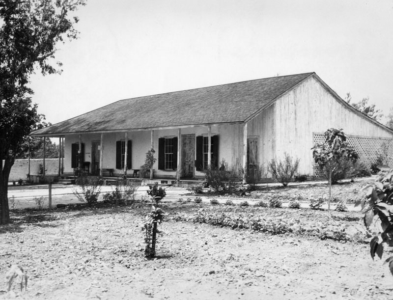
| (1936)^ - Exterior view of the Tomas Sanchez adobe, La Casa Adobe de San Rafael, Glendale, in June 1936, following restoration in 1932. The photo shows its Monterey-style corridor (covered porch). It was built by Tomas Sanchez, sheriff of L.A. County, in 1849 on Rancho San Rafael land owned by Fernando and Rafaela Verdugo. |
Historical Notes Casa Adobe de San Rafael has been designated a California Historical Monument (No. 235). It is located in a city park and is now furnished with furniture, cooking utensils and other relics of its time. Location:1330 Dorothy Dr, Glendale. |
Glendale Hotel (later Glendale Sanitarium, Glendale Adventist Health Center)
 |
|
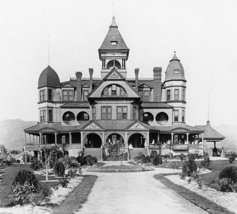
| (1895)* - View showing the Glendale Hotel, shown here when it was a school for girls. It was located on what is now Broadway Avenue. |
Historical Notes During the area's first little boom, the Hotel Glendale was built at a cost of $60,000 in 1887-1888. It was a grandiose structure, but it didn't even open! The boom busted too fast, and the hotel became a school (St. Hilda's Hall, School for Girls). It later became the Glendale Sanitarium until 1924 when the building was razed.* |
.jpg) |
|
| (1895)* - View showing the Glendale Hotel, shown here when it was a school for girls. It was located on what is now Broadway Avenue. Image enhancement and colorization by Richard Holoff |
 |
|
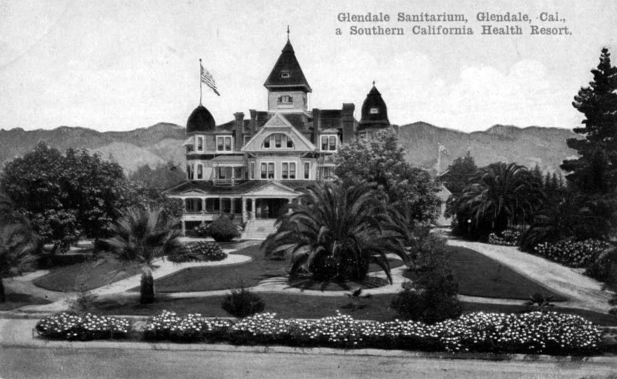
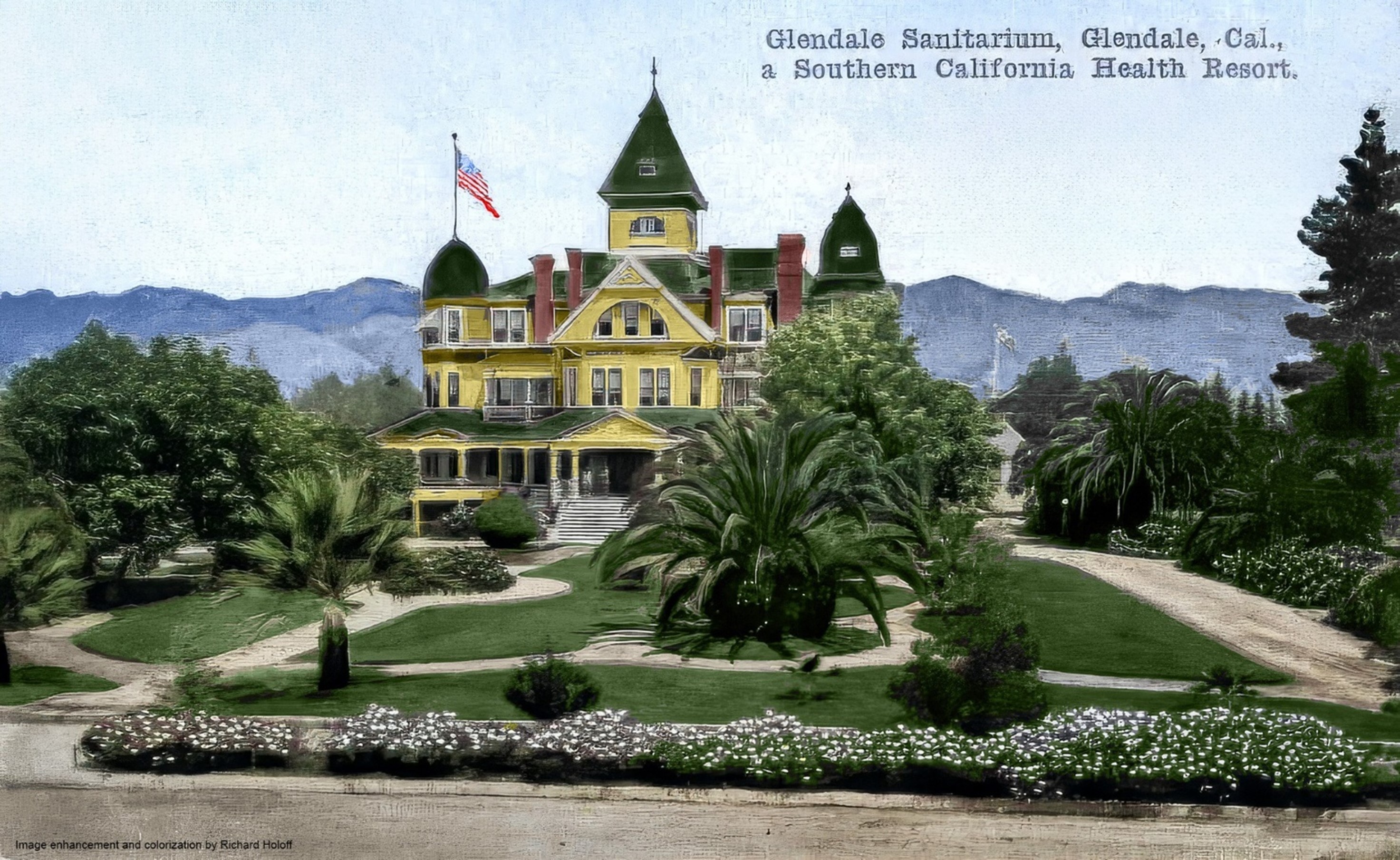
| (ca. 1910)* – View looking at the Glendale Sanitarium with the Verdugo Mountains in the background. Title reads: “Glendale Sanitarium…a Southern California Health Resort” |
Historical Notes Glendale Sanitarium opened in 1905, a year before Glendale was incorporated as a city. It occupied the beautiful 75-room Victorian structure (Hotel Glendale) and stayed until moving out in 1924 to a new location at 1509 Wilson Terrace. There it evolved into the well-known Glendale Adventist Health Center that exists today. |
 |
|
| (ca. 1910)* – View looking at the Glendale Sanitarium with the Verdugo Mountains in the background. Title reads: “Glendale Sanitarium…a Southern California Health Resort”. Image enhancement and colorization by Richard Holoff |
* * * * * |
Casa Verdugo Community
 |
|
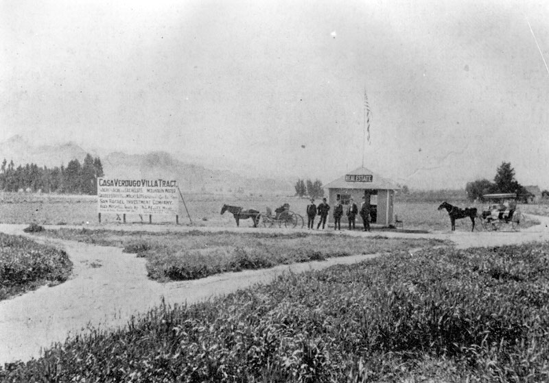
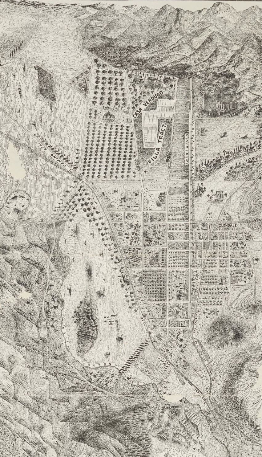
| (ca. 1900)^ - Panoramic view of a real estate development sign and office, with horses and carriages. The development is called "Casa Verdugo Villa Tract" and is offered by San Rafael Investment Company. |
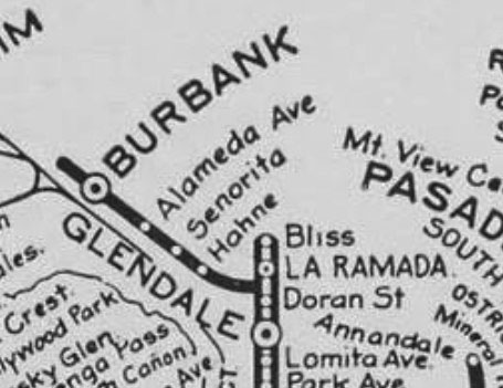
Historical Notes CCasa Verdugo was originally a part of the Rancho San Rafael land grant that was given to Jose Maria Verdugo in 1784. Verdugo’s granddaughter, Rafaela Verdugo de Sepulveda, subsequently owned the land after the Great Partition in 1871. In 1883 the real estate firm Wicks, Wright, Hodgkins, and Watts purchased 500 acres of land from Valentine Mand, which included the Sepulveda Adobe. A portion of the property was sold to clergyman George Baugh in 1886 who subdivided the tract and lived in the Sepulveda Adobe with his family. In 1900, Baugh sold the property to J.D. Bliss who with the help of his brother operated Bliss Ranch on the property. Finally, in 1903 Leslie Brand, who would become a civic leader in Glendale, purchased Bliss Ranch and 175 acres of surrounding land. In 1904, Brand sold a stake of the tract to Henry Huntington, the owner of the Pacific Electric Railway Company. This resulted in the creation of the Glendale line that ran from downtown Los Angeles to Broadway in Glendale. At the time, the Los Angeles Interurban Railway served as the operator, which was later succeeded by the Pacific Electric Railway. In November 1904, the line was extended a half-mile north along Brand Boulevard to Mountain Street.** |
The 'Red Car' comes to Glendale
 |
|
| (1906)^ - View showing one of the Pullman “Flyers” of the Pacific Electric Railway Co. leaving the grand depot, 6th and Main streets, on one of the regular thirty-three daily trips to Casa Verdugo. Photo was published in a real estate promotional brochure put out by San Rafael Investment Co. |
Historical Notes The Glendale Line was pioneered by L.C. Brand and associates starting in October, 1902, through their corporation, "The Los Angeles & Glendale Electric Railway". On June 29, 1903, Brand received a franchise from the Los Angeles City Council for an electric railway line running from Los Angeles to Glendale. The franchise was soon sold to Henry E. Huntington, owner of Pacific Electric Railway Co., who would bring the "Red Cars" to Glendale by 1904 under the name of Los Angeles Interurban Railway (later changed to Pacific Electric). A 1906 San Rafael Investment Co. and Pacific Electric Railway promotional brochure reads: The fame of this ride, decidedly the most picturesque to any suburb, attracts thousands of tourists, requiring many additional cars on Sundays and holidays, while the hundreds of commuters going daily to and from business and home are rapidly increasing in numbers. The passage through the city, passing Central Park, traversing Figueroa Street, Lake Shore Drive (today, Glendale Blvd.), skirting Echo Park, through Edendale and the Pass between Elysian and Griffith Parks to the point where the most enchanting of all valley panoramas burst upon the view, is accomplished in fifteen minutes. The scene is framed on the north, in ascending order, by the San Rafael hills, Verdugo mountains and the San Gabriel range, showing Mts. Lowe and Wilson in the foreground, while far to the east Mt. Cucamonga’s dome and the other snow-capped peaks of the San Bernardino mountains rising eight thousand and nine thousand feet are discovered. The flight along the borders of Griffith Park, over the trestles spanning Los Angeles River, and through Tropico to the fine depot at Brand Boulevard and Fourth Street (today, Broadway), Glendale occupies but ten minutes. Here, midway the broad valley, its beauties and surpassing advantages are fully realized. But five minutes are required for the remainder of the trip down the center of Brand Boulevard, a thoroughfare 130 feet in width, flanked by seventy-two monoliths, eleven and one-half feet high, capped by electric lights, with the space between the broad cement walks and curbs filled by graceful palms, on to Mountain Avenue. Here at the end of the line is found the choicest residential portion of the valley, at the foothills. This is not a picture of a dissolving view, but one as eternal as the everlasting hills.* |
 |
|
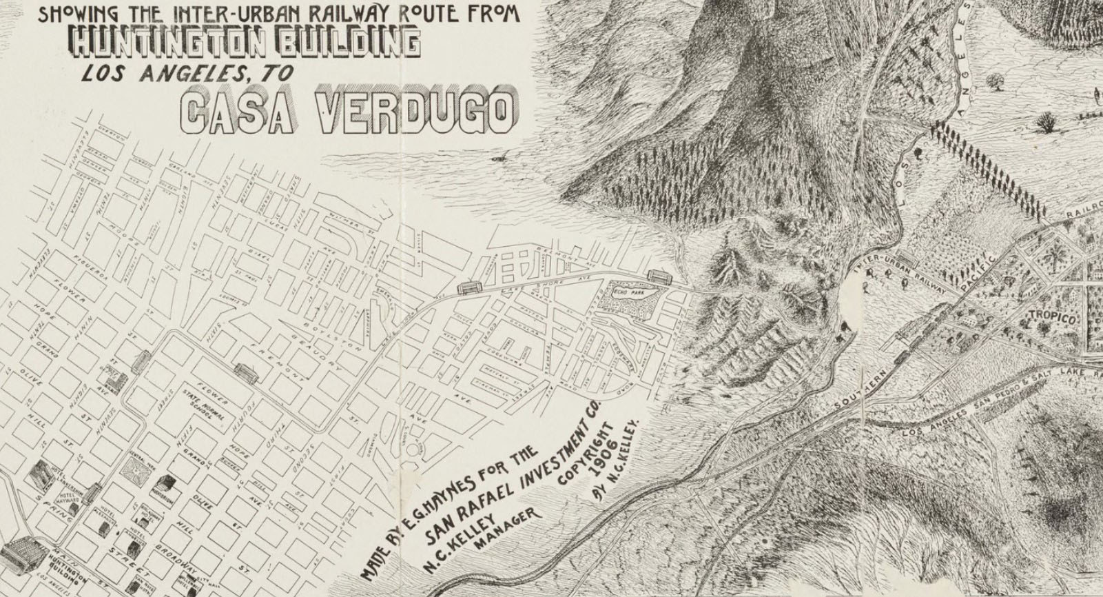
| (1906)^ – Map showing the Inter-Urban Railway route from the Huntington Building (aka Pacific Electric Building), located at 6th and Main streets, to Casa Verdugo at Brand Blvd and Mountain Ave. |
Historical Notes The Inter-Urban streetcar route began at the Huntington Building (aka Pacific Electric Building) in downtown Los Angeles, passing Central Park, traversing Figueroa Street, Lake Shore Drive (today, Glendale Blvd.), skirting Echo Park, through Edendale and the Pass between Elysian and Griffith Parks, over the trestles spanning Los Angeles River, through Tropico and then down the center of Brand Boulevard to the depot at Brand Boulevard and Fourth Street (today, Broadway), and finally further north on Brand to the end of the line at Mountain Avenue, the location of Casa Verdugo. |
 |
|
| (1904)* - Panoramic view looking north toward Glendale along the Pacific Electric line through the Edendale Cut. |
Historical Notes The Edendale Cut was an unpaved road (some of which is now known as Silver Lake Ct.) and was the former route of the Glendale and Burbank interurban railway lines operated by Pacific Electric. The line crossed Fletcher Drive over a viaduct before continuing along a hillside ledge to the Monte Sano stop at Glendale Blvd. and Riverside Drive. |
 |
|
| (1904)* - Panoramic view looking north toward Glendale along the Pacific Electric line through the Edendale Cut. Image enhancement and colorization by Richard Holoff. |
Historical Notes The Edendale Cut was part of the Pacific Electric's Glendale-Burbank Line, which had one terminus in Downtown LA and the other in Burbank, passing through Edendale/Silver Lake along the way. The cut was a deep trench carved through the hills to allow the rail line to pass through the area without steep grades. Homes and other buildings lined the sides of the cut, with the rail line running through the bottom. In 1960, many of these homes were demolished to make way for the construction of the Glendale (2) Freeway, which followed a similar route through the cut. Today, remnants of the old rail line like bridge footings and dirt paths can still be seen in the area, serving as reminders of LA's once-extensive rail network. |
 |
|
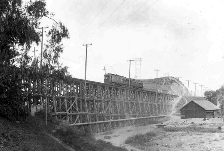
| (Early 1900s)^ – View showing two PE cars of the LA-Glendale Interurban Railway (owned by Pacific Electric) on top of the Fletcher Drive timber bridge. |
Historical Notes In 1904, a nearly 454 foot long bridge, the Fletcher Viaduct, was built by Pacific Electric over Fletcher Drive, which ran forty feet below. The viaduct stood until 1928 when it was replaced by a steel structure bridge. Click HERE to see more. |
 |
|
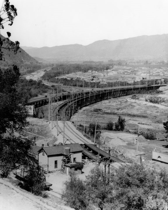
| (Early 1900s)^ – View looking towards the Pacific Electric LA-Glendale Interurban bridge at Glendale Boulevard running over the Los Angeles River, showing Griffith Park (left), Atwater Village, Tropico and Glendale. |
 |
|
| (1906)^* – Birdseye view of Casa Verdugo Villa Tract and streetcar route which terminated at Brand Boulevard and Mountain Avenue, in front of the Casa Verdugo Restaurant. |
Historical Notes As a result of transportation innovations and the success of the restaurant, a commercial district was created in the Casa Verdugo neighborhood at the corner of North Central Ave. and West Stocker St. A theatre, various stores, a school, and a post office were established in the area, providing a solid economic foundation and increasing population growth that spurred residential construction. A flurry of developers, companies, and individuals participated in the purchase and subdivision of tracts in Casa Verdugo. The development of Casa Verdugo was not the effort of any single developer or builder, but rather a number of individuals who produced a network of various tracts. Real estate investor James Wyvell played an active role in the subdivision and development of the neighborhood. From 1906 to 1908, Wyvell subdivided and sold a number of tracts both within and surrounding the proposed district. This included land adjacent to the Casa Verdugo restaurant property and lots sold as home sites to individuals. Wyvell’s own Casa Verdugo tract and the Casa Verdugo Villa tract spoke to the growing identity of Casa Verdugo as its own distinct community. ^^ Within a few years of the Casa Verdugo restaurant opening a small community had developed and called itself Casa Verdugo after the restaurant. A commercial district grew along Brand Boulevard and Central Avenue, including a department store, groceries, a meat market, hardware store, drug store, the Mission Theatre and a post office where tourists could have their picture postcards of the restaurant postmarked “Casa Verdugo, California.” The droves of tourists, and the postcards they mailed home, helped make Casa Verdugo a well-known destination throughout the country; visitors had to see the missions, the Mt. Lowe Railway, Santa Catalina Island and the famous Casa Verdugo. ^ |
Bliss
 |
|
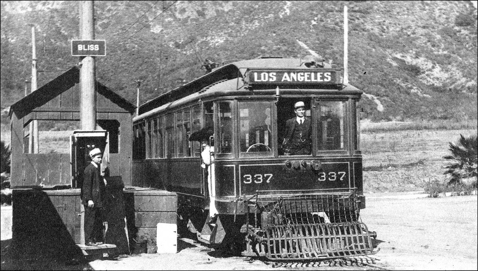
| (1909)* - All Aboard! Bliss to Los Angeles Line, 1909. Note the woman with the long white dress and huge hat. Also, the grill at the front (aka 'Cow Catcher'—it was a protective measure to prevent anyone (or anything) from falling underneath. |
Historical Notes Bliss was named for Bliss Ranch, owned by brothers John Dallett Bliss and Robert Parker Bliss from about 1894 to 1900, when LB Brand bought the property. He then sold a tract to Huntington for Pacific Electric. The Bliss stop was at the base of the Verdugo mountains, just after the Casa Verdugo stop (corner of Brand Boulevard and Mountain Street). |
 |
|
| (Early 1900s)+^^ - Old rail map showing the Bliss Station located om north Glendale, today's intersection of Brand Boulevard and Mountain Street (concrete base is still there). |
 |
|
| (1912)#* – Panoramic view of Glendale, looking west from Jackson Street, showing the extent to which the area had grown. |
Historical Notes Glendale, the Casa Verdugo community, and surrounding area experienced a significant growth spurt beginning around 1904, due in large part to the arrival of the Pacific Electric line. Casa Verdugo held on to the unique identity that emerged during this time and refused to annex to the city of Glendale for sixteen years. Opponents desired an independent city while those in favor wanted the advantages of utilities and services offered by the larger city. In March of 1926, a vote for annexation passed and Casa Verdugo officially became a part of the city of Glendale on April 17, 1926. |
Brand Boulevard
 |
|
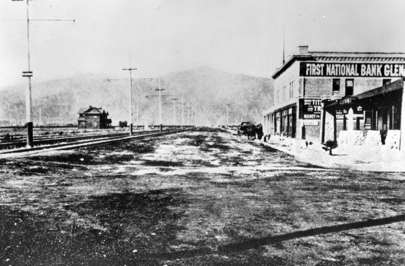
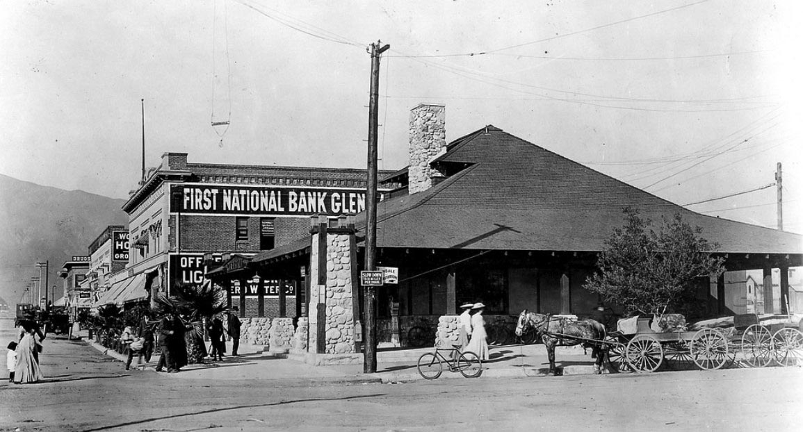
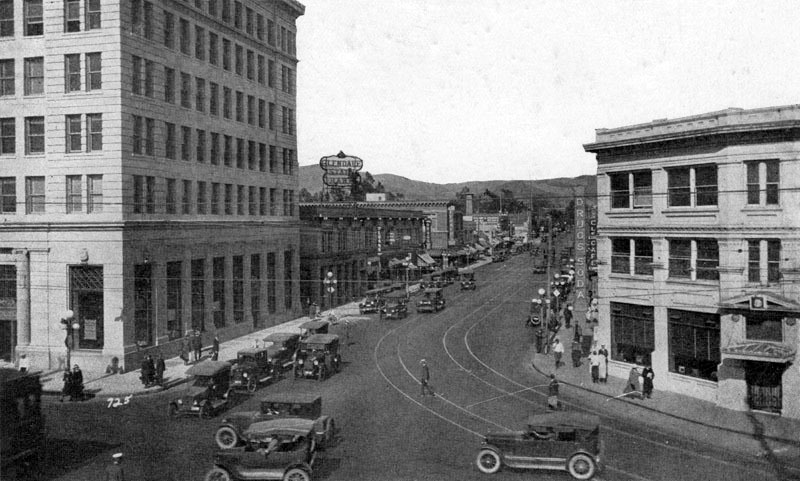
| (ca. 1905)^ - Early panoramic view looking north on Brand Boulevard at Fourth Street (later Broadway) with the First National Bank of Glendale seen at right. Rail tracks run north and south on Brand with electric power poles in the middle of the street. To the far right (N/E corner) stands the Pacific Eelctric station. |
Historical Notes Brand Boulevard was named after Leslie Coombs Brand, “The Father of Glendale”. Brand was an important civic booster who built an estate in 1904 called El Miradero featuring an eye-catching mansion whose architecture combined characteristics of Spanish, Moorish, and Indian styles (today’s Brand Library and Art Center). His most important contributions to Glendale, though, was when he partnered with Henry E. Huntington to bring the Pacific Electric Railway, or the "Red Cars," to the area also in 1904. The First National Bank of Glendale seen above was the city’s second bank. It was founded by Leslie Brand in 1905. Brand's friend and business partner, Dan Campbell, served as the bank's vice president and manager. |
 |
|
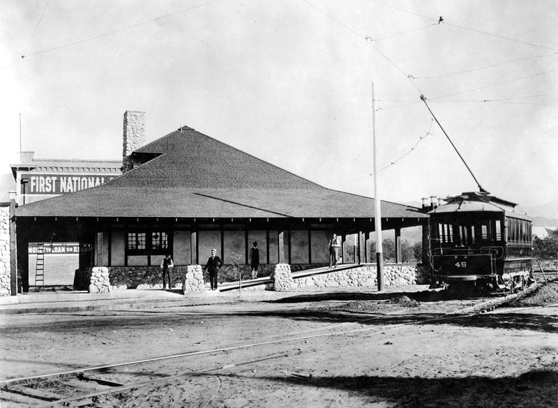
| (ca. 1906)^ - Early view of the Pacific Electric station in Glendale with car on track. First National Bank of Glendale, the first brick building in town, is seen behind the depot. |
Historical Notes The Glendale Line was pioneered by L.C. Brand and associates starting in October, 1902, through their corporation, "The Los Angeles & Glendale Electric Railway". On June 29, 1903, Brand received a franchise from the Los Angeles City Council for an electric railway line starting at the Southern Pacific's Arcade Station at Fifth, Central & Ceres Street in Los Angeles via Ceres, Sixth, Olive, Seventh, Figueroa, Second, Lake Shore Ave. (Glendale Boulevard) to Sunset Boulevard, and then northerly to the city limits. In Glendale, the line was to enter via a new thoroughfare, Brand Boulevard, thus creating a new business artery to the west of the then central business section on Glendale Ave. where the steam trains of the Los Angeles Terminal Railroad (U.P.) offered the only transportation via rail to the city. Brand's company commenced grading on above route in September, 1903 and continued into the spring of 1904. On March 11, 1904, however, Brand sold out to the Los Angeles Interurban Railway Company (LAIU), a Huntington-PE affiliate. The LAIU pushed the road through to completion and the first electric car entered Glendale on April 6, 1904, but a formal celebration was not held until July 2 when great crowds gathered for a Mexican barbecue. A Station was erected in Glendale on the corner of Brand Boulevard & Broadway (seen above).^ |
 |
|
| (1911)* – Panoramic view showing the corner of Brand Boulevard and Fourth Street (now Broadway) with the Pacific Electric depot in the foreground and the First National Bank of Glendale behind it. Horse-drawn wagons and a bicyle are parked by the curb in front of the depot. |
Historical Notes The Glendale Line was soon extended east on Broadway to Glendale Avenue where all cars terminated for a short time. Los Angeles Interurban Railway Company (LAIU) acquired the historic old Verdugo ranch house, more than a hundred years old, in 1904; this was located in North Glendale at the foot of the mountains and LAIU restored the ruins, making Casa Verdugo into one of Los Angeles' most popular restaurants. To serve this new tourist attraction, the Glendale Line was extended up Brand Boulevard to Mountain Avenue in 1904 with very frequent service offered from Sixth & Main Station, Los Angeles.^ |
 |
|
| (1911)* – Panoramic view showing the corner of Brand Boulevard and Fourth Street (now Broadway) with the Pacific Electric depot in the foreground and the First National Bank of Glendale behind it. Horse-drawn wagons and a bicyle are parked by the curb in front of the depot. Image enhancement and colorization by Richard Holoff |
 |
|
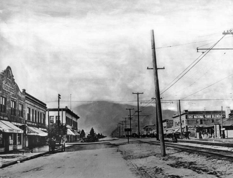
| (ca. 1910)^^ – View looking north in the 400 block of Brand Boulevard, Glendale. Railway tracks and electric wires run up the middle of the dirt road. Commercial structures on both sides of the street are principally two-stories in height. Horse-drawn wagons are parked along both curbs. First National Bank Glendale can be see at right. |
 |
|
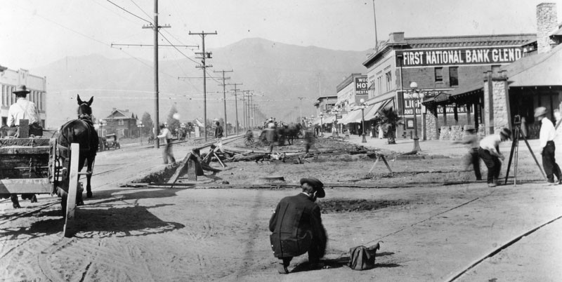
| (ca. 1910s)^ - View is looking at Brand Boulevard, north of Broadway. Work is being done on the right side of the road. Several businesses are seen including the First National Bank, Glendale building on the right. |
 |
|
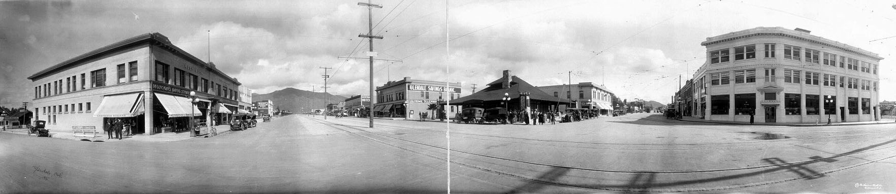
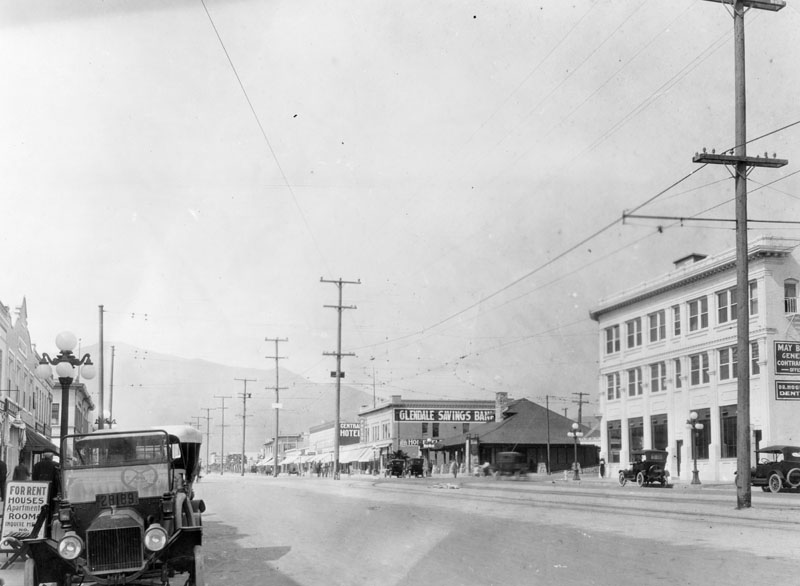
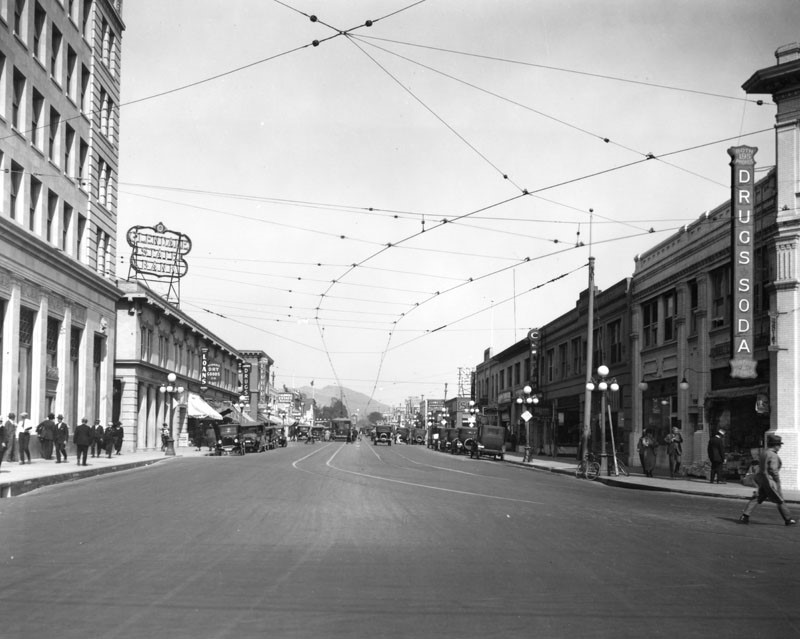
| (ca. 1915)^ - Panoramic view of Glendale showing the Pacific Electric Railway running north and south on Brand Boulevard with Glendale Savings Bank (previously First National Bank Glendale) on at center-right. |
 |
|
| (ca. 1915)^ - Panoramic view of Glendale showing the Pacific Electric Railway running north and south on Brand Boulevard with Glendale Savings Bank (previously First National Bank Glendale) on at center-right. Image enhancement and colorization by Richard Holoff |
 |
|
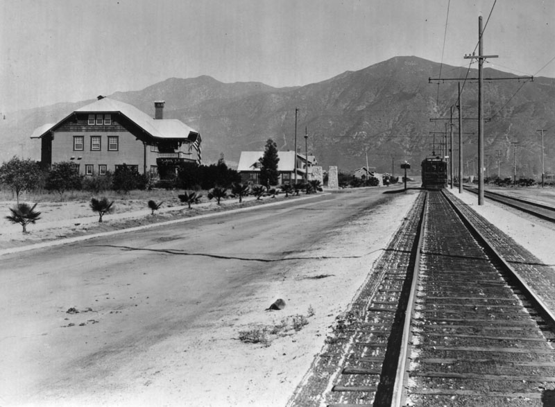
| (1915)^ - View of north Brand from Lexington. The railroad train, "Los Angeles line" makes its way up Brand. Large residential homes can be seen on the left. |
 |
|
| (1919)^ - View of Brand and Lexington and the surrounding area. The Glendale Press building is on the left. The train in the distance is stopped to pick up passengers waiting along the way. |
 |
|
| (ca. 1919)^ – View of Brand Boulevard from Wilson Avenue, looking north. Various businesses are seen on both sides of the road with railroad tracks running down the center of this wide street. |
 |
|
| (ca. 1920)^ – View looking north on Brand from Broadway. Glendale Savings Bank (previously First National Bank) can be seen in the distance. Electric car posts and wires fill the middle of the street. |
Then and Now
 |
|
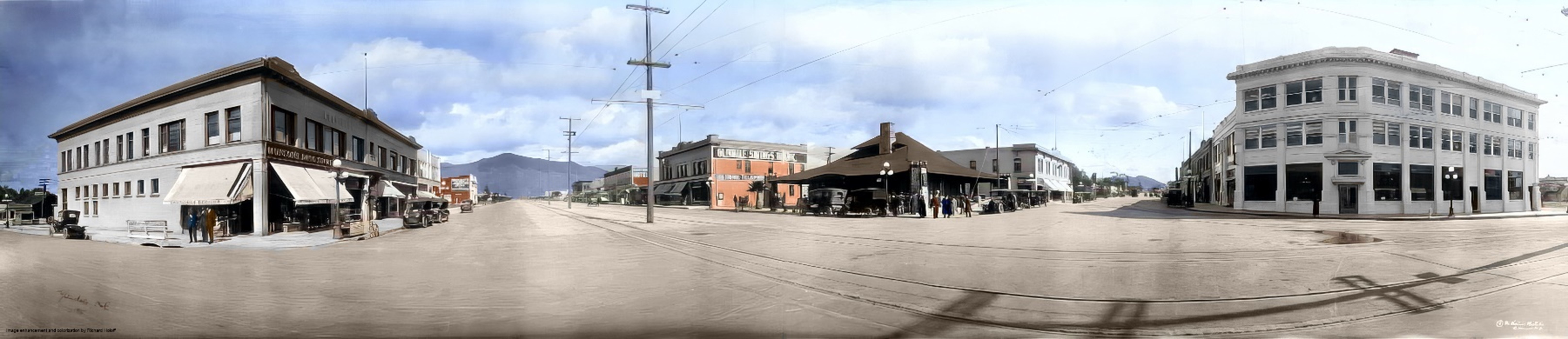
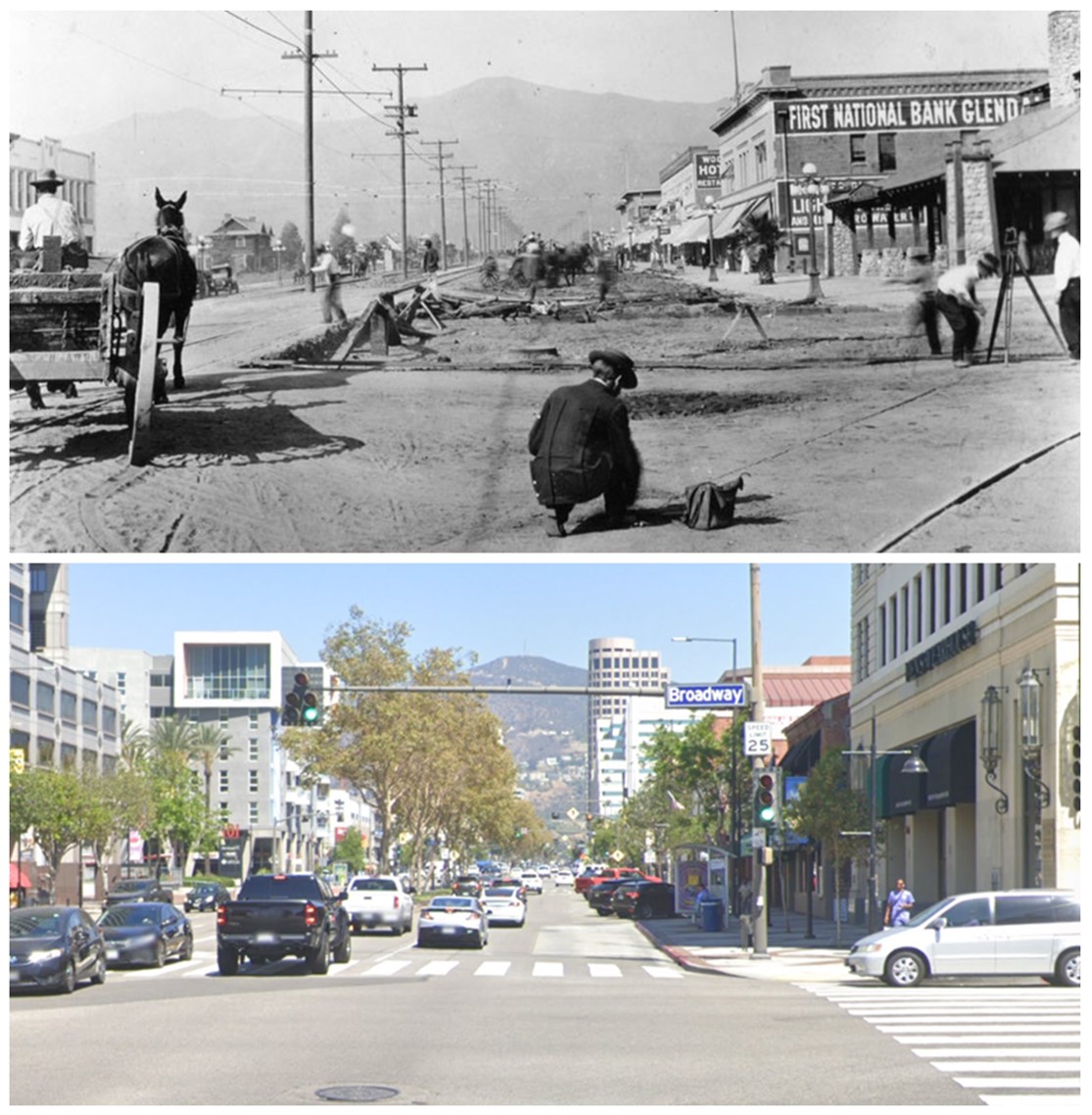
| (1911 vs 2022)* - Looking north on Brand Boulevard at Broadway. |
 |
|
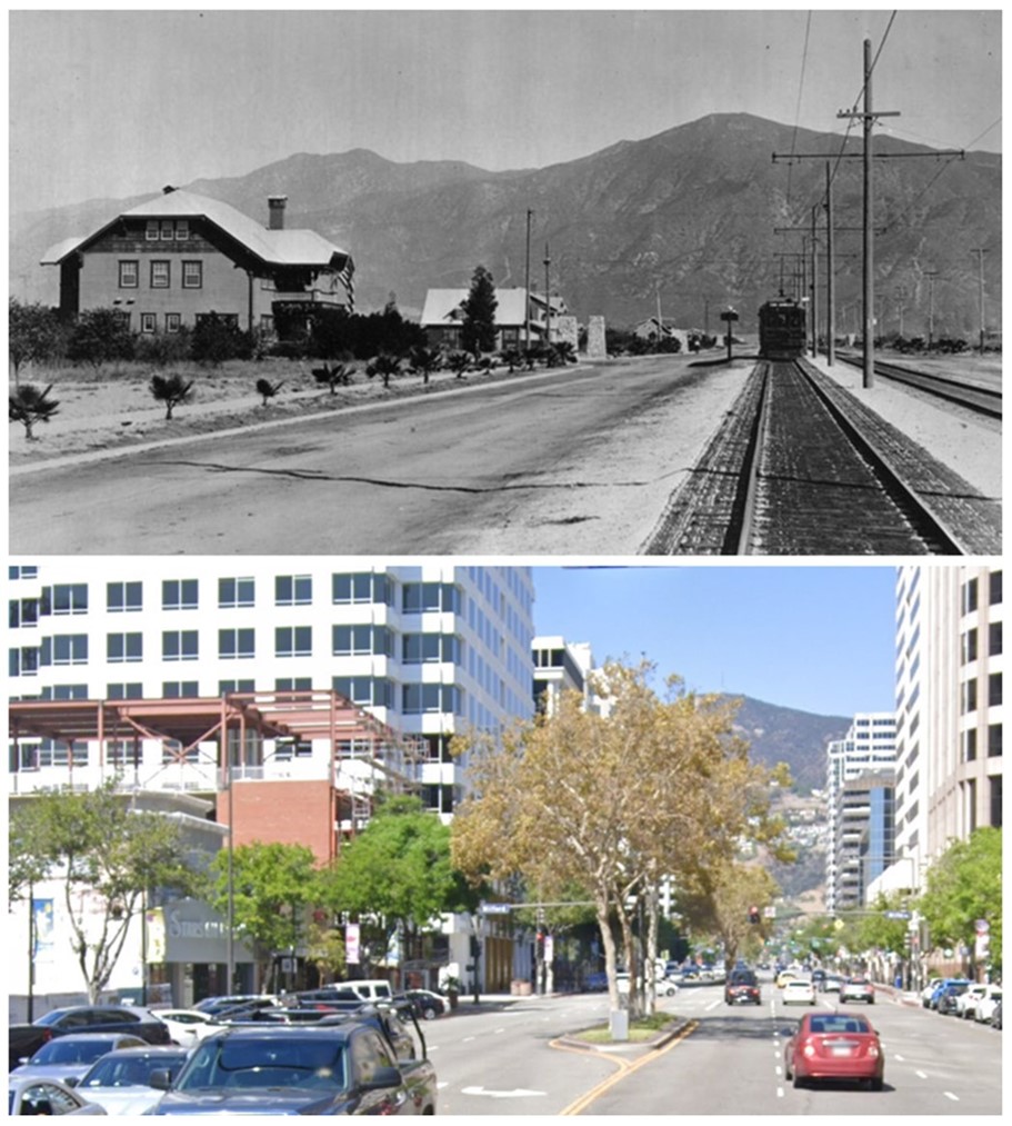
| (1915 vs 2022)* - Looking north on Brand Boulevard from Lexington Drive. |
Historical Notes Click HERE to see more Early Views of Brand Boulevard (1920 +) |
Life in Early Glendale
 |
|
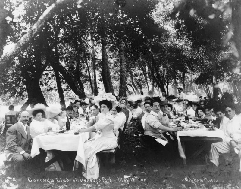
| (1908)^ - A picnic for the Concordia Club, a social group, at Verdugo Park in Glendale. |
 |
|
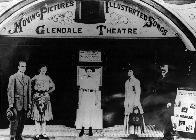
| (1910)^ - Three women and two men standing in front of the Glendale Theater. This is Glendale's first movie & vaudeville house. |
| (ca. 1906-1918)***^ - The Glendale Transfer and Express Company's moving truck in Glendale. |
Historical Notes Note the two phone numbers at the top of the truck (S.S. 82 and HOME 682). Between 1906 and 1918, the San Fernando Valley Home Telephone Company and Sunset Telephone both operated in the Glendale area. Unfortunately, neither was compatible with the other therefore requiring patrons to have two lines--one for each company. |
 |
|
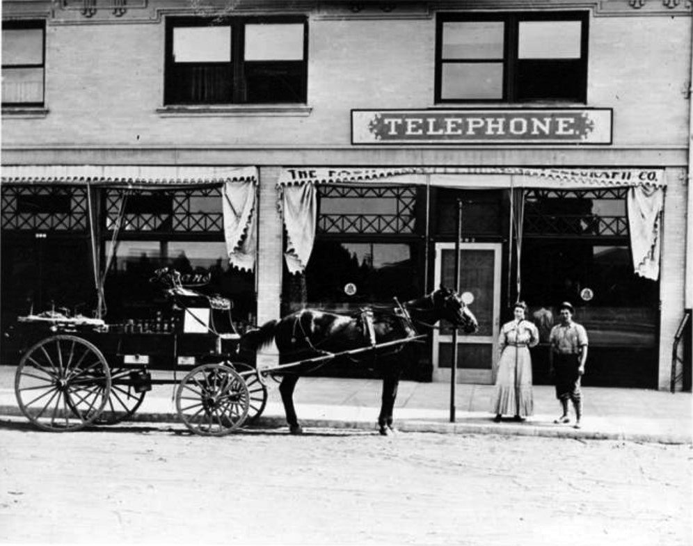
| (1914)***^ - View showing the Home Telephone Company office, located at 302 Brand Boulevard in Glendale. A state-of-the-art telephone maintenance vehicle is visible in the foreground. |
Historical Notes In 1909, L. C. Brand invested heavily in the Home Telephone Company and installed new switchboards in company office at the Central Hotel Building on Brand Boulevard.***^ |
 |
|
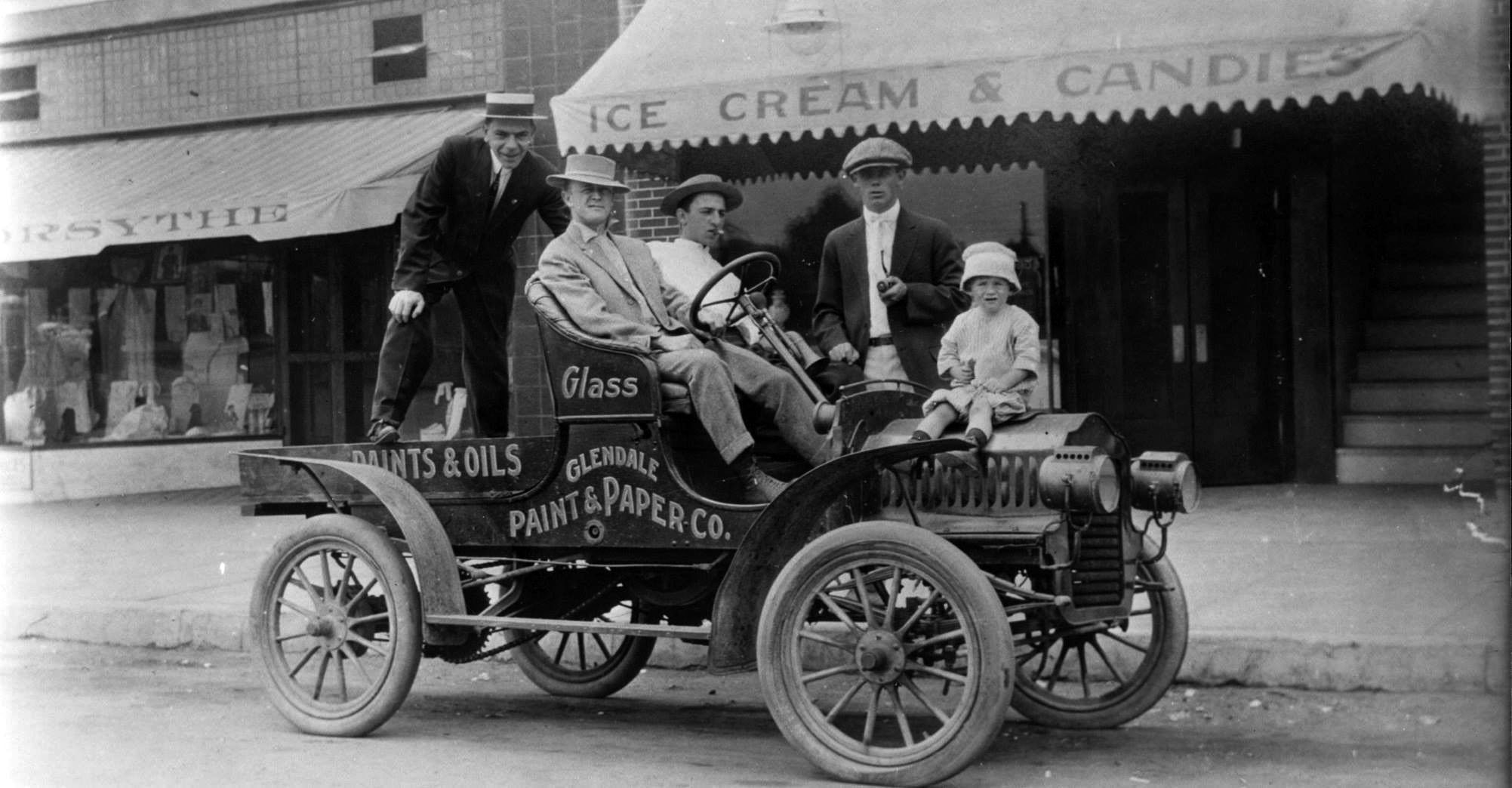
| (1913)+++ – View showing a group of men and a child posing on an early model car in Glendale. Sign on the side of car reads: “Glendale Paint & Paper Co. |
 |
|
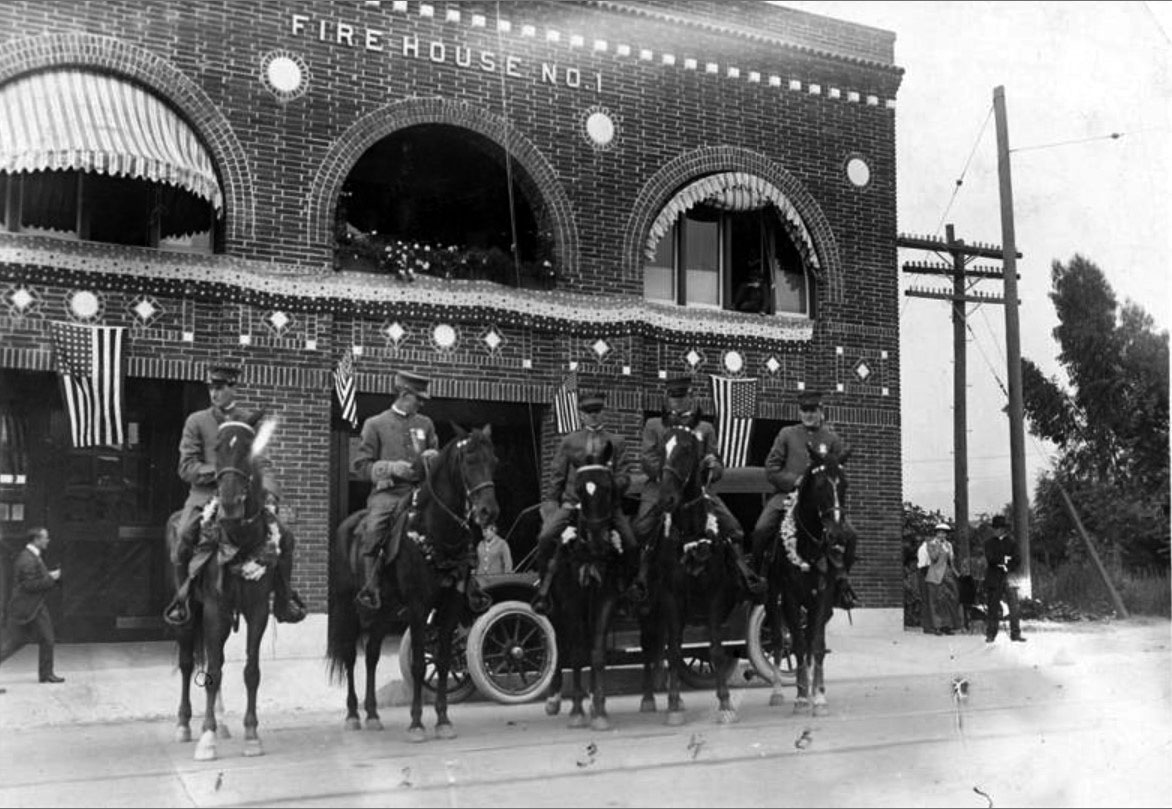
| (1916)***^ - View showing the police force of Glendale mounted on horseback in front of Fire House No. 1, located on Broadway between Louise and Kenwood Streets. (left to right) Emil Schroeder; Henry Hollenbeck; George Herald, Marshall & Fire Chief; Ernest Lawrence; Claire V. Arrington. |
Historical Notes From 1913 to 1918, the Glendale police and fire departments operated as a single entity out of Fire House No. 1 on Broadway between Louise and Kenwood Streets. Police officers and firemen were often required to perform double-duty when needed. In the upper right window are the twin sons of George Herald: Frank and George, Jr.***^ Click HERE to see more Early Views of the Glendale Police Department (1919 +) |
 |
|
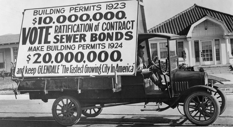
| (1923)^ - Glendale, incorporated as a city in 1906, by 1910 had a population of 2,742. In 1920 it had increased by 39%, to 13,576, creating "the fastest growing city in America." Here a truck bears a sign urging ratification of sewer bonds to enhance the awarding of building permits. |
 |
|
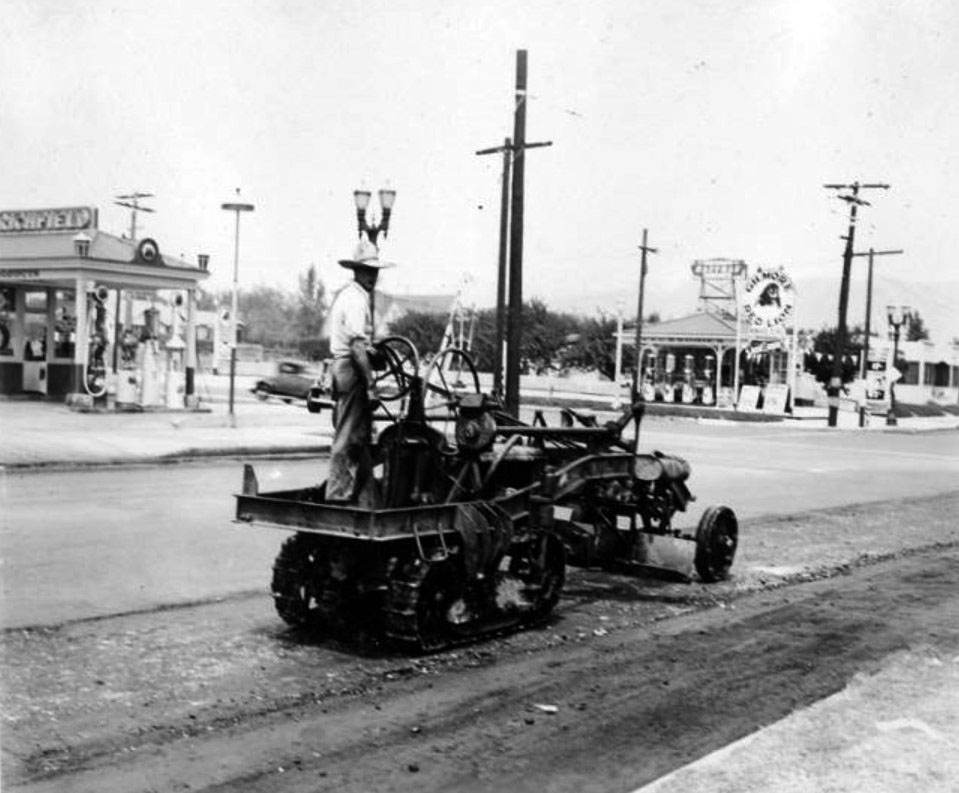
| (ca. 1930)***^ – View showing street paving in Glendale. A Richfield gas station and a Gilmore Red Lion gas station are visible in the background. |
 |
|
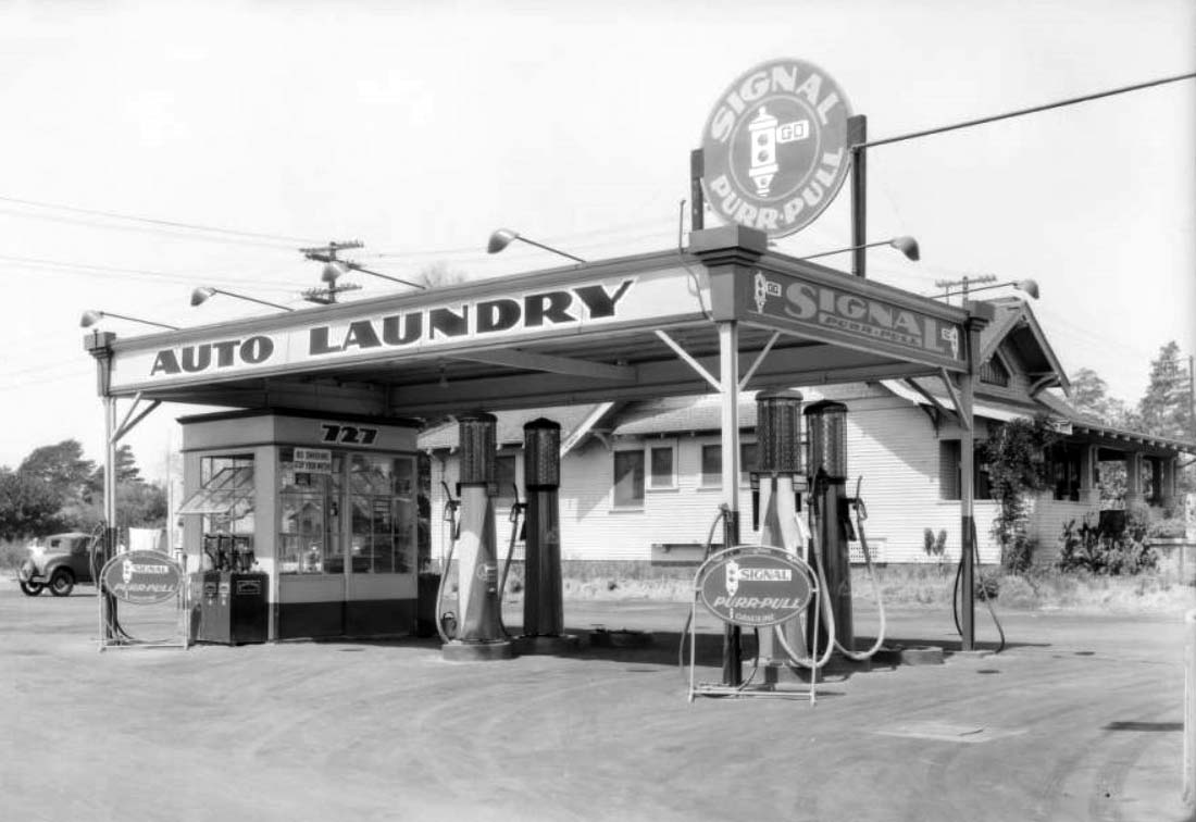
| (1931)^^ – Close-up view showing a 4-pump Signal Service Station in Glendale. Large signs reads Auto Laundry – Signal Purr-Pull. Click HERE to see more Early Views of Gas Stations. |
* * * * * |
Glendale Avenue
 |
|
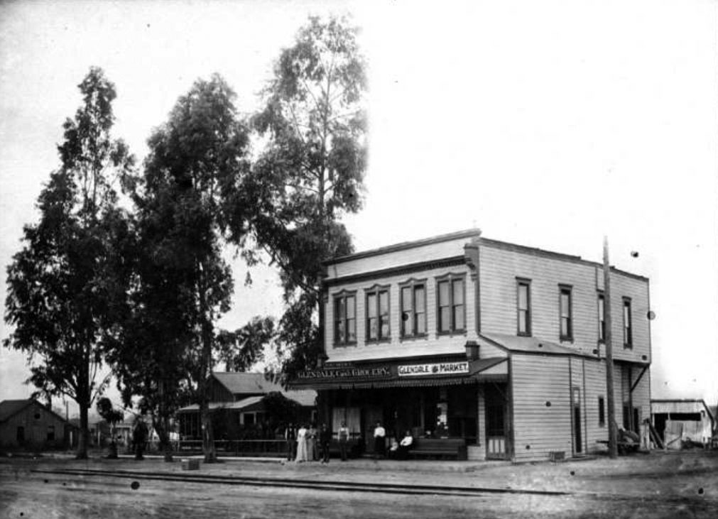
| (1895)***^ - View of the Glendale Market and the Glendale Cash Grocery Store on the southwest corner of Crow Avenue (now Glendale Avenue) and 3rd Street (now Wilson Avenue) in Glendale. The lean-to at the right corner was the local barbershop. Visible in the foreground are the train tracks that ran through the center of town connecting Glendale with downtown Los Angeles. |
 |
|
| (ca. 1900)##^ – A group of people pose in front of Al Oliver’s Barbershop located on the southwest corner of Everett Street and Wilson Avenue in Glendale. |
 |
|
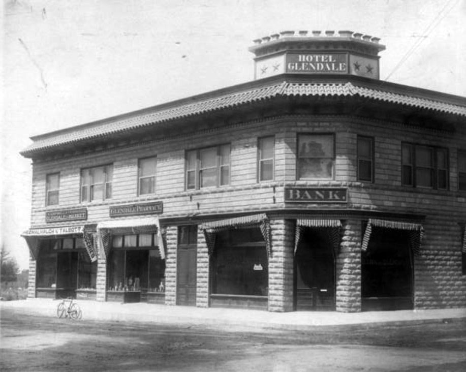
| (1905)***^ – View showing the Hotel Glendale located on the northwest corner of Glendale and Wilson Avenues (then Crow Avenue and 3rd Street). Glendale Bank occupies the ground floor. |
Historical Notes The Glendale Bank was the first bank in Glendale. The building was constructed by Mr. Ayers.***^ |
 |
|
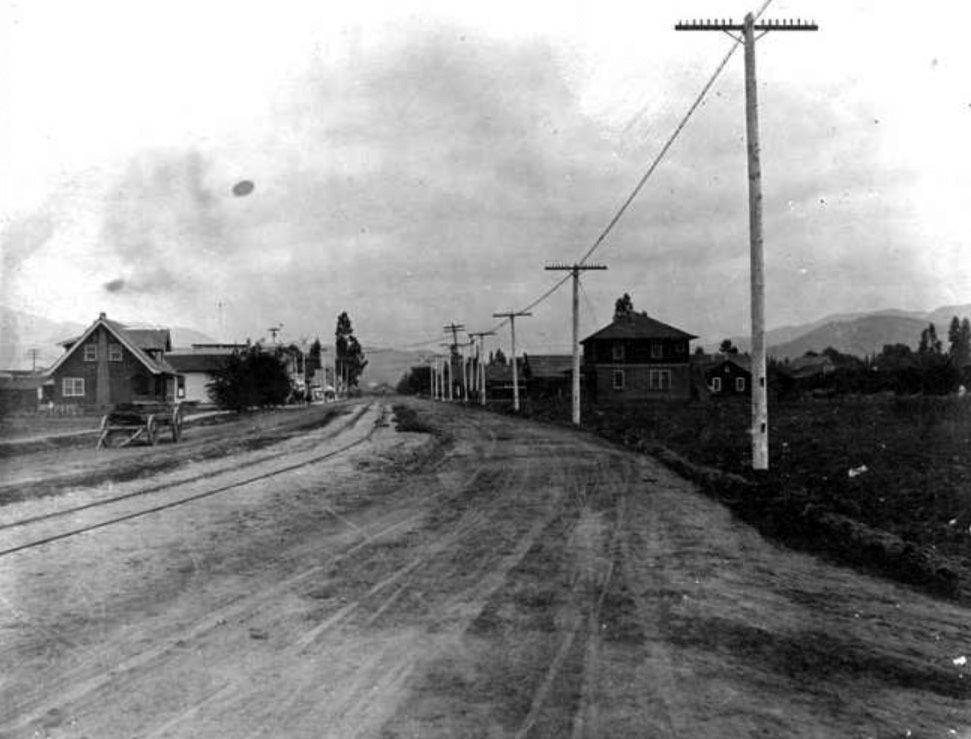
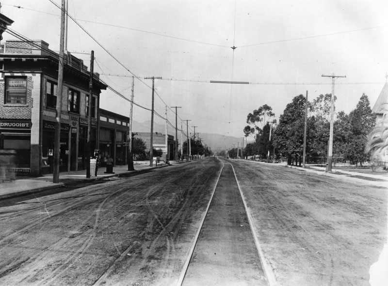
| (ca. 1908)***^ - Glendale Avenue, north from Harvard Street, circa 1908. The Southern Pacific railroad lines run down the center of Glendale Avenue. |
 |
|
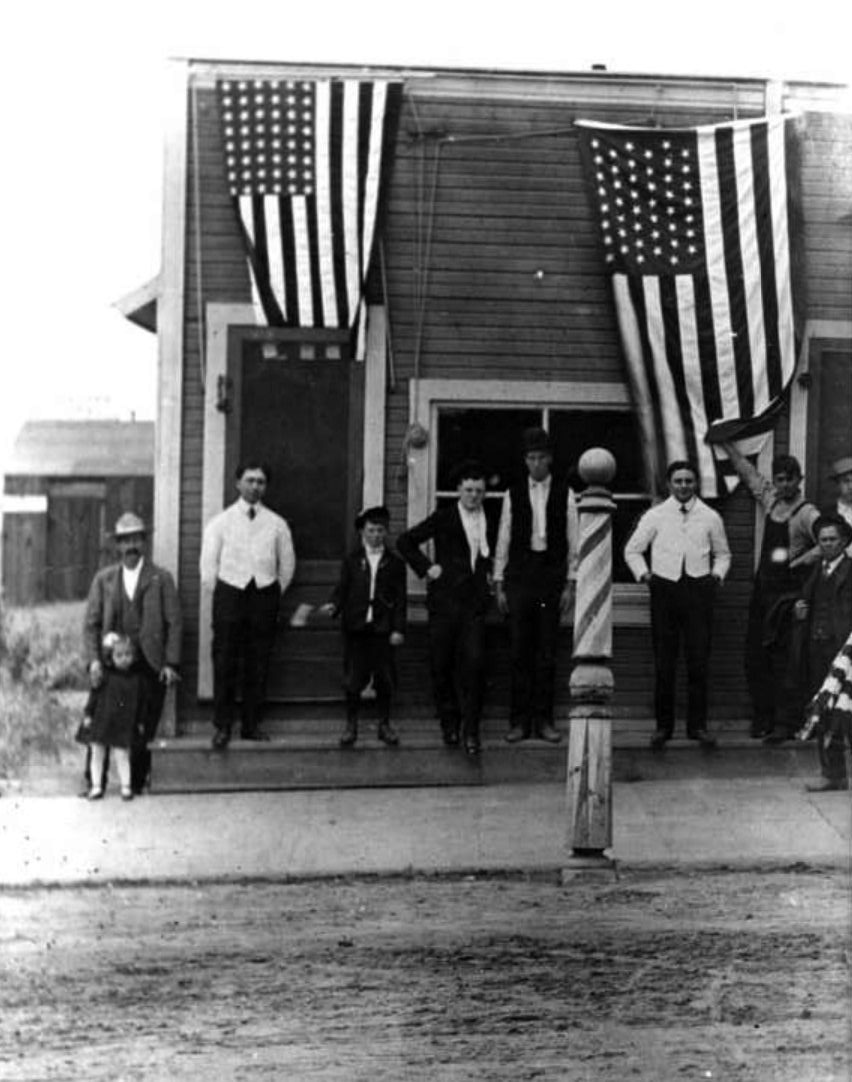
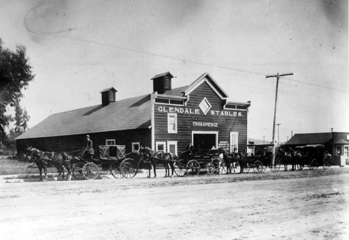
| (1909)***^ – Horse-drawn carriages are lined up in front of the Glendale Stables, located on Glendale Avenue. The stable was owned and operated by Thomas O. Pierce. |
 |
|
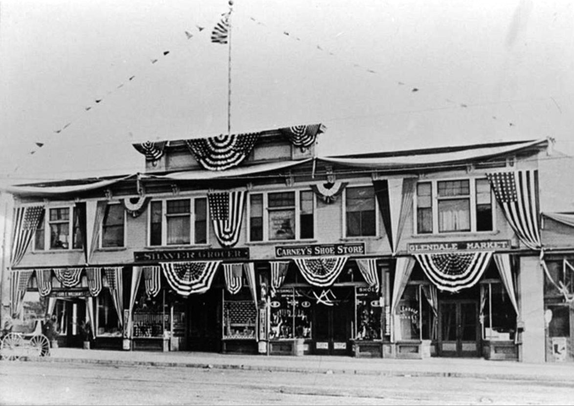
| (1911)##^ - View of the south side of East Broadway. Before the renaming and renumbering that occurred in 1916, this was the 500 block of West 4th Street. Visible here are: Shaver's Grocery Street, at 532 W. 4th Street, managed by H. G. McBain; Carney's Shoe Store, at 536 W. 4th Street, owned by Dave Carney; and Glendale Market, at 540 W. 4th Street, owned by C. W. Ingledue. |
 |
|
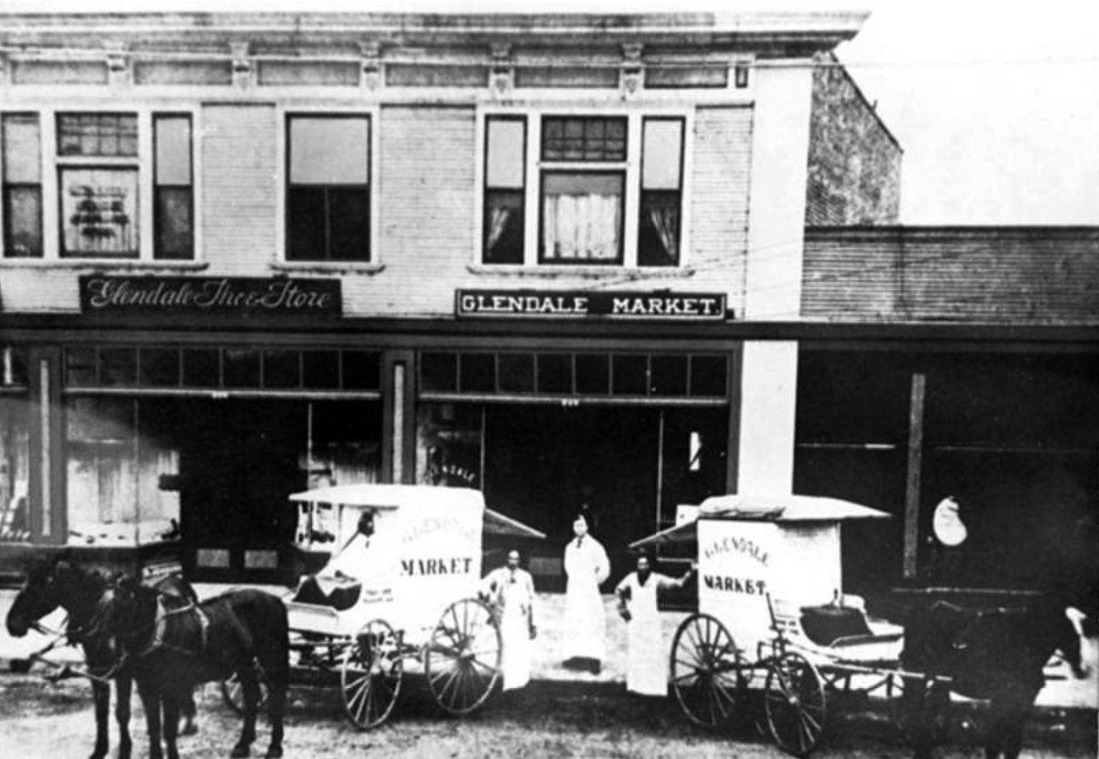
| (1910)***^ - The Glendale Market located on the southwest corner of Glendale Avenue and Broadway. Visible are (left to right): Fred Fish, Bill Whaley and unknown. |
 |
|
| (1910)^ - View of East Broadway in Glendale, looking west from Glendale Avenue. Street railway track and power lines are seen. |
Glendale and Broadway (S/E Corner)
 |
|
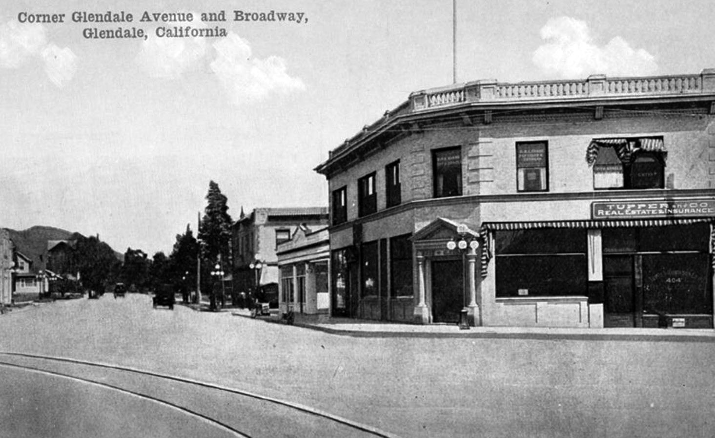
| (ca. 1910s)***^ – Postcard view showing The Bank of Glendale. The bank was originally located on the corner of Crow Avenue (now Glendale Avenue) and Broadway. |
 |
|
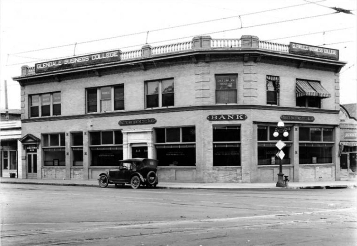
| (1922)***^ – View showing the Pacific Southwest Trust and Savings Bank and the Glendale Business College, located on the southeast corner of Broadway and Crow Avenue (now Glendale Avenue). |
Historical Notes From 1909 to circa 1922, the Glendale Bank was located in this building. The wires and tracks of the Pacific Electric Railway are visible running down the middle of the street. The Pacific Electric local line ran along East Broadway from Brand Boulevard to Chevy Chase Drive.***^ |
 |
|
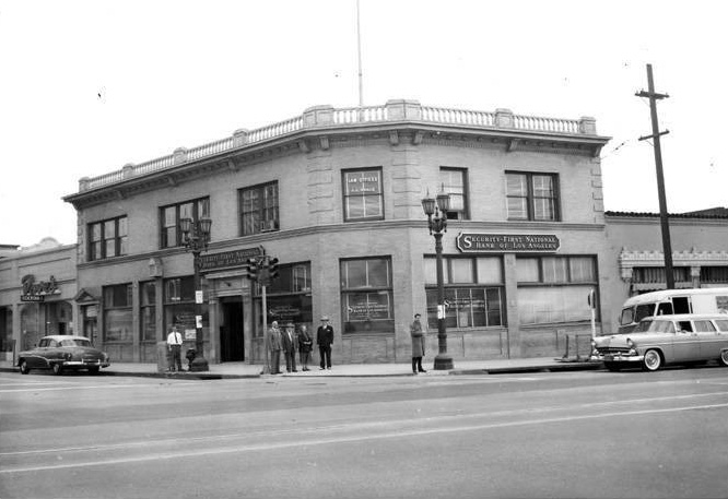
| (1955)^.^ – View showing the Security First National Bank of Los Angeles located on the corner of Glendale Avenue and Broadway. |
Historical Notes This building was lost to the 1971 Sylmar Earthquake. |
 |
|
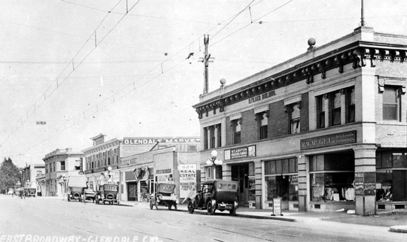
| (1921)##^ – View showing cars and businesses, including the D. Filger Building and the Glendale Market, along East Broadway in Glendale. The wires and tracks of the Pacific Electric Railway are visible running down the middle of the street. The Pacific Electric local line ran along East Broadway from Brand Boulevard to Chevy Chase Drive. In the distance can be seen the Pacific Southwest Trust and Savings Bank building on the SE corner of Glendale and Broadway. |
 |
|
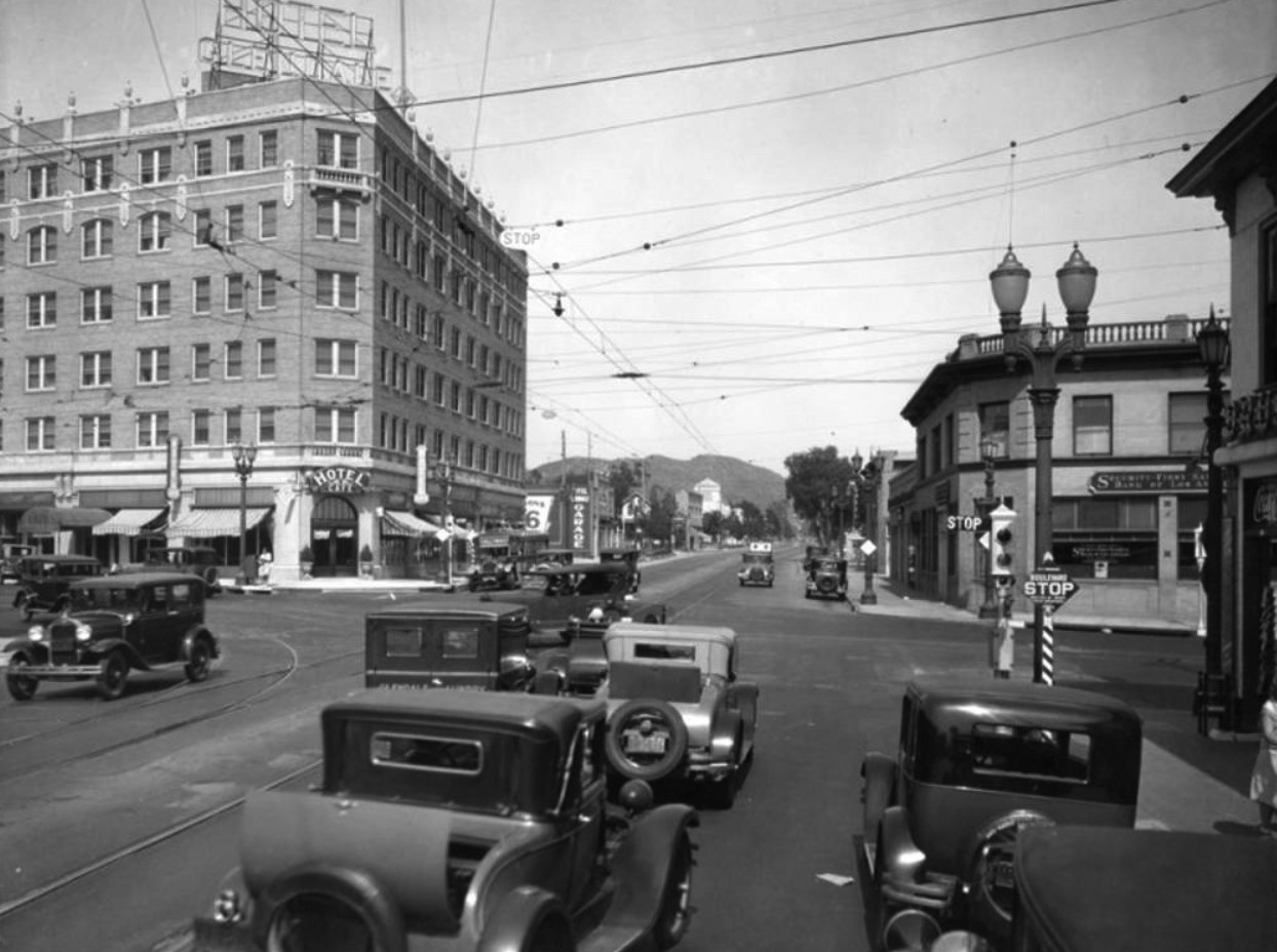
| (ca. 1928)* – View showing the intersection of Broadway and Glendale Avenue, looking east. On the southeast corner is a branch of Security-First National Bank of Los Angeles. On the northeast is a hotel and cafe. A semaphore traffic signal is seen on the corner (center-right). A car with a rumble seat can be seen in the foreground. |
* * * * * |
Terminal Market
 |
|
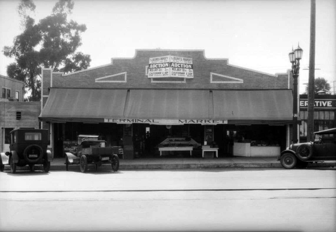
| (1926)^^ - View showing cars parked in front of Terminal Market at 123 North Glendale Avenue, Glendale. |
Tropico and Glendale
 |
|
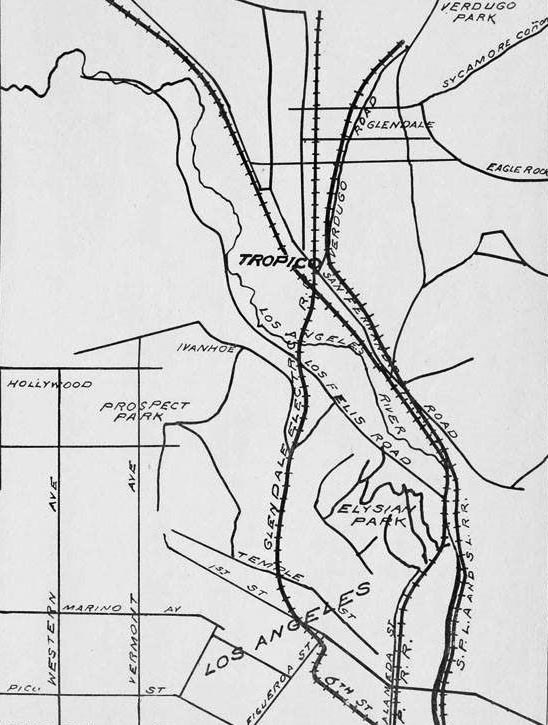
| (1903)^ – A map of Tropico showing rail lines and surrounding area. |
Historical Notes Tropico was put on the map as a fertile agricultural spot in the late 1800s. Shortly thereafter, the town began distancing itself from the rest of Glendale. In 1918, the neighborhood formally succeeded in becoming an independent entity for a short time. |
 |
|
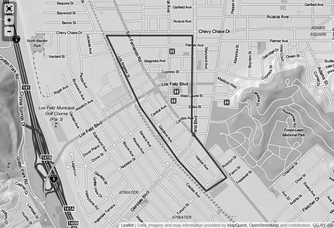
| (n.d.)*^ – Map view showing the boundaries of Tropico. |
Historical Notes Tropico was the name of the southern portion of Glendale, south of Windsor Road, between the late 1800s and 1918. The name "Glendale" had originated in the 1880s and was utilized north of Windsor Road. Political factions had divided the town in two. By the turn of the century, the commercial center of Tropico was at Central and San Fernando Road and its population was 700.* |
 |
|
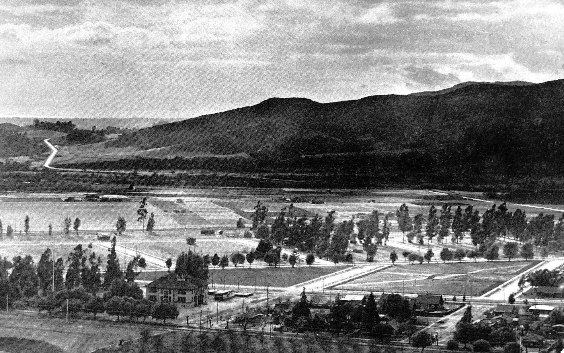
| (1910)^ - View of Tropico looking southwest to the Pacific, from the lower slopes of what would become Forest Lawn Memorial Park, Glendale. Photo by Edward Weston. |
 |
|
| (1910)^ - View of Tropico looking southwest to the Pacific, from the lower slopes of what would become Forest Lawn Memorial Park, Glendale. Annotated by Paul Ayers |
 |
|
| (1911)^ – A banner in support of the annexation of Tropico to Glendale in 1911 hangs outside the measure's headquarters on Broadway near Brand Boulevard in Glendale. The measure failed to pass, with Tropico instead voting for its own incorporation as a city. The issue would be revisited in 1918, when the upper half of Tropico would become a part of Glendale. |
Historical Notes Tropico was just a sleepy little village in the early 1900s. The business district included a few wooden buildings containing a general store, a blacksmith shop, meat store, livery stable, real estate offices and a few other small concerns. The buildings were all clustered near the intersection of San Fernando Road and Central Avenue. But within a few short years, the wood-frame buildings were replaced with brick, business boomed and the community became vibrant. The Tropico Art Tile Works stood just west of the railroad tracks, employing many people, and Tropico also became the shipping center for the strawberries raised in the area. Because of its proximity to Los Angeles, the area became a popular residential spot. The Tropico Chamber of Commerce organized in 1910, along with the Bank of Tropico, and soon the community realized it needed a city government. With so many of its residents commuting into Los Angeles, many favored annexing to Los Angeles. Others, seeing Glendale's successful example of home rule, wanted to be part of Glendale, which had incorporated in 1906.^ |
 |
|
| (1910s)^ - View looking N/W on San Fernando Road at Central Ave with the Bank of Tropico located on the triangular lot at right. |
Historical Notes With so many of its residents commuting into Los Angeles, many favored annexing to Los Angeles. Others, seeing Glendale's successful example of home rule, wanted to be part of Glendale, which had incorporated in 1906. They felt that since the two communities were adjacent and in the same valley, they should be affiliated. Those favoring annexation with Glendale (mainly in the northeast part of Tropico) approached Glendale officials in 1911 and asked that an election be called. The publishers of the Tropico Sentinel vehemently opposed annexation, and the issue failed. Instead, Tropico incorporated as its own city, with Elkanah W. Richardson, son of Tropico's founder, W.C.B. Richardson, serving as a member of the board of trustees. The new city government immediately embarked on a badly needed improvement of the roads, but the annexation issue didn't go away. Petition after petition was filed, each one eventually failing, until finally, in 1918, the annexation proposal passed. The upper half of Tropico voted to go with Glendale, and the lower half voted to merge with Los Angeles. Today, that portion makes up the area known as Atwater.^ |
 |
|
| (1915)^ - View looking N/W on San Fernando Road at Central Ave, Tropico. |
 |
|
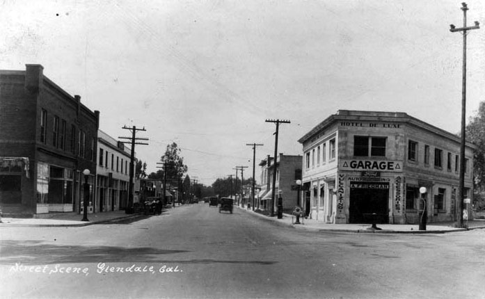
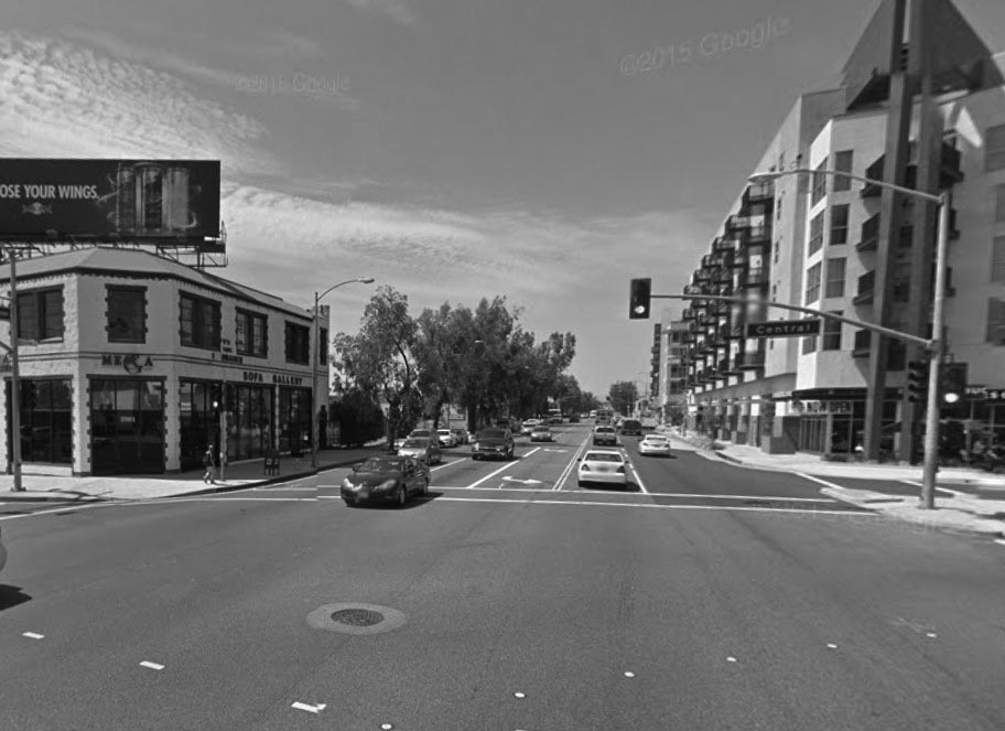
| (1920s)^*# - View looking N/W on San Fernando Road at Central Ave after Tropico was annexed into the city of Glendale This is the same intersection as previous photo but about 10 years later. The building housing the Bank of Tropico is now Hotel de Lux and a Garage. Note the gas pumps along the curb. Click HERE for contemporary view. |
 |
|
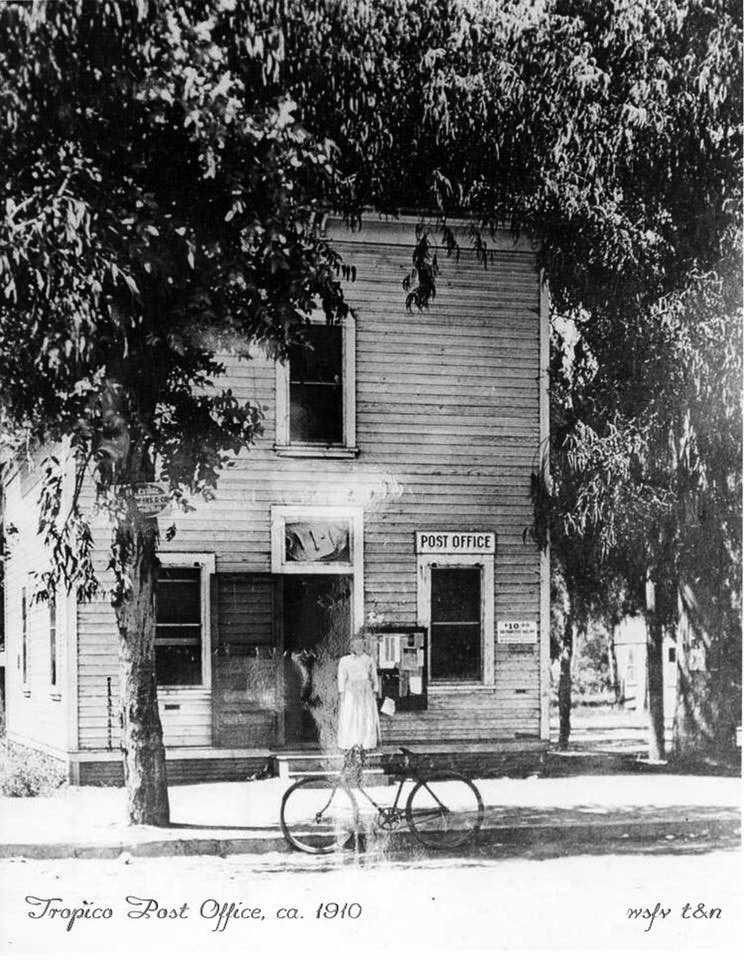
| (ca. 1910)^ – View showing a woman standing in front of the Tropico Post Office, with a bicycle parked by the curb. |
Historical Notes The Tropico Post Office building was owned by WCB Richardson and was located near the corner of Central Avenue and San Fernando Road. |
 |
|
| (1915)* – Studio of famous photographer Edward Weston, located in Tropico. |
Historical Notes Edward Henry Weston has been called "one of the most innovative and influential American photographers..." and "one of the masters of 20th century photography." Over the course of his 40-year career Weston photographed an increasingly expansive set of subjects, including landscapes, still-lifes, nudes, portraits, genre scenes and even whimsical parodies. It is said that he developed a "quintessentially American, and especially Californian, approach to modern photography" because of his focus on the people and places of the American West. In 1937 Weston was the first photographer to receive a Guggenheim Fellowship. In 1910 Weston opened his own business, called "The Little Studio", in Tropico. His sister later asked him why he opened his studio in Tropico rather than in the nearby metropolis of Los Angeles, and he replied "Sis, I'm going to make my name so famous that it won't matter where I live."* Weston photographed many of the early buildings and local events in Glendale. |
Then and Now
|
|
 |
|
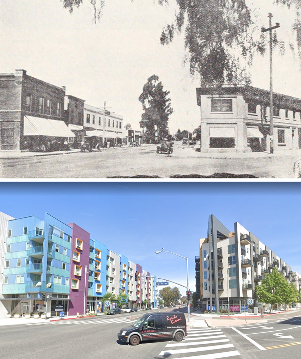
| (1910s vs. 2015)* – View looking N/W on San Fernando Road at S. Central Avenue. |
Then and Now
 |
|
| (1910s vs 2022)* - Looking N/W on San Fernando Road at S. Central Ave. |
 |
|
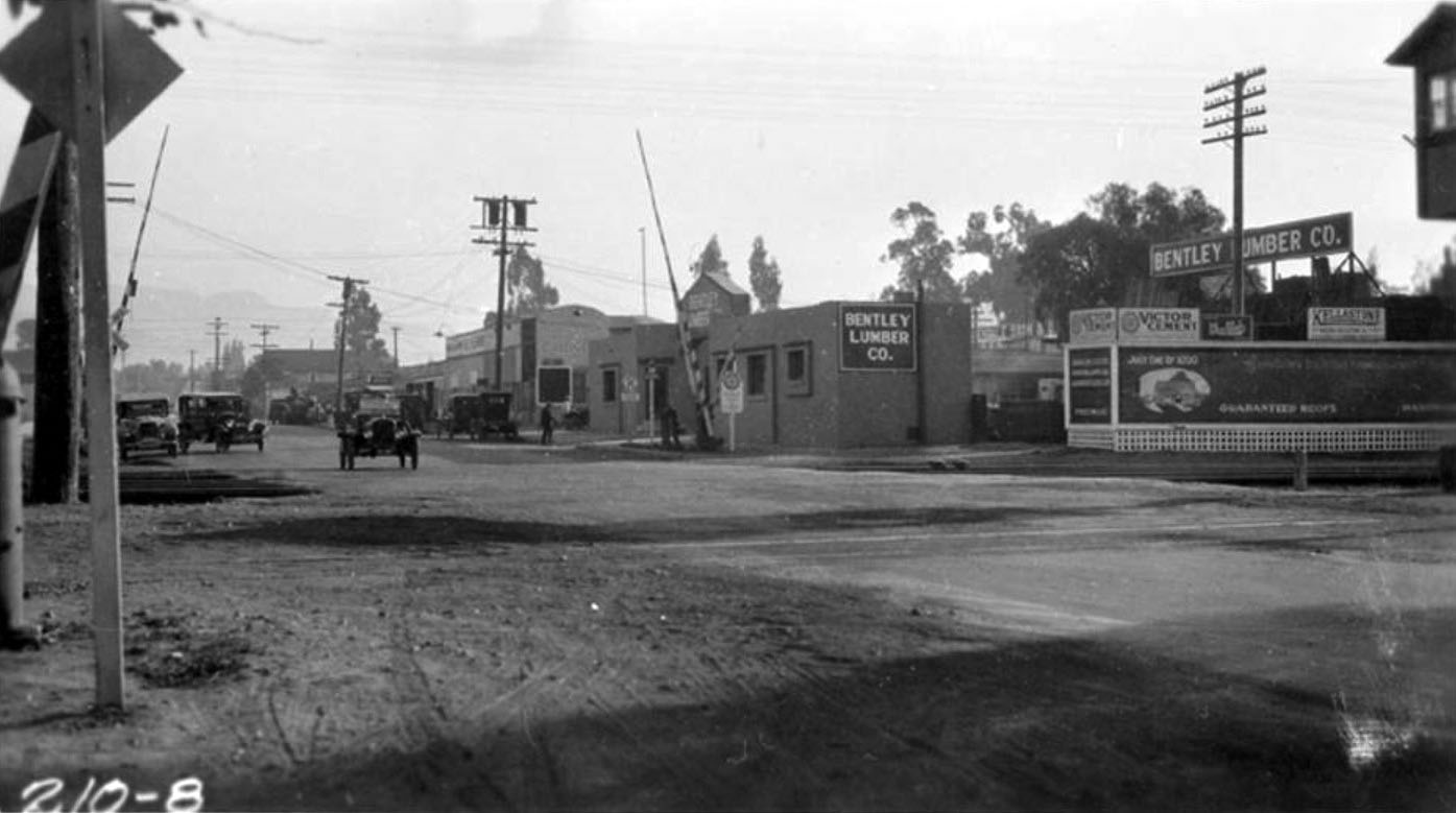
| (ca. 1921)^ - Southern Pacific Railway grade crossing in the Tropico area of Glendale. The city of Tropico was annexed by Glendale in 1918. Bentley Lumber Company is visible on the right. |
* * * * * |
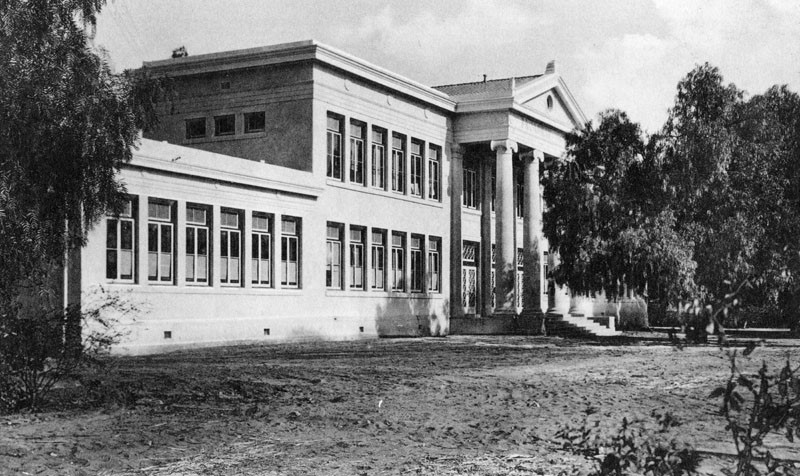
Broadway Elementary School (today John Marshall Elementary School)
 |
|
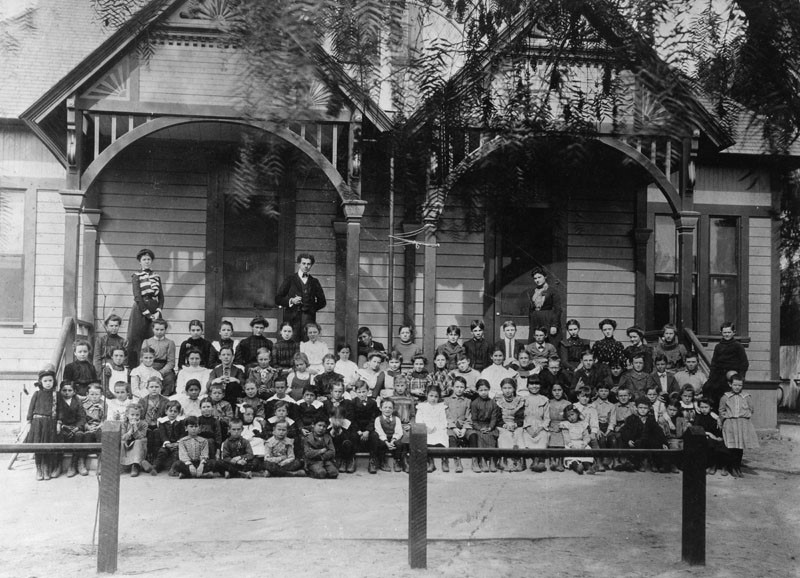
| (1902)^ - Group portrait of children and adults in front of the Broadway Elementary School located at Broadway and Chevy Chase since 1887. John Marshall Elementary School stands at this site today. |
 |
|
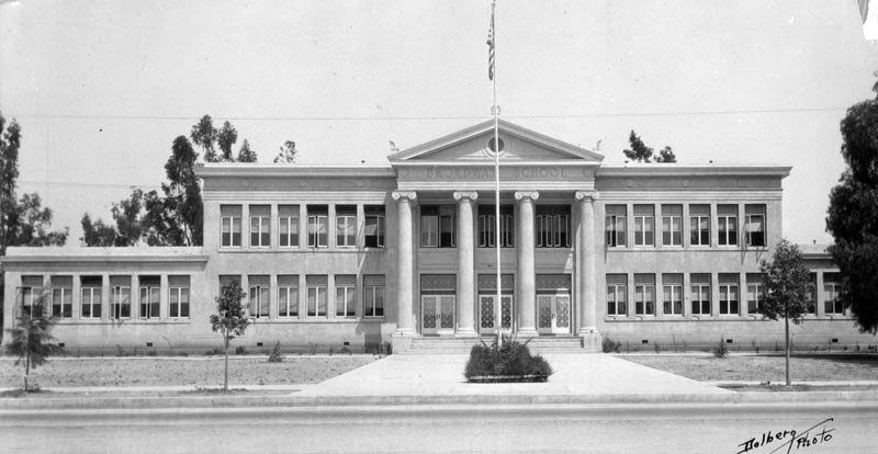
| (n.d.)^ - Picture postcard of the exterior view of Broadway School, which has been located on the same site at Broadway and Chevy Chase since 1887. The school has undergone five different name changes, the current being John Marshall Elementary School, in memory of U.S. Supreme Court Justice John Marshall, and the present-day address is 1201 East Broadway. |
 |
|
| (n.d.)^ - View showing the main entrance of Broadway School, located at Broadway and Chevy Chase in Glendale since 1887. For several years the main building had picturesque two-story pillars in front, resembling the White House. The pillars were demolished when the east and west wings were rebuilt in 1950. |
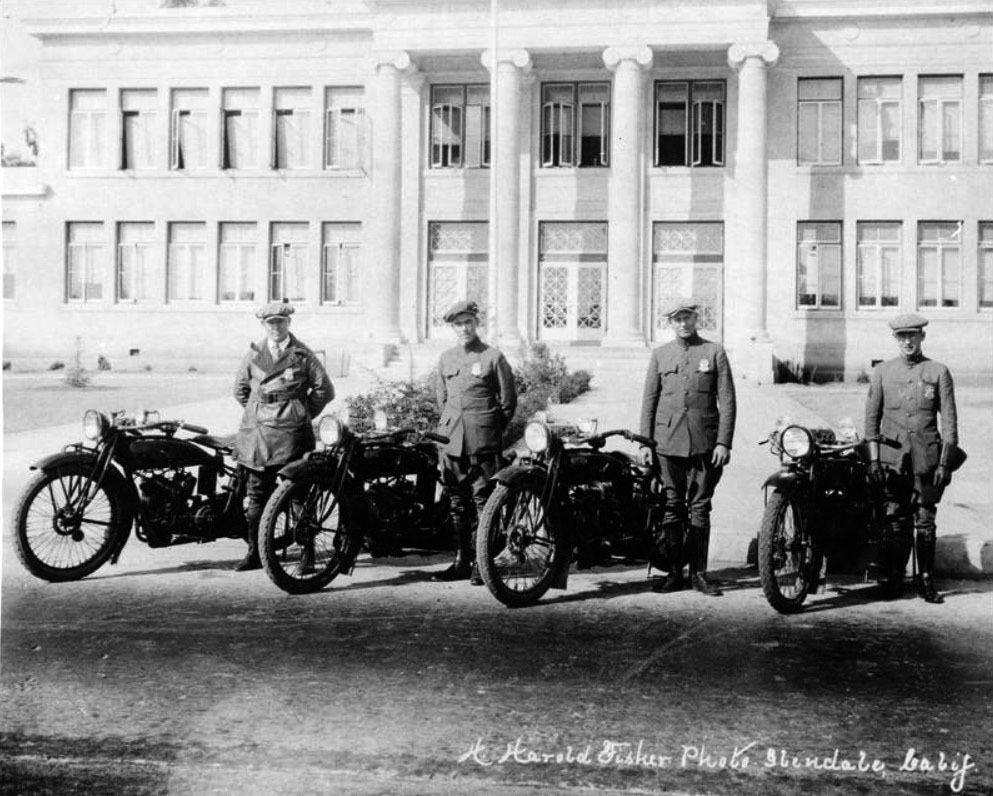
Glendale Police Department
 |
|
| (ca. 1919)* - Glendale Police Department Motor Division. Several members of the Glendale Police Department pose with their Indian motorcycles in front of Broadway Elementary School. |
 |
|
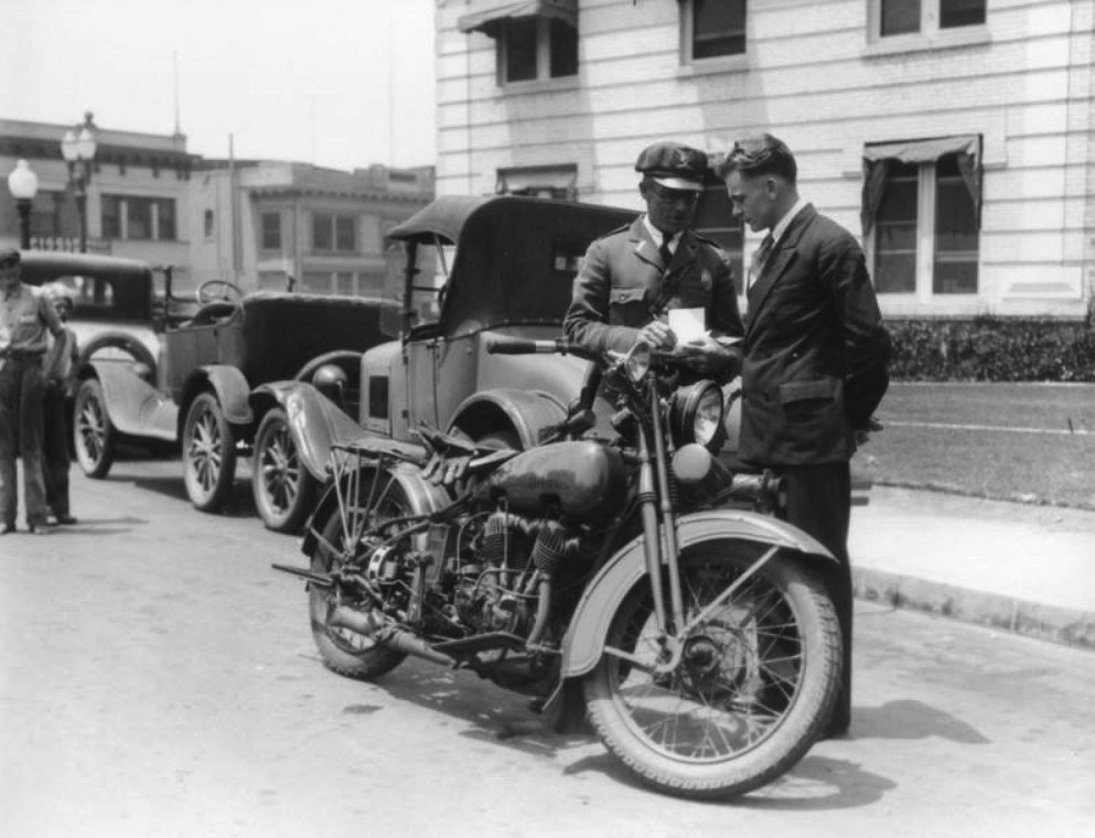
| (1920s)* - A man named Wykoff receives a traffic ticket from a member of the Glendale Police Dept. The photo shows a close-up of the policeman's Harley-Davidson motorcycle. |
 |
|
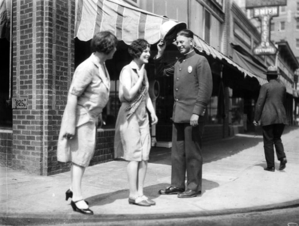
| (ca. 1920s)* - A member of the Glendale Police Dept. tips his hat to two women on Broadway, in front of Smith Electric Co. |
Historical Notes Click HERE to see more Early Views of the Glendale Police Department (1938 +). |
 |
|
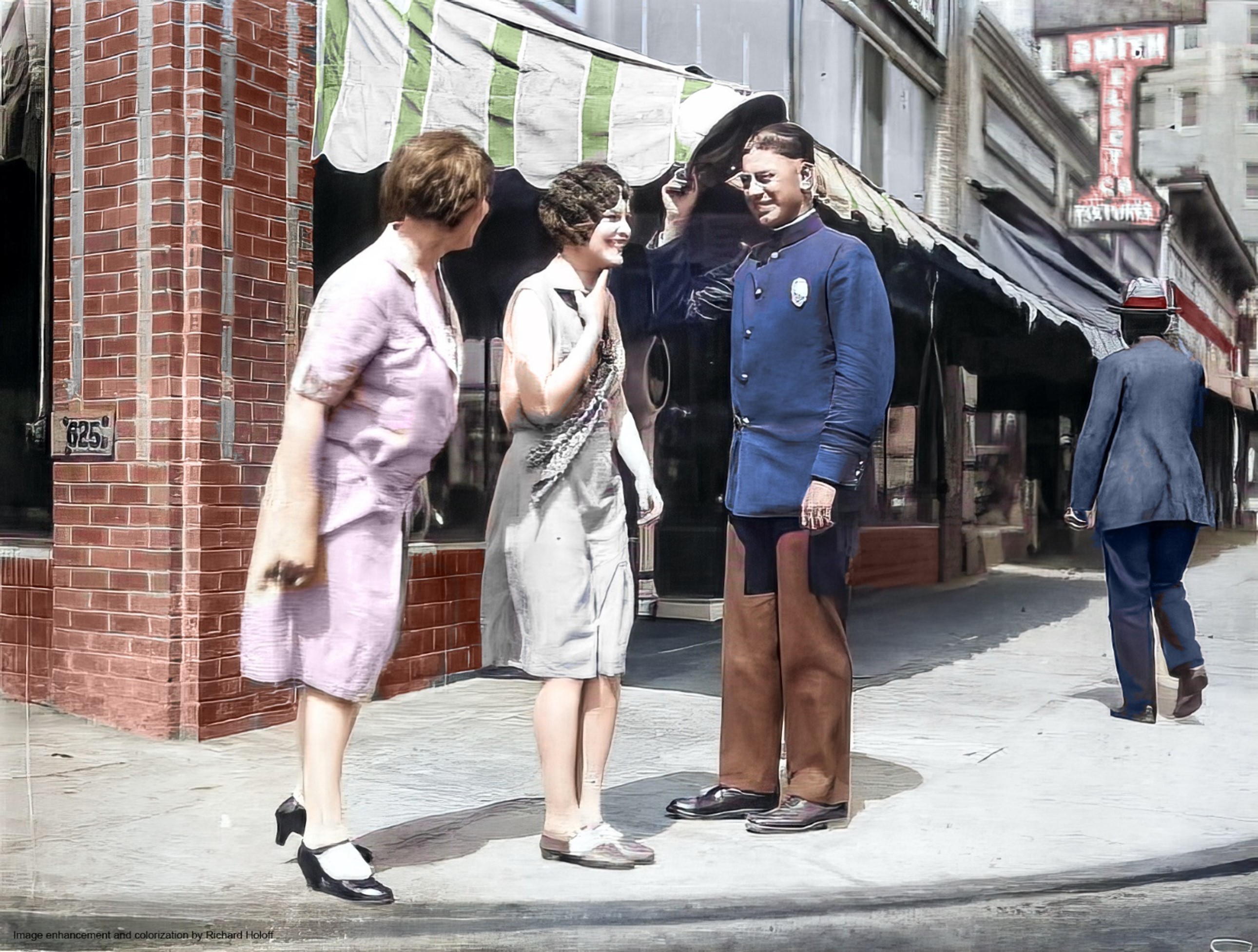
| (ca. 1920s)* - A member of the Glendale Police Dept. tips his hat to two women on Broadway, in front of Smith Electric Co. Image enhancement and colorization by Richard Holoff |
Historical Notes Click HERE to see more Early Views of the Glendale Police Department (1938 +). |
Glendale City Hall
 |
|
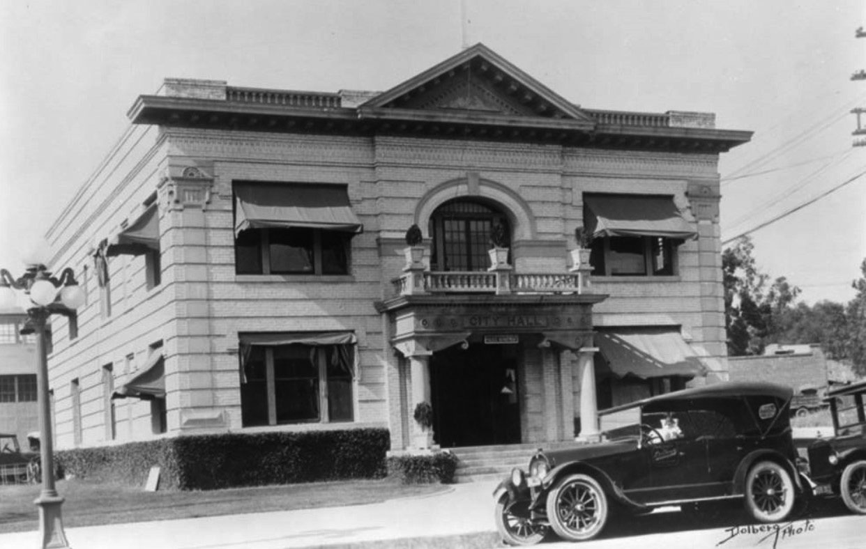
| (1920s)^ - Exterior view of Glendale's City Hall building which also houses its Police Department. Two large pillars stand on each side of the entrance. Note architecture at top and corners of this all brick building. |
Chevy Chase Drive
 |
|
| (ca. 1915)^.^ – View showing Sycamore Canyon Road before it became Chevy Chase Drive. |
Historical Notes The name Chevy Chase actually comes from an ancient Scottish ballad called "The Ballad of Chevy Chase". The "chase" refers to a hunting party, and the "Chevy" is from the Cheviot Hills, which are located along the English/Scottish border. Some parts of Chevy Chase Drive were originally named Park Avenue and Sycamore Canyon, but in the mid 1920's a real estate agent named E.R. Austin worked to create an additional entrance into Glendale from Los Angeles and was able to convince L.A. and Glendale officials to change the name of this route to Chevy Chase Drive for the entire length of the street, as well as extend the street in various places. All this combining of names and extending made Chevy Chase Drive the longest street in Glendale.^ |
East Broadway
 |
|
| (1918)^ - View of E. Broadway looking west at Orange in Glendale. This is near where the Glendale Galleria is today. Note the ornate streetlights. Click HERE to see map. |
 |
|
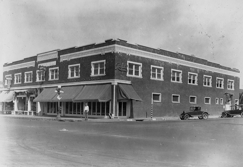
| (ca. 1920)^ – A man stands on the corner of Orange and Broadway in front of the Ralphs grocery store. |
Aurora Market
 |
|
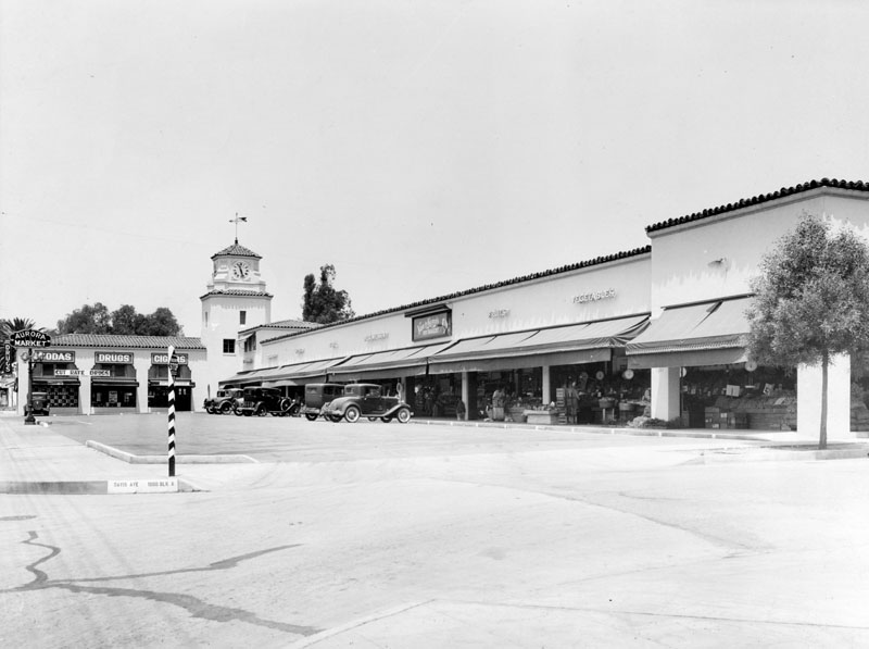
| (1920s)^ - View of Aurora Market located in a plaza at the corner of Davis Avenue, in Glendale. Note the clock tower in the corner of the 'L' shaped drive-in market. |
Historical Notes Southern California was the principal center for the development of drive-in markets between the mid-1910s to the early 1940s. Other notable early drive-in markets included: Mandarin Market (Hollywood), Plaza Market (LA), and the Sunset Clock Market (Beverly Hills). |
 |
|
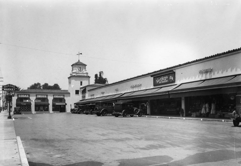
| (1920s)^ - Close-up view showing drive-in Aurora Market with a Van de Kamp's Bakery seen on the right next to a florist. |
Los Feliz and San Fernando
 |
|
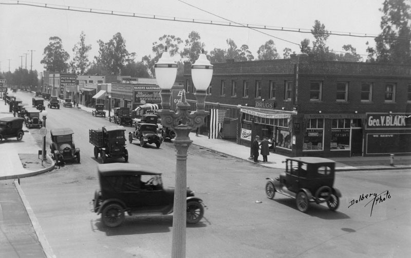
| (ca. 1920)^ - Looking south at an intersection of Los Feliz Blvd. and San Fernando Rd. Various cars and trucks are traveling on the street. There are businesses on right side of the street some include: "Geo. V. Black prescription Druggist" and "Baker's Hardware". Note the ornate dual-lamp streetlight. Click HERE to see more Early Streetlights. |
Historical Notes Los Feliz Boulevard in Glendale was formerly called Tropico Boulevard. ^ |
 |
|
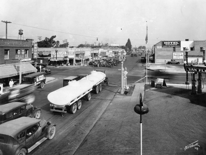
| (ca. 1920s)^ - A view of San Fernando Rd. looking north at an intersection of Los Feliz Blvd. Various cars and trucks have stopped at the intersection. There are businesses that run along both sides of the street some include: a drug store, a sports equipment store, the "Piggly Wiggly", "Tavern Buffet", "Glenwood Hotel" and a service station with gasoline pumps. |
Glendale Union High School
 |
|
| (1902)^* – View showing the two-story frame school house known as "The Cheesebox" (because of its distinctive yellow color), constructed on the southeast corner of Brand and Broadway, opposite the present site of the Glendale Security Building. |
Historical Notes Glendale Union High School was founded in 1901 by the residents of the villages of Glendale, La Crescenta, Burbank, Eagle Rock, Ivanhoe, Tropico and West Glendale. The first classes were held at the Glendale Hotel. The first principal was Mr. Llewellyn Evans and the school had two teachers and 29 students. The next year, a new school building (seen above) was built at the corner of what is today Brand Boulevard and Broadway.*^ |
 |
|
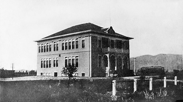
| (ca. 1909)^ – View showing Glendale Union High School at its second location, on Harvard Street, where the Glendale Public Library stands today. |
Historical Notes Erected in 1908, Glendale Union High School was located on Harvard Street in Glendale. The building was a two-story, pressed brick building facing Harvard. This marked the first departure of wooden school houses in Glendale. In 1913, three acres were added to the site and two more buildings were constructed.^ |
 |
|
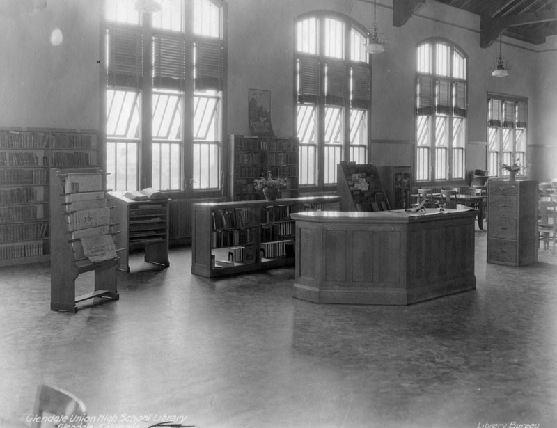
| (ca. 1920s)^ - Interior view of the Glendale Union High School library. Book shelves can be seen along the back wall. Also visible are a newspaper rack, dictionary stand, shelving behind the information desk, magazine rack, wooden file cabinet, and tables and chairs. |
 |
|
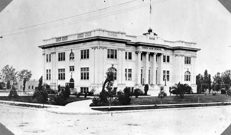
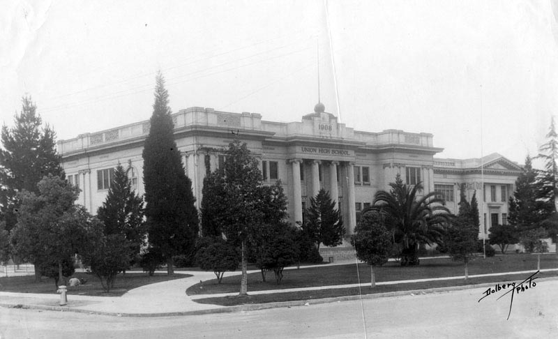
| (ca. 1920)^ - View of Glendale Union High School located on Harvard Street in Glendale. Glendale High School is now located at 1440 East Broadway. |
Historical Notes The school continued to grow, as enrollment reached 800 in 1920 and 1,050 in 1921. It was decided then to move the Grade 10, 11 and 12 classes to a new campus at the corner of the present-day Broadway Avenue and Verdugo Road. The school has remained in this location (1440 East Broadway, at the southeast corner of Verdugo) since 1924.*^ |
 |
|
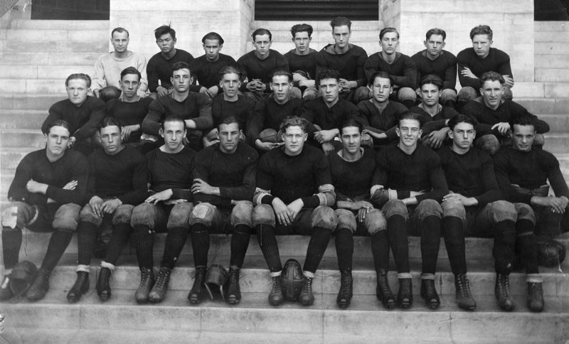
| (ca. 1924)^ – The Glendale Union High School football team picture. The football helmets seen between some players' feet look extremely pliable. |
Historical Notes From the 1920's thru 1940's helmets always were strictly of leather construction, and were not mandatory until the 1930's. One member of this Glendale football team, Marion Morrison, seated in the front row, third from the right, nicknamed "Duke", was a star football player, Senior class president, and sports editor of the school newspaper. "Duke" Morrison graduated in 1925, stumbled into acting, and later became known as John Wayne. ^ |
* * * * * |
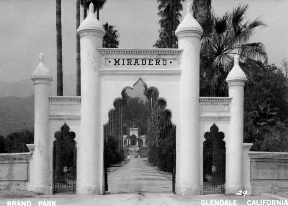
El Miradero
 |
|
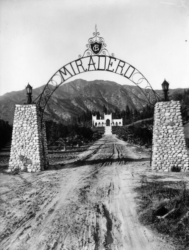
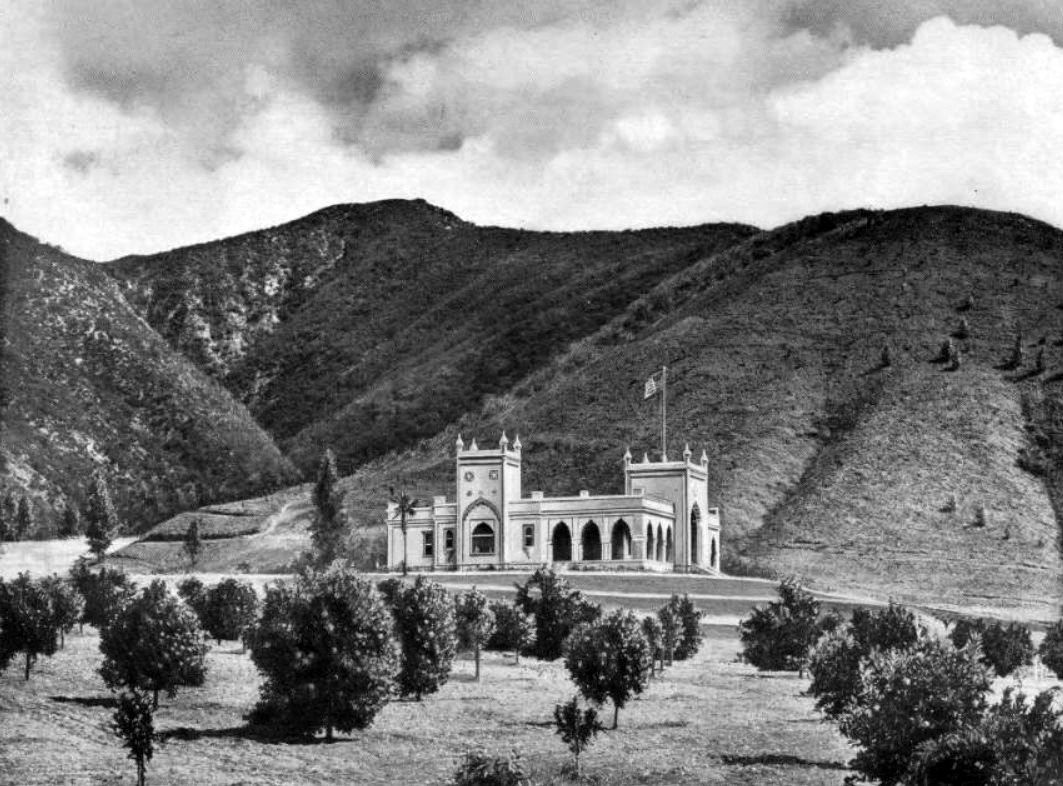
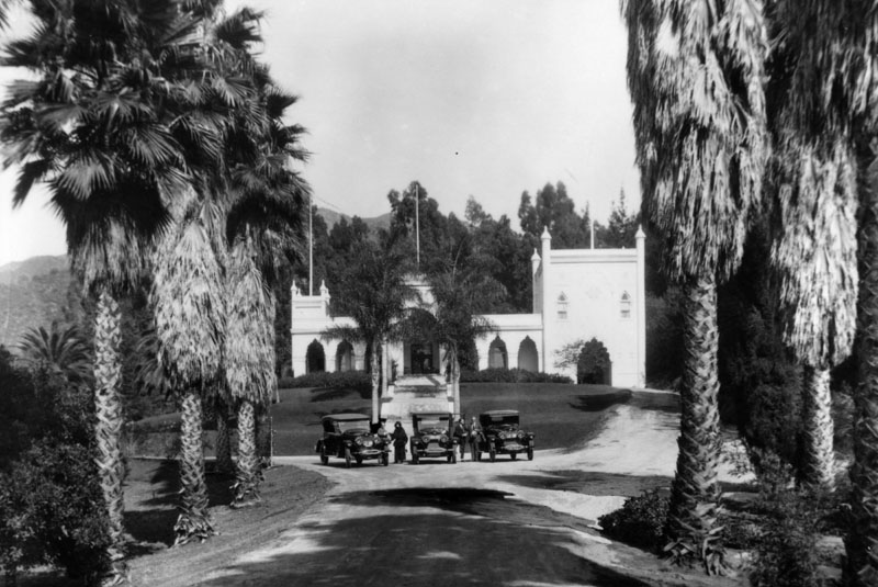
| (ca. 1904)^ - View of El Miradero, the estate of Leslie C. Brand, as seen from the entrance gates of the property. |
Historical Notes Born in Missouri in 1859, Leslie Coombs Brand became the sole provider for his family at age 11. In 1886, Brand came to California to take advantage of its first boom period. #*#^ Brand was a major figure in the settlement and economic growth of the Glendale area. He had purchased land on the lower slopes of Mount Verdugo overlooking the city, and in 1904 built an imposing residence that became known as Brand Castle, also El Miradero (which today houses the Brand Library).*^ |
 |
|
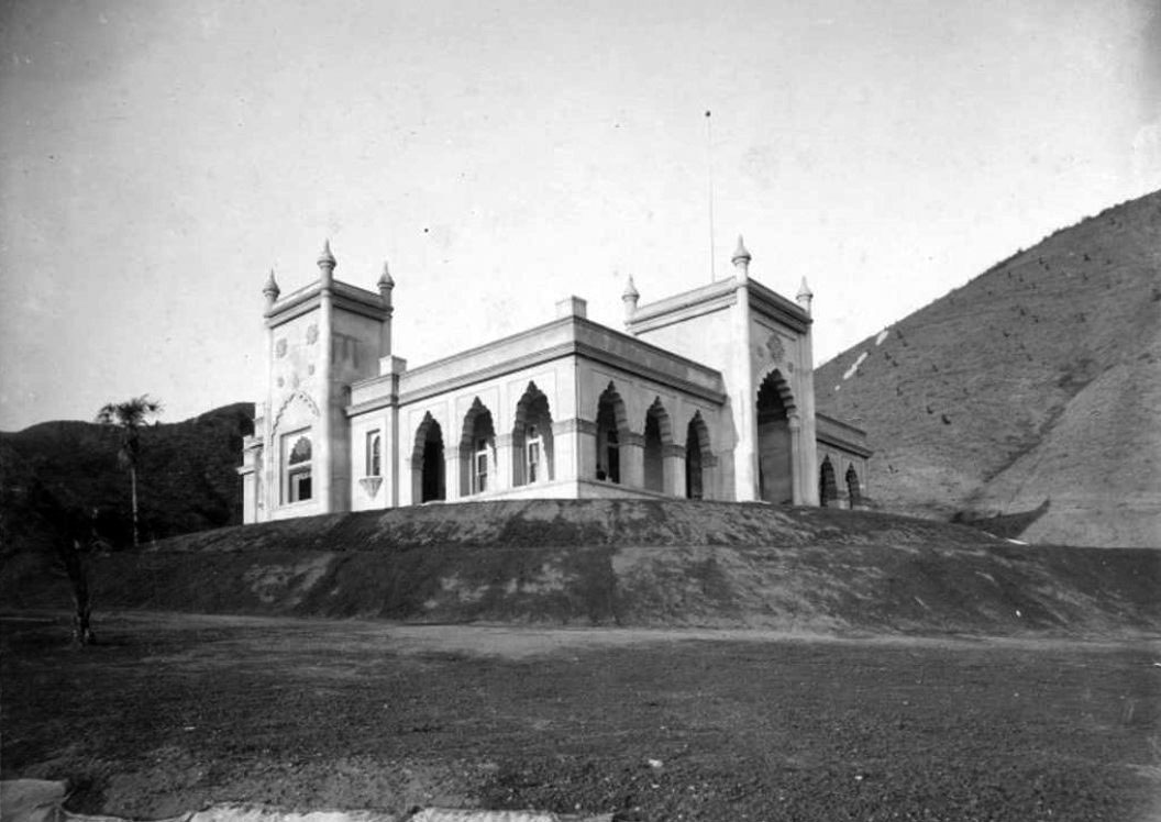
| (1904)^*# – West side view of the newly constructed ‘El Miradero’, home of Leslie C. Brand. |
Historical Notes Designed by Leslie C. Brand's brother-in-law Nathaniel Dryden, the mansion was completed in 1904 and is similar in style to that of the East Indian Pavilion built for the 1893 Columbian World Exposition held in Chicago. The architecture is considered Saracenic, with crenellated arches, bulbous domes and minars combining characteristics of Spanish, Moorish, and Indian styles.^ |
 |
|
| (ca. 1906)^*# – View of El Miradero Mansion standing between orange groves in the foreground and the Verdugo Hills in the background. |
Historical Notes Leslie C. Brand helped develop the city of Glendale. Together with Henry E. Huntington, he brought Pacific Electric to the town to develop it. The 'Brand Library' section of the Glendale Public Library is named in his honor. Brand Boulevard in Glendale is also named in his honor.*^ |
 |
|
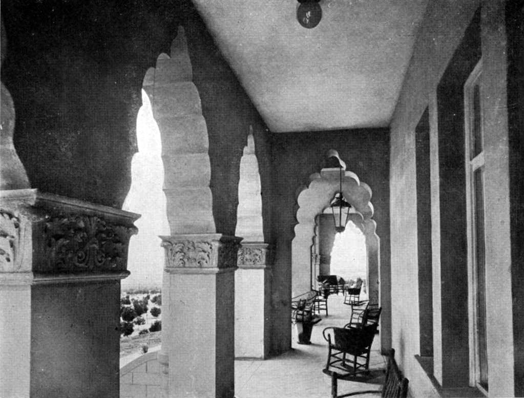
| (ca. 1906)##* - View of exterior porch of El Miradero (Brand Mansion) enclosed with a scalloped arched arcade. The porch is furnished with wicker chairs and potted plants. |
 |
|
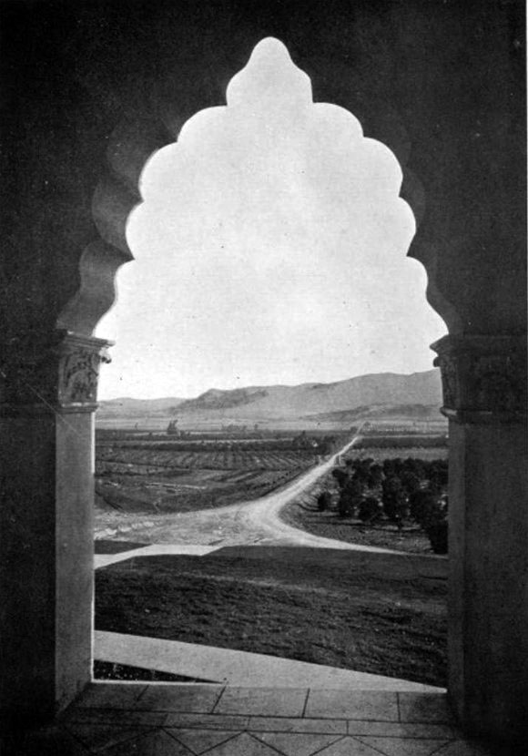
| (ca. 1906)^*# – View looking South over Glendale and Griffith Park toward Los Angeles through one of the many arches of ‘El Miradero’. |
Historical Notes Just across the mostly dry Los Angeles River, Brand could see the Griffith Park Aerodrome's grass field, built in 1912. Just three years later he decided to build his own grass airstrip below his mansion.*^ |
 |
|
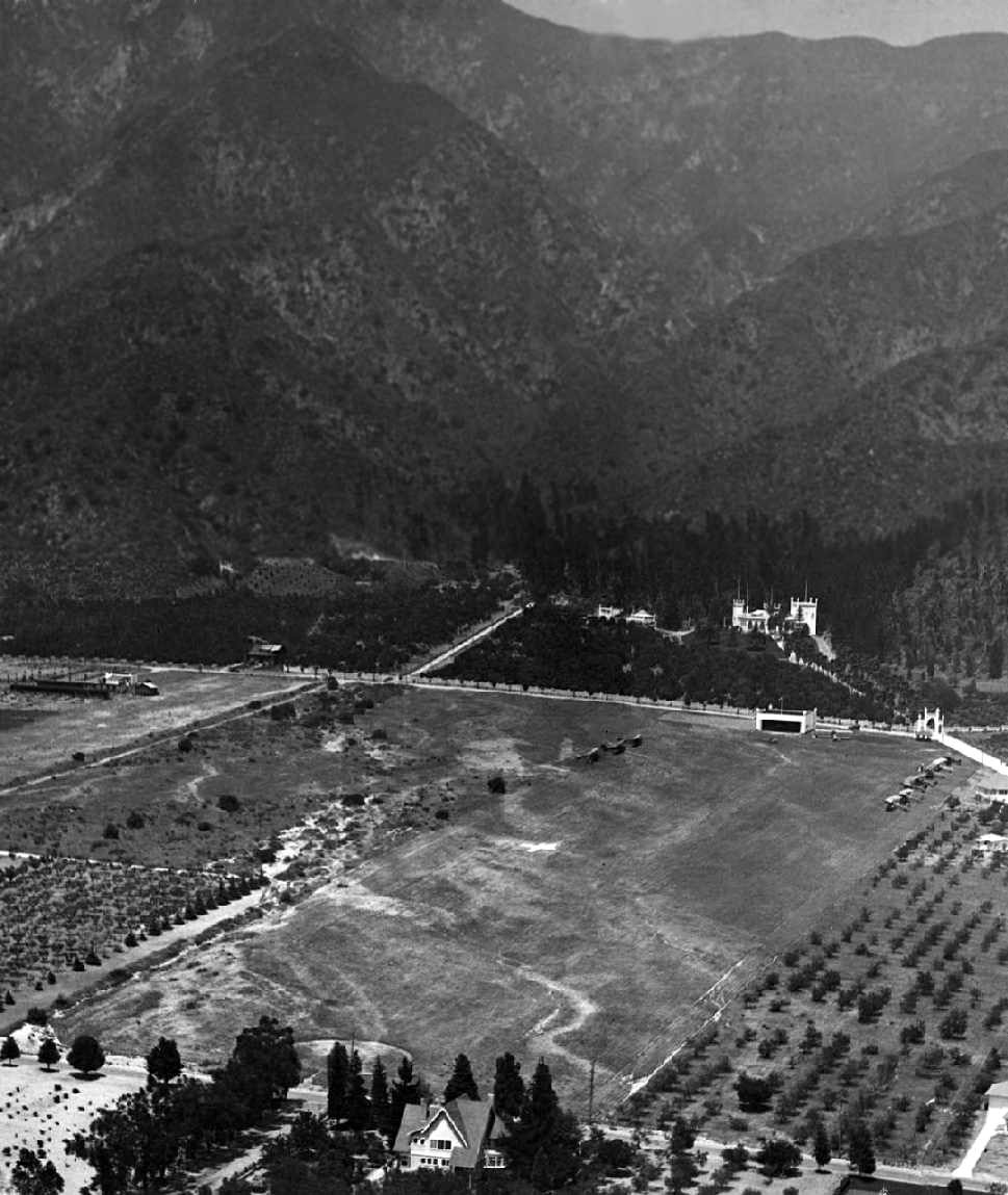
| (1921)***^ - An aerial view of L. C. Brand's airfield in front of his home, El Miradero in Glendale. The airplanes took off downhill toward Kenneth Road. |
Historical Notes Brand established a grassy, well-manicured airfield in front of the mansion. The airfield consisted of a 1,200' rolled dirt runway, with a white hangar at one end and a putting green on the other. The hangar matched the architectural style of the mansion - with turrets atop each of the 4 corners.*#*# |
 |
|
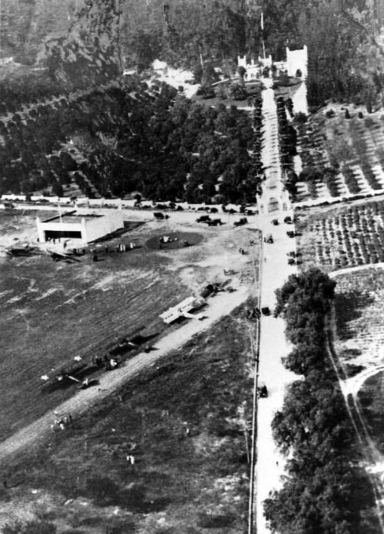
| 1923)*#*# – Aerial view looking north at Brand Field, showing the hangar and 10 aircraft on the field, and the mansion across the street. Note the steep terrain – obviously takeoffs to the north wouldn't be advisable. |
Historical Notes Only 3 aircraft are known to have been actually based at Brand Field. However, Brand apparently bought many war surplus Jennies, some to tinker with and fly as a sport, although most languished in storage buildings.*#*# |
 |
|
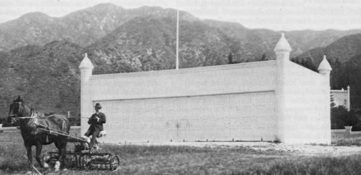
| (ca. 1920s)*#*# – View of millionaire Leslie C. Brand mowing the lawn in front of the Moorish-style hangar at his private Airfield. |
Historical Notes Brand built his first hangar in 1916 and put together a fleet of planes, and held fly-in parties. The only requirement was that guests had to arrive in their own planes and bring passengers.*^ |
 |
|
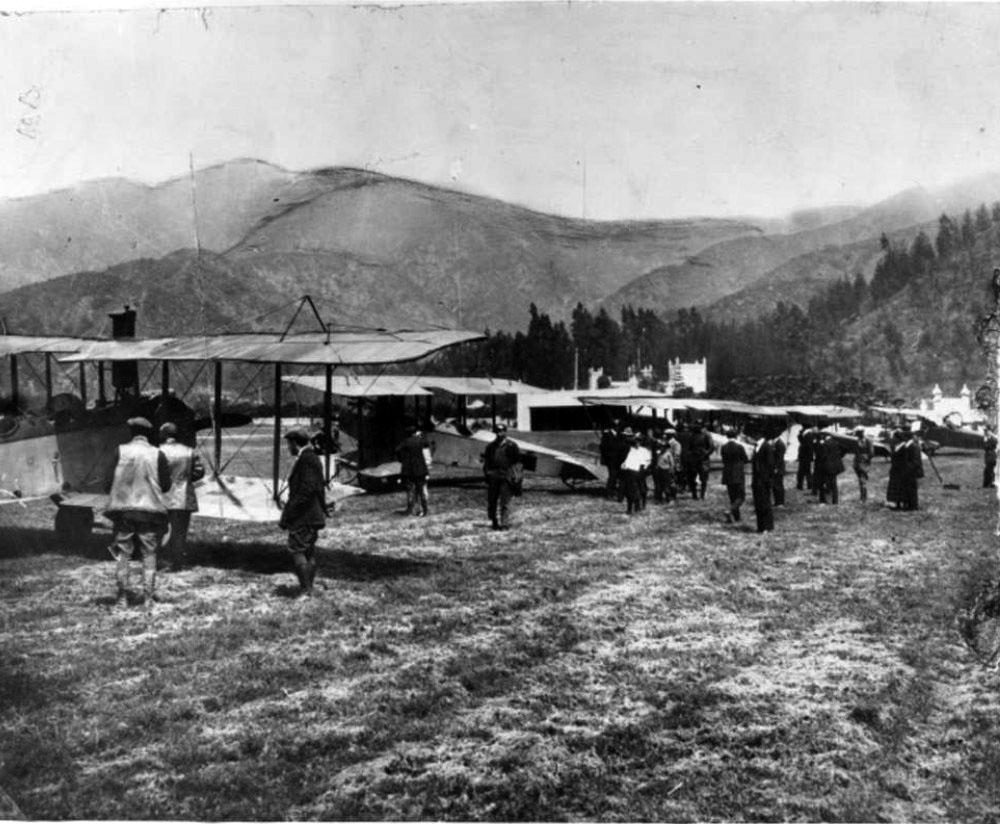
| (1921)^*# – Several airplanes and guests arriving at Brand's fly-in luncheon party on April 1, 1921. El Miradero Mansion is seen in the background. |
Historical Notes Brand Field was no longer depicted on a 1931 street map, but “Brand Park” was depicted, so the airfield may have ceased operation by that point.*#*# |
 |
|
| (ca. 1920)^ - View of El Miradero and estate grounds, once home to Leslie C. Brand. Three vehicles are seen parked next to one another where the driveway and path to the front door meet. Four people, three men and one woman, are standing next to the automobiles. |
Historical Notes It was stated in Brand's will that El Miradero would be bequeathed to the city upon his wife's death, on the condition that the property be used exclusively for a public park and library. Mrs. Mary Louise Brand retained rights of the residence from 1925, when Mr. Brand died, until her death in 1945.^ |
 |
|
| (ca. 1940s)#^^ - Postcard view of the entrance to El Miradero, the estate of Leslie C. Brand, located in Brand Park. |
Historical Notes In 1956 the mansion became the Brand Library, the art and music branch of the Glendale Public Library. The address is 1601 West Mountain Street, Glendale.^ |
* * * * * |
The City of Glendale Continues to Grow
 |
|
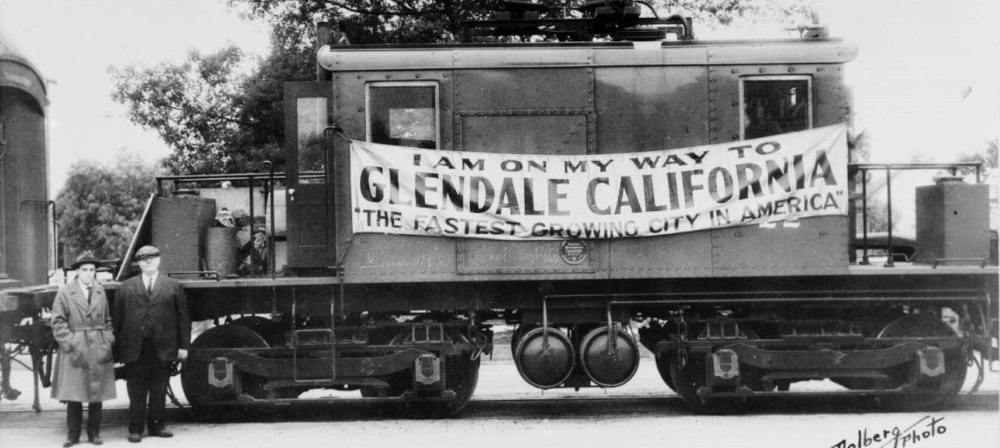
| (1920s)^^ - View showing two men standing in front of an electric locomotive bearing a sign promoting the city of Glendale. The rail car is parked on the tracks, and bears a banner that reads “I am on my way to Glendale, California. The Fastest Growing City in America”. |
Historical Notes By 1920, Glendale had grown through nine annexations to over 7,000 acres. From 1920 to 1930, ten annexations brought the total area to 12,294 acres. The population would keep growing. It rose from 13,756 in 1920 to 62,736 in 1930. |
 |
|
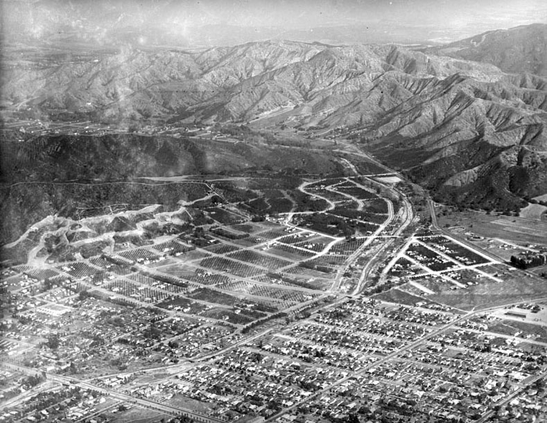
| (1920s)^ - Aerial view of Glendale at the foot of the Verdugo Mountains with Verdugo Canyon and the San Rafael Hills on the right. Housing development is encroaching on the citrus groves to the north. |
 |
|
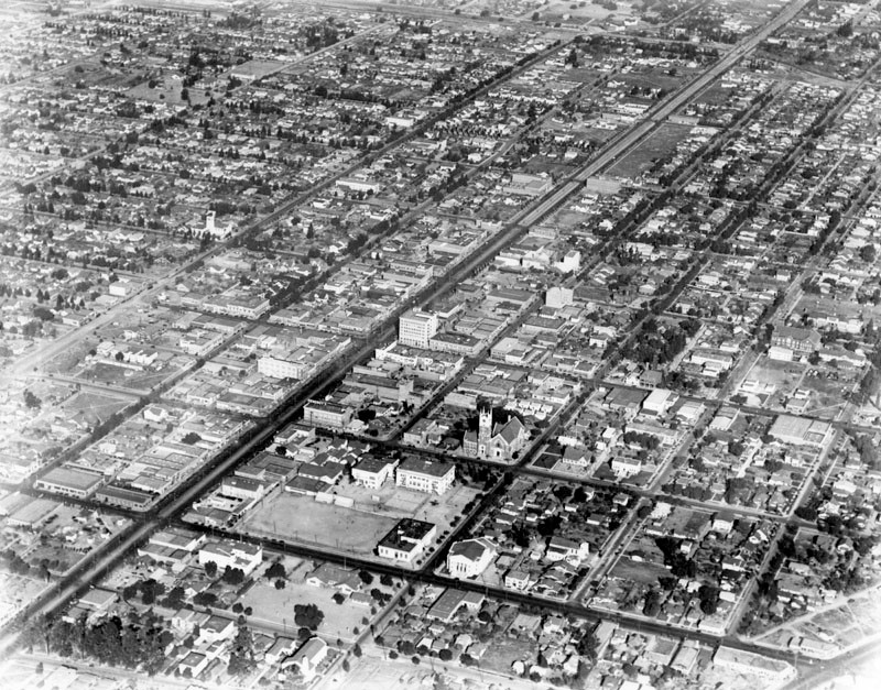
| (ca. 1927)^ - Aerial view of Glendale looking northwest toward the Verdugo Mountains. The intersection of Brand Boulevard and Broadway is in the center. The spires of the Glendale Presbyterian Church are visible to the right of Brand. |
.jpg) |
|
| (ca. 1927)^ - Aerial shot over Brand Boulevard looking north toward the Verdugo Mountains. The two tallest buildings in view are the Security-First National Bank (NE corner of Brand and Broadway) and Glendale Presbyterian Church at center-right (NW corner of Louise and Harvard streets). |
Brand Boulevard (1920 +)
 |
|
| (1925)^ - View looking north on Glendale's Brand Boulevard, when power poles were still located in the middle of the street. An electric car is seen descending the street. Palm trees line the boulevard in the upper portion of the photo. |
Historical Notes During the 'teens and 'twenties Brand Boulevard grew into a lively, modern, commercial and entertainment street with banks, department stores, movie theaters and automobile showrooms, becoming the city's "Main Street". |
 |
|
| (1926)* - View shows several automobiles travelling up and down the business section of Brand Boulevard, in Glendale. Note train stopped in the middle of the road to pick up and drop of passengers. The 6-story building in the distance is on the northeast corner of Brand and Broadway. It was constructed by Security Trust and Savings Bank in 1923. Glendale Theater can be seen on the right. |
Historical Notes Security Trust & Savings Bank was founded in 1888 by J.F. Sartori and associates; the bank grew through the development of business and mergers and became Security-First National Bank of Los Angeles (ca. 1931).^ |
 |
|
| (1926)* - View shows several automobiles travelling up and down the business section of Brand Boulevard, in Glendale. Note train stopped in the middle of the road to pick up and drop of passengers. The 6-story building in the distance is on the northeast corner of Brand and Broadway. It was constructed by Security Trust and Savings Bank in 1923. Glendale Theater can be seen on the right. Image enhancement and colorization by Richard Holoff |
 |
|
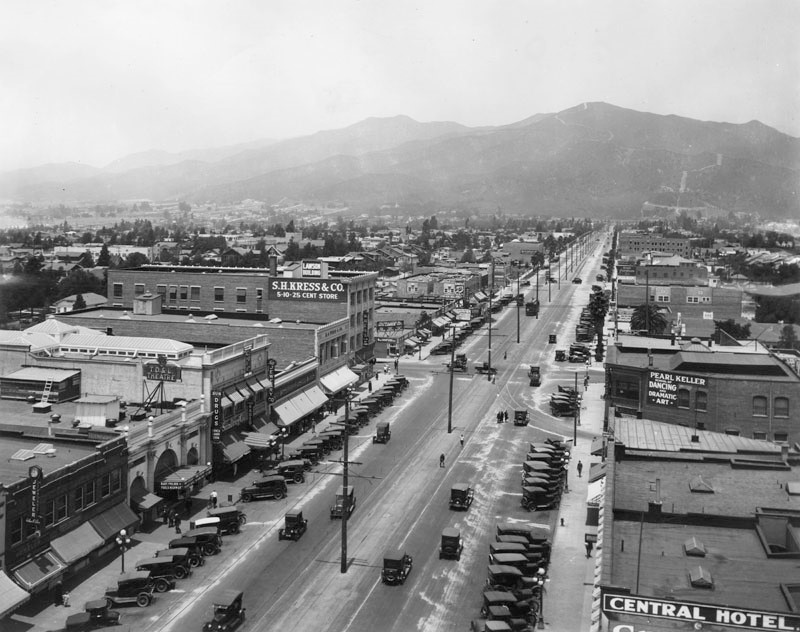
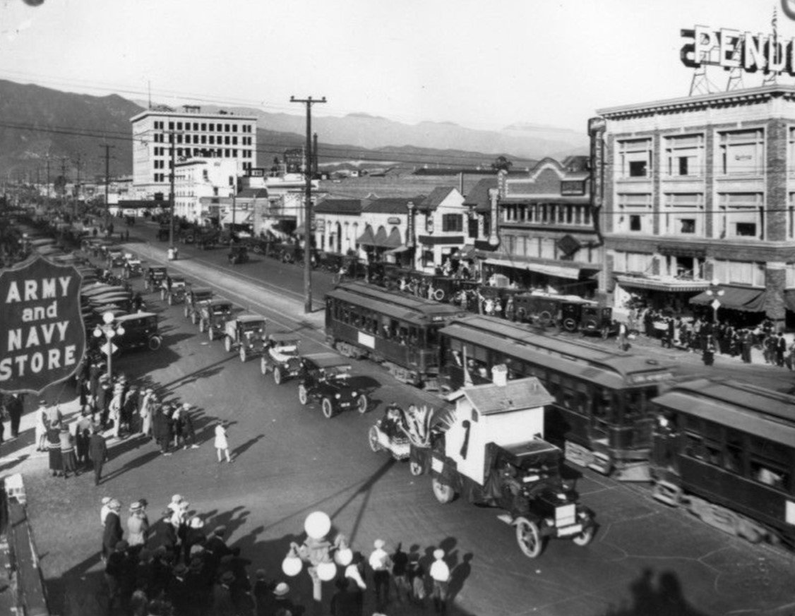
| (1923)* - Spectators gather on both sides of Brand Boulevard to watch the long line of automobiles participating in the Industrial Parade. |
Historical Notes The Industrial Parade in Glendale in the 1920s was part of the city's vibrant growth and development during that period. Glendale experienced significant expansion through annexations, growing from over 7,000 acres in 1920 to 12,294 acres by 1930. The population also saw a substantial increase from 13,756 in 1920 to 62,736 in 1930. This growth was marked by the city's transformation into a lively commercial and entertainment hub with modern amenities like banks, department stores, movie theaters, and automobile showrooms along Brand Boulevard. |
 |
|
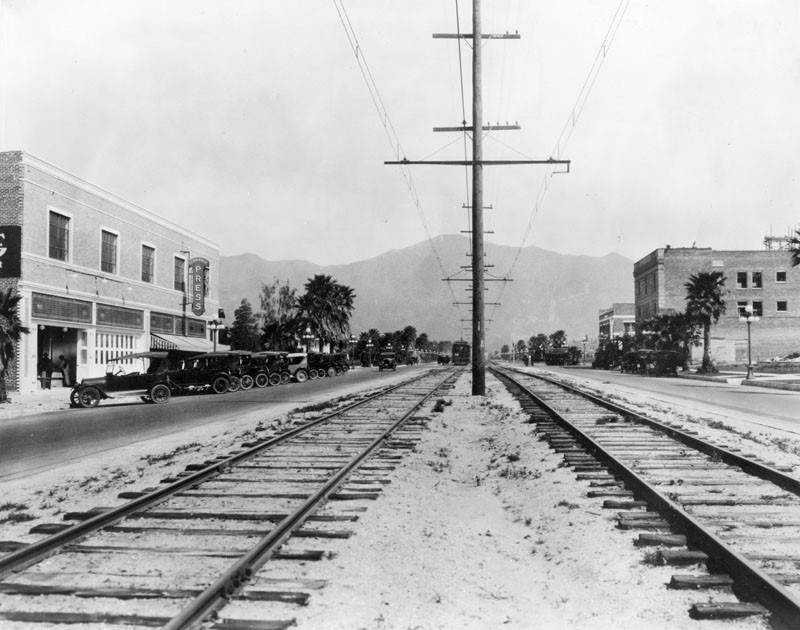
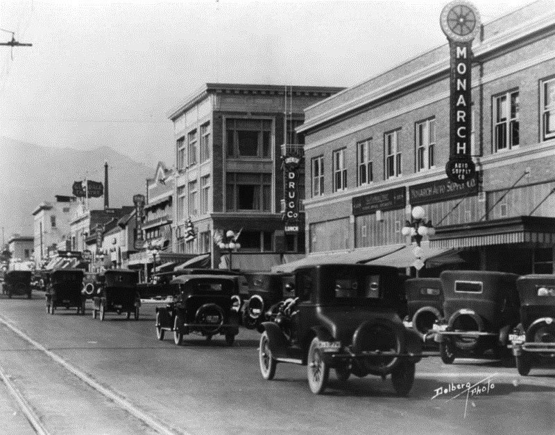
| (ca. 1924)^.^ – Street view looking north on Brand Boulevard. Monarch Auto Supply Co. and a drug store occupy the building on SE corner of S. Brand Blvd and E. Harvard St. seen on the right. The Glendale Theater can be seen in the distance. |
Historical Notes Today, the building on the SE corner of Brand and Harvard is occupied by a BevMo! Click HERE for contemporary view. |
 |
|
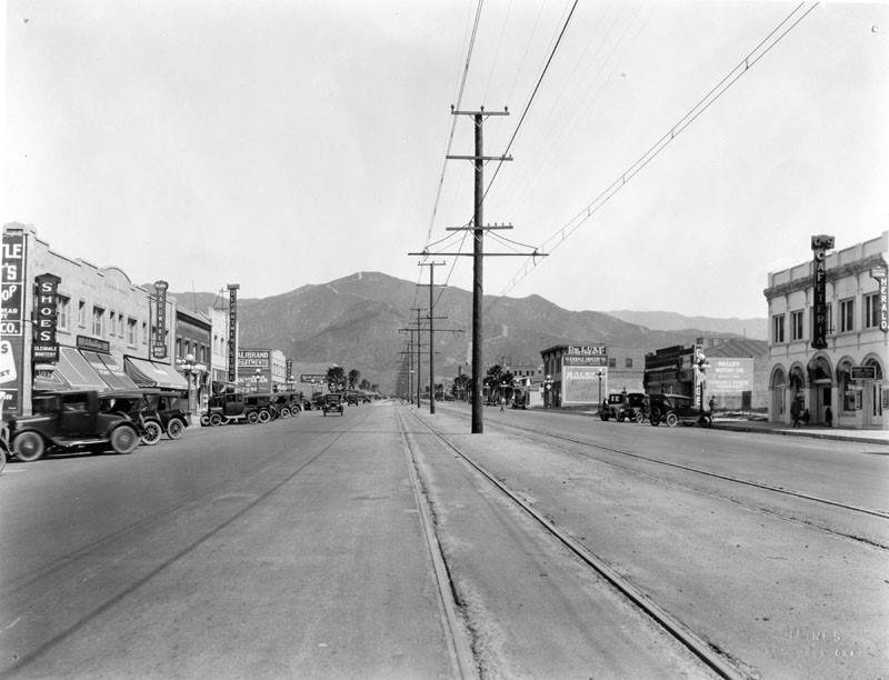
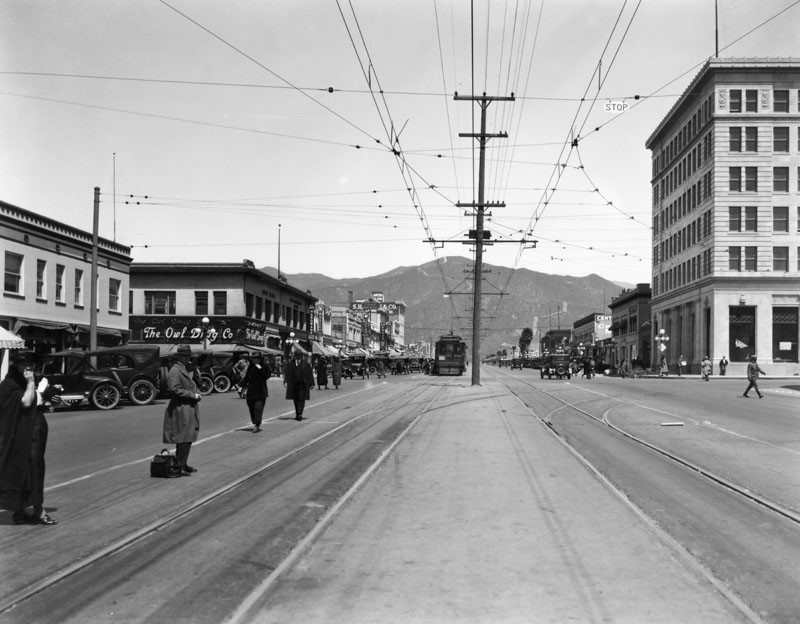
| (1924)^ - View from the middle of Brand Blvd. looking north. Pedestrians waiting just left of the train tracks for the Pacific Electric street car #566 to Los Angeles which is stopped at Broadway. Some of the businesses that can be seen include: "The Owl Drug Co.", "D.L. Gregg Hardware", "Glendale Music" and "Sun Drugs". |
 |
|
| (ca. 1924)^ - View looking north down the center of Brand Boulevard. The electric streetcar tracks are running north to south with a pair of tracks going off to the right toward Broadway. There are several businesses and stores that run along both sides of the street including "The Owl Drug Co." (N/W corner of Brand and Broadway). On the right in the distance, the Alexander Theatre with its original facade is visible. |
Historical Notes With population growing from 13,756 in 1920 to 62,736 in 1930, Glendale called itself "The Fastest Growing City in America". |
 |
|
| (1924)^ - View of the NE corner of Brand and Broadway in Glendale where the 1923-built Security Trust and Savings Bank stands. Note there are no street traffic lights as pedestrians and automobiles cross the streets. Many businesses may be seen on both sides of the street including railroad tracks which run down the middle of this wide street. |
 |
|
| (1924)^ - View looking north on Brand Boulevard from Broadway showing passengers boarding a Pacific Electric streetcar heading toward downtown Los Angeles. |
 |
|
| (ca. 1924)^ – Postcard view looking east on Broadway at Brand Boulevard. |
 |
|
| (ca. 1924)^ - View looking east on Broadway from Brand Blvd. Streetcar wires are overhead, with tracks beneath. A Glendale State Bank sign is seen on the north, and a drugstore on the south. |
 |
|
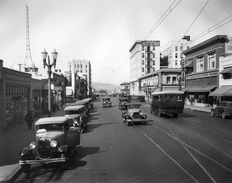
| (1930)^ - View looking west on Broadway toward Brand Boulevard where the Security-First National Bank stands (previously Security Trust and Savings Bank) . The Fair Department Store is seen on the right. |
 |
|
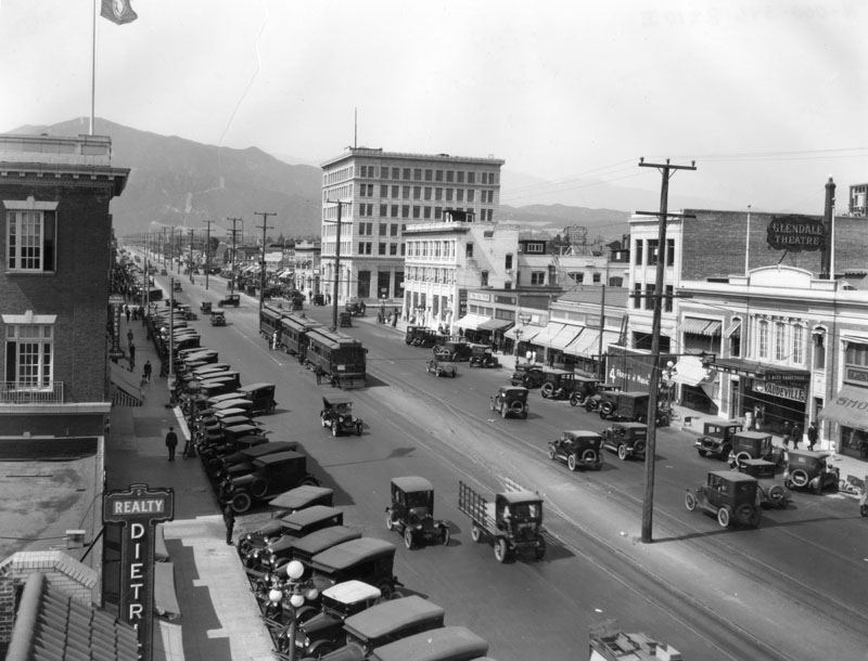
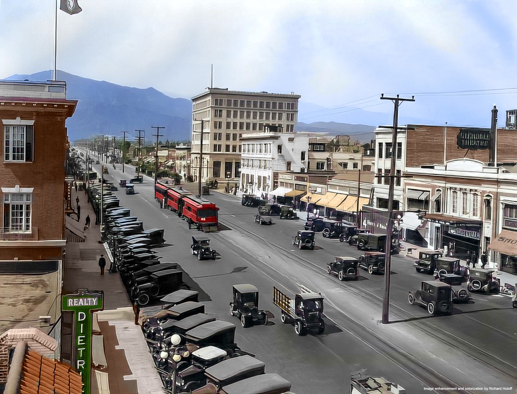
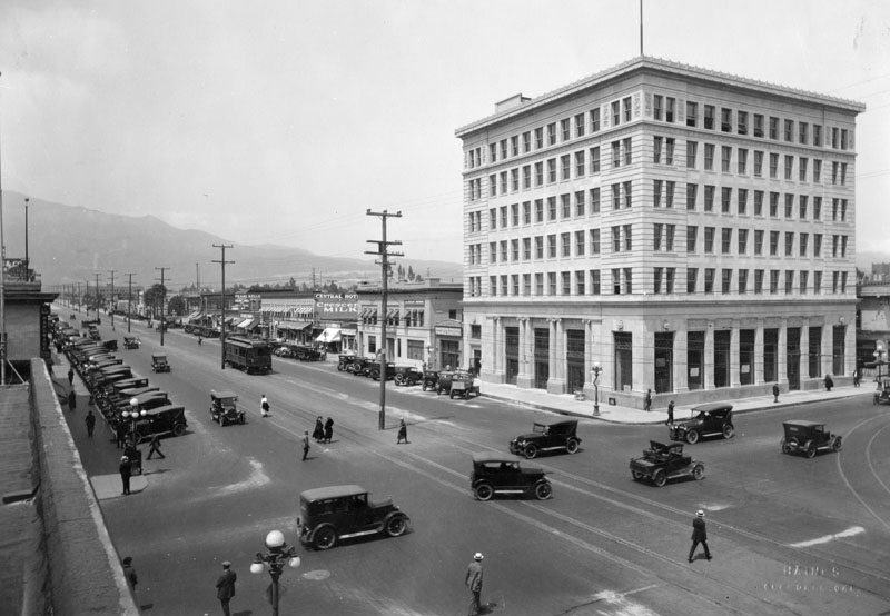
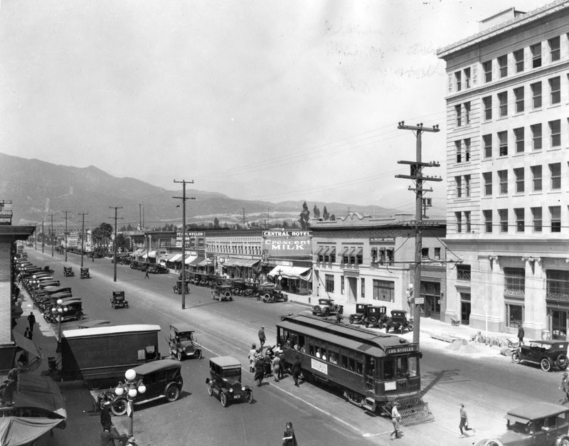
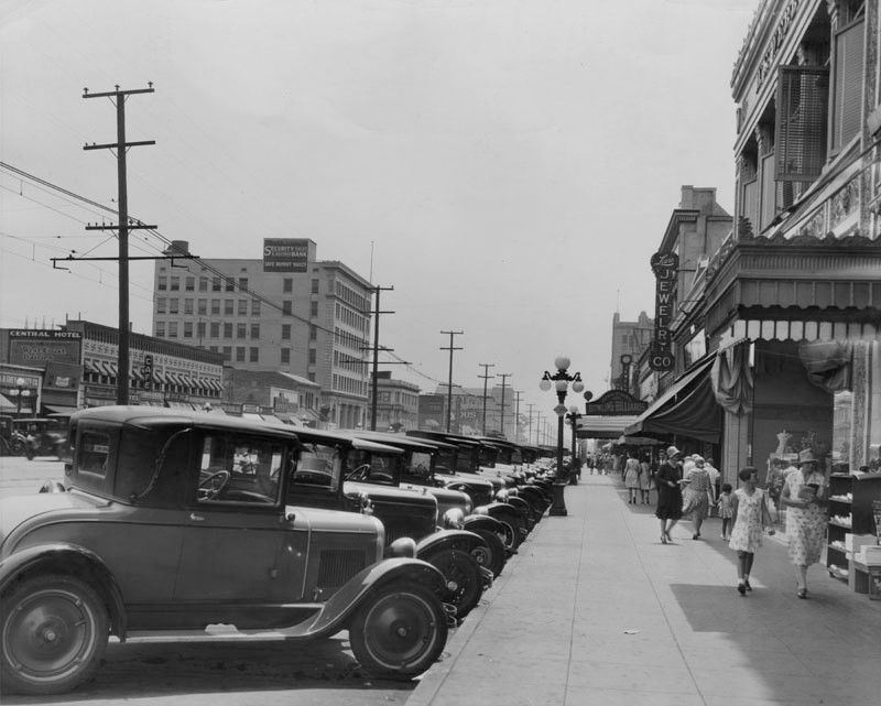
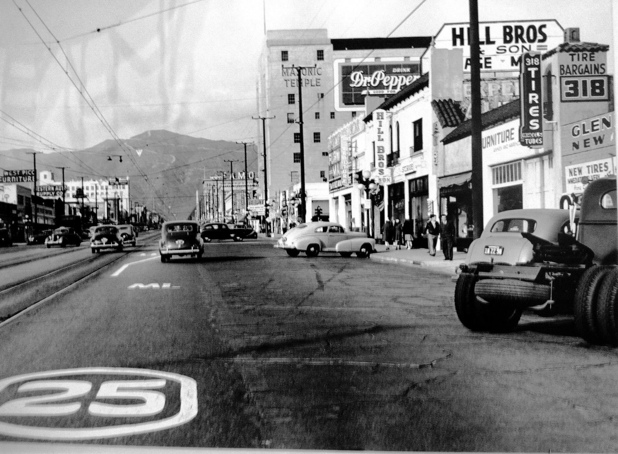
| (ca. 1929)^ - View looking south on Brand Boulevard at Wilson Ave. Cars parked diagonally line the street as pedestrians browse the shops. On the right, Lewis Jewelry Co. is visible mid-street, and on the opposite side of the road, the Central Hotel is seen on the corner and behind that, Security Trust & Savings Bank which would become Security-First National Bank circa 1930. |
 |
|
| (ca. 1931)^##- Downtown Glendale, looking south on Brand Boulevard toward Broadway. Security-First National Bank is on the left (originally the Security Trust and Savings Bank). |
 |
|
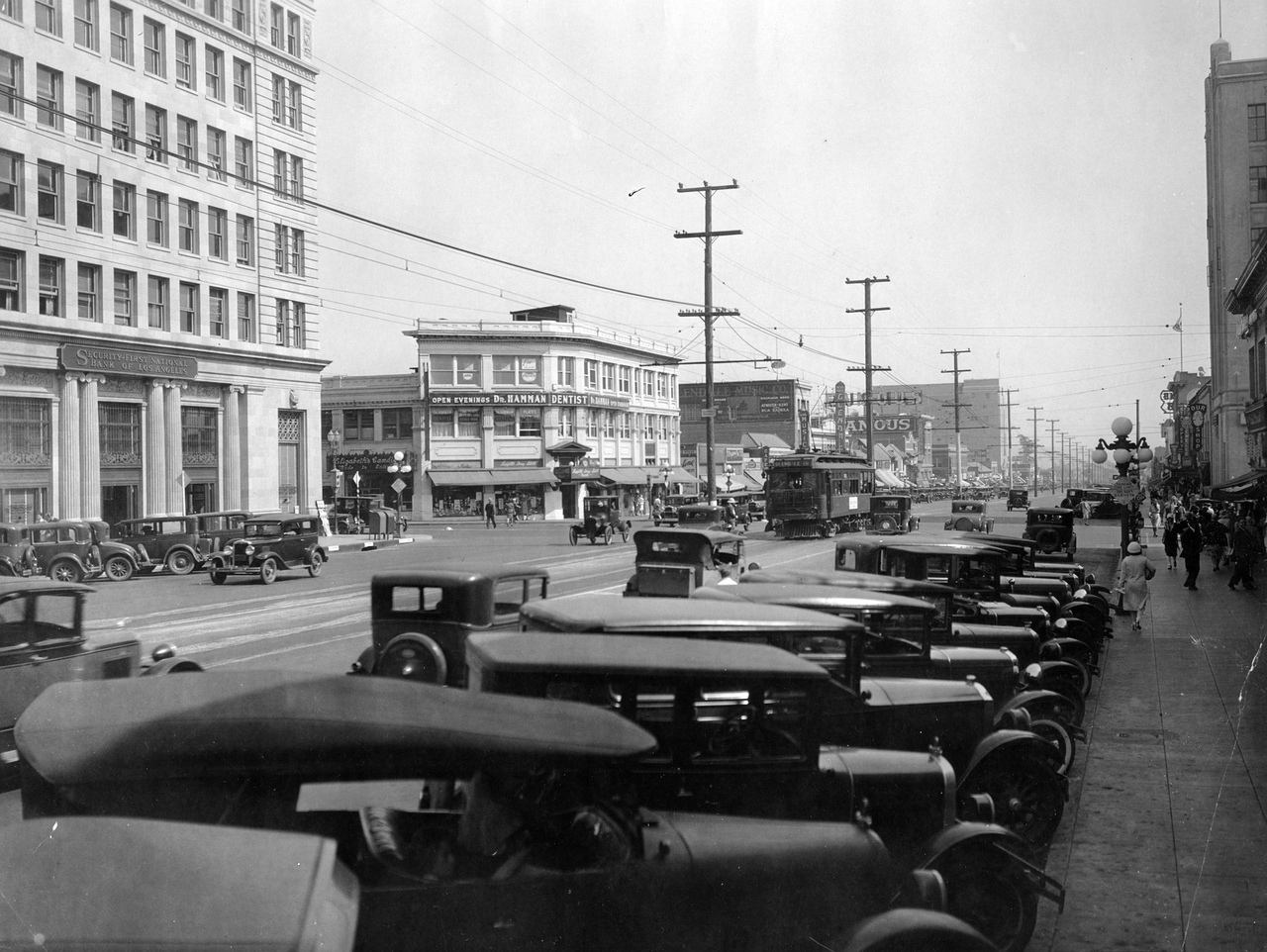
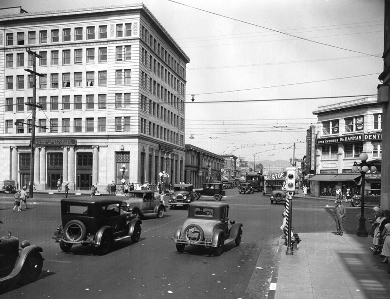
| (ca. 1931)^ - View looking east on Broadway at Brand Bloulevard with the Security-First National Bank building seen on the northeast corner. On the southeast corner is Dr. Hamman, Dentist. Note the STOP/GO semaphore traffic signal at lower-right. Click HERE for contemporary view. |
 |
|
| (1931)^ - View looking at the very busy intersection of Brand and Broadway with the Glendale branch of Security-First National Bank standing on the northeast corner. This was the site of the old electric railroad station. Photo date: January 9, 1931. |
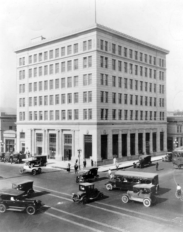
Historical Notes The NE corner of Brand and Broadway was the site of the Glendale depot of the Los Angeles Interurban railway, 1904-1923. The first six-story building in the city was constructed there by Security Trust and Savings Bank in 1923. Originally, the property was occupied by First National Bank of Glendale. |
 |
|
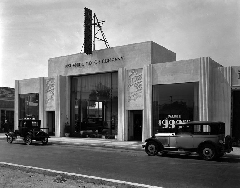
| (1926)^*# – View showing the McDaniel Motor Company Builidng located at 819 Brand Boulevard, Glendale. The Art-Deco building features a showroom with large display windows and decorative facade. Architect: C. Roderick Spencer. |
Historical Notes In the years between World War I and World War II, the country entered the age of the automobile, and this Art-Deco style worked particularly well in the expanding California automotive market where dealers competed fiercely for attention and for sales. |
.jpg) |
|
| (1926)^*# - View of the McDaniel Motor Co. car dealership showing the main showroom and the attached garage bay-style Used Car Department. Advertisement for a Nash Automobile for $999.00. |
Historical Notes Nash Motors was founded in 1916 by former General Motors president Charles W. Nash who acquired the Thomas B. Jeffery Company. Jeffery's best-known automobile was the Rambler whose mass production from a plant in Kenosha, Wisconsin began in 1902. The 1917 Nash Model 671 was the first vehicle produced to bear the name of the new company's founder. Nash enjoyed decades of success by focusing its efforts to build cars "embodying honest worth ... [at] a price level which held out possibilities of a very wide market." Charles Nash convinced the chief engineer of GM's Oakland Division, Finnish-born Nils Eric Wahlberg, to move to Nash's new company. The first Nash engine introduced in 1917 by Wahlberg had overhead valves, which Nash had learned about while working for Buick. Wahlberg is also credited with helping to design flow-through ventilation that is used today in nearly every motor vehicle.*^ |
Palace Grand Theatre
.jpg) |
|
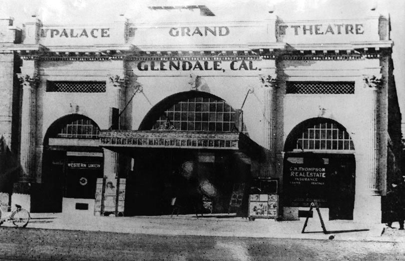
| (1920s)^ - View of the Business Block on Brand Boulevard, in Glendale. The Palace Grand Theatre is seen on the right at 131 N. Brand Blvd. |
Historical Notes The Palace Grand Theatre was originally built and owned by Henry C. Jensen, who would later build the more palatial Raymond Theatre in Pasadena. The neo-classical building was designed by architect Robert G. Kitts. Construction on the Palace Grand began in August, 1914.^ |
 |
|
| (ca. 1920)^ - View showing the Palace Grand Theatre located at 131 N. Brand Boulevard with a bicycle parked at the curb. |
Historical Notes The Palace Grand Theatre was operated by Henry C. Jensen for several years. By 1923, though, it had been renamed the T D & L Theatre, operated by the Turner, Dahnken and Langley Company, which became the basis of the Fox-West Coast circuit. After T D & L it became the Lincoln Theatre. The entire block on which it stood has long since been redeveloped. It may have closed as early as the 1930’s. ^^* |
 |
|
| (ca. 1925)^ - Panoramic view of Glendale looking northeast from the Lyons Storage building near Central Avenue and Colorado Boulevard. The Glendale Presbyterian Church with its distinctive bell-clock tower can be seen in the distance. |
 |
|
| (1925)^ - Panoramic view of Glendale from Broadway and Maryland, looking southeast to Forest Lawn Cemetery with a closer view of the Glendale Presbyterian Church. To the right of the Church can be seen Glendale Union High School (built in 1908). |
 |
|
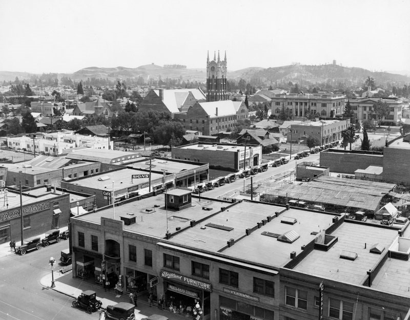
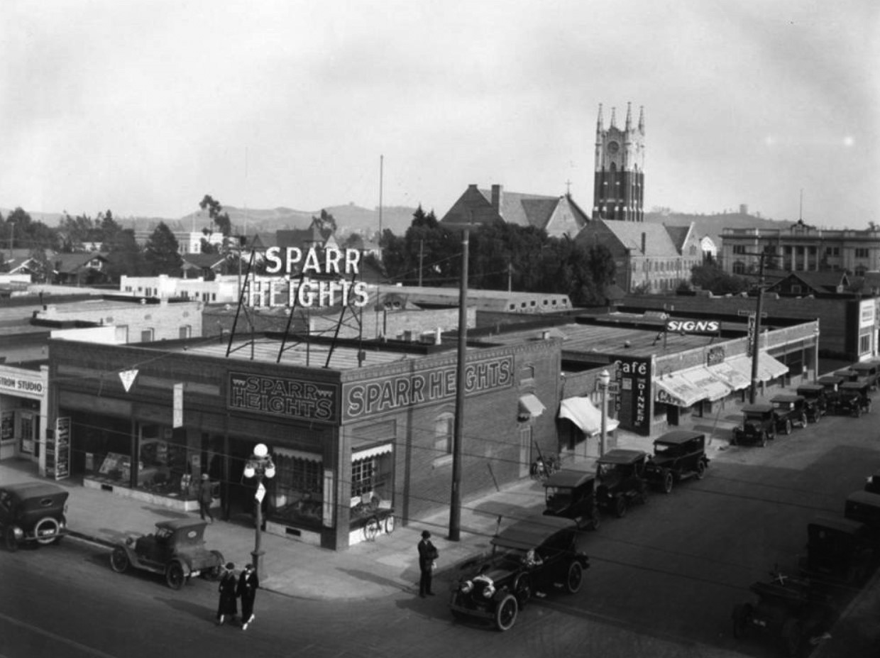
| (1920s)* - View looking southeast showing the Sparr Heights real estate office at the intersection of Broadway and Maryland, located next to Ostrom Studio. Glendale Presbyterian Church and Glendale Union High School can both be seen in the background. |
Historical Notes The area just south of Montrose was mostly orchards and vineyards owned by William Sparr. When he saw what was happening north of Honolulu Avenue in the 1920s, he decided to rip out his fruit trees and grapevines and divide his land into residential lots. He named the new area “Sparr Heights.” |
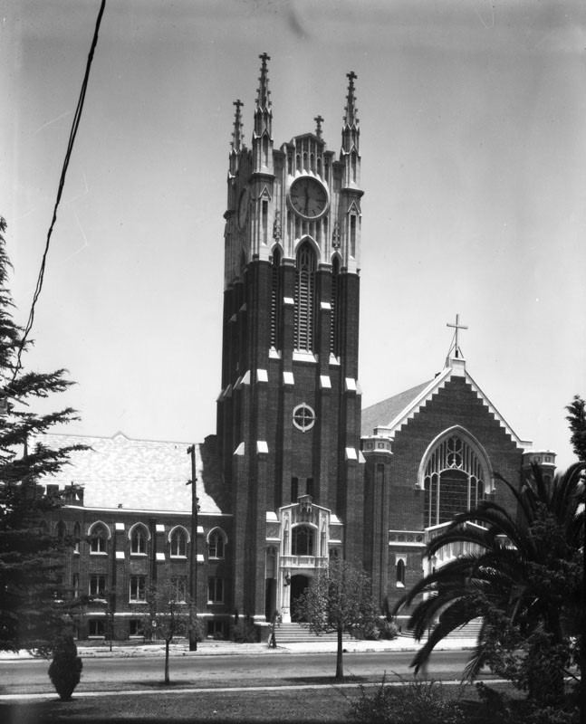
Glendale Presbyterian Church
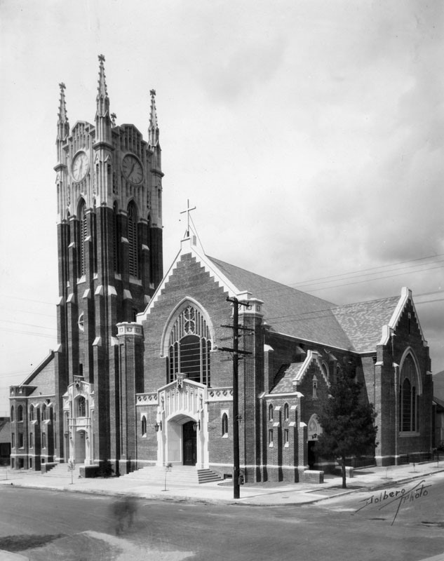 |
|
| (ca. 1924)^ - View of the bell tower with its clock and entrance to the Glendale Presbyterian Church located on the NW corner of Louise and Harvard streets. The church was built in 1923 in an English Gothic Revival style. |
 |
|
| (ca. 1920s)^ - Looking across Harvard Street showing the Glendale Presbyterian Church with its spires and clock tower. This church building no longer exists, however, the corner lot is still occupied by the Glendale Presbyterian Church. Click HERE for contemporary view. |
Glendale YMCA
 |
|
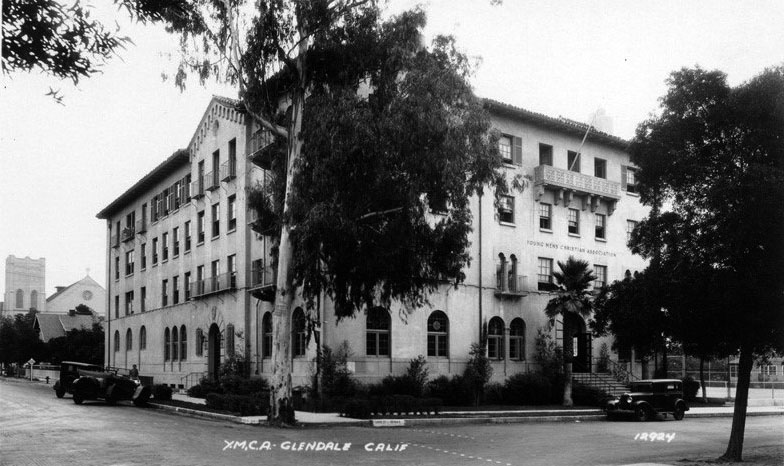
| (ca. 1926)^*# – Postcard view looking at the SE corner of Wilson Avenue and Louise Street showing the newly constructed Glendale YMCA. |
Historical Notes The Glendale YMCA was founded in 1919. A massive fundraising drive brought in enough money in 1926 to construct one of the most successful establishments of Glendale. Located at Wilson Avenue and Louise Street the building is an excellent example of Spanish Colonial Revival architecture and was originally designed with an open-air courtyard in the center and an underground swimming pool. Upper rooms were constructed for housing.^ |
 |
|
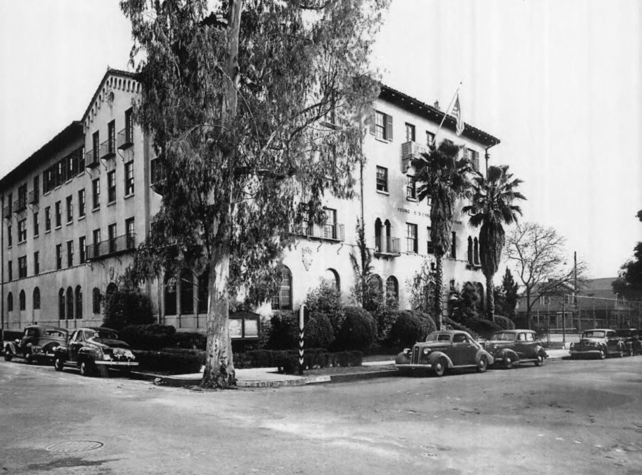
| (1938)#* – View showing a large Eucalyptus tree on the corner in front of the Glendale YMCA building. The building still houses YMCA today, but the Eucalyptus tree is no longer standing. Click HERE for contemporary view. |
Glendale Masonic Temple
 |
|
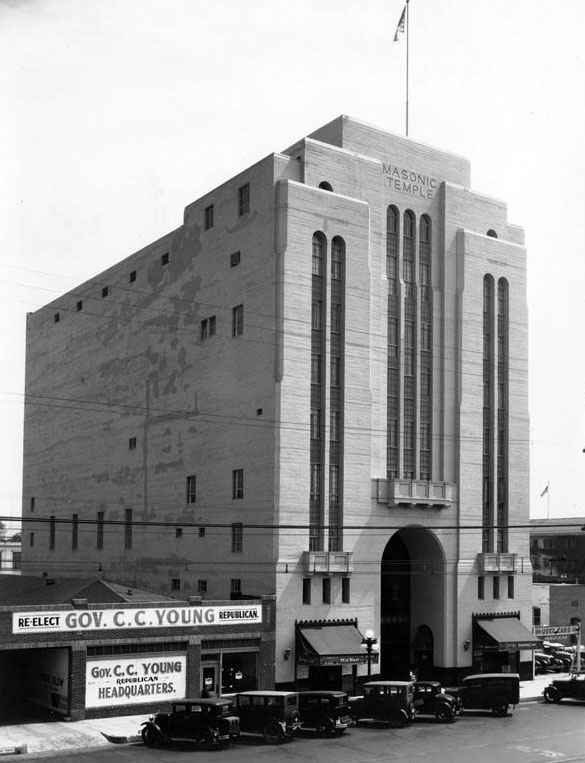
| (1931)^*# – View showing the Glendale Masonic Temple, located at 232 S. Brand Blvd. The ‘Re-elect Gov. C.C. Young Headquarters’ is seen on the left. |
Historical Notes The 1920s-building was designed by Arthur Lindley, whose firm Lindley & Selkirk designed the Alex Theatre a few blocks north of the temple. California Governor C.C. Young ran for a second term but lost to Frank Merriam, and left office on January 6, 1931. He retired from politics and returned to his business in real estate development.*^ |
 |
|
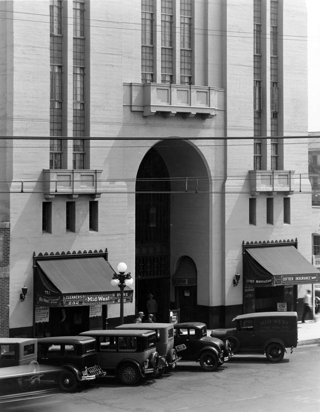
| (1931)^*# - Closer view showing the entrance to the Masonic Temple on Brand. |
Historical Notes Americana at Brand owner Rick Caruso and his company, Caruso Affiliated, bought the 1920s-era Masonic temple right across the street from the Americana and renovated the building. The repurposed Art Deco building now houses the commercial real estate firm CBRE. Click HERE to see contemporary view. |
* * * * * |
Glendale News-Press
 |
|
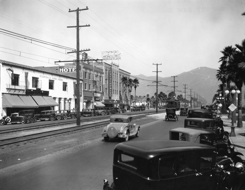
| (ca. 1931)^ - View looking down Brand Boulevard, in Glendale. The Lexington Hotel and Hotel California are the two large buildings across the street. The white building on the left belongs to the Glendale News-Press. |
Historical Notes The Glendale News-Press was formed when Ira Clifton Copley's Copley Press bought and combined the Glendale Daily Press and the Glendale Evening News in 1905. Copley sold the News Press and the Burbank Daily Review to Morris Newspapers in 1974; however Morris sold off the papers two years later. Ingersoll Publications bought the papers in 1980. Page Group Publishing, who had just bought the Orange Coast Daily Pilot and the Huntington Beach Independent, acquired the paper from Ingersoll in 1989. Times Mirror bought the newspaper group in 1993. The Glendale News-Press covers local news, entertainment and sports in Glendale and La Crescenta-Montrose. With a readership of more than 10,000, it is now published twice-weekly, instead of daily.*^ |
 |
|
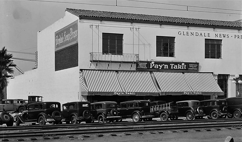
| (1931)^^ – View looking at west across the tracks showing the Pay'n Takit Store located at 329 North Brand Boulevard. The grocery store shared the building with Glendale News-Press. |
Glendale Avenue (1920s)
 |
|
| (1926)++# - View looking south on Glendale Avenue from just below Wilson Avenue. Note the Glendale & Montrose depot at right, the surviving Glendale Hotel at left and the rails curving off to the left to run in Wilson and thence to Eagle Rock. |
 |
|
| (1920s)++# – View showing the Glendale & Montrose (G&M) car No. 12 at the G&M depot on Glendale Ave. |
Historical Notes G&M No. 12 was one of four cars, nos. 10-13, built for the G&M by the American Car Company in 1920. ++# |
Brand Boulevard (1940s)
 |
|
| (1940)* – Brand Blvd looking north from Colorado Blvd. Streetcar tracks seen on the left. The tallest building in the distance is the Masonic Temple. |
 |
|
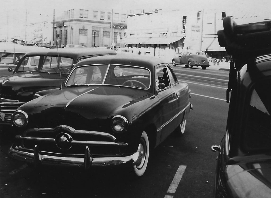
| (1949)* – Ford Coupe parked on Brand s/o Broadway with streetcar tracks running down the center of Brand Boulevard. |
Historical Notes Popularly called the "Shoebox Ford" for its slab-sided, "ponton" design, the 1949 Ford is credited both with saving Ford and ushering in modern streamlined car design with changes such as integrated fenders and more. This design would continue through the 1951 model year, with an updated design offered in 1952. The crest was designed by Frank L. Engle.^ |
* * * * * |
Brand Blvd Red Car
 |
|
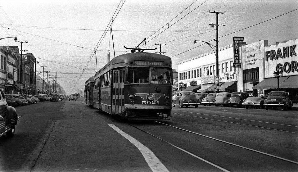
| (1949)* – View showing Pacific Electric PCC no. 5021 rolling to a stop on Brand Boulevard at Broadway. On the right is the east side of the 100 block of N. Brand. At 114 N. Brand is "Frank Gordon" clothes. At 118 N. Brand is "Mutual Savings & Loan". |
Historical Notes The Red Car on Brand Boulevard in Glendale was a significant part of Southern California's public transportation history, operating from the early 1900s to the mid-1950s. The story began in 1903 when L.C. Brand's Los Angeles & Glendale Electric Railway started construction on a local train line. However, in 1904, Brand sold his company to Henry E. Huntington's Los Angeles Inter-Urban Railway (LAIU). The line, initially known as "The Glendale Line," began service between Glendale and Downtown Los Angeles on April 10, 1904. |
 |
|
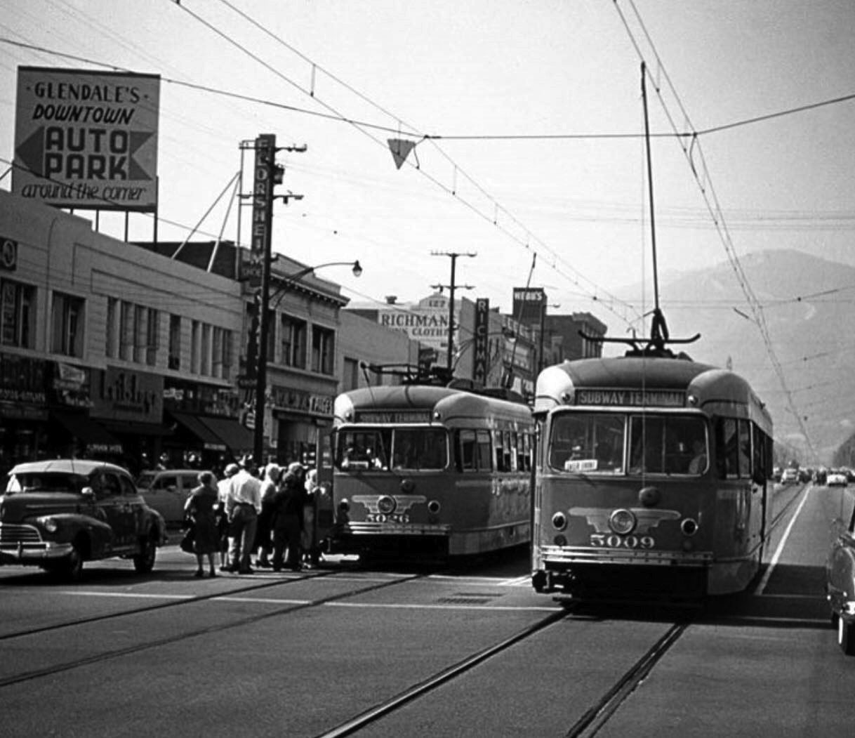
| (ca. 1949)* – Passengers are seen boarding Pacific Electric PCC no. 5026 heading to Subway Terminal in downtown Los Angeles with a second streetcar on adjacent tracks. |
Historical Notes In 1908, the Pacific Electric Railway, also owned by Huntington, assumed control of the line and extended it to Burbank, renaming it "The Glendale-Burbank Line." The Red Car ran along Brand Boulevard, which became Glendale's bustling "Main Street" during the 1920s. The line played a crucial role in Glendale's rapid growth, with the city's population increasing significantly during this period. |
 |
|
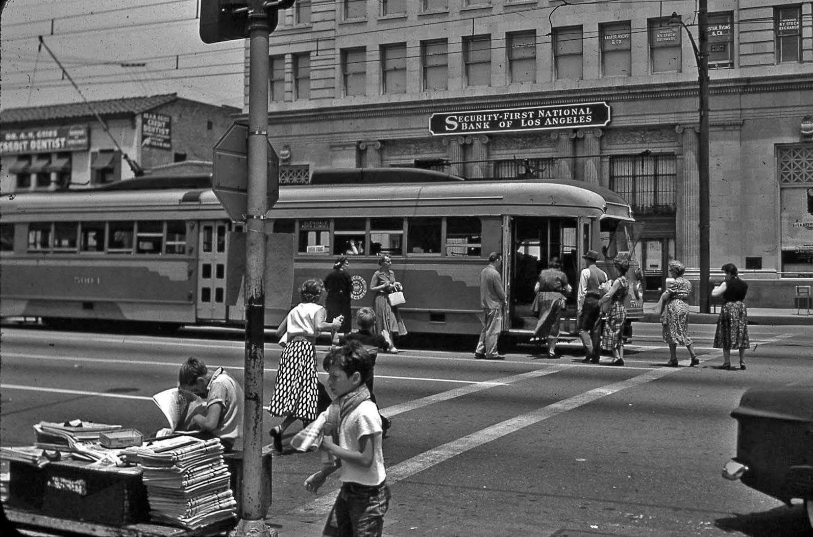
| (ca. 1950s)* - View looking east from behind a newstand at the NW corner of Brand Boulevard and Broadway showing passengers boarding the Pacific Electric PCC with the Security-First National Bank in the background. |
Historical Notes The Red Car system was extensive, with more than 1,000 miles of track throughout Southern California. It was not only a means of transportation but also a driver of the region's economy, allowing working-class Angelenos to commute to their jobs daily. The Brand Boulevard/Broadway station in downtown Glendale served as the main depot for Red Car riders visiting the city during the height of its use. |
 |
|
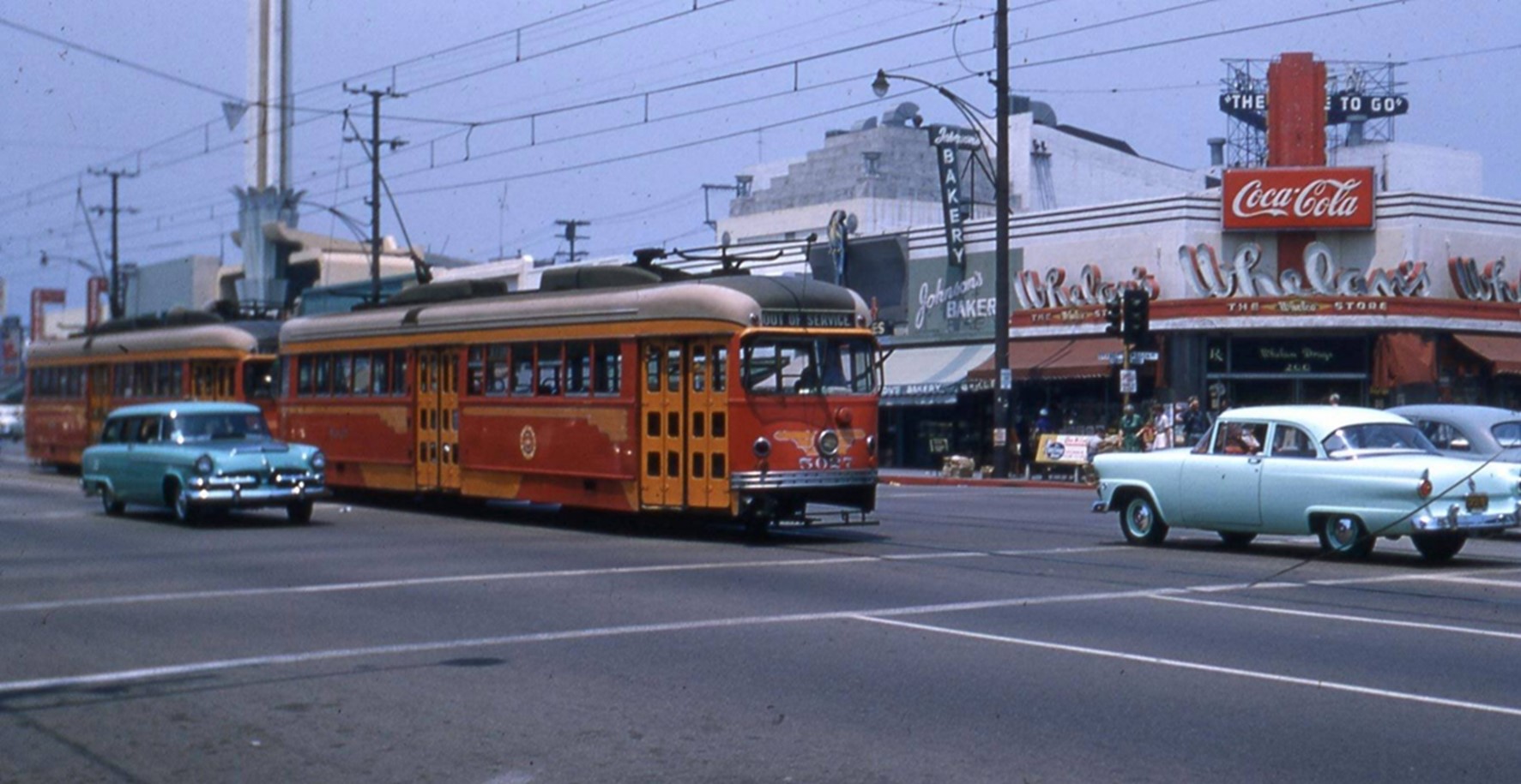
| (1955)* - View looking northeast at the corner of Brand Boulevard and Wilson Avenue showing two streetcars inbound to LA on the next to the last day of PE service to Glendale, 6/18/1955. The tower and roof of the Alex Theater rise in the background. |
Historical Notes The Red Car's prominence began to decline in the post-World War II era. Several factors contributed to this decline, including rising operational costs, the growth of automobile ownership, and the development of suburbs beyond the reach of the existing rail lines. The system's infrastructure, much of which dated back to the early 1900s, also required significant rehabilitation. |
 |
|
| (1955)* - View of Pacific Electric PCC and Hollywood cars at North Glendale Avenue (end of Brand) on the last day of service on the Glendale line. Photo by Loren Ayers, 6/19/1955 |
Historical Notes The end of the Red Car era came gradually. Rail service to North Glendale ceased on June 18, 1955, and the final day of service on the Glendale-Burbank line was in June 1955. Despite its relatively short lifespan, the Red Car had a significant impact on Glendale's development, shaping the city's growth and urban layout. Today, remnants of the Red Car era can still be found, serving as reminders of Los Angeles's once extensive rail network. |
 |
|
| (2021)* – A view looking north on Brand Boulevard toward Mountain Street, marking the former terminus of the Red Car line in Glendale. |
Then and Now
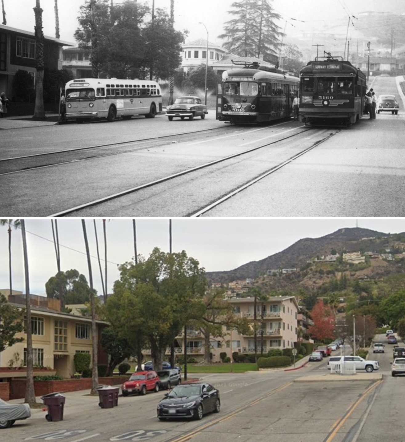 |
|
| (1955 vs 2021)* - Looking north on Brand Boulevard toward Mountain Street, the former terminus of the Red Car line in Glendale. The 1955 photo captures the final day of Red Car service through the city. |
Then and Now
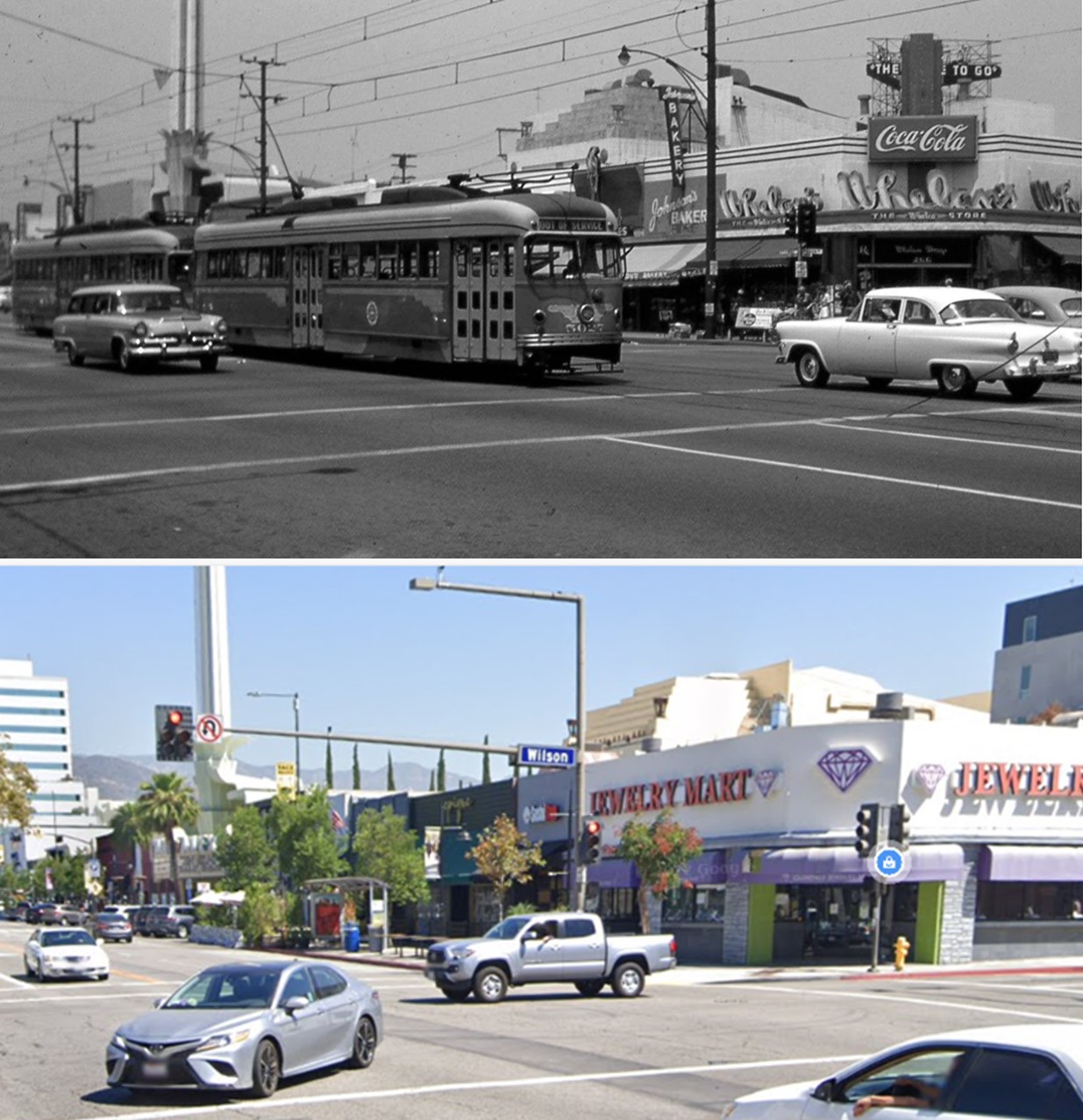 |
|
| (1955 vs. 2022)* - The intersection of Brand Boulevard and Wilson Avenue with the tower of the Alex Theatre seen in the background. |
* * * * * |
.jpg) |
|
| (1927)* - View looking north from the southeast corner of Western Ave and W. Glenoaks Blvd, Glendale. A morning three-car train of PE 500-class interurbans stands ready to whisk its riders to the Subway Terminal, downtown LA. The Verdugo Mountains can be seen at right. Click HERE for contemporary view. |
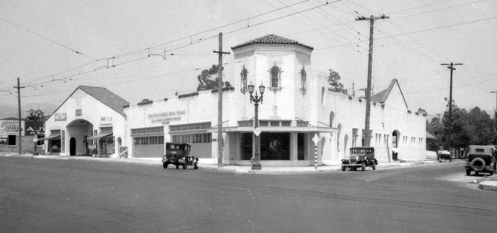 |
|
| (1931)* – Panoramic view showing the NE corner of Harvard Street and S. Glendale Ave. The above building is still standing today and is occupied by a Honda Dealership. Click HERE for contemporary view. |
* * * * * |
Hoover High School
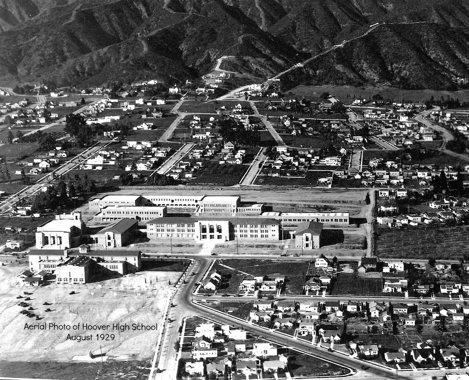 |
|
| (1929)^.^ – Aerial view showing a newly constructed Hoover High School located in the northern part of Glendale at the intersection of Glenwood Road and Concord Street. |
Historical Notes The school's original campus, on Glenwood Road, opened in 1929. Named after Herbert Hoover, the school was built to serve the northern foothill area of Glendale, which had experienced a lot of development in the 1920s. The first issue of the school yearbook, Scroll, included copies of letters written by Hoover and his wife, Lou. The school dedicated that issue to Hoover. The school has been the setting for several television programs and movies, most notably "Because They're Young", which was filmed at the campus during the summer recess in 1959. The original campus, with the exception of the auditorium and physical education facilities, was demolished in 1966 being replaced by a new facility which was completed in 1969. In 1990, due to continual and anticipated growth in the number of students entering Hoover, a 33-classroom facility was built and completed in 1992.^ |
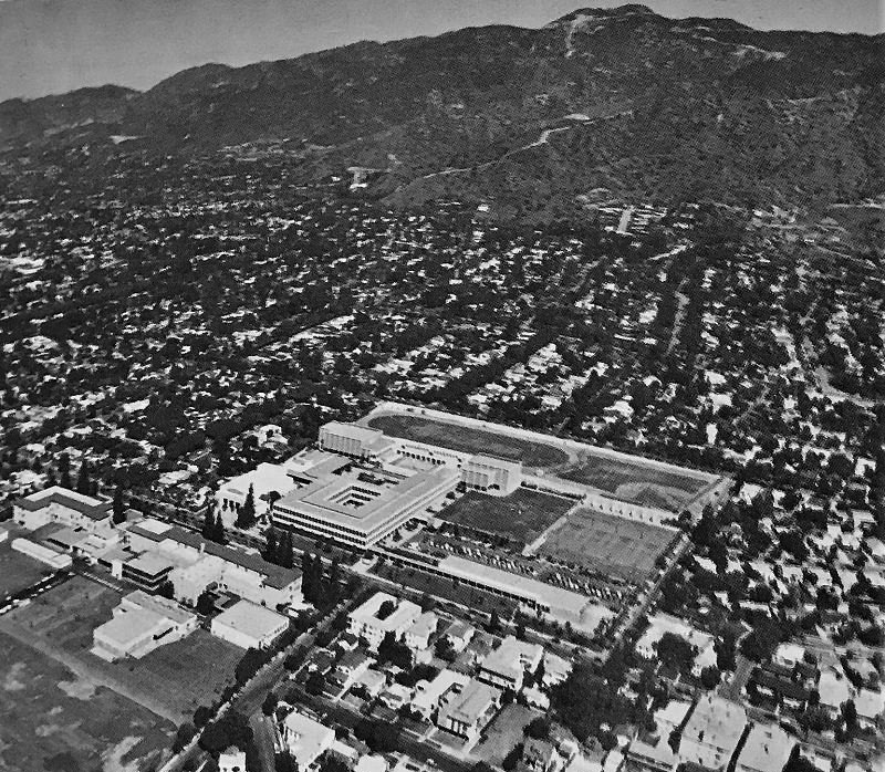 |
|
| (1974)^.^ - Hoover High School aerial shot with the Verdugo Mountains in the background. Click HERE for contemporary view. |
* * * * * |
Glendale Airport (Grand Central Airport)
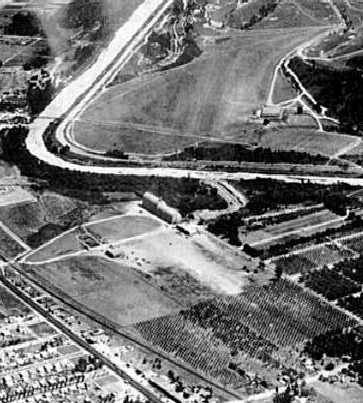 |
(1927)*# – Aerial view looking southeast showing the Glendale Airport field in an early configuration with a smaller border (bottom of photo). Note the peach orchard forming the northern border at lower-right. The Slate Aircraft Corporation dirigible hangar is visible on the south side of the field (center) and Griffith Park Airport is visible across the river.
|
Historical Notes In 1922—with prompting from the Aero Club of California, returning World War I pilots and local aviation enthusiasts who wanted to get in on the exciting new world of flying—the Glendale Chamber of Commerce purchased 33 acres adjacent to the Southern Pacific Railroad tracks, directly across the river from the Griffith Airdrome. They cleared a 1,200-ft. runway for the Glendale Municipal Airport. It opened in March 1923. Soon after clearing the field, objections were raised for the City’s plans, and a bond issue was unsuccessful, so citizen supporters, led by Dr. Thomas Young, got together to form the Glendale Airport Association. This group bought the City out, and Glendale finally had an official airport. The first hangar built at Glendale Airport was for the Kinner Airplane & Motor Corporation. Bert Kinner built Amelia Earhart’s first airplane, the Kinner Airster, in 1923. He also manufactured the first government-certified aircraft engine in 1928. +## |
.jpg) |
|
| (1927)*# – View showing three biplanes and one monoplane in front of the Wilson Aero Corporation hangar, with the Slate Aircraft Corporation dirigible hangar also visible on the left. |
Historical Notes The concept for this airport probably began with Leslie Coombs Brand (1859–1925), a major figure in the settlement and economic growth of the Glendale area. He had purchased land on the lower slopes of Mount Verdugo overlooking the city, and in 1904 built an imposing residence that became known as Brand Castle (which today houses the Brand Library). Just across the mostly dry Los Angeles River he could see the Griffith Park Aerodrome's grass field, built in 1912. Just three years later he decided to build his own grass airstrip below his mansion (Brand Field). He built his first hangar in 1916 and put together a fleet of planes, and held fly-in parties. The only requirement was that guests had to arrive in their own planes and bring passengers.*^ |
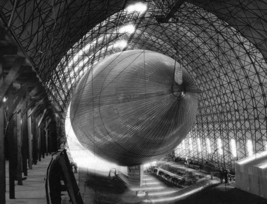 |
|
| (1928)* - The Slate Dirigible is docked in its hanagar at Glendale Airport. At the time, this was the largest built metal hangar in the United States. |
Historical Notes In 1925, Thomas Slate leased space adjacent to the south side of the Glendale Airport for the construction of an all-metal dirigible, a very novel (but ultimately unsuccessful) design. The dirigible was made out of duralumin & was filled with hydrogen. It was forecast to have a cruising speed of 80 mph and would accommodate 40 passengers and 5 crew. The dirigible was to be powered by oil and driven by steam-turbine, using one rotary blower, which would create a vacuum, instead of traditional propellers. Slate also constructed a metal hangar, the largest built in the United States at the time.* |
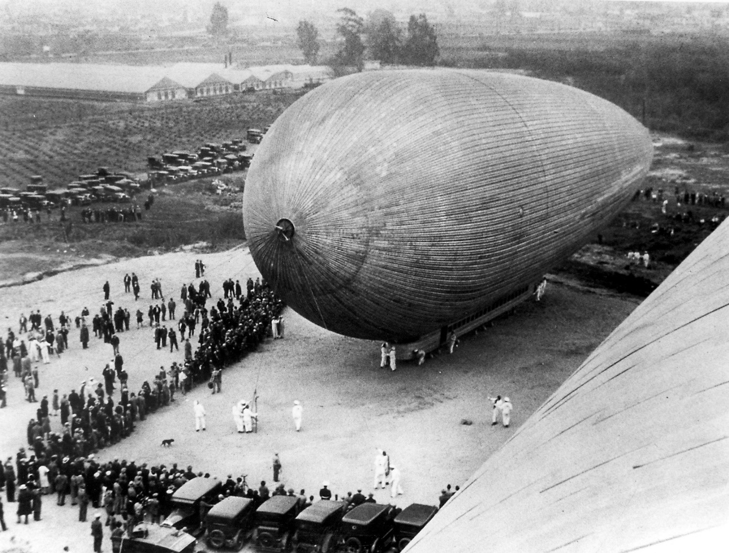 |
|
| (1929)*– Large crowd surrounds a Slate Dirigible at Glendale Airport. |
Historical Notes Dec. 19, 1929- Thomas Benton-Slate was an entrepreneur who invented dry-ice. This day in the suburb of Glendale, he attempted to fly the first all metal dirigible, the City of Glendale. He brought it out two days ago and it immediately began to pop rivets in the heat and fall apart. So he brought it in for repairs. This day he tried one more time, but the sun’s heat expanded the shell, causing rivets to pop again, followed by a metallic explosion and escaping gas. He had it dragged back into the hanger and forgot about it. * |
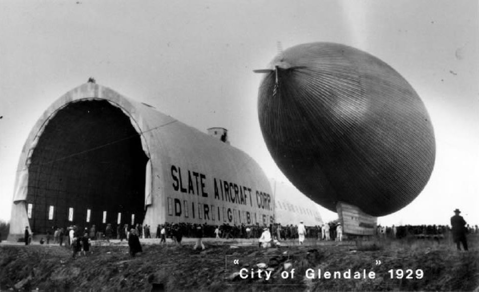 |
|
| (1929)* - Thomas Benton-Slate’s dirigible outside its hangar. |
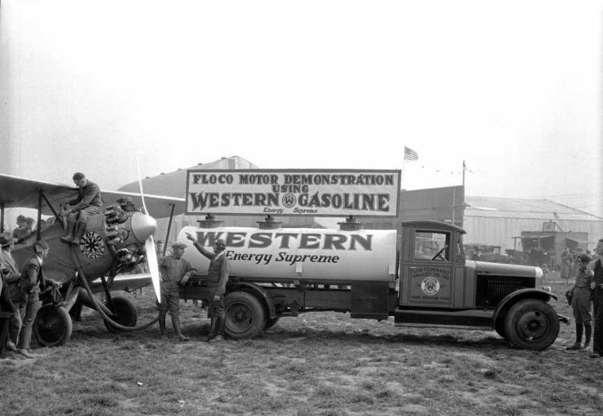 |
|
| (1928)#* - Men refuel a biplane at the Glendale Airport. A sign on the top of the fuel truck reads "Floco motor demonstration using Western Gasoline : energy supreme". The truck has the business's name, San Fernando Valley Oil Co., painted on the side of the cab. Photo by "Dick" Whittington |
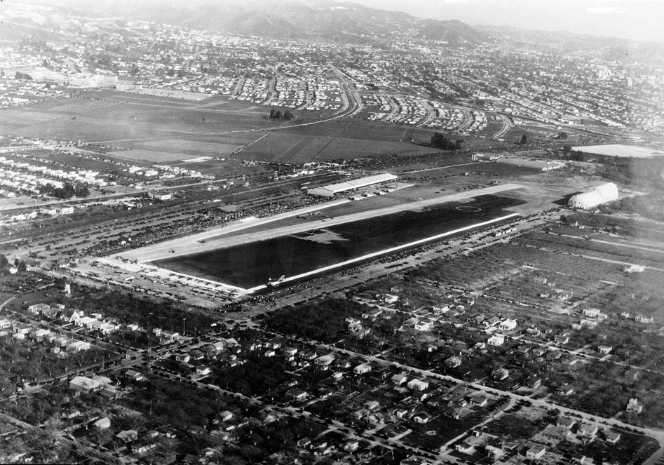 |
|
| (1929)^* - Aerial view of Grand Central Air Terminal, Glendale, 1929. The airfield can be seen at center and a single runway is visible. Hundreds of cars can be seen parked near the runway at left, and planes are visible on the taxiways. Closely spaced houses can be seen in the foreground and in the background. |
Historical Notes The Glendale Municipal Airport was renamed "Grand Central Air Terminal" (GCAT) when it was purchased by other venture capitalists, who expanded it to 175 acres. On February 22, 1929 a terminal with a control tower had been built, and was opened to much fanfare. Designed by Henry L. Gogerty, the intention was to construct an air terminal along the lines of a classic railroad terminal. It combined a style consisting of Spanish Colonial Revival with Zig-zag Moderne influences (Art Deco). GCAT became a major airport of entry to Los Angeles and provided the first paved runway west of the Rocky Mountains. Within a year, the entire enterprise was sold to a group calling itself the Curtiss-Wright Flying Service, managed by Major Corliss C. Moseley, a co-founder of the future Western Airlines. It became the city's largest employer.*^ |
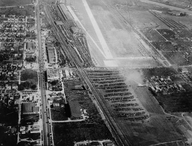 |
|
| (ca. 1929)* - Aerial view of Grand Central Aiport in Glendale on U.S. Army Air Force Day. Planes are parked in front of hangers and on the field. A large number of cars are parked on a field below the airport. A crowd stands between the Grand Central Air Terminal building and the hangars. |
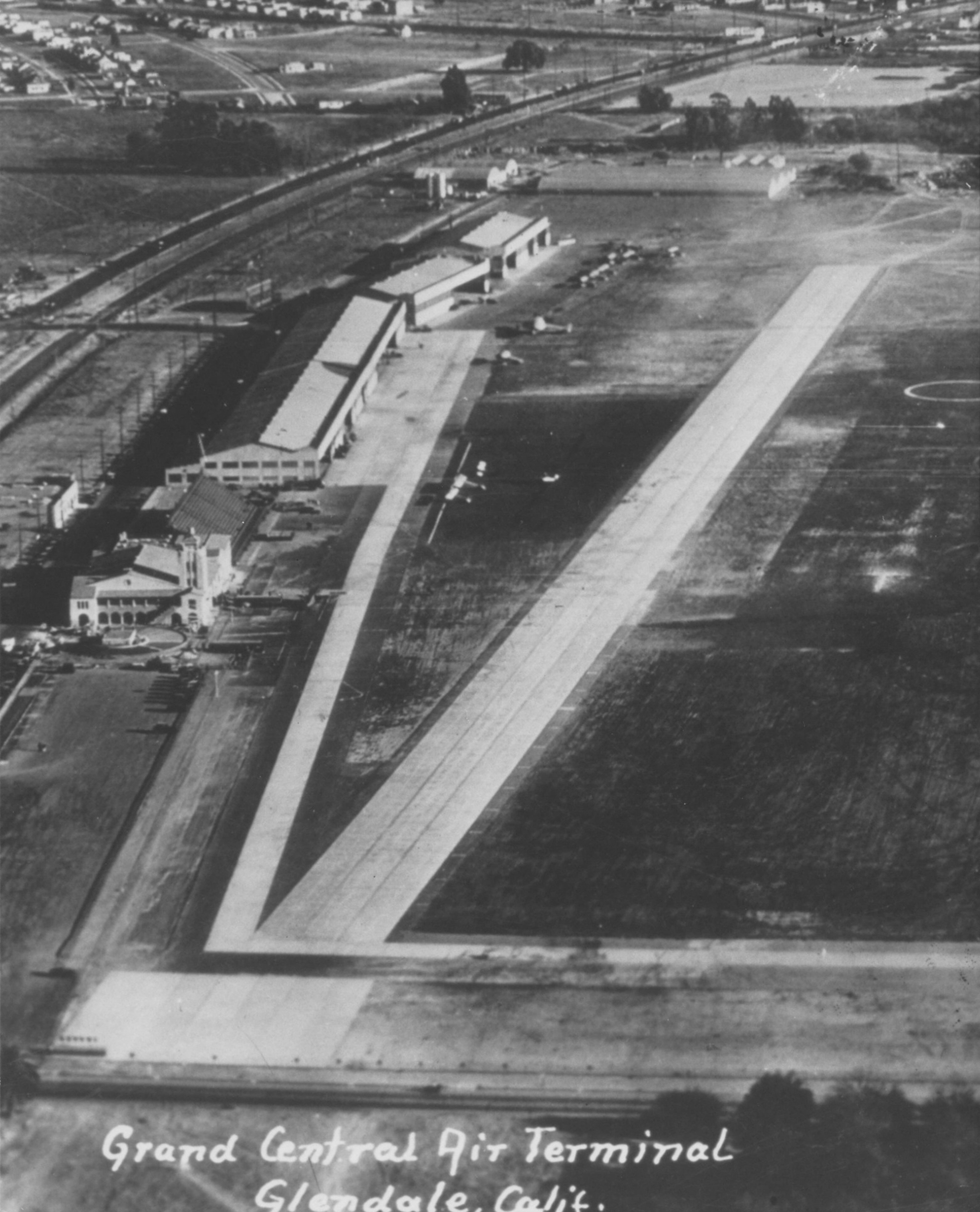 |
|
| (ca. 1930)* - Close-up arial showing Grand Central Aiport and Terminal. |
.jpg) |
|
| (ca. 1930s)^* - Birdseye view of a crowd along the runway at the Grand Central Air Terminal in Glendale. The runway goes from the foreground at right to the background at left. A large crowd of people can be seen around the entire periphery of the runway. It appears that they're waiting to see an air show. |
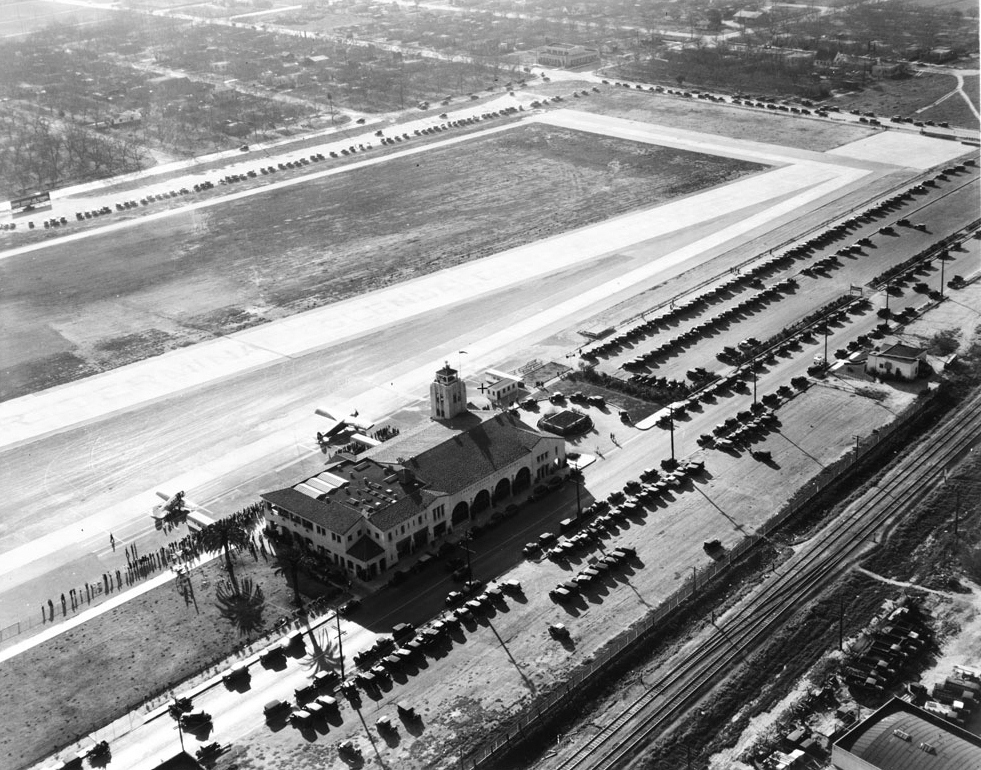 |
|
| (1932)^* - Aerial view of Grand Central Airport in Glendale, February 28, 1932. The terminal is at center and is a large, rectangular, mission-style structure. A tall control tower sticks up from the upper right corner. Two small aircraft are parked directly in front of the terminal, and hundreds of automobiles are parked in a lot behind the terminal. Many people are lined up near the aircraft. The runway is at center and borders a large dirt field. In the distance at left, a neatly arranged neighborhood is visible, while railroad tracks can be seen in the foreground at right. |
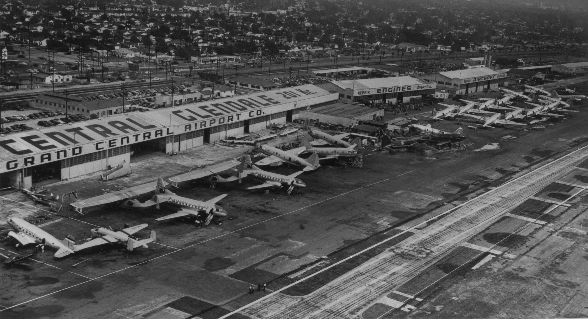 |
|
| (ca. 1940s)* - Glendale Central Air Terminal with passenger planes |
Historical Notes In 1947 the runway was cut back to 3,800' (southeast of Sonora Ave) due to pressure from local government. The airport was returned to private use, renamed Grand Central Airport, ceased to be profitable, and was closed in 1959 to make way for the development of the Grand Central Business Park, which today houses corporate offices of the Walt Disney Company as well as the headquarters for Walt Disney Imagineering. For a number of years the Southwest corner was used as a commercial helicopter base. That space is now occupied by the DreamWorks Animation SKG production company. The city of Glendale retains some interest in aviation, for it is part owner of the Bob Hope Airport (formerly "Burbank-Glendale-Pasadena Airport").*^ |
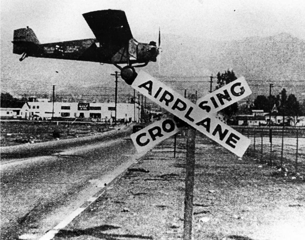 |
|
| (1930)+## - Airplane Crossing sign at Grand Central Airport in Glendale. |
Grand Central Terminal
 |
|
| (ca. 1930)^.^ – Postcard view showing the Administration Building at the Grand Central Airport in Glendale. A small airplane numbered NC-8413 is in front of the building. |
Historical Notes The Grand Central Airport Terminal was designed by Henry L. Gogerty in 1928 blending the Spanish Colonial Revival style with Art Deco influences. The Airport first began its service between Los Angeles and New York, and it played a vital role as the premier airport in Southern California. The building represents the simple concept of early airport terminal design, and it is listed on the Glendale Register of Historic Resources. The airplane shown in this image was a Ford 4-AT Tri-motor owned by the Maddux Air Lines, which carried 12 passengers from San Diego to Los Angeles during its inaugural flight in California.** |
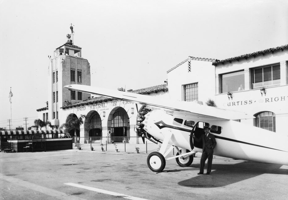 |
|
| (ca. 1930s)^* - Photograph of a radial-engine airplane outside the Grand Central Airport. The high-wing monoplane can be seen in the foreground at right, and a man in a suit is visible near an open door under the wing. The Spanish-style air terminal can be seen in the background. It is a two-story structure with a terracotta tile roof. In the background at left, a tall rectangular control tower is visible. Legible signs include "Grand Central Air Terminal" and "Curtiss-Wright". |
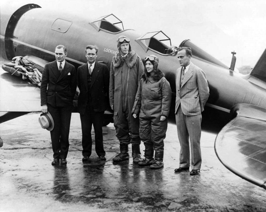 |
|
| (1930)^ – View of Charles A. Lindbergh and his co-pilot/navigator, Anne Lindbergh beside their Sirius, built according to the specifications of Lindbergh, by Lockheed. |
Historical Notes On Easter, 1930, Colonel Lindbergh and his wife, Anne, took off from Glendale (Calif.), bundled up in their bulky, electrically heated flying suits, to test the advantages of weather at high altitudes, and to set new transcontinental records. The sliding canopies, covering both formerly open cockpits, were suggested by Mrs. Lindbergh, who set a women's record for coast to coast flights on this first Lockheed Sirius. The sliding canopies were later put into common use. While the ship was being built, Lindbergh, shy of publicity, was secluded from hero-worshippers in the Hamilton Propeller Shop at the Burbank Field. He seemed happy and relaxed working quietly along with the mechanics. Some who were there have left stories of their admiration for this warm, friendly man, a perfectionist, interested in everything concerning his plane. They fondly told how he politely by-passed invitations from Very Important People, and went to lunch day after day with the crew. On occasions, Mrs. Lindbergh waited for her husband to finish his work in their car, parked in the shade of the hangar. The working crew would bring her sandwiches and cold drinks from the lunchroom nearby. The photograph was probably taken in Glendale, but it is a Lockheed plane, made in Burbank.^ |
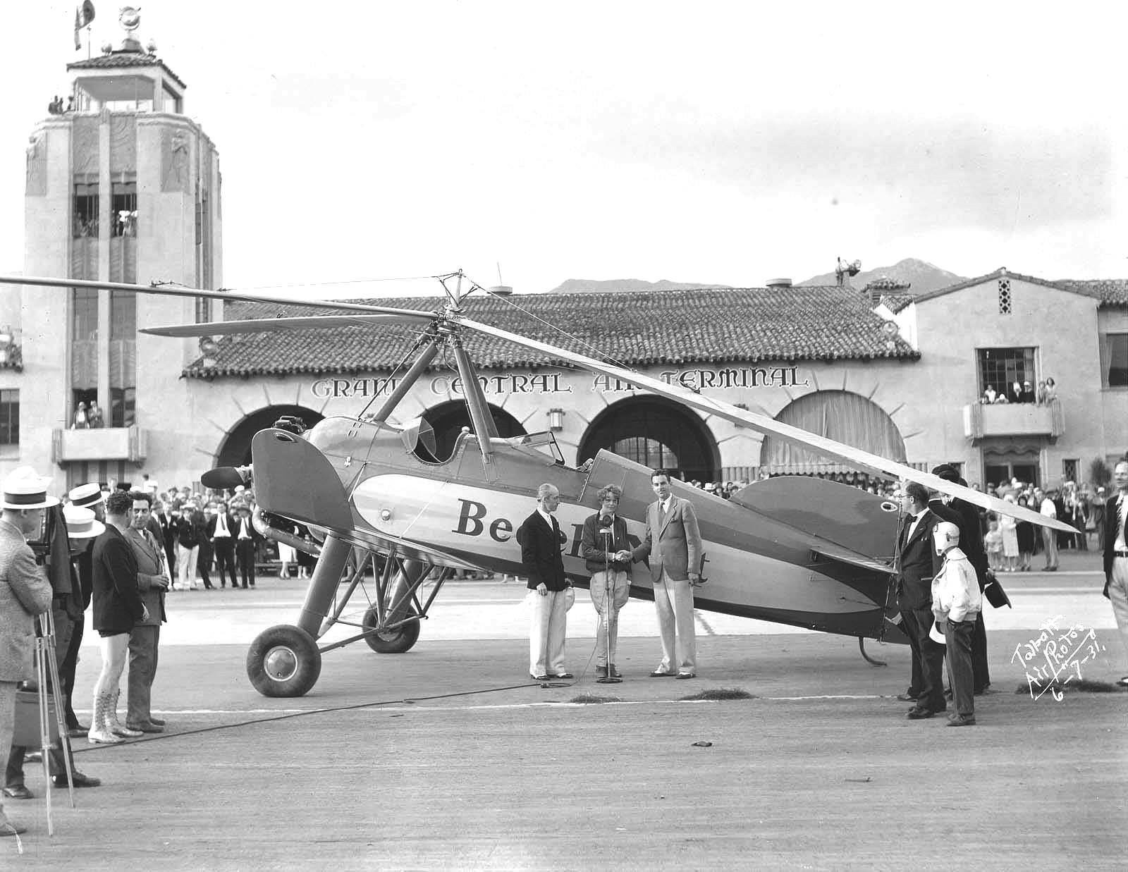 |
|
| (1931)** - Amelia Earhart with the Beech-Nut Pitcairn PCA-2 Autogiro at Glendale Grand Central Air Terminal on June 7, 1931. Earhart arrived from PA on what she thought was the first transcontinental Autogiro flight only to discover that John M. "Johnny" Miller had beaten her by 9 days. |
Historical Notes The PCA-2 was the first rotary-wing aircraft to achieve type certification in the United States and was used in a number of high-profile activities including a landing on the White House lawn and the first flight across the United States in a rotorcraft. This latter feat was attempted by Amelia Earhart, flying for the Beech-Nut food company, but was actually accomplished by John M Miller who completed his flight nine days before Earhart on 28 May 1931, in his PCA-2 named Missing Link. Learning of Miller's achievement upon her arrival in California, Earhart set out to turn her flight into a round-trip record by flying east again, but abandoned the attempt after three crashes. Earhart set an altitude record in a PCA-2 on 8 April 1931 with a height of 18,415 ft. This record was broken in another PCA-2 by Lewis Yancey who flew to 21,500 ft on 25 September 1932. ^ |
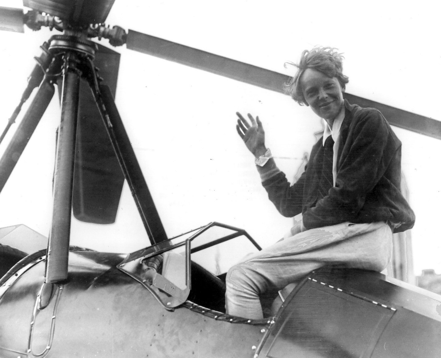 |
|
| (1931)+## - Amelia Earhart is seen sitting on plane mounted with a horizontal propeller (Pitcairn PCA-2 Autogiro) at Grand Central Airport. |
Historical Notes Amelia Earhart became famous when she was the first female aviator to fly solo across the Atlantic Ocean in 1928, so it was newsworthy when she landed an autogiro (which is kind of like a helicopter) at Grand Central Air Terminal, Glendale on June 7, 1931. At the time she was attempting the first transcontinental autogiro flight from Newark, NJ to Los Angeles, and landed at about 5 p.m. to replenish her gas supply. At the time, Grand Central was a busy and important airport, and due to its eye-pleasing design and proximity to the movie studios, was often used in the movies. |
 |
|
| (ca. 1931)^*# - Plane being refueled by a tank truck labeled Union Motor Oil, at Grand Central Airport. |
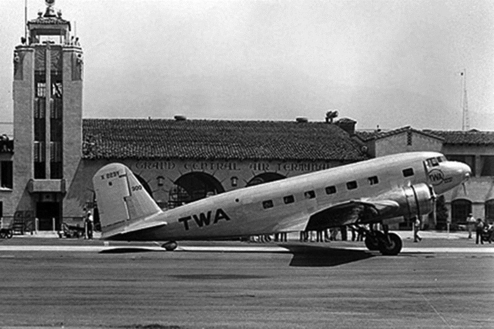 |
|
| (1933)^.^ – View showing the 12-passenger DC-1, Douglas Commercial Model No. 1, at Grand Central Air Terminal. |
Historical Notes The DC-1 was specifically designed for TWA. Its inaugural flight was on July 1, 1933, but it was nearly the last when both engines quit during the climb out. After modifications, the new plane met all of TWA’s requirements, most importantly of which was to be able to fly with only one of the two engines. TWA placed an immediate order for 25 Douglas airliners, but with more refinements as the DC-2. |
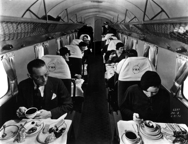 |
|
| (1933)* – View showing showing passengers dining in a TWA DC-2, (refined DC-1). |
Historical Notes The DC-2 was increased in size with a wider diameter fuselage to allow for the taller passengers to stand in the cabin. Its length was increased by two feet to allow for an extra row of seats that increased total seating to 14. There were other improvements as well. The payload was increased, the service ceiling was increased, the speed was increased and even in-flight movies were introduced. The DC-2 was now the most luxurious airliner in the world. Only four months after the Model 247 entered service, the first DC-2 was handed over to TWA. It flew in record time between Los Angeles and New York. TWA advertised Coast-to-Coast service in a 200 mph luxury airliner called the Sky Chief. Transcontinental flights consisted of four legs from New York (Newark) to Chicago, Kansas City, Albuquerque and Los Angeles. Flights left at 4:00 p.m. and arrived at 7:00 a.m. the next day. |
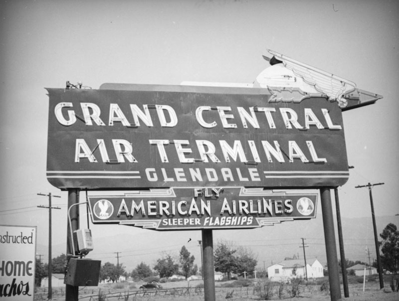 |
|
| (ca. 1937)* - A wing and arrow top this neon sign for the Grand Central Air Terminal, located at 1310 Air Way in Glendale. A smaller sign hangs below encouraging one to fly the American Airlines Sleeper Flagships. A log fence and telephone lines separate the neighboring Spanish style ranch houses from the field surrounding the sign. A painted sign advertising the new development of "Ranchos" is cut off in the foreground. |
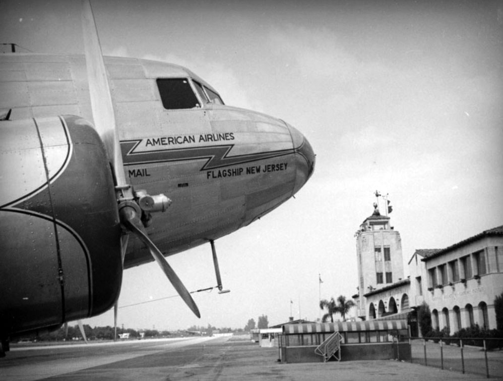 |
|
| (1937)* - View of an American Airlines DST (Douglas Sleeper Transport - an early version of a DC-3) prop plane carrying mail on the landing at the Grand Central Air Terminal, located at 1310 Air Way in Glendale. |
Historical Notes The Grand Central Air Terminal was designed by Henry L. Gogerty in 1928 in the Spanish Colonial Revival style with zig-zag moderne elements. The terminal is a City of Glendale registered landmark.* |
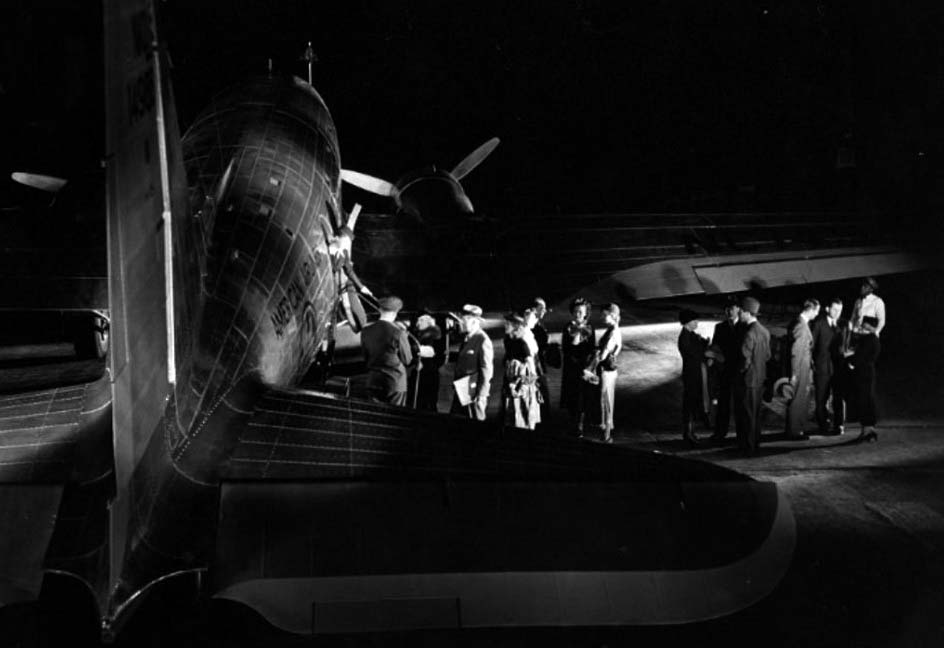 |
|
| (ca. 1940)#^ - Night departure of a DC-3, Grand Central Air Terminal, Glendale. Hagley Digital Archives |
Historical Notes The DC-3 was a twin-engine metal monoplane, developed as a larger, improved 14 bed sleeper version of the Douglas DC-2. It had many exceptional qualities compared to previous aircraft. It was fast, had a good range and could operate from short runways. Its construction was all-metal. It was reliable, easy to maintain and carried passengers in greater comfort. Before the war it pioneered many air travel routes. It was able to cross the continental United States, making transcontinental flights and worldwide flights possible, and is considered to be the first airliner that could make money by carrying passengers alone.*^ |
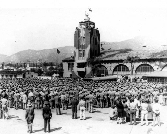 |
|
| (1942)^.^ – View showing hundreds of recruits gathered to hear Air Marshall W. A. Bishop speak in front of the Grand Central Air Terminal during WWII. Note that the tower has already been painted with camouflage. |
Historical Notes When Pearl Harbor was attacked on December 7, 1941, Grand Central Airport (like all other west coast airports) was immediately closed to private aviation. (The remaining airlines had already moved to Burbank.) The government moved in, heavily camouflaged the place, and converted it into an important defense base for Los Angeles. In 1942 the runway, which originally ended at Sonora Avenue, was extended North to Western Avenue, giving it a 5,000' length to accommodate large airplanes and future jet aircraft. After the war, geographic constraints hindered the airport’s ability to accommodate new—and larger—commercial aircraft. |
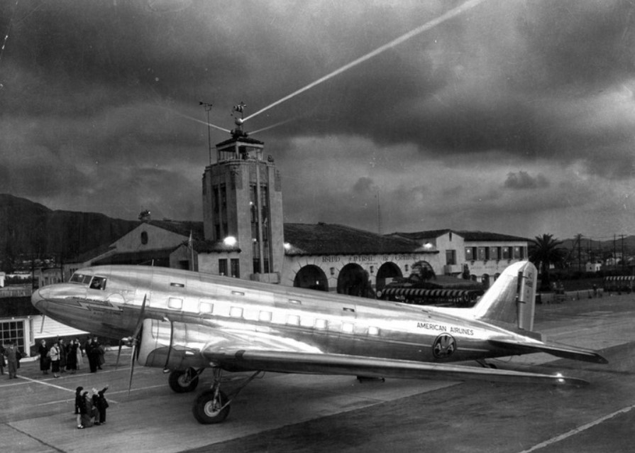 |
|
| (1940s)^*^ - A shining DC-3 parked in front of the Grand Central Airport terminal as night falls. |
Historical Notes In 1947 the runway was cut back to 3,800' (southeast of Sonora Ave) due to pressure from local government. The airport was returned to private use, renamed Grand Central Airport, ceased to be profitable, and would eventually be closed in 1959. The closed airport was then used as a private heliport for the Los Angeles Police Department's fleet of police helicopters, some Bell 47's ("recips") and some Bell 206's ("Jet Rangers"), until the hew LAPD Hooper Heliport opened on top of the Piper Tech Building in downtown Los Angeles in 1983. The runways were torn out and replaced by a street named Grand Central Avenue. Over 70 new “tilt up” manufacturing buildings were constructed under the direction of the Grand Central Industrial Centre. The redeveloped airport property was eventually purchased by the Prudential Insurance Company and leased out as an investment. When Walt Disney was developing Disneyland in the early 1950s, he wanted a place away from the main studio where he could work on new ideas undisturbed. He rented an industrial building at 1401 Flower St. on the old airport property. WED (Walter E. Disney) Enterprises also rented the old terminal building during the busy years of Epcot and Disney World development. Dreamworks was created in 1994, and their new buildings soon appeared on part of the old airport land just down the street from Disney’s leased building. The Disney Corporation soon purchased the remaining land from the airport and have announced a 15-year plan to turn it into a corporate “creative campus” behind security gates. Disney has stated their intention to rework the old terminal by the year 2015 to its original look. Much of the original metal work, railings and lights have been stripped away over the years, but the Disney representative feels that their company can easily reproduce replacement pieces. There are also two original hangars left—one very modified into a cold storage facility and the other is now used by Disney Imagineering for special effects mock-ups.+## |
 |
|
| (2017)^ - View showing the Grand Central Air Terminal as it appears today. Photo by Paul Turang, Los Angeles Conservancy |
Historical Notes The Grand Central Air Terminal remained untouched until 2012, when its current owner embarked on a project to transform the airport for new uses. The project team rehabilitated the entire property, including the airport concourse, runway, and taxiway. They completely restored the building’s exterior and significant interior spaces. The team thoroughly researched and meticulously restored, or recreated, missing or degraded character-defining features, such as light fixtures and decorative tile.* |
* * * * * |
Glendale Southern Pacific Railroad Depot (today Glendale Amtrak/Metrolink Station)
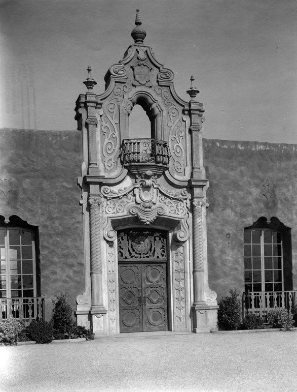 |
|
| (ca. 1923)^*# - Close-up view of the Mission Revival Style entrance to the Glendale Train Station. Beautiful wrought iron grills, railings, lanterns and magnificent Churrigueresque cast stone entry portals guarded by fanciful mermen figures hold up the railroad's herald above each waiting room door. |
Historical Notes The Glendale Southern Pacific Railroad Depot (now known as Glendale Amtrak/Metrolink Station) was designed in the Mission Revival Style by architects Maurice Couchot and Kenneth MacDonald, Jr. and built by the Southern Pacific Railroad in 1923; replacing an older one that dated as far back as 1883.^ |
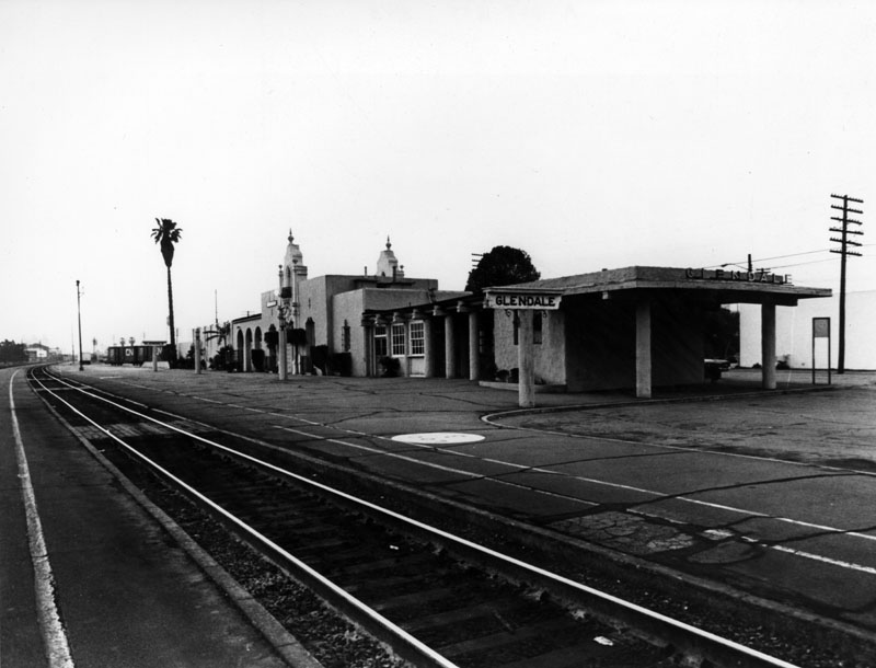 |
|
| (ca. 1940s)^ - Exterior view of the surprisingly empty railroad station at Glendale. This is the "back" portion of the station, where travelers wait for their trains to arrive and/or depart. Two stationary freight cars can be seen at the rear of the building. |
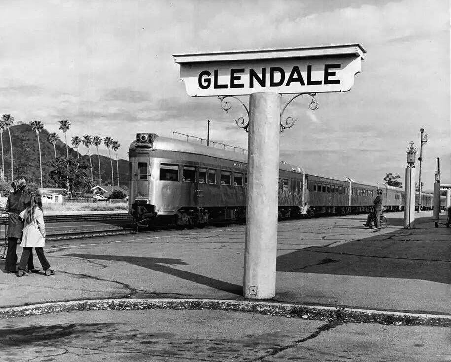 |
|
| (n.d.)^ – A woman and a young girl walk toward a stopped train at the Glendale Southern Pacific Railroad Depot with palm trees seen in the background. |
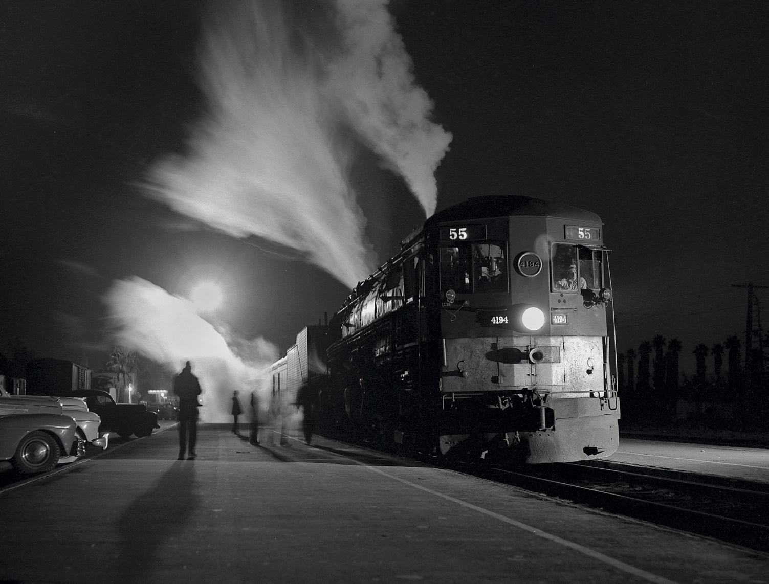 |
|
| (ca. 1950)^^^ - Southern Pacific #4194 ‘Tehachapi’ Night Train 55 at the Glendale Station. Photo by Richard Steinheimer. |
Historical Notes Because of the depot's proximity to the film industry in Los Angeles and Hollywood, many movies have been shot there. In the 1930s Buster Keaton filmed "College" at depot, "Horse Shoes" was another. The most well know film with the depot as a background was by director Billy Wilder, "Double Indemnity" in 1944 starring Fred MacMurray and Barbara Stanwyck.* |
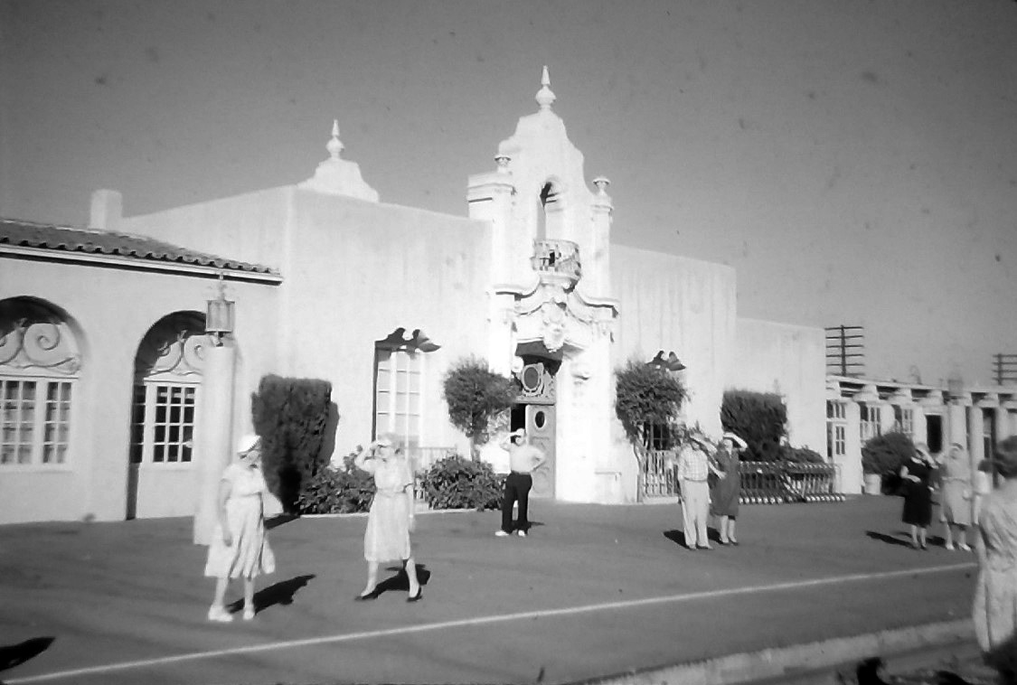 |
|
| (1962)^ – Passengers shield their eyes from a bright sun as they await an incoming train. |
 |
|
| (1975)* - The Freedom Train arrives in Glendale. Photo by Bill Varie for the LA Times, December 23, 1975. |
Historical Notes The Freedom Train toured the country in 1975–76 to commemorate the United States Bicentennial. This 26-car train was powered by three newly restored steam locomotives. The first to pull the train was the former Reading Company T-1 class 4-8-4 #2101. The second was the former Southern Pacific 4449, a large 4-8-4 steam locomotive that is still operating in special excursion service today. Tthe tour covered all 48 contiguous states and lasted from April 1, 1975, until December 31, 1976. More than 7 million Americans visited the train during its tour, while millions more stood trackside to see it go by.^ |
 |
|
| (ca. 1980s)*** – View showing a train coming into the Glendale Southern Pacific Railroad Depot. |
Historical Notes The depot has undergone minor remodels in 1943, 1954 and restored in 1999 and 2012. In 2015, the unstaffed depot served 10 Pacific Surfliners, 54 Metrolinks trains weekdays, and 12 Antelope Valley Line trains Weekends and was the 37th busiest Amtrak station in the state with 100 passengers daily*. |
 |
|
| (2018)^ – View showing the Glendale Southern Pacific Railroad Depot (today Glendale Amtrak/Metrolink Station) as it appears today. Photo courtesy of Shawn Morales |
Historical Notes The City of Glendale bought the depot from Southern Pacific in 1989 and acquired adjacent properties to create an intermodal center. Restoration of the historic building and the construction of other elements of the intermodal center cost approximately $6 million.^ |
 |
|
| (2020)^ – Close-up view of the Mission Revival Style entrance to the Glendale Amtrak/Metrolink Station. Photo by Carlos G. Lucero |
Historical Notes The depot (now known as Glendale Amtrak/Metrolink Station) was added to the National Register of Historic Places on May 2, 1997 - #97000376, and has undergone an extensive renovation since then. The Glendale train station is located at 400 Cerritos Avenue.^ |
Slate Dirigible (Glendale Airport)
|
|
| (1929)+## – Large crowd surrounds a Slate Dirigible which has just landed at Glendale Airport. |
Historical Notes In 1925, Thomas Slate leased space adjacent to the south side of the Glendale Airport for the construction of an all-metal dirigible, a very novel (but ultimately unsuccessful) design. The dirigible was made out of duralumin & was filled with hydrogen. It was forecast to have a cruising speed of 80 mph and would accommodate 40 passengers and 5 crew. The dirigible was to be powered by oil and driven by steam-turbine, using one rotary blower, which would create a vacuum, instead of traditional propellers. Slate also constructed a metal hangar, the largest built in the United States at the time.* |
|
|
| (1928)^.^ - The Slate Dirigible is docked in its hanagar at Glendale Airport. At the time, this was the largest built metal hangar in the United States. |
Verdugo Wash
 |
|
| (1934)##^ - A man is seen standing in the Verdugo Wash after the 1934 flood. |
Historical Notes The most severe flood recorded in Glendale occurred in 1934. Intense precipitation on New Year’s Eve, 1933 occurred locally in the La Canada Flintridge area, causing the Verdugo Wash to swell and overflow its then natural channel. Extensive areas of the drainage basin had burned earlier, in November 1933, causing large amounts of debris. The debris was carried by the storm waters down the mountains, and into the alluvial valleys, where several roads were choked. Damage was not confined to Verdugo Wash, but extended to several of the canyons draining the eastern and southern flanks of the Verdugo Mountains, and also in Sycamore and Scholl Canyons. Several people died, several bridges were washed out, and erosion and sedimentation damaged property.^ |
 |
|
| (1934)^ - An unidentified and mud-covered street in Glendale, captured after the flood of January 1, 1934. Men look at a severely damaged car, not far from homes (right), while other people are seen assessing other damage further down the street. |
Historical Notes Wildfires above the Crescenta Valley in November 1933 and subsequent heavy rain in December 1933 produced the perfect conditions for a massive flood. Just after midnight on January 1, 1934, millions of tons of mud and debris traveled from the mountains down to the Verdugo Wash, killing many people and destroying about 400 homes in the communities of La Cañada, La Crescenta, Montrose and Tujunga. Woody Guthrie's song, "Los Angeles New Year's Flood," commemorates the natural disaster.* |
 |
|
| (1934)^ - A young woman watches a man shovel mud off the sidewalk outside of Alexander Pharmacy, located at 251 N. Brand Boulevard in Glendale, after the flood on January 1, 1934. This commercial building is still standing, but its façade has been greatly modified. Click HERE for contemporary view. |
Historical Notes E.C. Eaton, the County Flood Control District’s chief engineer at the time, estimated that 600,000 cubic yards of debris came down in just 20 minutes. He called for the completion of a flood-control system. A federal Flood Control Act was signed in 1936, and the Verdugo Flood Control Project came into being. |
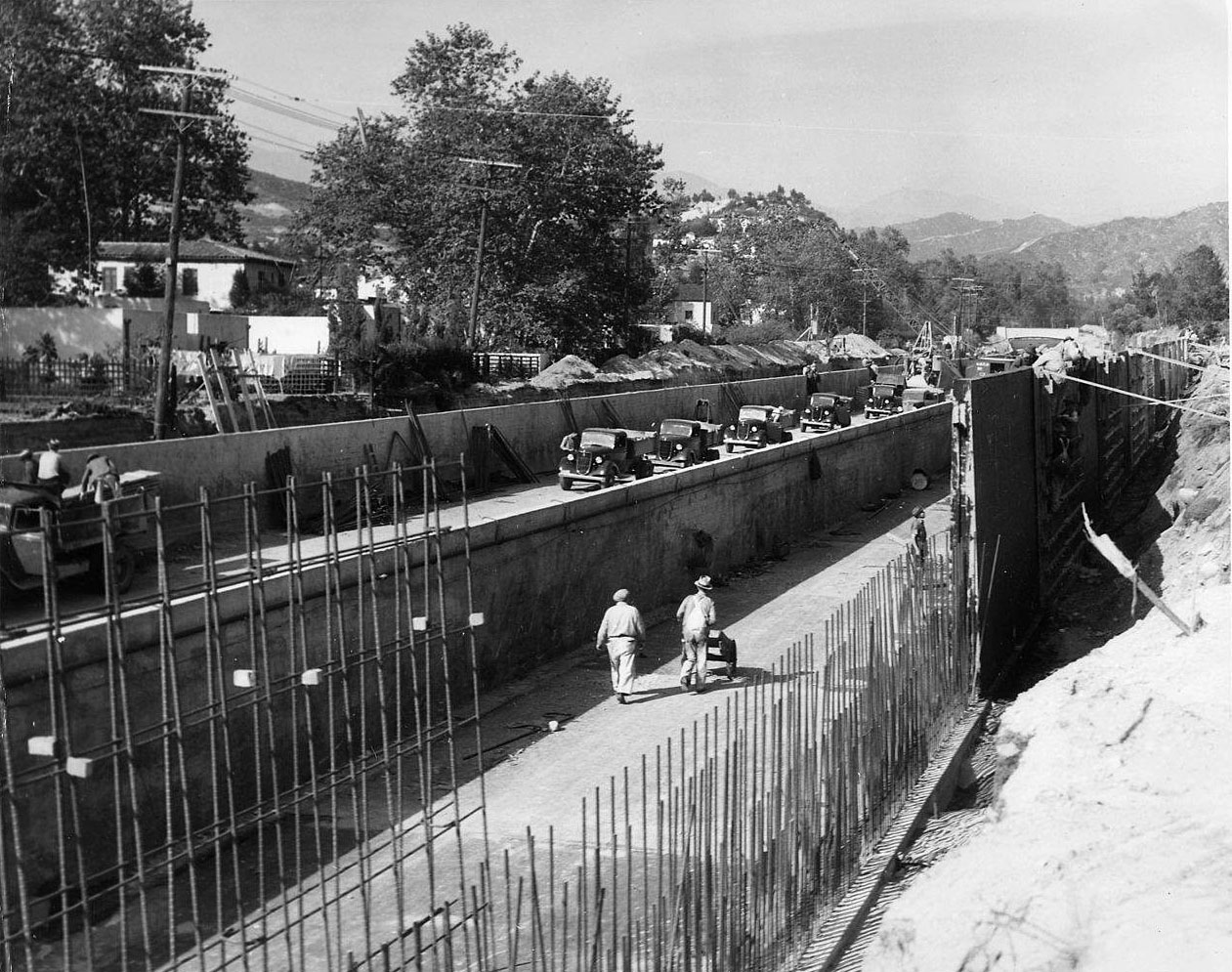 |
|
| (1936)*^ - View showing the construction of the new concrete-lined Verdugo Wash storm drain looking north between Glenoaks Blvd. and Royal Blvd. |
Historical Notes Verdugo Wash is a 9.4-mile-long tributary of the Los Angeles River in the Glendale area. The stream begins just south of Interstate 210 in the Crescenta Valley. It flows southeast along the eastern edge of the Verdugo Mountains, then south through a pass between those mountains and the San Rafael Hills, and finally west to ultimately join the Los Angeles River just northeast of Griffith Park. Its entire path is located within the city of Glendale.*^ |
.jpg) |
|
| (1936)*^ - View looking up the channel from the section between Glenoaks Blvd. and Royal Blvd. showing concrete mixer placing floor of storm drain for one side channel. |
Historical Notes Today, the Verdugo Wash is entirely encased in a concrete flood control channel with the exception of the free-flowing stream inside the Verdugo Wash Debris Basin Dam.*^ |
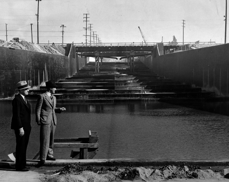 |
|
| (1938)^ - View showing two men inspecting the spilling basin of the new Verdugo Wash. |
Historical Notes Photo caption reads: “Capt. Lyle Rosenberg (left), and Lieut. F. E. Ressegieu inspecting the completed basin. Waters from the wash will spill down the concrete and steel stairs (background), and then into the basin in the foreground. A 10-foot concrete wall will cut the water's speed before it goes into the riverbed, lessening the flood hazards.” Photo dated: December 2, 1938. |
The Great Flood of 1938
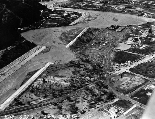 |
|
| (1938)*^ – Aerial View above Victory Boulevard near Riverside Drive in Glendale showing breaches in paved levees of the Los Angeles River. |
Historical Notes Between February 27 and 28, 1938, a storm from the Pacific Ocean moved inland into the Los Angeles Basin, running eastward into the San Gabriel Mountains. The area received almost constant rain totaling 4.4 inches from February 27-March 1. This caused minor flooding that affected only a few buildings in isolated canyons and some low-lying areas along rivers. Fifteen hours later on March 1, at approximately 8:45 PM, a second storm hit the area, creating gale-force winds along the coast and pouring down even more rain. The storm brought rainfall totals to 10 inches in the lowlands and upwards of 32 inches in the mountains. When the storm ended on March 3, the resulting damage was huge -- 115 lives were lost. |
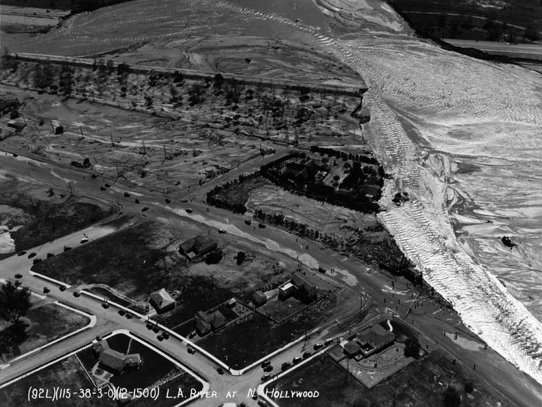 |
|
| (1938)^*# - Aerial view showing the devastation when the LA River overflowed its banks. The above photo is labeled “North Hollywood,” but the area shown is actually the southwestern portion of Glendale. This is the area where Glendale, Burbank, and the City of Los Angeles all come together. Riverside Drive runs from center-left to lower-right corner. The street that ends at the river is Western Avenue. The large estate surrounded by trees (center of photo) was the Betty Davis “country” estate (she did not live there but she did keep her horses there, entertained, etc.); her house and many of the trees are still in place today. Click HERE for contemporary aerial view. |
 |
|
| (1938)#+ - Heavily traveled Riverside Drive in Glendale was undermined by the torrent of the Los Angeles River. This damaged section was near the former Grand Central Airport. Photo date: March 5, 1938. |
Historical Notes Click HERE to see more in 'Los Angeles River The Unpredictable' |
Glendale Police Department
 |
|
| (1938)##^ - Radio telephone in patrol cars. Chief V. B. Brown gives a demonstration of the first two-way radio telephone in the Glendale Police Department's patrol cars. The motorcycle officer is Wes Owen. The call letters KQCI became the identifier of the Glendale Police Department radio telephone. |
 |
|
| (1930s)* - A meter maid and a motorcycle officer for the Glendale Police Department. |
 |
|
| (ca. 1940)* - Glendale Police Department Officer I. A. Robinson on an official-issue Harley Davidson motorcycle. |
Historical Notes Click HERE to see more Early Views of the Glendale Police Department (1919 +) |
* * * * * |
Carpenter's Drive-in Restaurant
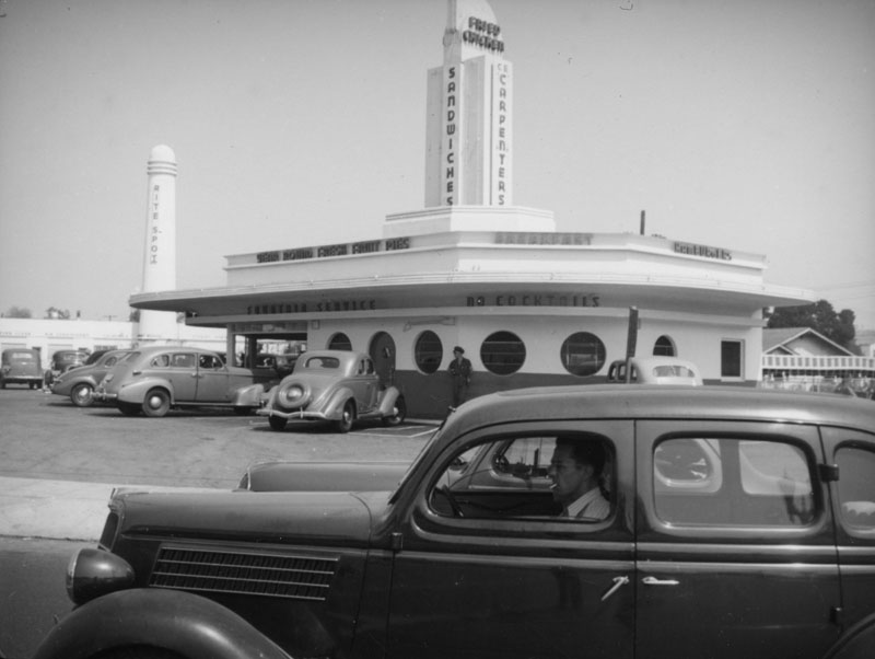 |
|
| (ca. 1938)^ - View showing Carpenter's Drive-in Restaurant located at 606 E. Colorado St. in Glendale. The drive-in featured fried chicken, sandwiches, year round fresh fruit pies, breakfast, hamburgers and fountain service. The Rite Spot Cafe pylon is seen in the background. |
Historical Notes In 1936, after separating from his brother, Charles E. Carpenter opened three Carpenter's Cafes. A transitional project Carpenter's Village (606 E. Colorado) combined a Rite Spot Cafe and Carpenter's Drive-in (seen above). Next he opened the Rite Spot Cafe in Pasadena, located at 1500 West Colorado Street (now considered Eagle Rock) and the Santa Anita Cafe at Huntington and Colorado. Click HERE to see more Early LA Drive-in Restaurants. |
* * * * * |
Sears Building
 |
|
| (1930s)* - View looking south showing the Sears Building located on the southeast corner of Central and California avenues in Glendale. |
Historical Notes The old Sears advertising slogan “Come to Sears Brand Central” has a special meaning in Glendale, as this Sears is situated between Brand Blvd. and Central Ave. Completed in 1935, this was the first Sears store in the world to be custom-built as such. Up until that point, Sears-Roebuck had taken over existing structures. |
 |
|
| (1930s)* – Close-up corner view showing the Sears Roebuck and Co. tower. |
Historical Notes Between 1937 and 1938 the architectural firm of Nimmons, Carr and Wright designed similar Late Moderne style Sears Roebuck and Company Department Stores in Illinois, Maryland, Michigan and Glendale California. The Glendale Sears features large sign towers, glass brick window panels and a long series of display windows covered by an awning along the street. The Glendale store, located at 236 North Central Avenue, is still standing today although it has been remodeled. |
 |
|
| (1930s)* – View looking north showing Sears Roebuck and Co. located at 236 N. Central Ave. Notice how the house on the right had been repurposed as a clinic. Though the structure is long gone, a medical clinic still occupies the lot just south of the Sears today. Click HERE to see contemporary view. |
* * * * * |
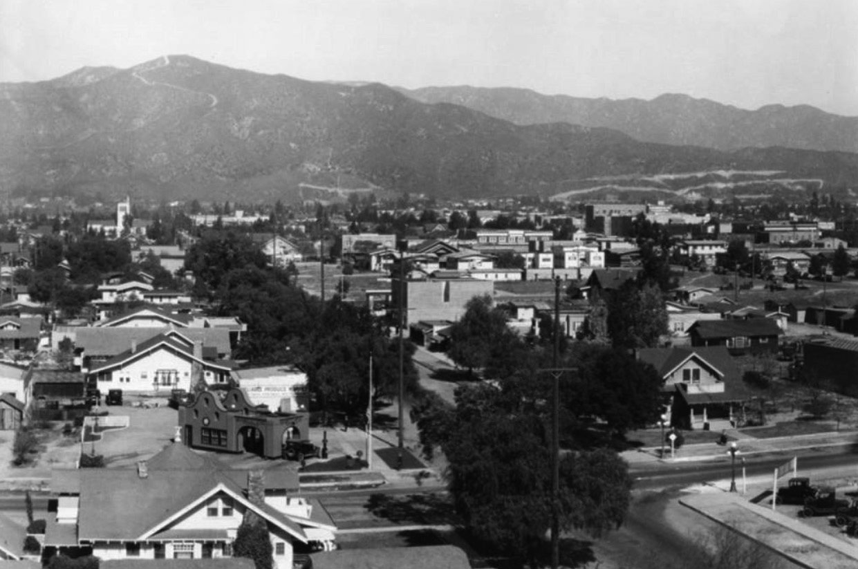 |
|
| (ca. 1925)* - Panoramic view of Glendale along Central Avenue looking north from Colorado Blvd. |
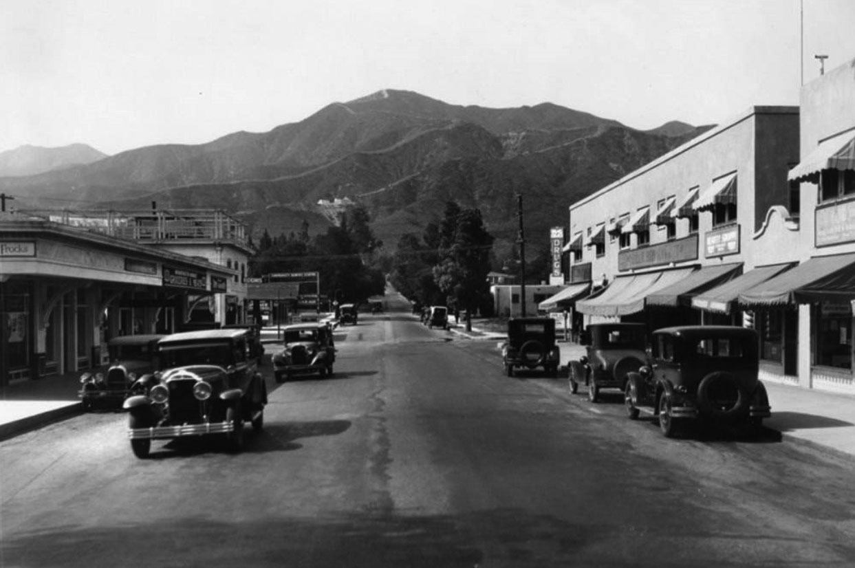 |
|
| (1930)* - View showing North Central Avenue in Glendale. The building on the right has a Radio service shop, Beauty Shoppe, "Billie Bird Market" and a drug store. The building on the left has "Bradstreet Market Groceries & Meats" and a dry goods shop. In the center left there is a building with rooms for rent and a Community service station with tire repairing. |
* * * * * |
Brand Boulevard (1930+)
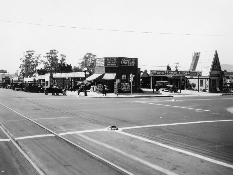 |
|
| (1930)^ - View of the southwest corner of Brand and Colorado, in Glendale. Several businesses are seen in the area, including "Mac's", a cigar, candy and sandwiches store located at the corner. Click HERE to see contemporary view. |
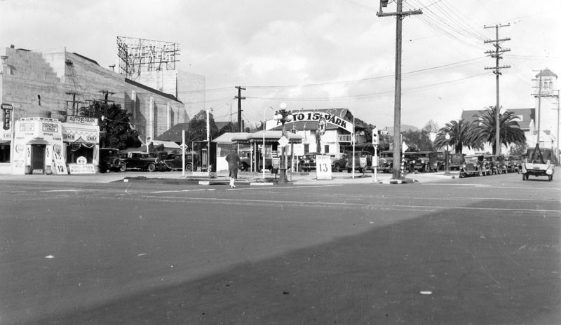 |
|
| (1930)^ - View of the northeast corner of Brand Boulevard and Wilson Avenue. A small Texaco service station can be seen at the corner of the intersection. On the left (east side of Brand) is Weber's Cafe and a side profile of the Alex Theatre building. Click HERE for contemporary view. |
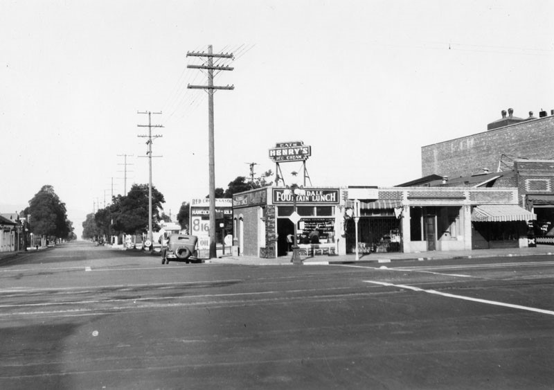 |
|
| (1930)* - View is west on Wilson Avenue from Brand Boulevard. At the corner is Henry's Ice Cream which also serves lunch. Residential homes may be seen further down the block. Click HERE for contemporary view. |
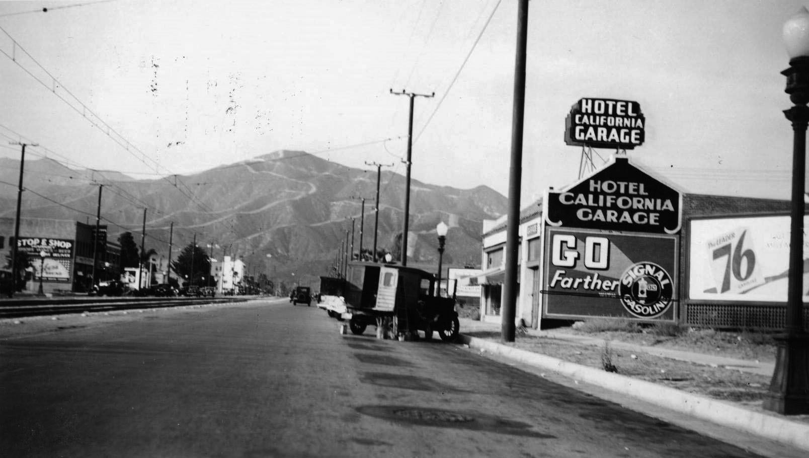 |
|
| (1936)* - View looking north from the 500 block of N. Brand Blvd., Glendale. Sign at right reads: HOTEL CALIFORNIA GARAGE |
Christmas
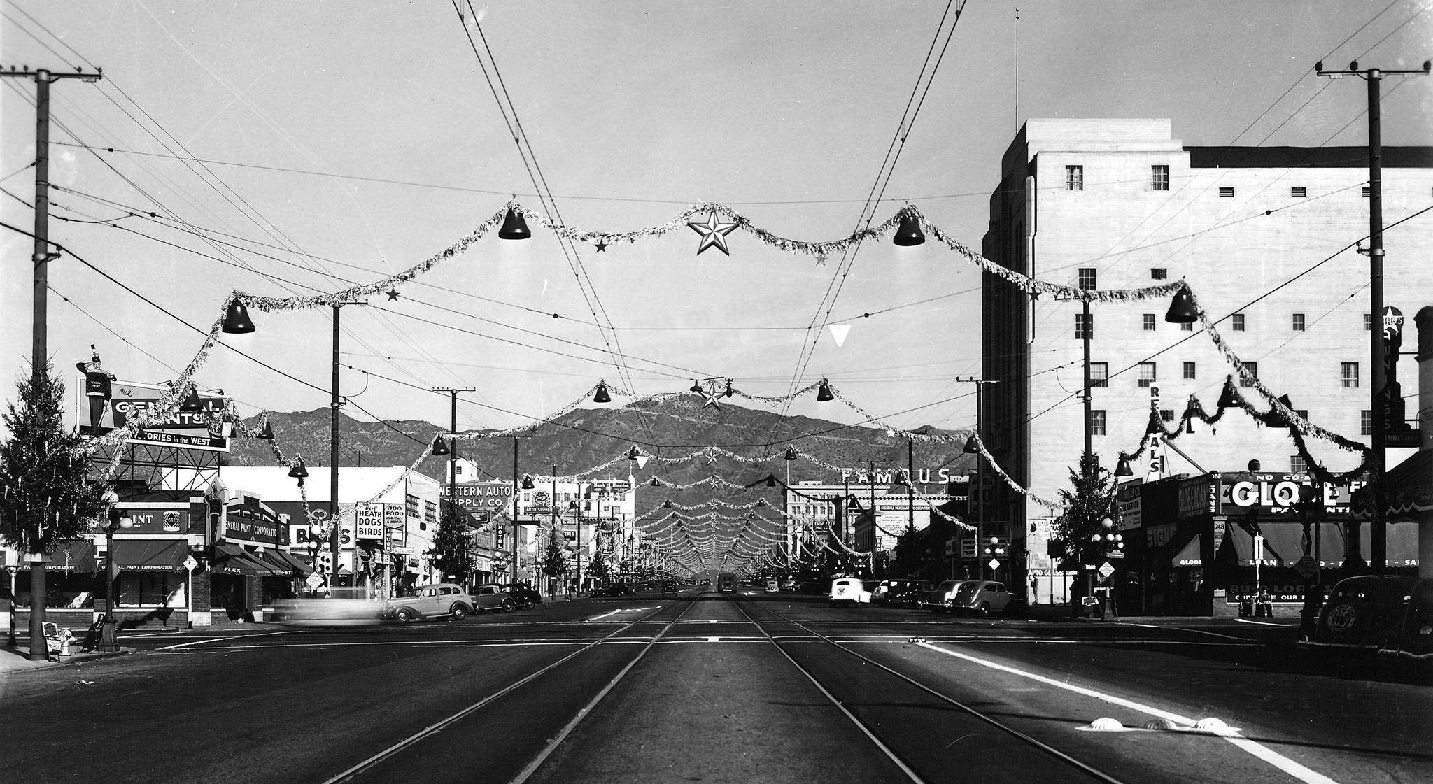 |
|
| (1938)* – Day time view looking north on Brand during Christmas. |
 |
|
| (1937)* – Night view looking south on Brand Boulevard during the Holiday Season with the Hotel California seen on the right. |
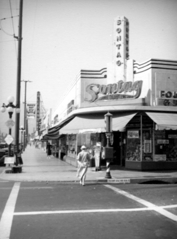 |
|
| (ca. 1938)^ - This view looking north on Brand at Wilson captures the Sontag, located at 200 North Brand. Just north of the drugstore is the Alexander Theatre (later the Alex Theatre) before the S. Charles Lee remodel (1940) and the addition of a 100 foot Art Deco tower. |
Historical Notes Sontag Drug Stores was one of the largest drug store chains in the U.S. in the 1930’s & 1940’s. It was also one of the first to allow customers to browse and choose their own products rather than requesting them from a clerk behind a counter. All in all, there were 16 Sontag Drugs located in Los Angeles, and another 32 in other locations – for a total of 48 stores. Their Los Angeles headquarters was located at the corner of Wilshire Blvd. and La Cienega Blvd. (torn down and replaced at one time with the Flynt Building). |
* * * * * |
Glendale Theater
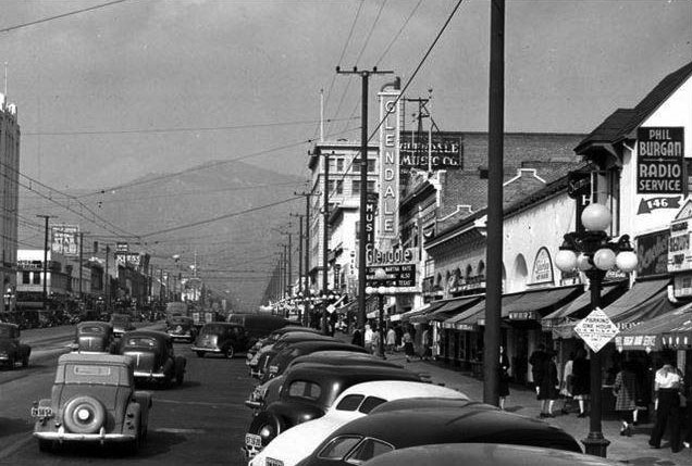 |
|
| (1940s)* – View looking north on Brand Blvd from near Harvard Street with the Glendale Theatre seen at center of the block. Paul Burgan’s Radio Service is on the right behind the ornate 5-bulb streetlight. |
Historical Notes The Glendale Theatre opened on October 28, 1920. In February 1940 it became a district 2 Fox West Coast Theatre. |
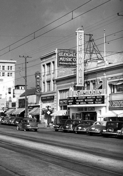 |
(1940s)* – View looking northeast showing the Glendale Theater located at 122 S. Brand Blvd. The Glendale Music Co. is seen just to the north of the theater. |
|
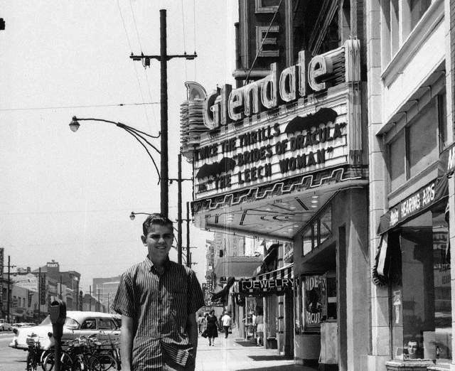 |
|
| (1970)* – A boy poses in front of the Glendale Theatre. Note all the bikes parked in front of the theater against the curb. The marquee reads: TWICE THE THRILLS: “Brides of Dracula” and “The Leech Woman”. Photo courtesy of Joel Sandell. |
 |
|
| (1979)* – Front view of the Glendale Theatre located at 122 S. Brand Boulevard. Photo courtesy of Stacie Inkel |
Historical Notes The Glendale Theatre was twinned on June 13, 1980 and later closed, last operated by Mann Theatres. It was demolished in 1995-1996. A DSW Shoes is now located where the Glendale Theatre once stood. Click HERE for contemporary view. |
* * * * * |
Hotel California (aka California Hotel)
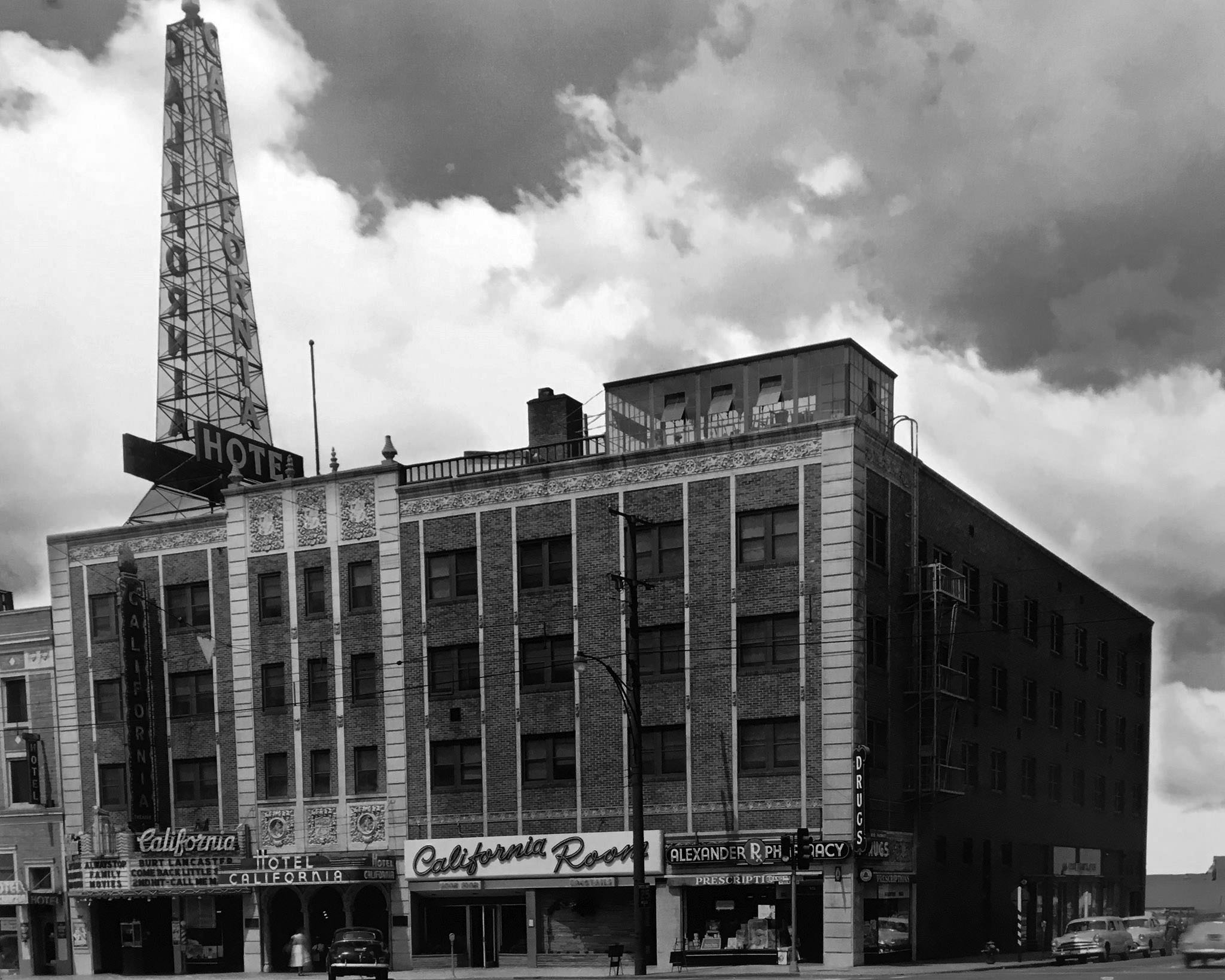 |
|
| (ca. 1952)* – View showing the Hotel California and California Theatre, located on the southwest corner Lexington Dr. and Brand Blvd. |
Historical Notes Built in 1927 and occupied in 1928, the California Hotel, along with the Glendale Hotel (Broadway and Glendale Ave), were the city’s “nicest places” for visitors to stay in the 1930s and 1940s. The California was among only a few hotels in greater Los Angeles that included a full-sized theater. |
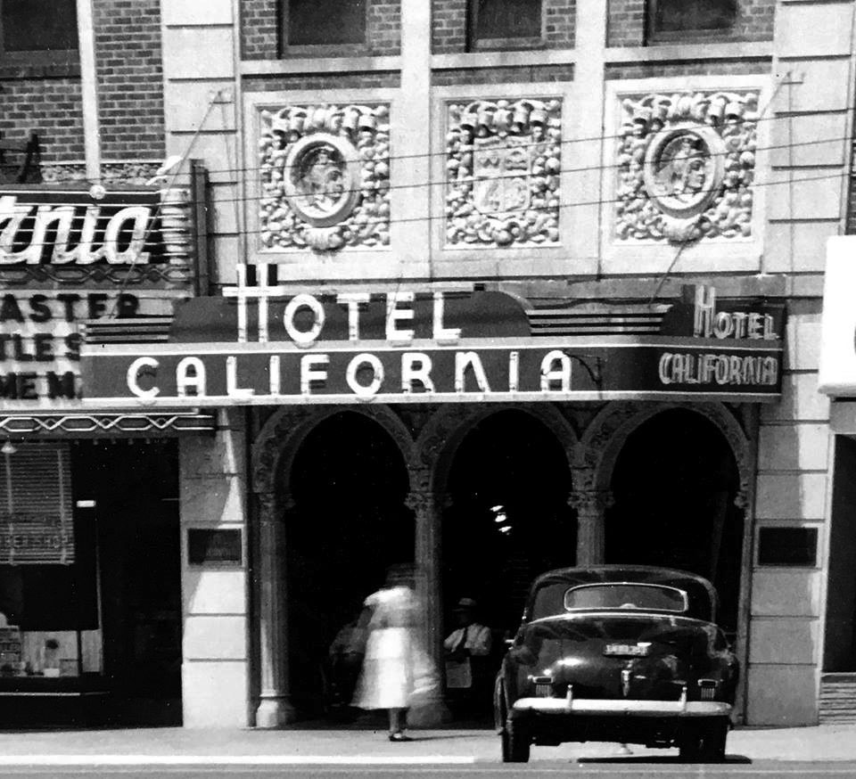 |
|
| (ca. 1952)* – Close-up view showing the entrance to the Hotel California aka California Hotel (1927-1966). |
Historical Notes When motels became popular in the late 40s and thereafter, popularity of the California Hotel began to fade. The hotel was demolished in 1966 and replaced with a Bank of America building. Click HERE to see contemporary view. |
California Theatre
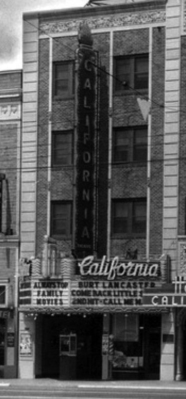 |
|
| (1952)* - View showing the California Theatre, 341 N. Brand Blvd. Marquis reads: Always Top Family Movies – Now Playing: Come Back Little Sheiba w/Burt Lancaster. |
Historical Notes The California Theatre was opened on December 25, 1928. In February 1940 the California Theatre was taken over by Fox West Coast Theatres as a District 2 house. It was still open in 1956, but had closed by 1957. By 1959 the theatre was converted into a furniture store, Scott's Furniture. |
* * * * * |
Alex Theatre (originally known as the Alexander Theatre)
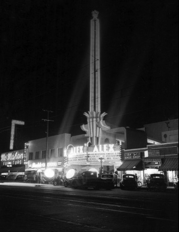 |
|
| (1940s)* - Spotlights draw attention to what appears to be a film premiere at the Alex Theatre, located at 216 N. Brand Boulevard. |
Historical Notes Designed by architects Charles R. Selkirk and Arthur G. Lindley with an emphasis on Greek and Egyptian themes, the Alex Theatre (originally known as the Alexander) opened its doors as a Vaudeville and motion picture house in 1925. In 1940 by S. Charles Lee added the 100 foot tall Art Deco tower. Included in Lee's design were the three-sided marquee, outdoor ticketing kiosk, and the decorative terrazzo floor crested in bright tropical colors. |
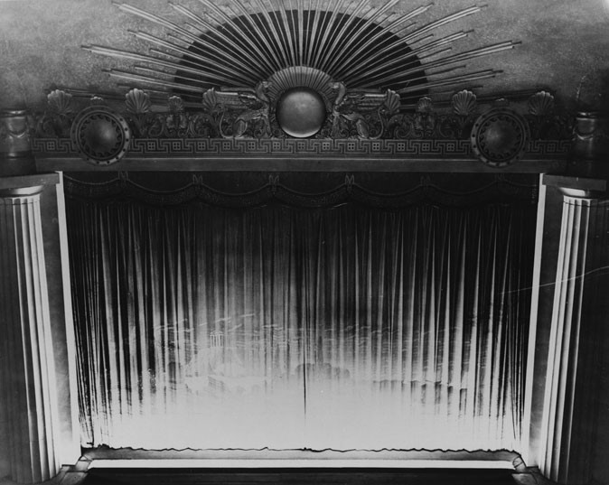 |
|
| (ca. 1937)^ - Interior view of the Alex Theatre showing the decorative stage curtain, done in a Grecian motif, and enclosed by column on both sides of the stage. |
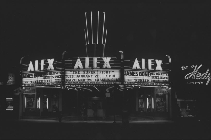 |
|
| (ca. 1969)^ - Close-up night view of the Alex Theatre (originally known as the Alexander Theatre) located on Brand Avenue in Glendale. The James Bond film "Her Majesty's Secret Service" and "The Super Fight" of Marciano versus Cassius Clay are advertised on the marquee. |
Historical Notes The Alexander officially opened its doors on September 4, 1925. It was operated by the West Coast-Langley Theatre Circuit and featured vaudeville performances, plays and silent movies on a single screen. It was named after Alexander Langley, the son of C.L. Langley, owner of the West Coast chain that included the Raymond Theater in Pasadena, and the Orange Theatre in the city of Orange. |
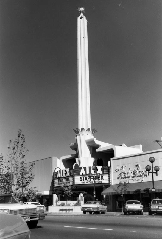 |
|
| (ca. 1979)^ - Exterior view of the Alex Theatre located on Brand Boulevard. The film "Star Trek" is advertised on the sign. The exterior of The Hedy Shop, a clothing store for women and children, is visible on the right. Click HERE for contemporary view. |
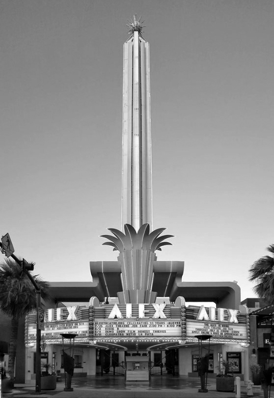 |
|
| (2019)* - The Alex Theater as it appears today. Photo courtesy of John Vincenti |
Historical Notes The Alex Theatre Performing Arts and Entertainment Center has been the centerpiece of the Glendale's arts, culture and community events since it originally opened. It is managed by Glendale Arts, a non-profit organization. The theater's diverse schedule boasts roughly 250 events per year and attracts more than 100,000 patrons annually. Programs range from classical and contemporary concerts, theatre, dance, comedy, fundraising and special events as well as TV and film productions and industry related award presentations. Resident companies include the Alex Film Society, Glendale Youth Orchestra, Musical Theatre Guild, and the Los Angeles Chamber Orchestra. The Alex Film Society regularly schedules classic films, often accompanied with special guests (e.g., the annual Thanksgiving weekend tradition "Three Stooges Big Screen Event," which children, grandchildren, and other relatives of the Stooges often attend), live musical performances of the film's soundtrack and vintage photos. |
* * * * * |
Brand and Wilson
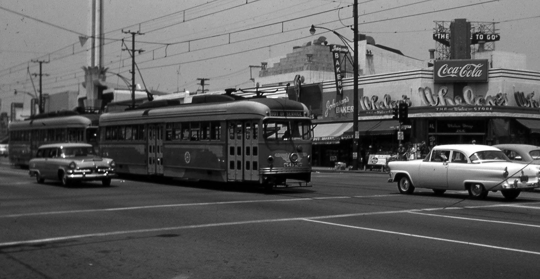 |
|
| (1955)* - View looking northeast at the corner of Brand Boulevard and Wilson Avenue showing two streetcars inbound to LA on the next to the last day of PE service to Glendale, 6/18/1955. The tower and roof of the Alex Theater rise in the background. |
|
|
| (1955)* - View looking northeast at the corner of Brand Boulevard and Wilson Avenue showing two streetcars inbound to LA on the next to the last day of PE service to Glendale, 6/18/1955. The tower and roof of the Alex Theater rise in the background. Photo courtesy of Paul Ayers. |
 |
|
| (2024)* – Contemporary view of the intersection of Brand and Wilson showing the tower of the Alex Theatre in the background. |
Then and Now
|
|
| (1955 vs. 2022)* - The intersection of Brand Boulevard and Wilson Avenue with the tower of the Alex Theatre seen in the background. |
* * * * * |
Webb's Department Store
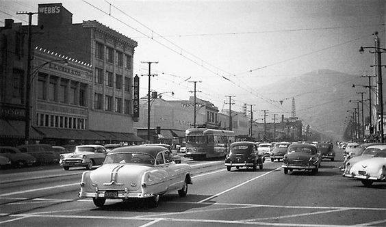 |
|
| (ca. 1955)* – View looking north on Brand Boulevard with Webb’s Department Store is seen at left on the southwest corner of Brand Boulevard and Wilson Avenue. |
Historical Notes Webb’s department store was the cornerstone of shopping for the Glendale community. It was locally owned and operated and expanded to several other buildings nearby. Harry S. Webb came to Glendale in 1916 from Chicago, convinced that California offered a great opportunity for a department-store business. His first Webb’s store was near the corner of Brand Boulevard and Broadway. |
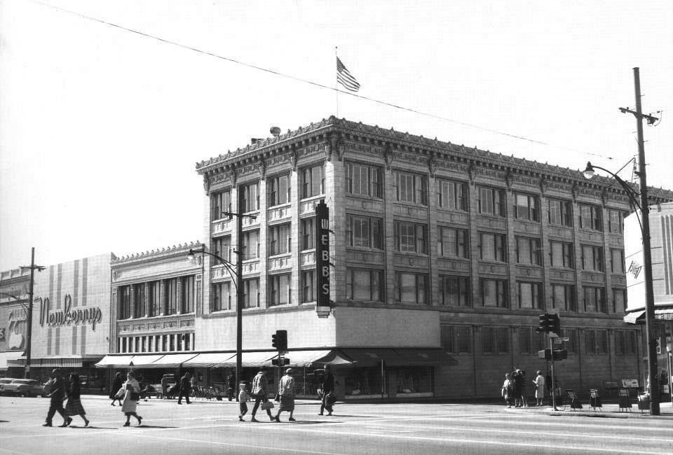 |
|
| (1962)* – View looking at the intersection of Brand Boulevard and Wilson Avenue, showing Webb's Department Store standing on the southwest corner. Newberry's Department Store is seen further south on the left. |
Historical Notes For nearly 50 years after its founding, Webb's was the only major department store in Glendale. But it began to get competition--first from Robinson's when it opened at the Fashion Center in 1966 and later from stores in the Galleria, which opened in two phases, in 1976 and 1982. With the Galleria's completion, shoppers in Glendale could choose from among such department stores as The Broadway, Buffum's, J. C. Penney, Mervyn's and Nordstrom's. |
* * * * * |
Bruce's Fun House
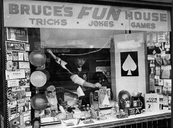 |
|
| (n.d.)* - View looking through the display window of Bruce’s Fun House located on Wilson Ave between Brand Blvd and Orange St. |
* * * * * |
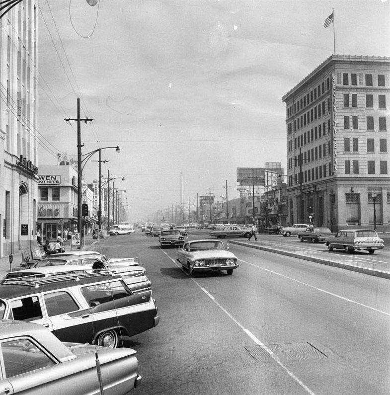 |
|
| (1963)^ – View looking north on Brand Boulevard at Broadway. Click HERE for contemporary view. |
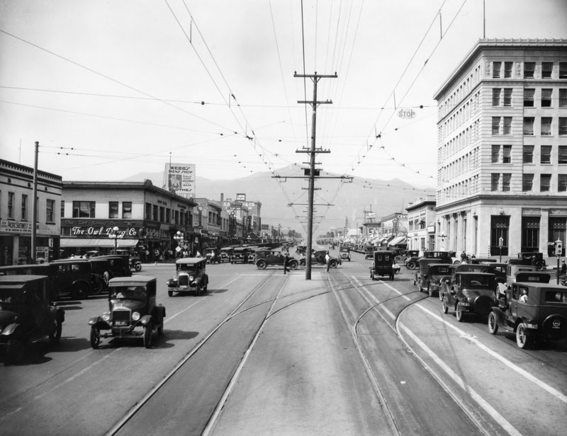 |
.jpg) |
|
| (ca. 1924)^ - View looking north on Brand Boulevard at Broadway. | (1963)^ – View looking north on Brand Boulevard at Broadway. |
* * * * * |
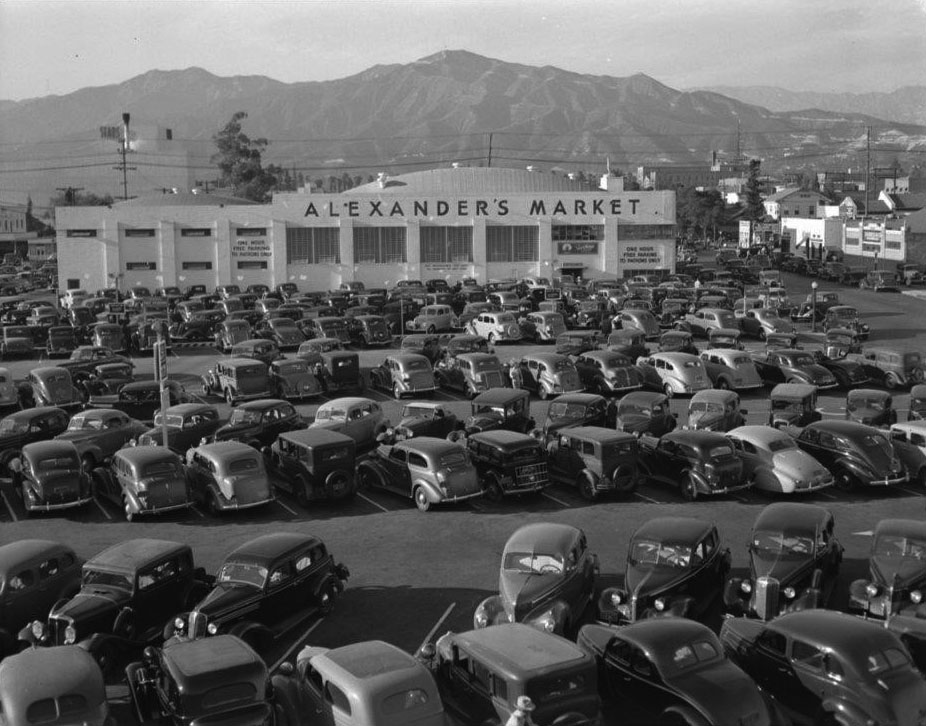 |
|
| (ca. 1940)* – View looking north showing a full parking lot in front of Alexander’s Market on Orange Street. |
Historical Notes In the 80s it was House of Fabrics, and then Joann's fabrics after that. |
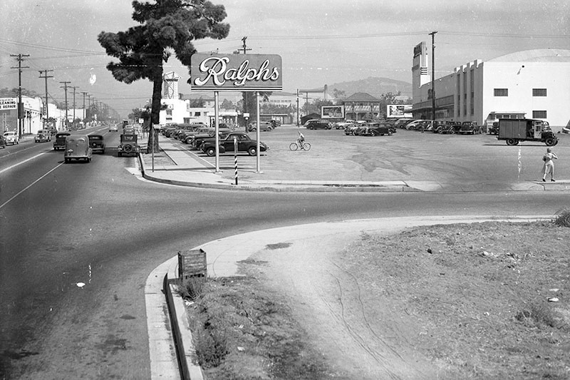 |
|
| (1946)^ – View looking north on Verdugo Road at Dixon Street in Glendale, showing various businesses on the left and a large Ralphs supermarket (right). At the northern end of the parking lot is a Van De Kamp's windmill-shaped bakery (upper left) and a Shell service station. |
Historical Notes This corner is still occupied by a Ralphs supermarket, but the Art Deco structure, designed by Stiles Clements, has since been demolished and replaced with a larger store. Click HERE for contemporary view. |
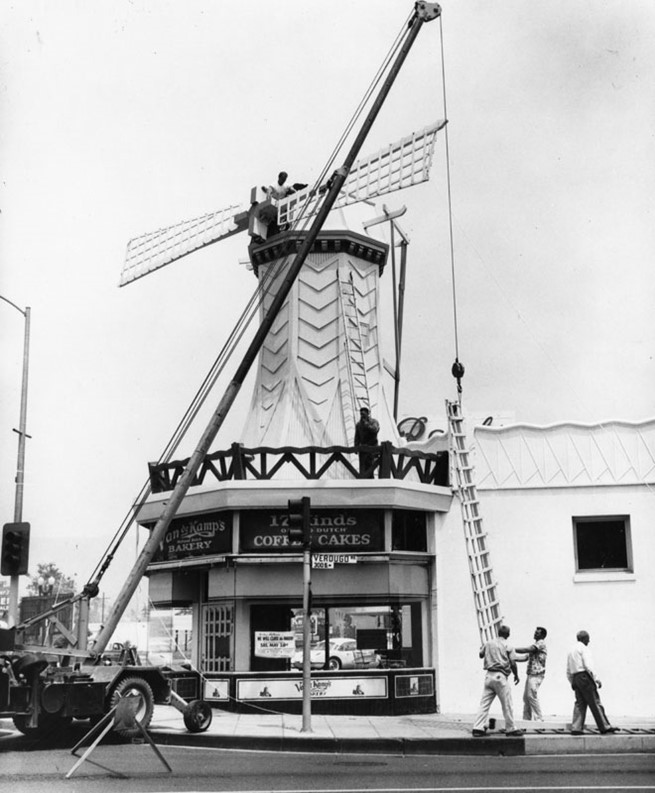 |
|
| (n.d.)* - Van de Kamp's Bakery on the SE corner of Verdugo Road and Colorado Street. Workers are assembling the windmill on top. A sign in the window says the bakery will be closed Saturday, May 28. |
* * * * * |
Snowbird Ice Cream (later Baskin-Robbins)
 |
|
| (1948)* - Baskin-Robbins originally Snowbird Ice Cream, 1130 South Adams Street, Glendale. The building on the corner of Adams Street and Palmer Ave still exists. Click HERE for contemporary view. |
Historical Notes Baskin-Robbins originated as separate ice cream ventures by Burt Baskin and his borther-in-law Irv Robbins: Burton's Ice Cream Shop and Snowbird Ice Cream, respectively. Snowbird, offering 21 flavors, merged with Burton's in 1953, expanding to 31 flavors. By 1948, they had six stores and began franchising. The first franchise was in Glendale in the store seen above. In 1953, the company adopted the 31 flavors theme and a circus-inspired design. The company name evolved from Huntington Ice Cream Company to Baskin-Robbins. The founders owned the company until its acquisition by United Brands in 1967. The brand went international in the 1970s and introduced ice cream cakes to the public. |
 |
|
| (2022)* - Looking west toward the building on the corner of Adams Street and Palmer Avenue in Glendale. Once occupied by Snowboard Ice Cream and later the first Baskin-Robbins franchise, it is now home to the Adams Kabob House Restaurant |
Historical Notes The first franchise was established on May 20, 1948, in Glendale (in the building seen above), and by 1953, the company adopted the Baskin-Robbins name and introduced the iconic "31 flavors" concept. Known for its innovative approach, Baskin-Robbins has introduced over 1,300 flavors since 1945 and created themed flavors for special events. |
Then and Now
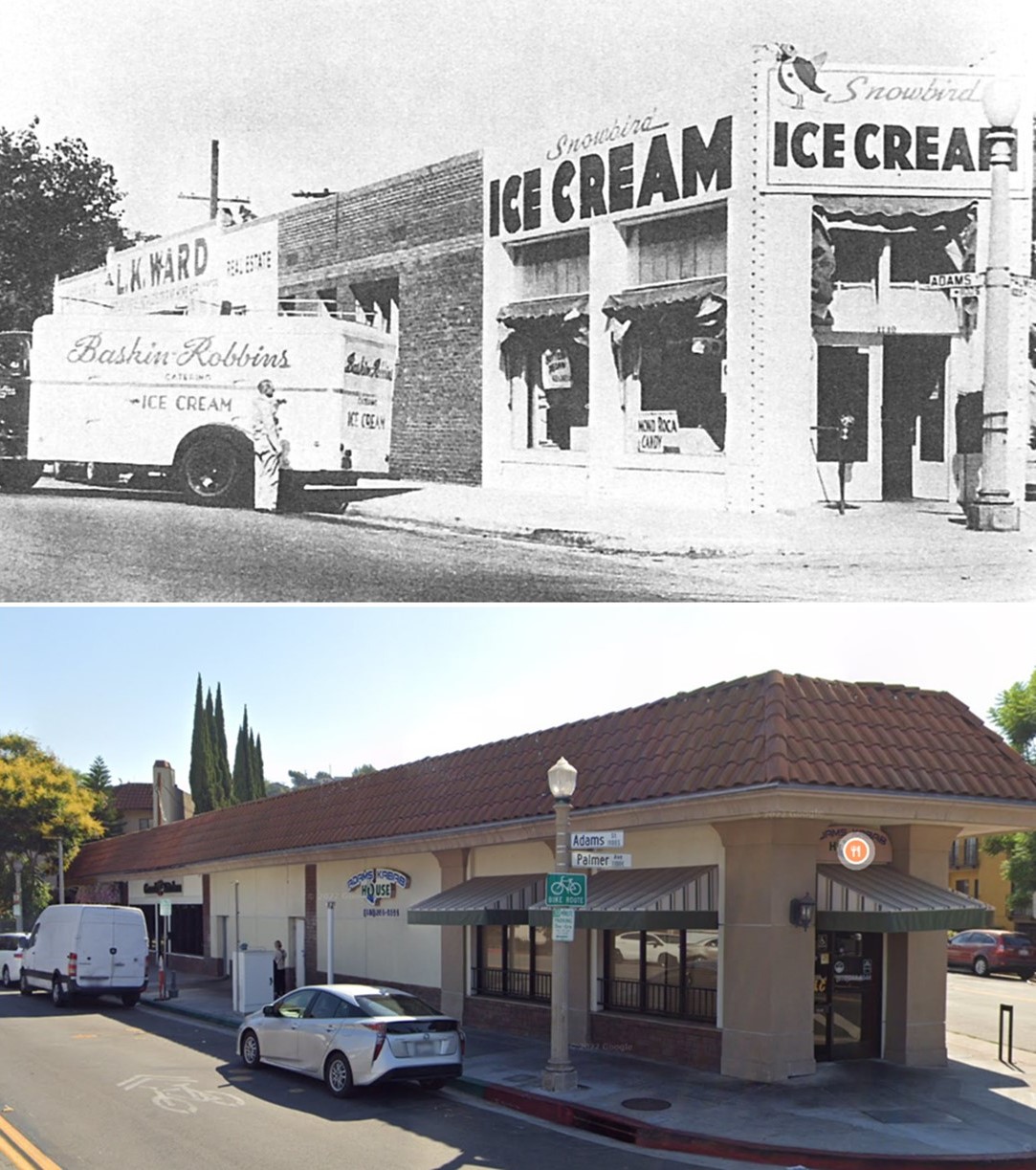 |
|
| (1948 vs 2022)* - Looking west toward the building on the corner of Adams Street and Palmer Avenue in Glendale. Once occupied by Snowboard Ice Cream which later became the first Baskin-Robbins franchise, it is now home to the Adams Kabob House Restaurant |
Historical Notes Baskin-Robbins went through several ownership changes, including acquisitions by United Fruit, J. Lyons and Co., and Allied Domecq. In 2006, private equity firms purchased Baskin-Robbins, and Dunkin' Brands became independent in 2012, later acquired by Inspire Brands in 2020. Today, Baskin-Robbins has over 8,000 locations worldwide, has introduced vegan and non-dairy flavors, and launched a new logo and tagline, "Seize the Yay," in 2022. The company's success is attributed to its commitment to flavor innovation, quality, and adaptability to changing consumer preferences. |
* * * * * |
Vogue Theatre
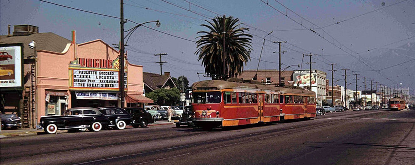 |
|
| (1949)* - Two coupled Pacific Electric streetcars pass the Vogue Theatre at 735 S. Brand Boulevard. |
Historical Notes The Vogue Theatre was a short-lived movie theater in Glendale, operating from 1941 to approximately 1955. Located at 735 S. Brand Boulevard, it was designed by architect Paul Hartman and opened on November 11, 1941, with a seating capacity of 735. Situated on the west side of Brand Boulevard, just north of Windsor Road, the theater was operated by Grover Smith, who also managed the nearby Cosmo Theatre. The Vogue's final known newspaper listing appeared on April 20, 1955, featuring Kiss Me Kate and Valley of the Kings. After its closure, the building underwent significant renovations and repurposing. Today, it houses part of a Nissan car dealership, with its original architectural features largely obscured by extensive modifications. Two Pacific Electric streetcars coupled together in early Southern California were commonly referred to as a "two-car train" or a "double-header." This coupling allowed for increased passenger capacity on popular routes, and each car would have its own motorman and conductor to handle the additional load and ticketing efficiently. |
 |
|
| (2022)* - Looking toward the Glendale Nissan showroom, formerly the site of the Vogue Theatre. |
Historical Notes Today, the former site of the Vogue Theatre at 735 S. Brand Boulevard in Glendale, is occupied by a Nissan car dealership. The building, once a vibrant movie theater, has been extensively modified, with the front now serving as a showroom for Glendale Nissan. The former auditorium area is likely used for support services or office space, as evidenced by new door configurations along the building's sides. While the original building’s shell may remain, the iconic marquee is gone, and the structure’s original architectural features are largely unrecognizable. Interestingly, an adjacent auto body shop at 737 Brand Boulevard, built in 1941, aligns with the theater's construction date. |
 |
|
| (1949 vs 2022)* - Looking toward the Vogue Theatre at 735 S. Brand Boulevard, now the site of the Glendale Nissan showroom |
* * * * * |
Towers Motors
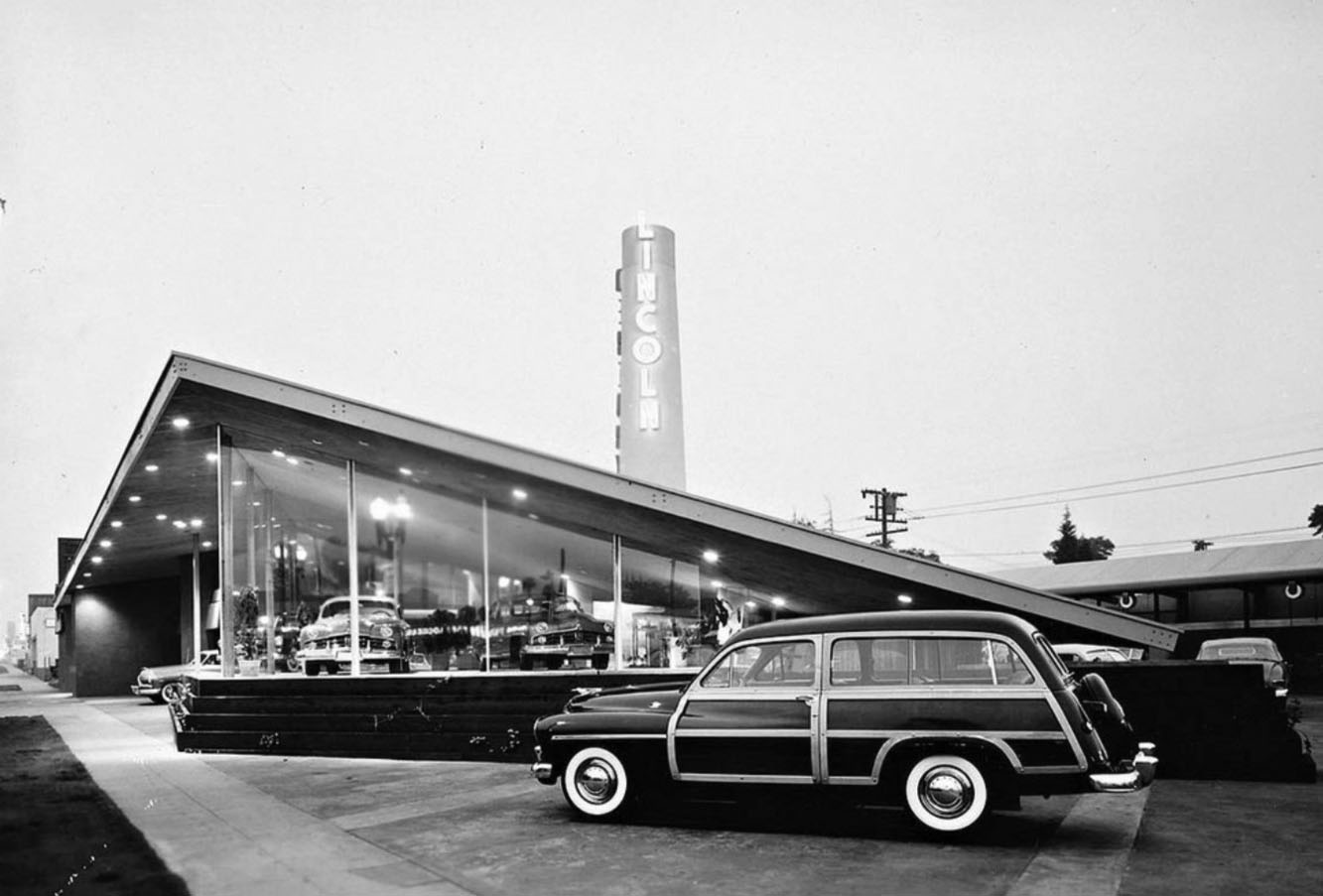 |
|
| (1949)* – View showing Towers Motors, a Lincoln Mercury dealership located on Colorado Street in Glendale. |
Historical Notes The Googie-style building located at 600 E. Colorado Street was designed by John Lautner. This beautiful building no longer stands. The price for a brand new 1949 Mercury woody wagon (as seen above) was a whopping $2,500.00. |
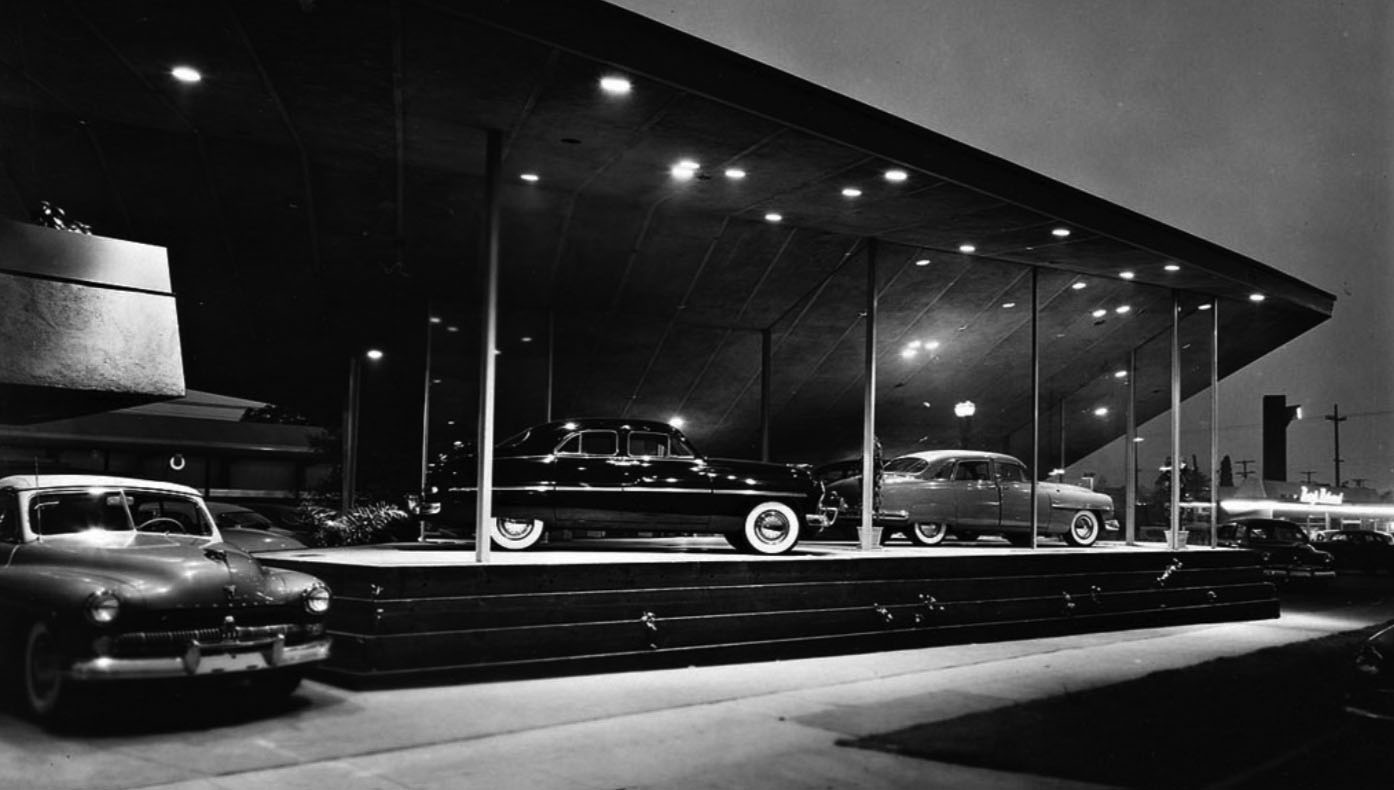 |
|
| (1949)* – Exterior night view showing the beautiful Towers Motors showroom, 600 E. Colorado Street, Glendale. Photo by Julius Shulman |
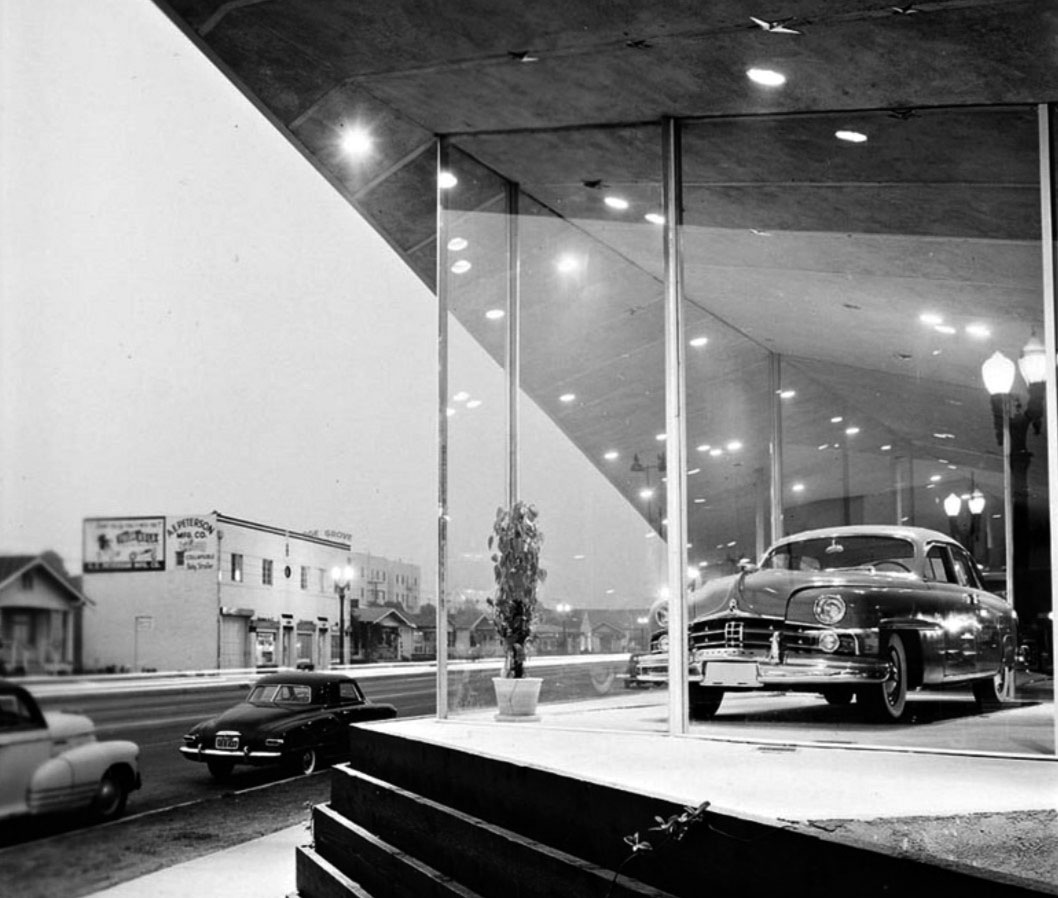 |
|
| (1949)* – Close-up view, looking southwest, showing the Towers Motors showroom with Colorado Street seen in the background. |
* * * * * |
Bob's Pantry (Original Bob's Big Boy)
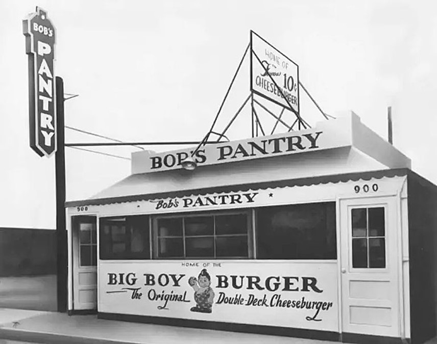 |
|
| (ca. 1936)* - Bob’s Pantry, located at 900 E. Colorado Street in Glendale. This site would later become the first location of Bob's Big Boy Drive-in. |
Historical Notes Bob's Big Boy, originally called Bob’s Pantry, was a 10-stool hamburger stand at 900 E Colorado St in Glendale. It was opened for $350 by 23-year-old former busboy Bob Wian, who raised the money by selling his car. |
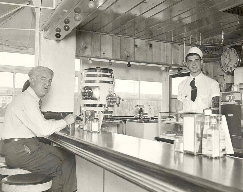 |
|
| (1930s)* - An interior view of Bob’s Pantry at 900 E. Colorado Street in Glendale, featuring a young Bob Wian behind the counter. |
Historical Notes In the early months of 1937, about six months into operation, one of Bob Wian's friends walked into the joint and reportedly asked for a different kind of hamburger. Jokingly, Wian added a second patty with a bun in between, inventing the double-decker burger, which to his surprise, suddenly took off. According to legend, Wian named the sandwich the Big Boy Burger after six-year-old customer Richard Woodruff, who used to come in on his own and stay at the counter eating multiple burgers until his grandmother would come in and drag him out. Woodruff also became the restaurant's original mascot after another regular customer, Warner Bros. animation artist Ben Washam, doodled the kid's caricature on a napkin one day while eating lunch. Wian saw it and asked to buy it, but Washam gave it to him for free. |
Bob's Big Boy (900 E. Colorado Street)
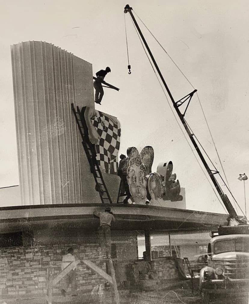 |
|
| (1940s)* - A man is dangling on a beam, waiting for the 'Big Boy' mascot sign to be raised and set at the new Bob’s Big Boy Drive-In located at 900 E. Colorado Street in Glendale. Bruce B. Hermann Collection |
Historical Notes The original Bob's Big Boy, initially called Bob's Pantry, was founded by Bob Wian in 1936 at 900 E Colorado St, Glendale. This location started as a 10-stool hamburger stand and quickly grew into a full-service drive-in restaurant, becoming a local landmark with its eye-catching neon lights in the 1940s. |
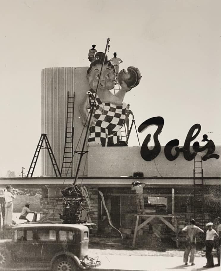 |
|
| (1940s)* - Workmen with wooden ladders and a vintage crane are pictured here, having just hoisted and secured the giant pieces of the Big Boy sign at the newly constructed Bob’s Big Boy Drive-in. Bruce B. Hermann Collection |
Historical Notes The chain is best known for its trademark chubby boy in red-and-white checkered overalls holding a Big Boy sandwich (double-decker cheeseburger). The inspiration for Big Boy's name, as well as the model for its mascot, was Richard Woodruff (1936–1986), of Glendale, California. When he was six years old, he walked into the diner Bob's Pantry as Bob Wian was attempting to name his new hamburger. Wian said, "Hello, Big Boy" to Woodruff, and the name stuck. |
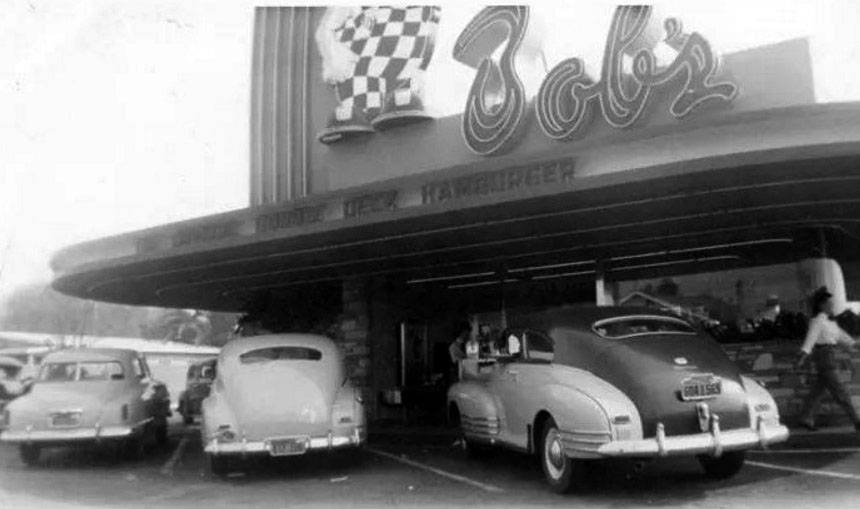 |
|
| (ca. 1949)* – View showing Bob’s Big Boy Drive-in restaurant located at 900 E. Colorado in Glendale. |
Historical Notes The Glendale location, like other Bob's Big Boy restaurants, became a cultural icon over the years. It served as a popular hangout spot for families, teenagers, and car enthusiasts, contributing to the local community's social fabric. |
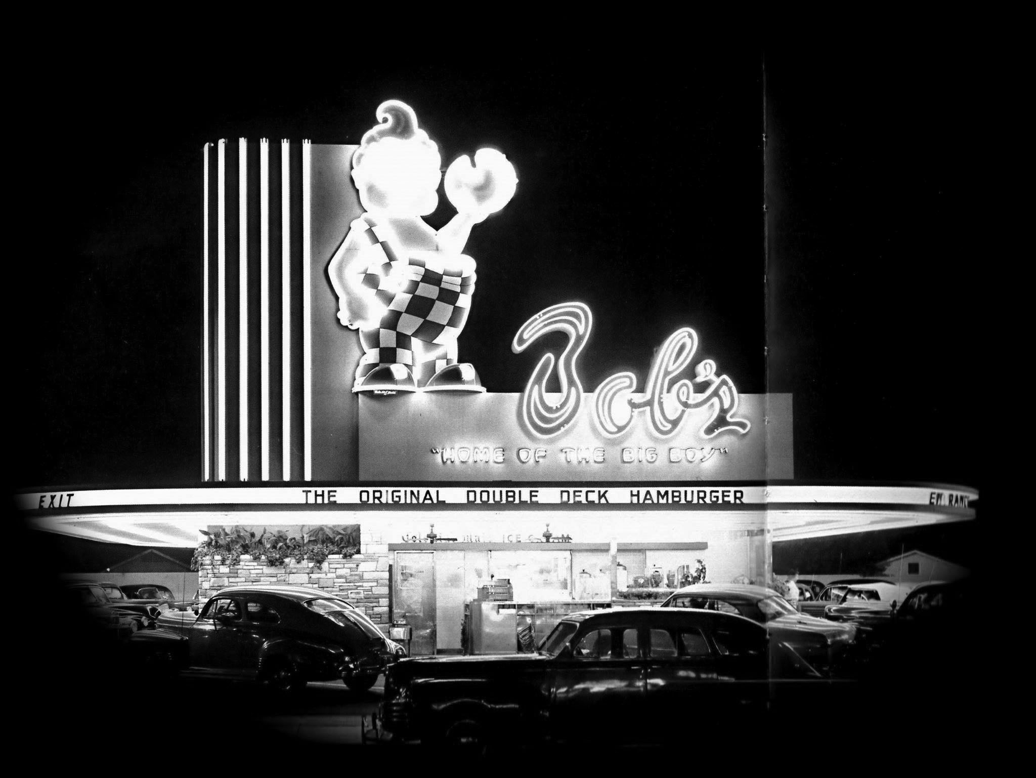 |
|
| (ca. 1949)* – Night view showing a very crowded Bob’s Big Boy Drive-in Restaurant at 900 E Colorado in Glendale. |
Historical Notes The architect behind the design of the original Bob's Big Boy was Wayne McAllister. McAllister was a renowned architect who played a significant role in shaping the iconic look of Bob's Big Boy restaurants. |
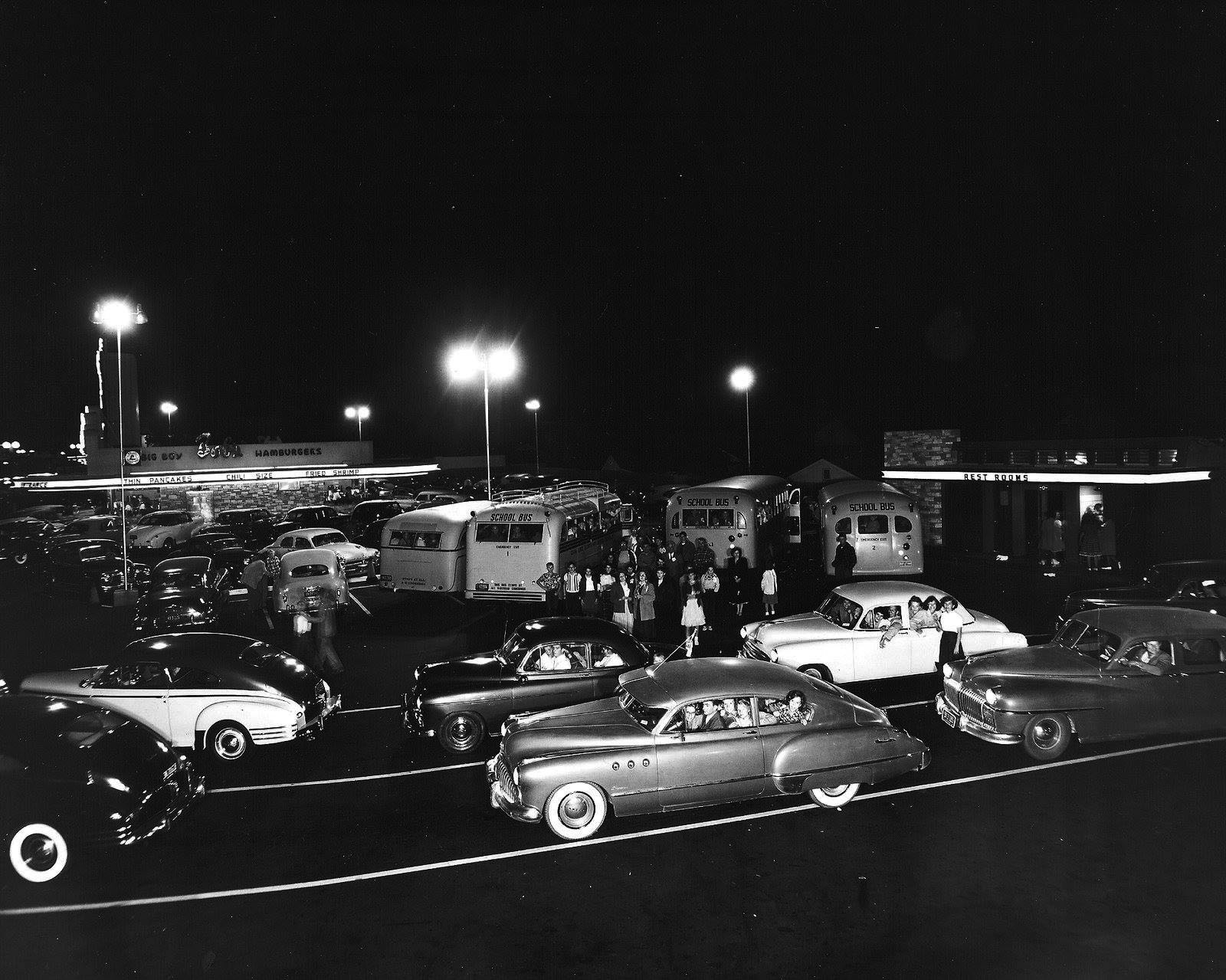 |
|
| (ca. 1950)* - Proof positive that Bob's was the place to be in the early 1950's! This picture shows the mob, and line of cars waiting to get into the "twin drive in and coffee shop" at 900 E. Colorado, Glendale. |
Historical Notes Bob’s Big Boy became a cultural icon for Glendale teenagers in the 1940s up until the 1970s. After the widely popular Glendale and Hoover High School football games, lines of cars filled with local students would eat at Bob’s Big Boy on Colorado Street. The original location at 900 E Colorado St was eventually demolished, and what stands there now is a typical Californian mini mall. Other Bob's Big Boy locations in Glendale, such as those at 3212 La Crescenta Ave and 115 W Broadway, have also been transformed and no longer serve as Bob's Big Boy restaurants. In 1967, Bob Wian sold Bob's Big Boy to Marriott Corporation for $7 million. At that time, the chain had already expanded significantly, and Marriott continued to grow it, reaching a peak of about 1,200 locations. However, by the late 1980s, Marriott sold the Big Boy trademark to Elias Brothers, who then faced financial difficulties, leading to a bankruptcy filing in 2000. Today, the Big Boy chain operates about 70 locations in the United States, with five of those in Southern California: Burbank/Toluca Lake at 4211 W. Riverside Drive, Burbank |
Bob's Big Boy (Broadway Ave)
 |
|
| (1950s)* - Bob's number four location at the northwest corner of Broadway and Maryland in Glendale. Photo courtesy of Bruce B. Hermann |
Historical Notes Opened May 17, 1948 rebuilt and reopened December 1956 at 121 E. Broadway Ave. The building still stands, but many remodeling jobs over the years have left it unrecognizable. It now houses a Chinese restaurant. Click HERE for contemporary view. |
* * * * * |
Currie's Ice Cream
 |
|
| (1960)* - View showing Currie’s Ice Cream and an Owl Drugs store located at the northwest corner of Glenoaks Boulevard and Irving Avenue, Grandview Neighborhood of Glendale. |
Historical Notes The above building is still there. Click HERE for contemporary view. |
 |
|
| (n.d.)* - Interior view of Currie’s. 40 cents for a quart of ice cream and they're apologizing for having to raise the prices. Yikes! |
Historical Notes The Currie's Ice Cream chain was started in 1927 by three brothers named Kuhns. After WWII they sold it to the Good Humor Company who later sold it to Lipton in the 1960s. In 1964 the chain opened its 87th store, in North Hollywood. Although Currie’s anticipated launching units in every community in Southern California, only three outlets were listed in the 1967 Los Angeles phone book and the chain had disappeared by the 1980s.* |
Candlelite Inn
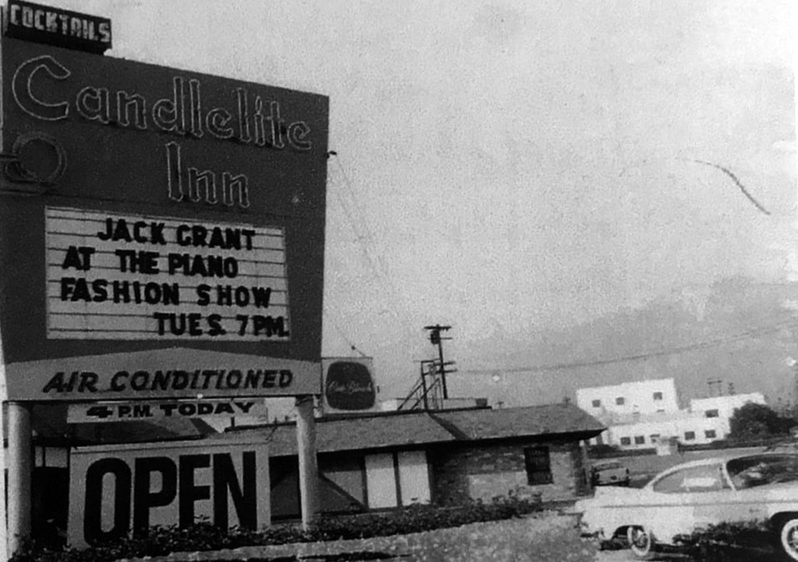 |
|
| (ca. 1963)* - Candlelite Inn located at 6100 San Fernando Road, NW corner of Grandview and San Fernando Rd. |
* * * * * |
Great White Hut
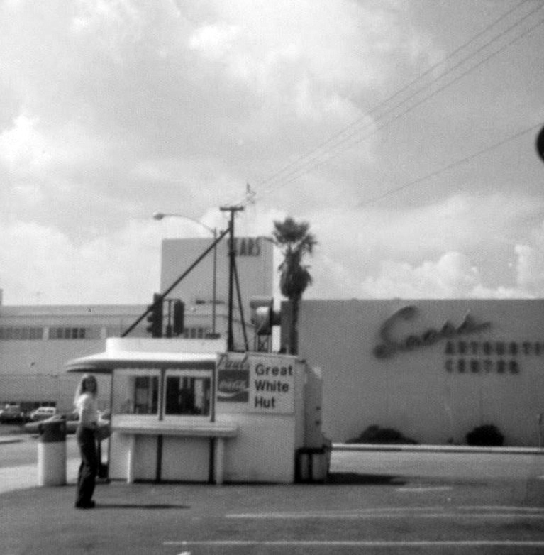 |
|
| (1970s)* – A young woman standing near the Great White Hut looks toward the camera with Sears Building seen in the background. Address: 121 W. California Avenue, Glendale. |
Historical Notes Since 1947, The Great White Hut has been located on the corner of Orange and California in Glendale. Staying open until 3am, it really becomes a great white beacon of hope after the bars let out and you realize IN N OUT has long since closed. For such a tiny spot, its menu is surprisingly large. |
 |
|
| (2017)* – Close-up side view of The Great White Hut as it appears today. Sign on top reads NOW OPEN LATE! Friday & Saturday: 8AM – 3AM |
Historical Notes The Great White Hut is a tiny little building in the corner of a parking lot, white walls with bright blue trim, surrounded on three sides with a black-and-white checker-board tile counter. Stools with blue posts and red seats, shaded by a blue-and-white awning. |
 |
 |
|
| (ca. 2019)* - Great White Hut with life-size murals of Marilyn Monroe and James Dean |
Historical Notes Painted on one side of the Hut is a life-sized portrait of James Dean, and on the other side is a portrait of Marilyn Monroe. Click HERE to see Contemporary Google View. |
 |
|
| (2020)* – The Great White Hut, outsie seating lunch counter since 1947. Photo by Gerson Medina |
Henry's Restaurant
 |
|
| (1977)*^* – View showing Henry’s Restaurant located on the SE corner of Colorado Street and Glendale Avenue. |
Historical Notes Henry's was known for its "Chicken in the Rough" meal. Also for its Fried Chicken Livers and Gizzards. Click HERE to see menu. |
 |
|
| (ca. 1959)^.^ – View looking northwest on Brand Boulevard toward Lexington Drive showing the newly built Glendale Federal Savings Building on the NW corner. Scott’s Furniture and the California Hotel can be seen at left. Photo courtesy of Alan Simon |
Historical Notes The Glendale Federal Savings Building was completed in 1959. Scott's Furniture (seen on the left) is in the space where the California Theatre was once located (1928-1957). |
Then and Now
|
 |
|
| (ca. 1959)^.^ | (2019)* |
Glendale Federal Savings Building
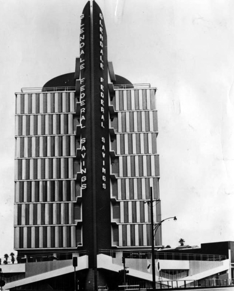 |
|
| (1959)^ - View showing the Glendale Federal Building shortly after it opened, located on the NW corner of Brand and Lexington. Valley Times Collection |
Historical Notes As head designer for the Bank Building and Equipment Corporation of America, Peruvian-born architect W. A. Sarmiento designed hundreds of Modern-style bank buildings all over the country. One of the most renowned and best-loved is right here, in Glendale: the Glendale Federal Savings and Loan Building on Brand Boulevard. Glendale Federal founder and president J. E. Hoeft wanted an ambitious design for his bank’s new headquarters, something not only representative of West Coast Modernism, but of his burgeoning hometown. He offered a prime site at the corner of Lexington and Brand, and Sarmiento delivered a dynamic design that would prove to be an icon of Southern California Modernism. Completed in 1959, the Glendale Federal Savings Building features a vertical, dramatically angled red stair/elevator tower fronting the main volume, which is a rectangular ten story high-rise.* |
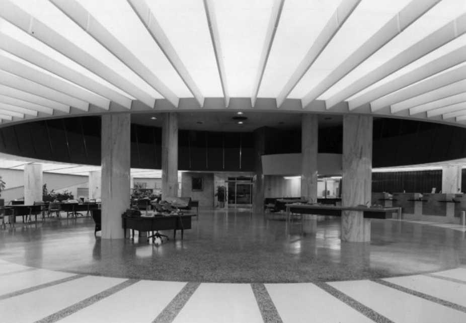 |
|
| (ca. 1960)^.^ - Interior view of the space-age Glendale Federal Savings. |
Historical Notes The tower is actually lifted above the building’s first floor, allowing the mezzanine level to be lit with natural sunlight.* |
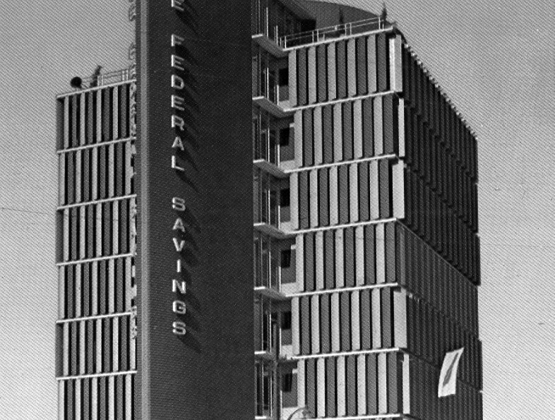 |
|
| (ca. 1960)** – Close-up view of the Glendale Federal Savings Building, 401 N. Brand Boulevard. Photo courtesy of the James Marston Fitch Charitable Foundation |
Historical Notes Architect Maxwell A. Starkman produced a design for an addition in 1962 that doubled the size of the office building and harmonized with Sarmiento's original design. On the building’s fire brick red corner tower, a vertical sign proudly displayed its name for all to see as this was the city’s tallest building for many years. The corner tower functions as fire escape and elevator tower. The main cube structure is framed by concrete and glass with windows framed in aluminum, forming a grid of blue and white colors during the day, and glowing light with the louvers open at night. |
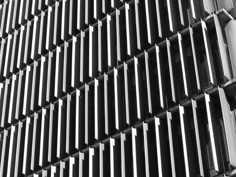 |
|
| (2009)** - Detail view showing the vertical louvers of the Glendale Federal Savings Building. Photo courtesy of the James Marston Fitch Charitable Foundation |
Historical Notes The building’s many windows are shaded by distinctive blue enameled steel louvers which use solar power to pivot throughout the day. |
 |
|
| (2019)^.^ – View showing the Glendale Federal Savings Building (now Hollywood Production Center) located at 401 N. Brand Blvd. Note how the building is set at a 45 degree angle to the city grid. |
Historical Notes Set at a 45 degree angle to the city grid, Hoeft gave Sarmiento the perfect site to create a bold architectural statement that for decades has been known as the “tower” of Glendale, featured on postcards, and described by Los Angeles architectural historian Robert Winter as “pure 1950s razzle dazzle.” ** |
 |
|
| (2019)^^ - Close-up view of the Glendale Federal Building on the NW corner of Brand and Lexington. The building now houses the Hollywood Production Center. Photo courtesy of Roadside Arcthitecture |
Historical Notes Glendale Federal Savings and Loan was bought out by Cal Fed in 1998 and the company moved its headquarters up the street. The building was subsequently sold to Nicholson Vertex Partners, who indicated their intent to remodel the building and to remove its character defining architectural features. In late 2000, the Glendale Historical Society, Los Angeles Conservancy, and concerned preservationists united to wage a preservation campaign that resulted in the building’s listing on the California survey of historic landmarks. With that listing, any permit to remodel required an environmental impact analysis. ** |
 |
|
| (2019)^^ – View looking west at the Glendale Federal Savings Building, 401 N. Brand Boulevard. Photo courtesy of Roadside Arcthitecture |
Historical Notes Largely retaining its architectural integrity, Glendale Federal Savings is the embodiment of distinguished mid-century modern architecture with enduring significance by retaining its central form and character. Viewed from any elevation, Glendale Federal Savings became the symbol of the new downtown through its design, color, size, and dynamic presence, which is unlike any other architecture in the region.** The building now houses the Hollywood Production Center. |
Glendale Police Headquarters
 |
|
| (1960)^ - Photograph caption reads, "Spanking new headquarters for Glendale Police Force is 1,000,000, two-story building at Wilson Avenue and Isabel Street. Glendale's 160-man force will now be under one roof in new building. Formerly, part of police department was in old police building at 111 N. Howard St. and part in utility building." Valley Times photo date: November 8, 1960. Click HERE for contemporary view. |
 |
|
| (1982)*^* – View showing north Brand Boulevard at the Verdugo wash with the Incarnation Church at left and the Ralph’s grocery store at right. |
* * * * * |
Glendale Fashion Center
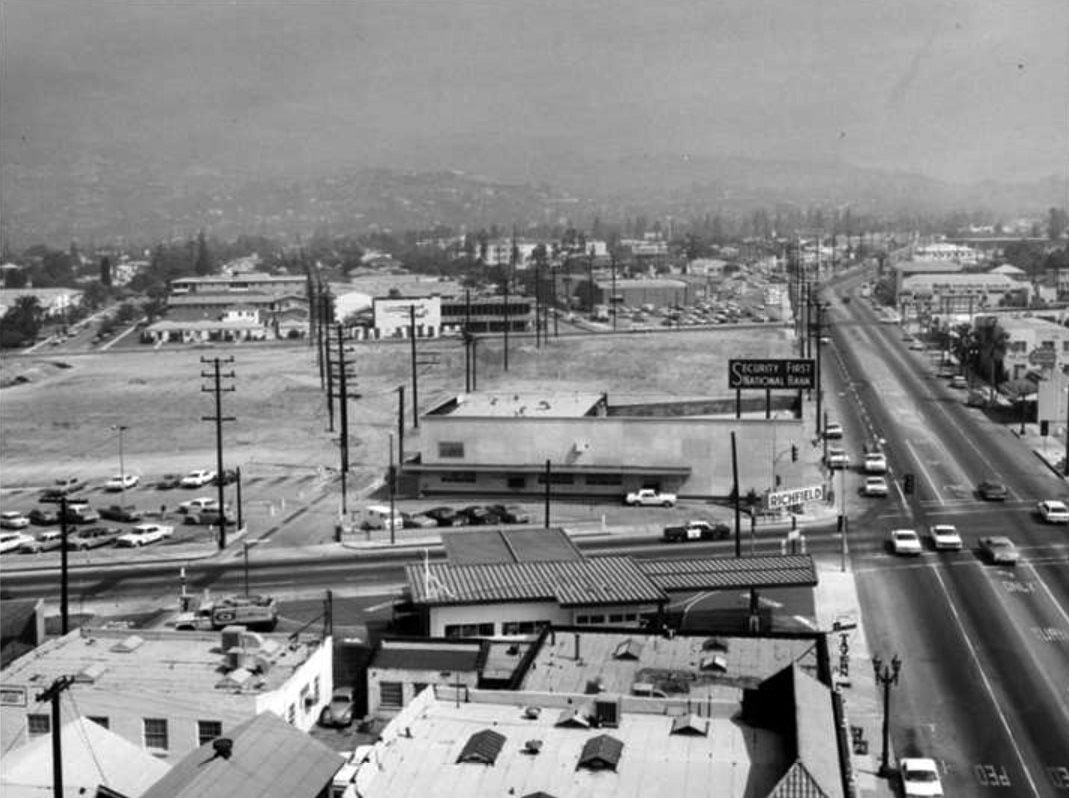 |
|
| (1966)##^ – View showing the intersection of Glendale and Wilson avenues, with Secutiry First National Bank and Richfield gas station on the NW and SW corners, respectively. This land was cleared for the Glendale Fashion Center. Click HERE for contemporary view. |
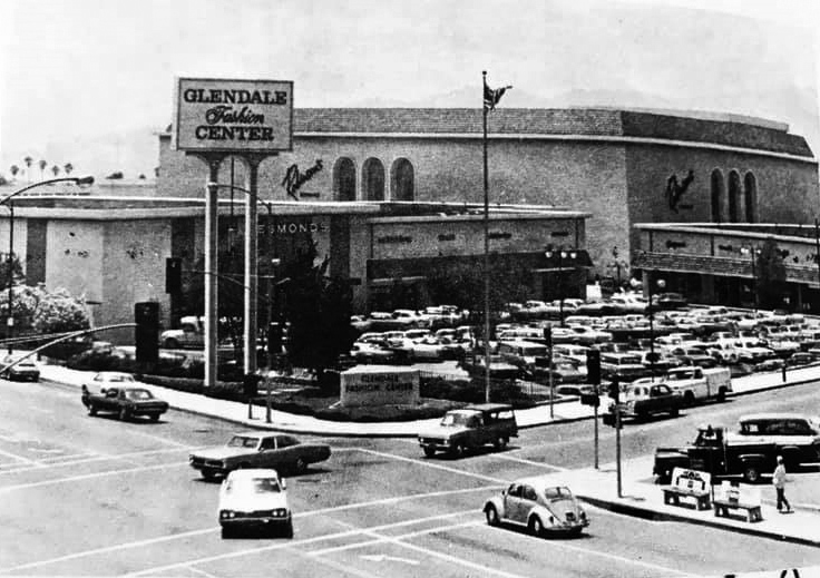 |
|
| (1974)^.^ - View looking SW showing the Glendale Fashion Center at Glendale Ave and California St. The anchor store was Robinson's, seen in the background. Desmond’s is at center-left. Photo courtesy of Art Jacobs |
Historical Notes Today Glendale Fashion Center is anchored by Ross, TJ Maxx, Nordstrom Rack, Staples, and Petco. Click HERE for contemporary view. |
Glendale Galleria
 |
|
| (1984)^ - Photograph caption dated August 12, 1984 reads, "A skylight and plants brighten the Nordstrom store at Glendale Galleria shopping mall." Photo by Lisa Hatalsky |
Historical Notes Developed by Glendale Associates, a partnership between J.S. Griffiths Co, Broadway Hale Stores and M.J. Brock & Sons, the Glendale Galleria opened on October 14, 1976. The architect was Jon Jerde, who credited his design to a Ray Bradbury essay on reviving retail districts. The mall began with four anchor stores: Buffum's and The Broadway, which opened in August 1976; Ohrbach's, which opened in October, 1976; and JCPenney, which opened in November of that year. The Galleria's first expansion, Galleria II, was completed in 1983. It expanded a wing of the mall and added another anchor store, Nordstrom. The first Panda Express restaurant opened in Galleria II in the same year, on level 3 near Bloomingdale's.*^ |
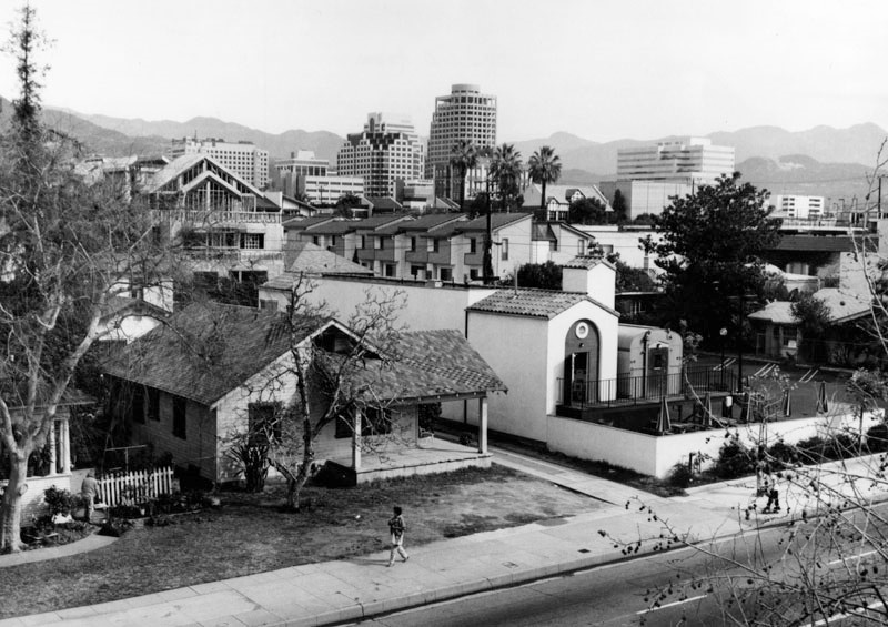 |
|
| (1990)^ - Panoramic view of Glendale, looking northeast from the Glendale Galleria parking structure. Photo by William Reagh |
* * * * * |
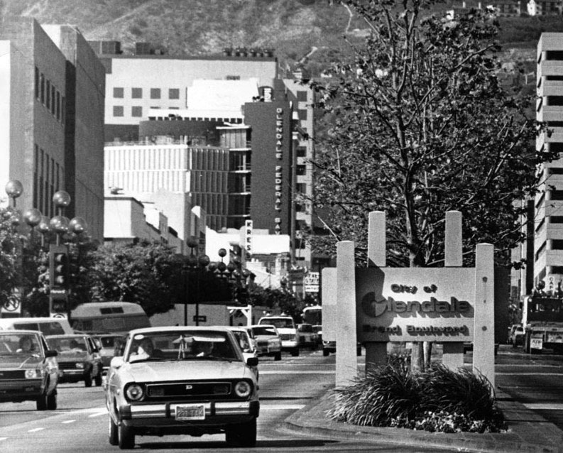 |
|
| (1980s)*# - Sign reads: City of Glendale - Brand Boulevard. Photo Credit: City of Glendale |
Then and Now
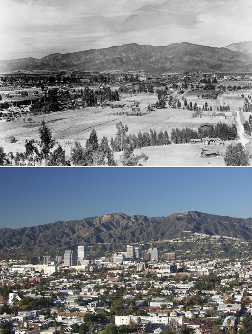 |
|
| (1910 vs 2009)* - Then and Now - Glendale as seen from current location of Forest Lawn Memorial Park. Contemporary photo by Gary B. Edstrom / Wikipedia |
Historical Notes When incorporated in 1906, Glendale consisted of only 1,486 acres. By 1920, the City had grown through nine annexations to over 7,000 acres. From 1920 to 1930, ten annexations brought the total area to 12,294 acres. |
.jpg) |
|
| (2017)*# – Panoramic view of the City of Glendale as seen from the Verdugo Moutains. Photo courtesy of the City of Glendale |
Historical Notes As of 2014, Glendale had a population was 200,167, making it the third largest city in Los Angeles County and the 23rd-largest city in California. Glendale has one of the largest communities of Armenian descent in the United States. In 2013, Glendale was named LA's Neighborhood of the Year by the readers and editors of Curbed.com. Forest Lawn Memorial Park Cemetery contains the remains of many noted celebrities and local residents. Grand Central Airport was the departure point for the first commercial west-to-east transcontinental flight flown by Charles Lindbergh.*^ |
Please Support Our CauseWater and Power Associates, Inc. is a non-profit, public service organization dedicated to preserving historical records and photos. Your generosity allows us to continue to disseminate knowledge of the rich and diverse multicultural history of the greater Los Angeles area; to serve as a resource of historical information; and to assist in the preservation of the city's historic records.
|
More Historical Early Views
Newest Additions
Early LA Buildings and City Views
History of Water and Electricity in Los Angeles
* * * * * |
References anc Credits
* DWP - LA Public Library Image Archive
^ LA Public Library Image Archive
*^ Wikipedia
^* Glendale High School Home Page
*# Abandoned & Little-Known Airfields – Paul Freeman
#* Flickr.com: Glendale Public Library
#^ Pacific Electric Railway Historical Society
#+ Los Angeles River Flood of 1938
++ Early Glendale (Images of America)
#**Huntington Digital Library Archive
**^Facebook.com: Bob's Big Boy
*^^LA Times: Webb's Department Store
+++Facebook: Vintage Glendale "The Jewel City"
^*^Nuestra Señora la Reina de los Ángeles: losangelespast.com
^^*Cinema Treasures: Palace Grand Theatre
***PhantomLosAngeles.blogspot.com: Glendale Southern Pacific Railroad
^x*Facebook.com: So. Calif. Historic Arrchitecture
^*#California State Library Image Archive
^##Metropolitan Transportation Library and Archive
+##Airport Journals: Grand Central Aiport
#^*Flickr.com: Michael Ryerson
##^CSUN Oviatt Library Digital Archives
##*OAC - Online Archive of California
^##^Glendale Historical Society
#+#+Glendale News-Press: Tropic
#*#^Brand Park and Studios: glendale.ca.us
***^CSUN Oviatt Library Digital Archives
#+++Facebook.com: West San Fernando Valley Then And Now
##^*Facebook.com: Classic Hollywood-Los Angeles-SFV
< Back