Early Views of Beverly Hills
Historical Photos of Beverly Hills |
 |
|
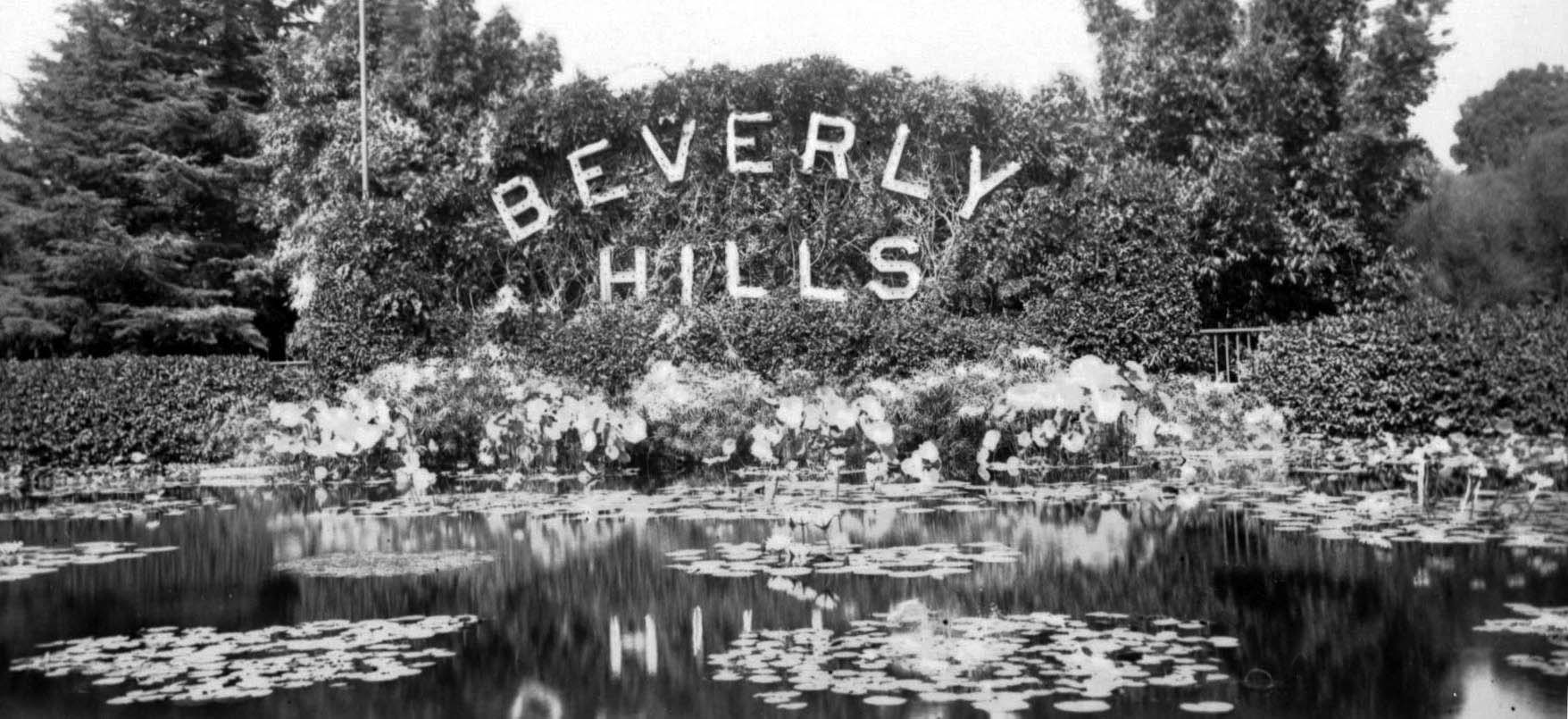
| (ca. 1925)* – View showing the world famous lily pond and Beverly Hills sign pictured in its original form. It is now part of the landmark Beverly Gardens Park.. |
Historical Background In 1838, the Mexican governor of California deeded the land grant El Rodeo de las Aguas to Maria Rita Valdez Villa, the Afro Latina widow of a Spanish soldier. Maria Rita, an early California feminist icon, built an adobe ranch house near the intersection of present day Sunset Boulevard and Alpine Drive. She employed a vast posse of cowboys and proceeded to raise cattle and horses. As was the custom of a time, Maria Rita permitted her livestock to wander freely, but once a year a festive roundup, another kind of rodeo, was held beneath a huge eucalyptus tree at the corner of Pico and Robertson boulevards. In 1852, three Native Americans ambushed Maria Rita's rancho. A shoot-out and siege followed in a grove of walnut trees at Benedict Canyon and Chevy Chase Drive. Maria Rita survived, but the battle may have influenced her decision just two years later to sell the ranch to Benjamin D. Wilson and Henry Hancock for $4000. However, the legendary waters deserted the new owners; a drought decimated their crops and their cattle died in parched stream beds. However, their names live on today in nearby Mt. Wilson and Hancock Park. After the Civil War wildcatters and roughnecks drilled oil wells. Cattle gave way to herds of sheep. Edward Preuss bought the ranch in 1868 with the intention of establishing a colony for German immigrant farmers. Preuss dubbed his civic speculation the "City of Santa Maria." He subdivided the soil into five-acre lots and put them up for sale for $10 a parcel. Another drought ruined these plans and the land reverted to sheep and cattle ranching. |
.jpg) |
|
| (ca. 1900)* – View looking south showing a bean field on the Hammel and Denker ranch in an area that would become the city of Beverly Hills. |
Historical Notes Shortly after the drought, the rancho passed into the hands of two Los Angeles hoteliers who proceeded to grow lima beans on the property. Their first land purchase was made in 1881, and was later added to parcel by parcel. Henry Hammel and Charles Denker, managers of the U.S. Hotel in Los Angeles, proposed their own townsite, to be called Morocco, for the area. Morocco was subdivided in 1888 during the big land boom of 1887-88, the era which saw the start of so many Southern California communities, both successful and unsuccessful. Hammel and Denker’s settlement was centered around the train station at the then junction of Burton Way and Santa Monica Boulevard (in the vicinity of Canon and Beverly Drives today) on the Santa Monica-Los Angeles line, which ran along Santa Monica Boulevard, which had also been named Morocco. Plans for Morocco were never realized, and the next activities on the ranch centered around a syndicate of investors, known as the Amalgamated Oil Company. |
 |
|
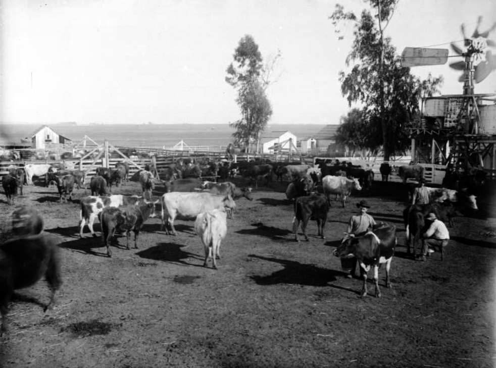
| (ca. 1905)* – View showing a herd of dairy cows on the Hammel and Denker ranch, Beverly Hills. Three men are in the corral with one milking a cow. Additional corrals and ranch buildings are visible in the background as well as stretches of wide open land. |
Historical Notes In 1900, Burton E. Green, Charles A. Canfield, Max Whittier, Frank H. Buck, Henry E. Huntington, William G. Kerckhoff, William F. Herrin, W.S. Porter, and Frank H. Balch, formed the Amalgamated Oil Company, bought the Hammel and Denker ranch, and began looking for oil. However, they did not find enough to exploit commercially by the standards of the time. |
 |
|
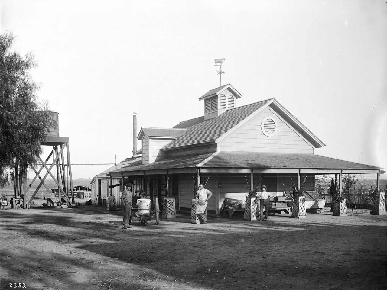
| (ca. 1905)* - View showing three men standing in front of the creamery on the Hammel and Denker ranch. Trellis planting boxes surround each of the wooden posts of the covered porch of the wooden creamery. A directional wind vane in the shape of a cow is on the top of the roof. A water tower is visible behind the building. Another ranch building is visible in the background. |
Historical Notes In 1906, Burton Green and the Amalgamated Oil Company reorganized as the Rodeo Land and Water Company, renamed the property "Beverly Hills," subdivided it, and began selling lots. The development was named "Beverly Hills" after Beverly Farms in Beverly, Massachusetts and because of the hills in the area. The first house in the subdivision was built in 1907, although sales remained slow. |
 |
|
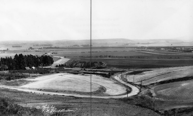
| (1913)^ - Panoramic view showing the Beverly Hills countryside with just a few homes and dirt roads. |
* * * * * |
Beverly Hills' 1st Train Station
.jpg) |
|
| (ca. 1910)* - Before being incorporated, before the Beverly Hills Hotel, before there was even "Hills," it was called just "Beverly." The above view shows Beverly Hill’s first train station located where the historic post office still stands on the southeast corner of Santa Monica Boulevard and Cañon Drive. |
Historical Notes The elite northern portion of the new city was divided from the southern portion by the railroad tracks and a commercial triangle between Santa Monica and Wilshire Boulevards. This triangle was originally known as “Beverly” while the rest of the City, located north of Santa Monica Boulevard, was known as “Beverly Hills.” |
 |
|
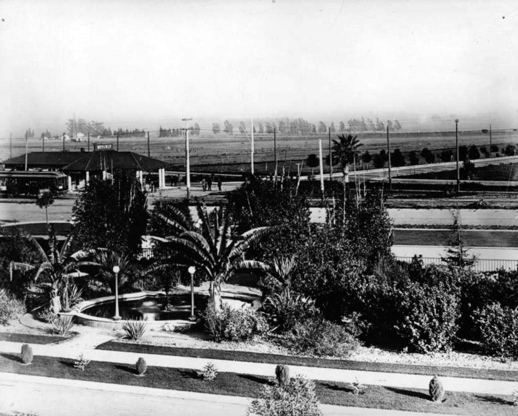
| (ca. 1918)* - View of Beverly Hills looking south showing a Pacific Electric Station. An oasis-style fountain stands in the foreground surrounded by trees, a sidewalk lining it in front. Behind this, the Pacific Electric station can be seen with a departing streetcar at left, on the corner of Beverly Drive and Santa Monica Boulevard. |
 |
|
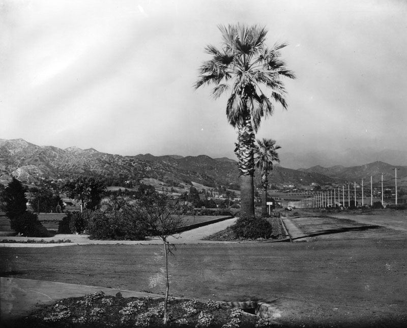
| (1915)* - View looking east on an unpaved Santa Monica Boulevard at Canon Drive with the Hollywood Hills in the background. |
Then and Now
 |
|
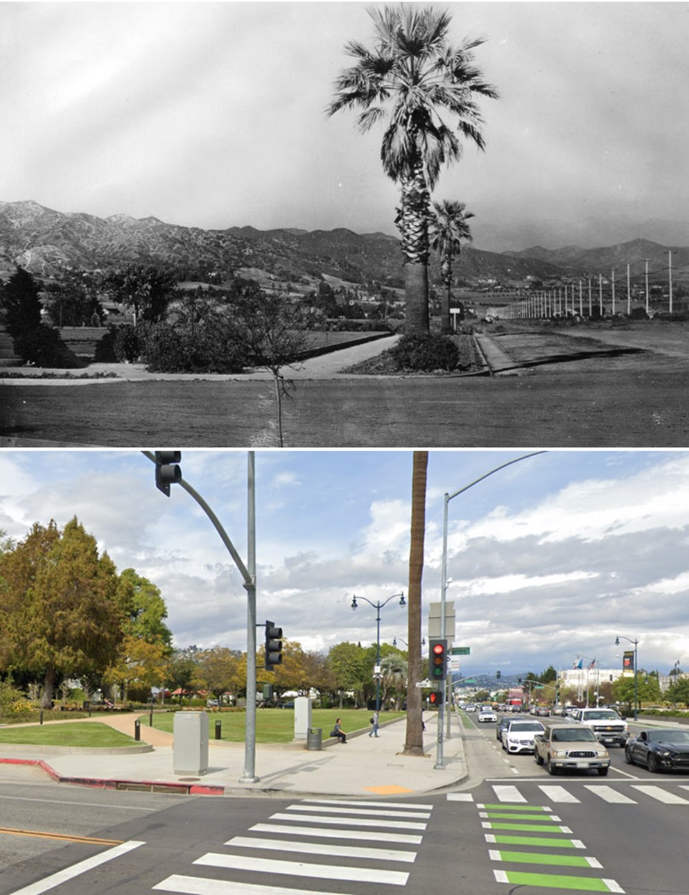
| (1915 vs 2019)* - View looking east on an unpaved Santa Monica Boulevard at Canon Drive. Photo comparison by Jack Feldman. |
 |
|
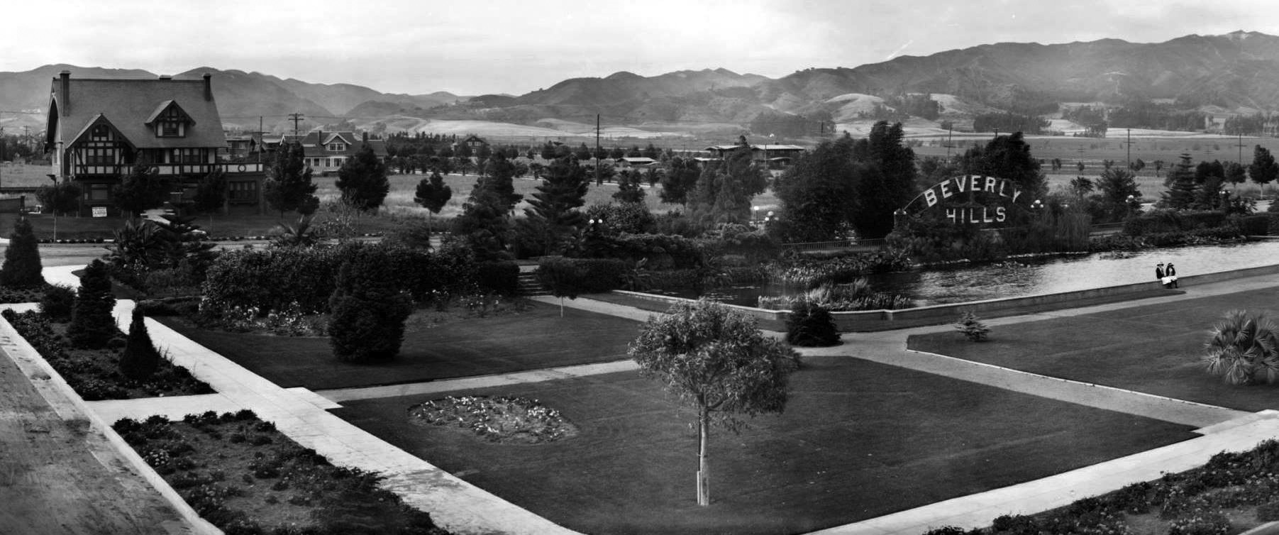
| (1920)* - A panoramic view of Beverly Gardens Park at the corner of Beverly and Santa Monica. The park has wide, flat lawns with a few flower beds, paths, and young trees. On the right a large sign reading "Beverly Hills" stands behind a wide, shallow pool. Both the sign and the house on Beverly on the right are still there. Most of the land beyond the park is undeveloped. |
Historical Notes The area was created as a real estate attraction, hoping to entice people traveling from Los Angeles to buy parcels of land for development, and could be seen from passer byers on the train that came through town on Santa Monica Boulevard, or as it was once known, as Railway Avenue. |
 |
|
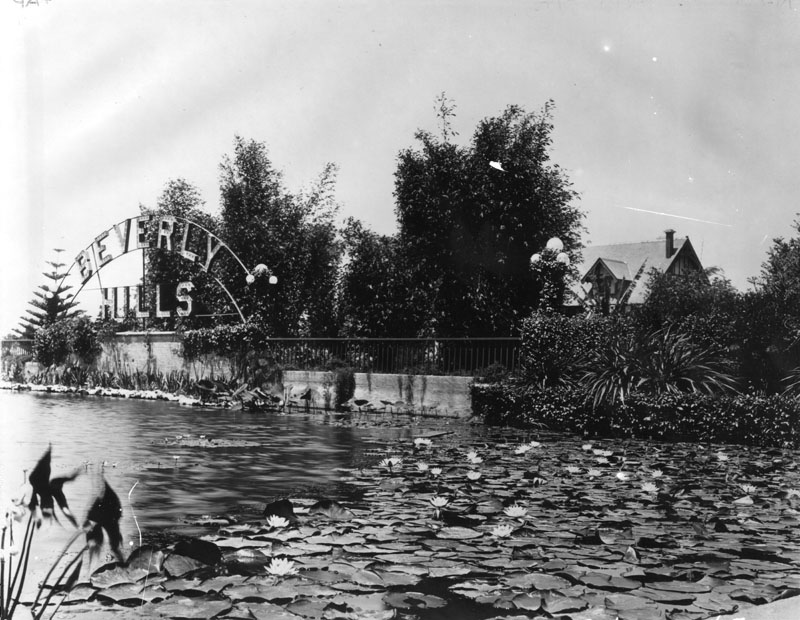
| (ca. 1920)* – View looking northeast near the intersection of Santa Monica Boulevard and N. Beverly Drive showing Beverly Hill’s iconic Tudor Revival Park Way house (upper-leftr) and famous lily pond in Beverly Gardens Park with its original electrified Beverly Hills sign. |
 |
|
| (1920s)* – Closer view showing the lily pond in Beverly Gardens Park, located at Santa Monica Boulevard and N. Beverly Drive. The large home in the background (right) is located at 1309 Park Way. |
.jpg) |
|
| (1913)* - Panoramic view looking southwest showing a mostly empty Beverly Hills. The 1912-constructed Beverly Hills Hotel appears at center-right. |
Historical Notes As in so many of the boom towns of the 1880s, Beverly Hills needed a large resort hotel to give it prominence and establish its reputation. It got that hotel in 1911, when the Rodeo Land and Water Company, in conjunction with Margaret J. Anderson, commissioned Elmer Grey to build his Craftsman/Mission Revival design. |
* * * * * |
Beverly Hills Hotel
 |
|
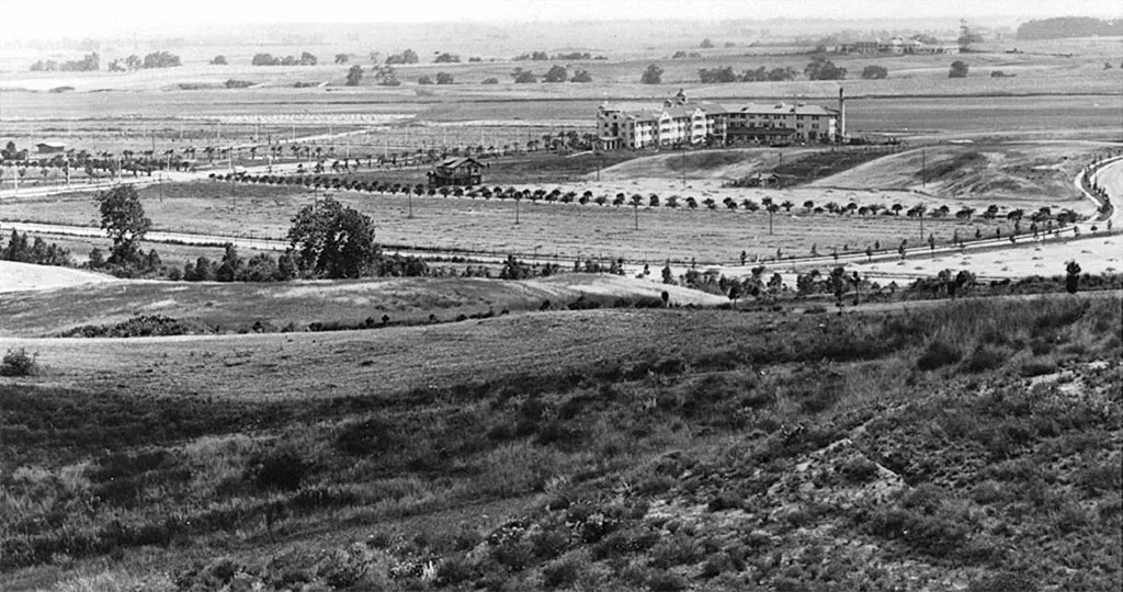
| (1912)* - View of looking southwest across Lexington and Crescent Drives. The Beverly Hills Hotel and the still undeveloped surrounding area can be seen in the background. Sunset Boulevard is beyond the hotel. |
Historical Notes Construction on The Beverly Hills Hotel began in September 1911, led by developer Burton Green, president of the Rodeo Land and Water Company. The hotel officially opened on May 12, 1912, and was managed by Margaret J. Anderson and her son Stanley, both of whom had previously operated the Hollywood Hotel. At the time, the surrounding area was mostly open land, but the hotel was intended to draw wealthy visitors and prospective buyers to what would soon become the city of Beverly Hills. Just two years later, in 1914, the population was large enough to incorporate the community as an independent city. |
 |
|
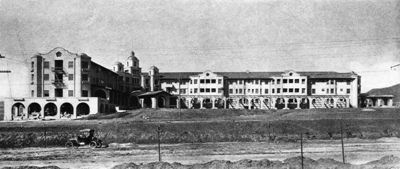
| (ca. 1912)* - The Beverly Hills Hotel as seen from across an unpaved Sunset Boulevard. Workers appear to be putting the finishing touches on the western wing, and the front lawn has yet to be landscaped. This Mission style complex was designed by architect Elmer Grey. |
Historical Notes Architect Elmer Grey designed the original hotel building in the Mediterranean Revival style, which was popular in Southern California at the time. The unpaved roads and lack of landscaping show how new and undeveloped the area was. Around this time, the Rodeo Land and Water Company began separating its real estate and utility services. In 1914, the Beverly Hills Utility Commission was created to manage local water, gas, and electricity—essential infrastructure for a growing community. |
 |
|
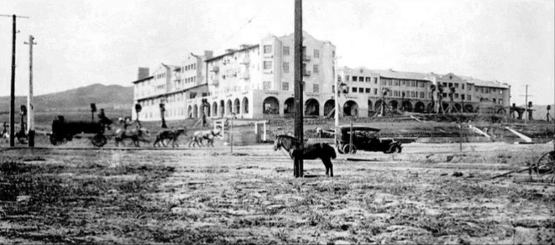
| (ca. 1912)* – View looking northeast showing the Beverly Hills Hotel. A horse-drawn water wagon his heading east on Sunset Boulevard with an early model car parked by the side of the road. In the foreground, a horse appears to be tied to a power pole. |
Historical Notes This view captures the mix of old and new transportation in early 20th-century Los Angeles—horses were still common, but automobiles were beginning to appear. The Beverly Hills Hotel had only just opened and quickly became a centerpiece of the new development. Despite the area's rural appearance, the hotel helped pave the way for Beverly Hills to evolve into a modern, desirable suburb of Los Angeles. |
 |
|
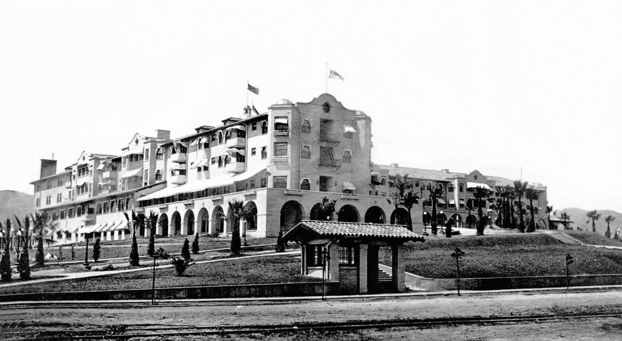
| (ca. 1918)* - Close-up view of the Beverly Hills Hotel with Pacific Electric station on Sunset Boulevard in the foreground. |
Historical Notes A short Pacific Electric shuttle line, often called the “Dinky,” connected the main Pacific Electric station at Santa Monica Boulevard and North Cañon Drive to the hotel. The 1.38-mile line ran up Rodeo Drive, making the hotel easily accessible to guests arriving from downtown Los Angeles. This unique transportation link operated from 1907 to 1923 and helped promote the area as a convenient and fashionable destination. |
 |
|
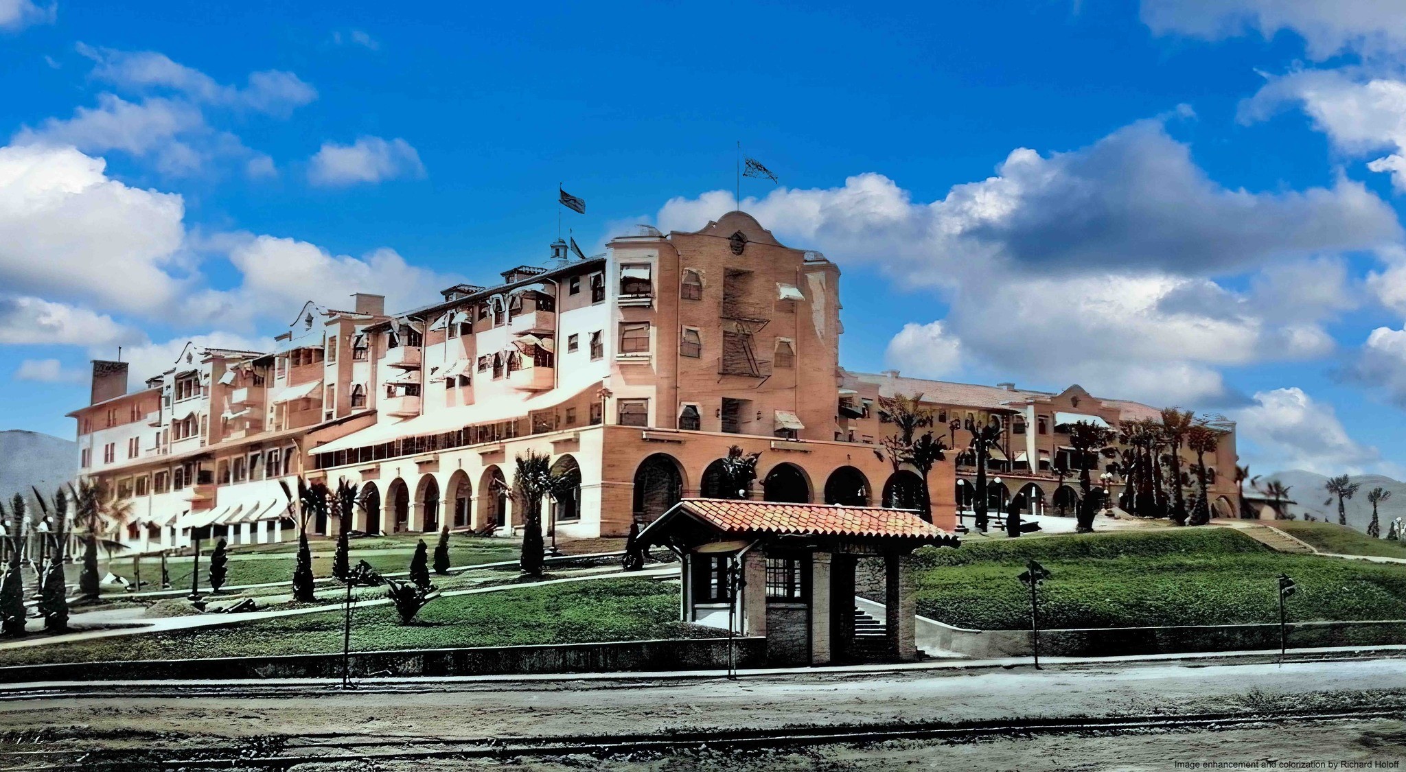
| (ca. 1918)* - Close-up view of the Beverly Hills Hotel with Pacific Electric station on Sunset Boulevard in the foreground. Image enhancement and colorization by Richard Holoff. |
Historical Notes The enhanced photo helps bring to life the early years of the hotel, when it was already attracting attention from celebrities and investors. As the Hollywood film industry took off, stars like Mary Pickford, Douglas Fairbanks, Charlie Chaplin, and Gloria Swanson became regular visitors—some even moved nearby, transforming Beverly Hills into an exclusive enclave. |
Then and Now
 |
|
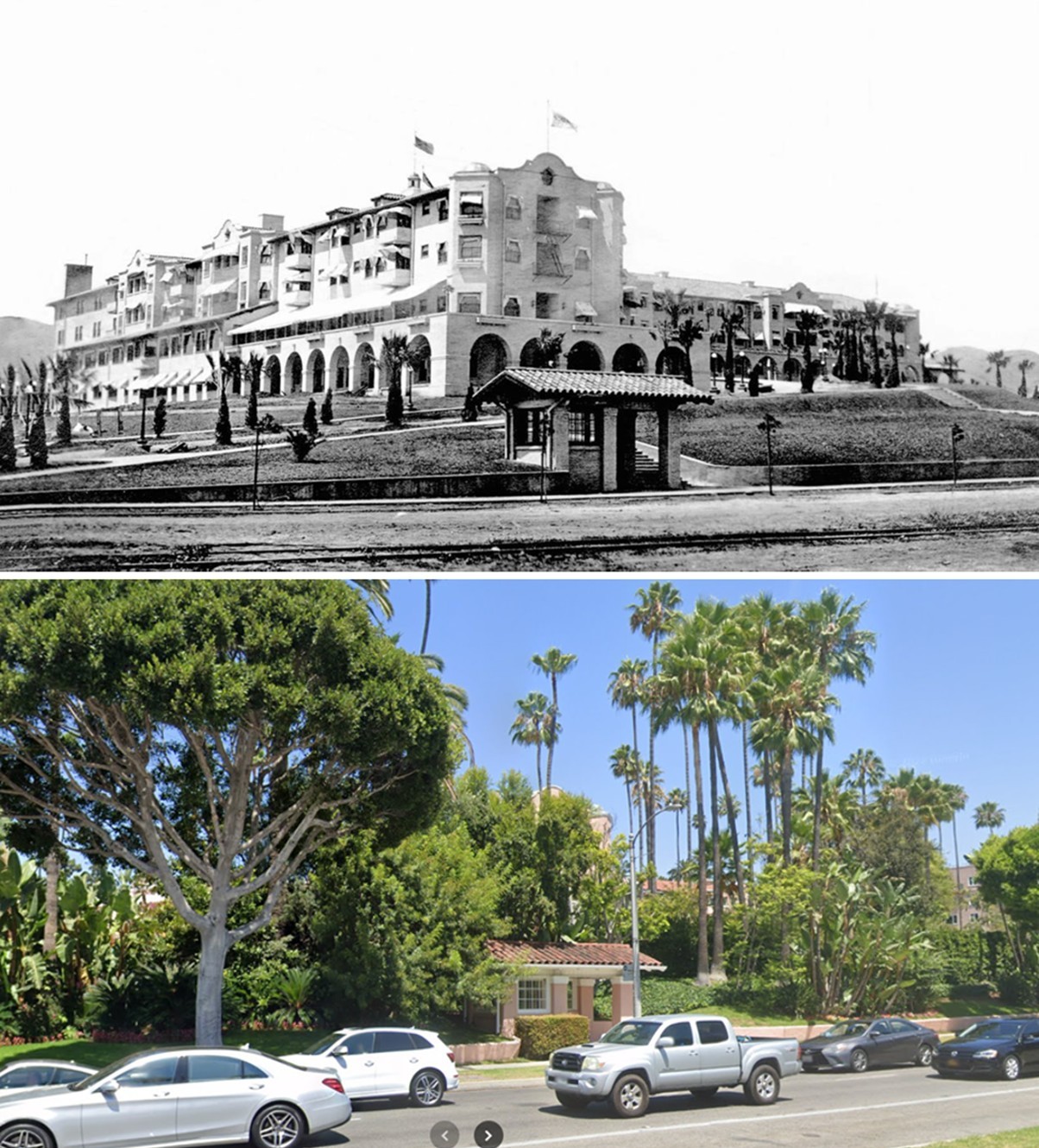
| (1918 vs 2022)* - Looking toward the Beverly Hills Hotel across Sunset Boulevard. The hotel was once fully visible across an unpaved Sunset Boulevard. Today, it’s largely hidden behind landscaping, but a small bus shelter still marks the spot where a Pacific Electric stop once stood. Photo comparison by Jack Feldman. |
Historical Notes The Beverly Hills Hotel opened in 1912, two years before the city was incorporated. To help guests reach the hotel, the Pacific Electric Railway operated a short 1.38-mile shuttle—nicknamed the “Dinky”—from its main station at Santa Monica Boulevard and North Cañon Drive. This local line ran up Rodeo Drive and ended at a modest shelter in front of the hotel. Passengers transferred here after arriving from either Santa Monica or downtown Los Angeles. The shelter visible in the 1918 photo was the final stop on that line and served guests during the hotel’s early years of attracting Hollywood’s elite. Though the trolley line was discontinued in 1923, a modern bus stop now occupies nearly the same location, echoing the site's past as a transportation gateway. The contrast between the open, unpaved landscape of 1918 and today’s tree-lined boulevard reflects more than a century of transformation in Beverly Hills. |
.jpg) |
|
| (ca. 1914)* – View showing the Beverly Hills Hotel from the end of its main driveway which is lined by small palm trees. |
Historical Notes When it opened in 1912, the Beverly Hills Hotel included the main building and 23 separate bungalows, also designed by Elmer Grey. The landscaped entrance—still in its early stages here—reflected the vision of a high-end, resort-like environment. The hotel's popularity spurred homebuilding in the surrounding hills, supporting the Rodeo Land and Water Company's goals of selling residential lots to the wealthy. |
 |
|
| (ca. 1915)* - View looking west across the front lawn of the Beverly Hills Hotel to the open space beyond. At left can be seen the new Pacific Electric station on Sunset Boulevard. |
Historical Notes The surrounding area remained largely undeveloped during the hotel's early years. However, wide, curving streets—designed by landscape architect Wilbur D. Cook—were already in place. Cook, influenced by Frederick Law Olmsted (designer of New York’s Central Park), also created parks and green spaces throughout Beverly Hills, including what is now Beverly Gardens Park. These thoughtful designs helped shape the city’s image as a luxurious, garden-like suburb. |
 |
|
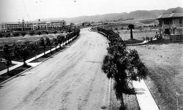
| (1915)* - View looking northwest on N. Crescent Drive from Lomitas Avenue. A large mansion can be seen on the right and the recently completed Beverly Hills Hotel is in the upper left. |
Historical Notes This image captures the transition of Beverly Hills from open ranchland into a residential community. Large homes were beginning to appear, and the hotel's reputation drew wealthy residents, many connected to the entertainment industry. The curving street layout and tree-lined drives reflect the city's early planning ideals. |
 |
|
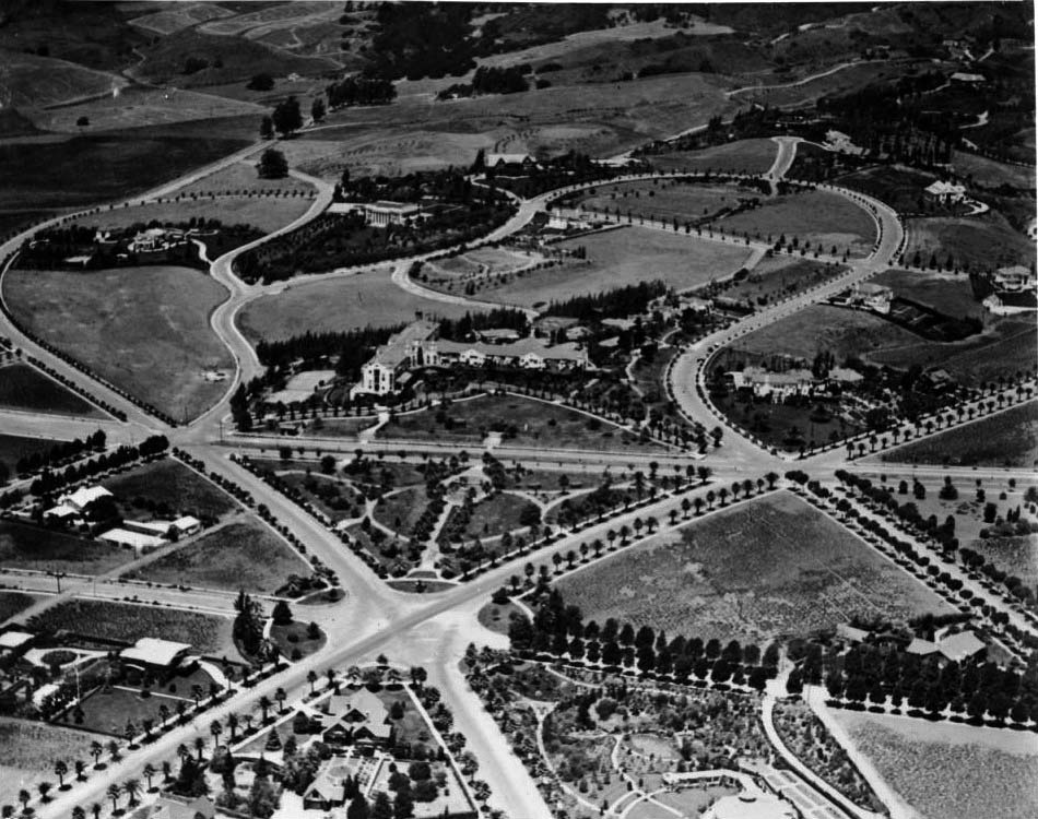
| (ca. 1918)* - Aerial view of Beverly Hills early on in real estate development. Seven roads meet just before the Beverly Hills Hotel. |
Historical Notes By 1918, the Beverly Hills Hotel was not just a landmark—it was a symbol of the city’s identity. Movie stars were buying homes nearby, and the area’s elegant layout made it one of Los Angeles’ most desirable neighborhoods. In 1919, Mary Pickford and Douglas Fairbanks built their estate “Pickfair” just blocks away, helping seal the city’s reputation as a haven for Hollywood’s elite. |
 |
|
| (ca. 1918)* - Aerial view of Beverly Hills showing the new Beverly Hills Hotel. The hotel is visible at center, its t-shaped main building surrounded by trees. There are two tennis courts and several smaller buildings on the hotel grounds as well. In front of the hotel is a triangular park that would later become Will Rogers Memorial Park, after the first mayor of Beverly Hills. The streets in this neighborhood curve irregularly and there are three six-way intersections visible, one at each of the corners of the park. |
Historical Notes This image shows the hotel and its grounds, including tennis courts and bungalows added in 1915 to accommodate celebrity guests seeking privacy. The triangular park in front, later named after Will Rogers (the city’s first honorary mayor), became a cherished public space. At this time, Beverly Hills was still a racially and religiously restricted community; deed covenants prevented non-white residents and Jews from buying property unless they were household staff. Despite this, the area flourished, shaped by real estate, celebrity culture, and early city planning. |
* * * * * |
Sunset Park (Will Rogers Memorial Park)
 |
|
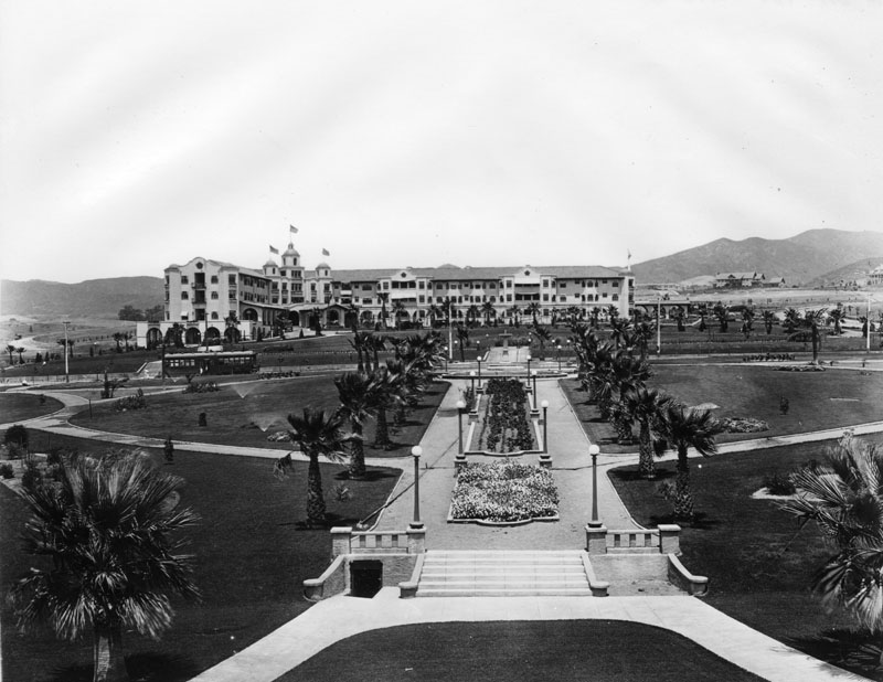
| (ca. 1918)* - View looking north showing Sunset Park (later Will Rogers Memorial Park) in front of the Beverly Hills Hotel, designed by Elmer Grey. Neither has mature landscaping at this time. Note the streetcar on Sunset Boulevard (center-left). |
Historical Notes Originally belonging to the Beverly Hills Hotel, this five acre park adjoining the property across Sunset Boulevard was donated to the City of Beverly Hills by owners Margaret and Stanley Anderson. |
 |
|
| (n.d.)* - Postcard view showing Sunset Municipal Park (later Will Rogers Memorial Park) with the Beverly Hills Hotel in the background. |
Historical Notes Sunset Municipal Park opened in 1915 as the first municipal park in the Beverly Hills. In 1926, entertainer Will Rogers was appointed first "Honorary Mayor" of Beverly Hills and, in 1952, the City renamed the Park, Will Rogers Memorial Park. |
 |
|
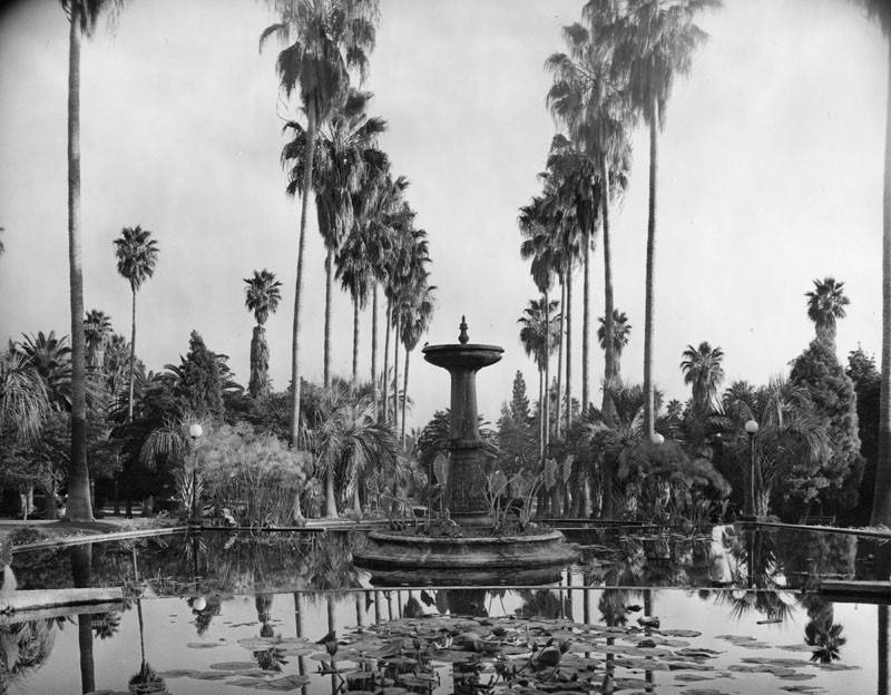
| (n.d.)* - View of a fountain in a lily pond in Will Rogers Memorial Park, located at 9650 W. Sunset Blvd. in Beverly Hills. |
* * * * * |
Golden Triangle
 |
|
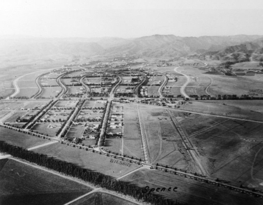
| (ca. 1919)* - View of Beverly Hills looking north over Wilshire Boulevard. Street names have been marked on the photo including Wilshire, Santa Monica, Sunset, and Crescent Drive. |
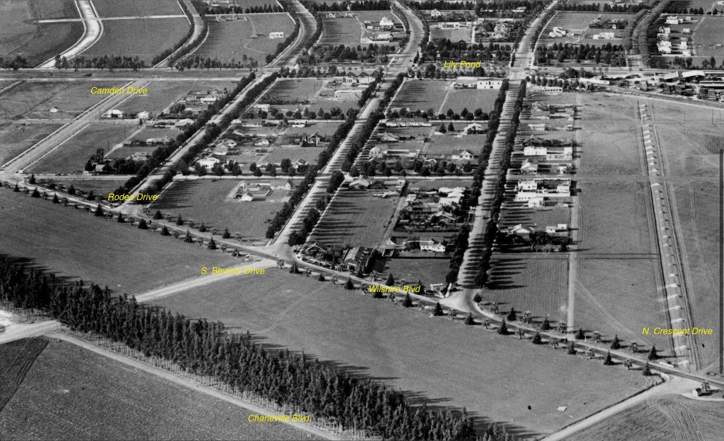
Historical Notes The Golden Triangle itself is defined by three major thoroughfares: Santa Monica Boulevard (west), Wilshire Boulevard (south), and Canon Drive (east), with Rodeo Drive running through its center. The area was intentionally designed as a triangular commercial district by landscape architect Wilbur D. Cook in 1907, as part of the broader city plan for Beverly Hills. |
 |
|
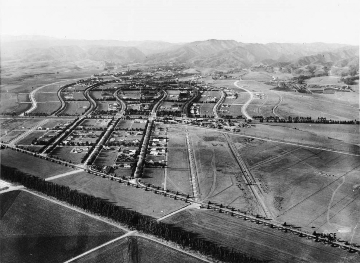
| (1922)* – Aerial view of Beverly Hills north of Wilshire Boulevard. A thin line of trees is pictured in the left foreground, cutting diagonally down across an expanse of what appear to be cultivated fields. In the center ground at left, a collection of three straight roads separates four sections of residential property. These roads continue farther into the background where they become part of a group of snaking, s-shaped roads. |
Historical Notes The Beverly Hills Hotel, opened in 1912, became a focal point for attracting the elite and establishing Beverly Hills as a desirable destination. The city was incorporated in 1914, but it wasn't until the post-World War II era that the Golden Triangle began to take shape as a commercial hub. |
 |
|
| (ca. 1920)* – Aerial view looking down at the City of Beverly Hills' world famous "Golden Triangle". Photo annotated by Kimberly Vinokur / Beverly Hills Heritage. |
Historical Notes At one point the Golden Triangle was nothing more than a modest residential neighborhood containing dozens of bungalow style homes accommodating city occupants of limited monetary means. A handful of these humble structures remained until the post war era when the city's shopping and financial center enjoyed robust growth, paving the way to the development of a successful commercial district. Today, the Golden Triangle remains an iconic symbol of luxury, attracting visitors from around the world with its exclusive boutiques, restaurants, and hotels, centered around the famed Rodeo Drive. |
* * * * * |
Beverly Hills Speedway (aka Los Angeles Speedway)
 |
|
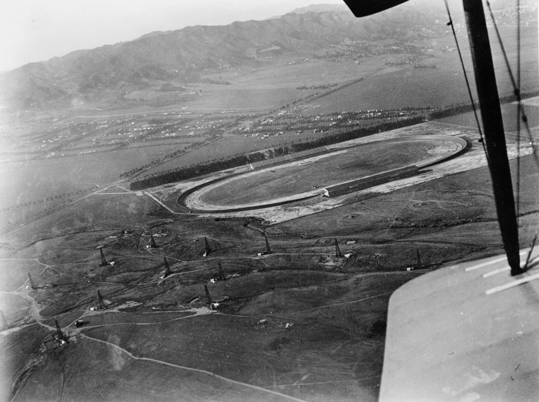
| (ca. 1919)* - Aerial view of the Beverly Hills Speedway, located just south of Wilshire Boulevard near its intersection with Santa Monica Boulevard. The tree-lined street above the speedway is Charleville Boulevard, one block south of Wilshire. Note the oil fields in the foreground. |
Historical Notes The Beverly Hills Speedway (also called the Los Angeles Speedway) was a 1.25-mile wooden board track for automobile and motorcycle racing in Beverly Hills. It was built in 1919 on 275 acres of land that includes the site of today's Beverly Wilshire Hotel, just outside of the "Golden Triangle". The site was bounded by Wilshire Boulevard, South Beverly Drive, Olympic Boulevard and Lasky Drive. |
 |
|
| (1919)^ - Aerial photograph of the Beverly Hills Speedway, located at Wilshire and Santa Monica boulevards. West Hollywood can be seen in the distance at upper-right. Note the oil wells in the left foreground. |
Historical Notes The new Speedway was built by Jack Prince and Art Pillsbury and was financed by a group of racers and businessmen that called itself the Beverly Hills Speedway Association. The track was the first in the United States to be designed with banked turns incorporating an engineering solution known as a spiral easement. |
.jpg) |
|
| (1919)^ - Aerial photo of the Beverly Hills Speedway located at Wilshire and Santa Monica Boulevards. |
 |
|
| (ca. 1919)* - Closer view of the Beverly HIlls Speedway located just south of Wilshire Boulevard near where it intersects with Santa Monica Boulevard (aka "Golden Triangle"). Photo courtesy of Beverly Hills Heritage. |
.jpg) |
|
| (1919)^ - Early race cars are lined up at the Beverly Hills Racetrack. |
 |
|
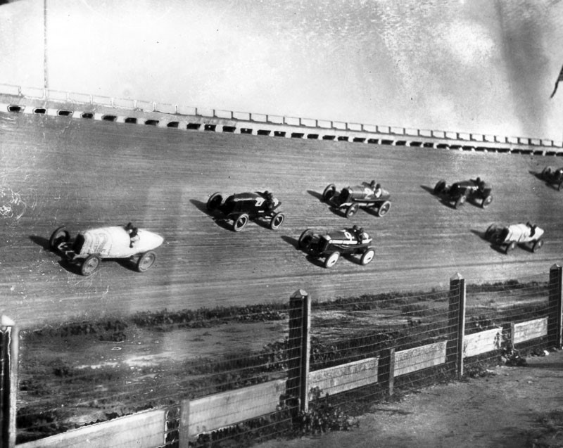
| (1919)^ - View showing race cars racing on the steep bank of the track at the Beverly Hills Racetrack. |
 |
|
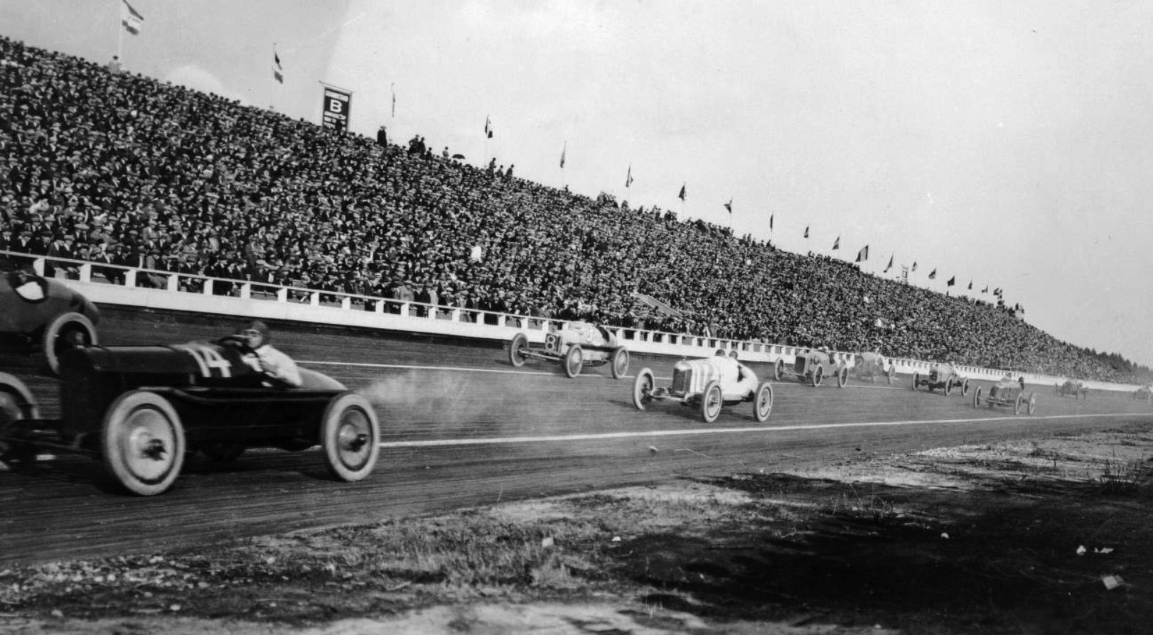
| (ca. 1919* - Panoramic view showing an automobile race at the Beverly Hills Racetrack. The early racecars are all open topped and the drivers are wearing leather helmets and goggles. The grandstand is packed with spectators. |
 |
|
| (1919)^ - View of two race cars racing past the finish line at the Beverly Hills Racetrack. |
Historical Notes At the time, the wooden racetrack was ranked second in race quality only to the Indianapolis Motor Speedway. |
 |
|
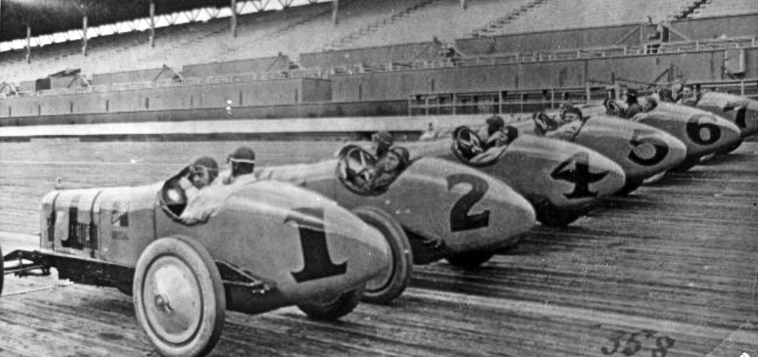
| (1922)* - Durant Racing team, Beverly Hills Raceway . . . Harry Miller Designed and built. Cliff Durant was William Durant's son (General Motors President). He had the most highly funded team of the day with the best drivers. |
Historical Notes Many race cars had paint jobs that read Durant Racing on the sides. Durant was an American race car driver, the son of William C. Durant, a founder of General Motors who was also the co-owner and president of the Beverly Hills Speedway. Durant Drive in the City of Beverly HIlls was named after these Durants. |
 |
|
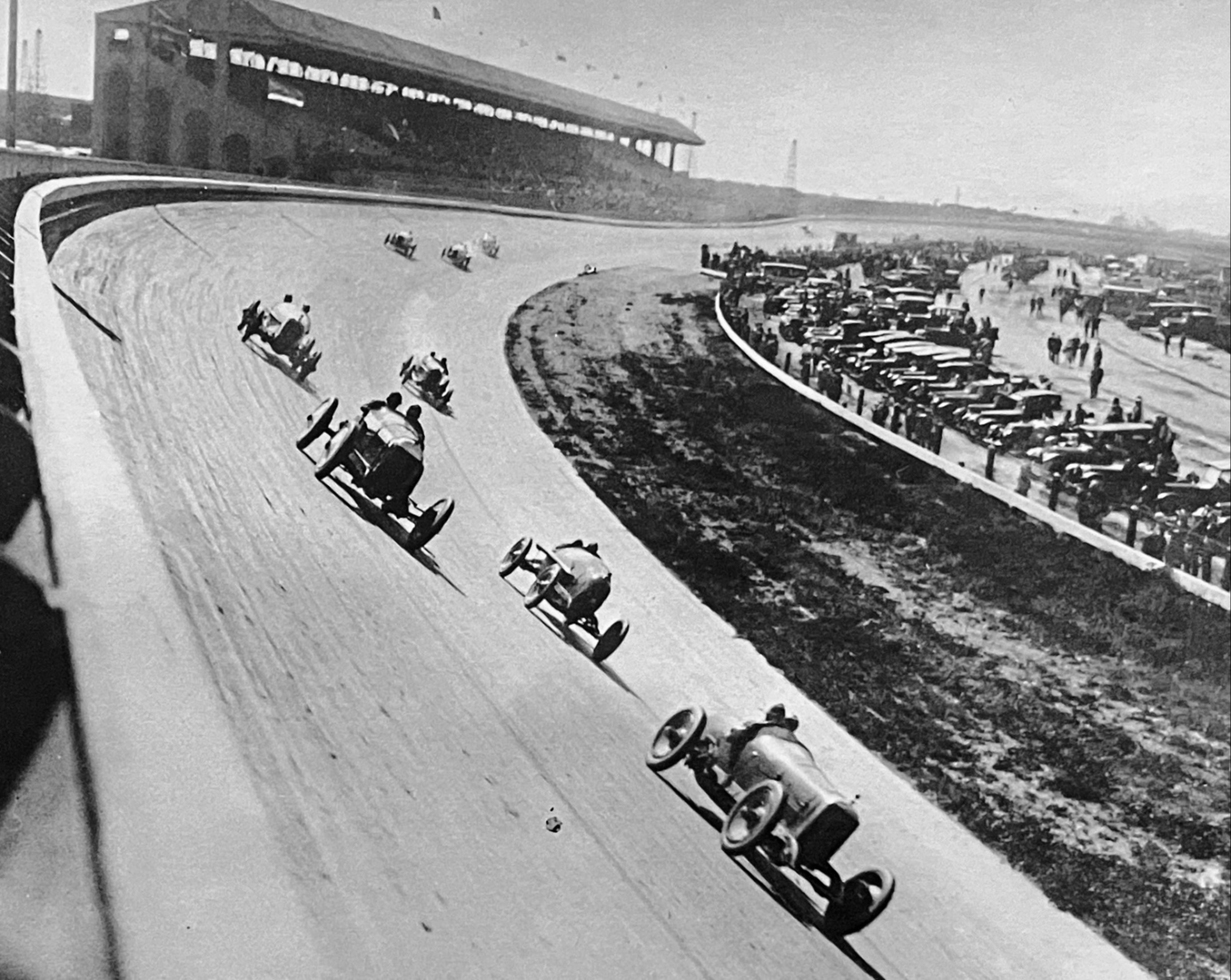
| (1920s)* - Race cars rounding the embanked curve a the speedway.. |
 |
|
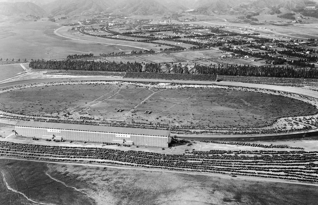
| (1922)* – Aerial view looking down at the Beverly Hills Speedway showing a full house at a racing event. Note the number of cars in the parking lot. Photo: Marc Wanamaker/Bison Archives |
Historical Notes The Speedway was a great success, not only for racing but also for events. In fact, sometimes the space was so well attended, the parking lots overflowed with cars. |
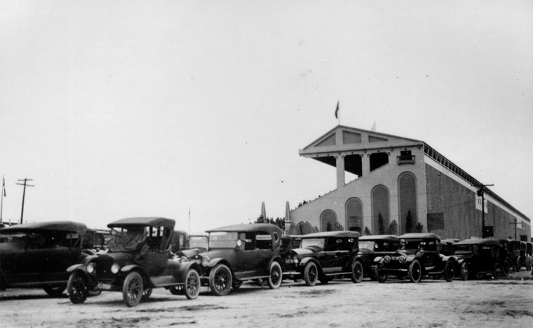 |
|
| (1919)^ - View of cars parked next to the spectator stands of the Beverly Hills Racetrack. |
Historical Notes The Speedway operated for four years and attracted many historically significant competitors including Ralph DePalma, Jimmy Murphy, and Tommy Milton. It was also the site of a racing accident that killed National Champion and Indianapolis 500 winner Gaston Chevrolet in 1920. Gaston Chevrolet was the younger brother of Louis Chevrolet, who in 1911 co-founded the Chevrolet Motor Company. |
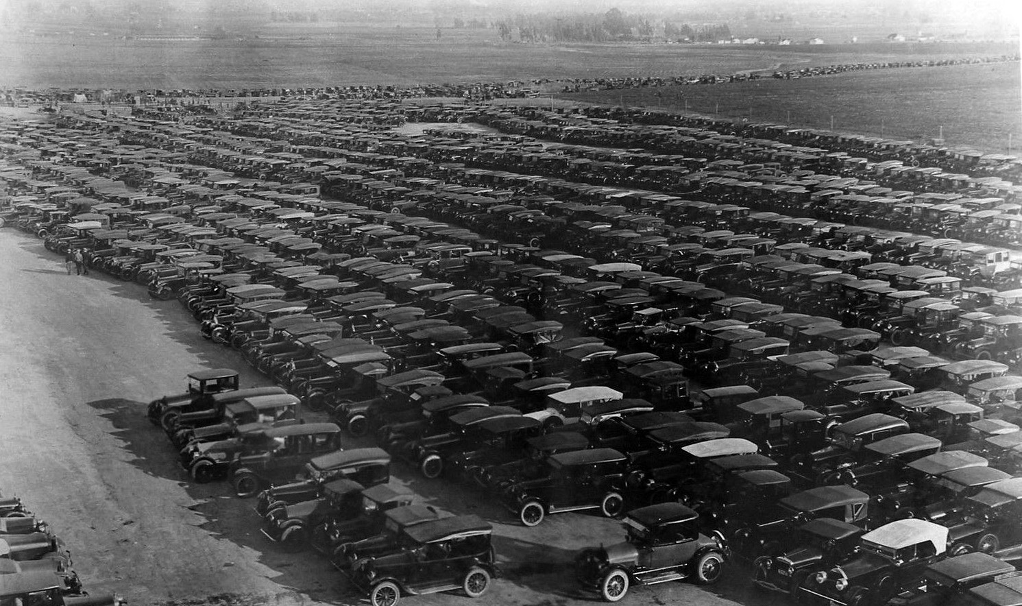 |
|
| (ca. 1919)* - View showing a filled to capacity parking lot at the Beverly Hills Speedway. |
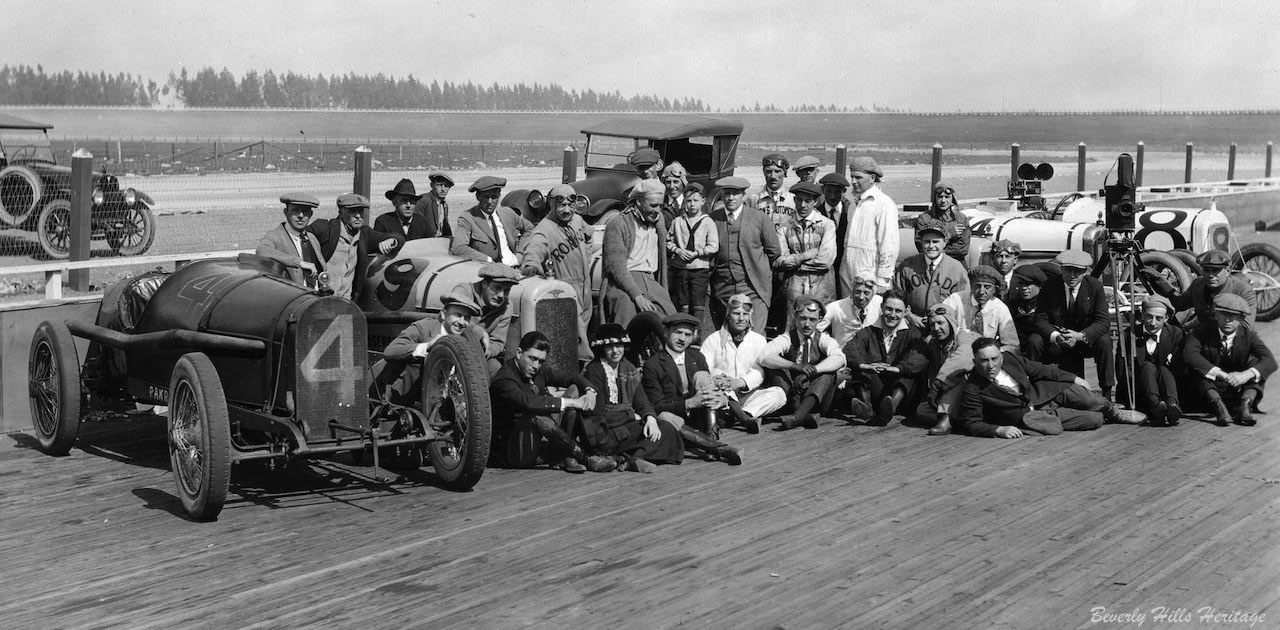 |
|
| (1919)* – View looking northeast showing cast and crew of the 1919 silent film “The Roaring Road” posing for the camera on the Beverly Hills Speedway track. |
Historical Notes The gigantic eucalyptus trees in the distance ran the length of what today would be Charleville Blvd., a street named for developer Walter G. McCarty's Irish roots. The trees created a natural wind and sound barrier for residential neighborhood north of Wilshire Boulevard, which within five years, would start to become the city's commercial triangle. |
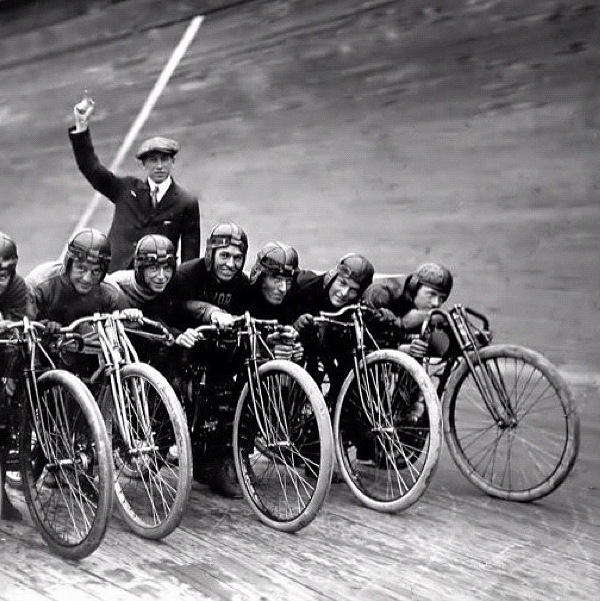 |
|
| (ca. 1921)* - Motorcycles line up and wait for the starting gun to go off. |
Historical Notes Motorcycle board track racing took place at the short lived Beverly Hills Speedway between 1920 and 1924. |
 |
|
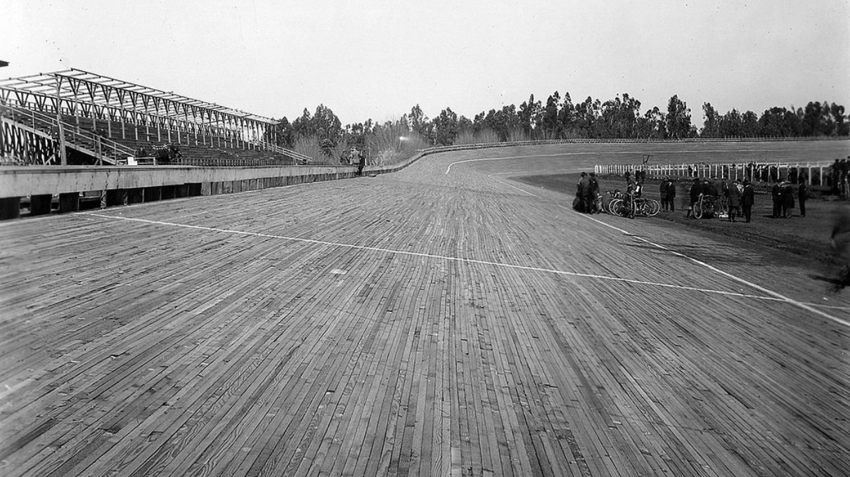
(1921)* - A group of men stand next to several motorcycles on the inside of the banked track at the Fresno Speedway. |
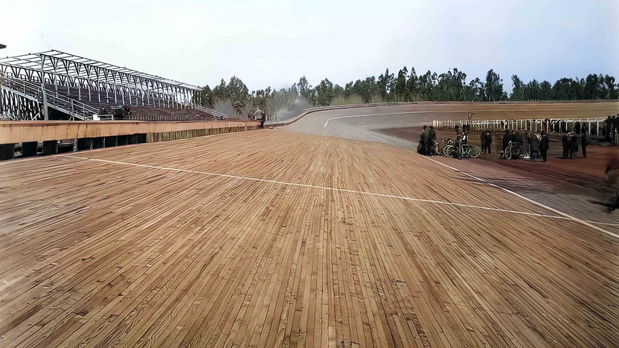
Historical Notes There is no doubt that board track racing was an incredibly exciting event to witness. The motorcycles were capable of speeds over 100 mph and represented all the marques of the day. Manufacturers such as Harley-Davidson, Indian and Excelsior all had factory racing teams with custom built factory race bikes. |
 |
|
| (1921)* - A group of men stand next to several motorcycles on the inside of the banked track at the Fresno Speedway. AI image enhancement and colorization by Richard Holoff. Correction Note: This image was initially misidentified as depicting the Beverly Hills Speedway. While similar in appearance and constructed in the same year, this photograph actually shows the Fresno Speedway, which was located at the Fresno County Fairgrounds. |
 |
|
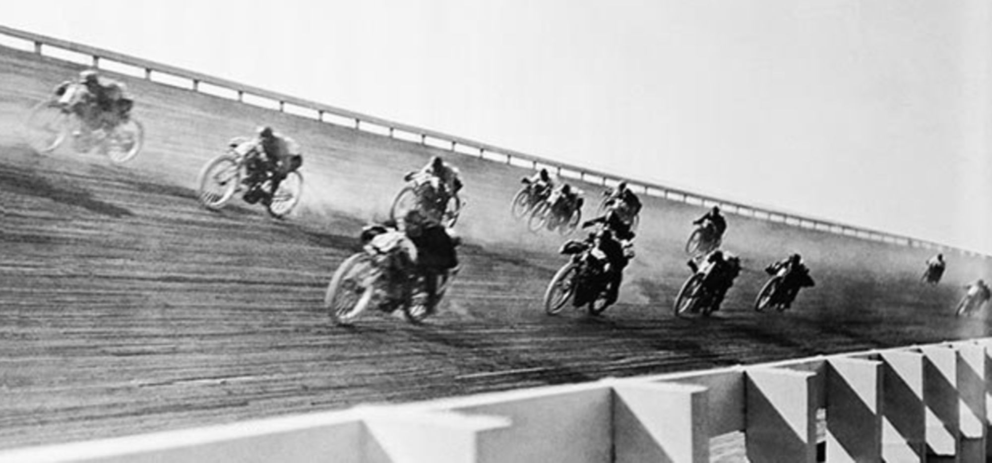
| (1920s)* - View showing motorcycle racers rounding the embanked curve a the speedway. |
Historical Notes Because the turns were severely banked, it allowed riders to reach speeds of more than 100 miles an hour. Crashes were frequent and horrific—riders who went down faced being impaled by splinters—and often fatal. |
 |
|
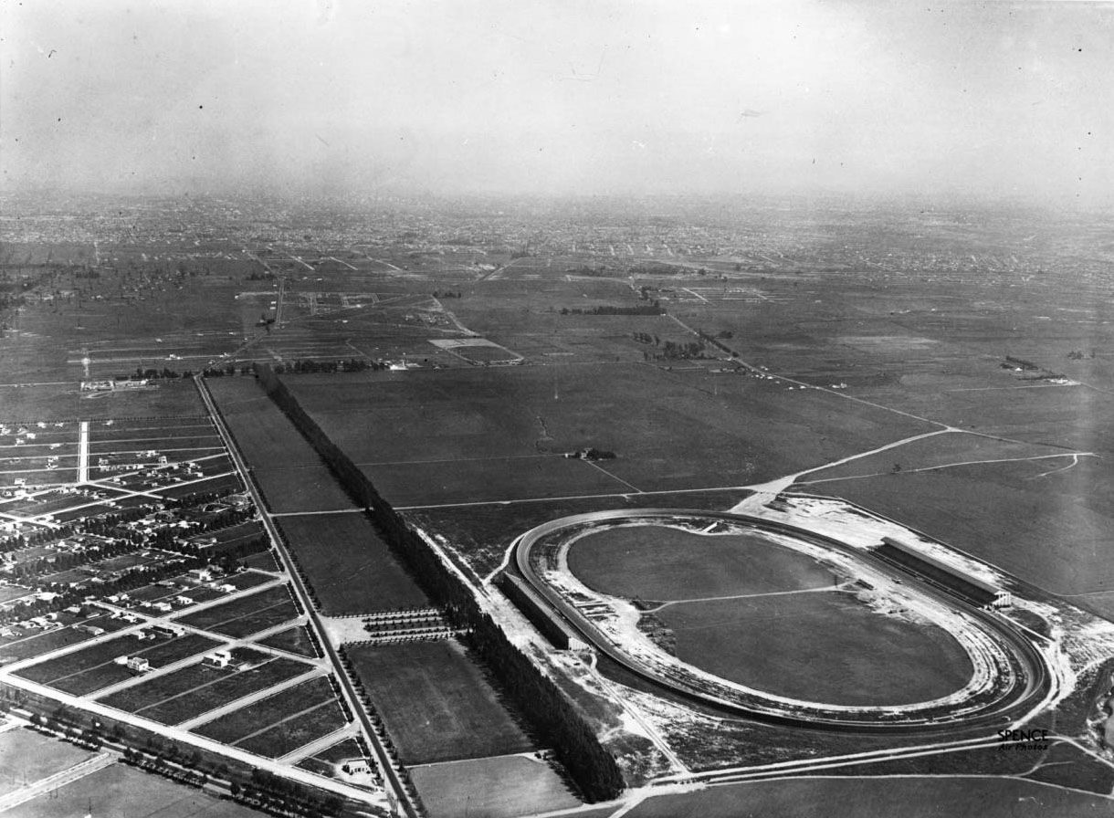
| (1921)* - Aerial view looking east on Wilshire Boulevard from where Santa Monica Boulevard intersects it. Vast open fields can be seen between the Beverly Hills Speedway and the City of Los Angeles. |
Historical Notes By the mid-‘20s, the sport began to lose its appeal. Perhaps the novelty wore off; certainly the carnage was appalling. Newspapers began referring to motordromes as “murderdromes,” and local governments closed some tracks. Race officials and the motorcycle manufacturers that sponsored racing teams tried to implement measures to slow down the bikes, but that went nowhere. By the early 1930s, board-track motorcycle racing had become a footnote in motorsport history. |
 |
|
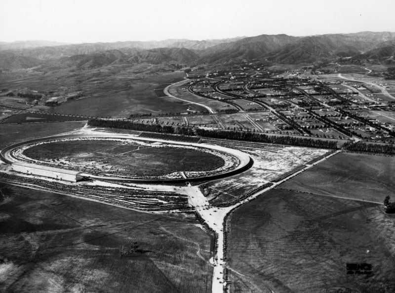
| (ca. 1921)^ - Aerial view looking northwest showing the Beverly Hills Speedway during an event. Note all the open, undeveloped land surrounding the speedway. |
Historical Notes It would soon become apparent that the racetrack wasn't as valuable as the land it was on. By the mid-twenties the track was dismantled to make way for new developments. |
* * * * * |
Coldwater Canyon
 |
|
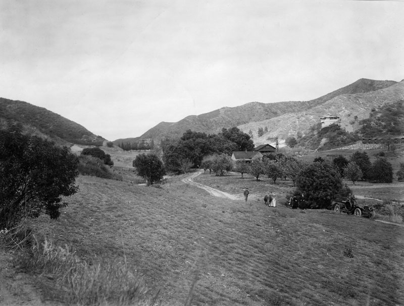
| (ca. 1910)^- Looking north up Coldwater Canyon at the Haines lemon farm and the Sheffler residence. The Rodeo Land and Water Company later developed the canyon as one of the prime residential areas in Beverly Hills north of Sunset Boulevard. |
Historical Notes Coldwater Canyon is a canyon running perpendicular to the Santa Monica Mountains. The canyon is traversed by Coldwater Canyon Drive and Coldwater Canyon Avenue (linked by a short section of Mulholland Drive), which connect the city of Beverly Hills with the community of Studio City in the San Fernando Valley.* |
 |
|
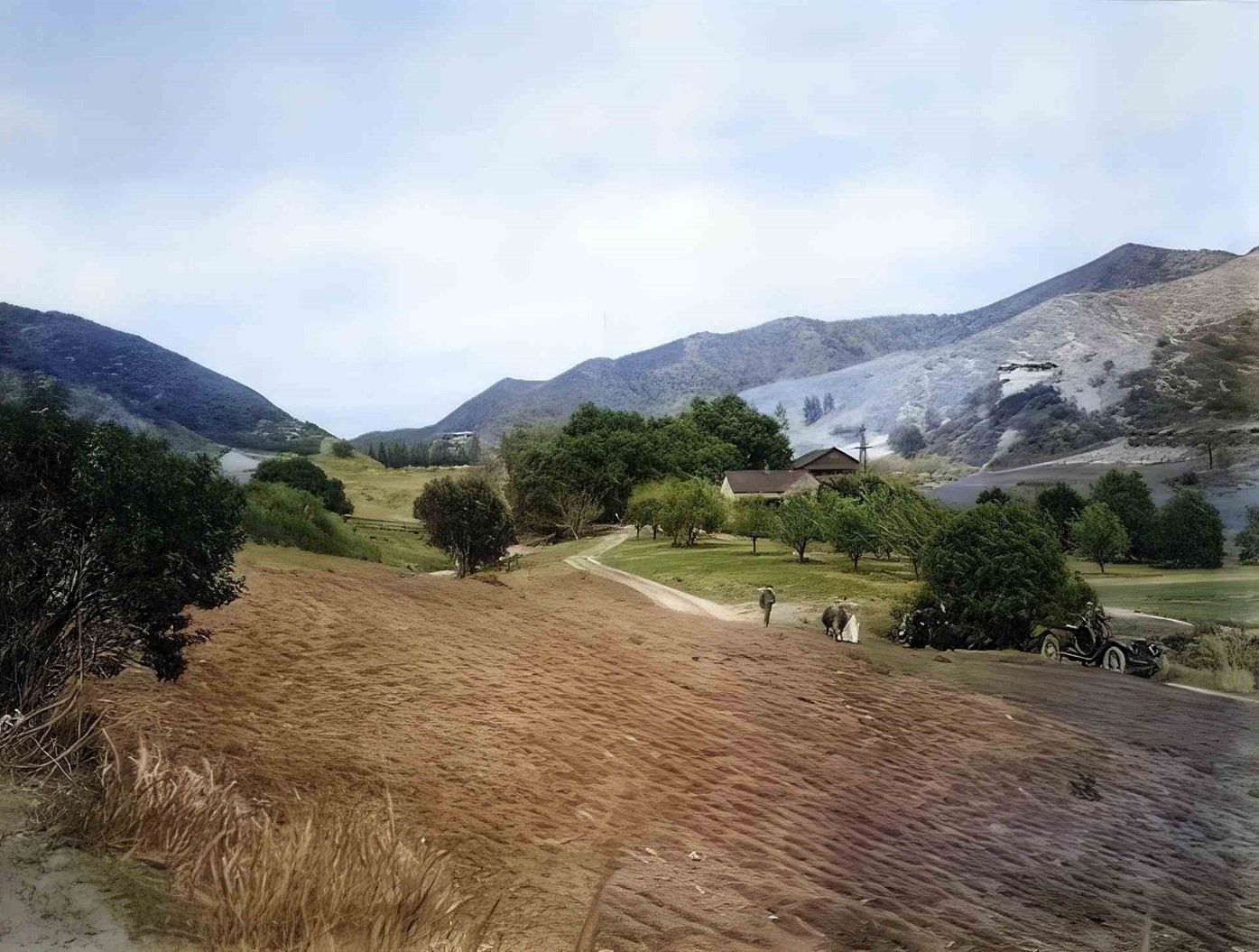
| (ca. 1910)^- Looking north up Coldwater Canyon at the Haines lemon farm and the Sheffler residence. The Rodeo Land and Water Company later developed the canyon as one of the prime residential areas in Beverly Hills north of Sunset Boulevard. (AI enhancement and colorization by Richard Holoff) |
Historical Notes The Rodeo Land and Water Company later developed the canyon as one of the prime residential areas in Beverly Hills north of Sunset Boulevard. The legacy of the Rodeo Land and Water Company is intertwined with the history of Beverly Hills. The successful development and promotion of the area helped establish Beverly Hills as a premier residential destination, known for its affluence and celebrity residents. |
 |
|
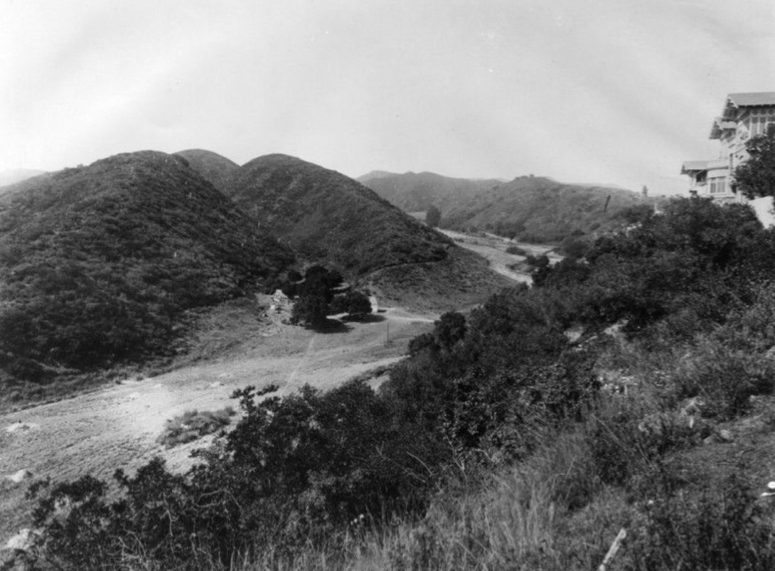
| (1911)* - View of a large home situated on the top of the hill, overlooking Coldwater Canyon. The home is identified as once belonging to a Kirk Johnson. |
Historical Notes In the early 20th century, the area underwent significant development, and Coldwater Canyon became a prominent route. The expansion of Los Angeles and the development of Beverly Hills as an upscale residential area contributed to the importance of Coldwater Canyon as a transportation artery. |
* * * * * |
Beverly Hills Bridle Paths
 |
|
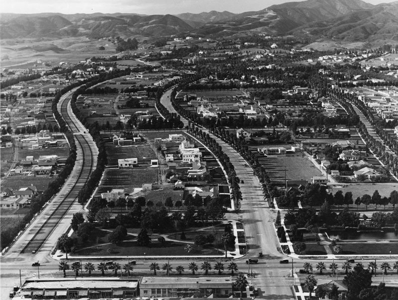
| (1921)^ - A view of Beverly Hills looking north from Santa Monica Boulevard, between Rodeo Drive and Beverly Boulevard. Note the bridle path down the center of Rodeo Drive on the left. Prior to 1920, it was used as a one-trolley car system (aka "Dinky") that conveyed guests from the Pacific Electric Station (SE corner of Canon Drive and Santa Monica Boulevard) up Rodeo Drive to the Beverly Hills Hotel. |
Historical Notes From the early 1920s through the 1960s, pathways dedicated to horse travel ran down the center of several Beverly Hills streets. One stretched from the city's eastern to western boundary, meandering through town down the center of Sunset Boulevard. Another occupied the median of Rodeo Drive, where it replaced an abandoned Pacific Electric trolley line that once connected Santa Monica Boulevard with the Beverly Hills Hotel. Two more snaked their way up Coldwater and Benedict canyons. The bridle paths served several purposes. They satisfied the recreational urges of the city's many equine enthusiasts. They reinforced the image of Beverly Hills as a place of wealth and privilege. They preserved the rustic feel of a city that was fervently carving itself out of the open countryside of Rancho Rodeo de las Aguas. And lastly, though saddle horses were never as common on city streets as draft horses, they nostalgically recalled that dying breed -- the urban horse. ^*^ |
 |
|
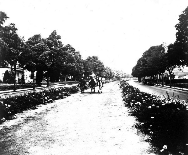
| (1920s)^# – Close-up view showing three horseback riders making their way down one of the bridle paths in Beverly Hills. |
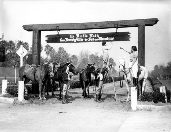
Historical Notes For a time, Beverly Hills' bridle paths teemed with horseback riders and the occasional tally-ho. A grand pageant marked the completion of the city's bridle path network on January 10, 1925. The Bridle Path Association placed signs at the paths' entrances proclaiming that they led from "Beverly Hills to the Sea and the Mountains" -- a reference to the organization's ambitious plans to lace the Santa Monica Mountains with equestrian trails. ^*^ |
 |
|
| (1920s)^ - A sign over the entrances to the bridle paths read: 'Ye Bridle Path - from Beverly Hills to Sea and Mountains'. |
Historical Notes The city's enthusiasm for horses soon waned and eventually its bridle paths fell into disuse. Another recreational craze briefly gave the paths new life in 1938, when, in the midst of a nationwide bicycle fever, the city opened them up to bicycles -- transforming the old bridle paths into some of the region's finest cycling infrastructure. But after World War II brought an abrupt end to the nation's obsession with biking, the city slowly dismantled the aging paths. By 1965, grassy medians occupied the space where horses once trod. ^*^ |
* * * * * |
New Development
.jpg.png) |
|
| (ca. 1921)#+ – Aerial photo showing the Beverly Hills Speedway annotated to show the major streets. |
Historical Notes The last race on the track was held in 1924; it wasn't as valuable as the land it was on, and was shuttered and dismantled to make way for new developments, like the 1928 Beverly Wilshire Hotel, which was erected on part of the former racetrack property. The Speedway was relocated just a few miles away to Culver City (1924), near the intersection of Culver and Overland boulevards (across the street from MGM Studios). Click HERE see more on the Culver City Speedway. |
 |
|
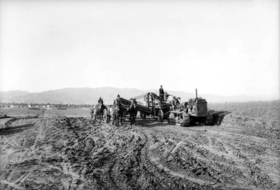
| (1925)^^ – View looking north showing the excavation of land south of where the Beverly Hills Speedway once stood. The new development, Beverly Hills Heights, is centered on South Beverly Drive and runs from where Olympic Boulevard is today up to Wilshire Boulevard. |
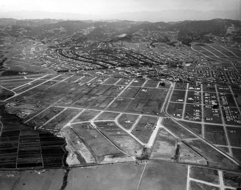
Historical Notes In 1923, the 193 acres known as the Beverly Hills Speedway tract owned by Silsby Spalding, Cliff Durant, and Jake Dansinger was sold to Walter G. McCarty at about $10,000 per acre. By 1924, the entire Speedway property bounded by Wilshire Boulevard, South Beverly Drive, Olympic Boulevard, and Lasky Drive was developed into a proposed residential and business district. #* |
 |
|
| (ca. 1925)^ - Aerial view of Beverly Hills showing new development where the Speedway used to be (center-left). |
Before and After
.jpg) |
|
 |
|
| (1919 vs. 1925)^ - Aerial view of Beverly Hills showing how much growth and development took place in a relatively short span of time. |
Beverly Hills Heights
.jpg) |
|
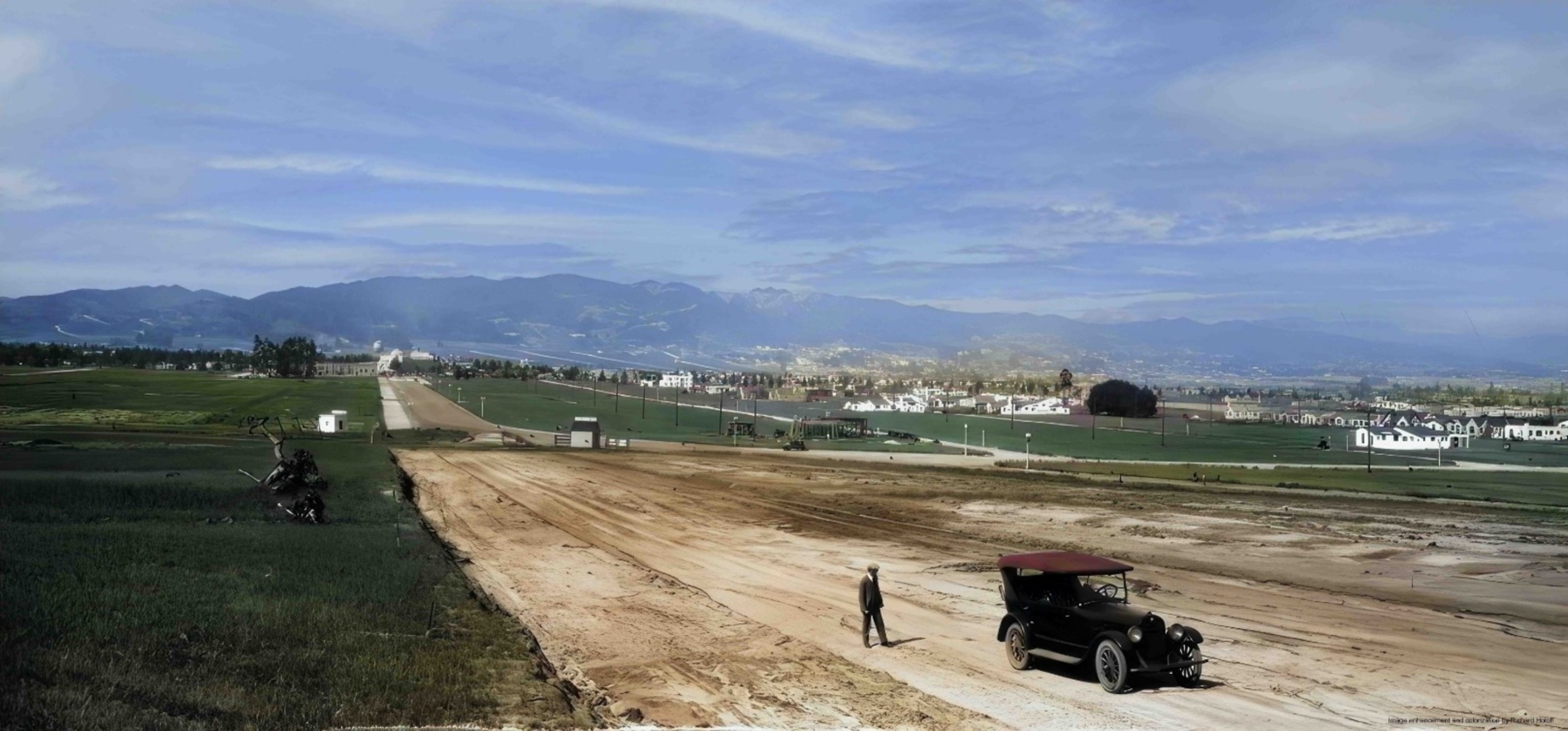
| (1925)* - A view of Beverly Hills Heights, a development by Frank Meline, shown at the start of the subdivision. A man stands near a parked automobile on a wide, unpaved S. Beverly Drive near what is today Olympic Boulevard. |
Historical Notes He’s a forgotten name today, but, in the 1920s, there was no more successful real estate developer in a booming greater Los Angeles than Frank L. Meline. Simultaneously, Meline’s powerhouse firm developed such prominent places as Bel-Air, Brentwood, Beverly Hills, and a host of others in the region. He expanded his enterprise to form The Meline Bond and Mortgage Company, an unusual move for a residential developer in that he could issue his own mortgages for projects developed by his realty company.* At the time of this photo 10th Street (now Olympic Boulevard) had not yet been cut through to the west. It was originally named 10th Street, but was renamed Olympic Boulevard for the 1932 Summer Olympics, as that was the occasion of the tenth modern event. |
 |
|
| (1925)* - A view of Beverly Hills Heights, a development by Frank Meline, shown at the start of the subdivision. A man stands near a parked automobile on a wide, unpaved S. Beverly Drive near what is today Olympic Boulevard. Image enhancement and colorization by Richard Holoff. |
Historical Notes At the time of this photo 10th Street (now Olympic Boulevard) had not yet been cut through to the west. It was originally named 10th Street, but was renamed Olympic Boulevard for the 1932 Summer Olympics, as that was the occasion of the tenth modern event. |
 |
|
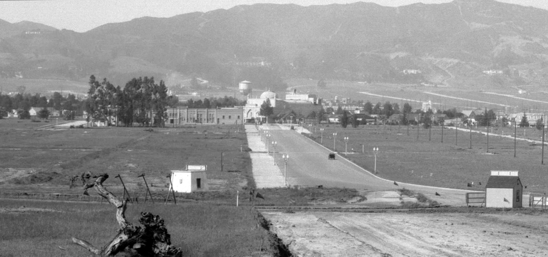
| (1925)*– Panoramic view of a completely undeveloped South Beverly Drive looking north to the Beverly Theater at Wilshire Boulevard. |
Historical Notes There are still giant eucalyptus trees that once lined the boundaries of the Beverly Hills Speedway to the north behind the Walter McCarty retail development. Those trees would soon be cut down to make way for Charleville Blvd. To the left you can see El Camino Drive is beginning to make its way south and in the upper left hand corner of the photo you will find the "Beverly Crest" real estate sign on the mountain, very much like its sister sign, "Hollywoodland" only a handful of miles away. The area from where the photo was taken was known as Beverly Heights. ##++ |
 |
|
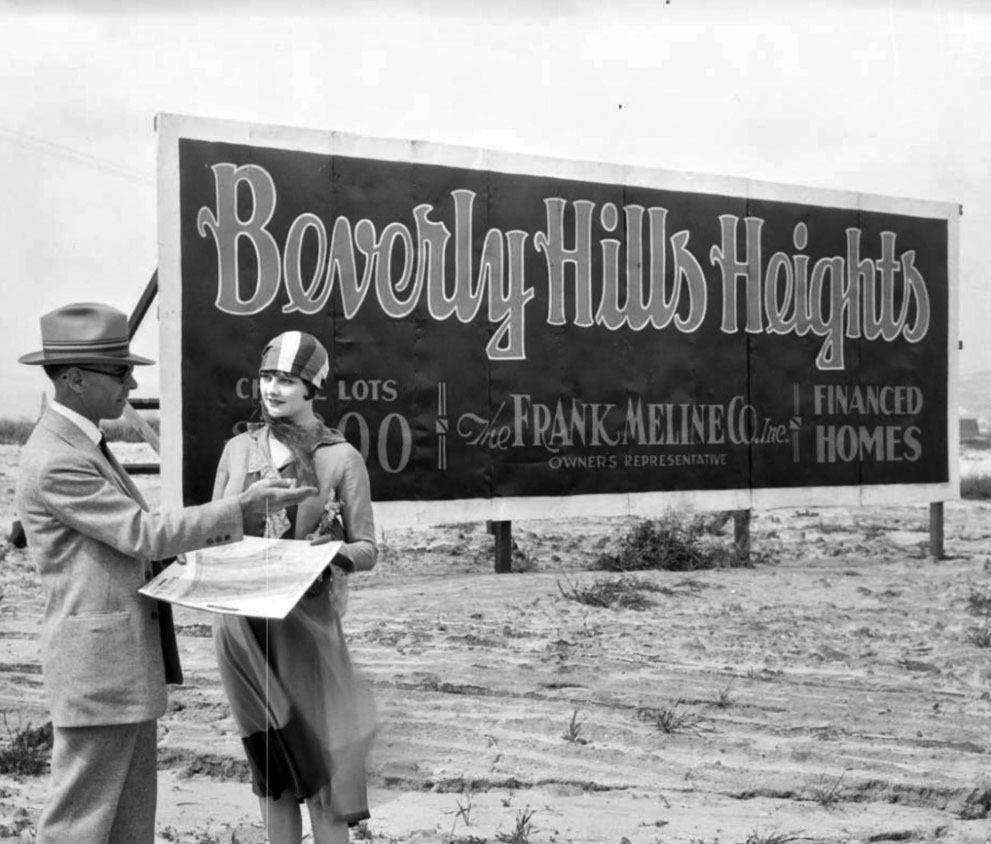
| (ca. 1925)^ - View showing a Real Estate agent making a pitch to a prospective buyer at the new Beverly Hills Heights Tract development. Sign reads: Beverly Hills Heights – The Frank Meline Co. Inc. – Financed Homes. |
Historical Notes Frank Meline was an architect and the first sales agent in Bel-Air for developer Alphonzo Bell (1875-1947). Meline subdivided Pacific Palisades’ California Riviera neighborhood, where some streets also bear the Claude Fisher Company seen in Monte-Mar Vista. Meline was a prominent developer "who in 1912 formed his hown Los Angeles construction company, which he expanded in 1919 to a full-service real-estate development and sales opertion with (by 1924) eighteen branch offices throughout the Los Angeles basin. As a broker, Meline sold half the homes purchased in Beverly Hills before 1930.^ |
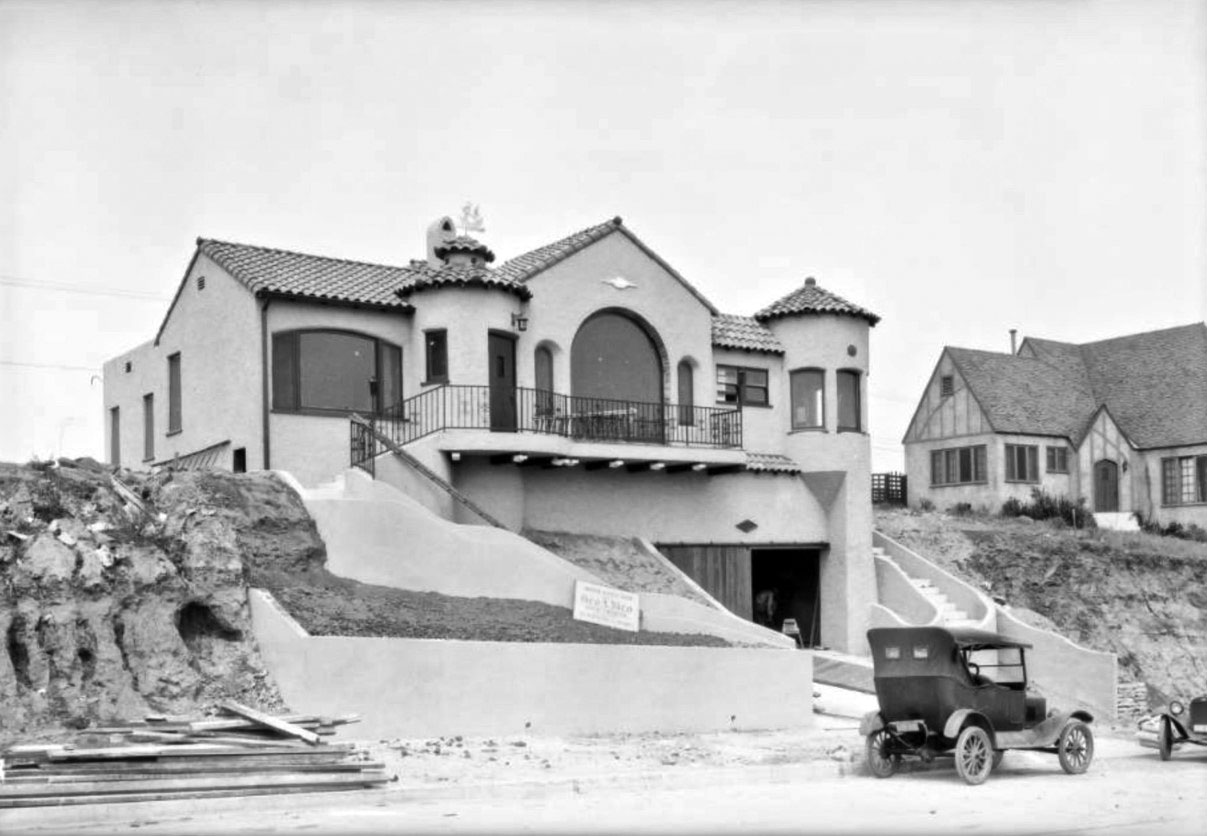 |
|
| (ca. 1925)^ – Early model car parked in front of newly constructed home in the Beverly Hills Heights Tract. |
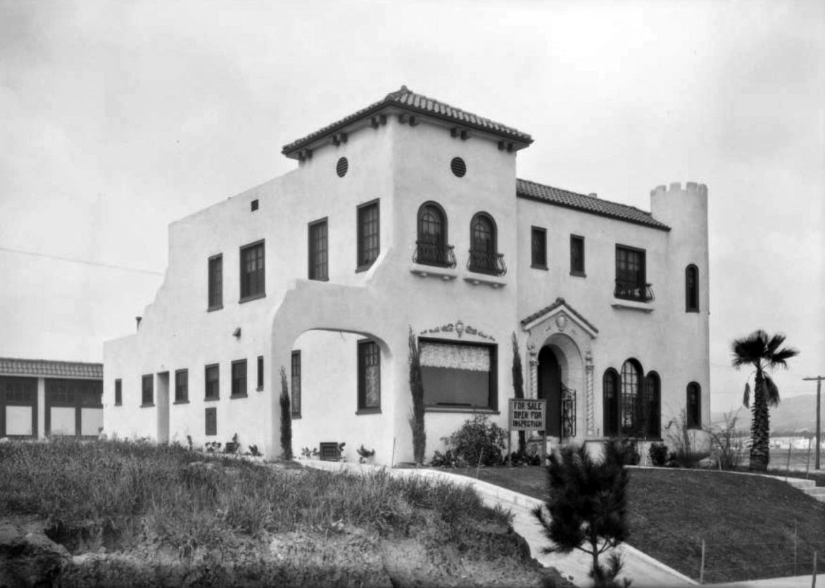 |
|
| (ca. 1925)^ - Close-up view showing a newly-built house for sale in the Beverly Hills Heights Tract. Sign in front reads: ‘For Sale – Open for Inspection’. Note the empty land in the background on the right. |
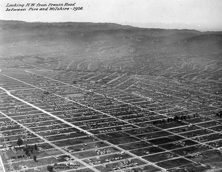 |
|
| (1926)^ - Aerial view of Beverly Hills looking NW from Preuss Road between Pico and Wilshire. |
Historical Notes The street called Preuss Road in the picture is now called Robertson Blvd. The Preuss Road name survives on a street south of Pico. |
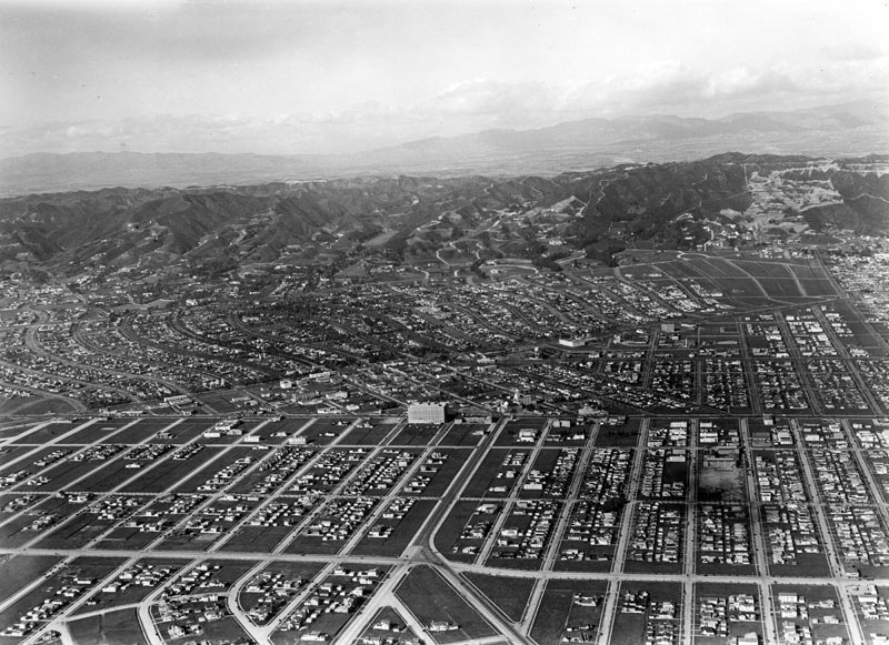 |
|
| (1929)^ - Aerial view of Beverly Hills looking north. The large white building at center of photo is the Beverly Wilshire Hotel, completed in 1928. |
Before and After
 |
|
 |
|
| (1925 vs. 1929)^ - Aerial view of Beverly Hills showing how much growth and development took place in a relatively short span of time. |
 |
|
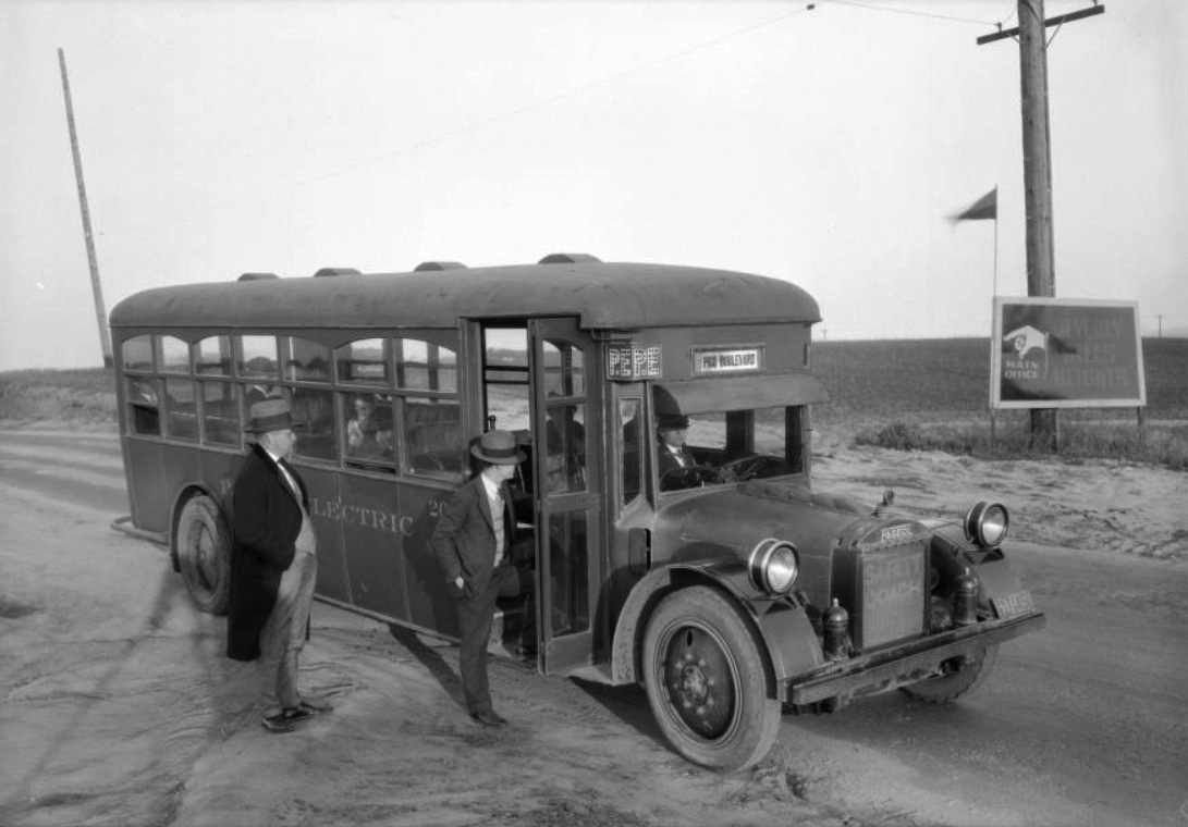
| (1925)* - A Pacific Electric bus parked along the side of the road near a sign for the Beverly Hills Heights development. Two men are standing outside the bus, one about to board, and a few people are already seated on the bus. The land that is visible is covered in fields. |
Sunset Boulevard
 |
|
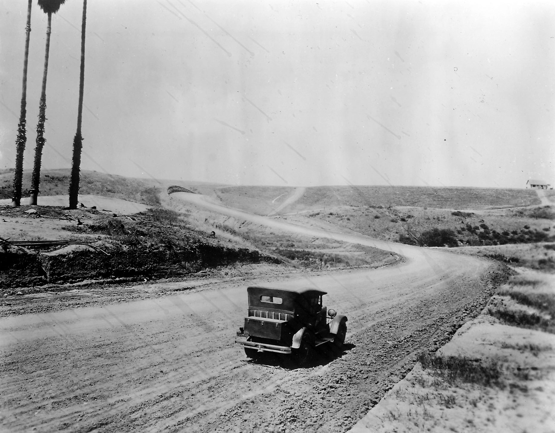
| (ca. 1925)* - View showing a car on an unpaved Sunset Boulevard heading west between Carolwood and Delfern Drives, with three palm trees in the background. Click HERE to see contemporary view. |
Historical Notes Sunset Boulevard stretches from Figueroa Street in Downtown Los Angeles to the Pacific Coast Highway at the Pacific Ocean in the Pacific Palisades. Approximately 22 miles in length, the famous boulevard roughly mimics the arc of the mountains that form the northern boundary of the Los Angeles Basin, following the path of a 1780s cattle trail from the Pueblo de Los Angeles to the ocean. The portion of Sunset Boulevard that passes through Beverly Hills was once named Beverly Boulevard.^* |
 |
|
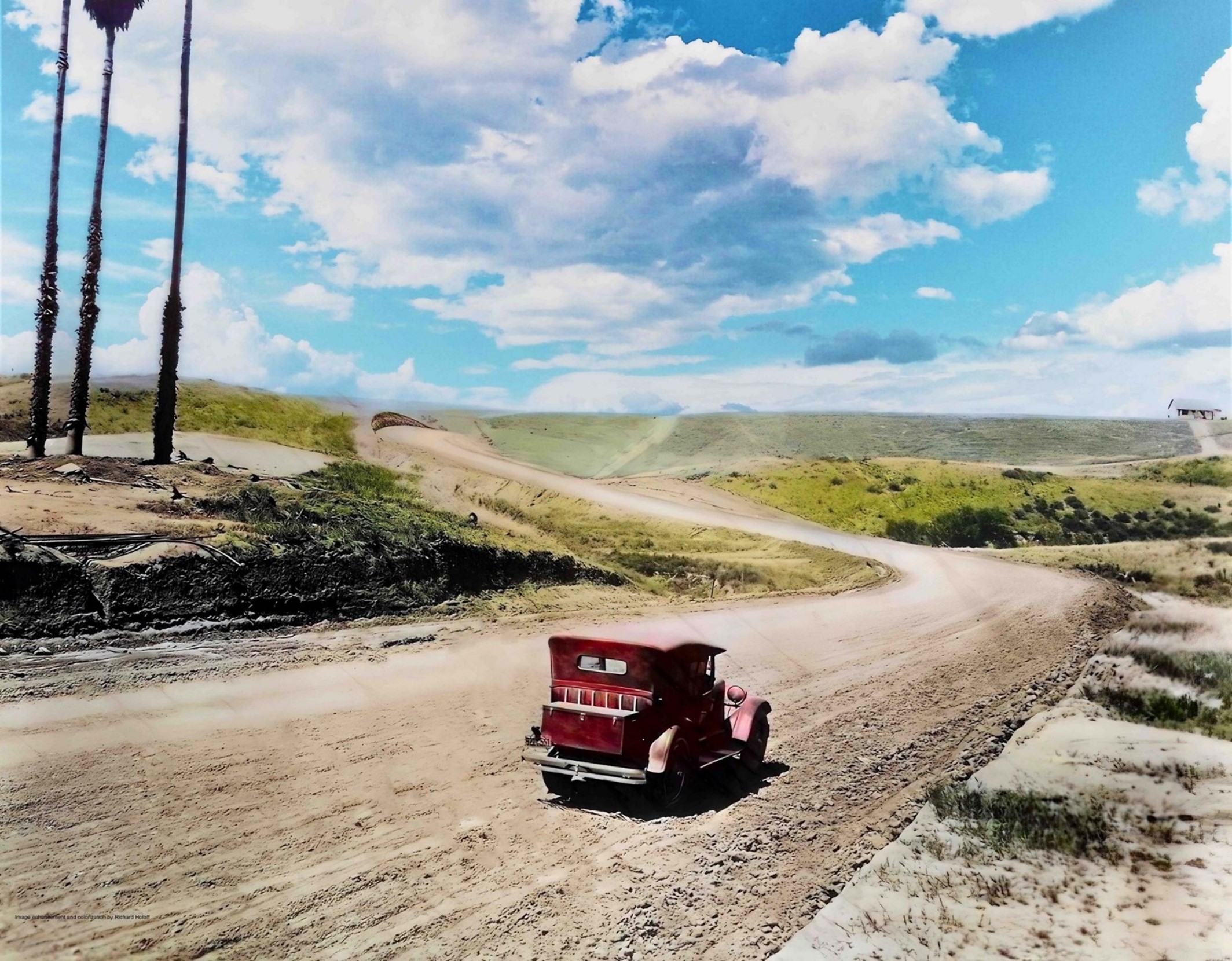
| (ca. 1925)* - View showing a car on an unpaved Sunset Boulevard heading west between Carolwood and Delfern Drives, with three palm trees in the background. Image enhancement and colorization by Richard Holoff. |
Then and Now
 |
|
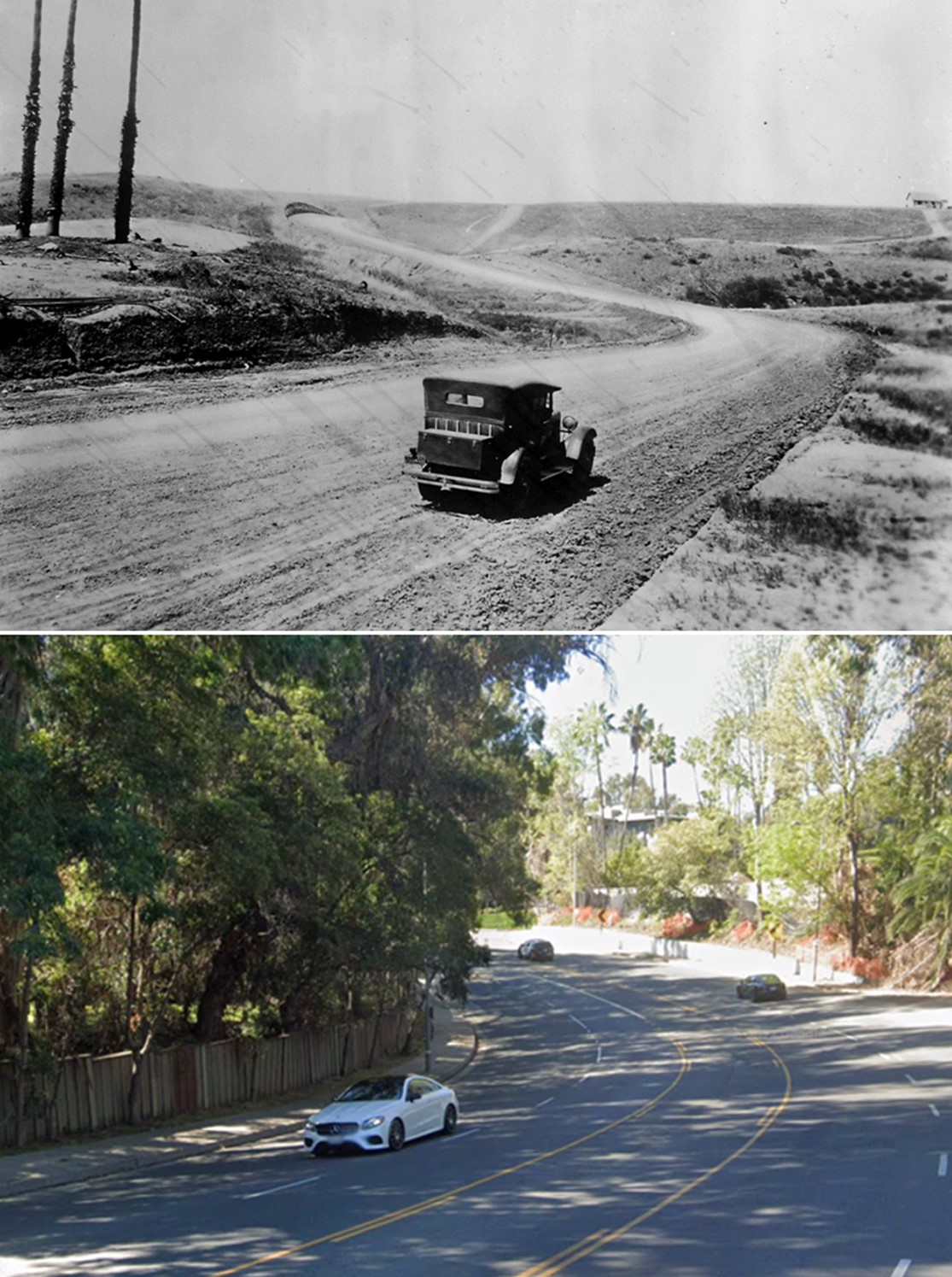
| (1925 vs 2021)* - Sunset Boulevard between Carolwood and Delfern Drives near Beverly Hills. |
 |
|
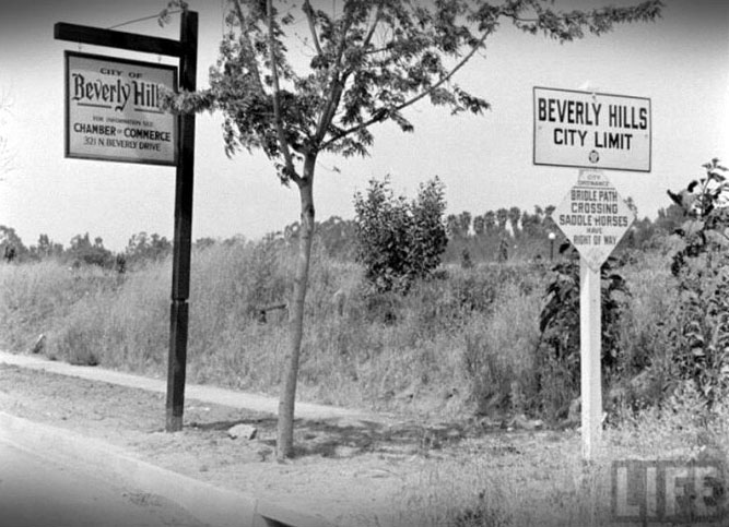
| (n.d.)+# – Life Magazine photo showing rural-looking Beverly Hills at city limits with signs reminding motorists that “Bridal path crossing – Saddle horses have right of way.” |
* * * * * |
Camden Drive and Santa Monica Boulevard
 |
|
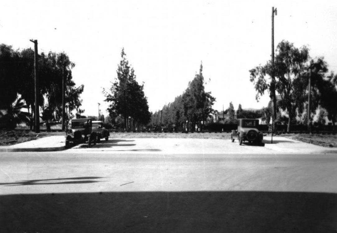
| (1927)^ - View looking north on Camden Drive across Santa Monica Boulevard and the P.E. tracks. |
 |
|
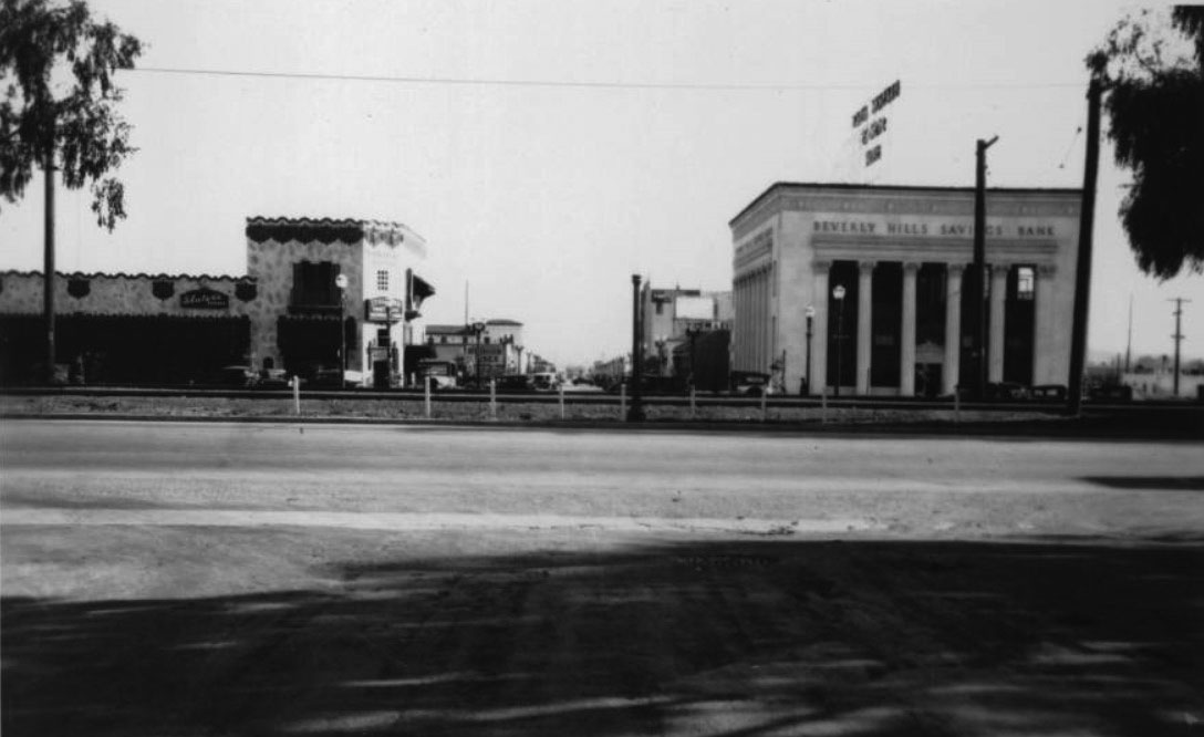
| (1927)^ – View looking south on Camden Drive across Santa Monica Boulevard and the Pacific Electric Railway tracks toward the commercial district of Beverly Hills. To the right can be seen the Beverly Hills Savings Bank. Sign on the building to the left reads “Slater’s Kodaks”. |
 |
|
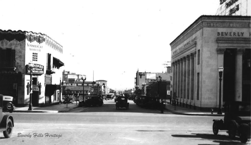
| (ca. 1927)* – View looking south on N. Camden Drive from just south of the PE tracks. On the left is the old Hans Ort Bicycle shop. On the right (SW corner) can be seen the Beverly Hills Savings Bank. Photo courtesy of Beverly Hills Heritage. |
 |
|
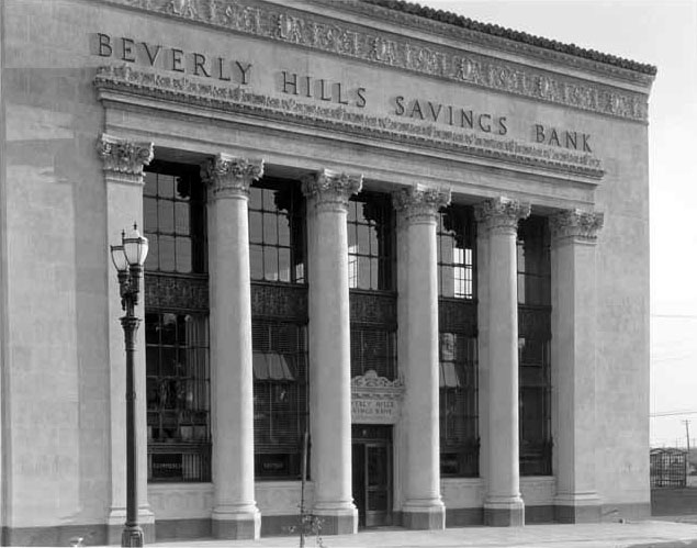
| (ca. 1920s)^*# – Close-up view of the Beverly Hills Savings Bank with Greek-style columns, located on the SW corner of Camden Drive and Santa Monica Boulevard. Note the ornate dual-lamp streetlight. |
Then and Now
 |
|
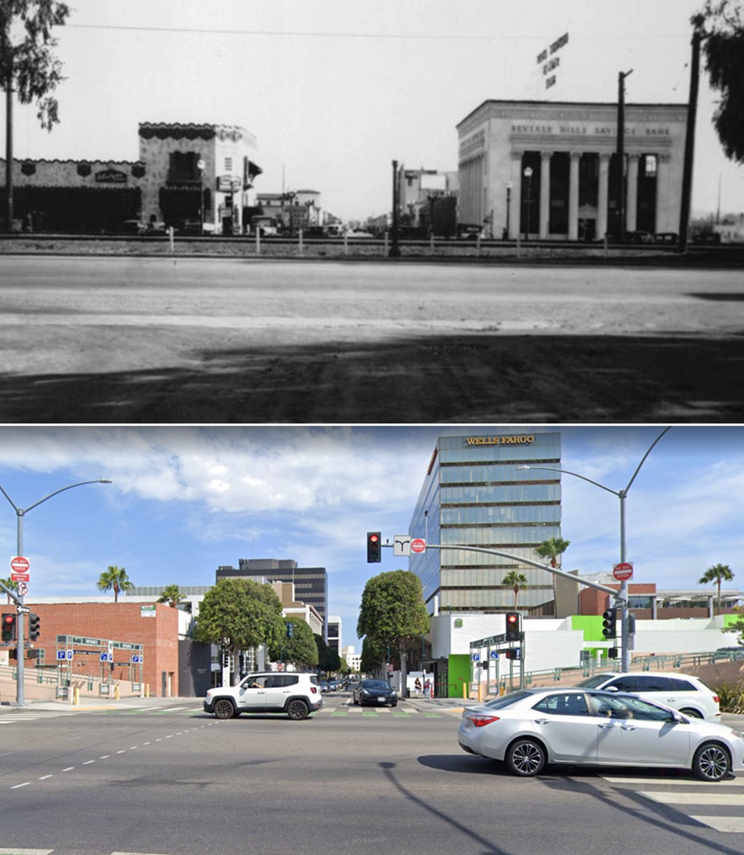
| (1927 vs 2022)* - Looking south on Camden Drive at Santa Monica Boulevard. |
* * * * * |
 |
|
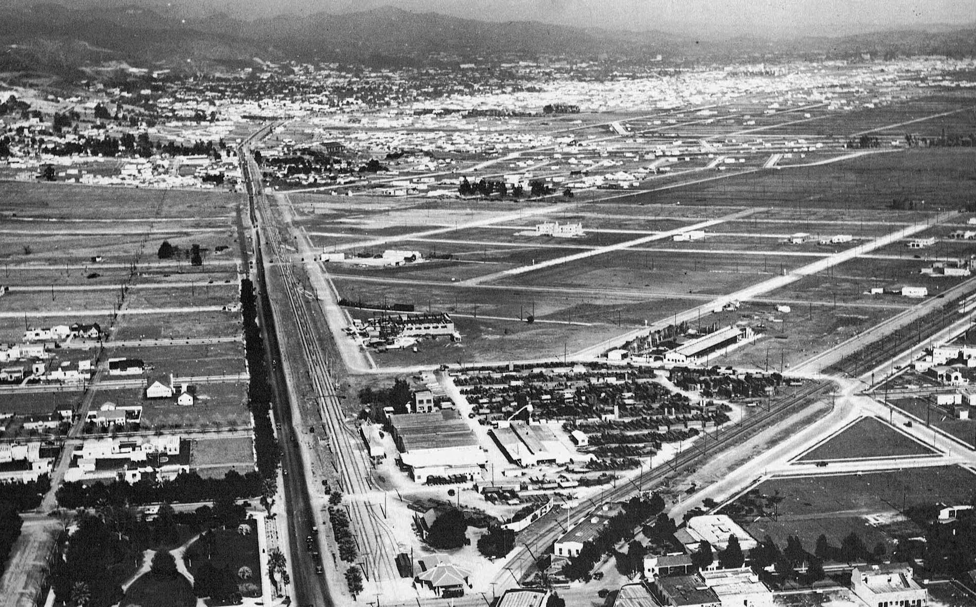
| (ca. 1924)* - Aerial view over Beverly Hills looking towards Hollywood. Below, at lower-center, can be seen Beverly Hill’s 1st Train Station. Photo: Fred Basten Collection |
Then and Now
 |
|
| (1924 vs. 2017) – Aerial view over Santa Monica Blvd and Canon Drive looking towards Hollywood showing the relative locations of the Beverly Hills’ 1st Train Station (left) and today’s City Hall (right). |
 |
|
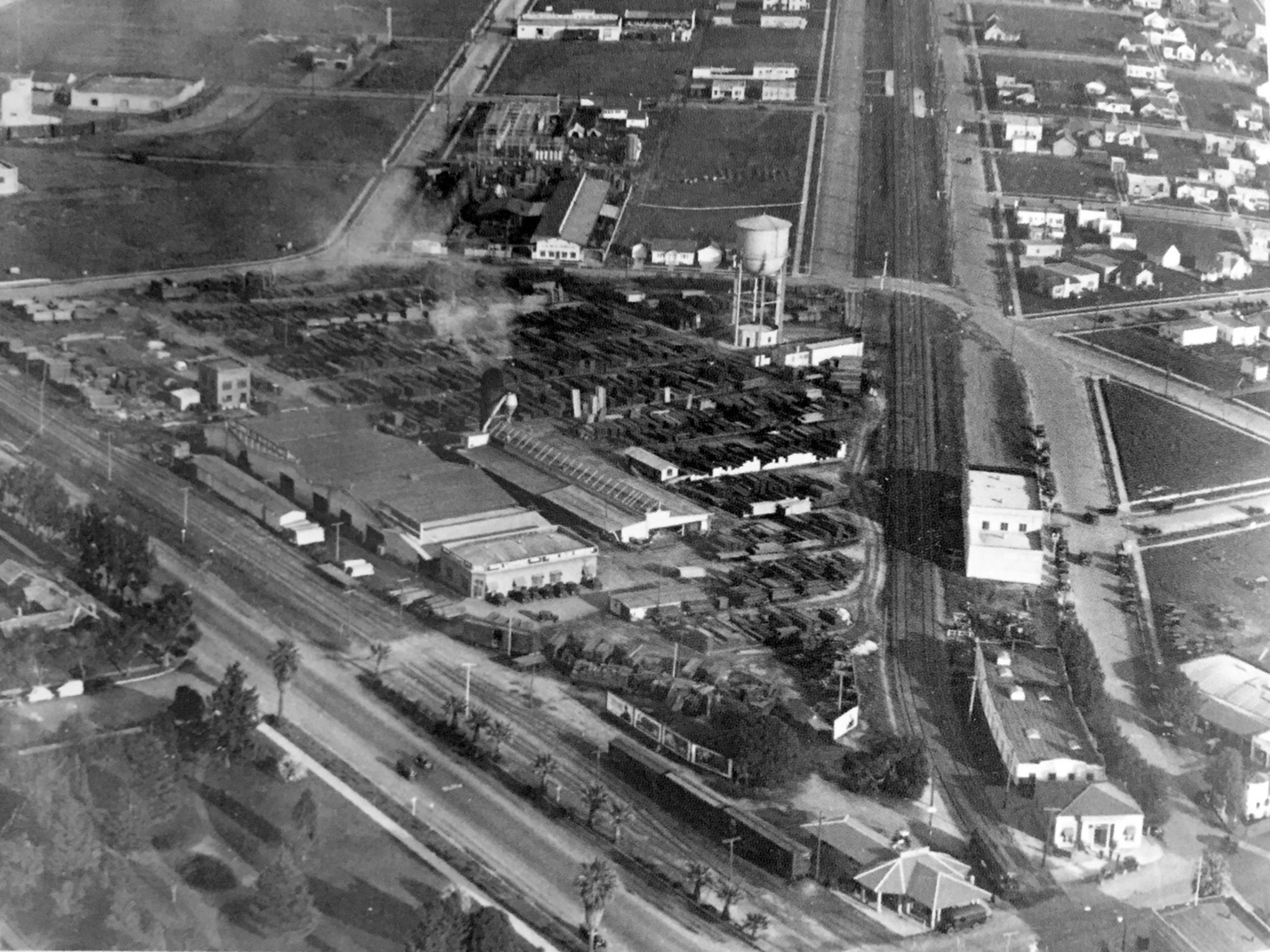
| (ca. 1926)* - Aerial view of Sun Lumber and the future location of City Hall. The intersection of Canon Drive and Santa Monica Blvd is in the foreground where the new Beverly Hills Depot is seen. |
 |
|
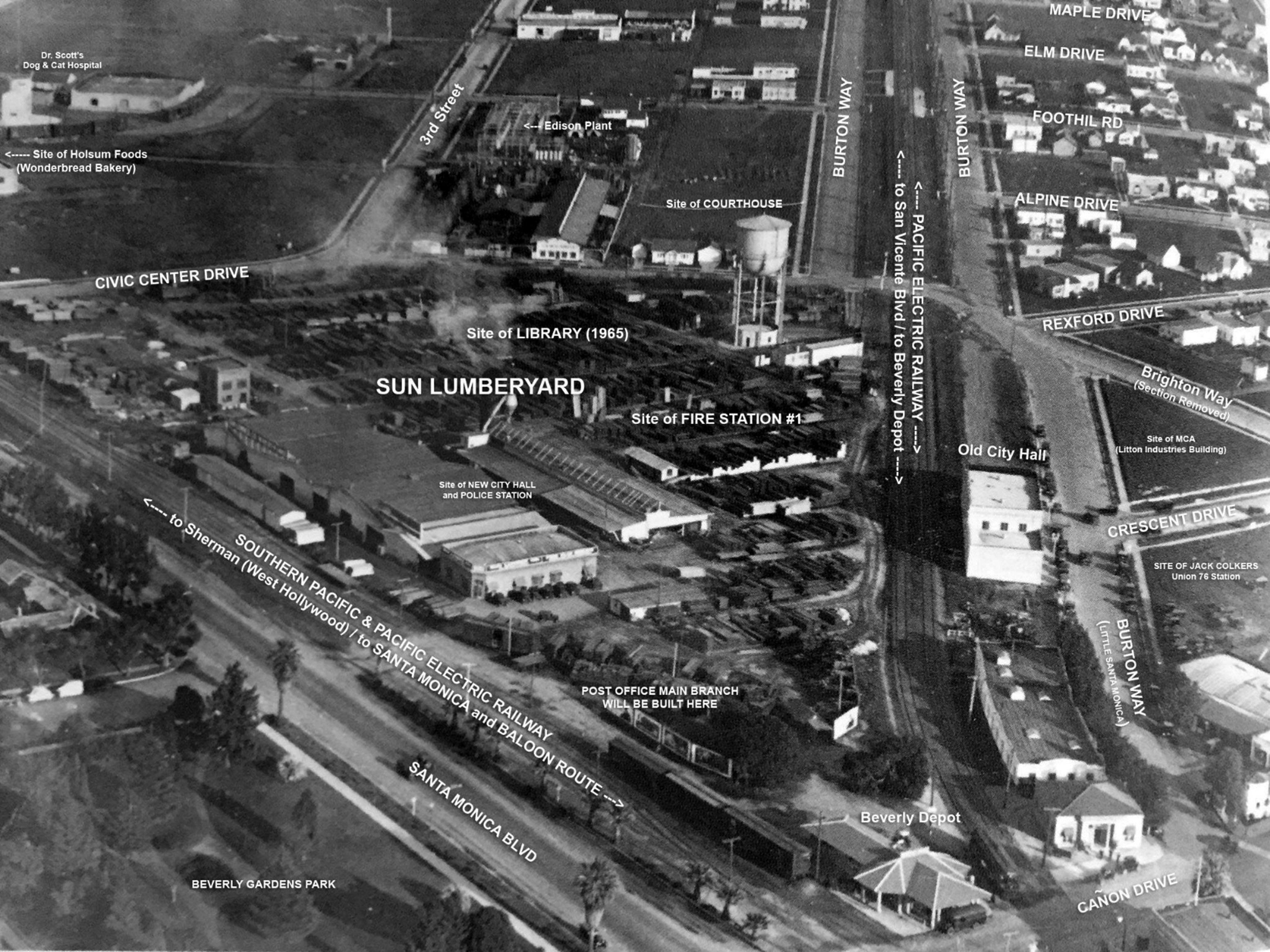
| (ca. 1926)* - Aerial view of Sun Lumber annotated to with street names and future significant buildings. Beverly Hills Historical Society |
 |
|
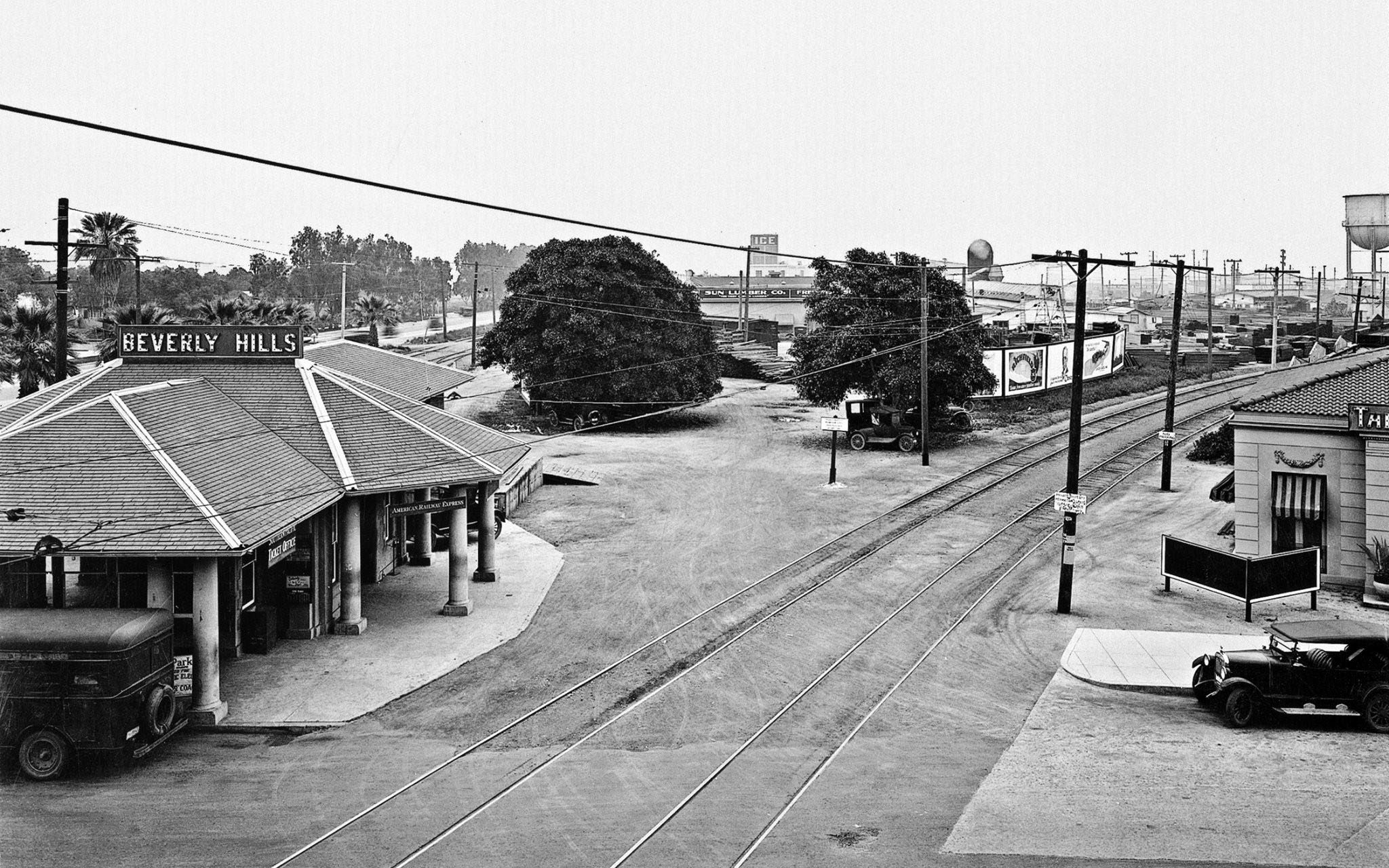
| (1926)^.^ – View looking northeast as seen from Canon Drive showing the newly named Beverly Hills Station featuring the American Railway Express. In the background can be seen Sun Lumber, soon to be the site for the new Beverly Hills City Hall. |
 |
|
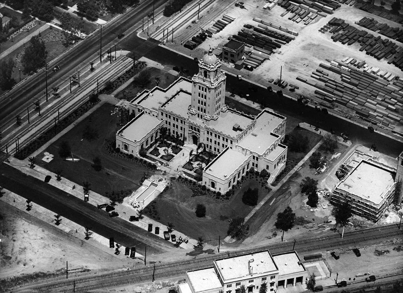
| (1932)* - Beverly Hills City Hall shortly after it was completed situated between tracks and the Sun lumberyard. |
Historical Notes In 1930, land was purchased from the Pacific Electric to build the city hall. Construction lasted from 1931 to 1932. The building was designed by architects William J. Gage and Harry G. Koerner in the California Churrigueresque style, a type of Spanish Revival Architecture. The building was constructed by the Herbert M. Baruch Corporation. When the city hall opened in 1932, it was called by the Los Angeles Times the "largest and most expensive City Hall of any municipality its size in the country."* Click HERE to see more Early Views of Beverly Hills City Hall. |
 |
|
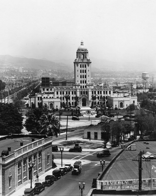
| (1933)^ - Panoramic view of Beverly Hills City Hall and surrounding area, looking east. City Hall was built in 1932 on Crescent Drive at Santa Monica Blvd. |
* * * * * |
Beverly Hills 1st City Hall
 |
|
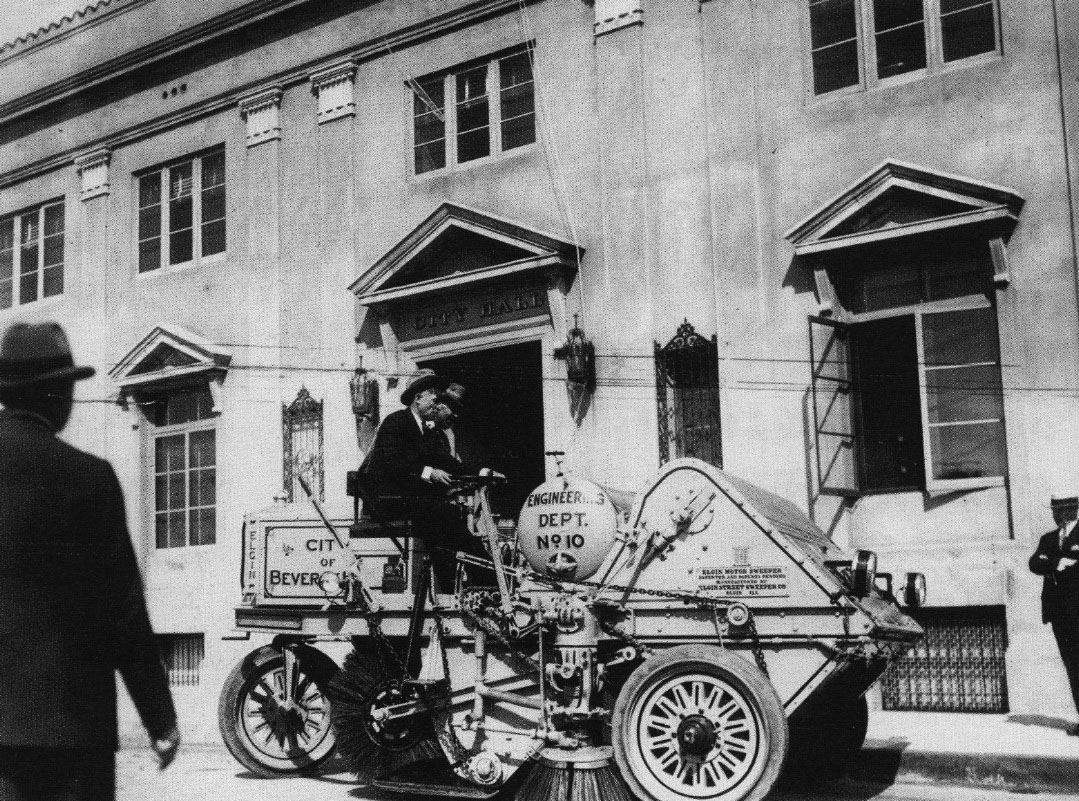
| (1926)* - Honorary Mayor Will Rogers demonstrates the city's brand new Elgin Street Sweeper in front of Beverly Hills’ original City Hall at the terminus of N Crescent Drive and Burton Way. |
Historical Notes William Penn Adair "Will" Rogers, in addition to being a cowboy, vaudeville performer, humorist, newspaper columnist, social commentator, and stage and motion picture actor, was the honorary Mayor of Beverly Hills (1926 – 1928). After the city was incorporated it was run by an appointed city manager. The "mayor's office" was merely a ceremonial one that enabled Will to make more jokes about do-nothing politicians such as himself. |
 |
|
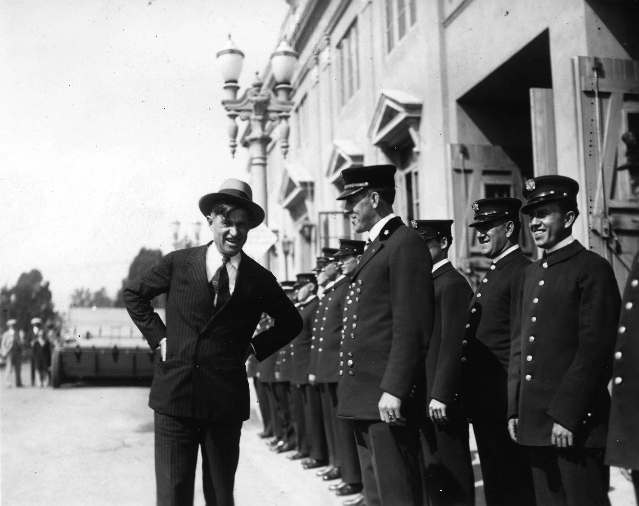
| (ca. 1928)* – View showing Honorary Mayor Will Rogers and the Beverly Hills Fire Department standing outside the city's first City Hall and fire station. |
Historical Notes The first City Hall building faced south at the end of Crescent Drive, right before Santa Monica Boulevard. It was demolished when the new City Hall was erected in 1932 and its demise made way for South Santa Monica Boulevard to the east and west and Crescent Drive to go all the way through to the South. |
Beverly Hills 2nd City Hall
 |
|
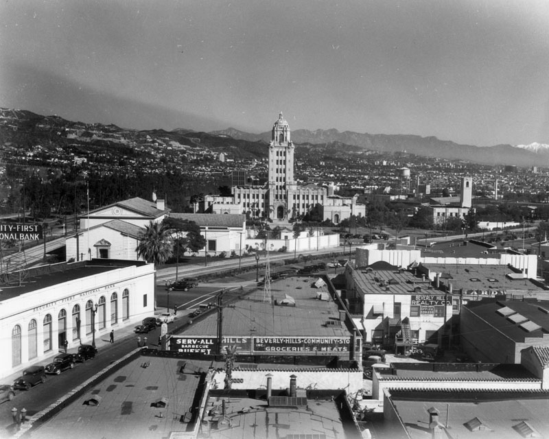
| (ca. 1935)^ - Looking northeast from the Beverly Hills business district showing Beverly Hills City Hall (built in 1932) and the Beverly Hills Civic Center. The Pacific Electric streetcar tracks of the Beverly Hills line that run down Santa Monica Boulevard are seen in the center. Between the tracks and City Hall is the Beverly Hills Post Office. In the far distance (upper-right) you can make out the snow-capped San Gabriel Mountains. |
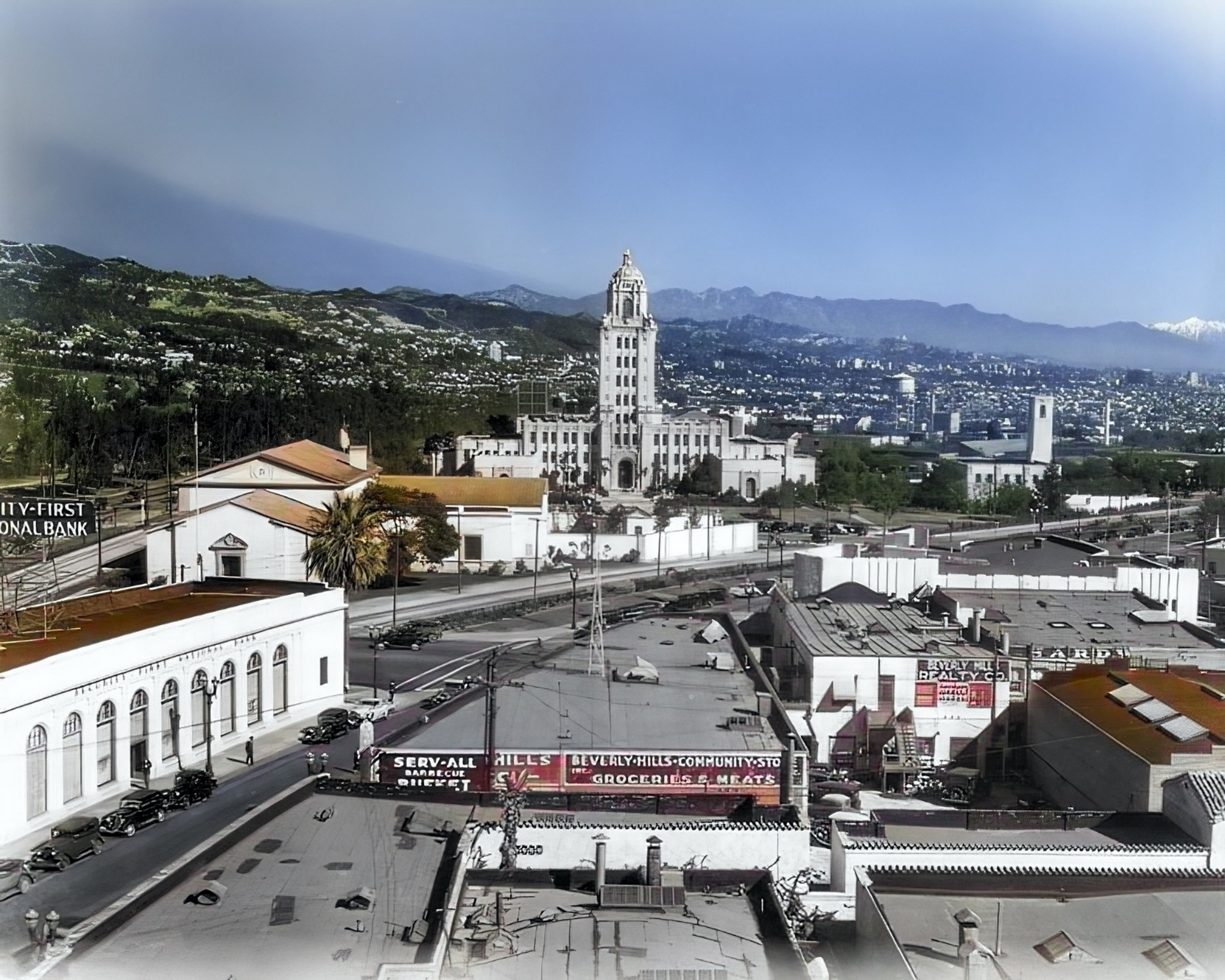
Historical Notes In 1930, land was purchased from the Pacific Electric to build the new city hall. Construction lasted from 1931 to 1932. The building was designed by architects William J. Gage and Harry G. Koerner in the Spanish Revival architectural style (though sometimes also characterized Churrigueresque). When the city hall opened in 1932, it was called by The Los Angeles Times the "largest and most expensive City Hall of any municipality its size in the country." |
 |
|
| (ca. 1935)^ - Looking northeast from the Beverly Hills business district showing Beverly Hills City Hall (built in 1932) and the Beverly Hills Civic Center. The Pacific Electric streetcar tracks of the Beverly Hills line that run down Santa Monica Boulevard are seen in the center. Between the tracks and City Hall is the Beverly Hills Post Office. In the far distance (upper-right) you can make out the snow-capped San Gabriel Mountains. Photo enhancement and colorization by Richard Holoff. |
 |
|
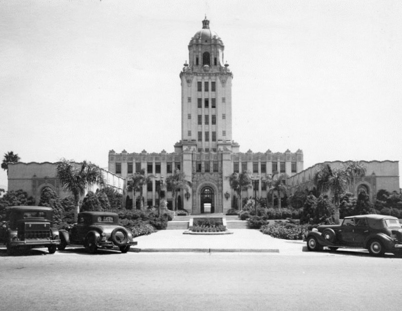
| (1937)^ - Close-up view looking east showing the Spanish Colonial Revival-style Beverly Hills City Hall. |
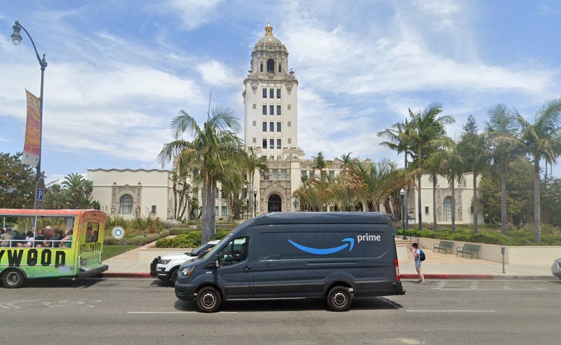
Historical Notes Beverly Hills City Hall is surrounded by North Santa Monica Boulevard, North Rexford Drive, South Santa Monica Boulevard, and North Crescent Drive. Its main entrance is at 455 North Rexford Drive. |
 |
|
| (2022)* - Contemporary view of Beverly Hills City Hall as seen from N. Crescent Drive. |
Then and Now
 |
|
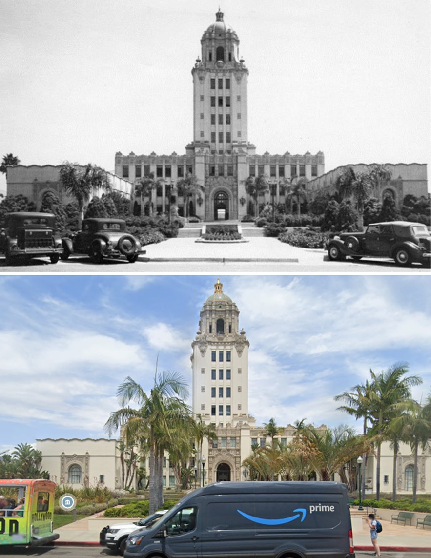
| (1938 vs 2022)* - Beverly Hills City Hall as seen from N. Crescent Drive. |
Historical Notes Beverly Hills City Hall is surrounded by North Santa Monica Boulevard, North Rexford Drive, South Santa Monica Boulevard, and North Crescent Drive. Its main entrance is at 455 North Rexford Drive. Click HERE to see more Early Views of Beverly Hills City Hall. |
* * * * * |
Beverly Hills Post Office
 |
|
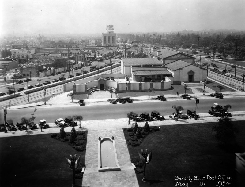
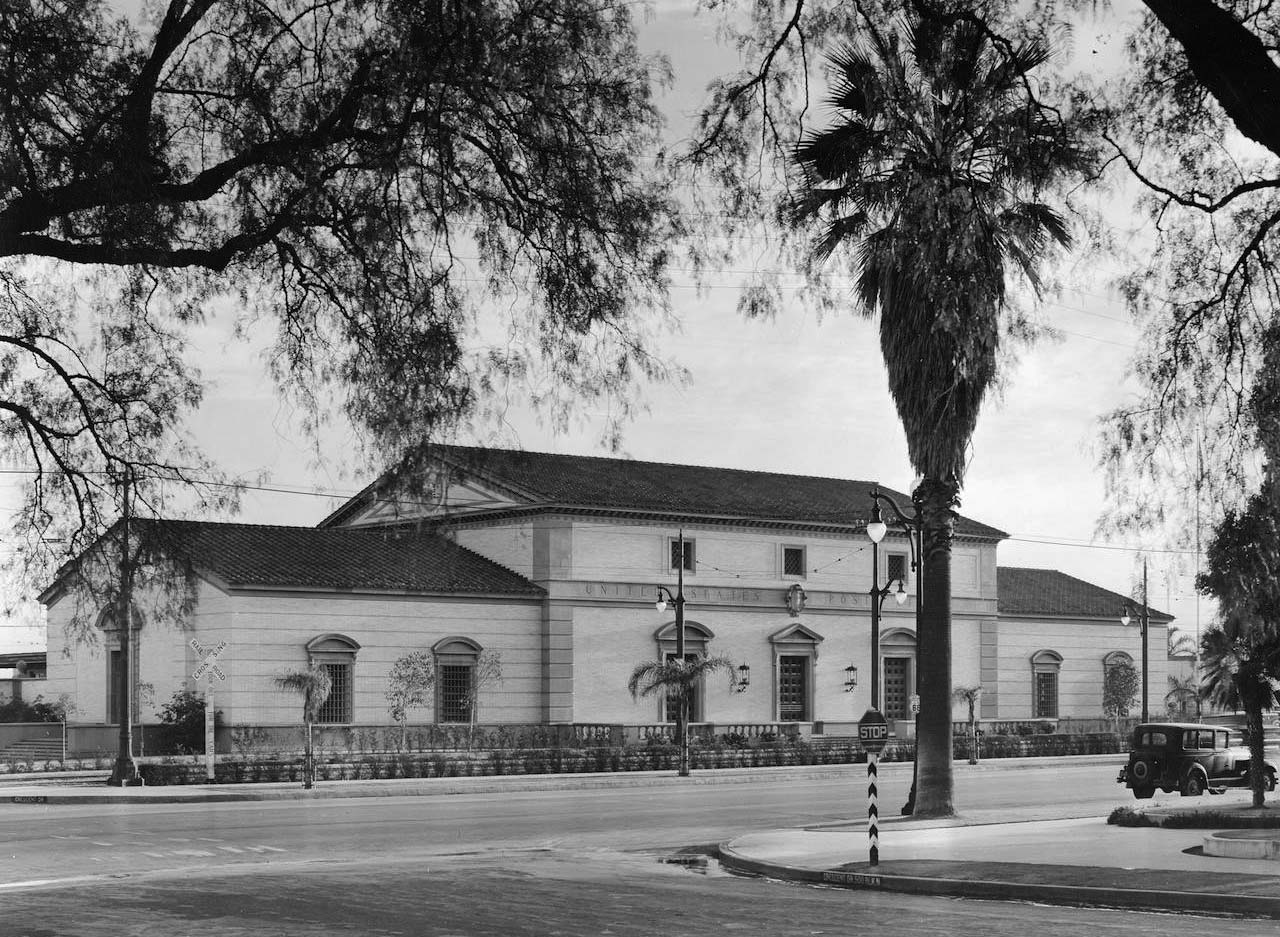
| (1934)^ - View looking west showing the Beverly Hills Post Office located at 325 N. Maple Drive as seen from City Hall. This was the location of Beverly Hills' 1st Train Station. |
Historical Notes Architects Ralph C. Flewellin and Allison and Allison built the Beverly Hills Post Office in 1932-1933 in the Italian Renaissance Revival style, with building in terra cotta and brick. |
 |
|
| (ca. 1934)* – Close-up view of the Italianate-style Beverly Hills Post Office located on Maple Drive between Canon Drive and Santa Monica Boulevard. |
Historical Notes The Beverly Hills Post Office (also known as the Crescent Drive Post Office) was part of the original civic center built for the growing young city. Legendary humorist and honorary mayor Will Rogers was credited with securing funding for the building from the federal government, after sending a typically folksy-yet-biting letter to Secretary of the Treasury Andrew Mellon. Ralph C. Flewelling designed the building with consulting architects Allison and Allison. The building’s stately Italian Renaissance Revival exterior leads into a double-height, marble-clad grand lobby. Artist Charles Kassler adorned the upper walls of the lobby with eight WPA fresco murals depicting the creation of the mail service and views of modern life during the Depression. |
 |
|
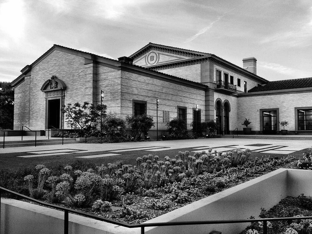
| (2014)* - View showing the restored Post Office portion of the Wallis Annenberg Center for the Performing Arts, as seen from the corner of South Santa Monica Boulevard and Canon Drive. Photo by Waliy Sherpa |
Historical Notes When the U.S. Postal Service’s needs outgrew the building, USPS declared it as “surplus property” and offered it for sale to federal, state, and local governments. The nonprofit Beverly Hills Cultural Center Foundation was formed to find a new use for the building as a cultural venue, and the City of Beverly Hills bought the building in 1999. To transform the site for use as a performing arts center, the project team restored historic elements of the post office building and added a modern annex, connected via tunnel, to house the main 500-seat theatre. The original building received a meticulous repair and restoration, from re-roofing, to restoring the WPA murals, to refurbishing all historic features inside and out. |
 |
|
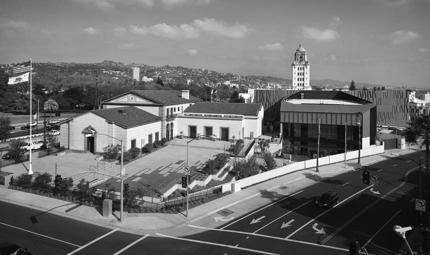
| (2015)^^– View showing the 1933-built Beverly Hills Post Office, now part of the Wallis Annenberg Center for the Performing Arts. Photo by John Edward Linden |
Historical Notes The Wallis Annenberg Center for the Performing Arts includes a new 500-seat state-of-the-art theater adjacent to the landmark Italian Renaissance Revival building, and three classrooms, a 150-seat flexible studio space, a donor lounge, production support services and administrative offices within the historic post office building itself. |
* * * * * |
Beverly Hills Pacific Electric Station
 |
|
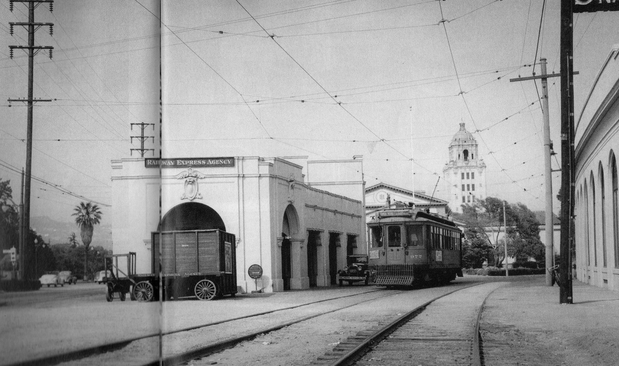
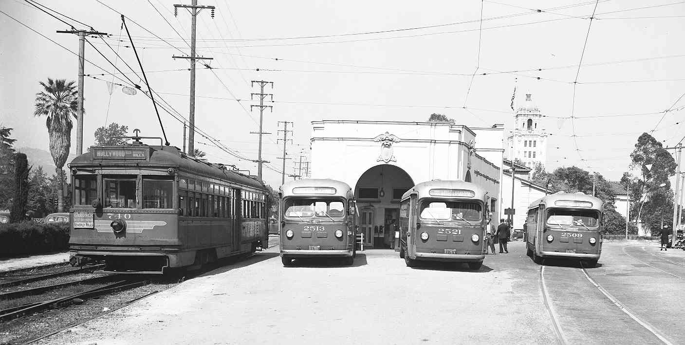
| (1940)* – Scan of a picture that was in the Spring 2008 issue of "Classic Trains" magazine. The picture was taken by Harold Stewart, a Pacific Electric motorman, in July 1940, just before passenger service on the Los Angeles-Beverly Hills-Santa Monica line was discontinued*. |
Historical Notes *The discontinuance was west of the station - service continued on the east side until the mid-1950s. PE/MTA provided service further to the west via buses. |
 |
|
| (ca. 1943)* - View of the Beverly Hills Pacific Electric Station looking east showing a PE Red Car adjacent to three buses all lined up. City Hall can be seen in the background. |
* * * * * |
Beverly Hills Fire Department
 |
|
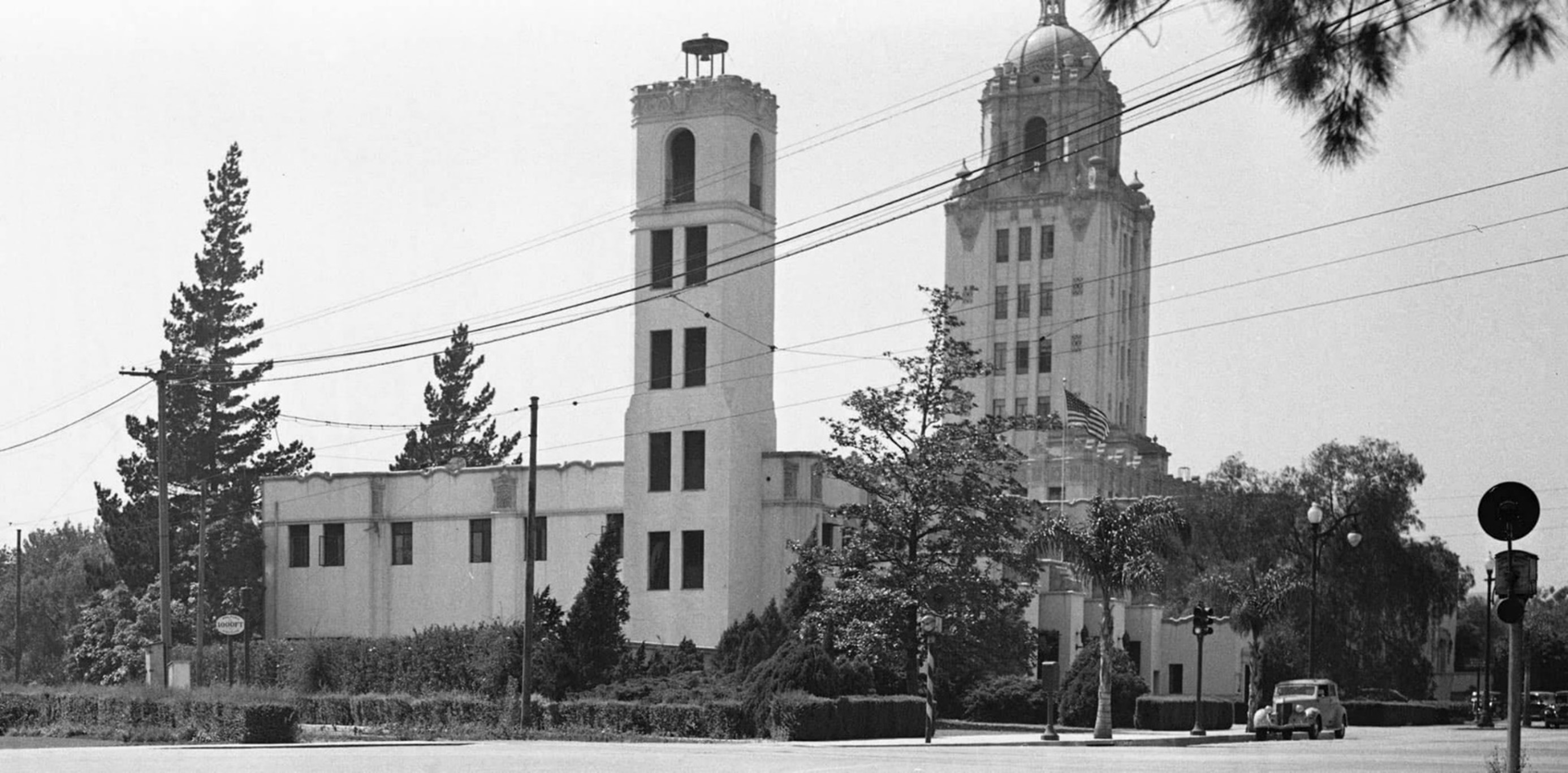
| (ca. 1938)* - Lookikng north on Rexford Drive from S. Santa Monica Boulevard showing the Beverly Hills Fire Department builiding with City Hall in the background. |
Historical Notes The Beverly Hills Fire Department's origins can be traced back to the city's incorporation in 1914, initially operating as a combined service with the police department. In the early years, the first deputy, Jack Munson, uniquely used his home as headquarters for both fire and police services. A significant change occurred in 1919 when a City Marshal was appointed to lead both departments. This combined leadership structure continued until 1925, marking a pivotal moment when the decision was made to separate the Fire and Police Departments. This separation allowed each department to develop independently, setting the foundation for the modern, specialized emergency services that Beverly Hills residents rely on today. |
 |
|
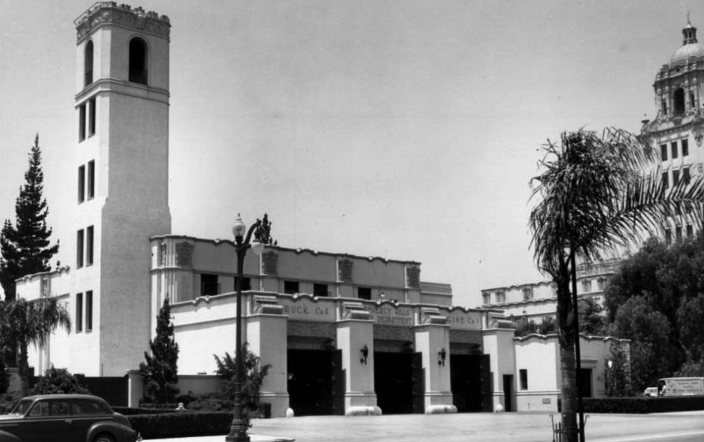
| (1938)* – View showing the Beverly Hills Fire Department at Rexford Drive at Santa Monica Boulevard with City Hall in the background. |
Historical Notes In 1925, the Beverly Hills Fire Department (originally a unit of the Beverly HIlls Police) came into its own entity as a separate organization. When the new city hall was built in 1932, a new and separate fire station building was added adjacent to the civic center. |
 |
|
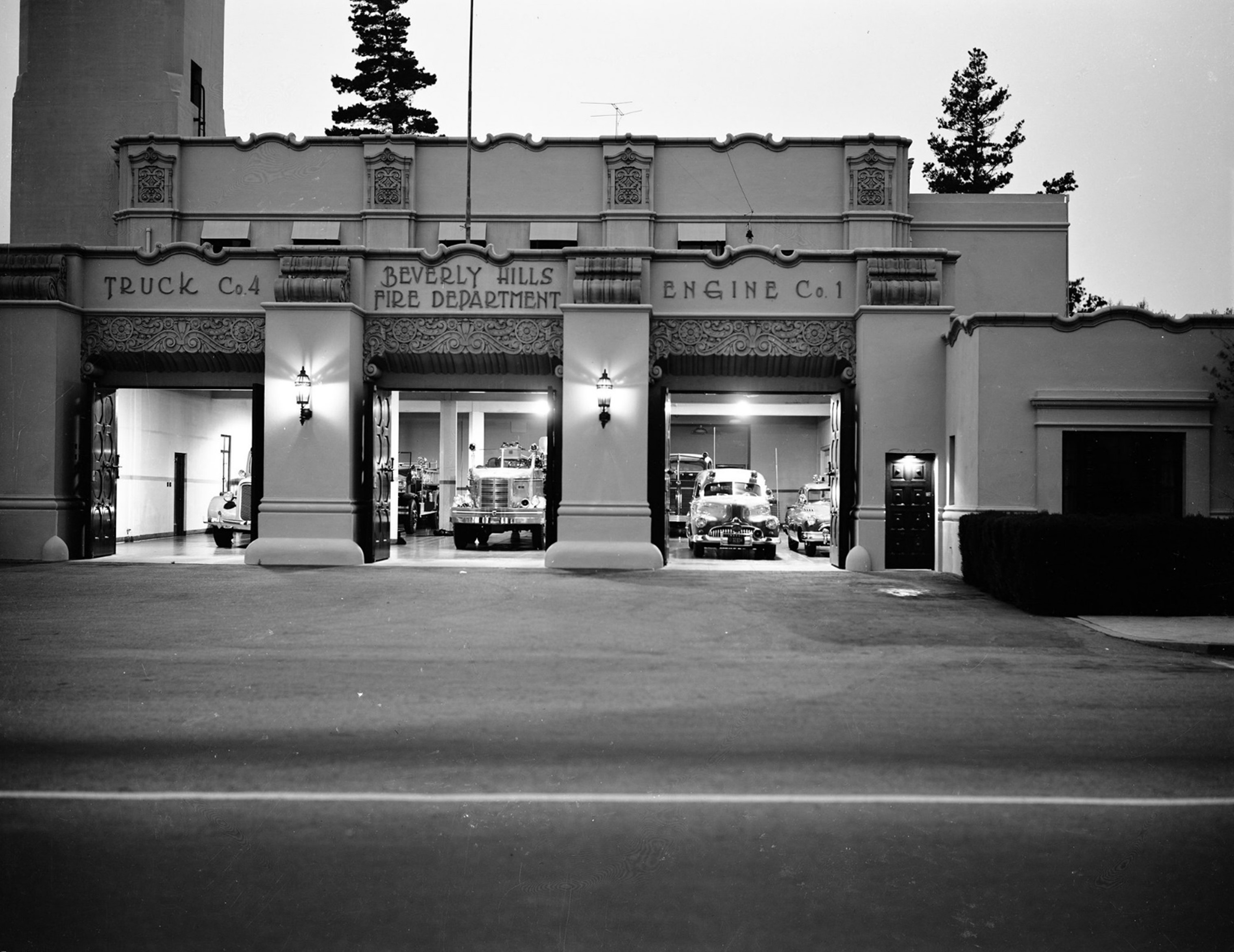
| (1950)* – Front view of the Beverly Hills Fire Deparmtent building at 445 Rexford Drive with fire engines and trucks all set to go if necessary. |
Historical Notes The Beverly Hills Fire Department Headquarters, built in 1932, was designed by the noted architect William J. Gage, in partnership with Harry G. Koerner. Known for designing several prominent buildings in Beverly Hills, Gage and Koerner created the Fire Department Headquarters in the distinctive Mediterranean Revival style, incorporating elements like stucco walls, tiled roofing, and arched windows. This style complemented the nearby Beverly Hills City Hall, also designed by Gage and Koerner, enhancing the architectural cohesion of the civic center. |
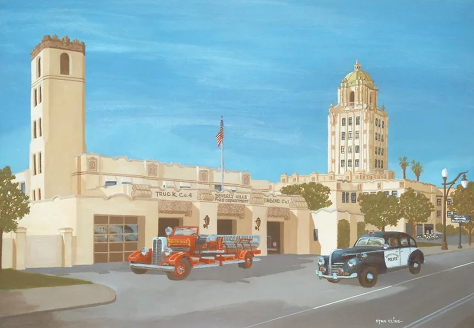 |
|
| (1939)* – Beverly Hills City Hall Police Fire Station. Image from Stan Cline Nostalgia Gallery. |
* * * * * |
Beverly Hills Police
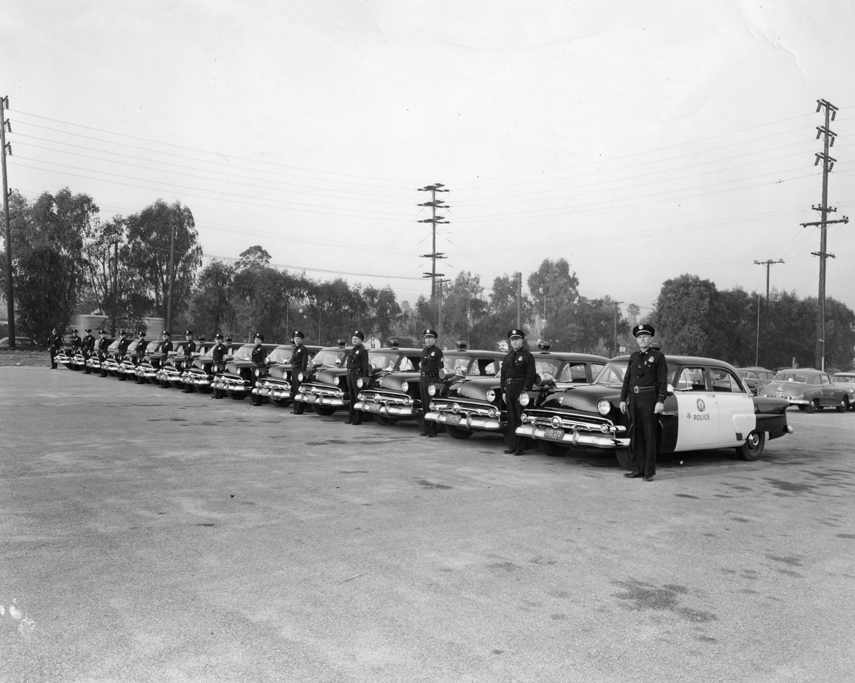 |
|
| (1952)* - Beverly Hills Police line up next to their patrol cars. |
* * * * * |
Associated Gas Station
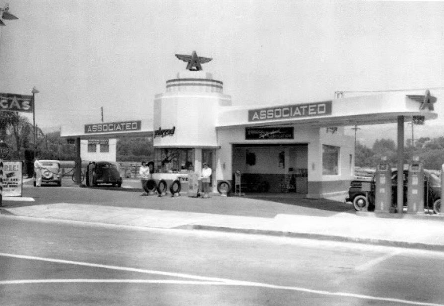 |
|
| (1941)* – View showing the Flying "A" gas station located at 400 Rexford Drive, across from the Beverly Hills City Hall. |
Historical Notes The station was built on a portion of the original Sun Lumber Company that once dominated the area. Today, the site is the south wing of the Beverly Hills Public Library. Click HERE for contemporary view. |
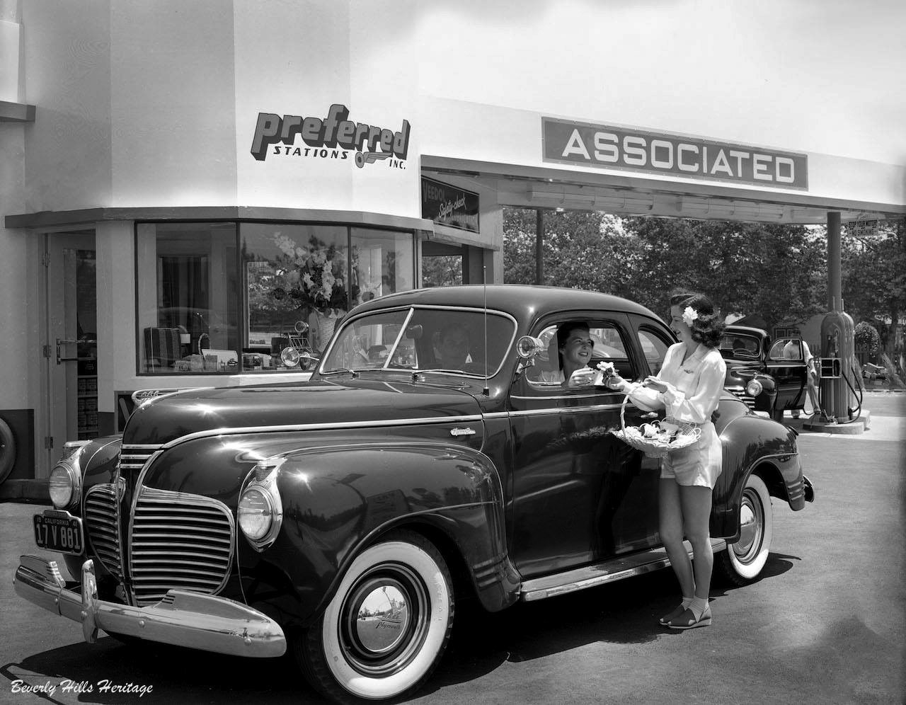 |
|
| (1941)* - Service with a smile and a gardenia flower is how it was done at this Associated Gas Station in Beverly Hills. This classic filling station stood at on the northeast corner of Rexford Drive and Burton Way. Click HERE to see more Early Views of Gas Stations. Photo courtesy of Beverly Hills Heritage. |
* * * * * |
Beverly Wilshire Hotel
 |
|
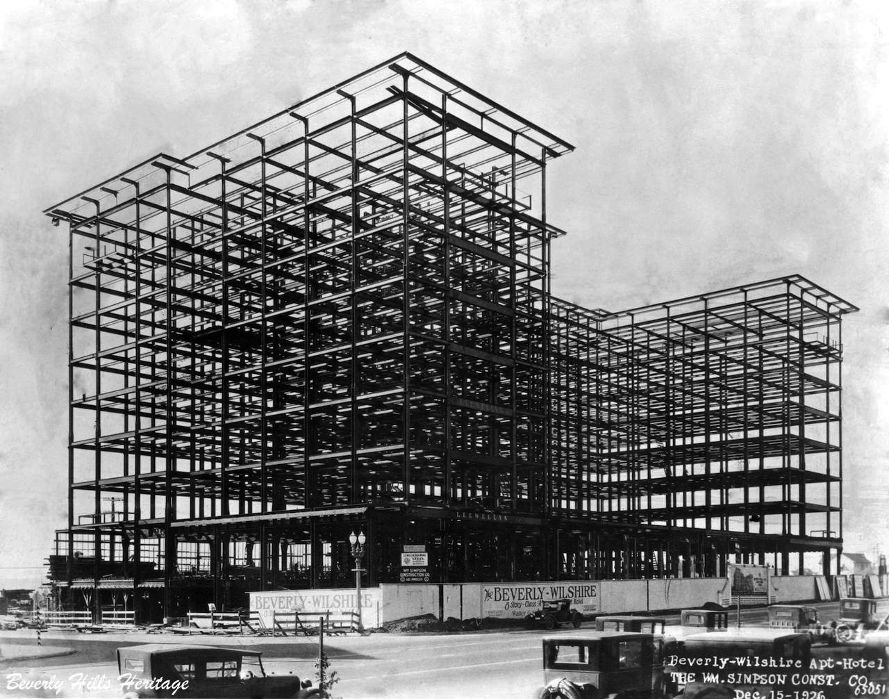
| (1926)* – View showing steel framing for the Beverly Wilshire Hotel. Photo: Marc Wanamaker, courtesy of Beverly Hills Heritage. |
Historical Notes One of the most significant buildings on Wilshire Boulevard in the 1920s was that of Walter G. McCarty's Beverly Wilshire Hotel and Apartment Homes. Designed by the prestigious Los Angeles architectural firm of Walker and Eisen in the Renaissance Revival style, it became the city's second large-scale hotel in 1928. McCarty and his investment syndicate were equally as committed to the promotion and growth of the city as the Rodeo Land and Water Company had been, and the hotel was a fitting anchor to their residential developments south of Wilshire Boulevard. |
 |
|
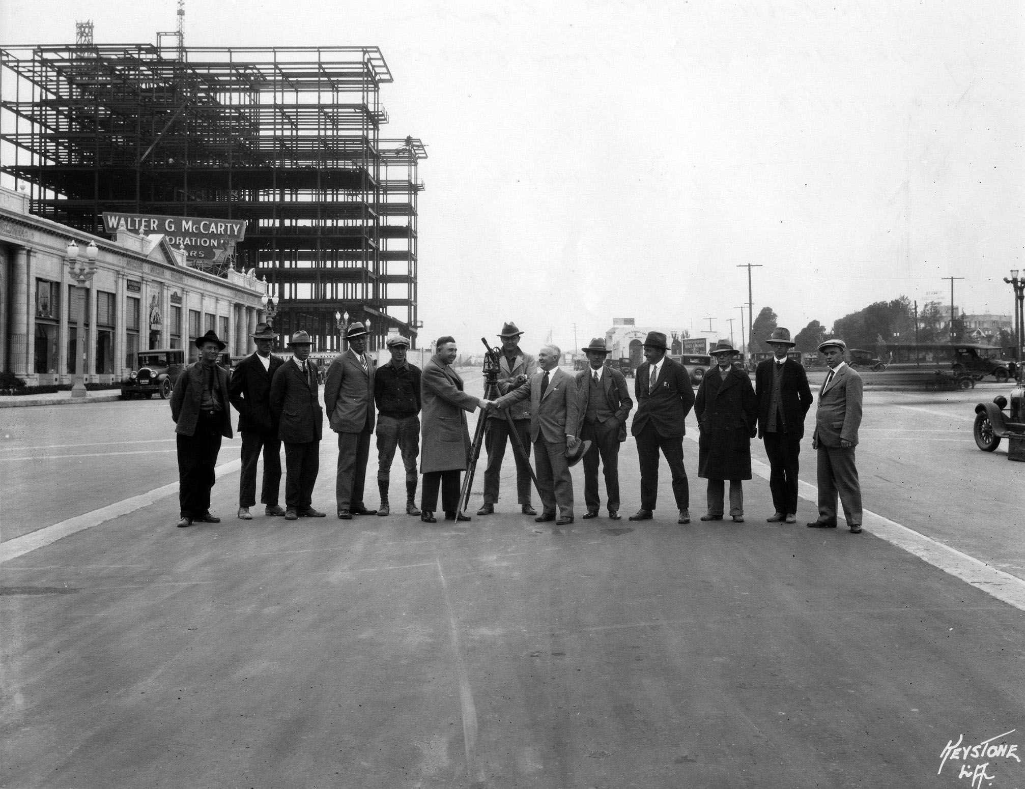
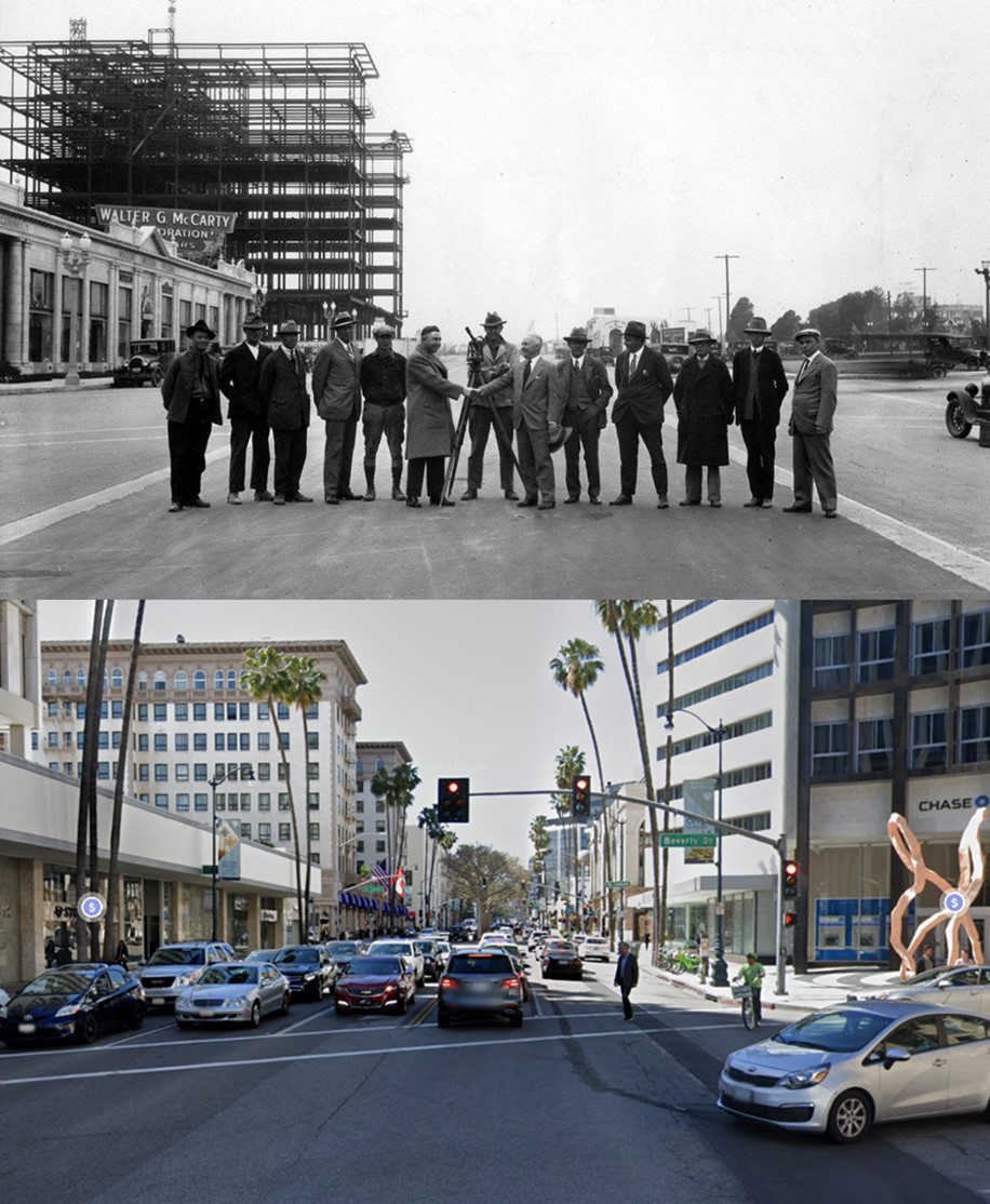
| (ca. 1927)* – View looking west on Wilshire Boulevard showing a group of men, including Walter G. McCarty, surveying the street and posing for the camera. The Beverly Wilshire Hotel is under construction as part of McCarty's developing landscape that once included the Beverly Hills Speedway tract of land. In the distance, the white building with the arched front doorway would soon become the Brown Derby Restaurant. |
Historical Notes The Beverly Wilshire Hotel was constructed by real estate developer Walter G. McCarty on the site of the former Beverly Hills Speedway. It was completed in 1928 (when the city had fewer than 18,000 residents), and was then known as the "Beverly Wilshire Apartment Hotel". |
Then and Now
 |
|
| (1927 vs 2022)*– View looking west on Wilshire Boulevard from N. Beverly Drive. |
 |
|
| (ca. 1930)* – Postcard view looking southwest showing the Beverly Wilshire Hotel as seen from the east side of N. Beverly Drive. The Brown Derby Restaurant sign can be seen at far right. |
 |
|
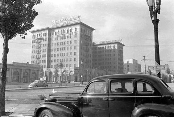
| (ca. 1937)* – View showing a 1937 Oldsmobile parked on Beverly Drive with the Beverly Wilshire Hotel in the background. Parking doesn't seem to be an issue. |
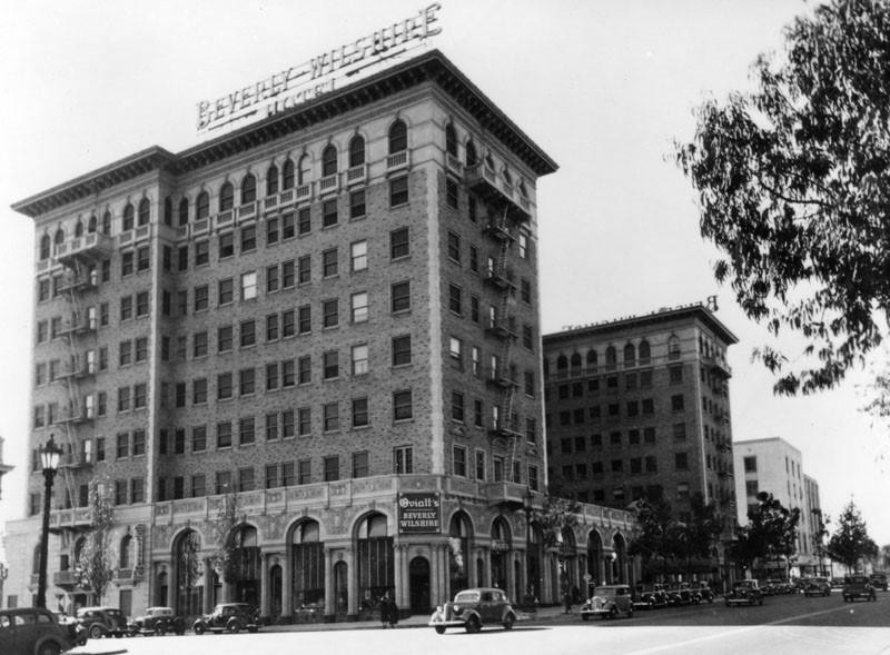 |
|
| (1937)^ - Closer view of the Beverly Wilshire Hotel located on the southwest corner of Wilshire Boulevard and S. El Camino Dr. |
Historical Notes Originally named the "Beverly Wilshire Apartment Hotel” when opened (1928), it was renamed the Beverly Wilshire Hotel by its new owners in the 1940s when it was renovated with a ballroom to accommodate the popular big bands of the day. An Olympic-sized swimming pool was built and championship tennis courts were added, with tennis champion Pancho Gonzalez as tennis director. |
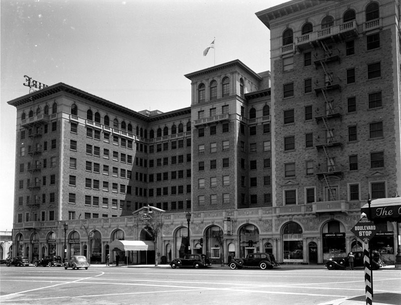 |
|
| (1939)^ - View showing the Beverly Wilshire Hotel at 9500 Wilshire Boulevard as seen from the northwest corner of Wilshire and Rodeo Drive. Sign at lower right reads: “Boulevard Stop”. |
Historical Notes The E-shaped structure is built of a Tuscan stone and Carrara marble in the Italian Renaissance architecture style. |
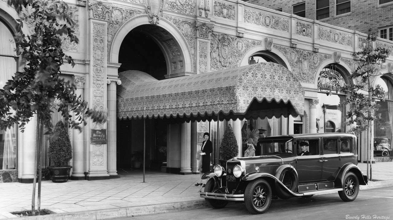 |
|
| (ca. 1929)* – View showing the front entrance to the Beverly Wilshire Hotel with a beautiful awning under which to arrive in style and bronze plaque bearing the name of the proud establishment. Photo: Marc Wanamaker/Bison Archives, courtesy of Beverly Hills Heritage. |
Historical Notes Today, you will still find the diamond shaped sidewalk when you arrive and individual awning on the tops of each window at the front and the sides of the hotel. |
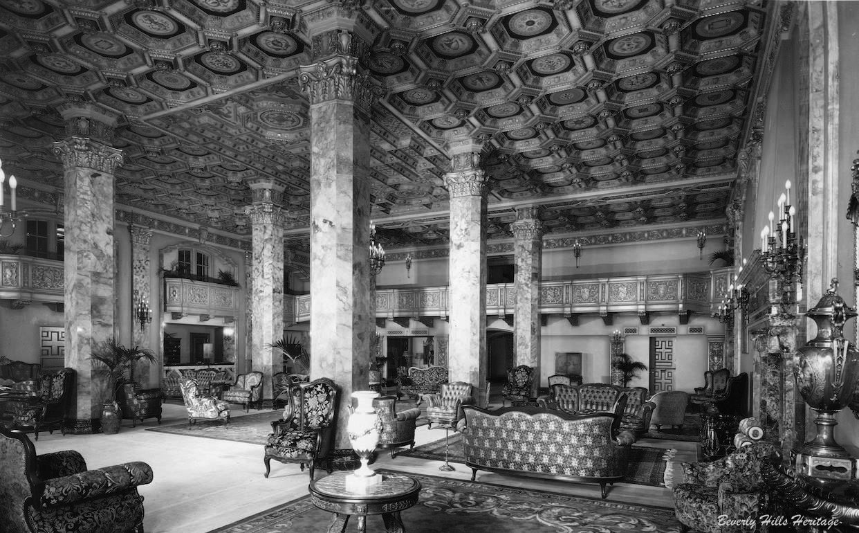 |
|
| (1929)* – View showing the elegant lobby of the Beverly Wilshire Hotel. Photo: Marc Wanamaker/Bison Archives, courtesy of Beverly Hills Heritage. |
Historical Notes Four of the six columns are still there today but are just covered up. The ceiling was dropped. Unfortunately that beautiful ornate balcony cover is gone. |
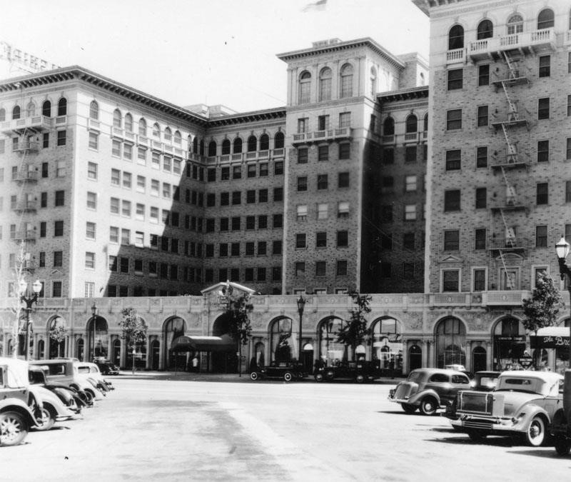 |
|
| (ca. 1937)^ – View of the Beverly Wilshire Hotel as seen from the center of Rodeo Drive. |
Historical Notes Commissioned by Walker G. McCarty, it was designed by Walker and Eisen and built in the Italian Renaissance revival style. The photo shows the arcade work on the street level. |
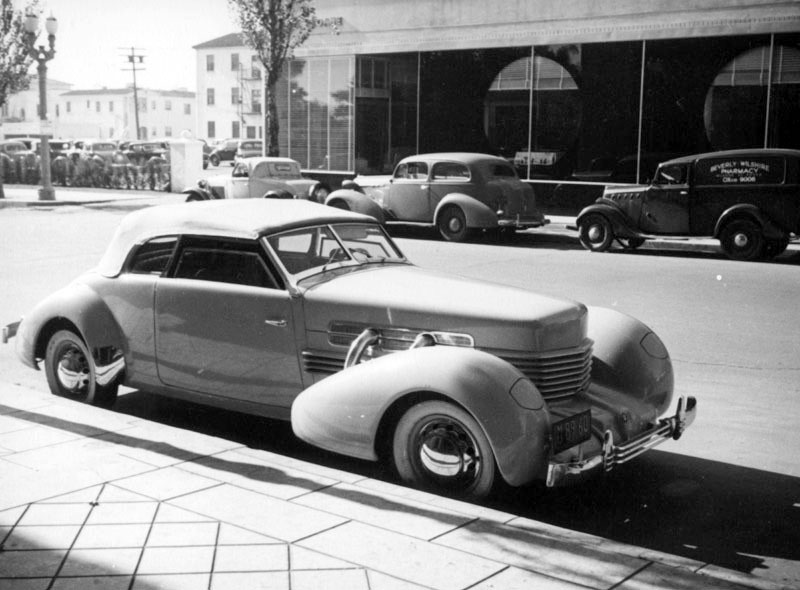 |
|
| (ca. 1937)^ - View of S. Rodeo Drive looking south from Wilshire showing a luxury car (1937 Cord Convertible) parked next to the diamond patterned sidewalk of the Beverly Wilshire Hotel. Across the street are the Art Deco windows of the W. & J. Sloane furniture store. |
Historical Notes Cord was the brand name of an American automobile company from Connersville, Indiana, manufactured by the Auburn Automobile Company from 1929 through 1932 and again in 1936 and 1937. |
 |
|
| (ca. 1937)^ - Numerous cars are parked outside businesses on Rodeo Drive in Beverly Hills. In the distance is the Beverly Wilshire Hotel, located at 9500 Wilshire Boulevard. Photo by Herman J. Schultheis |
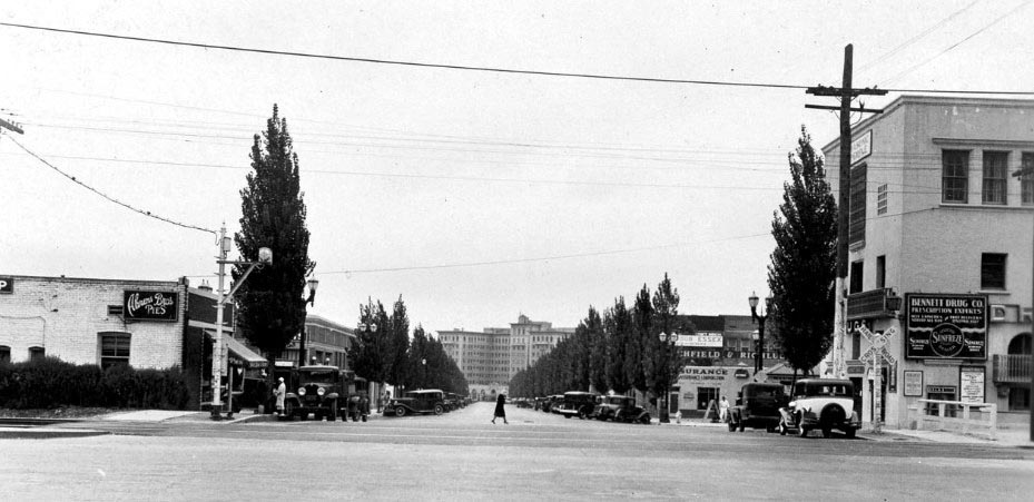 |
|
| (1932)* – View looking south down Rodeo Drive from Santa Monica Boulevard toward the Beverly Wilshire Hotel. Click HERE to see contemporary view. |
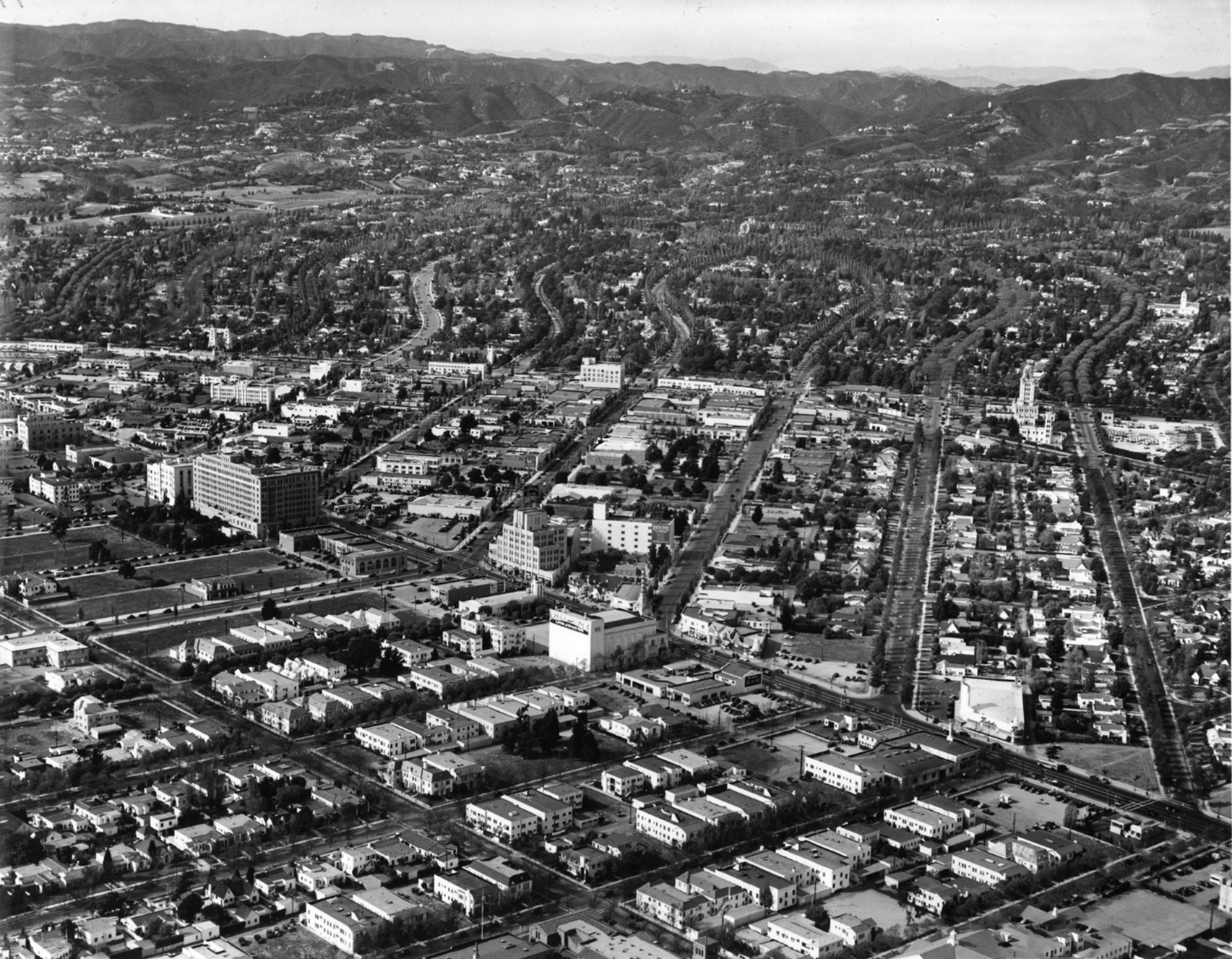 |
|
| (ca. 1938)*– Aerial view of Beverly Hills showing many of the landmarks that still exist today. The Beverly Wilshire Hotel and Rodeo Drive aree at center-left. City Hall is seen at upper-center right. |
 |
|
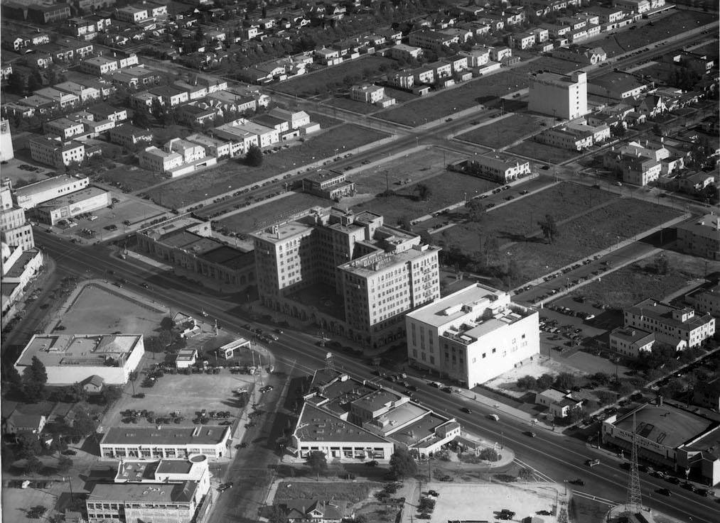
| (1938)* - Aerial view looking southeast over the intersection of Wilshire Boulevard and Rodeo Drive showing the historic Beverly Wilshire Hotel. Note all the empty land south of the hotel. Photo: Marc Wanamaker/Bison Archives |
Historical Notes The Beverly Wilshire Hotel changed hands in 1958 and again in 1961, when it was purchased by a group of investors headed by Hernando Courtright. The singer Elvis Presley and later the actor Warren Beatty lived several years in the hotel. It was also the home of John Lennon, when he was separated for several months from his wife Yoko Ono. The American socialite and Woolworth department store heiress Barbara Hutton spent her last years in near poverty and poor health in the hotel and died there in May 1979. Acquired by Regent International Hotels in 1985, the 395-room luxury hotel has been managed by the Four Seasons Hotel since 1992. |
 |
|
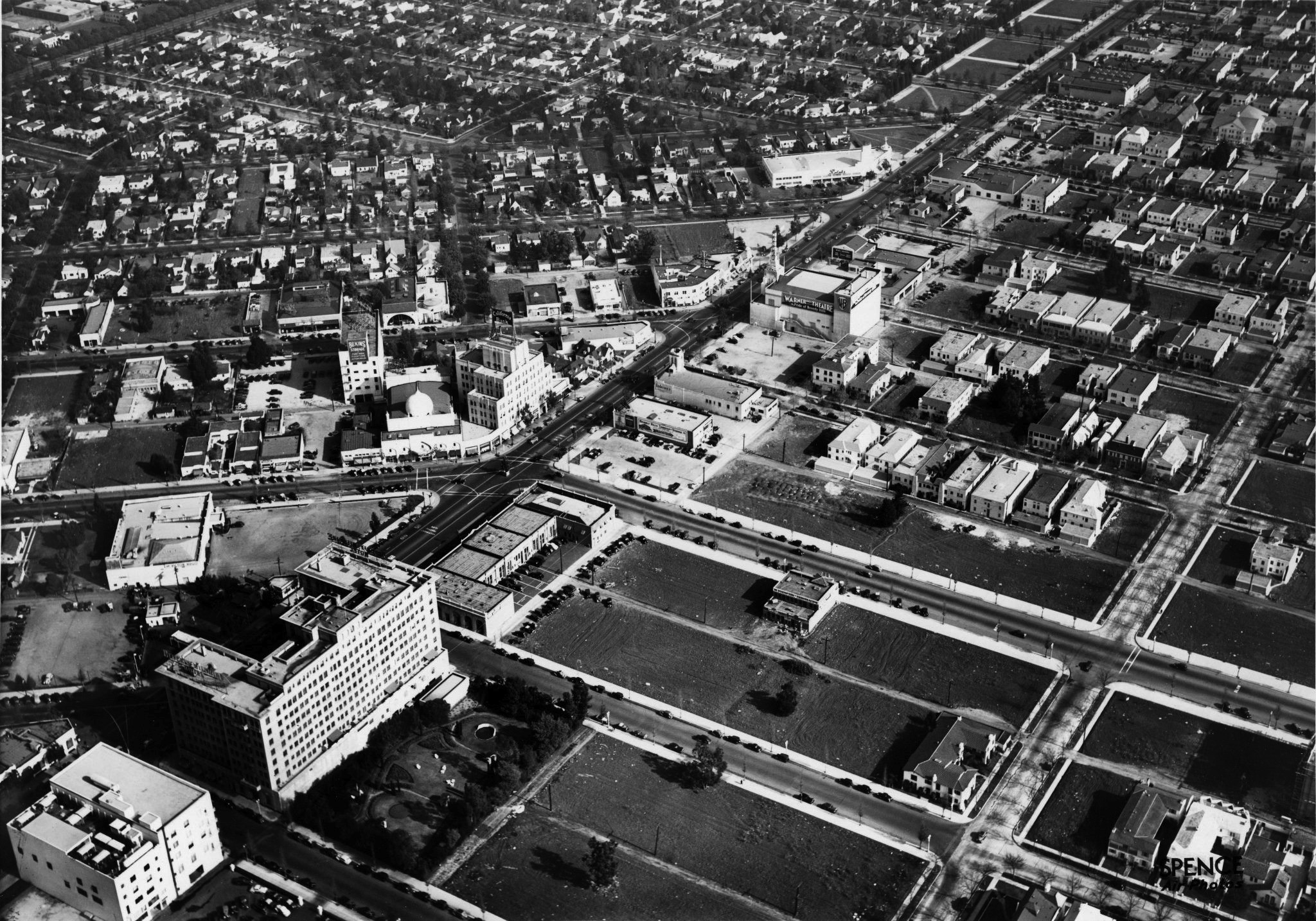
| (1937)* – Aerial view of Beverly Hills looking northeast. The intersection of Wilshire Boulevard and Beverly Drive is at center-left where the Moorish-style Beverly Theater stands at the corner. The Beverly Wilshire Hotel is seen at lower-left. |
 |
|
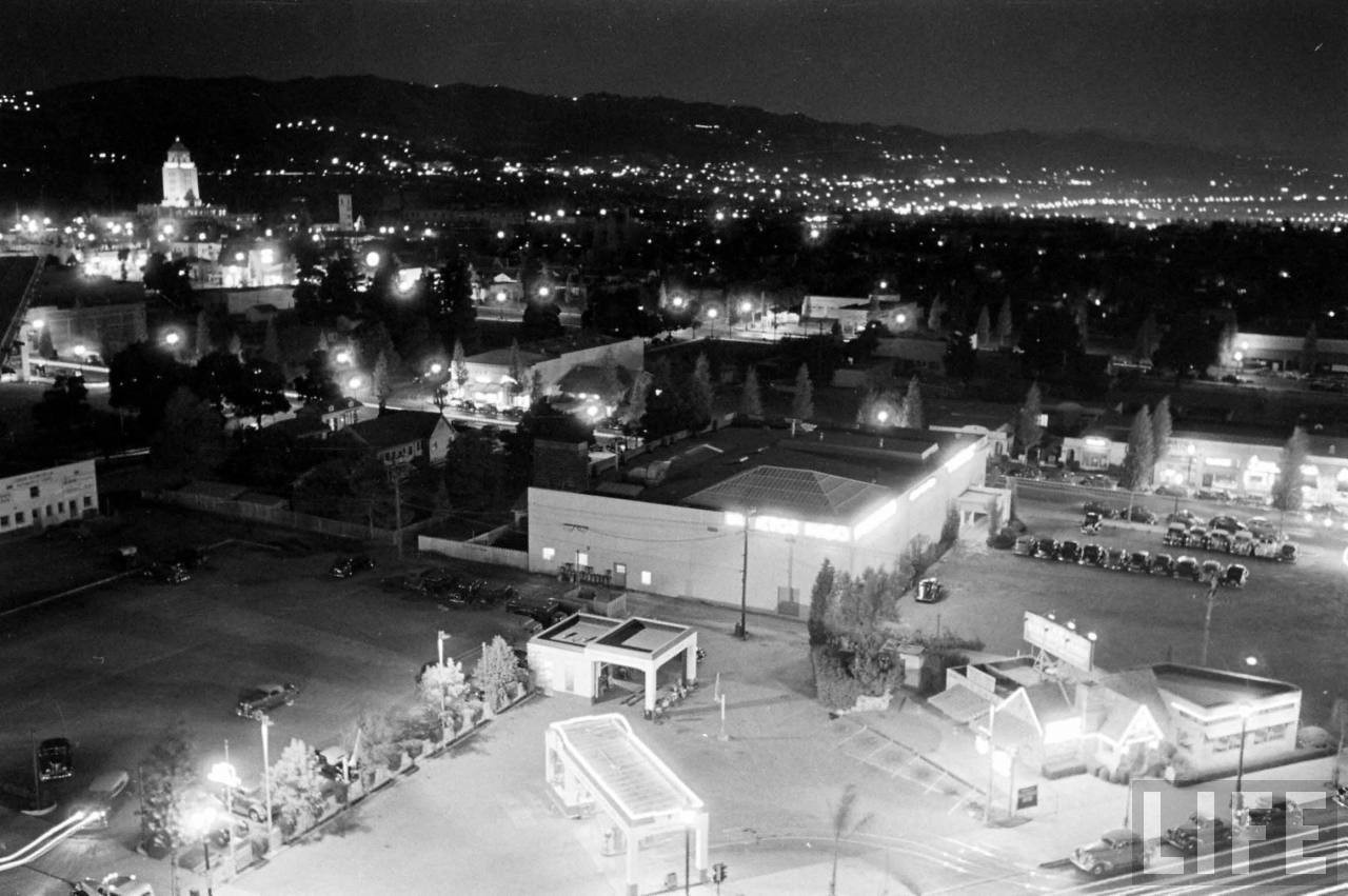
| (ca. 1938)*– – Panoramic night view looking northeast from the Beverly Wilshire Hotel showing the city lit up. Beverly Hills City Hall stands tall in upper-left, with a portion of West Hollywood seen in the distance at upper-right. Source: Life Magazine |
Wilshire and Beverly Drive
 |
|
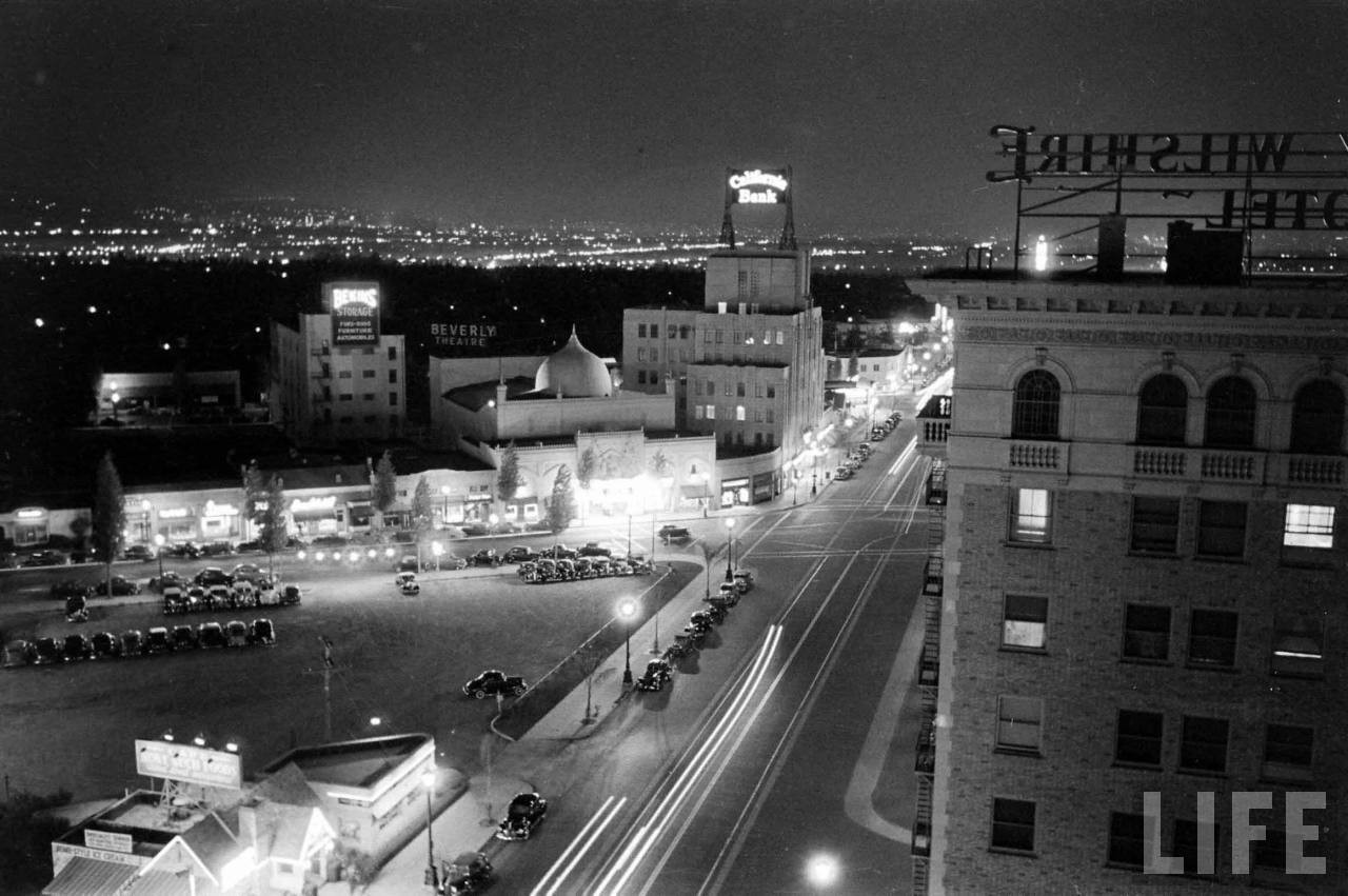
| (ca. 1938)* – Night view looking east on Wilshire Boulevard as seen from the Beverly Wilshire Hotel. The intersection of Wilshire and Beverly is at center of photo. Also seen from left to right are the: Bekins Storage Building, Beverly Theater, and California Bank Building. Source: Life Magazine |
 |
|
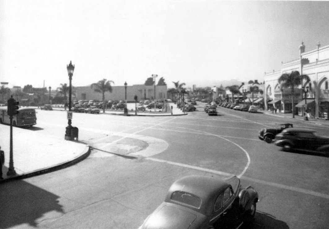
| (1939)^ - View looking north on Beverly Drive at the intersection with Wilshire Boulevard. |
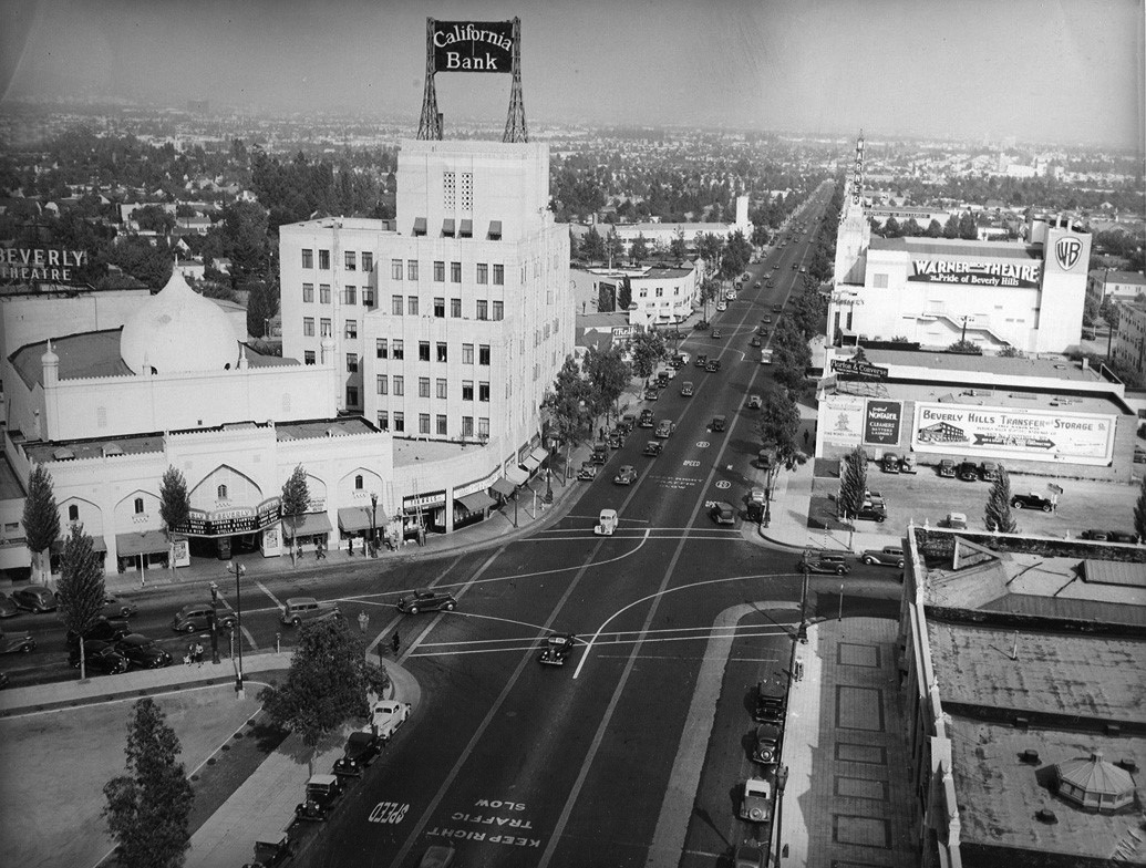
Historical Notes The intersection of Wilshire and Beverly Drive has always been the heart of the commercial triangle of Beverly Hills. On the northeast corner was the Beverly Theater, built in 1925. It was the cities first theater. On the northwest corner was the parking lot of Adrian's Costume building which was originally the Victor Hugo Restaurant in the 1930s. |
Then and Now
 |
|
| (1939 vs. 2021)*- Looking north on Beverly Drive at Wilshire Boulevard. |
 |
|
| (ca. 1940)* – View looking east on Wilshire Boulevard at Beverly Drive in Beverly Hills from the top of the Beverly Wilshire Hotel. Seen are, left to right, the Beverly Theater, the California Bank Building, and the Warner Theatre. |
 |
|
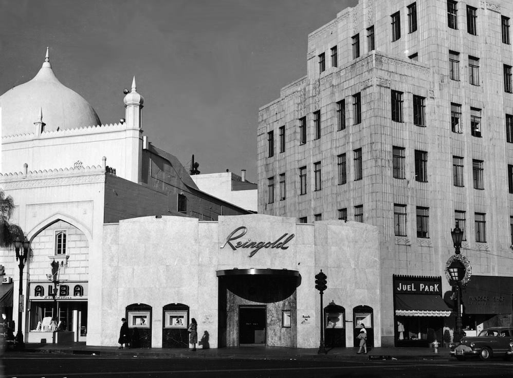
| (1951)* – Close-up view showing the northeast corner of Wilshire Boulevard and N. Beverly Drive showing three buildings with uniquely distinctive architectural styles: the Mughal Revival Beverly Theatre, the Mesoamerican Revival California Bank Building, and the Hollywood Regency style structure connecting them that became Reingold Jewelers. Photo: Marc Wanamaker |
 |
|
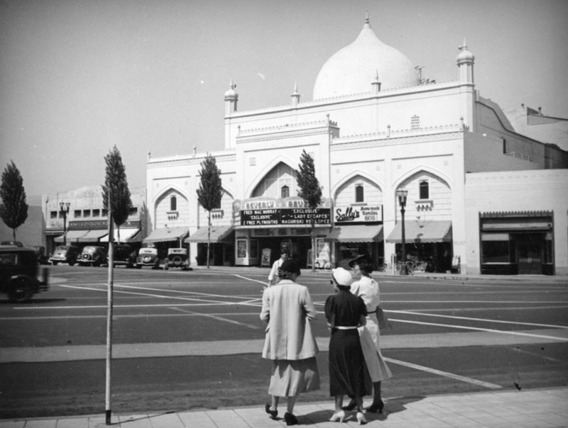
| (ca. 1940)^ - Three women stand on a street corner opposite the Beverly Theater in Beverly Hills. The marquee includes "Fred MacMurray Exclusive." |
Historical Notes Designed by L.A. Smith, this was the first vaudeville and movie theater to be built in Beverly Hills. |
 |
|
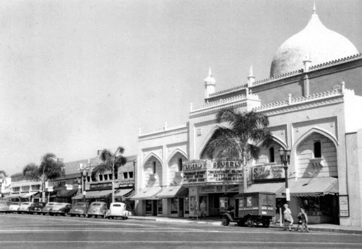
| (1945)* - Located at 206 North Beverly Drive, at Wilshire Boulevard, the current film playing at the Beverly Theater was Paramount's Incendiary Blonde, starring Betty Hutton. |
Historical Notes In 1925, real estate pioneer, Dan M. Quinlan constructed the theater, the first to be built with East Indian decor. The businesses in the theater building included Sally's Homemade Candies. |
 |
|
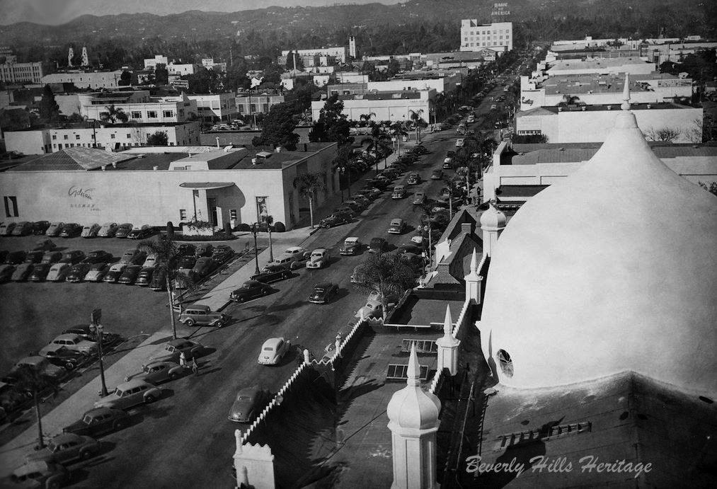
| (1945)* - A bird's-eye view from the California Bank Building (Sterling Plaza) of north Beverly Drive with the Beverly Theater directly below shortly after its dome received a fresh coat of paint. Photo courtesy of Beverly Hills Heritage. |
Historical Notes The first building on the west side of the road (left) began as the Victor Hugo Restaurant. It was next occupied by the salon of Adrian (as pictured), the movie costumer and designer of couture gowns for the discerning (and very wealthy) woman. It later became a Lane Bryant store. The building was eventually razed. The parking lot is where the Chase Bank building (originally Bank of America) now stands. The Adrian lot is the site of an office building where MGM is headquartered. |
 |
|
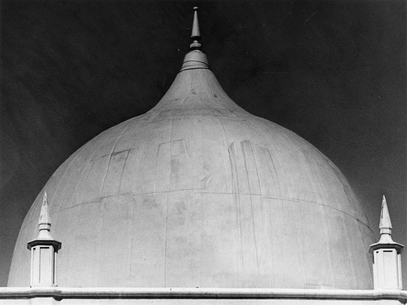
| (1978)* - Close-up view showing the dome of the old Beverly Theatre, at time of photo a bank. |
Historical Notes After many years of housing a bank, the Beverly Theater was sadly demolished in August of 2005 to make way for new development. The onion dome ... brings to mind Beverly Hills' temporary original name, "Morocco". Click HERE to see more in Early Views of the Beverly Theatre. |
* * * * * |
California Bank Building (aka Sterling Plaza)
 |
|
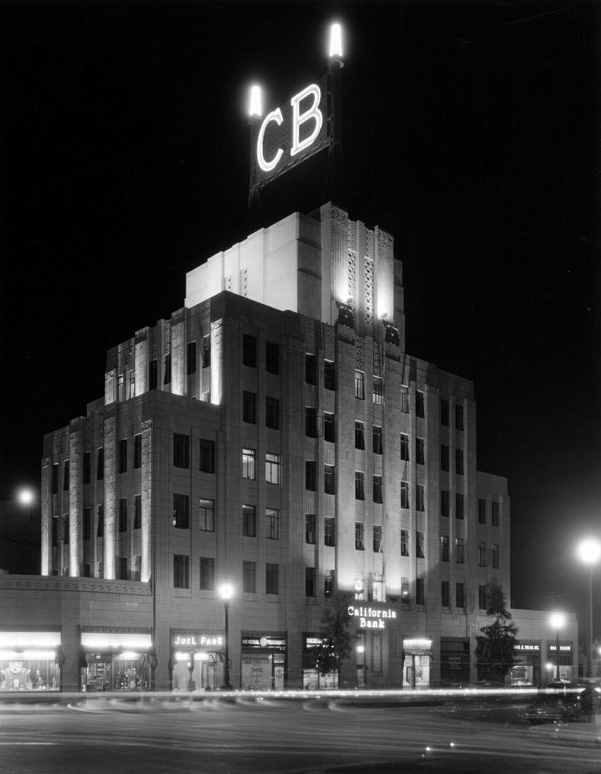
| (1930)* - Night view of the California Bank Building located at 9441 Wilshire Boulevard in Beverly Hills. Click HERE to see contemporary view. |
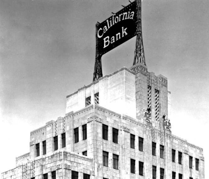
Historical Notes Completed in 1929, just before the stock market crash, the California Bank Building stands seven stories tall and was designed by the Los Angeles Father/Son architect team of John and Donald Parkinson. Its classic Art Deco era stair-step design is quintessentially Mesoamerican Revival in style and retains most of its architectural integrity from its period of significance. Louis B. Mayer, the head of MGM, owned the building for some time. In the 1990s, the building was acquired by Donald Sterling. As a result, it was renamed the Sterling Plaza. |
 |
|
| (ca. 1930s)* – Detailed top view of the California Bank Building located at the northeast corner of Wilshire and Beverly Drive. Today, the building is known as Sterling Plaza. Photo: Beverly Hill Heritage. |
Historical Notes The bottom portion of the building's façade was changed around 1951 to create a modernized, uniform appearance with the small corner building to the west. Around the same time, head of MGM Louis B. Mayer acquired the property and it's rumored there's a theatre on the top floor building. In the 90s, real estate investor/developer Donald Sterling purchased the property and renamed it Sterling Plaza. |
 |
|
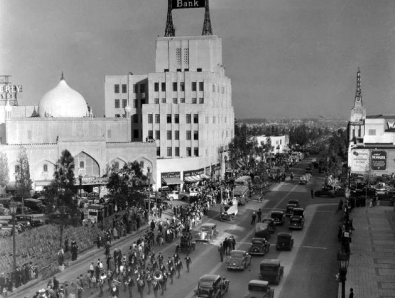
| (ca. 1936)* – View showing a marching band in a parade heading west on Wilshire Boulevard with spectators lining the street. In the background can be seen (l to r): Beverly Theatre, California Bank Building, and the Warner Beverly Theatre. |
 |
|
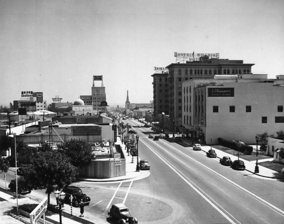
| (ca. 1936)* – View looking east on Wilshire Boulevard and Dayton Drive. From right to left can be seen: J.J. Haggarty, Beverly Wilshire Hotel, California Bank, the dome of the Beverly Theater and the top hat sign of the famous Brown Derby Restaurant. |
 |
|
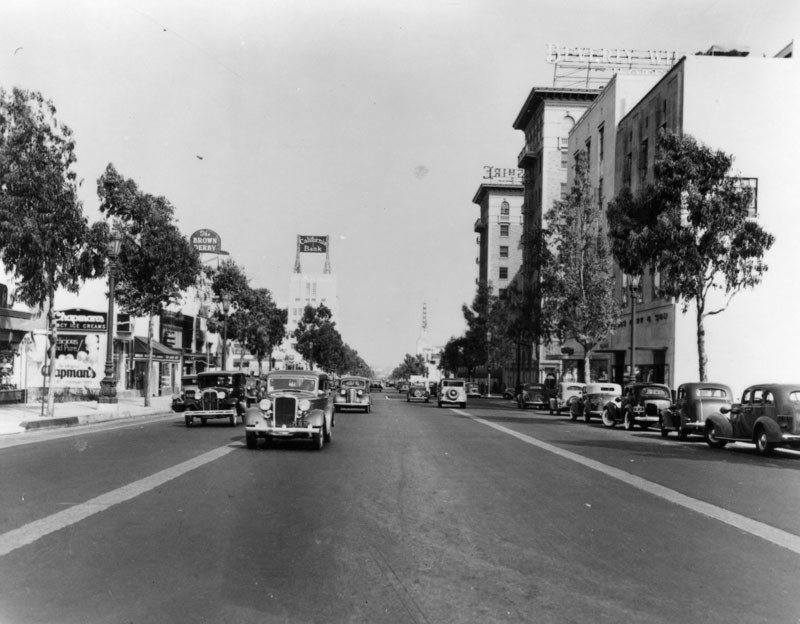
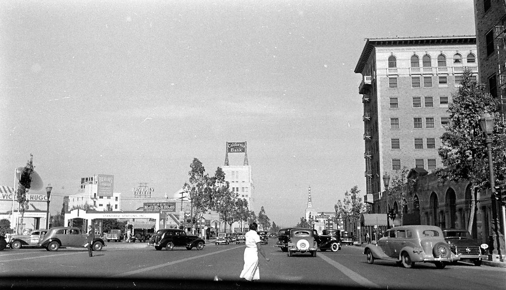
| (1937)* - View looking east on Wilshire Boulevard in Beverly Hills on September 22, 1937. Some of the prominent signs are: The Brown Derby, California Bank, Warner Bros. Theatre, and the Beverly-Wilshire Hotel. |
 |
|
| (ca. 1940)* – Dashboard view looking east on Wilshire Boulevard near Rodeo Drive showing a woman crossing the street. The Beverly-Wilshire Hotel is on the right. |
 |
|
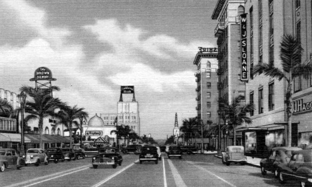
| (ca. 1940)* – Postcard view looking east on Wilshire Boulevard in Beverly Hills. The Brown Derby Restaurant is on the left (sign above the palm trees) with the Beverly Theater and California Bank Building in the distance. On the right can be seen the Beverly-Wilshire Hotel, W & J Sloane and J. J. Haggarty's Department Store. |
* * * * * |
Brown Derby (Beverly Hills)
 |
|
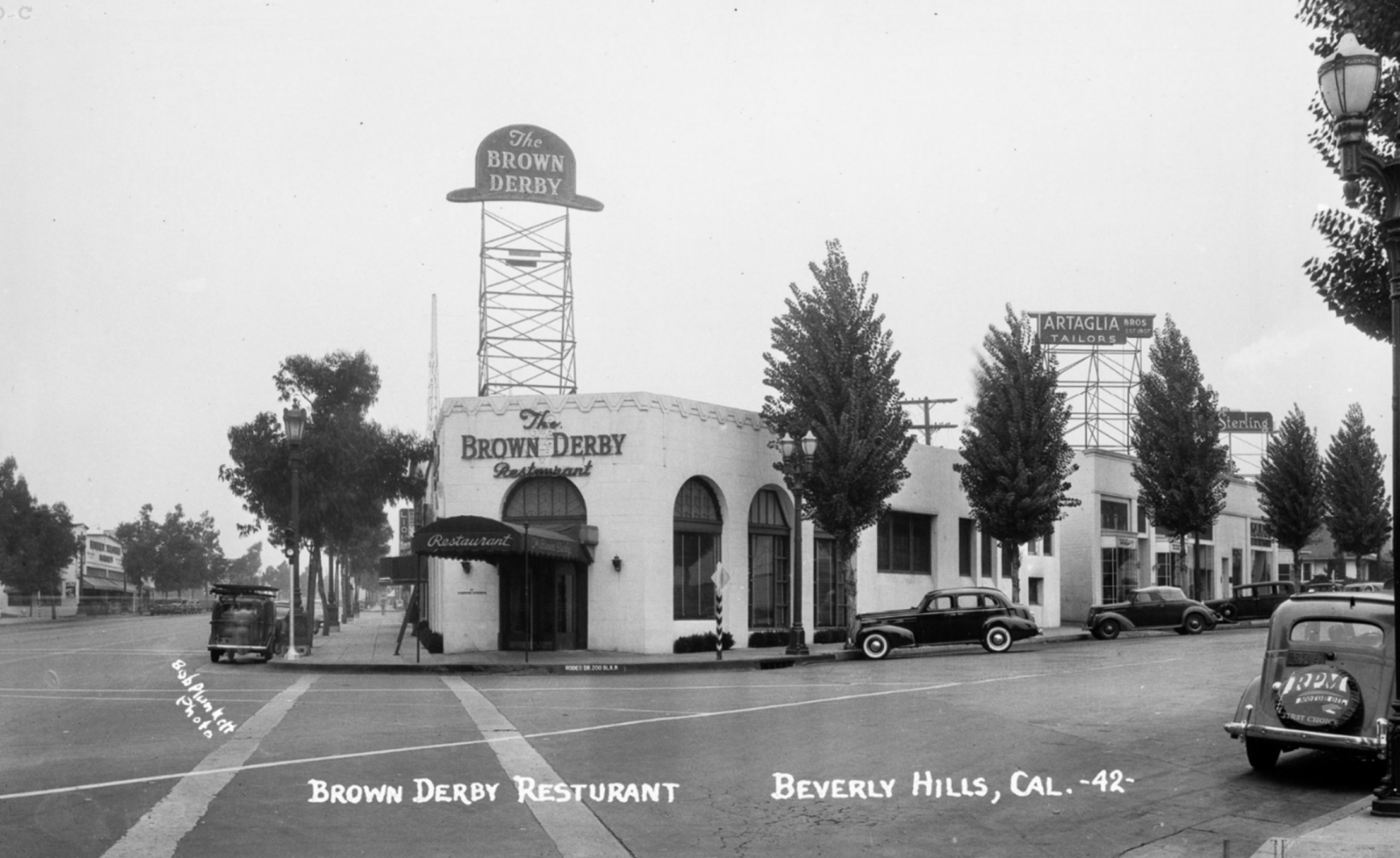
| (1942)* – Postcard view showing Brown Derby Restaurant with its distinctive hat-shaped rooftop sign, located on the northwest corner of Wilshire Boulevard and Rodeo Drive. Several 1940s-era automobiles are parked along the street. Photograph by Bob Plunkett, from the Ernest Marquez Collection. |
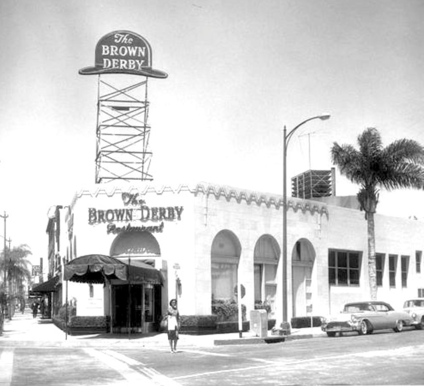
Historical Notes The Beverly Hills Brown Derby, opened in 1931 at the northwest corner of Wilshire Boulevard and Rodeo Drive, was the third and perhaps most glamorous outpost of the iconic Brown Derby restaurant chain. Situated directly across from the Beverly Wilshire Hotel, it quickly became a magnet for celebrities, industry executives, and tourists, reflecting the growing allure of Beverly Hills as a social and cultural hub. The building, remodeled from a group of small shops including a women’s clothing store called “The Petite Shop,” featured the city’s first revolving entry door and a large, illuminated derby-shaped sign that made it a local landmark. |
 |
|
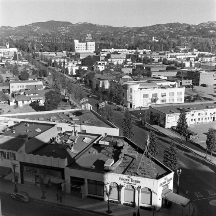
| (1940s)* – View showing the Brown Derby Restaurant on the corner of Wilshire and Rodeo Drive as seen from the Beverly-Wilshire Hotel. Today, Louis Vuitton sits on this corner. |
Historical Notes Inside, the restaurant was known for its elegant atmosphere and themed spaces. In 1938, it expanded to include “The Derby House,” a private dining room decorated in Old English style, and “The American Room,” which displayed charcoal portraits by artist Nicholas Volpe of Academy Award-winning actors and actresses. The Beverly Hills Brown Derby was renowned for attentive service and plush American fare, continuing the chain’s tradition of combining fine dining with Hollywood glamour. |
 |
|
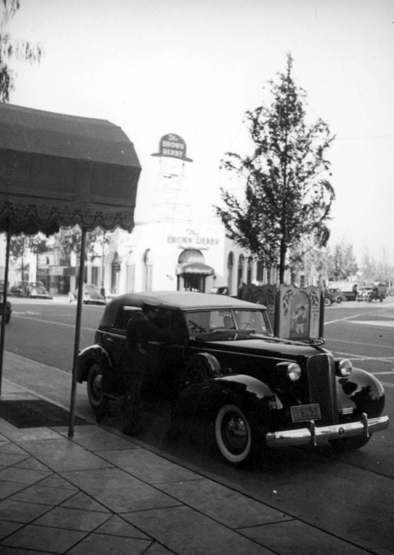
| (ca. 1937)^ - A car is parked in front of a walkway leading to the Beverly Wilshire Hotel (9500 Wilshire Boulevard) in this image looking west towards the Brown Derby, located at 9537 Wilshire Boulevard, on the northwest corner of Wilshire and Rodeo Drive. |
 |
|
| (1950s)* – View showing a woman crossing the street on Rodeo Drive with the The Brown Derby Restaurant behind her. Wilshire Boulevard is out of view on the left. After the building was occupied by the third Brown Derby from 1931 to 1982, it was demolished and replaced with a new commercial structure designed for high-end retail. |
Historical Notes The Brown Derby restaurants, including the Beverly Hills location, became synonymous with the Golden Age of Hollywood, serving as backdrops for deals, celebrations, and star sightings. However, by the early 1980s, shifting tastes and escalating land values led to their decline. The Beverly Hills Brown Derby closed its doors in 1982 and was demolished shortly thereafter. In 1986, the site was redeveloped into the “One Rodeo” shopping center, which features a derby-shaped dome as a tribute to the legendary restaurant. |
Then and Now
 |
|
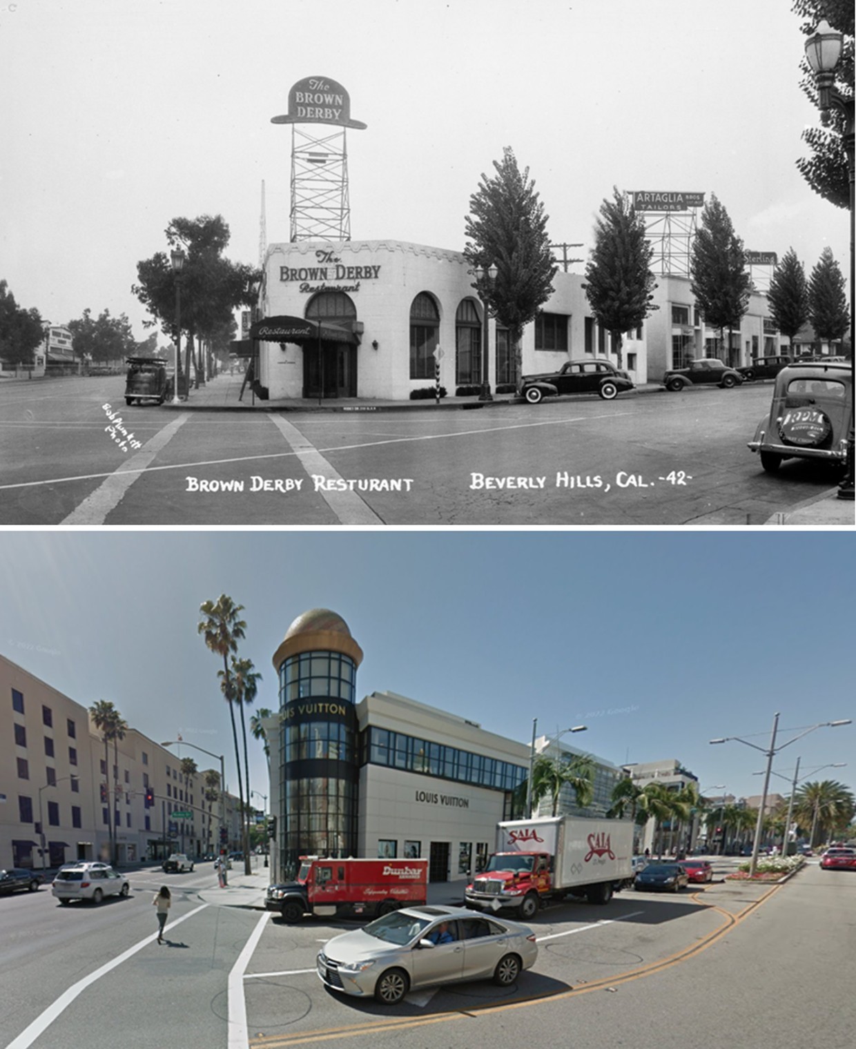
| (1940 vs. 2015)* – A 'Then and Now' view of the northwest corner of Rodeo Drive and Wilshire Boulevard in Beverly Hills. Photo comparison by Jack Feldman. |
Historical Notes The iconic Brown Derby restaurant once stood here, a favorite haunt of Hollywood’s elite until its closure and demolition in the early 1980s. The site was later redeveloped as part of the Wilshire Rodeo Plaza, now known as the One Rodeo office and retail complex. Today, the location is anchored by tenants such as Merrill Lynch/Bank of America, UBS, William Morris Endeavor, and Encore Recordings. The property was acquired by a new ownership group in 2024, which is actively working to attract additional luxury retail and office tenants. |
Blended View
 |
|
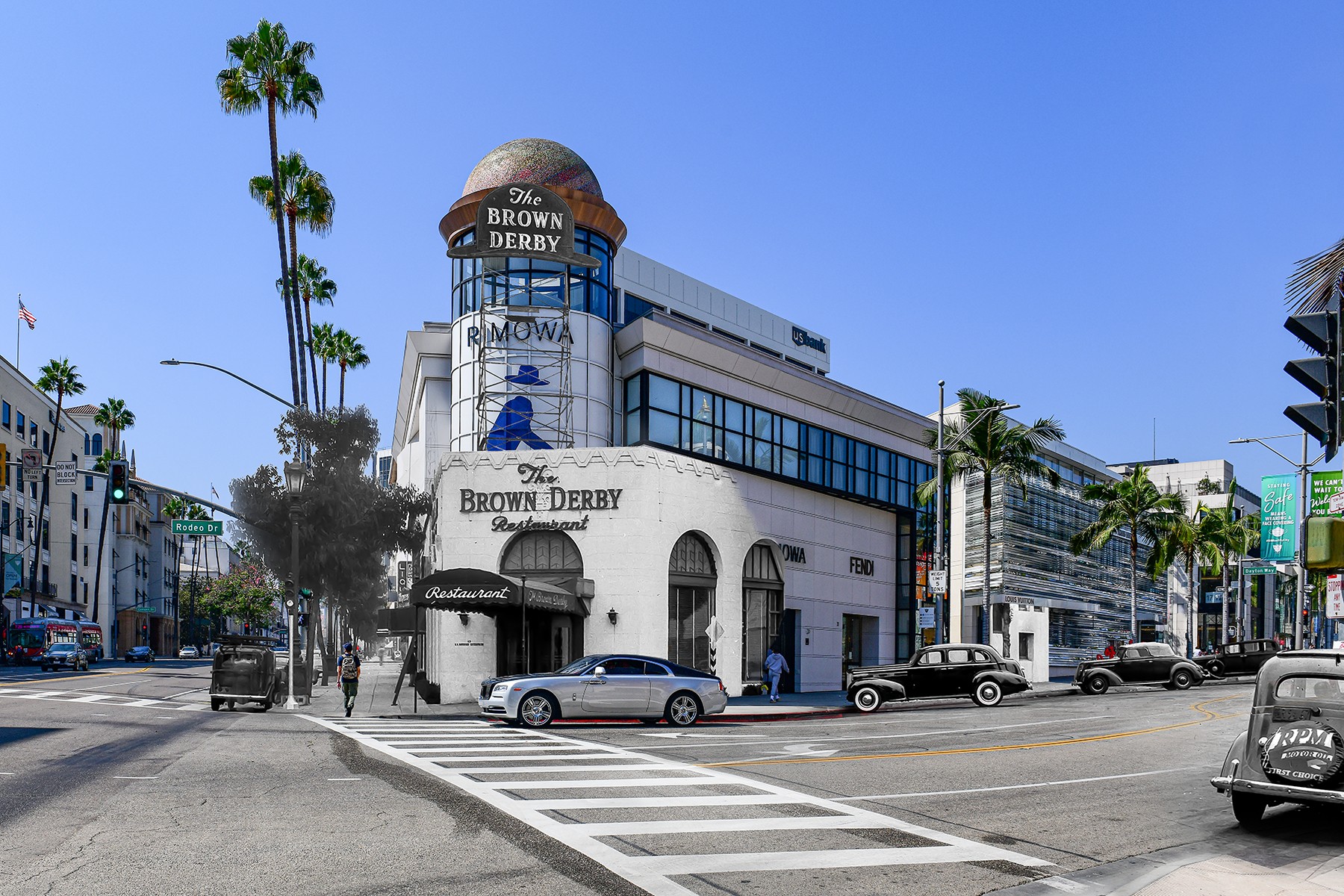
| (Then and Now - Blended)* - Brown Derby Then and Now by Mark Hersh / Mark Hersh Photography. |
Then and Now
 |
|
| (2014)* - The Brown Derby is gone, but the Louis Vuitton building gives a subtle nod to the past with its brown, hat-like dome. Location: 9537 Wilshire Bouelvard, Beverly Hills |
* * * * * |
More Historical Early Views
Newest Additions
Early LA Buildings and City Views
History of Water and Electricity in Los Angeles
* * * * * |
References and Credits
^ LA Public Library Image Archive
#^California Historical Society Digital Archive
+# Facebook.com: Garden of Allah Novels
#* Early Beverly Hills - Marc Wanamaker
** Beverly HIlls HIstorical Society
^* The Valley Observed: Street Name Origins
^# Beverly Hills Library Historical Collection
** Pinterest.com: Beverly Hills Centennial (1914-2014)
++ Travelingaround.tumblr.com: Beverly Hills
^+Beverly Hills Renovated Electric Fountain
^^MattConstruction.com: Wallis Annenberg Center for the Performing Arts
## Beverly Hills High School Home Page
***Fountains in LA: Beverly Hills Electric Fountain
*^*City of Beverly Hills: Historic Resource Report
*#*Riding Vintage: The Motordrome
^*^KCET: The Lost Bridle Paths of Beverly Hills
^*#California State Library Image Archive
+++BeverlyHills.org: History of Beverly Hills; Sign and Logo
*^#^Huntington Digital Library Archive
^^*Flickr.com: Michael Ryerson
^^^Rodeo Realty
^#^Noirish Los Angeles - forum.skyscraperpage.com
^x^My Love of Old Hollywood - A Quick Tour of Beverly Hills
+##MartinTurnbull.com: Fairfax and Wilshire
*##Restaurant-ing Through History: Ice Cream Parlors
*^#Facebook.com - Bizarre Los Angeles
#**Hemmings Classic Cars: Ralphs Market
++^Mentalfloss.com: 12 Postcard Locations Then and Now
^++Cinema Treasures: Fox Wilshire Theatre (Saban Theatre)
+++Los Angeles Conservancy: Birth of the Boulevard; Wallis Annenberg Center for the Performing Arts
**^#Vintage Los Angeles: Facebook.com
*^^#Curating the City: Sunset Clock Market
#^*^Pinterest.com: Old Hollywood
#+++Yahoo.com: Beverly Hills Hotel
##^*Calisphere: University of California Image Archive
##++Facebook.com - Beverly Hills Heritage
#*#^Flickr.com: Wilshire Boulevard History
^^^^Beverly Hills Board Track Racing
^*^*Beverly HIlls Patch: The Beverly Hills Speedway
^**^Pinterest: Splinters n Speed; Cars - Bertrand Lacheze; Beverly Boards Motorcycle Racing
***^^Will Rogers Memorial Park
< Back
Menu
- Home
- Mission
- Museum
- Major Efforts
- Recent Newsletters
- Historical Op Ed Pieces
- Board Officers and Directors
- Mulholland/McCarthy Service Awards
- Positions on Owens Valley and the City of Los Angeles Issues
- Legislative Positions on
Water Issues
- Legislative Positions on
Energy Issues
- Membership
- Contact Us
- Search Index