Flooding in the San Fernando Valley (1950s & 1960s)
 |
|
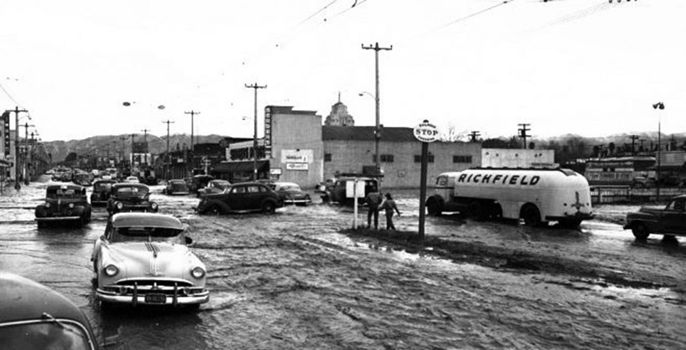
| (1952)* - View looking north of a flooded intersection at Van Nuys Blvd and Oxnard Street where the tracks are. A stop sign sits in the center median of Van Nuys. Serbers Market is at the northeast corner in the center of the photo. The spire of Van Nuys City Hall can be seen in the background just behind the market |
 |
|
| (1952)^ – View showing stuck cars as water rages down Tyrone Avenue near Sylvan Street. |
 |
|
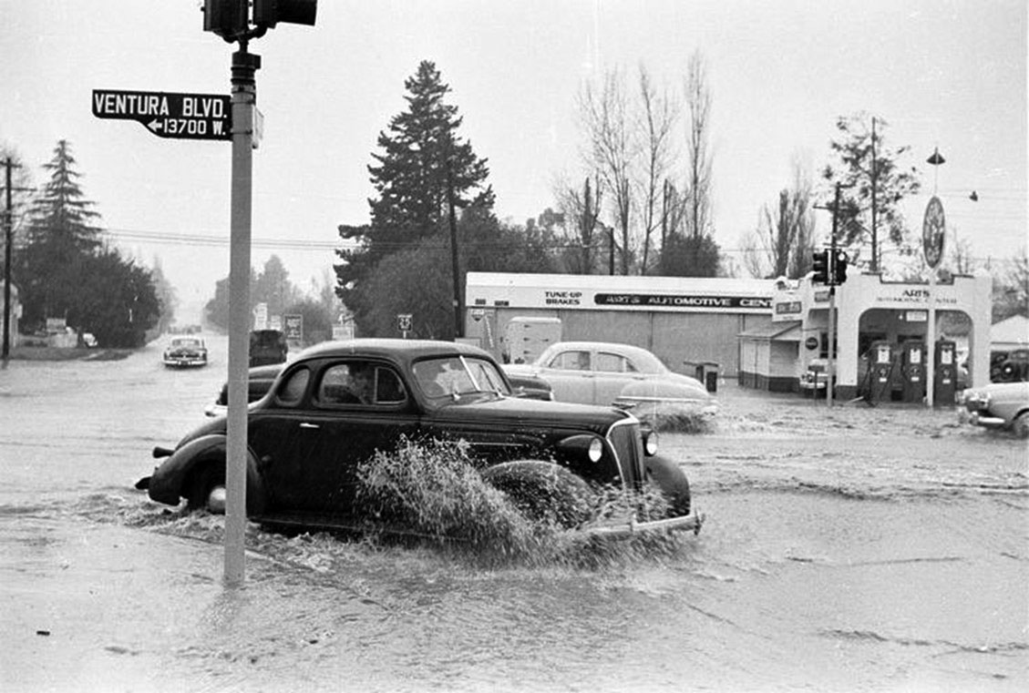
| (1952)^ - Heavy rain caused flooding at the intersection of Ventura Boulevard and Woodman Avenue. A Signal Gas Station is on the northeast corner. |
 |
|
| (1952)^ - View looking west on Ventura Boulevard at Woodman Avenue showing a flooded intersection. |
 |
|
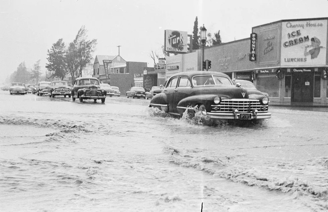
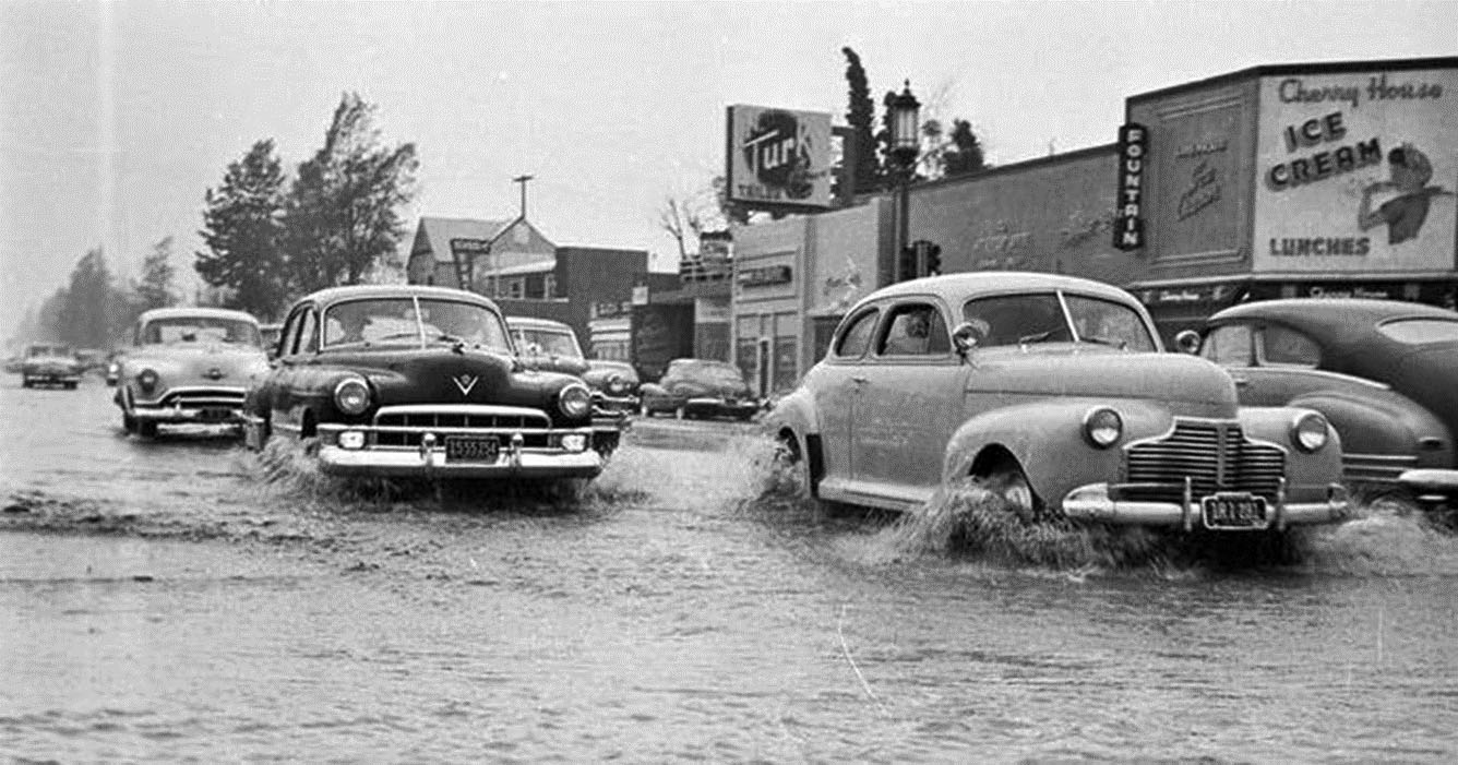
| (1952)^ - View of a flooded Ventura Boulevard at Woodman Avenue. The Cherry House Restaurant is seen on the southwest corner. |
.jpg) |
|
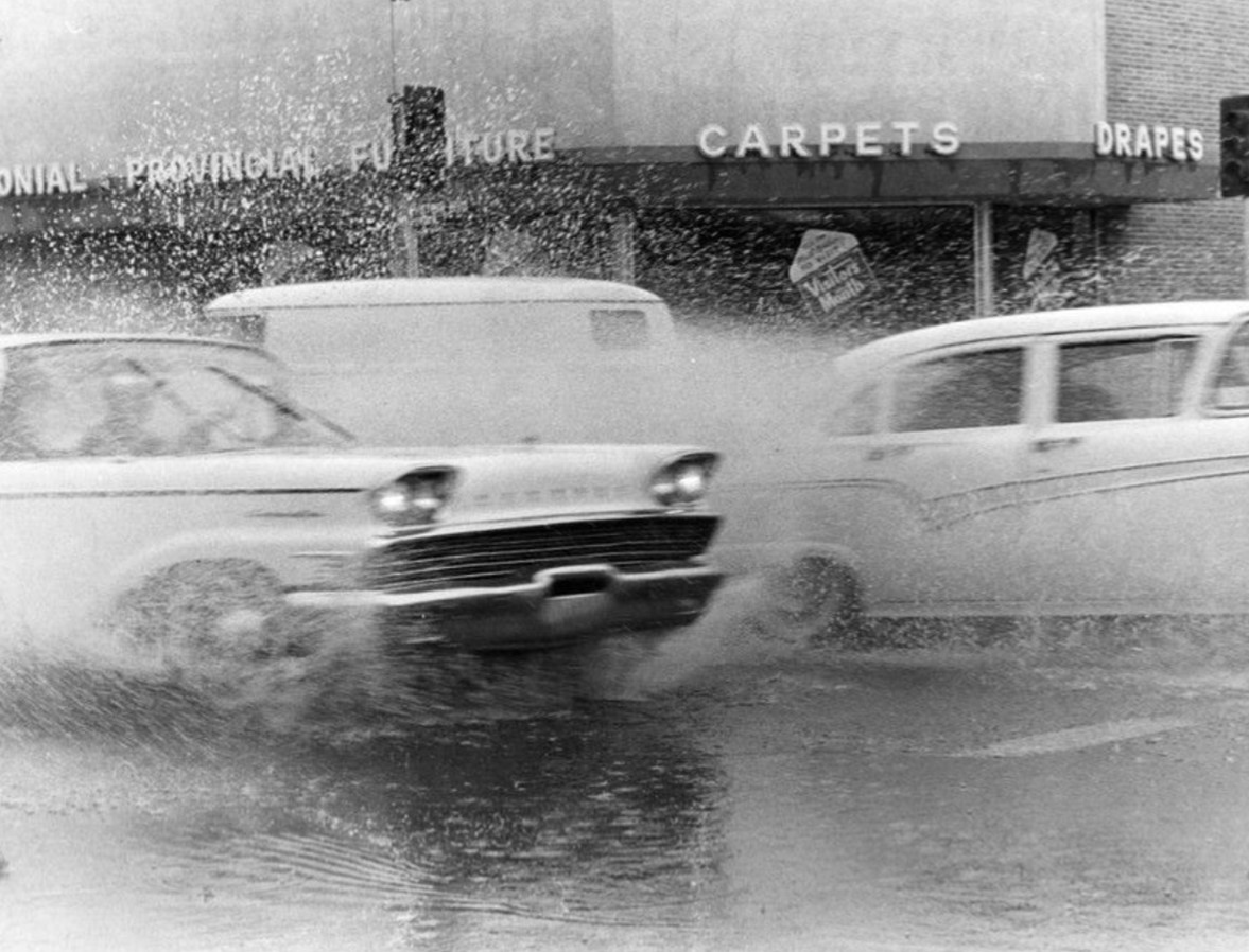
| (1952)^ - Flooded intersection of Ventura Boulevard and Woodman Avenue in Sherman Oaks. Photo date: May 1952 |
Then and Now
 |
|
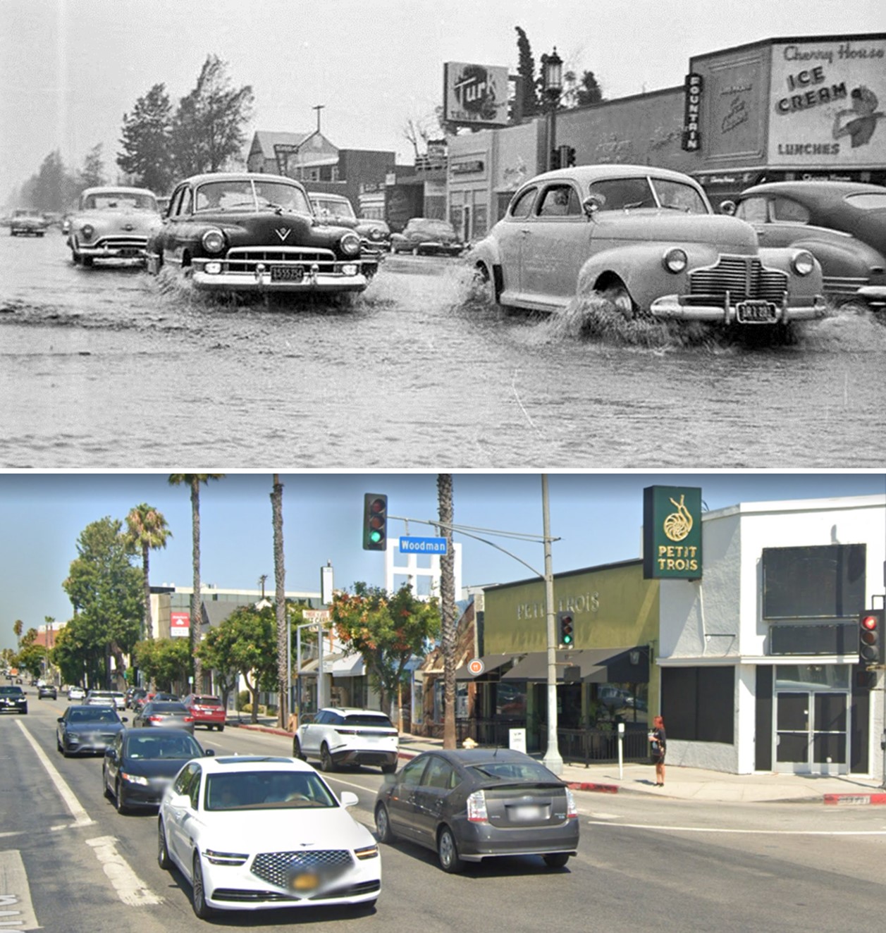
| (1952 vs 2022)* - Looking west on Ventura Boulevard at Woodman Avenue. |
 |
|
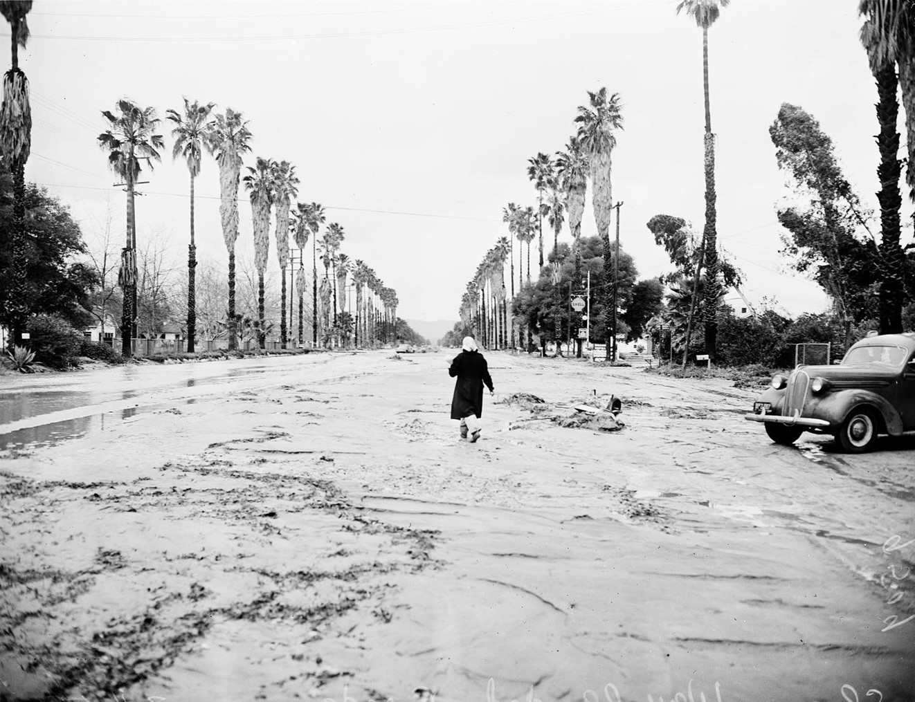
| (1952)* – A woman is walking down a flooded Sherman Way toward Oso Avenue after days of heavy rain in March of 1952. A Shell Station is seen on the southeast corner, today the site of an ARCO Station. |
Then and Now
 |
|
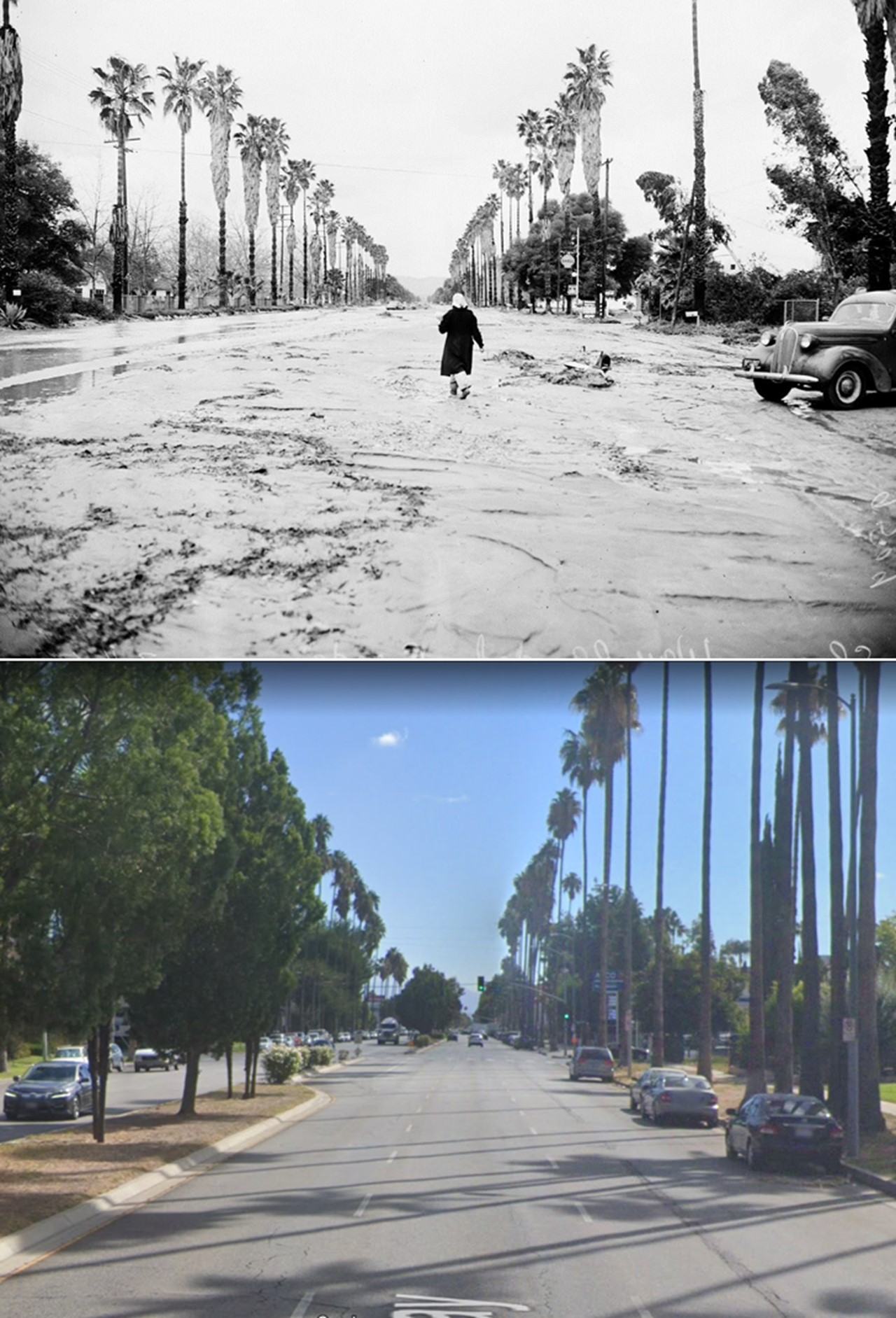
| (1952 vs. 2022)* – Looking East on Sherman Way toward Oso Avenue. |
 |
|
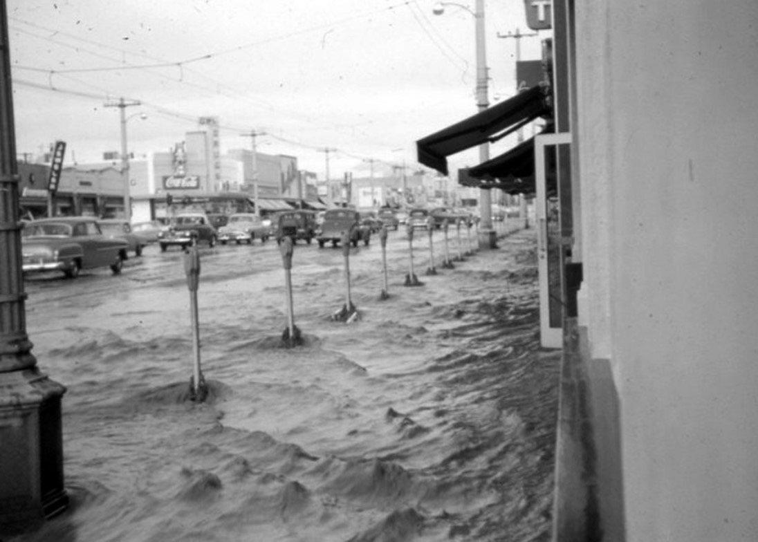
| (1952)^.^ – View looking north on Van Nuys Boulevard showing flooded street and sidewalk. |
 |
|
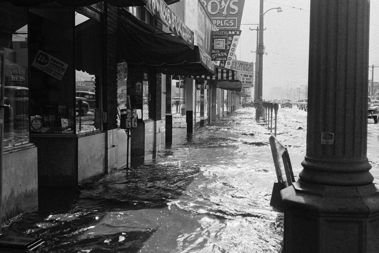
| (1952)^ - High water, looking south on the 6200 block of Van Nuys Boulevard. Pep Boys and The Rivoli Theatre can be seen in the background. |
 |
|
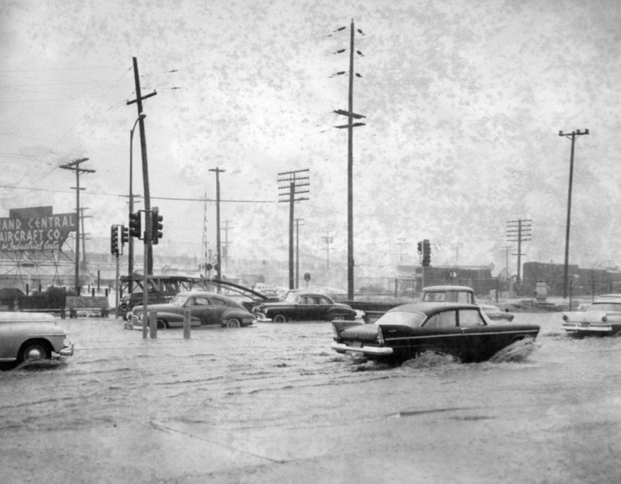
| (1958)* – Valley Times Photo with caption that reads: "Scene above, typical on many North Hollywood streets during winter rains, shows why residents are more than happy to learn new $2,241,600 Cahuenga boulevard-Vineland avenue storm drain project is very close to bidding and construction stage." |
 |
|
| (1962)* - View of flood at the northeast corner of Vanowen Street and Louise Avenue, in Van Nuys (now Lake Balboa). The photo caption reads, "Automobile splashes through deep water in a West Valley intersection. Heavy rains meant stalled cars, no school, wet pedestrians and cleaning bills." Valley Times photo, dated 2/9/1962. |
 |
|
| (1962)* - Photograph caption dated February 19, 1962 reads, "Motorists splash through flooded North Hollywood intersection - Corner of Victory and Laurel Canyon boulevards was awash." - Valley Times |
 |
|
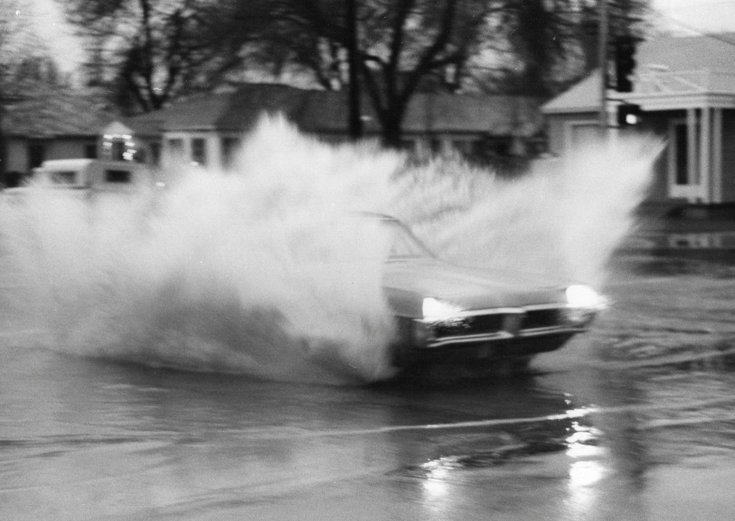
| (1963)* – Valley Times Photo caption reads: A car raises a mist as it plunges through a wet spot at Vesper Ave and Victory Blvd., Van Nuys." |
 |
|
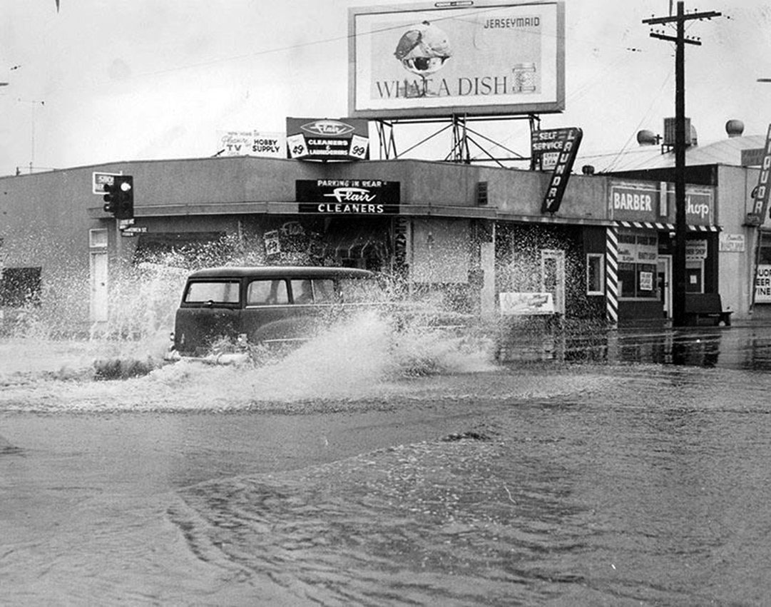
| (1960s)* - Flooding at the intersection of Burbank Boulevard and Cedros Avenue. Cedros was the open-air storm drain to the LA River as many other North-South streets were. Curbs 12" tall and a nasty dip crossing Burbank. Photo by Greg Kadorian |
 |
|
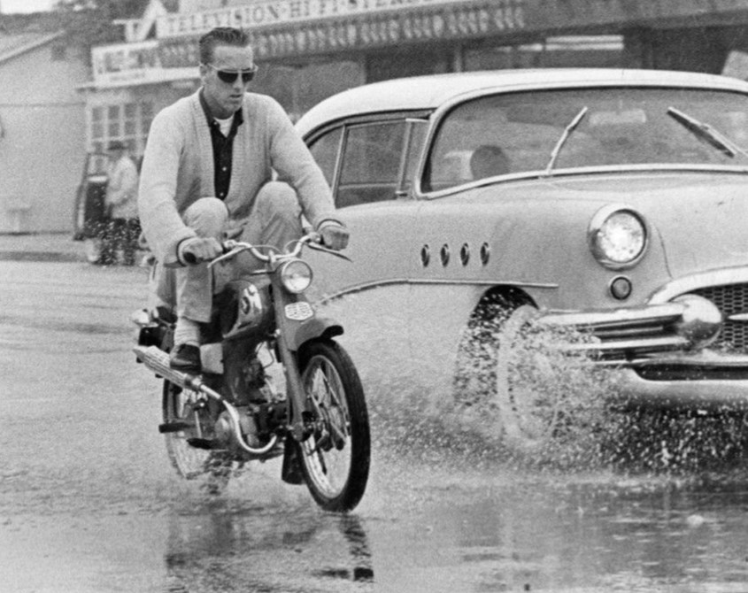
| (1963)* - A cyclist raises his feet to keep them dry as he goes through a puddle. Valley Times Photo Collection |
 |
|
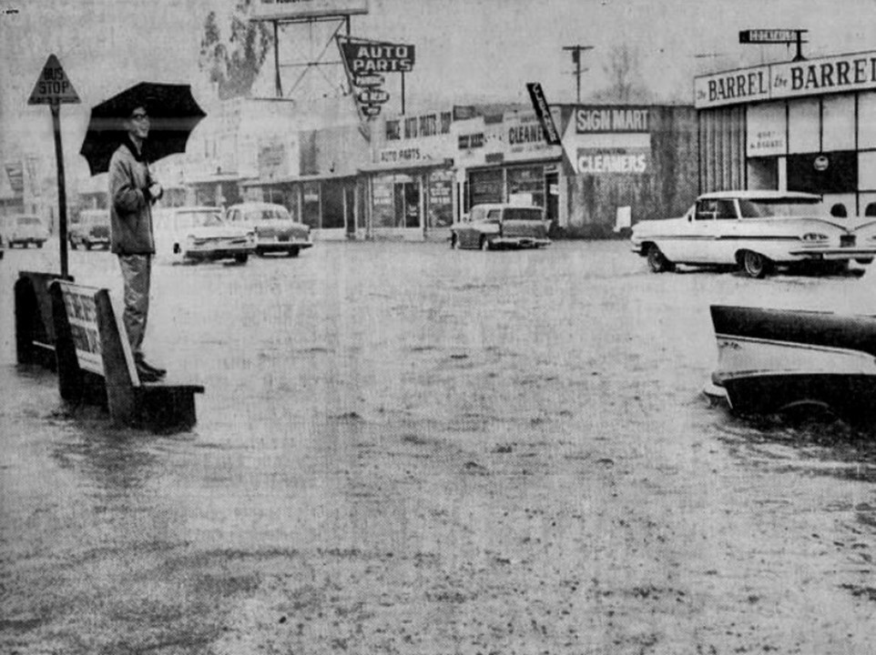
| (1965)* – Young man stands on bench on Van Nuys Blvd in Sherman Oaks after heavy rains. The Barrel Cocktails at 4547 Van Nuys Blvd can be seen across the street. Nearest intersection is Hortense Street. |
 |
|
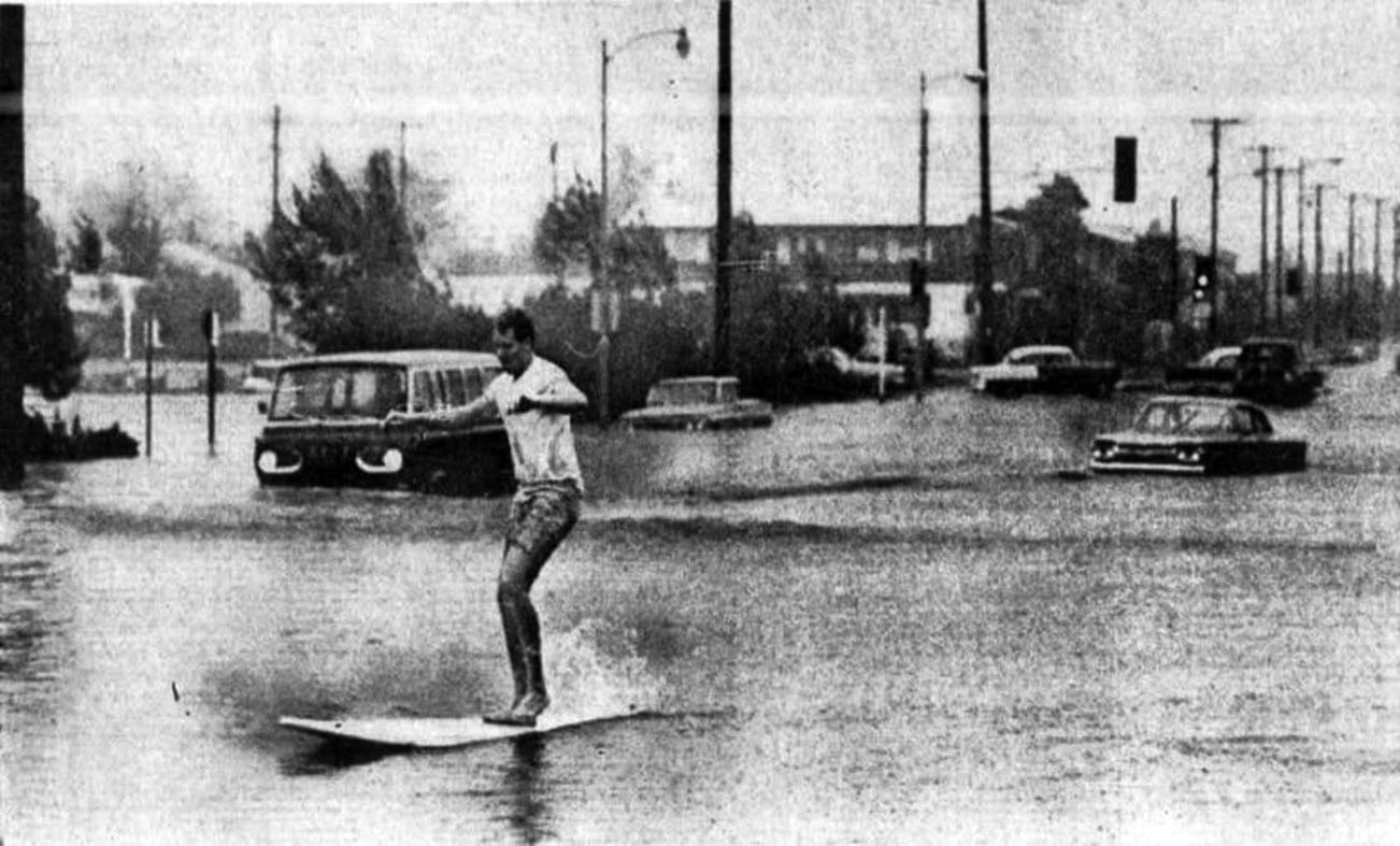
| (1965)^ - Surf's Up for John Wilson at the intersection of Burbank Blvd and Coldwater Canyon Ave. |
* * * * * |
|
Other Sections of Interest |
|
Water and Power in Early LA |
|
Newest Additions |
New Search Index |

A new SEARCH INDEX has been added to help navigate through the thousands of topics and images found in our collection. Try it out for a test run.
Click HERE for Search Index |
* * * * * |
< Back