Glendale-Hyperion Bridge
Introduction |
Few crossings over the Los Angeles River better illustrate the transformation of Los Angeles from rural floodplain to modern metropolis than the Glendale-Hyperion Bridge. Completed in 1929, the structure replaced a fragile wooden crossing and marked a decisive shift toward permanent civic infrastructure. At a time when Atwater Village and nearby neighborhoods were expanding rapidly, the new reinforced concrete bridge provided a dependable connection for automobiles and electric rail service. Its graceful arches combined engineering strength with architectural presence, signaling confidence in the city’s future.Designed under the direction of city bridge engineer Merrill Butler, the Glendale-Hyperion Bridge carried traffic over the river, Riverside Drive, and land that would later become Interstate 5. Over the decades it has witnessed the end of the Pacific Electric Red Cars, the channelization of the river after the catastrophic flood of 1938, the rise of the freeway system, and renewed efforts to restore public access to the river corridor. Today it remains both a vital transportation link and a visible reminder of nearly a century of urban change. |
 |
|
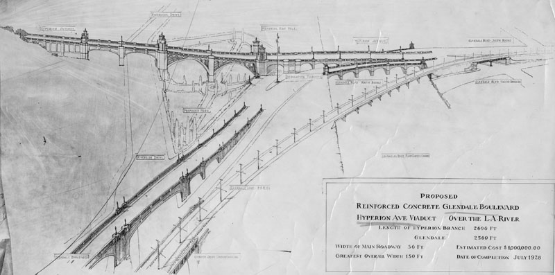
| (1927)* - Artist drawing dated November 2, 1927, showing the proposed Hyperion Avenue viaduct over the Los Angeles River and the reinforced concrete connection to Glendale Boulevard. The Hyperion branch measured about 2600 feet and the Glendale branch about 2500 feet. The main roadway was 50 feet wide, with a maximum overall width of 150 feet. The estimated cost was one million dollars, with completion projected for February 1929. The Pacific Electric line is shown running on its own adjacent bridge. |
Historical Notes Before construction of the Glendale-Hyperion Bridge, a wooden bridge built around 1910 stood at this location. It served as the main entrance to Atwater Village and provided an essential crossing over the often unpredictable river. Severe flooding in 1927 destroyed the wooden structure, reinforcing the need for a stronger and more permanent design. Local voters soon approved funding for a reinforced concrete bridge capable of withstanding future floods. |
 |
|
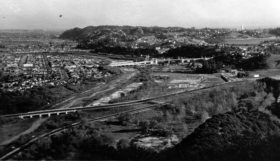
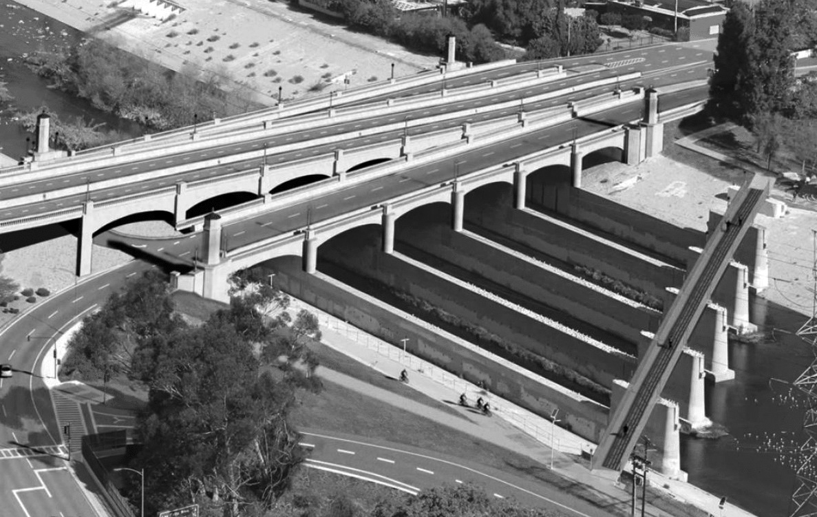
| (n.d.)* - Aerial view of the Glendale-Hyperion Viaduct annotated to show surrounding streets, with the Los Angeles River visible on the right. The Golden State Freeway had not yet been constructed. |
Historical Notes Construction began in 1927 and the bridge opened in February 1929. The main span crosses roughly 400 feet over the Atwater section of the river and carries four lanes of traffic. The bridge was originally named the Victory Memorial Bridge in honor of those who served in World War I. In later years it gained additional public recognition when a small scale replica was constructed at Disney California Adventure Park in Anaheim. |
 |
|
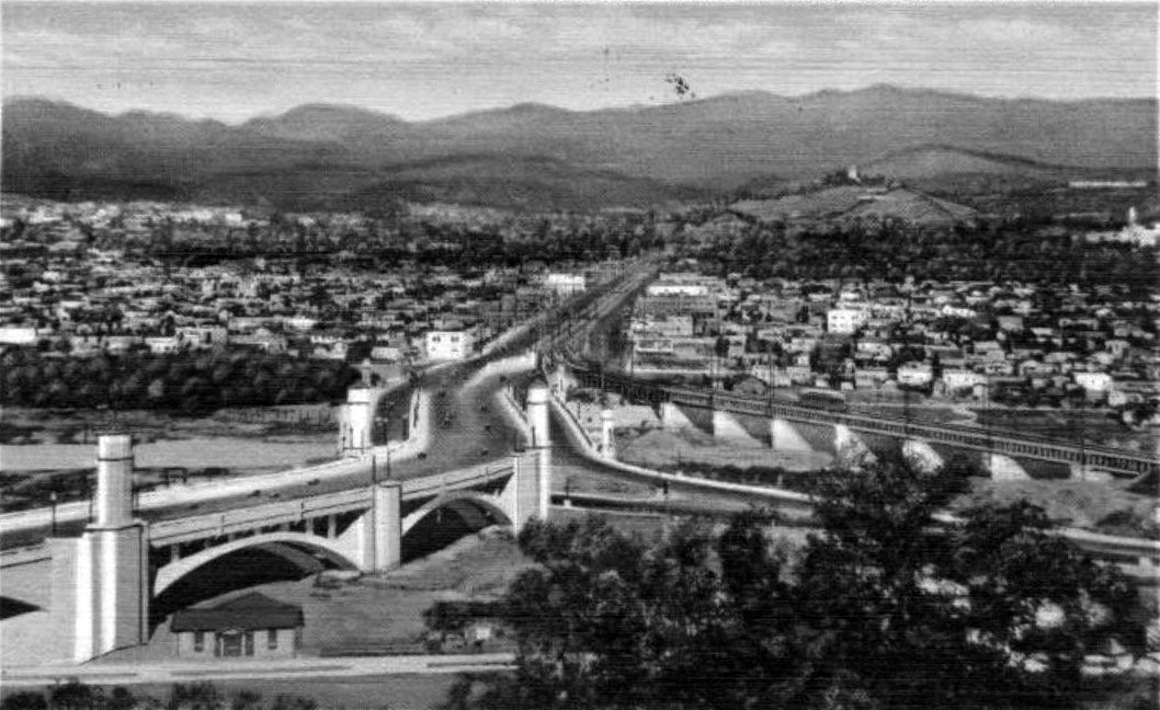
| (1930)* – View looking southwest showing the newly completed Glendale-Hyperion Bridge. The farmland and river bottom in the center of the image would later become the route of Interstate 5. Los Angeles City Hall, completed in 1928, appears in the upper right distance. |
Historical Notes The structure functions as both a bridge and a viaduct. A bridge spans a physical obstacle such as water or a roadway. A viaduct is a series of shorter spans placed one after another. The Glendale-Hyperion Bridge includes thirteen reinforced concrete arches arranged in sequence, giving it both structural strength and architectural rhythm. |
 |
|
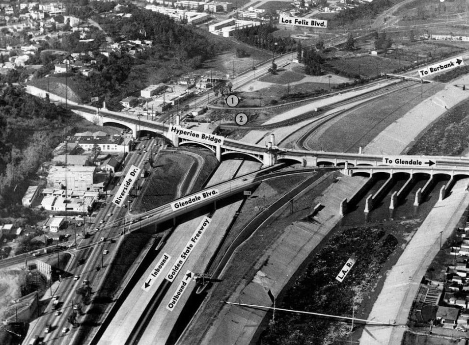
| (n.d.)* - Closer view of the Glendale-Hyperion Bridge after construction of the Golden State Freeway in the 1950s, with the Los Angeles River on the left. |
Historical Notes Merrill Butler, Engineer of Bridges and Structures for the City Bureau of Engineering from 1923 to 1961, is credited with the design. The main portion measures about 1400 feet in length. Construction required more than 35000 cubic yards of concrete and 6000000 pounds of reinforcing steel. Workers drove approximately 1500 wooden piles and 3200 concrete piles to support the piers and abutments. The bridge contains thirteen arches: two measuring 135 feet, eight measuring 48 feet, one measuring 68 feet, and two measuring 118 feet. These dimensions reflect both the scale of the river valley and the ambition of the project. |
 |
|
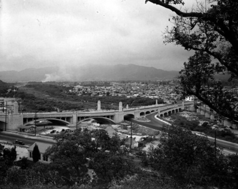
| (ca. 1930)* - View looking northeast showing the Glendale-Hyperion Bridge spanning Riverside Drive, the future alignment of Interstate 5, and the Los Angeles River. |
Historical Notes This view predates construction of Interstate 5 and shows the open character of the surrounding landscape. When the freeway was later built, one of the larger arches on the right side was removed to make room for the roadway. The Pacific Electric bridge can be seen at the far right, running parallel to the main structure, demonstrating how rail and automobile travel once shared this corridor. |
 |
|
| (1931)* – Postcard view looking east showing the Glendale-Hyperion Viaduct with a Pacific Electric Red Car crossing the adjacent bridge over the Los Angeles River. |
Historical Notes In 1929 the Pacific Electric Railway constructed a line next to the Glendale-Hyperion Bridge, allowing Red Cars to cross the river and continue along Glendale Boulevard. Until 1959 these electric trains provided regular service across the river, linking neighborhoods and supporting regional growth. The line was discontinued as freeways expanded and automobile traffic increased. Today the concrete supports that once carried the tracks remain, silent reminders of the electric rail era. |
 |
|
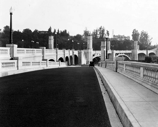
| (ca. 1930s)* - Close view of the Glendale-Hyperion Bridge shortly after it opened, with an early automobile at center. |
Historical Notes In its early years the bridge stood amid open land and low density neighborhoods. It quickly became a symbol of permanence and progress for communities on both sides of the river, offering reliable access where flooding had once disrupted travel. |
 |
|
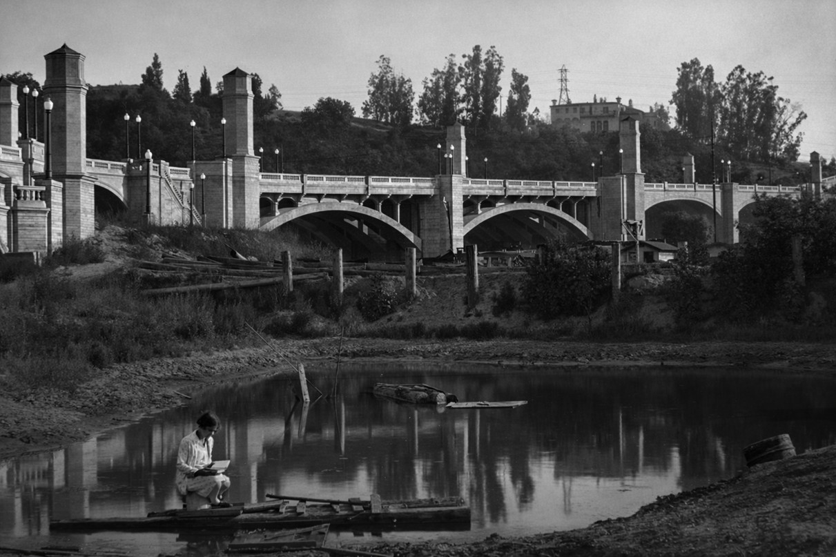
| (1930s)* – A woman reading on a makeshift wooden raft floating on a small body of water along the Los Angeles River, with the Glendale-Hyperion Bridge rising in the background. |
Historical Notes Even after completion of the bridge, portions of the Los Angeles River remained natural and unchannelized. The river flowed across a broad floodplain bordered by farmland and open space. This quiet scene captures a moment of calm beneath monumental infrastructure, highlighting the contrast between the engineered arches above and the still natural river below. |
 |
|
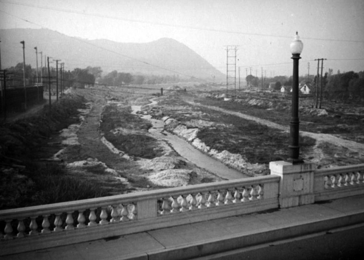
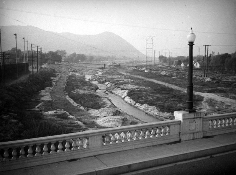
| (ca. 1937)* – View looking north from the Glendale-Hyperion Bridge showing the natural bottom of the Los Angeles River. |
Historical Notes The Los Angeles River originally flowed freely across its floodplain and frequently changed course. In March 1938 a powerful storm flooded large portions of the city and killed 115 people. Public demand for flood control led the United States Army Corps of Engineers to begin a long project to construct the concrete channel that now contains most of the river. The river landscape visible in earlier photographs would soon be permanently altered. Click HERE to see more in Los Angeles River - The Unpredictable! |
Before and After
 |
|
 |
|
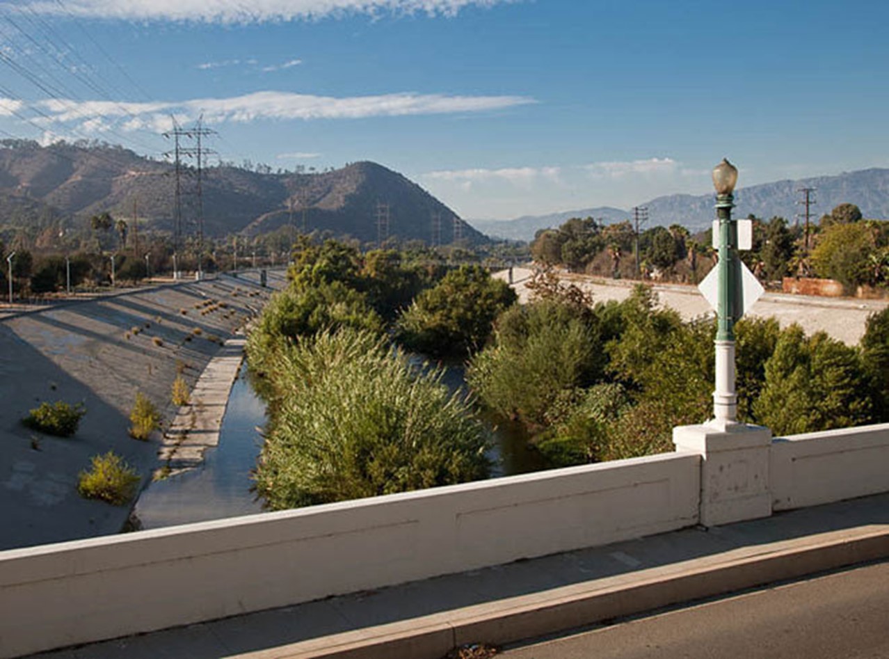
| (1937 vs. 2015)* - Before and After Los Angeles River Channelization - View from the Glendale-Hyperion Bridge. Photo comparison by Jack Feldman. |
Historical Notes Click HERE to see more on the Los Angeles River Channelization. |
 |
|
| (ca. 1935)* - View looking west showing the Pacific Electric Railway line adjacent to the Glendale-Hyperion Bridge. |
Historical Notes The Red Car line beside the bridge provided an efficient electric transit connection between neighborhoods. Its removal in 1959 marked the end of an important period in Southern California transportation history and signaled the dominance of the automobile. |
 |
|
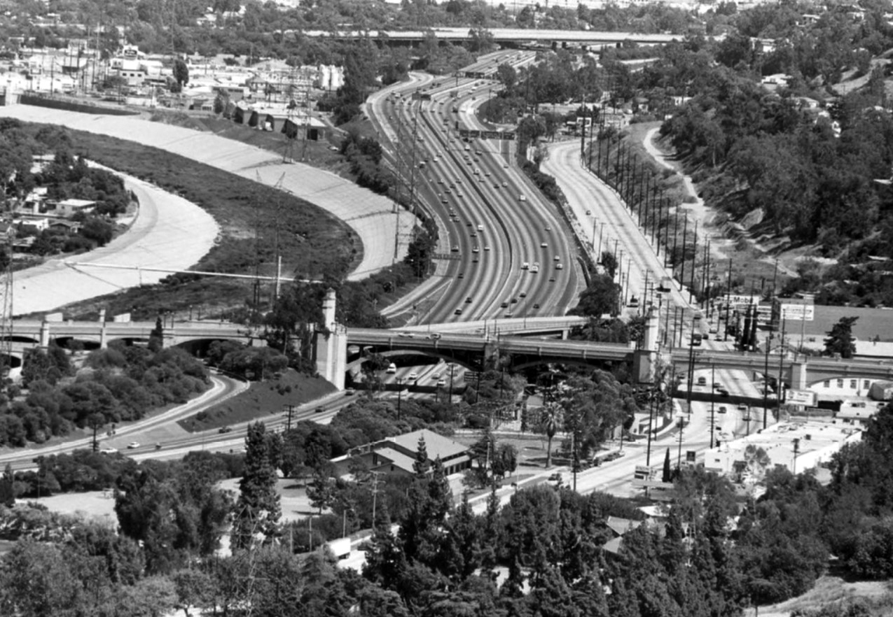
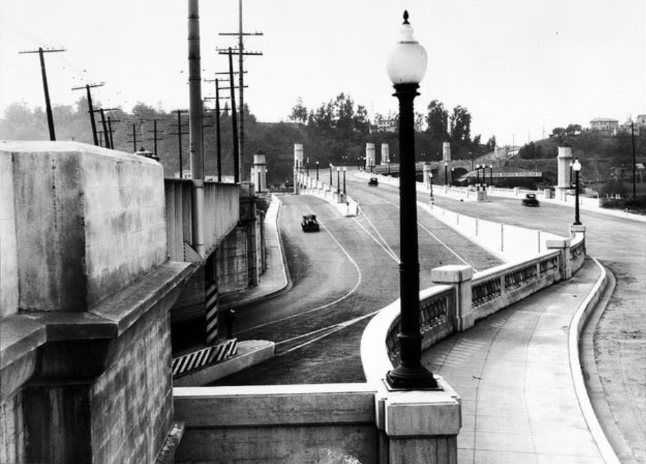
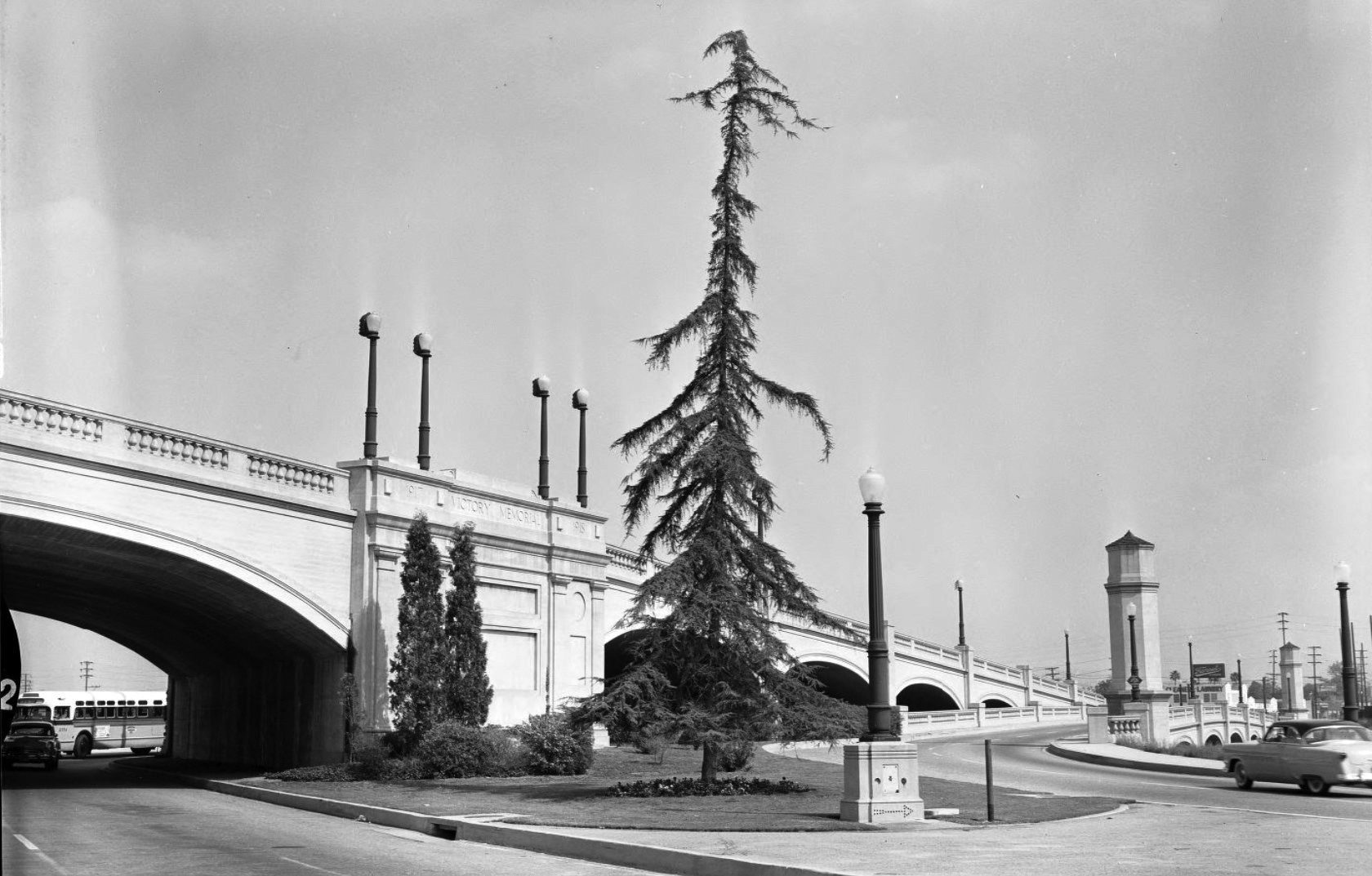
| (1956)* – View showing the eastern end of the Glendale-Hyperion Bridge descending over Riverside Drive near Glendale Boulevard in the Atwater District. |
Historical Notes The 56 foot wide and 1370 foot long reinforced concrete arch Glendale-Hyperion Bridge opened in 1929. It crosses the Los Angeles River and Riverside Drive between Ettrick Street and Glenfeliz Boulevard, and since the 1950s it has also spanned Interstate 5. Originally named the Victory Memorial Bridge, it was later designated Los Angeles Historic Cultural Monument 164, ensuring its preservation as a significant civic structure. |
 |
|
| (2015)* – Rendering of a planned pedestrian bridge across the Los Angeles River, with the Glendale-Hyperion Bridge visible on the left. |
Historical Notes In the early twenty first century, renewed interest in river access led to plans for a pedestrian and bicycle crossing using the remaining Red Car concrete pylons. Murals painted on the former rail retaining walls in 2004 helped transform the area into Red Car Park. City leaders announced the new crossing in 2015 as part of broader efforts to improve safety, reconnect neighborhoods divided by the river and freeway, and support future seismic strengthening of the main bridge. |
 |
|
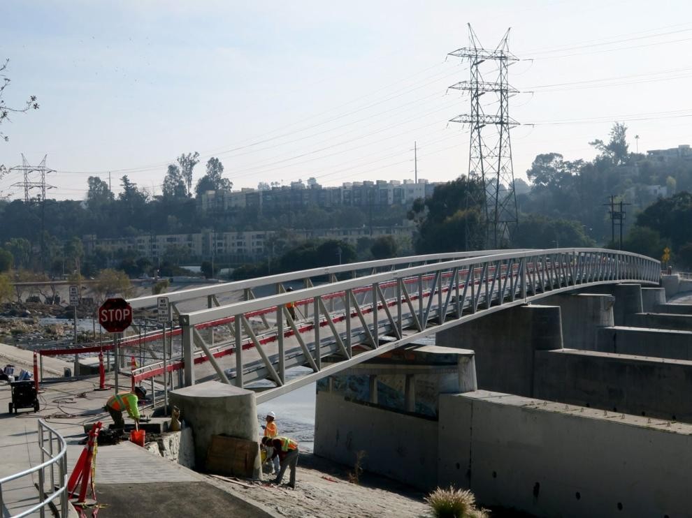
| (2020)* - The Red Car Pedestrian Bridge resting on the original concrete pylons that once supported the Pacific Electric streetcar span. Photo by Jesus Sanchez. |
| Historical Notes
The Red Car Pedestrian Bridge opened in January 2021. The 400 foot span connects Silver Lake with Red Car River Park near Atwater Village and provides a safe crossing for pedestrians and bicyclists just south of the Glendale-Hyperion Bridge. Built on five surviving concrete pylons from the former streetcar bridge, the structure acknowledges its history with a red painted steel stripe along each side. The 4 million dollar project strengthens access to the Los Angeles River Bike Path and offers an alternative to heavy vehicle traffic on the main bridge. It represents the latest chapter in the continuing evolution of this historic river crossing. For nearly a century, the Glendale-Hyperion Bridge has adapted to the changing needs of Los Angeles. From wooden predecessor to reinforced concrete monument, from electric rail service to freeway expansion, and from natural floodplain to revitalized river corridor, it stands as a durable witness to the city’s growth and resilience. |
* * * * * |
|
Other Sections of Interest |
|
Water and Power in Early LA |
|
Newest Additions |
New Search Index |

A new SEARCH INDEX has been added to help navigate through the thousands of topics and images found in our collection. Try it out for a test run.
Click HERE for Search Index |
* * * * * |
< Back