Gasometers of Early Los Angeles
 |
|
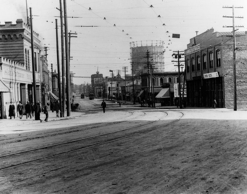
| (ca. 1900)* - View looking northeast along Aliso Street from San Pedro Street. A large gas storage tank (aka gasometer) is seen in the distance. Aliso Street is where the 101 Freeway (Hollywood Freeway) is located today. |
Historical Notes The huge tank seen above was known as "gas holder" (aka gasometers), and helped supply natural gas to the city. They were installed by Los Angeles Gas and Electric Co. which was one of several utilities operating in the City of Los Angeles at the turn of the century. The tanks rose or sank in height depending on the amount of gas being stored. |
 |
|
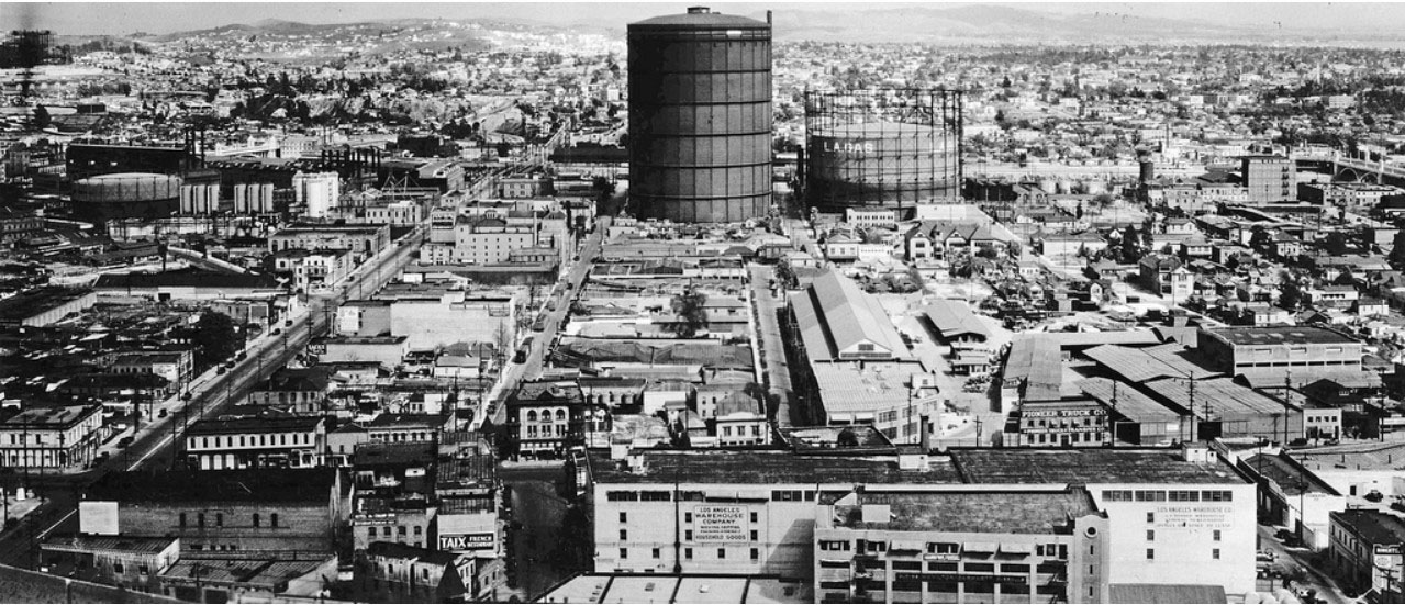
| (ca. 1930)* - Panoramic view looking east from the City Hall tower. What stands out is the enormously large gas tank owned by the LA Gas and Electric Corporation. The street on the left running diagonally is Aliso, where the 101 Freeway (Hollywood Freeway) is located today. |
Historical Notes The above 300-foot tall gas holder or silo (aka gasometer) was located at the corner of Ducommon and Center, east of the Civic Center. It was built in 1912 by the LA Gas and Electric Corp. and it's not clear when it was torn down. Shots of Downtown up through 1960 seem to show these structures in the background. |
 |
|
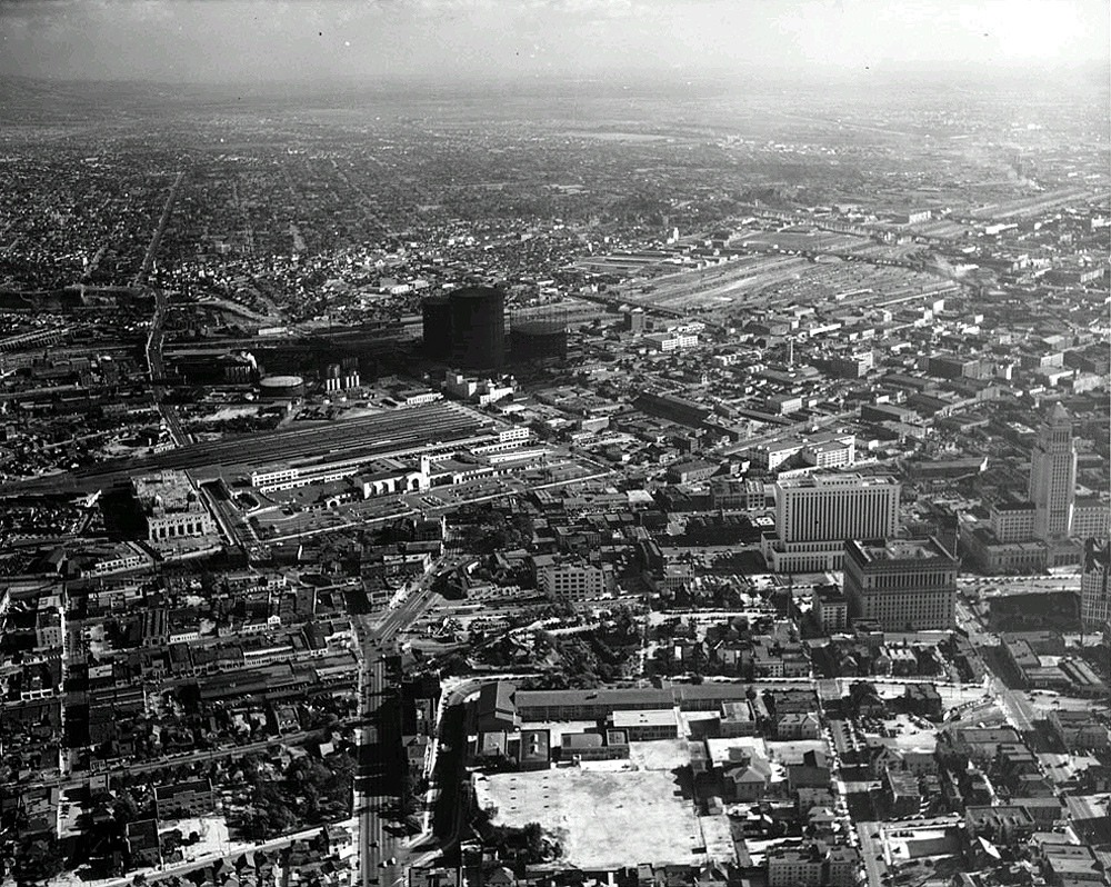
| (ca. 1939)* - Aerial view looking southeast across Fort Moore Hill. The recently completed (1938) Union Station is in view at left-center of photo. Just to the southeast of Union Station, across Aliso Street, can be seen two very large natural gas tanks known as "gas holders" (aka gasometers). |
Historical Notes The gas holders were in fact laughably large and towered over their surroundings. When one gas holder was built in 1906 its 210 foot height was 35 feet greater than the tallest building in Los Angeles. |
 |
|
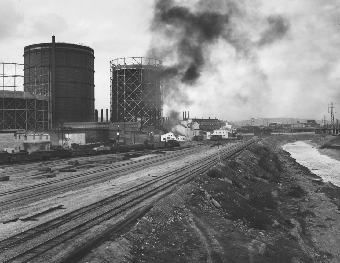
| (1939)* - Looking north along railroad tracks and Los Angeles River from the First Street Bridge with three large Gasometers on the left. Photo by William Reagh |
Historical Notes Note how the Los Angeeles River had no cement lining. Channelization and concrete lining didn’t occur in this area until the 1940s. Click HERE to see more in the 'Los Angeles River - The Unpredictable!' Section. |
 |
|
| (ca. 1930s)* - Mission Road looking across the L.A. River from Boyle Heights toward two very large “Gasometers” built in 1912 by the LA Gas and Electric Corp. A man is seen leaning over in front of a wagon (lower-left) and City Hall can also be seen (upper-left). |
Historical Notes In 1936 Los Angeles city voters approved a charter amendment authorizing the Bureau of Power and Light to issue revenue bonds in the amount of $46 million and purchase the electric system of Los Angeles Gas and Electric Corporation, the last remaining privately-owned system in LA. Click HERE to see more in Los Angeles Gas and Electric Corporation. In 1937, the Gas component of Los Angeles Gas and Electric was sold to what is now Southern California Gas Company. |
 |
|
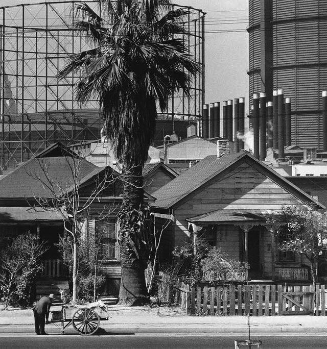
| (1940s)* - Two men appear to be loading a truck in front of the ‘Grocery and Meat Market’ on the northeast corner of Garey and Jackson Streets in downtown Los Angeles. A sign on the side of the truck reads, “Give to your Victory Chest.” In the background, two massive gas storage tanks (gasometers) tower over the scene. |
Historical Notes The Victory Chest, similar to the Community Chest (a precursor to the United Way), was a wartime fundraising campaign supporting military personnel, war relief efforts, and families affected by the war. These campaigns encouraged civilians to donate funds for war bonds, veterans' services, and charitable organizations aiding the war effort. |
 |
|
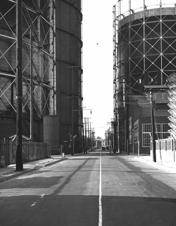
| (1940)* – View along Center Street near Jackson Street showing gas tanks lining the road. |
.jpg) |
|
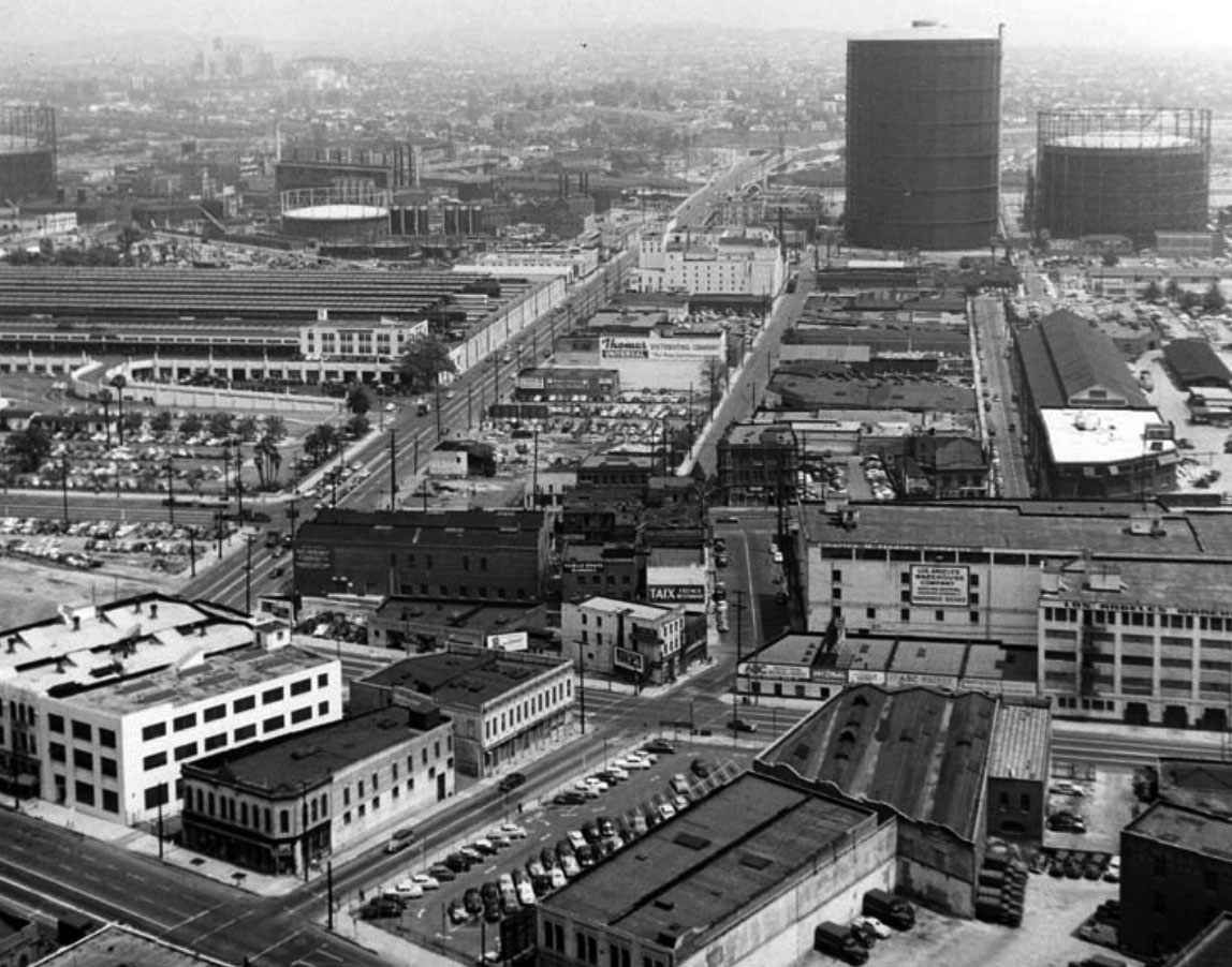
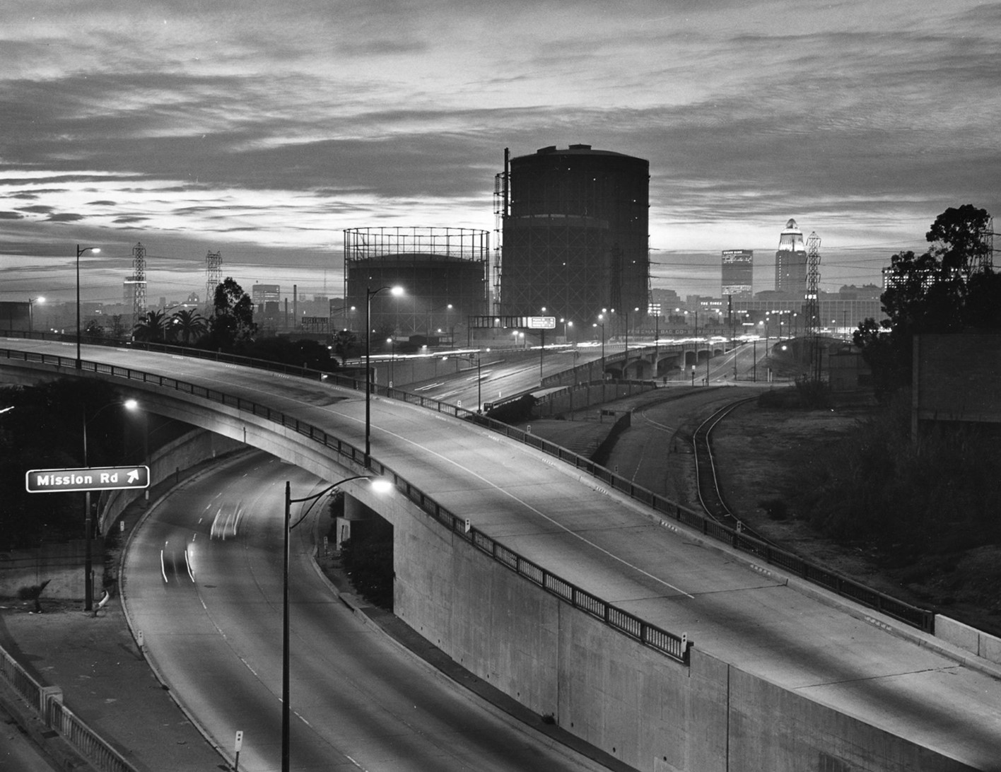
| (ca. 1950)* – View showing the San Bernardino Split; the junction of Ramona Fwy (then US-60-70-99, now San Bernardino Fwy Rte 10) and Santa Ana Fwy (US-101), with Gasometers and City Hall seen in the background. Mission Rd ramps at right-center (photo source unknown). |
Historical Notes Pacific Electric streetcars cross connector tunnel in foreground. The tunnel was removed in 1955 after P.E. tracks were abandoned. Part of tunnel portal remains to this day. |
 |
|
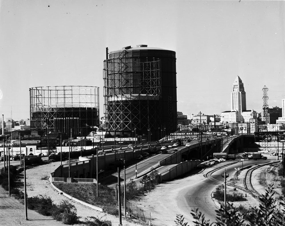
| (ca. 1950)* - View looking west on Aliso Street toward the Civic Center. Three extremely large natural gas holders stand in proximity to the Friedman Bag Company and Brew 102, with City Hall in the background. This photo was taken just a couple of years prior to the construction of the 101 Freeway where Aliso Street is seen above. |
Historical Notes If you lived in Los Angeles in the 1950s you would be familiar with the two prominent features of the skyline (excepting the fact there was no skyline). The City Hall of course was the tallest building and the most identifiable but the other dominant structures were the storage tanks (also called gasometers) of the Los Angeles Gas Company. The L.A. Gas Company supplied natural gas to Southern California from a distribution center located just east of downtown. This was in an industrial area next to Union Station and became known as the gas works. |
 |
|
| (1951)* - Aerial view taken from City Hall looking east showing the Gasometers at upper-right. Aliso Street and Union Station are seen on the left. |
Historical Notes Mainly used to store large volumes of gas these gasomweters had a secondary purpose. Until the late 60s Los Angeles' natural gas system was a low pressure distribution area. As a result of fluctuations in the temperature of the piping and/or increased usage, the pressure could drop too low, in which case these tanks would act as a pressure supply backup or relief. |
 |
|
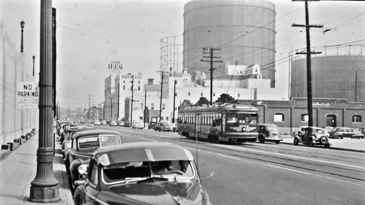
| (ca. 1950)* – Aliso Street looking east showing Brew 102 and the large natural gas holders (Gasometers) in the distance. Union Station is on the left. |
Historical Notes By the mid-1950s, Aliso Street, seen above, would be replaced by the Hollywood Freeway (U.S. 101) . Click HERE to see Construction of the Hollywood Freeway through Downtown. |
 |
|
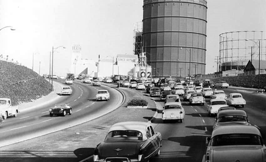
| (1954)* – Hollywood Freeway shorty after it was completed running where Aliso Street used to be. Brew 102 and the large natural gas holders (Gasometers) are still there. |
Historical Notes The last section of the 101 Freeway (aka Hollywood Frwy) through Downtown Los Angeles was completed in 1954. It ran in line with what used to be Aliso Street (seen above). Click HERE to see Before and After images. |
 |
|
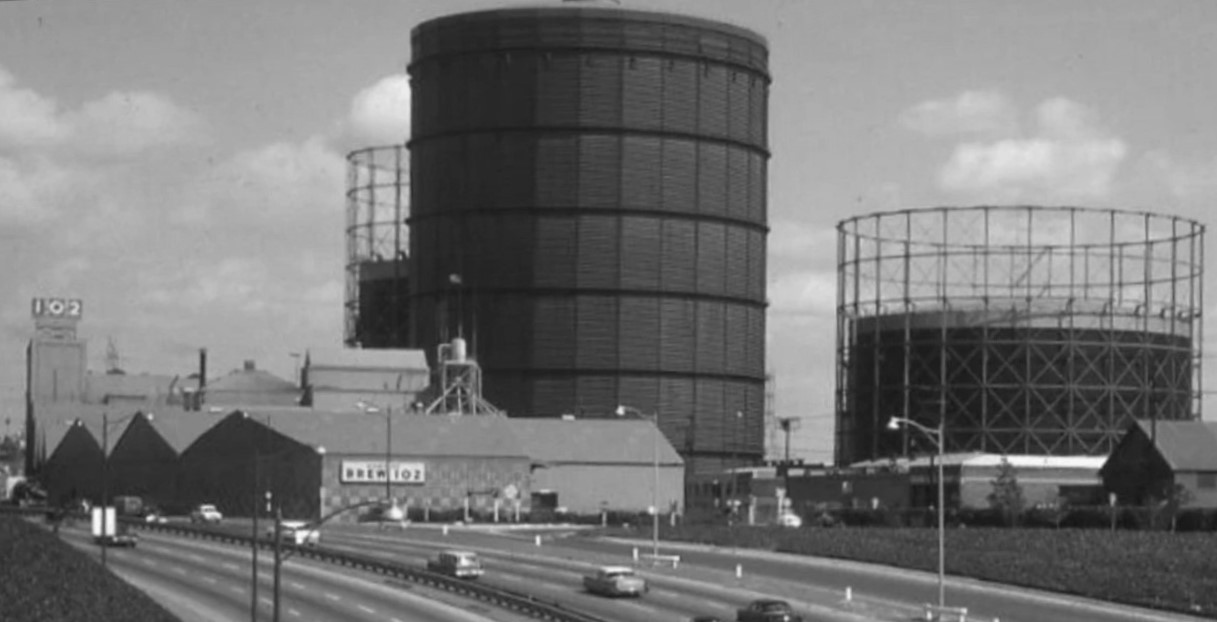
| (1963)* - Three Gasometer tanks sit behing Brew 102. |
Historical Notes In 1972, the suds of Brew 102 stopped flowing in Los Angeles. The old brewery closed; 102 was made in Tumwater, Wash. It is still sold by a few mom-and-pop stores in Los Angeles. The shutdown ended almost a century of the pungent aroma of malted barley, hops and freshly brewed beer in the shadow of the Civic Center. |
 |
|
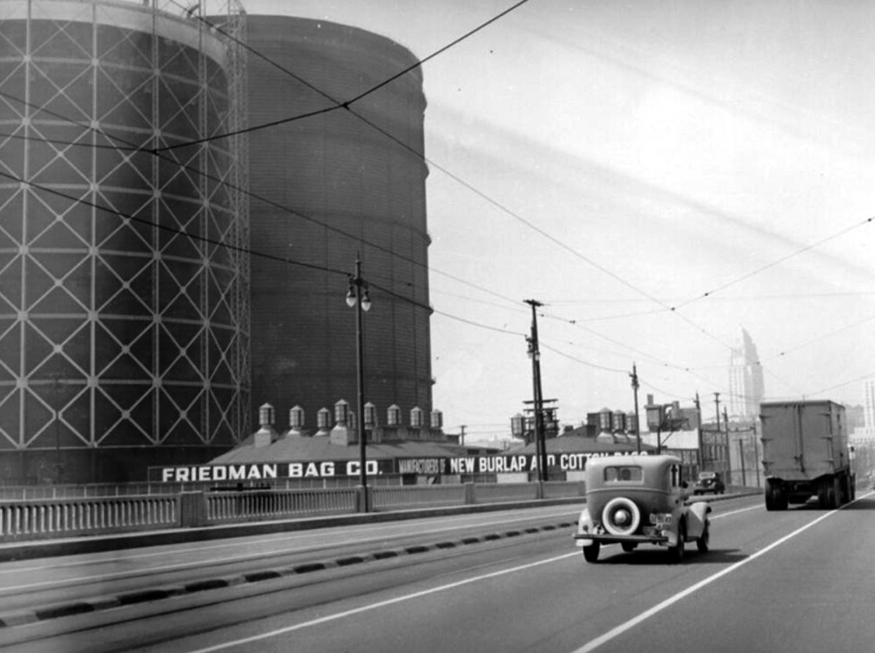
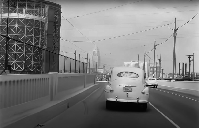
| (ca. 1940s)* - An early model car and truck are seen here driving across Aliso Street bridge (later the 101 Frwy) leading to downtown. To the left also are natural gas storage tanks (gasometers). City Hall can be seen in the distance, and a company making burlap and cotton bags is located to the left of the bridge (Friedman Bag Co.). |
 |
|
| (1940s)* – Heading into Downtown from the eastside. The two tallest structures that stand out are the Gasometers and City Hall. |
 |
|
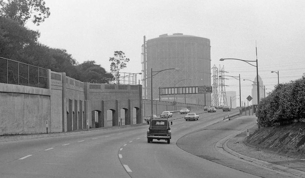
| (1960s)* – Heading into Downtown from the eastside. The two tallest structures that stand out are the Gasometers and City Hall. |
Historical Notes Prior to the late 1950s the Charter of the City of Los Angeles did not permit any portion of any building other than a purely decorative tower to be more than 150 feet. Therefore, from its completion in 1928 until 1964, the City Hall was the tallest building in Los Angeles |
 |
|
| (1968)* – Looking west from Brooklyn Avenue (today Cesar E. Chavez Ave) at Pleasant Avenue with Gasometers, City Hall, and the Union Bank building seen in the background. Photo by William Reagh |
Historical Notes Built in 1968, Union Bank was the first skyscraper constructed in the central business district of Los Angeles as part of the Bunker Hill redevelopment project. |
* * * * * |
Santa Monica and La Brea (West Hollywood)
 |
|
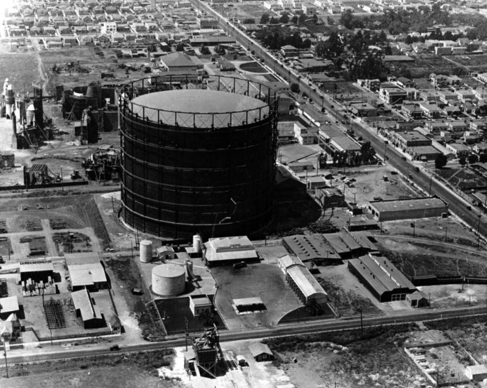
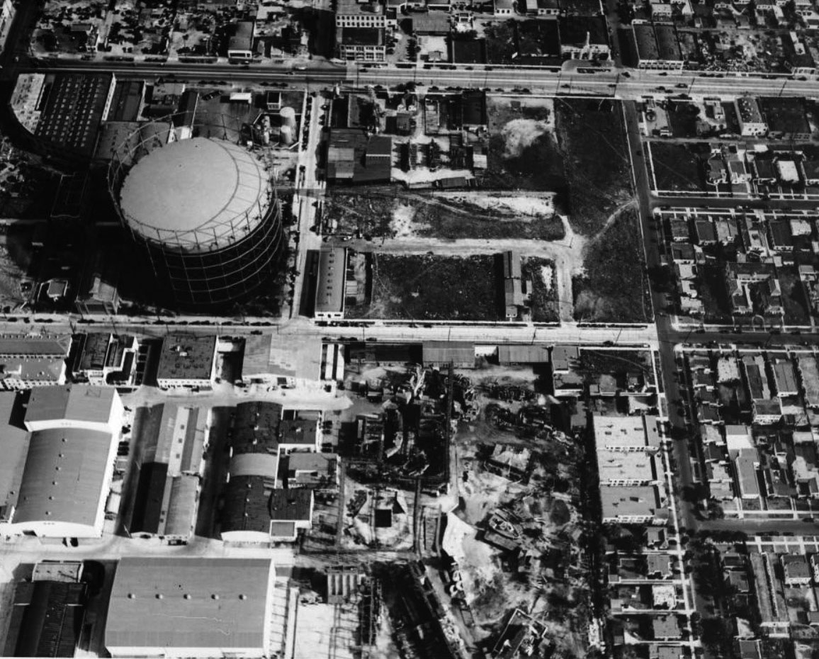
| (1920s)* – Aerial view looking West showing a “Gasometer” (Gas Storage Tank) located near the intersection of Formosa Ave and Romaine Street. La Brea runs across the bottom of photo. Santa Monica Boulevard runs diagonally from right-center to top center. Picford-Fairfanks Stuidos can be seen on the other side of Formosa Ave behind the tank. The SE corner of Formosa and Santa Monica Blvd (center-right) is where the iconic Formosa Cafe would be built. |
Historical Notes The huge tank seen above was installed by LA Gas and Electric Company which later evolved into Southern California Gas Company. These large tanks were known as "gas holders" (aka gasometers), and helped supply natural gas to the city. They rose or sank in height depending on the amount of gas being stored. |
 |
|
| (1937)* - Aerial view looking east, showing the same Gasometer at the southeast corner of Formosa Avenue and Romaine Street, with United Artists Studios visible in the foreground.Santa Monica Boulevard is on the left (out of view). The Formosa Cafe would be built to the north of the Gas Tank on the SE corner of Formosa and Santa Monica Blvd. |
Historical Notes The above Gasometer was dismantled in the mid-1970s. Click HERE to see more in Gasometers of Early Los Angeles. |
 |
|
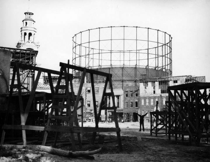
| (1926)*# - View of the Pickford-Fairbanks Studios lot on Santa Monica Boulevard in West Hollywood, showing the nearby Gasometer towering in the background. |
 |
|
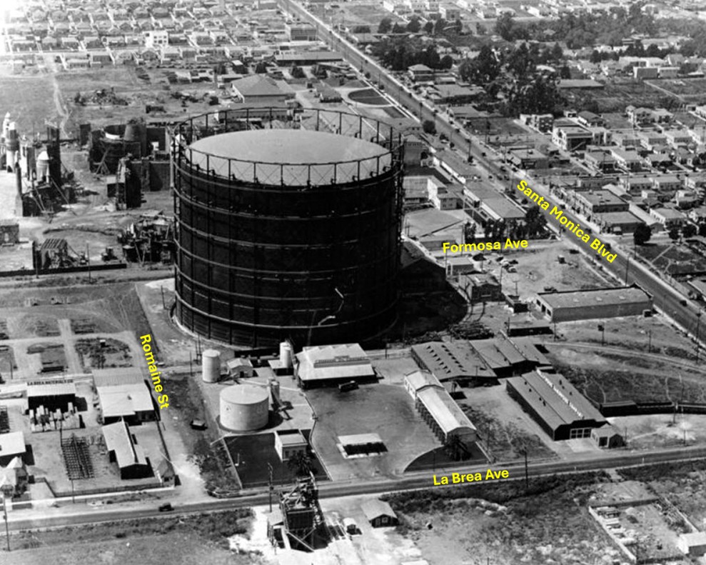
| (1920s)* – Aerial view looking West showing a “Gasometer” (Gas Storage Tank) located near the intersection of Formosa Ave and Romaine Street. La Brea runs across the bottom of photo. Santa Monica Boulevard runs diagonally from right-center to top center. Picford-Fairfanks Stuidos can be seen on the other side of Formosa Ave behind the tank. The SE corner of Formosa and Santa Monica Blvd (center-right) is where the iconic Formosa Cafe would be built. Annotated by Jack Feldman. |
 |
|
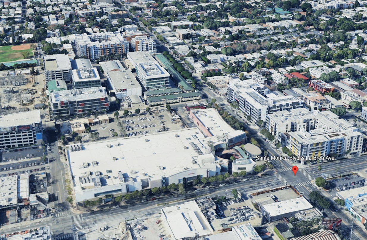
| (2023)* – Google Earth view looking west toward the area near the intersection of Formosa Avenue and Romaine Street, where the early Gasometer once stood. |
Then and Now
 |
|
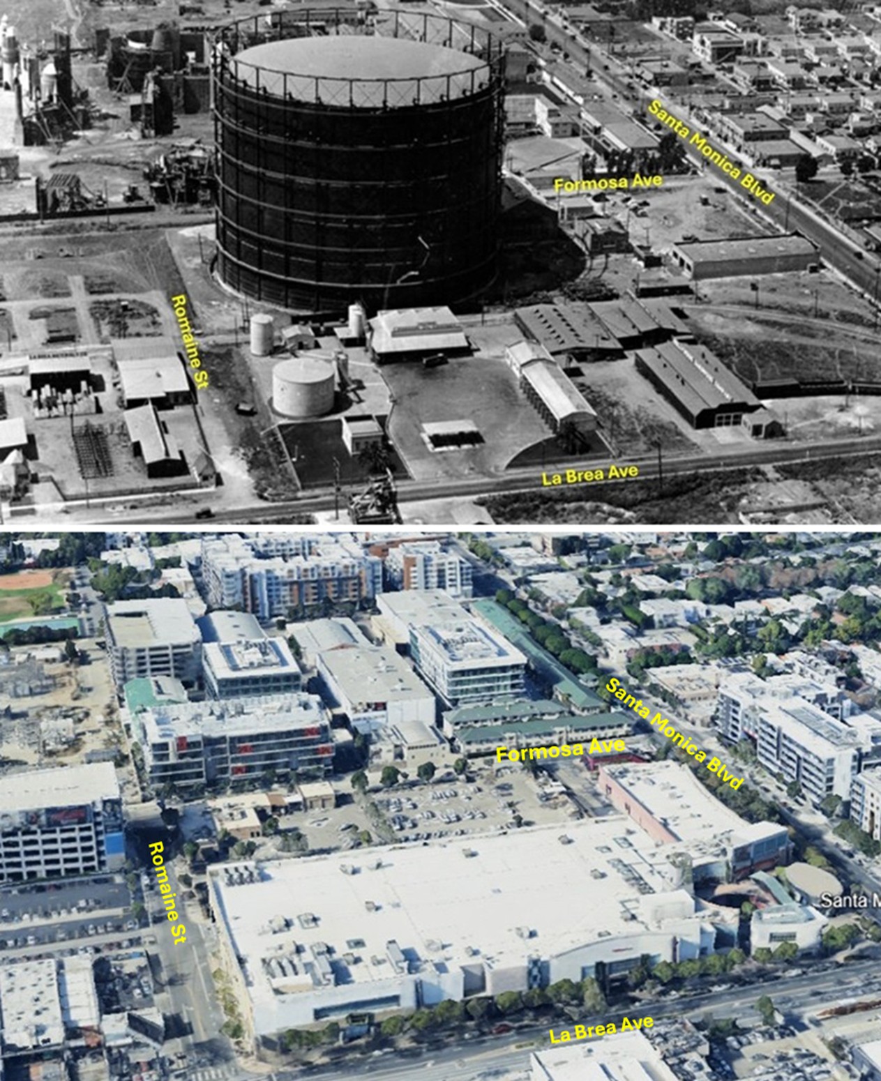
| (1920s vs. 2023)* – A ‘Then and Now’ aerial comparison looking west toward the southeast corner of Formosa Avenue and Romaine Street, where a Gasometer once stood. Today, a Southern California Gas Company facility occupies the site of the former gas tank, and to the east, the large building in the foreground is the West Hollywood Gateway shopping center, which fronts La Brea Avenue. Photo comparison by Jack Feldman. |
Then and Now
 |
|
| (1939 vs 2022)* – Looking north from the First Street Bridge showing the Los Angeles River before and after channelization. The Aliso Street Bridge (U.S. Route 101) can be seen in the distance. Photo comparison by Jack Feldman. |
Before and After
 |
|
| (1968 vs 1987)* – Looking west from Brooklyn Ave (today Cesar E. Chavez Ave) at Pleasant Ave toward the Los Angeles skyline. Photo comparison by Jack Feldman. |
Then and Now
.jpg) |
|
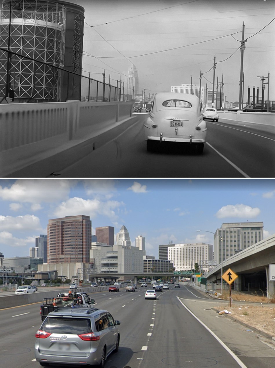
| (1968 vs 2009)* - Looking west from Brooklyn Ave (today Cesar E. Chavez Ave) at Pleasant Ave toward the Los Angeles skyline.Photo comparison by Jack Feldman. |
Historical Notes The 1960s era transition bridge that survived through the 1980s was eventually demolished to build the redirected FastTrak express lanes that extended the old 10 freeway median car pool lanes to Alameda. |
Then and Now
 |
|
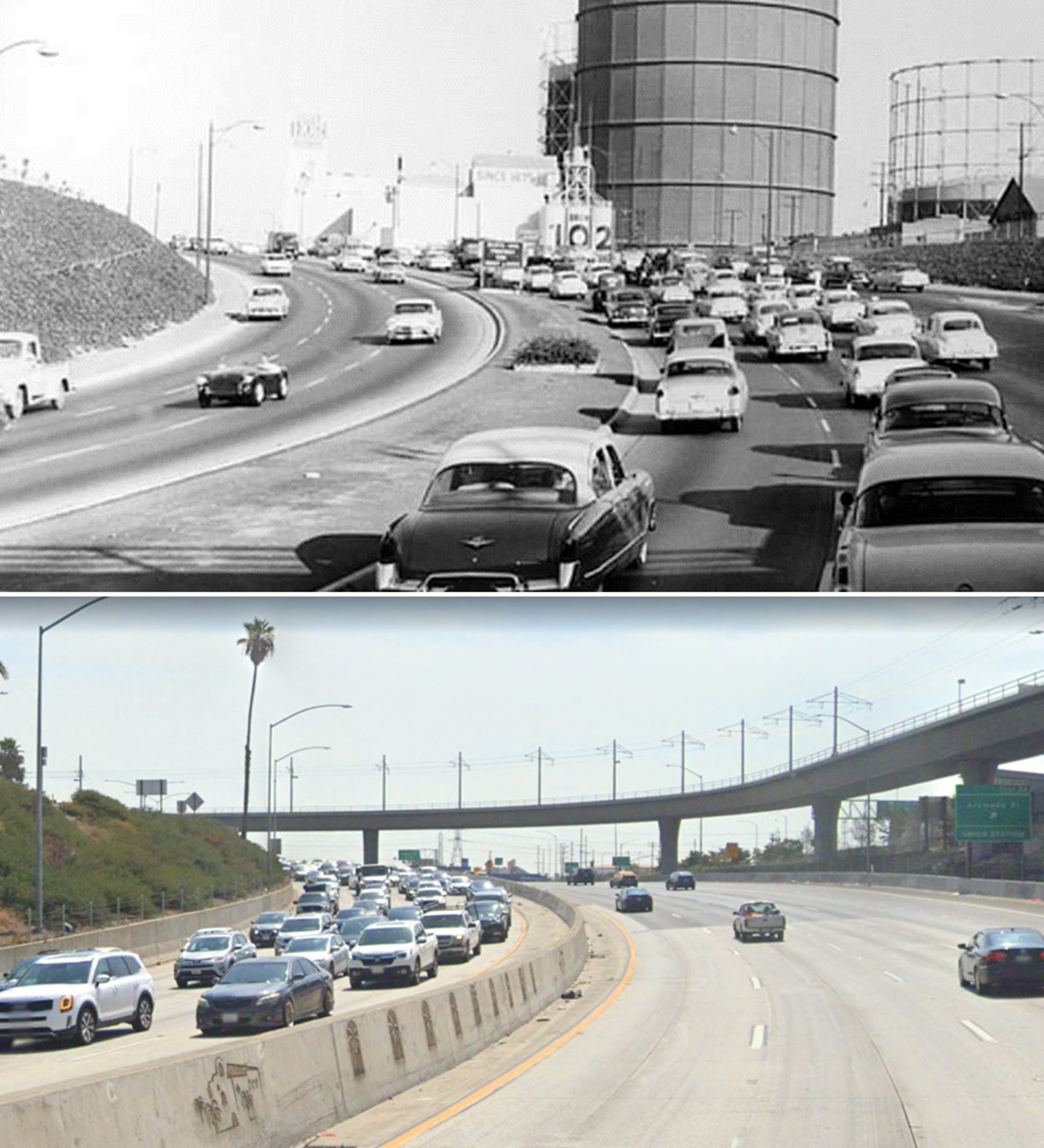
| (1954 vs. 2022)* – Top photo shows the Hollywood Freeway shorty after it was completed running where Aliso Street used to be. Brew 102 and three large natural gas holders (Gasometers) are seen in the background. Photo comparison by Jack Feldman. |
Then and Now
 |
|
| (1940s vs 2022)* - Heading into Downtown Los Angeles from the eastside. Photo comparison by Jack Feldman. |
Historical Notes By the early 1970s Gasometers were no longer needed as new pipelines from gas fields of West Texas could meet all demands. The tanks were removed at great relief to fire officials who worried about the potential disaster with these tanks near downtown. |
* * * * * |
|
Other Sections of Interest |
|
Water and Power in Early LA |
|
Newest Additions |
New Search Index |

A new SEARCH INDEX has been added to help navigate through the thousands of topics and images found in our collection. Try it out for a test run.
Click HERE for Search Index |
* * * * * |
< Back