Early Views of Santa Monica
Historical Photos of Early Santa Monica |
 |
|
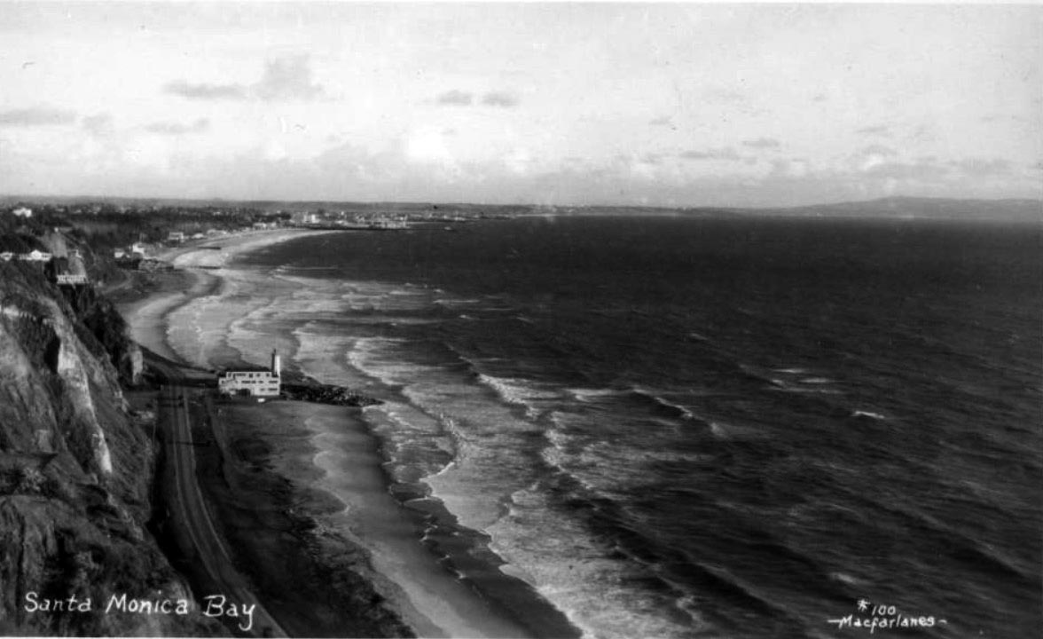
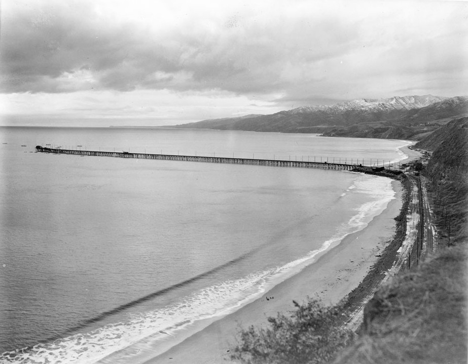
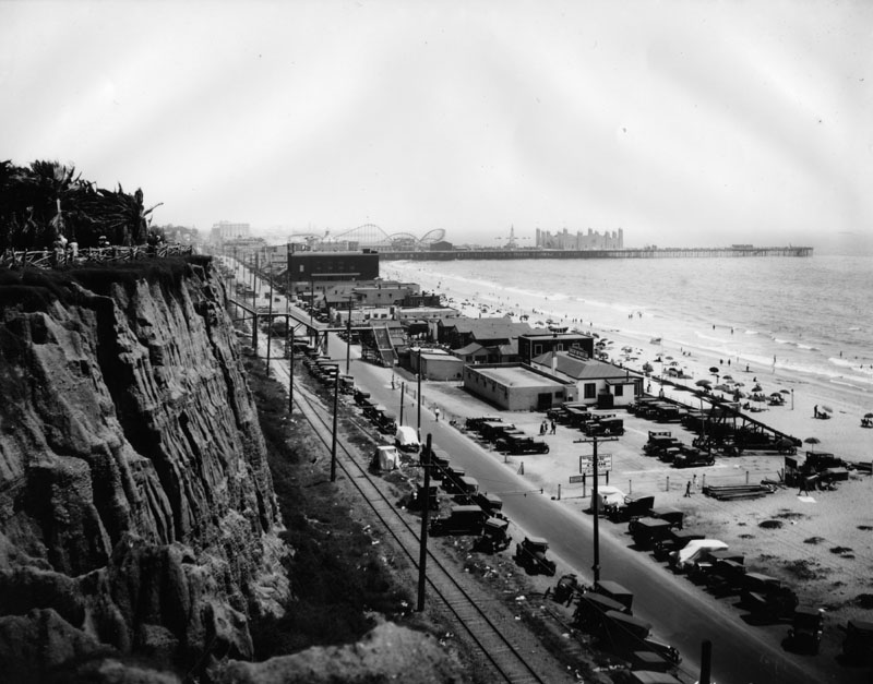
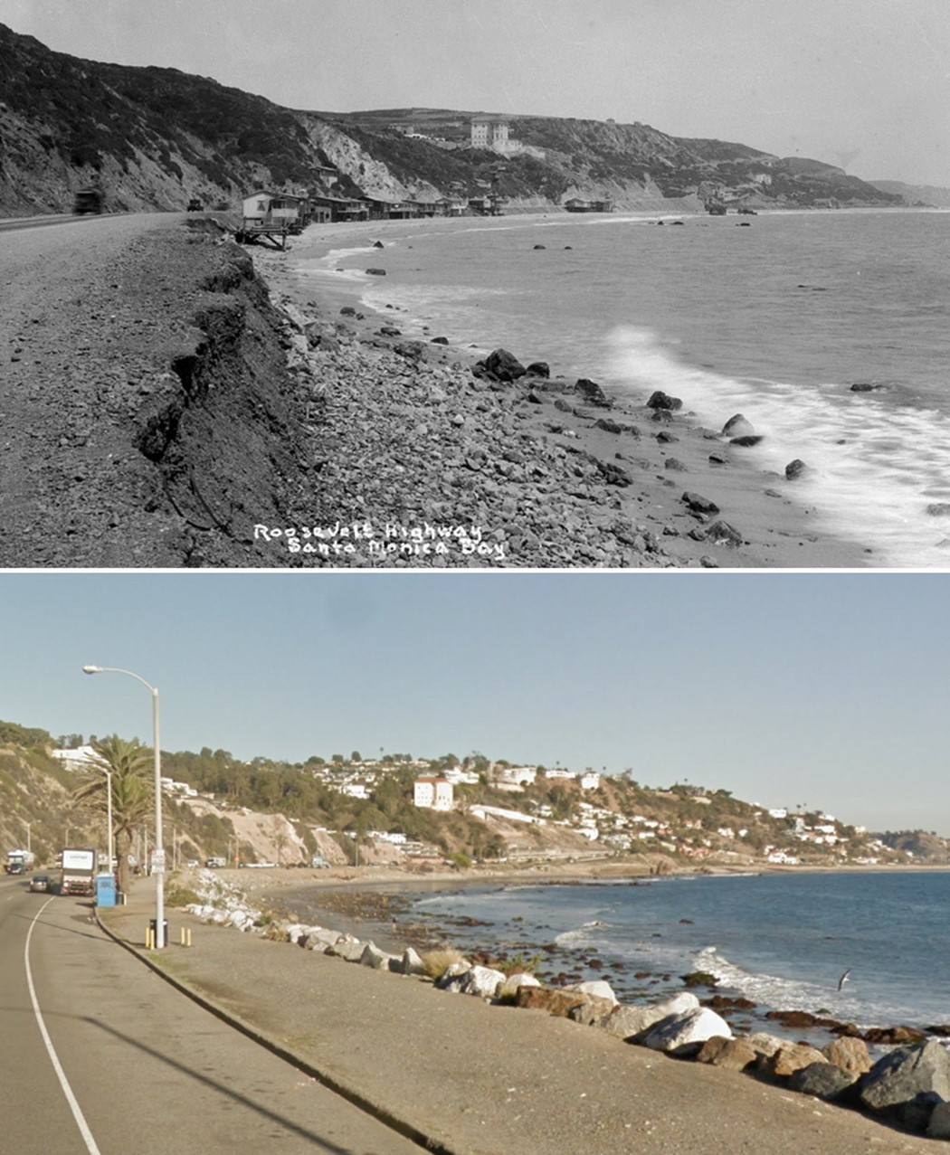
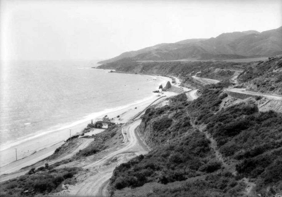
| (ca. 1927)#^^ - Panoramic view of Santa Monica Bay showing the Roosevelt Highway (later Pacific Coast Highway), Santa Monica Bay, and coastline with the Lighthouse Bathhouse on the beach next to the remains of the Long Wharf stone jetty in Pacific Palisades. The Santa Monica Pier can be seen in the distance at upper left center. A sign for "Huntington Palisades" is seen at left edge of image. |
Historical Notes The Pacific Palisades lighthouse was built as a bathhouse with a working light in 1927. In the early 1930s the structure along with the beach was sold to Will Rogers and later the beach was given to the state of California and renamed the Will Rogers State Beach.* |
 |
|
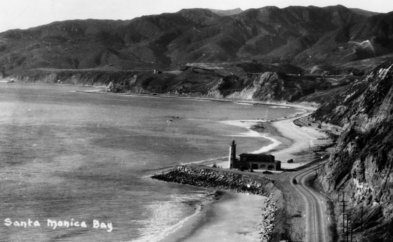
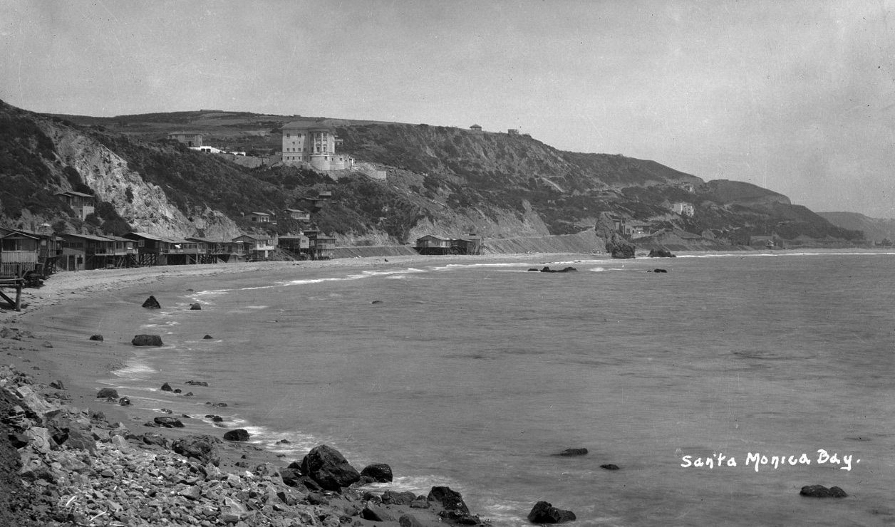
| (ca. 1927)* - View of the Santa Monica Bay coastline, showing a lighthouse and bathhouse near the Pacific Palisades. The lighthouse stands at the spot where the Long Wharf used to extend out into the ocean. |
Historical Notes “The Lighthouse” restaurant and bathhouse opened for business on Memorial Day, 1927. Built by the Pacific Palisades Association and designed by architect Thomas P. Barber, the bathhouse featured a second floor dining room, a wrap-around Venetian colonnade, and was large enough to accommodate 500 patrons. +#+# |
 |
|
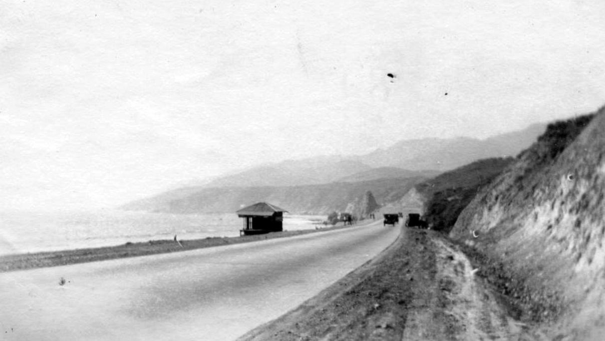
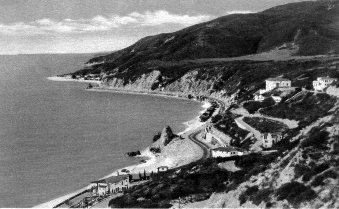
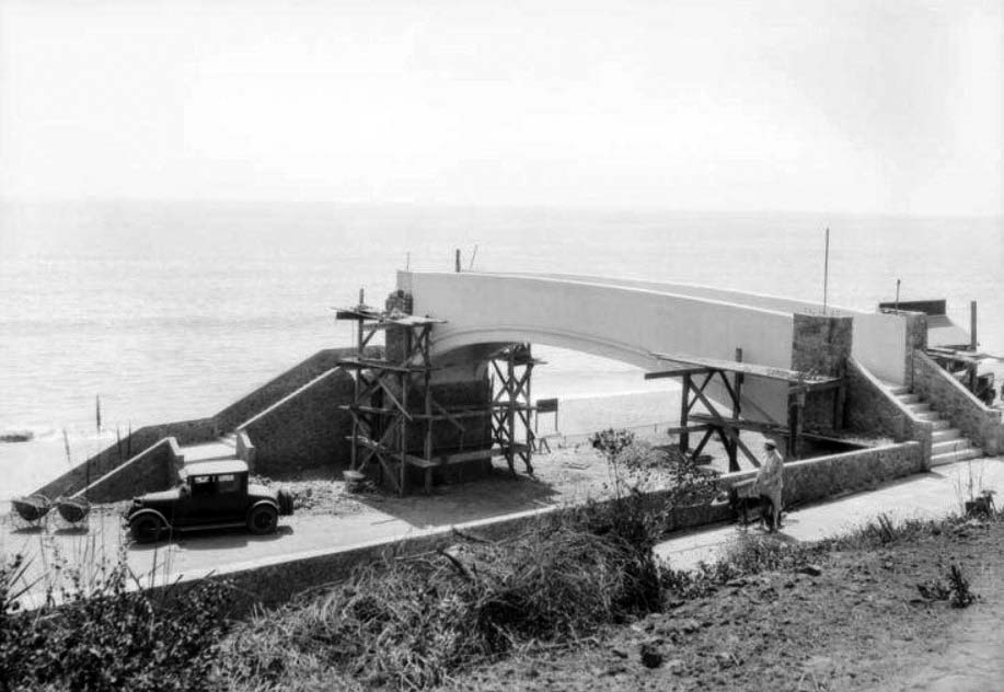
| (ca. 1930)^v^ - Postcard view showing the Roosevelt Highway (later Pacific Coast Highway) stretching westward from Santa Monica to Pacific Palisades, with Malibu in the background. The Lighthouse was a restaurant and cafe, and later the lifeguard headquarters. It marks the spot where the Long Wharf once projected into the Bay. |
Historical Notes Although it was not a true lighthouse, the picturesque building was commonly featured in promotional photographs and materials advertising Southern California. It was also an important visual point of reference for boats navigating into Santa Monica Bay. +#+# |
 |
|
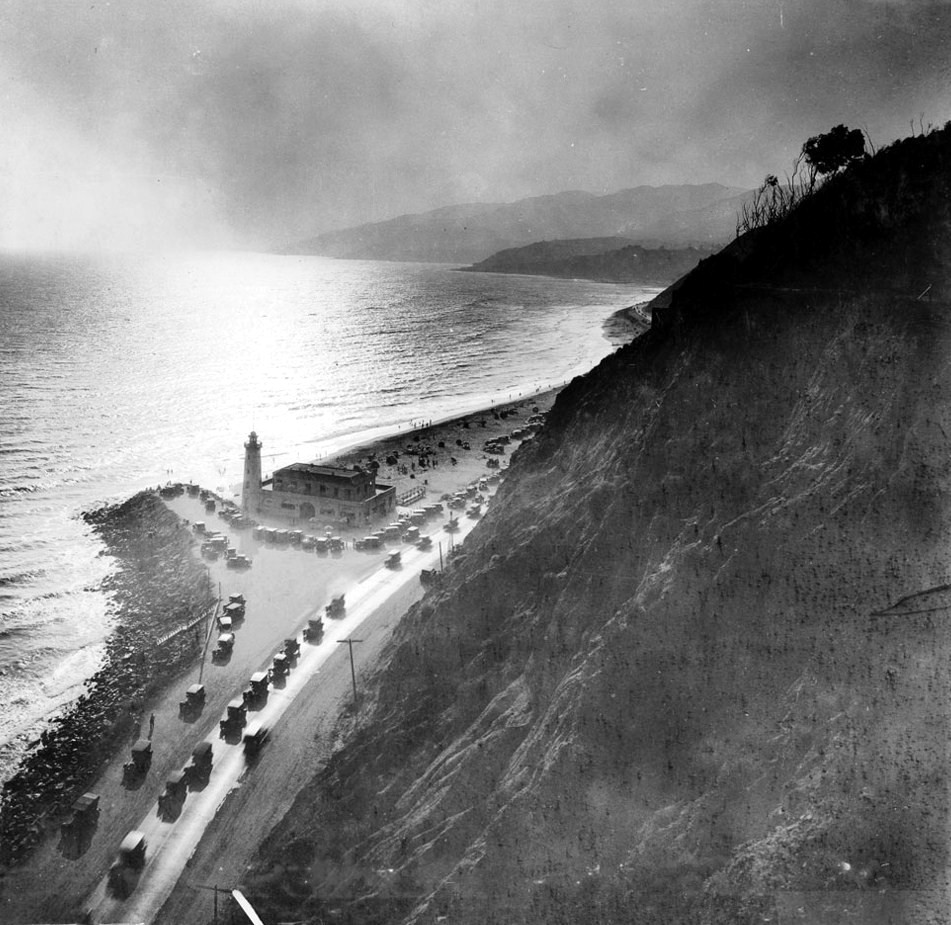
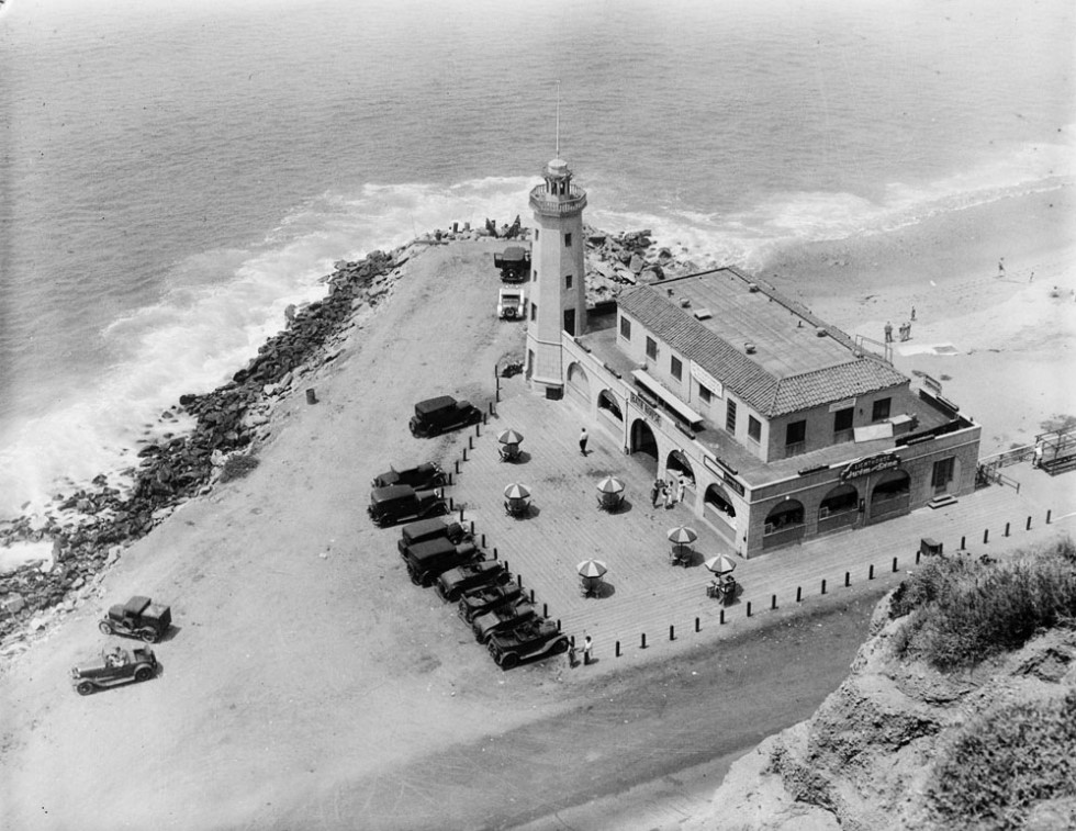
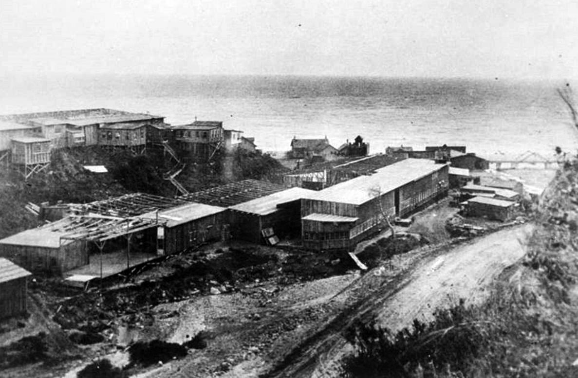
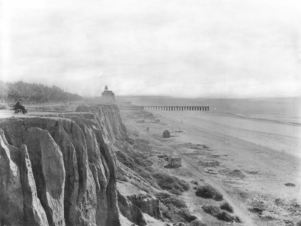
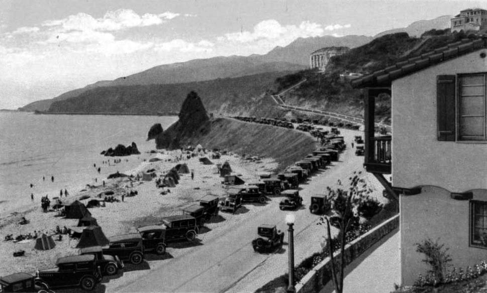
| (ca. 1920s)** - View looking down from the canyon of where the Long Wharf used to extend into the ocean. The Pacific Palisades Lighthouse and Bathhouse are seen with an adjacent parking lot full of cars. |
 |
|
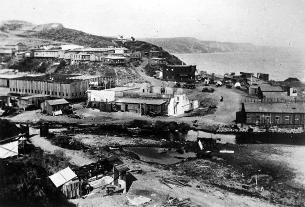
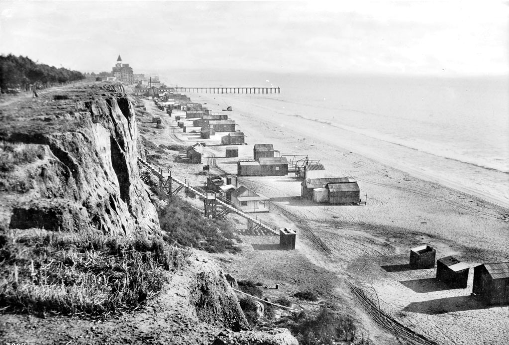
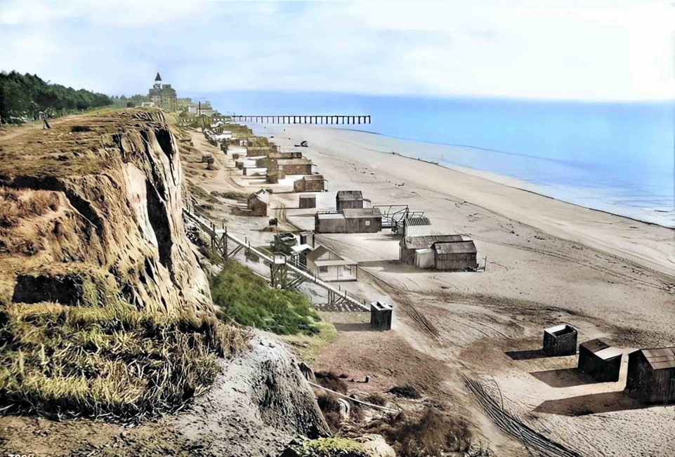
| (ca. 1930)** - View of the lighthouse, restaurant and bathhouse on the Long Wharf outcropping, Roosevelt Highway. Six tables with striped umbrellas can be seen to the left of the restaurant, while several automobiles are parked in front of the building at left. |
Historical Notes The most distinctive feature was the 50-foot tall lighthouse tower with a functioning beacon powered by eight 500-watt lamps. The Lighthouse was a popular destination and become an iconic landmark as the Roosevelt Highway (later the PCH) opened up through Malibu in 1929, connecting all of California along a single coast highway. +#+# |
 |
|
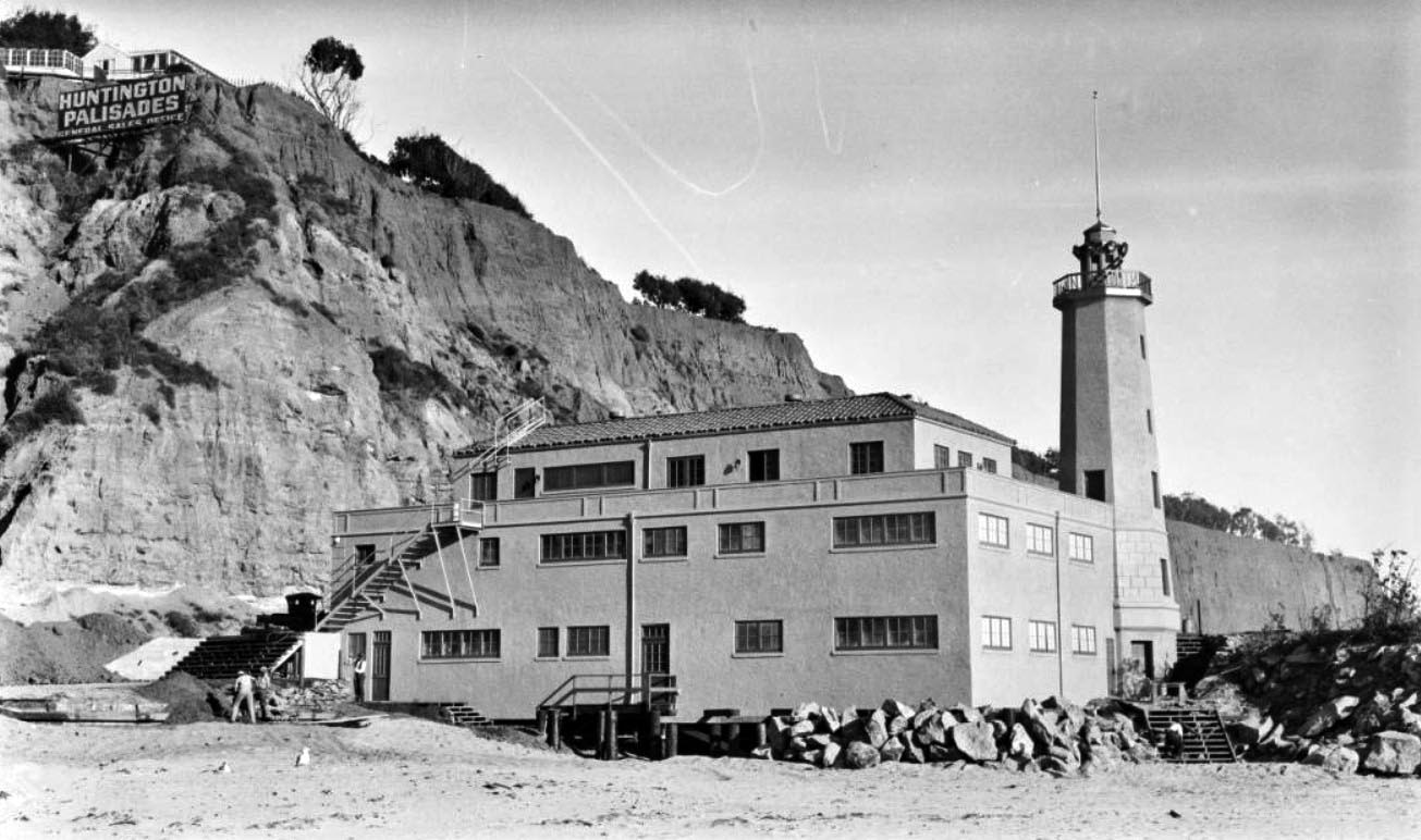
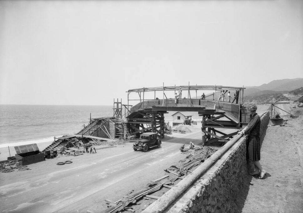
| (ca. 1927)#^^ - View showing construction workers working on a walkway and staircases of the Lighthouse Bathhouse on the beach in Pacific Palisades, with a small part of the remains of the Long Wharf at far right. A sign for the Huntington Palisades general sales office can be seen on a cliff above. |
Historical Notes In 1926, the Pacific Palisades Association purchased the land that was owned by the Huntington family of New York. Both a commemorative gesture and a way to benefit from the prestige associated with the Huntington name, the area was deemed “Huntington Palisades.” ^*# |
 |
|
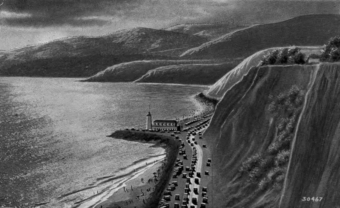
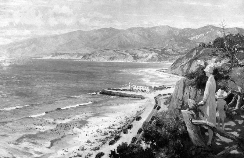
| (ca. 1930)* - Looking down from Palisades Park in Santa Monica north towards the Lighthouse bathhouse and restaurant that stood on Pacific Coast Highway at the point where the Santa Monica Mountains come down to the shore. This is a photograph of a painting by Chris Siemer. The painting was created for display by the L.A. Chamber of Commerce. |
 |
|
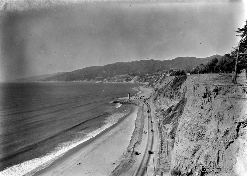
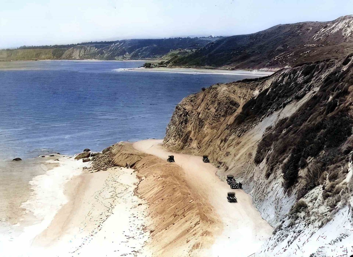
| (1927)* - A view of the palisades of Santa Monica, looking north along Roosevelt Highway next to an unbuilt beach (today's Will Rogers Beach). |
Before and After
 |
|
|
|
| (1916)** vs. (1927)* - View showing the Long Wharf (1893 - 1920) and the Pacific Palisades Lighthouse and Bathhouse (1927 - 1972) at the same location. The beach seen in the foreground is today's Will Rogers Beach. |
Historical Notes The Long Wharf was the longest ocean wharf in the world at 4700 feet. It was built in 1893 by the Southern Pacific Railroad, and it was destroyed in 1920 by the Pacific Electric Railroad Co.** The Long Wharf was designated California HIstorical Landmark No. 881. Click HERE to see more California Historical Landmarks in L.A. |
 |
|
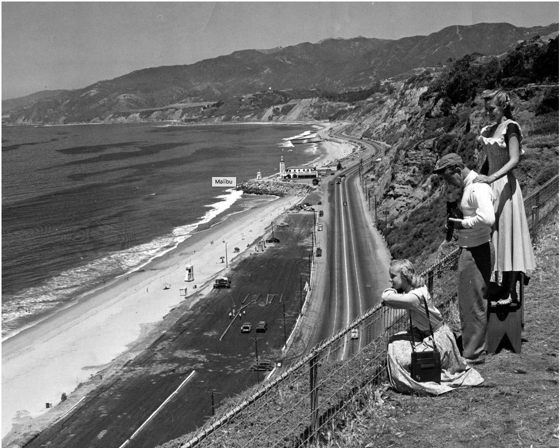
| (1940s)^x^ – View showing tourists admiring the scenery from the bluffs above Santa Monica Canyon (Huntington Palisades), with the Pacific Palisades Lighthouse seen in the distance. Photo courtesy of Eric Wienberg |
 |
|
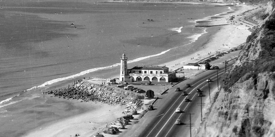
| (ca. 1940)+#+# – Panoramic view showing the Pacific Palisades Lighthouse, restaurant and bathhouse and Pacific Coast Highway. |
Historical Notes Over the decades, as the popularity of bathhouses faded, the patronage of the Lighthouse diminished. Eventually, the building was taken over by the Will Rogers State Beach lifeguard, serving as a part of the lifeguard headquarters. By 1972, the Lighthouse structure was determined to be unsuitable for habitation and was razed. |
 |
|
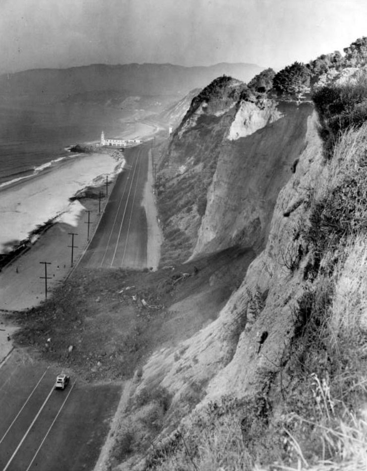
| (1944)^v^ - A landslide blocks the Roosevelt Highway--soon to be the Pacific Coast Highway. The Lighthouse bathhouse and cafe is in the background. |
Historical Notes Notes from reverse of photo: Roosevelt Highway Blocked Again. Santa Monica, Calif.,--Southern California's Roosevelt Highway along the Pacific Ocean near here was the scene of another traffic-stopping earth slide from the towering beach front Palisades. The 200-foot, 30-foot deep chunk of earth slid from the backyard of actor Charles Laughton. 8/29/44 |
Inceville
.jpg) |
|
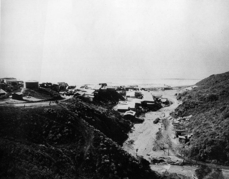
| (ca. 1915)#^ - View from the Palisades looking toward Malibu showing Inceville, the famed motion picture studio founded by Thomas Ince. |
Historical Notes In 1911, film director Thomas Ince created his Western film factory, "Inceville," which at its peak employed nearly 600 people.*^ |
 |
|
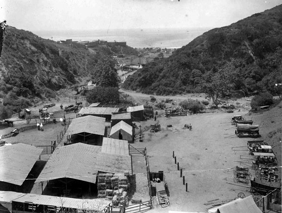
| (1915)* - View of Inceville, on Sunset Boulevard (Santa Ynez Canyon) at the Pacific Ocean, where Ince Studios filmed location scenes. |
Historical Notes Ince leased 18,000 acres of land extending from the seashore up Santa Ynez Canyon and into the mountains for 7-1/2 miles. While he was building the frame-structured studio buildings, situated where Gladstone’s Restaurant is today, he also hired Miller’s 101 Ranch Wildwest Show, including many cowboys, animals and a Sioux Indian tribe, who set up their teepees on the property.**^ |
 |
|
| (ca. 1916)**^ - The mouth of Santa Ynez Canyon at the Pacific Ocean was once home of Inceville, an early 1900s film studio built by film director Thomas Ince. |
Historical Notes Most of the cowboys, Indians and assorted workmen lived at Inceville, while the actors came from Los Angeles and other communities as needed, taking the red trolley cars to the Long Wharf at Potrero Canyon, where buckboards conveyed them to the set. Ince lived in a house that overlooked Inceville, the location of Marquez Knolls today.**^ |
 |
|
| (1916)#^ – View showing the Inceville Studios built by silent film producer Thomas H. Ince at the mouth of Santa Ynez Canyon. |
 |
|
| (1916#^ - Looking down Sunset Boulevard with a view of silent film producer Thomas Ince's Inceville Studios in Santa Ynez Canyon. |
 |
|
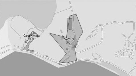
| (n.d.)*^ - Map showing the location of Incville relative to where Sunset and PCH are situated today. |
Historical Notes By 1916, Ince was supervising eight directors and releasing one five-reel picture (about 50-minute films) each week at an average cost of $40,000. His film ‘Civilization,’ which employed over 25,000 extras, was by far his most ambitious endeavor. The set for the mythical city stood alone on the barren hills, where Marquez Elementary School is today. It was built by 60 carpenters over a period of three months at a cost of $80,000 and was used for only 100 feet of film.**^ |
 |
|
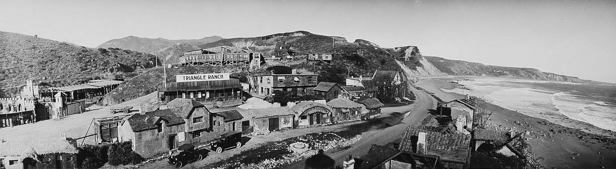
| (ca. 1916)*^ - View of houses and stage sets at Incville. Large sign on one of the buildings reads: Triangle Ranch. |
Historical Notes Incville's cost continued to rise as moviegoers enjoyed the more expensive feature films, which used five reels or more. Ince, through his alliance with Triangle, a production company founded by D. W. Griffith and Mark Sennett, built a new studio in Culver City to use for indoor movies, while retaining Inceville for outdoor locations and Westerns. Ironically, on January 16, 1916, a few days after opening of his Culver City studio, a fire broke out at Inceville, the first of many which would eventually destroy all of the dry frame buildings. That same year, Ince gave up on Inceville and sold it to Hart, who renamed it Hartville. Three years later, Hart sold the lot to Robertson-Cole, which continued filming until 1922.**^ |
 |
|
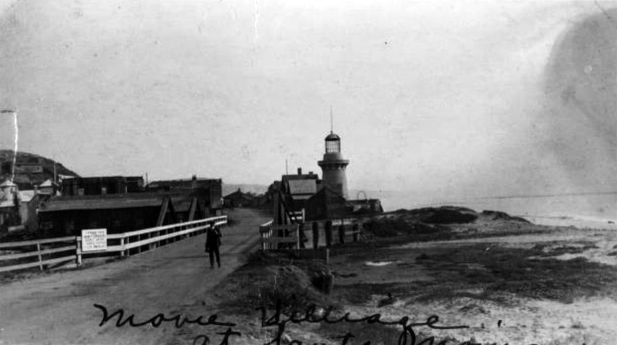
| (ca. 1915)#^^ - View showing a man standing on a bridge leading to Inceville Movie Studio village on the beach at Pacific Palisades in Santa Monica. A sign on the bridge reads "Take this newly completed scenic drive Santa Monica Los Angeles." |
* * * * * |
Santa Monica North Beach
 |
|
| (ca. 1891)* - View of Santa Monica beach looking north from the observation tower of the Arcadia Hotel. Palisades Park can clearly be seen to the right. |
 |
|
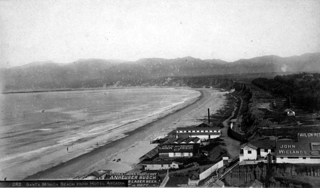
| (1893)#^^ - View showing restaurants on the North Beach, as seen from the Arcadia Hotel. Signs on the restaurants read "Hot and cold lunches, Eckert and Hopf, Anheuser Busch Lager Beer" "Pavilion Restaurant" and "John Wieland lager beer." The Santa Monica Bath House is seen beyond the "John Wieland" sign, with a bandstand shell on the bluffs above (in present-day Palisades Park) and the Long Wharf visible in the distance. |
 |
|
| (ca. 1893)* - View of Santa Monica beach looking north from the Arcadia Hotel observation tower. Palisades Park is on the right and the Santa Monica mountains can be seen in the distance. |
 |
|
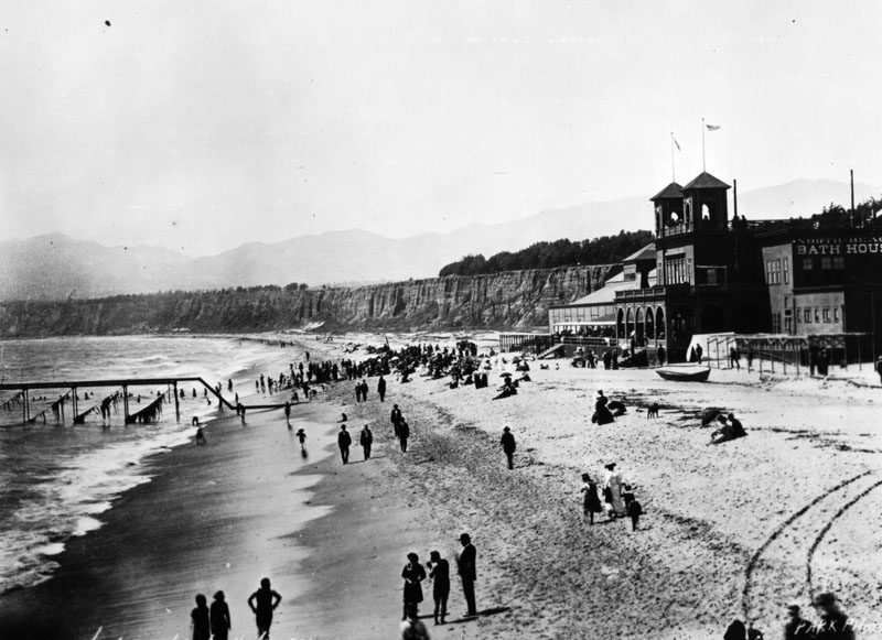
| (1898)* - This view of Santa Monica beach is looking north from the foot of Colorado Street. Ocean Avenue and Palisades Park can be seen on the right. The North Beach Bath House (dark building, center-left) is now in view. It was constructed in 1898. |
Historical Notes The Santa Monica Bath House was replaced by the North Beach Bath House in 1898. Two piers are seen in the above view. The lower pier is the remains of the Los Angeles & Independence Railroad Wharf. The pier further north is the North Beach Pier, built in 1898 (same year as the North Beach Bath House). |
North Beach Pier
 |
|
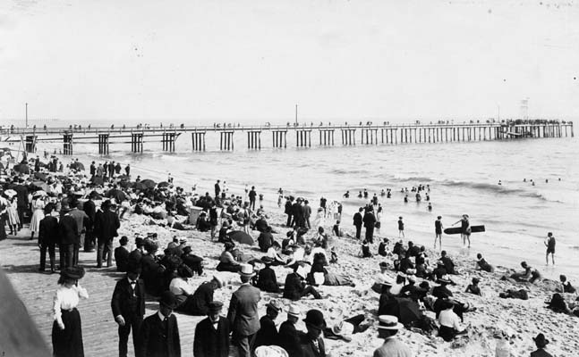
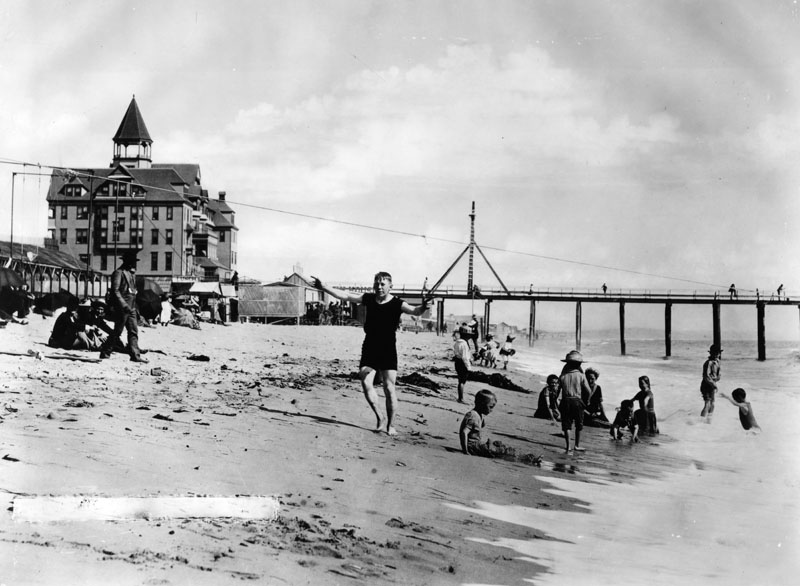
| (1898)^x^ – Crowds of people are seen enjoying the day on the newly constructed North Beach Pier. The North Beach Bath House, also constructed in 1898, can be seen in the background. |
Historical Notes The North Beach Pier was built adjacent to the North Beach Bath House in 1898. At 200 feet long, it was a place where guests of the North Beach Bath House could stroll. |
 |
|
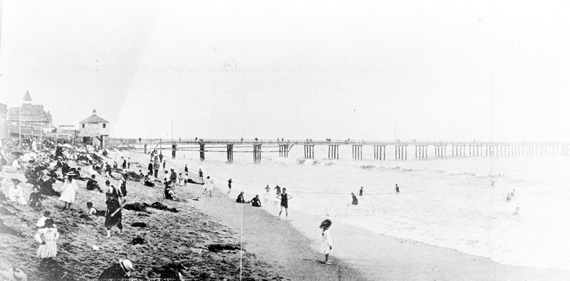
| (ca. 1898)* - View showing people walking on the boardwalk, sitting on the beach, and enjoying the surf with the North Beach Pier seen in the background. This was considered casual attire in the 1890s. |
 |
|
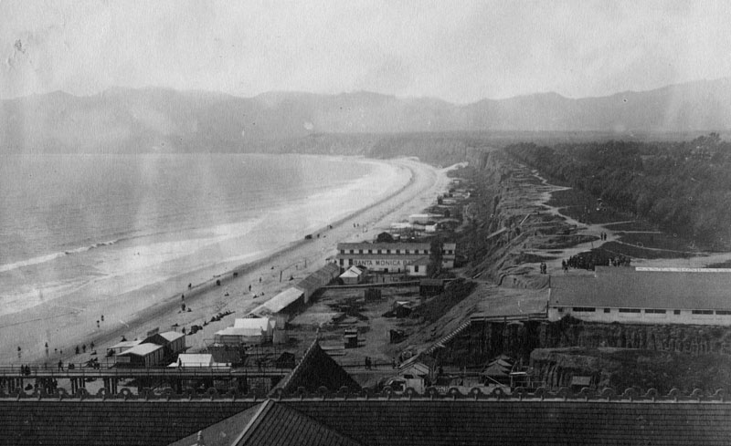
| (1898)* - Panoramic view of Santa Monica looking south from about the line of present Santa Monica Blvd. View is of the original bathing beach, or North Beach. The Camera Obscura building can be seen in the distance near the North Beach Pier. |
Historical Notes The remains of the 1875-built Los Angeles & Independence Railroad Wharf is further south closer to the Arcadia Hotel. |
|
Historical Notes The pipeline seen above is some form of discharge pipe that came out of the North Beach Bathhouse. |
 |
|
| (ca. 1898)^x^ – View as seen from the North Beach Pier looking toward the shoreline showing a pipe running from the North Beach Bathhouse out over the ocean. |
 |
|
| (ca. 1898)* - View from Santa Monica palisades south toward the North Beach Pier and Bath House. A train runs along the beach at the foot of the cliffs. The Arcadia Hotel can also be seen in the distance. |
 |
|
| (1901)^ - Image of the first house on the beach in Santa Monica, California, with the North Beach Bath House and North Beach Bath House Pier visible just south of the house, and the Arcadia Hotel, with one tower, in the distance. The Beach Road (which later became Pacific Coast Highway) and Southern Pacific Railroad tracks are seen behind the house next to the cliffs of Palisades Park, with a water tower at far center left. |
 |
|
| (1900)^ - View looking north toward Santa Monica Canyon with North Beach Bath House and houses along Beach Road on the left. Also, railroad tracks and signal and Palisades Park cliffs at right. |
Santa Monica Electric and Power Co.
 |
|
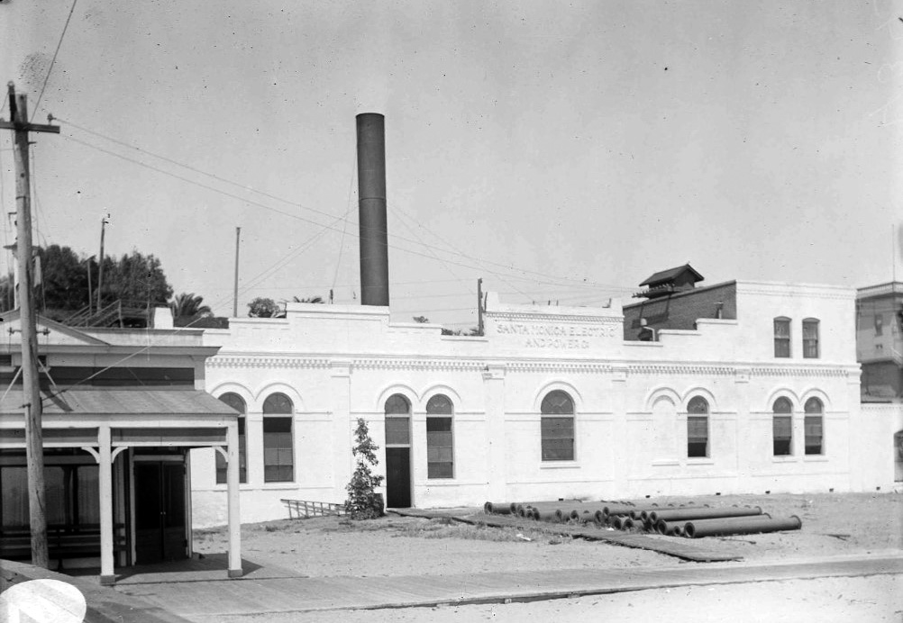
| (ca. 1898)^ – View looking south toward the Arcadia Hotel showing a large building with tall smoke stack at center of photo. This was Santa Monica’s first large steam power plant operated by the Santa Monica Electric and Power Co. Note the oil storage tanks at lower-right. |
Historical Notes Santa Monica Electric and Power Company built a power house on the beach in the late 1890s. |
 |
|
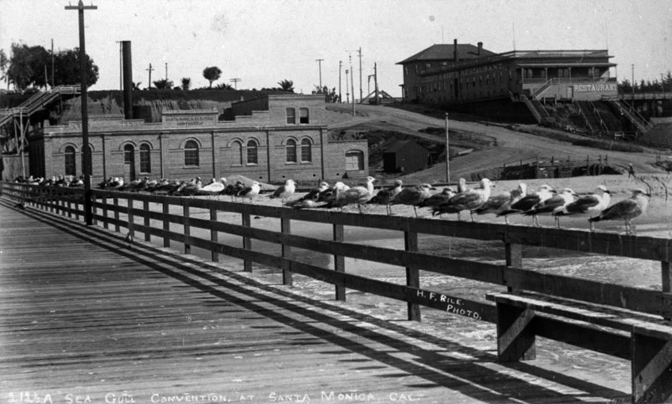
| (ca. 1900)^ - Postcard view showing a line of seagulls perched on a railing of the North Beach Bath House Pier. In the background is the brick Santa Monica Electric and Power Co. and Eckert & Hopf's Restaurant. Steps can be seen leading down from the Palisades bluffs. |
 |
|
| (ca. 1900)^ - Close-up front view of the Santa Monica Steam Plant. The sign on the building reads: "Santa Monica Electric and Power Co." |
 |
|
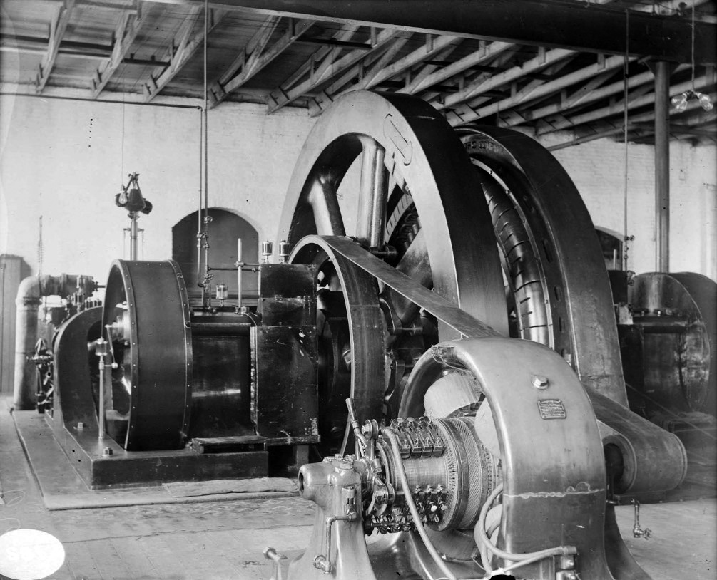
| (ca. 1900)^ – Interior view of Santa Monica Steam Plant showing steam turbine and generator of Unit 1. |
North Beach Bath House
 |
|
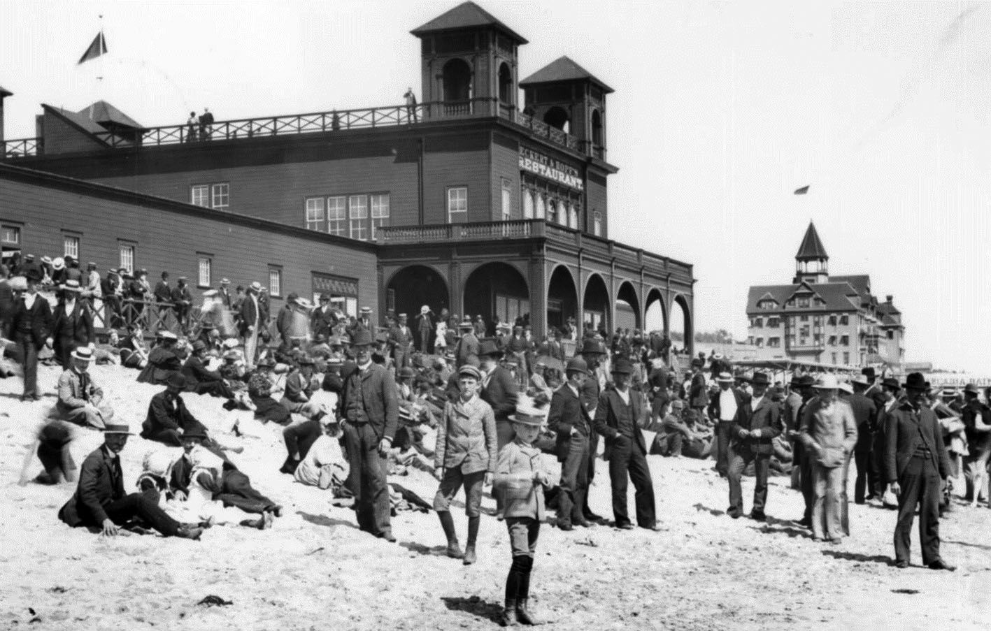
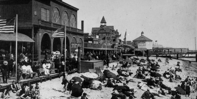
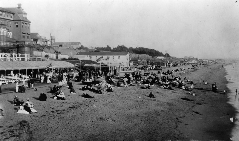
| (ca. 1898)* - Photograph of North Beach Bath House and Eckert & Hopf's Restaurant. The beach is crowded with fully clothed people. Another building is visible in the background. Flags are flying from all towers of both buildings. |
Historical Notes The North Beach Bath House was commissioned in 1898 by the children of Senator Jones. Located on the site of the original Santa Monica Bath House, it was an upscale facility complete with every recreational amenity a guest could imagine. This included everything from a heated plunge to a bowling alley and a restaurant.*^*^ |
 |
|
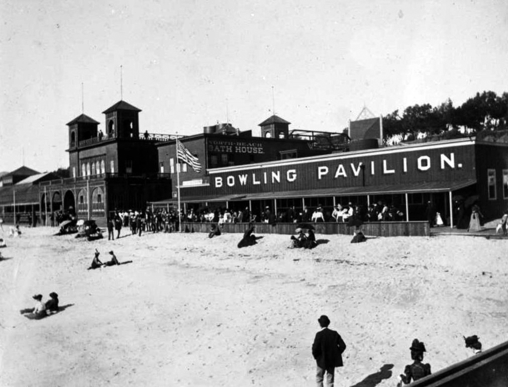
| (1898)^ – View showing people in front of the North Beach Bath House and Bowling Pavilion on the beach and boardwalk and carrying umbrellas. An edge of the North Beach Bath House Pier can be seen at bottom right. |
 |
|
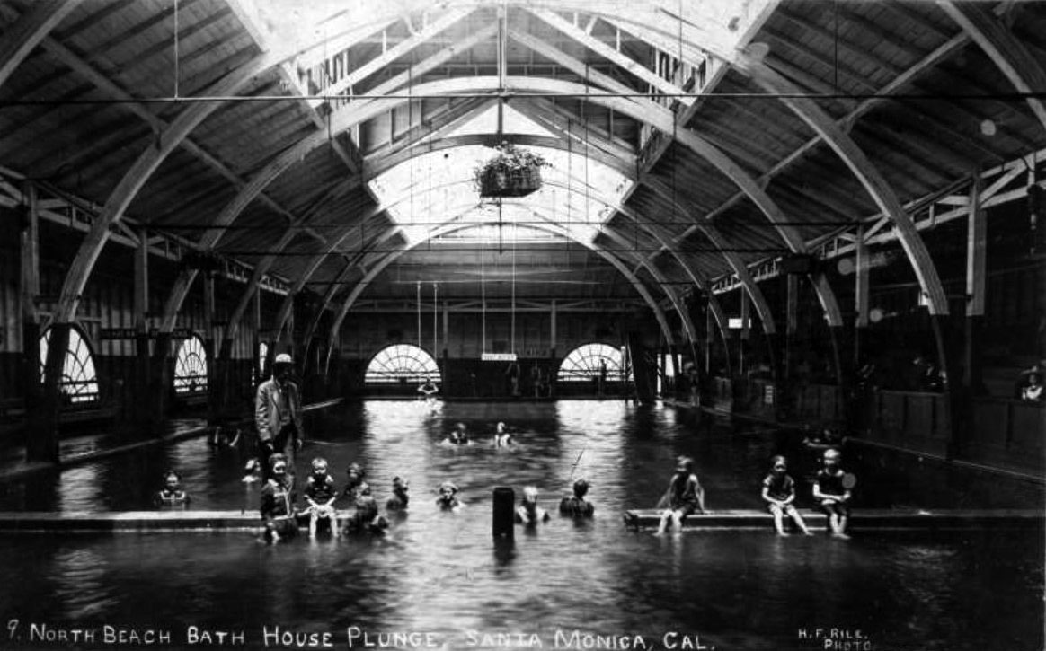
| (1901)^ - Image of people, including children, swimming in the North Beach Bath House salt water plunge in Santa Monica. A sign that reads "deep water" hangs at the center of image above the indoor pool. |
 |
|
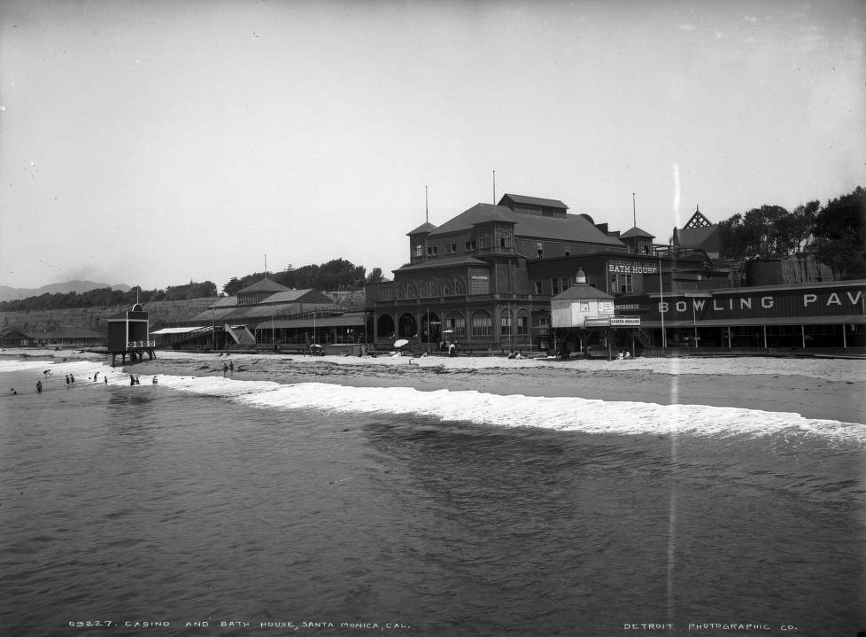
| (ca. 1900)* - View of Santa Monica North Beach from the pier's end. At center is the North Beach Bath House. To the right are the Camera Obscura and Bowling Pavilion. |
 |
|
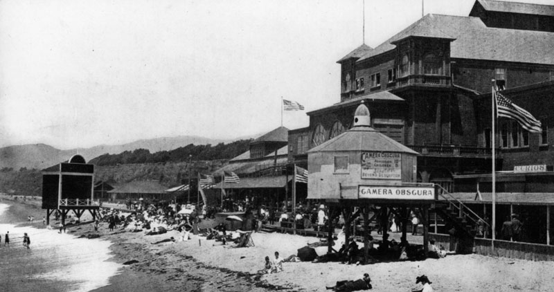
| (ca. 1900)* - View of the North Beach Bath House and casino at North Beach in Santa Monica. People mingle in front of Bath House while others swim or sit on the beach. Shows a bowling alley. Signs read: "North Beach Bath House" "Camera Obscura" "Bathing Suits" and "Bowling Pavilion." |
 |
|
| (ca. 1898)* - Crowds of people are shown enjoying the day on the beach in front of the North Beach Bath House. The Camera Obscura building is in the background. |
Camera Obscura
 |
|
| (ca. 1898)* - Exterior view of Camera Obscura can be seen in the foreground. The beach scene and North Beach Bath House can be seen in the background. |
Historical Notes The Santa Monica Camera Obscura was an optic device built in 1898 by Robert F. Jones, nephew of Senator John P. Jones, the founder of the City of Santa Monica. “Camera Obscura” means darken chamber. It is a darken room in which the device allows a 360 degree view of the outside surroundings. Sort of like a pinhole camera, a hole in the roof allows light from outside pass through the hole striking a white board where the image is shown in color but upside down. The camera obscura was known to earlier scholars since the time of Aristole.**^^ |
 |
|
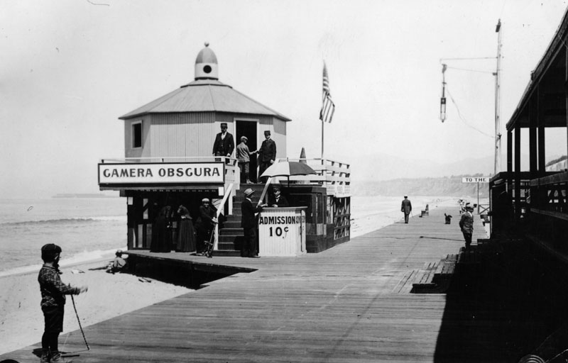
| (ca. 1900)* - Photo shows Camera Obscura located on the boardwalk of Santa Monica beach. The attendant is seen collecting a 10-cent admission fee from a young man before he enters the darkened chamber. |
 |
|
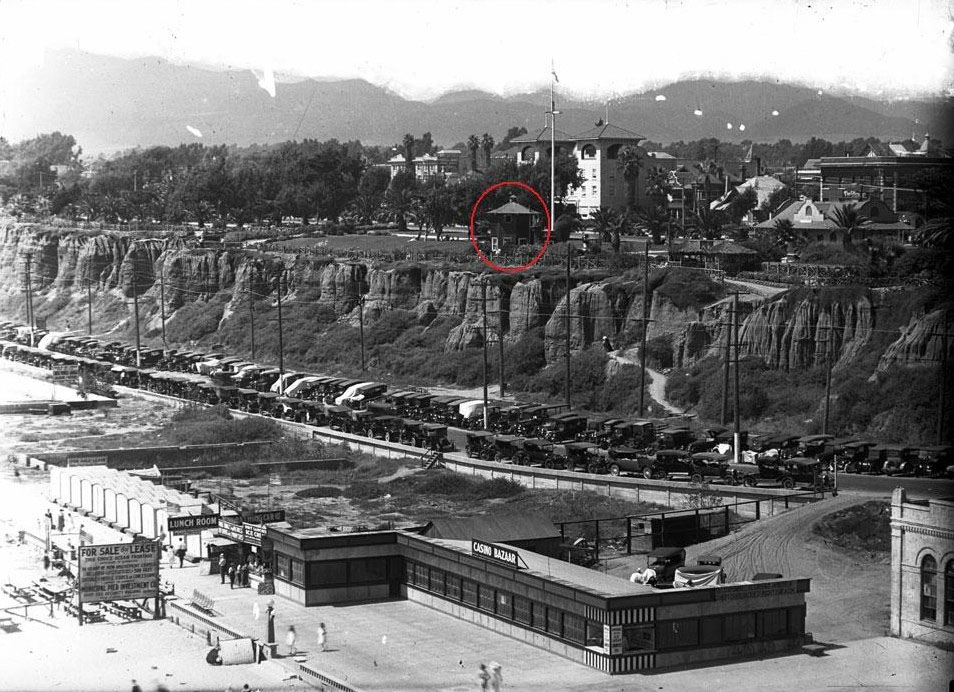
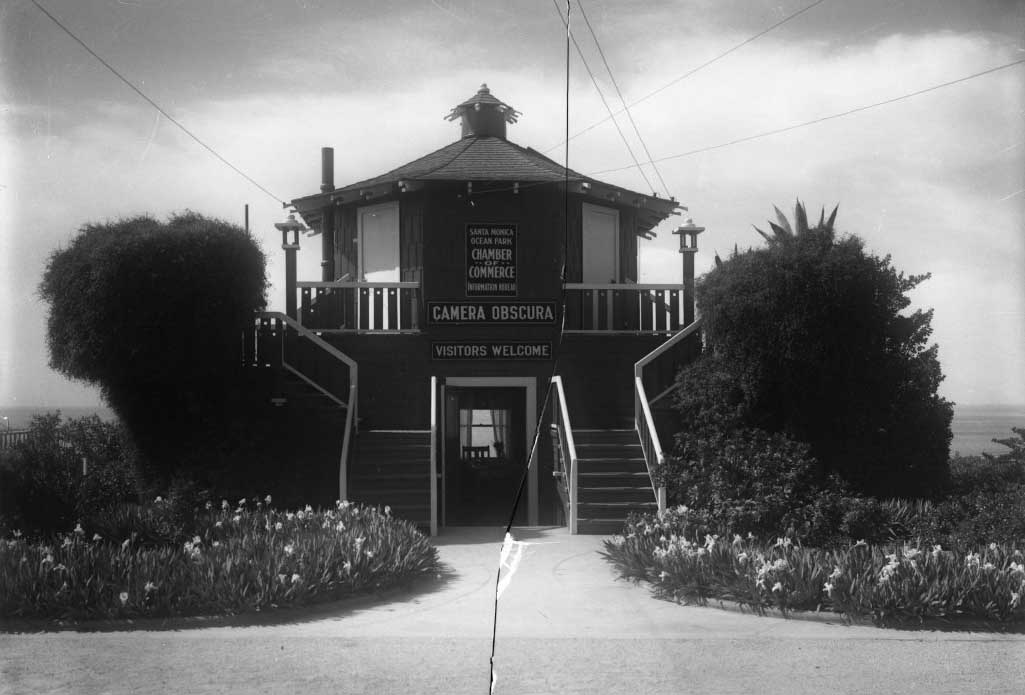
| (ca. 1907)**^ - View of the Camera Obscura after it was relocated to the top of the Palisades Bluffs. |
Historical Notes In 1907, the Camera Obscura was given to the city and then relocated to the top of the bluffs. The camera spent almost 50 years documenting life on the Santa Monica beach.^^** |
 |
|
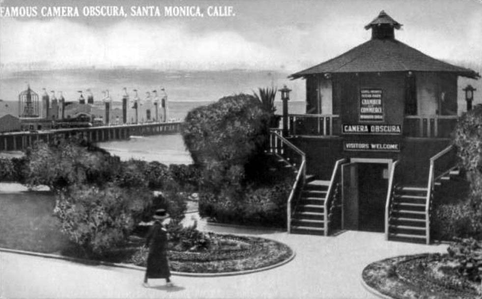
| (ca. 1924)** - Postcard view of the famous Camera Obscura, Santa Monica. The structure is a double stairway leading up to a second floor with an open door seen between the two staircases. The surrounding grounds are landscaped with large bushes and flowers planted half circles. In the background to the left is a pier with large buildings built upon it. A woman wearing a hat walks in the foreground. To the left is the Beautiful La Monica Ballroom, opened in 1924. |
Historical Notes In 1955 the Camera Obscura was installed in the nearby Senior Recreation Center at 1450 Ocean Boulevard where it can still be seen today. Many images of the popular beach community throughout the years are on display to compare to the current view. |
 |
|
| (ca. 1920)* - Camera Obscura, Linda Vista Park (later Palisades Park). |
Historical Notes Linda Vista Park was renamed Palisades Park in the 1920s. |
* * * * * |
 |
|
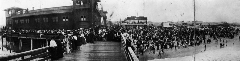
| (ca. 1895)* - A panoramic view of one of the ocean piers and parks along the ocean before 1900. Huge cowds are on the pier and on the beach next to it. |
Historical Notes In 1895, Abbot Kinney acquired the deed to the coastal strip previously purchased by W.D. Vawter and named the area Ocean Park. It became his first amusement park and residential project. A race track and golf course were built on the Ocean Park Casino. After a falling out with his partners he focused on the south end of the property, which he made into Venice of America.*^ Click HERE to see more in Early Southern California Amusement Parks. |
 |
|
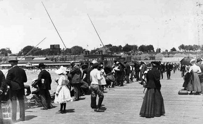
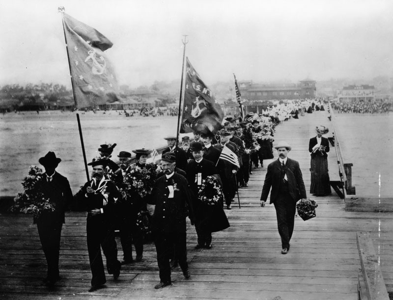
| (ca. 1900)* - A long parade line, led by U.S. Navy flag bearers, walks across a pier carrying flowers to be thrown from the pier into the water at the foot of Colorado Ave. |
Historical Notes Formerly known as Decoration Day, Memorial Day originated after the American Civil War to commemorate the Union and Confederate soldiers who died in the Civil War. By the 20th century, Memorial Day had been extended to honor all Americans who have died while in the military service.*^ |
 |
|
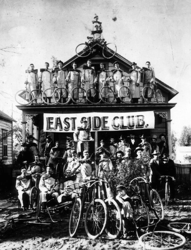
| (ca. 1898)* - Group photo of the East Side Cycle Club, showing a banner for the club, taken on the beach at Santa Monica near the old North Beach Bath House. The riders are wearing overcoats and over-sized bows. |
Los Angeles Pacific Electric Railway
 |
|
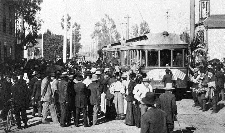
| (1896)* - Opening of the Los Angeles Pacific Electric Railway from Los Angeles to Santa Monica, April 1, 1896. The extensive Pacific Electric Railroad easily transported to the beaches people from across the Greater Los Angeles Area. |
Historical Notes The Los Angeles Pacific Railway was built by Eli Clark and Moses H. Sherman, for whom Clark Drive, Shermanton (now West Hollywood), and Sherman Avenue (now Santa Monica Boulevard) were first named. They were early pioneers of interurban electric railways that laid track from downtown to the sea. Their Los Angeles to Santa Monica line opened on April 1, 1896 to an excited beach crowd in Santa Monica.*# |
 |
|
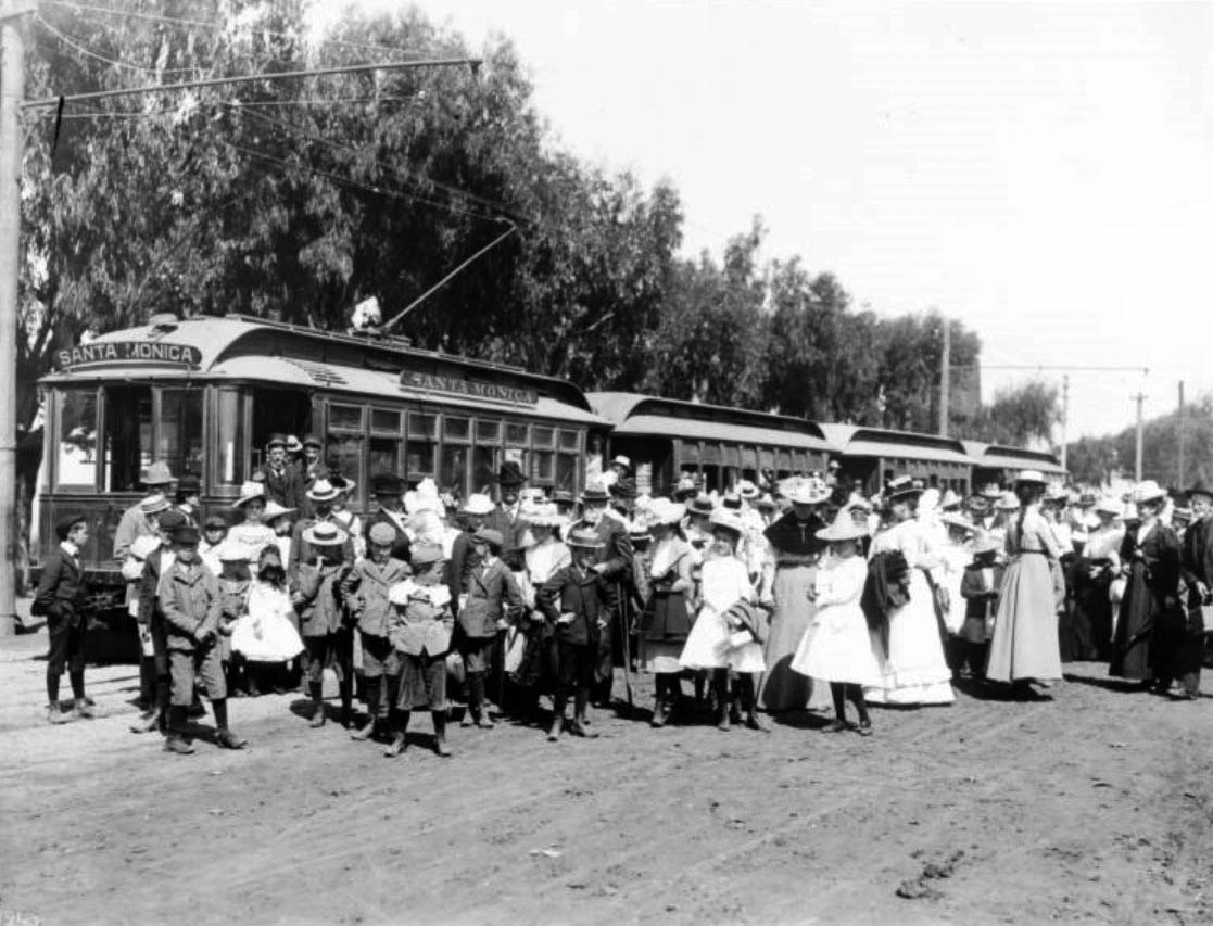
| (1896)** – View showing a crowd of people gathered for opening day of the electric car line in Santa Monica, April 1, 1896. The men, women and children are piling off of four cars at center. The finely-dressed crowd stands in front of the cars in the foreground while trees hang over the cars from the left side. |
 |
|
| (1896)* - View is looking north across the bridge on Ocean Avenue, from the Arcadia Hotel. A trolley can be seen on the right. In the middle of the photograph, a sign reads "Arcadia Baths, hot salt baths, new tubs." |
Whitaker Ranch
 |
|
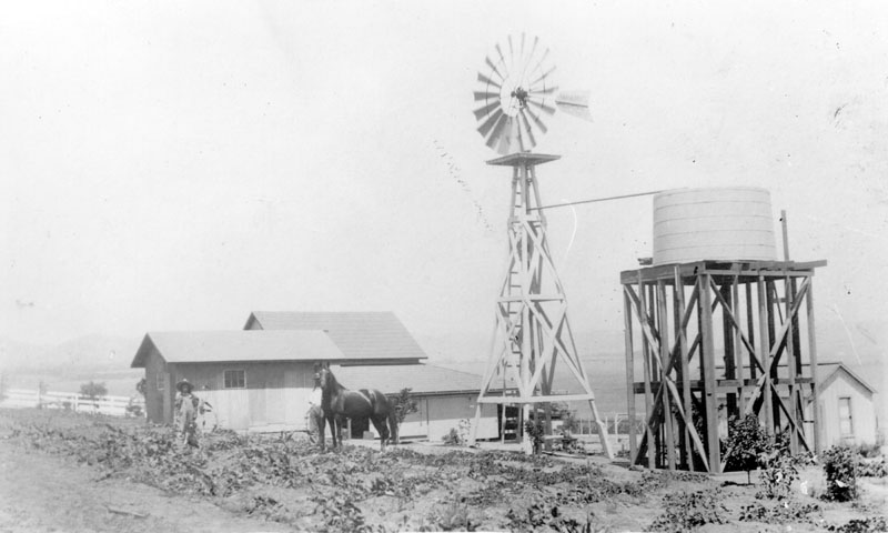
| (1897)* - Original wooden house and barn on the Whitaker Ranch located on Centinela Avenue in Santa Monica. Two men and a horse can be seen standing in the small field closest to the house, and a windmill and water tank are visible on the right. The Santa Monica Airport is now located in this same location. |
Historical Notes Santa Monica Airport was originally called "Clover Field" after World War I aviator Lieutenant Greayer "Grubby" Clover, and was home of the Douglas Aircraft company. The first circumnavigation of the world by air took off from Clover Field on St. Patrick's Day, March 17, 1942. At one point, it was the site of the Army's 40th Division Aviation, and became a Distribution Center after World War II.* |
Vawter Carnation Fields
 |
|
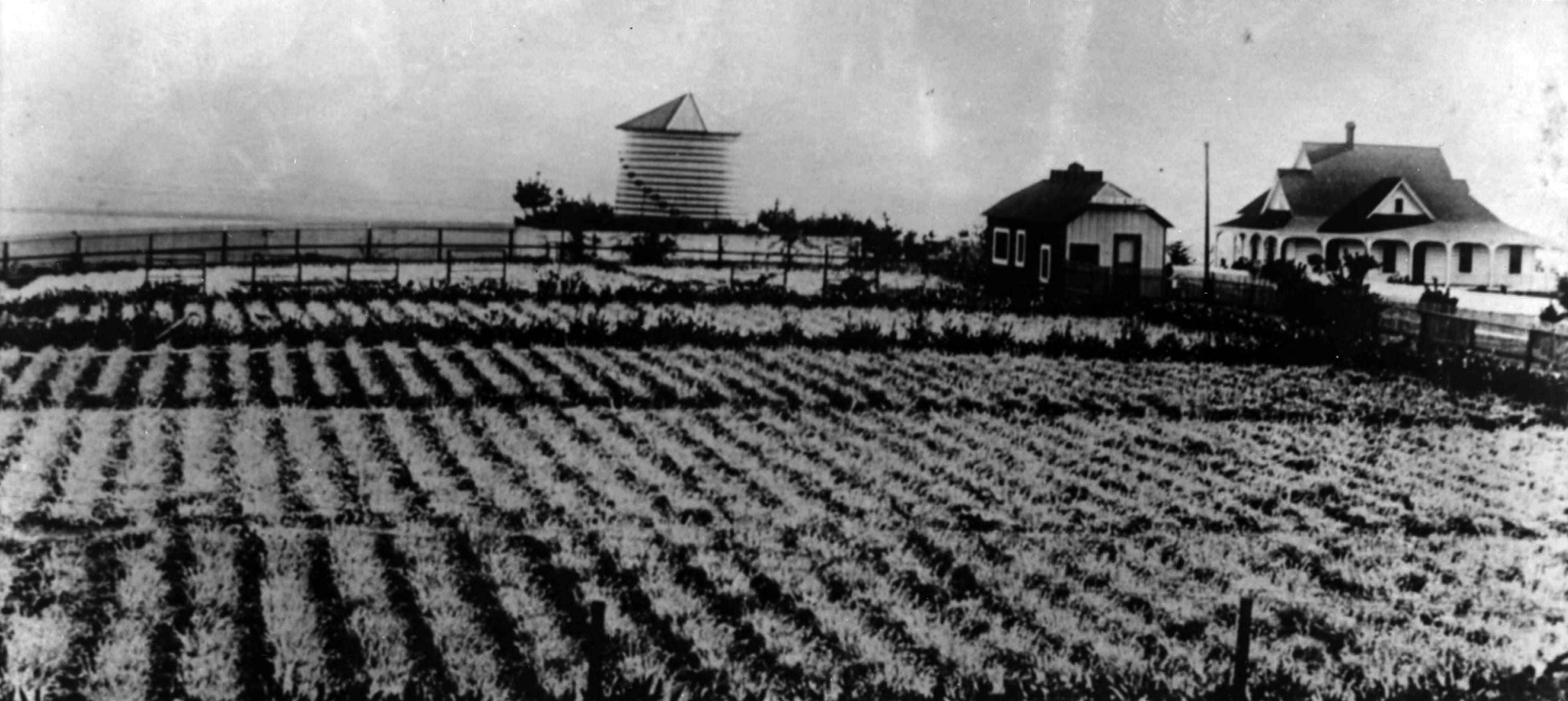
| (ca. 1900)* - Carnation field, silo, and a home, located at 4th Street and Marine Street in the Ocean Park neighborhood of Santa Monica. The property belonged to Edwin J. Vawter, a pioneering Santa Monica businessman. |
Historical Notes Edwin J. Vawter, was from a pioneering Santa Monica family. His father established Santa Monica's first general store and First National Bank. A 1901 guidebook (Wilson's Illustrated and Descriptive Souvenir and Guide to Los Angeles and Near-by Towns) described the carnation fields thus: "One of the most beautiful attractions [in Ocean Park] is the carnation field of Mr. E.J. Vawter. It is situated on a ridge overlooking the grand old Pacific. Here carnations are in full bloom summer and winter." It was probably helpful that Mr. Vawter was also in charge of the city water company. |
Ocean Park Pier
 |
|
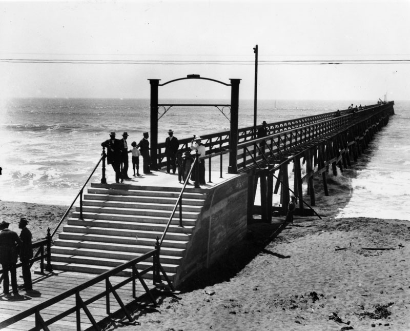
| (ca. 1897)* - A view of the 500 ft. long Ocean Park Pier, built by the Santa Fe Railroad in 1895. This view shows several people standing on the pier as we look towards the ocean. |
Historical Notes In 1891, Abott Kinney and (silent partner) Francis G. Ryan purchased a 1-1/2 mile long, narrow strip of sand dunes along the shore line south of Santa Monica extending from Strand Street to Brooks Avenue from a Captain Hutchinson. To encourage building, water was brought in, the tract was sewered, board walks laid, and lots leased to persons desiring to put up small cottages. That same year, Kinney & Ryan (Ocean Park Development Company) built a pier, golf course, horse-racing track, boardwalk and other resort amenities on the northernmost edge of their holdings. They would also give 12 acres to the Santa Fe Railroad so they would extend their Inglewood line north to Kinney and Ryan’s resort. In 1893, Kinney and Ryan began selling small 25 x 100 foot beach lots priced at $100 and featured piped water. Tents were erected on the unsold lots and were available to campers for summer rental. Frederick Rindge, who was president of the Los Angeles YMCA, founds a YMCA summer camp on 5 acres of land located on 250ft beach front near Hill St., donated by Kinney who hopes that the YMCA camp will attract people to his beach resort.* |
 |
|
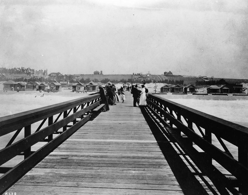
| (ca. 1897)* - A view of the 500 ft. long Ocean Park Pier, built by the Santa Fe Railroad in 1895, and located about 300 feet south of Hill St. Here we are standing on the pier looking toward Ocean Park itself. |
Historical Notes Kinney and Ryan’s original resort consisted of 150 beach cottages, and a small commercial district along Pier Avenue. A building boom added 40 new beach cottages, several stores, and Kinney’s new 40 acre Ocean Park race course and golf links. The resort would be subdivided and sold to more developers and by 1902, there were over 700 cottages in Ocean Park.* |
 |
|
| (1898)* - Closer view of Kinney and Ryan's beach cottage resort located near Ocean Park Pier. |
Historical Notes In 1898, Ryan died and his widow married Thomas Dudley of Santa Monica who becomes Kinney's new partner. After 1904, Kinney moved his attention to his Venice of America development (also called Ocean Park at the time) , south of the Santa Monica city boundary. The history of Venice and Ocean Park are intertwinned. From 1905 to 1925, Ocean Park was developed by people such as Fraser, Merritt Jones, Hart, Hollister and Wadsworth.* |
* * * * * |
Palisades
 |
|
| (ca. 1889)** - Looking south from the '99 steps' toward the Arcadia Hotel. In the upper left can be seen a man sitting on a bench very close to the edge of the palisades (This area would become Palisades Park). The stub of the Los Angeles and Independence Railroad Wharf can also be seen. |
Historical Notes Originally known as “Linda Vista Park,” Palisades Park was the first officially-designated public open space in Santa Monica. The land was donated to the City by Santa Monica's founder, Senator John P. Jones, in 1892. The Los Angeles and Independence Railroad Wharf was in use between 1875 and 1879, at which time it was purchased by the Southern Pacific Railroad company and partially dismantled. It stood just south of the present location of the Santa Monica Pier at the foot of Colorado Avenue. |
 |
|
| (ca. 1890)^- View looking south from the rim of the Palisades, overlooking the original "99 Steps," which provided access to the northern portion of Santa Monica beach. Seen in the distance is the Hotel Arcadia and the stub of the Los Angeles and Independence Railroad Co. Wharf. The vantage point of this photograph is near the foot of Wilshire Avenue. |
Historical Notes Most of the beach shacks would be removed with the laying of railroad tracks along the beach by Southern Pacific in 1892. |
 |
|
| (ca. 1890)^- View looking south from the rim of the Palisades, overlooking the original "99 Steps," which provided access to the northern portion of Santa Monica beach. Seen in the distance is the Hotel Arcadia and the stub of the Los Angeles and Independence Railroad Co. Wharf. The vantage point of this photograph is near the foot of Wilshire Avenue. AI image enhancement and colorization by Richard Holoff |
 |
|
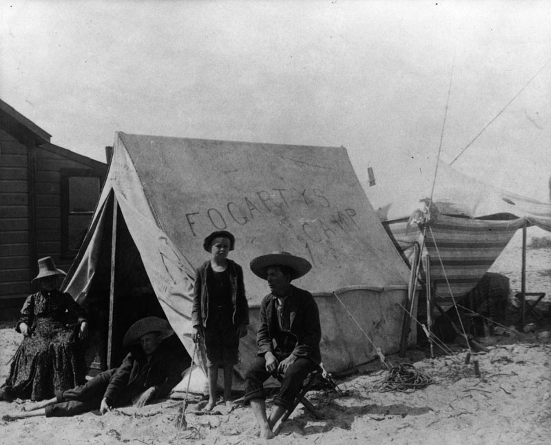
| (ca. 1900)* - A family is camping on the beach circa 1900. On their tent are written the words, "Fogarty's Camp." A man and woman are sitting on chairs near the tent, while two barefoot boys pose with them. All are wearing street clothes. The tent has an annex behind and is located next to a wooden house. |
"99 Steps"
 |
|
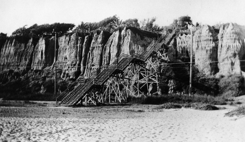
| (ca. 1891)** - View of the "99 Steps" from the palisades to the beach below. Two small wood buildings -- one storage shed or shack, the other a dwelling or business with a small covered porch -- sit on the adjacent beach. The wooden steps bifurcate near the top at a landing. |
Historical Notes This wooden staircase, the “99 Steps”, was constructed in 1875 to allow easy access to the beach. It was located at the foot of Arizona Avenue. The steps were later altered so that Southern Pacific trains en route to the Long Wharf could pass underneath. |
 |
|
| (ca. 1898)#^ - View looking NW showing railroad tracks running underneath the '99 Steps'. Note how the steps have been modified to accomodate the tracks (compare to previous image). |
Historical Notes Southern Pacific Railroad installed a rail line down to Santa Monica Canyon that was later sold to the Pacific Electric Railway. It was in use from 1891 to 1933. |
 |
|
| (ca. 1898)#^ - View looking NW showing railroad tracks running underneath the '99 Steps'. AI image enhancement and colorization by Richard Holoff |
 |
|
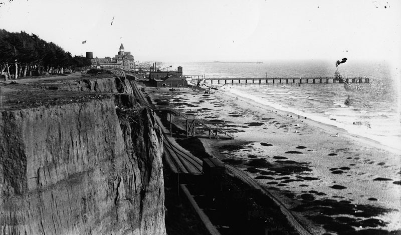
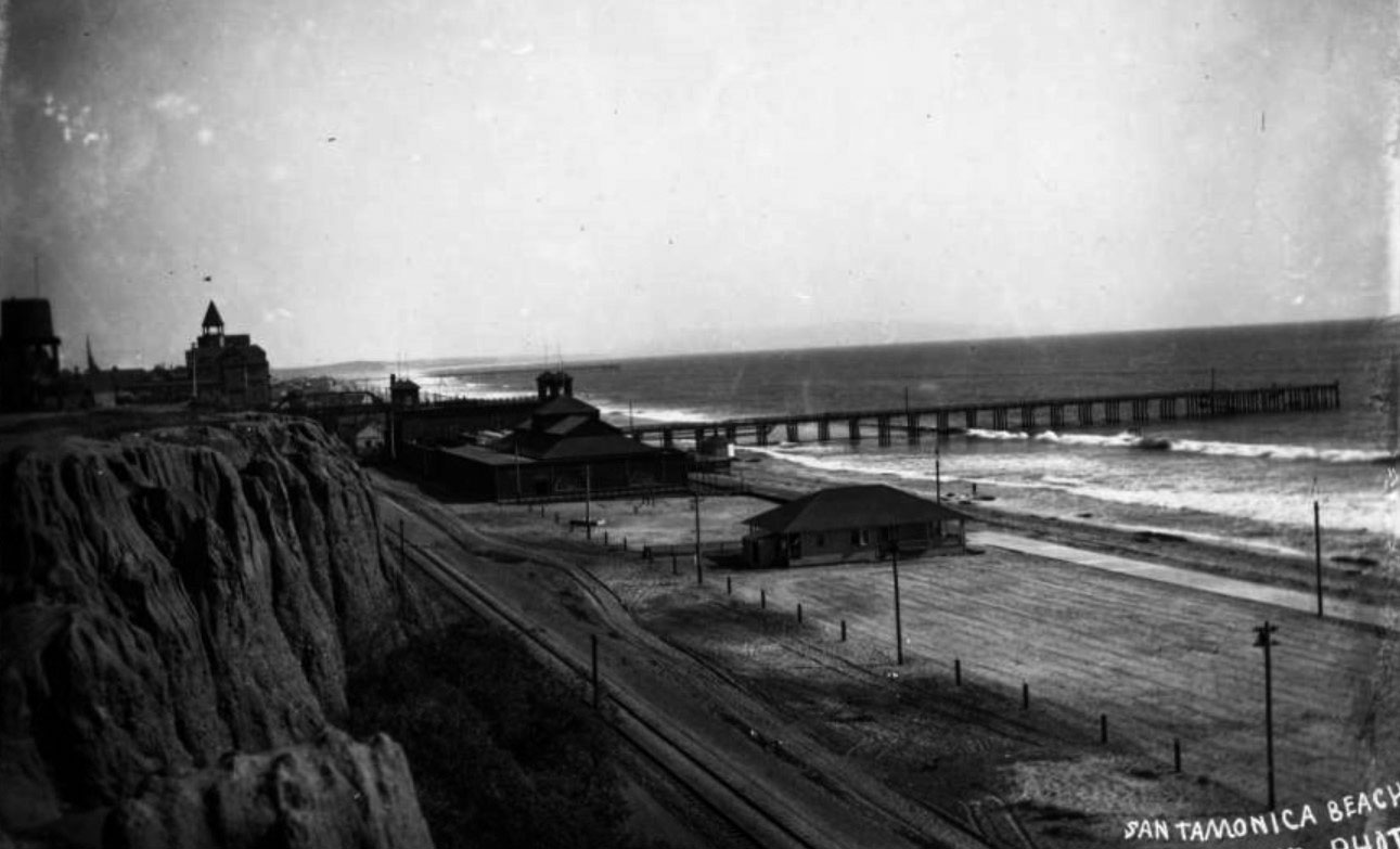
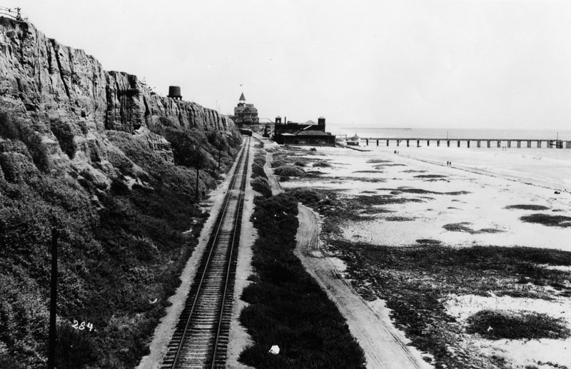
| (1898)* - Santa Monica beach and palisades with a railroad track and a highway running below the cliffs. In the distance are the bathhouse and pier at the foot of Colorado Boulevard. View is looking south towards Santa Monica. |
 |
|
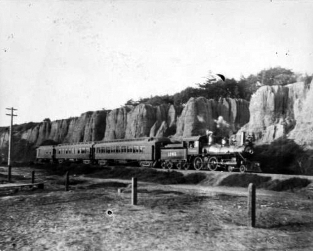
| (ca. 1898)#^^ - View showing a Southern Pacific train on the beach with the Santa Monica Palisades in the background. |
|
|
| (ca. 1898)* - View from Santa Monica palisades south toward the pier. A train runs along the beach at the foot of the cliffs. The Arcadia Hotel can be seen in the background. |
 |
|
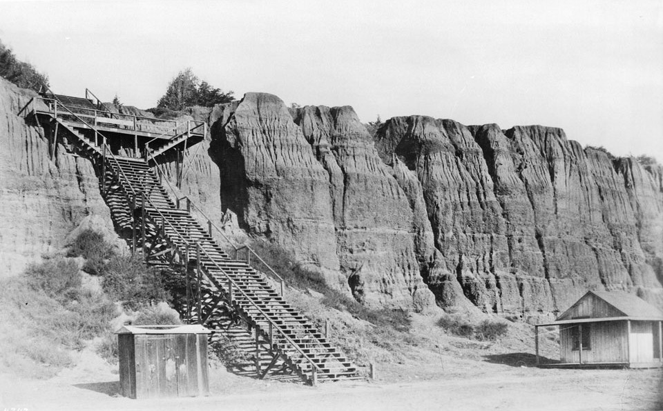
| (1915)* - View of the '99 Steps' leading from the beach to the area above the palisades at Santa Monica. |
 |
|
| (1920s)^ - Postcard view showing the '99 steps' leading down from the Palisades bluff, over the coast road to the beach in Santa Monica, with a building with an awning that reads "Public Welcome." Trees and fence of Palisades Park are seen at the top of the bluff. |
 |
|
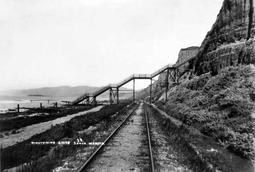
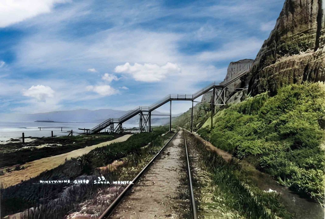
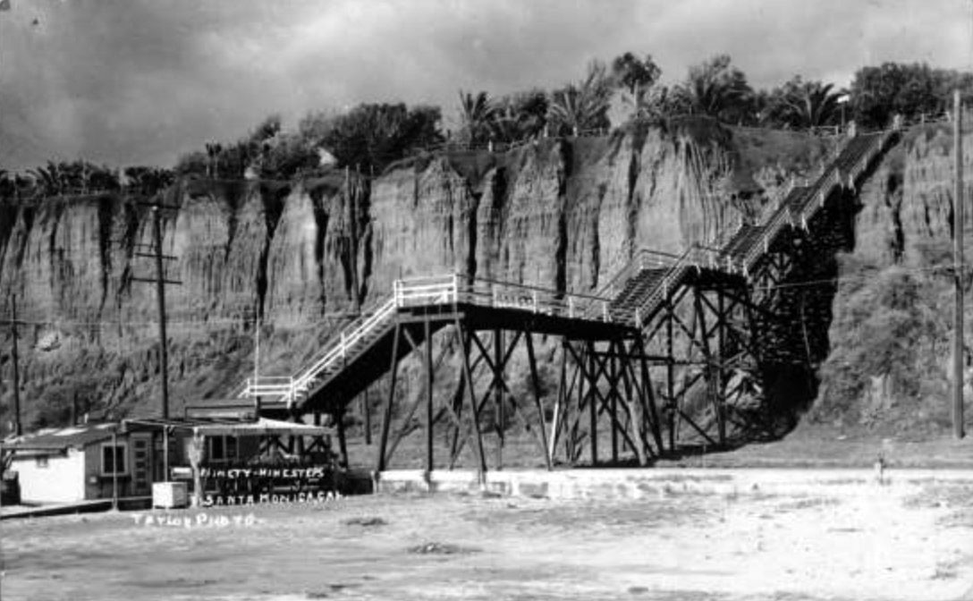
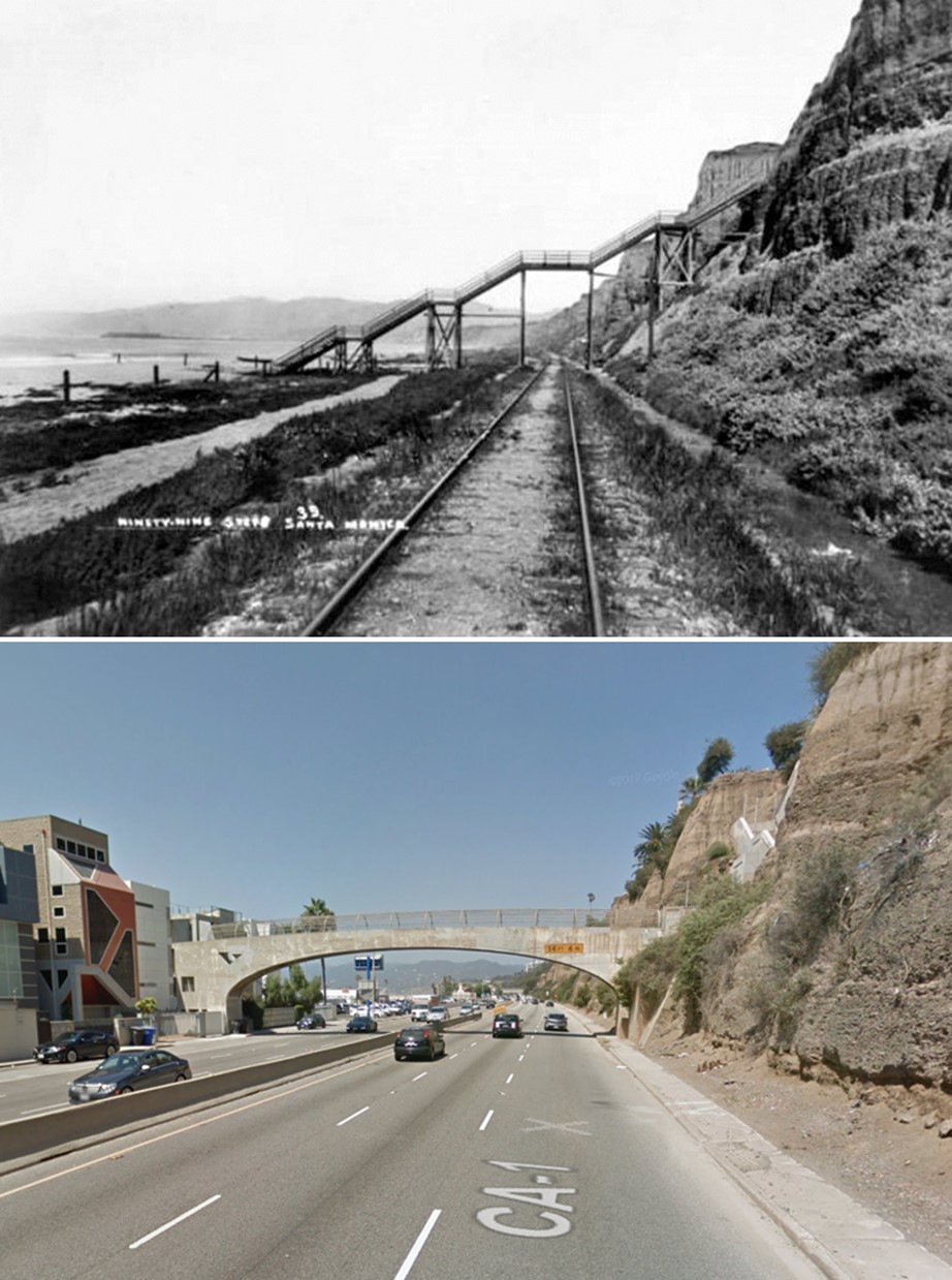
| (1927)* - Looking down at Pacific Coast Highway shortly after its completion. A new concrete staircase is seen that connects the top of the palisades to the beach. |
Historical Notes The steps and bridge seen in the above photo are at the same location as the original '99 Steps" built in 1875. When the Pacific Coast Highway was built in 1927, new concrete steps and a bridge over the highway were built to allow for continued beach access. |
 |
|
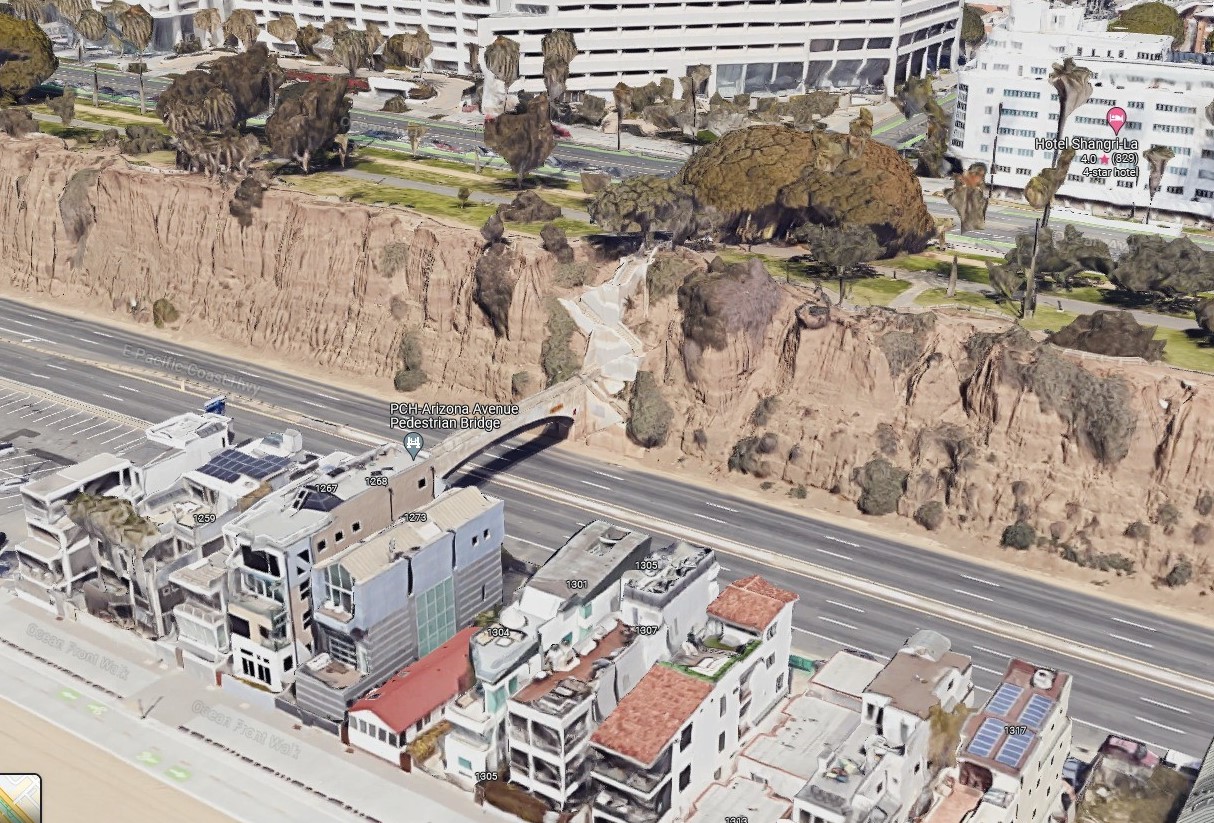
| (2022) - Google Earth view showing the Pedestrian Bridge that connects the Palisades, at the end of Arizona Ave, to the beach right where the original 1875-built 99 Steps were located. |
Then and Now
 |
|
| (1898 vs 2022)* – Looking NW showing at the Pedestrian Bridge (over PCH, CA-1) that connects the Palisades, at the end of Arizona Ave, to the beach right where the original 1875-built 99 Steps were located. |
* * * * * |
Arriving in Santa Monica
 |
|
| (ca. 1900)*#* - View from the Arcadia Hotel observation tower showing two Southern Pacific excursion trains. These trains regularly brought beachgoers to Santa Monica. Horse-drawn carriages and a trolley can also be seen. |
 |
|
| (ca. 1904)** - Birdseye view looking northeast from the Arcadia Hotel (same view as previous photo but about 4 years later). Note how the building in the lower right has been enlarged, also, the addition of trees around the train station at center of photo. |
Beach Views
 |
|
| (1900)* - Beachgoers enjoying the day at Santa Monica Beach. The large building to the right is the North Beach Bath House. Photo is looking north from the pier, at the foot of Colorado Avenue. |
 |
|
| (ca. 1900)* - Children are seen playing on the beach at Santa Monica. The Arcadia Hotel and wharf can be seen in the background. |
 |
|
| (ca. 1900)* - Crowds of people can be seen sitting on the beach and strolling the boardwalk on South Beach in Santa Monica. The Arcadia Hotel is in the upper-left. |
Santa Monica City Views
.jpg) |
|
| (1900)** - Panoramic view of Santa Monica looking northeast from Third Street and Arizona Avenue. Trees stand on the side of the street in the foreground. Large houses stand in a row with wide, manicured lawns. More houses can be seen amongst the tree tops that extend to the mountains in the distance. |
 |
|
| (ca. 1900)** - View looking southwest from the tower of the Academy of Holy Names, located on Third Street and Arizona Avenue with the ocean visible in the distance. Arizona Avenue runs diagonally from lower-left to upper-right where it meets Ocean Avenue. Today, the Hotel Shangri-La stands on that corner. |
 |
|
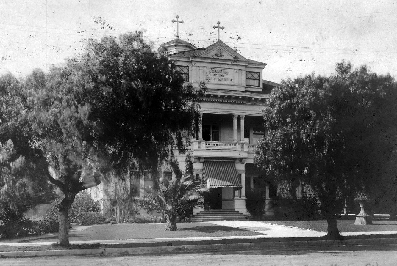
| (ca. 1900)**^ – Front view of the Academy of the Holy Names, a flourishing school for girls established by a band of holy sisters, located at 3rd Street and Arizona Avenue in Santa Monica. |
Historical Notes The Sisters of the Holy Names of Jesus and Mary had arrived in Santa Monica in July 1899. They opened the Academy of the Holy Names on September 4 of that year in a small frame building on Fourth Street and Arizona. An intense fund-raising drive was launched immediately and a more substantial Academy building was erected in 1900 at Third and Arizona.** |
Bank of Santa Monica
 |
|
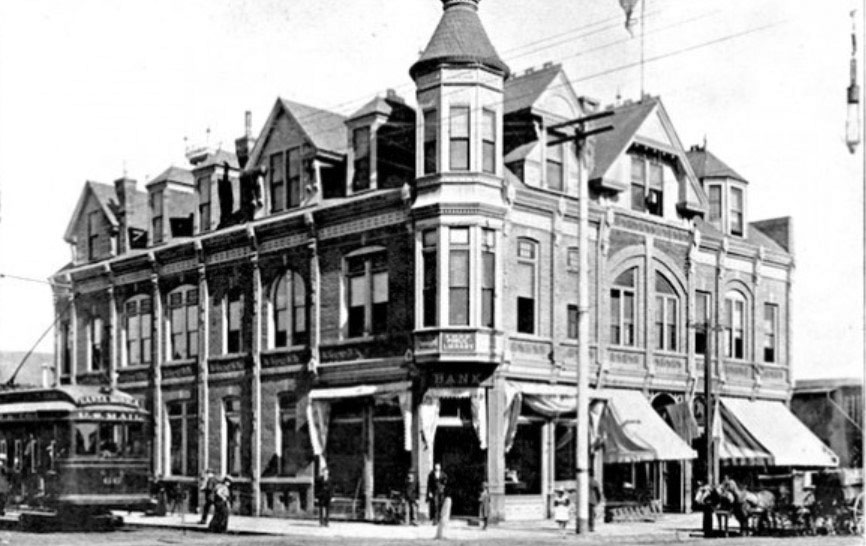
| (ca. 1899)* – View of the Bank of Santa Monica located at Third Street and Oregon Avenue (now Santa Monica). |
Historical Notes By 1899 there were two banks in the City of Santa Monica: Bank of Santa Monica located at Third Street and Oregon Avenue (now Santa Monica Blvd.) and Commercial Co's Bank at 219 Third Street. By the late 1920s there were thirteen financial institutions, including multiple branches.* |
 |
|
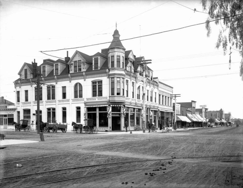
| (ca. 1900)* - View of the corner of Third Street and Santa Monica Boulevard (then named Oregon Avenue). Today the intersection is part of the popular Third Street Promenade retail district. |
Historical Notes The 1st Santa Monica Public Library was located at Third Street and Santa Monica Blvd. on the second floor of the Bank of Santa Monica.* |
 |
|
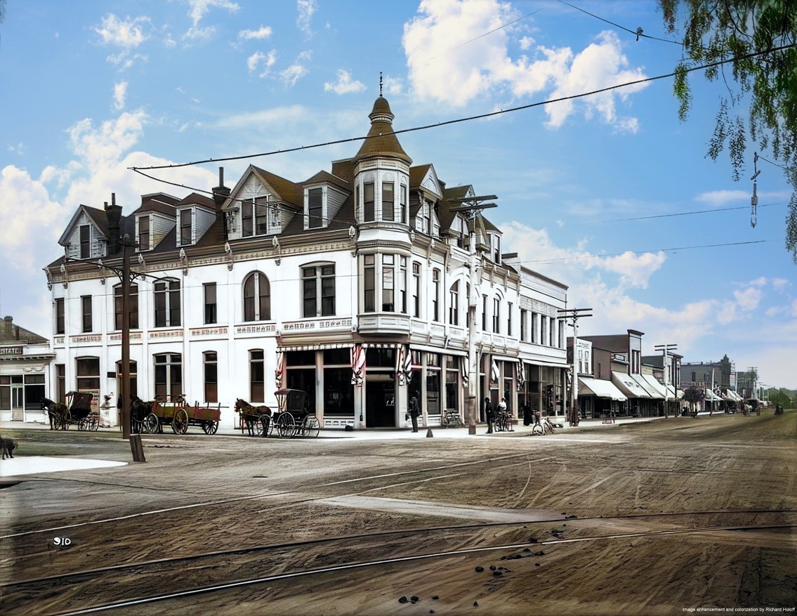
| (ca. 1900)* - View of the corner of Third Street and Santa Monica Boulevard (then named Oregon Avenue). Today the intersection is part of the popular Third Street Promenade retail district. Image enhancement and colorization by Richard Holoff. |
* * * * * |
Pacific Electric Railway
 |
|
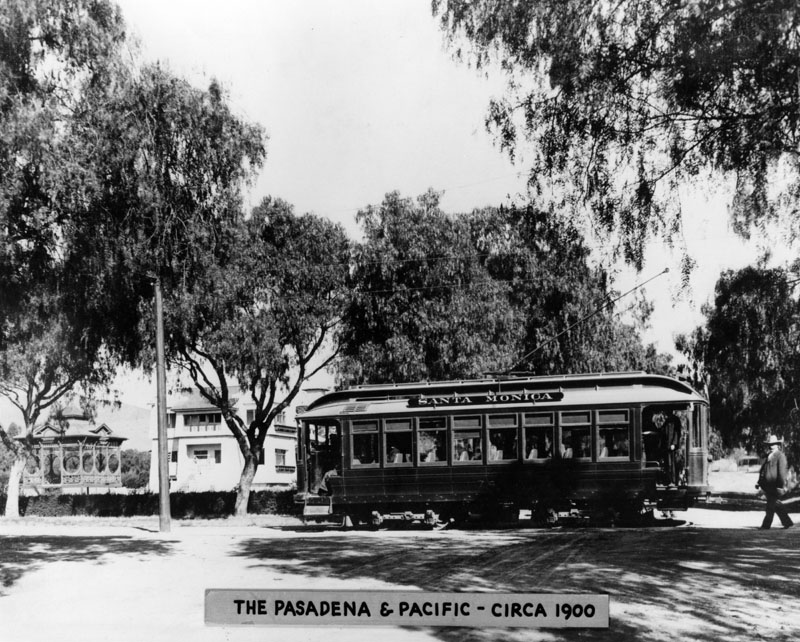
| (ca. 1900)* - Pacific Electric Railway Pasadena and Pacific car labelled "Santa Monica,” seen crossing a street. |
Historical Notes The Los Angeles Pacific Railroad, started by Moses Sherman and Eli Clark (brother-in-law), had at its peak 180 miles of track in the western portions of Los Angeles County, from Pasadena, California to Santa Monica, running down the coast to Redondo Beach.*^ |
Balloon Route Trolley Trip
 |
|
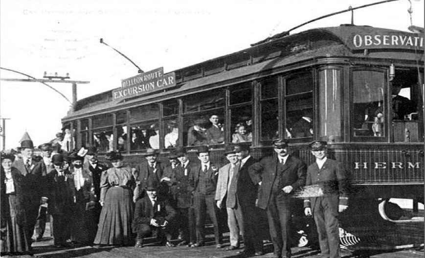
| (1902)#+ - Postcard view showing passengers enjoying the most famous trolley car trip in the West during the early 1900s – a daylong excursion called the “Balloon Route” from downtown Los Angeles to the beach cities and back again. The trip, billed as “the only ocean voyage on wheels,” covered 101 miles for 100 cents. |
Historical Notes Moses Sherman and Eli Clark introduced several innovations to trolley car operations in the L.A. area. One of the most popular was the scenic Balloon Route Trolley Trip, the most famous streetcar excursion in the West. Few tourists to Los Angeles missed riding the Balloon Route cars, so named because of the looped shape of the course trolleys would follow. The excursion consisted of as many as 18 cars daily going from downtown L.A. to Hollywood and then on to Santa Monica and south to other beach cities of Venice, Playa del Rey and Redondo Beach before heading back to downtown through the Palms area. #+ |
 |
|
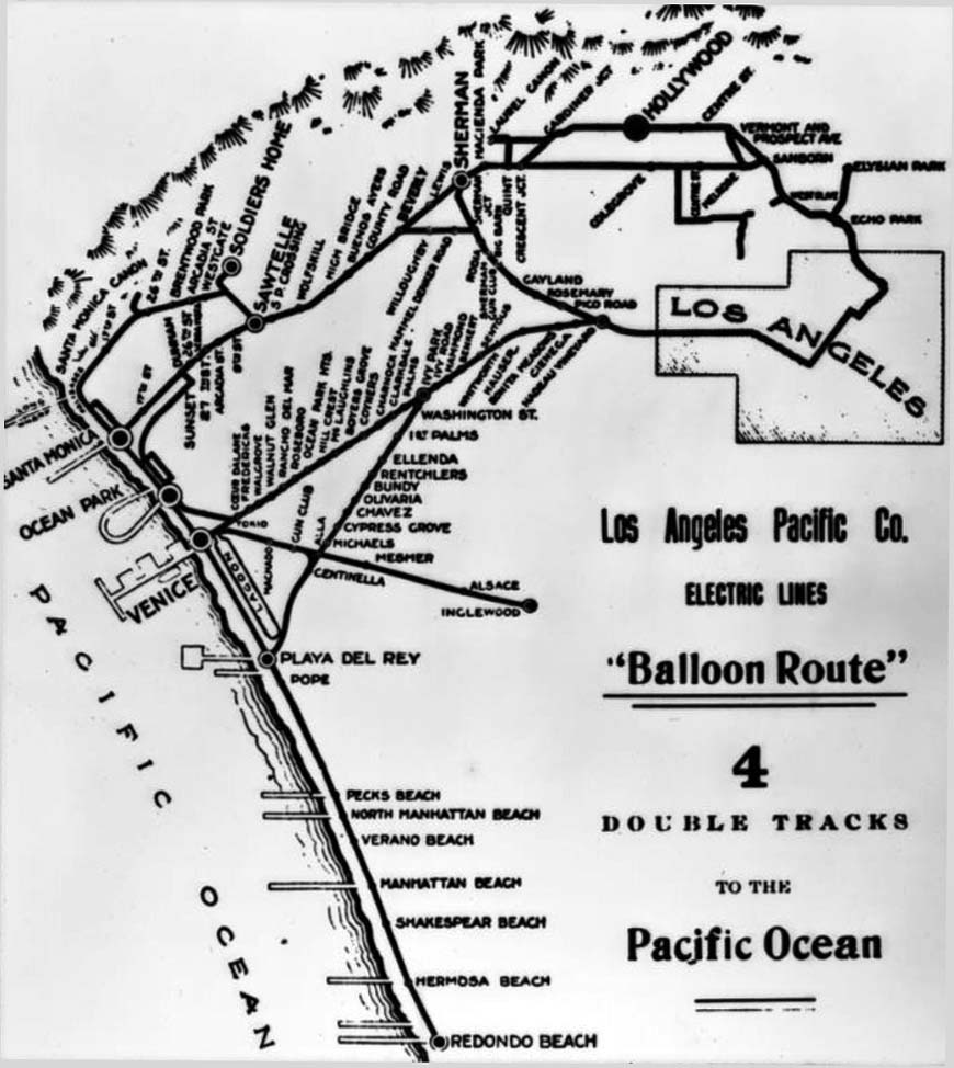
| (1910)** - Map of the Los Angeles Pacific Company Electric lines around Los Angeles, including the "Balloon Route" which would bring flocks of tourists to Santa Monica, among other places. |
Historical Notes The Balloon Route Trolley trip was the featured route of the Los Angeles Pacific, opened in September 1901. The line ran from downtown LA through Hollywood, Santa Monica, Venice Beach, Redondo Beach and back to L.A. via Culver City. The lines stopped at beach resorts and included free entrance to some en-route stops attractions along the way, including: Sunset Boulevard, studio of painter Paul de Longpré, bean fields of Morocco in Beverly Hills, Sawtelle Veterans Home and Old Soldiers' Home in Sawtelle, Long Wharf, Camera Obscura at Santa Monica, Playa del Rey Pavilion for a fish dinner, Redondo's Moonstone Beach, Venice, and Palms - Culver City.*^ |
 |
|
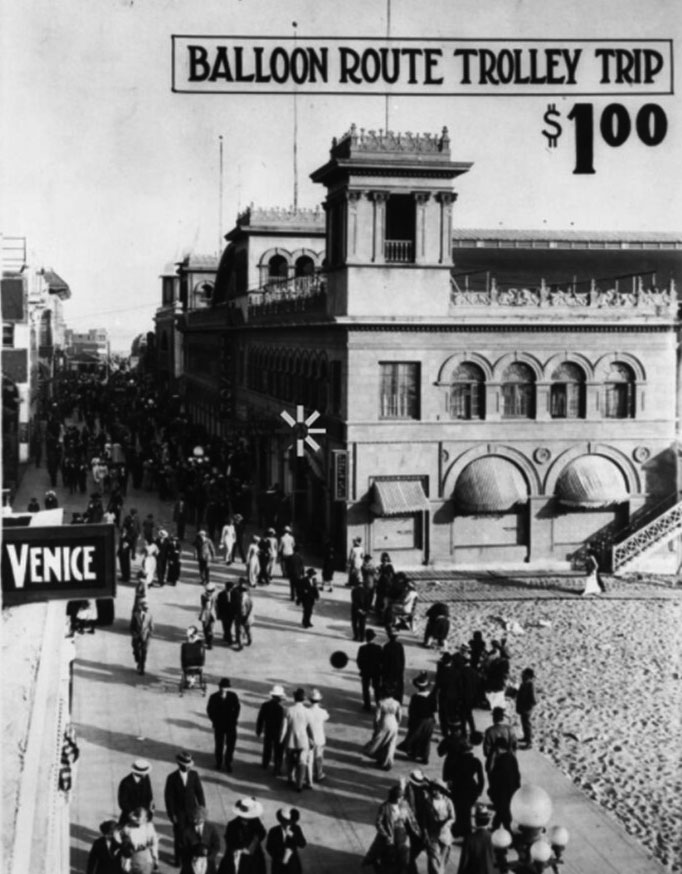
| (ca. 1905)* - Advertisement for the Balloon Route Trolley Trip. |
* * * * * |
Ocean Park Grammar School
 |
|
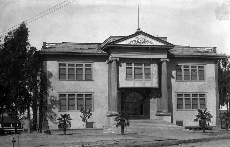
| (1900)* - Exterior view of Ocean Park Grammar Schoo |
Pacific Cafe
 |
|
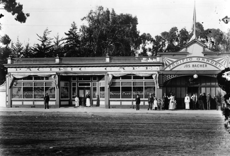
| (ca. 1900)* - View of the 1500 block on Ocean Avenue, opposite the Pacific Electric Depot. Groups of people can be seen standing outside of the Pacific Cafe and Pacific Garden restaurants. |
 |
|
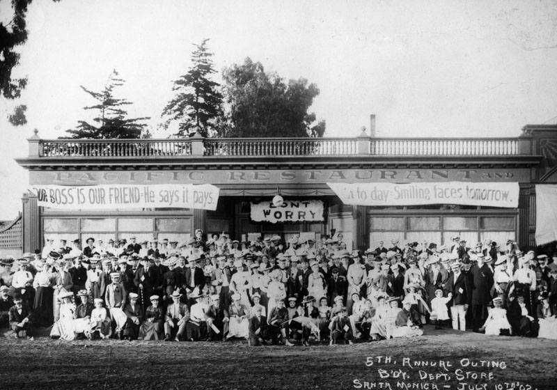
| (1902)* - Group portrait of department store employees and their families, taken in front of the Pacific Restaurant in Santa Monica. This was their 5th Annual Outing. |
Sue's Ice Cream and Confectionery
.jpg) |
|
| (1902)#^ – View showing Sue's Ice Cream and Confectionery on the northeast corner of Second Street and Utah (now Broadway) in Santa Monica. Nordstroms is located on this corner today. |
* * * * * |
 |
|
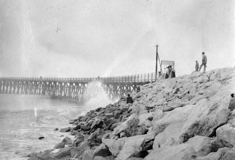
| (1902)* - Several people watch the heavy surf at the Santa Monica Pier. |
 |
|
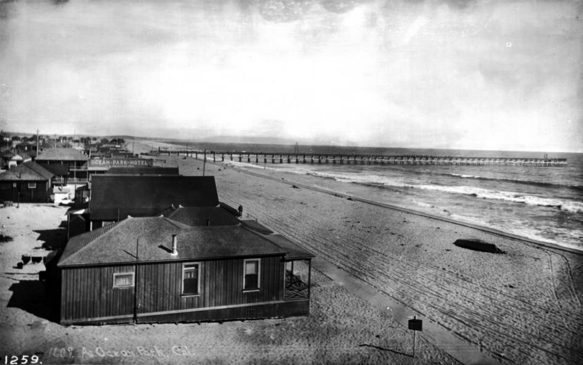
| (ca. 1903)** - View showing Ocean Park beach homes looking south toward the pier. Very few people are on the beach. Legible signs include: "Ocean-Park-Hotel, J.G. Holboro, propr.", and "Holboro's Restaurant". |
 |
|
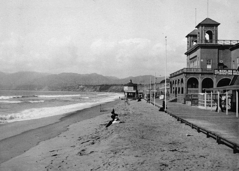
| (1904)* - A mother and child are seen sitting on the beach in front of the Santa Monica Bath House. The bath house is owned by Sen J.B. Jones. A sign shows there is also a pool room, bowling alley and a shooting gallery. The Camera Obscura booth stands at the end of the boardwalk and a long wharf can be seen in the far distance. |
 |
|
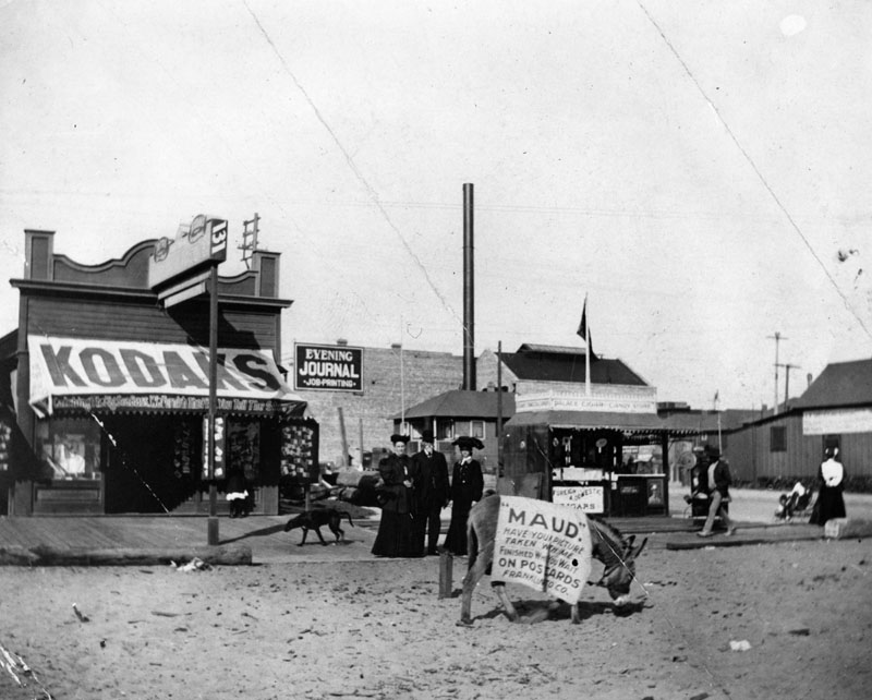
| (1905)* - A donkey with a blanklet advertising "Maud" to have your picture taken stands in the middle of an unpaved street. Buildings and people are seen behind the wooden board walk. |
* * * * * |
Arch Rock
 |
|
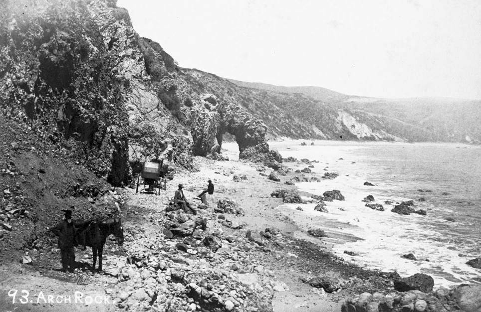
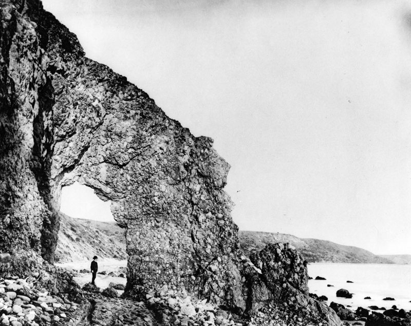
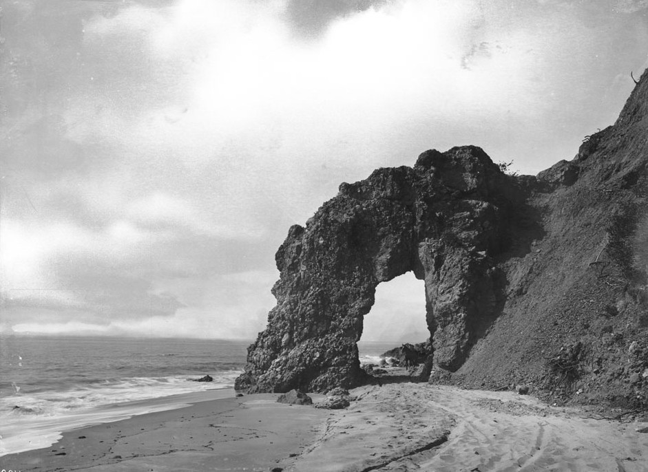
| (ca. 1880)** - View of Arch Rock (a stone formation) in Santa Monica, showing a group of men posing along the rocks nearby. The men can be seen in the center and left foreground area while either standing or sitting on rocks. In the center background, the natural rock formation can be observed while the shore is visible in the right. In the background, a ridge extends out across the horizon. |
Historical Notes One of Santa Monica’s natural wonders was the Arch Rock. It was so wide that during low tide, horse-drawn wagons could pass through its opening. It was located on what is now Pacific Coast Highway just south of Topanga Cyn Blvd. In the early 1890s, a primitive wagon road between Santa Monica and Malibu passed directly through the stony structure.*#* |
 |
|
| (1890s)* - A man is seen standing on what appears to be a large rock directly below the natural arch. |
Historical Notes With improved access, the Arch Rock became a popular destination among excursion parties and day-trippers.*#* |
 |
|
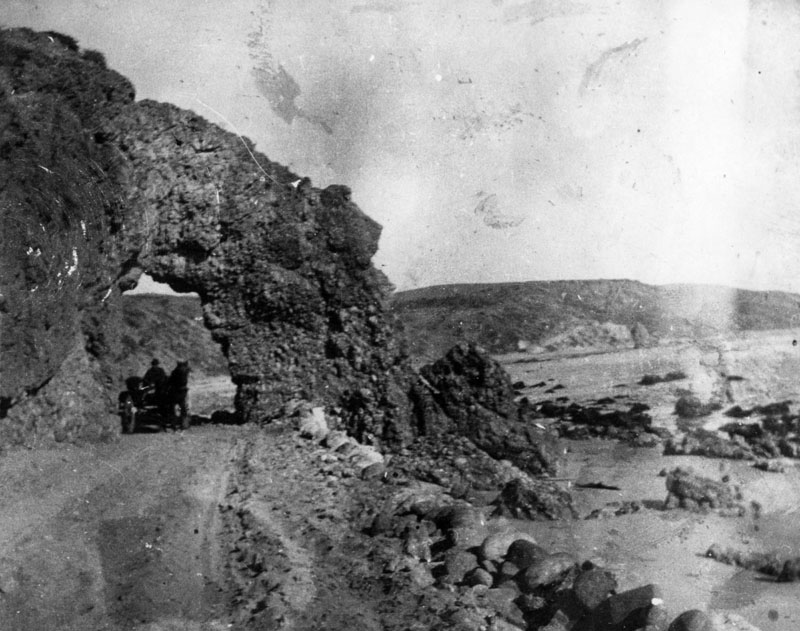
| 1890s)* - A horse and buggy are seen passing under the natural arch. |
Historical Notes The old stage road to San Francisco (later Pacific Coast Highway) passed under the Arch Rock on Santa Monica Beach.* |
 |
|
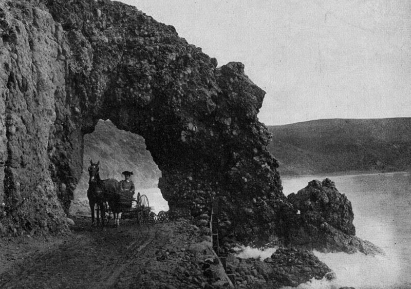
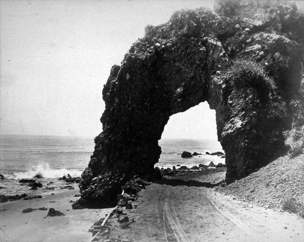
| (1890s)* - View of the Arch Rock, a natural formation on the old stage road (now Pacific Coast Highway) near Santa Monica. A horse and buggy pass under the natural arch during high tide. |
 |
|
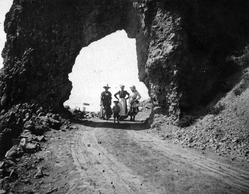
| (1890s)* - View showing three women and a child standing under the arch. |
Historical Notes For many nineteenth-century tourists, the Santa Monica Arch Rock was the place to see. It became the defining image of the Southern California coast.*# |
 |
|
| (ca. 1895)** - View of Arch Rock on the Santa Monica Bay beach, looking north. A horse-drawn carriage is about to drive under it toward the foreground. |
 |
|
| (ca. 1906)#^# – Close-up view, looking north, of the Arch Rock. In the foreground can be seen the wood shoring supporting the dirt road going through the arch. |
Historical Notes On the morning of March 24, 1906, the bridge that once spanned the arch's two columns was found crumbled on the ground. Initial reports blamed a rainstorm, but rumors later circulated that work crews constructing a railroad to Ventura had blasted the rock, performing their nefarious deed under the cover of darkness because of public affection for the landmark. In turns out that the railroad was never completed, but some of the grading work was later incorporated into the coast highway.*#* |
 |
|
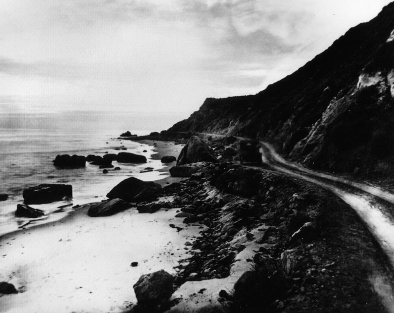
| (ca. 1920)* - View of old Roosevelt Highway (later Pacific Coast Highway) running parallel to the beach in Santa Monica. |
 |
|
| (ca. 1920s)* - Site of Arch Rock after its demolition and subsequent highway grading. The arch was demolished in 1906. |
Historical Notes Today, Mastro's Ocean Club Restaurant (18412 E. Pacific Coast Hwy) is located where the picturesque Arch Rock once stood.* |
 |
|
| (ca. 1920s)* - Site of Arch Rock after its demolition and subsequent highway grading. The arch was demolished in 1906. (AI image enhancement and colorization by Richard Holoff). |
Castle Rock and Haystack Rock
 |
|
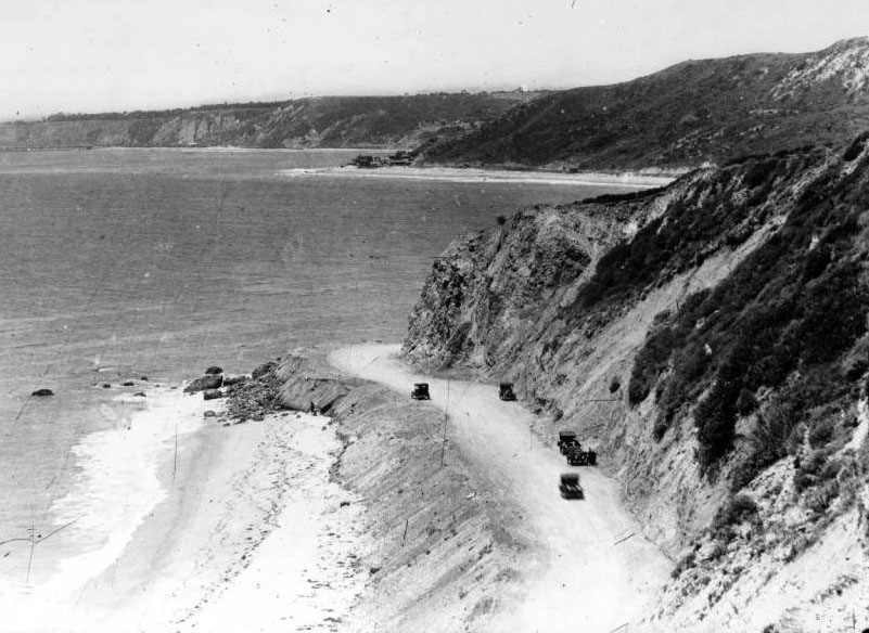
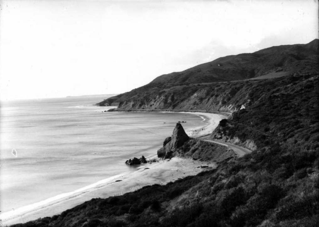
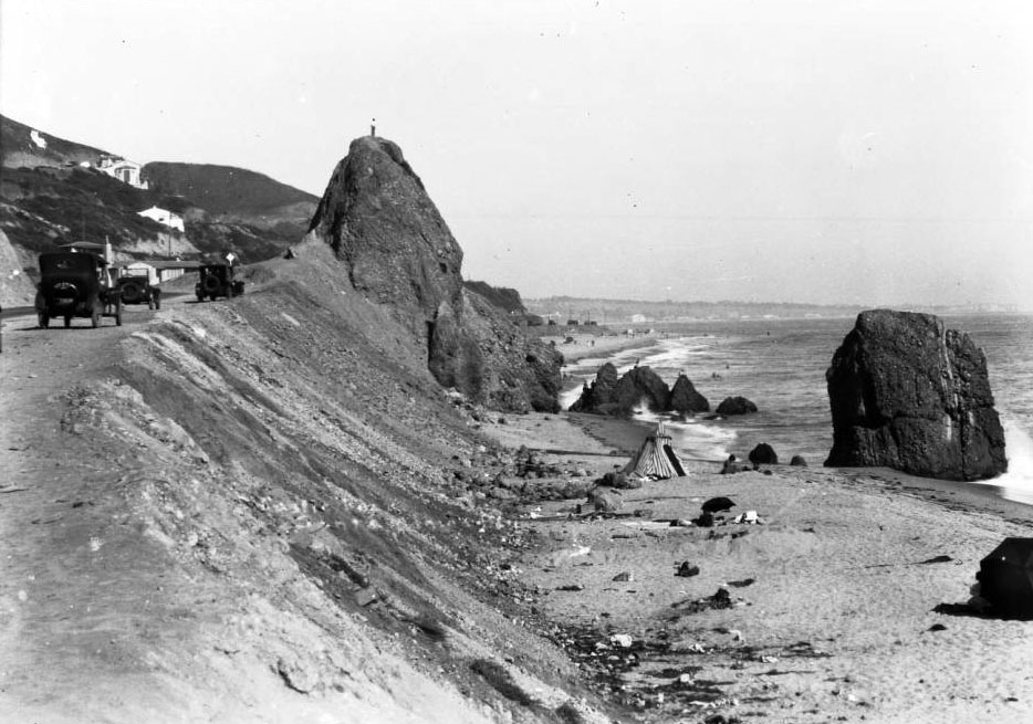
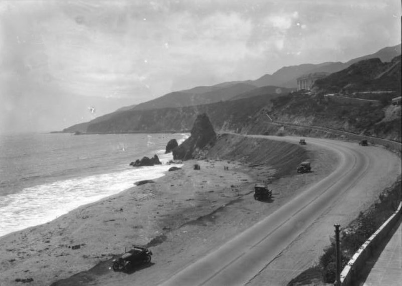
| (ca. 1915)^v^ - Cars approach Castle Rock on the coast road between Santa Monica and Malibu. Castle Rock was eventually demolished to expand the highway after World War II. |
Historical Notes Less than a mile down the coast, Castle Rock survived Arch Rock by several decades. Rising some fifty feet from a sandy beach, the promontory also became a cherished local landmark. In some ways, it functioned as a replacement for Arch Rock, with tourists routinely picnicking on the beach nearby.* |
 |
|
| (1910s)** - Photograph of Santa Monica's Palisades Park and Castle Rock. The conical rock is at center, jutting out from the shoreline above a sandy beach. Behind the rock at left, the Coast Highway can be seen winding its way along the shore. A wooden fence acts a guardrail near the rock. |
 |
|
| (1910s)** – Birdseye view of Castle Rock in Santa Monica from the north side hill. The large conical rock is at center, jutting out over a sandy beach at right. There is another large rock in the water near Castle Rock. Three people are seen walking near the breaking waves. |
 |
|
| (ca. 1920)** - Castle Rock, located between Sunset Boulevard and Coastline Drive north of Santa Monica. A man is seen standing on top of Castle Rock. |
 |
|
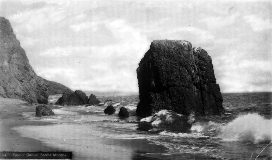
| (ca. 1925)** - Haystack Rock and the Family Group, located on the beach beneath Castle Rock. |
Historical Notes Picture-postcards romantically described Haystack Rock and the Family Group as the place "where the mountains meet the sea". *#* |
 |
|
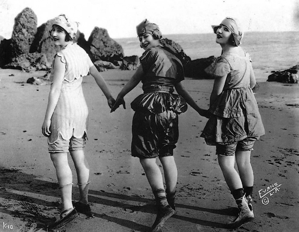
| (1918)**^ - Swimsuit in 1918 Fashion in Los Angeles Modern Postcard in front of Haystack Rock. It's difficult to imagine the beach attire in this photograph was once considered risque. |
 |
|
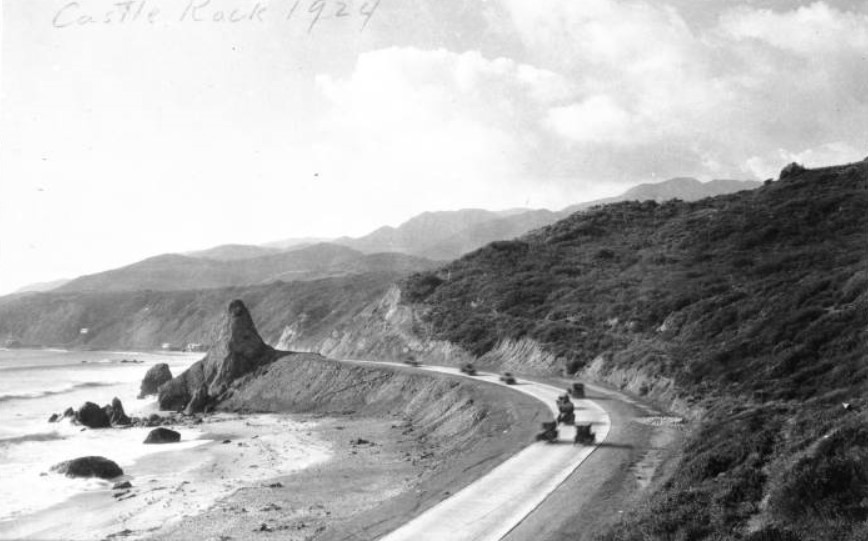
| (1924)*^ - View looking northwest showing early model cars passing Castle Rock on the two-lane Roosevelt Highway (now PCH). |
 |
|
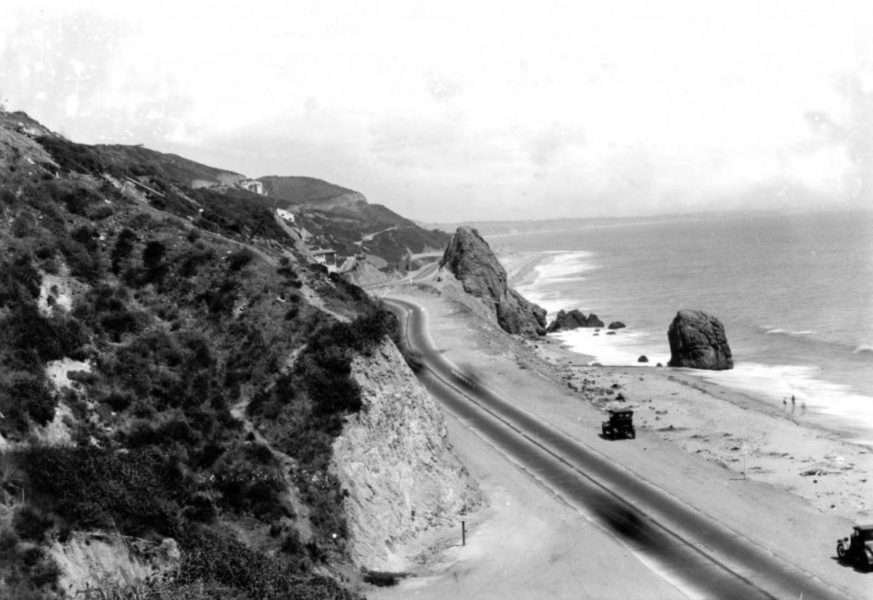
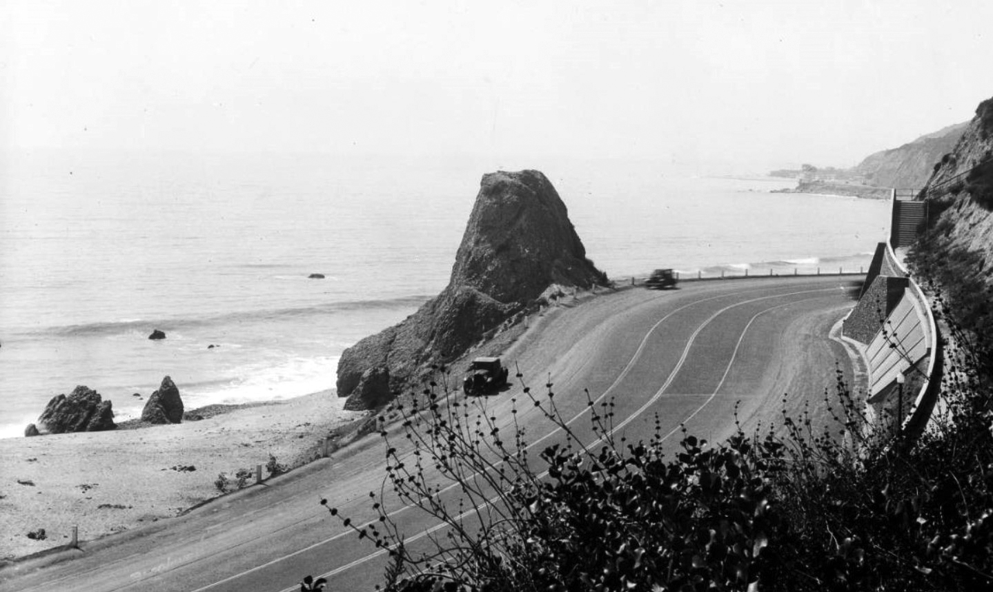
| (ca. 1928)** - View of Castle Rock in Santa Monica, looking northwest toward Topanga Canyon. The large conical rock is at center. At its base is a long sandy beach on which small waves are breaking and several people are playing. The Coast Highway is at right and winds its way along the shoreline, coming close to the back of Castle Rock. Several early-model automobiles are parked along the shoulders of the road. The right side of the road is bordered by steep hills. |
 |
|
| (ca. 1930)#^^ - Closer view showing automobiles driving down Roosevelt Highway (later PCH) past Castle Rock in Santa Monica. |
Historical Notes Roosevelt Highway was improved in 1929-30 and officially named Coast Highway at that time. The Highway 1 designation came about in 1939*^ |
.jpg) |
|
| (1936)* - Closer view of Castle Rock as seen from the hillside across Roosevelt Highway at Castellamare. |
Historical Notes Castle and Haystack Rocks appeared as a backdrop in numerous films, and in 1945 Marilyn Monroe posed in front of Castle Rock in one of her first photo shoots.* |
 |
|
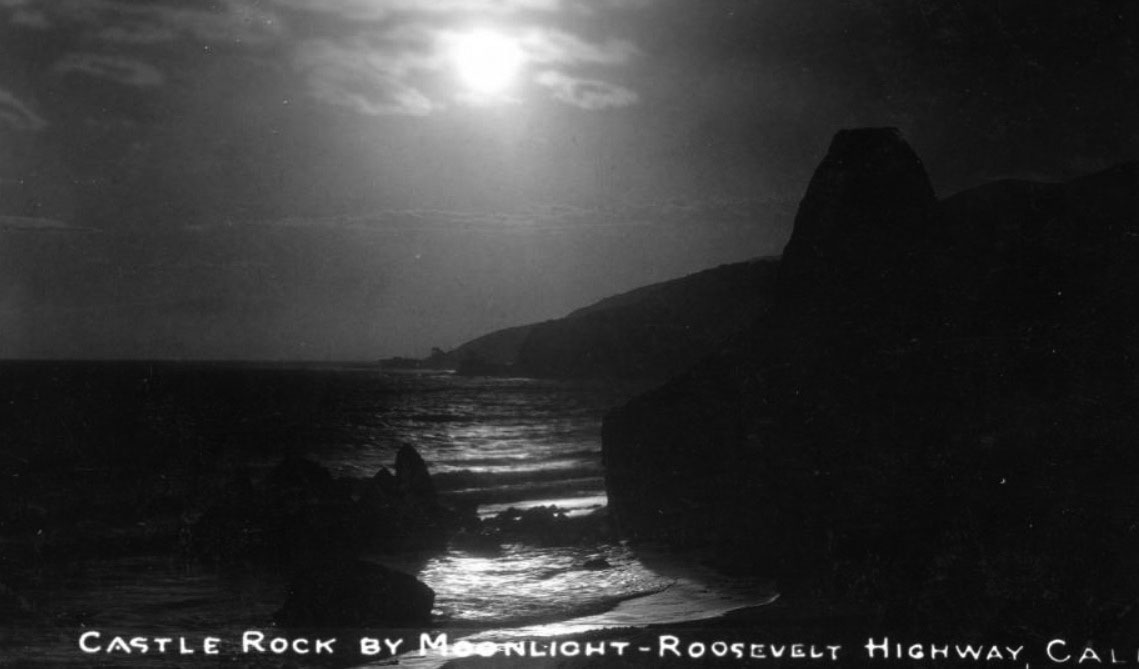
| (ca. 1920s)^v^ - Postcard view showing Castle Rock silhouetted against a moonlit ocean with the Malibu coastline in the background. |
Historical Notes Castle Rock used to stand beside the Roosevelt Highway at the water's edge near the present-day location of the Getty Center Villa. Castle Rock was demolished in 1945 in order to expand the highway, renamed the Pacific Coast Highway. |
 |
|
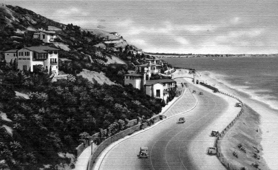
| (ca. 1927)** - Coastal view looking south towards the Villa de Leon, visible at the top of the slope in the distance, and Castle Rock. Writing on postcard reads Roosevelt Highway, Santa Monica Bay. |
Then and Now
 |
|
| (1927 vs 2016)* - Roosevelt Highway (today PCH, CA-1). View looking south towards Villa de Leon, visible at the top of the slope in the distance. |
 |
|
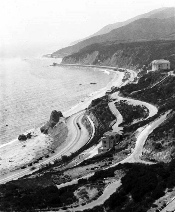
| (ca. 1927)** - View of the Topanga and Pacific Palisades coast in Santa Monica Bay facing east-southeast towards castle rock in the far distance. Beach houses line the shore with the Roosevelt Highway (later Pacific Coast Highway) and coastal slopes behind them. Villa de Leon (Leon Kauffmann residence, 17948 Porto Marina Way, is visible at the top of a slope. |
 |
|
| (1930s)^v^ - The rock formation known as Castle Rock appears here (center of image) in a view looking west toward Malibu. The Roosevelt Highway (later Pacific Coast Highway) winds through coastal homes. Note the mansions that now appear on the hillside. Castle Rock was demolished to expand the highway just after World War II. |
 |
|
| (ca. 1930)** - Postcard view of the Coast Highway at Castle Rock, near Santa Monica. Along the edge of the roadway, numerous cars are parked in one row and tents dot the sandy beach. In the background are large estates atop the mountain, one of which is the Villa de Leone, completed in 1928. |
Historical Notes Castle Rock used to stand beside the Roosevelt Highway at the water's edge near the present-day location of the Getty Center Villa and Villa de Leone. Castle Rock was demolished in 1945 in order to expand the highway, renamed the Pacific Coast Highway (see next photo). |
 |
|
| (1950s)^ - View looking west (technically speaking) of Pacific Coast Highway, which was also known in the 1950s as a Highway 101 alternative. Center-left in the image is the former location of Castle Rock, which had been demolished several years earlier to expand the highway to four lanes. |
Villa de Leon
 |
|
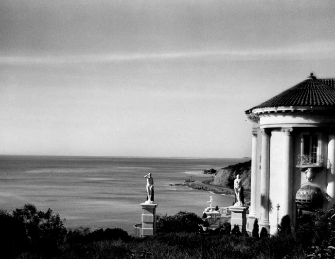
| (1930s)* - View showing the coastline and Pacific Coast Highway as seen from the grounds of the Villa de Leon. |
Historical Notes Named after its original builder, Austrian native Leon Kauffman, the Villa Leon was the result of a longstanding promise Kauffman had made to his wife Clemence that, if he ever had the money, he would build for her a dream castle by the sea. A fortune made in the wool processing business in California during the First World War allowed Kauffman to make good on his promise and, after purchasing an impressive six-lot parcel above the famous Castle and Haystack Rock formations, Kauffman began construction of his $1,000,000 dream house in 1926.^ |
 |
|
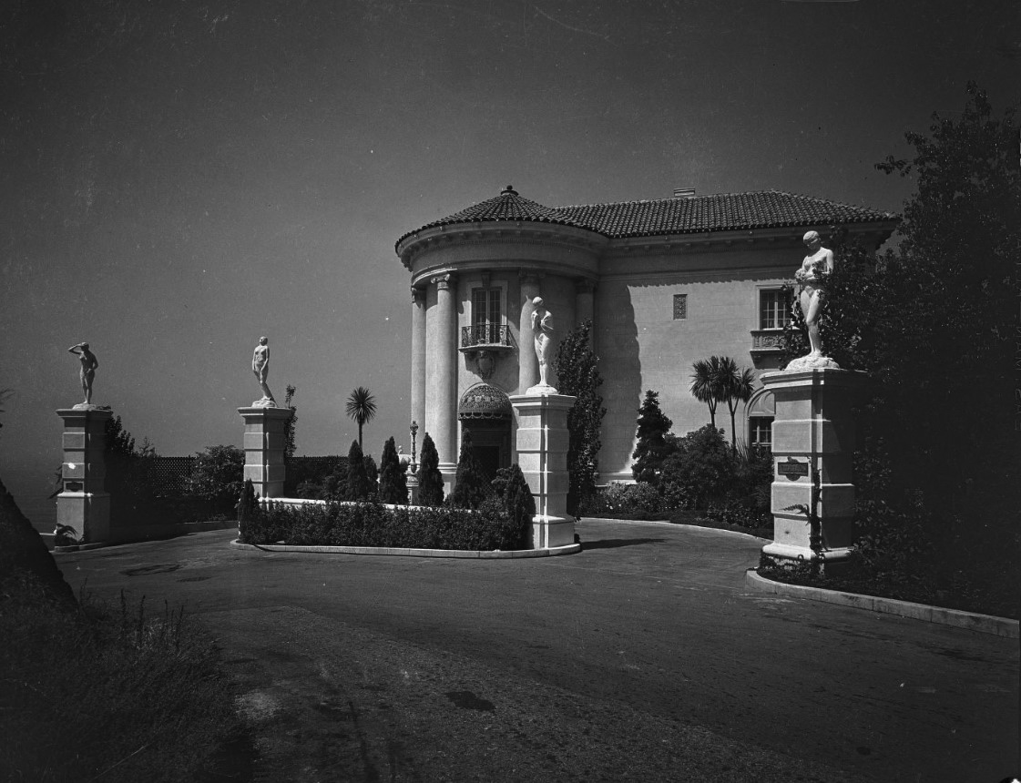
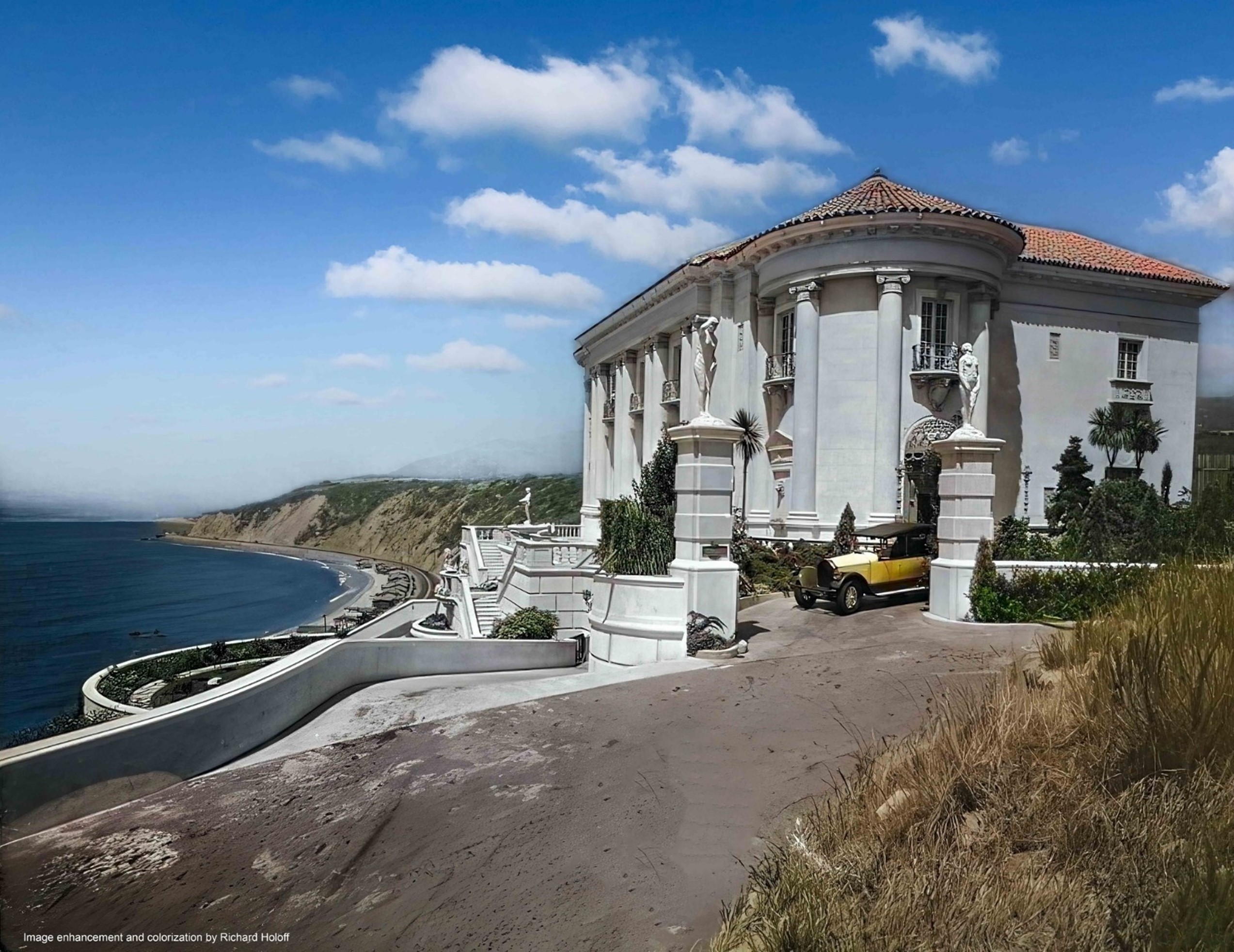
| (1929)^ – Close-up view of the front entrance to the Villa de Leon located at 17948 Porto Marina Way. At the time it was built (1927), it was one of the largest villas in Southern California. |
Historical Notes Leon Kauffman selected architect Kenneth MacDonald in 1926 to design this 12,000-square-foot palazzo in the Beaux- Arts European tradition. This imposing structure features 35 rooms, including nine bedrooms, 11 bathrooms, a huge grand salon (32’ x 64’), a library, a circular dining room, a butler’s pantry, an elevator and a seven-car garage. The construction price of $1 million (that was a lot of money in the late ‘20s!) included a first-ever central vacuum, several hand-made crystal chandeliers, Italian tiles, imported marbles, hand-carved wooden beams, mahogany paneling from Thailand, magnificent wrought-iron gates, even gold grouting for the Italian tiles. The Villa de Leon took five years to complete.* |
 |
|
| (ca. 1930)** – Birdseye view of the Santa Monica shoreline north from Castellammare Drive. Villa de Leon sits in the upper right on the edge of the cliffs overlooking Castle Rock below. |
Historical Notes Leon Kauffman purchased six elevated lots in the 1920s in the new Castellammare (Castle by the sea) area on the Malibu coast, North of Sunset Boulevard and high above what would soon become Roosevelt Highway, predecessor of the Pacific Coast Highway.* |
.jpg) |
|
| (1929)^ - Villa de Leon (Leon Kauffmann residence) and the coast beyond with early model car parked in the driveway. |
Historical Notes When first built, the Villa de Leon boasted topiary gardens, a pipe organ and beach access via a private funicular railway, very expensive amenities that have not survived the passage of time. |
 |
|
| (1929)^ - Villa de Leon (Leon Kauffmann residence) and the coast beyond with early model car parked in the driveway. Image enhanced and colorized by Richard Holoff. |
 |
|
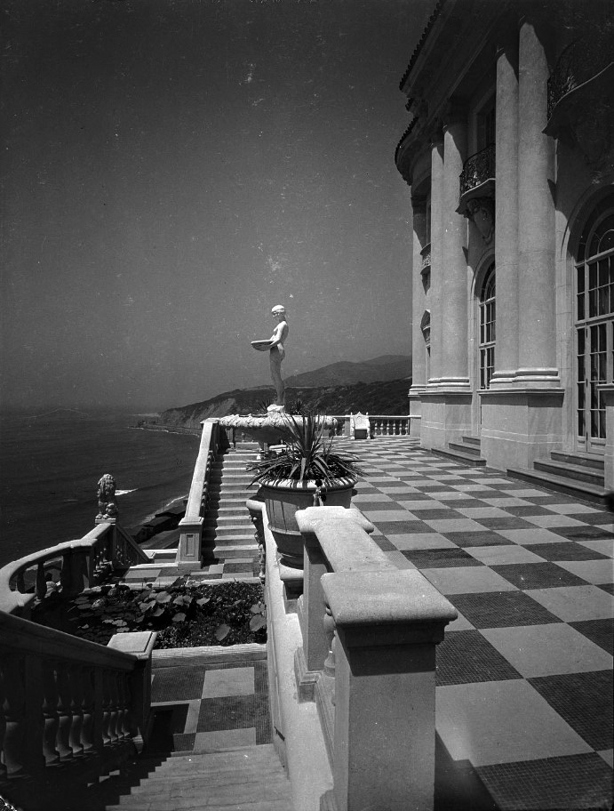
| (1929)^ - Exterior view of the ocean front terrace and terrace facade of the Villa de Leon, and the stairs leading from the paved terrace to the garden terrace below. The terrace is paced in a checkerboard pattern of dark and light stone. There is a nude statue on a pedestal and the coast is visible beyond the terrace. |
Historical Notes The Kauffmans lived in the house for five years before Leon’s wife (Clemence) died, and Leon lived only another two years. Their grown son chose not to live in the house, which was overseen by caretakers until 1952, when the estate was settled.* |
 |
|
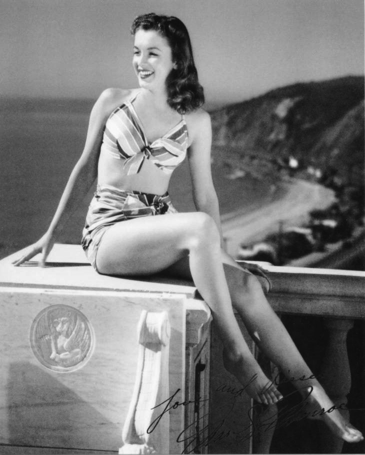
| (1946)** - Marilyn Monroe, then known as Norma Jean Baker, poses for a bikini pin-up on the terrace of Villa de Leon with the Topanga coastline in the background. Photo by Joseph Jasgur |
Historical Notes Villa de Leon has been featured in countless productions over the years, most notably photo shoots. |
 |
|
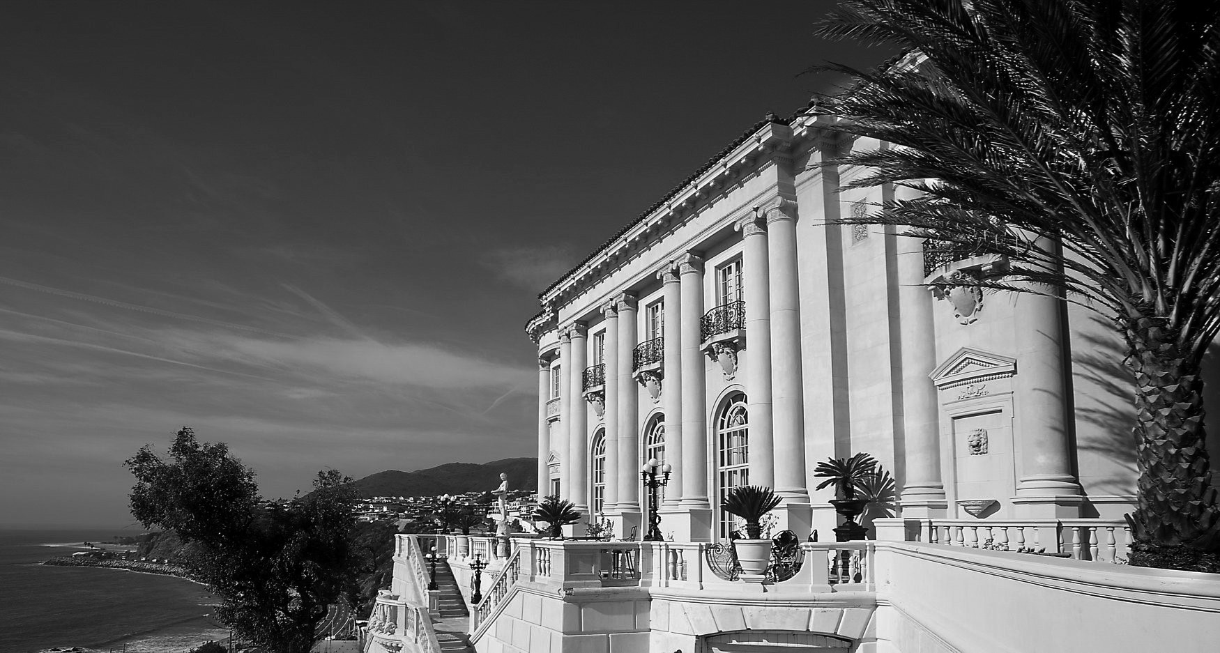
| (2020)^ - Panoramic view showing the Villa de Leon as it appears today. Photo courtesy of California Heritage |
Historical Notes The mansion overlooks Pacific Coast Highway and the Pacific Ocean and is situated in close proximity to the Getty Villa. It was designed by prominent Los Angeles architect Kenneth A. MacDonald, Jr. in 1926 for Austrian builder and investor in wool Leon Kauffman. |
 |
|
| (2017)^^ - Close-up view showing stairs leading to the terrace of Villa de Leon. Palisadian-Post |
Historical Notes The Villa de Leon has been used in many high-profile music videos, commercials, and printed ads such as Beyonce's "Haunted," Lady Gaga's "Paparazzi," Britney Spears's My Prerogative body fragrance commercial, Camila Cabello "Liar", Ariana Grande, Miley Cyrus and Lana Del Rey "Don't Call Me Angel", Rod Stewart's Christmas special Rod Stewart: Merry Christmas, Baby, and shoots featuring Heidi Klum, Victoria Beckham, Robert Pattinson, and Reese Witherspoon. Its highly recognizable grand staircase has been a major focal point in several of these videos and photographs, as has its balconies and their balustrades, including their appearance on the cover of English rock band Procol Harum's 1973 album, Grand Hotel.*^ |
|
Historical Notes Today, many first-time visitors to the adjacent J. Paul Getty Villa mistake the Italianate Revival palazzo, the Villa de Leon, for the Getty Villa museum, not visible from the Pacific Coast Highway. Even the New York Times and The Wall Street Journal have mis-identified Villa de Leon thinking it was the Getty Villa. |
* * * * * |
Roosevelt Highway
 |
|
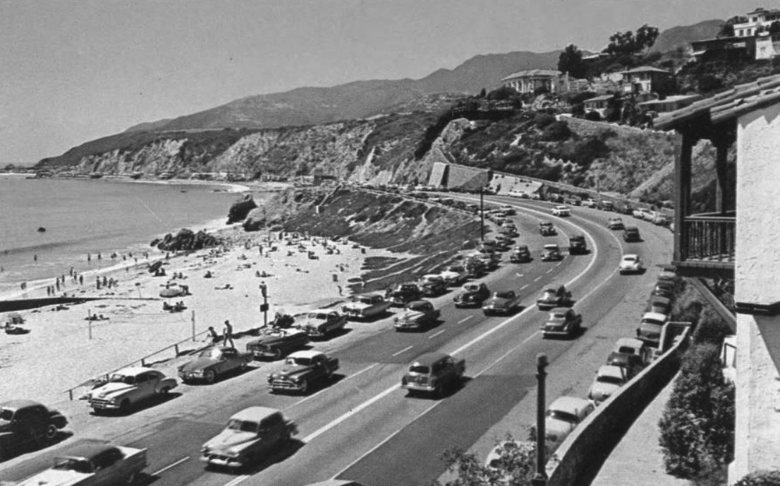
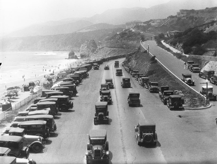
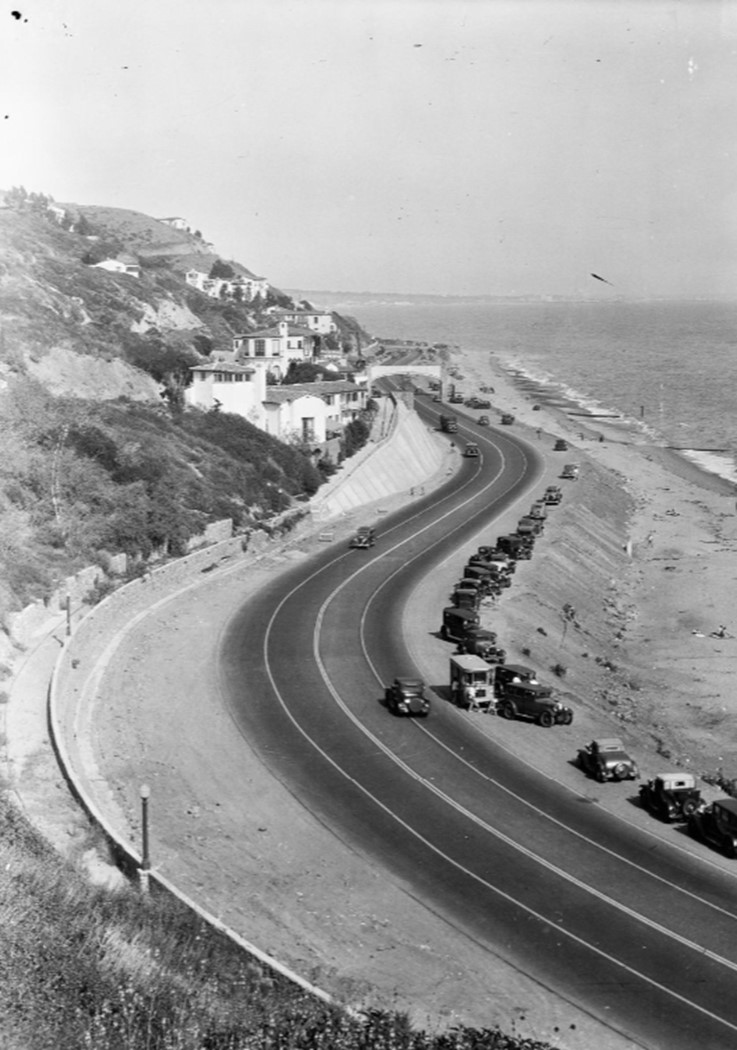
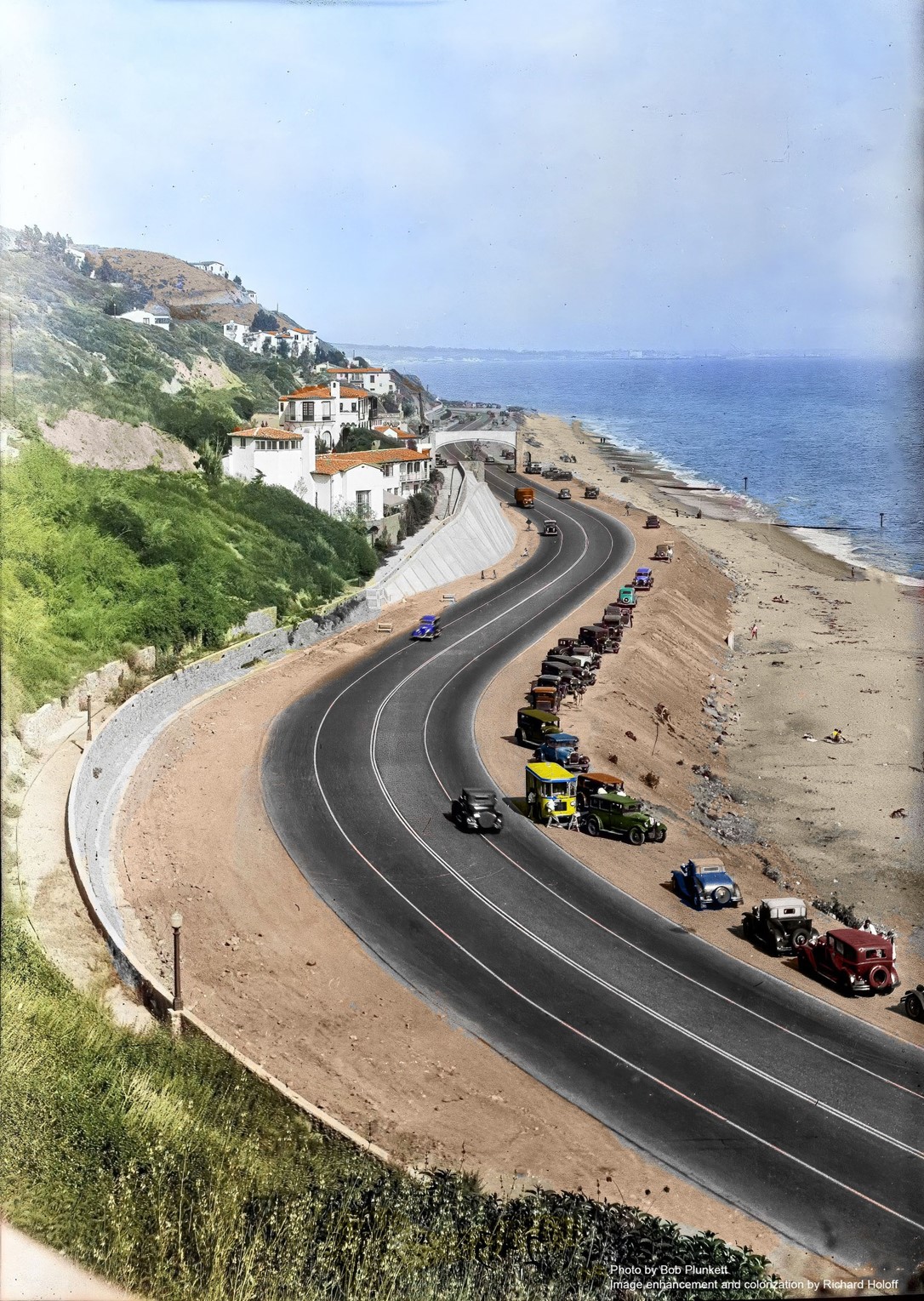
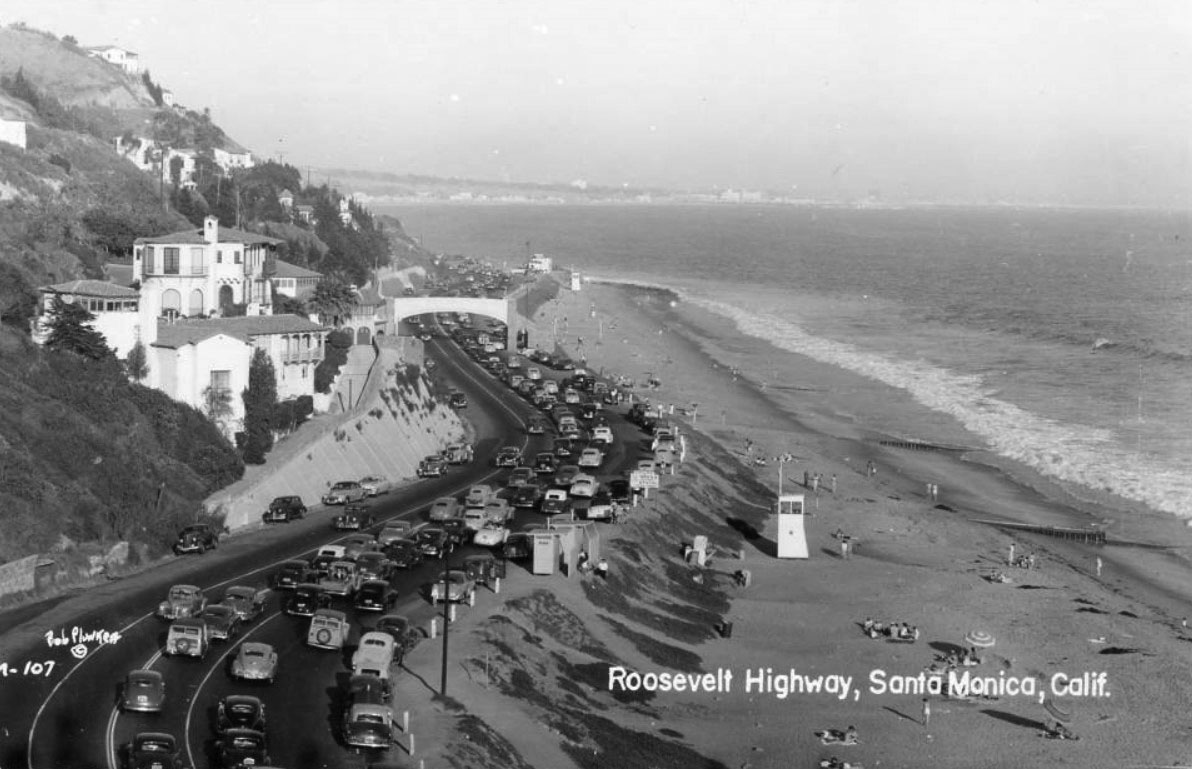
| (ca. 1930)** - Automobiles driving on the Roosevelt Highway (PCH) at Porto Marina Way. Almost every parking space is taken along the side of the road. Tents, umbrellas, and sunbathers are visible on the beach at left, while Castle Rock can be seen further back on the ocean side of the highway. Large homes are visible on the hills at right in the Castellammare neighborhood , while mountains can be seen in the distance. The site of Thelma Todd's Sidewalk Cafe restaurant is out of frame on the right although still a couple of years in the future (1932). |
Historical Notes The new Castellammare neighborhood became popular with the Hollywood crowd. John Barrymore, Thelma Todd and Joseph Cotton had homes in the area. |
 |
|
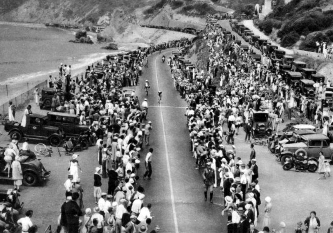
| (1932)^ - Onlookers and their cars crowd the edge of the Roosevelt Highway as cyclists approach the finish line during the 1932 Olympics. Castle Rock is in the background. Photo taken from the newly constructed footbridge over the highway. |
Historical Notes For the 1932 Summer Olympics, the segment of the PCH between Oxnard and Santa Monica (then known as the Theodore Roosevelt Highway) hosted part of the road cycling events. |
 |
|
| (1926)* – A woman looks down toward Roosevelt Highway (later PCH) at Castellammare where a pedestrian bridge is under construction. Photo by Dick Whittington |
 |
|
| (1926)* – View showing a pedestrian bridge being built over Roosevelt Highway (PCH) at Castellammare. The bridge provided beach access for residents of the new Castellammare development. Photo by Dick Whittington |
 |
|
| (1926)* - View of the Castellammare development following the subdivision but before any houses were built. Pedestrian bridge can be seen down on Roosevelt Highway (PCH) which appears to be a dirt road. Castle Rock can be seen in the distance. Photo by Dick Whittington |
 |
|
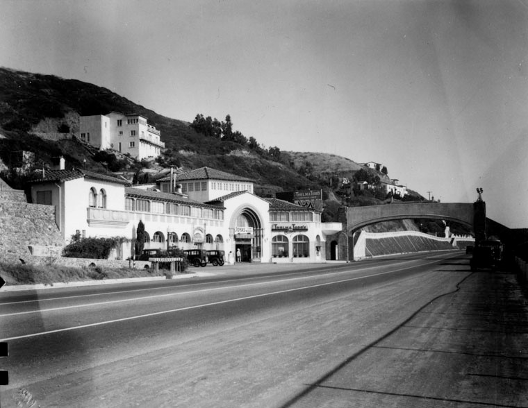
| (ca. 1928)** - Birdseye view of the Santa Monica shoreline north from Castellammare Drive. In the foreground, next to the footbridge over the highway, is the Thelma Todd Sidewalk Café, still under construction. Castle Rock is seen in the distance with the Villa de Leon standing watch in the hills above it. |
 |
|
| (1930s)* - Image of the Castellammare neighborhood on the Roosevelt Highway (later Pacific Coast Highway) in Pacific Palisades, with automobiles parked along the beach, including a small trolley or bus marked "6" in the foreground and an elevated pedestrian crossing in the distance. Photo by Bob Plunkett |
 |
|
| (1930s)* - Image of the Castellammare neighborhood on the Roosevelt Highway (later Pacific Coast Highway) in Pacific Palisades, with automobiles parked along the beach, including a small trolley or bus marked "6" in the foreground and an elevated pedestrian crossing in the distance. Photo by Bob Plunkett; Image enhancement and colorization by Richard Holoff |
Thelma Todd's Sidewalk Café
.jpg) |
|
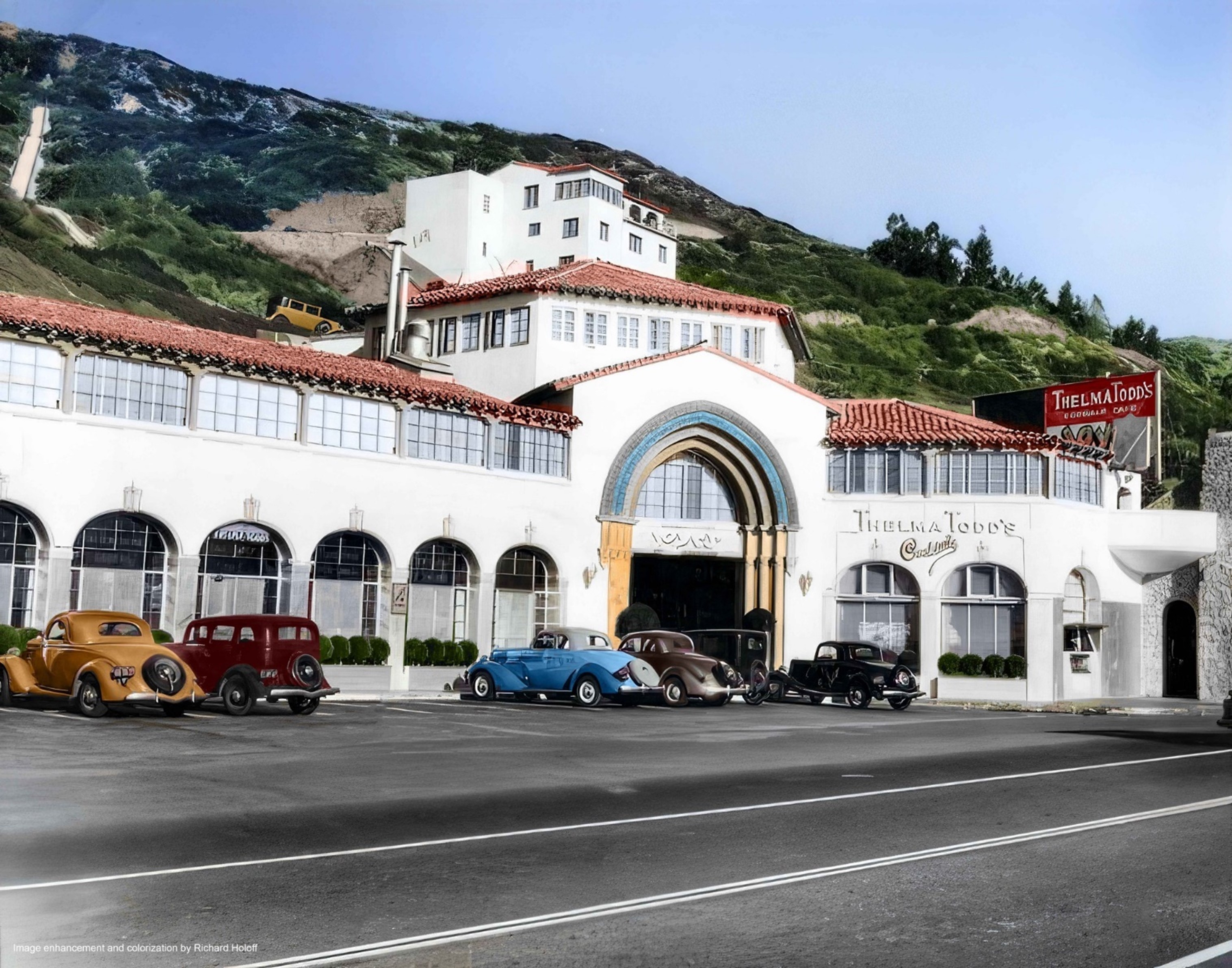
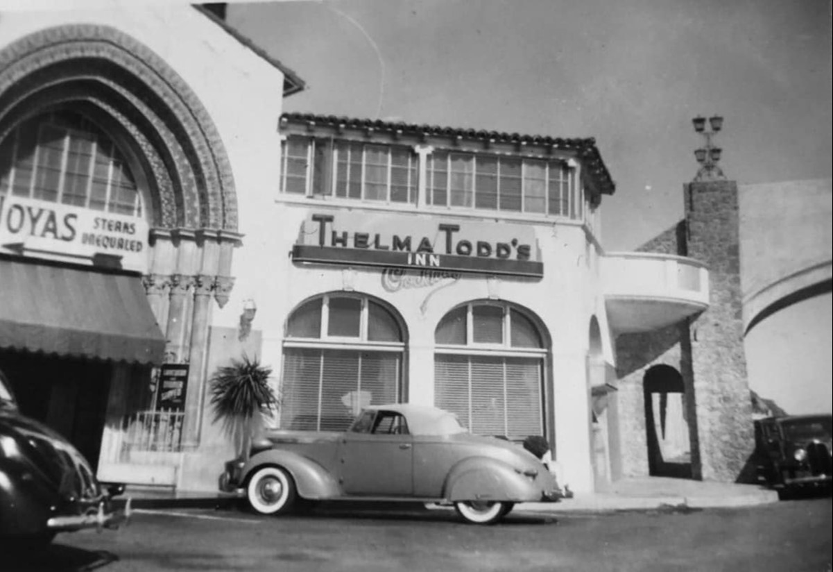
| (ca. 1934)** - Close-up view of Thelma Todd's Sidewalk Café located at 17575 Pacific Coast Highway in Pacific Palisades. The structure was built in 1928. |
Historical Notes In the early 1930s, this structure housed a restaurant on the ground floor owned by actress Thelma Todd and her partner Roland West. The duo also held parties in their private nightclub named Joya's, located on the second story near her personal apartment. At the time Todd owned the building, the hexagonal-shaped, third-floor included a dance floor and bandstand, which was famous for its Joya's barbequed steaks.*^ |
 |
|
| (ca. 1934)** - Close-up view of Thelma Todd's Sidewalk Café located at 17575 Pacific Coast Highway in Pacific Palisades. Image enhancement and colorization by Richard Holoff |
 |
|
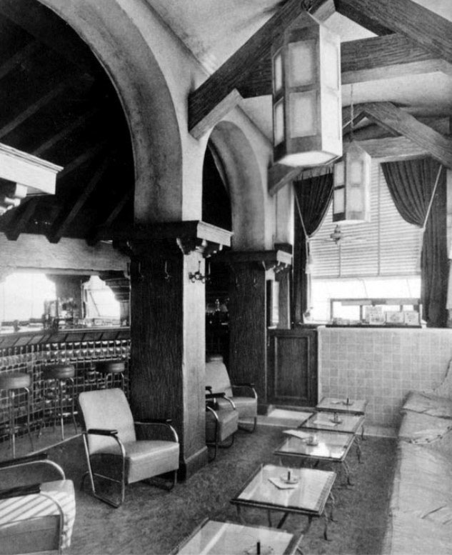
| (ca. 1934)^*## - Interior view of Thelma Todd's Sidewalk Café's cocktail room. |
Historical Notes Thelma Todd appeared in about 120 pictures between 1926 and 1935, she is best remembered for her comedic roles in films such as Marx Brothers' Monkey Business and Horse Feathers, a number of Charley Chase's short comedies, and co-starring with Buster Keaton and Jimmy Durante in Speak Easily. She also had roles in Wheeler and Woolsey farces, several Laurel and Hardy films, the last of which (The Bohemian Girl) featured her in a part that was truncated by her death.*^ |
 |
|
| (1937)* - View looking south of the three-story, 15,000-square-foot Spanish style Thelma Todd's Sidewalk Café, located at 17575 Pacific Coast Highway in Pacific Palisades. |
Historical Notes On the morning of December 16, 1935, Thelma Todd was found dead in her car inside the garage of Jewel Carmen, a former actress and former wife of Todd's lover and business partner, Roland West. Carmen's house was approximately a block from the topmost side of Todd's restaurant. Her death was determined to have been caused by carbon monoxide poisoning. Todd had a wide circle of friends and associates as well as a busy social life; police investigations revealed that she had spent the previous Saturday night (December 14) at the Trocadero, a popular Hollywood restaurant, at a party hosted by entertainer Stanley Lupino and his actress daughter, Ida. At the restaurant, she had had a brief but unpleasant exchange with her ex-husband, Pat DiCicco. However, her friends stated that she was in good spirits, and were aware of nothing unusual in her life that could suggest a reason for committing suicide. She was driven home from the party in the early hours of December 15 by her chauffeur.*^ |
 |
|
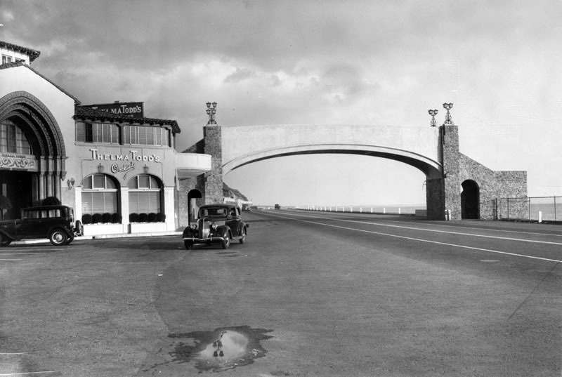
| (1935)* – View of Thelma Todd’s Sidewalk Café and the pedestrian bridge crossing over Pacific Coast Highway. |
Historical Notes The detectives of the LAPD concluded that Todd's death was accidental, the result of her either warming up the car to drive it or using the heater to keep herself warm; however, other evidence, such as a bloodied lip, seemed to point to foul play.*^ |
 |
|
| (1930s)* - A beautiful convertible is parked in front of Thelma Todd’s Inn. |
 |
|
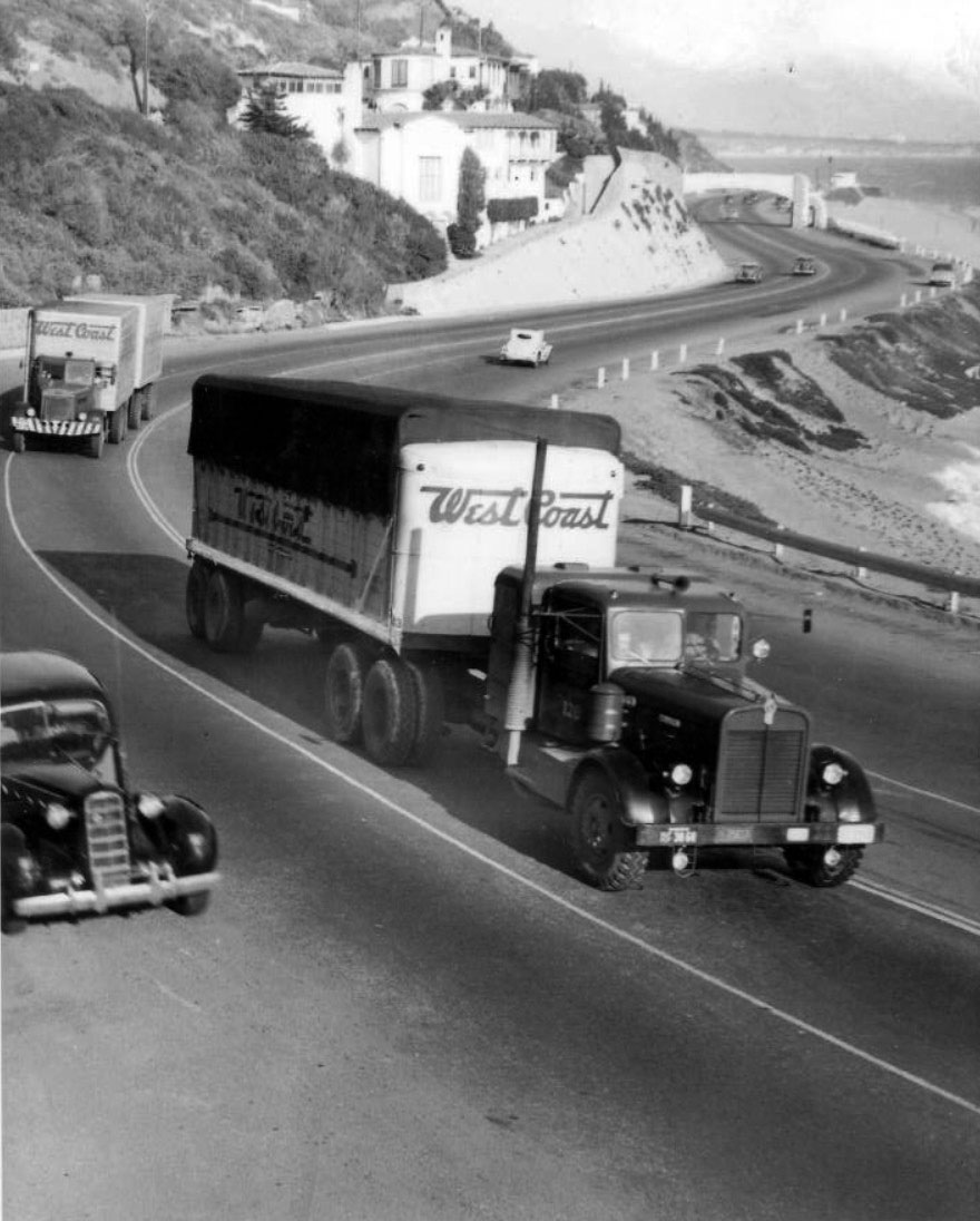
| (1930s)* – View showing two tractor trailer trucks heading west on the Roosevelt Highway (later Pacific Coast Highway) through the residential area known as Castellammare in Pacific Palisades. The pedestrian bridge adjacent to Thelma Todd’s Sidewalk Café is seen in the background. |
 |
|
| (1930s)* – Postcard view looking east on Roosevelt Highway (later Pacific Coast Highway) and the beach near the Castellammare area of Pacific Palisades just northwest of Santa Monica. |
 |
|
| (1940s)* – Postcard view looking east on the Roosevelt Highway (later Pacific Coast Highway) crowded with traffic near the Castellammare area of Pacific Palisades just northwest of Santa Monica. |
 |
|
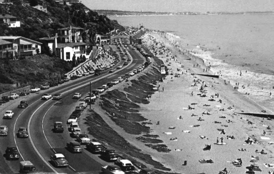
| (1950s)* - View looking east towards Santa Monica, from Pacific Palisades on the Pacific Coast Highway. |
Then and Now
 |
|
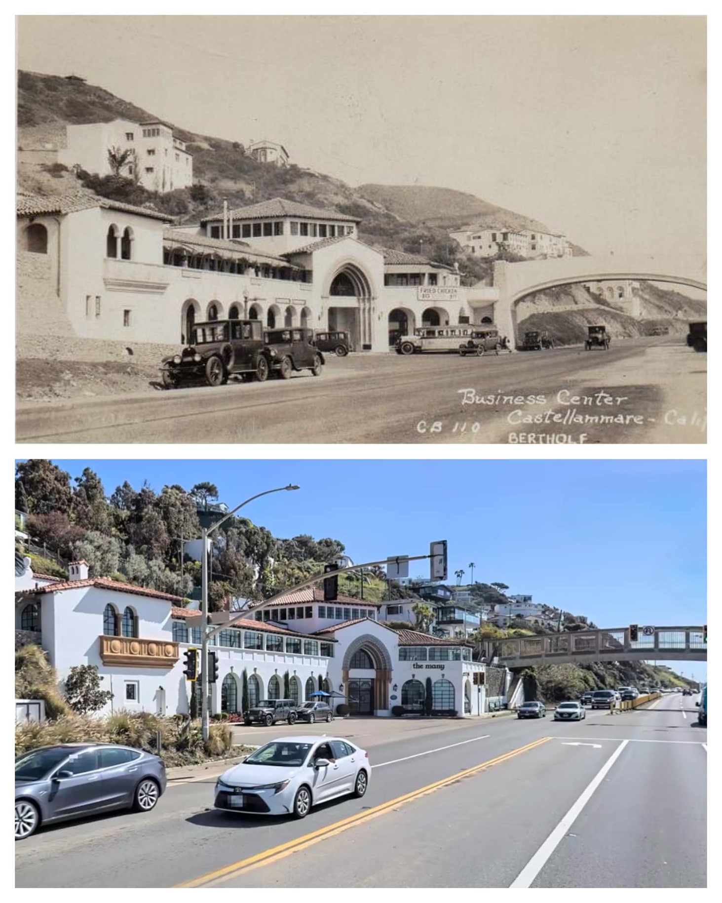
| Then and Now - Thelma Todd’s Café Shop, today Castellammare Shopping Center at 17575 Pacific Coast Highway in Pacific Palisades. Photo comparison by Trey Callaway* |
* * * * * |
Please Support Our CauseWater and Power Associates, Inc. is a non-profit, public service organization dedicated to preserving historical records and photos. Your generosity allows us to continue to disseminate knowledge of the rich and diverse multicultural history of the greater Los Angeles area; to serve as a resource of historical information; and to assist in the preservation of the city's historic records.
|
More Historical Early Views
Newest Additions
Early LA Buildings and City Views
History of Water and Electricity in Los Angeles
* * * * * |
References and Credits
* LA Public Library Image Archive
^^California State Library Image Archive
^* LMU Digital Collection: Arcadia Hotel
*# The Los Angeles County Metro Division 7
#^ Santa Monica Public Library Image Archive
#+ Wehoville.com: Balloon Route
#^*Ocean Park History: oceanpark.wordpress.com
^x^Facebook.com: Venice, Ca, Ocean Park, & Santa Monica in the 20th Century
*^*Paradise Leased: Arcadia Hotel
**^Noirish Los Angeles - forum.skyscraperpage.com; The Long Wharf; Camera Obscura; Acadamy of the Holy Names; Inceville - Inceville - palipost.com
*#*KCET: Arch Rock and Castle Rocks; Rail Returns to the Westside: The Expo Line's Historical Precursors
^#*Santa Monica History Museum
^*#Huntington Palisades - A Brief History
*^#Nuestra Señora la Reina de los Ángeles: losangelespast.com
#**MTA Transportation and Research Library Archives
#^^Huntington Digital Library Archive; Arcadia Roller Coaster; Arcadia Roller Coaster 2; Visitors to SM Beach; Southern Pacific RR
^##The Malibu Times: On the Villa de Leon
###Ingersoll's Century History, Santa Monica Bay Cities
***^History of the Fairmont Miramar Hotel and Bungalows
**^^TheLosAngelesBeat.com: Camera Obscura
^^**Atlas Obscura: Santa Monica Camera Obscura
^*##Facebook.com - Bizarre Los Angeles
*^^#LAistory: The Santa Monica Pier
^##^San Fernando Valley Historical Society/Facebook.com 1st Mail Wagon
^##*Inthecanyon.com: History of Santa Monica Canyon
^#^#CSUN Oviatt Library Digital Archives
+#+#The Famous Lighthouse that Almost Came to Pepperdine
#**#Santa Monica Local History: blogspot.com
#^^^Survey LA: Brentwod-Pacific Palisades Community Plan Area
#^^*Pinterest.com: Old Hollywood
#^#*Denver Public Library Image Archive
*^Wikipedia: California State Route 1; History of Santa Monica; Los Angeles and Independence Railroad; Griffith J. Griffith; Memorial Day; Pacific Electric Railway; Thelma Todd
< Back